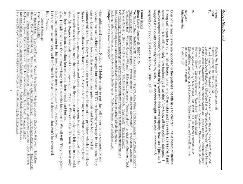
PLANNING COMMISSION AGENDA Tuesday, March 23, 2010, 7:00 pm
|
|
|
- Gwenda Sibyl Walsh
- 5 years ago
- Views:
Transcription

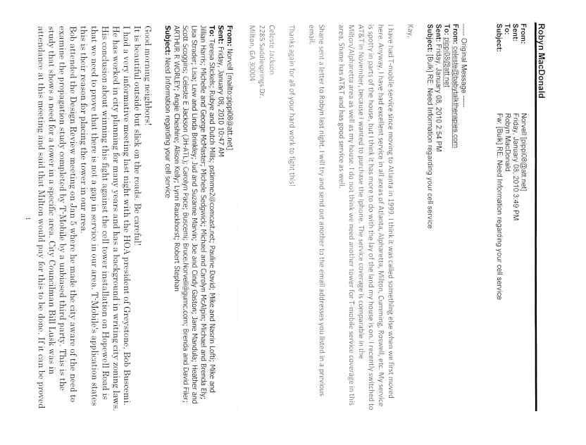
1 City of Milton Deerfield Professional Centre Deerfield Parkway Building 100, Suite 107 C Milton, GA Invocation 2. Pledge of Allegiance 3. Call to Order 4. Public Comment PLANNING COMMISSION AGENDA Tuesday, March 23, 2010, 7:00 pm 5. Approval of Action Minutes February 23, 2010 Planning Commission Meeting 6. Election of Chair and Vice-Chair of the City of Milton Planning Commission 7. Amendment to the City of Milton Planning Commission By-Laws 8. U Mountain Road by T-Mobile to obtain a use permit for a 145 foot tall monopole cell tower with an additional 4 foot lightning rod for a total of 149 feet (Article ) This item was administratively deferred from the January 26, 2010 meeting. 9. U Hopewell Road by T-Mobile to obtain a use permit for a 150 foot tall monopole cell tower with an additional 4 foot lightning rod for a total of 154 feet (Article ) - This item was administratively deferred from the January 26, 2010 meeting. 10. U New Providence Road by T-Mobile to obtain a use permit for a 150 foot tall monopole cell tower with an additional 4 foot lightning rod for a total of 154 feet (Article ) - This item was administratively deferred from the January 26, 2010 meeting. 11. Adjourn 1
2 PETITION NUMBER(S): U09-03 PROPERTY INFORMATION ADDRESS 2880 Mountain Road DISTRICT, LAND LOT 2/2, 249 OVERLAY DISTRICT Northwest EXISTING ZONING AG-1 (Agricultural) ACRES EXISTING USE Single family residence/horse farm PROPOSED USE 145 foot Monopole Cell Tower with a 4 ft. lightning rod for a total of 149 feet OWNER ADDRESS Jan C. Hines 80 Milton Avenue Alpharetta, Georgia PETITIONER/REPRESENTATIVE T-Mobile/Shawn Blassingill ADDRESS 4 Concourse Parkway, Suite 300 Sandy Springs, GA PHONE INTENT To obtain a use permit for a 145 foot tall monopole cell tower with an additional 4 foot lightning rod for a total of 149 feet (Article ). COMMUNITY DEVELOPMENT DEPARTMENT RECOMMENDATION U09-03 DENIAL Prepared by the Community Development Department for the Planning Commission Meeting on March 23, /16/2010 Page 1 of 19 U09-03

3 LOCATION MAP Prepared by the Community Development Department for the Planning Commission Meeting on March 23, /16/2010 Page 2 of 19 U09-03
4 ZONING MAP Prepared by the Community Development Department for the Planning Commission Meeting on March 23, /16/2010 Page 3 of 19 U09-03

5 FUTURE LAND USE MAP Prepared by the Community Development Department for the Planning Commission Meeting on March 23, /16/2010 Page 4 of 19 U09-03


6 REVISED SITE PLAN SUBMITTED FEBRUARY 10, 2010 Prepared by the Community Development Department for the Planning Commission Meeting on March 23, /16/2010 Page 5 of 19 U09-03
7 Distances from property lines/structures Prepared by the Community Development Department for the Planning Commission Meeting on March 23, /16/2010 Page 6 of 19 U09-03


8 SUBJECT SITE View of house and barn in background SUBJECT SITE View toward corral Prepared by the Community Development Department for the Planning Commission Meeting on March 23, /16/2010 Page 7 of 19 U09-03


9 SUBJECT SITE - View of Stream south of pond SUBJECT SITE View of Interior of property looking west Prepared by the Community Development Department for the Planning Commission Meeting on March 23, /16/2010 Page 8 of 19 U09-03


10 Tower Simulation looking west from Hopewell Road Tower Simulation looking from subject tract to the north Prepared by the Community Development Department for the Planning Commission Meeting on March 23, /16/2010 Page 9 of 19 U09-03
11 SUBJECT SITE: The subject site is a acre tract of agriculturally zoned land, located on the northern side of Mountain Road. The subject site is developed with a singlefamily residence and a small barn. It is located within the Agricultural, Forestry and Mining Land Use designation on the Focus Fulton 2025 Plan which was still in place at the time of this application s submittal. Existing uses and zoning of nearby property The subject site is surrounded by lots ranging in size from one acre to approximately 30 acres. They are developed with single family residences within the AG-1 (Agricultural) district. Many of the tracts are working horse farms and other related agricultural uses. Further to the south, east and southeast is The Manor subdivision and golf course. The parcels within the subdivision are a minimum of one acre and developed with large estate homes ranging in size from 5,000 square feet to over 10,000 square feet. Further to the north is the Fulton/Cherokee County line. Staff notes that the Mayor and City Council denied a request for a Use Permit (U08-01/VC08-01) for a Landscaping Business located on Land Road on March 17, In the interest of the public health, safety and welfare, the Mayor and City Council may exercise limited discretion in evaluating the site proposed for a use that requires a Use Permit. In exercising such discretion pertaining to the subject use, the Mayor and City Council shall consider each of the following as outlined in Article of the Zoning Ordinance; Use Permit Considerations. Staff has reviewed said items pertaining to the subject use, and, offers the following comments: A. Whether the proposed use is consistent with the Comprehensive Land Use Plan and/or Economic Development Revitalization plans adopted by the Mayor and City Council: Focus Fulton 2025 Plan Map: Agricultural, Forestry and Mining The proposed monopole cell tower is inconsistent with the intent and following policies of the Focus Fulton 2025 Comprehensive Plan (this plan was still in place at the time of the applicant filing this request): Encourage development consistent with the surrounding scale, transition of densities and uses, and Comprehensive Plan policies, where appropriate. Protect the existing rural character of Northwest Fulton. Prepared by the Community Development Department for the Planning Commission Meeting on March 23, /16/2010 Page 10 of 19 U09-03
12 B. Compatibility with land uses and zoning districts in the vicinity of the property for which the use permit is proposed; The proposed 145 foot monopole with 4 foot lightning rod is inconsistent with the adjacent land uses of single family residences on large agricultural parcels and associated agricultural uses such as barns and riding rings. The closest residential structures are 304 feet, 317 feet and 331 feet from the cell tower to the east, northeast and north respectively. Although the proposed cell tower meets the use permit standards for setbacks, it is Staff s opinion that it is incompatible based on the location of the tower in an area of residential structures. Further, the tower appears to be located such that it will be significantly higher than the tree stands and will not be visually screened from the road as depicted in the tower simulation photos above. C. Whether the proposed use may violate local, state and/or federal statutes, ordinances or regulations governing land development; Staff has determined that the subject site contains state water which requires a 50 foot undisturbed buffer and 25 foot non-impervious setback as required by Chapter 14, Environment of the City Code. The revised site plan indicates that no portion of the tower facility encroaches into the required buffer and non-impervious setback. D. The effect of the proposed use on traffic flow, vehicular and pedestrian, along adjoining streets; The proposed monopole cell tower is an unmanned operation that will generate only an occasional trip to the site for maintenance. Staff is of the opinion that the proposed monopole cell tower will not impact traffic flow along adjoining streets. E. The location and number of off-street parking spaces; For occasional maintenance trips to the site, space is available next to the gate of the 2,025 square foot leased area. Staff is of the opinion that parking will not impact the surrounding areas due to the size of the large parcel and the location of the leased area toward the center and rear of the site. F. The amount and location of open space; The applicant s site plan indicates a leased area of 2,025 square feet and an additional access easement. The remainder of the property is developed with a small single family residence and barn. The parcel is approximately 10 acres which provides a large area of open space. Prepared by the Community Development Department for the Planning Commission Meeting on March 23, /16/2010 Page 11 of 19 U09-03
13 G. Protective screening; Although the submitted site plan meets the requirements of Article to provide a 10-foot landscape strip planted to buffer standards exterior to the required fencing not less than 6 feet in height, Staff recommends that the applicant provide a 20-foot landscape strip in lieu of the required 10-foot landscape strip planted to buffer standards to provide additional screening of the tower and associated facilities. This requirement will be reflected in the Recommended Conditions. H. Hours and manner of operation; The proposed monopole cell tower is an unmanned operation that will generate only an occasional trip to the site for maintenance. Staff will condition the site maintenance to be completed between the hours of 8:30 a.m. and 5:30 p.m., Monday through Friday except in cases of emergency or when an after-hours permit is obtained pursuant to the City of Milton Noise Ordinance. I. Streetscape lighting; The applicant has not indicated any streetscape lighting for the site. In addition, no lights will be attached to the monopole tower. Staff notes that any security light utilized in the maintenance area must comply with the Northwest Overlay District and/or Night Sky Ordinance standards for site lighting. J. Ingress and egress to the property. The applicant s site plan indicates that access to the leased property will be derived from the existing driveway into the site off of Mountain Road. Given the limited use of the subject site for regular maintenance, Staff is of the opinion that the proposed development s ingress and egress will have limited impact upon the community when conditioned to the limited times listed above. SITE PLAN ANALYSIS Based on the applicant s revised site plan submitted to the Community Development Department on February 10, The original site plan submitted on November 30, 2009 was amended so the proposed tower would not encroach into the stream buffer and non-impervious setback. Staff offers the following considerations based on the Use Permit standards for cell towers as indicated in the City of Milton Zoning Ordinance, Article , prior to the Prepared by the Community Development Department for the Planning Commission Meeting on March 23, /16/2010 Page 12 of 19 U09-03
14 adoption of the Telecommunications Ordinance by the Mayor and City Council on December 7, 2009: Use Permit Standards Article Towers must be set back a distance equal to one and one-half (1½) times the height of the tower adjacent to residential and/or AG-1 zoned property. The closest AG-1 zoning property is located 229 feet from the proposed cell tower location. The minimum required is feet which includes the lighting rod. Therefore, it meets the required one and one-half times the height of the 149 foot tower. 2. Height shall not exceed 200 feet from existing grade. The proposed height of the tower is 149 feet and is below the maximum height allowed. 3. Tower and associated facilities shall be enclosed by fencing not less than six feet in height and shall also be equipped with an appropriate anticlimbing device. The site plan and associated plans indicate a new six foot high chain link fence with 3 strands of barbed wire. Staff notes that all chain link fencing shall be black vinyl clad. Although barbed wire is permitted in this use and zoning district, Staff recommends that the barbed wire not be utilized which will be reflected in the Recommended Conditions. 4. A minimum 10-foot landscape strip planted to buffer standards shall be required surrounding the facility exterior to the required fence unless the City Arborist determines that existing plant materials are adequate. The site plan indicates a 10-foot landscape strip planted with Leyland cypress. Staff recommends that a 20-foot landscape strip in lieu of the required 10-foot landscape strip be planted to buffer standards per the specifications of the City Arborist to provide additional screening of the facilities from adjacent single family residences. 5. Antennas or towers shall not have lights unless required by federal or state law. The proposed tower and antenna will not have any lighting, as it will be less than 200 feet per the Federal Communications Commission (FCC) and the Federal Aviation Administration (FAA). Staff notes that any security light utilized in the maintenance area must comply with the Prepared by the Community Development Department for the Planning Commission Meeting on March 23, /16/2010 Page 13 of 19 U09-03
15 Northwest Overlay District and/or Night Sky Ordinance standards for site lighting. 6. Towers shall not be located within one-half mile from any existing telecommunication tower above the district height, excluding alternative structures. Staff has confirmed that no existing towers are located within one-half mile from the proposed tower. 7. The tower shall comply with applicable state and local statutes and ordinances, including, but not limited to, building and safety codes. Towers which have become unsafe or dilapidated shall be repaired or removed pursuant to applicable state and local statutes and ordinances. The applicant has stated that the proposed tower will comply with all state and local ordinances as listed above and will apply for building permit approval prior to any construction. The applicant is aware and agrees to removal requirements for unsafe or dilapidated wireless facilities. Staff has determined that the subject site contains state water which requires a 50 foot undisturbed buffer and 25 foot non-impervious setback as required by Chapter 14, Environment of the City Code. The revised site plan indicates that no portion of the tower facility encroaches into the required buffer and non-impervious setback. 8. Facilities shall not be artificially lighted except to assure human safety or as required by the Federal Aviation Administration (FAA). The applicant has stated that the facilities will not be artificially lighted. Staff notes that on page C3.3 of the construction plans, lighting is indicated. Staff notes that any security light utilized in the maintenance area must comply with the Northwest Overlay District standards and/or the Night Sky Ordinance for site lighting. 9. Communication towers shall be designed and constructed to ensure that the structural failure or collapse of the tower will not create a safety hazard to adjoining properties, according to applicable Federal Standards which may be amended from time to time. The applicant has stated that the proposed tower is designed by certified structural engineers to ensure proper safety according to applicable Federal standards. Prepared by the Community Development Department for the Planning Commission Meeting on March 23, /16/2010 Page 14 of 19 U09-03
16 10. Telecommunications facilities shall not be used for advertising purposes and shall not contain any signs for the purpose of advertising. The applicant has stated there will not be any advertising on the proposed wireless facility. 11. Any telecommunications facility may co-locate on any existing tower, pole or other structure as long as there is no increase in height to the existing facility. The applicant has stated that the proposed facility may accommodate two additional carriers without increasing the height. 12. A commercial telecommunication facility that ceases operation for a period of 12 consecutive months shall be determined to have terminated and shall be removed within 90 days of termination at the property owner's expense. It shall be the duty of both the property owner and the tower owner to notify the City in writing of any intent to abandon the use of the tower. The applicant has stated that Section (B)(12) will be met. 13. Communication facilities not requiring FAA painting/marking shall have either a galvanized finish or [be] painted a dull blue, gray, or black finish or shall be screened through fencing and landscaping. The applicant states that the facility will be galvanized steel and screened behind fencing and landscaping. Staff notes that the City Design Review Board shall make the final recommendation for the finish of the structure. 14 An application for a telecommunications facility shall be submitted in accordance with the Department s Plan Review submittal requirements. The applicant states that the facility will adhere to the above requirements. 15. An application for a telecommunication facility shall include a certification from a registered engineer that the structure will meet the applicable design standards for wind loads. The applicant states that a certified/registered structural report will be provided for the proposed facility. 16. Communications facilities shall not be located in 100-year flood plain or delineated wetlands. Prepared by the Community Development Department for the Planning Commission Meeting on March 23, /16/2010 Page 15 of 19 U09-03
17 The applicant states that the proposed communication facility is not located in a 100-year flood plain or delineated wetlands. Staff has confirmed these findings to be correct. OTHER CONSIDERATIONS Transportation Engineer No Comments Building Official No Comments City Arborist There will be no specimen trees affected by the proposed cell tower. PUBLIC INVOLVEMENT On Thursday, January 13, 2010 the applicant was present at the Community Zoning Information Meeting held at the Milton City Hall. There were approximately 70 to 80 people in attendance from the community of which 20 people indicated interest in U09-03 on the City s sign in sheet. Public Comments Staff has received s which are attached expressing both opposition and support of the request. Staff has met with the adjacent property owners on two occasions. In addition, about ten residents have called Staff to express their opposition to the proposed cell tower. City of Milton Design Review Board Meeting January 5, 2010 Staff notes that another meeting before the Design Review Board is required based on the Zoning Ordinance s requirement to publish the DRB meeting in the newspapers as well as include it in the adjacent property owners notice. This meeting will occur on April 6, Although this meeting will occur after the Planning Commission, any new comments received at the meeting will also be included as an addendum to the Staff report prior to the Mayor and City Council meeting. The following recommendations were made by the DRB: Board/Applicant comments: o o The Board stated that their purpose is to examine the aesthetic aspects of the proposed towers; land use/location is not for them to decide. The applicant states that the tower will be a standard grey tower, as this is the best option for blending in. The Board states that they preferred this to the fake tree option. Prepared by the Community Development Department for the Planning Commission Meeting on March 23, /16/2010 Page 16 of 19 U09-03
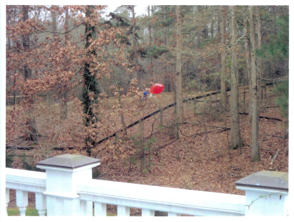
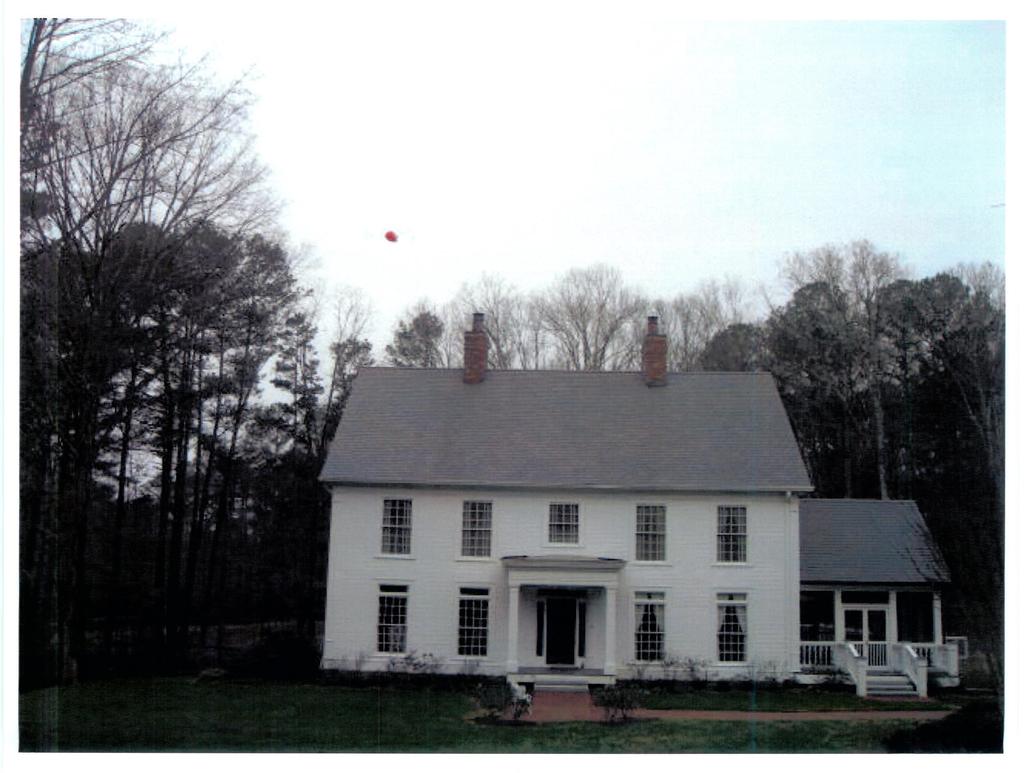
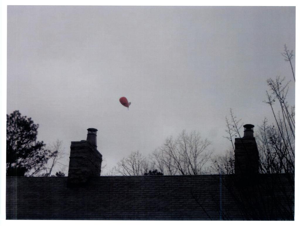
18 o o o o o o o o Applicant states that they are willing to meet City standards in terms of fencing. They are willing to remove the 3 rows of barbed wire topping the chain link fencing. Board inquired as to whether the Applicant would be able to screen the cell tower compound that is adjacent to the power easement (New Providence). The applicant states that the compound is at least 15 away from the easement, and that the existing trees will remain. Board informed the applicant that the trees used to screen the compound had to be a mix of evergreens that would provide screening in one year; Leylands are not allowed according to the Ordinance. Only towers above 200 are required to be lit. Stealth products include: light pole, flag pole, mono pine. The Board reminded the residents that the Board has the responsibility to protect the Code, and therefore the applicant. They ask the public to help by providing as much information as possible. A balloon test has been flown; applicant has pictures taken from 20 different locations. These pictures would be on display at the CZIM meeting scheduled for Thursday, January 7 th at 7:00pm. There appears to be a Code disconnect. The Code states that a tower buried far from the ROW is better. Did not anticipate that homes would be so nearby. Public comments: The cell tower is a commercial use; not appropriate for rural, residential area. Should be on commercial property. The tower would ruin the land value of the surrounding area. The tower would be an eyesore. This is not for the good of the community; not in the spirit of what the City was dreamed of. The residents would like to explore options for tower camouflage. The applicant should look into other collocate options first. Does the code require a propagation study to access the need for more towers? (This is included in the submitted documents). Resident expressed his frustration and displeasure with the process. Resident stated that his house was 327 from the proposed Mountain Road tower location; trees less than 100 tall. Feels that this location was not a good choice for a cell tower. It is important for the Council/Board to visit the sites before they made any decisions. Residents asked if Board considered areas that are highly populated as undesirable for cell towers. (Board reminded her that their purview is limited to aesthetics.) It is incumbent upon Board to understand the unique requirement of the Milton rural community. Resident asked if a fall zone analyses is required. (Towers are designed to collapse within itself.) Resident is concerned about environment impact of tower, especially the poisoning of the spring fed pond if the tower was to fall. Prepared by the Community Development Department for the Planning Commission Meeting on March 23, /16/2010 Page 17 of 19 U09-03
19 Public Participation Plan and Report This petition was administratively deferred to the March 23, 2010 Planning Commission meeting. Therefore, Staff will request an updated Public Participation Report seven (7) days prior to the Planning Commission meeting. The applicant will be required to submit an updated public participation report 7 days prior to the Mayor and City Council meeting. CONCLUSION It is Staff s opinion that the proposed cell tower is inconsistent with the adjacent land uses of single family residences on large agricultural parcels and incompatible based on the location of the tower to adjacent residential structures. In addition, the proposed cell tower is inconsistent with the surrounding scale, transition of densities and does not protect the existing rural character of Milton. Therefore, Staff recommends DENIAL of U Prepared by the Community Development Department for the Planning Commission Meeting on March 23, /16/2010 Page 18 of 19 U09-03
20 RECOMMENDED CONDITIONS If this petition is approved by the Mayor and City Council, it should be approved USE PERMIT for an Antenna Tower and Associated Structure to Exceed the District Height (Article ) CONDITIONAL subject to the owner s agreement to the following enumerated conditions. Where these conditions conflict with the stipulations and offerings contained in the Letter of Intent, these conditions shall supersede unless specifically stipulated by the Mayor and City Council. 1) To the owner s agreement to restrict the use of the subject property as follows: a) One monopole communications tower and equipment slab(s) and/or building(s). b) The tower shall not exceed 145 feet with a 4 foot lighting rod. 2) To the owner s agreement to abide by the following: a) To the revised site plan received by the Milton Community Development Department on February 10, Said site plan is conceptual only and must meet or exceed the requirements of the Zoning Ordinance and these conditions prior to the approval of a Land Disturbance Permit. Unless otherwise noted herein, compliance with all conditions shall be in place prior to the issuance of the first Certificate of Occupancy or Certificate of Completion. 3) To the owner s agreement to the following site development considerations: a) To provide a 20 foot landscape strip planted to buffer standards around the leased area. b) All chain link fencing shall be black vinyl clad. c) No barbed wire will be permitted on top of the minimum 6 foot high security fence. d) All site maintenance to be completed between the hours of 8:30 a.m. and 5:30 p.m., Monday through Friday except in cases of emergency or when an after-hours permit is obtained pursuant to the City of Milton Noise Ordinance. Prepared by the Community Development Department for the Planning Commission Meeting on March 23, /16/2010 Page 19 of 19 U09-03
21
22
23
24
25
26
27
28
29
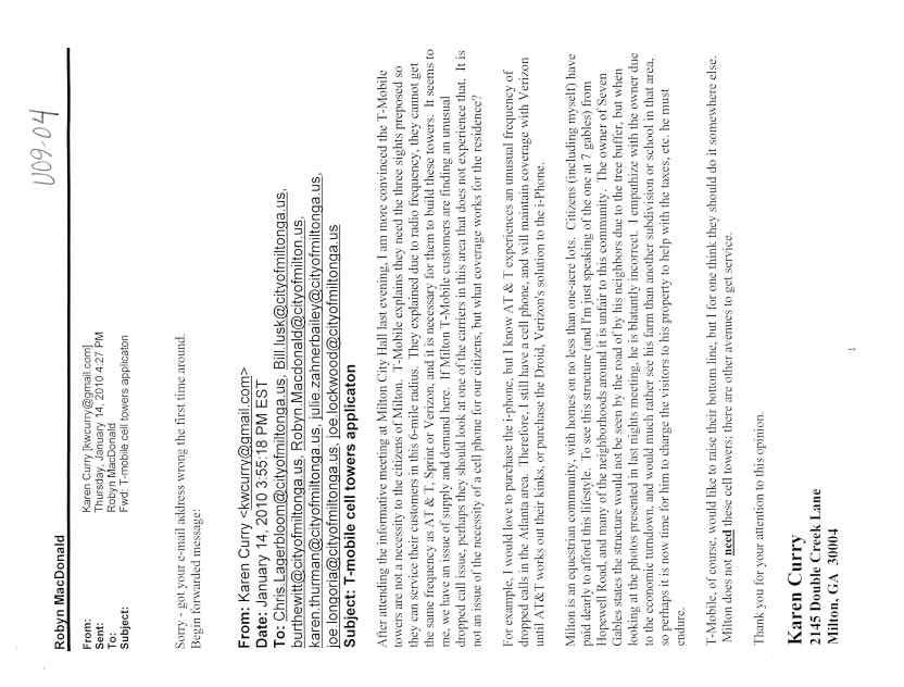
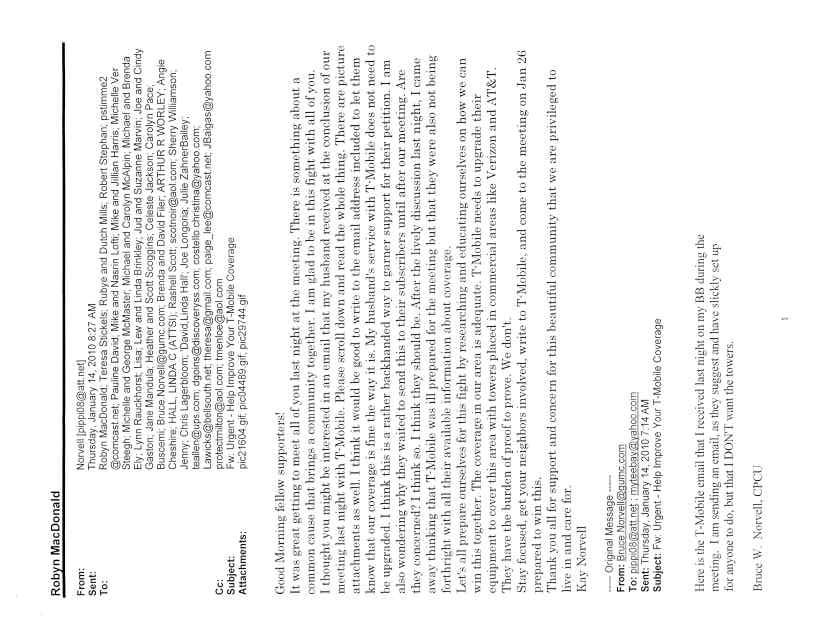
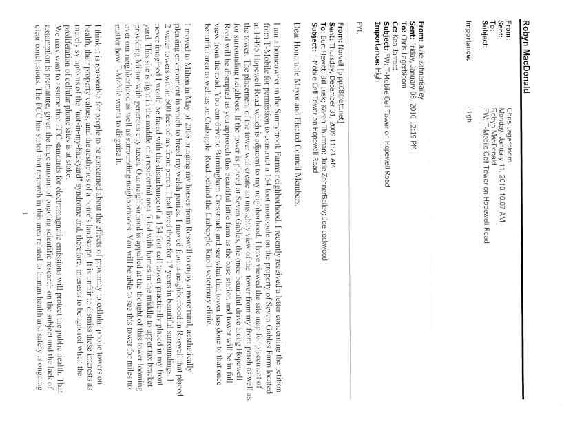
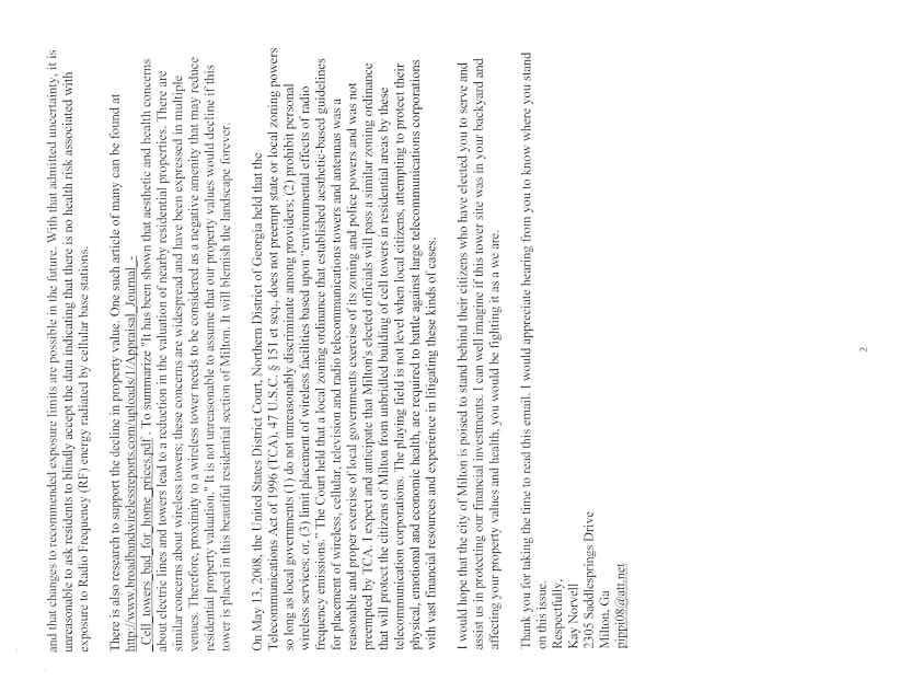
30 PETITION NUMBER(S): U09-04 PROPERTY INFORMATION ADDRESS Hopewell Road DISTRICT, LAND LOT 2/2, 691, 692 OVERLAY DISTRICT Northwest EXISTING ZONING AG-1 (Agricultural) ACRES EXISTING USE Single family residence/horse farm PROPOSED USE 150 foot Monopole Cell Tower with a 4 ft. lightning rod for a total of 154 feet OWNER ADDRESS Ronald Bogino Hopewell Road Milton, GA PETITIONER/REPRESENTATIVE T-Mobile/Shawn Blassingill ADDRESS 4 Concourse Parkway, Suite 300 Sandy Springs, GA PHONE INTENT To obtain a use permit for a 150 foot tall monopole cell tower with an additional 4 foot lightning rod for a total of 154 feet (Article ). COMMUNITY DEVELOPMENT DEPARTMENT RECOMMENDATION U09-04 DENIAL Prepared by the Community Development Department for the Planning Commission Meeting on March 23, /16/2010 Page 1 of 18 U09-04

31 LOCATION MAP Prepared by the Community Development Department for the Planning Commission Meeting on March 23, /16/2010 Page 2 of 18 U09-04

32 CURRENT ZONING MAP Prepared by the Community Development Department for the Planning Commission Meeting on March 23, /16/2010 Page 3 of 18 U09-04
33 Prepared by the Community Development Department for the Planning Commission Meeting on March 23, /16/2010 Page 4 of 18 U09-04

34 SITE PLAN SUBMITTED NOVEMBER 30, 2009 Prepared by the Community Development Department for the Planning Commission Meeting on March 23, /16/2010 Page 5 of 18 U09-04

35 Distances from property lines/structures Prepared by the Community Development Department for the Planning Commission Meeting on March 23, /16/2010 Page 6 of 18 U09-04


36 SUBJECT SITE Looking south into entrance from Hopewell SUBJECT SITE Looking south toward cell tower location Prepared by the Community Development Department for the Planning Commission Meeting on March 23, /16/2010 Page 7 of 18 U09-04


37 SUBJECT SITE Approximate leased area PHOTO SIMULATION OF TOWER FROM HOPEWELL ROAD Prepared by the Community Development Department for the Planning Commission Meeting on March 23, /16/2010 Page 8 of 18 U09-04

38 PHOTO SIMULATION OF TOWER FROM SADDLESPRINGS DRIVE LOOKING NORTH SUBJECT SITE: The subject site is a acre tract of agriculturally zoned land, located on the south side of Hopewell Road. The subject site is developed with a singlefamily residence and Seven Gables Horse Farm. It is located within the Agricultural, Forestry and Mining Land Use designation on the Focus Fulton 2025 Plan which was still in place at the time of this application s submittal. Existing uses and zoning of nearby property The subject site is surrounded by lots on average ranging in size from one acre to approximately 15 acres. They are developed with single family residences within the AG-1 (Agricultural) district. Stratford Estates is located to north on the north side of Hopewell Road developed with single family residences zoned AG-1 (Agricultural). North Fields is located further north of Stratford Estates and developed with single family residences zoned AG-1 (Agricultural). Wyndam Farms is located further to the southeast and developed with single family residences zoned AG-1 (Agricultural). Sunnybrooke Farms is a large lot Prepared by the Community Development Department for the Planning Commission Meeting on March 23, /16/2010 Page 9 of 18 U09-04
39 equestrian subdivision zoned AG-1 (Agricultural) located directly to the south of the subject site. Greystone Farms subdivision is zoned CUP (Community Unit Plan) with a minimum lot size of one acre with a minimum heated floor area of 4,000 square feet located north of the subject site. Staff notes that the Mayor and City Council denied a request for a Use Permit (U07-08/VC07-13) for a Landscaping Business located on Hopewell Road on December 13, A. Whether the proposed use is consistent with the Comprehensive Land Use Plan and/or Economic Development Revitalization plans adopted by the Mayor and City Council: Focus Fulton 2025 Plan Map: Agricultural, Forestry and Mining The proposed monopole cell tower is inconsistent with the intent and following policies of the Focus Fulton 2025 Comprehensive Plan (this plan was still in place at the time of the applicant filing this request): Encourage development consistent with the surrounding scale, transition of densities and uses, and Comprehensive Plan policies, where appropriate. Protect the existing rural character of Northwest Fulton. B. Compatibility with land uses and zoning districts in the vicinity of the property for which the use permit is proposed; The proposed 150 foot monopole with 4 foot lightning rod is inconsistent with the adjacent land uses of single family residences on large agricultural parcels and associated agricultural uses such as barns and riding rings. The closest residential structure is approximately 354 feet from the proposed monopole cell tower located on the subject site. Other residential structures are located 618 feet, 663 feet and 751feet to the west, south and southeast respectively. Although, it meets the use permit standards for setbacks, it is Staff s opinion that it is incompatible based on the location of the tower to adjacent residential structures. Further, the tower appears to be located such that it will be significantly higher than the tree stands and will not be visually screened from the road as depicted in the tower simulation photos above. C. Whether the proposed use may violate local, state and/or federal statutes, ordinances or regulations governing land development; It is Staff s opinion that the proposed use does not violate local, state and/or federal ordinances or regulations governing land development. Prepared by the Community Development Department for the Planning Commission Meeting on March 23, /16/2010 Page 10 of 18 U09-04
40 D. The effect of the proposed use on traffic flow, vehicular and pedestrian, along adjoining streets; The proposed monopole cell tower is an unmanned operation that will generate only an occasional trip to the site for maintenance. Staff is of the opinion that the proposed monopole cell tower will not impact traffic flow along adjoining streets. E. The location and number of off-street parking spaces; For occasional maintenance trips to the site, space is available next to the gate of the 2,500 square foot leased area. Staff is of the opinion that parking will not impact the surrounding areas due to the size of the large parcel and the location of the leased area away from Hopewell Road and behind existing barns. F. The amount and location of open space; The applicant s site plan indicates a leased area of 2,500 square feet and an additional access easement. The remainder of the property is developed with a single family residence and working horse farm. The parcel is approximately 26 acres which provides a large area of open space. G. Protective screening; Although the submitted site plan meets the requirements of Article to provide a 10-foot landscape strip planted to buffer standards exterior to the required fencing not less than 6 feet in height, Staff recommends that the applicant provide a 20-foot landscape strip in lieu of the required 10 foot landscape strip planted to buffer standards to provide additional screening of the tower and associated facilities. This will be reflected in the Recommended Conditions. H. Hours and manner of operation; The proposed monopole cell tower is an unmanned operation that will generate only an occasional trip to the site for maintenance. Staff will condition the site maintenance to be completed between the hours of 8:30 a.m. and 5:30 p.m., Monday through Friday except in cases of emergency or when an after-hours permit is obtained pursuant to the City of Milton Noise Ordinance. I. Streetscape lighting; The applicant has not indicated any streetscape lighting for the site. Prepared by the Community Development Department for the Planning Commission Meeting on March 23, /16/2010 Page 11 of 18 U09-04
41 In addition, no lights will be attached to the monopole tower.. Staff notes that any security light utilized in the maintenance area must comply with the Northwest Overlay District and/or Night Sky Ordinance standards for site lighting. J. Ingress and egress to the property. The applicant s site plan indicates that access to the leased property will be derived from the existing driveway into the site off of Hopewell Road. Given the limited use of the subject site for regular maintenance, Staff is of the opinion that the proposed development s ingress and egress will have limited impact upon the community when conditioned to the limited times listed above. SITE PLAN ANALYSIS Based on the applicant s site plan submitted to the Community Development Department on November 30, 2009, Staff offers the following considerations: Use Permit Standards Article Towers must be set back a distance equal to one and one-half (1½) times the height of the tower adjacent to residential and/or AG-1 zoned property. The closest AG-1 zoning property is located 269 feet from the proposed cell tower location. The minimum required is 231 feet which includes the lighting rod. Therefore, it meets the required one and one-half times the height of the 154 foot tower. 2. Height shall not exceed 200 feet from existing grade. The proposed height of the tower is 154 feet and is below the maximum height allowed. 3. Tower and associated facilities shall be enclosed by fencing not less than six feet in height and shall also be equipped with an appropriate anticlimbing device. The site plan and associated plans indicate a new six foot high chain link fence with 3 strands of barbed wire. Staff notes that all chain link fencing shall be black vinyl clad. Although barbed wire is permitted in this use and zoning district, Staff recommends that the barbed wire not be utilized which will be reflected in the Recommended Conditions. Prepared by the Community Development Department for the Planning Commission Meeting on March 23, /16/2010 Page 12 of 18 U09-04
42 4. A minimum 10-foot landscape strip planted to buffer standards shall be required surrounding the facility exterior to the required fence unless the City Arborist determines that existing plant materials are adequate. The site plan indicates a 10-foot landscape strip planted with Leyland cypress. Staff recommends that a 20-foot landscape strip in lieu of the 10- foot landscape strip be planted to buffer standards per the specifications of the City Arborist to provide additional screening of the facilities from adjacent single family residences. 5. Antennas or towers shall not have lights unless required by federal or state law. The proposed tower and antenna will not have any lighting, as it will be less than 200 feet per the Federal Communications Commission (FCC) and the Federal Aviation Administration (FAA). Staff notes that any security light utilized in the maintenance area must comply with the Northwest Overlay District and/or Night Sky Ordinance standards for site lighting. 6. Towers shall not be located within one-half mile from any existing telecommunication tower above the district height, excluding alternative structures. Staff has confirmed that no existing towers are located within one-half mile from the proposed tower. 7. The tower shall comply with applicable state and local statutes and ordinances, including, but not limited to, building and safety codes. Towers which have become unsafe or dilapidated shall be repaired or removed pursuant to applicable state and local statutes and ordinances. The applicant has stated that the proposed tower will comply with all state and local ordinances as listed above and will apply for building permit approval prior to any construction. The applicant is aware and agrees to removal requirements for unsafe or dilapidated wireless facilities. 8. Facilities shall not be artificially lighted except to assure human safety or as required by the Federal Aviation Administration (FAA). The applicant has stated that the facilities will not be artificially lighted. Staff notes that on page C3.3 of the construction plans, lighting is indicated. Staff notes that any security light utilized in the maintenance area must comply with the Northwest Overlay District standards and/or the Night Sky Ordinance for site lighting. Prepared by the Community Development Department for the Planning Commission Meeting on March 23, /16/2010 Page 13 of 18 U09-04
43 9. Communication towers shall be designed and constructed to ensure that the structural failure or collapse of the tower will not create a safety hazard to adjoining properties, according to applicable Federal Standards which may be amended from time to time. The applicant has stated that the proposed tower is designed by certified structural engineers to ensure proper safety according to applicable Federal standards. 10. Telecommunications facilities shall not be used for advertising purposes and shall not contain any signs for the purpose of advertising. The applicant has stated there will not be any advertising on the proposed wireless facility. 11. Any telecommunications facility may co-locate on any existing tower, pole or other structure as long as there is no increase in height to the existing facility. The applicant has stated that the proposed facility may accommodate two additional carriers without increasing the height. 12. A commercial telecommunication facility that ceases operation for a period of 12 consecutive months shall be determined to have terminated and shall be removed within 90 days of termination at the property owner's expense. It shall be the duty of both the property owner and the tower owner to notify the City in writing of any intent to abandon the use of the tower. The applicant has stated that Section (B)(12) will be met. 13. Communication facilities not requiring FAA painting/marking shall have either a galvanized finish or [be] painted a dull blue, gray, or black finish or shall be screened through fencing and landscaping. The applicant states that the facility will be galvanized steel and screened behind fencing and landscaping. Staff notes that the City Design Review Board shall make the final recommendation for the finish of the structure. 14 An application for a telecommunications facility shall be submitted in accordance with the Department s Plan Review submittal requirements. The applicant states that the facility will adhere to the above requirements. Prepared by the Community Development Department for the Planning Commission Meeting on March 23, /16/2010 Page 14 of 18 U09-04
44 15. An application for a telecommunication facility shall include a certification from a registered engineer that the structure will meet the applicable design standards for wind loads. The applicant states that a certified/registered structural report will be provided for the proposed facility. 16. Communications facilities shall not be located in 100-year flood plain or delineated wetlands. The applicant states that the proposed communication facility is not located in a 100-year flood plain or delineated wetlands. Staff has confirmed these findings to be correct. PUBLIC INVOLVEMENT On Thursday, January 13, 2010 the applicant was present at the Community Zoning Information Meeting held at the Milton City Hall. There were approximately 70 to 80 people in attendance from the community of which 33 people indicated interest in U09-04 on the City s sign in sheet. Public Comments Staff has received s which are attached expressing both opposition and support of the request. Staff has met with the adjacent property owners. In addition, about five residents have called Staff to express their opposition to the proposed cell tower. City of Milton Design Review Board Meeting January 5, 2010 Staff notes that another meeting before the Design Review Board is required based on the Zoning Ordinance s requirement to publish the DRB meeting in the newspapers as well as include it in the adjacent property owners notice. This meeting will occur on April 6, Although this meeting will occur after the Planning Commission, any new comments received at the meeting will also be included as an addendum to the Staff report prior to the Mayor and City Council meeting. The following recommendations were made by the DRB: Board/Applicant comments: o o The Board stated that their purpose is to examine the aesthetic aspects of the proposed towers; land use/location is not for them to decide. The applicant states that the tower will be a standard grey tower, as this is the best option for blending in. The Board states that they preferred this to the fake tree option. Prepared by the Community Development Department for the Planning Commission Meeting on March 23, /16/2010 Page 15 of 18 U09-04
45 o o o o o o o o Applicant states that they are willing to meet City standards in terms of fencing. They are willing to remove the 3 rows of barbed wire topping the chain link fencing. Board inquired as to whether the Applicant would be able to screen the cell tower compound that is adjacent to the power easement (New Providence). The applicant states that the compound is at least 15 away from the easement, and that the existing trees will remain. Board informed the applicant that the trees used to screen the compound had to be a mix of evergreens that would provide screening in one year; Leylands are not allowed according to the Ordinance. Only towers above 200 are required to be lit. Stealth products include: light pole, flag pole, mono pine. The Board reminded the residents that the Board has the responsibility to protect the Code, and therefore the applicant. They ask the public to help by providing as much information as possible. A balloon test has been flown; applicant has pictures taken from 20 different locations. These pictures would be on display at the CZIM meeting scheduled for Thursday, January 7 th at 7:00pm. There appears to be a Code disconnect. The Code states that a tower buried far from the ROW is better. Did not anticipate that homes would be so nearby. Public comments: The cell tower is a commercial use; not appropriate for rural, residential area. Should be on commercial property. The tower would ruin the land value of the surrounding area. The tower would be an eyesore. This is not for the good of the community; not in the spirit of what the City was dreamed of. The residents would like to explore options for tower camouflage. The applicant should look into other collocate options first. Does the code require a propagation study to access the need for more towers? (This is included in the submitted documents). Resident expressed his frustration and displeasure with the process. Resident stated that his house was 327 from the proposed Mountain Road tower location; trees less than 100 tall. Feels that this location was not a good choice for a cell tower. It is important for the Council/Board to visit the sites before they made any decisions. Residents asked if Board considered areas that are highly populated as undesirable for cell towers. (Board reminded her that their purview is limited to aesthetics.) It is incumbent upon Board to understand the unique requirement of the Milton rural community. Resident asked if a fall zone analyses is required. (Towers are designed to collapse within itself.) Resident is concerned about environment impact of tower, especially the poisoning of the spring fed pond if the tower was to fall. Prepared by the Community Development Department for the Planning Commission Meeting on March 23, /16/2010 Page 16 of 18 U09-04
46 Public Participation Plan and Report This petition was administratively deferred to the March 23, 2010 Planning Commission meeting, therefore Staff will request an updated Public Participation Report seven (7) days prior to the Planning Commission meeting. Therefore, Staff has requested an updated Public Participation Report seven (7) days prior to the Planning Commission meeting. The applicant will be required to submit an updated public participation report 7 days prior to the Mayor and City Council meeting. CONCLUSION It is Staff s opinion that the proposed cell tower is inconsistent with the adjacent land uses of single family residences on large agricultural parcels and incompatible based on the location of the tower to adjacent residential structures. In addition, the proposed cell tower is inconsistent with the surrounding scale, transition of densities and does not protect the existing rural character of Milton. Therefore, Staff recommends DENIAL of U Prepared by the Community Development Department for the Planning Commission Meeting on March 23, /16/2010 Page 17 of 18 U09-04
47 RECOMMENDED CONDITIONS If this petition is approved by the Mayor and City Council, it should be approved USE PERMIT for an Antenna Tower and Associated Structure to Exceed the District Height (Article ) CONDITIONAL subject to the owner s agreement to the following enumerated conditions. Where these conditions conflict with the stipulations and offerings contained in the Letter of Intent, these conditions shall supersede unless specifically stipulated by the Mayor and City Council. 1) To the owner s agreement to restrict the use of the subject property as follows: a) One monopole communications tower and equipment slab(s) and/or building(s). b) The tower shall not exceed 150 feet with a 4 foot lighting rod. 2) To the owner s agreement to abide by the following: a) To the site plan received by the Milton Community Development Department on November 30, Said site plan is conceptual only and must meet or exceed the requirements of the Zoning Ordinance and these conditions prior to the approval of a Land Disturbance Permit. Unless otherwise noted herein, compliance with all conditions shall be in place prior to the issuance of the first Certificate of Occupancy or Certificate of Completion. 3) To the owner s agreement to the following site development considerations: a) To provide a 20 foot landscape strip planted to buffer standards around the leased area. b) All chain link fencing shall be black vinyl clad. c) No barbed wire will be permitted on top of the minimum 6 foot high security fence. d) All site maintenance to be completed between the hours of 8:30 a.m. and 5:30 p.m., Monday through Friday except in cases of emergency or when an after-hours permit is obtained pursuant to the City of Milton Noise Ordinance. Prepared by the Community Development Department for the Planning Commission Meeting on March 23, /16/2010 Page 18 of 18 U09-04
48
49
50
51
52
53
54
55
56
57
58
59
60
61
62
63
64
65
66
67
68
69
70
71
72
73
74
75
76
77
78
79
80
81
82
83
84
85
86
87
88
89
90
91
92
93
94
95
96
97
98 PETITION NUMBER(S): U09-05 PROPERTY INFORMATION ADDRESS New Providence Road DISTRICT, LAND LOT 2/2, 996, 997 OVERLAY DISTRICT Northwest EXISTING ZONING AG-1 (Agricultural) ACRES EXISTING USE Single family residence PROPOSED USE 150 foot Monopole Cell Tower with a 4 ft. lightning rod for a total of 154 feet OWNER ADDRESS Rosemarie J. Schmidt Family Limited Partnership New Providence Road Milton, GA PETITIONER/REPRESENTATIVE T-Mobile/Shawn Blassingill ADDRESS 4 Concourse Parkway, Suite 300 Sandy Springs, GA PHONE INTENT To obtain a use permit for a 150 foot tall monopole cell tower with an additional 4 foot lightning rod for a total of 154 feet (Article ). COMMUNITY DEVELOPMENT DEPARTMENT RECOMMENDATION U09-05 DENIAL Prepared by the Community Development Department for the Planning Commission Meeting on March 23, /16/2010 Page 1 of 17 U09-05

99 LOCATION MAP Prepared by the Community Development Department for the Planning Commission Meeting on March 23, /16/2010 Page 2 of 17 U09-05

100 CURRENT ZONING MAP Prepared by the Community Development Department for the Planning Commission Meeting on March 23, /16/2010 Page 3 of 17 U09-05

101 FUTURE LAND USE MAP Prepared by the Community Development Department for the Planning Commission Meeting on March 23, /16/2010 Page 4 of 17 U09-05

102 SITE PLAN SUBMITTED DECEMBER 1, Distances from property lines/structures Proposed Leased Area Prepared by the Community Development Department for the Planning Commission Meeting on March 23, /16/2010 Page 5 of 17 U09-05


103 SUBJECT SITE - Looking west toward house on subject site SUBJECT SITE Interior of property from driveway Prepared by the Community Development Department for the Planning Commission Meeting on March 23, /16/2010 Page 6 of 17 U09-05


104 Looking east across New Providence Road Photo simulation of tower from subject site Prepared by the Community Development Department for the Planning Commission Meeting on March 23, /16/2010 Page 7 of 17 U09-05

105 SUBJECT SITE: Photo simulation from New Providence Road looking south The subject site is a acre tract of agriculturally zoned land, located on the southwest side of New Providence Road. The subject site is developed with a single-family residence. It is located within the Residential 1 unit or less per acre Land Use designation on the Focus Fulton 2025 Plan which was still in place at the time of this application s submittal. Existing uses and zoning of nearby property The subject site is surrounded by lots on average ranging in size from one acre to approximately 30 acres. They are developed with single family residences within the AG-1 (Agricultural) district. Providence Plantation subdivision is located to north on the north side of New Providence Road developed with single family residences zoned AG-1 (Agricultural). Further north is Boxwood Estates subdivision zoned CUP (Community Unit Plan) with minimum one acre lots and minimum 3,500 square foot heated floor area. Southeast down Dorris Road are scattered single family residences on large lots with equestrian facilities. Further to the southeast is Oxford Lakes subdivision zoned AG-1 (Agricultural) with single family residences. Further to the south is Ranchette road developed with smaller AG-1 (Agricultural) lots ranging in size between three and five acres. West of the Prepared by the Community Development Department for the Planning Commission Meeting on March 23, /16/2010 Page 8 of 17 U09-05
O-I (Office-Institutional) and AG-1(Agricultural)
 and AG-1(Agricultural)") PROPERTY INFORMATION ADDRESS 3503 and 3505 Bethany Bend DISTRICT, LAND LOTS 2/1 973 and 974 OVERLAY DISTRICT State Route 9 PETITION NUMBERS EXISTING ZONING O-I (Office-Institutional) and AG-1(Agricultural)
PROPERTY INFORMATION ADDRESS 3503 and 3505 Bethany Bend DISTRICT, LAND LOTS 2/1 973 and 974 OVERLAY DISTRICT State Route 9 PETITION NUMBERS EXISTING ZONING O-I (Office-Institutional) and AG-1(Agricultural)
ARTICLE II: CELLULAR ANTENNA TOWERS
 Kenton County Planning Commission 8 ARTICLE II: CELLULAR ANTENNA TOWERS SECTION 2.0 PRE-APPLICATION CONFERENCE: Applicants must contact Staff and request a pre-application conference. This meeting will
BOARD OF ZONING ADJUSTMENT STAFF REPORT Date: July 9, 2018
 BOARD OF ZONING ADJUSTMENT STAFF REPORT Date: July 9, 2018 CASE NUMBER 6185/1339 APPLICANT NAME LOCATION VARIANCE REQUEST Branch Towers III, LLC 1857 Duval Street (South side of Duval Street, 560 + West
Request Conditional Use Permit (Communication Tower) Staff Recommendation Approval. Staff Planner Emily Bazemore
 Staff Recommendation Approval. Staff Planner Emily Bazemore") Applicant Property Owner Columbia Club of Virginia Beach Public Hearing July 11, 2018 City Council Election District Beach Agenda Item 5 Request Conditional Use Permit (Communication Tower) Staff Recommendation
Applicant Property Owner Columbia Club of Virginia Beach Public Hearing July 11, 2018 City Council Election District Beach Agenda Item 5 Request Conditional Use Permit (Communication Tower) Staff Recommendation
Conditional Use Permit Report South Anna Magisterial District PC Meeting Date: January 21, Overview. Request
 CUP-1O-15, NATIONAL COMMUNICATION TOWERS Conditional Use Permit Report South Anna Magisterial District PC Meeting Date: January 21, 2016 Overview Request To permit a 199 telecommunications tower Zoning
REPRESENTATIVE: Centerline Solutions Table Mountain Parkway Golden, CO 80403
 COMMISSIONERS: DARRYL GLENN (PRESIDENT) MARK WALLER (PRESIDENT PRO TEMPORE) STAN VANDERWERF LONGINOS GONZALEZ PEGGY LITTLETON PLANNING AND COMMUNITY DEVELOPMENT DEPARTMENT CRAIG DOSSEY, EXECUTIVE DIRECTOR
TELECOMMUNICATIONS TOWER AND VARIANCE STAFF REPORT
 TELECOMMUNICATIONS TOWER AND VARIANCE STAFF REPORT City County Planning Commission 1141 State Street Bowling Green, Kentucky 42101 (270) 842 1953 Summary: The applicants have filed an application for approval
PLANNING COMMISSION REPORT Regular Agenda Public Hearing Item
 CUP-15-00474 Item No. 5-1 PC Staff Report 11/16/15 ITEM NO. 5 PLANNING COMMISSION REPORT Regular Agenda Public Hearing Item CONDITIONAL USE PERMIT FOR PUBLIC WHOLESALE WATER SUPPLY DISTRICT NO. 25; E 1300
MONTEREY COUNTY PLANNING COMMISSION
 MONTEREY COUNTY PLANNING COMMISSION Meeting: June 11, 2003 @ 9:30 AM Agenda Item: D2 Project Description: Use Permit (Associated Tagline/Sprint #PLN000669) for the construction of a 50 Ft. monopole with
2. The AT&T WCF shall consist of a stealth design (faux saguaro cactus) with a maximum height of 30 feet above adjacent grade;
 with a maximum height of 30 feet above adjacent grade;") AGENDA ITEM # DATE: October 24, 2011 COAC NUMBER: 11-4698 CITY OF GOODYEAR CITY COUNCIL ACTION FORM SUBJECT: Special Use to allow the installation of a proposed AT&T Wireless Communication Facility to
AGENDA ITEM # DATE: October 24, 2011 COAC NUMBER: 11-4698 CITY OF GOODYEAR CITY COUNCIL ACTION FORM SUBJECT: Special Use to allow the installation of a proposed AT&T Wireless Communication Facility to
Division 16.Telecommunication Tower Standards
 Division 16.Telecommunication Tower Standards Section 17-311. Telecommunication towers and antennas: general provision. The Director shall have the authority to regulate the construction and operation
Pagosa Lakes Telecommunication Facility Development Plan Rezoning in the PUD zone, located at 1311 Lake Forest Cir.
 Archuleta County Development Services Planning Department 1122 HWY 84 P. O. Box 1507 Pagosa Springs, Colorado 81147 970-264-1390 Fax 970-264-3338 MEMORANDUM TO: Archuleta County Planning Commission FROM:
Frank A Ford Etals, C/O Ford Group 9 LLC. Scott Ashley, AICP, Planning Manager
 Page 1 of 49 GROWTH AND RESOURCE MANAGEMENT DEPARTMENT PLANNING AND DEVELOPMENT SERVICES DIVISION CURRENT PLANNING ACTIVITY 123 W. Indiana Avenue, Room 202, DeLand, FL 32720 (386) 943-7059 PUBLIC HEARING:
New Cingular Wireless Telecommunication Tower at County Road 48, Milner Conditional Use Permit
 New Cingular Wireless Telecommunication Tower at 39415 County Road 48, Milner ACTIVITY #: Conditional Use Permit PP2012-023 HEARING DATES: Planning Commission (PC): August 16, 2012 at 6:00pm PETITIONER:
ADMINISTRATIVE HEARING STAFF REPORT
 ADMINISTRATIVE HEARING STAFF REPORT Providence Place Apartments Utility Box No. 2 Conditional Use Petition PLNPCM2011-00426 309 East 100 South September 22, 2011 Planning and Zoning Division Department
BEFORE THE HEARINGS EXAMINER FOR THURSTON COUNTY
 BEFORE THE HEARINGS EXAMINER FOR THURSTON COUNTY In the Matter of the Application of ) NO. SUPT 020642 ) T-Mobile ) FINDINGS, CONCLUSIONS ) AND DECISION For Approval of a Special Use Permit ) ) SUMMARY
ARTICLE VI. SPECIAL EXCEPTION REGULATIONS
 ARTICLE VI. SPECIAL EXCEPTION REGULATIONS SECTION 601. GENERAL DESCRIPTION Special exceptions are deemed to be permitted uses in their respective districts, subject to the satisfaction of the requirements
Planning and Zoning Staff Report Maverick Towers Van Wassenhove, PH
 Planning and Zoning Staff Report Maverick Towers Van Wassenhove, PH2018-17 Hearing Date: April 19, 2018 Development Services Department Applicant: Maverick Towers - Nadine Bostwick Owner: Paul Van Wassenhove
This is a conditional use permit request to establish a commercial wind energy conversion system.
 Public Works 600 Scott Boulevard South Hutchinson, Kansas 67505 620-694-2976 Road & Bridge Planning & Zoning Noxious Weed Utilities Date: March 28, 2019 To: From: Reno County Planning Commission Russ Ewy,
COMMUNICATION TOWERS ORDINANCE No. 31
 COMMUNICATION TOWERS ORDINANCE No. 31 ARTICLE 1: AUTHORITY AND JURISDICTION Authority Pursuant to the authority granted by 1967 SDCL 11-2 as amended; the following regulations are hereby adopted by the
TOWN OF RUTLAND Ordinance No. 12.5
 TOWN OF RUTLAND Ordinance No. 12.5 AN ORDINANCE RELATING TO CHANGES TO ZONING DISTRICT BOUNDARIES AND CONDITIONAL USE PERMITS REQUESTED TO ALLOW THE CONSTRUCTION AND OPERATION OF COMMUNICATION TOWERS The
AGENDA. a. Carol Crews Special Exception Hair Salon (Continued from February) b. James Barber Special Exception Horse
 b. James Barber Special Exception Horse") Baker County Land Planning Agency (LPA) Thursday, April 23, 2015 Baker County Administration Building 55 North Third Street Macclenny, FL 32063 (904) 259-3354 AGENDA 5:OO P.M. LDR Mining Workshop A. Draft
Baker County Land Planning Agency (LPA) Thursday, April 23, 2015 Baker County Administration Building 55 North Third Street Macclenny, FL 32063 (904) 259-3354 AGENDA 5:OO P.M. LDR Mining Workshop A. Draft
TITLE 33 REGULATION OF WIRELESS TELECOMMUNICATIONS FACILITIES
 CITY OF STURGIS ORDINANCES TITLE 33-1 TITLE 33 REGULATION OF WIRELESS TELECOMMUNICATIONS FACILITIES (Title 33 established effective 8/4/07, Ordinance 2007-17) Chapters: 33.01: General Provisions 33.02:
PUBLIC HEARING APPLICATION FORMS AND REQUIREMENTS
 PUBLIC HEARING APPLICATION FORMS AND REQUIREMENTS UPDATED: October 11, 2018 DEPARTMENT OF COMMUNITY DEVELOPMENT 2 PARK PLAZA ALPHARETTA, GA 30009 WWW.ALPHARETTA.GA.US TEL: 678.297.6070 FAX: 678.297.6071
ARTICLE 504. PD 504.
 ARTICLE 504. PD 504. SEC. 51P-504.101. LEGISLATIVE HISTORY. PD 504 was established by Ordinance No. 23475, passed by the Dallas City Council on March 25, 1998. Ordinance No. 23475 amended Ordinance No.
MINUTE ORDER. BONNER COUNTY PLANNING and ZONING COMMISSION PUBLIC HEARING MINUTES JULY 23, 2015
 MINUTE ORDER BONNER COUNTY PLANNING and ZONING COMMISSION PUBLIC HEARING MINUTES JULY 23, 2015 CALL TO ORDER: Chair Roger Daar called the Bonner County Planning and Zoning Commission hearing to order at
Jaime Pineda. 200 Rayburn Street
 Planning Report File No. 14-10/District 2 Meeting: City Council Date: May 6, 2014 Jaime Pineda 200 Rayburn Street REQUEST Approval of a Specific Use Permit for Contractor Equipment and Storage on a property
LAND OWNER OF SITE ADDRESS PHONE NUMBER FAX NUMBER. APPLICANT (if other than owner) ADDRESS PHONE NUMBER FAX NUMBER
 ADDRESS PHONE NUMBER FAX NUMBER") TELECOMMUNICATION TOWER CONDITIONAL USE PERMIT APPLICATION FOR WALWORTH COUNTY - $1025 The undersigned hereby applies to the Walworth County Zoning Agency (Walworth County Land Use and Resource Management
TELECOMMUNICATION TOWER CONDITIONAL USE PERMIT APPLICATION FOR WALWORTH COUNTY - $1025 The undersigned hereby applies to the Walworth County Zoning Agency (Walworth County Land Use and Resource Management
Planning and Zoning Staff Report Vallivue School District - PH
 Hearing Date: April 19, 2018 Planning and Zoning Staff Report - PH2018-16 Development Services Department Applicant: Nate Bondelid Owner: Staff: Dan Lister, Planner II (208) 455-5959 dlister@canyonco.org
Understanding the Conditional Use Process
 Understanding the Conditional Use Process The purpose of this document is to explain the process of applying for and obtaining a conditional use permit in the rural unincorporated towns of Dane County.
PLANNING COMMISSION REPORT Regular Agenda Public Hearing Item CONDITIONAL USE PERMIT FOR VERIZON WIRELESS; 1287 E 1200 RD (SLD)
") PC Staff Report 9/26/2016 CUP-16-00312 Item No. 5-1 PC Staff Report 9/26/2016 ITEM NO. 5 PLANNING COMMISSION REPORT Regular Agenda Public Hearing Item CONDITIONAL USE PERMIT FOR VERIZON WIRELESS; 1287
PC Staff Report 9/26/2016 CUP-16-00312 Item No. 5-1 PC Staff Report 9/26/2016 ITEM NO. 5 PLANNING COMMISSION REPORT Regular Agenda Public Hearing Item CONDITIONAL USE PERMIT FOR VERIZON WIRELESS; 1287
CITY COUNCIL AGENDA MEMORANDUM
 City and County of Broomfield, Colorado CITY COUNCIL AGENDA MEMORANDUM To: Mayor and City Council From: Charles Ozaki, City and County Manager Prepared by: Anna Bertanzetti, Principal Planner David Shinneman,
8 March 12, 2014 Public Hearing
 8 March 12, 2014 Public Hearing APPLICANT: NEW CINGULAR WIRELESS PCS, L.L.C. PROPERTY OWNER: CYPRESS POINT ENTERPRISES, INC. STAFF PLANNER: Ray Odom REQUEST: A. Conditional Change of Zoning (from PD-H2
DAMMERON VALLEY LANDOWNERS ASSOCIATION ARCHITECTURAL GUIDELINES [May, 2010] PREFACE
![DAMMERON VALLEY LANDOWNERS ASSOCIATION ARCHITECTURAL GUIDELINES [May, 2010] PREFACE](/thumbs/95/123903050.jpg "DAMMERON VALLEY LANDOWNERS ASSOCIATION ARCHITECTURAL GUIDELINES [May, 2010] PREFACE") DAMMERON VALLEY LANDOWNERS ASSOCIATION ARCHITECTURAL GUIDELINES [May, 2010] PREFACE To preserve the plan of development for the various subdivisions of Dammeron Valley, the developer established conditions
DAMMERON VALLEY LANDOWNERS ASSOCIATION ARCHITECTURAL GUIDELINES [May, 2010] PREFACE To preserve the plan of development for the various subdivisions of Dammeron Valley, the developer established conditions
CITY PLANNING COMMISSION AGENDA ITEM: Q STAFF: ANDREW FIRESTINE FILE NO: CPC CM QUASI-JUDICIAL
 Page 180 CITY PLANNING COMMISSION AGENDA ITEM: Q STAFF: ANDREW FIRESTINE FILE NO: CPC CM1 06-00172 - QUASI-JUDICIAL PROJECT: APPLICANT: OWNER: 45 MONOPOLE AT 5239 GALLEY ROAD T-MOBILE MICHAEL WATTA PROJECT
Planning Department Oconee County, Georgia STAFF REPORT
 Planning Department Oconee County, Georgia STAFF REPORT REZONE CASE #: 7332 DATE: November 28, 2017 STAFF REPORT BY: Gabriel Quintas, Planner APPLICANT NAME: Smith Planning Group PROPERTY OWNER: John Hadden
RZ12-16/VC12-06 INTENT
 RZ12-16/VC12-06 PROPERTY INFORMATION ADDRESS 12855 Hopewell Road DISTRICT, LAND LOT 2/2 1108, 1109 OVERLAY DISTRICT Northwest Fulton EXISTING ZONING AG-1 (Agricultural) PROPOSED ZONING NUP (Neighborhood
Special Use Permit Application to Allow Short Term Rental
 Planning & Community Development Department Planning Division 550 Landa St. New Braunfels, Tx 78130 (830) 221-4050 www.nbtexas.org CC/Cash/Check No.: Amount Recd. $ Receipt No.: Case No.: Submittal date
DOUGLAS COUNTY ZONING RESOLUTION Section 4 LRR - Large Rural Residential District 3/10/99. -Section Contents-
 SECTION 4 LRR LARGE RURAL RESIDENTIAL DISTRICT -Section Contents- 401 Intent... 4-2 402 Principal Uses... 4-2 403 Accessory Uses... 4-3 404 Uses Permitted by Special Review... 4-4 405 Land Dedication...
CITY OF TYLER CITY COUNCIL COMMUNICATION
 CITY OF TYLER CITY COUNCIL COMMUNICATION Agenda Number: Z-2 Date: January 23, 2019 Subject: PD18-035 FAIR NANCY WOOD (2801 AND 2835 SOUTH BROADWAY AVENUE) Request that the City Council consider approving
ARTICLE C. ZONING TEXT, DISTRICT CLASSIFICATIONS AND BOUNDARIES
 ARTICLE C. ZONING TEXT, DISTRICT CLASSIFICATIONS AND BOUNDARIES Sec. 10-2054. ZONING TEXT, DISTRICT CLASSIFICATIONS AND BOUNDARIES. In order to regulate the location of structures, the height and bulk
FRANKLIN COUNTY PLANNING COMMISSION MINUTES April 7, 2009
 FRANKLIN COUNTY PLANNING COMMISSION MINUTES April 7, 2009 MEMBERS PRESENT: Lois Hanses, Bruce Flippo, Flo Sayre, and Claude Pierret. MEMBERS ABSENT: Gary Bosch, Burl Booker, and David Piovesan. The Franklin
1.94 acres. Gwinnett Prado, L.P. c/o Brogdon Consulting Duluth, GA Contact: Ted Sandler
 Land Use Petition RZ-15-006 Date of Staff Recommendation Preparation: April 21, 2015 Revised to Incorporate Planning Commission Recommendations: 5/6/15 PROJECT LOCATION: 10800 Block of State Bridge Road
The minutes of the October 7, 201 4, meeting were approved on a m otion by Martin, seconded by Woleslagel, passed unanimously.
 1 MINUTES CITY PLANNING COMMISSION TUESDAY, OCTOBER 21, 2014 5:00 p.m. CITY COUNCIL CHAMBERS 125 EAST AVENUE B 1. The Planning Commission meeting was called to order with the following members present:
Zoning Bylaws, Canaan, VT Page 1 Adopted
 Zoning Bylaws, Canaan, VT Page 1 Adopted ZONING BYLAW TOWN OF CANAAN, VERMONT ARTICLE 1: ENACTMENT AND INTENT... 4 Section 101 Enactment... 4 Section 102 Intent... 4 ARTICLE II: ESTABLISHMENT OF DISTRICTS
PLANNING AND ZONING COMMISSION AGENDA MEMORANDUM
 City and County of Broomfield, Colorado PLANNING AND ZONING COMMISSION AGENDA MEMORANDUM To: Planning and Zoning Commission From: John Hilgers, Planning Director Anna Bertanzetti, Principal Planner Meeting
Special Use Permit - Planned Unit Development Checklist. Property Address:
 Special Use Permit - Planned Unit Development Checklist Special Use Permit Number. Parcel Code/s #28-11- - - Property Address: Applicant: ARTICLE VIII Ordinance Reference - Section 8.1.2 Permit Procedures:
MAJOR SUBDIVISION APPLICATION
 Revised 2.26.18 The Department is here to assist you with your development application pursuant to the Community Development Code (CDC). This publication outlines the Major Subdivision Development Application
Allow continued use of existing grass runway for personal use by landowner.
 CUP-13-00193 Item No. 4-1 PLANNING COMMISSION REPORT Regular Agenda PC Staff Report 7/22/13 ITEM NO. 4: CONDITIONAL USE PERMIT; PRIVATE LANDING STRIP; 2215 N 500 (MKM) CUP-13-00193: Consider a Conditional
City of Peachtree City. Annexation Review Process
 City of Peachtree City Annexation Review Process Page 1 Annexation Review Process Step One: Initial annexation information The following information is to be completed by the property owner and/ or their
MINUTES MANHATTAN BOARD OF ZONING APPEALS City Commission Room, City Hall 1101 Poyntz Avenue Wednesday, July 9, :00 PM
 MINUTES MANHATTAN BOARD OF ZONING APPEALS City Commission Room, City Hall 1101 Poyntz Avenue Wednesday, July 9, 2014 7:00 PM MEMBERS PRESENT: Harry Hardy, Chairperson; Connie Hamilton, Vice Chairperson;
ALBEMARLE COUNTY PLANNING STAFF REPORT SUMMARY
 ALBEMARLE COUNTY PLANNING STAFF REPORT SUMMARY Project Name: SDP2010-94 Hillsdale Farm/Cosner Property (AT&T CV427 Tier II) - Final Planning Commission Public Hearing: March 1, 2011 Owners: Kimco, LC Acreage:
RESOLUTION DISAPPROVING APPEAL NO
 RESOLUTION DISAPPROVING APPEAL NO. 2017-01 WHEREAS, Strategis LLC, 2530 Superior Avenue #303, Cleveland, OH 44114, as agent for Crown Castle and Verizon Wireless, Appellant, on December 7, 2016, filed
Planned Unit Development (PUD). Sections:
. Sections:") Chapter 19.07. Planned Unit Development (PUD). Sections: 19.07.01. Purpose. 19.07.02. PUD Definition and Design Compatibility. 19.07.03. General PUD Standards. 19.07.04. Underlying Zones. 19.07.05. Permitted
Chapter 19.07. Planned Unit Development (PUD). Sections: 19.07.01. Purpose. 19.07.02. PUD Definition and Design Compatibility. 19.07.03. General PUD Standards. 19.07.04. Underlying Zones. 19.07.05. Permitted
Community Development
 Land Use Petition RZ-15-010 Concurrent Variance VC-15-010-01 Date of Staff Recommendation Preparation: August 14, 2015 Date of Planning Commission Recommendation: September 1, 2015 PROJECT LOCATION: DISTRICT/SECTION/LANDLOT(S):
BEFORE THE LAND USE HEARINGS OFFICER OF CLACKAMAS COUNTY, OREGON
 BEFORE THE LAND USE HEARINGS OFFICER OF CLACKAMAS COUNTY, OREGON Regarding an Application for a Conditional Use ) Case File No. Permit to Establish a Wireless Telecommunications ) Facility and Design Review
City of Valdosta Land Development Regulations
 Chapter 214 Standards Applying to All Districts Section 214-1 Dimensional Standards of Zoning Districts Dimensional standards for zoning districts are summarized in Tables 1, 2 and 3. See Chapter 6 for
ZONING AMENDMENT & SUBDIVISION STAFF REPORT Date: July 9, 2015
 ZONING AMENDMENT & SUBDIVISION STAFF REPORT Date: July 9, 2015 APPLICANT NAME 2513 Dauphin Street, Inc. SUBDIVISION NAME Audubon Place Extension No. 3, Resubdivision of Lots 1-5 LOCATION 2513 Dauphin Street
DESOTO COUNTY PLANNING AND ZONING DEPARTMENT STAFF REPORT
 DESOTO COUNTY PLANNING AND ZONING DEPARTMENT STAFF REPORT REQUEST: PROPERTY OWNER: APPLICANT: AGENT: SE 2014-02 Felix & Maria Zapata Felix & Maria Zapata Same N/A PROPERTY: 35-38-24-0116-0010-0090 TOTAL
T-MOBILE DAVID WILKINS MESSINA & HARRIS, INC.
 APPLICATION NUMBER 5368 A REQUEST FOR HEIGHT, SETBACK, AND BUFFER SEPARATION VARIANCES TO ALLOW THE CONSTRUCTION OF A 70 MONOPOLE TELECOMMUNICATIONS TOWER, SETBACK 6.89 FROM A LEASE PARCEL LINE, AND 6.89
DRAFT Smithfield Planning Board Minutes Thursday, May 7, :00 P.M., Town Hall, Council Room
 DRAFT Smithfield Planning Board Minutes Thursday, May 7, 2015 6:00 P.M., Town Hall, Council Room Members Present: Chairman Eddie Foy Vice-Chairman Stephen Upton Daniel Sanders Gerald Joyner Mark Lane Jack
PLANNING AND ZONING COMMISSION Planned Unit Development (PUD), Type 2
, Type 2") PLANNING AND ZONING COMMISSION Planned Unit Development (PUD), Type 2 DOÑA ANA COUNTY COMMUNITY DEVELOPMENT DEPARTMENT Doña Ana County Government Center 845 North Motel Blvd Las Cruces, New Mexico 88007
PLANNING AND ZONING COMMISSION Planned Unit Development (PUD), Type 2 DOÑA ANA COUNTY COMMUNITY DEVELOPMENT DEPARTMENT Doña Ana County Government Center 845 North Motel Blvd Las Cruces, New Mexico 88007
Telecommunications Development Permit Application Package
 Telecommunications Development Permit Application Package POLICY POL#308 Title: Policy Guidelines to Evaluate Commercial Communications Facilities Legal References: Radio Communication Act Municipal Government
ORDINANCE NO. Be it ordained by the City Council of the City of Abilene, Texas:
 ORDINANCE NO. An ordinance repealing Chapter 23, Subpart B of the Code of the City of Abilene, Texas, entitled Mobile Homes and Vacation Travel Trailers; stating the authority; setting forth the scope
TYPE II LAND USE APPLICATION Telecommunications Tower: Collocation
 LAND MANAGEMENT DIVISION Date Received: TYPE II LAND USE APPLICATION Telecommunications Tower: Collocation PUBLIC WORKS DEPARTMENT 3050 N. DELTA HWY, EUGENE OR 97408 Planning: 682-3577 For Office Use Only
DIVISION 23. CUP COMMUNITY UNIT PLAN DISTRICT
 DIVISION 23. CUP COMMUNITY UNIT PLAN DISTRICT DIVISION 23. CUP COMMUNITY UNIT PLAN DISTRICT Sec. 64-894. Scope and intent. Sec. 64-895. Use regulations. Sec. 64-896. Development plan. Sec. 64-897. Development
LAND DEVELOPMENT AND SUBDIVISION ORDINANCE
 LAND DEVELOPMENT AND SUBDIVISION ORDINANCE (CHAPTER 18 OF THE MUNICIPAL CODE OF ORDINANCES) TO BE IMPLEMENTED BY: THE CITY OF FLORENCE July 2007 TABLE OF CONTENTS ARTICLE I: IN GENERAL... 1 1.1 Title...
Proposed Overland Park Kansas Ordinance RE-1 Residential Estates Community
 18.171 RE-1 Residential Estate Community 18.171.010 Statement of intent. The zoning of property as RE-1, (Residential Estates Community, 1 dwelling unit per Gross acre density), is intended to provide
MINUTES- SPECIAL MEETING BEDFORD TOWNSHIP PLANNING COMMISSION 8100 JACKMAN ROAD, TEMPERANCE, MICHIGAN November 15, 2017
 PRESENT: JAKE LAKE MATTHEW ANGERER LAMAR FREDERICK TOM ZDYBEK DENNIS JENKINS JOE GARVERICK EXCUSED: DAN STEFFEN ABSENT: NONE MINUTES- SPECIAL MEETING BEDFORD TOWNSHIP PLANNING COMMISSION 8100 JACKMAN ROAD,
STAFF REPORT. City of Ormond Beach Department of Planning. Exception for Outdoor Activity
 STAFF REPORT City of Ormond Beach Department of Planning DATE: March 7, 2019 SUBJECT: Lucky s Market, 101 East Granada Boulevard: Special Exception for Outdoor Activity APPLICANT: Wendy L. Petrillo-Rundle,
RE: 6. GILL/GREEN COMPREHENSIVE PLAN AMENDMENT, REZONING AND PRELIMINARY PLAT
 commission memo DATE: Thursday - August 9, 2018 TO: Marion Planning & Zoning Commission FROM: David N. Hockett, AICP Principal Planner RE: 6. GILL/GREEN COMPREHENSIVE PLAN AMENDMENT, REZONING AND PRELIMINARY
Staff Planner Jimmy McNamara. Location 3736 & 3744 Shore Drive GPINs & Site Size 24,288 square feet AICUZ Less than 65 db DNL
 Applicant Property Owner 3744 Shore Associates, LLC Public Hearing October 12, 2016 (Previously deferred 09/14/2016) City Council Election District Bayside Agenda Item D4 Requests Conditional Rezoning
WHEREAS, the Board of County Commissioners of Pasco County on August 29, 2017, held a public
 BY THE BOARD OF COUNTY COMMISSIONERS RESOLUTION NO. 17-75RZ RESOLUTION CONSTITUTING CONDITIONAL USE PERMIT AUTHORIZING THE USE OF PROPERTY DESCRIBED IN CONDITIONAL USE APPLICATION NO. CU17-26 FOR A 145-
ADMINISTRATIVE CODE BOARD OF COUNTY COMMISSIONERS
 ADMINISTRATIVE CODE BOARD OF COUNTY COMMISSIONERS CATEGORY: Development/Planning/Zoning TITLE: Vacation of Plats or Easements created through the platting process in accordance with Chapter 177, Florida
PLANNING AND PUBLIC WORKS DEPARTMENT CHANGE OF NONCONFORMING USE (Requires Public Hearing)
") INTRODUCTION PLANNING AND PUBLIC WORKS DEPARTMENT CHANGE OF NONCONFORMING USE (Requires Public Hearing) This informal material provides a basic outline of the City s requirements. Interested parties should
INTRODUCTION PLANNING AND PUBLIC WORKS DEPARTMENT CHANGE OF NONCONFORMING USE (Requires Public Hearing) This informal material provides a basic outline of the City s requirements. Interested parties should
Division 16 Bundamba Racecourse Stables Area Zone: Assessment Criteria and Assessment Tables
 Division 16 Bundamba Racecourse Stables Area Zone: Assessment Criteria and Assessment Tables 4.16.1 Bundamba Racecourse Stables Area Zone The provisions in this division relate to the Bundamba Racecourse
COUNTY OF CLEVELAND, NORTH CAROLINA AGENDA FOR THE PLANNING BOARD MEETING. January 22, :00 PM. Commissioners Chamber
 COUNTY OF CLEVELAND, NORTH CAROLINA AGENDA FOR THE PLANNING BOARD MEETING January 22, 2019 6:00 PM Commissioners Chamber Call to order and Establishment of a Quorum Invocation and Pledge of Allegiance
SPECIAL USE PERMIT (SUP) APPLICATION
 APPLICATION") This Section (Office Use Only) Case: PZ: Sign/s Picked Up By: CC: SPECIAL USE PERMIT (SUP) APPLICATION Owner/s (name): Company Name: Mailing Address: Work #: Cell #: E-Mail: Owner Signature (Owner/s Must
This Section (Office Use Only) Case: PZ: Sign/s Picked Up By: CC: SPECIAL USE PERMIT (SUP) APPLICATION Owner/s (name): Company Name: Mailing Address: Work #: Cell #: E-Mail: Owner Signature (Owner/s Must
Application for Conditional Use Permit CITY OF VALDOSTA PLANNING AND ZONING DIVISION
 Application for Conditional Use Permit CITY OF VALDOSTA PLANNING AND ZONING DIVISION This is an application for approval of a Conditional Use as listed in the Table of Uses of the Valdosta Land Development
STAFF REPORT #
 STAFF REPORT #15-4000-0001 A Conditional Use PLANNING COMMISSION MEETING DATE: March 19, 2015 1. APPLICATION: A public hearing regarding a request for a conditional use permit for the installation of a
Napa County Planning Commission Board Agenda Letter
 Agenda Date: 9/20/2017 Agenda Placement: 8C Napa County Planning Commission Board Agenda Letter TO: FROM: Napa County Planning Commission Charlene Gallina for David Morrison - Director Planning, Building
Financial Impact Statement There are no immediate financial impacts associated with the adoption of this report.
 STAFF REPORT Planning and Development Department Subject: Application by RYC Property to rezone a portion of lands on John Murray Dr. and Megan Lynn Dr. from R2 to R3 and to enter into a Development Agreement
PLANNED UNIT DEVELOPMENT & SUBDIVISION STAFF REPORT Date: November 17, 2016
 PLANNED UNIT DEVELOPMENT & SUBDIVISION STAFF REPORT Date: November 17, 2016 DEVELOPMENT NAME SUBDIVISION NAME LOCATION Autonation Ford of Mobile Autonation Ford of Mobile Subdivision 901, 909, and 925
PUBLIC HEARING. Ms. Christie Hester described the request and presented the following information to the Planning Commission:
 STATE OF ALABAMA SHELBY COUNTY Members Present: Members Absent: Staff Present: SHELBY COUNTY PLANNING COMMISSION MINUTES Regular Meeting August 7, 2017 6:00 PM Michael O Kelley, Chairman; Jim Davis, Vice
1 February 8, 2012 Public Hearing APPLICANT: ERNEST D. PARRISH
 REQUEST: Conditional Use Permit (Truck and Trailer Rental) 1 February 8, 2012 Public Hearing APPLICANT: ERNEST D. PARRISH PROPERTY OWNER: ACT B LYNNHAVEN COLONY SHOPS STAFF PLANNER: Faith Christie ADDRESS
PLAINFIELD CHARTER TOWNSHIP COMMUNITY DEVELOPMENT DEPARTMENT PLANNING, ZONING & BUILDING SERVICES MEMORANDUM
 PLAINFIELD CHARTER TOWNSHIP COMMUNITY DEVELOPMENT DEPARTMENT PLANNING, ZONING & BUILDING SERVICES 6161 BELMONT AVENUE N.E. BELMONT, MI 49306 PHONE 616-364-1190 FAX: 616-364-1170 www.plainfieldchartertwp.org
Community Development
 Land Use Petition RZ-16-002 Date of Staff Recommendation Preparation: April 15, 2016 (CEL) Date of Planning Commission Recommendation: May 3, 2016 PROJECT LOCATION: DISTRICT/SECTION/LANDLOT(S): ACREAGE
Urban Planning and Land Use
 Urban Planning and Land Use 701 North 7 th Street, Room 423 Phone: (913) 573-5750 Kansas City, Kansas 66101 Fax: (913) 573-5796 Email: planninginfo@wycokck.org www.wycokck.org/planning To: From: City Planning
Zoning Most Frequently Asked Questions
 Zoning Most Frequently Asked Questions Zoning is needed to achieve the following: Orderly development consistent with utility location/capacity, street network, public services; Compatible land uses in
Request Conditional Use Permit (Bulk Storage Yard) Conditional Rezoning (R-10 Residential to Conditional I-1 Light Industrial)
 Conditional Rezoning (R-10 Residential to Conditional I-1 Light Industrial)") Applicant and Property Owner Public Hearing December 12, 2018 City Council Election District Beach Agenda Item 6 Request Conditional Use Permit (Bulk Storage Yard) Conditional Rezoning (R-10 Residential
Applicant and Property Owner Public Hearing December 12, 2018 City Council Election District Beach Agenda Item 6 Request Conditional Use Permit (Bulk Storage Yard) Conditional Rezoning (R-10 Residential
Urban Planning and Land Use
 Urban Planning and Land Use 701 North 7th Street, Room 423 Kansas City, Kansas 66101 Email: planninginfo@wycokck.org Phone: (913) 573-5750 Fax: (913) 573-5796 www.wycokck.org/planning To: City Planning
UPPER MOUNT BETHEL TOWNSHIP NORTHAMPTON COUNTY, PENNSYLVANIA
 UPPER MOUNT BETHEL TOWNSHIP NORTHAMPTON COUNTY, PENNSYLVANIA JOINDER DEED / LOT CONSOLIDATION TOWNSHIP REVIEW PROCESS When accepting proposed Joinder Deeds / Lot Consolidations, review the Joinder Deed
Dennis Bordeaux Inspections Manager NOTICE OF PUBLIC HEARING NEW HANOVER COUNTY PLANNING BOARD MARCH 7, 2013
 NEW HANOVER COUNTY PLANNING & INSPECTIONS DEPARTMENT 230 GOVERNMENT CENTER DRIVE, SUITE 110 WILMINGTON, NORTH CAROLINA 28403 TELEPHONE (910) 798-7165 FAX (910) 798-7053 Chris O Keefe, AICP Planning & Inspections
PRELIMINARY SUBDIVISION PLAN APPLICATION INSTRUCTIONS
 City of Chesapeake Department of Planning Post Office Box 15225 Chesapeake, Virginia 23328-5225 (757) 382-6176 FAX (757) 382-6406 PRELIMINARY SUBDIVISION PLAN APPLICATION INSTRUCTIONS PURPOSE A preliminary
Attached is a Clinton Township Zoning Permit Application and requirements for issuance of a permit.
 To Whom It May Concern: Attached is a Clinton Township Zoning Permit Application and requirements for issuance of a permit. The fee for the permit application is $75.00, which shall be made payable to
SUBDIVISION, PLANNED UNIT DEVELOPMENT, ZONING AMENDMENT, & SIDEWALK WAIVER STAFF REPORT Date: July 19, 2018
 SUBDIVISION, PLANNED UNIT DEVELOPMENT, ZONING AMENDMENT, & SIDEWALK WAIVER STAFF REPORT Date: July 19, 2018 NAME SUBDIVISION NAME LOCATION West Mobile Properties, LLC U.S. Machine Subdivision 556, 566,
9. REZONING NO Vicinity of the northwest corner of 143 rd Street and Metcalf Avenue
 9. REZONING NO. 2002-15 Vicinity of the northwest corner of 143 rd Street and Metcalf Avenue 1. APPLICANT: Andrew Schlagel is the applicant for this request. 2. REQUESTED ACTION: The applicant is requesting
BOARD OF SUPERVISORS MEETING MINUTES April 8, 2013
 1562 BOARD OF SUPERVISORS MEETING MINUTES April 8, 2013 A Regular Meeting of the New Britain Township Board of Supervisors was held on April 8, 2013 at the Township Administration Building, 207 Park Avenue,
Town of Truckee. Contents. Article I - Development Code Enactment and Applicability. Chapter Purpose and Effect of Development Code...
 Town of Truckee TITLE 18 - DEVELOPMENT CODE Article I - Development Code Enactment and Applicability Chapter 18.01 - Purpose and Effect of Development Code... I-3 18.01.010 - Title... I-3 18.01.020 - Purposes
SPECIAL EXCEPTION APPLICATION LEVY COUNTY, FLORIDA
 Filing Date Petition Number SE Fee (See fee schedule) Validation Number TO THE LEVY COUNTY PLANNING COMMISSION: Special Exceptions are intended to provide for land use and activities not permitted By Right