PC# SUBJECT: APPLICANT: Florence County Planning Department
|
|
|
- Paul Powers
- 5 years ago
- Views:
Transcription

1
2
3 PC# SUBJECT: Text amendment request for Chapter 30 Zoning Ordinance, Article V. Sign Regulations for off-premise signage (billboards) of the Florence County Code. APPLICANT: Florence County Planning Department
4 PC# Background STAFF ANALYSIS: Chapter 30 Zoning Ordinance, Article V. Sign Regulations for off-premise signage (billboards) of the Florence County Code defines an off-premise sign as a sign which directs attention to a business, commodity, service, or entertainment conducted, sold, orofferedatalocationotherthanthepremisesonwhichthesignislocated. Recent inquiries concerning the use of a more advanced type of off-premise sign that is beyond this scope of the paste billboards and other type outdoor messaging centers regulated by the Florence County Code have been brought to the attention of Planning staff. These particular types of billboards and messaging centers are electronic and/or of digital display in nature. As the sign industry receives requests for newer and more viable means of advertisement from the business industry, it looks to local government for regulatory direction. Planning staff seeks to provide the most accurate and efficient information to guide enhanced development. The current Zoning Ordinance establishes regulations for off-premise signage but the current regulations do not address the specific design standards under which the newer billboards would fall.
5 PC# Background-Cont d. If approved, a text amendment to Sections Signs on Private Property, Table VII.-Regulation of Signs by Type, Characteristics, and Zoning Districts and Section Development Standards of Chapter 30-Zoning Ordinance of the Florence County Code off-premise signage (billboards), the text amendment shall read as follows (new text shall be shown in bold and underlined and deleted text shall be shown with strikethrough):
6 PC# Text Amendment Sec Table VII Regulation of Signs By Type, Characteristics, and Zoning Districts Sign Type Permanent Freestanding All Residential Zones B-1 B-2 B-3 B-4 B-5/B-6 RU-1 RU-2 INS(3) UZ(5) Billboards(4)(8) N N N P N P P N N P Other P(1) P(1) P P P P P P(1) P P Directional(6) N A A A A A A A A P Building Canopy N P P P P P P P N P Identification A A A A A A A A A A Directional(6) N A A A A A A A A A Marquee N N P P P P P N N P Projecting N N P P P P P N N P Roof N N P P P P P N N P Roof, integral N N P P P P P N N P Wall N P P P P P P P N P Window N A A A A A A A A A Temporary(2) A-frame N N A A A A A N N A Banner N N P P P P P N N A Posters A A A A A A A A A A Portable(7) N N N P N N P P N A Inflatable N N P P N N P N N A Pennant N N P P N P P N N A Identification A A A A A A A A A A Real estate A A A A A A A A A A Political A A A A A A A A A A Sign characteristics Animated N N P P P P P N N P Changeable copy N A A A A A A A A A Illumination indirect A A A A A A A A A A Illumination internal A A A A A A A A A A Illumination, exposed bulbs or neon N N N N N N N N N N Color, fluorescent (7) N N N N N N N N N N
7 PC# Text Amendment Sec Cont. d 1. Signs identifying or announcing land subdivisions, residential projects, or agricultural operations, where permitted. 2. See section This column does not represent a zoning district. It applies to institutional and other nonresidential uses permitted in residential zoning districts, i.e., churches, schools, parks, etc., and includes historical markers. 4. Where permitted by Table VII, billboards may be established only on lots or parcels fronting or within 600 feet of Interstate ROW as defined by Table VIII and U.S. designated highways. 5. Unzoned area of county. 6. Though allowed w/o prior permitting, must meet the conditional requirements of Table VIII. Directional signs are allowed for conforming, nonresidential uses in residential zones. 7. Color, fluorescent Allowed only on portable signs where permitted. 8. Digital display billboards-see Sec for development standards. NA - Regulation not applicable in unzoned area of county.
8 PC# Text Amendment-Sec (f) Digital and Electronic Changing Message Off-Premise Signs 1. Digital and Electronic Changing Message Signs are permitted off-site signs, including preexisting non-conforming off-site signs may be digital signs or electronic changing message signs subject to the following provisions: a. All messages, images or displays on a digital sign or electronically changing message sign shall remain unchanged for a minimum of six (6) seconds. b. The time interval used to change from one complete message, image or display to the next complete message, image or display shall be a maximum of one (1) second. c. There shall be no appearance of a visual dissolve or fading, in which any part of one message, image or display appears simultaneously with a part of a second message, image or display. d. There shall be no appearance of flashing or sudden bursts of light, and no appearance of video motion, animation, movement or flow of the message, image or display within the sign. e. The intensity and contrast of light levels shall remain constant throughout the sign face. f. Each digital sign or electronically changing message sign shall be equipped with automatic day/night dimming software, to reduce the illumination intensity of the sign from one hour after sunset to one hour prior to sunrise. g. The conversion of a preexisting nonconforming off-site sign to a digital sign or electronically changing message sign, including structural improvements related thereto, is permitted and shall not be considered as a removal, replacement, change, expansion, or restoration of a nonconformity. Any necessary modifications to a preexisting nonconforming off-site sign to a digital sign or electronically changing message sign, including reconstruction of the structure or structural alterations, shall be allowed, as long as all dimensions of the sign display shall stay the same as the current dimensions of the sign display. h. Any digital display installation on existing sign structures as of the date of the adoption of this sign ordinance amendment shall be a minimum of 650 from any other digital display facing the same direction. i. The following are the criteria for lighting standards for display signs or electronically changing messages signs: a. Lighting levels will not increase by more than 0.3 foot candles (over ambient levels) as measured using a foot candle meter at a pre-set distance. b. Pre-sent distances to measure the foot candles impact vary with the expected viewing distances of each sign size. Measurement distance criteria follow: i. Displays of 300 square feet or less 150 ii. Displays of 378 square feet or less 200 iii. Displays of 672 square feet or less 250 c. Each digital display or electronically changing message sign shall include a light-sensing device that will adjust the brightness as ambient light conditions change.
9 PC# Text Amendment-Sec Cont. d (g) (f) Sign illumination. Illuminated signs shall not directly shine on abutting properties. No illumination simulating traffic control devices or emergency vehicles shall be used, nor shall lights which are intermittently switched on and off, changed in intensity or color, or otherwise displayed to create the illusion of flashing or movement be permitted.
10 PC# Subject: Comprehensive Plan Map Amendment to change the Land Use Map designations for properties in Florence County located in the City of Johnsonville from Transitional Growth and Preservation to Public Facility and from Rural Preservation to Suburban Development. Locations: 127, 137, 259, 269, 277 and 309 S. Georgetown Highway and 171 Jasmine Street Tax Map Numbers 50007, Block 04, Parcel 011; 50007, Block 06, Parcel 001; 00433, Block 05, Parcel 002; 00433, Block 05, Parcel 176; 00433, Block 05, Parcel 003; 00433, Block 05, Parcel 004; 00440, Block 05, Parcel 093
11 PC# Cont d. Council District(s): 5; County Council Applicant: Florence County Planning Commission for the City of Johnsonville Land Area: 7 parcels, approximately 6.23 acres

12 PC# Aerial Map
13 PC# Land Use Map
14 Staff Analysis: PC# Background The properties are currently designated as Transitional Growth and Preservation and/or Rural Preservation according to the Comprehensive Plan Land Use map. The applicant is proposing to change the designations to Public Facility and/or Suburban Development. Staff s Justification/Reason for the proposed amendment is to recognize substantial change and changing conditions or circumstances in a particular locality.
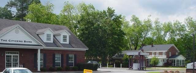
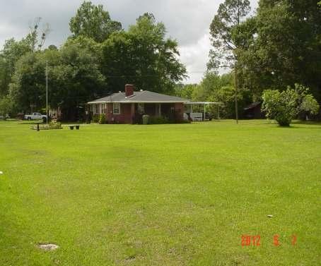
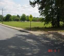
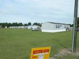
15 PC# Staff Recommendation Staff recommends approval of this request to recognize substantial change and changing conditions or circumstances in a particular locality.
16 PC# SUBJECT: Rezoning request from R-3, Single- Family Residential District and Unzoned to R-3A,Single-Family Residential District. LOCATION: 127, 137, 259, 269, 277 and 309 S. Georgetown Highway and 171 Jasmine Street, Johnsonville TAX MAP NUMBER(S): 00433, Block 05, Parcels 002, 003, 004, , Block 05, Parcel , Block 04, Parcel 011 Block 06, Parcel 001 COUNCIL DISTRICT(S): 2; County Council
17 PC# Cont d. OWNER(S) OF RECORD: See Property Owners Information Attached APPLICANT: The City of Johnsonville s City Council o/b/o City of Johnsonville and Property Owners LAND AREA: Approx acres WATER /SEWER AVAILABILITY: Water and sewer services are provided by the City of Johnsonville. ADJACENT WATERWAYS/ None BODIES OF WATER: FLOOD ZONE: N/A
18 PC# Location Map

19 PC# Land Use Map
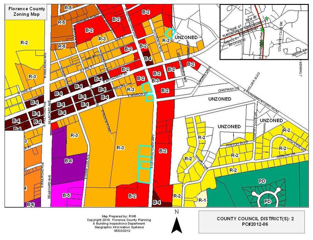
20 PC# Zoning Map
21 PC# Aerial Map

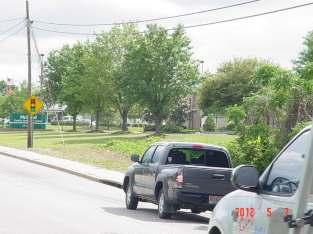
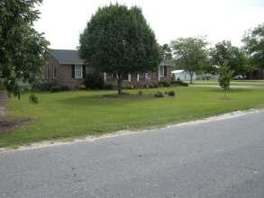
22 PC# Site Photograph S. Georgetown Hwy.

23 PC# Site Photograph S. Georgetown Hwy.

24 PC# Site Photograph S. Georgetown Hwy.

25 PC# Site Photograph S. Georgetown Hwy

26 PC# Site Photograph S. Georgetown Hwy.

27 PC# Site Photograph S. Georgetown Hwy.

28 PC# Site Photograph S. Georgetown Hwy.

29 PC# Site Photograph S. Georgetown Hwy.

30 PC# Site Photograph S. Georgetown Hwy.


31 PC# Adjacent Property S. Georgetown Hwy. East across S. Georgetown Hwy

32 PC# Adjacent Property S. Georgetown Hwy. West of S. Georgetown Hwy.


33 PC# Adjacent Property S. Georgetown Hwy. North along S. Georgetown Hwy.

34 PC# Adjacent Property S. Georgetown Hwy. South along S. Georgetown Hwy.

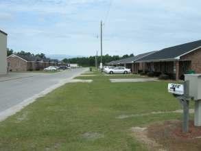
35 PC# Site Photograph Jasmine Street

36 PC# Site Photograph Jasmine Street

37 PC# Adjacent Property Photograph Jasmine Street
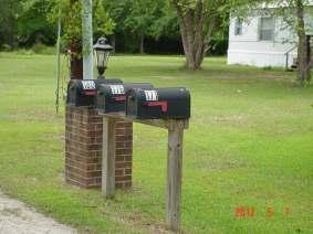
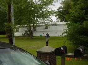
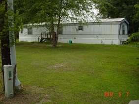
38 PC# Adjacent Property Photograph Jasmine Street

39 PC# Adjacent Property Photograph Jasmine Street
40 STAFF ANALYSIS: PC# Background Existing Land Use and Zoning: The subject properties are currently occupied by single-family and manufactured home residential uses, educational support uses, and commercial uses. The subject properties are currently zoned R-3, Single-Family Residential District and a portion of the subject property located on Jasmine Street is unzoned. Proposed Land Use and Zoning: There have been no proposals submitted for the development of new landusesortheredevelopmentintheexistinglandusesatthistime. The request is to zone the properties to an R-3A, Single-Family Residential Zoning District.
41 PC# Background-Cont. d Surrounding Land Use and Zoning on S. Georgetown Hwy: North: Residential and commercial/r-3/b-2/ City of Johnsonville South: Residential and commercial/r-3/b-2/city of Johnsonville West: Residential and educational/r-3/city of Johnsonville East: Across E. Georgetown Hwy, commercial and residential/b- 2/City of Johnsonville Surrounding Land Use and Zoning on Jasmine Street North: Residential/B-2/Unz/Florence County South: Residential/R-3/City of Johnsonville West: Residential/R-3/City of Johnsonville East: Residential/Unz/Florence County
42 PC# Background Cont. d Transportation Access and Circulation: Main access and circulation to the subject properties are by way of S. Georgetown Hwy., and Jasmine Street. Traffic Review: The rezoning of the subject properties will not have an effect on traffic flow for the area.
43 PC# Comprehensive Plan Currently, the Land Use Element of the Comprehensive Plan designates the subject properties as Transitional Growth and Preservation and/or Rural Preservation. The request for the zoning amendment to an R-3A does not presently comply with the Land Use Element s and Map s designation for the subject properties. In order for the zoning amendment to be in compliance with the land Use Element and Map of the Comprehensive Plan, the applicant has submitted a land use amendment request for the properties in question to the designation of Public Facility and/or Suburban Development. Approval of the land use amendment of the subject properties will bring the zoning amendment of the subject properties to an R-3A, Single-Family Residential District in compliance with the Florence County Comprehensive Plan.
44 PC# Chapter 30-Zoning Ordinance The R-3A, Single-Family Residential District has all the same permitted and conditional uses, excluding manufactured homes and the same setback requirements as the R-3, Single-Family Residential District. Additionally, the intent of the R-3, Single-Family Residential District is to foster, sustain, and protect areas in which the principal use of land is for single-family dwellings and related support uses.
45 PC# Staff Recommendation Staff recommends approval of the zoning amendment request based on the request being in compliance with the Land Use Map and Land Use Element of the Comprehensive Plan with the land use amendment request approval.
46 PC# SUBJECT: Rezoning request from R-5, Multi- Family Residential District and Unzoned to PD, Planned Development District. LOCATION: Property located off of Laron Street, Scranton TAX MAP NUMBER: COUNCIL DISTRICT(S): 1; County Council OWNER OF RECORD: William C. B. Eaddy APPLICANT: William C. B. Eaddy
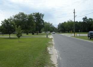
47 PC# Cont d. LAND AREA: 8.51 Acres WATER /SEWER AVAILABILITY: Water services provided by the Town of Scranton. Sewer services provided by the City of Lake City. ADJACENT WATERWAYS/ Body of water located to the west BODIES OF WATER: FLOOD ZONE: N/A
48 PC# Location Map

49 PC# Comprehensive Plan Land Use Map

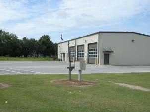
50 PC# Zoning Map

51 PC# Aerial Map
52 PC# SitePlan-PD-12-01

53 PC# SitePlan-PD-12-01


54 PC# Site Photographs


55 PC# Site Photographs West Along Laron Street


56 PC# Site Photographs East along Laron Street Rear View of Subject Property along LaRon Street


57 PC# Adjacent Property Photograph North of Laron Street North of Laron Street Along Bozy Road

58 PC# Adjacent Property Photograph South of Laron Street South along Bozy Road South along Bozy Road


59 PC# Adjacent Property Photograph West to the rear of Laron Street East across Bozy Road
60 Existing Land Use and Zoning: PC# Background Existing land uses include a mixture of duplexes, single-family homes and a single-wide mobile home. The current zoning district is R-5, Multi-Family Residential District in the Town of Scranton. A rear smaller portion of the property is currently unzoned in Florence County. Proposed Land Use and Zoning: The proposed land use is the development of a mixture of residential and commercial uses. The proposed zoning district for the property is a PD, Planned Development District allowing uses such as those allowed in a B-3, General Commercial District exclusive of sexually oriented businesses and liquor store.
61 PC# Background-Cont d. Surrounding Land Use and Zoning: North: Mixture of double and single-wide manufactured homes, mobile homes/ R-5/Town of Scranton South: Vacant land/r-2/town of Scranton West: Wooded land/substation/unz/florence County East: Fire station/r-5/town of Scranton Single-family residential (across Bozy Road) /R-1/Town of Scranton Commercial uses (across Bozy Road)/B-3/Town of Scranton Transportation Access and Circulation: Present access to the property is by way of Bozy Road onto Laron Street. Traffic Review: The rezoning of the property will not have an effect on traffic flow for this area.
62 Site Plan PD Development Standards Permitted Uses within a B-3, General Commercial District Residential uses of single-family homes, doublewide manufactured homes, duplexes Commercial uses (Excluding sexually oriented businesses and liquor stores.) Density Residential density, setbacks, impervious surface ratios, floor area ratios, and building heights shall be determined by the scale of the project in relation to its surroundings and its impact on existing and proposed support facilities, i.e. transportation, water and sewerage systems, recreation facilities, etc. Minimum Setback Requirements Front 5 feet -LaronStreet Side 10 feet Rear 10 feet Building to Building 20 feet Impervious Surface Ratio (%) 90%
63 Site Plan PD Cont d. Development Standards Maximum Floor Area Ratio None (Totalfloorareameasuredasapercentoftotallotarea.) Maximum Height There is no maximum: provided side and rear setbacks shall increase by one foot for each two feet in height over 35 feet for buildings outside of the B-4 district; further provided that approval of buildings over 35 feet shall be based on fire ladder capabilities as determined by the fire department with jurisdiction. Buffer Areas Buffer areas shall be required for peripheral uses only, and shall be provided in accordance with the minimum requirements for adjacent uses prescribed by article IV, division 1. Buffer areas are not required for internal use.
64 Streets and Street Improvements Site Plan PD Cont d. Development Standards Private streets may be permitted in a PD provided such streets meet the design and construction standards promulgated for public streets; further provided that an acceptable maintenance plan be submitted to and approved by the planning commission prior to permitting. Landscaping and Common Open Space Landscaping and open space requirements shall comply with the provisions of Article IV of Chapter 30-Zoning Ordinance of the Florence County Code. Signage Chapter 30-Zoning Ordinance, Sec Common signage plan required of the Florence County Code establishes that common signage plan shall be prerequisite to the issuance of any sign permit involving a PD, Planned Development District. The plan shall contain all information required for sign permits generally as required by Sec of the Florence County Code and shall specify standards for consistency among all signs on the lot affected by the plan with regard to lettering or graphic style; lighting; location of each sign on the buildings; material; sign proportions and all other pertinent criteria as established by this Ordinance.
65 PC# Florence County Comprehensive Plan The subject property is located in a Suburban Development and Rural Preservation area according to the Comprehensive Plan Land Use Map. While the applicant has requested to rezone this property for a Planned Development use, this request does comply with the Comprehensive Plan.
66 PC# Chapter 30-Zoning Ordinance PD, Planned Development District: The intent of the planned development district istoencourageflexibilityinthedevelopmentoflandinordertopromoteitsmost appropriate use; and to do so in a manner that will enhance public health, safety, morals, and general welfare. Within the PD, regulations adapted to unified planning and development are intended to accomplish the purpose of zoning and other applicable regulations to an equivalent or higher degree than where such regulations are designed to control unscheduled development on individual lots or tracts, promote economical and efficient land use, provide an improved level of amenities, foster a harmonious variety of uses, encourage creative design, and produce a better environment. In view of the substantial public advantage of "planned development", it is the intent of these regulations to promote and encourage or require development in this form where appropriate in character, timing, and location, particularly in large undeveloped tracts.
67 PC# Technical Review Committee Action The Technical Review Committee recommended approval of PD on June 18, 2012 to the Planning Commission.
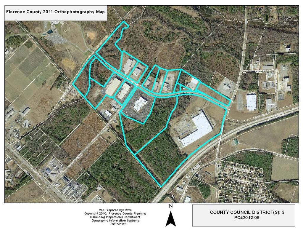
68 PC# Staff Recommendation Staff recommends approval of the zoning amendment request to Florence County Council based on the request being in compliance with the Land Use Element and Land Use Map of the Comprehensive Plan.
69 PC# SUBJECT: Request for text amendment to the Florence County Code, Chapter 30; Zoning Ordinance, Section , Certificates of zoning compliance and Section , Repair permits. APPLICANT: Florence County Planning Department
70 PC# Background STAFF ANALYSIS As staff administers the regulations of the Zoning Ordinance of the Florence County Code and all the participating jurisdictions, periodic amendments need to be made to the Code to maintain accurate references, to stay abreast of advances in technologies and systems and to provide the most efficient and accurate customer service as possible to all the citizens of Florence County. Planning staff is requesting an amendment to the text of Sec and Sec in an effort to alleviate any misunderstanding that may arise regarding the requirements for when a Certificate of Zoning Compliance (CZC) is needed, the processing of applications for a CZC and information required for a CZC application. Amendment to the text would provide a more accurate phrasing of the requirements the ordinance has established for CZC s and thus improve the public s interaction with the permitting process.
71 PC# Text Amendment Request Sec Certificates of zoning compliance. (a) When required. A certificate of zoning compliance shall be required in advance of: (1) The issuance of a building permitfor new construction or for existing construction where the footprint of an existing building is re-established through movement or increased through expansion. (2) Excavation preparatory to the construction of a structure for which a building permit is required. (3) All proposed construction and other developments including ttheplacementor relocationof manufactured homes. (4) Grading, filling, surfacing, or enlarging parking areas.containing more than six parking spaces for a new or changed use. (5) Changing the use of any part of a structure or zoning lot, including any increase in the number of families or dwelling units occupying a building or lot. (6) The installation on any zoning lot of a manufacturing or other industrial process whose operation may generate effects of the types and magnitudes limited by performance standards as set forth in section (76) Installation of any sign for which a permit is required. (8) The establishment of a temporary use as required by Section (9) Electric or gas utility companies and/or cooperatives extending service or utilities to a given site. Exceptions: Certificates of zoning compliance are not required for maintenance work, repair work and trade work provided that the work permitted will not result in a change of use of any existing building.
72 (b) PC# Text Amendment Request Processing procedures. (1) When the zoning administrator receives an application for a certificate of zoning compliance whose proposed improvement and use described and illustrated conforms to all requirements of this chapter, he shall issue a certificate of zoning compliance and return a signed copy to the applicant within ten days of receipt of the application. (2) When the zoning administrator receives an application for a certificate of zoning compliance whose proposed improvement and use described and illustrated does not conform to this chapter, he shall deny the issuance of a certificate of zoning compliance, and so advise the applicant within ten days, citing the particular sections of this chapter with which the application does not comply. (3) Each application for a certificate of zoning compliance shall be filed with the zoning coordinator administratoron a form provided therefore, which form may be combined with the application for a building permit required under the building code. The application must be signed by the owner or his authorized agent or attorney. (c) Application requirements. (1) In addition to such information as may be required in an application for a building permitwhere a site plan is required, each application for a certificate of zoning compliance shall be accompanied by a plan in duplicate, drawn legibly to scale on either a plat or paper, showing: a. The shape and dimensions of the zoning lot. b. The size and location of all existing buildings.
73 PC# Text Amendment Request c. The lines within which any proposed buildings shall be erected, altered, or moved; the locations of any officially approved building setback lines. d. The heights of all proposed buildings and parts thereof. e. The existing and proposed use of each building and part thereof. f. The use of adjoining properties. g. The number of families or dwelling units in each existing building and the number that each proposed building is intended to accommodate. h. The size and location of all proposed driveways, off-street loading areas, and off-street parking areas. containing more than six parking spaces. i. Finished first floor elevation above mean sea level requirement and the flood hazard zone designation if in a special flood hazard zone. j. Such other reasonable and pertinent information concerning the lot or neighboring lots as the zoning administrator may find necessary for the enforcement of this chapter. (2) Each application for a certificate of zoning compliance shall be accompanied by a recorded plat of the lot in duplicate, and drawn to scale, when required by the zoning administrator, for placement and distance measurement clarification. (Ord. No /07, 8.7, ; Ord. No /09, 1, ) Sec Reserved - Repair permits. Where an application for a certificate of zoning compliance is to effect repairs only, the zoning administrator may waive the requirements of an approved plat or plan. The work to be performed shall be clearly defined in the certificate of zoning compliance. (Ord. No /07, 8.8, )
74 PC# Staff Recommendation The Planning staff recommends approval of the text amendment to Planning Commission as presented.
75 PC# SUBJECT: Renaming of Range Way to Otis Way LOCATION: Within Florence Industrial Park, Florence County TAX MAP NUMBER: 00120, Block 01, Parcels 001, 052, 053, 058, 059, 062, 063, 065, 073, , 086, , 092, 093 COUNCIL DISTRICT(S): 3; County Council APPLICANT: Otis Elevator and all other property owners
76 PC# Location Map
77 PC# Aerial Map
78 PC# Background Staff Analysis: The applicant(s) are proposing to rename Range Way, an existing road located in Florence County to Otis Way. This road is a County-maintained road located between Pisgah Road and Mechanicsville Road in Florence County. The road is shown to exist on Tax Map No , Block 01, Parcels 001, 052, 053, 058, 059, 062, 063, 065, 073, , 086, , 092, 093.
79 PC# Background-Cont d. Findings: 1. The request was made by the property owner(s) or their representatives. 2. The applicant was advised to the minimum requirements to name a road. 3. Road names are not duplicates of existing road names in the County of Florence. 4. All landowners with property abutting the proposed road(s) have signed the petition. 5. The road name has been approved by the County addressing office.
80 PC# Staff Recommendation The staff recommends approval of the request for the road renaming to Otis Way to the Florence County Planning Commission based on compliance with the Florence County Road Naming/Renaming Ordinance.
81 Director s Report Summary Plats Building Reports
ARTICLE V SIGN REGULATIONS
 ARTICLE V SIGN REGULATIONS Section 5-1. Purpose The purpose of this Article is to protect the dual interest of the public and the advertiser. The regulations herein are designed to protect public safety
PC# SUBJECT: Rezoning request from R-3, Single-Family Residential District to R-3A, Single-Family Residential District.
 Agenda Cont d. PC#2012-01 SUBJECT: Rezoning request from R-3, Single-Family Residential District to R-3A, Single-Family Residential District. LOCATION: Properties located on E. & W. Marion St., N. & S.
CHAPTER 13 SIGNS 13-1
 SECTION 13.1 PURPOSE AND INTENT The purpose of this Chapter is to promote traffic safety, public safety, and the conservation of property values through the application of reasonable controls over the
ARTICLE 20 SIGNS. SIGN, AREA: The entire area of all sign faces, cumulatively, including sign faces on which no copy is currently displayed.
 ARTICLE 20 SIGNS 7 TCC 1-20 (a) Purpose. The purpose of the article is to provide regulation and control of the location, size, content and placement of signs throughout the County in order to promote
Article 9 Signs and Billboards
 Article 9 Signs and Billboards Section 9.01 Intent and Purpose The intent of this article is to regulate the type, number, physical dimensions, erection and placement of signs in Arbela Township. The purpose
CHAPTER 14. SIGNS AND GROUND SIGNS
 CHAPTER 14. SIGNS AND GROUND SIGNS Contents Section 1400 - Purpose... 1 Section 1405 Definitions... 2 Section 1410 General Provisions... 4 Section 1415 Permits... 5 Section 1420 Prohibited Characteristics
CHAPTER 154: SIGNS. Section
 CHAPTER 154: SIGNS Section 154.01 Permit required 154.02 Where prohibited 154.03 Street decorations 154.04 Approval by state 154.05 Purpose 154.06 Definitions 154.07 General sign and street graphics regulations
City of Jasper Sign Ordinance
 City of Jasper Sign Ordinance DIVISION 4. SIGNS Sec. 230 Permits Required (a) A sign permit shall be obtained from the Sign Administrator prior to the erection or placement of a sign, except those signs
PC# Subject:
 PC# 2014-11 Subject: Comprehensive Plan Map Amendment to change the land use map designation for property in Florence County located from Suburban Development to Industrial Growth and Preservation Locations:
New Lawrence, Kansas Sign Code. Frequently Asked Questions (FAQs)
") New Lawrence, Kansas Sign Code (Adopted by Ord. No. 9391 in City Code Chapter V, Art. 18, Effective 9/11/17, and Amended by Ord. No. 9439 on 3/6/18) Planning & Development Services Building Safety Division
New Lawrence, Kansas Sign Code (Adopted by Ord. No. 9391 in City Code Chapter V, Art. 18, Effective 9/11/17, and Amended by Ord. No. 9439 on 3/6/18) Planning & Development Services Building Safety Division
Sign, Canopy: A sign attached to the underside of a canopy.
 SECTION 15 SIGNS 15.1 Purpose: The requirements established herein are designed to regulate sign structures in order to insure light, air, and open space; to reduce hazards at intersections; to prevent
Article 18. Sign Regulations
 Article 18. Sign Regulations Section 18.01 Purpose and Intent Section 18.02 Use Regulations Section 18.03 Classification of Signs Section 18.04 Structural Types Section 18.05 General Standards Section
Excerpt from Town of West Greenwich, RI Zoning Ordinance Amended by Town Council September 12, 2007, and September 10, 2008
 ARTICLE IV SIGN REGULATIONS Section 1. Purpose and intent. The purpose of this Article is to: A. Improve pedestrian and traffic safety; B. Encourage the effective use of signs as a means of communication
CHAPTER 7. SIGNS TABLE OF CONTENTS ARTICLE 1. GENERAL Sec INTENT Sec NUMBER OF SIGNS AND SURFACE AREA...
 CHAPTER 7. SIGNS TABLE OF CONTENTS ARTICLE 1. GENERAL... 2 Sec. 7.1.1. INTENT.... 2 Sec. 7.1.2. NUMBER OF SIGNS AND SURFACE AREA.... 2 Sec. 7.1.3. DEFINITIONS.... 4 ARTICLE 2. REQUIREMENTS... 8 Sec. 7.2.1.
Section XXIV Signs (including Banners, Flags, and Temporary Signs)
") Section XXIV Signs (including Banners, Flags, and Temporary Signs) A. Guiding Principle Allow for adequate information to be conveyed without compromising the rural character of Rochester. B. Specific
Section XXIV Signs (including Banners, Flags, and Temporary Signs) A. Guiding Principle Allow for adequate information to be conveyed without compromising the rural character of Rochester. B. Specific
DRAFT PARK COUNTY US HIGHWAY 89 SOUTH EAST RIVER ROAD OLD YELLOWSTONE TRAIL ZONING DISTRICT REGULATIONS
 Formatting: Changes recommended by the Board and accepted by the County Commission are formatted in RED: Changes made by the Park County Commission are formatted in YELLOW highlight: and changes made by
No sign shall interfere with vehicular or pedestrian safety in any manner.
 Chapter 1170 Signs 1170.01 PURPOSE AND INTENT The purpose of these sign regulations is to encourage the proper development and use of signage and to permit and regulate signs in such a way as to support
CHAPTER 21.11: NONCONFORMITIES...1
 0 0 TABLE OF CONTENTS CHAPTER.: NONCONFORMITIES.....0 General Provisions... A. Purpose... B. Authority to Continue... C. Determination of Nonconformity Status... D. Nonconformities Created Through Government
ARTICLE VII. NONCONFORMITIES. Section 700. Purpose.
 ARTICLE VII. NONCONFORMITIES. Section 700. Purpose. The purpose of this chapter is to regulate and limit the development and continued existence of legal uses, structures, lots, and signs established either
13 NONCONFORMITIES [Revises Z-4]
![13 NONCONFORMITIES [Revises Z-4]](/thumbs/87/97238669.jpg "13 NONCONFORMITIES [Revises Z-4]") Dimensional Standards Building Design Standards Sidewalks Tree Protection & Landscaping Buffers & Screening Street Tree Planting Parking Lot Landscaping Outdoor Lighting Signs 13.1 PURPOSE AND APPLICABILITY
Dimensional Standards Building Design Standards Sidewalks Tree Protection & Landscaping Buffers & Screening Street Tree Planting Parking Lot Landscaping Outdoor Lighting Signs 13.1 PURPOSE AND APPLICABILITY
Larimer County Planning & Building Dept. Procedural Guide for NON-RESIDENTIAL DISTRICT SIGNAGE Information and Requirements
 Larimer County Planning & Building Dept. Procedural Guide for NON-RESIDENTIAL DISTRICT SIGNAGE Information and Requirements December 28, 2010 PURPOSE: The purpose of the Sign Code is to protect the health,
1. Animated: A sign or part of a sign that moves or appears to move.
 ZONING ORDINANCE, ARTICLE 16, SIGNS PAGE 16:1 ARTICLE 16 SIGNS 3-360 Purpose and Intent The purpose of this article is to promote and protect the public health, safety, and welfare by regulating outdoor
HUERFANO COUNTY SIGN REGULATIONS SECTION 14.00
 TABLE OF CONTENTS Section Title Page 14.01 SIGN CODE... 14-1 14.01.01 Intent and Purpose... 14-1 14.02 GENERAL PROVISIONS... 14-1 14.02.01 Title... 14-1 14.02.02 Repeal... 14-1 14.02.03 Scope and Applicability
SIGNS MASTER SIGN PROGRAM
 SIGNS MASTER SIGN PROGRAM How to apply for a Master Sign Program What is the purpose of a Master Sign Program? A Master Sign Program (MSP) is used to create standard sign design guidelines for projects
DRAFT PARK COUNTY US HIGHWAY 89 SOUTH EAST RIVER ROAD OLD YELLOWSTONE TRAIL ZONING DISTRICT REGULATIONS
 DRAFT PARK COUNTY US HIGHWAY 89 SOUTH EAST RIVER ROAD OLD YELLOWSTONE TRAIL ZONING DISTRICT REGULATIONS I. TITLE These regulations and the accompanying map(s) shall be known as, and shall be cited and
ARTICLE XII Sign Regulations
 Application # Zoning District Date received Village Of Cuba Fee Paid 17 East Main Street Planning Board Approval Cuba,NY 14727 Date Issued 585-968-1560 Instructions: 1 Application MUST be submitted 48
Signs General sign regulations District sign regulations.
 13.06.520 Signs. C. Definitions. Directional sign. A sign that is an attached or freestanding railroad, highway, road, or traffic signs or signals erected, constructed, or maintained for the purpose of
APPLICATION OF THIS CHAPTER RELATIONSHIP OF THIS CHAPTER TO STATE LAW... 4
 CHAPTER 21.11: SIGNS 21.11.010 PURPOSE... 3 21.11.020 APPLICATION OF THIS CHAPTER... 3 21.11.030 RELATIONSHIP OF THIS CHAPTER TO STATE LAW... 4 21.11.040 COMPUTATIONS AND RULES OF MEASUREMENT... 4 A. Determining
Title 6 - Local Government Provisions Applicable to Special Purpose Districts and Other Political Subdivisions
 Title 6 - Local Government Provisions Applicable to Special Purpose Districts and Other Political Subdivisions CHAPTER 29. SOUTH CAROLINA LOCAL GOVERNMENT COMPREHENSIVE PLANNING ENABLING ACT OF 1994 1994
ARTICLE 20 SIGN REGULATIONS
 ARTICLE 20 SIGN REGULATIONS Section 20.01 Purpose The purpose of this Article is to regulate the size, placement, and general appearance of all privately owned signs and billboards in order to promote
Signs along highways shall meet all of the requirements of the zoning districts in which they are located.
 SECTION 39 SIGNS 39.1 INTENT 39.1.1 The intent of this section is to regulate signs as defined hereinafter, to protect the safety of users of the streets and highways, to assure compatibility with uses
TITLE XV: LAND USAGE 150.BUILDING REGULATIONS 151.FLOOD DAMAGE PREVENTION 153.[RESERVED] 154.COMPREHENSIVE PLAN 155.SUBDIVISION AND ZONING CODE
![TITLE XV: LAND USAGE 150.BUILDING REGULATIONS 151.FLOOD DAMAGE PREVENTION 153.[RESERVED] 154.COMPREHENSIVE PLAN 155.SUBDIVISION AND ZONING CODE](/thumbs/86/94109177.jpg "TITLE XV: LAND USAGE 150.BUILDING REGULATIONS 151.FLOOD DAMAGE PREVENTION 153.[RESERVED] 154.COMPREHENSIVE PLAN 155.SUBDIVISION AND ZONING CODE") 1 TITLE XV: LAND USAGE Chapter 150.BUILDING REGULATIONS 151.FLOOD DAMAGE PREVENTION 152.SIGN AND BILLBOARD REGULATIONS 153.[RESERVED] 154.COMPREHENSIVE PLAN 155.SUBDIVISION AND ZONING CODE 2006 S-2 1 2
1 TITLE XV: LAND USAGE Chapter 150.BUILDING REGULATIONS 151.FLOOD DAMAGE PREVENTION 152.SIGN AND BILLBOARD REGULATIONS 153.[RESERVED] 154.COMPREHENSIVE PLAN 155.SUBDIVISION AND ZONING CODE 2006 S-2 1 2
17.0 NONCONFORMITIES CHAPTER 17: NONCONFORMITIES Purpose and Applicability
 17.0 NONCONFORMITIES 17.1 Purpose and Applicability The purpose of this section is to regulate and limit the continued existence of uses and structures established prior to the effective date of this Ordinance
Sign Regulations Recommendations
 Sign Regulations Recommendations January 23, 2014 City of Duluth Unified Development Code Agenda Approach: Results Adjustments for Freestanding Signs Electronic Changeable Copy Signs Billboards Downtown
C HAPTER 15: N ONCONFORMITIES
 SECTION 15.1: PURPOSE AND APPLICABILITY The purpose of this Chapter is to regulate and limit the continued existence of uses and structures established prior to the effective date of this Code (or any
ARTICLE XII SIGNAGE REGULATIONS
 ARTICLE XII Section 1. Section 2. Section 3. Section 4. Section 5. PURPOSE OF SIGNAGE REGULATIONS SIGN DEFINITIONS GENERAL SIGN STANDARDS SIGN STANDARDS BY TYPE PERMANENT SIGN STANDARDS Section 6. PROHIBITED
CHAPTER 5. Signs. It is further the intent of this section to prohibit signs which:
 CHAPTER 5 Signs 12-5-1 Purpose 12-5-2 Permitted Signs 12-5-3 Prohibited Signs 12-5-4 Computation of Number and Square Footage of Signs 12-5-5 District Regulations 12-5-6 Maintenance and Removal 12-5-7
Temporary Sign By-law
 THE CORPORATION OF THE TOWN OF WHITBY Temporary Sign By-law Being a By-law to regulate temporary signs and other temporary advertising devices By-law #5696-05 Consolidated Version As Amended by By-laws:
ARTICLE 3: Zone Districts
 ARTICLE 3: Zone Districts... 3-1 17.3.1: General...3-1 17.3.1.1: Purpose and Intent... 3-1 17.3.2: Districts and Maps...3-1 17.3.2.1: Applicability... 3-1 17.3.2.2: Creation of Districts... 3-1 17.3.2.3:
BOARD OF ZONING ADJUSTMENT STAFF REPORT Date: January 9, 2017
 # 1 HOLDOVER Revised ZON2016-02346 BOARD OF ZONING ADJUSTMENT STAFF REPORT Date: January 9, 2017 CASE NUMBER 6082 4140 1874 APPLICANT NAME LOCATION VARIANCE REQUEST ZONING ORDINANCE REQUIREMENT ZONING
In order to permit maximum applicability of the PUD District, PUD-1 and PUD-2 Districts are hereby created.
 ARTICLE III. PUD ned Unit Development Overlay District 205-128. Purpose. The PUD ned Unit Development Overlay District is intended to provide flexibility in the design of planned projects; to encourage
ARTICLE I. IN GENERAL. To encourage the effective use of signs as a means of communication in the city;
 ARTICLE I. IN GENERAL Section 46-1. Applicability. All signs erected or maintained after March 1, 2013; except official, traffic, street signs, and those signs which are displayed inside of a business
SHAWNEE COUNTY, KANSAS
 SHAWNEE COUNTY, KANSAS Instructions for SIGN PERMIT APPLICATION READ THOROUGHLY BEFORE SUBMITTING APPLICATION These instructions are provided to aid applicants of unincorporated Shawnee County in completing
City of Oshkosh Zoning Update
 City of Oshkosh Zoning Update The Zoning Rewrite Process Commenced in June of 2013 with selection of Vandewalle and Associates as zoning rewrite consultants. Consultants, City Staff, Plan Commission, and
CHAPTER 3 PERMITS, PLANS AND ANNEXATION
 CHAPTER 3 PERMITS, PLANS AND ANNEXATION SECTION: 10-3-1: General Regulations 10-3-2: Building Permit 10-3-3: Plans 10-3-4: Certificate of Compliance and Occupancy 10-3-5: Conditional Use Permits 10-3-6:
The provisions herein are designed to accomplish this intent in a way that:
 6. A. PURPOSE The intent of this chapter is to provide for the continuation and, under appropriate circumstances, elimination of existing uses of property that do not conform to the requirements of this
ORDINANCE NO
 TOWNSHIP OF ANDOVER, COUNTY OF SUSSEX, STATE OF NEW JERSEY ORDINANCE NO. 2014-04 AN ORDINANCE OF THE TOWNSHIP OF ANDOVER, COUNTY OF SUSSEX, AND STATE OF NEW JERSEY TO AMEND CHAPTER 190, ZONING, ARTICLE
COLERAIN TOWNSHIP ZONING COMMISSION Regular Meeting Tuesday, June 20, :00 p.m.
 COLERAIN TOWNSHIP ZONING COMMISSION Regular Meeting Tuesday, June 20, 2017-6:00 p.m. Colerain Township Government Complex 4200 Springdale Road - Cincinnati, OH 45251 1. Meeting called to order. Pledge
EXCERPT Planned Residential Development (PRD)
") LAND DEVELOPMENT CODE ESTABLISHING ZONING DISTRICTS AND REGULATIONS FOR LAND DEVELOPMENT AND SUBDIVISION IN THE CITY OF HATTIESBURG, MISSISSIPPI ORDINANCE NO. 2330 ADOPTED DECEMBER 05, 1989 EXCERPT Planned
LAND DEVELOPMENT CODE ESTABLISHING ZONING DISTRICTS AND REGULATIONS FOR LAND DEVELOPMENT AND SUBDIVISION IN THE CITY OF HATTIESBURG, MISSISSIPPI ORDINANCE NO. 2330 ADOPTED DECEMBER 05, 1989 EXCERPT Planned
PC# Subject:
 PC# 2014-11 Subject: Comprehensive Plan Map Amendment to change the land use map designation for property in Florence County located from Suburban Development to Industrial Growth and Preservation Tax
ARTICLE 10. NONCONFORMITIES
 ARTICLE 10. NONCONFORMITIES 10.1. General A lawful preexisting use, structure, or lot that does not meet the requirements of this UDO is deemed a nonconformity. Special provisions apply to nonconformities,
ARTICLE 11. NAMEPLATES AND SIGNS Signs in all districts.
 //Culpeper County, Virginia/CODE OF ORDINANCES COUNTY OF CULPEPER, VIRGINIA Codified through Ordinance of November 7, 2007. (Supplement No. 3)/APPENDIX A ZONING ORDINANCE*/ARTICLE 11. NAMEPLATES AND SIGNS
A. ARTICLE 18 - SIGNS
 1800. 1801.A. ARTICLE 18 - SIGNS SECTION 1800 INTENT A. Edgmont Township recognizes that signs perform an important function in identifying properties, businesses, services, events, and other matters of
ALPINE TOWNSHIP ZONING ORDINANCE TABLE OF CONTENTS
 ALPINE TOWNSHIP ZONING ORDINANCE TABLE OF CONTENTS PAGE CHAPTER I - DEFINITIONS 1-1 CHAPTER II - GENERAL PROVISIONS 2-1 2.01 Accessory Buildings 2-1 2.02 Automobiles 2-6 2.03 Prohibited Uses and Undesignated
CHAPTER 21.10: SIGNS...485
 Chapter.0: Signs Sec..0.00 Purpose 0 0 0 0 0 TABLE OF CONTENTS CHAPTER.0: SIGNS....0.00 Purpose....0.00 Application of This Section....0.00 Relationship of This Section to State Law....0.00 Computations,
Chapter SPECIAL USE ZONING DISTRICTS
 Chapter 20.20 Sections: 20.20.010 Urban Transition (U-T) Zoning District 20.20.020 Planned Development (P-D) Zoning Districts 20.20.010 Urban Transition (U-T) Zoning District A. Purpose. The purpose of
Chapter SIGNS. Sections: Specific Standards by Zoning District Specific Standards by Use
 Chapter 20.62 SIGNS Sections: 20.62.010 Purpose 20.62.020 Applicability 20.62.030 General Standards 20.62.040 Specific Standards by Zoning District 20.62.050 Specific Standards by Use 20.62.010 Purpose
IOSCO TOWNSHIP ZONING ARTICLE 11 SIGNS
 IOSCO TOWNSHIP ZONING ARTICLE 11 SIGNS INDEX Section 11.1 Section 11.2 Section 11.3 Section 11.4 Section 11.5 Section 11.6 Section 11.7 Section 11.8 Section 11.9 Intent and Purpose Definitions General
The following regulations shall apply in the R-E District:
 "R-E" RESIDENTIAL ESTATE DISTRICT (8/06) The following regulations shall apply in the R-E District: 1. Uses Permitted: The following uses are permitted. A Zoning Certificate may be required as provided
ARTICLE 22 SIGNS AND OUTDOOR ADVERTISING STRUCTURES
 ARTICLE 22 SIGNS AND OUTDOOR ADVERTISING STRUCTURES 22.0 Purpose: The purpose of this chapter is to protect the general health, safety, and welfare of the community by providing an instrument for protecting
CHAPTER 21.12: NONCONFORMITIES
 CHAPTER 21.12: NONCONFORMITIES 21.12.010 GENERAL PROVISIONS... 12-2 A. Purpose... 12-2 B. Authority to Continue... 12-2 C. Determination of Nonconformity Status... 12-3 D. Government Agency Property Acquisitions...
(Y/N) _}Y/N) (Y/N) (Y/N) 11 within a zoning category without the requirement to obtain a
 _}Y/N) (Y/N) (Y/N) 11 within a zoning category without the requirement to obtain a") ID COUNCIL/COMMITTEE ACTION ADOPTED ADOPTED AS AMENDED ADOPTED W/O OBJECTION FAILED TO ADOPT WITHDRAWN OTHER (Y/N) _}Y/N) ~ (Y/N) (Y/N) (Y/N) 1 Council/Committee hearing bill': Roads, Bridges & Ports Policy
ID COUNCIL/COMMITTEE ACTION ADOPTED ADOPTED AS AMENDED ADOPTED W/O OBJECTION FAILED TO ADOPT WITHDRAWN OTHER (Y/N) _}Y/N) ~ (Y/N) (Y/N) (Y/N) 1 Council/Committee hearing bill': Roads, Bridges & Ports Policy
Staff Report: Date: Applicant: Property Identification: Acreage of Request: Current Zoning of Requested Area: Requested Action: Attached:
 Staff Report: Completed by Jeff Palmer Director of Planning & Zoning Date: November 7, 2018 Applicant: Greg Smith, Oberer Land Developer agent for Ronald Montgomery ET AL Property Identification: Frontage
CITY OF MORRO BAY SIGN PERMIT. Public Services Department Planning Division 955 Shasta Avenue Morro Bay, CA (805)
") Introduction The City s Sign Ordinance, Title 17.68 of the City of Morro Bay Municipal Code, contains regulations for the various types of signs allowed. The Sign Ordinance of the City of Morro Bay is
Introduction The City s Sign Ordinance, Title 17.68 of the City of Morro Bay Municipal Code, contains regulations for the various types of signs allowed. The Sign Ordinance of the City of Morro Bay is
E L M E R B O R O U G H L A N D U S E B O A R D APPLICATION COVER SHEET (to be completed for all applications and appeals)
") E L M E R B O R O U G H L A N D U S E B O A R D APPLICATION COVER SHEET (to be completed for all applications and appeals) 1. Name(s): 2. Address: 3. Telephone Number(s): 4. E-mail: 5. Owner Name(s) (if
E L M E R B O R O U G H L A N D U S E B O A R D APPLICATION COVER SHEET (to be completed for all applications and appeals) 1. Name(s): 2. Address: 3. Telephone Number(s): 4. E-mail: 5. Owner Name(s) (if
TENANT STOREFRONT SIGNAGE CRITERIA
 TENANT STOREFRONT SIGNAGE CRITERIA DEERFOOT MEADOWS CALGARY ALBERTA 33 Heritage Meadows Way SE Calgary, AB T2H 3B3 1 General Requirements The purpose of this is to provide all of the tenants of the Deerfoot
NYE COUNTY, NV PAHRUMP REGIONAL PLANNING COMMISSION REGULAR MEETING December 14, 2016
 NYE COUNTY, NV PAHRUMP REGIONAL PLANNING COMMISSION REGULAR MEETING December 14, 2016 Staff Report Agenda Item No. 13 CASE DESCRIPTION(S): LOCATION: For Possible Action CU-2016-000023: Public hearing,
ARTICLE B ZONING DISTRICTS
 ARTICLE B ZONING DISTRICTS Sec. 8-3021 Established. In order to protect the character of existing neighborhoods; to prevent excessive density of population in areas which are not adequately served with
Chapter 10 Signs CHAPTER 10 SIGNS
 CHAPTER 10 SIGNS Section 1000.00 Section 1000.01 Signs Purpose The purpose of this Chapter is to promote and protect the public health, convenience and safety by regulating existing and proposed signs
ORDINANCE NO. 14,668
 ORDINANCE NO. 14,668 AN ORDINANCE to amend the Municipal Code of the City of Des Moines, Iowa, 2000, adopted by Ordinance No. 13,827, passed June 5, 2000, as heretofore amended, by repealing paragraphs
ARTICLE 8 SIGNS Section 8.1 Intent Section 8.2 Definitions Advertising Sign Attached Sign Billboard Business Sign
 ARTICLE 8 SIGNS Signs are permitted in accordance with regulations listed below and in accordance with other applicable regulations of this Ordinance. Section 8.1 Intent The purpose of this Article is
ORDINANCE NO Regulations governing the usage, size, format and location of business signs and outdoor advertising throughout the City
 ORDINANCE NO. 634 AN ORDINANCE AMENDING SECTION 921. USE UNIT 21, BUSINESS SIGNS AND OUTDOOR ADVERTISING, BEING A SECTION OF ORDINANCE NO. 458, ZONING ORDINANCE FOR THE CITY OF GLENPOOL, AND REPEALING
RE: 6. GILL/GREEN COMPREHENSIVE PLAN AMENDMENT, REZONING AND PRELIMINARY PLAT
 commission memo DATE: Thursday - August 9, 2018 TO: Marion Planning & Zoning Commission FROM: David N. Hockett, AICP Principal Planner RE: 6. GILL/GREEN COMPREHENSIVE PLAN AMENDMENT, REZONING AND PRELIMINARY
TITLE NINE - SUPPLEMENTAL REGULATIONS Chapter Signs. CHAPTER 1179 Signs. (1) Promote attractive and high value residential districts.
 Promote attractive and high value residential districts.") Village of Boston Heights OH, Planning and Zoning Code, Sign Regulations 1 TITLE NINE - SUPPLEMENTAL REGULATIONS Chapter 1179. Signs. CHAPTER 1179 Signs 1179.01 Purposes 1179.02 Definitions 1179.03 General
Village of Boston Heights OH, Planning and Zoning Code, Sign Regulations 1 TITLE NINE - SUPPLEMENTAL REGULATIONS Chapter 1179. Signs. CHAPTER 1179 Signs 1179.01 Purposes 1179.02 Definitions 1179.03 General
NOTICE OF PUBLIC HEARINGS CITY OF LIVE OAK, CALIFORNIA
 NOTICE OF PUBLIC HEARINGS CITY OF LIVE OAK, CALIFORNIA NOTICE IS HEREBY GIVEN that public hearings by the Live Oak City Council will be held to receive public comments at 7:00 PM on Wednesday, December
Staff Report: Date: Applicant: Property Identification: Acreage of Request: Current Zoning of Requested Area: Requested Action: Attached:
 Staff Report: Completed by Jeff Palmer Director of Planning & Zoning Date: November 7, 2018, Updated November 20, 2018 Applicant: Greg Smith, Oberer Land Developer agent for Ronald Montgomery ET AL Property
SECTION 16. "PUD" PLANNED UNIT DEVELOPMENT OVERLAY DISTRICT
 SECTION 6. "PUD" PLANNED UNIT DEVELOPMENT OVERLAY DISTRICT Subsection. Purpose. This district is established to achieve the coordinated integration of land parcels and large commercial and retail establishments
PLANNED UNIT DEVELOPMENT (PUD) AREA PLAN/REZONING REVIEW PROCEDURE
 AREA PLAN/REZONING REVIEW PROCEDURE") PLANNED UNIT DEVELOPMENT (PUD) AREA PLAN/REZONING REVIEW PROCEDURE Professional inquiries will be made to our Township Planning Consultant, Township Engineer, and Township Attorney to get their opinions
PLANNED UNIT DEVELOPMENT (PUD) AREA PLAN/REZONING REVIEW PROCEDURE Professional inquiries will be made to our Township Planning Consultant, Township Engineer, and Township Attorney to get their opinions
SPECIAL ZONING DISTRICTS
 SPECIAL ZONING DISTRICTS 5.01 5.99 RESERVED 5.100 PLANNED DEVELOPMENTS: Purpose: This district is intended to accommodate unified design of residential, commercial, office, professional services, retail
PICKENS COUNTY UNIFIED DEVELOPMENT STANDARDS ORDINANCE. Organization of the Ordinance
 PICKENS COUNTY UNIFIED DEVELOPMENT STANDARDS ORDINANCE Organization of the Ordinance Article 1. Article 2. Article 3. Article 4. Article 5. Article 6. Article 7. Adoption, Applicability and Interpretation
TOWN OF WATERVILLE VALLEY NEW HAMPSHIRE SITE PLAN REVIEW REGULATIONS
 TOWN OF WATERVILLE VALLEY NEW HAMPSHIRE Effective date March 17, 1981 Revised March 16, 1982 Revised March 13, 1986 Revised March 10, 1987 Revised March 14, 2013 Revised March 8, 2016 TOWN OF WATERVILLE
Except as authorized in section with respect to non-conforming signs, all signs shall be in compliance with the provisions of this chapter.
 ARTICLE XV. SIGNS DIVISION 1. GENERAL SIGN REGULATIONS 155.300. General signs regulations. Purpose: a. The purpose of Article XV is to establish reasonable and impartial regulations for all signs in order
MASTER SIGN PROGRAM SERRA CENTER COLMA, CALIFORNIA. Approved by the Town of Colma City Council on March 22, 2017
 MASTER SIGN PROGRAM SERRA CENTER COLMA, CALIFORNIA Approved by the Town of Colma City Council on March 22, 2017 A. INTRODUCTION 1. The intent of this sign program is to provide the guidelines necessary
UDC. Contents ARTICLE 11 SIGN REGULATIONS
 ARTICLE 11. SIGN REGULATIONS Contents Signs In General... 631 Prohibited Signs.... 635 Signs Allowed Without a Sign Permit.... 638 Signs Requiring a Sign Permit.... 648 General Standards for All Signs....
6. Wall signs shall not extend above the second story windowsill or extend above the roofline, whichever is lower.
 GENERAL ZONING 17.47 (4) (d) (4) 4. At the base of each ground sign shall be a landscaped area of the same size as the area of the copy. Where a ground sign is located within a paved area, then the landscaped
Appendix J - Planned Unit Development (PUD)
") Appendix J - Planned Unit Development (PUD) Intent and Purpose The purpose of the PUD is: 1. To provide development that is consistent with the Comprehensive Land Use Plan and promote the goals and objectives
Appendix J - Planned Unit Development (PUD) Intent and Purpose The purpose of the PUD is: 1. To provide development that is consistent with the Comprehensive Land Use Plan and promote the goals and objectives
Chapter 100 Planned Unit Development in Corvallis Urban Fringe
 100.100 Scope and Purpose. Chapter 100 Planned Unit Development in Corvallis Urban Fringe (1) All applications for land divisions in the Urban Residential (UR) and Flood Plain Agriculture (FPA) zones within
UPPER MOUNT BETHEL TOWNSHIP NORTHAMPTON COUNTY, PENNSYLVANIA
 UPPER MOUNT BETHEL TOWNSHIP NORTHAMPTON COUNTY, PENNSYLVANIA JOINDER DEED / LOT CONSOLIDATION TOWNSHIP REVIEW PROCESS When accepting proposed Joinder Deeds / Lot Consolidations, review the Joinder Deed
Midwest City, Oklahoma Zoning Ordinance
 2010 Midwest City, Oklahoma Zoning Ordinance 9/2/2010 Table of Contents Section 1. General Provisions... 5 1.1. Citation... 5 1.2. Authority... 5 1.3. Purpose... 5 1.4. Nature and Application... 5 1.5.
Chapter 15: Non-Conformities
 Chapter 15: Non-Conformities Section 15.1 Purpose... 15-2 Section 15.2 Non-Conforming Vacant Lots... 15-2 Section 15.3 Non-Conforming Buildings or Structures... 15-3 Section 15.4 Non-Conforming Uses...
Zoning Ordinance Chapter 9
 CHAPTER 9 SIGNAGE SECTION 9.0 PURPOSE A. The purpose of this Ordinance is to establish comprehensive provisions that will eliminate confusing, distracting and unsafe signs located on private property;
ORDINANCE TO AMEND CHAPTER 286, TITLE SIGNS OF THE CODE OF ST. MARY S COUNTY, MARYLAND, ESTABLISHING LAND USE REGULATIONS REGARDING SIGNS
 ORDINANCE TO AMEND CHAPTER 286, TITLE SIGNS OF THE CODE OF ST. MARY S COUNTY, MARYLAND, ESTABLISHING LAND USE REGULATIONS REGARDING SIGNS WHEREAS, pursuant to 4-102 of the Land Use Article of the Annotated
A. Location. A MRD District may be permitted throughout the County provided it meets the standards established herein.
 752. Multi-Residential District (MRD) The Multi-Residential (MRD) District is intended to provide opportunities for rural, suburban and urban density mixed-residential developments consistent with the
SECTION CLASSIFICATION OF ZONES For the purpose of this Code the following primary land use zoning districts are hereby established:
 ARTICLE 4 ZONING DISTRICTS SECTION 4.010 CLASSIFICATION OF ZONES For the purpose of this Code the following primary land use zoning districts are hereby established: Primary Zones Abbreviated Designation
CHAPTER 19 SIGNS AND BILLBOARDS
 CHAPTER 19 SIGNS AND BILLBOARDS (See also, 27-901, Signs ) PART 1 SIGNS 19-101. Purpose 19-102. Definitions 19-103. General Sign Types 19-104. General Provisions 19-105. Exempt Signs 19-106. Prohibited
ARTICLE 14 PLANNED UNIT DEVELOPMENT (PUD) DISTRICT
 DISTRICT") ARTICLE 14 PLANNED UNIT DEVELOPMENT (PUD) DISTRICT Section 14.01 Intent. It is the intent of this Article to allow the use of the planned unit development (PUD) process, as authorized by the Michigan Zoning
ARTICLE 14 PLANNED UNIT DEVELOPMENT (PUD) DISTRICT Section 14.01 Intent. It is the intent of this Article to allow the use of the planned unit development (PUD) process, as authorized by the Michigan Zoning
ORDINANCE NO
 ORDINANCE NO. 17-029 AN ORDINANCE OF THE CITY COMMISSION OF THE CITY OF FORT PIERCE, FLORIDA AMENDING THE PROVISIONS OF FORT PIERCE CODE OF ORDINANCES CHAPTER 15 SIGNS AND BILLBOARDS, SEC 1 DEFINITIONS
DIVISION 1 PURPOSE OF DISTRICTS
 ARTICLE 2 ZONING DISTRICTS AND MAP DIVISION 1 PURPOSE OF DISTRICTS Section 2.101 Zoning Districts. For the purpose of this Ordinance, the City of Richmond is hereby divided into districts as follows: DISTRICT
TOWN OF SARATOGA PO BOX 486 PHONE: APPLICATION FOR SIGN PERMIT
 TOWN OF SARATOGA PO BOX 486 PHONE: 326-8335 APPLICATION FOR SIGN PERMIT ZONING ORDINANCE SECTION 328-44 (1978) DATE: ZONE: FEE: $25.00 Permit must be obtained before beginning work. Location, Ownership
CHAPTER 5 ZONING SECTION 5.1 PURPOSE
 CHAPTER 5 ZONING SECTION 5.1 PURPOSE The purpose of this Chapter is to regulate the nature and extent of uses of land, and of buildings and structures thereon, in order to promote the purposes of this