A SUMMARY APPRAISAL REPORT OF A Vacant Land Parcel. OWNED BY City of Reno
|
|
|
- Caren Cooper
- 6 years ago
- Views:
Transcription
1 A SUMMARY APPRAISAL REPORT OF A Vacant Land Parcel OWNED BY City of Reno LOCATED Along the North Side of South Meadows Parkway, East of Double R Boulevard, Reno, Washoe County, Nevada Assessor s Parcel No.: FOR THE PURPOSE OF Forming an Opinion of the Current Market Value Of the Subject Property DATE OF REPORT February 14, 2013 PREPARED FOR Ms. Lori Miles, SR/WA City of Reno 1 E. 1st Street, 8th Floor Reno, Nevada Project Name: South Meadows Parkway APPRAISAL COMPLETED BY LUBAWY & ASSOCIATES, INC South Durango Drive, Suite 100 Las Vegas, Nevada Phone: (702) Fax: (702) File #
2 LUBAWY & ASSOCIATES, INC. REAL ESTATE APPRAISERS AND CONSULTANTS February 14, 2013 File # Ms. Lori Miles City of Reno 1 E. 1st Street, 8th Floor Reno, Nevada Re: A Summary Appraisal Report of A Vacant Land Parcel Located Along the North Side of South Meadows Parkway, East of Double R Boulevard Reno, Washoe County, Nevada, Project Name: South Meadows Parkway Dear Ms. Miles: As requested, we have prepared an appraisal report of the above referenced property. The property is located on the north side of Meadows Parkway, east of Double R Boulevard. The subject is identified as Washoe County Assessor s Parcel Number and is zoned PUD, Planned Unit Development, under the jurisdiction of the City of Reno. The subject has a total land area of 1.00 acre or 43,566 square feet, and the usable land area is also 1.00 net acre or 43,566 net square feet. We have inspected the site in order to estimate the current market value of the subject property. The client of this report is City of Reno. The intended user of this report is City of Reno. The intended use of this report is to assist City of Reno in asset management. The supporting data, analyses, and conclusions used to form an opinion of the market value of the subject are contained in the accompanying report and addenda. This letter by itself should not be construed as a complete report. This is a Summary Report as defined by Uniform Standards of Professional Appraisal Practice under Standards Rule 2-2(B). This format provides a summary of the appraisal process, subject and market data valuation analyses. Supporting documentation concerning the data, reasoning, and analyses are retained in the appraisers files. The depth of discussion contained in this report is specific to the needs of the client and for the intended use stated above. The appraisers are not responsible for unauthorized use of this report S. DURANGO DRIVE, SUITE 100, LAS VEGAS, NEVADA PHONE (702) FAX (702)
3 Ms. Lori Miles File # February 14, 2013 Page 2 The purpose of this appraisal report is to estimate the current market value of the subject property as of February 13, We have appraised the fee simple ownership rights. Based upon an analysis of the market data and subject to the assumptions and limiting conditions contained within this report, we have formed an opinion of the market value of the subject as follows: MARKET VALUE IDENTIFICATION PROPERTY RIGHTS APPRAISED EFFECTIVE DATE OF VALUE MARKET VALUE Current Market Value Fee Simple February 13, 2013 $700,000 According to the Treasurer's Office, there is no past or current tax amount owed as of the date of this report. The acceptance of this appraisal assignment and the completion of the appraisal report submitted herewith are not contingent upon any extraordinary assumptions and/or hypothetical conditions. The market value opinions have been predicated upon an exposure time of 12 months, based upon available market data. The marketing period has also been estimated at 12 months based upon similar data contained later in the appraisal. Thank you for giving us the opportunity of appraising this property. If we may be of further assistance, please do not hesitate to contact us. Sincerely, Matthew Lubawy, MAI Andrew J. Johnson, MAI Nevada License A CG Nevada License A CG License Expires April 30, 2013 License Expires January 31, S. DURANGO DRIVE, SUITE 100, LAS VEGAS, NEVADA PHONE (702) FAX (702)
4 TABLE OF CONTENTS ASSUMPTIONS AND LIMITING CONDITIONS... 1 GENERAL ASSUMPTIONS AND LIMITING CONDITIONS... 1 EXTRAORDINARY ASSUMPTIONS... 3 HYPOTHETICAL CONDITIONS... 3 CERTIFICATION OF VALUE... 4 SUMMARY OF IMPORTANT FACTS AND CONCLUSIONS... 6 INTRODUCTION... 9 IDENTIFICATION OF THE PROPERTY... 9 CENSUS TRACT NUMBER... 9 LEGAL DESCRIPTION... 9 PURPOSE OF APPRAISAL... 9 CLIENT... 9 INTENDED USER... 9 INTENDED USE OF THE APPRAISAL... 9 EFFECTIVE DATE(S) OF VALUATION... 9 DATE OF APPRAISAL REPORT USPAP COMPETENCY PROVISION PROPERTY RIGHTS APPRAISED DEFINITION OF MARKET VALUE EXPOSURE TIME MARKETING TIME CURRENT OWNERSHIP/ OWNERSHIP HISTORY SCOPE OF APPRAISAL AREA / CITY DESCRIPTION AND ANALYSIS INTRODUCTION REGIONAL ECONOMIC OVERVIEW GEOGRAPHIC SETTING TOURISM/CASINOS CLIMATE TOPOGRAPHY TRANSPORTATION UTILITIES LINKAGES SOCIAL FORCES POPULATION EMPLOYMENT CONCLUSION MARKET AREA/NEIGHBORHOOD DESCRIPTION AND ANALYSIS MARKET AREA/NEIGHBORHOOD BOUNDARIES MARKET AREA/NEIGHBORHOOD DESCRIPTION TRANSPORTATION PROPERTY TAXES UTILITIES/SERVICES EXTERNAL INFLUENCES RETAIL AND OFFICE MARKET ANALYSIS MARKET AREA CONCLUSION SITE DESCRIPTION AND ANALYSIS ZONING CONCLUSION ASSESSED VALUE AND PROPERTY TAXES CALCULATION OF TAXES TAX RATES HIGHEST AND BEST USE HIGHEST AND BEST USE AS THOUGH VACANT METHOD OF VALUATION LAND VALUATION LAND SALES ANALYSIS... 49
5 Table of Contents EXPOSURE TIME AND MARKETING PERIOD ADDENDA... I SUBJECT PHOTOGRAPHS... II ENGAGEMENT LETTER... VI FEMA FLOOD MAP... IX QUALIFICATIONS OF APPRAISERS... XI
6 ASSUMPTIONS AND LIMITING CONDITIONS GENERAL ASSUMPTIONS AND LIMITING CONDITIONS The acceptance of this appraisal assignment and the completion of the appraisal report submitted herewith are contingent upon the following general assumptions and limiting conditions: 1. This is a Summary Report as defined by Uniform Standards of Professional Appraisal Practice under Standards Rule 2-2(B). This format provides a summary of the appraisal process, subject and market data valuation analyses. Supporting documentation concerning the data, reasoning, and analyses is retained in the appraisers file. The information contained in this report is specific to the needs of the client and for the intended use stated in this report. The appraiser is not responsible for unauthorized use of this report. 2. No responsibility is assumed for legal or title considerations. Title to the property is assumed to be good and marketable unless otherwise stated. 3. The property is appraised free and clear of any or all liens or encumbrances unless otherwise stated in this report. 4. Responsible ownership and competent property management are assumed, unless otherwise stated. 5. The information furnished by others is believed to be reliable; however, no warranty is given for its accuracy. 6. All engineering is assumed to be correct. Any plot plans and illustrative material in this report are included only to assist the reader in visualizing the property. 7. It is assumed that there are no hidden or unapparent conditions of the property, subsoil, or structures that render it more or less valuable. No responsibility is assumed for such conditions or for arranging for engineering studies that may be required to discover them. 8. It is assumed that there is full compliance with all applicable federal, state, and local environmental regulations and laws unless otherwise stated. 9. It is assumed that all applicable zoning and use regulations and restrictions have been complied with, unless a nonconformity has been stated, defined, and considered. 10. It is assumed that all required licenses, certificates of occupancy or legislative or administrative authority from any local, state, or national governmental or private entity organization have been or can be obtained or renewed for any use on which the value opinions contained in this report are based. LUBAWY & ASSOCIATES, INC. 1
7 Assumptions and Limiting Conditions 11. Any sketch may show approximate dimensions and is included to assist the reader in visualizing the property. Maps and exhibits found are provided for reader reference purposes only. No guarantee as to accuracy is expressed or implied unless otherwise stated. No survey has been made for the purpose of this report. 12. It is assumed that the utilization of the land and improvements is within the boundaries or property lines of the property described and that there is no encroachment or trespasses unless otherwise stated. 13. The appraisers are not qualified to detect hazardous waste and/or toxic materials. Any comment by the appraisers that might suggest the possibility or presence of such substances should not be taken as confirmation of the presence of hazardous waste and/or toxic materials. Such determination would require investigation by a qualified expert in the field of environmental assessment. The presence of substances such as asbestos, urea-formaldehyde, foam insulation, or other potentially hazardous materials may affect the value of the property. The appraisers value opinions are predicated on the assumption that there is no such material on or in the property that would cause a loss in value unless otherwise stated in this report. No responsibility is assumed for any environmental conditions, or for any expertise or engineering knowledge required to discover them. The appraisers descriptions and resulting comments are the result of the routine observations made during the appraisal process. 14. The Americans with Disabilities Act (ADA) became effective January 26, We have not made a specific compliance survey and analysis of this property to determine whether or not it is in conformity with various detailed requirements of the ADA. It is possible that a compliance survey of the property, together with a detailed analysis of the requirements of the ADA, could reveal the property is not in compliance with one or more of the requirements of the act. If so, this fact could have a negative effect upon the value of the property. Therefore, it is assumed that the property complies with all ADA requirements. 15. Any proposed improvements are assumed to be completed in a competent manner in accordance with the submitted plans and specifications. 16. The distribution of any or the total valuation of this report between land and improvements applies under the stated program of utilization. The separate allocations for land and buildings must not be used in conjunction with any other appraisal and are invalid if so used. 17. Possession of this report or a copy thereof, does not carry with it the right of publication. It may not be used for any purpose by any person other than the party to whom it is addressed without the written consent of the appraisers, and in any event, only with the properly written qualification and only in its entirety. 18. Neither all nor any part of the contents of this report (especially any conclusions as to value, the identity of the appraisers, or the firm with which the appraisers are connected) shall be disseminated to the public through advertising, public relations, news sales, or other media without prior written consent and approval of the appraisers. LUBAWY & ASSOCIATES, INC. 2
8 Assumptions and Limiting Conditions 19. Prospective values are predicated upon stable market conditions unless otherwise stated. The appraisers cannot be held responsible for unforeseeable events that may alter market conditions prior to the effective date of the appraisal. 20. It is emphasized that the appraisers were not provided with an environmental/hazardous materials study regarding the property. As a result, the appraisers do not know the environmental condition of the property. It is assumed that hazardous or toxic materials do not adversely affect the property. The value opinion is therefore predicated upon the assumption that there are no such environmental conditions on or in the property that would cause a loss in value. Further, we reserve the right to amend the value within the report, if such items adversely affect the property. No responsibility is assumed for any such environmental conditions or for any expertise or engineering knowledge required to discover them. EXTRAORDINARY ASSUMPTIONS There are no extraordinary assumptions for this appraisal. HYPOTHETICAL CONDITIONS There are no hypothetical conditions for this appraisal. LUBAWY & ASSOCIATES, INC. 3
9 CERTIFICATION OF VALUE We certify that to the best of our knowledge and belief: 1. The statements of fact contained in this appraisal report are true and correct. 2. The reported analyses, opinions, and conclusions are limited only by the reported assumptions and limiting conditions, and is our personal, impartial, and unbiased professional analyses, opinions, and conclusions. 3. We have no present or prospective interest in the property that is the subject of this report, and no personal interest with respect to the parties involved. 4. We have no bias with respect to the property that is the subject of this report or to the parties involved with this assignment. 5. Our engagement in this assignment was not contingent upon developing or reporting predetermined results. 6. Our compensation for completing this assignment is not contingent upon the development or reporting of a predetermined value or direction in value that favors the cause of the client, the amount of the value opinion, the attainment of a stipulated result, or the occurrence of a subsequent event directly related to the intended use of this appraisal. 7. Our analyses, opinions, and conclusions were developed, and this report has been prepared, in conformity with the Uniform Standards of Professional Appraisal Practice. 8. Matthew Lubawy, MAI has not inspected the property that is the subject of this report. Andrew J. Johnson, MAI made a personal inspection of the subject property. 9. No one provided significant real property appraisal assistance to the persons signing this certification. 10. The reported analyses, opinions, and conclusions were developed, and this report has been prepared, in conformity with the requirements of the Code of Professional Ethics and Standards of Professional Appraisal Practice of the Appraisal Institute, which include the Uniform Standards of Professional Appraisal Practice. 11. The use of this report is subject to the requirements of the Appraisal Institute relating to review by its duly authorized representatives. 12. As of the date of this report, Matthew Lubawy, MAI and Andrew J. Johnson, MAI have completed the continuing education program of the Appraisal Institute. 13. The appraisers state registration/certification has not been revoked, suspended, canceled or restricted. LUBAWY & ASSOCIATES, INC. 4
10 Certification of Value 14. The appraisers did not base, either partially or completely, his or her analysis and/or the estimate of value on the race, color, religion, sex, handicap, familial status, health or national origin of the present or prospective owners, occupants or users of the subject property or of the present or prospective owners, occupants or users of the properties in the vicinity of the subject property. 15. The appraisers have not performed any prior services regarding the subject within the previous three years of the appraisal date. Matthew Lubawy, MAI Andrew J. Johnson, MAI Nevada License A CG Nevada License A CG License Expires April 30, 2013 License Expires January 31, 2014 LUBAWY & ASSOCIATES, INC. 5

11 SUMMARY OF IMPORTANT FACTS AND CONCLUSIONS View looking north across the subject property from along S. Meadows Parkway PROPERTY ADDRESS: PROPERTY LOCATION: Along the North Side of South Meadows Parkway, East of Double R Boulevard, Reno, Washoe County, Nevada, Located on the north side of Meadows Parkway, east of Double R Boulevard. MAP LATITUDE/LONGITUDE: ; ASSESSOR S PARCEL NUMBER: CENSUS TRACT NUMBER: PURPOSE OF APPRAISAL: CLIENT: The purpose of the appraisal is to estimate the current market value of the subject property. City of Reno LUBAWY & ASSOCIATES, INC. 6
12 Summary of Important Facts and Conclusions INTENDED USERS: INTENDED USE: City of Reno To assist City of Reno in asset management. DATE OF VALUATION: February 13, 2013 PROPERTY INSPECTION DATE: February 12, 2013 DATE OF REPORT: February 14, 2013 PROPERTY RIGHTS APPRAISED: LAND SIZE: ZONING: CURRENT USE: The fee simple estate The subject has a total land area of 1.00 acre or 43,566 square feet, and the useable land area is also 1.00 net acre or 43,566 net square feet. PUD, Planned Unit Development, under the jurisdiction of the City of Reno. The property is currently vacant land. HIGHEST AND BEST USE: As Vacant Land: The highest and best use of the site is to hold until new development becomes feasible, then develop with a smallscale commercial development. MARKET VALUE IDENTIFICATION PROPERTY RIGHTS APPRAISED EFFECTIVE DATE OF VALUE MARKET VALUE Current Market Value Fee Simple February 13, 2013 $700,000 According to the Treasurer's Office, there is no past or current tax amount owed as of the date of this report. EXPOSURE TIME: MARKETING PERIOD: The aforementioned opinion of market value has been predicated upon an exposure time of 12 months. This is the length of time that the property would have been exposed on the market to achieve the opinion of market value. The exposure time is based upon comparable sales within this report as well as discussions with real estate brokers and developers. The marketing period of the subject property has also been estimated at 12 months. The marketing period is the length of time that the property would need to be put on the market to achieve the opinion of market value of the subject property. The marketing period has been based upon comparable sales and takes into consideration the future supply and similar property types in the LUBAWY & ASSOCIATES, INC. 7
13 Summary of Important Facts and Conclusions subject s market area. It also assumes prudent marketing and an asking price (list price) similar to the market value opinion. The acceptance of this appraisal assignment and the completion of the appraisal report submitted herewith are contingent upon the general assumptions and limiting conditions contained on pages 1 2 and 3 of this report. The acceptance of this appraisal assignment and the completion of the appraisal report submitted herewith are based upon the following extraordinary assumptions and/or hypothetical conditions. EXTRAORDINARY ASSUMPTIONS: There are no extraordinary assumptions for this appraisal. HYPOTHETICAL CONDITIONS: There are no hypothetical conditions for this appraisal. LUBAWY & ASSOCIATES, INC. 8
14 INTRODUCTION IDENTIFICATION OF THE PROPERTY The subject property is located on the north side of Meadows Parkway, east of Double R Boulevard, Reno, Washoe County, Nevada, and is identified as Washoe County Assessor s Parcel Number The property is zoned PUD, Planned Unit Development, under the jurisdiction of the City of Reno. The subject has a total land area of 1.00 acre or 43,566 square feet, and the usable land area is also 1.00 net acres or 43,566 net square feet. The site is more thoroughly described in the Site Description and Analysis section contained within this report. CENSUS TRACT NUMBER The subject property is located within Census Tract LEGAL DESCRIPTION Based on information obtained from the Clark County Assessor s office, the subject property is legally described as follows: Parcel C-3 of Parcel Map No filed in the Office of the County Recorder of Washoe County, Nevada on September 13, 1995 as File No of Official Records. PURPOSE OF APPRAISAL The purpose of this appraisal report is to estimate the current market value of the subject property. CLIENT The client for this report is City of Reno. INTENDED USER The intended user of this report is City of Reno. INTENDED USE OF THE APPRAISAL The intended use of this appraisal report is to assist City of Reno in asset management. EFFECTIVE DATE(S) OF VALUATION The market value opinion is based on the date of February 13, 2013, the date the property was inspected. LUBAWY & ASSOCIATES, INC. 9
15 Introduction DATE OF APPRAISAL REPORT The date of this appraisal is February 14, The comparable sales and market data were verified prior to the date of this report. USPAP COMPETENCY PROVISION This appraisal report is being prepared with the intention of complying with the most recent version of the Uniform Standards of Professional Appraisal Practice (USPAP) as adopted by the Appraisal Foundation. We have the knowledge and the experience to complete this appraisal assignment. We have appraised numerous land parcels in the Reno/Sparks Metropolitan Area, and we are qualified to appraise the subject property. Please see our qualifications contained in the addenda of this report for additional information. PROPERTY RIGHTS APPRAISED We have formed an opinion of fee simple interest of the market value of the subject property. The fee simple ownership is defined as follows: Fee Simple Ownership Absolute ownership unencumbered by any other interest or estate, subject only to the limitations imposed by the governmental powers of taxation, eminent-domain, police power, and escheat. Source: The Dictionary of Real Estate Appraisal, Fifth Edition, (Chicago: Appraisal Institute, 2010) Page 78. DEFINITION OF MARKET VALUE Market value is defined as: The most probable price which a property should bring in a competitive and open market under all conditions requisite to a fair sale, the buyer and seller each acting prudently and knowledgeably, and assuming the price is not affected by undue stimulus. Implicit in this definition is the consummation of a sale as of a specified date and the passing of title from seller to buyer under conditions whereby: 1. buyer and seller are typically motivated; 2. both parties are well informed or well advised, and acting in what they consider their own best interests; 3. a reasonable time is allowed for exposure in the open market; 4. payment is made in terms of cash in United States dollars or in terms of financial arrangements comparable thereto; and 5. the price represents the normal consideration for the property sold unaffected by special or creative financing or sales concessions granted by anyone associated with the sale. Source: 12 C.F.R. Part 34.42(g); 55 Federal Register 34696, August 24, 1990, as amended at 57 Federal Register 12202, April 9, 1992; 59 Federal Register 29499, June 7, 1994). LUBAWY & ASSOCIATES, INC. 10
16 Introduction EXPOSURE TIME One of the implicit conditions of market value is that a reasonable time is allowed for exposure in the open market. This is always assumed to precede the effective date of the appraisal. Specifically, exposure time is defined as: The estimated length of time the property interest being appraised would have been offered on the market prior to the hypothetical consummation of a sale at market value on the effective date of the appraisal; a retrospective opinion based on an analysis of past events assuming a competitive and open market. Source: Statement 6, Uniform Standards of Professional Appraisal Practice, Edition, Appraisal Standards Board. MARKETING TIME Marketing time is defined as follows: The reasonable marketing time is an opinion of the amount of time it might take to sell a real or personal property interest at the concluded market value level during the period immediately after the effective date of an appraisal. Source: The Uniform Standards of Professional Appraisal Practice, , Advisory Opinion 7. CURRENT OWNERSHIP/ OWNERSHIP HISTORY According to Washoe County public records, the current owner of the subject property is the City of Reno. The City of Reno acquired the subject via Grant, Bargain, and Sale Deed as evidenced by Washoe County Recorded Document # on October 30, The grantor in the transaction was South Meadows Limited Partnership. The property was transferred to the city as part of a settlement with a developer, as the property was formerly planned for the construction of a fire station. However, the fire station will now be constructed at another location. Other than the October 2012 transfer, there have been no other sales or transfers of the subject property within the past three years. The subject property is not currently listed or offered for sale. SCOPE OF APPRAISAL This is a Summary Report as defined by Uniform Standards of Professional Appraisal Practice under Standards Rule 2-2(B). This format provides a summary of the appraisal process, subject and market data valuation analyses. Supporting documentation concerning the data, reasoning, and analyses are retained in the appraisers files. The depth of discussion contained in this report is specific to the needs of the client and for the intended use stated below. The appraisers are not responsible for unauthorized use of this report. As part of this appraisal, the appraisers have made a number of independent investigations and analyses. The investigations undertaken and the major data sources used are listed as follows: Area/City and Neighborhood Analysis Data pertaining to the metropolitan area and the subject neighborhood were provided by publications such as the CBRE and Colliers quarterly research reports for the Reno area, and LUBAWY & ASSOCIATES, INC. 11
17 Introduction information from the local Chamber of Commerce. Data pertaining to the labor force, employment and unemployment was supplied by the State of Nevada Employment Security Department; information pertaining to taxable sales was provided by the Nevada Department of Taxation; and data pertaining to residential construction building permits was collected from the governing jurisdictions. Additional neighborhood data was based upon a physical inspection of the area. Site Description and Analysis On February 12, 2013 the property was inspected by Andrew J. Johnson, MAI and photographs of the property were taken as of this date. Matthew Lubawy, MAI has not inspected the property that is the subject of this report. Information concerning utilities was collected by a physical inspection as well as contacting the individual utility companies, when necessary. Information pertaining to dimensions, shape, and area was taken from the Washoe County Assessor s Map. The description of analysis of topography, drainage, soils conditions and surrounding land uses was based upon a physical inspection. It is imperative to note that the appraisers are not experts in the analysis of soils conditions or environmental hazards; therefore, any comment by the appraisers that might suggest the presence of such substances should not be taken as confirmation of the presence of hazardous waste or questionable soils conditions. Such determination would require investigation by qualified professionals in the field of environmental assessment or soils testing. No responsibility is assumed for any environmental conditions or for any expertise or engineering knowledge required to discover them. The appraisers descriptions and resulting comments are a result of routine observations made during the appraisal process. Applied Methods of Valuation Of the three traditional approaches to value, the cost approach, income capitalization approach, and sales comparison approach, only the sales comparison approach for land valuation was used in the valuation of the subject property. Please see the section entitled Method of Valuation, contained later in the report, for a full description of the complete process for the approach performed. Market Data Collection and Verification Land sales data was collected through various sources including CoStar, Property Line, LoopNet, Washoe County records, and from brokers, owners, and developers. The information was verified with one or more of the parties involved in the transaction including the grantor, grantee, broker, or other knowledgeable parties, when possible. Verification of each sale is listed separately on each land sale abstract contained later in the report. LUBAWY & ASSOCIATES, INC. 12
18 AREA / CITY DESCRIPTION AND ANALYSIS INTRODUCTION The cities of Reno and Sparks are located in what is known as the Truckee Meadows region in the northwestern portion of the State of Nevada. The Reno-Sparks Metropolitan Statistical Area (MSA) consists of Washoe County, which includes the cities of Reno and Sparks. The City of Reno is the county seat of Washoe County. Reno is the third largest city in the state behind Las Vegas and Henderson. Reno-Sparks is located at the base of the Sierra Nevada Mountains along the shores of the Truckee River. The two cities are situated in a scenic valley known as Truckee Meadows in the northwestern portion of Nevada. Reno-Sparks lies 45 miles northwest of Lake Tahoe, 450 miles northwest of Las Vegas, 135 miles northeast of Sacramento, California, 231 miles northeast of San Francisco, 504 miles north of Los Angeles, 423 miles southwest of Boise, Idaho, and 568 miles southeast of Portland, Oregon. The economic vitality of the surrounding area, and the immediate neighborhood encompassing the subject property, is an important consideration in estimating future real estate demand and income potential. A detailed demographic analysis of Reno and Washoe County was conducted using information provided by Nielsen, a recognized industry source, as well as various State of Nevada websites. Information supplied includes historical and projected population, employment and income data. REGIONAL ECONOMIC OVERVIEW The near-term economic outlook for the state and the Reno region is best described as optimistic. Over the past few years the area has faced negative job growth, continued housing value declines, a major credit crunch, stressed financial markets, volatile oil/gas prices, declining consumer confidence, and increasing government budget deficits. Many of the same problems still exist; however, the current data suggest that the bottom of the market may have been reached or is near and the projections for the remainder of 2012 and into 2013 are for stabilization and possible minor improvement of the overall economy. GEOGRAPHIC SETTING The Reno-Sparks area sits at an elevation of 4,400 feet above sea level, at the eastern base of the foothills of the Sierra Nevada mountain range. This mountain range forms the natural border between Nevada and California. Land to the west of the Reno-Sparks area rises at an increasing rate, as foothills quickly become the eastern slopes of the Sierra Nevada. The land to the east of the metropolitan area gradually flattens out into basin and range topography for 200 miles. The nearby Sierra Nevada, and especially the Lake Tahoe area, provides recreation opportunities for the area. The Lake Tahoe region located only 45 miles to the southwest is considered one of the most scenic areas in the United States and draws tourists from all over the globe. The Tahoe area offers skiing, hiking, fishing and other water sports, and casino gambling. Also, Pyramid Lake is located LUBAWY & ASSOCIATES, INC. 13
19 Area/City Description and Analysis less than 30 minutes north of Reno-Sparks by automobile and offers some of the best fishing in the area. The Reno/Lake Tahoe area offers the highest concentration of ski resorts in the country, all within 90 minutes of Reno-Sparks. There are 16 alpine and nine cross-country ski resorts, with an average snowfall of 25 feet per season. During the winter months, skiing enthusiasts come from all over the United States to enjoy northern Nevada's unique blend of daytime skiing and nighttime gaming at Lake Tahoe and the surrounding areas. Here and at other smaller resorts located throughout the valleys, skiers can pursue both downhill and cross-country skiing. During the summer months hiking enthusiasts, hunters and campers enjoy the mountains and national forests in this area. Lake Tahoe is also used for fishing and other water sports. Pyramid Lake and the Truckee River -- along with several nearby lakes -- are also popular fishing locations. TOURISM/CASINOS Historically, the Reno-Sparks regional economy was based predominantly on the tourism spurred by local gaming. The strength of the gaming industry was one of the chief reasons that Nevada weathered the last national recession relatively well. Only recently has the reliance on tourism caused concern about the lack of diversification in the job base. Overall, in the short term, the gaming profits have decreased from previous years. The decreases are primarily attributed to the decline of the national economy and erosion of disposable incomes. Long term predictions suggest that as the economy stabilizes and employment increases, visitor volume is expected to begin to increase over the next 1-2 years. Overall, the gaming/tourism industry has a significant impact on the local economy. CLIMATE The area s semi-arid climate is generally favorable, and winters are characterized as moderate with January temperatures between 18 F to 46 F and July temperatures 47 F to 92 F. The area experiences about 306 days of sunshine per year, annual precipitation is just over 5 per year, and annual snowfall is about 32 per year. The foothill and mountain regions experience much heavier snowfall. TOPOGRAPHY The geographical characteristics are regarded as one of area s most notable attributes. The area contains many different types of terrain from level valley land in downtown Reno and Sparks to foothills and mountainous terrain in Virginia City, the Sierras, and Lake Tahoe. The majority of the valley is about 4,500-foot elevation; while, the mountainous region to the west rises to over 10,000 feet above sea level. The region is bisected by the Truckee River, which runs from Lake Tahoe, through downtown Reno and through Sparks out to Pyramid Lake. As a result of this river, flooding has been a problem. Most of the flood prone areas are in downtown Reno, and the industrial district of Sparks. LUBAWY & ASSOCIATES, INC. 14
20 Area/City Description and Analysis The soils in the area are basically alluvial, being composed of sands and sandy loam, which eroded from granite bedrock as well as from volcanic rock overlays. Most of the soils include some clay that expand when wet and shrink when dry. As a result, most properties in the area require some over excavation to remove these clays. The region is geologically active and several earthquake faults have been identified within the area including a band of faults extending in a north-south direction through Reno and Sparks. As a result of these faults, the area is identified as a Seismic Risk Zone 3, which identifies areas of potential for an earthquake up to 6.5 on the Richter Scale. Both cities and the county have adopted special construction considerations and building materials into the general plan. TRANSPORTATION Reno/Sparks central location to California and its transportation system contributed to the region s desirability as a place for business and living. The region benefits from the interstate highway system, rail system, and air transportation. Interstate 80 is an east/west highway connecting the Reno/Sparks region with Sacramento and San Francisco, California to the west, and Utah to the east. Interstate 80 is a major trucking route extending from coast to coast. U.S. Highway 395 is a north/south highway connecting the Reno/Sparks region to Southern California to the south and California, Oregon, and Washington to the north. These highways intersect each other just northeast of the Reno CBD. Several railroads provide freight and passenger service to the area, including Southern Pacific and Amtrak. Due to increased usage of the rail services, the community is in the process of lowering the tracks below ground level to reduce traffic congestion in the downtown district. The main airport for the area is the Reno-Tahoe Airport, located at the terminus of Plumb Lane, just east of US Highway 395. The airport has experienced slow growth due to a decrease in the demand by passengers over the last few years, and a reduction in scheduled flights as several airlines have merged operations. UTILITIES NV Energy supplies electricity and natural gas, while water is provided to the area by TMWA. Most areas have sufficient capacity to provide necessary utilities. Reno Disposal Co. provides solid waste and recycling services and AT&T is the primary telephone service provider. LINKAGES All of the environmental attributes form together to provide linkages that can attract or detract development from areas. These relationships form over time and create different real estate supply and demand characteristics. Historically, Reno/Sparks grew in a concentric structure, from the center of the cities. As casinos heavily influenced the central area, the retail, office, and residential uses moved towards the suburban markets following the growth of the freeway and highway expansion. Today, the land uses reflect a Radial-Corridor structure, where there is a high percentage of industrial development in Sparks along the rail and freeways. Those neighboring LUBAWY & ASSOCIATES, INC. 15
21 Population (1,000's) File # Area/City Description and Analysis residential districts are primarily blue-collar low income. Southwest Reno is moderate to upper income in the lower level land to upper income in the foothills. The newest retail and office development is occurring in the high growth south Reno market. The north and northwest has primarily developed with low to moderate-income neighborhoods. With the continued development in south Reno with the newer office and retail buildings, that area has captured a large share of the new growth. SOCIAL FORCES Social characteristics pertaining to an area are primarily based on population, density, trends, demographics, and quality of life. Real estate improvements are provided in response to the demand generated by a population with effective purchasing power. Population growth or decline, household size, income, educational levels, and age all affect and contribute to the structure of demand for real estate. Further, demand of a given population for goods and services will affect the type and value of real estate needed. An analysis of population, employment, and income trends for the Reno MSA and the State of Nevada is performed using data provided by Nielsen, a recognized source. POPULATION Historical and projected population trends for the Reno/Sparks MSA are charted below: POPULATION TRENDS Reno/Sparks MSA The population of the Reno/Sparks MSA increased at a compounded annual rate of 2.47% from 2000 to For the same time period, the State of Nevada grew at a compounded annual rate of approximately 3.59%. Looking ahead, both the Reno/Sparks MSA and the State of Nevada are anticipated to experience continued growth, with future population estimates reflecting growth rates much slower than those experienced in the past. For the period 2010 to 2015, the population of the Reno/Sparks MSA is expected to increase by an average annual compound rate of 1.74% Year LUBAWY & ASSOCIATES, INC. 16
 Period Washoe County Nevada United States 2nd Quarter, 2012 11.50% 11.60% 7.90% 1st Quarter, 2012 13.00% 12.70% 8.70% 4th Quarter, 2011 11.60% 13.00% 8.")
22 Area/City Description and Analysis RENO/SPARKS POPULATION SOURCE: NIELSEN EMPLOYMENT The following chart illustrates the historical unemployment rates for Washoe County, Nevada, and the United States. Historical Unemployment Rate (%) Period Washoe County Nevada United States 2nd Quarter, % 11.60% 7.90% 1st Quarter, % 12.70% 8.70% 4th Quarter, % 13.00% 8.60% 3rd Quarter, % 13.40% 9.10% 2nd Quarter, % 12.10% 9.10% 1st Quarter, % 13.60% 9.50% 4th Quarter, % 14.30% 9.30% 3rd Quarter, % 14.40% 9.60% 2nd Quarter, % 14.00% 9.50% 1st Quarter, % 13.40% 10.20% 4th Quarter, % 12.30% N/Avail. 3rd Quarter, % 12.70% N/Avail. 2nd Quarter, % 11.30% 9.40% 1st Quarter, % 10.40% N/Avail. LUBAWY & ASSOCIATES, INC. 17
23 Area/City Description and Analysis CONCLUSION As previously described, the economic outlook for the state and the Reno region is best described as optimistic. Over the past few years the area has faced negative job growth, continued housing value declines, a major credit crunch, stressed financial markets, volatile oil/gas prices, declining consumer confidence, and increasing government budget deficits. Many of the same problems still exist; however, the current data suggest that the bottom of the market may have been reached or is near and the projections for 2013 are for stabilization and possible minor improvement of the overall economy. Despite the current economic conditions, the longer term outlook for the region is still encouraging due to strong fundamentals. The area has many positive attributes that will work to ensure longterm growth and prosperity to the area -- good accessibility by major roadways, good infrastructure, an educated work force, expanding population, strong higher education institutions, a good climate and easy access to major recreational area. In addition, the economic base of the city is diversifying and becoming less susceptible to downturns in particular sectors of the economy. The Reno-Sparks metropolitan area is restructuring from an economy based primarily on tourism and gambling to an economy more evenly balanced with stronger employment in the business, manufacturing and trade sectors. These long-term strengths have often been recognized nationally and continue to draw new business from other parts of the country. LUBAWY & ASSOCIATES, INC. 18

24 MARKET AREA/NEIGHBORHOOD DESCRIPTION AND ANALYSIS LUBAWY & ASSOCIATES, INC. 19
25 Market Area/Neighborhood Description and Analysis MARKET AREA/NEIGHBORHOOD BOUNDARIES As defined by the Appraisal Institute in the 13 th edition of The Appraisal of Real Estate, a neighborhood is A group of complementary land uses; a related grouping of inhabitants, buildings, or business enterprises. In a neighborhood, the operation of social, economic, government, and environmental forces generally influence property values in the same way. The neighborhood may consist of a mixture of uses (termed a neighborhood), or one of similar uses (termed a district). A market area is the area in which the subject property competes for the attentions of buyers and sellers in the real estate market. A market area can encompass one or more neighborhoods and/or districts. For this report, the market area/neighborhood is defined as that area which is bound by S. McCarran Boulevard to the north, undeveloped land to the east, Mt Rose Highway/Geiger Grade Road to the south, and US 395 on the west. A map delineating the market area/neighborhood is shown on the preceding page. MARKET AREA/NEIGHBORHOOD DESCRIPTION The subject is specifically located along the north side of South Meadows Parkway, east of Double R Boulevard in the southeastern portion of the Reno/Sparks MSA. South Meadows Parkway is built up with multifamily, and medium-density single-family uses. Commercial uses exist to the west of the subject at the corner of Double R Boulevard and S. Meadows Parkway. The subject borders an apartment complex to the north and east and is located across Meadows Parkway from an apartment complex (directly to the south). The subject s neighborhood is overall about 75% built up, with properties mostly being under 10 years in age. The area has good access to and from the rest of the MSA, with Highway 395 running in a northsouth direction through the submarket less than ½ mile to the west of the subject property. Highway 395 has exits at S. McCarran Boulevard, Neil Road, S. Virginia Street, S. Meadows Parkway, and Damonte Ranch Parkway in the submarket. TRANSPORTATION The neighborhood is located in the southern portion of the Reno/Sparks MSA. It is considered to have good accessibility to all sections of the MSA. The main east/west thoroughfares that provide access to the area are S. McCarran Boulevard, Neil Road, W. Huffaker Lane, S. Meadows Parkway, and Damonte Ranch Parkway. The main north/south thoroughfares that provide access include Highway 395, Double R Boulevard, and Double Diamond Parkway. PROPERTY TAXES Taxes for the subject neighborhood appear sufficient to provide adequate public services. Therefore, the taxes are anticipated to increase at similar rates as those throughout the Reno/Sparks MSA. LUBAWY & ASSOCIATES, INC. 20
26 Market Area/Neighborhood Description and Analysis UTILITIES/SERVICES Public utility services are available throughout the neighborhood. Electricity is supplied by NV Energy; water is supplied by the Truckee Meadow Water Authority; sanitation service is provided by the City of Reno Sewer Service; telephone service is provided by AT & T; natural gas is supplied by NV Energy; and solid waste disposal is supplied by Reno Disposal Co. Utility services appear to be at adequate capacity for the neighborhood. EXTERNAL INFLUENCES There are no negative external influences impacting the subject property. RETAIL AND OFFICE MARKET ANALYSIS According to CBRE s 4 th Quarter, 2012 retail market report for the Reno/Sparks MSA, the overall vacancy rate fell to 16.2%, with net absorption increasing to 71,433 square feet. The average asking lease rate fell to $1.26 per square foot (monthly), under triple net terms. Completed construction also rose to 24,837 square feet in the 4 th Quarter. According to CBRE s 4 th Quarter, 2012 office market report for the Reno/Sparks MSA, the overall vacancy rate fell slightly to 20.9%, with net absorption increasing to 11,015 square feet. The average asking lease rate fell to $1.45 per square foot (monthly), under full service gross terms. There was no new construction in the 4 th Quarter. Overall, the retail and office markets have been improved slightly, but remain oversupplied. Some users are finding new development to be feasible on a build-to-suit basis. MARKET AREA CONCLUSION Based upon the rental rates being achieved and the general appearance of the properties in the subject s neighborhood, the subject s location is considered to be a good location relative to most areas within the Reno-Sparks MSA. The submarket is expected to remain a desirable location into the foreseeable future. LUBAWY & ASSOCIATES, INC. 21
27 SITE DESCRIPTION AND ANALYSIS The subject is located on the north side of Meadows Parkway, east of Double R Boulevard, Reno, Washoe County, Nevada, The subject is further identified as Washoe County Assessor s Parcel Number and is zoned PUD, Planned Unit Development, under the jurisdiction of the City of Reno within Census Tract Number Information pertaining to the full parcel dimensions, shape, and area were taken from Washoe County Records. The site is roughly square, which is considered consistent with the other sites in the area. The land equates to approximately 1.00 net acre or 43,566 square feet. The subject has level topography with the majority of the site being 4' to 5' above S. Meadows Parkway. The topography was mostly level and consistent in grade and was not indicated to be problematic for future development. The site is typical of other sites in the area and there were no adverse site conditions noted at the time of inspection. Access to the subject is provided by way of Meadows Parkway, which is fully improved as a primary north/south traffic arterial with three lanes in each direction. Meadows Parkway is fully improved with asphalt-paving, curbs, gutters, sidewalks, and streetlights. Meadows Parkway has a freeway interchange with U.S. 395 less than ½ mile to the west of the subject property. The subject also has access from an unnamed road along its western boundary that provides access to the adjacent apartment community. This access road is fully improved with asphalt paving, curbs, gutters, and sidewalks. The Flood Disaster Protection Act of 1973 and the National Flood Insurance Reform Act of 1994 have made the purchase of flood insurance mandatory for federally backed mortgages on structures located in special flood hazard areas. According to the Federal Emergency Management Agency (FEMA) Flood Insurance Rate Map (FIRM) for the area dated March 16, 2009, Community Panel No C3234G, the subject is located in Zone X which is not a flood hazard area. The subject is outside the 0.2% annual chance flood plain. The FEMA Flood Insurance Rate Map is included in the addenda of this report for reference. We were not provided with a copy of an environmental/hazardous materials study regarding the subject. As a result, we do not know the environmental condition of the subject. The value opinion is therefore predicated upon the assumption that there are no such environmental conditions on or in the subject that would cause a loss in value. Further, we reserve the right to amend the values within the report if such items adversely affect the subject. We were not provided with a title report that would disclose any encroachments or easements that may adversely affect the subject. Since no information regarding these items was furnished to us, it is assumed that only typical utility easements exist and that there are no adverse encroachments. Based on the physical inspection, no noted adverse easements or encroachments are considered to exist. LUBAWY & ASSOCIATES, INC. 22
28 Site Description and Analysis SITE DESCRIPTION SUMMARY Location: Current Use of the Property: Site Size: Shape: Frontage/Access: Visibility: The site is located on the north side of Meadows Parkway, east of Double R Boulevard. The property is currently vacant land. The subject has a total land area of 1.00 acre or 43,566 square feet, and the usable land area is also 1.00 net acre or 43,566 net square feet. The site is roughly square. The subject property has average access with frontage as follows: Meadows Parkway: 209 feet Unnamed access road: 209 feet The site has an average depth of 209 feet. It is a corner lot. The visibility is rated average. Topography: The subject has level topography with the majority of the site being 4' to 5' above S. Meadows Parkway. The topography was mostly level and consistent in grade and was not indicated to be problematic for future development. Soil Conditions: The soil conditions observed at the subject appear to be typical of the region and adequate to support development. Utilities: Electricity: Electricity is available to the site and is provided by NV Energy. Sewer: Water: Natural Gas: Sewer is available to the site and is provided by City of Reno Sewer Service. Water is available to the site and is provided by Truckee Meadows Water Authority. Natural gas is available to the site and is provided by NV Energy. Underground Util.: The site is serviced by underground utilities. Adequacy: The subject's utilities are typical and adequate for the market area. Site Improvements: Street Lights: Sidewalk: Curbs/Gutters: Yes / Incandescent Yes / Concrete Yes / Concrete LUBAWY & ASSOCIATES, INC. 23
29 Site Description and Analysis Landscaping: The subject is landscaped along S. Meadows Parkway. The landscaping includes trees, bushes, shrubs, and grass. Flood Zone: Wetlands/Watershed: Earthquake Zone: Environmental Issues: Encumbrance/Easements: Site Comments: The subject is located in an area mapped by the Federal Emergency Management Agency (FEMA). The subject is located in FEMA flood zone X, which is not classified as a flood hazard area. FEMA Map Number: 32031C3234G FEMA Map Date: March 16, 2009 The subject is outside the 0.2% annual chance flood plain. No wetlands were observed during our site inspection. The subject is not in an earthquake zone. There are no known adverse environmental conditions on the subject site. Please reference Limiting Conditions and Assumptions. There are no known adverse encumbrances or easements. Please reference Limiting Conditions and Assumptions. The site has average and typical utility and is suitable for a small commercial use. LUBAWY & ASSOCIATES, INC. 24
30 Site Description and Analysis CLARK COUNTY ASSESSOR S PARCEL MAP SUBJECT SUBJECT LUBAWY & ASSOCIATES, INC. 25


31 Site Description and Analysis AERIAL PHOTOGRAPHS SUBJECT SUBJECT SOURCE: WASHOE COUNTY LUBAWY & ASSOCIATES, INC. 26
32 Site Description and Analysis ZONING The subject property is zoned PUD, Planned Unit Development, under the jurisdiction of the City of Reno. The subject zoning was changed from MF21 (Multifamily) to PUD (Planned Unit Development) on February 13, 2013 through Ordinance The subject site (1 acre) was added to Planning Unit L of the South Meadows Phase III PUD. The PUD Planned Unit Development district is identified in Chapter of the Reno, Nevada Land Development Code. The purpose of the PUD Planned Unit Development District is to encourage flexibility in the development of land to promote the most appropriate and compatible uses; improve the design, character, and quality of new development; facilitate the adequate and economical provision of streets and utilities; and preserves the natural and scenic features in the community. More specifically, the purpose of this district is to encourage flexibility in the development of land in Reno, to promote its most appropriate and compatible use, to improve the design, character, and quality of new development, to facilitate the adequate and economical provision of streets and utilities, and to preserve the natural and scenic features of open areas in the community. Details of this zoning designation are summarized below: Permitted Uses: Minimum Size: Site Coverage: A planned unit development may include any uses permitted in any zone classification provided that any combination of uses is planned in a manner compatible to each and to the surrounding environment subject to the approval of the city council. A planned unit development shall contain a minimum of ten contiguous acres of land unless proper justification for a smaller size is made to the justification of the administrator. The subject is within the South Meadows Phase III PUD, comprising a total of 669 acres. Determined by setback requirements. Site/Bldg Standards: PUD s must be located within the city limits. Lot size, lot coverage, street width, height and distance between buildings shall meet health, safety, and welfare requirements and reflect good planning practices subject to the approval of city council. Unless otherwise specified, all requirements and standards pertaining to sewage, landscaping, and road profiles shall be as provided in Chapters 18.10, 18.12, and All requirements and standards pertaining to streets, drainage, alleys, sidewalks, curb and gutters, driveways and curb cuts, water and fire hydrants, underground utility services, water supply ditches, erosion control and street lighting shall be as approved by the city council. LUBAWY & ASSOCIATES, INC. 27
33 Site Description and Analysis CONCLUSION Within the South Meadows Phase III PUD, the subject falls within Planning Unit L. All uses within Planning Unit L are permitted either outright or with a special use permit in the following districts: Neighborhood Commercial (NC), Arterial Commercial (AC), and Community Commercial (CC), except for the following uses: motels with 300 or fewer rooms and interior access and business hotels with 300 or fewer rooms and a maximum height of 75. Therefore, the potentially legally permitted uses for the subject include a wide variety of commercial-oriented developments. The subject s physical characteristics are conducive to a small scale use that would be permitted under the current zoning. The site has physical characteristics that would allow a small commercial development. The parcel may be developed with several commercial oriented uses under the current zoning. There are no apparent physical environmental influences or characteristics that adversely affect the property s utility or uses. In summary, the physical features of the site are suitable for a small scale use that would be allowed under the current zoning. LUBAWY & ASSOCIATES, INC. 28
34 ASSESSED VALUE AND PROPERTY TAXES CALCULATION OF TAXES Property taxes are based upon an appraisal of the property performed by the Washoe County Assessor s Office. An appraisal is conducted at least once every five years on properties located within Washoe County and the values are updated each year by an index computed by the State of Nevada Department of Taxation. According to personnel at the Assessor s Office, properties are appraised for taxable value based upon the cost approach. This approach to value is performed by estimating the replacement cost new of a property less depreciation of 1.5% per year of effective age, up to a maximum of 75%. State Statute indicates that the taxable value of the property must not exceed the current market value. Since the cost approach in some instances may provide an indication higher than current market value, the sales comparison approach and/or income capitalization approach may be used to establish the taxable value of the property. Property taxes are calculated by multiplying 35% of the taxable value by the tax rate. TAX RATES The subject is located in Tax District Number 1015, which has a current tax rate of $ per $ of assessed value for the 2012/2013 tax year. The fiscal year starts July 1 st and ends on June 30 th of every year. HISTORICAL TAX RATES TAX YEAR TAX RATE 2012/13 $ /12 $ The tax rate increased steadily for the past three years. Please note that property tax increases were capped by Nevada Legislature Assembly Bill 489, which was passed on April 6, The tax increase caps are 3% per year for a primary residence and 8% per year on all other properties The real property taxes for the subject are as follows: LUBAWY & ASSOCIATES, INC. 29
35 Assessed Value and Property Taxes REAL ESTATE ASSESSMENT AND TAXES (2012/2013 TAX YEAR) Taxing Authority Washoe County Assessment Year Tax Identification Number Land Assessed Value $150,935 Building Assessed Value $0 Other Property Assessed Value $0 Total Assessed Value $150,935 Total Tax $5,524 Rates, Taxes, More Tax Rate $ per $100 Total Tax Amount $5,524 Property Tax Comments According to the Treasurer's Office, there is no past or current tax amount owed as of the date of this report. The subject property is government-owned and will not be subject to property taxes. The preceding tax amount is the estimate of taxes if the property was privatelyowned. LUBAWY & ASSOCIATES, INC. 30
36 HIGHEST AND BEST USE HIGHEST AND BEST USE Highest and best use is defined as: The reasonably probable and legal use of vacant land or an improved property that is physically possible, appropriately supported, financially feasible, and that results in the highest value. The four criteria the highest and best use must meet are legal permissibility, physical possibility, financial feasibility, and maximum productivity. Alternatively, the probable use of land or improved property-specific with respect to the user and timing of the use-that is adequately supported and results in the highest present value. Source: The Dictionary of Real Estate Appraisal, Fifth Edition, (Chicago: Appraisal Institute, 2010) Page 93. The highest and best use of a property is an economic study focusing on the four criteria. The determination of a property s highest and best use is the basis that provides the valuation framework upon which comparable market date is selected. Such data includes cost, income and expense data, and improved sales pertaining to the property s concluded best use. Highest and best use of the property as though vacant is considered separately from the highest and best use of the property as improved. The site is valued as though vacant and available for development to its highest and best use even if the property s existing improvements do not represent the highest and best use of the site. Highest and best use of the land as though vacant indicates only how the land should be used if it were vacant. The following is an analysis of highest and best use of the land as though vacant and as improved. HIGHEST AND BEST USE AS THOUGH VACANT Highest and best use of land or site as though vacant is defined as: Among all reasonable, alternative uses, the use that yields the highest present land value, after payments are made for labor, capital, and coordination. The use of a property based on the assumption that the parcel of land is vacant or can be made vacant by demolishing any improvements. Source: The Dictionary of Real Estate Appraisal, Fifth Edition, (Chicago: Appraisal Institute, 2010) Page 93. Legally Permissible As shown in the zoning section of this report, the subject parcel is zoned PUD, Planned Unit Development, under the jurisdiction of the City of Reno. The subject was previously zoned MF21 (Multifamily), but the zoning was changed to PUD on February 13, 2013 through Ordinance 6256 where the subject parcel was added to Planning Unit L of the South Meadows Phase III PUD. According to the PUD zoning and permitted uses for Planning Unit L, principally permitted uses LUBAWY & ASSOCIATES, INC. 31
37 Highest and Best Use include all uses permitted in the Neighborhood Commercial (NC), Arterial Commercial (AC), and Community Commercial (CC) districts. This includes a wide variety of commercial-oriented uses. The subject is zoned similar to other properties in the area and is consistent with the nature of the neighborhood. The possibility of rezoning is not probable based upon the zoning of other parcels in the immediate area. In summary, the legally permissible uses of the site would be for a small commercial-oriented use. The subject was formerly planned for the construction of a fire station. However, according to the client, the fire station will now be constructed at another location. Physically Possible The site is located within an area that is predominantly built up with multifamily and medium density residential uses to the north and south-southeast, with commercial development noted to the west of the subject at the corner of Double R Boulevard and S. Meadows Parkway. Physical characteristics of the site that affect its possible use include but are not limited to its location, street frontage, size, shape, street access, availability of utilities, easements and encroachments, soils and subsoils, and topography. Based on a physical inspection, the subject appears to be in an area that has fairly stable soils and subsoils with regard to support for typical structures. The soil and subsoil conditions are assumed to be typical of the area and do not present limitations or problems. The site is basically level and the majority is about 4 to 5 above grade to Meadows Parkway. The site has a level and consistent topography that is not indicated to be problematic for future development. The site is not located within a designated flood zone and, therefore, would not require mandatory flood insurance. The site size is relatively small compared with surrounding parcels, at one acre. The relatively small size of the site would limit the number of potential uses that could be developed on the site. The site is large enough to accommodate a small commercial development such as a build-to-suit retail or office facility. In summary, the physical characteristics of the site could be adaptable to a small commercial use which would conform to the current zoning. Financially Feasible According to the CBRE retail space report for the Reno/Sparks MSA (4 th Quarter, 2012), the overall retail market has a 16.2% vacancy, indicating oversupply. The 4 th Quarter office space report indicated an overall 20.9% office vacancy, also indicating oversupply. It is most financially feasible to hold the site until new development becomes feasible, then to develop with a commercial use. Some buyers might, however, find a use to be financially feasible on a build-to-suit basis. Maximally Productive Due the lack of demand for new development, the maximally productive use of the site is to hold it until an economic recovery occurs. At that time, constructing the site with a commercial use would be most productive. Some buyers might, however, find a use to be financially feasible on a build-tosuit basis. LUBAWY & ASSOCIATES, INC. 32
38 Highest and Best Use Conclusion In conclusion, the highest and best use of the subject site, as though vacant, is to hold the site until new development becomes feasible, then to develop with a commercial use. Some buyers might, however, find a use to be financially feasible on a build-to-suit basis. The most probable buyer at this time would be a land speculator or a buyer for a build-to-suit development. LUBAWY & ASSOCIATES, INC. 33
39 METHOD OF VALUATION The valuation process is the method in which the data used to form an opinion of the value of the subject property are acquired, analyzed, and presented. This data is typically applied within the traditional three approaches to value, which are the cost approach, the income capitalization approach, and the sales comparison approach. In appraisal practice, one or more approaches may not be appropriate to the property being appraised depending upon the quality, quantity, and reliability of the data. Only the sales comparison approach for valuing the vacant land has been Sales Comparison Approach - This approach involves verifying data of sales, listings, and offerings of properties comparable to the subject. The data has been separated into measurable units of comparison (i.e., price per square foot, price per acre, or price per unit). The price per square foot method involves adjusting the price per square foot of the comparable sales for differences between them and the subject. The final adjusted price per square foot is then applied to the subject s land area to provide an indication of market value. This approach produces a good indication of value when sales of similar properties are available. LUBAWY & ASSOCIATES, INC. 34
40 LAND VALUATION The sales comparison approach is the most common technique for valuing vacant land. To apply this method, sales of vacant land comparable to the subject property are gathered and analyzed. The sale prices are adjusted for dissimilarities identified between each of the comparables and the subject. Elements considered include property rights, legal encumbrances, financing terms, conditions of sale (motivation), market conditions (sale date), location, physical characteristics, available utilities, zoning, and highest and best use. The adjusted prices are analyzed on a price per square foot comparison. The appraisers analyze this information and derive the unit value applicable to the subject property that is multiplied by the land area to arrive at an opinion of the market value of the site. The sales used in the valuation are considered the most comparable to the subject as of the date of valuation. Specifically, we have identified and analyzed five sales in the subject area. The following pages display the location, details, property characteristics, and a discussion of the comparability of each sale followed by an adjustment grid. LAND SALES SUMMARY Comparable Location Date Price Land Area Net Acres Land Area Net SF Price Per Net SF Subject NS Meadows Pkwy, E of Double R Blvd 1 SS Los Altos Pkwy, E. of Galleria Dr 2/12/ ,566 3/25/11 $465, ,045 $ WS S. Virginia St, S. of Longley Ln 3 NEC Oddie Blvd & Mall Dr 4/14/11 $700, ,680 $ /17/11 $175, ,038 $ SEC Virginia St & S. Meadows Marketplace Dr 5 SWC Sharlands Ave & Robb Dr 6 SS Ridge St, E. of Flint St 9/19/11 $650, ,843 $ /14/12 $500, ,991 $ /13/12 $150, ,244 $13.34 LUBAWY & ASSOCIATES, INC. 35

41 Land Valuation LAND SALES MAP LUBAWY & ASSOCIATES, INC. 36
42 Land Valuation LAND SALE 1 Location: 581 Los Altos Parkway Sparks, NV County: Washoe Assessor s Parcel No.: Physical Data Land Area Net Acres: 1.08 net acres Land Area Net SF: 47,045 net square feet Topography: Level Shape: Rectangular Corner: No Utilities: All Available Off-site Costs: $0 Flood Plain: N/A Encumbrance/ Adverse Easements: None Zoning: NUD, Sparks, New Urban Development Proposed Use: Retail Sale Data Sale Status: Sold Date: March 25, 2011 Marketing Time: N/Av Grantor: Rialto, LLC Grantee: Spanish Springs Oil, LLC Document No.: Sale Price $465,408 Financing: Cash or Equivalency Cash Eq. Price: $465,408 Expenses after Purchase: $0 Price per Net Acre: $430,933 Price per Net SF of Land: $9.89 Confirmed With: Confirmation Tel No.: Confirmed By: Costar & Public Records N/A Andrew J. Johnson Comments: This was the sale of a 1.08-acre parcel located along the south side of Los Altos Parkway, east of Galleria Drive in the Sparks Galleria Commercial planned development area. All utilities were available to the site. The site had some improvements including paved access, curbs, and landscaping along Los Altos Parkway. The site was purchased for the development of a Jiffy Lube oil change facility. LUBAWY & ASSOCIATES, INC. 37

43 Land Valuation LAND SALE 1 AERIAL AND ASSESSOR S PLAT LUBAWY & ASSOCIATES, INC. 38
44 Land Valuation LAND SALE 2 Location: WS S. Virginia St, S. of Longley Ln Reno, NV County: Washoe Assessor s Parcel No.: Physical Data Land Area Net Acres: 0.66 net acres Land Area Net SF: 28,680 net square feet Topography: Level Shape: Mostly Rectangular Corner: No Utilities: All Available Off-site Costs: $0 Flood Plain: N/A Encumbrance/ Adverse Easements: None Zoning: MUSV, Reno, Mixed- Use/South Virginia Street TOD Corridor Plan Proposed Use: Retail Sale Data Sale Status: Sold Date: April 14, 2011 Marketing Time: N/Av Grantor: Nevada (S Virginia Ave), LLC Grantee: AutoZone Development Corporation Document No.: Sale Price $700,000 Financing: Cash or Equivalency Cash Eq. Price: $700,000 Expenses after Purchase: $0 Price per Net Acre: $1,063,183 Price per Net SF of Land: $24.41 Confirmed With: Confirmation Tel No.: Confirmed By: Costar & Public Records N/A Andrew J. Johnson Comments: This was the sale of a 0.66-acre parcel located along the west side of S. Virginia Street, south of Longley Lane in the south Reno area. All utilities were available to the site. The site was purchased for the development of an AutoZone retail store. LUBAWY & ASSOCIATES, INC. 39

45 Land Valuation LAND SALE 2 AERIAL AND ASSESSOR S PLAT LUBAWY & ASSOCIATES, INC. 40
46 Land Valuation LAND SALE 3 Location: 2400 Oddie Boulevard Sparks, NV County: Washoe Assessor s Parcel No.: Physical Data Land Area Net Acres: 0.46 net acres Land Area Net SF: 20,038 net square feet Topography: Level Shape: Rectangular Corner: Yes Utilities: All Available Off-site Costs: $0 Flood Plain: N/A Encumbrance/ Adverse Easements: None Zoning: TOD, Sparks, Transit- Oriented Development Proposed Use: Retail Sale Data Sale Status: Sold Date: August 17, 2011 Marketing Time: 615 days Grantor: First American Title Insurance Company Grantee: Michael O. Bladow Document No.: Sale Price $175,000 Financing: Cash or Equivalency Cash Eq. Price: $175,000 Expenses after Purchase: $0 Price per Net Acre: $380,435 Price per Net SF of Land: $8.73 Confirmed With: Ron Cobb with Commercial Partners of Nevada, Costar & Public Records Confirmation Tel No.: Confirmed By: Andrew J. Johnson Comments: This was the sale of a 0.46-acre parcel located at the northeast corner of Oddie Boulevard and Mall Drive within Silverado Plaza, a large anchored shopping center. This was a pad site and was improved with asphalt-paving, curbs, gutters, and landscaping, with all utilities to the site. According to the listing agent, the buyer purchased the site to construct a Jack-in-the-Box fast food restaurant. LUBAWY & ASSOCIATES, INC. 41

47 Land Valuation LAND SALE 3 AERIAL AND ASSESSOR S PLAT LUBAWY & ASSOCIATES, INC. 42
48 Land Valuation LAND SALE 4 Location: 9720 S. Virginia Street Reno, NV County: Washoe Assessor s Parcel No.: Physical Data Land Area Net Acres: 0.71 net acres Land Area Net SF: 30,843 net square feet Topography: Level Shape: Rectangular Corner: Yes Utilities: All Available Off-site Costs: $0 Flood Plain: N/A Encumbrance/ Adverse Easements: None Zoning: PUD, Reno, Planned Unit Development Proposed Use: Retail Sale Data Sale Status: Sold Date: September 19, 2011 Marketing Time: 868 days Grantor: Winco Foods, LLC Grantee: New York Pizza, Inc. Document No.: Sale Price $650,000 Financing: Cash or Equivalency Cash Eq. Price: $650,000 Expenses after Purchase: $0 Price per Net Acre: $918,004 Price per Net SF of Land: $21.07 Confirmed With: Adam Wexelblatt with Colliers, Costar & Public Records Confirmation Tel No.: Confirmed By: Andrew J. Johnson Comments: This was the sale of a 0.71-acre parcel located at the southeast corner of S. Virginia Street and South Meadows Marketplace Drive within South Meadows Marketplace, a large anchored shopping center. This was a pad site and was improved with asphalt-paving, curbs, gutters, and landscaping, with all utilities to the site. According to the listing agent, the buyer purchased the property to build a pizza restaurant (retail use) after a widening project condemned their previous location. LUBAWY & ASSOCIATES, INC. 43

49 Land Valuation LAND SALE 4 AERIAL AND ASSESSOR S PLAT LUBAWY & ASSOCIATES, INC. 44
50 Land Valuation LAND SALE 5 Location: The southwest corner of Sharlands Avenue and Robb Drive Reno, NV County: Washoe Assessor s Parcel No.: Physical Data Land Area Net Acres: 0.87 net acres Land Area Net SF: 37,991 net square feet Topography: Level Shape: Rectangular Corner: Yes Utilities: All Available Off-site Costs: $0 Flood Plain: N/A Encumbrance/ Adverse Easements: None Zoning: PUD, Reno, Planned Unit Development Proposed Use: Hold as Investment Sale Data Sale Status: Sold Date: May 14, 2012 Marketing Time: 815 days Grantor: Wells Fargo Bank Grantee: The Sharon Corporation Document No.: Sale Price $500,000 Financing: Cash or Equivalency Cash Eq. Price: $500,000 Expenses after Purchase: $0 Price per Net Acre: $573,294 Price per Net SF of Land: $13.16 Confirmed With: Ron Boles with Dickson Commercial, Costar & Public Records Confirmation Tel No.: Confirmed By: Andrew J. Johnson Comments: This was the sale of a 0.87-acre parcel located at the southwest corner of Sharlands Avenue and Robb Drive in the west Reno area. All utilities were available to the site. The site had some paving which did not appear to contribute to value. According to the listing agent, the property was purchased as an investment. LUBAWY & ASSOCIATES, INC. 45

51 Land Valuation LAND SALE 5 AERIAL AND ASSESSOR S PLAT LUBAWY & ASSOCIATES, INC. 46
52 Land Valuation LAND SALE 6 Location: The south side of Ridge Street, east of Flint Street (403 Ridge Street) Reno, NV County: Washoe Assessor s Parcel No.: & -03 Physical Data Land Area Net Acres: 0.26 net acres Land Area Net SF: 11,244 net square feet Topography: Level Shape: Rectangular Corner: No Utilities: All Available Off-site Costs: $0 Flood Plain: N/A Encumbrance/ Adverse Easements: None Zoning: MUDR, Reno, Mixed Use/Downtown Reno Regional Center Plan Proposed Use: Professional Office Sale Data Sale Status: Sold Date: September 13, 2012 Marketing Time: 143 days Grantor: Franklin D. Cathcart Jr. Trust Grantee: 320 Flint, LLC Document No.: Sale Price $150,000 Financing: Cash or Equivalency Cash Eq. Price: $150,000 Expenses after Purchase: $0 Price per Net Acre: $581,110 Price per Net SF of Land: $13.34 Confirmed With: Confirmation Tel No.: Confirmed By: Delores Zunino with Dickson Realty, Costar & Public Records N/A Andrew J. Johnson Comments: This was the sale of two contiguous parcels totaling 0.26 acres along the south side of Ridge Street, east of Flint Street in the Downtown Reno vicinity. According to the listing agent, the buyer also purchased an office building adjacent to these parcels and intends to hold the site for possible future expansion. LUBAWY & ASSOCIATES, INC. 47

53 Land Valuation LAND SALE 6 AERIAL AND ASSESSOR S PLAT LUBAWY & ASSOCIATES, INC. 48
54 Land Valuation LAND SALES ANALYSIS The sales have been adjusted for various influences including real property rights conveyed, financing, condition of sale, time/market conditions, location, size, shape, utilities/offsites, economic characteristics, use/zoning, and non-realty components. All of the comparable properties were frontage parcels. Real Property Rights Conveyed The transaction price is always predicated on the real property interest conveyed. Many types of real estate, particularly the income producing property, are sold subject to existing leases. In the valuation process, adjustments must be made to reflect the difference between properties leased at market rent or those leased at rent either below or above market rents. The length of the remaining lease term affects these adjustments. The subject site has been analyzed based on fee simple rights. In regard to the property rights conveyed relative to the comparables, all of the sales involved transfers of fee simple rights. Therefore, no adjustments were necessary for property rights conveyed. Financing The transaction price of one property may differ from that of an identical property due to different financing arrangements. For example, the purchaser of a comparable property may have assumed an existing mortgage at a favorable interest rate. In another case a developer or seller may have arranged a buy down, paying cash to the lender so that a mortgage with a below interest rate could be offered. In both cases, the buyer may have paid a higher price for the properties to obtain below market financing. For this analysis, the subject property has been valued based upon cash equivalent terms. All of the land sales were sold with terms equivalent to cash, and no adjustment is necessary. In summary, no adjustment for financing is considered appropriate to any of the land sales. Conditions of Sale When the conditions of sale are atypical, the result may be a sales price that is higher or lower than a normal market transaction. Examples of atypical transactions are those that occur between related parties or distress sales. Each sale has been examined for atypical characteristics that would then have been confirmed by either the broker or a principal party to the transaction. According to the information disclosed, the sales were arm s-length transactions and considered to be typical market sales. Additionally, none of the sales were determined to be distressed, and the buyers and sellers were each acting in their own best interest. Therefore, no adjustments were needed for conditions of sale. Time/Market Conditions Comparable sales that occurred under different market conditions than those applicable to the subject on the effective date of the report require adjustment for any differences that affect their values. A common adjustment for market conditions is made for differences occurring since the date of sale. Since the time the comparable sales were transacted, general values may have increased or decreased and investor s perceptions of the market conditions may have changed. Although the adjustment for market conditions is often referred to as a time adjustment, time is not the cause of the adjustment. Market conditions which shift over time create the need for an LUBAWY & ASSOCIATES, INC. 49
55 Land Valuation adjustment, not time itself. If market conditions have not changed, no adjustment is required even though considerable time may have elapsed. Changes in market conditions are usually measured as a percentage of previous prices. There are two traditional methods of estimating this percentage change due to market conditions. The first method is paired analysis. If the physical and economic characteristics of a property remain unchanged, analyzing two or more sales of the same property over a period of time will indicate the rate of price change. Sales and re-sales of the same property provide the best indication of the change in market conditions over time. If data on re-sales is unavailable, then the second method typically utilized is to survey knowledgeable market participants to estimate the potential impact of The comparable land sales closed between March of 2011 and September of Changes in market conditions have not been significant over this time period and no adjustments were needed. Location An adjustment for location may be required when the locational characteristics of a comparable property are different from those of the subject property. Most comparable properties in the same neighborhood have similar locational characteristics, but variations may exist within a neighborhood. The specific location of comparable property can influence its price. Further, the access and visibility from a major arterial or location within a specific area can have a positive impact upon the property price. Arterial exposure is primarily important for ease of locating and accessing the property by the public. Views and elevations can also have an impact on property price. The subject has a good location, being in an area of properties that are generally under 10 years in age and having good frontage, visibility and proximate access to the freeway system (under ½ mile to the west). However, the subject is not a pad site and is not located as an outparcel to a shopping center. Land Sale 2 is in a superior location with significant adjacent surrounding commercial development and was adjusted downward 25%. Land Sale 4 was also in a superior location, being a pad site within a shopping center and was also adjusted downward 25%. Land Sales 1 and 3 had inferior locations within Sparks, surrounded by older, more obsolescent development and were adjusted upward 50%. Land Sale 5 had an inferior location in the west portion of Reno and was adjusted upward 25%. Land Sale 6 had an inferior downtown location and was also adjusted upward 25%. Size Typically, the price per square foot of a smaller parcel will be higher than the sales price per square foot of a larger parcel. This assumption is based upon the principle of economy of scale which is predicated upon the inverted relationship between size and price. Conversely, the smaller the size of the site, the larger the price (per acre). Adjustments for size are typically considered when there is a wide range between the comparable sales and the subject site. The subject property is approximately 43,566 net square feet in size. The comparable sales range from 11,244 to 47,045 net square feet. When comparisons are made based upon size, no adjustment is indicated. No adjustments were made for differences in size. LUBAWY & ASSOCIATES, INC. 50
56 Land Valuation Topography The subject had a level topography, with most of the site being about 4 to 5 above grade to Meadows Parkway. The land sales also had level topography and no adjustments were needed. Utilities/Offsites The offsite adjustment takes into consideration certain infrastructure, such as utilities and services that are available to a particular site. Additionally, the quality, condition, and adequacy of the sewer, curbs, gutters, access to utility hookups, etc. can influence the sales price of a particular property. There may also be onsite improvements such as grading that need to be considered. The subject and all six land sales had all utilities available and no adjustments were needed. Site Improvements The subject does not have asphalt-paving or onsite curbs or landscaping. Sale 1 had some asphaltpaving and landscaping and was adjusted downward $0.50 per square foot. Sales 3 and 4 had more significant site improvements, including more asphalt paving and landscaping and were adjusted downward $1.00 per square foot. Use/Zoning In the valuation of vacant land, zoning is one of the primary factors in determining the best use of the property. Generally, zoning serves as the test of legal permissibility. As a result, zoning is typically a primary criterion in the selection of market data. When comparable properties with the same zoning as the subject are lacking or scarce, parcels with slightly different zoning that have a similar highest and best use to that of the subject may be used as comparables. These comparables must be adjusted for the difference in utility if the market indicates that this is appropriate. The subject has a zoning designation and planned land use designation that allow for a wide variety of commercial-oriented land uses. The land sales were all zoned or planned for commercial use and no adjustments were needed. Summary to Land Valuation The preceding adjustments have been applied to the land sales. These adjustments are summarized on the following page. LUBAWY & ASSOCIATES, INC. 51
57 Land Valuation LAND SALES ADJUSTMENT GRID Land Analysis Grid Comp 1 Comp 2 Comp 3 Comp 4 Comp 5 Comp 6 Location NS Meadows SS Los Altos WS S. Virginia NEC Oddie SEC Virginia St SWC Sharlands SS Ridge St, E. Pkwy, E of Double Pkwy, E. of St, S. of Longley Blvd & Mall Dr & S. Meadows Ave & Robb Dr of Flint St R Blvd Galleria Dr Ln Marketplace Dr City State Date Price Location Land Area Net SF Topography Utilities Corner Zoning Reno Nevada 2/12/2013 Good 43,566 Level All Available Yes PUD, Reno Sparks NV 3/25/2011 $465,408 Inferior 47,045 Level All Available No NUD, Sparks Reno NV 4/14/2011 $700,000 Superior 28,680 Level All Available No MUSV, Reno Sparks NV 8/17/2011 $175,000 Inferior 20,038 Level All Available Yes TOD, Sparks Reno NV 9/19/2011 $650,000 Superior 30,843 Level All Available Yes PUD, Reno Reno NV 5/14/2012 $500,000 Inferior 37,991 Level All Available Yes PUD, Reno Reno NV 9/13/2012 $150,000 Inferior 11,244 Level All Available No MUDR, Reno Land Area Net SF Unit Price $9.89 $24.41 $8.73 $21.07 $13.16 $13.34 Transaction Adjustments Property Rights Fee Simple $0.00 $0.00 $0.00 $0.00 $0.00 $0.00 $9.89 $24.41 $8.73 $21.07 $13.16 $13.34 Financing Conditions of Sale $0.00 $0.00 $0.00 $0.00 $0.00 $0.00 $9.89 $24.41 $8.73 $21.07 $13.16 $13.34 $0.00 $0.00 $0.00 $0.00 $0.00 $0.00 $9.89 $24.41 $8.73 $21.07 $13.16 $13.34 Expenditures After Sale $0.00 $0.00 $0.00 $0.00 $0.00 $0.00 Adjusted Land Area Net SF Unit Price $9.89 $24.41 $8.73 $21.07 $13.16 $13.34 Market Trends Through 2/12/13 0.0% 0.0% 0.0% 0.0% 0.0% 0.0% 0.0% Adjusted Land Area Net SF Unit Price $9.89 $24.41 $8.73 $21.07 $13.16 $13.34 Location Land Area Net SF Topography Utilities Site Improvements Zoning Adjustment Subtotal $4.95 $0.00 $0.00 $0.00 -$0.50 $0.00 $4.45 -$6.10 $0.00 $0.00 $0.00 $0.00 $0.00 -$6.10 $4.37 $0.00 $0.00 $0.00 -$1.00 $0.00 $3.37 -$5.27 $0.00 $0.00 $0.00 -$1.00 $0.00 -$6.27 $3.29 $0.00 $0.00 $0.00 $0.00 $0.00 $3.29 $3.34 $0.00 $0.00 $0.00 $0.00 $0.00 $3.34 Adjusted Land Area Net SF Unit Price $14.34 $18.31 $12.10 $14.81 $16.45 $16.68 Net Adjustments Gross Adjustments 44.9% -25.0% 38.5% -29.7% 25.0% 25.0% 50.0% 25.0% 50.0% 25.0% 25.0% 25.0% LUBAWY & ASSOCIATES, INC. 52
58 Land Valuation After adjustments, the comparable land sales provide an adjusted range from $12.10 to $18.31 per net square foot of land area. Land Sales 4, 5, and 6 were most reliable, being the most recent indications and were located within Reno city limits. The land sales are supportive of a value of $16.00 per square foot for the subject. In summary, we have formed an opinion of the market value of the subject land in fee simple ownership, subject to the assumptions and limiting conditions contained herein, as of February 13, 2013, as follows: Subject Land Area 43,566 Sq. Ft. Multiplied by Unit Value $16.00 /Sq. Ft. Indication of Market Value $697,056 Rounded To: $700,000 LUBAWY & ASSOCIATES, INC. 53
59 EXPOSURE TIME AND MARKETING PERIOD The aforementioned market value indication has been predicated upon an exposure time of 12 months. This is the length of time that the property would have been exposed on the market to achieve the market value. The exposure time is based upon comparable sales within this report as well as discussions with real estate brokers and developers. The marketing period of the subject property has also been estimated at 12 months. The marketing period is the length of time that the property would need to be put on the market to achieve the market value of the subject property. The marketing period has been based upon comparable sales and takes into consideration the future supply and similar property types in the subject s market area. It also assumes prudent marketing and an asking price (list price) similar to the concluded market value. LUBAWY & ASSOCIATES, INC. 54
60 ADDENDA LUBAWY & ASSOCIATES, INC. i
61 Addenda SUBJECT PHOTOGRAPHS LUBAWY & ASSOCIATES, INC. ii


62 Addenda View from the subject looking east along S. Meadows Parkway View from the subject looking west along S. Meadows Parkway LUBAWY & ASSOCIATES, INC. iii

63 Addenda View looking north across the subject from along S. Meadows Parkway View looking east across the subject property LUBAWY & ASSOCIATES, INC. iv


64 Addenda View looking south across the subject property View looking west across the subject property LUBAWY & ASSOCIATES, INC. v
65 Addenda ENGAGEMENT LETTER LUBAWY & ASSOCIATES, INC. vi
66 Addenda LUBAWY & ASSOCIATES, INC. vii
67 Addenda LUBAWY & ASSOCIATES, INC. viii
68 Addenda FEMA FLOOD MAP LUBAWY & ASSOCIATES, INC. ix

69 Addenda LUBAWY & ASSOCIATES, INC. x
70 Addenda QUALIFICATIONS OF APPRAISERS LUBAWY & ASSOCIATES, INC. xi
71 Addenda QUALIFICATIONS OF APPRAISER MATTHEW J. LUBAWY, MAI NEVADA LICENSE A CG ARIZONA LICENSE #31821 LUBAWY & ASSOCIATES, INC SOUTH DURANGO DRIVE, SUITE 100 LAS VEGAS, NEVADA TELEPHONE: (702) FAX: (702) COMPANY WEBSITE: lubawy.com APPRAISAL EXPERIENCE AND BACKGROUND Lubawy & Associates, Inc. Independent Fee Appraiser and Real Estate Consultant December, 1994 to Present Independent Fee Appraiser and Real Estate Consultant January, 1992 to December, 1994 First Interstate Bank Staff Appraiser December, 1988 to January, 1992 Independent Fee Appraiser March, 1987 to December, 1988 EDUCATION University of Nevada, Las Vegas, Bachelor of Science in Business Administration - Concentration in Real Estate Bishop Gorman High School, Las Vegas, Nevada APPRAISAL EDUCATION Fundamentals of Separating Real Property, Personal Property, and Intangible Business Assets, Appraisal Institute 7-Hour National USPAP Update Course, Appraisal Institute National USPAP Update, Appraisal Institute Appraising Distressed Commercial Real Estate, Appraisal Institute Understanding the Home Valuation Code of Conduct, Appraisal Institute March 2012 January 2012 January 2010 July 2009 June 2009 LUBAWY & ASSOCIATES, INC. xii
72 Addenda Introduction to Valuation for Financial Reporting, Appraisal Institute June 2009 Argus Based Discounted Cash Flow Analysis, Appraisal Institute June 2009 National Uniform Standards of Professional Practice Course 400, April 2009 Appraisal Institute Online Scope of Work: Expanding Your Range of Services, Appraisal April 2009 Institute Online Rates and Ratios: Making sense of GIMs, OARs and DCF, April 2009 Appraisal Institute Forecasting Revenue, Appraisal Institute October 2008 Law of Easements: Legal Issues & Practical Considerations, August 2008 Lorman Education Services Analyzing Operating Expenses, Appraisal Institute May, 2007 Valuation of Detrimental Conditions in Real Estate, Appraisal Institute April, National USPAP Update, Appraisal Institute March, 2007 Analyzing Commercial Lease Clauses, Appraisal Institute February, 2007 Analyzing Distressed Real Estate, Appraisal Institute February, 2007 Uniform Appraisal Standards for Federal Land Acquisitions, October 2005 Appraisal Institute Online Analyzing Distressed Real Estate, Appraisal Institute September 2005 Business Practices and Ethics, Course 420, Appraisal Institute September 2005 USPAP Update Course 400, Appraisal Institute February 2005 Litigation Appraising: Specialized Topics and Applications October 2004 Separating Real & Personal Property from Intangible Business Assets September 2003 So. NV Public Land Mgt. Act BLM Appraisal Compliance Workshop May 2003 Income Capitalization March 2003 Appraising Non-Conforming and Difficult Properties March 2003 Appraiser Liability March National USPAP February 2003 Valuation of Partial Acquisitions, Course 401 through IRWA October 2000 Partial Interest Valuation Divided, Course A7414 April 2000 Highest & Best Use and Market Analysis March 2000 Subdivision Analysis January 2000 Writing the Narrative Appraisal Report November 1999 USPAP 1999 Revisions A7415ES March 1999 Reporting Sales Comparison Grid Adj. for Residential Properties March 1999 USPAP 1999 Revisions A7415ES March 1998 Litigation Appraisal and Expert Testimony June 1997 USPAP (Parts A & B) 1996 Ethics - USPAP Statements March 1995 Comprehensive Appraisal Workshop July 1994 Current Issues and Misconceptions in Appraisal December 1993 Standards of Professional Appraisal Practice, Part B 1992 Land Faire Nevada July 1992 Appraising From Blueprints and Specifications September 1992 Accrued Depreciation September 1992 Standards of Professional Appraisal Practice, Part A 1991 Report Writing and Valuation Analysis; Exam 2-2 June 1991 LUBAWY & ASSOCIATES, INC. xiii
73 Addenda Case Studies; Exam 2-1 June 1991 Capitalization Theory and Techniques, Part B; Exam 1-BB June 1990 Capitalization Theory and Techniques, Part A; Exam 1-BA June 1990 Basic Valuation; Exam 1A2 May 1989 Principles of Real Estate Appraisal ; Exam 1A1 May 1989 MEMBERSHIPS AND AFFILIATIONS Member of the Appraisal Institute (MAI #10,653) Director President of Las Vegas Chapter 1998/ st Vice President of Las Vegas Chapter 1997/ nd Vice President of Las Vegas Chapter 1996/1997 Durango Business Park Director, President Nevada State Development Corporation - Director, and Chairman of the Board Greater Las Vegas Association of Realtors National Association of Realtors Las Vegas Host Lions Club - Director 1996, 1997, and 1998 UNLV Alumni Association AT Alumni Association TYPES OF APPRAISAL ASSIGNMENTS Airport Hangars Residential Subdivisions Assisted Living Restaurants Auto Mall Retail Shopping Centers Automobile Dealership Facilities Single-Family Residences Condominiums Special Use Properties Convenience Stores Taverns Golf Courses Townhouses Hotels/Casinos Industrial Buildings * * * * * * * * * * * * * * Low-Income Housing w/tax Credits & Bond Financing Condemnation/Eminent Domain Medical Office Buildings Fee Simple Valuations Mini-Storage Leasehold Valuations Multi-Family Dwellings Leased Fee Valuations Professional Office Buildings Feasibility Studies Market Studies PROMINENT APPRAISAL ASSIGNMENTS Hotels/Casinos Alexis Park La Bayou Casino Best Western Mardi Gras Inn Mt. Charleston Hotel Binion s Horseshoe Hotel/Casino PT s Mining Casino Castaways Hotel/Casino Regency Casino (Laughlin) LUBAWY & ASSOCIATES, INC. xiv
74 Addenda Comfort Inn Courtyard by Marriott (Reno) Day s Inn (Pahrump Station) Four Queens Hotel/Casino Golden West Casino Hampton Inn Holiday Inn Howard Johnson Saddle West Hotel/Casino Springhill Suites by Marriott Sunbird Motel Thirstbuster s Casino Tivoli Motel Vacation Village Hotel/Casino Wildfire Casino Allstate Car Rental Auto Auction Sales Auto Nation Ben Stepman Dodge Cashman Cadillac Desert Dodge Falconi Acura Automobile Dealerships Fletcher Jones Mitsubishi Freightliner Truck Sales/Repair Facility Friendly Ford Dealership Harley Davidson Sales/Repair Facility Norm Baker Auto Rick Peet Chrysler Jeep Dodge Recreational Uses Black Mountain Golf Course Millenium Sports Arena Dragon Ridge Golf Course Stallion Mountain Country Club Special Use Properties Bible Baptist Church Montessori Academy Braggsmith Driving School/Racetrack Quail Air Center (Airport Hangars) Cheyenne Air Center (Air Hangars) Sahara Surgery Center Friendship Church UMC Quick Care Centers Green Valley Christian Center Victory Christian Church Las Vegas Day School Warren Walker Elementary School Merryhill School Warren Walker Middle School Arby s BJ s Lounge Carrow s Chicago Brewing Co. Chicago s Own Claim Jumper Denny s Draft House Hamada s Harley Davidson Café IHOP Loose Caboose Restaurants/Taverns Magoo s Mc Donald s Mugshots Mulligans PT s Pubs Roadrunner Taverns Sean Patrick s Smith & Wollensky Taco Bell T-Bird Lounge Tenaya Lodge Tommy Rockers LUBAWY & ASSOCIATES, INC. xv
75 Addenda Miscellaneous Aliante (1,900 AC) K-Mart Checker Auto Parts Mountains Edge (3,000 AC) Inspirada (1,500 AC) Northport Bus.Center (400,000 SF Bus. Pk.) Ivanpah Airport (6,000 AC) Providence (1,700 AC) James Hardie Gypsum Mine (979 AC) Tuscany Hills (323 AC) PARTIAL LIST OF CLIENTS Financial Institutions American General Realty Advisors American Partners For Life Insurance ARCS Commercial Mortgage Company Bank of America, California Bank of America, Nevada Bank One (Arizona) Bank One (Texas) Bank of Las Vegas Bank of Nevada Belgravia Capital Corporation California Bank & Trust California Cho Hung Bank Canada Life Assurance Company CIB Bank Citicorp, Arizona City Mortgage City National Bank Consolidated Mortgage Credit Suisse First Boston Mortgage Criimi Mae Deutsche Bank Mortgage Capital East West Bank Federal Deposit Insurance Corp. First Denver Mortgage First Federal Lincoln First National Bank First Security Bank GE Capital General American Life Ins. Co. GMAC GPM Life Insurance Company Imperial Capital Bank Imperial Thrift & Loan Independent Order of Foresters Israel Discount Bank of New York Key Bank Keystone Capital M&I Thunderbird Bank Marshall and Ilsley Merchants Mortgage & Trust Merrill Lynch Mortgage Capital Midland Loan Services Modesto Commerce Bank Nationwide Life Insurance Company Nevada State Bank Northern Trust Bank Pacific First Bank Pacific Housing PCV Murcor PNC Multifamily Capital Principal Capital Management LLC Security Mutual Life Insurance Co Sierra West Bank Silverstate Credit Union Southern Pacific Bank Temecula Valley Bank U S Bank Union Planter s Bank United Bank of Switzerland US Savings Bank Vestin Mortgage Ward Cook Wells Fargo Western Capital Woodmen of The World Insurance Society Zions Bank LUBAWY & ASSOCIATES, INC. xvi
76 Addenda Attorneys Anthony Guenthur Barron, Vivone, Holland & Pruitt Beckley Singleton Gublers & Peters Jeffrey Eskin Jeffrey L. Burr and Associates John Boyer John Erickson John Peter Lee, Esq. Jones Vargas Koeller, Nebeker, Carlson, & Haluck Lionel Sayer Michael Mansfield, Esq. Michael Pontoni Sanford Scott Shea, and Carlyon Sylvester and Polednak William E. Cooper Law Offices Government Bureau of Land Management (BLM) City of Henderson City of Las Vegas City of North Las Vegas Clark County Dept of Aviation Clark County District Attorney Clark County Public Works Clark County School District Colorado River Commission Community College of So. Nevada Internal Revenue Service Las Vegas Valley Water District Nevada Department of Transportation Nevada Division of State Lands NV Energy (Nevada Power Company) Nevada Real Estate Division Nye County Nye County School District Small Business Administration Southern Nevada Water Authority U.S. Army Corps of Engineers Non-Financial/Private Individuals Becker Realty Brookhollow Properties CB Commercial Chrysler Realty Corporation Del Webb Insight Development International Bricklayers Union Ken Templeton Realty Maury Abrams Company Millennium Properties University of Nevada Las Vegas (UNLV) Nevada Hand Nigro & Associates Pratte Development Ribeiro Corporation Romano Realty Rossum Realty Terra West Development The Dial Corporation The Walters Group Triple Five Development Corp. LUBAWY & ASSOCIATES, INC. xvii
77 Addenda EXPERT WITNESS TESTIMONY Qualified as Expert Witness in Federal District Court Qualified as Expert Witness in Federal Bankruptcy Court Qualified as Expert Witness in the Nevada State District Court Qualified as Expert Witness in Nevada State District Court - Family Division Feb-13 LUBAWY & ASSOCIATES, INC. xviii
78 Addenda APPRAISER QUALIFICATIONS Andrew J. Johnson, MAI Nevada Certified General Appraiser (#A CG) Lubawy & Associates 3034 S. Durango Drive, Suite 100 Las Vegas, Nevada Phone (702) / Fax: (702) andrew@lubawy.com Professional Advancement: Certified General Appraiser Registered Intern Appraiser 2008 Present 2004 to 2007 Professional Affiliations: Member Appraisal Institute Formal Education: University of Phoenix- Las Vegas, NV Bachelor s Degree in Business/ Finance 2008 Appraisal Education Appraisal Institute Commercial Highest and Best Use and Market Analysis Residential Highest and Best Use and Market Analysis Basic Income Capitalization 7 Hour National USPAP Update General Appraiser Site Valuation & Cost Approach Appraisal Principles & Procedures Course Business Practice & Ethics Advanced Sales Comparison & Cost Approach Real Estate Finance Statistics and Valuation Modeling General Appraiser Sales Comparison Approach General Appraiser Report Writing & Case Studies LUBAWY & ASSOCIATES, INC. xix

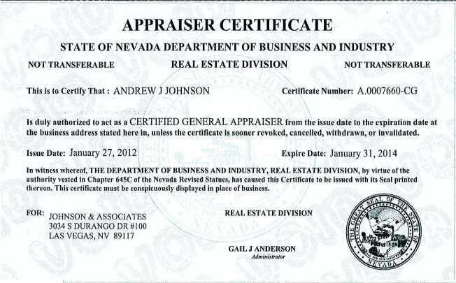
79 Addenda LUBAWY & ASSOCIATES, INC. xx
RESTRICTED APPRAISAL REPORT
 Restricted Use Appraisal Report Thomas J. Schulte & Associates Page #1 RESTRICTED APPRAISAL REPORT SUBJECT ASSIGNMENT Property City: Zip Code: County: Legal Description: Assessor's Parcel #: Tax Year:
AN APPRAISAL OF Acre Residential Site Northwest Corner Pleasant View Road & Gaar Road Richmond, Indiana 47374
 AN APPRAISAL OF 3.75 Acre Residential Site Northwest Corner Pleasant View Road & Gaar Road Richmond, Indiana 47374 American United Appraisal Company, Inc. Real Estate Appraisers Jay E. Allardt, SRA August
To all Appraisers: Brief Overview:
 To all Appraisers: As the appraisal industry continues to change, the demand for alternative valuation solutions grows. That is why is excited to announce the addition of a new product - the Desktop Appraisal
A Demonstration Appraisal Report. Of a. Located at. Date of Appraisal. Prepared for. Prepared by
 A Demonstration Appraisal Report Of a Located at Date of Appraisal Prepared for Prepared by International Association of Assessing Officers Professional Designation Subcommittee 314 W. 10 th Street Kansas
FIRST AMENDMENT TO LEASE
 Attachment 1 FIRST AMENDMENT TO LEASE THIS FIRST AMENDMENT TO LEASE, dated, 2013 ( First Amendment ), by and between the State of California, acting by and through its Department of General Services, (hereinafter
REED APPRAISAL COMPANY REAL PROPERTY APPRAISERS AND CONSULTANTS
 REAL PROPERTY APPRAISERS AND CONSULTANTS 100 SOUTH KENTUCKY AVENUE #230 ip.o. BOX 1645 ilakeland, FLORIDA 33802-1645 OFFICE: (863) 688-6718 ifax: (863) 688-5993iEMAIL: stan@reedappraisalco.com TO: Henry
EvaluePro Real Estate Restricted Appraisal Report
 EvaluePro Real Estate Restricted Appraisal Report EvaluePro Highlights Property Street: 1000 Main Street City: Anytown State: NC Zip: 12345 Property Owner: Mr. & Mrs. Property Owner Estimated Market Value:
As Of: Prepared For: Prepared By:
 of 216 SW 131st St As Of: 06/11/11 Prepared For: Prime Pacific Bank 2502 196th St SW Lynnwood WA 98036 Prepared By: Cynthia A. Nagle, CREA 922 N Cedar St Tacoma, WA 98406 RESTRICTED APPRAISAL REPORT Restriction
LUBAWY & ASSOCIATES, INC South Durango Drive, Suite 100 Las Vegas, Nevada 89117
 A SUMMARY APPRAISAL REPORT OF 24.08 Acres of Vacant Land OWNED BY Route 215 Investors LLC LOCATED AT The Northwest Corner of Centennial Parkway and Valley Drive, North Las Vegas, Clark County, Nevada 89031
A Demonstration Appraisal Report. Of a. Located at. Date of Appraisal. Prepared for. Prepared by
 A Demonstration Appraisal Report Of a Located at Date of Appraisal Prepared for Prepared by International Association of Assessing Officers Professional Designation Subcommittee 314 West 10 th Street Kansas
Copyright, 1999, 2002, 2004, Freddie Mac. All Rights Reserved.
 Page 1 of 13 Engineering Requirements/Chapter 12: Appraiser and Appraisal Requirements/12.1: General requirements 12.1: General requirements For all multifamily purchase programs and products, the Seller/Servicer
LAND APPRAISAL REPORT
 IDENTIFICATION LAND APPRAISAL REPORT Page #1 File No. Borrower None Census Tract * Map Reference 462820011000315 Property Address NWC Gaar and Pleasant View Roads City Richmond County Wayne State IN Zip
Appraisal Stream Restricted Use Residential Appraisal Report
 Appraisal Stream Restricted Use Residential Appraisal Report File No. 769kemplin This report is limited to the sole and exclusive use of the client. The appraiser's opinions and conclusions set forth in
RESIDENTIAL APPRAISAL SUMMARY REPORT
 SUBJECT ASSIGNMENT MARKET AREA DESCRIPTION Property City: Zip Code: County: Legal Description: Assessor's Parcel #: Tax Year: R.E. Taxes: $ Special Assessments: $ Borrower (if applicable): Current Owner
APPRAISAL OF REAL PROPERTY LOCATED AT: FOR: AS OF: BY:
 APPRAISAL OF REAL PROPERTY LOCATED AT: 489 MEADOWS EDGE COURT DEED BOOK 2896, PAGE 2759 CLEMMONS, NC 27012 FOR: ESTATE OF WILLIAM C. McINTOSH % BAILEY & THOMAS P.O. BOX 52 WINSTON-SALEM, NC 27102 AS OF:
Mike Dalton Jr. and Associates. Christina Adams INVOICE NUMBER Mike Dalton Jr. and Associates 8191 Wethersfield Drive. PB125 Germantown, TN 38138
 Mike Dalton Jr. and Associates FROM: INVOICE Christina Adams INVOICE NUMBER Mike Dalton Jr. and Associates 8191 Wethersfield Drive Germantown, TN 38138 DATE 08/14/2016 Telephone Number: (901) 674-0239
Sierra Pines Mobile Home Park Located in Markleeville, California
 , Lake Tahoe, CA 96150 Markleeville, Ca. 96120 Sierra Pines Mobile Home Park Located in Markleeville, California Coldwell Banker is pleased to present the Sierra Pines Mobile Home Park in Markleeville,
BADGER Appraisals, LLC
 BADGER Appraisals, LLC PO Box 2222 Appleton, WI 54912 T (920) 687-9000 / F (920) 687-9244 info@badgerappraisals.com www.badgerappraisals.com Appraisal Service Brown * Calumet * Outagamie * Winnebago APPRAISAL
2. Is the information in the contract section complete and accurate? Yes No Not Applicable If Yes, provide a brief summary.
 The purpose of this appraisal field review report is to provide the lender/client with an opinion on the accuracy of the appraisal report under review. Property Address City State Zip Code Borrower Owner
Individual Cooperative Interest Appraisal Report
 PURPOSE Individual Cooperative Interest Appraisal Report The purpose of this appraisal report is to provide the client with a credible opinion of the defined value of the subject property, given the intended
APPRAISAL REPORT OF THE REAL PROPERTY LOCATED AT. Enterprise Rd Dillon, SC Ronnie Gardner. March 1, 2018
 APPRAISAL REPORT OF THE REAL PROPERTY LOCATED AT Dillon, SC 29536 for as of March 1, 2018 by David McLaurin 105 West Harrison Street Dillon, SC 29536 IDENTIFICATION NEIGHBORHOOD SITE MARKET DATA ANALYSIS
BADGER Appraisals, LLC
 BADGER Appraisals, LLC PO Box 2222 Appleton, WI 54912 T (920) 687-9000 / F (920) 687-9244 info@badgerappraisals.com www.badgerappraisals.com Residential Appraisal Service Brown * Calumet * Outagamie *
RAINS COUNTY APPRAISAL DISTRICT
 RAINS COUNTY APPRAISAL DISTRICT 2017 MASS APPRAISAL SUMMARY REPORT mass appraisal report 2017 uspap_appr_report RAINS COUNTY APPRAISAL DISTRICT 2017 MASS APPRAISAL SUMMARY REPORT Identification of Subject:
APPRAISAL OF 1117 MONROE STREET, VICKSBURG, MS 39180
 APPRAISAL OF 1117 MONROE STREET, VICKSBURG, MS 39180 CLIENT/INTENDED USER: GLENN TRIPLETT INTENDED USE/USER: TO ASSIST THE CLIENT IN MAKING A PURCHASING DECISION. THIS REPORT IS NOT INTENDED FOR ANY OTHER
Anatomy Of An Appraisal
 Anatomy Of An Appraisal Leslie A. Fields The most important thing to know about an appraisal report is how to review and critique it. Leslie A. Fields a partner with the Law Firm of Faegre & Benson LLP,
Colorado Appraisal Consultants
 Colorado Appraisal Consultants SUBJECT Individual Condominium Unit Appraisal Report File # The purpose of this summary appraisal report is to provide the lender/client with an accurate, and adequately
Individual Condominium Unit Appraisal Report
 The purpose of this summary appraisal report is to provide the lender/client with an accurate, and adequately supported, opinion of the market value of the subject property. SUBJECT Property Address Unit
FOR SALE: MULTI-TENANT LEASED INVESTMENT
 FOR SALE: MULTI-TENANT LEASED INVESTMENT VICTORY MINE CENTER 768 PLEASANT VALLEY ROAD, DIAMOND SPRINGS, CA $3,750,000 7.1% CAP RATE EXCLUSIVE AGENTS: Tom Conwell, Jr. Managing Director CA RE License #01394155
ILLINOIS HOUSING DEVELOPMENT AUTHORITY APPRAISAL SCOPE AND GUIDELINES December 2015
 ILLINOIS HOUSING DEVELOPMENT AUTHORITY APPRAISAL SCOPE AND GUIDELINES December 2015 As part of the Common Application for Multifamily Financing, the Illinois Housing Development Authority (IHDA) requires
Superior Traffic Control 100 Main Street Christiana / Rutherford County TN
 311 S. ROYAL OAKS BOULEVARD, SUITE 110 FRANKLIN, TN 37064 615.866.4863 BGJONES@BGJONESCOMPANY.COM WWW.BGJONESCOMPANY.COM RESTRICTED APPRAISAL REPORT THE FOLLOWING REPORT IS INTENDED TO COMPLY WITH THE
Exterior Only Inspection Residential Appraisal Report File #
 SUBJECT Summary Appraisal Report Brian J. Davis & Associates Exterior Only Inspection Residential Appraisal Report File # Page #3 The purpose of this summary appraisal report is to provide the lender/client
Case 9:15-cv DMM Document Entered on FLSD Docket 11/22/2017 Page 1 of 12
 Case 9:15-cv-80946-DMM Document 181-5 Entered on FLSD Docket 11/22/2017 Page 1 of 12 APPRAISAL OF A 1.31 ACRE SITE LOCATED AT: XXX 77th Trl N (long legal description/see page #1) Palm Beach Gardens, FL
UPDATED MARKET VALUE APPRAISAL. Day Care/Senior Center Property and Excess Parcel Governors Drive Olympia Fields, Illnois.
 J _,i UPDATED MARKET VALUE APPRASAL Day Care/Senior Center Property and Excess Parcel 20080 Governors Drive Olympia Fields, llnois _ as of: March 16, 2007 Prepared for: Mr. Steve Townsend, Vice President
619 STANDARD 2: REAL PROPERTY APPRAISAL, REPORTING
 619 STANDARD 2: REAL PROPERTY APPRAISAL, REPORTING 620 In reporting the results of a real property appraisal, an appraiser must communicate each analysis, 621 opinion, and conclusion in a manner that is
APPRAISAL REPORT OF GROSS ACRES/17.72± USABLE ACRES OF VACANT COMMERCIAL LAND
 APPRAISAL REPORT OF 20.22 GROSS ACRES/17.72± USABLE ACRES OF VACANT COMMERCIAL LAND LOCATED AT NORTHWEST CORNER OF LAND O LAKES BOULEVARD & SUNTERRA DRIVE LAND O LAKES, FLORIDA 34638 Job No.: 14-0227 Prepared
WATERFRONT LOCAL IMPROVEMENT DISTRICT OVERVIEW. November 2017
 WATERFRONT LOCAL IMPROVEMENT DISTRICT OVERVIEW November 2017 LOCAL IMPROVEMENT DISTRICT Funding tool by which property owners financially contribute to a project that will increase the value of their property
Guide Note 6 Consideration of Hazardous Substances in the Appraisal Process
 Guide Note 6 Consideration of Hazardous Substances in the Appraisal Process Introduction The consideration of environmental conditions along with social, economic, and governmental conditions is fundamental
Dear Valuation Professional
 Dear Valuation Professional First American Mortgage Solutions LLC has a new product offering that we would like you to consider adding to your list of services with us - (Property Assessment Collateral
LOCAL IMPROVEMENT DISTRICT APPRAISER PRESENTATION. November 2017
 LOCAL IMPROVEMENT DISTRICT APPRAISER PRESENTATION November 2017 SPECIAL BENEFIT STUDY WHY? A special benefit study is a tool consistently used with LID projects. Municipality retains an expert consultant
YOUNG CENTRAL APPRAISAL DISTRICT
 YOUNG CENTRAL APPRAISAL DISTRICT 2018 - MASS APPRAISAL REPORT AS OF 8/07/2018 1 2 2018 - MASS APPRAISAL REPORT INTRODUCTION: The Young Central Appraisal District has prepared and published this report
Case 9:15-cv DMM Document Entered on FLSD Docket 11/22/2017 Page 1 of 11
 Case 9:15-cv-80946-DMM Document 181-3 Entered on FLSD Docket 11/22/2017 Page 1 of 11 G.F. Lubeck Appraisers, LLC 1250 N. Ocean Drive Riviera Beach, FL 33404 www.lubeckappraisers.com March 01, 2017 James
INVOICE $ $ $ $ $ $ Date: File No. Case No. 05/24/07 APN Prepared for:
 INVOICE Date: 05/24/07 File No. APN 933-050-026 Prepared for: SHULMAN, HODGES & BASTIAN LLP 26632 TOWNE CENTER DRIVE #300 FOOTHILL RANCH, CA 92610 Property Appraised: BRIONES/KOKEE APN: 933-050-026 (VIA
Appraisal and Market Analysis of Indoor Waterpark Resorts
 Appraisal and Market Analysis of Indoor Waterpark Resorts By David J. Sangree, MAI, CPA, ISHC An appraisal of an indoor waterpark resort is similar to other appraisals in that it is a professional appraiser
RevuPro Appraisal Review
 RevuPro Appraisal Review Getting It Right ELLIOTT introduces its flagship review product RevuPro, as an independent appraisal review service. Q. What is it and what does it do? A. RevuPro is a fast, economical
1057 Canton RD Marietta, GA 30066
 1057 Canton RD Marietta, GA 30066 +/- 1.49 Acres Presently Zoned LI $350,000 With all utilities available. Very little lot prep necessary for most uses. Two Level steppes descending from the street level.
Real Property Appraisal Summary Report of an Existing Office Condominium Unit
 Real Property Appraisal Summary Report of an Existing Office Condominium Unit Located at: Morlake Executive Suites Condominium Complex 114 Morlake Drive, Suite 202 Mooresville, Iredell County, North Carolina,
Industrial Real Estate Portfolio
 Industrial Real Estate Portfolio Portfolio Coverage Page 7 6565 Echo Avenue, Reno, NV Property Summary Address: Size (SF): Office Finish: HVAC Space: Year Built: 2003 Site Area: 6565 Echo Avenue Reno,
William K. Boyd, Inc.
 Real Estate Appraisers & Consultants Main Office 1564 Lakeview Drive Sebring, FL 33870 Satellite Office 410 Northwest 2 nd St Okeechobee, FL 34972 Phone: 863 385-6192 Fax: 866-384-0258 November 22, 2017
Uniform Residential Appraisal Report File #
 D.S. Murphy & Associates FHA/VA Case No. SUBJECT The purpose of this summary appraisal report is to provide the lender/client with an accurate, and adequately supported, opinion of the market value of
TRAYNOR & ASSOCIATES, INC East 75 th Street Indianapolis, Indiana 46250
 SUMMARY APPRAISAL REPORT November 15, 2013 11634 Maple Street Fishers, Indiana (Hamilton County) 13500 Effective Date of Valuation: As Is November 12, 2013 Appraisers: Joseph C. Traynor, MRICS, GAA Indiana
APPRAISAL OF REAL PROPERTY
 Main File No. Busick 1706 Page #1 APPRAISAL OF REAL PROPERTY LOCATED AT Burnsville, NC Deed Book 725 Page 505 FOR 8777 Holiday Springs Rd Rockledge, FL 32955 OPINION OF VALUE 660,000 AS OF 06/26/2017 BY
APPRAISAL OF REAL PROPERTY LOCATED AT: FOR: AS OF: BY:
 APPRAISAL OF REAL PROPERTY LOCATED AT: 627/631 NW 14 STREET SEE ADDENDUM FOR COMPLETE LEGAL DESCRIPTION FLORIDA CITY, FL 33034 FOR: 1261 HOMESTEAD ROAD LEHIGH ACRES, FL 33936 AS OF: 10/20/2014 BY: LINDA
Summary of Assignment. Identification of Property and Appraisal
 Summary of Assignment My assignment is to review an appraisal of the Athow Property owned by Lewis and Janice Athow. The property is located near the mouth of the Dungeness River in Clallam County, Washington
How to Read a Real Estate Appraisal Report
 How to Read a Real Estate Appraisal Report Much of the private, corporate and public wealth of the world consists of real estate. The magnitude of this fundamental resource creates a need for informed
COMMERCIAL PROPERTY SUMMARY APPRAISAL REPORT
 Redwood Appraisal (650) 533-4065 COMMERCIAL PROPERTY SUMMARY APPRAISAL REPORT Property Address: City: State: Zip: County: Legal Description: Page #1 SUBJECT Building Name (if applicable): Parcel ID #(s):
APPRAISAL OF REAL PROPERTY
 Page # 2 APPRAISAL OF REAL PROPERTY LOCATED AT Block 7, Castle Brewer Court, Plat Book 10, Page 18 FOR Sanford Housing Authority 94 Castle Brewer Ct. OPINION OF VALUE 30,000 AS OF 12/14/2012 BY William
Uniform Agricultural Appraisal Report
 File No. Uniform Agricultural Appraisal Report Prepared For: Intended User: Prepared By: Date Prepared: UAAR Agri management Uniform Agricultural Appraisal Report File No # Property Identification Owner/Occupant:
Existing Land Use. Typical densities for single-family detached residential development in Cumberland County: 1
 Existing Land Use A description of existing land use in Cumberland County is fundamental to understanding the character of the County and its development related issues. Economic factors, development trends,
Address Southeast Quadrant of U.S. Highway 41 and Sumter Boulevard City. North Port State. FL Zip Code County
 SUBJECT AERIAL LOCATION LAND AREA THREE-YEAR OWNERSHIP HISTORY OF SUBJECT Address Southeast Quadrant of U.S. Highway 41 and Sumter Boulevard City North Port State FL Zip Code 34287 County Sarasota Nearest
APPRAISAL REPORT. Vacant Commercial Land SW 268 th Street Miami, FL Cruz Appraisals, Inc SW 72 nd Street, Suite 263 Miami, FL 33173
 APPRAISAL REPORT Prepared for Mr Jorge Palomeras Jpal Marketing Corporation Property Appraised Vacant Commercial Land 12711 SW 268 th Street Miami, FL 33032 Date of Valuation October 6, 2017 Prepared by
Time for Retail to Take Stock
 Q1 2013 RETAIL LAS VEGAS NEVADA RESEARCH & FORECAST REPORT Time for Retail to Take Stock It is heartening to say, after five years of a bad economy, that the first quarter of 2013 s 119,649 square feet
Swisher County Appraisal District 2017 Mass Appraisal Report
 Swisher County Appraisal District 2017 Mass Appraisal Report Prepared Pursuant to Standard 6 of the Uniform Standards of Professional Appraisal Practice 1 TABLE OF CONTENTS Introduction 3 Listing of Taxing
VALUE FINDING APPRAISAL REPORT
 RE 90 Rev. 01-2014 VALUE FINDING APPRAISAL REPORT (Compensation not to exceed $65,000) COUNTY John Doe 2880 Lancaster-Newark Rd. (SR 37), Pleasant Twp., 43030 Owner Mailing Address of Owner East side of
AHDC. THA Affordable Housing Development Corp. Board of Directors Meeting
 AHDC THA Affordable Housing Development Corp. Board of Directors Meeting November 19, 2014 AHDC Meeting Agenda THA Affordable Housing Development Corp. November 19, 2014 I. CALL TO ORDER II. MINUTES FROM
Restricted Use Appraisal Report Of a development site
 A development site Located at: 700' E of SEC of 6th Avenue and 328 St Homestead, Florida As of November 7, 2017 Restricted Use Appraisal Report Of a development site Restricted Use Appraisal Report Of
APPRAISAL OF. RAL OR-02 76± Acres - Bluff Mountain Bluff Mountain Road Sevierville, TN FOR
 APPRAISAL OF RAL080535-OR-02 76± Acres - Bluff Mountain 37876 Report Type: Summary FOR Mr. William M. Fleming, III Senior Vice President, Real Estate Support BB&T 4600 New Bern Ave., Suite 101 Raleigh,
BOARD OF REGENTS BRIEFING PAPER. 1. Agenda Item Title: GBC Pahrump Property Exchange Meeting Date: March 1-2,2012
 BOARD OF REGENTS BRIEFING PAPER 1. Agenda Item Title: GBC Pahrump Property Exchange Meeting Date: March 1-2,2012 2. BACKGROUND & POLICY CONTEXT OF ISSUE: NSHE owns a High Tech Center (HTC) building in
Market Research. Market Indicators
 colliers international LAS VEGAS, NV Market Research OFFICE Third Quarter 2009 Market Indicators Net Absorption Construction Rental Rate Q3-09 Q4-2009 Projected Clark County Economic Data Jul-09 Jul-08
As of JANUARY 12, Prepared for TENNESSEE STATE BANK ATTN: JULIE KING 2210 PARKWAY P.O. BOX 1260 PIGEON FORGE, TN 37868
 RESTRICTED APPRAISAL REPORT RIVER CROSSING - 55.92+ ACRES OF VACANT LAND ON GREENWOOD ROAD CHATTANOOGA, HAMILTON COUNTY, TENNESSEE TENNESSEE STATE BANK FILE#: 11169 BENCHMARK TRUST FILE #: 15-123 As of
STATEMENT OF LIMITING CONDITIONS AND APPRAISER'S CERTIFICATION
 DEFINITION OF MARKET VALUE:The most probable price which a property should bring in a competitive and open market under all conditions requisite to a fair sale, the buyer and seller, each acting prudently,
APPRAISAL OF REAL PROPERTY
 Home Appraisals, Inc. (866) 533-7173 APPRAISAL OF REAL PROPERTY File # LOCATED AT Field Review Form Sample FOR OPINION OF VALUE 35, AS OF 11/1/7 TABLE OF CONTENTS One-Unit Field Review... 1 General Text
APPRAISAL OF REAL PROPERTY
 Page # 2 APPRAISAL OF REAL PROPERTY LOCATED AT Lake Monroe Ter. Lengthy Legal FOR Sanford Housing Authority 94 Castle Brewer Ct. OPINION OF VALUE 105,000 AS OF 12/14/2012 BY William Berkey Beaumont Matthes
TABLE OF CONTENTS. Borrower/Client. File No. Property Address th Ave. Lender. City of Fulton. City of Fulton. Invoice...
 File No. 03-30-12-03 5000 16th Ave City Fulton County Whiteside State IL Zip Code TABLE OF CONTENTS Invoice... 1 Summary of Salient Features... 2 USPAP Identification... 3 GP Land... 4 Additional Comparables
Industrial and Commercial Real Estate Appraisal Procedures
 Property Valuation Thought Leadership Industrial and Commercial Real Estate Appraisal Procedures John C. Ramirez The application of the asset-based approach to business valuation often involves the appraisal
Small Residential Income Property Appraisal Report File #
 SUBJECT Summary Appraisal Report Brian J. Davis & Associates Small Residential Income Property Appraisal Report File # Page #4 The purpose of this summary appraisal report is to provide the lender/client
ZELL & ASSOCIATES Real Estate Appraisers and Counselors
 ZELL & ASSOCIATES Real Estate Appraisers and Counselors A Complete Appraisal Report of: 7.47 Acres of Land Known as the: SE Division Property Located At: 15004 SE Division Street Portland OR, 97236 Prepared
Haley-Worsham & Associates LLC. HW Cordova, TN REFERENCE TO:
 Haley-Worsham & Associates LLC FROM: INVOICE Michael Bray INVOICE NUMBER Haley-Worsham & Associates LLC 1176 Vickery Lane HW171254 Cordova, TN 816 DATE 12/11/217 Telephone Number: 91-755-146 Fax Number:
APPRAISAL REPORT. NNA Canal St Coeur d' Alene ID PREPARED FOR. Prestige Realty of North Idaho 805 E Sherman Ave CDA, ID AS OF
 APPRAISAL REPORT OF NNA Canal St Coeur d' Alene ID 83814 PREPARED FOR Prestige Realty of North Idaho 805 E Sherman Ave CDA, ID 83814 AS OF July 21, 2008 PREPARED BY 12536 Kensington Ave Hayden Lake, ID
APPRAISAL OF 3,470.5 ACRES SE QUADRANT S.R. 200 AND SW 140TH ST. DUNNELLON, MARION COUNTY, FL
 APPRAISAL OF 3,470.5 ACRES SE QUADRANT S.R. 200 AND SW 140TH ST. DUNNELLON, MARION COUNTY, FL APPRAISAL OF 3,470.5 ACRES LOCATED IN THE SOUTHEAST QUADRANT OF STATE ROAD 200 AND SW 140TH STREET, DUNNELLON,
Across-the-Fence Value and Hostage Occupancy Agreements
 Across-the-Fence Value and Hostage Occupancy Agreements EUCI Conference: Electric Transmission Projects San Diego, California September 19, 2016 John T. Schmick Shenehon Company 2 What is the goal of valuation
FOR JEFFREY A. COSTELLO AICP, EXECUTIVE DIRECTOR DELRAY BEACH CRA ROBERT B. BANTING, MAI, SRA CERT GEN RZ4 AND MICHELLE J. MICKLE CERT GEN RZ3316
 APPRAISAL OF 39 PARCELS OF LAND BASED UPON THEIR HIGHEST AND BEST USE AND ALSO SUBJECT TO DEVELOPMENT CONDITIONS LOCATED ON THE SOUTH SIDE OF WEST ATLANTIC AVENUE DELRAY BEACH, FLORIDA 33444 FOR JEFFREY
MAGNOLIA OAKS APPRAISALS, INC.
 MAGNOLIA OAKS APPRAISALS, INC. File No. 20170304 APPRAISAL OF VACANT LAND LOCATED AT: Lot 1001, Bear Paw Ridge Dahlonega, GA 30533 FOR: David Sharpe 9811 Blaine Court Golden Oak, FL 32836 BORROWER: SHARPE,
5976 Okeechobee Boulevard, West Palm Beach, Palm Beach County, Florida PO As of July 19, 2015
 REAL ESTATE APPRAISAL REPORT Of 5976 Okeechobee Boulevard, West Palm Beach, Palm Beach County, Florida PO 151223 As of July 19, 2015 Prepared For Town of Palm Beach 360 S. County Road Palm Beach, FL 33480
Family Dollar rare nv family dollar
 Family Dollar rare nv family dollar [ Under Construction ] corporate family dollar in income tax-free state lake tahoe msa 1499 Albite Road, Wellington NV 89444 Click for Map [ www.capitalpacific.com ]
FOR SALE 605 Industry Ave DISTRIBUTION WAREHOUSE FACILITY Asking $395,000
 FOR SALE 605 Industry Ave DISTRIBUTION WAREHOUSE FACILITY Asking $395,000 For Additional Information and To View the Property Please Contact Sandy Hoff - Office Phone 218-722-5556 shoff@fisalter.com AREA
EMPLOYEE RELOCATION COUNCIL SUMMARY APPRAISAL REPORT
 EMPLOYEE RELOCATION COUNCIL SUMMARY APPRAISAL REPORT Client: Client File #: Client Address: Suite #: Homeowner: Subject Property Address: County: Appraiser Company Name: TOMAINO APPRAISAL Appraiser File
APPRAISING COMMERCIAL INVESTMENT PROPERTY
 APPRAISING COMMERCIAL INVESTMENT PROPERTY Cydney G. Bender-Reents, MAI President Jared M. Calabrese, MAI Senior Appraiser YOUR HOUSE AS SEEN BY: Yourself Your Lender YOUR HOUSE AS SEEN BY: Your Buyer Your
City of Hammond Purchasing Department. RFP # Invitation to Bid for. "Sale of City-Owned Property"
 City of Hammond Purchasing Department RFP # 14 19 Invitation to Bid for "Sale of City-Owned Property" Bids Shall Be Received by the Purchasing Department City of Hammond 310 East Charles Street P.O. Box
MARKET RENTAL ANALYSIS OF A: MEDICAL OFFICE SPACE LOCATED AT XXXXXXXX SUITE XXXX NEW YORK, NEW YORK DATE OF RENTAL VALUE: DECEMBER 3, 2014
 MARKET RENTAL ANALYSIS OF A: MEDICAL OFFICE SPACE LOCATED AT XXXXXXXX SUITE XXXX NEW YORK, NEW YORK 10017 DATE OF RENTAL VALUE: DECEMBER 3, 2014 DATE OF REPORT: DECEMBER 10, 2014 PREPARED FOR: XXXXXXXXXXXXXX
APPRAISAL REPORT ACRES VACANT LAND LOCATED AT 721 MIAMI CHAPEL ROAD DAYTON, OHIO FOR
 APPRAISAL REPORT OF 4.4245 ACRES VACANT LAND LOCATED AT 721 MIAMI CHAPEL ROAD DAYTON, OHIO 45408 FOR DAYTON PUBLIC SCHOOLS C/O MS. TAMI HART KIRBY, ESQUIRE PORTER WRIGHT MORRIS & ARTHUR ONE S. MAIN STREET,
For the Reno MSA employment has historically been based largely on construction and the leisure and hospitality industry. The construction industry
 For the Reno MSA employment has historically been based largely on construction and the leisure and hospitality industry. The construction industry has lost almost 15,000 construction jobs since 2006,
ECONOMIC CURRENTS. Vol. 4, Issue 3. THE Introduction SOUTH FLORIDA ECONOMIC QUARTERLY
 ECONOMIC CURRENTS THE Introduction SOUTH FLORIDA ECONOMIC QUARTERLY Vol. 4, Issue 3 Economic Currents provides an overview of the South Florida regional economy. The report presents current employment,
Birdville ISD Purchasing Department
 Birdville ISD Purchasing Department DATE: October 13, 2017 SUBJECT: Addendum 1 for Bid #033-18 Sale of Real Property The following items clarify the plans and specifications and shall become a part of
Uniform Agricultural Appraisal Report
 File No. Uniform Agricultural Appraisal Report Prepared For: Intended User: Prepared By: Date Prepared: Uniform Agricultural Appraisal Report Executive Summary USE OF APPRAISAL CLIENT/OWNER INSPECTION
Interagency Appraisal and
 Interagency Appraisal and Evaluation (IAEG) Workshop Purpose (77456) Supersedes the 1994 Interagency Appraisal & Evaluation Guidelines Address supervisory matters relating to real estate appraisal and
APPRAISAL REPORT ACRES VACANT LAND LOCATED AT 325 HOMEWOOD AVEUNE DAYTON, OHIO FOR
 APPRAISAL REPORT OF 12.784 ACRES VACANT LAND LOCATED AT 325 HOMEWOOD AVEUNE DAYTON, OHIO 45405 FOR DAYTON PUBLIC SCHOOLS C/O MS. TAMI HART KIRBY, ESQUIRE PORTER WRIGHT MORRIS & ARTHUR ONE S. MAIN STREET,
BOARD OF REGENTS BRIEFING PAPER
 BOARD OF REGENTS BRIEFING PAPER 1. Agenda Item Title: Powerline Easement on Nevada State College Campus Meeting Date: March 3, 2016 2. BACKGROUND & POLICY CONTEXT OF ISSUE: Nevada State College was approached
Evergreen PlazA CONTACT FOR SALE ODDIE BOULEVARD EL RANCHO DRIVE. Aiman Noursoultanova, CCIM Senior Vice President P
 FOR SALE Evergreen PlazA 2300-2360 ODDIE BOULEVARD SPARKS, NEVADA 89431 ODDIE BOULEVARD EL RANCHO DRIVE CONTACT Aiman Noursoultanova, CCIM Senior Vice President P 775-823-6983 EXECUTIVE SUMMARY CBRE, Inc.,
Soft Land Market in 2017
 Research & Forecast Report LAND Q4 217 Soft Land Market in 217 > > Land sales in 217 fell behind 216 > > A lack of large sales at Apex brought the average price per square foot up > > Strong development
CONTENTS. Executive Summary 1. Southern Nevada Economic Situation 2 Household Sector 5 Tourism & Hospitality Industry
 CONTENTS Executive Summary 1 Southern Nevada Economic Situation 2 Household Sector 5 Tourism & Hospitality Industry Residential Trends 7 Existing Home Sales 11 Property Management Market 12 Foreclosure