PLANNING COMMISSION AGENDA CITY COUNCIL CHAMBERS MAY 9, 2006 THE PLANNING COMMISSION S VISION OF ITS ROLE IN THE COMMUNITY
|
|
|
- Hugo Harris
- 5 years ago
- Views:
Transcription
1 PLANNING COMMISSION AGENDA CITY COUNCIL CHAMBERS MAY 9, 2006 THE PLANNING COMMISSION S VISION OF ITS ROLE IN THE COMMUNITY The Planning Commission sees its role as the preparation and implementation of the Comprehensive Plan through which the Commission seeks to promote orderly growth, preserve the quality of Coeur d Alene, protect the environment, promote economic prosperity and foster the safety of its residents. 5:30 P.M. CALL TO ORDER: ROLL CALL: Bruning, Bowlby, Jordan, Rasor, Messina, Souza, Tiffany Tenty (Student Representative), Dane Larsen (Student Alternate) APPROVAL OF MINUTES: April 11, 2006 PUBLIC COMMENTS: COMMISSION COMMENTS: STAFF COMMENTS: ADMINISTRATIVE ITEMS: 1. Applicant: Dwayne Humenny Location: The corner of 7 th Street and Harrison Avenue Request: A proposed 2-unit Condominium plat Trilogy Condominiums ADMINISTRATIVE, (SS-8-06) 2. Applicant: Second Street Project, LLC Location: 835, 841, 843, 845, 2 nd Street Request: A proposed 7-unit Condominium plat Cedar Chalet Condominium ADMINISTRATIVE, (SS-9-06) 3. Applicant: David Jensen Location: Near the Southwest corner of Neider Avenue and Government Way Request: A proposed 5-lot preliminary plat Neider Square ADMINISTRATIVE, (SS-10-06) PUBLIC HEARINGS: 1. Applicant: Jay Weedon Location: 5083 Building Center Drive Request: A proposed Commercial Recreation special use permit in the LM (Light Manufacturing) zoning district. QUASI-JUDICAL, (SP-4-06)
2 2. Applicant: James M. Duchow Location: 647 E. Best Avenue Request: A. proposed zone change for a +/ sq.ft lot from R-12 (Residential at 12 units/acre) to C-17 (Commercial at 17 units/acre) QUASI-JUDICIAL, (ZC-4-06) 3. Applicant: Shawn & Michelle Smith Location: 280 E. Kathleen Avenue Request: A proposed Automotive Sales special use permit in the C-17L (Commercial 17 units/acre) zoning district QUASI-JUDICIAL, (SP-6-06) 4. Applicant: Pat Acuff Location: 824 N. 16 th Street Request: A proposed 5-lot preliminary plat Trudy s Addition QUASI-JUDICIAL, (S-7-06) 5. Applicant: Charter Builders Location: An 8.5 acre parcel between Seltice Way and I-90 approximately.5 mile East of Huetter Road Request: Proposed annexation from County Commercial to City C-17 (Commercial at 17 units/acre) QUASI-JUDICIAL, (A-3-06) ADJOURNMENT/CONTINUATION: Motion by, seconded by, to continue meeting to,, at p.m.; motion carried unanimously. Motion by,seconded by, to adjourn meeting; motion carried unanimously. *The City of Coeur d Alene will make reasonable accommodations for anyone attending this meeting who requires special assistance for hearing, physical or other impairments. Please contact Shana Stuhlmiller at (208) at least 24 hours in advance of the meeting date and time.
3
4 PLANNING COMMISSION MINUTES APRIL 11, 2006 CITY COUNCIL CHAMBERS COMMISSIONERS PRESENT John Bruning, Chairman Heather Bowlby Brad Jordan Tom Messina Scott Rasor Mary Souza Tiffany Tenty (Student Representative) STAFF MEMBERS PRESENT John Stamsos, Associate Planner Shana Stuhlmiller, Public Hearing Assistant Warren Wilson, Deputy City Attorney Gordon Dobler, Engineering Services Director COMMISSIONERS ABSENT None CALL TO ORDER Chairman Bruning called the meeting to order at 5:30 p.m. APPROVAL OF MINUTES: Motion by Rasor, seconded by Messina, to approve the minutes of the Planning Commission meeting on March 14, 2006 and March 28, Commissioner Souza commented that on page seven of the Planning Commission Minutes for March 14, 2006, the discussion pertaining to a new commercial zoning classification needs more clarification. She explained that it is important for the Council to see that this topic is a high priority and needs immediate attention. Associate Planner Stamsos commented that staff will review that section of the tape and add additional discussion pertaining to that subject. COMMISSION COMMENTS: Chairman Bruning announced the dates of the up-coming meetings for April and May. STAFF COMMENTS: Commissioner Souza inquired what is the status of the letter of eminent domain that was to go forward to Council for their review. Associate Planner Stamsos answered that the letter was forwarded to Mayor Bloem and the City Council but no decision has been made at this time. Commissioner Souza inquired when the letter is discussed, will it be discussed in public or in a private session. Deputy City Attorney Wilson commented that this will be discussed in the public but was not sure how soon this will come forward to Council. PLANNING COMMISSION MINUTES: APRIL 11, 2006 PAGE 1
5 Commissioner Souza inquired regarding the status of when a new Planning Commissioner will be appointed. Chairman Bruning answered that he has not received any candidates from the Mayor and when a qualified candidate applies he will let the Commission know. Commissioner Souza questioned how soon the Commission can resume working on the new commercial zoning classification proposed a while ago, but was put aside because of the Comprehensive Plan. Chairman Bruning commented that he would talk to staff about scheduling this item. PUBLIC COMMENTS: There were none. ADMINISTRATIVE ITEMS: 1. Applicant: Indiana Arms Development Location: 217 Indiana and rd Street Request: Proposed 8-unit condominium plat Indiana Arms Condominium Plan Phase II ADMINISTRATIVE (SS-7-06) Engineering Services Director Dobler presented the staff report and then asked if the Commission had any questions. Commissioner Jordan commented that the process for the approval of a Condominium Plat seems backwards and hopefully staff can make changes to this process. Engineering Services Director Dobler commented that staff is working on changes to the platting process that will make this process run better in the future. Motion by Rasor, seconded by Souza, to approve Item SS Motion approved. PUBLIC HEARINGS 1. Applicant: City of Coeur d Alene, Parks Department Location: Between Spokane River and Riverview Lane in the Mill River development Request: Proposed Public Recreation special use permit In the R-3PUD(Residential at 3 units/acre) zoning district. QUASI-JUDICIAL (SP-2-06) Associate Planner Stamsos presented the staff report, gave the mailing tally as 3 in favor, 0 opposed, and 2 neutral, and answered questions from the Commission. Doug Eastwood, applicant representative, 710 Mullan Avenue, City of Coeur d Alene, Parks Director, presented a power point presentation highlighting how this park will be a benefit to the community and then asked if the Commission had any questions. PLANNING COMMISSION MINUTES: APRIL 11, 2006 PAGE 2
6 Commissioner Jordan inquired if there will be a public boat dock proposed at this site. Mr. Eastwood commented that a day-use dock system will be proposed at the west end of the park site. He added that the day-use dock can be accessed from the river by boat, or from the promenade/walkway and parking lot by foot. Commissioner Jordan questioned when the railroad vacates if there is potential for extra parking to be provided. Mr. Eastwood answered that when the tracks are removed, there is potential to expand the park north creating more open space for park users and more parking if deemed necessary. Commissioner Souza inquired if staff is aware of a potential problem for people wanting to swim in nondesignated areas. Mr. Eastwood commented that signs can be posted to discourage swimming in non-designated areas, but realistically people will swim where they choose to and ignore the signs. Commissioner Bowlby questioned how staff will discourage parking on the streets and to only park in the area designated for parking. Mr. Eastwood replied that staff could place signs in the area to discourage parking on the streets, but would rather not see a lot of signs in the area, but if the problem persists, action will be taken. Chairman Bruning noted that the staff report mentions there are 19 parking stalls, and questioned if this is correct. Mr. Eastwood replied that the staff report should be corrected to indicate only 14 parking stalls. Mr. Jordan complimented the applicant on a creative way to develop a small piece of land to make something that will enhance the area for the public to enjoy. Chairman Bruning concurred with Commissioner Jordan and added that the entire Parks Department staff should be commended for doing a great job maintaining all the parks in the area. Doug Eastwood commented that a piling located near the beach area needs to be cut flush with the river bed and would ask the Commission to consider this as a condition to the special use permit. He added that there is also assorted cables and scrap iron left over from the mill that also needs to be removed. Motion by Jordan, seconded by Rasor, to approve Item SP Motion approved. ROLL CALL: Commissioner Bowlby Commissioner Jordan Commissioner Messina Commissioner Rasor Commissioner Souza Voted Aye Voted Aye Voted Aye Voted Aye Voted Aye Motion to approve carried by a 5 to 0 vote. PLANNING COMMISSION MINUTES: APRIL 11, 2006 PAGE 3
7 Motion by Jordan, seconded by Rasor, to approve 14 spaces as the parking requirement for SP Motion approved. ROLL CALL: Commissioner Bowlby Commissioner Jordan Commissioner Messina Commissioner Rasor Commissioner Souza Voted Aye Voted Aye Voted Aye Voted Aye Voted Aye Motion to approve carried by a 5 to 0 vote. 2. Applicant: City of Coeur d Alene, Parks Department Location: N.W. corner of 12 th Street and Lunceford Lane Request: Proposed Public Recreation special use permit in the R-5(Residential at 5 units/acre) zoning district. QUASI-JUDICIAL (SP-3-06) Associate Planner Stamsos presented the staff report, gave the mailing tally as 9 in favor, 0 opposed, and 2 neutral, and answered questions from the Commission. Doug Eastwood, applicant representative, 710 Mullan Avenue, City of Coeur d Alene, Parks Director, presented a power point presentation explaining how this park will enhance this community and will be a benefit to the City when the project is completed. Chairman Bruning inquired if their will be crosswalks located at the park. Mr. Eastwood explained that a crosswalk is proposed at the corner of 11 th Street and Lunceford lane. Chairman Bruning commented that crosswalks with flashing lights are nice to help protect children crossing the street, and if this type of crosswalk is something staff might consider in the future. Mr. Eastwood answered that this request is something staff might be able to consider in the future. Commissioner Bowlby commented that it would be nice if the streets from the park lined up with the existing streets, so people crossing from Davis Park would be safe. Mr. Eastwood commented that staff held numerous meetings with this neighborhood regarding the layout of this park and from those discussions, a request for a crosswalk at the corner of 11 th Street and Lunceford Lane, with an additional one at 12 th Street were considered. Chairman Bruning commented that the addition of crosswalks is a great way to get traffic to slow down in this area. He questioned if there will be additional lighting for safety placed throughout the park and not just at the entry, as shown on the site plan. Mr. Eastwood commented that he has had discussions with the police regarding the placement of lighting and felt if they had concerns, they would have contacted him regarding this request. He added that the neighborhood did not want a lot of lighting in order to help discourage after-hour use in the park. PLANNING COMMISSION MINUTES: APRIL 11, 2006 PAGE 4
8 Commissioner Souza commented that the tree selection proposed for the park looks very nice. Public testimony. John Fischer, 3265 N 11 th Street, Coeur d Alene, commented that the traffic on Lunceford Lane is a problem that cars do not slow down and questioned if a speed limit sign could be posted to discourage speeding. Anita Barons, 1221 Elderberry Circle, Coeur d Alene, commented that she is in favor of the park and has volunteered to help. Todd Deming, 1108 E. Glenberry Court, Coeur d Alene, commented that he would like to thank staff for a great job on this park and how this will be a benefit to the community. Doug Eastwood commented that he would contact the City Engineer to request that traffic at the corner of Lunceford Lane and 12 th Street be evaluated. He added that he appreciates all the input from the neighborhood to provide a wonderful park. Motion by Souza, seconded by Rasor, to approve Item SP Motion approved. ROLL CALL: Commissioner Bowlby Commissioner Jordan Commissioner Messina Commissioner Rasor Commissioner Souza Voted Aye Voted Aye Voted Aye Voted Aye Voted Aye Motion to approve carried by a 5 to 0 vote. Motion by Souza, seconded by Bowlby, to recommend that the City Engineer look at Traffic calming measures or flashing lights at any crosswalks on that section of Lunceford Lane adjacent to the park. Motion approved. Motion by Souza, seconded by Jordan, to approve 20 parking spaces as the parking requirement for Item SP Motion approved. ROLL CALL: Commissioner Bowlby Commissioner Jordan Commissioner Messina Commissioner Rasor Commissioner Souza Voted Aye Voted Aye Voted Aye Voted Aye Voted Aye Motion to approve carried by a 5 to 0 vote. PLANNING COMMISSION MINUTES: APRIL 11, 2006 PAGE 5
9 3. Applicant: William Crawford Location: NWC of 15 th and Violet Request Proposed zone change from R-3 (Residential at 3 units/acre) To R-5 (Residential at 5 units/acre) zoning district QUASI-JUDICIAL (ZC-2-06) Associate Planner Stamsos presented the staff report, gave the mailing tally as 1 in favor, 30 opposed, and 2 neutral, and answered questions from the Commission. Commissioner Bowlby inquired if there was another way for the applicant to address this problem without having to do a zone change. Associate Planner Stamsos commented that after the annexation and zone change was approved, the intent by the applicant was to split the lot to build two homes on the property. He added that because of the right of way required by the City, the applicant s lot size was reduced. Commissioner Jordan inquired if there are other types of uses allowed in the R-5 zoning district. Associate Planner Stamsos answered that single-family homes is the only residential use allowed in the R-5 zone. Commissioner Souza questioned if we approve this request as an R-5, would we be setting a precedence for other properties in this area to do the same, and questioned if this would be considered spot zoning. Commissioner Bowlby commented that she feels an R-3 is the most compatible zone with this area and should not change. Assistant Attorney Wilson commented that the Commission should not be concerned about setting precedence since the Comprehensive Plan already provides the vision for the type of growth in this area. Public testimony William Crawford, applicant representative, 823 Boyd Avenue, Coeur d Alene, gave a brief history of how this property was zoned with the intent to build two homes on the lot. He continued that from talking with staff about the easement requirements, that the net area of the property was too small to be divided under the R-3 zoning classification, and that R-5 would be a more logical zoning. He then presented pictures showing the different types of homes along Violet Avenue providing a sketch of the homes he intends to build on the lots. He added that these homes would not be out of character for this area, but only be an improvement for the existing homes along Violet Avenue. He commented that he is sympathetic to the people living on Margaret Avenue, but feels this project will only enhance and not hurt this neighborhood. Brad Gilbert, 1400 Margaret Avenue, Coeur d Alene, commented that he is opposed to the applicants request for an R-5 and feels that the sentiment of the neighborhood would be to keep this area open. He applauds the Commission to have the vision to reject this request the first time. He added that he would personally like to thank Commissioner Souza for her comments to see that this neighborhood remains consistent with the surrounding area. Commissioner Rasor inquired if the neighborhood would consider getting together as a group to be annexed into the City and picking the appropriate zone that would help protect the neighborhood in the future. Mr. Gilbert commented that many of the neighbors have made comments that they feel uneasy about being annexed into the City for various reasons. PLANNING COMMISSION MINUTES: APRIL 11, 2006 PAGE 6
10 Commissioner Rasor commented that it is not fair for this neighborhood to attack this one person trying to improve this area. He added that eventually this piece of land will be annexed into the City and if the neighborhood wants to protect what they have, they need to be united. Mr. Gilbert commented that the neighborhood recently made strides to help the County pick the appropriate zoning for this area. He added that people who have lived in this area a long time and intend to stay a long time own most of the parcels in this area. Commissioner Souza commented that she concurs with Commissioner Rasor about being solidified as a group and feels that plans change and it eventually will come. Commissioner Rasor complimented the applicant s efforts for trying to upgrade this area, and feels that in the future; a similar situation could be presented again for this area. Mr. Elliott commented that he feels that the intent to build one home is fine, and that if the applicant would want to sell the other lot, various people in the neighborhood would be interested. He added that this neighborhood is filled with people who do not intend to move or want to be annexed into the City. Commissioner Bowlby commented that she is sympathetic to the desires of the neighborhood and concurs with Commissioner Rasor that this neighborhood should be unified to protect their neighborhood. Chairman Bruning commented that this property is a perfect piece to be annexed into the City, because eventually the septic systems will fail and cannot be replaced. He added that the applicant has shown various examples of homes that he intends to build, and has noticed different areas in town where the housing is mixed and it works. He continued that it is strange this property had not been annexed sooner. Mr. Elliott inquired if staff, in the future, would be willing to hold a neighborhood meeting explaining the benefits of annexing their property into the City. Commissioner Rasor commented that the applicant has presented an appealing proposal for this area and has a right to make this request since the subject property is in the City and the adjoining neighborhood is in the County. Mr. Elliott commented that he appreciated the Planning Commission s original decision and would hope that they deny this request as they did in the previous hearing. Chairman Bruning inquired if there are any restrictions to access onto 15 th Street. Associate Planner Stamsos answered that there is not any restrictions for access on 15 th Street and that any request for access in the future has to be approved by the City Engineer. August Mack, 1460 Margaret Avenue, Coeur d Alene, commented that he has lived in this area for 19 years, and does not intend to move for a long time. He continued that most of his neighbors have been here for a long time and sticks together. He applauded the Planning Commission and City Council for approving this as an R-3 and requested that they oppose the applicant s request. Commissioner Rasor commented that in the future, maybe one of the neighbors will want to subdivide and this process will start again if the neighborhood is not unified. Mr. Mack commented that he can not speak for his neighbors, but feels that he does not want to be annexed into the City, and would like this area to remain a park setting for as long as possible. Commissioner Souza commented that she feels that if this neighborhood does not want change, they PLANNING COMMISSION MINUTES: APRIL 11, 2006 PAGE 7
11 need to work together to find a way to assure that does not happen. Mr. Mack commented that he would like to see only one house built on the lot. Joni Schomer, 1460 Margaret Avenue, Coeur d Alene, commented that this is a small piece of land that is a little piece of heaven in the City, and does not want it to change. She commented that access onto 15 th Street is hazardous and that this request should be denied. John Schwan, 1440 Margaret Avenue, Coeur d Alene, commented that he has lived in this area for 20 years, and does not intend to move anytime in the future. He added that he is not opposed to the applicant building one home but two homes would be out of character for this area. He added that the Comprehensive Plan is the vision for the City, and that approving this request would not protect neighborhoods old and new. Commissioner Rasor commented that he feels the applicant should have equal consideration since his property is in the City. He questioned the type of zoning that would be requested for this neighborhood. Mr. Schwan commented that this area should stay an R-3, R-2 or R-1. Rebecca Engels, 1480 Margaret Avenue, Coeur d Alene, commented that she is concerned these homes will be rentals and had recently tried to get a hold of the previous owners to see if they wanted to sell the property, but was too late because the applicant had just purchased the lot. She also indicated that she is opposed to the request. REBUTTAL: William Crawford commented that these homes will not be sold as rental properties, and feels that these homes will not negatively impact the property values, but only add value to the existing homes in the area. He commented that R-5 is consistent, and how this project will be a positive for this neighborhood and asked the Commission for their approval. Public testimony closed. DISCUSSION: Chairman Bruning commented that he feels that there are good arguments on both sides for this request and questioned if there will be more requests like this in the future. Commissioner Souza inquired if a septic system fails, what are the choices for the property owners who live in the County. Commissioner Jordan commented that the property owner would have the option to rejuvenate their existing septic tank or move it to another area. He added that he hopes the people who testified did not feel like they were being picked on and that if these folks do not want to be annexed into the City, it is their choice. Commissioner Messina commented that he feels that nothing has changed since the last public hearing for a zone change. Commissioner Jordan concured that 15 th Street is very busy and trying to sell a home in this area is not as desirable. He added that he feels an R-5 is not out of line for the character of the neighborhood since there is a mixed use of homes in this area. Commissioner Bowlby commented that she feels that this property should remain an R-3 since it is undecided how this area should be developed. She commented that she respects this neighborhood and PLANNING COMMISSION MINUTES: APRIL 11, 2006 PAGE 8
12 feels that the current zoning is appropriate for the area. Commissioner Rasor commented that he would agree that this could be approved as an R-5, and feels that the applicant should not be penalized because he is in the City and the existing neighborhood is in the County. Commissioner Souza commented that she concurs with the rest of the Commissioners and added that traffic on 15 th Street is a concern and that this property should remain an R-3 to be consistent with the existing neighborhood. Motion by Bowlby, seconded by Souza, to deny Item ZC Motion approved. ROLL CALL: Commissioner Bowlby Commissioner Jordan Commissioner Messina Commissioner Rasor Commissioner Souza Voted Aye Voted Nay Voted Aye Voted Nay Voted Aye Motion to deny carried by a 3 to 2 vote. ADJOURNMENT/CONTINUATION: Motion by Rasor, seconded by Jordan, to adjourn the meeting. The meeting was adjourned at 10:00 p.m. Motion approved. Respectfully submitted by John Stamsos, Associate Planner Prepared by Shana Stuhlmiller, Public Hearing Assistant PLANNING COMMISSION MINUTES: APRIL 11, 2006 PAGE 9
13
14 TO: Planning Commission FROM: Christopher H. Bates, Project Manager DATE: May 9, 2006 SUBJECT: SS-8-06, Trilogy Condominiums DECISION POINT Approve or deny the applicant's request for a 2 unit condominium development on 7 th Street. GENERAL INFORMATION 1. Applicant: Dwayne Humenny NE 27 th Place Sammamish, WA Request: Approval of a one (1) building, two (2) unit condominium development. 3. Location: The northeast corner of 7 th Street and Harrison Avenue. PERFORMANCE ANALYSIS 1. Zoning: Existing zoning for the subject property is R-12 which is a residential district allowing for a broad mix of housing types, not to exceed 12 units/acre. 2. Land Use: The subject property currently has a duplex structure situated on it. 3. Infrastructure: Utilities, Streets, & Storm Water Facilities Utilities: Sewer & Water The subject property has access to both sewer and water utilities and the connections have been made. Streets: Fire: The public streets adjoining the subject property are developed to current standards. There is an existing hydrant on an adjacent corner that meets the spacing requirements of the City Fire Department. Proposed Conditions: Storm Water: Street drainage is already contained in the existing City system. Building drainage is channeled into existing on-site landscaping. 1. Any mortgage holder that has a securing interest on the subject property must sign the owner s certificate on the final plat document. DECISION POINT RECOMMENDATION Approve the proposed plat in its submitted configuration with the attached condition. ss806pc
15
16
17
18
19 TO: Planning Commission FROM: Christopher H. Bates, Project Manager DATE: May 9, 2006 SUBJECT: SS-9-06, Cedar Chalet Condominium DECISION POINT Approve or deny the applicant's request for a 7 unit condominium development on 2 nd Street. GENERAL INFORMATION 1. Applicant: Second Street Project, LLC 742 E. Southwood Court Hayden, ID Request: Approval of a four (4) building, seven (7) unit condominium development. 3. Location: The west side of 2 nd Street, south of Boise Avenue. PERFORMANCE ANALYSIS 1. Zoning: Existing zoning for the subject property is R-12 which is a residential district allowing for a broad mix of housing types, not to exceed 12 units/acre. 2. Land Use: The subject property has three, 2-unit buildings and one single unit structure existing on it. 3. Infrastructure: Utilities, Streets, & Storm Water Facilities Utilities: Sewer & Water The subject property has access to both sewer and water utilities and the connections have been made. Streets: Fire: The public streets adjoining the subject property are developed to current standards, and, the adjoining intersection is signalized. There is an existing hydrant adjacent to the subject property that meets the spacing requirements of the City Fire Department. Proposed Conditions: Storm Water: Street drainage is already contained in the existing City system. 1. Any mortgage holder that has a securing interest on the subject property must sign the owner s certificate on the final plat document. DECISION POINT RECOMMENDATION Approve the proposed plat in its submitted configuration with the attached condition. ss906pc
20
21
22 TO: Planning Commission FROM: Christopher H. Bates, Project Manager DATE: May 9, 2006 SUBJECT: SS-10-06, Neider Square DECISION POINT Approve or deny the applicant's request for a 5 unit condominium development on Neider Avenue. GENERAL INFORMATION 1. Applicant: David O. Jensen 309 Birch Haven Drive Sagle, ID Request: Approval of a one (1) building, five (5) unit condominium development. 3. Location: The southwest corner of Neider Avenue and Government Way. PERFORMANCE ANALYSIS 1. Zoning: Existing zoning for the subject property is C-17 which is a broad spectrum commercial district that allows all forms of commercial development as well as residential development at 17 units/acre. 2. Land Use: The subject property currently has a multi-story building under construction on it. 3. Infrastructure: Utilities, Streets, & Storm Water Facilities Utilities: Sewer & Water The subject property has access to both sewer and water utilities and the connections have been made. Streets: Fire: The public streets adjoining the subject property are developed to current standards, and, the adjoining intersection is signalized. There is an existing hydrant adjacent to the subject property that meets the spacing requirements of the City Fire Department. Proposed Conditions: Storm Water: Street drainage is already contained in the existing City system. Building drainage will be managed by on-site swales. 1. Any mortgage holder that has a securing interest on the subject property must sign the owner s certificate on the final plat document. DECISION POINT RECOMMENDATION Approve the proposed plat in its submitted configuration with the attached condition. ss1006pc
23
24
25
26

27 PLANNING COMMISSION STAFF REPORT FROM: JOHN J. STAMSOS, ASSOCIATE PLANNER DATE: MAY 9, 2006 SUBJECT: SP-4-06 REQUEST FOR A COMMERCIAL RECREATION SPECIAL USE PERMIT IN AN LM ZONING DISTRICT LOCATION A +/- 25,700 SQ. FT. PARCEL AT 5083 BUILDING CENTER DRIVE IN ATLAS BUILDING CENTER COMMERCIAL PARK DECISION POINT: Jay Weedon is requesting a Commercial Recreation Special Use Permit in the LM (Light Manufacturing) zone to allow the operation of a business utilizing air filled bounce houses (See picture on page 4) for children's birthday parties and other occasions in a 6,080 sq. ft. (4,680 sq. ft. for bounce structures & 1,400 sq. ft. for a party room) portion of an existing 11, 064 sq. ft. warehouse building. Pursuant to Section U.6 of the Municipal Code, Commercial Recreation, All Other Commercial Recreation Uses, the Planning Commission needs, by separate motion, needs to determine the parking requirement for this use, based on a recommendation from the Planning Director. GENERAL INFORMATION: A. Site photo. SP-4-06 MAY 9, 2006 PAGE 1
28 B. Zoning. C. Generalized land use pattern: SP-4-06 MAY 9, 2006 PAGE 2
29 D. Floor plan: SP-4-06 MAY 9, 2006 PAGE 3

30 E. Site Plan - existing building: F. Typical bounce ball house structure SP-4-06 MAY 9, 2006 PAGE 4
31 G. Applicant: Jay Weedon 7763 Gila Ct. Coeur d Alene, ID H. Owner: Steve Johnson th Street Dalton, ID I. The property owner has consented to the filing of the application. J. Existing land uses in the area include commercial retail sales and service, wholesale and civic. K. The remainder of the building is vacant, except for 1,320 sq. ft. that is used for storage. PERFORMANCE ANALYSIS: A. Finding #B8A: That this proposal (is) (is not) in conformance with the Comprehensive Plan policies. The Comprehensive Plan Map designates this area as Transition. The description of this designation is as follows: These areas represent the locations where the character of neighborhoods is in transition and, overall, should be developed with care. The street network, the number of building lots and general land use are planned to change greatly within the planning period. Significant policies for consideration: 6A: Promote the orderly development of land use at locations that are compatible with public facilities and adjacent land uses. 6A2: Encourage high-intensity commercial development, including professional offices, to concentrate in existing areas so as to minimize negative influences on adjacent land uses, such as traffic congestion, parking and noise. 6A3: Commercial development should be limited to collector and arterial streets. 6A5: Encourage renewal and enhancement of commercial sales and service corridors. 42A: The development of Coeur d Alene should be directed by consistent and thoughtful decisions, recognizing alternatives, effects and goals of citizens. 42A2: Property rights of citizens should be protected in land use decisions. 46A: Provide for the safe and efficient circulation of vehicular traffic. 51A: Protect and preserve neighborhoods both old and new. 62A: Examine all new developments for appropriateness in regard to the character of the proposed area. Inform developers of City requirements and encourage environmentally harmonious projects. SP-4-06 MAY 9, 2006 PAGE 5
32 Evaluation: The Planning Commission must determine, based on the information before them, whether the Comprehensive Plan policies do or do not support the request. Specific ways in which the policy is or is not supported by this request should be stated in the finding. B. Finding #B8B: The design and planning of the site (is) (is not) compatible with the location, setting, and existing uses on adjacent properties. The subject property is in an existing commercial park with several existing retail, wholesale and civic uses, has a building design that is compatible with other buildings in the area and provides on-site parking for approximately14 cars. Evaluation: C. Finding #B8C: Based on the information presented, the Planning Commission must determine if the request is compatible with surrounding uses and is designed appropriately to blend in with the area. The location, design, and size of the proposal are such that the development (will) (will not) be adequately served by existing streets, public facilities and services. WATER: Current facilities will serve with no changes required. Comments submitted by Terry Pickel, Assistant Water Superintendent SEWER: This building is connected to public sewer. Evaluation: This special permit as proposed will not impact changes to public sewer. Pretreatment requirements and/or plumbing requirements may be added when applicant applies for the Wastewater Service Permit. Comments submitted by Don Keil, Assistant Wastewater Superintendent STORMWATER, TRAFFIC AND STREETS: Engineering has no comments on SP Comments submitted by Chris Bates, Engineering Project Manager FIRE: The Fire Department will address issues such as water supply, fire hydrants, fire department access prior to any site development. Submitted by Dan Cochran, Deputy Fire Chief POLICE: The Police department was contacted and had no concerns. Submitted by Steve Childers, Captain Police Department SP-4-06 MAY 9, 2006 PAGE 6
33 D. Parking requirement: Pursuant to Section U.6 of the Municipal Code, Commercial Recreation, All Other Commercial Recreation Uses, the Planning Commission, by separate motion, needs to determine the parking requirement for this use, based on a recommendation from the Planning Director. Based on staff research of parking requirements for this type of use in other jurisdictions, an appropriate figure would be 1 parking space per 400 sq. ft. of gross floor area Evaluation: Staff recommends a parking requirement for this use of 1 space per 400 sq. ft. of gross floor area. E. Proposed conditions: None. F. Ordinances and Standards Used In Evaluation: Comprehensive Plan - Amended Municipal Code. Idaho Code. Wastewater Treatment Facility Plan. Water and Sewer Service Policies. Urban Forestry Standards. Transportation and Traffic Engineering Handbook, I.T.E. Manual on Uniform Traffic Control Devices. ACTION ALTERNATIVES: 1. The Planning Commission must consider this request and make appropriate findings to approve, deny or deny without prejudice. The findings worksheet is attached. 2. By separate motion, establish a parking requirement for SP [D:sta ffrptss406] SP-4-06 MAY 9, 2006 PAGE 7
34 JUSTIFICATION: Proposed Activity Group; ~oww\-&~m-? &kfrwhal~ Prior to approving a special use permit, the Planning Commission is required to make Findings of Fact. Findings of Fact represent the official determination of the Planning Commission and specify why the special use permit is granted. The BURDEN OF PROOF for why the special use permit is necessary rests on the applicant. Your narrative should address the following - points: A. A description of your request; 2 GI ( ~JL~ c,2k-/-i, *!L B. Show the design and planning of the site and if it is compatible with the location, setting and existing uses on adjacent properties; 5.ie.&jj--k~L\~~ C. Show the location, design and size of the proposal, and will it be adequately served by existing streets, public facilities and services; Cec ~%+c\t.:~h D. Any other justifications that you feel are important and should be considered by the Planning Commission. 3f A- PUH-~WG I PJ 6% Y~VGIWSSS?-R,(; LI k 1
35
36 COEUR D'ALENE PLANNING COMMISSION FINDINGS AND ORDER A. INTRODUCTION This matter having come before the Planning Commission on May 9, 2006, and there being present a person requesting approval of ITEM SP-4-06, a request for a Commercial Recreation special use permit in the LM (Light Manufacturing) zone. APPLICANT: Jay Weedon LOCATION A +/- 25,700 sq. ft. parcel at 5083 Building Center Drive in Atlas Building Center Commercial Park B. FINDINGS: JUSTIFICATION FOR THE DECISION/CRITERIA, STANDARDS AND FACTS RELIED UPON (The Planning Commission may adopt Items B1 to B7.) B1. That the existing land uses are commercial retail sales and service, wholesale and civic. B2. That the Comprehensive Plan Map designation is Transition. B3. That the zoning is LM (Light Manufacturing) B4. That the notice of public hearing was published on, April 22, 2006 and, May 2, 2006, which fulfills the proper legal requirement. B5. That the notice of public hearing was posted on the property on, April 26, 2006, which fulfills the proper legal requirement. B6. That 13 notices of public hearing were mailed to all property owners of record within threehundred feet of the subject property on April 21, 2006 and responses were received: in favor, opposed, and neutral. B7. That public testimony was heard on May 9, B8. Pursuant to Section , Special Use Permit Criteria, a special use permit may be approved only if the proposal conforms to all of the following criteria to the satisfaction of the Planning Commission: PLANNING COMMISSION FINDINGS: SP-4-06 MAY 9, 2006 PAGE 1
37 B8A. B8B. The proposal (is) (is not) in conformance with the comprehensive plan, as follows: The design and planning of the site (is) (is not) compatible with the location, setting, and existing uses on adjacent properties. This is based on Criteria to consider for B8B: 1. Does the density or intensity of the project fit the surrounding area? 2. Is the proposed development compatible with the existing land use pattern i.e. residential, commercial, residential w churches & schools etc? 3. Is the design and appearance of the project compatible with the surrounding neighborhood in terms of architectural style, layout of buildings, building height and bulk, off-street parking, open space, and landscaping? B8C The location, design, and size of the proposal are such that the development (will) (will not) be adequately served by existing streets, public facilities and services. This is based on Criteria to consider B8C: 1. Is there water available to meet the minimum requirements for domestic consumption & fire flow? 2. Can sewer service be provided to meet minimum requirements? 3. Can police and fire provide reasonable service to the property? C. ORDER: CONCLUSION AND DECISION The Planning Commission, pursuant to the aforementioned, finds that the request of JAY WEEDON for a Commercial Recreation special use permit, as described in the application should be (approved)(denied)(denied without prejudice). Special conditions applied are as follows: PLANNING COMMISSION FINDINGS: SP-4-06 MAY 9, 2006 PAGE 2
38 Motion by, seconded by, to adopt the foregoing Findings and Order. ROLL CALL: Commissioner Bowlby Commissioner Jordan Commissioner Messina Commissioner Rasor Commissioner Souza Chairman Bruning Voted Voted Voted Voted Voted Voted (tie breaker) Commissioners were absent. Motion to carried by a to vote. CHAIRMAN JOHN BRUNING PLANNING COMMISSION FINDINGS: SP-4-06 MAY 9, 2006 PAGE 3
 to C-17 (Commercial) for a +/- 2,000 sq. ft.")
39 PLANNING COMMISSION STAFF REPORT FROM: JOHN J. STAMSOS, ASSOCIATE PLANNER DATE: MAY 9, 2006 SUBJECT: ZC-4-06 ZONE CHANGE FROM R-12 TO C-17 LOCATION +/-2,000 SQ. FT. PARCEL ADJACENT TO 647 E. BEST DECISION POINT: James Duchow is requesting a zone change from R-12 (residential at 12 units per gross acre) to C-17 (Commercial) for a +/- 2,000 sq. ft. unpaved portion of Lot 3, Haycraft Estates that has been used for a parking lot for the Veterinarian Clinic on the parcel located at 647 E. Best Avenue. GENERAL INFORMATION: A. Site photo ZC-4-06 MAY 9, 2006 PAGE 1
40 B. Zoning: C. Generalized land use pattern: ZC-4-06 MAY 9, 2006 PAGE 2
41 D. Plat map of SS-2-06 Haycraft Estates: Portion of lot 3 used for unpaved parking lot and zoned R-12 E. Applicant: James Duchow Owner 875 N. Victorian Drive Coeur d Alene, ID F. Land uses in the area include single-family, multi-family, commercial retail sales & service civic and vacant land. G. The subject property is occupied by a single-family dwelling and the above noted unpaved parking lot. H. When the Planning Commission approved short plat SS-2-06 Haycraft Estates on February 14, 2006, a condition was attached that required the portion of lot 3 used for the above mentioned parking lot be re-zoned to commercial to bring the non-conforming use into compliance with the zoning ordinance. The applicant has filed this request to comply with the ZC-4-06 MAY 9, 2006 PAGE 3
42 PERFORMANCE ANALYSIS: condition that was part of the SS-2-06 approval. A. Zoning: Approval of the zone change request would intensify the potential uses on the property by allowing commercial retail sales and service uses on a parcel that now only allows residential and civic uses. The C-17 District is intended as a broad spectrum commercial district that permits limited service, wholesale/retail and heavy commercial in addition to allowing residential development at a density of seventeen (17) units per gross acre. This District should be located adjacent to arterials, however, joint access developments are encouraged. Principal permitted uses in a C-17 District shall be as follows: 1. Single-family detached housing (as specified by the R-8 District). 2. Duplex housing (as specified by the R-12 District). 3. Cluster housing (as specified by the R-17 District). 4. Multiple-family (as specified by the R-17 District). 5. Home occupations. 6. Community education. 7. Essential service. 8. Community assembly. 9. Religious assembly. 10. Public recreation. 11. Neighborhood recreation. 12. Commercial recreation. 13. Automobile parking when serving an adjacent business or apartment. 14. Hospitals/health care. 15. Professional offices. 16. Administrative offices. 17. Banks and financial institutions. 18. Personal service establishments. 19. Agricultural supplies and commodity sales. 20. Automobile and accessory sales. 21. Business supply retail sales. 22. Construction retail sales. 23. Convenience sales. 24. Department stores. 25. Farm equipment sales. 26. Food and beverage stores, on/off site consumption. 27. Retail gasoline sales. 28. Home furnishing retail sales. 29. Specialty retail sales. 30. Veterinary office. 31. Hotel/motel. 32. Automotive fleet storage. 33. Automotive parking. 34. Automobile renting. 35. Automobile repair and cleaning. 36. Building maintenance service. 37. Business support service. ZC-4-06 MAY 9, 2006 PAGE 4
43 38. Communication service. 39. Consumer repair service. 40. Convenience service. 41. Funeral service. 42. General construction service. 43. Group assembly. 44. Laundry service. 45. Finished goods wholesale. 46. Group dwelling-detached housing. 47. Mini-storage facilities. 48. Noncommercial kennel. 49. Handicapped or minimal care facility. 50. Rehabilitative facility. 51. Child care facility. 52. Juvenile offenders facility. 53. Boarding house. 54. Commercial kennel. 55. Community organization. 56. Nursing/convalescent/rest homes for the aged. 57. Commercial film production. Permitted uses by special use permit in a C-17 district shall be as follows: 1. Veterinary hospital. 2. Warehouse/storage. 3. Custom manufacturing. 4. Extensive impact. 5. Adult entertainment sales and service. 6. Auto camp. 7. Residential density of the R-34 district as specified. 8. Underground bulk liquid fuel storage-wholesale. 9. Criminal transitional facility. 10. Wireless communication facility. The zoning pattern (see zoning map on page 2) in the surrounding area shows predominately C-17 with only a small area of R-12. This area has been in transition from R-12 to C-17 zoning for several years. Evaluation: The Planning Commission, based on the information before them, must determine if the C-17 zone is appropriate for this location and setting. B. Finding #B8: That this proposal (is) (is not) in conformance with the Comprehensive Plan policies as follows: 1. The subject property is within the existing city limits. 2. The City Comprehensive Plan Map designates this area as a Stable Established, as follows: Transition Areas: These areas represent the locations where the character of neighborhoods has largely been established and in general should be maintained.the street network, the number of building lots and general land use are not planned to change greatly within the planning period. Page 28 All requests for zone changes, special use permits etc., will be made ZC-4-06 MAY 9, 2006 PAGE 5
44 considering, but not limited to: 1. The individual characteristics of the site; 2. The existing conditions within the area, and 3. The goals of the community. Significant policies for consideration: 4C: New growth should enhance the quality and character of existing areas and the general community. 6A: Promote the orderly development of land use at locations that are compatible with public facilities and adjacent land uses. 6A2: Encourage high-intensity commercial development, including professional offices, to concentrate in existing areas so as to minimize negative influences on adjacent land uses, such as traffic congestion, parking and noise. 6A3: Commercial development should be limited to collector and arterial streets. 46A: Provide for the safe and efficient circulation of vehicular traffic. 47C1: Locate major arterials and provide adequate screening so as to minimize levels of noise pollution in or near residential areas. 51A: Protect and preserve neighborhoods both old and new. 51A: Residential neighborhood land uses should be protected from intrusion of incompatible land uses and their effects. 62A: Examine all new developments for appropriateness in regard to the character of the proposed area. Inform developers of City requirements and encourage environmentally harmonious projects. Evaluation: The Planning Commission must determine, based on the information before them, whether the Comprehensive Plan policies do or do not support the request. Specific ways in which the policy is or is not supported by this request should be stated in the finding. C. Finding #B9: That public facilities and utilities (are)(are not) available and adequate for the proposed use. WATER: Water is available to the subject property. Evaluation: All lots in the area currently have service or service stubs. The mains are of adequate size to support additional services and to accommodate any needed fire flow. Terry Pickel, Assistant Water Superintendent SEWER: Sewer is available to the subject property ZC-4-06 MAY 9, 2006 PAGE 6
45 Evaluation: The veterinarian clinic on the subject property is connected to public sewer. Don Keil, Assistant Wastewater Superintendent STORMWATER, TRAFFIC AND STREETS: Engineering has no comments. SUBMITTED BY CHRIS BATES, ENGINEERING PROJECT MANAGER FIRE: No issues at this time. We will address any fire department issues, prior to any site development. Submitted by Dan Cochran, Deputy Fire Chief POLICE: I have no comments at this time. Submitted by Steve Childers, Captain, Police Department D. Finding #B10: That the physical characteristics of the site (do)(do not) make it suitable for the request at this time. The subject property is level with no significant topographic features. Evaluation: There are no physical limitations to future development. E. Finding #B11: That the proposal (would)(would not) adversely affect the surrounding neighborhood with regard to traffic, neighborhood character, (and)(or) existing land uses. The subject property is located along the Best Avenue commercial corridor with the request filed by the applicant to comply with a condition of approval for SS Evaluation: A condition requiring a site development permit to ensure compliance with parking ordinance design standards, landscaping and storm water swale requirements should be considered, if the Planning Commission approves this request. F. Proposed conditions: 1. A site development permit to ensure compliance with parking ordinance design standards, landscaping and storm water swale requirements to be approved by the City and required improvements constructed, prior to adoption of the zoning ordinance by the City Council. G. Ordinances and Standards Used In Evaluation: Comprehensive Plan - Amended Municipal Code. Idaho Code. Wastewater Treatment Facility Plan. Water and Sewer Service Policies. ZC-4-06 MAY 9, 2006 PAGE 7
46 ACTION ALTERNATIVES: Urban Forestry Standards. Transportation and Traffic Engineering Handbook, I.T.E. Manual on Uniform Traffic Control Devices. The Planning Commission must consider this request and make appropriate findings to approve, deny or deny without prejudice. The findings worksheet is attached. [D:staffrptsZC406]
47 1. Gross area: (all land involved):o, 046 acres, and/or Total length of streets included: N/A 4. Total number of lots included: 5. Average lot size included: 6. Existing land use: Residentai 1 JUSTIFICATION Proposed Activity Group; C~mme rc ia 1 (Par ki ng Area > Please use this space to state the reason(s) for the requested zone change. Appropriate Comprehensive Plan goals and policies should be included in your reasons. Area involved is 20 feet by 100 feet which is ~resently fenced and being used as auxilary garking for the Veterinarian office The request is bo bring into conformance with the existing cit?
48
49 COEUR D'ALENE PLANNING COMMISSION FINDINGS AND ORDER A. INTRODUCTION This matter having come before the Planning Commission on May 9, 2006, and there being present a person requesting approval of ITEM ZC-4-06, a request for a zone change from R-12 (residential at 12 units per gross acre) to C-17 (Commercial) zoning district. APPLICANT: LOCATION: James Duchow A +/-2,000 sq. ft. parcel adjacent to 647 E. Best B. FINDINGS: JUSTIFICATION FOR THE DECISION/CRITERIA, STANDARDS AND FACTS RELIED UPON (The Planning Commission may adopt Items B1-through7.) B1. That the existing land uses are single-family, multi-family, and commercial retail sales & service civic and vacant land. B2. That the Comprehensive Plan Map designation is Stable Established. B3. That the zoning is R-12 (residential at 12 units per gross acre) B4. That the notice of public hearing was published on, April 22, 2006 and, May 2, 2006, which fulfills the proper legal requirement. B5. That the notice of public hearing was posted on the property on April 30, 2006, which fulfills the proper legal requirement. B6. That 47 notices of public hearing were mailed to all property owners of record within threehundred feet of the subject property on April 21, 2006 and responses were received: in favor, opposed, and neutral. B7. That public testimony was heard on May 9, B8. That this proposal (is) (is not) in conformance with the Comprehensive Plan policies as follows: PLANNING COMMISSION FINDINGS: ZC-4-06 MAY 9, 2006 PAGE 1
50 B9. That public facilities and utilities (are) (are not) available and adequate for the proposed use. This is based on Criteria to consider for B9: 1. Can water be provided or extended to serve the property? 2. Can sewer service be provided or extended to serve the property? 3. Does the existing street system provide adequate access to the property? 4. Is police and fire service available and adequate to the property? B10. That the physical characteristics of the site (do) (do not) make it suitable for the request at this time because Criteria to consider for B10: 1. Topography 2. Streams 3. Wetlands 4. Rock outcroppings, etc. 5. vegetative cover B11. That the proposal (would) (would not) adversely affect the surrounding neighborhood with regard to traffic, neighborhood character, (and) (or) existing land uses because PLANNING COMMISSION FINDINGS: ZC-4-06 MAY 9, 2006 PAGE 2
51 Criteria to consider for B11: 1. Traffic congestion 2. Is the proposed zoning compatible with the surrounding area in terms of density, types of uses allowed or building types allowed 3. Existing land use pattern i.e. residential, commercial, residential w churches & schools etc. C. ORDER: CONCLUSION AND DECISION The Planning Commission, pursuant to the aforementioned, finds that the request of JAMES DUCHOW for a zone change, as described in the application should be (approved) (denied) (denied without prejudice). Special conditions applied are as follows: Motion by, seconded by, to adopt the foregoing Findings and Order. ROLL CALL: Commissioner Bowlby Commissioner Jordan Commissioner Messina Commissioner Rasor Commissioner Souza Chairman Bruning Voted Voted Voted Voted Voted Voted (tie breaker) Commissioners were absent. Motion to carried by a to vote. CHAIRMAN JOHN BRUNING PLANNING COMMISSION FINDINGS: ZC-4-06 MAY 9, 2006 PAGE 3

52 PLANNING COMMISSION STAFF REPORT FROM: JOHN J. STAMSOS, ASSOCIATE PLANNER DATE: MAY 9, 2006 SUBJECT: SP-6-06 REQUEST FOR A SPECIAL USE PERMIT IN A C-17L ZONING DISTRICT LOCATION: A +/ ACRE PARCEL AT THE SOUTHEAST CORNER OF KATHLEEN AVENUE AND 2 ND STREET DECISION POINT: Shawn and Michelle Smith are requesting an Automotive Sales and Automotive Repair/Cleaning Special Use Permit in the C-17L (Commercial Limited) zoning district to allow the construction and operation of new facilities for Kootenai Cycle including sales, service and repair of vehicles in a 12,104 sq. ft. one story building and paved storage yard in the first phase and an additional 4,500 sq. ft. storage building in the second phase. GENERAL INFORMATION: A. Site photo. SP-6-06 MAY 9, 2006 PAGE 1
53 B. Zoning: C. Land use D. SP-6-06 site plan: SP-6-06 MAY 9, 2006 PAGE 2
54 6 foot high chain link with privacy slats or solid vinyl fence and evergreen shrubs. Exterior lighting under building eaves or shielded to prevent light trespass into adjoining residential neighborhood E. SP-6-06 Building elevations: MAY 9, 2006 PAGE 3
55 F. Applicant: Shawn and Michelle Smith P. O. Box 3290 Hayden, ID G. Existing land uses in the area include residential, commercial and civic. H. The subject property is vacant. I. Previous actions on the subject property: 1. SP-3-03 A commercial recreation special use permit was approved on the subject property on May 13, That approval has now lapsed. J. Previous actions on adjoining property: PERFORMANCE ANALYSIS: 1. SP-7-03 A food and beverage on/off site consumption special use permit was approved on March 9, A. Finding #B8A: That this proposal (is) (is not) in conformance with the Comprehensive Plan policies. The Comprehensive Plan Map designates this area as Transition, as follows: These areas represent the locations where the character of neighborhoods is in transition and, overall, should be developed with care. The street network, the number of building lots and SP-6-06 MAY 9, 2006 PAGE 4
56 general land use are planned to change greatly within the planning period. Protect and/or enhance the integrity of existing residential areas. Encourage lower intensity commercial service and manufacturing uses close or abutting major transportation routes. Encourage residential when close to jobs and other services. Discourage uses that are detrimental to neighboring uses. Encourage commercial clusters that will serve adjacent neighborhoods vs. city as a whole. Pedestrian/bicycle connections. Significant policies for consideration: 6A: Promote the orderly development of land use at locations that are compatible with public facilities and adjacent land uses. 6A2: Encourage high-intensity commercial development, including professional offices, to concentrate in existing areas so as to minimize negative influences on adjacent land uses, such as traffic congestion, parking and noise. 6A3: Commercial development should be limited to collector and arterial streets. 6A5: Encourage renewal and enhancement of commercial sales and service corridors. 42A: The development of Coeur d Alene should be directed by consistent and thoughtful decisions, recognizing alternatives, effects and goals of citizens. 42A2: Property rights of citizens should be protected in land use decisions. 46A: Provide for the safe and efficient circulation of vehicular traffic. 51A: Protect and preserve neighborhoods both old and new. 51A4 Trees should be preserved and protected by support of the Urban Forestry Program and indiscriminate removal discouraged. 62A: Examine all new developments for appropriateness in regard to the character of the proposed area. Inform developers of City requirements and encourage environmentally harmonious projects. Evaluation: The Planning Commission must determine, based on the information before them, whether the Comprehensive Plan policies do or do not support the request. Specific ways in which the policy is or is not supported by this request should be stated in the finding. B. Finding #B8B: The design and planning of the site (is) (is not) compatible with the location, setting, and existing uses on adjacent properties. The proposed use will provide a buffer between the residential neighborhood to the South of the subject property and Kathleen Avenue, which is designated as a minor arterial on the Transportation Plan and the Kootenai County Fairgrounds. The proposed building has an architectural style that is similar to other commercial buildings in the area with the use of exterior materials including wood beam trusses, stone veneer, hardi-plank siding and asphalt shingles. As shown in the elevations, the east side of the building contains four service bays with overhead doors. SP-6-06 MAY 9, 2006 PAGE 5
57 To address the issues of lighting and noise, (See site plan on page 3) the applicant is proposing the following to mitigate these impacts: All exterior lighting will be under eve lighting or be shielded to prevent light penetration into the adjoining residential neighborhood. The site plan shows a buffer on the south property line adjoining the residential neighborhood comprised of a 6 foot chain link with privacy slats or solid vinyl fence and evergreen shrubs along the entire length of the property line. Locate the service bays on the east side of the building to minimize noise trespass into the adjoining residential area. Because of the location of this business next to a residential neighborhood and the operational characteristics of a recreational vehicle sales, repair and service type business, there may be impacts regarding light and noise trespass that could have an adverse impact on the adjoining residential neighborhood that may need to be mitigated with conditions beyond what the applicant is proposing above, as follows: 1. Install all outside lighting so that it is directed downward with the light pattern from each fixture not extending beyond the property lines of the subject property. 2. No outside loudspeakers. Evaluation: Based on the information presented, the Planning Commission must determine if the request is compatible with surrounding uses, is designed appropriately to blend in with the area and consider any impacts from the operation of the use that may adversely impact the adjoining residential neighborhood. C. Finding #B8C: The location, design, and size of the proposal are such that the development (will) (will not) be adequately served by existing streets, public facilities and services. WATER: Water is available and adequate to serve the site. Evaluation: The existing 2" service and 6" fire service are adequate to meet their needs. Comments submitted by Terry Pickel, Assistant Water Superintendent. SEWER: Public sewer is available and of adequate capacity to support this special use permit. Evaluation: This lot is connected to the Public sewer in 2 nd Street adjoining the subject property. Comments submitted by Don Keil, Assistant Wastewater Superintendent STORMWATER: City Code requires a stormwater management plan to be submitted and approved prior to any construction activity on the site. SP-6-06 MAY 9, 2006 PAGE 6
58 Evaluation: Stormwater issues will be addressed at the time of building permit submission for the subject property. TRAFFIC: The ITE Trip Generation Manual does not categorize this type of retail use for motorcycles and other recreational motor sport vehicles, however, utilizing new car sales estimates the project may generate approximately 26.3 trips per day during weekday peak hour periods. Evaluation: Kathleen Avenue, the principal frontage street accessing the subject property is a collector street that is signal controlled at the westerly end, and, has a free flowing round-about at the easterly end. Streets of this design configuration are capable of handling between 9,000 (LOS A) and 15,000 (LOS E) trips/day. Available traffic counts from 2000 show 3,029 vehicles utilizing this stretch of roadway. The adjacent and connecting streets will accommodate the additional traffic volume. STREETS: The proposed subdivision is bordered by Kathleen Avenue on the north and 2 nd Street on the west. Evaluation: Both roadways are constructed to City standards. No additional improvements will be required. APPLICABLE CODES AND POLICIES: UTILITIES: All proposed utilities within the project shall be installed underground. STREETS: An encroachment permit shall be obtained prior to any work being performed in the existing right-of-way. STORMWATER A stormwater management plan shall be submitted and approved prior to start of any construction. The plan shall conform to all requirements of the City. Comments submitted by Chris Bates, Engineering Project Manager FIRE: We will address any issues such as water supply, fire hydrants and Fire Department access, prior to any site development. Comments submiited by Dan Cochran, Deputy Fire Chief POLICE: I have no comments at this time. Comments submitted by Steve Childers, Captain, Police Department SP-6-06 MAY 9, 2006 PAGE 7
59 D. Proposed conditions: Planning 1. Install all outside lighting so that it is directed downward with the light pattern from each fixture not extending beyond the property lines of the subject property. 2. No outside loudspeakers. E. Ordinances and Standards Used In Evaluation: Comprehensive Plan - Amended Municipal Code. Idaho Code. Wastewater Treatment Facility Plan. Water and Sewer Service Policies. Urban Forestry Standards. Coeur d Alene Bikeways Plan. Transportation and Traffic Engineering Handbook, I.T.E. Manual on Uniform Traffic Control Devices. ACTION ALTERNATIVES: The Planning Commission must consider this request and make appropriate findings to approve, deny or deny without prejudice. The findings worksheet is attached. [D:staffrptsSP606] SP-6-06 MAY 9, 2006 PAGE 8
60 JUSTIFICATION: Proposed Activity Group; w Prior to approving a special use permit, the Planning Commission is required to make Findings of Fact. Findings of Fact represent the official determination of the Planning Commission and specify why the special use permit is granted. The BURDEN OF PROOF for why the special use permit is necessary rests on the applicant. Your narrative should address the following points: A. A description of your request; 7 0 % 0 \ kc\ w.d Y-Q~ (L; \ S~YL B. Show the design and planning of the site and if it is compatible with the location, setting and existing uses on adjacent properties; ~vrrounc\;na b r ~ m f 5 ~ five e ~ W \CL~OPV V2ki 1 LL~C\ u. W.L ~kcd lril b ~i \A 1 nq Q luode~dca 31-5\nop Lo\+L cc Jbu4 5h\\ S\mpk- --Dl ~/JLcQ W*-&LL C. Show the location, and will it be adequately served by existing streets, public facilities and servi s; kh b&\ie -rue ~TLC Wce%~ kfn curd ad') WL ~k~n~d \.e _elyw& ishd aw h ~f1civla 40 ~ U W\&P L ~ C L ~ i ~ i o ~ h \ l ~ \ ~ ~ ~ : /p\lte\\da~ p.4 OIOW~ k - &\\ 9a5, \ ~ ~ C Q ~ ~, ~ ~ ~ ' D. Any other justifications that you feel are important and should be considered by the Planning Commission. CDf+*3 9~064-h T'cmhlnuz~ U. Ceie ~fb~~bc.!i
61
62 COEUR D'ALENE PLANNING COMMISSION FINDINGS AND ORDER A. INTRODUCTION This matter having come before the Planning Commission on May 9, 2006, and there being present a person requesting approval of ITEM SP-6-06, a request for a Automotive Sales and Automotive Repair/Cleaning special use permit in the C-17L (Commercial Limited) zoning district. APPLICANT: LOCATION: Shawn and Michelle Smith a +/ acre parcel at the Southeast corner of Kathleen Avenue and 2 nd Street B. FINDINGS: JUSTIFICATION FOR THE DECISION/CRITERIA, STANDARDS AND FACTS RELIED UPON (The Planning Commission may adopt Items B1 to B7.) B1. That the existing land uses are residential, commercial and civic. B2. That the Comprehensive Plan Map designation is Transition, B3. That the zoning is C-17L (Commercial Limited) B4. That the notice of public hearing was published on, April 22, 2006 and, May 2, 2006, which fulfills the proper legal requirement. B5. That the notice of public hearing was posted on the property on, May 1, 2006, which fulfills the proper legal requirement. B6. That 48 notices of public hearing were mailed to all property owners of record within threehundred feet of the subject property on April 21, 2006 and responses were received: in favor, opposed, and neutral. B7. That public testimony was heard on May 9, B8. Pursuant to Section , Special Use Permit Criteria, a special use permit may be approved only if the proposal conforms to all of the following criteria to the satisfaction of the Planning Commission: PLANNING COMMISSION FINDINGS: SP-6-06 MAY 9, 2006 PAGE 1
63 B8A. B8B. The proposal (is) (is not) in conformance with the comprehensive plan, as follows: The design and planning of the site (is) (is not) compatible with the location, setting, and existing uses on adjacent properties. This is based on Criteria to consider for B8B: 1. Does the density or intensity of the project fit the surrounding area? 2. Is the proposed development compatible with the existing land use pattern i.e. residential, commercial, residential w churches & schools etc? 3. Is the design and appearance of the project compatible with the surrounding neighborhood in terms of architectural style, layout of buildings, building height and bulk, off-street parking, open space, and landscaping? B8C The location, design, and size of the proposal are such that the development (will) (will not) be adequately served by existing streets, public facilities and services. This is based on Criteria to consider B8C: 1. Is there water available to meet the minimum requirements for domestic consumption & fire flow? 2. Can sewer service be provided to meet minimum requirements? 3. Can police and fire provide reasonable service to the property? C. ORDER: CONCLUSION AND DECISION The Planning Commission, pursuant to the aforementioned, finds that the request of SHAWN AND MICHELLE SMITH for a Automotive Sales and Automotive Repair/Cleaning special use permit, as described in the application should be (approved)(denied)(denied without prejudice). Special conditions applied are as follows: PLANNING COMMISSION FINDINGS: SP-6-06 MAY 9, 2006 PAGE 2
64 Motion by, seconded by, to adopt the foregoing Findings and Order. ROLL CALL: Commissioner Bowlby Commissioner Jordan Commissioner Messina Commissioner Rasor Commissioner Souza Chairman Bruning Voted Voted Voted Voted Voted Voted (tie breaker) Commissioners were absent. Motion to carried by a to vote. CHAIRMAN JOHN BRUNING PLANNING COMMISSION FINDINGS: SP-6-06 MAY 9, 2006 PAGE 3
 zoning")
65 PLANNING COMMISSION STAFF REPORT FROM: JOHN J. STAMSOS, ASSOCIATE PLANNER DATE: MAY 9, 2006 SUBJECT: S LOT PRELIMINARY PLAT SUBDIVISION LOCATION +/-.84-ACRE PARCEL AT 824 NORTH 16TH STREET DECISION POINT: Pat Acuff is requesting Preliminary Plat approval of Trudy's Addition a 5-lot subdivision in the R-12 (Residential at 12 units/acre) zoning district including 2 lots with less than the 50 feet of required street frontage (Lots 2 & 3 have feet of frontage on St. Maries Avenue) that would have to be approved with a finding for deviations from standards. GENERAL INFORMATION: A. Site photo S-7-06 MAY 9, 2006 PAGE 1
66 B. Zoning. C. Generalized land use. S-7-06 MAY 9, 2006 PAGE 2
67 D. Preliminary plat for Trudy's Addition. Lots 2 & 3 both have only feet of frontage and must be approved through deviations from standards. Subdivision boundary E. Applicant: Pat Acuff 1105 Sherman Avenue Cœur d Alene, ID F. Land uses in the area include single-family, multi-family, duplexes, civic and vacant. G. The subject property has one lot containing a single-family dwelling and one vacant lot. PERFORMANCE ANALYSIS: A. Finding #B8A: That all of the general preliminary plat requirements (have) (have not) been met, as attested to by the City Engineer. The preliminary plat submitted contained all of the general information required by Section of the Municipal Code, General Requirements. S-7-06 MAY 9, 2006 PAGE 3
68 B. Finding #B8B: That the provisions for streets, alleys, rights-of-way, easements, street lighting, fire protection, planting, drainage, and utilities (are) (are not) adequate where applicable. SEWER: Sanitary sewer is available to the proposed subdivision. Two of the proposed lots along St. Maries will require the extension of a sanitary main line in order to provide service for the lots. Evaluation: There is an existing eight inch (8 ) sanitary main line located in 16 th Street and an existing manhole at the intersection of 16 th Street and St. Maries Avenue. The applicant will be required to extend an eight inch sanitary main in St. Maries Avenue and extend services to the proposed lots prior to final plat approval. Engineered plans will be required to be submitted for approval prior to any construction. The main will be extended at no cost to the City. WATER: City water is available to the proposed subdivision. Evaluation: There are existing six inch (6 ) water main lines located in both 16 th Street and St. Maries Avenue and an eight inch (8 ) main in Pennsylvania Avenue. The existing residence on proposed Lot 5 has water service; however, proposed Lots 1 to 4 will require new water service laterals to be installed. Installation of the service laterals will be required prior to final plat approval and be installed at no cost to the City. STORMWATER: City Code requires a stormwater management plan to be submitted and approved prior to any construction activity on the site. Evaluation: The adjoining street drainage is already contained within the existing City hard pipe system and no alterations will be required to that system. Lot drainage must be retained on-site and will be addressed at the time of development on the subject lots. TRAFFIC: The ITE Trip Generation Manual estimates the project will generate approximately 4.5 trips during the A.M./P.M. peak hour periods. Evaluation: The adjacent and connecting streets will accommodate the additional traffic volume. STREETS: 1. The proposed subdivision is bordered by Pennsylvania Avenue, 16 th Street and, St. Maries Avenue. The right-of-way widths are 60 feet for both Penn & 16 th and 30 feet for St. Maries. The right-of-ways for both Pennsylvania Avenue and 16th Street meet current City standards; however, the right-of-way for St. Maries Avenue is below the standard. S-7-06 MAY 9, 2006 PAGE 4
69 Evaluation: The need for additional right-of-way on St. Maries Avenue will be utilizing a ten foot (10 ) easement along the subject lots northerly boundary. This will allow for the placement of required roadway infrastructure. 2. There is existing sidewalk on portions of Pennsylvania and St. Maries adjoining the subject property. Evaluation: Standard five foot (5 ) sidewalk installation will be required along the 16 th Street and St. Maries Avenue frontages. Placement of the sidewalk will entail being setback five feet (5 ) from the curb line, allowing for a five foot (5 ) park strip. The sidewalk will be placed in the necessary easement along the lots fronting St. Maries Avenue. Installation of pedestrian ramps per City standards will be required at the both of the corners of Pennsylvania and 16 th and St. Maries and 16 th. Pedestrian ramp installations will adhere to the current designs for the type of intersection involved and have the new truncated dome and detectable warning plates installed. These installations will be required prior to final plat approval. SUBDIVISION REQUIREMENTS: 1. Lots 1, 2 & 3, that front on St. Maries Avenue, have less than the minimum frontage required for the R-12 zone, therefore if approved, a deviation from the standard will be required. The lots are shown having a frontage width of (50.00 is the minimum required). 2. There is an existing structure that is situated across the proposed common lot line of lots 2 and 3. This structure will be required to be removed prior to final plat approval. All permits required for the removal and abatement procedures of the existing utilities will be the responsibility of the applicant. 3. All garage structures and driveway areas that are constructed will be required to maintain twenty feet (20 ) of clearance to the back edge of the sidewalk. APPLICABLE CODES AND POLICIES: UTILITIES 1. All proposed utilities within the project shall be installed underground. 2. All water and sewer facilities shall be designed and constructed to the requirements of the City of Coeur d Alene. Improvement plans conforming to City guidelines shall be submitted and approved by the City Engineer prior to construction. 3. All water and sewer facilities servicing the project shall be installed and approved prior to issuance of building permits. 4. All required utility easements shall be dedicated on the final plat. STREETS 5. Street improvement plans conforming to City guidelines shall be submitted and approved by the City Engineer prior to construction. 6. All required street improvements shall be constructed prior to issuance of building permits. 7. An encroachment permit shall be obtained prior to any work being performed in S-7-06 MAY 9, 2006 PAGE 5
70 the existing right-of-way. GENERAL The final plat shall conform to the requirements of the City. Comments submitted by Chris Bates, Engineering Project Manager FIRE: Any issues have and will be addressed during the permit process. Submitted by Dan Cochran, Deputy Fire Chief POLICE: No comments. Submitted by Steve Childers, Captain, Police Department C. Finding #B8C: That the preliminary plat (is) (is not) in conformance with the Comprehensive Plan as follows: The subject property is within the existing city limits. The Comprehensive Plan Map designates this area as SE (Stable Established), as follows: Stable Established Areas: These areas represent the locations where the character of neighborhoods has largely been established and, in general, should be maintained. The street network, number of building lots, and general land use are not planned to change greatly within the planning period. For areas below the freeway, overall buildout density approximately = 5 du/acre. Individual lot size is typically not smaller than 5,500 sq. ft. (12 du/acre). Encourage residential when close to jobs and other services. Discourage uses that are detrimental to neighboring uses. Pedestrian/bicycle connections. Encourage vacant lot development that is sensitive to neighboring uses. Page 28 All requests for zone changes, special use permits etc., will be made considering, but not limited to: 1. The individual characteristics of the site; 2. The existing conditions within the area, and 3. The goals of the community. Significant policies for consideration: 4C: New growth should enhance the quality and character of existing areas and the general community. S-7-06 MAY 9, 2006 PAGE 6
71 6A: Promote the orderly development of land use at locations that are compatible with public facilities and adjacent land uses. 6A6: Encourage access to land uses with bicycle paths and/or pedestrian sidewalks. 42A: The physical development of Coeur d Alene should be directed by consistent and thoughtful decisions, recognizing alternatives, affects and goals of citizens 42A2: Property rights of citizens should be protected in land use decisions. 46A: Provide for the safe and efficient circulation of vehicular traffic. 51A: Protect and preserve neighborhoods both old and new. 51A5: Residential neighborhood land uses should be protected from intrusion of incompatible land uses and their effects. 62A: Examine all new developments for appropriateness in regard to the character of the proposed area. Inform developers of City requirements and encourage environmentally harmonious projects. 6416: Encourage development of high quality building and site design, which is sensitive to the existing or planned character of the surrounding community. Evaluation: The Planning Commission must determine, based on the information before them, whether the Comprehensive Plan policies do or do not support the request. Specific ways in which the policy is or is not supported by this request should be stated in the finding. Transportation Plan policies: The Transportation Plan is an addendum to the Comprehensive Plan and is a policy document that is intended to guide decisions that affect transportation issues. Its goal is to correct existing deficiencies and to anticipate, plan and provide for future transportation needs. 31A: Develop an improved arterial system that integrates with existing street patterns. 33A: Safe vehicular and pedestrian circulation should be enhanced through careful design and active enforcement. 34A: Use existing street systems better. 34B: Reduce automobile dependency by providing bike paths and sidewalks. Evaluation: The Planning Commission must determine, based on the information before them, whether the Comprehensive Plan policies do or do not support the request. Specific ways in which the policy is or is not supported by this request should be stated in the finding. S-7-06 MAY 9, 2006 PAGE 7
72 D. Finding #B8D: That the public interest (will) (will not) be served. The request is generally in conformance with the comprehensive plan policies, complies with the comprehensive plan density and lot size recommendations for areas below the freeway and would provide the opportunity for residential infill development in an existing residential area with existing infrastructure that can serve the proposed subdivision. Evaluation: The Planning Commission must determine, based on the information before them, whether the request will or will not serve the public interest. E. Finding #B8E: That all of the required engineering elements of the preliminary plat (have) (have not) been met, as attested to by the City Engineer. A preliminary utility design was submitted indicating that all proposed lots could be served. F. Finding #B8F: That the lots proposed in the preliminary plat (do) (do not) meet the requirements of the applicable zoning district. The minimum requirements of the R-12 zoning district are: Lot size - Frontage - Evaluation: 5,500 sq. ft. 50 ft. on a public street The Planning Commission, through past practice, has only approved flag, cul-de-sac and bull nose lots with less than the required street frontage using deviations from standards. Two of the lots in this request are not flag, cul-desac or bull nose lots. They meet the minimum lot size requirements of the R-12 zone. They do not meet the minimum frontage requirements (Lots 2 & 3 both have feet of frontage on St. Maries Street). Can only be approved upon making the following deviations from standards: : STANDARDS FOR GRANTING: In specific cases, the commission may authorize deviations from the provisions or requirements of this title that will not be contrary to public interest; but only where, owing to special conditions pertaining to a specific subdivision, the literal interpretation and strict application of the provisions S-7-06 MAY 9, 2006 PAGE 8
73 or requirements of this title would cause undue and unnecessary hardship. No such deviation from the provisions or requirements of this title shall be authorized by the commission unless they find that all of the following facts and conditions exist: A. Exceptional or extraordinary circumstances or conditions applying to the subject subdivision or to the intended use of any portion thereof that does not apply generally to other properties in similar subdivisions or in the vicinity of the subject subdivision. B. Such deviation is necessary for the preservation and enjoyment of a substantial property right of the subdivider or is necessary for the reasonable and acceptable development of the property. C. The authorization of such deviation will not be materially detrimental to the public welfare or injurious to property in the vicinity in which the subdivision is located. D. The authorization of such deviation will not adversely affect the comprehensive plan. E. Deviations with respect to those matters originally requiring the approval of the city engineer may be granted by the commission only with the written approval of the city engineer. G. Finding #B9: That the proposal (would) (would not) adversely affect the surrounding neighborhood at this time with regard to traffic, neighborhood character, and existing land uses. The request is in an area that is zoned R-12 and in an area of predominately single-family residential uses with a street pattern that can accommodate the traffic generated by five addition lots. Evaluation: The Planning Commission must determine, based on the information before them, what affect the request would have on traffic, neighborhood character, and existing land uses. H. Proposed conditions: Engineering S-7-06 MAY 9, 2006 PAGE 9
74 1. Extension of the sanitary sewer main in St. Maries Avenue will be required. Engineered plans will be required to be submitted and approved prior to construction, and installation must be completed prior to final plat approval. All installation costs will be the responsibility of the applicant. 2. Water service laterals will be required to be installed to all lots prior to final plat approval. All laterals will be installed at no cost to the City. 3. A ten foot (10 ) easement across the frontages of proposed Lots 1-3 on St. Maries Avenue will be required for the installation of residential sidewalk. 4. Sidewalk installation will be required on both 16 th Street and St. Maries Avenue. Sidewalk will be required to be set back with a five foot (5 ) park strip and installed prior to final plat approval. Installation will need to include pedestrian ramps with detectable warning at the intersections of Pennsylvania and 16 th and St. Maries and 16 th. 5. The existing structures situated on proposed Lots 2 & 3 will need to be removed prior to final plat approval. All permits and abatement procedures for the existing connected utilities will be the responsibility of the applicant. 6. All garage structures and driveway areas that are constructed will be required to maintain twenty feet (20 ) of clearance to the back edge of the sidewalk. I. Ordinances and Standards Used In Evaluation: Comprehensive Plan - Amended Municipal Code. Idaho Code. Wastewater Treatment Facility Plan. Water and Sewer Service Policies. Urban Forestry Standards. Transportation and Traffic Engineering Handbook, I.T.E. Manual on Uniform Traffic Control Devices. ACTION ALTERNATIVES: The Planning Commission must consider this request and make appropriate findings to approve, deny or deny without prejudice. The findings worksheet is attached. [F:pcstaffreportsS706] S-7-06 MAY 9, 2006 PAGE 10
75 I PROPERTY INFORMATION 1. Gross area: (all land involved): Ff acres, and/or 36, 35" sq.r. 1.. Total Net Area (land area exclusive of proposed or existing public street and other public lands): sq. ft.?l/ acres, andlor Total length of streets included: 39~ ft., and/or, o7c miles. 4. Total number of lots included:.< 5. Average lot size included: 7, 266 d 6. Existing land I- I I 7. ExistingZoning: (circleone) 8-1 R-3 R R-17 MH-8 C-17 C-17L C-34 LM SEWER AND WATER REIMBURSEMENT POLICY C Over sizing of utilities will not be eligible for reimbursement from the city unless a request is approved in writing by the CityCouncil prior to issuance of Building Permits or the start of construction, whichever comes first. PROJECT DESCWIQT88N: ( Please describe the concept of the proposed subdivision: I I
76
77 COEUR D'ALENE PLANNING COMMISSION FINDINGS AND ORDER A. INTRODUCTION This matter having come before the Planning Commission on May 9, 2006, and there being present a person requesting approval of ITEM S-7-06: a request for preliminary plat approval of Trudy's Addition a 5-lot subdivision in the R-12 (Residential at 12 units/acre) zoning district.. APPLICANT: Pat Acuff LOCATION: +/-.84-acre parcel at 824 North 16th Street B. FINDINGS: JUSTIFICATION FOR THE DECISION/CRITERIA, STANDARDS AND FACTS RELIED UPON (The Planning Commission may adopt Items B1-through7.) B1. That the existing land uses are single-family, multi-family, duplexes, civic and vacant. B2. That the Comprehensive Plan Map designation is Stable Established. B3. That the zoning is R-12 (Residential at 12 units/acre) B4. That the notice of public hearing was published on, April 22, 2006 and, May 2, 2006, which fulfills the proper legal requirement. B5. That the notice was not required to be posted on the property. B6. That 50 notices of public hearing were mailed to all property owners of record within three-hundred feet of the subject property on April 21, 2006, and responses were received: in favor, opposed, and neutral. B7. That public testimony was heard on May 9, B8. Pursuant to Section A.1, Preliminary Plats: In order to approve a preliminary plat, the Planning Commission must make the following findings: PLANNING COMMISSION FINDINGS: S-7-06 MAY 9, 2006 PAGE 1
78 B8A. That all of the general preliminary plat requirements (have) (have not) been met as attested to by the City Engineer. This is based on B8B. That the provisions for streets, alleys, rights-of-way, easements, street lighting, fire protection, planting, drainage, and utilities (are) (are not) adequate where applicable. This is based on B8C. That the preliminary plat (is) (is not) in conformance with the Comprehensive Plan as follows: B8D. That the public interest (will) (will not) be served based on Criteria to consider for B8D: 1. Does this request achieve the goals and policies of the comp plan? 2. Does it provide for orderly growth and development that is compatible with uses in the surrounding area? 3. Does it protect the public safety by providing adequate public utilities and facilities to mitigate any development impacts? 4. Does the it protect and preserve the natural beauty of Coeur d Alene? 5. Does this have a positive impact on Coeur d Alene s economy? 6. Does it protect property rights and enhance property values? B8E. That all of the required engineering elements of the preliminary plat (have) (have not) been met, as attested to by the City Engineer. This is based on B8F That the lots proposed in the preliminary plat (do) (do not) meet the requirements of the applicable zoning district for the following reasons: PLANNING COMMISSION FINDINGS: S-7-06 MAY 9, 2006 PAGE 2
79 Criteria to consider for B8F: 1. Do all lots meet the required minimum lat size? 2. Do all lots meet the required minimum street frontage? 3. Is the gross density within the maximum allowed for the applicable zone? B9. That the proposal (would) (would not) adversely affect the surrounding neighborhood at this time with regard to traffic, neighborhood character, and existing land uses because Criteria to consider for B9: 1. Can the existing street system support traffic generated by this request? 2. Does the density or intensity of the project fit the surrounding area? 3. Is the proposed development compatible with the existing land use pattern? i.e. residential, commercial, residential w churches & schools etc. 4. Is the design and appearance of the project compatible with the surrounding neighborhood? B10. Deviations from Provisions Criteria, Section , Standards for Granting. In specific cases, the Commission may authorize deviations from the provisions or requirements of this title that will not be contrary to public interest; but only where, owing to special conditions pertaining to a specific subdivision, the literal interpretation and strict application of the provisions or requirements of this title would cause undue and unnecessary hardship. No such deviation from the provisions or requirements of this title shall be authorized by the Commission unless they find that all of the following facts and conditions exist: A. Exceptional or extraordinary circumstances or conditions applying to the subject subdivision or to the intended use of any portion thereof that does not apply generally to other properties in similar subdivisions or in the vicinity of the subject subdivision. This is based on PLANNING COMMISSION FINDINGS: S-7-06 MAY 9, 2006 PAGE 3
80 B. Such deviation is necessary for the preservation and enjoyment of a substantial property right of the subdivider or is necessary for the reasonable and acceptable development of the property. This is based on C. The authorization of such deviation (will) (will not) be materially detrimental to the public welfare or injurious to property in the vicinity in which the subdivision is located. This is based on D. The authorization of such deviation will not adversely affect the Comprehensive Plan. E. Deviations with respect to those matters originally requiring the approval of the City Engineer may be granted by the Commission only with the written approval of the City Engineer. C. ORDER: CONCLUSION AND DECISION The Planning Commission, pursuant to the aforementioned, finds that the request of PAT ACUFF for preliminary plat of approval as described in the application should be (approved) (denied) (denied without prejudice). Special conditions applied to the motion are: Motion by, seconded by, to adopt the foregoing Findings and Order. PLANNING COMMISSION FINDINGS: S-7-06 MAY 9, 2006 PAGE 4
81 ROLL CALL: Commissioner Bowlby Commissioner Jordan Commissioner Messina Commissioner Rasor Commissioner Souza Chairman Bruning Voted Voted Voted Voted Voted Voted (tie breaker) Commissioners were absent. Motion to carried by a to vote. CHAIRMAN JOHN BRUNING PLANNING COMMISSION FINDINGS: S-7-06 MAY 9, 2006 PAGE 5

82 PLANNING COMMISSION STAFF REPORT FROM: JOHN J. STAMSOS, ASSOCIATE PLANNER DATE: MAY 9, 2006 SUBJECT: A-3-06 ZONING PRIOR TO ANNEXATION FROM COUNTY COMMERCIAL TO C-17. LOCATION +/- 8.5 ACRE PARCEL BETWEEN SELTICE WAY AND I-90 APROXIMATELY 1/2 MILE EAST OF HUETTER ROAD. DECISION POINT: Charter Builders is requesting Zoning Prior to Annexation from County Commercial to City C-17 (Commercial at 17 units/acre) for a +/- 8.5 acre parcel. GENERAL INFORMATION: A. Site photo A-3-06 MAY 9, 2006 PAGE 1
83 B. Zoning. C. Generalized land use. A-3-06 MAY 9, 2006 PAGE 2
84 D. Applicant: Charter Builders 2084 S. Eagle Road Meridian, ID E. Owners: Western Property Management 6479 Rude Street Cœur d'alene, ID Vince Hughes W. Prairie Avenue Post Falls, ID F. The subject property was formerly the site of a BMX bike track but is now vacant and has a partial tree cover of mature Ponderosa Pines. G. Land uses in the area include residential single-family, commercial, the U. S. Bank Call Center and vacant land. PERFORMANCE ANALYSIS: A. Zoning: The C-17 District is intended as a broad spectrum commercial district that permits limited service, wholesale/retail and heavy commercial in addition to allowing residential development at a density of seventeen (17) units per gross acre. This District should be located adjacent to arterials; however, joint access developments are encouraged. Principal permitted uses in a C-17 District shall be as follows: 1. Single-family detached housing (as specified by the R-8 District). 2. Duplex housing (as specified by the R-12 District). 3. Cluster housing (as specified by the R-17 District). 4. Multiple-family (as specified by the R-17 District). 5. Home occupations. 6. Community education. 7. Essential service. 8. Community assembly. 9. Religious assembly. 10. Public recreation. 11. Neighborhood recreation. 12. Commercial recreation. 13. Automobile parking when serving an adjacent business or apartment. 14. Hospitals/health care. 15. Professional offices. 16. Administrative offices. 17. Banks and financial institutions. 18. Personal service establishments. 19. Agricultural supplies and commodity sales. 20. Automobile and accessory sales. 21. Business supply retail sales. 22. Construction retail sales. 23. Convenience sales. 24. Department stores. 25. Farm equipment sales. A-3-06 MAY 9, 2006 PAGE 3
85 26. Food and beverage stores, on/off site consumption. 27. Retail gasoline sales. 28. Home furnishing retail sales. 29. Specialty retail sales. 30. Veterinary office. 31. Hotel/motel. 32. Automotive fleet storage. 33. Automotive parking. 34. Automobile renting. 35. Automobile repair and cleaning. 36. Building maintenance service. 37. Business support service. 38. Communication service. 39. Consumer repair service. 40. Convenience service. 41. Funeral service. 42. General construction service. 43. Group assembly. 44. Laundry service. 45. Finished goods wholesale. 46. Group dwelling-detached housing. 47. Mini-storage facilities. 48. Noncommercial kennel. 49. Handicapped or minimal care facility. 50. Rehabilitative facility. 51. Child care facility. 52. Juvenile offenders facility. 53. Boarding house. 54. Commercial kennel. 55. Community organization. 56. Nursing/convalescent/rest homes for the aged. 57. Commercial film production. Permitted uses by special use permit in a C-17 district shall be as follows: 1. Veterinary hospital. 2. Warehouse/storage. 3. Custom manufacturing. 4. Extensive impact. 5. Adult entertainment sales and service. 6. Auto camp. 7. Residential density of the R-34 district as specified. 8. Underground bulk liquid fuel storage-wholesale. 9. Criminal transitional facility. 10. Wireless communication facility. The subject property is currently zoned County commercial, which is intended as a district suitable for wholesale, retail sales and service type uses. The zoning pattern (see zoning map on page 2) in the surrounding area shows County commercial to the east, light industrial to the west and City C-17 and C-17L zoning on the south side of Seltice Way. Evaluation: The Planning Commission, based on the information before them, must determine if the C-17 zone is appropriate for this location and setting. A-3-06 MAY 9, 2006 PAGE 4
86 B. Finding #B8: That this proposal (is) (is not) in conformance with the Comprehensive Plan policies. 1. The portion of the subject property to be annexed is within the Area of City Impact Boundary. 2. The City Comprehensive Plan Map designates the subject property a Transition Area and Seltice Way as a medium intensity corridor. They are described as follows: Transition Areas: These areas represent the locations where the character of neighborhoods is in transition and, overall, should be developed with care. The street network, the number of building lots and general land use are planned to change greatly within the planning period. Protect and/or enhance the integrity of existing residential areas. Encourage lower intensity commercial service and manufacturing uses close or abutting major transportation routes. Encourage residential when close to jobs and other services. Discourage uses that are detrimental to neighboring uses. Encourage commercial clusters that will serve adjacent neighborhoods vs. city as a whole. Pedestrian/bicycle connections. Encourage cluster housing developments to maintain open space and forestlands. Overall build-out density approximately 3 dwelling units per acre. Individual lot size will typically not be smaller than 8,000 sq. ft. (5 du s/acre). Higher densities and mixed uses encouraged close or abutting transportation corridors. Neighborhood development should consist of: Size of 25 to 65 acres Urban services Sidewalks/bike paths Street trees Neighborhood parks Interconnecting street network Medium Intensity Corridor: These areas primarily consist of areas where commercial and residential uses may be encouraged. Residential/commercial mix. Possible residential density= du s/acre. Encourage lower intensity commercial service and manufacturing uses close or abutting major transportation routes. Encourage higher residential intensities when close to jobs and other services. Arterial/collector corridors defined by landscape street trees. A-3-06 MAY 9, 2006 PAGE 5
87 Significant policies: 4A: Establish limits and priorities of urban services. 4A1: Initial limits should be based upon existing capabilities. 4B1: Annexations should be made within the adopted city impact area. 4B2: Annexations should be effected in a manner that promotes an orderly growth pattern. 4C1: Development that proposes to increase the density of a given area may be allowed, provided that the increase maintains the character of the community. 4C2: Urban developments that propose to decrease the need for expanded transportation facilities should be encouraged. 4C3: Population growth should be compatible with preserving Coeur d Alene s character and quality of life. 6A: Promote the orderly development of land use at locations that are compatible with public facilities and adjacent land uses. 42A2: Property rights of citizens should be protected in land use decisions. 42B2: Expansion of the City should be based upon conformance to the urban service area. 42C1: Providing service to new areas should not be at the expense of areas presently being serviced. 51A: Protect and preserve neighborhoods, both old and new. 3. Evaluation: The Planning Commission must determine, based on the information before them, whether the Comprehensive Plan policies do or do not support the request. Specific ways in which the policy is or is not supported by this request should be stated in the finding. C. Finding #B9: That public facilities and utilities (are) (are not) available and adequate for the proposed use. SEWER: Evaluation: Public sewer is available and of adequate capacity for a public sewer extension. Public sewer is located on the North side of the West-bound half of Seltice Way and accessible for public sewer extension across the Parcel s Seltice Way frontage. A Public sewer extension will be required through the frontage of this parcel at no cost to the City of Coeur d'alene. This public A-3-06 MAY 9, 2006 PAGE 6
88 extension will also have to continue at its present depth (planned grade) to service westerly along Seltice Way to Atlas Road. Comments submitted by Don Keil, Assistant Wastewater Superintendent WATER: Water is available to the subject property. Evaluation: There are no current services to this property. The 12 inch main extension on Seltice Way reaches a small portion of the property. In order to support additional development, the property owner would be required to extend the main across the entire property frontage. Comments submitted by Terry Pickel, Assistent Wastewater Superintendent STORMWATER: Stormwater issues will be addressed at the time of development on the subject property. TRAFFIC: Utilizing the stated area of 8.5 acres and the requested C-17 zoning, all types of commercial uses would be allowed, and, it may be possible to place 144 residential units on the subject property if it were developed to the maximum density. Due to the lack of a defined commercial use, trip numbers cannot be determined, however, for a residential use utilizing either a low rise condominiums (1-2 floors) at 0.52 average peak hour average daily trips or mid-rise apartment (3-10 floors) at 0.39 average peak hour adt s, the ITE Trip Generation Manual estimates that approximately 57 or 75 adt s respectively at peak hour may be generated. STREETS: The proposed area of annexation adjoins Seltice Way which is under the jurisdiction of the Post Falls Highway District. Any access or development along the roadway will need the approval of the noted highway district as well as the City of Coeur d Alene. Evaluation: Permission in writing from the highway district will be required prior to allowing any access to the adjoining roadway. Submitted by Chris Bates, Engineering Project Manager FIRE: The Fire Department will address issues such as water supply, fire hydrants, Fire department access, etc., prior to any site development. Submitted by Dan Cochran, Deputy Fire Chief POLICE: I have no comments at this time. Submitted by Steve Childers, Captain, Police Department D. Finding #B10: That the physical characteristics of the site (make) (do not make) it A-3-06 MAY 9, 2006 PAGE 7
89 suitable for the request at this time. The subject property has an average 11% slope on the north parcel that would have to be considered in developing the property. The City's Hillside Regulations are "triggered" when the average slope is greater than 15%. Evaluation: The physical characteristics of the site appear to be suitable for the request at this time but care should be taken in any development activities. E. Finding #B11: That the proposal (would) (would not) adversely affect the surrounding neighborhood with regard to traffic, neighborhood character, (and) (or) existing land uses. The subject property is adjacent to Seltice Way, which is identified as a Medium Intensity Corridor and is in a developing commercial area adjacent to the developing Mill River residential/commercial development. F. Ordinances and Standards Used In Evaluation: Comprehensive Plan - Amended Municipal Code. Idaho Code. Wastewater Treatment Facility Plan. Water and Sewer Service Policies. Urban Forestry Standards. Transportation and Traffic Engineering Handbook, I.T.E. Manual on Uniform Traffic Control Devices. ACTION ALTERNATIVES: The Planning Commission must consider this request and make appropriate findings to approve, deny or deny without prejudice. The findings worksheet is attached. [F:pcstaffreportsA306] A-3-06 MAY 9, 2006 PAGE 8
90 AlTACHMENT "B" Seltice Annexation Properly Job Number: March 2006 Annexation Justification: The proposed annexation request is based on the flowing five key points: 1) Annexation of the described property would be consistent with the stated goals of the City of Coeur d'alene 1995 Comprehensive Plan. a. Annexation of this property is within the adopted city impact area. b. Annexation of this property represents an orderly and logical growth pattern. c. Growth in this area will improve the character of the community and will not be detrimental to the adjacent areas. d. Growth in this area will encourage mixed use development where citizens can live, work & and play within close proximity of each other. 2) The described property is located within the LCDC-River District overlay zone. a. Area is slated for redevelopment. b. Mill River development is currently under construction within this zone. c. Potential for increased tax base revenue. d. Potential for job creation within the community. e. Project will support overall mixed use concept if annexed. 3) The described property is currently surrounded on three of four sides by the City of Coeur d'alene. a. Property to the immediate West of the annexation property is currently within the city limits and is Zone C-17. b. Property to the immediate South of the annexation is currently within the city limits and is zoned 50% (western half) R-5 PUD and 50% (eastern half) C-17L-PUD. c. Property to the immediate East of annexation property is currently within Kootenai County and is zoned commercial. However just West of Atlas the zoning is back within the city limits and zoned C- 17 again. d. Property North of 1-90 is currently within the city limits and zoned R- 1 e. The zoning of the annexation property would be consistent with adjacent zoning and underlying Comprehensive Plan requirements. 4) The described property is currently within the area of service for the City of Coeur d'alene. a. City of Coeur d'alene domestic water is currently available in this area. b. City of Coeur d'alene waste water is currently available in this area. c. City of Coeur dfalene police is currently available in this area. d. City of Coeur d'alene fire is currently available in this area.
91
92 COEUR D'ALENE PLANNING COMMISSION FINDINGS AND ORDER A. INTRODUCTION This matter having come before the Planning Commission on May 9, 2006, and there being present a person requesting approval of ITEM A-3-06, a request for zoning prior to annexation from County Commercial to City C-17 (Commercial at 17units/acre) APPLICANT: LOCATION: Charter Builders +/- 8.5 acre parcel between Seltice Way and I-90 approximately 1/2 mile East of Huetter Road. B. FINDINGS: JUSTIFICATION FOR THE DECISION/CRITERIA, STANDARDS AND FACTS RELIED UPON (The Planning Commission may adopt Items B1-through7.) B1. That the existing land uses are residential single-family, commercial, the U. S. Bank Call Center and vacant land. B2. That the Comprehensive Plan Map designation is Transition. B3. That the zoning is County Commercial. B4. That the notice of public hearing was published on April 22, 2006, and May 2, 2006, which fulfills the proper legal requirement. B5. That the notice of public hearing was not required to be posted, which fulfills the proper legal requirement. B6. That 9 notices of public hearing were mailed to all property owners of record within threehundred feet of the subject property on April 21, 2006, and responses were received: in favor, opposed, and neutral. B7. That public testimony was heard on May 9, B8. That this proposal (is) (is not) in conformance with the Comprehensive Plan policies as follows: PLANNING COMMISSION FINDINGS: A-3-06 MAY 9, 2006 PAGE 1
93 B9. That public facilities and utilities (are) (are not) available and adequate for the proposed use. This is based on Criteria to consider for B9: 1. Can water be provided or extended to serve the property? 2. Can sewer service be provided or extended to serve the property? 3. Does the existing street system provide adequate access to the property? 4. Is police and fire service available to the property? B10. That the physical characteristics of the site (do) (do not) make it suitable for the request at this time because Criteria to consider for B10: 1. Topography. 2. Streams. 3. Wetlands. 4. Rock outcroppings, etc. 5. vegetative cover. B11. That the proposal (would) (would not) adversely affect the surrounding neighborhood with regard to traffic, neighborhood character, (and) (or) existing land uses because Criteria to consider for B11: 1. Traffic congestion. 2. Is the proposed zoning compatible with the surrounding area in terms of density, types of uses allowed or building types allowed? 3. Existing land use pattern i.e. residential, commercial, residential w churches & schools etc. PLANNING COMMISSION FINDINGS: A-3-06 MAY 9, 2006 PAGE 2
94 C. ORDER: CONCLUSION AND DECISION The Planning Commission, pursuant to the aforementioned, finds that the request of CHARTER BUILDERS or zoning prior to annexation, as described in the application should be (approved) (denied) (denied without prejudice). Suggested provisions for inclusion in an Annexation Agreement are as follows: Motion by, seconded by, to adopt the foregoing Findings and Order. ROLL CALL: Commissioner Bowlby Commissioner Jordan Commissioner Messina Commissioner Rasor Commissioner Souza Chairman Bruning Voted Voted Voted Voted Voted Voted (tie breaker) Commissioners were absent. Motion to carried by a to vote. CHAIRMAN JOHN BRUNING PLANNING COMMISSION FINDINGS: A-3-06 MAY 9, 2006 PAGE 3
95
96 2005 Planning Commission Retreat Priorities Progress MAY 2006.A note on the colors from from Tony Berns: I use the stop light analogy: Red is bad either that initiative has failed, or our Board goal for the year will not be met. Yellow is caution could get to red if we don t do something pronto. Green is good. The other colors like pending are place holders until action on those items can occur. Administration of the Commission s Business Follow-up of Commission requests & comments Meeting with other boards and Ped/Bike Committee meeting June 27th committees Goal achievement Checklist of projects Building Heart Awards Nominees? Speakers ULI educational opportunities provided. Council sponsored Idaho Smart Growth presentation being scheduled for early summer. Public Hearings Long Range Planning Comprehensive Plan Update 3/28 finished Call Out review. Staff compiling changes Education Corridor Meeting October completed(souza) Workshop w/prop river corridor owners took place in January. Neighborhood Parks & Open Coordinate w/ P&R & Open Space Comm. Space Nothing new Neighborhood Planning Discussed neighborhood designation in 3/28 Complan mtg. Public Hearing Management Continued work on Findings Warren and Plg staff to review and Motions Public hearing scheduling Chrman Bruning consulted on agenda Regulation Development Downtown Design Regs Hght Workshop & Hearing held. Next hearing May 15 th. Cluster Housing standards in process staff revising Hinshaw draft material. Subdivision Standards Prelim review began. PC road trip 10/05 Tweaks of condo plats and lot frontages being processed Revise Landscaping Regulations Future Commercial Zoning Pending 4/11 some interest in bringing forward Bruning to discuss w/ staff Parking Standards Future Lighting standards in process Hinshaw Accessory Dwelling Units Hinshaw has provided sample ord District and Corridor Design Review Future Home Occupations by SP Council followed chose not to pursue Other Action Eminent domain letter Mayor & Council has received Commissioner Vacancy Mayor reviewing candidates
97
98
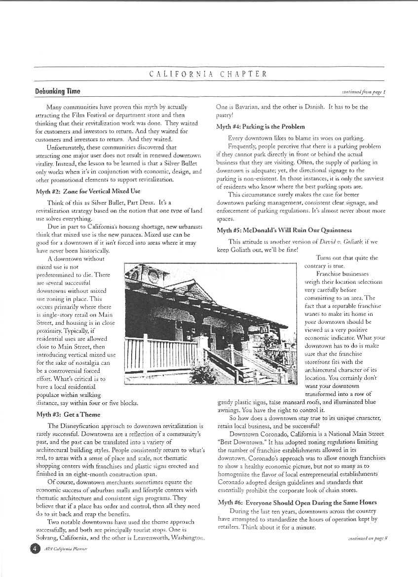
99
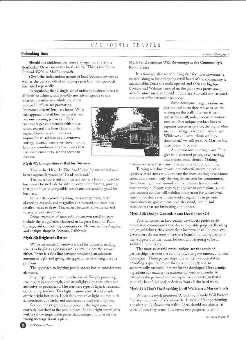
100
101
102
103 Planning Commission Draft DEVELOPMENT REGULATIONS DOWNTOWN COEUR D ALENE LMN Architects City of Coeur d Alene TABLE OF CONTENTS Development Regulations I. Overall Purpose II. Application and Intent III. Use Limitations IV. Basic Development Standards A. Floor Area Ratio B. Bonus Features C. Maximum Building Height D. Building Bulk E. Parking Ratios Definitions /15/06 DRAFT 2 Coeur d Alene Downtown Development Regulations and Design Standards
104 Planning Commission Draft DEVELOPMENT REGULATIONS I. Overall Purpose To create a distinct, strong identity for the downtown core, preserving a civic heart for Coeur d Alene. To encourage private and public investment, attract shoppers and visitors, and appeal to existing and new residents. To produce a concentration and a mixture of commercial, office, retail, residential, and public uses within the downtown. To develop a downtown that supports pedestrian movement and use of public transit. To implement the City s Comprehensive Plan. How Proposal relates to Purpose statements: Encourage the development of a mixed-use city center Response: Simplified list of uses to encourage virtually all uses Stimulate economic development in downtown Response: Allow a significantly greater residential density than current code Preserve views of Tubbs Hills and other distant landforms Response: View corridors through upper level stepbacks along with tower size and spacing Increase the downtown residential population 5/15/06 DRAFT 3 Coeur d Alene Downtown Development Regulations and Design Standards
105 Planning Commission Draft Response: Eliminate units per acre maximum; use FAR instead (Proposed Code doubles current allowable density) Respect the small town scale and character Response: Street level amenities and character through bonuses and exemptions from parking requirements for small retailers DEVELOPMENT REGULATIONS II. Application and Intent DC Downtown Core This district is envisioned to have the highest intensity uses, especially retail, office, residences, and hotels contained within low-rise, mid-rise and high-rise buildings. Shops and restaurants would be located along key streets. Major public spaces and buildings would anchor the district. Over time, parking would be increasingly located within structures. 5/15/06 DRAFT 4 Coeur d Alene Downtown Development Regulations and Design Standards

106 Planning Commission Draft Note: These proposed regulations do not affect the Downtown Overlay North area regulations located north of Indiana. III. Use Limitations All uses shall be allowed, unless prohibited below. Prohibited: Adult Entertainment Billboards Drive-Through Businesses along Pedestrian-Oriented Streets Gasoline Sales 5/15/06 DRAFT 5 Coeur d Alene Downtown Development Regulations and Design Standards
107 Planning Commission Draft Industrial Uses Mini-Storage on the street level. Outdoor Sales or Rental of Boats, Vehicles, or Equipment Outdoor Storage of materials and equipment (except during construction) Repair of Vehicles, unless entirely within a building Sewage Treatment Plants and other Extensive Impact activities. Surface Parking on Pedestrian-Oriented Streets Work Release Facilities Wrecking Yards Vehicle Washing, unless located within a building or parking structure Any other use that the Planning Director determines not to comport with the intent of the district as expressed in Section I Overall Purpose.. IV. Basic Development Standards A. Floor Area Ratio Floor Area Ratio (FAR) is a method of calculating allowable floor area. The FAR multiplied by the parcel size (in square feet) equals the amount of allowable floor area that can be built within a development. District Basic Allowable Floor Area Ratio (FAR) Maximum Allowable with Bonuses 5/15/06 DRAFT 6 Coeur d Alene Downtown Development Regulations and Design Standards
108 Planning Commission Draft DC Note: 1. For the purposes of these regulations, floor area is measured to the inside face of exterior walls. The following shall be excluded from floor area calculation: Space below grade Space dedicated to parking Mechanical spaces Elevator and stair shafts Lobbies and common spaces, including atriums Space used for any bonused feature B. Bonus Features Allowing Increased Floor Area Ratio (up to Maximum) Feature Additional Floor Area for each Feature Street Level Retail 100 sf of floor area for each linear Uses providing goods and services, including food and foot of retail frontage drink, adjacent to, visible from, and accessible from the sidewalk Public Plaza / Courtyard An open space that is accessible to the public at all times, predominantly open to the sky, and for use principally by people, as opposed to merely a setting for the building. It must abut and be within 3 feet in elevation of a sidewalk, at least 10% of the area shall be planted with trees and other vegetation. There must be seating, lighting and penetration of sunlight Canopy A rigid structure covered with fabric, metal or other 5 sf of floor area for each sf of plaza / courtyard 4 sf of floor area for each sf of canopy 5/15/06 DRAFT 7 Coeur d Alene Downtown Development Regulations and Design Standards
109 Planning Commission Draft material and supported by a building at one or more points, projecting over an entrance, window, outdoor service area or walkway with the purpose of sheltering persons from sun, wind and precipitation Public Art Any form of painting, mural, mosaic, sculpture, or other work of art as approved by the Arts Commission. Documentation of building costs and appraised value of the art feature shall be provided. The art feature must be displayed on the exterior of a building, at or near the pedestrian entrance or on a public plaza. Water Feature A fountain, cascade, stream, fall, pond of water, or combination thereof, that serves as a focal point. It must be a water-efficient design located outside of a building and be publicly visible and accessible. Water features must comply with City policies regarding water usage. It must be active during daylight hours. During periods of water use restrictions and freezing such features may be turned off Parking, Structured Parking contained within an enclosed building, designed to appear like it is part of the larger building complex. Parking, Below Grade Any portion of structure containing parking that is located below the average finished grade around a building. Green Roof A roof designed with principles of environmental sustainability, involving the use of vegetation and storm water collection and cleaning. It may or may not be accessible 10 sf of floor area for each $100 of valuation 10 sf of floor area for each $100 of valuation 0.5 sf of floor area for each sf of required parking above grade 1 sf of floor area for each sf of required parking below grade 2 sf of floor area for each sf of green roof Feature Day Care A use providing for the care of children or elderly people, generally during the hours of 6am and 7pm. Such use shall comply with all applicable City standards Health Club A use that offers exercise and recreational activities for tenants and/or the general public, either with or Additional Floor Area for each Feature 4 sf of floor area for each sf of day care 2 sf of floor area for each sf of health club without a fee. Public Meeting Rooms 5 sf of floor area for each sf of A space that can be used by the general public and meeting room having a capacity of at least 50 people. It may operate under a reservation or nominal fee system, but must be easily accessible from a lobby or plaza 5/15/06 DRAFT 8 Coeur d Alene Downtown Development Regulations and Design Standards
110 Planning Commission Draft Workforce Housing For purposes of this code, below-market housing is defined as dwelling units available to households making less than the median income for all households within the city limits 4 sf of floor area for each sf of workforce housing Note: Public Plaza, Parking & Workforce Housing features may be provided off-site. C. Maximum Building Height Buildings within this district shall only be permitted to exceed 75 feet if they comply with the bulk, spacing, and setback standards indicated in the sections that follow. Buildings that comply with the standards, as well as accumulate sufficient Floor Area Ratio through bonuses, may extend as high as shown in the chart below. Height Height w/architectural feature 2. Base 75 ft. 83 ft. Base + Bonus 200 ft 220 ft. Notes: 5/15/06 DRAFT 9 Coeur d Alene Downtown Development Regulations and Design Standards

111 Planning Commission Draft 1. Mechanical penthouses, stair/elevator overruns, and antennae may be excluded from Building Height calculation provided they are no more than 15 feet above the roof deck. 2. Building height may be increased by up to 10% if the top is designed as a nonhabitable, architectural element. This element may extend above the increased height limit. The combination of these restrictions are expected to result in 2-3 buildings on each block that might exceed 75 feet. Furthermore, only very large development sites would be able to attain the maximum height. It is estimated that throughout the downtown, only approximately a dozen sites are sufficiently large enough to reach the maximum height. D. Building Bulk 1. Tower Floor Size Building floors over 75 feet in height above grade shall have a maximum FAR area of 8000 square feet. 5/15/06 DRAFT 10 Coeur d Alene Downtown Development Regulations and Design Standards

. Balconies and Bay/Bow windows may project up to four feet (4 ).")
112 Planning Commission Draft 2. Tower Separation Building floors over 75 feet in height above grade shall be at least 50 feet from any other structure over 75 feet above grade. 3. Upper Level Stepback On the following streets, building floors over 45 feet in height above grade shall be stepped back from the right-of-way by at least 10 feet: 1st, 3rd, 4th, 5th, 6th, 7th., Sherman Avenue Note: Normal projections into setback allowed by the zoning ordinance include: Chimneys may extend into a yard a distance of not more than twenty four inches (24"). Eaves, cornices, belt courses, and similar ornamentation may project over a yard not more than two feet (2'). Balconies and Bay/Bow windows may project up to four feet (4 ). Design Departure for Building Bulk A design departure procedure would be established to allow a project to achieve flexibility in the application of prescriptive development standards. A 20% departure may be granted administratively. Greater departures would require approval of the Design Review Commission. In order to allow a departure from a code standard, an applicant must demonstrate that it would result in a development that better meets the intent of the purpose of the regulation and applicable design guidelines Note that this departure would not apply to building height 5/15/06 DRAFT 11 Coeur d Alene Downtown Development Regulations and Design Standards
PLANNING COMMISSION AGENDA CITY COUNCIL CHAMBERS AUGUST 28, 2007 THE PLANNING COMMISSION S VISION OF ITS ROLE IN THE COMMUNITY
 PLANNING COMMISSION AGENDA CITY COUNCIL CHAMBERS AUGUST 28, 2007 THE PLANNING COMMISSION S VISION OF ITS ROLE IN THE COMMUNITY The Planning Commission sees its role as the preparation and implementation
PLANNING COMMISSION AGENDA COEUR D ALENE PUBLIC LIBRARY LOWER LEVEL, COMMUNITY ROOM 702 E. FRONT AVENUE
 PLANNING COMMISSION AGENDA COEUR D ALENE PUBLIC LIBRARY LOWER LEVEL, COMMUNITY ROOM 702 E. FRONT AVENUE OCTOBER 13, 2009 THE PLANNING COMMISSION S VISION OF ITS ROLE IN THE COMMUNITY The Planning Commission
PLANNING COMMISSION AGENDA COEUR D ALENE PUBLIC LIBRARY LOWER LEVEL, COMMUNITY ROOM 702 E. FRONT AVENUE. June 9, 2015
 PLANNING COMMISSION AGENDA COEUR D ALENE PUBLIC LIBRARY LOWER LEVEL, COMMUNITY ROOM 702 E. FRONT AVENUE June 9, 2015 THE PLANNING COMMISSION S VISION OF ITS ROLE IN THE COMMUNITY The Planning Commission
PLANNING COMMISSION AGENDA CITY COUNCIL CHAMBERS JULY 11, 2006 THE PLANNING COMMISSION S VISION OF ITS ROLE IN THE COMMUNITY
 PLANNING COMMISSION AGENDA CITY COUNCIL CHAMBERS JULY 11, 2006 THE PLANNING COMMISSION S VISION OF ITS ROLE IN THE COMMUNITY The Planning Commission sees its role as the preparation and implementation
PLANNING COMMISSION AGENDA CITY COUNCIL CHAMBERS NOVEMBER 14, 2006 THE PLANNING COMMISSION S VISION OF ITS ROLE IN THE COMMUNITY
 PLANNING COMMISSION AGENDA CITY COUNCIL CHAMBERS NOVEMBER 14, 2006 THE PLANNING COMMISSION S VISION OF ITS ROLE IN THE COMMUNITY The Planning Commission sees its role as the preparation and implementation
Glades County Staff Report and Recommendation REZONING
 Glades County Staff Report and Recommendation REZONING CASE NUMBER: RZ15-01 DATE: October 2, 2015 CASE TYPE: Application for Rezoning REQUEST: J.J. Wiggins Memorial Trust is requesting a rezoning of 22.1±
PLANNING COMMISSION AGENDA COEUR D ALENE PUBLIC LIBRARY LOWER LEVEL, COMMUNITY ROOM 702 E. FRONT AVENUE JUNE 13, 2017
 PLANNING COMMISSION AGENDA COEUR D ALENE PUBLIC LIBRARY LOWER LEVEL, COMMUNITY ROOM 702 E. FRONT AVENUE JUNE 13, 2017 THE PLANNING COMMISSION S VISION OF ITS ROLE IN THE COMMUNITY The Planning Commission
PALM BEACH COUNTY PLANNING, ZONING AND BUILDING DEPARTMENT ZONING DIVISION
 PALM BEACH COUNTY PLANNING, ZONING AND BUILDING DEPARTMENT ZONING DIVISION Application No.: Z/CA-2013-00493 Application Name: Trails Charter School Control No.: 2013-00085 Applicant: MG3 ALF Military LLC
Planning Department Oconee County, Georgia
 Planning Department Oconee County, Georgia STAFF REPORT REZONE CASE #: 6985 DATE: October 31, 2016 STAFF REPORT BY: Andrew C. Stern, Planner APPLICANT NAME: Williams & Associates, Land Planners PC PROPERTY
PLANNING COMMISSION STAFF REPORT
 PLANNING COMMISSION STAFF REPORT West Capitol Hill Zoning Map Amendment Petition No. PLNPCM2011-00665 Located approximately at 548 W 300 North Street, 543 W 400 North Street, and 375 N 500 West Street
PLANNING COMMISSION Minutes
 MEETING DATE: Monday January 22, 2018 MEETING TIME: 6:00 PM MEETING LOCATION: City Council Chambers, 448 E. First Street, Suite 190, Salida, CO Present: Mandelkorn, Follet, Denning, Thomas, Farrell, Bomer,
CITY PLANNING COMMISSION AGENDA ITEMS: J & K STAFF: NATALIE BECKER FILE NOS: CPC ZC QUASI-JUDICIAL CPC DP QUASI-JUDICIAL
 Page 92 CITY PLANNING COMMISSION AGENDA ITEMS: J & K STAFF: NATALIE BECKER FILE NOS: CPC ZC 05-00151 - QUASI-JUDICIAL CPC DP 05-00152 - QUASI-JUDICIAL PROJECT: APPLICANT: OWNER: MERCURY CAR WASH SCOTT
DIVISION 1 PURPOSE OF DISTRICTS
 ARTICLE 2 ZONING DISTRICTS AND MAP DIVISION 1 PURPOSE OF DISTRICTS Section 2.101 Zoning Districts. For the purpose of this Ordinance, the City of Richmond is hereby divided into districts as follows: DISTRICT
THE CITY OF RAYMORE, MISSOURI Single-Family Residential Zoning Districts
 THE CITY OF RAYMORE, MISSOURI Single-Family Residential Zoning Districts REGULATIONS COMMON TO ALL DISTRICTS: Uses permitted in each district include detached single-family dwellings, manufactured homes
SARPY COUNTY BOARD OF ADJUSTMENT MINUTES OF MEETING May 14, 2015
 l. CALL MEETING TO ORDER SARPY COUNTY BOARD OF ADJUSTMENT MINUTES OF MEETING May 14, 2015 A meeting of the Board of Adjustment of Sarpy County, Nebraska was convened in open and public session at the call
Joint City-County Planning Commission of Barren County, Kentucky. November 18, 2013
 Joint City-County Planning Commission of Barren County, Kentucky The Joint City-County Planning Commission of Barren County, Kentucky met in regular session on Monday, at 7:00 PM in the Glasgow City Building.
SUBJECT: Application for Planned Unit Development and Rezoning 1725 Winnetka Road
 TO: FROM: CHAIRMAN BILL VASELOPULOS AND MEMBERS OF THE PLAN & ZONING COMMISSION STEVE GUTIERREZ DIRECTOR OF COMMUNITY DEVELOPMENT MEETING DATE: September 5, 2017 SUBJECT: Application for Planned Unit Development
CITY OF NORTH LAS VEGAS MEMORANDUM
 CITY OF NORTH LAS VEGAS MEMORANDUM TO: FROM: SUBJECT: Planning Commission Community Development and Compliance Department # 28 ) AMP-03-15; Coleman Airpark II & III - Comprehensive Plan Amendment (Public
1. Roll Call. 2. Minutes a. September 24, 2018 Special Joint Meeting with Clay County Planning Commission. 3. Adoption of the Agenda
 1. Roll Call City of Vermillion Planning Commission Agenda 5:30 p.m. Regular Meeting Tuesday, October 9, 2018 City Council Chambers 2 nd Floor City Hall 25 Center Street Vermillion, SD 57069 2. Minutes
DeWITT CHARTER TOWNSHIP 1401 W. HERBISON ROAD, DeWITT, MI PLANNING COMMISSION MINUTES MONDAY, MARCH 6, 2006
 DeWITT CHARTER TOWNSHIP 1401 W. HERBISON ROAD, DeWITT, MI PLANNING COMMISSION MINUTES MONDAY, MARCH 6, 2006 The regularly scheduled meeting of the DeWitt Charter Township Planning Commission was called
Mount Airy Planning Commission March 26, Staff Report
 Mount Airy Planning Commission March 26, 2018 Staff Report Special Exception Request Mixed Use Development in CC District Recommendation to Board of Appeals CASE MA-A-18-01 Applicant: Location: Zoning:
REZONING APPLICATION INSTRUCTIONS
 REZONING APPLICATION INSTRUCTIONS All required information, as stated on the Rezoning Application Checklist, must be included to qualify as a complete application. Upon receipt, staff will review the application
PLANNING COMMISSION AGENDA COEUR D ALENE PUBLIC LIBRARY LOWER LEVEL, COMMUNITY ROOM 702 E. FRONT AVENUE OCTOBER 8, 2013
 PLANNING COMMISSION AGENDA COEUR D ALENE PUBLIC LIBRARY LOWER LEVEL, COMMUNITY ROOM 702 E. FRONT AVENUE OCTOBER 8, 2013 THE PLANNING COMMISSION S VISION OF ITS ROLE IN THE COMMUNITY The Planning Commission
CHAPTER 14 SPECIAL DEVELOPMENTS
 10-14-1 10-14-1 CHAPTER 14 SPECIAL DEVELOPMENTS SECTION: 10-14-1: Cluster and Inner Block Development 10-14-2: Planned Unit Development 10-14-1: CLUSTER AND INNER BLOCK DEVELOPMENT: A. Land Use: Cluster
Town of Bayfield Planning Commission Meeting September 8, US Highway 160B Bayfield, CO 81122
 Planning Commissioners Present: Bob McGraw (Chairman), Ed Morlan (Vice-Chairman), Dr. Rick K. Smith (Mayor), Dan Ford (Town Board Member), Gabe Candelaria, Michelle Nelson Planning Commissioners Absent:
EDMOND PLANNING COMMISSION 20 S. Littler, Edmond, Oklahoma Tuesday, May 6, :30 p.m.
 City of Edmond NOTICE OF PUBLIC MEETING The City of Edmond encourages participation from all its citizens. If participation at any Public meeting is not possible due to a disability, notification to the
City of Lake Elmo Planning Commission Meeting Minutes of January 14, 2013
 City of Lake Elmo Planning Commission Meeting Minutes of January 14, 2013 Chairman Williams called to order the workshop of the Lake Elmo Planning Commission at 7:00pm COMMISSIONERS PRESENT: Fliflet, Obermueller,
MINUTES OF THE PLANNING AND ZONING COMMISSION CITY OF HAYDEN, KOOTENAI COUNTY, IDAHO. September 17, 2018
 MINUTES OF THE PLANNING AND ZONING COMMISSION CITY OF HAYDEN, KOOTENAI COUNTY, IDAHO September 17, 2018 Regular Meeting: 5:00 PM Council Chambers Hayden City Hall, 8930 N. Government Way, Hayden, ID 83835
LETTER OF APPLICATION
 Description of Proposed Land Division: LETTER OF APPLICATION The proposed land division would split a 1.94 acres rectangular lot into two lots. The general configuration would have one lot in front of
Minutes of 09/03/2003 Planning Board Meeting [adopted]
![Minutes of 09/03/2003 Planning Board Meeting [adopted]](/thumbs/89/98509328.jpg "Minutes of 09/03/2003 Planning Board Meeting [adopted]") Minutes of 09/03/2003 Planning Board Meeting [adopted] Angel M Kropf on 09/10/2003 at 11:04 AM Category: Planning Board Minutes MINUTES Wake County Planning Board Wednesday, September 3, 2003 1:30 p.m.,
Minutes of 09/03/2003 Planning Board Meeting [adopted] Angel M Kropf on 09/10/2003 at 11:04 AM Category: Planning Board Minutes MINUTES Wake County Planning Board Wednesday, September 3, 2003 1:30 p.m.,
AGENDA PLANNING COMMISSION Tuesday, April 18, :00 PM City Council Chambers 125 East Avenue B, Hutchinson, Kansas
 AGENDA PLANNING COMMISSION Tuesday, April 18, 2017 5:00 PM City Council Chambers 125 East Avenue B, Hutchinson, Kansas 1. ROLL CALL Macklin Woleslagel Bisbee (Chair) Hamilton Peirce Vacant Carr Hornbeck
MINUTE ORDER. BONNER COUNTY PLANNING and ZONING COMMISSION PUBLIC HEARING MINUTES NOVEMBER 5, 2015
 MINUTE ORDER BONNER COUNTY PLANNING and ZONING COMMISSION PUBLIC HEARING MINUTES NOVEMBER 5, 2015 CALL TO ORDER: Chair Temple called the Bonner County Planning and Zoning Commission hearing to order at
Midwest City, Oklahoma Zoning Ordinance
 2010 Midwest City, Oklahoma Zoning Ordinance 9/2/2010 Table of Contents Section 1. General Provisions... 5 1.1. Citation... 5 1.2. Authority... 5 1.3. Purpose... 5 1.4. Nature and Application... 5 1.5.
RP-2, RP-3, RP-4, AND RP-5 PLANNED RESIDENTIAL DISTRICTS
 6.10 - RP-2, RP-3, RP-4, AND RP-5 PLANNED RESIDENTIAL DISTRICTS 6.10.1 GENERAL DESCRIPTION: 6.10.1.1 The regulations established in this Section are intended to provide optional methods of land development
ARTICLE 14 PLANNED UNIT DEVELOPMENT (PUD) DISTRICT
 DISTRICT") ARTICLE 14 PLANNED UNIT DEVELOPMENT (PUD) DISTRICT Section 14.01 Intent. It is the intent of this Article to allow the use of the planned unit development (PUD) process, as authorized by the Michigan Zoning
ARTICLE 14 PLANNED UNIT DEVELOPMENT (PUD) DISTRICT Section 14.01 Intent. It is the intent of this Article to allow the use of the planned unit development (PUD) process, as authorized by the Michigan Zoning
ACTION FORM BRYAN CITY COUNCIL
 ACTION FORM BRYAN CITY COUNCIL DATE OF COUNCIL MEETING: July 8, 2014 DATE SUBMITTED: June 17, 2014 DEPARTMENT OF ORIGIN: Development Services SUBMITTED BY: Maggie Dalton MEETING TYPE: CLASSIFICATION: ORDINANCE:
4.2 RESIDENTIAL ZONING DISTRICTS
 4.2 RESIDENTIAL ZONING DISTRICTS A. Purpose: To define regulations and standards for each residential zoning district in the City. The following sections identify uses, regulations, and performance standards
CITY OF PRESTON PLANNING AND ZONING MEETING August 9, 2017
 ROLL CALL Roll Call showed the following Board members present: Chairman Linda Hansen, Commissioner Penny Wright, Commissioner Charles Chesney, Commissioner Steve Call, Commissioner Brock Alder, Commissioner
CITY OF APPLE VALLEY PLANNING COMMISSION MINUTES DECEMBER 7, 2016
 PLANNING COMMISSION MINUTES DECEMBER 7, 2016 1. CALL TO ORDER The City of Apple Valley Planning Commission meeting was called to order by Chair Melander at 7:01 p.m. Members Present: Tom Melander, Ken
MINUTES 7:30 PM. Block 40, Lots 8 & 8.04 Minor Subdivision Tumble Falls Road Completeness Determination
 MINUTES 7:30 PM PRESENT: R. Dodds ABSENT: P. Lubitz D. Haywood L. Riggio J. Mathieu M. Syrnick S. McNicol L. Voronin, Alt #1 J. Strasser C. Ely, Alt #2 CALL TO ORDER The meeting was called to order by
CHANNAHON PLANNING AND ZONING COMMISSION. February 11, Chairman Curt Clark called the meeting to order at 6:00 p.m.
 CHANNAHON PLANNING AND ZONING COMMISSION February 11, 2008 Chairman Curt Clark called the meeting to order at 6:00 p.m. Chairman Clark led the Pledge of Allegiance. Members present were Curt Clark, Karen
EDGERTON CITY HALL PLANNING COMMISSION MEETING REGULAR SESSION March 12, 2019
 EDGERTON CITY HALL PLANNING COMMISSION MEETING REGULAR SESSION The met in regular session with Chair John Daley calling the meeting to order at 7:00 p.m. All present participated in the Pledge of Allegiance.
AGENDA ITEM SUMMARY GLADES COUNTY BOARD OF COUNTY COMMISSIONERS
 AGENDA ITEM SUMMARY GLADES COUNTY BOARD OF COUNTY COMMISSIONERS SUBJECT: Case Number COMP17-01, Legend Moto LLC This is a Legislative Hearing. DEPARTMENT REQUEST: The Community Development Department requests
Zoning Board of Appeals Minutes
 Zoning Board of Appeals Minutes (meeting taped) Monthly meeting: Thursday, July 16, 2009 in the City Hall aldermanic chambers. The meeting was called to order at 6:35 p.m. By roll call, members present:
# Grant St. Apartments Preliminary/Final PUD Project Review for Planning and Zoning Commission
 #2014-48 95 Grant St. Apartments Preliminary/Final PUD Project Review for Planning and Zoning Commission Meeting Date: March 4, 2015 and May 6, 2015 Requests: Location: Acreage: Existing Zoning: Preliminary
PLANNING AND ZONING COMMISSION AGENDA MEMORANDUM
 PLANNING AND ZONING COMMISSION AGENDA MEMORANDUM City and County of Broomfield, Colorado To: Planning and Zoning Commission From: John Hilgers, Planning Director Prepared by: Michael Sutherland, Senior
City of Lake Elmo Planning Commission Meeting Minutes of January 26, 2015
 City of Lake Elmo Planning Commission Meeting Minutes of January 26, 2015 Chairman Williams called to order the meeting of the Lake Elmo Planning Commission at 7:00 p.m. COMMISSIONERS PRESENT: Williams,
Zoning Board of Appeals
 Zoning Board of Appeals Minutes (meeting taped) Monthly meeting: Thursday, July 15, 2010 in the City Hall Aldermanic Chambers. The meeting was called to order at 6:35 p.m. Without objection the chair called
PALM BEACH COUNTY PLANNING, ZONING AND BUILDING DEPARTMENT ZONING DIVISION
 PALM BEACH COUNTY PLANNING, ZONING AND BUILDING DEPARTMENT ZONING DIVISION Application No.: Z-2014-01627 Application Name: Dazco Center Control No.: 2003-00040 Applicant: 4730 Hypoluxo LLC Owners: 4730
CHAPTER 50 LAND USE ZONES ARTICLE 50 BASIC PROVISIONS
 CHAPTER 50 LAND USE ZONES ARTICLE 50 BASIC PROVISIONS 50.010 - PURPOSE The purposes of this chapter are to establish land use zones required to implement the goals and policies of the Klamath County Comprehensive
M-- I NUTES GLYNN COUNTY PLANNING COMMISSION OCTOBER 5, :00 A.M. Wayne Stewart, Chairman Georgia DeSain Glenda Jones Jack Kite Richard Parker
 M-- NUTES GLYNN COUNTY PLANNNG COMMSSON OCTOBER 5, 1993 9:00 A.M. PRESENT: ABSENT: ALSO PRESENT: STAFF PRESENT: Wayne Stewart, Chairman Georgia DeSain Glenda Jones Jack Kite Richard Parker ra Moore Lee
CITY OF ALBERT LEA PLANNING COMMISSION ADVISORY BOARD
 CITY OF ALBERT LEA PLANNING COMMISSION ADVISORY BOARD 9/1/2015, 5:30 p.m. City Council Chambers AGENDA A. CALL TO ORDER AND ROLL CALL B. APPROVAL OF THE AGENDA C. APPROVAL OF MINUTES 1. PC Minutes from
AGENDA. a. Carol Crews Special Exception Hair Salon (Continued from February) b. James Barber Special Exception Horse
 b. James Barber Special Exception Horse") Baker County Land Planning Agency (LPA) Thursday, April 23, 2015 Baker County Administration Building 55 North Third Street Macclenny, FL 32063 (904) 259-3354 AGENDA 5:OO P.M. LDR Mining Workshop A. Draft
Baker County Land Planning Agency (LPA) Thursday, April 23, 2015 Baker County Administration Building 55 North Third Street Macclenny, FL 32063 (904) 259-3354 AGENDA 5:OO P.M. LDR Mining Workshop A. Draft
City of Aurora PLANNING COMMISSION MEETING MINUTES January 16, 2013
 City of Aurora PLANNING COMMISSION MEETING MINUTES January 16, 2013 The Aurora Planning Commission met in a regularly scheduled meeting on Wednesday, January 16, 2013, in Council Chambers of Aurora City
City of McHenry Planning and Zoning Commission Minutes October 18, 2017
 City of McHenry Planning and Zoning Commission Minutes Chairman Strach called the regularly scheduled meeting of the City of McHenry Planning and Zoning Commission to order at 7:30 p.m. In attendance were
WEST BOUNTIFUL PLANNING COMMISSION
 Mayor Kenneth Romney City Engineer/ Zoning Administrator Ben White City Recorder Cathy Brightwell WEST BOUNTIFUL PLANNING COMMISSION 550 North 800 West West Bountiful, Utah 84087 Phone (801) 292-4486 FAX
Planning Department Oconee County, Georgia STAFF REPORT
 Planning Department Oconee County, Georgia STAFF REPORT REZONE CASE #: 7332 DATE: November 28, 2017 STAFF REPORT BY: Gabriel Quintas, Planner APPLICANT NAME: Smith Planning Group PROPERTY OWNER: John Hadden
City of Jacksonville Beach
 City of Jacksonville Beach Agenda Planning Commission 11 North Third Street Jacksonville Beach, Florida Monday, May 22, 2017 7:00 PM Council Chambers MEMORANDUM TO: Members of the Planning Commission City
ARTICLE 15 - PLANNED UNIT DEVELOPMENT
 Section 15.1 - Intent. ARTICLE 15 - PLANNED UNIT DEVELOPMENT A PUD, or Planned Unit Development, is not a District per se, but rather a set of standards that may be applied to a development type. The Planned
DEPARTURE OF PARKING & LOADING STANDARDS DPLS-333
 The Maryland-National Capital Park and Planning Commission Prince George's County Planning Department Development Review Division 301-952-3530 Note: Staff reports can be accessed at www.mncppc.org/pgco/planning/plan.htm.
Village of Glenview Plan Commission
 Village of Glenview Plan Commission STAFF REPORT March 24, 2015 TO: Chairman and Plan Commissioners CASE #: P2015-012 FROM: Community Development Department CASE MANAGER: Michelle House, Planner SUBJECT:
MINUTES PARK TOWNSHIP ZONING BOARD OF APPEALS Park Township Hall nd Street Holland, MI Regular Meeting April 27, :30 P.M.
 MINUTES PARK TOWNSHIP ZONING BOARD OF APPEALS Park Township Hall 52 152 nd Street Holland, MI 49418 Regular Meeting April 27, 2015 6:30 P.M. DRAFT COPY CALL TO ORDER: Chair Foster called to order the regular
95 Merchant Drive Unit B1, D&E Montrose, Colorado 81401
 95 Merchant Drive Unit B1, D&E 81401 COMMERCIAL LEASE INFORMATION PACKET John Renfrow * Joey Huskey Renfrow Realty Member of: www.rmcbrokers.com Page 1 Executive Summary Large Upstairs Office Space or
PLANNING AND ZONING COMMISSION MARCH 28, 2018 CITY HALL S COUNCIL 5:00 P.M.
 PLANNING AND ZONING COMMISSION MARCH 28, 2018 CITY HALL S COUNCIL CHAMBERS @ 5:00 P.M. P&Z PRESENT P&Z ABSENT STAFF PRESENT GUESTS PRESENT Ned Sheats Julio Cerda Jaime Acevedo Carlos Chapa John R. Guerra
Staff Report PLANNING DIVISION COMMUNITY & ECONOMIC DEVELOPMENT. Alley Closure
 Staff Report PLANNING DIVISION COMMUNITY & ECONOMIC DEVELOPMENT To: From: Salt Lake City Planning Commission Doug Dansie, 801-535-6182, doug.dansie@slcgov.com Date: March 23, 2016 Re: PLNPCM2015-00941
A favorable recommendation to the City Council is requested.
 To: Sycamore Plan Commission From: Brian Gregory, City Manager Date: November 9, 2017 Re: November 13, 2017 Plan Commission Meeting The Plan Commission has one action item and three workshop items. I.
TOWNSHIP OF WATERFORD 2131 AUBURN AVE., ATCO, NJ 08004
 TOWNSHIP OF WATERFORD 2131 AUBURN AVE., ATCO, NJ 08004 LAND USE BOARD MINUTES - April 17, 2017 The April 17, 2017 Joint Land Use Board meeting of the Township of Waterford, called to order at 7:04 pm by
REVISED # Federal Drive Milestones Therapy Project Review for Planning and Zoning Commission
 REVISED #2012-111 394 Federal Drive Milestones Therapy Project Review for Planning and Zoning Commission Meeting Date: November 7, 2012 and November 19, 2012 Request: Location: Acreage: Existing Zoning:
PLAINFIELD CHARTER TOWNSHIP COMMUNITY DEVELOPMENT DEPARTMENT PLANNING, ZONING & BUILDING SERVICES MEMORANDUM
 PLAINFIELD CHARTER TOWNSHIP COMMUNITY DEVELOPMENT DEPARTMENT PLANNING, ZONING & BUILDING SERVICES 6161 BELMONT AVENUE N.E. BELMONT, MI 49306 PHONE 616-364-1190 FAX: 616-364-1170 www.plainfieldchartertwp.org
REGULAR MEETING OF THE PLANNING COMMISSION Dearborn, Michigan. June 12, 2017
 REGULAR MEETING OF THE PLANNING COMMISSION Dearborn, Michigan June 12, 2017 The regular meeting was called to order at 7:08 P.M. by Chairperson Siwik. Upon roll call, the following members were present:
PORTER COUNTY PLAN COMMISSION Regular Meeting Minutes April 26, 2017
 PORTER COUNTY PLAN COMMISSION Regular Meeting Minutes April 26, 2017 The regular meeting of the was held at 5:30 p.m. on Wednesday, April 26, 2017 in the Porter County Administrative Center, 155 Indiana
PLANNING & ZONING COMMISSION. Administrative Session Tuesday, July 12, 2011 City Hall, City Council Chambers 505 Butler Place Park Ridge, Illinois
 CITY OF PARK RIDGE 505 BUTLER PLACE PARK RIDGE, IL 60068 TEL: 847/ 318-5291 FAX: 847/ 318-6411 TDD:847/ 318-5252 URL:http://www.parkridge.us DEPARTMENT OF COMMUNITY PRESERVATION AND DEVELOPMENT PLANNING
UPPER MOUNT BETHEL TOWNSHIP NORTHAMPTON COUNTY, PENNSYLVANIA
 UPPER MOUNT BETHEL TOWNSHIP NORTHAMPTON COUNTY, PENNSYLVANIA JOINDER DEED / LOT CONSOLIDATION TOWNSHIP REVIEW PROCESS When accepting proposed Joinder Deeds / Lot Consolidations, review the Joinder Deed
Draft Model Access Management Overlay Ordinance
 Draft Model Access Management Overlay Ordinance This model was developed using the City of Hutchinson and the Trunk Highway 7 corridor. The basic provisions of this model may be adopted by any jurisdiction
ZONING ORDINANCE: OPEN SPACE COMMUNITY. Hamburg Township, MI
 ZONING ORDINANCE: OPEN SPACE COMMUNITY Hamburg Township, MI ARTICLE 14.00 OPEN SPACE COMMUNITY (Adopted 1/16/92) Section 14.1. Intent It is the intent of this Article to offer an alternative to traditional
Request from Chad DeWaard for a Special Land Use Permit to Operate a Home-Based Business on property located at Cascade Road SE
 LOWELL CHARTER TOWNSHIP PLANNING COMMISSION REGULAR MEETING AND PUBLIC HEARINGS PRESENT: Blough, Batchelor, Simmonds, Clements, Edwards TOWNSHIP PLANNER: Tim Johnson CITIZENS IN ATTENDANCE: 13 The Regular
ARTICLE XI CONDITIONAL USE PERMITS
 ARTICLE XI CONDITIONAL USE PERMITS 11.1 Purpose. The City of Hailey recognizes that certain uses possess unique and special characteristics with respect to their location, design, size, method of operation,
VILLAGE OF DOWNERS GROVE PLAN COMMISSION VILLAGE HALL COUNCIL CHAMBERS 801 BURLINGTON AVENUE. June 2, :00 p.m. AGENDA
 VILLAGE OF DOWNERS GROVE PLAN COMMISSION VILLAGE HALL COUNCIL CHAMBERS 801 BURLINGTON AVENUE June 2, 2014 7:00 p.m. AGENDA 1. Call to Order 2. Roll Call a. Pledge of Allegiance 3. Approval of Minutes April
CITY OF CHARLOTTESVILLE DEPARTMENT OF NEIGHBORHOOD DEVELOPMENT SERVICES STAFF REPORT APPLICATION FOR A SPECIAL USE PERMIT
 CITY OF CHARLOTTESVILLE DEPARTMENT OF NEIGHBORHOOD DEVELOPMENT SERVICES STAFF REPORT APPLICATION FOR A SPECIAL USE PERMIT PLANNING COMMISSION AND CITY COUNCIL JOINT PUBLIC HEARING DATE OF HEARING: December
Commissioner Carter asked what this would do for the Town of Midland.
 Attendance: Chair Darrell Page; Commissioners: Ann Holland, Scott Burroughs, Steve Clark, Pam Carter; Hilda Keeney, Planning and Zoning Clerk; Kassie Watts, Town Planner; Doug Paris, Town Manager Absent:
REGULAR MEETING OF LURAY PLANNING COMMISSION APRIL 13, 2016
 REGULAR MEETING OF LURAY PLANNING COMMISSION The Luray Planning Commission met on Wednesday, April 13, 2016 at 7:00 p.m. in regular session. The meeting was held in the Luray Town Council Chambers at 45
MINUTES OF REGULAR MEETING OF THE PLANNING & ZONING COMMISSION OF THE CITY OF LUFKIN, TEXAS, HELD ON THE NOVEMBER 25, 1991 AT 5:00 P.M.
 MINUTES OF REGULAR MEETING OF THE PLANNING & ZONING COMMISSION OF THE CITY OF LUFKIN, TEXAS, HELD ON THE NOVEMBER 25, 1991 AT 5:00 P.M. On the 25th day of November, 1991, the Planning and Zoning Commission
ARTICLE Encourage well planned, efficient development.
 ARTICLE 14.00 PD PLANNED SECTIONS: 14.01 Intent 14.02 Procedure 14.03 Initial Development Plan 14.04 Final Development Plan 14.05 Amendments 14.06 Planned Development Districts PD-1 Willow Run PD PD-2
Understanding the Conditional Use Process
 Understanding the Conditional Use Process The purpose of this document is to explain the process of applying for and obtaining a conditional use permit in the rural unincorporated towns of Dane County.
PC Staff Report 11/18/2013 Z Item No. 1-1
 Z-13-00401 Item No. 1-1 PLANNING COMMISSION REPORT Regular Agenda - Public Hearing Item PC Staff Report 11/18/2013 ITEM NO. 1: Z-13-00401 IG (General Industrial) District TO CS (Strip Commercial) District;
AAAA. Planning and Zoning Staff Report Lake Shore Land Holdings, LLC CU-PH Analysis
 AAAA Planning and Zoning Staff Report Lake Shore Land Holdings, LLC CU-PH2016-28 Hearing Date: April 21, 2016 Development Services Department Applicant: BRS Architects/Cindy Huebert Staff: Kyle McCormick,
Boise City Planning & Zoning Commission Minutes November 3, 2014 Page 1
 Page 1 PUD14-00020 / 2 NORTH HOMES, LLC Location: 2818 W. Madison Avenue CONDITIONAL USE PERMIT FOR A FOUR UNIT PLANNED RESIDENTIAL DEVELOPMENT ON 0.28 ACRES LOCATED AT 2818 & 2836 W. MADISON AVENUE IN
DRAFT Smithfield Planning Board Minutes Thursday, May 7, :00 P.M., Town Hall, Council Room
 DRAFT Smithfield Planning Board Minutes Thursday, May 7, 2015 6:00 P.M., Town Hall, Council Room Members Present: Chairman Eddie Foy Vice-Chairman Stephen Upton Daniel Sanders Gerald Joyner Mark Lane Jack
TOWN OF CLAYTON. Town Plan Commission. Meeting Minutes. 7:00 P.M. 8:12 P.M. on Wednesday, July 10 th, 2013
 TOWN OF CLAYTON Approved 08/14/13 Town Plan Commission Meeting Minutes 7:00 P.M. 8:12 P.M. on Wednesday, July 10 th, 2013 Town Office Meeting Room, 8348 County Road T, Larsen, WI 54947 I. Call to Order:
CITY OF CEDARBURG. City Attorney Kaye Vance, City Planner Marty Marchek, Administrative Secretary Darla Drumel
 CITY OF CEDARBURG PLN20110906-1 A regular meeting of the Plan Commission of the City of Cedarburg was held on Tuesday, at Cedarburg City Hall, W63 N645 Washington Avenue, second floor, Council Chambers.
R E S O L U T I O N. B. Development Data Summary
 R E S O L U T I O N WHEREAS, the Prince George s County Planning Board has reviewed DPLS-333 requesting a Departure from Parking and Loading Standards for 19 parking spaces in accordance with Subtitle
Polk County Board of Adjustment October 3, 2014
 Polk County Board of Adjustment October 3, 2014 Call to Order: 10:58 A.M. Members in Attendance: Kerry Winkelmann, Robert Franks, Courtney Pulkrabek, Donovan Wright and Alternate, Rolland Gagner. Members
Perry City Planning Commission Perry City Offices, 3005 South 1200 West April 5, :00 PM
 Perry City Planning Commission Perry City Offices, 3005 South 1200 West April 5, 2012 7:00 PM Members Present: Chairman Jerry Nelson, Commissioner Esther Montgomery, Commissioner Todd Bischoff, Commissioner
MESA COUNTY PLANNING COMMISSION OCTOBER 28, 2004, PUBLIC HEARING MINUTES
 MESA COUNTY PLANNING COMMISSION OCTOBER 28, 2004, PUBLIC HEARING MINUTES Chairman Bruce Kresin called a scheduled hearing of the Mesa County Planning Commission to order at 7:01 p.m. Chairman Kresin led
CITY OF FARMERSVILLE CITIZEN ADVISORY COMMITTEE AGENDA November 17, :30 P.M. 1, COUNCIL CHAMBERS, CITY HALL
 I. PRELIMINARY MATTERS CITY OF FARMERSVILLE CITIZEN ADVISORY COMMITTEE AGENDA November 17, 2014 6:30 P.M. 1, COUNCIL CHAMBERS, CITY HALL Call to Order, Roll Call, Prayer and Pledge of Allegiance Welcome
SUMMARY OF AMENDMENTS TO THE AGENDA Monroe County Planning Commission October 11, 2017
 SUMMARY OF AMENDMENTS TO THE AGENDA Monroe County Planning Commission October 11, 2017 8. New Business: A. Consent Agenda: Additions Township Zoning Reviews 200.1-10-17-32 Whiteford Township (map) This
Organized with a "core" curriculum (the first five modules) and "electives" (the remaining modules in the program.
 and electives (the remaining modules in the program.") Introduction Sponsored by The North Carolina Chapter - American Planning Association These materials are the result of an effort by volunteer members of the North Carolina Chapter of the American Planning
Introduction Sponsored by The North Carolina Chapter - American Planning Association These materials are the result of an effort by volunteer members of the North Carolina Chapter of the American Planning
Urban Planning and Land Use
 Urban Planning and Land Use 701 North 7 th Street, Room 423 Phone: (913) 573-5750 Kansas City, Kansas 66101 Fax: (913) 573-5796 Email: planninginfo@wycokck.org www.wycokck.org/planning To: From: City Planning
AGENDA. CITY OF CENTRALIA, MISSOURI Planning and Zoning Commission Thursday, April 21, :00 P.M. City Hall Council Chambers
 AGENDA CITY OF CENTRALIA, MISSOURI Planning and Zoning Commission Thursday, April 21, 2016 6:00 P.M. City Hall Council Chambers I. ROLL CALL II. III. IV. Pledge of Allegiance Approval of Minutes of Previous
Bethel Romanian Church - Rezone, RZ
 / Planning and Zoning Staff Report Bethel Romanian Church - Rezone, RZ2018-0023 Hearing Date: November 15, 2018 Development Services Department Owners: Bethel Romanian Church, Corp. Applicant: Viorel Botos