Planning Commission Report
|
|
|
- Barnaby Carson
- 5 years ago
- Views:
Transcription
 858-5966 Planning Commission Report Meeting Date: May 10, 2018 Subject: Project Applicant: Recommendation: 128 AND 130 SOUTH CARSON ROAD REZONE PROJECT Zone Change and General Plan Amendment")

.")

1 SRLY City of Beverly Hills Planning Division 455 N. Rexford Drive Beverly Hills, CA TEL. (310) FAX. (310) Planning Commission Report Meeting Date: May 10, 2018 Subject: Project Applicant: Recommendation: 128 AND 130 SOUTH CARSON ROAD REZONE PROJECT Zone Change and General Plan Amendment Study Session Study Session regarding potential overlay zone for parcels located at 128 and 130 South Carson Road City Initiated Project That the Planning Commission consider the prior recommendation to establish an overlay zone for the parcels located at 128 and 130 South Carson Road and provide staff with direction. REPORT SUMMARY In 2007 the City Council approved a five-story mixed-use project located at 8600 Wilshire Boulevard containing up to 26 condominium units and approximately 6,000 square feet of ground-floor retail (8600 Wilshire Project). Subsequently, the property owners of the two singlefamily parcels located adjacent to the approved 8600 Wilshire Project (128 and 130 Carson Road) requested that the City consider the rezoning of their parcels from single-family zoning to multi-family zoning. In December 2007 the City Council held a Study Session to discuss this request. At that time the City Council directed staff to send the request through the Planning Commission and consider the request during the ongoing General Plan discussions. No further actions were taken to rezone the properties at that time. In 2016 the City Council/Planning Commission Liaison (consisting of then Mayor Gold, then Councilmember Bosse, then Planning Commission Chair Alan Block, and then Planning Commission Vice-Chair Joe Shooshani) directed staff to process this request and bring the item forward for consideration by the Planning Commission and City Council. Staff then consulted with the owners of the two properties to clarify the request, and completed the required California Environmental Quality Act (CEQA) review of the proposed rezoning. On October 12, 2017 the rezoning of the parcels was presented to the Planning Commission and the Planning Commission directed staff to return to the Commission with a resolution recommending approval of the rezone request to the City Council (this was a 3-2 vote with Chair Gordon and Commissioner Corman dissenting.) The report from October 12 is provided as Attachment A to this report and includes a summary of the history of the rezoning proposal, the Initial Study/Negative Declaration (IS/ND) CEQA review that has been prepared for the project, and includes staff analysis of the rezoning of the two parcels. Staff returned to the Planning Commission with a resolution recommending approval, as directed by the Planning Commission, on November 9, At this meeting, several community members spoke in opposition to the proposal. Neighbors expressed concern about Attachment(s): A. October 72, 2017 Planning commission Report B. Public Comment Received after October 12, 2017 Meeting C. Summary of Existing Overlay Zones Report Author and Contact Information: Timothea Tway, Senior Planner (310) ffway@ beverlyhills.org 143

2 increased height and density that àould result from the rezoning of the parcels as well as a C Page 2 of 15 ierly 128 and 130 South Carson Road Rezone Project May 10, 2018 At this time staff wishes to conduct a study session on the topic of the potential Overlay Zone to A detailed summary of the history of the project and request for rezoning as well as details In summary, the owners of the properties located at 128 and 130 South Carson Road requested 144 The proposal that was before the Planning Commission in October and November of 2017 have included a General Plan amendment in order to reflect the changed zone in the General order to amend Beverly Hills Municipal Code Section to include Parcel 1 and Parcel have limited any future development on the two subject parbels to 30 -O in height. development on the site. Therefore the rezoning considered by the Commission in 2017 would ( Parcel 1 ) and 130 South Carson Road ( Parcel 2 ) from R-1 (One-Family Residential) to R-4 involved changing the zoning designation of two properties located at 128 South Carson Road Buildings in Height District A are limited to a maximum of three (3) stories and 33 -O in height. Although the provisions of Height District A allow for a building up to 33 -O in height, the maximum General Plan height of 30 -O is more restrictive and would govern any future family residential low density General Plan designation allows for a maximum of 40 units per 2 in Multi-family Height District A, which is the most restrictive height district in the City. acre and a maximum height of 30 -O. The project also included a Zone Text Amendment in Plan land use map and designate the parcels as Multi-family residential low density. The Multi (Multiple Residential) and did not include a proposal for new construction. The project would The owners of the subject properties have previously submitted correspondence with illustrative pictures explaining the request. This correspondence is included as part of Attachment A to this project, which is currently under construction and is located immediately adjacent to the singlefamily properties located at 128 and 130 South Carson Road (as illustrated in Figure 1 on the following page). The 8600 Wilshire Boulevard project is currently under construction and is a maximum height of 61-0 tall on Wilshire Boulevard and 30 -O tall on Charleville Boulevard. report. that the City consider the zone change request due to the scale of the 8600 Wilshire Boulevard PROJECT HISTORY AND DESCRIPTION about the surrounding land uses and setting can be found in Attachment A to this report. gather further input and direction from the Planning Commission. the subject parcels to R-4. Commissioner Corman made a motion memorializing this dissenting). suggestion, which passed with a 3-2 vote (with Commissioners Shooshani and Block height and density that would now be present on the block. The resolution to recommend approval of the zone change to the City Council was then considered by the Planning Commission and failed to pass. Commissioner Corman then suggested that staff should explore options to create an Overlay Zone for the subject parcels, in lieu of changing the zone of domino effect of more property owners asking to rezone their parcels due to the increased Planning Commission Report


3 Planning Commission Report 128 and 130 South Carson Road Rezone Project May 10, 2018 Page 3 of 15 Non-conforming Multi family bull ding Figure 7. Project Location and Adjacent Properties Sharing the Same Block Figure 2. View of subject properties in April 2018 Community Character The general character of the surrounding neighborhood to the west and south of the subject properties is single-family homes, a majority of which are one-story in height. The building immediately to the north of the subject properties is a two-story duplex. To the rear of the properties, the 8600 Wilshire Project is under construction. This project will be a maximum of 61 0 tall on Wilshire Boulevard and 30 -O tall on Charleville Boulevard. 145


4 Planning Commission Report 128 and 130 South Carson Road Rezone Project May 10, 2018 Page 4 of 15 Rezoning the two subject parcels to R-4 would have allowed a property owner to develop a multi-family building on each of the subject sites. Alternatively, should one property owner obtain both sites, one multi-family building could be proposed across both properties if the parcels were rezoned. The maximum height of the multi-family building that could be built on this property would be 30 -O. This would be similar in height to portions of the 8600 Wilshire Project; however the maximum height of the 8600 Wilshire Project is 61-0 at the tallest point, which is located immediately to the rear of the two parcels. Should the property owners chose to build a single-family home on the project site(s), the maximum height would be between 25-0 and 32 -O depending on the design of the home. The following images (Dated March 2016) illustrate the neighborhood context: Figure 3. Subject properties L i _4_. -. Figure 4. Properties located across the street from subject properties 146


")

5 LW Planning Commission Report 128 and 130 South Carson Road Rezone Project May 10, 2018 PageS of 15 Figure 5. Properties immediately north of the subject properties Figure 6. Looking north (toward Wilshire Boulevard) on South Carson Road from Charleville Boulevard and Carson Road Figure 7. Looking south down Carson E - 1 from 147


6 ias Planning Commission Report 128 and 130 South Carson Road Rezone Project May 10, 2018 Page 6 of 15 Figure 8. Looking east on Charleville Boulevard from Charleville Boulevard and Carson Road Figure 9. Looking Road west on Charleville Boulevard from Charleville Boulevard and Carson Figure 10. Looking south on Carson Road from Carson Road and Wilshire Boulevard Whether the parcels were rezoned or not, a property owner would be able to redevelop the parcels should they choose to do so. The design style of a future single-family or multi-family development is not dictated by the City and a single-family or multi-family development could be proposed in any number of architectural styles that may not necessarily be the same style as the buildings that exist on the property at this time. It should also be noted that any singlefamily development would require Design Review and any multi-family development would require Architectural Review per city requirements. General Zoning Characteristics in the City The City of Beverly Hills maintains a fairly regular pattern of zoning throughout the City. This includes corridors or areas that are zoned Commercial that are generally buffered from singlefamily areas by multi-family zones. There are instances where single-family properties are 148
7 b5 Planning Commission Report 128 and 130 South Carson Road Rezone Project May 10, 2018 Page 7 of 15 immediately adjacent to commercial corridors. Areas where single-family properties are immediately adjacent to commercial zones occurs most often in the Southeast area of the City such as the residential area that is located to the north and south of Wilshire Boulevard between Hamel Drive and La Cienega Boulevard, as well as the residential area located to the South of Wilshire Boulevard between Doheny Drive and Robertson Boulevard. The following excerpt from the City s zoning map (Figure 11) illustrates the general pattern of zoning in the Southeast Area of the City f ( ] ç i [ t158 i87j ! i55 F I H c j I143144! ! F ] i&o is ISSI l52t D > r ] ] A I F * [138 1 CHARIIEVIaE ( oó 201 ( j 203 2O 203 I j t s T J r L 213 < ± < J j ] ] ] J 223 I s ] ] 224 F J 2282Y ( sIII IIl IIII IaIlIlIl II_. GREGORY Figure 11. Zoning pattern in the Southeast Area of the City i The subject parcels are on a unique block that contains few (two) single-family zoned properties on one block that also contains commercially zoned property. This pattern does not occur elsewhere in the City. The block upon which the subject properties are located as well as the block located immediately to the east were specifically discussed in a 2004 General Plan Topic Committee report on Residential Commercial interlace (this was prior to the rezoning of the parcels for the 8600 Wilshire Project). The discussion is related to the fact that on these two blocks there are single-family residential parcels that are directly across the street from commercial development, which is a unique pattern of development in the City. 149


 that are supplemental to the underlying zone upon which an overlay zone is placed.")
8 across the street from the single-family properties in the neighborhood. This is a relatively rare non-contiguous multi-family zone adjacent to the commercial properties on the same block and Should the subject parcels be rezoned to either R-4 or an overlay zone, there would be a small, c) Page 8 of 15 LLS to meet certain goals or provide additional flexibility in certain areas. These zones include: The City has a number of existing overlay zones1 that have previously been established in order certain targeted areas of a particular zone. zones are established to create additional or unique regulations that may only be appropriate in Overlay Zones and development standards (such as height, density, parking, setbacks, etc.) that are supplemental to the underlying zone upon which an overlay zone is placed. Often, overlay recommending that the Planning Commission consider the following discussion topics and explanation, he described a potential overlay zone as being an approach the Commission could more appropriate buildings for the two subject properties considering the larger 8600 Wilshire Boulevard development immediately adjacent to the properties, but also ensure that any multi applied to these two parcels, this approach could help avoid a domino effect where other property owners also ask to rezone their single-family parcels. At this time staff is take to tailor the development standards for the two subject parcels so that they could provide suggested exploring the idea of establishing an overlay zone for the two subject parcels. In his After the motion to recommend approval of the rezoning of the subject properties from R-1 to R 4 failed to obtain a majority vote at the November, 2017 meeting, Commissioner Corman family buildings that may be built on those properties were more compatible with the singlefamily homes that are on the same block. Further, because the overlay zone would only be DISCUSSION REGARDING POTENTIAL OVERLAY ZONE provide staff with feedback and direction. Wilshire Boulevard. development on Wilshire Boulevard and the single-family zoned properties to the south of Rodeo Drive, El Camino Drive, and South Camden Drive as a buffer between the commercial multi-family parcels that are not contiguous to other multi-family parcels, specifically along South zoning pattern in the City, however, there are areas in the City where there are two or three 128 and 130 South Carson Road Rezone Project May 10, 2018 An overlay zone is a zone that can be established in the municipal code that can regulate use The Commercial Retail Overlay Zone (Established 1976) The Commercial Retail Planned Development Overlay Zone (Established 1991) The Transportation Overlay Zone (Established 2001) The Adaptive Reuse Planned Development Overlay Zone (Established 2003) The M-PD-2 Mixed Use Planned Development Overlay Zone (Established 2003) 1 See attachment C for an additional summary of the approved overlay zones in the City. 150 Planning Commission Report
 The M-PD-4 Mixed Use Planned Development Overlay Zone (Established 2007) The Entertainment Office Planned Development Overlay Zone (Established 2007) The Medical Use Overlay")
9 Planning Commission Report 128 and 130 South Carson Road Rezone Project May 10, 2018 Page 9 of 15 The Commercial Hotel Overlay Zone (Established 2007) The M-PD-3 Mixed Use Planned Development Overlay Zone (Established 2007) The M-PD-4 Mixed Use Planned Development Overlay Zone (Established 2007) The Entertainment Office Planned Development Overlay Zone (Established 2007) The Medical Use Overlay Zone (Established 2011) Special Needs Housing Overlay Zone (Established 2012) Most of these overlay zones have established parcels and/or areas to which they have been applied in the City (such as the M-PD-3 Mixed Use planned development overlay zone located 8600 Wilshire Boulevard, immediately adjacent to the subject parcels on Carson Road) while others are overlay zones that have been established, but act more like floating zones where an applicant can request to apply that particular overlay to a property in a certain underlying zone through an approval process (such as the medical use overlay zone, which requires review prior to the placement of the zone on a certain property). Many of the zones have objectives outlined in the municipal code that describe the purpose of establishing such overlay zones. Establishing an overlay zone on the two subject parcels would be different than rezoning the properties to R-4 in the following ways: The overlay zone preserves the underlying zoning and would allow for continued use as an R-1 property in the event that an owner elected not to utilize the overlay zone. The overlay zone can be crafted to contain development standards different than those contained in the R-4 section of the code. These standards could further regulate height, density, design, parking, and other development standards. The overlay zone can be written to define under what circumstances the overlay zone can be applied to a parcel (for example, it could be restricted to only be allowed to be used by parcels that are immediately adjacent to buildings zoned commercial, or buildings located near commercial buildings more than a certain height, or could be applied to only defined parcels in the city, etc.) This could limit the overlay zone to only being used under very particular circumstances. The Planning Commission could also require that a property owner receive discretionary approval from the City prior to establishing the overlay zone on a property. Support for Overlay Zone First, staff would like the Planning Commission to discuss whether there is still Planning Commission support for the establishment of an overlay zone on the two subject parcels. Since the November 2017 meeting the members on the Planning Commission have changed. Commissioner Corman has left the Planning Commission and Commissioner Ostroff has joined 151

10 Planning Commission Report 128 and 130 South Carson Road Rezone Project May 10, 2018 Page 10 of 15 the Commission If there is support to establish an overlay zone in the code for the two subject properties, staff would require time to complete a draft ordinance per the direction from the Planning Commission as to the expected overlay zone regulations. In addition, staff would need to reexamine and amend the CEQA document that was prepared for the project in order to ensure that the potential environmental impacts are accurately described and disclosed to the public. Commissioner Corman s Comments at November 9, 2017 Hearing As part of the Commission s deliberation regarding this request at the November 9, 2017 hearing, Commissioner Corman suggested the Commission explore developing an overlay zone for the two subject parcels when the resolution recommending rezoning to R-4 failed to achieve the support of the majority of the Commission. The intent of the overlay zone would be to provide flexibility to the owners of 128 and 130 South Carson Road while also ensuring that future development on the site was compatible with the existing single-family development in the neighborhood. Commissioner Corman provided a list of potential characteristics that he would envision for the overlay zone. These are summarized as follows: The zone should be crafted to limit the building envelope so that development looks similar to the single-family homes on the block. This includes limiting the height to two stories instead of three stories. In order to offset the two story height Commissioner Corman suggested reducing the rear setback to allow more developable space on the property; The zone could limit the number of total units allowed on each site; A maximum lot size could be established for the zone to prevent an applicant from combining the two parcels and building one building instead of two. Commissioner Corman did suggest that parking could be shared underground between the two parcels to ensure that adequate underground parking could be accommodated, and; The zone can only be applied to these parcels to prevent others from asking to have this applied to their parcels. Contents of the Overlay Zone Staff is seeking Planning Commission input as to what, if any, of the topic areas outlined below the Commission would want to address in the overlay zone. For example, the Commission may wish to add language to the overlay zone to establish a maximum density on the subject sites since they are on the same block as single family homes. The Commission could also consider establishing specific design standards, modulation requirements, and/or height restrictions for any future multi-family building built on the subject properties in the overlay zone, or amend the parking standards for projects built in the overlay zone. Should the Commission direct staff to move forward with the creation of an overlay zone, staff is also seeking direction regarding the potential establishment of an ad-hoc committee. An ad-hoc committee of two Commissioners could be established to provide further direction to staff throughout the creation of the overlay zone, which would then return to the Planning 152

11 Planning Commission Report 128 and 130 South Carson Road Rezone Project May 10, 2018 Page 71 of 15 Commission at a future noticed public hearing for consideration Staff is seeking input on the following Location As described above, an overlay zone can be established on individual parcels, an area of the City, or can be established as a floating zone that can be applied to eligible parcels upon applicant request and approval by the decision making body. Staff suggests that the Planning Commission consider former Commissioner Corman s suggestion that the overlay zone should be crafted to include only the parcels located at 128 and 130 South Carson Road. Uses Overlay zones can address uses beyond the restrictions included in the underlying the Commission s reference the following uses are allowed in R-1 zone: zone. For Table 1: Land Uses in Single-family Zones Permitted: Single-family dwelling Accessory dwelling unit Small community care facility Transitional or supportive housing structured as a single-family or multiplefamily dwelling Small family daycare home Requires a Conditional Use Permit: Educational institution Museum Religious institution Club Public use Large Family Daycare Home (requires a Use Permit) Staff is seeking input as to the uses that would be allowed in the proposed overlay zone. If an overlay zone is established, the property owner will have the option to utilize the regulations of the underlying zone OR the regulations contained in the overlay zone that has been established. If there is support for an overlay zone, the Planning Commission can direct staff to write the zone in a way that further restricts the allowable uses on properties in the zone should any future applicant request the use of the overlay zone. Development Standards The overlay zone would provide supplemental development standards that can be different than the underlying development standards included in the zoning code. Staff is seeking Planning Commission input on the following standards: 153


12 should should Is should Planning Commission Report 128 and 130 South Carson Road Rezone Project May 10, 2018 Page 12 of 75 Height should the overlay zone establish a height maximum? Former Commissioner Corman suggested a two-story height limit to ensure that any future development is compatible with the surrounding neighborhood. Density the overlay zone establish density regulations that further restrict the maximum density on the project site mote than the allowable density under the R-4 zoning? Staff suggests that the Planning Commission consider limiting the maximum density to either two or three units per site. This could ensure that the density of any future development in the overlay zone would be compatible with the neighboring properties. Setbacks the required setbacks in the overlay zone be different than those established in the zoning code? Former Commissioner Corman suggested that the rear setbacks could be adjusted in order to allow smaller required rear yards and accommodate additional development on the site without allowing for increased height. Staff suggests that the Planning Commission consider the reduction of the required rear setback (the required rear setback for the two subject properties under R-1 zoning is approximately 29 -O ). If the properties were zoned multi-family, the required setback would be 15 -O from the rear lot line. Staff suggests that the Planning Commission consider establishing a 15 -O setback from the rear lot line for the two parcels in the overlay zone. Design o Architectural style there an architectural style or are there architectural components that should be required or encouraged in the overlay zone? o Modulation and massing Should the overlay zone establish additional or alternate modulation and massing in order to remain compatible with the neighborhood? Former Commissioner Corman suggested that regulations be written into the overlay zone that prohibit the construction of one building across both properties in order to preserve the character of the neighborhood. o Location of parking and driveways the overlay zone establish different or additional requirements for the location of parking or driveways on properties on the zone? Former Commissioner Corman suggested that parking could be allowed to be provided in one underground parking area for both properties, even though a building could not be built across the two properties above ground. Required parking should the parking regulations be adjusted in the overlay zone to require more, fewer, or the same parking spaces that are usually required for multi family development? Staff suggests that the Planning Commission consider keeping the parking requirements the same as would be required under traditional multi-family development in the City (see Table 2). The following table describes the existing standards that govern the R-1 regulations for the R-4 zones of the city for reference. zones and the 154
 (Multi-Family Residential) Maximum For a building with a flat Maximum height for multi- Height roof the maximum height is family")
13 Planning Commission Report 128 and 130 South Carson Road Rezone Project May 10, 2018 Page 13 of 15 Table 2. R-1 and R-4 Development Standards R-1 R-4 (Single-Family Residential) (Multi-Family Residential) Maximum For a building with a flat Maximum height for multi- Height roof the maximum height is family building with the low 25. density General Plan designation is 30 -O For a building with a sloped roof the maximum height is 28. For a building with a sloped roof with ridgeline the maximum height is 32. The maximum height of structures other than the above buildings is 25. Required 1-4 bedroom residence 1 parking space required for Parking requires 3 parking spaces. each efficiency unit (less than 1,000 square feet, no 5-6 bedroom residence bedrooms) requires 4 parking spaces. 2 parking spaces provided for 7 bedroom residence each unit with one bedroom requires 5 parking spaces. 2.5 parking spaces provided 8 bedroom residence for each unit with two requires 6 parking spaces. bedrooms 9 or more bedroom 3 parking spaces provided for residence requires 7 each unit with 3 or 4 parking spaces. bedrooms A multi-family building would also be required to provide guest parking spaces on the property Maximum One single family home and Maximum is 40 units per acre Density One accessory dwelling unit (# of units) on each parcel Parcel 1 is 6500 sqft = 6 units maximum Parcel 2 is 6320 sqft = 6 units 155
.")

14 ILLS Planning Commission Report 128 and 130 South Carson Road Rezone Project May 10, 2018 Page 14 of 15 maximum Note: Due to the configuration and size of the two parcels, it is unlikely that a project with 6 units on each subject parcel could meet R-4 development standards (parking, modulation, setback and open space). It is likely future development would result in less than 6 units per site. If the two sites were combined to construct one building, it is estimated that potentially ten units could be constructed. Sum mary of Suqqested Overlay Zone Reculations In summary, staff suggests that the Planning Commission consider, at a minimum, including the following regulations in any overlay zone that may be established for the subject properties: Crafting the overlay zone so that it only applies to these two parcels; Limiting density to either two or three units per parcel; Limiting height to two-stories; Prohibiting the construction of one building across both parcels; Decreasing the required rear yard to accommodate multi-family additional height; building without Allowing parking area below grade to be located on both properties parking underground, and; to accommodate Establishing parking requirements similar to those required for existing multi-family development in the City. PUBLIC OUTREACH AND NOTIFICATION The item before the Commission at this time is a study session to discuss the possibility of establishing an overlay zone. Because this is not a public hearing, public notice was not required per State law or the municipal code. Staff, however, did provide mailed public notices to all owners and residential occupants within 1,000 feet plus block-face, noticed the study session in the Beverly Hills Weekly and Beverly Hills Courier, and had the property owners display posted notices on their property. In addition, staff ed interested parties that have previously expressed interest in the project. 156


15 LLS Cs, Planning Commission Report 128 and 130 South Carson Road Rezone Project May 10, 2018 Page 75 of 75 Type of Notice Required Actual Period Required Notice Actual Notice Period Date Date Newspaper Notice N/A 20 days N/A 4/20/2018 Mailed Notice N/A 20 days N/A 4/20/2018 Property Posting N/A 20 days N/A 4/20/2018 Agenda Posting 72 Hours 7 Days 5/7/2018 5/3/2018 Website 72 Hours 7 Days 5/7/2018 5/3/2018 PUBLIC COMMENT Staff received a number of comment letters regarding the project when it was first considered by the Planning Commission in October. All correspondence received at that time was opposed to the rezoning of the subject properties. Commenters express concern about the change from single-family to multi-family, specifically noting the potential impact on surrounding property values, traffic, density and neighborhood character. All public comments received prior to the October meeting are included in attachment A. Public comment has also been received since mailed notice and newspaper notice of the project occurred on April 20, The correspondence received is in opposition to changing the zoning of the subject properties. All public comment received since the October meeting is included in attachment B. NEXT STEPS It is recommended that the Planning Commission conduct the study session, consider public comment, and provide direction to staff as to whether there is Planning Commission support to move forward with establishing an overlay zone on the subject properties. If there is support, then staff is seeking input on the desired contents of the overlay zone as well as input on whether or not the Planning Commission would like to establish an ad-hoc committee to further vet potential overlay zone language prior to the language returning to the Planning Commission. Report Reviewed y: Ryan Gohli6h, AICP, Assistant Director of Community Development / City Planner 157
16 LLS Planning Commission Report 128 and 130 South Carson Road Rezone Project May 10, 2018 Attachment A October 12, 2017 Planning Commission Report 158

17 Planning Commission Report 159 K. Excerpt from 2004 General Plan Topic Committee Report C. Match 2016 City Council/Planning Commission Liaison Meeting Minutes 1. Zoning Map I. Submission from 128 & 130 South Carson Road Property Owners A. December 18, 2007 City Council Study Session Staff Report D. Initial Study/Negative Declaration H. Public Comment G. Public Notice F. Beverly Hills Multi-family Height District Map E. General Plan Land Use Map B. December 18, 2007 City Council Study Session Meeting Minutes Attachment(s): Report Author and Contact Information: (310) Timothea Tway, Senior Planner forward for consideration by the Planning Commission and City Council. Since that time, staff This report summarizes the history of the rezoning proposal, the Initial Study/Negative the required California Environmental Quality Act (CEQA) review of the proposed rezoning. has consulted with the owners of the two properties to clarify the request, and has completed Councitmember Bosse, then Planning Commission Chair Alan Block, and then Planning Commission Vice-Chair Joe Shooshani) directed staff to process this request and bring the item In 2016 the City Council/Planning Commission Liaison (consisting of then Mayor Gold, then actions were taken to rezone the properties at that time. send the request through the Planning Commission and consider the request during the request (Staff report is included as Attachment A). At that time the City Council directed staff to Boulevard containing up to 26 condominium units and approximately 6,000 square feet of ground-floor retail (8600 Wilshire Project). Subsequently, the property owners of the two singlefamily parcels located adjacent to the approved 8600 Wilshire Project (128 and 130 Carson multi-family zoning. In December 2007 the City Council held a Study Session to discuss this Road) requested that the City consider the rezoning of their parcels from single-family zoning to ongoing General Plan discussions (meeting minutes are included as Attachment B). No further In 2007 the City Council approved a five-story mixed-use project located at 8600 Wilshire REPORT SUMMARY 2. Provide direction to staff as to next steps 1. Conduct a public hearing and receive testimony on the project Recommendation: That the Planning Commission: Project Applicant: City Initiated Project adoption of a Negative Declaration for this project. at this time. Pursuant to the provisions set forth in the California R-4 zone (multiple residential). The request does not involve construction Zone Change and General Plan Amendment Request to rezone two parcels from R-1 zone (one-family residential) to 128 AND 130 SOUTH CARSON ROAD REZONE PROJECT Environmental Quality Act, the Planning Commission will also consider Subject: Meeting Date: October 12, 2017 çyjryly TEL. (310) FAX. (310) N. Rexford Drive Beverly Hills CA City of Beverly Hills Planning Division
18 Council for their consideration. C Page 2 of 16 LLS October 12, and 130 South Carson Road Rezone Project Planning Commission Report 160 Figure 7. Project Location and Adjacent Properties Sharing the Same Block building Multi-family Non-conforming The remaining properties that share the city block on which the 8600 Wilshire Project is located located at the corner of Wilshire Boulevard and Carson Road. Multi-family buildings are show that this building was permitted in 1932 and is therefore legally non-conforming. The properties on the block, and the properties that are the subject of the proposed zone change. multi-family building located behind the commercial building on the commercially-zoned parcel generally not allowed in commercial zones in the City of Beverly Hills; however, city records following figure illustrates the location of the 8600 Wilshire Project, the existing commercial commercial buildings that front on Wilshire Boulevard. It should be noted that there is a two-unit front on Wilshire Boulevard, as well as two single-family-zoned lots fronting on Carson Road include three other commercially zoned parcels to the west of the 8600 Wilshire Project that (128 and 130 Carson Road). These commercial properties house one- and two-story fronting Wilshire Boulevard and also includes one lot that was previously zoned single-family at currently under construction. The 8600 Wilshire Project site is located on three commercial lots single-family-zoned lot was rezoned to C-3 (commercial) and a mixed use overlay zone was applied to all four lots (C-3/M-PD-3, commercial zoning with mixed-use planned development overlay zone). As permitted, the project includes 18 residential condominium units and 6,355 along Stanley Drive and Charleville Boulevard that will be a maximum of 30 -O in height. use project at 8600 Wilshire Boulevard. This project received a building permit in 2016 and is square feet of ground-floor commercial space, 97 parking spaces located in a subterranean In November, 2007, the City Council approved a five-story commercial and residential mixed PROJECT HISTORY the north-west corner of Stanley Drive and Charleville Boulevard. As part of the project, the approved 8600 Wilshire Project will be 61 -O along Wilshire Boulevard, with townhomes located garage, and loading facilities accessed from Stanley Drive. The maximum height for the analysis of the rezoning of the two parcels. Staff recommends that the Planning Commission conduct a public hearing on the rezoning request and provide a recommendation to the City Declaration (IS/ND) CEQA review that has been prepared for the project, and includes staff

 and")
19 Page 3 of 16 single-family lots be rezoned to multi-family. The basis of their request is that the approved October 12, 2017 Since the 8600 Wilshire Project was approved, the property owners of the two remaining singlefamily parcels located on the same block have expressed interest in requesting that these 161 Residential) to R-4 (Multiple Residential) and does not include a proposal for new construction include Parcel 1 and Parcel 2 in Multi-family Height District A, which is the most restrictive The proposed project involves changing the zoning designation of two properties located at 128 PROJECT DESCRIPTION South Carson Road ( Parcel 1 ) and 130 South Carson Road ( Parcel 2 ) from R-1 (One-Family at this time. The project would include a General Plan amendment in order to reflect the Zone Text Amendment in order to amend Beverly Hills Municipal Code Section to for a maximum of 40 units per acre and a maximum height of 30 -O. The project also includes a residential low density. The Multi-family residential low density General Plan designation allows changed zone in the General Plan land use map and designate the parcels as Multi-family Act (Attachment D). that has been conducted pursuant to the requirements of the California Environmental Quality of the parcels. The attached Initial Study/Negative Declaration reflects the environmental review Since that time staff has completed the required environmental review for the potential rezoning Commissioners and Councilmembers present expressed general support for review of the parcels. These minutes are provided as Attachment C. list; however, there was a lack of staff capacity at this time to complete this non-budgeted work not rezoned from single-family to multi-family. Subsequently, the rezoning of the properties was included as a non-budgeted item to the Community Development Department work effort/priority Council/Planning Commission Liaison discussed the rezoning and asked staff for information on rezoning and directed staff to proceed with studying the rezoning of the two single-family what the rezoning effort would entail. The minutes from this meeting indicate that the During the General Plan update process, which concluded in 2010, the subject properties were item, and it had not been elevated to an A Priority by the City Council. In March 2016 the City report from this meeting is included as Attachment A. At this meeting the Council considered regarding the potential rezoning of the project, and the City Council ultimately directed staff to meeting at the time to discuss the General Plan update. At the July 10, 2008 Planning Commission meeting Ms. Finizza, owner of the property located at 130 South Carson Road, to the new land use context that resulted from approval of the 8600 Wilshire Project. The staff two properties could lead to a domino effect and create a precedent for rezoning other singlefamily properties in the City. At this meeting several members of the public expressed concern considered a study session item on the potential rezoning of these two single-family parcels due discuss the issue with the Planning Commission and the General Plan committees that were spoke before the Planning Commission asking for her property to be rezoned to be more consistent with the 8600 Wilshire Project. At this time she again requested that the two appropriate location for increased residential density. In December 2007 the City Council several issues related to rezoning including the concern raised by neighbors that rezoning the properties on the block. density, scale and mass of the adjacent 8600 Wilshire Project results in their parcels being the remaining R-1 properties on the block be rezoned so that they would not be the only two R and 130 South Carson Road Rezone Project Planning Commission Report

 Land Use: Single Family General Plan: Single Family Residential South: Zoning: C-3 (Commercial Zone) Land Use: Commercial and")


20 maximum of three (3) stories and 33 -O in height. Although the provisions of Height District A height district in the City for multi-family properties. Buildings in Height District A are limited to a Page 4 of 16 October 12, 2017 allow for a building up to 33 -O in height, the maximum General Plan height of 30 -O is more 162 Zoning: R-1 (Single Family) Land Use: Single Family General Plan: Single Family Residential West: Zoning: C-3/M-PD-3 (Commercial with Mixed Use Planned Development Overlay) Land Use: Mixed use building currently under construction General Plan: Mixed Use East: Zoning: R-1 (Single Family) Land Use: Single Family General Plan: Single Family Residential South: Zoning: C-3 (Commercial Zone) Land Use: Commercial and Multi-family General Plan: Commercial North: site, across Charleville Boulevard, are zoned R-1 (Single Family) and are developed with singlefamily homes. Land uses surrounding the project site consist of the following: on what was previously a surface parking lot for a commercial property and a vacant parcel north. To the west of the project site, across South Carson Road, are single-family residences which is located directly east of the project site. There is no alley separating the subject one- and two-story commercial buitdings and a two-story residential duplex immediately to the zoned C-3/M-PD-3 (Commercial Zone with mixed use planned development overlay zone), properties from the 8600 Wilshire Boulevard project. Parcels located to the south of the project The land to the north of the Project site is zoned C-3 (Commercial Zone) and is developed with located in the R-1 (Single Family) zone. The 8600 Wilshire Project is currently being constructed Surrounding land uses and setting development proposed on the site would be limited to 30 -O in height. restrictive and thus would govern any future development on the site. Therefore any future 128 and 130 South Carson Road Rezone Project Planning Commission Report

 identifies that the proposed Project would result in no impacts for the project.")
, the State CEQA")

.")
21 The following figure illustrates the zoning on and around the project site. Page5of 16 October 12, The CEQA Guidelines and Statute are available online at to Agricultural and Forestry Resources, Biological Resources, Mineral Resources, The Initial study (Attachment D) identifies that the proposed Project would result in no impacts for the project. The subject project has been assessed in accordance with the authority and criteria contained environmental regulations of the City. An Initial Study/Negative Declaration has been prepared in the California Environmental Quality Act (CEQA), the State CEQA Guidelines1, and the ENVIRONMENTAL ASSESSMENT has been included as attachment F to this report. Map in order to designate the two parcels as part of Height District A. The Height District map rezone would also require an amendment to the City of Beverty Hills Multi-Family Height District Plan Amendment in order to amend the General Plan Land Use Map (Attachment E). The The request to rezone the subject parcels from single-family to multi-family requires a General REQUIRED ENTITLEMENTS Figure 2. Project Site and Adjacent Zoning R-1 Zone Zone C-3Zone and 130 South Carson Road Rezone Project Planning Commission Report


22 Cultural Resources, Geology and Soils, Greenhouse Gas Emissions, Hazards and Hazardous Materials, Hydrology and Water Quality, Land Use and Planning, Noise, Population and Page 6 of 76 Transportation/Traffic, and less than significant impacts related to Aesthetics, Air Quality, October 12, testimony may reach a different conclusion from that presented in this report and may choose to make alternate findings. A change to the findings may result in a final action that is different from the staff recommended action in this report. public hearing. The Planning Commission in its review of the administrative record and based on public 2 The information provided in this section is based on analysis prepared by the report author prior to the by the property owners includes a letter summarizing the reasons for the request as well as the owners of the subject parcels have provided documents to explain the request to the City to rezone the parcels. These items have been included in Attachment I. The information provided Although this work item has been directed by the City Council/Planning Commission Liaisons, Stated Reason for Request ANALYSIS2 H. noticed. All correspondence received at the time this report was written is opposed to rezoning density, and neighborhood character. All public comments received are included in Attachment multi-family, specifically noting the potential impact on surrounding property values, traffic, of the subject properties. Commenters express concern about the change from single-family to PUBLIC COMMENT Staff has received a number of comment letters regarding the project since the project was Mailed Notice 20 Days September 22, September 8, 34 days Newspaper Notice 20 Days September 22, September 8, 34 days Posted Notice 7 Days October 5, 2017 October 5, days Type of Notice Required Required Notice Actual Notice Actual Period Period Date Date Website 7 Days October 5, 2017 October 5, days Property Posting 20 Days September 22, September 8, 34 days PUBLIC OUTREACH AND NOTIFICATION public at least 20 days in advance of this hearing (Notice included as Attachment G). Study/Negative Declaration, along with the notice of public hearing has been provided to the In accordance with the regulations outlined in CEQA, the notice of intent to adopt an Initial ccortesej list. As evaluated in the Initial Study/Negative Declaration document, the project would Systems. The project site does not appear on the Hazardous Waste and Substances site Housing, Public Services, Recreation, Tribal Cultural Resources, and Utilities and Service not result in any significant environmental impacts and no required mitigation is identified. 128 and 130 South Carson Road Rezone Project Planning Commission Report

23 Wilshire Boulevard. scale of the single-family homes relative to the new mixed-use development located at 8600 pictures illustrating the construction to the rear of the subject properties in order to show the Page 7 of 16 October 12, subject properties or construction. Any building or project proposed after the rezoning of the At this time the proposed project does not include demolition of the single-family homes on the Museum Museum Religious institution Religious institution Public utility use hotel Restaurant located in a nonconforming disabled Educational institution Educational institution Use Permit) Multiple-family housing for the elderly or Large Family Daycare Home (requires a Large community care facility Public use law Club Childcare use licensed pursuant to state Requires a Conditional Use Permit: Requires a Conditional Use Permit: Multiple-family dwelling Small community care facility Small community care facility Accessory dwelling unit Accessory dwelling unit Single-family dwelling Single-family dwelling Small family daycare home Public library structured as a single-family or multiple- structured as a single-family or multiplefamily dwelling family dwelling Transitional or supportive housing Transitional or supportive housing Allowed by-right: Allowed by-right: R-1 R-4 Table 1: Land Uses in Single-family and Mutti1amily Zones (Single-Family Residential) (Multi-Family Residential) Permit in the R-1 and R-4 zones, per the Beverly Hills Municipal Code. The following table illustrates the uses that are permitted by-right and with a Conditional Use that would govern a property if it were zoned single-family or multi-family. The Planning Commission may wish to consider the different uses and development standards Difference between single-family and multi-family standards she feels that there will be impacts related to loss of privacy, parking, traffic and garage traffic was zoned R-1. Since the property to the rear was rezoned as part of the 8600 Wilshire Project that wilt be located immediately adjacent to her home. owner is requesting the rezoning because when she bought her home the property to the rear As stated in the letter submitted by the property owner of 130 South Carson Road, the property from the adjacent development, and loss of value to her property due to the mixed-use project 128 and 130 South Carson Road Rezone Project Planning Commission Report
 or one dwelling unit per")
24 October 12, 2017 allowed by-right in multi-family residential column of Table 1 would still be subject to subject to environmental review at that time. It should be noted that some uses described as property would require separate discretionary review by the City of Beverly Hills and would be Page8of individually) or one dwelling unit per square feet (if parcels are developed Code is one dwelling unit per 1,700 Maximum per Beverly Hills Municipal (# of units) Density accessory dwelling unit on each parcel General Plan Requirements Maximum One single family home and One Maximum is 40 units per acre per the 5-6 bedroom residence requires 4 parking spaces. 2 parking spaces provided for each unit parking spaces. 2.5 parking spaces provided for each on the property feet, no bedrooms) required to provide guest parking spaces 8 bedroom residence requires 6 unit with two bedrooms 7 parking spaces. A multi-family building would also be 9 or more bedroom residence requires with 3 or 4 bedrooms parking spaces. 3 parking spaces provided for each unit 7 bedroom residence requires 5 with one bedroom Required 1-4 bedroom residence requires 3 1 parking space required for each Parking parking spaces. efficiency unit (less than 1,000 square The maximum height of structures other than the above buildings is 25. For a building with a sloped roof with ridgeline the maximum height is 32. For a building with a sloped roof the maximum height is 28. Maximum For a building with a flat roof the Maximum height for multi-family building (Single-Family Residential) (Multi-Family Residential) R-1 R-4 Table 2. R-J and R-4 Development Standards Height maximum height is 25. in this General Plan designation is 30 -O and multi-family (R-4) development on the subject site. The following table illustrates the development standard differences between single-family (R-1) the Planning Commission, which would in turn trigger environmental review of the Project. require discretionary approvals prior to establishment on a project by project basis. For environmental review under the California Environmental Quality Act because they would example, a new multi-family building would requite a discretionary Development Plan Review by 128 and 130 South Carson Road Rezone Project Planning Commission Report
, the maximum height would")
25 1,450 square teet (if parcels combined and developed together). In are Page 9 of 76 October 12, The following images illustrate the neighborhood context: owners choose to build a single-family home on the project site(s), the maximum height would Rezoning the two subject parcels would allow a property owner to develop a multi-family should one property owner obtain both sites, one multi-family building could be proposed across property would be 30 -O. This would be similar in height to the townhomes contained within the be between 25 -O and 32 -O depending on the design of the home Wilshire Project, which are located to the rear of the two parcels. Should the property both properties. The maximum height of the multi-family building that could be built on this building on each of the subject sites should they chose to do so in the future. Alternatively, 61,0 tall on Wilshire Boulevard and 30 -O tall on Charleville Boulevard. immediately to the north of the subject properties is a two-story duplex. To the rear of the property, the 8600 Wilshire Project is under construction. This project will be a maximum of The general character of the surrounding neighborhood to the west and south of the subject properties is single-family homes, a majority of which are one-story in height. The building Community Character units in a new building. inability to fit the maximum number of standards, which could result in the project could be designed to meet the required parking, modulation, setback maximum per the municipal code density required to meet all municipal code and size of the parcels it is unlikely that a and outdoor living standards in a way that would allow for the maximum number of units on each parcel. The numbers above represent the absolute requirements. Should a project be proposed at one or both of the sites in the future the developer would be Please note: Due to the configuration units 1 efficiency unit II parcels are combined (12820 sqft) = efficiency unit Parcel 2 maximum (6320 sqft) = 3 units + 1 efficiency unit Parcel 1 maximum (6500 sqft) = 4 units bedrooms) can be added to the total the BHMC. per addition, an efficiency unit (no 128 and 130 South Carson Road Rezone Project Planning Commission Report
26 Page 10 of 16 October 12, Properties immediately north of the subject properties - abject properties ierlv 128 and 130 South Carson Road Rezone Project 168 Planning Commission Report


27 Page 71 of 76 October 12, Road 9. Looking west on (harleville Boulevard from Charleville Boulevard and Carson Road Figure 8. Looking east on Charleville Boulevard from Charleville Boulevard and Carson Figure 7. Looking south down Carson load rom (harleville I.oulevard and Carson Road Charleville Boulevard and Carson Road Figure 6. Looking north (toward iire Bëulevard) on South Carson ERLY 128 and 130 South Carson Road Rezone Project Planning Commission Report


28 Page 12 of 16 October 12, Whether the parcels were rezoned or not, a property owner would be able to redevelop the development is not dictated by the City and a single-family or multi-family development could be parcels should they choose to do so. The design style of a future single-family or multi-family properties and combine them in order to develop a larger multi-family building across both sites. continuous wall, but this type of development could introduce a new type of building in the neighborhood which has traditionally been comprised of smaller single-family homes. façade of the building would be required to be modulated, in order to visually break up any This building would also have a maximum height of 30 -O under the proposed regulations. The By changing the zoning to multi-family It could be possible for one owner to obtain both subject height. have a maximum height of between 25 -O and 32 -O in height depending on the style of the would be a maximum of 30 -O in height. A single family home built on the properties would build a multi-family building on one or both of the subject properties. The multi-family building changed from single-family to multi-family on the two subject properties, a property owner could The images shown above illustrate the current neighborhood context. Should the zoning be properties and was constructed in the early 1 930s. Immediately to the rear of the subject properties a mixed-use building is being constructed, which will be between 30 -O and 61 -O in home. The nearest multi-family structure is located immediately to the north of the subject at the 8600 Wilshire Project. Figure 11. Looking north from Charleville at 130 South Carson Road and the townhomes Figure 10. Looking south on Carson Road from Carson Road and Wilshire Boulevard -p and 130 South Carson Road Rezone Project Planning Commission Report
29 : Architectural Review per city requirements. the buildings that exist on the property at this time. It is also important to note that should the properties be rezoned, any single-family development or multi-family development would require proposed in any number of architectural styles that may not necessarily be the same style as GREGORY I _. - J227 L226 1E IIII F i1163 I f I ly r >< r D 150 1t TI ] I l34i : t b I4 128 W ] FL3o 1 r !287 2) iO i ,< U _ T : : I , 222 [ t T j1l9 11ii9[21B ) a 215 2l I j 215 j< cs ôiEd [ J 1202, I 212 I ) Oil 87302)1 2)0 201 :20oo7i I i i ] r1 Ti I I 13B1137 [ I ±i I uib :; i ILl 171 Figure 12. Zoning pattern in the Southeast Area of the City I I z U i ) i. >r I t1i55 it5j tise j City has been included as Attachment J to this report and the following image (Figure 12) Wilshire Boulevard between Doheny Drive and Robertson Boulevard. The zoning map for the such as the residentiat area that is located to the north and south of Wilshire Boulevard between immediately adjacent to commercial corridors. Areas where single-family properties are immediately adjacent to commercial zones occur most often in the Southeast area of the City Hamel Drive and La Cienega Boulevard, as well as the residential area located to the South of illustrates the general pattern of zoning in the Southeast Area of the City. includes corridors or areas that are zoned Commercial that are generally buffered from singlefamily areas by multi-family zones. There are instances where single-family properties are The City of Beverly Hills maintains a fairly regular pattern of zoning throughout the City. This General Zoning Characteristics in the City J2 Page 13 of 16 October 12, and 130 South Carson Road Rezone Project Planning Commission Report
 single-family zoned properties.")
30 elsewhere in the City. The block upon which the subject properties are located as well as the on one block that also contains commercially zoned property. This pattern does not occur The subject parcels are on a unique block that contains few (two) single-family zoned properties.4 Page 14 of 16 Committee report on Residential Commercial 172 Rezoning the properties could provide a May create a domino effect or set a precedent transition between low density single-family for rezoning single-family areas adjacent to commercially zoned properties. This is City. zoned properties and more dense new developments or commercial areas in the parcels of the same zone. opportunity for more housing in the City zoning in the City. It is a rare occurrence in Purple Line Subway). particular zone that are not contiguous to other The rezoning of the parcels could allow Is generally not consistent with the pattern of located near a major transit corridor (future the City that there are two parcels of any Could allow property owners to develop Could introduce more density on a street that north of the subject properties). that is immediately to the north of the subject homes in the surrounding area and maintain a new type of development (multi-family) that projects that are more compatible with the has historically contained only single-family mixed-use project immediately to the tear of parcels. The relatively small homes that exist the area. The change in zoning may introduce one multi-family building immediately to the is not as common on Carson Road (there is site. the character of the original development in the subject site and the multi-family building on the parcels today are more similar to the Pros Cons Table 3. Pros and Cons parcels in question that the Planning Commission may wish to consider during discussion on The following table describes the potential pros and cons of changing the zoning of the two the topic. Pros and Cons single-family zoned properties to the south of Wilshire Boulevard. Camden Drive as a buffer between the commercial development on Wilshire Boulevard and the adjacent to the commercial properties on the same block and across the street from the singlefamily properties in the neighborhood. This is a relatively tare zoning pattern in the City, Should the subject parcels be rezoned, there would be a small non-contiguous multi-family zone however, there are areas in the City where there are two or three multi-family parcels that are not contiguous to other multi-family parcels, specifically along Rodeo Drive, El Camino and parcels for the 8600 Wilshire Project). The discussion is related to the fact that on these two interface (this was prior to the rezoning of the blocks there are single-family residential parcels that are directly across the street from commercial development, which is a unique pattern of development in the City. The relevant excerpt of this report has been included as attachment K of this report. block located immediately to the east were specifically discussed in a 2004 General Plan Topic HILLS October 12, 2017 BEVERLY 128 and 130 South Carson Road Rezone Project Planning Commission Report

31 some other areas of the City and would generally consistent with the zoning pattern in Page 15 of 16 October 12, neighborhoods and new residential development to existing transit stops and to the anticipated subway stations. H 2.8 Transit-Oriented Housing. Promote access, where feasible, from residential and character of existing housing and residential neighborhoods. Housing (H) Hi Maintenance and Conservation. Maintain and enhance the quality landscaping, property setbacks, and other comparable elements. building form, scale, massing, relationship to street frontages, architectural design, housing be located and designed to maintain the distinguishing characteristics and qualities of the neighborhoods in which they are located, including prevailing lot sizes, LU 6.2 Housing Character and Design. Require that new, renovated, and additions to and density abut to assure smooth transitions in scale, form, and character. buildings, and landscaping of backyards where neighborhoods of differing housing type LU 5.7 Neighborhood Transitions. Regulate the setback, rear elevation design of within existing neighborhoods that is consistent with contextual parcel sizes, densities, built form and scale. LU 5.2 tnfill and Replacement Housing. Accommodate new and renovated housing contribution to the City s identity, economic value, and quality of life. amenities, and quality of the City s residential neighborhoods, recognizing their LU 5.1 Neighborhood Conservation. Maintain the uses, densities, character, setbacks, window and entry placement, lighting, landscape buffers, and service access. between areas of differing uses and densities by addressing property and height buildings be planned, located, and designed to assure functional and visual transitions LU 2.10 Development Transitions and Compatibility. Require that sites and spaces. City s distinctive residential neighborhoods, business districts, corridors, and open and enhance the character, distribution, built form, scale, and aesthetic qualities of the Land Use (LU) 2.1 City Places: Neighborhoods, Districts, and Corridors. Maintain The General Plan includes numerous goals and policies intended to help guide development in the City. Some policies relevant to the Planning Commission s review of the project include: General Plan Consistency use properties). a block consisting of commercial and mixed eliminate the existing unusual pattern of zoning (two single-family residential parcels on 128 and 130 South Carson Road Rezone Project Planning Commission Report


32 It is recommended that the Planning Commission conduct the public hearing, consider public NEXT STEPS Page 16 of 16 October 12, Development / City Planner Report Reviewed By: 2. Denying the proposed zone change and General Plan Amendment. Plan amendment, or 1. Recommending to the City Council approval of the proposed zone change and General comment, and direct staff to return at a future meeting with a resolution either: 128 and 130 South Carson Road Rezone Project Planning Commission Report
33 December 18, 2007 City Council Study Session Staff Report Attachment A October 12, and 130 South Carson Road Rezone Project Planning Commission Report 175

 INTRODUCTION This report provides background and requests direction from the")


34 CBH - City Council Informal Meeting - 12/ Y1RLY CITY OF BEVERLY HILLS STAFF REPORT Meeting Date: December 18, 2007 To: From: Subject: Honorable Mayor & City Council Donna Jerex, Senior Planner Consideration of General Plan Amendment to re-zone two properties located on the 100 block of South Carson Road Attachments: 1. Comment letter from Lisa Wolfe 2. General Plan Topic Committee Recommendation (Excerpt) INTRODUCTION This report provides background and requests direction from the City Council regarding whether or not the Council wishes to pursue a General Plan Amendment to re-zone two single-family parcels located in the 100 South block of Carson. The City Council approved a mixed-use project at 8600 Wilshire Boulevard last month. This project included 3 commercially-zoned lots and one single-family residential lot. There are two single-family lots abutting the project. The owners of two R-1 properties have requested that the Council consider re-zoning their lots to a higher density to be more consistent and compatible with the approved mixed-use project. these DISCUSSION Background In October 2007 the City Council approved a mixed-use development located at 8600 Wilshire Boulevard. The project consists of four lots with the following zoning information: Page 1 Page 12 of
 Lot Frontage:")
.")


35 Site Are&Number of Lots 25,920 square feet /4 Lots Site Dimensions Zoning DIstricts GENERAL INFORMATION 3 lots fronting on Wilshire: C-3 (commercial three 1 tot at corner of Stanley & Charieville: R-1 (singte-fam liv residential) Lot Frontage: Approximately 155 feet Lot Depth: Varies; approximately 125 feet stories/45-foot height) Page 13 of 29 Page 2 abutting the project (the southeast corner of Charteville and Carson). foot setback between the townhome closest to the R-i parcel located at 728 Carson Road The 8600 Wilshire project was approved with three townhomes along the R-i parcel at the corner of Charleville Boulevard and Stanley Drive. A condition was included that required a 30- Analysis the west of the project site. The graphic below highlights the area of the project and shows the two R-1 zoned tots directly to The project includes: December 18, 2007 CBH - City Council Informal Meeting - 12/18/2007 A maximum of 26 residential condominium units 6,383 square feet of ground-floor commercial space Up to 97 parking spaces located in a multi-level subterranean garage Access to the project site would be from Stanley Drive Loading facilities would be located on the site off of, and accessed from Stanley Drive 177

36 December 18,2007 CBH - City Council Informal Meeting - 12/ Concerns were expressed at the public hearings that the City had never re-zoned an R-1 lot to a higher density and that the approval of the mixed-use project would create a precedent for upzoning other single-family properties in the City. Neighbors felt that a domino effecf could be created by allowing R-i parcels in this area to be rezoned to a higher density. There are a number of issues to consider in deciding whether or not re-zoning for this property is appropriate. Some of these issues include: The City is currently updating its General Plan. Recommendations for allowing higher densities in certain areas of the City and areas for mixed-use have been developed over the past several years but have not yet been formalized. This project is a good candidate for review during the General Plan process to determine whether it is appropriate for higher density, as well as the level of higher density (e.g., duplex, two residential units, or more than two residential units, etc.) This request is not for a mixed-use project, but rather to allow a higher density for these two single-family parcels. This would allow the parcels to be redeveloped in the future with two or more residences on each lot. As the above graphic shows, this block is unique in that it contains a mix of single family and commercial parcels. Two of the commercial parcels and the single family parcel within the project s boundaries have been vacant and undeveloped for more than 30 years. The site was discussed by the General Plan Residential-Commercial Interface Topic Committee back in 2004, and the Committee recommended that this block be developed as a whole. An excerpt from their final report completed in 2004 is provided under Attachment 2 as background information. Please note that their recommendation contemplated development of the entire block as a whole. Ortions for Re-zoning There are a few options the Council can consider to re-zone this property. One would be to consider it along with the General Plan Update currently underway; and another would be to initiate a zone change by motion of the Council. These options are discussed below. 1. Stand Alone Re-Zoning: If the Council wishes to initiate re-zoning of this property, it may do so by motion pursuant to Beverly Hills Municipal Code Section which states: Boundaries of the zones established by this chapter, or the classification of property uses therein, may be amended, reclassified, and altered whenever the public necessity, convenience, and general welfare require. Such changes may be initiated by: The verified petition of the owners of property proposed to be so changed or reclassifled; Motion of the council; or Motion of the planning commission. If this option is chosen, the cost to complete the process would be a minimum $80,000 in fees, and potentially much higher if additional issues arise during the process of the evaluation. Page 3 Page 14 of


37 December 18, 2007 CBH - City Council Informal Meeting - 12/18/ Genera) Plan Update: - This is staff s recommendation. These two lots can be analyzed along with other in the City that will be considered for higher density residenttal development. The City s current residential zoning districts range from R-1 (single family) to R-4 (multi-family). The General Plan white papers contemplate adding zoning that would allow for duptexes or something in between R-1 and R-4. The City also currently has an R-3 zoning designation, however, there is no R-2 zoning. Duplex or R-2 zoning could be appropriate for these lots. areas Looking at these parcels in the context of the General Plan Update would represent a more holistic approach to planning. A joint session with the Planning Commission and City Council is anticipated to discuss issues general plan issues in January,, and this would be an appropriate issue to raise at that time. Conducting the analysis with the General Plan would also be appropriate because California cities are limited to enacting four general plan amendment cycles per year. For the year 2008, the City already is contemplating amendments four amendments: 9900 Wilshire; the Beverly Hilton Revitalization Plan; the Entertainment Business District; and the General Plan. The review of these lots could be included with the amendment for the General Plan and therefore not be delayed or potentially create delays for other projects already under review by the City. PUBLIC COMMENT As this item is to be reviewed at a study session rather than public hearing, no official notice was mailed or pubtished. However, this matter is of great concern and interest to the neighboring residents, a courtesy notice of today s meeting was mailed to residents within 500 feet of the 8600 Wilshire property boundaries. Staff received a written comment from Lisa Wolfe which is included under Attachment A. FISCAL IMPACT as If a stand along rezoning effort is undertaken rather than rather than grouping this request with the General Plan Update, costs to implement the Zone Change and General Plan Amendment would depend on the level of environmental analysis required. Generally speaking, minimum costs for legal fees, applications and noticing requirements would be in the range of $80,000. If further environmental analysis is required, the cost could go up substantially. If this rezoning is analyzed as part of the General Plan Update, there are no additional costs to the General Plan project and therefore no costs to the residents. RECOMMENDATION Staff recommends that the City Council provide staff with direction to specifically address the potential for re-zoning two parcels along with the General Plan Update currently underway. these Page 4 Vincent P. Bertoni, AICP.f) Approved Page 15 of
38 CBH - City Council Informal Meeting - 12/18/2007 Attachment 1 Comment Letter from Lisa Wolfe Page 16 of


 a duptex.")

39 Sent: Tuesuiy, December 04, :44 PM Subject: FW; Carson rezoning To: Donna Jetex From: Use Donna Jerex Page 17 of Lisa Wolfe Respectfully submitted, them R4 compromises the homes on the west side of the street, propagating the problem rather than mitigating it. the neighborhood. It could serve as a buffer between the R4 behind it and the RI s directly across the street. To make Thirdly and most critically, an R2, though not ideal by any means in this area, would at least not destroy the character of homes and revamp their current project, only to subject our neighborhood to an even larger development. We residents need assurance that the project, already too large for the neighborhood, will not be allowed to grow any larger whether R2 or R4. Second, changing to R2 rather than R4 will prevent a major development from going in or having Wilshire Colonial buy the block and changes the character of the neighborhood entirely. This is not to be taken lightly. reasons. First, the homes are currently next to (Immediately north) a duptex. Shoutd these RI homes become R4, the Instead of changing the Ri of R4, the properties should be changed, if at all, to R2. This is more sensible for many owners of the duplex might request an R4 change as well. Suddenly, the $600 project results in a restructure of the entire property vatue. Understandably, the residents on South CatsQn Road backing the 8600 Witshire development are concerned about their Dear Ms. Jerex, 3 December 2007 CBH - City Council Informal Meeting
40 CBH - Cfty Council Informal Meeting - 12/18/2007 Attachment 2 General Plan Topic Committee Recommendation (Excerpt) Page 18 of


41 CBH - City Council Informal Meeting - 12/18/2007 General Plan Topic Residential-Commercial Interface Comñittee Excerpt: THE SUBJECT AREA IS WiTHIN THE DASHED LINE BOUNDARIES COMMERCIAL SINGLE-FAMILY RESIDENTIAL MULTI-FAMILY RESIDENTIAL The interface in this immediate area is unique in that there are R-Y properties which share their common side property lines with commercial properties, in addition to R- 1 properties across the street from the commercial zone. The particular commercial zone bounded by Wilshire Blvd., Stanley Drive, Charleville Blvd, and Le Doux Road is currently designated as a commercial transition zone, with only office use as the allowable use with a two-story limit. These provisions were established with the intent for compatible commercial development with the surrounding residential zone. However, under this zoning it has been difficult to develop this site, and a portion of it has remained vacant for a number of years. The block to the west, between Carson Road and Stanley Drive, has also remained partially vacant. Developers have indicated that development on these parcels is economically infeasible because of the current zoning limits and the abrupt interface between the commercial and residential zones. The Committee considered these issues and made the following recommendation for this particular area: Commercial use with residential development, which may include townhouse development, to be compatible and commensurate in scale and density with the surrounding R-Y zone context; commercial uses should be oriented to lace Wilshire Boulevard and the residential development should be oriented to face the single-family residential zones to the west and south. Required resources to implement: A land use study of the area by Staff to determine the appropriate scale, height, and density standards of the commercial and residential uses. Also should be studied is the townhouse development concept, and seeking examples in other communities. Minority Opinions: o o The zoning for this area should remain as is, and changing the zoning would increase spiliover parking onto the residential streets, cause traffic congestion, and would negatively impact the property values of the single-family properties in the immediate area. Mixed-use development would be an appropriate transitional zoning, with limited density and height, and that it could add value to the surrounding properties. Page 19 of
42 Planning Commission Report 128 and 130 South Carson Road Rezone Project October 12, 2017 Attachment B December 18, 2007 City Council Study Session Meeting Minutes 184


43 PRESENT: Mayor Deishad 02:15 P.M. Council Chambers CITY OF BEVERLY HILLS ACTION MINUTES - STUDY SESSION December 1$, 2007 hftp:llbeverlyhills.granicus.comiminutesviewer.php?view_iu=2&clip_id=747 1/3 City Attorney Laurence Wiener recused himself from the discussion and asked Chief Assistant City Jerex provided a background report of information prompting the discussion of a proposed General Attorney Roxanne Diaz to serve as legal advisor for this item. Senior Planner Donna residents expressed concern with traffic congestion and lowering of neighborhood quality due to the 185 Plan Amendment to re-zone two properties on the 100 block of South Carson Road. Various Boulevard Carson Road Discusses issues related to the potential rezoning of properties from R-l to multi-family zoning properties. These properties abut the recently approved mixed-use development at $600 Wilshire 2. Consideration of General Plan Amendment to Rezone Properties Located on the 100 South Block of resident advisors Bruce Cole and Howard Szabo spoke about the Committee s potential Economic Development and Marketing Director Alison Maxwell provided the City Council with relationships with Shanghai s Pudong District in China and the City of Herzliya in Israel as proposed sister cities. Mayor Deishad expressed concern with the creation of a Sister City umbrella and suggested the umbrella should extend beyond the City of Beverly Hills. The City results of recent discussions held by the City s Sister City Committee (Committee). Committee Council asked staff to consider establishing a 50 1(c) (3) nonprofit corporation and to create a Council liaison subcommittee to work with Mr. Cole and Mr. Szabo. potential new Sister City relationships. This item presents discussions and recommendations of the Sister City committee regarding 1. Report from the Sister City Standing Committee of discussions. asked the Adhoc committee of Councilmembers Nancy Krasne, Frank Fenton, and City staff to meet with the City s allocated increases in rental fees causing a hardship on renters. Mayor Jimmy Deishad Prior to discussion of the Study Session items, Beverly Hills resident Mr. Roni Rofeim expressed concern with landlords, and tenants regarding this issue. Mr. Deishad asked the subcommittee to return with result A - DIRECTION ABSENT: City Manager City Attorney Councilmembers Brucker, Briskman, Fenton and Krasne City Clerk Assistant City Manager Chief Assistant City Attorney Director of Economic Development & Marketing Director of Community Development Deputy City ManagerfLightner Deputy City Manager/Friedling Senior Planner Jerex 1014/2017 Informal Meeting

44 future agenda. issue back through the Planning Commission and General Plan discussions and return the item to a building. Façade Discuss Architectural Commission s review of exterior changes proposed to 455 North Canon at D Lot and provide staff with direction as to whether or not changes are acceptable for this City-owned 3. Wolfgang s Stealthouse: 455 North Canon Drive. Review of Proposed Exterior Changes to Building hup:llbeverlyhills.granicus.com/minutesviewer.php?viewju=2&clip_id=747 2/3 The Smdy Session adjourned at 4:15 p.m. to the Formal Meeting to discuss the items that are identified on the agenda that has been prepared for the meeting. 186 This item was not discussed. staff level. Provides the City Council with a list of upcoming public hearings set at both the City Council and 6. List of Scheduled Hearing Dates This item was not discussed. Rooms and the Collection of Transient Occupancy Tax Occupancy Tax (TOT). To assure that TOT remains constant, it is important that the City has the ability to discourage hotels from reducing the number of available hotel rooms and that TOT is collectable for all hotel stays. Proposed code amendments shall be discussed by the Planning Commission in the early part of 2008 and a resolution will be forwarded along with an ordinance for the Council s consideration thereafter. Currently, hotels provide the City s fourth largest revenue source through the collection of Transient 5. Amendments to the Beverly Hills Municipal Code Regulating the Reduction in Available Hotel B - TNFORMATION to engage in community outreach meetings and directed staff to invite the Courier and Weekly staff s proposed communications plan for the City of Beverly Hills. Ms. Friedling outlined specific 2008, a community outreach campaignlmontffly newsletter, and quarterly town hail meetings meeting. Deputy City Manager of Public Affairs Cheryl Friedling advised the City Council of initiatives for the upcoming year - a redesign of the City s website to be launched in the spring of beginning February 4, Mayor Deishad asked Councilmember Briskman to assist him as subcommittee member of the proposed Mayor s Blue Ribbon Task Force being implemented Newspapers. Mr. Deishad asked staff to place this item on the next City Council agenda. City Manager Rod Wood pointed out that development projects will not be discussed at the Town Hall plans for a community outreach component. Provides an update regarding progress of the Communications Plan implementation and upcoming 4. Communications Plan Implementation Update Steathouse to remodel the facade of the City-owned building at 455 North Canon Drive to attain a Senior Planner Donna Jerex spoke briefly about an application from new tenant Wolfgang s Jerex asked for City Council direction following the Architectural Commission s denial of the and gave consensus to proceed. Councilmember Briskman asked the applicant to forward material more formalized entry. Architectural Commission Chairman Paul Langh provided the City Council with the Architectural Commission s recommendations for the 455 No. Canon Drive facility. Ms. applicationlproject. The City Council discussed the issues, suggested the applicant post a bond, boards to the City Council for review. proposed re-zoning. The City Council briefly discussed the re-zoning and directed staff to send the 10/4/2017 Informal Meeting

45 City Clerk s ofc/meh This meeting was televised on City of Beverly Hills Municipal Government Television Access, BRN/lO, Time Warner Cable. THESE INFORMATIONAL NOTES ARE PREPARED BY THE CITY CLERK S OFFICE AND ARE NOT APPROVED BY THE CITY COUNCIL hup:/ibevedyhills.granicus.com/minutesviewer.php?viewjd=2&clip_id=747 3/ /4/2017 Informal Meeting
46 March 2016 City Councfl/Planning Commission Liaison Meeting Minutes Attachment C October 12, and 730 South Carson Road Rezone Project Planning Commission Report

 Public Comment Members of the public will be given the")

47 CITY OF BEVERLY HILLS 455 N. Rexford Drive Beverly Hills, CA th Floor Conference Room A Beverly Hills City Council Liaison I Planning Commission Committee SPECIAL MEETING HIGHLIGHTS Thursday, March 10, :00 AM MEETING CALLED TO ORDER Date/Time: March 10, 2016/ 10:03AM IN ATTENDANCE: Mayor Gold, Councilmember Bosse, City Manager Mahdi Aluzri, Planning Commission Chair Alan Robert Block, Planning Commission Vice Chair Farshid Joe Shooshani, Assistant Director of Community Development / City Planner Ryan Gohlich, Executive Assistant Karen Myron 1) Public Comment Members of the public will be given the opportunity to directly address the Committee on any item listed on the agenda. Speakers: Mark Elliott 2) Proposed Restaurant at N. Canon Drive City Planner Gohlich provided a brief introduction of the proposed project at N. Canon Drive. The applicant team, led by representative Murray Fischer, provided additional information on the project. The parking requirement and its limitations due to space and cost were the primary points of discussion. The applicant team s proposed parking currently consists of 3 levels of stacked, subterranean parking, accessed via valet-operated vehicle elevators. The parking access and configuration were the general focus of discussion, as the proposal does not comply with the City s current parking standards and would require amendments to the Municipal Code in order to be accommodated. Commissioners and Councilmembers expressed general support of the proposed concept of utilizing vehicle elevators and vertically stacked parking, pending further review and approval of all pertinent details and functionality requirements by the full Planning Commission and City Council. 3) Proposed Rezoning of R-1 Properties at 128 and 130 S. Carson Road City Planner Gohlich provided a brief introduction of a request by the property owners of 128 and 130 S. Carson Road to amend their properties to an R-4 Multi-family zoning designation. Owners for both properties were present, and expressed their concerns related to the adjacent project at 8600 Wilshire Boulevard. 189


48 Beverly Hills City Council Liaison I Planning Commission Committee Match 10, 2016 Special Meeting Highlights Commissioners and Councilmembers expressed general support of rezoning the specific lots, and requested from staff, information on the rezoning process. The Commissioners and Councilmembers expressed general support for the rezoning of the subject properties to a multi-family zoning designation, and directed staff to proceed with study and implementation of the rezoning, subject to review and approval by the full Commission and Council at future public hearings. 4) Adjournment Date/Time: March 1O,2016/11:O7AM 190

49 (ERLY Planning Commission Report 128 and 130 South Carson Road Rezone Project October12, 2017 Attachment D Initial Study/Negative Declaration 191


50 I? CITY OF BEVERLY HILLS SOUTH CARSON ROAD REZONE PROJECT INITIAL STUDY Table of Contents Initiat Study 1. Project titles 3 2. Leadagencynameandaddress 3 3. Contact person and phone number 3 4. Project location: 3 5. Project sponsor s name and address 3 6. General plan designatiorr 4 7. Zoning 4 8. Project description 4 9. Surrounding land uses and setting Necessary Public Agency Approvals 7 Environmental Factors Affected 8 Determination 9 Environmental checklist Aesthetics Agricultural and Forestry Resources Air Quality Biological Resources Cultural Resources Geology and Soils Greenhouse Gas Emissions Hazards and Hazardous Materials Hydrology and Water Quality


51 South Carson Road Rezone Project Initial Study 10. Land use and planning 28 II. Mineral resources Noise Population and Housing Public Services Recreation Transportation/Traffic Tribal Cultural Resources Utilities and Service Systems Mandatory Findings of Significance 40 References 42 List of Figures Figure 1 Regional Location 5 Figure 2 Project Site 6 Figure 3 Existing Zoning on and Around Project Site 7 List of Tables Table 1: Land Uses in Single-family and Multi-family Zones 4 Table 2 City Noise Compatibility Guidelines


 is 6,320 square feet in area and is improved with a 2,414 square foot single-family residence.")
52 South Carson Road Rezone Project Initial Study Initial Study 1. Project title: South Carson Road Rezoning and General Plan Amendment 2. Lead agency name and address: City of Beverly Hilts Community Development Department 455 N Rexford Drive Beverly Hills, CA Contact person and phone number: Timothea Tway, AICP, Senior Planner Community Development Department, City of Beverly Hills (310) Project location: The project is located at 128 South Carson Road and 130 South Carson Road in the City of Beverly Hills. The project site is located in the City of Beverly Hills on the northeast corner of the intersection of South Carson Road and Charleville Boulevard and is located south of the intersection of South Carson Road and Wilshire Boulevard. The project site consists of two parcels. Parcel 1 (128 South Carson Road, APN ) is 6,500 square feet in area and is developed with a 1,674 square foot single-family residence. Parcel 2 (130 South Carson Road, APN ) is 6,320 square feet in area and is improved with a 2,414 square foot single-family residence. The total size of the project site is 12,820 square feet. The subject site is relatively flat, with no major changes in elevation. The existing landscaping includes a variety of trees, shrubs and plants. The City of Beverly Hills is bordered by the City of West Hollywood to the east and the City of Los Angeles neighborhoods of Carthay to the south, Century City to the west, and Holmby Hills and Brentwood to the northwest and north. The City is 5.7 square miles and is home to a resident population of approximately 35,000 people. 5. Project sponsor s name and address: City of Beverly Hills 455 N. Rexford Drive Beverty Hills, CA


53 South Carson Road Rezone Project Initial Study 6. General plan designation: Single-Family Residential 7. Zoning: R-1 (One-Family Residential) 8. Project description: The proposed project involves an amendment to General Plan land use map to designate the parcels as Multi-family residential low density, and a change of zoning designation of the two from R-1 (One-Family Residential) to R-4 (Multiple-Family Residential). The project also includes an amendment to the City Multi-family Height District Map to include Parcel I and Parcel 2 in Multi-family Height District A. Buildings in Height District A are limited to three (3) stories. The contemplated Multi-family residential low density General Plan designation would allow for a maximum of 40 units per acre and a maximum height of 30 in height. The project does not include any proposal for new construction on either of the lots at this time. Table I illustrates the uses that are permitted by-right and with a Conditional Use Permit in the R-1 and R-4 zones, per the Beverly Hills Municipal Code. Table 1: Land Uses in One-Family and Multiple Residential Zones R-I (One-Family Residential) Allowed by-right: Single-family dwelling Accessory dwelling unit Small community care facility Transitional or supportive housing structured as a single-family or multiple-family dwelling Small family daycare home Requires a Conditional Use Permit: Educational institution Museum Religious institution Club Public use Large Family Daycare Home (requires a Use Permit) R-4 (Multiple Residential) Allowed by-right: Single-family dwelling Accessory dwelling unit Small community care facility Transitional or supportive housing structured as a single-family or multiple-family dwelling Public library Multiple-family dwelling Requires a Conditional Use Permit: Educational institution Museum Religious institution Childcare use licensed pursuant to state law Large community care facility Multiple-family housing for the elderly or disabled Public utility use Restaurant located in a nonconforming hotel Because the rezoning and General Plan amendment will not directly result in construction on the property, and there is currently no development project contemplated for the project site, it would be speculative to analyze any impacts of a hypothetical development project at this time. Therefore, this document only analyzes the potential 4 195
 to multiple residential (R-4).")


54 South Carson Road Rezone Project Initial Study impacts of changing the zone of the two parcels from one-family (R-1) to multiple residential (R-4). Any building or project proposed after the rezoning of the property would require discretionary review by the City of Beverly Hills and would be subject to environmental review at that time. It should be noted that uses described as allowed by-right in Table I would still be subject to environmental review under the California Environmental Quality Act because they would requite discretionary approvals prior to establishment on a project by project basis. For example, a new multi-family building would requite a Development Plan Review from the City, which would trigger environmental review of the project. The zone change/general Plan amendment would not authorize any by-right development that would not be subject to additional environmental review in the future. The site is developed, as shown on the existing aerial plan shown below in Figure 2. U.flai4o OiY GrzfMi Park Glendale ELE POC,C West Hollywood HQITWGiO Eeverly weatw000 0 Los Angeles OOWNTOWI4 Monica Culeer Oty East Los Angeles Ldec Heihi 5OUIHUiS Huntrngton Park 5 196


 zone.")


 and are")

55 South Carson Road Rezone Project Initial Study Ii _ -1-0 At re2 -. -a-- i i > N. I ;-:i - Figure 2 Project Site i.r1 I I 9. Surrounding land uses and setting The land to the north of the project site is zoned C-3 (Commercial Zone) and is developed with one- and two-story commercial buildings and a two story duplex immediately to the north. To the west of the project site, across South Carson Road, are single-family residences located in the R-J (One-Family) zone. A surface parking tot for a commercial property and a vacant parcel zoned C-3/M-PD-3 (Commercial Zone with mixed use planned development overlay zone) is located directly east of the project site. A mixed use development is currently being constructed on this site. Parcels located to the south of the project site, across Charleville Boulevard, are zoned R-1 (One-Family) and are developed with single-family homes. Land uses surrounding the project site consist of the following: North: General Plan: Commercial Zoning: C-3 (Commercial Zone) Land Use: Commercial and Multi-family South: General Plan: Single Family Residential Zoning: R-1 (One-Family) Land Use: Single Family 6 197


 Land Use:")


56 South Carson Road Rezone Project Initial Study East: General Plan: Zoning: Land Use: Land Use: Mixed Use #2 C-3/M-PD-3 (Commercial with Mixed Use Planned Development Overlay) Commercial building abutting parcel #1 Vacant Parcel abutting parcel #2 West: General Plan: Single Family Residential Zoning: R-1 (Single Family) Land Use: Single Family Figure 3 Existing Zoning on and around Project Site 10. Necessary Public Agency Approvals: The proposed zone change and General Plan amendment would require review and approval by the City of Beverly Hills Planning Commission and City Council

57 South Carson Road Rezone Project Initial Study ENVIRONMENTAL FACTORS AFFECTED The environmental factors checked below would be potentially affected by this project, involving at least one impact that is a Potentially Significant Impact as indicated by the checklist on the following pages. LI Aesthetics fl Agriculture Resources LI Air Quality fl Biological Resources LI Cultural Resources LJ Geology/Soils LI Gas LI Hazards & Hazardous El Land Use/Planning LI Mineral Resources LI Noise LI Population/Housing LI Public Services LI Recreation LI LI Hydrology/Water Quality Tribal Cultural Transportation/Traffic LI Resources LI Utilities/Services Systems Mandatory Findings of Significance 8 199

58 DETERMINATION On the basis of this initial evaluation: EZI I find that the proposed project COULD NOT have a significant effect on the environment, and a NEGATIVE DECLARATION will be prepared. El I find that although the proposed project could have a significant effect on the environment, there will not be a significant effect in this case because revisions in the project have been made by or agreed to by the project proponent. A MITIGATED NEGATIVE DECLARATION wilt be prepared. El I find that the proposed project MAY have a significant effect on the environment, and an ENVIRONMENTAL IMPACT REPORT is required. El I find that the proposed project may have a potentially significant impact or potentially significant unless mitigated impact on the environment, but at least one effect 1) has been adequately analyzed in an earlier document pursuant to applicable legal standards, and 2) has been addressed by mitigation measures based on the earlier analysis as described on attached sheets. An ENVIRONMENTAL IMPACT REPORT is requited, but it must analyze only the effects that remain to be addressed. El I find that although the proposed project could have a significant effect on the environment, because all potentially significant effects (a) have been analyzed adequately in an earlier EIR or NEGATIVE DECLARATION pursuant to applicable standards, and fb) have been avoided or mitigated pursuant to that earlier EIR or NEGATIVE DECLARATION, including revision or mitigation measures that are imposed upon the proposed project, nothing further is required. Signature % D Timothea Tway, Senior Planner Printed Name City of Beverly Hills For 9 200

 Substantially degrade the existing visual character or quality of the site and its surroundings?")
59 ENVIRONMENTAL CHECKLIST I - Aesthetics Less Than Potentially Significant Less Than Significant With Significant No Environmental Issues Impact Mitigation Impact Impact Would the project: a) Have a substantial adverse effect on a scenic vista? b) Substantially damage scenic resources, including, but not limited to, trees, rock outcroppings, and LI LI LI historic building within a state scenic highway? c) Substantially degrade the existing visual character or quality of the site and its surroundings? LI LI LI d) Create a new source of substantial light or glare which would adversely affect day or nighttime LI LI LI views in the area? a) Less than Significant. The subject site, located at 128 South Carson Road and 130 South Carson Road, is surrounded by developed lots containing one- and two-story commercial and residential buildings. No scenic vistas currently exist on or are viewable from the project site. The mountain views to the north are limited by the existing multi-story commercial buildings to the north along the Wilshire Boulevard corridor. The City s General Plan contains Policy OS 6.1 Protection of Scenic Views, which calls for the protection of scenic views and vistas from public places including City landmarks, hillside vistas and urban views of the City. There are no scenic vistas, urban views, or City landmarks viewable from the project site. Any future construction on the site will be limited to three-stories and required to adhere to specific R-4 (Multiple Residential Zone) development standards in the City s Zoning Ordinance. Therefore, the proposed project s impacts on scenic vistas will be less than significant. The proposed project would not hinder the view of the skyline from public areas. b) No Impact. The subject site, located at 128 South Carson Road and 130 South Carson Road, is located in an urban built environment. There are no significant trees, rock outcroppings, historic buildings or other significant scenic resources that would be impacted by the proposed project. The project site is not located on a State Scenic Highway (California Scenic Highway Mapping System, 2016). Therefore, no scenic resources would be damaged by the implementation of the proposed project, no significant impacts would occur, and no mitigation measures would be required. c) Less than Significant. The existing site is developed with two single-family dwellings and is surrounded by developed single-family and commercial properties. The project analyzed in this document is the zone change and associated General Plan amendment to change


60 the zoning of the project site from R-1 to R-4. There is no development contemplated as part of the project at this time and any analysis of a hypothetical project would be speculative in nature. Any future temporary construction activities could result in changes to the visual quality of the property. These activities could include excavation of soil to build subterranean parking and storage of construction materials and equipment. These activities would be temporary in nature and would not permanently impact the visual character of the neighborhood. In addition, any future proposal would be required to comply with CEQA because a discretionary approval would be required. The Beverly Hills Municipal code regulates the height of buildings constwcted in each zone. Any future building proposed on the subject property would be required to meet the height limit for properties zoned R-4 and the height limit outlined in the height district in which a property is located. The project site is proposed to be added to Height District A, which allows a building up to 33 in height. The approved development that is currently under constwction at 8600 Wilshire Boulevard, which is located to the east of the project site, will be five stories in height. Any future development project at the site would be subject to discretionary review and approval by the City s Planning Commission for the scale and size of the development proposal and by the City s Architectural Commission to ensure the quality of the design and construction material. Such a project would be requited to comply with CEQA. Therefore, to the current project will not impact the overall visual character and quality of the neighborhood. d) Less than Significant. The rezoning of the subject property and associated general plan amendment would not introduce a new source of light and/or glare. If, in the future, new structures are proposed on the site, they may introduce new sources of light and glare. Any new building proposed at the site would be subject to review by the City and would be requited to comply with CEQA. Potential new sources of light and glare from a future project could include windows, lighting of entrances, exterior illumination of the building, and lights from vehicles entering and exiting the building. The area surrounding the project is urban and generally has high levels of existing light, especially considering the proximity to Wilshire Boulevard, a major corridor. Any new source of light would require compliance with the Beverly Hill Municipal Code Section (Excessive Lighting Prohibited), which prohibits the installation, use, and maintenance of lighting that creates an intensity of light on residential property greater than one foot-candle above ambient light level. Additionally, pursuant to BHMC Section G, the Architectural Commission will review any lighting proposed for a new multi-family project at the site. Because of this, the proposed project, is not expected to substantially change the lighting in the area or create a new source of substantial light or glare that would adversely affect day or nighttime views in the area
 prepared by the California Dept. of Conservation as an option model to use in assessing impacts on agriculture and farmland.")

61 2. Agricultural and Forestry Resources In determining whether impacts to agricultural resources are significant environmental effects, lead agencies may refer to the California Agricultural Land Evaluation and Site Assessment Model (1997) prepared by the California Dept. of Conservation as an option model to use in assessing impacts on agriculture and farmland. In determining whether impacts to forest resources, including timberland, are significant environment effects, lead agencies may refer to information compiled by the California Department of Forestiy and Fire Protection regarding the state s inventory of forest land, including the Forest and Range Assessment Project; and the Forest Legacy Assessment project; and forest carbon measurement methodology provided in Forest Protocols adopted by the California Air Resources Board Would the project: Less Than Potentially Significant Less Than Environmental Issues Significant With Significant No Impact Mitigation Impact Impact a) Convert Prime Farmland, Unique Farmland, or Farmland of Statewide Importance (Farmland), as shown on the maps prepared pursuant to the Farmland Mapping and Monitoring Program of the Catifornia Resources Agency, to non-agricultural use? b) Conflict with existing zoning for agricultural use, or a Williamson Act contract? El c) Conflict with existing zoning for, or cause rezoning of, forest land (as defined in Public Resources Code section (g)), timberland (as defined by Public Resources Code section 4526), or timberland zoned Timberland Production (as defined by Government Code section 51104(g))? U) Result in the loss of forest land or conversion of u forest land to non-forest use? e) Involve other changes in the existing environment which, due to their location or nature, could result in conversion of Farmland, to non-agricultural use or conversion of forest land to non-forest use? a-e) No Impact. The project area is located in an urban setting and does not contain any agricultural resources as defined by the state farmland mapping and monitoring program (State of California Department of Conservation, 2012). The project is not located on or adjacent to any agricultural resources or forest land. Further, the proposed project would not require any changes to the existing environment that would result in the conversion of farmland to non-agricultural uses. The project site is not enrolled under a Williamson Act contract and it is not located on or near a site with timberland or other forestry resources, nor does the property have any zoning or General Plan designations for forest land, farmland, timberland or timberland production. Therefore, no significant impacts to existing agricultural resources, forest land, farmland, Prime Farmland, or Unique Farmland would occur from implementation of the project and no mitigation measures are necessary

 Violate any air quality standard or contribute substantially to an existing or projected air quality Li U violation?")
62 3. Air Quality Where available, the significance criteria established by the applicable air quality management or air pollution control district may be relied upon to make the following determinations. Would the project: Less Than Potentially Significant Less Than Significant With Significant No Environmental Issues Impact Mitigation Impact Impact a) Conflict with or obstruct implementation of the applicable air quality plan? b) Violate any air quality standard or contribute substantially to an existing or projected air quality Li U violation? c) Result in a cumulatively considerable net increase of any criteria pollutant for which the project region is non-attainment under an applicable federal or state ambient air quality standard (including releasing emissions, which exceed quantitative thresholds for ozone precursors)? U) Expose sensitive receptors to substantial pollutant concentrations? U e) Create objectionable odors affecting a substantial number of people? a,b,c) Less than Significant Impact. The City of Beverly Hills is within the South Coast Air Basin (SCAB), south of the Santa Monica Mountains, and east of the Pacific Ocean. Air quality in the South Coast Air Basin is managed by the South Coast Air Quality Management District (SCAQMD). The SCAQMD has an Air Quality Management Plan (AQMP) to outline a strategy to meet state and federal air quality standards. A project is considered to have a significant adverse impact to air quality if it individually or cumulatively interferes with progress toward the attainment of ozone standards or results in the exceedance of state or federal ambient air quality standards for criteria pollutants. The air quality analysis included in this report conforms to the methodologies recommended in the SCAQMD s California Environmental Quality Act (CEQA) Air Quality Handbook (1993). SCAQMD has established the following thresholds for project operations within the SCAB: 55 pounds per day of Reactive Organic Gases (ROG); 55 pounds per day of Nitrogen Oxides (NOX); 550 pounds per day of Carbon Monoxide (CO); 150 pounds per day of Particulate Matter (PM)10; and 55 pounds per day of PM


63 SCAQMD has established the following thresholds for temporary construction emissions for projects within the SCAB: 75 pounds per day of ROG; 700 pounds per day of NOX; 550 pounds per day of CO; 750 pounds per day of PM7O; and 55 pounds per day of PM2. 5. The project site currently contains two single family homes, which generate vehicle trips that result in air pollutant emissions. Under R-4 zoning, the project site could be used for multi family housing or other uses as outlined in Table 1 of this report. There is currently no development project proposed for the site. At this time it would. be speculative to analyze potential air quality impacts of a hypothetical project on the project site. Any air quality impacts of a project proposed on the site will be considered if a project application is submitted to the City in the future. The rezoning of the property and general plan amendment would result in a less than significant impact because it does not involve a physical project or development on the project site. d) Less than Significant Impact. In general, projects are considered to have significant impacts to sensitive receptors if they expose sensitive receptors to substantial levels of toxic air contaminants. Nearby sensitive receptors include places where children, the elderly and people with health problems would congregate or frequent. This includes parks, hospitals, community centers, schools, and residential areas. The project is located in a residential area, and is therefore located adjacent to sensitive receptors. Demolition of the buildings on the site would need to comply with regulations related to asbestos and lead paint, which are considered to be toxic air contaminants. Rule 2403 of the SCAQMD requires that the applicant obtain an asbestos abatement permit from the City of Beverly Hills if toxic air contaminants are found prior to demolition. Any proposed project would also have to comply with California Code of Regulations Section , which requires that lead based materials are handled such that exposure levels do not exceed standards set forth by the California Occupational Safety and Health Administration (CaIOSHA). Because any project constructed on the project site would be subject to the above regulations and would be required to undergo further CEQA review at the time of a specific project proposal, it would not emit substantial levels of toxic air contaminants. e) Less than Significant Impact. Some objectionable odors may be temporarily created during most construction activities, such as diesel exhaust. These odors would not impact a substantial number of people and would occur in localized areas during construction. Further, diesel emissions are highly diffusive. Any project proposed on the site in the future is not expected to increase localized air pollutant emissions during operations as it would be residential in nature and industrial uses are not allowed in R-4 zones. Any proposed project for construction would be required to undergo further CEQA review at the time of a specific project proposal. Therefore, the implementation of the current project would not expose sensitive receptors to substantial pollutant concentrations

 Have a substantial adverse effect on any tiparian habitat or other sensitive natural community identified in local or regional plans, policies, and regulations El U El c) Have a substantial")
64 4. Biological Resources Would the project: Less Than Potentially Significant Less Than Significant With Significant No Environmental Issues Impact Mitigation Impact Impact a) Have a substantial adverse effect, either directly or through habitat modifications, on any species identified as a candidate, sensitive, or special status species in local or regional plans, policies, or regulations, or by the California Department of Fish and Game or U.S. Fish and Wildlife Service? u El b) Have a substantial adverse effect on any tiparian habitat or other sensitive natural community identified in local or regional plans, policies, and regulations or by the California Department of Fish and Game or U.S. Fish and Wildlife Service? El U El c) Have a substantial adverse effect on federally protected wetlands as defined by Section 404 of the Clean Water Act (including, but not limited to, marsh, vernal pool, coastal, etc.) through direct removal, filling, hydrological interruption, or other means? U) Interfere substantially with the movement of any native resident or migratory fish or wildlife species or with established native resident or migratory wildlife corridors, or impede the use of wildlife nursery sites? U e) Conflict with any local policies or ordinances protecting biological resources, such as a tree preservation policy or ordinance? U U U f) Conflict with the provisions of an adopted Habitat Conservation Plan, Natural Community Conservation Plan, or other approved local, regional, or state habitat conservation plan? U U U a) No Impact. The project site is located in an urban, developed area, and is a site that has already been developed with two single-family houses. The Migratory Bird Treaty Act states that it is unlawful to pursue, hunt, take, capture, or kill a migratory bird except as permitted by the U.S. Fish and Wildlife Service. The project site currently contains minimal landscaping including several palm trees, ficus trees and shrubs. The rezoning of the sites and general plan amendment project would not include removal of any existing street trees. Any animal species located on the subject properties are likely limited to rodents and a variety of bird species that are able to adapt to life in an urban environment


65 b,c,d) No Impact. The project area is a fully developed urban area. The project involves the rezoning and revised designation of land that is already improved with residential structures. No significant habitats or migratory wildlife corridors would be directly affected by the project, and the project does not propose, any policy changes that present significant impacts to endangered, threatened, or tare species or their habitats. The project area site is not within the vicinity of identified natural water courses. Wetlands are defined under the federal Clean Water Act as land that is flooded or saturated by surface water or groundwater at a frequency and duration sufficient to support, and that normally does support, a prevalence of vegetation adapted to life in saturated soils. Wetlands include areas such as swamps, marshes, streams, lakes, and bogs. According to the U.S. Fish and Wildlife Service Wetlands Mapper, the project site is not located within a wetlands or riparian habitat. The proposed project is located in an urban area developed with a mixture of residential and commercial areas that do not contain any wildlife or wetlands. No wildlife species would be impacted by approval of the proposed project. The project site is not considered a migratory wildlife corridor due to the existing surrounding urban development. Therefore, there is no potential impact to any protect habitat or wetlands. e) No Impact. The City has adopted a Regulation of trees on Private Property ordinance, contained in Section of the Beverly Hills Municipal Code. The ordinance requires applicants seeking to remove certain protected trees on single-family properties to obtain permits. The proposed project would change the zoning of the site from one-family residential to multiple residential, which would result in the local tree ordinance no longer being applicable to the site. A visual site inspection indicates that there are no trees on the property that would qualify as protected trees so this regulatory change will have no impact to any existing trees located on the project site. The project will not conflict with any local policies or ordinances protecting biological resources. Therefore, no impacts would result from the project implementation. f) No Impact. There are no natural habitats or natural biological communities in the vicinity of the project. As the project is not of such a scope as to have a significant, wide-ranging effect on the natural environment, it appears to be consistent with all habitat conservation plans and natural community conservation plan that may be applicable to the area
 Cause a substantial adverse change in the significance of an archaeological, resource pursuant El El to 15064.")
 Disturb any human remains, including those interred outside of formal cemeteries? El U a) Less than Significant Impact.")
![CEQA requires an evaluation of project impacts on historic resources, including properties listed in, or determined eligible for listing in, the California Register of Historical Resources [or]](/docs-images/93/112990534/images/66-3.jpg "included in a local register of historical resources.")
66 5. Cultural Resources Would the project: Less Than Potentially Significant Less Than Environmental Issues Significant With Significant No Impact Mitigation Impact Impact a) Cause a substantial adverse change in the significance of a historical resource as defined in ? 1J U El b) Cause a substantial adverse change in the significance of an archaeological, resource pursuant El El to ? U c) Directly or indirectly destroy a unique paleontological resource or site or unique geologic El El El feature? d) Disturb any human remains, including those interred outside of formal cemeteries? El U a) Less than Significant Impact. CEQA requires an evaluation of project impacts on historic resources, including properties listed in, or determined eligible for listing in, the California Register of Historical Resources [or] included in a local register of historical resources. In analyzing the historic significance of properties located within the study area, various criteria for designation under federal, state, and local landmark programs were considered and applied. However, pursuant to CEQA Section (a)(4), [tjhe fact that a resource is not listed in, or determined to be eligible for listing in the California Register of Historical Resources, not included in a local register of historical resources...or identified in an historical resources survey.., does not preclude a lead agency from determining that the resource may be a historical resource as defined in Public Resources Code sections (j) or The City of Beverly Hills adopted Ordinance in 2012 to establish a Historic Preservation Program. The existing residence at 128 South Carson Road (Parcel 1) was built in May of 1925 (by William McCausland) and the existing residence at 130 South Carson Road (Parcel 2) was built in April of 1924 (by William McCausland). Mr. McCausland is not listed on the City of Beverly Hills list of Master Architects. The project site contains no known historical or archeological resources of any architectural, engineering, scientific, economic, agricultural, educational, social, political, military, or cultural significance. The existing structures on the two aforementioned parcels were analyzed and do not appear to meet the requirements to be individually designated as local landmarks under requirements set forth in the Beverly Hills Historic Preservation Ordinance. In addition, pursuant to the City of Beverly Hills Municipal Code Section , the formation of local historic single-family residential districts is not permitted


67 Consultation with City staff who administers the historic preservation program in the City of Beverly Hills confirms that the two houses located on the project site are not individually eligible for historic designation pursuant to the local criteria provided in the Municipal Code. Upon further analysis of the surrounding neighborhood, however, the house located at 130 South Carson Road may be considered a potential contributor to a potentially historic landmark district eligible for listing on the California Register of Historical Resources. The house located at 128 South Carson Road has lost many character defining features and no longer appears eligible as a potential contributor to a historic district. Analysis by the City of Beverly Hills historic preservation staff indicates that should the subject residence be removed from the grouping of contributing residential structures, e.g., demolished, there would still be a sufficient number of remaining contributing structures in the vicinity for the potential historic landmark district to remain intact and continue to be eligible for listing as a historic district. To be eligible for the California Register, a historic resource must be significant at a local, state or national level, under one or more of the following four criteria: 1. Is associated with events that have made a significant contribution to the broad patterns of California s history and cultural heritage; 2. Is associated with the lives of persons important in our past; 3. Embodies the distinctive characteristics of a type, period, region, or method of construction, or represents the work of an important creative individual, or possesses high artistic values; or 4. Has yielded, or may be likely to yield, information important in prehistory or history. Historic districts are unified geographic entities which contain a concentration of historic buildings, structures, objects, or sites united historically, culturally, or architecturally. Historic districts are defined by precise geographic boundaries. Therefore, districts with unusual boundaries require a description of what lies immediately outside the area, in order to define the edge of the district and to explain the exclusion of adjoining areas. The potential district must meet at least one of the criteria for significance required for listing in the California Register of Historical Resources. Those individual resources contributing to the significance of the historic district will also be listed in the California Register. For this reason, all individual resources located within the boundaries of an historic district must be designated as either contributing or as noncontributing to the significance of the historic district. This area is currently not a historic district at this time. Additionally, the proposed project does not include any physical changes at this time. Any future proposal that may contain physical changes on the property would be subject to review under CEQA. Therefore, the project as proposed would not cause a substantial adverse change in significance of a historical resource as defined in CEQA Section and the impact would be less than significant. b-d) Less than Significant Impact. California Assembly Bill 52 (AB 52) and California Senate Bill 18 (SB 18) outline formal consultation processes for California tribes during the CEQA process. The City of Beverly Hills conducted tribal outreach pursuant to the regulations set forth by the state and no requests for consultation were submitted to the City


68 during this process. Correspondence was exchanged with representatives from the Gabrieleno Band of Mission Indians Kizh Nation; however, after discussion and review of the project, the Gabrieleno Band of Mission Indians Kizh Nation determined a monitor would not be necessary for the Carson Rezone Project because the proposed project does not involve ground disturbance, demolition, or construction. The project site is developed and has been previously disturbed by the construction of the residences existing on the site. The project area is not located within a cultural/agricultural sensitive area as identified in the Beverly Hills General Plan and there is no evidence to suggest that the site has ever been used as a cemetery. The project site is located in a developed setting containing no unique geologic features or any identified paleontological resources. Therefore, the project as proposed would not have a significant impact on an archaeological resource would not destroy a unique paleontological resource or site or unique geological feature as defined in CEQA Section 15064;5. 6. Geology and Soils Would the project: Less Than Potentially Significant Less Than Significant With Significant No Environmental Issues Impact Mitigation Impact Impact a) Expose people or structures to potential substantial adverse effects, including the risk of loss, injury or death involving: i) Rupture of a known earthquake fault, as delineated on the most recent Aiquist-Priolo Earthquake Fault Zoning Map issued by the State Geologist for the area or based on other substantial evidence of a known fault? Refer to Division of Mines and Geology Special Publication 42. LI LI LI ii) Strong seismic ground shaking? LI LI iii) Seismic-related ground failure, including liquefaction? LI LI iv) Landslides? LI LI b) Result in substantial soil erosion or the loss of topsoil? LI LI LI c) Be located on a geologic unit or soil that is unstable, or that would become unstable as a result of the project and potentially result in on- or off-site landslide, lateral spreading, subsidence, liquefaction or collapse? LI LI LI
 Have soils incapable of adequately supporting the use of septic tanks or alternative wastewater disposal systems where sewers are not available for the disposal of wastewater?")
.")
69 U) Be located on expansive soil, as defined in Table 18-1-B of the Uniform Building Code (1994), creating substantial risks to life or property? El El El e) Have soils incapable of adequately supporting the use of septic tanks or alternative wastewater disposal systems where sewers are not available for the disposal of wastewater? El El El The City of Beverly Hills is located in a region that is subject to high seismic activity. There are several active faults in or neat the city. a) Seismic hazards. i. Less than Significant Impact. The project site is not located in an area that is known to have Atquist-Priolo faults and no known active faults cross the subject property (State of California Department of Conservation, 2017). The nearest known potentially active fault is the Hollywood Fault, located approximately 1.7 mile to the north. The California Building Code (CBC) regulates the design of buildings to resist forces generated by strong earthquake. It is not possible to conclude that the building and its inhabitants would never be at risk of significant adverse impacts due to the rupture of a known or unknown earthquake fault, but compliance with the CBC can reduce the potential for the exposure of people or structure to substantial risk of seismic hazards to a less than significant level. The project will not expose people or structures to potential substantial adverse effects, including the risk of loss, injury or death involving the rupture of a known earthquake fault. ii.less than Significant Impact. Southern California is a seismically active region and prone to earthquakes, which may result in hazardous conditions to people within the region. Earthquakes and ground motion can affect a wide-spread area. The potential severity of ground shaking depends on many factors, including the distance from the originating fault, the earthquake magnitude and the nature of the earth materials beneath the site. The most serious impacts associated with ground shaking would occur if the structures were not properly constructed according to seismic engineering standards. If in the future a project is proposed, all buildings will meet the CBC and be designed to withstand strong earthquakes. All future development on the project site will adhere to the applicable building codes and undergo engineering checks in compliance with State and City standards. These necessary compliance strategies will reduce potentially significant impacts to less than significant levels. iii. Less than Significant Impact. There is no evidence of potential seismic-related ground failure on the site. The site is located in a mapped liquefaction area (City of Beverly Hills General Plan, 2010). If in the future a project is proposed, all buildings will be required to produce a liquefaction study and full geological report that will meet the CBC and be designed to withstand strong earthquakes. All future development on the project site will adhere to the applicable building codes and undergo engineering checks in compliance with State and City standards and therefore the impacts are expected to be less than significant

70 iv.no Impact. The site is located on a mostly level site and there is no evidence of potential landslides on the site. The Beverly Hills GIS system shows that there is minimum grade change within the subject property. The Beverly Hills General Plan indicates that the project site is located several miles from the nearest area subject to landslide (City of Beverly Hills General Plan Safety Element, 2010). Therefore, the project is not expected to have any potentially significant, adverse impact from landslides. b. Less than Significant Impact. The project site is currently occupied with two single family residential strictures and is generally level. The highest risk of erosiop would occur during grading and excavation of the site. If, in the future, a construction project is proposed at the site, it would be subject to the California Stormwater Quality Association Best Management Handbook, which requires that erosion control measures be implemented through the use of effective Best Management Practices (BMP5) per BHMC Section With Jmplementation of the Best Management Handbook and compliance with South Coast Air Quality Management District Rule 403, which regulates fugitive dust control, future project implementation would result in a less than significant impact regarding soil erosion or the loss of topsoil. c. No Impact. The project site is generally flat and not located in an area that is prone to landslides. Landslides are a type of erosion in which masses of earth and rock move down slope as a single unit. Susceptibility of slopes to landslides and other forms of slope failure depend on several factors. These are usually present in combination and include, but are not limited to, steep slopes, condition of rock and soil materials, presence of water, formational contracts, geologic shear zones, and seismic activity. The parcels that are the subject of the proposed project are flat lots that would not be susceptible to landslides. Additionally, there are no hills or slopes near the subject properties that could pose a landslide danger to the project area. While Beverly Hills has experienced limited subsidence (Beverly Hills Technical Background Report, 2005), any development in the City and on the project site would be required to meet the CBC and Uniform Building Code (UBC) requirements. These requirements would govern the design and construction of excavation and building elements to mitigate any effects related to hazardous soil conditions. Therefore, implementation of the proposed project or future construction would not have an impact regarding unstable soil and no mitigation measures would be required. d. No Impact. The proposed project is not anticipated to result in impacts involving expansive soils. If in the future a project is proposed, all buildings will meet the CBC and a soils report would be required by the City of Beverly Hills. All future development on the project site will adhere to the applicable building codes and undergo engineering checks in compliance with State and City standards. Therefore, no significant impacts are anticipated. e. No Impact. The use of septic tanks or alternative waste water disposal systems are not proposed since the site is fully served by the City s wastewater disposal system. Therefore no potential exists for soil incompatibility with septic systems and no impact is expected to occur

, which requires the California Air Resources Board to design and implement emission limits, regulation, and other")
71 7. GREENHOUSE GAS EMISSIONS Would the project: Less Than Potentially Significant Less Than Significant With Significant No Environmental Issues lmpatt Mitigation Impact Impact a) Generate greenhouse gas emissions, either directly or indirectly, that may have a significant El El El impact on the environment? b) Conflict with an applicable plan, policy or regulation adopted for the purpose of reducing the emissions El El El of greenhouse gases? In 2006, the State passed the California Global Warming Solutions Act of 2006 (AB 32), which requires the California Air Resources Board to design and implement emission limits, regulation, and other measures, such that feasible and cost-effective statewide greenhouse gas (GHG) emissions are reduced to 1990 levels by In 2008, the State passed SB 375, which creates regional planning processes designed to reduce GHG emissions in accordance with AB 32. These processes, which have yet to be fully implemented, tie GHG reduction targets to the region s land use and transportation strategic plans. Senate Bill 97, passed in 2007, requires analysis of climate change in CEQA documents and the California Resources Agency adopted amendments to the CEQA Guidelines for mitigation of GHG emissions. These guidelines give lead agencies the ability to set thresholds for the assessment and mitigation of Greenhouse Gases and climate change impacts. a,b) Less Than Significant: The SCAQMD has not adopted GHG emissions thresholds that apply to land use projects where the SCAQMD is not the lead agency. In addition, the City of Beverly Hills has not adopted local GHG emissions thresholds or a qualifying local GHG reduction plan. Therefore, the GHG emissions associated with the proposed project are evaluated based on the SCAQMD s recommended/preferred option threshold for all land use types, including residential projects, of 3,000 metric tons C02e per year (SCAQMD, 2010). This threshold identifies that a project s contribution to cumulative impacts related to GHG emissions and climate change would be cumulatively considerable if a project produces in excess of 3,000 metric tons C02e/year. Due to the fact that no physical improvements or development project has been proposed for the site at this time, and that a number of uses could be allowed on the site per the regulations governing R-4 properties (see Table 1), it would be speculative to attempt to calculate the expected GHG emissions from a development project at this time. Any proposed development project would be requited to obtain a discretionary permit and therefore, would be subject to additional CEQA review. As such, any such project would be analyzed by the City to determine construction and operational emissions upon project submittal. The rezoning of the parcels and general plan amendment project would not result in any change to the physical environment at this time and therefore, would not result in significant impacts related to GHG emissions
 that is a long-range plan that addresses mobility, housing, economic, environmental, and public heath goals")

.")

72 Existing Plans and Policies The City of Beverly Hills has an adopted Sustainable City Plan (2009) for the purpose of reducing greenhouse gas emissions. SCAG has an adopted Regional Transportation Plan/Sustainable Communities Strategy (RTP/SCS) that is a long-range plan that addresses mobility, housing, economic, environmental, and public heath goals for the region. The project is consistent with the City s Sustainable City Plan, including Goal 5 Land-Use, Transportation and Open Space, which calls for the City to foster an energy efficient, walkable community. The proposed project would allow for the provision of more housing units near mass transit and commercial areas, which could reduce the need for commuting via private automobile. The proposed project is also consistent with the SCAG Regional Transportation Plan / Sustainable Community Strategy (RTPISCS). This plan calls for the identification of areas that are suitable for infill development. The project analyzed in this document is the rezoning of the property and associated General Plan amendment, and does not include any physical development at the site. If, in the future, the site is developed with additional housing units or other uses allowed in the R-4 zone, this would represent an infill project that would provide more housing units along a transportation corridor in an urban core that would be consistent with the RTP/SCS. Conclusion: The proposed rezoning of the project site and general plan amendment would not produce GHG emissions because it does not involve any physical changes on the project site. Any project proposed in the future will be assessed for potential impacts under CEQA at the time of project. Therefore, the GHG emissions are less than significant. 8. Hazards and Hazardous Materials Would the project: Less Than Potentially Significant Less Than Environmental Issues Significant With Significant No impact Mitigation Impact Impact a) Create a significant hazard to the public or the environment through the routine transport, use, or LI LI disposal of hazardous materials? b) Create a significant hazard to the public or the environment through reasonably foreseeable upset and accident conditions involving the likely release of hazardous materials into the environment?
 Be located on a site which is included on a list of hazardous materials sites compiled pursuant to Government Code 65962.")
 For a project located within an airport land use plan, or where such a plan has not been adopted, within two miles of a public airport or public use airport, would the project result in a safety")
 For a project within the vicinity of a private airstrip, would the project result in a safety LI g) Impair implementation of or physically interfere with an adopted emergency response plan or")
73 c) Emit hazardous emissions or handle hazardous or acutely hazardous materials, substances, or waste within one-quarter mile of an existing or proposed school? U) Be located on a site which is included on a list of hazardous materials sites compiled pursuant to Government Code and, as a result, would it LI create a significant hazard to the public or the environment? e) For a project located within an airport land use plan, or where such a plan has not been adopted, within two miles of a public airport or public use airport, would the project result in a safety hazard for people residing or working in the project area? f) For a project within the vicinity of a private airstrip, would the project result in a safety hazard for people residing or working in the project area? LI g) Impair implementation of or physically interfere with an adopted emergency response plan or emergency evacuation plan? h) Expose people or structures to a significant risk of loss, injury or death involving wildiand fires, including where wildlands are adjacent to urbanized areas or where residences are intermixed with wildiands? BHMC Section 102.9, the City would not issue demolition permits until the applicant involving significant use, transport, or disposal of hazardous substances. A proposed project allowed on a multi-family zoned property could involve the use and storage of Environmental Health, The City of Beverly Hills Fire Department (BHFD) and CaIOSHA. The rezoning of the project site would allow multi-family residential units and would not allow materials is regulated by a number of agencies including the Los Angeles Department of landscape maintenance supplies such as herbicides and/or pesticides. The use of such b) Less Than Significant Impact. The project neither proposes nor facilitates any activity public or the environment. Any buildings proposed to be demolished on the site in the future of Regulations, to test, monitor and dispose of any lead-based materials to ensure risk of exposure to hazardous materials to less than significant. would be required by the City to be tested for asbestos and I or lead paint. As outlined in hazardous emissions will be associated with the proposed project. The subject properties has submitted an asbestos abatement completion certificate by qualified contractors. California Occupational Safety and Health Administration (CaIOSHA) regulates any leadbased materials exposure. The applicant would be requited to comply with California Code are not on the list of hazardous waste facilities as established by Government Code section a) Less Than Significant Impact The proposed project would not involve the routine transport, use, or disposal of any significant quantities of hazardous materials. No Therefore, project implementation would not create a significant hazard to the they do not exceed CaIOSHA standards for exposure. These regulations would reduce any LI LI LI LI LI LI LI LI LI
 from of hazardous materials during any potential construction on the site, but as described in U) No Impact.")
 No Impact. The project is not located within the vicinity of an airstrip.")


74 Horace Mann Elementary School. The proposed project would change the zoning of the site c) Less Than Significant Impact. The project site is located about 700 feet (0.1 miles) from of hazardous materials during any potential construction on the site, but as described in U) No Impact. A review of the California Department of Toxic Substances Control EnviroStor facility, as established by Government Code section One leaking underground fuel within two miles of any airport. There would be no impacts to any airport land use plan or f) No Impact. The project is not located within the vicinity of an airstrip. Therefore, there In addition, per existing City Fire Department regulations, evacuation plans and procedures h) No Impact. The project is located within a highly urbanized area with limited flammable and regulations for fire protection. Approval of the proposed project would not expose subject to review and approval by the City to ensure compliance with alt applicable codes people or structures to a significant risk of loss, injury or death involving wildiand fires, result from the proposed project and no mitigation measures are required. intermixed with wildlands. No significant impacts to the public or the environment would including where wildiands are adjacent to urbanized areas or where residences are brush, grass, or dense trees in the vicinity. Any construction proposed on the site would be routes out of the area. If a project is proposed in the future, prior to construction any the City Fire Department regulation, a less than significant impact would occur. g) No Impact. Allowable uses in multi-family zoneswould not involve any uses that would would be required to be incorporated into building and site design. Upon implementation of development access would be required to obtain plan approval by the City Fire Department. interfere with the City s emergency operations plan or with any major emergency evacuation would be no impacts associated with any private airstrip. airport. e) No Impact. The project is not located within an airport land use plan and is not located create a significant impact to the public. but it is marked as case closed and the cleanup status is completed. Therefore it wilt not tank was located on a property (8600 Wilshire) on the same block as the proposed project, website indicates that the subject property is not and was not ever a hazardous waste materials used on the site would be regulated by State and local agencies and standards. Therefore, a less than significant impact would occur. single-family project and do not normally include hazardous materials. Any hazardous State and local regulations. The uses and operation of a multi-family project are similar to a subsection a) of this section, the handling of hazardous materials would be controlled by from single-family residential to multi-family residential. There is a small potential for the use significant. any commercial or industrial uses of the site. Therefore, the impacts would be less than

75 9 Hydrology and Water Quality Would the project: Less Than Potentially Significant Less Than Environmental Issues Significant With SIgnificant No Impact Mitigation Impact Impact a) Violate any water quality standards or waste discharge requirements? LI b) Substantially deplete groundwater supplies or interfere substantially with groundwater recharge such that there would be a net deficit in aquifer volume or a lowering of the local groundwater table level (e.g., the production rate of pre-existing nearby wells would drop to a level which would not support existing land uses or planned uses for which permits have been granted)? LI LI LI c) Substantially alter the existing drainage pattern of area, including through the alteration of the course of a stream or river, in a manner which would result in substantial erosion or siltation on- or off-site? d) Substantially alter the existing drainage pattern of the site or area, including through the alteration of the course of a stream or river, or substantially increase the rate or amount of surface runoff in a manner, which would result in flooding on- or off-site? LI LI LI e) Create or contribute runoff water which would exceed the capacity of existing or planned stormwater drainage systems or provide substantial additional sources of polluted runoff? LI LI LI f) Otherwise substantially degrade water quality? LI LI g) Place housing within a 700-year flood hazard area as mapped on a federal Flood Hazard Boundary or Flood Insurance Rate Map or other flood hazard delineation map? LI LI LI h) Place within a 100-year flood hazard area structures, which would impede or redirect flood flows? U LI LI i) Expose people or structures to a significant risk of loss, injury or death involving flooding, including flooding as a LI LI LI result of the failure of a levee or dam? j) Inundation by seiche, tsunami, or mudflow? LI LI LI a, e, f) Less Than Significant Impact. The existing property is currently improved with two residential dwellings. The project involves the rezoning of the property from One-Family 1) to Multiple Residential (R-4) and no development project is proposed at this time. Future development on the property has the potential to degrade water quality by exposing surface runoff to exposed soils, dust, and other debris and construction equipment. The City would (R


 has classified the City Beverly Hills General Plan Update Negative Declaration and Environmental Initial Study, The project site is located in a portion")
, however no recent flooding of Beverly Hills under Flood Zone C, which does not require flood")
76 discharges. Implementation of BMPs would ensure that project-related water quality addition, the project would be requited to comply with the regulations established under the National Pollution Discharge Elimination System (NPDES) program to control storm water erosion and to protect the quality of surface water wnoff during the construction period. In the Los Angeles County Flood Control District s Holly Hills Unit 7 Storm Drain Project. be less than significant. inundation path should there be a breach of the Lower Franklin Canyon Reservoir (City of 2010), however as stated, the project is not located in this area. Therefore, impacts would g,h,i) No Impact. The Federal Emergency Management Agency (FEMA) has classified the City Beverly Hills General Plan Update Negative Declaration and Environmental Initial Study, The project site is located in a portion of the City that has historically experienced flooding Portions of the City north of Carmelita Drive (north of the project site) would be in the has taken place in this area and the flood risk has been minimized through the completion of (City of Beverly Hills Hazard Mitigation Action Plan, ), however no recent flooding of Beverly Hills under Flood Zone C, which does not require flood mitigation enforcement. uses that could be allowed on a R-4 zoned site), impacts would be less than significant. development practices and standards for stormwater pollution mitigation. Due to this, and the relatively limited scope of any potential future development at the site (see table I for absorption rates, drainage patterns or the rate and amount of surface runoff. The project site is currently developed with two residential dwellings that have existing landscaped Development and Redevelopment; Low Impact Development. This would require the impacts of development by using smart growth practices, and integrating low impact future any development would be proposed, it would be required to meet the regulations in project to comply with the current municipal NPDES permit to lessen the water quality BHMC : Planning and Land Development Program Requirements for New areas or paved area that have proper drainage to enter the storm drain systems. If, in the c, d) Less Than Significant Impact. The proposed project will not result in changes in not deplete groundwater supplies. development project on the site in the future, the City would confirm that adequate water residential to multiple family residential. There is no development project currently proposed impact of a hypothetical project on groundwater supplies. Should an applicant propose a supply exists. The rezoning of the property and associated general plan amendment would b) Less Than Significant Impact. The project involves the rezoning of land from single-family for the site at this time and therefore, it would be speculative to attempt to determine the Low Impact Development (LID) standards for stormwatec pollution mitigation into projects. development would be requited to meet the BHMC (Planning and Land requirements apply to construction activities and facility operations and are meant to lessen impacts during construction would be less than significant. Additionally, any proposed the water quality impacts of development by using smart growth practices, and integrating water quality and have no significant impact that would result from approval of this project and no mitigation measures would be required. Development Program) requirements for new development and redevelopment. These Therefore, the proposed re-zone and any future development will not substantially degrade require any new development to implement best-management practices (BMPs) that meet or exceed local, State and Federal mandated guidelines for storm water treatment to control


 Physically divide an")
77 j) No Impact. The project site is located approximately 7.5 miles east of the Pacific Ocean, and is not located near any lake, river or large body of water, making the risk of damage or endangerment from seiche and mudflow minimal. The City s Safety Element does not identify mudflows and seiches as dangers in the City. Any development would be requited to comply with City permit requirements to ensure soil stability and flooding. Therefore, no significant impacts would occur as a result of the project and no mitigation measures would be required. 10. LAND USE AND PLANNiNG Would the project: Less Than Potentia1Iy Significant Less Than : Signlflcant With Significant No Environmental Issues Impact Mitigation Impact Impact a) Physically divide an established community? fl El El b) Conflict with any appticable land use plan, policy, or regulation of an agency with jurisdiction over the project (including, but not limited to the general plan, specific plan, local coastal program, or zoning ordinance) adopted for the purpose of avoiding or mitigating an environmental effect? c) Conflict with any applicable habitat conservation plan or natural communities conservation plan? a) No Impact. The project is not of sufficient scale to pose a physical barrier to the community. Any proposed project in the future would be requited to adhere to the development standards for projects located in the R-4 zone, which establish maximum heights and densities for various uses. Due to the built-out nature of the property and the surrounding area, implementation of the project would not physically divide an established community. b) Less Than Significant Impact. The project involves rezoning two parcels from single-family to multi-family residential zones, which also requires an amendment of the City s General Plan. The change from single-family to multi-family would not introduce incompatible land uses to the neighborhood. All future development at the project site would be in compliance with the General Plan if this regulatory change is approved. The project is consistent with goals and objectives in the General Plan including Land Use 3.2 Fair Share of Regional Housing Needs, which calls for the accommodation of the State requirements of the City s fair share of regional housing needs. The addition of multi-family units on this site would provide additional housing units in the City. Additionally, Housing 2.8 Transit Oriented Housing calls for new residential developments near existing transit stops and neat anticipated subway stations. A number of bus ttnes and rapid bus tines provide service along Wilshire Boulevard to the north of the project site and a Purple Line subway station will be located less than 0.3 miles from the project site at Wilshire Boulevard and La Cienega Boulevard. Changing the zoning to multi-family could encourage new housing near


78 transit stops. regulation. The proposed project does not conflict with any adopted plan, policy, or c) No Impact. The proposed project will not conflict with any applicable land use plan, policy, or regulation of an agency with jurisdiction over the project (including, but not limited to the General Plan, Specific Plan, Local Coastal Program, or Zoning Ordinance) adopted for the purpose of avoiding or mitigating an environmental effect. Therefore any impact would be less than significant. The project site is located in a highly urbanized setting with no local habitat conservation or natural community conservation plans. The proposed project would not conflict with any applicable habitat conservation plan or natural community conservation plan area. Therefore, no impact would result from implementation of the project and no mitigation measures would be required. Ii MINERAL RESOURCES Would the project: Less Than Potentially Significant Less Than Significant With Significant No Environmental Issues Impact Mitigation Impact Impact a) Result in the loss of availability of a known mineral resource that would be of value to the region and the residents of the state? b) Result in the loss of availability of a locally-important mineral resource recovery site delineated on a local El general plan, specific plan or other land use plan? a, b) No Impact. There is no mining activity on the site. In addition, no known mineral resource appears to be present that would be valuable to the region or state residents and that would be lost due to the development of the project. The project site is located in Mineral Resource Zone MRZ-1 as defined by the Division of Mines and Geology Mineral Classification System (City of Beverly Hills General Plan Conservation Element, 2010). MRZ-1 areas are areas of no mineral resource significance. Further, no mineral resource of value to the region and the residents of the State are known to be within the project area (other than petroleum), and the project proposes no policies that would have any effect on the petroleum resources located in the vicinity. Therefore, there will be no impact or loss of availability of a known mineral resource

 A substantial permanent increase in ambient noise levels in the project vicinity above levels existing without the fl LI LI project?")
79 12.Noise Would the project result in: Less Than Potentially Significant Less Than Significant With Significant No Environmental Issues Impact Mitigation impact impact a) Exposure of persons to or generation of noise levels in excess of standards established in the local general plan or noise ordinance, or applicable standards of other agencies? b) Exposure of persons to or generation of excessive groundbome vibration or groundbome noise levels? c) A substantial permanent increase in ambient noise levels in the project vicinity above levels existing without the fl LI LI project? U) A substantial temporary or periodic increase in ambient noise levels in the project vicinity above levels existing LI LI LI without the project? e) For a project located within an airport land use plan or, where such a plan has not been adopted, within two miles of a public airport or public use airport, would the project expose people residing or working in the project LI LI LI area to excessive noise levels? f) For a project within the vicinity of a private airstrip, would the project expose people residing or working in the LI LI LI project area to excessive noise levels? a,b,c,d) Less than Significant Impact. The City of Beverly Hills General Plan contains noise policies that address unnecessary, excessive, and annoying noise levels and sources, such as vehicles, construction, special sources (e.g., radios, musical instrument, animals, etc.) and stationary sources (e.g., heating and cooling systems, mechanical rooms, etc.). The following table shows City noise compatibility guidelines for various land uses. Table 2 City Noise Compatibility Guidelines Community Noise Equivalent Levels (CNEL, dba). Normally Conditionally Normally Clearly Land Use Categories Acceptable Acceptable Unacceptable Unacceptable Residential (Low Density, Single Family, Duplex, Mobile Homes) Residential (Multiple Family) Source: appendix 2 (based on the office of Noise Contml California Department of Health, Land Use Noise Compatibility Matrix) of the City of Beverly Hills General Plan (2070)

 also includes noise standards and regulations.")
 PM and eight o clock (8:00) AM of the")
80 As illustrated in the table, the normally and conditionally acceptable levels for single family and multiple family areas is similar, and the maximum UBA for conditionally acceptable noise is the same for both land uses. Noises caused by single-family and multi-family uses tend to be similar in nature and include traffic, conversations, playing children, trash hauling, and ventilation and heating systems. The City s noise ordinance (Beverly Hills Municipal Code [BHMCJ Section through ) also includes noise standards and regulations. Title 5, Chapter 1, Noise Regulations, of the City of Beverly Hills Municipal Code contains the following regulations that would apply to the Project: : SOUND AMPLIFYING EQUIPMENT: It shall be unlawful for any person within any residential zone of the city to use or operate any sound amplifying equipment between the hours of ten o clock (10:00) PM and eight o clock (8:00) AM of the following day in such a manner as to be distinctly audible at or beyond the property line of the property on which the equipment is located. (Ord , eff ) : MACHINERY, EQUIPMENT, FANS, AND AIR CONDITIONING: It shall be unlawful for any person to operate any machinety, equipment, pump, fan, air conditioning apparatus, or similar mechanical device in any manner so as to create any noise which would cause the noise level at the property line of any property to exceed the ambient noise level by more than five (5) decibels based on a reference sound pressure of microbars, as measured in any octave band center frequency, in cycles per second, as follows: 63, 125, 250, 500, 1,000, 2,000, 4,000, and 8,000 and for the combined frequency bands (all pass). (1962 Code ). As proposed, the project consists of the rezoning of the project site and a general plan amendment. No development is proposed on the project site at this time. Any future development will be assessed for potential noise related impacts. In addition, any future project would be required to adhere to local regulations pertaining to noise. BHMC Section prohibits construction activity between the hours of 6:00 PM and 8:00 AM Monday through Saturday and prohibits construction activity on Sundays and on public holidays, unless an after-hours construction permit is obtained. Further, construction work within 500 feet of a residential zone is prohibited on Saturdays unless an after-hours construction permit has been issued. The Project site is 20 feet from residences to the south. Therefore, construction work within these residential areas (including the Project site) would be prohibited on Saturdays or would have to adhere to conditions of any after-hours construction permit issued for the Project. BHMC Section prohibits the creation of noise on any street, sidewalk, or public place adjacent to any school, hospital, institution of learning, or church while in use where the noise substantially and unreasonably interferes, disturbs, or annoys the workings at such places. The Project site would not involve construction on any street, sidewalk, or public place adjacent to a school, hospital, church, or institute of learning, If in the future a


 induce substantial")
 Displace substantial numbers of existing housing, necessitating the construction of replacement housing Li Li Li elsewhere?")
81 project is proposed at the site, it would be subject to the BHMC Noise Ordinance and therefore, it would cause a less than significant impact. e,f) No Impact. There are no public or private airports within two miles of the project site. The nearest aviation facilities are the Santa Monica Airport, located approximately six miles from the site, and the Los Angeles International Airport, located approximately ten miles to the south of the City. The City does not fall within the airport s land use plan. There are no private airstrips located within the City of Beverly Hills or within its immediate vicinity. Therefore, no significant impacts would occur in the vicinity of a public airport or private airstrip and no mitigation measures would be required. 13. Population and Housing Would the project: Less Than Potentially Significant Less Than Environmental Issues Significant With Significant No Impact Mitigation Impact Impact a) induce substantial population growth in an area, either directly (e.g., by proposing new homes and businesses) or indirectly (e.g., through extension of roads or other infrastructure)? b) Displace substantial numbers of existing housing, necessitating the construction of replacement housing Li Li Li elsewhere? c) Displace substantial numbers of people necessitating the construction of replacement housing elsewhere? a) Less than Significant. The project site currently contains two single family homes. The rezoning and general plan amendment project does not include development of the project site. Future development proposed at the site will be analyzed for impacts to population and housing, as it is likely that future development could represent a minor change in potential population growth if the development were multi-family in nature. Nonetheless, a future project proposed at the site would not represent a substantial population increase given the size of the parcel and the regulations governing multi-family properties in the City. The project would not involve the extension of roads or other infrastwcture. Therefore, the impacts would be less than significant. b,c) Less than Significant. The tezoning of the subject site and general plan amendment would not displace existing housing or a number of people. Should a multi-family project be proposed on the site in the future, there could be a net increase of housing units on the subject site. Analyzing a hypothetical project at this time would be speculative in nature due to the fact that no development project is currently proposed for the project site. While existing residents of the single family homes may be displaced if a multi-family building were


 Police Protection? El El El c) Schools? El El El d) Parks? El El El e) Other public facilities? El El El a) Less than Significant.")
82 built, there would be a net increase in units and therefore, there would not be a need for replacement housing elsewhere and there would be a less than significant impact due to any displacement of housing or people. 14. Public Services Would the project result in substantial adverse physical impacts associated with the provision of new or physically altered governmental facilities, need for new or physically altered governmental facilities, the construction of which could cause significant environmental impacts, in order to maintain acceptable service ratios, response times or other performance objectives for any of the public services: Less Than Potentially Significant Less Than Significant With Significant No Environmental Issues impact Mitigation Impact impact a) Fire Protection? El El El b) Police Protection? El El El c) Schools? El El El d) Parks? El El El e) Other public facilities? El El El a) Less than Significant. Fire protection at the project site is provided by the City of Beverly Hills Fire Department. The nearest fire station is Fire Station Number 3, which is located at 180 South Doheny Drive, which is approximately 0.6 miles away. The project being analyzed in this document is the rezoning of the project site to multi-family and associated general plan amendment and does not include any physical changes on the site. Impacts to public services, including fire protection, will be analyzed for a specific project at the time a project is proposed at the site. Any project proposed on the site would be required to meet all applicable fire codes, building codes, and local fire codes including the California fire Code, Uniform Building Code and Beverly Hills Fire Department standards. This includes any regulations pertaining to fire safety, egress and other design requirements. Therefore, any impacts to fire protection would be less than significant. b) Less than Significant. Police protection for the site is provided by the City of Beverly Hills Police Department (BHPD). The BHPD has a ratio of 3.4 officers pet 1,000 residents and the nearest police station is located at 464 North Rexford Drive, approximately 1.5 miles from the project site. The Department achieves a response time of approximately 2.8 minutes (BHPD, 2016). The project being analyzed in this document is the rezoning of the project site to multi-family and associated general plan amendment and does not include any physical changes on the site. Impacts to public services, including police protection, will be analyzed for a specific project at the time a project is proposed at the site, however, a project on a multi-family parcel of this size in the City of Beverly Hills is unlikely to impact police response times. Impacts would be tess than significant


 Less than Significant.")
83 c) Less than Significant The project is located in the Beverly Hills Unified School District (BHUSD). The project being analyzed in this document is the rezoning of the project site to multi-family and associated general plan amendment and does not include any physical changes on the site. Impacts to public services, including schools, will be analyzed for a specific project at the time a project is proposed at the site. Any future developer would be required to pay City of Beverly Hills school tax. As outlined in Section 65995(3)(h) of the California Government Code, the payment of such fees should be considered complete mitigation of the impacts of any legislative or adjudicative act and thus the payment of these fees is considered mitigation of any possible project impacts under CEQA such that there would be a less than significant impact. U) Less than Significant. The Beverly Hills Recreation and Parks department is responsible for the parks in the vicinity of the project. The nearest park space is La Cienega Park, which is located less than half a mile from the project site. The project being analyzed in this document is the rezoning of the project site to multi-family and associated general plan amendment and does not include any physical changes on the site. Impacts to public services, including parks, will be analyzed for a specific project at the time a project is proposed at the site. Beverly Hills Municipal Code Section requires developers to pay a Parks and Recreation Facilities Tax to fund public parks and offset any impacts associated with new development. Therefore, the impacts would be less than significant. e) Less than Significant. The project being analyzed in this document is the rezoning of the project site to multi-family and associated general plan amendment and does not include any physical changes on the site. Impacts to public services, including storm drains, public parks, solid waste, water usage and wastewater disposal, will be analyzed for a specific project at the time a project is proposed at the site. It would be speculative to attempt to analyze the impacts to public services at this time; however, due to the types of uses that are allowed, the project would contribute incrementally toward impacts to City services such as storm drain, public parks, solid waste, water usage, and wastewater disposal. Any project allowed on site would result in minimal demands on services, and as such, the project would cause a less than significant impact to other public facilities

 Less than Significant. The nearest park to the project site is La Cienega Park, which is located approximately 0.5 miles from the site.")

84 15. Recreation Less Than Potentially Significant Less Than Significant With Significant No Environmental Issues Impact Mitigation Impact Impact a) Would the project increase the use of existing neighborhood and regional parks or other recreational facilities such that substantial physical deterioration of the facility would occur or be accelerated? b) Does the project include recreational facilities or require the construction or expansion of recreational facilities, which might have an adverse physical effect on the environment? a) Less than Significant. The nearest park to the project site is La Cienega Park, which is located approximately 0.5 miles from the site. The proposed project, which does not include any development at this time, does not include, nor require, the construction or expansion of recreational facilities. If, in the future, a development project is proposed on the project site, Beverly Hills Municipal Code Section would require the payment of a Parks and Recreation Facilities Tax to fund public parks and offset any imacts. Therefore, no significant impacts would occur and no mitigation measures would be required. b) Less than Significant. The proposed project does not include, nor require, the constwction or expansion of recreational facilities, If, in the future, a development project is proposed on the project site, the developer would be required to pay the Parks and Recreation Facilities Tax to offset any potential impacts to parks and recreation. Therefore, no significant impacts would occur and no mitigation measures are required

 Conflict with an applicable congestion management program, including, but not limited to level of service standards and travel demand measures, or other standards established by the county")
85 16. Trans portationltraffic Would the project: Less Than Potentlafly Significant Less Than Significant With Significant No Environmental Issues Impact Mitigation Impact Impact a) Conflict with an applicable plan, ordinance or policy establishing measures of effectiveness for the performance of the circulation system, taking into account all modes of transportation including mass transit and non-motorized travel and relevant - components of the circulation system, including but not limited to intersections, streets, highways and freeways, pedestrian and bicycle paths, and mass transit? b) Conflict with an applicable congestion management program, including, but not limited to level of service standards and travel demand measures, or other standards established by the county congestion El El management agency for designated roads or highways? c) Result in a change in air traffic patterns, including either an increase in traffic levels or a change in location that fl El. results in substantial safety risks? El d) Substantially increase hazards due to a design feature (e.g., sharp curves or dangerous intersections) or El El El incompatible uses (e.g., farm equipment)? e) Result in inadequate emergency access? El El El f) Conflict with adopted policies, plans, or programs regarding public transit, bicycle, or pedestrian facilities, or otherwise decrease the performance or safety or such facility. a,b,d,e,f) No Impact. The project being analyzed in this document is the rezoning of the project site from single-family zoning to multi-family zoning and an associated general plan amendment and does not include any physical changes on the site. It would be speculative to attempt to assess the potential transportation impacts of a hypothetical development project at the site at this time. Impacts to transportation and traffic will be analyzed for a specific project at the time a project is proposed at the site. Approval of the project would not conflict with an applicable plan, ordinance or policy that establishes measures of effectiveness for the performance of the circulation system. The proposed project does not include physical development and does not contain any features that would alter the alternative transportation provisions of the Circulation Element, conflict with an applicable congestion management program, increase traffic hazards, or result in inadequate emergency access. The General Plan Circulation Element contains Goal 1, Policies 1.1 through I.5a, which concern the safe and efficient roadway circulation system within the City. All future potential development on the subject properties will be reviewed in accordance with these requirements and any proposed changes to the circulation system


86 would be evaluated at the time of proposal. Therefore, no significant impacts would occur and no mitigation measures would be required. c) No Impact. The project does not propose any use which could cause any changes to air traffic patterns or a change in location which results in substantial safety risks. Santa Monica Airport is approximately five miles west of the project site. Any development allowed on the site would be no mote than three stories tall and would not affect air operations, alter air traffic patterns or conflict with Federal Aviation Administration flight protection zones. 17. Tribal Cultural Resources Would the project cause a substantial adverse change in the significance of a tribal cultural resource, defined in Public Resources Code section as either a site, feature, place, cultural landscape that is geographically defined in terms of the size and scope of the landscape, sacred place, or object with cultural value to a California Native American tribe, and that is: Less Than Potentially Significant Less Than Significant With Significant No Environmental issues Impact Mitigation Impact Impact a) Listed or eligible for listing in the California register of Historical Resources, or in a local register of historical resources as defined in Public resources Code section (k) or b) A resource determined by the lead agency, in its discretion and supported by substantial evidence, to be significant pursuant to criteria set forth in subdivision (c) of Public Resources Code Section In applying the criteria set forth in subdivision (c) of Public Resources Code Section , the lead agency shall consider the significance of the resource to a California Native American Tribe. a,b) Less Than significant Impact. The project site is a developed urban site in an urbanized area. In order to determine if the project would cause a substantial adverse change to the significance of a tribal cultural resource the City conducted outreach to several tribes per the requirements of Assembly Bill (AB) 52 and Senate Bill (SB) 18. Staff sent letters to three tribes that requested consultation with the City through the AB 52 process on October 27, Staff also requested a tribal consultation list from the Native American Heritage Commission (NAHC) per the requirements of AB 52 and was provided with a list of six tribes with traditional lands or cultural places near the project site. On November 16, 2016, the City of Beverly Hills mailed letters to all contacts provided by the NAHC. In response to the letters, staff consulted via phone with Andrew Salas, Chairman of the Gabrieleno Band of Mission Indians Kizh Nation regarding the project and the project site. As a result of the consultation, Mr. Salas determined that no mitigation was required and that Native American monitoring would not be needed at the site. No further consultation followed. Therefore, impacts will be less than significant

87 18. Utilities and Service Systems Would the project: Less Than Potentially Significant Less Than SignIficant With Significant No Environmental Issues Impact Mitigation Impact Impact a) Exceed wastewater treatment requirements of the applicable Regional Water Quality Control Board? b) Require or result in the construction of new water or wastewater treatment facilities or expansion of existing facilities, the construction of which could cause significant environmental effects? c) Require or result in the constwction of new storm water drainage facilities or expansion of existing facilities, the construction of which could cause significant environmental effects? U) Have sufficient water supplies available to serve the project from existing entitlements and resources, or are El El El new or expanded entitlements needed? e) Result in a determination by the wastewater treatment provider, which serves or may serve the project that it has adequate capacity to serve the project s projected demand in addition to the provider s existing commitments? El El El f) Be served by a landfill with sufficient permitted capacity to accommodate the project s solid waste disposal El El El needs? g) Comply with federal, state, and local statutes and regulations related to solid waste? a,b,e) Less Than Significant Impact. Because the site is already developed with single-family homes, mainline water and sewer infrastructure is in place. The Beverly Hills Department of Public Works maintains the sewer collection and distribution system at the project site and throughout the City. All wastewater generated in the City of Beverly Hills is collected and treated at Los Angeles Hyperion Wastewater Treatment Plant located near LAX in Los Angeles. The Hyperion Wastewater Treatment Plant treats an average of 362 million gallons of waste per day, which is 88 million gallons per day lower than their dry weather capacity of 450 million gallons per day (LA Sanitation, 2016). The project being analyzed in this document is the rezoning of the project site from singlefamily zoning to multi-family zoning and an associated general plan amendment and does not include any physical changes on the site. It would be speculative to attempt to analyze the wastewater impact of a future development project on the site, as none have been proposed at this time. As currently proposed, the project does not include any development on the site, therefore, no significant impacts would occur and no mitigation measures would be required

 and the current National Pollutant Discharge")

88 c) Less Than Significant Impact. Any development that resulted from the rezoning of the project site would be required to comply with applicable regulations to ensure that stormwater is adequately handled. Best Management Practices would be requited during construction and operation of the project. The City also requires urban runoff mitigation plans for new projects that comply with the most recent Standard Urban Stormwater Mitigation Plan (SUSMP) and the current National Pollutant Discharge Elimination System permit. This is meant to reduce the amount of storm water discharged from the site by requiring an increase in pervious surface area on the project site thus reducing the amount of runoff. Further, any development allowed on a multi-family parcel the size of the project site would be limited to the uses allowed in a multi-family zone (see Table 1). These uses are not uses that would generate a large amount of wastewater. At this time, there is no physical development proposed on the site and no development is included in the scope of the project being analyzed in this documentjherefore, no significant impacts would occur and no mitigation measures would be required. - - d) Less Than Significant Impact. The City receives 90% of its water from the Metropolitan Water District (MWD) and 10% from groundwater pumped from the Hollywood Basin. The project being analyzed in this document is the rezoning of the project site from singlefamily zoning to multi-family zoning and an associated general plan amendment and does not include any physical changes on the site. It would be speculative to attempt to analyze the wastewater impact of a future development project on the site, as none have been proposed at this time. As currently proposed, the project does not include any development on the site, therefore, no significant impacts would occur and no mitigation measures would be required. f,g) Less Than Significant Impact The City of Beverly Hills achieves the state requirement to divert at least 50% of solid waste from landfills. Over the past decade, the City has achieved a 78% diversion rate (City of Beverly Hills Website, 2077). The solid waste in the City is collected by the City of Beverly Hills Public Works Department, which contracts with Recology Los Angeles. Solid waste from the City is sent to one of three landfills: Chiquita Canyon Landfill, Sunshine Canyon Landfill, and the Calabasas Sanitary Landfill. The solid waste generated by a net increase of eight residential units is well under the existing capacity of the three landfills, which together are permitted to receive 21,600 tons of waste per day (LA County Solid Waste Information Website). The project being analyzed in this document is the rezoning of the project site from single-family zoning to multi-family zoning and an associated general plan amendment and does not include any physical changes on the site. It would be speculative to attempt to analyze the solid waste impact of a future development project on the site, as none have been proposed at this time. As currently proposed, the project does not include any development on the site; Uherefore, no significant impacts would occur and no mitigation measures would be required

 Does the project have impacts that are individually limited, but cumulatively considerable?")
 c) Does the project have environmental effects, which will cause substantial adverse effects on human beings, Li Li U either directly or indirectly?")
89 19. Mandatory Findings of Significance Less Than Potentially Significant Less Than Significant With Significant No Environmental Issues Impact Mitigation Impact Impact a) Does the project have the potential to degrade the quality of the environment, substantially reduce the habitat of a fish or wildlife species, cause a fish or wildlife population to drop below self-sustaining levels, threaten to eliminate a plant or animal community, reduce the number or restrict the range of a rare or endangered plant or animal, or eliminate important examples of the major periods of California history or prehistory? b) Does the project have impacts that are individually limited, but cumulatively considerable? (Cumutatively considerabl& means that the incremental effects of a project are considerable when viewed in connection with the effects of past projects, the effects of other current projects, and the effects of probable future projects.) c) Does the project have environmental effects, which will cause substantial adverse effects on human beings, Li Li U either directly or indirectly? a) Less Than Significant Impact. Based on the preceding analysis, the proposed project does not have the potential to degrade the quality of the environment, substantially reduce the habitat of a fish or wildlife species, cause a fish or wildlife population to drop below selfsustaining levels, threaten to eliminate a plant or animal community, reduce the number or restrict the range of a tare or endangered plant or animal, or eliminate important examples of the major periods of California history or prehistory. The two existing structures on the project site are from 1925 and 1926 but were not built by a locally recognized master architect and do not represent important examples of the major periods of California history or prehistory. b) Less Than Significant Impact. The project being analyzed in this document is the rezoning of the project site from single-family zoning to multi-family zoning and an associated general plan amendment and does not include any physical changes on the site. Nearby past, current, and future probable projects include the 8600 Wilshire Project, which involves the development of up to 26 residential units and commercial space on the property adjacent to the project site to the east, as well as the nearby Metro Purple Line Subway Extension, which will pràvide subway service from Downtown Los Angeles to west Los Angeles along Wilshire Boulevard through the City of Beverly Hills. The proposed project that has been analyzed in this document does not include any physical development on the site; therefore, no significant impacts have been identified and no mitigation measures are requited
90 c) Less Than Significant Impact. Eased on the preceding analysis, the proposed project does not have the potential to cause substantial adverse effects on human beings. Therefore, no significant impacts have been identified and no mitigation measures are requited
![References 1. Air Resources Board (ARE), 2014. Assembly Bill 32 Overview. [online]: hffp:llwww.arb.ca.gov/cc/ab32/ab32.htm. 2. California Building Code (CBC). [online]: http:uwww.bsc.ca.gov/ 3.](/docs-images/93/112990534/images/91-1.jpg "California Department of Transportation (Caltrans). 2016. California Scenic Highway Mapping System. [online]: http:llwww.dot.ca.gov/hq/landarch/1 6_livability/scenic_highways!. 4.")
![California Department of Toxic Substances Control Envirostor Database. 2017. [online]: http://www.envirostor.dtsc.ca.qov. 5. California Integrated Waste Management Board [online]: www.ciwmb.ca.gov 6.](/docs-images/93/112990534/images/91-2.jpg "City of Beverly Hills General Plan, 2010. [online]: http://www.beverlyhills.orq/business/constructionlanduse/generahlan/generalplandocum enu 7. City of Beverly Hills Hazard Mitigation Action Plan.")
![2010-2015. [online]: http://www.beverlyhills.org/cbhfiles/storage/files/filebankj1 0286 9a HazardMitigationPlan%201 1152011.rdf 8. City of Beverly Hills. Personal Communication with Mark QUell.](/docs-images/93/112990534/images/91-7.jpg "March 22, 2017. 9. City of Beverly Hills General Plan Environmental Impact Report 10. City of Beverly Hills Municipal Code [online]: http://www.sterlinqcodifiers.com/codebook/index.php?book id=466.")
91 References 1. Air Resources Board (ARE), Assembly Bill 32 Overview. [online]: hffp:llwww.arb.ca.gov/cc/ab32/ab32.htm. 2. California Building Code (CBC). [online]: 3. California Department of Transportation (Caltrans) California Scenic Highway Mapping System. [online]: 6_livability/scenic_highways!. 4. California Department of Toxic Substances Control Envirostor Database [online]: 5. California Integrated Waste Management Board [online]: 6. City of Beverly Hills General Plan, [online]: enu 7. City of Beverly Hills Hazard Mitigation Action Plan [online]: a HazardMitigationPlan% rdf 8. City of Beverly Hills. Personal Communication with Mark QUell. March 22, City of Beverly Hills General Plan Environmental Impact Report 10. City of Beverly Hills Municipal Code [online]: id= City of Beverly Hills General Plan Technical Background Report [online]: ndreports/ 12. City of Beverly Hills Urban Water Managerñent Plan [online]: / I 6CityofBeverlyHills20l 5FinalDraftUWMPReport.pdf 13. City of Beverly Hills About the Fire Department. [online]: httpllwww.beverlyhills.org/citygovernment/departments/firedepartmentlabouilhefiredepar tmenu 14. City of Beverly Hills Website. Beverly Hills Public Works, 2017 [online]:
![15. City of Los Angeles CEQA Thresholds Guidelines. 2006. [online]: http:ilwww.environmentla.orqlprogramslthresholdslcomplete%20threshold%20quide%20 2006.pdf 16.](/docs-images/93/112990534/images/92-1.jpg "Federal Emergency Agency, Flood Insurance Rate Map 00059C0036H 17. LA Sanitation, 2016. [online]: http://www.iacitysan.orq/wastewater/factsfiqures.htm, accessed March 2017. 1$.")
![Los Angeles County Department of Public Works, Solid Waste Information Management System. [online]: https://drw.iacounty.gov/epd/swims/ 19. Los Angeles Flood Zones,. ArcGIS [online]: hffp://www.](/docs-images/93/112990534/images/92-2.jpg "arcgis.com/home/item.html?id=b976dc9cc76a4f9ab5b2272a78888fc7 20. South Coast Air Quality Management District 2007 AQMP [online]: www.agmd.gov 21.")
![South Coast Air Quality Management District 2012 Air Quality Data [online]: www.apmd.gov 22. South Coast Air Quality Management District Rule 403 Fugitive Dust [online]: http:llwww.agmd.](/docs-images/93/112990534/images/92-3.jpg "qov/docs/default-source/rule-booklrule-iv/rule-403.pdf 23. South Coast Air Quality Management District (SCAQMD), Asbestos Demolition & Removal. [online]: http://www.agmd.")
92 15. City of Los Angeles CEQA Thresholds Guidelines [online]: pdf 16. Federal Emergency Agency, Flood Insurance Rate Map 00059C0036H 17. LA Sanitation, [online]: accessed March $. Los Angeles County Department of Public Works, Solid Waste Information Management System. [online]: Los Angeles Flood Zones,. ArcGIS [online]: hffp:// 20. South Coast Air Quality Management District 2007 AQMP [online]: South Coast Air Quality Management District 2012 Air Quality Data [online]: South Coast Air Quality Management District Rule 403 Fugitive Dust [online]: South Coast Air Quality Management District (SCAQMD), Asbestos Demolition & Removal. [online]: demolition-removal. 24. South Coast Air Quality Management District CEQA Air Quality Handbook Southern California Association of Governments, Adopted 2012 RTP Growth Forecast. [online]: State of California Department of Conservation, Alquist-Priolo Earthquake Fault Zoning Map. [online]: hffp://maps.conservation.ca.qov/cqs/informationwarehouselindex.html?map=requlatorvm ads. 27. State Water Resources Control Board [online]: State of California Department of Conservation, Guidelines for Classification and Designation of Mineral Lands. Department of Conservation, State Mining and Geology Board, and Department of Conservation Division of Mines and Geology. California Mineral Land Classification System Diagram. [online]: State of California Department of Conservation, Farmland Mapping and Monitoring Program Los Angeles County Farmland [online]: ftp://ftp.consrv.ca.qov/pub/dlrp/fmmp/pdf/20 12/los I 2.pdf
93 30. Transportation Project-Level Carbon Monoxide Protocol, University of Davis, California Department of Transportation United States Census Bureau, American Community Survey. Table DP-1 profile off general population and housing characteristics: [onlinej: accessed February U.S. Fish & Wildlife Service, National Wetlands Inventory Wetlands Mapper. [online]:

94 Planning Commission Report 128 and 130 South Carson Road Rezone Project October 12, 2017 Attachment E General Plan Land Use Map 236


10")


FAR SO)*fi)")


95 - General Plan Land Use Designations L jr t% (1 I I I- LEGEND 0060LE FAIILY O00 0X00 FEET) <. 00<00)10 JORco&ry VERY LQWDRN$g7y 00JLflFAOOox R1000<fllAL.. LOW D 4500A1 coui LOW00N$nY tow <Of DEN6110 <90 ION 001<5300 OR NEOf54 OOWTYRf1O <<ODIUM D N5<TY COMMERCIAL SPEOVC R0<o HOTEL <$05 90)FAR SO)*fi) <FAR) 92 $PEflC. 5000W<C PLAN 05 I:J <ajial 9<000 USA fovorly HOJON 15.2OAR) 45 40(PAK) )PAO) 01 1RA0ISmDIMu MLLTIFAL*,Y ODI445RcL*L PAR0040 PUIUCAHO DIM53-PUOUC USES. RJOL<C.o.oos. El sceoc ioomay. pj afffl )OOW_; Jcjl/qJTJ Map LU1 SCALE 0 FEET EXCfPTFCRItPCAS FOR HOUSWOG FOR ELOfRLYO4MCICAmDdWICI Th LIMJ.4 D00TT CWELLP4O IW$ PEfi Ac1flfMIicMJM HEOGHT IS O FEET GENERALIZED LOCATION Community Development Department - April 29, Transmittal 1 3


96 Beverly Hills Multi-family Height District Map Attachment F LLS October 12, and 730 South Carson Road Rezone Project Planning Commission Report


")


) FEET DISTRICT B:")


 )) FEET ON")


97 E. - LEGEND I IA II L 2 LEEEI C EURTON WAY EXISTING USES C SINGLE-FAMILY RESIDENTIAL ZONES COMMERCIAL ZONES PARK. INSTITUTIONAL. OR PARKING [Dl MIXED USE (RMCP ZONE) MULTIPLE-FAMILY RSSIDENTIAL HEIGHT DISTRICTS J ED DISTRICT A: 3 STORIES?)) FEET DISTRICT B: 4 STDRIESM5 FEET DISTRICT C: 5 STORIES?55 PEEr I!IIWi ILnaninrnrn A Ilk iea a DISTRICT A: 3 STORIESO3 FEET TEED STORK IS PERMSTED ONL.T WITH ADDWONSL IS SETBACKS IEHMC SSC TEl 2SS4IcS3S - HEIGHT IS LIMITED TO) STORIES?)) FEET ON SITES LESS THAN OR EOUAL TOSS FEET IN WIDTH lit ir lwi I HEIGHT DISTRICTS IN MULTIPLE-FAMILY RESIDENTIAL ZONES (SECTION , ARTICLE 28, TITLE 101 BEVERLY HILLS MUNICIPAL CODE) PREPARED BY THE BEVERLY HILLS DEPARTMENT OF PLANNING & COMMUNITY DEVELOPMENT OCTOBER 3, 2O2 239

98 Planning Commission Report 128 and 130 South Carson Road Rezone Project October 12, 2017 Attachment G Public Notice 240
99 City of Beverly Hills Notice of Public Hearing and Notice of Intent to Adopt a Negative Declaration HEARING DATE: Thursday, October 12, 2017 TIME: 1:30 p.m., or as soon thereafter as the matter may be heard LOCATION: Commission Meeting Room 280A Beverly Hills City Hall, 2 Floor 455 North Rexford Drive, Beverly Hills, CA PROJECT: 128 and 130 South Carson Road Rezone Project The City of Beverly Hills has prepared an Initial Study/Negative Declaration (IS/ND) for the proposed 128 and 130 South Carson Road Rezone Project (proposed project). The City of Beverly Hills is the lead agency, pursuant to the California Environmental Quality Act (CEQA), and is responsible for the preparation of the is/nd. The proposed project is located at 128 and 130 South Carson Road as more fully described below. The Planning Commission will hold a public hearing to review the proposed project on Thursday. October 12, 2017 at 1:30 or as soon thereafter as the matter may be heard. The purpose of this meeting is to review the proposed project and consider the IS/ND. Project Location: The project site is located in the City of Beverly Hills on the northeast cornet of the intersection of South Carson Road and Charleville Boulevard and is located south of the intersection of South Carson Road and Wilshire Boulevard. The project site consists of two parcels. Parcel 1 (128 South Carson Road, APN ) is 6,500 square feet in area and is developed with single-family residence. Parcel 2 (130 South Carson Road, APN ) is 6,320 square feet in area and is improved with a single-family residence. Project Description: The proposed project involves an amendment to General Plan land use map to designate the parcels as Multi-family residential low density, and a change of zoning designation of the two from R-1 (One-Family Residential) to R-4 (Multiple-Family Residential). The project also includes an amendment to the City Multi-family Height District Map to include Parcel I and Parcel 2 in Multi-family Height District A. Buildings in Height District A are limited to three (3) stories. The contemplated Multi-family residential low density General Plan designation would allow for a maximum of 40 units per acre and a maximum height of 30 in height. The project does not include any proposal for new construction on either of the lots at this time. 241


100 Quality Act (CEQA), the City of Beverly Hills has prepared an Initial Study to analyze potential Mineral Resources, Transportation/Traffic, and less than significant impacts related to Aesthetics, Air Quality, Cultural Resources, Geology and Soils, Greenhouse Gas Emissions, Hazards and Hazardous project would result in no impacts to Agricultural and Forestry Resources, Biological Resources, environmental impacts associated with development of the project. It has been found that the proposed Environmental Review and Summary of Impacts: In accordance with the California Environmental Page 2 1 V 242 wheelchair accessible and is equipped with audio equipment for the hearing impaired. If you hours prior to the meeting if you require captioning service so that reasonable arrangements need special assistance to attend this meeting, please call the Planning Division at (310) can be made. J or TTY (310) Please notify the Planning Division at least forty-eight (48) In accordance with the Americans with Disabilities Act, Commission Meeting Room 280A is Printed Name Title Timo ea Tway Senior Planner S ature; Date September 8,_ or via at ttwaybeverlyhills.org. review the file or receive copies of available documents, please contact Timothea Tway, at (310) Drive, Beverly Hilts, CA If there are any questions regarding this notice, or if you would like to The case file on this project is available for public review at the Planning Division, 455 North Rexford Beverly Hills, California North Rexford Drive however oral and written comments regarding the project will also be taken up to and at the October 12, All comments on the Negative Declaration are due between September 11 and October 2, 2017, Fax: (310) ftway(äbeverlyhiiis.org 2017 Planning Commission meeting. City of Beverly Hills Community Development Department Timothea Tway, AICP, Senior Planner Written comments must be submitted during the comment period, and should be addressed to: Beverly Hills, CA North Rexiord Drive Beverly Hills, CA Planning Division and Office of the City Clerk 444 North Rexford Drive City of Beverly Hills City Hall Beverly Hills Public Library and available for review at the following locations: on September II, 2017 and end on October 2, The document is available online at Public Comment Period: The public comment period for the Initial Study/Negative Declaration will begin would not result in any significant impacts. Materials, Hydrology and Water Quality, Land Use and Planning, Noise, Population and Housing, Public Services, Recreation, Tribal Cultural Resources, and Utilities and Service Systems. The project site does not appear on the Hazardous Waste and Substances site Cortese list. The project Negative Declaration for the South Carson Road Rezone Project Notice of Public Hearing and Notice of Intent to Adopt a


101 Planning Commission Report 128 and 130 South Carson Road Rezone Project October 12, 2017 Attachment H Public Comment 243


102 Flag Status: Flagged To: Timmilway Sent: Tuesday, September 12, :27 PM Subject: Notice of Public Hearing & Notice of Intent to Adopt a Negative Declaration From: Stacey Babbitt <staceybabbitt@gmaitcom> Follow Up Flag: Follow up 128 and 130 S. Carson Road. I al-n in receipt of your letter dated 9/8/17 and I am vehemently opposed to changing the zoning on Timothy, When I purchased my home at 207 S. Carson Road in 1993, this was a very sleepy street. It has stayed that way With the construction on the corner of Charleville and Stanley going up, the noise has increased for many, many years. The homes on our blocks do not change hands; the owners stay on this block because of the proximity to everything, but also because it has been relatively sleepy. Also, the 200 block of Willaman just got street permits. So, now we have the overflow of people parking on our 200 block of Carson. When I spearheaded trying to get permit parking on our block, everyone was in agreement and at the last moment, we acquiesced so the smaller Mom and Pop businesses on Wilshire would substantially. We do not know what the impact of that commercial building will be. the 100 and 200 South Blocks of Carson. There certainly are enough new construction apartment complexes in and around the city of Beverly Hills. I am aware of a huge project going up on the 100 North Block of LaPeer. With a designation of R-4 on a residential block, that would be a serious threat to the current homeowners on not go out of business. I am sorry we did not press further for permit parking on our block. As you can see, I am a realtor with almost 30 years of experience. I specialize in income property - duplexes S. Carson Road I will be attending the meeting on October 12th, as well as many of my concerned neighbors. if the project does not include any proposal for new construction on either of the lots at this time, why are you 128 and 130 rezoned! I would guesstimate that the property values would decline at least 20%. that work downtown or for people that work on the Westside. My guess is it will be very convenient for and start protecting their architectural integrity. I am FULLY aware of the problems with rental properties - parking be precise. You can visit my website at and congestion to name a few. South Beverly Hills is being destroyed. The city of Beverly Hills, which had so much fantastic to architecture, has not been protected by the city. Only recently have they begun to categorize these properties burglars to jump on and jump off. As you may or may not be aware, our homes have been burglarized for the past 5-7 years due to the proximity of La Cienega. property values will be great compromised. if you turn the 100 block into We do not know the impact of the new Purple Line coming. My guess is it will be very convenient for people I can tell you one thing for sure - R-4 zoning, then that entire 100 block will eventually become rental property. We do not need more apartments. We do not need more congestion. As it is, I had a line of 15 cars in front of my house due to the Once the neighbors realize that their property will immediately decline in value, I doubt anyone will be wanting construction on Wilshire Boulevard. visiting this? R-4 zoning has no business being on our blocks! This is extremely upsetting. Stacey Babbitt Thank you, Beverly Hills, CA our Timmi Tway

103 Sent: Sunday, September 17, :45 PM Subject: Carson Rd Rezone Project To: Timmilway From: Marcia Drantch I love the street with its palm trees and its friendly neighbors. I am against the R-4 zoning change if it is going to devalue my property. The Wilshire side is R-4 which when I purchased mdrantch(aol.com Marcia Drantch Thank you lot your consideration. We want the best for ourselves. Our block has many owners with longevity. We want the highest value we have lived here for. cornet, it would congest the whole street, and make it the neighborhood we won t feel safe in. With the Metro being built on Wilshire and La Cienega, we are dealing daily with traffic and noise. With apartments on the my house I knew but it didn t affect our residential street. went through the Beverly Hills school system, graduating from Beverly High. patents at 224 Carson, graduated Beverly Hills High, and later in life bought my house, where I raised my two sons, who My name is Marcia Drantch, I live at 203 S Carson Rd, I have lived on Carson Rd for over 50 years. I lived with my HiTimi, Flag Status: Flagged Follow Up Flag: Follow up Timmi Tway


104 ptc%lt3 ), 4 D O(VahA ptpr4j. Stt cs Rd (- 1+ is i t3c 1m I a m 1-y Ms. Ti4 rv Community Develonment Planning Ulvislon AH.-t t,9 1E11C SEP 2? 2017 OO C4rciD- Rd City of lrredy HillS e-ft &tøbt 4/%40t7 246

 on our street.")

105 Sent: Friday, September 29, :50 PM Subject: Proposed zoning change of 128 & 130 S. Carson Rd. To: TimmiTway From: Jaye J <valentineinla@gmail.com> our homes takes away our privacy and the peaceful enjoyment of our homes. Three... Privacy. Having a multi or condo building looming over Second... Increased traffic. Our block is a very short block and we out of our driveways difficult. Wilshire and Charleville and accelerating which makes backing up are already impacted by traffic turning on to our block from sell with a condo building(s) on our street. first... Adjacent homes will decrease in value and take longer to 90+ year old single family homes to multi residential in the future block of Carson Rd. and the possibility of losing two charming Carson Rd. from Ri to R4! I am a long time resident of the 100 S. will have a negative impact on our block as well as the 200 S. block. I 100% object to the proposed zoning change of 128 & 130 S. To whom it may concern... Flag Status: Flagged Follow Up Flag: Follow up Timmi Tway

106 parking traffic. the population of our street with multi units will create more Thank you... for your consideration in this matter. negative impact on at least 10+ other homes! The proposed zoning change for two homes if passed will have an many parking issues due to the businesses on Wilshire. Increasing Fourth... Parking! We already have limited street parking and


107 I received a letter about changing the zoning of the two homes at 249 Thank you, Please... keep those homes Ri! concerned about the value of my home going down. parking tickets because I needed to park a few inches over my street the way it has always been. It wiii be too crowded with have been living on this street for 26 years and want to enjoy our condos. Parking is always a problem and I have received many driveway or in the loading zone because the street was full. I am also 12$ and 130 S. Carson Rd. from Ri to R4. This is very upsetting! I Dear Timothea,

108 Beverly Hills, CA North Rexford Drive The multi-use development now under construction on Stanley and particular development it would not affect our lifestyles. If a poll were crowded traffic situation. We were told during the hearing on that Charleville has and will continue to contribute to an increasingly Wilshire and Olympic and to avoid stalled traffic on Willaman Drive. This situation has worsened since it is used daily as a bypass between between Wilshire and Charleville is burdened with street congestion. 5. The R-4 zoning would open the door to development of additional An impartial environmental study would acknowledge S. Carson Rd. housing units. This would increase traffic on our already busy street. 4. The height and increased foot traffic will impinge on our privacy. ambience and create a negative environmental impact. our privacy. It would detract from the quaint, Southeast Beverly Hills 3. The height of the inevitable future redevelopment would impinge on and neighborhood. 2. Destroy the architectural integrity, charm and culture of our street 1. Decrease in the property value of our home. that the proposed rezoning would have the following impact: We own the home at 127 South Carson Road, directly across 128 and 130 Carson Road the site of the proposed rezoning project. We believe South Carson Road Rezone Project. We are submitting comments regarding the proposed 128 and 130 Dear Ms. Tway City of Beverly Hills Community Development Department Timothea Tway, AICP, Senior Planner


109 We 6. Parking on this block gets taken up by customers and clients of the 251 decreased lung capacity, asthma, etc.. Imagine how this would affect you and your family on a pleasant day believe you would agree this activity, in addition to stealing your right to quiet enjoyment, would would have on someone with a compromised immune system, spending time or entertaining in your homes. Imagine again, the affect it and clients who prefer to sit with the engine turned on. This takes from us our right to have an afternoon or evening enjoying nature. Since they that when parking space has become even less available, the hostility of consideration. are unaware of the fumes escaping into the air, we have at times been non-residents will be even more challenged when we ask them for idling in front of our home, by many of those aforementioned customers our windows for fresh air. However, toxic petrol fumes from vehicles met with hostility and verbal abuse when we politely ask them to turn off their motors. As this is only what we observe today, we are concerned 7. We look forward to those times when we can enjoy our patio or open because the parking spaces close to our home are already occupied. and friends. Our visitors are required to walk two or three blocks look at the parking passes we have paid for to be used by guests, family The unfairness of this phenomenon is additionally highlighted when we placards is logically disproportionate to vehicles without these placards. incidences where six out of nine cars parked on our single block of Robertson Blvd. and La Cienega Blvd. We have frequently counted South Carson Road display disability plates. One has only to refer to simple mathematics to discern the statistics of vehicles with disabled Wilshire Blvd. businesses and commercial establishments between demonstrate the falsehood of that statement. taken of the people who actually live in this neighborhood, it would

110 a change to R-4 zoning and the certainty of the development it would These are current issues in our R-1 zoned neighborhood. To insist that Susan Zachary, homeowner Alice Lake Zachary, homeowner Claude B. Zachary, homeowner Respectfully Submitted, Negative Declaration to rezone part of the 100 block of S. Carson Road. Due to facts mentioned above we do not agree with the Initial Study! of faulty research. bring, would not have a negative impact on our lives, is a smoke screen 252 have an adverse effect on your lifestyle and health.


111 1 October 1, 2017 Dear Members of the Planning Commission of the City of Beverly Hills: I am writing respectfully to express my vehement and very determined opposition to the proposed 128 and 130 South Carson Road Rezone Project. Obviously these two parcels parcels specifically and originally zoned for single-family homes need to be blended in order to provide a suitabte footpad large enough for the developer behind this effort to build an R-4 multi-family structure which is entirely incompatible with every single house you can now see if you stand anywhere on South Carson Road s lovely, palm-lined length. But it s not just that approving this upzoning request will spoil the long-standing ambience of South Carson Road by permitting the intrusion into our neighborhood of a much larger, blocky structure clearly out of place on the corner of Charleville and South Carson Road. On what legal basis will you deny future upzoning requests from the home owners on the western side of South Carson Road directly facing a looming multi-family structure? On what basis will you deny the upzone requests of the residents of two adjoining homes just south of Charleville who also decide to blend their properties and cash in at the expense of all the homeowners on South Carson Road? Where and why would this encroachment into our neighborhood end? That is why this very first upzoning request must not be permitted to happen on South Carson Road. This specific upzoning request for 128 and 130 South Carson Road is not good zoning practice. An R-1 homeowner successfully requesting upzoning approval is extremely tare and there ate good reasons for its rarity. In fact, a little research reveals that there has never been a single successful upzoning request along the entire length of Charleville Boulevard from South Carson Road all the way to Doheny. A glance at the map shows that South Carson Road is the last street crossing Charleville (before Charleville dead-ends at Le Doux) which has preserved the original R-1 zoning of homes on the north side of Charleville. The upzone request for the 8536 Wilshire Boulevard building seems reasonable because the 8530 Wilshire building s overarching presence has existed on the northernmost end of Le Doux for 50 years or more. The 8600 Wilshire project, which extends down the west side of Stanley to Charleville, faces no R-1 homes on the east side of Stanley, and in this light this specific upzone request also has some merit. But for the R-1 homeowners on South Carson Road, the short 100 block of our street has served as a crucial buffer between our homes and the office buildings lining Wilshire Boulevard for three quarters of a century. As limited as it is, we need to preserve the status quo of a street 253

112 2 originally designed and constructed as a street of homes, not apartment buildings. The residents of South Carson Road want to hang onto what little buffer we ve got. Please do not to take it away from us. Clearly, approving this upzoning request is good financially for the two owners of the parcels and also for the developer the two property owners are most likely working with behind the scenes. But their financial gain will come at the expense of the vast majority of the longtime home-owning residents in this quiet neighborhood whose home values, experts advise me, could drop as much as 25%. Becaus permitting the construction of a double-lot, multi-family structure on the 12$ and 130 lots will be highly incompatible with our neighborhood s look and ambience and will disrupt the long-standing consistency of our R-1 homes, I respectfully request that the City Council of the City of Beverly Hills and the Planning Commission take sensible action which not only makes good city planning sense, but also preserves South Carson Road s long history as a street of single family homes. Thank you for this opportunity to convey the reasons for my intense concern and alarm. Respectfully submitted, Frederick Ayeroff A 29-year resident on the 200 block of $ Carson Road 254
113 Submission from 128 & 130 South Carson Drive Property Owners Attachment I October 12, and 130 South Carson Road Rezone Project Planning Commission Report 255

114 HLmy name is Eileen Finizza...just so you know I was invited to be a committee be Upzoned, we would have never bought this house! We could have bought any R-1 in the city for our schoo!s...and if we knew it would zoned...that an R-1 is Sacred were told by the Planning Commission an R-1 lot next to me could not be re I feet in good faith in 1979, we bought a home that was surrounded by 2 R-l s and We are victims of Direct Impact to this Massive-Scaled Property!!! END Parking, Traffic and Garage Traffic Loss of Privacy & Privacy Enjoyment significantly diminished valuations. Not to Mention: ARE LESS desirable than properties in clearly designated R-1 districts and suffer It is commonly known that R-1 properties adjacent to intensely development My Research: Realtors! LA Tax Assessor: on a Transitional Block. Massivellntense Development leaving our 2 R-l s/remaining parcels left behind In 2007, Stanley-Charleville/R4 (Next to me) was Upzoned, permitting $600 Charlevillef Next and East of Me) Carson 1305 Carson(my property) LAUSD/Studio City in 1979 since Beverly Hills Unified was not affected. When we bought our home it was the direct impact of Reverse Bussing for When we bought our home for the schools there were 3 R-l s on the city block: to help develop the update of the General Plan in future years. member representing the SouthEast BH for the Residential/Commercial Interface Shooshani and Comm.Corman, Dear Commissioners Chair Greene Gordon,Vice Chair Licht, Comm. Block,Comm. 256


115 area. Eileen Finizza Please recommend Approval of the Re-Zoning for 130 & 12$ S. Carson Rd. You know it s the right thing to do...thank You! The city wilt benefit by this Mixed-Use Project making Millions of dollars in R-l s to R-4 sh! So...what can you do...at least Help save our values from falling by re-zoning our Revenuesjaxes, Businesses and Home Use!!! parents plan to do. Legacy...planned on leaving our home for our children...just like some of you at the same rate as every other R-1 home in Beverty Hills did in the future and as a We thought this would be a sound and safe investment and also to grow in value Community. They did NOT design it as Commercial/Multiple Condos in an R-1 The City Fathers originally designed Beverly Hills as an R-1 Residential 257


116 Photographs from owner of 130 S. Carson Road - ;t t4t,j 258


117 259


118 260


119 IN: -I


120 262
121 263 Ut


122 264
123 265 91

124 266


125 267


126 268 :1


127 - S 269


128 270


129 September 17, 2014 EILEEN FINIZZA-FINNEY Eileen Finizza Sincerely, Thank you for your consideration. I look forward to news of a favorable ruling in the near future. I trust you will find this an equitable solution to an otherwise untenable situation. CARSON ROAD TO R-4. PLEASE DIRECT STAFF TO INITIATE RE-ZONING OF THE R-1 PROPERTIES LOCATED AT 128 AND 130 S last two remaining R-1 properties on the block. Now is the time to make that change. There is no other way to make this right than to grant me and my neighbor the same up-zoning to the When the developers of the other properties and 8600 Wilshire were granted variances, I was placed at increasing disadvantage. it is commonly known that R-1 properties adjacent to intensely developed are diminished valuations. This is not fair! less desirable than properties in clearly designated R-1 districts and thereby suffer significantly of the impending development of 8600 Wilshire Blvd. Consequently, both of these properties have devalued and will decline even further in value as a result As a result only two remaining parcels, mine and one other at 128 S. Carson Road, remain R-1. zoned R-1. About 7 years ago, the empty lot on Stanley including property east and in back of my home, have been up-zoned, permitting intense development. Charleville, since My property, and property on Stanley and Charleville feast of me) was originally My family and I have lived at 130 S. Carson Road on the north-east corner of Carson Road and William Brien, John Mirisch, City Manager Jeff Kolin, Asst.City Manager Mahdi Aluzri, Susan Healy-Keane Dear Honorabte Mayor Liii Bosse, Vice-Mayor Dr. Julian Gold, Councilmembers Nancy Krasne, Dr. Director-Cam. Development, 130 S. Carson Rd home mobile Beverly Hills, CA 90211


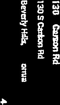


130 272


![4334 COMmtRC L ZesNS C 0 O C lii I z ] J C z 0 U, ix: 4: ci C](/docs-images/93/112990534/images/131-6.jpg "6j vd Qc 0LJ CHARLEVILLE BLVD. - CODE 2410 FOR PREy.")
131 4,333 ALE Present Zoning The 700 South block between LeDoux and Stanley Is all C-3 The 100 South block between Stanley and Carson is C-3 and R-1 The 700 South block on west side of Carson and Williaman is all R-1 All of the 200 South blocks south of Charleville are all R-1 SiN1. Frn Y I-!6S f-j Cfff1iND1 1 BK COMmtRC L ZesNS C 0 O C lii I z ] J C z 0 U, ix: 4: ci C 6j vd Qc 0LJ CHARLEVILLE BLVD. - CODE 2410 FOR PREy. ASSM T SEE: T8.26 TRACT NO M.B ASSESSOR S MAP 273
132 To: TimmiTway Sent: Thursday, October 05, :17 PM From: Gholi Gholizad 1 Here is few picture from our back yard that shows the new construction behind our house. Hi timmi TimmiTway 274


133 II I 4k I LLf 275


134 I.4 I; 276


135 277

136 278


137 279
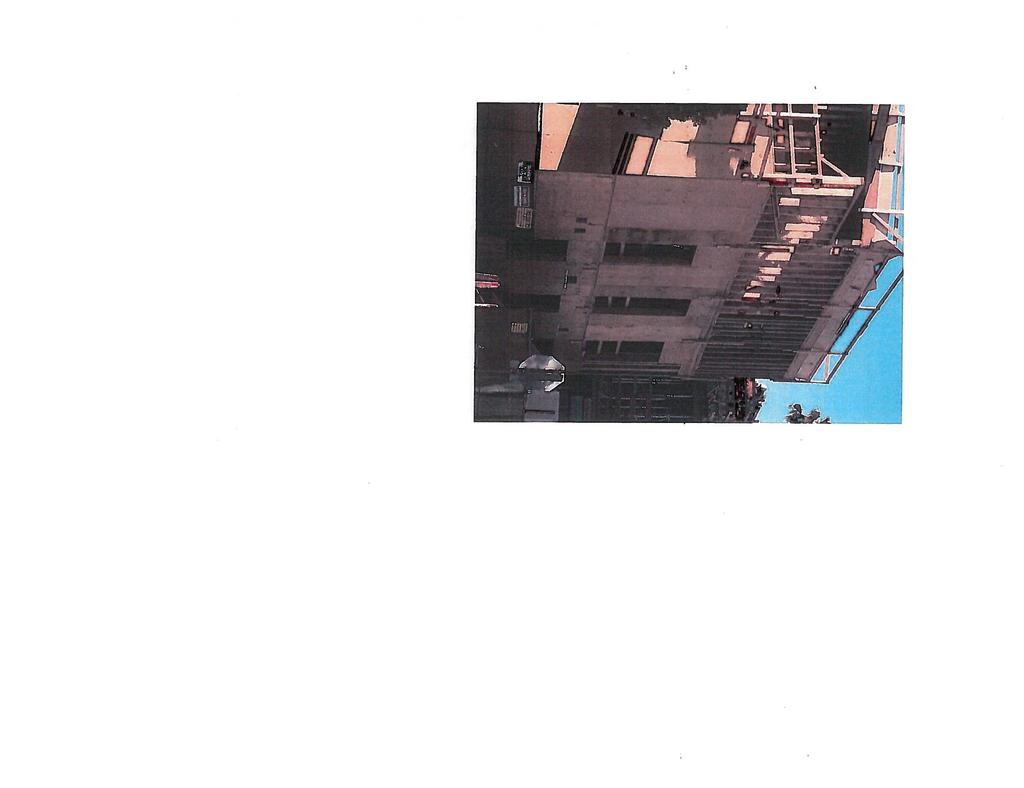


138 280 I I I

139 Planning Commission Report 128 and 130 South Carson Road Rezone Project October 12, 2017 Attachment J Zoning Map 281
140 :_-_- - R-l.6X J City of Beverly Hills Zoning Map Planning Division, October 2008 HILLSIDE AREA Il - - I / -; :- - -:: T / I - TROUSDALE ESTATES :,: : L, :\: ri. -- a-. : : : / ZONES: SDOGLE-FAMILY RESIDENTIAL K-I One-Family ResidstialZone - R4XOne-Pomily ResidenilaiZane.J R-I.5X One-Family RmidenflalZone R-I.5)G One-Family Reudenlial Zone One-Family Residential Zone R47X One-Family Residential Zone R-lSX One-FamilyResidenthi Zone MULTI-FAMILY RESIDENTIAL R-3 Multiple ResidentiaiZone R-4 Multiple ResidentiaiZone [] R4)D Residential lissome and Multiple DweflftsgZosse R4X2Multiple Reuidesstial Zone K-ti-P Residential FarkhsgZone E] RSSICP Multiple-Family Residesstial-Cumxsvrcixlpurldng Zone COMMERCIAL C-3 CommerdalZone C-IA Commercial Zone C-SB Commercial Zone C-3T-I Commeodal-Tranultion Zone C-3T-Z Commercial-Transition Zone 3 C-ST-I Commerdal-Isunultion Zone C-S INSTITtONAL/GOVERNMENT Courch Zone P-SPublirlereine Zone SSchool 14 TronsportalionZone Parks, Reserroim, Government (Unoossed) SPECIFIC PLAN AREAS & OVERLAY ZONES 9900 WilshireSpedficFlan - Benerly Hills Gardenlpecific Plan Beverly Hills HotelSpecific Plan E Beverly Hiltenspecific Han )5 C-SCAR) Adaptive Reuse Planned Development OverloyZone El C-H(O) Commercial Hotel OverlayZone C-RCommercial-Retail Overlay Zone El C-K-PD Commercial Retail Planned DevelopmentOverlayZone EPD ReimtainmenlO00ce Plomed DevelopmmtOnalay Zone El M-PO-2 Mixed Use Planned DevelopmertOverlay Zone M-PD-3 Mixed Use Planned DevdopmmLOcerlay Zone M-PD4 Mixed Use Planned Development Overlay Zone T-OTrannportation Overlay Zone AreaBowsiary City Boundary _% CENTRAL AREA I Miles 282
141 Excerpt from 2004 General Plan Topic Committee Report Attachment K October 12, and 130 South Carson Road Rezone Project Planning Commission Report 283


142 Single4amily (R-1) Residential across the street from Commercial Report of Recommendations February 2004 Commercial development with the surrounding residential zone. However, under this zoning zones. addition to R-1 properties across the street from the commercial zone. The provisions were established with the intent for compatible commercial The interface in this immediate area is unique in that there ate R-1 properties particular commercial zone bounded by Wilshire Blvd., Stanley Drive, Charleville zoning limits and the abrupt interface between the commercial and residential zone, with only office use as the allowable use with a two-story limit. These development on these parcels is economically infeasible because of the current for a number of years. The btock to the west, between Carson Road and Stanley Drive, has also remained partially vacant. Developers have indicated that it has been difficult to develop this site, and a portion of it has remained vacant Blvd, and Le Doux Road is currently designated as a commercial transition which share their common side property lines with commercial properties, in I I RESIDENTIAL I I MULTI-FAMILY I I RESIDENTIAL [ 7 SINGLE-FAMILY I:.ab b COMMERCIAL LINE BOUNDARIES WITHIN THE DASHED THE SUBJECT AREA IS Charleville Blvd. (between Carson and Le Doux Roads) Location: Residential Interface Committee Beverly Hills General Plan Topic Committees 284

143 recommendation for this particular area: The Committee considered these issues and made the following Report of Recommendations February 2004 Commercial properties. limited density and height, and that it could add value to the surrounding o Mixed-use development would be an appropriate transitional zoning, with family properties in the immediate area. congestion, and would negatively impact the property values of the single increase spillover parking onto the residential streets, cause traffic o The zoning for this area should remain as is, and changing the zoning would Minority Opinions: examples in other communities. should be studied is the townhouse development concept, and seeking height, and density standards of the commercial and residential uses. Also A land use study of the area by Staff to determine the appropriate scale, Required resources to imrlement: to face the single-family residential zones to the west and south. development, to be compatible and commensurate in scale and density with the surrounding R-1 zone context; commercial uses should be oriented to face Wilshire Boulevard and the residential development should be oriented Commercial use with residential development, which may include townhouse Residential Interface Committee Beverly Hilts General Plan Topic Committees 285
144 Public Comment Received after October 12, 2017 Meeting Attachment B 128 and 130 South Carson Road Rezone Project May 10, Planning Commission Report


145 Timmi Tway From: Sent: To: Subject: Follow Up Flag: Flag Status: Masa Alkire Wednesday, May 02, :50 PM TimmiTway FW: 128 and 130 South Carson Road Follow up Flagged From: Sent: Tuesday, April 24, :35 PM To: Masa Alkire Subject: Re: 128 and 130 South Carson Road Just that we oppose the rezoning. Original Message From: Masa Alkire <malkirecbeverlyhills.orq> To: <ginaseidelfaol.com> Cc: Timmi Tway <ttwaybeverlyhills.org> Sent: Tue, Apr 24, :48 pm Subject: RE: 128 and 130 South Carson Road Gina The public notice identifies that the planning commission will discuss rezoning the parcel a multifamily zoning designation called R-4. This zoning designation does not denote 4 units per parcel. The number of units that could be built on a parcel is based on a density calculation that is derived from the total size of a site. At this point in time the hearing is to get direction from the commission on if an ad hoc committee should be established to further study the rezoning request. This further study could include ideas such as limited the two sites to two units each. This meeting is a study session to further discuss the possibility of rezoning the site, and is an opportunity for the planning commission to direct staff on what actions should be taken regarding this matter. Do you have any communication that you would like to distributed to the planning commission for this upcoming meeting? Best, Masa Alkire, AICP Principal Planner City of Beverly Hills 455 N Rexford Dr Beverly Hills, CA Direct: malkire@ beverlyhills.org 1 287

146 From: Sent: Tuesday, April 24, :13 PM To: Masa Alkire Subject: 128 and 130 South Carson Road Dear Masa, I received the notice regarding the properties referenced above. I assume that both parcels would have to be sold so that one 4 unit building could be built. It s not 4 each is it? What about the idea of permitting a duplex? Thank you, Gina Seidel The City keeps a copy of all s sent and received for a minimum of 2 years. All retained s will be treated as a Public Record per the California Public Records Act, and may be subject to disclosure pursuant to the terms, and subject to the exemptions, of that Act


147 Timmi Tway From: Sent: To: Subject: Follow Up Flag: Flag Status: Masa Alkire Wednesday, May 02, :45 PM Timmilway FW: 128 and 130 S. Carson rezoning session Follow up Flagged From: anatoly balsim Sent: Wednesday, May 2, :58 PM To: Masa Alkire Anatoly Balsim Subject: 128 and 130 S. Carson rezoning session Attn. Masa Alkire To whom It may concern I am writing regarding 128 and 130 S. Carson road potential rezoning of the properties which will have public meeting on May 10, Bo Balsim Salon owner and Dian Whitney owner of the properties located in effected area received notice of this meeting and would like to submit our comments regarding this matter. Considering current construction projects in this area, which include Wilshire and Stanly development and Purple Line project, greatly effecting businesses and public parking. In addition, we are aware of new Preferential Parking Permit Zone proposal to change parking permit zone from 2 -Hours parking to 1 (one) on 200 Block of South Willaman Dr. which will make public parking almost impossible. We are concern that rezoning of the properties 128 and 130 S. Carson road from R-1 to R-4 will significantly worsening parking and other situations for businesses and their clients. Please note that multiple businesses in our area endure many challenges (many relocate already) and complicating Public Parking conditions will jeopardize our survival. Anatoly and Bo Balsim Dian Whitney May 1,


148 Timmi Tway From: Masa Alkire Sent: Tuesday, May 01, :54 PM To: Marcia Drantch Cc: Timmi Tway Subject: Re: 128 and 130 S Carson Rd May 10 Follow Up Flag: Flag Status: Follow up Flagged Marcia Public correspondence received to date will be attached to the staff report. Best, Masa On Apr 25, 2018, at 10:48 AM, Marcia Drantch <rndrantch@aol.com> wrote: Masa, You may share my communication. We are wondering, you have all our previous letters we have sent. Do we need to resend them or will they look at all the letters we did send? The session is to consider alternatives, which is good. Thank you, Marcia Marcia Drantch mdrantch(aol.com Original Message From: Masa Alkire <malkirefbeverlyhills.orq> To: Marcia Drantch <mdrantch(aol.com> Sent: Tue, Apr 24, :42 pm Subject: RE: RE 128 and 130 S Carson Rd May 10 Thank you Marcia Would you like the communication below shared with the Planning Commission? Masa Alkire, AICP Principal Planner City of Beverly Hills 455 N Rexford Dr Beverly Hills, CA Direct: malkire@beverlyhills.org 1 290

149 From: Marcia Drantch Sent: Saturday, April 21, :33 PM To: Masa Alkire Subject: RE 128 and 130 S Carson Rd May 10 Hi Masa, My name is Marcia Drantch at 203 S Carson Rd. I saw you at the last meeting. I brought my neighbors Harold Goldsmith, with dog, 205 S Carson and Betty Globe, 103 now years old at 200 S Carson.. I will be out of town on Mayl 0th. Harold and Betty will be unable to come, as they both are having trouble walking. We are all still interested in the outcome and hope it won t depreciate our property value. I any other meetings, in the future. will come to Thank you for our consideration. Marcia Drantch mdrantchaol. corn The City keeps a copy of all s sent and received for a minimum of 2 years. All retained s will be treated as a Public Record per the California Public Records Act, and may be subject to disclosure pursuant to the terms, and subject to the exemptions, of that Act

150 Potential Timmi Tway From: Sent: To: Subject: Masa Alkire Tuesday, May 01, :46 PM TimmiTway Fwd: Comments on 128 and 130 S. Carson Road - Rezoning Follow Up Flag: Flag Status: Follow up Flagged Begin forwarded message: From: Anthony Mayorkas <amayorkas(hotrnail.com> Date: May 1, 2018 at 8:29:30 PM PDT To: Masa Alkire <ma1kire(bever1yhi11s.org> Subject: Comments on 128 and 130 S. Carson Road - Potential Dear Planning Commission, Rezoning I am concerned by the prospects of the rezoning of the properties located at 128 and 130 South Carson Road. I request that the Planning Commission maintain the properties as single-family residential properties. I live with my family on Willaman Dr., in the same house that I grew up in. I have witnessed the increased congestion in the neighborhood as more (or at least seemingly larger) buildings have been built on Wilshire Blvd. And, undoubtedly, larger multi-family residential buildings have been built on the blocks immediately south of Gregory; true, these buildings lie in Los Angeles and Beverly Hills cannot control the building construction there, but the ultimate impact on streets in our immediate Beverly Hills neighborhood is undoubted. Congestion has increased, and a neighborhood feel has dissipated. Specifically as it applies to Carson, the 200 S. block would be increasingly bookended by streets of multi-family buildings. I would also ask the Planning Commission to keep in mind what the presence of the La Cienaga subway stop may portend for the neighborhood in terms of congestion. I worry greatly about this congestion issue and view it as a real threat to the quality of life here. I have already seen an impact and would ask that the Planning Commission try to manage the impact and not exacerbate it. Thank you for your consideration. Tony Mayorkas amayorkas@hotmail.com (917) mobile 1 292


151 whole. From: Masa Alkire Sent: Monday, April 30, 201$ 8:55 AM To: TimmiTway Subject: FW: Carson when our area was initially planned and certainly expected when we bought our homes. logical reason to bulk-up the small neighborhood feeling currently enjoyed residents are more important than the interests of developers there is no If Our Residents Come First is more than a City catch-phrase if Allowing R4 development on any lot(s) would be opening the door to overdevelopment in a single family community which exists in the four streets encompassing this area of our city between Robertson and La Cienega, south and north of Wilshire If he did it why can t we do it these two lots by at least four-fold, and perhaps more. Parking for nearby too, on our block? The contemplated re-zoning will increase density on homes and small businesses on Wilshire Blvd would suffer exponentially Dear Commissioners: not believe the proposal to allow even limited R4 development in an Ri neighborhood is a sound idea or benefit to our area or to the City as a Tim ml Tway From: Patt and/or Arnie Sklar <a.p.sklarsbcglobal.net> Sent: Sunday, April 29, 201$ 10:30 AM To: Masa Alkire <malkire@beverlyhills.org> Subject: S. Carson We are very much opposed to the proposed re-zoning of the 2 lots at S. Carson. As 35+ year homeowners and residents nearby, we do in an area that struggles already with limited parking for everyone

152 With respect to the applicant, this proposal is nothing more than an attempt to make a lot of money at the expense of our neighborhood character. Respectfully, Arnie & Patt Sklar 152 N. Hamel Dr


153 0 0 GSG INCORPORATED Tel: (310) designers and manufacturers of fine jewelry Fax: (310) P.O. Box 5786 Beverly Hills, CA De& Masa. I strongly oppose the rezoning of I 2$ and 1 30 So Carson road for reason that I would be REWARDING them I repeat REWARDiNG them for their poor judgment in purchasing their properties adjacent to a pioperty Zoned for commercia use. They shou d have known that although the property was aeant at that time at some point a structure would be built that would affect the value of their properties.. It was their decisions that are responsible for the position they arc now in. They are now asking you to reward them for their bad decisions by rezonin.g their properties adding value to their properties at the expense of allthe other property owners whose properties would lose value.. Where is the fairness that because of their poor judgment they be rewarded and we be punished? Their statement that it does not involve construction at this time is an insu]t to our intelegance. It is very likely that the properties would be up for sale before the ink is dry on the document. 1 am 98 years old.and have lived at 205 S Carson Rd since My dog Orco has been living with me for the past 1 3 years. 1-le is my best friend and he takes me for a walk up and down the street every day. We both would like you to know that we like the street just the way it is and are praying that you do not change it. Thank you for your consideration, Harold Goldsmith and Oreo 295


154 From: To: Cc: Subject: Date: Masa Alkire Karen Myron 128/130 S Carson Proposed Rezoning Wednesday, November 8, :40:34 AM Dear Masa, I would like to take this opportunity to let you know how shocked and disappointed we all were by the last planning commission meeting to discuss the rezoning efforts on the above mentioned property. First, let me introduce myself. My name is Stacey Babbitt and I have been a homeowner in Beverly Hills since 1984, first at 208 S. Clark and now at 207 S. Carson since I am a licensed realtor with Coldwell Banker in Beverly Hills for over 28 years. I am considered the #1 duplex specialist in Los Angeles. I work and live in Beverly Hills and support alt of the local restaurants daily. I also sell many residential homes in South Beverly Hills. The new project on Stanley and Wilshire brings uncertainty to our small pocket. The Metro project brings more uncertainty. We do not know how these projects will impact our quality of living. I cannot see how rezoning these two parcels on Carson will have a positive impact in our community. I have expressed my concerns with a prior and I have spoken at the last planning commission meeting. During the last planning commission meeting, many of our neighbors (some on adjoining streets) attended and raised their concerns about this rezoning project. There was only opposition. The only person that appeared was Nancy Krasne, the past Mayor from , in favor of rezoning. The neighbors thought this was extremely unfair, as Mrs. Krasne is a current Council member and should be unbiased. She brought up an old promise from 10 years ago, why she was in favor of the rezoning. As I have respect for people that dedicate their lives to public service, my neighbors and I were blind-sided by her support for one individual. I do not understand how 3 members of the planning commission took a 10 minute break and then voted to approve the rezoning. One of the members said they didn t believe that the rezoning would affect property values. One of them stated that we didn t have empathy for the owners of 128/130 S Carson. Neither of these arguments makes sense. There will be clearly be a property value loss, in the event these lots are rezoned. I think anyone that purchases a home with a vacant lot behind it, must know the inherit perils. I am urging the planning commission to rethink this issue. This one decision that is out of our hands, rewards 2 people, while punishing the entire neighborhood. Thank you for your time and understanding in this most critical issue for our neighbors. Sincerely, Stacey Babbitt 207 S. Carson Road Beverly Hills, CA Stacey Babbitt Coldwell Banker/Beverly Hills South 166 N. Canon Drive Beverly Hills, CA (310) CaIBRE#

155 Masa Alkire From: Sent: To: Subject: Follow Up Flag: Flag Status: Tuesday, November 7, :36 AM Masa Alkire 128 & 130 S. Carson Road Re-Zoning Follow up Flagged Dear Masa, I m writing to express my concern over the South Carson Road re-zoning project. I m the property owner at 201 South Carson Road and have lived here since the 1970s. The re-designation of 128 and 130 South Carson Road from R-1 to R-4 would have a direct impact on my property, its potential future value, and living experience in my long-time neighborhood. The construction of the Wilshire/Stanley building has created chronic noise and disruption. Alongside the Metro construction, it feels as though this once quiet and peaceful neighborhood has become very active and less of a residential community than it once was. My concern is the influx of activity that another R-4 structure would bring to this already increasingly congested area. It remains to be seen how the neighborhood will continue to change as the building is completed and occupied. I hope that the commission will strongly consider how adversely this re-zoning could affect homeowners who are already facing the reality of a drastically changed neighborhood. Thank you for your time and consideration. Sincerely, Vickie Daley 201 S. Carson Road Homeowner 1 297
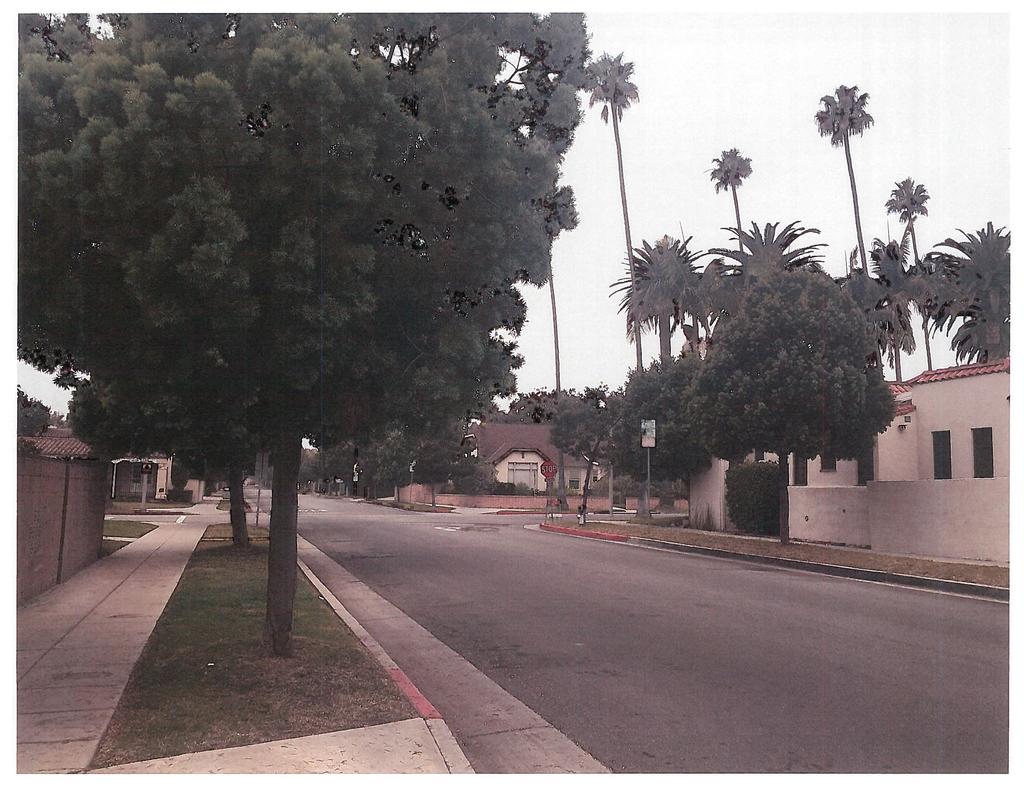


156 4E2 I 298

157 Dear Planning Commissioners: Neighbors and I are concerned about the up-zoning, the domino effect, change of neighborhood character should 128 and 130 Carson be designated R-4. Understandably, my neighbors at 128 and 130 Carson are about the size and of the 86( Wilshire development. To designate R-4, however, and allow up to 10 residences where are now two is too drastic for our R-1 streets. there Perhaps a compromise could be reached This would Carson Road. their properties upset structures transition better with residences to the north, south, and especially west that would limit future impact to a duplex on each lot. of 128 and 130 I was during the October 12, 2017 meeting where the Hon. Nancy Krasne claimed the owners on Carson were promised R-4 zoning in With all due respect, I do not believe any such promise was made, so it concerned me this was the reason Commissioner Licht offered when explaining his approval of the R-4 designation. I the Planning Commission and City Council meetings in As in the 2007 present stated that attended transcripts, The General Plan white papers contemplate adding zoning something in R-1 and R-4 between As in the 2007 Staff Report, the owners of two R-1 Council consider re-zoning lots to a higher density to be more the approved mixed-use project. stated R-4 is too drastic. their these that that would allow for duplexes or properties consistent have the and compatible with requested that Creating a building to house ten--where are now two--residences will change of the neighborhood, especially for the people residing directly across from the homes in question, whose front yards will face a large multi family complex, likely 2 parcels joined together. The height and mass of a 10 on the 200 blocks as well. there unit building will affect the ambiance for the residents the character Although the impact survey analysis states is no negative impact, it also specifically it does not include any physical development on the site. This is significant. If R-4 is granted, for height and density. The same thing could happen here. that that there there will be a physical development, and it will have an impact was granted entitlements states The analysis also states it would be speculative to to assess potential impacts of a hypothetical development project at this time. BUT our niche to feel the impac of the traffic and parking from 8600 Wilshire s 18 units ( commercial) or of the Wilshire-La Cieneg metro station. that attempt has yet transportation 299

158 Lastly, when 8600 was built, its driveway was specifically designed to NOT be on Charleville becaus of pedestrian traffic. Following reasoning, the and egress of the R-4 would be on Carson. that The residents of 128 and 130 have solution for this neighborhood. Thank you for your consideration. Respectfully submitted, Lisa Wolfe reason to be entrance upset with their situation, but granting R-4 is not a 300

159 need parcels 1 November 1, 2017 Dear Members of the Planning Commission of the City of Beverly Hills: I am writing respectfully to express my strong and very determined opposition to the proposed 128 and 130 South Carson Road Rezone Project. Obviously these two parcels specifically and originally zoned for single-family homes to be blended in order to provide a suitable footpad large enough for the developer behind this effort to build an R-4 multi-family structure which is entirely incompatible with every single house you can now see if you stand anywhere on South Carson Road s lovely, palm-lined length. But it s not just that approving this upzoning request will spoil the long-standing ambience of South Carson Road by permitting the intrusion into our neighborhood of a much larger, blocky structure clearly out of place on the corner of Charleville and South Carson Road. On what legal basis will you deny future upzoning requests from the home owners on the western side of South Carson Road directly facing a looming multi-family structure? On what basis will you deny the upzone requests of the residents of two adjoining homes just south of Charleville who also decide to blend their properties and cash in at the expense of all the homeowners on South Carson Road? Where and why would this encroachment into our neighborhood end? That is why this very first upzoning request must not be permitted to happen on South Carson Road. This specific upzoning request for 128 and 130 South Carson Road is not good zoning practice. An R-1 homeowner successfully requesting upzoning approval is extremely rate and there are good reasons for its rarity. In fact, a little research reveals that there has never been a single successful upzoning request along the entire length of Charleville Boulevard from South Carson Road all the way to Doheny. A glance at the map shows that South Carson Road is the last street crossing Charleville (before Charleville dead-ends at Le Doux) which has preserved the original R-1 zoning of homes on the north side of Charleville. The upzone request for the 8536 Wilshire Boulevard building seems reasonable because the 8530 Wilshire building s overarching presence has existed on the northernmost end of Le Doux for 50 years or more. The 8600 Wilshire project, which extends down the west side of Stanley to Charleville, faces no R-1 homes on the east side of Stanley, and in this light this specific upzone request also has some merit. But for the R-1 homeowners on South Carson Road, the short 100 block of our street has served as a crucial buffer between our homes and the office buildings lining Wilshire Boulevard for three quarters of a century. As limited as it is, we need to preserve the status quo of a street 301


160 2 originally designed and constructed as a street of homes, not apartment buildings. The residents of South Carson Road want to hang onto what little buffer we ve got. Please do not to take it away from us. Clearly, approving this upzoning request is good financially for the two owners of the parcels and also for the developer the two property owners are most likely working with behind the scenes. But their financial gain will come at the expense of the vast majority of the longtime home-owning residents in this quiet neighborhood whose home values, experts advise me, could drop as much as 25%. Because permitting the construction of a double-lot, multi-family structure on the 128 and 130 lots will be highly incompatible with our neighborhood s look and ambience and will disrupt the long-standing consistency of our R-1 homes, I respectfully request that the City Council of the City of Beverly Hills and the Planning Commission take sensible action which not only makes good city planning sense, but also preserves South Carson Road s long history as a street of single family homes. Thank you for this opportunity to convey the reasons for my intense concern and alarm. Respectfully submitted, Frederick Ayeroff A 29-year resident on the 200 block of S Carson Road 302

161 From: To: Subject: Date: Colleen Sternshein Karen Myron 128 and 130 S Carson Rd Tuesday, November 7, :18:56 PM Dear Planning Commission, I am a resident of the neighborhood around 128 and 130 S Carson Rd. My family has lived in our house for 20 years and we have supported the schools and the Beverly Hills community. I am very concerned about the effects of changing the zoning for the parcels of 128 and 130 S Carson. This is setting a very dangerous precident that could drastically change our neighborhood with extremely negative impacts. This neighborhood is a very important area for new and young families to be able to buy a house and move into the area. The added density of changing the zoning affects the quality of life for the single family homes in the neighborhood adding noise, car traffic, and pedestrian traffic. Please do not approve this change and respect the single family neighborhoods of Beverly Hills. Thank you, Colleen Sternshein 303


162 Timmi Tway From: Sent: To: Subject: Parisa Leviadin Thursday, October 12, :16 PM Timmi Tway Re: 12$ and 140 south Carson road Thank you, Also forgot to mention when a residential owner wants to rebuild their home their are so many rules and guidelines they must obey to abide by the city codes. Why is it so easy to suddenly change a residential property to a multifamily unit? If that is a case then all residential owners should have the right to build the same with their properties. Thank you, Pld Sent from my iphone On Oct 12, 2017, at 12:12 PM, Timmi Tway <ttway 1ibever1vhiIIs.org> wrote: Thank you, I have received your comments and they will be provided to the Planning Commission for consideration. Timmi From: Parisa Leviadin [malto: pleviadin@yahoo.com] Sent: Thursday, October 12, :39 AM To: Timmi Tway Subject: Re: 128 and 140 south Carson road Dear Ms. Tway and the Planning Commission: My family and I reside on Le Doux Road, approximately one blocks away from the proposed re zoning project at 12$ and 130 South Carson Road. I am writing to share my opposition to this proposed project. We have had tremendous increase in traffic and congestion due in large part to the construction of the subway stop at La Cienega Boulevard. In addition, there has also been a massive amount of construction underway on the corner of Stanley and Charleville. All this construction has been underway for almost four years now, and it is still only half way through. We are afraid that there will be even more traffic as the residents and patrons of the new residences and businesses will be flooding the area. We did not move to Beverly Hills to be part of a construction zone and metropolitan city. My kids already have a hard time sleeping from the noise and loud disrupting sounds


163 If the proposed re-zoning occurs, the property owners at 12$ and 130 South Carson Road wilt likely sell their property to a developer who will tear down the houses and develop another massive project. Enough is enough. My children can t play in the streets because the traffic has become so packed and dangerous. Cars speed their way through stop signs and trucks drive by with objects falling off of them. Our street is a shortcut even for the police to fly by. Traffic is so fast they are speeding over the bumps and loud banging sounds come from the cars. We do not want any further development in our neighborhood. Other than homes wanting to improve their look we are tired of all the disruption. Not only is this proposed re-zoning altering the charm and character of our quaint neighborhood (and doing away with the signature Spanish style homes that preserve the history of this city), but it is also bringing unwanted congestion and crime and we are sick and tired of it. We urge you to please vote NO on converting the two properties into R-4. Thank you, Pid The City keeps a copy of all s sent and received for a minimum of 2 years. All retained E mails will be treated as a Public Record per the California Public Records Act, and may be subject to disclosure pursuant to the terms, and subject to the exemptions, of that Act


164 Timmi Tway From: Sent: To: Subject: Kamy Kamjoo Thursday, October 12, :30 PM TimmiTway Carson project Ms Tway, RE: 128 and 130 South Carson Road My wife and I strongly oppose this project. For the sake of our community and families, please vote NO on converting these properties to R-4 zoning. Kamyar and Shirin Kamjoo 1 306


165 Timmi Tway From: Sent: To: Cc: Subject: Attachments: Cyrus Zahabian Thursday, October 12, :19 PM Timmi Tway Anita Yossian Rezoning Projection On Carson Redeclaration opposition.docx Ms Tway, RE: 128 and 130 South Carson Road My wife and I strongly oppose this project. For the sake of our community and families, please vote NO on converting these properties to R-4 zoning. Best Regards, Kurosh & Ilana Zahabain 1 307

166 Ms. Timothea Tway, AICP, Senior Planner City of Beverly Hills, Community Development Department 455 North Rexford Drive Beverly Hills, CA RE: 128 and 130 South Carson Road Dear Ms. Tway and the Planning Commission: My family and I reside on North Carson Road, approximately two blocks away from the proposed re zoning project at 128 and 130 South Carson Road. I am writing to declare my opposition to this proposed project. As you know, over the last few years, this area has seen a tremendous increase in traffic and congestion due in large part to the construction of the subway stop at La Cienega Boulevard. In addition, there has also been a massive amount of construction underway on the corner of Stanley and Charleville. All this construction has been underway for almost four years now, and it is still only half way through. When the projects in the neighborhood are complete, we anticipate that there will be even more traffic as the residents and patrons of the new residences and businesses will be flooding the area. If the proposed re-zoning occurs, the property owners at 128 and 130 South Carson Road will likely sell their property to a developer who will tear down the houses and develop another massive project. Enough is enough. We have children who cannot play in the streets because the traffic has become so horrendous. Cars speed their way through stop signs. Our streets have become virtual freeways and we do not want any further development in our neighborhoods. Not only is this proposed re-zoning altering the charm and character of our quaint neighborhood (and doing away with the signature Spanish style homes that preserve the history of this city), but it is also bringing unwanted congestion and crime and we are sick and tired of it. We urge you to please vote NO on converting the two properties into R-4. Respectfully Yours, Q a aa& Concerned Residents of North Carson Rd. 308

167 October 12, 2017 Ms. Timothea Tway, AICP, Senior Planner City of Beverly Hills, Community Development Department 455 North Rexford Drive Beverly Hills, CA RE: 128 and 130 South Carson Road Dear Ms. Tway and the Planning Commission: My family and I reside on North Le Doux Road, approximately two blocks away from the proposed re zoning project at 128 and 130 South Carson Road. I am writing to declare my opposition to this proposed project. As you know, over the last few years, this area has seen a tremendous increase in traffic and congestion due in large part to the construction of the subway stop at La Cienega Boulevard. In addition, there has also been a massive amount of construction underway on the corner of Stanley and Charleville. All this construction has been underway for almost four years now, and it is still only half way through. When the projects in the neighborhood are complete, we anticipate that there will be even more traffic as the residents and patrons of the new residences and businesses will be flooding the area. If the proposed re-zoning occurs, the property owners at 128 and 130 South Carson Road will likely sell their property to a developer who will tear down the houses and develop another massive project. Enough is enough. We have children who cannot play in the streets because the traffic has become so horrendous. Cars speed their way through stop signs. Our streets have become virtual freeways and we do not want any further development in our neighborhoods. Not only is this proposed re-zoning altering the charm and character of our quaint neighborhood (and doing away with the signature Spanish style homes that preserve the history of this city), but it is also bringing unwanted congestion and crime and we are sick and tired of it. We urge you to please vote NO on converting the two properties into R-4. Respectfully Yours, Concerned Residents of North Le Doux Rd. 309


168 October 12, 2017 Ms. Timothea Tway, AICP, Senior Planner City of Beverly Hills, Community Development Department 455 North Rexford Drive Beverly Hills, CA RE: 128 and 130 South Carson Road Dear Ms. Tway and the Planning Commission: My family and I reside on South Le Doux Road, approximately two blocks away from the proposed re zoning project at 128 and 130 South Carson Road. I am writing to declare my opposition to this proposed project. As you know, over the last few years, this area has seen a tremendous increase in traffic and congestion due in large part to the construction of the subway stop at La Cienega Boulevard. In addition, there has also been a massive amount of construction underway on the cornet of Stanley and Charleville. All this construction has been underway for almost four years now, and it is still only half way through. When the projects in the neighborhood are complete, we anticipate that there will be even more traffic as the residents and patrons of the new residences and businesses will be flooding the area. If the proposed re-zoning occurs, the property owners at 128 and 130 South Carson Road will likely sell their property to a developer who will teat down the houses and develop another massive project. Enough is enough. We have children who cannot play in the streets because the traffic has become so horrendous. Cars speed their way through stop signs. Our streets have become virtual freeways and we do not want any further development in our neighborhoods. Not only is this proposed re-zoning altering the charm and character of our quaint neighborhood (and doing away with the signature Spanish style homes that preserve the history of this city), but it is also bringing unwanted congestion and crime and we are sick and tired of it. We urge you to please vote NO on converting the two properties into R-4. Respectfully Yours, Concerned Residents of South Le Doux Rd. 310
169 j7 () Planning Commission Report 128 and 130 South Carson Road Rezone Project May 10, 2018 Attachment C Summary of Existing Overlay Zones 311

170 - 9700, City of Beverly Hills Overlay Zones Overlay Zone Adopted Address Description. Establishment of retail department stores under different regulations than the underlying commercial zone such as: Commercia I 9680 and 9650 Wilshire o Building height not to exceed 100 feet Retail Overlay 1/20/ Boulevard o Maximum floor area ratio permitted of 5.0 Zone fc-r) Site for Neiman Marcus, Saks Fifth Avenue Men s Store and other retail uses. A total of two subsurface parking structures. Additional opportunities to locate quality retail department stores that would not otherwise Commercial. be encouraged by the underlying zone with regulations such as: R etai1 P1 anne d 9620, 9610, 9600, , o Maximum height of five (5) stories and maximum height of 85 feet Development 10/8/ I 9570, 9582 Wilshire Boulevard o Floor Area Ratio no greater than five to one (5:1) (C-R-PD) Site for Saks Fifth Avenue and Barney s New York Surface parking and subsurface parking 9338 Third Street and the sites The Transportation Overlay Zone was superimposed over the Transportation Zone to Transportation located along the south side of allow limited expansion of the uses permitted on property located within the T-zone in a Overlay Zone 7/10/2001 North Santa Monica Boulevard manner that is consistent with the underlying zoning district and the elements of the (T-O) roadway from the eastern and general plan. western City boundaries Adaptive Renovated and converted an existing legally nonconforming 11-story office building Reuse Planned Created 37 residential rental units Development 2/4/ Wilshire Boulevard Approximately 650 square feet of ground floor retail Overlay Zone 114 on-site parking spaces (C-3 (AR)) 44,450 square feet of gross building square footage Mixed use development project consisting of a four-story, 39,975 square-foot office/retail building with a height of 45 feet Residential component comprised of 82 apartment units with a maximum height of fivestories and 60 feet 307 parking spaces in subterranean and above-grade garages for the commercial portion Mixed Use of the Project P1anned North Crescent and 227 parking spaces in an at- and below grade structure for the residential portion of the Development 12/3/ Wilshire Boulevard project Overlay Zone An amendment in 2014 allowed for the 28 apartment units to function as AKA serviced (M-PD-2) residences as well as an addition of a 2,500 square foot restaurant 312

171 City of Beverly Hills Overlay Zones Overlay Zone Adopted Address Description.. Allowed a four-story, four-unit condominium building to be used as a hotel in conjunction Commercial with the existing four-story, 49-unit Mosaic Hotel located at 125 Spalding Drive H t I 0 I ay ezon 3/13/ Spalding Drive One unit per floor as luxury hotels suites and each unit encompasses an individual floor of the building (C-H (0)). Subterranean garage containing twelve parking spaces Allowed for a mixed-use development project with a maximum building height of 60 feet 54 residential condominium units and rooftop uses Mixed se 14,000 square feet of ground floor commercial space Planned parking spaces in a four level subterranean garage Development 9/17/ Wilshire Boulevard An amendment to the project later allowed for a reduction of ground floor commercial to Overlay Zone 7,300 square feet fm-pd-4) o As well as a reduction in parking to 220 parking spaces located in a subterranean garage consisting of two full levels and a partial third level Allowed a mixed-use development project with a building height of 61 feet and five stories M d 6,383 square feet of ground floor retail/commercial space p,ne7 11/13/.. Maximum of 26 residential condominium units, two of which are affordable Development 8600 Wilshire Boulevard square feet of ground floor retail/commercial space Overlay Zone Parking provided at street level and in a subterranean garage for up to a total of 97 (M-PD-3) parking spaces Allowed for an entertainment talent agency office building with a maximum height of 91 feet Entertainment Maximum floor area of 3.6:1 Office P1 anne d The building has a gross square footage of 208,100 including 177,225 gross square feet of Development 12/18/ North Beverly Drive Overlay Zone (E-O-PD) M e d ca I U se ver ay Zone office space on floors two through six 30,875 gross square feet of retail space (up to 8,000 square feet of which could be restaurant space) on the ground floor A total of 756 parking spaces contained in five levels of subterranean parking Existing four-story, 68-foot-tall, 75,116 square foot office/retail building 1/11/ Wilshire Boulevard Allowed up to 33,802 square feet of medical office space (45% of the building s floor area), but not on the ground floor, to be located within the building Purpose is to encourage the construction of housing for persons with special needs in. compliance with state law. Such housing shall be allowed in certain areas of the city to 11/23/ avoid the concentration of special needs housing in any single area and locate such... housing close to amenities and services appropriate for the intended residents. S pecial Needs Housing Not yet applied to any property. Overlay Zone. 313
Planning Commission Report
 cjly City of Beverly Hills Planning Division 455 N. Rexford Drive Beverly Hills, CA 90210 TEL. (310) 285-1141 FAX. (370) 858-5966 Planning Commission Report Meeting Date: April 28, 2016 Subject: Project
Planning Commission Report
 City of Beverly Hills Planning Division 455 N. Rexford Drive Beverly Hills, CA 90210 TEL. (310)285-1141 FAX. (310) 858-5966 Meeting Date: Subject: Project Applicant: Recommendation: STUDY SESSION REGARDING
Staff recommends the City Council hold a public hearing, listen to all pertinent testimony, and introduce on first reading:
 CITY COUNCIL PUBLIC HEARING JANUARY 16, 2018 SUBJECT: INITIATED BY: MULTI-FAMILY NEIGHBORHOODS ZONE TEXT AMENDMENTS: AMEND MINIMUM DENSITY REQUIREMENTS FOR R3 AND R4 DISTRICTS; AMEND THE DENSITY BONUS
PLANNING COMMISSION MAY 3, 2018 PUBLIC HEARING
 PLANNING COMMISSION MAY 3, 2018 PUBLIC HEARING SUBJECT: REQUEST TO DEMOLISH TWO SINGLE-FAMILY DWELLINGS ON TWO ADJOINING LOTS AND CONSTRUCT TEN RESIDENTIAL CONDOMINIUM UNITS AT 947 GENESEE AVENUE AND 944
HILLS BEVERLY. Planning Commission Report. City of Beverly Hills
 BEVERLY HILLS 1 City of Beverly Hills Planning Division 455 N. Rexford Drive Beverly Hills, CA 90210 TEL, (310) 4854141 FAX. (310) 8584966 Planning Commission Report Meeting Date: February 14, 2013 Subject:
VRLYRLY. Planning Commission Report. City of Beverly Hills Planning Division. Meeting Date: July 13, Subject: 462 SOUTH REXFORD DRIVE
 Planning Commission Report VRLYRLY 455 N. Rexiord Drive Beverly Hills, CA 90210 TEL. (310)285-1141 FAX. (310) 858-5966 A. B. Required Finding For Time Extension Draft Resolution D. September 8, 2016 Planning
Planning Commission Report
 City of Beverly Hills Planning Division 455 N. Rexford Drive Beverly Hills, CA 90210 TEL. (310) 285-1141 FAX. (310) 858-5966 Planning Commission Report Meeting Date: Subject: Project Applicant: February
STAFF REPORT. Meeting Date: April 25, 2017
 Meeting Date: April 25, 2017 Agency: City of Belmont Staff Contact: Damon DiDonato, Community Development Department, (650) 637-2908; ddidonato@belmont.gov Agenda Title: Amendments to Sections 24 (Secondary
SANjOSE CAPITAL OF SILICON VALLEY
 COUNCIL AGENDA: 05/17/16 ITEM:,1.1 fr) CITY OF *2 SANjOSE CAPITAL OF SILICON VALLEY CITY COUNCIL STAFF REPORT File No. C16-010 Applicant: Jeff Guinta Location Northwesterly corner of Los Gatos-Almaden
PIN , Part 1, Plan SR-713 in Lot 2, Concession 5, Township of McKim (1096 Dublin Street, Sudbury)
") STAFF REPORT Applicant: Dalron Construction Limited Location: PIN 02124-0103, Part 1, Plan SR-713 in Lot 2, Concession 5, Township of McKim (1096 Dublin Street, Sudbury) Official Plan and Zoning By-law:
STAFF REPORT Applicant: Dalron Construction Limited Location: PIN 02124-0103, Part 1, Plan SR-713 in Lot 2, Concession 5, Township of McKim (1096 Dublin Street, Sudbury) Official Plan and Zoning By-law:
In order to permit maximum applicability of the PUD District, PUD-1 and PUD-2 Districts are hereby created.
 ARTICLE III. PUD ned Unit Development Overlay District 205-128. Purpose. The PUD ned Unit Development Overlay District is intended to provide flexibility in the design of planned projects; to encourage
Strathcona County Municipal Policy Handbook. Last Review Date: May 21, 2013 Next Review Date: 05/2016
 SER-008-019 Strathcona County Municipal Policy Handbook Conceptual Schemes Date of Approval by Council: 09/28/04; 05/08/2007; 05/21/2013 Resolution No: 786/2004; 386/2007; 314/2013 Lead Role: Chief Commissioner
BEVERLY HILLS. Planning Commission Report
 BEVERLY HILLS Beverly Hills Planning Division 455 N. Rexford Drive Beverly Hills, CA 90210 TEL. (510) 458-1140 FAX. (310) 858-5966 Planning Commission Report Meeting Date: Subject: Recommendation: December
Community Development
 Community Development STAFF REPORT Housing Commission Meeting Date: 7/11/2018 Staff Report Number: 18-013-HC Regular Business: Review and provide feedback on potential amendments to the El Camino /Downtown
Planning Commission Report
 çbe~rly Beverly Hills Planning Division 455 N. Rexford Drive Beverly Hills, CA 90210 TEL. (310) 285-1141 FAX. (310) 858-5966 Planning Commission Report Meeting Date: March 13, 2014 Subject: 9521 Sunset
Planning Commission Report
 çbevrlyrly City of Beverly Hills Planning Division 455 N. Rexford Drive Beverly Hills, CA 90210 TEL. (310)285-1141 FAX. (310) 858-5966 Meeting Date: Subject: Project Applicant: Recommendation: 705 NORTH
Zoning Ordinance Amendment (ZOA) Detached Accessory Dwellings
 Detached Accessory Dwellings") DEPARTMENT OF COMMUNITY PLANNING, HOUSING AND DEVELOPMENT Housing Division 2100 Clarendon Boulevard, Suite 700, Arlington, VA 22201 TEL: 703-228-3765 FAX: 703-228-3834 www.arlingtonva.us Memorandum To:
DEPARTMENT OF COMMUNITY PLANNING, HOUSING AND DEVELOPMENT Housing Division 2100 Clarendon Boulevard, Suite 700, Arlington, VA 22201 TEL: 703-228-3765 FAX: 703-228-3834 www.arlingtonva.us Memorandum To:
Plan ning Commission Report
 çbevrlyrly Beverly Hills Planning Division 455 N. Rexford Drive Beverly Hills, CA 90210 TEL. (310) 235-1141 FAX. (310) 858-5966 Plan ning Commission Report Meeting Date: June 11, 2015 Subject: 603 North
MEMORANDUM. City Council. David J. Deutsch, City Manager. County Zoning Ordinance Rewrite Briefing. DATE: June 11, 2015
 MEMORANDUM TO: FROM: SUBJECT: City Council David J. Deutsch, City Manager County Zoning Ordinance Rewrite Briefing DATE: June 11, 2015 As Council is aware, Prince George's County is conducting a comprehensive
BEVERLY HILLS AGENDA REPORT
 BEVERLY HILLS Meeting Date: June 8, 2015 Item Number: i To: From: Subject: AGENDA REPORT Honorable Mayor & City Council Susan Healy Keene, AICP, Director of Community Development Ryan Gohlich, Assistant
Allenspark Townsite Planning Initiative Community Meeting July 23, Boulder County Land Use Department
 Allenspark Townsite Planning Initiative Community Meeting July 23, 2018 OBJECTIVES FOR THIS MEETING Update the community on developments, outcomes of recent discussions Recognizing the revised scope (Allenspark
Second Reading and Adoption of Zone Text Amendment Ordinance 1/15/19
 Second Reading and Adoption of Zone Text Amendment Ordinance LA PALMA CITY COUNCIL JANUARY 15, 2019 1 RECOMMENDATION It is recommended that the City Council conduct the second reading and adopt an Ordinance
Staff Report PLANNED DEVELOPMENT. Salt Lake City Planning Commission. From: Lauren Parisi, Associate Planner; Date: December 14, 2016
 Staff Report PLANNING DIVISION COMMUNITY & NEIGHBORHOODS To: Salt Lake City Planning Commission From: Lauren Parisi, Associate Planner; 801-535-7932 Date: December 14, 2016 Re: 1611 South 1600 East PLANNED
ATTACHMENT 2 PLANNING COMMISSION STAFF REPORT
 ATTACHMENT 2 PLANNING COMMISSION STAFF REPORT ~BEVERLY~RLY Planning C Beverly Hills Planning Division 455 N. Rexford Drive Beverly Hills, CA 90210 TEL. (010) 285-1141 FA)(. (310) 858-5966 mmission Report
1 Accessory Dwelling Unit Project
 1 Welcome Welcome, and thank you for coming to tonight s open house! The purpose of tonight s meeting is to provide information, discuss, and gather input on the topic of Accessory Dwelling Units (s).
Planning Commission Report
 City of Beverly Hills Planning Division 455 N. Rexford Drive Beverly Hills, CA 90210 TEL. (310) 285-1141 FAX. (310) 858-5966 Planning Commission Report Meeting Date: October 22, 2015 Subject: Regulation
NOTICE OF PREPARATION of a Draft Program Environmental Impact Report for the Fresno County General Plan Review and Zoning Ordinance Update
 NOTICE OF PREPARATION of a Draft Program Environmental Impact Report for the Fresno County General Plan Review and Zoning Ordinance Update Date: March 21, 2018 To: State Clearinghouse, Responsible Agencies,
STAFF REPORT FOR ANNEXATION AND ZONING. CASE NAME: Taylor Annexation and Zoning PC DATE: August 7, 2013
 STAFF REPORT FOR ANNEATION AND ZONING ANNEATION CASE NO: A-13-001 ZONING CASE NO: RZ-13-002 REPORT DATE: July 30, 2013 CASE NAME: Taylor Annexation and Zoning PC DATE: August 7, 2013 ADDRESS OF PROPOSAL:
LONG RANGE PLANNING ISSUE PAPER NO Updating the Standards of CDC Section (Infill)
") LONG RANGE PLANNING ISSUE PAPER NO. 2017-01 For Presentation at the January 24, 2017 Board Work Session Issue The Washington County Committee for Community Involvement (CCI) submitted a 2016 Long Range
LONG RANGE PLANNING ISSUE PAPER NO. 2017-01 For Presentation at the January 24, 2017 Board Work Session Issue The Washington County Committee for Community Involvement (CCI) submitted a 2016 Long Range
ZONE TEXT AMENDMENT TO REVISE THE ACCESSORY DWELLING UNIT REGULATIONS TO CONFORM WITH STATE LAW
 CITY COUNCIL LEGISLATIVE SUBJECT: January 16, 2018 ZONE TEXT AMENDMENT TO REVISE THE ACCESSORY DWELLING UNIT REGULATIONS TO CONFORM WITH STATE LAW INITIATED BY: STATEMENT ON THE SUBJECT: On December 4,
PLANNING COMMISSION STAFF REPORT
 PLANNING COMMISSION STAFF REPORT West Capitol Hill Zoning Map Amendment Petition No. PLNPCM2011-00665 Located approximately at 548 W 300 North Street, 543 W 400 North Street, and 375 N 500 West Street
ROSEMEAD CITY COUNCIL STAFF REPORT
 ROSEMEAD CITY COUNCIL STAFF REPORT TO THE HONORABLE MAYOR AND CITY COUNCIL FROM JEFF ALLRED CITY MANAGER DATE JUNE 9 2015 6 SUBJECT MUNICIPAL CODE AMENDMENT 15 02 AMENDING CHAPTERS 17 04 AND 17 72 OF TITLE
CITY OF SIGNAL HILL SUBJECT: PUBLIC HEARING THE COURTYARD RESIDENTIAL DEVELOPMENT OF 10 CONDOMINIUMS AND A NEW SPECIFIC PLAN
 CITY OF SIGNAL HILL 2175 Cherry Avenue Signal Hill, CA 90755-3799 AGENDA ITEM TO: FROM: HONORABLE CHAIR AND MEMBERS OF THE PLANNING COMMISSION SELENA ALANIS ASSOCIATE PLANNER SUBJECT: PUBLIC HEARING THE
DATE: September 18, 2014 TO: Planning Commission FROM: Douglas Spondello, Associate Planner
 DATE: September 18, 2014 TO: FROM: Planning Commission Douglas Spondello, Associate Planner Thank you for the feedback provided at the June 19, 2014 Planning Commission meeting. Staff has revised the proposed
A DJUSTMENTS. A. Zoning Permits Required: Use Permit to construct a dwelling unit, as required by BMC Section 23D
 Z O N I N G A DJUSTMENTS B O A R D S t a f f R e p o r t FOR BOARD ACTION AUGUST 14, 2008 2421 Ninth Street Use Permit 05-10000084 to construct a two-story 1,766 sq. ft., detached dwelling unit at the
SAN IPSE CAPITAL OF SILICON VALLEY
 jtrr*. CITY OF ff: J 2k SAN IPSE CAPITAL OF SILICON VALLEY COUNCIL AGENDA: 11/15/16 IT : «Memorandum TO: HONORABLE MAYOR AND CITY COUNCIL FROM: Planning Commission SUBJECT: SEE BELOW DATE: October 26,
Community Development
 Community Development STAFF REPORT Planning Commission Meeting Date: 12/5/2016 Staff Report Number: 16-101-PC Public Hearing: Consider Zoning Ordinance Amendments Relating to Secondary Dwelling Units Recommendation
ORDINANCE NO
 AN ORDINANCE OF THE CITY OF SANTA CRUZ AMENDING CHAPTER 24.08, PART 10 HISTORIC ALTERATION PERMIT, CHAPTER 24.12, PART 5 HISTORIC PRESERVATION, CHAPTER 24.12 COMMUNITY DESIGN, CHAPTER 24.16 AFFORDABLE
RECOMMENDATION REPORT
 DEPARTMENT OF CITY PLANNING RECOMMENDATION REPORT City Planning Commission Date: August 27, 2009 Time: After 8:30 AM Place: City Hall 200 North Spring Street Los Angeles, CA 90012 Public Hearing: Completed
1069 regarding Accessory Dwelling Units (ADUs) were signed into law; and
 were signed into law; and") AN ORDINANCE OF THE CITY COUNCIL OF THE CITY OF ARROYO GRANDE AMENDING TITLE 16 OF THE ARROYO GRANDE MUNICIPAL CODE REGARDING ACCESSORY DWELLING UNITS FOR COMPLIANCE WITH STATE LAW AND ADDITIONALLY ROOFTOP
AN ORDINANCE OF THE CITY COUNCIL OF THE CITY OF ARROYO GRANDE AMENDING TITLE 16 OF THE ARROYO GRANDE MUNICIPAL CODE REGARDING ACCESSORY DWELLING UNITS FOR COMPLIANCE WITH STATE LAW AND ADDITIONALLY ROOFTOP
City of Fayetteville, Arkansas Page 1 of 3
 City of Fayetteville, Arkansas 113 West Mountain Street Fayetteville, AR 72701 (479) 575-8323 Legislation Text File #: 2018-0144, Version: 1 ADM 18-6094 (AMEND UDC 164.19/ACCESSORY DWELLING UNITS): AN
Community Development Department
 Community Development Department SUBJECT: Reconsideration of Final Site Plan Review, Preliminary Subdivision, and Planned Development for Park Place Glenview at 1225 Waukegan Road MEETING DATE: March 28,
PLANNING COMMISSION OCTOBER 19, 2017 PUBLIC HEARING
 PLANNING COMMISSION OCTOBER 19, 2017 PUBLIC HEARING SUBJECT: ZONE TEXT AMENDMENT AND ZONE MAP AMENDMENT IMPLEMENTING R3C-C ZONING DISTRICT IDENTIFIED IN THE WEST HOLLYWOOD GENERAL PLAN 2035 AND ANALYSIS
Operating Standards Attachment to Development Application
 Planning & Development Services 2255 W Berry Ave. Littleton, CO 80120 Phone: 303-795-3748 Mon-Fri: 8am-5pm www.littletongov.org Operating Standards Attachment to Development Application 1 PLANNED DEVELOPMENT
City of Oshkosh Zoning Update
 City of Oshkosh Zoning Update The Zoning Rewrite Process Commenced in June of 2013 with selection of Vandewalle and Associates as zoning rewrite consultants. Consultants, City Staff, Plan Commission, and
Ordinance No. 04 Series of 2013 RECITALS
 AN ORDINANCE OF THE TOWN COUNCIL OF THE TOWN OF BASALT, COLORADO, APPROVING AMENDMENTS TO PORTIONS OF CHAPTER 16, ZONING, OF THE MUNICIPAL CODE OF THE TOWN OF BASALT, COLORADO, CREATING A NEW R-4 MIXED
A. Land Use Designations: General Plan: LDR Low Density Residential Zoning: R-1H Single Family Residential - Hillside Overlay
 Z O N I N G A D J U S T M E N T S B O A R D S t a f f R e p o r t FOR BOARD ACTION FEBRUARY 26, 2015 1229 Oxford Street Use Permit #UP2014-0009 to 1) add a 1,171 square-foot third story which would result
Duplex and Tandem Development Community Workshop. Presented by: Elisabeth Dang, AICP
 Duplex and Tandem Development Community Workshop Presented by: Elisabeth Dang, AICP September 21, 2016 Staff presentation Agenda Overview Outreach to date Explanation of proposed code amendments Examples
Planning Department Frequently Asked Questions
 Planning Department Frequently Asked Questions Contents How do I find out what my property is zoned and what that means?... 1 What is the ETJ?... 2 Why do I need a zoning permit?... 2 What do I need to
Planning & Transportation Commission Staff Report (ID # 8862)
") Planning & Transportation Commission Staff Report (ID # 8862) Report Type: Action Items Meeting Date: 2/14/2018 Summary Title: Title: From: Affordable Housing (AH) Combining District Draft Ordinance PUBLIC
Planning & Transportation Commission Staff Report (ID # 8862) Report Type: Action Items Meeting Date: 2/14/2018 Summary Title: Title: From: Affordable Housing (AH) Combining District Draft Ordinance PUBLIC
Community Advisory Committee (CAC) Meeting #7 West Anaheim Youth Center May 26, 2016
 Meeting #7 West Anaheim Youth Center May 26, 2016") Community Advisory Committee (CAC) Meeting #7 West Anaheim Youth Center May 26, 2016 1 Project Team City: David Belmer Planning and Building Director Jonathan Borrego, AICP Planning Services Manager Gustavo
Community Advisory Committee (CAC) Meeting #7 West Anaheim Youth Center May 26, 2016 1 Project Team City: David Belmer Planning and Building Director Jonathan Borrego, AICP Planning Services Manager Gustavo
TOWN OF ORO VALLEY PLANNING & ZONING COMMISSION MEETING DATE: December 6, 2011
 PLANNING & ZONING COMMISSION MEETING DATE: December 6, 2011 TO: FROM: SUBJECT: PLANNING & ZONING COMMISSION Matt Michels, Senior Planner mmichels@orovalleyaz.gov; tel. 229-4822 Public Hearing: Rancho de
ARTICLE 3: Zone Districts
 ARTICLE 3: Zone Districts... 3-1 17.3.1: General...3-1 17.3.1.1: Purpose and Intent... 3-1 17.3.2: Districts and Maps...3-1 17.3.2.1: Applicability... 3-1 17.3.2.2: Creation of Districts... 3-1 17.3.2.3:
2. Rezone a portion of the lot from R2 (Small Lot Residential) to RD2 (Duplex: Housing Lane).
 to RD2 (Duplex: Housing Lane).") Public Notice September 6, 2018 Subject Property Subject Property: 337 Hastings Ave Lot 24, District Lot 1, Group 7, Similkameen Division Yale (Formerly Yale-Lytton) District, Plan 932 Application: The
Public Notice September 6, 2018 Subject Property Subject Property: 337 Hastings Ave Lot 24, District Lot 1, Group 7, Similkameen Division Yale (Formerly Yale-Lytton) District, Plan 932 Application: The
RESOLUTION NO. PC
 RESOLUTION NO. PC 17-1235 A RESOLUTION OF THE PLANNING COMMISSION OF THE CITY OF WEST HOLLYWOOD, RECOMMENDING TO THE CITY COUNCIL APPROVAL OF A ZONE TET AMENDMENT AMENDING PORTIONS OF TITLE 19, WEST HOLLYWOOD
Planning Commission Agenda Item
 Planning Commission Agenda Item TO: THRU: FROM: Chair Glasgow and Members of the Planning Commission Anna Pehoushek, AICP Assistant Community Development Director Jennifer Le Principal Planner SUBJECT
STAFF REPORT. Financial Impact Statement There are no immediate financial impacts associated with the adoption of this report.
 STAFF REPORT Planning and Development Department Subject: Cottage Country Unsubstantial Amendment to Development Agreement To: CAO for Planning Advisory Committee, December 13, 2016 Date Prepared: December
Planning Commission Report
 Planning Commission Report To: From: Subject: Planning Commission Planning Commission Meeting: February 18, 2015 Tony Kim, Acting Special Projects Manager Beth Rolandson, AICP, Principal Transportation
CLEARFIELD CITY COUNCIL AGENDA AND SUMMARY REPORT July 31, 2018 SPECIAL POLICY SESSION
 CLEARFIELD CITY COUNCIL AGENDA AND SUMMARY REPORT July 31, 2018 SPECIAL POLICY SESSION Meetings of the City Council of Clearfield City may be conducted via electronic means pursuant to Utah Code Ann. 52-4-207
Community Development Department Planning Division 1600 First Street + P.O. Box 660 Napa, CA (707)
") Community Development Department Planning Division 1600 First Street + P.O. Box 660 Napa, CA 94559-0660 (707) 257-9530 PLANNING COMMISSION STAFF REPORT MAY 31, 2018 AGENDA ITEM 7.A File No. PL16-0054 TRINITAS
Community Development Department Planning Division 1600 First Street + P.O. Box 660 Napa, CA 94559-0660 (707) 257-9530 PLANNING COMMISSION STAFF REPORT MAY 31, 2018 AGENDA ITEM 7.A File No. PL16-0054 TRINITAS
City Council Agenda Item #14_ Meeting of Oct. 8, Concept plan for Marsh Run Two Redevelopment at and Wayzata Blvd.
 City Council Agenda Item #14_ Meeting of Oct. 8, 2018 Brief Description Recommendation Concept plan for Marsh Run Two Redevelopment at 11650 and 11706 Wayzata Blvd. Continue discussion of the concept plan
TOWN OF LOS ALTOS HILLS January 11, 2018 Staff Report to the Planning Commission
 ITEM #3.2 TOWN OF LOS ALTOS HILLS Staff Report to the Planning Commission SUBJECT: FROM: REQUEST FOR APPROVAL OF A CONDITIONAL DEVELOPMENT AND SITE DEVELOPMENT PERMITS FOR A NEW 2,831 SQUARE FOOT, TWO
Planning Commission Report
 Beverly Hills Planning Division 455 N. Rexford Drive Beverly Hills, CA 90210 TEL. (310) 285-1141 FAX. (310) 858-5966 Planning Commission Report Meeting Date: August 12, 2013 Subject: 1184 Loma Linda Drive
Board of Zoning and Planning Members. Justin A. Milam, AICP, Planning Officer. Positive recommendation of a rezoning to City Council.
 To: From: Board of Zoning and Planning Members Justin A. Milam, AICP, Planning Officer Prepared for Meeting Dated: Tuesday, February 19, 2013 Subject: Action Requested: Master Plan Objective: BZAP review
GENERAL PLAN UPDATE SPECIFIC AREAS OF THE CITY
 GENERAL PLAN UPDATE SPECIFIC AREAS OF THE CITY Background There are a total of 14 specific areas that are being reviewed as part of the update of the General Plan. Requests to review these areas came from
RESIDENTIAL VACATION RENTALS
 RESIDENTIAL VACATION RENTALS WHAT IS A RESIDENTIAL VACATION RENTAL? A residential vacation rental is the renting of a house, apartment, or room for a period of less than thirty days to a person or group
1. The UAIZ shall not be established in areas that are outside the City of San Jose's USA/UGB.
 -------- 9/13/16 ------- 4.2 COUNCIL AGENDA: 8/23/16 ITEM: CITY OF SAN JOSE CAPITAL OF SILICON VALLEY Memorandum TO: HONORABLE MAYOR AND CITY COUNCIL FROM: Harry Freitas SUBJECT: SEE BELOW DATE: August
BOARD OF ADJUSTMENT MEETING CITY OF ST. PETE BEACH
 BOARD OF ADJUSTMENT MEETING CITY OF ST. PETE BEACH 155 Corey Avenue St. Pete Beach, Florida Wednesday, 11/15/2017 2:00 p.m. Call to Order Pledge of Allegiance Roll Call 1. Changes to the Agenda Agenda
WHEREAS, on October 6, 2015, the Planning Commission held a duly noticed public hearing and recommended the proposed Ordinance Amendments; and
 ORDINANCE NO. ORDINANCE OF THE CITY COUNCIL OF THE CITY OF REDWOOD CITY AMENDING ARTICLE 2, ARTICLE 5, ARTICLE 30, ARTICLE 36, ARTICLE 37, AND ARTICLE 45 OF THE REDWOOD CITY ZONING ORDINANCE AND AMENDING
CONDITIONAL USE AUTHORIZATION
 1650 MISSION STREET, #400 SAN FRANCISCO, CA 94103 www.sfplanning.org CONDITIONAL USE AUTHORIZATION APPLICATION PACKET OF INFORMATION Pursuant to Planning Code Section 303, the Planning Commission shall
Agenda Report DATE: APRIL 30,2007 TO: CITY COUNCIL CYNTHIA J. KURTZ, CITY MANAGER FROM:
 Agenda Report DATE: APRIL 30,2007 TO: FROM: SUBJECT: CITY COUNCIL CYNTHIA J. KURTZ, CITY MANAGER APPROVAL OF THE DEVELOPMENT AGREEMENT FOR THE SMVIA NOISE WITHIN MIXED-USE PROJECT BETWEEN THE ClTY OF PASADENA
Planning Commission Report
 Beverly Hills Planning Division 455 N. Rexford Drive Beverly Hills, CA 90210 TEL. (310) 458-1140 FAX. (310) 858-5966 Planning Commission Report Meeting Date: September 27, 2012 Subject: 366 North Rodeo
M E M O. September 14, 2017 Agenda Item #4. Planning Commission. David Goodison, Planning Director
 September 14, 2017 Agenda Item #4 M E M O To: From: Planning Commission David Goodison, Planning Director Re: Preliminary review of an application for a mixed-use development proposed for 870 Broadway
RP-2, RP-3, RP-4, AND RP-5 PLANNED RESIDENTIAL DISTRICTS
 6.10 - RP-2, RP-3, RP-4, AND RP-5 PLANNED RESIDENTIAL DISTRICTS 6.10.1 GENERAL DESCRIPTION: 6.10.1.1 The regulations established in this Section are intended to provide optional methods of land development
STAFF REPORT. September 25, City Council. Chief Planner and Executive Director, City Planning Division
 STAFF REPORT September 25, 2006 To: From: Subject: City Council Chief Planner and Executive Director, City Planning Division Request for Directions Report Toronto & East York Community Council, Report
1. APPLICANT: The City of Overland Park is the applicant for this request.
 8. UNIFIED DEVELOPMENT ORDINANCE AMENDMENT - ZRR 2590 - Residential Neighborhood District 1. APPLICANT: The City of Overland Park is the applicant for this request. 2. REQUESTED ACTION: The applicant is
Action Recommendation: Budget Impact:
 City of Fayetteville Staff Review Form Garner Stoll Submitted By 2018-0144 Legistar File ID 4/17/2018 City Council Meeting Date - Agenda Item Only N/A for Non-Agenda Item 3/22/2018 Submitted Date Action
AGENDA ITEM K3 Community Development
 AGENDA ITEM K3 Community Development STAFF REPORT City Council Meeting Date: 4/17/2018 Staff Report Number: 18-079-CC Regular Business: Complete the biennial review of the El Camino /Downtown Specific
Central Lathrop Specific Plan
 Addendum to the Draft Environmental Impact Report for the Central Lathrop Specific Plan SCH# 2003072132 Prepared for City of Lathrop Prepared by December 2005 Addendum to the Draft Environmental Impact
Notice of Preparation
 Notice of Preparation OF ENVIRONMENTAL IMPACT REPORT AND PUBLIC SCOPING MEETING September 28, 2017 CASE NO.: ENV-2017-2513-EIR PROJECT NAME: 945 W. 8 th Street Project PROJECT APPLICANT: Maguire Properties
SANjOSE CAPITAL OF SILICON VALLEY
 COUNCIL AGENDA: 06/14/16 ITEM: 11.1(a) CITY OF ffr -3 SANjOSE CAPITAL OF SILICON VALLEY CITY COUNCIL STAFF REPORT File No. C16-015 Applicant: Owens Mortgage Investment Fund Location 455 Piercy Road Existing
AGENDA REPORT. Susan Healy Keene, AICP, Director of Community Development
 AGENDA REPORT Item Number: To: From: Subject: F i Honorable Mayor & City Council Susan Healy Keene, AICP, Director of Community Development UPDATE ON IMPLEMENTATION OF AMENDED RENT STABILIZATION ORDINANCE
CITY OF MANHATTAN BEACH COMMUNITY DEVELOPMENT DEPARTMENT STAFF REPORT. Richard Thompson, Director of Community Development
 CITY OF MANHATTAN BEACH COMMUNITY DEVELOPMENT DEPARTMENT STAFF REPORT TO: FROM: BY: Planning Commission Richard Thompson, Director of Community Development Eric Haaland AICP, Associate Planner DATE: February
City of San Juan Capistrano Agenda Report. Honorable Mayor and Members of the City Council
 2/6/2018 City of San Juan Capistrano Agenda Report F1a TO: FROM: Honorable Mayor and Members of the City Council %enjamin Siegel, City Manager SUBMITTED BY: PREPARED BY: Joel Rojas, Development Services
ARTICLE I ZONE BASED REGULATIONS
 ARTICLE I ZONE BASED REGULATIONS RZC 21.08 RESIDENTIAL REGULATIONS 21.08.290 Cottage Housing Developments A. Purpose. The purpose of the cottage housing requirements is to: 1. Provide a housing type that
Vermont Corridor Project State Clearing House No
 Community Development Commission of the County of Los Angeles Vermont Corridor Project State Clearing House No.2017051013 Draft EIR Community Meeting November 28, 2017 5:00 P.M. Los Angeles County Department
MEMORANDUM. Mr. Sean Tabibian, Esq. Dana A. Sayles, AICP, three6ixty Olivia Joncich, three6ixty. DATE May 26, 2017
 MEMORANDUM TO FROM Dana A. Sayles, AICP, three6ixty Olivia Joncich, three6ixty DATE VIA Email RE 3409 W. Temple Street, Los Angeles, CA 90026 Zoning Analysis and Entitlement Strategy three6ixty (the Consultant
CITY COUNCIL PUBLIC HEARING MARCH 20, 2017 SUBJECT:
 CITY COUNCIL PUBLIC HEARING MARCH 20, 2017 SUBJECT: INITIATED BY: APPEAL OF THE PLANNING COMMISSION APPROVAL OF A REQUEST TO EXPAND AN EXISTING RESTAURANT WITHIN THE EXISTING LOBBY AND ROOFTOP AREA WITH
COUNTY PLANNING COMMISSION Staff Report for Transitional and Supportive Housing Ordinance Amendments 1.0 REQUEST
 COUNTY PLANNING COMMISSION Staff Report for Transitional and Supportive Housing Ordinance Amendments Hearing Date: May 3, 2017 Staff Report Date: April 25, 2017 Case Nos.: 17ORD-00000-00002 and 17ORD-00000-00003
Agenda Item No. October 14, Honorable Mayor and City Council Attention: David J. Van Kirk, City Manager
 Agenda Item No. October 14, 2008 TO: FROM: SUBJECT: Honorable Mayor and City Council Attention: David J. Van Kirk, City Manager Scott D. Sexton, Community Development Director ORDINANCE OF THE CITY COUNCIL
AGENDA SLOT HOME EVALUATION & TEXT AMENDMENT. 5:30 - Welcome
 AGENDA 5:30 - Welcome Please sign-in, put a sticker on the map, grab snacks, materials and a seat 5:45 - Staff Presentation 6:15 - Open House Stations Background Information Mixed Use Districts Multi Unit
Annotated Outline of Proposed Changes to Title 16, Zoning Ordinance For Working Group Review, August 17, 2006
 Annotated Outline of Proposed Changes to Title 16, Zoning Ordinance For Working Group Review, August 17, 2006 OVERVIEW This annotated outline identifies and describes recommended changes to the Menlo Park
A APPENDIX A: FORM-BASED BUILDING PROTOTYPES
 A : A.1 Introduction Form-based prototypes are specific building types that are either encouraged or discouraged in historic multi-family residential or mixed-use neighborhoods. Their intent is to ensure
COUNTY OF SONOMA PERMIT AND RESOURCE MANAGEMENT DEPARTMENT 2550 Ventura Avenue, Santa Rosa, CA (707) FAX (707)
 FAX (707)") COUNTY OF SONOMA PERMIT AND RESOURCE MANAGEMENT DEPARTMENT 2550 Ventura Avenue, Santa Rosa, CA 95403 (707) 565-1900 FAX (707) 565-1103 MEMO Date:, 1:05 p.m. To: Sonoma County Planning Commission From:
COUNTY OF SONOMA PERMIT AND RESOURCE MANAGEMENT DEPARTMENT 2550 Ventura Avenue, Santa Rosa, CA 95403 (707) 565-1900 FAX (707) 565-1103 MEMO Date:, 1:05 p.m. To: Sonoma County Planning Commission From:
CITY OF RIO VISTA PLANNING COMMISSION STAFF REPORT
 MEETING DATE: January10, 2018 CITY OF RIO VISTA PLANNING COMMISSION STAFF REPORT AGENDA ITEM #4.2 PREPARED BY: Lamont Thompson, Planning Manager SUBJECT: Vesting Tentative Tract No. 2017-001: To consider
MINUTES JOINT MEETING LINCOLN COUNTY and SIOUX FALLS PLANNING COMMISSIONS 7:00 pm August 10, 2011
 MINUTES JOINT MEETING LINCOLN COUNTY and SIOUX FALLS PLANNING COMMISSIONS 7:00 pm August 10, 2011 Commissioners Room - Lincoln County Court House A joint meeting of the Lincoln County and Sioux Falls Planning
M E M O R A N D U M. Meeting Date: April 19, Item No. H-2. Mark Hafner, City Manager. Michele Berry, Planner II
 M E M O R A N D U M Meeting Date: April 19, 2016 Item No. H-2 To: From: Subject: Mark Hafner, City Manager Michele Berry, Planner II PUBLIC HEARING: Consider an ordinance approving a Specific Use Permit
PLANNING COMMISSION Minutes
 MEETING DATE: Monday January 22, 2018 MEETING TIME: 6:00 PM MEETING LOCATION: City Council Chambers, 448 E. First Street, Suite 190, Salida, CO Present: Mandelkorn, Follet, Denning, Thomas, Farrell, Bomer,
Accessory Dwelling Units
 Planning & Building Department 3675 Mt. Diablo Boulevard, Suite 210 Lafayette, CA 94549-1968 Tel. (925) 284-1976 Fax (925) 284-1122 http://www.ci.lafayette.ca.us Accessory Dwelling Units 6-560 Purpose
Amendments to the Subdivision and Zoning Ordinances Regarding Open Space Land in Cluster Subdivisions
 Board of Supervisors Gary F. Snellings, Chairman Laura A. Sellers, Vice Chairman Meg Bohmke Jack R. Cavalier Paul V. Milde, III Cord A. Sterling Robert Bob Thomas, Jr. 10 May 13, 2015 Anthony J. Romanello,