CITY OF GRAHAM AGENDA TUESDAY, APRIL 14, :00 P.M.
|
|
|
- Emerald Robinson
- 5 years ago
- Views:
Transcription
1 CITY OF GRAHAM AGENDA TUESDAY, APRIL 14, :00 P.M. Page 1 of 125 Meeting called to order by the Mayor Invocation and Pledge of Allegiance 1. Honorary Proclamations: Fireman of the Year Police Officer of the Year Arbor Day Alcohol Awareness Month 2. Consent Agenda: a. Approval of Minutes March 3, 2015 Regular Session. b. Budget Amendment; Riverwalk Subdivision Improvements. c. Resolution to Amend the Regional Geographic Information System Agreement. 3. Old Business: Quasi-Judicial Public Hearing: Apex View UBD & Community Center (SUP1501). Request by Thangaraju Muruegsan for a Special Use Permit for a Community Center and Unified Business Development on property located at 602 W Elm St (GPIN ). 4. Requests and Petitions of Citizens: a. Petition for Voluntary Non-Contiguous Annexation Kimrey Road: i. Approve Resolution requesting City Clerk to Investigate the Sufficiency. ii. Approve Resolution fixing date of Public Hearing on Question of Annexation. 5. Recommendations from Planning Board: a. Public Hearing: Graham Manor (CR1501). Request by James B. Smith, United Developers, Inc. for a 56 unit senior apartment housing complex located on Auto Park Drive (GPIN ). b. Quasi-Judicial Public Hearing: Davita Dialysis (SUP8301). Request by Richard Porterfield to amend the Special Use Permit at Kourescent Properties (currently the Just Save), to allow for a new tenant on the vacant parcel on the corner of Auto Park and W Crescent Square Drive (GPIN ). c. Public Hearing: Border St. Multifamily (RZ1501). Request by Chris Foust to rezone a parcel located at 515 Border Street from R-7 to R-MF (GPIN ). d. Public Hearing: Patterson Place (CR0502). Request by Mark Richardson to amend the original Conditional Mixed-Use Residential application located on Cheeks Lane (GPIN , , and ). e. Public Hearing: City of Graham Comprehensive Plan Review of the final draft and adoption. 6. An Ordinance of the City Council of the City Of Graham, Amending Chapter 10 Cemeteries of the Code of Ordinances of the City of Graham, North Carolina 7. Issues Not Included on Tonight s Agenda

2 Page 2 of 125 PROCLAMATION COMMENDING NATHAN NEWLIN AS 2014 FIREMAN OF THE YEAR WHEREAS, annually the Graham Fire Department Ladies Auxiliary sponsors a Fireman of the Year Award for a member of the City of Graham Fire Department; and WHEREAS, the Fireman of the Year Award was presented at a dinner held on February 13, 2015 to Nathan Newlin, who has served the citizens of Graham as a Volunteer Firefighter since November 14, 2013 and WHEREAS, Nathan Newlin was selected for this honor by his peers based on his personal commitment to the betterment of the Fire Department and his community in numerous respects; including, but not limited to: Providing professional public service and protection above and beyond expectations Serving as a positive role model to students, colleagues, and the community at large Unselfishly participating in department related efforts and events on and off duty WHEREAS, it is the desire of the City Council to extend their deepest appreciation to Nathan for the excellent service he has afforded the citizens of Graham and his peers. NOW, THEREFORE, I, Jerry Peterman, Mayor of the City of Graham, on behalf of the City Council and citizens of Graham, do hereby extend official congratulations and proclaim Nathan Newlin as the City of Graham Fire Department s 2014 Fireman of the Year. This the 14th day of April Jerry Peterman, Mayor City of Graham
3 Page 3 of 125 PROCLAMATION COMMENDING BEN EDWARDS 2014 POLICE OFFICER OF THE YEAR WHEREAS, annually the Graham Police Department presents a Police Officer of the Year Award to a member of the City of Graham Police Department; and WHEREAS, the Police Officer of the Year Award was presented to Ben Edwards, who has served the citizens of Graham since November 10, 2005; and WHEREAS, Ben Edwards was selected for this honor by his peers based on his personal commitment to the betterment of the Police Department and his community in numerous respects; including, but not limited to: Providing professional public service and protection above and beyond expectations Serving as a positive role model to colleagues and the community at large Completing tasks willingly and optimistically WHEREAS, it is the desire of the City Council to extend their deepest appreciation to Ben for the excellent service he has afforded the citizens of Graham and his peers. NOW, THEREFORE, I, Jerry Peterman, Mayor of the City of Graham, on behalf of the City Council and citizens of Graham, do hereby extend official congratulations and proclaim Ben Edwards as the City of Graham Police Department s 2014 Police Officer of the Year. This the 14th day of April Jerry Peterman, Mayor City of Graham
4 Page 4 of 125 ARBOR DAY 2015 PROCLAMATION WHEREAS, in 1872 J. Sterling Morton proposed that a special day be set aside for the planting of trees; and WHEREAS, this holiday, called Arbor Day, was first observed with the planting of more than a million trees; and WHEREAS, Arbor Day is now observed throughout the nation and the world; and WHEREAS, trees can reduce the erosion of our precious topsoil by wind and water, cut heating and cooling costs, moderate the temperature, clean the air, produce oxygen, increase property value, enhance the economic vitality of business areas, and beautify our community; and WHEREAS, trees are a source of joy and renewal. NOW, THEREFORE, I, Jerry Peterman, Mayor of the City of Graham, do hereby proclaim April 18th, 2015 as ARBOR DAY in the City of Graham and challenge all citizens to support this project and extend to all involved in this effort our sincere appreciation for their dedication in planting trees to promote the well-being of this and future generations. This the 14 th day of April Jerry Peterman, Mayor City of Graham
5 Page 5 of 125 ALCOHOL AWARENESS MONTH 2015 PROCLAMATION WHEREAS, the month of April has been designated as Alcohol Awareness Month; and WHEREAS, across our nation, alcohol abuse is a major public health problem that affects Americans from all communities of all ages, races and ethnic backgrounds; and WHEREAS, alcohol kills more children than all illegal drugs combined; and WHEREAS, 29% of high school students in Alamance County report having at least one drink of alcohol in the past 30 days; and WHEREAS, underage drinkers consume nearly 10% of all alcohol sold in North Carolina, totaling $526 million in sales; and WHEREAS, alcoholic beverages sold in convenience and grocery stores are more dangerous than ever containing high alcohol content, sugar and flavorings that make them attractive and palate-friendly to youth; and WHEREAS, alcohol is defined by the World Health Organization as a group 1 carcinogen and is the 3 rd leading preventable cause of cancer; and WHEREAS, over half of the teens in Alamance County between ages say it is easy to get alcohol and 24% report using alcohol in their home or at a friend s house; and and WHEREAS, minimizing access to alcohol creates a barrier and can protect children from harm; WHEREAS, parents can have a significant impact on their children s decision to not drink alcohol by setting clear no alcohol rules and by supporting this rule with zero tolerance ; and WHEREAS, underage drinking alone costs the citizens of North Carolina $1.5 billion in medical care, work loss and pain and suffering associated with the multiple problems resulting from the use of alcohol by youth; and WHEREAS, The Alamance County Youth Advisory Council and Alamance Citizens for a Drug Free Community are working to decrease the stigma associated with alcohol dependence through increased awareness, education, discussion and community mobilization; and WHEREAS, The Alamance County Youth Advisory Council and Alamance Citizens for a Drug Free Community are working to raise awareness statewide, and to mobilize efforts within communities to implement strategies that prevent alcohol abuse and dependency by decreasing underage access to alcohol, changing community norms that promote underage and excessive alcohol consumption and address policies pertaining to underage and excessive drinking. NOW, THEREFORE, I, Jerry Peterman, Mayor of the City of Graham, do hereby proclaim April 2015, as ALCOHOL AWARENESS MONTH in Graham, North Carolina and recommend this observance to all citizens. This the 14 th day of April Jerry Peterman, Mayor City of Graham

6 172 Page 6 of 125 CITY OF GRAHAM REGULAR SESSION TUESDAY, MARCH 3, :00 P.M. The City Council of the City of Graham met in regular session at 7:00 p.m. on Tuesday, March 3, 2015, in the Council Chambers of the Municipal Building located at 201 South Main Street. Council Members Present: Mayor Jerry Peterman Mayor Pro Tem Jimmy Linens Council Member Lee Kimrey Council Member Chip Turner Council Members Absent: Council Member Jim Albright Also Present: Frankie Maness, City Manager Darcy Sperry, City Clerk Nathan Page, City Planner Michael Leinwand, Special Projects Coordinator Victor Quick, Utilities Director Mayor Jerry Peterman called the meeting to order and presided at 7:00 p.m. Mayor Pro Tem Jimmy Linens gave the invocation and everyone stood to recite the Pledge of Allegiance. Resolution of Commendation and Appreciation Mayor Jerry Peterman presented Clarence Baldwin with a gift from the City of Graham and thanked him for his twenty-one (21) years, nine (9) months of service to the City of Graham. Graham Utilities Director Victor Quick also thanked Mr. Baldwin for his dedication and service to the City.
7 Page 7 of Consent Agenda: Approval of Minutes February 3, 2015 Regular Session Approval of Minutes February 19, 2015 Special Session Approval of Minutes February 24, 2015 Special Session Amend date of Advertisement of Tax Liens to March 26, 2015 Amend City of Graham Code of Ordinances Officials page Request from the Recreation and Parks Department to close the 100 block of W. Elm Street from 5:00 p.m. 11:00 p.m. for the Thursday at Seven Concert Series on May 28, 2015, June 25, 2015, July 23, 2015, August 27, 2015 and September 24, Council Member Chip Turner made a motion to approve the Consent Agenda, seconded by Council Member Lee Kimrey. All voted in favor of the motion. Recommendations from Planning Board: Public Hearing: Apex View UBD & Community Center (SUP1501). Request by Thangaraju Muruegsan for a Special Use Permit for a Community Center and Unified Business Development on property located at 602 W Elm St (GPIN ). City Planner Nathan Page explained that the applicant was not present at their meeting to answer questions therefore the Graham Planning Board voted to postpone this agenda item until their March 17, 2015 meeting. Council Member Kimrey motioned to postpone this agenda item until the next monthly meeting, seconded by Mayor Pro Tem Linens. All voted in favor of the motion. North Carolina Commerce Park (NCCP): a. Approve Committee Recommendations

8 174 Page 8 of 125 City Manager Frankie Maness explained that in May 2013, the City approved entering into a compact with Alamance County and the City of Mebane to establish an Economic Development Zone in the Hawfields area. The compact called for the establishment of an organizational committee to develop policies and procedures as well as make recommendations to the governing boards to effectuate the development of the Zone. The recommendations include: a. Approve the name of the zone as the North Carolina Commerce Park. b. Appoint the Chamber of Commerce as the NCCP Representative to work with property owners to: i. Negotiate an agreed upon option to sell their land; ii. In exchange for providing services for site certification, marketing and master planning of the NCCP. c. Appropriate $100,000 each ($300,000 total) to the Alamance County Chamber of Commerce to be placed in a NCCP Fund to pay for expenses associated with site certification, marketing and master planning within the NCCP. d. Approve the creation by Graham and Mebane of an overlay zoning district that will maintain development standards within the park. e. Appoint the Organizational Committee as the NCCP Oversight Committee for the administration of future activities and operations. f. Require the Oversight Committee to provide a semiannual report and accounting of the revenues, expenditures, and activities of the NCCP in April and October of each year. Council Member Kimrey motioned to approve the six (6) recommendations of the NCCP Organizational Committee, seconded by Council Member Turner. All voted in favor of the motion. b. Approve Budget Amendment Mr. Maness indicated that for it to be legal to spend money, we have to have it appropriated in our budget. He further explained that this is a Budget Amendment to allocate one hundred thousand (100,000) dollars for the marketing and site certification effort for the NCCP.
9 Page 9 of Council Member Kimrey motioned to approve the Amendment to the Fiscal Year Budget Ordinance for the appropriation to NCCP, seconded by Mayor Pro Tem Jimmy Linens. All voted in favor of the motion. Issues Not Included on Tonight s Agenda Mr. Maness advised Council of the United Way sponsored Municipal Madness Basketball Tournament taking place this month. Mr. Maness advised Council of Town Hall Day which takes place in Raleigh on March 18, Mayor Peterman welcomed Mr. Page and Mr. Michael Leinwand to Graham. He explained that both gentlemen will be working together to assume the duties of former City Planner Melissa Guilbeau. Council Member Turner thanked Staff and Council Members for their acts of kindness shown him recently as he recuperates from shoulder surgery. Council Member Kimrey followed up Mr. Maness comments on the United Way Basketball Tournament. He mentioned that he has been fortunate to have served on a Committee with United Way this year. He stated that there will be a trophy along with a signed basketball by the coaches of the ACC awarded to the winning team and displayed at the winning Municipality for the next twelve (12) months not to mention the sense of pride associated with winning. Mayor Peterman asked Mr. Maness to pass along a well done to the City Staff for their recent snow removal efforts. Mr. Buster Goodman of 320 Moser St gave an update on the current health condition of Coach Don Amos. Mayor Peterman encouraged those in attendance to purchase tickets to the upcoming Graham Sports Hall of Fame induction ceremony (which is scheduled for April 11, 2015). Mayor Peterman also advised he will be out of town for the April 7, 2015 Council Meeting. Council Members discussed what alternatives are available to them. Council Member Kimrey made a motion to move the regularly scheduled business meeting to April 14, 2015, seconded by Council Member Turner. All voted in favor of the motion. At 7:36 p.m. Council Member Kimrey made a motion to adjourn, seconded by Mayor Pro Tem Linens. All voted in favor of the motion. Darcy Sperry, City Clerk
10 Page 10 of 125 STAFF REPORT SUBJECT: PREPARED BY: BUDGET AMENDMENT FOR RIVERWALK SUBDIVISION FRANKIE MANESS, CITY MANAGER REQUESTED ACTION: Adopt Amendment to Fiscal Year Budget Ordinance for Riverwalk Subdivision Improvements. BACKGROUND/SUMMARY: The City is holding a cash bond as surety for incomplete items within the Riverwalk Subdivision. Work has resumed in this subdivision and bonded improvements are being installed. Sidewalks, trails, and required landscaping are among the outstanding improvements. The City previously used part of this cash bond to cover the cost of asphalt and sidewalks during FY FISCAL IMPACT: The funds expended are from the developer of the Riverwalk Subdivision in which the City is holding as a cash bond. Therefore, no outlay of City funds is required. The balance of the cash bond is $144,257 STAFF RECOMMENDATION: Approval. SUGGESTED MOTION(S): I move we approve the Amendment to the Fiscal Year Budget Ordinance for Riverwalk Subdivision Improvements.
11 Page 11 of 125 BE IT ORDAINED BY THE CITY COUNCIL of the City of Graham that the Budget Ordinance shall be and is hereby amended as follows: Section 1: General Fund Expenditures APPROVED AMENDED DIFFERENCE LOC Funds , ,157 Section 2: General Fund Revenues Riverwalk LOC 0 144, ,257 This the 14th day of April, Jerry Peterman - Mayor ATTEST: Darcy Sperry, City Clerk
12 Page 12 of 125 STAFF REPORT SUBJECT: PREPARED BY: AMENDING GIS AGREEMENT FRANKIE MANESS, CITY MANAGER REQUESTED ACTION: Adopt Resolution to Amend the Regional Geographic Information System Agreement. BACKGROUND/SUMMARY: In 2001 the Cities and Burlington and Graham along with the Town of Elon entered into a Regional Geographic Information System (ReGIS) Agreement. Referred to simply as our mapping system, this partnership affords employees and citizens access to geographical information such as parcel data, location of utilities, zoning, garbage routes, flood plains, etc The resolution seeks to extend the agreement through FY FISCAL IMPACT: It is anticipated that the cost for the upcoming fiscal year will be $62,000. The City, by itself, could not provide the same level of service for less. STAFF RECOMMENDATION: Approval. The utilization of our GIS is at an all-time high with nearly every department utilizing its various aspects. The system established through our partnership is robust and gives us access to information and technology that would be otherwise unattainable. SUGGESTED MOTION(S): I move we adopt the Resolution to Amend the Regional Geographic Information System Agreement.
13 Page 13 of 125 RESOLUTION TO AMEND THE REGIONAL GEOGRAPHIC INFORMATION SYSTEM (ReGIS) AGREEMENT WHEREAS, Part 1 of Article 20 of Chapter 160A of the North Carolina General Statutes authorizes units of local government to enter into contracts or agreements with each other in order to execute joint undertaking; and WHEREAS, on August 14, 2001, the City of Burlington (hereinafter, City ), and City of Graham and Town of Elon (hereinafter, Partners ) entered into a Regional Geographic Information System (ReGIS) Agreement; and WHEREAS, the City and Partners have a continued compelling and mutual interest in developing and maintaining accurate and current electronically-retrievable geographic information about themselves and their extraterritorial planning jurisdictions; and WHEREAS, the City and Partners recognize that at this time, neither Partner can afford to individually develop and maintain efficiently and effectively, a GIS for themselves; and WHEREAS, the City and Partners recognize that a regional GIS benefits their citizens by improving the efficiency and effectiveness of local government and enhancing the regional economic competitiveness of the individual municipal corporations; and WHEREAS, the City and Partners want to ensure continued cooperation and mutual support for a successful and cost effective implementation of GIS-related management information systems, WHEREAS, the current ReGIS Agreement will expire at the end of the fiscal year ; and NOW, THEREFORE, BE IT RESOLVED BY THE CITY COUNCIL OF THE CITY OF GRAHAM, NORTH CAROLINA, THAT: Section 1: Item 2 of the Regional Geographic Information System (ReGIS) Agreement Duration of Agreement be amended to extend the agreement through fiscal year Section 2: This resolution will take effect upon passage of identical resolutions by all ReGIS Partners. Adopted this 14th day of April, 2015, by the City Council of the City of Graham, North Carolina. Attest Jerry Peterman, Mayor City of Graham
14 Page 14 of 125 STATE OF NORTH CAROLINA CITY OF BURLINGTON REGIONAL GEOGRAPHIC INFORMATION SYSTEM (ReGIS) AGREEMENT THIS AGREEMENT made and entered into this day of, 20, by and between the CITY OF BURLINGTON, a municipal corporation organized and existing under the laws of the State of North Carolina (hereinafter referred to as City ), and the CITY OF GRAHAM and the TOWN OF ELON (hereinafter collectively referred to as Partners ). WITNESSETH: WHEREAS, Part 1 of Article 20 of Chapter 160A of the North Carolina General Statutes authorizes units of local government to enter into contracts or agreements with each other in order to execute joint undertaking; and WHEREAS, the City and Partners have a compelling and mutual interest in developing and maintaining accurate and current electronically-retrievable geographic information; and WHEREAS, the City and Partners recognize that a regional GIS will benefit their citizens by improving the efficiency and effectiveness of local government and enhancing the economic competitiveness of the area; and WHEREAS, the City and Partners recognize that at this time neither Partner can afford to individually develop and maintain an entire GIS for themselves; and WHEREAS, the City has committed to creating a GIS for its incorporated and extraterritorial area; and WHEREAS, the City and Partners want to ensure cooperation and mutual support for successful and cost effective implementation of GIS-related management information systems. NOW, THEREFORE, be it understood and agreed by City and Partners as follows: 1. PURPOSE: The purpose of this agreement is to establish a partnership that will maintain geographic data, develop GIS services and establish regional GIS standards. 2. DURATION OF AGREEMENT: This agreement shall be in effect from fiscal year through fiscal year , providing for an annual cost-sharing arrangement. Any party may terminate its participation in this joint effort by giving six (6) months written notice to all other parties of its intent to terminate, to take effect commencing with the following fiscal year. 3. ESTABLISHMENT OF THE JOINT EFFORT: Pursuant to N.C.G.S. 160A-461, the governing body of each participating governmental unit must approve this agreement.
15 Page 15 of APPOINTMENT OF PERSONNEL: All GIS personnel working on behalf of the City or the Partners will be hired and appointed by the City. 5. DUTIES OF PERSONNEL: A GIS Administrator will oversee the collection and maintenance of all geographic data within the regional GIS, as well as oversee the development of all GIS-related management information systems. The GIS Administrator will also have primary responsibility for the completion of daily GIS tasks on behalf of the City. A GIS Specialist will assist in the collection and maintenance of all geographic data with the regional GIS, as well as assisting in the development of GIS-related management information systems. The GIS Specialist will also have primary responsibility for the completion of daily GIS tasks on behalf of the Partners. The Administrator and Specialist will work together and with other appropriate area personnel to develop and enforce GIS standards required for efficient operation of the regional GIS. 6. FINANCING: (a) A GIS Administrator s salary and benefits will be funded wholly by the City. (b) Capital improvement costs necessary to the GIS Administrator will be funded wholly by the City. (c) A GIS Specialist s salary and benefits will be wholly reimbursed to the City by the Partners according to the following percentages which are based upon the estimated number of parcels within each jurisdiction's corporate limits: City of Graham 72% (6,055 parcels) Town of Elon 28% (2,396 parcels) (d) Capital improvement costs necessary to the GIS Specialist will be wholly reimbursed to the City by the Partners according to the percentages outlined in section 6(c). (e) Capital improvement costs necessary for the maintenance or collection of geographic data and the development of GIS services will be funded by the City or reimbursed to the City by the Partners according to the following percentages which are based on the estimated parcels within their respective corporate limits: City of Burlington 71% (21,027 parcels) City of Graham 21% (6,055 parcels) Town of Elon 8% (2,396 parcels) (f) Miscellaneous costs (e.g. supplies, travel, memberships) will be divided according to the percentages outlined in section 6(e). (g) All apportionment percentages listed in sections 6(c) and 6(e) will be reviewed in March of each year and adjusted annually for the following fiscal year budgetary purposes based on actual parcel numbers. (h) The City will bill on a quarterly basis and the partners will make payment on a quarterly basis for their pro rata share of the services covered in this agreement.
16 Page 16 of PERSONAL PROPERTY: All personal property purchased under this agreement shall be owned by the City and shall be retained by the City upon the expiration or termination of this agreement. 8. METHOD OF AMENDING THE AGREEMENT: This agreement may be amended with the mutual agreement of all parties hereto. 9. METHOD OF TERMINATING THE AGREEMENT: This agreement may be terminated by any party giving six (6) months written notice to all other parties of such intent, to take effect commencing with the following fiscal year. (Seal) CITY OF BURLINGTON ATTEST: By: Mayor Date: City Clerk (Seal) CITY OF GRAHAM ATTEST: By: Mayor Date: City Clerk (Seal) TOWN OF ELON ATTEST: By: Mayor Date: Town Clerk
17 Page 17 of 125 PLANNING ZONING BOARD Tuesday, March 17, 2015 The Planning & Zoning Board held their regular meeting on Tuesday, March 17, 2015 in the Council Chambers of the Graham Municipal Building at 7:00 p.m. Board members present were Dean Ward, Andy Rumley, Bonnie Blalock, Michael Benesch, Kenneth Dixon, Ricky Hall and Bill Teer. Staff members present were Nathan Page, Interim City Planner, Martha Johnson, Zoning/Inspections Technician, and Michael Leinwand Special Projects Coordinator. Chair Andy Rumley called the meeting to order and gave the Overview of the Board and general meeting rules. Ricky Hall gave the invocation. 1. Public comment on non-agenda items. There were none. 2. Approval of the March 3, 2015 meeting minutes. Ricky Hall made a motion for approval, second by Bonnie Blalock. All voted in favor. 3. Committee Reports. There were none. 4. Old Business. a. Apex View UBD & Community Center (SUP1501). Request by Thangaraju Muruegsan for a Special Use Permit for a Community Center and Unified Business Development on property located at 602 W Elm St (GPIN ). Nathan Page explained this request is for a Special Use Permit for a Community Center and UBD for property located at 602 W Elm St. There are 3 units, 1 is 15,000 sq. ft. and 2 units at 4,000 square feet each. Mr. Page explained one of the smaller units is proposed for the community center. Mr. Page said the Planning Board has the authority to recommend traffic patterns on the site and any other layout questions they may have. Kai Mariappan 1608 Brambleton Court Graham, NC spoke representing the applicant as one of the owners of the property. Mr. Mariappan stated he would like to have a grocery store or office space. He said that is the reason for the application for multiple uses on the property. Andy Rumley asked if he had any idea what type of businesses he wanted to go in there being the owner. Mr. Mariappan said he would like to have data centers, call centers, furniture stores, offices or grocery units which he thinks is designed for these type businesses at this location. Dean Ward asked if the event center proposed to serve alcohol there, and Mr. Mariappan replied no. Mr. Rumley asked what he anticipated being an event center. Mr. Mariappan stated when he made application there was a tenant wanting to use it for birthday parties. Now they have decided not to rent to him and to use it for multiple units like offices or stores. Mr. Ward asked if the drive thru will be kept and Mr. Mariappan replied if the tenant needs it, then it will be kept but if not it will be closed. Mr. Ward asked what was staff s concern about the drive thru on the property. Mr. Page said it is funneling traffic in the opposite direction from where we normally drive when they are exiting the property. They would be looking to the left for oncoming traffic so there is an additional pedestrian vehicle conflict here. Mr. Page said staff left it up to the Planning Board to decide the traffic issue. Ricky Hall made a motion to recommend approval with the conditions of removing the drive thru window and traffic
18 Page 18 of 125 accessibility flow being changed, second by Michael Benesch. The vote passed 7-0. b Comprehensive Plan. Review of the final draft and recommendation on adoption. Mr. Page explained this was an update to the Growth Management Plan The Comprehensive Plan will guide the City s decisions through the year Mr. Roger Walden from Clarion Associates LLC 101 Market Street Suite D Chapel Hill, NC spoke further concerning the Comprehensive Plan for the City of Graham. Mr. Walden gave an overall view of the plan. Ricky Hall stated he had been on the steering committee for the Comprehensive Plan. Mr. Hall said there had been a lot of hard work and thought put into developing this plan. There were several concerned citizens that spoke: Tom Foust 906 Hanford Rd Pat Ernest 817 Ivey Rd Dave Dillard 919 Hanford Rd Lynne Dillard 919 Hanford Rd Darrell Faircloth 152 Andrews Ave The citizens that spoke were concerned about no provisions made to give notifications to property owners for any possible future land use reclassification. Overall, the Board was in agreement with the plan. Ricky Hall made a motion for approval of the document for the Comprehensive Plan. Andy Rumley second the motion with an amendment to suggest to City Council to approve the Plan with their discretion on sending out a mass mailing notification. The vote was 5 to 2 with Dean Ward and Bill Teer voting against. 5. New Business a. Graham Manor (CR1501). Request by James B. Smith, United Developers, Inc. for a 56 unit senior apartment housing complex located on Auto Park Drive (GPIN ). Nathan Page stated this is a proposal to rezone the subject property from R18 to C-R to construct a 56-unit senior rental community. Mr. Page also mentioned there is a 50-foot PNG gas line easement on the front of the property next to Auto Park Dr. Mr. Hall and Mr. Rumley both stated they are both employees of Piedmont Natural Gas and have no vested interest in this project. No one on the Board had a problem. Bill Owen 1416 Pine Valley Loop, Fayetteville, NC spoke representing the project. Mr. Owen is with United Developers, Inc. Mr. Owen stated that his company for 35 years have built over 3,500 units in North Carolina and South Carolina. Mr. Owen said a study been done, and the result showed there was a significant need for senior developments and the nearest one being in Burlington, North Carolina that stays at 100% capacity most of the time. Mr. Owen said they had two meetings with adjacent property owners which they contacted to discuss their proposal at this location. In January, Mr. Owen said they submitted their application to the North Carolina Housing Finance for a 56-unit development on the 18 acre plot of land with no additional development on that site. Mr. Owen stated that they feel this is an ideal location for senior housing. It is convenient to various services. Restaurants, grocery store, drug store, shopping center, dentist office and a bank are all near the project. Mr. Owen also stated that there would be sidewalks and also significant buffering on 3 sides of the development. He said there would be on site management to take care of the tenants. Mr. Owen showed drawings of the site plan and further explained the grounds for the project along with interior description
19 Page 19 of 125 of the one and two bedroom units. Mr. Owen said the rent would be between $525 and $600 per month including water and sewer but not electric. Also the limit on overnight guest (example underage children) is two weeks only and this is in the tenant s signed lease because this is an age appropriate project. Bernice Shuler of 611 Hertford Lane asked if there was a maximum or minimum number of people to rent the two bedroom units. Mr. Owen replied they had a policy for no more than two people per bedroom. Judy Ward of 483 W Moore Street questioned what would happen if in six or seven months they don t rent these units out can it be opened up to other people? Mr. James Smith 2004 Raeford Rd, Fayetteville, NC is another representative of United Developers. Mr. Smith said that renting these units is not a problem. This project is for the elderly only and can t be changed. Tom and Velna Foust of 906 Hanford Rd spoke next. They went to Fayetteville to tour the project there that Mr. Owen spoke about that was built in They thought the property was very well kept up, impressed by the landscaping and talked to some of the tenants there. The tenants stated they got good service. Mr. Foust checked the police report and there was none but there was some EMT calls to that location. Ms. Foust felt like the sidewalks would definitely be a welcomed addition along with the buffering on the site. Lynne Dillard 919 Hanford Rd stated that she felt this has been the best proposed project for land use for this property and does feel like some fencing should be there to help protect the elderly. Ms. Dillard also had concerns on tax value for her property and how it would be affected. Mr. Owen said that there had been a lot of studies done nationwide concerning that issue. He said if the properties are not maintained it certainly could affect them, but the studies done at NC State indicated no negative affect on adjoining properties. Christopher Marks 609 Terrell Street wanted to know if there was any benefit for the City of Graham to move forward with this type project. Dean Ward said all the Section 42 is the affordable housing that will allow Mr. Owen to get tax credits from the State. Mr. Rumley said it would increase the tax base for the City, but in turn, they City will provide services to the tenants. The Planning Board expressed favorable comments concerning the proposed project. Dean Ward made a motion to approve with the following conditions. The buffer remain undisturbed, a fence on three sides, final site plan submitted and approved by TRC before permitting, and stormwater be evaluated as part of final site plan review. Second was by Ricky Hall, the vote was 7 to 0. b. DaVita Dialysis (SUP8301). Request by Richard Porterfield with Total Renal Care, Inc Cumberland Parkway #3633 Atlanta, Ga to amend the Special Use Permit at Kourscent Properties (currently the Just Save), to allow for a new tenant on the vacant parcel on the corner of Auto Park and W Crescent Square Drive (GPIN ). Mr. Page explained this is a request to amend an existing Special Use Permit from 1983 for a Unified Business Development (UBD). The permit request includes DaVita Dialysis, which is a type of doctor s office, located on a separate parcel not in the Highway 87 Overlay District. Gray Hill with Gray Hill Seven Development 1350 City View Center Oviedo, FL introduced himself with the other applicants of this request, including Allan Hill (civil engineer with Triad Design Group 4807-C Koger Blvd Greensboro, NC 27407), Sam Unsworth of Richard Jones Real Estate 2040 S Church St Suite 250, Burlington, NC (represents the property owner), and Rich Porterfield (representative of Davita Dialysis). Mr. Hill addressed staff s recommendation of the installation of a sidewalk around the
20 Page 20 of 125 perimeter of the property. He is concerned with additional stormwater requirements that could be placed on the applicant if land disturbance is greater than one acre. He explained the site is small and constrained due to a Piedmont Natural Gas easement along the property. He is willing to pay the City a fee in lieu of installing the sidewalk. The Planning Board asked staff about the stormwater ramifications created by a sidewalk. Michael Leinwand explained staff would need to further discuss this issue with their engineers with Alley, Williams, Carmen, and King (AWCK) to determine how a sidewalk would impact this proposal. The Planning Board asked if any of the stormwater requirements could be waived. Mr. Page said no as these requirements are mandated by the state. Mr. Leinwand also mentioned staff would like to see less parking at this site, which would create less impervious surface. However, Mr. Hill prefers to keep the number of proposed parking spaces to accommodate their patients. Dave Dillard of 919 Hanford Road voiced his concerns relating to the stormwater impacts of this development and potential sidewalk. The Planning Board explained they have no intention of making a decision to create a negative stormwater impact. Board member Bill Teer would like to see the stormwater impacts evaluated further before making a decision. Allan Hill explained the stormwater impacts are currently being evaluated, including the downstream effects. He is working with Josh Johnson of AWCK, and he understands final Technical Review Committee (TRC) approval must be given before construction starts. Board member Ricky Hall makes a motion to give a favorable recommendation since the request meets the Growth Management Plan Conditions of the motion include the applicant work out the payment in lieu of installing a sidewalk with the City Council and City Attorney, and final approval must be given by TRC. Dean Ward seconds the motion. The motion passes unanimously. c. Border St. Multifamily (RZ1501). Request by Chris Foust to rezone a parcel located at 515 Border Street from R-7 to R-MF (GPIN ). Nathan Page explained this is a request to rezone the subject property from R7 to R-MF. The property is currently vacant and the stated reason is to rezone for 2-3 attached duplex units. The properties would be rentals removing the need to subdivide the plot. Chris Foust of 1851 S Main St Graham, NC spoke as the applicant. Mr. Foust stated he would like to build a total of five buildings altogether. Mr. Foust showed pictures of the Washington St duplex he did and these on Border St would be similar. This property is a corner lot. Jesse Walker of 665 Sedalia Rd Sedalia NC spoke in opposition of the project. His mother lives across the street on Border St from the proposed project, and he owns property located at 507 Border St. Mr. Walker felt that the property should stay single family not multifamily because the area is already congested with Graham Housing at the bottom of the hill in that area. Next Sarah Cooper of 604 Oakley St spoke in opposition also. Ms. Cooper felt the apartments on the hill are already too much with a lot of children also. Mr. Rumley asked if Mr. Foust would be maintaining this property. Mr. Foust said he contracts with landscapers and deals with a rental agency. Mr. Foust said they keep good people in their units and he hasn t had any complaints about the ones on Washington St. Ricky Hall made a motion for approval, second by Dean Ward. The vote was 7 to 0. d. Patterson Place (CR0502). Request by Mark Richardson to amend the original Conditional Mixed-Use Residential application located on Cheeks Lane (GPIN , , , and
21 Page 21 of ). Mr. Page explained this is a request to amend the initial Conditional Mixed-Use-Residential (C-MXR) which was originally approved May The intention is to redesign the 112 unit townhome section into 80 multi-family dwelling units for seniors because they will be rentals not owner occupied. The site will now need to comply with our stormwater ordinance. The alternate landscaping they are asking to be approved for is Type B buffer toward the front of the property and Type D toward the rear of the property. John Wood of Cline Design Associates 125 N. Harrington St Raleigh, NC spoke. They are the Planners and Landscaping Architects for the project. Mr. Wood showed pictures of a similar project which they are proposing. These were one story two bedrooms with six and seven unit buildings. Mr. Wood said they will have front and back porch with a lot of sidewalks and heavy landscaping. This will be a 55 and over senior restricted active community. Mr. Wood said they are proposing a central community center with exercise facility, meeting rooms, computer center, and laundry room. There will be trails and sidewalks that interconnect with all of the buildings back to the club along with significant landscaping against the adjacent residential areas. There also is a wider entrance and sidewalks along Cheeks Lane. Mr. Wood said they are allocating an area for water quality management toward the bottom of the site. Bonnie Blalock asked how much the rent was. Brad Parker of Greenway Developers Brixham Hill Dr Charlotte, NC spoke. Mr. Parker stated the rent would be from $360 to $580 per month. Mr. Ward asked if they were applying for Section 42 tax credit programs on this project. Mr. Parker said yes they were. Mr. Ward asked if there would be an on-site manager, and Mr. Parker said yes there would be a full time manager and maintenance employee. Mr. Ward asked why they were requesting to keep the streets private. Mr. Parker said they were so they can maintain them and would like to take care of the streets, seal the streets and to keep the streets striped etc. Mr. Ward asked on this project what was the exterior going to be. Mr. Parker replied vinyl or hardy plank. Mr. Parker said this is a project that has restrictions on underage to have visitation for only two week visits because it is seniors only. Pate Ernest 817 Ivey Rd and Kindra Lowe 503 Winesap Dr both had concerns about the water flow with the creek already having issues with overflowing and the four wheelers on the property. Also, there were concerns about their subdivision being kept separate and property value questions. Mr. Wood said that there would only be one entrance in and out for this proposed project. Mr. Parker referenced the above mentioned studies, and no changes in property values for surrounding properties. Glenn Patterson 1310 S Main St who is the owner of the property spoke. Mr. Patterson stated he has been dealing with the three and four wheelers for quite some time and has been working hard with the Police Department and Sheriff s office with this problem. Mr. Patterson said this is what is causing some difficulty with the property from an erosion standpoint. Bernice Shuler of 611 Hertford Ln asked for clarification concerning how to ensure the tenants are 55 and over. Mr. Parker said the age and income is verified when they apply initially. Ms. Shuler asked about when someone comes to visit and wants to stay do you verify their age. Mr. Parker said no; only the people on the lease can live on that property, anyone else can only stay 2 weeks. Mr. Parker said the site manager keeps track of it, and if they continue to stay on the property, the tenant will be evicted. Ms. Shuler asked how soon construction would be started and Mr. Parker said approximately one year. Ms. Shuler asked about fencing, but Mr. Parker said they have no fencing planned. Ricky Hall made a motion for approval with the following conditions: The project will supply sidewalks on Cheeks Lane and the final site plan must be submitted and approved by TRC before building permits are issued. Second was by Kenneth Dixon. The vote was 7 to 0.
22 Page 22 of 125 e. Discussion of Development Ordinance. It was the consensus of the Board to table this item until the next meeting. No further business the meeting was adjourned. Respectfully Submitted, Martha Johnson Inspections/Zoning Technician

23 Page 23 of 125 STAFF REPORT Prepared by Nathan Page, Interim City Planner Apex View UBD and Community Center (SUP1501) Type of Request: Special Use Permit Meeting Dates Planning Board on March 17, 2015 City Council on April 14, 2015 Contact Information Thangaraju Muruegsan 503 Front Ridge Dr. Cary NC Summary This is a request for a Special Use Permit for a Community Center and Unified Business Development (UBD) for property located at 602 W. Elm St. There is an existing building on the site previously the Simmons Center. The existing drive-thru is to be utilized. The total building square footage is 23,000, with two 4,000 sq ft units, and one 15,000 sq ft unit. Additionally, one of the smaller units is proposed as a community center. Location 602 W. Elm St GPIN: Proposed Special Use Unified Business Development and Community Center Current Zoning Light Industrial (I-1) and General Business (B-2) Overlay District N/A Surrounding Zoning B-2, R-7, & I-1 Surrounding Land Uses Single Family Houses, Duplex Houses, General Businesses & Light Industrial Public Water & Sewer Yes Floodplain No Staff Recommendation Approval
24 Page 24 of 125 This site was originally developed in 1967, as a multi-tenant building (unified business development). This occurred before the adoption of a Special Uses clause for buildings with multiple tenants in our ordinance. However, given that the site remained vacant for greater than 180 days, a new Special Use Permit is now required to allow for multiple tenants. The location currently has 110 parking spaces. The building, with a total of about 23,000 sq ft, was subdivided into three units (1, 2, and 3). Unit 1 is about 15,000 sq ft and was used as a supermarket/grocery and meat market business. Units 2 and 3, about 4,000 sq ft and 4,100 sq ft, remained vacant spaces that can be used for any purpose. Currently, one prospective tenant intends to use Unit 2 to run a Party hall/event center/community center. Some other proposed uses are to run a non-profit adoption and rescue center, church, gym, or dollar tree etc. in Unit 3. Since the proposal is to use an existing building as is, no landscaping is required to be installed by the owner. However, if the owner were to expand over 3,000 sq ft or begin new construction, they would have to meet landscaping requirements in relation to the expansion or new construction. Conformity to the Growth Management Plan (GMP) and Other Adopted Plans Planning District: North Development Type: Highway Commercial Applicable Goals to Guide Us into the Future Continue to support efforts that identify, restore and/or reuse cultural and historic structures, buildings, monuments, and neighborhoods. The existing structure was constructed in 1967, and this special use permit would allow a reuse of the building which has been vacant for some time Provide various and adequate community facilities for all residents throughout the city. This special use permit would allow a privately owned community center facility in the northern part of the city Encourage commercial development that utilizes effective landscaping and buffering to aid in improving the overall aesthetics of the community. The development on this site pre-dates current landscaping ordinances. Unless alterations specified above take place, no landscaping will be required. Description of Development Type North Development Toolkit Checklist Located near a major thoroughfare With commercial and Office/Institutional Uses Characteristics include strip development, automobile orientation, sidewalks, landscaping, buffering, on-site parking to 100,000 sq ft of retail Infrastructure includes water, sewer, street connectivity and underground utilities Prohibit the encroachment of commercial development into established or planned residential areas. The building is located in an identified highway commercial corridor Encourage the reuse and revitalization of unused or underutilized structures and properties. This special use permit would allow new uses in an existing building which has been underutilized.
25 Page 25 of 125 Applicable Planning District Policies and Recommendations Encourage infill development within the district, as well as redevelopment efforts of deteriorating structures. This special use permit would permit the reuse of a building designed as a shopping center Prohibit the continuation of additional commercial strip development along major thoroughfares. The development will not add additional commercial strip, but reuse a site which was already developed as auto-oriented. DRAFT Findings of Fact and Conclusions In granting a special use permit, the City Council shall find that all of the six conditions listed below have been met, or it shall be denied. Staff has prepared the following DRAFT findings of fact for each of the six conditions. These findings should be modified by the Council as it considers its decision. 1. All applicable regulations of the zoning district in which the use is proposed are complied with. o The property is zoned B-2 and I-1. Unified Business Development is permitted in both the B-2 and I-1 districts. The property will allow all uses allowed in a B-2 district, with the exceptions as noted our ordinance, under section o The existing signs appear to conform to our ordinance. Any new or replaced signs will need sign permits. o The existing building may be nonconforming with respect to side and rear yard setbacks, but no new construction is proposed that would increase these nonconformities. o The property may also be nonconforming with regards to screening of adjacent residentially zoned properties. 2. Conditions specific to each use, identified by the Development Ordinance, are complied with. o There are no conditions specific to community centers. o All uses permitted in the B-2 district are permitted in a Unified Business Development, with the exception of certain uses which are not permitted. The only use specified for this Unified Business Development is the community center. That use is permitted in the B-2 district with a special use permit, and is not prohibited in Unified Business Developments. All future uses to be located within the UBD will be required to obtain a Zoning Permit prior to occupancy. o All uses shall be completely enclosed in buildings except for plant sales, sidewalk cafes, and permitted drive-in uses. The proposed uses are completely enclosed, with the exception of the proposed drive-thru window. Drive-in establishments offering goods or services directly to customers in parked cars shall be permitted only when the locations of the builds and access drives have been approved by the city council. This proposal includes a drive-thru window, which is seeking the approval of City Council. o An opaque screen shall be provided wherever, in the city council s judgment, such screening is necessary to shield adjacent residential districts. There is a residential zone to the rear of the building, zoned R-7, and currently occupied by single family residential. o Off-street parking for 110 spaces is currently provided. A 15,000 sq ft grocery would require 75 spaces, the 4,100 sq ft community center 21 spaces, and a 4,000 sq ft service establishment dealing frequently with the public another 20. This would require a total of 116. However, if the
26 Page 26 of 125 uses are service establishments dealing infrequently with the public and low-volume retailers, the smaller units could require as little as 14 additional parking spaces, for a total of 89. If all three units require 1 spot per 200 sq ft (the required for high volume retail, service establishments dealing frequently with the public, and community centers), the site would require 6 additional spaces. o The property is located along a major thoroughfare, minor arterial, or collector street (existing or proposed). This UBD abuts West Elm Street/Highway 87, which is a principal arterial. o The property is also nonconforming for landscaping, but would not be required to meet current ordinances unless the site adds more than 3,000 sq ft. or constructs a new building.in which case, said modifications would only be required in relation to the expansion or new construction. 3. The use will not materially endanger the public health or safety if located where proposed and developed according to the plan as submitted. o The reuse of the location as a shopping center will not materially endanger the public health or safety. 4. The use will not substantially injure the value of adjoining property or that the use is a public necessity. o The proposed UBD will not substantially injure the value of adjoining property. 5. The location and character of the use if developed according to the plan as submitted will be in harmony with the area in which it is to be located and in general conformity with the plan of development for the Graham planning area. o The community center and unified business district will be located along a major road in a highway commercial corridor and is in general conformity with the Growth Management Plan Satisfactory provision has been made for the following, when applicable: vehicle circulation, parking and loading, service entrances and areas, screening, utilities, signs and lighting, and open space. o Public water and sewer, parking and loading, service entrances and areas, utilities, and signs and lighting are satisfactorily provided. o Vehicle circulation is being proposed to remain as is. City Council must approve the proposed location of the drive-thru window, as well as access drives. o Parking is being proposed to remain as is. Staff Recommendation Based on the Growth Management Plan and the City of Graham Development Ordinance, staff recommends approval of the Special Use Permit. The following supports this recommendation: The development furthers goals of the Growth Management Plan and is in conformance with the Highway Commercial development type. The development meets all six conditions required by Section of the Development Ordinance.
27 Page 27 of 125
28 Page 28 of 125
29 Page 29 of 125 City Council Decision & Statement of Consistency Per NCGS 160A-383, zoning regulations shall be made in accordance with an adopted comprehensive plan and any other officially adopted plan that is applicable. When adopting or rejecting any zoning amendment, the City Council shall also approve a statement describing whether its action is consistent with the comprehensive plan and briefly explaining why the City Council considers the action taken to be reasonable and in the public interest. The Planning Board shall provide a written recommendation to the City Council, but a comment by the Planning Board that a proposed amendment is inconsistent with the comprehensive plan shall not preclude consideration or approval of the proposed amendment by the City Council. Apex View UBD and Community Center (SUP1501) Type of Request Special Use Permit Meeting Dates Planning Board on March 17, 2015 City Council on April 14, Choose one I move that the application be APPROVED as presented. I move that the application be APPROVED with the following conditions: o The existing drive-thru window be closed and the lane be removed. o [Insert additional or other conditions] I move that the application be DENIED. 2. Choose one I move to adopt the Findings of Fact and Conclusions of Law as presented in the staff report. I move to adopt the Findings of Fact and Conclusions of Law presented in the staff report with the following revisions: o [Clearly describe revisions] 3. Choose one The application is consistent with the City of Graham Growth Management Plan The application is not fully consistent with the City of Graham Growth Management Plan State reasons This action is reasonable and in the public interest for the following reasons: o The proposed special use permit is compatible with the area and meets all six conditions required by Section of the Development Ordinance. o [insert additional or other reasons] This report reflects the decision of the City Council, this the 14 rd day of April, Attest: Gerald R. Peterman, Mayor Darcy L. Sperry, City Clerk


30 Page 30 of 125 STAFF REPORT SUBJECT: PREPARED BY: ANNEXATION OF PROPERTY AT KIMREY RD NATHAN PAGE, INTERIM CITY PLANNER REQUESTED ACTION: Approve the following (separately): 1. Resolution Directing the Clerk to Investigate a Petition Received Under G.S. 160A-58.1 for Property on KIMREY RD 2. Resolution Fixing Date of Public Hearing on Question of Annexation Pursuant to G.S. 160A-58.2 for Property on KIMREY RD BACKGROUND/SUMMARY: The attached petition seeks the Council s approval for an extension of the corporate limits to include the subject property. The area being considered for annexation is the parcel located on KIMREY RD (Tract 1; acres, and Tract 2; acres). The annexation process has multiple steps. The preliminary steps following receipt of a petition are to adopt two resolutions that are outlined in the Requested Action above. Approval of these resolutions does not finalize the annexation as Council is required to advertise and conduct a public hearing, followed by a vote on an annexation ordinance. FISCAL IMPACT: The fiscal impact of this property is negligible. The acres are currently valued around $ /acre. STAFF RECOMMENDATION: Approval. The adoption of the requested resolutions simply moves forward the annexation process. SUGGESTED MOTION(S): 1. I move we approve the Resolution Directing the Clerk to Investigate a Petition Received Under G.S. 160A-58.1 for Property on KIMREY RD. 2. I move we approve the Resolution Fixing Date of Public Hearing on Question of Annexation Pursuant to G.S. 160A-58.2 for Property on KIMREY RD.
31 Page 31 of 125 RESOLUTION DIRECTING THE CLERK TO INVESTIGATE A PETITION RECEIVED UNDER G.S. 160A-58.1 FOR PROPERTY ON KIMREY ROAD WHEREAS, a petition requesting annexation of an area described in said petition was received on March 31 st, 2015, by the Graham City Council; and WHEREAS, G.S. 160A-58.2 provides that the sufficiency of the petition shall be investigated by the City of Graham City Clerk before further annexation proceedings may take place; and WHEREAS, the City Council of the City of Graham deems it advisable to proceed in response to this request for annexation: NOW, THEREFORE BE IT RESOLVED, by the City Council of the City of Graham that: The City Clerk is hereby directed to investigate the sufficiency of the above described petition and to certify as soon as possible to the City Council the result of her investigation. ATTEST: Gerald R. Peterman, Mayor Darcy L. Sperry, City Clerk
32 Page 32 of 125 RESOLUTION FIXING DATE OF PUBLIC HEARING ON QUESTION OF ANNEXATION PURSUANT TO G.S. 160A-58.2 FOR PROPERTY ON KIMREY ROAD WHEREAS, a petition requesting annexation of the non-contiguous area described herein has been received; and WHEREAS, the Graham City Council has by resolution directed the City Clerk to investigate the sufficiency of the petition; and WHEREAS, certification by the City Clerk as to the sufficiency of the petition has been made; NOW, THEREFORE, BE IT RESOLVED, by the City Council of the City of Graham, North Carolina that: Section 1. Section 2. A public hearing on the question of annexation of the area described herein will be held at the City Hall, 201 S. Main St., Graham, NC at 7:00pm on May 5, The area proposed for annexation is described as follows: TRACT 1 AREA TO BE ANNEXED METES & BOUNDS DESCRIPTION BEING A TRACT OF LAND SITUATED AT THE NORTHWEST RIGHT OF WAY OF KIMREY ROAD (S.R. 2125), A PORTION OF TAX IDS: & , SITUATED IN THE UNINCORPORATED AREA OF ALAMANCE COUNTY, NORTH CAROLINA, MORE PARTICULARLY DESCRIBED BY METES AND BOUNDS AS FOLLOWS: COMMENCING AT NCGS STATION "GUVNOR" HAVING NC GRID COORDINATES IN U.S. SURVEY FEET OF NORTH 839, AND EAST 1,897,712.00; THENCE, S 72 50'06" E, A HORIZONTAL GRID DISTANCE OF 2, FEET TO A CALCULATED POINT, THE POINT OF BEGINNING; THENCE, IN A CLOCKWISE DIRECTION, N 54 37'42" E, 1, FEET TO A CALCULATED POINT; THENCE, WITH AN ARC OF A CIRCULAR CURVE TO THE LEFT HAVING A RADIUS OF 2,030.00', A DELTA OF , AN ARC LENGTH OF FEET AND A CHORD OF FEET BEARING N 52 51'58" E TO A CALCULATED POINT; THENCE, N 51 06'15" E, FEET TO A FOUND ¾ PIPE, THE WESTERN CORNER OF THAT WAL-MART STORES EAST LP PARCEL RECORDED IN BOOK 3352, PAGE 601, ACR; THENCE, S 40 31'34" E, 2, FEET TO A FOUND 3/4 PIPE ON THE NORTHERLY RIGHT OF WAY LINE OF KIMREY ROAD (60 PUBLIC RIGHT OF WAY), MAP BOOK 65, PAGE 177, ACR; THENCE, WITH THE NORTHERLY RIGHT OF WAY OF KIMREY ROAD THESE FOLLOWING SEVEN (7) COURSES; 1. S W, FEET TO A CALCULATED POINT; 2. S W, FEET TO A CALCULATED POINT; 3. S W, FEET TO A CALCULATED POINT; 4. S W, FEET TO A CALCULATED POINT; 5. S W, FEET TO A CALCULATED POINT; 6. S W, FEET TO A CALCULATED POINT; 7. S W, FEET TO A CALCULATED POINT; THENCE, N 40 23'47" W, 2, FEET TO POINT OF BEGINNING, AND CONTAINING ACRES OR 3,677, SQUARE FEET OF LAND, AS SHOWN ON THAT FINAL PLAT SHOWING: CORPORATE LIMITS EXTENSION CITY OF GRAHAM MAP PREPARED BY THE SURVEY COMPANY INC., DATED MARCH 27, SIGNED BY CHARLES S. LOGUE, NC PLS #L TRACT 2 AREA TO BE ANNEXED METES & BOUNDS DESCRIPTION BEING A TRACT OF LAND SITUATED AT THE NORTHEAST RIGHT OF WAY GOVERNOR SCOTT FARM ROAD (S.R. 2124), A PORTION OF TAX IDS: & , SITUATED IN THE UNINCORPORATED AREA OF ALAMANCE COUNTY, NORTH CAROLINA, MORE PARTICULARLY DESCRIBED BY METES AND BOUNDS AS FOLLOWS: COMMENCING AT NCGS STATION "GUVNOR" HAVING NC GRID COORDINATES IN U.S. SURVEY FEET OF NORTH 839, AND EAST 1,897,712.00;
33 Page 33 of 125 THENCE, S 42 43'16" E, A HORIZONTAL GRID DISTANCE OF FEET TO A FOUND #4 REBAR IN THE CENTERLINE OF GOVERNOR SCOTT FARM ROAD (A 60 WIDE PUBLIC RIGHT OF WAY),THE POINT OF BEGINNING; THENCE, IN A CLOCKWISE DIRECTION, N 49 51'03" E, FEET TO A CALCULATED POINT, ON THE EASTERN PROPERTY LINE OF THAT CARL A. WESTMAN PARCEL RECORDED IN BOOK 2976, PAGE 166, ACR; THENCE, S 46 24'08" E, FEET TO A CALCULATED POINT; THENCE, N 60 06'44" E, FEET TO A CALCULATED POINT; THENCE, N 51 58'56" E, FEET TO A CALCULATED POINT; THENCE, WITH AN ARC OF A CIRCULAR CURVE TO THE LEFT HAVING A RADIUS OF 2,970.00', A DELTA OF , AN ARC LENGTH OF FEET AND A CHORD OF FEET BEARING N 51 16'58" E TO A CALCULATED POINT; THENCE, N 50 34'59" E, FEET TO A CALCULATED POINT; THENCE, WITH AN ARC OF A CIRCULAR CURVE TO THE RIGHT HAVING A RADIUS OF 2,430.00', A DELTA OF , AN ARC LENGTH OF FEET AND A CHORD OF FEET BEARING N 52 36'21" E TO A CALCULATED POINT; THENCE, N 54 37'42" E, 1, FEET TO A CALCULATED POINT; THENCE, WITH AN ARC OF A CIRCULAR CURVE TO THE LEFT HAVING A RADIUS OF 1,970.00', A DELTA OF , AN ARC LENGTH OF FEET AND A CHORD OF FEET BEARING N 52 51'58" E TO A CALCULATED POINT; THENCE, N 51 06'15" E, FEET TO A CALCULATED POINT ON THE WESTERLY LINE OF THAT KIMREY FARMS LLC PARCEL RECORDED IN BOOK 3304, PAGE 397, ACR; THENCE, S 40 31'38" E, FEET TO A FOUND ¾ PIPE, THE WESTERN CORNER OF THAT WAL-MART STORES EAST LP PARCEL RECORDED IN BOOK 3352, PAGE 601, ACR; THENCE, S 51 06'15" W, FEET TO A CALCULATED POINT; THENCE, WITH AN ARC OF A CIRCULAR CURVE TO THE RIGHT HAVING A RADIUS OF 2,030.00', A DELTA OF , AN ARC LENGTH OF FEET AND A CHORD OF FEET BEARING S 52 51'58" W TO A CALCULATED POINT; THENCE, S 54 37'42" W, 1, FEET TO A CALCULATED POINT; THENCE, S 54 37'42" W, FEET TO A CALCULATED POINT; THENCE, WITH AN ARC OF A CIRCULAR CURVE TO THE LEFT HAVING A RADIUS OF 2,370.00', A DELTA OF , AN ARC LENGTH OF FEET AND A CHORD OF FEET BEARING S 52 36'21" W TO A CALCULATED POINT; THENCE, S 50 34'59" W, FEET TO A CALCULATED POINT; THENCE, WITH AN ARC OF A CIRCULAR CURVE TO THE RIGHT HAVING A RADIUS OF 3,030.00', A DELTA OF , AN ARC LENGTH OF FEET AND A CHORD OF FEET BEARING S 51 16'58" W TO A CALCULATED POINT; THENCE, S 51 58'56" W, FEET TO A CALCULATED POINT; THENCE, S 42 53'55" W, FEET TO A CALCULATED POINT; THENCE, S 30 08'32" E, FEET TO A CALCULATED POINT; THENCE, S 51 43'22" W, FEET TO A CALCULATED POINT IN THE CENTERLINE OF GOVERNOR SCOTT FARM ROAD; THENCE, N 38 16'38" W, FEET TO THE POINT OF BEGINNING, AND CONTAINING ACRES OR 175, SQUARE FEET OF LAND, AS SHOWN ON THAT FINAL PLAT SHOWING: CORPORATE LIMITS EXTENSION CITY OF GRAHAM MAP PREPARED BY THE SURVEY COMPANY INC., DATED MARCH 27, SIGNED BY CHARLES S. LOGUE, NC PLS #L Section 3. Notice of the public hearing shall be published once in The Alamance News, a newspaper having general circulation in the City of Graham, at least ten (10) days prior to the date of the public hearing. Gerald R. Peterman, Mayor ATTEST: Darcy L. Sperry, City Clerk
34 Page 34 of 125
35 Page 35 of 125 VICINITY MAP NOT TO SCALE I-40 & RY ER CH R O RN VE O G RD RR REY RD HW Y1 RD KIM NC RM FA ERR MIN O 19 SITE TT O SC K MIE JIM NJ IM I-85 LN D CITY OF GRAHAM (ZONING ENFORCEMENT OFFICER CERTIFICATION) NO APPROVAL REQUIRED UNDER ARTICLE VIII, OF THE CITY OF GRAHAM DEVELOPMENT ORDINANCES. PLANNER DATE CERTIFICATE OF ACCURACY I CHARLES S. LOGUE, CERTIFY THAT THIS PLAT WAS DRAWN UNDER MY DIRECTION FROM AN ACTUAL SURVEY MADE UNDER MY SUPERVISION (DEED DESCRIPTION RECORDED IN BOOK 1667, PAGE 706, ETC.) (OTHER); THAT THE BOUNDARIES NOT SURVEYED ARE CLEARLY INDICATED; THAT THE RATIO OF PRECISION AS CALCULATED IS LESS THAN 1:10,000; THAT THIS PLAT WAS PREPARED IN ACCORDANCE TO G.S AS AMENDED. WITNESS MY ORIGINAL SIGNATURE, REGISTRATION NUMBER AND SEAL THIS DAY OF, A.D., DATE CORPORATE LIMITS EXTENSION CITY OF GRAHAM NC STANDARD SURVEYORS CERTIFICATION THIS DAY OF, FINAL PLAT SHOWING: I CERTIFY THAT THIS MAP WAS DRAWN UNDER MY SUPERVISION FROM AN ACTUAL SURVEY MADE UNDER MY SUPERVISION (DEED DESCRIPTION IN BOOK 1667, PAGE 706 OF THE ALAMANCE COUNTY REGISTRY); THAT THE RATIO OF PRECISION IS GREATER THAN 1:10,000; AND THAT THIS MAP MEETS THE REQUIREMENTS OF THE STANDARDS OF PRACTICE FOR LAND SURVEYING IN NORTH CAROLINA (21 NCAC ).. CHARLES S. LOGUE, PLS L-4212 DATE GENERAL NOTES 1. ALL DISTANCES ARE HORIZONTAL MEASUREMENTS UNLESS OTHERWISE NOTED. 2. ALL AREAS ARE CALCULATED BY THE COORDINATE COMPUTATION METHOD. 3. THIS PLAT IS NOT FOR RECORDATION AS PER G.S AS AMENDED. 4. ALL CORNERS MONUMENTED AS SHOWN. 5. THE HORIZONTAL DATUM IS NAD83 (CORS) VRS DERIVED THE VERTICAL DATUM IS NAVD88 (CORS) VRS DERIVED 6. NO NORTH CAROLINA GRID CONTROL MONUMENT WAS FOUND WITHIN 2000 FEET OF SUBJECT PROPERTY. CERTIFICATE OF PURPOSE OF PLAT I CHARLES S. LOGUE, REGISTERED LAND SURVEYOR NO. L-4212, CERTIFY TO ONE OR MORE OF THE FOLLOWING: A. THAT THIS SURVEY CREATES A SUBDIVISION OF LAND WITHIN THE AREA OF A COUNTY OR MUNICIPALITY THAT HAS ONE ORDINANCE THAT REGULATES PARCELS OF LAND; B. THAT THE SURVEY IS LOCATED IN A PORTION OF A COUNTY OR MUNICIPALITY THAT IS UNREGULATED AS TO AN ORDINANCE THAT REGULATES PARCELS OF LAND; C. ANY ONE OF THE FOLLOWING: 1. THAT THE SURVEY IS OF AN EXISTING PARCEL OR PARCELS OF LAND AND DOES NOT CREATE A NEW STREET OR CHANGE AN EXISTING STREET; 2. THAT THE SURVEY IS OF AN EXISTING BUILDING OR OTHER STRUCTURE, OR NATURAL FEATURE, SUCH AS A WATERCOURSE; 3. THAT THE SURVEY IS A CONTROL CORNER. D. THAT THE SURVEY IS OF ANOTHER CATEGORY, SUCH AS THE RECOMBINATION OF EXISTING PARCELS, A COURT-ORDERED SURVEY, OR OTHER EXCEPTION TO THE DEFINITION OF SUBDIVISION; E. THAT THE INFORMATION AVAILABLE TO THE SURVEYOR IS SUCH THAT THE SURVEYOR IS UNABLE TO MAKE A DETERMINATION TO THE BEST OF THE SURVEYOR'S PROFESSIONAL ABILITY AS TO PROVISIONS CONTAINED IN (A) THROUGH (D) ABOVE. PORTION OF TAX PARCELS & KIMREY ROAD MELVILLE TOWNSHIP ALAMANCE COUNTY - NORTH CAROLINA CHARLES S. LOGUE, PLS L-4212 PROPERTY OWNER: CHARLES S. LOGUE, PLS L-4212 SCOTT MAYO PROPERTIES LLC P.O. BOX 2690 BURLINGTON, NC DATE REVIEW OFFICER CERTIFICATION STATE OF NORTH CAROLINA, COUNTY OF ALAMANCE I,, REVIEW OFFICER OF ALAMANCE COUNTY, CERTIFY THAT THE MAP OR PLAT TO WHICH THIS CERTIFICATION IS AFFIXED MEETS ALL STATUTORY REQUIREMENTS FOR RECORDING. REVIEW OFFICER PREPARED FOR: LITTLE DIVERSIFIED CONSULTING 5815 WESTPARK DRIVE CHARLOTTE, NC DAVID POWLEN, RLA DATE LEGEND LINETYPES USED PROPERTY LINE SURVEYED PROJECT NUMBER: PROPERTY LINE NOT SURVEYED SURVEYED BY: PARCEL AREA IN KIMREY ROAD RIGHT OF WAY NOT BEING ANNEXED RIGHT-OF-WAY LINE SYMBOLS USED AC ± 50, Sq. Ft. AREA COMPUTED BY THE COORDINATE METHOD FOUND PROPERTY CORNER SET #4 REBAR OR MAG NAIL DRAWN BY: LTL60 JCF CCG CHECKED BY: ISSUE DATE: CSL 03/27/2015 FOUND CONC. MONUMENT / STONE CALCULATED POINT CONTROL POINT GRAPHIC SCALE HATCHES USED AREA IN R/W NOT BEING ANNEXED AREA TO BE ANNEXED ( IN FEET ) 1 inch = 250 ft. CAD FILE: LTL60 ANNEX PLAT.dwg
36 Page 36 of 125

37 Page 37 of 125 STAFF REPORT Prepared by Nathan Page, Interim City Planner Graham Manor (CR1501) Type of Request: Conditional Rezoning Meeting Dates Planning Board on March 17, 2015 City Council on April 14, 2015 Contact Information James B. Smith, United Developers, Inc Breezewood Ave, Ste 201 Fayetteville, NC ; Summary This is a request to rezone the subject property from R-18 to C-R to construct a 56-unit senior rental community. The parcel is currently wooded. One stream crosses the property and there is a 50-foot PNG gas line easement on the front of the property next to Auto Park Dr. The applicant is proposing to rezone the property to C-R in accordance with the preliminary site plan and building elevations prepared by MDG, dated March 4, The proposal is for a 56- unit senior rental community consisting of a two-story residential building. Internal to the building are a chapel, library, hair salon, and a game room. The applicant also proposes to construct a gazebo and outdoor seating area, as well as a path which encircles the property. Some additional specifics: 50 two-bedroom units and 6 one-bedroom; six will be fully accessible Location Auto Park Dr and Hanford Rd GPIN: Current Zoning Residential (low density) (R-18) Proposed Zoning Conditional Residential (C-R) Overlay District none Surrounding Zoning R-18, R-12, B-2 & I-1 Surrounding Land Uses Single Family Houses and General Businesses Size 18.2 acres Density 3.1 DU/acre Public Water & Sewer Yes, along Auto Park Dr and Hanford Rd Floodplain No Staff Recommendation Approval, with condition


38 Page 38 of parking spaces, including 10 ADA compliant spaces Erosion control to meet stormwater requirements Thirteen acres of undisturbed natural area
39 Page 39 of 125 Technical Review Committee The TRC reviewed the preliminary site plan and met with the applicant on February 2, The applicant has resubmitted a site plan which will go before TRC for approval after Planning Board meets. Some preliminary TRC comments that may impact the overall development include: The riparian buffer for the northern stream is 50 feet from the top of bank; this may impact the location of buildings and parking Wetlands must be delineated on site Conformity to the Growth Management Plan (GMP) and Other Adopted Plans Applicable Goals to Guide Us into the Future Support efforts to protect sensitive natural resources including wetlands, waterways, slopes, floodplains, etc. There is one stream and potentially wetlands on this site. The development will be required to abide by riparian buffer requirements Enforce landscaping standards to help beautify and buffer development sites. The proposal will, upon final TRC approval, adhere to the City s landscaping requirements Prohibit residential development that is in close proximity to incompatible uses or provide proper buffering to protect existing uses and new development. The proposal includes a large undisturbed natural area between the development and adjacent single family homes and will itself serve as a transition between existing commercial and industrial developments and single family houses Encourage the incorporation of open space design within new developments. The proposal includes a walking trail and other common open and undisturbed areas. Applicable Planning District Policies and Recommendations Planning District Central Development Type Neighborhood Residential adjacent to Highway Commercial Located near a major thoroughfare For single family residential and townhouses Characteristics include open space; parks included with development; pedestrianoriented; automobile-oriented; sidewalks; street trees; landscaping Density of 3+ DU/acre Infrastructure includes water, sewer, street connectivity and underground utilities Provide a transitional buffer between the proposed commercial and village centers and existing or proposed single-family neighborhoods that would consist of landscaping, multi-family developments and/or townhouse developments. The proposed multifamily development and adjacent undisturbed natural areas would provide a transition between existing single family houses and the commercial and industrial development along S Main St, Auto Park Dr and W Crescent Square Dr Encourage residential development that conserves land along rivers, creeks and tributaries to protect environmentally sensitive areas, promote open space preservation, and provide a natural
40 Page 40 of 125 buffer for waterways. The development will include approximately 13 acres of undisturbed natural area adjacent to a creek and will be required to abide by riparian buffer requirements Encourage neighborhood residential development in remaining undeveloped areas that are adjacent to existing residential developments. Additionally, interconnectivity between neighborhoods should be a priority for new developments. The proposed multifamily development is on a large undeveloped tract that backs up to existing residential development and is across the street from commercial and light industrial developments. The streams and existing surrounding development make new road connections difficult. Graham Pedestrian Plan Recommends a five-foot sidewalk on Hanford Road and Auto Park Drive as a lower priority, longterm project. The developer has proposed a sidewalk along Hanford Road and a portion of Auto Park Drive. Staff Recommendation Based on the Growth Management Plan and the City of Graham Development Ordinance, staff recommends approval of the Conditional Rezoning, with the following condition(s): The final site plan must be submitted to and approved by the TRC before a building permit and/or certificate of occupancy will be issued. The size and layout of the stormwater treatment device will be evaluated as part of final site plan review. If these necessitate a shift in the location of buildings or parking, these revisions will maintain the general layout of the site as proposed and will conform to all ordinance requirements for multifamily, or they will be considered major revisions. The following supports this recommendation: The development furthers a number of goals of the Growth Management Plan. While it is not strictly consistent with the Development Toolkit Checklist for Neighborhood Residential because it is multifamily as opposed to townhouses, the proposal is at a similar scale and density to what could be expected of a multifamily development and provides a large forested buffer. The development complies, or will comply upon final site plan approval, with the standards of the Development Ordinance.

41 Page 41 of 125

42 Page 42 of 125
43 Page 44 of 125
44 City Council Decision & Statement of Consistency Page 45 of 125 Per NCGS 160A-383, zoning regulations shall be made in accordance with an adopted comprehensive plan and any other officially adopted plan that is applicable. When adopting or rejecting any zoning amendment, the City Council shall also approve a statement describing whether its action is consistent with the City of Graham Growth Management Plan and briefly explaining why the City Council considers the action taken to be reasonable and in the public interest. The Planning Board shall provide a written recommendation to the City Council, but a comment by the Planning Board that a proposed amendment is inconsistent with the City of Graham Growth Management Plan shall not preclude consideration or approval of the proposed amendment by the City Council. Graham Manor (CR1501) Type of Request Conditional Rezoning Meeting Dates Planning Board on March 17, 2015 City Council on April 14, 2015 Choose one I move that the application be APPROVED. I move that the application be APPROVED with the following conditions: o The final site plan must be submitted to and approved by the TRC before a building permit and/or certificate of occupancy will be issued. o The size and layout of the stormwater treatment device will be evaluated as part of final site plan review. If these necessitate a shift in the location of buildings or parking, these revisions will maintain the general layout of the site as proposed and will conform to all ordinance requirements for multifamily, or they will be considered major revisions. o A fence be provided between the undisturbed areas to the rear and sides of the property with the intention of safeguarding the residents from the undisturbed areas. o The undisturbed area be undisturbed for at least 30 years. o [Insert additional or other conditions] I move that the application be DENIED. Choose one The application is consistent with the City of Graham Growth Management Plan The application is not fully consistent with the City of Graham Growth Management Plan State reasons This action is reasonable and in the public interest for the following reasons: [insert reasons] This report reflects the decision of the City Council, this the 14 th day of May, Attest: Gerald R. Peterman, Mayor Darcy L. Sperry, City Clerk

45 Page 46 of 125 STAFF REPORT Prepared by Nathan Page, Interim City Planner DaVita at Kourescent (SUP8301) Type of Request: Special Use Permit Amendment Meeting Dates Planning Board on March 17, 2015 City Council on April 14, 2015 Contact Information Richard Porterfield with Total Renal Care, Inc Cumberland Parkway #3633 Atlanta, GA (240) Summary This is a request to amend the Special Use Permit for a Unified Business Development (UBD) currently known as Kourescent Square, located on S Main St, W Crescent Square Dr and Auto Park Dr. Specifically, the proposal is to construct a new doctor s office on the parcel located at the corner of W Crescent Square Drive and Auto Park Drive. The Special Use Permit for this shopping center was approved on October 4, 1983 and included a site plan. Because that site plan is unavailable for reference, an amendment to the Special Use Permit is needed in order to add a building on this lot. Location 835 S Main St GPIN: , & Proposed Special Use amendment for Unified Business Development Current Zoning General Business (B-2) Overlay District Hwy 87/S Main St Surrounding Zoning R-18, R-7, R-12, R-MF, O-I, B-2 & I-1 Surrounding Land Uses Single Family Houses, Multifamily, Offices & General Businesses Public Water & Sewer Yes Floodplain No Staff Recommendation Approval with conditions

46 Page 47 of 125 A preliminary site plan, prepared by Triad Design Group, was submitted as part of the application. The proposal is for a 10,616 square foot building and 30 parking spaces, as shown on the preliminary site plan. The location has a 50 wide natural gas easement which follows along W. Crescent Square Drive and will require internal planting for many of the canopy trees. Technical Review Committee The TRC reviewed the preliminary site plan and met with the applicant on March 2, Major findings are: A reduction in parking should be considered due to the plentiful parking within the UBD. Landscaping does not meet ordinance requirements, and should be placed outside of sightlines from the travel lanes (particularly existing the property to the east of the parcel). Sidewalks should be provided along both street frontages Analysis showing downstream storm drainage capacity should be completed Remove retaining wall further from travel lane A disturbed area line must be shown on the map Disturbed area must remain below one acre or stormwater regulations will kick in
47 Conformity to the Growth Management Plan (GMP) and Other Adopted Plans Applicable Goals to Guide Us into the Future Reduce and restrict the number of curb cuts and driveways along major arterials. The proposal uses existing driveways and does not create any new driveways along Auto Park Drive or W Crescent Square Dr Encourage commercial development within designated village centers as opposed to continued commercial strip development. This commercial development is an amendment to a Special Use Permit for a unified business development that was approved in Applicable Planning District Policies and Recommendations Limit direct highway access or the number of curb cuts to commercial activities by directing development to proposed regional and village centers and requiring internal connectivity between commercial uses, as well as uniformity in design standards. The proposal uses existing driveways and does not create any new driveways along Auto Park Drive or W Crescent Square Dr. Graham Pedestrian Plan Recommends a five-foot sidewalk on this section of Auto Park Drive as a priority project. Planning District Central Development Type Highway Commercial Located near a major thoroughfare For commercial and office/institutional Page 48 of 125 Characteristics include automobile-oriented; design requirements; sidewalks; street trees; landscaping; buffering/screening; parking provided on-site; height of structures regulated; controlled access; building orientation 10,001 to 100,000sf of retail Infrastructure includes water, sewer, street connectivity and underground utilities DRAFT Findings of Fact and Conclusions In granting a special use permit, the City Council shall find that all of the six conditions listed below have been met, or it shall be denied. Staff has prepared the following DRAFT findings of fact for each of the six conditions. These findings should be modified by the Council as it considers its decision. 1. All applicable regulations of the zoning district in which the use is proposed are complied with. The property is zoned B-2. Unified Business Development is permitted in the B-2 zoning district with a Special Use Permit. The proposed development meets the area, height and yard regulations. Signs will require a sign permit. 2. Conditions specific to each use, identified by the Development Ordinance, are complied with. The following requirements are specific to this use: o Such developments shall abut a major thoroughfare, minor arterial, or collector street (existing or proposed). This existing Unified Business Development abuts NC 87/S Main St, which is a major thoroughfare. o All uses permitted in the B-2 district are permitted in a Unified Business Development, with the exception of certain uses which are not permitted. Doctor s offices are permitted in the B-2 district and are not prohibited in a Unified Business Development. o All business establishments shall be retail or service establishments dealing directly with the public. The proposed office directly serves the public. o All uses shall be completely enclosed in buildings except for plant sales, sidewalk cafes, and permitted drive-in uses. The proposed office is completely enclosed.
48 o An opaque screen shall be provided wherever, in the city council s judgment, such screening is necessary to shield adjacent residential districts. There are no adjacent residential districts that would require screening. 3. The use will not materially endanger the public health or safety if located where proposed and developed according to the plan as submitted. The proposed office, to be located within an existing Unified Business Development, will not materially endanger the public health or safety. 4. The use will not substantially injure the value of adjoining property or that the use is a public necessity. The proposed office, to be located within an existing Unified Business Development, will not substantially injure the value of adjoining property. Page 49 of The location and character of the use if developed according to the plan as submitted will be in harmony with the area in which it is to be located and in general conformity with the plan of development for the Graham planning area. The proposed office, to be located within an existing Unified Business Development, is a commercial use that will be located in an existing highway commercial corridor and is in general conformity with the Growth Management Plan Satisfactory provision has been made for the following, when applicable: vehicle circulation, parking and loading, service entrances and areas, screening, utilities, signs and lighting, and open space. Satisfactory provision has been made for vehicle circulation, parking, service entrances and areas, utilities, and lighting. Staff Recommendation Based on the Growth Management Plan and the City of Graham Development Ordinance, staff recommends approval of the Special Use Permit amendment, with the following conditions: The applicant will construct a sidewalk along W. Crescent Square Drive and Auto Park Drive. A final site plan must be submitted to and approved by the TRC before a building permit and/or certificate of occupancy will be issued. As part of final site plan review, the layout of the parking and sidewalks may change to meet Development ordinance and other requirements, including NCDOT. The following supports this recommendation: The development furthers goals of the Growth Management Plan and will be upon final site plan approval in conformance with the Highway Commercial development type. The development will comply upon final site plan approval with the standards of the Development Ordinance. The development meets, or will meet upon final site plan approval, all six conditions required by Section of the Development Ordinance if approved with the recommended conditions.
49 Page 50 of 125


50 ±37' L.D. PVMT H.D. PVMT Page 51 of 125 DUMPSTER AREA N N DELIVERY TRUCK LICENSE AREA NC GRID NAD 83/86 D D PB 65, PG 287 Triad Design Group, P.C. RETAINING WALL (COORDINATE MATERIAL WITH OWNER TO MATCH BUILDING) 40.00' 8.00' CONCRETE SIDEWALK ±36' 10.00' R15.00' 12.00' 10.00' R5.00' TIE NEW ASPHALT FLUSH WITH EXISTING PAVEMENT R15.00' NOTES 1.TOPOGRAPHIC AND GEOMETRIC DATA FROM SURVEY BY SACKS SURVEYING & MAPPING, P.C., 3308-B EDGEFIELD ROAD, GREENSBORO, N.C , DATED JUNE 17, THIS SITE IS NOT LOCATED WITHIN A DESIGNATED 100 YEAR FLOOD ZONE PER F.I.R.M. COMMUNITY PANEL # K, EFFECTIVE DATE SEPTEMBER 6, THE PROPERTY IS NOT LOCATED WITHIN A DESIGINATED WATER SUPPLY WATERSHED C Koger Boulevard Greensboro, NC Telephone Facisimile NC Architecture Reg NC Engineering Lic. C-1108 C 30.6' 12.5' 25.2' (EP-EP) 60.00' (R/W) 10' X 70' SIGHT EASEMENT 8.00' STREET PLANTING YARD 20' SIDE BUILDING SETBACK LINE 40.01' 8.00' CONCRETE SIDEWALK SINGLE STORY METAL FRAMED BUILDING 10,616 SQ.FT. F.F.E ' CONCRETE PAVEMENT (SEE DETAIL) KNOX BOX FOR FIRE DEPT. (SEE ARCH PLANS) 10.00' 20.00' 12.00' 10.00' 5.00' R5.00' 5.00' CONCRTETE SIDEWALK R50.00' 24.00' R10.00' R5.00' R10.00' R5.00' 5.00' 8' PAINTED R5.00' CROSSWALK 8' 4 L.D. PVMT H.D. PVMT H.D. PVMT L.D. PVMT R5.00' H/C SIGN - TYP. OF 4 (VAN ACCESSIBLE) 8' 9.00' 18.00' 24.00' 24.00' CONCRETE WHEEL STOPS (TYP. OF 4) R5.00' 8 8 L.D. PVMT H.D. PVMT R5.00' R5.00' (TYP.) R29.00' 24.00' R29.00' 10' X 70' SIGHT EASEMENT 2'-0" CONCRETE CURB & GUTTER (TYP.) EXISTING LANDSCAPING TO REMAIN 4. SITE BENCHMARK AS ESTABLISHED WITH REFERENCE TO A SURVEY OF 820 S. MAIN ST. BY SACKS SURVEYING & MAPPING DATED 28 DECEMBER, 2010 [FILE H:CPART.DWG]. PROJECT BENCHMARK IS THE TOP OF CURB ELEVATION OF A CATCH BASIN IN THE EASTERN CURB LINE OF S. MAIN ST. ELEV. = THE VERTICAL DATUM IS NAVD 88. EXISTING LEGEND BUILDING BITUMINOUS PAVING CONC. SLAB OR PAVING CONTOUR ELEVATION SPOT ELEVATION STORM DRAIN LINE STORM DRAIN INLET STORM DRAIN MANHOLE HEADWALL OR ENDWALL SANITARY SEWER LINE SANITARY MANHOLE CLEAN OUT CHAIN LINK FENCE SOLID WOOD FENCE SILT FENCE CONC. CURB & GUTTER NEW C EXISTING TREES AND SHRUBS TO REMAIN IN LIEU OF 8' STREET YARD (SUPPLEMENT AS NECESSARY DUE TO CONSTRUCTION) 70.19' 40' FRONT BUILDING SETBACK LINE 5.00' CONCRETE SIDEWALK 63.80' R5.00' H.D. PVMT L.D. PVMT 12 30' 20' SPILL TYPE C&G WATER MAIN TELEPHONE CONDUIT GAS LINE ELECTRICAL CONDUIT FIRE HYDRANT GATE VALVE PIPE BOLLARD LIGHT POLE B PLANTING YARD 8.00' STREET (FC-FC) 40' 60' (R/W) TELEPHONE OR UTILITY POLE PROPERTY LINE RIGHT OF WAY LINE EASEMENT LINE IRON PIN OR PROPERTY CORNER STONE MARKER OR PROPERTY CORNER BUILDING SETBACK LINE CONC. SIDEWALK SWALE RIPRAP TEMPORARY DIVERSION DIKE EROSION CONTROL MAT CANOPY TREE TREE LINE B West Crescent Square Drive Graham, North Carolina Site Data Property Owner Developer Kourescent Properties LLC Total Renal Care, Inc. Zoning Data: B-2 General Business District P.O. Box Cumberland Parkway #3633 Burlington, NC Atlanta, GA P:\2014\DAVITA - GRAHAM, NC \- CIVIL\C101 SITE DWG 2/23/2015 3:35 PM A 1 2 SITE NOTE: ALL CONSTRUCTION TO BE IN ACCORDANCE WITH ALL CITY OF GRAHAM, SPECIFICATIONS AND STANDARD DETAILS, LATEST EDITION STREETYARD LANDSCAPE NOTE: STREETYARD PLANTINGS WITHIN THE PIEDMONT NATURAL GAS RIGHT-OF-WAY SHALL CONSIST OF SHRUBS ONLY, MAXIMUM 4' MATURE HEIGHT, PLANTED AT A RATE OF 17 SHRUBS / 100 LF OF PLANTING YARD. THE REQUIRED CANOPY TREES SHALL BE LOCATED WITHIN THE SITE, OUTSIDE OF THE PIEDMONT NATURAL GAS RIGHT-OF-WAY. 3 Item Required Provided Min. Lot Size sf/1.425 Acres Min. Lot Width 50ft ' Min. Setbacks: Max. Bldg. Ht. Front (South) 40 ft. 63 ft. Rear (North) 0 ft. 10 ft. Side (East) 0 ft. 234' Side (West) 20 ft. 40 ft. 35 ft. Parking Spaces H/C Spaces 2 4 Parking Requirements: (1) Doctor, 4 spaces/doctor and (15) employees, 1 space/employee GRAPHIC SCALE "=20' Project Address References Contact - Richard Porterfield Phone - (240) richard.porterfield@davita.com W. Crescent Square Drive D.B. 2892, Pg. 213 Graham, NC P.B. 65, PG. 287 Tax Parcel Zoning GPIN # B-2 General Business District Existing Use Proposed Use Vacant Medical Clinic Parcel Information Lot Size Acres Existing Built Upon Area Acres (6.53%) Proposed Built Upon Area Acres (48.91%) Total Built Upon Area Acres (55.44%) Disturbed Area sq.ft. / Acres (68.50%) Undisturbed Area Acres (31.50%) 5 A Site Plan
51 Page 52 of 125
52 Page 53 of 125 City Council Decision & Statement of Consistency Per NCGS 160A-383, zoning regulations shall be made in accordance with an adopted comprehensive plan and any other officially adopted plan that is applicable. When adopting or rejecting any zoning amendment, the City Council shall also approve a statement describing whether its action is consistent with the comprehensive plan and briefly explaining why the City Council considers the action taken to be reasonable and in the public interest. The Planning Board shall provide a written recommendation to the City Council, but a comment by the Planning Board that a proposed amendment is inconsistent with the comprehensive plan shall not preclude consideration or approval of the proposed amendment by the City Council. DaVita Dialysis (SUP8301 DaVita) Type of Request Special Use Permit Amendment Meeting Dates Planning Board on March 17, 2015 City Council on April 14, Choose one I move that the application be APPROVED as presented. I move that the application be APPROVED with the following conditions: o A final site plan must be submitted to and approved by the TRC before a building permit and/or certificate of occupancy will be issued. As part of final site plan review, the layout of the parking and sidewalks may change to meet Development ordinance and other requirements, including NCDOT. o A sidewalk in-lieu-of payment be made to the City of Graham, as addressed by section (c)(5). o [Insert additional or other conditions] I move that the application be DENIED. 2. Choose one I move to adopt the Findings of Fact and Conclusions of Law as presented in the staff report. I move to adopt the Findings of Fact and Conclusions of Law presented in the staff report with the following revisions: o [Clearly describe revisions] 3. Choose one The application is consistent with the City of Graham Growth Management Plan The application is not fully consistent with the City of Graham Growth Management Plan State reasons This action is reasonable and in the public interest for the following reasons: o The proposed special use permit is compatible with the area and meets all six conditions required by Section of the Development Ordinance. o [insert additional or other reasons] This report reflects the decision of the City Council, this the 14 rd day of April, Attest: Gerald R. Peterman, Mayor Darcy L. Sperry, City Clerk

53 Page 54 of 125 STAFF REPORT Prepared by Nathan Page, Interim City Planner Border Street Multifamily (RZ1501) Type of Request: Rezoning Meeting Dates Planning Board on March 17, 2015 City Council on April 14, 2015 Contact Information Chris Foust 1851 S Main St, Graham, NC ; kfoust@mcphersongrading.com Summary This is a request to rezone the subject property from R-7 to R-MF. The property is currently vacant. The stated reason for this rezoning request is to rezone for 2-3 attached duplex units. The properties would be rentals removing the need to subdivide the plot. Location 515 Border St GPIN: Current Zoning Residential (high density) (R-7) Proposed Zoning Residential (multifamily) (R-MF) Overlay District none Surrounding Zoning R-7 & R-MF Surrounding Land Uses Multi and Single family and Vacant Size 0.47 acres Public Water & Sewer Yes Floodplain No Staff Recommendation Approval
54 Page 55 of 125 Conformity to the Growth Management Plan (GMP) and Other Adopted Plans Applicable Goals to Guide Us into the Future Encourage the conversion and development of higher density residential development around the downtown and other designated activity areas. This rezoning would permit the development of higher density residential development in an area that is not around the downtown or a designated activity area. Applicable Planning District Policies and Recommendations Existing infrastructure (i.e. water, sewer, roads, parks, etc.) reduces the costs of new development. The site would use existing city infrastructure Encourage infill development within the district, as well as redevelopment efforts of deteriorating structures. This rezoning would permit the development of an infill parcel with a variety of residential types, including single family, duplexes, multifamily and townhouses, instead of being limited to only single family. Planning District North Development Type Neighborhood Residential For single family residential and townhouses Characteristics include open space; parks included with development; pedestrianoriented; automobile-oriented; sidewalks; street trees; landscaping Density of 3+ DU/acre Infrastructure includes water, sewer, street connectivity and underground utilities Staff Recommendation Based on the Growth Management Plan and the City of Graham Development Ordinance, staff recommends approval of the rezoning. The following supports this recommendation: Rezoning the property does further some goals of the Growth Management Plan, such as infill development. It would not be entirely consistent with the Neighborhood Residential development type, however, some adjacent properties are already R-MF. Staff feels that a multifamily development on this site could fit in with the surrounding area if properly designed, but simply applying the standards of the Development Ordinance would not guarantee a compatible design and site layout. Multi-family dwelling units that look like townhomes would be in character with the GMP 2020 vision of Neighborhood Residential.
55 Page 56 of 125
56 Page 58 of 125
57 Page 59 of 125 City Council Decision & Statement of Consistency Per NCGS 160A-383, zoning regulations shall be made in accordance with an adopted comprehensive plan and any other officially adopted plan that is applicable. When adopting or rejecting any zoning amendment, the City Council shall also approve a statement describing whether its action is consistent with the City of Graham Growth Management Plan and briefly explaining why the City Council considers the action taken to be reasonable and in the public interest. The Planning Board shall provide a written recommendation to the City Council, but a comment by the Planning Board that a proposed amendment is inconsistent with the City of Graham Growth Management Plan shall not preclude consideration or approval of the proposed amendment by the City Council. 515 Border Street (RZ1501) Type of Request Rezoning Meeting Dates Planning Board on March 17, 2015 City Council on April 14, 2015 Choose one I move that the application be APPROVED. I move that the application be DENIED. Choose one The application is consistent with the City of Graham Growth Management Plan The application is not fully consistent with the City of Graham Growth Management Plan State reasons This action is reasonable and in the public interest for the following reasons: [insert reasons] This report reflects the decision of the City Council, this the 14 rd day of April, Attest: Gerald R. Peterman, Mayor Darcy L. Sperry, City Clerk

58 Page 60 of 125 STAFF REPORT Prepared by Nathan Page, Interim City Planner Patterson Place (Stillhouse Farms) (CR0502) Type of Request: Conditional Rezoning Meeting Dates Planning Board on March 17, 2015 City Council on April 14, 2015 Contact Information Mark Richardson John Delaney Dr, Suite 120 Charlotte NC, Summary This is a request to amend the initial Conditional Mixed-Use- Residential (C-MXR) that was approved May 3, The site remains vacant today. The intention is to redesign the 112 unit townhome section into 80 multi-family dwelling units for seniors. Due to the increased regulations during the interim, the site will now need to comply with our stormwater ordinance. The applicant is proposing to amend the conditional zoning to allow for a different style of construction and rental units for the Cheeks Lane portion of the property. The preliminary site plans, completed by Cline Design on 2/25/2015, as well as building elevations are enclosed to provide additional information regarding site layout and design. Location Cheeks Lane, E Moore Street GPIN: , , , and Current Zoning Conditional Mixed Use Residential (C-MXR) Proposed Zoning Conditional Mixed Use Residential (C-MXR) Overlay District None Surrounding Zoning R-18, R-12, B-2 & I-1 Surrounding Land Uses Single Family Houses, General Businesses, Light Industrial and Undeveloped Size approximately 70 acres Density 3.0 DU/acre Public Water & Sewer Water and Sewer will need to be extended by developer Floodplain Yes, across portion of property Staff Recommendation Approval with conditions

59 Page 61 of 125 The proposal is for an 80-unit multifamily development consisting of twelve residential buildings, a maintenance building and a community center complex. All buildings are proposed to be one-story tall. The applicant also proposes to provide large areas of open space, as well as a protected corridor for the future Southern Loop. Technical Review Committee The TRC reviewed the original preliminary site plan and met with the applicant on March 2, The following TRC comments have not been addressed on the preliminary site plan: Cheeks Lane is identified as a priority corridor in our pedestrian plan. Please provide a sidewalk along Cheeks Lane. Plan must address how the property is to be served by water and sewer. Stream determination points will need to be field verified. Conformity to the Growth Management Plan (GMP) and Other Adopted Plans Applicable Goals to Guide Us into the Future Support efforts to protect sensitive natural resources including wetlands, waterways, slopes, floodplains, etc. Steelhouse Branch Creek crosses the property. The proposed development is set back from the creek and floodplain in accordance with the Development Ordinance.
60 Page 62 of Enforce landscaping standards to help beautify and buffer development sites. The proposal includes a type C yard buffering all nearby residential properties, as well as a street yard for the portion abutting Cheeks Lane Encourage the conversion and development of higher density residential development around the downtown and other designated activity areas. This proposal is for a higher density residential development in a Traditional Neighborhood Zone Prohibit residential development that is in close proximity to incompatible uses or provide proper buffering to protect existing uses and new development. The proposed dwelling units are adjacent to Cheeks Lane and undeveloped land and low density residential. The location also identifies a corridor for the future Southern Loop. Applicable Planning District Policies and Recommendations Improve the transportation network to allow for east-west corridors in the southern section of Graham, which would alleviate pressures on South Main Street and offer residence alternative transportation routes. The project protects a potential alignment for the proposed Southern Loop Encourage residential development that conserves land along rivers, creeks and tributaries to protect environmentally sensitive areas, promote open space preservation and provide a natural buffer for waterways. The proposal includes open space encompassing an identified creek to the northwest of the project. Planning District South Development Type Village Center, Traditional Neighborhood Development and Neighborhood Residential For single family residential, townhouses, apartments & condominiums, commercial, office/institutional and mixed use Characteristics include open space; parks included with development; pedestrianoriented; automobile-oriented; design requirements; sidewalks; street trees; landscaping; buffering/screening; parking provided on-site; height of structures regulated; controlled access; building orientation Density of 3+ DU/acre or 10,001 to 100,000sf of retail Infrastructure includes water, sewer, street connectivity and underground utilities Encourage neighborhood residential development in remaining undeveloped areas that are adjacent to existing residential developments. Additionally, interconnectivity between neighborhoods should be a priority for new developments. The northern portion of the plan, comprised of single family homes, is to connect to existing road ends. The southern portion of the plan, consisting of multi-family dwelling units, is to be divided from the balance of the property by the Southern Loop, and connect only to Cheeks Lane. Graham Pedestrian Plan Recommends a sidewalk on this section of Cheeks Lane as a high priority project.
61 Page 63 of 125 Staff Recommendation Based on the Growth Management Plan and the City of Graham Development Ordinance, staff recommends approval of the Conditional Rezoning, with the following conditions: The project will supply a sidewalk along Cheeks Lane. The final site plan must be submitted to and approved by the TRC before a building permit and/or certificate of occupancy will be issued. The following supports this recommendation: The development furthers a number of goals of the Growth Management Plan and is consistent with the Development Toolkit Checklist for Regional Commercial Center. The development complies, or will comply upon final site plan approval, with the standards of the Development Ordinance.

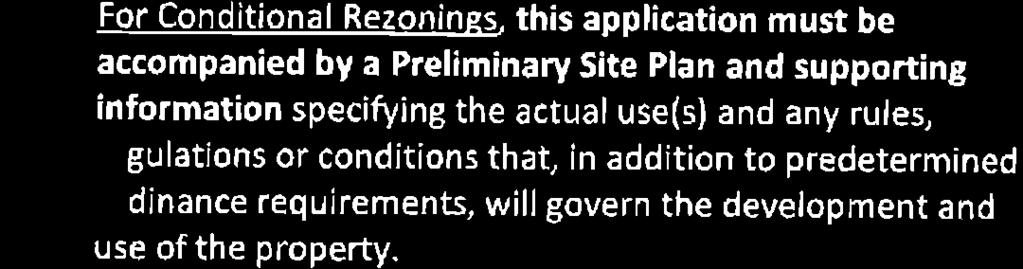
62 Page 64 of 125
63 Page 65 of 125
64 Page 66 of 125
65 Page 71 of 125

66 Page 72 of 125 City Council Decision & Statement of Consistency Per NCGS 160A-383, zoning regulations shall be made in accordance with an adopted comprehensive plan and any other officially adopted plan that is applicable. When adopting or rejecting any zoning amendment, the City Council shall also approve a statement describing whether its action is consistent with the City of Graham Growth Management Plan and briefly explaining why the City Council considers the action taken to be reasonable and in the public interest. The Planning Board shall provide a written recommendation to the City Council, but a comment by the Planning Board that a proposed amendment is inconsistent with the City of Graham Growth Management Plan shall not preclude consideration or approval of the proposed amendment by the City Council. Stillhouse Farms/Patterson Place (CR0502) Type of Request Conditional Rezoning Meeting Dates Planning Board on March 17, 2015 City Council on April 14, 2015 Choose one I move that the application be APPROVED. I move that the application be APPROVED with the following conditions: o The project will supply a sidewalk along Cheeks Lane. o The final site plan must be submitted to and approved by the TRC before a building permit and/or certificate of occupancy will be issued. o [Insert additional or other conditions] I move that the application be DENIED. Choose one The application is consistent with the City of Graham Growth Management Plan The application is not fully consistent with the City of Graham Growth Management Plan State reasons This action is reasonable and in the public interest for the following reasons: [insert reasons] This report reflects the decision of the City Council, this the 14 th day of April, Attest: Gerald R. Peterman, Mayor Darcy L. Sperry, City Clerk

67 Page 73 of 125 STAFF REPORT Prepared by Melissa Guilbeau, City Planner 2035 Comprehensive Plan Type of Request: Adoption of Comprehensive Plan Meeting Dates Planning Board on March 17, 2015 City Council on April 14, 2015 Contact Information Not applicable Summary The Growth Management Plan has served as the city s comprehensive plan since it was adopted on May 2, Over the past year and a half, the city has worked to draft a new comprehensive plan to guide the city s decisions over the next 20 years. Key milestones in the development of the 2035 Comprehensive Plan included: In the summer of 2013, a Steering Committee of 19 individuals was formed. The role of the steering committee was to serve as an ambassador of the plan, provide oversight and guidance of the planning effort, review and comment on draft products, and determine the policies and strategies to be included in the plan. The steering committee met 11 times throughout the process. With the support of the Community Transformation Grant, the City established a MindMixer site to serve as a platform for community input on the plan. Several local establishments generously donated goods to serve as rewards to encourage participation on the MindMixer site. In September 2013, the City issued a Request for Proposals with the intent to hire a consulting firm to prepare the new comprehensive plan. Proposals were due October 4 th. The City received 10 proposals, with fees ranging from $49,950 to $172,188. Staff reviewed and ranked the proposals, and chose the three highest-ranked to be invited to interview with the Steering Committee. On October 17, 2013, the Steering Committee met with presentations and interviews of the three top-ranked consultants. Following the presentations, the Steering Committee discussed and voted Clarion Associates as their first choice consultant, with Renaissance Planning Group as their second. The City entered into a contract with Clarion Associates in late October Over four days in January and February, 2014, Clarion interviewed 37 stakeholders. Based on these interviews, combined with review of data and existing plans and trends, the Planning Conditions Report was prepared. A public workshop was held on April 8, 2014 at the Graham Recreation Center. About 40 residents attended and provided input on the plan via small group discussion, sticky notes and interactive polling. Location corporate limits and ETJ Staff Recommendation Approval Small group discussions at the April 8 th public workshop


68 Page 74 of 125 Over the summer of 2014, staff and Clarion conducted a scenario planning exercise. That exercise forecasted future population and commercial/industrial growth then described two different development scenarios status quo and compact, nodal development both based on the forecasted growth. The results of this exercise were presented in a Growth Options Report. On November 17, 2014, a second and final public workshop was held at the Graham Recreation Center. About 20 residents attended and provided input on the draft comprehensive plan, again using sticky notes and interactive polling. A presentation at the November 17 th public workshop Staff Recommendation Based on the input received throughout the comprehensive planning process, staff recommends approval of the 2035 Comprehensive Plan. Suggested Motion: I move that we adopt the 2035 Comprehensive Plan as the comprehensive plan for the City of Graham. Steering Committee members and staff at the final steering committee meeting on January 26, 2015 Steering Committee Members Allison Russell resident Denise Baker Historic Resources Commission Destiny Snipes Graham High School Elaine Murrin Appearance Commission Griffin McClure downtown business owner and Recreation Commission Jamie Rollins Southern High School Janice McSherry resident Jay Cook business owner Jennifer Talley resident and business owner Keith Parker resident Kristin Foust resident Larry Brooks Historic Resources Commission Lee Kimrey City Council Member Mike Conklin resident Rev. Miriam Pereda Hispanic/Latino Community Ricky Hall Planning Board Roger Jefferson resident Stan Wyrick business owner Tim Beshel Planning Board
Planning Board. March 18, 2014 at 7:00pm Council Chambers, 201 S Main St. Meeting Agenda
 Planning Board Meeting Agenda March 18, 2014 at 7:00pm Council Chambers, 201 S Main St Invocation 1. Approve minutes of the January 21, 2014 meeting 2. WKZ River Bend Apartments (CR1401). Request by WKZ
Planning Board. December 17, 2013 at 7:00pm Council Chambers, 201 S Main St. Meeting Agenda
 Planning Board Meeting Agenda December 17, 2013 at 7:00pm Council Chambers, 201 S Main St Invocation 1. Approve minutes of the November 4, 2013 special meeting 2. Approve minutes of the November 19, 2013
Planning Board. Meeting Agenda. January 15, 2019 at 7:00 PM Council Chambers, 201 S Main St
 Planning Board Meeting Agenda January 15, 2019 at 7:00 PM Council Chambers, 201 S Main St Meeting Called to Order, Invocation, and Overview of Board and general meeting rules 1. Approve minutes of the
MINUTES. Council Members Present: Mayor Sears, Councilmen James Cobb, Tim Sack and Hank Dickson and Councilwomen Linda Hunt-Williams and Cheri Lee.
 Holly Springs Town Council Regular Meeting Sept. 2, 2014 MINUTES The Holly Springs Town Council met in regular session on Tuesday, Sept. 2, 2014 in the Council Chambers of Holly Springs Town Hall, 128
RM18 RS9 RM12 RS9 !( S DOCKET #: W3120 PROPOSED ZONING: GB-L EXISTING ZONING: HB-S. PETITIONER: Bank of North Carolina for property owned by Same
 DELANE DR DOCKET #: W3120 RM18 BARRY ST PROPOSED ZONING: GB-L RS9 EXISTING ZONING: HB-S IP OLD GREENSBORO RD WALES ST DENVER ST GEORGE BIG REDD CT LOUISE WILSON LN RM12!(DS MOSES LUCAS CT 585' 627' HB-S
VILLAGE OF JUSTICE ORDINANCE NO
 VILLAGE OF JUSTICE ORDINANCE NO. 2004-24 AN ORDINANCE ADOPTING THE FIRST PHASE OF THE VILLAGE OF JUSTICE COMPREHENSIVE PLAN FOR THE VILLAGE OF JUSTICE ZONING CODE, CREATING CHAPTER 12 ARTICLE II, DIVISION
Logan Municipal Council Logan, Utah December 6, 2011
 Logan Municipal Council Logan, Utah December 6, 2011 Minutes of the meeting of the Logan Municipal Council convened in regular session on Tuesday, December 6, 2011 at 5:30 p.m. in the Logan City Municipal
Town of Cary, North Carolina Rezoning Staff Report 14-REZ-31 Cary Park PDD Amendment (Waterford II) Town Council Meeting January 15, 2015
 Town Council Meeting January 15, 2015") Town of Cary, North Carolina Rezoning Staff Report 14-REZ-31 Cary Park PDD Amendment (Waterford II) Town Council Meeting January 15, 2015 REQUEST To amend the Town of Cary Official Zoning Map by amending
Town of Cary, North Carolina Rezoning Staff Report 14-REZ-31 Cary Park PDD Amendment (Waterford II) Town Council Meeting January 15, 2015 REQUEST To amend the Town of Cary Official Zoning Map by amending
CITY COUNCIL SPECIAL MEETING THURSDAY, SEPTEMBER 1, :00 P.M. CITY COUNCIL CHAMBER, CITY HALL 2401 MARKET STREET BAYTOWN, TEXAS AGENDA
 CITY OF BAYTOWN NOTICE OF MEETING CITY COUNCIL SPECIAL MEETING THURSDAY, SEPTEMBER 1, 2016 5:00 P.M. CITY COUNCIL CHAMBER, CITY HALL 2401 MARKET STREET BAYTOWN, TEXAS 77520 AGENDA CALL TO ORDER AND ANNOUNCEMENT
MCGUIRE AV 374 COUNTRY CLUB RD RANDALL ST RYANDALE RD FLOODWAY FLOODWAY FRINGE
 SILAS CREEK MCGUIRE AV OLD COUNTRY CLUB RD 249 RYANDALE RD 323 374 COUNTRY CLUB RD S 441 SEDGEFIELD LN (PVT) QUEENSBURY RD FLOODWAY FLOODWAY FRINGE RANDALL ST SOUTHWIN DR November 19, 2004 Paul E. Burke,
PENINSULA TOWNSHIP PLANNING COMMISSION MINUTES Center Road Traverse City, MI (Township Hall) February 27, :30 pm - amended time
 February 27, :30 pm - amended time") Meeting called to order at 5:30 pm by Couture. PENINSULA TOWNSHIP PLANNING COMMISSION MINUTES 13235 Center Road Traverse City, MI 49686 (Township Hall) February 27, 2017 5:30 pm - amended time Present:
Meeting called to order at 5:30 pm by Couture. PENINSULA TOWNSHIP PLANNING COMMISSION MINUTES 13235 Center Road Traverse City, MI 49686 (Township Hall) February 27, 2017 5:30 pm - amended time Present:
Village of Mount Horeb
 Village of Mount Horeb 138 E Main St Mount Horeb, WI 53572 Phone (608) 437-6884/Fax (608) 437-3190 Email: mhinfo@mounthorebwi.info Website: www.mounthorebwi.info PLAN COMMISSION/HISTORIC PRESERVATION COMMISSION
Town of Cary, North Carolina Rezoning Staff Report 12-REZ-27 Morris Branch Town Council Public Hearing January 24, 2013
 Town of Cary, North Carolina Rezoning Staff Report 12-REZ-27 Morris Branch Town Council Public Hearing January 24, 2013 REQUEST To amend the Town of Cary Official Zoning Map to rezone approximately 9.0
CLEARFIELD CITY COUNCIL AGENDA AND SUMMARY REPORT July 31, 2018 SPECIAL POLICY SESSION
 CLEARFIELD CITY COUNCIL AGENDA AND SUMMARY REPORT July 31, 2018 SPECIAL POLICY SESSION Meetings of the City Council of Clearfield City may be conducted via electronic means pursuant to Utah Code Ann. 52-4-207
Town of Holly Springs Town Council Meeting Agenda Cover Sheet
 Town of Holly Springs Town Council Meeting Agenda Cover Sheet Meeting Date: Feb. 19, 2019 Agenda Item #: 8c Agenda Placement: Public Hearing (Recognitions (awards, proclamations), Requests & Communications
FRANKLIN COUNTY PLANNING BOARD. May 8, 2018
 FRANKLIN COUNTY PLANNING BOARD May 8, 2018 The Franklin County Planning Board held its regular monthly meeting on Tuesday, May 8, 2018 in the Franklin County Administration Building, Commissioners Meeting
City of Walker Planning Commission Regular Meeting November 16, 2011
 City of Regular Meeting November 16, 2011 Members Present: Vice-chair C. Rypma, A. Parent, C. Gornowich, D. Brown, T. Schweitzer, T. Korfhage and T. Byle Absent: Chairman J. Hickey Also Present: Planning
COUNCIL COMMUNICATION
 Meeting Date: January 22, 2019 COUNCIL COMMUNICATION Agenda Item: Agenda Location: Consent Calendar Goal(s): Legal Review: 1 st Reading X 2 nd Reading Subject: An ordinance approving a Rezoning of approximately
CITY OF DEL RIO PLANNING & ZONING COMMISSION COUNCIL CHAMBERS - CITY HALL 109 WEST BROADWAY ST. WEDNESDAY, MAY 20, :30 P.M.
 CITY OF DEL RIO PLANNING & ZONING COMMISSION COUNCIL CHAMBERS - CITY HALL 109 WEST BROADWAY ST. WEDNESDAY, MAY 20, 2015 5:30 P.M. AGENDA 1. CALL TO ORDER 2. ROLL CALL 3. APPROVAL OF MINUTES a. Approve
ROSEMEAD CITY COUNCIL STAFF REPORT
 ROSEMEAD CITY COUNCIL STAFF REPORT TO THE HONORABLE MAYOR AND CITY COUNCIL FROM JEFF ALLRED CITY MANAGER DATE JUNE 9 2015 6 SUBJECT MUNICIPAL CODE AMENDMENT 15 02 AMENDING CHAPTERS 17 04 AND 17 72 OF TITLE
VILLAGE OF PALM SPRINGS VILLAGE COUNCIL MINUTES REGULAR MEETING, COUNCIL CHAMBERS, JULY 25, 2013
 VILLAGE OF PALM SPRINGS VILLAGE COUNCIL MINUTES REGULAR MEETING, COUNCIL CHAMBERS, JULY 25, 2013 CALL TO ORDER, ROLL CALL, INVOCATION, AND PLEDGE OF ALLEGIANCE Mayor Bev Smith called the regular meeting
ACTION FORM BRYAN CITY COUNCIL
 ACTION FORM BRYAN CITY COUNCIL DATE OF COUNCIL MEETING: July 8, 2014 DATE SUBMITTED: June 17, 2014 DEPARTMENT OF ORIGIN: Development Services SUBMITTED BY: Maggie Dalton MEETING TYPE: CLASSIFICATION: ORDINANCE:
Final Plats for Major Residential and Commercial Subdivisions Checklist
 Project Name: : This form is a checklist of Zoning Ordinance requirements for major residential and commercial subdivision plats to assist the applicant in their submittal. It is not intended to be a comprehensive
Presented WASILLA Date Action Taken: It)/;::;- I q /17 ALASKA. Other: Verifie
/;::;- I q /17 ALASKA. Other: Verifie") CITY OF Presented WASILLA Date Action Taken: It)/;::;- I q /17 ALASKA Other: Verifie CITY COUNCIL INFORMATIONAL MEMORANDUM IM No. 17-01: A recommendation from the Planning Commission that the City Council
CITY OF Presented WASILLA Date Action Taken: It)/;::;- I q /17 ALASKA Other: Verifie CITY COUNCIL INFORMATIONAL MEMORANDUM IM No. 17-01: A recommendation from the Planning Commission that the City Council
City of Lake Elmo Planning Commission Meeting Minutes of January 14, 2013
 City of Lake Elmo Planning Commission Meeting Minutes of January 14, 2013 Chairman Williams called to order the workshop of the Lake Elmo Planning Commission at 7:00pm COMMISSIONERS PRESENT: Fliflet, Obermueller,
Town of Cary, North Carolina Rezoning Staff Report 13-REZ-31 Weston PDD Amendment at Centregreen Park Town Council Meeting March 13, 2014
 Town of Cary, North Carolina Rezoning Staff Report 13-REZ-31 Weston PDD Amendment at Centregreen Park Town Council Meeting March 13, 2014 REQUEST This proposed amendment to the Town of Cary Official Zoning
THE AREA PLAN COMMISSION OF ST. JOSEPH COUNTY, IN AGENDA
 THE AREA PLAN COMMISSION OF ST. JOSEPH COUNTY, IN AGENDA Tuesday, June 20, 2017 Fourth-Floor Council Chambers 3:30 p.m. County-City Building, South Bend, IN PUBLIC HEARINGS: 1. Rezonings: A. A combined
Brainerd City Council Agenda Request
 Brainerd City Council Agenda Request Agenda Item # Requested Meeting Date: Title of Item: INFORMATION ONLY CONSENT AGENDA P&F COMMITTEE SPW COMMITTEE MAIN AGENDA Submitted by: Action Requested: Approve/Deny
CITY OF ELK GROVE CITY COUNCIL STAFF REPORT
 AGENDA ITEM NO. 9.2 CITY OF ELK GROVE CITY COUNCIL STAFF REPORT AGENDA TITLE: A public hearing to consider a Specific Plan Amendment to the Laguna Ridge Specific Plan and a Rezone of approximately 4.14
Amending Chapter 9 Establishment of Fees, Section 9.04 Ambulance Service Fees. (Second Reading)
") DATE: July 20, 2016 TO: FROM: SUBJECT: Honorable Mayor John Rey City Council Anne Marie Gaura, City Manager Cathy Haley, Finance Director Amending Chapter 9 Establishment of, Section 9.04 Ambulance Service.
DATE: July 20, 2016 TO: FROM: SUBJECT: Honorable Mayor John Rey City Council Anne Marie Gaura, City Manager Cathy Haley, Finance Director Amending Chapter 9 Establishment of, Section 9.04 Ambulance Service.
The meeting was called to order by Acting Chairman Lee Dorson. Also present was Bill Mann, Senior Planner and Recording Secretary Amber Lehman.
 Held Monday, October 13, 2008 at 7:00 P.M. in the Council Chambers, 11 North 3 rd Street, Jacksonville Beach, Florida Call to Order The meeting was called to order by Acting Chairman Lee Dorson. Roll Call
TOWN OF MAIDEN. July 17, 2017 MINUTES OF REGULAR MEETING
 TOWN OF MAIDEN July 17, 2017 MINUTES OF REGULAR MEETING The Maiden Town Council met on Monday, July 17, 2017 at 7:00 p.m. for their regularly scheduled meeting, held in the Council Chambers at the Maiden
ANNEXATION AGREEMENTS. What is it? Shared Impact and Benefits. How long does this take to implement? Costs. The Bottom Line
 ANNEXATION AGREEMENTS What is it? An annexation agreement is an interlocal agreement between one or more local governments that delineates future growth boundaries by determining where the localities may
Town of Holly Springs
 Meeting Date: 9/18/2018 Agenda Topic Cover Sheet / last modified June 13, 2018 Town of Holly Springs Town Council Meeting Agenda Form Agenda Placement: Public Hearing (Special Recognitions (awards, proclamations),
PLANNING COMMISSION CITY OF SONORA OCTOBER 9, :30 P.M.
 PLANNING COMMISSION CITY OF SONORA OCTOBER 9, 2018 5:30 P.M. A regular meeting of the Planning Commission of the City of Sonora was scheduled on this date at 5:30 p.m. in the Sonora City Hall Council Chambers.
TILDEN TOWNSHIP PLANNING COMMISSION
 TILDEN TOWNSHIP PLANNING COMMISSION Tuesday, Regular Meeting The Tilden Township Planning Commission met in the Township Municipal Building on Tuesday, with the following present: Dale Keener, Sharon Enevoldson,
City of Brooklyn Park Planning Commission Staff Report
 City of Brooklyn Park Planning Commission Staff Report Agenda Item: 6D Meeting Date: August 9, 2017 Originating Agenda Section: Public Hearing Department: Community Development Resolution: X Ordinance:
AGENDA PLANNING COMMISSION
 AGENDA PLANNING COMMISSION Tuesday, November 27, 2018 5:30 PM City Council Chambers 125 E Avenue B, Hutchinson, Kansas 1. ROLL CALL Richardson Vacant Bisbee Hamilton Wells Roberts-Ropp Carr (Vice Chair)
HB-S RM8-S RS9 RM18 HB-S RS9 DOCKET #: W2872. PROPOSED ZONING: RM8-S (Child Day Care Center) EXISTING ZONING: RS9 and RM8-S
 EXISTING ZONING: RS9 and RM8-S") 150' 80' RS9 UNIVERSITY PW STANLEYVILLE DR HB-S LB 123' 70' PROPOSED BELTWAY!( RM8-S S 289' NOEL DR 202' NITA AV MILL CREEK DOCKET #: W2872 PROPOSED ZONING: RM8-S (Child Day Care Center) EXISTING ZONING:
150' 80' RS9 UNIVERSITY PW STANLEYVILLE DR HB-S LB 123' 70' PROPOSED BELTWAY!( RM8-S S 289' NOEL DR 202' NITA AV MILL CREEK DOCKET #: W2872 PROPOSED ZONING: RM8-S (Child Day Care Center) EXISTING ZONING:
MIXED USE DEVELOPMENT AGREEMENT
 MIXED USE DEVELOPMENT AGREEMENT THIS MIXED USE DEVELOPMENT AGREEMENT (hereinafter "Agreement") made and entered into this day of, 2007, pursuant to Section 205-30 of the Zoning Ordinances of the City of
WHEREAS, the West Plains R-7 School District desires the services of three School Resource Officers in its schools; and
 BILL NO. 4557 ORDINANCE NO. AN ORDINANCE TO AUTHORIZE THE EXECUTION OF A SCHOOL RESOURCE OFFICER PROGRAM AGREEMENT WITH THE CITY OF WEST PLAINS, MISSOURI AND WEST PLAINS R-7 SCHOOL DISTRICT. WHEREAS, the
NOTICE OF MEETING. The City of Lake Elmo Planning Commission will conduct a meeting on Wednesday, November 14, 2012 at 7:00 p.m.
 3800 Laverne Avenue North Lake Elmo, MN 55042 (651) 777-5510 www.lakeelmo.org NOTICE OF MEETING The City of Lake Elmo Planning Commission will conduct a meeting on Wednesday, November 14, 2012 at 7:00
GOVERNING BOARD MEMBERS PRESENT Mayor Jackie Warner, Mayor Pro Tem Mike Mitchell, Commissioners Jessie Bellflowers, Meg Larson and Jerry Legge.
 TOWN OF HOPE MILLS BOARD OF COMMISSIONERS SPECIAL JOINT MEETING WITH CUMBERLAND COUNTY PLANNING & INSPECTION THURSDAY, MARCH 8, 2018, 12:00 P.M. WILLIAM F. BILL LUTHER, JR. & DORIS LUTHER MEETING ROOM
STERLING HEIGHTS ZONING BOARD OF APPEALS REGULAR MEETING CITY HALL October 27, 2016
 STERLING HEIGHTS ZONING BOARD OF APPEALS REGULAR MEETING CITY HALL October 27, 2016 LOCATION: City Council Chambers, 40555 Utica Road, Sterling Heights, MI SUBJECT: Minutes of the Regular Meeting of the
MINUTES OF THE CITY OF BURLINGTON CITY COUNCIL MEETING FEBRUARY 6, 2018
 MINUTES OF THE CITY OF BURLINGTON CITY COUNCIL MEETING FEBRUARY 6, 2018 The City Council of the City of Burlington held a regularly scheduled meeting in the Council Chamber, Municipal Building, 425 South
UDO Advisory Committee Meeting #3 August 18, 2011
 UDO Advisory Committee Meeting #3 August 18, 2011 Today s s Agenda Welcome Recap of Meeting #2 Overview of Strategy Statement Overview of Zoning Districts What changes and what stays the same? Break Putting
Town of Cary, North Carolina Rezoning Staff Report 14-REZ-20 Habitat for Humanity Evans Road Town Council Meeting October 16, 2014
 Town of Cary, North Carolina Rezoning Staff Report 14-REZ-20 Habitat for Humanity Evans Road Town Council Meeting October 16, 2014 REQUEST To amend the Town of Cary Official Zoning Map by rezoning 0.53
The requested rezoning would be consistent with the City of Wilmington Focus Area of Welcoming Neighborhoods and Public Spaces.
 ITEM PH3 OFFICE OF THE CITY MANAGER (910) 341-7810 FAX(910)341-5839 TDD (910)341-7873 1/6/2015 City Council City Hall Wilmington, North Carolina 28401 Dear Mayor and Councilmembers: Attached for your consideration
CASE SUMMARY Conditional District Zoning Modification Planning Commission January 9, 2013 CD M1212
 CASE SUMMARY Conditional District Zoning Modification Planning Commission January 9, 2013 CD-3-109-M1212 Jim Diepenbrock, Associate Planner jim.diepenbrock@wilmingtonnc.gov 910-341-3257 Staff recommendation
Cedar Hammock Fire Control District
 Cedar Hammock Fire Control District FY 2015 Fire/Rescue Impact Fee Study February 24, 2016 Prepared by: February 24, 2016 Mr. Jeff Hoyle Fire Chief 5200 26 th St W Bradenton, FL 34207 Re: FY 2015 Impact
PROCEDURE FOR CLOSING STREETS AND ALLEYS UNDER N.C.G.S. 160A-299 CITY OF GASTONIA, LEGAL DEPT., P. O. BOX 1748, GASTONIA, NC ( )
") PROCEDURE FOR CLOSING STREETS AND ALLEYS UNDER N.C.G.S. 160A-299 CITY OF GASTONIA, LEGAL DEPT., P. O. BOX 1748, GASTONIA, NC 28053 (866-6735) 1. Applicant requests closing of street or alley through the
PROCEDURE FOR CLOSING STREETS AND ALLEYS UNDER N.C.G.S. 160A-299 CITY OF GASTONIA, LEGAL DEPT., P. O. BOX 1748, GASTONIA, NC 28053 (866-6735) 1. Applicant requests closing of street or alley through the
CITY OF WINTER PARK Planning & Zoning Board
 CITY OF WINTER PARK Planning & Zoning Board Regular Meeting December 4, 2012 City Hall, Commission Chambers 7:00 p.m. MINUTES Chair Whiting called the meeting to order at 7:00 p.m. in the Commission Chambers
CITY OF FLORENCE PLANNING COMMISSION JANUARY 10, :30 PM City Center, Council Chambers FLORENCE, SOUTH CAROLINA AGENDA
 CITY OF FLORENCE PLANNING COMMISSION JANUARY 10, 2017 6:30 PM City Center, Council Chambers FLORENCE, SOUTH CAROLINA AGENDA I. Election of officers II. III. IV. Review and approval of 2017 meeting schedule
City of Driggs PLANNING AND ZONING COMMISSION MEETING MINUTES March 14, :30PM
 City of Driggs PLANNING AND ZONING COMMISSION MEETING MINUTES March 14, 2018 6:30PM MEMBERS PRESENT: Brian Gibson, Josh Holmes, Grant Wilson, and Larry Young STAFF PRESENT: Ashley Koehler, Planning and
REZONING APPLICATION CHECKLIST BUCKINGHAM COUNTY OFFICE OF ZONING AND PLANNING MINUMUM SUBMISSION REQUIREMENTS
 REZONING APPLICATION CHECKLIST BUCKINGHAM COUNTY OFFICE OF ZONING AND PLANNING MINUMUM SUBMISSION REQUIREMENTS The following table lists the information necessary to review a rezoning application. All
MINUTES CITY COUNCIL MEETING COUNCIL CHAMBERS HUTCHINSON, KANSAS April 17, :00 a.m.
 MINUTES CITY COUNCIL MEETING COUNCIL CHAMBERS HUTCHINSON, KANSAS 9:00 a.m. 1. The Governing Body of the City of Hutchinson, Kansas met in regular session at 9:00 a.m. on Tuesday, in the City Council Chambers
BARRE TOWN PLANNING COMMISSION MINUTES
 BARRE TOWN PLANNING COMMISSION MINUTES The Town of Barre held its regular meeting on Wednesday, beginning at 7:00 p.m. at the Municipal Building, Lower Websterville, to consider the following: Members
Catherine Dreher; Gerry Prinster; Kevin DeSain; David Bauer; and Vicki LaRose
 MINUTES OF REGULAR MEETING ST. CHARLES COUNTY BOARD OF ZONING ADJUSTMENT DATE: June 1, 2017 TIME: PLACE: 7:00 P.M. COUNTY ADMINISTRATIVE BUILDING 201 NORTH SECOND ST. FIRST FLOOR MULTI-PURPOSE ROOM 116
Staff presented two options for the Commission to consider recommending to Town Council:
 Attendance: Chair Darrell Page; Commissioners: Ann Holland, Scott Burroughs, Steve Clark, Pam Barger, Pam Carter, Michael Aldridge (arrived at 7:39); Hilda Keeney, Planning and Zoning Clerk; Kassie Watts,
Opening Ceremonies 1. Welcome/Introductions Sharla Bynum 2. Serious Moment of Reflection/Pledge of Allegiance Portia Mila
 South Salt Lake City Council REGULAR MEETING AGENDA Public notice is hereby given that the South Salt Lake City Council will hold a Regular Meeting on Wednesday, August 22, 2018 in the City Council Chambers,
TOWN OF HOPE MILLS BOARD OF COMMISSIONERS SPECIAL MEETING AGENDA THURSDAY, DECEMBER 20, :00 P.M. WILLIAM BILL LUTHER, JR
 TOWN OF HOPE MILLS BOARD OF COMMISSIONERS SPECIAL MEETING AGENDA THURSDAY, DECEMBER 20, 2018 5:00 P.M. WILLIAM BILL LUTHER, JR. & DORIS LUTHER MEETING ROOM CALL TO ORDER INVOCATION PLEDGE OF ALLEGIANCE
City of Fayetteville, Arkansas Page 1 of 1
 City of Fayetteville, Arkansas 113 West Mountain Street Fayetteville, AR 72701 (479) 575-8323 Legislation Text File #: 2015-0400, Version: 1 RZN 15-5148 (402 E. 7TH ST./NIEDERMAN): AN ORDINANCE REZONING
O-I (Office-Institutional) and AG-1(Agricultural)
 and AG-1(Agricultural)") PROPERTY INFORMATION ADDRESS 3503 and 3505 Bethany Bend DISTRICT, LAND LOTS 2/1 973 and 974 OVERLAY DISTRICT State Route 9 PETITION NUMBERS EXISTING ZONING O-I (Office-Institutional) and AG-1(Agricultural)
PROPERTY INFORMATION ADDRESS 3503 and 3505 Bethany Bend DISTRICT, LAND LOTS 2/1 973 and 974 OVERLAY DISTRICT State Route 9 PETITION NUMBERS EXISTING ZONING O-I (Office-Institutional) and AG-1(Agricultural)
VILLAGE OF MAYVILLE REGULAR BOARD MEETING
 VILLAGE OF MAYVILLE REGULAR BOARD MEETING 8-14-18 Board Present Mayor Bova; Trustees: Syper, Jacobson, Shearer, Webb. Board absent None. Others Present John Crandall, Village Clerk; Jennifer Obert, Village
Town of Onalaska. A scale map depicting the portion of Pineview Drive to be officially laid out as a Town highway is attached hereto as Exhibit A.
 Town of Onalaska Special Meeting Minutes for March 31, 2011 The Town Board met on site of the Pineview Road and County OT in Onalaska for the purpose of viewing the lay out of the road as required by law.
Minutes of 09/03/2003 Planning Board Meeting [adopted]
![Minutes of 09/03/2003 Planning Board Meeting [adopted]](/thumbs/89/98509328.jpg "Minutes of 09/03/2003 Planning Board Meeting [adopted]") Minutes of 09/03/2003 Planning Board Meeting [adopted] Angel M Kropf on 09/10/2003 at 11:04 AM Category: Planning Board Minutes MINUTES Wake County Planning Board Wednesday, September 3, 2003 1:30 p.m.,
Minutes of 09/03/2003 Planning Board Meeting [adopted] Angel M Kropf on 09/10/2003 at 11:04 AM Category: Planning Board Minutes MINUTES Wake County Planning Board Wednesday, September 3, 2003 1:30 p.m.,
AGENDA COLLETON COUNTY COUNCIL REGULAR MEETING TUESDAY, FEBRUARY 5, :00 P.M. COUNTY COUNCIL CHAMBERS, OLD JAIL BUILDING
 AGENDA COLLETON COUNTY COUNCIL REGULAR MEETING TUESDAY, FEBRUARY 5, 2013 6:00 P.M. COUNTY COUNCIL CHAMBERS, OLD JAIL BUILDING 1. Call to Order 2. Invocation 3. Present Colors and Lead Pledge of Allegiance-
Mayor Ashley called the meeting to order and asked the Clerk to call the roll:
 Page 239 Mayor Ashley called the meeting to order and asked the Clerk to call the roll: PRESENT: ABSENT: Mayor Ashley, Councillors Davis, Kennedy, Price, Shaver, Skamperle and Stevenson None CONSENT AGENDA
WEST BOUNTIFUL PLANNING COMMISSION
 Mayor Kenneth Romney City Engineer/ Zoning Administrator Ben White City Recorder Cathy Brightwell WEST BOUNTIFUL PLANNING COMMISSION 550 North 800 West West Bountiful, Utah 84087 Phone (801) 292-4486 FAX
MINUTES TOWN OF NAGS HEAD NAGS HEAD MUNICIPAL COMPLEX BOARD ROOM WEDNESDAY, MARCH 16, 2016
 MINUTES TOWN OF NAGS HEAD NAGS HEAD MUNICIPAL COMPLEX BOARD ROOM WEDNESDAY, MARCH 16, 2016 Joint Meeting with Planning Board/Property Managers re: rental sign regulations Board members present: Planning
SUBDIVISION AND / OR LAND DEVELOPMENT SUBMITTAL REQUIREMENTS
 SUBDIVISION AND / OR LAND DEVELOPMENT SUBMITTAL REQUIREMENTS Please review checklist prior to submittal. Incomplete submittals will delay the review process. Township 90-day time clock begins upon submission
CITY OF ALBERT LEA PLANNING COMMISSION ADVISORY BOARD
 CITY OF ALBERT LEA PLANNING COMMISSION ADVISORY BOARD 9/1/2015, 5:30 p.m. City Council Chambers AGENDA A. CALL TO ORDER AND ROLL CALL B. APPROVAL OF THE AGENDA C. APPROVAL OF MINUTES 1. PC Minutes from
PLAINFIELD CHARTER TOWNSHIP COMMUNITY DEVELOPMENT DEPARTMENT PLANNING, ZONING & BUILDING SERVICES MEMORANDUM
 PLAINFIELD CHARTER TOWNSHIP COMMUNITY DEVELOPMENT DEPARTMENT PLANNING, ZONING & BUILDING SERVICES 6161 BELMONT AVENUE N.E. BELMONT, MI 49306 PHONE 616-364-1190 FAX: 616-364-1170 www.plainfieldchartertwp.org
MINUTES OF THE VINEYARD TOWN PLANNING COMMISSION MEETING Vineyard Town Hall, 240 East Gammon Road, Vineyard, Utah January 21, 2015, 7:00 PM
 MINUTES OF THE VINEYARD TOWN PLANNING COMMISSION MEETING Vineyard Town Hall, 240 East Gammon Road, Vineyard, Utah January 21, 2015, 7:00 PM PRESENT ABSENT Commission Chair Wayne Holdaway Commissioner Garrett
2/22/2016. Planning and Zoning. David Owens March 2016 SOME CONTEXT
 Planning and Zoning David Owens March 2016 SOME CONTEXT 1 N.C. Population 1900 1.6 million 1950 2.4 million 2015 10 million 2 3 Population Growth Housing Units/ Square Mile Source: UNC Carolina Population
SPECIAL USE PERMIT APPLICATION CHECKLIST BUCKINGHAM COUNTY OFFICE OF ZONING AND PLANNING MINUMUM SUBMISSION REQUIREMENTS
 SPECIAL USE PERMIT APPLICATION CHECKLIST BUCKINGHAM COUNTY OFFICE OF ZONING AND PLANNING MINUMUM SUBMISSION REQUIREMENTS The following table lists the information necessary to review a special use application.
LEMOORE PLANNING COMMISSION Regular Meeting AGENDA Lemoore Council Chamber 429 C Street. May 14, :00 p.m.
 LEMOORE PLANNING COMMISSION Regular Meeting AGENDA Lemoore Council Chamber 429 C Street May 14, 2018 7:00 p.m. 1. Pledge of Allegiance 2. Call to Order and Roll Call 3. Public Comment This time is reserved
Northside and Pine Knolls Community Plan
 Northside and Pine Knolls Community Plan Overview During the summer and early fall of 2011, the Hill worked with the Sustaining OurSelves Coalition and the Northside and Pine Knolls communities to jointly
Town of Holly Springs
 Meeting Date: 7/17/2018 Agenda Topic Cover Sheet / last modified June 13, 2018 Town of Holly Springs Town Council Meeting Agenda Form Agenda Placement: Public Hearing (Special Recognitions (awards, proclamations),
CITY OF RAYTOWN Request for Board Action
 CITY OF RAYTOWN Request for Board Action Date: April 23, 2013 Bill No. 6316-13 To: Mayor and Board of Aldermen Section No: XIII From: John Benson, Director of Development and Public Affairs Department
MINUTES OF THE REGULAR MEETING OF. May 08, Staff members present: Jim Hewitt, Ginny Owens, David Mahoney
 -- '" LEAVENWORTH COUNTY PLANNING COMMISSION MINUTES OF THE REGULAR MEETING OF May 08, 1996 Meeting called to order at 6:33p.m. f^ Members present: John Hattok, Peggy Heintzelman, Mark Kole, Sam Maxwell,
PLANNING COMMISSION Minutes
 MEETING DATE: Monday January 22, 2018 MEETING TIME: 6:00 PM MEETING LOCATION: City Council Chambers, 448 E. First Street, Suite 190, Salida, CO Present: Mandelkorn, Follet, Denning, Thomas, Farrell, Bomer,
MINUTES ZONING BOARD OF ADJUSTMENT
 MINUTES ZONING BOARD OF ADJUSTMENT The New Hanover County Zoning Board of Adjustment held a regular and duly advertised meeting at 5:30 P.M. at the New Hanover County Government Center Complex, 230 Government
Public Portion: Mr. Bianchini opened the public portion. There being no comment, the public portion was closed. Resolutions:
 GLOUCESTER TOWNSHIP SPECIAL COUNCIL MEETING DECEMBER 1, 2008 MUNICIPAL BUILDING, CHEWS LANDING NEW JERSEY Pledge Allegiance to the Flag Statement: Mr. Bianchini read a statement setting forth the time,
Perry City Planning Commission Perry City Offices, 3005 South 1200 West April 5, :00 PM
 Perry City Planning Commission Perry City Offices, 3005 South 1200 West April 5, 2012 7:00 PM Members Present: Chairman Jerry Nelson, Commissioner Esther Montgomery, Commissioner Todd Bischoff, Commissioner
FRANKLIN COUNTY PLANNING BOARD. April 12, 2016
 FRANKLIN COUNTY PLANNING BOARD April 12, 2016 The Franklin County Planning Board held its regular monthly meeting on Tuesday, April 12, 2016 in the Franklin County Administration Building, Commissioners
Town of Cary, North Carolina Rezoning Staff Report 14-REZ-24 Indian Wells Road Properties Town Council Meeting November 20, 2014
 Town of Cary, North Carolina Rezoning Staff Report 14-REZ-24 Indian Wells Road Properties Town Council Meeting November 20, 2014 REQUEST To amend the Town of Cary Official Zoning Map by revising a condition
Planning Board Meeting Monday, December 14, 2015 Council Chambers, City Hall at 7:00 PM. MINUTES Approved 12/28/2015
 Planning Board Meeting Monday, December 14, 2015 Council Chambers, City Hall at 7:00 PM MINUTES Approved 12/28/2015 The Chairman Wahrlich called the meeting to order at 7:00 PM I. Roll Call Present: David
ATLANTA ZONING ORDINANCE UPDATE
 CITY OF ATLANTA ZONING ORDINANCE QUICK FIXES In 2015 the City of Atlanta selected a team of consultants to conduct a comprehensive assessment of the City s Zoning Ordinance, including a review of the ability
MINUTES JOINT MEETING LINCOLN COUNTY and SIOUX FALLS PLANNING COMMISSIONS 7:00 pm July 14, 2010
 MINUTES JOINT MEETING LINCOLN COUNTY and SIOUX FALLS PLANNING COMMISSIONS 7:00 pm July 14, 2010 Commissioners Room - Lincoln County Court House A joint meeting of Lincoln County and Sioux Falls Planning
Town of Jamestown Planning Board Zoning Staff Report June 14, 2010
 Town of Jamestown Planning Board Zoning Staff Report June 14, 2010 The information provided in this staff report has been included for the purpose of reviewing proposed zoning changes. Since the zoning
BOARD OF SUPERVISORS MEETING MINUTES April 8, 2013
 1562 BOARD OF SUPERVISORS MEETING MINUTES April 8, 2013 A Regular Meeting of the New Britain Township Board of Supervisors was held on April 8, 2013 at the Township Administration Building, 207 Park Avenue,
A. Consideration of the unapproved December 8, 2015 minutes B. Consideration of the unapproved January 12, 2016 minutes
 OFFICIAL AGENDA PLANNING & ZONING COMMISSION CITY OF STARKVILLE, MISSISSIPPI MEETING OF TUESDAY, April 12, 2016 CITY HALL - COURT ROOM, 110 West Main Street, 5:30 PM I. CALL TO ORDER II. III. IV. PLEDGE
DOWNTOWN JANESVILLE. Business Improvement District Operating Plan
 DOWNTOWN JANESVILLE Business Improvement District Operating Plan 2019 TABLE OF CONTENTS Introduction..1 District Boundaries. 1 Proposed Operating Plan...1 Method of Assessment 4 Future Year Operating Plans...6
Town of Cary, North Carolina Rezoning Staff Report. 956 W. Chatham Street. Town Council Meeting January 9, 2014
 Town of Cary, North Carolina Rezoning Staff Report 13-REZ-22 956 W. Chatham Street Town Council Meeting January 9, 2014 REQUEST To amend the Town of Cary Official Zoning Map by rezoning 0.85 acres located
LINCOLN COUNTY PLANNING BOARD MINUTES. April 7, 2014
 LINCOLN COUNTY PLANNING BOARD MINUTES The Lincoln County Planning Board met on at 6:30 p.m. at the James W. Warren Citizens Center, Commissioners Room, 115 West Main Street, Lincolnton, North Carolina
Town of Hamburg Planning Board Meeting April 20, 2016
 Town of Hamburg Planning Board Meeting April 20, 2016 Minutes The Town of Hamburg Planning Board met for a Work Session at 6:30 P.M. followed by a Regular Meeting at 7:00 P.M. on Wednesday, April 20, 2016
COUNTY OF ALBEMARLE PLANNING STAFF REPORT SUMMARY
 COUNTY OF ALBEMARLE PLANNING STAFF REPORT SUMMARY Project Name: ZMA 2011-00006, Albemarle Health and Rehab Center and SP 2011-00014, Albemarle Health and Rehab Center Planning Commission Public Hearing:
PLANNING COMMISSION MEETING
 03-13-08: Page 1 of 5 PLANNING COMMISSION MEETING March 13, 2008 The Planning Commission convened in Courtroom No. 1 at City Hall for their regular meeting. Chairman Fitzgerald called the meeting to order
BOARD OF ZONING ADJUSTMENT MINUTES MEETING OF DECEMBER 1, :00 P.M. MOBILE GOVERNMENT PLAZA, MULTI-PURPOSE ROOM
 BOARD OF ZONING ADJUSTMENT MINUTES MEETING OF DECEMBER 1, 2008-2:00 P.M. MOBILE GOVERNMENT PLAZA, MULTI-PURPOSE ROOM MEMBERS PRESENT William Guess, Vice Chairman Vernon Coleman Sanford Davis Mack Graham