Maryland Historical Trust Inventory No Maryland Inventory of Historic Properties Form
|
|
|
- Marcus Henderson
- 5 years ago
- Views:
Transcription
1 Inventory No Maryland Inventory of 1. of Property (indicate preferred name) historic other 2. Location Etchison Ragtown street and number Damascus, Laytonsville, and Hipsley Mill Roads not for publication city, town Etchison vicinity county Montgomery 3. Owner of Property (give names and mailing addresses of all owners) name Multiple street and number See attached table telephone city, town state zip code 4. Location of Legal Description courthouse, registry of deeds, etc. Montgomery County Courthouse liber folio city, town Rockville tax map tax parcel tax ID number 5. Primary Location of Additional Data 6. Classification Contributing Resource in National Register District Contributing Resource in Local Historic District Determined Eligible for the National Register/Maryland Register Determined Ineligible for the National Register/Maryland Register Recorded by HABS/HAER Historic Structure Report or Research Report at MHT Other: Category Ownership Current Function Resource Count x district public agriculture landscape Contributing Noncontributing building(s) x private x commerce/trade recreation/culture 18 3 buildings structure both defense x religion sites site x domestic social structures object education x transportation objects funerary work in progress 21 Total government unknown health care x vacant/not in use Number of Contributing Resources industry other: previously listed in the Inventory
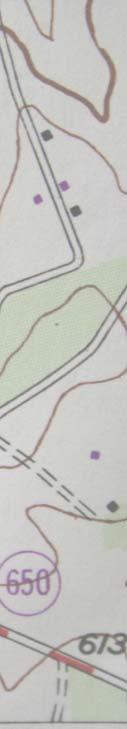
2 7. Description Inventory No Condition excellent deteriorated x good ruins fair altered Prepare both a one paragraph summary and a comprehensive description of the resource and its various elements as it exists today. SUMMARY DESCRIPTION The Etchison Historic District is located in the town of Etchison (elevation 650), four miles south of Damascus, three miles north of Laytonsville, and eleven miles east of Gaithersburg. Laytonsville Road (Rt 108) forms the spine of the district, bordered by Hipsley Mill Road at the south end, and Damascus Road (Rt 650) at the north end. The district contains 21 primary structures dating mainly from the late 19 th to mid 20 th century. The majority of the structures are frame single family houses, with three church related structures at the south end of the district, and two commercial structures at the north end. The period of significance for the district is from The residences built at the end of this range, even though not yet attaining 50 years of age, qualify under Criterion Consideration G for exceptional significance, representing continuity of tradition in this kinship community. BUILDING DESCRIPTIONS Initial Development, A Laytonsville Road, Etchison Hawkins House, c (Contributing) This elegant frame structure is a five bay, two and a half story Victorian Vernacular frame residence, constructed circa The house has elements of both Italianate and Gothic Revival styles, a favored combination in the late nineteenth century vernacular. The central front gable with decorative gable pendant, lancet or pointed arch window, and scrolled porch brackets speak the Gothic Revival vocabulary. Its use of symmetry, bracketed cornices, and round arched molding on the front door denote the Italianate. Additional interior details are Italianate, including the substantial newel post on the front stair and wooden mantelpieces. The house has a center passage plan with one room on either side of the front stair hall, and a third room forming a rear ell. In addition to the front porch, an open porch was located inside the ell, on the east wall of the back room. A kitchen was added on the back of the rear ell about Between c1901 and 1903, a porch, pantry, and summer kitchen additions were built on the southwest corner. Between 1928 and 1930, the two level east rear porch was enclosed, providing additional living space and, on the second level, an indoor bathroom. The house has been covered in vinyl siding which replaces cementitious siding that had been in place since at least the 1950s. The original siding was wood clapboard. Original 2/2 sash windows have been replaced with 2/2 simulated divided sash. The structure sits on a parged stone foundation wall. The house was built by Marcellus Etchison who acquired the property in 1876, and expanded by the Hawkins family who owned the house from 1891 to c1961. Etchison also built a store building to the east (no longer standing). 1 1 Deed , p45. Steven Hawkins annotated sketch plan of Laytonsville Road, and correspondence
3 Number 7 Page Laytonsville Road, Hipsley Hawkins House, log section mid 1800s to c1876, frame wing c (Contributing) This T plan house includes a section that is one of the oldest structures in the Etchison community. The structure stands on land that was part of the original 1876 acquisition of Marcellus Etchison from the Moore family. The earliest section is the north (right) one story portion of the structure and it is constructed of log. The 1879 Hopkins map does not note any structure at this site; however, a small log structure could well have been overlooked during compilation of the map. In 1891, Etchison subdivided his parcel, selling this parcel, presumably with the log section, for $400 to L. Reese Kinsey. According to resident Jane King, Kinsey had been a tenant. He had a blacksmith business and was a Justice of the Peace. Elizabeth Hipsley ( ) lived here from 1909 to 1924, first with her husband Evan Hipsley, and then, after his 1910 death, with her second husband Wilbur Hawkins. Elizabeth and Wilbur Hawkins likely built the south (left), two story frame side c , judging by a change in tax assessments. 2 In any case, the current structure is best described by elevations. The front (east) elevation presents as a two story front gable wing with a one story side gable portion. A front porch is located along the entire façade of the onestory log portion and encloses two entrances into the residence. All windows on this façade are 1/1 vinyl windows. The log portion of the structure sits on a stone foundation, while the two story frame portion rests on a poured concrete foundation, similar to other poured concrete foundations in the district. The entire structure is clad in aluminum siding and is covered with asphalt shingles. The north elevation presents the side of the log structure and the later rear additions. This side has mostly 1/1 vinyl windows; however, there are two small four light wooden gable end windows visible on the attic story of the log structure. The rear (west) façade presents several small additions. A shed roofed addition stretches across the log portion of the structure and extends about half way into the two story frame wing. This addition is likely a porch that was enclosed for more living space. Another one room shed addition was appended onto this addition at a later date. This small room has a brick chimney flue at its rear wall. Both additions were likely done in the 1930s 50s timeframe. A large shed roof dormer was cut into the log building at the rear to provide light into the attic space. Cellar doors are located at the rear of the two story wing. The south (left) side of the structure has been added onto as well. The main body of the 1900s wing is clearly visible on this side; however, a one story porch was enclosed near the center to provide access into this portion of the house. This addition was also done between the 1930s and the 1950s. Pearl Green, daughter of George W. Hawkins, lived here from 1924 until 1980, first with husband Clarence E. Green, who had a blacksmith shop and car repair business. Clarence Green died in Pearl then married Fillmore C. King who died in A small one story frame outbuilding with sliding garage doors served as a repair shop. Located behind this structure was an auto repair shop said to have been formerly used as a blacksmith shop. Pearle and Fillmore King operated the car repair business into the mid 20 th century. 3 The garage has a poured concrete foundation, similar to other foundations walls in the area. A long shed roofed frame 2 Deeds JA 25:238; JA 44:65, TD 27:48; 364:169. 3Tom King.
4 Number 7 Page 2 outbuilding is located at the rear of the house. It might have been a chicken house that was converted for other purposes. 4 The numerous small additions on this house are in part due to its commercial past. This building has served as a blacksmith shop, a gas station, and now an antique store, though it was usually lived in at the same time A Laytonsville Road, Mt Tabor Methodist Church, Original Church, 1881 and Cemetery, 1884(Contributing) The Mt Tabor United Methodist Church property contains a 1914 frame church, the original 1881 frame church (now a meeting hall), a parsonage, and a small cemetery located to the rear of the church complex. The 1881 church structure is located to the north of the current church building. The building originally faced south toward Hispley Mill Rd (see historic photograph). The original church is a two story front gable, braced frame structure with very simple detailing. The building sits on a stone foundation wall and was originally sheathed in wood siding; currently the church is clad in aluminum siding. A stone datestone at the left front of the structure contains the 1881 construction date. The building retains 1/1 wood windows to which aluminum storms have been added. The church is covered with a standing seam (panelized) metal roof. Entry into the original portion of the church was accomplished under the gable. The sole decorative details in situ are the cornice returns that extend slightly off the main gable to pronounce the central entry and continue along the eave sides of the building. Typical for the region, the church building was quite plain, as a lack of significant adornment is a hallmark of the rural church vernacular type. The structure has been expanded over the years with additions appended to its original form. By 1914, when the new church was built, a small addition was built on the rear (north) of this structure. Another undated expansion extended the main space and added a small kitchen. The roof of this addition had a pitch matching the original building but lower. Additions in 1971 extended the kitchen space, keeping the same roofline, and added office rooms and bathrooms to the west (now front) façade. 5 The 1881 church building has undergone much change in its new incarnation as a meeting hall; however, the building is historically significant and a contributing resource, representing Etchison s early history. The Mt Tabor United Methodist Church cemetery contains approximately 144 burials dating from as early as Community members who were not part of the fellowship were generally buried in public grounds in Laytonsville or Damascus. The Mt Tabor Cemetery is bordered by painted pipe fencing along the parking lot. The cemetery, which contains no mature trees, lies between the church building and agricultural fields. It is clear that the site was not planned with the more romantic, nineteenth century verdant park ideals in mind, but rather grew more organically from earlier ideas about orthogonally designed burial space. It is a cemetery landscape common to small rural churches in location (to the rear of the church) and design (bodies laid in straight lines and parallel with one another). Given the wide range of dates for burials, a great variety of funerary styles are seen on the gravestones. Most common among the older stones are intricately decorated Victorian obelisks and a restrained Art Deco look on stones from the 1920s 1940s. There are very few flat markers located in the cemetery space. 4Jane King, Oldest House in Etchison County Courier, Ernest Hawkins, Report to the Mt Tabor UM Church, Steven Hawkins, correspondence.
5 Number 7 Page 3 Prominent community names such as Hawkins and Allnutt are recorded on many of the stones in the church cemetery. 6 Edwin Dorsey Hawkins House, Laytonsville Rd, c (Contributing) This building is a two story, three bay side gable vernacular frame house with a one story frame addition. E. Dorsey Hawkins acquired a five acre parcel here in 1880, part of Luther Snyder s 200 acre property. Dorsey married in 1882 and had a wheelwright business in this vicinity. He sold the 4 acre property in 1891 for $850, being $750 more than his 1880 purchase price for 5 acres, further evidence that Hawkins built the house. Local informants substantiate that the house was constructed with a heavy timber frame, complete with mortise and tenon joinery though it could easily be a late Victorian example of a combination braced frame structure. 7 The structure has many of its original 2/2 wood windows and some 1/1 wood sash. The structure was formerly clad in wood siding, but now has vinyl siding as its covering. The side gable roof is covered in asphalt shingle. The south side addition appears to date from the 1950s or 60s. Several small frame shed outbuildings are located at the rear of this property. 8 Established Community, A Laytonsville Road, Main Church, 1914 (Contributing) The main church building of the Mt Tabor United Methodist Church sits directly adjacent (south) of the original 1881 structure. Built in 1914, the church faces toward Laytonsville Road at the corner of Hipsley Mill. The structure is a two story cross gable frame building with a central entry bell tower. A small addition built at the rear of the structure in 1956 provided space for Sunday School classes and restrooms. The building sits on a homemade poured concrete foundation, has been sheathed in aluminum siding since the early 1970s, and has an asphalt shingle roof covering. 9 On the west (front) façade, the structure is entered from a poured concrete sidewalk that leads directly into an enclosed church bell tower. The tower s entry was enclosed in recent times with addition of commercial looking metal framed, glass entry doors. Originally the tower was topped with an open belfry and sheltered by an elegant flared hipped roof topped with a weather vane (see historic photograph). Sometime between c , the tower was truncated when the roof and belfry were removed. The tower is now at least six feet lower and is capped by a wooden balustrade. The bell appears to have been removed. Stained glass, foil like ocular windows grace the west and south sides of the tower. To the north (left) of the main entry on the projecting front gable are three sets of pointed arch Gothic inspired windows, notable for their subdued geometric tracery. The central window is largest with smaller windows on either side. A stained glass oculus in the front gable matches those found on the tower. At the bottom left of this projecting gable is the church s date stone, which states, Mt Tabor 6 Montgomery County Cemetery Inventory 7 Robert Allnutt and Bryan Marshall. 8 Deeds EBP 13:1; EBP 22:340. In 1974, Michael Dwyer recorded Earl Marshall s statement that an old frame house [in Etchison, owned by the Marshalls] just north of the church [was] about 100 years old, and built by Ernest Hawkins uncle. Michael Dwyer notes, #14 12 Hawkins Creamery Farm. The structure does not appear on Hopkins 1879 Atlas, but it is shown on the 1909 USGS map. 9 Michael F. Dwyer, 1974, MHT Historic Sites Inventory Form, Etchison Historic District.
6 Number 7 Page 4 ME Church, To the right (south) of the tower is the other side of the cross gable. One stained glass window similar in appearance to the other windows exists on this portion of the façade. All stained glass windows on the building are leaded and set into wood frames. Some of the windows have protective aluminum storms. On the south (right) façade, a projecting gable with a set of double stained glass windows is similar in appearance to the windows on the main façade. A stained glass oculus is in the gable end. A small wood double hung window is visible on the building s flat roofed Sunday School addition. On the east (rear) façade, the building is characterized by a projecting gable containing a central double set of pointed arch stained glass windows surrounded by a smaller pointed arch stained glass window to either side. A stained glass oculus is in the gable end. On the south (left) side of the rear facade is the addition appended in It features three double hung aluminum stained glass windows and a flat roof. The church cellar can be reached through a double set of metal cellar doors on this elevation. Additionally the addition can be accessed by a poured concrete handicapped ramp, making the church ADA accessible. On the north (left) façade, the building features a projecting oriel like apse, which on the interior serves as the altar. This elevation has four medium sized stained glass windows of similar appearance to the other original windows, as well as a stained glass oculus at the top of the apse. A brick chimney flue is located directly to the west of the altar projection. As mentioned above, entry into the church is gained through a bell tower. From there, two sets of wooden doors are available for congregants. One set has a stained glass transom with the words Mt Tabor in the center of a leaded pane. The doors to the left lead directly into the church sanctuary. The sanctuary maintains great integrity to its time of construction. The historic wooden communion rail, the pressed tin ceiling, and plaster walls are in situ. The sanctuary is set up in lecture style: benches are facing a main altar from which the minister delivers his/her message. These spaces are separated by the communion rail. The church s altar is located in the apse. Two classical revival style columns frame the entry into this space, much like the proscenium does in an older theater. To the rear of the congregation space are large wooden doors that can be opened to provide more worship space or can remain closed to provide storage. This space is directly accessible from the other set of original wooden entry doors. 10 Nettie Hawkins Store/Etchison Store, Laytonsville Road, c1915 The store was built about 1915 by Thomas Hawkins for Nettie Hawkins, store owner and operator. The one story building is nearly square in footprint and has a full width front porch facing Damascus Road. The front façade is characterized by a remarkably intact wood storefront with central entry doors and transom lights. The hipped roof is covered with standing seam metal. Small shed roofed dormers are located on the north (front) and south slopes of the main roof. The structure is covered with wood siding. Windows are wood and include 6/6 sash and 1/1 sash. The north façade is sheltered by a one story porch. A 1917 shows the porch with a masonry or poured concrete foundation and centered steps with four risers. Brick, put in place by 1941, is likely a facing over the 10Ernest Hawkins, Report to the Mt Tabor UM Church, Steven Hawkins, correspondence.
7 Number 7 Page 5 porch s original masonry foundation. The main body of the store rests on a stone foundation. Reportedly, the current store was rebuilt on the foundation wall of the original store built by Marcellus Etchison (c ). 11 The west (right) façade has two 1/1 wood windows and is characterized by the bell like roof overhang, common in early twentieth century structures, with Craftsman detailing. The rear (south) façade is currently the main entry from the adjacent parking lot. A modern one story, one room addition is located to the southwest of south (rear) façade. A small frame storage shed addition was appended onto the east façade, beginning at the rear elevation. Still visible is a double hung 1/1 wood sash window. When the Hawkins family put the property up for sale in 1961 it was described as a one story frame building with attic space for storage and warehouse (behind the store) size 27 x Damascus Rd, Walter and Ida Allnutt House, c (Contributing) The frame structure is a two story, three bay side gable house with rural vernacular Gothic Revival detailing and integral rear ell. The house sits on a poured concrete foundation, similar in appearance to Mt Tabor Church (1914) and to the William and Pearl Moore House, Laytonsville Rd (c 1916). Like the neighboring Moore House, the house is characterized by a full width front porch, a central front gable, and a steeply pitched standing seam roof with interior gable end brick chimneys. The house is dissimilar in not having gable end cornice returns and in being larger than its neighbor at The structure is clad in aluminum siding and has 1/1 aluminum windows. A rear side porch was enclosed on the southeast façade in the mid 20 th century to provide additional space. Several frame outbuildings and a garage exists at the rear of the house. Ida May Moore ( ) and Walter Allnutt ( ) acquired land from Ida s parents, Luther J. and Lydia E. W. Moore, in Current owner Robert Allnutt, grandson of Walter and Ida May Allnutt, related family tradition that the house was built in Laytonsville Rd, William and Pearl Moore House, c1916 (Contributing) This frame structure is a two story, three bay side gable house with rural vernacular Colonial Revival detailing. The house sits on a poured concrete foundation, which is similar in appearance to the foundation wall on the 1914 Mt Tabor Church structure. William L. and Pearl E. Moore acquired the property from William s parents, Luther and Lydia Moore, for $50 in In 1930, the house was valued at $5,000. The side gable building is characterized by its pediment like front gable, gable end cornice returns, and steeply pitched standing seam metal roof with matching interior brick end chimneys. A full width porch is supported by Doric columns. The house retains most of its 2/2 wood windows and currently has aluminum siding covering or replacing the original German or drop siding. A circa 1950s/60s rear addition appears to be a porch that was enclosed for additional space. The house has been in commercial use for the past several years as an office for a landscaping business. Several frame outbuildings are located at the rear of the house. A flat roofed concrete block commercial structure has a brick veneered front façade. The functionally spare modernist building has metal awning windows, softened by addition of colonial revival style shutters. The building is a good example of a mid century commercial modern 11 J Ernest Hawkins ( )memoir, Over the Counter, or, My Seventy Years with the Little Country Store. Steven Hawkins correspondence Joseph C. Hawkins gave 1915 as the construction date, County Courier, Letter to Editor, Building description of 1961 from Real Inventory, Wills, EA 60: Deed 262:430. Robert Allnutt interview, Rachel Kennedy also related that the house was built by Charles Hawkins. This has not been substantiated. 14 Catherine Crawford MHT inventory form, 1986.
8 Number 7 Page 6 office/warehouse space. The buildings served as an office for Millard Oland s landscaping company beginning in the 1960s. Oland had purchased the store and house, Laytonsville Road, from the Hawkins family c The property is currently vacant Damascus Road, Thomas F. Hawkins House, (Contributing) This structure is a one and a half story frame bungalow with a wrap around brick addition. The side gable bungalow has a dramatic sweeping roofline that extends beyond the front eave to serve as a front porch. The porch is supported on paired colonial revival style wood columns. The front façade is characterized by a central shed roofed dormer with four 6/1 wood windows. Two brick chimneys are situated at either gable end of the roof. Most of the house s windows are six over one wood sash; however, some are 1/1 wood sash. Thomas F. Hawkins, son of Nettie Hawkins, built the house about 1918, the year of his marriage. The house has had a one story brick rear addition dating from the 1940s or 50s A Laytonsville Road, c /c (Contributing) This structure is a one story early twentieth century vernacular commercial building, constructed to serve as a feed warehouse for the Hawkins general store directly adjacent. This structure was built in two phases: the right (northeast) portion of the building was constructed first circa and the portion on the left (southeast) was built in the 1940s. The earlier portion is a concrete block building with a flat roof and stepped parapet walls, while the later part is constructed of frame with a front gable roof covered by a false front. On the front (east) façade, the building presents a fairly unified appearance. The structure is covered in stucco and has a storefront bay window and a modern garage door on the left part of the building. The older right portion has a main entry through metal framed glass doors. The false front on the 1940s portion characterizes the façade. The north façade is spare of ornamentation, save for the stepped down parapets on the white stuccoed walls. A pair of older wood frame doors provided access to men s and women s restrooms for store customers. Upon viewing the rear façade, it is more apparent that the building was built in two phases. The differing roof systems and materials are clearly detectable. The rear of the 1940s frame portion is covered in roll metal simulated brick, while the 1920s part presents a solid stucco appearance. The south façade is the side of the 1940s section. It is frame and has two small 1/1 double hung wood windows at its rear Laytonsville Rd, R. Washington and Virginia Bowman House, c1937 (Contributing) This residence is a one and a half story frame bungalow, built circa The structure is typical of side gable craftsman style bungalows in its use of a low sweeping roofline, full width entry porch, and large central gableroofed dormer. The house sits on a concrete block foundation, which appears to have been made in a Sears block machine and has an asphalt shingle roof. 17 The house also retains its historic three over one wood windows. The front porch has been altered through removal of the original columns (probably wood) and installation of wrought iron supports at some point in the last decades of the twentieth century. Interestingly, the house has an integral basement garage with original wood entry doors on its south facade. Also notable on the south façade is the cylindrical brick chimney flue and the projecting bay window with double wood windows. 15Bogley. Steven Hawkins James Ernest Hawkins memoirs, Over the Counter, Steven Hawkins papers. 17 Simpson 2001.
9 Number 7 Page 7 The building was constructed by R. Washington Bowman and William Moore, who also built Laytonsville Road. Bowman acquired both parcels of land in 1937, though local tradition says was built in Washington Bowman was the sister of Virginia Bowman Weber, the children of Martha, youngest child of Thomas and Susan Clagett Laytonsville Road, Norman and Gertrude Bowman Weber, c1937 (Contributing) This house is a one and a half story frame bungalow with a central shed roofed dormer window. As is often the case with side gable bungalows, the sweeping roofline makes a dramatic presence on this structure. The roof extends from the front eave to provide a full width front porch. The porch has replacement iron railings and wood columns. The bungalow has 1/1 aluminum replacement windows and aluminum siding. Much like its bungalow neighbor across Laytonsville Road (24211), the most striking feature of this structure is its concrete block foundation, which may have its origins in a Sears Block machine. 19 Additionally, this bungalow has an integral ground level garage, which can be entered from its north façade. Unlike the ground level garage at 24211, the doors have been replaced by a circa 1950 roll top garage door. A detached frame two car garage is located at the end of the driveway on the right (north) side of the structure. In spite of some modernizations in the 1950s/60s, the house retains enough integrity to qualify as a district level resource. The house still reads like a bungalow, without some of the more interesting details present on Laytonsville Rd. According to local tradition, the building was constructed by R. Washington Bowman and William Moore Laytonsville Road was constructed by them as well. R. Washington was the brother of Gertrude Bowman Weber, and he acquired the property apparently for his sister in 1937, the same time he acquired his own lot at Bowman and Moore built the two houses which are nearly identical in form and amenities Laytonsville Rd, James L. and Willie B. Gue House, c1944 (Altered, Noncontributing) This structure is a one story modern residence, constructed in several building campaigns. James Gue and his wife Willie acquired this lot in 1943 from Mary Bowman who lived immediately north at The tax assessment record date of construction is 1944 which corresponds with the construction of a house by the Gues soon after their acquisition. The original block appears to be the southernmost (right) portion, potentially originally a twobay Cape Cod structure. This section has been appended with an enclosed breezeway connected to the northern (left) portion of the structure. The building has mostly 1/1 windows and is covered with an asphalt shingle roof. A detached garage of more recent era is located at the top of the driveway directly adjacent to the main structure. 21 Mature Community, Laytonsville Road, Mary Ruth Owings and William Bogley House, 1958 (Contributing) Mary Ruth Owings and William Bogley built this brick faced ranch house in The Bogleys built their house the year after Mary Ruth s father Thomas Owings died. Bogley drove a milk truck, making early morning and mid 18 Robert Allnutt interview. Deed 658:479. William Moore conveyed the property for to Bowman. It was the back portion of his residential lot, his residence of being immediately north of Simpson Source: Robert Allnutt. Deed 658:480. Bowman acquired the land from Grayson Gray and Joseph L. Gray. 21The Wallaces resided here by the 1950s. Jane Horan correspondence with Clare Lise Kelly,
10 Number 7 Page 8 afternoon runs. The house was built with an open one bay carport on the south side. The carport was enclosed for living space and a one bay garage addition built on the south end, as an extension of the original side gable roof Laytonsville Road, J Ernest and Ruth Hawkins House, 1961 (Contributing) J. Ernest Hawkins built this house and resided here with his wife upon his retirement. Hawkins sold the Hawkins Store and residence at in Hawkins father had acquired the store in 1891, the year Ernest was born. Hawkins continued the family tradition, operating the store until his retirement in The house was constructed by Damascus contractor and builder John Haines. A two bay garage constructed on the south gable end is not original to the structure. Original divided light windows have been replaced with casement windows in the bay window, and 1/1 sash in the northern bays Laytonsville Road, Claudia and Luther Howard House, 1963 (Contributing) This one story brick faced ranch was built by Claudia and Luther Howard. The residence is ell shaped with an entry porch located within the front ell. A two car garage addition was built on the south gable end of the original structure Laytonsvile Road, Thomas and Jane King, c1960 (Contributing) This one story brick veneered ranch house was built about 1960 by Tom King, a grandson of George Hawkins, and his wife Jane. The house has typical ranch house details, a low horizontal profile and simple modern detailing. The house has 1/1 windows of undetermined material. A one room addition was added to its north (right) side in the 1970s/80s. This addition is similar in appearance to the main body of the house and appears to be a continuance of the same. This house is deemed a contributing resource, due to its integrity to its time of construction, its proximity to the 50 year guideline for eligibility, and its association with the Hawkins family, who were prominent community members and builders in Etchison Laytonsville Road, Mt Tabor UM Church Parsonage, 1965 (Contributing) Built as a parsonage for the Mt Tabor UM Church, this structure is a one story, three bay, cross gable ranch house. This brick veneered ranch has the typical horizontal emphasis of a mid century structure. The windows are all 1/1 wood sash with aluminum storms and it sits on a brick foundation. A brick pylon type chimney is situated on the building s south façade. The church did not have a parsonage before this structure was built, as the minister preached at several area churches and lived in Laytonsville or Sunshine. Given its historical relationship with the Mt Tabor UM Church, the parsonage is a contributing resource Historic photograph 1962, Steven Hawkins collection. Steven Hawkins correspondence with Clare Lise Kelly, and MHT Inventory Form, 23 6 Samuel Dorsey Farm. 23Steven Hawkins s op cit. 24 Ibid. 25 Construction date and family information from Jane Horan. 26Tom King interview.
11 Number 7 Page 9 Recent History, 1965 present Laytonsville Rd, Marshall House, 1994 (Noncontributing) This house is a five bay neo colonial saltbox style structure, constructed in It has 6/6 vinyl windows, vinyl siding, and a brushed brick foundation wall. The house was built by the Marshall family for their aging parents. The family has historically built or owned houses in the area, according to Bryan Marshall (current owner of Laytonsville Rd).
12 8. Significance Inventory No Period Areas of Significance Check and justify below agriculture economics health/medicine performing arts archeology education industry philosophy x x architecture engineering invention politics/government x art entertainment/ landscape architecture x religion x commerce recreation law science communications ethnic heritage literature social history community planning exploration/ maritime history x transportation conservation settlement military other: Specific dates Architect/Builder Construction dates Evaluation for: National Register Maryland Register not evaluated Prepare a one-paragraph summary statement of significance addressing applicable criteria, followed by a narrative discussion of the history of the resource and its context. (For compliance projects, complete evaluation on a DOE Form see manual.) Etchison developed as a rural crossroads village beginning in the immediate post reconstruction period.. The Etchison community has its origins with the 1876 acquisition by Marcellus Etchison of land at the crossroads. A community identity, however, preceded Etchison, as the area had acquired the name of Ragtown sometime in the mid 1800s. Beginning in the 1880s, Etchison with populated with members of the Hawkins family who were instrumental in operating commercial enterprises and active leaders in the Mt Tabor Church. Hawkins family members continued to build houses in Etchison into the mid 20 th century. The district displays an unusual dichotomy between residents who built outmoded residences long after popularity wained on a regional scale, reflecting persistence of tradition, and up to date styles indicative of a consciousness of current trends in architectural design. There are three periods of significance for the district: , , and DETAILED HISTORY Initial Development, Etchison is located at the intersection of two ridge roads, Laytonsville Road and Damascus Road, which separate the Patuxent and Seneca watersheds. Another road, Hipsley Mill Road, led to a mill on the Patuxent River. Farms in the immediate vicinity belonged to Snyder, Hawkins, Moore, and Griffith. The Etchison community has its origins with the 1876 acquisition by Marcellus Etchison of land at the crossroads. A community identity, however, preceded Etchison, as the area had acquired the name of Ragtown sometime in the mid 1800s. The origin of the name is unknown. One story passed down from Etchison storekeeper Ernest Hawkins ( ) was that rags were stuffed into window cracks to insulate against cold air. By 1865, there was a school known as Ragtown School. According to Martenet and Bond s map of 1865 the school was located on the west side of Laytonsville Road, near Hipsley Mill Road intersection. The school is shown on the 1865 Martenet and Bond map. In 1868, there were 23 students. Teachers Millie E Swope and Charles E. Hill alternated through the year. 27 In 1876, Marcellus Etchison ( ) acquired a two acre lot from Luther J Moore and his mother, Lydia R Moore at the northwest intersection of Laytonsville Road and Damascus Road, for which he paid $ The 27 Martenet and Bond 1865 map. Guy Jewell School History. Steven Hawkins recalled his grandfather J Ernest Hawkins story on origins of Ragtown name, correspondence with Clare Lise Kelly.
13 Number 8 Page 1 Moores had a well established farm with farmstead on the north side of Damascus Road (Resource #15/28, 7201 Damascus Road) and acreage straddling Damascus Road east and west of current day Etchison. By 1879 Marcellus had a store and blacksmith shop on his property, as shown in the Hopkins 1879 map. The store, located on the site of the current Etchison Store, Laytonsville Road, was a simple 2½ story front gable structure with a doubleleaf front door lit by a simple transom (see historic photograph). J. Ernest Hawkins, whose father bought the store from Etchison, described the building as a small structure, being about 18 by 30 feet with two rooms upstairs for living quarters. The reason the store was so small, according to Hawkins, was that Etchison initially planned to sell mainly whiskey, with only limited grocery stock. Starting in 1880, the county prohibited the sale and consumption of alcohol, a law that remained in effect until In response, Etchison expanded his business to offer a more complete line of merchandise. Over the next decade or so he constructed four additions to the original store building. 28 Etchison built a residence as well, possibly shortly after construction of the store, and located on the west side of the store (same parcel, Laytonsville Road). Perhaps Etchison built the house in 1877, the year he married Fannie L. King. The store appears on Hopkins Atlas of 1879, along with a blacksmith shop, but not the residence, although it may be an omission. A historic photograph reveals similarity in architectural details in the two buildings. The roof slope, cornice returns, and paired attic windows are nearly identical. The house is a five bay Gothic Revival and Italianate influenced structure larger and grander than most residences in the area at the time. 29 Etchison s location at the intersection of two major ridge roads leading from Laytonsville and Damascus to points north and east across the Patuxent led to its prime location to serve travelers through the area. At least three blacksmith shop locations in Etchison have been identified between 1876 and More than one source documents a blacksmith shop on Etchison s property during his ownership. The blacksmith shop may be the log structure now part of Laytonsville Road. The lot on which the structure stands was part of the two acre parcel owned by Marcellus. Reese Kinsey, a tenant on Etchison s property, was said to have been a tenant and blacksmith while Etchison still owned the property. Other locations for blacksmith shops were the southeast intersection of Damascus and Hipsley Mill Roads, blacksmith unknown; and E. Dorsey Hawkins blacksmith shop and wheelwright shop on the east side of Laytonsville Road, north of Hipsley Mill Road. Both are further documented below. 30 Marcellus opened a post office at his store in 1884 and served as the postmaster for the nascent community. Undoubtedly the expansion of postal services accounted for one of the additions made to the store. As was the custom of the time, the community was named for its postmaster. It took a few years for the name to catch on. 28 Deed made , folio 45. J Ernest Hawkins memoir, Over the Counter, p12. Historic photo, Steve Hawkins collection. Hiebert and MacMaster, A Grateful Remembrance, p197. Luther Moore Farm, Resource #15/28, MIHP inventory form. Deed research for and 6920 Damascus Road reveals the property was part of the Moore Farm. These houses were built by Moore children for their own residency. 29 Etchison bought a farm on Hawkins Creamery Road in At the time he had a wife, Fannie, and a young son. He likely built the residence next to the store, followed soon after by the farm purchase. 30 Jane King, Oldest House in Etchison, County Courier, The location of the store and blacksmith shop labels on the 1879 Hopkins Atlas may be reversed. No records have been found that would indicate a blacksmith shop stood on the west side of the store. Another early blacksmith shop stood south east of the Hipsley Mill and Laytonsville Roads intersection, according to J Ernest Hawkins memoirs, Mt Tabor Church address.
14 Number 8 Page 2 Until 1899, the school here was listed in school records as Ragtown School, and thereafter was known as Etchison School. 31 Etchison s involvement in the community appears to have ended with his sale of the house and store in It was during this period, 1880s 90s, that the children of Thomas and Susan Clagett Hawkins were coming of age. The Hawkins established a farm southwest of Etchison (#14/12) and had two daughters and seven sons, most of whom settled in the area and became industrious contributors to the community. (See family record.) Two sons, Randolph and Joseph, bought and operated Etchison s store. Son Edwin Dorsey acquired land on the east side of Laytonsville Road. The southern portion he conveyed for Mt Tabor Church, and the northern portion held his wheelwright and furniture shop. George had a farm southeast of Etchison (#23/4) and operated cider and feed mills. Charles acquired the homestead and set up a successful creamery, and the road name was changed from Duvall Road to Hawkins Creamery Road (#14/12). Martha s children settled in Etchison, joining offspring of other children of Thomas and Susan, and populating the Etchison community. 32 In 1880, Edwin Dorsey Dorsey Hawkins acquired five acres on the east side of Laytonsville Road, north of Hipsley Mill Road, for $100. The next year, he conveyed the southern portion to the Mt Tabor Church. The Methodist Episcopal congregation had been holding church services in a blacksmith shop south east of the Hipsley Mill and Laytonsville Roads intersection. 33 Congregants built a simple church building. Luther Snyder was instrumental in establishing the church. 34 The children of Thomas and Susan Clagett Hawkins were active leaders in the church. The church was on a circuit with other Methodist churches in the region. The circuit included other Methodist Episcopal churches in the area: Laytonsville, Damascus, Wesley Grove (Woodfield), Salem, Cedar Grove. One minister served all circuit congregations. James Ernest ( Ernest ) Hawkins recalled of the Mt. Tabor Church, For many years we were served by one minister, traveling by horse and buggy, with each church having a service every other week, with one having to have a night service, which alternated among the churches. The earliest minister Ernest Hawkins recalled was a Rev. Winstead, serving about In 1891, brothers Joseph C. and Randolph S. Hawkins bought the store and neighboring residence from Marcellus Etchison for $3, The brothers operated as R.S. Hawkins and Bro. Randolph, born in 1854, was 10 years older than Joseph. Their plan, according to family tradition, was for Joseph to manage the store while Randolph was to 31 Montgomery County Sentinel, 1884 cited in People Places Potpourri, Montgomery County Historical Society. Joseph Hawkins on Ragtown, in County Courier letter to Editor E Guy Jewell school history in Damascus History, County Courier, James B Hawkins and his family operated the Woodfield Store, constructing an addition and attached residence. Edwin Dorsey Hawkins later his wheelwright business to Olney. Mary E married Rezin Washington Bowman and settled on a farm near Damascus (#11/21, 9190 Damascus Rd). 33 Deed EBP 22:340 (1880). J Ernest Hawkins (b1891), Report given at Mt Tabor UM Church, Joseph C Hawkins (b1917) recalled the blacksmith shop that stood at the southeast corner of Hipsley Mill Road and Laytonsville Road, which was across Hipsley Mill Road from the church. He also recalled that it was torn down c Annotated sketch map, 1993, Steven Hawkins papers. 34 Snyder lived northwest on Damascus Road, Resource #14/10. He acquired a 200 acre tract of Griffithsburg from Griffith descendants in 1874, paying $3,500. Described as Lot 1 of Henry Griffith land; also 1½ acre of Resurvey on Hartley s Lot etc; and 65 acres from sheriff s sale. Deed EBP 13:1. 35 Deed EBP 25: Deed JA 29:490.
15 Number 8 Page 3 drive the huckster s wagon. A huckster collected farm products, in this case, produce, chickens and eggs, and sold them in Washington, DC markets. The empty wagon was then loaded with merchandise for sale at the store. Joseph succeeded Marcellus as postmaster. Joseph, who had married in 1885, lived with his wife, Nettie, in the residence at Laytonsville Road and operated the store next door. Joseph and Nettie had three children born between 1886 and Joseph added a kitchen on the back of the house about Edwin Dorsey Hawkins operated a furniture store and wheelwright shop on the east side of Laytonsville Road. Dorsey married Fannie S. West in 1882 and built the house at Laytonsville Road, a simple three bay side gable house. The house was in the vicinity of his business. Fannie Hawkins died in With the death of his wife and his brothers opening a shop across the street, Dorsey appears to have been ready for a change. According to family tradition, Dorsey was persuaded to go to Olney to replace a recently departed wheelwright. Dorsey married Chloe Marlow of Olney in He sold his house and about four acres to Dorsey L. Baker, in Randolph conveyed his interest in the store to his brother Joseph in It is not known what interests he pursued after this period. He was remembered as a master carpenter and stair builder. The only building he is known to have constructed is the original (rear) section of 6630 Damascus Road (Resource #23/4) where he lived from He sold the house to his brother George W. who built the front section in A new school was built in 1890, replacing an earlier school that had stood near the intersection of Hipsley Mill and Laytonsville Road as early as The new school was 30 x 22 and cost $450 to build and $50 to furnish. In 1897, the school teacher was James E. Duvall, brother of Nettie Duvall Hawkins. A photograph from 1929 shows a frame structure on stone foundation with a row of six oversize 6/6 sash windows on the eaves side. A louvered bell tower sat at the front of the front gable roof, above the gabled vestibule entrance. The school stood 100 yards southwest of the church, located about where the house at Laytonsville Road is now standing. 40 By 1895, Etchison was one of about 20 communities in the northern quadrant of Montgomery County that was large enough to be recognized in Rand McNally s Atlas. The mercantile business declined during the period During the same time, Joseph s health failed, and he died in An inventory taken at the time describe the type of items found in general stores of the time: notions, clothing, drugs, gent[leman]s arti[cles], ladies overshoes, groceries, patent medicines, crockery, lamp burners, candy, tinware, hardware, horse collars, wagon and buggy whips, coffee, canned goods, showcase and contents, clocks, hats, tobacco and cigars, glassware, paints, and oils Joseph Hawkins in County Courier, Postmaster information from County Courier, J Ernest Hawkins memoir, Over the Counter p1. Sketch plan of based on Joseph C Hawkins recollections, Steven Hawkins papers. 38 Ernest Hawkins memoir. Edwin Dorsey Hawkins buried at St John s Church, Olney. The County Courier, Lyn Skillington, Francis Hawkins and store: permanent fixtures in Olney, Family records indicate that Randolph left the Etchison Store business to pursue a wheelwright business. It is not known if Randolph went to Olney to work with Dorsey or if he went elsewhere. Deed JA 31:390, MIHP Inventory form for Resource #23/4. J Ernest Hawkins memoir, children of Thomas and Susan Hawkins. See family record. 40 Jane Horan, op cit. In 1908 James Duvall was elected to the Maryland House of Delegates. He sponsored a bill to construct a high school in Damascus, four miles from Etchison. Damascus HS was the first high school in upper Montgomery County. Ernest Hawkins memoir, Over the Counter. Hiebert and MacMaster, inventory in Wills, HCA 6:82.
16 Number 8 Page 4 Etchison had an African American population about which little is known. A newspaper notice of a hurricane that struck the area in 1896 mentioned that a colored child was instantly killed by the collapse of a house at Etchison, in which he was sleeping. As was customary for the time the community was segregated. A school for black children opened in 1884, known as Ragtown Colored School. The location of the school site is unknown. The school was repaired in 1900, and proposed for closing in The schoolhouse was insured for $590 in It closed in 1937, at the same time that Etchison s school for white children closed. 42 In the early 20 th century, the Hall family lived on Damascus Road east of Etchison. Wilbur G Hall, known as Bill, was an African American resident who was worked at the Hawkins Store, the only non family member employed by the Hawkins. 43 Established Community, After her husband Joseph s death in 1906, Nettie E Duvall Hawkins operated the store trading under the name, N.E. Hawkins & Co. Family traditions continued as brothers Thomas and Ernest, Nettie s children, worked together to help operate the store. The business grew from an assessed value of $1,250 in 1911 to $2,500 in The family expanded their wares in 1912 to include automobiles, and was said to be one of the few such agencies in upper Montgomery County. The car they sold was the Krit automobile (see photograph). When the manufacturer, Krit Motor Car of Philadelpia, went out of business it brought to an end the sales of automobiles in Etchison. Undaunted the Hawkins expanded their wares to include farm seed, lime, and fertilizer. The Hawkins brothers continued another family tradition of huckstering. Instead of horse and wagon, they bought a truck to get to and from markets. Like their father and uncle before them, they divided their labor with Tom managing the store while Ernest drove the truck. Ernest hauled livestock to Baltimore and Washington and returned with merchandise for the store. 44 The post office closed in Postal service changed when rural free delivery service began, approved by Congress in When residents began receiving mail at home, post offices were no longer a central meeting place. Etchison became part of the Gaithersburg postal area. As rural post offices closed, another change led to the decline of many rural stores the establishment of parcel post service. Starting in 1913, packages were delivered directly to homes and farms. While other rural retail merchants fought against parcel post, the Hawkins family found opportunity, offering merchandise not available from mail order companies, including barbed wire, plows, and mowers. The Hawkins mercantile business expanded through the period The population of Etchison grew during this period as offspring of neighboring farmers settled at the crossroads. Luther and Lydia Moore lived on a farm to the north (#15 28, 7201 Damascus Road). Their children, including William F. and Ida May, came of age in the 1910s. The Moore s land straddled Damascus Road east of Laytonsville Road. William Moore and his wife Pearl built Laytonsville Road. Ida May married Walter T. Allnutt and built a house next to William, at 6920 Damascus Road E Guy Jewell, Schools That Were, New York Times, Six Dead in Maryland, Ernest Hawkins memoir, Over the Counter. Steven Hawkins Joseph Hawkins op cit. p12. Tax assessments cited in Crawford, op cit. Ernest Hawkins, memoir, p12. 45National Postal Museum. J. Ernest Hawkins memoir, Over the Counter, p #15-28 Inventory Form. Family record research. Deeds.
17 Number 8 Page 5 About 1915, Nettie turned the business over to her sons. Tom and Ernest decided to replace the old store building with a new structure. They built a one story structure using the foundation of the original store. Ernest married Ruth Haines in 1915 and continued to live in the Etchison Hawkins House, Laytonsville Road, where he had grown up. Thomas married Bessie Bell in 1918 and built a house next door (west) at 7010 Damascus Road, on land that his mother owned. Thomas retained an interest in the property until his death in The year that his mother Nettie died, in 1961, J. Ernest Hawkins sold the store and residence and built a retirement house for himself and wife Ruth, at Laytonsville Road. 47 The Mt Tabor congregation outgrew the needs of their church building. In 1914 a new frame church was built. Rev John E Fort was the minister. About this same time a parsonage was built in Laytonsville to accommodate the minister who continued to serve the five churches in the circuit. 48 The charge was divided about 1920, with Laytonsville and Wesley Grove (Woodfield) remaining with Mt Tabor. A new parsonage was built which, like the earlier one was located in Laytonsville. In 1965 the Methodist Church circuit reorganized again and Mt. Tabor and St. Paul s Churches became stations. Etchison was the site for the first time of the church parsonage, built in 1965 at Laytonsville Road. 49 For much of the century, daily social life was separated by gender. Men gathered after supper on the porch of the store, sharing stories and news of the day. Women organized the Ladies Aid Society, with regular meetings and entertainment organized at the residences of members. 50 In the 1920s, farmers began specializing in dairying or chicken farming. In response, the Hawkins brothers added feed to their line of merchandise. To combat a growing rodent problem, they built a concrete block feed warehouse south of the store building, replacing an old frame structure. The new building was finished in stucco, a new material for the community, and was outfitted with modern restrooms, an improvement over the outhouses facilities that had previously been in use. 51 In 1930, the Etchison School served grades one through six. Twenty six students posed for a photograph with the one teacher assigned to the school. The school closed in The Works Progress Administration dismantled the building and used the material for an addition on the Damascus School. The land was sold to Fannie Etchison, daughter of Marcellus Etchison, who lived at the Scott Etchison House, 7211 Hawkins Creamery Road. 52 Clarence Green continued the tradition of blacksmithing. His shop was located at Laytonsville in the vicinity of a blacksmith shop shown on the 1879 map. By 1930, Clarence Green s blacksmithing expanded to include automobile repair and gas station. A harbinger of a changing society, the automobile signified an increased mobility that, all with a changing economy and other forces, led residents to choose other locations to live. 47 Hawkins sold to Millar and Mildred Oland who conveyed to Gland and Hazel Ellis in Deeds 2890:579; 3366: 622. Postal information from Courier, Thomas wife Bessie Bell was a childhood friend of Ruth s. 48 J. Ernest Hawkins, Report given at Mt Tabor UM Church, The parsonage was described as a large white house on Goshen Road, at the northeast corner of Goshen and Laytonsville Roads 49 Ernest Hawkins Mt Tabor Church op cit. The parsonage was on the east side of Goshen Road, north of Laytonsville. 50 Ernest Hawkins, Over the Counter, p7a. Ladies Aid Society notices in The Frederick Post, , Ernest Hawkins, Over the Counter memoir. Joseph C. Hawkins sketch map of Etchison store property. 52 Etchison School photograph, Maryland News, E Guy Jewell, Damascus History, Courier Courier,
18 Number 8 Page 6 Residents sights turned outward to the larger region for consumer goods, social relations and work life. A sign of the changing times was the institution of family reunions for descendants of the nine children of Thomas and Susan Hawkins. The first reunion organized by J Ernest Hawkins in 1969 brought over 200 family members together. The reunions continue through the present, the most recent held in September 2009, bringing descendants from around the country back to their Etchison roots. The Etchison buildings remain to serve as testimony to this kinship community. 53 Architecture The community includes vernacular structures and buildings exhibiting design influences from national architectural trends. One of the oldest buildings is a log structure incorporated into Laytonsville Road that likely dates from before The structure was expanded with a frame wing between 1912 and This structure represents the earlier settlement of the area before the Etchison community was established, and is also typical of how vernacular buildings were expanded with growing needs and changing building techniques. The residence at Laytonsville Road is a Gothic Revival influenced frame structure believed to have been built by Marcellus Etchison about It was inhabited by the Hawkins family from 1891 to The house is a larger scale and has a higher level of architectural design than seen elsewhere in the area for this period. The house exhibits Italianate and Gothic Revival architectural influence. Gothic Revival influence is seen in the central front gable, decorative finial, and lancet or pointed arch window. Italianate details include scrolled brackets and shaped cornice, which is scalloped from one bracket to the next. The house is a full five bays wide. Most other documented examples in the area are three bays wide and were more commonly built later in the century. An evaluation of architecture in the Etchison Historic District reveals a combination of two philosophies toward building. One being the continuation of local building traditions, and the other an understanding of national design trends. Interestingly, the Etchison examples appear to be somewhat divided along family lines, evidenced by houses built by the Moores and the Hawkins. The Moore family houses tend to be derived from local traditions and harken back to styles that had been popular for generations. The houses at Laytonsville Road and 6920 Damascus Road built for Moore siblings were three bay, center cross gable houses derived from the Gothic Revival style that taken hold some 35 or so years earlier when the Etchison House was built. William Moore and R. Washington Bowman built sibling houses at and with bungalow forms. They date from the 1930s, fifteen years after bungalows had ceased being popular in more urban areas. In contrast, Hawkins family buildings exhibit an awareness of national trends in architecture. Thomas Hawkins built a bungalow type house at 7010 Damascus Road in , a time period when bungalows were being built along streetcar lines in urban neighborhoods all along the East Coast. The Nettie Hawkins Store (1915), Laytonsville Road, with its low sloped hip roof and square plan, was also a new commercial building form for the area. General stores in other rural Montgomery County communities in the teens were almost uniformly the same 53 J Ernest Hawkins, The Hawkins Family Get Together, Steven Hawkins collection. 54 Deeds EBP 16:45; JA 29:490; 2890:579.
19 Number 8 Page 7 kind of two story front gable structures that had been constructed for decades. The feed warehouse built c was also very current, with its innovative concrete block construction and stucco wall finish. A new generation of residents is represented by the low, eaves front, brick faced ranch houses built in the late 1950s and early 1960s. Most of these were built by Hawkins family members, representing the continuity of settlement in this kinship community. J. Ernest Hawkins retired from operating the Nettie Hawkins Store and built a retirement house for himself and wife Ruth at Laytonsville. Tom King, grandson of George W. Hawkins, built his house about 1960 just down the street at Laytonsvile Road with his wife, Jane. Tom King was the son of Pearl Green King of Laytonsville Road. Mary Ruth and William Bogley built their brick faced ranch house at Laytonsville Road in 1958, following the death of Thomas Owings, father of Mary Ruth. Mary Ruth grew up in the area. Her parents Thomas and Elizabeth Owings had a farm at 5701 Damascus Rd (Samuel Dorsey Farm, #23 6). Her grandparent father was Conrad Royer, whose farm has been preserved at 5900 Damascus Road (Resource 23/5). Mary Ruth s siblings settled nearby on Damascus Road. 55 Biographies Marcellus Etchison ( ) built a store on the two acre lot at the intersection of Laytonsville Road and Damascus Road that he bought in He married Fannie L. King in According to the Hopkins Atlas, a store and blacksmith shop were built by Etchison also built the residence northwest of the store building. It is likely he lived here with his wife and son, Charles M., who was born in Marcellus opened a post office at his store in 1884 and served as the postmaster for the nascent community. As was the custom of the time, the community was named for its postmaster. Etchison s prospects were bright in this era as he embarked on life as a young father and nascent businessman. Etchison bought a farm on Hawkins Creamery Road in Five years later, daughter Fannie was born. The farm, located at 7211 Hawkins Creamery Road (Scott Etchison House, Resource #14 11), was immediately southwest of Etchison. Hipsley Mill Road is said to have connected through to Marcellus farm, making a close connection between his farm and his Etchison store. 56 Sadly, Fannie died a young woman, at age 32, in 1888, leaving her husband with two young children. In later life Marcellus lived with relatives in the Clagettsville area. 57 After his death in 1935, Marcellus was buried at Montgomery Chapel with his first wife Fannie. His daughter Fannie Etchison married a Chrobot and continued to live at the Hawkins Creamery Road house until her death in Both of Marcellus children, Fannie and Charles, are buried at Montgomery Chapel. 58 Thomas and Susan Clagett Hawkins established a farm in 1860, southwest of the Etchison Historic District on what is now known as Hawkins Creamery Road. Thomas had grown up in the Kensington area. His grandfather 55 Steven Hawkins, correspondence with Clare Lise Kelly, Frederick Post obituary Gillis Owings, Research forms for 23 5 and Janet Manuel, Marriage Licenses. Dona Cuttler, Genealogical Companion to Rural Montgomery Cemeteries, p226. Hawkins family records confirm that the house was built before Randolph and Joseph acquired the property from Marcellus Etchison in MHT forms Etchison Historic District. MHT form, Scott Etchison House, #14 11, Catherine Crawford, The Scott Etchison House was built about c1870. Marcellus and his wife had two children born 1879 and In 1891, the year he sold the store property, Marcellus married Blanche Townsend, daughter of Charles Townsend of Etchison. His marriage was not to last, ending in divorce in Montgomery County Sentinel, , , By 1900, he was living with his brother in law in Clagettsville census. Chrobot children attended Etchison school, see 1897 photo.
20 Number 8 Page 8 John Hawkins of Prince George s County had bought 400 acres in Thomas and Susan Hawkins purchased the property from Zadock Talbott. 60 Their house was located on parcel P606, at the back of the present farmstead, 7420 Hawkins Creamery Road. The road to their farm from Laytonsville Road (Rt 108) was known as Hawkins Outlet, and, when extended to Woodfield Road (Route 124) in 1884, was platted as Duvall Road. The road was renamed Hawkins Creamery Road after their son Charles established a successful creamery on their farm. The Hawkins Creamery Farm was carved out of their property. 61 Thomas and Susan had nine children, many of whom stayed in the Etchison area populating it with their offspring. Descendants of Thomas and Susan have held family reunions in Etchison since the 1960s. Joseph C Hawkins ( ) was the youngest son of Thomas and Susan Hawkins. He married Nettie E. Duvall ( )in 1885 and had two children: James Ernest Ernest and Thomas Franklin Tom. He was remembered by son Ernest as a farmer, merchant, paperhanger, cobbler, and harness maker. Joseph acquired the Etchison store with his brother Randolph and then became sole proprietor, operating the store until his death in James Ernest Hawkins ( ) was born at 7420 Hawkins Creamery Road, homestead of Thomas and Susan Hawkins. He is the son of Joseph C and Nettie Hawkins. Ernest, as he was known, married Ruth Haines ( ), about Ernest operated the Etchison Store with his mother and brother Thomas. Ernest grew up at the Etchison Hawkins House, Laytonsville Road, the house adjacent to the store, and he continued to reside there after his marriage. His brother Thomas married 1918 and built adjacent house at Ernest retired in 1961, the year after his mother s death, sold store and built Laytonsville Road for retirement home for himself and Ruth. Ernest and Ruth Hawkins are buried at Laytonsville Church cemetery. Charles Hawkins acquired the Hawkins Creamery farm in 1894 and built the bank barn in 1898, and the distinctive Queen Anne house about Charles Hawkins established a creamery at the farm, which became a successful operation. The site of the creamery structure is believed to have been northwest of house, at the bend in the driveway. James Benjamin Hawkins bought the Woodfield Store with an acre of land in 1895, for the sum of $1,500. In 1910, James added two wings to the sides of the store. One was the south commercial addition in the Italianate style, and the other was the north attached residence, with its Vernacular Gothic center cross gable roof. 63 William Hawkins was a member of Mt. Tabor Church, where he was an organist. In 1909, William Hawkins married Nellie May Linthicum. They had at least one child, Mary Edith, born This land included the early 20 th century African American community of Hawkins Lane, now a historic district (#35 54) deed from Talbott to Hawkins, papers of Steven Hawkins. 61Hopkins Atlas, Hawkins Descendants Reunion at Mt. Tabor Methodist Church, Frederick Post, Deed EBP 34:137. After the road was platted, it was known as Duvall Road, providing access to extensive Duvall land along Great Seneca Creek. Later the name was changed to Hawkins Creamery. See MHT form 11/23 Duvall Farm. 62 James Ernest Hawkins memoir. The house is an elaborate design for this part of the county. Charles was a builder according to family tradition. The name Fish said to be inscribed on a rafter was thought by former owner Earl Marshall to have represented the builder. Interview with Earl Marshall,by Michael Dwyer, Janie Payne, Woodfield Country Store, MHT form, #14 16, 1981.
21 Number 8 Page 9 Pearl Winstead Hawkins ( ), youngest child of George W and Ida L Hawkins, grew up at 6630 Damascus Road. Pearl married Clarence Green and acquired the old log house at Laytonsville Road. They had a son Thomas and put a frame addition on the house. Clarence Green had a blacksmith business and also serviced automobiles. Clarence died in Pearl remarried in 1935, to Filmore Clark King ( ), the son of Rufus F King of Purdum. Filmore adopted Pearl s son who changed his name to Tom King. Tom married Jane and built the house at 24210, next door to his mother s house, Laytonsville Circuit Record Book, c1917, at Laytonsville Historical Center, Laytonsville Elementary School. 65William N Hurley Jr, The King Families, pp323 4.
22 Number 8 Page 10 Mount Tabor United Methodist Cemetery Laytonsville Road Etchison, Maryland Allnutt, Benjamin F., b. 1889, d Allnutt, Bessie May, b. Feb 27, 1906, d. Feb 28, 1925, w/o Raymond Allnutt, Donald F., b. Nov 29, 1919, d. Oct 3, 1994 Allnutt, Grace, b. 1893, d Allnutt, Ida May, b. 1891, d Allnutt, Linda E., b. Dec 1, 1921, d. no date, s/w Donald Allnutt, Walter Thomas, b. 1888, d. 1979, s/w Ida May Ayres, Elva Hawkins, b. May 21, 1919, d. Apr 10, 1995 Blizzard, Mildred K. Hipsley, b. 1903, d. 1926, w/o Charles Bowman, Martha A., b. Jul 29, 1865, d. Dec 4, 1935, s/w Maurice Bowman, Mary Virginia, b. Mar 10, 1889, d. Sep 23, 1982 Bowman, Maurice E., b. Mar 18, 1867, d. Feb 25, 1927 Bowman, R. Washington, b. Nov 5, 1887, d. Oct 12, 1943 Brown, John D.B., b. Apr 13, 1918, d. Dec 12, 1940, age 22yr 7mn 29da, s/o Maude Burns, Mamie M., b. 1899, d. 2000, s/w Wilbur Burns, Wilbur R., b. 1896, d Craver, Alina V., d. Oct 24, 1925, age 4mn and 25da Craver, Allen B., b. Feb 16, 1888, d. Feb 15, 1956 Craver, Pearle B., b. Nov 8, 1899, d. Mar 11, 1989, s/w Allen Curtis, Alice, b. Nov 17, 1919, d. no date, s/w Frank Curtis, Frank S., b. Jun 20, 1912, d. Oct 24, 1974 Davis, Dora D., b. Jan 1, 1881, d. Apr 19, 1971, s/w George Davis, Florence E., b. Apr 10, 1926, d. Sep 18, 1938, d/o George and Dora Davis, George B., b. Jan 4, 1880, d. Apr 23, 1957 Davis, Wayne H., b. Aug 10, 1928, d. Nov 20, 1964 Evely, Ida M., b. 1875, d Evely, James E, b. 1870, d Evely, Margaret, d. Nov 9, 1898, age 25 years, w/o James Gardner, G. Edward Sr., b. Oct 25, 1937, d. no date Gardner, Nancy Ann, b. Apr 21, 1936, d. Dec 10, 1995, s/w G. Edward Goad, Robert C., b. Jun 25, 1938, d. Jul 20, 1967 Gray, Elizabeth, d. Aug 23, 1895, age 76yr 3mn 6da, w/o William Green, Clarence, b. Mar 12, 1894, d. Mar 11, 1939 Gregg, Eleanor L., b. Feb 8, 1925, d. Jun 29, 1959 Gue, Doris H., b. Jul , d. May 1, Lat: 39 15' 04"N, Lon: 77 08' 37"W. Total records = 137. Source: Contributed by Anne Braun, Jan 26, 2004, updated Feb 20, 2004 [annieb1961@comcast.net]
23 Number 8 Page 11 Gue, G. Edna, b. Dec 18, 1885, d. Dec 5, 1980 Gue, G. Irving, b. Jan 20, 1917, d. Apr 11, 2002, s/w Doris Gue, James L., b. Jul 14, 1922, d. no date Gue, Joshua Paul, b. Oct 9, 1919, d. Sep 12, 1994 Gue, Rosalie Bosely, b. Jun 29, 1929, d. no date, s/w Joshua Paul Gue, William R., b. Jan 3, 1882, d. Jul 26, 1960 Gue, William Rodney, b. Mar 25, 1911, d. Dec 6, 1921, s/o William and G. Edna Hawkins, Annie G., d. Jul 20, 1884, age 1yr 1mn and 8da Hawkins, Bessie B., b. 1897, d Hawkins, Carl Alton, b. Dec 4, 1916, d. Feb 21, 2003 Hawkins, Charles W., b. 1886, d. 1957, Husband Hawkins, Chester B., b. Jul 7, 1892, d. Feb 6, 1963 Hawkins, Cylde E., b. May 6, 1916, d. Dec 25, 1982, WWII Veteran Hawkins, Daisy P., b. 1902, d Hawkins, Dora M., b. Dec 13, 1891, d. Jan 24, 1977 Hawkins, Elizabeth M. Hipsley, b. 1879, d Hawkins, Estelle, d. May 1, 1923, age 4 hours, d/o Thomas and Bessie Hawkins, George H., b. Sep 16, 1851, d. Sep 12, 1929, age 77yr 11mn 26da Hawkins, Ida L., b. Jun 20, 1865, d. Apr 11, 1913, age 47yr 9mn 21da Hawkins, James Ernest, b. Apr 11, 1945, d. Sep 24, 1946, s/o Joseph and Margaret Hawkins, James Ernest, b. Apr 14, 1945, d. Sep 14, 1946, s/o Joseph and Margaret Hawkins, Joseph C., b. 1917, d Hawkins, Laura Jean, b. Jan 9, 1920, d. Jan 1, 1999, s/w Carl Alton Hawkins, Margaret G., b. 1914, d. 1992, s/w Joseph Hawkins, Nellie M. King, b. May 8, 1886, d. Sep 11, 1918, w/o William Hawkins, Thomas F., b. 1889, d. 1958, s/w Bessie Hawkins, William W., b. 1886, d. 1962, s/w Daisy Henley, Nellie E., d. Nov 9, 1898, age 20yr 10mn 21da, w/o Edgar Hilton, Charles F., b. Dec 12, 1923, d. no date, s/w Nellie Hilton, Davey Ray, b. 1958, d Hilton, Esther M., b. Oct 18, 1928, d. no date, s/w James Hilton, James O., b. Apr 28, 1921, d. Dec 4, 1989 Hilton, Nellie A., b. Aug 26, 1929, d. Nov 30, 1965 Hipsley, Evan A., b. 1870, d. 1910, Husband Howes, Elaine W., b. May 11, 1924, d. May 27, 1980, s/w G. Kenneth Howes, Frances H., b. 1908, d Howes, G. Kenneth, b. Jul 5, 1916, d. no date Howes, Lena M., b. Dec 14, 1880, d. Jun 22, 1969 Howes, Thomas E., b. Jan 8, 1879, d. Jun 7, 1953, s/w Lena Howes, Thomas Edgar, b. Feb 17, 1906, d. Sep 29, 1914, age 8yr 7mn 5da, s/o Thomas Elwood and Lena Howes, Vivian E., b. 1915, d. no date, s/w Frances Hurlebaus, Emma K., b. 1903, d. 1991, s/w William Hurlebaus, William G., b. 1897, d Hutchison, Lynn Michele, b. Jun 11, 1962, d. Jan 29, 1993
24 Number 8 Page 12 Jackson, Andrew, b. Feb 15, 1846, d. Apr 30, 1904, age 58yr and 2mn Jackson, Annie, b. Mar 29, 1906, d. Sep 13, 1913, age 7yr 5mn 16da, d/o William and Maggie Jackson, Florence W., b. 1902, d Jackson, Lemuel A., b. Sep 11, 1849, d. May 2, 1929 Jackson, Lena, b. 1907, d. 1985, s/w Florence Jackson, Maggie E., b. May 24, 1874, d. Aug 12, 1960, s/w William Jackson, Mary E., b. Jun 4, 1846, d. Jun 19, 1902 Jackson, William H., b. Feb 14, 1872, d. Nov 25, 1936 Jett, Joel W. Howard, b. and d Law, Florence A, b. Mar 6, 1896, d. Jan 5, 1984, s/w Royal Law, Royal E., b. May 26, 1896, d. mar 10, 1970 Layman, Alverda P., d. Aug 16, 1906, age 37yr 7mn 16da Layman, Bessie V., d. Oct 11, 1906, age 18yr 5mn 18da, d/o John and Alverda, s/w John and Alverda Layman, James E., b. Aug 14, 1936, d. Sep 17, 1936 Layman, John T., d. Jan 1, 1912, age 46yr 9mn 21da Layman, Wilbur C., b. Oct 2, 1900, d. Dec 21, 1976 Marshall, Dorothy J., b. 1916, d Mathias, Thomas, b. Aug 8, 1828, d. Apr 16, 1907, age 88yr 8mn 8da Mathis, Ralph Clifford, b. Feb 3, 1930, d. Sep 7, 1970 Mathis, Wayne, b. 1873, d Moles, Matilda, b. 1867, d. 1946, Mother Moore, Clifton L., b. Jan 19, 1885, d. May 31, 1972 Moore, Hattie A., b. 1897, d. 1974, s/w Russell Moore, Luther J., b. Jan 28, 1853, d. Jan 9, 1927 Moore, Lydia E., b. Nov 7, 1860, d. Aug 5, 1940, s/w Luther Moore, Russell G., b. 1896, d Nicholson, Claude Mark, b. May 2, 1961, d. Sep 15, 1992 Nicholson, Wilma, b. 1936, d. 1987, Mother Oland, Douglas Carlton, b. Dec 4, 1918, d. Jan 7, 1943, WWII Veteran Parsley, Catherine A., b. 1848, d. 1936, Mother Parsley, Sadie M., b. Sep 30, 1875, d. May 12, 1964, s/w Walter Parsley, Walter E., b. May 15, 1876, d. May 10, 1938 Parsley, William W., b. Apr 12, 1837, d. Jan 26, 1925 Payne, Jack S., b. Jun 6, 1918, d. May 29, 1995, s/w Ruth Payne, Ruth, b. Oct 9, 1919, d. no date Price, Caroline, no date Price, Frankin, b. Dec 3, 1831, d. Oct 1, 1910 Price, Laura, b. May 4, 1834, d. Feb 23, 1923, s/w Franklin Price, Percy, no date Ray, A. Frank, b. 1883, d Ray, Dora L., b. 1881, d. 1965, s/w A. Frank Sirk, Dorothy, b. 1929, d Sirk, Joseph F., b. 1922, d Smith, Ollie M. Parsley, d. Mar 18, 1908, age 26 years, d/o Catherine and William Tetlow, Jay Dwight Sr., b. Aug 29, 1935, d. Nov 19, 1995
25 Number 8 Page 13 Thacker, James W., b. Sep 8, 1876, d. Nov 30, 1952 Wachter, Edith E., b. 1882, d. 1960, s/w Ira Wachter, Ira M., b. 1877, d Walker, James Elwood, b. Aug 30, 1915, d. Jul 27, 1995 Watkins, Mildred E., b. Jan 24, 1909, d. Feb 22, 1984, s/w Russell Watkins, Russell, b. Jan 3, 1908, d. Sep 18, 2002 Weber, C. Norman, b. Sep 7, 1899, d. Apr 6, 1940 Weber, Gertrude W., b. Dec 3, 1894, d. Jun 6, 1947 Weidner, Dorothy, b. 1922, d Weidner, Ray, b. 1932, d. no date, s/w Dorothy Whetzel, Charles R., b. May 5, 1939, d. Dec 8, 1996 Wilkes, Jane, b. Oct 16, 1943, d. no date, s/w John Wilkes, John, b. Feb 9, 1921, d. Jan 18, 2002

26 Number 8 Page Martenet and Bond map of Etchison area showing an established road system: Laytonsville Road, Damascus Road, Hipsley Mill Road


27 Maryland Inventory of Historic Properties Form Inventory No Number 8 Page Hopkins Atlas, Cracklin District

28 Maryland Historical Trust Maryland Inventory of Number 8 Page Rand McNally Atlas Inventory No


29 Number 8 Page 17 Mt Airy Quad USGS map, 1909 Rockville Quad


30 Maryland Inventory of Historic Properties Form Inventory No Number 8 Page 18 USGS map 1941, revised in 1977


31 Number 8 Page 19 Original Etchison Store, built c with later additions, demolished The foundation was re used for the current Etchison Store, Laytonsville Road, built The side gable of the Etchison Hawkins House is seen at far right. Source: Steven Hawkins Etchison School (1890), site of Laytonsville Road


32 Number 8 Page 20 J. Ernest Hawkins, storekeeper, family photo taken c It is unknown whether the photograph taken at Hawkins Store, Etchison, or Higgins Store, Unity. Ernest worked at each of these stores during this period. If taken at Hawkins Store, it would have been the original 1870s store constructed by Marcellus Etchison. Source: Steven Hawkins N E Hawkins & Co were car dealers for a short time, selling the Krit automobile from 1912 to This photograph of Ernest Hawkins was taken on his honeymoon in October Source: Damascus History CD, Damascus Methodist Church. Identification from Steven Hawkins.

, age 17 Family photo,")
33 Number 8 Page 21 Etchison Hawkins House, Ruth Hawkins, seated. Family photo, Steven Hawkins collection Nettie E Duvall Hawkins (b1868), age 17 Family photo, Steven Hawkins collection

34 Number 8 Page 22 Nettie Hawkins Store, 1917 view Thomas Hawkins, standing at base of porch. Source: Steven Hawkins

35 Number 8 Page 23 Mt Tabor Church, first building, constructed 1881 Now part of Sunday School building, Laytonsville Road Source: Steven Hawkins

36 Number 8 Page 24 Mt Tabor 1914 church right, with original 1881 church at left. Source: Steven Hawkins


37 Number 8 Page 25 Etchison, Store in center, Etchison Hawkins House at right Damascus Road foreground, Laytonsville Road at center left. Marcellus Etchison Farm right background. Source: Steven Hawkins James Ernest and Thomas Franklin Hawkins, c1942 At Etchison Hawkins House, Laytonsville Road

38 Number 8 Page 26 Nettie Hawkins Store (Etchison Store), View c1960, Laytonsville Road 1952 view of Etchison Store property. Rear of store at left, water pump center background. Feed store at right. Steve Hawkins collection

 under construction.")
39 Number 8 Page 27 J Ernest and Ruth Hawkins House, Laytonsville Rd, Builder: John Haines Photograph taken soon after construction. Source: Steven Hawkins Ruth Hawkins with son, Joseph Hawkins, and grandson, Andrew, at Laytonsville Road. This 1962 view looking southwest shows the Howard House (24110) under construction. The Marcellus Etchison barn (14/11, 7211 Hawkins Creamery Road) is visible in the background. Source: Steven Hawkins
40 9. Major Bibliographical References Inventory No See continuation sheet. 10. Geographical Data Acreage of surveyed property Acreage of historical setting Quadrangle name Quadrangle scale: Verbal boundary description and justification 11. Form Prepared by name/title Clare Lise Kelly and Rachel Kennedy organization Historic Preservation Montgomery Co. Planning Dept date November 2009 street & number M-NCPPC, 8787 Georgia Avenue telephone city or town Silver Spring state MD The Maryland Inventory of Historic Properties was officially created by an Act of the Maryland Legislature to be found in the Annotated Code of Maryland, Article 41, Section 181 KA, 1974 supplement. The survey and inventory are being prepared for information and record purposes only and do not constitute any infringement of individual property rights. return to: Maryland Historical Trust Maryland Department of Planning 100 Community Place Crownsville, MD
41 Number 8 Page 1 Allnutt, Robert. Interview by telephone conducted by Rachel Kennedy. February Bogley, Ruth Ann. Interview by telephone conducted by Rachel Kennedy. February 2009 Crawford, Catherine, 15 19, Etchison Historic District, Maryland Historical Trust Inventory Form,1982. Crawford, Catherine Hawkins Creamery Farm, Maryland Historical Trust Inventory of Historic Properties Form, Dwyer, Michael F., Etchison Historic District Maryland Historical Trust Inventory Form, Dwyer, Michael F. Earl Marshall interview, 1974, Hawkins Creamery Farm file, # Hawkins, Ernest. Report given at Mt Tabor UM Church, Hawkins, James Ernest ( )memoir, Over the Counter, or, My Seventy Years with the Little Country Store. Steven Hawkins collection. Hawkins, Joseph. Letter to the Editor, County Courier, Hawkins, Steven. correspondence with Clare Lise Kelly, October November Hiebert, Ray Eldon and Richard K. MacMaster, A Grateful Remembrance, Montgomery County and Montgomery County Historical Society, Horan, Jane, correspondence, Jewell, E. Guy. Schools That Were Jewell, E. Guy. History of Damascus, County Courier, King, Jane, Oldest House in Etchison County Courier, King, Thomas. Interview conducted by Rachel Kennedy in Etchison, MD. January Malloy, Mary Gordon and Marian W. Jacobs, Genealogical Abstracts: Montgomery County Sentinel, Montgomery County Historical Society: Rockville, MD, Marshall, Bryan. Interview by telephone conducted by Rachel Kennedy. February Maryland News, Etchison School photograph, Montgomery County Historical Society A.
42 Number 8 Page 2 McAlester, Virginia and Lee. A Field Guide to American Houses. New York, Alfred Knopf, Montgomery County Historical Society, Montgomery County Cemetery Inventory, Mt. Tabor U.M. Church Cemetery, ID #112, Surveyed Montgomery County Land Records, mdlandrec.net, Deeds. Julia Hawkins Moxley, memoir, 20 th Annual Hawkins Family Reunion, Payne, Janie, Woodfield Country Store, Maryland Historical Trust Inventory Form, #14 16, Potter, Elizabeth Walton and Beth M. Boland. Guidelines for Evaluating and Registering Cemeteries and Burial Places. Department of the Interior, National Park Service, Rand McNally Corporation. "The New 11 x 14 Atlas of the World" 1895, Simpson, Pamela. Cheap, Quick, and Easy: Imitative Architectural Materials, Knoxville: University of Tennessee Press, Skillington, Lyn, Francis Hawkins and store: permanent fixtures in Olney, The County Courier,
43 ETCHISON HISTORIC DISTRICT


44 First period buildings Folk and Victorian Vernacular Clare Lise Kelly, M-NCPPC, Etchison-Hawkins House, c , 24230A Laytonsville Hipsley-Hawkins Hse, mid 1800s log/ c frame, Laytonsville E Dorsey Hawkins House c , Mt Tabor Church, 1881, Laytonsville 24101A Laytonsville Mt Tabor Cemetery, Burials from A Laytonsville 1


45 Second Period Buildings Latent Victorian and Early Modern Mt Tabor Church, 1914, 24101B Laytonsville Walter & Ida Allnutt Hse, c , 6920 Damascus William & Pearl Moore, c1916, Laytonsville Nettie Hawkins Store, c1915, 24230B Laytonsville Thomas F. Hawkins Hse, c , 7010 Damascus Hawkins Feed Store, c /c , 24230C Laytonsville Washington & Virginia Bowman Hse, c1937, Laytonsville Gertrude Bowman & Norman Weber Hse, c1937, Laytonsville 2

46 Third Period Buildings Mid Century Modern Bogley House, 1958, Laytonsville Tom and Jane King Hse, c1960, Laytonsville Ernest Hawkins House, 1961, Laytonsville Claudia & Luther Howard Hse, 1963, Laytonsville Mt Tabor Church parsonage,1965, Laytonsville 3


47 Non-Contributing James & Willie B Gue House, 1944, Laytonsville Marshall House, 1994, Laytonsville 4


48 OUT OF DISTRICT Franklin & Grace Allnutt House, c1920, 6760 Hipsley Mill Rd Katz House, 1985, Laytonsville G Edna Gue House, 1960, 7016 Damascus Gaines House, 1961, 7105 Damascus Goad House, 1963, 7101 Damascus 5
Maryland Historical Trust Inventory No Maryland Inventory of Historic Properties Form
 Inventory No. 15 21 Maryland Inventory of 1. Name of Property (indicate preferred name) historic John O Etchison House other 2. Location street and number 25611 Long Corner Road not for publication city,
Maryland Historical Trust Inventory No. PG: 81B-003 Maryland Inventory of Historic Properties Form
 Maryland Historical Trust Inventory No. PG: 81B-003 Maryland Inventory of 1. Name of Property (indicate preferred name) historic other 2. Location Thrift Schoolhouse street and number 11110 Thrift Road
DHR Resource Number: AVON STREET
 DHR Resource Number: 104-5082-0089 309 AVON STREET 309 Avon Street Parcel ID: 580127000 DHR Resource Number: 104-5082-0089 Primary Resource: Store, Spudnuts (contributing) Date: 1960 Commercial Style Site
Maryland Historical Trust Inventory No. 15/8 4 Maryland Inventory of Historic Properties Form
 Inventory No. 15/8 4 Maryland Inventory of 1. Name of Property (indicate preferred name) historic other 2. Location Lewis Easton House George Easton House street and number 28408 Kemptown Road not for
Submitted to Fire Station 8 Working Group and Arlington County Public Library HOUSE AT 2211 NORTH CULPEPER STREET
 Submitted to Fire Station 8 Working Group and Arlington County Public Library HOUSE AT 2211 NORTH CULPEPER STREET Location: 2211 North Culpeper Street, Arlington, Virginia. Significance: The house at 2211
1718 Jefferson Park Avenue (DHR # )
") JEFFERSON PARK AVENUE 1718 Jefferson Park Avenue (DHR # 104-5092-0068) STREET ADDRESS: 1718 Jefferson Park Avenue MAP & PARCEL: 11-56 PRESENT ZONING: R-UHD ORIGINAL OWNER: P. D. Glison ORIGINAL USE: PRESENT
JEFFERSON PARK AVENUE 1718 Jefferson Park Avenue (DHR # 104-5092-0068) STREET ADDRESS: 1718 Jefferson Park Avenue MAP & PARCEL: 11-56 PRESENT ZONING: R-UHD ORIGINAL OWNER: P. D. Glison ORIGINAL USE: PRESENT
Maryland Historical Trust Inventory No. PG: 87B-001 Maryland Inventory of Historic Properties Form
 Inventory No. PG: 87B-001 Maryland Inventory of 1. Name of Property (indicate preferred name) historic other 2. Location street and number 16421 Aquasco Farm Road not for publication city, town Aquasco
NEW HAMPSHIRE HISTORIC PROPERTY DOCUMENTATION DINARDO-DUPUIS HOUSE NH STATE NO Wight Street, Berlin, Coos County, New Hampshire
 NEW HAMPSHIRE HISTORIC PROPERTY DOCUMENTATION DINARDO-DUPUIS HOUSE NH STATE NO. 696 Location:, Berlin, Coos County, New Hampshire USGS Berlin Quadrangle UTM Coordinates: Z19 4926650N 325990E Present Owner:
NEW HAMPSHIRE HISTORIC PROPERTY DOCUMENTATION LESSARD HOUSE NH STATE NO Second Avenue, Berlin, Coos County, New Hampshire
 NEW HAMPSHIRE HISTORIC PROPERTY DOCUMENTATION LESSARD HOUSE NH STATE NO. 695 Location:, Berlin, Coos County, New Hampshire USGS Berlin Quadrangle UTM Coordinates: Z19 4926222N 326139E Present Owner: Present
Maryland Historical Trust Inventory No. 15/8-2 Maryland Inventory of Historic Properties Form
 Inventory No. 15/8-2 Maryland Inventory of 1. Name of Property (indicate preferred name) historic other 2. Location Ira Dorsey Moxley House/Harvey Moxley House street and number 28318 Kemptown Road not
119 Maywood Lane (DHR # )
") MAYWOOD LANE 119 Maywood Lane (DHR # 104-5092-0058) STREET ADDRESS: 119 Maywood Lane MAP & PARCEL: 11-63 PRESENT ZONING: R-2U ORIGINAL OWNER: B. R. Bibb ORIGINAL USE: PRESENT USE: PRESENT OWNER: Maywood
MAYWOOD LANE 119 Maywood Lane (DHR # 104-5092-0058) STREET ADDRESS: 119 Maywood Lane MAP & PARCEL: 11-63 PRESENT ZONING: R-2U ORIGINAL OWNER: B. R. Bibb ORIGINAL USE: PRESENT USE: PRESENT OWNER: Maywood
List of Landmarks. Below are the properties currently designated as Cary Historic Landmarks:
 Historic Landmarks Overview The Town of Cary designates Cary Historic Landmarks as a way to preserve buildings that are historically, architecturally, or culturally significant to Cary. The Town Council
City of Loveland Community and Strategic Planning Civic Center 500 East 3 rd Street Loveland, Colorado Fax
 City of Loveland Community and Strategic Planning Civic Center 500 East 3 rd Street Loveland, Colorado 80537 970-962-2577 Fax 970-962-2900 Loveland City Council Staff Report From: Matt Robenalt, Community
Richardson s Bakery. Description of Historic Place. Heritage Value of Historic Place
 HISTORIC RESOURCES 2013 City of Medicine Hat Richardson s Bakery Date of Construction 1899 Address 720-4 (Montreal) Street SE Original Owner Henry McNeely Neighbourhood River Flats Legal 1491;24;11 Description
NEW HAMPSHIRE HISTORIC PROPERTY DOCUMENTATION BICKFORD RENTAL HOUSE NH STATE NO First Avenue, Berlin, Coos County, New Hampshire
 NEW HAMPSHIRE HISTORIC PROPERTY DOCUMENTATION BICKFORD RENTAL HOUSE NH STATE NO. 689 Location:, Berlin, Coos County, New Hampshire USGS Berlin Quadrangle UTM Coordinates: Z19 4926353N 326093E Present Owner:
Wyman Historic District
 Wyman Historic District DISTRICT DESCRIPTION The Wyman Historic District is a large district that represents the many architectural styles in fashion between the late 1800s through 1955. With the establishment
1. Name of Property. historic name Coonradt, Ernest E. and Ruth G., House. other names/site number. 2. Location
 Site Inventory Form State Inventory No. 09-00875 New Supplemental State Historical Society of Iowa Part of a district with known boundaries (enter inventory no.) 09-00962 (November 2005) Relationship:
A GUIDE TO HOUSING ARCHITECTURE IN SOUTH CENTRAL WISCONSIN
 A GUIDE TO HOUSING ARCHITECTURE IN SOUTH CENTRAL WISCONSIN The purpose of this guide is to provide REALTORS with a common frame of reference in identifying housing architecture. In compiling the guide,
Loveland Historic Preservation Commission Staff Report
 COMMUNITY & STRATEGIC PLANNING Civic Center 500 East Third Street Loveland, Colorado 80537 (970) 962-2577 FAX (970) 962-2945 TDD (970) 962-2620 www.cityofloveland.org Loveland Historic Preservation Commission
Maryland Historical Trust Inventory No Maryland Inventory of Historic Properties Form
 Inventory No. 15-8 Maryland Inventory of 1. Name of Property (indicate preferred name) historic other 2. Location Dogtown street and number Vicinity of Ridge and Kemptown not for publication city, town
A GUIDE TO HOUSING ARCHITECTURE IN SOUTH CENTRAL WISCONSIN
 A GUIDE TO HOUSING ARCHITECTURE IN SOUTH CENTRAL WISCONSIN The purpose of this guide is to provide REALTORS with a common frame of reference in identifying housing architecture. In compiling the guide,
Site Inventory Form State Inventory No New Supplemental
 Site Inventory Form State Inventory No. 70-00940 New Supplemental State Historical Society of Iowa Part of a district with known boundaries (enter inventory no.) (December 1, 1999) Relationship: Contributing
Architectural Inventory Form
 OAHP1403 Rev. 9/98 COLORADO CULTURAL RESOURCE SURVEY Architectural Inventory Form Official eligibility determination (OAHP use only) Date Initials Determined Eligible- NR Determined Not Eligible- NR Determined
FORM A - AREA MASSACHUSETTS HISTORICAL COMMISSION MASSACHUSETTS ARCHIVES BUILDING 220 MORRISSEY BOULEVARD BOSTON, MASSACHUSETTS 02125
 FORM A - AREA MASSACHUSETTS HISTORICAL COMMISSION MASSACHUSETTS ARCHIVES BUILDING 220 MORRISSEY BOULEVARD BOSTON, MASSACHUSETTS 02125 Assessor s Sheets USGS Quad Area Letter Form Numbers in Area Town Northborough
VIRGINIA BEACH HISTORICAL REGISTER PROGRAM INFORMATION AND NOMINATION/APPLICATION FORM INSTRUCTIONS
 VIRGINIA BEACH HISTORICAL REGISTER PROGRAM INFORMATION AND NOMINATION/APPLICATION FORM INSTRUCTIONS Program Information: The Virginia Beach Historical Register was established by the Virginia Beach City
3I6' t1' 0)vU-&--y~cJ) t y. '1'-
vU-&--y~cJ) t y. '1'-") Inventory Number REGISTER OF HISTORIC KANSAS PLACES--COVER SHEET Name of Property Dr. E. A. Lyons House Location 212 S. Kansas Ave. (street and number) Norton (city, town, or vicinity location) Lots 5
Inventory Number REGISTER OF HISTORIC KANSAS PLACES--COVER SHEET Name of Property Dr. E. A. Lyons House Location 212 S. Kansas Ave. (street and number) Norton (city, town, or vicinity location) Lots 5
Property Name Haxton-Griffin Farm Location Athens vic., Greene County, New York NATIONAL REGISTER OF HISTORIC PLACES CONTINUATION SHEET
 Section Number 7 Page 1 7. Narrative Description Location & Setting The Haxton-Griffin Farm is located on the west side of the Hudson River, about one-half mile from the river and less than two miles southwest
Assessor's number 46/100. Town. Address. luses: Present _. Source Melville Style/Form. Condition good. Moved X no.
 FORM B - BUILDING Assessor's number 46/100 USGS Quad Plymouth Area(s) Form Number 75 Massachusetts Historical Commission Massachusetts Archives Facility 220 Morrissey Boulevard Boston, Massachusetts 02125
I 1-1. Staff Comment Form. Heritage Impact Assessment 7764 Churchville Road (Robert Hall House)
") I 1-1 Staff Comment Form Date: March 25, 2013 To: The Brampton Heritage Board Property: Applicant: Daniel Colucci and Larysa Kasij Brampton Heritage Board Date: April 16, 2013 Subject: Heritage Impact
I 1-1 Staff Comment Form Date: March 25, 2013 To: The Brampton Heritage Board Property: Applicant: Daniel Colucci and Larysa Kasij Brampton Heritage Board Date: April 16, 2013 Subject: Heritage Impact
Maryland Historical Trust Inventory No. PG: Maryland Inventory of Historic Properties Form
 Maryland Historical Trust Inventory No. PG: 83-006 Maryland Inventory of 1. Name of Property (indicate preferred name) historic other 2. Location Market Overton, The Clagett House (preferred) street and
\ Town. St,- F O R M B - BUILDING. Massachusetts Historical Commission 80 Boylston Street Boston, Massachusetts 02116
 F O R M B - BUILDING Massachusetts Historical Commission 80 Boylston Street Boston, Massachusetts 02116 Assessor's number USGSQuad 33/160-10 Boston South \ Town Br Area(s) Form Number BKL.616
Historic Property Report
 Location Address: 1224 E ROCKWOOD PINES RD, SPOKANE, WA 99203 Tax No/Parcel No: 35294.0243 Plat/Block/Lot: ROCKWOOD PINES 2ND L15 Geographic Areas: Spokane County, SPOKANE NW Quadrangle, T25R43E29 Information
Architectural Inventory Form
 OAHP1403 Rev. 9/98 COLORADO CULTURAL RESOURCE SURVEY Architectural Inventory Form Official eligibility determination (OAHP use only) Date Initials Determined Eligible- NR Determined Not Eligible- NR Determined
Memorandum. Overview. Background Information. To: Scott Albright, City of Santa Monica Date: 04/22/2013 Jan Ostashay, Principal OAC
 Memorandum P.O. Box 542 Long Beach, CA 562.500.9451 HISTORICS@AOL.COM To: Scott Albright, City of Santa Monica Date: 04/22/2013 From: Jan Ostashay, Principal OAC Re: PRELIMINARY HISTORICAL ASSESSMENT:
Woodland Smythe Residence
 HISTORIC RESOURCES 2013 City of Medicine Hat Woodland Smythe Residence Date of Construction 1914 Address 234-1 (Esplanade) Street SE Original Owner Dr. George H. Woodland Architect McCoy & Levine Engineering
Windshield Survey of McLoud, Pottawatomie County. September 12, 2007 By Jim Gabbert Architectural Historian OK/SHPO
 Windshield Survey of McLoud, Pottawatomie County September 12, 2007 By Jim Gabbert Architectural Historian OK/SHPO Purpose and Methodology The purpose of this windshield survey is to identify, based on
1. Name of Property. other names/site number Downtown Survey Map # DT- 053
 Site Inventory Form State Inventory No. 92-00510 New Supplemental State Historical Society of Iowa Part of a district with known boundaries (enter inventory no.) 92-00349 (November 2005) Relationship:
MONTGOMERY COUNTY PLANNING DEPARTMENT
 [Type text] MONTGOMERY COUNTY PLANNING DEPARTMENT THE MARYLAND-NATIONAL CAPITAL PARK AND PLANNING COMMISSION HPC Item # III 3-10-2010 MEMORANDUM DATE: March 3, 2010 TO: Historic Preservation Commission
Kerr-Wallace Residence
 88 HISTORIC RESOURCES 2013 City of Medicine Hat Kerr-Wallace Residence Date of Construction 1912 Address 360-1 (Esplanade) Street Original Owner Harvey J. Kerr Architect Harvey J. Kerr Contractors Christopher
Index Calculating Total Living Area...2 Factors that affect your square footage:...3 Elements of the Property Sketch...4 Style Definitions...
 Index Calculating Total Living Area...2 Factors that affect your square footage:...3 Elements of the Property Sketch...4 Style Definitions...6 Ranch:... 6 Raised Ranch:... 7 Split Level:... 8 Cape Cod:...
Current Functions (Enter categories from instructions) Materials (Enter categories from instructions)
 Materials (Enter categories from instructions)") Site Inventory Form State Inventory No. 92-00503 New Supplemental State Historical Society of Iowa Part of a district with known boundaries (enter inventory no.) 92-00349 (November 2005) Relationship:
Site Inventory Form State Inventory No. 92-00503 New Supplemental State Historical Society of Iowa Part of a district with known boundaries (enter inventory no.) 92-00349 (November 2005) Relationship:
Architectural Style. A-Frame. AirLite. Art Deco. Back-to-Back
 A-Frame Features steeply-angled roofline that begins at or near the foundation line, and meets at the top in the shape of the letter A. AirLite Represented as attached row houses (sometimes twins) built
Poten ally Eligible Structures
 Poten ally Eligible Structures (Note: Construction dates for many properties are based on County Assessor s records and have not been verified by historical research.) Fifteen commercial or public buildings
1 WAY STREET. Private Residence
 1 WAY STREET VG BALDWIN STREET Late 19th C. (cal 1898) 21/2 storey brick gable roofed residential building with a projecting central bay with 1/1 windows in each of the three faces on the first two storeys
Historic Property Report
 Location Address: Geographic Areas: Information Number of stories: 1326 E Club Ct, Spokane, WA, 99203, USA Spokane Certified Local Government, Spokane County, T25R43E32, SPOKANE SW Quadrangle N/A Construction
Memorandum. Historic Resources Inventory Survey Form 315 Palisades Avenue, 1983.
 Memorandum TO: Roxanne Tanemori, City of Santa Monica DATE: August 30, 2007 CC: FROM: Jon L. Wilson, M.Arch., Architectural Historian RE: Preliminary Historic Assessment: 315 Palisades Avenue (APN 4293-015-015)
MUNICIPAL HERITAGE REGISTRY MACGREGOR/ALBERT HERITAGE CONSERVATION DISTRICT PART V ONTARIO HERITAGE ACT
 MUNICIPAL HERITAGE REGISTRY MACGREGOR/ALBERT HERITAGE CONSERVATION DISTRICT PART V ONTARIO HERITAGE ACT 40 Albert Street Designated Landmark 47 Albert Street Designated Landmark 06-097 85-5 06-097 99-107
Architectural Inventory Form
 310 N Spruce St 5SM1775 Official Eligibility Determination OAHP1403 (OAHP use only) COLORADO CULTURAL RESOURCE SURVEY Rev. 9/98 Date Initials Determined Eligible National Register Determined Not Eligible
Plymouth 163. Place (neighborhood or village)
") USGS Quad Area(s) Form Number Plymouth 163 Town Place (neighborhood or village) Address 2 Cross Street Historic Name Uses: Present residence Original residence Date of Construction c.1850 Source maps Style/Form
USGS Quad Area(s) Form Number Plymouth 163 Town Place (neighborhood or village) Address 2 Cross Street Historic Name Uses: Present residence Original residence Date of Construction c.1850 Source maps Style/Form
Maryland Historical Trust Inventory No. PG: Maryland Inventory of Historic Properties Form
 Maryland Historical Trust Inventory No. PG: 70-087 Maryland Inventory of 1. Name of Property (indicate preferred name) historic other 2. Location (preferred) Glenn Dale Colored School street and number
Eden Smith Survey: Forest Hill and Poplar Plains Neighbourhoods
 REASONS FOR LISTING ATTACHMENT NO. 3A 223 Balmoral Avenue: Frederick Jones House Description The property at 223 Balmoral Avenue is worthy of inclusion on the City of Toronto Inventory of Heritage Properties
REASONS FOR LISTING: 306 AND 308 LONSDALE ROAD. #306 Lonsdale #308 Lonsdale. 306 and 308 Lonsdale Road Apartments
 REASONS FOR LISTING: 306 AND 308 LONSDALE ROAD ATTACHMENT 2A #306 Lonsdale #308 Lonsdale 306 and 308 Lonsdale Road Apartments Description The properties at 306 and 308 Lonsdale Road are worthy of inclusion
Church and Gloucester Properties Inclusion on Heritage Inventory
 STAFF REPORT ACTION REQUIRED Church and Gloucester Properties Inclusion on Heritage Inventory Date: April 17, 2009 To: From: Toronto Preservation Board Toronto and East York Community Council Director,
BEFORE THE JACKSONVILLE HISTORIC PRESERVATION COMMISSION ORDER GRANTING REOUEST FOR DEMOLITION
 BEFORE THE JACKSONVILLE HISTORIC PRESERVATION COMMISSION IN RE: Request for Demolition - 2730 Cherokee Avenue ORDER GRANTING REOUEST FOR DEMOLITION At the August 24, 2016 meeting, the JACKSONVILLE HISTORIC
Steve Mizokami Senior Planner, City of Santa Monica. From: Christine Lazzaretto, Principal; Heather Goers, Architectural Historian Date: April 3, 2018
 To: Steve Mizokami Senior Planner, City of Santa Monica 1 From: Christine Lazzaretto, Principal; Heather Goers, Architectural Historian Date: April 3, 2018 INTRODUCTION Per your request, Historic Resources
SEE INSTRUCTIONS IN HOW TO COMPLETE NATIONAL REGISTER FORMS TYPE ALL ENTRIES -- COMPLETE APPLICABLE SECTIONS X VICINITY OF CODE 22 STATUS
 Form No. 10-300 (Rev. 10-74) UNITED S DEPARTMENT OF THE INTERIOR NATIONAL PARK SERVICE NATIONAL REGISTER OF HISTORIC PLACES INVENTORY «NOMINATION FORM 1NAME HISTORIC AND/OR COMMON SEE INSTRUCTIONS IN HOW
other names/site number Downtown Survey Map # J-135
 Site Inventory Form State Inventory No. 29-01109 New Supplemental State Historical Society of Iowa Part of a district with known boundaries (enter inventory no.) 29-03685, 29-00001 (November 2005) Relationship:
Wednesday, January 22, 2014
 THE CORPORATION OF THE TOWNSHIP OF KING HERITAGE ADVISORY COMMITTEE AGENDA Wednesday, January 22, 2014 COUNCIL CHAMBERS 2075 KING ROAD, KING CITY 1. INTRODUCTION OF ADDENDUM ITEMS Any additional items
Memorandum. 233 Wilshire Boulevard, Suite 130, Santa Monica, CA INTERNET TEL FAX
 TO: Scott Albright, City of Santa Monica DATE: April 29, 2010 CC: FROM: PCR Services RE: PRELIMINARY HISTORIC ASSESSMENT: 2501 2ND TH STREET, APN As requested by City s staff, PCR Services Corporation
CITY OF TORONTO. BY-LAW No
 Authority: Toronto and East York Community Council Item 8.9, as adopted by City of Toronto Council on July 12, 13 and 14, 2011 Enacted by Council: April 11, 2012 CITY OF TORONTO BY-LAW No. 492-2012 To
This location map is for information purposes only. The exact boundaries of the property are not shown.
 LOCATION MAP AND PHOTOGRAPH: 73 ST. GEORGE ST ATTACHMENT NO. 13A This location map is for information purposes only. The exact boundaries of the property are not shown. View of the principal (west) façade
Current Functions (Enter categories from instructions) Materials (Enter categories from instructions)
 Materials (Enter categories from instructions)") Site Inventory Form State Inventory No. 92-00584 New Supplemental State Historical Society of Iowa Part of a district with known boundaries (enter inventory no.) 92-00349 (November 2005) Relationship:
Site Inventory Form State Inventory No. 92-00584 New Supplemental State Historical Society of Iowa Part of a district with known boundaries (enter inventory no.) 92-00349 (November 2005) Relationship:
HISTORIC RESOURCES INVENTORY - BUILDING AND STRUCTURES. One Constitution Plaza, 2nd Floor, Hartford CT 06103
 HISTORIC RESOURCES INVENTORY - BUILDING AND STRUCTURES Please send completed form to: Stacey Vairo, National Register and State Register Coordinator, Connecticut Commission State Historic on Culture Preservation
The Historic Raleigh Times Building Restoration Project
 EMPIRE PROPERTIES H I S T O R I C R E S T O R A T I O N One of Raleigh s most important buildings in the first part of the 1900s, this building housed the Evening Times, which later became the Raleigh
Town Kingston. Place (neighborhood or village) Silver I ake. Address 279 Grove Street. Historic Name. Style/Form. Roof asphalt shingles
 Silver I ake. Address 279 Grove Street. Historic Name. Style/Form. Roof asphalt shingles") USGS Quad Area(s) Form Number 379 Town Kingston Place (neighborhood or village) Silver I ake Address 279 Grove Street Historic Name Horace Maglathlin Hnngp Uses: Present residence Original residence of
USGS Quad Area(s) Form Number 379 Town Kingston Place (neighborhood or village) Silver I ake Address 279 Grove Street Historic Name Horace Maglathlin Hnngp Uses: Present residence Original residence of
NEW HAMPSHIRE HISTORIC PROPERTY DOCUMENTATION JOSEPH DUBE HOUSE NH STATE NO First Avenue, Berlin, Coos County, New Hampshire
 NEW HAMPSHIRE HISTORIC PROPERTY DOCUMENTATION JOSEPH DUBE HOUSE NH STATE NO. 682 Location:, Berlin, Coos County, New Hampshire USGS Berlin Quadrangle UTM Coordinates: Z19 4926255N 326080N Present Owner:
Current Functions (Enter categories from instructions) Materials (Enter categories from instructions)
 Materials (Enter categories from instructions)") Site Inventory Form State Inventory No. 29-00089 New Supplemental State Historical Society of Iowa Part of a district with known boundaries (enter inventory no.) 29-03522 (November 2005) Relationship:
Site Inventory Form State Inventory No. 29-00089 New Supplemental State Historical Society of Iowa Part of a district with known boundaries (enter inventory no.) 29-03522 (November 2005) Relationship:
Styles. Allows you to specify what type of residence is being valued.
 RCTQuick Reference Styles Styles Allows you to specify what type of residence is being valued. Cape Cod A residence with two levels of living area, characterized by a steep roof fronts). Because of the
This Paper was written by. Katherine Hillock. for the 2007 Spring Semester of the. Historic Preservation Studio Course
 This Paper was written by Katherine Hillock for the 2007 Spring Semester of the Historic Preservation Studio Course taught by Professor James L. Ward 1 CONTENTS INTRODUCTION BUILDING IDENTIFICATION BACKGROUND
other names/site number Downtown Survey Map # J-143
 Site Inventory Form State Inventory No. 29-01123 New Supplemental State Historical Society of Iowa Part of a district with known boundaries (enter inventory no.) 29-03685, 29-00001 (November 2005) Relationship:
L 5-1. Municipal Register of Cultural Heritage Resources. Listing Candidate Summary Report. 39 Mill Street North
 L 5-1 Municipal Register of Cultural Heritage Resources Listing Candidate Summary Report Brampton Heritage Board Date: November 20, 2012 39 Mill Street North November 2012 1 L 5-2 Property Profile Municipal
Sickels Laundry and Dry Cleaning
 Site Inventory Form State Inventory No. 29-03677 New Supplemental State Historical Society of Iowa Part of a district with known boundaries (enter inventory no.) 29-03685 (November 2005) Relationship:
Nathan s Hill Millrace Center Stage Grover s Forge
 SOUTH VILLAGE As the residential areas at the center of the Village increased in density, development of the area southward toward route 355 also accelerated. The Hamlet apartments (now Cider Mill) had
Rock Island County Courthouse History & Significance
 1 Rock Island County Courthouse History & Significance HISTORY: The Rock Island County Courthouse was built in 1896 in downtown Rock Island. Rock Island County was established in 1833 and Stephenson, as
Site Inventory Form State Inventory No New Supplemental
 Site Inventory Form State Inventory No. 70-00938 New Supplemental State Historical Society of Iowa Part of a district with known boundaries (enter inventory no.) (December 1, 1999) Relationship: Contributing
THE CHATHAM-KENT MUNICIPAL HERITAGE REGISTER. Listed Properties in the Community of Dover
 THE CHATHAM-KENT MUNICIPAL HERITAGE REGISTER Listed Properties in the 7119 Bay Line 1890 Historical Significance: This dwelling is one of the first structures one notices on their entrance into Mitchell
The Central Park Neighborhood Chuck LaChiusa
 The Central Park Neighborhood 2012 Chuck LaChiusa BuffaloAH.com Frederick Law Olmsted 1868-1898 Olmsted & Vaux Park & Parkway System Calvert Vaux Louis J. Bennett 1833-1925 To Buffalo in 1866 from Fultonville,
National Register of Historic Places Registration Form
 NPS Form 10-900 OMB No. 1024-0018 National Register Listed National Park Service December 4, 2013 National Register of Historic Places Registration Form This form is for use in nominating or requesting
heritage property nomination form
 HERITAGE PRESERVATION SERVICES heritage property nomination form Return to: Heritage Preservation Services City Planning Division Toronto City Hall, 17 th Floor, East Tower Toronto, Ontario M5H 2N2 (416)
HISTORIC RESOURCES INVENTORY - BUILDING AND STRUCTURES. Please send completed form to: National Register and State Register Coordinator,
 HISTORIC RESOURCES INVENTORY - BUILDING AND STRUCTURES Please send completed form to: National Register and State Register Coordinator, Connecticut Commission State Historic on Culture Preservation & Tourism,
Town of Cary, North Carolina Rezoning Staff Report 13-REZ-13 An Zou Property Town Council Meeting November 21, 2013
 Town of Cary, North Carolina Rezoning Staff Report 13-REZ-13 An Zou Property Town Council Meeting November 21, 2013 REQUEST To amend the Town of Cary Official Zoning Map by rezoning 0.63 acres located
Section 7: HIGH STREET and The Cottage, Singleborough Lane (Sequential numbers south side, none north side)
") Buckinghamshire Archaeological Society HISTORIC BUILDINGS GROUP Great Horwood Village Survey : October 2011 Section 7: HIGH STREET and The Cottage, Singleborough Lane (Sequential numbers south side, none
Buckinghamshire Archaeological Society HISTORIC BUILDINGS GROUP Great Horwood Village Survey : October 2011 Section 7: HIGH STREET and The Cottage, Singleborough Lane (Sequential numbers south side, none
STATE OF IOWA. Historical and Architectural Reconnaissance Survey for 2008 Flood Projects in Elkader, Clayton County
 STATE OF IOWA CHESTER J. CULVER GOVERNOR PATTY JUDGE LT. GOVERNOR DEPARTMENT OF PUBLIC DEFENSE IOWA HOMELAND SECURITY AND EMERGENCY MANAGEMENT DIVISION DAVID L. MILLER, ADMINISTRATOR Historical and Architectural
The West ½ of Lot 4, block 4 South, Range 2 West, of the Original Plat of the Village of Jacksonburgh
 The Robert Lake House Jackson, Michigan 317 W. Wesley January 13, 2003 Legal description, 317 W. Wesley Jackson, Michigan Being a part of the West ½ of the Northeast ¼ of Section 3, T3S, R1W, City of Jackson,
Edward Doran Davison Sr. The Lumber King
 Edward Doran Davison Sr. The Lumber King Edward Doran Davison Senior was born in 1819 at Mill Village, Queens County. Growing up under the guidance of his maternal Aunt Catherine Doran, a woman with savvy
3 ELLIEWOOD AVENUE. ORIGINIAL USE: ELJO S Traditional Clothes, Ragged Mountain Running Shop
 3 ELLIEWOOD AVENUE STREET ADDRESS: 3 Elliewood Avenue MAP & PARCEL: 9-083 PRESENT ZONING: B-6 ORIGINIAL OWNER: Charles & DJ Hyman ORIGINIAL USE: CURRENT USE: ELJO S Traditional Clothes, Ragged Mountain
D. A. DORSEY HOUSE 250 N.W. 9 STREET
 D. A. DORSEY HOUSE 250 N.W. 9 STREET Designation Report City of Miami REPORT OF THE CITY OF MIAMI PLANNING DEPARTMENT TO THE HERITAGE CONSERVATION BOARD ON THE POTENTIAL DESIGNATION OF D. A. DORSEY HOUSE
CHRS House and Garden Tour - May 13 and 14, 2017 Terrace Court, NE Outdoor Mini Tour
 CHRS House and Garden Tour - May 13 and 14, 2017 Terrace Court, NE Outdoor Mini Tour Welcome to Terrace Court, NE in Square 759 (2nd/3rd/A/East Capitol streets, NE). These eight alley dwellings, built
THE BURLINGTON ARCHITECTURAL SCAVENGER HUNT
 THE BURLINGTON ARCHITECTURAL SCAVENGER HUNT PRESENTED BY PRESERVATION BURLINGTON Thank you to everyone who participated in the 2011 Burlington Architectural Scavenger Hunt, or History Hunt! Between October
and (P2c, P2e, and P2b or P2d. Attach a Location Map as necessary.)
") State of California -- The Resources Agency PRIMARY RECORD Primary # HRI # NRHP Status Code Other Listings Review Code Reviewer Date Page 1 of 6 *Resource Name or #: (Assigned by Recorder) Casa Magnolia
State of California -- The Resources Agency PRIMARY RECORD Primary # HRI # NRHP Status Code Other Listings Review Code Reviewer Date Page 1 of 6 *Resource Name or #: (Assigned by Recorder) Casa Magnolia
Stewkley s Historic Public Houses
 Stewkley s Historic Public Houses Buckinghamshire Archaeological Society BUCKINGHAMSHIRE HISTORIC PUBS SURVEY / March 2013 SURVEY: Stewkley Local History Group REPORT: Jill Scott Report number BAS/2013-03
1 Total Total. Current Functions (Enter categories from instructions) Materials (Enter categories from instructions)
 Materials (Enter categories from instructions)") Site Inventory Form State Inventory No. 29-03663 New Supplemental State Historical Society of Iowa Part of a district with known boundaries (enter inventory no.) (November 2005) Relationship: Contributing
Site Inventory Form State Inventory No. 29-03663 New Supplemental State Historical Society of Iowa Part of a district with known boundaries (enter inventory no.) (November 2005) Relationship: Contributing
A Walking Tour of Heritage Burlington Art Gallery of Burlington Neighbourhood Walking Tour
 A Walking Tour of Heritage Burlington Art Gallery of Burlington Neighbourhood Walking Tour Educate, Inform and Engage the community on Burlington s Heritage The Ontario Heritage Act provides a framework
San Francisco Planning Department South Mission Historic Resources Survey Historic District Description
 Von Schroeder Welsh Block East side of Capp Street between 22 nd and 23 rd Streets. Boundaries: Block bounded by nue, Capp, 22 nd and 23 rd Streets Period of Significance: 1889 1895 Eligibility: California
The Corporation of the TOWN OF MILTON
 Report to: From: Chair & Members of the Administration & Planning Standing Committee B. Koopmans, Acting Director of Planning and Development Date: May 13, 2013 Report No. PD-022-13 Subject: HERITAGE DESIGNATION
214 Hurdle Mills Road
 214 Hurdle Mills Road Cedar Grove, NC 27231 1845 Renovated Farm House on 3 acres with Horse Barn & fenced pasture Year Built 1845 2403 Heated Square Feet 2.96 acres 3 Bedrooms 2.5 Bathroom Barn/Stable
Current Functions (Enter categories from instructions) 02D01: Commerce / financial / savings and loan 11D03: doctor office chiropractic
 02D01: Commerce / financial / savings and loan 11D03: doctor office chiropractic") Site Inventory Form State Inventory No. 92-00550 New Supplemental State Historical Society of Iowa Part of a district with known boundaries (enter inventory no.) 92-00349 (November 2005) Relationship:
Site Inventory Form State Inventory No. 92-00550 New Supplemental State Historical Society of Iowa Part of a district with known boundaries (enter inventory no.) 92-00349 (November 2005) Relationship:
National Register of Historic Places Registration Form
 NPS Form 10-900 OMB No. 10024-0018 (Oct. 1990) Registration Form This form is for use in nominating or requesting determinations for individual properties and districts. See instructions in How to Complete
Architectural Inventory Form
 OAHP1403 Rev. 9/98 COLORADO CULTURAL RESOURCE SURVEY Architectural Inventory Form Official eligibility determination (OAHP use only) Date Initials Determined Eligible- NR Determined Not Eligible- NR Determined
Registered Plan 84, Pari Lot 17 S, Part Lot 18 (civic address 110 Collingwood Street), also known as Inglewood, on May 17,2005;
, also known as Inglewood, on May 17,2005;") Registered as Instrument No. FC5726 Clause (l), Report No. 70,2005 BY-LAW NO. 2005-132 A BY-LAW TO DESIGNATE 110 COLLINGWOOD STREET TO BE OF ARCHITECTUAL VALUE PURSUANT TO THE PROVISIONS OF THE ONTARIO
Registered as Instrument No. FC5726 Clause (l), Report No. 70,2005 BY-LAW NO. 2005-132 A BY-LAW TO DESIGNATE 110 COLLINGWOOD STREET TO BE OF ARCHITECTUAL VALUE PURSUANT TO THE PROVISIONS OF THE ONTARIO