HISTORIC DISTRICT ASSESSMENT REPORT 1200 BLOCK 11 th STREET SANTA MONICA, CALIFORNIA
|
|
|
- Ellen Townsend
- 5 years ago
- Views:
Transcription


1 HISTORIC DISTRICT ASSESSMENT REPORT 1200 BLOCK 11 th STREET SANTA MONICA, CALIFORNIA Prepared for: City of Santa Monica, City Planning Division 1685 Main Street, Room 212 Santa Monica, CA November 2018 Prepared by: Jan Ostashay Principal Ostashay & Associates Consulting PO BOX 542 Long Beach, CA 90801
2 THIS PAGE INTENTIONALLY BLANK
3 HISTORIC DISTRICT ASSESSMENT REPORT Santa Monica, California INTRODUCTION At the request of the City of Santa Monica s Planning and Community Development Department, Ostashay & Associates Consulting (OAC) has prepared this historic district assessment to determine if a potential historic district exists along the 1200 block of 11 th Street based on the historic district application submitted to the City in June 2018 by the Santa Monica Mid City Neighbors (the applicant). The applicant s proposed historic district is located within the Town of Santa Monica tract. It contains older single-family housing stock dating back to 1905 as well as multi-story apartment houses and contemporary condominiums. OAC evaluated the block and the grouping of properties identified in the applicants report (dated April 2017, Update May 2018) to determine whether it appears to satisfy one or more of the statutory criteria associated with City of Santa Monica Historic District eligibility, pursuant to Chapter 9.56 (Landmarks and Historic Districts Ordinance) of the Santa Monica Municipal Code. Completion of this assessment involved a site visit and documentation of potential resources within the district study area; the collection and review of building permits obtained from the City s Planning and Community Development; archival research conducted at the Santa Monica Public Library, Los Angeles Public Library, and other relevant repositories; a review of prior survey work of the area; development of applicable historic contexts and themes; and consideration of eligibility under Santa Monica Historic District criteria. This report was prepared by Ostashay & Associates Consulting (OAC) staff Jan Ostashay, Principal. Ms. Ostashay satisfies the Secretary of the Interior s Professional Qualification Standards for Architectural History and History. In summary, OAC finds that the applicant s proposed district (and overall 1200 block of 11 th Street) does not satisfy any of the City s applicable historic district criteria. Along this stretch of 11 th Street no geographically definable area possessing a distinct concentration of historic properties was visually or physically apparent. Collectively, the grouping of pre-world War IIera housing stock along this block also lacks integrity, cohesiveness, and distinction to define it as a historic district that adequately manifests the early residential development patterns of the City. The following sections of this report provide a contextual basis for analysis and a detailed discussion of how this determination was made. METHODOLOGY In order to identify and consider any portion of the 1200 Block of 11 th Street as a potential historic district a survey was conducted and archival research performed. The assessment included a review of the National Register of Historic Places (National Register) and its annual updates, the California Register of Historical Resources (California Register), and the California page 1
4 Historic Resources Inventory list maintained by the State Office of Historic Preservation (OHP) in order to determine if any previous evaluations or survey assessments of the properties had been performed. The City of Santa Monica Historic Resources Inventory database was also reviewed. For this assessment of the study area a field survey and a review of relevant building permits and tax assessor records were also conducted to understand and document the history, existing conditions and historical integrity of the immediate neighborhood and each property within the survey area. These work tasks also assisted in evaluating the 1200 block of 11 th Street neighborhood for local historical significance as a potential historic district. The following are additional tasks that were performed for the study: Searched records of the National Register, California Register, Library of Congress archives, U.S. Census records, OHP Historic Resources Inventory, and the City s Historic Resources Inventory (SMHRI). Conducted an exterior field inspection of the subject properties from the public rights-of-way. Conducted site-specific research on the subject properties utilizing Sanborn fire insurance maps, city directories, voter s registration cards, census records, newspaper articles, historical photographs, and building permits. Consulted historical collections located at the Santa Monica Library; the Los Angeles Public Library; project team s in-house library of Santa Monica archives, architectural and historical reference publications; and various internet sites and digital archives. Reviewed and analyzed ordinances, statutes, regulations, bulletins, and technical materials relating to federal, state, and local historic preservation, designation assessment procedures, and related programs. A review of the material submitted to the City by the Santa Monica Mid City Neighbors, including associated updated reports and material, was also reviewed and studied. The documentation provided by the applicant included copies of previously completed State Inventory forms (DPR523 forms) of the properties under review, photographs, permit history information, various maps, and occupancy narrative histories. In addition to the above work efforts, OAC conducted additional research into the historical development and early architectural composition of the Town of Santa Monica Tract as it relates to the early residential development of the 1200 block 11th Street grouping of properties under review built prior to The applicant s proposed district of early Craftsman bungalows and hipped roof cottages is located within the Town of Santa Monica Tract. This expanded research came after the Santa Monica Landmarks Commission held a discussion on the potential landmarking of the 1200 block 11 th Street grouping of early Craftsman bungalows and hipped roof cottages at their January 8, 2018 meeting. Upon concluding discussions on the topic, the Landmarks Commission requested additional information on the uniqueness of this particular cluster within the larger Town of Santa Monica Tract in order to page 2
5 gain a greater understanding of the broader historical context of the extant early housing stock and owner/occupant composition of the area. The Landmarks Commission request was to ascertain if the bungalows in the applicant s proposed 1200 block 11th Street grouping were some of the last remaining in the Town of Santa Monica Tract. Following this hearing, a formal historic district application was filed by the applicant with the City in June In order to gain a better understanding of the development history of the Town of Santa Monica Tract additional research was conducted by OAC that included a review of county assessor records, county assessor parcel maps, U.S. census records ( ), relevant city directories, a review of the City s GIS based maps of the area, and the collection and review of historic aerial photographs of the tract. In addition, prior surveys were collected and reviewed and the City s on-line Historic Resources Inventory (HRI) was utilized to identify resources by construction date, property type, architectural style, and location. Google Map, Bing Maps, and Sanborn Fire Insurance Maps were also used to locate and identify relevant properties within the tract boundary. A cursory windshield field survey was conducted within the large tract to further identify and confirm properties. Relevant online resources including the Santa Monica Public Library, the Los Angeles Public Library, the University of California Calisphere, Hathi Trust Digital Library, Ancestry.com and other repositories were also accessed and researched for associated information. REGULATIONS AND HISTORIC DISTRICT CRITERIA FOR EVALUATION City of Santa Monica Historic Districts Ordinance Historic preservation in Santa Monica is governed by Chapter 9.56 (Landmarks and Historic Districts Ordinance) of the Santa Monica Municipal Code (SMMC). The Ordinance was adopted by the Santa Monica City Council in 1976 and twice amended, first in 1987 and again in Among the primary objectives achieved by the Ordinance was the creation of a local designation program for buildings, structures, sites, objects, districts, and landscapes in the City that are of historical significance. The Ordinance includes criteria and procedures for designating City of Santa Monica Landmarks, Structures of Merit, and Historic Districts. Local landmarks and historic districts may include structures, natural features, or any type of improvement to a property that is found to have particular architectural or historical significance to the City. Per Section (b) of the Ordinance, a geographic area or thematic grouping of properties merits consideration as a Historic District if it satisfies one of the following four statutory criteria: 1. Any of the criteria identified in Section (a)(1) through (6). Criterion A.1 (SMMC Section (A)(1). It exemplifies, symbolizes, or manifests elements of the cultural, social, economic, political, or architectural history of the City. Criterion A.2 (SMMC Section (A)(2). It has aesthetic or artistic interest or value, or other noteworthy interest or value. page 3
6 Criterion A.3 (SMMC Section (A)(3). It is identified with historic personages or with important events in local, state, or national history. Criterion A.4 (SMMC Section (A)(4). It embodies distinguishing architectural characteristics valuable to a study of a period, style, method of construction or the use of indigenous materials or craftsmanship, or is a unique or rare example of an architectural design, detail, or historical style valuable to such a study. Criterion A.5 (SMMC Section (A)(5). It is a significant or a representative example of the work or product of a notable builder, designer, or architect. Criterion A.6 (SMMC Section (A)(6). It has a unique location, a singular physical characteristic, or is an established and familiar visual feature of a neighborhood, community, or the City. 2. It is a noncontiguous grouping of thematically related properties or a definable area possessing a concentration of historic, scenic or thematic sites, which contribute to each other and are unified aesthetically by plan, physical development or architectural quality. 3. It reflects significant geographical patterns, including those associated with different eras of settlement and growth, particular transportation modes, or distinctive examples of park or community planning. 4. It has a unique location, a singular physical characteristic, or is an established and familiar visual feature of a neighborhood, community, or the City. Historic Integrity Currently, the City of Santa Monica designation criteria does not include a definition of historic integrity in its ordinance. However, the City of Santa Monica is a Certified Local Government (CLG) as defined under the National Historic Preservation Act, as amended, and is, therefore, certified to participate in the identification, registration, and preservation of historic properties located within its jurisdiction of local government. Pursuant to the CLG program, the City has developed and implements a local historic preservation program based on federal and state standards. As required under the program, Santa Monica is obligated to maintain a system for the survey and inventory of historic properties. It is, therefore responsible to assure that survey activities are coordinated with and complementary to the state program and are conducted in conformance with state survey standards and procedures. In addition, survey standards utilized for evaluation of properties must be consistent with the National Register of Historic Places criteria methodology and the Secretary of the Interior s Standards for Identification and Evaluation. As obligated under the CLG program, the City must also consider the historical integrity of properties being surveyed and assessed for potential local landmark (and historic district) eligibility. Historic integrity is the ability of a property to convey its significance and is defined as the authenticity of a property s historic identity, evidenced by the survival of physical page 4
7 characteristics that existed during the property s historic period. 1 The National Park Service (NPS) defines seven aspects of integrity: location, design, setting, materials, workmanship, feeling, and association. 2 To retain historic integrity a property will usually possess several, and usually most, of the aspects. The assessment of historic integrity applies to buildings, structures, objects, sites, and historic districts. Understanding the seven aspects of integrity are as follows: Location. Location is the place where the historic property was constructed or the place where the historic event occurred. Design. Design is the combination of elements that create the form, plan, space, structure, and style of a property. Setting. Setting is the physical environment of a historic property. Whereas location refers to the specific place where a property was built or an event occurred, setting refers to the character of the place in which the property played its historical role. Materials. Materials are the physical elements that were combined or deposited during a particular period of time and in a particular pattern or configuration to form a historic property. Workmanship. Workmanship is the physical evidence of the crafts of a particular culture or people during any given period in history or prehistory. It is the evidence of artisans labor and skill in constructing or altering a building, structure, object, or site. Feeling. Feeling is a property s expression of the aesthetic or historic sense of a particular period of time. It results from the presence of physical features that, taken together, convey the property s historic character. Association. Association is the direct link between an important historic event or person and a historic property. A property retains association if it is the place where the event or activity occurred and is sufficiently intact to convey that relationship to an observer. Integrity is based on significance: why, where, and when a property is important. Only after significance is fully established can you proceed to the issue of historic integrity. Historic integrity enables a property to illustrate significant, important aspects of its past. For consideration as a potentially historic resource, a property must resemble its historic appearance and retain physical materials, design features, and aspects of its construction dating from the period when it attained significance. Guidelines for Historic Districts and Contributing Properties Pursuant to the Landmarks and Historic Districts Ordinance, the City of Santa Monica defines a 1 U.S. Department of the Interior, National Register Bulletin: How to Complete the National Register Registration Form (Washington, D.C.: National Park Service, 1997, p.4. 2 Ibid, pp page 5
8 Contributing Building or Structure as one which has been identified by the Landmarks Commission as one which contributes to the designation of an area as a Historic District (Santa Monica Municipal Code Section ). Standard preservation practice evaluates collections of properties (buildings, structures, objects, etc.) from similar time periods and historic contexts as historic districts. The NPS defines a historic district as a significant concentration, linkage, or continuity of sites, buildings, structures, or objects united historically or aesthetically by plan or physical development. 3 A historic district derives its significance as a single unified entity. The NPS guidelines continue to define a district as: The identity of a district results from the interrelationship of its resources, which can convey a visual sense of the overall historic environment or be an arrangement of historically or functionally related properties. 4 Resources that have been found to contribute to the historic identity of a district are referred to as district contributors. Properties located within the district boundaries that do not contribute to its significance are identified as non-contributors. Those properties identified as non-contributors were either constructed outside of the period of significance and/or retain a low level of historical integrity. A district can be comprised of both features that lack individual distinction and individually distinctive features that serve as focal points. 5 However, the majority of the components that add to the district s historic character must possess integrity, as must the district as a whole. 6 Under professional practice, pursuant to the NPS guidelines, a component of a district cannot contribute to the significance if it has been substantially altered since the period of the proposed district s significance or it does not share the historic associations of the district. 7 A district is not eligible if it contains so many alterations or new intrusions that it no longer conveys the sense of a historic environment. Because much of the neighborhood s significance stems from its potential architectural character, application of a high threshold for retaining integrity was considered appropriate during the evaluation process. Properties were assessed based on the quantity, quality, and character of alterations sustained. For the purposes of this evaluation assessment, a building was identified as a contributor to the potential district if it met all of the following criteria: It relates to the historic contexts/themes within which the grouping is significant; It was constructed during the period of significance which has been defined for the 3 U.S. Department of the Interior, National Register Bulletin: How to Apply the National Register Criteria for Evaluation (Washington, D.C.: National Park Service, 1997, p.5. 4 Ibid. 5 Ibid. 6 Ibid. 7 Ibid, p.46. page 6
9 proposed 1200 Block 11 th district as ; and It retains a substantial level of historical integrity to accurately reflect its significance. Substantial Integrity To possess substantial integrity, a property usually retains all of its seven qualities of integrity. In a small minority of cases, some properties may have sustained small losses of material integrity for one character-defining feature of the property (in-kind replacement of some windows within original openings, replacement of wood roof shingles with compositional roof shingles, small addition at the rear of the property), but in general retained substantially high level of integrity due to the overall quality and detail in their design. Compromised (Low) Integrity Properties with compromised historical integrity generally have sustained a greater loss of historic material for one or more character-defining feature. Due to these alterations low integrity properties were determined to have lost integrity of materials, workmanship, feeling, and in some instances design. Common alterations for this level of integrity include inappropriate window replacement or modifications to window openings, inappropriate door replacement, the application of stucco over wood lap siding, front porch enclosure, removal of historical details or ornamentation, alteration of the original roofline, rough lacy stucco over original textured stucco sheathing, and/or incompatible additions. For some more modest properties, integrity is more easily lost because there are fewer character-defining features that make up the building s historical character. Period of Significance Historic resources are identified as being significant during a specified period of time, referred to as the period of significance. The NPS defines the term period of significance as the length of time when a property was associated with important events, activities or persons, or attained the characteristics which qualify it for listing in the National, State or Local registers. A period of significance can be as brief as a single year or span many years. It is based on specific events directly related to the significance of the property, for example the date of construction, years of ownership, or length of operation as particular entity. 8 The period of significance of the proposed historic district was identified as , which spans the original period of construction of all previously identified contributing properties within the Study Area. Historic Context A historic context contains information about historical trends and properties, organized by important themes during a particular period of time. Development of a historic context is developed on the basis of background data on the community s history and on data from the surrounding area. A historic context is linked with tangible built resources through the concept of property type: a grouping of individual properties based on shared physical or associative 8 U.S. Department of the Interior, National Register Bulletin: How to Apply the National Register Criteria for Evaluation (Washington, D.C.: National Park Service, 1997, p.42. page 7
10 characteristics. Because such contexts are organized by theme, place, and time, they link historic properties to important historic trends, thereby providing a framework for understanding the potential significance of a property. A historic context is not a comprehensive history of an area, but rather it is intended to highlight broad historical trends that help to explain why the built environment evolved in the way that it did. It should be noted that some trends are discussed within the larger context of the Los Angeles region. This is due in part to the fact that much of the historical scholarship on the region focuses on the Los Angeles area. However, these trends are often relevant as they reflect parallel trends that can be seen in Santa Monica during the same period. Nonetheless, development of a historic context is unique to each community. It is within the larger picture of a community s history that local significance is understood and evaluated. Understanding Persons of Significance Criteria According to the NPS, properties associated with individuals whose specific contributions to history can be identified and documented may be considered potentially historic resources if they meet certain requirements. Persons significant in our past refers to individuals whose activities are demonstrably important within a local, State, or national historic context. 9 The criterion is generally restricted to those extant properties (buildings, structures, or sites) that illustrate (rather than commemorate) a person s important achievements. The persons associated with the property must be individually significant within a historic context. A property is not eligible if its only justification for significance is that it was owned, occupied or used by a person who is a member of an identifiable profession, class, or social or ethnic group. It must be shown that the person gained importance within his or her profession or group while occupying the property. 10 In addition, the person s place of business, office, laboratory, studio, or home that directly represents where the person s significant accomplishments were achieved must still be extant. The best representatives are usually properties associated with the person s adult or productive life. 11 Properties eligible under criteria linked with important personages are usually those associated with a person s productive life, reflecting the time period when he or she achieved significance. 12 Properties that pre- or post-date an individual s significant accomplishments are usually not eligible. Properties associated with an individual s formative or later years may also qualify if it can be demonstrated that the person s activities during this period where historically significant and the property is extant. For properties associated with several community leaders or with a prominent family, it is necessary to identify specific individuals and to explain their significant accomplishments Ibid, p Ibid. 11 Ibid. 12 Ibid. 13 Ibid. page 8
 as well as the properties along the north side of Arizona Avenue between 11th Street and 11th Court Alley (1107-1115 Arizona Avenue), as further illustrated")
11 STUDY AREA Proposed 11th Street Historic District Study Area Proposed by the applicant is an historic district containing 10 parcels located on the east side of 11th Street between Wilshire Boulevard and Arizona Avenue ( th Street) as well as the properties along the north side of Arizona Avenue between 11th Street and 11th Court Alley ( Arizona Avenue), as further illustrated in the figure below. Composition of the applicant s proposed district would include five contributors (infilled green), two altered contributors (infilled yellow), and three non-contributors. Study Area Neighborhood The 1200 block of 11 th Street (Study Area) neighborhood contains single-family houses, multifamily apartments, contemporary apartment houses, and condominiums. Buildings in the area are predominately one and/or two stories with the tallest building being two three-story condominiums at the south end of the block. Construction dates of the improvements vary greatly from as early as 1905 up through Most of the west side of the 1200 block of 11 th Street neighborhood is developed with post-world War II era multi-story apartment buildings with only a single bungalow extant at th Street. The east side of the street contains four examples of early single-family residences set at the front of the lots (several have additional residences in the rear) with four post World War II era apartments infilling the remaining lots on the block. Three additional early single family dwellings within the study area front onto Arizona Avenue ( Arizona Avenue). Architectural styles present along this portion of the street include California Craftsman Bungalow, Hipped Roof Cottage, Spanish Colonial Revival, Minimal Traditional, and Contemporary Vernacular. Of the 18 total parcels along this block of 11 th Street ten (56%) were built with improvements post-dating World War II. page 9
12 Properties within the 1200 Block of 11 TH Street Study Area Neighborhood Address Description Year Built th Street Apartment Building th Street Single-family, Apartment 1914, 1921, th Street ( th Street) Single-family, Apartment 1911, th Street Apartment Building th Street Apartment Building th Street Condominium th Street Single-family 1908, 1912, th Street Single-family 1905, th Street Apartment Building th Street Apartment Building th Street Single-family 1905, th Street Apartment Building th Street Apartment Building th Street Condominium th Street Condominium Arizona Avenue ( th Street) Single-family Arizona Avenue Single-family Arizona Avenue Single-family 1925 Study Area Setting This area encompasses single-family and multi-family residential properties along both sides of 11 th Street between Wilshire Boulevard and Arizona Avenue, situated in the central section of Santa Monica. Also included in the Study Area are two additional parcels fronting Arizona Avenue at 1109 and 1115 Arizona Avenue, which were originally part of the property at 1107 Arizona Avenue (original address th Street) before the parcel was subdivided decades ago. The 1200 block of 11 th Street neighborhood and adjacent residential area adhere to a grid-like street network and are divided into a series of rectilinear blocks and parcels that are fairly uniform in size and shape. Some of the older properties are bordered by low, cement curbs. The area was once developed with modest one-story, single-family dwellings until the mid- 1950s when two-story apartment buildings began replacing many of the homes along this street and others in the immediate neighborhood. This development of multi-family structures continued well into the mid-1990s and beyond. A few of the larger multi-family residences occupy two lots thereby disrupting the uniformity of the original subdivision 50 by 150 parcel page 10
13 foot print. Because of the later infill of modern apartments/condominiums, the setbacks along this block of the street are somewhat irregular with concrete sidewalks paralleling both sides of the street. With traffic signals placed at both ends of the block (Wilshire Boulevard and Arizona Avenue) there is a high volume of automobile traffic that runs along 11 th Street. This high amount of traffic adversely disrupts the residential contextual setting of the block. Automobile traffic along other nearby numbered streets is regulated by stop signs, so those residential blocks are less impacted from such traffic impositions. The 11 th Street thoroughfare is a single-lane street in both directions; however, because of the dedicated parallel parking lanes and bicycle lanes along the east and west sides of the street the road visually and physically reads as four lanes wide. Over the years, this block has changed from a rather quiet, calmer residential street to more of a collector street with greater congestion. These transportation attributes further radically modify the historic context, feeling and setting of the area. PREVIOUS SURVEYS AND EVALUATIONS The Study Area has been previously evaluated as part of the City s on-going historic resource survey efforts. Through historic resources survey work completed in 1994 (Santa Monica Historic Resources Inventory Phase 3), the 1200 block of 11 th Street neighborhood was identified as a small potential thematic cluster called the 1200 block of 11 th Street Cluster. Nineteen (19) potential clusters of merit were identified as part of the Phase 3 survey process, of which the 1200 block of 11 th Street Cluster was one of them. Properties within these potential clusters were assigned National Register Status Codes 14 of 5D3, which at the time indicated a contributor to a fully documented district that is unlikely to be designated as a local historic district, overlay zone, or preservation area but is eligible for special consideration in local planning. The recorded inventory forms for the potential clusters and associated contributing properties were all assigned status codes of 5D3. 15 According to the Santa Monica Historic Resources Inventory Phase 3 inventory form prepared for the 1200 block of 11 th Street Cluster, the grouping contained 12 parcels; seven (7) of which were documented as potential contributors. Properties along much of the west side of the block and at the ends (north/south) of the blocks were excluded from the cluster boundary as they did not contribute to the potential grouping s historic character. The identified noncontributors located within the potential cluster boundary were noted as two-story apartment buildings/condominiums built since the late 1950s. The single-family residence located at 1109 Arizona Avenue was also identified as a non-contributor and was not recorded due to lack of historic integrity. One property, th Street, was also identified as 14 Effective August 2003, the former National Register Status Codes (NRSC) were revised by OHP in order to simplify and clarify the identification, evaluation, and understanding of California s historic resources and better promote their recognition and preservation. The NRSC were revised to reflect the application of the CRHR, CEQA, and local criteria. The name was also changed to California Historical Resource Status Codes. 15 Under the current California Historical Resources Status Codes the old NRSC 5D3 status codes now equates to a status code of 6L, which is defined as determined ineligible for local listing or designation through local government review process; may warrant special consideration in local planning. page 11
14 individually eligible for local landmark designation and was, therefore, assigned a status code of 5B5. 16 Previous Survey Identified Contributing Properties, 1994 Survey Cluster Address Year Built District Status Status Code th Street 1914, 1921, 1956 Contributor 5B th Street ( th Street) 1911, 1955 Contributor 5D th Street 1908, 1912, 1921 Contributor 5D th Street 1905, 1924 Contributor 5D th Street 1905, 1934 Contributor 5D th Street (1107 Arizona Ave) 1907 Contributor 5D Arizona Avenue 1925 Contributor 5D3 The 1200 block of 11 th Street Cluster was re-surveyed as part of the Citywide Historic Resources Inventory Update completed in Under that survey process it was identified as a potential cluster district with six (6) contributors. The property located th Street was downgraded to non-contributor status due to compromised integrity and was assigned a status code of 6L. 17 As in the prior survey, the property located at 1109 Arizona Avenue was not recorded. In addition, non-contributing properties were not identified nor discussed under the 2010 survey update. Contributing properties were assigned a California Historical Resource Status Code of 5D3. 18 The property at th Street was also identified as individually eligible for local landmark designation and was, therefore, assigned a status code of 5B. 19 Previous Survey Identified Contributing Properties, 2010 Survey Update Cluster Address Year Built District Status Status Code th Street 1914, 1921, 1956 Contributor 5B th Street ( th Street) 1911, 1955 Contributor 5D3 16 Under the current California Historical Resources Status Codes the old NRSC 5B5 status codes also equates to a status code of 6L, which is defined as determined ineligible for local listing or designation through local government review process; may warrant special consideration in local planning. 17 As this survey was completed after August 2003, the California Historical Resource Status Codes (CHRSC) were utilized. Under the CHRSC, the status code of 6L indicates the property was determined ineligible for local listing or designation through local government review process; may warrant special consideration in local planning. 18 Under the CHRSC, the status code of 5D3 indicates the property appears to be a contributor to a district that appears eligible for local listing or designation through survey evaluation. 19 Under the CHRSC, the status code of 5B indicates the property is locally significant both individually (listed, eligible, or appears eligible) and as a contributor to a district that is locally listed, designated, determined eligible or appears eligible through survey evaluation. page 12
15 th Street 1908, 1912, 1921 Contributor 5D th Street 1905, 1924 Contributor 5D th Street 1905, 1934 Non-contributor 6L 1107 Arizona Avenue ( th Street) 1907 Contributor 5D Arizona Avenue 1925 Contributor 5D3 Upon completion of the 2018 city-wide survey update, the 1200 block 11 th Street Cluster was re-surveyed and re-evaluated. Due to inconsistency with state and federal survey guidelines related to historic districts, the 1200 block 11 th Street cluster district was found not to meet the necessary survey evaluation registration requirements. According to the 2018 city-wide historic resources inventory update report, several potential districts were identified in the 2010 HRI Update as potential clusters. Because of their diminutive size, they generally do not convey sufficient information about patterns of history and development in a manner consistent with the registration requirements included the report s historic context statement and under general standardized industry survey practice methodology. The potential 1200 block 11 th Street Cluster was, therefore, dropped from the City s Historic Resources Inventory. The contributing properties within the previously identified potential cluster were instead evaluated as potential individual resources. Under the 2018 survey update, five of the properties previously surveyed along the 1200 block of 11 th Street were identified as potentially eligible for listing as individual Santa Monica Landmarks (assigned a status code of 5S3). According to the 2018 survey findings, the properties (with additional research conducted and assessment of integrity) may be potentially individually significant for conveying patterns of residential development that helped shape the Mid-City area of the city in the early decades of the twentieth century. Two of the previously surveyed properties did not satisfy the registration requirements for local, state, or federal listing and were assigned a status code of 6L (ineligible for any type of designation). The following table provides the results of the 2018 survey update for the properties along the 1200 block of 11 th Street Survey Update Findings, Properties Address Year Built District Status Status Code th Street 1914, 1921, 1956 Ineligible 5S th Street ( th Street) 1911, 1955 Ineligible 5S th Street 1908, 1912, 1921 Ineligible 5S th Street 1905, 1924 Ineligible 5S th Street 1905, 1934 Ineligible 6L 1107 Arizona Avenue ( th Street) 1907 Ineligible 5S Arizona Avenue 1925 Ineligible 6L page 13
16 HISTORIC CONTEXT Early Santa Monica In 1875, the original townsite of Santa Monica was surveyed, including all the land extending from Colorado Street on the south to Montana on the north, and from 26 th Street on the east to the Pacific Ocean on the west. Between 1893 and the 1920s, the community operated as a tourist destination and gained national acclaim for its recreational culture, balmy climate, bathhouses, opulent hotels, and amusement piers. Those areas just outside of the incorporated city limits were semi-rural in setting and were populated with scattered residences. Residential development in the city at this time tended to be concentrated in sites nearest the ocean and around the present-day commercial core. Small communities of beach cottages, many of which were built as vacation homes for affluent out-of-towners, arose in those areas proximate to the shoreline, and several large residences were constructed on parcels atop palisades that overlook the ocean. 20 Prior to 1900, Santa Monica s growth was primarily clustered between Washington Avenue to the north, Railroad Avenue (now Colorado Avenue) to the south, 7 th Street to the east, and Ocean Avenue to the west. The area of the city north of Nevada Avenue (now Wilshire Boulevard) and east of 6 th Street was left largely unimproved in this early development period. 21 Residential development expanded outward toward the city s periphery as Santa Monica began to come of age as a residential enclave in the early 20 th century. After the advent of the automobile in the 1920s, Santa Monica experienced a significant building boom. Whereas a significant portion of the first homes built in the older sections of the city were originally used as vacation retreats or retirement homes, the homes being constructed in the tracts north of Montana and east of Seventh Street were developed for yearround middle and upper middle class income residents. Residential development beyond the city s core was also aided greatly by the proliferation of electric streetcar lines, increasing accessibility to areas that had previously been impractical to subdivide and develop. Architecturally, from the late nineteenth century through the first decade of the twentieth century, the quaint affordable hipped-roof vernacular cottage became the dominant residential building type in the area as elsewhere in Santa Monica and Southern California. During the first decade of the twentieth century the single-family Craftsman bungalow became popular in residential construction with modest scale bungalows built in many of the areas east and south of Santa Monica s downtown area and elsewhere throughout the southland. The bungalow was well suited to accommodate Southern California s need for inexpensive housing. Its affordability allowed many people to purchase a single-family home on their own plot of land. By the late 1910s and into the 1920s, the Craftsman style was often melded with revival styles such as the American Colonial Revival. 20 City of Santa Monica General Plan, Historic Preservation Element, prepared by PCR Services Corporation and Historic Resources Group (September 2002), ICF Jones & Stokes, Santa Monica Citywide Historic Resources Inventory Update Final Report (prepared for the City of Santa Monica Planning and Community Development Department, 2010). page 14
17 Starting in the early 1920s, residential development in Santa Monica and Southern California, which then also included one-story duplexes and two-story four-plexes, solidly embraced a number of highly popular period revival styles of architecture. The Spanish Colonial Revival style was especially popular and would effectively define Santa Monica s built environment during one of the city s greatest period of economic and residential growth, the 1920s. In addition to the small multi-family units being erected, the modest bungalow/apartment court was an especially popular building type that appeared on single or multiple adjoining residential lots throughout Santa Monica, and particularly in the once sparsely populated eastern portions of the townsite during the 1920s and 1930s. By the mid-1930s, the Streamline Moderne style came to predominate and was most commonly applied to apartment courts and two-story apartment buildings. After the Second World War, apartment courts evolved into larger garden apartments. Much of the older housing stock began to be replaced with vernacular condominium complexes and larger scale apartment buildings throughout the community from the 1960s to the present day. Residential Development of the Mid-City Area The Mid-City area is located behind (east) the present central business district of Santa Monica. Initially, in the decades following the 1875 subdivision, the business district was both the residential and commercial heart of the town of Santa Monica. The 1887 Sanborn map indicates that Oregon (Santa Monica Boulevard) was more or less the dividing line between the mostly residential blocks between Arizona and Oregon avenues and the commercial blocks extending south of Oregon. As elsewhere in the young city, 4 th Street was the initial boundary of the most built-up section, with only a handful of widely scattered cottages and farmhouses further to the east. The north and eastward push of the residential district was well underway by By the end of 1898, Lincoln School had been constructed at 10 th Street and Santa Monica Boulevard. It was the second oldest school in Santa Monica and operated as a high school. By 1902, blocks developed with several houses apiece extended to 10 th Street on the east and crossed Nevada (Wilshire Boulevard) on the north, and by 1909 had reached up to 17 th Street. By 1911, five interurban railway lines served Santa Monica with travel times of 30 to 50 minutes from downtown Los Angeles. 22 The availability of affordable streetcar service was a key factor in laying the groundwork for future real estate development in Santa Monica and elsewhere in the greater southern California region. Socioeconomically, interurban streetcar neighborhoods attracted a wide range of people from the working to upper-middle class, with the great majority being the middle class. By keeping fares low in cost and offering a flat fare with free transfers, streetcar operators encouraged households to move out of the city where the cost of land and a new home were cheaper. With accessible streetcar service Santa Monica and the Mid-City area were poised for residential development in the early years of the twentieth century. In reviewing Sanborn maps from 1902 it shows many of the lots east of downtown from 7 th Street to 10 th Street between Wilshire Boulevard and Broadway developed with modest working-class (middle class), single-family homes. In the years to follow the empty lots in the 22 Santa Monica Bay News Scene of Great Activity, Los Angeles Times, July 16, 1911, IV11. page 15
18 area were also developed with bungalows and cottages as were the blocks further east of 10 th Street. By 1916, building permits in the city totaled $169,000 almost entirely representing the building of homes for the medium class with the construction of an average bungalow costing between $1,500 and $3, A combination of factors contributed to the area s desirability among individuals with middleclass and upper middle class incomes, including the charms of beach accessible living, the warm temperate weather, the local entertainment industry, tourism, adjacency to good schools, a thriving and growing downtown, and access to affordable and efficient transportation. Like many other early working class neighborhoods in the Mid-City area of Santa Monica, like elsewhere in the city and Southern California in general, residents in the area represented a variety of blue and white collar workers as well as widows and retirees. Tenants of these homes were either renters or owner-occupants; some were long-term residents while others resided in their abodes only briefly. In 1926, Lincoln School was replaced with a new elementary school, Madison Elementary School (it opened in 1926). The school was heavily damaged following the Long Beach earthquake of 1933 and rebuilt a few years later. By the late 1920s and 1930s, multi-family buildings began replacing the smaller single-family homes found in the Mid-city area. It was during that time that the nearby Wilshire (Nevada Avenue), Santa Monica (Oregon Avenue), and Broadway (Utah Avenue) corridors assumed their current, primarily commercial character. These trends intensified in the post-world War II era, as shown in the 1950 Sanborn map with the result being the redevelopment of older, intact housing stock with larger one- and twostory apartment buildings. In later years, Madison Elementary School became part of Santa Monica College. In reviewing U.S. Census records from 1900, 1910, 1920, and 1930s occupants of the homes constructed in and around the Mid-City area (Town of Santa Monica Tract), from its earliest development through the 1920s, included middle class families, widows, retirees, married couples, and single people who owned or rented their abodes in the local community. Many residents of the area were employed in a variety of blue collar and white collar occupations including salesmen, cashier, mechanic, stenographer, carpenter/builder, clerk, driver, machinist, real estate agent, insurance agent, school teacher, day laborer, engineer, bookkeeper, dentist, doctor, brick layer, druggist, oil field worker, rancher, conductor, clergy, etc. Being of the middle class, their social and economic status was very similar to those other residents living elsewhere in the town of Santa Monica and in the neighboring communities throughout the southland. Despite continued redevelopment into the modern era, there are still extant pockets of residential neighborhoods throughout the Town of Santa Monica Tract, the Mid-city area and the city overall that reflect aspects of the community s association with the early working (middle) class and the overall diverse residential development of Santa Monica. 23 Along the Coast, Los Angeles Times, January 1, 1916, IV107. page 16
19 Residential Development of the 1200 Block of 11 th Street Neighborhood The lots in and around the 1200 block of 11 th Street were recorded in the latter part of the 19 th century; however, they remained vacant until the early 20 th century. In reviewing the 1902 Sanborn map, the entire east side of 11 th Street between Wilshire Boulevard (then called Nevada Avenue) and Arizona Avenue was undeveloped with only two houses built on the west side of the street. The 1909 Sanborn map depicts the area was well developed with sixteen modest single-family hipped roof cottages. Much of this early development and residential growth was directly linked to the expanding network of streetcar lines in Santa Monica and nearby Los Angeles, which enabled suburban growth outside of the city s central core. Many of the homes along the 1200 block of 11 th Street were the result of local building contractor and real estate entrepreneur Waldo K. Cowan, who built one of his homes at th Street in 1905 (now demolished) and later at th Street. Most of the dwellings he built along this street and elsewhere in the community were speculative real estate investments, including his own on 11 th Street, which he sold at a profit. By this time, many of the street address numbers in the city had also changed. So this block of 11 th Street changed address numbers from the 400 range to the 1200 range. The property at th Street was also readdressed to 1107 Arizona following the lot s subdivision into three smaller parcels. By 1918, the block was fully developed with Craftsman bungalows infilling the empty lots. Like much of the surrounding neighborhood, this block of 11 th Street was also built for the middle class with moderate incomes. Because of their relative economy, bungalows answered a growing need for affordable housing during the 1910s and 1920s. Following the real estate boom of the 1920s, many of the property owners built second units behind or adjacent to their main homes for extra income or extended family. The properties along the 1200 block of 11 th Street were no different and a number of owners built detached rental units in the ensuing years. In terms of reflecting historic residential development patterns in the City, the neighborhood was one of numerous examples of the proliferation of single-family dwellings in the Santa Monica Townsite. The architectural styles of choice for the smaller homes at the time were typically either the popular California Craftsman bungalow or Spanish Colonial Revival. By the 1920s, many Santa Monica residents navigated the city by automobile, crowding streets as cars and streetcars competed for space. With expanding transportation options and a large population boom came the city s expansion, and by the end of the 1930s the once vacant land in and around the periphery of the town was filled with single- and multi-family neighborhoods. Residences built at this time included automobile-related features such as rear detached garages and driveways with curb cuts. The homes were occupied by families, widows, retirees, students, married couples, and single people of all ages. During the 1920s and 1930s, multi-family buildings also began replacing smaller homes throughout a number of neighborhoods. These trends intensified in the post-world War II era, with the removal of many modest bungalows for the development of large-scale apartment buildings and condominiums. The 1200 block of 11th Street underwent substantial redevelopment beginning in the late 1950s and through the 1960s and 1970s, and much later. page 17
20 Similar to the middle class residents of the Mid-City neighborhood in general, the early owners and occupants of the residential improvements along the 1200 block of 11 th Street and adjacent residential streets also held various blue and white collar jobs, including tailor, sawmill laborer, oil well driller, teacher, railroad conductor, motorman (bus driver), draftsman, janitor, police officer, bookkeeper, blacksmith, ship builder (shipwright), carpenter/contractor, real estate agent, auto mechanic, telephone worker, and the like. Many of the residents were retirees and/or widows, again similar to the rest of the Mid-City area and the city at-large. Associated Residential Property Types/Architectural Styles Hipped Roof Cottage The turn-of-the-century hipped roof cottage or Victorian vernacular cottage style was a transitional architectural style popular in the older communities of Southern California from the late 1880s to the early 1900s. Buildings designed in the style generally are one-story in height and mass with elements of the American Foursquare and Queen Anne style displayed on a much smaller scale. These modest homes were cost effective to build as many of the parts were already cut and pre-assembled. They were a good alternative for the working class of the period. Common characteristics of the idiom include its box-like or rectangular plan or shape, a pyramidal or hipped roof (sometimes with flared extended eaves), a hipped or gabled dormer(s), a recessed front porch (usually offset on the front façade), and a rounded or canted bay window on a primary elevation. The style developed as a utilitarian example of the Queen Anne cottage. Like the Queen Anne cottage, the front façade is asymmetrical in composition and is divided with a rounded or canted bay and recessed or covered porch entrance. The style was largely replaced by the Craftsman cottage and later the Craftsman bungalow as the predominant wood-frame modest residential house in Southern California, including Santa Monica. Throughout the community, including the 1200 block of 11 th Street, there are a number of hipped roof turn-of-the-century cottages in varying states of condition still extant. Craftsman Bungalow Small developers and owner/contractors with the construction of affordable houses played a central role in Southern California s real estate boom in the early twentieth century. Working class neighborhoods proliferated across the region and the bungalow provided respectability and a good quality of life for working class families. The property type/style was most commonly manifested in the thousands of bungalows that were constructed in the newly developed suburban areas of the Los Angeles region, including Santa Monica, Los Angeles, Sherman (later West Hollywood), Monrovia, Long Beach, and Pasadena among other nearby communities. Because of their relative economy bungalows answered a growing need for affordable housing during the 1910s and 1920s. The style was widely popularized in architectural journals, design books, and store catalogs, including the Sears Roebuck catalog. The more modest, vernacular examples of the style are typically identified simply as bungalows or California bungalows. Many of these common vernacular style California bungalows still exist today within the city of Santa Monica, including the 1200 block of 11 th page 18
21 Street. Bungalows were constructed into the 1920s in the study area and reflect basic Craftsman and period revival stylistic details. The term bungalow typically refers to a modest, one- or one-and one-half story house with an informal floor plan. The exteriors were generally simple, and the use of natural materials was important to the design aesthetic. Square or rectangular shaped cottages with one- to one-andone-half stories and rectilinear front porches typify the bungalow form. To this basic form, designers and craftsmen introduced elements of the Spanish, Stick, Tudor, Colonial Revival, and even Japanese stylistic features. Simple, horizontal, and craft-oriented natural materials characterized the typical Craftsman design. Common elements of the style included shingle or clapboard siding; battered (tapered) or square porch piers; rectangular (sash) windows; simple wood-frame door and window surrounds; gabled roofs; deeply projecting overhangs; and exposed rafter tails, beams, and bargeboards (fasciae). The open front porch area, which was raised, usually included a wood or concrete textured deck floor (sometimes tinted); wood ceilings; wood, brick, stone, or plastered balustrades; and porch steps of textured concrete or brick veneer that were approached from the front or side depending on design. Associated Builders and Contractors Contractor, Joseph J. Rowe Born in Willingboro, New Jersey, Joseph J. Rowe was a Santa Monica-based building contractor who built two of the residences along the 1200 block of 11 th Street (1221 and th Street). It appears that he was a skilled craftsman as U.S. Census records from 1900 list his occupation as a laborer in a furniture factory; at this time he was living in Plymouth, Wisconsin with his family. According to the City of Santa Monica local directories, he lived at various residences with his wife Armina M. Rowe after their arrival in the City in From roughly 1915 to 1925, the couple along with their grown son Lloyd C. Rowe and brother-in-law Gilbert Sanford lived at the th Street residence. Lloyd Clifford Rowe ( ), who also had property in Lancaster, California, learned the carpentry business from his father and worked with him on many building commissions during the 1910s and early 1920s. Gilbert Sanford ( ) was a well-versed carpenter and had moved to Santa Monica from the Midwest sometime after 1910 to support J.J. Rowe with his building contracting business. After a brief illness, Joseph J. Rowe died on January 3, 1925, at his home at the age of 78. An obituary of his passing was noted in the Santa Monica Evening Outlook newspaper on January 5, The brief obituary stated that Rowe was a resident of Santa Monica for twenty-three years and was a member of the Modern Woodmen of America. It also references his widow, Armina; son L. Clifford Rowe of Lancaster and his daughter, Mrs. Harry Ellis (Alta May Rowe) of Glendale along with his surviving four brothers and one sister who were living in the East. For a number of years after Joseph Rowe s passing the local city directories listed his wife Armina ( ) as the widow of J.J. Rowe. She eventual sold the Santa Monica property and moved in with her daughter and family in Glendale until her passing at the age of 80 years in Prior survey assessments reviewed building permits on file with the City of Santa Monica for the years to identify commission received by J.J. Rowe. 24 During that period, the 24 Architectural Resources Group th Street: Landmark and Structure of Merit Preliminary Assessment page 19
22 contractor oversaw at least twenty projects throughout Santa Monica, including cottages, large single-family residences, and a number of residential alterations/additions. Besides the two 11 th Street properties, there are a few other known residences constructed by J.J. Rowe in Santa Monica, including 426 Palisades Avenue (1914, an American Foursquare) and 929 Lincoln Boulevard (1916, Craftsman bungalow). The Santa Monica Evening Outlook from February 1906 also referenced that J.J. Rowe built a home for W. A. Irwin within his newly formed Irwin Heights tract (but did not specify any addresses). Despite the lack of a robust professional portfolio or substantial peer recognition it appears that J.J. Rowe was an established building contractor in the community over his 20 some years in the business. Builder, Waldo K. Cowan Waldo Kossmuth Cowan was born in Grasshopper Falls, Kansas in 1864 to William Alexander and Martha B. Cowan. Waldo K. Cowan married Susie A. Jenkins in 1899 and only a few years later moved to Santa Monica from Fresno where he operated a grocery store and assisted his father on a farm. By 1903, the couple was purchasing parcels to develop and sell in the newly formed tracts of Santa Monica. Cowan was involved in many ventures and at varying times was a real estate businessman, building contractor, Rambler auto dealer, and auto enthusiast among other business endeavors. A few years later he partnered with George Elliott to create Cowan and Elliott, a local construction company that built many residential bungalow cottages in the city particularly in the area now referred to as the mid-city area of Santa Monica. Cowan as well as Cowan and Elliott helped to develop much of the 11 th Street neighborhood as he built th Street (altered), th Street (altered), th Street (demolished), th Street (demolished), and th Street (1107 Arizona Avenue). Later he formed a partnership with Barnard Sues as a real estate venture and construction business (Sues & Cowan). Cowan was quite civic minded as he served as treasurer of the Santa Monica Board of Trade in He also was a member of the Santa Monica School Board, secretary of the Oddfellows Seaside Lodge #30, and treasurer and active leader of the Associated Charities. In addition, Cowan was the 1912 Election Supervisor for his precinct, a founding member of the Los Angeles Automobile Club, and a member of several local lodges. Waldo Cowan s association with the 1200 block of 11 th Street neighborhood is linked to the construction of the modest hipped roof cottage (modified into a Colonial Revival bungalow in 1923) at th Street in 1904 with his partner George Elliott. In addition, Cowan built the now altered hipped roof cottage at th Street in He had also built to other hipped roof cottage at 1247 and th Street, but those two dwellings were later demolished for new multi-family residences. Cowan also built, owned, and occupied the hipped roof house at 1107 Arizona Avenue (originally addressed as th Street, built in 1906). In 1910, he subdivided the parcel and built the adjacent bungalow to the east (now altered) for his parents William and Martha Cowan (1109 Arizona Avenue). A few years later his mother, Martha B. Cowan, died on June 20, 1913 at the age of 71 years. His father, then 81 years old, remained at the 1109 Arizona Avenue house until Waldo and Susie moved to their newly purchased ranch in Lancaster in William A. Cowan had been a Report, August page 20
23 farmer and nurseryman near Fresno for many years as well as a carpenter when the family lived in Grasshopper Falls, Kansas. At their ranch they grew and sold various fruit trees among other agricultural products. Once up at the ranch, a couple of agricultural publications of the time noted Cowan s fine pear farm and poplar trees, which he sold as extra income. By the late 1920s, the Cowan s had moved back to Southern California residing in Redondo Beach, Hermosa Beach, and Inglewood; and operating a grocery store in Redondo Beach. Waldo K. Cowan passed away in 1943 with Susie passing 15 years later. IDENTIFICATION OF PROPERTIES WITH STUDY AREA The following seven (7) pre-world War II era residential properties along the 1200 block of 11 th Street is a very small assemblage of such improvements, which were identified by the applicant as contributors to a proposed historic district. The residential property at th Street has also been included in the following discussion as its initial construction dates to pre-world War II, within the identified period of significance of 1905 to In addition, the proposed historic district has been identified and discussed in the following narrative. Residential Property, th Street (APN: ) Description According to permit history, this one-story Craftsman bungalow was built in 1913 for then owner J. C. Walters by local builder A.H. Feist at a cost of $1,200. Originally designed with strong Oriental influences that included the distinctive lift at the peaks of the roof gables those features have all been since removed. The wood-frame, single-family residence is capped with a cross gable roof with an extremely low pitch, exposed rafters, and extended eaves. The front entry porch is centrally located along the front façade (east elevation) and is sheltered by an extended front gable with open pediment that is supported by a pair of wood posts set on brick pedestals. Portions of the house are sheathed with rows of the original wood shingles with alternating exposure. Large windows flank the central front entry area and are clustered in bands of twos and threes. Extended lintels and sills frame the front window and door openings. The chimney (originally brick) has been rebuilt and is now sheathed in stucco. The south (side) elevation has been extensively altered by the removal of fenestration, the application of brick veneer skirting, and the application of stucco. The once open roof eave along this elevation has also been covered over by the re-roofing the dwelling in recent years. In addition, many of the windows along the side and rear elevations have been infilled or replaced. The house is approached from the public sidewalk via a concrete walkway and steps. Tax assessor records indicate a secondary structure (small bungalow cottage) was built on site at the rear of the lot in The Sanborn map from 1950 confirms the construction of the cottage and also illustrates a small garage structure at the northwest corner of the parcel. A two-story, non-descript stuccoed sheathed apartment building with garages was built at the rear of the lot in At the time of its construction the existing garage was demolished and a portion of the cottage was relocated to the front of the new apartment building. The small cottage structure was extensively modified by the application of stucco, replacement of windows and the modification of window openings, the installation of new doors, and the reconfiguration of its building footprint. page 21
24 Permit history indicates the brick chimney on the main house was rebuilt and covered with stucco in 1994 due to earthquake damage. The main house was also re-roofed in 2015, which is probably when the Oriental influenced character-defining features of the bargeboards and roof peaks were removed and the southern roof eave modified. Upon review of the permit history and a visual inspection of the property under this current survey assessment, the Craftsman bungalow has lost much of its historical integrity of design, workmanship, material, and design. The small cottage at the rear of the property has substantial compromised historical integrity due to extensive inappropriate remodeling work. Owners/Occupants The earliest occupant of the bungalow listed in the city directories was Charles A. Harris in Only one year later, Harry J. Byshe, who worked at the Pacific Telegraph and Telephone Company, resided there. Donald and Mabelle Prettyman were the owners/occupants of the dwelling during the late 1910s. Mrs. Amy Darlington, widow of Stanley Darlington and a bookkeeper, was renting the property in A few years later, Joseph Daly, a retiree, was noted in the directory as the owner/occupant of the front house in At that time, Henry Chambers was listed as living in the cottage at the rear of the lot. In reviewing city directory information, John and Margaret Klein became the owners/occupants of the property by the mid-1920s. Research data indicates that John Klein had various occupations including serving as the manager of Aztec Tile in 1927 and as a roofing salesman in According to city directory and census records, the Kleins lived at the th Street property through the mid- 1930s. During this time, the back unit was rented to Clarence E. Keifer, a tailor at a nearby dry cleaning shop. By 1940, Archie L. Shaver, an insurance salesman, and his wife Grace were the owners and occupants of the property. Weldon, a draftsman, and Ruby Fulton were listed in the city directory and 1940 Census as the tenants of the back cottage. It appears that sometime in the mid-1940s, Fred and Thelma Dickey Rush along with Thelma s mother Elizabeth Dickey, a widow, purchased the property. Fred and Thelma were married in 1944 and before that time Thelma and Elizabeth had been renting an apartment along Second Street in Santa Monica. Fred was a plumber with his own business while Thelma worked as an office clerk for the Veteran s Administration in West Los Angeles. Fred, Thelma and Elizabeth remained at the 11 th Street residence for several decades. All the while, they continued to rent out the apartment units at the rear of the parcel to a variety of individuals, including retirees, students, and blue and white collar workers. Research into all of the known owners and occupants found no evidence of any of them being significant individuals in the history of Santa Monica or elsewhere. Residential Property, th Street (APN: ) Description This property contains two buildings. The primary building with an address of th Street is a one-story, wood-frame single-family residence designed in the Craftsman style, a popular choice for residential architecture in Santa Monica and elsewhere in Southern California during the first quarter of the twentieth century. It is similar in design, features, scale, and configuration to its neighbor to the south at th Street. The th Street bungalow was built in 1911 (County Assessor records indicate a 1910 construction date) by local page 22
25 contractor Joseph J. Rowe for then owners Mary and Ashford Drumm. The house features a rectangular plan; wood clapboard siding; and a front-facing gable roof of medium pitch with overhanging eaves, carved braces under the eaves of the gable ends, and extended bargeboards with notched ends. A smaller gable roof extends out over a now enclosed front porch that is offset on the front façade to the south. A large tripartite window with fixed center and flanking sashes punctuates the front wall plane north of the porch. A square shape, woodframe multi-pane attic window is centered just below the gable of the main roof. A flat wood beltcourse set just above the window line of the gable end adds extra detailing to the front façade. All window and door openings set within the exterior walls of the house are framed by flat molded wood surrounds. The house is slightly elevated above grade; hence, the front door and porch are approached from the street via a walkway and concrete steps. A detached garage with workshop was located at the northeast corner of the lot, but was removed for the construction of a three unit, two-story Modern style apartment building in 1955 ( th Street). Besides the enclosure of the front porch other permitted changes to the main house included the construction of a one room addition at the rear of the building in The property maintains much of its historical integrity of location, design, workmanship, material, setting, feeling, and association. Owners/Occupants As mentioned, the bungalow on this lot was built for then owners Mary and Ashford Drumm of Santa Monica. Ashford Drumm was a house painter and Mary a housewife. They were also real estate investors whereby they bought and sold property as speculative investment throughout much of Santa Monica. With a building permit issued in April 1911, the Drumms sold the property to Frank and Mary Polly. The Pollys lived there for roughly three years before selling it to Frank J. Strickfaden, a retired businessman, in He remained at the 11 th Street property until has passing in After getting divorced from Nancy Creek Strickfaden, Frank Joseph Strickfaden had moved from Ashland, Oregon with his middle son Kenneth to Santa Monica in A few years later his oldest son Frank Jr. and youngest son Charles joined them. In December 1914, Frank Strickfaden purchased the 11 th Street property and moved in with his family. Only months later he added a bedroom, enclosed the front porch, and built a garage with workshop at the rear of the lot. In 1920, Frank married Clara Dunston. That same year Frank s son Ken moved out of the house and a year later married his high school sweetheart Gladys Ward. His other two sons followed suit and moved out to establish their own careers and personal lives. Of the three Strickfaden sons, the most recognized with any notoriety was Ken Joseph Strickfaden. He had entered high school as a sophomore in 1914 when he and his father arrived in Santa Monica. He was an active student involved in a variety of campus activities including photography, theater, band, orchestra, and sports. During his high school years he held several part-time, after-school jobs as an electrician. At home in their backyard workshop on 11 th Street (now demolished) he and his older brother Frank began experimenting with Tesla coils, wireless communications, and electrical special effects. After serving in World War I, he worked as an electrician and honed his skills in designing sets while working at amusement parks on the east page 23
26 and west coasts (Coney Island and the Ocean Park pier). Eventually he gained employment in the Hollywood film industry where he became known as a Hollywood special effects genius. It was Ken who created the mad scientist and science fiction apparatus that entertained, thrilled, and frightened many people in more than 100 motion picture films and television programs such as Frankenstein (1931), The Wizard of Oz (1939), Young Frankenstein (1974), and the television series The Munsters. He has been recognized by various organizations for his contributions to the motion picture industry, including the Academy of Motion Pictures Arts and Sciences. In addition, to his behind the scenes movie work, he presented some 1,500 traveling lectures on the physical sciences which proved to be both highly educational and entertaining. Much of his research for his professional work was conducted in his home garage at th Street after he moved out from the 11 th Street property and married Gladys in A year later in 1933, he and Gladys move to th Street, where he continued to refine his special effects skills by working out of his garage workshop. Their youngest daughter Marilyn, who married Mark Throssel, eventually inherited the th Street property from her grandfather Frank J. Strickfaden. In 1963, they sold the family home to James and Doris Lennon. Research into all of the known owners and occupants found no evidence of any of them being significant individuals in the history of Santa Monica or elsewhere with the exception of Ken Strickfaden. As discussed above, Kenneth Strickfaden is best known for his innovations in motion picture and television electrical special effects. However, city directory data, census records, and biographical references from 1920 through the 1930s indicate he was no longer living at the 11 th Street address with his father during the period in which he attained significance and saw his most professional productive years. In addition, the workshop/garage where he did experiment with electricity is no longer extant as it was demolished for new construction. Residential Property, th Street (APN: ) Description The modest Craftsman bungalow at th Street typifies the homes that once characterized much of the city during the first quarter of the twentieth century. The wood-frame, singlefamily house has a rectangular plan, is clad with wood clapboard siding, and is capped by a front-facing gable roof with overhanging eaves. A smaller gable projects out over a now enclosed front porch that is offset along the façade to the south. Roof elements along the front façade feature a moderate pitch, carved eave brackets, and extended bargeboards with notched ends. Fenestration includes a tripartite wood-frame window north of the front porch, an attic window centered beneath the apex of the main gable, and fixed and sash type window frames. All doors and window openings are framed by flat wood surrounds. A second, smaller bungalow with a gable roof and lap siding is sited at the rear of the lot 1229½ 11 th Street). Some of the fenestration on this secondary structure has been replaced with slider type frames, as have some entry doors. A detached, wood-frame garage with lap siding and a gable roof, which appears to have been enlarged, is set at the northeast corner of the parcel and is accessed from the alley. The property maintains much of its historical integrity of location, design, workmanship, material, setting, feeling, and association. County Assessor records give this bungalow a 1912 construction date with the original permit dated rom page 24
27 Owners/Occupants This modest one-story California Craftsman bungalow was built in 1911 by local building contractor Joseph J. Rowe for then owners Thomas and Florence Holbert. Rowe was also responsible for the construction of the bungalow next door at th Street. Both homes embody his typical quality of design and craftsmanship which is physically evident in the carved braces under the eaves and in the notched ends of the bargeboards. The initial property owner Thomas Holbert was noted in the 1910 US Census and 1912 city directory as a millman while Florence was listed as an ironer. The following year the Holberts are listed as residing at 1229½ 11 th Street (the back house) and Frank L. Moore of the Ocean Park Tea and Coffee Company was listed at th Street. This slight change in address suggests that the rear dwelling was built within a few years of the first bungalow. The Holberts occupied the rear bungalow during much of their ownership. Sometime around 1940 Mrs. Florence Holbert (now a widow) moved into the front house and remained there until her passing in Wilburn Larson, a mechanic at the Douglas plant) and his wife Gladyce then became the owners and lived there a number of years before converting the entire property to rental use. Research into all of the known owners and occupants found no evidence of any of them being significant individuals in the history of Santa Monica or elsewhere. Residential Property, th Street (APN: ) Description This one-story, wood-frame single-family residence reflects the design of an American Colonial Revival style bungalow. However, the dwelling was originally designed and built as a turn-ofthe-century hipped roof cottage, similar to its neighbor next door to the south. Built in 1904, at a cost of approximately $1,600 it was constructed by the contracting firm of Cowan and Elliott for then owner Frank D. Booth. The extant narrow clapboard siding and hip roof are characteristics of its original design intent and period. The front façade addition, facing west, is symmetrical in composition and features an enclosed soffit broken by a front-facing gabled portico. Fluted pilasters and scrolled brackets frame the entry and the open pediment. The double wood-frame front door is glazed with muntins outlining the shape of each door. A similar glazing pattern is applied to the single and double wood-frame casement windows that flank the main entry. At the rear of the parcel is a two story duplex (1233½ and th Street) with attached one-story garage that was built in This structure incorporates similar clapboard siding and fenestration as used on the front of the main house. Other features of the property include a pergola, tiled side patio area, and mature palm trees, which were added after the original construction date of the front house. It appears the front façade of the house was modified to its current American Colonial Revival appearance around At that time, permits indicate that a new screen porch, sleeping room, a laundry room and nook at the rear of the structure were added to the house. The building permit history also confirms the construction of the duplex in The permits also reference the installation of the side and rear patio areas with landscaping in 1946 by then owner John B. Terry. page 25
28 Owners/Occupants A review of city directory listings, voter registration records and census files show the property was owned and occupied by a series of individuals that consisted of blue and white collar workers as well as retirees. City directory listing from 1905 does indicate Frank Booth, a sea captain, resided there with Hattie and Mary Booth. A photograph of the house from circa 1905 also confirms Booth s occupancy at the residence and its original design as a hipped roof cottage. A review of the 1910 US Census notes the occupant of the property as George K. Boultner, an oil well driller, and his wife Clara and daughter Ester. Only a few years later Wilford Justin Davenport was listed in the city directories as the owner/occupant. Davenport, a carpenter, along with his wife Anna and youngest son Ralph lived there for only a few short years before moving up the street to 15 th Street. Lewis Philip Heckel and his wife Annabel along with their three children resided at the th Street property for roughly four years. 25 While residing in Santa Monica Lewis Heckel was an auto operator (bus driver). The property was then purchased by Christopher (Crispo) and Margaret Ysais Enriquez in the early 1920s. Shortly thereafter they divorced with Margaret and their children remaining at the 11 th Street residence. They lived primarily in the rear building while they rented out the front house over the course of several years. The property was later sold to John B. Terry just before Margaret passed away in John and Mrs. Mary Blank Terry (widow of Carl S. Blank) lived in the rear unit and continued renting out the front house, as Margaret Enriquez had done before. Research data indicates that Mrs. Mary Blank Terry remained the owner of the property through much of the 1950s. By 1958, however, Mrs. Florence Campbell, a nurse, was residing in the front house while Warren J. Wardell, of Warren s Body & Paint Shop in Santa Monica, occupied the back unit. Interestingly enough, the property was not listed in the city directories. Research into all of the known owners and occupants found no evidence of any of them being significant individuals in the history of Santa Monica or elsewhere. Residential Property, th Street (APN: ) Description This altered one-story, wood-frame single-family residence was built in 1905 as a hipped roof cottage similar to its neighbor s original design ( th Street). Its size, mass, and plan are characteristic of the style from that period just after the turn-of-the-century (20 th century). The modest house has a raised foundation and is slightly elevated above grade. The identifying features of the style and period include its box-like plan, hipped roof with overhanging boxed eaves, and Colonial Revival detailing in the round porch columns. There are dormers that are centered on the side (north and south) elevations of the roof. They have; however, since been covered with stucco and the windows within the dormers have been replaced with non-original aluminum slider type frames. Much of the dwelling is sheathed with non-original stucco with fenestration consisting primarily of non-original aluminum framed sliding windows. The only intact original elements appear to be the hipped roof and recessed corner front porch area, which contains some narrow lap wood siding, a wood-frame tripartite window, and Tuscan 25 The spelling of Lewis Heckel s first name varies depending on the reference records reviewed. The accurate spelling of his first name is Lewis. The World War I registration record from 1918 is signed by Lewis Philip Heckel. Santa Monica city directory records list him as Louis P. Heckel. page 26
29 porch columns. Access to the front porch is via a non-original stone paved walkway from 11 th Street and stucco covered porch steps with cheek walls. At the rear of the lot is a small onestory vernacular style residence that was built in It features stucco clad exterior walls, a side facing gable roof with overhanging eaves and exposed rafter tails, and a multi-pane canted bay window on its west elevation. Its integrity has also been compromised. Permitted alterations to the property include the addition of a sleeping room and roof work to the front house in 1922; construction of the detached dwelling and garage at the back of the lot in 1934; and the remodel of the back house in Other work includes the replacement of windows, the addition of stucco on the exterior walls of the front unit, and the replacement of the original concrete walkways. Because of the substantial changes to the property its historical integrity of design, workmanship, materials, feeling, and setting has also been compromised. Owners/Occupants Permit history indicates the property was built by local builder and real estate investor Waldo K. Cowan at a cost of approximately $1,225. This property is one of the earliest homes built along this block of 11 th Street. By 1907, William Nelson, a rancher and farmer, and his wife Electra were the owners and occupants of the property. Unfortunately, William Nelson passed away several years later in August of 1915 at the age of 79. His wife Electra maintained the house until the mid-1920s. She lived there along with her daughter Myra, son-in-law F. Delmer Dudley, and granddaughter Frieda. By the mid-1930s, the back house (1239½ 11 th Street) had been erected with Grace McCarthy, a nurse, residing at the front house and Leon Compton, an auto mechanic, and his wife Ruth in the house at the rear. During the 1950s, the property was owned by Mrs. Nellie F. Mudd, a nurse. Mudd resided at the back house while the front unit was rented out over the course of several years to various blue and white collar workers. Research into all of the known owners and occupants found no evidence of any of them being significant individuals in the history of Santa Monica or elsewhere. Residential Property, 1107 Arizona Avenue (APN: ) Description Built slightly larger than the typical hipped roof cottage of the period, this dwelling has a boxlike plan, a hipped roof with flared eaves and enclosed soffits, and Colonial Revival detailing evident under the eaves and at the front porch. Narrow clapboard wood siding sheathes the slightly elevated wood-frame structure. Bracketed cant bays are centrally set on the west and south elevations. Fenestration includes fixed and sash type wood window frames. Hip roofed dormers containing pairs of double hung sash windows are centered over each elevation. The dormer at the rear (east) of the house has been modified and no longer reflects its original design intent. The front porch at the southwest corner of the house has been enclosed by a series of multi-pane, fixed type wood-frame windows. The non-original front door is also of wood-frame and glass and is approached via stairs and walkway from Arizona Avenue. The property is surrounded by a tall wood fence and dense foliage making it difficult to see from the public right-of-way. Despite the glazed enclosure to the front porch area, which was done decades ago, and the alteration to the rear dormer and addition of metal vent pipes on the roof, the structure retains good historical integrity of location, design, materials, workmanship, page 27
30 setting, feeling and association from its period of construction. Owners/Occupants A review of city directory listings, census files, building permit, and voter registration records indicates the property s ownership and occupancy over the years. The property at the northeast corner of 11 th Street and Arizona Avenue was initially owned and developed by Waldo K. Cowan in Cowan subdivided the parcel in 1910 and built the adjacent bungalow to the east (1109 Arizona Avenue) for his parents William Alexander and Martha M. Cowan (which has since been extensively remodeled). A few years later Cowan and his wife Susie sold their 11 th Street property and moved to their newly purchased ranch in Lancaster. Following the ownership and occupancy by the Cowan s, the city directory from 1914 lists the property as vacant. A year later, however, Mrs. Carrie Kneer, a widow, had purchased the residence and lived there for roughly five years. City directory listings during this time also indicated the property had two occupants at the same address. Hence, it appears that Mrs. Kneer earned extra income by letting rooms out in her home (a practice that was not uncommon). By 1921, John Rule and his wife Emma (Amelia) had purchased the property and were living there. The Rules were retired and lived there for several years with their daughter Genevieve and her husband Merwyn Christie, a salesman. During their tenancy, John Rule built the modest Spanish Colonial Revival bungalow at 1115 Arizona Avenue in John Rule passed away in the late 1920s, though Amelia and her daughter and son-in-law continued to reside there through the early 1930s. Through the late 1930s, 1940s, and 1950s, the owners and occupants of the property included Mrs. Anna Tylee, a nurse; William Worley, and Frank Wixson. Research into all of the known owners and occupants found no evidence of any of them being significant individuals in the history of Santa Monica or elsewhere with the exception of Waldo K. Cowen. Residential Property, 1109 Arizona Avenue (APN: ) Description This one-story Craftsman bungalow was built in 1911, according to the permit history on file with the City. With roughly 1,057 square feet of space the dwelling is slightly elevated above grade, has a rectangular plan, (non-original) stucco exterior walls, a front facing gable roof with overhanging eaves and carved knee brackets, and multi-pane fenestration of varying size and type. The front façade faces west and is defined by a small concrete landing at the south end, a centrally located extended bay window with shed roof covering, and additional window openings. A small shed roof with exposed purlins and brackets shelters the small front entry landing area and panel with glazed upper half front door. The front door is accessed from Arizona Avenue. Windows along the south (side) of the dwelling abutting the public sidewalk consists of two pairs of non-original multi-pane windows that are slightly recessed within wood casings and are flanked by (non-original) louvered shutters. Additional fenestration includes fixed-frame and slider type windows. Permit history regarding the exterior of the property indicates the house was stuccoed in 1954 by then owner Howard Fink. That same year, other improvements included a new side (north) porch and patio roof. Though difficult to see from the public right-of-way, upon current visual page 28
31 inspection it was noted that some windows had been replaced along with the addition of the louvered shutters. Though quaint and charming, because of the inappropriate changes a false sense of historicism has been created. Hence, its historical integrity has been compromised in terms of materials, design, and workmanship. Owners/Occupants The bungalow cottage was built by Waldo K. Cowan, owner of the adjacent corner property to the west at th Street (now 1107 Arizona Avenue) for his parents William A. and Martha B. Cowan. After selling their farm in Fresno just after the turn-of the 20 th century the elder Cowan and his wife moved to Cahuenga and then into the 1109 Arizona Avenue dwelling. With their health failing, they resided there near their son for only a few brief years when in June 1913 Martha passed away at the age of 71 years old. A year later the Cowans sold their properties and moved to their ranch in Lancaster. The 1109 Arizona Avenue property went on to become a rental as it was advertised in the Daily Outlook in 1914 and By that time, it was rented to Andrew Dickens a Santa Monica police officer for a brief period. Over the years the ownership and occupancy of the property changed several times. Occupations of the tenants at that time included a grocer, gardener, and mechanic. By the mid-1930s, Bert Greterman and his wife Mayme were the owners/occupants. Greterman was an aerospace worker at the nearby Douglas plant. By the 1950s, Howard and Regina Fink were the owners/occupants. Howard Fink was plumber with his own business in Santa Monica. The Finks were the ones who had made several changes to the property in 1954, including the application of stucco to the exterior walls of the bungalow. Mrs. Dorothy Kiev, a bookkeeper, became the owner in the late 1950s and throughout much of the 1960s. Research into all of the known owners and occupants found no evidence of any of them being significant individuals in the history of Santa Monica or elsewhere. Residential Property, 1115 Arizona Avenue (APN: ) Description This modest Spanish Colonial Revival style bungalow with roughly 771 square feet of space was built in 1925, at a cost of approximately $2,900. It was designed and built by L.B. Norman of Santa Monica for then owner John Rule and his wife Lillie. At the time, the Rules were the owners/occupants of the corner house at 1107 Arizona Avenue. The 1115 Arizona Avenue improvement was built on a subdivided portion of the original Waldo K. Cowan lot on the northeast corner of 11 th Street and Arizona Avenue ( th Street aka 1107 Arizona Avenue). The rectangular shape residence features stucco exterior walls, a flat roof with tiled parapet, and recessed multi-pane fenestration of varying size with wood sills. The south (side) elevation along Arizona Avenue is punctuated by a set of elongated wood-frame 3 over 5 casement windows that are recessed within arch shaped openings and are separated by an engaged spiral column. To the east is a pair of wood-frame, multi-pane casements with flanking wood shutters. The west, front facade is defined by a small attached front porch that is sheltered by a tiled shed roof. Within this stoop area is a multi-pane French door that provides access into the dwelling. The porch area has been enclosed since it was initially surveyed and documented probably for security reasons. Permit history is limited and notes minor work to the property in page 29
32 1954 costing $70. In 1956, an attached one car garage was built onto the rear (north) side of the property. The stuccoed, rectangular shape structure is approached from the alley and has a small concrete driveway apron. In general, much of the original design features are intact, therefore, it retains sufficient integrity of location, design, materials, workmanship, setting, feeling, and association. Owners/Occupants In reviewing permit history and city directory information it appears the property was initially built as a rental unit. Early occupants included John Seablom and his wife Ruth who resided there up through Seablom worked at a nearby gas station as an attendant. Occupancy throughout the 1930s appears to have been short term as the turnover of occupants was frequent. By the 1950s, however, Mrs. Amy Angle (widow of Hugh Angle) was the owner and occupant of the property. Her daughter Jean became the owner/occupant in the early 1960s. Research into all of the known owners and occupants found no evidence of any of them being significant individuals in the history of Santa Monica or elsewhere Block of 11 th Street Proposed Historic District The previously identified 1200 block of 11 th Street cluster was narrowly defined with twelve (12) parcels containing various residential improvements built between 1905 and 1925 with varying degrees of historic integrity. Under the 2018 citywide survey update, this cluster was found ineligible for recognition as a potential City of Santa Monica historic district as it did not meet state and federal survey guidelines related to historic districts. In June of 2018, an application for historic district designation of the 1200 block 11 th Street area was submitted to the City for consideration by the Santa Monica Landmarks Commission and City Council. The proposed district boundary was identified in the district application as the east side of 11 th Street between the parcel at 1221(1223) 11 th Street south to the corner at Arizona Avenue. It also includes the lots along Arizona Avenue between 11th Street and 11 th Court. The currently proposed district by the applicant is comprised of ten (10) parcels, five of which are considered potential contributors and two as altered contributors. The proposed district includes five lots on the HRI: , 1229, th Street and 1107 and 1115 Arizona Avenue that were built between 1905 and The nominated assemblage of residences also includes three post-world War II multi-story apartment buildings. Those properties identified as pre-world War II in construction have been identified and discussed herein this report. Of those ten properties in the nominated grouping five (5) have substantially intact improvements that date from the area s period of significance ( ). Two (2) of the ten properties have been inappropriately altered and are no longer accurately convey their historic character, but are considered altered contributors by the applicant. One of those properties, 1109 Arizona Avenue, was never previously recorded or documented. The remaining three (3) properties are improvements built after the area s period of significance. As described in the applicant s historic district application the proposed district would be comprised of seven (7) potential contributors/altered contributors and three potential non-contributors (a district composition of 70% contributors). As an option, the applicant also considered omitting the page 30
33 altered contributors, which would then equate to five (5) contributors and five (5) noncontributors (a district composition of 50% contributors). In addition to having a majority of contributing properties within a potential district, a district should have sufficient historical integrity and possess significance as a whole. Overall, the district must be able to visually and physically convey its sense of time, place, historical development and authenticity from its period of significance. 26 As currently developed with a variety of improvements from various periods with varying degrees of historical integrity, the small collection of residential improvements along the narrowly defined proposed 1200 block of 11 th Street historic district does not appear to be a distinct concentration of resources developed with more than a majority of its contributors. The two properties identified by the applicant as altered contributors have been extensively modified and no longer accurately convey their original historic character. Therefore, OAC identifies those two properties as non-contributors. Under this scenario, the proposed district would result in five (5) contributors out of a total of ten (10) properties within the narrowly defined district boundary identified in the application packet (exactly fifty percent composition of contributors). The following table provides a summary of this analysis. Address Description District Status Year Built th Street Single-family, Apartment Contributor 1910, th Street Apartment Building Non-contributor th Street Single-family Contributor 1908, 1912, th Street Single-family Contributor 1905, th Street Single-family Non-contributor 1905, th Street Apartment Building Non-contributor th Street Condominium Non-contributor Arizona Avenue Single-family Contributor Arizona Avenue Single-family Non-contributor Arizona Avenue Single-family Contributor 1925 As stated in the 2018 citywide historic resources inventory update report regarding the identification and evaluations of clusters such small groupings of resources typically do not convey sufficient information about patterns of history and development. 27 They also are not consistent with the state and federal recognized survey guidelines related to historic districts. Because of inappropriate changes to its residential dwellings and street improvements as well as the infill of parcels with later multi-story improvements the spatial organization, physical 26 U.S. Department of the Interior, National Register Bulletin: How to Apply the National Register Criteria for Evaluation (Washington, D.C.: National Park Service, 1997, p Architectural Resources Group and Historic Resources Group. Santa Monica Citywide Historic Resources Inventory Update Survey Report, August page 31
34 components, aspects of design, and historic associations of the 1200 block of 11 th Street have been extensively compromised. Hence, the nominated district lacks integrity of setting and feeling; two very important integrity qualities in the identification of historic districts. In addition, because of its small size and inconsistent composition, the proposed district does not accurately or adequately convey an important development pattern within the city. Due to its diminutive, non-cohesive composition the proposed district does not fully demonstrate this particular socio-economic group as collectively making important contributors to the city s prosperity. It rather reflects a very small aspect of the City s overall association with the middle class from the first quarter of the twentieth century. TOWN OF SANTA MONICA TRACT CONTEXTUAL ANALYSIS At its January 8, 2018 meeting, the Santa Monica Landmarks Commission held a discussion on the potential landmarking of the 1200 block 11 th Street cluster of early Craftsman bungalows and hipped roof cottages as a historic district. The initial findings of the OAC s preliminary assessment report (the City s historic preservation consultant), dated December 2017, and a documentation report prepared by the Historic 11 th Street Coalition/Friends of 11 th Street were also discussed at that time. The OAC s preliminary assessment findings noted that the identified grouping of twelve (12) properties along the 1200 block of 11 th Street appeared to lack sufficient architectural merit, direct associations with important personages, and adequate historic integrity to be eligible for local historic district designation. Upon concluding discussions on the topic, the Landmarks Commission requested additional information on the uniqueness of this particular cluster within the larger Town of Santa Monica tract in order to gain a greater understanding of the broader historical context of the City s extant early housing stock. The 1200 block of 11 th Street grouping of early Craftsman and hipped roof cottages is located within the Town of Santa Monica tract. The Landmarks Commission request was to ascertain if the bungalows in the 1200 block of 11 th Street cluster were of the last remaining in that particular tract. The following information, based on expanded research of the larger tract, provides insight into the historical development and early architectural composition of the Town of Santa Monica tract as it relates to the residential development pattern of the 1200 block of 11 th Street and its associated properties under review built prior to Contextual Setting The Town of Santa Monica Tract covers an expansive area of the city, with its boundaries defined roughly as the south side of Montana to the north, the north side of Colorado Boulevard to the south, the east side of Ocean Avenue to the west, and along the western side of 17th Street from Montana Avenue to Wilshire Boulevard as well as up to 20th Street to Colorado for the eastern border. The blocks within the tract were 320 feet by 600 feet with the lots within each block measuring roughly 150 by 50 feet and alley widths approximately 20 feet. In reviewing Sanborn Fire Insurance Maps, historical aerial photographs, U.S. Census records, archival references and resources, old tract maps, and the existing and historical land uses the larger, more accurate residential developmental pattern and trends of the Town of Santa page 32
35 Monica Tract can be better understood. Prior to the 1910s, the area was largely undeveloped. Only a scattering of residences dotted the semi-rural landscape as depicted in the 1909 Sanborn Maps. The housing stock at that time included hipped roof cottages, small Queen Anne style homes, and vernacular structures. By the mid-1920s; however, many of the empty lots were filled with modest residential housing stock, primarily Craftsman and Spanish Colonial Revival bungalows. It was during this period that most of the bungalows along the 1200 block of 11th Street were constructed. As a result of modern redevelopment, the character of many of the neighborhoods within the Town of Santa Monica Tract have changed from 1910s hipped roof cottages and 1920s bungalows to neighborhoods with a mixture of early modest cottages, 1910s and 1920s bungalows, 1920s and1930s Period Revival homes, and 1950s and 1960s apartment buildings, as well as modern condominiums and commercial buildings. The historical integrity of the contextual setting of the immediate area surrounding the 1200 block of 11th Street grouping and much of the Town of Santa Monica Tract have been compromised by this historical development. Nonetheless, the tract is still rich in its diversity of property types and styles. Contextual Analysis Reference was made in the applicant s report, Documentation for 11th Street Historic District (Friends of 11th Street), dated April 2017 (later updated to May 2018), of the disappearing bungalow within the larger context of the Town of Santa Monica Tract and that the contributing bungalows of the cluster are; therefore, unique and rare examples of the idiom. Properties erected within the Town of Santa Monica Tract during the previously identified period of significance of 1905 to 1925 were researched and studied. A review of historical data; prior survey data; search of the City s HRI; and a windshield, cursory survey of the Town of Santa Monica Tract conducted by OAC attempted to identify the extant pre-1925 residential cottage and bungalow improvements within this development tract; in particular those residential improvements that were similar to the property types and styles located along the 1200 block of 11th Street (Craftsman bungalows and Hipped Roof Cottages) were studied. The table in the appendix of this report identifies extant residential properties in the Town of Santa Monica Tract that were built prior to and including 1925 by address and architectural style. Most of the properties listed in the table are single-family dwellings; however, a few fourplex apartments, bungalow courts, and early apartment houses are included as they were built prior to 1925 and designed in the associated architectural idiom under review. Such properties are noted in the table. In reviewing the information from the above table of pre-1925 residential properties there are still several small pockets of older housing stock from the first period of the 20th century within the Town of Santa Monica Tract, including those along several blocks of 4th Street, 5th Street 10th Street, 11th Street, California Avenue, Lincoln Boulevard, and Ocean Avenue. There are also many extant individual properties built prior to the first quarter of the 20th century scattered throughout the streets of the Town of Santa Monica Tract. These early residential properties were built in one of several varied styles, including the Hipped Roof Cottage, Queen Anne, Craftsman, Spanish Colonial, and Period Revival variants. page 33
36 In order to gain a greater understanding of the extant resources remaining in the Town of Santa Monica Tract and determine if any one particular style or property type should be considered a rare or last remaining example of its type a review of the table above listing the known pre residential properties should be quantified. The following table summarizes the results of the quantitative analysis. Architectural Style Count Queen Anne 4 Hipped Roof Cottage/Queen Anne Cottage 13 Craftsman Bungalow 45 Spanish Colonial/Mission/Spanish influenced 22 Period Revival (American Colonial, Tudor, Italianate, English, etc.) 27 TOTAL 111 From the information in the summary table above, the majority of residential resources remaining within the Town of Santa Monica Tract are the Craftsman bungalows with 45 structures, followed by a high number of Spanish style and Period Revival style homes. Those residential properties built around the turn of the twentieth century, which includes the modest hipped roof cottage and Queen Anne style homes appear to be the rarest amongst the early housing stock of this area. This additional information provides a greater understanding of the broader historical context and architectural composition of the extant early housing stock, which currently exists in the Town of Santa Monica Tract. Remarkably, the tract contains a substantial number of Craftsman style bungalows along with early examples of Spanish influenced style homes and Period Revival style residences. Those two latter styles became very popular in the late 1920s and early 1930s. The extant hipped roof cottages and Queen Anne style residences from around the turn of the twentieth century appear to be just a third of the Craftsman bungalow count, which may indicate rarity for these two particular architectural styles in this area. As reference; however, there are many other hipped roof cottages located in the Ocean Park neighborhood of the City. Upon concluding the additional research and survey it appears that the 1200 block of 11th Street grouping, as well as other similar pockets of homes in the tract, and the tract in general comprises a varied collection of early residential housing stock constructed for (and by, in many cases) the working and middle-class residents of the City. The information provided herein was undertaken to better understand the historical development and architectural patterns of the greater Town of Santa Monica Tract prior to A table of the research results listing known extant pre-1925 residential properties is provided in the appendix as an exhibit to this report. page 34
37 EVALUATION OF LOCAL HISTORICAL SIGNIFICANCE Application of City of Santa Monica Historic District Criteria The pre-world War II-era properties located along the 1200 block of 11 th Street have been assessed collectively to determine if a potential City of Santa Monica historic district may exist. In summary, based on current research, the 2010 and 2018 citywide historic resources survey update information, and the above assessment none of the properties along the 1200 Block of 11 th Street form a distinct, unique, and cohesive local historic district as defined under the City s Ordinance and pursuant to the registration requirements consistent with state and federal survey guidelines related to historic districts. The visual and physical continuity, cohesiveness, interrelationship, and unity of a distinct set of resources are not clearly evident to satisfy and support the following application of criteria for such landmark recognition. Landmark Criteria Criterion A.1 (SMMC Section (A)(1). It exemplifies, symbolizes, or manifests elements of the cultural, social, economic, political, or architectural history of the City. The proposed historic district, though associated with an earlier period of the City s residential development history, does not appear to satisfy this criterion due to compromised historical integrity of many of its resources and the neighborhood in general. Because of its small size and inconsistent composition the proposed district does not accurately or adequately convey an important development pattern within the city. It reflects a very small aspect of the city s overall association with the middle class from the first quarter of the twentieth century, but because of its diminutive, non-cohesive composition does not fully demonstrate this particular socio-economic group as collectively making important contributors to the city s prosperity. Furthermore, there are still extant pockets of residential neighborhoods throughout the Town of Santa Monica Tract, the Mid-city area and the city overall that reflect aspects of the community s association with the early working (middle) class and the overall diverse residential development of Santa Monica. Though this little assemblage of residences is part of the city s history, it alone does not manifest historic elements in its own right. This block does not appear to be a geographically definable area possessing a distinct concentration of historic properties. The neighborhood is a densely developed area comprised primarily of large-scale, post-world War II era multi-story apartment buildings that are interspersed with modest singlefamily homes dating from the 1900s, 1920s, and 1930s. The period of construction along this block of 11 th Street was built over a period of time spanning from roughly 1905 to This sporadic development is very evident in the variety, type, and size of residential improvements and styles present within the area. These properties, as well as later infill additions, all have varying heights, setbacks, scale and massing forms, and levels of historical integrity. Many of the older homes are screened off from the street, sidewalk, alley (the public rights-of-way) by the use of high dense vegetation and varied fencing. This seclusion has created small compounds within many of the parcels. From a cohesiveness and uniformity perspective these non-conforming neighborhood features provide a greater sense of disconnect between each of the older homes and the block in general. In addition, the width, reconfiguration, and high traffic volume of the street further compromises the tranquil setting and feeling of a residential page 35
38 neighborhood dating from the first quarter of the twentieth century. As a result of this lack of uniformity, concentration, and cohesiveness the association of themes is not accurately visually or physically conveyed. Therefore, the proposed district does not appear to satisfy this criterion. Criterion A.2 (SMMC Section (A)(2). It has aesthetic or artistic interest or value, or other noteworthy interest or value. While the collectiveness of the group of properties under review reflect a varied architectural vocabulary due to the lack of sufficient integrity, design qualities, stylistic articulation they collectively do not possess sufficient aesthetic or artistic value necessary for designation under this criterion as a historic district. Criterion A.3 (SMMC Section (A)(3). It is identified with historic personages or with important events in local, state, or national history. While there is clear evidence to associate the garage workshop at th Street with special effects master Ken Strickfaden s early endeavors into the electrical special effects profession that connection was lost when the structure was demolished for the construction of an apartment building in Where he resided when creating the sets and props for the 1931 film Frankenstein and other motion pictures and television shows would be more closely associated with the life, profession, and accomplishments of Ken Strickfaden. Under standard industry practice, a property that pre- or post-dates an individual s significant accomplishments are usually not eligible. 28 As for other owners and occupants of the properties within the study area, the current research investigation did not reveal any information to indicate these individuals were historically important or associated with important events. Therefore, the grouping does not appear to satisfy this criterion. Criterion A.4 (SMMC Section (A)(4). It embodies distinguishing architectural characteristics valuable to a study of a period, style, method of construction or the use of indigenous materials or craftsmanship, or is a unique or rare example of an architectural design, detail, or historical style valuable to such a study. Within the proposed district are extant examples of properties reflective of the turn-of-century hipped roof cottage and the ubiquitous California Craftsman bungalow. These residential properties have construction dates that range from 1905 to A few of the homes along the 1200 block of 11 th Street are good examples of their style and period such as the modest California Craftsman bungalow at th Street and the hipped roof cottage at 1107 Arizona Avenue. The bungalow located at th Street, outside of the proposed district boundary, though once individually eligible for local landmark designation is no longer eligible due to inappropriate alterations and compromised historical integrity of material, workmanship, design, and feeling. In addition, the Spanish Colonial Revival style dwelling along Arizona 28 U.S. Department of the Interior, National Register Bulletin: How to Apply the National Register Criteria for Evaluation (Washington, D.C.: National Park Service, 1997, pp page 36
39 Avenue does not appear to warrant further consideration as a component of the grouping as it is outside of the associated architectural stylistic pattern of the historic context and its offset location away from the properties that front west towards the 1200 block of 11 th Street visually and physically disassociates itself from the Study Area (despite it being part of the 1107 Arizona Avenue parcel prior to its subdivision). As for rarity or uniqueness of a resource, there are other more intact extant examples of turnof-the-century hipped roof cottages in the city that still representative this style and would better convey the story of Santa Monica s residential development history and architectural heritage. Similarly, is the case with the California Craftsman bungalow homes along this section of 11 th Street. Though intact, the extant California Craftsman bungalows under review share common elements of the style that are still consistently representative elsewhere in the surrounding area and in other parts of the Town of Santa Monica Tract and the city of Santa Monica in general. Therefore, the proposed district does not appear to satisfy this criterion. Criterion A.5 (SMMC Section (A)(5). It is a significant or a representative example of the work or product of a notable builder, designer, or architect. A few of the properties under review were identified with Waldo K. Cowan. Cowan was actively involved in the community and was a local builder/contractor, real estate businessman, and auto dealer. Most of the homes he had built were as speculative housing (including his first personal residence on the street at th Street). Though the th Street property was eventually demolished for new multi-family construction his second home he built at 1107 Arizona Avenue ( th Street) appears substantially extant. Cowan and his family resided there for roughly seven years before moving to Lancaster. With the current research conducted, there is no clear evidence that connects the 1107 Arizona Avenue property with his professional or civic life (other than he built it and held some social parties there). Mere occupancy association between the house and Cowan s professional business does not necessarily account for historical significance. From a collective development of residences built by Cowan, because of compromised integrity within the neighborhood there are not enough extant representative examples along the 1200 Block of 11 th Street to accurately convey his original concept of plan and design for residential development dating from the first quarter of the twentieth century (under his ownership and development). His few extant contributions to the development of the block date primarily from 1905 to Therefore, the proposed district does not appear to satisfy this criterion. Within the proposed historic district there are also two Craftsman style bungalows that were built by local contractor Joseph J. Rowe, th Street (1910) and th Street (1908). Both of these bungalows reflect typical elements of the Craftsman idiom. In reviewing local newspaper accounts, archival data, and building permit history, it appears Rowe was a very active contractor having constructed many cottages and bungalows in the City during the 1900s and 1910s. The Santa Monica Daily Outlook and the Santa Monica Evening Outlook from 1912 both reference some of Rowe s commissions as on the north side of the city and also on the page 37
40 south side of town. 29 The construction of a bungalow at 16 th and Arizona Avenue by Rowe was also noted in the January 6, 1912 Santa Monica Daily Outlook. Most works by Rowe are limited and inconclusive as to his full professional portfolio. However, two other properties in the city by Rowe have been previously identified: 426 Palisades Avenue (1914), an American Foursquare, and 929 Lincoln Boulevard (1916), a Craftsman bungalow that features the unusual use of clinker brick in its front porch walls and piers. This property is also a designated a City landmark. Nonetheless, at this time there is insufficient evidence to suggest or conclude that he was a notable, master builder in Santa Monica. Given the modest size and typical design of the Rowe built bungalows along the 1200 block of 11th Street it is unlikely a prominent architect or designer was involved or was associated with their design. Therefore, the proposed district does not satisfy this criterion in relationship to local builder J. J. Rowe. Criterion A.6 (SMMC Section (A)(6). It has a unique location, a singular physical characteristic, or is an established and familiar visual feature of a neighborhood, community, or the City. The application of this criterion does not indicate that the collection of older single-family homes has a singular physical characteristic or location rendering it an established or familiar visual feature. It is situated within a neighborhood that is comprised of varied property types, architectural styles, mass and scale, setbacks, and dates of construction. Many of the properties are visually hidden from view due to dense vegetation and/or tall fences. In addition, the infill of parcels with later multi-story, multi-family improvements further disrupts the original spatial organization and historic character of the neighborhood. Therefore, the proposed district does not appear to satisfy this criterion. Historic District Criteria Criterion B.1 (SMMC Section (B)(1). Any of the criteria identified in Section (a)(1) through (6). Since the proposed historic district does not appear to meet Criterion (a)(1) through (6), it does not satisfy this criterion. Criterion B.2 (SMMC Section (B)(2). It is a noncontiguous grouping of thematically related properties or a definable area possessing a concentration of historic, scenic or thematic sites, which contribute to each other and area unified aesthetically by plan, physical development or architectural quality. The block of properties under review does not visually or accurately manifest as a cohesive, unified entity of the early residential development patterns of the Santa Monica that occurred in the area during the first quarter of the twentieth century. In consideration of a thematic grouping based on shared themes of architecture, design, development, and socio-economic composition, those properties that are extant vary in integrity, condition, design principals, workmanship, and construction. The spatial organization of the lots, the different property 29 Santa Monica Daily Outlook, Santa Monica Evening Outlook, April 18, page 38
41 types constructed over time, and the varied architectural styles in the neighborhood have visually altered the distinctive development patterns associated with the older properties along this block. Because of the sporadic placement of properties, their varied levels of integrity, the introduction of inappropriate hardscape (street features and conditions, tall fences, irregular streetscape elements, etc.) and softscape features (tall dense landscape obscuring properties from the public right-of-way), and lack of a definable unified area it appears that the neighborhood no longer qualifies as a thematic grouping. Therefore, the proposed district does not satisfy this criterion. Criterion B.3 (SMMC Section (B)(3). It reflects significant geographical patterns, including those associated with different eras of settlement and growth, particular transportation modes, or distinctive examples of park or community planning. As discussed in this report, the neighborhood and study area are comprised of improvements of varying dates of construction, architectural styles, and property types. The older homes along this block initially consisted of hipped roof cottages and bungalows. However, many post-world War II era multi-story apartment buildings and condominiums have infilled the area and, therefore, changed the setting and feeling of the neighborhood. The result is a varied residential development pattern lacking unity, cohesiveness, and a distinct concentration of resources. The extensive loss of historic fabric on some of the older extant homes has further compromised the collective historical integrity of the small assemblage of properties that were once identified as part a thematic grouping. In addition, because of its small size and inconsistent composition the proposed district does not accurately or adequately convey an important development pattern within the city. It reflects a very small aspect of the city s overall association with the middle class from the first quarter of the twentieth century, but because of its diminutive, non-cohesive composition does not fully demonstrate this particular socio-economic group as collectively making important contributors to the city s prosperity. Therefore, the proposed district does not satisfy this criterion. Criterion B.4 (SMMC Section (B)(4). It has a unique location, a singular physical characteristic, or is an established and familiar visual feature of a neighborhood, community, or the City. Since the proposed 1200 Block of 11 th Street district does not appear to meet Criterion (a)(6), it does not satisfy this criterion. CONCLUSION The 1200 Block of 11 th Street neighborhood was previously identified as a small thematic grouping called the 1200 block of 11 th Street Cluster under Phase 3 of the survey work completed in There were nineteen (19) clusters of merit that were identified throughout the City as part of that survey effort, including the 1200 block of 11 th Street Cluster. Under the 1994 survey, clusters were evaluated and identified as ineligible for designation as local historic districts, but eligible for special consideration in local planning. At that time, the 1200 block of 11 th Street Cluster contained 12 parcels (properties), seven (7) of which were identified as contributors and five (5) as non-contributors. Under the citywide survey update page 39
42 conducted in 2010 the 1200 block of 11 th Street Cluster was re-evaluated and identified a total of twelve (12) properties with six (6) contributors and one property downgraded due to compromised integrity. The 2010 survey update report also referred to the cluster as a potential historic district. Upon completion of the 2018 city-wide survey update, the 1200 block of 11 th Street Cluster was once again re-surveyed and re-evaluated. Due to inconsistency with state and federal survey guidelines related to historic districts the 1200 block of 11 th Street cluster district was found not to meet the necessary survey evaluation registration requirements. Under this current survey assessment, no potential historic district was identified within the 1200 block of 11 th Street. Along this stretch of 11 th Street no geographically definable area possessing a distinct concentration of historic properties was visually or physically apparent. In addition, based on current research and the above assessment, the proposed district does not appear to be eligible for local historic district designation. The collective grouping of bungalows and cottages lack sufficient architectural merit, direct associations with important personages, and adequate historical integrity to be eligible for local historic district designation. Because of its diminutive size and lack of cohesive continuity it does not sufficiently manifest information regarding the City s history or residential development patterns. The older housing stock of the 1200 Block of 11th Street neighborhood, like similar dwellings found on neighboring streets in the immediate area and within the overall Town of Santa Monica tract, is associated with the early residential growth of the middle, working class in the Mid-city area and Santa Monica in general during the first quarter of the twentieth century. However, many post-world War II era multi-story apartment buildings and condominiums have infilled the area and, therefore, changed the setting, configuration, and feeling of the neighborhood. Visual changes in the character of area due to different architectural styles, types, and periods as well as a decline in the concentration of contributing resources have also attributed to the potential district s ineligibility. page 40
43 BIBLIOGRAPHY Ames, David L. and Linda Flint McClelland. National Register Bulletin: Historic Residential Suburbs: Guidelines for Evaluating and Documentation for the National Register of Historic Places. Washington, DC: National Park Service, Interagency Resources Division, Ancestry.com. United States Census records (database on-line): 1900, 1910, 1920, 1930, 1940; World War I draft registration records; World War II draft registration records; city directory files; voter s registration records; birth and death records. Provo, Utah. Architectural Resources Group. Landmark and Structure of Merit Preliminary Assessment Report: th Street, prepared for the City of Santa Monica, August Architectural Resources Group and Historic Resources Group. City of Santa Monica Citywide Historic Resources Inventory Update Survey Report, prepared for the City of Santa Monica, August 9, Associated Telephone Company. Santa Monica Exchange City Directory, Basten, Fred E. Santa Monica The First 100 Years. Los Angeles: Douglas-West Publishers, 1974 Basten, Fred E. Santa Monica Bay: Paradise by the Sea. Santa Monica: Hennessey+Ingalls, Blumenson, John. Identifying American Architecture. New York: W.W. Norton & Company, Brooks, Mel. Young Frankenstein: A Mel Brooks Book, The Story of the Making of the Film. New York: Hachette Books, Carley, Rachel. The Visual Dictionary of American Domestic Architecture. New York, New York: Henry Holt and Company, City of Santa Monica. Santa Monica Historical Resources Inventory, Phase I: Prepared by Paul Gleye and Leslie Heumann, City of Santa Monica. Santa Monica Historical Resources Inventory, Phase III. Prepared by Johnson Heumann Research Associates, City of Santa Monica. Historic Resources Inventory Update, Post Northridge Earthquake. Prepared by Parkinson Field Associates and Janet Tearnen, City of Santa Monica. Historic Resources Inventory Update North of Montana Area Prepared by Historic Resources Group, page 41
44 City of Santa Monica. Historic Resources Inventory Update. Prepared by ICF International, City of Santa Monica Building and Safety Department, Building Permits. Gabriel, Louise B. Early Santa Monica. Chicago, Illinois: Arcadia Publishing, Gebhard, David and Robert Winter. Architecture in Los Angeles. Salt Lake City, Utah: Peregrine Smith Books, Gebhard, David and Robert Winter. An Architectural Guidebook to Los Angeles. Salt Lake City, Utah: Gibbs Smith Publishers, Goldman, Harry. Kenneth Strickfaden, Dr. Frankenstein s Electrician. Jefferson, North Carolina: McFarland & Company, Inc., Heckman, Marlin L. Santa Monica in Vintage Postcards. Chicago, Illinois: Arcadia Publishing, Historic 11 th Street Coalition/Friends of 11 th Street. Community Consultants Report (Documentation for 11 th Street Historic District). Self-published, prepared by Susan Suntree, Sherrill Kushner, Mario Fonda-Bornardi with photography by Mike Hejjas, April Historic 11 th Street Coalition/Friends of 11 th Street. Community Consultants Report (Documentation for 11 th Street Historic District). Self-published, prepared by Susan Suntree, Sherrill Kushner, Mario Fonda-Bornardi with photography by Mike Hejjas, April 2017, May Ingersoll, Luther A. Ingersoll s Century History: Santa Monica Bay Cities, 1542 to Los Angeles: Luther A. Ingersoll, Los Angeles County Tax Assessor. Property Specific Information Records. Los Angeles Public Library, On-line historical and image archives. Marquez, Ernest. Santa Monica Beach: A Collector s Pictorial History. Los Angeles: Angel City Press, McAlester, Virginia & Lee. A Field Guide to American Houses. New York: Alfred A. Knopf, McWilliams, Carey. Southern California: An Island on the Land. Salt Lake City, Utah: Peregrine Smith Books, 1946, Revised National Trust for Historic Preservation. A Guide to Delineating Edges of Historic Districts. Washington, D.C.: Preservation Press, page 42
45 No Author. Santa Monica Bay News Scene of Great Activity, Los Angeles Times, July 16, 1911, IV11. No Author. Along the Coast, Los Angeles Times, January 1, 1916, IV107. No Author. The Daily Outlook. April 18, No Author. List of Letters. The Daily Outlook, May 5, 1913, p.6. No Author. For Sale: Real Estate. The Daily Outlook, July 18, 1913, p.2. No Author. Santa Monica Evening Outlook. January 6, No Author. Contractor Dies After Illness of Short Duration, Santa Monica Evening Outlook. January 5, PCR Services Corporation. Landmark Assessment Report: Lincoln Avenue, Santa Monica, California, prepared for the City of Santa Monica, August Polk & Company. Polk s Santa Monica City Directory. Los Angeles County (various years). ProQuest Historical Newspapers: Los Angeles Times ( ). Sanborn Fire Insurance Maps, City of Santa Monica. Santa Monica Public Library, Santa Monica Index. Santa Monica Public Library, Santa Monica Image Archives. Scott, Paul A. Santa Monica: A History on the Edge. Charleston, South Carolina: Arcadia Publishing, Shelley, Mary, Leslie S. Klinger, ed. The New Annotated Frankenstein. New York: Liveright Publishing Corporation, Skal, David J. Screams of Reason: Mad Science and Modern Culture. New York: W.W. Norton & Company, Storrs, Les. Santa Monica, Portrait of a City, Santa Monica: Santa Monica Bank, Tibbetts, John C. and James M. Welsh. American Classic Screen Profiles. Lanham, Maryland: Rowman & Littlefield Publishers, Inc., United States Department of the Interior. National Register Bulletin: Guidelines for Local Surveys: A Basis for Preservation Planning. Washington, D.C.: U.S. Government Printing Office, page 43
46 United States Department of the Interior. National Register Bulletin: How to Apply the National Register Criteria for Evaluation. Washington, DC: National Park Service, Interagency Resources Division, United States Department of the Interior. National Register Bulletin: How to Complete the National Register Registration Form. Washington, DC: National Park Service, Interagency Resources Division, United States Department of the Interior. National Register Bulletin: Historic Residential Suburbs, Guidelines for Evaluation and Documentation for the National Register of Historic Places. Washington, DC: National Park Service, Interagency Resources Division, United States Department of the Interior. Preservation Brief 17. Architectural Character Identifying the Visual Aspects of Historic Buildings as an Aid to Preserving Their Character. Washington, D.C.: National Park Service, Interagency Resources Division, 1982 rev Upton, Dell, and John Michael Vlach. Common Place: Readings in American Vernacular Architecture. Athens, Georgia: University of Georgia Press, Warren, Charles S. ed. History of the Santa Monica Bay Region. Santa Monica: Cawston, Warren, Charles S. ed. Santa Monica Blue Book. Santa Monica: Cawston, Warren, Charles S. ed. Santa Monica Community Book. Santa Monica: Cawston, Whiffen, Marcus. American Architecture since 1780: A Guide to the Styles. Cambridge: MIT Press, White, Col. Carl F. ed. Santa Monica Community Book (Fifth Edition). Santa Monica: Cawston, page 44
47 APPENDIX Regional Location Map Historic District Assessment Map Sanborn Fire Insurance Maps (1902, 1909, 1918, 1950) Photographs DPR Inventory Forms: 1200 Block of 11 th Street Cluster (1992) Tract Maps, Town of Santa Monica Town of Santa Monica Tract, Pre-1925 Residential Properties List page 45
48 THIS PAGE INTENTIONALLY BLANK page 46

49 Legend Notes CSMENT.DBO.city World Street Map 1: 36, WGS_1984_Web_Mercator_Auxiliary_Sphere Latitude Geographics Group Ltd Miles This map is a user generated static output from an Internet mapping site and is for reference only. Data layers that appear on this map may or may not be accurate, current, or otherwise reliable. THIS MAP IS NOT TO BE USED FOR NAVIGATION


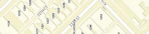


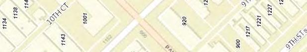

50 1200 Block 11th Street Neighborhood Proposed 1200 Block 11th Street District Proposed Contributor
51 SANBORN FIRE INSURANCE MAP, Santa Monica 1200 Block of 11th Street = INTACT PROPERTY July 1902
52 SANBORN FIRE INSURANCE MAP, Santa Monica 1200 Block of 11th Street = INTACT PROPERTY April 1909
53 SANBORN FIRE INSURANCE MAP, Santa Monica 1200 Block of 11th Street = INTACT PROPERTY 1918
54 SANBORN FIRE INSURANCE MAP, Santa Monica 1200 Block of 11th Street = INTACT PROPERTY 1918, Feb 1950 paste-up


55 PROPOSED 1200 BLOCK 11 TH STREET HISTORIC DISTRICT BOUNDARY AERIAL: 1200 block 11 th Street (Bing Map, 2014) AERIAL: 1200 block 11 th Street (Google 2018)


 11 TH STREET")
 1229")
 1233 11 TH")
56 PROPOSED 1200 BLOCK 11 TH STREET HISTORIC DISTRICT: PROPERTIES UNDER REVIEW TH STREET (1962) TH STREET (1914, 1921, 1956) 1223 (1221) 11 TH STREET (1911, 1955) TH STREET (1957) TH STREET (1908, 1912, 1921) TH STREET (1905, 1924)


 1247 (1955)")

")
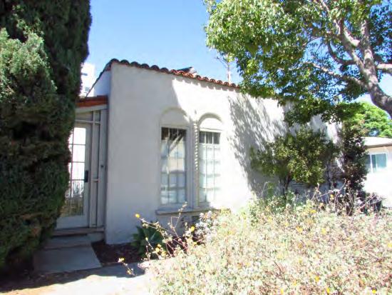
57 PROPOSED 1200 BLOCK 11 TH STREET HISTORIC DISTRICT: PROPERTIES UNDER REVIEW TH STREET (1905, 1934) TH STREET (1955) TH STREET (1992) 1107 ARIZONA AVENUE (1907) 1109 ARIZONA AVENUE (1911) 1115 ARIZONA AVENUE (1925)


58 PROPOSED 1200 BLOCK 11 TH STREET HISTORIC DISTRICT: PROPERTIES UNDER REVIEW TH STREET (c1905) [MODIFIED TO COLONIAL REVIVAL BUNGALOW] TH STREET (2017)

59
60
61

62 TOWN OF SANTA MONICA TRACT MAP (portion thereof)
63 1200 Block 11th Street TOWN OF SANTA MONICA TRACT MAP (portion thereof)
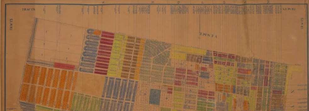

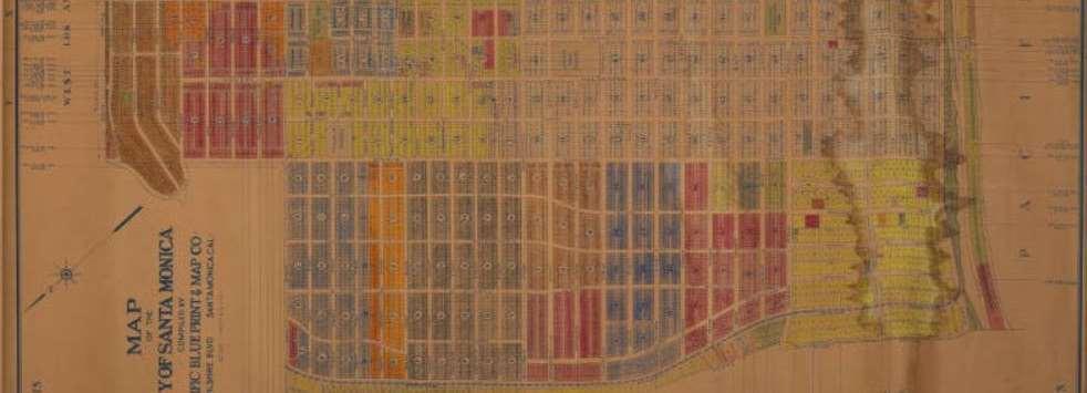
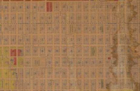
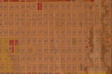
64
CRITERIA FOR EVALUATION
 This project focused on establishing the historic context for the commercial buildings in West Hollywood from its initial development in the 1890s through its incorporation as a city in 1984. The scope
2501 2nd Street Santa Monica, California City Landmark Assessment and Evaluation Report
 2501 2nd Street Evaluation Report Assessor s Parcel Map Sanborn Maps Photographs Prepared for: City of Santa Monica Planning Division July 27, 2010 2501 2nd Street Environmental Setting Improvements on
Memorandum. 233 Wilshire Boulevard, Suite 130, Santa Monica, CA INTERNET TEL FAX
 TO: Scott Albright, City of Santa Monica DATE: April 29, 2010 CC: FROM: PCR Services RE: PRELIMINARY HISTORIC ASSESSMENT: 2501 2ND TH STREET, APN As requested by City s staff, PCR Services Corporation
M E M O R A N D U M PLANNING AND COMMUNITY DEVELOPMENT DEPARTMENT CITY OF SANTA MONICA PLANNING DIVISION
 M E M O R A N D U M 10-A PLANNING AND COMMUNITY DEVELOPMENT DEPARTMENT CITY OF SANTA MONICA PLANNING DIVISION DATE: May 14, 2018 TO: FROM: SUBJECT: The Honorable Landmarks Commission Planning Staff 1314
Memorandum. Overview. Background Information. To: Scott Albright, City of Santa Monica Date: 04/22/2013 Jan Ostashay, Principal OAC
 Memorandum P.O. Box 542 Long Beach, CA 562.500.9451 HISTORICS@AOL.COM To: Scott Albright, City of Santa Monica Date: 04/22/2013 From: Jan Ostashay, Principal OAC Re: PRELIMINARY HISTORICAL ASSESSMENT:
Memorandum. Historic Resources Inventory Survey Form 315 Palisades Avenue, 1983.
 Memorandum TO: Roxanne Tanemori, City of Santa Monica DATE: August 30, 2007 CC: FROM: Jon L. Wilson, M.Arch., Architectural Historian RE: Preliminary Historic Assessment: 315 Palisades Avenue (APN 4293-015-015)
Executive Summary (updated) Inner Mission North Survey and Mission Dolores Neighborhood Survey Historic District Themes and Boundaries
 Inner Mission North Survey and Mission Dolores Neighborhood Survey Historic District Themes and Boundaries") DATE: May 25, 2011 TO: FROM: RE: Historic Preservation Commission Matt Weintraub, Preservation Planner Comments and Responses, Inner Mission North Historic Resource Survey Case No. 2011.0401U This memorandum
DATE: May 25, 2011 TO: FROM: RE: Historic Preservation Commission Matt Weintraub, Preservation Planner Comments and Responses, Inner Mission North Historic Resource Survey Case No. 2011.0401U This memorandum
th Street Santa Monica, California City Landmark Assessment and Evaluation Report. Evaluation Report Parcel Map Sanborn Maps Photographs
 1047 9 th Street Santa Monica, California City Landmark Assessment and Evaluation Report Evaluation Report Parcel Map Sanborn Maps Photographs Prepared for: City of Santa Monica Planning Division October
Steve Mizokami Senior Planner, City of Santa Monica. From: Christine Lazzaretto, Principal; Heather Goers, Architectural Historian Date: April 3, 2018
 To: Steve Mizokami Senior Planner, City of Santa Monica 1 From: Christine Lazzaretto, Principal; Heather Goers, Architectural Historian Date: April 3, 2018 INTRODUCTION Per your request, Historic Resources
CITY LANDMARK ASSESSMENT REPORT 305 ALTA AVENUE, SANTA MONICA, CA
 CITY LANDMARK ASSESSMENT REPORT 305 ALTA AVENUE, SANTA MONICA, CA Preparedfor: CityofSantaMonica CityPlanningDivision 1685MainStreet,Room212 SantaMonica,CA90401 Preparedby: JanOstashayPrincipal Ostashay&AssociatesConsulting
M E M O R A N D U M PLANNING AND COMMUNITY DEVELOPMENT DEPARTMENT CITY OF SANTA MONICA PLANNING DIVISION
 M E M O R A N D U M 9-B PLANNING AND COMMUNITY DEVELOPMENT DEPARTMENT CITY OF SANTA MONICA PLANNING DIVISION DATE: May 14, 2018 TO: FROM: SUBJECT: The Honorable Landmarks Commission Planning Staff 1413
Los Angeles Department of City Planning RECOMMENDATION REPORT
 Los Angeles Department of City Planning RECOMMENDATION REPORT CULTURAL HERITAGE COMMISSION CASE NO.: CHC-2011-2487-NR HEARING DATE: October 6, 2011 TIME: 10:00 AM PLACE: City Hall, Room 1010 200 N. Spring
Windshield Survey of McLoud, Pottawatomie County. September 12, 2007 By Jim Gabbert Architectural Historian OK/SHPO
 Windshield Survey of McLoud, Pottawatomie County September 12, 2007 By Jim Gabbert Architectural Historian OK/SHPO Purpose and Methodology The purpose of this windshield survey is to identify, based on
Wilshire Historic Districts, Planning Districts and Multi-Property Resources 01/26/15
 Name: Oakhurst Drive Multi-Family Residential Historic District Description: The Oakhurst Drive Multi-Family Residential Historic District is a small multi-family historic district along the east side
435 Georgina Avenue, Santa Monica Historic Resource Assessment HISTORIC RESOURCES GROUP
 To: Steve Mizokami 1 Senior Planner, City of Santa Monica From: Christine Lazzaretto; Molly Iker-Johnson Date: March 23, 2018 RE: 435 Georgina Avenue Executive Summary We have evaluated the residence located
CALIFORNIA. cfr. i l fi ERIC GARCETTI MAYOR
 DEPARTMENT OF CITY PLANNING 200 N. Spring Street, Room 272 LOS ANGELES, CA 90012-4801 CULTURAL HERITAGE COMMISSION RICHARD BARRON PRESIDENT GAILKENNARD VICE PRESIDENT PILAR BUELNA DIANE KANNER BARRY MILOFSKY
Residential Design Guide Appendices
 Residential Design Guide Appendices Appendix 1 Thorndon Appendix 2 Mt Victoria Appendix 3 Aro Valley Appendix 4 Southern Inner Residential Areas Appendix 5 Oriental Bay Appendix 6 Residential Coastal Edge
Key for Understanding Integrity Rating and Architecture Rating used in the Showplace Square / Northeast Mission Historic Resources Survey
 Key for Understanding Integrity Rating and Architecture Rating used in the Showplace Square / Northeast Mission Historic Resources Survey Integrity Integrity, as it applies to historic preservation, is
III. Apartment HISTORIC DISTRICTS. & Multifamily Development
 III HISTORIC DISTRICTS Apartment & Multifamily Development PART III Historic Districts APARTMENT & MULTIFAMILY DEVELOPMENT CH. 13 THE AVENUES 13 : 1-6 CH. 14 CAPITOL HILL 14 : 1-6 CH. 15 CENTRAL CITY 15
Montana Avenue, Santa Monica
 909-911 Montana Avenue, Santa Monica Landmark Assessment Report Prepared for: City of Santa Monica Planning & Community Development Department 1685 Main Street, Room 212 Santa Monica, CA 90401 Prepared
NATIONAL REGISTER OF HISTORIC PLACES
 1501 (Rev. 07/2012) INFORMATION ON NOMINATING PROPERTIES TO THE NATIONAL REGISTER OF HISTORIC PLACES AND THE COLORADO STATE REGISTER of HISTORIC PROPERTIES National Register and State Register Programs
Venice Report Historic Districts, Planning Districts and Multi-Property Resources 04/02/15
 Districts Name: Lost Venice Canals Historic District Description: The Lost Venice Canals Historic District is a residential neighborhood located in the northwestern portion of Venice. The district contains
2.0 Section 106 Scope of Work and Methodology
 measures for those impacts found to be unavoidable; and 6) development of a financing plan that identifies sources of funding and the timing of their availability. This report documents the historic properties
M E M O R A N D U M PLANNING AND COMMUNITY DEVELOPMENT DEPARTMENT CITY OF SANTA MONICA PLANNING DIVISION
 M E M O R A N D U M PLANNING AND COMMUNITY DEVELOPMENT DEPARTMENT CITY OF SANTA MONICA PLANNING DIVISION DATE: February 10, 2017 TO: FROM: SUBJECT: The Honorable Landmarks Commission Roxanne Tanemori,
2018 Historic Resources Inventory Update Individual Resources
 Foot of the staircase at Appian Way and Arcadia Terrace c. 1910 Arcadia Terrace Entrance Pylon Not applicable 5S3 Colorado Avenue between Ocean Avenue and the Santa 1939 Colorado Avenue Viaduct (Santa
Ch. 14 CAPITOL HILL. Historic Districts - Apartment and Multi-family Development
 Historic Districts - Apartment and Multi-family Development Ch. 14 CAPITOL HILL A HISTORY OF APARTMENT AND MULTI-FAMILY DEVELOPMENT The following background on the historical development of apartment and
INTENSIVE HISTORIC RESOURCES SURVEY ADELANTE EASTSIDE REDEVELOPMENT AREA LOS ANGELES, CALIFORNIA
 INTENSIVE HISTORIC RESOURCES SURVEY ADELANTE EASTSIDE REDEVELOPMENT AREA LOS ANGELES, CALIFORNIA July 2008 INTENSIVE HISTORIC RESOURCES SURVEY ADELANTE EASTSIDE REDEVELOPMENT AREA LOS ANGELES, CALIFORNIA
Residential Property 142 Hollister Avenue Santa Monica, California Structure of Merit Evaluation
 Residential Property Santa Monica, California Evaluation Report City Directory Research Photographs Sanborn Maps Prepared for: City of Santa Monica Prepared by: PCR Services Corporation Santa Monica, California
Historic Preservation
 PETITION NUMBER - - (FOR OFFICIAL USE ONLY) DATE RECEIVED BY CITY AUDITOR AND CLERK: Historic Preservation Historic Designation Application Packet (Buildings, Sites and Districts) for the NAME OF RESOURCE
Westlake Report Historic Districts, Planning Districts and Multi-Property Resources 04/03/14
 Districts Name: Rampart Boulevard Residential Historic District The Rampart Boulevard Residential Historic District is composed of a single residential block located in the Westlake neighborhood of Los
4.2.8 Westwood/VA Hospital Station Area
 4.2.8 Westwood/VA Hospital Station Area The Westwood/VA Hospital Station area is north of the VA Hospital and surrounded by large, open landscaped areas and several parking lots. I-405 is a prominent visual
Chairman and Members of the Planning and Development Committee. Thomas S. Mokrzycki, Commissioner of Planning and Building
 Exhibit 1 Port Credit DATE: TO: FROM: SUBJECT: Chairman and Members of the Planning and Development Committee Thomas S. Mokrzycki, Commissioner of Planning and Building Proposed Heritage Conservation District
315 Palisades Avenue Santa Monica, California City Landmark Assessment Report
 Santa Monica, California Prepared for: City of Santa Monica Planning Division Prepared by: PCR Services Corporation Santa Monica, California November 2007 Santa Monica, California BACKGROUND INFORMATION
Senior Planner, City of Santa Monica From: Christine Lazzaretto; Molly Iker Date: April 1, Gale Place
 To: Scott Albright 1 Senior Planner, City of Santa Monica From: Christine Lazzaretto; Molly Iker Date: April 1, 2015 RE: 15 Gale Place INTRODUCTION Historic Resources Group (HRG) has completed an evaluation
The City of Titusville
 The City of Titusville Historic Preservation Board Local Historic Resource Nomination Form 1. Location Street Address Original Street Name (if any) City Titusville State Florida Zip Code Streets that form
The City of Titusville Historic Preservation Board Local Historic Resource Nomination Form
 The City of Titusville Historic Preservation Board Local Historic Resource Nomination Form 1. Location Street Address Original Street Name (if any) City Titusville State Florida Zip Code Streets that form
10 IONIA NW PROJECT INTRODUCTION
 10 IONIA NW PROJECT INTRODUCTION The Hinman Company ( Hinman ) owns the 11,040 square-foot, triangle-shaped property commonly known as 10 Ionia Avenue NW, Grand Rapids, Michigan (the 10 Ionia property
CALIFORNIA S' '( * ERIC GARCETTI MAYOR
 DEPARTMENT OF CITY PLANNING 200 N. Spring Street, Room 532 Los Angeles, CA 90012-4801 CULTURAL HERITAGE COMMISSION RICHARD BARRON City of Los Angeles CALIFORNIA S' '( * PRESIDENT y* GAILKENNARD VICE PRESIDENT
Planning Rationale in Support of an Application for Plan of Subdivision and Zoning By-Law Amendment
 Planning Rationale in Support of an Application for Plan of Subdivision and Zoning By-Law Amendment The Kilmorie Development 21 Withrow Avenue City of Ottawa Prepared by: Holzman Consultants Inc. Land
The City of Titusville Historic Preservation Board Local Historic Resource Nomination Form
 The City of Titusville Historic Preservation Board Local Historic Resource Nomination Form 1. Location Street Address City Titusville State Florida Zip Code 2. Property Owner Owner Name Address (if different
TOTTENHAM SECONDARY PLAN
 TOTTENHAM SECONDARY PLAN AMENDMENT NO. 11 TO THE OFFICIAL PLAN OF THE TOWN OF NEW TECUMSETH The following text and schedules to the Official Plan of the Town of New Tecumseth constitute Amendment No. 11
2014 Plan of Conservation and Development
 The Town of Hebron Section 1 2014 Plan of Conservation and Development Community Profile Introduction (Final: 8/29/13) The Community Profile section of the Plan of Conservation and Development is intended
2.2.2 The Land Use Setting
 2-6 Planning Area pearance varies dramatically from season to season. The absence of significant topographic or man-made features within the District contributes to a very open visual character that allows
Criteria Evaluation: Landmark staff found that the structure application meets History Criteria 1a, and Architecture Criterion 2a and 2b.
 To: Landmark Preservation Commission From: Kara Hahn, Principal Planner, Community Planning & Development (CPD) Date: October 9, 2018 RE: Landmark Designation for the Henderson House, 2600 Milwaukee Street
Silver Lake Echo Park Elysian Valley Report Historic Districts, Planning Districts and Multi-Property Resources 05/09/14
 Districts Name: Childs Heights Tract Residential Historic District Description: The Childs Heights Residential Historic District is located within the southwestern portion of the Silver Lake neighborhood,
Planning Rationale. 224 Cooper Street
 Submitted by: Robertson Martin Architects Tel 613.567.1361 Fax 613.567.9462 216 Pretoria Ave, Ottawa, Ontario, K1S 1X2 Planning Rationale 224 Cooper Street Planning Rationale Application to City of Ottawa
Los Angeles Department of City Planning RECOMMENDATION REPORT
 Los Angeles Department of City Planning RECOMMENDATION REPORT CULTURAL HERITAGE COMMISSION HEARING DATE: November 19, 2009 TIME: 10:00 AM PLACE: City Hall, Room 1010 200 N. Spring Street Los Angeles, CA
Housing Characteristics
 CHAPTER 7 HOUSING The housing component of the comprehensive plan is intended to provide an analysis of housing conditions and need. This component contains a discussion of McCall s 1990 housing inventory
Appendix 2: Mt Victoria
 Appendix 2: Mt Victoria Contents 2.1 Significance of Mt Victoria to the City 2.2 Character Overview 2.3 Areas in Mt Victoria Moir Street Armour Avenue Porritt Avenue Scarborough Terrace Queen Street Elizabeth
San Francisco Planning Department South Mission Historic Resources Survey Historic District Description
 Von Schroeder Welsh Block East side of Capp Street between 22 nd and 23 rd Streets. Boundaries: Block bounded by nue, Capp, 22 nd and 23 rd Streets Period of Significance: 1889 1895 Eligibility: California
Whereas, the Forests have invited recreation residence and organizational camp/club permit holders to comment on this Programmatic Agreement; and
 Programmatic Agreement Among The National Forests of Washington State The Washington State Historic Preservation Office and The Advisory Council on Historic Preservation Regarding Recreation Residence,
CHAPTER 2: PEOPLE AND THEIR HOMES
 2 CHAPTER 2: PEOPLE AND THEIR HOMES 1kf guts prep.indd 14 3/2/06 1:13:07 PM DANE COUNTY IS DIVERSE The 426,000 people who live in Dane County 6 are in a word diverse. There are people of all ages and families
Emerging Trends in Multifamily Living
 Design & Development Posted on: January 24, 2017 0 Design Emerging Trends in Multifamily Living With infill product growing in popularity, apartments and condominiums are adapting, bringing creative, single-family
HOUSING TYPES AND CHARACTERISTICS
 HOUSING TYPES AND CHARACTERISTICS Market Study Housing Type Classification Single-Family Detached Townhouse Projected Dwelling Unit Demand 2010-2040 65.7 percent of total 9.1 percent of total Housing Variants
Re: Preliminary Historical Assessment: 1430 Georgina Avenue (APN: )
") Memorandum To: (Name Withheld Upon Request) Re: Preliminary Historical Assessment: 1430 Georgina Avenue (APN: 4279-030-024) Date: May 9, 2014 Introduction At your request, Nelson White Preservation has
Memorandum To: (Name Withheld Upon Request) Re: Preliminary Historical Assessment: 1430 Georgina Avenue (APN: 4279-030-024) Date: May 9, 2014 Introduction At your request, Nelson White Preservation has
505 Georgina Avenue, Santa Monica, CA Landmark Assessment Report
 505 Georgina Avenue, Santa Monica, CA Landmark Assessment Report Prepared for: City of Santa Monica Planning and Community Development Department 1685 Main Street, Room 212 Santa Monica, CA 90401 Prepared
REQUEST FOR EVALUATION FOR POTENTIAL HISTORIC SIGNIFICANCE
 COMMUNITY DEVELOPMENT DEPARTMENT PLANNING DIVISION 701 Laurel Street Menlo Park, CA 94025 phone: (650) 330-6702 fax: (650) 327-1653 planning@menlopark.org http://www.menlopark.org REQUEST FOR EVALUATION
Harbor Gateway Individual Resources July 2012
 Individual Resources 16003 S AINSWORTH ST Year built: 1912 Architectural style: Craftsman An excellent intact example of a Craftsman residence dating from the early 20th century. Represents the earliest
DES, DES, DES. PROJECT ADDRESSES Townsend Street, 457 Bryant Street, Fourth Street
 HEARING DATE: April 18, 2018 CASE NUMBERS 2017-004023DES, 2017-002874DES, 2017-004129DES PROJECT ADDRESSES 228-248 Townsend Street, 457 Bryant Street, 500-504 Fourth Street BLOCKS/LOTS 3787/018, 3775/085,
Place Type Descriptions Vision 2037 Comprehensive Plan
 Place Type Descriptions Vision 2037 Comprehensive Plan The Vision 2037 Comprehensive Plan establishes a range of place types for Oxford, ranging from low intensity (limited development) Rural and Natural
174 Kinney Street Landmark Assessment Report
 174 Kinney Street Landmark Assessment Report Santa Monica, CA 90405 Prepared for: City of Santa Monica Planning & Community Development Department 1685 Main Street, Room 212 Santa Monica, CA 90401 Prepared
Los Angeles Department of City Planning RECOMMENDATION REPORT
 Los Angeles Department of City Planning RECOMMENDATION REPORT CULTURAL HERITAGE COMMISSION DATE: January 13, 2011 TIME: 10:00 AM PLACE: City Hall, Room 1010 200 N. Spring Street Los Angeles, CA 90012 CASE
HISTORIC RESOURCES INVENTORY UPDATE HISTORIC CONTEXT STATEMENT
 City of Santa Monica HISTORIC RESOURCES INVENTORY UPDATE HISTORIC CONTEXT STATEMENT March 2018 PREPARED FOR City of Santa Monica Planning & Community Development Department City Planning Division 1685
Downtown Housing Policy
 Downtown Housing Policy Background The Downtown Development Authority (DDA) has requested that city staff and other interested Commissions and Boards assist it in developing a Housing Policy to apply within
P RESERVATION C OMMISSION
 L A N D M A R K S P RESERVATION C OMMISSION S t a f f R e p o r t 2580 Bancroft Way The Bancroft Center REFERRAL NOVEMBER 2, 2017 Demolition Referral: Use Permit (#ZP2017-0083) to demolish an existing,
RECOMMENDATION REPORT
 DEPARTMENT OF CITY PLANNING RECOMMENDATION REPORT CITY PLANNING COMMISSION DATE: January 8, 2009 TIME: after 8:30 a.m.* PLACE: City Hall, 10 th Floor Room 1010 200 N. Spring Street Los Angeles, CA 90012
ORDINANCE NO. 972 N.S. AN ORDINANCE OF THE CITY OF EL PASO DE ROBLES ADDING ARTICLE V. CHAPTER OF THE MUNICIPAL CODE ON HISTORIC PRESERVATION
 ORDINANCE NO. 972 N.S. AN ORDINANCE OF THE CITY OF EL PASO DE ROBLES ADDING ARTICLE V. CHAPTER 21.50 OF THE MUNICIPAL CODE ON HISTORIC PRESERVATION WHEREAS, policies contained in the City s General Plan
Land Use, Transportation, and Infrastructure Committee of Denver City Council FROM: Scott Robinson, Senior City Planner DATE: December 6, 2018 RE:
 Community Planning and Development Planning Services 201 W. Colfax Ave., Dept. 205 Denver, CO 80202 p: 720.865.2915 f: 720.865.3052 www.denvergov.org/cpd TO: Land Use, Transportation, and Infrastructure
Los Angeles Department of City Planning RECOMMENDATION REPORT
 Los Angeles Department of City Planning RECOMMENDATION REPORT CULTURAL HERITAGE COMMISSION HEARING DATE: September 17, 2009 TIME: 10:00 AM PLACE: City Hall, Room 1010 200 N. Spring Street Los Angeles,
CALIFORNIA. 'w<. LISA M. WEBBER, AICP GAIL KENNARD DEPUTY DIRECTOR VICE PRESIDENT (213) PILAR BUELNA DIANE KANNER BARRY A MILOFSKY
 PILAR BUELNA DIANE KANNER BARRY A MILOFSKY") DEPARTMENT OF CITY PLANNING City of Los Angeles EXECUTIVE OFFICES CALIFORNIA VINCENT P. BERTONI, AICP 200 N. Spring Street, Room 532 Los Angeles, CA 90012-4801 DIRECTOR (213) 978-1271 $ CULTURAL HERITAGE
DEPARTMENT OF CITY PLANNING City of Los Angeles EXECUTIVE OFFICES CALIFORNIA VINCENT P. BERTONI, AICP 200 N. Spring Street, Room 532 Los Angeles, CA 90012-4801 DIRECTOR (213) 978-1271 $ CULTURAL HERITAGE
Technical Report 7.1 MODEL REPORT AND PARKING SCENARIOS. May 2016 PARKING MATTERS. Savannah GA Parking Concepts PARKING MATTERS
 Savannah GA Parking Concepts PARKING MATTERS A Strategic Plan for Parking + Mobility in Savannah PARKING MATTERS Technical Report 7.1 MODEL REPORT AND PARKING SCENARIOS Prepared for the Chatham County-Savannah
DEVELOPMENT DEPARTMENT STAFF REPORT STAFF REPORT DRESDEN DRIVE TOWNHOMES DCI
 DEVELOPMENT DEPARTMENT STAFF REPORT Meeting Date: September 13, 2018 Item #: PZ2018-319 STAFF REPORT DRESDEN DRIVE TOWNHOMES DCI Request: Project Name: Development of Community Compact (DCI) and six concurrent
ARTICLE 3: Zone Districts
 ARTICLE 3: Zone Districts... 3-1 17.3.1: General...3-1 17.3.1.1: Purpose and Intent... 3-1 17.3.2: Districts and Maps...3-1 17.3.2.1: Applicability... 3-1 17.3.2.2: Creation of Districts... 3-1 17.3.2.3:
Historic Property Report
 Location Address: 1224 E ROCKWOOD PINES RD, SPOKANE, WA 99203 Tax No/Parcel No: 35294.0243 Plat/Block/Lot: ROCKWOOD PINES 2ND L15 Geographic Areas: Spokane County, SPOKANE NW Quadrangle, T25R43E29 Information
CPED STAFF REPORT Prepared for the Heritage Preservation Commission HPC Agenda Item #5 July 28, 2015 BZH-28578
 HERITAGE PRESERVATION APPLICATION SUMMARY Property Location: Properties along Golden Valley Road between Sheridan Avenue North and Vincent Avenue North Project Name: Golden Valley Road Apartments Historic
Los Angeles Department of City Planning RECOMMENDATION REPORT
 Los Angeles Department of City Planning RECOMMENDATION REPORT CULTURAL HERITAGE COMMISSION HEARING DATE: June 16, 2011 TIME: 10:00 AM PLACE: City Hall, Room 1010 200 N. Spring Street Los Angeles, CA 90012
Request to Designate a Structure: East 12 th Avenue
 To: Land Use, Transportation, and Infrastructure Committee From: Kara Hahn, Principal Planner, Community Planning & Development (CPD) Date: October 11, 2018 RE: Landmark Designation for the Essex Apartments
John Byers (Third) Residence 2034 La Mesa Drive Santa Monica, California City Landmark Assessment Report
 Residence 2034 La Mesa Drive Santa Monica, California City Landmark Assessment Report") John Byers (Third) Residence Santa Monica, California Evaluation Report Building Permit History City Directory Research Additional Photographs Tax Assessor Map Sanborn Map Prepared for: City of Santa Monica
John Byers (Third) Residence Santa Monica, California Evaluation Report Building Permit History City Directory Research Additional Photographs Tax Assessor Map Sanborn Map Prepared for: City of Santa Monica
CEQA and Historic Preservation: A 360 Degree Review
 CEQA and Historic Preservation: A 360 Degree Review California Preservation Foundation Workshop February 11, 2015 CEQA Case Studies and Hypotheticals Based on case studies presented by Ken Bernstein (Los
Ch.16 SOUTH TEMPLE. Historic Districts - Apartment and Multi-family Development A HISTORY OF APARTMENT AND MULTI-FAMILY DEVELOPMENT
 Historic Districts - Apartment and Multi-family Development Ch.16 SOUTH TEMPLE A HISTORY OF APARTMENT AND MULTI-FAMILY DEVELOPMENT The following background on the historical development of apartment and
A. Land Use Relationships
 Chapter 9 Land Use Plan A. Land Use Relationships Development patterns in Colleyville have evolved from basic agricultural and residential land uses, predominate during the early stages of Colleyville
Chatsworth Porter Ranch Report Individual Resources 07/13/15
 Individual Resources Primary Address: 9761 N ANDORA AVE Year built: 1964 Architectural style: Modern, Mid-Century L.A. Modernism, 1919-1980 Theme: Post-War Modernism, 1946-1976 Sub theme: Mid-Century Modernism,
Los Angeles Department of City Planning RECOMMENDATION REPORT
 Los Angeles Department of City Planning RECOMMENDATION REPORT CULTURAL HERITAGE COMMISSION HEARING DATE: November 3, 2011 TIME: 10:00 AM PLACE: City Hall, Room 1010 200 N. Spring Street Los Angeles, CA
A. Land Use Designations: General Plan: LDR Low Density Residential Zoning: R-1H Single Family Residential - Hillside Overlay
 Z O N I N G A D J U S T M E N T S B O A R D S t a f f R e p o r t FOR BOARD ACTION FEBRUARY 26, 2015 1229 Oxford Street Use Permit #UP2014-0009 to 1) add a 1,171 square-foot third story which would result
M E M O R A N D U M PLANNING AND COMMUNITY DEVELOPMENT DEPARTMENT CITY OF SANTA MONICA PLANNING DIVISION
 M E M O R A N D U M PLANNING AND COMMUNITY DEVELOPMENT DEPARTMENT CITY OF SANTA MONICA PLANNING DIVISION DATE: November 8, 2010 TO: FROM: The Honorable Landmarks Commission Planning Staff SUBJECT: 2009
Planning & Zoning Tools for Preserving Historic Communities
 Planning & Zoning Tools for Preserving Historic Communities 2018 APA PLANNING WEBCAST SERIES JULY 6, 2018 ANDREA PIETRAS, AICP DEPUTY PLANNING DIRECTOR & SCAPA PRESIDENT ANDREA HARRIS- LONG, AICP PLANNER
CHAPTER 3. HOUSING AND ECONOMIC DEVELOPMENT
 CHAPTER 3. HOUSING AND ECONOMIC DEVELOPMENT This chapter analyzes the housing and economic development trends within the community. Analysis of state equalized value trends is useful in estimating investment
Downtown Community Plan Area
 City of Santa Monica Citywide Historic Resources Inventory Update Downtown Community Plan Area Prepared for: City of Santa Monica Planning and Community Development Prepared by: Pasadena, California July
Missing Middle Housing Types Showcasing examples in Springfield, Oregon
 Missing Middle Housing Types Showcasing examples in Springfield, Oregon MissingMiddleHousing.com is powered by Opticos Design Illustration 2015 Opticos Design, Inc. Missing Middle Housing Study Prepared
Flexibility in the Law: Reengineering of Zoning to Prevent Fragmented Landscapes
 Pace University DigitalCommons@Pace Pace Law Faculty Publications School of Law 2-18-1998 Flexibility in the Law: Reengineering of Zoning to Prevent Fragmented Landscapes John R. Nolon Elisabeth Haub School
Architectural Inventory Form
 310 N Spruce St 5SM1775 Official Eligibility Determination OAHP1403 (OAHP use only) COLORADO CULTURAL RESOURCE SURVEY Rev. 9/98 Date Initials Determined Eligible National Register Determined Not Eligible
Table of Contents. Appendix...22
 Table Contents 1. Background 3 1.1 Purpose.3 1.2 Data Sources 3 1.3 Data Aggregation...4 1.4 Principles Methodology.. 5 2. Existing Population, Dwelling Units and Employment 6 2.1 Population.6 2.1.1 Distribution
Appraisers and Assessors of Real Estate
 http://www.bls.gov/oco/ocos300.htm Appraisers and Assessors of Real Estate * Nature of the Work * Training, Other Qualifications, and Advancement * Employment * Job Outlook * Projections Data * Earnings
SPIKOWSKI PLANNING ASSOCIATES
 SPIKOWSKI PLANNING ASSOCIATES 1617 Hendry Street, Suite 416 Fort Myers, Florida 33901-2947 telephone: (941) 334-8866 fax: (941) 334-8878 e-mail: bill@spikowski.com web site: www.spikowski.com MEMORANDUM
Los Angeles Department of City Planning RECOMMENDATION REPORT
 Los Angeles Department of City Planning RECOMMENDATION REPORT CULTURAL HERITAGE COMMISSION HEARING DATE: July 15, 2010 TIME: 10:00 AM PLACE: City Hall, Room 1010 200 N. Spring Street Los Angeles, CA 90012
FOR SALE. Rare Small Santa Monica Commercial Property
 FOR SALE Rare Small Santa Monica Commercial Property 2331 4TH STREET SANTA MONICA, CA CONTACT: WILLIAM B. ALTHOUSE Executive Vice President althouse@westmac.com tel. 310 966 4389 BRE #01403020 Company
Request to Designate a Structure: District 10, Wayne New Blueprint Denver: Area of Stability John and Beverly Muraglia
 To: Landmark Preservation Commission From: Kara Hahn, Principal Planner, Community Planning & Development (CPD) Date: July 31, 2018 RE: Landmark Designation for 670 Marion Street (Meyer-Reed-Muraglia House)
Los Angeles Department of City Planning RECOMMENDATION REPORT
 Los Angeles Department of City Planning RECOMMENDATION REPORT CULTURAL HERITAGE COMMISSION HEARING DATE: May 21, 2009 TIME: 10:00 AM PLACE: City Hall, Room 1010 200 N. Spring Street Los Angeles, CA 90012
MEMORANDUM REGARDING: DATE September 13, 2016 PROJECT NO Mill Creek Residential Trust 411 Borel Avenue, Suite #405 San Mateo, CA 94402
 MEMORANDUM DATE September 13, 2016 PROJECT NO. 16137 TO Dave Fiore PROJECT 2190 Shattuck Avenue OF Mill Creek Residential Trust 411 Borel Avenue, Suite #405 San Mateo, CA 94402 FROM Katherine Wallace,
Bylaw No , being "Official Community Plan Bylaw, 2016" Schedule "A" DRAFT
 Bylaw No. 2600-2016, being "Official Community Plan Bylaw, 2016" Schedule "A" Urban Structure + Growth Plan Urban Structure Land use and growth management are among the most powerful policy tools at the