CONFIRMED MINUTES FOR THE GREATER SHEPPARTON CITY COUNCIL DEVELOPMENT HEARINGS PANEL. Meeting No. 02/2016 HELD ON FRIDAY 11 MARCH 2016 AT 9.
|
|
|
- Warren Chase
- 5 years ago
- Views:
Transcription
1 CONFIRMED MINUTES FOR THE GREATER SHEPPARTON CITY COUNCIL DEVELOPMENT HEARINGS PANEL Meeting No. 02/2016 HELD ON FRIDAY 11 MARCH 2016 AT 9.00AM IN THE COUNCIL BOARDROOM 90 WELSFORD STREET CHAIR Councillor Chris Hazelman
2 1. ACKNOWLEDGEMENT Welcome everyone to Development Hearings Panel meeting number 2 for I would like to begin with an acknowledgement of the traditional owners of the land. We the Greater Shepparton City Council, begin today s meeting by acknowledging the traditional owners of the land which now comprises Greater Shepparton. We pay respect to their tribal elders, we celebrate their continuing culture, and we acknowledge the memory of their ancestors. 2. RECORDING OF PROCEEDINGS I would like to advise all present today that: the proceeding is being minuted but not recorded. and that out of courtesy for all other attendees any recording devices should be turned off during the course of the hearing unless the chair has been formally advised that a party wishes to record proceedings. 3. COMMITTEE MEMBERS PRESENT Committee members present today are: Cr Chris Hazelman (Chair), Johann Rajaratnam Director Sustainable Development Colin Kalms Manager Planning Michael MacDonagh Team Leader Strategic Planning, and Jon Griffin Team Leader Project Management Office and Development 4. OFFICERS AND OTHERS PRESENT The Planning Officers present today are: Tim Watson Senior Statutory Planner Andrew Dainton Principal Statutory Planner I would also like to acknowledge all other parties present today. Given we have a two items for consideration today we will get you to introduce yourself when your turn comes to present. 5. APOLOGIES Nil
3 6. CONFIRMATION OF MINUTES OF PREVIOUS MEETINGS Moved by Johann Rajaratnam, and seconded by Colin Kalms that the minutes of the meeting held on 4 November 2015 be adopted. Carried Moved by Colin Kalms, and seconded by Jonathan Griffin that the minutes of the meeting held on 4 February 2016 be adopted. Carried 7. DECLARATIONS OF CONFLICTS OF INTEREST None 8. ORDER OF PROCEEDINGS For those of you who are attending the DHP for the first time the process is as follows The DHP operates under Local Law No 2, with such modifications and adaptations as the DHP deems necessary for the orderly conduct of meetings. All DHP panel members have 1 vote at a meeting. Decisions of the DHP are by ordinary majority resolution. If a vote is tied the Chair of the DHP has the casting vote. The process for submitters to be heard by the Panel today shall be: The planning officer to present the planning report recommendation Any objector/s or representatives on behalf of the objectors present to make a submissions in support of their objection (should they wish to) The applicant/applicant representative to present in support of the application The officer, objectors/submitters and applicant will be limited to three minutes per person unless granted a further 3 minute extension by the Chair (following a moved and seconded motion from the panel). 9. MATTERS FOR CONSIDERATION There are four items formally listed for consideration today: The first item for consideration is planning permit application for cricket practice nets at Knight Street, Shepparton. The second item for consideration is planning permit application for a major promotion sign at 195 Numurkah Road, Shepparton.
4 The third item for consideration is planning permit application for the resubdivision of land at 380 Turnbull Road, Ardmona. The fourth item for consideration is planning permit application for a home occupation at 1 Redbyrne Court, Grahamvale. 10. LATE REPORTS None 11. NEXT MEETING Friday, 1 April 2016
5 I N D E X Application No. Subject Address: Proposal: Page No Knight Street, Shepparton Numurkah Road, Shepparton Buildings and works for cricket practice nets associated with a Section 2 Use (School) in the Neighbourhood Residential Zone and Heritage Overlay Erection and display of an externally illuminated major promotion sign Turnbull Road, Ardmona Re-subdivision in the Farming Zone to excise the existing dwelling and reduce the number of lots from four to two Redbyrne Court, Grahamvale Home Occupation (swimming pool construction business) with a floor area not exceeding 100 sqm 58
 Why is a permit required 32.")
6 Application Details: Responsible Officer: Tim Watson Application Number: Applicants Name: Notre Dame College Date Application Received: 6-Nov-2015 Statutory Days: 77 (4/2/16) Land/Address: Knight Street SHEPPARTON VIC 3630 Zoning and Overlays: Neighbourhood Residential Zone Heritage Overlay (HO85) Why is a permit required buildings and works associated with a section 2 use (include Permit Triggers): buildings and works in the Heritage Overlay Are there any Restrictive No Covenants on the title? Proposal The application for a planning permit proposes the construction of cricket practice nets at the rear of the oval owned and used by the school. The practice area will consist of three synthetic pitches with retractable netting 10.8m across the rear of the wickets, and 18m along the sides to a height of 3.6m. Above that height along the rear will be fixed netting (of the same flexible netting material) between 3.6m and 5m high. There will be fixed netting overhead for 10m extending out from the wicket end. The reason for the fixed netting is to catch any fly balls that might otherwise travel towards the dwellings in Breage Court. The retractable netting will be folded into the boxes on the posts when each training session is finished so that the practice wickets cannot be used at other times. The plan and elevation of the nets is shown below, and its intended position shown on an aerial photo of the oval. Page 3

7 Summary of Key Issues That the addition of cricket practice nets on the existing sports grounds of Notre Dame College is supported by the purpose of the Neighbourhood Residential Zone and acceptable within the Heritage Overlay. That the proposal is satisfactory considering the relevant decision guidelines including for the zone, overlay, amenity and orderly planning. That on balance the application provides an acceptable outcome under State and local planning policy and a net community benefit. That the objectors concerns are addressed through increasing the set back from Breage Court and thereby the distance from dwellings. The resulting location, and the design and proposed usage of the nets will maintain acceptable residential amenity by appearance and noise. Recommendation Notice of Decision to Grant a Permit That Council having caused notice of Planning Application No to be given under Section 52 of the Planning and Environment Act 1987 and having considered all the matters required under Section 60 of the Planning and Environment Act 1987 and having considered the objections to the application, decides to issue a Notice of Decision to Grant a Permit under the provisions of Clauses and of the Greater Shepparton Planning Page 4
8 Scheme in respect of the land known and described as Knight Street SHEPPARTON VIC 3630, for the construction of cricket practice nets on St Brendan s Oval in accordance with the Notice of Decision and the endorsed plans. Discuss key Conditions (including Referral Authorities): Given that the approval is for construction and not use of land (which exists) conditions for the following matters are appropriate: 1. Amended plans required before endorsement showing northern end of nets to be setback 10 metres from the northern property boundary. 2. Layout of plans not to be altered without further permission 3. Two years for commencement of development, Four years for completion Moved by Colin Kalms Seconded by Jonathan Griffin That Council having caused notice of Planning Application No to be given under Section 52 of the Planning and Environment Act 1987 and having considered all the matters required under Section 60 of the Planning and Environment Act 1987 and having considered the objections to the application, decides to issue a Notice of Decision to Grant a Permit under the provisions of Clauses and of the Greater Shepparton Planning Scheme in respect of the land known and described as Knight Street SHEPPARTON VIC 3630, for the construction of cricket practice nets on St Brendan s Oval in accordance with the Notice of Decision and the endorsed plans. Discuss key Conditions (including Referral Authorities): Given that the approval is for construction and not use of land (which exists) conditions for the following matters are appropriate: 1. Amended plans required before endorsement showing northern end of nets to be setback 10 metres from the northern property boundary. 2. Layout of plans not to be altered without further permission 3. Two years for commencement of development, Four years for completion CARRIED Subject Site & Locality An inspection of the site and the surrounding area has been undertaken on 9/11/2015 and a number of occasions since that time. The total site occupied by St Brendan s and Notre Dame College covers many titles however the area of the sports grounds comprising two ovals and roofed basketball court is about 2 Page 5

9 hectares. Breage Court runs directly along the northern boundary of the sports grounds and has individual lots with dwellings facing the sports grounds. The aerial photo below shows the sports oval in the context of the school buildings with the site of the cricket nets marked by a red dot and dwellings of objectors in Breage Court to the north of the oval properties outlined in blue The reason for the practice nets being located in the north-east corner of the oval on the right is that oval is a smaller practice oval. The oval on the left is a viable oval for junior cricket competition. In addition, for football the goal posts and boundary line at the eastern end can be moved in a few metres to compensate for the practice wickets and posts and still be viable for games up to grade six level. Perm it/site History There is no planning history of the site relevant to the use or development of the sports grounds. Further Information Further information was not requested for this application. Public Notification The application was advertised pursuant to Section 52 of the Planning and Environment Act 1987 with the following description buildings and works for cricket nets in Neighbourhood Residential Zone and Heritage Overlay associated with a section 2 use (school), by: Sending notices to the owners and occupiers of adjoining land as shown on the plan below. Page 6

10 Objections The Council has received three objections to date. The key issues that were raised in the objections are. Should be located in an alternate location on the oval where there would be less impact on court The aesthetic appearance of the court will be detrimentally impacted which will result in an impact on property values. Rubbish Car parking and traffic congestion in court The size of the structure is large and will not fit the street landscape and will result in a visual impact. The nets will be very close to a resident s living room. Noise and disruption within the residential zone Hours of operation and noise generated from the cricket nets. Flooding. The school as applicant has provided a response to the objections that included the following points: Page 7
11 The location was chosen carefully to avoid the one viable junior cricket oval (western) where a new synthetic pitch was recently installed. Area selected was the one location where balls hit out of the nets would not cause damage to buildings or parked cars. The location also allows the oval to be used for football up to grade six student level with some shortening at the eastern end. The nets have been designed to stop any balls going north into the residential area. The Notre Dame/St Brendan s & Central Park/St Brendan s Cricket Clubs, who will be using the facility outside of school hours, will initiate a strict 3 step policy to ensure there is no increased traffic or parking on Breage Court due to training sessions: 1. All players and parents would be verbally advised and provided with written instructions that drop off, pick up or parking is to only occur via Coria Avenue 2. If a player or parent drops off, picks up or parks in Breage Court, they would get one warning to not do this 3. If it occurs again, the player will be suspended by the Club for 2 matches The St Brendan's and Notre Dame College Football teams do not have any problems with parking, drop off or pick-ups in Breage Court for their training sessions and the Cricket Clubs anticipate the same response from their players and parents. The cricket nets will only be used during school hours and Cricket Club training sessions. The general public will not be able to use the facility because all side netting will be retracted and locked in steel boxes outside of school and training times. We are not sure how the existing flooding issue that occurs on many streets around Shepparton whin heavy rain occurs has anything to do with the construction of the nets. In our research into constructing this facility, we noted that two cricket net structures at Vibert Reserve and Kialla Recreation Reserve have been built within a short distance of residential properties, both on Council land. Our proposed nets structure is being built on School grounds for only students and School related cricket teams to use. Planner s Response The location for the practice nets was selected for practical reasons with least impact to the variety of sporting requirements for the sports ground area of the school grounds. There is some visual impact of residents view across Breage Court into the sports ground. There is a row of street trees on the south side of Breage Court that lessons the impact to some degree. While the residents enjoy the current view into the open playing fields this is a private school property not a public open space reserve. Further information obtained by discussion with the applicant is as follows: Page 8
12 The juniors train after school, generally on Wednesday and Friday between 4pm and 5:15pm. The seniors train on Tuesday and Thursday and start arriving from 5:15pm for the session between 5:45pm and 7pm. While some fielding practice may occur on the oval till about 7:15pm, the latest time the nets would be used for training outside of school hours by the seniors is about 7pm before the nets are locked away and the players meet back at their clubrooms for a BBQ. No lighting is proposed. In discussion with the applicant a solution was offered that the net structure could be relocated up to 10m south with some adjustment to the goal posts and boundary necessary to continue use of the area for football for up to six grade students. This would move the nets further away from the residents. For 7 and 9 Breage Court the separation between the dwellings and closest part of the nets would increase to about 25m. It is considered that such a change makes the nets less intrusive on the court, and lessens any noise disturbance by the increased distance. At this distance the proposal presents an acceptable solution with a reasonable compromise between use of the schools sporting fields and residential amenity. The use of the nets does not extend into the sensitive evening or night period, and is far earlier than allowed for example in the Code of Practice Private Tennis Court Development 1999 where play is allowed with lighting up until 10:30pm at a distance of only 3m from adjoining dwellings in residential areas. If a permit is to issue then it is considered that the relocation of the practice nets to a distance not less than 10m from the northern property boundary of the school should be required before plans are endorsed. Title Details The title does not contain a Restrictive Covenant or Section 173 Agreement Consultation Consultation was undertaken. The objections were sent to the applicant and a response received. A phone conversation with the applicant clarified some information about the proposed use of the practice nets by the club and the offer was made to set the nets 10m south of the property boundary to be further away from the objectors. Referrals External Referrals/Notices Required by the Planning Scheme: Referrals/Notice Section 55 Referrals Section 52 Notices Advice/Response/Conditions None required None required Internal Council Notices Heritage Advisor Advice/Response/Conditions Officer spoke to heritage advisor, who informed no objections. Page 9
13 Assessment The zoning of the land Purpose of Zone To implement the State Planning Policy Framework and the Local Planning Policy Framework, including the Municipal Strategic Statement and local planning policies. To recognise areas of predominately single and double storey residential development. To limit opportunities for increase residential development. To manage and ensure that development respects the identified neighbourhood character, heritage, environmental or landscape characteristics. To implement neighbourhood character policy and adopted neighbourhood character guidelines. To allow educational, religious, community and a limited range of other nonresidential uses to serve local community needs in appropriate locations. Decision Guidelines Before deciding on an application, in addition to the decision guidelines in Clause 65, the responsible authority must consider, as appropriate: The State Planning Policy Framework and Local Planning Policy Framework, including the Municipal Strategic Statement and local planning policies. The purpose of this zone. Any other decision guidelines specified in a schedule to this zone. Non-residential use and development In the local neighbourhood context: Whether the use or development is compatible with residential use. Whether the use generally serves local community local community needs. The scale and intensity of the use and development. The design, height, setback and appearance of the proposed buildings and works. The proposed landscaping. The provision of car and bicycle parking and associated accessways. Any proposed loading and refuse collection facilities. The safety, efficiency and amenity effects of traffic to be generated by the proposal. Response Page 10
14 1. The relevant purpose of the Neighbourhood Residential Zone is for development to respect the identified neighbourhood character, heritage, environmental or landscape characteristics protection of the existing character. The purpose does allow educational, religious, community and a limited range of other non-residential uses to serve local community needs in appropriate locations. 2. The use of the subject land for an educational establishment and open sports grounds is well established with both a junior and senior school and the sports grounds adjacent to Breage Court. The proposed cricket net structure for school and local community use is development for an existing section 2 use requiring permission and is appropriate to the purpose of the zone. 3. Whether the use or development is compatible with residential use. 4. The proposed development for retractable cricket nets to be associated with the school s students and the old students cricket club is considered to be compatible with adjacent residential use, serve a local community need and be of reasonable scale and intensity. The nets are an accepted part of a school sports field where students are exposed to and learn different sports. The limited hours during which the nets are proposed to be used for school related clubs is reasonable as it gives working adults who are part of the local community the chance to use the facility. The use after 5:15pm would not occur every day, and with use to cease at 7pm, the hours do not extend into the late evening or night period when noise of sporting activity could be detrimental to residential amenity. 5. It is considered that the location of the nets close to the boundary adjacent to Breage Court could cause a detrimental visual impact to dwellings at 7 and 9 Breage Street with the 5m being higher than the prunus street trees. If the nets are setback by 10m then this substantially reduces the visual impact and allows the height to be appropriate to the setback. 6. The scale of the development which includes the installation of upright poles and a number of boxes to store retractable nets is considered appropriate for the location given the existing use of the land for a large sports field associated with the school. The development will not significantly obstruct views of the sports field which and school which contributes to the neighbourhood character of the locality. 7. No landscaping is proposed or recommended, there are street trees which allow filtered views into the school open sports grounds and it is expected that the residents appreciate this view. 8. The car parking provision is within the school grounds and not via Breage Court. The rules of usage for students and club members at training should prevent any disturbance of residents by cars. Relevant overlay provisions Heritage Overlay Page 11
15 Purpose of Overlay The relevant purpose for this application is: To ensure that development does not adversely affect the significance of heritage places. The relevant decision guideline for this application is: Whether the proposed works will adversely affect the significance, character or appearance of the heritage place. Response The site of the proposed nets is included in HO85 St Brendan s Roman Catholic Primary School and is adjacent to HO84 Notre Dame College, church and convent all fronting Knight Street. The buildings are significant and contribute to the streetscape of Knight Street. Surrounding school buildings are modern and of little significance. Although the land through to the northern boundary is included in the overlay, development of cricket practice nets on the open sports fields does not adversely affect the significance, character or appearance of the heritage place. The Heritage Advisor was consulted and offers no objection to the application. The State Planning Policy Framework (SPPF) Clause Objectives of Planning Includes objectives to provide for the fair, orderly, economic and sustainable use, and development of land; to protect public utilities and other facilities for the benefit of the community; and to facilitate development in accordance with the objectives. Clause 11 Settlement Planning is to facilitate sustainable development that takes full advantage of existing settlement patterns, and investment in transport and communication, water and sewerage and social facilities. Response The consideration of the application and objections is consistent with the objectives of planning for fair and orderly development of land, and particularly with the relocation of the nets further from the northern boundary and the residents. The proposal uses existing open sports grounds of the school for the further benefit of the school and old students cricket club. This is a benefit to the local community, both in terms of the Objectives of Planning and State Planning Policy on settlement given that cricket is both a sport and a social activity. The Local Planning Policy Framework (LPPF) - including the Municipal Strategic Statement (MSS), local planning policies and Structure Plans Urban Design Council wishes to ensure high quality architectural, urban design and landscape outcomes for built form and open spaces are achieved throughout the municipality. Non Residential Uses Page 12
16 Council acknowledges that there is a need to protect the amenity of existing and future residential areas. While a range of non residential uses in residential areas provide services to the local community, (including places of worship, schools, medical centres, display homes, child care centres, cafes, restaurants, and the like), it is important to ensure that these uses do not have a negative impact on residential amenity through inappropriate location, unsympathetic design, and traffic impacts. While the Notre Dame College use and associated sports fields are established, the following strategy is of relevance to development: Ensure the siting and design of buildings and works (including car parking areas) responds to the surrounding housing and streetscape and includes features to reduce the noise, loss of privacy and to enhance the appearance of the development, including landscaping, screening, acoustic fencing. Response The nets have been designed with poles and retractable lockable netting for the rear and sides which will ensure that at all times when the nets are not in use the view into the sports fields is maintained for residents and casual use of the nets is not possible. Providing that the location of the nets is 10m inside the boundary of the school grounds then the visual impact of the fixed netting should be of acceptable proportion to the setback. The limited hours of cricket training and finishing by 7pm limits noise to residential properties. The residents have views into the grounds over Breage Street between street trees and it is considered that further landscaping or screening is not appropriate. No additional car parking is required for the practice nets as car parking within the school grounds will be available and used. Relevant Particular Provisions None applicable The decision guidelines of Clause 65 Because a permit can be granted does not imply that a permit should or will be granted. The responsible authority must decide whether the proposal will produce acceptable outcomes in terms of the decision guidelines of this clause Approval of an application or plan Before deciding on an application or approval of a plan, the responsible authority must consider, as appropriate: The matters set out in Section 60 of the Act. The State Planning Policy Framework and the Local Planning Policy Framework, including the Municipal Strategic Statement and local planning policies. The purpose of the zone, overlay or other provision. Any matter required to be considered in the zone, overlay or other provision. The orderly planning of the area. The effect on the amenity of the area. Page 13
17 The proximity of the land to any public land. Factors likely to cause or contribute to land degradation, salinity or reduce water quality. Whether the proposed development is designed to maintain or improve the quality of stormwater within and exiting the site. The extent and character of native vegetation and the likelihood of its destruction. Whether native vegetation is to be or can be protected, planted or allowed to regenerate. The degree of flood, erosion or fire hazard associated with the location of the land and the use, development or management of the land so as to minimise any such hazard. Response The proposed development complies with the Decision Guidelines set out in Clause 65 in the following ways: The proposed cricket nets within existing school grounds is compatible with the purpose of the Neighbourhood Residential Zone and the Heritage Overlay. Orderly planning has been considered to be satisfied by the decision process and better local use of sports facilities. It is considered that the location and design of the proposed nets particularly when set back a minimum of 10m from the northern boundary will reduce any impact on visual amenity for residents to acceptable levels. The design of the retractable facility and limited hours of usage will ensure residential amenity of residents is acceptable. The proposed nets does not impact on the land or stormwater or flooding, erosion or fire hazards. No native vegetation will be affected. On the basis of all relevant considerations it is considered that the proposed practice nets with a minimum set back of 10m from the Breage Court boundary, will produce an acceptable outcome and a net community benefit. Relevant incorporated or reference documents None applicable to this application Other relevant adopted State policies or strategies policies None applicable to this application Relevant Planning Scheme amendments None applicable to this application Are there any significant social & economic effects? None applicable to this application Discuss any other relevant Acts that relate to the application? None applicable to this application Page 14
18 The Aboriginal Heritage Act 2006 The Area of Cultural Heritage Sensitivity in Victoria does not include the land within an area of cultural heritage sensitivity; therefore the proposed use does not trigger the need for a CHMP. Charter of Human Rights and Responsibilities The process of consideration and decision-making in respect of the application has given proper consideration to and is compatible with the requirements of the Charter of Human Rights and Responsibilities. Conclusion Having considered all the matters required by Clause 65 including State and local planning policy, zone and overlay requirements, and all decision guidelines, it is considered that granting permission for construction of cricket practice nets will produce an acceptable outcome and a Notice of Decision to grant a planning permit should be issued subject to a conditions including relocation further from the objectors properties by a minimum set back of 10m from the Breage Court boundary of the college grounds. Page 15
19 Draft Notice Of Decision APPLICATION NO: PLANNING SCHEME: RESPONSIBLE AUTHORITY: GREATER SHEPPARTON PLANNING SCHEME GREATER SHEPPARTON CITY COUNCIL THE RESPONSIBLE AUTHORITY HAS DECIDED TO GRANT A PERMIT. THE PERMIT HAS NOT BEEN ISSUED. ADDRESS OF THE LAND: KNIGHT STREET SHEPPARTON VIC 3630 WHAT THE PERMIT WILL ALLOW: BUILDINGS AND WORKS FOR CRICKET PRACTICE NETS ASSOCIATED WITH A SECTION 2 USE (SCHOOL) IN THE NEIGHBOURHOOD RESIDENTIAL ZONE AND HERITAGE OVERLAY WHAT WILL THE CONDITIONS OF THE PERMIT BE? 1. Amended Plans Required Before the construction of the cricket practice wickets and nets starts, amended plans to the satisfaction of the responsible authority must be submitted to and approved by the responsible authority. When approved, the plans will be endorsed and will then form part of the permit. The plans must be drawn to scale with dimensions and must be generally in accordance with the plan submitted with the application particularly with the orientation of the wickets and nets remaining unaltered but modified to show the north end of the cricket practice nets being set back a minimum of ten (10) metres from the northern property boundary with Breage Court. 2. Layout Not Altered The development of the cricket practice nets as shown on the endorsed plans must not be altered without the written consent of the responsible authority. 3. Time for Starting and Completion This permit will expire if one of the following circumstances applies: a) the development is not started within two (2) years of the date of this permit; b) the development is not completed within four (4) years of the date of this permit. Page 16
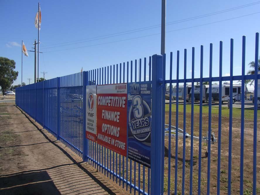
20 Application Details: Responsible Officer: Tim Watson Application Number: Applicant Name: C/- Jewell Partnerships P/L Date Received: 21-Dec-2015 Statutory Days: 32 (4/2/16) Land/Address: 195 Numurkah Road SHEPPARTON VIC 3630 Zoning & Overlays: Commercial 2 Zone Land Subject to Inundation Overlay Why is a permit required Erection and display of an externally illuminated Major (include Permit Promotional sign Triggers): Are there any Restrictive No Covenants on the title? Is a CHMP required? no Was the correct Yes ($604) application fee paid? Signature Date Initial Assessment Approval Advertising Approval Team Leader Statutory Planning Team Leader Statutory Planning Andrew Dainton 6/1/16 Andrew Dainton 6/1/16 Proposal The application for a planning permit proposes the erection and display of an externally lit major promotional sign in the Commercial 2 Zone. The plans below show the proposal. Page 17
21 Summary of Key Issues The application for a planning permit proposes the erection and display of an externally illuminated free-standing major promotional sign. The application was notified to surrounding properties with no objections received. The application to display a major promotional sign is not considered to be an acceptable planning outcome when assessed against the relevant section of Council s Local Planning Policy in relation to advertising signs. Recommendation Refusal That the Council having caused notice of Planning Application No to be given under Section 52 of the Planning and Environment Act 1987 and having considered all the matters required under Section 60 of the Planning and Environment Act 1987 decides to refuse to Grant a Permit under the provisions of of the Greater Shepparton Planning Scheme in respect of the land known and described as 195 Numurkah Road Page 18
22 SHEPPARTON VIC 3630, for the Erection and display of an externally illuminated major promotion sign. For the following reasons: o The proposed externally illuminated major promotion sign does not produce acceptable planning outcomes under Council s Local Planning Policy for the following reasons: a) The sign is not located within a designated Regional or Sub-regional centre; b) The sign is not attached to a building wall; c) The sign is displayed more than 3 meters above the ground and externally lit; and d) Approval of the sign would result in more than one freestanding sign on the land o The size and scale of the sign does not produce acceptable planning outcomes under the decision guidelines of the with regard to the relationship of the sign to the site and building through: a) Not appropriately scaling the sign relative to the scale and proportion of the existing building on the land. Page 19
23 Moved by Johann Rajaratnam Seconded by Michael MacDonagh That the Council having caused notice of Planning Application No to be given under Section 52 of the Planning and Environment Act 1987 and having considered all the matters required under Section 60 of the Planning and Environment Act 1987 decides to refuse to Grant a Permit under the provisions of of the Greater Shepparton Planning Scheme in respect of the land known and described as 195 Numurkah Road SHEPPARTON VIC 3630, for the Erection and display of an externally illuminated major promotion sign. For the following reasons: o The proposed externally illuminated major promotion sign does not produce acceptable planning outcomes under Council s Local Planning Policy for the following reasons: a) The sign is not located within a designated Regional or Sub-regional centre; b) The sign is not attached to a building wall; c) The sign is displayed more than 3 meters above the ground and externally lit; and d) Approval of the sign would result in more than one freestanding sign on the land o The size and scale of the sign does not produce acceptable planning outcomes under the decision guidelines of the with regard to the relationship of the sign to the site and building through: a) Not appropriately scaling the sign relative to the scale and proportion of the existing building on the land CARRIED Subject Site & Locality An inspection of the site and the surrounding area has been undertaken. Date: 6/1/16 Time: 9:15 am The site has a total area of 1.04 hectares and: The site is currently occupied by solar city marine who undertakes sales and service of boats and caravans. An existing shed located centre in approximately the middle of the site orientated wo the north and west. Page 20

24 An area of car parking and access ways is provided to the north of the building with two access points from Shelby Court. A display area is provided on the western side of the building which has been grassed and which is currently used for the display of boats and caravans. An area along the western portion of the site is not used and remains undeveloped. The main site/locality characteristics are: The land is surrounded by un-developed land with the allotment to the south forming part of the IGA supermarket site. The IGA site has an active permit to further develop the land abutting the subject land however has not yet been acted upon. The land to the north and east surrounding Shelby Court is vacant and undeveloped. The site abuts Numurkah Road to the west with premises adjacent the site used for highway commercial purposes. The Photos below show the existing site: Page 21


25 Page 22


26 Page 23

27 Page 24

28 Page 25


29 Page 26

30 Page 27

31 Permit/Site History The history of the site includes: Planning permit approved the erection and display of an internally illuminated business identification sign (Quintrex sign shown above). A condition of the permit required the removal of an existing free-standing Yamaha sign. Planning permits and /C approved a 8 lot subdivision for the land and surrounding properties to the north. Planning permit approved the temporary use of the land for a warehouse, bulk/wholesale factory sales outlet with incidental retail sales in case lots and a 120 seat café. Planning permit approved the removal of a drainage easement. Further Information Is further information required for the application? No Public Notification The application was advertised pursuant to Section 52 of the Planning and Environment Act 1987 with the following description erection and display of an externally lit major promotional sign, by: Page 28
32 Sending notices to the owners and occupiers of adjoining land. Objections The Council has received no objections to date. Title Details The title does not contain a Restrictive Covenant or Section 173 Agreement Consultation Consultation was not undertaken. Referrals to Authorities External Referrals Required by the Planning Scheme: Section 55 - Referrals Authority No referral was required List Planning clause triggering referral Determining or Recommendi ng Advice/Response/Conditions Notice to Authorities External Notice to Authorities: Section 52 - Notice Authority No external notices were required. Advice/Response/Conditions - Internal Notice: Internal Council Notices No internal referrals required Advice/Response/Conditions - Assessment The zoning of the land Commercial 2 Zone The purpose of the zone is: To implement the State Planning Policy Framework and the Local Planning Policy Framework, including the Municipal Strategic Statement and local planning policies. Page 29
33 To encourage commercial areas for offices, appropriate manufacturing and industries, bulky goods retailing, other retail uses, and associated business and commercial services. To ensure that uses do not affect the safety and amenity of adjacent, more sensitive uses. Pursuant to clause of the zone advertising sign requirements are at Clause this zone is in Category 1. Relevant overlay provisions Land Subject to Inundation Overlay The purpose of the overlay is: To identify land in a flood storage or flood fringe area affected by the 1 in 100 year flood or any other area determined by the floodplain management authority. To ensure that development maintains the free passage and temporary storage of floodwaters, minimises flood damage, is compatible with the flood hazard and local drainage conditions and will not cause any significant rise in flood level or flow velocity. To reflect any declaration under Division 4 of Part 10 of the Water Act, 1989 where a declaration has been made. To protect water quality in accordance with the provisions of relevant State Environment Protection Policies, particularly in accordance with Clauses 33 and 35 of the State Environment Protection Policy (Waters of Victoria). To ensure that development maintains or improves river and wetland health, waterway protection and flood plain health. A planning permit is not required for an outdoor advertising sign/structure in the Land Subject to Inundation Overlay Schedule. The State Planning Policy Framework (SPPF) Urban Design Relevant objectives and strategies include: To create urban environments that are safe, functional and provide good quality environments with a sense of place and cultural identity. Ensure new development or redevelopment contributes to community and cultural life by improving safety, diversity and choice, the quality of living and working environments, accessibility and inclusiveness and environmental sustainability. Page 30
34 Require development to respond to its context in terms of urban character, cultural heritage, natural features, surrounding landscape and climate. Response 1. The proposed sign does not seek to provide a good urban design outcome in that it doesn t seek to respond to its context by being larger than the building onsite. The Local Planning Policy Framework (LPPF) - including the Municipal Strategic Statement (MSS), local planning policies and Structure Plans Urban Design Advertising signage is a key and often highly visible component of the physical environment of the municipality and the inappropriate design or placement of advertising signs can have a significant effect on the appearance and visual amenity of an area. Council wants to guide the location and display of signage within the municipality to ensure signage is compatible with the character and architecture of local streetscapes. The design, form, size and placement of advertising signs should be controlled so as to protect and enhance the appearance of rural and urban areas and to avoid signs that are excessive, confusing or incompatible with the character of the surrounding area. Objectives and strategies To control the number of signs and ensure that the appearance, size, illumination or location of signs does not adversely affect the visual amenity of the natural environment or the built form in the municipality. Control the location, size and scale of advertising signage, especially in key precincts of the Shepparton CBD and town centres. Ensure that the location, form and size of signs complements the dominate character of any urban or rural landscape, building, site or area on which they are erected. Specific Implementation Fewer signs displaying a simple clear message is encouraged Advertising signage is encouraged to be primarily for business identification providing basic identification information of the business. Sky signs, high wall signs, projecting off-wall signs on upper facades and signs that project above parapets, wall, verandahs, roof lines or building fascias are discouraged in all areas Where a building is set back from the street, signs are encouraged to be located within the boundary and should be orientated to be parallel or at right angles to the street. Page 31
35 Where possible signs should be located on the building. Major promotional signs are discouraged, but if approved are to be confined to Regional and sub-regional centres attached to a building wall and should not be more than 3 metres above the ground or to be internally or externally illuminated. Response 2. The policy above identifies that advertising signage is a key and often highly visible component of the physical environment of the municipality and the inappropriate placement of a sign can have significant effect on the appearance and visual amenity of the area. 3. The proposed major promotional sign, given the location of the site will form a highly visible and dominate feature on the entry to Shepparton. The sign does not seek to respond to the existing site context, with the sign to be taller than the adjacent building. 4. The policy above discourages the display of major promotional signs within the municipality, however notes that in cases where Council considers them appropriate the signs should be confined to regional and sub-regional centres, attached to a building, not be more than 3 metres above the ground of to be internally or externally illuminated. 5. The proposed site is not designated as a regional or sub-regional centre within the municipality with the Shepparton CBD (regional) and Shepparton Market Place, Mooroopna CBD and Shepparton Plaza (sub-regional) the centre identified under the local planning policy at clause of the Planning Scheme. 6. The proposed sign is not intend to be attached to a building, with a structure to be located onsite to support the sign. The Council has over a number of years when considering applications for the display of major promotional signage sought to create a precedent when approving major promotional signs that they be displayed on wall of existing buildings. Most recently approving two major promotional signs on either side of the building at Numurkah Road, a site approximately 400 metres to the north of the subject land. 7. This directional policy was implemented into the Planning Scheme after a decision of the tribunal in D Agostino v Greater Shepparton CC (2005) VCAT 1181, where Member Cimino concluded in refusing an application for a free-standing major promotional sign: In coming to this conclusion, I am not saying that there is no scope for promotion signs, whether or not they fall into major promotional sign category, in this area. For example, I would think that there may be scope for Page 32
36 the display of such a sign on the wall of a building, framed by the building envelope 8. The above decision references a sign which was to be displayed at the eastern entrance to Shepparton on the Midland Highway, where the land uses are similar to the subject land of highway retail and light industrial. 9. The proposed sign is to be externally illuminated which is also discouraged by the above policy. 10. Council does not seek to discourage all major promotional signs within the municipality, however consider that the subject application which does not achieve any of the characteristics of the only major promotional sign specific policy within Council s Local Planning Policy is not supported. Relevant Particular Provisions Advertising Signs The purpose of this provision is to: Regulate the display of signs and associated structures; Provide for signs that are compatible with the amenity and visual appearance of an area, including the existing or desired future character; To ensure signs do not contribute to excessive visual clutter or visual disorder; To ensure that signs do not cause loss of amenity or adversely affect the natural or built environment or the safety, appearance or efficiency of a road. Pursuant to Clause a planning permit is required to display a major promotional sign. Decision Guidelines Before deciding on an application to display a sign, in addition to the decision guidelines in Clasue 65, the responsible authority must consider, as appropriate: The character of the area including: The sensitivity of the area in terms of the natural environment, heritage values, waterways and open space, rural landscape or residential character. The compatibility of the proposed sign with the existing or desired future character of the area in which it is proposed to be located. The cumulative impact of signs on the character of an area or route, including the need to avoid visual disorder or clutter of signs. The consistency with any identifiable outdoor advertising theme in the area. Page 33
37 Response 11. The character of the locality is that of highway retail, however in saying that there are a number of vacant sites along the eastern side of Numurak road abutting the subject site. The surrounding businesses include motor vehicle traders, farm machinery sales, boat and caravan sales and the IGA supermarket which abuts the site directly to the south. 12. The locality is not considered to have any natural values that would be compromised by the sign given the existing commercial development of the locality. 13. The signage theme for the locality is one typical of the uses, with predominantly business identification signs being displayed on building and fences. The theme is also generally consistent with most site displaying only one free-standing sign per site. As identified above the closest major promotional signs are displayed to the north of the land on an existing building used by a fencing company. The majority of the surrounding free-standing signs are of a blade style. 14. The proposed sign will be significantly larger than any free-standing sign displayed within the immediate vicinity and given that the site is not setback from the road like most other sites which are provided access via service road the sign has the potential to become a dominate feature. Impacts on views and vistas: The potential to obscure or compromise important views from the public realm. The potential to dominate the skyline. The potential to impact on the quality of significant public views. The potential to impede views to existing signs. Response 15. Given the highway retail characteristics of the locality and existing development, it is not considered that the sign will obscure or compromise important views from the public realm. 16. The sign has the potential to become a dominate feature of the site given that it is proposed to have a maximum height of 8.3 metres above the natural ground level, resulting in the sign being taller than that of the existing building on the site. 17. The sign is unlikely to impede on views to existing signs, as the abutting section of land to the south is yet to be developed by the IGA supermarket. The relationship to the streetscape, setting or landscape: The proportion, scale and form of the proposed sign relative to the streetscape, setting or landscape. The position of the sign, including the extent to which it protrudes above existing buildings or landscape and natural elements. Page 34
38 The ability to screen unsightly built or other elements. The ability to reduce the number of signs by rationalising or simplifying signs. The ability to include landscaping to reduce the visual impact of parts of the sign structure. Response 18. The proposed sign is considered to be excessive in scale for the locality, particularly height relative to the streetscape setting. The sign s height of 8.3 metres being a significant factor to this, with a lot of the surrounding buildings single storey. 19. The existing free-standing sign on site is 7.8 metres at it maximum height and already forms a dominate part of the site in that the building is setback from the frontage and the sign is approximately the same height as the building. The proposed sign which is significantly larger in area and taller will become a dominate feature of the site and locality. The relationship to the site and building: The scale and form of the sign relative to the scale, proportion and any other significant characteristics of the host site and host building. The extent to which the sign displays innovation relative to the host site and host building. The extent to which the sign requires the removal of vegetation or includes new landscaping. Response 20. As identified above the sign will form a dominate feature of the site and the proposal does not seek to incorporate the sign with the building. The proportion of the sign to the building cannot be considered desirable with the free-standing sign to be taller than the section of building which it is closest to. 21. The proposal does not display any innovation relative to the host site, with the sign to be constructed at a significant height comparative to the surrounding building and close to the road. 22. No native vegetation will need to be removed to allow for the display of the sign. The impact of structures associated with the sign: The extent to which associated structures integrate with the sign. The potential of associated structures to impact any important or significant features of the building, site, streetscape, setting or landscape, views and vistas or area. Response 23. The proposed sign will required the construction of a single structure with four poles with a clearance underneath of 4.75 metres. Page 35
39 24. It is not considered that the structure itself is excessive, as most of it will comprise the advertising display area. The impact of any illumination: The impact of glare and illumination on the safety of pedestrians and vehicles. The impact of illumination on the amenity of nearby residents and the amenity of the area. The potential to control illumination temporally or in terms of intensity. Response 25. The external illumination of the sign is considered to be acceptable, with the site located within a commercial area, with no residential uses within close proximity. A number of the existing business signs within the locality are illuminated and have not resulted in any impacts. The impact of any logo box associated with the sign: The extent to which the logo box forms an integral part of the sign through its position, lighting and any structures used to attach the logo box to the sign The suitability of the size of the logo box in relation to its identification purpose and size of the sign. Response 26. No logo box has been identified as part of this application The need for identification and the opportunities for adequate identification on the site or locality. 27. The Council as identified do not discourage major promotional signs outright and acknowledge that there is a need for them as reflected in the Council s Local Planning Policy. 28. Despite this the proposed sign does not attempt to meet any of the Council s Local Planning Policy directions for the location and placement of Major Promotional signs, which Council has shown will be considered if appropriately located and designed within the subject area. 29. The subject site already has a significant display of business identification signs, including a large free-standing sign, all of which is considered to be an acceptable level of signage for a sales yard. The impact on road safety. A sign is a hazard if the sign: Obstructs a driver s line of sight at an intersection, curve or point of egress from an adjacent property. Obstructs a driver s view of a traffic control device, or is likely to create a confusing or dominating background which might reduce the clarity or effectiveness of a traffic control device. Page 36
40 Could dazzle or distract drivers due to its size, design or colouring, or it being illuminated, reflective, animated or flashing. Is at a location where particular concentration is required, such as a high pedestrian volume intersection. Is likely to be mistaken for a traffic control device, because it contains red, green or yellow lighting, or has red circles, octagons, crosses, triangles or arrows. Requires close study from a moving or stationary vehicle in a location where the vehicle would be unprotected from passing traffic. Invites drivers to turn where there is fast moving traffic or the sign is so close to the turning point that there is no time to signal and turn safely. Is within 100 metres of a rural railway crossing. Has insufficient clearance from vehicles on the carriageway. Could mislead drivers or be mistaken as an instruction to drivers. Response 30. The proposed sign is not to be display near any areas which require high levels of concentration, with no traffic lights or major intersections located within the immediate vicinity. 31. The sign will not obstruct a driver s line of sight or create levels of confusion with no moving or animated sections proposed. 32. Given the sign to be displayed is promotional it is difficult to determine or provide an assessment against some of the other criteria as the sign content will change. For this matter, should a permit issue standard road safety conditions should be included as permit conditions to ensure future road safety with regard to content displayed. Major Promotion sign Decision Guidelines The effect of the proposed major promotion sign on: o o o o Significant streetscapes, buildings and skylines. The visual appearance of a significant view corridor, viewline, gateway location or landmark site identified in a framework plan or local policy. Residential areas and heritage places. Open space and waterways. Page 37
41 When determining the effect of a proposed major promotion sign, the following locational principles must be taken into account: o o o o o Major promotion signs are encouraged in commercial and industrial locations in a manner which complements or enhances the character of the area. Major promotion signs are discouraged along forest and tourist roads, scenic routes or landscaped sections of freeways. Major promotion signs are discouraged within open space reserves or corridors and around waterways. Major promotion signs are discouraged where they will form a dominate visual element from residential areas, within a heritage place or where they will obstruct significant viewlines. In areas with a strong built form character, major promotion signs are encouraged only where they are not a dominate element in the streetscape and except for transparent feature signs (such as neon signs), are discouraged from being erected on the roof of a building. Response 33. The sign will form a dominate feature of the landscape given its height in comparison to surrounding structures and the adjacent building on the land. 34. The sign does not seek to incorporate its self with the site, with the sign to be taller than the adjacent building on the land and not building or wall behind it to form a frame. This will create a situation where the sign will dominate visual element on the main northern entry into Shepparton. The decision guidelines of Clause 65 Because a permit can be granted does not imply that a permit should or will be granted. The responsible authority must decide whether the proposal will produce acceptable outcomes in terms of the decision guidelines of this clause Approval of an application or plan Before deciding on an application or approval of a plan, the responsible authority must consider, as appropriate: The matters set out in Section 60 of the Act. The State Planning Policy Framework and the Local Planning Policy Framework, including the Municipal Strategic Statement and local planning policies. The purpose of the zone, overlay or other provision. Page 38
42 Any matter required to be considered in the zone, overlay or other provision. The orderly planning of the area. The effect on the amenity of the area. The proximity of the land to any public land. Factors likely to cause or contribute to land degradation, salinity or reduce water quality. Whether the proposed development is designed to maintain or improve the quality of stormwater within and exiting the site. The extent and character of native vegetation and the likelihood of its destruction. Whether native vegetation is to be or can be protected, planted or allowed to regenerate. The degree of flood, erosion or fire hazard associated with the location of the land and the use, development or management of the land so as to minimise any such hazard. Response 35. The application for a planning permit to display a major promotional sign is not considered to provide an acceptable outcome when assessed against the State and particularly Local Planning Policies. The proposal is specifically discouraged by the Local Planning Policy relating to the display of major promotional signs. 36. Despite the sign being located in a commercially developed highway location, where a large number of business identification including free-standing signs are located the sign does not appropriate respond to the physical context of the site. The proposed sign will be taller than the existing free-standing sign on site and the existing building on the land. 37. The sign does is not considered to provide for an orderly planning outcome within the locality with the sign to form a dominate feature of the site which does not seek to incorporate its self with the building. Relevant incorporated or reference documents There are no relevant or incorporated or reference documents that relate to this application for a planning permit. Other relevant adopted State policies or strategies policies There are no other relevant State or strategic policies that relate to this application for a planning permit. Page 39
43 Relevant Planning Scheme amendments There are no relevant Planning Scheme amendments that relate to this application for a planning permit Are there any significant social & economic effects? There are no relevant significant social or economic effects that relate to this application for a planning permit. Discuss any other relevant Acts that relate to the application? There are no other relevant Acts that relate to this application for a planning permit. The Aboriginal Heritage Act 2006 The Aboriginal Heritage Act 2006 provides protection for all Aboriginal places, objects and human remains in Victoria, regardless of their inclusion on the Victorian Aboriginal Heritage Register or land tenure. The Aboriginal Heritage Act 2006 introduces a requirement to prepare a Cultural Heritage Management Plan (CHMP) if all or part of the activity is a listed high impact activity, resulting in significant ground disturbance, and all or part of the activity area is an area of cultural heritage sensitivity, which has not been subject to significant ground disturbance. The Area of Cultural Heritage Sensitivity in Victoria does not include the land within an area of cultural heritage sensitivity; therefore the proposed use does not trigger the need for a CHMP. Charter of Human Rights and Responsibilities The Charter of Human Rights and Responsibilities has been considered when assessing this application and it is not considered that the application impinges on the Charter Conclusion The application for a planning permit to display a major promotional sign is not considered to provide an acceptable outcome when assessed against the State and particularly Local Planning Policies. The proposal is specifically discouraged by the Local Planning Policy relating to the display of major promotional signs. Page 40
44 DRAFT REFUSAL TO GRANT A PERMIT APPLICATION NO: PLANNING SCHEME: RESPONSIBLE AUTHORITY: GREATER SHEPPARTON PLANNING SCHEME GREATER SHEPPARTON CITY COUNCIL ADDRESS OF THE LAND: 195 Numurkah Road SHEPPARTON VIC 3630 WHAT HAS BEEN REFUSED: Erection and display of an externally illuminated major promotion sign WHAT ARE THE REASONS FOR THE REFUSAL? 1. The proposed externally illuminated major promotion sign does not produce acceptable planning outcomes under Council s Local Planning Policy for the following reasons: a) The sign is not located within a designated Regional or Sub-regional centre; b) The sign is not attached to a building wall; c) The sign is displayed more than 3 meters above the ground and externally lit; and d) Approval of the sign would result in more than one freestanding sign on the land 2. The size and scale of the sign does not produce acceptable planning outcomes under the decision guidelines of the with regard to the relationship of the sign to the site and building through: a) Not appropriately scaling the sign relative to the scale and proportion of the existing building on the land. Page 41
45 Application Details: Responsible Officer: Tim Watson Application Number: Applicants Name: Planright Pty Ltd Date Application 02-Dec-2015 Received: Statutory Days: 51 (4/2/16) Land/Address: 380 Turnbull Road ARDMONA VIC 3629 Zoning and Overlays: Farming Zone 1 Why is a permit required (include Permit Triggers): Are there any Restrictive Covenants on the title? Subdivision in the Farming Zone. No Proposal The application proposes to excise an old dwelling and associated shedding to create a small lot of 0.72ha from a lot of ha that is part of a large dairy farm operation. The balance of that lot being about ha would be consolidated with 3 other lots that are on title plans of 7.95ha, 7.77ha and 4.55ha and are also part of the large farm. The subject land for the application includes four lots totalling 47.3 ha that are part of a larger dairy farming operation and would be consolidated, effectively reducing the number of lots from 4 to 2, with the creation of one small lot for a dwelling that will no longer be related to the farming operation. The older style dwelling is currently rented and the occupier has expressed an interest in purchasing the lot should it be able to be excised. The dwelling and sheds are set back over 220m from Turnbull Road. The shape of the dwelling lot would have a narrow access leg with a 10.37m wide frontage and width of access for 220m down a driveway before widening into a rectangular shape of approx. 50m wide and 98m deep. The main area of the lot for the dwelling, yard, sheds and effluent envelope would be about 0.49 ha (4900m 2 ). Summary of Key Issues 1. The application does not produce an acceptable outcome considering relevant decision guidelines including for the Farming Zone 1 and the State and local planning policy for agriculture. 2. The re-subdivision will create a lot used for a lifestyle dwelling not associated with agriculture which; a) May adversely affect agriculture and is not supported by the purpose of the Farming Zone; Page 42
46 b) Has the potential to adversely affect or limit the operation and expansion of adjoining and nearby agricultural uses through land use conflict and effect on land values; c) May be adversely affected by agricultural activities on adjacent and nearby land due to dust, noise, odour, use of chemicals and farm machinery, traffic and hours of operation; d) Create expectations of amenity that is not compatible with surrounding agricultural activity both now and in the future and can lead to land use conflict; e) Is a permanent change in land use that fragments and removes land from agricultural production and does not represent sustainable land management; f) Is not of sufficient size to support a viable agricultural enterprise; and g) Does remove the land and sheds from possible agricultural use in the future. 3. The application does not demonstrate how it will support or enhance agricultural production as; a) Creating one consolidated lot of 46ha may be detrimental to the future flexibility for the current dairy operation or incremental growth of surrounding orchards or to local agricultural enterprises responding to the needs of markets in future. b) The proposed consolidation of lots does not necessarily promote the viability of agriculture or compensate for the excision of the dwelling lot. The smaller lots are all in the same ownership, are well serviced by irrigation infrastructure and already used for a productive dairy farming operation that is valuable for its contribution to agricultural production at the local, regional and state level. c) Should the dairy farm operation change in future to a more intensive use that requires close supervision there might be the need for an additional dwelling on the balance land. 4. Excision of a dwelling lot to meet personal circumstances is not supported by planning scheme provisions. 5. The proposal to excise a lot for a dwelling was discussed with Council planners on two occasions prior to application being made with advice and explanation given verbally and in writing as to why such an application was contrary to policy and zone provisions of the planning scheme, that it would not produce an acceptable outcome and therefore would not be supported. 6. The application has been notified to adjoining neighbours and to Council s Health Department and Goulburn Murray Water Authority, with no objections received. Page 43
47 Recommendation Refusal That the Council having caused notice of Planning Application No to be given under Section 52 of the Planning and Environment Act 1987 and having considered all the matters required under Section 60 of the Planning and Environment Act 1987 decides to refuse to Grant a Permit under the provisions of of the Greater Shepparton Planning Scheme in respect of the land known and described as 380 Turnbull Road ARDMONA VIC 3629, for re-subdivision of four lots to create one house lot excision and consolidation of titles in the Farming Zone. For the following reasons: 1. The application does not produce an acceptable outcome considering all the relevant decision guidelines of Clause 65 including of Clause of the State Planning Policy Framework, Clause (Agriculture), Clause (Subdivision in Rural Areas) and Clause (Dwellings in Rural Areas) of the Municipal Strategic Statement, and the purpose and decision guidelines of the Farming Zone The re-subdivision will create a lot used for a lifestyle dwelling not associated with agriculture which; d) May adversely affect agriculture and is not supported by the purpose of the Farming Zone; e) Has the potential to adversely affect or limit the operation and expansion of adjoining and nearby agricultural uses through land use conflict and effect on land values; f) May be adversely affected by agricultural activities on adjacent and nearby land due to dust, noise, odour, use of chemicals and farm machinery, traffic and hours of operation; g) Create expectations of amenity that is not compatible with surrounding agricultural activity both now and in the future and can lead to land use conflict; h) Is a permanent change in land use that fragments and removes land from agricultural production and does not represent sustainable land management; i) Is not of sufficient size to support a viable agricultural enterprise; and j) Does remove the land and sheds from possible agricultural use in the future. 3. The application does not demonstrate how it will support or enhance agricultural production as; a) Creating one consolidated lot of 46ha may be detrimental to the future flexibility for the current dairy operation or incremental growth of surrounding orchards or to local agricultural enterprises responding to the needs of markets in future. Page 44
48 b) The proposed consolidation of lots does not necessarily promote the viability of agriculture or compensate for the excision of the dwelling lot. The smaller lots are all in the same ownership, are well serviced by irrigation infrastructure and already used for a productive dairy farming operation that is valuable for its contribution to agricultural production at the local, regional and state level. c) Should the dairy farm operation change in future to a more intensive use that requires close supervision there might be the need for an additional dwelling on the balance land. 4. Excision of a dwelling lot to meet personal circumstances is not supported by planning scheme provisions. Moved by Johann Rajaratnam Seconded by Michael MacDonagh That the Council having caused notice of Planning Application No to be given under Section 52 of the Planning and Environment Act 1987 and having considered all the matters required under Section 60 of the Planning and Environment Act 1987 decides to refuse to Grant a Permit under the provisions of of the Greater Shepparton Planning Scheme in respect of the land known and described as 380 Turnbull Road ARDMONA VIC 3629, for re-subdivision of four lots to create one house lot excision and consolidation of titles in the Farming Zone. For the following reasons: 1. The application does not produce an acceptable outcome considering all the relevant decision guidelines of Clause 65 including of Clause of the State Planning Policy Framework, Clause (Agriculture), Clause (Subdivision in Rural Areas) and Clause (Dwellings in Rural Areas) of the Municipal Strategic Statement, and the purpose and decision guidelines of the Farming Zone The re-subdivision will create a lot used for a lifestyle dwelling not associated with agriculture which; a) May adversely affect agriculture and is not supported by the purpose of the Farming Zone; b) Has the potential to adversely affect or limit the operation and expansion of adjoining and nearby agricultural uses through land use conflict and effect on land values; c) May be adversely affected by agricultural activities on adjacent and nearby land due to dust, noise, odour, use of chemicals and farm machinery, traffic and hours of operation; Page 45
49 d) Create expectations of amenity that is not compatible with surrounding agricultural activity both now and in the future and can lead to land use conflict; e) Is a permanent change in land use that fragments and removes land from agricultural production and does not represent sustainable land management; f) Is not of sufficient size to support a viable agricultural enterprise; and g) Does remove the land and sheds from possible agricultural use in the future. 3. The application does not demonstrate how it will support or enhance agricultural production as; a) Creating one consolidated lot of 46ha may be detrimental to the future flexibility for the current dairy operation or incremental growth of surrounding orchards or to local agricultural enterprises responding to the needs of markets in future. b) The proposed consolidation of lots does not necessarily promote the viability of agriculture or compensate for the excision of the dwelling lot. The smaller lots are all in the same ownership, are well serviced by irrigation infrastructure and already used for a productive dairy farming operation that is valuable for its contribution to agricultural production at the local, regional and state level. c) Should the dairy farm operation change in future to a more intensive use that requires close supervision there might be the need for an additional dwelling on the balance land. 4. Excision of a dwelling lot to meet personal circumstances is not supported by planning scheme provisions. CARRIED Subject Site & Locality An inspection of the site and the surrounding area has been undertaken. The four titles have a total area of hectares and currently contains: An old weatherboard dwelling with associated sheds including an old dairy shed, formerly used as a small dairy farm and now amalgamated into a large dairy operation. A large dairy farm operation on the east, south and west of the proposed house lot, and an orchard on the north side. The main site/locality characteristics are: The land surrounding the subject site is used for dairy farms and orchards typical of the Ardmona Area. While there are a limited number of small lots with dwellings, the majority Page 46


50 of the lots are similar in size to the lots comprising the applicant s property, and many form part of larger orchards or dairy farm operations. The aerial photo below shows the existing dwelling and shedding and about half of the length of access driveway, with the proposed lot boundaries drawn in red. Below is a wider photo showing surrounding farming. Permit/Site History The history of the site includes: Page 47
51 The only planning history on record is a Whole Farm Plan in 2001 (the majority of the property is laser levelled for irrigation). Further Information No further information was formally requested for this application. Public Notification The application has been advertised pursuant to Section 52 of the Planning and Environment Act 1987, by: Placing a sign on site. Sending notices to the owners and occupiers of adjoining land, as shown on the plan below. Objections The Council has received no objections to date. Title Details The title does not contain a Restrictive Covenant or Section 173 Agreement Consultation Consultation was undertaken. Relevant aspects of consultation, included: Initial consultations including written confirmation occurred on two occasions (11 May 2015 and 5 August 2015) prior to the application being made. The applicant Page 48
52 was advised that this proposal would not be supported because the potential for undesirable impacts on abutting farm operations outweighed any benefit from consolidating lots. State and local planning policy give strong support for agricultural production and seek to prevent creation of small lots for dwellings that have the potential to conflict with and prejudice agricultural activities. Referrals External Referrals/Notices Required by the Planning Scheme: Referrals/Notice Section 55 Referrals Section 52 Notices Advice/Response/Conditions None. The application was notified to Goulburn Murray Water, which did not object to the granting of a planning permit subject to the following conditions: 1. Any Plan of Subdivision lodged for certification must be referred to Goulburn-Murray Rural Water Corporation pursuant to Section 8(1)(a) of the Subdivision Act. 2. The existing on-site wastewater treatment and disposal systems for proposed new lot 1 must be wholly contained within the boundaries of the new lot created by subdivision. 3. Should water supply be required to the new lots created by subdivision, the Plan of Subdivision submitted for Certification must show appropriate water supply easements a minimum of 5 metres wide. 4. For subdivision of property holding delivery shares the applicant must either: a) make application to Goulburn Murray Water pursuant to sections 224 and 229 of the Water Act 1989 to: terminate the delivery shares in relation to the property; make a declaration that the property cease to be a serviced property (to effect excision from the district); and trade or transfer any Water Share in relation to the property; or alternatively b) demonstrate to Goulburn Murray Water s reasonable satisfaction the means by which a Goulburn Murray Water water supply will be metered and delivered to the lots created by the subdivision, bearing in mind requirements for water use licences and annual use limits. Page 49
53 Internal Council Notices Council s Health Department Nil Advice/Response/Conditions The application was referred to Council s Health Department, which did not object to the issue of a permit. Nil Assessment The zoning of the land Clause Farming Zone 1 The purpose of the Farming Zone is to: Provide for the use of land for agriculture; Encourage the retention of productive agricultural land; Ensure that non-agricultural uses, particularly dwellings, do not adversely affect the use of land for agriculture; Encourage use and development of land based on comprehensive and sustainable land management practices and infrastructure provision; and Protect and enhance natural resources and the biodiversity of the area. Subdivision A permit is required to subdivide land and the minimum area for each lot is 40ha. There are two relevant exceptions when application can be made for a smaller lot as follows: The subdivision is to create a lot for an existing dwelling. The subdivision must be a two lot subdivision. The subdivision is the re-subdivision of existing lots and the number of lots is not increased. The minimum size lot for a dwelling to be as-or-right in the Farming Zone 1 is 60ha. The dwelling has an existing use right on the lot of 27ha and would have originally been required for operation of the small dairy farm. Farming Zone Decision Guidelines The decision guidelines which are relevant to this application and which the Council must consider when assessing an application to construct a dwelling or subdivide land are: General issues The State Planning Policy Framework and the Local Planning Policy Framework, including the Municipal Strategic Statement and local planning policies. The capability of the land to accommodate the proposed use or development, including the disposal of effluent. How the use or development relates to sustainable land management. Whether the site is suitable for the use or development and whether the proposal is compatible with adjoining and nearby land uses. Page 50
54 How the use and development makes use of existing infrastructure and services. Agricultural issues Whether the use or development will support and enhance agricultural production. Whether the use or development will adversely affect soil quality or permanently remove land from agricultural production. The potential for the use or development to limit the operation and expansion of adjoining and nearby agricultural uses. The agricultural qualities of the land, such as soil quality, access to water and access to rural infrastructure. Any integrated land management plan prepared for the site. Dwelling issues Whether the dwelling will result in the loss or fragmentation of productive agricultural land. Whether the dwelling will be adversely affected by agricultural activities on adjacent and nearby land due to dust, noise, odour, use of chemicals and farm machinery, traffic and hours of operation. Whether the dwelling will adversely affect the operation and expansion of adjoining and nearby agricultural uses. The potential for the proposal to lead to a concentration or proliferation of dwellings in the area and the impact of this on the use of the land for agriculture. Environmental issues The impact of the proposal on the natural physical features and resources of the area, in particular on soil and water quality. The location of on-site effluent disposal areas to minimise the impact of nutrient loads on waterways and native vegetation. Response In general it is considered that the creation of a small rural lifestyle lot is a dwelling use that is not compatible with the surrounding productive agriculture. The proposal is likely to permanently remove the dwelling from being part of a productive farming operation. A dwelling may even be needed in future on the balance of the land in the event that a more intensified agricultural use occurs. The proposed re-subdivision does not enhance the agricultural production of the land through the separation of the existing dwelling from the agricultural land. The four existing lots are all in the same ownership and currently used as part of a productive farming operation. The proposed house lot is not large enough to sustain a viable agricultural use and does remove the land and sheds from possible agricultural use in the future. The expectation for lifestyle use has the potential to limit the operation and expansion of adjoining and nearby agricultural uses both through land use conflict and raising land value beyond what is viable for agricultural use. Relevant overlay provisions No overlays apply to the land. Page 51
55 The State Planning Policy Framework (SPPF) Protection of Agricultural Land The objective of this clause is to protect productive farmland which is of strategic significance in the local or regional context. To ensure that the state agricultural base is protected from the unplanned loss of productive agricultural land due to permanent changes of land use and to enable protection of productive agricultural land which is of strategic significance in the local and regional context. It is State policy: Permanent removal of productive agricultural land from the State s agricultural base must be undertaken without consideration of its economic importance for the agricultural production and processing sectors. In considering a proposal to subdivide or develop agricultural land, the following factors must be considered: The desirability and impacts of removing the land from primary production, given its agricultural productivity; The impacts of the proposed subdivision or development on the continuation of primary production on adjacent land, with particular regard to land values and to viability of infrastructure for such production; The compatibility between the proposed or likely development and the existing uses of the surrounding land; and Assessment of land capability. Response This farming area is well serviced by irrigation infrastructure and is valuable for its contribution to agricultural production at the local, regional and state level. The proposal does permanently remove the land containing an old dwelling and shedding from potentially being used again for agricultural production. The excision of the lot creates a lifestyle dwelling with expectations of amenity that is not compatible with surrounding agricultural activity both now and in the future and can lead to land use conflict. The excision is likely to affect the value of the land in a way that is detrimental to agriculture. The Local Planning Policy Framework (LPPF) - including the Municipal Strategic Statement (MSS), local planning policies and Structure Plans Clause Agriculture Irrigated primary production and the processing of that product underpin the municipality and the Region s economy. The level of production is nationally important and the region is responsible for significant parts of the nation s milk production, deciduous canned fruit production, stone fruit crop and tomato processing production. In both irrigation and dryland production the drivers of future successful agribusinesses, regardless of the scale of enterprise, are likely to be: Page 52
56 Continuing current trends for significantly increased scale of production which is achieved by expanding the land area of production and/or by increasing the intensity of the production system. A shift to individual management of their own business risks such as consolidation into contiguous properties to manage all their own water supply. Agribusinesses that seek to minimize the number of neighbours. Agribusinesses that expand into land that is priced competitively because it is used for agriculture rather than having inflated land values because it has been subdivided for hobby farms. It is increasingly evident that prospective agricultural investment is jeopardized, deterred, or completely lost by land uses and developments that have the potential to compromise the scale and location of such investment. In particular, agricultural investment is far less likely where land is already fragmented in ownership with housing dispersed throughout. Strategies include to: Discourage land uses and development in the Farming Zone, Schedule 1 that would compromise the future agricultural use of the land, including farm related tourism. Clause Subdivision in Rural Areas Farm holdings in rural areas are becoming larger. Rural dwelling lot excisions continue to pose a threat to the long term viability of the agricultural sector by reducing the size of farms and by causing friction between the expectations of farmers and residents. The planning scheme provides for a range of subdivision sizes based on the outcomes of the RRLUS. Subdivision of rural land at a density greater than these minimums, especially for personal and financial reasons; or to create lots for rural lifestyle purposes, could jeopardise the economic future of the region. The only circumstance in which Council will contemplate a small lot subdivision is if it leads to the consolidation of rural landholdings so as to promote the viability of agriculture. This is an increasingly important issue in the municipality since the deregulation of the dairy industry. Council wishes to facilitate farm consolidation so as to assist with (among other things) the rationalisation of a sustainable dairy industry. It is acknowledged that in some circumstances, small lot subdivision can assist the process of consolidation as it enables the farming land to be priced at its agricultural value rather than have it distorted by its housing value. While small lot subdivisions are discouraged in the municipality, they will be considered on a case by case basis if the outcome is farm consolidation. Objectives - Subdivision in Rural Areas To limit the further fragmentation of rural land by subdivision. To ensure that lots resulting from subdivision are of a sufficient size to be of benefit to agricultural production. Page 53
57 To encourage the consolidation of rural lots. To provide for the incremental growth of farming enterprises. To discourage small lot subdivision unless the balance lot is at least the minimum lot size and is of a size sufficient to support a viable agricultural enterprise. To ensure that small lot subdivisions do not prejudice surrounding agricultural activities. To ensure that small lots have access to adequate infrastructure including access to all weather roads. To prevent small lot subdivision to meet personal and financial circumstances or to create lots for rural lifestyle purposes. To prevent the creation of irregular shaped lots. To prevent serial small lot subdivisions from the one lot. Strategies - Subdivision in Rural Areas Discourage small lot subdivisions except where: o Restructure is an outcome; o No new opportunities for additional dwellings below the minimum specified in the schedule to the Farming Zone; and o The impact on neighbours and existing or potential agricultural use of nearby land is minimised. Discourage small lot subdivision, except where the proposal assists in the use, sale, reduction in number of lots, transfer or preservation of the land for agricultural purposes. Policy Guidelines - Small Lot Subdivision Criteria An application for a small lot subdivision of a lot containing a dwelling or the re-subdivision of existing lots should meet the following criteria: The lot containing the dwelling is to be no greater than 2ha in area unless there is a need for a larger parcel to take account of natural or public infrastructure features; The balance lot is of an area that complies with the minimum lot size for the zone; The existing dwelling is habitable; and The dwelling has existing use rights pursuant to Clause 63. Exercise of discretion It is policy to: Require the applicant to enter into an agreement under Section 173 of the Act which prevents: o The construction of a dwelling on the balance lot unless, when combined with other land, the area satisfies the minimum lot size for the construction of a dwelling in the zone; and Page 54
58 o The further subdivision of any lot created other than in accordance with the minimum lot size for subdivision in the zone. Discourage applications for a re-subdivision to realign lot boundaries if they: o o Rely on freehold land which was previously a road reserve, channel, utility lot, crown land or similar; and Create a dwelling opportunity where none previously existed. Support applications for a re-subdivision to realign lot boundaries will only be permitted for the purpose of making minor adjustments including to take account of topographical or public infrastructure features. Clause Dwellings in Rural Areas. The same intentions of local policy are present in Clause While these are directed against developing a dwelling not associated with agricultural use, the proposed subdivision is a development that creates a land use of a dwelling for lifestyle purposes. Two relevant strategies are: Discourage the establishment of dwellings not associated with or required for the agricultural use of the land. Discourage dwellings which are proposed to meet personal or financial circumstances or to create dwellings for rural lifestyle purposes. Response Creation of the lifestyle dwelling does not accord with local policy as it reduces the size of a farm and poses a threat to long term viability of agriculture. The old dwelling is reaching the end of its economic life without major renovation and does not presently distort land value of the 29 ha lot from its agricultural value. Excision of the dwelling lot will make a long term change that has the potential to be detrimental to agriculture for all the reasons listed in the local planning policies above. The existing tenants have indicated that if they were able to buy the lot they would expect to replace the dwelling in the future. Separating this old dwelling from the farm would create a lifestyle lot for a long time into the future with the potential to impact on surrounding agriculture. Excision of a dwelling lot to meet personal circumstances is not supported by planning scheme provisions. Should the dairy operation change in future to a more intensive use, there might be the need for an additional dwelling on the balance land. The proposed consolidation of lots does not necessarily promote the viability of agriculture or compensate for the excision of the dwelling lot. The smaller lots are already in one ownership and used for a productive dairy farming operation regardless of lot boundaries. Dairy farms, orchards and other agricultural uses can need to expand and contract over a period of time and the existing land titles can be bought and sold for farming value and in Page 55
59 smaller increments. Creating one lot of 46ha may reduce this flexibility and be detrimental to local agricultural enterprises responding to the needs of markets in future. Creating a lifestyle lot for a dwelling will inflate land value and introduces an unwanted neighbour for agricultural businesses. Relevant Particular Provisions There are no relevant Particular Provisions that relate to this application. The decision guidelines of Clause 65 Because a permit can be granted does not imply that a permit should or will be granted. The responsible authority must decide whether the proposal will produce acceptable outcomes in terms of the decision guidelines of this clause Approval of an application or plan Before deciding on an application or approval of a plan, the responsible authority must consider, as appropriate: The matters set out in Section 60 of the Act. The State Planning Policy Framework and the Local Planning Policy Framework, including the Municipal Strategic Statement and local planning policies. The purpose of the zone, overlay or other provision. Any matter required to be considered in the zone, overlay or other provision. The orderly planning of the area. The effect on the amenity of the area. The proximity of the land to any public land. Factors likely to cause or contribute to land degradation, salinity or reduce water quality. Whether the proposed development is designed to maintain or improve the quality of stormwater within and exiting the site. The extent and character of native vegetation and the likelihood of its destruction. Whether native vegetation is to be or can be protected, planted or allowed to regenerate. The degree of flood, erosion or fire hazard associated with the location of the land and the use, development or management of the land so as to minimise any such hazard Approval of an application to subdivide land Before deciding on an application to subdivide land, the responsible authority must also consider, as appropriate: The suitability of the land for subdivision. The existing use and possible future development of the land and nearby land. The availability of subdivided land in the locality, and the need for the creation of further lots. Page 56
60 The effect of development on the use or development of other land which has a common means of drainage. The subdivision pattern having regard to the physical characteristics of the land including existing vegetation. The density of the proposed development. The area and dimensions of each lot in the subdivision. The layout of roads having regard to their function and relationship to existing roads. The movement of pedestrians and vehicles throughout the subdivision and the ease of access to all lots. The provision and location of reserves for public open space and other community facilities. The staging of the subdivision. The design and siting of buildings having regard to safety and the risk of spread of fire. The provision of off-street parking. The provision and location of common property. The functions of any body corporate. The availability and provision of utility services, including water, sewerage, drainage, electricity and gas. If the land is not sewered and no provision has been made for the land to be sewered, the capacity of the land to treat and retain all sewage and sullage within the boundaries of each lot. Whether, in relation to subdivision plans, native vegetation can be protected through subdivision and siting of open space areas. Response The decision guidelines of Clause 65 which are relevant to this application have been considered when assessing this application and are addressed elsewhere within this report. The excision of a dwelling lot surrounded by productive agriculture does not represent good or orderly planning as it is contrary to State and local planning policy and the Farming Zone purpose and decision guidelines. In relation to any further matters listed in clause including the availability or need for further subdivided land the proposal is an inappropriate means to provide one additional lot and is outweighed by overwhelming policy against creating lifestyle lots in productive agricultural areas. It is considered that there are sufficient rural living areas available to meet the demand for lifestyle lots unrelated to agriculture, together with some excision lots previously created that become available for purchase from time to time. The proposed area and dimensions of the lot are not supported. The narrow access is a long and wasteful use of land that will become disassociated with surrounding farm use. The dwelling lot has inadequate dimensions to create an effective buffer to surrounding farming activities or be used for a small farming enterprise. Page 57
61 Relevant incorporated or reference documents None relevant Other relevant adopted State policies or strategies policies Regional Rural Land Use Strategy 2008 (RRLUS) has been adopted by City of Greater Shepparton and incorporated into local planning policy. Relevant Planning Scheme amendments None relevant. Are there any significant social & economic effects? There are no relevant significant social or economic effects that relate to this application. Discuss any other relevant Acts that relate to the application? There are no other relevant Acts that relate to this application. Charter of Human Rights and Responsibilities The process of consideration and decision-making in respect of the application has given proper consideration to and is compatible with the requirements of the Charter of Human Rights and Responsibilities. Conclusion It is considered that the proposal for re-subdivision of four lots to create a dwelling lot and consolidation of other lots does not produce an acceptable planning outcome having regard to relevant policy and the decision guidelines for the Farming Zone and it is recommended that a Refusal to grant a Permit should be issued for the reasons set out in the Recommendation above. Page 58
62 DRAFT REFUSAL TO GRANT A PERMIT APPLICATION NO: PLANNING SCHEME: RESPONSIBLE AUTHORITY: GREATER SHEPPARTON PLANNING SCHEME GREATER SHEPPARTON CITY COUNCIL ADDRESS OF THE LAND: 380 Turnbull Road ARDMONA VIC 3629 WHAT HAS BEEN REFUSED: Re-subdivision in the Farming Zone to excise the existing dwelling and reduce the number of lots from four to two WHAT ARE THE REASONS FOR THE REFUSAL? o o The application does not produce an acceptable outcome considering all the relevant decision guidelines of Clause 65 including of Clause of the State Planning Policy Framework, Clause (Agriculture), Clause (Subdivision in Rural Areas) and Clause (Dwellings in Rural Areas) of the Municipal Strategic Statement, and the purpose and decision guidelines of the Farming Zone 1. The re-subdivision will create a lot used for a lifestyle dwelling not associated with agriculture which; a) May adversely affect agriculture and is not supported by the purpose of the Farming Zone; b) Has the potential to adversely affect or limit the operation and expansion of adjoining and nearby agricultural uses through land use conflict and effect on land values; c) May be adversely affected by agricultural activities on adjacent and nearby land due to dust, noise, odour, use of chemicals and farm machinery, traffic and hours of operation; d) Creates expectations of amenity that is not compatible with surrounding agricultural activity both now and in the future and can lead to land use conflict; e) Is a permanent change in land use that fragments and removes land from agricultural production and does not represent sustainable land management; f) Is not of sufficient size to support a viable agricultural enterprise; and Page 59
63 g) Removes the land and sheds from possible agricultural use in the future. o The application does not demonstrate how it will support or enhance agricultural production as; a) Creating one consolidated lot of 46ha may be detrimental to the future flexibility for the current dairy operation or incremental growth of surrounding orchards or to local agricultural enterprises responding to the needs of markets in future. b) The proposed consolidation of lots does not necessarily promote the viability of agriculture or compensate for the excision of the dwelling lot. The smaller lots are all in the same ownership, are well serviced by irrigation infrastructure and already used for a productive dairy farming operation that is valuable for its contribution to agricultural production at the local, regional and state level. c) Should the dairy farm operation change in future to a more intensive use that requires close supervision there might be the need for an additional dwelling on the balance land. o Excision of a dwelling lot to meet personal circumstances is not supported by planning scheme provisions. Page 60
 Why is a permit required (include Permit Triggers): Are there any Restrictive Covenants on the title? Clause 52.")
64 Application Details: Responsible Officer: Andrew Dainton Application Number: Applicants Name: G Surace Date Application 18 November 2015 Received: Statutory Days: 75 Land/Address: 1 Redbyrne Court GRAHAMVALE VIC 3631 Zoning and Overlays: Low Density Residential Zone (LDRZ) Why is a permit required (include Permit Triggers): Are there any Restrictive Covenants on the title? Clause Home Occupation with a floor area not exceeding 100 sq m Yes, AK991555M about minimum standards of construction for buildings and restricting some land use activities see further detail in report. Section 173 Agreement for Effluent Treatment and the required Disposal Field Proposal The resident of the dwelling at 1 Redbyrne Court Grahamvale presently conducts a Home Occupation (administration and storage for his swimming pool construction business) from the shed on his property. The existing shed which is considered under the planning scheme to be an outbuilding of a dwelling, has an office related to the business within one end and some storage shelves for the business on the side walls at the other end. The shed is also used for personal storage. The application is required to use a larger floor area than permitted as-of-right under the requirements. The plan submitted with the application is shown below. Page 61

65 The context of the site can be seen in the aerial photo below. The site is outlined in blue with a blue circle indicating the shed in which the office and shelving is situated. The resident s business is called Aquazone Pools and previously operated from business premises in Gilchrist Street. The resident has explained that his business is downsizing, has ceased to sell pool products or conduct water testing and the number of pools to be constructed each year will be halved in number. The business constructs swimming pools on customers properties with materials delivered directly to the construction sites. Although the resident has had two trucks and an excavator stored at the property in the past, this is not permitted and this equipment is now stored elsewhere and one truck and the excavator are being sold. About half of the pool construction sites are away from Shepparton, such as at Bendigo, Mansfield and Yarrawonga. Appropriate contractors with any equipment required will be hired for each job whether in Shepparton or away and will go directly to the construction site. The planning scheme definition of a Home occupation is; An occupation carried on in a dwelling, or on the land around a dwelling, by a resident of the dwelling. It may include a use defined elsewhere, but not a Brothel. Home Occupation is an as-of-right use in the LDRZ, however Clause lists the requirements that a Home occupation must meet with limitations designed to ensure amenity Page 62
66 is not adversely affected. The limitations include the maximum floor area used, only one non-resident working in the home occupation, and one commercial vehicle not exceeding 2 tonnes capacity present at any time. Permission can be granted for those three limitations to be raised to 100m floor area, two non-residents working, and two commercial vehicles. In this application the resident conducting the home occupation has applied to increase the floor area used in the shed to 100 sq m. The applicant intends to comply with the remaining requirements, with one employee doing administration from an office in the shed on weekdays, and some minor and surplus items connected to the construction of swimming pools stored on shelves in the shed. Summary of Key Issues That the Aquazone Pools business which previously operated from a commercial premises in Gilchrist Street has downsized and modified operations to operate as a home occupation. The business has ceased to offer pool products and water testing that required customers to come to the business premises, has halved the number of pools constructed annually, and is in the process of selling a tip truck and excavator (now stored elsewhere) with required equipment to be hired in the local area of each job. A second small concrete pumping truck is also stored elsewhere, is used infrequently and travels directly to a construction site only when required. The shed that has been constructed on the resident s property in Redbyrne Court is quite large at 10m x 30m (300 sq m) but only a portion of the shed is shown on the plan to be used for the business, being an office of 48 sq m portioned off at one end and some work storage shelves totally 45 sq m in the main area of the shed. The remaining floor area is for personal use and storage including for boat, jet skis, mowers, bikes etc. The size of shed is not unusual on the LDRZ lots in Redbyrne Court where the size of lots range from 4,100 sq m to 5,600 sq m (and in the adjacent Dobsons Estate). Among the five houses existing or under construction there are four sheds constructed for hobbies and for tradesman likely to conduct a home occupation, ranging from 572 sq m to 216 sq m. Recommendation Notice of Decision to Grant a Permit That Council having caused notice of Planning Application No to be given under Section 52 of the Planning and Environment Act 1987 and having considered all the matters required under Section 60 of the Planning and Environment Act 1987 and having considered the objections to the application, decides to Grant a Notice of Decision to Grant a Permit under the provisions of Clause of the Greater Shepparton Planning Scheme in respect of the land known and described as 1 Redbyrne Court Grahamvale, for the home occupation (swimming pool construction business) to have a floor area not exceeding 100sqm in accordance with the following conditions. Page 63
67 Moved by Colin Kalms Seconded by Michael MacDonagh That Council having caused notice of Planning Application No to be given under Section 52 of the Planning and Environment Act 1987 and having considered all the matters required under Section 60 of the Planning and Environment Act 1987 and having considered the objections to the application, decides to Grant a Notice of Decision to Grant a Permit under the provisions of Clause of the Greater Shepparton Planning Scheme in respect of the land known and described as 1 Redbyrne Court Grahamvale, for the home occupation (swimming pool construction business) to have a floor area not exceeding 100sqm in accordance with the following conditions. CARRIED Amended Plans Required Before the use of the additional floor area starts, amended plans to the satisfaction of the responsible authority must be submitted to and approved by the responsible authority. When approved, the plans will be endorsed and will then form part of the permit. The plans must be drawn to scale with dimensions, must be generally in accordance with the plan submitted with the application but modified to show the actual location of the internal fence between the driveway and the septic disposal area to the satisfaction of the responsible authority Layout Not Altered The use as shown on the endorsed plans must not be altered without the written consent of the responsible authority. Permission required for change to Home Occupation The Home Occupation conducted at the premises must comply at all times with the requirements of Clause to the satisfaction of the responsible authority, with the exception that the maximum floor area permitted to be used is 100 sq m, and prior permission must be obtained in writing before the Home Occupation using greater than 50 sq m is changed to a substantially different business activity. Additional Landscaping Required Within six months of the permit date, landscaping shall be planted along the outside of the fence with frontage to Redbyrne Court across the width of the yard to the shed, similar to Page 64

68 what has been planted elsewhere in front of the house along that frontage, to the satisfaction of the responsible authority. The additional landscaping required together with the perimeter landscaping inside the lot boundary fences to the shed yard must thereafter be maintained to the satisfaction of the responsible authority. Subject Site & Locality An inspection of the site and the surrounding area has been undertaken on a number of occasions since April The site is on the north-west corner of Redbyrne Court and Old Dookie Road has a total area of 4550 square metres and currently contains: A single storey dwelling and swimming pool area at the southern end of the site, associated landscaped outdoor space over the wastewater effluent field area in the centre part of the site, and with a large outbuilding, being a shed and gravelled surrounds at the northern end of the site. The main locality characteristics are: The Redbyrne Court LDRZ subdivision of 12 lots of which 5 lots have dwellings and/or sheds completed or under construction, and the remainder of vacant lots have been sold but construction of dwellings has not commenced. There is a retarding basin on a small reserve on the east side of the entrance to the Court and this is opposite the site. The south side of Old Dookie Road is in a Farming Zone and consists mainly of orchards with associated dwellings having a frontage to the road, and some dwellings on lots of about 4500 sq m previously excised from farm properties. Page 65


69 Photo 1 - View of the front of the shed to Redbyrne Court with the door to the office. The gate has been observed to be generally closed unless the employee is in the office, and there is no signage to indicate there is a business operating. Photo 2 above - View of side yard on the south side of the shed. Photo 3 above: View of the rear of the shed Permit/Site History The history of the site includes: Page 66
70 EF-581 An enforcement file was opened on 8 April 2015 when the abutting neighbour complained that Giuseppe (Joe) Surace had moved his business Aquazone Pools from Gilchrist St to 1 Redbyrne Court. A number of discussions were held informing the resident the limitations of what was permitted as a Home Occupation. It was agreed that the best course of action if the two trucks and small excavator where to be kept and stored on the site would be to apply for a Contractor s Depot permit Permit application made on 20 May 2015 by Chris Smith and Associates on behalf of G Surace for a Contractor s Depot associated with the business being conducted from the site. Following advertising, nine objections and one letter of support was received. On 27 August 2015 the application was withdrawn as Joe Surace did not wish to upset other residents or future residents of the court Permit Application made on 18 November 2015 by Chris Smith and Associates on behalf of Joe Surace to allow his home occupation to use a floor area not exceeding 100 sq m. The application was made after re-assessing that the tip truck and excavator was not essential to the scaled down business he intended to operate, but the office for administration and the area required for storage would exceed the 50 sq m allowed as-of-right. Further Information No further information was requested for this application. Public Notification The application has been advertised pursuant to Section 52 of the Planning and Environment Act 1987, by: Placing a sign on site. Sending notices to the owners and occupiers of adjoining land as shown by blue stars on the plan below: Page 67

71 Objections The Council has received three objections to date, although one objection is anonymous. There have also been three letters supporting the application. The key issues that were raised in the objections are summarised as: I wished to live in a rural court environment and firmly object to any form of business activity adjacent to my home. Allowing one business to operate opens the door to others. The storage shed is 1m from my property and closer to my house than to the applicant s house. The business should be operating in a suitable zoning as it did previously. I purchased the property to live in a family friendly court and would have purchased elsewhere if advised of the business operating and bringing extra traffic and noise to the court. The selling agent did not inform us of the business days and hours of operation. Although the home office hours are stated as 9am to 4pm Mon to Fri, vehicles would depart the property from 7am onwards and return prior to 6pm, on what days? Page 68
CONFIRMED MINUTES FOR THE GREATER SHEPPARTON CITY COUNCIL DEVELOPMENT HEARINGS PANEL. Meeting No. 1/2012 HELD ON THURSDAY 8 MARCH 2012 AT 10.
 CONFIRMED MINUTES FOR THE GREATER SHEPPARTON CITY COUNCIL DEVELOPMENT HEARINGS PANEL Meeting No. 1/2012 HELD ON THURSDAY 8 MARCH 2012 AT 10.00AM AT THE COUNCIL BOARD ROOM 90 WELSFORD STREET CHAIR DEAN
Division 5 Residential Low Density Zone: Assessment Criteria and Assessment Tables
 Division 5 Residential Low Density Zone: Assessment Criteria and Assessment Tables 4.5.1 Residential Low Density Zone The provisions in this division relate to the Residential Low Density Zone as follows
Division 8 General Urban (T4) Zone: Assessment Criteria and Assessment Tables
 Zone: Assessment Criteria and Assessment Tables") Division 8 General Urban (T4) Zone: Assessment Criteria and Assessment Tables 15.8.1 General Urban (T4) Zone The provisions in this division relate to the General Urban (T4) Zone as follows overall outcomes
Division 8 General Urban (T4) Zone: Assessment Criteria and Assessment Tables 15.8.1 General Urban (T4) Zone The provisions in this division relate to the General Urban (T4) Zone as follows overall outcomes
32.08 GENERAL RESIDENTIAL ZONE. Shown on the planning scheme map as GRZ, R1Z, R2Z or R3Z with a number (if shown). Purpose
. Purpose") 32.08 GENERAL RESIDENTIAL ZONE Shown on the planning scheme map as GRZ, R1Z, R2Z or R3Z with a number (if shown). Purpose To implement the State Planning Policy Framework and the Local Planning Policy
32.08 GENERAL RESIDENTIAL ZONE Shown on the planning scheme map as GRZ, R1Z, R2Z or R3Z with a number (if shown). Purpose To implement the State Planning Policy Framework and the Local Planning Policy
Flinders Avenue, Lara Planning Scheme Amendment Combined Application for Rezoning and Multi-Lot Subdivision Reference : Decembe
 143-179 Flinders Avenue, Lara Planning Scheme Amendment Combined Application for Rezoning and Multi-Lot Subdivision Reference: 14134-03 TGM Group Geelong Melbourne Ballarat 1/27-31 Myers Street (PO Box
PLANNING SUBMISSION & CLAUSE 56 ASSESSMENT RESIDENTIAL SUBDIVISION OF LAND 1525 POUND ROAD, CLYDE NORTH (LOT 2 PS F, SIENNA PARK ESTATE)
") PLANNING SUBMISSION & CLAUSE 56 ASSESSMENT RESIDENTIAL SUBDIVISION OF LAND 1525 POUND ROAD, CLYDE NORTH (LOT 2 PS 327975F, SIENNA PARK ESTATE) DFC (PROJECT MANAGEMENT) PTY LTD (A DENNIS FAMILY CORPORATION
PLANNING SUBMISSION & CLAUSE 56 ASSESSMENT RESIDENTIAL SUBDIVISION OF LAND 1525 POUND ROAD, CLYDE NORTH (LOT 2 PS 327975F, SIENNA PARK ESTATE) DFC (PROJECT MANAGEMENT) PTY LTD (A DENNIS FAMILY CORPORATION
16.1 ISSUES OBJECTIVES POLICIES RULES PERFORMANCE STANDARDS 5
 16 SIGNAGE 16.1 ISSUES 3 16.2 OBJECTIVES 3 16.3 POLICIES 3 16.4 RULES 4 16.5 PERFORMANCE STANDARDS 5 Whanganui District Plan (15 January 2018) Chapter 16 Signage 16-1 16 SIGNAGE The objectives, policies
32.07 RESIDENTIAL GROWTH ZONE. Shown on the planning scheme map as RGZ with a number (if shown). Purpose
. Purpose") 32.07 RESIDENTIAL GROWTH ZONE Shown on the planning scheme map as RGZ with a number (if shown). Purpose To implement the State Planning Policy Framework and the Local Planning Policy Framework, including
32.07 RESIDENTIAL GROWTH ZONE Shown on the planning scheme map as RGZ with a number (if shown). Purpose To implement the State Planning Policy Framework and the Local Planning Policy Framework, including
32.07 RESIDENTIAL GROWTH ZONE
 32.07 RESIDENTIAL GROWTH ZONE 29/08/2017 VC139 Shown on the planning scheme map as RGZ with a number (if shown). Purpose To implement the State Planning Policy Framework and the Local Planning Policy Framework,
PORT PHILLIP PLANNING SCHEME. Condition
 SCHEDULE 1 TO THE CAPITAL CITY ZONE Shown on the planning scheme map as CCZ1. FISHERMANS BEND URBAN RENEWAL AREA Purpose To use and develop the Fishermans Bend Urban Renewal Area generally in accordance
Division 6 Residential Medium Density Zone: Assessment Criteria and Assessment Tables
 Division 6 Residential Medium Density Zone: Assessment Criteria and Assessment Tables 4.6.1 Residential Medium Density Zone The provisions in this division relate to the Residential Medium Density Zone
CONFIRMED MINUTES FOR THE GREATER SHEPPARTON CITY COUNCIL DEVELOPMENT HEARINGS PANEL. Meeting No. 5/2012 HELD ON THURSDAY 12 JULY 2012 AT 10.
 CONFIRMED MINUTES FOR THE GREATER SHEPPARTON CITY COUNCIL DEVELOPMENT HEARINGS PANEL Meeting No. 5/2012 HELD ON THURSDAY 12 JULY 2012 AT 10.00AM AT THE COUNCIL HUNTER ROOM 90 WELSFORD STREET CHAIR DEAN
Requirements for accepted development and assessment benchmarks for assessable development
 9.3.10 Small Lot Housing Design Code 9.3.10.1 Application (1) This code applies to development identified as requiring assessment against the Small Lot Housing Design Code by the categories of development
Division 16 Bundamba Racecourse Stables Area Zone: Assessment Criteria and Assessment Tables
 Division 16 Bundamba Racecourse Stables Area Zone: Assessment Criteria and Assessment Tables 4.16.1 Bundamba Racecourse Stables Area Zone The provisions in this division relate to the Bundamba Racecourse
Division 4 Large Lot Residential Zone: Assessment Criteria and Assessment Tables
 Division 4 Large Lot Residential Zone: Assessment Criteria and Assessment Tables 4.4.1 Large Lot Residential Zone The provisions in this division relate to the Large Lot Residential Zone as follows overall
H5. Residential Mixed Housing Urban Zone
 H5. Residential Mixed Housing Urban Zone [ENV-2016-AKL-000197: Robert Adams] Addition sought H5.1. Zone description The Residential Mixed Housing Urban Zone is a reasonably high-intensity zone enabling
9.3.6 Dwelling house code
 9.3.6 Dwelling house code 9.3.6.1 Application (1) This code applies to accepted development assessable development identified as requiring assessment against the Dwelling house 3 code by the tables of
New Victorian Residential Zones 2013
 Clause 1 Planning Page 1 of 35 Clause 1 is a town planning consultancy. We specialise in assisting property developers, architects and building designers meet the increasingly complex requirements of State
9.3.5 Dual occupancy code
 9.3.5 Dual occupancy code 9.3.5.1 Application (1) This code applies to accepted development and assessable development identified as requiring assessment against the Dual occupancy 1 code by the tables
H6 Residential Terrace Housing and Apartment Buildings Zone
 H6. Residential Terrace Housing and Apartment Buildings Zone [CIV-2016-404-002333: Franco Belgiorno-Nettis]-Note: The properties affected by this appeal are identified on the Auckland Unitary Plan viewer.
H4. Residential Mixed Housing Suburban Zone
 H4. Residential Mixed Housing Suburban Zone H4.1. Zone description The Residential Mixed Housing Suburban Zone is the most widespread residential zone covering many established suburbs and some greenfields
34.02 COMMERCIAL 2 ZONE
 34.02 COMMERCIAL 2 ZONE Shown on the planning scheme map as B3Z, B4Z or C2Z. Purpose To implement the Municipal Planning Strategy and the Planning Policy Framework. To encourage commercial areas for offices,
H5. Residential Mixed Housing Urban Zone
 H5. Residential Mixed Housing Urban Zone H5.1. Zone description The Residential Mixed Housing Urban Zone is a reasonably high-intensity zone enabling a greater intensity of development than previously
Greater Shepparton Planning Scheme Amendment C188 Shepparton North Growth Area
 Planning and Environment Act 1987 Panel Report Greater Shepparton Planning Scheme Amendment C188 Shepparton North Growth Area Front page 22 March 2017 Planning and Environment Act 1987 Panel Report pursuant
H4. Residential Mixed Housing Suburban Zone
 H4. Residential Mixed Housing Suburban Zone H4.1. Zone description The Residential Mixed Housing Suburban Zone is the most widespread residential zone covering many established suburbs and some greenfields
PERMITTED USES: Within the MX-1 Mixed Use Neighborhood District the following uses are permitted:
 6.25 MX-1 - MIXED USE NEIGHBORHOOD 6.25.1 INTENT: The purpose of the MX-1 Mixed Use Neighborhood District is to accommodate the development of a wide-range of residential and compatible non-residential
Activities which do not satisfy the General Rules and are not provided for as Restricted Discretionary activities... 9
 16.0 PAPAKAINGA AND MARAE SETTLEMENTS... 1 16.1 INTRODUCTION... 1 16.2 ISSUES... 1 16.3 OBJECTIVE (PAPAKAINGA)... 2 16.4 POLICIES (PAPAKAINGA)... 2 16.5 OBJECTIVE (SURROUNDING ENVIRONMENT)... 2 16.6 POLICIES
RURAL SETTLEMENT ZONE - RULES
 Chapter 38 RURAL SETTLEMENT ZONE - RULES INTRODUCTION This Chapter contains rules managing land uses in the. The boundaries of this zone are shown on the planning maps. There is limited opportunity for
CASEY PLANNING SCHEME AMENDMENT C219
 Who is the planning authority? Planning and Environment Act 1987 CASEY PLANNING SCHEME AMENDMENT C219 EXPLANATORY REPORT This amendment has been prepared by the, which is the planning authority for this
GREATER SHEPPARTON CITY COUNCIL
 GREATER SHEPPARTON CITY COUNCIL Policy Number 58.POL1 Version 1.0 Adopted: 21 October 2014 Last Reviewed: 2 September 2013 Business Unit: Responsible Officer: Approved By: Business Manager Citizen Services
Andrew Cormie s comments on Policies from the BPNDP Draft of May 2015
 Read in conjunction with AC_BPNDP_Comment.doc / pdf Policy as in the BPNDP Draft May 2015 As amended by Andrew Cormie. AC PROPOSED POLICY - This Bray Parish Neighbourhood Development Plan excludes from
Multi-unit residential uses code
 9.3.11 Multi-unit residential uses code 9.3.11.1 Application (1) This code applies to assessable development identified as requiring assessment against the Multi-unit residential uses code by the tables
SCHEDULE 12 TO THE URBAN GROWTH ZONE. Shown on the planning scheme map as UGZ12. Kororoit Precinct Structure Plan
 SCHEDULE 12 TO THE URBAN GROWTH ZONE Shown on the planning scheme map as UGZ12. Kororoit Precinct Structure Plan 1.0 The plan Map 1 below shows the future urban structure proposed in the Kororoit Precinct
Mr P. Spong Collingtree C of E Primary School. Concerned regarding the level of noise and disruption residential amenity
 PLANNING COMMITTEE: 12 th January 2010 DIRECTORATE: Planning and Regeneration HEAD OF PLANNING: Susan Bridge N/2009/0955: Variation of Condition 7 of Planning Application 94/0442 requesting four yearly
The following regulations shall apply in the R-E District:
 "R-E" RESIDENTIAL ESTATE DISTRICT (8/06) The following regulations shall apply in the R-E District: 1. Uses Permitted: The following uses are permitted. A Zoning Certificate may be required as provided
PLANNED UNIT DEVELOPMENT & SUBDIVISION STAFF REPORT Date: April 18, 2019
 PLANNED UNIT DEVELOPMENT & SUBDIVISION STAFF REPORT Date: April 18, 2019 DEVELOPMENT NAME SUBDIVISION NAME Springhill Village Subdivision Springhill Village Subdivision LOCATION 4350, 4354, 4356, 4358,
Simon Court 2-4 Neeld Crescent London NW4 3RR
 Location Simon Court 2-4 Neeld Crescent London NW4 3RR Reference: 17/1019/FUL Received: 20th February 2017 Accepted: 23rd February 2017 Ward: West Hendon Expiry 20th April 2017 Applicant: Proposal: Mr
APPLICATION No. 17/01532/MNR APPLICATION DATE: 29/06/2017
 COMMITTEE DATE: 11/10/2017 APPLICATION No. 17/01532/MNR APPLICATION DATE: 29/06/2017 ED: APP: TYPE: RIVERSIDE Full Planning Permission APPLICANT: Mr PROTHERO LOCATION: 49 DESPENSER STREET, RIVERSIDE, CARDIFF,
CHAPTER XVIII SITE PLAN REVIEW
 CHAPTER XVIII SITE PLAN REVIEW Section 18.1 Section 18.2 Description and Purpose. The purpose of this chapter is to provide standards and procedures under which applicants would submit, and the Township
CITY OF GREATER GEELONG DEVELOPMENT HEARINGS PANEL MINUTES OF THE MEETING HELD AT BROUGHAM STREET OFFICE, 100 BROUGHAM STREET, GEELONG
 CITY OF GREATER GEELONG DEVELOPMENT HEARINGS PANEL MINUTES OF THE MEETING HELD AT BROUGHAM STREET OFFICE, 100 BROUGHAM STREET, GEELONG ON THURSDAY, 20 APRIL 2017 Meeting opened at 5:00pm. 1. COMMITTEE
York Neighbourhood Area Structure Plan
 York Neighbourhood Area Structure Plan Office Consolidation March 2006 Prepared by: Planning and Policy Services Branch Planning and Development Department City of Edmonton Bylaw 7064 was adopted by Council
Financial Impact Statement There are no immediate financial impacts associated with the adoption of this report.
 STAFF REPORT Planning and Development Department Subject: Application by RYC Property to rezone a portion of lands on John Murray Dr. and Megan Lynn Dr. from R2 to R3 and to enter into a Development Agreement
PROPOSED AMENDMENTS TO THE DERBY ZONING REGULATIONS AUGUST 12, 2008
 ARTICLE II Definitions and word usage 195-7. Definitions and word usage. Modify the following: HOUSING FOR THE ELDERLY OLDER PERSONS Housing in accordance with and as defined in the United States Fair
DRAFT PROPOSED CHAPTER 21 SPECIFIC PURPOSE - FLAT LAND RECOVERY ZONE
 DRAFT PROPOSED CHAPTER 21 SPECIFIC PURPOSE - FLAT LAND RECOVERY ZONE Note: The Specific Purpose (Flat Land Recovery) Zone is a "holding" zone that will be subject to a later plan change to confirm the
Rezoning from IL-1 to IB-2
 City of Surrey PLANNING & DEVELOPMENT REPORT PROPOSAL: Rezoning from IL-1 to IB-2 Planning Report Date: June 27, 2011 to facilitate future industrial development in South Westminster. LOCATION: OWNER:
ARTICLE 20 SIGNS. SIGN, AREA: The entire area of all sign faces, cumulatively, including sign faces on which no copy is currently displayed.
 ARTICLE 20 SIGNS 7 TCC 1-20 (a) Purpose. The purpose of the article is to provide regulation and control of the location, size, content and placement of signs throughout the County in order to promote
I Harris. Melbourne. John Quirk, Member. Merits Review of Refusal
 VICTORIAN CIVIL AND ADMINISTRATIVE TRIBUNAL ADMINISTRATIVE DIVISION PLANNING AND ENVIRONMENT LIST VCAT REFERENCE NO. P382/2005 PERMIT APPLICATION NO. YR-2004/1272 CATCHWORDS 4 lot subdivision of large
PAPAKAINGA DISTRICT WIDE ACTIVITY
 SECTION 13.1 PAPAKAINGA DISTRICT WIDE ACTIVITY 13.1.1 INTRODUCTION The Resource Management Act 1991 introduced specific and new obligations for those exercising functions and powers under the Act to provide
Part 4.0 DEVELOPMENT REGULATIONS
 M A I N S T R E E T N O R T H Part 4.0 DEVELOPMENT REGULATIONS 4.1 Districts 4.2 Permitted and Prohibited Uses, Standards and Standard Specific Criteria and Other General Provisions 4.3 DPS REGULATIONS
Committee Date: 17/07/2014 Application Number: 2014/02247/PA Accepted: 23/04/2014 Application Type: Full Planning Target Date: 18/06/2014
 Committee Date: 17/07/2014 Application Number: 2014/02247/PA Accepted: 23/04/2014 Application Type: Full Planning Target Date: 18/06/2014 Ward: Selly Oak 99 Hubert Road, Selly Oak, Birmingham, B29 6ET
Woollahra Local Environmental Plan 2014
 New South Wales Local Environmental Plan 2014 under the Environmental Planning and Assessment Act 1979 I, the Minister for Planning, pursuant to section 33A of the Environmental Planning and Assessment
Environmental Planning and Assessment Act 1979
 New South Wales State Environmental Planning Policy (Sydney Region Growth Centres) Amendment (East Leppington Precinct) 2013 under the Environmental Planning and Assessment Act 1979 Her Excellency the
MEMORANDUM. TO: Plan Commission. FROM: Jeff Ryckaert, Principal Planner and Dan Nakahara, Planner. DATE: October 5, 2017
 MEMORANDUM TO: Plan Commission FROM: Jeff Ryckaert, Principal Planner and Dan Nakahara, Planner DATE: October 5, 2017 RE: Public Hearing on the Request for Approval of a Class B Special Use to Permit the
LITTLE MOUNTAIN ADJACENT AREA REZONING POLICY
 LITTLE MOUNTAIN ADJACENT AREA REZONING POLICY JANUARY 2013 CONTENTS 1.0 INTENT & PRINCIPLES...1 2.0 APPLICATION...2 3.0 HOUSING TYPES, HEIGHT & DENSITY POLICIES...3 3.1 LOW TO MID-RISE APARTMENT POLICIES...4
Draft Zoning Changes for the 2nd Planning Board Public Hearing, January 22, 2018.
 Draft Zoning Changes for the 2nd Planning Board Public Hearing, January 22, 2018. No changes were made at the 1st Public Hearing. Proposed wording for the 1 st Public Hearing in red, eliminated text in
ZONING ORDINANCE: OPEN SPACE COMMUNITY. Hamburg Township, MI
 ZONING ORDINANCE: OPEN SPACE COMMUNITY Hamburg Township, MI ARTICLE 14.00 OPEN SPACE COMMUNITY (Adopted 1/16/92) Section 14.1. Intent It is the intent of this Article to offer an alternative to traditional
[2010] VSC (2004) 18 VPR 229
![[2010] VSC (2004) 18 VPR 229](/thumbs/74/70555400.jpg "[2010] VSC (2004) 18 VPR 229") MOOT COURT 2017 PREPARED BY TIM RETROT VICTORIAN CIVIL AND ADMINISTRATIVE TRIBUNAL PLANNING PERMIT APPLICATION NO. TP418/2016 OUTLINE OF SUBMISSIONS ON BEHALF OF LIONHEART HOMES 93-95 VICTORIA STREET,
MOOT COURT 2017 PREPARED BY TIM RETROT VICTORIAN CIVIL AND ADMINISTRATIVE TRIBUNAL PLANNING PERMIT APPLICATION NO. TP418/2016 OUTLINE OF SUBMISSIONS ON BEHALF OF LIONHEART HOMES 93-95 VICTORIA STREET,
SANCTUARY LAKES RESORT CODE (BODY CORPORATE RULES OF BODY CORPORATE NO. PS)
") SANCTUARY LAKES RESORT CODE (BODY CORPORATE RULES OF BODY CORPORATE NO. PS) 1. INTERPRETATION The Sanctuary Lakes Resort Code is to be interpreted having regard to the following objectives of the Developer
SANCTUARY LAKES RESORT CODE (BODY CORPORATE RULES OF BODY CORPORATE NO. PS) 1. INTERPRETATION The Sanctuary Lakes Resort Code is to be interpreted having regard to the following objectives of the Developer
3 and 5 Southvale Dr - Official Plan Amendment and Zoning Amendment Applications - Preliminary Report
 STAFF REPORT ACTION REQUIRED 3 and 5 Southvale Dr - Official Plan Amendment and Zoning Amendment Applications - Preliminary Report Date: August 20, 2015 To: From: Wards: Reference Number: North York Community
CASTLES OF CALEDON URBAN DESIGN REPORT
 CASTLES OF CALEDON URBAN DESIGN REPORT PROPOSED RESIDENTIAL DEVELOPMENT CALEDON, ONTARIO 10 JULY, 2015 TABLE CONTENTS: 1.0 DEVELOPMENT 4.0 CONCLUSION 1.1 Introduction 1.2 Castles of Caledon- Urban Design
Planning & Development. Background. Subject Properties
 Planning & Development APPLICATION BRIEFING Prepared For: Planning Advisory Committee Submitted by: Jason Fox, Director of Planning & Development Date: Subject: Application by Meech Holdings Limited to
PLANNING COMMITTEE 22/02/2006 SCHEDULE ITEM:- 11..Site Location; SOUTHALL COURT LADY MARGARET ROAD SOUTHALL MIDDLESEX UB1 2RG.
 PLANNING COMMITTEE 22/02/2006 SCHEDULE ITEM:- 11.Site Location; SOUTHALL COURT LADY MARGARET ROAD SOUTHALL MIDDLESEX UB1 2RG Form Letters49 PLANNING APPLICATION REPORT DATE: 22 February 2006 PLANNING COMMITTEE
PIN , Part 1, Plan SR-713 in Lot 2, Concession 5, Township of McKim (1096 Dublin Street, Sudbury)
") STAFF REPORT Applicant: Dalron Construction Limited Location: PIN 02124-0103, Part 1, Plan SR-713 in Lot 2, Concession 5, Township of McKim (1096 Dublin Street, Sudbury) Official Plan and Zoning By-law:
STAFF REPORT Applicant: Dalron Construction Limited Location: PIN 02124-0103, Part 1, Plan SR-713 in Lot 2, Concession 5, Township of McKim (1096 Dublin Street, Sudbury) Official Plan and Zoning By-law:
High Street Epping
 Submission to Kaufland Stores in Victoria Advisory Committee (Epping) 592-694 High Street Epping Prepared by Akemi Traill, Senior Town Planner of Tract Consultants Pty Ltd 6 December 2018 1 Epping Hub
P. H. Robinson Consulting Urban Planning, Consulting and Project Management
 PLANNING RATIONALE REPORT FOR SITE PLAN AND DRAFT PLAN OF CONDOMINIUM APPLICATIONS 73-75 HARVEY STREET CITY OF OTTAWA PREPARED BY: P H ROBINSON CONSULTING AUGUST 2012 1 This report has been prepared on
Appendix 5 - Track Changed Ordinance
 SCHEDULE 1 TO THE URBAN GROWTH ZONE Shown on the planning scheme map as UGZ1 1.0 The Plan Shepparton North East Plan 1 shows the future urban structure proposed in the Shepparton North East Precinct Structure
PLACEMENT OF SECURITY HUTS ON CITY OWNED LAND
 PLACEMENT OF SECURITY HUTS ON CITY OWNED LAND Policy No: 17957 Approved by Council 29 May 2014 C 39/05/14 Contents 1. Definitions 2. Problem Statement 3. Desired Outcomes 4. Strategic Intent 5. Role Players
SJB Planning. Statement of Planning Evidence
 SJB Planning Statement of Planning Evidence Combined Amendment C192 and C193 to the Greater Shepparton Planning Scheme and Section 96A Planning Permit Application PP2016/269 221-229 Numurkah Road and 10
SECTION B - GUIDELINES
 SECTION B - GUIDELINES APPLICATION KIT FOR SUBDIVISION RESOURCE CONSENT UNDER SECTION 88 OF THE RESOURCE MANAGEMENT ACT 1991 CONTENTS: PLEASE READ AND COMPLETE 1. Making an Application for a Subdivision
Legal Description Part of the Western Half of the Eastern Half of the Northwest Quarter of Section 30, Le Ray Township
 Owner and Applicant s 20448 State Highway 83 Mankato, MN 56001 Request and Location Request for review and approval of a Conditional Use Permit to allow an Elder Care Residential Unit to be constructed
State Environmental Planning Policy No 53 Metropolitan Residential Development
 1999 No 523 New South Wales State Environmental Planning Policy No 53 Metropolitan Residential Development under the Environmental Planning and Assessment Act 1979 His Excellency the Governor, with the
SUBDIVISION, PLANNED UNIT DEVELOPMENT, ZONING AMENDMENT, & SIDEWALK WAIVER STAFF REPORT Date: July 19, 2018
 SUBDIVISION, PLANNED UNIT DEVELOPMENT, ZONING AMENDMENT, & SIDEWALK WAIVER STAFF REPORT Date: July 19, 2018 NAME SUBDIVISION NAME LOCATION West Mobile Properties, LLC U.S. Machine Subdivision 556, 566,
PUBLIC HEARINGS. Variance Ness Avenue (St. Charles Ward) File DAV /2018C [c/r DCU /2018C]
![PUBLIC HEARINGS. Variance Ness Avenue (St. Charles Ward) File DAV /2018C [c/r DCU /2018C]](/thumbs/95/124557969.jpg "PUBLIC HEARINGS. Variance Ness Avenue (St. Charles Ward) File DAV /2018C [c/r DCU /2018C]") Agenda Board of Adjustment July 25, 2018 PUBLIC HEARINGS Item No. 2 Variance 3045-3059 Ness Avenue (St. Charles Ward) File DAV 143093/2018C [c/r DCU 143080/2018C] WINNIPEG PUBLIC SERVICE RECOMMENDATION:
Agenda Board of Adjustment July 25, 2018 PUBLIC HEARINGS Item No. 2 Variance 3045-3059 Ness Avenue (St. Charles Ward) File DAV 143093/2018C [c/r DCU 143080/2018C] WINNIPEG PUBLIC SERVICE RECOMMENDATION:
Dwelling house guide
 Dwelling house guide Contents 1.0 Introduction... 1 2.0 What is a dwelling house?... 1 3.0 What building assessment provisions apply to dwelling houses?... 1 4.0 What category of development and category
Section Three, Part 8 Reserves and Community Services
 PART 8 RESERVES AND COMMUNITY SERVICES RESERVES, RECREATION AND COMMUNITY FACILITIES/SERVICES 8.1 INTRODUCTION This part of the District Plan sets out the provisions for reserves and areas of community
UPPER MOUNT BETHEL TOWNSHIP NORTHAMPTON COUNTY, PENNSYLVANIA
 UPPER MOUNT BETHEL TOWNSHIP NORTHAMPTON COUNTY, PENNSYLVANIA JOINDER DEED / LOT CONSOLIDATION TOWNSHIP REVIEW PROCESS When accepting proposed Joinder Deeds / Lot Consolidations, review the Joinder Deed
PROVIDENCE (BOLLARD BULRUSH SOUTH) LOCAL DEVELOPMENT PLAN. 2263Rep146E
 LOCAL DEVELOPMENT PLAN. 2263Rep146E") 1 PROVIDENCE (BOLLARD BULRUSH SOUTH) Prepared by: PO Box 796 Subiaco WA 6904 t: 9382 1233 f: 9382 1127 www.cleplan.com.au October 2013 This Local Development Plan has been approved by Council under the
1 PROVIDENCE (BOLLARD BULRUSH SOUTH) Prepared by: PO Box 796 Subiaco WA 6904 t: 9382 1233 f: 9382 1127 www.cleplan.com.au October 2013 This Local Development Plan has been approved by Council under the
ARTICLE XI CONDITIONAL USE PERMITS
 ARTICLE XI CONDITIONAL USE PERMITS 11.1 Purpose. The City of Hailey recognizes that certain uses possess unique and special characteristics with respect to their location, design, size, method of operation,
Guidelines for the Approval of New Homes Sales Offices (Building Permits, Agreements, Securities)
") Guidelines for the Approval of New Homes Sales Offices (Building Permits, Agreements, Securities) ENCLOSURES: Site Plan Application Building Permit Application Grading and Drainage Approval Requirements
Guidelines for the Approval of New Homes Sales Offices (Building Permits, Agreements, Securities) ENCLOSURES: Site Plan Application Building Permit Application Grading and Drainage Approval Requirements
SCHEDULE 3 TO THE URBAN GROWTH ZONE. Shown on the planning scheme map as UGZ3 QUARRY HILLS PRECINCT STRUCTURE PLAN. 1.0 The Plan
 SCHEDULE 3 TO THE URBAN GROWTH ZONE 1.0 The Plan Shown on the planning scheme map as UGZ3 QUARRY HILLS PRECINCT STRUCTURE PLAN Map 1 to Schedule 3 to Clause 37.07 shows the Future Urban Structure for Quarry
H30. Special Purpose Tertiary Education Zone
 H30. Special Purpose Tertiary Education Zone H30.1. Description The Special Purpose Tertiary Education Zone applies to tertiary education facilities in locations where the surrounding zoning will not appropriately
APPENDIX D: DEFINITIONS
 D APPENDIX D: DEFINITIONS Terms used throughout the 2040 Comprehensive Plan should be interpreted using the definitions provided in this appendix. For interpretation of any term not defined, defer to the
General Manager of Planning, Urban Design, and Sustainability in consultation with the Director of Legal Services
 POLICY REPORT DEVELOPMENT AND BUILDING Report Date: August 31, 2016 Contact: Anita Molaro Contact No.: 604.871.6489 RTS No.: 11651 VanRIMS No.: 08-2000-20 Meeting Date: October 18, 2016 TO: FROM: SUBJECT:
Omnibus Zoning Amendment (FILE # D ) Proposals
 Proposals") Omnibus Zoning Amendment (FILE # D02-02-17-0011) Proposals The Omnibus Zoning report will recommend amendments to modify the intent of certain provisions and to correct minor errors in the Zoning By-law.
Omnibus Zoning Amendment (FILE # D02-02-17-0011) Proposals The Omnibus Zoning report will recommend amendments to modify the intent of certain provisions and to correct minor errors in the Zoning By-law.
PLANNED UNIT DEVELOPMENTS (Ordinance No.: 3036, 12/3/07; Repealed & Replaced by Ordinance No.: 4166, 10/15/12)
") 159.62 PLANNED UNIT DEVELOPMENTS (Ordinance No.: 3036, 12/3/07; Repealed & Replaced by Ordinance No.: 4166, 10/15/12) A. PURPOSE 1. General. The Planned Unit Development (PUD) approach provides the flexibility
159.62 PLANNED UNIT DEVELOPMENTS (Ordinance No.: 3036, 12/3/07; Repealed & Replaced by Ordinance No.: 4166, 10/15/12) A. PURPOSE 1. General. The Planned Unit Development (PUD) approach provides the flexibility
REPRESENTATIVE: Julie & Brad Nicodemus Black Squirrel Road Colorado Springs, CO 80809
 COMMISSIONERS: DARRYL GLENN (PRESIDENT) MARK WALLER (PRESIDENT PRO TEMPORE) STAN VANDERWERF LONGINOS GONZALEZ PEGGY LITTLETON PLANNING AND COMMUNITY DEVELOPMENT DEPARTMENT CRAIG DOSSEY, EXECUTIVE DIRECTOR
Warringah Local Environmental Plan 2011
 New South Wales Warringah Environmental Plan 2011 under the Environmental Planning and Assessment Act 1979 I, the Minister for Planning and Infrastructure, pursuant to section 33A of the Environmental
LAND USE AND ZONING OVERVIEW
 OVERVIEW OF PLANNING POLICIES LAND USE AND ZONING OVERVIEW The Minneapolis Plan for Sustainable Growth and Other Adopted Plans Community Planning and Economic Development Development Services Division
APPLICATION PROCEDURE
 ANTRIM PLANNING BOARD P. O. Box 517 Antrim, New Hampshire 03440 Phone: 603-588-6785 FAX: 603-588-2969 APPLICATION FORM AND CHECKLIST FOR MINOR OR MAJOR SITE PLAN REVIEW File Date Received By APPLICATION
CITY OF NAPLES STAFF REPORT
 Meeting of 05/13/15 Conditional Use Petition 15-CU3 CITY OF NAPLES STAFF REPORT To: Planning Advisory Board From: Planning Department Subject: Conditional Use Petition 15-CU3 Petitioner: Hazelden Betty
CHAPTER 154: SIGNS. Section
 CHAPTER 154: SIGNS Section 154.01 Permit required 154.02 Where prohibited 154.03 Street decorations 154.04 Approval by state 154.05 Purpose 154.06 Definitions 154.07 General sign and street graphics regulations
BARROW COUNTY, GEORGIA
 BARROW COUNTY, GEORGIA Application For Rezoning, Special Use, and Change in Conditions BARROW COUNTY DEPARTMENT OF PLANNING AND DEVELOPMENT 30 North Broad Street Winder, Georgia 30680 770-307-3034 APPLICATION
DRAFT FOR DISCUSSION PURPOSES ONLY. Port Credit Local Area Plan Built Form Guidelines and Standards DRAFT For Discussion Purposes
 Port Credit Local Area Plan Built Form Guidelines and Standards DRAFT For Discussion Purposes 1 Local Area Plan - Project Alignment Overview Directions Report, October 2008 (General Summary Of Selected
Chair Mark Seifert Presiding. 1. Roll Call. 2. Approval of Agenda. 3. Recognition by Planning Commission of Interested Citizens.
 If Commissioners have any comments, concerns or questions, they should contact the staff Project Manager prior to the scheduled meeting date. Also, if you are for any reason unable to attend the meeting,
PALM BEACH COUNTY PLANNING, ZONING AND BUILDING DEPARTMENT ZONING DIVISION ZONING COMMISSION VARIANCE STAFF REPORT 06/07/2012
 PALM BEACH COUNTY PLANNING, ZONING AND BUILDING DEPARTMENT ZONING DIVISION ZONING COMMISSION VARIANCE STAFF REPORT 06/07/2012 APPLICATION NO. CODE SECTION REQUIRED PROPOSED VARIANCE ZV-2009-03300 Variance
REPRESENTATIVE: Centerline Solutions Table Mountain Parkway Golden, CO 80403
 COMMISSIONERS: DARRYL GLENN (PRESIDENT) MARK WALLER (PRESIDENT PRO TEMPORE) STAN VANDERWERF LONGINOS GONZALEZ PEGGY LITTLETON PLANNING AND COMMUNITY DEVELOPMENT DEPARTMENT CRAIG DOSSEY, EXECUTIVE DIRECTOR
PLANNING COMMISSION STAFF REPORT
 PLANNING COMMISSION STAFF REPORT West Capitol Hill Zoning Map Amendment Petition No. PLNPCM2011-00665 Located approximately at 548 W 300 North Street, 543 W 400 North Street, and 375 N 500 West Street
16.1 Introduction Resource Management Issues Objectives And Policies Rules: Permitted Activities 3
 SECTION 16: CACCIA BIRCH CONTENTS 16.1 Introduction 1 16.2 Resource Management Issues 1 16.3 Objectives And Policies 1 16.5 Rules: Permitted Activities 3 R16.5.1 Permitted Activities 3 16.6 Rules: Controlled
Committee Date: 17/07/2014 Application Number: 2014/02259/PA Accepted: 28/04/2014 Application Type: Full Planning Target Date: 23/06/2014
 Committee Date: 17/07/2014 Application Number: 2014/02259/PA Accepted: 28/04/2014 Application Type: Full Planning Target Date: 23/06/2014 Ward: Selly Oak 101 Hubert Road, Selly Oak, Birmingham, B29 6ET
Appendix A: Guide to Zoning Categories Prince George's County, Maryland
 Appendix A: Guide to Zoning Categories Prince George's County, Maryland RESIDENTIAL ZONES 1 Updated November 2010 R-O-S: Reserved Open Space - Provides for permanent maintenance of certain areas of land