An Inventory of Conservation Easements in Bay County, Florida
|
|
|
- Duane Martin
- 5 years ago
- Views:
Transcription

1 An Inventory of Conservation Easements in Bay County, Florida Dolphin Bay Sunteck Conservation Easement Photograph by Neil Lamb Prepared by: Neil J. Lamb, Ph.D. Edwin J. Keppner, Ph.D. Co-Chair Conservation Committee and Conservation Committee Bay County Audubon Society Bay County Audubon Society For: The Bay County Audubon Society, Inc. December 2004
2 2 Acknowledgements This work could not have been accomplished without the cooperation and support of a number of people and agencies. The authors wish to extend sincere appreciation to the Board of Directors of the Bay County Audubon Society, Inc. and the St. Joe Community Foundation for supporting this effort. We also thank and appreciate the efforts of Mr. Henry Hernandez and the personnel of the Panama City Office of the Florida Department of Environmental Protection and Mr. Kevin O Kane and the personnel of the U.S. Army Corps of Engineers Panama City Regulatory Office for making their files containing conservation easements available for this project. We also thank the City of Panama City (Mr. Neil Fravel), City of Lynn Haven (Ms. Lisa Fowler), City of Panama City Beach (Mr. Charles Silky), and the Bay County Environmental Coordinator (Mr. Larry Hawks) for their cooperation in finding conservation easements within their areas of responsibility. We thank Mr. James Slonina of Panhandle Engineering who kindly provided the information regarding the conservation easements at Wild Heron. We thank Ms. Wendy Gierhart of the U.S. Fish and Wildlife Service and Mr. Chris Caird of Bay County GIS Department for answering questions regarding the GIS aspects of this work and Ms. Lydia Ambrose of Bay County GIS Department for providing basic GIS data for Bay County. We thank the St. Joe Company for kindly providing the West Bay and special permit GIS layers. Appreciation is also extended to Ms. Lisa Keppner, Ms. Susan Lamb, and Mr. John Benton, President of the Bay County Audubon Society, and Ms. Marsha Benton, Bay County Audubon Society, for their review of the report. Preface The Bay County Audubon Society was founded in 1962 and is a local chapter of the National Audubon Society and Audubon of Florida. The motto of the Bay County Audubon Society is From birding to the total environment. Among the goals of the Society are the increase of citizen awareness and appreciation for wildlife and the natural habitat upon which it depends. The Conservation Committee of the Bay County Audubon Society monitors activities in the county that may have an effect on the environment of the county and the St. Andrew Bay ecosystem, informs the Society of such activities, and proposes actions for discussion by the Society. In 2004, the Bay County Audubon Society received a grant in support of its activities from The St. Joe Community Foundation. As members of the Conservation Committee, the authors sought and received support for this project from the Board of Directors of the Bay County Audubon Society with approval of the St. Joe Community Foundation. The authors are citizen volunteers and received no compensation for the time and effort expended to complete this inventory. There are many aspects to the process of planning for development including the issuance of permits for the alteration of wetlands by state agencies, federal agencies, and compliance with the land use codes developed by local governments. One of the aspects of this process of development is the possible granting of conservation easements as mitigation for the issuance of permits for alteration of land and water by development interests. As such, the conservation easements used as mitigation become important in the process of planning for the maintenance of a functioning St. Andrew Bay ecosystem and its estuary, St. Andrew Bay. It is hoped that
3 this inventory of conservation easements will encourage regulatory agencies to examine the possibility of using conservation easements in a planned manner to benefit the ecosystem and estuary as the development of Bay County proceeds. 3 This is an inventory, and there is little information or analysis provided that is original. However, for the first time, this information is brought together in one place, and, by doing so, provides another method of viewing the use of conservation easements in regulatory and planning programs. The authors believe that the conservation easement program of our regulatory agencies is valuable, but it can be of greater value if basic knowledge of ecosystem function and large scale planning can be emphasized to the maximum degree within the constraints of each program. This inventory began as an examination of the conservation easements held primarily by the Florida Department of Environmental Protection. However, as is often the case, it assumed a life of its own by presenting more and more avenues of government conservation easements to explore. We have attempted to remain focused primarily on the wetland permit related easements, but we found it interesting and pertinent to examine some of the other conservation easements held by non-regulatory government agencies and the private sector. Finally, we have attempted to provide meaningful recommendations to assist in the continuing development of a conservation easement program that provides maximum benefits to the St. Andrew Bay ecosystem. We expect that experts in the fields of planning and geographical information systems and other professionals will manipulate and modify the database and files for their own use. The authors would appreciate and benefit from input regarding the use and manipulation of the database and from any suggested improvements that may be made to it or the shapefiles. The information provided herein is intended for use by interested individuals. It would be greatly appreciated if the users would acknowledge the source of the information as this document prepared for the Bay County Audubon Society. A recommended citation is: Lamb, Neil J. and Keppner, Edwin J An Inventory of Conservation Easements in Bay County, Florida. Report to the Bay County Audubon Society, Bay County, Florida. 24 pages + Figures + Appendix. Neil J. Lamb, Ph.D. Edwin J. Keppner, Ph.D. December 2004
4 Table of Contents 4 Introduction 6 Optional Sector Plan and Other Advanced Planning Activities...6 Mitigation... 7 Conservation Easements 8 DEP and COE Conservation Easements 9 Standard Language in DEP Conservation Easements... 9 Purpose..10 Overview of Bay County and the St. Andrew Bay Ecosystem Ecosystem Management Plans and Inventories.11 Fragmentation of the Ecosystem and Conservation Easements 12 Noah s Ark...12 Conservation Easements and the Comprehensive Plan.13 Summary 14 Materials and Methods.. 14 Results and Discussion.. 15 DEP and COE Conservation Easements Distribution of Conservation Easements Conservation Easement Placement Strategy 18 Other Holders of Conservation Land and Easements.. 18 Federal Government Land State Government Land Local Government Land.. 20 Utility Easements General Discussion and Comments. 21
5 5 On-site Conservation Easements. 21 Off-site Conservation Easements.22 Violations of Conservation Easements Created Wetlands on Conservation Easements Conservation Easement Signs...23 Monitoring of Conservation Easements...23 Conservation Easements as Habitat for Plants and Animals Recommendations 24 Literature Cited 26 Text Figures (Figures 1-17) 28 Table 1. Conservation Easements Ground Level Photographs... 51
6 Introduction 6 Bay County, Florida, is experiencing a rate of growth unprecedented in its history, and this growth is occurring throughout the entire county. The great majority of the land in Bay County is owned by three companies that have used the land primarily for growing pine trees for the paper industry until recently. The St. Joe Company owns about 50% of the land in the county, and other large tracts of land in eastern and northern Bay County are owned by two other companies, Great Eastern and the Profundus Group. Great Eastern has offered to sell approximately 35,000 acres in Bay County to the State of Florida. Florida has placed the purchase of the Bay County portion of the land (about 35,000 acres) and the remainder of Great Eastern s holdings in Gulf and Calhoun Counties on its list for purchase. However, even though it is listed for purchase, there is no assurance that Florida will purchase the land for conservation purposes. A private company or organization could purchase the land before the state can take action. This has happened in the past in Bay County, and development has occurred on the property purchased by private interests. If the Great Eastern holdings are not purchased by the State of Florida, the area will offer an excellent place for planning for the location of conservation easements resulting from dredge and fill permits necessary to develop this land in the most ecologically beneficial manner. Profundus Group appears to be content, for the time being, with the use of its land in Bay County for silviculture. However, few people thought that Great Eastern would offer their land for sale, and Profundus could embark on the same path at any time. The St. Joe Company has shifted its interests from the growing of pine trees to developing or selling the land that it owns for development, mitigation purposes, and/or conservation. This places many thousands of acres of the ecosystem into the local, state, and federal processes that regulate or plan for development. The St. Joe Company s shift toward development in Bay County was initially directed at the northwest part of the county north of West Bay (Figure 1). Optional Sector Plan and Other Advanced Planning Activities. The Bay County Board of County Commissioners, the local airport authority, and the St. Joe Company agreed to use the Optional Sector planning process as a method of planning development for the approximately 75,000 acres of land north of West Bay. If brought to a successful conclusion, the Optional Sector planning process will result in about 40,000 acres of land around West Bay being used for mitigation for development in wetlands and for preservation purposes. In the southwestern part of Bay County, the St. Joe Company has cooperated with the U.S. Army Corps of Engineers (COE) in developing a Regional General Permit (RGP) and the Florida Department of Environmental Protection (DEP) in developing an Ecosystem Management Permit (EMP) for development in wetlands extending from Highway 79 westward into Walton County. If issued, these two regulatory permits will place an additional approximately 7,200 acres of land as mitigation land or preservation land in the southwestern part of Bay County. According to the COE, these preserved lands will be the subject of DEP conservation easements as the phases of the permits are initiated and/or completed. The process of the permits phases is not important here. The fact that there will be DEP conservation easements placed on these properties is important. Figure 1 shows the areas along with some conservation easements included in this survey.
7 Lastly, the St. Joe Company has a development agreement with Bay County for their River Camps project along West Bay from the west side of Crooked Creek to Highway 79 and south of Highway 388. This area contains a large proportion of wetlands, and it is our understanding that about 121 separate conservation easements have been placed on about acres of this area. A strip of land (buffer) along the western shore line of Crooked Creek is also involved as a buffer for the creek. The Crooked Creek buffer will be about 550 feet wide and extend from the mouth of the creek north to the bridge at Highway 388 with some incursions into the buffer to be allowed. However, we were not able to determine the specific areas at River Camps that will be subject to the conservation easements at the time of the preparation of this inventory. Therefore, the conservation easements are included as a block of easements labeled River Camps and designated as a single area by an information point. It is our understanding that the conservation easements at River Camps will be placed on the designated land at some time in the future as permits are issued and lot sales reach a certain number. Other conservation easements that are not mapped in this survey due to insufficient current information are the conservation easements for the Syfrett and Eubanks permits. Both of these permits were issued in 2004, and the easements may not have been recorded at the time of the preparation of this inventory. These two conservation easement areas are designated as a single information point in the same manner as River Camps. The remainder of Bay County has not been the subject of an Optional Sector planning process. Therefore, development is occurring and will occur subject to the normal procedures of state, federal, and local agencies with jurisdiction over proposed development. The normal procedures evaluate development case by case rather than planning for a large area as occurred during the Optional Sector Plan and the state and federal permits mentioned above. Development requires changing the nature of the land, and in many instances, requires state and/or federal permits for the alteration of wetlands within their jurisdiction and compliance with local land use codes. The northeastern part of the county and the part of the county north of East Bay are now prime areas for development. Mitigation. The issuance of state and federal permits for wetland alterations often involves the concept of mitigation to reduce the adverse impacts of the permitted alteration of the wetlands of Bay County. Mitigation for wetland losses involves a hierarchy of consideration. First, of course, is on-site mitigation to reduce the adverse impacts on wetlands at the actual site of development. Off-site mitigation within the drainage basin that suffers the alteration of wetlands is employed in those instances where the on-site mitigation is insufficient to compensate for the wetlands to be altered or destroyed at the development site. Whether on-site or off-site, restoration of wetlands lost to various previous activities is a priority mitigating activity, followed by creation of wetlands, followed by enhancement of existing wetlands that have been the subject of some alteration but remain wetlands. Preservation of wetlands and, in too few instances, their adjacent ecotone and upland biotic communities, also plays a role in mitigating wetlands to be altered or destroyed for development. The effectiveness of preservation of wetlands as a mitigating action through conservation easements depends most importantly on the size of the easement, the location in relation to other easements or preserved land, the location in the ecosystem, the type of wetland, and the inclusion of ecotones and upland buffers in the easements. Preferably and/or ideally, any mitigating actions must be performed in the same subdrainage basin or at least in the same ecosystem as the permitted alteration of wetlands. This inventory focuses on the conservation easements obtained by state and federal agencies as a mitigating action for permitting the 7
8 alteration of wetlands. The conservation easements are obtained by the state agencies pursuant to the requirements of Section , Florida Statutes and Section , Florida Administrative Code. Federal agency actions comply with the National Environmental Policy Act, the Clean Water Act, and other federal statutes. The COE issues permits for the alteration of waters of the United States and wetlands are included in Section 404 of the Clean Water Act and Section 10 of the River and Harbors Act. Conservation Easements. The following definition and description of conservation easements is from Diehl and Barrett (1988). A conservation easement is a legal agreement a property owner makes to restrict the amount of development that may take place on his or her property. Each easement s restrictions are tailored to a particular property and to the interests of the individual owner. The ownership of a piece of property brings rights and responsibilities. The owner may sell or give away all of the rights or some of those rights. The giving or selling of certain of those rights such as the right to construct buildings or restrict access, etc. while retaining other rights is accomplished by granting or selling an easement to another party. The specific rights that a property owner foregoes when granting or selling a conservation easement are detailed in each easement document. The property owner and the easement holder agree to restrictions (what can and/or cannot be done on the property) in order to protect the property. The owner gives to the easement holder the right to enforce the restrictions. The holder of a conservation easement is usually a qualified conservation organization such as a public agency, a land trust, or other qualified group with the means to enforce the restrictions of the easement. The conditions of the easement may be altered with agreement of all parties involved in the easement. Another method of explaining conservation easements was provided by Alavalapati (2004) in a cover letter to a survey of easements sent to selected landowners to determine their perceptions and attitudes toward conservation easements. The letter stated that a conservation easement (CE), is a voluntary legal agreement wherein a landowner agrees not to build houses, apartments, shopping malls, etc. (i.e., not to develop the land in a specific way) over a specified period of time in exchange for a payment and/or tax benefits. Like conservation land purchase programs, CEs preserve environmental quality and control urban sprawl. However, CEs are preferred over land purchases by conservation agencies since they cost less (since only the rights and not the land are being purchased) and lands do not need to be managed by the agency. CEs are ideal for landowners who want to keep land in its current use (e.g., farming, ranching, recreation, forestry). This is because they do not want to develop their land anyway and are getting paid. On the other hand, CEs are not appropriate for landowners who desire flexibility in terms of future use of their land. This is because CEs restrict land use (particularly for potentially high-valued development) and require periodic monitoring for compliance (i.e., land remains undeveloped). The characteristics of CE agreements provided by Alavalapati (2004) include: In Florida, CE agreements in perpetuity mean that they last forever. That is, they are not short-term arrangements and cannot be discontinued. Once a CE agreement is established, the information is included on the deed and the land can never be developed. CE agreements lower estate and property taxes. 8
9 CE agreements are transferable assets so they can be transferred. For example, if you sell a CE to the State of Florida, the state has the option to transfer ownership to another organization (e.g., The Florida Land Trust or the Trust for Public Lands). The owner of the CE has the right and responsibility to ensure that you do not violate the terms of your agreement. CE prices typically range from 25% to 75% of the current land value. DEP and COE Conservation Easements. This inventory examines the conservation easements held primarily by regulatory agencies. First and foremost are those conservation easements held by the Florida Department of Environmental Protection (DEP) and the U.S. Army Corps of Engineers (COE). These easements have been negotiated as part of the DEP or COE process for issuing permits for the alteration or destruction of wetlands by dredging or placement of fill in wetlands. The easements serve as partial or complete mitigating actions to compensate for the wetlands permitted for alteration. Although the regulatory conservation easements appear to take various forms on paper, they all appear to have in common the condition that the property under easement be retained in perpetuity in its natural vegetative and hydrological condition at the time of the execution of the easement. However, some of the easements are executed with conditions that wetlands will be restored, enhanced, or created on the easement. Although the conditions of the easements can be changed by agreement of all parties involved, we assume, for the purposes of this document, that any agreed alterations of the easement will not violate the mitigating purpose of the easement. Standard Language in DEP Conservation Easements. About eight standard restrictions and conditions are included in DEP and COE environmental protection conservation easement deeds. The conservation easements can be adjusted with specific language above and beyond the standard eight restrictions listed below. However, when the conservation easements are negotiated as mitigation for wetland impacts, these are usually the minimum standards. One should note that the conditions stated below are taken from a DEP document and are those activities that are prohibited. It is the purpose and intent of this Conservation Easement to assure that the subject lands (with the exception of included wetlands which are to be enhanced or created as specified in the permit) will be retained and maintained forever predominantly in the natural vegetative and hydrologic condition existing at the time of execution of this Conservation Easement. Except for such activities as authorized within the permit, the following activities are prohibited on property subject to this Conservation Easement: 1. Construction or placing of buildings, roads, signs, billboards, or other advertising, utilities, or other structure on or above ground; 2. Dumping or placing of soil or other substances or material as land fill, or dumping or placing of trash, waste, or unsightly or offensive materials; 9
10 3. Removal or destruction of trees, shrubs, or other vegetation, with exception of nuisance and/or exotic plant species, as may be required by DEP; Excavation, dredging, or removal of loam, peat, gravel, soil, rock, or other material substances in such a manner as to affect the surface; 5. Surface use except for purposes that permit the land or water area to remain predominantly in its natural condition; 6. Activities detrimental to drainage, flood control, water conservation, erosion control, soil conservation, or fish and wildlife habitat preservation; 7. Acts or uses detrimental to such aforementioned retention and maintenance of land or water areas; and 8. Acts detrimental to the preservation of any features or aspects of the property having historical, archaeological or cultural significance. The conservation easements held by the municipalities appear comparable to the documents prepared for the DEP conservation easement. Purpose The purpose of this work was to locate and map the land within Bay County, Florida, that is subject to conservation easements. The primary effort was directed at DEP and COE held conservation easements, because they appear to be the most abundant and are directed at preserving the land for its natural characteristics, particularly its wetland classification. Additional easements held as conservation land by Bay County, by the municipalities within the county, or by private organizations are included where appropriate. Ground level photographs were taken of a number of the conservation easements to initiate a monitoring program to track the status of each easement through time. The ultimate purpose of this inventory is to provide state and federal agencies, local governments, and the citizens of Bay County with a ready reference and expandable database of conservation easements established in the county. This information should be useful for planning purposes involving all aspects of the development of our ecosystem such as local comprehensive planning, zoning, planning for the maximization of mitigating actions through the use of conservation easements, flood control plans, etc. Use and improvement of the database by experts in the fields of planning and geographical information systems in each agency and/or organization are encouraged by the authors. Overview of Bay County and the St. Andrew Bay Ecosystem Bay County is located at the heart of the St. Andrew Bay drainage basin (= ecosystem) and accounts for about 66% of the total area of the drainage basin (= ecosystem). The ecosystem includes about 1100 square miles of land and water, and the entire tidally influenced estuarine (St. Andrew Bay) part of the drainage basin is located in Bay County (Figure 2). The ecosystem (drainage basin) also includes small areas in Washington, Jackson, Calhoun, and Walton
11 Counties. The Deer Point Reservoir in Bay County impounds the water of the Econfina Creek subdrainage basin as the drinking water supply for Bay County. The major sources of this high quality drinking water are springs and aquifer recharge from numerous karst ponds in the ecosystem. The continued water quality of the Deer Point Reservoir is dependent upon land development regulations within this subdrainage basin, and most importantly, the maintenance of the wetlands along the creeks, karst ponds, and seepage streams that provide surface and ground water to the subdrainage basin. This can be achieved through preservation of these ponds, creeks, streams and their riparian wetlands including a provision to preserve an upland buffer for these wetlands. The ultimate fate of the St. Andrew Bay ecosystem with its St. Andrew Bay estuary and Deer Point Reservoir will depend on actions taken within Bay County by all those agencies involved in the planning and permitting processes: state, federal, and local. An examination of the National Wetland Inventory maps for Bay County reveals that much of the county is occupied by a variety of wetland biotic communities. Therefore, further development within the county can not avoid the alteration of wetlands in the ecosystem. It is our opinion that the loss of wetlands and other habitats should be mitigated in a manner that will sustain the natural functions of the St. Andrew Bay ecosystem and, as a result, will sustain the estuary and reservoir. Ecosystem Management Plans and Inventories. The St. Andrew Bay ecosystem has been the subject of an ecosystem management plan prepared by the St. Andrew Bay Environmental Study Team (Keppner and Keppner 2001) and a Surface Water Improvement Management Plan (Thorpe et al., 2000). Both documents identify actions, stated as action plans, that will aid in maintaining the overall function of the ecosystem including the St. Andrew Bay estuary and Deer Point Reservoir. Important among these action plans are the defragmentation of the ecosystem and the preservation of land and waterways to maintain the quality, quantity, and seasonal distribution of the linear flow of ecological materials within the ecosystem. The linear flow of ecological materials refers to the movement of water and the materials the water transports from the land to the St. Andrew Bay estuary. Water from the Deer Point Reservoir is discharged over the dam to the St. Andrew Bay estuary and is an important component in maintaining the natural characteristics of the estuary. The St. Andrew Bay estuary has been documented by the St. Andrew Bay Environmental Study Team to be one of, if not the most, diverse estuary so inventoried in the United States (Keppner 2002). Maintenance of the biodiversity of the estuary and ecosystem depends on maintaining the linear flow of ecological materials. The fate of the St. Andrew Bay estuary will depend on what happens on the land and wetlands in the ecosystem. This is determined by the actions taken by regulatory agencies, local land use codes, the degree of compliance with conditions of the permits and the codes, and compliance with the conditions of the mitigating conservation easements. Lastly, Bay County commissioned an inventory of the Lake Powell subdrainage basin (Keppner and Keppner, 2000). Lake Powell is an Outstanding Florida Water and the largest of the Florida Panhandle dune lakes. Dune lakes are considered by the Florida Natural Areas Inventory (2002) to be critically imperiled in Florida, and these unique aquatic systems are quite vulnerable to degradation in water quality and habitat quality from development. Only the small westerly extension of Lake Powell is in Walton County whereas the majority of the Lake Powell subdrainage basin is in Bay County. The RGP and EMP permits have addressed the major 11
12 concerns in this subdrainage basin. If conservation easements are held by the DEP and/or the COE on these mitigation lands, they will be appended to this inventory when that information becomes available. Fragmentation of the Ecosystem and Conservation Easements. A concept of maintaining ecosystem function through a planned method of land and water preservation using a variety of methods is desirable. Methods can include purchase of conservation easements, designation of land for preservation/conservation, and acquisition of designated land for preservation/ conservation to preserve ecosystem function. In the absence of such a plan, the efforts are uncoordinated and can result in additional fragmentation of the ecosystem. Interconnectivity of land and water is considered essential to the maintenance of ecosystem function and is more desirable than a patchwork of preserves and easements isolated from one another. State and federal conservation land purchasing agencies usually pursue land in large tracts that are connected to their existing property and often include provisions to preserve the ecotones and upland buffers contiguous with the wetlands. It is important to recognize the value of ecotones and upland buffers for wetlands and to include them in the purchase of land and conservation easements to increase the ecological value of the preserved land, wetlands, and water bodies. The use of conservation easements in the regulatory process does not always provide for such on-site and off-site planning options due to the hierarchy of mitigating actions employed in the process. The first mitigating action that is examined is usually one of reducing direct impacts on the site proposed for alteration. This involves the avoidance of wetland impacts on-site by the placement of a conservation easement on the wetlands not altered within the boundaries of the development. Therefore, conservation easements placed on a part or parts of the site to be developed are mitigating actions for the loss of other wetlands at the development site. As additional mitigation in these on-site preservation areas, restoration, creation, or enhancement of the preserved wetlands may be required. The conservation easements within developed areas can be scattered, unconnected, and/or difficult to interconnect with others. They tend to function as green space within the development rather than function as an integrated part of the remainder of the ecosystem. This is a fact, not a criticism. Once the impacts are mitigated on-site, the applicant and agencies may seek off-site areas for mitigation that then become preservation areas through the placement of conservation easements. The placement of conservation easements on land as mitigating actions off-site can provide an opportunity to use them in a more planned manner to establish connectivity with other preserved areas or expand existing areas already in preservation. The inclusion of ecotones and upland buffers for the wetlands to be preserved should be considered to increase the ecological value of conservation easements placed in appropriate areas. A framework within which to place off-site conservation easements including ecotones and upland buffers as well as wetlands as part of the permitting process is desirable. Noah s Ark. The concept of Noah s Ark may provide a beginning for the defragmentation of the ecosystem. The idea for the Noah=s Ark concept originated from a desire of a small group of citizens of Bay County to be proactive toward the local government land use planning process, particularly Bay County s, rather than await and criticize other=s ideas. The original goals were to provide a protective buffer around West Bay and connect the existing public lands with corridors of preserved land to defragment the ecosystem. Preservation was expected to be 12
13 achieved through a number of methods including regulatory actions such as conservation easements, purchase by the state or private conservation organizations, a transfer of development rights process, etc. Thus, a concept was presented for critique and development within the framework of planning processes. With the advent of the Sector Planning process, the applicants were introduced to the Noah s Ark concept, and an attempt was made to reach a consensus on the conservation/preservation part of the planning process. With this concept, applicants and the interested public could approach the regulatory agencies with a flexible plan that all might support. As stated, the subject of interest at the beginning of the Noah=s Ark thought process was the provision of connecting corridors between existing public lands and the preservation of a land buffer around West Bay. Following this, the question was how to maximize mitigation, not just in terms of number of acres preserved, restored, or enhanced, but more importantly, in terms of providing something of ecological value for the St. Andrew Bay ecosystem. Areas of concern included conservation of species diversity; rare, protected, and/or endemic species; biotic communities, water quality, as well as reduction of the fragmentation of the ecosystem. The chosen ecological basis for Noah s Ark was the maintenance of the linear flow of ecological materials within the ecosystem. Because this concept recognizes the integration of wetlands, ecotones, and uplands, these issues were important considerations in the Noah s Ark concept. Initially, emphasis of Noah s Ark was placed on the western half of Bay County, and the concept was extended to the remainder of the county in draft form in In recognition of the importance of the Econfina Creek subdrainage basin as the largest source of freshwater entering St. Andrew Bay and the primary source of drinking water for the Deer Point Reservoir, the Northwest Florida Water Management District has purchased land along the creek and in the recharge area to protect this valuable water resource. The other three major creeks that enter Deer Point Reservoir, Cedar Creek, Bear Creek, and Bayou George Creek, have not received similar preservation attention from local and state entities. The wetlands and upland buffers along these creeks should also be protected by purchase, conservation easements, etc. Noah s Ark placed emphasis on the development of a Transfer of Development Rights program by Bay County to preserve and protect these and other stream corridors. However, in 2002, the county contracted with a consultant to investigate the use of Transfer of Development Rights (TDR) in Bay County as a method of conserving ecologically important land. Based on the report, the Bay County Board of County Commissioners decided that the county was not ready to entertain a TDR or mitigation program at that time. In the absence of the TDR program, the planned use of conservation easements along these stream corridors may yield the protection that the source of the county s drinking water deserves. Conservation Easements and the Comprehensive Plan. Each local government has a Comprehensive Land Use Plan and Land Development Regulations (LDRs). Bay County is responsible for the planning, development of LDRs, and their enforcement for a large majority of the land in the county, and therefore, determines how development will proceed. An overarching concept of the Bay County Comprehensive Plan and its LDRs is called wide-open space. Wide open spaces should not be just pine plantations, baseball and soccer fields, but should include ecosystem function areas used for passive human activities such as birdwatching, hiking, fishing, hunting, and other non-consumptive uses. Unfortunately, it appears that there has been little accomplished to abide by the plan and LDRs in the past, because variances were 13
14 easily achieved. The Bay County Comprehensive Plan and the implementing LDRs had not recognized conservation easements or integrated these into the land use planning process until recently when the process of zoning the county resulted in some recognition. Bay County LDRs that were adopted in September 2004 established Zoning Districts to implement the Comprehensive Plan. Within the Future Land Use Category designated Conservation, the Zoning Districts added the following categories: Conservation Habitation, Conservation Recreation, and Conservation Preservation. The Conservation Preservation category appears to be the appropriate category for the recognition of conservation easements in the LDRs. Mr. Ian Crelling of the Bay County Planning Department made a personal, dedicated effort to incorporate the easements identified by this inventory to that date into the zoning maps under consideration. The easements identified to that date were adopted, in part, by Bay County in the initial zoning effort. This action established a precedent for inclusion of conservation easements in future zoning efforts. Such use of this inventory is one of the purposes of the work. Summary. The majority of the land and water in the St. Andrew Bay ecosystem is located in Bay County, and there is an abundance of wetland biotic communities in the county. The fate of these wetland communities will be addressed in the regulatory processes, land use plans, and codes (LDRs) leading to development. The ecosystem has been the subject of planning to maintain its function in general and maintain the water quality of the estuary and its biodiversity in the form of ecosystem management plans, a Surface Water Improvement Management (SWIM) plan, and the Noah s Ark concept. The question becomes what tools are available to fulfill the action plans in the ecosystem management plan and SWIM plan and/or achieve the Noah s Ark concept? Perhaps conservation easements can play a significant role in accomplishing these plans. It is hoped that this inventory of conservation easements will provide information to aid in answering that question as was initiated with the inclusion of conservation easements mapped by this inventory in the Bay County Zoning maps and LDRs described above. Materials and Methods Information pertaining to the conservation easements held by the DEP and COE was obtained by examining issued permits for the presence of an easement. This required numerous visits to the Panama City Offices of the DEP and COE. Information was also obtained from various Bay County departments, the City of Panama City, City of Lynn Haven, and City of Panama City Beach. The emphasis of the research was to obtain information regarding conservation easements that placed the land in a status of preservation in perpetuity as wildlife habitat and water quality maintenance rather than as artificially constructed stormwater ponds or drainage ditch easements. The number of easements in this document represents our best effort at locating permits and enforcement actions that contain such conservation easements. The probability that additional conservation easements presently exist and were not located during this inventory is high. The Bay County Property Appraiser s Office database was searched for land coded as wasteland, the code that included wetlands, because there is no code for conservation easements in the database, and the system and nomenclature used in the database have varied over the years. Conservation easements were listed as restrictions, restrictions for 14
15 conservation, deed restrictions, or covenants. Parcels with conservation easements as a result of state leases for pier and dock construction are often listed under the State of Florida Board of Trustees for the Internal Improvement Trust Fund. The online Bay County Clerk s database was also searched for conservation easements. These county databases have been invaluable in filling in the gaps in the data used in this survey. Recorded deeds, permits, and other pertinent documents were assembled as hard copies as the documentation for the conservation easements included in this inventory. These documents will be retained by Dr. Lamb for verification purposes and as a centralized database for expansion as more conservation easements are added in Bay County. The information obtained from the issued permits and other documents was used to locate the easements in the field and on maps. Global Positioning System (GPS) devices were used to obtain locations in the field for use in the mapping of some of the easements and to document photographs in some instances. The GPS information was used to prepare tables that could be used to create maps of the easements on aerial photographs and provide information regarding the easements. Otherwise, the easements were drawn on the maps directly from the engineering drawings or survey drawings attached to the permits or other documents. Photographs were taken of some of the easements from various documented points to show the easements as they existed at the time of the visit. The example photos are placed behind the appropriate Figure. ArcGIS 8.3 was used to create the polygon easement shapefiles and the information point shapefiles for projection on the maps and aerial photographs. The basic layers for the maps were obtained from the information provided by the Bay County Geographical Information System Department. The shapefiles created to depict the easements and the associated information points were defined as North American datum 1983 and State Plane as feet. It was noticed during the process of mapping the easements that the parcels layer did not line up very well with the aerial photograph or vice versa in some areas. This required some guess work on the part of the authors that undoubtedly introduced an error in addition to those errors resulting from the difficulty in reading the drawings attached to some of the easement documents. Therefore, the easements depicted on the maps in this survey were not drawn from survey data and must not be interpreted as the definitive boundaries of the easements. Rather, they are an approximation of the easement boundaries at the indicated sites, based on the maps provided with the permits and surveys and our interpretation of those maps. Those interested in the exact boundaries of any or all of the easements shown on the maps are directed to the survey information provided with the deeds for each easement. Shapefiles created during this survey will be made available to those who request them and should be viewed with the same caveats. Ground level photographs are available from Dr. Lamb on a CD-ROM. Results & Discussion The DEP and COE regulate activity in wetlands. Therefore, mitigating actions can be, and most often are, directed at restoring, creating, enhancing, and/or preserving wetlands on the development site. Totally off-site mitigating actions appear to be employed rarely and only if a sufficient reason is provided to prevent some on-site mitigation for the wetlands permitted for alteration at the site of development. It appears that off-site mitigation through preservation of wetlands is supplemental mitigation to the on-site mitigating actions. The Florida Department of Transportation projects appear to be the major exception in that the mitigation required for road projects is obtained by the Northwest Florida Water Management District (NWFWMD) in 15
16 most instances. Although the value of ecotones and upland buffers to the complete ecological functioning of the wetlands is recognized, the opportunities to expand the mitigating actions to include these two functional components of wetlands may be limited due to the almost complete emphasis on wetlands in the permitting programs. It is our understanding that the NWFWMD is in the process of establishing a mitigation bank in the sandhills of Washington County referred to as the Sandhill Lakes Mitigation Bank (Carter Tract) as part of their involvement with mitigation for DOT projects. Mr. Paul Thorpe and Mr. Robert Lide of the NWFWMD provided the following information. The tract consists of about 2150 acres in Washington County and 1700 of those acres are considered to be within the ground water recharge area of the Econfina Creek subdrainage basin with the surface water from the entire tract draining to the Choctawhatchee River in the Choctawhatchee Bay ecosystem (Figure 9). This Mitigation Bank would preserve and provide restoration and enhancement actions for both wetlands and uplands as part of the preservation of natural communities in the two ecosystems. The emphasis of this inventory is on regulatory conservation easements, particularly those held by the DEP and COE. One may view the easements as functioning on their own. However, in the overall view of the Bay County portion of the ecosystem, their function should be viewed in relationship to other conservation easements held by the regulatory agencies as well as the land held by other regulatory and non-regulatory agencies that is considered to be conservation/ preservation properties. Therefore, the other lands are summarized here to provide a perspective of the placement of such easements on the landscape in Bay County with the ultimate goal of linking these properties to decrease the fragmentation of the ecosystem, preserve ecologically valuable land, and thereby, protect the estuary and reservoir. DEP and COE Conservation Easements. Currently, there are 121 DEP and COE conservation easements in the database with a total of about 3, acres or 4.92 square miles with an average of acres per easement. The range of acres in the easements is from acres distributed as 0-10 acres = 72 easements, acres = 17 easements, acres = 12 easements, acres = 5 easements, acres = 2, acres = 2, and acres = 6, and 100+ acres = 6. The River Camps conservation easements totaling 721 acres are in place, have been recorded, and are included in the above figures as is the 250 acres at Wild Heron. The RGP-EMP conservation easements of about 7800 acres will eventually be in place and will increase the total acres under conservation easement in the ecosystem to about 10, acres. This is about 1.56 % of the approximately 1100 square miles in the St. Andrew Bay ecosystem. About 10,000 acres of land in the proposed West Bay Preservation Area will be the subject of conservation easements as a result of the DEP and COE permitting processes for the proposed airport relocation should this proposal be approved. Of course, the fate of this proposal is not known at the time of this writing. Inclusion of this acreage and the remainder of the West Bay Preservation Area designated in the Optional Sector Plan would be premature at this time. The distribution of the easements in Bay County is shown as points on Figure 3, and Table 1 provides the information gathered for each easement. The conservation easements are numbered according to Table 1 on the Appendix figures. Field observations revealed that, as expected, wetlands are the subject of the conservation easements. Figure 3 does not include the conservation easements that are located out of county and out of the St. Andrew Bay ecosystem as mitigating actions for wetland losses in the county and/or ecosystem, but Table 1 does include this small number. 16
17 17 Distribution of Conservation Easements. The distribution of the DEP and COE conservation easements includes conservation easements in the midst of residential developments, easements that include portions of home owner s lots, easements located in undeveloped areas of the county, and easements that appear to be placed in areas for addition to existing easements. An example of an easement in a residential development with part of the easement on individual lots is shown on Figure 4. The figure shows the Lyndell Plantation conservation easement located west of Alf Coleman Road and just south of Back Beach Road in Panama City Beach. Non-compliance with the conditions of the easement on some residential lots resulted in a realignment of the entire easement and an overall increase in the size of the easement. Situations such as this provide green space for the residents of the development and may provide some ecosystem function. However, if they remain as isolated fragments, their value to the overall functioning of the ecosystem is significantly decreased. The use of conservation easements to mitigate for wetland losses in this manner may and probably does increase the fragmentation of the ecosystem. The inclusion of a portion of individual home-owner s property within the conservation easement increases the chances for non-compliance with the conditions of the easement and should probably be avoided. An example of an easement contiguous with property held by a private entity is shown in Figure 5. The conservation easement for Siena Gardens (12.8 acres) held by the DEP adjoins the northern boundary of the King Family Preserve owned by the Bay County Conservancy. This property is located between Balboa Avenue eastward across Wood Avenue north of 15 th Street and south of 19 th Street. The Siena Gardens conservation easement is located from the north boundary of the Preserve to 19 th Street between Balboa and Wood Avenues. By connecting the conservation easement to the Preserve, the number of acres of preservation land is increased to The 41.8 acres consists primarily of hardwood swamp with an artificial storm water ditch forming the approximate boundary between the parcels. The entire block is in preservation and can be managed to function as wildlife habitat and for storm water retention and/or detention. The development of a management plan for the King Family Preserve in conjunction with the Siena Gardens conservation easement would be beneficial. The above example demonstrates the advantages of linking public or privately held conservation land or conservation easements, where possible, to one another. Such actions increase the size of the preserved areas, provide for more efficient monitoring and management, help to defragment the ecosystem, and provide larger areas for wildlife habitat and passive human use. An example of multiple easements in an undeveloped area is shown on Figure 6. The easements shown in the figure are located north of Back Beach Road on the west side of Breakfast Point north of Arnold High School and the large conservation easement associated with the school. The linking of conservation easements in such a given area increases the acres of land in preservation as a unit. This is desirable from all points of view for the ecosystem and the practicalities of management and monitoring. The practicalities of management and monitoring of these aggregated easements would be to have them owned and managed as permanent conservation easements by a single entity whose mission is to preserve and manage land for its ecological value. The location of this area for mitigating actions has been identified in the Optional Sector Plan area and the Regional General Permit. If areas such as these were identified throughout the county for their ecosystem function values and used for off-site placement of conservation easements, the conservation easement program would become a more valuable tool in maintaining ecosystem functions. Noah s Ark may be a concept to
18 prioritize these areas to protect the natural characteristics of the estuary by preserving the quantity, quality, and seasonal distribution of freshwater to the estuary. 18 Examples have been located of DEP and COE conservation easements placed on narrow strips of land. Five examples of this type of easement are Mr. Hogan (0.030 acre), Mariner s Cove (0.413 acre), Service First (0.090 acre), and Ms. Gullette (0.052 acre). Figure 7 shows the Service First easement as a strip along the shoreline that is apparently located behind a bulkhead. Some, if not all, of these shore line strips appear to be associated with the lease of state land for docks and piers. It is our understanding that the placement of a conservation easement on the strip of land associated with the leases is to preclude additional construction along the strip. Therefore, their purpose is not exactly the same as the placement of conservation easements as mitigation for the issuance dredge and/or fill permits in wetlands. Conservation Easement Placement Strategy. The mapping of the conservation easements allows an examination of the spatial relationship within and between the conservation easements. It is hoped that this examination may encourage interconnection of existing conservation easements, identification of areas with existing conservation easements that may be expanded by adding additional easements in the area, and better compliance with the conditions of the easements. This, in turn, may aid in developing a conservation easement strategy that, while recognizing that development will occur, will also consider maximizing positive effects on the environment of Bay County. In summary, the overall strategy of connecting conservation easements to privately held preservation land, to state owned conservation land, or existing conservation easements may aid in maximizing the benefits of these conservation easements to the ecosystem. Other Holders of Conservation Land and Easements. The Bay County Audubon Society (BCAS) holds conservation easements on some of the property owned by the Bay County Conservancy, Inc. (BCC). The BCC is a not-for-profit Florida Corporation formed in 1998 and is recognized as a Section 501(c)(3) corporation by the Internal Revenue Service. The emphasis of the BCC has been on obtaining inner city wetlands primarily for stormwater retention and/or detention and wildlife values but does hold some property purely for its ecosystem value. The BCC has obtained, by donation or purchase, about 55.3 acres of land in the urban area, and about 50 acres of rural land outside of Bay County in the St. Andrew Bay ecosystem (45 acres). Figure 8 shows the location of the BCC property in Bay County. The BCAS holds a conservation easement on the Mary Ola Miller Palm Preserve (0.33 acre) in downtown Panama City and on the Audubon Nature Preserve south of Walmart on 23 rd Street along State Avenue. There is no conservation easement on the King Family Preserve or the Tumble Creek Preserve located in Washington County. Federal Government Land. The lands in Bay County that are owned by the federal government are primarily military bases, Tyndall Air Force Base (about 29,000 acres) and the Navy Base (about 640 acres). Conservation easements are, obviously, not present on these military lands. Tyndall has been studied rather intensively and a number of populations of listed plants and animals and rare and important biotic communities have been documented as occurring on Tyndall. However, Tyndall is a military base that must fulfill its mission. Therefore, the habitats presently on Tyndall are not guaranteed for the future. An effort by the Bay County Audubon Society to obtain legislation that would require that Tyndall Air Force Base be
19 converted to a federal fish and wildlife refuge or other such designation, should Tyndall ever be closed, has received little interest. Therefore, should Tyndall ever be closed, all or part of the ecological value of the base could be lost to development. Currently, the use of conservation easements and other preservation methods for the land east of Tyndall would be beneficial to both the ecosystem and as a buffer for Tyndall Air Force Base. The Navy Base has also been the subject of biological surveys and supports populations of a few protected species of plants and animals but has been and currently is, being rapidly developed to fulfill the military purposes of the base. The military bases are shown in Figure 9 along with other government and water management district land. The Department of Interior, Bureau of Land Management (BLM), owns a portion of Lathrop or Raffield Island (182 acres) known as the Lathrop Tract in East Bay just east of Tyndall Air Force Base (Figure 9). The Lathrop Tract and adjacent property support a significant number of protected species of vascular plants and a population of the state and federally protected redcockaded woodpecker. The BLM established a memorandum of agreement in 2002 with the owners of the adjacent property, St. Joe Company and the Genevco Company, to manage a tract of about 1200 acres for the management and preservation of the protected species on these lands (Figure 10). A management plan has been written and is being implemented. The core area of 182 acres should be secure into the future. Connections to this area through conservation easements would be desirable to expand this area that is important to the East Bay portion of the estuary and the rare, endemic, and/or listed species of plants and animals that inhabit the area. State Government Land. The Northwest Florida Water Management District (NWFWMD) owns about 11,000 + acres of land in Bay County (Figure 9). According to their 2003 Annual Report, the NWFWMD holds conservation easements on 1,551.4 acres of land in the Econfina Creek watershed that is embedded in the existing titled land in Bay County and in Washington County. The NWFWMD obtains and manages land to protect the quality and quantity of surface and ground water in the St. Andrew Bay ecosystem. They have, by and large, protected Econfina Creek and its subdrainage basin, which is the largest flowing freshwater system in Bay County and the ecosystem. They also have acquired large areas of the aquifer recharge area that provides ground water to the Econfina Creek subdrainage basin. The NWFWMD performs restoration of natural biotic communities, in particular the longleaf pine-wiregrass community, by reintroducing fire, aerial spraying of herbicides in some instances, and replanting of longleaf pine and possibly wiregrass where indicated. They are also interested in the restoration and protection of wetland habitats that support populations of protected species, riparian habitats, and karst ponds. Florida Department of Transportation (FDOT) appears to own some mitigation land in Bay County but does not appear to hold conservation easements in the county. An example is a parcel located on Back Beach Road that is listed in the Bay County parcels database as being owned by the FDOT (Figure 11). This may be a mitigation site consisting of wetlands that were created or restored as mitigation for the loss of wetlands associated with the construction of the new bridge at Phillips Inlet. The Florida Division of Forestry owns Pine Log State forest of which about 5000 acres are located in Bay County, but the entire tract is in the Choctawhatchee Bay ecosystem (drainage basin) rather than the St. Andrew Bay ecosystem (drainage basin). However, Noah=s Ark recognized the importance of providing links between the St. Andrew Bay ecosystem and the 19
20 Choctawhatchee Bay ecosystem westward from Pine Log State Forest. The Division of Forestry grows pine trees, provides restoration of natural biotic communities, and provides for some public recreational activities. Additions to the forest to the east in Bay County would be valuable to the ecosystem and serve as a major connector between the State Forest and the NWFWMD lands to the east. This connector was part of the Noah=s Ark plan and would fit in nicely with the planned Apalachicola - Eglin Air Force Base corridor to the north. Forestry lands should be secure into the future. The Florida Division of Recreation and Parks is responsible for the 182 acre Camp Helen State Recreation Area and the St. Andrews State Recreation Area of about 1500 acres. Both areas are heavily used by the public in accordance with the mission of the Division. St. Andrews is located on a peninsula and is isolated on the land side by dense development. Camp Helen is also surrounded on three sides by water and on the west by intensive development. It is also the site for a new environmental education center that will be carved out of coastal scrub habitat on the property. These lands are not of great value to the maintenance of ecosystem function due to their isolation by development around them and heavy use by the public. Local Government Land. The county and municipal governments hold many types of easements such as road right-of-ways, drainage easements, stormwater pond easements, etc. They are not conservation easements in the same manner as are the DEP and COE conservation easements in that the primary purpose of the easement is generally not for the preservation of wildlife habitat or ecosystem function in perpetuity. These easements were not mapped in this inventory, but they are available from the government entities holding the easements. However, local governments have inherited some conservation easements that carry the same restrictions and provide ecosystem functions. An example is the parcels totaling 88.3 acres that the City of Lynn Haven holds (Figure 12). Other counties in Florida have instituted aggressive wetland purchasing programs as part of their storm water management plans and Federal Emergency Management flood insurance programs. Bay County and the municipalities in the county could augment the conservation easement program that is the subject of this survey with selected purchases of land or conservation easements on land that would yield economic return through reduced flood insurance rates and more efficient storm water treatment. It is our understanding that some of the conservation easements documented in this inventory have already been used by the City of Panama City in calculations used to reduce flood insurance rates. Conservation easements on floodplain wetlands and wetlands within the urban area can serve as flood storage and stormwater treatment areas, thereby reducing the effects of stormwater runoff. The Bay County Community Rating System (CRS) is an example of the above. The Bay County CRS is an incentive program that encourages community floodplain management activities that exceed the minimum National Flood Insurance Program s (NFIP) requirements. Flood insurance premium rates are discounted to reflect the reduced flood risk resulting from the community actions meeting the three goals of the CRS: (1) reduce flood losses; (2) facilitate accurate insurance rating; and (3) promote awareness of flood insurance. In February of 2004, the Board of County Commissioners established the CRS Strategy Team to develop a plan that will improve Bay County s rating. The first goal of the CRS Team is to implement a public awareness outreach program and reduce the Bay County rating to a class 7 from a class 8, which will result in a 15% premium discount. The strategic placement of conservation easements on wetlands associated with flood reduction may play a role in this exercise. 20
21 21 The conservation easements inventoried herein may be of benefit to the municipalities, county, and citizens as part of the flood insurance calculations and other programs. Added to this could be a county-wide plan for purchase of land or conservation easements on land to maintain ecosystem function and provide passive use for the citizens of Bay County. Utility Easements. There are easements for power lines and pipelines within the ecosystem that are narrow, linear corridors managed for the purpose of the easement or right-of-way. For example, Gulf Power Company overhead transmission line easements are managed to control the growth of woody vegetation and provide access to the power lines along the easement. In eastern and central Bay County, these easements support a number of wetland communities such as bogs and wet depressions that benefit a number of species of plants and animals that are considered threatened or endangered by state and federal agencies. The power line easements surveyed by the second author and his wife support significant populations of a number of listed plants and the state protected Panama City Crayfish (Procambarus econfinae). Figure 9 shows the power line right-of-ways in Bay County, and Figure 13 shows the distribution of some listed plants and the Panama City Crayfish along the power line easements surveyed. Establishment of conservation easements connected to the power line easements may be beneficial to the ecosystem with restoration or enhancement as a condition of the conservation easement. Power line easements may serve as connecting corridors between conservation easements and/or other conservation land within the ecosystem. General Discussion and Comments As already stated, the placement of conservation easements required by the regulatory process can be planned, within the limitations of the permitting process, to increase their value to the ecosystem. The data presented herein provides a method for examining the effects of the placement of conservation easements and may provide information to develop a plan for the placement of conservation easements to benefit everything and everyone concerned. On-site Conservation Easements. The nature of the permitting process appears to require, where feasible, the placement of conservation easements within residential and commercial developments to provide the preferred on-site mitigation. Examination of the data presented here indicates that these easements may be more strategically placed by developing a plan that would link conservation easements as development occurs on adjacent areas. However, there are conservation easements that will remain isolated because they are surrounded by existing development, and there will be additional isolated conservation easements developed in the future out of necessity for on-site mitigation. The same is true for the linking of easements with easements held by other entities. The area around each existing conservation easement and other entity held easements could be examined and a plan developed for linkage or expansion of the existing easement(s) and preserve(s). Some of the easements in residential areas incorporate a portion of the residential lots in the development. For a variety of reasons, this should be discouraged. The individual lot owners may not be sufficiently aware of the purpose of the conservation easement, or they may believe that their ownership rights allow them to violate the easement. For these reasons, the location of a conservation easement should avoid the incorporation of private, residential property in the easement that will be sold and sold again.
22 22 Some conservation easements placed in residential developments consist of isolated fragments scattered throughout the developed area. Figure 14 is a fragmented residential conservation easement off of Wildwood Drive and north of Highway 98 along the western shore of St. Andrew Bay. Figure 15 shows an interconnected residential conservation easement south of Laird Street at Panama City Beach. The interconnected easement is conceivably of more value ecologically than the fragmented easement. When planning on-site mitigation in terms of conservation easements, the easement plan should maximize the interconnectivity of the individual parcels placed in conservation easement. In other developed areas that have a number of conservation easements scattered among the development, the individual units can be connected in a variety of ways including culverts, bridges, or direct land connections. The large number of discreet conservation easement units on the Wild Heron development appears to have interconnections between the units (Figure 16). Off-site Conservation Easements. Off-site easements are those conservation easements that are placed on property away from the place of impact and serve as mitigation through preservation of the property. Additional mitigation lift, above that of preservation, can be received if wetlands are restored, enhanced, or created on the preserved property. Off-site easements are of two types, within the ecosystem or drainage basin affected by the permit and out of the ecosystem affected by the permit. It is our opinion that off-site easements must remain in the ecosystem that is affected by the permit in order to maximize the benefits to the affected ecosystem. Out of ecosystem mitigation does little, if anything, to support the affected ecosystem. A. Off-site Conservation Easements within the Ecosystem. Examination of the data presented herein demonstrates areas within the ecosystem where off-site placement of conservation easements linked to existing easements would increase the acreage of land in conservation status and provide increasing benefits to the ecosystem by defragmentation and expansion of existing wildlife habitat areas protected by conservation easements. The examples provided in Figure 6 and Figure 17 represent areas of linked conservation easements. Other areas in eastern and southeastern Bay County or in the Washington County portion of the ecosystem that may also benefit from this practice may be identified. Noah s Ark could also be employed to place easements along essential stream corridors to maintain the water quality of the freshwater streams and the estuary. B. Conservation Easements Out of the Ecosystem. In general, the reasons for the placement of the easements listed in this document are apparent as on-site mitigation or mitigation within the subdrainage basin, or ecosystem. However, the few conservation easements that have been placed out of the St. Andrew Bay ecosystem appear to have little, if any, ecological justification to our ecosystem that has suffered the loss of wetlands. The mitigation values of conservation easements located in an ecosystem other than the one affected appears of little value in compensating for the loss of wetlands in the affected ecosystem. This is particularly important in a small yet highly productive and species diverse ecosystem such as the St. Andrew Bay ecosystem. The placement of easements out of the St. Andrew Bay ecosystem has an unrecoverable, negative impact on the ecosystem due to its small size. The Choctawhatchee River and Bay ecosystem encompasses all or parts of Washington, Holmes, Walton, Jackson, and Okaloosa Counties and extends into Alabama. It is significantly
23 larger than the St. Andrew Bay ecosystem. The placement of conservation easements in this ecosystem for losses of wetlands in the St. Andrew Bay ecosystem is, proportionately, of little value to the Choctawhatchee River ecosystem whereas it is of great impact on the St. Andrew Bay ecosystem. Two examples of the placement of conservation easements in another ecosystem as mitigation for wetland losses in the St. Andrew Bay ecosystem are the Mullis easement and the Brudnicki easement adjacent to the Choctawhatchee River in Washington County, Florida. The Mullis easement is 11 acres, and the Brudnicki easement is acres. Violations of Conservation Easements. A few activities on conservation easements that appear to be violations of the conditions of the easements were observed and reported to the DEP during this survey. In one instance, property owners violated the portion of the easement on their residential lots by placing structures on the easement part of their property. In this instance, the DEP renegotiated the easement and removed the easement from residential lots and expanded the easement in other areas. Another observed violation was the clearing of a portion of an easement behind residential lots by the homeowners. The rather extensive area was cleared of shrubs and herbaceous vegetation and nursery plants with tags on them were replanted in a few areas. This activity degraded the value of the easement as wildlife habitat in spite of the fact that a bird house or two were placed on a few remaining trees. The resolution of this apparent violation is unknown. Created Wetlands on Conservation Easements. Where permits and conditions of conservation easements require the creation of man-made wetlands, these man-made wetlands invariably appear less functional than natural wetlands. Although these observations are limited to those observed in this inventory and were strictly casual, it appears that this aspect of the mitigation process should be limited in favor of greater emphasis on preserving natural wetlands and their associated ecotones and upland buffer. This is particularly important along the flowing waters of our ecosystem. Conservation Easement Signs. Conservation easements were observed that had signs that inform people that the area is a conservation easement held by the DEP and provides the DEP permit number. An example is shown in the cover photograph of this report. These signs should be placed at regular intervals around each conservation easement and would benefit from a short statement of the purpose of the easement such as to protect the wildlife and water quality of the St. Andrew Bay ecosystem. Some counties in Florida (e.g. Brevard County) require standard signs at specified intervals around the conservation easement and split-rail type fences around each conservation easement. It is our opinion that such requirements are an excellent strategy and should be adopted in Bay County. Monitoring of Conservation Easements. It appears that the periodic monitoring of the conservation easements is a necessary requirement to maintain the purpose for which they were negotiated. Monitoring plans for the DEP conservation easements are in place in some instances. These plans should be developed for the monitoring of each easement and should include photographic documentation from referenced points to track the condition of the easements with time. The conditions and restrictions placed on the easements must be enforced and violations rectified quickly. A monitoring plan is necessary to accomplish this efficiently. 23
24 Conservation Easements as Habitat for Plants and Animals 24 Among the functions of conservation easements is that they serve as habitat for animals and plants. The Environmental Law Institute (2003) provided valuable information for land use planners regarding the maintenance of biodiversity in the planning process. The Institute document recognizes that loss and fragmentation of habitats and ecosystems have become the most significant threats to biodiversity and discusses the effects of size of habitat patches, ecotones, riparian buffers, and habitat connectivity effects. Habitat loss, alteration, and fragmentation are essential aspects of the endangerment of most rare species that are protected under state and federal law nationally, at the state level, and in Bay County. Neotropical migrating species of birds are increasingly of more concern due to habitat loss, alteration, and fragmentation. A planned application of conservation easements as mitigation for the loss of wetland habitat can be of benefit to biodiversity as a whole and protected species specifically. However, this will require thought and the expenditure of time to attain the information necessary to maximize the positive impact of the conservation easement plan on habitat in general and on rare, endemic, and/or listed species. The value of the conservation easements to these species should be considered. If conservation easements are to be kept in a natural state, then knowledge of the biotic communities present on each easement should be obtained and used as the basis for management plans to maintain the easement in the natural community. For example, a conservation easement that was placed on freshwater marsh should be managed to remain as freshwater marsh. The natural replacement of the marsh by shrubs and trees may not be desirable in some instances. The growth of invasive non-native species should be controlled if they are present when the easement is established and should be removed if they become established after the area is placed in a conservation easement. An inventory of the rare and/or protected species, if any, occurring on each or certain selected conservation easements would provide valuable information regarding the status of those species and encourage a management plan that will maintain their occupied habitat on the easement. This would require that species inventories be conducted in conjunction with the biotic community surveys on the easements. The value of the inventories would be in providing information-based management and monitoring plans for the conservation easements that will assure the forever in the statement of purpose for conservation easements provided in the DEP easement documents as stated above. Recommendations The following recommendations are based on the observations and examination of the data presented herein. If the use of conservation easements continues to be employed as a frequent mitigating action, a plan should be developed to maximize the mitigating circumstances and effectiveness of each conservation easement and to provide for the exchange of information pertaining to existing and future conservation easements between state, federal, and local governmental agencies. 1. Intergovernmental agreements and processes should be developed to ensure that the Bay County Planning Department and the equivalent departments in the municipalities receive notice of conservation easements negotiated as part of the permitting processes of the DEP and COE for annotating their zoning maps and future land use maps. One method to accomplish this
25 would be to make re-zoning of the conservation easements in the county to Conservation- Preservation a condition of the issued permit and require proof of re-zoning prior to execution of the permit by the permittee. 2. Continue the precedent set by Bay County in September 2004 by adopting the conservation easements as Conservation Preservation in the LDRs, by incorporating the final results of this inventory into the Bay County LDRs, and by automatically zoning all new conservation easements identified in this inventory and those to be added in the future as Conservation Preservation in the LDRs and Comprehensive Plan. 3. A plan for the strategic placement of off-site conservation easements as mitigation for permit issuance should be developed to maximize the ecological value of the easement program, to provide for better management, and provide for easier monitoring and enforcement of the easement conditions and restrictions. It is hoped that there is sufficient latitude in the mitigation process to include ecotones and upland buffers in the site selection process for easements, particularly those placed off-site. As a corollary to this recommendation, conservation easements should be used to expand existing protected areas of habitat, interconnect existing patches of habitat, and to maintain the diversity of natural biotic communities in the ecosystem. 4. One method that may be beneficial in achieving a strategic plan for the placement of conservation easements is the development of a Transfer of Development Rights (TDR) program for Bay County and the municipalities. This inventory could be a tool in developing the TDR programs by aiding in the identification of sending areas (parcels to be preserved and their development rights transferred to increase density elsewhere) of ecological value or of value in stormwater management. 5. On-site conservation easements should be interconnected within the area to be developed. Isolated patches of easements within the overall development proposal should be avoided. These small fragments of easements do not appear to be ecologically functional, and they are difficult to manage and to monitor. 6. Conservation easements should not include portions of individual residential lots subject to the interpretation of the easement by the homeowner. A serious issue and problems can result from violation of the easement when the easement is spread over many lot owners in a development. It appears that new homeowners may not understand the deed restrictions on their property even though what may be considered unambiguous disclosure is provided to these new homeowners at the time of their purchase. 7. It is our recommendation that the use of conservation easements to compensate for the loss of wetlands to the regulatory process be placed in the subdrainage basin of the ecosystem affected or, if not feasible, then in the same ecosystem. 8. Monitoring plans should be developed for each easement with referenced photographic points and a required frequency of monitoring of at least once each year. The plans should be developed to provide sufficient information to be of value in enforcing the conditions of the conservation easement. This may involve a description of the biological and/or physical conditions of the easement if one is not included in the conservation easement document or accurately described in the mitigation plan attached to the permit. Any required restoration, 25
26 creation, or enhancement of wetlands on the conservation easement should be carefully monitored for compliance with the condition(s) of the conservation easement and permit Enforcement of the conservation easements should be vigorously pursued to maintain the value of the easement program as a mitigating action. In the absence of monitoring for enforcement, the conservation easement program loses credibility as a mitigating action for the loss of wetlands in the permitting program. 10. Standard signs should be required at specified intervals along the conservation easements to provide information that the area is a conservation easement. This has been required by the DEP in some instances and should be extended to all easements where practicable. It is also recommended that the split-rail type fencing be required around conservation easements as is accomplished in Brevard County where practicable. 11. It is recommended that the DEP and COE use this inventory to establish a permanent, ongoing database of all the conservation easements that will be obtained in the future. This should include dependable and accurate documentation to establish that all conservation easements are officially recorded in order to appropriately encumber the properties. 12. If the DEP and COE do not have the staff or funds required to monitor and enforce the conditions of the conservation easements, they should consider adding a conservation-based organization to the conservation easement program to monitor and enforce the conditions of the easement (i.e. a third party). This, of course, would require some means of providing that organization with an endowment sufficient to provide for monitoring and legal fees that may be incurred in enforcing the conditions of the easement. The first author has proposed a volunteer monitoring program, Adopt an Easement that may assist in monitoring easements. This, however, will not provide enforcement capabilities that would remain with the easement holding agency or agencies. The agency holding the conservation easement would be responsible for the enforcement of any violations of the conservation easements documented by the volunteer monitors. Literature Cited Alavalapati, J Conservation Easement Survey Document. University of Florida, School of Forest Resources and Conservation, Gainesville, FL. Attached letter. Diehl, J. and Barrett, T.S The Conservation Easement Handbook. The Trust for Public Land and the Land Trust Alliance. San Francisco, CA. 269 pp. Environmental Law Institute Conservation Thresholds for Land Use Planners. Environmental Law Institute, Washington, D.C. 55 pp. Florida Natural Areas Inventory Tracking List of Rare, Threatened, and Endangered Plants, Animals, and Natural Communities of Florida. Florida State University, Tallahassee, FL. 75 pp.
27 Keppner, Edwin J An Inventory of the Biological Resources Reported from the St. Andrew Bay Estuarine System, Bay County, Florida. A Revision. Bay Environmental Study Team (BEST) Publication. 106 pp. Keppner, Edwin J. and Keppner, Lisa A The St. Andrew Bay Ecosystem, Our Environment. A Revision of A Look to the Future, St. Andrew Bay Environmental Study Team Publication (BEST). 90 pp. Keppner, Edwin J. and Keppner, Lisa A A Compilation of the Information Pertaining to Lake Powell, Bay County, Florida. Report to the Bay County Board of County Commissioners. March pp. + Appendices. Northwest Florida Water Management District Annual Report. North West Florida Water Management District, Havana, FL. 16 pp. Thorpe, P. et al St. Andrew Bay Watershed Surface Water Improvement and Management Plan. Northwest Florida Water Management District, Havana, FL. 151 pp. 27
28 Text Figures 28
29 Figure 1. West Bay Preservation Area, Regional General Permit and Ecosystem Management Permit Legend Water RPG and EMP Conservation Area Devils Swamp West Bay Preservation Area Optional Sector Plan Conservation Easements
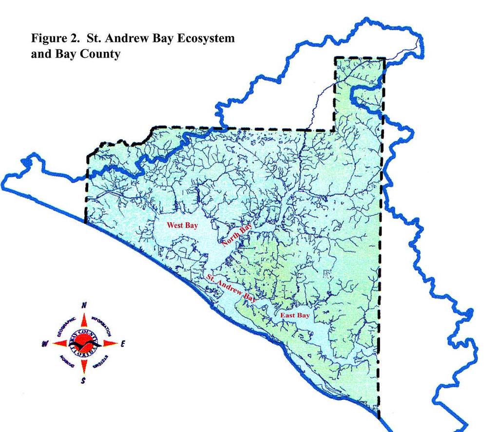
30
31 Figure 3. DEP and COE Conservation Easments HWY 20 HWY 20 Pine Log Rd HWY 77 HWY 388 HWY 98 Panama City Beach Pkwy HWY 79 Front Beach Rd HWY 388 Joan Rd Thomas Dr HWY 98 Beck Av Frankford Av Delwood Beach Rd HWY rd St Jenks Av HWY 2302 Ohio Av Baldwin Rd 11th St East Av Transmitter Rd Resota Beach Rd 3rd St HWY 98 HWY 2321 HWY 390 Tyndall Pkwy Berthe Av Bayhead Rd Star Av HWY 231 HWY 2301 John Pitts Rd HWY 231 Crown Miller Rd Tram Rd Wewa HWY Tyndall Pkwy Tyndall Pkwy HWY 98 Legend 15th St Information Points Major Roads water
32


33 Figure 5. Siena Gardens and King Family Preserve 19th Street Legend Siena Gardens 1 roads Conservation Easements parcels King Family Preserve King Family Preserve Balboa Ave Wood Ave Highway 98


34 Figure 6. Multiple Connected Conservation Easements, Back Beach Road Behind Arnold High School Home Depot 2 Alf Coleman North Beckrich B & N Developers 1 Pier Park Arnold HS Home Depot 1 Back Beach rd Legend roads Conservation Easements


35 Figure 7. Service First 6TH 6TH BAY WILLIAMS SATSUMA 98 5TH 1 98 Legend roads parcels water Conservation Easements


36 Figure 8. Bay County Conservancy Property Audubon Nature Preserve King Family Preserve 1 Palm Preserve Legend roads Conservation Easements Bay County Conservancy
37 Figure 9. Government Land and Power Lines Sandhills Mitigation Bank Legend parks NWFWMD Other Government Land Power Line Easements water


38 1 Figure 10. Lathrop Plant and Red-cockaded Woodpecker Management Area Legend Lathrop Management Area parcels


39 PC BEACH Figure 11. FDOT Owned Land 1 FDOT Presumed Mitigation Area PC BEACH AMY ALISON


40 Figure 12. Lynn Haven Easements Near the Landfill REEVES FOR&WL RD 47 Legend water Conservation Easements 1 City of Lynn Haven 88.3 acres
41 2321 Figure 13. Power Line Easments and Some Listed Species Records BLUEGRASS HILLTOP HARVARD ABERDEEN GRAHAM WILLOW MCCALL GARRISON 43RD BROOK FOREST MILL BAYOU 43RD CATO CORBIN BRANNON PIPELINE ALLIE COLLEGE STATION MERRITT BROWN FRANK HOUGH STAR ORMOND HILAND BROOKE 37TH RICHARDSON E MAYNARD 34TH IRIS PIPELINE 39TH QUICK COUNTRY LAKE HENDERSON HOOFPRINT NEHI ALVA THOMAS ORMOND DALE BALDWIN GLENVIEW ORLANDO TEN ACRE DOUGLAS G GAME FARM NAPLES AVON C F B D T LANE A EAGLE LARK AVON BENNIE'S HOPE VALLEY KNIGHT TRANSMITTER Legend water Power Lines roads Power Line Listed Plants TRAM 15TH 15TH TYNDALL SENECA P. econfinae SCHOOL BETTY 13TH 14TH DELISA 13TH 11TH 12TH 15TH TYNDALL
42 1 Figure 14. Sunteck Fragmented Easement HARBOUR DOLPHIN HARBOR WILDWOOD DOLPHIN BAY DOLPHIN SHORES SUNSET GREENWOOD CAROLYN RED CEDAR Legend CRAIG WOODLAWN BAYSHORE FRONT BEACH roads parcels Conservation Easements FRONT BEACH THOMAS SOLOMONS OSPREY PELICAN


43 1 Figure 15. Hidden Pines I, Connected KINGMAN LAIRD JERSEY TREASURE PALM Legend roads parcels Conservation Easements VERDE WOOD ROYAL PALM HIDDEN PINES ALANNA DEEP FOREST HIDDEN ISLAND ARALIA LYONIA CLIFTONIA PALM GROVE


44 1 Figure 16. Wild Heron Legend Lake Powell roads water Wetland Conservation Easements


45 CARLA 1 Figure 17. Grouped Conservation Easments. 390 BRITTON ABERDEEN ABERDEEN HILLTOP WILLOW HILL MCCALL LH Method. Church Lynn Haven Sports Complex 43RD CCS Land 39TH Bay Haven III Christian Adv Bay Haven II TRANSMITTER HILAND BROOKE Legend roads parcels Conservation Easements VERA LONG ORMOND ORCHARDWOOD 37TH
46 46 Table 1. Conservation Easements
47 Table 1. Conservation Easements CE # Name Acres DEP Permit COE Permit Deed Bk Location Yr Miscellaneous 1 Alf Coleman I S26,T3S,R16W Alt. 2 Alf Coleman II S13,24,T3S,R16W Alt. 3 Allied Signal S9,T3S,R14W Andrews Place Apart & S31,T3S,R14W Andrews-Hill LLC S9,T4S,R15W Arbor Properties S28,T3S,R14W Arnold High School S26,T3S,R16W B & N Developers I S23,T3S,R16W 2004 Edgewater Bch Apts 9 B & N Developers II S24,T3S,R16W,S19,T3S,15W 2004 Edgewater Bch Apts 10 Bankston\Ammons S22,T2S,R13W Bay Fabrication S10,T4S,R14W Bay Haven School I S22&23, T3S,R14W Bay Haven School II S14,T3S,R14W Bay Haven School III S14,T3S,R14W Beckrich Office Park I S26,T3S,R16W Beckrich Office Park II S24,T3S,R16W Ben Kernan S7,T3S,R14W Brookwood Subdivision S15,T3S,R14W Brudnicki I S28,T3S,R14W Brudnicki II Wash. Co., Bonifay 1999 Washington County 21 Bui and Vu S20,T4S,R14W Callaway Point (K. Hughes) S20,T4S,R13W DB 1985 p CCS Land S14,T3S,R14W areas 24 Charles Dickens S21,T3S,R14W Charles Parker S24,T6S,R12W Christian Advent Church S22,T3S,R14W City of Lynn Haven I n/a & S25,T1S,R15W parcels 28 City of Lynn Haven II S22,T3S,R14W City of PCB Frank Brown Pk S8,17,18,T3S,R16W Victor/Commander n/a S7,T3S,R14W , David McSpadden I DEP Con. Ord S16,T2S,R13W 2004 C.R Rogers Road 32 David McSpadden II DEP Con. Ord S9,T2S,R13W 2004 Surbass Road 33 Dever Development I S24,T2N,R12W Dever Development II S11,T4S,R15W Donald Walters case S16,T2S,R12W Dolphin Bay, Sunteck S28,T3S,R15W 1998
48 Table 1. Conservation Easements CE # Name Acres DEP Permit COE Permit Deed Bk Location Yr Miscellaneous 37 Donald Hogan S9,T4S,R15W Dubose, Counts, Gortemoller S32,T1S,R13W Emily Dowdy BOTIITF* S9,T4S,R14W Florida Gas Transmission S25,T2S,R15W Fred Webb S18,T3S,R14W 1995 North Shore Subdivision 42 Greenwood Estates BOTIITF* S8,T4S,R15W Gulf Power Co., Smith PA S25,T2S,R15W Gullette, Susann BOTIITF* S18,T2S,R13W Herman Leisemeyer S14,T2S,R13W 1999 DB 1922 pg Hidden Pines I S5,T4S,R15W Hidden Pines II S30,T2S,R14W Home Depot S28,T3S,R14W Home Depot-PCB I S25,26,T3S,R16W 2003 ORB Home Depot-PCB II S13,24,T3S,R15W Home Depot-PCB III S29,T3S,R15W James Branch S8,17,T3S,R16W Jerry Bishop n/a S31,T3S,R14W Jim Gardner S4,T4S,R15W John Aztberger S25,T6S,R12W John Burruss S24,T6S,R12W Joseph Denault S24,T6S,R12W Justin Gerlach S24,25,T6S,R12W Laird Bayou (St. Joe) S14,15,22,23,T4S,R13W Laird Land Company I n/a S1,T2S,R14W 1995 Cedar Bluff Unit 3 61 Laird Land Company II S1,T2S,R14W Lake Charlie Claude n/a S10,T3S,R17W 63 Lake Merial S16,T1S,R14W Lake Powell LLC** n/a 65 Lloyd Pontiac n/a S33,T3S,R14W Lyndell Plantation S26,T3S,R16W Lynn Haven Meth. Chur S14,T3S,R14W Magnolia Pointe of Bay I S31,T3S,R14W 17th Street 69 Magnolia Pointe of Bay II S3,T4S,R14W th Street 70 Mariner's Cove * S24,T4S,R14W 1994 BOTIITF 71 Mary Sue Eubank S7,T2S,R13W Mathis et al. I S29,T1S,R13W 2001
49 Table 1. Conservation Easements CE # Name Acres DEP Permit COE Permit Deed Bk Location Yr Miscellaneous 73 Mathis et al. II S21,T3S,R14W McWhorter and Company n/a S33,T3S,R14W 1994 Lowe's 75 Michael Carroll S24,T4S,R13W Michael Peaden S1,T2S,R14W Michael Simeone S21,T3S,R14W Mill Bayou Development Co S11,12,T3S,R14W & Millirons Construction to be record S22,T3S,R14W MM&A Dev. Mowat HL S14,T3S,R14W Morris Development S8,T3S,R16W Mullis Eye Institute I S32,T2S,R14W Mullis Eye Institute II n/a 2000 Offsite 11A Jack. Co. 84 North Colony Club Estates n/a S15,T3S,R16W North Harbor Landing n/a S8,T3S,R14W 1997 Btwn MD & NJ Ave 86 P & N Callaway (Walmart) S1,T4S,R14W Panama City Airport S19,T3S,R14W Panama City Surgical S32,T3S,R14W Par-Con, Inc S36,T3S,R16W 1999 The Glades Subsivision 90 Peaden Air Conditioning S1,T2S,R14W Pier Park S17,20,T3S,R16W Pier Park, North Mitigation S24,T3S,R16W Porter and Prows n/a S13,T2S,R14W Publix (Regency Reality) S15,T3S,R14W 2001 Owned by Mr. McCain 95 Rear, Inc S33,T3S,R14W A Jr. Museum 96 Richard Pepple S4,T3S,R17W River Camps, Crooked Crk S21,22,23,26,27,T2S,R16W 2004 in 121 parcels 98 Royal American S17,T3S,R14W Rutherford Sports Comp S2,T4S,R14W Scott Plummer S17,T4S,R13W Seahaven Development S10,T4S,R15W Service First BOTIITF* S10,T4S,R14W Siena Gardens n/a S22,T3S,R14W 2003 City of PC Easement 104 Sonny's BBQ S26,T3S,R16W 2001 Off site 105 Storage Town S8,T3S,R13W Sweetwater Village I,II, III S34,T2S,R13W Talkington Properties S20,T3S,R14W 2003 Jenks and 26th Street 108 Ted Baker Dynasty Homes S1,T2S,R14W 1999
50 Table 1. Conservation Easements CE # Name Acres DEP Permit COE Permit Deed Bk Location Yr Miscellaneous 109 The Timbers Subdivision I & S16,T3S,R14W pieces, The Timbers Subdivision II & S17,T2S,R13W pieces, The Timbers Subdivision III & S17,T2S,R13W pieces, The Woods I,II,III n/a S28,T3S,R14W Amd. 8 parcels 113 Town & Country Residences S29,T3S,R15W 1998 Brandywine Drive 114 Town of Cedar Grove S34,T3S,R14W Troy Syfrett S12,T2S,R14W Tyndall Federal Credit Union S24,T4S,R13W Victoria Bellinger S27,T3S,R16W Walmart Callaway S1,T4S,R14W Wild Heron S29,30,31,32,T2S,R17W 120 Wilson Bros., Pelican Bay S10,T4S,R15W Winn Dixie Transmitter S24,T3S,R14W Wood Run S21,T3S,R14W th Street, Lynn Haven Total Acres * = Board of Trustees of the Internal Trust Fund ** = Same as Wildheron
51 Ground Level Photographs 51


52 Photo 1. Lyndell Plantation


53 Photo 2. Siena Gardens


54 Photo 3. Arnold High School


55 Photo 4. Service First


56 Photo 5. Home Depot 1


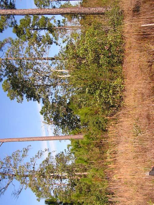
57 Photo 6. Dolphin Bay, Sunteck


58 Photo 7. Hidden Pines I


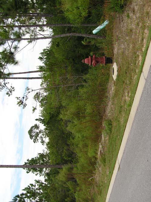
59 Photo 8. Wild Heron


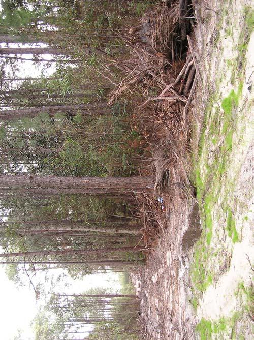
60 Photo 9. Lynn Haven Methodist Church


61 Photo 10. Bay Haven Charter II (Transmitter Rd)


62 Photo 11. Bay Haven Charter III


63 #57. Joseph Denault #25. Charles Parker #56. John Burruss #55. John Aztberger Photo 12. Zone 1, Mexico Beach


64 Photo 13. Zone 2, Cooks Bayou, Laird Bayou #116., Tyndall Federal Credit Union #116., Tyndall Federal Credit Union


65 Photo 14. Zone 3, Callaway Bayou #22. Callaway Point (K. Hughes) #100. Scott Plummer


66 Photo 15. Zone 4, Pratt Bayou, Watson Bayou #11. Bay Fabrication (Two separate areas) #11. Bay Fabrication (Two separate areas)


67 #99. Rutherford Sports Complex #99. Rutherford Sports Complex #118. Walmart Callaway Photo 16. Zone 5, Callaway #118. Walmart Callaway


68 # 114, Town of Cedar Grove # 114, Town of Cedar Grove #69, Magnolia Point II Photo 17. Zone 6, Downtown Panama City #69, Magnolia Point II


69 #68, Magnolia Point I #68, Magnolia Point I #53, Jerry Bishop Photo 18. Zone 7, Harrison Ave. to Lisenby Ave. #53, Jerry Bishop


70 # 19, Brudnicki # 19, Brudnicki #48, Home Depot Photo 19. Zone 7, Harrison Ave. to Lisenby Ave. #48, Home Depot

 Photo")

")
71 #65, Lloyd Pontiac #65, Lloyd Pontiac #74, McWhorter (Lowe s) Photo 20. Zone 7, Harrison Ave. to Lisenby Ave. #74, McWhorter (Lowe s)


72 # 82, Mullis Eye Institute I # 82, Mullis Eye Institute I # 95, REAR, Inc. Photo 21. Zone 7, Harrison Ave. to Lisenby Ave. # 95, REAR, Inc.

 Surgical")


73 # 88, Panama City Surgical # 88, Panama City Surgical (after violation mowing) # 88, Panama City Surgical Photo 22. Zone 7, Harrison Ave. to Lisenby Ave. # 88, Panama City Surgical


74 # 28, Citty of Lynn Haven II # 28, Citty of Lynn Haven II # 18, Brookwood Subdivision Photo 23. Zone 8, Transmitter Rd. to East Ave. # 18, Brookwood Subdivision
 Realty)")

 - violation")
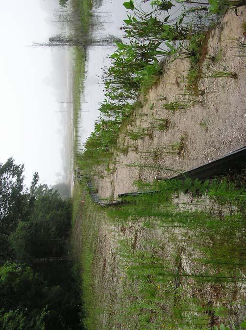
75 # 94, Publix (Regency Realty) # 94, Publix (Regency Realty) # 94, Publix (Regency Realty) Photo 24. Zone 8, Transmitter Rd. to East Ave. # 94, Publix (Regency Realty) - violation
")

")
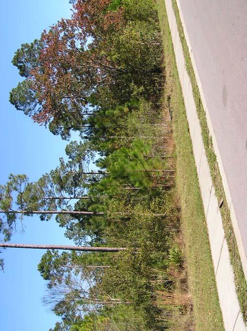
76 # 80, MM&A Dev. (Mowat Highlands) # 80, MM&A Dev. (Mowat Highlands) # 80, MM&A Dev. (Mowat Highlands) Photo 24a. Zone 8, Transmitter Rd. to East Ave. # 80, MM&A Dev. (Mowat Highlands)


77 # 23, CCS Land # 79, Millirons Construction # 109, The Timbers Subdivision I Photo 25. Zone 8, Transmitter Rd. to East Ave. # 109, The Timbers Subdivision I


78 # 78, Mill Bayou Development. Co. # 78, Mill Bayou Development Co. # 78, Mill Bayou Development Co. Photo 26. Zone 8, Transmitter Rd. to East Ave. \ # 121, Winn Dixie Transmitter Rd.


79 # 87, Panama City Airport # 87, Panama City Airport # 107, Talkington Properties Photo 27. Zone 9, Highway 77 to Airport # 107, Talkington Properties


80 # 122, Woodrun HOA # 122, Woodrun HOA # 122, Woodrun HOA Photo 28. Zone 9, Highway 77 toairport # 122, Woodrun HOA - violation


81 # 77, Michael Simeone # 77, Michael Simeone wetland enhancement? # 72, Mathis et. al. I Photo 29. Zone 9, Highway 77 to Airport # 72, Mathis et. al. I

")


82 # 24, Charles Dickens # 24, Charles Dickens # 6, Arbor Properties (Eagle s Landing) Photo 30. Zone 9, Highway 77 to Airport # 6, Arbor Properties (Eagle s Landing)


83 # 3, Allied Signal # 3, Allied Signal # 85, North Harbor Landing Photo 31. Zone 10, Highway 77 to Goose Bayou # 30, Commander

")


84 # 41, Fred Webb # 41, Fred Webb # 98, Royal American (The Reserve) Photo 32. Zone 10, Highway 77 to Goose Bayou # 98, Royal American (The Reserve)


85 Photo 33. Zone 11, South Highway 231 #105, Storage Town #105, Storage Town


86 Photo 34. Zone 12, Sweetwater Village # 106, Sweetwater Village # 106, Sweetwater Village


87 Photo 35. Zone 13, North Highway 231 # 35, Donald Walters # 35, Donald Walters


88 # 60, Laird Land Company # 60, Laird Land Company # 61, Laird Land Company Photo 36. Zone 14, West Deer Point # 61, Laird Land Company


89 Photo 37. Zone 16, Power Plant. 43, Gulf Power Co., Smith Unit 3 # 43, Gulf Power Co., Smith Unit 3


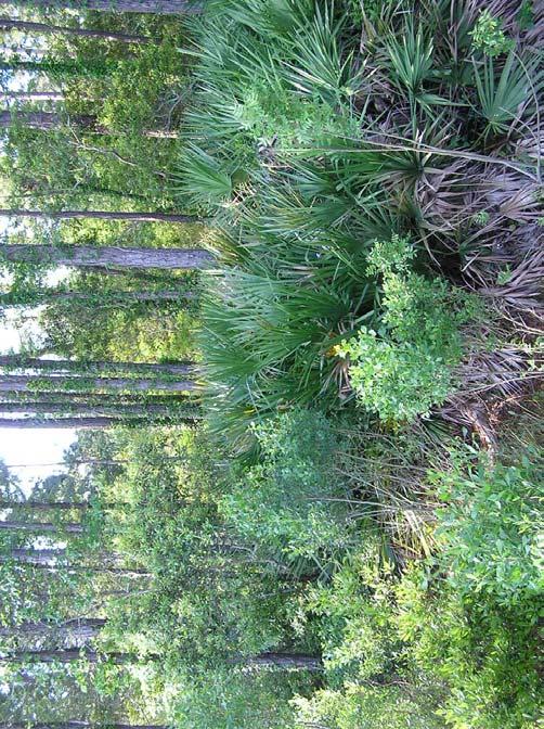
90 # 120 Wilson Bros Pelican Bay # 120 Wilson Bros Pelican Bay # 120 Wilson Bros Pelican Bay Photo 38. Zone 17, Bay Point # 120 Wilson Bros Pelican Bay


91 # 113, Town & Country # 113, Town & Country # 46, Hidden Pines I. Photo 39. Zone 18, Breakfast Point East # 36, Dolphin Bay, Sunteck
 Joe Co.")


92 # 1, Alf Coleman I (St. Joe Co.) # 1, Alf Coleman I (St. Joe Co.) # 66, Lyndell Plantation Photo 40. Zone 19, Breakfast Point West # 104,, Sonny s BBQ

 Photo 41.")
")
93 # 49, Home Depot PCB I # 49, Home Depot PCB I # 15, Beckrich Office Park I (St. Joe Co.) Photo 41. Zone 19, Breakfast Point West # 15, Beckrich Office Park I (St. Joe Co.)
")

")

94 # 89, Par-Con, Inc (Hombre Golf) # 89, Par-Con, Inc (Hombre Golf) # 89, Par-Con, Inc (Hombre Golf) Photo 42. Zone 19, Breakfast Point West # 89, Par-Con, Inc (Hombre Golf)


95 # 31, David McSpadden I # 32, David McSpadden II # 32, David McSpadden II Photo 43. Zone 20, Deer Point East # 10, Bankston/Ammons


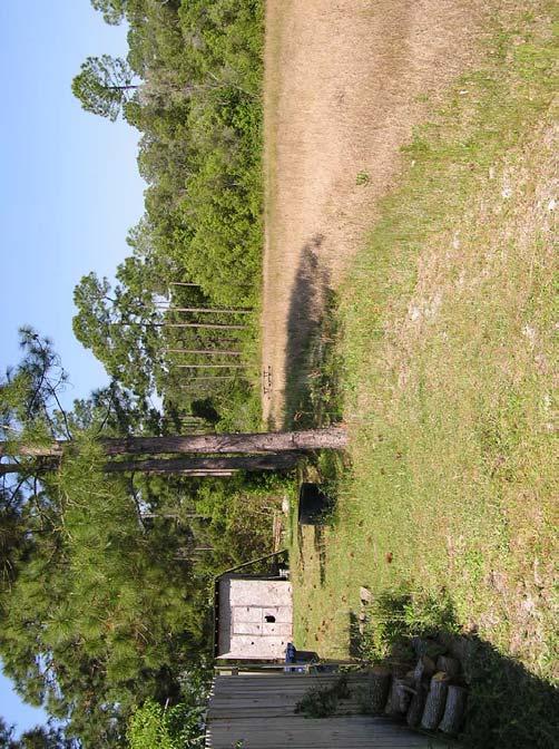
96 # 29, City of PCB Frank Brown Park # 29, City of PCB Frank Brown Park # 52, James Branch Photo 44. Zone 21, Central Beaches # 52, James Branch


97 # 91, Pier Park # 91, Pier Park # 91, Pier Park Photo 45. Zone 21, Central Beaches # 91, Pier Park


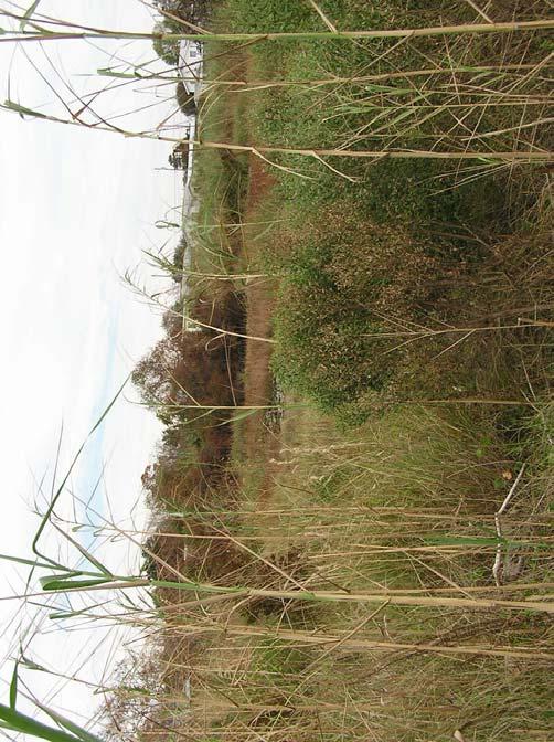
98 # 62, Lake Charlie Claude # 62, Lake Charlie Claude # 62, Lake Charlie Claude Photo 46. Zone 22, West Beaches # 62, Lake Charlie Claude


99 Photo 47. Zone 24, Panhandle # 33, Dever Development I # 33, Dever Development I
Submittal of the Minutes from the March 9, 2011, April 5, 2011, and April 19, 2011 Cabinet Meetings.
 AGENDA BOARD OF TRUSTEES OF THE INTERNAL IMPROVEMENT TRUST FUND JUNE 16, 2011 Attachments to the items below can be viewed at the following link: http://www.dep.state.fl.us/secretary/cab/public_notices.htm
IRS FORM 8283 SUPPLEMENTAL STATEMENT DONATION OF CONSERVATION EASEMENT
 Name(s) shown on income tax return Identifying Number Robert T. Landowner 021-34-1234 Susan B. Landowner 083-23-5555 IRS FORM 8283 SUPPLEMENTAL STATEMENT DONATION OF CONSERVATION EASEMENT On November 12,
DECLARATION OF RESTRICTIVE COVENANTS
 DECLARATION OF RESTRICTIVE COVENANTS The Declarant,, is the fee simple owner of the certain real property located in County, Kansas, as described on Exhibit A, which is attached hereto and incorporated
Conservation Easement Stewardship
 Conservation Easements are effective tools to preserve significant natural, historical or cultural resources. Conservation Easement Stewardship Level of Service Standards March 2013 The mission of the
CITY OF FORT COLLINS NATURAL AREAS AND CONSERVED LANDS EASEMENT POLICY
 CITY OF FORT COLLINS NATURAL AREAS AND CONSERVED LANDS EASEMENT POLICY Adopted January 3, 2012 PURPOSE: The purpose of the policy statement is to clarify the policies and procedures of the City of Fort
AMENDED DEED OF CONSERVATION EASEMENT
 Prepared by: Wayne E. Flowers Lewis, Longman & Walker, P.A. 245 Riverside Ave. Suite 150 Jacksonville, FL 32202 Return recorded original to: Mitigation Marketing 1091 W. Morse Blvd. Suite 101 Winter Park,
BY BOARD OF COUNTY COMMISSIONERS AN ACT TO BE ENTITLED
 BY BOARD OF COUNTY COMMISSIONERS ORDINANCE NO. AN ACT TO BE ENTITLED AN ORDINANCE AMENDING THE PASCO COUNTY LAND DEVELOPMENT CODE, ARTICLE 700, BY REPEALING EXISTING SECTION 702, ENVIRONMENTALLY SENSITIVE
FRESHWATER WETLANDS PROTECTION IN NEW JERSEY Tools for Municipal Action
 FRESHWATER WETLANDS PROTECTION IN NEW JERSEY Tools for Municipal Action The Freshwater Wetlands Protection Act INTENT OF FRESHWATER WETLANDS LAW The New Jersey legislature passed the Freshwater Wetlands
MEMORANDUM. Michael D. Minton, Esq., Brad R. Gould, Esq. and Richard I. Withers, Esq.
 Dean, Mead, Minton & Zwemer 1903 South 25th Street, Suite 200 P.O. Box 2757 (ZIP 34954) Fort Pierce, Florida 34947 772-464-7700 772-464-7877 Fax www.deanmead.com Orlando Fort Pierce Viera MICHAEL MINTON
MODEL DEED RESTRICTION FOR THE PENNSYLVANIA STATE PROGRAMMATIC GENERAL PERMIT-3 (PASPGP-3) DECLARATION OF RESTRICTIVE COVENANTS FOR CONSERVATION
 DECLARATION OF RESTRICTIVE COVENANTS FOR CONSERVATION") MODEL DEED RESTRICTION FOR THE PENNSYLVANIA STATE PROGRAMMATIC GENERAL PERMIT-3 (PASPGP-3) DECLARATION OF RESTRICTIVE COVENANTS FOR CONSERVATION THIS DECLARATION OF RESTRICTIVE COVENANTS FOR CONSERVATION
MODEL DEED RESTRICTION FOR THE PENNSYLVANIA STATE PROGRAMMATIC GENERAL PERMIT-3 (PASPGP-3) DECLARATION OF RESTRICTIVE COVENANTS FOR CONSERVATION THIS DECLARATION OF RESTRICTIVE COVENANTS FOR CONSERVATION
OPEN SPACE & RECREATION PLAN
 OPEN SPACE & RECREATION PLAN HOPEWELL TOWNSHIP Cumberland County, New Jersey Prepared by: Hopewell Township Environmental Commission Final October 2011 (THIS PAGE INTENTIONALLY LEFT BLANK) PUBLIC MEETINGS
METROPOLITAN COUNCIL 390 North Robert Street, St. Paul, MN Phone (651) TDD (651)
 TDD (651)") METROPOLITAN COUNCIL 390 North Robert Street, St. Paul, MN 55101 Phone (651) 602-1000 TDD (651) 291-0904 DATE: November 23, 2009 TO: Metropolitan Parks and Open Space Commission FROM: Jan Youngquist, Senior
METROPOLITAN COUNCIL 390 North Robert Street, St. Paul, MN 55101 Phone (651) 602-1000 TDD (651) 291-0904 DATE: November 23, 2009 TO: Metropolitan Parks and Open Space Commission FROM: Jan Youngquist, Senior
Georgia Conservation Tax Credit Program Frequently Asked Questions
 Georgia Conservation Tax Credit Program Frequently Asked Questions What are the minimum requirements for eligibility under the Georgia Conservation Tax Credit Program (GCTCP)? Individual and corporate
ALREADY SUBMITTED FOR HIGHLANDS COUNCIL PRE
 Highlands Preservation Area Approval Application Checklist Items Block 15901 Lot 1, West Milford See Highlands Council Review at: http://www.highlands.state.nj.us/njhighlands/projectreview/ **For advisory
THIS DECLARATION OF RESTRICTIVE COVENANTS is made this day of, 20, by ("Covenantor"). RECITALS
. RECITALS") Model for Use with Permits Without Mitigation Plans STATE OF COUNTY OF DECLARATION OF RESTRICTIVE COVENANTS THIS DECLARATION OF RESTRICTIVE COVENANTS is made this day of, 20, by ("Covenantor"). RECITALS
Model for Use with Permits Without Mitigation Plans STATE OF COUNTY OF DECLARATION OF RESTRICTIVE COVENANTS THIS DECLARATION OF RESTRICTIVE COVENANTS is made this day of, 20, by ("Covenantor"). RECITALS
St. Joe Ecosystem Management Agreement. For Bay and Walton Counties
 St. Joe Ecosystem Management Agreement For Bay and Walton Counties This agreement is made and entered into by The St. Joe Company (St. Joe) and the Florida Department of Environmental Protection (DEP).
PROJECT SCORING GUIDANCE. Introduction: National Proiect Selection:
 FOREST LEGACY PROGRAM PROJECT SCORING GUIDANCE Introduction: This document provides guidance to the National Review Panel on how to score individual Forest Legacy Program (FLP) projects, including additional
Implementation Tools for Local Government
 Information Note #5: Implementation Tools for Local Government This Information Note is a guide only. It is not a substitute for the federal Fisheries Act, the provincial Riparian Areas Regulation, or
APPLICATION. Telephone Fax Address. Telephone Fax Address FOR MARTIN COUNTY USE ONLY
 APPLICATION PRESERVE AREA MANAGEMENT PLAN/ ABBREVIATED PRESERVE AREA MANAGEMENT PLAN Growth Management Department Environmental Division PART 1: Applicant Information A. Land Owner(s) Name Title and Company
CONSERVATION EASEMENT AND RESTRICTION
 CONSERVATION EASEMENT AND RESTRICTION The purpose of a Conservation Easement is to protect in perpetuity significant natural features and to minimize the environmental impact of activities associated with
( ) Ordinance. Environmental Resources Management
 Ordinance. Environmental Resources Management") PALM BEACH COUNTY BOARD OF COUNTY COMMISSIONERS AGENDA ITEM SUMMARY Agenda Item #:5 I/" 3 Meeting Date: April 1,2008 ( ) Consent Department Submitted By: Submitted For: ( ) Ordinance Environmental Resources
PALM BEACH COUNTY BOARD OF COUNTY COMMISSIONERS AGENDA ITEM SUMMARY Agenda Item #:5 I/" 3 Meeting Date: April 1,2008 ( ) Consent Department Submitted By: Submitted For: ( ) Ordinance Environmental Resources
Central Pennsylvania Conservancy Project Selection Criteria Form
 Central Pennsylvania Conservancy Project Selection Criteria Form The following criteria guide the actions of the Central Pennsylvania Conservancy s Land Protection Committee and Board of Directors in selecting
Community Development Committee
 C Date Prepared: Subject: Community Development Committee For the Metropolitan Council meeting of December 9, 2009 December 8, 2009 Committee Report SW Item: 2009-444 ADVISORY INFORMATION Rice Creek Chain
Application Procedures for Easements or Rights of Way on City of Fort Collins Natural Areas and Conserved Lands March 2012
 Application Procedures for Easements or Rights of Way on City of Fort Collins Natural Areas and Conserved Lands March 2012 IMPORTANT NOTE: This document was created to accompany the City of Fort Collins
Article 5. Environmentally Sensitive Areas
 Article 5. Environmentally Sensitive Areas This Article establishes standards and regulations governing environmental constraints. These regulations are intended to encourage preservation of lands designated
ARLINGTON COUNTY, VIRGINIA. County Board Agenda Item Meeting of June 17, 2017
 ARLINGTON COUNTY, VIRGINIA County Board Agenda Item Meeting of June 17, 2017 DATE: June 9, 2017 SUBJECT: Request to authorize advertisement of public hearings by the Planning Commission and County Board
BRISTOL CONSERVATION COMMISSION INLAND WETLANDS AGENCY FORM IW-1 (Application for a Wetlands Permit)
") APPLICATION NO. BRISTOL CONSERVATION COMMISSION INLAND WETLANDS AGENCY FORM IW-1 (Application for a Wetlands Permit) DATE FILED: APPROVED: DENIED: 1. APPLICANT: Name: Signature: Address: City: State: Zip
APPLICATION NO. BRISTOL CONSERVATION COMMISSION INLAND WETLANDS AGENCY FORM IW-1 (Application for a Wetlands Permit) DATE FILED: APPROVED: DENIED: 1. APPLICANT: Name: Signature: Address: City: State: Zip
DESCRIPTION OF A LAND TRUST
 DESCRIPTION OF A LAND TRUST What is a land trust? Land trusts are non-profit organizations that work hand-in-hand with landowners to protect our valuable natural resources. Land trusts have become increasingly
Introduction to INRMP Implementation Options
 El Dorado County Integrated Natural Resources Management Plan Introduction to INRMP Implementation Options 1 Our approach to the options evaluation is based on the INRMP components as they are currently
ORDINANCE NO WHEREAS, the Town of Jupiter ( Town ) has adopted a Comprehensive Plan
 has adopted a Comprehensive Plan") 0 0 ORDINANCE NO. -0 AN ORDINANCE OF THE TOWN COUNCIL OF THE TOWN OF JUPITER, FLORIDA, AMENDING CHAPTER OF THE TOWN CODE TO AMEND SECTION -, ENTITLED INTENT TO ADD PERMITTING LANDGUAGE; TO AMEND SECTION
0 0 ORDINANCE NO. -0 AN ORDINANCE OF THE TOWN COUNCIL OF THE TOWN OF JUPITER, FLORIDA, AMENDING CHAPTER OF THE TOWN CODE TO AMEND SECTION -, ENTITLED INTENT TO ADD PERMITTING LANDGUAGE; TO AMEND SECTION
CHAPTER 3 PRELIMINARY PLAT
 10-3-1 10-3-3 SECTION: CHAPTER 3 PRELIMINARY PLAT 10-3-1: Consultation 10-3-2: Filing 10-3-3: Requirements 10-3-4: Approval 10-3-5: Time Limitation 10-3-6: Grading Limitation 10-3-1: CONSULTATION: Each
Sample Baseline Documentation Report (BDR) Annotated Template for Environmentally Important Land
 Annotated Template for Environmentally Important Land") Sample Baseline Documentation Report (BDR) Annotated Template for Environmentally Important Land The baseline documentation report (BDR) provides a snap shot of the biophysical condition of a property
Sample Baseline Documentation Report (BDR) Annotated Template for Environmentally Important Land The baseline documentation report (BDR) provides a snap shot of the biophysical condition of a property
Texas Land Trust Conference March 6, 2015
 Texas Land Trust Conference March 6, 2015 James D. Bradbury James D. Bradbury, PLLC Austin Fort Worth An Overview Unique area of law where the government can take private property Protected by the US Constitution
LAKE OF THE WOODS COUNTY WETLAND CONSERVATION ORDINANCE OF 2002
 Ordinance # LAKE OF THE WOODS COUNTY WETLAND CONSERVATION ORDINANCE OF 2002 ARTICLE 1 TITLE AND PURPOSE Section 1.1. Title This Ordinance shall be known, cited and referred to as the Lake of the Woods
Land Use. Land Use Categories. Chart 5.1. Nepeuskun Existing Land Use Inventory. Overview
 Land Use State Comprehensive Planning Requirements for this Chapter A compilation of objectives, policies, goals, maps and programs to guide the future development and redevelopment of public and private
Donation of Circle Pine Farm, Rural and Family Lands Protection Easement
 AGENDA BOARD OF TRUSTEES DEPARTMENT OF AGRICULTURE & CONSUMER SERVICES JANUARY 19, 2011 Attachments to the items below can be viewed at the following link: http://www.dep.state.fl.us/secretary/cab/public_notices.htm
Validation Checklist. Date submitted: How to use this check-list. Ecosystem Credit Accounting System. Version 1.1&2. Project Information
 Ecosystem Credit Accounting System Version 1.1&2 Last updated April 21, 2017 Validation Checklist Date submitted: Project Information Project Name Trading Area Name Trading Area Type (e.g., TMDL, TNC Ecoregion)
MODEL DEED RESTRICTION
 MODEL DEED RESTRICTION This type of Protective Covenant is the most commonly used. It is a legal agreement between the grantor, typically the property owner or applicant, and the Corps. Please view instructions
The Guadalupe Blanco River Trust and the Guadalupe-Blanco River Authority: Creating and Then Working with a Non-Profit Conservation Partner
 The Guadalupe Blanco River Trust and the Guadalupe-Blanco River Authority: Creating and Then Working with a Non-Profit Conservation Partner Todd Votteler, Guadalupe-Blanco River Authority South Central
******************************************************************************
 AGENDA BOARD OF TRUSTEES OF THE INTERNAL IMPROVEMENT TRUST FUND MARCH 19, 2013 Attachments to the items below can be viewed at the following link: http://www.dep.state.fl.us/secretary/cab/public_notices.htm
Conceptual Scheme SE W4
 December 2012 1. PURPOSE 1.1. The purpose of a Conceptual Scheme (CS) is as follows: a) To provide a framework for the subsequent subdivision and/or development of land within the Country Residential Policy
2015 WETLAND CONSERVATION ACT STATUTE CHANGES
 2015 WETLAND CONSERVATION ACT STATUTE CHANGES Summary of Key Statute Changes and Related Legislation with Explanations This summary includes excerpts from Laws of MN 2015, Chapter 4, Article 4. It includes
SENATE, No STATE OF NEW JERSEY. 217th LEGISLATURE INTRODUCED SEPTEMBER 8, 2016
 SENATE, No. 0 STATE OF NEW JERSEY th LEGISLATURE INTRODUCED SEPTEMBER, 0 Sponsored by: Senator BOB SMITH District (Middlesex and Somerset) Senator CHRISTOPHER "KIP" BATEMAN District (Hunterdon, Mercer,
Land Conservation Agreements Project Guidance
 Land Conservation Agreements Project Guidance Stakeholder Informed OTHER OPTIONS Introduction Enhanced or permanent protection of corporate lands through land conservation agreements means that companies
Climate Change and Conservation Easement Clause Databank
 Photograph by Alice Kubler of the Archer Taylor Preserve Climate Change and Conservation Easement Clause Databank (May 15, 2009, last edited June 3, 2009) This Databank is a work in progress assembled
CONSERVATION EASEMENTS FREQUENTLY ASKED QUESTIONS
 CONSERVATION EASEMENTS FREQUENTLY ASKED QUESTIONS CCALT Founder and Steamboat rancher, Jay Fetcher notes, You shouldn t even be considering a conservation easement unless two things have happened: (1)
Thurston County Planning Department BOARD OF COUNTY COMMISSIONERS PUBLIC HEARING DRAFT AMENDMENTS TO THE CRITICAL AREAS REGULATIONS. Chapter 24.
 Thurston County Planning Department BOARD OF COUNTY COMMISSIONERS PUBLIC HEARING DRAFT AMENDMENTS TO THE CRITICAL AREAS REGULATIONS Chapter 24.01 GENERAL PROVISIONS Chapter 24.01 6/4/2012 GENERAL PROVISIONS
CONSERVATION EASEMENTS FREQUENTLY ASKED QUESTIONS
 CONSERVATION EASEMENTS FREQUENTLY ASKED QUESTIONS CCALT Founder and Steamboat rancher, Jay Fetcher notes, You shouldn t even be considering a conservation easement unless two things have happened: (1)
***** Subchapter A. GENERAL PROVISIONS ***** PERMIT APPLICATIONS
 105.11. Permit requirements. 105.12. Waiver of permit requirements. Title 25 Environmental Protection Part I. Department of Environmental Protection Subpart C. Protection of Natural Resources Article I.
Claudia Stuart, Williamson Act Program Manager and Nick Hernandez, Planning Intern
 Land Conservation (Williamson) Act Advisory Committee STAFF REPORT September 15, 2014 Prepared by: Claudia Stuart, Williamson Act Program Manager and Nick Hernandez, Planning Intern Subject: Discussion:
Marine Turtle Protection Act. Allows designation of Aquatic Preserves. Protects sea turtle nesting habitat (1953)
") , STATE AND LOCAL AUTHORITY FOR MARINE PROTECTION (2014). FLORIDA 1 State Authority for Marine Protection Summary of State Authorities Florida has a number of statutes that grant state agencies authority
, STATE AND LOCAL AUTHORITY FOR MARINE PROTECTION (2014). FLORIDA 1 State Authority for Marine Protection Summary of State Authorities Florida has a number of statutes that grant state agencies authority
Purpose: Regulations:
 Administrative Procedures for the Designation and Refinement Of Chesapeake Bay Preservation Area Boundaries Guidance on the Chesapeake Bay Preservation Area Designation and Management Regulations September,
Using Easements to Conserve Biodiversity. Jeff Lerner Defenders of Wildlife
 Using Easements to Conserve Biodiversity Jeff Lerner Defenders of Wildlife jlerner@defenders.org Northeast LTA June 10, 2006 Defenders of Wildlife Mission: to protect native wild animals and plants in
FINAL DRAFT 12/1/16, Rev. to 7/18/17
 FINAL DRAFT 12/1/16, Rev. to 7/18/17 (As Adopted 8/8/17 Effective 9/1/17) SHELTON PLANNING AND ZONING COMMISSION Proposed Amendments to Zoning Regulations I. Amend Section 23 PERMITTED USES by inserting
DEPARTMENT OF THE ARMY OFFICE OF THE CHIEF OF ENGINEERS WASHINGTON, D.C
 DEPARTMENT OF THE ARMY OFFICE OF THE CHIEF OF ENGINEERS WASHINGTON, D.C. 20314-1000 REPLY TO ATTENTION OF: CECW-PM (10-1-7a) THE SECRETARY OF THE ARMY 1. I submit for transmission to Congress my report
Submittal of the Minutes from the April 28, 2009 and June 9, 2009 Cabinet Meetings.
 AGENDA BOARD OF TRUSTEES DEPARTMENT OF AGRICULTURE & CONSUMER SERVICES JULY 28, 2009 Attachments to the items below can be viewed at the following link: http://www.fl-dof.com/calendar/public_notices.html
Chapter HABITAT CONSERVATION PLAN / NATURAL COMMUNITY CONSERVATION PLAN IMPLEMENTATION ORDINANCE
 Chapter 15.108 HABITAT CONSERVATION PLAN / NATURAL COMMUNITY CONSERVATION PLAN IMPLEMENTATION ORDINANCE Sections: 15.108.010 Purpose. 15.108.020 Definitions. 15.108.030 Applicability 15.108.040 Responsibility
1. Future Land Use FLU6.6.8 Land uses within the Rural Service Area portion of the Wekiva Study Area shall be limited to very low and low intensity
 1. Future Land Use FLU6.6.8 Land uses within the Rural Service Area portion of the Wekiva Study Area shall be limited to very low and low intensity uses to the greatest extent possible. Existing land uses
TOWN OF MIDDLEBOROUGH COMMUNITY PRESERVATION PLAN
 TOWN OF MIDDLEBOROUGH COMMUNITY PRESERVATION PLAN Vision The residents of Middleborough desire a community which is family-oriented and which retains its small town character while preserving an abundance
Private Land Conservation: Conservation Easements. Matt Singer Land Stewardship Manager
 Private Land Conservation: Conservation Easements Matt Singer Land Stewardship Manager Galveston Bay Foundation Mission: To preserve, protect, and enhance the natural resources of the Galveston Bay estuarine
ARTICLE XI - CONSERVATION SUBDIVISIONS
 ARTICLE XI - CONSERVATION SUBDIVISIONS Section 1101: Purpose and Intent. This Article is intended to provide for residential subdivisions that are designed based first and foremost on the preservation
LAND USE Inventory and Analysis
 LAND USE Inventory and Analysis The land use section is one of the most important components of the comprehensive plan as it identifies the location and amount of land available and suitable for particular
Planning Justification Report
 Planning Justification Report, Township of Puslinch FARHI HOLDINGS CORPORATION Updated January 27, 2017 Zelinka Priamo Ltd. Page i TABLE OF CONTENTS Page No. 1.0 1.1 1.2 1.3 2.0 2.1 2.2 2.3 2.4 2.5 3.0
Thurston County Planning Department PUBLIC HEARING DRAFT. AMENDMENTS TO THE CRITICAL AREAS REGULATIONS Chapter /18/2011 GENERAL PROVISIONS
 Thurston County Planning Department PUBLIC HEARING DRAFT AMENDMENTS TO THE CRITICAL AREAS REGULATIONS Chapter 24.01 11/18/2011 Chapter 24.01 GENERAL PROVISIONS GENERAL PROVISIONS Sections: 24.01.005 Short
2015 Reinvest in Minnesota (RIM) Reserve Wetlands Program
 Reserve Wetlands Program") 2015 Reinvest in Minnesota (RIM) Reserve Wetlands Program Eligibility Guidance Document 1/16/15 The purpose of the RIM Wetlands Program is to identify and enroll under permanent easement lands that contain
2015 Reinvest in Minnesota (RIM) Reserve Wetlands Program Eligibility Guidance Document 1/16/15 The purpose of the RIM Wetlands Program is to identify and enroll under permanent easement lands that contain
Nova Scotia Community Lands Trust Discussion Paper. Approaches to Enable Community Participation In the Purchase of Land
 Nova Scotia Community Lands Trust Discussion Paper Approaches to Enable Community Participation In the Purchase of Land Objective Nova Scotians have expressed a desire to acquire and make use of lands
St. Joe Timberland. Climate Change Lands. Bay, Walton Washington, Gadsden, Liberty, Gulf, Franklin, Wakulla, Leon, Jefferson and Taylor Counties
 Bay, Walton Washington, Gadsden, Liberty, Gulf, Franklin, Wakulla, Leon, Jefferson and Taylor Counties St. Joe Timberland Climate Change Lands Purpose for State Acquisition The St. Joe Company is one of
FLORIDA DEPARTMENT OF AGRICULTURE AND CONSUMER SERVICES
 FLORIDA DEPARTMENT OF AGRICULTURE AND CONSUMER SERVICES Office of Agricultural Water Policy Mayo Building 407 South Calhoun Street Tallahassee, Florida 32399 Binding Determination Florida Statute 373.406(2);
Forest Service Role CHAPTER 2
 CHAPTER 2 Forest Service Role Implementation of the Management Plan charters a federal presence with an expanded focus beyond traditional Forest Service roles. In addition to administration of the National
Part 72. Sec. 1. This ordinance shall be known and may be cited as the Clyde Township Wetlands Ordinance.
 Part 72 72.000 WETLANDS ORDINANCE Ord. No. 1 Adopted: June 12, 1991 Amended: April 13, 1994 72.001 SHORT TITLE. 72.002 PURPOSE. 72.003 DEFINITIONS. CLYDE TOWNSHIP ORDAINS: Sec. 1. This ordinance shall
CHAPTER Committee Substitute for Committee Substitute for Senate Bill No. 2188
 CHAPTER 2004-372 Committee Substitute for Committee Substitute for Senate Bill No. 2188 An act relating to land development; amending s. 197.502, F.S.; providing for the issuance of an escheatment tax
WEST VIRGINIA DIVISION OF FORESTRY Cooperative Forest Legacy Program. Sample Conservation Easement
 WEST VIRGINIA DIVISION OF FORESTRY Cooperative Forest Legacy Program Sample Conservation Easement This document is included in the forest legacy kit as an example for information and possible guidance
DECLARATION OF RESTRICTIVE COVENANTS
 STATE OF MARYLAND COUNTY OF DECLARATION OF RESTRICTIVE COVENANTS THIS DECLARATION OF RESTRICTIVE COVENANTS is made this day of, 20, by ( Declarant(s) ). RECITALS WHEREAS, Declarant(s) is/are the owner(s)
MUNICIPALITY OF ANCHORAGE PLANNING AND ZONING COMMISSION RESOLUTION NO
 MUNICIPALITY OF ANCHORAGE PLANNING AND ZONING COMMISSION RESOLUTION NO. 0-07 A RESOLUTION SUPPORTING THE APPROVAL AND ADOPTION OF THE ANCHORAGE WETLANDS MANAGEMENT PLAN. (Case 0-09) WHEREAS, the Anchorage
DECLARATION OF RESTRICTIVE COVENANTS. THIS DECLARATION OF RESTRICTIVE COVENANTS made this day of, 200_, by ( Declarant ). RECITALS
. RECITALS") DECLARATION OF RESTRICTIVE COVENANTS THIS DECLARATION OF RESTRICTIVE COVENANTS made this day of, 200_, by ( Declarant ). RECITALS WHEREAS, Declarant is the owner of the surface of certain real property
DECLARATION OF RESTRICTIVE COVENANTS THIS DECLARATION OF RESTRICTIVE COVENANTS made this day of, 200_, by ( Declarant ). RECITALS WHEREAS, Declarant is the owner of the surface of certain real property
About Conservation Easements
 Section Three: Farm Transfer Tools About Conservation Easements Editor s note: One question that our education collaborative has fielded consistently throughout the years is about conservation easements.
protect your place Guide to Understanding Conservation Easements
 protect your place Guide to Understanding Conservation Easements To the Landowner Founded in 1990, the Teton Regional Land Trust is a community-based non-profit conservation organization that works to
MITIGATION POLICY FOR DISTRICT-PROTECTED LANDS
 MITIGATION POLICY FOR DISTRICT-PROTECTED LANDS Approved by the District Board of Directors on July 18, 2017 The following Mitigation Policy is intended to inform the evaluation of environmental mitigation-related
Chapter 136. SOIL EROSION
 1 of 8 12/19/2011 4:17 PM Township of Andover, NJ Monday, December 19, 2011 Chapter 136. SOIL EROSION [HISTORY: Adopted by the Township Committee of the Township of Andover by Ord. No. 77-11 (Ch. XVII
Conservation Easements: Creating a Conservation Legacy for Private Property
 Conservation Easements: Creating a Conservation Legacy for Private Property What is a Conservation Easement? For landowners who want to conserve their land and yet keep it in private ownership and use,
Chapter VIII. Conservation Easements: Valuing Property Subject to a Qualified Conservation Contribution
 A. Overview and Purpose Chap. VIII Conservation Easements: Valuing... Jacobson & Becker 91 Chapter VIII Conservation Easements: Valuing Property Subject to a Qualified Conservation Contribution Forest
Corte Madera Marsh Restoration Project Update
 Corte Madera Marsh Restoration Project Update Building and Operating Committee Agenda Item No. 5 August 25, 2016 Photo credit: WRA Background of Site 1. 72 acre parcel carved out of larger property acquired
WETLAND PROTECTION BY-LAW
 WETLAND PROTECTION BY-LAW Article 3.7 Wetland and Natural Resources Protection As Amended at Town Meeting October 26, 2009 Section 3.7.1 Intent, Purpose and Jurisdiction: The intent and purpose of this
NEW YORK CITY WETLANDS TRANSFER TASK FORCE PROPERTY ASSESSMENT FORM
 NEW YORK CITY WETLANDS TRANSFER TASK FORCE PROPERTY ASSESSMENT FORM SITE DESCRIPTION CB BLOCK(S) LOT(S) JURISDICTION MGMT ACREAGE RECOMMENDED ACTION FOR PROPERTY: TRANSFER TO PARKS? TRANSFER TO OTHER AGENCY?
SEQRA (For Land Surveyors) Purpose of this Presentation
 Purpose of this Presentation") SEQRA (For Land Surveyors) Purpose of this Presentation Understand the basics and legal requirements of SEQRA Recognize the role that Land Surveyors play in the SEQRA Identify the problems posed by SEQRA
SEQRA (For Land Surveyors) Purpose of this Presentation Understand the basics and legal requirements of SEQRA Recognize the role that Land Surveyors play in the SEQRA Identify the problems posed by SEQRA
Interpretation of Conservation Purpose INTERNAL REVENUE GUIDANCE AS TO WHAT CONSTITUES A CONSERVATION PURPOSE
 Interpretation of Conservation Purpose INTERNAL REVENUE GUIDANCE AS TO WHAT CONSTITUES A CONSERVATION PURPOSE 170(h)(4)(A) of Title 26, Internal Revenue Code, Subtitle A of the United States Code gives
Public Notice U.S. ARMY CORPS OF ENGINEERS, GALVESTON DISTRICT AND TEXAS COMMISSION ON ENVIRONMENTAL QUALITY
 Public Notice U.S. Army Corps Permit Application No: SWG-2016-00384 Of Engineers Date Issued: 27 December 2018 Galveston District Comments Due: 29 January 2019 U.S. ARMY CORPS OF ENGINEERS, GALVESTON DISTRICT
ARTICLE 5 GENERAL REQUIREMENTS
 5.1 SUITABILITY OF THE LAND ARTICLE 5 GENERAL REQUIREMENTS 5.1.1 Land subject to flooding, improper drainage or erosion, and land deemed to be unsuitable for development due to steep slope, unsuitable
DEPARTMENT OF THE ARMY OFFICE OF THE CHIEF OF ENGINEERS WASHINGTON. D.C MAR
 DEPARTMENT OF THE ARMY OFFICE OF THE CHIEF OF ENGINEERS WASHINGTON. D.C. 2031 4-1 000 MAR 3 1 2006 CEMP-NAD (1 0-1-7a) THE SECRETARY OF THE ARMY 1. I submit for transmission to Congress my report on the
Flexibility in the Law: Reengineering of Zoning to Prevent Fragmented Landscapes
 Pace University DigitalCommons@Pace Pace Law Faculty Publications School of Law 2-18-1998 Flexibility in the Law: Reengineering of Zoning to Prevent Fragmented Landscapes John R. Nolon Elisabeth Haub School
SECTION 1 INTRODUCTION TO THE PANAMA CITY BEACH COMPREHENSIVE GROWTH DEVELOPMENT PLAN
 1. PURPOSE SECTION 1 INTRODUCTION TO THE PANAMA CITY BEACH COMPREHENSIVE GROWTH DEVELOPMENT PLAN The purpose of the City of Panama City Beach's Comprehensive Growth Development Plan is to establish goals,
FUTURE LAND USE. City of St. Augustine Comprehensive Plan EAR-Based Amendments
 FUTURE LAND USE City of St. Augustine Comprehensive Plan EAR-Based Amendments Future Land Use Element FLU Goal To create an environment within the City and adjacent areas in which its residents have the
Chapter XVIII LAND USE REGULATION A. ZONING. The most significant scheme for controlling land use in America is zoning, by which
 Chapter XVIII LAND USE REGULATION A. ZONING The most significant scheme for controlling land use in America is zoning, by which local authorities divide a municipality into various zoning districts for
AGENDA BOARD OF TRUSTEES OF THE INTERNAL IMPROVEMENT TRUST FUND MAY 13, 2009 Substitute Page
 AGENDA BOARD OF TRUSTEES OF THE INTERNAL IMPROVEMENT TRUST FUND MAY 13, 2009 Substitute Page * Substitute Item 1 Guana Tolomato Matanzas National Estuarine Research Reserve Management Plan REQUEST: Consideration
Special Exception Application Packet
 Washington County Planning Office 1331 South Boulevard, Chipley FL 32428 Phone: (850) 415-5093 Email: scramer@washingtonfl.com Procedure 1. Pre-Application Review a. The applicant should consult early
Appendix B Real Estate Plan
 Appendix B Real Estate Plan B-1 REAL ESTATE PLAN Prepared for U.S. Army Corps of Engineers Southwestern Division Little Rock District As of May 1, 2013 Prepared by Ronald Bridges Real Estate Division ANY
Working Together to Conserve Land
 Working Together to Conserve Land A Resource for Landowners Protecting land for future generations About Loon Echo was formed as a 501(c)(3)nonprofit organization in 1987 to preserve land in the northern
Town of Middleborough Conservation Commission 2014 Policy
 Approved February 20, 2014 Town of Middleborough Conservation Commission 2014 Policy The Wetland Protection Act under M.G.L. c. 131, sec. 40 and regulations 310 CMR 10.02(1)(a-f) & 310 CMR 10.02 (2)(a)
Primary Discussion Topics
 Analysis of Retained and Assumable Waters in Minnesota A Supplement to the January 17, 2017 MN Federal Clean Water Act Section 404 Permit Program Feasibility Study Report to the Legislature February 7,
LLC & MLLC Property Bismark Meadows Bonner County, Idaho
 Vital Ground Property Management Plan LLC & MLLC Property Bismark Meadows Bonner County, Idaho December 10, 2009 (updated 2/12/13) Ryan Lutey The Vital Ground Foundation Building T-2, Fort Missoula Road