$12,850,000 COUNTY OF EL DORADO COMMUNITY FACILITIES DISTRICT NO (CARSON CREEK) SPECIAL TAX BONDS SERIES 2016
|
|
|
- Shannon Short
- 6 years ago
- Views:
Transcription
1 NEW ISSUE-FULL BOOK ENTRY NOT RATED In the opinion of Jones Hall, A Professional Law Corporation, San Francisco, California, Bond Counsel, subject, however to certain qualifications described herein, under existing law, the interest on the Bonds is excluded from gross income for federal income tax purposes and such interest is not an item of tax preference for purposes of the federal alternative minimum tax imposed on individuals and corporations, although for the purpose of computing the alternative minimum tax imposed on certain corporations, such interest is taken into account in determining certain income and earnings. In the further opinion of Bond Counsel, such interest is exempt from California personal income taxes. See "TAX MATTERS" herein. $12,850,000 COUNTY OF EL DORADO COMMUNITY FACILITIES DISTRICT NO (CARSON CREEK) SPECIAL TAX BONDS SERIES 2016 Dated: Date of Delivery Due: September 1, as shown below The bonds captioned above (the "Bonds"), are being issued by the County of El Dorado (the "County") by and through its Community Facilities District No (Carson Creek) (the "District"). The Bonds are special tax obligations of the County, authorized pursuant to the Mello-Roos Community Facilities Act of 1982, as amended, being California Government Code Section 53311, et seq. (the "Act"), and are issued pursuant to a Fiscal Agent Agreement dated as of September 1, 2016 (the "Fiscal Agent Agreement") by and between the County and The Bank of New York Mellon Trust Company, N.A., as fiscal agent (the "Fiscal Agent"). The Bonds are being issued to (i) construct and acquire certain public facilities of benefit to the District, (ii) provide for the establishment of a reserve fund, and (iii) pay initial administration expenses and the costs of issuance of the Bonds. Interest on the Bonds is payable March 1, 2017, and thereafter semiannually on September 1 and March 1 of each year. The Bonds are being issued as fully registered bonds, registered in the name of Cede & Co. as nominee of The Depository Trust Company, New York, New York ("DTC"), and will be available to ultimate purchasers in the denomination of $5,000 or any integral multiple thereof, under the book-entry system maintained by DTC. See "APPENDIX G THE BOOK-ENTRY SYSTEM." The Bonds are secured by and payable from a pledge of Special Tax Revenues (as defined herein) derived from Special Taxes (as defined herein) to be levied by the County on real property within the boundaries of the District, from the proceeds of any foreclosure actions brought following a delinquency in the payment of the Special Taxes, and from amounts held in certain funds under the Fiscal Agent Agreement, all as more fully described herein. Unpaid Special Taxes do not constitute a personal indebtedness of the owners of the parcels within the District. In the event of delinquency, proceedings may be conducted only against the parcel of real property securing the delinquent Special Tax. There is no assurance the owners will be able to pay the Special Tax or that they will pay a Special Tax even though financially able to do so. To provide funds for payment of the Bonds and the interest thereon as a result of any delinquent Special Taxes, the County will establish a Reserve Fund from proceeds of the Bonds, as described herein. See "SECURITY FOR THE BONDS." Property in the District subject to the Special Tax comprises approximately 264 gross acres. Land in the District is planned for 1,059 age-restricted single family residential homes and 4 acres of multi-family use. Construction and sales of homes has commenced by Lennar Homes of California, Inc., which anticipates developing all of the single family homes in the District. See "THE DISTRICT" and "OWNERSHIP OF PROPERTY WITHIN THE DISTRICT." The Bonds are subject to optional and mandatory redemption prior to maturity as described herein. See "THE BONDS Redemption." NEITHER THE FAITH AND CREDIT NOR THE TAXING POWER OF THE COUNTY, THE STATE OF CALIFORNIA OR ANY POLITICAL SUBDIVISION THEREOF IS PLEDGED TO THE PAYMENT OF THE BONDS. THE BONDS DO NOT CONSTITUTE A DEBT OF THE COUNTY WITHIN THE MEANING OF ANY STATUTORY OR CONSTITUTIONAL DEBT LIMITATION. THE INFORMATION SET FORTH IN THIS OFFICIAL STATEMENT, INCLUDING INFORMATION UNDER THE HEADING "SPECIAL RISK FACTORS," SHOULD BE READ IN ITS ENTIRETY. This cover page contains certain information for general reference only. It is not a summary of all of the provisions of the Bonds. Prospective investors must read the entire Official Statement to obtain information essential to the making of an informed investment decision. See "SPECIAL RISK FACTORS" herein for a discussion of the special risk factors that should be considered, in addition to the other matters and risk factors set forth herein, in evaluating the investment quality of the Bonds. The Bonds are offered when, as and if issued, subject to approval as to their legality by Jones Hall, a Professional Law Corporation, San Francisco, California, Bond Counsel. Certain legal matters will also be passed on by Jones Hall, as Disclosure Counsel, and Stradling, Yocca, Carlson & Rauth, Newport Beach, California, as counsel to the Underwriter. It is anticipated that the Bonds will be available for delivery through the facilities of DTC on or about September 15, 2016 in New York, New York. The date of this Official Statement is August 23, 2016
2 Maturity Date (September 1) MATURITY SCHEDULE $5,630,000 Serial Bonds Principal Amount Interest Rate Yield Price 2017 $130, % 0.660% % HK , HL , HM , HN , HP , HQ , HR , HS , HT , HU , C HV , C HW , C HX , C HY , HZ , JA , JB , JC , JD , JE9 CUSIP (283113) $1,725, % Term Bond Due September 1, 2039; Price: %; Yield: 3.250%; CUSIP: JF6 $5,495, % Term Bond Due September 1, 2046 Price: % C ; Yield: 2.940%; CUSIP: JG4 C : Serial bonds priced to first optional redemption date of September 1, 2023 at 103%. Term Bond due September 1, 2046 priced to optional redemption date of September 1, 2024 at 102%. Copyright 2016, CUSIP Global Services, and a registered trademark of the American Bankers Association. CUSIP data is provided by CUSIP Global Services, which is managed on behalf of American Bankers Association by S&P Capital IQ. Neither the County nor the Underwriter assumes any responsibility for the accuracy of the CUSIP data.
3 COUNTY OF EL DORADO, CALIFORNIA Board of Supervisors Ron Mikulaco, District No. 1 Shiva Frentzen, District No. 2 Brian Veerkamp, District No. 3 Michael Ranalli, District No. 4 Sue Novasel, District No. 5 County Officials Karl Weiland, Assessor Joe Harn, Auditor-Controller C.L. Raffety, Treasurer-Tax Collector County Staff Don Ashton, Chief Administrative Officer Michael Ciccozzi, County Counsel Steve Pedretti, Director of Community Development Agency SPECIAL SERVICES Bond Counsel Jones Hall, A Professional Law Corporation San Francisco, California Fiscal Agent The Bank of New York Mellon Trust Company, N.A. Los Angeles, California District Administrator NBS Government Finance Group Temecula, California Appraiser Bender Rosenthal, Inc. Sacramento, California Disclosure Counsel Jones Hall, A Professional Law Corporation San Francisco, California
4 GENERAL INFORMATION ABOUT THIS OFFICIAL STATEMENT Use of Official Statement. This Official Statement is submitted in connection with the sale of the Bonds referred to herein and may not be reproduced or used, in whole or in part, for any other purpose. This Official Statement is not to be construed as a contract with the purchasers of the Bonds. Estimates and Forecasts. When used in this Official Statement and in any continuing disclosure by the County or the Developer, in any press release and in any oral statement made with the approval of an authorized officer of the County or the Developer, the words or phrases "will likely result," "are expected to", "will continue", "is anticipated", "estimate", "project," "forecast", "expect", "intend" and similar expressions identify "forward looking statements." Such statements are subject to risks and uncertainties that could cause actual results to differ materially from those contemplated in such forwardlooking statements. Any forecast is subject to such uncertainties. Inevitably, some assumptions used to develop the forecasts will not be realized and unanticipated events and circumstances may occur. Therefore, there are likely to be differences between forecasts and actual results, and those differences may be material. The information and expressions of opinion herein are subject to change without notice, and neither the delivery of this Official Statement nor any sale made hereunder shall, under any circumstances, give rise to any implication that there has been no change in the affairs of the County since the date hereof. Limit of Offering. No dealer, broker, salesperson or other person has been authorized by the County to give any information or to make any representations in connection with the offer or sale of the Bonds other than those contained herein and if given or made, such other information or representation must not be relied upon as having been authorized by the County or the Underwriter. This Official Statement does not constitute an offer to sell or the solicitation of an offer to buy nor shall there be any sale of the Bonds by a person in any jurisdiction in which it is unlawful for such person to make such an offer, solicitation or sale. Involvement of Underwriter. The Underwriter has provided the following sentence for inclusion in this Official Statement. The Underwriter has reviewed the information in this Official Statement in accordance with, and as a part of, their responsibilities to investors under the Federal Securities Laws as applied to the facts and circumstances of this transaction, but the Underwriter does not guarantee the accuracy or completeness of such information. The information and expressions of opinions herein are subject to change without notice and neither delivery of this Official Statement nor any sale made hereunder shall, under any circumstances, create any implication that there has been no change in the affairs of the County since the date hereof. All summaries of the documents referred to in this Official Statement, are made subject to the provisions of such documents, respectively, and do not purport to be complete statements of any or all of such provisions. IN CONNECTION WITH THIS OFFERING, THE UNDERWRITER MAY OVERALLOT OR EFFECT TRANSACTIONS WHICH STABILIZE OR MAINTAIN THE MARKET PRICE OF THE BONDS AT A LEVEL ABOVE THAT WHICH MIGHT OTHERWISE PREVAIL IN THE OPEN MARKET. SUCH STABILIZING, IF COMMENCED, MAY BE DISCONTINUED AT ANY TIME. THE BONDS HAVE NOT BEEN REGISTERED UNDER THE SECURITIES ACT OF 1933, AS AMENDED, IN RELIANCE UPON AN EXCEPTION FROM THE REGISTRATION REQUIREMENTS CONTAINED IN SUCH ACT. THE BONDS HAVE NOT BEEN REGISTERED OR QUALIFIED UNDER THE SECURITIES LAWS OF ANY STATE.
5 TABLE OF CONTENTS Page INTRODUCTION... 1 THE BONDS... 6 Authority for Issuance... 6 Description of the Bonds... 6 Redemption... 7 Transfer or Exchange of Bonds ESTIMATED SOURCES AND USES OF FUNDS SECURITY AND SOURCES OF PAYMENT FOR THE BONDS General Special Taxes Special Tax Methodology Levy of Annual Special Tax; Maximum Special Tax Delinquent Payments of Special Tax; Covenant for Superior Court Foreclosure Reserve Fund Special Tax Fund Bond Fund Community Facilities Fund Additional Bonds DEBT SERVICE SCHEDULE THE FACILITIES Eligible Facilities Estimated Cost of the Facilities THE DISTRICT Formation of the District Location and Description of the District Planned Development in the District OWNERSHIP OF PROPERTY WITHIN THE DISTRICT APPRAISAL OF PROPERTY WITHIN THE DISTRICT The Appraisal Value to Special Tax Burden Ratios Overlapping Liens and Priority of Lien Estimated Tax Burden on Single Family Home SPECIAL RISK FACTORS Concentration of Property Ownership Failure or Inability to Complete Proposed Development on a Timely Basis Disclosures to Future Purchasers Impact Fees Litigation - Austin v. County of El Dorado Future Land Use Regulations Earthquakes Endangered Species Hazardous Substances Naturally Occurring Asbestos California Drought Conditions Potential Impact of Water Shortage Water Reports Direct and Overlapping Public Indebtedness Private Indebtedness Land Values Collection of Special Tax Maximum Special Tax Rates Exempt Properties FDIC/Federal Government Interests in Properties Bankruptcy and Foreclosure Delays No Acceleration Provision Loss of Tax Exemption Ballot Initiatives Absence of Secondary Market for the Bonds Recent Case Law Related to the Mello-Roos Act i
6 LEGAL MATTERS Legal Opinions Tax Exemption No Litigation CONTINUING DISCLOSURE NO RATINGS UNDERWRITING PROFESSIONAL FEES EXECUTION APPENDIX A - RATE AND METHOD OF APPORTIONMENT OF SPECIAL TAX APPENDIX B - THE APPRAISAL APPENDIX C - THE COUNTY OF EL DORADO APPENDIX D - FORM OF OPINION OF BOND COUNSEL APPENDIX E - FORMS OF CONTINUING DISCLOSURE UNDERTAKINGS APPENDIX F - THE BOOK ENTRY SYSTEM APPENDIX G - SUMMARY OF CERTAIN PROVISIONS OF THE FISCAL AGENT AGREEMENT ii
7 OFFICIAL STATEMENT $12,850,000 COUNTY OF EL DORADO COMMUNITY FACILITIES DISTRICT NO (CARSON CREEK) SPECIAL TAX BONDS SERIES 2016 This Official Statement, including the cover page and all Appendices hereto, is provided to furnish certain information in connection with the issuance by the County of El Dorado (the "County") by and through its Community Facilities District No (Carson Creek) (the "District") of the bonds captioned above (the "Bonds"). Any statements made in this Official Statement involving matters of opinion or of estimates, whether or not so expressly stated, are set forth as such and not as representations of fact, and no representation is made that any of the estimates will be realized. Definitions of certain terms used herein and not defined herein have the meaning set forth in the Fiscal Agent Agreement. INTRODUCTION This introduction is not a summary of this Official Statement. It is only a brief description of and guide to, and is qualified by, more complete and detailed information contained in the entire Official Statement, including the cover page and attached appendices, and the documents summarized or described in this Official Statement. A full review should be made of the entire Official Statement. The offering of the Bonds to potential investors is made only by means of the entire Official Statement. Creation of the District. On January 27, 2015, the Board of Supervisors adopted Resolution No (the "Resolution of Formation"), which formed the District and followed a Resolution of Intention adopted December 16, The District was established and authorized to incur bonded indebtedness in an aggregate principal amount not to exceed $50,000,000 at a special election in the District held on the same day. Under the provisions of the Act, since there were fewer than 12 registered voters residing within the District at any point during the 90-day period preceding the adoption of the Resolution of Formation, the qualified electors entitled to vote in the special election consisted solely of Lennar Homes of California, Inc. a California Corporation (the Developer ), the only eligible landowner/voter in the District. The landowner voted to incur the indebtedness and to approve the annual levy of Special Taxes to be collected within the District, for the purpose of paying for the Facilities, including repaying any indebtedness of the District, replenishing the Reserve Fund and paying the administrative expenses of the District. See "THE DISTRICT" herein. See "SECURITY AND SOURCES OF PAYMENT FOR THE BONDS Additional Bonds" below.
8 The Bonds are issued pursuant to the provisions of the Mello-Roos Community Facilities Act of 1982, as amended (Sections 53311, et seq., of the Government Code of the State of California) (the "Act") and pursuant to a Fiscal Agent Agreement dated as of September 1, 2016 (the "Fiscal Agent Agreement") between the County and The Bank of New York Mellon Trust Company, N.A., Los Angeles, California, as fiscal agent (the "Fiscal Agent") and Resolution No (the "Resolution") adopted on April 7, 2015 by the Board of Supervisors of the County (the "Board of Supervisors") which authorized the issuance of the Bonds payable from Special Taxes (as defined herein) levied on property within the District according to a methodology approved by the County. The Bonds represent the first series of a total of $50,000,000 of bonds authorized by the District and the issuance of additional bonds in the future are contemplated. See "SECURITY FOR THE BONDS" herein. Bond Terms. The Bonds will be dated as of and bear interest from the date of delivery thereof at the rate or rates set forth on the cover page of this Official Statement. Interest on the Bonds is payable on March 1 and September 1 of each year (each an "Interest Payment Date"), commencing March 1, The Bonds will be issued without coupons in denominations of $5,000 or any integral multiple thereof. Registration of Ownership of Bonds. The Bonds will be issued only as fully registered bonds in book-entry form, registered in the name of Cede & Co., as nominee of The Depository Trust Company ("DTC"). Ultimate purchasers of Bonds will not receive physical certificates representing their interest in the Bonds. So long as the Bonds are registered in the name of Cede & Co., as nominee of DTC, references herein to the Owners will mean Cede & Co., and will not mean the ultimate purchasers of the Bonds. Payments of the principal, premium, if any, and interest on the Bonds will be made directly to DTC, or its nominee, Cede & Co. so long as DTC or Cede & Co. is the registered owner of the Bonds. Disbursements of such payments to DTC s Participants is the responsibility of DTC and disbursements of such payments to the Beneficial Owners is the responsibility of DTC s Participants and Indirect Participants, as more fully described herein. See "APPENDIX F THE BOOK-ENTRY SYSTEM." Use of Proceeds. Proceeds of the Bonds will primarily be used to finance the costs of constructing and installing public facilities authorized to be financed by the Special Taxes (the "Facilities," as described herein). The Facilities consist generally of roadway and transportation improvements, intersection and signal improvements, sanitary sewer systems, drainage systems, potable water systems, landscaping improvements, development impact fees, and other infrastructure improvements necessary for development of property within the District, as well as park and open space improvements (which include environmental mitigation costs). Portions of the Facilities comprising backbone infrastructure are complete or nearly complete, including Carson Crossing Drive, utility infrastructure and grading, as well as a sewer lift station. Homebuilding commenced in 2015; models are open and sales are underway. See THE DISTRICT - Planned Development in the District herein. The cost of a portion of the Facilities will be reimbursed by the proceeds of the Bonds and by additional bonds expected to be issued in the future, as described below, and the Developer is required to fund any remaining shortfall. See "THE FACILITIES." Proceeds of the Bonds will also be used to establish a reserve fund (described below) available for payment on the Bonds and to provide initial administration costs and to pay cost of the issuance of the Bonds. Source of Payment of the Bonds. The Board of Supervisors has covenanted to annually levy special taxes on the property in the District (the "Special Taxes") beginning in fiscal year in accordance with the Rate and Method of Apportionment for County of El Dorado Community Facilities District No (Carson Creek) (as amended, the "Rate and Method"), which is attached as APPENDIX B to this Official Statement. The Bonds and any Additional Bonds 2
9 (as defined herein) are secured by and payable from a first pledge of "Special Tax Revenues." Special Tax Revenues are proceeds of the Special Taxes received by the County, including any scheduled payments thereof, interest and proceeds of the redemption or sale of property sold as a result of foreclosure of the lien of the Special Taxes to the amount of said interest (but not including any interest in excess of the interest due on the Bonds and the Bonds or any penalties collected in connection with any such foreclosure). Special Taxes are the special taxes levied by the County within the District pursuant to the Rate and Method under the Act, the Ordinance and the Fiscal Agent Agreement. See SECURITY AND SOURCES OF PAYMENT FOR THE BONDS Special Tax Methodology" and "APPENDIX A RATE AND METHOD OF APPORTIONMENT OF SPECIAL TAX." Pursuant to the Act, the Resolution of Formation (as defined herein), and the Fiscal Agent Agreements, so long as any Bonds are outstanding, the County will annually levy the Special Tax against all land within the District that is taxable under the Act and the Rate and Method in accordance with the proceedings for the authorization and issuance of the Bonds and to make provision for the collection of the Special Tax in amounts which will be sufficient to pay interest on, principal of and redemption premium (if any) on the Bonds as such becomes due and payable and to replenish the Reserve Fund (as defined herein) as necessary. See "SECURITY AND SOURCES OF PAYMENT FOR THE BONDS - Special Taxes" herein. Unpaid Special Taxes do not constitute a personal indebtedness of the owners of any of the parcels within the District. In the event of delinquency, proceedings may be conducted only against the real property on which the Special Tax is delinquent. The unpaid Special Taxes are not required to be paid upon sale of property within the District. Additional Bonds. The maximum authorized indebtedness for the District is $50 million; the Bonds are the first series of bonds being issued by the District and additional bonds are expected to be issued in the future. So long as the Bonds are outstanding, any future bonds issued for the District and secured on parity with the Bonds (herein, "Additional Bonds") are required to meet certain conditions of issuance as set forth in the Fiscal Agent Agreement and no bonds having a lien senior to the lien of the Bonds are allowed; see "SECURITY AND SOURCES OF PAYMENT FOR THE BONDS Additional Bonds." Reserve Fund. In the Fiscal Agent Agreement, the County directs the Fiscal Agent to establish a Reserve Fund (the "Reserve Fund") from Bond proceeds in the amount of the Reserve Requirement, which amount is available to be transferred to the Bond Fund in the event of delinquencies in the payment of the Special Taxes, to the extent of such delinquencies. The Reserve Fund is required to be maintained at the Reserve Requirement from moneys available under the Fiscal Agent Agreement. See "SECURITY AND SOURCES OF PAYMENT FOR THE BONDS Reserve Fund." If there are additional delinquencies after depletion of funds in the Reserve Fund, the County is not obligated to pay the Bonds or replenish the Reserve Fund. Covenant to Foreclose. The County has covenanted in the Fiscal Agent Agreement to cause foreclosure proceedings to be commenced and prosecuted against parcels with delinquent installments of the Special Taxes in certain circumstances. For a more detailed description of the foreclosure covenant see "SECURITY AND SOURCES OF PAYMENT FOR THE BONDS - Delinquent Payments of Special Tax; Covenant for Superior Court Foreclosure." Property Subject to the Special Tax. The land in the District is located along the southern line of White Rock Road, just east of and adjacent to the El Dorado County/Sacramento County border, within the County s ("CCSP") area. The land in the District is also known locally as "Carson Creek." Property in the District subject to the Special Tax 3
10 comprises approximately 264 gross acres planned for 1,059 age-restricted single family residential homes and 4 acres of multifamily use expected to be developed as an assisted living facility. Construction of site improvements for the first phase of development has begun and is nearly complete, including the backbone roadway (Carson Crossing Drive), utility infrastructure and grading, and a sewer lift station. Construction of homes commenced in 2015 by the Developer, which anticipates developing all of the single family homes in the District over the next 8 years. As of July 31, 2016, 29 homes had been completed and sold to homewoners, and another 114 homes were under construction, of which 112 were in contract for sale. Non-taxable land uses within the District will incorporate various parks and open space areas, and to a lesser extent, commercial uses. Bond Sizing. The Bonds have been sized to leverage the anticipated Special Tax Revenues generated from Taxable Property in Unit 1 and in Lot 7 of Unit 3, all of which have recorded Final Maps. See Table 4 under the caption THE DISTRICT - Planned Development in the District. Appraised Value of Property. Property in the District classified as Taxable Property (as defined in the Rate and Method) is security for the Special Tax. At the County s request, Bender Rosenthal (the Appraiser ) prepared an appraisal report (the Appraisal ) and a bring forward letter for the taxable real property within the District, which sets forth a total hypothetical bulk vale of not less than $108,070,000, as of April 1, 2016, as confirmed on July 29, 2016 (the Appraised Value ). The valuation assumes completion of the Facilities funded by the Bonds (but not any Additional Bonds) and accounts for the impact of the lien of the Special Tax. However, it does not recognize the full value of the homes completed and sold to individual homeowners since April 1, See "THE FACILITIES." In considering the estimates of value evidenced by the Appraisal, it should be noted that the Appraisal is based upon a number of standard and special assumptions which affect the estimates as to value, in addition to the assumption of completion of the Facilities and other hypothetical circumstances. See "APPRAISAL OF PROPERTY WITHIN THE DISTRICT" and Appendix B. The aggregate Appraised Value is approximately 8.4 times the $12,850,000 aggregate principal amount of the Bonds, and the Appraised Value allocable to the property within Unit 1 and Lot 7 of Unit 3, the tax capacity on which the Bonds have been sized, is approximately 4.8 to 1, assuming all of the Bonds have been allotted only to property upon which Special Taxes are estimated to be levied upon in Fiscal Year See "APPRAISAL OF PROPERTY WITHIN THE DISTRICT." Risks of Investment. See the section of this Official Statement entitled "SPECIAL RISK FACTORS" for a discussion of special factors that should be considered, in addition to the other matters set forth herein, in considering the investment quality of the Bonds. Limited Obligation of the County. The general fund of the County is not liable and the full faith and credit of the County is not pledged for the payment of the interest on, or principal of or redemption premiums, if any, on the Bonds. The Bonds are not secured by a legal or equitable pledge of or charge, lien or encumbrance upon any property of the County or any of its income or receipts, except the money in the Special Tax Fund and the Reserve Fund (both described herein) established under the Fiscal Agent Agreement, and neither the payment of the interest on nor principal of or redemption premiums, if any, on the Bonds is a general debt, liability or obligation of the County. The Bonds do not constitute an indebtedness of the County within the meaning of any constitutional or statutory debt limitation or restrictions and neither the Board of Supervisors, the County nor any officer or employee thereof are liable for the payment of the interest on or principal of or redemption premiums, if any, on the Bonds other than from the proceeds of the 4
11 Special Taxes and the money in the Special Tax Fund, as provided in the Fiscal Agent Agreement. Summary of Information. Brief descriptions of certain provisions of the Fiscal Agent Agreement, the Bonds and certain other documents are included herein. The descriptions and summaries of documents herein do not purport to be comprehensive or definitive, and reference is made to each such document for the complete details of all its respective terms and conditions, copies of which are available for inspection at the office of the Finance Director of the County. All statements herein with respect to certain rights and remedies are qualified by reference to laws and principles of equity relating to or affecting creditors rights generally. Capitalized terms used in this Official Statement and not otherwise defined herein have the meanings ascribed to such terms in the Fiscal Agent Agreement. The information and expressions of opinion herein speak only as of the date of this Official Statement and are subject to change without notice. Neither delivery of this Official Statement, any sale made hereunder, nor any future use of this Official Statement shall, under any circumstances, create any implication that there has been no change in the affairs of the County or the District since the date hereof. Any statements made in this Official Statement involving matters of opinion or of estimates, whether or not so expressly stated, are set forth as such and not as representations of fact, and no representation is made that any of the estimates will be realized. 5
12 THE BONDS Authority for Issuance The Bonds are issued pursuant to the Fiscal Agent Agreement, approved by Resolutions Nos and adopted by the Board of Supervisors on March 22, 2016 and June 28, 2016, respectively, and the Act. On January 27, 2015, the Board of Supervisors adopted Resolution No (the "Resolution of Formation"), which formed the District and followed a Resolution of Intention adopted December 16, The District was established and authorized to incur bonded indebtedness in an aggregate principal amount not to exceed $50,000,000 at a special election in the District held on the same day. Under the provisions of the Act, since there were fewer than 12 registered voters residing within the District during the 90-day period preceding the adoption of the Resolution of Formation, the qualified electors entitled to vote in the special election consisted solely of the Developer, the only eligible landowner/voter in the District. The landowner voted to incur the indebtedness and to approve the annual levy of Special Taxes to be collected within the District, for the purpose of paying for the Facilities, including repaying any indebtedness of the District, replenishing the Reserve Fund and paying the administrative expenses of the District. See "THE DISTRICT" herein. See "SECURITY AND SOURCES OF PAYMENT FOR THE BONDS Additional Bonds" below. Description of the Bonds Bond Terms. The Bonds will be dated as of and bear interest from the date of delivery thereof at the rates and mature in the amounts and years, as set forth on the cover page hereof. The Bonds are being issued in the denomination of $5,000 or any integral multiple thereof. Interest on the Bonds will be payable semiannually on March 1 and September 1 of each year (each an "Interest Payment Date"), commencing March 1, The principal of the Bonds and premiums due upon the redemption thereof, if any, will be payable in lawful money of the United States of America at the principal corporate trust office of the Fiscal Agent in Los Angeles, California, or such other place as designated by the Fiscal Agent, upon presentation and surrender of the Bonds; provided that so long as any Bonds are in book-entry form, payments with respect to such Bonds will be made by wire transfer, or such other method acceptable to the Fiscal Agent, to DTC. Book-Entry Only System. The Bonds are being issued as fully registered bonds, registered in the name of Cede & Co., as nominee of The Depository Trust Company, New York, New York ("DTC"), and will be available to ultimate purchasers under the book-entry system maintained by DTC. Ultimate purchasers of Bonds will not receive physical certificates representing their interest in the Bonds. So long as the Bonds are registered in the name of Cede & Co., as nominee of DTC, references herein to the Owners will mean Cede & Co., and will not mean the ultimate purchasers of the Bonds. The Fiscal Agent will make payments of the principal, premium, if any, and interest on the Bonds directly to DTC, or its nominee, Cede & Co., so long as DTC or Cede & Co. is the registered owner of the Bonds. Disbursements of such payments to DTC s Participants is the responsibility of DTC and disbursements of such payments to the Beneficial Owners is the responsibility of DTC s Participants and Indirect Participants, as more fully described herein. See "APPENDIX G THE BOOK ENTRY SYSTEM." below. Calculation and Payment of Interest. Interest on the Bonds will be computed on the basis of a 360-day year consisting of twelve 30-day months. Interest on the Bonds (including the 6
13 final interest payment upon maturity or earlier redemption) is payable by check of the Fiscal Agent mailed on each Interest Payment Date by first class mail to the registered Owner thereof at such registered Owner s address as it appears on the registration books maintained by the Fiscal Agent at the close of business on the Record Date preceding the Interest Payment Date, or by wire transfer made on such Interest Payment Date upon written instructions received by the Fiscal Agent on or before the Record Date preceding the Interest Payment Date, of any Owner of $1,000,000 or more in aggregate principal amount of Bonds; provided that so long as any Bonds are in book-entry form, payments with respect to such Bonds will be made by wire transfer, or such other method acceptable to the Fiscal Agent, to DTC. See "APPENDIX G BOOK ENTRY SYSTEM" below. Each Bond will bear interest from the Interest Payment Date next preceding the date of authentication thereof unless (i) it is authenticated on an Interest Payment Date, in which event it will bear interest from such date of authentication, or (ii) it is authenticated prior to an Interest Payment Date and after the close of business on the Record Date preceding such Interest Payment Date, in which event it will bear interest from such Interest Payment Date, or (iii) it is authenticated prior to the Record Date preceding the first Interest Payment Date, in which event it will bear interest from the Dated Date; provided, however, that if at the time of authentication of a Bond, interest is in default thereon, such Bond will bear interest from the Interest Payment Date to which interest has previously been paid or made available for payment thereon. So long as the Bonds are registered in the name of Cede & Co., as nominee of DTC, payments of the principal, premium, if any, and interest on the Bonds will be made directly to DTC, or its nominee, Cede & Co. Disbursements of such payments to DTC s Participants is the responsibility of DTC and disbursements of such payments to the Beneficial Owners is the responsibility of DTC s Participants and Indirect Participants, as more fully described herein. See "APPENDIX G THE BOOK ENTRY SYSTEM" below. Redemption Optional Redemption. The Bonds are subject to optional redemption from any source of available funds prior to maturity at the option of the County, in whole, or in part among maturities selected by the County and by lot within a maturity, on any Interest Payment Date on or after September 1, 2023, at the following respective redemption prices (expressed as percentages of the principal amount of the Bonds to be redeemed), plus accrued interest thereon to the date of redemption: Redemption Dates Redemption Price September 1, 2023 and March 1, % September 1, 2024 and March 1, September 1, 2025 and March 1, September 1, 2026 and Interest Payment Dates thereafter 100 7
14 Mandatory Redemption From Prepayments. The Bonds are subject to mandatory redemption from prepayments of the Special Tax by property owners, in whole or in part among maturities on a pro rata basis among the Bonds and any series of Additional Bonds and by lot within a maturity, on any Interest Payment Date, at the following respective redemption prices (expressed as percentages of the principal amount of the Bonds to be redeemed), plus accrued interest thereon to the date of redemption: Redemption Dates Redemption Price March 1, 2017 and Interest Payment Dates through March 1, % September 1, 2024 and March 1, September 1, 2025 and March 1, September 1, 2026 and Interest Payment Dates thereafter 100 Mandatory Sinking Fund Redemption. The Term Bonds maturing September 1, 2039 and September 1, 2046 are subject to mandatory sinking payment redemption in part on September 1, 2037 and September 1, 2040, respectively, and on each September 1 thereafter to maturity, by lot, at a redemption price equal to 100% of the principal amount thereof to be redeemed, without premium, in the aggregate respective principal amounts as set forth in the following tables: Term Bonds of September 1, 2039 Sinking Fund Redemption Date (September 1) Sinking Payments 2037 $540, , (maturity) 610,000 Term Bonds of September 1, 2046 Sinking Fund Redemption Date (September 1) Sinking Payments 2040 $645, , , , , , (maturity) 935,000 The amounts in the foregoing tables will be reduced pro rata, in order to maintain substantially level debt service, as a result of any prior partial optional redemption or mandatory redemption of the Bonds. Purchase In Lieu of Redemption. In lieu of redemption, moneys in the Bond Fund may be used and withdrawn by the Fiscal Agent for purchase of Outstanding Bonds, upon the filing with the Fiscal Agent of an Officer s Certificate requesting such purchase, at public or private sale as and when, and at such prices (including brokerage and other charges) as such Officer s Certificate may provide, but in no event may Bonds be purchased at a price in excess of the principal amount thereof, plus interest accrued to the date of purchase and any premium which would otherwise be due if such Bonds were to be redeemed in accordance with the Fiscal Agent Agreement. 8
15 Redemption Procedure by Fiscal Agent. The Fiscal Agent will cause notice of any redemption to be mailed by first class mail, postage prepaid, at least 30 days but not more than 60 days prior to the date fixed for redemption, to the Securities Depositories and to one or more Information Services, and to the respective registered Owners of any Bonds designated for redemption, at their addresses appearing on the Bond registration books in the Principal Office of the Fiscal Agent; but such mailing is not a condition precedent to such redemption and failure to mail or to receive any such notice, or any defect therein, will not affect the validity of the proceedings for the redemption of such Bonds. Such notice will state the redemption date and the redemption price and, if less than all of the then Outstanding Bonds are to be called for redemption, shall state as to any Bond called in part the principal amount thereof to be redeemed, and shall require that such Bonds be then surrendered at the Principal Office of the Fiscal Agent for redemption at the said redemption price, and shall state that further interest on such Bonds will not accrue from and after the redemption date. The cost of mailing any such redemption notice and any expenses incurred by the Fiscal Agent in connection therewith shall be paid by the County. The County shall have the right to rescind any notice of prepayment delivered by the Fiscal Agent prior to the date fixed for redemption. Whenever provision is made in the Fiscal Agent Agreement for the redemption of less than all of the Bonds of any maturity or any given portion thereof, the Fiscal Agent will select the Bonds to be redeemed, from all Bonds or such given portion thereof not previously called for redemption, by lot in any manner which the Fiscal Agent in its sole discretion shall deem appropriate; provided, however, that if Bonds are to be redeemed as a result of the prepayment of Special Taxes, Bonds shall be selected for redemption on a pro-rata basis among maturities. Upon surrender of Bonds redeemed in part only, the County will execute and the Fiscal Agent will authenticate and deliver to the registered Owner, at the expense of the County, a new Bond or Bonds, of the same series and maturity, of authorized denominations in aggregate principal amount equal to the unredeemed portion of the Bond or Bonds. Effect of Redemption. From and after the date fixed for redemption, if funds available for the payment of the principal of, and interest and any premium on, the Bonds so called for redemption are deposited in the Bond Fund, such Bonds so called will cease to be entitled to any benefit under the Fiscal Agent Agreement other than the right to receive payment of the redemption price, and no interest will accrue thereon on or after the redemption date specified in such notice. 9
16 Transfer or Exchange of Bonds So long as the Bonds are registered in the name of Cede & Co., as nominee of DTC, transfers and exchanges of Bonds will be made in accordance with DTC procedures. See "Appendix F THE BOOK ENTRY SYSTEM." Any Bond may, in accordance with its terms, be transferred or exchanged by the person in whose name it is registered, in person or by his duly authorized attorney, upon surrender of such Bond for cancellation, accompanied by delivery of a duly written instrument of transfer in a form approved by the Fiscal Agent. Whenever any Bond or Bonds are surrendered for transfer or exchange, the County will execute and the Fiscal Agent will authenticate and deliver a new Bond or Bonds, for a like aggregate principal amount of Bonds of authorized denominations and of the same maturity. The cost for any services rendered or any expenses incurred by the Fiscal Agent in connection with any such transfer or exchange will be paid by the County. The Fiscal Agent will collect from the Owner requesting such transfer any tax or other governmental charge required to be paid with respect to such transfer or exchange. No transfers or exchanges of Bonds will be required to be made (i) within 15 days prior to the date established by the Fiscal Agent for selection of Bonds for redemption or (ii) with respect to a Bond after such Bond has been selected for redemption. ESTIMATED SOURCES AND USES OF FUNDS A summary of the estimated sources and uses of funds associated with the sale of the Bonds follows: Estimated Sources of Funds: Principal Amount of Bonds $12,850, Plus Net Premium 567, Total $13,417, Estimated Uses of Funds: Acquisition and Construction Fund $12,032, Reserve Fund 927, Costs of Issuance (1) 456, Total $13,417, (1) Includes fees of bond and disclosure counsel, initial fees, expenses and charges of the Fiscal Agent, costs of printing the Official Statement, administrative fees of the County, special tax consultant, appraiser, Underwriter s discount, and other costs of issuance. 10
17 SECURITY AND SOURCES OF PAYMENT FOR THE BONDS General Pursuant to the Act, the Rate and Method, the Resolution of Formation and the Fiscal Agent Agreement, the County will annually levy the Special Taxes in an amount sufficient to pay the principal of and interest on the Bonds. The Bonds are secured by and payable from a first pledge of "Special Tax Revenues. Special Tax Revenues are proceeds of the Special Taxes received by the County, including any scheduled payments or prepayments thereof, interest and proceeds of the redemption or sale of property sold as a result of foreclosure of the lien of the Special Taxes to the amount of said interest, but shall not include any interest in excess of the interest due on the Bonds or any penalties collected in connection with any such foreclosure. Special Taxes are the special taxes levied by the County within the District under the Act, pursuant to the Rate and Method, the Ordinance and the Fiscal Agent Agreement. The Bonds are further secured by a first pledge of all moneys deposited in the Bond Fund and the Reserve Fund, both of which are established for the Bonds under the Fiscal Agent Agreement. Furthermore, on a semi-annual basis, until disbursed as provided in the Fiscal Agent Agreement, the Bonds are secured by a first pledge of all moneys in the Special Tax Fund. The Special Tax Revenues and all moneys deposited into such funds are dedicated to the payment of the principal of, and interest and any premium on, the Bonds as provided in the Fiscal Agent Agreement, until all of the Bonds have been paid and retired or until moneys or Federal Securities (as defined in the Fiscal Agent Agreement) have been set aside irrevocably for that purpose. Amounts to be transferred into the Administrative Expense Fund established under the Fiscal Agent Agreement are to be made on a subordinate basis to amounts necessary to be paid on the Bonds. The Facilities financed with the proceeds of the Bonds are not in any way pledged to pay the debt service on the Bonds. Any proceeds of condemnation, destruction or other disposition of any such facilities are not pledged to pay the debt service on the Bonds and are free and clear of any lien or obligation imposed under the Fiscal Agent Agreement. Special Taxes The County has covenanted in the Fiscal Agent Agreement to comply with all requirements of the Act so as to assure the timely collection of Special Tax Revenues, including without limitation, the collection of delinquent Special Taxes through foreclosure proceedings. The Fiscal Agent Agreement provides that the Special Taxes shall be payable and be collected in the same manner and at the same time and in the same installment as the general taxes on real property are payable, and have the same priority, become delinquent at the same times and in the same proportionate amounts and bear the same proportionate penalties and interest after delinquency as do the general taxes on real property. Because the Special Tax levy is limited to the maximum Special Tax rates set forth in the Rate and Method, no assurance can be given that, in the event of Special Tax delinquencies, the receipts of Special Taxes will, in fact, be collected in sufficient amounts in any given year to pay the Bonds. In addition, Section 53321(d) of the Act provides that the special tax levied against any parcel for which an occupancy permit for private residential use has been issued may not be increased as a consequence of delinquency or default by the owner of any other parcel within a community facilities district by more than 11
18 10% above the amount that would have been levied in such Fiscal Year had there never been any such delinquencies or defaults. A Special Tax applicable to each taxable parcel in the District will be levied and collected according to the tax liability determined by the Board of Supervisors through the application of the Rate and Method prepared by NBS, Temecula, California (the "Special Tax Consultant") and set forth in APPENDIX B hereto for all taxable properties in the District. Interest and principal on the Bonds is payable from the annual Special Taxes to be levied and collected on taxable property within the District, from amounts held in the funds and accounts established under the Fiscal Agent Agreement (other than the Rebate Fund) and from the proceeds, if any, from the sale of such property for delinquency of such Special Taxes. The Special Taxes are exempt from the property tax limitation of Article XIIIA of the California Constitution, pursuant to Section 4 thereof, as a "special tax" authorized by a two-thirds vote of the qualified electors. The levy of the Special Taxes was authorized by the County pursuant to the Act in an amount determined according to the Rate and Method approved by the County as approved by a two-thirds vote of the qualified electors. See "Special Tax Methodology" below and "APPENDIX B - Rate and Method of Apportionment." The amount of Special Taxes that may be levied in any year, and from which principal and interest on the Bonds is to be paid, is strictly limited by the maximum rates set forth as the annual "Maximum Special Tax" in the Rate and Method. Under the Rate and Method, Special Taxes for the purpose of making payments on the Bonds will be levied annually in an amount, not in excess of the annual Maximum Special Tax. The Special Taxes and any interest earned on the Special Taxes constitute a trust fund for the principal of and interest on the Bonds pursuant to the Fiscal Agent Agreement and, so long as the principal of and interest on these obligations remains unpaid, the Special Taxes and investment earnings thereon will not be used for any other purpose, except as permitted by the Fiscal Agent Agreement, and will be held in trust for the benefit of the owners thereof and will be applied pursuant to the Fiscal Agent Agreement. The Rate and Method apportions the Special Tax Requirement (as defined in the Rate and Method and described below) among the taxable parcels of real property within the District according to the rate and methodology set forth in the Rate and Method. See "- Special Tax Methodology" below. See also "APPENDIX B - Rate and Method of Apportionment." The County has covenanted to annually levy the Special Taxes in an amount at least sufficient to satisfy the Special Tax Requirement (as defined below). Because each Special Tax levy is limited to the annual Maximum Special Tax rates authorized as set forth in the Rate and Method, no assurance can be given that, in the event of Special Tax delinquencies, the amount of the Special Tax Requirement will in fact be collected in any given year. See "SPECIAL RISK FACTORS Collection of Special Taxes" herein. The Special Taxes are collected for the County by the District in the same manner and at the same time as ad valorem property taxes. 12
19 Special Tax Methodology The Special Tax authorized under the Act applicable to land within the District will be levied and collected according to the tax liability determined by the County through the application of the appropriate amount or rate as described in the Rate and Method set forth in "APPENDIX B - Rate and Method of Apportionment." Capitalized terms set forth in this section and not otherwise defined have the meanings set forth in the Rate and Method. The discussion below incorporates summaries of certain provisions of the Rate and Method, the complete text of which appears in APPENDIX B. The Rate and Method provides that the Special Tax levy each fiscal year is calculated by first determining the "Special Tax Requirement" for the fiscal year. The Special Tax Requirement is defined in the Rate and Method to be the total required to (i) pay debt service which is due in the calendar year that commences in such fiscal year; (ii) pay periodic costs related to bonds; (iii) pay administrative expenses, (iv) pay amounts needed to establish or replenish any reserve funds; and (v) pay any amounts needed for pay-as-you-go expenditures eligble to be funded by the District to the extent that the inclusion of such amount does not increase the Special Tax levy on Undedeloped Property; (vi) an amount equal to the amount of delinquencies in payments of Special Taxes levied in the previous fiscal year, less any credit from earnings on the Reserve Fund, less (vii) a credit for funds available to reduce the annual Special Tax levy. Pursuant to the Rate and Method, the County will prepare a list of the County Assessor's parcels based on the equalized tax rolls as of each January 1 (the "Parcels"). Such rolls reflect ownership of taxable parcels as of January 1 of each year. No Special Tax will be assigned to parcels classified as tax-exempt parcels, i.e. parcels that are, or are intended to be publicly owned and are exempt from the levy of general ad valorem property taxes, such as Public Property or a parcel for which the Special Tax has been prepaid in full. Certain privately owned parcels also may be exempt, including common areas owned by homeowner s associations or property owner associations, wetlands, detention basins, water quality ponds and open space, as determined by the Disrict administrator. Each year, taxable parcels are divided into Developed Property (defined in the Rate and Method as being all Taxable Property in each Fiscal Year for which a Building Permit was issued on or before April 30 of the prior Fiscal Year), Final Map Property (defined in the Rate and Method as being all Taxable Property for which a Final Map has been recorded on or before April 30 of the prior Fiscal Year) or Undeveloped Property (defined in the Rate and Method as being all Taxable Property not classifed as Developed Property or Final Map Property), and shall be subject to allocation of Special Taxes in accordance with the Rate and Method. See APPENDIX B. The County will cause the Special Tax to be levied each Fiscal Year in an amount equal to the Special Tax Requirement by levying parcels in the following priority First: The Special Tax shall be levied on each Assessor s Parcel of Developed Property at up to 100% of the applicable Maximum Special Tax for such Fiscal Year. Second: If additional monies are needed to satisfy the Special Tax Requirement after the first step has been completed, the Special Tax shall be levied Proportionately on each Assessor s Parcel of Final Map Property at up to 100% of the Maximum Special Tax for Final Map Property; Third: If additional monies are needed to satisfy the Special Tax Requirement after the first and second step have been completed, the Special Tax shall be levied Proportionately on each 13
20 Assessor s Parcel of Undeveloped Property at up to 100% of the Maximum Special Tax for Undeveloped Property; The Rate and Method provides that the funding of Facilities can also be made from collections of the Special Tax available as the "pay-as-you-go" component of Special Taxes. Under no circumstances can the Special Tax levied against any parcel for which an occupancy permit for private residential use has been issued be increased as a consequence of delinquency or default by the owner of any other parcel wihtin the District by more than 10% above the amount that would have been levied in such Fiscal Year had there never been any such delinquencies or defaults. The annual Maximum Special Tax as prescribed by the Rate and Method is increased annually at a rate of 2% per year. 14
21 TABLE 1 COUNTY OF EL DORADO Community Facilities District No (Carson Creek) Special Tax Bonds Series 2016 Fiscal Year Maximum Special Tax Rates and Anticipated Levy (1) Planned Residential Lots Maximum Special Tax Rates Maximum Special Tax Revenue at Buildout Estimated Special Tax Levy Development Phase Property Width Unit 1 Per Unit IA to $1,769 $95,509 $95, to , , , or Greater 26 2,185 56,806 56,806 IB or Greater 47 2, , ,687 IC to ,977 35,582 35, or Greater 2 2,185 4,370 4,370 ID to ,769 86,665 86, to ,977 41,512 41, or Greater 14 2,185 30,588 30,588 Subtotal , ,463 Unit 2 (2) 2A to , , to , , or Greater 18 2,185 39, B to ,769 99, to , , or Greater 32 2,185 69, Phase to , , to , , or Greater 48 2, , Subtotal 634 1,196, Unit 3 Acres Per Acre Lot , , Lot N/A 10,924 44,483 44,483 Subtotal ,271 44,483 Total 1,059 $2,012,986 $604,947 (1) Based on development status and development plans as of May 2016 (2) Estimated based on the planned residential lot information provided by the Developer. Source: NBS and the Developer Prepayment of Special Tax. Property owners may permanently satisfy the Special Tax obligation of a parcel by a cash settlement with the County as permitted under Government Code Section The procedure for permanently satisfying the Special Tax obligation is set forth in the Rate and Method. See APPENDIX B. Pursuant to the Fiscal Agent Agreement, the County is required to transfer amounts received as prepayments of the Special Tax to the Fiscal Agent to be used to redeem Bonds or portions thereof. See also THE BONDS - Redemption. In addition to payment of the Special Tax, the property owners within the District will also be obligated to pay ad valorem property taxes levied against such property, certain other taxes and assessments, and taxes and assessments to pay existing and any additional overlapping debt for which the property within the District may become obligated. (See THE DISTRICT - Direct and Overlapping Governmental Obligations ). The actual amount of these taxes, which may be levied or assessed in the future, will vary depending upon a number of factors, including the assessed 15
22 value of the property within the District at such time, the actual amount of the Special Tax that is levied annually in the future and the existence of additional taxes and assessments levied in the future. Levy of Annual Special Tax; Maximum Special Tax The Act provides that the Special Tax shall be collected in the same manner as ordinary ad valorem property taxes are collected and shall be subject to the same penalties and the same procedure, sale, and lien priority in case of delinquency as is provided for ad valorem taxes. The County may deduct the reasonable administrative costs incurred in collecting the Special Tax. In the Resolution of Formation, the Board has reserved the right to utilize any method of collecting the Special Tax which it will from time to time determine to be in the best interests of the County. In the Fiscal Agent Agreement the County has covenanted for the Special Taxes to be levied annually on the ad valorem property tax bills prepared by the County Tax Collector for taxable parcels and to be collected in the same manner and, except with respect to foreclosure as provided below under Delinquent Payments of Special Tax; Covenant for Foreclosure, subject to the same penalties and the same procedure, sale, and lien priority in case of delinquency as is provided for ad valorem property taxes. The Fiscal Agent Agreement also authorizes the County to collect the Special Tax on an as-needed basis through direct billing to property owners. Section 4701 et seq. of the California Revenue and Taxation Code authorizes counties, at their option, to adopt an Alternative Method of Distribution of Tax Levies and Collections and of Tax Sale Proceeds specified therein (the Teeter Plan ) to simplify the tax-levying and apportioning process and increase flexibility in the use of available cash resources. For so long as a Teeter Plan is in effect in a particular county, each entity levying property taxes of a class covered by such county s Teeter Plan may draw on the uncollected taxes and assessments credited by the county to such entity s fund following completion of the tax roll whether or not the amount credited has actually been collected. Penalties and collection costs, when received, will be credited to various County-maintained funds rather than to the participating levying entity. The County has a Teeter Plan in effect with respect to the collection of the 1% base ad valorem property tax and with respect to general obligation bonds, but not with respect to special taxes or special assessments. The result is that the amount of the Special Tax that may be drawn upon by the District will be limited to actual collections credited to the Special Tax Fund (as defined herein) rather than amounts allocated to such fund in anticipation of collections as provided for with respect to Teeter Plan levies. For information concerning limits on ad valorem property taxes and the existence of other public and private debt encumbering property within the District, see THE DISTRICT - Direct and Overlapping Governmental Obligations. Pursuant to the Fiscal Agent Agreement, the County is required, upon receipt of Special Taxes, to deposit such proceeds in the Special Tax Fund, which is held by the County. Moneys in the Special Tax Fund are to be disbursed, as received and as needed, as provided in the Fiscal Agent Agreement. 16
23 Delinquent Payments of Special Tax; Covenant for Superior Court Foreclosure Bills for property taxes on the secured roll are mailed annually by the first of September. Such taxes are due in two installments, on November 1 and February 1 of each Fiscal Year. If unpaid, such taxes become delinquent on December 10 and April. 10, respectively, and a 10% penalty attaches to any delinquent payment. Property on the secured roll with respect to which taxes are delinquent becomes tax-defaulted on or about June 30 of the fiscal year. Such property may thereafter be redeemed by payment of a penalty of 1.5% per month to the time of redemption, plus costs and a redemption fee. Pursuant to Section 3691 of the California Revenue and Taxation Code, tax defaulted property not so redeemed within five years after it has become tax-defaulted becomes subject to sale by the County Tax Collector. The Act provides the additional remedy of judicial foreclosure for delinquencies in the payment of a special tax for so long as debt secured by the special tax is outstanding. Pursuant to the Act, the Board may order the institution of a superior court action to foreclose the lien securing a delinquent Special Tax within four years after the due date of the last installment of the principal thereof. A judgment in such an action will include the amount of the delinquency for each parcel to be foreclosed, reasonable attorneys fees, interest, penalties, and other authorized charges and costs and will order the parcel to be sold on execution as in other cases of the sale of real property by process of the court. Such judicial foreclosure action is not mandatory. However, the Board has covenanted for the benefit of the owners of the Bonds that the County Auditor-Controller will review the County s records in connection with the collection of the Special Tax not later than October 1 of each year to determine the amount of the Special Tax collected in the prior fiscal year. The County will annually on or before October 1 of each year review the public records of the County relating to the collection of the Special Tax in order to determine the amount of the Special Tax collected in the prior Fiscal Year, and (a) on the basis of such review the County will, not later than the succeeding December 1, institute foreclosure proceedings as authorized by the Act against all parcels that are delinquent in the payment of such Special Tax in such Fiscal Year by two thousand five hundred dollars ($2,500) or more in order to enforce the lien of all such delinquent installments of such Special Tax, and will diligently prosecute and pursue such foreclosure proceedings to judgment and sale, and (b) on the further basis of such review, if the County determines that the total amount so collected is less than ninety-five per cent (95%) of the total amount of the special tax levied in such Fiscal Year, the County will, not later than the succeeding December 1, institute foreclosure proceedings as authorized by the Act against all parcels that are delinquent in the payment of such Special Tax in such Fiscal Year to enforce the lien of all the delinquent installments of such Special Tax, and will diligently prosecute and pursue such foreclosure proceedings to judgment and sale; provided, that any actions taken to enforce delinquent Special Tax liens shall be taken only consistent with Sections through , both inclusive, of the Government Code of the State of California.. Pursuant to the Act, the property foreclosed upon may not be sold for less than the amount of the judgment in the foreclosure action (which may include reasonable attorneys fees, interest, penalties, and other authorized charges and costs), plus post-judgment interest and authorized costs; provided, however, that the County may, based upon certain determinations set forth in the Act, waive delinquent penalties and redemption penalties. The County has covenanted not to exercise rights under the Act to waive delinquency and redemption penalties related to or to declare an amnesty program with respect to such delinquency and redemption penalties related to the Special Taxes if to do so would materially and adversely affect the interests of the Bondholders. The County has further covenanted not to permit the tender of Bonds in payment of any Special Taxes except upon receipt of a certificate of an independent certified public accountant that to accept such tender will not result in the County having 17
24 insufficient Special Tax revenues to pay the principal of and interest on the Bonds that will remain outstanding following such tender. In the event that sales or foreclosures of property are necessary, there could be a delay in payments to owners of the Bonds (if the Reserve Fund has first been depleted) pending such sales or the prosecution of such foreclosure proceedings and receipt by the County of the proceeds of sale. However, within the limits of the Rate and Method, the Board may adjust the Special Tax levied on all property within the District, subject to the annual Maximum Special Tax, to provide an amount required to pay interest on and principal of and minimum sinking fund payments for the Bonds, the amount, if any, necessary to replenish the Reserve Fund to an amount equal to the Reserve Requirement, and the amount required to pay all current annual expenses. There is, however, no assurance that the annual Maximum Special Tax, or that collections of the Special Tax at such annual Maximum Special Tax rates, will be at all times sufficient to pay the amounts required to be paid by the Fiscal Agent Agreement. See - Limitations on Increases in Special Tax Levy and SPECIAL RISK FACTORS - annual Maximum Special Tax Rates. For residential property of four or fewer units, a period of 120 days must elapse after the property is levied upon and before the notice of sale of such parcel can be given (for other property the 120 day period may be shortened to 20 days). Furthermore, if the purchaser at the sale is the judgment creditor, i.e. the County, an action may be commenced by the delinquent property owner within 90 days after the date of sale to set aside such sale. If, as a result of such an action, a foreclosure sale is set aside, the judgment is revived and the judgment creditor is entitled to interest on the revived judgment as if the sale had not been made. If the purchaser at the sale is other than the judgment creditor, the sale can not be set aside. No assurances can be given that the real property subject to foreclosure sale will be sold or, if sold, that the proceeds of sale will be sufficient to pay any delinquent Special Tax installment. The Act does not require the County to purchase or otherwise acquire any lot or parcel of property sold if there is no other purchaser at such sale. Section of the Act requires that property sold pursuant to foreclosure under the Act be sold for not less than the amount of judgment in the foreclosure action, plus post-judgment interest and authorized costs, unless the consent of the owners of 75% of the outstanding Bonds is obtained. However, under Section of the Act, the District, as judgment creditor, is entitled to purchase any property sold at foreclosure using a credit bid, where the District could submit a bid crediting all or part of the amount required to satisfy the judgment for the delinquent amount of the Special Tax. If the District becomes the purchaser under a credit bid, the District must pay the amount of its credit bid into the redemption fund established for the Bonds, but this payment may be made up to 24 months after the date of the foreclosure sale. Special Tax Enforcement and Collection Procedures. The County could receive additional funds for the payment of debt service through foreclosure sales of delinquent property, but no assurance can be given as to the amount foreclosure sale proceeds or when foreclosure sale proceeds would be received. The County has covenanted in the Fiscal Agent Agreement to take certain enforcement actions and commence and pursue foreclosure proceedings against delinquent parcels under the terms and conditions described in this Official Statement. See SECURITY FOR THE BONDS Delinquent Payments of Special Tax; Covenant for Superior Court Foreclosure. Foreclosure actions would include, among other steps, formal Board of Supervisors action to authorize commencement of foreclosure proceedings, mailing multiple demand letters to the record owners of the delinquent parcels advising them of the consequences of failing to pay the 18
25 applicable special taxes and contacting secured lenders to obtain payment. If these efforts were unsuccessful, they would be followed (as needed) by the filing of an action to foreclose in superior court against each parcel that remained delinquent. Limitations on Increases in Special Tax Levy. If owners are delinquent in the payment of Special Taxes, the County may not increase Special Tax levies to make up for delinquencies for prior Fiscal Years above the Maximum Special Tax rates specified for each category of property within the District. See SECURITY FOR THE BONDS Special Tax Methodology. In addition, due to Section 53321(d) of the Act, the Rate and Method provides that the special tax levied against any parcel for which an occupancy permit for private residential use has been issued may not be increased as a consequence of delinquency or default by the owner of any other parcel within a community facilities district by more than 10% above the amount that would have been levied in such Fiscal Year had there never been any such delinquences or defaults.in cases of significant delinquency, these factors may result in defaults in the payment of principal of and interest on the Bonds. See SPECIAL RISK FACTORS. Reserve Fund In order to further secure the payment of principal of and interest on the Bonds, a separate Reserve Fund, to be held by the Fiscal Agent, will be established for the Bonds pursuant to the Fiscal Agent Agreement. The amount on deposit in the Reserve Fund will be established in the amount of the Reserve Requirement for the Bonds, which is the least of 10% of the initial offering price to the public of the Bonds, 100% of maximum annual debt service on the Bonds, or 125% of average annual debt service as of the date of issuance of of the Bonds. If, at any time, the Reserve Fund is funded in whole or in part with cash, the County has the right at any time to cause the Fiscal Agent to release funds from the Reserve Fund, in whole or in part, by tendering to the Fiscal Agent: (1) a Qualified Reserve Account Credit Instrument, as defined in the Fiscal Agent Agreement, and (2) an opinion of Bond Counsel stating that such release will not, of itself, cause the portion of the proceeds of the Bonds designated as and comprising interest to become includable in gross income for purposes of federal income taxation. Upon tender of such items to the Fiscal Agent, the Fiscal Agent will transfer such funds from the Reserve Fund to the County to be used for any authorized District purpose. The County is required to maintain an amount of money, derived from available Special Tax collections, or other security equal to the Reserve Requirement at all times that the Bonds are outstanding. All amounts deposited in the Reserve Fund will be used and withdrawn by the Fiscal Agent solely for the purpose of making transfers to the Bond Fund in the event of any deficiency at any time in the Bond Fund of the amount then required for payment of the principal of, and interest and any premium on, the Bonds or, in accordance with the provisions of the Fiscal Agent Agreement, for the purpose of redeeming Bonds from the Bond Fund, or in the event of a prepayment of the Special Tax, as a credit in accordance with the Rate and Method. Whenever transfer is made from the Reserve Fund to the Bond Fund due to a deficiency in the Bond Fund, the Fiscal Agent will provide written notice thereof to the County. Whenever, on any Interest Payment Date, the amount in the Reserve Fund exceeds the Reserve Requirement, the Fiscal Agent is authorized to transfer an amount equal to the excess from the Reserve Fund to the Bond Fund, except that investment earnings on amounts in the Reserve Fund may be withdrawn from the Reserve Fund for purposes of making payment to the Federal government to comply with rebate requirements. 19
26 Moneys in the Reserve Fund will be invested and deposited in accordance with the Fiscal Agent Agreement. Interest earnings and profits resulting from the investment of moneys in the Reserve Fund and other moneys in the Reserve Fund will remain therein until the balance exceeds the Reserve Requirement. Whenever on or before any Interest Payment Date, the balance in the Reserve Fund exceeds the amount required to redeem or pay the Outstanding Bonds, including interest accrued to the date of payment or redemption and premium, if any, due upon redemption, and make any other transfer required under the Fiscal Agent Agreement, the Fiscal Agent will transfer the amount in the Reserve Fund to the Bond Fund to be applied, on the next succeeding Interest Payment Date, to the payment and redemption of all of the Outstanding Bonds. If the amount so transferred from the Reserve Fund to the Bond Fund exceeds the amount required to pay and redeem the Outstanding Bonds, the balance in the Reserve Fund will be transferred to the County, after payment of any amounts due the Fiscal Agent, to be used for any lawful purpose of the District. In connection with the issuance of Additional Bonds, the Reserve Fund shall be increased (or a separate reserve fund established) at or prior to the time the Additional Bonds to an amount at least equal to the Reserve Requirement on all then Outstanding Bonds (exclusive of the Additional Bonds) and such Additional Bonds. See - Additional Bonds below. Special Tax Fund Pursuant to the Fiscal Agent Agreement, the County establishes a separate fund to be held by the Auditor-Controller, to the credit of which the Auditor-Controller is required to deposit all Special Tax Revenue received by the County. Moneys in the Special Tax Fund will be held by the Auditor-Controller for the benefit of the County and the Owners of the Bonds, will be disbursed as provided in the Fiscal Agent Agreement, as provided below, and, pending any disbursement, are subject to a first lien in favor of the Owners of the Bonds. Disbursements. As soon as practicable after the receipt by the County of any Special Tax Revenues or the transfer of other amounts under the Fiscal Agent Agreement, the Auditor- Controller shall withdraw from the Special Tax Fund and transfer in the following order of priority: (i) to the Fiscal Agent for deposit in the Bond Fund, (a) an amount necessary to pay any principal or interest on the Bonds not paid when due, together with additional interest at the interest rate of the Bonds to the expected date of payment from the date such payment was due, plus (b) an amount, taking into account any amounts then on deposit in the Bond Fund for payment of the Bonds, such that the amount in the Bond Fund equals the principal, premium, if any, and interest due on the Bonds on the next two Interest Payment Dates with respect to Special Tax Revenues received during the period from September 1 through the last day of August in any calendar year in which the fiscal year commences, and on the next Interest Payment Date with respect to Special Tax Revenues received during the period from March 1 through the last day of August in any calendar year in which the fiscal year commences; (ii) to the Fiscal Agent an amount, taking into account amounts then on deposit in the Reserve Fund, so that the amount in the Reserve Fund equals the Reserve Requirement; (iii) provided any amounts needed for payment of the Bonds is sufficiently provided for, to the Administrative Expense Fund; and 20
27 (iv) after the foregoing disbursements, on September 1 of each year, any moneys remaining in the Special Tax Fund shall be transferred to the Community Facilities Fund and free of the pledge for payment of the Bonds. Bond Fund Moneys in the Bond Fund established pursuant to the Fiscal Agent Agreement will be held by the Fiscal Agent for the benefit of the Owners of the Bonds. At least 10 Business Days before each Interest Payment Date, the Fiscal Agent will notify the Auditor-Controller in writing as to the principal and premium, if any, and interest due on the Bonds on the next Interest Payment Date. At least 5 Business Days prior to each Interest Payment Date, the Fiscal Agent will determine if the amounts then on deposit in the Bond Fund are sufficient to pay the debt service due on the Bonds on the next Interest Payment Date. On each Interest Payment Date, the Fiscal Agent will withdraw from the Bond Fund and pay to the Owners of the Bonds the principal of, and interest and any premium, due and payable on such Interest Payment Date on the Bonds. In the event that amounts in the Bond Fund are insufficient for such purpose with respect to any Interest Payment Date, the Fiscal Agent shall withdraw from the Reserve Fund to the extent of any funds or Permitted Investments therein, amounts to cover the amount of such Bond Fund insufficiency. If, after the foregoing transfers, there are insufficient funds in the Bond Fund to make such payments, the Fiscal Agent shall apply the available funds first to the payment of interest on the Bonds, then to the payment of principal due on the Bonds other than by reason of sinking payments, if any. The County covenants in the Fiscal Agent Agreement to increase the levy of the Special Taxes in the next Fiscal Year (subject to the maximum amount authorized by the Rate and Method and the Act) in accordance with the procedures set forth in the Rate and Method for the purpose of curing any Bond Fund deficiencies. 21
28 Community Facilities Fund Pursuant to the Fiscal Agent Agreement, the County establishes a separate fund to be held by the Auditor-Controller, to be known as the "County of EI Dorado Community Facilities District No (Carson Creek) Community Facilities Fund," which fund is held and maintained in trust by the County, and all money remaining in the Special Tax Fund on September 1 of each year, after transferring all of the sums required to be transferred therefrom on or prior to such date by the provisions of the Fiscal Agent Agreement, shall be deposited by the County in the Community Facilities Fund. All money in the Community Facilities Fund shall be used and withdrawn by the County for the payment of costs of the acquisition and construction of the Facilities or otherwise in any manner for the benefit of the CFD in accordance with and as permitted by the Act. Additional Bonds The Board of Supervisors may, at any time after the issuance and delivery of the Bonds, issue Additional Bonds secured by a lien and charge upon the Special Tax and the respective funds and accounts established under the Fiscal Agent Agreement equal to and on a parity with the lien and charge securing the Bonds and any Additional Bonds issued (together, the Outstanding Bonds ), upon satisfaction of specific conditions, which include conditions that: (i) the Fiscal Agent shall have received a certificate of the County s special tax consultant to the effect that the proceeds that would have been available to the County if the Special Tax had been levied and collected at the annual Maximum Special Tax rates on all Taxable Property in the District (excluding Undeveloped Property for which a wetlands permit is required under Section 404 of the Clean Water Act, but not yet issued) are equal to at least 110% of Debt Service on all Outstanding Bonds in each Bond Year after the issuance of the Additional Bonds; (ii) with respect to the period of time preceding the receipt of proceeds of the Special Tax calculated in accordance with the Rate and Method, the proceeds of the Special Tax anticipated to be available to the County during such period plus other revenue, if any, including but not limited to capitalized interest, legally available for payment of Debt Service on the Outstanding Bonds, identified in the Supplemental Fiscal Agent Agreement authorizing the issuance of the Additional Bonds, and as shown by a Certificate of the County on file with the Fiscal Agent, shall be equal to at least 100% of the Debt Service payable on all Outstanding Bonds during such period; (iii) the fair market value of the Taxable Parcels (including the then-existing private improvements thereon), as determined by assessed valuation as shown on the most recent equalized assessment roll of the El Dorado County Assessor or by an MAI appraisal is an amount equal to at least three times the sum of (a) the aggregate principal amount of all Outstanding Bonds following issuance of the Additional Bonds plus (b) the aggregate principal amount of all special assessment bonds then outstanding and payable from special assessments levied on the Taxable Parcels plus (c) the proportion of the aggregate principal amount of any other special tax bonds issued under the Act and then outstanding which are payable from special taxes to be levied on the Taxable Parcels; and 22
29 (iv) the fair market value of the Undeveloped Property (as defined in the Rate and Method), as determined by assessed valuation as shown on the most recent equalized assessment roll of the El Dorado County Assessor or by an MAI appraisal is an amount equal to at least two times the sum of (a) the proportion of the aggregate principal amount of all Outstanding Bonds following issuance of the Additional Bonds payable from special taxes to be levied on the Undeveloped Property plus (b) the aggregate principal amount of all special assessment bonds then outstanding and payable from special assessments levied on the Undeveloped Property plus (c) the proportion of the aggregate principal amount of any other special tax bonds issued under the Act and then outstanding which are payable from special taxes to be levied on the Undeveloped Property. In connection with the issuance of Additional Bonds, the Reserve Fund shall be increased (or a separate reserve fund established) at or prior to the time the Additional Bonds to an amount at least equal to the Reserve Requirement on all then Outstanding Bonds (exclusive of the Additional Bonds) and such Additional Bonds. 23
30 DEBT SERVICE SCHEDULE The annual debt service on the Bonds, based on the interest rates and maturity schedule set forth on the cover of this Official Statement, is set forth below. The Bonds have been sized to provide debt service coverage of at least 110% from the estimated special taxes to be levied on Developed Property and Final Map Property in Fiscal Year , and as escalated 2% annually thereafter. COUNTY OF EL DORADO COMMUNITY FACILITIES DISTRICT NO (CARSON CREEK) SPECIAL TAX BONDS SERIES 2016 DEBT SERVICE Year Ending (Sept. 1) Principal Interest Total 2017 $130,000 $419, $549, , , , , , , , , , , , , , , , , , , , , , , , , , , , , , , , , , , , , , , , , , , , , , , , , , , , , , , , , , , , , , , , , , , , , , , , , , , , , , , , , , ,000 72, , ,000 37, , Total $12,850,000 $9,380, $22,230,
31 THE FACILITIES Eligible Facilities The Bonds will provide a funding source to acquire certain Facilities from the Developer. The Facilities eligible to be financed by the District are set forth in Exhibit A of the Resolution of Intention of the Board of Supervisors of the County of El Dorado to Form a Community Facilities District and Levy a Special Tax in Community Facilities District No (Carson Creek) to Finance the Acquisition and Construction of Certain Public Facilities in and for such Community Facilities District (the "Resolution of Intention"), adopted by the Board of Supervisors of the County on December 16, 2014, in connection with the formation of the District. The Facilities authorized to be financed by the Special Taxes of the District include, but are not limited to: on-site and off-site roadway and transportation facilities, intersection and signal improvements, on-site and off-site sanitary sewer conveyance and collection facilities, storm drainage system improvements on-site and off-site water conveyance and storage facilities, landscaping improvements, park and trail improvements, and certain development impact fees including the El Dorado Hills Road Impact Fees (RIF), El Dorado Hills Community Services District Park Impact Fees, and El Dorado Irrigation District Facility Capacity Charge (Connection Fees). Estimated Cost of the Facilities The primary Facilities expected to be reimbursed from bond proceeds or Special Tax collections include Carson Crossing Drive (from its prior terminus in Euer Ranch to Golden Foothill Parkway), two sewer lift stations, parks and a variety of impact fees. The estimated cost of completing Carson Crossing Drive and the associated infrastructure is $14,214,000. The estimated costs of completing two sewer lift stations is $4,000,000 and the park improvements is $1,790,000. Impact fees account for an additional estimated amount of $33,715,000. The total estimated cost of the Facilities is $51,929,000, of which approximately $24,448,255 has been expended by the Developer as of July See THE DISTRICT - Planned Development in the District - Infrastructure Construction. The Rate and Method provides that the funding of Facilities costs can also be made from collections of the Special Tax available as the "pay-as-you-go" component of Special Taxes. Joint Community Facilities Agreements. Pursuant to a joint facilities agreement entered into with El Dorado Irrigation District and a joint facilities agreement entered into with El Dorado Hills Community Services District, the County has provided for utilizing funds generated by the District for payment of improvements to and fees for authorized water and park related facilities to be owned by such entities. 25
32 THE DISTRICT Formation of the District On December 16, 2014, the Board of Supervisors adopted the Resolution of Intention to form a community facilities district under the Act, to levy a special tax and to incur bonded indebtedness for the purpose of financing the Facilities and making contributions to certain public facilities. After conducting a noticed public hearing, on January 27, 2015, the Board of Supervisors adopted the Resolution of Formation, which established Community Facilities District No (Carson Creek), set forth the Rate and Method within the District and set forth the necessity to incur bonded indebtedness in a total amount not to exceed $50,000,000. On the same day, an election was held within the District in which the only landowner/voter in the District, the Developer, approved the proposed bonded indebtedness and the levy of the Special Tax. See "OWNERSHIP OF PROPERTY WITHIN THE DISTRICT" below. The District comprises the second of two phases of the 710-acre Carson Creek Specific Plan ("CCSP") area. The CCSP area lies at the southwest corner of the El Dorado Hills community located west of Latrobe Road and south of White Rock Road. To the northeast is the major commercial center known as Town Center which is built like a traditional downtown with a main street, local and national retailers, cafes, restaurants, bars, a movie theater, hotel, gourmet market, fitness club, day spa, luxury car dealership and professional and medical offices. The first phase of the CCSP, known as Euer Ranch, was developed by K. Hovnanian as an active adult community with 460 age restricted single family homes and a clubhouse. Euer Ranch is adjacent to but not part of this District, and is fully built out. Location and Description of the District The District comprises approximately 264 acres planned for 1,059 age-restricted homes in a gated development, and approximately 4 acres zoned for multifamily use and planned as an assisted living facility. The District is located in the unincorporated community of El Dorado Hills, within a portion of the CCSP area, bordered by the Sacramento-El Dorado County Line to the west, the southern portion of the Euer Ranch project to the northwest, the El Dorado Hills Business Park to the northeast and east, and agricultural lands to the south. The District is approximately 23 miles east of the central business district of Sacramento and about 122 miles northeast of San Francisco. The nearest city is Folsom to the west. The area is south of and served by US Highway 50, a major east west route of the U.S. Highway system, stretching just over 3,000 miles from West Sacramento, California to Ocean City, Maryland. Lake Tahoe is located 79 miles east of the District along Highway 50. North/south traffic in the immediate area is carried by Latrobe Road which becomes El Dorado Hills Boulevard north of Highway 50. The District s location near Highway 50 and at the foot of the Sierra foothills places it within a major economic and transportation activity corridor of the Sacramento region. Maps. A District boundary map is shown on the following page. 26
33 MONTE MAR DR HILLSDALE CIR MAP OF PROPOSED BOUNDARIES OF THE EL DORADO COUNTY COMMUNITY FACILITIES DISTRICT NO (CARSON CREEK) Sheet 1 of 1 COUNTY OF EL DORADO STATE OF CALIFORNIA CARSON CROSSING DR FILED IN THE OFFICE OF THE CLERK OF THE BOARD OF THE COUNTY OF EL DORADO THIS DAY OF, GRASSY CREEK WAY CREEKBERRY WAY 7 GOLDEN FOOTHILL PKY CLUBVIEW DR DANA LOOP ALDRIDGE WAY DAVID LOOP LANFORD CT ARLINGTON WAY CLERK OF THE BOARD I HEREBY CERTIFY THAT THE WITHIN MAP SHOWING PROPOSED BOUNDARIES OF THE EL DORADO COUNTY COMMUNITY FACILITIES DISTRICT NO (CARSON CREEK) WAS APPROVED BY THE BOARD OF SUPERVISORS OF THE COUNTY OF EL DORADO, AT A MEETING THEREOF, HELD ON THE DAY OF, 2014, BY ITS RESOLUTION NO.. CLERK OF THE BOARD 9 10 BLACKSTONE PKY FILED THIS DAY OF, 2014, AT THE HOUR OF O'CLOCK.M., IN BOOK OF MAPS OF ASSESSMENT AND COMMUNITY FACILITIES DISTRICTS, AT PAGE IN THE OFFICE OF THE COUNTY RECORDER IN THE COUNTY OF EL DORADO, STATE OF CALIFORNIA GEMWOOD WAY COUNTY RECORDER, COUNTY OF EL DORADO COPPERWOOD WAY 3 8 GLENHAVEN CT RADFORD LOOP LARKSTONE PL FOR PARTICULARS OF THE LINES AND DIMENSIONS OF ASSESSOR S PARCELS, REFERENCE IS MADE TO THE MAPS OF THE ASSESSOR OF THE COUNTY OF EL DORADO, STATE OF CALIFORNIA. LATROBE RD INVESTMENT BLVD ROBERT J MATHEWS PKY 11 EL DORADO COUNTY LINE Legend Map ID APN Map ID APN Map ID APN Map ID APN Miles CFD Parcels Parcel Lines
34 Planned Development in the District The Developer, Lennar Homes of California, Inc. is a California corporation. The Developer has provided the following information with respect to development within the District. No assurance can be given that all information is complete. No assurance can be given that development of the property will be completed, or that it will be completed in a timely manner. Since the ownership of the parcels is subject to change, the development plans outlined below may not be continued by the subsequent owner if the parcels are sold, although development by any subsequent owner will be subject to the CCSP, the Development Agreement described herein and the policies and requirements of the County. No assurance can be given that the plans or projections detailed below will actually occur. Overview. The Developer is a homebuilder and intends to develop and sell all of the planned 1,059 homes in the District as a gated, active adult age restricted community. The Developer is developing the project in three phases, referred to as Unit 1, Unit 2, and Unit 3. Construction of backbone infrastructure improvements for the development began in 2014 and has largely been completed for Unit 1, including Carson Crossing Drive (which also serves Unit 2 and Unit 3), the County road serving as immediate access to the development, and in-tract street and utility improvements for this first phase. Final maps have been recorded creating 285 lots in Unit 1. Model homes and a clubhouse and fitness center in Unit 1 were completed in March 2016 and homes sales have begun. As of July 31, 29 homes in Unit 1 have been completed and sold, and 114 homes are under construction, of which 112 are in sales contract. Tentative maps have been filed for Units 2 and 3. Construction of additional infrastructure for Unit 2 and Unit 3 is expected to be completed in increments as market demand warrants. In addition, the Developer is under contract to sell Lot 7, a 4-acre parcel in Unit 3 to Westmont Development, LP for development of an assisted living facility. Project amenities include two clubhouse and fitness centers, public and private parks, multi-use public trails, 180 acres of open space, and front yard landscape maintenance. In March 2016, the first 5,000 square foot clubhouse was completed in Unit 1 with resort-style amenities such as a pool, spa, and tennis and sports courts. A second approximately 6,000 square foot social clubhouse is planned on 30 acres in Unit 2, with meeting and activity rooms, a fitness center, pool/spa and a snack bar facility. The amenities are not subject to the Special Tax. The amenities and streets within the gated area are to be owned and maintained by a homeowners association. Homeowner s association assessments are expected to be approximately $158 - $191 per month. Development Agreement. The real property within the District is subject to the terms and provisions of the Development Agreement adopted by the El Dorado County Board of Supervisors on February 24, The Development Agreement has a 20-year term, is assignable, runs with the property, and may be modified only by mutual consent of the County and the Developer and in a manner consistent with the. Land use and development entitlements granted under the Development Agreement for property in the District are consistent with the Carson Creek Specific Plan described above. The Development Agreement does not protect the Developer against subsequently enacted state or federal laws or regulations preventing or precluding compliance with one or more provisions of the Development Agreement, or. from modification or suspension by a city into which the development is annexed or incorporated if the city determines that failure to do so would place the residents of the development or the residents of the city, or both, in a condition dangerous to 28
35 their health or safety or both. See "SPECIAL RISK FACTORS - Concentration of Property Ownership" and " - Failure or Inability to Complete Proposed Development on a Timely Basis." Mapping and Entitlements. Property in the District is zoned and entitled for the contemplated residential development. In February 2008, the El Dorado County Planning Commission approved the tentative map for Unit 1 (TM ). The Developer obtained final map approval for 181 residential lots in Unit 1A and 1B in August 2015 and the remaining 104 residential lots in Unit 1C and 1D in March Tentative map approval was received for all 634 residential lots in Unit 2 in December 2012 and amended in July 2015 (TM R). Construction of homes in Unit 2 is currently projected to begin in See THE DISTRICT - Planned Development - Seasonal Wetlands Affecting Unit 2 for additional information. A final map for Lot 7 in Unit 3, a 4.0-acre parcel planned for an assisted living facility, was approved in August A conditional use permit was approved on July 19, 2016 and the County Planning Commission approved an assisted living special use permit for the project on July 28, Lot 7 is under contract for purchase by Westmont Development; closing is expected to occur in September No assurance can be given that the sale will close. Tentative map approval for the 140 residential lots on Lot 4 in Unit 3 was received in July 2015 (TM ). The Developer expects that model construction for the planned 140 homes in Unit 3 will begin as market conditions dictate. The table below describes the entitlements and planned residential construction timing as of July 31,
36 Table 2 County of El Dorado Community Facilities District No (Carson Creek) Development Plan and Entitlements As of July 31, 2016 Estimated Home Construction Begins Estimated Last Home Closing Phase Units Tentative Map Final Map Unit 1 la 134 Approved 2/08, Amended 1/14 and 8/14 Aug-15 Nov-15 Jul-17 lb 47 Approved 2/08, Amended 1/14 and 8/14 Aug-15 Nov-15 Jul-17 lc 20 Approved 2/08, Amended 1/14 and 8/14 March-16 Nov-16 Jul-17 ld 84 Approved 2/08, Amended 1/14 and 8/14 March-16 Dec-16 Feb-18 Subtotal 285 Unit 2 2A 171 Approved 12/12, Amended 7/15 March-17 (1) May-17 Aug-19 2B 140 Approved 12/12, Arnended 7/15 March-17 (1) Aug-17 Jul-20 Phase Approved 12/12, Amended 7/15 March 18 (1) Feb-18 Mar-24 Subtotal 634 Unit 3 Lot 4 Ph 1 70 Approved 7/15 Oct-16 (1) Apr-17 Oct-18 Lot 4 Ph 2 70 Approved 7/15 Oct-17 (1) Jul-18 Jan-20 Lot 7 (2) -- Lot created with Unit la Final Map Aug-15 Unknown Unknown Subtotal 140 Total 1,059 (1) Estimate based on 6 months prior to earliest Estimated Home Construction Start in group. (2) Unit 3 Lot 7, a 4-acre parcel, is under contract for sale to a buyer who expects to develop an assisted living facility. Closing is expected to occur in September of Source: The Developer. 30
37 Construction and Sales in Progress and Projected. Home construction and sales by the Developer in Unit 1 are underway. All of the home sales in the District are to be age restricted for sales to those aged 55 and older. Unit 1 includes 285 final mapped single family lots ranging in size from approximately 4,725 to 6,825 square feet. Home construction commenced in November 2015 as the Heritage El Dorado Hills development offering three product lines and 9 model homes opened in April As of July 31, 2016, 29 homes have been completed and sold to homebuyers, and 114 homes are under construction, of which 112 are under contract for sale. Table 3 County of El Dorado Community Facilities District No (Carson Creek) Marketing Plan and Sales Activity Heritage at El Dorado Hills As of July 31, 2016 Product Units Est. Last Home Closings Approx. No. of Floor Plans Mosaic 108 Feb-18 4 Approx. Base Price Range $383,990 - Completed Homes Homes Under Construction Homes Under Sales Contract Closed Escrows 444, $458, , Approx. Sq. Footage 1,230-1,784 1,813- Legends 92 Oct ,576 2,405- $548,990 - Estates 85 Sep , , Total Source: The Developer 31
38 TABLE 4 County of El Dorado Community Facilities District No (Carson Creek) Special Tax Bonds Series 2016 Maximum Special Tax Revenue by Development Status Parcels Planned Lots Maximum Special Tax at Buildout Estimated 2016/17 Special Tax Levy % of Expected Levy Appraised Value (6) Allocated Bond Debt Valueto-Lien Ratio Developed Property (1) Unit 1A $143,783 $143, % $16,824,972 $3,054, :1 Unit 1B ,133 96, ,740,773 2,042, :1 Subtotal $239,916 $239, % $26,565,746 $5,096, :1 Final Map Property (2) Unit 1A $115,276 $115, % $12,840,110 $2,448, :1 Unit 1B 3 3 6,555 6, , , :1 Unit 1C ,951 39, ,948, , :1 Unit 1D , , ,581,923 3,372, :1 Unit 3, Lot 7 1 N/A 44,483 44, ,172, , :1 Subtotal $365,031 $365, % $35,206,701 $7,753, :1 Undeveloped Property (3) Unit $1,196, $40,715, N/A Unit 3, Lot 4 (5) , ,582, N/A Subtotal $1,408, % $46,297, N/A Total 289 1,059 $2,012,986 $604, % $108,070,000 $12,850, :1 (1) Defined in the Rate and Method as all property for which a building permit was issued on or before April 30 of the prior Fiscal Year. Data in this table is as of July 13, 2016 and reflects all building permits issued through that date. The Bring Forward Letter expresses that the value of the property as of July 1, 2016 is not less than the appraised value as of April 1, The appraised value does not take into account subsequent construction activity and home sales since April 1, (2) Defined in the Rate and Method as all property for which a final map was recorded on or before April 30 of the prior Fiscal Year. Data in this table is as of July 13, 2016 and reflects all final maps recorded through that date. (3) Defined in the Rate and Method as all taxable property that is not classified as developed or final map property. Data in this table is as of July 13, (4) Unit 2 is currently comprised of two Assessor's Parcels and is not separated by phase. The table represents the maximum special tax calculated for the current parcel configuration as of July 13, (5) Lot 4 is currently comprised of one Assessor's Parcel and is not separated by phase. The table represents the maximum special tax calculated for the current parcel configuration as of July 13, (6) Per the Appraisal, date of value April 1, Values assigned in the Appraisal were further allocated to parcels on a per lot basis for Unit 1, and a per acre basis for Units 2 and 3. Source: NBS and the Developer Water Availability. The El Dorado Irrigation District ( EID ), a special irrigation district created under California Water Code et seq., is the water and wastewater purveyor for the portion of the County of which the District is a part. EID is a separate entity from the County, governed by an independent elected board, which has adopted various policies concerning the provision of water service within the District. EID provides water service to developments in accordance with Regulation No. 2 "Water Supply Reliability" of its Rules and Regulations Governing the Distribution and Use of Water/Wastewater and Recycled Water. Section 2.4 of Regulation No. 2 states that EID will "endeavor to provide water supplies having a System Firm Yield (i.e., 95% of the time water will be delivered) greater than or equal to the normal, unrestricted, water demands of EID ' s system. " In the remaining 5% of the time, shortages not to exceed 20% of demand annually will be allowed. These shortages would be met by varying levels 32
39 of conservation (increasing from voluntary to mandatory) as outlined in the Attachment to Regulation No. 2, "EID's 4-Stage Water Supply Matrix and Water Shortage Response Measures. " According to EID s 2015 Water Resources and Service Reliability Report dated August 10, 2015, its most recently adopted Water Resources and Service Reliability Report, water supply in El Dorado Hills is currently restricted by the infrastructure capacity of the El Dorado Hills Water Treatment Plant and other facilities. However, EID estimates that as of January 1, 2015, this infrastructure-constrained, available potable water supply is adequate to serve current and anticipated future demand, including the ability to serve an additional 4,088 Equivalent Dwelling Units (EDUs) in the El Dorado Hills supply area. Existing agreements commit a total of 3,579 EDUs of this available supply to specific uses in El Dorado Hills. In connection with its purchase of the District, Lennar obtained an assignment of the 1,250 water and sewer connections previously pre-purchased by AKT Carson Creek Investors, LLC from EID, which assignment and continued availability of such connections has been confirmed to the County by EID. These pre-purchased connections cover the planned 1,059 units in the District, and the Developer indicates it does not anticipate any water availability issues. California is currently experiencing drought conditions. In January 2014, with California facing water shortfalls in the then-driest year in recorded state history, the State governor proclaimed a State of Emergency and directed State officials to take all necessary actions to prepare for these drought conditions. On April 1, 2015, for the first time in State history, the Governor of California directed the State Water Resources Control Board ( SWRCB ) to implement mandatory water reductions in cities and towns across California to reduce water usage by 25 percent. In addition, the proclamation gave State water officials more flexibility to manage supply throughout California under drought conditions. On May 17, 2016, the SWRCB rescinded these mandatory water reductions due to an improved water supply outlook. The SWRCB also granted individual water suppliers like EID broad control over future conservation orders. Notwithstanding the drought, water supply infrastructure, rather than water supply itself, is expected to be the limiting factor for new development in the El Dorado Hills area of western El Dorado County in coming years. See SPECIAL RISK FACTORS - California Drought; State of Emergency Proclamation. Seismic Zone. According to the Seismic Safety Commission, the property in the District is located within Zone 3, areas of moderate seismic activity. However, Zone 3 is considered to be the lowest risk zone in California. In addition, the land is not located within a Fault-Rupture Hazard Zone (formerly referred to as an Alquist-Priolo Special Study Zone), as defined by Special Publication 42 of the California Department of Conservation, Division of Mines and Geology. Flood Zone. The properties in the District are located in Flood Zone X, described as areas outside the 100-year and 500-year flood plains. This information is according to the Federal Emergency Management Agency Flood Map, Community Panel No C, 0725E and 0950E, dated September 26, Seasonal Wetlands Affecting Unit 2. On August 31, 1994, the U.S. Army Corps of Engineers ( USACOE ) authorized the placement of 9.14 acres of fill of wetlands (the Wetlands ) in the District under Nationwide Permit 26, Headwaters and Isolated Waters ( NWP 26 ). This allowed for construction of housing and commercial development. The NWP 26 authorization expired on June 5, The permitee of NWP 26 was Pacific Palisades Development, Inc. and in the following years, the property was owned or controlled by various entities, until the Developer acquired the property in
40 By 1998, all 9.14 acres of Wetlands in the District were filled, partially filled, or otherwise impacted by land development activities, and 8.56 acres of marsh wetlands were established as compensatory mitigation within the District, in compliance with NWP 26. Subsequent monitoring and reporting for these mitigation wetlands were conducted for five years and a final report was submitted to USACOE in 2004, documenting that the mitigation wetlands were functioning in accordance with established performance criteria. However, between May 2002 and May 2014, of the 9.14 acres of Wetlands filled in 1998 reportedly reverted back to Wetlands based on a review by the USACOE of satellite imagery from that period. Upon a site inspection conducted by USACOE in March 2015, the Developer was notified that its construction activities in the District, specifically with respect to Unit 1, were resulting in disturbance to acres of Wetlands which were previously filled, partially filled, or otherwise impacted by prior land development activities in The Developer did not have a new permit prior to conducting such land development in Unit 1. In May 2016, the USACOE and the Developer entered into a non-judicial settlement agreement (the Settlement Agreement ) with respect to both development activities in Unit 1 and proposed development activities in Unit 3. The Settlement Agreement allows USACOE and the Developer to authorize the filling of the re-established wetlands impacting Unit 1 and Unit 3, under a new Nationwide Permit 32 ( NWP 32 ), which was issued in May No additional compensatory mitigation for Unit 1 or Unit 3 is required under the Settlement Agreement and the Developer indicates that all conditions of the permit have been met or will timely be met to allow development in Unit 1 to proceed without delay. The Settlement Agreement does not extend to Unit 2, and the USACOE will complete an additional jurisdictional determination based on the reappearance of certain Wetlands. Depending on the results of that determination, the Developer may need to submit a new application for the appropriate permits to continue the planned development in Unit 2, and engage in additional compensatory mitigation. The par amount of the Bonds has been calculated based on the special tax capacity of Unit 1 and Lot 7 in Unit 3 only and not on any tax capacity in Unit 2. Therefore, the ultimate impact of the USACOE s additional investigation in Unit 2 should not affect Special Tax Revenues projected to pay debt service on the Bonds. See "APPENDIX B THE APPRAISAL" for additional information on each Unit s appraised value. See also SPECIAL RISK FACTORS - Failure or Inability to Complete Proposed Development on a Timely Basis for additional explanation as to the risks of delays or changes in the development. 34
41 Utilities and Services. Public utilities, including electricity, natural gas, water and telephone service, are available to property in the District. The Developer does not expect development of property in the District to be delayed by water issues. See Water Availability below. The following are service providers for the District: Fire: El Dorado Hills County Water District (El Dorado Hills Fire District) Police: El Dorado County Sheriff's Department Elementary: Rescue Union School District/Buckeye Union School District Intermediate: Rescue Union School District/Buckeye Union School District High School: El Dorado Union High School District Recreation and Parks: El Dorado Hills Community Services District Water and Sewer: El Dorado Irrigation District Electricity and Gas: Pacific Gas & Electric Telephone/Internet: AT&T/Comcast Measure E Slow Growth Initiative on June 2016 Ballot. The County has provided the following information with respect to development within the District. At the June 7, 2016 general election, voters in the County passed Measure E ( Measure E ) amending policies to the County General Plan related to traffic impact mitigation by new development. In 1998, voters enacted the Control Traffic Congestion Initiative (Measure Y) which added five policies to the 1996 General Plan regarding traffic impact mitigation by new development. Those policies were scheduled to expire in The policies were placed on the ballot for amendment and renewal in The 2008 amendments included: (1) clarification that the prohibition against residential projects of five or more units causing or worsening Level of Service ( LOS ) F applies only to single-family subdivisions; (2) a provision that a road may be allowed to operate at LOS F by a 4/5 vote of the Board of Supervisors; and (3) deletion of the prohibition against using county tax revenues to fund road projects to serve new development. The 2008 measure passed. (LOS F is a mesure of traffic congestion associated with gridlock or stop and go traffic.) Measure E rescinded the 2008 amendments and makes further amendments to the County s General Plan policies regarding traffic impact mitigation by new development. The amended policies would remain in effect indefinitely and could only be amended by voter approval. Measure E amended Policy TC-Xa to require that road capacity improvements needed to prevent new development s cumulative traffic impacts from reaching LOS F be completed before any form of discretionary approval can be given to a project. Measure E also amended Policy TC-Xf, which provided two methods for the County to mitigate traffic impacts: (1) condition the project to construct necessary road improvements, or (2) ensure that the necessary road improvements are scheduled for construction within the County s Capital Improvement Program, which is primarily funded by impact fees collected with each building permit. Measure E eliminated the second option. Measure E further requires that mitigation fees and assessments be applied to the geographic zone from which they originated. Measure E also added a policy prohibiting the use of County tax revenues to pay for building road capacity improvements to offset traffic impacts from new development, unless County voters first approve. It is unclear if implementation of Measure E will impact existing development projects which haven t yet received all of their discretionary approvals, and the extent of those impacts if any, in part because the language of Measure E allows significant room for interpretation. Since the Bonds are sized based on the anticipated Special Tax Revenues generated from taxable property in Unit 1 and Lot 7 of Unit 3, all of which have recorded final maps, and in the case of Lot 7 Unit 3, 35
42 a conditional use permit, the Developer expects that the impacts of the passage of Measure E will not affect its ability to pay debt service on the Bonds. OWNERSHIP OF PROPERTY WITHIN THE DISTRICT Unpaid Special Taxes do not constitute a personal indebtedness of the owners of the property within the District. There is no assurance that the present property owners or any subsequent owners will have the ability to pay the Special Taxes or that, even if they have the ability, they will choose to pay the Special Taxes. An owner may elect to not pay the Special Taxes when due and cannot be legally compelled to do so. Neither the County nor any Bond Owner will have the ability at any time to seek payment directly from the owners of property within the District of the Special Tax or the principal or interest on the Bonds, or the ability to control who becomes a subsequent owner of any property within the District. The Developer has provided the information set forth in this section entitled "OWNERSHIP OF PROPERTY WITHIN THE DISTRICT." No assurance can be given that all information is complete. In addition, any Internet addresses included below are for reference only, and the information on those Internet sites is not a part of this Official Statement or incorporated by reference into this Official Statement. No assurance can be given that development of the property will be completed, or that it will be completed in a timely manner, as described herein. The Special Taxes are not personal obligations of the developers or of any subsequent landowners; the Bonds are secured only by the Special Taxes and moneys available under the Fiscal Agent Agreement. See "SECURITY AND SOURCES OF PAYMENT FOR THE BONDS" and "SPECIAL RISK FACTORS" herein. Except for the home sales completed to date, all of the land planned for development of the 1,059 homes in the District is owned by the Developer, who acquired such land in Lot 7 in the District, a 4.0-acre parcel, is under contract for purchase by Westmont Development, LP and is planned for an assisted living facility. Closing is expected to occur in September No assurance can be given that the sale will close. The Developer is a wholly-owned subsidiary of Lennar Corporation, a Delaware corporation ( Lennar Corporation ). Lennar Corporation is a diversified real estate company headquartered in Miami, Florida and publicly traded on the New York Stock Exchange under the symbol LEN. It has two classes of stock: Class A common stock which is entitled to one vote per share; and Class B common stock, which is entitled to ten votes per share. Stuart Miller, the President and Chief Executive Officer, has voting control, through family owned entities and personal holdings of Class A and Class B common stock. This entitles Mr. Miller to approximately 48% of the combined votes that can be cast by the holders of their outstanding Class A and Class B common stock combined. Lennar Corporation started as a Dade County, Florida homebuilder in 1954 and currently reports that it is one of the largest homebuilders in the United States with operations in Arizona, California, Colorado, Florida, Illinois, Maryland, Minnesota, Nevada, New Jersey, North Carolina, Ohio, Pennsylvania, South Carolina, Texas, Virginia, West Virginia, and Wisconsin marked the eighteenth year Lennar Corporation has operated in the Sacramento Area. Lennar Corporation is subject to the informational requirements of the Securities Exchange Act of 1934, as amended, and in accordance therewith files reports, proxy statements and other information with the SEC. Such filings, particularly the Annual Report on Form 10-K and its most 36
43 recent Quarterly Report on Form 10-Q, may be inspected and copied at the public reference facilities maintained by the SEC at 450 Fifth Street, N.W., Washington, D.C at prescribed rates. Such files can also be accessed over the Internet at the SEC s website at Copies of such material can be obtained from the public reference section of the SEC at 450 Fifth Street, N.W., Washington, D.C at prescribed rates. In addition, the aforementioned material may also be inspected at the office of the NYSE at 20 Broad Street, New York, New York Additionally, Lennar Corporation provides investor relations information on its website. For further information on the Developer, see its Internet homepage located at The website address is given for reference and convenience only, and the information on the website may be incomplete or inaccurate and has not been reviewed by the County or the Underwriter. Nothing on this website is a part of this Official Statement or incorporated into this Official Statement by reference and no representation is made in this Official Statement as to the accuracy or adequacy of the information contained on the internet site. Financing Plan. The Developer acquired the property in 2013 using available cash and the property is not currently encumbered by acquisition or construction financing loans. Development of the residential lots and payment of the Special Taxes will be funded through available cash and/or lines of credit through the end of the development process and the last home sale. See the Carson Creek Sources and Uses Table below. 37
44 Table 5 County of El Dorado Community Facilities District No (Carson Creek) Sources and Uses (Rounded) Through June 1, 2016 % Complete Through June 1, 2016 Remainder 2016 (5) Total Budget Sources of Funds Sales (Closings) of Homes (1) $486,676,000 $4,039,000 $70,081,000 $99,282,000 $313,274,000 Sales of Land 2,000, ,000, Lennar Corporate (Self Fund Project) 92,245,000 92,245, CFD 29,000, ,300,000 13,000,000 6,700,000 Credits/Reimbursements 2,744, , ,000 1,789,000 Total Sources of Funds $612,665,000 $96,284,000 $81,776,000 $112,842,000 $321,763 Uses of Funds Land 27,380,000 27,380, % 0 0 $0 Common Costs/Land Planning/Other (2) 4,421,000 2,300, , ,000 1,485,000 Site Construction - Unit 1 (3) 25,327,000 25,327, Site Construction - Unit 2 and 3 (3) 64,053,000 4,200, ,978,000 8,978,000 41,897,000 Fitness Club - Unit 1 6,516,384 6,516, Social Club - Unit 2 5,463, ,463,000 Parks and Trails 1,800,000 10, , ,000 1,167,000 Infrastructure - Roadway (4) 17,044,000 12,600, ,875, ,000 1,662,000 Wetland 1,300, ,300,000 0 Direct Construction 155,177,000 14,500, ,345,000 31,656,000 86,676,000 Fees & Permits 24,604,000 2,301, ,543,000 5,019,000 13,741,000 Service & Warranty 7,300, ,051,000 1,489,000 4,760,000 Field Expenses 7,787, ,121,000 1,589,000 5,077,000 Selling & Marketing 26,767, , ,854,000 5,461,000 16,802,000 General & Administrative 2,434, , ,000 1,588,000 Property Taxes & Other 5,840, , ,000 1,191,000 3,308,000 Total Uses of Funds $383,213,000 $96,284, % $44,534,000 $58,769,000 $183,626,000 NET CASH FLOW $229,452,000 $0 $37,242,000 $54,073,000 $138,137,000 Cumulative Cash Flow $0 $37,242,000 $91,315,000 $229,452,000 (1) Sales revenues as of June 1, 2016 reflected 8 sales as of that date. See Table 2 above for a description of the Developer s assumed absorption. (2) Includes sewer lift stations. (3) Includes payment of EID FCC fees, Potable Water, Drainage and Wastewater Improvements. (4) Includes Carson Crossing Drive (Roadway, conspans, Intersection and joint trench) and Investment Blvd. (5) For the period of time from June 1, 2016 to July 31, 2016, 21 additional home sales have closed and an additional 112 homes are in contract. 38
45 APPRAISAL OF PROPERTY WITHIN THE DISTRICT The Appraisal General. Bender Rosenthal, Inc., Sacramento, California (the "Appraiser") prepared an appraisal report dated May 25, 2016 (the Original Appraisal ), with a date of value of April 1, 2016 (the Date of Value ), updated by a bring forward letter dated July 29, 2016 (the Bring Forward Letter and together with the Original Appraisal, the "Appraisal"). The Bring Forward Letter confirms that the value of the property in the District as of July 1, 2016 is not less than the value of property in the District as of the Date of Value. The Appraisal was prepared at the request of the County. The Appraisal is set forth in APPENDIX B hereto. The description herein of the Appraisal is intended for limited purposes only; the Appraisal should be read in its entirety. The conclusions reached in the Appraisal are subject to certain assumptions and qualifications which are set forth in the Appraisal. Value Estimates. The Appraiser valued the fee simple estate of the taxable property in the District to estimate the market value of the property in bulk, (based on the hypothetical condition the improvements to be financed by the Bonds were in place as of the date of valuation). The valuation accounts for the impact of the lien of the Special Tax and represents the hypothetical market value (based on the assumptions and limiting conditions cited below) of all the land in the District. The Appraiser concluded that the property appraised excludes property in the District designated for public and quasi public purposes. The value estimate for the property as of the Date of Value, using the methodologies described in the Appraisal and subject to the limiting conditions and special assumptions set forth in the Appraisal, and based on the ownership of the property as of that date is not less than $108,070,000. In addition to this aggregate hypothetical market value, the Appraiser also provided allocated values for Unit 1A & 1B, Unit 1C & 1D, and the balance of the property. In order to allocate values, the concluded finished lot values presented in the Appraisal were used to estimate the total bulk finished lot value of Unit 1. Then, the estimated remaining costs to finish Unit 1 were deducted and the contributory values for the permits and fees already paid and vertical improvements and additional infrastructure completed for Unit 1 were added, along with a pro-rata share of expected bond proceeds. A similar methodology was used to allocate the Unit 1 value to the portion of property represented by Units 1A and 1B. It should be noted that all of the vertical construction and permits and fees pulled as of the Date of Value were associated with Units 1A and 1B. The allocated amount for Units 1C and 1D is the difference between the concluded allocated amount for Unit 1 as a whole and the allocated amount for Units 1A and 1B. Similarly, the allocated amount for Units 2 and 3 is the difference between the aggregate market value and the allocated amount for Unit 1. Planned Units Appraised Value Allocated to Unit 1A & 1B 181 $40,070,000 Allocated to Unit 1B & 1C ,530,000 Allocated to Units 2 & ,470,000 Total Hypothetical Market Value 1,059 $108,070,000 For purposes of the credit tables used throughout this Official Statement, the allocated values were allocated to parcels proportionally on a per lot basis for Units 1A, 1B, 1C and 1D, and on a per acre basis for Unit 2 and Unit 3. 39
46 Neither the aggregate hypothetical market value or the allocated values described above recognize any of the construction or sales activity that has occurred in the District since April 1, Market Value, Bulk Value. The bulk sale value represents the most probable price, in a sale of certain parcels within District, to a single purchaser or sales to multiple buyers, over a reasonable absorption period discounted to present value. The discounted value of the property represents the market value of the property in the District. Assumptions and Limiting Conditions. In considering the estimate of value evidenced by the Appraisal, the Appraisal is based upon a number of standard and special assumptions which affect the estimates as to value, some of which include the following. See "APPENDIX B THE APPRAISAL." The value estimates assume that the CCSP area will have enough water supply to complete the Facilities. The Appraisal relies on property information that was provided by the Developer, as well as information summarizing the estimated bond proceed amounts and the infrasturcutre that will be developed with the bond proceeds. The Appraisal assumes that the information provided is reasonably accurate and the project will be developed as proposed. Limitations of Appraisal Valuation. Property values may not be evenly distributed throughout the District; thus, certain parcels, zones or development units may have a greater value than others. This disparity is significant because in the event of nonpayment of the Special Tax, the only remedy is to foreclose against the delinquent parcel. See APPENDIX B - The Appraisal. No assurance can be given that the foregoing valuation can or will be maintained during the period of time that the Bonds are outstanding in that the County has no control over the market value of the property within the District or the amount of additional indebtedness that may be issued in the future by other public agencies, the payment of which, through the levy of a tax or an assessment, may be on a parity with the Special Taxes. See "Overlapping Liens and Priority of Lien" below. For a description of certain risks that might affect the assumptions made in the Appraisal, see "SPECIAL RISK FACTORS" herein. 40
47 Value to Special Tax Burden Ratios District Value to Bonds Ratio. The Appraisal sets forth the estimated bulk sale discounted value, subject to the Special Tax lien, of all taxable property within the District to be not less than $108,070,000, subject to the limiting conditions stated therein. (See "The Appraisal" above and Appendix B hereto.) The principal amount of the Bonds is $12,850,000. Consequently, the Appraised Value of the Taxable Property within the District, is approximately 8.4 times the principal amount of the Bonds, as shown below, and the allocated Appraised Value of the property within Unit 1 and Lot 7 of Unit 3 is approximately 4.8 times the principal amount of the Bonds, assuming all of the Bonds have been allocated only to property upon which the Special Taxes are estimated to be levied upon in Fiscal Year Table 6 County of El Dorado Community Facilities District No (Carson Creek) Value-to-Lien by Category Allocated Appraised Value (5) Expected Special Tax Levy % of Special Tax Levy Value-to-Lien Expected Allocated Category Parcels Units Bond Share Greater than 5:1 (1) $35,561,297 $300,780 50% $6,389, :1 Aggregate Value-to-Lien Greater than 4:1 - less than 5:1 (2) ,038, , ,516, :1 Greater than 1:1 - less than 2:1 (3) 1 N/A 1,172,447 44, , :1 Parcels not expected to be levied in FY16-17 (4) ,297, Total 289 1,059 $108,070,000 $604, % $12,850, :1 (1) Individual parcel value lien ratios range from 5.04:1 to 6.50:1. (2) Individual parcel value lien ratios range from 4.06:1 to 4.77:1. (3) Unit 3, Lot 7 parcel. This parcel is anticipated to be developed with an assisted living facility. (4) Unit 2 and Unit 3, Lot 4 parcels. (5) Per the Appraisal. Values assigned in the Appraisal were allocated to parcels on a per lot basis for Unit 1, and a per acre basis for Units 2 and 3. Source: NBS for tax levy, Underwriter for estimated bond principal. In comparing the Appraised Value of the real property within the District and the principal amount of the Bonds, it should be noted that only the real property upon which there is a delinquent Special Tax can be foreclosed upon, and the real property within the District cannot be foreclosed upon as a whole to pay delinquent Special Taxes of the owners of such parcels within the District unless all of the property is subject to a delinquent Special Tax. In any event, individual parcels may be foreclosed upon separately to pay delinquent Special Taxes levied against such parcels. Other public agencies whose boundaries overlap those of the District could, without the consent of the County and in certain cases without the consent of the owners of the land within the District, impose additional taxes or assessment liens on the land within the District. The lien created on the land within the District through the levy of such additional taxes or assessments may be on a parity with the lien of the Special Tax. In addition, construction loans may be obtained by the Developers or home loans may be obtained by ultimate homeowners. The deeds of trust securing such debt on property within the District, however, will be subordinate to the lien of the Special Tax. 41
48 Overlapping Liens and Priority of Lien The principal of and interest on the Bonds are payable from the Special Tax authorized to be collected within the District, and payment of the Special Tax is secured by a lien on certain real property within the District. Such lien is co-equal to and independent of the lien for general taxes and any other liens imposed under the Act, regardless of when they are imposed on the property in the District. The imposition of additional special taxes, assessments and general property taxes will increase the amount of independent and co-equal liens which must be satisfied in foreclosure. The County and certain other public agencies are authorized by the Act to form other community facilities districts and improvement areas and, under other provisions of State law, to form special assessment districts, either or both of which could include all or a portion of the land within the District. Set forth below is an overlapping debt table showing the existing direct and overlapping bonded debt payable with respect to property within the District. This table has been prepared by California Municipal Statistics Inc. as of the date indicated, and is included for general information purposes only. The County has not reviewed the data for completeness or accuracy and makes no representations in connection therewith. 42
49 Table 7 County of El Dorado Community Facilities District No (Carson Creek) Summary of Overlapping Debt February Assessed Valuation: $15,091,719 (Land and Improvements) DIRECT AND OVERLAPPING TAX AND ASSESSMENT DEBT: % Applicable Debt 2/1/16 Los Rios Community College District General Obligation Bonds 0.009% $32,393 El Dorado Union High School District General Obligation Bonds ,215 El Dorado Irrigation District General Obligation Bonds ,967 El Dorado County Community Facilities District No TOTAL DIRECT AND OVERLAPPING TAX AND ASSESSMENT DEBT $88,575 (1) (1) Excludes Mello-Roos Act bonds to be sold. Ratios to Assessed Valuation: Direct Debt % Total Direct and Overlapping Tax and Assessment Debt % There can be no assurance that the Developer, its affiliates or any subsequent owner will not petition for the formation of other community facilities districts and improvement areas or for a special assessment district or districts and that parity special taxes or special assessments will not be levied by the County or some other public agency to finance additional public facilities, however no other special districts are currently contemplated by the County or the Developer. Private liens, such as deeds of trust securing loans obtained by the Developer, may be placed upon property in the District at any time. Under California law, the Special Taxes have priority over all existing and future private liens imposed on property subject to the lien of the Special Taxes. 43
50 Estimated Tax Burden on Single Family Home The Special Tax Consultant has projected that the overall tax burden for a single family residence selling for $450,000 will be approximately %, as shown in the following table. Table 8 County of El Dorado Community Facilities District No (Carson Creek) Projected Overall Tax Burden for Single-Family Residence Valued at $450,000 (Fiscal Year ) Item Tax (4) Estimated Home Price (1) $450,000 Homeowner's Exemption (7,000) Estimated Assessed Value $443,000 Ad Valorem Property Taxes Proposition 13 Property Tax % $4,430 El Dorado Union High School District Los Rios Community College District El Dorado Irrigation District - Against Land Value Only Subtotal, Ad Valorem Property Taxes % $4,570 Direct Charges CFD No (2) $1,938 CSA 10 Solid Waste Management/Litter Collection 17 CSA 10 Household Hazardous Waste Fee 3 CSA 9 Road and Drainage Zone of Benefit (3) 263 CSA 7 West Slope Ambulance Service Fee 25 EDH L&L #39 Carson Creek 322 EDH CSD CC&R Assessment (Measure B) 10 Library Services Tax (Zone E El Dorado Hills) 25 Subtotal, Direct Charges $2,603 Total Ad Valorem Property Taxes and Direct Charges $7,173 Overall Tax Burden % (1) Based on hypothetical pricing from the Developer. (2) From Attachment 2 of the RMA. (3) Developer estimate; properties may be subject to the County of El Dorado County Service Area #9 Zone of Benefit, which provides for road and drainage facility maintenance and improvement services. The Zone of Benefit has yet to be determined by the County. (4) Excludes HOA fees. Source: Alliant Tax Research 44
51 SPECIAL RISK FACTORS The following is a discussion of certain risk factors which should be considered, in addition to other matters set forth herein, in evaluating the investment quality of the Bonds. This discussion does not purport to be comprehensive or definitive. The occurrence of one or more of the events discussed herein could adversely affect the ability or willingness of property owners in the District to pay their Special Taxes when due. Such failures to pay Special Taxes could result in a rapid depletion of the Reserve Fund and/or a default in payments of the principal of, and interest on, the Bonds. In addition, the occurrence of one or more of the events discussed herein could adversely affect the value of the property in the District. See " - Land Values" below. Concentration of Property Ownership Land in the District is comprised of a residential subdivision under development, with most of the taxable property currently undeveloped and owned by the Developer. Such concentration of ownership means that the timely payment of the Bonds is dependent upon the continued willingness and ability of the Developer to pay the Special Taxes when due. Home sales are underway and ownership of property in the District is beginning to diversify, but until further diversification of ownership occurs, the failure of the Developer or others purchasing substantial portions of the property in the District to pay installments of the Special Taxes when due could result in the rapid total depletion of the Reserve Fund prior to reimbursement from delinquent collections or the sale or redemption of the property in connection with foreclosure proceedings. If additional delinquencies were to occur following depletion of the Reserve Fund, there could be a delay in payments to the Bondholders of principal of and interest on the Bonds. The County has covenanted for the benefit of the owners of the Bonds that the County will initiate judicial foreclosure proceedings under certain conditions in the event of a delinquency in payment of one or more installments of the Special Tax as more fully described herein. See "SECURITY FOR THE BONDS - Delinquent Payments of Special Tax; Covenant for Foreclosure." Although the only asset of any owner of real property subject to the Special Tax securing the Bonds is such real property, the overall financial condition of the owner may affect the owner's willingness or ability to pay the Special Tax when due. A reduction in the Developer's cash flow which differs significantly from the Developer's cash flow projections could be a significant factor affecting the ability or willingness of the Developer to pay the Special Tax or to complete the Development. Failure or Inability to Complete Proposed Development on a Timely Basis A major risk to the Bondholders is that the Development may be subject to unexpected delays, disruptions and changes which may affect the willingness and ability of the property owners to pay Special Taxes when due. For example, proposed development within the District may be adversely affected by economic conditions less favorable than those assumed in the Appraisal, an inability of the Developer or future owners of the parcels to obtain financing, fluctuations in the real estate market or interest rates, unexpected increases in development costs, changes in federal, state or local governmental policies relating to the ownership of real estate, water allocation related issues, or the appearance of previously unknown environmental impacts necessitating preparation of a supplemental environmental impact report, and by other similar factors. 45
52 First, partially developed land may be less valuable than developed land and may provide less security to the owners of the Bonds should it be necessary for the County to foreclose on undeveloped property due to the nonpayment of Special Taxes. Moreover, failure to complete the development on a timely basis could adversely affect the land values of those parcels which have been completed. Lower land values result in less security for the payment of principal of and interest on the Bonds and lower proceeds from any foreclosure sale necessitated by delinquencies in the payment of the Special Tax. Second, any inability to develop the land within the District as planned could reduce the expected diversity of ownership of land within the District, making the owners of the Bonds more dependent upon timely payment of the Special Taxes levied on the Developer. Because of the concentration of property ownership, until sales are well underway, the timely payment of the Bonds depends upon the willingness and ability of the Developer to pay the Special Taxes levied on its property when due. The Rate and Method allocates the Special Tax first to Developed Property, second to Final Map Property and third to Undeveloped Property, as more fully described herein under "SECURITY AND SOURCES OF PAYMENT FOR THE BONDS Levy of Annual Special Tax, Maximum Special Tax." Further, an unsettled issue is outstanding regarding wetland mitigation on a portion of the undeveloped property in the District, pertaining to future development in Unit 2. The U.S. Army Corps of Engineers is currently conducting additional jurisdictional determinations due to a reappearance of wetlands within the District and will require the Developer to submit a new application for appropriate permits to continue the development in Unit 2, as well as engage in additional compensatory mitigation. See THE DISTRICT - Planned Development - Seasonal Wetlands Affecting Unit 2 for additional information. Disclosures to Future Purchasers The County has recorded a Notice of Special Tax Lien in the Office of the County Recorder. See "THE BONDS - Authority For Issuance. " While title companies normally refer to such notices in title reports, there can be no guarantee that such reference will be made or, if made, that a prospective purchaser or lender will consider such Special Tax obligation in the purchase of a parcel of land or a home in the District or the lending of money thereon. The Act requires the subdivider (or its agent or representative) of a subdivision to notify a prospective purchaser or long-term lessor of any lot, parcel, or unit subject to a Mello-Roos special tax of the existence and maximum amount of such special tax using a statutorily prescribed form. California Civil Code Section b requires that in the case of transfers other than those covered by the above requirement, the seller must at least make a good faith effort to notify the prospective purchaser of the special tax lien in a format prescribed by statute. Failure by an owner of the property to comply with the above requirements, or failure by a purchaser or lessor to consider or understand the nature and existence of the Special Tax, could adversely affect the willingness and ability of the purchaser or lessor to pay the Special Tax when due. The Acquisition Agreement contains an agreement by the Developer to comply with all disclosure requirements of the Act, specifically including the notice to prospective purchasers under Section of the Act. 46
53 Impact Fees Litigation - Austin v. County of El Dorado In December 2015, a lawsuit was filed claiming that the County failed to adopt the required periodic findings specified by statute with respect to the collection and expenditure of development impact fees collected by the County and deposited into eight County-maintained funds, and the County is thus obligated to refund all moneys held in these funds to the current lot owners. Of the eight impact fee funds that are the subject of the litigation, Developer paid specific impact fees into these five funds: 2004 General Plan El Dorado Hills, 2004 General Plan Highway 50 Variable Fee Fund, El Dorado Hills County Safety Fee Fund, El Dorado Hills Community Services District Park Fee Fund, El Dorado Hills County Water District Fire Impact Fee Fund. The impact fees are imposed, collected, and programmed by the County with the exception of the park and fire funds. The lawsuit has no direct impact on the construction or completion of development within the District. If plaintiffs ultimately prevail and the County is required to refund the moneys held in these funds to the current lot owners, it may potentially delay the construction or completion of public road improvements and park facilities in the El Dorado Hills area. Future Land Use Regulations Notwithstanding that the Development Agreement, approved tentative and/or final maps and certain other land use approvals which have been obtained, no assurance can be given that such documentation will ultimately exempt the Development from future land use or development restrictions, such as a limitation on the number of building permits that the County may issue each year. There are currently no reported cases in California which address the issue of whether the provisions of the Government Code relating to development agreements along with any related County Ordinances, coupled with the existence of a recorded development agreement, will succeed in overriding the provisions of a subsequently enacted voter initiative or certain other land use regulations, including those of successor cities. Because the completion of the Development will not occur for several years, the imposition of future initiatives and other regulations on the Development could cause significant delays and cost increases not currently anticipated, thereby reducing the ability or willingness of property owners to pay the Special Taxes when due or causing land values within the District to decrease substantially from those estimated by the Appraiser. See THE DISTRICT - Measure E Slow Growth Initiative on June 2016 Ballot and "SPECIAL RISK FACTORS - Land Values" herein. It is also possible that future federal or state regulations, or regulations of other public agencies having jurisdiction over an aspect of the Development, could be applicable to the Development and could negatively affect the ability of the Developer, or its successors, to complete the proposed Development. For example, EID could impose a water moratorium or new restrictions on the number of water allocations granted each year. In addition, it is the County's understanding that any further use of Folsom Reservoir for water supplies will require that EID must enter into a contract with the United States Bureau of Reclamation (the "Bureau") for the use of the Bureau's Folsom Lake storage facilities. Before entering into this contract, the Bureau may be required to initiate and complete a consultation with the United States Fish and Wildlife Service under Section 7 of the Federal Endangered Species Act. This process could add to the time required for completion of the Development and could result in additional restrictions on the use of such water supplies, including related land use restrictions. In addition, measures could be imposed to protect any endangered species which might be identified in or near the Development in the future (see "Endangered Species'). This possibility presents a risk to prospective purchasers of the Bonds, or beneficial. ownership interests therein, in that an 47
54 inability to complete the Development as planned increases the risk that the Bonds will not be repaid when due. See "SPECIAL RISK FACTORS - Failure or Inability to Complete Proposed Development on a Timely Basis. Earthquakes The District, like all California communities, may be subject to unpredictable seismic activity. The occurrence of seismic activity in the District could result in substantial damage to properties in the District which, in turn, could substantially reduce the value of such properties and could affect the ability or willingness of the property owners to pay their Special Taxes. The District is not located in any existing special study zone delineated by the Chief of the Division of Mines and Geology of the State of California as an area of known active faults and is not otherwise known to be located within an area of any significant seismic activity. Endangered Species It is illegal to harm or disturb any plants or animals in their habitat that have been listed as endangered species by the United States Fish & Wildlife Service under the Federal Endangered Species Act or by the California Fish & Game Commission under the California Endangered Species Act without a permit. Although the Developer believes that no federally listed endangered or threatened species would be affected by the proposed development within the District, other than any that are permitted by the entitlements already received, the discovery of an endangered plant or animal could delay development of vacant property in the District or reduce the value of undeveloped property. Additionally, new species are proposed to be added to the State and federal protected lists on a regular basis. Any action by the State or federal governments to protect species located on or adjacent to the property within the District could negatively affect the ability to complete development in the District as planned. This, in turn, could reduce the likelihood of timely payment of the Special Taxes and would likely reduce the value of the land estimated by the Appraiser and the potential revenues available at a foreclosure sale for delinquent Special Taxes. See "SPECIAL RISK FACTORS - Failure or Inability to Complete Proposed Development on a Timely Basis." During recent years, there has been an increase in activity at the State and federal level related to the possible listing of certain plant and animal species found in California as endangered species. An increase in the number of endangered species is expected to curtail development in a number of areas. The Developer indicates that no special status plant or wildlife species were found on site during the field surveys conducted in preparation of the EIR. The Developer reports that there has been no other indication to date that any plant or animal species listed (or proposed for listing by the California Department of Fish and Game or the United States Fish and Wildlife Service) as threatened or endangered under either the State of California or federal endangered species acts, inhabits any of the property within the District. Notwithstanding this fact, new species are proposed to be added to the State and federal protected lists on a regular basis. Any action by the State or federal governments to protect species located on or adjacent to the property within the District could negatively affect the Developer's ability to complete the Development as planned. This, in turn, could reduce the likelihood of timely payment of the Special Taxes and would likely reduce the value of the land estimated by the Appraiser and the potential revenues available at a foreclosure sale for delinquent Special Taxes. See "SPECIAL RISK FACTORS - Failure or Inability to Complete Proposed Development on a Timely Basis" and " - Land Values." 48
55 Hazardous Substances While governmental taxes, assessments, and charges are a common claim against the value of a taxed parcel, other less common claims may be relevant. One of the most serious in terms of the potential reduction in the value that may be realized to pay the Special Tax is a claim with regard to hazardous substances. In general, the owners and operators of parcels within the District may be required by law to remedy conditions of the parcels related to the releases or threatened releases of hazardous substances. The federal Comprehensive Environmental Response, Compensation, and Liability Act of 1980, sometimes referred to as "CERCLA" or the " Superfund Act," is the most well-known and widely applicable of these laws, but California laws with regard to hazardous substances are also stringent and similar. Under many of these laws, the owner or operator is obligated to remedy a hazardous substances condition of a property whether or not the owner or operator has anything to do with creating or handling the hazardous substance. There exists in western portions of the County serpentine bedrock which can contain a natural form or forms of asbestos. Disturbance of the serpentine bedrock during development could release asbestos into the air. In response to this potential for release of asbestos into the air, the County adopted and is implementing Ordinance No which contains construction control measures to be applied whenever development occurs within serpentine bedrock. Those measures require sites to be kept wet and machinery to be kept dust free during periods of exposure and work in serpentine bedrock. See "Naturally Occurring Asbestos" below. The effect of any parcel within the District being affected by a hazardous substance could be to reduce the marketability and value of the parcel by the costs of remedying the condition, because the owner is obligated to remedy the condition. Further, such liabilities may arise not simply from the existence of a hazardous substance but from the method of handling it. All of these possibilities could significantly affect the financial and legal ability of a property owner to develop the affected parcel or other parcels, as well as the value of the property that is realizable upon a delinquency and foreclosure. The Appraisal does not take into account the possible liability of the owner (or operator) for the remedy of a hazardous substance condition of the parcel. Naturally Occurring Asbestos Naturally occurring asbestos is found in the rocks (primarily serpentine) and soil of EI Dorado Hills. Natural weathering Or human disturbance can break the asbestiform minerals down to microscopic fibers, which are easily suspended in air. There is no 'health threat if asbestos fibers in soil remain undisturbed and do not become airborne. When inhaled, these thin fibers irritate tissues and resist the body's natural defenses. Asbestos causes cancers of the lung (such as mesothelioma) and the lining of internal organs, asbestosis, and other diseases that inhibit lung function. Scientists consider certain types of asbestos fibers (i.e., tremolite fibers and similarly structured amphibole asbestos particles) that are frequently identified in EI Dorado County to be more potent than other types in causing mesothelioma. In response to the potential for release of asbestos fibers into the air, the County first adopted a ordinance that contains construction control measures to be applied whenever development occurs in areas containing serpentine rock. These regulations do not prohibit construction activities, but in areas where naturally occurring asbestos can be found, construction projects must have dust-control measures in place as well as mitigation procedures for soil and rock areas disturbed by construction. In addition, the asbestos ordinance requires a 49
56 disclosure as part of real estate transactions for properties where naturally occurring asbestos soils are known to have been disturbed. In 2002, a vein of rock containing amphibole asbestos was uncovered during construction of new soccer fields at Oak Ridge High School, which is located in Serrano, approximately three-quarters of a mile to the east of the District. As a result, the U.S. Environmental -Protection Agency (EPA) conducted a comprehensive investigation to assess the potential for exposure from naturally occurring asbestos. In 2004, the EPA collected samples in local community areas and schools, including children's playgrounds and local parks. The EPA collected fixed samples of air and soil and "activity-based" samples of air. The "activity-based" air samples were collected during simulated recreational activities to more accurately estimate the level of exposure for children and adults engaged in these activities. The EPA's report of its investigation showed that asbestos fibers were found in almost all of the samples collected. On August 16, 2011, the Agency for Toxic Substances and Disease Registry (ATSDR) of the U.S. Department of Health and Human Services released the final version of its report on its health consultation, titled "Evaluation of Community-Wide Asbestos Exposures, EI Dorado Hills Naturally Occurring Asbestos Site." ATSDR reached two conclusions in the health consultation: breathing in naturally occurring asbestos in the EI Dorado Hills area, over a lifetime, has the potential to harm people's health, and reducing exposures to naturally occurring asbestos will protect people's health and is warranted in EI Dorado County based on estimates of past exposures The report noted that mesothelioma incidence, which is tracked by the California Cancer Registry, was not higher than expected in western EI Dorado County at the time of the report. However, mesothelioma may take decades after exposure to appear. ATSDR recommended that state and local entities continue to enforce applicable dust regulations throughout the community, which will reduce releases of naturally occurring asbestos fibers and that community members and groups learn how to minimize their exposure to asbestos while conducting their normal activities. The health concerns associated with the presence of naturally occurring asbestos in EI Dorado Hills may adversely affect the marketability of property in the area. California Drought Conditions On January 17, 2014, with California facing water shortfalls in the then-driest year in recorded state history, Governor Edmund G. Brown Jr. proclaimed a State of Emergency and directed state officials to take all necessary actions to prepare for these drought conditions. In the State of Emergency declaration, Governor Brown directed state officials to assist farmers and communities that are economically impacted by dry conditions and to ensure the State can respond if Californians face drinking water shortages. The Governor also directed state agencies to use less water and hire more firefighters and initiated a greatly expanded water conservation public awareness. In addition, the proclamation gave state water officials more flexibility to manage supply throughout California under drought conditions. The Governor s State of Emergency follows a series of actions the administration has taken to ensure that California is prepared for record dry conditions. In May 2013, Governor Brown issued an Executive Order to direct state water officials to expedite the review and processing of voluntary transfers of water and water rights. In December 2014, the Governor formed a Drought Task Force to review expected water allocations, California s preparedness for water scarcity and whether conditions merit a drought declaration. On April 1, 2015, for the first time in state history, the Governor directed the State Water 50
57 Resources Control Board to implement mandatory water reductions in cities and towns across California to reduce water usage by 25 percent. This savings amounts to approximately 1.5 million acre-feet of water over the next nine months. On May 17, 2016, the State Water Resources Control Board rescinded its mandatory water reductions due to an improved water supply outlook. The State Water Resources Control Board also granted individual water suppliers like EID broad control over future conservation orders The County cannot predict how long the drought conditions will last, what effect drought conditions may have on property values or whether or to what extent water reduction requirements may affect the homeowners in the District Potential Impact of Water Shortage The number of existing water allotments is limited, and no assurance can be made that additional water supplies will be made available or that existing supplies will not be reduced. EID has invoked water shortage emergency powers pursuant to California Water Code Section 350 et seq. during two periods within the last 16 years (from March 12, 1990 through June 12, 1992 and from November 9, 1992 through August 9, 1993). In the first case, this was due to a perceived shortage of water supply, and in the second case, delivery of available water supply was interrupted as a result of a major forest fire. In the first case, EID ceased allowing new hook-ups pending confirmation of its capacity to serve but constructed facilities to more fully utilize existing water supplies which were made available for new hook-ups. In the second case, EID developed water conservation plans and water shortage response measures to deal with this and future emergencies. Water allocations for full development of the District is not yet certain. In connection with its purchase of the District, Lennar obtained an assignment of the 1,250 water and sewer connections previously pre-purchased by AKT Carson Creek Investors, LLC from EID, which assignment and continued availability of such connections has been confirmed to the County by EID. These pre-purchased connections cover the planned 1,059 units in the District, and the Developer indicates it does not anticipate any water availability issues. However, until final maps are recorded, no assurance can be made that such allocations will be guaranteed. See THE DISTRICT - Water Availability. In the event that the water supply is cut off to future phases of the development by virtue of existing limitations or future actions resulting from drought conditions, or by virtue of water moratoriums or any other reason, development within the District may be delayed or even stopped, and the Development Agreement could terminate prior to completion of the Development. The anticipated diversity of ownership of land within the District would be reduced, making the owners of the Bonds more dependent upon the Developer's timely payment of the Special Taxes levied on the undeveloped property. Furthermore, such an increased period of concentration of ownership increases the potential negative impact of any bankruptcy or other financial difficulties experienced by the Developer or their successors. See "SPECIAL RISK FACTORS - Bankruptcy and Foreclosure Delays" below. Any reduction or interruption in the water supply would also likely cause a reduction in the estimated land value provided by the Appraiser and thus a reduction in the security in the event of a need to foreclose on land within the District following a delinquency in the payment of Special Taxes. For information concerning the existing supply of water allocations within the District, see Future Land Use Regulations above. 51
58 Water Reports On August 22, 1995, The Board of Supervisors adopted Ordinance No (the Water Ordinance ). The Water Ordinance requires the County to obtain water supply and demand data (the Water Data ) from public water agencies and districts within the County, provide for public review of the Water Data, and hold public hearings prior to acceptance of the Water Data. The Water Ordinance further requires that a long term water plan be prepared and updated annually. This plan is required to contain information relating to public water needs of projects in the County, and a water availability assessment for each public water district, among other things. The County is required to mail a summary of this assessment to all County property owners on the current property tax assessment roll. The County does not believe it is currently in compliance with all of the requirements of the Water Ordinance, and has not provided a summary of the water availability assessment to the County property owners on its most recent property tax assessment roll. The County does not believe that such instances of non-compliance will have any negative impacts on the proposed development in the District. Direct and Overlapping Public Indebtedness The ability or willingness of an owner of land within the District to pay the Special Taxes could be affected by the existence of other taxes and assessments imposed upon the property. The lien of the Special Tax is co-equal to and independent of the lien for general property taxes, other special taxes, and certain special assessments. Thus the existence of general property taxes, other special taxes, and assessments may reduce the value-to-lien ratio of the affected parcels. In addition, other public agencies whose boundaries overlap those of the District could, with (or in some circumstances without) the consent of the owners of the land within the District, impose additional taxes or assessment liens on the property within the District in order to finance public improvements to be located inside of or outside of the District. The District and the County may have no control over the ability of other public agencies to issue indebtedness secured by special taxes or assessments payable from all or a portion of the property within the District. In addition, the property owners within the District may, without the consent or knowledge of the County or the District, petition other public agencies to issue public indebtedness secured by special taxes or assessments. Any such special taxes would create a lien on such property on a parity with that securing the Special Tax, and any such special assessments may create a lien on such property on a parity with that securing the Special Tax. The imposition of additional liens on a parity with the Special Taxes could reduce the ability or willingness of the landowners to pay the Special Taxes and increases the possibility that foreclosure proceeds will not be adequate to pay delinquent Special Taxes or the principal of and interest on the Bonds when due. The County has covenanted that it will not issue additional bonds on a parity with the Bonds unless a specified debt service coverage requirement and lien-to-value requirement are met, and certain other conditions are met. See "THE FISCAL AGENT AGREEMENT - Additional Bonds." 52
59 Private Indebtedness See "OWNERSHIP OF PROPERTY IN THE DISTRICT - Developer Finances." Deeds of trust securing residential mortgages or construction financing will likely encumber those properties sold by the Developer to third parties. Such existing private liens, as well as any future private liens secured by land within the District, are subordinate to the lien securing the Special Tax. Liens securing construction financing may be satisfied and released from residential parcels (using sale proceeds) when such parcels are sold. Nevertheless, the existence of such private debt and of any additional residential mortgages or construction financing that may be needed in connection with completion or sale of homes in the Development could reduce the ability of the Developer or any other owners of the property to pay the Special Tax. In addition, other financial obligations of property owners, such as homeowners' association fees, may also affect their ability to pay the Special Tax. Deeds of trust securing residential mortgages or construction financing will likely encumber those properties sold by the Developer to third parties. Any future private liens secured by land within the District, are subordinate to the lien securing the Special Tax. Liens securing construction financing may be satisfied and released from residential parcels (using sale proceeds) when such parcels are sold. Nevertheless, the existence of such private debt and of any additional residential mortgages or construction financing that may be needed in connection with completion or sale of homes in the District could reduce the ability of the Developer or any other owners of the property to pay the Special Tax. In addition, other financial obligations of property owners, such as homeowners' association fees, may also affect their ability to pay the Special Tax. Land Values The Appraisal is based upon a variety of assumptions and limiting conditions. Reference should be made to the Appraisal contained in APPENDIX B hereto for a list of such assumptions and conditions. Prospective purchasers of the Bonds should not assume that the property within the District could be sold for the appraised amount at a foreclosure sale for delinquent Special Taxes. The actual value of the property is subject to future events which might render invalid the assumptions relied upon by the Appraiser in determining the appraised value. For additional information concerning the Appraisal and the assumptions contained therein, see "SECURITY FOR THE Bonds - Land Values." Collection of Special Tax In order to pay debt service on the Bonds, it is necessary that the Special Taxes against taxable land within the District be paid in a timely manner. Should the Special Taxes not be paid on time, the County has established a Reserve Fund in the amount of the Required Bond Reserve to pay debt service on the Bonds to the extent other funds are not available therefore. See "SECURITY AND SOURCES OF PAYMENT FOR THE BONDS - Reserve Fund." The Fiscal Agent Agreement and the Act provide that the Special Tax is to be collected in the same manner as ordinary ad valorem property taxes are collected and, except as provided in the special covenant for foreclosure described below and in the Act, is to be subject to the same penalties and the same procedure, sale, and lien priority in case of delinquency as is provided for ad valorem property taxes. See "SECURITY AND SOURCES OF PAYMENT FOR THE BONDS - Special Tax Collections." Pursuant to the Act, in the event of any delinquency in the payment of the Special Tax, the County may order the institution of a 53
60 superior court action to foreclose the lien therefore within specified time limits. In such an action, the real property subject to the unpaid amount may be sold at judicial foreclosure sale. Such judicial foreclosure action is not mandatory. However, the County has covenanted for the benefit of the owners of the Bonds that the County will initiate judicial foreclosure proceedings under certain conditions in the event of a delinquency in the payment of one or more installments of the Special Tax as more fully described herein. See "SECURITY AND SOURCES OF PAYMENT FOR THE BONDS - Delinquent Payments of Special Tax; Covenant for Foreclosure. " In lieu of instituting any particular foreclosure action, the County will have the right, but not the obligation, to advance from any available funds, other than any funds or accounts established under the Fiscal Agent Agreement, the amount of the delinquency; As described in "SECURITY AND SOURCES OF PAYMENT FOR THE BONDS - Levy of Annual Special Tax; Maximum Special Tax," the County has enacted a Teeter Plan with respect to collection of the 1% base ad valorem property tax and with respect to general obligation bonds, but not with respect to special taxes or special assessments. In the event that sales or foreclosures of property are necessary, there could be a delay in payments to holders of the Bonds pending such sales or the prosecution of foreclosure proceedings and receipt by the County of the proceeds of sale if the Reserve Fund is depleted. See "SECURITY AND SOURCES OF PAYMENT FOR THE BONDS - Delinquent Payments of Special Tax; Covenant for Foreclosure." The County may be unable to make full or timely payment of debt service on the Bonds if property owners fail to pay installments of the Special Tax when due, if the Reserve Fund is depleted, or if the County is unable to sell foreclosed parcels for amounts sufficient to cover the delinquent installments of the Special Tax. Maximum Special Tax Rates Within the limits of the Rate and Method and the Act, the County may adjust the Special Tax levied on all property within the District to provide an amount required to pay interest on and principal of and minimum sinking fund payments for the Bonds, and the amount, if any, necessary to cure delinquencies and replenish the Reserve Fund to an amount equal to the Reserve Requirement and to pay all annual expenses. However, the amount of the Special Tax that may be levied against particular categories of property within the District is subject to the annual Maximum Special Tax rates. In the event of delinquencies, there is no assurance that the imposition of the annual Maximum Special Taxes on the various taxable Parcels within the District will create enough revenue to pay debt service on the Bonds. For information concerning the Rate and Method, see "SECURITY AND SOURCES OF PAYMENT FOR THE BONDS - Special Tax Methodology." 54
61 Exempt Properties Certain properties are exempt from the Special Tax in accordance with the Rate and Method. In addition, the Act provides that properties or entities of the State, federal or local government are exempt from the Special Tax; provided, however, that property within the District acquired by a public entity through a negotiated transaction or by gift or devise, which is not otherwise exempt from the Special Tax, will continue to be subject to the Special Tax. The Act further provides that if property subject to the Special Tax is acquired by a public entity through eminent domain proceedings, the obligation to pay the Special Tax with respect to that property is to be treated as if it were a special assessment. The constitutionality and operation of these provisions of the Act have not been tested. In particular, insofar as the Act requires payment of the Special Tax by a federal entity acquiring property within the District, it may be unconstitutional. If for any reason property within the District becomes exempt from taxation by reason of ownership by a nontaxable entity such as the federal government, another public agency or a religious organization, the Special Tax would have to be reallocated, subject to the limitation of the maximum authorized rates, to the remaining taxable properties within the District. This would result in the owners of such property paying a greater amount of the Special Tax and could have an adverse impact upon the timely payment of the Special Tax. Moreover, if a substantial portion of land within the District becomes exempt from the Special Tax because of public ownership or otherwise, the annual Maximum Special Tax which could be levied upon the remaining acreage might not be sufficient to pay principal of and interest on the Bonds when due, and a default would occur with respect to the payment of such principal and interest. FDIC/Federal Government Interests in Properties General. The ability of the District to foreclose the lien of delinquent unpaid Special Tax installments may be limited with regard to properties in which the Federal Deposit Insurance Corporation (the FDIC ), the Drug Enforcement Agency, the Internal Revenue Service, or other federal agency has or obtains an interest. Federal courts have held that, based on the supremacy clause of the United States Constitution, in the absence of Congressional intent to the contrary, a state or local agency cannot foreclose to collect delinquent taxes or assessments if foreclosure would impair the federal government interest. The supremacy clause of the United States Constitution reads as follows: This Constitution, and the Laws of the United States which shall be made in Pursuance thereof; and all Treaties made, or which shall be made, under the Authority of the United States, shall be the supreme Law of the Land; and the Judges in every State shall be bound thereby, any Thing in the Constitution or Laws of any State to the contrary notwithstanding. This means that, unless Congress has otherwise provided, if a federal governmental entity owns a parcel that is subject to Special Taxes within the District but does not pay taxes and assessments levied on the parcel (including Special Taxes), the applicable state and local governments cannot foreclose on the parcel to collect the delinquent taxes and assessments. Moreover, unless Congress has otherwise provided, if the federal government has a mortgage interest in the parcel and the District wishes to foreclose on the parcel as a result of delinquent Special Taxes, the property cannot be sold at a foreclosure sale unless it can be sold for an amount sufficient to pay delinquent taxes and assessments on a parity with the Special Taxes and preserve the federal government s mortgage interest. In Rust v. Johnson (9th 55
62 Circuit; 1979) 597 F.2d 174, the United States Court of Appeal, Ninth Circuit held that the Federal National Mortgage Association ( FNMA ) is a federal instrumentality for purposes of this doctrine, and not a private entity, and that, as a result, an exercise of state power over a mortgage interest held by FNMA constitutes an exercise of state power over property of the United States. Bankruptcy and Foreclosure Delays The payment of Special Taxes and the ability of the District to foreclose the lien of a delinquent unpaid Special Tax could be significantly limited by bankruptcy, insolvency, or other laws generally affecting creditors' rights or by the laws of the State relating to judicial foreclosure. In addition, the prosecution of a foreclosure action could be delayed due to crowded local court calendars or delays in the legal process. The various legal opinions to be delivered concurrently with the delivery of the Bonds (including Bond Counsel's approving legal opinion) will be qualified, as to the enforceability of the various legal instruments, by bankruptcy, reorganization, insolvency or other similar laws affecting the rights of creditors generally. Although bankruptcy proceedings would not cause the Special Taxes to become extinguished, bankruptcy of a property owner could result in a delay in prosecuting superior court foreclosure proceedings and could result in the possibility of delinquent Special Tax installments not being paid in full. Such a delay would increase the likelihood of a delay or default in payment of the principal of and interest on the Bonds. To the extent that property in the District continues to be owned by a limited number of property owners, the chances are increased that the Reserve Fund could be fully depleted during any such delay in obtaining payment of delinquent Special Taxes. As a result, sufficient monies would not be available in the Reserve Fund for transfer to the Bond Fund to make up shortfalls resulting from delinquent payments of the Special Tax and thereby to pay principal of and interest on the Bonds on a timely basis. On July 30, 1992, the United States Court of Appeals for the Ninth Circuit issued its opinion in a bankruptcy case entitled In re Glasply Marine Industries. In that case, the court held that ad valorem property taxes levied by Snohomish County in the State of Washington after the date that the property owner filed a petition for bankruptcy were not entitled to priority over a secured creditor with a prior lien on that property. The court upheld the priority of unpaid ad valorem taxes imposed before the bankruptcy petition (the "pre-petition taxes"), but unpaid taxes imposed after the filing of the bankruptcy petition ("post-petition taxes") were declared to be unsecured "administrative expenses " of the bankruptcy estate, and were therefore held to be payable from the bankruptcy estate only after payment of all secured creditors. As a result, the secured creditor of the property was able to foreclose on the property and retain all of the proceeds of the sale except for the amount of the pre-petition taxes. According to the court's ruling, as administrative expenses, post-petition taxes would have to be paid, but only if the debtor had sufficient assets not subject to other perfected security interests to do so. In certain circumstances, payment of such administrative expenses may also be allowed to be deferred. Once the property is transferred out of the bankruptcy estate (through foreclosure or otherwise) it would at that time again become subject to and would secure liens for then current and future ad valorem taxes. 56
63 Glasply was controlling precedent on bankruptcy courts in the State of California for several years subsequent to the date of the Ninth Circuit's holding. Pursuant to state law, the lien date for general ad valorem property taxes levied in the State of California is the January 1 preceding the fiscal year for which the taxes are levied. Under the Glasply holding, a bankruptcy petition filing would have prevented the lien for general ad valorem property taxes levied in fiscal years subsequent to the filing of a bankruptcy petition from attaching and becoming a lien so long as the property was a part of the estate in bankruptcy. However, the Glasply holding was for the most part subsequently rendered inoperative with respect to the imposition of a lien for and the collection of ad valorem taxes by amendments to the federal Bankruptcy Code (Title 11 U.S.C.) which were part of the Bankruptcy Reform Act of 1994 (the "Bankruptcy Reform Act") passed by Congress during the later part of The Bankruptcy Reform Act added a provision to the automatic stay section of the Bankruptcy Code which, pursuant to Section 362(b)(18) thereof, excepts from the Bankruptcy Code's automatic stay provisions, "the creation of a statutory lien for an ad valorem property tax imposed by... a political subdivision of a state, if such tax comes due after the filing of the petition" by a debtor in bankruptcy court. The effect of this provision is to continue the secured interest of ad valorem taxes on real property (i.e., post-petition taxes) in effect during the period following the filing of a bankruptcy petition, including during the period bankruptcy proceedings are pending. Without further clarification by the courts or Congress, the original rationale of the Glasply holding could, however, still result in the treatment of post-petition special taxes as "administrative expenses," rather than as tax liens secured by real property, at least during the pendency of bankruptcy proceedings. This treatment might result from the fact that, although the lien of special taxes is of record from the date of the filing of a Notice of Special Tax Lien, the actual special tax is levied annually. As noted above, special taxes have a different lien date than the lien date for general ad valorem taxes in the State of California noted above. The lien of a Mello-Roos special tax attaches upon recordation of the notice of the special tax lien, as provided for in Section of the Act, as opposed to the annual January 1 lien date for general ad valorem taxes. Thus, in deciding whether the original Glasply ruling is applicable to a bankruptcy proceeding involving special taxes rather than general ad valorem property taxes, a court might consider the differences in the statutory provisions for creation of the applicable tax lien (general ad valorem or special tax) in determining whether there is a basis for post petition special taxes to be entitled to a lien on the property during pending bankruptcy proceedings. If a court were to apply Glasply to eliminate the priority of the special tax lien as a secured claim against property with respect to post-petition levies of the Special Taxes made against property owners within the District who file for bankruptcy, collections of the Special Taxes from such property owners could be reduced as the result of being treated as "administrative expenses" of the bankruptcy estate. Also, and most importantly, is the fact that the original holding in Glasply and the mitigation of that holding by the Bankruptcy Reform Act of 1994 both appear to be applicable only to general ad valorem taxes, and, therefore, the exemption from the automatic stay in Section 362(b)(18) discussed above may not be applicable to special taxes since they were not expressly mentioned or provided for in this section, nor defined to be included within the term "ad valorem taxes." 57
64 No Acceleration Provision The Bonds do not contain a provision allowing for the acceleration of the Bonds in the event of a payment default or other default under the terms of the Bonds or the Fiscal Agent Agreement. Pursuant to the Fiscal Agent Agreement, a bondholder is given the right, for the equal benefit and protection of all bondholders similarly situated, to pursue certain remedies described in the Fiscal Agent Agreement. So long as the Bonds are in book-entry form, DTC will be the sole bondholder and will be entitled to exercise all rights and remedies of bondholders. See APPENDIX F BOOK-ENTRY SYSTEM. Loss of Tax Exemption As discussed under the caption "TAX MATTERS," interest on the Bonds might become includable in gross income for purposes of federal income taxation retroactive to the date the Bonds were issued, as a result of future acts or omissions of the County in violation of its covenants in the Fiscal Agent Agreement. The Fiscal Agent Agreement does not contain a special redemption feature triggered by the occurrence of an event of taxability. As a result, if interest on the Bonds were to be includable in gross income for purposes of federal income taxation, the Bonds would continue to remain outstanding until maturity unless earlier redeemed pursuant to optional or mandatory redemption or redemption upon prepayment of the Special Tax. Ballot Initiatives From time to time initiative measures could be adopted by California voters which might place limitations on the ability of the State, the County or local public agencies to increase revenues or to increase appropriations or on the ability of the Developer to complete the Development. Government Code Section requires a city or county to permit the portion of a development project served by bond-financed infrastructure to proceed in a manner consistent with an approved tentative map or vesting tentative map, notwithstanding the effect of an initiative measure enacted at least 90 days after the issuance of bonds, if the legislative body of the city or county finds that as a result of the initiative measure there is likely to be a default on the land-secured bonds issued to finance such infrastructure. To date, there are no reported cases in California with respect to the constitutionality of Government Code Section See THE DISTRICT - Measure E Slow Growth Initiative on June 2016 Ballot. Absence of Secondary Market for the Bonds No application has been made for a credit rating for the Bonds, and it is not known whether a credit rating could be secured either now or in the future for the Bonds. There can be no assurance that there will ever be a secondary market for purchase or sale of the Bonds. From time to time there may be no market for them, depending upon prevailing market conditions, the financial condition or market position of firms who may make the secondary market, the financial condition and results of operations of the owners of property located within the boundaries of the District, and the extent of the proposed development of the parcels within the District. The Bonds should therefore be considered long-term investments in which funds are committed to maturity, subject to redemption prior to maturity as described herein. 58
65 Recent Case Law Related to the Mello-Roos Act On August 1, 2014, the California Court of Appeal, Fourth Appellate District, issued its opinion in City of San Diego v. Melvin Shapiro, et al. (D063997). The case involved a Convention Center Facilities District (the "CCFD") established by the City of San Diego. The CCFD is a financing district established under the City s charter (the "Charter") and was intended to function much like a community facilities district established under the Mello-Roos Act. The CCFD was comprised of all of the real property in the entire City. However, the CCFD special tax was to be levied only on properties in the CCFD that were improved with a hotel. At the election to authorize the CCFD special tax, the CCFD proceedings limited the electorate to owners of hotel properties and lessees of real property owned by a governmental entity on which a hotel was located. Registered voters in the City of San Diego were not permitted to vote. This definition of the qualified electors of the CCFD was based on Section 53326(c) of the Mello-Roos Act, which generally provides that, if a special tax will not be apportioned in any tax year on residential property, the legislative body may provide that the vote shall be by the landowners of the proposed community facilities district whose property would be subject to the special tax. The San Diego Court held that the CCFD special tax election did not comply with the City s Charter and with applicable provisions of the California Constitution -- specifically Article XIIIA, section 4 ("Cities, Counties and special districts, by a two-thirds vote of the qualified electors of such district, may impose special taxes on such district.") and Article XIIIC, section 2(d) ("No local government may impose, extend, or increase any special tax unless and until that tax is submitted to the electorate and approved by a two-thirds vote.") -- because the electors in the CCFD election should have been the registered voters residing within the CCFD (the boundaries of which were coterminous with the boundaries of the City of San Diego). As to the District, there were no registered voters within the District at the time of the election to authorize the Special Taxes. Significantly, the San Diego Court expressly stated that it was not addressing the validity of a landowner election to impose special taxes on residential property pursuant to the Mello-Roos Act in situations where there are fewer than 12 registered voters. Therefore, by its terms, the San Diego Court s holding does not apply to the special tax election in the District. Moreover, Sections and of the Act establish a limited period of time in which special taxes levied under the Mello-Roos Act may be challenged by a third party: Any action or proceeding to attack, review, set aside, void, or annul the levy of a special tax or an increase in a special tax pursuant to [the Mello-Roos Act] shall be commenced within 30 days after the special tax is approved by the voters An action to determine the validity of bonds issued pursuant to [the Mello-Roos Act] or the validity of any special taxes levied pursuant to [the Mello-Roos Act] shall. be commenced within 30 days after the voters approve the issuance of the bonds or the special tax Landowner voters approved the Special Taxes and the issuance of bonds for the District in compliance with all applicable requirements of the Mello-Roos Act on April 16,
66 Therefore, pursuant to Sections and of the Mello-Roos Act, the statute of limitations period to challenge the validity of the special tax has expired. Because the San Diego Court expressly stated that it did not consider the facts presented by the District and because the period for challenging the Special Taxes has passed, the County believes the Special Taxes are valid and cannot be challenged. Legal Opinions LEGAL MATTERS The legal opinion of Jones Hall, A Professional Law Corporation, San Francisco, California, Bond Counsel, approving the validity of the Bonds will be made available to purchasers at the time of original delivery and is attached in substantially final form as APPENDIX D. Jones Hall, A Professional Law Corporation, San Francisco, California, has served as Disclosure Counsel to the County. The County Attorney will pass upon certain legal matters for the County as its general counsel. Stradling, Yocca, Carlson & Rauth, a Professional Corporation, Newport Beach, California, has served as counsel to the Underwriter, as defined below. Tax Exemption Opinion of Bond Counsel. In the opinion of Jones Hall, A Professional Law Corporation, San Francisco, California, Bond Counsel, subject, however to the qualifications set forth below, under existing law, the interest on the Bonds is excluded from gross income for federal income tax purposes and such interest is not an item of tax preference for purposes of the federal alternative minimum tax imposed on individuals and corporations, provided, however, that, for the purpose of computing the alternative minimum tax imposed on corporations (as defined for federal income tax purposes), such interest is taken into account in determining certain income and earnings. The opinions set forth in the preceding paragraph are subject to the condition that the County comply with all requirements of the Internal Revenue Code of 1986, as amended (the "Tax Code") that must be satisfied subsequent to the issuance of the Bonds. The County has covenanted to comply with each such requirement. Failure to comply with certain of such requirements may cause the inclusion of such interest in gross income for federal income tax purposes to be retroactive to the date of issuance of the Bonds. If the initial offering price to the public (excluding bond houses and brokers) at which a Bond is sold is less than the amount payable at maturity thereof, then such difference constitutes "original issue discount" for purposes of federal income taxes and State of California personal income taxes. If the initial offering price to the public (excluding bond houses and brokers) at which a Bond is sold is greater than the amount payable at maturity thereof, then such difference constitutes "original issue premium" for purposes of federal income taxes and State of California personal income taxes. De minimis original issue discount and original issue premium is disregarded. 60
67 Under the Tax Code, original issue discount is treated as interest excluded from federal gross income and exempt from State of California personal income taxes to the extent properly allocable to each owner thereof subject to the limitations described in the first paragraph of this section. The original issue discount accrues over the term to maturity of the Bond on the basis of a constant interest rate compounded on each interest or principal payment date (with straightline interpolations between compounding dates). The amount of original issue discount accruing during each period is added to the adjusted basis of such Bonds to determine taxable gain upon disposition (including sale, redemption, or payment on maturity) of such Bond. The Tax Code contains certain provisions relating to the accrual of original issue discount in the case of purchasers of the Bonds who purchase the Bonds after the initial offering of a substantial amount of such maturity. Owners of such Bonds should consult their own tax advisors with respect to the tax consequences of ownership of Bonds with original issue discount, including the treatment of purchasers who do not purchase in the original offering, the allowance of a deduction for any loss on a sale or other disposition, and the treatment of accrued original issue discount on such Bonds under federal individual and corporate alternative minimum taxes. Under the Tax Code, original issue premium is amortized on an annual basis over the term of the Bond (said term being the shorter of the Bond's maturity date or its call date). The amount of original issue premium amortized each year reduces the adjusted basis of the owner of the Bond for purposes of determining taxable gain or loss upon disposition. The amount of original issue premium on a Bond is amortized each year over the term to maturity of the Bond on the basis of a constant interest rate compounded on each interest or principal payment date (with straight-line interpolations between compounding dates). Amortized Bond premium is not deductible for federal income tax purposes. Owners of premium Bonds, including purchasers who do not purchase in the original offering, should consult their own tax advisors with respect to State of California personal income tax and federal income tax consequences of owning such Bonds. In the further opinion of Bond Counsel, interest on the Bonds is exempt from California personal income taxes. Owners of the Bonds should also be aware that the ownership or disposition of, or the accrual or receipt of interest on, the Bonds may have federal or state tax consequences other than as described above. Bond Counsel expresses no opinion regarding any federal or state tax consequences arising with respect to the Bonds other than as expressly described above. 61
68 No Litigation At the time of delivery of and payment for the Bonds, the County Counsel will deliver his opinion that to the best of its knowledge there is no action, suit, proceeding, inquiry or investigation at law or in equity before or by any court or regulatory agency pending against the County affecting its existence or the titles of its officers to office or seeking to restrain or to enjoin the issuance, sale or delivery of the Bonds, the application of the proceeds thereof in accordance with the Fiscal Agent Agreements, or the collection or application of the Special Tax to pay the principal of and interest on the Bonds, or in any way contesting or affecting the validity or enforceability of the Bonds, the Fiscal Agent Agreements or any action of the County contemplated by any of said documents, or in any way contesting the completeness or accuracy of this Official Statement or any amendment or supplement thereto, or contesting the powers of the County or its authority with respect to the Bonds or any action of the County contemplated by any of said documents. CONTINUING DISCLOSURE The County has covenanted for the benefit of owners of the Bonds to provide certain financial information and operating data relating to the District by not later than April 30 after the end of the County s fiscal year (presently June 30) in each year (the "Annual Report"), commencing with its report for fiscal year , and provide notices of the occurrence of certain enumerated events. The Developer has also covenanted for the benefit of owners of the Bonds to provide certain financial information and operating data relating to the property it or its affiliates owns in the District by not later than April 1 st and October 1 st of each year beginning with the report due April 1, 2017 (the "Developer Periodic Reports"), and to provide notices of the occurrence of certain enumerated events. The obligation of the Developer to provide such information is in effect only so long as the Developer and its affiliates, or their successors, are collectively responsible for 20% or more of the Special Taxes, as described in the Developer Periodic Reports and the Developer's undertaking includes a provision that if a portion of the Developer's property which is responsible for such 20% is sold, the reporting obligation may be assumed by the new owner and the Developer s obligations with respect to such property will be terminated, or if not so assumed, the Developer is to report such required information, as applicable to the transferee. In the last five years, the Developer has not failed to comply in any material respects with its previous undertakings, specifically regarding its requirement to provide prior developer periodic reports or to provide notice of occurrence of enumerated events. The Annual Report and the Developer Annual Report and notices of material events will be filed with the Municipal Securities Rulemaking Board ("MSRB") or otherwise as required by Securities Exchange Commission Rule 15c2-12(b)(5) (the "Rule"). The covenants of the County have been made in order to assist the Underwriter in complying with the Rule. The specific nature of the information to be contained in the Annual Report or the notices of material events by the County and the Developer is summarized in "APPENDIX E FORM OF CONTINUING DISCLOSURE UNDERTAKINGS." The County has existing disclosure undertakings that have been made pursuant to the Rule in connection with the issuance of bonds. Within the last five years, the County has not 62
69 met its disclosure undertakings with regards to timing of filing its audited financial statements. The County s audited financial statement for fiscal year was filed 1,048 days late, the audited financial statement for fiscal year was filed 181 days late, the audited financial statement for fiscal year was filed 188 days late, the audited financial statement for fiscal year was filed 182 days late, and the audited financial statement for fiscal year was filed 180 days late. Within the last five years, with respect to previously issued Special Tax Bonds, the required operating data was generally timely filed except in the following instances: (i) operating data for CFD which was required to be filed for fiscal year was filed eight days late; (ii) operating data which was required to be filed for fiscal year was filed on time but was missing a Special Tax Levy by Land Use table; and (iii) operating data for CFD was missing a table for fiscal year The County is now in full compliance with its disclosure undertakings. In order to assist it in complying with its disclosure undertakings, including timely submission of information for the Bonds, the District will utilize a third party to serve as its dissemination agent to assist with future disclosure undertakings. The County s initial dissemination agent will be NBS Government Finance Group. The County has also revised the due date for its annual reports from the October 30 date on its other outstanding bonds to April 30 for the Bonds in order to further enhance its ability to comply with its continuing disclosure obligations. The County expects to be able to meet its disclosure obligations for the Bonds. NO RATINGS The County has not applied to a rating agency for the assignment of a rating to the Bonds and does not contemplate applying for a rating. UNDERWRITING The Bonds are being purchased by Stifel, Nicolaus & Company, Inc (the "Underwriter"), at a purchase price of $13,193, (representing the principal of amount of the Bonds, less an underwriter s discount of $223,853.82, plus a net original issue premium of $567,176.75). The purchase agreement relating to the Bonds provides that the Underwriter will purchase all of the Bonds, if any are purchased, the obligation to make such purchase being subject to certain terms and conditions set forth in such purchase agreement. The Underwriter may offer and sell the Bonds to certain dealers and others at prices lower than the offering prices stated on the inside cover page hereof. The offering prices may be changed from time to time by the Underwriter. PROFESSIONAL FEES In connection with the issuance of the Bonds, fees or compensation payable to certain professionals are contingent upon the issuance and delivery of the Bonds. Those professionals include: the Underwriter; Jones Hall, A Professional Law Corporation, as Bond Counsel and Disclosure Counsel; Stradling, Yocca, Carlson & Rauth, a Professional Corporation, as Underwriter s Counsel; and The Bank of New York Mellon Trust Company, N.A., as Fiscal Agent for the Bonds. 63
70 EXECUTION The execution and delivery of the Official Statement by the County has been duly authorized by the Board of Supervisors, acting as the legislative body of the District. COUNTY OF EL DORADO By: /s/ Joe Harn Auditor-Controller 64
71 APPENDIX A RATE AND METHOD OF APPORTIONMENT OF SPECIAL TAX A-1
72 [THIS PAGE INTENTIONALLY LEFT BLANK]
73
74

75
76
77

78
79

80
81

82
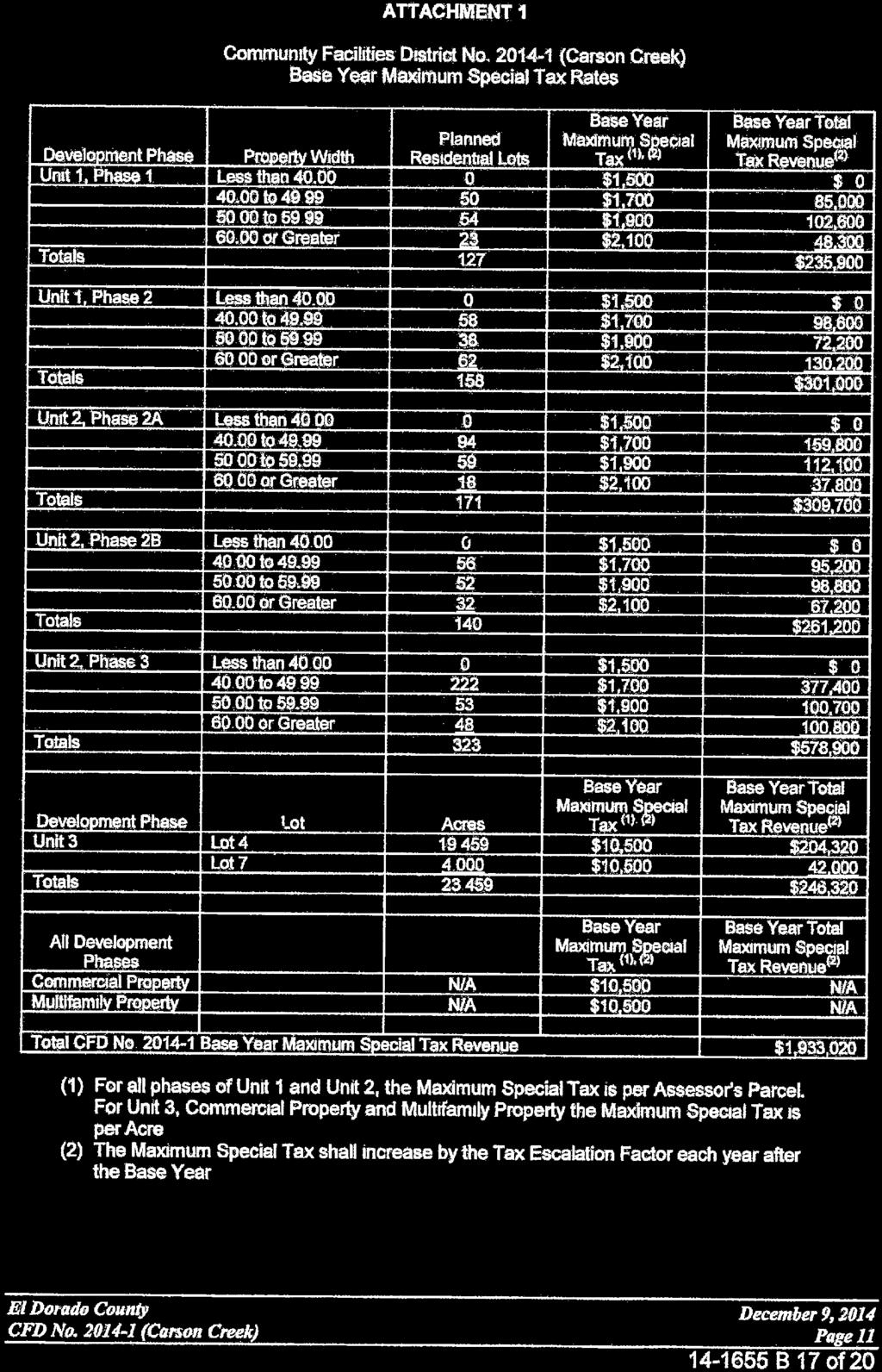
83

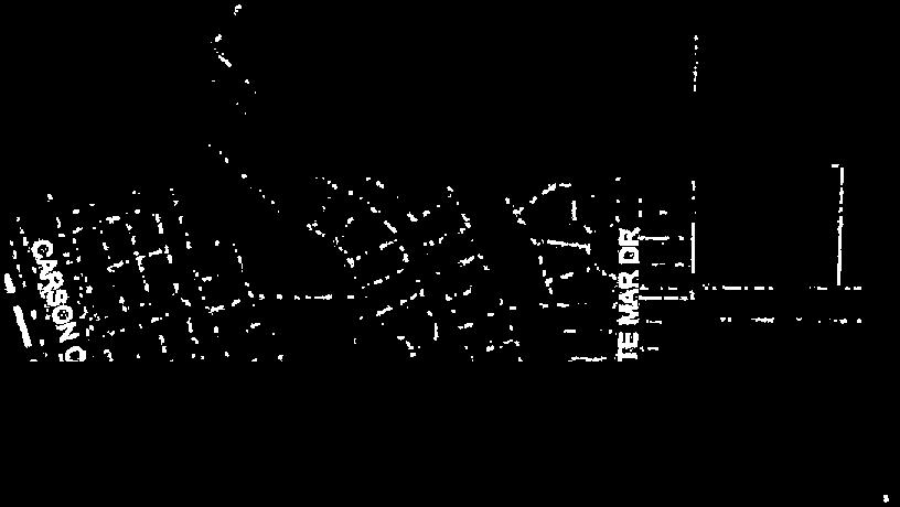


84
85 APPENDIX B THE APPRAISAL [Insert Appraisal and Update Letter] B-1
86 [THIS PAGE INTENTIONALLY LEFT BLANK]
87 UPDATE APPRAISAL REPORT OF: THE COMMUNITY FACILITIES DISTRICT NO (CARSON CREEK) EL DORADO HILLS, COUNTY OF EL DORADO CALIFORNIA FOR: MR. JOE HARN AUDITOR-CONTROLLER, EL DORADO COUNTY 360 FAIR LANE PLACERVILLE, CALIFORNIA DATE OF VALUE: JULY 1, 2016 BRI
88 July 29, 2016 Mr. Joe Harn Auditor-Controller County of El Dorado 360 Fair Lane Placerville, California Re: Update Appraisal of the Community Facilities District No (Carson Creek), located in the community of APNs: & ; thru -28; thru -51; thru -83; thru -53 Dear Mr. Harn: We have prepared an update to our prior appraisal of the lands within the Community Facilities District No (Carson Creek). Our original report had an effective date of value as of April 1, 2016 and a report date of May 25, This updated appraisal incorporates the prior appraisal report by reference and is to be used in conjunction with the prior appraisal report. The is located on approximately 710± acres and is bound by White Rock Road on the north, the Sacramento/El Dorado County line to the west, and is approximately one half mile west of Latrobe Road. The Specific Plan area is planned for 1,700± age restricted dwelling units, and additional multi-family, research & development and industrial lands. The boundaries of the CFD will contain a portion of the Specific Plan totaling 264± acres. Taxable land uses within the CFD include 1,059± age-restricted single-family residential lots and 4 acres of multi-family land. In addition, non-taxable land uses within the District boundaries will incorporate various parks and open space areas along with several areas dedicated for a fitness center and associated facilities and a clubhouse. Currently, most of the lands within the District are owned by Lennar Homes of California, Inc. However, as of the date of value, it is understood that 102 units within the district have been sold to individual homeowners. As of the date of value of the prior referenced report, construction of the site improvements was underway along with development of vertical improvements associated with the single family homes. During the course of performing this updated appraisal, the property was again viewed/researched and additional vertical improvements were noted within Units 1A and 1B. The updated date of value is as of July 1, Construction cost information was provided by a representative of the owner and is current as of June 1, Vertical construction of the single family homes associated with the project has been continuous since the date of the cost information and the date of value. BRI BENDER ROSENTHAL, INC.
89 Updated Appraisal Report of the Community Facilities District (Improvements) In order to prepare this update appraisal, the appraisers performed the following: Analyzed market conditions and data contained in the original report. Re-inspected the subject property. The property was last inspected on July 27, Researched current market conditions and data as of the effective date of value contained in this updated appraisal. The following is a summary of some of the more significant changes associated with the subject and market conditions in general: The number of single-family residential building permits secured as of the prior date of value was estimated at 67. Estimates as of July 1, 2016 provided by the property ownership is 114 permits. As of the prior date of value, multiple homes were under construction with at least $2,300,000 in vertical home construction costs incurred. Current estimates provided by the property ownership indicate that at least $14,500,000 has been spent towards completing single family homes. Per surveys as of the prior date of value, over 39 single-family residential units were in contract. As of the current date of value, information provided by the property ownership revealed that 102 units had closed escrow. The prior appraisal assumed an estimated bond proceed amount of approximately $9,300,000. Based upon information provided from Stifel, Nicolaus & Company, Inc., the estimated bond proceed amount is currently $11,400,000, representing an increase in estimated bond proceeds of approximately $2,100,000. Single-family residential market conditions have not deteriorated since the date of value of the prior appraisal which is evidenced by steady home sales and new home price appreciation in the El Dorado Hills market area over the first half of the 2016 year. Similarly, multi-family market conditions have not deteriorated as well as exhibited by increasing rents and stable land pricing observed over the first 6 months of the 2016 year. This appraisal only provides the appraiser s conclusions. Supporting documentation is retained in the appraiser s work file. This appraisal valuation only includes the developable components of the project. The lands designated for parks, open space and right of way will be tax-exempt and are not being valued in this appraisal analysis. The subject property is subject to standard assumptions and limiting conditions, as well as the extraordinary and hypothetical conditions that are contained in the prior referenced appraisal report. BRI BENDER ROSENTHAL, INC.
90 Updated Appraisal Report of the Community Facilities District (Improvements) Given that additional single family development has occurred on the subject property, coupled with an analysis of market conditions as of the date of value of this updated appraisal report, it is our opinion that the market value of the subject property, as of July 1, 2016, is not less than that reported in the original appraisal with a date of value as of April 1, The not-less-than conclusion of market value is presented in the following table: Description Market Value Hypothetical Market Value $108,070,000* *Includes consideration of infrastructure paid for by the bond proceeds. Per USPAP, this appraisal is communicated in an Appraisal Report format. It is to be used only in conjunction with the original referenced appraisal with a date of value as of April 1, The appraisers are not responsible for unauthorized use of this report. Every effort has been made to conform to the Standards of Professional Practice of the Appraisal Institute, which fully incorporate the Uniform Standards of Professional Practice (USPAP) of the Appraisal Foundation 1. We also have attempted to adhere to CDIAC 2 guidelines. Please refer to the Extraordinary and General Assumptions and Limiting Conditions contained in the referenced original appraisal report. We are pleased to have the opportunity to provide you with professional appraisal services. BENDER ROSENTHAL, INC. Adam Bursch, MAI California Certified General Real Estate Appraiser Certificate No. AG The Appraisal Institute is a national organization of appraisers that self-regulates its members, and the undersigned is a designated Member of the Appraisal Institute (MAI). A Member must adhere to the Institute's ethics code and standards. The U.S. congress has tasked the Appraisal Foundation to set standards and procedures with which statecertified appraisers must comply when appraising property interests involved in federally-regulated transactions. 2 California Debt and Investment Advisory Commission, Appraisal Standards for Land-Secured Financings, CDAC BRI BENDER ROSENTHAL, INC.
91 Updated Appraisal Report of the Community Facilities District (Improvements) APPRAISER S CERTIFICATION I certify that, to the best of our knowledge and belief: 1. The statements of fact contained in this report are true and correct. 2. The analyses, opinions, and conclusions are limited only by the reported assumptions and limiting conditions and are my personal, impartial, unbiased, and professional analyses, opinions and conclusions. 3. I have no present or prospective interest in the property that is the subject of this report, and I have no personal interest with respect to the parties involved. 4. I have no bias with respect to the property that is the subject of this report or to the parties involved with this assignment. 5. My engagement in this assignment was not contingent upon developing or reporting predetermined results. 6. My compensation for completing this assignment is not contingent upon the development or reporting of a predetermined value or direction in value that favors the cause of the client, the amount of the value opinion, the attainment of a stipulated result, or the occurrence of a subsequent event directly related to the intended use of this appraisal. 7. I have appraised the subject property within the three-year period immediately preceding the acceptance of this assignment. The property was last appraised in April of I have performed no other services as an appraiser, or in any other capacity, regarding the property that is the subject of this report within the threeyear period immediately preceding acceptance of this assignment. 8. The reported analyses, opinions, and conclusions were developed, and this report has been prepared, in conformity with the Uniform Standards of Professional Appraisal Practice (USPAP). 9. The reported analyses, opinions, and conclusions were developed, and this report has been prepared, in conformity with the requirements of the Code of Professional Ethics and Standards of Professional Appraisal Practice of the Appraisal Institute. 10. The use of this report is subject to the requirements of the Appraisal Institute relating to review by its duly authorized representatives. 11. As of the date of this report, I have completed the continuing education program of the Appraisal Institute. 12. I made a personal inspection of the property that is the subject of this report. Adam Bursch, MAI California Certified General Real Estate Appraiser Certificate No. AG BRI BENDER ROSENTHAL, INC.
92 APPRAISAL REPORT OF: THE COMMUNITY FACILITIES DISTRICT NO (CARSON CREEK) EL DORADO HILLS, COUNTY OF EL DORADO, CALIFORNIA FOR: MR. JOE HARN AUDITOR-CONTROLLER, EL DORADO COUNTY 360 FAIR LANE PLACERVILLE, CALIFORNIA DATE OF VALUE: APRIL 1, 2016 BRI
93 May 25, 2016 Mr. Joe Harn Auditor-Controller, County of El Dorado 360 Fair Lane Placerville, California Re: Appraisal of the Community Facilities District No (Carson Creek), located in the community of APNs: & ; thru -28; thru -51; thru -83; thru -53 Dear Mr. Harn, We have appraised the above referenced property, consisting of the lands within the Community Facilities District No (Carson Creek) (CFD) which is a portion of the Carson Creek Specific Plan. The is located on approximately 710± acres and is bound by White Rock Road on the north, the Sacramento/El Dorado County line to the west, and is approximately one half mile west of Latrobe Road. The Specific Plan area is planned for 1,700± age restricted dwelling units, and additional multi-family, research & development and industrial lands. The boundaries of the CFD will contain a portion of the Specific Plan totaling 264± acres. Taxable land uses within the CFD include 1,059± age-restricted single-family residential lots and 4 acres of multi-family land. In addition, non-taxable land uses within the District boundaries will incorporate various parks and open space areas along with several areas dedicated for a fitness center and associated facilities and a clubhouse. All of the lands within the proposed District are owned by Lennar Homes of California, Inc. The new infrastructure facilities authorized to be financed through issuance of bonds include roadway and transportation improvements, intersection and signal improvements, sewer, drainage and water systems, reclaimed water systems and landscaping improvements, impact fees, public improvements, parks and trails as well as soft costs associated with the facilities. This report is subject to standard assumptions and limiting conditions referenced in the Introduction section of this appraisal, as well as the extraordinary and hypothetical conditions. BRI BENDER ROSENTHAL, INC.
94 Mr. Joe Harn El Dorado County May 25, 2016 Page 2 Per USPAP, this appraisal is communicated in a narrative Appraisal Report format. The following report sets forth a summary of the descriptive and factual data, the assumptions and conditions affecting the appraisal, and the findings and analyses that lead to and support the value opinions. The appraisers are not responsible for unauthorized use of this report. Every effort has been made to conform to the Standards of Professional Practice of the Appraisal Institute, which fully incorporate the Uniform Standards of Professional Practice (USPAP) of the Appraisal Foundation 1. We also have attempted to adhere to CDIAC 2 guidelines. Please refer to the Extraordinary and General Assumptions and Limiting Conditions contained in this report. We are pleased to have the opportunity to provide you with professional appraisal services. BENDER ROSENTHAL, INC. Adam Bursch, MAI California Certified General Real Estate Appraiser Certificate No. AG The Appraisal Institute is a national organization of appraisers that self-regulates its members, and the undersigned is a designated Member of the Appraisal Institute (MAI). A Member must adhere to the Institute's ethics code and standards. The U.S. congress has tasked the Appraisal Foundation to set standards and procedures with which state-certified appraisers must comply when appraising property interests involved in federally-regulated transactions. 2 California Debt Advisory Commission, Appraisal Standards for Land-Secured Financings, CDAC BRI BENDER ROSENTHAL, INC.
95 TABLE OF CONTENTS Community Facilities District TITLE PAGE... i LETTER OF TRANSMITTAL... ii TABLE OF CONTENTS... iv PROPERTY IDENTIFICATION AND SUMMARY OF SALIENT FACTS...v AERIAL MAP... xii SUBJECT PROPERTY PHOTOGRAPHS... xiii SECTION I. INTRODUCTION...1 II. NATIONAL, CALIFORNIA AND REGIONAL OVERVIEW...8 III. EL DORADO COUNTY / NEIGHBORHOOD OVERVIEW...14 IV. RESIDENTIAL MARKET OVERVIEW...26 V. MULTI-FAMILY MARKET OVERVIEW...41 VI. SITE AND PROJECT ANALYSIS...45 VII. HIGHEST AND BEST USE ANALYSIS...69 VIII. VALUATION ANALYSIS...71 IX. APPRAISERS CERTIFICATIONS ADDENDUM ITEM 1 ITEM 2 MARKET STUDY PROFESSIONAL QUALIFICATIONS BRI BENDER ROSENTHAL, INC. iv
96 PROPERTY IDENTIFICATION AND SUMMARY OF SALIENT FACTS Appraisal Assignment / Purpose: Client and Intended User: Intended Use: Property Rights Appraised: Property Location: To determine the market value of the taxable land included within the County of El Dorado CFD No (Carson Creek). El Dorado County is the client and intended user of this appraisal report. This appraisal is intended to provide a value for underwriting as part of issuance of bonds associated with the County of El Dorado Community Facilities District No (Carson Creek). Fee Simple Estate The properties appraised are within the Community Facilities District No (Carson Creek) and are bound by Golden Foothills Parkway to the north, the Sacramento/El Dorado County line to the west, and are approximately one half mile west of Latrobe Road. Primary access to the general area is provided by Latrobe Road which extends in a north/south direction through the neighborhood. Golden Foothill Parkway will provide direct access to the District and this roadway directly connects with Latrobe Road to the east. Plan Area Land Use / Description: The Community Facilities District No (Carson Creek) is comprised of a mixture of residential and public uses and is a portion of the. For illustrative purposes, the following District Map is presented: BRI v BENDER ROSENTHAL, INC.
97 BRI vi BENDER ROSENTHAL, INC.
98 At build out, the District will include 1,059 residential dwelling units and approximately 4 acres of multi-family land. The Carson Creek Specific Plan totals approximately 710 acres and the Community Facilities District No (Carson Creek) is 37% of the total area associated with the Specific Plan. The following table presented summarizes the land uses within the District: Community Facilities District No (Carson Creek) Land Uses Dwelling Land Use Units Unit 1 Lot Size 45' x 105' ' x 105' 93 65' x 105' 89 Subtotal 285 Unit 2 Lot Size 45' x 105' ' x 105' ' x 105' 98 Subtotal 634 Unit 3 Lot Size 60' x 65' 140 Other Uses Unit 3, Lot acres of multi-family land Total within District Acres* Total DU's 1,059 Source: Community Facilities District No (Carson Creek) - District Map of Development Phases as contained in the Rate and Method of Apportionment, the CFD Development Summary provided by Lennar, dated October 9, 2015, and NBS. * Acreage represented above is the gross acreage including tax exempt portions such as roadways, parks, club house/recreational facilities, etc. The acreage indicated above was provided by the County Assessor's office. BRI vii BENDER ROSENTHAL, INC.
99 As of the date of value, a significant portion of the site improvements associated with Unit 1 have been put in place including the majority of Carson Crossing Drive, in-tract street and utility improvements. In addition, greater than 20 homes were under construction and the fitness facility and related recreational improvements were completed. Adjoining Land Uses: Legal Description: North Single-family Residential / Industrial South Vacant Land West City of Folsom / Vacant Land East Industrial / Commercial A complete legal description of the lands appraised was not provided for review. Parcel information as researched through the County Assessor s office was relied upon for this analysis. Assessor s Parcel Numbers: & ; thru -28; thru -51; thru -83; thru -53 Ownership: Sales History: Lennar Homes of California, Inc. Research of the sales history of the subject property revealed that the project was involved in a transfer within the last three years. Per discussions with the owner, the property appraised was originally optioned from Carson Creek El Dorado LLC in The option was for 10 years. In 2013, the option was reportedly restructured and Lennar then closed the transaction. The specific terms of the transaction, including price and other issues, were not divulged. However, the transaction is not considered to be arms length given negotiated profit sharing/joint venture terms between the buyer and seller and other related deal structures. In addition, it is noted that Lot 7, which is comprised of 4 acres of land, is in contract to be purchased. The name of the buyer is Westmont Living. Specific details regarding the contract and terms were requested, but not provided. However, it was reported that the buyer is expected to purchase the site for the ultimate development of a 134 unit BRI viii BENDER ROSENTHAL, INC.
100 assisted living facility. Discussions with the County Planning Department revealed that a Special Use Permit is currently being processed for this anticipated use. Close of escrow is expected in the 2016 year. No other transactions are known to have occurred within the last three years. Further, the lands within the District are not currently listed for sale. However, it is noted that the proposed homes within Unit 1 are currently listed for sale. Lennar Homes is the builder and is currently marketing three separate product lines identified as Heritage El Dorado Hills Estates, Legends and Mosaic. Homes within these subdivisions will range in size from 1,230 square feet to 2,993 square feet at net base asking prices from the high $300,000 s to the low $600,000 s. It was reported that, as of February 2016, 39 homes were in contract. Specific details regarding the contract price and other terms were requested, but not provided. Zoning and Entitlements: The properties appraised are zoned according to the and the Development Agreement with El Dorado County. The underlying uses allowed include single-family residential developments of various densities along with multifamily development. Per discussions with a representative of the El Dorado County Planning Department, Units 1A, 1B, 1C and 1D, totaling 285 lots, have obtained final map status. 171 lots within Unit 2 are expected to obtain final map status in September 2016, with an additional 140 lots within Unit 2 expected to receive final map approval in December The remaining 323 lots within Unit 2 are expected to have final map approval by June The single family residential lots within Unit 3 have tentative map approvals. However, it is noted that Lot 7 within Unit 3 (approximately 4 acres of multi-family residential land) has been final map approved. BRI ix BENDER ROSENTHAL, INC.
101 Flood Information: Seismic Information: Per FEMA maps, the property appraised is located in one flood zone identified as Flood Zone X. Flood Zone X is located outside both the 100 and 500 flood plains. This information was obtained from the FEMA website, community number/panel 06017C 0725E and 0950E, dated September 26, The subject property is not within a Fault-Rupture Hazard Zone (formerly an Alquist-Priolo Special Studies Zone), according to Special Publication 42, "Fault-Rupture Hazard Zones in California", published by the California Department of Conservation, Division of Mines and Geology, revised No active faults are located on or in the proximity of the property. However, strong earthquakes generated along any of the active California faults may affect the site depending on the characteristics of the earthquake and the location of the epicenter. In general, the effects should be confined to shaking and/or acceleration (shock waves) and potential damage to structures should be minimized by employing adequate design and construction procedures. Because El Dorado County, and most of the State of California, is a seismically active region, the potential for earthquake-induced hazards must be acknowledged. However, the history of past earthquake activity does not indicate that El Dorado County is a particularly hazardous area. Current engineering design and construction practices, such as the Uniform Building Code, provide the opportunity to reduce earthquake related hazards. Toxic Hazards Information: We were not provided with a Phase I assessment for the subject property. No evidence of contamination was noted upon inspection of the property. However, the appraisers are not experts in this field and are not qualified to detect or advise on similar matters. This appraisal therefore assumes that there is no toxic contamination on the subject property. Please refer to General Limiting Condition Number 15 regarding hazardous materials. BRI x BENDER ROSENTHAL, INC.
102 Wetlands: Highest and Best Use: A detailed wetlands study was not provided. However, information provided by the master developer indicates that there may be wetlands areas associated with the District. Please see extraordinary assumption #8. Development to residential and multi-family uses. Date of Inspection: February 26, 2016 Date of Value: April 1, 2016 Date of Report: May 25, 2016 Valuation Summary, As of April 1, 2016: Description Hypothetical Market Value of the Community Facilities District Allocated Amounts Market Value $108,070,000* Allocated amount of Units 1A and 1B $40,070,000* Allocated amount of Units 1C and 1D $20,530,000* Allocated amount of Unit 1 $60,600,000* Allocated amount of the Balance of the Property $47,470,000* *The numbers indicated above are not less than the stated amounts. BRI xi BENDER ROSENTHAL, INC.

 BRI 16-047 xii BENDER")
103 AERIAL MAP (Please note: The aerial below does not depict the current improvements in place within the District) BRI xii BENDER ROSENTHAL, INC.
 Looking east along Golden Foothills Parkway.")

104 SUBJECT PROPERTY PHOTOGRAPHS (The photos were taken on the date of inspection, February 26, 2016) Looking east along Golden Foothills Parkway. The District appraised is on the right. Looking west along Golden Foothills Parkway. The District appraised is on the left. BRI xiii BENDER ROSENTHAL, INC.
105 SUBJECT PROPERTY PHOTOGRAPHS Community Facilities District View of a portion of the District. Picture taken from northeastern portion of the District, looking in a southerly direction. View of a portion of the District. Picture taken from the northeastern portion of the District, looking in a southwestern direction. BRI xiv BENDER ROSENTHAL, INC.


106 SUBJECT PROPERTY PHOTOGRAPHS Community Facilities District View of a portion of the District and Carson Crossing Drive. Picture taken from the northwestern portion of the site, looking south along the newly developed Carson Crossing Drive. Another view along Carson Crossing Drive. Picture taken from the central portion of the District, looking east along Carson Crossing Drive. BRI xv BENDER ROSENTHAL, INC.


107 SUBJECT PROPERTY PHOTOGRAPHS Community Facilities District View of a portion of Unit 1 and construction underway. Picture taken from the western portion of the District, looking east. View of some of the partially completed homes within Unit 1. BRI xvi BENDER ROSENTHAL, INC.

108 SUBJECT PROPERTY PHOTOGRAPHS Community Facilities District View of a portion of Unit 2 (future phase) of District. Picture taken from Carson Creek Drive, looking southeast. BRI xvii BENDER ROSENTHAL, INC.
109 I. INTRODUCTION Community Facilities District SUBJECT PROPERTY The subject property is the lands contained with the boundaries of the Community Facilities District No (Carson Creek) which is a portion of the, an approximate 710 acre community located along the Sacramento/El Dorado County border, south of Highway 50 and west of Latrobe Road. The property appraised is comprised of multiple components including production single-family residential lots of various densities and a 4-acre lot slated for future multi-family development. The total number of single-family residential units planned for the District is 1,059. PURPOSE OF THE APPRAISAL The purpose of the appraisal assignment is to estimate the following market value: Hypothetical Market Value of the lands within the Community Facilities District No (Carson Creek) Allocated amount of Unit 1 Allocated amount of Units 1A and 1B Allocated amount of Units 1C and 1D Allocated amount of the Balance of the District PROPERTY RIGHTS APPRAISED Fee Simple Estate CLIENT / USER / USE OF THE APPRAISAL El Dorado County is the client and intended user of the report. The client intends to use the appraisal to aid in bond underwriting. The appraiser consents to the inclusion of this report in the Preliminary Official Statement and Official Statement for the bonds. The appraiser has not authorized any other use or user of this report, and any other use or user may invalidate it. Assumption and Limiting Condition No. 9 applies to subsequent additional use of the appraisal. SCOPE OF THE APPRAISAL The appraisal assignment involved an inspection of the subject property by the appraisers, interviews with government departments having jurisdiction over the property, and collection of data pertaining to the subject property and the relevant market. Information was obtained from the client, the owners, public records, publications, appraisal office files, developers, builders, real estate agents, and/or knowledgeable persons. Sales data were confirmed with knowledgeable parties, unless otherwise stipulated. Opinions were sought from market participants. Professional experts in such fields as site engineering, etc., were not hired, as this would have been beyond the scope of the assignment. BRI BENDER ROSENTHAL, INC.
110 The valuation process also involved an investigation and analysis of regional area demographic and economic trends, and the Regional housing and multi-family markets. Neighborhood attributes such as amenities, services, facilities, and other factors that could influence value were identified. The highest and best use of the property has been considered in light of these trends and factors, the degree of marketing success for the existing use, and the economic virtues and consequences of changing the property s use. Information considered relevant to the appraisal assignment has been summarized in the appraisal, and data pertaining to value have been analyzed using the Sales Comparison Approach and discounted cash flow analyses. The steps taken to estimate the market value of the property include the following: Overview of the current real estate market; Overview of regional and neighborhood data; Inspection of the subject property and data pertaining to the subject property; Adam Bursch, MAI last inspected the property on February 26, 2016, however, additional inspections occurred during the course of the 2015 year. Market research was continuous through the stated effective date of value, April 1, Review of the Rate and Method of Apportionment; Review of costs to finish the project provided by the master developer as well as costs incurred. The cost information provided was as of March of Construction associated with the project has been continuous since the date of the cost information and the date of value. The additional improvements contribute to the overall value of the property. It follows that the values/amounts indicated in this report are considered to be not less than figures. Review of estimated fees provided by the El Dorado Irrigation District and the El Dorado County Building Department and a representative of the master developer; Research of absorption and price points of competitive projects; Review of a Market Study developed by The Gregory Group, dated May of 2015; Research of comparable properties through sources including Co-Star, MLS, and Loopnet; Discussions with real estate agents and buyers/sellers in the area; and Analysis of this data and calculations. TYPE OF REPORT As defined by USPAP, this appraisal is presented in a narrative Appraisal Report format. BRI BENDER ROSENTHAL, INC.
111 COMMUNITY FACILITIES DISTRICTS BONDS SOME APPRAISAL CONSIDERATIONS Special tax bonds, also known as Mello-Roos bonds, can be issued by a municipality under authority provided by the California Mello-Roos Community Facilities Act of Proceeds from such bonds usually pay for major development infrastructure such as roads, sewer lines, etc. The benefiting properties are obliged to pay a special tax until the bonds are finally retired. A property described as subject to these bonds is really subject to the special tax and not the bonds directly. Therefore, a property subject to a special tax should really be described, in the appraiser s opinion, as a property owned in fee simple, as taxation is one of the four powers reserved from private property ownership (see definition of fee simple estate ). Often, however, the description terminology is extended to fee simple subject to special tax, or fee simple subject to bonds. DEFINITIONS USED IN THE REPORT Market Value is the most probable price in cash or terms equivalent to cash for which the specified property rights should sell after reasonable exposure in a competitive market under all conditions requisite to a fair sale, with the buyer and seller each acting prudently, knowledgeably, and for self-interest, and assuming that neither is under undue stress. 3 Fee Simple Estate 4 is the absolute ownership of real property unencumbered by any other interest, subject only to the limitations imposed by the governmental powers of taxation, eminent domain, police power, and escheat. Fee Simple Value Subject To Special Taxes. The cash price that would be paid in the market for a property or group of properties, assuming that annual special tax payments are required. This is the value that is being appraised in this CFD. Properties of equal quality and utility, but not subject to special taxes, might sell at higher cash prices. Extraordinary Assumption. 5 An assumption, directly related to a specific assignment, as of the effective date of the assignment results, which, if found to be false, could alter the appraiser s opinions and conclusions. Hypothetical Condition. 6 A condition, directly related to a specific assignment, which is contrary to what is known by the appraiser to exist on the effective date of the assignment results, but is used for the purpose of analysis. Reasonable Exposure Time 7 is the estimated length of time the property interest being appraised would have been offered on the market prior to the hypothetical consummation of a sale at market value on the effective date of the appraisal; a retrospective estimate based upon an analysis of past events assuming a competitive and open market. Based on my analysis of the market, an exposure period of 12 months is estimated for the entire project. 3 Appraisal Standards for Land-Secured Financings, California Debt Advisory Commission, 94-6, Pg. 9 4 The Dictionary Of Real Estate Appraisal (Fifth Edition), Appraisal Institute, Chicago, Illinois, 2010, Pg Uniform Standards of Professional Appraisal Practice Edition; Pg. 3 6 Uniform Standards of Professional Appraisal Practice Edition; Pg. 3 7 Uniform Standards of Professional Appraisal Practice Edition; Pg. 2 BRI BENDER ROSENTHAL, INC.
112 Retail Value is an estimate of what an end user would pay for a finished property under conditions requisite to a fair sale. 8 In the discounted cash flow approach used in this appraisal, the value estimates are for the anticipated finished lots as if they were available today for home production, with all necessary infrastructure in place, and subject to expected CFD (Mello Roos) special taxes. Bulk Sale Value is the most probable price, in a sale of all parcels within a tract or development project, to a single purchaser or sales to multiple buyers, over a reasonable absorption period discounted to present value, as of a specified date, in cash, or in terms equivalent to cash, for which the property rights should sell after reasonable exposure, in a competitive market under all conditions requisite to a fair sale, with buyer and seller each acting prudently, knowledgeably, and for self interest, and assuming that neither is under undue stress. 9 DATE OF VALUATION AND DATE OF THE REPORT The effective date of value is April 1, The date of the report is the date of the letter of transmittal on May 25, EXTRAORDINARY ASSUMPTIONS AND HYPOTHETICAL CONDITIONS In order to properly value the subject property within the CFD so that the security interest for the bonds can be appropriately considered, certain special assumptions and limiting conditions have to be made that pertain specifically to this appraisal and are summarized as follows. Note to Reader: The subject property is subject to the following extraordinary assumptions and/or hypothetical conditions, which might have affected the assignment results With regard to future absorption and absent, any evidence to the contrary, we must assume that economic conditions will remain reasonably stable, and that interest rates will remain moderate. 2. We assume, for purposes of absorption analysis, that when market demand for lots is obviously strong, the supply of lots at the subject property is never artificially or unduly restrained by regulatory or managerial factors. 3. It is understood that historically there have been concerns over the availability of potable water in the County of El Dorado. Currently, there is not enough supply to service all of the proposed construction within the El Dorado Hills area at build out. However, per the 2015 EID (El Dorado Irrigation District) Water Resources Report, as of 2015, the area had 14,110 acre feet of supply that could be produced by the current infrastructure. That being said, the demand as of 2015 was only 11,085 acre feet per year, leaving a surplus of 3,025 acre feet. Per ratios provided by EID, that effectively translates to an available water supply that can currently service 4,088 additional equivalent dwelling units or EDU s. However, EID has provided commitments for future water, recycled water and wastewater service for 1,250 EDU s within the. It is understood that $3,470 per 8 Appraisal Standards for Land-Secured Financings, California Debt Advisory Commission, 04-07, Pg Ibid 10 Uniform Standards of Professional Appraisal Practice Edition, Pg. U-25 BRI BENDER ROSENTHAL, INC.
113 EDU has been prepaid towards the total EID fees, or a total of $4,337,500. Information provided by a representative of EID indicated that the commitments provided will satisfy most of the EDU requirements for the Carson Creek Specific Plan. The values in this report assume that the area will have enough water supply to complete build out. 4. As part of the analysis, the lots were appraised assuming they were all in a finished condition, which is contrary to how the majority of the project exists today. Estimated remaining costs to finish the lots (the additional costs required to finish the lots beyond that which is being financed with the bond sale proceeds) were considered in the final values. The final value presented in this report is predicated on the hypothetical condition that the infrastructure being financed through the proceeds from the bonds is in place. As of the date of value, the infrastructure was not yet completed. 5. Preliminary title reports referencing portions of the property appraised were provided. The reports were produced by North American Title Company dated January 14, 2015 and February 19, These preliminary title reports have been retained in the appraiser s files. Review of the preliminary title reports revealed a number of public utility and roadway easements, references to development and other agreements, special assessments, etc. that are typical for properties of this type and should not have an adverse impact on value. This report assumes that there are no conditions of title that could have an adverse impact on value. Should at a later date this be shown to be incorrect, the value conclusions may change. 6. Property information was provided from a representative of the master developer. This information included property maps referencing the total number of proposed lots, subdivision and amenity design, estimated costs to finish the lots, estimated costs incurred as of March 1, 2016, estimated building permits pulled and estimates of building permits and fees. In addition, information was provided summarizing the estimated bond proceed amount. This appraisal assumes that the information provided is reasonably accurate and the project will be developed as proposed. Should at a later date, this information be shown to be inaccurate, the value conclusions contained herein may change. 7. Information regarding the historical and current sales activity pertaining to the lands within the District was requested from the master developer including purchase agreements and specific price points. Although components of the property were reported as having sold within the last three years or were currently in contract, specific price points or supportive documentation was not provided. This appraisal assumes that the sales history information provided is accurate. 8. The U.S. Army Corps of Engineer (USACOE) issued a letter to Lennar Homes (master developer) in December of 2015 identifying the presence of seasonal wetlands associated with the District that will require additional permitting from the USACOE. The letter indicated that no additional compensatory mitigation would be required for the areas associated with Unit 1 but a non-judicial settlement agreement was recommended. Further development of Unit 2 will require BRI BENDER ROSENTHAL, INC.
114 additional permitting and mitigation. A biological consultant hired by the master developer, Foothill Associates, estimates the total costs associated with the mitigation and permitting associated with Unit 2 is $1,300,000. This appraisal assumes that the estimated costs in this regard are reasonably accurate. 9. Per information provided by Stifel Nicolaus & Co. Inc, the estimated bond proceed amount is $9,300,000. This appraisal assumes that the estimated bond proceed amount provided is reasonably accurate. GENERAL ASSUMPTIONS AND / OR LIMITING CONDITIONS This appraisal report and the value estimates it contains are expressly subject to the following assumptions and/or limiting conditions. 1. We assume that property lines as depicted in material provided to the appraisers by the client (directly or indirectly), or as they appear on the ground, are correct. We have not commissioned any surveys of the property. 2. We assume that data, maps, and descriptive data furnished by the client or his representatives are accurate and correct. 3. We do not assume any responsibility for matters of law or legal interpretation. The appraiser is not a lawyer and cannot give legal advice. 4. We assume that any conditions that might exist that would affect the use and value of the property are discoverable through normal, diligent investigation. 5. The valuation is based on information from sources believed reliable, and we assume that such information is correct and accurately reported. 6. The value estimate(s) are subject to the purpose, date, and definition of value stated in the report. 7. The report is to be considered in its entirety and use of only a portion will invalidate the appraisal. 8. The appraisal is made based on the premise that there are no encumbrances prohibiting utilization of the property under the appraiser s estimate of highest and best use. 9. Possession of this report does not carry with it the right of publication. No part of it may be reproduced by any means nor disseminated to the public in any way without the prior written consent of the appraiser. However, the appraisers recognize that the report may be included as part of the official statement for CFD (Carson Creek). It may not be used for any purpose or function other than those stated in the report, or by anyone other than the client without the prior written consent of the appraiser and the appraisal firm. Such consent will only be granted subject to proper qualifications and arrangements, possibly including the payment of an additional fee to the appraisal firm. BRI BENDER ROSENTHAL, INC.
115 10. The report is subject to review by duly authorized representatives of the Appraisal Institute for the purpose of upholding ethics and standards. This means that the appraiser must supply a copy of the report to the Appraisal Institute, if requested. 11. It is not the intention of the appraisers or the appraisal firm to assume any liability with regard to this appraisal from any user other than the client. Any person or entity who obtains or reads this report, other than the client, expressly assumes all risk of damages to himself or third persons arising out of reliance on this report, and waives the right to bring any action based on the appraisal. Neither the appraiser nor the firm of Bender Rosenthal, Inc., shall have any liability to any such person or entity. 12. Neither the appraisers nor the appraisal firm shall in any way be responsible for any costs incurred to discover or correct any physical, financial, and/or legal deficiencies of any type present in the subject property. 13. The appraisers shall not be required to give testimony or appear in court by reason of this appraisal with reference to the property described in this report unless prior arrangements are made. 14. No responsibility is assumed for building permits, zone changes, engineering, or any other services or duty connected with legally utilizing the subject property. 15. Unless otherwise stated in this report, hazardous material were not observed by the appraisers at the property. The appraisers, however, are not qualified to detect such substances. The appraisers have no knowledge of the existence of such materials on or in the property, except as discussed in the report. The presence of such substances as asbestos, urea-formaldehyde foam insulation, or other potentially hazardous materials may affect the value of the property. The value estimate is predicated on the assumption that there is no such material on or in the property that would cause a loss in value. The client should secure proper professional investigation of such matters. 16. With referenced to improved properties: The property appraised may or may not be subject to the Americans with Disabilities Act of 1990 (ADA). Title III of this act provides for penalties for discrimination in failing... to remove architectural barriers... in existing facilities [unless] an entity can demonstrate that the removal... is not readily achievable... Unless otherwise noted in this appraisal, it is assumed that the property appraised is not substantially impacted by this law. However, the appraiser has not undertaken any detailed compliance review, nor is the appraiser an expert in ADA matters. 17. We assume that the property would be competently managed. 18. We assume that the property would have been competently marketed during the exposure period. BRI BENDER ROSENTHAL, INC.
116 II. NATIONAL, CALIFORNIA AND REGIONAL OVERVIEW NATIONAL ECONOMY According to the National Association of Business Economics (NABE), forecasters are expecting moderate growth in GDP and jobs in 2016 with modest upticks in inflation and interest rate targets. The NABE December 2015 Outlook presents the consensus of macroeconomic forecasts from a panel of 49 professional forecasters. Specifically, the consensus forecast is that the real GDP from the fourth quarter of 2014 to the fourth quarter of 2015 decreased to 2.2% and the median forecast for 2016 dipped to 2.6%. Two-thirds of the panel expect potential growth over the next five years to be in the 2% to 2.5% range. Only 5% of the panelists anticipate less than 2% potential growth, and the remaining 28% expect potential growth to be higher than 2.5% per year. The 2016 forecast for job creation is just north of 210,000. The unemployment rate is expected to decline to 4.7% by the fourth quarter 2016 and average 4.8% throughout the year. The Index of Leading Indicators, an index published monthly by The Conference Board, is used to predict the direction of the economy's future movements for upcoming months. The Leading Economic Index (or LEI) declined 0.2% in January to (the year 2010 = 100), following a 0.3% decrease in December and a 0.5% increase in November. The U.S. LEI fell slightly in January, driven primarily by large declines in stock prices and further weakness in initial claims for unemployment insurance. Despite back-to-back monthly declines, the index does not signal a significant increase in the risk of recession, and its six month growth rate remains consistent with a modest economic expansion through early The Federal Open Market Committee (FOMC) press release on January 27, 2016 indicated that labor market conditions improved further even as economic growth slowed late last year. Contributing to this activity is household spending and business fixed investment along with improvements in the housing sector; however, net exports have been soft and inventory investment slowed. Inflation has continued to run below the Committee s 2 percent longer-run objective, partly reflecting declines in energy prices and in prices of non-energy imports. Over the near term, the FOMC expects inflation to remain low in part because of the further declines in energy prices, but to gradually rise toward 2% over the medium term as the transitory effects of the declines in energy prices dissipate and the labor market strengthens further. To support continued progress toward maximum employment and price stability, the FOMC decided to maintain the target range for the federal funds rate at ¼ to ½ percent. In determining how long to maintain this target range, the FOMC will assess progress, both realized and expected, toward its objectives of maximum employment and 2% inflation. This assessment will take into account a wide range of information, including measures of labor market conditions, indicators of inflation pressures and inflation expectations, and current events in the financial and international developments. The Committee expects that economic conditions will evolve in a manner that will warrant only gradual increases in the federal funds rate. The federal funds rate is likely to remain, for some time, below levels that are expected to prevail in the longer run. BRI BENDER ROSENTHAL, INC.
117 CALIFORNIA ECONOMY The following chart illustrates the national, regional and local employment picture that exists as of December The Sacramento MSA unemployment rate is slightly below the State levels, but above the National rate. Unemployment in the San Francisco Bay Area MSAs is well below both state and national levels. UNEMPLOYMENT RATE SUMMARY Area YOY December December November 2015 Increase/ Decline California 6.8% 5.7% 5.8% -1.0% Stockton Lodi MSA 10% 8.8% 8.6% -1.4% Sacramento Roseville 6.3% 5.5% 5.5% -0.80% Arden Arcade MSA Oakland Hayward 5.1% 4.4% 4.5% -0.60% Berkley MD San Francisco Redwood City South San Francisco MD 3.6% 3.2% 3.2% -0.20% Source: California EDD & USBLS Data Not Seasonally Adjusted The California Employment Development Department s report on payroll employment (wage and salary jobs) in the nonfarm industries of California totaled 16,320,100 in December 2015, a net gain of 60,400 jobs since the November survey. Nonfarm payrolls in California have grown over the past year in nine sectors; construction (8.6%); professional and business services (5%); leisure and hospitality (4.3%); information (3.3%); educational and health services (3%); trade, transportation and utilities (2.4%); government (1.5%); other series (1.2%); and financial activities (0.6%). In a year-over-year comparison (December 2014 to December 2015), nonfarm payroll employment in California increased by 459,400 jobs (up 2.9%). Professional and business services posted the largest gains on a numerical basis, adding 124,700 jobs (up 5 %). Construction posted the largest gains on a percentage basis, up 8.6% (adding 59,300 jobs). Two categories (mining and logging and manufacturing) posted job decline over the year, down 5,500 jobs. Mining and logging posted the largest decreases on both a numerical and percentage basis, down 3,000 jobs (a 9.6% decrease). BRI BENDER ROSENTHAL, INC.

118 SACRAMENTO REGIONAL OVERVIEW The Sacramento Consolidated Metropolitan Statistical Area (CMSA), consisting of El Dorado, Placer, Sacramento, and Yolo counties, is located at the confluence of two major rivers, the Sacramento and the American, at the northern end of California's great inland Sacramento-San Joaquin Valley, often called the Central Valley. The community's area of influence extends from the Sonoma (Coastal) Range to the west, across the Sacramento Valley, and up through the foothills of the Sierra Nevada to the east. The area is strategically located adjacent to productive agricultural areas on the north and south, recreational mountain areas on the east, and not far from the metropolitan San Francisco Bay area 85 miles to the southwest. In addition, it is centrally located with respect to the Mexican and Canadian borders. The largest city in the region, Sacramento, is the state capital and the cultural, communications, financial, employment, and transportation hub of the Sacramento Valley and adjacent mountain county regions. REGIONAL MAP Unemployment Rate. The unemployment rate in the Sacramento MSA was 5.5% in December 2015, unchanged from a revised 5.5% in November 2015, and below the year-ago estimate of 6.3%. This compares with an unemployment rate of 5.8% for California during the same period. For the region, leisure and hospitality added 1,600 jobs over the month. Gains were seen in arts, entertainment, and recreation (up 800 jobs) and accommodation and food services (up 800 jobs). Trade, transportation and utilities gained 1,400 jobs from November. Retail trade accounted for the majority of the gain, adding 800 jobs. Transportation, warehousing, and utilities added 400 jobs, and wholesale trade increased by 200 jobs. Professional and business services increased by 700 jobs over the month. Administrative and support and waste services added 400 jobs; professional, scientific, and technical services increased by 200 jobs; and management of companies and enterprises grew by 100 jobs. BRI BENDER ROSENTHAL, INC.
119 Six industries saw month-over declines in December. Government led the decline by shedding 3,300 jobs. Construction was down 400 jobs. Farm and other services each cut back 200 jobs. Education and health services and mining and logging each lost 100 jobs. Between December 2014 and December 2015, total jobs in the region increased by 22,900 or 2.5%. Leisure and hospitality continued to lead year-over job growth with an expansion of 11,400 jobs. Accommodation and food services increased by 9,100 jobs. Trade, transportation, and utilities grew by 4,600jobs from last year. Retail trade accounted for the majority of the gain in this industry, adding 3,900 jobs. Construction advanced 3,200 jobs from December of Specialty trade contractors led the growth with a gain of 2,400 jobs. Two industries saw year-over job declines. Information dropped 500 jobs, while mining and logging was down 100 jobs. Demographic Trends. As of January of 2015, the Sacramento Region had an estimated population of about 2.4 million, which is an increase of 0.87% over the estimated population as of the beginning of the 2014 year. The majority of the growth is occurring in Sacramento and Placer Counties. Sacramento County showed the fastest population growth over this time at 1.01% change from 2014 to The rate of growth of the Sacramento region is slightly slower when compared to the State as a whole over the same time period. It is noted, however, that many of the counties that have more of an agricultural use in in the region have experienced relatively low population growth rates with Yuba, Yolo and Sutter Counties demonstrating this. The table below contains the 2010 Census data through January of 2015 populations for the state, Sacramento Region and Counties in the Sacramento Region. Area (State/Region/County) 4/1/2010 1/1/2011 1/1/2012 1/1/2013 1/1/2014 1/1/ % Change California 37,253,956 37,427,946 37,680,593 38,030,609 38,357,121 38,714, Sacramento Region 2,316,019 2,327,914 2,341,377 2,361,336 2,383,870 2,404, El Dorado County 181, , , , , , Placer County 348, , , , , , Sacramento County 1,418,788 1,427,961 1,431,726 1,442,993 1,456,230 1,470, Sutter County 94,737 94,620 94,697 95,083 95,739 95, Yolo County 200, , , , , , Yuba County 72,155 72,316 72,907 73,490 73,690 74, Source: Department of Finance: Population Estimates BRI BENDER ROSENTHAL, INC.
120 Future Populations. Population projections indicate that the Greater Sacramento Region is expected to increase by 5.6% between 2015 and 2020, or approximately 1.1% per year. GREATER SACRAMENTO REGION PROJECTED POPULATION GROWTH Area California 40,619,346 42,373,301 44,085,600 45,747,645 47,233,240 48,574,095 Sacramento Region 2,547,064 2,689,600 2,836,824 2,998,542 3,145,647 3,276,383 El Dorado County 190, , , , , ,302 Placer County 396, , , , , ,147 Sacramento County 1,554,022 1,639,613 1,730,276 1,823,985 1,912,838 1,989,722 Sutter County 105, , , , , ,113 Yolo County 219, , , , , ,208 Yuba County 81,467 88,282 95, , , ,891 Source: Department of Finance- Population Projections 2,500,000 Greater Sacramento Region Projected Population Growth: Demonstrated by County 2,000,000 1,500,000 1,000, , El Dorado County Placer County Sacramento County Sutter County Yolo County Yuba County When looking at the projected population growth by county, Sacramento County remains the largest population contributor when compared to the surrounding counties in the region. Counties like Placer, Yolo and El Dorado will also experience growth, but not at the rates that Sacramento County will. The lowest growth throughout the years is projected to be from Sutter and Yuba counties. BRI BENDER ROSENTHAL, INC.
121 Housing Market. It is estimated that just over 6,500 residential building permits were pulled in 2015 for the Sacramento Region, which is the most the area has seen in the 2007 year. Total singlefamily building permits pulled for the 2015 year increased in part due to the lifting of the flood zone builders moratorium in North Natomas by FEMA in June of It is noted that permit activity increased significantly in 2015 relative to prior years; however, the current number of single-family building permits issued are well below of levels seen in the early 2000s. Looking to the future, the expectation from market participants is that the residential market will continue to stabilize. Lending rates are not expected to increase substantially over the course of the next several years which should also help to maintain sales momentum and pricing. Commercial Real Estate Market. The Sacramento Region commercial real estate markets have generally stabilized over the past two years, however substantial improvement is only being experienced over very specific product types within the various sectors. Vacancy, however, has decreased across the board, which is partially a reflection of the complete lack of new construction over the previous few years, coupled with slowly increasing job growth and a rebounding housing market. Rental rates remain significantly depressed for the most part, which continues to keep most types of development infeasible. The leasing paralysis has subsided and activity increased somewhat in 2010 and 2011, as many users who were postponing moves in 2009 took advantage of excellent opportunities to enter the market. Much of the activity currently occurring is due to existing tenants chasing cheaper rent and/or upgrading their location, however the return of the housing market has resulted in renewed interest from start-up businesses, as home equity loans are the most common source of capital for these users. Small Business Administration financing enticed owner-users back into the market in the years , and these type of buyers accounted for the majority of the sale activity. While investors have been somewhat active as well, they continue to focus on those well located, class A properties with stable occupancy and high-credit tenants. Regional Analysis Conclusion. The Sacramento Region is strategically located with respect to transportation corridors and agricultural production within California s Central Valley. It is apparent that the region is slowly recovering from the recession with gradual but steady job growth occurring in 2013 thru early 2016 years. Further, a rebound in the housing markets has helped the local economy as well. Although continued recovery is needed, it is apparent that the economy of the region is on the mend. The general consensus in the market is that the region will continue to stabilize over the course of 2016 and the job market will continue to strengthen. BRI BENDER ROSENTHAL, INC.

122 III. EL DORADO COUNTY / NEIGHBORHOOD OVERVIEW The subject is located in an unincorporated portion of El Dorado County known as El Dorado Hills, within the State of California. The subject s general area is approximately +23 miles northeast of the Central Business District of Sacramento. More specifically, the subject area is positioned south of Highway 50 along the southern side of White Rock Road and the western side of Latrobe Road. A County map is shown on the following page. COUNTY OF EL DORADO MAP The County of El Dorado totals over 1,800 square miles and is located along the eastern Central Valley. The western most portion of the County is characterized by rolling hills and contains the majority of the residents. As one moves east, the terrain in the County becomes much more rugged as it includes portions of the Sierra Nevada Mountains. As of 2015, the California Department of Finance reported the County s population at 184,917, representing an increase of 0.9% over the 2014 estimates. Looking to the future, by 2025, the California Department of finance projects the population to increase to 220,384 residents, or an average population increase of nearly 2% per year. Much of this anticipated growth will occur within the western most portion of the County (El Dorado Hills and surrounding areas). Cities / Communities. The County contains only two incorporated cities, the county seat of Placerville and South Lake Tahoe. In addition, there are six unincorporated communities. While the majority of the County is rural in nature, the four largest urban areas of the County are Placerville and South Lake Tahoe, as well as the unincorporated areas of El Dorado Hills and Cameron Park. Except for South Lake Tahoe, all of these communities are within 15 miles or less of Sacramento County. BRI BENDER ROSENTHAL, INC.
123 It is noted that all of these communities are located immediately along Highway 50, and retail and commercial uses catering to the highway traffic are prominent along this corridor. Industrial and flex space can be found in the southwest quadrant of El Dorado Hills, along Latrobe and White Rock Roads and in Diamond Springs, just south of Placerville. To a smaller extent there is some industrial space along Business Drive in Cameron Park. Overall, however, while there is some industry and local businesses sprinkled throughout these areas, they are generally considered bedroom communities for the Sacramento MSA to the west. Agricultural Uses. As described above, the majority of the undeveloped land in the county is forested or enjoyed as other open space, however there is some agricultural production occurring within the County. The following table presents the agricultural production for El Dorado County in the year Crop Value Apples $14,610,651 Livestock $9,348,089 Wine Grapes $8,010,833 Timber $11,422,718 Hay and Pasture $3,935,010 Nursery $1,717,182 Christmas Trees $2,242,448 Pears $1,589,040 Minor and Miscellaneous Crops $1,287,967 Other Fruit and Nut Crops $2,236,322 Apiary $840,500 Gross Agricultural Value $57,240, El Dorado - Alpine Counties Agricultural & Livestock Report Apple production, which accounts for almost 30% of the total agricultural production within the region, is primarily focused around the "Apple Hill" area of El Dorado County. This area extends along the north side of Highway 50 from the Schnell School Exit in Placerville to Blair Road, in Pollock Pines. Apple Hill is comprised of 50 different ranches, and is a popular destination during the late summer and early fall for local, farm grown produce. Although the local emphasis is on apples, the area provides other activities and attractions throughout the year, such as wineries, Christmas tree cutting, concerts, and festivals. In all, however, the agricultural production is significantly less than other counties in Northern California, which can produce well over $1 billion in agricultural products annually. Transportation. El Dorado County has average linkages to the region s major transportation centers. State Highway 50 traverses the County from east to west and is by far the primary thoroughfare within the County, connecting Sacramento to the west with Lake Tahoe to the east. In Sacramento, the highway connects with Interstates 5 and 80, as well as Business 80 and Highway 99. As previously mentioned, all towns and cities within the County are located immediately along this highway. The highway consists of eight lanes at the westernmost portion of the County, but as it extends east across the county quickly reduces to six lanes before eventually BRI BENDER ROSENTHAL, INC.
124 becoming just two lanes near Pollock Pines. Highway 49 extends in a north/south direction throughout the Sierra Nevada foothills, from Oakhurst to the south up past Auburn and Grass Valley to the north. Highways 49 and 50 intersect in the city of Placerville. El Dorado Transit provides public bus transportation, although this is primarily focused on several routes located in those areas between Cameron Park and Pollock Pines. Additionally, some minimal service is provided to El Dorado Hills and Folsom, primarily during commute hours. A recent study completed in 2013 indicated that the costs of establishing a fixed-route bus service were prohibitive based on the nominal amount of anticipated ridership. There are two airports within the county: the Placerville Airport and Georgetown Airport. Both are public-use airports that have no passenger services departing from the airport, although it is noted that the Placerville runway is long enough to accommodate medium turboprop aircraft. Freight service is provided at the Mather Air Park, just 12 miles to the west in the city of Rancho Cordova. The closest passenger airport is Sacramento International Airport, located approximately 26 miles to the west. Utilizing two terminals, this airport serves more than 9 million passengers a year and is the dominant airport in the northern portion of the California Central Valley area, providing passenger service to most American cities. Southwest Airlines operates 70 daily flights out of Sacramento International. Hawaiian and Mexicana airlines operate successfully from this location. The Sacramento International Airport recently completed a massive project to completely renovate a terminal and expand the runway. The $1.1 billion terminal modernization project broke ground June 19, 2008, and was completed in the fourth quarter 2011, as scheduled. The Big Build includes a three-story central passenger terminal and a separate 19 gate concourse to meet an expected rising demand for passenger service as well as attract new carriers and routes. The new concourse replaces the aging, two story, 13 gate Terminal B. The project also includes a two-level roadway system, 42,000 square feet for concessions, an international arrivals facility and an automated people mover that will transport travelers between the terminal and concourse. At 670,000 square feet, the new terminal and concourse is three times the size of the old terminal. Amtrak California offers five daily motor coach round trips to the Transit Center in Placerville on their way between South Lake Tahoe/Carson City and the Sacramento train station. Education. Given the age-restricted nature of the property appraised, a detailed discussion of grade schools in the neighborhood is not relevant. However, it is noted that there are multiple elementary, middle and high schools in the general area of El Dorado Hills. With regard to post high school education, the only college within El Dorado County is the Lake Tahoe Community College, located in South Lake Tahoe. The college serves approximately 2,900 students each academic quarter. Just to the west of the subject, however, in Folsom, is the Folsom Lake College, which opened in The campus has continued to expand since this time, and now serves over 7,000 students per quarter, with plans to eventually accommodate 15,000 to 20,000 students. The college offers over 30 different associate of arts or science degrees, as well as over 30 certificate alternatives to choose from. It is noted that the college maintains an outreach BRI BENDER ROSENTHAL, INC.
125 center in Placerville, as well. Both the Lake Tahoe and Folsom Colleges have full accreditation through the Western Association of Schools and Colleges. Equivalent and transferable courses successfully completed at these schools are given full credit by the University of California and California State University systems. Four-year colleges are located to the west in neighboring Placer and Sacramento Counties. Sacramento State University enrolls approximately 29,000 students annually and awards 7,000 degrees annually. The university offers 151 different Bachelor's degrees, 69 Master's degrees, 28 types of teaching credentials, and 2 Doctoral degrees. The campus is consistently one of the top three destinations among all universities in the state for California Community College students, welcoming over 4,000 new transfers each academic year. William Jessup University is a Christian Liberal Arts University located in Rocklin, Placer County. The university serves just over 1,000 full time equivalents. Record enrollments have occurred for the past four consecutive semesters. Other academic opportunities include technical schools such as the Art Institute of California, International Academy of Design & Technology, Institute of Technology, MTI College; as well as post-graduate schools such as Drexel University, California Northstate University College of Pharmacy, McGeorge School of Law, and Lincoln Law School of Sacramento. Health Care. Three hospitals serve the County of El Dorado: Barton Memorial Hospital (South Lake Tahoe), Marshall Medical Center (Placerville), and El Dorado County Psychiatric Health Facility (Placerville). All three hospitals include primary care facilities. Of these hospitals, Marshall Medical Center is the closest to the subject. This hospital has 105 beds and provides basic emergency services as well as a level three-trauma center. However, as the subject lies along the southeastern edge of the county, Mercy Hospital in the neighboring city of Folsom is actually the most proximate medical facility at approximately 5 miles to the northwest. Mercy is a general acute care and surgical hospital with 106 beds that provides basic emergency services and has a certified trauma center. The hospital provides birthing services/women's health center, kidney dialysis, and physical rehabilitation, as well as multiple diagnostic and therapeutic imaging services. Additional hospitals are located in Sacramento, approximately 22 miles to the west, including Kaiser Hospital (238 beds), Mercy Hospital Sacramento (342 beds), and Sutter General Hospital (306 beds). These hospitals provide a broad spectrum of services, including chemotherapy, geriatric services, cancer services, heart surgery, heart catheterization, sports medicine, genetic testing, psychiatric services, and neonatal intensive care services. Retail / Shopping Centers. There are two retail projects within immediate proximity of the subject. The El Dorado Hills Town Center and Montano de El Dorado, located at the northeast and southeast corners of Latrobe Road and White Rock Road, respectively. There is a CVS pharmacy located at the southwest corner of White Rock and Latrobe roads. The Town Center is anchored by Target, Regal Cinemas, and Nugget Markets. A multitude of other national, regional, and local tenants occupy this upscale lifestyle center. Montano is a strip retail development and includes Pottery World, FedEx, Peet's Coffee, and 36 Handles Pub and Eatery as tenants. Although significantly smaller, the center is of similar quality as the Town Center. Occupancy at both of these shopping centers has been strong. BRI BENDER ROSENTHAL, INC.
126 Also within close proximity is significant retail development at the northwest quadrant of Highway 50 and E. Bidwell Avenue in the City of Folsom. Big box retailers, including Staples, REI, and Bed Bath and Beyond, and various smaller tenants are located along the freeway frontage. Immediately to the north is the Palladio regional mall. The mall includes over 700,000 square feet of retail and 60,000 square feet of office. Tenants include Whole Foods, White House Black Market, H&M, Chops Steakhouse, Chicago Fire, AT&T, See's Candy, Gymboree, and a 16-screen movie theater. Cultural / Recreational. El Dorado Hills and the surrounding communities offers a number of cultural and recreational activities, and specifically is immediately adjacent to Folsom Lake, which provides opportunities for hiking, mountain biking, fishing and water sports. There are numerous state and local parks along the 77-mile shoreline of the lake, which is one of the most heavily used recreational areas in the State. Other nearby parks include the Mississippi Bar along the American River, Prairie City State Vehicular Recreation Area, and the Pine Hill State Ecological Preserve. Presently, there are a number of nearby golf courses, with Empire Ranch Golf Club, Serrano Country Club, Granite Bay Golf Course, and Cameron Park Country Club being the most prominent. The El Dorado Community Services District provides a wide variety of activities including youth summer camps, aquatic events, adult classes, fitness classes, and sports leagues, as well as maintains the area's libraries and park facilities. The Folsom Lake College Regional Visual and Performing Arts Center, located in Folsom, offers 80,000 square feet of state-of-theart educational and entertainment space. The Red Hawk Casino is located in Shingle Springs and, beyond the 2,100+ slot machines and 75 table games, includes five restaurants and four bars/lounges. Immediate El Dorado Hills / Neighborhood Area. The property appraised is within the community of El Dorado Hills. Given similar and complementary land uses, this Community is largely considered to be the subject s neighborhood. El Dorado Hills is an unincorporated portion of El Dorado County, but is the most populated area within the County. The community is located just east of the western edge of El Dorado County, and in immediate proximity to neighboring Folsom and nearby Sacramento. The community is 22 miles east of downtown Sacramento, the cultural, economic, political, and transportation hub for the entire region. The San Francisco Bay Area is approximately 75 miles to the west. El Dorado Hills has immediate access to Highway 50, which provides direct access to these areas. Several smaller bedroom communities are located to the east of El Dorado Hills along the Highway 50 corridor, as well as the City of Placerville, which is the County seat and sits at the intersection of Highways 50 and 49. While El Dorado Hills draws visitors from surrounding smaller towns for shopping, and to a lesser extent, for business, employment, and cultural attractions, a vast majority of the population works and shops outside the County, in Folsom and other portions of Sacramento County beyond. BRI BENDER ROSENTHAL, INC.

127 NEIGHBORHOOD MAP Community Facilities District Given current market conditions, most of the new development in El Dorado Hills has had a residential focus. Residential development is centered around Empire Ranch Road/Sophia Parkway, El Dorado Hills Boulevard, Latrobe Road and Silva Valley Parkway, which all run in a north/south direction both north and south of Highway 50 and has represented most of the new construction in the neighborhood and the County for that matter. Most of the new development is concentrated within four communities. The following is a discussion of each. Serrano Master Planned Community - This 3,500-acre community, originally developed by Parker Development Company, is generally located in the northeast quadrant of El Dorado Hills Boulevard and Highway 50. It was designed around the Serrano Country Club, which includes a par-72 championship golf course and clubhouse. The clubhouse also includes swimming and exercise facilities as well as dining opportunities. This community is primarily developed with a residential focus offering a mixture of move-up and executive level housing product. In addition, the area offers a number of custom lots as well. The appraisers research also revealed that several new production home projects have come online for the market within Serrano over the course of the 2015 year including 45 lots that will be developed by Premier United Homes, 50 lots that will be developed by Taylor Morrison and approximately 80 lots that will be built by Toll Brothers. Blackstone Master Planned Community - Blackstone is a 990-acre community located south of Highway 50, along the eastern line of Latrobe Road. This Plan area primarily caters to production housing with a blend of entry level and move up product types. The area includes a good balance of open space, public uses including an elementary school, as well as a clubhouse with multiple pools and an exercise area. At build out, this project will accommodate over 1,300 single-family residential units. BRI BENDER ROSENTHAL, INC.
128 Currently, there are multiple builders within the community. The builders include Lennar, Meritage Homes, KB Homes, K. Hovnanian, The New Home Company and Standard Pacific Homes. Analysis of subdivisions within this community revealed home prices ranging from the mid $400,000 s to over $700,000 with base floor plans ranging in size from about 2,000 square feet to over 4,000 square feet. As of the beginning of the 2016 year, homes were actively being sold within this community. The Promontory Specific Plan - The specific plan totals 1,000 acres in size and is predominantly comprised of single-family residential development with some open space and a small commercial component. The Plan consists of multiple residential villages plus a "village center" consisting of high-density residential and commercial uses. The plan has approvals for 1,100 residential units, of which 127 are high-density. To date, approximately half of the proposed lots within the Plan area have been further improved with single-family residential units. Although a portion of this Plan area is slated for high-density residential uses, most of the community is reserved for relatively lower density residential production and custom lots. Standard Pacific Homes is building on the high-density residential portion of this project located in the Village Center. The high density product is being built on lots of approximately 4,000 square feet in size and base pricing ranges from the mid to high $400,000 s. In addition, it is noted that an additional homebuilder, Toll Brothers, has entered the market in this project as of the beginning of the 2015 year. This entity is selling homes at prices from the high $600,000 s to the high $700,000 s. - This Plan area (of which a portion is the subject property) is located along the southern line of White Rock Road, just east of and adjacent to the El Dorado County/Sacramento County boarder. At build out, the specific plan will include 710 acres of residential, R&D/Industrial, Commercial and public uses. However, over 50% of the Plan area is proposed for residential uses. It is noted that this Plan area is unique in that it responds to El Dorado County s need for an agerestricted community. Per the Specific Plan, a wide range of housing types will be provided aimed at the 55+ year old demographic. The design of the plan will allow for up to 1,700 dwelling units. Currently, approximately 1/4 th of the plan area has been built out with primarily single-family residences. In addition, as of this writing, construction of portions of the 2 nd phase of the Carson Creek Specific Plan was underway. Homes are being marketed from the high $300,000 s to the high $500,000 s. The City of Folsom is also expanding into undeveloped land south of Highway 50 between Prairie City Road, White Rock Road and the El Dorado County line. More specifically, this area is bounded by Highway 50 to the north, Prairie City Road to the west, El Dorado County line to the east and White Rock Road to the south. This proposed project is known as the Folsom South of U.S. Highway 50 Specific Plan and consists of development of 3,502 acres of land. Overall, the proposed project would involve construction of approximately 1,483 acres of residential development, 507 acres of commercial and employment-generating land uses, 107 acres for a regional shopping mall, a police station, a fire station, a municipal services center, five elementary BRI BENDER ROSENTHAL, INC.
129 schools, a joint high school/middle school, a water treatment plan, associated on-site infrastructure, an off-site water supply line, highway interchanges and crossover roads, an off-site sewer line extension, and 1,050 acres open space area, including a preserve. Neighborhood Access. Latrobe and White Rock Road are the main arterials to the subject property. Latrobe Road provides direct access to Highway 50. The majority of Latrobe Road is a two way paved road until you get to the El Dorado Hills Bushiness Park at Golden Foothill Parkway where the road becomes four lanes, two each way. White Rock Road is a paved, four lane road (two each way). Residential uses are located to the west and east sides of this arterial. Special Neighborhood Considerations. The appraisers research revealed several unique characteristics of the neighborhood that require further discussion. These characteristics include water availability and asbestos. Historically there have been concerns over the availability of potable water in the County of El Dorado. Currently, there is not enough supply to service all of the proposed construction within the El Dorado Hills area at build out. Per information provided by a representative of the agency that is responsible for the water service, El Dorado Irrigation District (EID), build out demand will be around 26,000 acre-feet per year. As of 2015, the area had 14,110 acre feet of supply that could be produced by the current infrastructure. That being said, the demand as of 2015 was only 11,085 acre feet per year, leaving a surplus of 3,025 acre feet. Per ratios provided by EID, that effectively translates to an available water supply that can currently service 4,088 additional equivalent dwelling units or EDU s. However, EID has provided commitments for future water, recycled water and wastewater service for 1,250 EDU s within the. It is understood that $3,470 per EDU has been prepaid towards the total EID fees, or a total of $4,337,500. Information provided by a representative of EID indicated that the commitments provided will satisfy most of the EDU requirements for the. Limitations on water supply for the are not considered to be significant. In addition, the presence of naturally occurring asbestos in the El Dorado Hills area has been documented by the EPA and other entities. Further, articles have historically been written in local newspapers addressing the health concerns. Known for causing health problems, the presence of asbestos in the neighborhood is well known and has largely become common knowledge. Despite its presence, construction and residential sales activity continues. Although considered in this analysis, it is apparent that the market does not foresee the presence of asbestos as a substantial threat. BRI BENDER ROSENTHAL, INC.

130 DEMOGRAPHIC ANALYSIS In order to further describe the subject s immediate neighborhood, statistical information was obtained from the online Site To Do Business (STDB). A demographic survey was performed of the El Dorado Hills area specifically. The following is a presentation of the map and defined El Dorado Hills area and a brief discussion of the relevant neighborhood statistics. The most recent statistical information provided by STDB is as of Population Growth. Per STDB, the community had an estimated population of 44,065 as of By 2020, the population is expected to grow to 45,710. El Dorado Hills Historical and Projected Population Growth Population Total 2020 Projection 45, Estimate 44, Population 42, Population 24,117 Growth % Growth % BRI BENDER ROSENTHAL, INC.
131 Household Income. As of 2015, STDB estimates average household incomes within El Dorado Hills at $155,730. By 2020, the average household income is expected to increase by 14%. Relative to other areas in the Sacramento Region, the El Dorado Hills market area has one of the highest average household income levels. El Dorado Hills Household Income Distribution Income Cohort Number Percentage Number Percentage <$15, % % $15,000 - $24, % % $25,000 - $34, % % $35,000 - $49, % % $50,000 - $74,999 2, % 1, % $75,000 - $99,999 1, % 2, % $100,000 - $149,999 2, % 2, % $150,000 - $199,999 2, % 2, % $200,000+ 3, % 4, % Total 15, % 15, % Avg. Household Income $155,730 $177,975 Est. Median Household Income $118,260 $137,133 Estimated Housing Values. As can be seen from the following table, over 75% of homes within the community have estimated housing values greater than $400,000 according to STDB. El Dorado Hills 2015 Estimate of Owner-Occupied Housing Values Value Number Total Percentage <$50, % $50,000 - $99, % $100,000 - $149, % $150,000 - $199, % $200,000 - $249, % $250,000 - $299, % $300,000 - $399,999 1, % $400,000 - $499,999 2, % $500,000 - $749,999 4, % $750,000 - $999,999 1, % $1,000, , % Total 12, % Estimated Median Housing Value $536,179 BRI BENDER ROSENTHAL, INC.
132 55+ Age Group Demographic Analysis. The preceding discussion pertains to the broader demographic makeup of the El Dorado Hills Neighborhood. However, as indicated previously, the property appraised will be an age-restricted community limited to those individuals within the 55+ age group. It follows that additional discussion is merited to address the current and anticipated trends within the neighborhood associated with this specific demographic. The following table is presented summarizing the estimated age distribution of the El Dorado Hills Neighborhood: El Dorado Hills 2015 Estimated Age Breakdown Age Bracket Number Percentage Number Percentage Number Percentage 0-4 2, % 2, % 2, % 5-9 1, % 3, % 2, % , % 3, % 3, % , % 5, % 5, % % 3, % 4, % , % 5, % 5, % , % 7, % 6, % , % 6, % 7, % % 3, % 4, % % 1, % 2, % % % % Total 42, % 44, % 45, % As can be seen from the table, as of 2015, nearly 28% of the population within the neighborhood is 55+ years of age. By 2020, this age group is expected to increase to just over 32% of the total population. Based upon the projections, this age group will increase by about 20%, or 4% per year on average over the course of the next 5 years. It is interesting to note that, based upon the same data, the population age group under 55 years old is expected to decline by 3% over that same time frame. Based upon the projections, most of the future age growth in the market area will be associated with the 55+ age demographic. With regard to total households, the total number of households currently within the neighborhood is estimated at 15,024. Of that total, an estimated 45.3%, or 6,806 units are occupied by 55+ residents. By 2020, that percentage is expected to increase to 50.1% or 7,829 units. This indicates an increase of 1,023 households in the El Dorado Hills as of 2020 that will be occupied by residents 55+ year of age. However, it is estimated that approximately 16% of the households are renter occupied. It follows that of the total estimated household growth of 1,023, approximately 859 units will be associated with owner/occupied dwelling units. The following table is presented summarizing this information: Household and Income Analysis Age Group Households 14,368 15,024 15,627 % Householders % 45.3% 50.1% Median Household Income for Householder $102,286 $118,182 As can also be seen from the table presented, the median household income for this age group is expected to increase by nearly 16% over the next five years. BRI BENDER ROSENTHAL, INC.
133 County / Neighborhood Conclusion. The Community of El Dorado Hills sits along the western edge of El Dorado County. The area is bordered to the west by the affluent City of Folsom, which provides numerous retail opportunities and serves as a large employment center within the region. To the east are significantly smaller communities of a much more rural nature. El Dorado Hills has become one of the premier addresses within the MSA and has a large stock of executive and high-end housing. In addition, the area benefits from relatively high household incomes with expected growth both in terms of income levels and population. The area is well serviced by supporting retail, employment centers, and medical services located within the community or immediately surrounding areas. In addition, the demographic characteristics of the neighborhood suggest that the 55+ age group bracket is expanding more rapidly than other age groups with an increasing trend of households occupied by this age group. Overall, the area compares favorably to other communities within the Sacramento MSA. BRI BENDER ROSENTHAL, INC.
134 IV. RESIDENTIAL MARKET OVERVIEW Given that most of the properties appraised are for single-family residential use, a discussion of the residential market is merited. Data was obtained from multiple sources including The Gregory Group and Standard & Poors. The following is a discussion of the national housing trends, as well as the trends observed in the Sacramento Region market areas specifically. NATIONAL HOME VALUE TRENDS The S&P/Case-Shiller Home Price Indices measures the residential housing market, tracking changes in the value of the residential real estate market in 20 metropolitan regions across the United States and the US as a whole. These indices use the repeat sales pricing technique to measure housing markets. First developed by Karl Case and Robert Shiller, this methodology collects data on single-family home re-sales, capturing re-sold sale prices to form sale pairs. The following is a summary of National housing information and trends contained in the latest S&P Press Release, dated March 29, BRI BENDER ROSENTHAL, INC.
135 The previously presented chart depicts the annual returns of the U.S. National, 10-City and the 20- City Composite Home Price Indices. The S&P/Case-Shiller U.S. National Home Price Index covers all nine U.S. census divisions. Over the last 12 months, prices rose 5.1% and 5.7% as measured by the 10 and 20 City Composites respectively in January of The U.S. National Home Price Index recorded a 5.4% gain as well over the same time frame. According to the Chairman of the Index Committee at S&P Indices, David M. Blitzer, Home prices continue to climb at more than twice the rate of inflation. The low inventory of homes for sale-currently about a five month supply- means that would-be sellers seeking to trade-up are having a hard time finding a new, larger home. The recovery of the sale and construction of new homes has lagged the gains seen in existing home sales. This may be starting to change: starts of single-family homes in February were the highest since November The single-family-home share of total housing starts was 70% in February, up from a low of 57% in June 2015, and approaching the 75%-80% range seen before the housing crisis. While low inventories and short supply are boosting prices, financing continues to be a concern for some potential purchasers, particularly young adults and first time home buyers. The issue is availability of credit for people with substantial student or credit card debt. While rising prices are certainly a factor deterring home purchases, individual financial positions are more important than local housing market conditions. One hopeful sign is that the home ownership rate, at 63.7% in the 2015 fourth quarter, may be turning around. It is up slightly from 63.5% in the 2015 second quarter but far below the 2004 high of 69.1%. The following chart shows the index levels for the 10-City and 20-City Composite Indices. As of January of 2016, average home prices across the United States are back to their winter 2007 levels. Measured from their June/July 2006 peaks, the peak-to-current decline for both Composites is approximately 11-13%. The recovery from the March 2012 lows is 34.5% and 36.2% for the 10- City and 20-City Composites. BRI BENDER ROSENTHAL, INC.
136 The following table is presented summarizing the January 2016 index levels and changes for the 20 cities included in the Index: BRI BENDER ROSENTHAL, INC.
137 SACRAMENTO REGION HOUSING TRENDS The parcels appraised are within the second phase of the in El Dorado Hills. The single-family residential portion of the subject property is a combination of lots designed for age-restricted production housing. The following discussion will first address the production new home trends in the Region and El Dorado Hills specifically. Then a discussion of market conditions associated with age-restricted projects will be provided. The following sections discuss in more detail building permits, new home sales, new home pricing and new home inventory in the Sacramento region, the subject s market area. The Sacramento Valley market area is comprised of Sacramento, Yolo, Placer, El Dorado, Sutter, and Yuba Counties. The following information was published by the Gregory Group and details statistics as of the end of 4th Quarter 2015, the most recent market information available by this source. BRI BENDER ROSENTHAL, INC.
138 Building Permits. Per the Gregory Group, it is estimated that a total of 4,336 residential building permits (comprised of both single-family and multi-family) were pulled in This represents a slight decrease over the total number of building permits pulled in However, per the Gregory Group, the total number of residential building permits for the Sacramento Region increased to 6,503 for the 2015 year. Estimates for the 2016 year indicate a total of 7,655 building permits for the Region. The following table is presented summarizing the historical building permit activity in the Sacramento Region. Total Residential Building Permit Activity in the Sacramento Region Building Year Permits % Change , , % , % , % , % , % , % , % , % , % , % , % , % , % , % , % Source: The Gregory Group Although building permit activity is currently nowhere near the levels observed in the early 2000 s, more recent activity suggests improving market conditions in this regard. New Home Pricing. According to the Gregory Group, as of 4th Quarter 2015 there were a total of 143 actively marketing projects in the Sacramento Region. The number of residential projects in the Region has been steadily increasing over the course of the last several years. The table on the following page was created summarizing the new home prices and quarterly sales in each county and some of the cities in the market area: BRI BENDER ROSENTHAL, INC.
139 Sacramento Region New Home Sales and Pricing County/Community Q uarter Year (Average Price/ 3rd Qtr 4th Qtr 1st Qtr 2nd Qtr 3rd Qtr 4th Qtr 1st Qtr 2nd Qtr 3rd Qtr 4th Qtr % Ago % Quarter Sales) Change Change El Dorado County $505,866 $515,775 $547,615 $542,328 $539,890 $571,247 $605,286 $630,045 $633,866 $599, % 4.9% % 186.7% El Dorado Hills $505,866 $515,775 $547,615 $542,328 $539,890 $571,247 $605,286 $630,045 $633,866 $613, % 7.4% % 168.9% Placer County $432,335 $440,065 $446,174 $459,472 $451,003 $434,420 $466,467 $477,351 $479,019 $485, % 11.7% % 40.6% Lincoln $348,489 $356,455 $379,155 $387,345 $388,369 $389,560 $433,066 $452,435 $519,574 $548, % 40.7% % -2.7% Rocklin $515,688 $522,344 $544,077 $537,816 $537,845 $522,824 $523,422 $524,850 $522,189 $511, % -2.1% % 113.0% Roseville $406,243 $409,569 $393,049 $406,898 $417,242 $410,485 $425,281 $441,829 $443,673 $450, % 9.8% % 26.5% Sacramento County $387,964 $392,479 $394,772 $412,295 $411,425 $416,875 $422,462 $415,675 $423,471 $422, % 1.3% % 64.7% Elk Grove $303,035 $299,155 $337,283 $344,149 $341,755 $348,143 $360,990 $387,614 $417,545 $423, % 21.6% % 6.8% Folsom $441,149 $456,979 $455,684 $466,204 $465,884 $472,223 $469,635 $472,302 $495,715 $506, % 7.3% % -68.1% Laguna $398,287 $405,408 $403,592 $431,564 $421,470 $419,080 $415,230 $421,951 $433,217 $440, % 5.1% % 18.5% Natomas $359,250 $334, % % -- Rancho Cordova $355,023 $359,617 $370,672 $379,571 $381,536 $383,849 $399,749 $377,970 $380,240 $386, % 0.6% % 70.6% Yolo County $374,224 $393,354 $402,719 $426,751 $415,432 $429,146 $427,280 $460,498 $567,333 $544, % 26.8% % 27.5% West Sacramento $359,396 $359,390 $365,110 $451,050 $457,050 $490,550 $465,741 $467,526 $479,423 $494, % 0.7% % -46.7% Sutter County $374,923 $411,727 $411,727 $411,727 $410,102 $413,932 $413,932 $414, % 0.6% % -- Yuba City $374,923 $411,727 $411,727 $411,727 $410,102 $413,932 $413,932 $414, % 0.6% % -- Yuba County $275,535 $276,808 $275,808 $280,445 $277,717 $277,717 $295,387 $303,766 $303,591 $299, % 7.7% % 54.5% Linda $275,535 $276,808 $275,808 $280,445 $277,717 $277,717 $281,535 $295,157 $292,682 $278, % 0.2% % -9.1% Plumas Lake $308,083 $312,375 $315,408 $316, % % -- Source: The Gregory Group The average new-home price in the six-county Sacramento Region was at $472,397 at the end of Quarter 4, 2015, which equated to an increase of 8.3% from the prior year and a decrease of 1.2% from the prior quarter. The base pricing does not reflect buyer incentives, which are prevalent in the Region. Of the six counties in the Region, El Dorado posted the highest average new home sales price at just over $599,409. Although there have been slight fluctuations in price points from quarter to quarter, the general trend associated with new home pricing in El Dorado County has been positive over the course of the last several years. New Home Sales (Absorption). A total of 1,049 new detached homes were sold in the Sacramento Region during Quarter 4, 2015, an increase of approximately 30% from the prior quarter and an increase of 61% from the prior year. The Quarter 4, 2015 average quarterly sales rate was 0.56 units per week, or roughly 2.2 units per month. BRI BENDER ROSENTHAL, INC.
140 New Home Inventory. Per the Gregory Group as of the end of the Quarter 4, 2015 unsold inventory for the Sacramento Region was 1,245 units. At current sales rates, approximately three months of available supply is implied. Actively Marketing Projects El Dorado Hills. The is located in the unincorporated area El Dorado Hills. The El Dorado Hills area is considered to be the primary competitive market area for the subject. Per information provided by the Gregory Group and research performed by the appraiser, there are multiple subdivisions in the El Dorado Hills area actively selling homes. Although these other subdivisions are not age restricted like the property appraised, they will likely capture a portion of that demographic. As such, a brief discussion of each project in the market area is merited: Chaparral by The New Home Company This project is located in the master planned community of Blackstone in El Dorado Hills, a 990 acre master planned community located south of Highway 50, along the eastern line of Latrobe Road in El Dorado Hills. Chaparral is currently offering three different floor plans ranging in size from 1,994 to 2,422 square feet. As of the 4 th Quarter of 2015, net base pricing ranged from $427,400 to $449,900. There are a total of 72 lots offered within this subdivision and the project opened for sales in June of The estimated amount of the special taxes associated with each unit is $273 per month. In addition, HOA assessments are reportedly $145 per month. As of the 4 th Quarter of 2015, six of the 72 units had been sold. Average absorption over the course of the latter half of the 2015 year has been approximately one unit per month. Laurelton by Standard Pacific Homes The Laurelton subdivision is also located in the Blackstone El Dorado master planned community. This project opened in January of The subdivision offers five different floor plans ranging in size from 2,828 square feet to 4,159 square feet. Net base prices range from $627,500 to $707,500. The typical lot size associated with this project is reportedly 12,500 square feet. The project will offer 114 units at build out. Monthly special tax payments are $308 and HOA assessments are $152 per month. Per the Gregory Group, this project sold 40 homes as of the end of the 4th Quarter of Discussions with a property representative indicated that an additional 6 sales have occurred in the beginning of the 2016 year for a total of 46 homes sold since opening. This would suggest an average absorption of nearly 2 homes per month since opening in the beginning of the 2014 year. Blackstone by Lennar This project is situated within the Blackstone master-planned community. This development has a total of 61 units planned. They are offering four floor plans ranging in size from 1,429 square feet to 2,426 square feet. The average lot size is 3,078 square feet. As of the 4 th Quarter of 2015, the net base price ranged from $407,990 to $449,990. Discussions with a property representative indicated that, since opening in June of 2015, prices have increased $4,000 to $7,000 depending on which floor plan. HOA dues are $145 per month and monthly special tax payments are $273. Per the Gregory Group, as of the 4 th Quarter units have been sold. This equates to an absorption rate of approximately three units per month over the latter half of the 2015 year. BRI BENDER ROSENTHAL, INC.
141 Serrano by Taylor Morrison Homes This project is located in the master-planned community of Serrano in El Dorado Hills and totals 50 units. Some of the lots are located along the golf course. The subdivision offers three different floor plans ranging in size from 2,784 square feet to 4,017 square feet. Net base prices range from $667,500 to $742,500. The typical lot size is 8,800 square feet. Special tax payments are $250 per month and HOA assessments are $230 per month. This project began selling homes in May of As of the 4 th Quarter 2015, 10 units had been sold. Discussions with a property representative indicated that an additional sale had occurred in the beginning of the 2016 year as well. Average absorption since opening is approximately one unit per month. Villagio by Standard Pacific Homes The Villagio subdivision is located in the Promontory Community within the Village Center. Relative to other projects in the market area, the typical lot size within this subdivision is smaller at approximately 4,000 square feet. The Villagio is currently offering four different floor plans ranging from 2,226 square feet to 2,683 square feet with net base pricing from $450,000 to $489,500. Monthly special tax payments per unit is $190 and HOA s are reportedly $135 per unit per month. This project opened for sale in March of 2014 and offers 127 lots. As of the 4th Quarter of 2015, The Gregory Group reported 54 homes have been sold. This equates to an average absorption of over 2 homes per month since opening. Per our February of 2016 survey, an additional 3 homes have been sold year to date making the total number of sales 57 for this development. Solstice by Meritage Homes This project opened in December of 2013 in the master planned community of Blackstone El Dorado. Solstice has 110 lots and eleven different floor plans are offered ranging in size from 2,762 square feet to 4,575 square feet. The typical lot size is 12,000 square feet and net price points are from $532,450 to $734,450. HOA monthly payments are $167 and monthly special tax payments are $252. As of the 4th Quarter of 2015 per the Gregory Group, a total of 81 units have reportedly been sold. This would equate to an average absorption of about 3 units per month since opening. Blackstone by KB Homes This subdivision opened in October of 2014 in the master planned community of Blackstone El Dorado. Fiora offers 72 lots and includes 6 different floor plans. The floor plans range in size from 2,533 square feet to 3,413 square feet. The typical lot size is 6,600 square feet and current price points are from $487,500 to $542,500. After consideration of incentives which were reportedly $10,000 a unit, the net base sale price ranges from $477,500 to $532,500. HOA monthly payments are $77 and monthly special tax payments are approximately $250. As of the 4th Quarter of 2015, a total of 37 units have reportedly been sold. Surveys as of the beginning of the 2016 year indicate that additional sales within this subdivision have also occurred. The average monthly absorption within this project since opening is approximately 2 units a month. BRI BENDER ROSENTHAL, INC.
142 The Blackstone by K. Hovnanian Homes The Estates subdivision is also located in the Blackstone El Dorado master planned community. This project opened in August of The subdivision offers six different floor plans ranging in size from 2,385 square feet to 3,878 square feet. Net base prices range from $500,990 to $580,990. The typical lot size associated with this project is reportedly 6,600 square feet. The project will offer 114 units at build out. Monthly special tax payments are approximately $250 and HOA assessments are $136 per month. Per the Gregory Group, this project sold 41 homes as of the end of the 4 th Quarter of This would suggest an average absorption of just over 2 homes per month since opening in the 2014 year. Summit View by Lennar Homes This subdivision is located in the Blackstone El Dorado master planned community. This project opened in latter half of The subdivision offers 4 different floor plans ranging in size from 2,707 square feet to 4,253 square feet. Base prices range from $610,000 to $692,000. After consideration of the reported $7,500 in incentives offered, the net base prices range from $602,500 to $684,500. The typical lot size associated with this project is reportedly 14,400 square feet. The project includes 101 lots and monthly special tax payments are approximately $262 and HOA assessments are $136 per month. Per the Gregory Group, this project sold 22 units as of the end of the 4th Quarter of 2015 equating to an estimated average absorption of just over 1 unit a month since opening. The Ridge by Lennar Homes This subdivision is also located in the Blackstone El Dorado master planned community. This project opened in latter half of The subdivision offers 5 different floor plans ranging in size from 2,861 square feet to 4,253 square feet. Net base prices range from $622,500 to $681,500. The typical lot size associated with this project is reportedly 12,800 square feet. The project includes 99 lots. Monthly special tax payments are approximately $262 and HOA assessments are $152 per month. Per the Gregory Group, this project sold 29 units as of the end of the 4th Quarter of Average absorption since opening for this project is about 2 units a month. Villa Lago by Toll Brothers This project is located in the Promontory community and the project offers 89 units. This development opened for sale in the beginning of the 2015 year. The typical lot size within this subdivision is estimated at 20,000 square feet and the builder is offering 5 different floor plans ranging in size from 3,023 square feet to 4,453 square feet. Base prices reportedly range from $696,995 to $766,995. HOA dues are $77 per month while special tax payments are estimated at $180 per month. Since opening, 18 lots were reportedly sold by the end of the 4th Quarter of the 2015 year. Discussions with a representative of the subdivision confirmed that 3 more sales have occurred in the beginning of the 2016 year as well. Since opening, the average monthly absorption has been just over 1 unit a month. BRI BENDER ROSENTHAL, INC.
143 Pinnacle by Toll Brothers This subdivision is located in the master planned community of Serrano in El Dorado Hills. Similar to their community in the Promontory, Toll Brothers opened Pinnacle in the beginning of the 2015 year. The typical lot size within this subdivision is estimated at 10,000 square feet and the builder is offering 4 different floor plans ranging in size from 3,309 square feet to 4,243 square feet. Net base prices reportedly range from $679,995 to $749,995. HOA dues are $220 per month while special tax payments are estimated at $180 per month. At build out, this project will offer a total of 81 lots. As of the 4 th Quarter 2015, 11 lots have been sold with an additional 3 units selling within the first several months of the 2016 year. Average absorption within this project is approximately 1 unit a month. The Treviso by Renasci Homes This project is not located in a master planned community, but is within close proximity to the Promontory in El Dorado Hills. The builder, Renasci Homes opened this subdivision for sale in March of The project offers 2 different floor plans ranging from 2,556 to 2,872 square feet. Net base price points range from $518,000 to $549,500. The subdivision offers 19 lots with HOA dues reportedly at $136 per month and monthly special tax payments at $125 per month. The typical lot size within this project is estimated to be approximately 5,225 square feet. It was reported by the Gregory Group that this project has sold 11 units at the end of the 4 th Quarter of As can be seen from the preceding discussion, single-family residential projects in the El Dorado Hills area have been selling homes. Observations of these projects revealed that sales averages have typically been ranging from approximately 1 to 3 homes per month. Active Adult Community Analysis. Research of Northern California revealed a number of active adult communities. These communities, which cater to the 55+ age demographic, generally offer unique amenities for their residences including gated access, clubhouse and fitness facilities, organized activities, etc. In general, these projects have been very successful which is part due to the current expanding trend of this demographic. The appraiser s observations of this project type revealed that most projects exhibit absorption rates that are relatively higher than those associated with non-age restricted communities. Analysis of the Region revealed several other similar projects. In order to demonstrate the market activity associated with this product type, the appraiser surveyed/researched multiple active adult communities as of the 2015 year and summarized the findings as follows. There are a total of 114 active adult communities located in California. 33 out of the 114 are located in Northern California spread out between the Sacramento area (16), Bay area (13), Redding (2) and Stockton-Modesto area (2). Currently there are multiple, 55+ communities that are actively being marketed with new homes for sale, or have recently sold out in the region. It is noted that there are six active adult communities in El Dorado Hills. Three of these communities are sold out of new home product; however Lennar Homes has opened three age restricted developments that recently began selling in 2015 (within the Community Facilities District (Carson Creek)). The following is a discussion of the six 55+ adult communities located in El Dorado Hills. BRI BENDER ROSENTHAL, INC.
144 Versante (3745 Park Drive, El Dorado Hills) This is a 55+ active adult gated community with a club house, recreation facilities including pool, spa, gym, library, BBQ, full kitchen and more. This development was constructed by Lakemont Development between 2001 and 2003 with 100 homes that resemble cottages. There are both, 2 bedroom, 2 bath units (1,610 SF) and 3 bedroom, 3 bath units (2,259 SF) within this project. This project is completely sold out. Analysis of resale activity revealed resales of homes ranging in price from $395,000 to $469,000. Four Seasons at El Dorado Hills (3186 Four Seasons Drive, El Dorado Hills) This is an active, gated adult community located near El Dorado Hills Town Center and is Phase 1 of Carson Creek. Amenities include a 12,500 square foot club house, library with computers, arts and crafts room, ballroom and a fitness room. The fitness room includes showers, lockers and a sauna. There is also an Olympic size lap pool, two lighted tennis courts, bocce ball, shuffleboard, horseshoe areas as well as a BBQ area. A unique feature of Four Seasons at El Dorado Hills is their two-acre community gardening area. K. Hovnanian built 460 homes between 2004 and During build out, it is estimated that average absorption within this project was approximately 92 units per year, or about 7 to 8 units per month. There were a total of ten different floor plans to choose from ranging in size from 1,932 square feet to 3,245 square feet. There is no new home product available in this community. Recent resales in this community range from the low $400,000 s to the mid $600,000 s. Pinnacle at Blackstone (1461 Blackstone Parkway, El Dorado Hills) Pinnacle at Blackstone is an active adult community situated within the larger Blackstone master-planned community. Taylor Morrison built 65 homes between 2011 and Estimated average absorption within this community was approximately 2 per month. There were five floor plans to choose from ranging in size from 2,541 square feet to 3,564 square feet and offer three to four bedrooms and two-and-a-half to four-and-a-half bathrooms. Amenities available to residences within the Blackstone master-planned community include a 10,500 square foot clubhouse, a fitness center with aerobic and dance studio, hobby and game room, business center, a lap pool, a resort-style pool and a kiddie pool. The resale home prices in this community range from the mid $500,000 s to the mid $600,000 s. Heritage (Community Facilities District (Carson Creek), El Dorado Hills) This project is located in Unit 1 of the and is being built out by Lennar Homes. Five floor plans are offered within this product line ranging in size from 2,405 square feet to 2,993 square feet. The net base price ranges from $539,990 to $597,990. HOA dues are approximately $220 per month. Discussions with a property representative revealed that, as of February of 2016, 18 units within this subdivision were in contract. It is noted that the model homes have not yet been completed, but will be available in March of Heritage (Community Facilities District (Carson Creek), El Dorado Hills) This project is located in Unit 1 of the and is being built out by Lennar Homes. All the homes are single-story and range in size from 1,813 square feet to 2,423 square feet. There are four floor plans and the average lot size is 5,775 square feet. After consideration of the $5,000 in incentives offered, the net base price range for these homes is from $453,990 to $513,990. A representative of the project reported that 6 units were in contract as of February of BRI BENDER ROSENTHAL, INC.
145 Heritage (Community Facilities District (Carson Creek), El Dorado Hills) This project is located in Unit 1 of the and is being built out by Lennar Homes. There are four floor plans that range in size between 1,230 square feet and 1,784 square feet. The average lot size is 4,725 square feet. Net base prices range from $378,990 to $439,990. To date, a reported 15 units were in contract. Next, as mentioned previously, there are multiple active adult 55+ communities in the Central Valley region that currently have new homes available or have recently sold out. Some of these individual communities were surveyed and are discussed below. Destinations at Vineyard Point (7501 Chevelle Way, Sacramento, CA) Destinations at Vineyard Point is an active adult community in Sacramento. There were 177 planned homes in this gated community. Lennar Homes was the builder and there are five single-family home styles ranging in size from 996 square feet to 1,314 square feet. Construction began in 2011 through the beginning of the 2015 year. Amenities include a 2,500 square foot clubhouse, outdoor pool and spa and exercise room. The price range for this community are from the low $200,000 s to the mid $200,000 s. This project has sold out and analysis of the historical absorption suggest an average absorption of about 3 to 4 units per month. Eskaton Village (1650 Eskaton Loop, Roseville, CA) Eskaton is an age-restricted community that is located in Roseville approximately 19 miles northwest of Carson Creek. At build out, the project will offer 282 homes in this community. The builder is Silverado Homes and the project reportedly offers five different floor plans. The plans range in size from 1,163 square feet to 1,645 square feet. The project began marketing in 2006 and as of the 4 th quarter of 2015, they had reportedly sold 267 units. Amenities in this gated community include social, fitness and recreation features like an indoor/outdoor pool, several parks, and a Village Center with a fitness center and clubhouse area. In addition, residences in Eskaton Village can take advantage of additional home based medical services if need be. Price points in this community range from the low $300,000 s to the high $300,000 s. Absorption within this project over the course of the 2015 year was reportedly just over 5 units per month on average. Jackson View (108 Nicolas Court, Jackson, CA) Jackson View is the first gated 55+ community in Amador County, California. Jackson View Limited Partners began construction of Jackson View in 2006 and upon completion the community plans to have 86 single-family homes. There are nine models offered on both a new and resale basis that range in size from 1,902 to 2,600 square feet. Homes feature two to three bedrooms with two or three bathrooms. Amenities include a 5,000 square foot clubhouse, library, billiards room, exercise room and a pool. Currently, the price range is from the mid $300 s to the mid $400 s. Upon speaking with a representative for this community we were told the first phase has completely sold out and it is unknown at this time when the second phase is to begin. This community was started prior to the downturn in the market in 2006 and has more recently experienced financial difficulties due to the economy. Woodbridge by Del Webb (2401 Morning Brook Drive, Manteca, CA) Construction of Woodbridge started in 2006 and at completion, around 1,407 homes will make up the community. All homes are single-family ranch-style residences and are available on a new or resale basis. Homes come in seven different floor plans ranging from 1,329 to 2,618 square feet and feature BRI BENDER ROSENTHAL, INC.
146 two to three bedrooms with two to two-and-a-half bathrooms. Amenities include a 28,000 square foot clubhouse with a billiards room, arts and crafts room and fitness center which offers an elevated, glass-enclosed running and walking track that overlooks Lake Rockwell. There are indoor and outdoor pools and spas, a 12-acre Lifestyle Park that includes a softball field, three tennis courts, four bocce ball courts, a half basketball court and 18-hole professional putting course. Another feature is Lake Rockwell, a man-made lake located on the Lakeview grounds which has a pier and is stocked with fish for catch-and-release fishing. Per a survey performed by The Gregory Group as of the end of the 4 th Quarter of 2015, 1,120 homes have been sold. The current price range for new and existing homes in this development range from the low $300 s to the low $400 s. Analysis of the sales history associated with this project suggest an average absorption over the course of the 2015 year of 11 units per month. Cottage Park (2400 Cyprus Point Drive, Turlock, CA) Cottage Park offers 81 single-family lots and 4 different floor plans. The floor plans offered range in size from 1,466 to over 1,600 square feet of living space and have two to three bedrooms with two bathrooms. Construction began in 2009 to present and the builder is McRoy-Wilbur Communities. Amenities include a clubhouse which features an exercise room, multi-purpose room, a game room and library. There is also an outdoor pool. The current price range for new and existing homes is from the low to mid $200,000 s. Per The Gregory Group, as of the 4 th Quarter of 2015, 69 units within this community had been sold. Estimated absorption for the 2015 year averaged approximately 2 units a month. Trilogy at Rio Vista (1001 Summerset Drive, Rio Vista, CA) Trilogy at Rio Vista by Shea Homes in an active adult community with a nationally recognized 18-hole championship golf course and two clubhouses. Construction of the community began in 1996 with the original builder, Braddock and Logan and Blackhawk and was originally named Summerset at Rio Vista. In 1999, Shea Homes acquired the development and renamed the community Trilogy at Rio Vista. At completion, around 3,000 single-family homes will be built. Residences are available as new construction or on a resale basis. Per a 4 th Quarter 2015 survey performed by The Gregory Group, there are 8 different floor plans offered that range in size from 1,212 square feet to 2,397 square feet. Amenities include the original 7,000 square foot clubhouse (Delta Club) which is located next to the golf course. This clubhouse includes a game room, fitness area and an outdoor pool. The Vista clubhouse which was added at a later date contains 27,000 square feet including a fitness center and a heated Olympic size indoor pool. There is also an outdoor pool and of course the 18- hole golf course. As of the 4 th Quarter of 2015 it was reported that 2,422 units had been sold. Over the course of the 2015 year, reported absorption in this community is approximately 9 units a month. Current research of this project indicated a price range for new homes in this community range from the mid $200,000 s to the high $300,000 s. Trilogy at the Vineyards (1986 Sacred Mountain, Brentwood, CA) Trilogy at the Vineyards by Shea Homes is a gated, active adult community. Construction of Trilogy at the Vineyards started in 2006 by Shea Homes and at completion around 1,100 residences will be built. There are currently three models available with nine different floor plans. The floor plans range in size from 1,520 to 3,111 square feet. Amenities include a 34,000 square foot clubhouse (Club Los Meganos) which includes a fitness center, an indoor pool, a full service spa, an arts and crafts room as well as a ballroom. There is also an outdoor pool. As of the 4 th quarter of the 2015 year, it was reported BRI BENDER ROSENTHAL, INC.
147 that 610 units had been sold. Average absorption over the course of the 2015 year was estimated at about 10 units a month. Current research found the current price range for new and existing homes in this community range from the low $500,000 s to the mid $800,000 s. Market Study The Gregory Group. In addition to the appraisers independent research, a market study pertaining to the single-family residential product was also performed. The market study was produced by The Gregory Group, dated May of 2015 and is included in the addenda of this report for the reader s reference. In summary, the market study addresses the lack of supply for age-restricted product, the relatively high demand as well as the overall desirability of the subject s immediate market area in El Dorado Hills. The market study addresses potential pricing for the proposed product types which is towards the upper end observed in the market as well as absorption which is projected at ranging from 0.75 to 1.25 units per week or approximately 3 to 5 units per month. The relatively larger units with correspondingly larger proposed product type would absorb at rates towards the lower end of the range. Further, given differences in lot size and potential product types, it is concluded that multiple product types on the different lot types could compete and sell concurrently. Conclusion. Overall, the Sacramento Region has observed noticeable improvement in residential market conditions over the course of the 2013 thru early 2016 years. Although market conditions stagnated somewhat during the course of the 2014 year with slow absorption of new home product and reduction in new home pricing in some areas, since early 2015 the market has rebounded somewhat with an uptick in sales and new home pricing. Discussions with market participants suggest that recent home sales activity has created additional optimism associated with some homebuilders in the area. With regard to active adult communities, the appraisers research revealed a very limited supply of this type of product in the El Dorado Hills market area specifically. Further, there are no other age-restricted projects in the El Dorado Hills area that are selling new homes other than those within the Community Facilities District (Carson Creek) itself. However, of the projects identified in Region that are actively selling new product, sales activity has been brisk with new home age-restricted product generally selling at a faster pace than standard, non-age restricted product. With regard to Phase 2 of Carson Creek, the limited competitive supply and observed demand associated with other age restricted projects in the Central Valley Region, coupled with an expanding 55+ age demographic in the El Dorado Hills area specifically will certainly be supportive of property values and demand in the foreseeable future. The appraiser s research coupled with the market survey performed by The Gregory Group suggests that absorption of the age-restricted product will be relatively faster than the non-age restricted product. The following table summarizes the price points and absorption statistics for the various market and active adult communities surveyed. BRI BENDER ROSENTHAL, INC.
148 Absorption and Price Point Summary Non Age Restricted Projects in El Dorado Hills Project Name Price Range Current Status Absorption/Month Chaparral - The New Home Company $400,000's Active 1 Laurelton - Standard Pacific Homes $600,000's - $700,000's Active 2 Palisades - Lennar Homes $400,000's Active 3 Fiori - Taylor Morrison Homes $600,000's - $700,000's Active 1 Villagio - Standard Pacific Homes $400,000's Active 2 Solstice - Meritage Homes $500,000's - $700,000's Active 3 Fiora - KB Homes $400,000's - $500,000's Active 2 The Estates - K. Hovnanian Homes $500,000's Active 2 Summit View - Lennar Homes $600,000's Active 1 The Ridge - Lennar Homes $600,000's Active 2 Villa Lago - Toll Brothers $600,000's - $700,000's Active 1 Pinnacle - Toll Brothers $600,000's - $700,000's Active 1 The Willows - Renasci Homes $500,000's Active 1 Age Restricted Projects Surveyed Project Name Price Range Current Status Absorption/Month Vineyard Point - Lennar Homes $100,000's - $200,000's Sold Out in the 2015 year 3 to 4 Eskaton Village Roseville - Silverado Homes $300,000's Active 5 Jackson View - Jackson View Limited Partners* $300,000's - $400,000's On Hold - Woodbridge - Del Webb $300,000's - $400,000's Active 11 Cottage Park - McRoy-Wilbur Communities $200,000's Active 2 Rio Vista - Shea Homes $200,000's - $300,000's Active 9 Trilogy at the Vineyards - Shea Homes $500,000's - $800,000's Active 10 *This project is currently on hold. As such, current absorption information was not available. As can be seen from the table just presented, in general, the absorption statistics available for the age restricted projects indicate a relatively faster rate of absorption when compared to the non-age restricted product. The Gregory Group s analysis suggests an absorption ranging from approximately 3 to 5 units a month depending upon the product type developed. Although, at the lower end of the age-restricted surveyed range, the projected absorption provided by The Gregory Group is considered to be reasonable given price points in the El Dorado Hills market area and will be used in the valuation analysis presented in this report. In addition, it should be noted that there has been significant sales activity associated with the product lines offered within Carson Creek itself. Per a survey performed in February of 2016, a sales representative reported that 39 units within the three different product lines offered were in escrow. Marketing of the various product lines began in the 2015 year and the models for the various floor plans were completed in March of Net base price points range from the high $300,000 s to the low $600,000 s with a $5,000 incentive currently being offered that can be applied towards closing costs. BRI BENDER ROSENTHAL, INC.
149 V. MULTI-FAMILY MARKET OVERVIEW A 4.0-acre portion of the subject is zoned for multi-family uses. As such, we present an overview of the regional multi-family markets within the following section. The following information is summarized from the Third Quarter Sacramento Multi-Family Market Research & Forecast Report published by Colliers International as well as the appraisers independent research. Overview. During 3 rd Quarter 2015, the Sacramento apartment region continued with another quarter of exceptional performance, yielding improvement in both rental rates and occupancy. The strength in the market continues to be a reflection of the minimal new supply that trickles in to the local inventory base each quarter coupled with consistently strong demand. Average monthly rent during 3 rd Quarter 2015 increased from $1,082 to $1,118 and average occupancy increased 10 basis points. At the end of Q3, 2015, the average occupancy rate ranged between 96.1% to 99.5%. Average occupancy has remained above the economic equilibrium level of 95% for the past 10 quarters, and the average rent level increased over 8.1% during the course of the last year. BRI BENDER ROSENTHAL, INC.


150 Per Colliers, the following tables are presented summarizing the growth in occupancy and rents in the Region: BRI BENDER ROSENTHAL, INC.
151 With regard to permits pulled for new multi-family construction, the third quarter of 2015 observed 370 permits, the largest three-month total of new multi-family permits issued since Q Although new multi-family construction has not been substantial in the recent past, there were 158 new apartment units delivered to the Region over the course of the third quarter of Over the past 12 months, the total number of new deliveries was 923 units. Further, as of the end of the third quarter of 2015, there were seven multi-family properties under construction which will add another 1,343 units to the area. It is expected that these units will be delivered by year-end The following table is presented summarizing the historical and projected multi-family construction activity for the Region: Individual submarkets in the Region vary with regard to performance and rental rates. However, it is noted that all of the submarkets exhibit strong occupancy which ranges from 96.1% to 99.5%. Of the submarkets in the Region, only three had any significant unit deliveries and included Central Sacramento, Roseville/Rocklin and Davis. The submarkets with the highest rental growth included the Rancho Cordova and East Sacramento at 14.3% followed by Citrus Heights at 11.9%. In all 12 submarkets the rent level recorded in 3 rd Quarter 2015 was higher than the rent level reported for 3 rd Quarter The following table is presented summarizing the statistics of each submarket as of the end of the 3rd Quarter of It is noted that the El Dorado Hills market area is included within the Orangevale/Fair Oak/Folsom submarket as indicated in the table: BRI BENDER ROSENTHAL, INC.

152 With regard to multi-family investment characteristics, the Region has observed increased demand for multi-family investment properties over the course of the last several years. This in turn has applied downward pressure on capitalization rates. As of Q3, 2015, average capitalization rates for multi-family product were 5.60%, which is very close to the pre-recession levels. Much of this reduction in capitalization rates has been the result of the competitive pricing in the larger institutional sales. These types of transactions are routinely trading at 5% cap rates. Conclusion. Some strength has been observed in the multi-family housing market over the course of the last several years. The general trends observed include decreases in vacancy rates and increases in rental rates. Demand from investors in the Sacramento Region has also been strong as multi-family product is generally viewed as a better alternative to other sectors of real estate as well as to the premium market areas of the Bay Area. Although some new construction is expected in the Region, the anticipated supply is not expected to outpace demand and so the future outlook is for continued relatively low vacancy rates and growth in rental rates. Only a single, four-acre site is zoned multi-family within the which reflects a very small portion of the property appraised. The sale comparables, presented later in this report, range in size from 1.87 to acres. The comparables were marketed between approximately 2 months to over a year. Given current market conditions and the subject s location, it is concluded that within the DCF that the four-acre parcel will absorb within the first six months of the holding period. BRI BENDER ROSENTHAL, INC.
153 VI. SITE AND PROJECT ANALYSIS GENERAL The property appraised is within the boundaries of the Community Facilities District No (Carson Creek) which is further a portion of The. The Carson Creek Specific Plan is an approximate 710 acre plan area located along the western boarder of El Dorado County within the unincorporated community of El Dorado Hills. The Plan area is approved for the development of 1,700 age-restricted single-family dwelling units (55+) along with additional industrial and research & development uses. The can further be demised into two Phases identified as Phase One and Phase Two as indicated in the following map: Phase One of the Plan area has been built out with 460 age restricted single-family units and is not a part of this analysis. The Community Facilities District No (Carson Creek) is a portion of Phase Two. The approximate size of the District is acres (per County Assessor s records). The balance of Phase 2 (which is not a part of the District) will be developed at a later date with industrial, research and development and additional open space. No additional residential units are planned for the balance of Phase 2 outside of the defined CFD district. BRI BENDER ROSENTHAL, INC.
154 The map below outlines the District area: The Communities Facilities District is comprised of multiple Units of various single-family lot sizes and acreage. All of the single-family lots within the district will be age-restricted. BRI BENDER ROSENTHAL, INC.

155 For further illustration of the layout and design of the proposed project, the following map is presented: Please note: The map presented above is for illustration purposes only and depicts the general layout and design of the District as a whole. Although the total number of lots within the district is 1,059 as indicated on the map, the number of the individual lot types (i.e. 45 x 105, 55 x105 etc.) per Unit as indicated on the map has changed. The lands within Phase Two that are part of the District are further demised into various Units identified as Units 1, 2 and 3. Additionally, a 4 acre portion of the district is multi-family land. BRI BENDER ROSENTHAL, INC.
156 The land uses per proposed Unit are summarized in the table below: Community Facilities District Community Facilities District No (Carson Creek) Land Uses Dwelling Land Use Units Unit 1 Lot Size 45' x 105' ' x 105' 93 65' x 105' 89 Subtotal 285 Unit 2 Lot Size 45' x 105' ' x 105' ' x 105' 98 Subtotal 634 Unit 3 Lot Size 60' x 65' 140 Other Uses Unit 3, Lot acres of multi-family land Total within District Acres* Total DU's 1,059 Source: Community Facilities District No (Carson Creek) - District Map of Development Phases as contained in the Rate and Method of Apportionment, the CFD Development Summary provided by Lennar, dated October 9, 2015, and NBS. * Acreage represented above is the gross acreage including tax exempt portions such as roadways, parks, club house/recreational facilities, etc. The acreage indicated above was provided by the County Assessor's office. BRI BENDER ROSENTHAL, INC.
157 It is noted that Unit 1 is further demised into four separate subunits identified as 1A, 1B, 1C and 1D. Per discussions with a representative of the El Dorado County Planning Department, all of Unit 1, has obtained final map status. As of the date of value, the site infrastructure associated with Unit 1 is complete. Further, portions of Unit 1 are further improved with vertical singlefamily residential structures in various stages of completion along with the fitness club and associated recreational improvements. For illustrative purposes, the following subdivision maps are presented detailing the lots and subdivision design associated with Unit 1: BRI BENDER ROSENTHAL, INC.

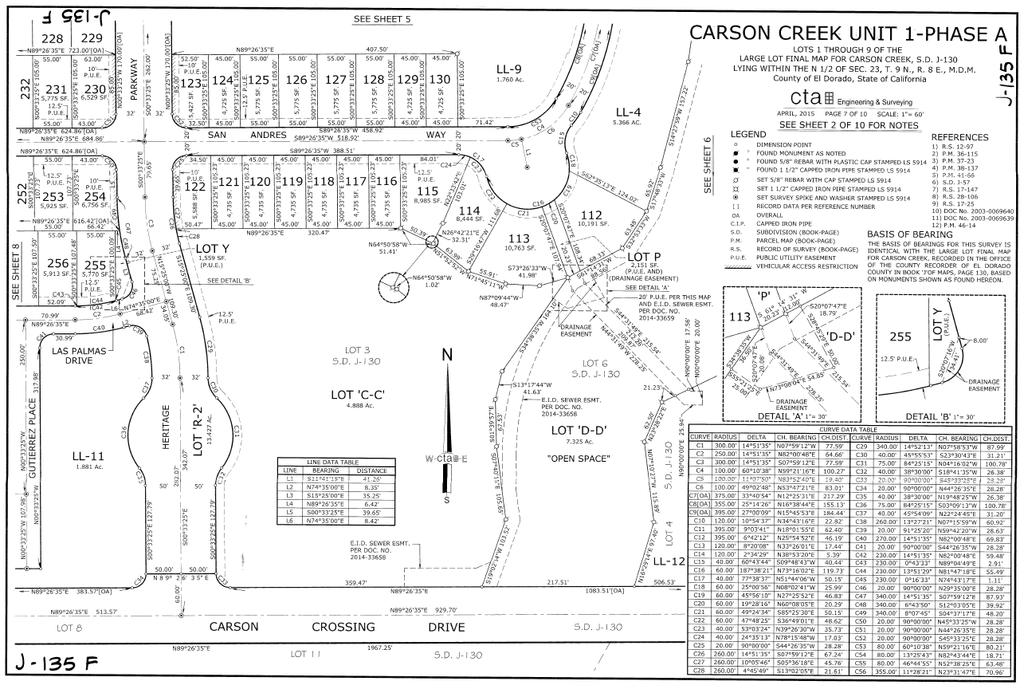
158 BRI BENDER ROSENTHAL, INC.

159 BRI BENDER ROSENTHAL, INC.

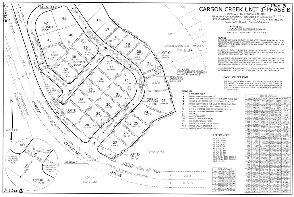
160 BRI BENDER ROSENTHAL, INC.

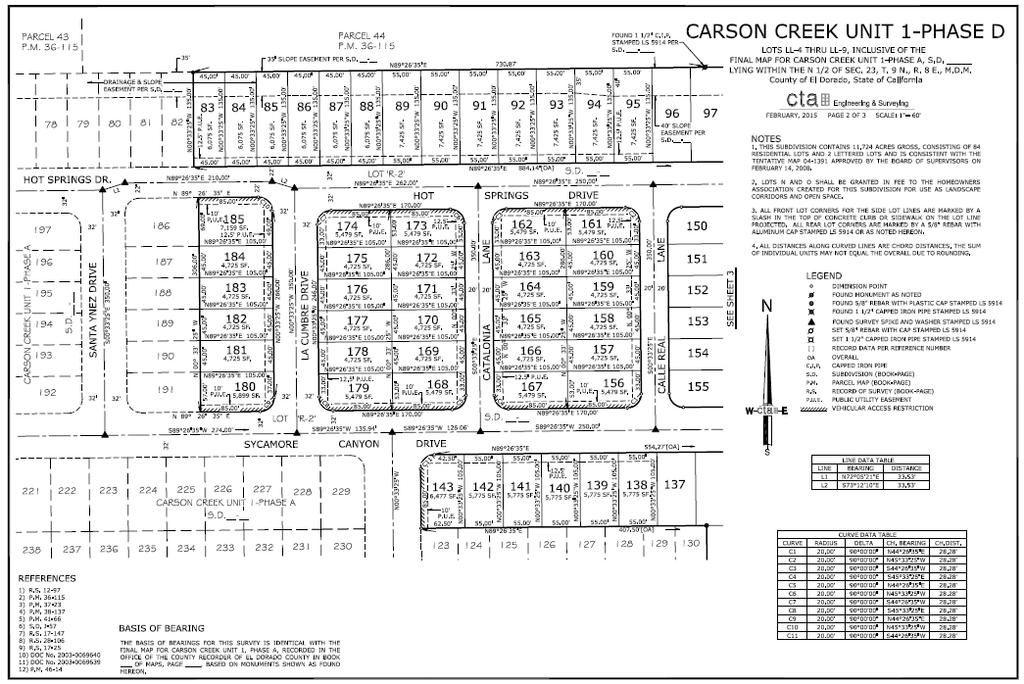
161 BRI BENDER ROSENTHAL, INC.

162 With regard to Unit 2, 171 lots within this Unit are expected to obtain final map status in September 2016, with an additional 140 lots within Unit 2 expected to receive final map approval in December The remaining 323 lots within Unit 2 are expected to have final map approval by June The single family residential lots within Unit 3 have tentative map approvals. However, it is noted that Lot 7 within Unit 3 (approximately 4 acres of multi-family residential land) has been final map approved. It should be noted that a portion of Unit 3 is designated for multi-family development. Identified as Lot 7 on the maps previously presented, this parcel is 4 acres in size and is located in the northeastern corner of the District. It is understood that Lot 7 is currently in contract to be purchased and is planned for the development of an assisted living facility. Discussions with a representative of the Planning Department indicated that a Special Use Permit is currently being processed for the assisted living project. BRI BENDER ROSENTHAL, INC.
163 The following is additional discussion of the general site information that pertains to the properties appraised within the District area: Census Tract: Census Tract No.: Assessor s Parcel Numbers: & ; thru -28; thru -51; thru -83; thru -53 Zoning: Surrounding Land Uses: Shape: Frontage / Access / Exposure: Topography: Soil Conditions: Utilities: The property appraised will accommodate a number of property uses including single-family residential, multi-family residential and public uses. Zoning designations are based upon the approved Carson Creek Specific Plan as well as the Development Agreement with the County of El Dorado. North Single-family Residential South Proposed Single-family Residential East Office/Industrial West Sacramento County/Future Development The property as a whole is irregular in shape. Current primary access to the general area of the parcels appraised is provided from Golden Foothill Parkway, which generally extends in an east/west direction along the northern boundary of the Carson Creek Specific Plan. This roadway provides direct access to Latrobe Road approximately 1/4 mile to the east. The topography of the property appraised ranges from relatively level to rolling in some areas. In general, the areas with the lowest elevation are concentrated within the center portion of the district that includes some wetlands/creek areas. No specific soil or subsoil survey was provided to the appraiser for the subject properties. There are no known major problems with building structures due to the soil conditions. All municipal utilities are available to the property. BRI BENDER ROSENTHAL, INC.
164 Flood Zone: Existing Site Improvements: Per FEMA maps, the property appraised is located in one flood zone identified as Flood Zone X. Flood Zone X is located outside both the 100 and 500 flood plains. This is information was obtained from the FEMA website, community number/panel 06017C 0725E and 0950E, dated September 26, As of the date of value, the site improvements associated with Unit 1 have been put in place along with the majority of Carson Crossing Drive and portions of the improvements associated with Unit 2/3. Further, a fitness center and related recreational improvements were complete within Unit 1. Lastly, at least 20 homes were under construction. Per information provided by a property representative, as of March of 2016, the direct construction costs associated with the taxable vertical improvements spent to date are estimated at $2,300,000 and 67 single-family residential building permits have been secured and paid for totaling $1,656,000. The single-family residential improvements and permits pulled are associated with those lots in Units 1A and 1B. Easements / Encroachments: Seismic Information: Preliminary title reports referencing portions of the property appraised were provided. Analysis of the preliminary title reports provided did not reveal any significant easements or encroachments that could have a negative impact on value. This report assumes that there are no easements/encroachments that could negatively impact value. The subject property is not within a Fault-Rupture Hazard Zone (formerly an Alquist-Priolo Special Studies Zone), according to Special Publication 42, "Fault-Rupture Hazard Zones in California", published by the California Department of Conservation, Division of Mines and Geology, revised No active faults are located on or in the proximity of the property. However, strong earthquakes generated along any of the active California faults may affect the site depending on the characteristics of the earthquake and the location of the epicenter. In general, the effects should be BRI BENDER ROSENTHAL, INC.
165 confined to shaking and/or acceleration (shock waves) and potential damage to structures should be minimized by employing adequate design and construction procedures. Because El Dorado County, and most of the State of California, is a seismically active region, the potential for earthquake-induced hazards must be acknowledged. However, the history of past earthquake activity does not indicate that El Dorado County is a particularly hazardous area. Current engineering design and construction practices, such as the Uniform Building Code, provide the opportunity to reduce earthquake related hazards. Cultural, Recreational, Historical Significance: External Influences: Permits and Fees: None known or suspected to be present. None significant Permits and fees will need to be paid prior to vertical construction. However, the amount of the permit and fee can vary depending upon the size and type of the improvements. A portion of the development fees are due at final map (namely El Dorado Irrigation District (EID) water and sewer fees). Based upon information provided by the El Dorado County Development Services Department the El Dorado Irrigation District, and the developer, the following table was created summarizing estimated fees associated with development of the various proposed product type within each lot size category. An average home size for each typical lot size was estimated and used in the calculation of estimated building permit fees: BRI BENDER ROSENTHAL, INC.
166 Permit and Fee Estimate for a Single Family Residence (Age-Restricted) 45'x105' Lots (1,543 sf) 55' x 105' Lots (2,100 sf) 65' x 105' Lots (2,740 sf) Floor Plan Permit/Fee Due at Final Map Approval EID Water Facility Capacity Charges $19,157 $19,157 $19,157 EID Wastewater Facility Capacity Charges $13,440 $13,440 $13,440 Other EID Charges $1,538 $1,538 $1,538 Sub-total $34,135 $34,135 $34,135 Due at Building Permit Building Services Fees $2,725 $3,431 $4,241 Misc. Fees $654 $664 $674 Fire/Police District Fees $1,790 $2,436 $3,178 Department of Transportation Fees* $10,690 $10,690 $10,690 Special District Fees $5,736 $5,736 $5,736 School District Fees (Buckeye Union)* $833 $1,134 $1,480 Sub-total $22,428 $24,091 $25,999 Total Permits & Fees $56,563 $58,226 $60,134 *Due to the age-restricted nature of the project appraised, it receives certain discounts associated with fees due at building permit. The Traffic Impact Mitigation Fee associated with the Department of Transportation is reduced to $10,690 per lot for the subject lots vs. $28,140 per lot for other projects. Further, the Buckeye Union school fee is reduced to $0.54 per square foot vs. $3.11 per square foot for other projects. It is noted that permit and fee information was not provided for the proposed lots associated with Unit 3. Based upon the product type that could be developed on these lots, permits and fees due at building permit are estimated at $21,000 per unit. In addition, discussions with a representative of the El Dorado Irrigation District revealed that multifamily units receive a 25% discount per unit. It follows that for the multi-family component of the subject property, the estimated EID fees are $25,601 per unit. BRI BENDER ROSENTHAL, INC.
167 Site Development Costs: As indicated previously, significant site improvements have been put in place as of the date of value. As provided by a representative of the owner, the total direct and indirect costs associated with development of the lands within the District are summarized as follows along with the remaining costs to complete the site development associated with the District: Site Development Costs Project Component Total Cost % Complete Remaining Cost Common Costs $5,861, % $2,338,851 Site Budget Unit 1 - Intracts $25,327, % $0 Unit 2 and 3 - Intracts $64,053, % $59,853,000 Parks/Amenities $1,800, % $1,790,000 Fitness Club - Unit 1 $6,516, % $0 Social Club - Unit 2 $5,462, % $5,462,932 Wetlands Mitigation (Unit 2) $1,300, % $1,300,000 Infrastructure Carson Crossing Drive $17,044, % $852,200 Total $127,365,098 $71,596,983 Total/SFR Unit $120, $67, Source: Property ownership, as of March 1, It is understood that the total costs represented in the table above include the estimated cost associated with the EID fees associated with the Single-family Residential component of the District. The reported remaining costs reflect the EID fees that have been paid as of the date of value (EID fees associated with 285 units within Unit 1 of the District) along with the additional site improvements in place. In addition, per the developer, the total costs indicated above include the partial payment of $4,337,500 towards the procurement of the 1,250 El Dorado Irrigation District FCC s. Final payment of the FCC s are due upon final map approval. Lastly, the costs above account for the estimated wetlands mitigation/permitting costs. Please see the extraordinary assumption #8. BRI BENDER ROSENTHAL, INC.
168 Property Tax Data: The property tax system in California was amended in 1978 by adding Article XIII to the state constitution, commonly referred to as Proposition 13. Under Proposition 13, real property assessment values were returned to March 1, 1975 levels, and properties are now appraised (i.e., reassessed) only when: A change in ownership occurs; or New construction is completed; or New construction is unfinished on March 1 st (lien date). Except for these three instances, property assessments cannot be increased by more than 2% annually. Also under Proposition 13, the property tax rate is stipulated to be 1% of a property s assessed value, plus any bonds or fees approved by the voters. It is also noted that, as of 1978, California voters passed Proposition 8, a constitutional amendment to Article XIII A that allows a temporary reduction in assessed value when real property suffers a decline in value. A decline in value occurs when the current market value of real property is less than the current assessed (taxable) factored base year value as of the lien date, January 1. The existing tax data for all existing parcels is not particularly germane to this report. Per information provided by the El Dorado County Tax Collector, as of the 2015/2016 tax year, the subject property falls into the tax code area identified as The rate for this tax code area is %. In addition, the anticipated annual special taxes to service the Community Facilities Districts bonds are applied in the subsequent analysis. As noted, the property appraised is located within the boundaries of the Community Facilities District No (Carson Creek) and will be encumbered by special taxes. BRI BENDER ROSENTHAL, INC.
169 Based upon information provided, the following table was created summarizing the special taxes within the District as of the 2015/2016 tax year: Development Phase Property Width (LF) (i.e. Lot Width) Planned Residential Lots Base Year Maximum Special Tax/Lot ( Tax Year) (Increases by 2% annually) Unit 1A to $1, to $1, or Greater 26 $2,142 Sub-Total 134 Unit 1B to $1, to $1, or Greater 47 $2,142 Sub-Total 47 Unit 1C to $1, to $1, or Greater 2 $2,142 Sub-Total 20 Unit 1D to $1, to $1, or Greater 14 $2,142 Sub-Total 84 Unit 2A to $1, to $1, or Greater 18 $2,142 Sub-Total 171 Unit 2B to $1, to $1, or Greater 32 $2,142 Sub-Total 140 Unit 2, Phase to $1, to $1, or Greater 48 $2,142 Sub-Total 323 Unit 3 Lot Acres Base Year Maximum Special Tax/Acre Lot 4* $10,710 Lot 7** $10,710 Source: CFD Development Summary provided by Lennar, dated October 9, 2015; Rate and Method of Apportionment and NBS. *Lot 4 is currently undergoing approvals for 140 single family residential lots. The base year maximum special tax per lot is therefore allocated at $1, ( acres times $10,710 per acre divided by 140 lots). **Lot 7 is planned for an assisted living facility. BRI BENDER ROSENTHAL, INC.
170 Potential Financed Facilities: The Facilities authorized to be financed for the County of El Dorado Community Facilities District No (Carson Creek) constitutes the following improvements: Roadway and Transportation Improvements. Includes on-site and off-site roadway and transportation facilities designed to meet the needs of development within the Community Facilities District. Includes, but not limited to, clearing, grubbing, existing pavement removal, excavation, grading, base material, paving, conspans, water supply facilities, joint trench facilities, curbs, gutters, sidewalk, street lights, interconnect, signage, striping, and all appurtenances thereto and utility relocation associated therewith, together with the acquisition of easements and/or property necessary for said construction, where required for the following public facilities (Including frontage improvements): Carson Crossing Drive From existing terminus in Phase I (Euer Ranch) to Golden Foothill Parkway. Carson Crossing Drive Con/Spans Investment Boulevard Extension Intersection and Signal Improvements. The construction, improvement and/or acquisition of signalized intersections together with all necessary appurtenances thereto required facilities designed to meet the needs of development within the Community Facilities District and the acquisition of easements and/or property necessary for the ultimate configuration of the intersections. Sanitary Sewer System. The construction, improvement and/or acquisition of sanitary sewer system improvements necessary to meet the needs of development within the Community Facilities District, including onsite and off-site sanitary sewer conveyance BRI BENDER ROSENTHAL, INC.
171 and collection facilities designed to meet the needs of development within the Community Facilities District. Includes, but not limited to, gravity sewer lines, manholes, forcemains, potential lift station, trenching, shoring and bracing, backfill material, potential pipe boring and jacking, odorcontrol facilities and related wastewater improvements thereto, including easements and/or property acquisitions, where required. Drainage System. The construction, improvement and/or acquisition of storm drainage system improvements necessary to meet the needs of development within the Community Facilities District, including onsite and off-site drainage and storm water conveyance and collection facilities designed designed to meet the needs of development within the Community Facilities District. Includes, but not limited to, pipelines and appurtenances, box culverts, outlet structures, drainage channels, detention basins, temporary drainage facilities, water quality improvements (including basins), erosion control, pump stations, pumps, related drainage system improvements and roadway replacement as needed and all appurtenances thereto, including easements and/or property acquisitions, where required. Potable Water Systems. The construction, improvement and/or acquisition of any and all necessary potable water systems required to meet the needs of development within the Community Facilities District, including onsite and off-site water conveyance and storage facilities designed to meet the needs of development within the Community Facilities District. Includes, but not limited to, water lines, transmission mains, valves, trenching, backfill, storage reservoirs with pressure booster plant & control building and all appurtenances thereto, including easements and/or property acquisitions, where required. BRI BENDER ROSENTHAL, INC.
172 Community Facilities District Reclaimed Water Systems. The construction, improvement and/or acquisition of any and all necessary reclaimed water systems required to meet the needs of development within the Community Facilities District, including on-site and off-site water conveyance and storage facilities designed to meet the needs of development within the Community Facilities District. Includes, but not limited to, water lines, transmission mains, valves, trenching, backfill, storage reservoirs with pressure booster plant & control building and all appurtenances thereto, including easements and/or property acquisitions, where required. Landscaping Improvements. Includes landscaping improvements designed to serve the needs of development within the Community Facilities District, including, but not limited to, grading, turf and irrigation, trees and shrubs, sidewalks, pathways and trails, masonry sound walls, entry monumentation and signage, and other related hard and soft-scape improvements along roadways and adjacent to or within parks, open space, drainage channels and detention basins. Development Impact Fees El Dorado Hills Road Impact Fees (RIF) El Dorado Hills Fire Impact Fees El Dorado Hills Community Services District Park Impact Fees Buckeye Union & El Dorado High School District Impact Mitigation Fees El Dorado Irrigation District Water Facility Capacity Charge (Connection Fees) El Dorado Irrigation District Sewer Facility Capacity Charge (Connection Fees) BRI BENDER ROSENTHAL, INC.
173 Parks and Trails. Includes park and trail improvements designed to serve the needs of development within the Community Facilities District. Other Public Improvements. Any and all other public improvements authorized under the Mello-Roos Community Facilities Act of 1982 and otherwise necessary to meet the needs of development within the Community Facilities District. Soft Costs. Any and all soft costs for the facilities described herein including, but not limited to, preliminary engineering, environmental review, engineering, plan checking, construction staking, construction management, construction inspection and contingencies. Formation, Administrative, and Incidental Expenses. All incidental expenses as authorized by the Mell-Roos Community Facilities Act of 1982, including, but not limited to, costs associated with the creation of the CFD, and issuance of bonds; determination of the amount of taxes, collection of taxes and payment of taxes; costs otherwise incurred in order to carry out the authorized purposes of the CFD; reimbursements to other areas for infrastructure facilities or planning purposes serving development in the CFD; and any other expenses incidental to the construction, completion, and inspection of the facilities and related expenses associated with any of the foregoing. BRI BENDER ROSENTHAL, INC.
174 Community Facilities District (Carson Creek) Estimated Bond Proceeds: Based upon information provided from Stifel Nicolaus & Co. Inc, the estimated bond proceed amount is $9,300,000. This appraisal assumes that the estimated bond proceed amount provided is reasonably accurate. PROPOSED PROJECT DISCUSSION Planned Residential Development. The general information presented previously pertains to the District area as a whole. As proposed, the future taxable developments within the District will be comprised of single-family residential of various densities and multi-family land. The following is a discussion of each proposed residential product type. 45 x 105 Lots: Both Units 1 and 2 will offer this product type which will have a typical lot size of 4,725 square feet. Between both units combined, there will be a total of 472 lots. Most of the lots will be of a typical rectangle shape. As proposed by the developer, future floor plans to be built on these lots will range from approximately 1,200 square feet to 1,800 square feet. 55 x 105 Lots: Both Units 1 and 2 will offer this product type which will have a typical lot size of 5,775 square feet. Between both units combined, there will be a total of 257 lots. Most of the lots will be of a typical rectangle shape. As proposed by the developer, future floor plans to be built on these lots will range from approximately 1,800 square feet to 2,400 square feet. 65 x 105 Lots: Both Units 1 and 2 will offer this product type which will have a typical lot size of 6,825 square feet. Between both units combined, there will be a total of 190 lots. Most of the lots will be of a typical rectangle shape. As proposed by the developer, future floor plans to be built on these lots will range from approximately 1,800 square feet to 2,400 square feet. BRI BENDER ROSENTHAL, INC.
175 Unit 3-60 x 65 Lots: Unit 3 will offer 140 single-family residential lots. Per information provided a property contact, the typical lot will be 60 feet wide by 65 feet in depth, or a total of 3,900 square feet. The housing product type that will be developed on this lot type will range in size from approximately 1,300 to 1,500 square feet. Multi-Family Parcel: A component of the overall development is a 4 acre parcel zoned for multi-family uses. This parcel is identified as Lot 7 on the map presented previously. Per the Carson Creek Specific plan, this parcel has an allowable density ranging from 5 to 24 units to the acre. It is estimated that the parcel could accommodate 96 attached units. This portion of the subject is currently in contract to be purchased. The buyer is planning on developing an assisted living facility on the site and a special use permit is currently being processed with the County for that use. Planned Project Amenities: HOA s: In addition to the single-family and multi-family land uses previously described, the project will also incorporate a variety of open space, trails and park uses in addition to recreation amenities that are typical of similar age-restricted projects. As planned, Unit 1, as shown on the map presented previously, will also be improved with a 5,000 square foot fitness center that will include tennis courts, swimming pool/spa, a Pickle Ball court, a Bocce ball court and other uses. Unit 2 will incorporate an approximate 6,000 square foot social clubhouse that will contain meeting and activity rooms, a pool/spa and a snack bar facility. Reported HOA s are $220 per month per unit. OVERALL COMMENTS The property appraised is a portion of the and will be an age-restricted (55+) residential project that will incorporate 1,059 single-family residential lots along with 4 acres of multi-family land. The design of the project will also include multiple parks, trails and open space areas along with recreational amenities (i.e. clubhouse, fitness center, etc.) that are typical BRI BENDER ROSENTHAL, INC.
176 of a project of this type. The subdivision is positioned in the highly desirable area of El Dorado Hills and has very limited competition in the immediate area. The location, design, and market conditions for the proposed product type should assist in maintaining property values over the foreseeable future. As of the date of value, a significant portion of the site and other improvements associated with Unit 1 of the project have been installed. Further, vertical improvements were under construction which included 20 single-family residences and a fitness center and related recreational improvements. BRI BENDER ROSENTHAL, INC.
177 VII. HIGHEST AND BEST USE ANALYSIS Highest and best use may be defined as the reasonably probable use of property that results in the highest value. 11 There are four criteria used in the highest and best use analysis process. These are: 1. Legally Permissible Use. What uses are permitted legally under existing zoning, building codes, historic district controls, environmental regulations, deed (private) restrictions, and long-term lease provisions on the site in question? 2. Physically Possible Use. What uses of the site are physically possible, given its size, shape, area, terrain, soils composition, accessibility, assembly potential, and risk potential from natural disasters? 3. Financially Feasible Use. Which possible and permissible uses will produce a positive net return to the owner of the property? 4. Maximally Productive Use. Among the feasible uses, which use will produce the highest residual land value consistent with the rate of return warranted by the market for that use? HIGHEST AND BEST USE OF THE SITE (AS VACANT) Legally Permissible Uses. Possible uses are constrained by legal restrictions on a property both private and public. The subject properties are located in the, and legal development opportunities are largely guided by this plan and the associated development agreement. Per information provided by a representative of the El Dorado County Planning Department, land uses associated with those properties appraised include a combination of singlefamily and multi-family uses. Permitted residential developments include a broad range in density. Based upon the approvals granted, development of a combination of single and multi-family projects are legally permissible. The reader should note that the property appraised is also subject to a Settlement Agreement which requires the proposed units to be age-restricted. Physically Possible Uses. The size, topography, and location of the subject are important factors in determining the use of the property. The size of the site can significantly affect the type of development that is possible, as the economies of scale notion often comes into play. The general area compares favorably to the surrounding region in regards to desirability for residential uses. As a whole, the property appraised is irregular in shape and has a level to rolling topography. Nearby property uses are a combination of single-family residential developments (age restricted projects to the north) and industrial/commercial developments. A residential development would be in conformance with the surrounding projects. Based upon surrounding developments, the soil appears to adequately support residential development. External factors (beyond current market conditions) were not apparent that would create a negative developmental impact on the property. An age restricted residential use of the site appraised is considered to be physically possible. 11 The Appraisal of Real Estate, Appraisal Institute, 14th Edition, Pages BRI BENDER ROSENTHAL, INC.
178 Financially Feasible Uses. The most probable use of the subject consists of developing it in accordance with the specific plan requirements. There continues to be demand for housing in the area based upon an analysis of sales within competing projects in the market area. This demand continues given the lower cost of housing relative to the Bay Area, as well as the appeal of the El Dorado Hills community. Most subdivisions in the El Dorado Hills market area are exhibiting average absorption rates ranging from approximately 1 to 3 units per month. Analysis of agerestricted communities in the Region indicate that absorption associated with these communities is generally stronger than typical non-age restricted projects which typically range from 2 to 11 units per month. In addition, the development fees associated with an age-restricted community are less than that of a non-age restricted project and net base price points for new homes currently selling within Carson Creek range from the high $300,000 s to the low $600,000 s. Given costs of construction, sales prices of new homes and absorption, immediate development of an age-restricted community is financially feasible. Maximally Productive Use / Conclusion. Immediate development of an age-restricted residential project in accordance with the is the maximally productive use of the subject. The most probable buyer of the property would be one or more home builders. HIGHEST AND BEST USE OF THE SITE (AS IMPROVED) As of the date of value, development of the lands within the District had begun. Improvements include street and utility construction associated with Unit 1 along with vertical improvements associated with one of the community centers, recreational amenities and single-family residences. The improvements as being developed are consistent with the concluded highest and best use as vacant and a significant portion of the planned residential units are currently in contract. It follows that the highest and best use as improved is for completion of the partially completed homes and other project amenities and continued development of an age-restricted community as market conditions permit. BRI BENDER ROSENTHAL, INC.
179 VIII. VALUATION ANALYSIS Community Facilities District VALUATION METHOD AND CONSIDERATIONS The initial stages of the appraisal process include the investigation, organization, and analysis of relevant market data and other information that relate to the market value of the subject property. Factors discussed previously that influence value include the Sacramento Region demographics and economic conditions, neighborhood characteristics and features, the market for residential and commercial land, and subject property attributes. All of these need to be considered when rendering the highest and best use conclusion. After a highest and best use conclusion has been made, the possibilities for the property have been sufficiently narrowed so that a proper valuation process can be pursued. This section of the report contains the comparable data, the interpretation, analysis, and processing of these data and the conclusions reached about the property s market value. An appraisal of an improved property typically utilizes up to three valuation approaches: The Cost Approach to value The Sales Comparison Approach to value The Income Capitalization Approach to value The Cost Approach to value usually involves estimation of the land value through the sales comparison approach. Then, we estimate the replacement cost of the improvements as if they were new, less a deduction for depreciation, which is computed after analyzing the deficiencies or disadvantages of the existing building compared to a new building. This approach can be a reliable indicator of value when the improvements are new or relatively new and are proper improvements for the site, and estimated depreciation is not an issue. In the case of the properties appraised, given the building improvements are not valued, this approach is not relevant to this analysis. The Sales Comparison Approach to value involves the accumulation of sales data of comparable properties, the analysis of each sale, and the adjustment to each sale for conditions such as favorable seller financing, changes in market conditions, and dissimilar physical or other characteristics. Several relevant bulk sales of other production lots and multi-family land were identified and considered. This approach is applicable to this assignment. The Income Approach to value is based on the assumption that there is a relationship between the amount of income a property will produce and its value. Usually, we estimate the annual net income the property will earn and convert it into value by a capitalization process. This process is accomplished by dividing the net income, before payment of debt service, by a capitalization rate determined from the market or through the use of a discounted cash flow analysis and the estimation of a yield rate. This rate will vary as a result of such factors as risk, time, interest or capital investment, and recapture of the depreciating asset. As part of this assignment, discounted cash flow analyses will be employed. BRI BENDER ROSENTHAL, INC.
180 The valuation analysis will involve several different components. First, the analysis will address the value of the production housing lots. The production lots will be valued using both the Sales Comparison analysis as well as a discounted cash flow analysis. The bulk lot value indication from each valuation method will then be reconciled into a final bulk lot estimate. Then, the valuation of the multi-family land will be presented. The valuation of the property as a whole will be provided using a discounted cash flow analysis and will consider the contributory value associated with the improvements in place as of the date of value. That analysis assumes that the owner of the property would sell off portions of the project in typical bulk lot Units commonly observed in the market place to production home builders. Lastly, the allocated amount of Unit 1 as a whole will also be estimated along with the allocated amounts of Units 1A and 1B. MARKET VALUE OF THE PRODUCTION LOTS As discussed previously, there are four different production lot types that will be developed within the District. The lot types differ primarily by size and include lots of 3,900; 4,725; 5,775; and 6,825 square feet. For the purposes of the following analysis, the lots with a typical lot size of 5,775 square feet will be valued and used as a benchmark to value the remaining lots within the project. The most relevant approach to value involves a direct sales comparison of the subject lots to other bulk sales of production home lots. Analysis of the market revealed several bulk sales of production single-family residential lots occurring in the Region during the course of the 2013, 2014, and 2015 years. Of the sales observed, the most relevant comparables were selected for analysis. However, the reader should note that none of the sales observed in the market are agerestricted projects. This fact is considered in the bulk lot value conclusion at the end of this section. Data on these land sales have been obtained for this analysis and are summarized in the table on the following page. The relevant unit of comparison is the price per lot, which is consistent with the market. It should be noted that only several transactions of bulk lots were identified in the El Dorado Hills area specifically. As such, the search was expanded geographically into competitive market areas in order to form a relevant data set. Further, the sales identified were in various stages of development (i.e. finished lots, paper lots, partially finished, etc.). For comparison purposes, the sales were adjusted where necessary in order to reflect finished lot status. As will be shown later in this report, adjustments were applied to the bulk finished lot value in order estimate the market value of the lots upon completion of the infrastructure funded by the land secured financing. The comparable sales table and map are shown on the following page. BRI BENDER ROSENTHAL, INC.

181 COMPARABLE BULK LOT LAND SALES SUMMARY Summary of Bulk Production Lot Land Sales Comp # Property Identification Sale Date Sale Price Typical Lot Size SF Number of Lots Cash Equalivent Price per Lot S-1 S-2 S-3 Finished Lots NWQ of North Hayden Parkway and Fiddyment Road, Roseville, CA Paper Lots SEQ of Pleasant Grove Boulevard and Westbrook Roseville, CA Partially Finished Lots Along Brentford Way and Keystone Drive Jul-15 May-15 Dec-14 $ 7,980,000 $ 12,377,000 $ 26,631,250 5,775 5,500 19, $133,000 $78,834 $132,494 S-4 S-5 El Dorado Hills, CA Finished Lots Portion of Village K-5 of Serrano El Dorado Hills Paper Lots NEC of Brentford Way and Royal Oaks Drive Dec-13 Dec-13 $ 11,500,000 $ 10,412,000 10,000 7, $230,000 $144,611 S-6 El Dorado Hills Paper Lots E/O Latrobe Road, S/O Blackstone Parkway El Dorado Hills Mar-13 $ 8,550,000 12, $75,000 COMPARABLE RESIDENTIAL LAND SALES MAP BRI BENDER ROSENTHAL, INC.
 5,775 Topography Level Streets To Site Off-site Improvements To Site On-site Improvements None Utilities")
182 COMPARABLE LAND SALES DATA SHEETS LAND SALE 1 LOCATION Description Finished Lots Address/Location NWQ of North Hayden Parkway and Fiddyment Road, Roseville, CA APN PROPERTY CHARACTERISTICS Zoning RS/DS Property Use Residential Number of Lots 60 Typical Lot Size (SF) 5,775 Topography Level Streets To Site Off-site Improvements To Site On-site Improvements None Utilities To Site Location Good Access Average Map Status Tentative Map SALES DATA Grantor GBD Fiddyment Lands LP Grantee John Mourier Construction, LP Sale Status Closed Document Number Sale Date Jul-15 Sale Price $7,980,000 Cash Equivalent $7,980,000 Property Rights Fee Simple Terms Cash Equiv. Sale Conditions At Market Price per Unit $133,000 Permits & Fees $60,000 Improvement Costs per Lot $0 PV Bonds per Lot $23,000 COMMENTS This purchase is effectively for 60 finished lots. The purchase price was for $7,950,000. However, the buyer reportedly had an expenditure after sale of approximatetly $30,000 ($500 per lot) to comply with SWPPP. Thus, the effective purchase price is $7,980,000 or $133,000 per finished lot. BRI BENDER ROSENTHAL, INC.
183 LAND SALE 2 LOCATION Description Paper Lots Address/Location SEQ of Pleasant Grove Boulevard and Westbrook Boulevard, Roseville, CA APN & 006 PROPERTY CHARACTERISTICS Zoning RS/DS Property Use Residential Number of Lots 157 Typical Lot Size (SF) 5,500 Topography Level Streets To Site Off-site Improvements To Site On-site Improvements None Utilities To Site Location Good Access Average Map Status Tentative Map SALES DATA Grantor Westpark Communities Grantee Woodside Homes Sale Status Closed Document Number N/Av. Sale Date May-15 Sale Price $12,377,000 Cash Equivalent $12,377,000 Property Rights Fee Simple Terms Cash Equivalent Sale Conditions At Market Price per Unit $78,834 Permits & Fees $60,000 Improvement Costs per Lot $45,000 PV Bonds per Lot $27,000 COMMENTS This is the purchase of two adjacent villages, 5A and 5B within Solaire within the Westbrook plan area. Village 5A is comprised of 71 paper lots with dimensions of 50'x100' (5,000 square feet). Village 5B is comprised of 86 paper lots with dimensions of 60'x 100' (6,000 square feet). It was reported that the purchase amount for Village 5A was $5,325,000 and the purchase amount for 5A was $7,052,000. The purchase price mentioned above is the combined total of the two villages. This property is encumbered by Mello-Roos special taxes with an estimated annual payment per lot of $1,580 and is within the City of Roseville Westbrook CFD #1. BRI BENDER ROSENTHAL, INC.
184 LOCATION Description Address/Location APN LAND SALE 3 Partially Finished Lots Along Brentford Way and Keystone Drive El Dorado Hills, CA et al. PROPERTY CHARACTERISTICS Zoning SFR Property Use Residential Number of Lots 201 Typical Lot Size 19,000 Topography Level to rolling Streets To Site Off-site Improvements To Site On-site Improvements None Utilities To Site Location Good Access Average Map Status Approved FM SALES DATA Grantor Landsource Holding Company Grantee Lennar Homes of California Sale Status Closed Document Number & & Sale Date Dec-14 Sale Price $26,631,250 Cash Equivalent $26,631,250 Property Rights Fee Simple Terms Cash Sale Conditions At Market Price per Unit $132,494 Permits & Fees $53,000 Improvement Costs per Lot $54,354 PV Bonds per Lot $42,000 COMMENTS This sale invovled the purchase of 201 lots within three take downs in the 2014 year. The first occurred in March of 2014 for $9,500,000, the second in June of 2014 for $7,631,250 and the third in December of 2014 for the remaining $9,500,000. The lots were partially finished at the time of sale. The remaining cost to finish the lots were $54,354 per lot. Lots within this subdivision range from 11,326 square feet over 120,000 square feet. However, most lots within the property range from approximately 12,000 to 30,000 square feet. The average lot size is estimated at about 19,000 square feet. BRI BENDER ROSENTHAL, INC.
185 LOCATION Description Address/Location APN LAND SALE 4 Finished Lots Portion of Village K-5 of Serrano El Dorado Hills , 30 (a portion of these orignal parcels) PROPERTY CHARACTERISTICS Zoning R1 Property Use Residential Size (Acres) N/Ap Size (SF) N/AP Number of Lots 50 Density (Units/Acre) N/Ap Typical Lot Size 10,000 Topography Rolling Streets To Site Off-site Improvements To Site On-site Improvements None Utilities To Site Location Good Access Good Map Status Approved FM SALES DATA Grantor Parker Development Company Grantee Taylor Morrison Sale Status Closed Document Number Sale Date Dec-13 Sale Price $11,500,000 Cash Equivalent $11,500,000 Property Rights Fee Simple Terms Cash Equivalent Sale Conditions At Market Price per Unit $230,000 Permits & Fees $42,000 Improvement Costs per Lot $0 PV Bonds per Lot $22,000 Total Cost per Lot $230,000 COMMENTS This property is located in the master planned community of Serrano. The transaction was a cash deal with no unusual conditions of sale reported. The buyer is a production home builder interested in building production high end housing product. The lots included in the bulk purchase are located in Village K-5 in the Serrano Master Planned Community. It is understood that the buyer closed on the property when they were in a paper lot condition at the end of the 2013 year. The seller then put in the in-tract improvements and the buyer reimbursed the seller for the cost of the in-tracts in the 2014 year. The purchase price of $11,500,000 indicated above (or $230,000 per lot) reflects the entire purchase price for the 50 finished lots. The lots range in size from approximately 9,000 square feet to over 17,000. The typical lot size is estimated at 10,000 square feet. It is understood that the final map has been recorded, however, it was not available as of this writing. BRI BENDER ROSENTHAL, INC.
186 LAND SALE 5 LOCATION Description Paper Lots Address/Location NEC of Brentford Way and Royal Oaks Drive El Dorado Hills APN thru 72 PROPERTY CHARACTERISTICS Zoning SFR Property Use Residential Size (Acres) N/Ap Size (SF) N/AP Number of Lots 72 Density (Units/Acre) N/Ap Typical Lot Size 7,000 Topography Rolling Streets To Site Off-site Improvements To Site On-site Improvements None Utilities To Site Location Good Access Good Map Status Approved FM SALES DATA Grantor Landsource Holding Co LLC Grantee KB Home Sacramento Inc Sale Status Closed Document Number Sale Date Dec-13 Sale Price $10,412,000 Cash Equivalent $10,412,000 Property Rights Fee Simple Terms Cash Equivalent Sale Conditions At Market Price per Unit $144,611 Permits & Fees $26,000 Improvement Costs per Lot $52,000 PV Bonds per Lot $42,000 COMMENTS This property is located in the master planned community of Blackstone. Per an informed source, the purchase price included some pre-paid fees. The permits and fee remaining were estimated at $26,000 per lot. The lots were purchased in a blue-top paper lot condition and the remaining costs to finish were estimated at $52,000 per lot. Lot sizes range from about 6,400 square feet to over 20,000 square feet. However, the typical lot size is estimated at 7,000 square feet. BRI BENDER ROSENTHAL, INC.
187 LOCATION Description Address/Location APN LAND SALE 6 Paper Lots E/O Latrobe Road, S/O Blackstone Parkway El Dorado Hills et al. PROPERTY CHARACTERISTICS Zoning ER-2 Property Use Residential Size (Acres) N/Ap Size (SF) N/AP Number of Lots 114 Density (Units/Acre) N/Ap Typical Lot Size 12,500 Topography Level Streets To Site Off-site Improvements To Site On-site Improvements None Utilities To Site Location Good Access Good Map Status Approved TM SALES DATA Grantor Landsource Holding Company, LLC Grantee Standard Pacific Corporation Sale Status Closed Document Number Sale Date Mar-13 Sale Price $8,550,000 Cash Equivalent $8,550,000 Property Rights Fee Simple Terms Cash Equivalent Sale Conditions At Market Price per Unit $75,000 Permits & Fees $55,500 Improvement Costs per Lot $57,368 PV Bonds per Lot $42,000 COMMENTS This property is located in the Blackstone master planned community. The sale involved the transfer of 114 blue top lots. However, it was reported that 53 of the lots had additional underground water, storm drainage and sewer facilities installed. Although not all of the contributory costs of the additional infrastructure was realized, it was reported that some value associated with these improvements were included in the sale price. The buyer paid cash and no unusual conditions of sale were reported. The sale of the property involved an open bidding process. The permit and fee amount indicated above includes approximately $2,000,000 in reimbursements paid to the seller for initial backbone infrastructure fee costs and approximately $38,000 per lot in additional building permits and fees. The estimated present worth of the bonds were based upon annual tax payments researched. Current research of this property as of the 2014 year revealed that the subdivision is actively selling homes with price ranges from the high $600,000's to the mid $700,000's. The subdivision map presented above represents a portion of the lots included in this transaction. BRI BENDER ROSENTHAL, INC.
188 DESCRIPTION OF ADJUSTMENTS Adjustments to the comparable sales are considered for property rights transferred, market conditions, additional buyer expenditures, financing, conditions of sale, zoning and the physical characteristics/locale of each comparable. The adjustment considerations are discussed on the following pages: Property Rights: Financing Terms: Conditions of Sale: Market Conditions: All transactions were Fee Simple, therefore no adjustments were warranted. Cash equivalent, favorable seller financing, or assumption of below market mortgage. No adjustments were warranted; all of the transactions were cash equivalent. Reflects the additional motivation of the seller(s) or buyer(s), real estate owner (REO) transactions, and bulk sales. All sales were market transactions, no adjustments were necessary. Analysis of the market for production single-family residential lots over the course of the last several years revealed that there has been fluctuations in the market. Over the course of the latter half of 2012 and through the middle of the 2013, price points for new homes, demand for residential land, and consequently price points for residential land increased significantly. However, it is noted that the greatest price increases occurred during the first 6 months of the 2013 year. As of the middle of the 2013 year (May/June 2013) several factors changed in the market area. First, lending interest rates spiked from approximately 3.5% to 4.5%. Although rates were still low by historical standards, the approximate 30% increase in rates effectively priced a portion of the potential new home buyers out of the market. Consequently, absorption associated with some new home projects in the region slowed. Second, many of the new home builders purchasing lots in the beginning of the 2013 year acquired at least several years worth of supply. Given ample supply of lots held by builders and a BRI BENDER ROSENTHAL, INC.
189 cautious outlook to future market conditions given changes in rates, the demand for residential lots began to wane after the middle of the 2013 year. Consequently, the volume of bulk lot sales diminished as did reported price points. Although there are limited bulk lot sales occurring in 2015, and new homes sales activity has been accelerating in the first half of the 2015 year, discussions with brokers and buyers alike active in the market revealed that current price points for bulk residential land are at least 10% to 20% less than price points observed in the first half of the 2013 year. The bulk sales used in this analysis range in date of sale from March of 2013 to July of One comparable sold in March of 2013 when market conditions were rapidly appreciating. This comparable is adjusted downward by 20% to reflect changes in market conditions. With regard to the comparables that sold in the latter half of the 2013 year, adjustments were applied at 10% downward to reflect changes in market conditions. The sales that occurred in the 2014 and 2015 years transacted after the reported decline in price points and are therefore not adjusted. PHYSICAL CHARACTERISTICS Number of Lots: Typical Lot Size: This analysis assumes a typical Unit size of 100 lots. With regard to the total number of lots, the property appraised is similar to that of the comparables. No significant adjustment for this category is merited. Typically, premiums are paid for larger lots, albeit at a decreasing rate. Lot premiums have been observed ranging from about $2 to over $10 per square foot in Region. The subject lots are typically 5,775 square feet. Based upon the range an adjustment of $5 per square foot is applied. BRI BENDER ROSENTHAL, INC.
190 Topography: Location: Access: Map Status: Costs to Finish: Permits and Fees: Portions of the subject lots vary with regard to topography. However, restrictions to development with regard to topography do not appear to be a significant issue. None of the comparables have issues with topography that restrict development. Therefore, no adjustments were made for this category. Surrounding uses, and economic, and demographic characteristics of the immediate area, proximity and conformity to local businesses, including positioning along major thoroughfares or interior streets, proximity to new subdivisions, and average home prices for each respective neighborhood are considered. The property appraised is considered to be within a good location within El Dorado Hills. Some of the comparables are considered to be in inferior locations based upon surrounding developments and home prices. Although a quantitative adjustment was not applied for location differences, qualitative consideration is given in the final valuation analysis. All of the comparables have similar access, therefore, no adjustments for this category is merited. This analysis assumes that the subject lots are in a mapped condition. The analysis of the subject assumes a finished lot condition. In some cases, the comparables used were purchased in either a paper lot, or partially finished condition. Adjustments were applied to the comparables where applicable to account for the estimated remaining costs to finish the lots. Average permits and fees for the subject and the comparables were estimated. Adjustments were applied on a dollar for dollar basis. It is noted that consideration is given to the relatively reduced fee structure associated with the subject given the agerestricted status. BRI BENDER ROSENTHAL, INC.
191 Special Taxes: Absorption: The production lots appraised and the comparables are encumbered by special taxes. The present worth of the special taxes was estimated for the subject and for the comparables. The present worth was estimated based upon the annual special tax amount, the term of the special tax and an estimated 4% discount rate. Adjustments were applied to the comparables based upon the observed difference in the present worth of the bonds. All of the comparable data used in this analysis are associated with non-age restricted projects. The property appraised is age-restricted. Analysis of the market revealed that age-restricted projects typically absorb at a faster rate than non-age restricted developments. All of the comparable are considered inferior to the subject in this regard. Although a quantitative adjustment was not applied, this characteristic is considered in the final valuation analysis. The adjustment grid is presented on the following page: BRI BENDER ROSENTHAL, INC.
192 Address/Location Subject Carson Creek Specific Plan - Production Lots El Dorado Hills PRODUCTION LOT LAND SALES ANALYSIS - 5,775 SF TYPICAL LOT SIZE S-1 S-2 S-3 S-4 S-5 S-6 NWQ of North Hayden Parkway SEQ of Pleasant Grove Boulevard Along Brentford Way and NEC of Brentford Way and Royal E/O Latrobe Road, S/O Blackstone and Fiddyment Road, and Westbrook Boulevard, Keystone Drive Portion of Village K-5 of Serrano Oaks Drive Parkway Roseville, CA Roseville, CA El Dorado Hills, CA El Dorado Hills El Dorado Hills El Dorado Hills Sale Price ~ $7,980,000 $12,377,000 $26,631,250 $11,500,000 $10,412,000 $8,550,000 Price per Lot ~ $133,000 $78,834 $132,494 $230,000 $144,611 $75,000 Comparison Comparison Adj. Comparison Adj. Comparison Adj. Comparison Adj. Comparison Adj. Comparison Adj. Property Rights Fee Simple Fee Simple Fee Simple Fee Simple Fee Simple Fee Simple Fee Simple Adjusted Price Per Lot $ 133,000 $ 78,834 $ 132,494 $ 230,000 $ 144,611 $ 75,000 Terms Cash Equivalent Cash Equiv. Cash Equiv. Cash Equiv. Cash Equiv. Cash Equiv. Cash Equiv. Adjusted Price Per Lot $ 133,000 $ 78,834 $ 132,494 $ 230,000 $ 144,611 $ 75,000 Sale Conditions At Market At Market At Market At Market At Market At Market At Market Adjusted Price Per Lot $ 133,000 $ 78,834 $ 132,494 $ 230,000 $ 144,611 $ 75,000 Sale Date Appraisal Jul-15 May-15 Dec-14 Dec-13-10% Dec-13-10% Mar-13-20% Adjusted Price Per Lot $ 133,000 $ 78,834 $ 132,494 $ 207,000 $ 130,150 $ 60,000 Physical Characteristics Comparison Comparison Adj. Comparison Adj. Comparison Adj. Comparison Adj. Comparison Adj. Comparison Adj. Zoning CCSP RS/DS RS/DS SFR R1 SFR ER-2 Property Use Residential Residential Residential Residential Residential Residential Residential Number of Lots Varies Typical Lot Size 5,775 5,775 $ - 5,500 $ 1,375 19,000 $ (66,125) 10,000 $ (21,125) 7,000 $ (6,125) 12,500 $ (33,625) Topography Level Level Level Level to rolling Rolling Rolling Level Streets To Site To Site To Site To Site To Site To Site To Site Off-site Improvements To Site To Site To Site To Site To Site To Site To Site On-site Improvements None None None None None None None Utilities To Site To Site To Site To Site To Site To Site To Site Location Average Inferior Inferior Similar Similar Similar Similar Access Average Similar Similar Similar Similar Similar Similar Costs To Finish $0 $0 $0 $45,000 $45,000 $54,354 $54,354 $0 $0 $52,000 $52,000 $57,368 $57,368 Remaining Permits & Fees $24,091 $60,000 $35,909 $60,000 $35,909 $53,000 $28,909 $42,000 $17,909 $26,000 $1,909 $55,500 $31,409 Bonds $33,500 $23,000 -$10,500 $27,000 -$6,500 $42,000 $8,500 $22,000 -$11,500 $42,000 $8,500 $42,000 $8,500 Absorption Age-restricted Inferior Inferior Inferior Inferior Inferior Inferior Total Physical Adjustment $ 25,409 $ 75,784 $ 25,638 $ (14,716) $ 56,284 $ 63,652 Indicated Price Per Lot $ 158,409 $ 154,618 $ 158,132 $ 192,284 $ 186,434 $ 123,652 BRI BENDER ROSENTHAL, INC.
193 Conclusion of the Sales Comparison Approach Production Single-family Finished Residential Lots 5,775 SF Typical Lot Size. After adjustments, the comparables indicate a range from $123,652 to $192,284 per finished lot. The sales exhibit a broad range in value with some of the comparables varying with regard to location, date of sale and entitlement status. However, it is noted that all of the comparables differ from the subject with regard to age-restricted status. As indicated previously in this report, supply of this product type in the market area, and in the Region in general, is very limited. Further, analysis of other age-restricted projects indicated that absorption is relatively faster that non-age restricted projects. Although land sales data with age-restrictions is limited, a typical buyer of this product type would pay a premium for these positive attributes. Based upon the aforementioned discussion, the concluded finished bulk lot value for a 5,775 square foot lot should be greater than the range indicated by the bulk sale data set. DISCOUNTED CASH FLOW ANALYSIS FINISHED LOT ANALYSIS As a check of reasonableness, the finished lot analysis of a typical 5,775 square foot lot will also be estimated using a discounted cash flow analysis. The following is a discussion of the methodology. Explanation of the Discounted Value Analysis Concept. Ultimately, the property will be developed to its highest and best use which is for production, age-restricted housing. The subject property finished lots will experience future income, partially offset by development expenses. The analysis of these cash flows over the development or sellout period, and the discounting of future income, constitutes the discounted cash flow analysis (DCF) leading to an estimate of current bulk value of the project as of the date of value. Simple Overview of the Process. The future sales of finished homes are projected over time. Similarly, all remaining development expense and carrying costs that will be the responsibility of the bulk property owner are projected over some period of time. These expenses are subtracted from the sales proceeds in each finite time period in order to project the cash flow inuring to the bulk landowner during that period. Finally, these cash flows are discounted in order to derive the indication of current overall bulk value. Sale Price of Future Homes. Per the appraisers primary surveys, homes within the El Dorado market area are selling. However, it is noted that there are no other new home age-restricted projects in the market area other than those currently being sold within the District. Given the sales activity within Carson Creek, the following table is presented summarizing the net base price points (after consideration of incentives) for the various floor plans within the three product types offered: BRI BENDER ROSENTHAL, INC.
194 Heritage El Dorado Hills () Product Line Plan #/Name Plan Size (SF) Bed/Baths Garages Net Base Price* Estates 1 The Arlington 2,405 2/2.5 3 $548,990 2 The Hampton 2,701 2/2.5 3 $576,990 3 The Vanderbilt 2,756 3/2.5 3 $583,990 4 The Monticello 2,955 3/3.5 3 $606,990 5 The Biltmore 2,993 3/3.5 3 $608,990 Legends 1 The Carmel 1,813 2/2 2 $457,990 2 The Monterey 1,977 2/2.5 2 $470,990 3 The Montecito 2,213 3/3 2 $488,990 4 The Santa Barbara 2,423 3/2.5 2 $513,990 Mosaic 1 The Ruby 1,230 2/2 2 $380,990 2 The Sapphire 1,444 2/2 2 $401,990 3 The Emerald 1,712 2/2.5 2 $437,990 4 The Diamond 1,784 3/3 2 $442,990 * Pricing as of April Based upon the new home sales data researched, as well as the existing price points observed within the three separate product lines being offered within Carson Creek itself, an average size home of 2,000 square feet should sell for approximately $470,000. Absorption Rate. Analysis of the market revealed new home projects in the market area were typically selling about 1 to 3 units per month. However, other projects in the market area are not age-restricted. Analysis of age-restricted projects suggest absorption rates typically greater than this range.. The market study provided by the Gregory Group estimated absorption of approximately 1 home per week, or about 4 homes per month for the proposed product to be developed on the 5,775 square foot lots. The existing rate of sales within the District is supportive of the concluded absorption rate estimated by the Gregory Group. Based upon the data, an estimate of 4 homes per month will be used in the analysis, or 48 homes per year. Assuming a typical bulk purchase of approximately 100 lots, the sell out of this many lots would occur in just over 2 years. Direct Costs. Direct costs can vary significantly from one subdivision to the next depending upon the type of home being built, quality of construction, location, etc. The following table is presented summarizing the estimated direct cost of subdivisions in various Central Valley market areas: BRI BENDER ROSENTHAL, INC.
195 Based upon the cost information presented in the table above, direct costs for a 2,000 square foot home are estimated at $62 per square foot. Indirect Costs. The indirect costs generally include engineering, architecture, general conditions, model costs, insurance, overhead, warranty expenses, loan costs etc. Typically, indirect costs have been observed ranging from about 15% to over 30% of direct costs. Based upon the range, an estimated indirect cost of 20% of direct cost is concluded. Permits and Fees. Based upon the information presented previously, the permits and fees associated with a typical lot size of 5,775 square feet is estimated at $24,091. Other Holding Costs. This analysis assumes the lots are already finished, so no site construction costs are applicable. Additional expenses include property taxes, sales and marketing, administration and overhead and developer profit. These are described on the following page. Direct Cost Comparables Direct Cost per Direct Cost Plan # SF Direct Cost SF Plan # SF Direct Cost per SF Subdivision #1, Sacramento Subdivision #2, Folsom $ 67,728 $ ,709 $98,671 $ ,057 $ 71,876 $ ,815 $94,020 $ ,117 $ 77,073 $ ,956 $109,977 $ ,119 $ 77,211 $ ,143 $115,560 $ ,314 $ 88,038 $67.00 Subdivision #3, Clovis Subdivision #4 - Sacramento 1 1,440 $ 108,758 $ ,250 $95,000 $ ,608 $ 118,678 $ ,000 $124,000 $ ,646 $ 113,663 $ ,370 $139,830 $ ,945 $ 127,101 $ ,023 $ 134,527 $ ,438 $ 155,746 $63.88 Subdivision #5, El Dorado Hills 1 1,813 $ 114,219 $ ,969 $ 122,078 $ ,187 $ 133,407 $ ,423 $ 145,380 $60.00 Real Estate Taxes are estimated using the current tax rate of %. This rate will apply to the bulk lot value of the properties remaining in inventory. The tax expense assumes the lots are sold on a straight line basis with 50% of the tax expense for the sold lots in any given year and 100% on the remaining inventory. CFD Payments will be $1,938 per year for a typical lot size of 5,775 square feet. This amount will apply to the bulk lot value of the properties remaining in inventory. The tax expense assumes the lots are sold on a straight line basis with 50% of the tax expense for the sold lots in any given year and 100% on the remaining inventory. BRI BENDER ROSENTHAL, INC.
196 HOA Payments will be $2,640 per year (estimated at $220 per month). This amount will apply to the bulk lot value of the properties remaining in inventory. The tax expense assumes the lots are sold on a straight line basis with 50% of the tax expense for the sold lots in any given year and 100% on the remaining inventory. Marketing and Closing Costs are projected to be approximately 4% of gross sales revenues. This includes all typical closing costs, and a modest amount of commission. Administration, Insurance, and Other Miscellaneous Holding Costs are projected to be about 2% per year, including liability on unsold inventory. Developer Profit is included in the discount rate applied per market norms. All of these periodic costs are subtracted from sales proceeds that occur in the same time period in order to determine an estimate of cash flow for that period. After all of these out-year sales proceeds and expenses are projected and net cash flows determined, the net annual cash flows then can be discounted to a present value. Discount Rate. During the course of this assignment and over the course of the last several years we have interviewed numerous developers and investors connected with residential land development projects. Based on the information obtained, we estimate that the appropriate discount rate is in the range of a 10% to approximately 25% real rate of return 12. Information that bears on the discount rate selection for the subject property is as follows: RealtyRates.com Developer Survey. This rate selection is supported by the results published in the RealtyRates.com Developer Survey, a RealtyRates publication, first quarter, The survey provided by this source specifically addresses internal rates of return for California and the Pacific Islands. Per the survey, rates range from approximately 17% to as high as 41% with an average of 27%. Inherent in this return expectation is an assumption of annual increases in property values, making these nominal rates of return. Company Interviews. During the course of this assignment and over the course of the last several years, Bender Rosenthal Inc. staff interviewed major land investor/developer groups to discuss discount rates, profit estimates, expense estimates, and assumptions used when valuing large land holdings. Some of these conversations are summarized below. The names of the companies have been withheld at the request of the company officers interviewed. One of the interviewees is a large development company that has purchased large tracts of land throughout the United States. A representative of this organization reported that they typically use a discount rate of 18 to 25%, inclusive of profit. Further, this rate represents a real rate of return. 12 A real rate of return is an inflation-adjusted rate of return. If inflation were expected to remain at the 2% level, more or less, then the equivalent nominal (unadjusted) rate range would be 22% to 32%. We have used a real rate of return so as to avoid having to also adjust future retail values for inflation. BRI BENDER ROSENTHAL, INC.
197 Another recent interview was a representative of a national home developer that is active in the Sacramento area and also in Arizona, Colorado, and several other states across the County. They also reported the use of a 20 to 25% internal real rate of return. Further, discussions with a representative of this company indicated that generally investments are accepted that exhibit IRR s towards the lower end of this range. In addition, a private home builder active in the Sacramento Region specifically was surveyed. Discussions with a representative of this firm revealed that internal rates of return commanded range from 10% to 20% (real rate of return) depending upon risk characteristics of the project. Lastly, another private home builder active in the California Central Valley also indicated an IRR range from 10% to 20%. It was reported that the rate applied to any given subdivision depends upon the various risk characteristics of the project including location, product type, etc. A summary of these interview results is shown in the following table: DISCOUNT RATES INTERVIEWS SUMMARY Interviewee Range Average Rate Type RealtyRates.com 17% - 41% 27% Nominal National Home Builder, Sacramento Office #1 18% - 25% - Real National Home Builder, Sacramento Office #2 20% - 25% - Real Local Home Builder, Sacramento Region 10% - 20% - Real Private Home Builder, California Central Valley 10% - 20% - Real Chosen Discount Rate. The discount rate must reflect an adequate profit in relation to the risk and effort that the prospective bulk sale buyer might expend. Based upon the range exhibited by the surveys, with consideration to the unique characteristics of the age-restricted lots appraised, an annual 15% discount rate has been selected for valuation purposes. A discount rate towards the lower end of the quoted range is selected to reflect the unique market conditions for the agerestricted product type which includes strong demand, relatively faster absorption than standard non-age restricted product, as well as the overall desirable location of the project in the El Dorado Hills Market area. Again, this is a real rate of return no inflation, price increases or cost increases have been projected. BRI BENDER ROSENTHAL, INC.
198 Bulk Value per the Discounted Cash Flow Analyses. The discounted cash flow table is presented for the subdivision as follows: Year Year Year Total Number Developed Number of Units Sold Number of Units Unsold Home Revenue $470,000 $470,000 $470,000 Total Revenue $22,560,000 $22,560,000 $1,880,000 Home Construction Costs (direct, indirect and permits/fees) DCF Finished Lots - 5,775 SF Lots $0 $8,298,768 $8,298,768 $691,564 TOTAL CONSTRUCTION COSTS $8,298,768 $8,298,768 $691,564 VARIABLE EXPENSES Property Taxes 1.03% $165,310 $60,904 $4,350 CFD Payments $1,938 $147,288 $54,264 $3,876 HOA Dues $2,640 $200,640 $73,920 $5,280 Sales and Marketing 4% $902,400 $902,400 $75,200 Admin. and Overhead 2% $451,200 $451,200 $37,600 TOTAL VARIABLE EXPENSES $1,866,838 $1,542,688 $126,306 TOTAL EXPENSES $10,165,606 $9,841,456 $817,870 Net Sales Revenue $12,394,394 $12,718,544 $1,062,130 Project Analysis Discount Rate 15% Net Cash Flow $10,777,734 $9,617,047 $698,368 Discount Rate Utilized Indicated Value Per/Lot 15% $21,093,149 $210,931 Finished Lot Market Value Conclusion Typical 5,775 SF Lot. The direct sales analysis suggests a value greater than the range indicated by the data set (from $123,799 to $192,431 per finished lot). The discounted cash flow analysis indicated a market value of $210,931 per lot. In reconciling the two indicated values, the strengths and weakness of each must be discussed. The direct sales analysis is the preferred method of valuing residential land when data is plentiful and current. There were several transactions observed in the general market area that occurred during the course of the 2013 through 2015 years. The sales data is considered to be relatively recent, is mostly located in the El Dorado Hills and competing market areas and is reliable. However, it is noted that an inherent weakness of this approach is the fact that none of the sales were age-restricted. The discounted cash flow model requires a number of assumptions and cost estimates. In addition, there was limited absorption and sales data in the immediate market area of competing agerestricted projects. Regardless, absorption was supported through an analysis of age-restricted projects in the Region, other non-age restricted projects in the market area as well as a market BRI BENDER ROSENTHAL, INC.
199 study performed by the Gregory Group. Further, this method directly accounts for the holding costs, and risk associated with developing a subdivision under the current market conditions. Both methods are considered valid in estimating the market value of the project. Therefore, after considering the strengths and weakness of each approach, a finished lot value of $200,000 per lot is considered appropriate for a typical 5,775 square foot lot. Considering the differences in lot size between the various proposed product types, and the estimated adjustment factor presented in the Sales Comparison approach of $5 per square foot, the following finished lot values are concluded using the concluded value of the 5,775 square foot lot as a benchmark: Typical Lot Size (SF) Difference in Size vs. Benchmark (SF) Estimated Finished Lot Value Adj. $5/SF 3,900-1,875 -$9, ,625 $190,000 4,725-1,050 -$5, ,750 $195,000 5,775 Benchmark ,000 $200,000 6,825 1,050 $5, ,250 $205,000 Estimated Finished Lot Value (Rounded) Sales Comparison Approach Multi-Family Land. The project includes a single parcel comprised of 4.0 acres designated for multi-family uses. The following market transactions were considered in analyzing the multi-family land category, and are summarized below. Due to the lack of activity in the market, the search was expanded geographically and chronologically to include other portions of the Sacramento Region. BRI BENDER ROSENTHAL, INC.
 Zoning # of Units Price/Acre Price/Unit Multi-Family Land S-1 Along Butano Drive, W/O Watt Avenue Arcade Sacramento, LP Apr-15 $3,000,000")
200 COMPARABLE MULTI-FAMILY LAND SALES SUMMARY TABLE MULTI-FAMILY LAND SALES Sale No. Location Buyer/Seller Sale Date/ Doc# Sale Price Size (Acres) Zoning # of Units Price/Acre Price/Unit Multi-Family Land S-1 Along Butano Drive, W/O Watt Avenue Arcade Sacramento, LP Apr-15 $3,000, RD $580,271 $20,270 Sacramento, CA Countre Club Centre LLC APN: Multi-Family Land S Sierra College Boulevard Rocklin/Sierra Apartments 157 LLC Mar-15 $1,560, RD $247,619 $9,750 Rocklin, CA Resch $500,000 APN: , 014, 016 Multi-Family Land S-3 Blue Oaks Boulevard, E/O Fiddyment Road West Roseville Development, Inc Sep-14 $4,000, R3 300 $344,234 $13,333 Roseville, CA Central Valley Property Advisors, LLC APN: Multi-Family Land S Redding Avenue Campus Crest at Sacramento, LP Jan-14 $2,300, R-2B/RMX-TO 230 $169,367 $10,000 Sacramento, CA NMC I LLC, BBK I LLC $500,000 APN: Multi-Family Land S th Street & G Street, 4th Street Investors LP Feb-14 $940, R-4 88 $502,674 $10,682 West Sacramento, CA Richard Strock Profit Sharing Plan $439,900 APN: ; & 010 COMPARABLE MULTI-FAMILY LAND SALES MAP BRI BENDER ROSENTHAL, INC.

201 The respective unit sale prices of the comparable properties are adjusted, quantitatively if possible based on market data, but at least qualitatively based on the appraiser s observations of market behavior, in order to derive an indication of market value. All comparable transactions were compared based on the price per unit. The elements of comparison include property rights transferred, financing, conditions of sale, expenditures immediately after sale, market conditions (time), and physical characteristics (location, size, site utility, zoning/density, etc.). Unless stated otherwise, the comparable sales consist of cash equivalent transfers with no unusual sale conditions or financing terms. In addition, it is noted that the multi-family component appraised will be subject to the special taxes in the amount of $10,710 per acre per year. Assuming a 4% interest rate and the term of special taxes associated with the subject, the present worth of the special taxes is estimated at $740,791, or approximately $7,717 per unit. The comparables will be adjusted by this amount to reflect differences in special tax payments. A detailed discussion of the comparables is presented below. Multi-Family Land Sale Comparable #1. This is the sale of a 5.17 acre, roughly rectangular, vacant lot situated on the southeast corner of Butano Drive, just west of Watt Avenue in Sacramento, CA. The site is 2.5 miles south of Highway 80 and 4 miles north of Highway 50. The surrounding land uses include commercial type properties and additional multi-family developments. Further, the property is within walking distance to the Country Club Mall, Wal-Mart and grocery amenities. The property is paved with curbs, gutters, and sidewalks. The property is not located in a flood zone. The lot had been used as over-flow parking and owned by the same company for over 20 years. The lot sold in April 2015 for $3,000,000, or $13.32 per land gross square foot. The listing agent stated the escrow lasted over a year because the buyer needed approval from the county for 148 unit multi-family apartment complex. On a per unit basis, the property sold for $20,270 per unit. Analysis of taxes associated with this parcel indicates that there are no bonds associated with the site. Therefore, after consideration of the bond payments associated with the multi-family land appraised, the adjusted sale price is $12,553 per unit. There were no special sales conditions or additional costs to the buyer. Since the sale, the buyer has demolished the parking lot and put up fencing. The agent stated the buyer is an experienced developer and these types of properties are in high demand. BRI BENDER ROSENTHAL, INC.

202 Relative to the property appraised, this site is considered to be inferior to the subject s multi-family land component with regard to location and relative demographics. However, this inferior attribute is considered somewhat offset by the fact that this property sold with entitlements for a 148 unit apartment project and is directly proximate to significant commercial amenities. Based upon the aforementioned discussion, an appropriate value for the subject s multi-family land component should be near $12,553 per unit. Multi-Family Land Sale Comparable #2. This property is located at 5401 Sierra College Boulevard in Rocklin, California. This property consists of three APNs: , -015 and -016, totaling 6.3 acres. This vacant lot is located on the southeast corner of Sierra College Boulevard and Rocklin Road, in Rocklin. The site is roughly 1 mile southeast of Highway 80 and surrounding land uses consist of commercial buildings to the west, multifamily residential to the direct east, vacant land to the north, Sierra Junior College to the northeast and single-family residential type properties to the south. The offsite improvements available to the property are curbs, gutters, and sidewalks along Sierra College Boulevard and Rocklin Road. The property is not located in a flood zone. There were no entitlements in place at the time of the sale other than underlying zoning which was changed from commercial to RD which took a special plan approval. The parcels sold in March of 2015 for $1,560,000, or $5.68 per land gross square foot. This was an arm s length sale. According to the buyer, the property was in escrow of 365 days. The buyer plans to construct 160 single unit apartments on the site, thus the purchase price per unit is approximately $9,750 per unit. Per the County Tax Collector, there are some bonds associated with this property. However, the present worth of the bonds are considered to be negligible. Adjusting for differences in bonds payments, the adjusted sale price is $2,033 per unit. The buyer stated that this property was purchased heavily due to the proximity to the college and the current oversupply of commercial sites. This project benefits greatly from its proximity to Sierra Junior College. In addition, commercial amenities are located in close proximity. Although located in Rocklin, which is considered to be a highly desirable area in the Region, the surrounding demographics are not considered to be commensurate with that of the subject s immediate area. Further, an inspection of this site revealed that future development will be heavily impacted by topography and vegetation. It follows that an appropriate value for the subject property should be higher than the indicated unit price of $2,033. BRI BENDER ROSENTHAL, INC.


203 Multi-Family Land Sale Comparable #3. This property is located north side of Blue Oaks Boulevard, east of Fiddyment Road in Roseville, California. The site is rectangular in shape and consists of acres. Surrounding land uses include single-family residential development built in the late 1990 s/early 2000 s and newer residential subdivisions being built to the north and east. The offsite improvements available to the property are curbs and gutters along Blue Oaks Boulevard. The property is not located in a flood zone. The site sold September 18, 2014 for $4,000,000 or $7.90 per land square foot. There are special taxes associated with the site that have annual carry of nearly $200,000. The price paid reflects the special taxes, the present worth of which is estimated at approximately $2,000,000 or $6,667 per unit. The buyer intends to develop the site with 300 apartment units that will all be at market rate. This equates to a price paid of $13,333 per unit. However, after considering differences in special taxes, a downward adjustment of $1,050 is applied. Thus, the adjusted unit price is $12,283. Although located in Roseville, which is considered to be a highly desirable area in the Region, the surrounding demographics and multi-family rental rates are not considered to be commensurate with that of the subject s immediate area. It follows that an appropriate value for the subject property should be greater than the indicated adjusted unit price of $12,283. Multi-Family Land Sale Comparable #4. This irregular shaped site is located east of Redding Avenue and north of San Joaquin Street, in the City of Sacramento. The property is strategically located south of the California State University Sacramento within walking distance to the college campus, shopping, services, and public transit. The property totals acres in size and has two zoning designations, R-2B (multi-family) and RMX-TO (multi-family mixed use). The site was a former golf driving range and the street frontages are fully improved. The site is generally level on the western-side and has in increasing slope on the eastern-side. Both wet and dry utilities are available at the site. Newer multi-family development is located to the west, with single-family development, an industrial property for the Sacramento City Unified School District, and Little League Park located to the south. The previous owners invested significant time and resources seeking approval for approximately 230 multi-family (student housing) units. This was primarily BRI BENDER ROSENTHAL, INC.

204 due to the proximity to Sacramento State University, to the north of Highway 50, relatively close to the undercrossing. The property was under contract since The broker reported the property has no building constraints and has approvals for multi-family development. The land sold in January of 2014 for a reported $2,300,000, or $10,000 per unit. Bonds associated with the site are not considered to be significant. Therefore, the adjusted sale price, after consideration of bonds, is estimated at $2,283 per unit. The property sold with entitlements which is considered to be superior to the subject. However, this superior attribute is considered to be more than offset by this comparable s relatively inferior location. All factors considered, this comparable is inferior to the subject, indicating a value above $2,283 per unit. Multi-Family Land Sale Comparable #5. This is the February 2014 sale of two separate sites located at th Street and G street in West Sacramento. At the time of sale the site was fully entitled to develop an 88 unit condo project. According to the broker the original asking price was $1,500,000 and had several offers one of which was for $1,200,000; however, the owner sold the property to an all cash buyer in order to sell the property quickly. The cash sales price was $940,000 or $10,682 per unit. This sale appears to have been a distressed sale. The property consisted of two separate sites on three parcels. The sites are both zoned R-4. The site is level and the street frontages are fully improved. Surrounding uses are single or multi-family residential. The property was on the market for approximately 4 months. Analysis of County records indicates that bonds associated with this comparable are negligible. Thus the adjusted price, after consideration of bonds associated with the property appraised, is $2,965 per unit This comparable was fully entitled for the development of 88 units at the time of sale which is considered to be superior to the subject property. However, this attribute is more than offset by the this comparables inferior location. Further, there appears to have been motivations from the seller to move the property quickly. Overall, the comparable is inferior to the subject, indicating a value above $2,965 per unit. BRI BENDER ROSENTHAL, INC.
205 Multi-Family Land Value Conclusion. The primary comparables are arrayed in the following table and have been adjusted for bond payments. Based on the foregoing discussion, the comparables indicate a bracketed range for the subject from $12,283 to $12,553 per unit as follows: Comparable Price/Unit* 1 ~$12,553 Subject Range $12,283 to $12,553 per Unit 3 >$12,283 5 >$2,965 4 >$2,283 2 >$2,033 *Prices are adjusted to reflect differences in special tax amounts between the subject and the comparables. Based on the location of the property appraised, and the aforementioned comparable discussion a value towards the upper end of the range is considered appropriate. As such, a value conclusion of $12,500 per unit is applied to the subject property. Considering the estimated 96 units that could be built on the property appraised, the total estimated value is $1,200,000, or approximately $300,000 per acre. The concluded market value for the multi-family land component is used in the discounted cash flow analysis section. Corresponding expenses during the holding period will also be reflected in the discounted cash flow analysis. DISCOUNTED CASH FLOW ANALYSIS PROPERTY AS A WHOLE Explanation of the Discounted Value Analysis Concept. After the potential unit values have been estimated, the bulk sale value can be pursued. Basically, the property developer owns an asset, a large tract of undeveloped land. The analysis assumes the property will be marketed over time. The analysis of these cash flows over the development or sellout period, and the discounting of future income, constitutes the discounted cash flow analysis (DCF) leading to an estimate of current bulk value of the lots appraised. Simple Overview of the Process. The future sales of lots are projected over future time. Similarly, all carrying costs that will be the responsibility of the bulk property owner are projected over some period of time. These expenses are subtracted from the sales proceeds in each finite time period in order to project the cash flow inuring to the bulk landowner during that period. Finally, these cash flows are discounted in order to derive the indication of current overall bulk value. Identification of Land to be Absorbed in the Future. The previously presented analysis of the production lots assumes that the lands within the District are segmented into Units of approximately 100 lots or less and sold to homebuilders over time similar to other master planned communities in the market area and Region. BRI BENDER ROSENTHAL, INC.
206 Assuming 4 different product lines, and an average sales rate of 3 to 5 units per month per product type (per The Gregory Group), sell out of the individual lots would likely occur within 8 years. However, sell out of the individual bulk lot Units would occur sooner as builders purchase lots in anticipation of constructing homes. Consideration was given to several absorption models in this regard with 5 year and 2.5 year absorption periods. Analysis of the two models indicate resulting value estimate differences of less than 10%. With consideration to the observed demand for this product type and limited supply, it is estimated that 100 lots of each typical lot size would sell within the first six months of the absorption period which would allow for construction of the infrastructure necessary to finish the lots. Every six months thereafter, either 100 lots would sell of each typical lot size, or the balance of the lots for each product type would sell out if less than 100 lots remaining of any given lot size. With regard to the multi-family land, it is assumed that that portion of the District would sell within the first six months of the absorption period. The total absorption of the project, assuming sold in Units of 100 lots or less, is estimated at 2.5 years. Retail Values. Retail values (finished lots) are shown in the lower middle portion of DCF. Again, these are the value estimates for the individual units as if they were available today for relatively immediate development, with all necessary infrastructure in place, and subject to expected CFD (Mello Roos) special taxes. We do not increase these values over time because we are conducting a real rate of return analysis. Real Rate of Return Analysis. We do not attempt to project land price increases, cost increases or inflation over future time. Therefore, we provide a real rate of return analysis. This has ramifications with regard to discount rate selection, as discussed later in this section. Other Holding Costs. This analysis will consider the remaining costs to finish the lots after the bond proceeds of $9,300,000 is invested in the project. Additional expenses include property taxes, sales and marketing, administration and overhead, a contingency and developer profit. These are described on the following page. Remaining Costs to Finish. The estimated bond proceeds is $9,300,000. The total remaining costs to finish the project are estimated at $71,596,983 which includes the estimated remaining EID fees for 774 single-family residential lots (Per EID, EID fees for 285 units have been paid for as of the date of value). Information provided by a property representative indicated that the EID fees associated with the multi-family portion of the project have not been paid. With regard to the multi-family units, estimated EID fees are $25,601 per unit after taking into consideration the 25% discount. The total EID fees associated with the multi-family component is therefore $2,457,696. The following table is presented summarizing the estimated remaining costs to finish the lots: BRI BENDER ROSENTHAL, INC.
207 Remaining Cost To Finish Remaining Cost to Finish $ 71,596,983 EID Fees (Multi-Family) $ 2,457,696 Bond Proceeds $ (9,300,000) Total Remaining Costs $ 64,754,679 The total estimated remaining costs to finish are therefore estimated at $64,754,679. This amount will be used in the following analysis and shown as a lump sum deduction at the beginning of the cash flow analysis. Real Estate Taxes are estimated using the current tax rate of %. This rate will apply to the bulk lot value of the properties remaining in inventory. CFD Payments are estimated based upon the Rate and Method of Apportionment discussion presented previously in this report and are applied to the bulk lot value of the properties remaining in inventory. HOA Payments will be $2,640 per year (estimated at $220 per month). This amount will apply to the bulk lot value of the properties remaining in inventory. Marketing and Closing Costs are projected to be approximately 4% of gross sales revenues. This includes all typical closing costs, and a modest amount of commission. Administration, Insurance, and Other Miscellaneous Holding Costs are projected to be about 2% per year, including liability on unsold inventory. Contingency is estimated at 2% of the total revenue. Developer Profit is included in the discount rate applied per market norms. All of these periodic costs are subtracted from sales proceeds that occur in the same time period in order to determine an estimate of cash flow for that period. After all of these out-year sales proceeds and expenses are projected and net cash flows determined, the net annual cash flows then can be discounted to a present value. Discount Rate. During the course of this assignment and over the course of the last several years, we have interviewed numerous developers and investors connected with residential land development projects. Based on the information obtained, we estimate that the appropriate discount rate is in the range of a 10% to approximately 25% real rate of return. 13 Information that bears on the discount rate selection for the subject property is as follows: 13 A real rate of return is an inflation-adjusted rate of return. If inflation were expected to remain at the 2% level, more or less, then the equivalent nominal (unadjusted) rate range would be 22% to 32%. We have used a real rate of return so as to avoid having to also adjust future retail values for inflation. BRI BENDER ROSENTHAL, INC.
208 RealtyRates.com Developer Survey. This rate selection is supported by the results published in the RealtyRates.com Developer Survey, a RealtyRates publication, first quarter, The survey provided by this source specifically addresses internal rates of return for California and the Pacific Islands. Per the survey, rates range from approximately 17% to as high as 41% with an average of 27%. Inherent in this return expectation is an assumption of annual increases in property values, making these nominal rates of return. Company Interviews During the course of this assignment and over the course of the last several years, Bender Rosenthal Inc. staff interviewed major land investor/developer groups to discuss discount rates, profit estimates, expense estimates, and assumptions used when valuing large land holdings. Some of these conversations are summarized below. The names of the companies have been withheld at the request of the company officers interviewed. One of the interviewees is a large development company that has purchased large tracts of land throughout the United States. A representative of this organization reported that they typically use a discount rate of 18 to 25%, inclusive of profit. Further, this rate represents a real rate of return. Another recent interview was of representative of a national home developer that is active in the Sacramento area and also in Arizona, Colorado, and several other states across the County. They also reported the use of a 20 to 25% internal real rate of return. Further, discussions with a representative of this company indicated that generally investments are accepted that exhibit IRR s towards the lower end of this range. In addition, a private home builder active in the Sacramento Region specifically was surveyed. Discussions with a representative of this firm revealed that internal rates of return commanded range from 10% to 20% (real rate of return) depending upon risk characteristics of the project. Lastly, another private home builder active in the California Central Valley also indicated an IRR range from 10% to 20%. It was reported that the rate applied to any given subdivision depends upon the various risk characteristics of the project including location, product type, etc. A summary of these interview results is shown in the following table: DISCOUNT RATES INTERVIEWS SUMMARY Interviewee Range Average Rate Type RealtyRates.com 17% - 41% 27% Nominal National Home Builder, Sacramento Office #1 18% - 25% - Real National Home Builder, Sacramento Office #2 20% - 25% - Real Local Home Builder, Sacramento Region 10% - 20% - Real Private Home Builder, California Central Valley 10% - 20% - Real Chosen Discount Rate. The discount rate must reflect an adequate profit in relation to the risk and effort that the prospective bulk sale buyer might expend. In this case, it is noted that the analysis assumes that the owner of the lots in bulk sells individual Units of lots to various BRI BENDER ROSENTHAL, INC.
209 homebuilders over time. As such, the risk associated with constructing the homes is removed from the analysis. It follows that an appropriate discount rate should not be towards the upper end of the range. Further, consideration needs to be given to the positive attributes associated with agerestricted product as previously discussed. Based upon the range exhibited by the surveys, with consideration to the unique characteristics of the lots appraised, an annual 10% discount rate has been selected for valuation purposes. Again, this is a real rate of return no inflation, price increases or cost increases have been projected. Bulk Value per the Discounted Cash Flow Analyses. The discounted cash flow table is presented for the subdivision as follows: BRI BENDER ROSENTHAL, INC.
210 Discounted Cash Flow Analysis Projection Period Time 0 First 6 Months First Year 1.5 years 2 years 2.5 years Total Number of Lots Developed Total Lots Production Lots (3,900 sf Typical Lot Size) Remaining Production Lots (3,900 sf Typical Lot Size) Production Lots (4,725 sf Typical Lot Size) Remaining Production Lots (4,725 sf Typical Lot Size) Production Lots (5,775 sf Typical Lot Size) Remaining Production Lots (5,775 sf Typical Lot Size) Production Lots (6,825 sf Typical Lot Size) Remaining Production Lots (6,825 sf Typical Lot Size) Total Residential Units Sold Number of Residential Units Unsold Multi-Family Land (Acres) Remaining Multi-Family Land (Acres) Sales Analysis Retail Sales/ Unit Price/Acre Total Production Lots (3,900 sf Typical Lot Size) $190,000 - $26,600,000 - $19,000,000 $7,600,000 $0 $0 $0 Production Lots (4,725 sf Typical Lot Size) $195,000 - $92,625,000 - $19,500,000 $19,500,000 $19,500,000 $19,500,000 $14,625,000 Production Lots (5,775 sf Typical Lot Size) $200,000 - $51,400,000 - $20,000,000 $20,000,000 $11,400,000 $0 $0 Production Lots (6,825 sf Typical Lot Size) $205,000 - $38,335,000 - $20,500,000 $17,835,000 $0 $0 $0 Multi-Family Land - $300,000 $1,200,000 - $1,200,000 $0 $0 $0 $0 Total Aggregate Value $210,160,000 - Total Revenue per Period $0 $80,200,000 $64,935,000 $30,900,000 $19,500,000 $14,625,000 Development and Holding Period Expense Analysis Property Taxes 1.03% - $535,474 $333,218 $167,873 $88,487 $37,923 Sales and Marketing 4% - $3,208,000 $2,597,400 $1,236,000 $780,000 $585,000 Admin. and Overhead 2% - $1,604,000 $1,298,700 $618,000 $390,000 $292,500 HOA Dues $2,640 - $1,397,880 $869,880 $438,240 $231,000 $99,000 CFD Annual Special Tax/Lot - (Unit 3-3,900 sf Typical Lot Size) $1,489 - $104,203 $29,772 $0 $0 $0 CFD Annual Special Tax/Lot - (4,725 sf Typical Lot Size) $1,734 - $411,825 $325,125 $238,425 $151,725 $65,025 CFD Annual Special Tax/Lot - (5,775 sf Typical Lot Size) $1,938 - $249,033 $152,133 $55,233 $0 $0 CFD Annual Special Tax/Lot - (6,825 sf Typical Lot Size) $2,142 - $200,277 $93,177 $0 $0 $0 CFD Annual Special Tax/Acre - Multi-Family $10,710 - $21,420 $0 $0 $0 $0 Remaining Costs to Finish $ 64,754,679 $0 $0 $0 $0 $0 Contingency 2% - $1,604,000 $1,298,700 $618,000 $390,000 $292,500 TOTAL DEVELOPMENT EXPENSES $64,754,679 $9,336,112 $6,998,105 $3,371,771 $2,031,212 $1,371,948 Net Sales Revenue (Total Revenue less Development Expenses) -$64,754,679 $70,863,888 $57,936,895 $27,528,229 $17,468,788 $13,253,052 Project Analysis Discount Rate 10% Net Cash Flow -$64,754,679 $67,489,417 $52,669,905 $23,833,965 $14,437,015 $10,431,367 Discount Rate Utilized Indicated Market Value Rounded To Per/Lot 10% $104,106,989 $104,110,000 $98,307 BRI BENDER ROSENTHAL, INC.
211 As can be seen from the previous table, the concluded hypothetical bulk value, after the infrastructure paid for with the bond proceeds is in place, is estimated at $104,110,000. However, it should be noted that the above mentioned amount does not account for additional vertical improvements in place along with building permits and fees that have been paid as of the date of value. It is understood that approximately $2,300,000 in direct construction costs associated with the homes has been expended along with $1,656,000 in costs associated with securing 67 building permits. The improvements and associated fees align with the concluded highest and best use for the property appraised and will therefore be accounted for in the following analysis. Thus, the total hypothetical bulk value is estimated at not less than $108,066,000, rounded to $108,070,000 (hypothetical bulk value (exclusive of vertical improvements and fees paid) of $104,110,000, plus the vertical improvement cost of $2,300,000 plus the permit and fee cost of $1,656,000.) ALLOCATION OF UNIT 1 In addition, the estimated allocation of taxable lands associated with Unit 1 will also be provided. In order to allocate this component of the District, the concluded finished lot values presented previously in this report will be used in order to estimate the total bulk finished lot value of Unit 1. Then, the estimated remaining costs to finish Unit 1 will be deducted along with consideration of contributory value of the permits and fees paid for, vertical improvements and additional infrastructure completed given Unit 1 s pro-rata share of the bond proceeds. The approximate pro-rata share of the remaining costs and bond proceeds associated with Unit 1 was based on the total number of single-family units associated with Unit 1 divided by the total number of single and estimated multi-family units associated with the District as a whole times the total remaining cost/bond proceed amount. The following table was created summarizing the analysis: BRI BENDER ROSENTHAL, INC.
212 ALLOCATION OF UNITS 1A & 1B Community Facilities District Allocation of Unit 1 Lot Type # of Lots Value/Finished Lot Total 45' x 105' 103 $195,000 $20,085,000 55' x 105' 93 $200,000 $18,600,000 65' x 105' 89 $205,000 $18,245,000 Total 285 Total $56,930,000 Less Remaining Costs to Finish Site Construction Costs - Unit 1 $0 Pro-rata share of Common Costs ($577,119) Pro-rata share of Parks & Trails Costs ($441,688) Pro-rata share of Fitness Club Costs $0 Pro-rata share of Social Club Costs ($1,347,996) Pro-rata share of Infrastructure - Carson Crossing Drive ($210,283) Plus improvements/fees paid/pro-rata share of bond proceeds Pro-rata share of bond proceeds $2,294,805 Direct Construction costs $2,300,000 Permits & Fees costs $1,656,000 Total $60,603,718 Rounded $60,600,000 In addition, the estimated allocation of taxable lands associated within Units 1A and 1B will also be provided. In order to allocate this component of the District, the concluded finished lot values presented previously in this report will be used in order to estimate the total bulk finished lot value of Units 1A and 1B. Then, the estimated remaining pro-rata share of the costs to finish Unit 1A and 1B will be deducted. Ultimately, consideration of the contributory value of the permits and fees paid for, vertical improvements and additional infrastructure completed given Units 1A and 1B s pro-rata share of the bond proceeds. It is noted that all of the vertical construction and permits and fees pulled are associated with Units 1A and 1B. The following table was created summarizing the analysis: BRI BENDER ROSENTHAL, INC.
213 Allocation of Unit 1A & 1B Lot Type # of Lots Value/Finished Lot Total 45' x 105' 54 $195,000 $10,530,000 55' x 105' 54 $200,000 $10,800,000 65' x 105' 73 $205,000 $14,965,000 Total 181 Total $36,295,000 Less Remaining Costs to Finish Pro-rata share of Site Construction Costs - Units 1A & 1B $0 Pro-rata share of Common Costs ($366,521) Pro-rata share of Parks & Trails Costs ($280,511) Pro-rata share of Fitness Club Costs $0 Pro-rata share of Social Club Costs ($856,096) Pro-rata share of Infrastructure - Carson Crossing Drive ($133,548) Plus improvements/fees paid/pro-rata share of bond proceeds Pro-rata share of bond proceeds $1,457,403 Direct Construction costs $2,300,000 Permits & Fees costs $1,656,000 Based upon the previously presented tables, the allocated amount for Unit 1 as a whole (which includes Unit 1A, 1B, 1C and 1D) is $60,600,000. The allocated amount for Unit 1A and 1B is $40,070,000. It follows that the allocated amount for Unit 1D and 1C is the difference between the concluded allocated amount for Unit 1 as a whole and the allocated amount for Unit 1A and 1B, or $20,530,000. The allocated amount for the balance of the property is the difference between the total estimated hypothetical market value of the District as a whole ($108,070,000) less the allocated amount of Unit 1 as a whole ($60,600,000) or $47,470,000. This concludes the report. Total $40,071,726 Rounded $40,070,000 BRI BENDER ROSENTHAL, INC.
214 IX. APPRAISER S CERTIFICATIONS I certify that, to the best of our knowledge and belief: 1. The statements of fact contained in this report are true and correct. 2. The analyses, opinions, and conclusions are limited only by the reported assumptions and limiting conditions and are my personal, impartial and unbiased and professional analyses, opinions and conclusions. 3. I have no present or prospective interest in the property that is the subject of this report, and I have no personal interest with respect to the parties involved. 4. I have no bias with respect to the property that is the subject of this report or to the parties involved with this assignment. 5. My engagement in this assignment was not contingent upon developing or reporting predetermined results. 6. My compensation for completing this assignment is not contingent upon the development or reporting of a predetermined value or direction in value that favors the cause of the client, the amount of the value opinion, the attainment of a stipulated result, or the occurrence of a subsequent event directly related to the intended use of this appraisal. 7. I have appraised the property that is the subject of this report within the three years immediately preceding the acceptance of this assignment. The last appraisal was completed in the 2015 year. I have performed no other services as an appraiser, or in any other capacity, regarding the property that is the subject of this report within the three year period immediately preceding acceptance of this assignment. 8. The reported analyses, opinions, and conclusions were developed, and this report has been prepared, in conformity with the Uniform Standards of Professional Appraisal Practice (USPAP). 9. The reported analyses, opinions, and conclusions were developed, and this report has been prepared, in conformity with the requirements of the Code of Professional Ethics and Standards of Professional Appraisal Practice of the Appraisal Institute. 10. The use of this report is subject to the requirements of the Appraisal Institute relating to review by its duly authorized representatives. 11. As of the date of this report, I have completed the continuing education program of the Appraisal Institute. 12. I made a personal inspection of the property that is the subject of this report. 13. No one provided significant real property appraisal assistance to the person signing this certification. Adam Bursch, MAI California Certified General Real Estate Appraiser Certificate No. AG BRI BENDER ROSENTHAL, INC.
215 ADDENDUM BRI BENDER ROSENTHAL, INC.
216 ITEM 1 MARKET STUDY BRI BENDER ROSENTHAL, INC.
217 BRI BENDER ROSENTHAL, INC.
218 BRI BENDER ROSENTHAL, INC.

219 BRI BENDER ROSENTHAL, INC.
220 BRI BENDER ROSENTHAL, INC.

221 BRI BENDER ROSENTHAL, INC.

222 BRI BENDER ROSENTHAL, INC.

223 BRI BENDER ROSENTHAL, INC.
224 BRI BENDER ROSENTHAL, INC.
225 BRI BENDER ROSENTHAL, INC.

226 BRI BENDER ROSENTHAL, INC.
227 BRI BENDER ROSENTHAL, INC.

228 BRI BENDER ROSENTHAL, INC.

229 BRI BENDER ROSENTHAL, INC.

230 BRI BENDER ROSENTHAL, INC.

231 BRI BENDER ROSENTHAL, INC.
232 BRI BENDER ROSENTHAL, INC.

233 BRI BENDER ROSENTHAL, INC.

234 BRI BENDER ROSENTHAL, INC.

235 BRI BENDER ROSENTHAL, INC.
236 BRI BENDER ROSENTHAL, INC.
237 BRI BENDER ROSENTHAL, INC.

238 BRI BENDER ROSENTHAL, INC.

239 BRI BENDER ROSENTHAL, INC.

240 BRI BENDER ROSENTHAL, INC.

241 BRI BENDER ROSENTHAL, INC.
242 BRI BENDER ROSENTHAL, INC.
243 BRI BENDER ROSENTHAL, INC.
244 BRI BENDER ROSENTHAL, INC.
245 BRI BENDER ROSENTHAL, INC.
246 BRI BENDER ROSENTHAL, INC.
247 BRI BENDER ROSENTHAL, INC.
248 BRI BENDER ROSENTHAL, INC.
249 BRI BENDER ROSENTHAL, INC.

250 BRI BENDER ROSENTHAL, INC.
251 BRI BENDER ROSENTHAL, INC.

252 BRI BENDER ROSENTHAL, INC.

253 BRI BENDER ROSENTHAL, INC.
254 BRI BENDER ROSENTHAL, INC.

255 BRI BENDER ROSENTHAL, INC.
256 BRI BENDER ROSENTHAL, INC.

257 BRI BENDER ROSENTHAL, INC.

258 BRI BENDER ROSENTHAL, INC.

259 BRI BENDER ROSENTHAL, INC.
260 BRI BENDER ROSENTHAL, INC.
261 BRI BENDER ROSENTHAL, INC.
262 BRI BENDER ROSENTHAL, INC.

263 BRI BENDER ROSENTHAL, INC.

264 BRI BENDER ROSENTHAL, INC.
265 BRI BENDER ROSENTHAL, INC.

266 BRI BENDER ROSENTHAL, INC.
267 BRI BENDER ROSENTHAL, INC.
268 BRI BENDER ROSENTHAL, INC.

269 BRI BENDER ROSENTHAL, INC.

270 BRI BENDER ROSENTHAL, INC.

271 BRI BENDER ROSENTHAL, INC.
COUNTY OF EL DORADO COMMUNITIES FACILITIES DISTRICT NO (Blackstone) $20,920, SERIES A SENIOR LIEN SPECIAL TAX BONDS
 $20,920, SERIES A SENIOR LIEN SPECIAL TAX BONDS") NEW ISSUE RATINGS: AGM INSURED BONDS: S&P: AA SENIOR BONDS UNDERLYING RATING: S&P: BBB See RATINGS herein JUNIOR (SUBORDINATE) BONDS NOT RATED OR INSURED In the opinion of Jones Hall, A Professional Law
NEW ISSUE RATINGS: AGM INSURED BONDS: S&P: AA SENIOR BONDS UNDERLYING RATING: S&P: BBB See RATINGS herein JUNIOR (SUBORDINATE) BONDS NOT RATED OR INSURED In the opinion of Jones Hall, A Professional Law
NEW ISSUE, BOOK-ENTRY ONLY RATING: S&P A- (See RATING herein)
") NEW ISSUE, BOOK-ENTRY ONLY RATING: S&P A- (See RATING herein) In the opinion of Quint & Thimmig LLP, Larkspur, California, Bond Counsel, subject however, to certain qualifications described herein, under
NEW ISSUE, BOOK-ENTRY ONLY RATING: S&P A- (See RATING herein) In the opinion of Quint & Thimmig LLP, Larkspur, California, Bond Counsel, subject however, to certain qualifications described herein, under
$4,810,000 COMMUNITY FACILITIES DISTRICT NO. 26 (EASTVALE AREA) OF JURUPA COMMUNITY SERVICES DISTRICT SPECIAL TAX BONDS, 2015 SERIES A
 OF JURUPA COMMUNITY SERVICES DISTRICT SPECIAL TAX BONDS, 2015 SERIES A") NEW ISSUE BOOK-ENTRY ONLY NO RATING In the opinion of Best Best & Krieger LLP, Riverside, California, Bond Counsel, subject to certain qualifications described in the Official Statement, under existing
NEW ISSUE BOOK-ENTRY ONLY NO RATING In the opinion of Best Best & Krieger LLP, Riverside, California, Bond Counsel, subject to certain qualifications described in the Official Statement, under existing
$32,740,000 CITY OF DUBLIN COMMUNITY FACILITIES DISTRICT NO (DUBLIN CROSSING) IMPROVEMENT AREA NO. 1 SPECIAL TAX BONDS, SERIES 2017
 IMPROVEMENT AREA NO. 1 SPECIAL TAX BONDS, SERIES 2017") NEW ISSUE-FULL BOOK ENTRY NOT RATED In the opinion of Jones Hall, A Professional Law Corporation, San Francisco, California, Bond Counsel, subject, however to certain qualifications described herein, under
NEW ISSUE-FULL BOOK ENTRY NOT RATED In the opinion of Jones Hall, A Professional Law Corporation, San Francisco, California, Bond Counsel, subject, however to certain qualifications described herein, under
SECOND SUPPLEMENT TO THE OFFICIAL STATEMENT DATED MAY 14, 2014
 SECOND SUPPLEMENT TO THE OFFICIAL STATEMENT DATED MAY 14, 2014 relating to the $4,680,000 CALIFORNIA STATEWIDE COMMUNITIES DEVELOPMENT AUTHORITY STATEWIDE COMMUNITY INFRASTRUCTURE PROGRAM REVENUE BONDS
Honorable John Chiang Treasurer of the State of California as Agent for Sale
 NEW ISSUES FULL BOOK-ENTRY NOT RATED In the opinion of Orrick, Herrington & Sutcliffe LLP, Bond Counsel to the Authority, based upon an analysis of existing laws, regulations, rulings and court decisions
$5,915,000 CITY OF FONTANA COMMUNITY FACILITIES DISTRICT NO. 71 (SIERRA CREST) SPECIAL TAX BONDS, SERIES 2016
 SPECIAL TAX BONDS, SERIES 2016") NEW ISSUE BOOK-ENTRY-ONLY NO RATING In the opinion of Orrick, Herrington & Sutcliffe LLP, Bond Counsel to the District, based upon an analysis of existing laws, regulations, rulings and court decisions
NEW ISSUE BOOK-ENTRY-ONLY NO RATING In the opinion of Orrick, Herrington & Sutcliffe LLP, Bond Counsel to the District, based upon an analysis of existing laws, regulations, rulings and court decisions
$6,165,000 COMMUNITY FACILITIES DISTRICT NO. 15 OF RIVERSIDE UNIFIED SCHOOL DISTRICT (IMPROVEMENT AREA NO. 3) SPECIAL TAX BONDS, 2013 SERIES C
 SPECIAL TAX BONDS, 2013 SERIES C") NEW ISSUE BOOK-ENTRY-ONLY NO RATING In the opinion of Best Best & Krieger LLP, Riverside, California, Bond Counsel, subject to certain qualifications described in the Official Statement, under existing
NEW ISSUE BOOK-ENTRY-ONLY NO RATING In the opinion of Best Best & Krieger LLP, Riverside, California, Bond Counsel, subject to certain qualifications described in the Official Statement, under existing
$8,800,000 COUNTY OF SAN BERNARDINO COMMUNITY FACILITIES DISTRICT NO (LYTLE CREEK NORTH) IMPROVEMENT AREA NO. 5 SPECIAL TAX BONDS, SERIES 2017
 IMPROVEMENT AREA NO. 5 SPECIAL TAX BONDS, SERIES 2017") NEW ISSUE - BOOK-ENTRY-ONLY NO RATING In the opinion of Orrick, Herrington & Sutcliffe LLP, Bond Counsel to the District, based upon an analysis of existing laws, regulations, rulings and court decisions,
NEW ISSUE - BOOK-ENTRY-ONLY NO RATING In the opinion of Orrick, Herrington & Sutcliffe LLP, Bond Counsel to the District, based upon an analysis of existing laws, regulations, rulings and court decisions,
$16,135,000 CITY OF ONTARIO COMMUNITY FACILITIES DISTRICT NO. 24 (PARK PLACE FACILITIES PHASE I) SPECIAL TAX BONDS, SERIES 2016
 SPECIAL TAX BONDS, SERIES 2016") NEW ISSUE BOOK-ENTRY-ONLY NO RATING In the opinion of Orrick, Herrington & Sutcliffe LLP, Bond Counsel to the District, based upon an analysis of existing laws, regulations, rulings and court decisions
NEW ISSUE BOOK-ENTRY-ONLY NO RATING In the opinion of Orrick, Herrington & Sutcliffe LLP, Bond Counsel to the District, based upon an analysis of existing laws, regulations, rulings and court decisions
$24,210,000 STOCKTON PUBLIC FINANCING AUTHORITY REVENUE BONDS (ARCH ROAD EAST CFD NO ) SERIES 2018A
 SERIES 2018A") NEW ISSUE-FULL BOOK ENTRY NO RATING In the opinion of Quint & Thimmig LLP, Larkspur, California, Bond Counsel, subject to compliance by the Stockton Public Financing Authority and the City of Stockton,
NEW ISSUE-FULL BOOK ENTRY NO RATING In the opinion of Quint & Thimmig LLP, Larkspur, California, Bond Counsel, subject to compliance by the Stockton Public Financing Authority and the City of Stockton,
$23,155,000 COUNTY OF SACRAMENTO COMMUNITY FACILITIES DISTRICT NO (NORTH VINEYARD STATION NO. 1) SPECIAL TAX BONDS, SERIES 2016
 SPECIAL TAX BONDS, SERIES 2016") NEW ISSUE (Book-Entry Only) NO RATING In the opinion of Orrick, Herrington & Sutcliffe LLP, Bond Counsel to the County, based upon an analysis of existing laws, regulations, rulings and court decisions,
NEW ISSUE (Book-Entry Only) NO RATING In the opinion of Orrick, Herrington & Sutcliffe LLP, Bond Counsel to the County, based upon an analysis of existing laws, regulations, rulings and court decisions,
UBS Financial Services Inc.
 In the opinion of Orrick, Herrington & Sutcliffe LLP, Bond Counsel, based upon an analysis of existing laws, regulations, rulings and court decisions, and assuming, among other matters, the accuracy of
$5,265,000 COMMUNITY FACILITIES DISTRICT NO OF THE MENIFEE UNION SCHOOL DISTRICT 2018 SPECIAL TAX BONDS
 NEW ISSUE NOT RATED In the opinion of Jones Hall, A Professional Law Corporation, San Francisco, California, Bond Counsel, subject, however to certain qualifications described herein, under existing law,
$4,355,000 COMMUNITY FACILITIES DISTRICT NO OF THE TEMECULA VALLEY UNIFIED SCHOOL DISTRICT 2014 SPECIAL TAX BONDS
 NEW ISSUE NOT RATED In the opinion of Bowie, Arneson, Wiles & Giannone, Newport Beach, California, Bond Counsel, subject, however, to certain qualifications described herein, under existing laws, regulations,
NEW ISSUE BOOK ENTRY ONLY
 NEW ISSUE BOOK ENTRY ONLY NOT RATED In the opinion of Stradling Yocca Carlson & Rauth, a Professional Corporation, Newport Beach, California, Bond Counsel, under existing statutes, regulations, rulings
Due: September 2 as Shown on the Inside Front Cover.
 NEW ISSUE BOOK-ENTRY ONLY NOT RATED (See CONCLUDING INFORMATION - No Rating on the Bonds; Secondary Market herein) In the opinion of Fulbright & Jaworski L.L.P., Los Angeles, California, under existing
NEW ISSUE - BOOK-ENTRY ONLY
 NEW ISSUE - BOOK-ENTRY ONLY NOT RATED In the opinion of Bond Counsel, under existing statutes, regulations, rulings and court decisions, and assuming compliance with the tax covenants described herein,
MATURITY SCHEDULE. (see inside front cover)
") NEW ISSUE BOOK-ENTRY ONLY RATINGS: Moody s: Aa3 ; Standard & Poor s: AA+ (See Ratings herein.) In the opinion of Stradling Yocca Carlson & Rauth, a Professional Corporation, San Francisco, California (
NEW ISSUE BOOK-ENTRY ONLY RATINGS: Moody s: Aa3 ; Standard & Poor s: AA+ (See Ratings herein.) In the opinion of Stradling Yocca Carlson & Rauth, a Professional Corporation, San Francisco, California (
Rod Gunn Associates, Inc.
 NEW ISSUE-BOOK ENTRY ONLY NOT RATED (See CONCLUDING INFORMATION - No Rating on the Bonds herein) In the opinion of Fulbright & Jaworski L.L.P., Los Angeles, California, Bond Counsel, under existing law
Rod Gunn Associates, Inc.
 NEW ISSUE-BOOK ENTRY ONLY NOT RATED (See CONCLUDING INFORMATION - No Rating on the Bonds herein) In the opinion of Fulbright & Jaworski L.L.P., Los Angeles, California, Bond Counsel, under existing law
CELEBRATION COMMUNITY DEVELOPMENT DISTRICT (Osceola County, Florida) $6,035,000 Special Assessment Bonds Series 2003A
 $6,035,000 Special Assessment Bonds Series 2003A") New Issue - Book-Entry Only NOT RATED (See Absence of Ratings herein) In the opinion of Bond Counsel with respect to the Series 2003A Bonds, assuming compliance with certain tax covenants, interest on
New Issue - Book-Entry Only NOT RATED (See Absence of Ratings herein) In the opinion of Bond Counsel with respect to the Series 2003A Bonds, assuming compliance with certain tax covenants, interest on
$815,000 COUNTY OF SANTA CRUZ LIMITED OBLIGATION IMPROVEMENT BONDS ASSESSMENT DISTRICT NO (ORCHARD DRIVE SEWER EXTENSION PROJECT)
") NEW ISSUE BOOK-ENTRY NOT RATED (See CONCLUDING INFORMATION - No Rating on the Bonds; Secondary Market herein) In the opinion of Jones Hall, A Professional Law Corporation, San Francisco, California, Bond
NEW ISSUE BOOK-ENTRY NOT RATED (See CONCLUDING INFORMATION - No Rating on the Bonds; Secondary Market herein) In the opinion of Jones Hall, A Professional Law Corporation, San Francisco, California, Bond
$12,280,000 CITY OF CHULA VISTA COMMUNITY FACILITIES DISTRICT NO. 16-I (MILLENIA) IMPROVEMENT AREA NO SPECIAL TAX BONDS
 IMPROVEMENT AREA NO SPECIAL TAX BONDS") NEW ISSUE BOOK-ENTRY-ONLY NO RATING In the opinion of Best Best & Krieger, LLP San Diego, California ( Bond Counsel ), subject to certain qualifications described in this Official Statement, under existing
NEW ISSUE BOOK-ENTRY-ONLY NO RATING In the opinion of Best Best & Krieger, LLP San Diego, California ( Bond Counsel ), subject to certain qualifications described in this Official Statement, under existing
$93,110,000 COMMUNITY FACILITIES DISTRICT NO OF THE COUNTY OF ORANGE (VILLAGE OF ESENCIA) SERIES A OF 2016 SPECIAL TAX BONDS
 SERIES A OF 2016 SPECIAL TAX BONDS") NEW ISSUE BOOK-ENTRY ONLY NO RATING In the opinion of Stradling Yocca Carlson & Rauth, a Professional Corporation, Newport Beach, California, Bond Counsel, subject to certain qualifications described in
NEW ISSUE BOOK-ENTRY ONLY NO RATING In the opinion of Stradling Yocca Carlson & Rauth, a Professional Corporation, Newport Beach, California, Bond Counsel, subject to certain qualifications described in
$13,060,000 CLARK COUNTY, NEVADA Special Improvement District No. 151 (Summerlin-Mesa) Local Improvement Refunding Bonds, Series 2015
 Local Improvement Refunding Bonds, Series 2015") NEW ISSUE (Book-Entry Only) NO RATING In the opinion of Sherman & Howard L.L.C., Las Vegas, Nevada, Bond Counsel, assuming continuous compliance with certain covenants described herein, interest on the
NEW ISSUE (Book-Entry Only) NO RATING In the opinion of Sherman & Howard L.L.C., Las Vegas, Nevada, Bond Counsel, assuming continuous compliance with certain covenants described herein, interest on the
$6,675,000 FOLSOM RANCH FINANCING AUTHORITY SPECIAL TAX REVENUE BONDS SERIES 2015A
 NEW ISSUE-BOOK-ENTRY ONLY NOT RATED In the opinion of Orrick, Herrington & Sutcliffe LLP, Bond Counsel to the Authority, based upon an analysis of existing laws, regulations, rulings and court decisions,
$215,000 Public Finance Authority Multifamily Housing Revenue Bonds (The Rubix Apartments) Taxable Series 2017B
 Taxable Series 2017B") NEW ISSUE - Book Entry Only RATINGS: S&P Senior Bonds A- (Stable Outlook) S&P Subordinate Bonds BBB- (Stable Outlook) See RATINGS herein In the opinion of Butler Snow LLP, Bond Counsel, under existing
NEW ISSUE - Book Entry Only RATINGS: S&P Senior Bonds A- (Stable Outlook) S&P Subordinate Bonds BBB- (Stable Outlook) See RATINGS herein In the opinion of Butler Snow LLP, Bond Counsel, under existing
ASSESSMENT BONDS, SERIES 2011 (WAXAHACHIE PUBLIC IMPROVEMENT DISTRICT NO. 1 PHASE I PROJECT)
") NEW ISSUE NOT RATED In the opinion of Bond Counsel, interest on the Series 2011 Bonds will be excludable from gross income for purposes of federal income taxation under the existing statutes, subject to
NEW ISSUE NOT RATED In the opinion of Bond Counsel, interest on the Series 2011 Bonds will be excludable from gross income for purposes of federal income taxation under the existing statutes, subject to
Table of Contents. Sections. Tables. Appendices
 - Table of Contents Sections Section 1. Bond Profile 1 Section 2. Fund Information 2 Section 3. Special Tax Information 3 Section 4. Owner and Development Status Information 4 Section 5. Payment History
$75,000,000* MIAMI WORLD CENTER COMMUNITY DEVELOPMENT DISTRICT (Miami-Dade County, Florida) Special Assessment Bonds Series 2017
 Special Assessment Bonds Series 2017") This Preliminary Limited Offering Memorandum and the information contained herein are subject to completion or amendment without notice. These securities may not be sold nor may an offer to buy be accepted
This Preliminary Limited Offering Memorandum and the information contained herein are subject to completion or amendment without notice. These securities may not be sold nor may an offer to buy be accepted
$5,870,000 COMMUNITY FACILITIES DISTRICT NO OF THE LAKE ELSINORE UNIFIED SCHOOL DISTRICT SERIES 2013 SPECIAL TAX BONDS
 NEW ISSUE NOT RATED In the opinion of Bowie, Arneson, Wiles & Giannone, Newport Beach, California, Bond Counsel, subject, however, to certain qualifications described herein, under existing laws, regulations,
Administration Report Fiscal Year 2016/2017. Hesperia Unified School District Community Facilities District No June 20, 2016.
 Administration Report Fiscal Year 2016/2017 Hesperia Unified School District Community Facilities District No. 2006-2 June 20, 2016 Prepared For: Hesperia Unified School District 15576 Main Street Hesperia,
ISSAQUAH SCHOOL DISTRICT NO. 411 KING COUNTY, WASHINGTON UNLIMITED TAX GENERAL OBLIGATION BONDS, 2013A (TAX-EXEMPT)
") ISSAQUAH SCHOOL DISTRICT NO. 411 KING COUNTY, WASHINGTON UNLIMITED TAX GENERAL OBLIGATION BONDS, 2013A (TAX-EXEMPT) UNLIMITED TAX GENERAL OBLIGATION REFUNDING BONDS, 2013B (TAXABLE) RESOLUTION NO. 1025
ISSAQUAH SCHOOL DISTRICT NO. 411 KING COUNTY, WASHINGTON UNLIMITED TAX GENERAL OBLIGATION BONDS, 2013A (TAX-EXEMPT) UNLIMITED TAX GENERAL OBLIGATION REFUNDING BONDS, 2013B (TAXABLE) RESOLUTION NO. 1025
ORDINANCE NUMBER 1154
 ORDINANCE NUMBER 1154 AN ORDINANCE OF THE CITY COUNCIL OF THE CITY OF PERRIS ACTING AS THE LEGISLATIVE BODY OF COMMUNITY FACILITIES DISTRICT NO. 2005-1 (PERRIS VALLEY VISTAS) OF THE CITY OF PERRIS AUTHORIZING
$20,030,000 CITY OF SACRAMENTO NATOMAS CENTRAL COMMUNITY FACILITIES DISTRICT NO SPECIAL TAX BONDS, SERIES 2016
 ISSUE BOOK-ENTRY-ONLY NO RATING In the opinion of Orrick, Herrington & Sutcliffe LLP, Bond Counsel to the City, based upon an analysis of existing laws, regulations, rulings and court decisions, and assuming,
$25,220,000 Limited Obligation Bonds (City of Kannapolis, North Carolina), Series 2014
, Series 2014") NEW ISSUE BOOK-ENTRY ONLY Rating: Moody s: Aa3 S&P: A+ (See RATINGS herein) In the opinion of Parker Poe Adams & Bernstein LLP, Bond Counsel, under existing law, the portion of the Installment Payments
NEW ISSUE BOOK-ENTRY ONLY Rating: Moody s: Aa3 S&P: A+ (See RATINGS herein) In the opinion of Parker Poe Adams & Bernstein LLP, Bond Counsel, under existing law, the portion of the Installment Payments
JH:SRF:JMG:brf AGENDA DRAFT 4/06/2016 ESCROW AGREEMENT
 23090-12 JH:SRF:JMG:brf AGENDA DRAFT 4/06/2016 ESCROW AGREEMENT THIS ESCROW AGREEMENT (the Agreement ) is dated as of May 1, 2016, and is entered into by and between the MT. DIABLO UNIFIED SCHOOL DISTRICT
SECOND AMENDED RATE AND METHOD OF APPORTIONMENT OF SPECIAL TAXES FOR TUSTIN UNIFIED SCHOOL DISTRICT COMMUNITY FACILITIES DISTRICT NO
 SECOND AMENDED RATE AND METHOD OF APPORTIONMENT OF SPECIAL TAXES FOR TUSTIN UNIFIED SCHOOL DISTRICT COMMUNITY FACILITIES DISTRICT NO. 07-1 (ORCHARD HILLS) A Special Tax shall be levied and collected within
$9,550,000 UNIVERSITY PLACE TRANSPORTATION DEVELOPMENT DISTRICT (ST
 NEW ISSUE NOT RATED Book Entry Only In the opinion of Armstrong Teasdale LLP, Bond Counsel, under existing law and assuming continued compliance with certain requirements of the Internal Revenue Code of
BOARD OF SUPERVISORS RESOLUTION NO
 Kenosha County BOARD OF SUPERVISORS RESOLUTION NO. 2017- Subject: A Resolution Authorizing and Providing for the Sale and Issuance of $5,315,000 General Obligation Law Enforcement Enhancement Bonds, Series
PRIVATE PLACEMENT MEMORANDUM
 PRIVATE PLACEMENT MEMORANDUM NEW ISSUE: Book-Entry Only In the opinion of Hodgson Russ LLP, Bond Counsel, based on existing statutes, regulations, rulings and court decisions: (1) interest on the Bonds
ESCROW AGREEMENT RELATING TO THE DEFEASANCE OF PORTIONS OF
 ESCROW AGREEMENT RELATING TO THE DEFEASANCE OF PORTIONS OF $168,838,667.35 CHABOT-LAS POSITAS COMMUNITY COLLEGE DISTRICT (Alameda and Contra Costa Counties, California) General Obligation Bonds, Election
VILLAGE OF HORSEHEADS CHEMUNG COUNTY, NEW YORK
 NOTICE OF SALE CHEMUNG COUNTY, NEW YORK $584,000 Bond Anticipation Notes, 2017 (Renewals) Notice is given that the Village of Horseheads, Chemung County, New York (the Village ) will receive electronic
Goals and Policies Concerning Use of MELLO-ROOS COMMUNITY FACILITIES ACT OF 1982
 Goals and Policies Concerning Use of MELLO-ROOS COMMUNITY FACILITIES ACT OF 1982 Section TABLE OF CONTENTS Page Introduction 1 1 Policy & Goals 1 2 Definitions 2 3 Eligible Public Facilities 3 4 Value-to-Lien
TOWN OF NEW HARTFORD ONEIDA COUNTY, NEW YORK $325,000 Bond Anticipation Notes, 2018 (Renewals)
") NOTICE OF SALE ONEIDA COUNTY, NEW YORK $325,000 Bond Anticipation Notes, 2018 (Renewals) Notice is given that the Town of New Hartford, Oneida County, New York will receive electronic and facsimile bids,
NOTICE OF SALE ONEIDA COUNTY, NEW YORK $325,000 Bond Anticipation Notes, 2018 (Renewals) Notice is given that the Town of New Hartford, Oneida County, New York will receive electronic and facsimile bids,
RATE AND METHOD OF APPORTIONMENT FOR CASITAS MUNICIPAL WATER DISTRICT COMMUNITY FACILITIES DISTRICT NO (OJAI)
") RATE AND METHOD OF APPORTIONMENT FOR CASITAS MUNICIPAL WATER DISTRICT COMMUNITY FACILITIES DISTRICT NO. 2013-1 (OJAI) A Special Tax shall be levied on all Assessor s Parcels of Taxable Property in Casitas
RATE AND METHOD OF APPORTIONMENT FOR CASITAS MUNICIPAL WATER DISTRICT COMMUNITY FACILITIES DISTRICT NO. 2013-1 (OJAI) A Special Tax shall be levied on all Assessor s Parcels of Taxable Property in Casitas
BOARD OF SUPERVISORS RESOLUTION NO
 Kenosha County BOARD OF SUPERVISORS RESOLUTION NO. 2017- Subject: A Resolution Authorizing and Providing for the Sale and Issuance of $13,255,000 General Obligation Promissory Notes, Series 2017A, and
ESCROW AGREEMENT. Relating to the advance crossover refunding of the outstanding
 ESCROW AGREEMENT Relating to the advance crossover refunding of the outstanding $11,998,678.35 aggregate denominational amount Piedmont Unified School District (Alameda County, California) General Obligation
CALIFORNIA MUNICIPAL FINANCE AUTHORITY
 CALIFORNIA MUNICIPAL FINANCE AUTHORITY POLICIES AND PROCEDURES FOR COMMUNITY FACILITIES DISTRICTS I. GENERAL. The purpose of these Policies and Procedures (the Policies ) is to provide guidance and conditions
2005 SPECIAL TAX BONDS 2005 SPECIAL TAX BONDS
 NEW ISSUE NOT RATED In the opinion of Best Best & Krieger LLP, San Diego, California, Bond Counsel, subject, however to certain qualiñcations described herein, under existing law, the interest on the 2005
Community Facilities District Report. Jurupa Unified School District Community Facilities District No. 13. September 14, 2015
 Community Facilities District Report Jurupa Unified School District Community Facilities District No. 13 September 14, 2015 Prepared For: Jurupa Unified School District 4850 Pedley Road Jurupa Valley,
Harris Ranch Community Infrastructure District No. 1. Feasibility Report Special Assessment Bonds (Assessment Area One)
") Harris Ranch Community Infrastructure District No. 1 Feasibility Report Special Assessment Bonds (Assessment Area One) September 21, 2010 Submitted By: Mr. Doug Fowler Lenir, Ltd. 4940 East Mill Station
Harris Ranch Community Infrastructure District No. 1 Feasibility Report Special Assessment Bonds (Assessment Area One) September 21, 2010 Submitted By: Mr. Doug Fowler Lenir, Ltd. 4940 East Mill Station
STANDARD & POOR S RATING: AA-
 THIS COVER PAGE CONTAINS CERTAIN INFORMATION FOR QUICK REFERENCE ONLY. IT IS NOT A SUMMARY OF THIS ISSUE. INVESTORS MUST READ THE ENTIRE OFFICIAL STATEMENT TO OBTAIN INFORMATION ESSENTIAL TO THE MAKING
RESOLUTION NUMBER 3992
 RESOLUTION NUMBER 3992 A RESOLUTION OF THE CITY COUNCIL OF THE CITY OF PERRIS AUTHORIZING THE CHANGES TO THE SPECIAL TAXES WITHIN COMMUNITY FACILITIES DISTRICT NO. 2006-3 (ALDER) OF THE CITY OF PERRIS;
POWAY UNIFIED SCHOOL DISTRICT ADMINISTRATION REPORT FISCAL YEAR 2017/2018 IMPROVEMENT AREA NO. 1 OF COMMUNITY FACILITIES DISTRICT NO.
 POWAY UNIFIED SCHOOL DISTRICT ADMINISTRATION REPORT FISCAL YEAR 2017/2018 IMPROVEMENT AREA NO. 1 OF COMMUNITY FACILITIES DISTRICT NO. 2 JUNE 29, 2017 PREPARED FOR: Poway Unified School District Planning
SEE THE INSIDE COVER FOR CERTAIN ADDITIONAL INFORMATION RELATING TO THE SERIES 2002B LEASE AND THE SERIES 2002B CERTIFICATES.
 NEW ISSUE - BOOK ENTRY ONLY $115,350,000 CERTIFICATES OF PARTICIPATION, SERIES 2002B Evidencing Undivided Proportionate Interests of the Owners Thereof in Basic Lease Payments to be Made by THE SCHOOL
INSTALLMENT PURCHASE AGREEMENT
 INSTALLMENT PURCHASE AGREEMENT by and between COUNTY SANITATION DISTRICT NO. 14 OF LOS ANGELES COUNTY and LOS ANGELES COUNTY SANITATION DISTRICTS FINANCING AUTHORITY Dated as of 1, 2015 TABLE OF CONTENTS
ESCROW AGREEMENT (2008 CERTIFICATES)
") ESCROW AGREEMENT (2008 CERTIFICATES) Stradling Yocca Carlson & Rauth Draft of 9/1/16 THIS ESCROW AGREEMENT (2008 CERTIFICATES), dated as of 1, 2016 (the Agreement ), by and between the Yorba Linda Water
ESCROW AGREEMENT (2008 CERTIFICATES) Stradling Yocca Carlson & Rauth Draft of 9/1/16 THIS ESCROW AGREEMENT (2008 CERTIFICATES), dated as of 1, 2016 (the Agreement ), by and between the Yorba Linda Water
RESOLUTION NUMBER 3970
 RESOLUTION NUMBER 3970 A RESOLUTION OF THE CITY COUNCIL OF THE CITY OF PERRIS, COUNTY OF RIVERSIDE, STATE OF CALIFORNIA, AUTHORIZING THE CHANGES TO THE FACILITIES AND SPECIAL TAXES WITHIN IMPROVEMENT AREA
EXHIBIT B COUNTY OF SACRAMENTO COMMUNITY FACILITIES DISTRICT NO (NORTH VINEYARD STATION NO. 1)
") EXHIBIT B COUNTY OF SACRAMENTO COMMUNITY FACILITIES DISTRICT NO. 2005-2 (NORTH VINEYARD STATION NO. 1) AMENDED RATE AND METHOD OF APPORTIONMENT OF SPECIAL TAX A Special Tax applicable to each Assessor
EXHIBIT B COUNTY OF SACRAMENTO COMMUNITY FACILITIES DISTRICT NO. 2005-2 (NORTH VINEYARD STATION NO. 1) AMENDED RATE AND METHOD OF APPORTIONMENT OF SPECIAL TAX A Special Tax applicable to each Assessor
$4,830,000 CITY OF LINCOLN COMMUNITY FACILITIES DISTRICT NO (LAKESIDE) IMPROVEMENT AREA NO. 1 SPECIAL TAX BONDS, SERIES 2013
 IMPROVEMENT AREA NO. 1 SPECIAL TAX BONDS, SERIES 2013") NEW ISSUE BOOK-ENTRY ONLY NOT RATED In the opinion of Orrick, Herrington & Sutcliffe llp, Bond Counsel to the City, based upon an analysis of existing laws, regulations, rulings and court decisions and
NEW ISSUE BOOK-ENTRY ONLY NOT RATED In the opinion of Orrick, Herrington & Sutcliffe llp, Bond Counsel to the City, based upon an analysis of existing laws, regulations, rulings and court decisions and
ESCROW AGREEMENT. Dated, Relating to
 CITY OF ANAHEIM, CALIFORNIA and U.S. BANK NATIONAL ASSOCIATION, Escrow Agent ESCROW AGREEMENT Dated, 2014 Relating to Certificates of Participation (1993 Land Acquisition Refinancing Project) Evidencing
THE EVERGREEN STATE COLLEGE RESOLUTION NO
 THE EVERGREEN STATE COLLEGE RESOLUTION NO. 2006-01 A RESOLUTION OF THE BOARD OF TRUSTEES OF THE EVERGREEN STATE COLLEGE AUTHORIZING THE ISSUANCE AND SALE OF HOUSING SYSTEM REVENUE AND REFUNDING BONDS,
George K. Baum & Company
 NEW ISSUE BANK QUALIFIED OFFERING CIRCULAR Unrated In the opinion of Bryan Cave LLP, Special Tax Counsel, under existing law and assuming continued compliance with certain requirements of the Internal
SPECIAL TAX AND BOND ACCOUNTABILITY REPORT
 SPECIAL TAX AND BOND ACCOUNTABILITY REPORT FOR IMPROVEMENT AREA A OF COMMUNITY FACILITIES DISTRICT NO. 6 OF THE POWAY UNIFIED SCHOOL DISTRICT November 14, 2003 SPECIAL TAX AND BOND ACCOUNTABILITY REPORT
NEW ISSUE - BOOK-ENTRY-ONLY NOT RATED LIMITED OFFERING
 NEW ISSUE - BOOK-ENTRY-ONLY NOT RATED LIMITED OFFERING In the opinion of Bond Counsel, assuming continuing compliance with certain tax covenants, interest on the Series 2004A Bonds is excluded from gross
NEW ISSUE BOOK-ENTRY-ONLY
 NEW ISSUE BOOK-ENTRY-ONLY NO RATING In the opinion of Stradling Yocca Carlson & Rauth, a Professional Corporation, Newport Beach, California, Bond Counsel, subject to certain qualifications described in
REPORT OF SPECIAL TAX LEVY FOR THE CITY OF LAKE ELSINORE. CITY OF LAKE ELSINORE CFD (Rosetta Canyon Public Improvements) Fiscal Year
 Fiscal Year") REPORT OF SPECIAL TAX LEVY FOR THE CITY OF LAKE ELSINORE CITY OF LAKE ELSINORE CFD 2004-3 (Rosetta Canyon Public Improvements) Fiscal Year 2006-07 Submitted to: City of Lake Elsinore Riverside County,
REPORT OF SPECIAL TAX LEVY FOR THE CITY OF LAKE ELSINORE CITY OF LAKE ELSINORE CFD 2004-3 (Rosetta Canyon Public Improvements) Fiscal Year 2006-07 Submitted to: City of Lake Elsinore Riverside County,
CITY OF OCEAN SHORES, WASHINGTON ORDINANCE NO. 939
 CITY OF OCEAN SHORES, WASHINGTON ORDINANCE NO. 939 AN ORDINANCE OF THE CITY COUNCIL OF THE CITY OF OCEAN SHORES, WASHINGTON, PROVIDING FOR THE ISSUANCE OF LIMITED TAX GENERAL OBLIGATION REFUNDING BONDS
New Home Tax Disclosure Report
 New Home Tax Disclosure Report This report satisfies the seller s obligation, pursuant to Civil Code Section 1102.6b, to disclose all special tax and/or assessment districts affecting the subject property
ESCROW AGREEMENT RELATING TO THE DEFEASANCE OF A PORTION OF
 ESCROW AGREEMENT RELATING TO THE DEFEASANCE OF A PORTION OF $55,771,886.25 DESERT COMMUNITY COLLEGE DISTRICT (Riverside and Imperial Counties, California) 2005 General Obligation Refunding Bonds THIS ESCROW
UBS FINANCIAL SERVICES INC.
 NEW ISSUE - BOOK-ENTRY ONLY RATINGS: See RATINGS herein In the opinion of Co-Special Tax Counsel, assuming continuing compliance with certain tax covenants and the accuracy of certain representations of
SPECIAL TAX AND BOND ACCOUNTABILITY REPORT
 SPECIAL TAX AND BOND ACCOUNTABILITY REPORT FOR IMPROVEMENT AREA A OF COMMUNITY FACILITIES DISTRICT NO. 10 OF THE POWAY UNIFIED SCHOOL DISTRICT November 14, 2003 SPECIAL TAX AND BOND ACCOUNTABILITY REPORT
RESOLUTION NUMBER 4779
 RESOLUTION NUMBER 4779 RESOLUTION OF INTENTION OF THE CITY COUNCIL OF THE CITY OF PERRIS TO ESTABLISH COMMUNITY FACILITIES DISTRICT NO. 2014-1 (AVELINA) OF THE CITY OF PERRIS AND TO AUTHORIZE THE LEVY
ESCROW AGREEMENT (2003 CERTIFICATES) By and Between CITY OF FOUNTAIN VALLEY. and. MUFG UNION BANK, N.A., as Escrow Bank. Dated as of February 1, 2016
 By and Between CITY OF FOUNTAIN VALLEY. and. MUFG UNION BANK, N.A., as Escrow Bank. Dated as of February 1, 2016") Stradling Yocca Carlson & Rauth Draft of 12/29/15 ESCROW AGREEMENT (2003 CERTIFICATES) By and Between CITY OF FOUNTAIN VALLEY and MUFG UNION BANK, N.A., as Escrow Bank Dated as of February 1, 2016 Relating
Stradling Yocca Carlson & Rauth Draft of 12/29/15 ESCROW AGREEMENT (2003 CERTIFICATES) By and Between CITY OF FOUNTAIN VALLEY and MUFG UNION BANK, N.A., as Escrow Bank Dated as of February 1, 2016 Relating
The date of this Official Statement is June 18, 2013.
 NEW ISSUE BANK QUALIFIED BOOK ENTRY ONLY RATINGS: Standard & Poor s: AA In the opinion of Gilmore & Bell, P.C., Special Tax Counsel, under existing law and assuming continued compliance with certain requirements
POWAY UNIFIED SCHOOL DISTRICT
 POWAY UNIFIED SCHOOL DISTRICT CONTINUING DISCLOSURE ANNUAL REPORT FISCAL YEAR ENDING JUNE 30, 2016 IMPROVEMENT AREA C OF COMMUNITY FACILITIES DISTRICT NO. 6 SPECIAL TAX REFUNDING BONDS, SERIES 2016 BASE
County of El Dorado CFD Series 2002 and 2005 Special Tax Bonds. Continuing Disclosure Annual Report. Fiscal Year Ending: June 30, 2014
 County of El Dorado CFD 2001-1 Series 2002 and 2005 Special Tax Bonds Continuing Disclosure Annual Report Fiscal Year Ending: June 30, 2014 Main Office 32605 Temecula Parkway, Suite 100 Temecula, CA 92592
RESOLUTION NUMBER 3968
 RESOLUTION NUMBER 3968 A RESOLUTION OF THE CITY COUNCIL OF THE CITY OF PERRIS, COUNTY OF RIVERSIDE, STATE OF CALIFORNIA, AS THE LEGISLATIVE BODY OF COMMUNITY FACILITIES DISTRICT NO. 2001-1 (MAY FARMS)
The Certificates are subject to optional, mandatory and extraordinary optional prepayment prior to their stated payment dates as described herein.
 NEW ISSUE BOOK-ENTRY ONLY NO RATING In the opinion of Gilmore & Bell, P.C., St. Louis, Missouri, Special Tax Counsel, under existing law and assuming continued compliance with certain requirements of the
ESCROW INSTRUCTIONS RECITALS
 HDW 6/8/15 Draft ESCROW INSTRUCTIONS These Escrow Instructions, dated as of July 1, 2015 (the Escrow Instructions ), are directed to WELLS FARGO BANK, NATIONAL ASSOCIATION, as escrow agent (the Escrow
RESOLUTION NUMBER 3928
 RESOLUTION NUMBER 3928 RESOLUTION OF CONSIDERATION OF THE CITY COUNCIL OF THE CITY OF PERRIS, COUNTY OF RIVERSIDE, STATE OF CALIFORNIA, ACTING AS THE LEGISLATIVE BODY OF COMMUNITY FACILITIES DISTRICT NO.
CITY OF CALABASAS COMMUNITY FACILITIES DISTRICT NO SPECIAL TAX REFUNDING BONDS SERIES 2006 REFUNDING ESCROW AGREEMENT
 OH&S 8/28/17 Draft CITY OF CALABASAS COMMUNITY FACILITIES DISTRICT NO. 2001-1 SPECIAL TAX REFUNDING BONDS SERIES 2006 REFUNDING ESCROW AGREEMENT This REFUNDING ESCROW AGREEMENT (the Agreement ), made and
Bear, Stearns & Co., Inc. A. G. Edwards & Sons, Inc. William R. Hough & Co.
 NEW ISSUE - BOOK-ENTRY ONLY Dated: December 1, 2002 $191,215,000 CERTIFICATES OF PARTICIPATION, SERIES 2002D Evidencing Undivided Proportionate Interests of the Owners Thereof in Basic Lease Payments to
RATE AND METHOD OF APPORTIONMENT OF A SPECIAL TAX FOR COMMUNITY FACILITIES DISTRICT NO OF THE TUSTIN UNIFIED SCHOOL DISTRICT
 RATE AND METHOD OF APPORTIONMENT OF A SPECIAL TAX FOR COMMUNITY FACILITIES DISTRICT NO. 97-1 OF THE TUSTIN UNIFIED SCHOOL DISTRICT The Board of Education of the Tustin Unified School District (the Board)
NC General Statutes - Chapter 116 Article 21B 1
 Article 21B. The Centennial Campus, the Horace Williams Campus, and the Millenial Campuses Financing Act. 116-198.31. Purpose of Article. The purpose of this Article is to authorize the Board of Governors
ESCROW DEPOSIT AND TRUST AGREEMENT
 11030-23 JH:SRF:KD:brf AGENDA DRAFT 8/29/2016 ESCROW DEPOSIT AND TRUST AGREEMENT This ESCROW DEPOSIT AND TRUST AGREEMENT, dated as of October 1, 2016 (the Agreement ), is by and between the CITY OF ALBANY,
REEDY CREEK IMPROVEMENT DISTRICT (FLORIDA) (Located in Orange and Osceola Counties)
 (Located in Orange and Osceola Counties)") NEW ISSUE BOOK ENTRY ONLY RATINGS: Moody s: Aa3 Fitch: AA- S&P: A+ See RATINGS herein In the opinion of Greenberg Traurig, P.A., Bond Counsel, assuming continuing compliance with certain tax covenants,
NEW ISSUE BOOK ENTRY ONLY RATINGS: Moody s: Aa3 Fitch: AA- S&P: A+ See RATINGS herein In the opinion of Greenberg Traurig, P.A., Bond Counsel, assuming continuing compliance with certain tax covenants,
CITY OF EL CENTRO. Community Facilities District No (Legacy Ranch) $1,220,000 Special Tax Bonds, Series 2008
 $1,220,000 Special Tax Bonds, Series 2008") CITY OF EL CENTRO Community Facilities District No. 2007-1 (Legacy Ranch) $1,220,000 Special Tax Bonds, Series 2008 IMPERIAL COUNTY, CALIFORNIA DATED: October 8, 2008 CUSIP + : 282826 2014/2015 ANNUAL
CITY OF EL CENTRO Community Facilities District No. 2007-1 (Legacy Ranch) $1,220,000 Special Tax Bonds, Series 2008 IMPERIAL COUNTY, CALIFORNIA DATED: October 8, 2008 CUSIP + : 282826 2014/2015 ANNUAL
ESCROW AGREEMENT. by and between the SAN DIEGO UNIFIED SCHOOL DISTRICT COUNTY OF SAN DIEGO, CALIFORNIA. and. MUFG UNION BANK, N.A.
 ESCROW AGREEMENT by and between the SAN DIEGO UNIFIED SCHOOL DISTRICT COUNTY OF SAN DIEGO, CALIFORNIA and MUFG UNION BANK, N.A., as Escrow Agent Dated September 5, 2017 RELATING TO: SAN DIEGO UNIFIED SCHOOL
Bear, Stearns & Co., Inc. A. G. Edwards & Sons, Inc. William R. Hough & Co.
 NEW ISSUE - BOOK-ENTRY ONLY Dated: September 1, 2002 $93,350,000 REFUNDING CERTIFICATES OF PARTICIPATION, SERIES 2002E Evidencing Undivided Proportionate Interests of the Owners Thereof in Basic Lease
ESCROW DEPOSIT AGREEMENT
 ESCROW DEPOSIT AGREEMENT THIS ESCROW DEPOSIT AGREEMENT is entered into as of February 19, 2014, between the North Ogden City, Utah (the Issuer ), and Wells Fargo Bank, N.A., as Escrow Agent (the Escrow
EXTRACTS FROM MINUTES OF MEETING OF THE BOARD OF TRUSTEES OF THE VILLAGE OF MAMARONECK, COUNTY OF WESTCHESTER, STATE OF NEW YORK
 EXTRACTS FROM MINUTES OF MEETING OF THE BOARD OF TRUSTEES OF THE VILLAGE OF MAMARONECK, COUNTY OF WESTCHESTER, STATE OF NEW YORK (Refunding Bond Resolution, 2019) A regular meeting of the Board of Trustees
ESCROW DEPOSIT AGREEMENT WIT N E SSE T H:
 ESCROW DEPOSIT AGREEMENT This ESCROW DEPOSIT AGREEMENT, dated as of March 1, 2015, by and between the LOUISIANA LOCAL GOVERNMENT ENVIRONMENTAL FACILITIES AND COMMUNITY DEVELOPMENT AUTHORITY, a political
RATE AND METHOD OF APPORTIONMENT FOR COMMUNITY FACILITIES DISTRICT NO. 3 (SEABRIDGE AT MANDALAY BAY) OF THE CITY OF OXNARD
 OF THE CITY OF OXNARD") RATE AND METHOD OF APPORTIONMENT FOR COMMUNITY FACILITIES DISTRICT NO. 3 (SEABRIDGE AT MANDALAY BAY) OF THE CITY OF OXNARD A Special Tax as hereinafter defined shall be levied on all Assessor s Parcels
RATE AND METHOD OF APPORTIONMENT FOR COMMUNITY FACILITIES DISTRICT NO. 3 (SEABRIDGE AT MANDALAY BAY) OF THE CITY OF OXNARD A Special Tax as hereinafter defined shall be levied on all Assessor s Parcels
Exhibit E Meyers Nave Draft 2/12/14 ESCROW AGREEMENT. by and between the SUCCESSOR AGENCY TO THE REDEVELOPMENT AGENCY OF THE CITY OF PITTSBURG.
 Exhibit E Meyers Nave Draft 2/12/14 ESCROW AGREEMENT by and between the SUCCESSOR AGENCY TO THE REDEVELOPMENT AGENCY OF THE CITY OF PITTSBURG and THE BANK OF NEW YORK MELLON TRUST COMPANY, N.A. as Escrow
ADDENDUM TO OFFERING STATEMENT DATED FEBRUARY 8, Relating to
 ADDENDUM TO OFFERING STATEMENT DATED FEBRUARY 8, 2007 Relating to $268,545,000 CERTIFICATES OF PARTICIPATION, SERIES 2007A Evidencing Undivided Proportionate Interests of the Owners Thereof in Basic Lease
AMENDED AND RESTATED MEMORANDUM OF UNDERSTANDING
 AMENDED AND RESTATED MEMORANDUM OF UNDERSTANDING THIS AMENDED AND RESTATED MEMORANDUM OF UNDERSTANDING (this Memorandum ) is made as of this day of, 2011, by and between the COUNTY OF FAIRFAX, VIRGINIA
ESCROW AGREEMENT. by and among HARBOR DEPARTMENT OF THE CITY OF LOS ANGELES. and. U.S. BANK NATIONAL ASSOCIATION, as Trustee and as Escrow Agent
 NP Draft 6/25/14 ESCROW AGREEMENT by and among HARBOR DEPARTMENT OF THE CITY OF LOS ANGELES and U.S. BANK NATIONAL ASSOCIATION, as Trustee and as Escrow Agent Dated 1, 2014 relating to: Harbor Department