TOWN OF SWANSBORO Planning Board Regular Meeting Community Room AGENDA
|
|
|
- Chad Robert Tyler
- 6 years ago
- Views:
Transcription

1 TOWN OF WANBORO Planning Board Regular Meeting Community Room July 18, 2016 Monday 6:00 pm Town Hall 601 W. Corbett Ave. AGENDA 1. Call to Order 2. Roll Call and Quorum Verification 3. Approve Unified Development Ordinance Review Meeting minutes: June 20, 2016 UDO Meeting #7 4. Public Comment 5. pecial Use Permit: For the Bojangles located in the Bailey Center at 801 NC Highway UDO Review #8 A. Add Technical Review Checklist as Appendix IV B. Add Article 14 Vested Rights and Develop Development Agreements 7. Adjournment
2 TOWN OF WANBORO Planning Board UDO REVIEW #7 June 20, 2016 Members Present Members Absent tacie Friebel Wayne Mixon Christina Ramsey Laurent Meilleur Joel Wiltgen andi Eubanks The meeting was called to order at 6pm and a quorum was verified. Approve Unified Development Ordinance Review Meeting minutes: May 16, 2016 UDO Review #5 Christina Ramsey made a motion to approve the May 16, 2016 Meeting Minutes as written. andi Eubanks seconded the motion. The minutes were unanimously approved. June 2, 2016 UDO Review #6 Christina Ramsey made a motion to approve the June 2, 2016 Meeting Minutes as written. Joel Wiltgen seconded the motion. The minutes were unanimously approved. UDO REVIEW #7 Items: ection 2 Definitions remove the definition of amusement arcade and add amusement, indoor and outdoor andi Eubanks made a motion to recommend removing the definition of amusement arcade from ection 2 and adding amusement, indoor and outdoor. Christina Ramsey seconded the motion. The motion was unanimously approved. ection Table of Permitted and pecial Uses removing Theater and adding Indoor and Outdoor Amusement Joel Wiltgen made a motion to recommend removing Theater from ection Table of Permitted and pecial Uses and adding Indoor and Outdoor Amusement. andi Eubanks seconded the motion. The motion was unanimously approved. ection Notes to the Table of Permitted and pecial Uses removing indoor and outdoor Theaters and adding Indoor and Outdoor Amusement Laurent Meilleur made a motion to recommend removing indoor and outdoor
3 Theater from ection Notes to the Table of Permitted and pecial Uses. Joel Wiltgen seconded the motion. The motion was unanimously approved. ection 12-2 pecific Criteria for Certain pecial Uses, add criteria for amusement, indoor and outdoor. andi Eubanks made a motion to recommend adding criteria for amusement, indoor and outdoor to ection 12-2 pecific Criteria for Certain pecial Uses. Laurent Meilleur seconded the motion. The motion was unanimously approved. Add Technical Review Checklist as Appendix IV After some discussion, Christina Ramsey made a motion to table adding the Technical Review Checklist as Appendix IV pending some formatting and correct changes. Laurent Meilleur seconded the motion. The motion was unanimously approved. The Planning Board further requested that the Description and the definitions match the chart. Discuss revised Unified Development Ordinance chedule for the upcoming meeting advertisement and finalize the August 1 st meeting The five members present, agreed that they would be able to make the August 1 st meeting. Discuss methods of getting chamber input on August 10 th on orderly and pleasing signage on the Hwy 24 Corridor. After some discussion, the Planning Board agreed that they should invite the Chamber members at the August 10 th meeting to attend the joint meeting of the Planning Board and the Board of Commissioners to provide some input regarding banner flags and lighted signs. Laurent Meilleur made a motion to amend the agenda to add: ection 2-2: (267) Retail tore definition andi Eubanks seconded the motion. The Motion passed unanimously. (267) Retail tore In previous discussions the Planning Board agreed to recommend changing Paragraph 2 by removing the struck through lines and decreasing the square footages from 50,000 to 40,000 square feet. The previous recommendation is as follows: Unless included in a hopping Center, a single retail store shall not exceed 50,000(40,000) square feet in gross floor area. Multiple retail establishments may be located within one building or developed as long as the gross floor area of the development does not exceed 50,000 (40,000) square feet. After some discussion the Planning Board voted to add or developed as long as the gross floor area of the development does not exceed 50,000 (40,000) square feet. back into the description. andi Eubanks made the motion. Laurent Meilleur seconded the motion. The motion was unanimously approved. The meeting was adjourned at 7:30 pm.


.")
4 Request for Planning Board Review and Recommendation July 18, 2016 To: The Planning Board From: Through: ubject: Andrea Correll, Town Planner J. cott Chase, Town Manager pecial Use Permit for the proposed Bojangles in the Bailey Center Overview Redco Properties, LLC has requested a special use permit under the new requirement adopted as part of Ordinance , which states that all new nonresidential developments referred to as a commercial use shall be reviewed under Article 12 pecial Uses. The proposed restaurant at 801 W. Corbett Avenue is further identified as tax parcel The property is located in the B-1 zoning district (Figure 1 below). The CAMA Land Use Plan depicts the parcel as commercial (Figure 2). Commercial uses are consistent with the CAMA Core Land-Use Plan. Figure 1 - Town of wansboro Zoning Map
 and recommend other items deemed necessary as you")
 TRC Comments (Exhibit B) Aerial location map (Exhibit C) Conceptual Plan (Exhibit D) Preliminary ite Plan (Exhibit E)")
 Applicant s Appraiser s Memorandum (Exhibit K) ection 12-1 Procedure for pecial Use Permit (Exhibit L) Applicable portion of Ordinance")
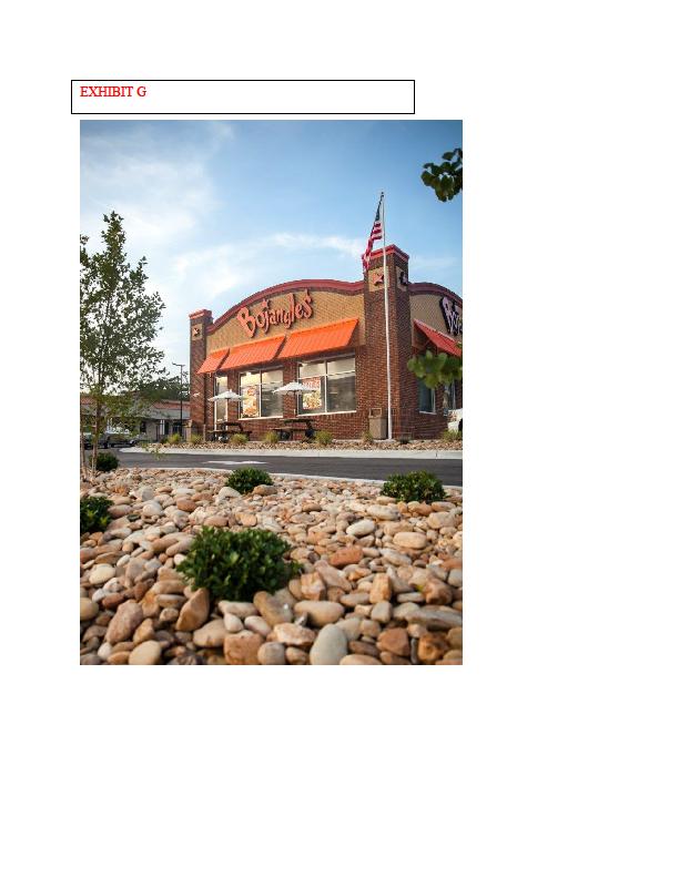
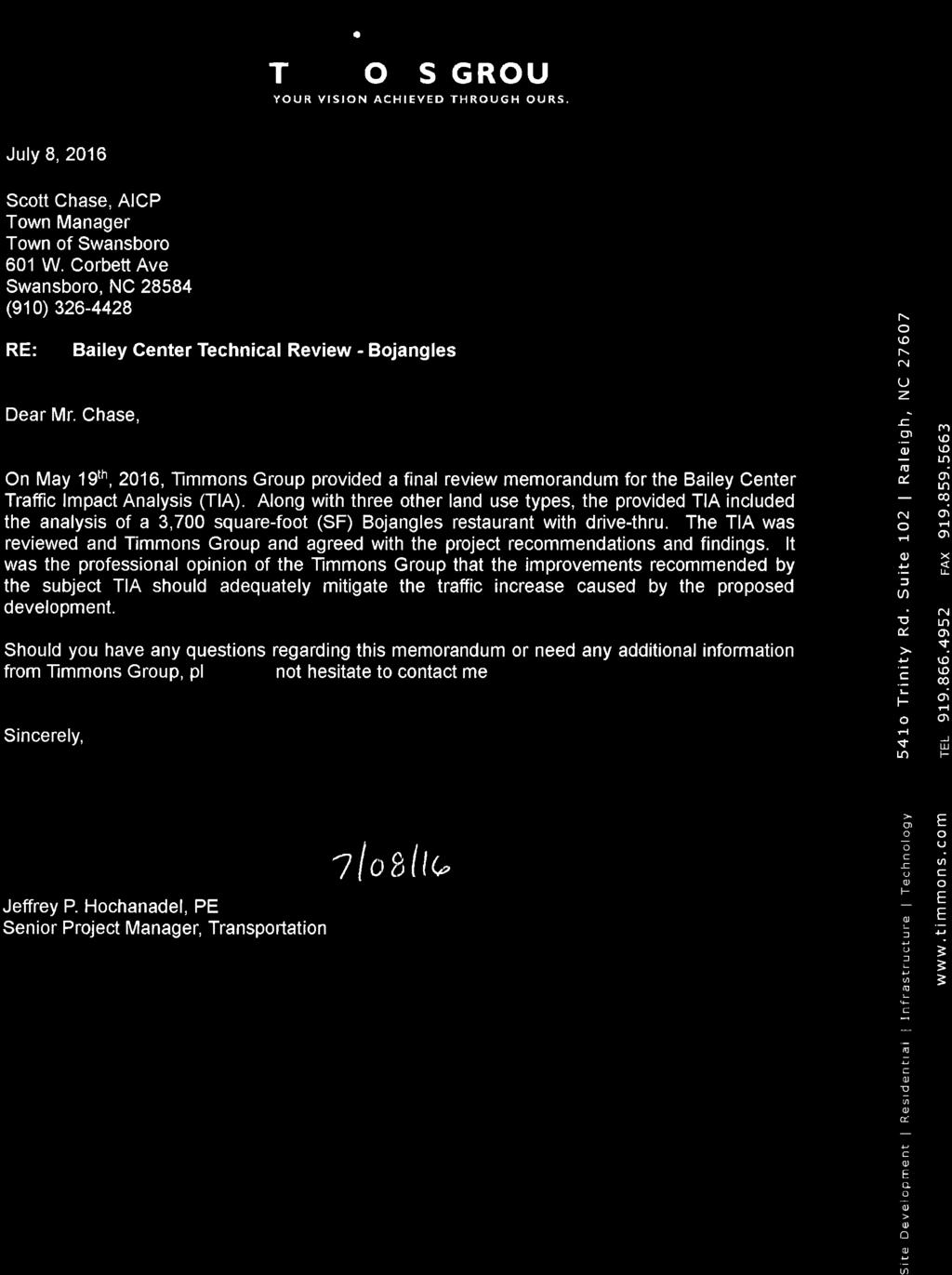
5 Figure 2- Town of wansboro Land Use Plan Future Land Use Map Actions Needed Recommendation for the UP request to be heard by the Mayor and Board of Commissioners. The motion should include a set of written findings, you may utilize the set provided by staff based on ection 12-1 (A-E) and recommend other items deemed necessary as you see fit after hearing the evidence in the hearing. Attachments pecial Use Application (Exhibit A) TRC Comments (Exhibit B) Aerial location map (Exhibit C) Conceptual Plan (Exhibit D) Preliminary ite Plan (Exhibit E) Rendering (Exhibit F) Bojangles Photo (Exhibit G) Town s Traffic Engineer s Memorandum (Exhibit H) Applicant s Traffic Engineer s Memorandum (Exhibit I) Applicant s Civil Engineer s Memorandum (Exhibit J) Applicant s Appraiser s Memorandum (Exhibit K) ection 12-1 Procedure for pecial Use Permit (Exhibit L) Applicable portion of Ordinance 2016-O3 (Exhibit M) taff findings including conditions (Exhibit N) pecial Use Permit Proposed Bojangles in the Bailey Commercial Center Page 2
6 Exhibit A
7 Exhibit B Board of Commissioners cott Chadwick, Mayor Philip Keagy, Mayor Pro Tem Patricia Turner, Commissioner John Lister, Commissioner Frank Tursi, Commissioner Roy Herrick, Commissioner sm Town Manager J. cott Chase, AICP schase@ci.swansboro.nc.us Town Clerk Administrative ervices Director Paula W. Webb, MMC-NCCMC pwebb@ci.swansboro.nc.us Town of wansboro Friendly City by the ea Established Bojangles Technical Review Committee June 23, 2016 Attendees comments/concerns: cott Chase, Town Manager Comments: Provide for pedestrian connectivity to Bojangles site from other parcels in development Concern for ingress/egress drive on southside of property Recommendation of monument sign for restaurant, similar to structure (brick veneer) Type A landscaping Adhere to Article 24, 24-5 landscaping requirements for parking spacing Less is better on structure, taff recommends uniform brick design, less enhancements (stars, awnings, etc.) Include decorative lighting for site to enhance site Provide for landscaping plans Provision for off-street loading 10x25x14 per UDO creening around dumpster and secure Wynne Ray, ONWAA, Technical Operations upervisor No Comments andi Eubanks, Planning Board Representative Building design and colors are extremely important. Changes need to be made from beige and brick to solid brick and orange needs to be eliminated. Red awnings or no awnings on side facing 24, and more detailed entrance, such as double entry doors. Addition of islands with trees in parking area closest to 24 instead of multiple parking spaces (there are 60). Outdoor seating would be nice also. 1
8 Jim tipe, Public Works Director No Comments Kevin Taveirne, Acting Deputy Fire Chief Town Code ection requires 300 feet for the hydrant spacing for commercial, however the Town Code does not address buildings equipped with an approved sprinkler system. In that regard the 2012 Fire Code, ection exception 2 would apply as approved by the Fire Code Official. That distance is 600. o Identify the location of the fire hydrant being relocated for the turn lane into the Bailey Center. o If the hydrant is moved to the intersection of Phillips Loop Road/Hwy 24 it would make it accessible for incidents inside or outside the Bailey Center. NC Fire Code ection If the hydrant is near an area where it is subjected to be hit by a motor vehicle, physical protection must be installed to comply with section NC Fire Code Table B105.1 requires the minimum flow to be 1500 gallons per minute for this type of construction and size of building. ection B103.2 allows the Fire Chief to increase that number where conditions indicate an unusual susceptibility to group fires or conflagrations. NC Fire Code ection A fire access road shall be able to support the weight of the department apparatus. ection D102.1 requires the fire apparatus road to be capable of supporting at 75,000 lbs. NC Fire Code ection requires the fire access road to be within 150 of all portions of the building. The 150 can be increased by the Fire Code Official, where the building is equipped with an automatic sprinkler system. NC Fire Code ection recommends a Knox Box key lock system on commercial structures. The fire department will work with Bojangles. Andrea Correll, Town Planner Consider using parking lot weirs to contain water and the use of rain gardens as a type of parking lot island. Connectivity to allow cross access with adjacent properties should be provided. Easements and stubbing in access to the property line are appropriate methods to use. Pedestrian circulation by utilizing connective sidewalks from Bojangles to the rest of the Bailey Center is required. Cc: Charles Cazier, Intracoastal Engineering 2

9 Exhibit C ite
10 Exhibit D
11 Exhibit E ITE DATA: PROPERTY ADDRE: 810 W CORBETT AVE (NC HWY 24) WANBORO, NC VICINITY MAP (NOT TO CALE): TUNNELL HAMMOCK BEACH RD NC 24 ite HAMRICK RD MAIN T ET. N.C. GRID NORTH NAD '83 (2007 ADJUTMENT) WANBORO OF JACKONVILLE, LLC. DEED BOOK 3544, PAGE 234 LOT 5 WANBORO PARK MAP BOOK 32, PAGE 139 ZONED B-1 CURRENT OWNER: BAILEY & FULLER PROPERTIE, LLC P.O. BO 400 JACKONVILLE, NC ONLOW COUNTY PIN: TOTAL TRACT AREA: ± 1.03 AC. ( 44,943 F) NELLIE LN W PHILLIP DR REVIION PINELAND DR OLD HAMMOCK RD CURRENT ZONING: B-1 1-1/4" EIP CREENED DUMPTER PAD LOADING AREA 61 06'07" E ' 15' CREENED DUMPTER PAD TORMWATER POND 1" EIPP 2" BG 45' ROW LEVEL PREADER W/30' VEGETATED FILTER ETBACK: FRONT REQ'D= 25 ' PROP= 157' REAR REQ'D= 10' PROP= 56' IDE REQ'D= 10'L/0'R PROP= 15'L PROPOED LAND UE: QUICK ERVE RETAURANT GRO FLOOR AREA: 3,700 F (8.2% LOT COVERAGE) ITE BY OTHER 70' 60' BUILDING HEIGHT: ±20' N 18 35'36" E ' TORMWATER POND 142' 6' IDEWALK 20' 20' 20' FH (4) 1" WATER ERVICE (1) FH AEMBLY 1/2" 2" BG ONITE IMPERVIOU URFACE: BUILDING= PAVED PARKING= CONCRETE IDEWALK= 3,700 F 29,184 F 1,485 F PAULINE C. TROUD DEED BOOK 769, PAGE 183 ZONED B-1 ACCE EAEMENT 1-1/4" EIP 6" AG 41.24' N 18 43'39" E N 18 43'39" E 41.28' 29' N 18 35'36" E 35.36' GRAVITY LIFT TATION '36" E ' LOADING AREA 30' 18' TYP 9' TYP 61 10'36" E ' FUTURE DRIVE BY OTHER N 28 17'27" E 24.72' N 28 17'27" E 17.59' 1-1/4" EIPP N 61 06'07" W 94.22' WHITNEY AVENUE PER MAP BOOK 32, PAGE 139 5/8" GRADE 5/8" GRADE N 61 08'51" W 19.30' 5/8" 1" AG CHORD = 73 22'58" W 42.50' (RADIU=30.00' PER MAP BOOK 32, PAGE 159) 45' ROW 03 49'42" W 90.90' 03 45'50" W ' 5/8" 1" AG N 86 12'26" W 9.41' N 86 12'07" W 9.48' CHORD = N 41 15'30" W 42.41' (RADIU=30.00' PER MAP BOOK 32, PAGE 159) CHORD = N 73 43'36" W 74.96' (RADIU=172.50' PER MAP BOOK 32, PAGE 139) 5/8" GRADE 5/8" 3" BG IRELAND AVENUE PER MAP BOOK 32, PAGE 139 TOTAL IMPERVIOU= 34,369 F (76.5%) PARKING MIN. REQUIRED: (EATING AND DRINKING FACILITIE, FAT FOOD : 13 PACE PER 1,000 F) TOTAL PARKING REQUIRED: 3,700/1,000 * 13= 48 PACE TOTAL PARKING PROVIDED: 64 PACE (2 HC) PARKING LOT INTERIOR LANDCAPING: REQUIRED: 2,335 F (29,184 F 8%) PROVIDED: 4,083 F ECM 18" AG PAULINE C. TROUD DEED BOOK 405, PAGE 146 ZONED B '30" E 70.34' N 01 22'24" W ' 40' AE FORCE MAIN 5/8" EI 1" BG N 18 41'54" E ' EPK 12' 5' 31' ' TRAFFIC LIGHT ARM N 13 21'07" E 51.30' 27' 1.5" WATER ERVICE CURB INLET TOP: INV ' 28' 24' 7 18' TYP FH TIE TO E. 6" FORCE MAIN GT 9' TYP ' 40' NO BUILD LINE E FIRE HYDRANT TO BE RELOCATED N 61 09'52" W ' 7 17' 5' IDEWALK ITE BENCHMARK TOP OF FLANGE BOLT CLOET TO "M" IN MUELLER ELEV ' 6 27' CAUTION LIGHT TELEPHONE BO UTILITY POLE 13.09" 1-1/4" EIP 4" AG 40' NO BUILD LINE CONCRETE FLUME TYP. DEPREED ILAND N 61 07'44" W ' R/W CURB AND GUTTER TYP. 1/2" GRADE 10'x20' IGN EAEMENT N.C. HIGHWAY NO ' R/W 28 55'04" W ' WHITNEY AVENUE PER MAP BOOK 32, PAGE ' ROW N 61 09'44" W ' 6" C-900 PVC 28 52'35" W ' 1/2" GRADE 5/8" GRADE CHORD = 16 23'32" E 42.27' (RADIU=30.00' PER MAP BOOK 32, PAGE 159) 5/8" 2" BG TEQUILA PROPERTIE, LLC. DEED BOOK 3110, PAGE 816 ZONED B-1 R/W E. IDEWALK ITE BENCHMARK TOP OF EWER CLEANOUT IN IDEWALK ELEV ' TIE TO E. 8" WATER MAIN (1) 8"6" TAPPING LEEVE AND VALVE INV = 28.58' 15" RCP Main treet Ext. R/W INV = 28.79' DEVELOPMENT NOTE: 1. ALL DEVELOPMENT HALL BE IN ACCORDANCE WITH TOWN OF WANBORO ZONING ORDINACE. 2. PROJECT HALL COMPLY WITH ALL FEDERAL, TATE & TOWN OF WANBORO REGULATION. UTILITY NOTE: 1. WATER AND ANITARY EWER ERVICE ARE CURRENTLY AVAILABLE TO THE ITE FROM ONLOW COUNTY WATER AND EWER AUTHORITY (ONWAA) PUBLIC MAIN. 2. ALL PROPOED UTILITY ERVICE, UCH A ELECTRIC POWER, CATV, GA & TELEPHONE HALL BE INTALLED UNDERGROUND. 3. OLID WATE DIPOAL BY PRIVATE DUMPTER ERVICE.. 9. THE CONTRACTOR I REPONIBLE FOR THE LOCATION AND PROTECTION OR EITING UTILITIE DURING CONTRUCTION. CALL U-LOCO AT CONTRACTOR I REPONIBLE FOR THE REPAIR AND REPLACEMENT OF ANY UTILITIE, CURB & GUTTER, PAVEMENT, ETC. THAT MAY BE BE DAMAGED DURING CONTRUCTION. DAMAGED ITEM HALL BE REPAIRED TO AT LEAT THE QUALITY OR WORKMANHIP FOUND IN THE ORIGINAL ITEM. URVEY NOTE: 1. THE PROPERTY HOWN HEREON I NOT LOCATED WITHIN A PECIAL 100 YEAR FLOOD HAZARD AREA ACCORDING TO FLOOD INURANCE RATE MAP NO J DATED NOV. 3, ALL N.C. GRID DATA HOWN HEREON I BAED ON NAD ADJUTMENT UING THE NCG RTK NETWORK YTEM. 3. ALL DITANCE HOWN HEREON ARE N.C. GRID DITANCE UNLE OTHERWIE NOTED. 4. ALL UTILITY LINE HOWN HEREON MAY HAVE EAEMENT AND RIGHT OF ENTRANCE AND MAINTENANCE AOCIATED WITH THEM. 5. ALL ELEVATION HOWN HEREON ARE BAED ON MEAN EA LEVEL ( NAVD 1988 ) 6. UNDERGROUND UTILITY LINE AND FORCE MAIN TAKEN FROM 2008 MARKING BY OTHER. 7. ITE HA NOT BEEN REVIEWED FOR EITENCE OF REGULATED WETLAND. GENERAL NOTE: 1. PROPOED IDEWALK AT HWY 24 TO BE INTALLED A LOT "A & B" ARE DEVELOPED. 2. IMPROVEMENT AT NC24 UBJECT TO CHANGE. ITE WILL COMPLY WITH APPROVED TRAFFIC IMPACT ANALYI. IGNAL IMPROVEMENT TO BE INCLUDED A NECEARY PER TOWN OF WANBORO AND NCDOT PRELIMINARY ITE PLAN PRELIMINARY DRAWING DO NOT UE FOR CONTRUCTION N.C..R ' R/W PHILLIP LOOP ROAD R/W R/W LEGEND 25.5 PROPERTY LINE TEMPORARY ILT FENCE PROPOED WATERLINE PROPOED ANITARY EWER LINE PROPOED TORMDRAIN LIMIT OF DITURBANCE DROP INLET W/ INLET PROTECTION CURB INLET W/ INLET PROTECTION TORM DRAIN MANHOLE POT ELEVATION CLIENT INFORMATION: REDCO PROPERTIE, LLC 335 N. QUEEN T. KINTON, NC (252) PARKING LOT LANDCAPING "TYPE A" BUFFER LANDCAPING TOWN OF WANBORO REQ'D PARKWAY DRAWN: JAE HEET IZE: 24x36 CHECKED: CDC DATE: 7/6/2016 CL APPROVED: CDC CALE: 1" = 40' PROJECT NUMBER: ' 20' 0' 40' 80' cale: 1"=40' DRAWING NUMBER: C-1 1 OF 1
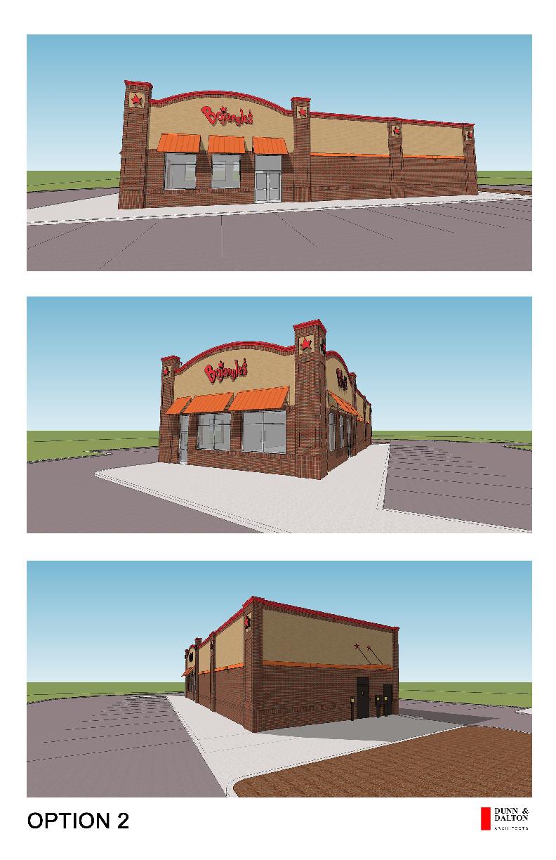
12 EHIBIT F
13
14 EHIBIT H
15 Exhibit I
16 EHIBIT J
17 Exhibit K REALTY ERVICE of EATERN CAROLINA, INC. Appraisers, Consultants and Brokers Mailing Address: Post Office Box New Bern, NC Telephone: 252/ CURTI D. JERNIGAN, MAI ( ) CHARLE J. MOODY III, MAI R. EARL JONE, MAI, RA KENNETH R. JONE MICHAEL N. MOODY, MAI UZANNE H. NELON, MAI treet Address: 2313 Grace Avenue New Bern, NC Facsimile: 252/ July 6, 2016 wansboro Planning Board wansboro Board of Commissioners 601 W. Corbett Avenue wansboro, NC Via RE: Proposed Bojangles West Corbett Avenue wansboro, Onslow County, North Carolina We have inspected the neighborhood and reviewed the proposed location for the Bojangles restaurant in wansboro, Onslow County, North Carolina. The restaurant will be located along West Corbett Avenue within the Bailey Commercial Center. The subject is further identified as Tract A of the Bailey Commercial Center. A physical address is not known at this time. The subject neighborhood consists of the commercial and neighborhood business district along Corbett Avenue (NC Highway 24) in wansboro. Corbett Avenue serves as NC Highway 24, the main traffic artery through wansboro and the main connecting link to Jacksonville to the west and Morehead City to the east. urrounding uses along the Corbett Avenue (NC Highway 24) corridor include Walgreens, Hardee s, wansboro Methodist, Piggly-Wiggly, Hampton Inn, Family Dollar, Advance Auto, Nationwide Insurance, Country-Aire Rental, Tideland News, Mills & Thomas Furniture, anders Ford, Wendy s, McDonald s, Rotary Civic Center, Ace Hardware, gas stations, retail strip/office centers, restaurants and professional office space. The subject neighborhood is currently zoned B-1, Highway Business District, per the Town of wansboro Zoning Map (created on March 2016). A copy of the zoning map is provided on the following page for you convenience. (The Bailey Commercial Center parcels are identified with a yellow dot.)

18 wansboro Planning Board wansboro Board of Commissioners July 6, 2016 Page 2 The B-1, Highway Business District is defined by the Town of wansboro Unified Development Ordinance as follows: B1 - Highway Business. The purpose of this district shall be to provide for the proper grouping and development of roadside business uses, and for uses not basically related to central or neighborhood business areas. Retail, restaurants and office space are a few of the permitted uses under the current zoning classification. As previously noted, the subject will be located within the proposed Bailey Commercial Center. The Bailey Commercial Center will be located along West Corbett Avenue and will be bound to the north by vacant land, to the south by W. Corbett Avenue (NC Highway 24), to the east by medical office space and to the west by Budget Truck Rental. Physical access is currently provided by a curb cut off West Corbett Avenue. The Bailey Commercial Center will consist of three tracts containing a total area of 4.51 acres; Tract A 1.03 acres (Bojangles ), Tract B 1.0 acre (financial institution), and Tract C 2.48 acres (Dollar Tree, 3-unit retail building & storm water ponds).

19 wansboro Planning Board wansboro Board of Commissioners July 6, 2016 Page 3 C A B At this time, no improvements for the Bailey Commercial Center are in place.


20 wansboro Planning Board wansboro Board of Commissioners July 6, 2016 Page 4 As noted, the subject is identified as Tract A of the Bailey Commercial Center. The acre site is proposed for Bojangles, a franchise restaurant. The single-story brick veneer restaurant building will contain approximately 3,700 square feet upon completion. ite improvements will include concrete walks, asphalt-paved parking, area lighting, gated dumpster pad, signage and landscaping. The proposed improvement will be constructed similar to the renderings below. The design, construction and aesthetic appeal of the proposed improvement will be permitted under the current zoning classification, in harmony with the neighborhood, and will not substantially injure or alter the value of the adjoining or abutting property owners.
21 wansboro Planning Board wansboro Board of Commissioners July 6, 2016 Page 5 Recent construction of commercial properties along Corbett Avenue, the commercial/neighborhood business district within wansboro, includes McDonald s, Rose strip center, tevenson Chevrolet, Taco Bell and O Reilly Auto Parts. McDonald s is located at 905 West Corbett Avenue, adjacent to the subject property. The 1.30-acre site is improved with a single-story drive-thru restaurant containing 4,537 square feet. The improvement was constructed around (ite and building size taken from Onslow County Tax Office GI.) The Rose strip center is located at 1450 West Corbett Avenue. The 2.10-acre site is improved with a single-story retail-strip building. The improvement was constructed around 2014 containing 7,620 square feet. (ite and building size taken from Onslow County Tax Office GI.) tevenson Chevrolet is located at 1435 West Corbett Avenue, adjacent to the Rose strip center. The acre site is improved with two steel-frame and masonry automobile sales and service buildings. Building 1 is the sales and service building containing 30,543 square feet (1 st floor 28,733 sf; 2 nd floor 1,810 sf). Building 2 is the detail building containing 5,040 square feet. The improvements were constructed around Taco Bell is located at 652 Corbett Avenue, outparcel of Cornerstone hopping Center. The 0.83-acre site is improved with a single-story, drive-thru restaurant. The improvement was constructed around 2015 containing 2,052 square feet. (ite and building size taken from Onslow County Tax Office GI.) O Reilly Auto Parts is located at 680 West Corbett Avenue, outparcel of Cornerstone hopping Center. The 1.24-acre site is improved with a single-story retail store. The improvement was constructed around 2015 containing 7,372 square feet. (ite and building size taken from Onslow County Tax Office GI.) The recent development along Corbett Avenue consists of commercial/neighborhood business uses that are legally permitted and in harmony with the neighborhood. There is no indication of a loss in property value within the neighborhood and/or to the adjoining property owners.


22 wansboro Planning Board wansboro Board of Commissioners July 6, 2016 Page 6 Based on our review of the proposed project as well as inspection of the neighborhood, it is our opinion the development of the 1.03-acre site for the proposed Bojangles as designed, would be in harmony with the neighborhood. In addition, if this project is constructed as proposed, it would not substantially injure or alter the value of the adjoining or abutting property owners. Respectfully, R. Earl Jones, MAI, RA NC Certified General Real Estate Appraiser A246 uzanne H. Nelson, MAI NC Certified General Real Estate Appraiser A6424 REJ:mlr
23 QUALIFICATION OF APPRAIER R. Earl Jones, MAI, RA Realty ervices of Eastern Carolina, Inc. Mailing Address treet Address Post Office Box Grace Avenue New Bern, NC New Bern, NC Tel FA: Education Bachelor of cience in Business Administration, Concentration in Real Estate East Carolina University, Greenville, North Carolina, 1977 Real Estate Training The Appraisal Institute Can you upport that Adjustment?, Wilson, NC, March 2016 National UPAP 7 Hour Update , Wilson, NC, March 2016 National UPAP Update Course Appraisal Institute, Asheville, NC, January 2014 Fundamentals Real Property/Personal Property & Intangible Assets, Appraisal Institute, Greensboro, NC, June Real Estate Valuation Conference: Retrench/Recovery?, Appraisal Institute, Raleigh, NC, April 2012 UPAP Update Course - Appraisal Institute, New Bern, NC, February 2012 UPAP Update Course Appraisal Institute, Wilmington, NC, March Hour National UPAP Update Course ~ Appraisal Institute, Cary, NC, February 2009 Appraisal Review, Charlotte, NC, January 2006 ubdivision Valuation, Atlantic Beach, NC, February 2006 Real Estate Finance, Value and Investment Performance, Asheville, NC, October 2005 Yellow Book Uniform Appraisal tandards for Federal Land Acquisition, Wrightsville Beach, NC, August 2006 Investment Analysis Course VI, University of North Carolina, 1985 Urban Properties Course II, University of North Carolina, 1979 Capitalization Theory and Techniques Course I-B, University of North Carolina, 1978 Residential Valuation Course VIII, University of Georgia, 1978 Appraisal Principles Course I-A, University of North Carolina, 1977 Licenses Licensed North Carolina tate Certified Real Estate Appraiser, #A246 Licensed Real Estate Broker, tate of North Carolina, #42169 Professional Affiliations President, North Carolina Chapter of the Appraisal Institute, 1999 Member, Appraisal Institute, (MAI) #7363, Designated 1986 Residential Member, Appraisal Institute, (RA) #1715, Designated 1982 Experience and Current tatus From 1977 to 1983, the appraiser was employed with Jones Appraisal ervice in New Bern, NC. ince 1983, the appraiser has been employed with Realty ervices of Eastern Carolina, Inc. in New Bern, North Carolina as a real estate appraiser. Responsibilities include appraisals on commercial, industrial, land and residential properties in Eastern North Carolina with specialties in commercial, income-producing properties and development properties.
24 QUALIFICATION OF APPRAIER uzanne H. Nelson, MAI Realty ervices of Eastern Carolina, Inc. Mailing Address treet Address Post Office Box Grace Avenue New Bern, NC New Bern, NC Tel Fax Education Bachelor of cience in Business Administration, Concentration in Management East Carolina University, May 2001 Real Estate Training Can You upport that Adjustment?, Wilson, NC, March 2016 National UPAP 7 Hour Update , Wilson, NC, March 2016 Online Comparative Analysis ~ Appraisal Institute, April May, 2015 Appraisal of elf-torage Facilities ~ McKissock, April 2015 General Demonstration Report Writing ~ Appraisal Institute, February 2015 Evaluation Appraisal eminar ~ Appraisal Institute, Greensboro, NC, October 2014 UPAP Update Course ~ Triangle Appraisal and Real Estate chool, Wilson, NC, December 2013 Appraisal Laws & Rules (2013) ~ Brightpath Education ervices, New Bern, NC, March 2013 Advanced ales Comparison & Cost Approaches ~ Appraisal Institute, Greensboro, NC, June 2010 General Market Analysis and Highest & Best Use ~ Appraisal Institute, Greensboro, NC, July 2009 Advanced Income Capitalization ~ Appraisal Institute, Greensboro, NC, June 2009 Rates and Ratios ~ Appraisal Institute, Chicago, IL, May Hour National UPAP Update Course ~ Appraisal Institute, Cary, NC, February 2009 Real Estate Finance tatistics & Valuation Modeling ~ Appraisal Institute, Greensboro, NC, May 2008 Highest & Best Use Applications ~ Appraisal Institute, Asheville, NC, October 2006 ubdivision Valuation ~ Appraisal Institute, Atlantic Beach, NC, February Hour National UPAP ~ Appraisal Institute, Chicago, IL, November 2005 Business Practice and Ethics ~ Appraisal Institute, Chicago, IL, November 2005 Report Writing and Valuation Analysis ~ Appraisal Institute, Greensboro, NC, April 2005 G-3, Applied Income Property Valuation ~ Appraisal chools by M. Curtis West, 2004 G-2, Advanced Income Capitalization Procedures ~ Appraisal chools by M. Curtis West, 2004 G-1, Introduction to Income Property Appraisal ~ Williams Appraisers Education Center, 2003 R-3, Applied Residential Property Valuation ~ Williams Appraisers Education Center, 2002 R-2, Valuation Principles and Procedures ~ Williams Appraisers Education Center, 2002 R-1, Introduction to Real Estate Appraisal ~ Williams Appraisers Education Center, 2002 License NC Certified General Real Estate Appraiser, A6424 Professional Affiliation Member, Appraisal Institute, (MAI), Designated 2016 Experience and Current tatus ince August 2003, the appraiser has been employed with Realty ervices of Eastern Carolina, Inc. in New Bern, NC. Responsibilities include assisting and performing real estate appraisals for commercial, industrial, land and residential properties in Eastern North Carolina.
25 Exhibit L ARTICLE 12. PECIAL UE ection 12-1: Procedure for pecial Use Permits pecial use permits may be issued by the Administrator, after approval by the Board of Commissioners, for the uses as designated in the table of regulations for special uses. Applications shall include all of the requirements pertaining to it as specified in this section. A hearing shall be held, and all interested persons shall be permitted to offer relevant comments. The Town Board of Commissioners shall consider the application and may approve or deny the requested special use permit. Amended 6/16/200, 7/20/2010 In granting a special use permit, the Board of Commissioners shall give due regard to the nature and state of all adjacent structures and uses, and the districts within which the proposed use is to be located, and shall make written findings of fact concerning the existence or absence of the following criteria: Amended 7/20/2010 (A) (B) (C) (D) The special use is allowed pursuant to ection 12-1 and meets all the required conditions and specifications, including without limitation, those set out in ection The special use will not materially endanger the public health or safety if located where proposed and developed according to the plan as submitted and approved. The special use will not substantially injure the value of adjoining or abutting property. OR the special use is a public necessity. The location and character of the special use, if developed according to the plan as submitted and approved, will be in harmony with the area in which it is located.
26 The special use shall demonstrate conformance to the Land Use Plan or other plan in effect at the time and address impacts of the project as required by G 160A-382(b). Amended 4/18/2006 (E) Upon the issuance of any special use permit, the Board of Commissioners shall consider whether it is necessary or appropriate to affix conditions thereto for the purposes of protecting neighboring properties and/or the public interest assuring that the use is harmonious with the area, and ensuring that the use is consistent with the spirit of the ordinance, and shall affix to such permit such conditions as it finds are necessary for any of those purposes. If any conditions affixed to any special use permit or any part thereof is held invalid by any competent authority, then said special use permit shall be void. Amended 7/20/2010 Orders of Board of Commissioners. Upon its determination that all of the criteria set out in this section are met, the Board of Commissioners shall enter a written order with findings of fact and conclusions of law, and shall issue the special use permit as requested or with such conditions as it finds necessary and appropriate pursuant to ection Amended 7/20/2010 Upon its determination that one or more of the criteria set out in this section are not met, the Board of Commissioners shall issue its written order with findings of fact and conclusions of law and shall deny the requested special use permit. Amended 7/20/2010 Any special use permit approved or approved with conditions shall be recorded in the office of the Register of Deeds of Onslow County, North Carolina. All such additional conditions shall be entered in the minutes of the meeting at which the special use permit is granted and also on the special use permit approval, and on the approved plans submitted therewith. All specific conditions shall run with the land and shall be binding on the original applicant for the special use permit, the heirs, successors, and assigns. In order to ensure that such conditions and requirements for each special use permit will be fulfilled, the petitioner for the special use permit may be required to enter into a contract with the Town of wansboro providing for the installation of the physical improvements required as a basis for the issuance of the special use permit. Performance of said contract shall be secured by cash or surety bond which will cover the total estimated cost of the improvements as determined by the Town of wansboro; provided, however, that said bond may be waived by the Town Board of Commissioners within its discretion. Amended 7/20/2010
27 In addition to the conditions specifically imposed by the Town Board of Commissioners, special uses shall comply with the height, area, and parking regulations of the zone in which they are located (no variances from requirements within zoning ordinance are allowed). Amended 7/20/2010 In the event of failure to comply with the plans approved by the Board of Commissioners or with any other conditions imposed upon the special use permit, the permit shall thereupon immediately become void and of no effect. No building permits for further construction nor a certificate of compliance under this special use permit shall be issued, and the use of all completed structures shall immediately cease and such completed structures not thereafter be used for any purpose other than a use-by-right as permitted by the zone in which the property is located. Amended 7/20/2010 Where plans are required to be submitted and approved as part of the application for a special use permit, modifications of the original plans may be authorized by the Town Board of Commissioners. Amended 7/20/2010
28 Exhibit M ection 2. The Town of wansboro Unified Development Ordinance is amended by changing the following Article 10 PART IV. Proposed changes (highlighted/strikethrough text) to PART IV. District Regulations ection 10-10: Table of Permitted/pecial Uses ection 10-10: TABLE OF PERMITTED/PECIAL UE/CONDITIONAL ZONING DITRICT PERMITTED/PECIAL UE DWELLING, MULTI- FAMILY AND CONDOMINIUM (see Notes 22 and 37, ection 10-11) DWELLING, THREE/FOUR FAMILY DWELLING, TOWNHOUE (ee Note 37, ection 10-11) IC* CO N MANUFACTURED 5311 HOME PARK but excl. any 90 manufactured home sales (see Note 21, ection 10-11) RA R 6 P P P R6 F R 8 P P P R8 F R R10 10 F P P P R R15 15 F P P P R R20 20 F P P R R40 PU 40 F D ** P P P P P M HP P M MH H - 15 F MH -O *** O/ I G/ E B1 ** ** B2 ** ** B3 ** ** P P All new nonresidential and mixed-use development and expansions or alterations of any such existing building where the expansion or alteration exceeds fifty (50) percent of the building value as assessed for real property taxes considered permitted by right and referred to as a Commercial Use shall be reviewed under Article 12. pecial Uses. B2H M DO I ****
29 Exhibit N- Written Findings Including Conditions A) The special use is allowed pursuant to ection 12-1 and meets all the required conditions and specifications, including without limitation, those set out in ection The special use is allowed per Article 10, ection 10-10, Table of Permitted/pecial Uses. The requirements of ection 12-2 appear to have been met. B) The special use will not materially endanger the public health or safety if located where proposed and developed according to the plan as submitted and approved. There is no evidence that the special use will endanger the public health or safety if located where proposed. C) The special use will not substantially injure the value of adjoining or abutting property. Or the special use is a public necessity. A fast food restaurant is consistent with adjacent businesses along the NC Highway 24 corridor. D) The location and character of the special use, if developed according to the plan, will be in harmony with the area in which it is located. The special use shall demonstrate conformance to the Land Use Plan or other plan in effect at the time and address impacts of the project as required on G 160A-382 (b) the property is located in the B-1 zoning district. The CAMA Land Use Plan depicts these parcels as Commercial. The use will be in harmony with area in which it is located. E) Upon the issuance of any special use permit, the Board of Commissioners shall consider whether it is necessary or appropriate to affix conditions thereto for the purposes of protecting neighboring properties and/or the public interest assuring that the use is harmonious with the area, and ensuring that the use is consistent with the spirit of the ordinance, and shall affix to such permit such reasonable and appropriate conditions as it finds are necessary for any of those purposes. If any conditions affixed to any special use permit or any part thereof is held invalid by any competent authority, then said special use permit shall be void.
30 APPENDI IV - INFORMATION REQUIRED WITH APPLICATION, ITE PLAN, UBDIVIION PLAT AND ZONING PERMIT APPENDI q IV- INFORMATION REQUIRED j WITH p APPLICATION, p p ITE PLAN, p UBDIVIION PLAT p AND p ZONING PERMIT following information before submission to the Town Planner for review. And ": indicates required information. Depending on the scale or complexity of the development, any or all the sheets may be combined. Additional information may be required for approval fo the site plan. The Town Planner or the approval authority may waive items required if it is judged that they are not necessary to complete the review. Information ubdivision Plans Major Preliminary General notes to be included on the plan: No changes to any aspect of this site plan, including but not limited to, landscaping, grading, building elevations, lighting or utilities will be made without the Town's approval. The site shall be stabilized and seeded prior to the issuance of a certification of occupancy or guaranteed by approved methods if applicable All required improvement shall comply with the standards of the code of ordinances Indicate the owner, current zoning, and present use of all contiguous properties and show all surrounding adjoining property lines Name, address, registration number, and telephone # of preparer of map (licensed surveyor, engineer, land planner, landscape architect or architect) Developer s name, address and daytime phone number (if different from owner's) Owners Certification of development plan Corporate limits, county lines, and other jurisdiction lines, if any, on the tract Registration and seal of land surveyor All outdoor storage areas shall be clearly identified Map or plan size: Maps submitted shall not exceed a maximum size of 24 by 36 and be less than a minimum of 18 x 24 tandard 18 by 24 sheet for plats/plans to be recorded, minimum 1-1/2 border on the left side and a minimum ½ border on all other sides; or as required by the applicable County Register of Deeds Office Acceptable range of scale from 1 =60 to 1 =100 Maps or plans may be drawn on more than one sheet with appropriate match lines Original drawn on material as required by the applicable County Register of Deeds Office Drawn in ink Minor Final Plot Plan Zoning Permit or ite Plan Page 1
31 APPENDI IV - INFORMATION REQUIRED WITH APPLICATION, ITE PLAN, UBDIVIION PLAT AND ZONING PERMIT Information Minor ubdivision Plans Major Preliminary Final Property lines distinctly and accurately represented Elevation and benchmarks shall be referenced to national Geodetic Vertical Datum (NGVD). Assumptions must be clearly noted Prepared by a professional engineer or other sealed professional land surveyor ubmit one 11 x17 copy and digital pdf Date of original preparation and/or revision(s) - clearly identifying revisions Number of sheets (i.e., sheet 1 of 1) cale denoted both graphically and numerically utilizing engineering scale only, Architectural scale will not be accepted Provide a color rendering of the building elevation detailing building materials and colors, if applicable Title, date, north arrow and graphic scale cale of drawing in feet per inch. Drawing shall be at a scale of 1 equals not more than 200 cale of drawing in feet per inch. Drawing shall be at a scale of 1 equals not more than 100 cale of drawing in feet per inch. Drawing shall be at a scale of not less than 1 equal to 40. If all lots are greater than 3 acres, only the building site needs to be shown Bar graph book and deed book reference Location and heights of all fences, walls, and hedges shall be shown Title Block containing: Name of Development Name of map or plan (minor plat, preliminary plat, etc.) Property owner s name with address and daytime phone number Location (including address, township, county and state) Date(s) map(s) prepared or revised Tax parcel identification number North arrow and orientation (north arrow shall not be oriented toward the bottom of the map Boundaries of the tract to be subdivided or developed: Distinctly and accurately represented and showing all distances Location and descriptions of all monuments, markers and control corners Plot Plan Zoning Permit or ite Plan Page 2
32 APPENDI IV - INFORMATION REQUIRED WITH APPLICATION, ITE PLAN, UBDIVIION PLAT AND ZONING PERMIT Information Minor ubdivision Plans Major Preliminary Final All proposed buffers, setbacks and street yard areas dimensioned and labeled The name and location of any property or building on the National Register of Historic Places or locally designated historic property Railroad lines and rights-of-way Existing and proposed water courses, ponds, lakes or streams; their names direction of flow, centerline elevation, cross- sections and any other pertinent datum The location of existing and platted property lines, street s building, water course, railroads, transmission lines, sewer, bridges, culverts, and drainpipes, water mails, Town and County lines (if adjoining) and any public utility easements Boundaries of tract shown with bearing and distances treams, floodplains, and elevation contours (two feet), soil classification, seasonal high water table, and vegetation at the site Proposed solid waste and recycling storage facilities Water courses, railroads, bridges, culverts, storm drains, wooded areas, marshes, swamps, rock outcrops, ponds or lakes, stream or stream, beds, ditches or other natural or improved features which affect the site Indicate streams/ditches subject to White Oak or ICW buffer rules Marshes, swamp and other wetlands Areas to be dedicated or reserved for the public or a local jurisdiction Areas designated as common area or open space under control of an owners association, including acreage Proposed building locations for zero lot line developments Location of manufactured home park dwelling spaces and whether they are designated for single or double wide dwellings Typical diagram of manufactured home park dwelling space Location of designated recreation areas and facilities Location of the 100-year floodway from Flood Hazard Boundary Maps and cross- section elevations Floodway zone and flood fringe zone show, indicating base flood elevation (minimum finished floor elevation) for all lots adjoining the zones. If site is located within Zone AE, show location of FEMA floodway and flood hazard area Plot Plan Zoning Permit or ite Plan Page 3
33 APPENDI IV - INFORMATION REQUIRED WITH APPLICATION, ITE PLAN, UBDIVIION PLAT AND ZONING PERMIT Information Minor ubdivision Plans Major Preliminary Topography (existing and proposed) at contour interval of one foot, based on mean sea level datum, with an accuracy of plus or minus 0.5 of a foot and references to the National Geodetic Vertical Datum (NGVD), when required Topography (existing and proposed) at contour interval of one foot, based on mean sea level datum, with an accuracy of plus or minus 0.5 of a foot and references to the National Geodetic Vertical Datum (NGVD), when required quare footage of all proposed lots under an acre in size and acreage for all lots over an acre in size Location vicinity map, showing the development in relation to major and minor roads or streets, natural features, existing Town limit lines and other obvious references ubdivision name, block and lot number, tax map number and parcel number and street address, if applicable Copy of restrictive or protective covenants applicable to the subdivision if any shall be submitted to the Planning Board Existing land use within the property and on adjacent properties Zoning district(s) within the property and adjacent properties Names of adjoining property owners (or subdivisions or developments of record with plat book reference) Political subdivision(s) including Town limit lines, township boundaries, county lines and extra territorial jurisdiction boundaries ource of property boundaries signed or sealed by registered land surveyor, architect, landscape architect or engineer howing locations of intersecting boundary lines or adjoining properties Location, dimension and type of all easements, including but not limited to electric water, sanitary sewer, storm sewer, drainage, private street, gas or other service delivery easements including their location, width and purpose Copies of any recorded inter- connectivity easements or agreements if applicable If the site is outside the Town limits, indicate if a petition for annexation is required to be submitted to the Town. Annexation is required by the Town Commissioners prior to the issuance of a building permit or recordation of a final plat ite calculations including: Acreage in total tract Final Plot Plan Zoning Permit or ite Plan Page 4
34 APPENDI IV - INFORMATION REQUIRED WITH APPLICATION, ITE PLAN, UBDIVIION PLAT AND ZONING PERMIT Information Minor ubdivision Plans Major Preliminary Final Acreage in public open space Total number of lots proposed Linear feet in roads Proposed linear footage of water lines Proposed linear footage of sewer lines Area in newly dedicated right-of-way Lots sequenced are numbered consecutively treet address as assigned by the Town for each new lot Acreage in subdivision/project Acreage in park and other land usages Average lot size, if any Total number of lots, if any Linear feet in streets Number of units and unit density by neighborhoods Total area in site Existing property lines, public and private streets, right-of-way and/or easement widths, pavement widths, easements, utility lines, hydrants, driveways, recreation areas or open spaces on adjoining property Location of existing and proposed fire hydrant(s). Where a hydrant is not shown within the development site, the nearest hydrant providing service shall be denoted with dimension to the property lines Location of electrical service connection(s), meter(s), transformer base and pole(s). Adjacent overhead electric lines shall be denoted as to type transmission; distribution; service drop ketch vicinity map showing location of site relative to surrounding area (typically drawn in upper right hand corner), at a scale of 1 = 2,000 Plot Plan Zoning Permit or ite Plan Location, arrangement dimension of all automobile parking spaces, width of aisles, width or bays, angle of parking and number of spaces. Typical pavement section and/or surface type Location, arrangement, and dimension of all truck unloading docks, ramps and spaces Indicate the location and method of garbage containment. (Indicate the proposed location and type of screening of solid waste dumpster, if applicable) Page 5
35 APPENDI IV - INFORMATION REQUIRED WITH APPLICATION, ITE PLAN, UBDIVIION PLAT AND ZONING PERMIT Information Minor ubdivision Plans Major Preliminary Location and dimension of all fences, walls, docks ramps, pools, patios, mechanical equipment and impervious areas Existing property lines on tract to be subdivided. If existing property lines are to be changed, label as old property lines and shown as dashed lines Dimensions, location and use of all existing and proposed buildings; distances between buildings measured at the closest point; distance from buildings to the closest property lines; building setback lines (or note). A dashed line should be shown on the plat outlining all known structures, ponds or lakes removed or filled. Exterior dimensions should include heights, number of stories, public drives, public right-of-way and easements Proposed parks, school sites, or public open spaces, if any County Health Department information for developments without access to public sewer: (1) Each plat or plan shall contain a statement concerning suitability for septic system use (2) Each lot that has been approved for an on-site subsurface sewage treatment and disposal system shall be shown. Denied lots or lots not evaluated shall be cross- hatched and labeled, NO IMPROVEMENT PERMIT HA BEEN IUED FOR THI LOT Utility Layout Plan: Connections showing existing systems, line sizes, material of lines, location of fire hydrants, blow offs, valves, manholes, catch basins, force mains, etc. for the following types of utility lines: anitary sewer Water distribution Drainage Natural gas, electric, cable TV and the like Electrical and telephone lines Indicate if any water/or sanitary sewer tap fees are due and the amount per application how location and type of backflow protection provided Location of water tap(s) denoting size(s) of line(s) and meter location(s) existing and proposed treet data illustrating: Existing and proposed rights of- way lines within and adjacent to property (shown with a cross-hatch pattern) Final Plot Plan Zoning Permit or ite Plan Page 6
36 APPENDI IV - INFORMATION REQUIRED WITH APPLICATION, ITE PLAN, UBDIVIION PLAT AND ZONING PERMIT Information Minor ubdivision Plans Major Preliminary Existing and proposed rights of- way within and adjacent to property showing: Total right-of-way width dimension Right-of-way width dimension from centerline of existing public streets and consistent with NCDOT tandards Existing streets, their names and numbers (if state marked routes) shown and designated as either public or private, indicating right-of-way and/or easement widths, pavement widths, including sight distance triangles Tied to nearest road intersection (within 300 ) or UG (within 2,000 ) how dimensions and location of all parking areas, total provided and minimum required number of parking spaces, driveways, service areas, off- street loading facilities and pedestrian walkways Total number of handicapped parking spaces (required and provided) Within parking areas, clearly indicate each parking space, angle of parking and typical size Existing and proposed streets showing: Pavement or curb lines Pavement width dimension (face-to-face) Cul-de-sac pavement radius Existing street names and names of new streets as approved by the town ufficient data to determine readily and reproduce on the ground location, bearing and length or every street, lot line, boundary line, block line and building line whether curved or straight. This includes radius, central angle and tangents Road profiles Documentation of approval of a driveway permit from NCDOT tormwater drainage plan, including site surface drainage, pipe size(s) with direction of flow, yard drain(s), catch basin(s), curb inlet(s), detention pond(s), ditches, and topographic features and all associated nitrogen reduction calculations when required how proposed disturbed area for construction purposes tormwater Management Plan: Total impervious surface area, including streets, roofs, patios, parking areas, sidewalks and Location(s) and dimension(s) of all existing and proposed sidewalks, vehicular entrances, exits, and drives including interconnectivity access drives with adjoining sites driveways Final Plot Plan Zoning Permit or ite Plan Page 7
APPENDIX B. SUBMISSION REQUIREMENTS
 Master Major Site Minor Site Landscape Section B.1 Table of /Plat Requirements Proposed or approved name of development, project, subdivision, and/or phase. Location, including township, county, and state.
Gates County Planning and Zoning
 Gates County Planning and Zoning PO Box 411, 200 Court Street, Gatesville, NC 27938 phone: 252-357-2411 fax: 252-357-0073 Application for Technical Review Committee For Staff Use Only: Date: Application
APPLICATION PROCEDURE
 ANTRIM PLANNING BOARD P. O. Box 517 Antrim, New Hampshire 03440 Phone: 603-588-6785 FAX: 603-588-2969 APPLICATION FORM AND CHECKLIST FOR MINOR OR MAJOR SITE PLAN REVIEW File Date Received By APPLICATION
PRELMINARY PLAT CHECKLIST
 PRELMINARY PLAT CHECKLIST A. All preliminary plat submitted for approval shall be prepared by a Registered Professional Land Surveyor. B. Preliminary plats must be drawn to a scale of XXX with such accuracy
NOT TO BE SUBMITTED WITH SKETCH DESIGN APPROVAL Subdivision Checklist: Major Subdivision Final Plat
 Must be received with review fee (equal to $200.00, plus $25.00 per lot) no later than 15 days prior to Planning Board meeting, which is normally the first Monday of the month (certain holidays may modify
ARTICLE 900 PLAT AND PLAN REQUIREMENTS
 ARTICLE 900 PLAT AND PLAN REQUIREMENTS SEC. 900.1 ITEMS TO BE SHOWN ON PLAT OR PLAN General (1) Property lines of all property owners adjacent to the exterior boundaries of the project shall be located
SUBDIVISION APPLICATION CHECKLIST SKETCH PLAN PRELIMINARY PLAT FINAL PLAT
 RECEIVED STAMP SUBDIVISION APPLICATION CHECKLIST SKETCH PLAN PRELIMINARY PLAT FINAL PLAT A checklist of background information and submission requirements for processing of a sketch plan, preliminary plat
PLANNING BOARD CITY OF CONCORD, NH MINOR SUBDIVISION CHECKLIST
 PLANNING BOARD CITY OF CONCORD, NH MINOR SUBDIVISION CHECKLIST Summary This checklist is intended to assist applicants and design professionals in the preparation of minor subdivision applications for
Preliminary Subdivision Application (Major) (Four (4) lots or more)
 (Four (4) lots or more)") Gunnison City Offices www.gunnisoncity.org 38 West Center Gunnison, Utah 84634 (435) 528 7969 Date of Application: Preliminary Subdivision Application (Major) (Four (4) lots or more) APPLICANT INFORMATION
Gunnison City Offices www.gunnisoncity.org 38 West Center Gunnison, Utah 84634 (435) 528 7969 Date of Application: Preliminary Subdivision Application (Major) (Four (4) lots or more) APPLICANT INFORMATION
Site Plan Application
 Site Plan Application City of St. Pete Beach Community Development Department 155 Corey Avenue St. Pete Beach, Florida 33706 (727) 367-2735 www.stpetebeach.org Case Number: PROPERTY OWNER: Name: Address:
MAJOR SUBDIVISION PRELIMINARY PLAT CHECKLIST
 TOWNSHIP OF EGG HARBOR PLANNING BOARD/ZONING BOARD OF ADJUSTMENT 3515 BARGAINTOWN ROAD EGG HARBOR TOWNSHIP, NJ 08234 MAJOR SUBDIVISION PRELIMINARY PLAT CHECKLIST The following checklist is designed to
FINAL SUBDIVISION AND LAND DEVELOPMENT PLAN CHECKLIST. Plan Name. Applicant's Name:
 TOWNSHIP OF UPPER ST. CLAIR FINAL SUBDIVISION AND LAND DEVELOPMENT PLAN CHECKLIST Date Filed Plan Name PLC Applicant's Name: Phone Filing Date for Final Application Final Plat 114.22. FINAL APPLICATION
CITY OF FAYETTEVILLE, ARKANSAS FINAL PLAT FOR STAFF USE ONLY FINAL PLAT FEE: $ $ Date Application Submitted: Date Accepted as Complete:
 CITY OF FAYETTEVILLE, ARKANSAS FINAL PLAT FOR STAFF USE ONLY FINAL PLAT FEE: $200.00-$800.00 Date Application Submitted: Date Accepted as Complete: Project Number: Public Hearing S-T-R: PP#: Zone: Please
I. Requirements for All Applications. C D W
 108-16.1. Application checklists. Checklist for Required Submissions to the Planning Board or Zoning Board of Adjustment of Monroe Township All required submissions are to be made to the Administrative
Preliminary Subdivision Application (Minor) (Three (3) lots or less)
 (Three (3) lots or less)") Gunnison City Offices www.gunnisoncity.org 38 West Center Gunnison, Utah 84634 (435) 528 7969 Date of Application: Preliminary Subdivision Application (Minor) (Three (3) lots or less) APPLICANT INFORMATION
Gunnison City Offices www.gunnisoncity.org 38 West Center Gunnison, Utah 84634 (435) 528 7969 Date of Application: Preliminary Subdivision Application (Minor) (Three (3) lots or less) APPLICANT INFORMATION
FINAL PLAT APPLICATION
 FINAL PLAT APPLICATION (Page 1 of 3) LEGAL OWNER(s): NAME: STREET ADDRESS OWNER(s): CITY, STATE, ZIP CODE: PHONE NUMBER: BILLING ADDRESS: NAME OF ENGINEER/SURVEYOR: Engineer/Surveyor Address, Phone: PROPERTY
SUBDIVISION AND LAND DEVELOPMENT. 185 Attachment 20
 185 Attachment 20 APPENDIX S Plat No. Date of Submission Twp. Fee $ Dauphin Co. Fee $ TOWNSHIP OF DERRY SUBDIVISION OR LAND DEVELOPMENT PLAN SUBMISSION APPLICATION This block for Twp. use only 1. Title
New Electronic Planning Commission Submittal Process
 New Electronic Planning Commission Submittal Process STANDARD OPERATING PROCEDURE Purpose: To outline the electronic submittal process for applications to the Planning Commission. Background: Procedure:
E L M E R B O R O U G H L A N D U S E B O A R D APPLICATION COVER SHEET (to be completed for all applications and appeals)
") E L M E R B O R O U G H L A N D U S E B O A R D APPLICATION COVER SHEET (to be completed for all applications and appeals) 1. Name(s): 2. Address: 3. Telephone Number(s): 4. E-mail: 5. Owner Name(s) (if
E L M E R B O R O U G H L A N D U S E B O A R D APPLICATION COVER SHEET (to be completed for all applications and appeals) 1. Name(s): 2. Address: 3. Telephone Number(s): 4. E-mail: 5. Owner Name(s) (if
MINOR SUBDIVISION FINAL PLAT APPLICATION Town of Apex, North Carolina
 MINOR SUBDIVISION FINAL PLAT APPLICATION Town of Apex, North Carolina This document is a public record under the North Carolina Public Records Act and may be published on the Town s website or disclosed
-MENDOCINO COUNTY PLANNING AND BUILDING SERVICES- DIVISION OF LAND REGULATIONS TITLE 17
 ARTICLE VI -- GENERAL REGULATIONS AND PROVISIONS Sec. 17-50. Sec. 17-51 General Plan. Sec. 17-52 Lot and Block Design and Configuration. Sec. 17-53 Lot Access. Sec. 17-54 Private Roads. Sec. 17-55 Water
TOWN OF LEWISTON PLANNING BOARD APPLICATION
 TOWN OF LEWISTON PLANNING BOARD APPLICATION DESCRIPTION OF PROPOSED REQUEST: Name of Property Owner: Phone #: Name of Applicant:Phone #: Address or Location of Proposal:_SBL# Size of Parcel or Structure:Existing
CITY OF GROVER BEACH COMMUNITY DEVELOPMENT DEPARTMENT Tentative Map Checklist
 CITY OF GROVER BEACH COMMUNITY DEVELOPMENT DEPARTMENT Tentative Map Checklist The following list includes all of the items you must submit for a complete application. Some specific types of information
Residential Minor Subdivision Review Checklist
 Residential Minor Subdivision Review Checklist Plan Submittal Requirements: 2 full sets of stamped plans Electric submittal - all plans contained in a single PDF 3 full sets if commercial kitchen or dining
SECTION SITE SURVEYS
 PART 1 - GENERAL 1.1 DESCRIPTION SECTION 02 21 00 SPEC WRITER NOTES: 1. Use this section only for NCA projects. 2. Delete between //---// if not applicable to project. Also delete any other item or paragraph
ARTICLE 900 PLAT AND PLAN REQUIREMENTS
 Final SEC. 900.01 ARTICLE 900 PLAT AND PLAN REQUIREMENTS General provisions. (a) Scale. The scale of all plats and plans shall be a minimum of 1 to 100 ft. (b) Size. The minimum page size for all plats
MASTER SUBDIVISION FINAL PLAT APPLICATION Town of Apex, North Carolina
 MASTER SUBDIVISION FINAL PLAT APPLICATION Town of Apex, North Carolina This document is a public record under the North Carolina Public Records Act and may be published to the Town s website or disclosed
COMMERCIAL SITE DEVELOPMENT GUIDE FOR UNINCORPORATED ST. CHARLES COUNTY
 COMMERCIAL SITE DEVELOPMENT GUIDE FOR UNINCORPORATED ST. CHARLES COUNTY GENERAL INFORMATION: This brochure is to be used as a guide and is not intended to amend or supersede the corresponding County ordinances
610 LAND DIVISIONS AND PROPERTY LINE ADJUSTMENTS OUTSIDE A UGB
 ARTICLE VI: LAND DIVISIONS AND PROPERTY LINE ADJUSTMENTS VI-21 610 LAND DIVISIONS AND PROPERTY LINE ADJUSTMENTS OUTSIDE A UGB 610-1 Property Line Adjustments (Property Line Relocation) A property line
CHAPTER 26 PLANNING AND ZONING ARTICLE VII. MOBILE HOMES AND RECREATIONAL VEHICLE (RV) PARKS. Recreational Vehicle (RV) Park Development Standards
 PARKS. Recreational Vehicle (RV) Park Development Standards") CHAPTER 26 PLANNING AND ZONING ARTICLE VII. MOBILE HOMES AND RECREATIONAL VEHICLE (RV) PARKS. Section 26-VII-1. Section 26-VII-2. Section 26-VII-3. Section 26-VII-4. Section 26-VII-5. Purpose Permitted
CHAPTER 26 PLANNING AND ZONING ARTICLE VII. MOBILE HOMES AND RECREATIONAL VEHICLE (RV) PARKS. Section 26-VII-1. Section 26-VII-2. Section 26-VII-3. Section 26-VII-4. Section 26-VII-5. Purpose Permitted
TOWNSHIP OF BORDENTOWN LAND DEVELOPMENT APPLICATION CHECKLIST. General Requirements for all Applications
 TOWNSHIP OF BORDENTOWN LAND DEVELOPMENT APPLICATION CHECKLIST This CHECKLIST has been adopted in accordance with Section 25:807 of the Land Development Ordinance of the Township of Bordentown and will
UPPER MOUNT BETHEL TOWNSHIP NORTHAMPTON COUNTY, PENNSYLVANIA
 UPPER MOUNT BETHEL TOWNSHIP NORTHAMPTON COUNTY, PENNSYLVANIA JOINDER DEED / LOT CONSOLIDATION TOWNSHIP REVIEW PROCESS When accepting proposed Joinder Deeds / Lot Consolidations, review the Joinder Deed
Residential Major Subdivision Review Checklist
 Residential Major Subdivision Review Checklist Plan Submittal Requirements: 2 full sets of stamped plans Electric submittal - all plans contained in a single PDF 3 full sets if commercial kitchen or dining
BRIDGETON SUBDIVISION APPLICATION CHECKLIST
 APPLICATION NAME AND # CHECKLIST COMPLETED BY: DATE: Signature and printed name BRIDGETON SUBDIVISION APPLICATION CHECKLIST TO SUBDIVISION APPLICANTS: The attached checklist is to assist you in the submission
SUBDIVISION APPLICATION
 SUBDIVISION APPLICATION Preliminary Plat Minor Plat Final Plat Amended Plat Applicant Name: Owner (if different from applicant) Name: Company: Company: Address: Address: City, State, Zip City, State, Zip
APPLICATION SUBMITTAL REQUIREMENTS FOR Tentative Parcel or Subdivision Maps
 CITY OF EL CERRITO Community Development Department Planning and Building Division 10890 San Pablo Avenue, El Cerrito, CA 94530 (510) 215-4330 FA (510) 233-5401 planning@ci.el-cerrito.ca.us APPLICATION
CHECKLIST FOR DEVELOPMENT REVIEW
 CHECKLIST FOR DEVELOPMENT REVIEW Petitions and related documents and plans for land development or other proposals regulated by Title 16 of the Municipal Code (Development Ordinance) and Title 17 of the
Administrative Plat Application Form
 1 Administrative Plat Application Form This form shall be submitted with each application for an administrative plat. CONTACT INFORMATION Applicant Architect (if different) Property Owner (if different)
Township of Little Egg Harbor Planning Board 665 Radio Road Little Egg Harbor, New Jersey Phone: ext. 221 Fax:
 BLOCK(S) LOT(S) Township of Little Egg Harbor Planning Board 665 Radio Road Little Egg Harbor, New Jersey 08087 Phone: 609-296-7241 ext. 221 Fax: 609-294-3040 Development Application Amended Development
SECTION 4: PRELIMINARY PLAT
 SECTION 4: PRELIMINARY PLAT After the completion of the sketch plan process, if submitted, the owner or developer shall file with the City an application for preliminary plat. The preliminary plat stage
MAJOR AND MINOR SUBDIVISIONS. Section 26-8: Plat Shall be Required on Any Subdivision of Land
 PART II. MAJOR AND MINOR SUBDIVISIONS Section 26-8: Plat Shall be Required on Any Subdivision of Land Pursuant to NCGS 160A-372, a final plat shall be prepared, approved, and recorded pursuant to the provisions
Initial Subdivision Applications Shall Include the Following:
 Initial Subdivision Applications Shall Include the Following: 1) Subdivision Application Form: completely filled out (12 copies) 2) Plat: The Plat must adhere to the requirements set forth in the Town
MINOR PLAT. The following documents are provided as required by the City of Conroe for use in the above titled platting submittals:
 Public Works - Engineering Division CITY OF CONROE MINOR PLAT The following documents are provided as required by the City of Conroe for use in the above titled platting submittals: Submittal Questionnaire
Medical Marijuana Special Exception Use Information
 Medical Marijuana Special Exception Use Information The Special Exception Use information below is a modified version of the Unified Development Code. It clarifies the current section 5:104 Special Exceptions
Request for Action form is also defined as an application to be considered by the Planning Commission.
 CITY OF NORTH RIDGEVILLE INSTRUCTIONS FOR FILING REQUEST FOR ACTION APPLICATIONS WITH THE PLANNING COMMISSION (Please read the full instruction as it will help in providing a full complete application)
MINOR SUBDIVISION PLAT CHECKLIST
 MINOR SUBDIVISION PLAT CHECKLIST Project Name: Tax ID #: Project Number: Date: _ Reviewed By: Telephone: NOTES: All lots on septic systems must comply with the Fulton County Health Department requirements
TOWN OF SWANSBORO Planning Board Regular Meeting. December 5, 2016 Members Present Members Absent
 TOWN OF SWANSBORO Planning Board Regular Meeting December 5, 2016 Members Present Members Absent Wayne Mixon Christina Ramsey Sandi Eubanks Joel Wiltgen Brent Hatlestad Laurent Meilleur The meeting was
CHAPTER 32 SUBDIVISIONS SECTION TITLE PAGE NO.
 Page 1 of 46 CHAPTER 32 SUBDIVISIONS SECTION TITLE PAGE NO. SECTION 32-1 Purpose of Ordinance 3 SECTION 32-2 Definitions 3 SECTION 32-3 Staff Sketch Review 4 SECTION 32-4 Subdivision and PUD Plats Required
City of Prior Lake APPLICATION FOR COMBINED PRELIMINARY AND FINAL PLAT
 Case File No. Property Identification No. City of Prior Lake APPLICATION FOR COMBINED PRELIMINARY AND FINAL PLAT Requested Action Brief description of proposed project (Please describe the proposed amendment,
APPLICATION for MINOR SUBDIVISION REVIEW for CONCEPT and FINAL PLAT within COALVILLE CITY. Project Name: Project Address or Area: Name of Owner:
 APPLICATION for MINOR SUBDIVISION REVIEW for CONCEPT and FINAL PLAT within COALVILLE CITY For Office Use Only: Application #: Application Date: PC Approval Date: CC Approval Date: Community Development
ARTICLE 24 SITE PLAN REVIEW
 ARTICLE 24 SITE PLAN REVIEW 24.1 PURPOSE: The intent of these Ordinance provisions is to provide for consultation and cooperation between the land developer and the Township Planning Commission in order
City of Prior Lake APPLICATION FOR REGISTERED LAND SURVEY
 Case File No. Property Identification No. City of Prior Lake APPLICATION FOR REGISTERED LAND SURVEY Requested Action Brief description of proposed project (Please describe the proposed amendment, project,
Condominium Unit Requirements.
 ARTICLE 19 CONDOMINIUM REGULATIONS Section 19.01 Purpose. The purpose of this Article is to regulate projects that divide real property under a contractual arrangement known as a condominium. New and conversion
PRELIMINARY PLATS. The following documents are provided as required by the City of Conroe for use in the above titled platting submittals:
 Public Works Engineering Division CITY OF CONROE PRELIMINARY PLATS The following documents are provided as required by the City of Conroe for use in the above titled platting submittals: Submittal Questionnaire
Waseca County Planning and Zoning Office
 Waseca County Planning and Zoning Office 300 North State Street Waseca, Minnesota 56093 Phone: 507-835-0650 Fax: 507-837-5310 Form no. PZ 081009 Web Site: www.co.waseca.mn.us FEES: 1) CUP FEE- $400.00
ARTICLE 5 MINOR SUBDIVISION/LAND DEVELOPMENT
 ARTICLE 5 MINOR SUBDIVISION/LAND DEVELOPMENT SECTION 501 ONLY FINAL PLAN REQUIRED The classification of a proposed subdivision as a "Minor Subdivision" shall only require the submission, review and approval
FINAL SITE PLAN PLAT APPLICATION Town of Apex, North Carolina
 FINAL SITE PLAN PLAT APPLICATION Town of Apex, North Carolina This document is a public record under the North Carolina Public Records Act and may be published on the Town s website or disclosed to third
A.3. ARTICLE 7 PLAN REQUIREMENTS FOR MINOR SUBDIVISION AND/OR LAND DEVELOPMENT
 700. 701.A.3. ARTICLE 7 PLAN REQUIREMENTS FOR MINOR SUBDIVISION AND/OR LAND DEVELOPMENT SECTION 700 PURPOSE The purpose of this Article is to set forth a streamlined set of Plan Requirements for minor
CHAPTER XVIII SITE PLAN REVIEW
 CHAPTER XVIII SITE PLAN REVIEW Section 18.1 Section 18.2 Description and Purpose. The purpose of this chapter is to provide standards and procedures under which applicants would submit, and the Township
SUBMITTAL REQUIREMENTS: The number indicates the number of copies for submittal (if applicable).
.") Office Use Only Preliminary Long Plat Long Subdivision Applicant Checklist PLANNING, COMMUNITY, & ECONOMIC DEVELOPMENT DEPARTMENT PRELIMINARY LONG PLAT LONG SUBDIVISION CHECKLIST Mailing Address: P.O.
Office Use Only Preliminary Long Plat Long Subdivision Applicant Checklist PLANNING, COMMUNITY, & ECONOMIC DEVELOPMENT DEPARTMENT PRELIMINARY LONG PLAT LONG SUBDIVISION CHECKLIST Mailing Address: P.O.
City of Midland Application for Site Plan Review
 City of Midland Application for Site Plan Review Submission Date: Property Owner: Mailing Address: Phone number: ( ) Cell phone: ( ) Email address: Fax: ( ) Owner s Signature: Applicant Name (if not owner):
SUBMITTAL REQUIREMENTS: The number indicates the number of copies for submittal (if applicable).
.") Office Use Only Preliminary Long Plat Long Subdivision Applicant Checklist PLANNING, COMMUNITY, & ECONOMIC DEVELOPMENT DEPARTMENT FINAL LONG PLAT LONG SUBDIVISION CHECKLIST Mailing Address: P.O. Box 547,
Office Use Only Preliminary Long Plat Long Subdivision Applicant Checklist PLANNING, COMMUNITY, & ECONOMIC DEVELOPMENT DEPARTMENT FINAL LONG PLAT LONG SUBDIVISION CHECKLIST Mailing Address: P.O. Box 547,
TOWN OF ROXBURY PLANNING BOARD
 UPDATED: APRIL 2011 TOWN OF ROXBURY PLANNING BOARD Applicant s Guide for Subdivision Review The Town Planning Board administers the subdivision review process. This guide has been prepared in order to
Section 3.0: RESIDENTIAL AND NON-RESIDENTIAL SUBDIVISION APPLICATION AND APPROVAL PROCESS
 Cherokee County Development Ordinance Adopted - January 15, 2002 3-1 Section 3.0: RESIDENTIAL AND NON-RESIDENTIAL SUBDIVISION APPLICATION AND APPROVAL PROCESS It shall be the policy of the Cherokee County
City of Suwanee Development Regulations ARTICLE 10 PLAN AND PLAT SPECIFICATIONS
 ARTICLE 10 PLAN AND PLAT SPECIFICATIONS 10.1 CONCEPT PLAN SPECIFICATIONS The following paragraphs outline the required elements of both the required and optional plans and plats mentioned throughout these
MIDWAY CITY Planning Office 75 North 100 West Phone: x105 Midway, Utah Fax:
 MIDWAY CITY Planning Office 75 North 100 West Phone: 435-654-3223 x105 Midway, Utah 84049 Fax: 435-654-2830 mhenke@midwaycityut.org Preliminary/ Final Application for Small Scale Subdivision Application
SITE DEVELOPMENT PLAN REQUIREMENTS CHECKLIST
 SITE DEVELOPMENT PLAN REQUIREMENTS CHECKLIST Completed DRC Application for Review Required for Application Process DRC Processing Fee 1 Commercial $2,500.00 Fire Department Review Fee 150.00 Total $2,650.00
SUBDIVISION APPLICATION: RECOMBINATION PLAT or EXEMPT PLAT
 SUBDIVISION APPLICATION: RECOMBINATION PLAT or EXEMPT PLAT Pursuant to Article 7, Section 155.706 of the Unified Development Code, an owner of land within the jurisdiction of the Town (or a duly authorized
City of Leavenworth DEPARTMENT OF DEVELOPMENT SERVICES MAJOR SUBDIVISION APPLICATION 1
 Proposed Name of Subdivision: City of Leavenworth DEPARTMENT OF DEVELOPMENT SERVICES MAJOR SUBDIVISION APPLICATION 1 FOR PRELIMINARY SUBDIVISION APPROVAL This application must be filled out legibly, in
PRELIMINARY PLAT CHECK LIST
 PRELIMINARY PLAT CHECK LIST Name of Proposed Subdivision: The following items must be included with the initial submittal of a Preliminary Plat: Application, filled out completely Project Narrative Pre-application
FINAL PLAT CHECKLIST
 FINAL PLAT CHECKLIST Project Name: Tax ID #: Project Number: Date: _ Reviewed By: Telephone: Please address all items marked with an "X" Please return redline comments with corrected plan, original mylar,
RIVERDALE CITY PLANNING COMMISSION APPLICATION FOR RESIDENTIAL SUBDIVISION SITE PLAN APPROVAL
 Community Development 4600 So. Weber River Drive Riverdale, Utah 84405 RIVERDALE CITY PLANNING COMMISSION APPLICATION FOR RESIDENTIAL SUBDIVISION SITE PLAN APPROVAL CASE NO: DATE SUBMITTED: APPLICANT S
CERTIFICATION OF THE APPROVAL OF WATER AND SEWERAGE SYSTEMS
 ARTICLE 9 FORMS AND CHECK LISTS 9.100 On preliminary layout & final subdivision plat CERTIFICATION OF THE APPROVAL OF WATER AND SEWERAGE SYSTEMS I hereby certify that the (...type: private or pubic...)
ANDOVER CODE. Checklist #5 Preliminary Site Plan Conditional Use
 ANDOVER CODE Checklist #5 Preliminary Site Plan Conditional Use Applicant: Block Lot File No. This checklist is for general reference only. Further information may be required by the reviewing authority.
ARTICLE 13 CONDOMINIUM REGULATIONS
 ARTICLE 13 CONDOMINIUM REGULATIONS Section 13.01 Purpose. The purpose of this Article is to regulate projects that divide real property under a contractual arrangement known as a condominium. New and conversion
SUBDIVISION DESIGN PRINCIPLES AND STANDARDS
 SECTION 15-200 SUBDIVISION DESIGN PRINCIPLES AND STANDARDS 15-201 STREET DESIGN PRINCIPLES 15-201.01 Streets shall generally conform to the collector and major street plan adopted by the Planning Commission
Final Plat Mapping Requirements
 CURRENT PLANNING DIVISION 410 E. 5 th Street Loveland, CO 80537 970-962-2523 eplan-planning@cityofloveland.org cityofloveland.org/dc Final Plat Mapping Requirements All Final plats shall comply with the
ARTICLE 9 SPECIFICATIONS FOR DOCUMENTS TO BE SUBMITTED
 ARTICLE 9 SPECIFICATIONS FOR DOCUMENTS TO BE SUBMITTED SECTION 950 GENERALLY All applications shall be properly signed and filed by the owner or, with the owner s specific written consent, a contract purchaser
MAPLETON CITY CORPORATION. Step 7: Upon final approval and prior to plat recording the applicant shall provide the following:
 MAPLETON CITY CORPORATION Subdivision Process The City s subdivision requirements are designed to facilitate orderly, safe and efficient development and to implement the adopted General Plan. Below is
Oakland County Michigan Register of Deeds Plat Engineering, GIS, & Remonumentation Dept. Ph: (248) Fax (248)
 Fax (248)") Oakland County Michigan Register of Deeds Plat Engineering, GIS, & Remonumentation Dept. Ph: (248)-858-1447 Fax (248)-858-7466 Requirements Needed for Final Plat Approval No. General Requirements. 1 Routing
Oakland County Michigan Register of Deeds Plat Engineering, GIS, & Remonumentation Dept. Ph: (248)-858-1447 Fax (248)-858-7466 Requirements Needed for Final Plat Approval No. General Requirements. 1 Routing
MAJOR RESIDENTIAL AND NONRESIDENTIAL SUBDIVISIONS
 Lawrence-Douglas County MAJOR RESIDENTIAL AND NONRESIDENTIAL SUBDIVISIONS Preliminary Plats The applicant shall schedule a Pre-Application meeting with Planning Staff at least seven (7) working days prior
Application For Development Review (Subdivisions and Site Plan Review)
") Application For Development Review (Subdivisions and Site Plan Review) Thank you for your interest in Pickens County, South Carolina. This packet includes the necessary documents for review of subdivision
Application For Development Review (Subdivisions and Site Plan Review) Thank you for your interest in Pickens County, South Carolina. This packet includes the necessary documents for review of subdivision
STONE COUNTY PRELIMINARY PLAT CHECKLIST. Note: Applications need to be in the office by 2 p.m. on the cutoff day.
 STONE COUNTY PRELIMINARY PLAT CHECKLIST Note: Applications need to be in the office by 2 p.m. on the cutoff day. JOY WILSON, DIRECTOR Return form to: Planning & Zoning Administrator PO Box 301, Galena,
CONDOMINIUM REGULATIONS
 ARTICLE 37 CONDOMINIUM REGULATIONS SECTION 37.01. Purpose The purpose of this Article is to regulate projects that divide real property under a contractual arrangement known as a condominium. New and conversion
(voice) (fax) (voice) (fax) Site Plan Review
 (fax) (voice) (fax) Site Plan Review") Town of South Boston PO Box 417 455 Ferry Street South Boston Virginia 24592 Planning Department Public Works Department (Engineering) 434.575.4241 (voice) 434.575.4275 (fax) 434.575.4260 (voice) 434.575.4275
Town of South Boston PO Box 417 455 Ferry Street South Boston Virginia 24592 Planning Department Public Works Department (Engineering) 434.575.4241 (voice) 434.575.4275 (fax) 434.575.4260 (voice) 434.575.4275
BOSSIER CITY PARISH METROPOLITAN PLANNING COMMISSION 620 Benton Rd. Bossier City, LA Phone: Fax: PRELIMINARY PLAT
 (OFFICE USE ONLY) Application Fee: Paid: Date: CASE # Project Information BOSSIER CITY PARISH METROPOLITAN PLANNING COMMISSION 620 Benton Rd. Bossier City, LA 71111 Phone: 318-741-8824 Fax: 318-741-8827
CITY OF SARALAND FINAL SUBDIVISION PLAT REVIEW
 CITY OF SARALAND FINAL SUBDIVISION PLAT REVIEW Application Number: Date Plat Submitted: Name of Subdivision: Name of Owner: Owner Address: (Street or P.O. Box) Telephone #: (City) (State) (Zip) E-mail:
PLYMOUTH PLANNING BOARD APPLICATION FOR A MINOR SUBDIVISION OR MAJOR SUBDIVISION
 CASE # PLYMOUTH PLANNING BOARD APPLICATION FOR A MINOR SUBDIVISION OR MAJOR SUBDIVISION The undersigned Applicant hereby submits to the Plymouth Planning Board a completed application for a proposed minor
DEVELOPMENT POLICY INFRASTRUCTURE GUIDELINES FOR NEW DEVELOPMENT
 CITY OF HAYS SUBJECT DEVELOPMENT POLICY INFRASTRUCTURE GUIDELINES FOR NEW DEVELOPMENT ISSUED BY LAST REVISION DATE POLICY MANUAL REVISION DATE City Commission 3-13-08 10-22-09 POLICY STATEMENT: The City
REGULAR FINAL PLAT SUBDIVISION APPLICATION
 REGULAR FINAL PLAT SUBDIVISION APPLICATION Name of Subdivision (Subdivision Name must be approved by at 856-6216) ( )Cluster Subdivision ( )Lot-by-Lot Subdivision ( )Open Space Subdivision Name of Subdivision
ARTICLE 15. RULES, REGULATIONS AND DEFINITIONS
 ARTICLE 15. RULES, REGULATIONS AND DEFINITIONS Section 1. Interpretation and Construction: The following rules and regulations regarding interpretation and construction of the Ulysses-Grant County, Kansas,
géãç Éy VtÇtÇwt zât 5440 Routes 5 & 20 West Canandaigua, NY Phone: (585) / Fax: (585)
 / Fax: (585)") géãç Éy VtÇtÇwt zât 5440 Routes 5 & 20 West Canandaigua, NY 14424 Phone: (585) 394-1120 / Fax: (585) 394-9476 APPLICATION FOR LOT-LINE ADJUSTMENT The applicant is responsible for the completeness of all
géãç Éy VtÇtÇwt zât 5440 Routes 5 & 20 West Canandaigua, NY 14424 Phone: (585) 394-1120 / Fax: (585) 394-9476 APPLICATION FOR LOT-LINE ADJUSTMENT The applicant is responsible for the completeness of all
ARTICLE 4 MAJOR SUBDIVISION/LAND DEVELOPMENT PLAN REQUIREMENTS
 ARTICLE 4 MAJOR SUBDIVISION/LAND DEVELOPMENT PLAN REQUIREMENTS SECTION 401 LAND SKETCH PLANS FOR MAJOR SUBDIVISIONS AND DEVELOPMENTS 401.1 Sketch Plan Information The following process and procedures shall
APPLICATION FOR MAJOR SUBDIVISION APPROVAL (PRELIMINARY PLAT)
") 209 S. Main Street Marysville, Ohio 43040 Phone: (937) 645-7350 Fax: (937) 645-7351 www.marysvilleohio.org APPLICATION FOR MAJOR SUBDIVISION APPROVAL (PRELIMINARY PLAT) *** IMPORTANT INFORMATION ~ Please
209 S. Main Street Marysville, Ohio 43040 Phone: (937) 645-7350 Fax: (937) 645-7351 www.marysvilleohio.org APPLICATION FOR MAJOR SUBDIVISION APPROVAL (PRELIMINARY PLAT) *** IMPORTANT INFORMATION ~ Please
PLANNED UNIT DEVELOPMENT & SUBDIVISION STAFF REPORT Date: November 17, 2016
 PLANNED UNIT DEVELOPMENT & SUBDIVISION STAFF REPORT Date: November 17, 2016 DEVELOPMENT NAME SUBDIVISION NAME LOCATION Autonation Ford of Mobile Autonation Ford of Mobile Subdivision 901, 909, and 925
PLANNING BOARD APPLICATION FORM TOWNSHIP OF BETHLEHEM 405 MINE ROAD ASBURY, NEW JERSEY Date of Application: Township Application Number:
 Township of Bethlehem Page 1 of 8 PLANNING BOARD APPLICATION FORM TOWNSHIP OF BETHLEHEM 405 MINE ROAD ASBURY, NEW JERSEY 08802 Date of Application: Township Application Number: Jurisdiction: Planning Board
ORDINANCE NO. Be it ordained by the City Council of the City of Abilene, Texas:
 ORDINANCE NO. An ordinance repealing Chapter 23, Subpart B of the Code of the City of Abilene, Texas, entitled Mobile Homes and Vacation Travel Trailers; stating the authority; setting forth the scope
CITY OF SARALAND PRELIMINARY SUBDIVISION PLAT REVIEW
 PRELIMINARY SUBDIVISION PLAT REVIEW Application Number: Date Plat Submitted: Name of Subdivision: Name of Owner: Owner Address: (Street or P.O. Box) Telephone #: (City) (State) (Zip) E-mail: Name of Authorized
City of Duluth Development Regulations
 ARTICLE 10 PLAN AND PLAT SPECIFICATIONS 10.1 CONCEPT PLAN SPECIFICATIONS The following paragraphs outline the required elements of both the required and optional plans and plats mentioned throughout these
Plans shall be drawn at a readable scale, signed, and sealed by a Florida Registered Engineer. The application package shall include:
 CHAPTER 400. SECTION 403. PERMIT TYPES AND APPLICATIONS SITE DEVELOPMENT 403.3. Preliminary Site Plans (PSP) A. Intent and Purpose PSPs are used to identify existing site conditions and demonstrate general