BE IT ORDAINED BY THE TOWN COUNCIL OF THE TOWN OF APEX
|
|
|
- Melanie Melton
- 5 years ago
- Views:
Transcription
1

2 .. u~l~~\.::~ AMENDING THE OFFICIAL ZONING DISTRICT MAP #O6CUO8 WHEREAS, the application of Susan Castlebury and Junius Earl Maynard, petitioner, for the rezoning of lands hereinafter described was duly filed with the office of the Planning Director and thereafter public hearings were held hereon on the 8th day of May, 2006 before the Planning Board and the 20th day of June, 2006, before the Town Council, respectively, pursuant to due notice mailed and published pursuant to G.S. 160A-384. Thereafter, the Planning Board submitted its final report to the Town Council recommending approval of said application for the rezoning of the lands hereinafter described, all in accordance with the requirements of the Town of Apex Unified Development Ordinance and the provisions ofchapter 160A, Article 19, of the North Carolina General Statutes; NOW, THEREFORE, BE IT ORDAINED BY THE TOWN COUNCIL OF THE TOWN OF APEX Section 1: The Town of Apex Unified Development Ordinance, including the Town of Apex North Carolina Official Zoning District Map which is a part of said Ordinance, is hereby amended by changing the zoning classification of the lands hereinafter described from TND-CU (Traditional Neighborhood District Conditional Use)District to TND-CU (Traditional Neighborhood District Conditional Use) District, said lands so rezoned being described as follows: See Attachment " A " Section 2: The Planning Director is hereby authorized and directed to cause the said Official Zoning District Map for the Town of Apex, North Carolina, to be physically revised and amended to reflect the zoning changes directed by this Ordinance. Section 3: A Conditional Use Pennit is hereby issued whereby the previously described property and the subject of the previously mentioned change in zoning classification is subject to the following limitations: See Attachment "8" Section 4: This property shall be perpetually bound to the uses authorized, unless subsequently changed or amended as provided for in the Unified Development Ordinance. Site plans for any development to be made pursuant to this rezoning permit shall be submitted for site plan approval as provided for in the Unified Development Ordinance.
3 ~ Seconded by Council Member -TeQ~e.Vl. : 1 tlar APPROVED AS TO FORM: "---""

4 r1', :57 tj Bt-4< ~E FffiESr. P.05/05 EXHIBIT A TnT 0 r" :
5

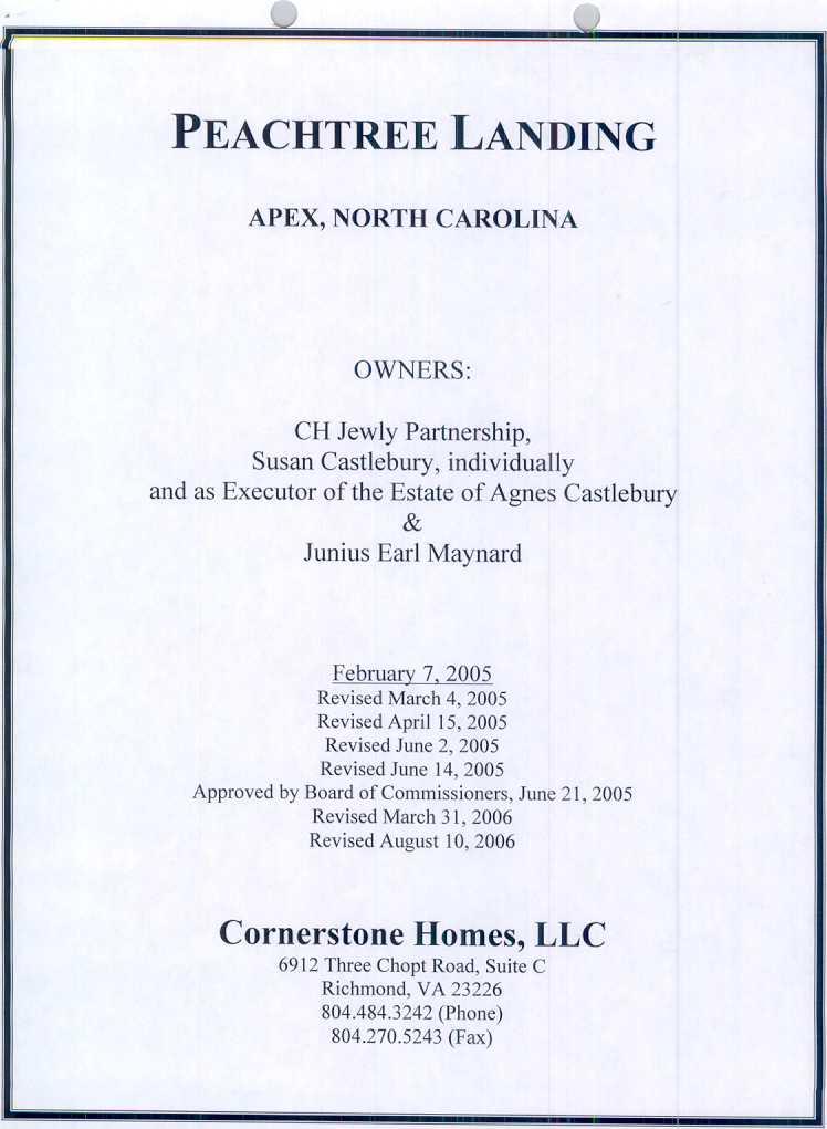
6 SECTION 3- PROJECT DATA A. Project Name: Peachtree Landing B. Revisions to approved Peachtree Landing Plan Prepared By c. Owners: Cornerstone Homes, LLC 6912 Three Chopt Road, Suite C Richmond, V A CH Jewly Partnership P.O. Box 1847 Buies Creek, NC Susan Castlebury, individually Castlebury, and Junius Earl Maynard 1701 US Highway 64 W. Apex, NC and as Executor of the Estate of Agnes D. Designated Single Point of Contact -Custis Colemen, Cornerstone Homes, LLC E. Current and Proposed Zoning of the Property: Current Zoning is TND-CUD; Proposed zoning is TND-CUD (with revised PD Plan and conditions) F. Current and Proposed Land Use Designation Current and proposed land use designations are a mixture of commercial, office and residential uses. G. Contract Purchaser's Name: Cornerstone Homes, LLC, has entered into a contract to purchase portions of the site from Susan Castlebury, individually and as administrator of the Estate of Agnes Castlebury, and Junius Earl Maynard. 3


7 SECTION 4 -PURPOSE STATEMENT The Peachtree Landing project is proposed to be a mixed-use project developed under the Town of Apex ordinances as TND (Traditional Neighborhood District). The project is currently five parcels owned by two entities who are working together to propose this development. The site is located along us Highway 64 West and lies adjacent to the Haddon Hall subdivision. Cornerstone Homes, LLC, has contracted with Susan Castlebury, individually and as Executor of the Estate of Agnes Castlebury, and Junius Earl Maynard to purchase a portion of the Castlebury lands which are located primarily on the western half of the site. The property currently under contract comprises, in general, Parcel D and right-of-ways thereon as noted on the Preliminary Layout Plan attached hereto. Cornerstone Homes proposes to construct an active adult condominium community with up to 96 units targeted to older adults without children or empty nesters. The current zoning on these parcels is TND-CUD and designated on the Town of Apex Comprehensive Plan as a mixture of commercial, office and residential uses. The existing TND zoning is consistent with the mix of uses and provides a good transition from the medium density residential of Haddon Hall to a limited access major thoroughfare highway. The proposed commercial and office uses will provide support for the residents of Haddon Hall and the nearby residents along Highway 64. The development of Peachtree Landing will provide attractive views into the site from US64 and will provide an attractive entrance into the Haddon Hall subdivision. The proposal to revise the existing conditions of the TND zoning is in keeping with the Town's objectives as outlined in the text of the Comprehensive Plan, and is necessary to accommodate the owner's and developer's vision of constructing an active adult community in this area of the Town of Apex. The project would allow a cluster of development centered on a mixed use core that is bordered by parks and natural areas. The mixed use areas are close enough to allow pedestrian traffic from this project and also from Haddon Hall and yet are separated from adjacent properties by open spaces. The Peachtree Landing plan will require sidewalks that comply with the Town of Apex street and sidewalk standards and provide safe pedestrian access from the active adult community to nearby mixed-use areas. Developer agrees to provide sidewalks along both sides of all public roads within the Peachtree Landing plan. This compact development will be conducive to pedestrian and public transportation. SECTION 5 -PERMITTED USES Residential Allow apartment use except in Parcel D as the following: The Apartment use will be permitted (on Parcels A and C on top floor in Mixed Use area only) and Condominiums (on Parcel D, and on Parcels A and C on top floor in Mixed Use areas only). Duplex, triplex or quadplex; 4
 Church or place of worship Convenience store Day care facility Dry cleaners and laundry service")

8 Single family detached; and Townhouse (all). Non-Residential Assembly hall, nonprofit Barber and beauty shop Bookstore (excluding adult bookstores) Church or place of worship Convenience store Day care facility Dry cleaners and laundry service Farmer's market Financial Institution Floral shop Government service Grocery, general or specialty Heath/fitness center or spa Laundromat Medical or dental office or clinic Newsstand or gift shop Office, business or professional Park, active or passive Personal service Pharmacy Printing and copying service Publishing office Real estate sales Recreation facility, private Restaurant, general Retail sales, general School, public or private Studio for art Tailor shop Theatre SECTION 6- DESIGN CONTROLS A. Maximum SQuare Footage Rer Mixed Use Parcel Parcel A: The maximum area of retail is 68,200 square feet with a total maximum building area of retail, office and residential uses of 85,600 square feet. The maximum number of residential units allowed within this space is 14. 5


9 Parcel C The maximum area of retail is 29,400 square feet and a total maximum building area of retail, office and residential area of 48,000 square feet. The maximum number of residential units allowed within this space is 15. Both Parcels A & C may mix a retail and office uses only on the lower floors of multi-story buildings while the top floor in a multi-story building may be a combination of office and residential uses only. Any single story building in these parcels may be retail, office or any combination thereof. B. Maximum Densities ner Residential Use Parcel Parcel B: Single detached uses only and may include up to 12 lots. Parcel D: All allowed residential uses with a maximum of 96 units. c, Pro~osed Lot Sizes for Residential Use Parcel The maximum lot size for any single family detached lot is 4,000 square feet. D. Pronosed Maximum Height of the Buildings and Number of Stories Residential Non-Residential Max. height- 30' Max. stories -2 Max. height- 45' Max. stories -3 E ProQosed Minimum Front. Side and Rear Yard Setbacks Residential Non-residential Front- 10' Side -5' Between buildings -10' Rear from alley easement -10' From buffer-10' Front -0' Side -0' Between buildings -10' From parking -10' From buffer- 0' F. Amount and Percentage of Built uqon Area Allowed 6


10 The UDO allows for a maximum 70 percent of built upon area in a lnd project. G. Amount and Percentage of Built uqon Area ProQosed Peachtree Landing will have a maximum of 70 percent built upon area in the entire project. Since approximately 29 percent of the project is in RCA or buffers which allow no impervious surface, as long as the individual developed parcels do not exceed 90 percent impervious then the overall impervious surfaces will be less than 70 percent. H. Land Use Percentages The land use percentages shown in the UDO are guidelines for development. The land use percentages based upon land area for Peachtree Landing are as follows: Shopfront and Business (mixed use) -22.3% Attached Homes -41.5% Detached Homes -7.7% RCA- 18.2% SECTION 7- ARCHITECURAL STANDARDS Residential All residential buildings (including any private recreational facility to be located on Parcel D) shall have exterior materials of brick, stone, wood, and/or hardiplank type of siding. All roofs of residential buildings shall be pitched at 5: 12 or greater, with the exception attached garages may be pitched at 4:12 or greater and all shall be covered with wood or asphalt shingles. Covered porches of at least 50 square feet are required on the front fa~ade of each residential structure facing the public right of way, except on Parcel D. To assure a variety of architectural styles and construction materials throughout the neighborhood, in Parcel D, at least two different home designs will offer varied floor plans. The included picture demonstrates the layout and use of color in the neighborhood, showcasing shades of white. 7


11 All residential units within the mixed use areas shall be consistent with the architectural style of that building. Non-Residential All non-residential structures shall have exterior materials of brick, stone, precast concrete and/or wood. Trim and decorative accent pieces may be hardiplank, metal or concrete. Roofs of non-residential buildings may be flat if enclosed by parapets. All non-residential structures shall be approved by an Architectural Review Committee appointed by the developer. SECTION 8- PARKING AND ~ LOADING As is typical in a TND project, on-street parking is allowed and encouraged in mixed use areas. On street parking adjacent to mixed use areas shall be angled spaces and any on-street parking in residential areas shall be parallel spaces on one side of the street. On-street parking along Blackburn Road shall be limited to the section between US 64 and the roundabout. Angled on-street parking on Street #1 shall be limited to the length from the roundabout down to the beginning of Parcel B and may occur on both sides of the street. Residential site plans may determine which side of the street parallel parking is allowed on, if any. Due to the nature of active adult communities, and considering safety and security concerns, Parcel D will utilize primarily attached garages to provide off -street parking. Parking and loading requirements shall generally conform to the Town of Apex UDO with the following exceptions. 8


12 All mixed use area parking shall be calculated based upon I parking space per 300 square feet of conditioned space including retail, office and residential spaces. In mixed use areas, the developer may be allowed a 10 percent reduction in total parking for shared parking allowance. Loading spaces may be provided at a rate and at locations determined by the developer. Each mixed use parcel shall provide at least one designated area for loading. Parking on the residential Parcels B and D may include side or rear entry garages. SECTION 9- SIGNS Signage for this project may vary from the UDO as allowed in the lnd ordinance. A Master Sign Plan has been created and submitted to the Planning Department for approval concurrent with the PO Plan. All signage shall be in keeping with the architectural styles established during the project and the Master Sign Plan may be modified as development styles are refined as allowed in UOO Section SECTION 10 -NA TURAL RESOURCE AND ENVIROMENT AL D A B This project currently does not fall within the primary or secondary watershed protection overlay districts as shown on Town of Apex watershed maps. This project does not contain any FEMA mapped floodplain. c. This project includes gross acres and by the UDO will require 20 percent of the gross area to be designated as RCA or landscape buffer. The required area ofrca and buffers is therefore 8.34 acres. D. The Peachtree Landing plan shows 7.57 acres of dedicated RCA (18.2%) and an additiona13.81 acres ofbuffers (9.1 %). Therefore the total area of RCA and buffers is acres (27.3%). This site is unusual in that most of the site is cleared and significant RCA and buffer areas to preserve are small. The plan shows three areas of dedicated RCA. Parcel G is 3.09 acres and includes and preserves an existing farm pond and several trees along the southern property line. Parcel H is 1.69 acres, includes a 0.75 acre park, preserves trees along the southern property line and acts as a buffer between Peachtree Landing and Haddon Hall. Parcel I is 3.39 acres and is adjacent to a parcel owned by the Town of Apex. Parcel I maya stormwater management device to handle stormwater runoff from western 9


 may include detention ponds, retention ponds, bioretention areas or any other approved BMP stormwater control.")
13 side of the project. Parcel I also includes 2.05 acres oftype E buffer area along US 64. SECTION 11- STORMWATER MANAGEMENT Although these properties do not currently fall within any watershed protection overlay district, once the property is annexed, the entire project will fall within the secondary watershed protection overlay district. Peachtree Landing will meet all applicable requirements and standards as described in section 6.1 of the Apex UDO. This project will meet all stormwater reduction requirements including limiting the post-development stormwater flows to not exceed the predevelopment stormwater runoff. Peachtree Landing will use the existing pond and additional devices to control the stormwater and sediment runoff. The additional device(s) may include detention ponds, retention ponds, bioretention areas or any other approved BMP stormwater control. Any stormwater control device shall be landscaped and constructed to be an amenity to the development and shall blend into its' surroundings. SECTION 12- PARKS AND RECREATION There are no greenways or municipal park areas shown for these properties on the Town of Apex Parks, Recreation, Greenways and Open Space Master Plan. Peachtree Landing is proposing to pay a fee-in-iieu for the residential portion of the project based upon the actual approved density at the time of a site/subdivision plan. Peachtree Landing will include several private parks and common areas for the residents and patrons of the project. Residential Parcels B and D, and Parcel G shall include at least one neighborhood amenity such as a playground, picnic area, etc., however, in the case where the proposed residential use is targeted to older adults the neighborhood amenity to be constructed may be directed to serve the appropriate target resident. A community clubhouse constructed as part of the unified development of residential Parcel D shall satisfy the neighborhood amenity requirement for Parcels D and G. The improvements to Blackbum Road will include sidewalks to connect to existing sidewalks and greenway paths along Blackbum Road. Parcel H shall include a minimum 0.75 acre improved park area that may include additional sidewalks, seating areas, a gazebo, sculptures, etc. SECTION 13 -PUBLIC FACILITIES The road network on the plan shows a safe and interconnected transportation system. In compliance with the Town of Apex Transportation Plan, this project includes the connection ofblackbum Road from Haddon Hall to us 64 and a stub 10


14 ~ road from Parcel D. Within Parcel D traffic calming devices will be used such as raised stamped concrete and an un-manned guard house potentially at both entrances and the interior loop road will utilize pedestrian crossings, and widening and narrowing of the road to slow traffic to meet the needs of an active adult community. We have provided a roundabout in a central location for effective but safe traffic flow. The owners of Peachtree Landing are also offering to pay for the installation of two additional stop signs at the Blackbum Road and Abby Knoll Drive intersection as a traffic calming measure. The Peachtree Landing Plan will require sidewalks along both sides of all public streets which will conform to the UDO, This compact development will be conducive to pedestrian and public transportation, which will provide numerous pedestrian opportunities to the mixed use center. The preliminary utility plan shows the interconnection of Peachtree Landing into the existing infrastructure of the Town. A sewer connection is available at the end ofblackbum Road, which shall be used to serve Parcels C and D. Sanitary sewer connection is also available to west into existing facilities of the Town property. By agreement with the Town, the developer(s) of Peachtree Landing shall provide an oversized gravity sewer main running through the project and receive oversize reimbursement for this installation. Water connection is available in Blackbum Road where there is an existing Town water line. The layout plan shows a proposed Town of Apex utility easement along US 64 based upon comments from Town staff. There is existing electrical service along a portion of the US 64 frontage and the Town intends to extend this service towards NC55 to meet the demands of growth in this part of Town. Peachtree Landing intends to use Town electrical services and cooperate in the establishment of the proposed fifteen foot utility easement. SECTION 14-PHASING The phasing plan is shown on map TND-4 in this document. Market conditions will fluctuate and ultimately determine the order and pace of development. This phase schedule is approximate and should be used for information services only. It is the intent of the owner and contract purchaser of the western portion of the site to develop Parcel D in phases over a 2 year period upon issuance of building permits from the Town. Phasing of Parcels A, B and C are dependant on development objectives of the owners of those properties, future developers, and ultimately, market conditions. However, the phase schedule is approximate and should be used for information services only. Phase 2 3 Begin Construction Oct 2006 August 2008 August 2008 Completion Dec 2008 August 2009 August


15 4 August 2009 August 2010 SECTION 15- CONSISTENCY WITH LAND USE PLAN The Town of Apex Comprehensive Plan designates this area for mixed use. The Plan shows a mixture of commercial, office and residential uses with more commercial designated west ofblackbum Road. The layout plan for Peachtree Landing shows a mix uses including commercial, office and residential with more commercial areas shown west of Blackbum Road. We believe this plan to be consistent with the intent of the Apex Comprehensive Plan. SECTION 16- COMPLIANCE WITH THE UDO The proposed plans for Peachtree Landing are in compliance with the standards and allowances provided in the current approved version of the Town of Apex Unified Development Ordinance. SECTION 17- LAND --~ USE NOTES A. The buildings within mixed use Parcels A and C shall be oriented to the new public streets and shall be located near the right-of-way. Buildings along Blackbum Road shall be a minimum of two stories in height measured above the Blackbum Road elevation. No building in Parcel A shall contain more than 50% of the total retail space allocated for that parcel. B. Parcel B shall incorporate a private alley into the site/subdivision plans for each parcel. c. The initial site or subdivision plan for each component of Peachtree Landing shall incorporate a landscape plan, each component landscape plan to be complimentary and consistent with one another, and shall designate street tree types and locations along with schematic planting plans for the thoroughfare and residential buffers. All landscape buffers shall meet the requirements of the Apex UDO. The landscape buffers along US 64 will include a fifteen foot Town of Apex utility easement for overhead power. These easements may be landscaped with shrubs or decorative grasses if approved by the Public Works Department. D. The roundabout shall be designated to have a single lane and accommodate large truck vehicular traffic. The islands in the roundabout 12


16 8. may be used for landscaping and signage as long as sight distances around the island are not compromised. E. All access points shown on the layout plan are approximate and shall be determined at the time of site/subdivision plans for individual parcels. The western most access point shown on the plan into Parcel A shall be 500 feet or less from the center of the cul-de-sac on Street #1. Parcel A shall provide adequate internal access to allow for emergency vehicle ingress and egress. Parcel C shall include two points of ingress and egress as shown on the Preliminary Layout Plan, with both points of access located along Public Street bordering Parcel C, in the approximate locations as noted on the Preliminary Layout Plan. Parcel C shall provide adequate internal access to allow for emergency vehicle ingress and egress. F. This project will require the creation of Property Owners Associations to handle the maintenance of common areas, buffers, parks, stormwater devices, etc. Inherent in the adoption of the POAs is the creation of an Architectural Review Committee which will oversee and approve architectural styles, materials, colors and signage. 13
PLANNED DEVELOPMENT DISTRICT STANDARDS. Cadence Site
 PLANNED DEVELOPMENT DISTRICT STANDARDS Cadence Site A Planned Development District 1. Statement of General Facts, Conditions and Objectives Property Size: Approximately 57.51 Acres York County Tax Map
a. provide for the continuation of collector streets and thoroughfare streets between adjacent subdivisions;
 Section 7.07. Intent The requirements of this Section are intended to provide for the orderly growth of the Town of Holly Springs and its extra-territorial jurisdiction by establishing guidelines for:
LINCOLN COUNTY PLANNING & INSPECTIONS DEPARTMENT
 LINCOLN COUNTY PLANNING & INSPECTIONS DEPARTMENT 302 NORTH ACADEMY STREET, SUITE A, LINCOLNTON, NORTH CAROLINA 28092 704-736-8440 OFFICE 704-736-8434 INSPECTION REQUEST LINE 704-732-9010 FAX To: Board
Town of Cary, North Carolina Rezoning Staff Report 12-REZ-27 Morris Branch Town Council Public Hearing January 24, 2013
 Town of Cary, North Carolina Rezoning Staff Report 12-REZ-27 Morris Branch Town Council Public Hearing January 24, 2013 REQUEST To amend the Town of Cary Official Zoning Map to rezone approximately 9.0
CITY OF BONITA SPRINGS ZONING ORDINANCE NO
 CITY OF BONITA SPRINGS ZONING ORDINANCE NO. 05-11 A ZONING ORDINANCE OF THE CITY OF BONITA SPRINGS, FLORIDA; APPROVING A REQUEST BY ROCKPOINT/RONTO NAPLES, LLC IN REFERENCE TO EAST BONITA ACTIVE ADULT
LINCOLN COUNTY PLANNING & INSPECTIONS DEPARTMENT
 LINCOLN COUNTY PLANNING & INSPECTIONS DEPARTMENT 302 NORTH ACADEMY STREET, SUITE A, LINCOLNTON, NORTH CAROLINA 28092 704-736-8440 OFFICE 704-736-8434 INSPECTION REQUEST LINE 704-732-9010 FAX To: Board
DEVELOPMENT DEPARTMENT STAFF REPORT STAFF REPORT DRESDEN DRIVE TOWNHOMES DCI
 DEVELOPMENT DEPARTMENT STAFF REPORT Meeting Date: September 13, 2018 Item #: PZ2018-319 STAFF REPORT DRESDEN DRIVE TOWNHOMES DCI Request: Project Name: Development of Community Compact (DCI) and six concurrent
c) Stub streets shall be required as follows:
 Stub streets shall be required as follows:") Sec. 7.2.1 / Streets 7.2 DESIGN STANDARDS 7.2.1 Streets A) Interconnectivity 1) Conformity with Apex Transportation Plan. The subdivision s street system shall conform to the Apex Transportation Plan.
Sec. 7.2.1 / Streets 7.2 DESIGN STANDARDS 7.2.1 Streets A) Interconnectivity 1) Conformity with Apex Transportation Plan. The subdivision s street system shall conform to the Apex Transportation Plan.
LINCOLN COUNTY PLANNING & INSPECTIONS DEPARTMENT
 LINCOLN COUNTY PLANNING & INSPECTIONS DEPARTMENT 302 NORTH ACADEMY STREET, SUITE A, LINCOLNTON, NORTH CAROLINA 28092 704-736-8440 OFFICE 704-736-8434 INSPECTION REQUEST LINE 704-732-9010 FAX To: Board
DEVELOPMENT DEPARTMENT STAFF REPORT THE PARK AT 5 TH
 DEVELOPMENT DEPARTMENT STAFF REPORT ARB Meeting Date: July 3, 2018 Item #: _PZ2018-293_ THE PARK AT 5 TH Request: Site Address: Project Name: Parcel Number: Applicant: Proposed Development: Current Zoning:
(a) Commercial uses on Laurel Avenue, abutting the TRO District to the
 Commercial uses on Laurel Avenue, abutting the TRO District to the") 32X Zoning Code 150.36 TRANSITIONAL RESIDENTIAL OVERLAY DISTRICT. (A) Intent and purpose. (1) It is the intent of the Transitional Residential Overlay District (hereinafter referred to as the "TRO District")
32X Zoning Code 150.36 TRANSITIONAL RESIDENTIAL OVERLAY DISTRICT. (A) Intent and purpose. (1) It is the intent of the Transitional Residential Overlay District (hereinafter referred to as the "TRO District")
Sec Tier 2 principal uses and structures. The principal uses of land and structures allowed in Tier 2 are provided below subject to the
 Sec. 27-730.4.9. Tier 2 principal uses and structures. The principal uses of land and structures allowed in Tier 2 are provided below subject to the standards and limitations contained within this division.
Town of Cary, North Carolina Rezoning Staff Report 14-REZ-24 Indian Wells Road Properties Town Council Meeting November 20, 2014
 Town of Cary, North Carolina Rezoning Staff Report 14-REZ-24 Indian Wells Road Properties Town Council Meeting November 20, 2014 REQUEST To amend the Town of Cary Official Zoning Map by revising a condition
CITY OF FATE, TEXAS UNIFIED DEVELOPMENT ORDINANCE. Article III Zoning Districts
 CITY OF FATE, TEXAS UNIFIED DEVELOPMENT ORDINANCE Article III Zoning Districts 3.1. General to all Zoning Districts and Zoning Map 3.1.1. Zoning Districts Established This article establishes the zoning
Article 7: Residential Land Use and Development Requirements
 Article 7: Residential Land Use and Section 701: Statement of Intent (A) (B) (C) The intent of Article 7 is to develop certain land use and development requirements for the residential uses within Cumru
MINOR SUBDIVISION FINAL PLAT APPLICATION Town of Apex, North Carolina
 MINOR SUBDIVISION FINAL PLAT APPLICATION Town of Apex, North Carolina This document is a public record under the North Carolina Public Records Act and may be published on the Town s website or disclosed
ARTICLE 14 PLANNED UNIT DEVELOPMENT (PUD) DISTRICT
 DISTRICT") ARTICLE 14 PLANNED UNIT DEVELOPMENT (PUD) DISTRICT Section 14.01 Intent. It is the intent of this Article to allow the use of the planned unit development (PUD) process, as authorized by the Michigan Zoning
ARTICLE 14 PLANNED UNIT DEVELOPMENT (PUD) DISTRICT Section 14.01 Intent. It is the intent of this Article to allow the use of the planned unit development (PUD) process, as authorized by the Michigan Zoning
STAFF REPORT. Guttman Development Group, LLC. PUD-R (Residential Planned Unit Development Plan)
") P a g e 1 STAFF REPORT CASE: APPLICANT: LOCATION: ZONED: REQUEST: ZC09-2017 Guttman Development Group, LLC 4990 Wilmington Pike PUD-R (Residential Planned Unit Development Plan) A Major Change to an Approved
P a g e 1 STAFF REPORT CASE: APPLICANT: LOCATION: ZONED: REQUEST: ZC09-2017 Guttman Development Group, LLC 4990 Wilmington Pike PUD-R (Residential Planned Unit Development Plan) A Major Change to an Approved
PLANNED UNIT DEVELOPMENT & SUBDIVISION STAFF REPORT Date: April 18, 2019
 PLANNED UNIT DEVELOPMENT & SUBDIVISION STAFF REPORT Date: April 18, 2019 DEVELOPMENT NAME SUBDIVISION NAME Springhill Village Subdivision Springhill Village Subdivision LOCATION 4350, 4354, 4356, 4358,
MIXED USE DEVELOPMENT AGREEMENT
 MIXED USE DEVELOPMENT AGREEMENT THIS MIXED USE DEVELOPMENT AGREEMENT (hereinafter "Agreement") made and entered into this day of, 2007, pursuant to Section 205-30 of the Zoning Ordinances of the City of
FINAL SITE PLAN PLAT APPLICATION Town of Apex, North Carolina
 FINAL SITE PLAN PLAT APPLICATION Town of Apex, North Carolina This document is a public record under the North Carolina Public Records Act and may be published on the Town s website or disclosed to third
MASTER SUBDIVISION FINAL PLAT APPLICATION Town of Apex, North Carolina
 MASTER SUBDIVISION FINAL PLAT APPLICATION Town of Apex, North Carolina This document is a public record under the North Carolina Public Records Act and may be published to the Town s website or disclosed
Planning Department Oconee County, Georgia
 Planning Department Oconee County, Georgia STAFF REPORT REZONE CASE #: 6985 DATE: October 31, 2016 STAFF REPORT BY: Andrew C. Stern, Planner APPLICANT NAME: Williams & Associates, Land Planners PC PROPERTY
Courtyards at Kinnamon Park Sketch Plan
 Courtyards at Kinnamon Park Sketch Plan Courtyards at Kinnamon Park Sketch Plan Staff Analysis PART 1: PROJECT SUMMARY Applicant: EPCON Communities Property Owner: Johnsie M. Kinnamon Heirs, Douglas and
CITY OF LEBANON RUSSELL DRIVE AREA MIXED USE NEIGHBORHOOD CENTER FINAL IMPLEMENTATION PLAN
 CITY OF LEBANON RUSSELL DRIVE AREA MIXED USE NEIGHBORHOOD CENTER FINAL IMPLEMENTATION PLAN TGM Contract 2G-01 #22425 Deliverable 15.5 Prepared by: Satre Associates, P.C. Planners, Landscape Architects,
Chapter MIXED USE ZONING DISTRICTS
 Page 1 of 12 Page 1/12 Chapter 17.18 MIXED USE ZONING DISTRICTS Sections: 17.18.010 Purposes. 17.18.020 Permitted, conditional and prohibited uses. 17.18.030 Bulk, 17.18.010 Purposes. A. Mixed Use Districts.
DEVELOPMENT DEPARTMENT STAFF REPORT STAFF REPORT MCDONALD S ZONING MAP AMENDMENT AND CONCURRENT VARIANCES
 DEVELOPMENT DEPARTMENT STAFF REPORT Meeting Date: October 12, 2017 Item #: _PZ2017-172_ STAFF REPORT MCDONALD S ZONING MAP AMENDMENT AND CONCURRENT VARIANCES Request: Rezone property from MU-BC to CC,
LINCOLN COUNTY PLANNING & INSPECTIONS DEPARTMENT
 LINCOLN COUNTY PLANNING & INSPECTIONS DEPARTMENT 30 NORTH ACADEMY STREET, SUITE A, LINCOLNTON, NORTH CAROLINA 809 704-736-8440 OFFICE 704-736-8434 INSPECTION REQUEST LINE 704-73-900 FAX To: Board of Commissioners
ORDINANCE NOW THEREFORE, BE IT ENACTED BY THE CITY COMMISSION OF THE CITY OF WINTER GARDEN, FLORIDA, AS FOLLOWS:
 ORDINANCE 12-02 AN ORDINANCE OF THE CITY OF WINTER GARDEN, FLORIDA, AMENDING ARTICLE V OF CHAPTER 118 OF THE WINTER GARDEN CODE OF ORDINANCES ENTITLED PLANNED UNIT DEVELOPMENTS CREATING URBAN VILLAGE PLANNED
Chapter Residential Mixed Density Zone
 Chapter 19.16 Residential Mixed Density Zone 19.16.010 Purpose and Intent 19.16.020 Permitted Uses 19.16.030 Accessory Permitted Uses 19.16.040 Secondary Permitted Uses 19.16.050 Conditional Uses 19.16.060
M E M O R A N D U M. Meeting Date: October 23, Item No. F-1. Planning and Zoning Commission. Daniel Turner, Planner I
 M E M O R A N D U M Meeting Date: October 23, 2017 Item No. F-1 To: From: Subject: Planning and Zoning Commission Daniel Turner, Planner I PUBLIC HEARING: Consider a recommendation of a of Planned Development
Attachment 5 - Ordinance 3154 Exhibit D (Revised for 9/15 Council Meeting) Page 1 of 7 Port Townsend Municipal Code. Chapter 17.18
 Page 1 of 7 Port Townsend Municipal Code. Chapter 17.18") Page 1 of 7 Page 1/7 Chapter 17.18 MIXED USE ZONING DISTRICTS Sections: 17.18.010 Purposes. 17.18.020 Permitted, conditional and prohibited uses. 17.18.030 Bulk, 17.18.010 Purposes. A. Mixed Use Districts.
Page 1 of 7 Page 1/7 Chapter 17.18 MIXED USE ZONING DISTRICTS Sections: 17.18.010 Purposes. 17.18.020 Permitted, conditional and prohibited uses. 17.18.030 Bulk, 17.18.010 Purposes. A. Mixed Use Districts.
Town of Cary, North Carolina Rezoning Staff Report 14-REZ-31 Cary Park PDD Amendment (Waterford II) Town Council Meeting January 15, 2015
 Town Council Meeting January 15, 2015") Town of Cary, North Carolina Rezoning Staff Report 14-REZ-31 Cary Park PDD Amendment (Waterford II) Town Council Meeting January 15, 2015 REQUEST To amend the Town of Cary Official Zoning Map by amending
Town of Cary, North Carolina Rezoning Staff Report 14-REZ-31 Cary Park PDD Amendment (Waterford II) Town Council Meeting January 15, 2015 REQUEST To amend the Town of Cary Official Zoning Map by amending
ADDRESS / DESCRIPTION: Northeast corner of Sandbridge Road and Atwoodtown Road ELECTION DISTRICT: PRINCESS ANNE
 10 & 11 March 14, 2012 Public Hearing APPLICANT: MARLYN DEVELOPMENT CORPORATION PROPERTY OWNER: CORAL DEVELOPMENT, LLC STAFF PLANNER: Faith Christie REQUEST: Modification of Conditional Change of Zoning
ARTICLE 15. RULES, REGULATIONS AND DEFINITIONS
 ARTICLE 15. RULES, REGULATIONS AND DEFINITIONS Section 1. Interpretation and Construction: The following rules and regulations regarding interpretation and construction of the Ulysses-Grant County, Kansas,
1. Cuyler-Brownsville planned neighborhood conservation (P-N-C) districtphase I (section ). (2) Single-family semiattached dwellings;
 districtphase I (section ). (2) Single-family semiattached dwellings;") Sec. 8-3035. Planned unit development multifamily (PUD-M). A. Purpose. The PUD-M district is intended to allow a variety of residential development including single-family residential, two-family residential,
Sec. 8-3035. Planned unit development multifamily (PUD-M). A. Purpose. The PUD-M district is intended to allow a variety of residential development including single-family residential, two-family residential,
SECTION 3.1 ZONING DISTRICTS ESTABLISHED
 ARTICLE 3. ZONING DISTRICTS SECTION 3.1 ZONING DISTRICTS ESTABLISHED The City of Cedar Hill, Texas is hereby divided into the following zoning districts. The use, height and area regulations as set out
DRAFT -- PROPOSED EXPANSION AND REVISIONS TO DIVISION 24. SPECIAL DISTRICT--COLLEGE AND UNIVERSITY NEIGHBORHOODS DISTRICT
 DRAFT -- PROPOSED EXPANSION AND REVISIONS TO DIVISION 24. SPECIAL DISTRICT--COLLEGE AND UNIVERSITY NEIGHBORHOODS DISTRICT Sec. 28-831. Purpose. The college and university neighborhoods district purposes
16 February 9, 2011 Public Hearing APPLICANT: GEO I, L.L.C.
 16 February 9, 2011 Public Hearing APPLICANT: GEO I, L.L.C. PROPERTY OWNER: GEO I, L.L.C., DONALD K. PILAND, AND BOOTSIE LORAINE TERRY STAFF PLANNER: Faith Christie REQUEST: Conditional Change of Zoning
THE REDEVELOPMENT PLAN
 PAGE 37 THE REDEVELOPMENT PLAN FUTURE LAND USE The Silver Terrace Redevelopment Area is currently designated as Redevelopment Area #4 on the City of Delray Beach Future Land Use Map (FLUM). This designation
CHAPTER 29 ARTICLE 8. 20,000 sf 30,000 sf 100,000 sf (with approval by Special Use Permit according to Sec
 CHAPTER 29 ARTICLE 8 (3) Zone Development Standards. The zone development standards for the NC Zone are set forth in Table 29.81(3) below: Table 29.81(3) Neighborhood Commercial (NC) Zone Development Standards
Chapter 1107: Zoning Districts
 Chapter 1107: Zoning Districts 1107.01 Establishment of Zoning Districts (a) Districts Established In order to carry out the purpose of this code, the City is hereby divided into the zoning districts established
CHARTER TOWNSHIP OF CALEDONIA COUNTY OF KENT, MICHIGAN. at the Township and Village Hall, 8196 Broadmoor Avenue, Caledonia, Michigan on the
 First Reading CHARTER TOWNSHIP OF CALEDONIA COUNTY OF KENT, MICHIGAN At a regular meeting of the Township Board of the Charter Township of Caledonia, held at the Township and Village Hall, 8196 Broadmoor
Washington County, Minnesota Ordinances
 Washington County, Minnesota Ordinances Ordinance No. 153 Text Amendment to the Washington County Development Code - Chapter One, Section 2 and Chapter Two, Part 1, Part 2, Part 3, of the Development Code
TOWNSHIP OF UPPER MACUNGIE LEHIGH COUNTY, PENNSYLVANIA. ORDINANCE NO [To be considered for Adoption June 1, 2017]
![TOWNSHIP OF UPPER MACUNGIE LEHIGH COUNTY, PENNSYLVANIA. ORDINANCE NO [To be considered for Adoption June 1, 2017]](/thumbs/91/106428876.jpg "TOWNSHIP OF UPPER MACUNGIE LEHIGH COUNTY, PENNSYLVANIA. ORDINANCE NO [To be considered for Adoption June 1, 2017]") TOWNSHIP OF UPPER MACUNGIE LEHIGH COUNTY, PENNSYLVANIA ORDINANCE NO. 2017 05 [To be considered for Adoption June 1, 2017] AN ORDINANCE OF THE BOARD OF SUPERVISORS OF THE TOWNSHIP OF UPPER MACUNGIE, LEHIGH
TOWNSHIP OF UPPER MACUNGIE LEHIGH COUNTY, PENNSYLVANIA ORDINANCE NO. 2017 05 [To be considered for Adoption June 1, 2017] AN ORDINANCE OF THE BOARD OF SUPERVISORS OF THE TOWNSHIP OF UPPER MACUNGIE, LEHIGH
SECTION 11 - GENERAL COMMERCIAL ZONE (C3) REGULATIONS
 REGULATIONS") SECTION 11 - GENERAL COMMERCIAL ZONE (C3) REGULATIONS 11.1 GENERAL USE REGULATIONS 11.1.1 PERMITTED USES No land, building, or structures shall be used or erected in the General Commercial Zone (C3) except
SECTION 11 - GENERAL COMMERCIAL ZONE (C3) REGULATIONS 11.1 GENERAL USE REGULATIONS 11.1.1 PERMITTED USES No land, building, or structures shall be used or erected in the General Commercial Zone (C3) except
Commercial Zoning Districts
 Article 4 Commercial Zoning Districts Section 4.1 Section 4.2 Section 4.3 C-D Downtown Commercial District C-1 General Commercial District C-2 Heavy Service Commercial District 4.1 C-D, Downtown Commercial
1. Multi-family dwellings, including town homes, apartments, or condominiums.
 Sec. 4-6.67 Planned Unit Development (PUD-M). a. Definition. A planned multi-family zoning district of three acres or more, consisting of townhouses, apartments, condominiums, single-family detached, single-family
ARTICLE 3 DEFINITIONS
 Sections: 3-1 Rules of Construction 3-2 Definitions ARTICLE 3 DEFINITIONS SECTION 3-1 RULES OF CONSTRUCTION 3-101. a. The language set forth in these regulations shall be interpreted in accordance with
ARTICLE 7 R-1 LOW DENSITY ONE-FAMILY RESIDENTIAL DISTRICT Updated 5/4/13
 ARTICLE 7 R-1 LOW DENSITY ONE-FAMILY RESIDENTIAL DISTRICT Updated 5/4/13 Sec. 7.01. DESCRIPTION AND PURPOSE. This is the most restricted, low-density zone, composed chiefly of low-density one-family homes
Exhibit A-1. Piney Creek Bend Planned Development
 Exhibit A-1 Piney Creek Bend Planned Development A. Purpose and Intent The Piney Creek Bend PD is composed of approximately 90.91 acres, as described in Exhibit D (Field Notes). The development of this
INTERLOCAL AGREEMENT FOR LEESVILLE BRANCH LIBRARY BETWEEN CITY OF RALEIGH, NORTH CAROLINA AND WAKE COUNTY, NORTH CAROLINA
 DRAFT 01-23-08 INTERLOCAL AGREEMENT FOR LEESVILLE BRANCH LIBRARY BETWEEN CITY OF RALEIGH, NORTH CAROLINA AND WAKE COUNTY, NORTH CAROLINA Dated as of, 2008 INTERLOCAL AGREEMENT THIS INTERLOCAL AGREEMENT
Condominium Unit Requirements.
 ARTICLE 19 CONDOMINIUM REGULATIONS Section 19.01 Purpose. The purpose of this Article is to regulate projects that divide real property under a contractual arrangement known as a condominium. New and conversion
MCGUIRE AV 374 COUNTRY CLUB RD RANDALL ST RYANDALE RD FLOODWAY FLOODWAY FRINGE
 SILAS CREEK MCGUIRE AV OLD COUNTRY CLUB RD 249 RYANDALE RD 323 374 COUNTRY CLUB RD S 441 SEDGEFIELD LN (PVT) QUEENSBURY RD FLOODWAY FLOODWAY FRINGE RANDALL ST SOUTHWIN DR November 19, 2004 Paul E. Burke,
Staff Report: Date: Applicant: Property Identification: Acreage of Request: Current Zoning of Requested Area: Requested Action: Attached:
 Staff Report: Completed by Jeff Palmer Director of Planning & Zoning Date: November 7, 2018, Updated November 20, 2018 Applicant: Greg Smith, Oberer Land Developer agent for Ronald Montgomery ET AL Property
The following regulations shall apply in the R-E District:
 "R-E" RESIDENTIAL ESTATE DISTRICT (8/06) The following regulations shall apply in the R-E District: 1. Uses Permitted: The following uses are permitted. A Zoning Certificate may be required as provided
Community Development
 Land Use Petition RZ-16-002 Date of Staff Recommendation Preparation: April 15, 2016 (CEL) Date of Planning Commission Recommendation: May 3, 2016 PROJECT LOCATION: DISTRICT/SECTION/LANDLOT(S): ACREAGE
ARTICLE 3: Zone Districts
 ARTICLE 3: Zone Districts... 3-1 17.3.1: General...3-1 17.3.1.1: Purpose and Intent... 3-1 17.3.2: Districts and Maps...3-1 17.3.2.1: Applicability... 3-1 17.3.2.2: Creation of Districts... 3-1 17.3.2.3:
R E S O L U T I O N. 1. Request: A Departure from Parking and Loading Standards (DPLS-449) for 32 parking spaces.
 for 32 parking spaces.") R E S O L U T I O N WHEREAS, the Prince George s County Planning Board has reviewed Departure from Parking and Loading Standards No. DPLS-449 requesting a departure to allow a reduction of 32 parking spaces
R E S O L U T I O N WHEREAS, the Prince George s County Planning Board has reviewed Departure from Parking and Loading Standards No. DPLS-449 requesting a departure to allow a reduction of 32 parking spaces
A favorable recommendation to the City Council is requested.
 To: Sycamore Plan Commission From: Brian Gregory, City Manager Date: November 9, 2017 Re: November 13, 2017 Plan Commission Meeting The Plan Commission has one action item and three workshop items. I.
CITY OF MERCED SMALL LOT SINGLE-FAMILY HOME DESIGN GUIDELINES
 CITY OF MERCED SMALL LOT SINGLE-FAMILY HOME DESIGN GUIDELINES Development Services Department Planning and Permitting Adopted August 15, 2005 SMALL LOT SINGLE FAMILY HOME GUIDELINES A. Purpose and Applicability.
 Petition for Amendment #2 to the Existing Planned Unit Development known as VILLA VIZCAYA For Villa Vizcaya LLC 625 Marquette Ave., South; Minneapolis, Mn., 55479 Presented to: City of Port St Lucie Planning
The following information is for use by the Lincoln County Planning Board at their meeting/public hearing on February 3, 2014.
 LINCOLN COUNTY PLANNING & INSPECTIONS DEPARTMENT 302 NORTH ACADEMY STREET, SUITE A, LINCOLNTON, NORTH CAROLINA 28092 704-736-8440 OFFICE 704-736-8434 INSPECTION REQUEST LINE 704-732-9010 FAX To: Planning
LINCOLN COUNTY PLANNING & INSPECTIONS DEPARTMENT
 To: Board of Commissioners From: Randy Hawkins, Zoning Administrator Date: August 4, 2015 Re: Planning Board recommendations (08/03/15) UDO Proposed Amendments #2015-3 Lincoln County Planning and Inspections
Initial Project Review
 Pierce County Department of Planning and Land Services, 2401 South 35th Street, Tacoma, WA (253) 798-7037 Initial Project Review Major Amendment to Preliminary Plat: Hawks Ridge Division 1 Application
Clearcreek Township Zoning Staff Report Soraya Farms Section 6 Stage 3 Review Page 1 of 8
 Staff Report: Completed by Jeff Palmer Director of Planning & Zoning Report Date: September 10, 2018 Meeting Date: October 1, 2018 Applicant: Shery Oakes, agent for Soraya Farms Requested Action: Soraya
Organized with a "core" curriculum (the first five modules) and "electives" (the remaining modules in the program.
 and electives (the remaining modules in the program.") Introduction Sponsored by The North Carolina Chapter - American Planning Association These materials are the result of an effort by volunteer members of the North Carolina Chapter of the American Planning
Introduction Sponsored by The North Carolina Chapter - American Planning Association These materials are the result of an effort by volunteer members of the North Carolina Chapter of the American Planning
Part 4.0 DEVELOPMENT REGULATIONS
 M A I N S T R E E T N O R T H Part 4.0 DEVELOPMENT REGULATIONS 4.1 Districts 4.2 Permitted and Prohibited Uses, Standards and Standard Specific Criteria and Other General Provisions 4.3 DPS REGULATIONS
Zoning Regulations of the Town of Redding Connecticut
 Zoning Regulations of the Town of Redding Connecticut Statutory zoning authority was adopted for the Town of Redding, and a Zoning Commission established as provided by law, at a Town Meeting held May
DEVELOPMENT DEPARTMENT STAFF REPORT DRESDEN HEIGHTS PHASE II DCI
 DEVELOPMENT DEPARTMENT Meeting Date: January 10, 2019 Item #: PZ2019-393 Project Name: Applicant and Owner: Proposed Development: Requests: STAFF REPORT DRESDEN HEIGHTS PHASE II DCI Dresden Heights Phase
BE IT ORDAINED, by the City Council of the City of Saratoga Springs, New York, following a public hearing, as follows:
 Chapter 241.6 AN ORDINANCE PROVIDING FOR THE AMENDMENT TO THE ESTABLISHED PLANNED UNIT DEVELOPMENT DISTRICT KNOWN AS "WOODLAWN OVAL PLANNED UNIT COMMERCIAL DEVELOPMENT" BE IT ORDAINED, by the City Council
ARTICLE 23 CONDOMINIUM STANDARDS
 ARTICLE 23 CONDOMINIUM STANDARDS Section 23.01 Intent. The intent of this Article is to provide regulatory standards for condominiums and site condominiums similar to those required for projects developed
Time Extension Staff Report
 Time Extension Staff Report Subdivision Name Lunara Subdivision File Number SUB07-00019 Approval Time Extension for Lead Agency Boise City Certification Signature of Boise City Engineer Annexation Date
Rezoning Petition Pre-Hearing Staff Analysis April 17, 2017
 Rezoning Petition 2017-041 Pre-Hearing Staff Analysis April 17, 2017 REQUEST Current Zoning: R-5 (single family residential), R-22MF (multifamily residential), and I-1 (light industrial) Proposed Zoning:
THE AREA PLAN COMMISSION OF ST. JOSEPH COUNTY, IN AGENDA
 THE AREA PLAN COMMISSION OF ST. JOSEPH COUNTY, IN AGENDA Tuesday, June 20, 2017 Fourth-Floor Council Chambers 3:30 p.m. County-City Building, South Bend, IN PUBLIC HEARINGS: 1. Rezonings: A. A combined
CITY OF EAU CLAIRE, WISCONSIN. SPECIAL ASSESSMENT POLICY (Dated: November 8, 2016)
") CITY OF EAU CLAIRE, WISCONSIN SPECIAL ASSESSMENT POLICY (Dated: November 8, 2016) (Adopted by reference by Ordinance No. 7207 adopted November 8, 2016) PURPOSE The purpose of this Policy is to assure fair
CITY OF EAU CLAIRE, WISCONSIN SPECIAL ASSESSMENT POLICY (Dated: November 8, 2016) (Adopted by reference by Ordinance No. 7207 adopted November 8, 2016) PURPOSE The purpose of this Policy is to assure fair
ARTICLE 13 CONDOMINIUM REGULATIONS
 ARTICLE 13 CONDOMINIUM REGULATIONS Section 13.01 Purpose. The purpose of this Article is to regulate projects that divide real property under a contractual arrangement known as a condominium. New and conversion
DEVELOPMENT DEPARTMENT STAFF REPORT
 DEVELOPMENT DEPARTMENT STAFF REPORT Meeting Date: January 11, 2018 Item #: PZ2017-151 STAFF REPORT VARIANCES RESTAURANT WITH DRIVE-THROUGH Request: Multiple Variances for a new restaurant with drive-through
CITY OF TYLER CITY COUNCIL COMMUNICATION
 CITY OF TYLER CITY COUNCIL COMMUNICATION Agenda Number: Z-2 Date: January 23, 2019 Subject: PD18-035 FAIR NANCY WOOD (2801 AND 2835 SOUTH BROADWAY AVENUE) Request that the City Council consider approving
ORDINANCE WHEREAS, the adoption of this Ordinance shall not be construed as an admission that the aforesaid claim has merit or is correct; and
 ORDINANCE 12-24 AN ORDINANCE OF THE CITY OF WINTER GARDEN, FLORIDA, REPEALING ORDINANCE 12-02 AND REPLACING IT WITH THE AMENDMENTS TO ARTICLE V OF CHAPTER 118 OF THE WINTER GARDEN CODE OF ORDINANCES CONTAINED
FREQUENTLY USED PLANNING & ZONING TERMS
 City Of Mustang FREQUENTLY USED PLANNING & ZONING TERMS Abut: Having property lines, street lines, or zoning district lines in common. Accessory Structure: A structure of secondary importance or function
c. Public Facilities: Community Center; Public Park; Religious Use; Transit Stop. [Amended Ordinance #11-07]
![c. Public Facilities: Community Center; Public Park; Religious Use; Transit Stop. [Amended Ordinance #11-07]](/thumbs/72/66882116.jpg "c. Public Facilities: Community Center; Public Park; Religious Use; Transit Stop. [Amended Ordinance #11-07]") Section 2.04. Intent The s are established to protect, promote and maintain the development of medium density single family dwellings and to provide for limited public and institutional uses that are compatible
Section 2.04. Intent The s are established to protect, promote and maintain the development of medium density single family dwellings and to provide for limited public and institutional uses that are compatible
Chapter Planned Residential Development Overlay
 Chapter 19.29 Planned Residential Development Overlay Sections 010 Purpose 020 Scope 030 Definitions 030 Minimum Size 040 Allowable Uses 050 Minimum Development Standards 060 Density Bonus 070 Open Space
PLANNING COMMISSION REPORT Regular Agenda -Public Hearing Item
 PDP-13-00518 Item No. 3B- 1 PLANNING COMMISSION REPORT Regular Agenda -Public Hearing Item PC Staff Report 2/24/14 ITEM NO. 3B PRELIMINARY DEVELOPMENT PLAN FOR HERE @ KANSAS; 1101 INDIANA ST (SLD) PDP-13-00518:
Community Advisory Committee (CAC) Meeting #7 West Anaheim Youth Center May 26, 2016
 Meeting #7 West Anaheim Youth Center May 26, 2016") Community Advisory Committee (CAC) Meeting #7 West Anaheim Youth Center May 26, 2016 1 Project Team City: David Belmer Planning and Building Director Jonathan Borrego, AICP Planning Services Manager Gustavo
Community Advisory Committee (CAC) Meeting #7 West Anaheim Youth Center May 26, 2016 1 Project Team City: David Belmer Planning and Building Director Jonathan Borrego, AICP Planning Services Manager Gustavo
January 7, Sarah Smith Community Development Director City of Mound 5341 Maywood Road Mound, MN Dear Ms. Smith,
 January 7, 2019 Sarah Smith Community Development Director City of Mound 5341 Maywood Road Mound, MN 55364 Dear Ms. Smith, We are pleased to present the enclosed concept plan and requisite attachments
City of Grande Prairie Development Services Department
 City of Grande Prairie Development Services Department COUNTRYSIDE SOUTH OUTLINE PLAN Prepared by: GPEC Consulting Ltd. #202, 10712-100th Street Grande Prairie, AB Council Resolution of August 20, 2001
ORDINANCE NO. AN ORDINANCE AMENDING THE ZONING ORDINANCE OF FISHERS, INDIANA 2006
 ORDINANCE NO. AN ORDINANCE AMENDING THE ZONING ORDINANCE OF FISHERS, INDIANA 2006 AN ORDINANCE AMENDING THE ZONING ORDINANCE OF FISHERS, INDIANA 2006. BE IT ORDAINED BY THE TOWN COUNCIL OF THE TOWN OF
In order to permit maximum applicability of the PUD District, PUD-1 and PUD-2 Districts are hereby created.
 ARTICLE III. PUD ned Unit Development Overlay District 205-128. Purpose. The PUD ned Unit Development Overlay District is intended to provide flexibility in the design of planned projects; to encourage
4.2 RESIDENTIAL ZONING DISTRICTS
 4.2 RESIDENTIAL ZONING DISTRICTS A. Purpose: To define regulations and standards for each residential zoning district in the City. The following sections identify uses, regulations, and performance standards
Bowie Marketplace Residential Detailed Site Plan Statement of Justification January 13, 2017 Revised February 2, 1017
 Bowie Marketplace Residential Detailed Site Plan Statement of Justification January 13, 2017 Revised February 2, 1017 Submitted on behalf of: BE Bowie LLC 5410 Edson Lane, Suite 220 Rockville, MD 20852
STAFF REPORT. Director Planning, Zoning and Building Department. Longboat Key, Florida
 STAFF REPORT DATE: October 12, 2015 TO: FROM: THROUGH: Planning and Zoning Board Maika Arnold, Planner Planning, Zoning and Building Department Alaina Ray, AICP Director Planning, Zoning and Building Department
PERMITTED USES: Within the MX-1 Mixed Use Neighborhood District the following uses are permitted:
 6.25 MX-1 - MIXED USE NEIGHBORHOOD 6.25.1 INTENT: The purpose of the MX-1 Mixed Use Neighborhood District is to accommodate the development of a wide-range of residential and compatible non-residential
County of Loudoun. Department of Planning MEMORANDUM
 County of Loudoun Department of Planning MEMORANDUM DATE: September 3, 2013 TO: FROM: Marchant Schneider, Project Manager Land Use Review Marie Genovese, AICP, Planner III, Community Planning SUBJECT:
the conditions contained in their respective Orders until January 1, 2025, at the discretion of the Director of Planning, Property and Development.
 Part 4: Use Regulations Temporary Uses and Structures Purpose the conditions contained in their respective Orders until January 1, 2025, at the discretion of the Director of Planning, Property and Development.
PART 3 RESIDENTIAL ZONING DISTRICTS. Designation of Residential Zoning Districts and Purpose Statements.
 PART 3 S Section 301. Designation of and Purpose Statements. See Table 3-1 herein this Section for the designations and purpose statements of the respective Residential Zoning Districts which are shown
ARTICLE C. ZONING TEXT, DISTRICT CLASSIFICATIONS AND BOUNDARIES
 ARTICLE C. ZONING TEXT, DISTRICT CLASSIFICATIONS AND BOUNDARIES Sec. 10-2054. ZONING TEXT, DISTRICT CLASSIFICATIONS AND BOUNDARIES. In order to regulate the location of structures, the height and bulk
Article XIII-A. A-1000-M Apartment District Regulations
 . Sec. 1. Use regulations. In the A-1000-M Apartment District, no land shall be used and no building shall be erected for or converted to any use other than: (e) Apartments in compliance with all provisions
Development Plan DP13-3 (Arlington Lofts) Planning and Zoning Meeting Date: Document Being Considered: Ordinance
 Planning and Zoning Meeting Date: Document Being Considered: Ordinance") Staff Report Development Plan DP13-3 (Arlington Lofts) Planning and Zoning Meeting Date: 6-19-13 Document Being Considered: Ordinance RECOMMENDATION Following the public hearing, consider Development Plan
Staff Report Development Plan DP13-3 (Arlington Lofts) Planning and Zoning Meeting Date: 6-19-13 Document Being Considered: Ordinance RECOMMENDATION Following the public hearing, consider Development Plan
Town of Jamestown Planning Board Zoning Staff Report June 14, 2010
 Town of Jamestown Planning Board Zoning Staff Report June 14, 2010 The information provided in this staff report has been included for the purpose of reviewing proposed zoning changes. Since the zoning