Conservation Landholding Assessment. Lake Simcoe Region Conservation Authority
|
|
|
- Andrea Reed
- 5 years ago
- Views:
Transcription


1 Conservation Landholding Assessment Lake Simcoe Region Conservation Authority 2016
2 Table of Contents Table of Contents... i List of Figures... ii List of Tables... ii Conservation Authority Resolution... iii Purpose of Assessment... 1 Conservation Landholdings... 3 Land Securement and Disposition... 6 Conservation Land Classifications Ecosystem Services Natural Heritage Inventory Ecological Value Conservation Land Management Information Management Revenue Generation Management Agreements Trail Use Agreements Use of Property and Hold Harmless Agreements Guiding Management Documents Forest Management Property Tax Incentives Property Maintenance Standards Accessibility Asset Management Risk Assessment Plan of Approach Appendices Lake Simcoe Region Conservation Authority Conservation Landholding Assessment i
3 Appendix A. Summary of recommendations for conservation land management Appendix B. Record of existing conservation landholding information Appendix C. Individual conservation landholding maps and associated information List of Figures Figure 1. Map of conservation landholdings located across Lake Simcoe watershed... 4 Figure 2. Map of target land securement areas in the Lake Simcoe watershed... 8 List of Tables Table 1. Approximate funding requirements to support LSRCA land management program... 2 Table 2. Conservation landholdings and their location, ownership and size... 5 Table 3.Conservation landholdings acquired with support through a provincial grant... 9 Table 4. Conservation landholdings by classification Table 5. Record of natural heritage inventories for conservation landholdings Table 6. Ecological goods and services value for conservation landholdings Table 7. Sources of revenue to support the management of conservation landholdings Table 8. Conservation landholdings with active management agreements Table 9. Conservation landholdings with active trail use agreements Table 10. Conservation landholdings with management plans Table 11. Conservation landholdings with conservation area reports Table 12. Conservation Landholdings with baseline documentation reports Table 13. Conservation landholdings identified as high risk for hazard trees Table 14. Conservation landholdings currently under CLTIP and/or MFTIP Table 15. Maintenance standards for conservation landholdings Table 16. Potential conservation land management scenarios with predicted and alternative outcomes Table 17. Proposed schedule of activities to prepare a complete record of conservation landholdings Lake Simcoe Region Conservation Authority Conservation Landholding Assessment ii
4 Conservation Authority Resolution To Be Inserted Following October 28 th, 2016 Board of Directors meeting Lake Simcoe Region Conservation Authority Conservation Landholding Assessment iii
5 Purpose of Assessment The Lake Simcoe watershed stretches from the Oak Ridges Moraine in the south to the Oro Moraine in the north and is home to a diverse range of natural features. It covers an area of about 3,400 square kilometers and spans 20 municipalities. With nearly 400,000 people residing within the watershed, it is vital to protect lands that are environmentally sensitive or significant in order to help maintain and protect the health of the watershed. At present, Lake Simcoe Region Conservation Authority (LSRCA) owns, manages or holds easement over approximately 2,425 ha (5,992 ac) of conservation land across the watershed, divided into 35 main conservation landholdings, embodying a range of landscapes, ecosystem types and recreational opportunities. The purpose of this landholding assessment is three fold: Provide an account of all existing records for LSRCA landholdings. Identify incomplete or outof date records and propose a schedule for their completion. Inform future conservation land management direction. As the built environment expands, there are fewer and fewer opportunities for human contact with nature in urban areas. Canadians, on average, spend close to 90% of their time inside; at home, at work and in recreational environments 1. However, research shows that significant health benefits are derived from outdoor recreation. Numerous studies now link increased physical activity and increased physical fitness with access to local parks and greenways 2. Being in nature can also lead to reductions in selfreported anger, fatigue, anxiety, and sadness and an increase in feelings of energy 3. The majority of LSRCA s conservation landholdings are available for the public to visit and explore, providing the community with many benefits in addition to environmental conservation. Despite a common appreciation for the contribution that conservation landholdings make to the community, securing funding to support their continued management has proven to be a challenge over the years. In the mid 1990 s, provincial funding to support the operation of conservation areas decreased significantly 4. LSRCA responded to this challenge by developing a Land Assessment Report and Strategy to deliver an accurate and up to date description of all LSRCA landholdings and determine their future use and management as well as provide direction for ensuring the retention of significant conservation lands. This report addressed funding limitations and other challenges associated with conservation land management. Unfortunately, since this time, funding required to properly manage conservation lands has continued to lag. As a result, LSRCA is not always able to provide essential services and meet basic management requirements for conservation landholdings. 1 Parks Canada Agency on behalf of the Canadian Parks Council Parks Canada Connecting Canadians with Nature An Investment in the Well Being of our Citizens, ON: Parks Canada 2 Dustin, Daniel L., Bricker, Kelly S., Schwab, Keri A People and Nature: Toward an Ecological Model of Health Promotion, Leisure Sciences, 32:1, Hartig, Terry, Mitchell, Richard, devries, Sjerp, Frumkin, Howard Nature and Health, Annual Reviews, Public Health, 35: Lake Simcoe Region Conservation Authority Land Assessment Report and Strategy Draft Lake Simcoe Region Conservation Authority Conservation Landholding Assessment 1
6 Although there have been resource challenges with managing conservation land, there have also been several opportunities and influxes of funds over the years to support land acquisition. While LSRCA s portfolio of conservation landholdings continue to grow, the available funds to support land management has not kept pace. In light of this challenge, it is crucial that LSRCA, once again, review current conservation landholdings and endeavor to shift towards a more sustainable approach to conservation land management. Currently, LSRCA receives less than $400 per hectare to administer, manage and maintain/develop 35 properties across the Lake Simcoe watershed. This amount covers taxes, insurance, staffing, management planning and minimal maintenance and development. With the current level of funding, LSRCA is struggling to effectively manage all of the conservation landholdings. This has led to a concern that safety and liability risks such as encroachments, property fencing, illegal dumping, inappropriate use, hazardous trees, security and trail condition may not be addressed to LSRCA s satisfaction or to public expectation. It is estimated that the amount required to adequately address these concerns and proactively manage LSRCA s landholdings would be $600 $800 per hectare, leaving LSRCA with an overall annual funding gap of $200 $400 per hectare. These costs are estimated using the best information available, including internal expense records and information provided by similar agencies, accounting for administrative costs, operating costs and both small and large scale capital development costs. As LSRCA s Strategic Plan has established priority actions to develop and implement a natural heritage restoration strategy and to develop a newly focused land acquisition strategy, a reduction in the total hectares of secured conservation lands would be counterproductive. Therefore, as LSRCA endeavors to maintain its current conservation landholdings with a goal to increase them over time, there are three general funding options and outcomes to consider: (1) continue with existing funding, acknowledging that basic management needs will not be met, (2) increase funding to support basic management requirements, ensuring safety and liability concerns are addressed, and (3) increase funding to support basic management requirements as well as property development and enhancements, improving ecological integrity, user experience and overall property function. These three options, along with the funding required to achieve them based on current conservation land holdings, are displayed in Table 1. Table 1. Approximate funding requirements to support LSRCA land management program Funding Options Option 1 Continue with existing funding Option 2 Increase funding to support basic proactive management Option 3 Increase funding to support basic proactive management and property improvements Current funding ($/ha/yr) Funding required ($/ha/yr) Funding required for 2,425 ha ($/yr) $363 $363 $880,275 $0 Funding gap for 2,425 ha ($/yr) $363 $600 $1,455,000 $574,725 $363 $800 $1,940,000 $1,059,725 Lake Simcoe Region Conservation Authority Conservation Landholding Assessment 2
7 In order to ensure that, at a minimum, LSRCA is better able to address and mitigate safety and liability concerns, a balance must be struck between available funding and the amount and type of land LSRCA is committed to owning and/or managing. It is not sustainable to continue with the current funding approach to land management over the long term. Not only does the current approach force LSRCA to reactively manage conservation land issues as they arise, it leaves the organization vulnerable to unanticipated financial burdens and legal recourse. This landholding assessment is one step in the process of moving towards a more sustainable approach to land management. By identifying information gaps and developing a plan for populating and maintaining a complete and accurate record of all information pertaining to conservation landholdings, LSRCA will be better positioned to shift from a reactive to an active or proactive land management approach. Accordingly, this would reduce risk, increase efficiency, and support the future success of the conservation land program. To further movement towards sustainable land management, a series of high level recommendations have been included throughout this report as they pertain to the various sections. A summary of these recommendations is provided in Appendix B. A record of LSRCA s existing landholding information and current information gaps is provided in Appendix C. Conservation Landholdings Lake Simcoe Region Conservation Authority (LSRCA) is mandated under the Conservation Authorities Act to provide leadership in the restoration and protection of the environmental health and quality of Lake Simcoe and its watershed. LSRCA s portfolio of conservation landholdings is an important part of this mandate as it represents an opportunity to manage some of the most sensitive natural heritage features in the watershed, demonstrate appropriate approaches to land and water stewardship and provide opportunities for public education and outdoor recreation. Each of the 35 properties are unique and have been recognized for the natural, ecological and/or cultural value they add to the community at large. The public view the protection of these lands, as well as their access for public use, as one of the most important contributions LSRCA makes to the communities it serves. As the watershed continues to urbanize, the role of conservation land will become even more critical. LSRCA s conservation landholdings are located across the Lake Simcoe watershed, as shown in Figure 1. An accompanying list of landholdings with additional details is provided in Table 2. Appendix D. provides individual property maps along with pertinent information for each specific landholding. Lake Simcoe Region Conservation Authority Conservation Landholding Assessment 3


8 Figure 1. Conservation landholdings located across Lake Simcoe watershed Lake Simcoe Region Conservation Authority Conservation Landholding Assessment 4
9 Table 2. Conservation landholdings location, ownership and size Property Name Municipality Owner Ha* 1 Arnold C. Matthews Nature Reserve Town of Georgina Private Bailey Ecological Park Town of Newmarket LSRCA Baldwin Dam Conservation Area Town of Georgina LSRCA Beaver River Wetland Conservation Area Township of Scugog, Township of Brock, LSRCA/OILC** City of Kawartha Lakes 5 Beaverton Dam Conservation Area Township of Brock LSRCA Brozic Ecological Preserve Town of Georgina LSRCA Collings Ecological Preserve Town of East Gwillimbury LSRCA Durham Regional Forest Township of Uxbridge Durham Region Franklin Beach Conservation Area Town of Georgina LSRCA Glassco Conservation Easement Township of King, Town of Caledon Private Herrell Ecological Preserve Township of Brock LSRCA Herrema Ecological Preserve Township of Uxbridge LSRCA Holland Landing Conservation Area Town of East Gwillimbury LSRCA Holmes Point Conservation Area Town of Georgina LSRCA Keilhofer Ecological Preserve Town of Georgina LSRCA Keswick North Watercourse Conservation Area Town of Georgina LSRCA Luck Conservation Area Town of Innisfil LSRCA Mabel Davis Conservation Area Town of Newmarket LSRCA Pangman Springs Conservation Area Town of Whitchurch Stouffville LSRCA Pefferlaw Dam Conservation Area Town of Georgina LSRCA Pottageville Swamp Natural Heritage Area Township of King LSRCA Queen Street Conservation Area Town of Newmarket LSRCA Raikes Ecological Preserve Township of Oro Medonte LSRCA Rogers Reservoir Conservation Area Town of East Gwillimbury LSRCA Scanlon Creek Conservation Area Town of Bradford West Gwillimbury LSRCA Sheppard s Bush Conservation Area Town of Aurora OHT*** Studholme Natural Heritage Area Town of Bradford West Gwillimbury LSRCA Thornton Bales Conservation Area Township of King LSRCA Tyrwhitt Conservation Area Township of King LSRCA Webb Natural Heritage Area Town of Georgina LSRCA Wesley Brooks Conservation Area Town of Newmarket LSRCA Whitchurch Conservation Area Town of Whitchurch Stouffville LSRCA Willow Beach Conservation Area Town of Georgina LSRCA Yeap Ecological Preserve Township of Uxbridge LSRCA Zephyr Creek Wetland Ecological Preserve Town of Georgina, Township of Uxbridge LSRCA Total Hectares Conservation Landholdings Total Hectares Conservation Landholdings Owned by LSRCA *Property size was estimated using parcel fabric available through LSRCA s geographical information system and may not be exact. **Ontario Infrastructure and Lands Corporation ***OHT Lake Simcoe Region Conservation Authority Conservation Landholding Assessment 5
10 Land Securement and Disposition The securement of environmentally sensitive and significant land supports LSRCA s long term goal to protect, enhance and increase the Lake Simcoe watershed s natural heritage system. Over time, LSRCA has steadily expanded its existing landholdings; most recently, land has been secured through the direction of the Natural Heritage System Land Securement Project ( ) 5. This project identifies target land securement areas based on specific natural heritage features that are known and mapped across the watershed. These include provincially significant wetlands (PSW), areas of natural and scientific interest (ANSI), rare habitat, waterfowl habitat, well head protection zones and interior forest. To refine these areas, a feature occurrence map was used to identify nine general land securement target areas as shown in Figure 2. Within these nine target areas, first priority for acquisition is given to lands that satisfy requirements of the Ministry of Natural Resources and Forestry (MNRF) Conservation Land Tax Incentive Program (CLTIP). Second priority is given to lands that meet the federal Ecological Gift Program requirements. However, LSRCA recognizes that opportunities for land securement may arise outside of these nine areas. These opportunities are considered on a case by case basis, involving an initial review by the Land Securement Committee, but any pursuit to secure these lands must first be approved by the CAO and Board of Directors. LSRCA s Strategic Plan has established priority actions to develop and implement a natural heritage restoration strategy and to develop a newly focused land acquisition strategy. Recommendation 1: Update the Land Securement Strategy (2017) to ensure that it continues to support goals as identified in LSRCA s strategic plan. Canada s Ecological Gift Program allows landowners with ecologically sensitive land to protect nature and leave a legacy for future generations. The program offers significant tax benefits to landowners who donate land or a partial interest in land to a qualified recipient. LSRCA is considered a qualified recipient and has accepted several land donations by this means in the past. As a recipient, LSRCA is responsible for ensuring that the donated land s biodiversity and environmental heritage are conserved in perpetuity. Therefore, properties acquired through the Ecological Gift Program are managed with consideration for this responsibility. The most crucial component of any land securement opportunity is a willing seller or donor and an able buyer. Sellers and donors generally control the land acquisition process by determining what land is available, when it is available and under what terms it may be acquired. When a property within the target areas becomes available, LSRCA must be ready and able to secure it, often with little notice. The securement of land occurs through two primary mechanisms: holding title or holding rights on the land. Holding title requires the purchase or donation of land. Full ownership is the most effective way to protect environmentally sensitive and significant land because LSRCA would hold full property rights 5 Lake Simcoe Region Conservation Authority Natural Heritage Land Securement Project ( ) Lake Simcoe Region Conservation Authority Conservation Landholding Assessment 6
11 over the land. Holding rights on land can be achieved through several methods: conservation easements, covenants, and leases and agreements. Conservation easements are voluntary legally binding agreements registered on title. They require the landowner to transfer specific rights to an easement holder, such as a Conservation Authority, permanently limiting the use of land in order to protect its conservation values. In most cases, the easement holder has the right and responsibility to monitor the property and ensure that the terms of the easement agreement are being upheld. Similarly, land covenants are also voluntary legally binding agreements registered on title that restrict land use, but they may not permit the covenant holder access to the land for monitoring purposes. Land leases and agreements offer a great deal of flexibility depending on their terms. They can range from a simple right to occupy to holding full responsibility of land ownership. The benefits and costs associated with this type of land securement vary according the terms in the agreement. Regardless of the mechanism used for securing land, it is still an expensive endeavor. Not only is the cost of land in southern Ontario steadily rising, but there are many other associated costs with the transfer of land or land rights, such as legal fees, appraisals, surveys, environmental audits, administration fees, taxes and interest charges. For example, the transaction costs to acquire a donated property could be up to $50, Initially, once a property is acquired, there are often additional costs for clean up, base line monitoring and management planning. Currently, LSRCA does not have access to a consistent source of funding for land securement. However, there are various finite funding opportunities available, such as monetary donations, grants, government funding programs and special budget requests. Recommendation 2: Develop a sustainable funding strategy to support the Land Securement program. Generally, LSRCA does not support the disposition of environmentally sensitive and significant land. However, lands that contain no or only a portion of natural heritage features may be deemed surplus due to their limited or lack of ecological significance. Further to this, some dispositions may be initiated at the request of a municipality or other government agency as part of a specific project requirement (i.e. road widening, water and sewer lines, etc.). Any disposition of land must be executed in accordance with requirements outlined in the Conservation Authorities Act and may involve either a transfer of land or the placement of an easement on the land. Based on an initial review of current landholdings a few properties have been identified as candidate sites for disposition. These properties include Wesley Brooks (Newmarket), Queen Street (Newmarket), Whitchurch (Whitchurch Stouffville), Beaverton Dam (Beaverton) and William Street (Newmarket). Recommendation 3: Develop a Land Disposition Strategy that provides direction for the sale or transfer of conservation landholdings. 6 Environmental Commissioner of Ontario Small Things Matter, Annual Report Lake Simcoe Region Conservation Authority Conservation Landholding Assessment 7

12 Figure 2. Map of target land securement areas in the Lake Simcoe watershed Lake Simcoe Region Conservation Authority Conservation Landholding Assessment 8
13 In the past, it was not uncommon for Conservation Authorities to receive provincial grants through the Ministry of Natural Resources to support the acquisition of conservation land. Several of LSRCA s landholdings were acquired with this assistance, as displayed in Table 3. Requests for this type of financial support would go to the Minister for their approval and, if supported, the award of the grant would be recorded as an Order in Council. A condition of receiving these grants was that any future development, lease or transfer of the land would require Ministerial approval. More recently, this requirement has had exceptions added through revisions to the Conservation Authorities Act. Currently, LSRCA is able to develop, lease or transfer applicable conservation land with approval through the appropriate District Office of the Ministry of Natural Resources and Forestry; however, the Minister must be notified of such approvals. Additionally, as conservation land that was acquired with a provincial grant is developed, leased or transferred, the approval is recorded as an additional Order in Council, which may in turn stipulate specific conditions of that approval. Table 3.Conservation landholdings acquired with support through a provincial grant Property Order in Council Number Date Bailey Ecological Park Unknown Unknown Beaverton Dam Conservation Area O.C. 333/85 Unknown Holland Landing Conservation Area O.C. 2517/60 June 16, 1960 Holmes Point Conservation Area O.C. 1784/82 June 30, 1982 Keswick North Watercourse Conservation Area Unknown Unknown Mabel Davis Conservation Area Unknown Unknown Pefferlaw Dam Conservation Area Unknown Unknown Queen Street Conservation Area O.C. 1725/84 May 14, 1984 Rogers Reservoir Conservation Area Unknown Unknown Scanlon Creek Conservation Area O.C. 2271/63 August 1, 1963 Tyrwhitt Conservation Area Unknown June 10, 1982 Wesley Brooks Conservation Area Unknown Unknown Lake Simcoe Region Conservation Authority Conservation Landholding Assessment 9
14 Conservation Land Classifications The landscape of each property is the foundation for potential recreation, but it may also limit the extent to which these activities may occur. For example, some properties are easily accessible and serve as popular recreation areas while others contain sensitive natural heritage features and are not available for public use. LSRCA employs a classification system that categorizes conservation landholdings based on their potential for recreation and vulnerability to disturbance. There are five classifications that apply to LSRCA s current landholdings: (1) Active Recreation Area, (2) Passive Recreation Area, (3) Natural Heritage Area, (4) Ecological Preserve and (5) Conservation Easement. Table 4 displays the conservation landholdings that have been assigned to each classification. Active Recreation Areas are conservation landholdings that experience relatively high use levels and thus provide LSRCA an opportunity to engage and inform watershed residents about nature and environmental conservation. These areas may contain a variety of landscapes that range from managed forests to manicured lawns. These properties are an important part of the public face of LSRCA and infrastructure levels tend to be higher than in other classifications. These properties may include trails, interior roads, parking areas, public washrooms, picnic pavilions, and buildings. In most cases, these lands are referred to as conservation areas. Passive Recreation Areas are conservation landholdings that provide an opportunity for the public to experience, appreciate, and enjoy nature, but where infrastructure is more limited. This category includes properties with a variety of landscapes that range from forest to lakefront. Passive recreational activities are the primary public use of these properties so they tend to have lower infrastructure levels. These properties may include trails, parking areas, public washrooms and picnic pavilions. In most cases, these lands are referred to as conservation areas. Natural Heritage Areas are conservation landholdings that LSRCA has acquired in order to protect significant natural heritage features. These properties provide limited recreational opportunities and contain limited to no infrastructure. These properties may include minor trails and signage. They are managed to support ecological preservation or restoration while allowing compatible passive recreation in a natural setting. In most cases, these properties are referred to as natural heritage areas. Ecological Preserves are conservation landholdings that LSRCA has acquired, but are not accessible to the public. These properties have outstanding natural heritage value and are particularly vulnerable to human use. The primary management objective for these properties is to maintain them in their natural state. The location of these properties is not typically made publically known. In most cases, these properties are referred to as ecological preserves. Conservation Easements are conservation landholdings that LSRCA holds an easement over. They are not owned or managed by LSRCA, but rather monitored by LSRCA to ensure they are being managed by the land owner in accordance with the terms of the easement agreement. The function of these lands will vary as some may be isolated and managed for natural heritage protection while others may contain limited infrastructure to support passive recreation and nature appreciation. The location of these properties is not typically made publically known. Lake Simcoe Region Conservation Authority Conservation Landholding Assessment 10
15 Table 4. Conservation landholdings by classification Active Recreation Area Durham Regional Forest Main Tract Mabel Davis Conservation Area Pangman Springs Conservation Area Scanlon Creek Conservation Area Main Tract Sheppard s Bush Conservation Area Wesley Brooks Conservation Area Willow Beach Conservation Area Passive Recreation Area Bailey Ecological Park Baldwin Dam Conservation Area Beaver River Wetland Conservation Area Trail Tracts Beaverton Dam Conservation Area Durham Regional Forest Brookdale, Norton, Roseville, and Timbers Tracts Franklin Beach Conservation Area Holland Landing Conservation Area Holmes Point Conservation Area Keswick North Watercourse Conservation Area Luck Conservation Area Pefferlaw Dam Conservation Area Queen Street Conservation Area Rogers Reservoir Conservation Area Thornton Bales Conservation Area Tyrwhitt Conservation Area Whitchurch Conservation Area Natural Heritage Area Beaver River Wetlands Conservation Area Non trail Tracts Durham Regional Forest West Tract Pottageville Swamp Natural Heritage Area Scanlon Creek Conservation Area North Tract Studholme Natural Heritage Area Webb Natural Heritage Area Ecological Preserve Brozic Ecological Preserve Collings Ecological Preserve Herrell Ecological Preserve Herrema Ecological Preserve Keilhofer Ecological Preserve Raikes Ecological Preserve Scanlon Creek Conservation Area Lee East Tract Yeap Ecological Preserve Zephyr Creek Ecological Preserve Conservation Easement Arnold C. Matthews Nature Reserve Glassco Conservation Easement* * easement currently held by Oak Ridges Moraine Land Trust Lake Simcoe Region Conservation Authority Conservation Landholding Assessment 11
16 Ecosystem Services Ecosystem services can be described as the benefits that humans and wildlife obtain from functioning ecosystems. These benefits include services such as the provision of clean water and food; storage of flood waters; carbon sequestration and climate regulation; waste treatment and nutrient cycling; and recreational opportunities. All of these benefits depend on ecosystem functions, which are the physical, chemical and biological processes that maintain ecosystems and the species that live within them. It is difficult to place exact economic value on the services that ecosystems provide due to their diversity and complexity. There is still much to be discovered and understood regarding the processes that maintain ecosystem function and how they interact over time. However, several techniques have been developed to determine value for ecosystem services by assessing potential economic damage resulting from loss in productivity and people s willingness to pay for or accept compensation to mitigate these losses. Natural Heritage Inventory The ecological value of LSRCA s conservation lands can be described in part through the analysis of natural heritage inventories, which in turn provide a basis for determining ecosystem services. Between 2008 and 2012, inventories were collected for 18 of LSRCA s 35 landholdings as displayed in Table 5. The inventories were collected with an objective to describe plant species composition, presence of breeding birds and the presence of amphibians on each property. Data was collected using standardized survey methodology and additional incidental observations were also noted. In total, these inventories cover an area of 1664 ha. They provide both a foundation for assessing the biodiversity and ecosystem health of conservation lands and are a resource to support the proper management of these lands. Table 5. Record of natural heritage inventories for conservation landholdings Property Area Inventoried (ha) Year Inventoried Bailey Ecological Park Baldwin Dam Conservation Area Beaver River Wetland Conservation Area and 2012 Durham Regional Forest Herrema Ecological Preserve Holland Landing Conservation Area Kielhofer Ecological Preserve Mabel Davis Conservation Area Pottageville Swamp Natural Heritage Area and 2012 Raikes Ecological Preserve Rogers Reservoir Conservation Area Scanlon Creek Conservation Area Sheppard s Bush Conservation Area Thornton Bales Conservation Area Webb Natural Heritage Area Whitchurch Conservation Area Yeap Ecological Preserve Zephyr Creek Wetland Ecological Preserve and 2009 Lake Simcoe Region Conservation Authority Conservation Landholding Assessment 12


17 Recommendation 4: Develop a terrestrial monitoring program and continue to update existing natural heritage inventories for conservation landholdings to measure ecological trends over time. Ecological Value The ecological goods and services provided by the entire Lake Simcoe watershed have been estimated at $975 million per year which is worth $2,780 to each of the 350,000 permanent residents 7. The most highly valued natural assets are the forests and wetlands, worth $319 and $435 million per year, respectively 3. Of the many properties that LSRCA owns or manages, the majority of them include either forest or wetland communities, and in some cases, both. LSRCA s conservation landholdings span over 2,400 hectares (5,900 acres) in the Lake Simcoe watershed, and provide an estimated $20 million per year in ecological goods and services. This accounts for just over two percent of the total ecological value provided by the Lake Simcoe watershed and highlights the importance of protecting and expanding conservation lands. Through the Lake Simcoe Basin s Natural Capital Study (2008), ecological values were calculated based on land cover type and the services that those ecological communities provide. The study was completed in With consideration for inflation since that time and the conservative estimates that were used in the study, it is expected that the true value of ecological goods and services is higher than what is presented here and will continue to increase over time. Employing the methodology from the study and the assigned values for each land cover type, an annual ecological goods and services value was calculated for each of LSRCA s conservation landholdings. A summary of these values is provided in Table 6. 7 Wilson, Sara J Lake Simcoe Basin s Natural Capital: The Value of the Watershed s Ecosystems. Friends of the Greenbelt Foundation occasional Paper Series Lake Simcoe Region Conservation Authority Conservation Landholding Assessment 13
18 Table 6. Ecological goods and services value for LSRCA conservation landholdings Property Name Area (ha)* Annual Ecological Value Arnold C. Matthews Nature Reserve $455,858 Bailey Ecological Park $62,599 Baldwin Dam Conservation Area $122,613 Beaver River Wetland Conservation Area $5,549,746 Beaverton Dam Conservation Area 0.43 $359 Brozic Ecological Preserve 8.36 $133,458 Collings Ecological Preserve 7.00 $77,773 Durham Regional Forest $2,887,314 Franklin Beach Conservation Area 0.50 $409 Glassco Conservation Easement $673,783 Herrell Ecological Preserve $458,444 Herrema Ecological Preserve $130,178 Holland Landing Conservation Area 9.21 $52,077 Holmes Point Conservation Area 0.62 $601 Keilhofer Ecological Preserve 5.67 $86,426 Keswick North Watercourse Conservation Area 0.60 $1245 Luck Conservation Area $179,915 Mabel Davis Conservation Area $72,734 Pangman Springs Conservation Area $594,584 Pefferlaw Dam Conservation Area 0.69 $555 Pottageville Swamp Natural Heritage Area $3,236,983 Queen Street Conservation Area 0.56 $630 Raikes Ecological Preserve 0.86 $3,658 Rogers Reservoir Conservation Area $486,032 Scanlon Creek Conservation Area $1,552,208 Sheppard s Bush Conservation Area $94,857 Studholme Natural Heritage Area $684,521 Thornton Bales Conservation Area $129,087 Tyrwhitt Conservation Area 3.74 $11,356 Webb Natural Heritage Area $223,248 Wesley Brooks Conservation Area $24,122 Whitchurch Conservation Area $76,856 Willow Beach Conservation Area 3.86 $3,246 Yeap Ecological Preserve $158,351 Zephyr Creek Wetland Natural Heritage Area $2,606,510 TOTAL $20,832,335 *Property size was estimated using parcel fabric available through LSRCA s geographical information system and may not be exact. Lake Simcoe Region Conservation Authority Conservation Landholding Assessment 14
19 Conservation Land Management The diversity of property in LSRCA s conservation lands portfolio requires varied approaches to management. There are historical, cultural, social, physical and environmental facets to conservation land that may influence the manner in which it is managed. Some specific aspects to consider include acquisition history and historical uses; land restrictions; location and access; terrain and hydrology; natural resources and ecology; built features and infrastructure; organizational goals and resources; and public expectations, to name a few. As a public land owner and manager, LSRCA aims to strike a balance between conserving the natural environment and facilitating opportunities for outdoor recreation. Information Management The resources required to manage conservation lands vary by property; however, each property requires a certain level of administrative oversight. Information pertaining to acquisition history, property taxes, insurance, land use restrictions, property boundaries, utilities, infrastructure, management agreements, etc. must be well organized and kept up to date. It is necessary to have access to this information because without it, LSRCA may be unable to foresee and mitigate future issues which otherwise could be avoided entirely. Such issues may include, but are not limited to: inadequate insurance coverage; inconsistent management approaches; liability for personal injury or property damage; property naming discrepancies; revenue losses; encroachments and property line disputes; improper use of land and associated fines; management agreement discrepancies; diminished user experience; messaging and communication inconsistencies; negative perception of organization; damage to stakeholder relations; and corporate knowledge gaps. Currently, conservation landholding information is stored in a combination of hard and electronic files. Unfortunately, limited resources and the cost of obtaining information, along with inconsistencies in record keeping and file structure, has led to information gaps. Recommendation 6: Review the current system for tracking and maintaining conservation landholding information and identify opportunities to improve accuracy. Recommendation 7: Develop and implement a management approach for addressing encroachments on conservation lands. Lake Simcoe Region Conservation Authority Conservation Landholding Assessment 15
20 Revenue Generation A variety of recreational opportunities are supported by LSRCA s conservation landholdings that generate revenue to support the management of these properties. However, the annual amount required to sustainably manage conservation landholdings far outweighs the amount acquired through revenue generation. Revenue from conservation landholdings is generated in a number of ways. Table 7 provides a summary of approximate revenue dollars from 2014 and 2015, along with the means by which it was acquired. Table 7. Sources of revenue to support the management of conservation landholdings Type of Revenue 2014 Revenue 2015 Revenue Gate Fees and Permits $43,236 $28,704 Building/Property Leases $43,157 $43,742 Durham Forest (harvest, permits, etc.) $69,630 $91,602 General Levy $251,815 $232,537 Special Capital $346,485 $439,715 Total Revenue $754,323 $836,300 LSRCA s municipal partners supplement revenue generated on conservation lands through the provision of a municipal levy, which supports minimal property maintenance. On occasion, additional funding is secured through external grants, donations and municipal special capital requests, but these funds are generally allocated towards specific projects and would not necessarily support the maintenance of conservation landholdings. Recommendation 8: Optimize existing revenue opportunities and explore new opportunities for revenue generation on conservation lands. Management Agreements Over time, LSRCA s portfolio of conservation landholdings has expanded and it is anticipated to continue expanding. In order to manage these properties in the most responsible manner possible, certain circumstances have presented opportunities for LSRCA to enter into property management agreements with external organizations. The motivation for entering into such agreements is unique to each property and is influenced by the management goals identified for the property as well as factors such as resource availability; risk and liability; and property features. Some management agreements apply to an entire or multiple properties, while others are specific to a certain portion of or structure on the property. On occasion, multiple agreements may apply to one property and may involve several external organizations. In general, any conservation land management agreement that LSRCA enters into is legally binding and applies for a set period of time. Lake Simcoe Region Conservation Authority Conservation Landholding Assessment 16
21 The following are types of conservation land management agreements that LSRCA has recently or historically entered into: Agreement for external organization to manage land owned by LSRCA Agreement for LSRCA to manage land owned by external organization Lease agreement for external organization to occupy building or residence owned or managed by LSRCA Lease agreement for LSRCA to occupy building owned by external organization Agreement for LSRCA to hold a conservation easement on land owned by external organization or individual The above mentioned conservation land management agreements can range from relatively simple to very complex agreements. They all require administrative oversight to ensure that contractual obligations are being met by both parties. Management agreements often outline responsibilities and restrictions unique to the property that it pertains to. Some of these may include monthly or annual fees; insurance and liability coverage; status updates and monitoring reports; exchange of services; parameters for management activities and property enhancements; property uses; third party management agreements; and means for termination of an agreement. Table 8 provides a record of current management agreements in place for the various conservation landholdings. Table 8. Conservation landholdings with active management agreements Property Scope of Management Owner Manager Bailey Ecological Park Entire property LSRCA Town of Newmarket Beaver River Wetland Conservation Area Entire property LSRCA and OILC* LSRCA Durham Regional Forest Entire property Durham Region LSRCA Franklin Beach Conservation Area Entire property LSRCA Town of Georgina Holmes Point Conservation Area Entire property LSRCA Town of Georgina Keswick North Watercourse Conservation Area Entire property LSRCA Town of Georgina Luck Conservation Area Portion of property LSRCA Town of Innisfil and LSRCA Mabel Davis Conservation Area Portion of property LSRCA Town of Newmarket and LSRCA Pangman Springs Conservation Area Portion of property LSRCA Trails Youth Initiatives and LSRCA Pefferlaw Dam Conservation Area Entire property LSRCA Town of Georgina Queen Street Conservation Area Entire property LSRCA Town of Newmarket Rogers Reservoir Conservation Area Portion of property LSRCA East Gwillimbury and LSRCA Sheppard s Bush Conservation Area Portion of property OHT** Town of Aurora and LSRCA Tyrwhitt Conservation Area Entire property LSRCA Township of King Wesley Brooks Conservation Area Portion of property LSRCA Town of Newmarket and LSRCA Willow Beach Conservation Area Entire property LSRCA Town of Georgina *Ontario Infrastructure and Lands Corporation. ** Ontario Heritage Trust Lake Simcoe Region Conservation Authority Conservation Landholding Assessment 17
22 Recommendation 9: Develop set criteria or standards for entering into management agreements to ensure consistency and transparency. Recommendation 10: Review existing management agreements to ensure they are up todate and obligations are being met. Trail Use Agreements Providing access to trails on conservation land is one of the primary ways LSRCA facilitates public interaction with the natural environment. Occasionally, community or not for profit organizations with an interest in trails will enter into a trail use agreement with LSRCA. There are many benefits to these types of agreement, or rather partnerships. They do not restrict the general public s access to trails, but may provide permission to specific user groups to use the trails or may also permit the installation of specific signage or way finding markers along the trail. In some cases, there is an exchange of service or a fee associated with these agreements. Often, they support trail connections, in turn promoting the use of trails. Several trail use agreements currently apply to conservation landholdings; they are displayed in Table 9. Table 9. Conservation landholdings with active trail use agreements Property Beaver River Wetland Conservation Area Durham Regional Forest Scanlon Creek Conservation Area Sheppard s Bush Conservation Area Thornton Bales Conservation Area Whitchurch Conservation Area Organization Heart of Ontario Snowmobile Club TransCanada Trail TransCanada Trail Simcoe County Trails Oak Ridges Trail Association TransCanada Trail Oak Ridges Trail Association Oak Ridges Trail Association Recommendation 11: Review existing trail use agreements to ensure they are up to date and obligations are being met. Use of Property and Hold Harmless Agreements Occasionally, an external organization, such as a government agency or utility company, will require temporary access to a conservation landholding to conduct specific works. When this type of access is requested, the external organization must enter into a Use of Property and Hold Harmless Agreement with LSRCA. This type of agreement is legally binding and stipulates the scope of work permitted, period of time that access is allowed, insurance requirements and condition to which the property must be restored to, along with any other conditions that may be relevant to the request. Examples of circumstances or works where this type of agreement would apply include the installation of utilities such as sewer, telecommunications or hydro and infrastructure improvements such as road widening or trail expansion. Lake Simcoe Region Conservation Authority Conservation Landholding Assessment 18
23 Recommendation 12: Establish a process, including implementation of a fee schedule and site monitoring program, for issuing Use of Property and Hold Harmless Agreements that will reinforce conditions set out in the agreement. Guiding Management Documents There are many aspects to the management of conservation lands, but the general management approach is heavily influenced by the property s classification Active Recreation Area, Passive Recreation Area, Natural Heritage Area, Ecological Preserve or Conservation Easement. In order to provide a greater level of direction and clarity for conservation land management, several types of management documents have been established. These include conservation area management plans, conservation area reports and baseline documentation reports. These management documents are generally written for individual properties; however, conservation landholdings that are in close proximity to each other may form a complex and would be addressed collectively. Recommendation 13: Document existing conditions for all newly acquired land at the time of transfer. Recommendation 14: Review and update guiding management documents for all properties, as appropriate. Conservation Area Management Plans Management plans provide the greatest level of detail of the three types of management documents. They are predominantly developed for properties that are classified as either Active Recreation Areas or Passive Recreation Areas as these present unique challenges with balancing public use and conservation. A number of conservation area master plans were initially developed in 1979 and were written much like management plans are written today. The purpose of both the master plans and management plans is to establish long and short term goals for the properties and to develop strategies by which they can be achieved. A list of conservation landholdings that currently have conservation area management plans is provided in Table 10. Currently, management plans are developed under the direction of a steering committee that may include members of LSRCA s management team; members of LSRCA s Board of Directors; representatives of the Lake Simcoe Conservation Foundation; municipal staff members; external organization representatives; and members of the general public. The development of management plans is led by Conservation Lands staff and often supported by a project team of staff members from across the organization. This ensures that every aspect of the property from natural heritage to user experience is considered throughout the development of a management plan. Lake Simcoe Region Conservation Authority Conservation Landholding Assessment 19
24 Conservation area management plans are developed in phases. The initial phase is the development of a background report which involves extensive research and data collection. The background report summarizes the property s cultural and natural heritage; development and infrastructure; landscape influences; and public uses. The second phase itemizes the process for how the management plan was developed. This includes public and staff consultation, completed reports or projects related to property management and any other activity that has taken place that provides valuable information for setting management direction. The third phase is developing the management plan itself. This section identifies any vision, mission or goals established for the property and outlines the overall direction for how the property should be managed. It identifies any restrictions or regulations as they pertain to property use and also provides direction for boundary; infrastructure; vegetation and wildlife; and water resources management. Depending on the property, it may also provide direction for setting user fees, volunteer management, and programming. The final phase of the management plan is the development of a business plan. The business plan section provides a description and schedule of implementation priorities and responsibilities, coupled with projections of revenue and expenses over a five year period. Management plans are generally reviewed at the end of the five year period. If the property has experienced significant changes over this period of time or if significant changes are expected to occur in the short term, the entire plan will be reviewed and updated. If a property has not experience significant change, only the business plan section will be reviewed and a new business plan will be established for the subsequent five year period. Before a new business plan is established, a review of the previous business plan is completed to gauge success and evaluate challenges. This ensures that land management is able to continually improve based on experience. Table 10. Conservation landholdings with management plans Property Name Year of Initial Development Year of Review and Update Beaver River Wetlands Conservation Area 2010 Franklin Beach Conservation Area 1979 Pangman Springs Conservation Area 1990 Rogers Reservoir Conservation Area Sheppard s Bush Conservation Area Scanlon Creek Conservation Area , 2014 Willow Beach Conservation Area 1979 Wesley Brooks Conservation Area 1979 Recommendation 15: Complete an annual review of implementation priorities for conservation landholdings as identified by conservation area management plans. Conservation Area Reports Conservation area reports provide baseline information regarding a property along with direction for how the property should be managed. These reports are developed for properties that are classified as Natural Heritage Areas or Ecological Preserves and, on occasion, they are also developed for smaller, less complex Passive Recreation Areas. A list of conservation landholdings that currently have conservation area reports is provided in Table 11. Lake Simcoe Region Conservation Authority Conservation Landholding Assessment 20
25 Conservation area reports describe the natural and physical aspects of a property, including location, geology, soils, hydrology, ecology and infrastructure. Broad goals and objectives for properties are established in these reports and general management direction is provided. This would include direction for mitigating negative impacts to the property and enhancing the property to support ecological restoration, habitat creation or passive recreation opportunities. Management direction provided through conservation area reports is less specific than what is provided through management plans; therefore, conservation area reports are written with no expiry date. As the landscape and community changes overtime, external inputs may warrant a review and update of a conservation area report; scheduling for any updates is determined on an as needed basis. Table 11. Conservation landholdings with conservation area reports Property Name Year of Initial Development Bailey Ecological Park 2012 Beaver River Wetland Conservation Area Huntington Tract 2012 Beaver River Wetland Conservation Area Newton Tract 2010 Brozic Ecological Preserve 2008 Herrema Ecological Preserve 2013 Keilhofer Ecological Preserve 2013 Pottageville Swamp Natural Heritage Area 2012 Pottageville Swamp Natural Heritage Area Olejniczak Tract 2013 Raikes Ecological Preserve 2008 Webb Natural Heritage Area 2013 Yeap Ecological Preserve 2013 Zephyr Creek Wetland Ecological Preserve 2009 Zephyr Creek Wetland Ecological Preserve Egypt Tract 2009 Baseline Documentation Report Baseline documentation reports provide a depiction of a property s ecological and physical features, as well as the uses of a property at certain point in time. They contain information in both written and graphic form, specifically maps and photographs from site visits. Baseline documentation reports are generally developed when a property is secured for conservation purposes, either by purchase, donation or conservation easement. A list of conservation landholdings that currently have baseline documentation reports is provided in Table 12. In the case of a conservation easement, the baseline documentation report serves as a factual legal document that provides an accurate description of the features of the property. It ensures that both the landowner and easement holder are fully aware of features to be protected and their current condition. It does not, however, provide direction for how the property should be managed. A standard template for baseline documentation reports was released by the Ontario Land Trust Alliance in This template has guided the development of baseline documentation reports for conservation easements held by LSRCA. Other LSRCA conservation landholdings, such as ecological preserves or natural heritage areas, may have baseline documentation reports completed to provide an accurate description of the condition of a property at the time of acquisition. Lake Simcoe Region Conservation Authority Conservation Landholding Assessment 21
26 Table 12. Conservation Landholdings with baseline documentation reports Property Name Year of Initial Development Arnold C. Matthews Nature Reserve Deer Park 2008 Arnold C. Matthews Nature Reserve Gibbons Forest 2008 Arnold C. Matthews Nature Reserve Connell Forest 2016 Beaver River Wetland Conservation Area Lacey Tract 2008 Beaver River Wetland Conservation Area Norrie Tract 2008 Forest Management The majority of LSRCA landholdings are forested to some degree. Some properties contain plantations that support timber production and revenue generation while others are naturally regenerating, longer lived native forest communities. LSRCA s forested properties have a range of objectives associated with them that require implementation of silviculture and other management practices to improve the quality of forest communities. This includes maintaining dead and dying trees to provide additional wildlife habitat. Recommendation 16: Develop a Forest Management Strategy for LSRCA conservation landholdings, including opportunities for revenue generation from prescribed harvesting practices. Where failing trees intersect with human activities, the priority shifts to ensuring the safety of people and property. A hazardous tree is one with significant visible structural defects or recognizable mechanical flaws that are likely to cause structural failure to all or part of the tree, which could result in harm or damage caused to a person, object or structure. The Hazard Tree Management Strategy 8 was developed for LSRCA s conservation landholdings to establish a formal process for identifying and abating hazardous trees located on conservation lands. The objectives for this strategy include protecting employee and public safety, identifying department responsibilities, setting criteria for determining risk and establishing a schedule for inspection and abatement of hazard trees. Properties with higher levels of use and higher levels of infrastructure will have a higher potential hazard tree risk. With this understanding, a categorization system was established to prioritize and schedule properties for hazard tree management. Conservation landholdings identified as presenting the greatest hazard tree risk are displayed in Table 13. Accordingly, these properties require the greatest investment of time and funding to support regular monitoring and hazard tree abatement. 8 Lake Simcoe Region Conservation Authority Hazard Tree Management Strategy Lake Simcoe Region Conservation Authority Conservation Landholding Assessment 22
27 Due to limited resources for ongoing forest management, maintenance of declining trees and the objective to ensure the safety of the public and staff, the full removal of hazard trees is the preferred option to pruning or partial removal. Where aerial work or tree climbing is required, a qualified tree care service provider is retained. Guidelines for the inspection, documentation, tracking and removal of hazard trees have been established as part of the Hazard Tree Management Strategy. Table 13. Conservation landholdings identified as high risk for hazard trees Property Name Beaverton Dam Conservation Area Durham Regional Forest Franklin Beach Conservation Area Holland Landing Conservation Area Holmes Point Conservation Area Luck Conservation Area Mabel Davis Conservation Area Property Name Pangman Springs Conservation Area Rogers Reservoir Conservation Area Scanlon Creek Conservation Area Sheppard s Bush Conservation Area Tyrwhitt Conservation Area Wesley Brooks Conservation Area Willow Beach Conservation Area Property Tax Incentives The province of Ontario currently offers two programs that provide property tax credits to landowners who commit to protect the natural heritage features on their property: the Conservation Land Tax Incentive Program 9 (CLTIP) and the Managed Forest Tax Incentive Program 10 (MFTIP). Conservation landholdings that are currently under MFTIP, CLTIP or both are identified in Table 14. CLTIP offers up to 100 percent property tax relief for land that has important natural heritage features. Eligible properties must be a minimum of 1/5 ha (1/2 ac) in size and the natural heritage features must be identified and evaluated by MNRF as being provincially important. These features may include provincially significant wetland (PSW), areas of natural and scientific interest (ANSI), endangered species habitat or community conservation lands. As buildings or other improvements and associated land do not qualify, it is not uncommon for CLTIP to only apply to a portion of a property. Through MFTIP, landowners who have their property classified as Managed Forest pay 25% of the municipal tax rate set for residential properties. In order to qualify, a 10 year Managed Forest Plan must be submitted with details regarding how the forest will be managed responsibly during this time. The Managed Forest Plan must be approved by a Managed Forest Plan Approver and updated every 10 years in order for the property to remain eligible under MFTIP. A five year progress report is required in the interim. Eligibility for MFTIP is restricted to properties with a minimum of 4 ha (9.9 ac) of forested land on a single property on one municipal roll number and must have a minimum number of trees per ha. 9 Conservation Land Tax Incentive Program Queen s Printer for Ontario. Web: May 18, URL: land tax incentive program 10 Managed Forest Tax Incentive Program Queen s Printer for Ontario. Web: May 18, URL: forest tax incentive program Lake Simcoe Region Conservation Authority Conservation Landholding Assessment 23
28 Table 14. Conservation landholdings currently under CLTIP and/or MFTIP Property Name MFTIP CLTIP Bailey Ecological Park portion of property Yes Baldwin Dam Conservation Area Yes Brozic Ecological Preserve portion of property Yes Beaver River Wetland Conservation Area portion of property Yes Collings Ecological Preserve Yes Herrema Ecological Preserve Yes Holland Landing Conservation Area portion of property Yes Yes Keilhofer Ecological Preserve Yes Mabel Davis Conservation Area portion of property Yes Pangman Springs Conservation Area portion of property Yes Yes Pefferlaw Dam Conservation Area Yes Pottageville Swamp Conservation Area Yes Queen Street Conservation Area Yes Rogers Reservoir Conservation Area portion of property Yes Yes Scanlon Creek Conservation Area portion of property Yes Yes Studholme Natural Heritage Area Yes Thornton Bales Conservation Area Yes Tyrwhitt Conservation Area Yes Wesley Brooks Conservation Area Yes Whitchurch Conservation Area Yes Zephyr Creek Wetland Ecological Preserve Yes Property Maintenance Standards Conservation landholdings, their landscapes and uses vary greatly. This is reflected by the conservation landholding classification system, which classifies properties based on their potential for recreation and vulnerability to disturbance. There are five categories in the classification system: Active Recreation Area, Passive Recreation Area, Natural Heritage Area, Ecological Preserve and Conservation Easement. Depending on the classification, a different level of investment, both financial and time, is required for effectively and responsibly managing conservation landholding. Property maintenance is a significant component of overall property management and to ensure that resources are allocated wisely, a set of minimum standards has been determined for each conservation land classification. These standards are provided in Table 15. Minimum maintenance standards may be exceeded as circumstances require or as resources permit. Additionally, purchase, management or lease agreements may identify specific standards for maintenance that would be considered the minimum maintenance standards for properties that they apply to. Responsibility for satisfying these standards would be identified in a formal agreement. It is important to note that with current resources, LSRCA is unable to fully satisfy these maintenance standards. However, LSRCA makes a concerted effort to prioritize resources and time in order to address maintenance issues that present the greatest safety and liability risks. Lake Simcoe Region Conservation Authority Conservation Landholding Assessment 24
29 Table 15. Maintenance standards for conservation landholdings Maintenance Assignment Guiding Management Document Active Recreation Area Passive Recreation Area Natural Heritage Area Ecological Preserve Conservation Easement Property owned and/or managed by LSRCA will operate under an approved management document, such as a Conservation Area Management Plan or Conservation Area Report. Property owned and/or managed by LSRCA will operate under an approved management document, such as a Conservation Area Management Plan or Conservation Area Report. Property owned and/or managed by LSRCA will operate under an approved management document, such as a Conservation Area Management Plan or Conservation Area Report. Property owned and/or managed by LSRCA will operate under an approved management document, such as a Conservation Area Management Plan or Conservation Area Report. Property that LSRCA holds easement over will operate according to the easement agreement. They will have a Baseline Documentation Report prepared to record existing conditions. Formal Agreement Monitoring Property managed by or leased to another agency will be inspected semi annually to ensure adherence to the terms of agreement. Property managed by or leased to another agency will be inspected annually to ensure adherence to the terms of agreement. Property managed by or leased to another agency will be inspected annually to ensure adherence to the terms of agreement. Property managed by or leased to another agency will be inspected annually to ensure adherence to the terms of agreement. Property will be inspected annually to ensure adherence to the terms of the conservation easement agreement. An annual report will be prepared and distributed to all relevant agencies. Boundary Management Boundaries of property owned and/or managed by LSRCA will be defined by a plan of survey and will be marked with standard iron bars and, where possible, their coordinates documented. Boundaries of property owned and/or managed by LSRCA will be defined by a plan of survey and will be marked with standard iron bars and, where possible, their coordinates documented. Boundaries of property owned and/or managed by LSRCA will be defined by a plan of survey and will be marked with standard iron bars and, where possible, their coordinates documented. Boundaries of property owned and/or managed by LSRCA will be defined by a plan of survey and will be marked with standard iron bars and, where possible, their coordinates documented. Property will be inspected annually to ensure adherence to the terms of the conservation easement agreement. Where boundaries abut privately owned land and there is a higher risk of encroachment, fencing will be erected and maintained. Where boundaries abut privately owned land and there is a higher risk of encroachment, fencing will be erected and maintained. Where boundaries abut privately owned land and there is a higher risk of encroachment, fencing will be erected and maintained. Where boundaries abut privately owned land and there is a higher risk of encroachment, fencing will be erected and maintained. Lake Simcoe Region Conservation Authority Conservation Landholding Assessment 25
30 Due Diligence Inspection Boundaries of property owned and/or managed by LSRCA will be inspected annually where encroachments are likely to occur. All boundaries will be marked with yellow dots under the Trespass to Property Act. Property owned and/or managed by LSRCA will be inspected monthly during high season and bimonthly during low season for litter; and trail, bridge, bench, picnic table, pavilion, BBQ, fire pit, privy and infrastructure condition. Boundaries of property owned and/or managed by LSRCA will be inspected annually where encroachments are likely to occur. All boundaries will be marked with yellow dots under the Trespass to Property Act. Property owned and/or managed by LSRCA will be inspected bimonthly during high season and once during low season for litter; and trail, bridge, bench, picnic table, pavilion, privy and infrastructure condition. Boundaries of property owned and/or managed by LSRCA will be inspected biennially where encroachments are likely to occur. All boundaries will be marked with yellow dots under the Trespass to Property Act. Property owned and/or managed by LSRCA will be inspected periodically for litter and trail condition as well as non sanctioned trails. Limited to no infrastructure will be provided on these properties. Boundaries of property owned and/or managed by LSRCA will be inspected biennially where encroachments are likely to occur. All boundaries will be marked with red dots under the Trespass to Property Act. Property owned and/or managed by LSRCA will be inspected periodically for litter and non sanctioned trails. No infrastructure will be provided on these properties. Property will be inspected annually to ensure adherence to the terms of the conservation easement agreement. Lake Simcoe Region Conservation Authority Conservation Landholding Assessment 26
31 Private Utility and Pit Privy Maintenance Drinking water wells will be installed, monitored and maintained in accordance with the Safe Drinking Water Act and any other applicable legislation. Drinking water wells will be installed, monitored and maintained in accordance with the Safe Drinking Water Act and any other applicable legislation. No private utilities or pit privies will be installed or provided. No private utilities or pit privies will be installed or provided. Property will be inspected annually to ensure adherence to the terms of the conservation easement agreement. Septic systems will be installed, monitored and maintained in accordance with the Building Code Act and any other applicable legislation. Septic systems will be installed, monitored and maintained in accordance with the Building Code Act and any other applicable legislation. Pit privies will be maintained and emptied as required. Pit privies will be maintained and emptied as required. Hazard Tree Management Property owned and/or managed by LSRCA will be inspected and managed for hazard trees as directed by LSRCA s Hazard Tree Management Strategy. Property owned and/or managed by LSRCA will be inspected and managed for hazard trees as directed by LSRCA s Hazard Tree Management Strategy. Property owned and/or managed by LSRCA will be inspected and managed for hazard trees as directed by LSRCA s Hazard Tree Management Strategy. Property owned and/or managed by LSRCA will be inspected and managed for hazard trees as directed by LSRCA s Hazard Tree Management Strategy. Property will be inspected annually to ensure adherence to the terms of the conservation easement agreement. Lake Simcoe Region Conservation Authority Conservation Landholding Assessment 27
32 Manicured Landscape Maintenance Manicured open space areas on property owned and/or managed by LSRCA will be mowed at a frequency that maintains a kept appearance. Landscape features around buildings on property owned and/or managed by LSRCA will be weeded, planted, mulched, etc. at a frequency that maintains a kept appearance. Manicured open space areas on property owned and/or managed by LSRCA will be mowed at a frequency that maintains a kept appearance. No manicured open space areas will be created or maintained. No manicured open space areas will be created or maintained. Property will be inspected annually to ensure adherence to the terms of the conservation easement agreement. Waste Removal Property owned and/or managed by LSRCA will have waste receptacles provided in parking areas, where appropriate. Receptacles will be emptied biweekly during high season and every two weeks during low season. Property owned and/or managed by LSRCA will have waste receptacles provided in parking areas, where appropriate. Receptacles will be emptied every two weeks during high season and monthly during low season. No waste receptacles will be provided. No waste receptacles will be provided. Property will be inspected annually to ensure adherence to the terms of the conservation easement agreement. Lake Simcoe Region Conservation Authority Conservation Landholding Assessment 28
33 Parking Lots, Roads and Walkways Property owned and/or managed by LSRCA will have gravel parking lots and interior gravel roads regraded or top dressed semiannually or as needed. Property owned and/or managed by LSRCA will have gravel parking lots and interior gravel roads regraded or top dressed semiannually or as needed. No parking areas will be provided. No parking areas will be provided. Property will be inspected annually to ensure adherence to the terms of the conservation easement agreement. Signage Property owned and/or managed by LSRCA will have roads, parking lots and walkways cleared of snow through the winter months; however, seasonal parking areas, roads and walkways will be not be maintained and their access will be restricted during this time. Property owned and/or managed by LSRCA will have signs installed at all public entrances providing the name of the property and indicating ownership or management by LSRCA. Property owned and/or managed by LSRCA will have roads, parking lots and walkways cleared of snow through the winter months; however, seasonal parking areas, roads and walkways will be not be maintained and their access will be restricted during this time. Property owned and/or managed by LSRCA will have signs installed at all public entrances providing the name of the property and indicating ownership or management by LSRCA. Property owned and/or managed by LSRCA will have signs installed at all public entrances providing the name of the property and indicating ownership or management by LSRCA. No signs will be installed on the property. Property will be inspected annually to ensure adherence to the terms of the conservation easement agreement. All trail heads will have a sign installed that includes a trail map with general description of trails. Property owned and/or managed by LSRCA will have signs with emergency contact information and regulations installed in common areas. All trail heads will have a sign installed that includes a trail map with general description of trails. Property owned and/or managed by LSRCA will have signs with emergency contact information and regulations installed in common areas. Property owned and/or managed by LSRCA will have signs with emergency contact information and permitted uses installed in common areas. Lake Simcoe Region Conservation Authority Conservation Landholding Assessment 29
34 Dam and Water Control Structure Inspection Property owned and/or managed by LSRCA will have any active dams and water control structures inspected monthly. Property owned and/or managed by LSRCA will have any active dams and water control structures inspected monthly. Property owned and/or managed by LSRCA will have any dams and water control structures inspected monthly. Property owned and/or managed by LSRCA will have any dams and water control structures inspected monthly. Property will be inspected annually to ensure adherence to the terms of the conservation easement agreement. Nuisance Wildlife Management Where wildlife negatively impacts infrastructure or public safety on property owned and/or managed by LSRCA, it will be removed or relocated in accordance with all applicable legislation and regulations. Where wildlife negatively impacts infrastructure or public safety on property owned and/or managed by LSRCA, it will be removed or relocated in accordance with all applicable legislation and regulations. Where wildlife negatively impacts infrastructure or public safety on property owned and/or managed by LSRCA, it will be removed or relocated in accordance with all applicable legislation and regulations. Where wildlife negatively impacts infrastructure or public safety on property owned and/or managed by LSRCA, it will be removed or relocated in accordance with all applicable legislation and regulations. Property will be inspected annually to ensure adherence to the terms of the conservation easement agreement. Recommendation 17: Develop a system for documenting maintenance activities. Recommendation 18: Ensure all property boundaries and public access points are properly marked. Recommendation 19: Enforce Conservation Authorities Act, Section 27, O. Reg Lake Simcoe Region Conservation Authority Conservation Landholding Assessment 30
35 Accessibility The availability of natural spaces accessible to people of all abilities has increased since the Accessibility for Ontarians with Disabilities Act (AODA) became law. Through this legislation, the government of Ontario has developed mandatory accessibility standards that will identify, remove, and prevent barriers for people with disabilities. In order to meet these requirements, LSRCA has developed a multi year accessibility plan that outlines a phased in strategy to prevent and remove barriers 11. Everything from communication methods to the physical management of property has been considered as LSRCA must be in full compliance with AODA by Several physical aspects of conservation landholdings must meet the Design of Public Spaces Standards as identified in AODA. This involves consideration for recreational trails and beach access routes; outdoor public use eating areas; outdoor play spaces; exterior paths of travel; accessible parking; and other service related elements. While LSRCA is not required to upgrade existing infrastructure falling under any of the aforementioned categories, any new infrastructure or significant changes to existing infrastructure must meet AODA standards. Creating accessible spaces will generate great opportunities for both the organization and the public, but it may also present some challenges. As existing elements of conservation landholdings require upgrade or replacement, achieving AODA standards may require a greater investment of resources. Some of these investments may include facilitating opportunities for consultation with local Accessibility Advisory Committees; supporting new or additional design considerations; assigning larger land area to accommodate accessible features; acquiring specialized components to assemble accessible features; and increasing regular maintenance to ensure that accessible features remain in good condition, to name a few. The provision of accessible spaces on conservation lands creates an inclusive atmosphere and encourages people of all abilities to explore and enjoy nature. However, in order to successfully create these spaces, consideration must first be given to the resources, both staff time and budget allocation, required to ensure their successful implementation and long term maintenance. Recommendation 20: Plan for the redevelopment of existing infrastructure to meet AODA standards. Recommendation 21: Commit to installing new infrastructure that supports accessible outdoor recreation wherever possible. 11 Lake Simcoe Region Conservation Authority LSRCA s Multi Year Accessibility Plan. Lake Simcoe Region Conservation Authority Conservation Landholding Assessment 31
36 Asset Management In 2010, the Public Sector Accounting Board (PSAB) instituted accounting standards for public agencies and LSRCA was required to report the value of all assets in financial statements. In order to respond to this requirement, LSRCA created an asset database. In 2013, LSRCA s Physical Infrastructure Strategy Working Group noted that an asset management plan needed to be developed for LSRCA s tangible capital assets. This was to ensure the sound management of existing assets, identify assets required to achieve desired service levels and demonstrate the financial sustainability of LSRCA s asset management practices. The working group has since moved forward on the development of an asset management plan, with an anticipated completion date of The purpose of LSRCA s asset management plan is to support sound decisions regarding the construction, operation, maintenance, renewal, replacement, expansion and disposal of all assets. All assets and infrastructure have a finite life expectancy. Planning for their replacement and ongoing maintenance is an important component of sound fiscal management and good governance. Currently, assets are generally replaced when failure occurs or when the need for a new asset is identified. With the absence of an asset management plan, LSRCA has limited financial resources available to manage existing or future assets. Upon completion and approval of an asset management plan, LSRCA can anticipate complete valuation of all assets and asset components, an implementation strategy for major deliverables, an asset lifecycle management plan and a financial plan for asset management. The property value of land owned by LSRCA is estimated at $10M, as determined by the Municipal Property Assessment Corporation (MPAC), based on the 2016 assessment. This represents LSRCA s largest and most valuable asset. For this reason, a clear understanding of existing and future assets is required to appreciate the full value of these lands and ensure that they are managed in a way that accounts for the assets they contain. Recommendation 22: Develop an asset management plan with budget projections to support future replacement or upgrade costs associated with conservation landholdings. Risk Assessment Owning and/or managing any type of property comes with some inherent risks. With adequate planning and resources, these risks can be mitigated. LSRCA is currently responsible for 35 properties. These properties serve many purposes from providing venues for passive recreation to protecting sensitive natural heritage features. Investing in their management will ensure that they will maintain their integrity for years to come. Available resources for conservation land management are not currently able to support maintenance required to satisfy established minimum property maintenance standards, as displayed in Table 15. This increases risk and places LSRCA in a vulnerable position. Additionally, information gaps in conservation landholding records limits staff s ability to identify and address issues that could decrease risk and prevent potential negative outcomes in the future. Lake Simcoe Region Conservation Authority Conservation Landholding Assessment 32
37 To aid in illustrating risks and challenges associated with not having complete and accurate property records and not meeting minimum property maintenance standards, Table 16 provides some examples of potential and real scenarios that LSRCA has encountered in the past or may encounter in the future. The predicted outcomes are based on the resources and information available today, while alternative outcomes demonstrate how an increased investment in conservation land management can prevent negative outcomes entirely. Table 16. Potential conservation land management scenarios with predicted and alternative outcomes Scenario 1: Predicted outcome: Alternative outcome: Scenario 2: Predicted outcome: Alternative outcome: Scenario 3: Predicted outcome: Alternative outcome: A private land owner installs a new fence where their property abuts conservation land The fence is unknowingly installed several meters onto conservation land. Some of the neighbours follow suit and install fence along the same line. A large portion of conservation land is lost to these encroachments. A survey was completed for the conservation land and property line markers were installed. The fence is installed on the private property and no conservation land is lost. An individual is injured when they trip in a pothole in the parking area on conservation land. LSRCA is held accountable for the injury as the parking lot has not been re graded or top dressed for several years. A significant amount of time and money is spent in litigation. The individual never returns to the property and speaks poorly of LSRCA to others. The roads and parking areas are re graded or top dressed semi annually as per maintenance standards. The injury is avoided entirely. A tree on conservation land splits in a windstorm and falls on a conservation building. The building incurs significant damage. A claim is submitted to have repairs covered through insurance, but it is discovered that this building was missed on the policy. The cost of repair well exceeds available funds and the building remains in a state of disrepair, visible to the public, for several years. It was noticed early on that the building was missed on the insurance policy and is added in. The hazard tree was discovered during regular monitoring and is removed, avoiding damage to the building entirely. Recommendation 23: Continue to work with insurance industry to undertake periodic risk assessments for LSRCA s conservation landholdings. Lake Simcoe Region Conservation Authority Conservation Landholding Assessment 33
38 Plan of Approach LSRCA s current conservation land management practices can be described as largely reactive. This type of management is driven by situations or issues as they arrive. The ability to plan appropriately and schedule work in advance ensures that no tasks are missed and emergency situations are, for the most part, avoided. When conservation lands are managed reactively, it removes the ability to plan in advance and leads to other maintenance activities being sacrificed so that resources are available to address unexpected issues. In general, over the long term, the cost of reactive management will far exceed the cost of proactive or active management. Through this assessment, many opportunities to improve conservation land management have been identified and should be pursued. However, they all require additional resources. A commitment to make a greater investment in conservation land management today will better serve LSRCA in the future. In an effort to shift towards a more sustainable approach to conservation land management, a number of high level recommendations have been presented throughout this report, a summary of which is provided in Appendix B. These recommendations propose a number of activities involving strategy, process, and future investment. In order to address and implement these recommendations over the long term, a short term investment must first be made to fill information gaps and confirm that records pertaining to conservation landholdings are accurate, complete and up to date. A proposed plan of approach to fill information gaps, along with projected timelines is provided in Table. 17. Table 17. Proposed schedule of activities to prepare a complete record of conservation landholdings Activity Update hard file structure to consolidate and centralize information Develop an electronic file structure to consolidate and centralize information Create a tracking system and update as new property information is acquired Review property tax status to identify and rectify any discrepancies Review insurance policy to ensure adequate coverage Review existing management agreements to ensure they are still applicable Acquire Order in Council details for properties where there are none Resources Required: Staffing Only Conduct title searches for properties where there are none (approx. 15 properties) Complete surveys for properties where there are none (approx. 22 properties) Update the GIS parcel fabric for conservation landholdings using official surveys Convert essential property documents to an electronic format Develop an information database to hold essential information Update web mapping and general property maps Resources Required: Staffing and Funds to Cover Legal Costs, Surveys, etc. (approx. $100,000) Phase Phase /18 Recommendation 24: Identify budget requirements within the 2017 and 2018 budgets in order to implement recommendations related to conservation landholding records and legal document updates. Lake Simcoe Region Conservation Authority Conservation Landholding Assessment 34
39 Appendices Lake Simcoe Region Conservation Authority Conservation Landholding Assessment 35
40 Appendix A. Summary of recommendations for conservation land management Recommendation 1: Update the Land Securement Strategy (2017) to ensure that it continues to support goals as identified in LSRCA s strategic plan. Recommendation 2: Develop a sustainable funding strategy to support the Land Securement program. Recommendation 3: Develop a Land Disposition Strategy that provides direction for the sale or transfer of conservation landholdings. Recommendation 4: Develop a terrestrial monitoring program and continue to update existing natural heritage inventories for conservation landholdings to measure ecological trends over time. Recommendation 6: Review the current system for tracking and maintaining conservation landholding information and identify opportunities to improve accuracy. Recommendation 7: Develop and implement a management approach for addressing encroachments on conservation lands. Recommendation 8: Optimize existing revenue opportunities and explore new opportunities for revenue generation on conservation lands. Recommendation 9: Develop set criteria or standards for entering into management agreements to ensure consistency and transparency. Recommendation 10: Review existing management agreements to ensure they are up to date and obligations are being met. Recommendation 11: Review existing trail use agreements to ensure they are up to date and obligations are being met. Recommendation 12: Establish a process, including implementation of a fee schedule and site monitoring program, for issuing Use of Property and Hold Harmless Agreements that will reinforce conditions set out in the agreement. Recommendation 13: Document existing conditions for all newly acquired land at the time of transfer. Recommendation 14: Review and update guiding management documents for all properties, as appropriate. Recommendation 15: Complete an annual review of implementation priorities for conservation landholdings as identified by conservation area management plans. Lake Simcoe Region Conservation Authority Conservation Landholding Assessment 36
41 Recommendation 16: Develop a Forest Management Strategy for LSRCA conservation landholdings, including opportunities for revenue generation from prescribed harvesting practices. Recommendation 17: Develop a system for documenting maintenance activities. Recommendation 18: Ensure all property boundaries and public access points are properly marked. Recommendation 19: Enforce Conservation Authorities Act, Section 27, O. Reg Recommendation 20: Plan for the redevelopment of existing infrastructure to meet AODA standards. Recommendation 21: Commit to installing new infrastructure that supports accessible outdoor recreation wherever possible. Recommendation 22: Develop an asset management plan with budget projections to support future replacement or upgrade costs associated with conservation landholdings. Recommendation 23: Continue to work with insurance industry to undertake periodic risk assessments for LSRCA s conservation landholdings. Recommendation 24: Identify budget requirements within the 2017 and 2018 budgets in order to implement recommendations related to conservation landholding records and legal document updates. Lake Simcoe Region Conservation Authority Conservation Landholding Assessment 37
42 Appendix B. Record of existing conservation landholding information = document exists in LSRCA file. X = document does not exist in LSRCA file. Property Name Title Search Property Survey Guiding Document Arnold C. Matthews Nature Reserve X some parcels Bailey Ecological Park Baldwin Dam Conservation Area X X X Beaver River Wetland Conservation Area some parcels some parcels Beaverton Dam Conservation Area X X x Brozic Ecological Preserve X X Collings Ecological Preserve X Durham Regional Forest X X X Franklin Beach Conservation Area X Glassco Conservation Easement X X X Herrell Ecological Preserve X X X Herrema Ecological Preserve X Holland Landing Conservation Area X Holmes Point Conservation Area X X Keilhofer Ecological Preserve X Keswick North Watercourse Conservation Area X X Luck Conservation Area X Mabel Davis Conservation Area X X X Pangman Springs Conservation Area X X X Pefferlaw Dam Conservation Area X Pottageville Swamp Natural Heritage Area X Queen Street Conservation Area X Raikes Ecological Preserve Rogers Reservoir Conservation Area some parcels some parcels Scanlon Creek Conservation Area X Sheppard s Bush Conservation Area Studholme Natural Heritage Area X Thornton Bales Conservation Area X X X Tyrwhitt Conservation Area X Webb Natural Heritage Area X Wesley Brooks Conservation Area X Whitchurch Conservation Area X Willow Beach Conservation Area X Yeap Ecological Preserve X X Zephyr Creek Wetland Ecological Preserve X Lake Simcoe Region Conservation Authority Conservation Landholding Assessment 38
43 Appendix C. Individual conservation landholding maps and associated information Lake Simcoe Region Conservation Authority Conservation Landholding Assessment 39
44 Arnold C. Matthews Nature Reserve Owner Multiple owners Acquisition From Date Method Cost Contact Jack Gibbons Jack Gibbons et. al. Sep 08 Conservation Easement Agreement N/A Parcel B: Jack Gibbons et. al. Sep 08 Conservation Easement Agreement N/A Manager Multiple owners Parcel C: Jack Gibbons et. al. Dec 11 Conservation Easement Agreement N/A Agreement None Expiry N/A Parcel D: Jack Gibbons et. al. xxx Conservation Easement Agreement N/A Lease None Expiry N/A Parcel E: Jack Gibbons et. al. Sep 08 Conservation Easement Agreement N/A LSRCA Role Easement Holder Alternate Name Size (ha)* Size (ac)* EG&S** MPAC value (2016) Deer Park (North) $124,385 N/A Municipality Upper Tier: York Region Parcel B: Deer Park (South) $147,752 N/A Lower Tier: Town of Georgina Parcel C: Connel Forest $12,209 N/A Parcel D: Meadows $14,566 N/A Zoning Rural Parcel E: Gibbon's Forest $156,946 N/A Parcel B: Rural Total: $455,858 $0 Parcel C: Rural * Property size was estimated using parcel fabric available through LSRCA s geographic information system and may not be exact. Parcel D: Rural ** Ecological Goods and Services values based on methodology developed by S. J. Wilson (2008). Displayed as $/yr Parcel E: Rural OP Designation: Environmental Protection Areas 1 and 3 and Rural Area Tax Information Roll number Tax Status Town of Georgina Official Plan Parcel B: Environmental Protection Areaa 1 and 3 and Rural Area Town of Georgina Zoning Bylaw 500 (1995/2013) (2002/2013) N/A Parcel C: Environmental Protection Area 1, and Rural Area Parcel B: N/A Parcel D: Environmental Protection Area 1, and Rural Area Parcel C: N/A Parcel E: Environmental Protection Areas 1, 2, and 3 and Rural Area Parcel D: N/A Parcel E: N/A Infrastructure Buildings Parking Trails Bridges Roads Other no no yes no no Legal Survey Easement Description Parcel B: no no yes no no Trailhead sign yes conservation xxx Parcel C: no no yes no no Parcel B: yes conservation xxx Parcel D: no no no no no Parcel C: yes conservation xxx Parcel E: no no yes yes no Parcel D: xxx conservation xxx Parcel E: yes conservation xxx Resource Reports Baseline Documentation Report (2008) Parcel B: Baseline Documentation Report (2008) Classification Parcel C: Baseline Documentation Report (2016) Conservation Easement Parcel D: Parcel B: Conservation Easement Parcel E: Baseline Documentation Report (2008) Parcel C: Conservation Easement Parcel D: Conservation Easement Other Information Ecological Gift ID Parcel E: Conservation Easement ON 224 Parcel B: ON 224 Parcel C: ON 483 Parcel D: xxx Parcel E: ON 225

45
46 Bailey Ecological Park Owner Lake Simcoe Region Conservation Authority Acquisition From Date Method Cost Contact xxx John Marcus Bailey & Brian Bailey Dec 73 purchase $71,410 Manager Town of Newmarket Agreement Management^` Expiry Jan. 1, 2000 w/ 5 yr autorenew Lease None Expiry N/A LSRCA Role Owner Alternate Name Size (ha)* Size (ac)* EG&S** MPAC value (2016) N/A $62,599 $114,000 Municipality Upper Tier: York Region Lower Tier: Town of Newmarket Zoning Open Space Zone Environmental Protection Open Space Zone Total: $62,599 $114,000 Town of Newmarket Zoning Bylaw No (2010/2012) * Property size was estimated using parcel fabric available through LSRCA s geographic information system and may not be exact. ** Ecological Goods and Services values based on methodology developed by S. J. Wilson (2008). Displayed as $/yr Tax Information Roll number Tax Status CCL CLTIP^^ OP Designation: Town of Newmarket Official Plan (2006/2014) Parks and Open Space Natural Heritage System Legal Survey Easement yes storm sewer^^^ Description CON 1E PT LOT 90 RS65R1039 PART 1 Infrastructure Buildings Parking Trails Bridges Roads Other no no yes no no Classification Passive Recreation Area Resource Reports Conservation Area Report Other Information ^Original management agreement with ^^23.4 acres under CLTIP ^^^Town of Newmarket holds a permanent easement for a storm sewer, which was the result of road reconstruction work

47
48 Baldwin Dam Conservation Area Owner Lake Simcoe Region Conservation Authority Acquisition From Date Method Cost Contact xxx Leonard Rosenberg Feb 86 purchase $15,000 Town of Georgina Dec 92 donation N/A Manager xxx Agreement xxx Expiry xxx Lease None Expiry N/A LSRCA Role xxx Alternate Name Size (ha)* Size (ac)* EG&S** MPAC value (2016) N/A $122,613 $278,000 Municipality Upper Tier: York Region Lower Tier: Town of Georgina Zoning Rural Open Space Total: $122,613 $278,000 Town of Georgina Zoning Bylaw 500 (1995/2013) * Property size was estimated using parcel fabric available through LSRCA s geographic information system and may not be exact. ** Ecological Goods and Services values based on methodology developed by S. J. Wilson (2008). Displayed as $/yr Tax Information Roll number Tax Status AC/CCL CLTIP (100%) OP Designation: Town of Georgina Official Plan (2002/2013) Environmental Protection Areas 1, 2, 3 and Hamlet Area Legal Survey Easement yes access^ Description CON 3 PT LOT 2 PLAN 65M2645 BLK 31 Infrastructure Buildings Parking Trails Bridges Roads Other no no yes no no trailhead sign Classification Passive Recreation Area Resource Reports none Other Information Originally two parcels that have since been merged ^Permanent easement in place with the Town of Georgina that states that the Authority will "allow free and unobstructed access to residents"

49
50 Beaver River Wetland Conservation Area Trail Owner LSRCA and OILC^ Acquisition From Date Method Cost Contact xxx N/A N/A N/A N/A Parcel B: xxx xxx Purchase xxx Manager LSRCA Parcel C: CN Rail xxx Purchase $1,043 Agreement Management^^ Expiry xxx Parcel D: CN Rail xxx Purchase $4,166 Lease None Expiry N/A Parcel E: CN Rail Feb 94 Purchase $6,120 LSRCA Role Owner and Manager Alternate Name Size (ha)* Size (ac)* EG&S** MPAC value (2016) N/A $449,614 xxx Municipality Upper Tier: Durham Region/City of Kawarth Lakes^^^ Parcel B: N/A $35,697 $9,200 Lower Tier: Township of Brock/Township of Scugog/City of Parcel C: N/A $46,878 $15,400 Kawartha Lakes^^^ Parcel D: N/A $230,693 $17,900 Parcel E: N/A $43,520 $28,500 Zoning Total: $806,401 $71,000 Parcel B: * Property size was estimated using parcel fabric available through LSRCA s geographic information system and may not be exact. Parcel C: ** Ecological Goods and Services values based on methodology developed by S. J. Wilson (2008). Displayed as $/yr Parcel D: Parcel E: OP Designation: Township of Uxbridge Official Parcel B: Tax Information Roll number Tax Status Plan (1970/2014) Parcel C: multiple xxx Parcel D: Parcel B: AC, Cl, CCL^^^^ Parcel E: Parcel C: C1W, CCL^^^^ Parcel D: C1W, CCL CLTIP (100%) Infrastructure Buildings Parking Trails Bridges Roads Other Parcel E: C1W, CCL CLTIP (100%) no no yes yes no Parcel B: no no yes yes no Legal Survey Easement Description Parcel C: no no yes yes no xxx xxx xxx Parcel D: no no yes yes no Parcel B: no xxx CON 14 PT LOTS 1 AND 2 CON 15 PT Parcel E: no no yes no no LOTS 1 TO 3 Township of Uxbridge Zoning Bylaw (1981/2015) Parcel C: no xxx CON 10, 11 PT LOT 18 TO 20 NOW PLAN D PART 1 4 Resource Reports Parcel A E: Parcel D: no xxx CON 4 TO 9 PT LOT 12 TO 18 Parcel E: yes xxx NOW PLAN D PART 5 20 Beaver River Wetland Conservation Area Management Plan Classification Parcel B: Parcel C: Parcel D: Parcel E: Passive Recreation Area Passive Recreation Area Passive Recreation Area Passive Recreation Area Passive Recreation Area Other Information ^Parcel A is owned by Ontario Infrastructure and Lands Corporation ^^Agreement with OILC for LSRCA to manage property dated xxx. ^^^Parcel A is in Township or Brock and Township of Scugog, Durham Region. Parcel B is in City of Kawarth lakes. Parcel C, D and E are in Township of Brock, Durham Region. ^^^^Parcel B: 9.7 acres under CLTIP. Parcel C: acres under CLTIP.
51
52 Beaver River Wetland Conservation Area NHA (1 of 2) Owner LSRCA Acquisition From Date Method Cost Contact xxx Parcel F: Peter Giles Jan 09 Purchase $65,000 Parcel G: Donald, James and Alan Dobson Dec 08 Purchase $69,458 Manager LSRCA Parcel H: Margaret Elizabeth Norrie Jun 07 Purchase $22,800 Agreement None Expiry N/A Parcel I: Heather Colbourne and Gary Saunders Jun 05 Purchase $30,000 Lease None Expiry N/A Parcel J: Louise Shaufler Jun 09 Purchase $140,000 Parcel K: Jodi Lougheed and Russell Maronhic Apr 06 Purchase $40,000 LSRCA Role Owner and Manager Alternate Name Size (ha)* Size (ac)* EG&S** MPAC value (2016) Municipality Upper Tier: Durham Region Parcel F: Giles $441,811 $108,000 Lower Tier: Township of Brock Parcel G: Dobson $505,088 $104,000 Parcel H: Norrie $149,339 $197,000 Zoning Parcel F: xxx Parcel I: Saunders $237,055 $24,500 Parcel G: xxx Parcel J: Shaufler $74,431 $126,000 Parcel H: xxx Parcel K: Lougheed $679,535 $97,000 Parcel I: xxx Total: $2,087,259 $656,500 Parcel J: xxx * Property size was estimated using parcel fabric available through LSRCA s geographic information system and may not be exact. Parcel K: xxx ** Ecological Goods and Services values based on methodology developed by S. J. Wilson (2008). Displayed as $/yr Township of Brock Zoning Bylaw xxx (xxxx/xxxx) Tax Information Roll number Tax Status OP Designation: Parcel F: xxx Parcel F: xxx Township of Brock Official Plan Parcel G: xxx Parcel G: xxx CLTIP (100%) (xxxx/xxxx) Parcel H: xxx Parcel H: C1W CLTIP (100%) Parcel I: xxx Parcel I: C1W CLTIP (100%) Parcel J: xxx Parcel J: C1W^ Parcel K: xxx Parcel K: xxx Infrastructure Buildings Parking Trails Bridges Roads Other Legal Survey Easement Description Parcel F: no no no no no Parcel F: yes xxx CON 10, Pt LOT 18 40R (Part 1) Parcel G: no no no no no Parcel G: yes xxx CON 9, PT LOT 18, 40R (Part 1) Parcel H: no no no no no Parcel H: yes xxx CON 8, PT LT 18, PART 2, RP40R24906 Parcel I: no no no no no Parcel I: no xxx CON 8 S PT LOT 17 Parcel J: no no no no no storage shed Parcel J: yes xxx CON 7, PART LT 15 & 16, 40R (Part 1 Parcel K: no no no no no & 2) Parcel K: yes xxx PTS S 1/2 LT 15, PT W 1/2 LT 16 CON 7 Resource Reports Parcel F I and K: BROCK AS IN D247712; S/T BK BROCK, SAVE & EXCEPT PARTS 1 AND 2, PLAN 40R Beaver River Wetland Conservation Area Management Plan Classification Parcel F K: Natural Heritage Area Other Information ^13.28 acres under CLTIP

53
54 Beaver River Wetland Conservation Area NHA (2 of 2) Owner LSRCA Acquisition From Date Method Cost Contact xxx Parcel L: Laurel Catherine and Ross David James Apr 06 Purchase $40,000 Parcel M: Yael Dunkleman Apr 05 Purchase $24,000 Manager LSRCA Parcel N: Beverley Bailey and John Gorrell Apr 08 Purchase $34,500 Agreement None Expiry N/A Parcel O: Diane and Peter Lacey May 07 Purchase $30,000 Lease None Expiry N/A Parcel P: Carla Linette and Mark Richard Puckrin Aug 14 Purchase $79,000 Parcel Q: Wilmot and Lorne Brethour Sep 05 Purchase $11,700 LSRCA Role Owner and Manager Parcel R, S and T: Ontario Limited (Huntington) Aug 10 Purchase $9,500 Parcel U, V and W: Kathleen and Frank Boulton Jul 08 Purchase $24,200 Municipality Upper Tier: Durham Region Parcel X: Katherine McEachern Dec 08 Purchase $10,300 Lower Tier: Township of Brock/Township of Scugog^ Parcel Y: George Tsalavoutas Dec 08 Purchase $21,150 Parcel Z: Lorne and Marlene Newton Nov 09 Purchase $150,000 Zoning Parcel L Z: xxx Township of Brock Zoning Bylaw Alternate Name Size (ha)* Size (ac)* EG&S** MPAC value (2016) ( / ) d T hi f Parcel L, M and N: James, Dunkleman and Bailey $739,497 $39,000 Parcel O: Lacey $161,801 $80,000 Parcel P: Puckrin $417,770 $67,000 Tax Information Roll number Tax Status Parcel Q: Brethour $59,091 $13,100 Parcel L, M and N: xxx Parcel R, S and T: Huntington $66,972 $12,600 Parcel O: PSW^^ Parcel U, V and W: Boulton $127,368 $57,000 Parcel P: xxx Parcel X: McEachren $58,795 $11,000 Parcel Q: C1W CLTIP (100%) Parcel Y: Tsalavoutas $114,046 $30,000 Parcel R, S and T: xxx^^ Parcel Z: Newton $910,745 $118,000 Parcel U, V and W: C1W CLTIP (100%) Total: $2,656,086 $427,700 Parcel X: C1W^^ * Property size was estimated using parcel fabric available through LSRCA s geographic information system and may not be exact. Parcel Y: xxx ** Ecological Goods and Services values based on methodology developed by S. J. Wilson (2008). Displayed as $/yr Parcel Z: C1W^^ OP Designation: Parcel L Z: xxx Legal Survey Easement Description Township of Brock Official Plan Parcel L, M and N: yes^^^ xxx xxx ( / ) Parcel O: yes xxx CON 5, E PT LT 12, RP 40R24856 PART 2 Parcel P: yes no PART LOT 13 CONC.4 BROCK PART 1, 40R6349: BEING PART 2, 40R BROCK Infrastructure Buildings Parking Trails Bridges Roads Other Parcel Q: no xxx CON 4 S PT LOT 14 Parcel L Z: no no no no no Parcel R, S and T: yes xxx BROCK CON 3 PT LOT 13 RP 40R25430 PARTS 1 AND 2 RP 40R26532 PART 1 Resource Reports Parcel U, V and W: yes xxx N PART LOT 13, CON 3 RP 40R (Parts 3, 6 and 8) Parcel K O and Q Z: Beaver River Wetland Conservation Area Management Plan Parcel X: yes xxx N PART LOT 13, CON 3 40R (Part 1) Parcel Y: yes xxx S PART LOT 13, CON 3 40R (Part 1) Other Information Parcel Z: yes xxx CON 10, N PT LTS 1 & 2, RP 40R (Part 1) ^Parcel L Y are in Township pf Brock. Parcel Z is in Township of Scugog. ^^Parcel O: acres under CLTIP. Parcel R, S and T: acres under CLTIP. Parcel X: acres under CLTIP. Parcel Z: Classification acres under CLTIP. Parcel L Z: Natural Heritage Area ^^^Survey completed for Parcel N but not L and M.
55
56 Beaverton Dam Conservation Area Owner Lake Simcoe Region Conservation Authority Acquisition From Date Method Cost Contact xxx xxx xxx xxx xxx Parcel B: xxx xxx xxx xxx Manager xxx Agreement xxx Expiry xxx Lease None Expiry N/A LSRCA Role Owner and Manager Alternate Name Size (ha)* Size (ac)* EG&S** MPAC value (2016) N/A $224 $38,000 Municipality Upper Tier: Durham Region Parcel B: N/A $135 $31,500 Lower Tier: Township of Brock Zoning General Commercial Parcel B: General Commercial Total: $359 $69,500 Township of Brock Zoning Bylaw PL (2013) * Property size was estimated using parcel fabric available through LSRCA s geographic information system and may not be exact. ** Ecological Goods and Services values based on methodology developed by S. J. Wilson (2008). Displayed as $/yr OP Designation: open space Tax Information Roll number Tax Status Township of Brock Offical Plan Parcel B: open space xxx (2007/2013) Parcel B: xxx Infrastructure Buildings Parking Trails Bridges Roads Other no yes no no yes skate park structures Legal Survey Easement Description Parcel B: no no yes no no xxx xxx PLAN 81 PT LOT 83,84 AND CON 5 PT LOT 14 NOW RP 40R8514 PART 1 Parcel B: xxx xxx CON 5, PT LOT 14 AND PLAN 81 PT LOT 84 NOW RP 40R8514 PART 2,5,6 Resource Reports none Parcel B: none Classification Passive Recreation Area Parcel B: Passive Recreation Area Other Information This property does not include the actual dam Address: 204 Simcoe St.

57
58 Brozic Ecological Preserve Owner Lake Simcoe Region Conservation Authority Acquisition From Date Method Cost Contact xxx Veronica Brozic Dec 07 Donation^^ N/A Manager Lake Simcoe Region Conservation Authority Agreement None Expiry N/A Lease None Expiry N/A LSRCA Role Owner and Manager Alternate Name Size (ha)* Size (ac)* EG&S** MPAC value (2016) N/A $133,458 $42,500 Municipality Upper Tier: York Region Lower Tier: Town of Georgina Zoning Town of Georgina Zoning Bylaw 500 (1995/2013) Rural Total: $133,458 $42,500 * Property size was estimated using parcel fabric available through LSRCA s geographic information system and may not be exact. ** Ecological Goods and Services values based on methodology developed by S. J. Wilson (2008). Displayed as $/yr Tax Information Roll number Tax Status PSW CLTIP^ OP Designation: Town of Georgina Official Plan (2002/2013) Environmental Protection Area 1 Legal Survey Easement xxx xxx Description CON 2, PT LOT 18 Infrastructure Buildings Parking Trails Bridges Roads Other no no no no no Resource Reports Conservation Area Report Classification Ecological Preserve Other Information ^6.4 acres under CLTIP ^^Ecological Gift ID xxx
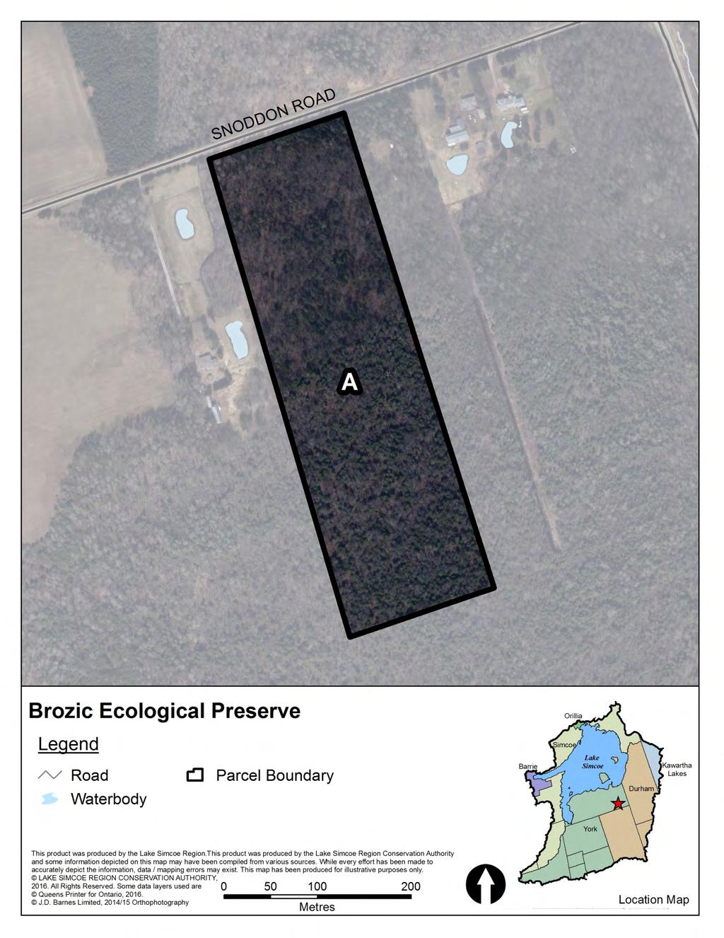
59
60 Collings Ecological Preserve Owner Lake Simcoe Region Conservation Authority Acquisition From Date Method Cost Contact xxx Thomas Benjamin Collings^^ Dec 06 Donation N/A Manager Lake Simcoe Region Conservation Authority Agreement None Expiry N/A Lease None Expiry N/A LSRCA Role Owner and Manager Alternate Name Size (ha)* Size (ac)* EG&S** MPAC value (2016) N/A $77,773 $42,500 Municipality Upper Tier: York Region Lower Tier: Town of East Gwillimbury Zoning Town of East Gwillimbury Bylaw xxx (1997) xxx Total: $77,773 $42,500 * Property size was estimated using parcel fabric available through LSRCA s geographic information system and may not be exact. ** Ecological Goods and Services values based on methodology developed by S. J. Wilson (2008). Displayed as $/yr Tax Information Roll number Tax Status AC ALS/C1W CLTIP (100%) OP Designation: Town of East Gwillimbury Official Plan (2010/2014) Greenbelt Protected Countryside Legal Survey Easement no hydro^ Description CON 1WY PT LOT 125, AS IN A38750; EXCEPT IN LANDS IN R Infrastructure Buildings Parking Trails Bridges Roads Other no no no no no Resource Reports Scanlon Creek Conservation Area Management Plan Classification Ecological Preserve Other Information ^Two hydro corridors. ^^Land donation made to NCC. Transferred to LSRCA soon after.

61
62 Durham Regional Forest Owner Durham Region Acquisition From Date Method Cost Contact xxx Parcel A F: N/A N/A N/A N/A Manager LSRCA Agreement Management^ Expiry xxx Lease None Expiry N/A Alternate Name Size (ha)* Size (ac)* EG&S** MPAC value (2016) Roseville Tract $383,602 N/A LSRCA Role Manager Parcel B: Norton Tract $92,424 N/A Parcel C: Timbers Tract $194,856 N/A Municipality Upper Tier: Durham Region Parcel D: Brookdale Tract $278,551 N/A Lower Tier: Township of Uxbridge Parcel E: West Tract $200,519 N/A Parcel F: Main Tract $1,737,363 N/A Zoning Open Space Total: $2,887,314 $0 Township of Uxbridge Zoning Parcel B: Rural * Property size was estimated using parcel fabric available through LSRCA s geographic information system and may not be exact. Bylaw (1981/2015) Parcel C: Rural ** Ecological Goods and Services values based on methodology developed by S. J. Wilson (2008). Displayed as $/yr Parcel D: Parcel E: Open Space and Environmental Protection Rural OP Designation: xxx Parcel F: Rural Township of Uxbridge Official Plan (1970/2014) Parcel B: Parcel C: xxx xxx Tax Information Roll number Tax Status Parcel D: xxx xxx Parcel E: xxx Parcel B: xxx Parcel F: xxx Parcel C: xxx Parcel D: xxx Infrastructure Buildings Parking Trails Bridges Roads Other Parcel E: multiple xxx no xxx yes no no Parcel F: multiple xxx Parcel B: no xxx yes no no Parcel C: no xxx yes no no Legal Survey Easement Description Parcel D: no xxx yes no no xxx xxx xxx Parcel E: no xxx yes no no Parcel B: xxx xxx xxx Parcel F: yes yes yes xxx yes Parcel C: xxx xxx xxx Parcel D: xxx xxx xxx Resource Reports Parcel E: xxx xxx xxx Parcel A D and F: Draft Durham Regional Forest Trail Management Plan (2010) Parcel F: xxx xxx xxx Classification Parcel B: Parcel C: Parcel D: Parcel E: Parcel F: Passive Recreation Area Passive Recreation Area Active Recreation Area Passive Recreation Area Natural Heritage Area Active Recreation Area Other Information ^Agreement with Durham Region for LSRCA to manage property dated xxx.


63

64
65
66 Franklin Beach Conservation Area Owner Lake Simcoe Region Conservation Authority Acquisition From Date Method Cost Contact xxx Unikower and Kohn Property Aug 75 Purchase $41,500 Isabell Beddow Jan 81 Purchase $8,500 Manager Town of Georgina Parcel B: Alfred Eadie and Ella Mabel Eadie May 74 Purchase $30,500 Agreement Management^ Expiry xxx Parcel B: Ann Ebner Jan 74 Purchase $24,200 Lease None Expiry N/A Parcel B: Jean McVeigh Aug 74 Purchase $62,700 LSRCA Role Owner Alternate Name Size (ha)* Size (ac)* EG&S** MPAC value (2016) N/A $171 $43,500 Municipality Upper Tier: York Region Parcel B: N/A $237 $50,000 Lower Tier: Town of Geogina Zoning Residential Parcel B: Residential Total: $409 $93,500 Town of Georgina Zoning Bylaw 500 (1995/2013) * Property size was estimated using parcel fabric available through LSRCA s geographic information system and may not be exact. ** Ecological Goods and Services values based on methodology developed by S. J. Wilson (2008). Displayed as $/yr OP Designation: Tax Information Roll number Tax Status Town of Georgina Official Plan Parcel B: (2002/2013) Sutton Secondary none Plan Parcel B: none stable residential area stable residential area Infrastructure Buildings Parking Trails Bridges Roads Other no no no no no Legal Survey Easement Description Parcel B: no no no no no yes^^ xxx PLAN 188 LOTS 3 5 PT LTS227 CON 9 LOT 16 Parcel B: no xxx PLAN 188 LOTS 6 TO 8 CON 9 PT LOT 16 Resource Reports Parcel A and B: Franklin Beach Conservation Area Master Plan 1979 Classification Parcel B: Passive Recreation Area Passive Recreation Area Other Information Address: 743 and 745 Lake Dr. E. ^Original management agreement with Town of Georgina is dated July 1995 ^^Survey completed for a portion of Parcel A.
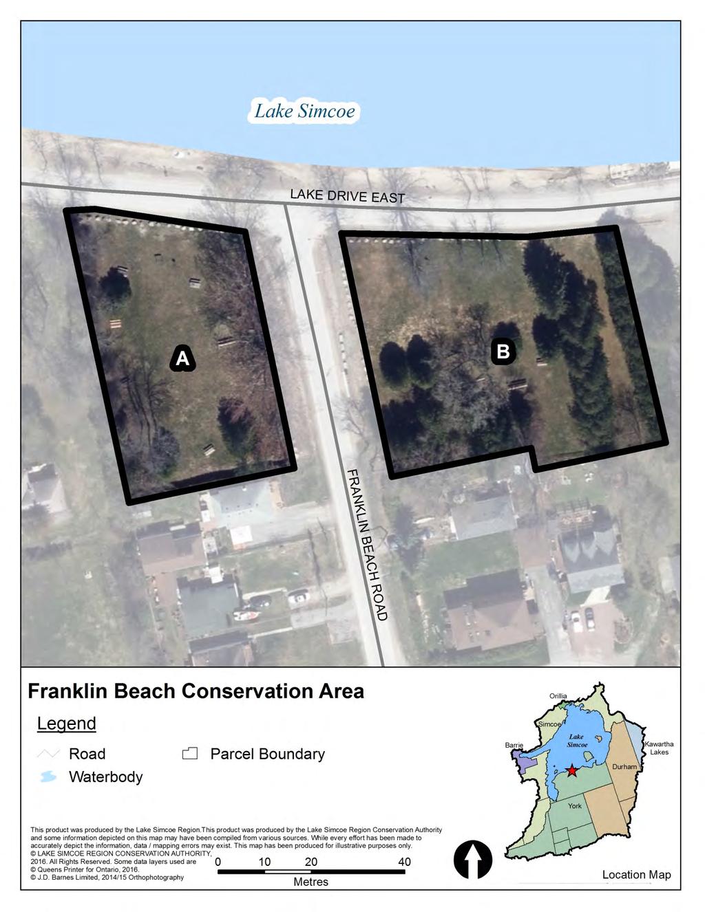
67
68 Glassco Conservation Easement Owner Jane Lockheart Glassco Acquisition From Date Method Cost Contact Jane Lockheart Glassco Jane Lockheart Glassco 2006 Conservation Easement Agreement N/A Parcel B: Jane Lockheart Glassco 2006 Conservation Easement Agreement N/A Manager Jane Lockheart Glassco Parcel C: Jane Lockheart Glassco 2006 Conservation Easement Agreement N/A Agreement None Expiry N/A Lease None Expiry N/A LSRCA Role Back up easement holder^ Alternate Name Size (ha)* Size (ac)* EG&S** MPAC value (2016) N/A $77,018 N/A Municipality Upper Tier: York Region/Peel Region^^ Parcel B: N/A $78,602 N/A Lower Tier: Township of King/Town of Caledon^^ Parcel C: N/A $518,163 N/A Zoning Environmental Policy Area Zone 2 ORM Town of Caledon Zoning Bylaw (2006/2015) and Township of King Zoning Bylaw (1974/2005) Parcel B: Oak Ridges Moraine Feature Protection Total: $673,783 $0 Parcel C: Oak Ridges Moraine Feature Protection * Property size was estimated using parcel fabric available through LSRCA s geographic information system and may not be exact. ** Ecological Goods and Services values based on methodology developed by S. J. Wilson (2008). Displayed as $/yr OP Designation: Tax Information Roll number Tax Status Town of Caledon Official Plan Parcel B: (2015) and Township of King N/A Parcel C: Offical Plan (1970/2003) Parcel B: N/A Parcel C: N/A Palgrave Estate Residential Community Policy Area 4 Oak Ridges Moraine Natural Linkage Area Oak Ridges Moraine Natural Linkage Area Infrastructure Buildings Parking Trails Bridges Roads Other no no yes no no Legal Survey Easement Description Parcel B: yes yes yes no yes xxx conservation LOT 20 CON 10 Parcel C: no no yes no no Parcel B: xxx conservation^^^ LOT 29 and PT LOT 28 CON 12 Parcel C: xxx conservation PT LOT 28 CON 12 Resource Reports Parcel A, B and C: Baseline Documentation Report^^^^ Classification Conseravtion Easement Other Information Parcel B: Conservation Easement portion of parcel ^Oak Ridges Moraine Land Trust is current easmenet holder. LSRCA would assume easement if ORMLT defaults. Parcel C: Conservation Easement ^^Parcel A is in Town of Caledon, Peel Region. Parcel B and C are in Township of King, York Region ^^^Conservation easement only covers all of Parcel A and C and only a portion of Parcel B ^^^^BDR was to be completed by ORMLT. LSRCA does not currently hold a copy.

69
70 Herrell Ecological Preserve Owner LSRCA Acquisition From Date Method Cost Contact xxx Owen Herrell Jan 12 Purchase $64,000 Manager LSRCA Agreement None Expiry N/A Lease None Expiry N/A LSRCA Role Owner and Manager Alternate Name Size (ha)* Size (ac)* EG&S** MPAC value (2016) N/A $458,444 $90,000 Municipality Upper Tier: Durham Region Lower Tier: Township of Brock Zoning xxx Total: $458,444 $90,000 * Property size was estimated using parcel fabric available through LSRCA s geographic information system and may not be exact. ** Ecological Goods and Services values based on methodology developed by S. J. Wilson (2008). Displayed as $/yr Tax Information Roll number Tax Status xxx OP Designation: xxx Legal Survey Easement xxx xxx Description CON 9 PT LOT 14 RP 40R27270 PART 2 Infrastructure Buildings Parking Trails Bridges Roads Other no no no no no Resource Reports none Classification Ecological Preserve Other Information

71
72 Herrema Ecological Preserve Owner LSRCA Acquisition From Date Method Cost Contact xxx Gerritt Wilbert Herrema Dec 87 Purchase and Donation^ $10,000 Manager LSRCA Agreement None Expiry N/A Lease None Expiry N/A LSRCA Role Owner and Manager Alternate Name Size (ha)* Size (ac)* EG&S** MPAC value (2016) N/A $130,178 $8,600 Municipality Upper Tier: Durham Region Lower Tier: Township of Uxbridge Zoning Environmental Protection Zone Township of Uxbridge Zoning Bylaw Total: $130,178 $8,600 * Property size was estimated using parcel fabric available through LSRCA s geographic information system and may not be exact. ** Ecological Goods and Services values based on methodology developed by S. J. Wilson (2008). Displayed as $/yr Tax Information Roll number Tax Status PSW, CCL CLTIP (100%) OP Designation: Durham Regional Official Plan (1993/2015) Greenlands System Major Open Space Area Legal Survey Easement yes xxx Description CON 8 LOT 22 Infrastructure Buildings Parking Trails Bridges Roads Other no no no no no Resource Reports none Classification Ecological Preserve Other Information ^ Property was largely donated to the Foundation and then transferred to the Authority. The purchase price of $10,000 was only a fraction of the actual value.
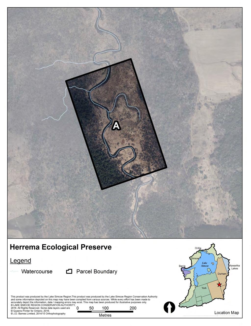
73
74 Holland Landing Conservation Area Owner LSRCA Acquisition From Date Method Cost Contact xxx Roger Lightfoot 1959 Purchase $3,500 Manager Town of East Gwillimbury Agreement Management^ Expiry 2012 Lease None Expiry N/A LSRCA Role Owner and Manager Alternate Name Size (ha)* Size (ac)* EG&S** MPAC value (2016) N/A $52,077 $206,000 Municipality Upper Tier: York Region Lower Tier: Town of East Gwillimbury Zoning xxx Total: $52,077 $206,000 * Property size was estimated using parcel fabric available through LSRCA s geographic information system and may not be exact. ** Ecological Goods and Services values based on methodology developed by S. J. Wilson (2008). Displayed as $/yr Tax Information Roll number Tax Status CCL CLTIP^^ OFA MFTIP^^ OP Designation: Town of East Gwillimbury Official Plan (2010/2014) Parks and Open Space Natural Heritage System Core Area Legal Survey Easement xxx sewage^^ hydro^^^ Description CON 1 YE PT LOT 111 Infrastructure Buildings Parking Trails Bridges Roads Other no no yes no no Resource Reports none Classification Passive Recreation Area Other Information ^Management Agreement with East Gwillimbury on hold until a decsision is made regarding adjacent sewage lagoons. ^^12.53 acres under CLTIP acres under MFTIP.

75
76 Holmes Point Conservation Area Owner LSRCA Acquisition From Date Method Cost Contact xxx Parcel A and B: Fiorino De Angelis, Antonina Apr 79 Purchase^^ $76,500 De Angelis, John De Angelis, Manager Town of Georgina Urbano Cappellucci, and Sam Agreement Management^ Expiry 31 Dec 19 Egizii Lease None Expiry N/A LSRCA Role Owner Alternate Name Size (ha)* Size (ac)* EG&S** MPAC value (2016) N/A $388 $43,000 Municipality Upper Tier: York Region Parcel B: N/A $213 $35,500 Lower Tier: Town of Georgina Zoning Tourist Commercial Parcel B: Tourist Commercial Total: $601 $78,500 Town of Georgina Zoning Bylaw 500 (1995/2013) * Property size was estimated using parcel fabric available through LSRCA s geographic information system and may not be exact. ** Ecological Goods and Services values based on methodology developed by S. J. Wilson (2008). Displayed as $/yr OP Designation: Tax Information Roll number Tax Status Town of Georgina Pefferlaw Parcel B: none Secondary Plan (1996/2013) Parcel B: none Residential Residential Infrastructure Buildings Parking Trails Bridges Roads Other no no no no no play structures Legal Survey Easement Description Parcel B: no no no no no yes xxx Parcel B: no xxx PLAN 520 LOT 1 & BLK A PLAN 520 LOT 22 Resource Reports none Parcel B: none Classification Passive Recreation Area Parcel B: Passive Recreation Area Other Information ^Management agreement expiry date of Dec 31, 2014, with an automatic 5 year renewal. ^^Both parcels were purchased together.

77
78 Keilhofer Ecological Preserve Owner LSRCA Acquisition From Date Method Cost Contact xxx Peter and Steven Keilhofer Jun 07 Donation Ecological Gift^ N/A Manager LSRCA Agreement None Expiry N/A Lease None Expiry N/A LSRCA Role Owner and Manager Alternate Name Size (ha)* Size (ac)* EG&S** MPAC value (2016) N/A $86,426 $31,500 Municipality Upper Tier: York Region Lower Tier: Town of Georgina Zoning Rural Town of Georgina Zoning Bylaw 500 (1995/2013) Total: $86,426 $31,500 * Property size was estimated using parcel fabric available through LSRCA s geographic information system and may not be exact. ** Ecological Goods and Services values based on methodology developed by S. J. Wilson (2008). Displayed as $/yr Tax Information Roll number Tax Status C1W, CCL CLTIP (100%) OP Designation: Town of Georgina Official Plan (2002/2013) Environmental Protection Area 1 Legal Survey Easement no xxx Description CON 7, PT LOT 10 Infrastructure Buildings Parking Trails Bridges Roads Other no no no no no Resource Reports Keilhofer Conservation Area Report (2013) Classification Ecological Preserve Other Information ^Ecological Gift ID xxx

79
80 Keswick North Conservation Area Owner LSRCA Acquisition From Date Method Cost Contact xxx Stella O Rourke and Frances Sawchuck Mar 85 Purchase $21,000 Kathleen and Edward Hartwick Mar 85 Purchase $3,100 Manager Town of Georgina Parcel B: June Majorie Satmire and Leonard Satmire Jun 84 Purchase $12,100 Agreement Management^ Expiry 1 Jan 13 Lease None Expiry N/A LSRCA Role Owner Alternate Name Size (ha)* Size (ac)* EG&S** MPAC value (2016) N/A $1,174 $64,000 Municipality Upper Tier: York Region Parcel B: N/A $71 $45,000 Lower Tier: Town of Georgina Zoning Low Density Urban Residential Parcel B: Low Density Urban Residential Total: $1,245 $109,000 Town of Georgina Zoning Bylaw 500 (1995/2013) * Property size was estimated using parcel fabric available through LSRCA s geographic information system and may not be exact. ** Ecological Goods and Services values based on methodology developed by S. J. Wilson (2008). Displayed as $/yr OP Designation: Neighbourhood Residential Tax Information Roll number Tax Status Town of Georgina Keswick Parcel B: Neighbourhood Residential none Secondary Plan (2004/2012) Parcel B: none Infrastructure Buildings Parking Trails Bridges Roads Other no no no no no hardened stream chanel Legal Survey Easement Description Parcel B: no no no no no hardened stream chanel yes multiple^^ CON 2 PT LOT 14 AND PLAN 480 LOTS 2 & 3 RS65R7859 PARTS 1, 2, 4 & 5 Parcel B: yes multiple^^^ PLAN 298 LOT 7 Resource Reports none Parcel B: none Classification Passive Recreation Area Parcel B: Passive Recreation Area Other Information ^Original management agreement with Town of Georgina dated June 6, ^^ xxx ^^^ xxx

81
82 Luck Conservation Area Owner LSRCA Acquisition From Date Method Cost Contact xxx Florence Luck Jun 89 Donation^^ N/A Manager Town of Innisfil and LSRCA Agreement Management^ Expiry 1 Jan 17 Lease None Expiry N/A LSRCA Role Owner and Part Manager Alternate Name Size (ha)* Size (ac)* EG&S** MPAC value (2016) N/A $179,915 $242,000 Municipality Upper Tier: Simcoe County Lower Tier: Town of Innisfil Zoning Environmental Protection Agriculture General Total: $179,915 $242,000 Town of Innisfil Zoning Bylaw (2013/2015) * Property size was estimated using parcel fabric available through LSRCA s geographic information system and may not be exact. ** Ecological Goods and Services values based on methodology developed by S. J. Wilson (2008). Displayed as $/yr OP Designation: Natural Environment Area Tax Information Roll number Tax Status Town of Innisfil Official Plan Agricultural Area none (2006/2011) Legal Survey Easement yes xxx Description CON 1 S PT LOT 21 RP 51R18124 PART 1 Infrastructure Buildings Parking Trails Bridges Roads Other yes yes no no no arboretum Resource Reports none Classification Passive Recreation Area Other Information Address: 1474 Shore Acres Dr. ^Original management agreement with Town of Innisfil dated Mar. 26, Town of innisfil has a subagreement with Gilford and District Horticultural Society dated May 12, ^^Donation was made with a condition that LSRCA not dispose of land for 40 years.
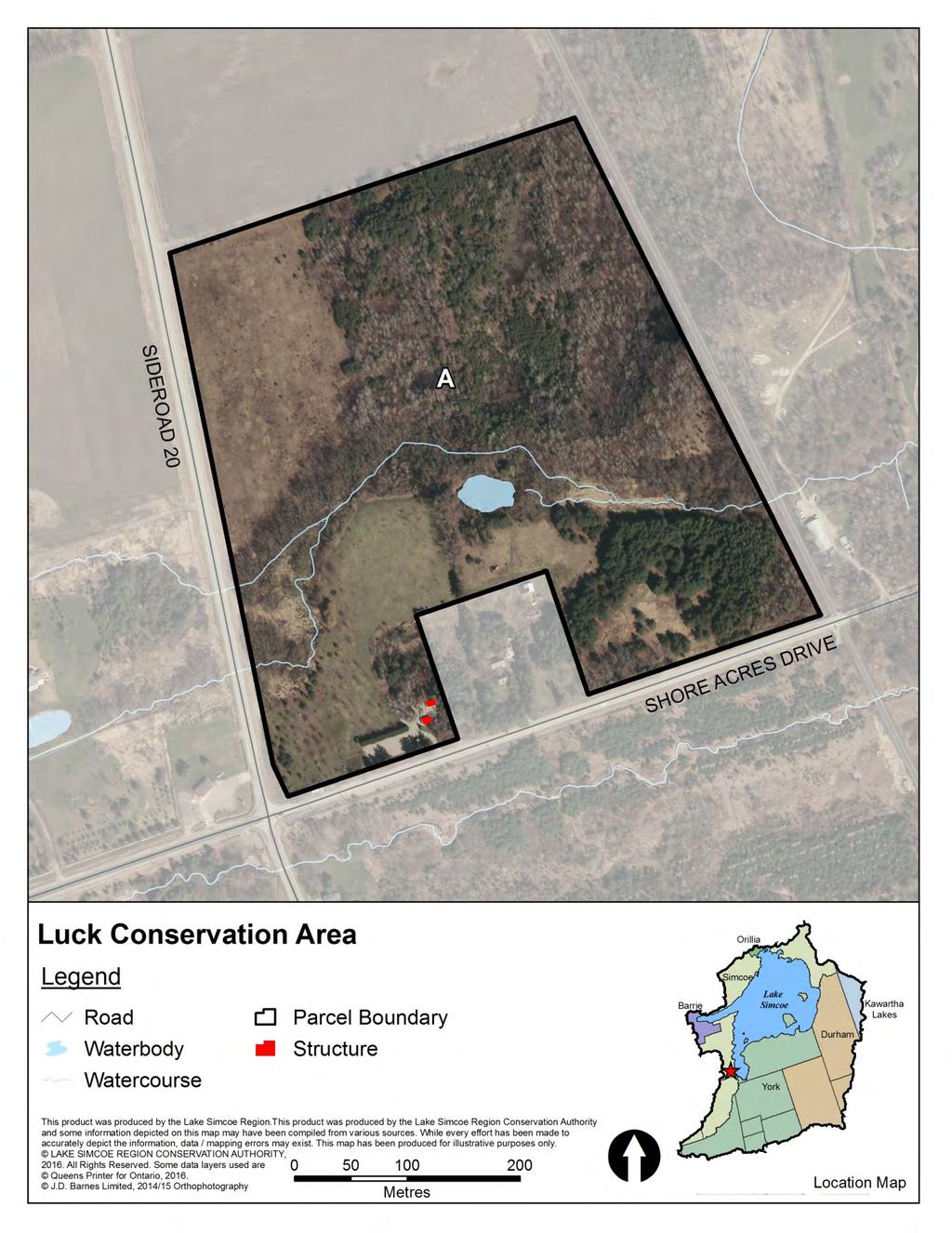
83
84 Mabel Davis Conservation Area Owner LSRCA Acquisition From Date Method Cost Contact xxx Mabel Davis Jul 69 Donation N/A Glenville Property (Royal Bank of Canada) Mar 93 Purchase $261,000 Manager Town of Newmarket and LSRCA Agreement Management^ Expiry Dec 18 Lease None Expiry N/A LSRCA Role Owner and Part Manager Alternate Name Size (ha)* Size (ac)* EG&S** MPAC value (2016) N/A $72,734 $230,000 Municipality Upper Tier: York Region Lower Tier: Town of Newmarket Zoning Environmental Protection Open Space Zone Town of Newmarket Zoning Bylaw (2010/2013) Total: $72,734 $230,000 * Property size was estimated using parcel fabric available through LSRCA s geographic information system and may not be exact. ** Ecological Goods and Services values based on methodology developed by S. J. Wilson (2008). Displayed as $/yr OP Designation: Major Institutional Tax Information Roll number Tax Status Town of Newmarket Official Parks and Open Space AC, CCL CLTIP^^ Plan (2006/2014) Natural Heritage System Legal Survey Easement yes^^^ hydro^^^^ Description CON 1 EYE PT LTS 96 & 97, PLAN 78 LOTS 8 & 9 PT LT 10, RP 65R6172 Part 1 Infrastructure Buildings Parking Trails Bridges Roads Other yes yes yes no yes Resource Reports none Classification Active Recreation Area Other Information Address: 120 Bayview Parkway ^ Management agreement with Town of Newmarket to develop and manage trails ^^14.58 acres under CLTIP ^^^Survey completed for a portion of the property ^^^^ xxx

85
86 Pangman Springs Conservation Area Owner LSRCA Acquisition From Date Method Cost Contact xxx Alexander Roderick McLennan Mar 86 Purchase^^ $625,276 Parcel B: St. John's Wood Subdivision Woodheath Jan 03 Condition of subdivision $0 Manager Trails Youth Initiatives and LSRCA Parcel C: St. John's Wood Subdivision Woodheath Jan 03 Condition of subdivision $0 Agreement Management^ Expiry 30 Jun 17 Lease None Expiry N/A LSRCA Role Owner and Part Manager Alternate Name Size (ha)* Size (ac)* EG&S** MPAC value (2016) N/A $566,474 $1,246,000 Municipality Upper Tier: York Region Parcel B: N/A $3,904 $73,000 Lower Tier: Town of Whitchurch Stouffville Parcel C: N/A $24,206 $167,000 Zoning Environmental, Agricultural and Flood Hazard Town of Whitchurch Stouffville Zoning Bylaw ZO (2010/2014) Parcel B: Flood Hazard Total: $594,584 $1,486,000 Parcel C: Flood Hazard * Property size was estimated using parcel fabric available through LSRCA s geographic information system and may not be exact. ** Ecological Goods and Services values based on methodology developed by S. J. Wilson (2008). Displayed as $/yr OP Designation: Public Open Space and Significant Environmental Area Tax Information Roll number Tax Status Town of Whitchurch Stouffville Parcel B: Significant Environmental Area CCL CLTIP^^ Official Plan (2000/2011) Parcel C: Significant Environmental Area OFA MFTIP^^ Parcel B: xxx Parcel C: xxx Infrastructure Buildings Parking Trails Bridges Roads Other yes yes yes no yes Legal Survey Easement Description Parcel B: no no no no no no xxx CON 5 PT LOT 23 TO 25 Parcel C: no no no no no Parcel B: no xxx RS65R3916 PTS 3 8 PLAN 65M3630 BLK 32 Parcel C: no xxx PLAN 65M3630 BLK 33 Resource Reports Parcel B: Pangman Springs Conseravtion Area Master Plan (1990) none Classification Parcel C: none Active Recreation Area Parcel B: Active Recreation Area Other Information Parcel C: Active Recreation Area Address: Warden Ave. ^Original management agreement with Trails Youth Initiatives dated July 1, Agreement expires June 30, 2017 with an option to renew for 20 years followed by and option for 10 years. ^^ acres under CLTIP acres under MFTIP. ^^^Parcel A purchased with a donation from the Pangman family and funds from NCC and MNR.

87
88 Pefferlaw Dam Conservation Area Owner LSRCA Acquisition From Date Method Cost Contact xxx Parcel A and B: Town of Georgina Nov 81 Purchase $12,000 Manager Town of Georgina Agreement Management^ Expiry xxx Lease None Expiry N/A LSRCA Role Owner Alternate Name Size (ha)* Size (ac)* EG&S** MPAC value (2016) N/A $237 $42,500 Municipality Upper Tier: York Region Parcel B: N/A $318 Lower Tier: Town of Georgina Zoning Residential Parcel B: General Commercial Total: $555 $42,500 Town of Georgina Zoning Bylaw 500 (1995/2013) * Property size was estimated using parcel fabric available through LSRCA s geographic information system and may not be exact. ** Ecological Goods and Services values based on methodology developed by S. J. Wilson (2008). Displayed as $/yr OP Designation: Rural Tax Information Roll number Tax Status Town of Georgina Pefferlaw Parcel B: Rural Parcel A and B: CCL CLTIP (100%) Secondary Plan (1996/2013) Infrastructure Buildings Parking Trails Bridges Roads Other no no no no no Legal Survey Easement Description Parcel B: no no no no no Parcel A and B: yes Gas^^ CON 5 PT LOT 23 RS65R3240 PT 2 RS65R4695 PT 1 Resource Reports Parcel B: none none Classification Passive Recreation Area Parcel B: Passive Recreation Area Other Information Address: 219 Pefferlaw Rd. ^Original management agreement with Town of Georgina dated xxx ^^Permanent easement trasferred to Consumer Gas on July 9, 1996 for $1500
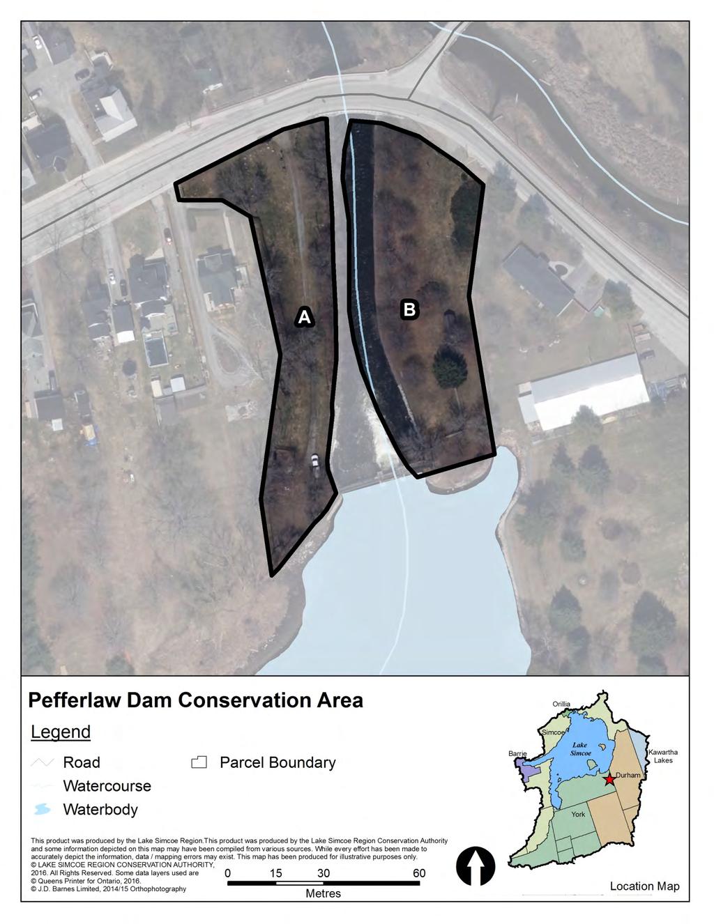
89
90 Pottageville Swamp Natural Heritage Area Owner LSRCA Acquisition From Date Method Cost Contact xxx Township of King Jul 78 Purchase $13,000 James Kitchen Aug 86 Purchase $38,547 Manager LSRCA Parcel B: Gunter Ullrich Dec 79 Purchase $6,000 Agreement None Expiry N/A Parcel B: Robert Hulse Jan 84 Purchase $20,000 Lease None Expiry N/A Parcel B: Margaret Armstrong Jan 86 Purchase $11,841 Parcel C: William & Helen Groombridge Jun 79 Purchase $9,000 LSRCA Role Owner and Manager Parcel C: Charles Keller Mar 82 Purchase $1,500 Parcel C: Dawson Aitchison Jun 87 Purchase $2,100 Municipality Upper Tier: York Region Parcel D: Taggart (Sheriff Property) Jun 86 Purchase $5,000 Lower Tier: Township of King Parcel D: Mariani & Stefino Aug 87 Purchase $6,000 Parcel E: Hattie Lenore Feb 76 Purchase $4,000 Zoning xxx Parcel E: Hilde Smith Feb 76 Purchase $4,750 Township of King Zoning Bylaw Parcel B: xxx Parcel E: McClintok Homes Jul 82 Donation $2 xxxx xx (xxxx/xxxx) Parcel C: xxx Parcel E: Floosie Luella Boys Jul 88 Purchase $7,500 Parcel D: xxx Parcel F: Anne Olejniczak Jan 11 Purchase $10,000 Parcel E: xxx Parcel F: xxx Alternate Name Size (ha)* Size (ac)* EG&S** MPAC value (2016) N/A $1,000,214 $333,000 Tax Information Roll number Tax Status Parcel B: N/A $833,726 $245, ALS CLTIP (100%) Parcel C: N/A $251,096 $81,000 Parcel B: ALS CLTIP (100%) Parcel D: N/A $236,613 $94,000 Parcel C: ALS, PSW, CCL CLTIP (100%) Parcel E: N/A $867,153 $602,000 Parcel D: ALS, CCL CLTIP (100%) Parcel F: Olejniczak $48,182 $9,600 Parcel E: ALS, CCL CLTIP (100%) Total: $3,236,983 $1,364,600 Parcel F: xxx * Property was size estimated using parcel fabric available through LSRCA s geographic information system and may not be exact. ** Ecological Goods and Services values based on methodology developed by S. J. Wilson (2008). Displayed as $/yr Legal Survey Easement Description yes Gas^^ CON 7 PT LOT 35 RS65R2563 PT 1 OP Designation: xxx Parcel B: yes^ Gas^^ CON 7 PT LOT 34 RS65R8841 PT 1 Township of King Official Plan Parcel B: xxx Parcel C: no xxx CON 7 PT LOT 33 (xxxx/xxxx) Parcel C: xxx Parcel D: yes^ Gas^^, Rail^^^ CON 7 PT LOT 32 AND RS65R10567 PTS 2 TO 6, 9 & Parcel D: xxx 10 Parcel E: xxx Parcel E: yes^ xxx CON 6 PART LOT 31 & 32 RS65R4654 PART 1 Parcel F: xxx Parcel F: yes xxx KING CON 6 PT LOT 32 RP 65R32785 PART 1 Infrastructure Buildings Parking Trails Bridges Roads Other Classification Parcel A, B, C, D, E, F: no no no no no Natural Heritage Area Parcel B: Natural Heritage Area Resource Reports Pottageville Swamp Conservation Area Report (2012) Parcel C: Natural Heritage Area Pottageville Swamp Conservation Area Report Olejniczak (2013) Parcel D: Natural Heritage Area Parcel E: Natural Heritage Area Other Information ^Survey completed for a portion of the property Parcel F: Natural Heritage Area ^^TransCanada pipeline runs through a portion of these properties. ^^^Canadian Railway Company holds a permanent easement over a portion of the property

91
92 Queen Street Conservation Area Owner LSRCA Acquisition From Date Method Cost Contact xxx Town of Newmarket Jan 76 Purchase $33,000 Manager Town of Newmarket Agreement Management^ Expiry 1 Jan 20 Lease None Expiry N/A LSRCA Role Owner Alternate Name Size (ha)* Size (ac)* EG&S** MPAC value (2016) N/A $630 $243,000 Municipality Upper Tier: York Region Lower Tier: Town of Newmarket Zoning Environmental Protection Open Space Zone Town of Newmarket Zoning Bylaw (2010/2013) Total: $630 $243,000 * Property size was estimated using parcel fabric available through LSRCA s geographic information system and may not be exact. ** Ecological Goods and Services values based on methodology developed by S. J. Wilson (2008). Displayed as $/yr Tax Information Roll number Tax Status CCL CLTIP (100%) OP Designation: Town of Newmarket Official Plan (2006/2014) Open Space Legal Survey Easement yes xxx Description PLAN 81 PT LOT 9 PLAN 262 PTBLK F PLAN 125 PT LOT 1 RS65R1600 PARTS 6 TO 10 Infrastructure Buildings Parking Trails Bridges Roads Other no no yes no no radial arch^^ Resource Reports none Classification Passive Recreation Area Other Information ^Original management agreement with Town of Newmarket dated March 26, Agreement expires January 1, 2000 with an option to renew every 5 years. ^^Dedicated for historical and architectural significance by Town of Newmarket By law

93
94 Raikes Ecological Preserve Owner LSRCA Acquisition From Date Method Cost Contact xxx Gail Frances Raikes^ Jun 07 Purchase $103,500 Manager LSRCA Agreement None Expiry N/A Lease None Expiry N/A LSRCA Role Owner and Manager Alternate Name Size (ha)* Size (ac)* EG&S** MPAC value (2016) N/A $3,658 $43,000 Municipality Upper Tier: Simcoe County Lower Tier: Township of Oro Medonte Zoning Agricultural/Rural Township of Oro Medonte Zoning Bylaw (2013/2015) Total: $3,658 $43,000 * Property size was estimated using parcel fabric available through LSRCA s geographic information system and may not be exact. ** Ecological Goods and Services values based on methodology developed by S. J. Wilson (2008). Displayed as $/yr Tax Information Roll number Tax Status RES OP Designation: Township of Oro Medonte Official Plan (1997/2015) Shoreline Legal Survey Easement yes xxx Description CON 1 EPR E PT LOT 1 RP 51R34787 PART 1 Infrastructure Buildings Parking Trails Bridges Roads Other no no no no no Resource Reports Raikes Conservation Area Report (2008) Classification Ecological Preserve Other Information ^Seller requested to remain anonymous.

95
96 Rogers Reservoir Conservation Area Owner LSRCA Acquisition From Date Method Cost Contact xxx Bruce Thompson May 14 Purchase $232,000 Parcel B: xxx xxx xxx xxx Manager Town of East Gwillimbury and LSRCA Parcel C: Agreement Management^ Expiry April 31, 2023 Parcel D: Town of East Gwillimbury 1996 Purchase $77,000 Lease None Expiry N/A Parcel E: J.S. Rogers Nov 66 Purchase $25,000 Parcel E: L. Greaves Nov 66 Purchase $2,495 LSRCA Role Owner and Part Manager Parcel E: Town of East Gwillimbury Nov 66 Purchase $5 Municipality Upper Tier: York Region Alternate Name Size (ha)* Size (ac)* EG&S** MPAC value (2016) Lower Tier: Town of East Gwillimbury Ghost Canal Property $57,013 $939,000 Parcel B: Rogers West $62,302 $209,000 Zoning xxx Parcel C: Rogers West $7,802 Town of East Gwillimbury Bylaw xxx (1997) Parcel B: xxx Parcel D: Rogers South $37,623 $338,000 Parcel C: xxx Parcel E: Rogers East $321,292 $200,000 Parcel D: xxx Total: $486,032 $1,686,000 Parcel E: xxx * Property size was estimated using parcel fabric available through LSRCA s geographic information system and may not be exact. ** Ecological Goods and Services values based on methodology developed by S. J. Wilson (2008). Displayed as $/yr Tax Information Roll number Tax Status xxx OP Designation: Environmental Protection Area Parcel B: CCL, OFA CLTIP, MFTIP^^^ Town of East Gwillimbury Parcel B: Environmental Protection Area Official Plan (2010/2014) Parcel C: Parcel C: Environmental Protection Area ^^ CCL, OFA CLTIP, MFTIP^^^ Parcel D: Parcel D: Environmental Protection Area and Agricultural/Long term Growth Area Parcel E: CCL, OFA CLTIP, MFTIP^^^ Parcel E: Environmental Protection Area Legal Survey Easement Description Infrastructure Buildings Parking Trails Bridges Roads Other no xxx PART LOTS 105, 106, 107, CONC no no yes no no 1, E.Y.S. Parcel B: no no yes no no Parcel B: no xxx PLAN M2 BLK S NX OX Parcel C: no no yes no no Parcel C: no xxx CON 1 YE PT LOT 104 RS66R7986 Parcel D: no no no no no Parcel D: no xxx PART 2, PART 3 Parcel E: no yes yes no yes Parcel E: yes xxx CON 2 PT LOT 6 TO 9 Resource Reports Classification Parcel B E: Rogers Reservoir Management Plan (2013) Parcel B: Parcel C: Parcel D: Passive Recreation Area Passive Recreation Area Passive Recreation Area Passive Recreation Area Other Information Parcel E: Passive Recreation Area ^Management agreement for Parcels B, C and E to develop and manage trails dated May 1, 2007 ^^Parcels C and D are merged and have the same roll number and legal description ^^^ Parcel B: acres CLTIP, 9.88 acres MFTIP. Parcel C and D: acres CLTIP, acres MFTIP. Parcel E: acres CLTIP, 9.88 acres MFTIP.

97
98 Scanlon Creek Conservation Area Owner LSRCA Acquisition From Date Method Cost Contact xxx Thomas Scanlon Aug 65 Purchase $24,000 Parcel B: Lewis Earl Coombs Sep 63 Purchase $25,008 Manager LSRCA Parcel B: Thomas A. Brown May 66 Purchase $15,600 Agreement None Expiry N/A Parcel B: Thomas A. Brown May 66 Donation N/A Lease None Expiry N/A Parcel B: Samuel Lee May 66 Donation N/A Parcel C: Samuel Christopher Lee Jul 71 Purchase $2,650 LSRCA Role Owner and Manager Parcel C: Samuel Lee Dec 75 Purchase $57,750 Municipality Upper Tier: Simcoe County Alternate Name Size (ha)* Size (ac)* EG&S** MPAC value (2016) Lower Tier: Town of Bradford West Gwillimbury Scanlon North $128,137 $250,000 Parcel B: Main Tract $489,437 $480,000 Zoning Open Space Parcel C: Lee East $934,634 $69,000 Town of Bradford West Gwillimbury Zoning Bylaw (2010/2014) Parcel B: Parcel C: Agricultural and Environmental Protection Natural Heritage System 1 and 2 Total: $1,552,208 $799,000 * Property was size estimated using parcel fabric available through LSRCA s geographic information system and may not be exact. ** Ecological Goods and Services values based on methodology developed by S. J. Wilson (2008). Displayed as $/yr Tax Information Roll number Tax Status CCL CLTIP^ OP Designation: Agricultural Parcel B: CCL CLTIP^ Town of Bradford West Parcel B: Agricultural Parcel C: C1W MFTIP (100%) Gwillimbury Official Plan Parcel C: Provincially Significiant Wetland (2000/2010) Legal Survey Easement Description Infrastructure Buildings Parking Trails Bridges Roads Other no hydro CON 10 S PT LOT 18 no no no no no weather station^^ Parcel B: no hydro CON 9 N PT LOT 16 TO LOT 19 Parcel B: yes yes yes yes yes dam and play structures RP 51R1325 PART 1 Parcel C: no no no no no Parcel C: yes xxx CON 9 S1/2 of N1/2 LOT 19 & S1/2 LOT 19 & E PT LOT 18 Classification Parcel B: Parcel C: Natural Heritage Area Active Recreation Area Ecological Preserve Resource Reports Scanlon Creek Conservation Area Management Plan (2015) Other Information Address: 2450 Line 9 ^ 13.6 acres CLTIP. Parcel B: acres CLTIP. ^^Weather station owned and operated by Environment Canada.

99
100 Sheppard's Bush Conservation Area Owner Ontario Heritage Trust Acquisition From Date Method Cost Contact xxx Edwin Reginald Sheppard Jun 71 Donation^^^ N/A Manager Town of Aurora and LSRCA Agreement Management^ Expiry xxx Lease Buildings^^ Expiry xxx LSRCA Role Manager Municipality Upper Tier: York Region Alternate Name Size (ha)* Size (ac)* EG&S** MPAC value (2016) Lower Tier: Town of Aurora N/A $94,857 N/A Zoning Town of Aurora Zoning Bylaw (2002/2014) Major Open Space Total: $94,857 $0 * Property size was estimated using parcel fabric available through LSRCA s geographic information system and may not be exact. ** Ecological Goods and Services values based on methodology developed by S. J. Wilson (2008). Displayed as $/yr Tax Information Roll number Tax Status OP Designation: xxx Town of Aurora Official Plan (2010/2014) Environmental Protection Infrastructure Buildings Parking Trails Bridges Roads Other Legal Survey Easement Description yes yes yes no yes yes xxx PLAN 246 LOT 153 & 154 Resource Reports Sheppard's Bush Conservation Area Management Plan (2009) Classification Active Recreation Area Other Information Address: 93 Industrial Parkway ^Agreement with OHT for LSRCA to manage entire property dated xxx. LSRCA has a separate agreement with Town of Aurora to manage soccer pitches and other aspects of the property dated xxx ^^Lease agreement with Windfall Ecology Centre for Sheppard House dated xxx. Lease agreeement with private tenant for cottage building dated xxx. ^^^Property was donated to Ontario Heritage Trust.

101
102 Studholme Natural Heritage Area Owner LSRCA Acquisition From Date Method Cost Contact xxx Studholme Mar 80 Purchase $40,000 Manager LSRCA Agreement None Expiry N/A Lease None Expiry N/A LSRCA Role Owner and Manager Municipality Upper Tier: Simcoe County Alternate Name Size (ha)* Size (ac)* EG&S** MPAC value (2016) Lower Tier: Town of Bradford West Gwillimbury N/A $684,521 $89,000 Zoning Town of Bradford West Gwillimbury Zoning Bylaw (2010/2014) Natural Heritage System 1 Total: $684,521 $89,000 * Property size was estimated using parcel fabric available through LSRCA s geographic information system and may not be exact. ** Ecological Goods and Services values based on methodology developed by S. J. Wilson (2008). Displayed as $/yr Tax Information Roll number Status OP Designation: ALS, PSW, CCL CLTIP (100%) Town of Bradford West Gwillimbury Official Plan (2000/2010) Provincially Significant Wetland Infrastructure Buildings Parking Trails Bridges Roads Other Legal Survey Easement Description no no no no no xxx xxx CON 9 PT LOT 20 PT LOT 21 PT LOT 22 Resource Reports Scanlon Creek Conservation Area Management Plan (2015) Classification Natural Heritage Area Other Information
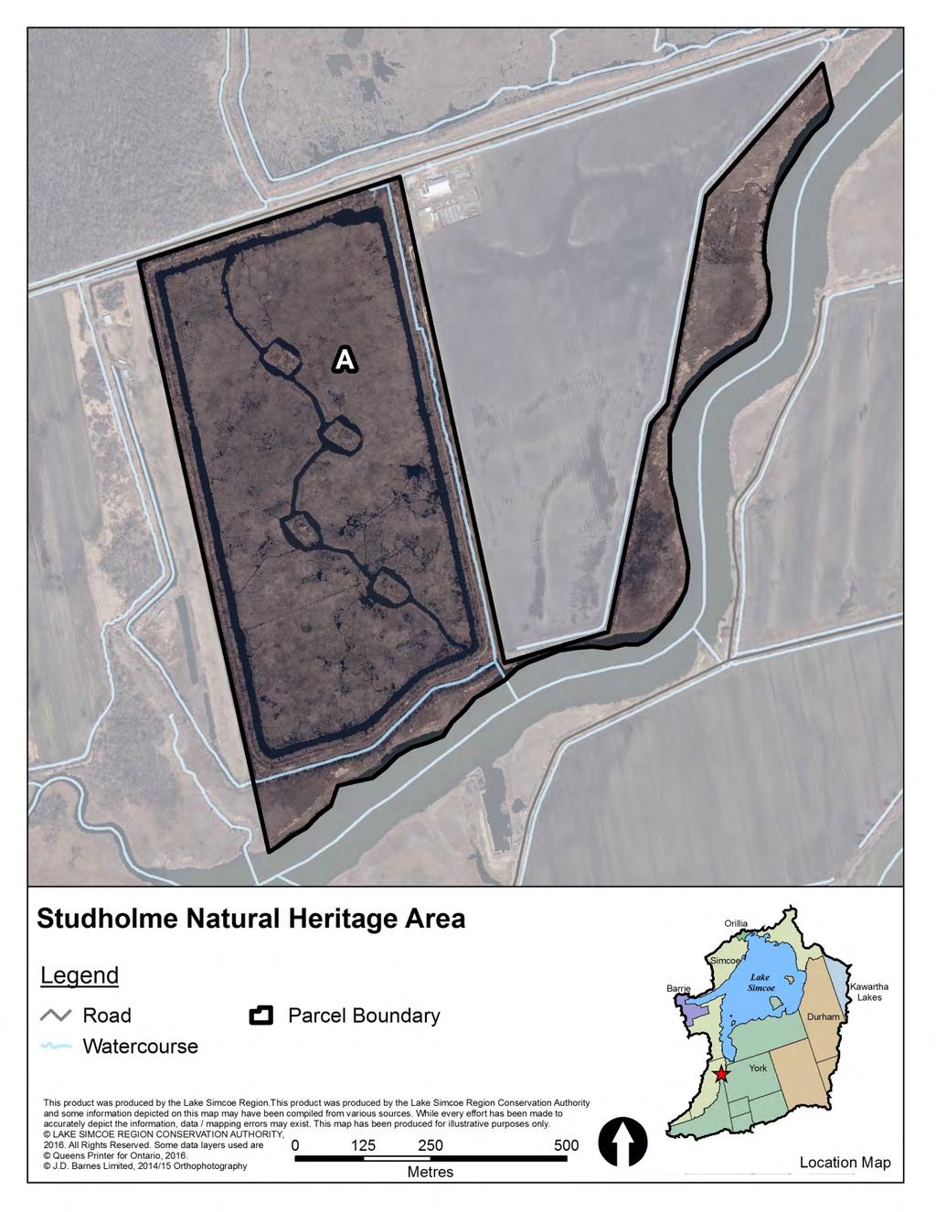
103
104 Thornton Bales Conservation Area Owner LSRCA Acquisition From Date Method Cost Contact xxx Township of King Jun 61 Donation $2 Manager LSRCA Agreement None Expiry N/A Lease None Expiry N/A LSRCA Role Owner and Manager Alternate Name Size (ha)* Size (ac)* EG&S** MPAC value (2016) N/A $129,087 $96,000 Municipality Upper Tier: York Region Lower Tier: Township of King Zoning Oak Ridges Moraine Feature Protection Total: $129,087 $96,000 Township of King Zoning Bylaw (2005/2007) * Property size was estimated using parcel fabric available through LSRCA s geographic information system and may not be exact. ** Ecological Goods and Services values based on methodology developed by S. J. Wilson (2008). Displayed as $/yr Tax Information Roll number Tax Status AES, CCL CLTIP (100%) OP Designation: Oak Ridges Moraine Natural Core Area Township of King Official Plan (1970/2003) Infrastructure Buildings Parking Trails Bridges Roads Other no yes yes no no Legal Survey Easement no xxx Description CON 2 PT LOTS 30 & 31 Resource Reports Thornton Bales Conservation Area Report Natural Heritage Inventory (2011) Classification Passive Recreation Area Other Information Address: th Sideroad

105
106 Tyrwhitt Conservation Area Owner LSRCA Acquisition From Date Method Cost Contact xxx Maple Leaf Mills Limited Jan 80 Purchase $32,500 Manager Township of King Agreement Management^ Expiry N/A Lease None Expiry N/A LSRCA Role Owner and Manager Alternate Name Size (ha)* Size (ac)* EG&S** MPAC value (2016) N/A $11,356 $312,000 Municipality Upper Tier: York Region Lower Tier: Township of King Zoning Oak Ridges Moraine Feature Protection and Open Total: $11,356 $312,000 Space and Conservation Township of King Zoning Bylaw (2005/2007) * Property size was estimated using parcel fabric available through LSRCA s geographic information system and may not be exact. ** Ecological Goods and Services values based on methodology developed by S. J. Wilson (2008). Displayed as $/yr Tax Information Roll number Tax Status CCL CLTIP (100%) OP Designation: Township of King Official Plan, Kettleby Hamlet Plan (1970/2003) Hazard Lands Infrastructure Buildings Parking Trails Bridges Roads Other no no yes yes no Legal Survey Easement yes xxx Description CON 4 PT LOT 28 PT LOT 29 RS65R1444 PARTS 4 9 Resource Reports none Classification Passive Recreation Area Other Information Address: 575 Kettleby Rd. ^Original management agreement with Township of King dated June 10, Agreement expires January 1, 2000 with an option to renew every 5 years.
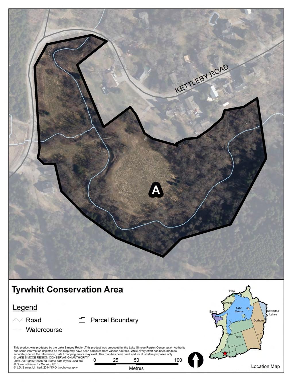
107
108 Webb Natural Heritage Area Owner LSRCA Acquisition From Date Method Cost Contact xxx Catherine and Jeffery Webb Dec 11 Donation^ N/A Manager LSRCA Agreement None Expiry N/A Lease None Expiry N/A LSRCA Role Owner and Manager Alternate Name Size (ha)* Size (ac)* EG&S** MPAC value (2016) N/A $223,248 $342,000 Municipality Upper Tier: York Region Lower Tier: Town of Georgina Zoning Rural Total: $223,248 $342,000 Town of Georgina Zoning Bylaw 500 (1994/2013) * Property size was estimated using parcel fabric available through LSRCA s geographic information system and may not be exact. ** Ecological Goods and Services values based on methodology developed by S. J. Wilson (2008). Displayed as $/yr Tax Information Roll number Tax Status xxx OP Designation: Town of Georgina Proposed Offical Plan (2016) Environmental Protection Area and Greenlands System Infrastructure Buildings Parking Trails Bridges Roads Other no no no no no Legal Survey Easement xxx xxx Description NORTH GWILLIMBURY CON 2 PT LOTS 1 AND 2 RP 65R33374 PART 2 Resource Reports Webb Conservation Area Report (2013) Classification Natural Heritage Area Other Information ^Ecological Gift ID xxx

109
110 Wesley Brooks Conservation Area Owner LSRCA Acquisition From Date Method Cost Contact xxx Town of Newmarket Dec 73 Purchase $19,250 Town of Newmarket Jul 95 Donation N/A Manager Town of Newmarket Parcel B: xxx xxx xxx xxx Agreement Management^ Expiry 1 Jan 04 Lease None Expiry N/A LSRCA Role Owner and Part Manager^^ Alternate Name Size (ha)* Size (ac)* EG&S** MPAC value (2016) Wesley Brooks Memorial $23,791 $43,500 Municipality Upper Tier: York Region Conservation Area Lower Tier: Town of Newmarket Parcel B: William St. Property $332 $42,000 Zoning Open Space Zone and Flood Plain Total: $24,123 $85,500 Parcel B: Open Space Zone and Flood Plain Town of Newmarket Zoning Bylaw (2010/2013) * Property size was estimated using parcel fabric available through LSRCA s geographic information system and may not be exact. ** Ecological Goods and Services values based on methodology developed by S. J. Wilson (2008). Displayed as $/yr Tax Information Roll number Tax Status CCL CLTIP (100%) Parcel B: xxx OP Designation: Parcel B: Town of Newmarket Official Plan (2006/2014) Parks and Open Space Parks and Open Space Infrastructure Buildings Parking Trails Bridges Roads Other yes yes yes yes yes dam Parcel B: no no yes no no Legal Survey Easement Description yes xxx CON 1 PT LOTS 92 & 93 Parcel B: no xxx PLAN 85 REGD SURVEY 221 Resource Reports Parcel B Wesley Brooks Conservation Area Master Plan (1979) none Classification Parcel B: Active Recreation Area Active Recreation Area Other Information Address: 520 Water St. ^Original management agreement with Town of Newmarket dated January 1, Agreement expired January 1, 1995 with an option to renew for 5 years ^^LSRCA is reponsible for managing the dam
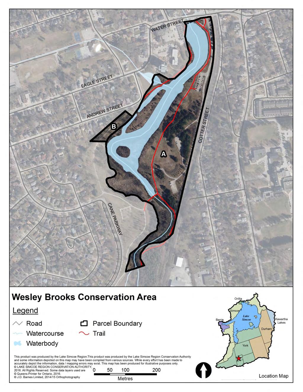
111
112 Whitchurch Conservation Area Owner LSRCA Acquisition From Date Method Cost Contact xxx Township of Whitchurch Jan 61 Donation $1 Manager LSRCA Agreement None Expiry N/A Lease None Expiry N/A LSRCA Role Owner and Manager Alternate Name Size (ha)* Size (ac)* EG&S** MPAC value (2016) N/A $76,856 $57,000 Municipality Upper Tier: York Region Lower Tier: Town of Whitchurch Stouffville Zoning Town of Whitchurch Stouffville Zoning Bylaw ZO (2010/2014) Environmental and Flood Hazard Total: $76,856 $57,000 * Property size was estimated using parcel fabric available through LSRCA s geographic information system and may not be exact. ** Ecological Goods and Services values based on methodology developed by S. J. Wilson (2008). Displayed as $/yr Tax Information Roll number Tax Status CCL CLTIP (100%) OP Designation: Town of Whitchurch Stouffville Official Plan (2000/2011) Oak Ridges Moraine Core Area and Oak Ridges Moraine Countryside Area Legal Survey Easement yes xxx Description CON 5 PT LOT 20 Infrastructure Buildings Parking Trails Bridges Roads Other yes yes yes no no Resource Reports Whitchurch Conservation Area Report Natural Heritage Inventory (2011) Classification Passive Recreation Area Other Information Address: 3329 Aurora Rd.
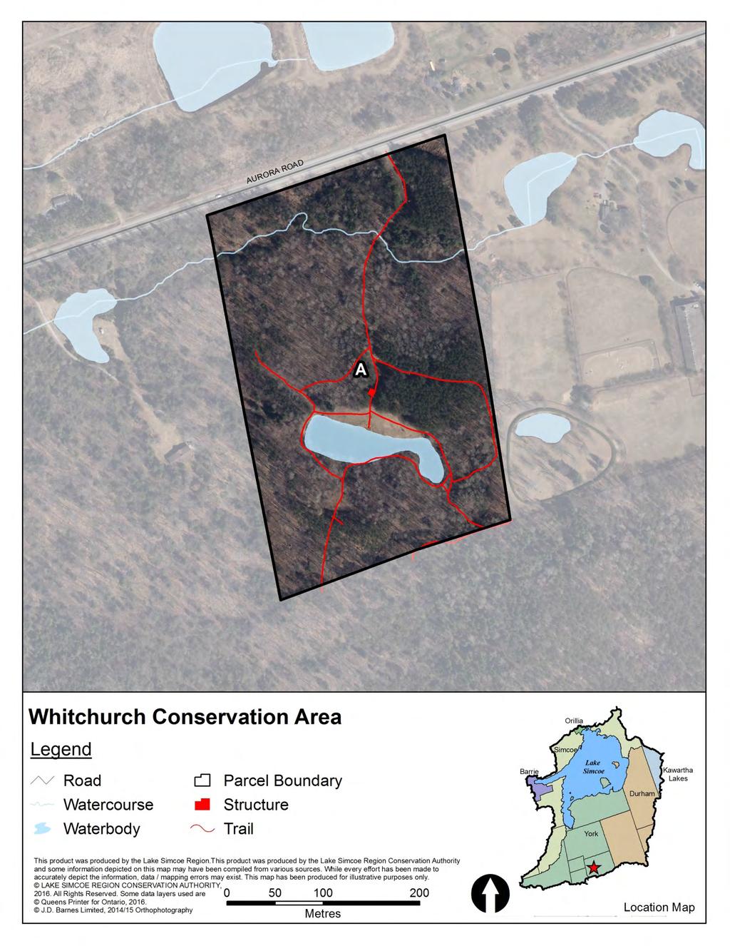
113
114 Willow Beach Conservation Area Owner LSRCA Acquisition From Date Method Cost Contact xxx Veli Laine 26 Sep 74 Purchase $68,500 Robert Allard 29 Oct 74 Purchase $35,000 Manager Town of Georgina Potito Maulucci 30 Jan 75 Purchase $54,000 Agreement Management^ Expiry 30 Apr 16 Mary Garrtley 19 Oct 77 Purchase $36,500 Lease None Expiry N/A James Reynolds 20 Oct 77 Purchase $45,000 Parcel B: James Karys 13 Nov 74 Purchase $63,000 LSRCA Role Owner Parcel C: Witch Beach Enterprises 1 Nov 72 Purchase $142,338 Parcel C: Joyce, Rita and Tobias 4 Apr 74 Purchase $26,400 Municipality Upper Tier: York Region Parcel C: George and Catherine Burns 9 Jul 74 Purchase $39,600 Lower Tier: Town of Georgina Parcel C: Brigitte Hochradl Zorke and Fritz Kralits 1 Jun 78 Purchase $41,089 Parcel C: Billie Faye Stevens 22 Apr 80 Purchase $48,000 Zoning Rural Parcel C: Bret and Sean Lowery 1 Jan 95 Purchase $95,000 Town of Georgina Zoning Bylaw Parcel B: Rural 500 (1995/2013) Parcel C: Open Space Alternate Name Size (ha)* Size (ac)* EG&S** MPAC value (2016) N/A $563 $13,400 Parcel B: N/A $168 $96,000 Parcel C: N/A $2, Tax Information Roll number Tax Status none Total: $3,246 $130,400 Parcel B: none * Property size was estimated using parcel fabric available through LSRCA s geographic information system and may not be exact. Parcel C: none ** Ecological Goods and Services values based on methodology developed by S. J. Wilson (2008). Displayed as $/yr OP Designation: Town of Georgina Offical Plan Parcel B: Parkland Area Parkland Area Legal Survey Easement Description (2002/2013) Parcel C: Parkland Area yes xxx CON 9 PT LOT 8 PLAN 284 LOTS 1, 2, 3, 4, 5 Parcel B: yes xxx CON 9 PT LOT 9 Infrastructure Buildings Parking Trails Bridges Roads Other Parcel C: no xxx CON 9 PT LOT 9 RS65R705 no no no no no PTS 1, 3 PT OF PT 2 Parcel B: no yes no no no Parcel C: yes yes no no yes play structures Classification Resource Reports Active Recreation Area Parcel A, B and C: none Parcel B: Active Recreation Area Parcel C: Active Recreation Area Other Information ^Original management agreement with Town of Georgina dated May 1, 2011.
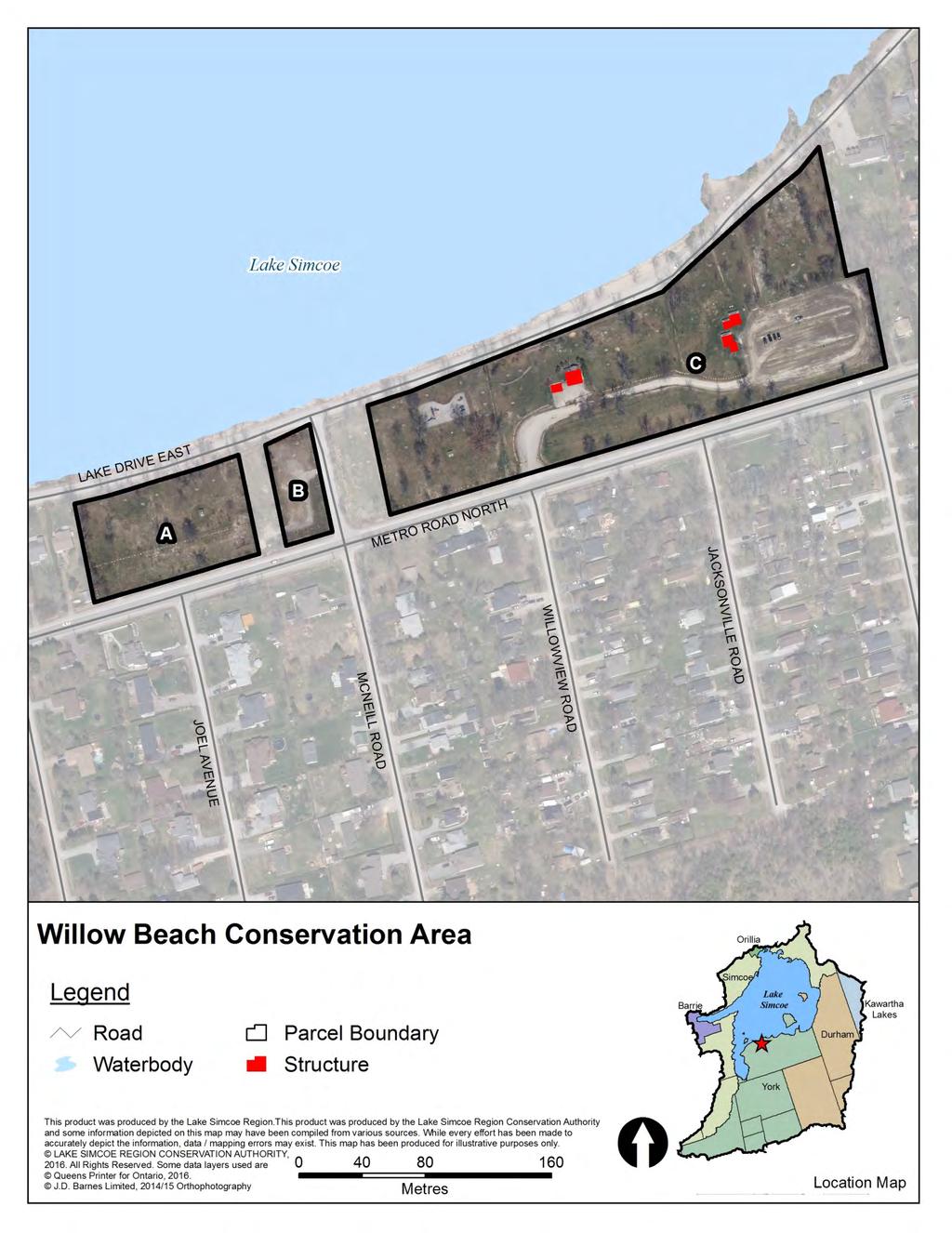
115
116 Yeap Ecological Preserve Owner LSRCA Acquisition From Date Method Cost Contact xxx Tuan Huat Yeap Feb 11 Donation N/A Manager LSRCA Agreement None Expiry N/A Lease None Expiry N/A LSRCA Role Owner and Manager Alternate Name Size (ha)* Size (ac)* EG&S** MPAC value (2016) N/A $158,351 $62,000 Municipality Upper Tier: Durham Region Lower Tier: Township of Uxbridge Zoning Township of Uxbridge Zoning Bylaw (1981/2015) Environmental Protection Zone Total: $158,351 $62,000 * Property size was estimated using parcel fabric available through LSRCA s geographic information system and may not be exact. ** Ecological Goods and Services values based on methodology developed by S. J. Wilson (2008). Displayed as $/yr Tax Information Roll number Tax Status xxx OP Designation: Township of Uxbridge Official Plan (1970/2014) xxx Legal Survey Easement xxx xxx Description CON8 LOT 26 RP 40R26800 PART 1 Infrastructure Buildings Parking Trails Bridges Roads Other no no no no no Resource Reports Yeap Conservation Area Report (2013) Classification Ecological Preserve Other Information
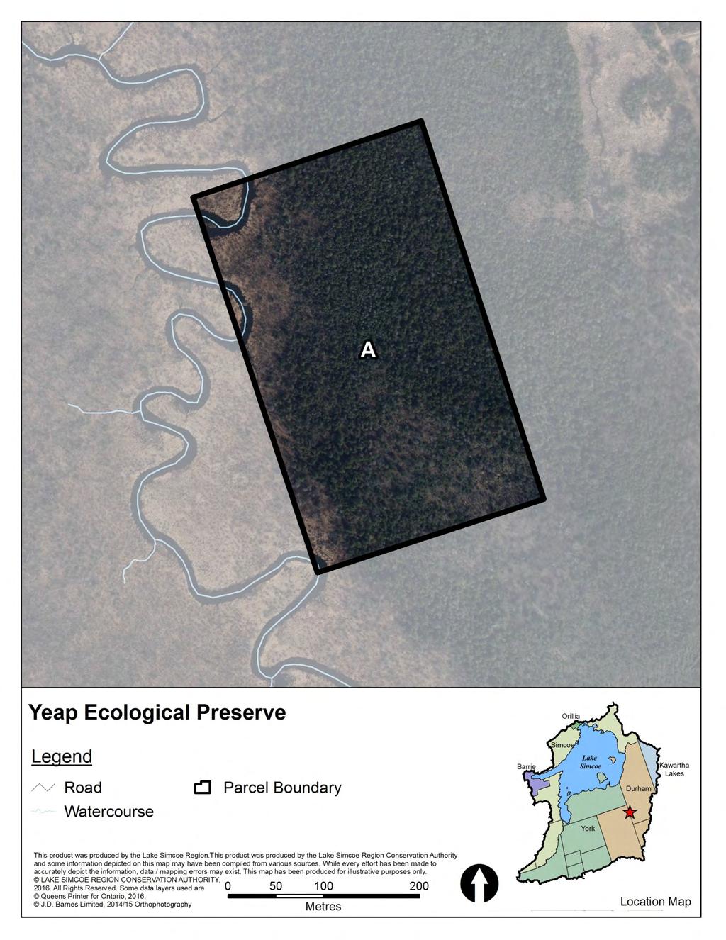
117
118 Zephyr Creek Wetland Ecological Preserve Owner LSRCA Acquisition From Date Method Cost Contact xxx Parcel A, B and C: David Adam Pallett Dec 80 Purchase $111,000 Parcel D: Encon Insurance Managers Inc. Mar 93 Purchase $15,590 Manager LSRCA Parcel E: Township of Uxbridge Feb 07 Donation $2 Agreement None Expiry N/A Lease None Expiry N/A LSRCA Role Owner and Manager Alternate Name Size (ha)* Size (ac)* EG&S** MPAC value (2016) N/A $59,933 Municipality Upper Tier: York Region/Durham Region^ Parcel B: N/A $1,573,147 $130,000 Lower Tier: Town of Georgina/Township of Uxbridge^ Parcel C: N/A $655,902 $50,000 Parcel D: N/A $259,588 $36,000 Zoning Rural Parcel E: Egypt $57,940 $88,000 Town of Georgina Zoning Bylaw Parcel B: Rural 500 (1995/2013) and Township Parcel C: Rural Total: $2,606,510 $304,000 of Uxbridge Zoning Bylaw (1981/2015) Parcel D: Rural * Property size was estimated using parcel fabric available through LSRCA s geographic information system and may not be exact. Parcel E: Environmental Protection Zone ** Ecological Goods and Services values based on methodology developed by S. J. Wilson (2008). Displayed as $/yr Tax Information Roll number Tax Status OP Designation: Town of Georgina Offical Plan Parcel B: ^ PSW CLTIP (100%) (2002/2013) and Township of Parcel B: Parcel C: Uxbridge Official Plan Parcel C: PSW, CCL CLTIP (100%) (1970/2014) Parcel D: Parcel D: PSW, CCL CLTIP (100%) Parcel E: Parcel E: PSW CLTIP (100%) Environmental Protection Area 1 Environmental Protection Area 2 Environmental Protection Area 3 Environmental Protection Area 4 xxx Legal Survey Easement Description Infrastructure Buildings Parking Trails Bridges Roads Other CON 2 PT LOT 11 PT LOT 12 no no no no no yes xxx Parcel B: RS65R3600 PTS 1, 2 AND 4 Parcel B: no no no no no Parcel C: yes xxx CON 2 PT LOT 13 RS65R3600 Parcel C: no no no no no PART 3 Parcel D: no no no no no Parcel D: yes xxx CON 1 PT LOT 13 Parcel E: no no no no no Parcel E: no xxx CON 4, PT LT 35, SCOTT as in CO Resource Reports Parcel A E: Zephyr Creek Wetland Conservation Area Report (2009) Classification Parcel B: Parcel C: Parcel D: Parcel E: Ecological Preserve Ecological Preserve Ecological Preserve Ecological Preserve Ecological Preserve Other Information ^Parcel A D are in Town of Georgina, York Region. Parcel E is in Township of Uxbridge, Durham Region. ^^Parcels are merged and have the same roll number and legal description.
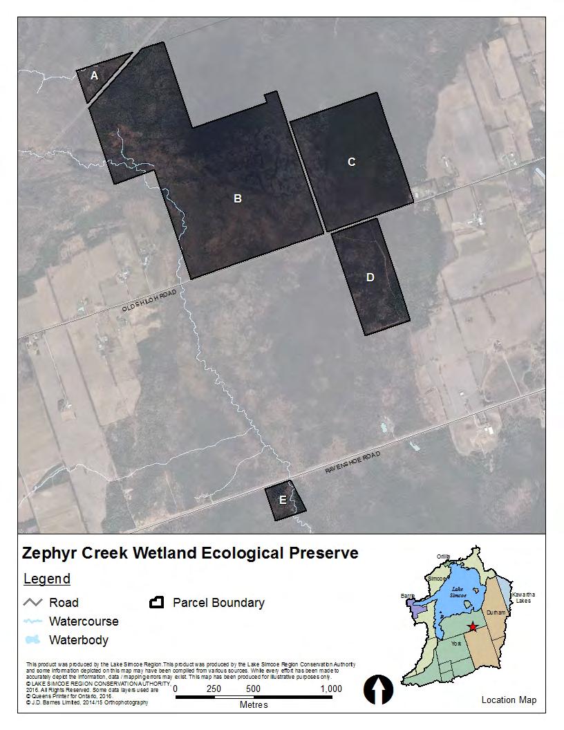
119
Introduction to INRMP Implementation Options
 El Dorado County Integrated Natural Resources Management Plan Introduction to INRMP Implementation Options 1 Our approach to the options evaluation is based on the INRMP components as they are currently
11/11/2014. Takeaways. Making the Most of Provincial Tax Incentive Programs. Provincial Property Tax Incentive Programs
 Making the Most of Provincial Tax Incentive Programs Fiona McKay, Ministry of Natural Resources and Forestry Ontario Land Trust Alliance Gathering October 24, 2014 TIPs and Tools Takeaways What provincial
Conservation Easement Stewardship
 Conservation Easements are effective tools to preserve significant natural, historical or cultural resources. Conservation Easement Stewardship Level of Service Standards March 2013 The mission of the
APPENDIX B. Fee Simple v. Conservation Easement Acquisitions NTCOG Water Quality Greenprint - Training Workshops
 APPENDIX B Fee Simple v. Conservation Easement Acquisitions NTCOG Water Quality Greenprint - Training Workshops Lake Arlington Watershed and Lewisville Lake East Watershed June 21, 2011 Presenter Talking
Central Pennsylvania Conservancy Project Selection Criteria Form
 Central Pennsylvania Conservancy Project Selection Criteria Form The following criteria guide the actions of the Central Pennsylvania Conservancy s Land Protection Committee and Board of Directors in selecting
Conservation Area Management Statement Brookwood Wildlife Area
 Conservation Area Management Statement Brookwood Wildlife Area Resolution #: Approval: Issue Date: Date of Last Revision: Page: 4 Table of Contents 1. Purpose. 1 2. Property Description 1 2.1. Legal description.
Nova Scotia Community Lands Trust Discussion Paper. Approaches to Enable Community Participation In the Purchase of Land
 Nova Scotia Community Lands Trust Discussion Paper Approaches to Enable Community Participation In the Purchase of Land Objective Nova Scotians have expressed a desire to acquire and make use of lands
IRS FORM 8283 SUPPLEMENTAL STATEMENT DONATION OF CONSERVATION EASEMENT
 Name(s) shown on income tax return Identifying Number Robert T. Landowner 021-34-1234 Susan B. Landowner 083-23-5555 IRS FORM 8283 SUPPLEMENTAL STATEMENT DONATION OF CONSERVATION EASEMENT On November 12,
Submittal of the Minutes from the March 9, 2011, April 5, 2011, and April 19, 2011 Cabinet Meetings.
 AGENDA BOARD OF TRUSTEES OF THE INTERNAL IMPROVEMENT TRUST FUND JUNE 16, 2011 Attachments to the items below can be viewed at the following link: http://www.dep.state.fl.us/secretary/cab/public_notices.htm
PROJECT SCORING GUIDANCE. Introduction: National Proiect Selection:
 FOREST LEGACY PROGRAM PROJECT SCORING GUIDANCE Introduction: This document provides guidance to the National Review Panel on how to score individual Forest Legacy Program (FLP) projects, including additional
Land Trust of Santa Cruz County. Strategic Plan. July 2012 to June This is a public version of a more detailed internal plan.
 Land Trust of Santa Cruz County Strategic Plan July 2012 to June 2015 This is a public version of a more detailed internal plan. Over the next three years the Land Trust will pursue four critical strategies.
SALE OF PUBLIC LAND IN ALBERTA RECOMMENDATIONS FOR IMPROVING REGULATION, POLICY AND PROCEDURES
 SALE OF PUBLIC LAND IN ALBERTA RECOMMENDATIONS FOR IMPROVING REGULATION, POLICY AND PROCEDURES 1. Introduction The recent application to government for sale of 25 sections of public land that would see
Using Easements to Conserve Biodiversity. Jeff Lerner Defenders of Wildlife
 Using Easements to Conserve Biodiversity Jeff Lerner Defenders of Wildlife jlerner@defenders.org Northeast LTA June 10, 2006 Defenders of Wildlife Mission: to protect native wild animals and plants in
Canadian Land Trust - Standards and Practices
 Canadian Land Trust - Crosswalk Comparison: 2005 to Standard 1: Ethics, Mission and Community Engagement 1A Mission 1B Planning and 1B Mission, Planning and Evaluation Reworded: Practices 1A and 1B combined.
THE COUCHICHING CONSERVANCY LAND STEWARDSHIP POLICY. As approved by the Board, April 30, 2007
 THE COUCHICHING CONSERVANCY LAND STEWARDSHIP POLICY As approved by the Board, April 30, 2007 When one tugs at a single thing in nature, he finds it attached to the rest of the world. John Muir This policy
Our Proposal. The Proposal
 Page 1 The Land Trust Alliance of BC and partners are promoting the establishment of a province-wide Conservation Tax Incentive Program (CTIP). This would be established through amendment of provincial
Saskatchewan Farmland Ownership
 Saskatchewan Farmland Ownership Joint presentation to the Ministry of Agriculture by: Ducks Unlimited Canada Nature Conservancy of Canada Saskatchewan Wildlife Federation June 11, 2015 DUC Saskatchewan
A Class Environmental Assessment for Provincial Parks and Conservation Reserves. Phase III: Submission to Ministry of the Environment
 A Class Environmental Assessment for Provincial Parks and Conservation Reserves Phase III: Submission to Ministry of the Environment II CLASS EA FOR PROVINCIAL PARKS AND CONSERVATION RESERVES 2001, Queen
Georgia Conservation Tax Credit Program Frequently Asked Questions
 Georgia Conservation Tax Credit Program Frequently Asked Questions What are the minimum requirements for eligibility under the Georgia Conservation Tax Credit Program (GCTCP)? Individual and corporate
CITY OF FORT COLLINS NATURAL AREAS AND CONSERVED LANDS EASEMENT POLICY
 CITY OF FORT COLLINS NATURAL AREAS AND CONSERVED LANDS EASEMENT POLICY Adopted January 3, 2012 PURPOSE: The purpose of the policy statement is to clarify the policies and procedures of the City of Fort
10 Affordable Housing Measuring and Monitoring Guidelines
 Clause 10 in Report No. 11 of Committee of the Whole was adopted, without amendment, by the Council of The Regional Municipality of York at its meeting held on June 25, 2015. 10 Affordable Housing Measuring
Sample Baseline Documentation Report (BDR) Annotated Template for Environmentally Important Land
 Annotated Template for Environmentally Important Land") Sample Baseline Documentation Report (BDR) Annotated Template for Environmentally Important Land The baseline documentation report (BDR) provides a snap shot of the biophysical condition of a property
Sample Baseline Documentation Report (BDR) Annotated Template for Environmentally Important Land The baseline documentation report (BDR) provides a snap shot of the biophysical condition of a property
Auckland Council Rates Remission and Postponement Policy Consultation Submission
 Auckland Council Rates Remission and Postponement Policy Consultation Submission 13 April 2018 To: Auckland Council Private Bag 92300 Auckland 1142 From: Queen Elizabeth the Second National Trust PO Box
About Conservation Easements
 Section Three: Farm Transfer Tools About Conservation Easements Editor s note: One question that our education collaborative has fielded consistently throughout the years is about conservation easements.
Climate Change and Conservation Easement Clause Databank
 Photograph by Alice Kubler of the Archer Taylor Preserve Climate Change and Conservation Easement Clause Databank (May 15, 2009, last edited June 3, 2009) This Databank is a work in progress assembled
Tools for Conservation: Land Trusts & Easements
 Tools for Conservation: Land Trusts & s CSS 235 Dr. Ed Krumpe 2 4 Basic Ways to Protect Land Acquisition the only permanent solution? Regulation Protect sensitive areas Control development patterns Address
INVENTORY POLICY For Real Property
 INVENTORY POLICY For Real Property (Broader Public Sector Entities) Page 1-12 CONTENTS 1. TITLE... 3 2. OVERVIEW... 3 3. PURPOSE... 3 4. POLICY STATEMENT... 3 5. APPLICATION... 7 6. EVALUATION AND REVIEW...
Capital Regional District. Regional Parks Land Acquisition Strategy 2015 to 2017
 Capital Regional District Regional Parks Land Acquisition Strategy 2015 to 2017 CRD Board Approved July 8, 2015 Table of Contents EXECUTIVE SUMMARY.... iv 1.0 BACKGROUND... 1 2.0 PURPOSE.... 1 3.0 REGIONAL
MARK TWAIN LAKE MASTER PLAN CLARENCE CANNON DAM AND MARK TWAIN LAKE MONROE CITY, MISSOURI
 MARK TWAIN LAKE MASTER PLAN CLARENCE CANNON DAM AND MARK TWAIN LAKE MONROE CITY, MISSOURI CHAPTER 4 LAND ALLOCATION, LAND CLASSIFICATION, WATER SURFACE, AND EASEMENT LANDS This Master Plan is a land use
Audit and Finance Committee Recommended Amendment to Fee Schedule
 To: From: Re: Date: Virginia Outdoors Foundation Board of Trustees Brett Glymph Audit and Finance Committee Recommended Amendment to Fee Schedule June 10, 2015 Recommendation: To sustain current operations,
Conservation Land Tax Incentive Program
 Conservation Land Tax Incentive Program Community Conservation Lands Guide Page 1 Purpose This document has been created to assist conservation groups and conservation authorities in determining whether
Private Landowner Contribution for Erosion Control Works
 Private Landowner Contribution for Erosion Control Works Category Approved by Application to the General Public or Have Significant Implications Authority Approval date (last amendment) January 27 2017
TOWN OF WHITBY REPORT RECOMMENDATION REPORT
 TOWN OF WHITBY REPORT RECOMMENDATION REPORT REPORT TO: Planning and Development Committee REPORT NO: PL 4-08 DATE OF MEETING: January 21, 2008 FILE NO(S): MI-01-07 (SW- 2002-03) PREPARED BY: Planning Department
2018 Highlands Region Land Preservation Status Report
 2018 Highlands Region Land Preservation Status Report Highlands Development Credit (HDC) properties (l to r): Tewksbury Township, Hunterdon County; Mount Olive, Morris County; Independence Township, Warren
1. Future Land Use FLU6.6.8 Land uses within the Rural Service Area portion of the Wekiva Study Area shall be limited to very low and low intensity
 1. Future Land Use FLU6.6.8 Land uses within the Rural Service Area portion of the Wekiva Study Area shall be limited to very low and low intensity uses to the greatest extent possible. Existing land uses
DESCRIPTION OF A LAND TRUST
 DESCRIPTION OF A LAND TRUST What is a land trust? Land trusts are non-profit organizations that work hand-in-hand with landowners to protect our valuable natural resources. Land trusts have become increasingly
Environment and Natural Resources Trust Fund Request for Proposals (RFP)
") Environment and Natural Resources Trust Fund 2012-2013 Request for Proposals (RFP) Project Title: Southeast Minnesota Sensitive Habitat Protection Program (SHPP) ENRTF ID: 067-D Topic Area: D. Land Acquisition
Environment and Natural Resources Trust Fund 2012-2013 Request for Proposals (RFP) Project Title: Southeast Minnesota Sensitive Habitat Protection Program (SHPP) ENRTF ID: 067-D Topic Area: D. Land Acquisition
OPEN SPACE & RECREATION PLAN
 OPEN SPACE & RECREATION PLAN HOPEWELL TOWNSHIP Cumberland County, New Jersey Prepared by: Hopewell Township Environmental Commission Final October 2011 (THIS PAGE INTENTIONALLY LEFT BLANK) PUBLIC MEETINGS
MITIGATION POLICY FOR DISTRICT-PROTECTED LANDS
 MITIGATION POLICY FOR DISTRICT-PROTECTED LANDS Approved by the District Board of Directors on July 18, 2017 The following Mitigation Policy is intended to inform the evaluation of environmental mitigation-related
TRANSFER OF DEVELOPMENT RIGHTS
 STEPS IN ESTABLISHING A TDR PROGRAM Adopting TDR legislation is but one small piece of the effort required to put an effective TDR program in place. The success of a TDR program depends ultimately on the
City of Brandon Brownfield Strategy
 City of Brandon Brownfield Strategy 2017 Executive Summary A brownfield is a property, the expansion, redevelopment, or reuse of which may be complicated by the presence or potential presence of a hazardous
Land Conservation Agreements Project Guidance
 Land Conservation Agreements Project Guidance Stakeholder Informed OTHER OPTIONS Introduction Enhanced or permanent protection of corporate lands through land conservation agreements means that companies
Our Focus: Your Future NATURE CONSERVANCY OF CANADA ACQUISITION OF PHILIPS PROPERTY
 Town of Fort Erie Community & Development Services Our Focus: Your Future Prepared for Council-in-Committee Report No. CDS-47-7 Agenda Date June 11, 27 File No. 1292 Subject NATURE CONSERVANCY OF CANADA
BOUNDARY MANAGEMENT AND ENCROACHMENTS
 BOUNDARY MANAGEMENT AND ENCROACHMENTS 1 255 255 255 237 237 237 0 0 0 217 217 217 163 163 163 200 200 200 Open Forum Discussion on Challenges and Best Management Practices 131 132 122 239 65 53 80 119
CONSERVATION EASEMENTS FREQUENTLY ASKED QUESTIONS
 CONSERVATION EASEMENTS FREQUENTLY ASKED QUESTIONS CCALT Founder and Steamboat rancher, Jay Fetcher notes, You shouldn t even be considering a conservation easement unless two things have happened: (1)
INVENTORY POLICY For Real Property
 INVENTORY POLICY For Real Property (Consolidated Revenue Fund Entities) Page 1-10 CONTENTS 1. TITLE... 3 2. OVERVIEW... 3 3. PURPOSE... 3 4. POLICY STATEMENT... 3 5. APPLICATION... 7 6. EVALUATION AND
Private Land Conservation: Conservation Easements. Matt Singer Land Stewardship Manager
 Private Land Conservation: Conservation Easements Matt Singer Land Stewardship Manager Galveston Bay Foundation Mission: To preserve, protect, and enhance the natural resources of the Galveston Bay estuarine
Conservancy Mission. Leveraging GIS Technologies in Chesapeake Conservation and Restoration 10/17/2018
 Leveraging GIS Technologies in Chesapeake Conservation and Restoration Rachel Soobitsky Geospatial Project Manager Chesapeake Conservancy Conservation Innovation Center Kristin Kirkwood Executive Director
( ) Ordinance. Environmental Resources Management
 Ordinance. Environmental Resources Management") PALM BEACH COUNTY BOARD OF COUNTY COMMISSIONERS AGENDA ITEM SUMMARY Agenda Item #:5 I/" 3 Meeting Date: April 1,2008 ( ) Consent Department Submitted By: Submitted For: ( ) Ordinance Environmental Resources
PALM BEACH COUNTY BOARD OF COUNTY COMMISSIONERS AGENDA ITEM SUMMARY Agenda Item #:5 I/" 3 Meeting Date: April 1,2008 ( ) Consent Department Submitted By: Submitted For: ( ) Ordinance Environmental Resources
Proponent s Guide to the NCC s Federal Land Use, Design and Transaction Approvals Process
 Proponent s Guide to the NCC s Federal Land Use, Design and Transaction Approvals Process September 2018 Table of Contents 1. INTRODUCTION 3 2. WHAT IS THE NATIONAL CAPITAL REGION? 4 3. WHEN IS APPROVAL
Council Public Meeting
 Agenda 3.1 a Council Public Meeting Department: Division: Subject: Planning and Regulatory Services Development Planning Request for Comments Zoning By-law Amendment and Draft Plan of Subdivision Applications
Chapter 24 Saskatchewan Housing Corporation Housing Maintenance 1.0 MAIN POINTS
 Chapter 24 Chapter 24 Saskatchewan Housing Corporation Housing Maintenance 1.0 MAIN POINTS The Saskatchewan Housing Corporation s maintenance of the 18,300 housing units it owns is essential to preserve
CITY OF HAMILTON. PLANNING AND ECONOMIC DEVELOPMENT DEPARTMENT Economic Development Division
 CITY OF HAMILTON PLANNING AND ECONOMIC DEVELOPMENT DEPARTMENT Economic Development Division TO: Mayor and Members General Issues Committee WARD(S) AFFECTED: WARD 11 COMMITTEE DATE: May 2, 2012 SUBJECT/REPORT
2 REVISED NOBLETON COMMUNITY DEVELOPMENT CHARGE OPTIONS AND PREPAID DEVELOPMENT CHARGE CREDIT AGREEMENT PRINCIPLES TOWNSHIP OF KING
 2 REVISED NOBLETON COMMUNITY DEVELOPMENT CHARGE OPTIONS AND PREPAID DEVELOPMENT CHARGE CREDIT AGREEMENT PRINCIPLES TOWNSHIP OF KING The Finance and Administration Committee recommends the adoption of the
15 July Ms E Young Team Leader Protected Area Establishment Department of Environment and Natural Resources Adelaide
 15 July 2011 Ms E Young Team Leader Protected Area Establishment Department of Environment and Natural Resources Adelaide PROTECTED AREAS ON PRIVATE LAND DISCUSSION PAPER The Environmental Defenders Office
Implementation Tools for Local Government
 Information Note #5: Implementation Tools for Local Government This Information Note is a guide only. It is not a substitute for the federal Fisheries Act, the provincial Riparian Areas Regulation, or
CONSERVATION EASEMENTS FREQUENTLY ASKED QUESTIONS
 CONSERVATION EASEMENTS FREQUENTLY ASKED QUESTIONS CCALT Founder and Steamboat rancher, Jay Fetcher notes, You shouldn t even be considering a conservation easement unless two things have happened: (1)
The Farmland Preservation Program in Sussex County
 The Farmland Preservation Program in Sussex County Preserved Tranquility Farm The Importance of Saving Farmland and Farmers Photo by Tanya Nolte Farmland, an irreplaceable natural resource, and the farmers
TOTTENHAM SECONDARY PLAN
 TOTTENHAM SECONDARY PLAN AMENDMENT NO. 11 TO THE OFFICIAL PLAN OF THE TOWN OF NEW TECUMSETH The following text and schedules to the Official Plan of the Town of New Tecumseth constitute Amendment No. 11
Biodiversity Planning Policy and Guidelines for (LEP) Rezoning Proposals
 Rezoning Proposals") Council Policy Biodiversity Planning Policy and Guidelines for (LEP) Rezoning Proposals Table of Contents Table of Contents... 1 Policy... 2 Policy Objectives... 2 Policy Statement... 2 Guidelines... 2
Council Policy Biodiversity Planning Policy and Guidelines for (LEP) Rezoning Proposals Table of Contents Table of Contents... 1 Policy... 2 Policy Objectives... 2 Policy Statement... 2 Guidelines... 2
Texas Parks and Wildlife Foundation Buffer Lands Program Program Description and Application
 Texas Parks and Wildlife Foundation Texas Parks and Wildlife Foundation s mission is to provide private support to Texas Parks and Wildlife Department to manage and conserve the natural and cultural resources
DCLG consultation on proposed changes to national planning policy
 Summary DCLG consultation on proposed changes to national planning policy January 2016 1. Introduction DCLG is proposing changes to the national planning policy framework (NPPF) specifically on: Broadening
2016 Highlands Region Land Preservation Status Report
 State of New Jersey Highlands Water Protection and Planning Council 100 North Road (Route 513) Chester, New Jersey 07930-2322 (908) 879-6737 (908) 879-4205 (fax) www.nj.gov/njhighlands 2016 Highlands Region
FARMLAND AMENITY PROTECTION. A Brief Guide To Conservation Easements
 FARMLAND AMENITY PROTECTION A Brief Guide To Conservation Easements The purpose of this guide is to help landowners access their land amenity value and to provide direction to be compensated for this value.
Tejon Ranch Conservation and Land Use Agreement Executive Summary
 Tejon Ranch Conservation and Land Use Agreement Executive Summary The Tejon Ranch Company (TRC) and Audubon California, the Endangered Habitats League, Natural Resources Defense Council, Planning and Conservation
18 Sale and Other Disposition of Regional Lands Policy
 Clause 18 in Report No. 7 of Committee of the Whole was adopted, without amendment, by the Council of The Regional Municipality of York at its meeting held on April 19, 2018. 18 Sale and Other Disposition
DEVELOPMENT SERVICES REPORT B
 DEVELOPMENT SERVICES REPORT B2014-02 To: Committee of the Whole of Council Date: Subject: Origin: 2013 Building Standards Branch Year End, Building Approvals and Inspections Branch Director of Building
Staff Report for Council Public Meeting
 Agenda Item 3.3 Staff Report for Council Public Meeting Date of Meeting: September 27, 2017 Report Number: SRPRS.17.134 Department: Division: Subject: Planning and Regulatory Services Development Planning
Participants of the Ministerial Meeting on Housing and Land Management on 8 October 2013 in Geneva
 Summary At its meeting on 2 April 2012, the Bureau of the Committee on Housing and Land Management of the United Nations Economic Commission for Europe agreed on the need for a Strategy for Sustainable
Interpretation of Conservation Purpose INTERNAL REVENUE GUIDANCE AS TO WHAT CONSTITUES A CONSERVATION PURPOSE
 Interpretation of Conservation Purpose INTERNAL REVENUE GUIDANCE AS TO WHAT CONSTITUES A CONSERVATION PURPOSE 170(h)(4)(A) of Title 26, Internal Revenue Code, Subtitle A of the United States Code gives
Chapter 100 Planned Unit Development in Corvallis Urban Fringe
 100.100 Scope and Purpose. Chapter 100 Planned Unit Development in Corvallis Urban Fringe (1) All applications for land divisions in the Urban Residential (UR) and Flood Plain Agriculture (FPA) zones within
AN ANALYSIS OF SOCIAL ARRANGEMENTS THAT CREATE OPEN SPACE. Lisa Blake Ava Goodale Caroline Krassen Johnathan Licitra Elizabeth Ochoa
 AN ANALYSIS OF SOCIAL ARRANGEMENTS THAT CREATE OPEN SPACE Lisa Blake Ava Goodale Caroline Krassen Johnathan Licitra Elizabeth Ochoa OPEN SPACE REGIMES ARE The institutions of state, market, and community
Working Together to Conserve Land
 Working Together to Conserve Land A Resource for Landowners Protecting land for future generations About Loon Echo was formed as a 501(c)(3)nonprofit organization in 1987 to preserve land in the northern
TRENDS IN QUALIFIED CONSERVATION EASEMENTS. By: Melinda M. Beck, Esq.
 TRENDS IN QUALIFIED CONSERVATION EASEMENTS By: Melinda M. Beck, Esq. What is a Conservation Easement? An easement interest granted by a landowner to a land trust or governmental entity that voluntarily
A SYNOPSIS ON PROTECTING AND COMMEMORATING HERITAGE TREES
 A SYNOPSIS ON PROTECTING AND COMMEMORATING HERITAGE TREES Barbara Heidenreich, Heritage Tree Advisor Forests Ontario & Ontario Urban Forest Council January 2016 PROTECTING HERITAGE TREES: A SYNOPSIS This
Land and Easement Donation Process and Requirements Summary
 Land and Easement Donation Process and Requirements Summary Many of the steps involved in donating land or conservation easements to American Friends of Canadian Land Trusts (AF) will be familiar to people
Chapter 10 Local Protection Measures
 The DPC fully supports the protection of private property rights and the DPC will work to ensure that there will be no negative impacts stemming from NHA activities on private property, should the designation
Land Acquisition Strategy and Implementation Policy Public Opinion Survey Results
 Land Acquisition Strategy and Implementation Policy Public Opinion Survey Results Presentation to Council and Parks & Planning Commissions May 9, 2017 Background Parks CIP: - Allocated $13 million to Land
Table of Contents Executive Summary...1 This audit focused on acquisitions and dispositions of City-owned real estate... 1 During the four-year
 Report #0510 Table of Contents Executive Summary...1 This audit focused on acquisitions and dispositions of City-owned real estate.... 1 During the four-year period covered by this audit, acquisitions
UNOFFICIAL COPY OF HOUSE BILL 1272 A BILL ENTITLED
 UNOFFICIAL COPY OF HOUSE BILL 1272 M4 6lr0525 By: Delegates Smigiel, Kelley, Rosenberg, and Sossi Introduced and read first time: February 10, 2006 Assigned to: Environmental Matters 1 AN ACT concerning
Evaluation of the Natural Areas Conservation Program
 Evaluation of the Natural Areas Conservation Program Final Report DATE OF SUBMISSION: June 20, 2012 SUBMITTED TO: Michael Bradstreet, Vice President Conservation Nature Conservancy of Canada 36 Eglinton
CAPITAL ASSET POLICY
 CAPITAL ASSET POLICY POLICY STATEMENT Morningside College, through each of its operating departments acquires and disposes of capital assets. Each department is responsible for following College procedures
Remains eligible for state or federal farm programs. Can use land as collateral for loans. Can reserve home lots for children
 December 2002 B-1132 Conservation Easements: An Introductory Review for Wyoming By Allison Perrigo and Jon Iversen, William D. Ruckelshaus Institute of Environment and Natural Resources William D. Ruckelshaus
3.23 LANDS AND SPECIAL USES
 3.23 LANDS AND SPECIAL USES Introduction This section addresses those aspects of SJPLC management relating to public land ownership and use. Special Use Permits, rights-of-way (ROW) grants, easements,
Terms of Reference for Town of Caledon Housing Study
 1.0 Introduction Terms of Reference for Town of Caledon Housing Study The Town of Caledon is soliciting proposals for a comprehensive Housing Study. Results of this Housing Study will serve as a guiding
LAKE OF THE WOODS COUNTY WETLAND CONSERVATION ORDINANCE OF 2002
 Ordinance # LAKE OF THE WOODS COUNTY WETLAND CONSERVATION ORDINANCE OF 2002 ARTICLE 1 TITLE AND PURPOSE Section 1.1. Title This Ordinance shall be known, cited and referred to as the Lake of the Woods
Marin County Agricultural Land Conservation Program March 1, 2014
 Marin County Agricultural Land Conservation Program March 1, 2014 I. Purpose of this Document This document describes the Marin County Agricultural Land Conservation Program (County Program). The Marin
Corporate Services Planning and Economic Development. Memorandum
 Corporate Services Planning and Economic Development Memorandum TO: FROM: Committee of the Whole Paul Freeman, Chief Planner DATE: June 21, 2018 RE: York Region C omments on Draft Provinci al Guidance
Thurston County Planning Department BOARD OF COUNTY COMMISSIONERS PUBLIC HEARING DRAFT AMENDMENTS TO THE CRITICAL AREAS REGULATIONS. Chapter 24.
 Thurston County Planning Department BOARD OF COUNTY COMMISSIONERS PUBLIC HEARING DRAFT AMENDMENTS TO THE CRITICAL AREAS REGULATIONS Chapter 24.01 GENERAL PROVISIONS Chapter 24.01 6/4/2012 GENERAL PROVISIONS
Lessard Sams Outdoor Heritage Council
 Lessard Sams Outdoor Heritage Council MEMO: Agenda Item # 10 DATE: December 11, 2014 SUBJECT: PRESENTER: 2015 Legislative Appropriation Recommendation Bill Heather Koop, LSOHC staff Background: On October
Guide to Planned Giving
 Guide to Planned Giving Leave it to nature, forever. Tax ID# 91-1533402 For more information: Skagit Land Trust 1020 S Third Street - PO Box 1017 Mount Vernon, WA 98273 360.428.7878 Molly Doran, Executive
Comprehensive Plan /24/01
 IV The is a central component of the Comprehensive Plan. It is an extension of the general goals and policies of the community, as well as a reflection of previous development decisions and the physical
SPORTING AND COMMUNITY LEASING POLICY
 SPORTING AND COMMUNITY LEASING POLICY Classification: Statutory Policy. Trim Container TRIM Container Number Trim Document Number: TRIM Document Number First Issued / Approved: 24 April 2018 Last Reviewed:
Dakota County Farmland and Natural Areas Program. Lake Pepin TMDL May 31, 2007
 Dakota County Farmland and Natural Areas Program Lake Pepin TMDL May 31, 2007 Presentation Overview County Context FNAP Planning Process FNAP Implementation Integrating Conservation Efforts Parcel Development
Township of Tay Official Plan
 Township of Tay Official Plan Draft for Consultation (v.3) March 2016 Contents 1. INTRODUCTION... 1 1.1 Content, Title and Scope... 1 1.2 Basis and Purpose of this Plan... 1 1.3 Plan Structure... 2 2.
6 SECOND SUITES IN YORK REGION
 6 SECOND SUITES IN YORK REGION (Regional Council at its meeting on June 19, 2008, referred this Clause back to staff to provide additional information and report back to the September 3, 2008 meeting of
Grand Mesa, Uncompahgre and Gunnison National Forests Region 2, USDA Forest Service
 Decision Memo Taylor River Land Exchange Under the General Exchange Act of March 20, 1922 as Amended, The Federal Land Policy and Management Act of 1976 as Amended and the Federal Land Exchange Facilitation
Kent Land Trust Strategic Reassessment Project Final Report
 Kent Land Trust Strategic Reassessment Project Final Report Prepared For: Connecticut Institute for Resilience and Climate Adaptation (CIRCA) Prepared by: Michael A. Benjamin, Land Steward, Kent Land Trust
West Virginia Outdoor Heritage Conservation Fund. Grant Program TECHNICAL ASSISTANCE MANUAL
 West Virginia Outdoor Heritage Conservation Fund Grant Program TECHNICAL ASSISTANCE MANUAL Please Note: 1. All applicants are advised to read this manual prior to even starting on a grant application.
Subject. Date: 2016/10/25. Originator s file: CD.06.AFF. Chair and Members of Planning and Development Committee
 Date: 2016/10/25 Originator s file: To: Chair and Members of Planning and Development Committee CD.06.AFF From: Edward R. Sajecki, Commissioner of Planning and Building Meeting date: 2016/11/14 Subject