MEMPHIS AND SHELBY COUNTY OFFICE OF PLANNING AND DEVELOPMENT STAFF REPORT #3
|
|
|
- Britney Pearson
- 5 years ago
- Views:
Transcription
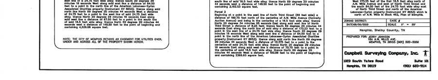
1 MEMPHIS AND SHELBY COUNTY OFFICE OF PLANNING AND DEVELOPMENT STAFF REPORT #3 CASE NUMBER: SAC L.U.C.B. MEETING: October 14, 2010 ALLEY NAME: North Third Street - A.W. Willis Avenue Alley LOCATION: West feet of the first 16.5 foot alley north of A.W. Willis Avenue and east of North Third Street and the south 84 feet of the foot wide alley east of North Third Street and north of the ALSAC Property north of A.W. Willis Avenue COUNCIL DISTRICT: 7 SUPER DISTRICT: 8 APPLICANT Tony Fox REPRESENTATIVE: Jerry Johnson REQUEST: Close & Vacate Alley Right-Of-Way AREA: 4,529 square feet EXISTING LAND USE & ZONING ADJOINING ALLEY: Doggy Day Care and Gayoso Bayou/Mixed Use (MU) District OFFICE OF PLANNING AND DEVELOPMENT RECOMMENDATION: Approval With Conditions CONCLUSIONS 1. This alley was platted in 1856 as part of the original Greenlaw Subdivision. Though platted to connect from Third Street to Fourth Street and from Auction Avenue to Sycamore Street, the only portion of the public alleys left remaining in this block is the portion proposed for closing. 2. The majority of this block contains a substantial drainage basin as part of the Gayoso Bayou. The slope of this basin abuts the alley on its north and east sides. 3. The drainage basin makes any future physical connection to the existing alley difficult in terms of creating a through street pedestrian or vehicular connections. 4. While alleys are integral to the prevailing pattern of development and redevelopment in Uptown, keeping this particular remnant portion of alley appears to be value limited due to its lack of interconnectivity and isolation created by the abutting Gayoso Bayou drainage basin. Staff Writer: Chip Saliba chip.saliba@memphistn.gov

2 The Original Greenlaw Subdivision Plan dedicated the subject alleys in 1856 (highlighted in yellow).

3 SAC Page 3 Land Use and Zoning Map. Of the original platted alleys in this block, only a portion of alleyway remains which is the subject of this closing application.

4 SAC Page 4 This aerial photo illustrates the Gayoso Bayou drainage basin that abuts the alley on its north and east sides.

5 SAC Page 5 Doggy s Daycare currently abuts the alleys.


6 SAC Page 6 The proposed closing is highlighted in yellow.
7 SAC Page 7 The applicant is proposing redevelopment of the site as a convenience store with gasoline sales. A Special Use Permit application (Case # SUP ) was filed with the Office of Planning and Development on 09/29/10 per the requirements of the Uptown Ordinance. The special use permit must receive approval from the City Council. The proposed alley closing area is highlighted in yellow.
8 SAC Page 8 Vicinity Map illustrating adjacent ownership and public notice mailing radius. A public notice sign has also been posted.

9 SAC Page 9 East/West Alley is between the two fences

10 SAC Page 10 East/West Alley looking west toward North Third Street. The Gayoso Bayou drainage basin is to the right of the black fence.

11 SAC Page 11 East/West Alley looking east from North Third Street. The Gayoso Bayou drainage Basin is on the left side of the photo.

12 SAC Page 12 North/South Alley The Gayoso Bayou drainage basin is in the foreground between the building and sidewalk.

13 SAC Page 13 North/South Alley looking south to A.W. Willis Avenue

14 SAC Page 14 Another view of North/South Alley looking south to A.W. Willis Avenue. The Gayoso Bayou drainage basin is to the left.

15 SAC Page 15 Doggy Daycare City s Drainage Detention Basin The City of Memphis owns property surrounding the alleys in the form of a drainage detention area.
16 SAC Page 16 STAFF ANALYSIS The applicant is requesting to close portions of two unimproved alleys that connect to one another and border an existing building and grounds at the northeast corner of A.W. Willis Street and North Third Street. The existing building operates as a Doggy s Daycare. The applicant is pursuing plans to redevelop this property into a convenience store with gasoline sales and would like the area containing the alleys closed and conveyed to him as part of his redevelopment plan for the property. The applicant s proposed plan is illustrated on Page 7 of this staff report. The subject alley remnants were originally established in the platting of the Greenlaw Neighborhood in 1856 (see Page 2 of this staff report). The plat established a grid consisting of a north-south and east-west alley contained within the block bounded by Sycamore Avenue to the north, Auction Avenue (now A.W. Willis Avenue) to the south, Fourth Street to the east, and Third Street to the west. Over the subsequent decades the City of Memphis constructed a drainage basin/detention area abutting the subject alley closing request area for the flood waters of the Gayoso Bayou. This basin exists today as an active flood control depression and has effectively eliminated the original grid alley system established by the 1856 plat. In fact, current property records within this block indicate no alley system remains with the exception of the subject alleys. This is best illustrated by the graphics contained on Pages 3-4, and 6 and 8 of this staff report. Because of the physical limitations created by the adjoining drainage basin, the remnant alley section is not connected to an existing through alley system and has been isolated. Public rightof-way in the Uptown area including alleys provide a valuable asset in terms of retaining the urban character and development pattern of the original platting and offer varied vehicular and pedestrian options for the public. In this instance though it is difficult to see how retaining the subject alley remnants could be beneficial due to their limited access and lack of connectivity. For these reasons, the alley remnants are recommended for closing.
17 SAC Page 17 RECOMMENDATION: Approval subject to the following conditions: 1. Provide easements for existing sanitary sewers, drainage facilities and other utilities or relocate at developer's expense. 2. The applicant shall provide for the construction of curb, gutter and sidewalk across the closure as required by the City Engineer. If the City Engineer approves access, the applicant shall construct a City Standard curb cut across the closure, all to the satisfaction of the City Engineer, and at the applicant's expense. The applicant shall enter into a Standard Improvement Contract or obtain a curb cut permit from the City Engineer to cover the above required construction work. 3. The applicant shall comply with all conditions of the closure within two years of the conditional approval of the closure by the City Council. 4. Revise the closure plat and legal descriptions accordingly if it is determined by the City Engineer that additional right-of-way is needed for any future improvement of North Third Street.
18 SAC Page 18 GENERAL INFORMATION Planning District: Uptown Memphis Zoning Atlas Page: 1930 DEPARTMENTAL COMMENTS: The following comments were provided by agencies to which this application was referred: City Engineer: Street Closures: Provide easements for existing sanitary sewers, drainage facilities and other utilities or relocate at developer's expense. The applicant shall provide for the construction of curb, gutter and sidewalk across the closure as required by the City Engineer. If the City Engineer approves access, the applicant shall construct a City Standard curb cut across the closure, all to the satisfaction of the City Engineer, and at the applicant's expense. The applicant shall enter into a Standard Improvement Contract or obtain a curb cut permit from the City Engineer to cover the above required construction work. The applicant shall comply with all conditions of the closure within 365 days of the conditional approval of the closure by the City Council. City Fire Division: City Real Estate: City/County Health Department: Tank City Board of Education: Construction Code Enforcement: No comments. No comments received. The Water Quality Branch & Septic Program has no comments. No comments. No comments received. Memphis Light, Gas and Water: MLGW has reviewed the referenced application, and has no objection, subject to the following conditions:
19 SAC Page 19 MLGW has existing utility distribution facilities within the present public road right of way. The City of Memphis shall retain an easement across the proposed street closure, from edge to edge of the road right of way, to accommodate any existing public utilities, including electric, gas, water, CATV, telephone, sewer, drainage, etc If it is necessary for MLGW facilities to be installed, removed or relocated, any work performed by MLGW will be done at the expense of the owner/applicant. MLGW reserves the right to retain a utility right-of-way within that portion of the existing public road right of way at all times for existing utilities, or the owner/applicant may choose to relocate existing utilities at the expense of the owner/applicant. MLGW must be able to access any overhead or underground facilities. Consequently, no permanent structure(s) shall be constructed or erected within that portion of the existing public road right of way including fences, buildings, patios, vehicle parking or paving. It is the responsibility of the owner/applicant to identify any utility easements, whether dedicated or prescriptive (electric, gas, water, CATV, telephone, sewer, drainage, etc.), which may encumber the subject property, including underground and overhead facilities. No permanent structures will be allowed within any utility easements. It is the responsibility of the owner/applicant to contact MLGW-Property Management, Land Rights to request a Release Deed for release of easement for any existing MLGW Easement(s) in conflict with the proposed development. It is the responsibility of the owner/applicant to pay the cost of any work performed by MLGW to install, remove or relocate any facilities to accommodate the proposed development. It is the responsibility of the owner/applicant to identify any utility easements, whether dedicated or prescriptive (electric, gas, water, CATV, telephone, sewer, drainage, etc.), which may encumber the subject property, including underground and overhead facilities. No permanent structures will be allowed within any utility easements. It is the responsibility of the owner/applicant to comply with the National Electric Safety Code (NESC) and maintain minimum horizontal/vertical clearances between existing overhead electric facilities and any proposed structures. Landscaping is prohibited within any MLGW utility easement without prior MLGW approval. It is the responsibility of the owner/applicant to comply with Memphis/Shelby County Zoning Ordinance - Landscape and Screening Regulations. It is the responsibility of the owner/applicant to contact , before digging, and to determine the location of any underground utilities including electric, gas, water, CATV, telephone, etc It is the responsibility of the owner/applicant to submit a detailed plan to MLGW Engineering for the purposes of determining the availability and capacity of existing utility services to serve any proposed or future development(s). It is the responsibility of the owner/applicant to submit a detailed plan to MLGW Engineering for the purposes of determining the availability and capacity of existing utility services to serve any proposed or future development(s). Application for utility service is necessary before plats can be recorded. o All residential developers must contact MLGW's Residential Engineer at for application of utility services. o All commercial developers must contact MLGW's Builder Services line at to initiate the utility installation process.
20 SAC Page 20 It is the responsibility of the owner/applicant to pay the cost of any utility system improvements necessary to serve the proposed development with electric, gas or water utilities. Bell South / Millington Telephone: Memphis Area Transit Authority (MATA): Center City Commission: OPD-Regional Services: OPD-Plans Development: Park Services Division: North Memphis CDC: Downtown Neighborhood Association: Uptown Neighborhood Association: No comments received. No comments received. Objects to closing. Favor preservation of the alley as public right-of-way to provide additional public space adjacent to the Gayoso Bayou. No comments received. No comments received. No comments received. No comments received. See attached. No comments received.
21 SAC Page 21
Memphis City Council Summary Sheet. S.D Roland Road Street Right-of-Way Dedication
 Memphis City Council Summary Sheet S.D. 16-01 Roland Road Street Right-of-Way Dedication Resolution requesting a Street Dedication south of U.S. Hwy 64 at the southern terminus of Roland Road to extend
MEMPHIS AND SHELBY COUNTY OFFICE OF PLANNING AND DEVELOPMENT. CASE NUMBER: S.U.P L.U.C.B. MEETING: April 8, 2010
 MEMPHIS AND SHELBY COUNTY OFFICE OF PLANNING AND DEVELOPMENT STAFF REPORT 8 CASE NUMBER: S.U.P 10-209 L.U.C.B. MEETING: April 8, 2010 LOCATION: South side of Quince Road; +/-350.57 feet east of Kirby Road
Memphis City Council Summary Sheet
 Memphis City Council Summary Sheet Resolution requesting a Special Use Permit (S.U.P. 12 203) to allow a pawn and jewelry shop at the southwest corner of S. Perkins Road and Knight Arnold Road: This item
Memphis and Shelby County Office of Planning and Development CITY HALL 125 NORTH MID AMERICA MALL MEMPHIS, TENNESSEE (901)
") Memphis and Shelby County Office of Planning and Development CITY HALL 125 NORTH MID AMERICA MALL MEMPHIS, TENNESSEE 38103-2084 (901) 576-6619 M E M O R A N D U M TO: FROM: Agnes Martin, City Real Estate
Memphis and Shelby County Office of Planning and Development CITY HALL 125 NORTH MID AMERICA MALL MEMPHIS, TENNESSEE 38103-2084 (901) 576-6619 M E M O R A N D U M TO: FROM: Agnes Martin, City Real Estate
MEMPHIS AND SHELBY COUNTY OFFICE OF PLANNING AND DEVELOPMENT. CASE NUMBER: P.D L.U.C.B. MEETING: August 14, 2008
 MEMPHIS AND SHELBY COUNTY OFFICE OF PLANNING AND DEVELOPMENT STAFF REPORT 17 CASE NUMBER: P.D. 08-321 L.U.C.B. MEETING: August 14, 2008 DEVELOPMENT NAME: FLEMING S STEAKHOUSE PLANNED DEVELOPMENT, Amended
Memphis City Council Summary Sheet
 Memphis City Council Summary Sheet Zoning Ordinance requesting a Zoning Map Amendment for reclassification of property located in Commercial Mixed Use (CMU 1) District zoning at southwest corner of S.
Chapter Plat Design (LMC)
") Chapter 18.14 Plat Design (LMC) Sections: 18.14.010 Lot width 18.14.020 Right-of-way requirements 18.14.030 Pipe stem lots 18.14.040 Division resulting in minimum lot sizes 18.14.050 Flood prone and bad
Chapter 18.14 Plat Design (LMC) Sections: 18.14.010 Lot width 18.14.020 Right-of-way requirements 18.14.030 Pipe stem lots 18.14.040 Division resulting in minimum lot sizes 18.14.050 Flood prone and bad
Appendix A. Definitions
 Definitions 1. Terms Defined. Words contained in this are those having a special meaning relative to the purposes of this Ordinance. Words not listed in this section shall be defined by reference to: (1)
THE REDEVELOPMENT PLAN
 PAGE 37 THE REDEVELOPMENT PLAN FUTURE LAND USE The Silver Terrace Redevelopment Area is currently designated as Redevelopment Area #4 on the City of Delray Beach Future Land Use Map (FLUM). This designation
SUBDIVISION DESIGN PRINCIPLES AND STANDARDS
 SECTION 15-200 SUBDIVISION DESIGN PRINCIPLES AND STANDARDS 15-201 STREET DESIGN PRINCIPLES 15-201.01 Streets shall generally conform to the collector and major street plan adopted by the Planning Commission
610 LAND DIVISIONS AND PROPERTY LINE ADJUSTMENTS OUTSIDE A UGB
 ARTICLE VI: LAND DIVISIONS AND PROPERTY LINE ADJUSTMENTS VI-21 610 LAND DIVISIONS AND PROPERTY LINE ADJUSTMENTS OUTSIDE A UGB 610-1 Property Line Adjustments (Property Line Relocation) A property line
PLANNING COMMISSION STAFF REPORT SURROUNDING LAND USES. Light Industrial, Office, UDOT Right of Way (Interstate- 15)
") PLANNING COMMISSION STAFF REPORT MEETING DATE: March 21, 2019 PROJECT NUMBER: S-18-014 REQUEST: Final Plat approval for a single lot subdivision ADDRESS: 3535 South 500 West 7 Parcels: 15-36-127-021-0000,
PLANNING COMMISSION STAFF REPORT MEETING DATE: March 21, 2019 PROJECT NUMBER: S-18-014 REQUEST: Final Plat approval for a single lot subdivision ADDRESS: 3535 South 500 West 7 Parcels: 15-36-127-021-0000,
# 6 Case #SUB LEGACY SUBDIVISION. Engineering Comments: Must comply with the Mobile County Flood Damage Prevention Ordinance.
 LEGACY SUBDIVISION Engineering Comments: Must comply with the Mobile County Flood Damage Prevention Ordinance. The plat illustrates the proposed 46 lot, 26.7 + acres subdivision which is located on the
PENNY LAKES SUBDIVISION
 PENNY LAKES SUBDIVISION Engineering Comments: A portion of the site may be located within the J.B. Converse watershed, the primary drinking water supply for the Mobile Area Water and Sewer System. Consultation
ARTICLE VI. SUBDIVISION STANDARDS, PUBLIC
 ARTICLE VI. SUBDIVISION STANDARDS, PUBLIC IMPROVEMENTS, AND DESIGN REQUIREMENTS ARTICLE VI. SUBDIVISION STANDARDS, PUBLIC IMPROVEMENTS, AND DESIGN REQUIREMENTS DIVISION 1. GENERAL PROVISIONS Sec. 21-6100.
Condominium Unit Requirements.
 ARTICLE 19 CONDOMINIUM REGULATIONS Section 19.01 Purpose. The purpose of this Article is to regulate projects that divide real property under a contractual arrangement known as a condominium. New and conversion
KRONER S MOBILE WEST COMMERCIAL BUSINESS PARK SUBDIVISION
 KRONER S MOBILE WEST COMMERCIAL BUSINESS PARK SUBDIVISION Engineering Comments: Must comply with the Mobile County Flood Damage Prevention Ordinance. Development shall be designed to comply with the storm
ELIZA JORDAN CORNER SUBDIVISION
 ELIZA JORDAN CORNER SUBDIVISION Engineering Comments: Must comply with the Mobile County Flood Damage Prevention Ordinance. Development shall be designed to comply with the storm water detention and drainage
DAUPHIN CREEK ESTATES SUBDIVISION
 # 12 SUB-000076-2017 DAUPHIN CREEK ESTATES SUBDIVISION Engineering Comments: FINAL PLAT COMMENTS (should be addressed prior to submitting the FINAL PLAT for review and/or signature by the City Engineer):
MEMPHIS AND SHELBY COUNTY OFFICE OF PLANNING AND DEVELOPMENT. CASE NUMBER: P. D L.U.C.B. MEETING: July 9, 2009 Held from June 11, 2009
 MEMPHIS AND SHELBY COUNTY OFFICE OF PLANNING AND DEVELOPMENT STAFF REPORT 9 CASE NUMBER: P. D. 09-311 L.U.C.B. MEETING: July 9, 2009 Held from June 11, 2009 DEVELOPMENT NAME: HARBERT AVENUE PLANNED DEVELOPMENT
PRELIMINARY PLATS. The following documents are provided as required by the City of Conroe for use in the above titled platting submittals:
 Public Works Engineering Division CITY OF CONROE PRELIMINARY PLATS The following documents are provided as required by the City of Conroe for use in the above titled platting submittals: Submittal Questionnaire
ADDRESS / DESCRIPTION: Property located near the intersection of Mill Dam Court and First Colonial Road. ELECTION DISTRICT: LYNNHAVEN
 August 10, 2011 8 Public Hearing APPLICANT : 1168 ASSOCIATES, LLC, A VA LIMITED LIABILITY COMPANY STAFF PLANNER: Leslie Bonilla REQUEST: Discontinuance, closure and abandonment of a portion of right-of-way
ZONING AMENDMENT, PLANNED UNIT DEVELOPMENT & SUBDIVISION STAFF REPORT Date: August 8, 2013
 ZONING AMENDMENT, PLANNED UNIT DEVELOPMENT & SUBDIVISION STAFF REPORT Date: August 8, 2013 NAME SUBDIVISION NAME PV-Magnolia, LLC Twelve Trees Subdivision LOCATION 2860, 2862 and 2866 Pleasant Valley Road
WESTMINSTER PARK PLACE SUBDIVISION
 WESTMINSTER PARK PLACE SUBDIVISION Engineering Comments: FINAL PLAT COMMENTS (should be addressed prior to submitting the FINAL PLAT for review and/or signature by the City Engineer): A. Provide all of
ARTICLE 13 CONDOMINIUM REGULATIONS
 ARTICLE 13 CONDOMINIUM REGULATIONS Section 13.01 Purpose. The purpose of this Article is to regulate projects that divide real property under a contractual arrangement known as a condominium. New and conversion
ZONING AMENDMENT & SUBDIVISION STAFF REPORT Date: November 3, 2016
 ZONING AMENDMENT & SUBDIVISION STAFF REPORT Date: November 3, 2016 APPLICANT NAME SUBDIVISION NAME David Shumer 5955 Airport Subdivision CITY COUNCIL DISTRICT District 6 5955 Airport Boulevard, 754 Linlen
ORDINANCE NO. Be it ordained by the City Council of the City of Abilene, Texas:
 ORDINANCE NO. An ordinance repealing Chapter 23, Subpart B of the Code of the City of Abilene, Texas, entitled Mobile Homes and Vacation Travel Trailers; stating the authority; setting forth the scope
PORT CITY COMMERCE PARK SUBDIVISION
 # 4 SUB2015-00019 PORT CITY COMMERCE PARK SUBDIVISION Engineering Comments: Must comply with the Mobile County Flood Damage Prevention Ordinance. Development shall be designed to comply with the storm
Initial Project Review
 Pierce County Department of Planning and Land Services, 2401 South 35th Street, Tacoma, WA (253) 798-7037 Initial Project Review Major Amendment to Preliminary Plat: Hawks Ridge Division 1 Application
Section Preliminary Plat Checklist and Application Forms
 Section 201 - Preliminary Plat Checklist and Application Forms PRELIMINARY SUBDIVISION PLAT REVIEW PROCESS CHART PRELIMINARY SUBDIVISION PLAT APPLICATION PRELIMINARY PLAT REVIEW CHECKLIST CITY OF NAMPA
Preliminary Subdivision Application (Major) (Four (4) lots or more)
 (Four (4) lots or more)") Gunnison City Offices www.gunnisoncity.org 38 West Center Gunnison, Utah 84634 (435) 528 7969 Date of Application: Preliminary Subdivision Application (Major) (Four (4) lots or more) APPLICANT INFORMATION
Gunnison City Offices www.gunnisoncity.org 38 West Center Gunnison, Utah 84634 (435) 528 7969 Date of Application: Preliminary Subdivision Application (Major) (Four (4) lots or more) APPLICANT INFORMATION
ZONING AMENDMENT & SUBDIVISION STAFF REPORT Date: July 9, 2015
 ZONING AMENDMENT & SUBDIVISION STAFF REPORT Date: July 9, 2015 APPLICANT NAME 2513 Dauphin Street, Inc. SUBDIVISION NAME Audubon Place Extension No. 3, Resubdivision of Lots 1-5 LOCATION 2513 Dauphin Street
ZONING AMENDMENT, SUBDIVISION & SIDEWALK WAIVER REQUEST STAFF REPORT Date: November 16, 2006
 ZONING AMENDMENT, SUBDIVISION & SIDEWALK WAIVER REQUEST STAFF REPORT Date: November 16, 2006 NAME SUBDIVISION NAME Terhaar & Cronley Investment Partnership P & E Subdivision LOCATION 4210 and 4218 Halls
ARTICLE 7 UTILITIES AND EASEMENTS
 7.1 PLACEMENT OF UTILITIES ARTICLE 7 UTILITIES AND EASEMENTS 7.1.1 All authorized public underground utilities shall be located within the right-of-way of a public street or within an easement designated
STAFF REPORT Administrative Subdivision Hearing West 150 South Street, Parcel # , and
 Petition Number: 490-06-24 STAFF REPORT Administrative Subdivision Hearing Project Name: Project Location: Project Type: Applicant: Planning Staff: Haight Industrial Subdivision 5550 West 150 South Street,
Waseca County Planning and Zoning Office
 Waseca County Planning and Zoning Office 300 North State Street Waseca, Minnesota 56093 Phone: 507-835-0650 Fax: 507-837-5310 Form no. PZ 081009 Web Site: www.co.waseca.mn.us FEES: 1) CUP FEE- $400.00
Community Development Department
 Community Development Department SUBJECT: Reconsideration of Final Site Plan Review, Preliminary Subdivision, and Planned Development for Park Place Glenview at 1225 Waukegan Road MEETING DATE: March 28,
WESTMINSTER PARK SUBDIVISION
 WESTMINSTER PARK SUBDIVISION Engineering Comments: FINAL PLAT COMMENTS (should be addressed prior to submitting the FINAL PLAT for review and/or signature by the City Engineer): A. Provide all of the required
PALMER WOODS SUBDIVISION, PHASE III
 PALMER WOODS SUBDIVISION, PHASE III Engineering Comments: Must comply with the Mobile County Flood Damage Prevention Ordinance. MAWSS Comments: MAWSS has NO water and sewer services available. The plat
Preliminary Subdivision Application (Minor) (Three (3) lots or less)
 (Three (3) lots or less)") Gunnison City Offices www.gunnisoncity.org 38 West Center Gunnison, Utah 84634 (435) 528 7969 Date of Application: Preliminary Subdivision Application (Minor) (Three (3) lots or less) APPLICANT INFORMATION
Gunnison City Offices www.gunnisoncity.org 38 West Center Gunnison, Utah 84634 (435) 528 7969 Date of Application: Preliminary Subdivision Application (Minor) (Three (3) lots or less) APPLICANT INFORMATION
ARLINGTON COUNTY, VIRGINIA
 ARLINGTON COUNTY, VIRGINIA County Board Agenda Item Meeting of June 18, 2016 DATE: June 7, 2016 SUBJECT: Vacations Concerning a Project Known as 2400 Columbia Pike A. Vacation of a Portion of Columbia
Staff Report PLANNING DIVISION COMMUNITY & ECONOMIC DEVELOPMENT. Alley Closure
 Staff Report PLANNING DIVISION COMMUNITY & ECONOMIC DEVELOPMENT To: From: Salt Lake City Planning Commission Doug Dansie, 801-535-6182, doug.dansie@slcgov.com Date: March 23, 2016 Re: PLNPCM2015-00941
MINOR PLAT. The following documents are provided as required by the City of Conroe for use in the above titled platting submittals:
 Public Works - Engineering Division CITY OF CONROE MINOR PLAT The following documents are provided as required by the City of Conroe for use in the above titled platting submittals: Submittal Questionnaire
GENERAL PLAN, DEVELOPMENT CODE AND ZONING MAP AMENDMENT APPLICATION INFORMATION SHEET
 GENERAL PLAN, DEVELOPMENT CODE AND ZONING MAP AMENDMENT APPLICATION INFORMATION SHEET GENERAL INFORMATION This information sheet explains how an application requesting an amendment to the Truckee General
ARTICLE V PRELIMINARY PLAN SUBMISSION
 ARTICLE V PRELIMINARY PLAN SUBMISSION 501. Plan Requirements a. On or before the 25 th day of the month prior to a regularly scheduled meeting of the Planning Commission, the applicant shall submit two
DETAILED GRADING PLAN CHECKLIST (TEARDOWN/REDEVELOPMENT)
") GENERAL DETAILED GRADING PLAN CHECKLIST (TEARDOWN/REDEVELOPMENT) ADDRESS: PERMIT #: DATE: 1. Plan is signed and sealed by an Illinois registered professional engineer including date signed and license
GENERAL DETAILED GRADING PLAN CHECKLIST (TEARDOWN/REDEVELOPMENT) ADDRESS: PERMIT #: DATE: 1. Plan is signed and sealed by an Illinois registered professional engineer including date signed and license
Development Plan DP13-3 (Arlington Lofts) Planning and Zoning Meeting Date: Document Being Considered: Ordinance
 Planning and Zoning Meeting Date: Document Being Considered: Ordinance") Staff Report Development Plan DP13-3 (Arlington Lofts) Planning and Zoning Meeting Date: 6-19-13 Document Being Considered: Ordinance RECOMMENDATION Following the public hearing, consider Development Plan
Staff Report Development Plan DP13-3 (Arlington Lofts) Planning and Zoning Meeting Date: 6-19-13 Document Being Considered: Ordinance RECOMMENDATION Following the public hearing, consider Development Plan
MEMBERS PRESENT: Darrin Buskirk, Buan Smith, Chris Cobbler, Mitzi Delius, Jeri Hartley, J. Smith, Bruce Southworth, Pattie Wilson
 ON TUESDAY, JANUARY 19, 2016 THE TECHNICAL REVIEW COMMITTEE HELD THEIR MEETING AT 10:00 A.M. IN THE 2 ND FLOOR COURTROOM OF THE WOODFORD COUNTY COURTHOUSE. MEMBERS PRESENT: Darrin Buskirk, Buan Smith,
AMELIA LAKE SUBDIVISON, PHASES 1-2
 # 1 HOLDOVER Revised SUB2014-00089 AMELIA LAKE SUBDIVISON, PHASES 1-2 Engineering Comments: Must comply with the Mobile County Flood Damage Prevention Ordinance. Development shall be designed to comply
CITY OF EAU CLAIRE, WISCONSIN. SPECIAL ASSESSMENT POLICY (Dated: November 8, 2016)
") CITY OF EAU CLAIRE, WISCONSIN SPECIAL ASSESSMENT POLICY (Dated: November 8, 2016) (Adopted by reference by Ordinance No. 7207 adopted November 8, 2016) PURPOSE The purpose of this Policy is to assure fair
CITY OF EAU CLAIRE, WISCONSIN SPECIAL ASSESSMENT POLICY (Dated: November 8, 2016) (Adopted by reference by Ordinance No. 7207 adopted November 8, 2016) PURPOSE The purpose of this Policy is to assure fair
DAWES OAK SUBDIVISION
 DAWES OAK SUBDIVISION Engineering Comments: Must comply with the Mobile County Flood Damage Prevention Ordinance. The plat illustrates the proposed 82-lot, 28.1± acre subdivision, which is located on the
NOBLE DRIVE EAST SUBDIVISION
 NOBLE DRIVE EAST SUBDIVISION Engineering Comments: Must comply with the Mobile County Flood Damage Prevention Ordinance. Development shall be designed to comply with the storm water detention and drainage
Chapter 4 Utility Locations and City Utility Easements
 Chapter 4 Utility Locations and City Utility Easements U30004.docx 06/06/13 Chapter 4 Utility Locations and City Utility Easements Section Topic Page 4.1 Purpose of Standard Locations 4.1 4.2 Plans Required
REPORT TO PLANNING AND DESIGN COMMISSION City of Sacramento
 REPORT TO PLANNING AND DESIGN COMMISSION City of Sacramento 915 I Street, Sacramento, CA 95814-2671 www.cityofsacramento.org 9 PUBLIC HEARING December 10, 2015 To: Members of the Planning and Design Commission
TERRY POIROUX FAMILY DIVISION SUBDIVISION
 TERRY POIROUX FAMILY DIVISION SUBDIVISION Engineering Comments: Must comply with the Mobile County Flood Damage Prevention Ordinance. Development shall be designed to comply with the storm water detention
SUBJECT: Application for Planned Unit Development and Rezoning 1725 Winnetka Road
 TO: FROM: CHAIRMAN BILL VASELOPULOS AND MEMBERS OF THE PLAN & ZONING COMMISSION STEVE GUTIERREZ DIRECTOR OF COMMUNITY DEVELOPMENT MEETING DATE: September 5, 2017 SUBJECT: Application for Planned Unit Development
SOUTHERN INDUSTRIAL PARK SUBDIVISION, LOT A, RESUBDIVISION OF LOTS 7 & 8
 SOUTHERN INDUSTRIAL PARK SUBDIVISION, LOT A, RESUBDIVISION OF LOTS 7 & 8 Engineering Comments: Need to increase width of existing easement to include an area at least 20 from the top of the existing ditch,
THE BLUFFS AT CYPRESS CREEK SUBDIVISION
 THE BLUFFS AT CYPRESS CREEK SUBDIVISION Engineering Comments: Must comply with all stormwater and flood control ordinances. Any work performed in the right-of-way will require a right-of-way permit. Traffic
SUBDIVISION, PLANNING APPROVAL, & REZONING STAFF REPORT Date: June 4, 2015
 SUBDIVISION, PLANNING APPROVAL, & REZONING STAFF REPORT Date: June 4, 2015 APPLICANT NAME SUBDIVISION NAME DEVELOPMENT NAME LOCATION Board of Water & Sewer Commissioners of the City of Mobile MAWSS MLK
PARCEL MAP CHECK ENG
 Engineering Division 201 North Broadway, Escondido, CA 92025 (760) 839-4651, FAX (760) 839-4597 PARCEL MAP CHECK ENG To: Date: Project: Site Address Check No. Attn: Via: The attached plans have been reviewed
THE CITY OF MOBILE, ALABAMA MOBILE Crry PLANNING COMMISSION
 THE CITY OF MOBILE, ALABAMA MOBILE Crry PLANNING COMMISSION LETTER OF DECISION MLK Avenue Redevelopment Corp. Attn: Michael Pierce P.O. Box 2204 Mobile, AL 36652 Re: Case #SUB2014-00040 (Subdivision) MLK
ARLINGTON COUNTY, VIRGINIA. County Board Agenda Item Meeting of July 15, 2017
 ARLINGTON COUNTY, VIRGINIA County Board Agenda Item Meeting of July 15, 2017 DATE: July 7, 2017 SUBJECT: Deed of Easement from Highland Holdings, LLC, to the County Board of Arlington County, Virginia
Draft Model Access Management Overlay Ordinance
 Draft Model Access Management Overlay Ordinance This model was developed using the City of Hutchinson and the Trunk Highway 7 corridor. The basic provisions of this model may be adopted by any jurisdiction
APPENDIX 7 SPECIAL NOTES FOR PLATS AND CONSTRUCTION PLANS
 APPENDIX 7 SPECIAL NOTES FOR PLATS AND CONSTRUCTION PLANS EASEMENT AND DRAINAGE STATEMENT TO BE PLACED ON PLANS AND ALL SUBDIVISION PLATS REQUIRING SOIL DRAINAGE MANAGEMENT PLANS The easements designated
City of Leavenworth DEPARTMENT OF DEVELOPMENT SERVICES MAJOR SUBDIVISION APPLICATION 1
 Proposed Name of Subdivision: City of Leavenworth DEPARTMENT OF DEVELOPMENT SERVICES MAJOR SUBDIVISION APPLICATION 1 FOR PRELIMINARY SUBDIVISION APPROVAL This application must be filled out legibly, in
SUBMITTAL REQUIREMENTS: The number indicates the number of copies for submittal (if applicable).
.") Office Use Only Preliminary Long Plat Long Subdivision Applicant Checklist PLANNING, COMMUNITY, & ECONOMIC DEVELOPMENT DEPARTMENT PRELIMINARY LONG PLAT LONG SUBDIVISION CHECKLIST Mailing Address: P.O.
Office Use Only Preliminary Long Plat Long Subdivision Applicant Checklist PLANNING, COMMUNITY, & ECONOMIC DEVELOPMENT DEPARTMENT PRELIMINARY LONG PLAT LONG SUBDIVISION CHECKLIST Mailing Address: P.O.
Rapid City Planning Commission Vacation of Right-of-Way Project Report June 9, 2016
 Rapid City Planning Commission Vacation of Right-of-Way Project Report June 9, 2016 Case #16VR006 Companion Case File #16PL050 Item 5 Applicant Request(s) Vacation of Right-of-Way to vacate a portion of
13-2 SUBDIVISION PLANS AND PLATS REQUIRED EXCEPTIONS Subdivision Plats Required To be Recorded
 ARTICLE XIII SUBDIVISIONS 13-1 INTENT AND PURPOSE 13-1-1 Intent: It is the intent of the County Commission through the adoption of this Article to more fully avail itself of the power granted under 17-27-601
SECTION SITE SURVEYS
 PART 1 - GENERAL 1.1 DESCRIPTION SECTION 02 21 00 SPEC WRITER NOTES: 1. Use this section only for NCA projects. 2. Delete between //---// if not applicable to project. Also delete any other item or paragraph
PLANNING COMMISSION REPORT Regular Agenda -Public Hearing Item
 PDP-13-00518 Item No. 3B- 1 PLANNING COMMISSION REPORT Regular Agenda -Public Hearing Item PC Staff Report 2/24/14 ITEM NO. 3B PRELIMINARY DEVELOPMENT PLAN FOR HERE @ KANSAS; 1101 INDIANA ST (SLD) PDP-13-00518:
SUBDIVISION, PLANNED UNIT DEVELOPMENT, PLANNING APPROVAL, ZONING AMENDMENT, & SIDEWALK WAIVER REQUEST STAFF REPORT Date: February 17, 2010
 SUBDIVISION, PLANNED UNIT DEVELOPMENT, PLANNING APPROVAL, ZONING AMENDMENT, & SIDEWALK WAIVER REQUEST STAFF REPORT Date: February 17, 2010 APPLICANT NAME SUBDIVISION NAME DEVELOPMENT NAME LOCATION David
SUBMITTAL REQUIREMENTS: The number indicates the number of copies for submittal (if applicable).
.") Office Use Only Preliminary Long Plat Long Subdivision Applicant Checklist PLANNING, COMMUNITY, & ECONOMIC DEVELOPMENT DEPARTMENT FINAL LONG PLAT LONG SUBDIVISION CHECKLIST Mailing Address: P.O. Box 547,
Office Use Only Preliminary Long Plat Long Subdivision Applicant Checklist PLANNING, COMMUNITY, & ECONOMIC DEVELOPMENT DEPARTMENT FINAL LONG PLAT LONG SUBDIVISION CHECKLIST Mailing Address: P.O. Box 547,
Individual Well Individual Septic. Community Well 19. What is the proposed method of sewage disposal? Public. None
 Please Answer the Following Questions: (attach sheet if needed). What type of facility is being proposed? Campground Recreational Vehicle (RV) Park Both 2. What is the total acreage of the proposed facility?
DEER RIVER COMMERCIAL PARK SUBDIVISION
 DEER RIVER COMMERCIAL PARK SUBDIVISION Engineering Comments: Must comply with the Mobile County Flood Damage Prevention Ordinance. Development shall be designed to comply with the storm water detention
COMMUNICATION URBAN DESIGN REVIEW BOARD CITY OF DES MOINES, IOWA NOVEMBER 1, 2016, 2016 MEETING
 COMMUNICATION URBAN DESIGN REVIEW BOARD CITY OF DES MOINES, IOWA NOVEMBER 1, 2016, 2016 MEETING Subject: Recommendation Prepared by: PRELIMINARY DESIGN AND FINANCIAL REVIEW 401 SE 6 TH STREET- CONNOLLY
Chapter 22 LAND USE* Article III. Subdivisions
 Chapter 22 LAND USE* Article III. Subdivisions Sec. 22-256. Authority to Regulate. Sec. 22-257. Scope; plat required. Sec. 22-258. Definitions. Sec. 22-259. Interpretations and Meanings. Sec. 22-260. Procedure
KEIZER COMMUNITY DEVELOPMENT DEPARTMENT STAFF RECOMMENDATION Subdivision Case No
 KEIZER COMMUNITY DEVELOPMENT DEPARTMENT STAFF RECOMMENDATION Subdivision Case No. 2014-01 TO: FROM: Cynthia Domas, Keizer Hearings Officer Sam Litke, Senior Planner SUBJECT: Subdivision Case No. 2014-01
BAY FOREST PARK SUBDIVISION, RESUBDIVISION OF LOTS 6 & 7 AND BAY FOREST PARK SUBDIVISION LOT 10, OF THE RESUBDIVISON OF LOTS 9 & 10
 BAY FOREST PARK SUBDIVISION, RESUBDIVISION OF LOTS 6 & 7 AND BAY FOREST PARK SUBDIVISION LOT 10, OF THE RESUBDIVISON OF LOTS 9 & 10 Engineering Comments: Must comply with the Mobile County Flood Damage
JOHNNY S RV PARK SUBDIVISION
 # 11 SUB2016-00001 JOHNNY S RV PARK SUBDIVISION Engineering Comments: The following comments should be addressed prior to submitting the FINAL PLAT for acceptance and signature by the City Engineer: A.
The 6-foot wide walk connecting Ventura Boulevard to Sunswept Drive, adjacent to Lot 8, Tract No. 5896
 Office of the City Engineer Los Angeles, California To the Public Works and Gang Reduction Committee Of the Honorable Council Of the City of Los Angeles April 24, 2018 Honorable Members: SUBJECT: VACATION
a. provide for the continuation of collector streets and thoroughfare streets between adjacent subdivisions;
 Section 7.07. Intent The requirements of this Section are intended to provide for the orderly growth of the Town of Holly Springs and its extra-territorial jurisdiction by establishing guidelines for:
ARTICLE 900 PLAT AND PLAN REQUIREMENTS
 ARTICLE 900 PLAT AND PLAN REQUIREMENTS SEC. 900.1 ITEMS TO BE SHOWN ON PLAT OR PLAN General (1) Property lines of all property owners adjacent to the exterior boundaries of the project shall be located
ARTICLE 44. PD 44. Unless otherwise stated, the definitions and interpretations in Chapter 51 apply to this
 ARTICLE 44. PD 44. SEC. 51P-44.101. LEGISLATIVE HISTORY. PD 44 was established by Ordinance No. 13164, passed by the Dallas City Council on January 25, 1971. Ordinance No. 13164 amended Ordinance No. 10962,
MAGNOLIA SPRINGS SUBDIVISION, PHASE ONE
 MAGNOLIA SPRINGS SUBDIVISION, PHASE ONE Engineering Comments: Must comply with the Mobile County Flood Damage Prevention Ordinance. Development shall be designed to comply with the storm water detention
Staff Report. Street Vacation. Salt Lake City Planning Commission. Ashley Scarff, (801) or Date: April 10 th, 2019
 or Date: April 10 th, 2019") Staff Report PLANNING DIVISION DEPARTMENT of COMMUNITY & NEIGHBORHOODS To: From: Salt Lake City Planning Commission Ashley Scarff, (801) 535-7660 or ashley.scarff@slcgov.com Date: April 10 th, 2019 Re:
Staff Report PLANNING DIVISION DEPARTMENT of COMMUNITY & NEIGHBORHOODS To: From: Salt Lake City Planning Commission Ashley Scarff, (801) 535-7660 or ashley.scarff@slcgov.com Date: April 10 th, 2019 Re:
SUBDIVISION, PLANNED UNIT DEVELOPMENT, ZONING AMENDMENT, & SIDEWALK WAIVER STAFF REPORT Date: July 19, 2018
 SUBDIVISION, PLANNED UNIT DEVELOPMENT, ZONING AMENDMENT, & SIDEWALK WAIVER STAFF REPORT Date: July 19, 2018 NAME SUBDIVISION NAME LOCATION West Mobile Properties, LLC U.S. Machine Subdivision 556, 566,
ARTICLE 15 - PLANNED UNIT DEVELOPMENT
 Section 15.1 - Intent. ARTICLE 15 - PLANNED UNIT DEVELOPMENT A PUD, or Planned Unit Development, is not a District per se, but rather a set of standards that may be applied to a development type. The Planned
Community Dev. Coord./Deputy City Recorder
 1 2 3 4 5 6 7 8 9 10 11 12 13 14 15 16 17 18 19 20 21 22 23 24 25 26 27 28 29 30 31 32 33 34 35 36 37 38 39 40 41 42 43 44 45 46 NORTH OGDEN PLANNING COMMISSION MEETING MINUTES December 18, 2013 The North
Parkland-Spanaway-Midland LUAC - Agenda
 1. 6:30 P.M. Parkland-Spanaway-Midland LUAC - Agenda Documents: 8 2 17 PSMAC Agenda.pdf 2. Parkland-Spanaway-Midland LUAC Initial Project Review Documents: Lincoln Court PP IPR PSMAC-RJ.pdf Department
Commercial Requirements Packet Sheridan, Indiana Hamilton County
 Commercial Requirements Packet Sheridan, Indiana Hamilton County Town of Sheridan 506 S. Main Street Sheridan, IN 46069 317 758 5293 FAX: 317 758 2505 Needed Information For All Commercial (Office, Retail,
SILVER PINES SUBDIVISION
 SILVER PINES SUBDIVISION Engineering Comments: Must comply with the Mobile County Flood Damage Prevention Ordinance. The plat illustrates the proposed 39.4+ acre, 153 lot subdivision, which is located
ARTICLE 5.0 SCHEDULE OF REGULATIONS
 ARTICLE 5.0 SCHEDULE OF REGULATIONS Section 5.101 Table of Dimensional Standards by District. Dimensional Standards AG AG with sewer Districts Rural Residential Business Other SF SF with sewer R-1 R-1
EAST ALLEN TOWNSHIP PLANNING COMMISSION December 6, **NOTE: The November 6, 2018 meeting was cancelled due to lack of quorum.
 EAST ALLEN TOWNSHIP PLANNING COMMISSION December 6, 2018 **NOTE: The November 6, 2018 meeting was cancelled due to lack of quorum. CALL TO ORDER 7:00 PM The recorded meeting was called to order at 7:00
NOTICE OF DECISION CITY OF CASCADE LOCKS PLANNING COMMISSION SUB 04-04
 NOTICE OF DECISION CITY OF CASCADE LOCKS PLANNING COMMISSION SUB 04-04 The City of Cascade Locks Planning Commission held a public hearing on June 10, 2004 to consider the application. The Commission s
PLANNING COMMISSION REPORT Regular Agenda - Public Hearing Item
 Z-11-25-09; Z-11-26-09; Z-11-28-09 Item No. 2-1 PC Staff Report 3/28/11 PLANNING COMMISSION REPORT Regular Agenda - Public Hearing Item ITEM NO. 2A RM32 TO MU;.19 ACRES; 1340 TENNESSEE ST (MJL) Z-1-1-11:
RIVERDALE CITY PLANNING COMMISSION APPLICATION FOR RESIDENTIAL SUBDIVISION SITE PLAN APPROVAL
 Community Development 4600 So. Weber River Drive Riverdale, Utah 84405 RIVERDALE CITY PLANNING COMMISSION APPLICATION FOR RESIDENTIAL SUBDIVISION SITE PLAN APPROVAL CASE NO: DATE SUBMITTED: APPLICANT S
THE CI FY OF MOBILE, ALABAMA
 THE CI FY OF MOBILE, ALABAMA LETTER OF DECISION DewberryiPreble-Rish 9949 Bellaton Avenue Daphne, AL 36526 Re: Area bounded by Foxtail Drive, Lace Bark Drive and Whitebark Drive Council District 6 SUB-000323-2017
STONE HEDGE SUBDIVISION, UNIT 1, RESUBDIVISION OF LOT 40 & WEST COMMON AREA
 # 5 SUB-000498-2018 STONE HEDGE SUBDIVISION, UNIT 1, RESUBDIVISION OF LOT 40 & WEST COMMON AREA Engineering Comments: Must comply with the Mobile County Flood Damage Prevention Ordinance. Development shall
REPORT TO THE SHELBY COUNTY PLANNING COMMISSION From the Department of Development Services Planning Services. February 4, 2019
 REPORT TO THE SHELBY COUNTY PLANNING COMMISSION From the Department of Development Services Planning Services February 4, 2019 Case No. Request for Rezoning Approval From E-1 to E-2 SD This is a request
PARK PLACE SUBDIVISION
 PARK PLACE SUBDIVISION Engineering Comments: Must comply with the Mobile County Flood Damage Prevention Ordinance. The plat illustrates the proposed 53 lot, 12.6 + acres subdivision which is located on