TECHNICAL REVIEW COMMITTEE AGENDA VOLUSIA COUNTY LAND DEVELOPMENT
|
|
|
- Alexina Lee
- 5 years ago
- Views:
Transcription

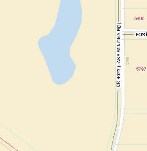
1 TECHNICAL REVIEW COMMITTEE AGENDA VOLUSIA COUNTY LAND DEVELOPMENT MEETING DATE: Wednesday, November 28, 2012 TIME: 9:00 a.m. PLACE: Thomas C. Kelley Administration Center 123 W. Indiana Avenue Room 202 DRC Conference Room DeLand, Florida Volusia County, Florida Vice Chair: Joyce M. Cusack District #1: District #2: District #3: District #4: District #5: Andy Kelly Joshua J. Wagner Joie Alexander Patricia Northey * The following project will only be scheduled for TRS * TIME: 9:00 a.m. PROJECT NO.: /RSN REF.: 2008-F-CPN-0489, 1997-S-EXM-0022 PARCEL NO.: & PROJECT NAME: APPLICANT: Mr. Reginald A. Mills The Pallet Exchange DESCRIPTION: Inquiry application for a proposed manufacturing facility with the associated paved drive aisles, parking and stormwater retention on a 4.11-acre site. LOCATION: East side of Lake Winona Road, approximately 540-feet north of its intersection with N. US Highway 17, in the rural community of DeLeon Springs area. WATER UTILITIES: Well SEWER UTILITIES: Septic ZONING: Light Industrial (I-1) - 1 -
2
3 *Applicant submitted plan
4 TECHNICAL REVIEW STAFF COMMENTS November 28, 2012, RSN * * * * * * CURRENT PLANNING Christian Nagle, AICP, Planner II November 26, 2012 Current Planning staff has reviewed the requested submission and provides the following comments: 1. The property is zoned Light Industrial (I-1) and has a Rural Community (DeLeon Springs) Future Land Use designation. The I-1 zoning classification permits a contractor s shop, storage and equipment yard as a permitted principal use. The applicant stated that the proposed property use is for pallet repair and sales. The proposed pallet repair and sales use is substantially similar to a contractor s shop/storage yard. Therefore, as authorized by Section of Article II Zoning, Chapter 72 Code of Ordinances (ZC), current planning staff finds the proposed use is a permitted principal use. 2. The site consists of two parcels and Parcel is a nonconforming lot, as it does not meet the I-1 zoning classification minimum lot size of one acre. Both parcels and are considered an undivided lot for purposes of the zoning code, because both parcels are in common ownership and nonconforming parcel abuts parcel The parcels must be combined into a unified parcel, by submission and approval of a subdivision exemption application. In addition, no portion of the property shall be sold or subdivided in a manner that does not comply with the lot width or lot area requirements of the I-1 zoning classification found in Section of the ZC. 3. The parcel is not eligible for building permits as configured, based on an August 6, 2008, letter from Palmer Panton. Jesse Bowers, of the Land Development office, stated the applicant is working with county staff to resolve the lot configuration situation. 4. A sealed property boundary survey is required with a final site plan (FSP) application (Section (2)(e) of Article III Land Development, Chapter 72 Code of Ordinances (LDC). The survey shall include structures and easements on the 1
5 property. Principal and accessory structures other than walkways are not allowed in platted easements on this property (Section of the ZC). 5. Based on Clerk of the Court records, the property is part of a platted subdivision and appears to include a 50-foot wide right-of-way easement, which runs in an east to west direction over the northern part of the property. A previous property owner conveyed the right-of-way easement to Volusia County. The easement agreement is recorded in Volusia County Official Records Book 4142, Pages 4174 and The project must comply with the minimum yard requirements of the I-1 zoning classification. The proposed building and structures are required to be setback a minimum of 30 feet from the referenced right-of-way easement, to comply with applicable minimum front yard requirements of the zoning code. 6. The project must comply with the minimum and maximum off-street parking requirements of Section of the ZC. The applicant is required to submit proposed building elevations and floor plan drawings with the FSP application, for staff to verify the minimum and maximum amounts of required off-street parking. Per Section of the ZC, the off street parking requirements for a contractor s shop/storage yard is a minimum of one parking space per 1,000 square feet of building gross floor area, plus one loading space per 2,000 square feet of gross floor area for designated truck parking area, and two parking spaces per 1,000 square feet of building gross floor area of retail display/sales area (if any). In addition, the amount of parking provided cannot exceed a maximum 125 percent of the minimum number of required parking spaces. The 13 parking spaces shown on the plan exceed the maximum 5 permitted off-street parking spaces. 7. The property is located on Lake Winona Road, which is a county thoroughfare. Therefore, building orientation, site layout, architectural design, site circulation and access, off-street parking, service, utility display and storage areas, landscaping buffers and signs shall comply with the requirements found in Section nonresidential design standards of the ZC. With the FSP, also submit architectural building elevations and building color samples for staff review. For this property, the I-1 zoning classification allows a maximum permitted building height of 45 feet. 8. With the FSP, the building shall face a public right-of-way and no more than 50 percent of the required off-street parking shall be located between the front facade of the establishment and the abutting street (Sections (c)(1) and (g)(9) of the ZC). 9. With the FSP, loading areas or docks, outdoor storage, waste disposal, mechanical equipment, truck parking, satellite dishes and other service support equipment shall be located behind the building line and fully screened from view of adjacent properties both at ground and roof top levels by masonry, brick, or durable man made material wall(s) (Section (h)(2) of the ZC). Solid waste pads, containers and container screens shall also comply with the requirements found in Section (8) of the ZC. 2
6 10. On the FSP, demonstrate that areas for outdoor storage, trash collection and loading are incorporated into the primary building design and that these areas are constructed with materials of comparable quality and appearance as that of the primary building (Section (h)(3) of the ZC). 11. With the FSP, design the site to comply with the off-street circulation, parking and loading requirements of Section of the LDC, including Section (e) interconnected parking areas. 12. With the FSP, submit sign information and exhibits, which at a minimum shall include location(s), height(s), and copy area(s) for proposed project signs. The maximum permitted copy area for a ground sign is 40 square feet. The maximum permitted height of a ground sign is 8 feet (Section (j) of the ZC). 13. As part of the FSP submittal, the applicant must provide a landscape plan that complies with the requirements found in Section (i) and Section of the ZC. Existing trees and vegetation in required landscape buffers and vehicle use areas are required to the extent possible, to be used to meet minimum landscaping requirements. Per Section , the landscape plan shall also provide the minimum buffer, and tree and shrub plantings as listed below: Buffer Width Minimum Number of Trees and Vegetation Required North 15 feet 6 Group B trees and 18 Group C or D plants per 100 and South lineal ft. of buffer or fraction thereof; and optional screening consisting of a continuous 6 ft. high landscape hedge, pressure treated wood fence, brick or masonry wall, or landscaped earthen berm or combination thereof unless existing vegetation serves as adequate screening within the required buffer. East & South 10 feet 6 Group B trees and 18 Group C or D plants per 100 and South lineal ft. of buffer or fraction thereof; and optional screening consisting of a continuous 6 ft. high landscape hedge, pressure treated wood fence, brick or masonry wall, or landscaped earthen berm or combination thereof unless existing vegetation serves as adequate screening within the required buffer. West 20 feet 4 Group A trees and 4 Group B trees and 27 Group C or D plants per 100 lineal ft. of buffer or fraction thereof; unless existing vegetation provides equivalent screening within the required buffer. 14. The required landscape plan shall be signed and sealed by a landscape architect (Section (jj) of the LDC). 3
7 15. A landscape irrigation plan must be provided that complies with Section (4) irrigation system plan of the ZC. The irrigation plans shall specify sprinkler head type, pipe size, radius of throw, valve location, and location of the required rain sensor device. 16. New utility services shall be installed underground and shall comply with the requirements of Section (h)(8) of the ZC. 17. If artificial lighting is provided for the off-street parking area, it shall be arranged and installed to minimize or eliminate glare on surrounding residential property and to motorists traveling on adjacent streets. Show any proposed light fixtures and poles on the FSP (Section (1) of the ZC). 18. Lake Winona Road is a county maintained roadway that lies within a 59-foot wide prescriptive easement. * * * * * * DEVELOPMENT ENGINEERING Joe Spiller, Civil Engineer II November 26, 2012 Development Engineering staff has reviewed the requested submission and provides the following comments: 1. The parcels need to be combined to conform to legal lot A as created per Espinal Unrecorded, 97-S-EXM FEMA Flood Insurance Rate Maps indicate that the entire site is located within a Zone X designation; areas determined to be outside of the 500 year floodplain. 3. The portion of Lake Winona Road abutting the proposed project is classified as a thoroughfare collector roadway. The site falls within a Rural Land Use category and is within 2 miles of a school. a. Per LDC Tables II & III, a minimum of 80 foot of right-of-way is required for a thoroughfare collector roadway. b. Per LDC Table V-B, the minimum centerline spacing between minor driveways shall be at least 335 feet. 4
8 c. Per Section (b)(2) of the LDC, a five-foot sidewalk shall be required within the Lake Winona Road right-of-way along the abutting side of the property. Per Section (b)(3) of the LDC, the proposed sidewalks shall be located a minimum of 1 foot from the right-of-way line and any above ground obstruction. 4. The proposed driveway culvert will need to be sized to convey the 100YR/24HR peak flow from the contributing watershed. The size of the conveyance will further be determined by the greater flow rate generated by the contributing basin area or the existing ditch capacity. 5. The drainage easements shown on the plan are required and shall provide for maintenance access as well as the existing canal sections. 6. Per Section (b)(1)f of the LDC, the one-time construction of any structure or pavement which exceeds 1,000 square feet of impervious area on or parallel to the ground will require a Stormwater Permit. 7. Per Section (a)(2) of the LDC, a minimum 15 foot radius/depth is required at end row parking spaces for turnaround maneuvering at the ends of the driveway isles. 8. A Use Permit will be required for any work proposed within the Lake Winona Road right-of-way. 9. Any construction activity disturbing more than one acre will require application to the Florida Department of Environmental Protection (FDEP) for a Notice of Intent (NOI) To Use Generic Permit For Stormwater Discharge From Large And Small Construction Activities. * * * * * * ENVIRONMENTAL PERMITTING Danielle Dangleman, Environmental Specialist III November 20, 2012 Environmental Permitting staff has reviewed the requested submission and provides the following comments: 1. Per Section of the LDC, fifteen (15) percent of the total site shall be designated for the protection of existing trees. The tree preservation areas must be clearly labeled on the plans. 5
9 2. The project must comply with County specimen tree preservation requirements found in Section of the LDC. Specimen trees shall only be removed or relocated in accordance with a permit issued by the County Forester. 3. A tree survey will be required for all trees at least 6 inches in diameter at breast height with specimen and historic trees noted. The tree survey must identify pine and hardwood trees by specific species. 4. A tree removal permit and replacement is required for trees proposed for removal or for encroachment into tree drip lines (approximated as one foot of radius per inch of tree diameter). 5. Tree removal and replacement calculations must be submitted for all trees at least 6 inches in diameter at breast height removed on site. Existing trees between 2 inches and 6 inches may count toward replacement. 6. Per Section of the LDC, this site must meet the minimum tree coverage standard of one tree per 2,500 square feet of parcel area (rounded up to the nearest whole tree). Please demonstrate that there are a sufficient number of trees on site to meet this requirement. 7. Tree replacement stock shall have a minimum caliper of two (2) inches and a height of at least six (6) feet. 8. The plans should include a tree protection detail consistent with Section of the LDC. The root zone of the tree is approximated by one foot of radius per inch of tree diameter. 9. This property has been identified as containing suitable habitat for the gopher tortoise (GT), a threatened species. Per Section of the LDC, a 100% GT burrow survey is required to be conducted by an Authorized Agent to determine if GT burrows or their 25 foot buffers are located on the property. If any GT burrows are found on site and their 25 foot buffers cannot be avoided, a Florida Fish and Wildlife Conservation Commission GT relocation permit will be required. Please be aware that Environmental Permitting may request the applicant redesign the project to avoid GT burrow impacts. * * * * * * 6
10 FIRE SAFETY Michael Garrett, Fire Safety Inspector November 15, 2012 Fire Safety Inspection staff has reviewed the requested submission and provides the following comments: 1. Fire Services will require more information on the project before comment. Please describe the proposed business plan and include what types and quantities of pallets are to be stored or manufactured on site. Please show this information on a revised site plan to allow for the fire protection review. Any additional information relative will be helpful. * * * * * * HEALTH James McRae, Environmental Health Manager November 19, 2012 DOH/Volusia County Public Health Unit Public Health Unit staff has reviewed the requested submission and provides the following comments: 1. Potable water to be supplied by construction of a Limited Use Commercial Well. Obtain a well construction permit from the Health Department. Contact Brian Volkman at for well testing requirements. The well must be at least 100 feet from the septic system. 2. Sewage disposal to be provided by construction of an onsite septic system. Obtain a septic system construction permit from the Health Department. The septic system must be located at least 75 feet from the retention pond. * * * * * * 7
11 LAND DEVELOPMENT Jesse Bowers, Land Development Assistant November 20, 2012 Land Development staff has reviewed the requested submission and provides the following comments: 1. The subject site consists of two parcels encompassing the approved Parcel A, Espinal Unrecorded, 97-S-EXM The applicant has requested that the two parcels be recombined. This office sent a memo to the Property Appraiser requesting that the parcels be recombined to comply the approved lot configuration. 2. It should be noted that the N 50' of Lot 5, Block 21, aka parcel , is encompassed by a right-of-way easement for road, bicycle path, and utility purposes in favor of Volusia County in O.R. Book 4142, Page The applicant still retains ownership of the parcel and it should be included in the application and shown on the site plan. * * * * * * SCHOOL BOARD Marian Ridgeway, VC School District November 19, 2012 This is a non residential project and is not subject to School District review. * * * * * * 8
12 SOILS Dave Griffis, County Extension Director November 19, 2012 As requested I reviewed the proposed plan. Soils were found to be: 1. #4 Astatula fine sand, 0 to 8 percent slopes. This excessively drained, nearly level to sloping sandy soil occurs on sand hills. The water table is usually below a depth of 72 inches. This soil has a high potential for community development. 2. #49 Pomona fine sand. This nearly level, poorly drained soil occurs in low, broad areas within the flatwoods. The water table is within a depth of 10 inches in the wet season. The potential is low for community development. Excessive wetness and the moderately slowly permeable subsoil are the major limitations. 3. #63 Tavares fine sand, 0 to 5 percent slopes. This moderately well drained, nearly level to gently sloping sandy soil occurs on higher positions on low sand hills. The water table is between 40 and 60 inches in wet seasons. This soil has a high potential for community development. * * * * * * SURVEY David H. Kraft, PSM, County Surveyor Manager November 16, 2012 Survey staff has reviewed the requested submission and provides the following comments: 1. A certified Boundary and Location survey of the subject property performed within the last two years is required for this project and must be prepared by a Florida registered surveyor, showing the boundaries of the project and any existing streets, buildings, watercourses, easements and section lines. 2. Lake Winona Road is considered a county thoroughfare collector road requiring 80 feet of right-of-way, 40 feet each side of the centerline of road. I request the consideration of an additional feet of right-of-way donation be deeded to the County of Volusia to meet this requirement. The developer may contact me, David Kraft, at ext for assistance in this matter. After a deed is executed and recorded, the additional right-of-way and the recording information must be placed on a revised Boundary survey or plat by your surveyor and 8 certified copies provided to the Land Development office. 9
13 TRAFFIC Melissa Winsett, Transportation Planner November 16, 2012 Traffic Engineering staff has reviewed the requested submission and provides the following comments: 1. As specified in Section (b)(1) of the LDC, a commercial driveway shall be 24 feet wide and have a 30-inch STOP sign (R1-1), 24-inch wide white thermoplastic stop bar and 25 feet of 6-inch thermoplastic double yellow centerline striping will be required for each driveway. 2. As specified in Section (m) of the LDC, provide a street light at the driveway entrance for safety and nighttime visibility. 3. As specified in Section (b)(2), a 5-foot wide sidewalk is required along the street frontage (this location is within two miles of a school). Payment into the Volusia County Sidewalk Improvement Trust Fund must be approved by the DRC. A handicap accessible route must be provided to the site from the sidewalk. 4. As specified in Section (a)(2)f of the LDC, parking lot striping shall be 6 inches wide. 5. As specified in Section (a)(3)e of the LDC, on the north end of the parking lot, the area beyond the 15-foot radii will have to be extended 15 feet to meet code requirements. 6. On the site plan, designate the loading area for trucks. 7. As specified in Section (b)(3) of the LDC, provide a turning movement detail showing turning capabilities for the types of trucks anticipated. 8. Additional comments may be provided at subsequent stages of the development. * * * * * * 10
14 UTILITIES Scott Mays, P.E., Civil Engineer III November 20, 2012 Utility staff has reviewed the requested submission and has no comment. Well and septic is proposed for this development. * * * * * * 11
15
16
17
18
19
20
21 BYRD RD VOLUSIA AV BEAR PAW LN GRAND AV SR 11 SR 15A SR 11 AMELIA AV LAKE AV KEPLER RD JACOBS RD MARSH RD 5TH AV SR 11 IVY AV 1ST AV RIDGE BLVD 8TH AV COUNTY BOUNDARY N PINE ST TURNER RD PIERSON SHAW LAKE RD BLACK BEAR RANCH TR STILL RD W SR 40 SR 40 W SR 40 S CENTER ST LAMAR RD EMPORIA RD S COUNTY RD 3 CHURCH ST BUCKLES RD DEW DROP LN E SR 40 SR 40 E SR 40 LAK E WINONA RD SR 11 CLIFTON RD JERICO RD SR 40 COUNTY W SR 40 PRICE RD BLUFFTON RD COUNTY RD 3 FAWN RD MARSH RD S US HWY 17 JIMS RD 17 CSX RR WINONA RD LAKE PONCE DELEON BLVD RETTA ST PALLET EXCHANGE 1 SPRING GARDEN RANCH RD REYNOLDS RD BLACKWELDER RD ARRENDONDO G RAN T RD REYNOLDS R D SR 11 REYNOLDS RD DAUGHARTY RD MCCORVEY RD MUD LAKE RD GRAND AV LEMON ST N US HWY 17 STONE RD GAUDREY ST CR 15A (SPRING GARDEN AV N) VIRGINIA AV SR 11 CARTER RD MARSH RD LIME ST GLENWOOD RD N KEPLER RD COUNTY BOUNDARY DYKES DR MERCERS FERNERY RD GRAND AV SPRING GARDEN AV OLD DAYTONA RD CR STONE ST HAZEN RD HAZEN RD PLYMOUTH AV KEPLER RD N SHELL RD SR 44 GRAND AV MINNESOTA AV SR 44 W EUCLID AV DELAND GARFIELD AV MINNESOTA AV VOORHIS AV HILL AV WADE AV SR 44 RK AV PALLET EXCHANGE 1 1 inch = 2 miles
22 RIDGEWOOD AV FOREST CREEK RUN 0080 LAKE WINONA RD COUNTY N COUNTY RD CSX RR N US HWY PALLET EXCHANGE 1 1 inch = 300 feet
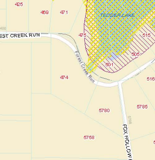
23 LELAND AV S ANDALUSIA AV ANDALUSIA AV FIESER LN BARNHILL LN A-1 AR N US HWY 17 N COUNTY RD 3 LAKE WINONA RD R R FOREST CREEK RUN W R TEDDER LAKE RD R RCOMM COUNTY CON C W B-7 A-4 TEDDERS CT A-3 R HERITAGE OAKS LN A-2 W BURTS PARK RD P REC CSX RR FRONT ST PARK AV CLOUGH AV RCOMM RIDGEWOOD AV JACKSON AV WAUCHULA AV FOX HOLLOW RD I-1 A-3 R-3 R-7 B-4 SPRING GARDEN AV APALACHICOLA CIR DADE AV WINONA TR B-2 R-4 CATALONIA AV VENETIA ST RAMANO AV SPRING GARDEN RANCH RD R-4 R-3 BRIDLELAND RD PALLET EXCHANGE 1 1 inch = 1,000 feet
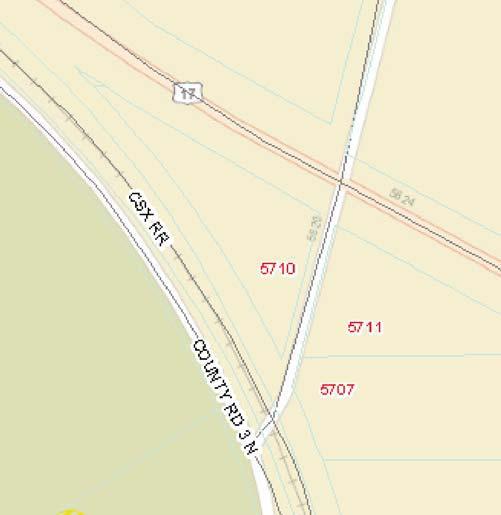
24 RIDGEWOOD AV FOREST CREEK RUN ZONE A LAKE WINONA RD ZONE X COUNTY N COUNTY RD CSX RR N US HWY PALLET EXCHANGE 1 1 inch = 300 feet


25
VOLUSIA COUNTY, FLORIDA LAND DEVELOPMENT FINAL MEETING AGENDA DEVELOPMENT REVIEW COMMITTEE MEETING
 VOLUSIA COUNTY, FLORIDA LAND DEVELOPMENT FINAL MEETING AGENDA DEVELOPMENT REVIEW COMMITTEE MEETING MEETING DATE: Tuesday, October 2, 2012 TIME: 9:00 a.m. PLACE: Thomas C. Kelly Administration Center 123
TECHNICAL REVIEW COMMITTEE AGENDA VOLUSIA COUNTY LAND DEVELOPMENT
 TECHNICAL REVIEW COMMITTEE AGENDA VOLUSIA COUNTY LAND DEVELOPMENT MEETING DATE: September 26, 2012 TIME: 9:00 a.m. PLACE: Thomas C. Kelley Administration Center 123 W. Indiana Avenue Room 202 DRC Conference
BUILDING CODE ADMINISTRATION CURRENT PLANNING
 TECHNICAL REVIEW STAFF COMMENTS BUILDING CODE ADMINISTRATION Randy Roberts, Commercial Plans Examiner September 26, 2013 No Comments. CURRENT PLANNING Carol McFarlane, AICP, Planner II October 2, 2013
TECHNICAL REVIEW COMMITTEE AGENDA VOLUSIA COUNTY LAND DEVELOPMENT
 TECHNICAL REVIEW COMMITTEE AGENDA VOLUSIA COUNTY LAND DEVELOPMENT MEETING DATE: Wednesday, November 14, 2012 TIME: 9:00 a.m. PLACE: Thomas C. Kelley Administration Center 123 W. Indiana Avenue Room 202
TO: Development Review Committee DATE: November 25, 2014
 Inter-Office Memorandum TO: Development Review Committee DATE: November 25, 2014 FROM: John G. Thomson, AICP Land Development Manager SUBJECT: DRC Meeting Date: December 2, 2014 Request for Extension of
November 15, 2018 Planning and Land Development Regulation Commission (PLDRC)
") Page 1 of 24 GROWTH AND RESOURCE MANAGEMENT DEPARTMENT PLANNING AND DEVELOPMENT SERVICES DIVISION 123 W. Indiana Avenue, DeLand, FL 32720 (386) 736-5959 PUBLIC HEARING: CASE NO: SUBJECT: LOCATION: APPLICANT:
Page 1 of 24 GROWTH AND RESOURCE MANAGEMENT DEPARTMENT PLANNING AND DEVELOPMENT SERVICES DIVISION 123 W. Indiana Avenue, DeLand, FL 32720 (386) 736-5959 PUBLIC HEARING: CASE NO: SUBJECT: LOCATION: APPLICANT:
Site Plan Application
 Site Plan Application City of St. Pete Beach Community Development Department 155 Corey Avenue St. Pete Beach, Florida 33706 (727) 367-2735 www.stpetebeach.org Case Number: PROPERTY OWNER: Name: Address:
PUBLIC HEARING: August 11, 2015 Planning and Land Development Regulation Commission (PLDRC)
") Page 1 of 15 GROWTH AND RESOURCE MANAGEMENT DEPARTMENT PLANNING AND DEVELOPMENT SERVICES DIVISION CURRENT PLANNING ACTIVITY 123 W. Indiana Avenue, DeLand, FL 32720 (386) 736-5959 PUBLIC HEARING: August
Page 1 of 15 GROWTH AND RESOURCE MANAGEMENT DEPARTMENT PLANNING AND DEVELOPMENT SERVICES DIVISION CURRENT PLANNING ACTIVITY 123 W. Indiana Avenue, DeLand, FL 32720 (386) 736-5959 PUBLIC HEARING: August
APPLICATION PROCEDURE
 ANTRIM PLANNING BOARD P. O. Box 517 Antrim, New Hampshire 03440 Phone: 603-588-6785 FAX: 603-588-2969 APPLICATION FORM AND CHECKLIST FOR MINOR OR MAJOR SITE PLAN REVIEW File Date Received By APPLICATION
MAJOR SUBDIVISION PRELIMINARY PLAT CHECKLIST
 TOWNSHIP OF EGG HARBOR PLANNING BOARD/ZONING BOARD OF ADJUSTMENT 3515 BARGAINTOWN ROAD EGG HARBOR TOWNSHIP, NJ 08234 MAJOR SUBDIVISION PRELIMINARY PLAT CHECKLIST The following checklist is designed to
E L M E R B O R O U G H L A N D U S E B O A R D APPLICATION COVER SHEET (to be completed for all applications and appeals)
") E L M E R B O R O U G H L A N D U S E B O A R D APPLICATION COVER SHEET (to be completed for all applications and appeals) 1. Name(s): 2. Address: 3. Telephone Number(s): 4. E-mail: 5. Owner Name(s) (if
E L M E R B O R O U G H L A N D U S E B O A R D APPLICATION COVER SHEET (to be completed for all applications and appeals) 1. Name(s): 2. Address: 3. Telephone Number(s): 4. E-mail: 5. Owner Name(s) (if
UPPER MOUNT BETHEL TOWNSHIP NORTHAMPTON COUNTY, PENNSYLVANIA
 UPPER MOUNT BETHEL TOWNSHIP NORTHAMPTON COUNTY, PENNSYLVANIA JOINDER DEED / LOT CONSOLIDATION TOWNSHIP REVIEW PROCESS When accepting proposed Joinder Deeds / Lot Consolidations, review the Joinder Deed
Plans shall be drawn at a readable scale, signed, and sealed by a Florida Registered Engineer. The application package shall include:
 CHAPTER 400. SECTION 403. PERMIT TYPES AND APPLICATIONS SITE DEVELOPMENT 403.3. Preliminary Site Plans (PSP) A. Intent and Purpose PSPs are used to identify existing site conditions and demonstrate general
April 19, Planning and Land Development Regulation Commission (PLDRC)
") Page 1 of 15 GROWTH AND RESOURCE MANAGEMENT DEPARTMENT PLANNING AND DEVELOPMENT SERVICES DIVISION 123 W. Indiana Avenue, DeLand, FL 32720 (386) 736-5959 PLDRC HEARING: CASE NO: SUBJECT: LOCATION: APPLICANT:
Page 1 of 15 GROWTH AND RESOURCE MANAGEMENT DEPARTMENT PLANNING AND DEVELOPMENT SERVICES DIVISION 123 W. Indiana Avenue, DeLand, FL 32720 (386) 736-5959 PLDRC HEARING: CASE NO: SUBJECT: LOCATION: APPLICANT:
ARTICLE 13 CONDOMINIUM REGULATIONS
 ARTICLE 13 CONDOMINIUM REGULATIONS Section 13.01 Purpose. The purpose of this Article is to regulate projects that divide real property under a contractual arrangement known as a condominium. New and conversion
Condominium Unit Requirements.
 ARTICLE 19 CONDOMINIUM REGULATIONS Section 19.01 Purpose. The purpose of this Article is to regulate projects that divide real property under a contractual arrangement known as a condominium. New and conversion
ARTICLE 5 MINOR SUBDIVISION/LAND DEVELOPMENT
 ARTICLE 5 MINOR SUBDIVISION/LAND DEVELOPMENT SECTION 501 ONLY FINAL PLAN REQUIRED The classification of a proposed subdivision as a "Minor Subdivision" shall only require the submission, review and approval
Initial Subdivision Applications Shall Include the Following:
 Initial Subdivision Applications Shall Include the Following: 1) Subdivision Application Form: completely filled out (12 copies) 2) Plat: The Plat must adhere to the requirements set forth in the Town
SITE DEVELOPMENT PLAN REQUIREMENTS CHECKLIST
 SITE DEVELOPMENT PLAN REQUIREMENTS CHECKLIST Completed DRC Application for Review Required for Application Process DRC Processing Fee 1 Commercial $2,500.00 Fire Department Review Fee 150.00 Total $2,650.00
WASCO COUNTY PRELIMINARY SUBDIVISION APPLICATION
 WASCO COUNTY PRELIMINARY SUBDIVISION APPLICATION DETAILED SPECIFIC WRITTEN REQUEST File Number: SDV- Number of Proposed Lots & their Dimensions: PRELIMINARY SUBDIVISION PLAN REQUIREMENTS The approval of
ARTICLE 7: PLOT PLANS AND SITE PLAN REQUIREMENTS AND REVIEW
 ARTICLE 7: PLOT PLANS AND SITE PLAN REQUIREMENTS AND REVIEW Section 7.0 - Purpose The purpose of this article is to specify the documents and/or drawings required for a Site Plan Review or a Plot Plan
Article 7: Residential Land Use and Development Requirements
 Article 7: Residential Land Use and Section 701: Statement of Intent (A) (B) (C) The intent of Article 7 is to develop certain land use and development requirements for the residential uses within Cumru
COMMERCIAL SITE DEVELOPMENT GUIDE FOR UNINCORPORATED ST. CHARLES COUNTY
 COMMERCIAL SITE DEVELOPMENT GUIDE FOR UNINCORPORATED ST. CHARLES COUNTY GENERAL INFORMATION: This brochure is to be used as a guide and is not intended to amend or supersede the corresponding County ordinances
610 LAND DIVISIONS AND PROPERTY LINE ADJUSTMENTS OUTSIDE A UGB
 ARTICLE VI: LAND DIVISIONS AND PROPERTY LINE ADJUSTMENTS VI-21 610 LAND DIVISIONS AND PROPERTY LINE ADJUSTMENTS OUTSIDE A UGB 610-1 Property Line Adjustments (Property Line Relocation) A property line
August 14, 2012-Planning and Land Development Regulation Commission (PLDRC)
") GROWTH AND RESOURCE MANAGEMENT DEPARTMENT PLANNING AND DEVELOPMENT SERVICES DIVISION LONG RANGE PLANNING ACTIVITY 123 W. Indiana Avenue, DeLand, FL 32720 (386) 736-5959 PUBLIC HEARING: August 14, 2012-Planning
GROWTH AND RESOURCE MANAGEMENT DEPARTMENT PLANNING AND DEVELOPMENT SERVICES DIVISION LONG RANGE PLANNING ACTIVITY 123 W. Indiana Avenue, DeLand, FL 32720 (386) 736-5959 PUBLIC HEARING: August 14, 2012-Planning
APPENDIX B. SUBMISSION REQUIREMENTS
 Master Major Site Minor Site Landscape Section B.1 Table of /Plat Requirements Proposed or approved name of development, project, subdivision, and/or phase. Location, including township, county, and state.
CITY OF HOLLYWOOD. Technical Advisory Committee Submittal Checklist. Guide to TAC Submittal Checklist. General Requirements:
 CITY OF HOLLYWOOD Technical Advisory Committee Submittal Checklist Guide to TAC Submittal Checklist This document is an outline of site plan review procedures as listed in the Technical Advisory Committee
4. facilitate the construction of streets, utilities and public services in a more economical and efficient manner;
 PVPC MODEL BYLAW BY-RIGHT CLUSTER ZONING BYLAW Prepared by Pioneer Valley Planning Commission Revised: October 2001 1.00 Development 1.01 Development Allowed By Right Development in accordance with this
Waseca County Planning and Zoning Office
 Waseca County Planning and Zoning Office 300 North State Street Waseca, Minnesota 56093 Phone: 507-835-0650 Fax: 507-837-5310 Form no. PZ 081009 Web Site: www.co.waseca.mn.us FEES: 1) CUP FEE- $400.00
PLANNING BOARD CITY OF CONCORD, NH MINOR SUBDIVISION CHECKLIST
 PLANNING BOARD CITY OF CONCORD, NH MINOR SUBDIVISION CHECKLIST Summary This checklist is intended to assist applicants and design professionals in the preparation of minor subdivision applications for
Planned Residential Development ( PRD ) Application
 Application") FOR PLANNING USE ONLY Application # PRD Application Fee $ Receipt No. Filing Date Completeness Date Planned Residential Development ( PRD ) Application A. PROJECT INFORMATION 1. Project Name: 2. Address
FOR PLANNING USE ONLY Application # PRD Application Fee $ Receipt No. Filing Date Completeness Date Planned Residential Development ( PRD ) Application A. PROJECT INFORMATION 1. Project Name: 2. Address
TOWNSHIP OF BORDENTOWN LAND DEVELOPMENT APPLICATION CHECKLIST. General Requirements for all Applications
 TOWNSHIP OF BORDENTOWN LAND DEVELOPMENT APPLICATION CHECKLIST This CHECKLIST has been adopted in accordance with Section 25:807 of the Land Development Ordinance of the Township of Bordentown and will
ANDOVER CODE. Checklist #5 Preliminary Site Plan Conditional Use
 ANDOVER CODE Checklist #5 Preliminary Site Plan Conditional Use Applicant: Block Lot File No. This checklist is for general reference only. Further information may be required by the reviewing authority.
EXHIBIT D. Planned Unit Development Written Description April 13, 2016 Rouen Cove Phase II PUD
 1 EXHIBIT D Planned Unit Development Written Description April 13, 2016 Rouen Cove Phase II PUD Development # 8986.001 Developer: Curtis L. Hart Hart Resources LLC 8051 Tara Lane Jacksonville, Florida
City of Midland Application for Site Plan Review
 City of Midland Application for Site Plan Review Submission Date: Property Owner: Mailing Address: Phone number: ( ) Cell phone: ( ) Email address: Fax: ( ) Owner s Signature: Applicant Name (if not owner):
BRIDGETON SUBDIVISION APPLICATION CHECKLIST
 APPLICATION NAME AND # CHECKLIST COMPLETED BY: DATE: Signature and printed name BRIDGETON SUBDIVISION APPLICATION CHECKLIST TO SUBDIVISION APPLICANTS: The attached checklist is to assist you in the submission
Chapter Plat Design (LMC)
") Chapter 18.14 Plat Design (LMC) Sections: 18.14.010 Lot width 18.14.020 Right-of-way requirements 18.14.030 Pipe stem lots 18.14.040 Division resulting in minimum lot sizes 18.14.050 Flood prone and bad
Chapter 18.14 Plat Design (LMC) Sections: 18.14.010 Lot width 18.14.020 Right-of-way requirements 18.14.030 Pipe stem lots 18.14.040 Division resulting in minimum lot sizes 18.14.050 Flood prone and bad
ORANGE BLOSSOM GARDENS PLANNED UNIT DEVELOPMENT PREPARED BY: COASTAL ENGINEERING CONSULTANTS, INC.
 ORANGE BLOSSOM GARDENS A PLANNED UNIT DEVELOPMENT PREPARED BY: COASTAL ENGINEERING CONSULTANTS, INC. REVISED OCTOBER 19, 1992 BY THE COLLIER COUNTY LONG RANGE PLANNING DEPARTMENT REVISED DECEMBER, 2008
Marion County Board of County Commissioners
 Marion County Board of County Commissioners Office of the County Engineer 412 SE 25th Ave. Ocala, FL 34471 Phone: 352-671-8686 Fax: 352-671-8687 DEVELOPMENT REVIEW COMMITTEE A G E N D A February 25, 2013
CHECKLIST FOR DEVELOPMENT REVIEW
 CHECKLIST FOR DEVELOPMENT REVIEW Petitions and related documents and plans for land development or other proposals regulated by Title 16 of the Municipal Code (Development Ordinance) and Title 17 of the
COMMERCIAL SITE PLAN & CONDITIONAL USE PERMIT REVIEW PROCESS & CHECKLIST
 Community Development 110 South Main Street Springville, UT 84663 COMMERCIAL SITE PLAN & CONDITIONAL USE PERMIT REVIEW PROCESS & CHECKLIST 801.491.7861 www.springville.org Prior to the issuance of a building
APPLICATION FOR SUBDIVISION APPROVAL OF A SKETCH PLAN with checklist
 Prior to filing any application for SUBDIVISION approval, the applicant shall request in writing that the zoning administrator schedule a pre-submission conference. APPLICATION TO THE PLANNING BOARD TOWN
LABEL PLEASE NOTE: ALL APPLICATIONS AND SITE PLANS MUST BE COMPLETED IN BLACK OR BLUE INK ONLY Intake by:
 STAFF USE ONLY Thurston County Resource Stewardship 2000 Lakeridge Dr. S.W. Olympia, WA 98502 (360)786-5490 / (360)754-2939 (Fax) TDD Line (360) 754-2933 Email: permit@co.thurston.wa.us Supplemental Application
Section Preliminary Plat Checklist and Application Forms
 Section 201 - Preliminary Plat Checklist and Application Forms PRELIMINARY SUBDIVISION PLAT REVIEW PROCESS CHART PRELIMINARY SUBDIVISION PLAT APPLICATION PRELIMINARY PLAT REVIEW CHECKLIST CITY OF NAMPA
ARTICLE 5 GENERAL REQUIREMENTS
 5.1 SUITABILITY OF THE LAND ARTICLE 5 GENERAL REQUIREMENTS 5.1.1 Land subject to flooding, improper drainage or erosion, and land deemed to be unsuitable for development due to steep slope, unsuitable
ARTICLE 900 PLAT AND PLAN REQUIREMENTS
 ARTICLE 900 PLAT AND PLAN REQUIREMENTS SEC. 900.1 ITEMS TO BE SHOWN ON PLAT OR PLAN General (1) Property lines of all property owners adjacent to the exterior boundaries of the project shall be located
ARTICLE 24 SITE PLAN REVIEW
 ARTICLE 24 SITE PLAN REVIEW 24.1 PURPOSE: The intent of these Ordinance provisions is to provide for consultation and cooperation between the land developer and the Township Planning Commission in order
CITY OF OCOEE LAND DEVELOPMENT CODE SUFFICIENCY TABLE WITH NOTES
 CITY OF OCOEE LAND DEVELOPMENT CODE SUFFICIENCY TABLE WITH NOTES The Sufficiency Table is a checklist to help identify the types of information and documentation needed for various types of projects. The
Level III Preliminary and Final Site Plans Development Review Application Portland, Maine Planning and Urban Development Department Planning Division
 Level III Preliminary and Final Site Plans Development Review Application Portland, Maine Planning and Urban Development Department Planning Division Portland s Planning and Urban Development Department
ARTICLE 23 CONDOMINIUM STANDARDS
 ARTICLE 23 CONDOMINIUM STANDARDS Section 23.01 Intent. The intent of this Article is to provide regulatory standards for condominiums and site condominiums similar to those required for projects developed
ARTICLE 9 SPECIFICATIONS FOR DOCUMENTS TO BE SUBMITTED
 ARTICLE 9 SPECIFICATIONS FOR DOCUMENTS TO BE SUBMITTED SECTION 950 GENERALLY All applications shall be properly signed and filed by the owner or, with the owner s specific written consent, a contract purchaser
PREPARED BY PLANNING DEPARTMENT ORANGE COUNTY NORTH CAROLINA
 PREPARED BY PLANNING DEPARTMENT ORANGE COUNTY NORTH CAROLINA Return to: DONNA PUCKETT 1555 NC 56 SUITE 2 CREEDMOOR, NC 27522 DECLARATION OF DEVELOPMENT RESTRICTIONS AND REQUIREMENTS RECORDED CONCURRENTLY
Special Land Use. SLU Application & Review Standards
 review and approval is needed for certain uses of property that have the potential to impact adjacent properties and the neighborhood. The application and review procedure is intended to ensure that the
WRIGHT TOWNSHIP Ottawa County 1565 Jackson Street, P.O. Box 255, Marne, Michigan 49435
 WRIGHT TOWNSHIP Ottawa County 1565 Jackson Street, P.O. Box 255, Marne, Michigan 49435 SITE PLAN REVIEW APPLICATION _ Instructions For an application to be considered complete, ALL information must be
SUBDIVISION APPLICATION CHECKLIST SKETCH PLAN PRELIMINARY PLAT FINAL PLAT
 RECEIVED STAMP SUBDIVISION APPLICATION CHECKLIST SKETCH PLAN PRELIMINARY PLAT FINAL PLAT A checklist of background information and submission requirements for processing of a sketch plan, preliminary plat
WRIGHT TOWNSHIP Ottawa County 1565 Jackson Street, P.O. Box 255, Marne, Michigan 49435
 WRIGHT TOWNSHIP Ottawa County 1565 Jackson Street, P.O. Box 255, Marne, Michigan 49435 SPECIAL USE PERMIT APPLICATION _ Instructions For an application to be considered complete, ALL information must be
Town of Lisbon, Maine SUBDIVISION REVIEW APPLICATION
 Date Received: Fee Paid (amount): Applicant: Town of Lisbon, Maine SUBDIVISION REVIEW APPLICATION Subdivision Name/Title: This application must be received at the Town Office by close of business on the
Individual Well Individual Septic. Community Well 19. What is the proposed method of sewage disposal? Public. None
 Please Answer the Following Questions: (attach sheet if needed). What type of facility is being proposed? Campground Recreational Vehicle (RV) Park Both 2. What is the total acreage of the proposed facility?
THE COUNTY BOARD OF SUPERVISORS OF THE COUNTY OF DOUGLAS DOES ORDAIN AS FOLLOWS:
 8.1 SUBDIVISION CONTROL ORDINANCE THE COUNTY BOARD OF SUPERVISORS OF THE COUNTY OF DOUGLAS DOES ORDAIN AS FOLLOWS: SECTION I. GENERAL INTERPRETATION This ordinance shall not repeal, impair or modify private
TOWNSHIP OF DOYLESTOWN APPLICATION FOR REVIEW OF SUBDIVISION OR LAND DEVELOPMENT PROPOSAL. Please PRINT; all information MUST be filled out completely
 TOWNSHIP OF DOYLESTOWN APPLICATION FOR REVIEW OF SUBDIVISION OR LAND DEVELOPMENT PROPOSAL Please PRINT; all information MUST be filled out completely Date: Name of Subdivision or Land Development: Location:
CHAPTER XVIII SITE PLAN REVIEW
 CHAPTER XVIII SITE PLAN REVIEW Section 18.1 Section 18.2 Description and Purpose. The purpose of this chapter is to provide standards and procedures under which applicants would submit, and the Township
SITE PLAN REVIEW ADMINISTRATIVE REVIEW. Please Note: Once submitted to the County, all application materials become a matter of public record.
 200 W. Oak Street, 3rd Floor Fort Collins, CO 80521 (970) 498-7683 / larimer.org/planning SITE PLAN REVIEW ADMINISTRATIVE REVIEW The submittal requirements listed in this packet are intended to collect
ORDINANCE NOW THEREFORE, BE IT ENACTED BY THE CITY COMMISSION OF THE CITY OF WINTER GARDEN, FLORIDA, AS FOLLOWS:
 ORDINANCE 12-02 AN ORDINANCE OF THE CITY OF WINTER GARDEN, FLORIDA, AMENDING ARTICLE V OF CHAPTER 118 OF THE WINTER GARDEN CODE OF ORDINANCES ENTITLED PLANNED UNIT DEVELOPMENTS CREATING URBAN VILLAGE PLANNED
November 12, Planning and Land Development Regulation Commission (PLDRC) Destination Daytona Boulevard, Ormond Beach
 Destination Daytona Boulevard, Ormond Beach") Page 1 of 28 GROWTH AND RESOURCE MANAGEMENT DEPARTMENT PLANNING AND DEVELOPMENT SERVICES DIVISION CURRENT PLANNING ACTIVITY 123 W. Indiana Avenue, DeLand, FL 32720 (386) 943-7059 PUBLIC HEARING: CASE NO:
Page 1 of 28 GROWTH AND RESOURCE MANAGEMENT DEPARTMENT PLANNING AND DEVELOPMENT SERVICES DIVISION CURRENT PLANNING ACTIVITY 123 W. Indiana Avenue, DeLand, FL 32720 (386) 943-7059 PUBLIC HEARING: CASE NO:
Walton County Planning and Development Services
 Walton County Planning and Development Services 31 Coastal Centre Boulevard, Suite 100 47 N 6 th Street Santa Rosa Beach, Florida 32459 DeFuniak Springs, Florida 32433 Phone 850-267-1955 Phone 850-892-8157
PLANNING BOARD APPLICATION FORM TOWNSHIP OF BETHLEHEM 405 MINE ROAD ASBURY, NEW JERSEY Date of Application: Township Application Number:
 Township of Bethlehem Page 1 of 8 PLANNING BOARD APPLICATION FORM TOWNSHIP OF BETHLEHEM 405 MINE ROAD ASBURY, NEW JERSEY 08802 Date of Application: Township Application Number: Jurisdiction: Planning Board
TOWN OF LEWISTON PLANNING BOARD APPLICATION
 TOWN OF LEWISTON PLANNING BOARD APPLICATION DESCRIPTION OF PROPOSED REQUEST: Name of Property Owner: Phone #: Name of Applicant:Phone #: Address or Location of Proposal:_SBL# Size of Parcel or Structure:Existing
City of Dade City, Florida Land Development Regulations ARTICLE 5: DENSITY, INTENSITY & DIMENSIONAL STANDARDS
 City of Dade City, Florida Land Development Regulations ARTICLE 5: DENSITY, INTENSITY & DIMENSIONAL STANDARDS ADOPTED AUGUST 12, 2014 ARTICLE 5: DENSITY, INTENSITY & DIMENSIONAL STANDARDS SECTION 5.1 DIMENSIONAL
the conditions contained in their respective Orders until January 1, 2025, at the discretion of the Director of Planning, Property and Development.
 Part 4: Use Regulations Temporary Uses and Structures Purpose the conditions contained in their respective Orders until January 1, 2025, at the discretion of the Director of Planning, Property and Development.
ARTICLE XVII SCHEDULE OF REGULATIONS
 ARTICLE XVII SCHEDULE OF REGULATIONS SECTION 1700. LIMITING HEIGHT, BULK, DENSITY, AND AREA BY DISTRICT TYPE Use Minimum Size Lot Per Unit Maximum Height of Structures Minimum Yard Setback (Per Lot in
Development Related Fee Schedule Effective May 1, Plan Reviews. Remodeling, Alterations, Additions Residential and Commercial
 Plan Reviews Plan Review Payable at the time a permit application is submitted. Per hour fee for reviews exceeding standard review times payable prior to the issuance of a permit. Remodeling, Alterations,
SITE PLAN REVIEW PROCEDURES SECTION DEVELOPMENTS REQUIRING SITE PLAN APPROVAL
 SECTION 22.01 PURPOSE ARTICLE XXII PROCEDURES The purpose of this Article is to establish uniform requirements of procedure for all developments in the Township. Certain specific types of minor development
ARTICLE 5.0 SCHEDULE OF REGULATIONS
 ARTICLE 5.0 SCHEDULE OF REGULATIONS Section 5.101 Table of Dimensional Standards by District. Dimensional Standards AG AG with sewer Districts Rural Residential Business Other SF SF with sewer R-1 R-1
ARTICLE 7 UTILITIES AND EASEMENTS
 7.1 PLACEMENT OF UTILITIES ARTICLE 7 UTILITIES AND EASEMENTS 7.1.1 All authorized public underground utilities shall be located within the right-of-way of a public street or within an easement designated
SECTION 4: PRELIMINARY PLAT
 SECTION 4: PRELIMINARY PLAT After the completion of the sketch plan process, if submitted, the owner or developer shall file with the City an application for preliminary plat. The preliminary plat stage
A. Preserve natural resources as identified in the Comprehensive Plan.
 1370.08 Conservation Residential Overlay District. Subd. 1 Findings. The City finds that the lands and resources within the Conservation Residential Overlay District are a unique and valuable resource
City of Sanibel. Planning Department STAFF REPORT
 City of Sanibel Planning Department STAFF REPORT Planning Commission Meeting: July 23, 2013 Planning Commission Agenda Item: No 7b. Application Number: 13-7438DP Applicant Name: Attorney Beverly Grady
Final Plats for Major Residential and Commercial Subdivisions Checklist
 Project Name: : This form is a checklist of Zoning Ordinance requirements for major residential and commercial subdivision plats to assist the applicant in their submittal. It is not intended to be a comprehensive
Moore Township Planning Commission 2491 Community Drive, Bath, Pennsylvania Telephone: FAX: Rev:12/23/2013
 2491 Community Drive, Bath, Pennsylvania Telephone: 610-759-9449 FAX: 610-759-9448 Rev:12/23/2013 APPLICATION FORM FOR A SITE PLAN PER MOORE TOWNSHIP ZONING ORDINANCE SECTION 200-58.1 NORTHAMPTON COUNTY,
19.12 CLUSTER RESIDENTIAL DISTRICT
 Chapter 19.12 CLUSTER RESIDENTIAL DISTRICT (Adopted 12/22/2003; Ordinance #0061970). Amended 7/3/17, Ordinance #079100. Section 19.12.010 - Declaration of Intent. The Cluster Residential District provides
ARTICLE 15. RULES, REGULATIONS AND DEFINITIONS
 ARTICLE 15. RULES, REGULATIONS AND DEFINITIONS Section 1. Interpretation and Construction: The following rules and regulations regarding interpretation and construction of the Ulysses-Grant County, Kansas,
RESIDENTIAL CLUSTER DEVELOPMENT DISTRICT SPECIAL PERMIT RULES AND REGULATIONS OF THE PLANNING BOARD OF THE TOWN OF COHASSET, MASSACHUSETTS
 RESIDENTIAL CLUSTER DEVELOPMENT DISTRICT SPECIAL PERMIT RULES AND REGULATIONS OF THE PLANNING BOARD OF THE TOWN OF COHASSET, MASSACHUSETTS Attached: Residential Cluster Development District Special Permit
STAFF REPORT. Director Planning, Zoning and Building Department. Longboat Key, Florida
 STAFF REPORT DATE: October 12, 2015 TO: FROM: THROUGH: Planning and Zoning Board Maika Arnold, Planner Planning, Zoning and Building Department Alaina Ray, AICP Director Planning, Zoning and Building Department
CONDOMINIUM REGULATIONS
 ARTICLE 37 CONDOMINIUM REGULATIONS SECTION 37.01. Purpose The purpose of this Article is to regulate projects that divide real property under a contractual arrangement known as a condominium. New and conversion
PLANNING & ZONING DEPARTMENT 401 South Rogers Street Waxahachie, Texas (469)
") ZONING APPLICATION Select Application Type: Zoning Change Specific Use Permit (SUP) PD Concept Plan PD Detailed Plan PD Amendment Site Plan The following items shall be included in the application submittal:
ZONING APPLICATION Select Application Type: Zoning Change Specific Use Permit (SUP) PD Concept Plan PD Detailed Plan PD Amendment Site Plan The following items shall be included in the application submittal:
Town of Penetanguishene APPLICATION FOR SITE PLAN APPROVAL
 APPLICATION CHECKLIST (It is recommended that you consult with the Town s Planning and Development Department prior to submitting your application.) Please ensure you have completed the following prior
Development Related Fee Schedule Effective May 1, Plan Reviews. Remodeling, Alterations, Additions Residential and Commercial
 Plan Reviews Plan Review Payable at the time a permit application is submitted. Per hour fee for reviews exceeding the standard review times are payable prior to the issuance of a permit. Remodeling, Alterations,
ZONING AMENDMENT, PLANNED UNIT DEVELOPMENT & SUBDIVISION STAFF REPORT Date: August 8, 2013
 ZONING AMENDMENT, PLANNED UNIT DEVELOPMENT & SUBDIVISION STAFF REPORT Date: August 8, 2013 NAME SUBDIVISION NAME PV-Magnolia, LLC Twelve Trees Subdivision LOCATION 2860, 2862 and 2866 Pleasant Valley Road
Attached is a Clinton Township Zoning Permit Application and requirements for issuance of a permit.
 To Whom It May Concern: Attached is a Clinton Township Zoning Permit Application and requirements for issuance of a permit. The fee for the permit application is $75.00, which shall be made payable to
Administrative Plat Application Form
 1 Administrative Plat Application Form This form shall be submitted with each application for an administrative plat. CONTACT INFORMATION Applicant Architect (if different) Property Owner (if different)
GWINNETT COUNTY CSO CONSERVATION SUBDIVISION OVERLAY DISTRICT REQUIREMENTS
 GWINNETT COUNTY CSO CONSERVATION SUBDIVISION OVERLAY DISTRICT REQUIREMENTS Section 1316. CSO Conservation Subdivision Overlay District. 1. Purposes. The purposes of this overlay district are as follows:
Larimer County Planning Dept. Procedural Guide for 1041 PERMITS
 - Larimer County Planning Dept. Procedural Guide for 1041 PERMITS PLEASE NOTE: A PRE-APPLICATION CONFERENCE IS REQUIRED PRIOR TO SUBMITTING THIS APPLICATION. PURPOSE: State Statutes allow local governments
TOWN OF NORTHWOOD, NEW HAMPSHIRE
 TOWN OF NORTHWOOD, NEW HAMPSHIRE OFFICE OF THE PLANNING BOARD 818 First New Hampshire Turnpike, Northwood NH 03261 (603)942-5586 Extension 205 Facsimile: (603)942-9107 Major Subdivision Application Form
CITY OF RIALTO PLANNING DIVISION
 ENTITLEMENT APPLICATION LEGAL OWNER PROPERTY INFORMATION: I hereby certify that I am (we are) the record owner(s) for property tax assessment purposes of the property encompassed by this application. I
CITY OF RIALTO PLANNING DIVISION ENTITLEMENT APPLICATION
 ENTITLEMENT APPLICATION LEGAL OWNER INFORMATION: I hereby certify that I am (we are) the record owner(s) for property tax assessment purposes of the property encompassed by this application. I understand
CHAPTER 3 PRELIMINARY PLAT
 10-3-1 10-3-3 SECTION: CHAPTER 3 PRELIMINARY PLAT 10-3-1: Consultation 10-3-2: Filing 10-3-3: Requirements 10-3-4: Approval 10-3-5: Time Limitation 10-3-6: Grading Limitation 10-3-1: CONSULTATION: Each
1105 SUBDIVISIONS, PARTITIONS, REPLATS, CONDOMINIUM PLATS, AND VACATIONS OF RECORDED PLATS
 1105 SUBDIVISIONS, PARTITIONS, REPLATS, CONDOMINIUM PLATS, AND VACATIONS OF RECORDED PLATS 1105.01 PURPOSE AND APPLICABILITY Section 1105 is adopted to provide standards, criteria, and procedures under
Zoning Certificate/Occupancy Certification Application
 Zoning Certificate/Occupancy Certification Application One DeKorte Park Plaza PO Box 640 Lyndhurst, New Jersey 07071 Phone: 201.460.1700 Fax: 201.372.0161 Website: njsea.com/applications CHECK APPROPRIATE
PRELIMINARY PLAN CHECKLIST Major Land Development Projects. To initiate the application, the applicant shall submit to the Administrative Officer:
 PRELIMINARY PLAN CHECKLIST Major Land Development Projects To initiate the application, the applicant shall submit to the Administrative Officer: 1. The application review fee, as established by the South
APPLICATION PACKET ADMINISTRATIVE SITE PLAN REVIEW
 APPLICATION PACKET ADMINISTRATIVE SITE PLAN REVIEW COMMUNITY DEVELOPMENT DEPARTMENT CHARTER TOWNSHIP OF PLYMOUTH 9955 N. Haggerty Road Plymouth, MI 48170 Fees Revised 9.13.2017 APPLICATION PACKET ADMINISTRATIVE