ARLINGTON COUNTY, VIRGINIA. County Board Agenda Item Meeting of September 19, 2015
|
|
|
- Clara Boyd
- 5 years ago
- Views:
Transcription
.")
.")

1 ARLINGTON COUNTY, VIRGINIA County Board Agenda Item Meeting of September 19, 2015 DATE: September 10, 2015 SUBJECTS: A. U Use Permit for a Unified Residential Development for the Reeves property located at 400 N. Manchester St. (RPC # , , -073). County Manager: ##### County Attorney: *** * * Staff: Peter Schulz, CPHD, Planning Division Diane Probus, DPRC Rebeccah Ballo, CPHD, Neighborhood Services Division, Historic Preservation Program B. U Use Permit for a Public Park for the Reeves property located at 400 N. Manchester St. (RPC # , , -073). Applicant: Lisa Grandle, Chief, Park Development Arlington County Department of Parks & Recreation 2100 Clarendon Boulevard, Suite 414 Arlington, Va C.M. RECOMMENDATION: A. Approve a use permit for a Unified Residential Development, with modifications from the Zoning Ordinance requirements for setbacks, lot width, and lot coverage, subject to the conditions of the staff report, and Direct the County Manager to not record the subdivision plat until instructed to do so by the County Board. B. Approve a use permit for a Public Park for open space and uses incidental to it including but not limited to passive recreation, trails, shelters and benches and other small structures, subject to the conditions of the staff report, effective upon recordation of the subdivision plat associated with U ISSUES: This is a request for use permits for a Unified Residential Development (URD) and a Public Park. There is opposition from members of the community to the proposed marketing of the farmhouse for sale to a private owner. In a typical URD application consensus is reached between the community and the applicant on the proposed development, and URD applications 46.
2 where consensus has not been reached typically do not advance through the public process. Additionally, creating the URD may limit the permitted uses of the Reeves Farmhouse to singlefamily residential use and related accessory uses. SUMMARY: The applicant, the Department of Parks and Recreation (DPR), requests use permits for a Unified Residential Development (URD) and a Public Park for the 2.5 acre Countyowned Reevesland property located at 400 N. Manchester St. in the Boulevard Heights neighborhood. The entire property is a County historic district. The purpose of the URD is to facilitate the preservation of the historic Reeves farmhouse and adjacent landscape by creating a separate lot which includes the farmhouse to market for potential sale to a private buyer who would be willing to restore and maintain the house, in response to the County Board s request at the May 19, 2015 County Board meeting. The remainder of the property will remain open space. A pipe-stem lot is proposed, which minimizes the amount of public land that will be sold along with the house. New pipe-stem lots are only permitted by obtaining a use permit for a Unified Residential Development (URD). The proposed URD meets the purpose and intent of the URD Ordinance in Section 10.1 of the Zoning Ordinance by providing a flexible, site specific solution for a single-family dwelling that preserves an irreplaceable historically significant feature, the Reeves Farmhouse, as well as a historic landscape, while at the same time preserving the maximum amount of public land as open space. The proposed URD is compliant with the Low Residential designation on the General Land Use Plan (GLUP) and the R-6 zoning district. Staff supports the proposed modifications for setbacks, lot coverage and lot width as in keeping with the intent to maximize the land area that remains as public open space, while giving a potential future owner privacy and flexibility to expand. Unlike a typical URD, the proposed URD will not result in new residential development at this site, but is being used as a method to create the lot through which the house will continue to be historically preserved under private ownership. The remainder of the historic property, including a historically significant milk shed will continue to be owned by Arlington County Government. The applicant is also requesting a use permit for a public park for that part of the property that will remain in owned by the County. A public park requires a use permit in the R-6 zoning district. Both parcels, the farmhouse lot and open space lot, including the milk shed will remain under a County historic district where all exterior changes will be subject to review by the Historic Affairs and Landmark Review Board (HALRB). The house lot will have an additional historic easement recorded on it before it is marketed for sale. The proposed use permits will not adversely affect the health and safety of persons residing or working in the vicinity; will not be detrimental to the public welfare or be injurious to property or improvements in the neighborhood; and are not in conflict with the master plans of the County. Therefore, staff recommends approval of use permits for a Unified Residential Development and Public Park, subject to the conditions of the staff report, and to direct the Manager to not record the subdivision plat until instructed to do so by the Board. BACKGROUND: The subject property is the last remnant of the Reeves farm (also known as Reevesland ), a once-large family-owned dairy farm in Arlington County which ceased operations in The farmland was gradually subdivided and sold for single-family housing U
3 development from the 1950s through the 1970s. Two-and-one-half acres of the original tract, consisting of a house, detached garage and milking shed, remained in the ownership of the Reeves family until the County purchased the property in 2001 to expand Bluemont Park. The property has been managed by the Department of Parks and Recreation since then. The entire 2.5 acre property (the house and surrounding grounds) was designated a local historic district by the County Board in The existing house was constructed in stages beginning as early as The detached garage was constructed in 1956 reusing concrete block from a demolished 1930s barn. The milk shed also dates to around At their meeting of May 19, 2015 the County Board voted 3-2 to instruct staff to: 1. Create a separate parcel for the former Reeves Farmhouse and a limited portion of the surrounding park land that conforms to zoning requirements, subject to necessary Board approvals. Once the new parcel is created, pursue the sale of the property to private owner subject to Board approval of the sale. 2. Preserve the historical integrity of the Reeves Farmhouse, consistent with the designation of the house and Reevesland property as a Local Historic District. 3. Use the remaining balance of FY 2013 closeout funds (approximately $410,000 of the original $500,000 remains available) towards transaction costs related to creating a conforming parcel and enhancing urban agriculture activities on the portion of the parcel the County will retain for Bluemont Park. 4. Maintain the continued use and recently approved expansion of the raised planting beds by the Reevesland Learning Center. The subject application responds to the County Board s direction. Since the May County Board hearing, County staff from the Department of Parks and Recreation (DPR), Community Planning, Housing and Development (CPHD) and the Department of Environmental Services (DES) convened to develop a proposed lot configuration for the historic farmhouse that would maximize the land that would remain in public ownership for use as a public park, but also be attractive to a potential buyer by leaving possible space for an addition or detached garage, while also conforming to the requirements of the Zoning Ordinance and the Subdivision Ordinance. The Zoning and Subdivision Ordinances require that any new lot must have frontage on a public street. Because the farmhouse is more or less in the center of the tract, it was determined that a pipe-stem lot configuration would minimize the amount of parkland to be taken out of the public domain. However, a new pipe-stem lot can only be created in Arlington County by obtaining a use permit for a Unified Residential Development (URD), after public hearings in front of the Planning Commission and County Board. It is important to note that in this particular case, the URD use permit is not being used for new development, but only so that the County can legally subdivide the Reeves Farmhouse from the rest of the 2.5-acre property in order to offer the farmhouse for sale to a buyer willing to restore U

4 it, while retaining the maximum amount of open space for public use. The applicant is also requesting modifications for setbacks, lot coverage, and lot width. The historic milk shed, sledding hill and planting beds will remain in public ownership. So that public access to the milk shed is not blocked due to the creation of the private lot for the house, staff proposes to demolish the non-historic garage. Demolition of the garage will require the approval of the Historic Affairs and Landmark Review Board (HALRB). Figure 1 Area Overview. Courtesy Bing Maps The following provides additional information about the site and location: Site: The subject property consists of three (3) parcels of land located at 400 N. Manchester St. in the western part of the County. The site is approximately 2.5 acres. The site is currently improved with a single-family house, detached garage and milk shed. To the North: Single-family dwellings zoned R-6 and designated Low Residential (1-10 units/acre) on the GLUP. To the South: Single-family dwellings zoned R-6 and designated Low Residential (1-10 units/acre) on the GLUP. To the East: A part of Bluemont Park, a public park zoned S-3A and designated Public (Parks [local, regional, and federal] Schools [public]. Parkways, major unpaved rights-of-way. Libraries and cultural facilities.) on the GLUP. To the West: Single-family dwellings zoned R-6 and designated Low Residential (1-10 units/acre) on the GLUP. U
. Neighborhood: The subject site is located in the Boulevard Manor Civic Association area.")

5 Zoning: R-6 One-Family Dwelling District. A Unified Residential Development is permitted with approval of a use permit. Land Use: The site is designated on the General Land Use Plan as Low Residential (1-10 units/acre). Neighborhood: The subject site is located in the Boulevard Manor Civic Association area. The Civic Association has been informed of the use permit application and to date there has been no official statement from the Civic Association. Representatives of the Civic Association were also invited to the open house on July 29, U Figure 2 Reeves Farmhouse. Courtesy DPR DISCUSSION: This is a request for a use permit for a Unified Residential Development (URD), in order to facilitate the historic preservation of the Reeves farmhouse and adjacent landscape by creating a separate lot (shown in the attached drawings as Lot 1) for the house for sale to a private buyer for restoration, while at the same time preserving the maximum amount of land possible in public hands (shown as Parcel B-1). Unified Residential Developments are regulated by Section 10.1 of the Zoning Ordinance. The purpose of a URD is described in Section : A. Provide for flexible, site-specific solutions for the development of one-family detached dwellings in certain districts; B. Implement the purposes of the general land use plan and the zoning ordinance; C. Promote the compatibility of one-family residential developments with surrounding neighborhoods by coordinating building forms, the bulk, scale and placement of new buildings, and the relationship between buildings and structures within the development and surrounding properties; D. Provide pedestrian connectivity; and
6 E. Preserve natural land forms, irreplaceable historical features, and significant trees and foliage. In addition, it has been a goal of the URD process that the development that results from a URD is superior to by right development. A lot that conformed to the by right subdivision standards would incorporate a much larger part of the public park in order to make the required 60 feet of lot frontage on a public street. The proposed URD is superior because it creates a legal lot that conforms to the Zoning Ordinance and Subdivision Ordinance requirements, and maximizes the amount of land that will remain in public ownership. The applicant, the Department of Parks and Recreation (DPR) is proposing the URD in order to provide a flexible, site-specific solution in response to the direction by the County Board to create a parcel of land for the Reeves Farmhouse that conforms to zoning requirements to market for possible sale. The proposed URD is compliant with the intent of the GLUP designation of Low Residential (1-10 units/acre) and the Zoning Ordinance (with modifications where allowed by the URD process), and will preserve irreplaceable historic features (the Farmhouse, which will be sold, and the milk shed, which will remain in County ownership) and significant trees and foliage. It will promote compatibility with the surrounding one-family neighborhood as the URD is being created so that the existing farmhouse can be purchased by a private owner for renovation (with a limited area of open space for possible additions) and only the ownership of the farmhouse will change. Unlike other URDs, the proposed action is expressly not for new development; rather it is the technique enabling the creation of a legal lot that preserves the existing Reeves Farmhouse and maximizes the land that remains public property. The entire property is currently a County historic district and will remain as a historic district. All exterior changes, including changes to the landscaping, will be required to be approved by the Historic Affairs and Landmark Review Board (HALRB). Additional historic preservation controls will be added to Lot 1 (the farmhouse lot) as part of the URD. The County will record an historic preservation easement over the entirety of Lot 1 to provide further historic protection for the Reeves Farmhouse. The local historic preservation ordinance, derived from the Code of Virginia Section , does provide for, under extremely limited circumstances, the demolition of properties that are within designated historic districts. While no property within an historic district has ever been demolished using this provision in Arlington County, it is a possibility but one that can be further limited by an historic preservation easement. Important considerations in staff s creation of the proposed lot was to: a) maximize the amount of open space available for parkland that would remain in public hands; b) create a new lot attractive to potential buyers which would allow a future homeowner some privacy from the public uses surrounding him/her; and c) a lot that could accommodate a potential addition or detached structures. Staff from the Historic Preservation Program, the Urban Design and Research Section, and DPR determined that potential additions and accessory structures should be limited by the use permit to an area on the rear of the farmhouse, away from the sledding hill and other sensitive areas. Staff has drawn an exhibit (attached Exhibit 1, labeled Potential Area for Future Reeves Farmhouse Addition ). This designates an approximately 1,250 square foot box within which additions to the house or accessory structures will be limited (other than U
7 fences). All additions or accessory structures will have to receive a Certificate of Appropriateness from the HALRB and comply with the terms of the historic preservation easement that will be placed on the property, and because of that it is unlikely that the entire box will be filled with structures. Access to the house will be from the existing driveway, which DPR staff proposes to repave at the same time as they create the required parking pad, subject to the approval of the HALRB. The following table provides more information on the proposed development per the URD provisions: Requirements Zoning Requirements URD proposed Compliance Minimum Site 12,000 sf 2.47 acres Yes Area Minimum 100 ft. 169 ft. Yes Frontage Density The maximum number of dwelling units shall be determined 1 dwelling unit Yes by the County Board, depending on the design and configuration of the development, up to a maximum number arrived at by dividing the site area, together with the area of any part of the site to be dedicated for public right-of-way, by the required minimum lot area of the district applicable to the site. Maximum Site 50 percent 7 percent Yes Coverage Minimum Parking Two and one-half parking spaces per dwelling unit shall be provided, at least one of which shall be off-street,. 2.5 spaces Yes So that public access to the milk shed is not land-locked by the creation of the private lot for the farmhouse, staff proposes to demolish the non-historic garage. In addition, to prepare the lot for sale, the DPR proposes to repave the existing driveway from North Manchester Street and create a parking pad for 2.5 parking spaces as required by the Zoning Ordinance for a single family dwelling in a URD. These items will need HALRB approval of a COA before recordation of the subdivision plat. Modifications: The applicant requests modifications for setbacks, lot coverage and lot width. The following table is the statistics for the house lot (Proposed Lot 1) and the proposed modifications: Regulation Required Applicant Requests Compliance Modification Requested? Minimum Lot 6,000 13,827 Yes No Size All Yard setbacks 25 feet (all sides) Current: As shown on attached Sheet S3. Smallest Setback 10.2 feet. No (may be modified by CB) Yes Proposed: Potential future addition area (As shown on Exhibit 1): U No (may be modified by CB) Yes
8 Regulation Required Applicant Requests Compliance Modification Requested? Minimum 3 feet from the south and west property lines. Other setbacks remain the same as current conditions. Lot Width 60 feet Minimum feet No (may be modified by CB) Total Lot 43% Current: 40% Yes Coverage (including required new parking pad) Yes No Main Building footprint with front porch of at least 60 s.f. Main Building foot print with a front porch (as a percentage of the total lot) Main Building Height Detached Accessory Structure Height 2,772 s.f. (max.) Proposed: Up to 49% (with potential future buildout in area shown on Exhibit 1) Current: 1,400 s.f. Proposed: Up to 2650 s.f. (with potential buildout in area shown on Exhibit 1) 33% Current: 11% Proposed: Up to 20% 35 feet Current: 25 feet 25 feet AND 1.5 stories Proposed: As the Zoning ordinance permits at the time a permit is requested Current: Both the milk shed and garage comply No (may be modified by CB) Yes Yes Yes Yes Yes Yes Yes Yes No No No No No No No Proposed: N/A. Future detached accessory structures must comply with the ZO. Yes No Staff supports the proposed modification for setbacks, lot coverage and lot width. The proposed setbacks will minimize the amount of land that will be sold to a private owner, but at the same time will be attractive to a buyer by providing a sense of privacy for an occupant, will provide space for a potential owner to expand the house or construct an accessory building (but only within the area as shown on Exhibit 1), plant a garden or do additional landscaping. The proposed modification for lot width is necessary in order to create the pipe-stem portion of the lot. U
9 The proposed modification for lot coverage is a maximum only. Since a buyer has not been identified at this time, it is unknown what kind of additions or detached structures, if any, could be requested in the future. As stated above, staff has designated an area in the rear of the house (shown on attached Exhibit 1) of around 1,250 square feet for additions or detached structures. Any potential addition or detached structure will have to be reviewed and approved by the HALRB in a public hearing, and it is unlikely that the entire box will be entirely built upon. The proposed modification for lot coverage is only intended to give a future owner flexibility in proposing additions or detached structures, without having to go back to the County Board for a use permit amendment. Any new additions or structures will have to comply with the height regulations of the Zoning Ordinance for the R-6 district at the time a building permit is requested. Possible limitations on uses of the house resulting from the use of the URD technique: The URD ordinance states that among the purposes of a URD is to Provide for the development of onefamily detached dwellings in certain districts Implementing the URD therefore could limit the uses of the house to a single-family residential dwelling and to accessory uses to a singlefamily dwelling, such as a home occupation or home day care. It is conceivable that uses such as a museum, art gallery, or interpretive center for example (non-residential uses that are permitted by use permit in the R-6 district), would be in conflict with the URD and therefore not be allowable under the Zoning Ordinance unless there is also a full-time resident of the house. There are about 30 URDs in Arlington and there are no known examples of non-single-family uses in a URD. Proposed Condition #14 permits the Zoning Administrator to determine whether a proposed use is compatible a Unified Residential Development. However, a URD is necessary only if the County Board wishes to sell the property in fee-simple. A URD would not be necessary if the Board were to lease the property. If the County Board were to choose to lease the property for a use other than a single-family dwelling, the URD use permit may not be implemented either by: 1) allowing the use permit to expire by not recording the subdivision plat (Condition #1 sets the expiration date as September 2018), or 2) voting to discontinue the use permit for a URD. Either action would free the property to be used for all permitted uses and uses permitted by use permit in the R-6 zoning District. As part of the proposed action, staff requests that the County Board instruct the County Manager to not record the subdivision plat until instructed to do so by the County Board at a later date. This will permit alternative proposals to be researched in the interim. It is important to note that additional off-street parking likely would be required for any other use than a single-family dwelling. Any expansion of the parking area to accommodate an alternative use will need HALRB approval of a COA. Public Park Use Permit: The applicant also requests a use permit for a public park for that part of the property that will remain in public ownership. The Zoning Ordinance requires a use permit for public parks in the R-6 and other residential zoning districts. Although the property has not been master planned, DPR staff does not anticipate that the site will be used for more than passive recreation and gardening. The park will remain a part of the Historic District and any U
10 changes to the park will require approval of a Certificate of Appropriateness, whether or not the use permit is approved. The park use permit will become valid when, and if, the subdivision plat associated with the URD is recorded. Community Process: An informational meeting for the public was held on July 29, 2015 to explain how staff responded to the Board s instructions, the URD process, the proposed demolition of the garage, and responded to questions from the community. Since the adoption of the URD process in 1997, a major part of the URD process has been consensus between the applicant for a URD and the surrounding community, and URD proposals that engender strong community opposition have not gone forward. Most concerns by neighbors of a URD include the possible impact to their properties during construction; the size, height or architecture of the proposed dwellings; and the compatibility of the proposed development with the surrounding neighborhood. However, this proposed URD is not a typical URD, as no new dwellings are proposed. The purpose of this particular URD development instead is preservation of an existing historic structure and adjacent landscape. Nevertheless, there is not, nor will there be, community consensus on this proposed URD, but the objections from the community are based on the proposed sale of the property by the County, and not disagreements on the details of the URD proposal. The County could have subdivided the property by-right (using much more land in the process) and the fundamental disagreement over the sale would remain. Historic Affairs and Landmark Review Board (HALRB): The HALRB voted on August 19, 2015 to defer the request for a Certificate of Appropriateness (COA) for the demolition of the garage, the repaving of the driveway, the creation of the parking pad, creation of a new grasscrete driveway to allow access to the milk shed, and the removal of one (1) tree and (1) bush to create a paver access to the milk shed to the November 2015 HALRB meeting. The HALRB also deferred consideration of the URD to November 2015 as well. Creation of a URD does not require a COA, and the HALRB s actions with regard to the URD are advisory only. Planning Commission: At their September 9, 2015, public hearing, the Planning Commission voted to recommend that the County Board approve the use permit for a Unified Residential Development, with the modifications requested by the applicant, subject to the conditions of the staff report, and that the County Board direct the County Manager to not record the subdivision plat for the URD until instructed to do so by the Board. In a separate vote, the Planning Commission voted to recommend that the County Board approve the use permit for a public park, subject to the conditions of the staff report, effective upon recordation of the subdivision plat associated with U CONCLUSION: The proposed Unified Residential Development (URD) meets the purpose and intent of the URD Ordinance in Section 10.1 of the Zoning Ordinance by providing a flexible, site specific solution for a single-family dwelling that preserves irreplaceable historically significant features, the Reeves Farmhouse and a historically significant milk shed, as well as a historic landscape, while at the same time preserving the maximum amount of public open space for use as parkland. The proposed URD is in compliance with the General Land Use Plan and the R-6 zoning district, as modified by the County Board. Staff supports the proposed modifications for setbacks, lot coverage and lot width as in keeping with the intent to maximize U
11 the land area that remains public, while giving a potential future owner privacy and flexibility to expand. The proposed use permits will not adversely affect the health and safety of persons residing or working in the vicinity; will not be detrimental to the public welfare or be injurious to property or improvements in the neighborhood; and are not in conflict with the master plans of the County. Therefore, staff recommends approval of use permits for a Unified Residential Development and a Public Park, subject to the conditions of the staff report, and to direct the Manager to not record the subdivision plat until instructed to do so by the Board. Proposed Conditions for U (Unified Residential Development): 1. The Developer (as used in these conditions, the term Developer shall mean the owner, the applicant and all successors and assigns) agrees to comply with the standard conditions set forth below and as referenced in Administrative Regulation The Developer further agrees to comply with the revised plans dated August 5, 2015, which were reviewed and approved by the County Board and made a part of the public record on September 19, 2015, including all renderings, drawings, and presentation boards presented during public hearings, together with any modifications proposed by the Developer and accepted by the County Board or vice versa (hereafter the Plan(s) ). This use permit approval expires three (3) years after the date of County Board approval if a subdivision plat has not been recorded pursuant to the approved plan. Extension of this approval shall be at the sole discretion of the County Board. The owner agrees that this discretion shall include a review of this use permit and its conditions for their compliance with then current County policies for land use, zoning and special exception uses. Extension of the use permit is subject to, among other things, inclusion of amended or additional use permit conditions necessary to bring the permit into compliance with then current County policies and standards together with any modifications proposed by the owner and accepted by the County Board or vice versa. 2. The Developer agrees that, except as otherwise specifically provided in these conditions, all required easements and right-of-way agreements shall be submitted to the County Manager or designee for approval and be recorded by the Developer at the time of recordation of the subdivision plat. 3. The Developer agrees that the two (2) trees that are proposed to be removed on proposed Parcel B-1 (as shown on Sheet L1 of the Plans) for the construction of the grass paver access drive shall be not be removed until the Developer constructs the grass paver access drive. The trees shall be replaced at the time of construction according to Arlington County Tree Replacement Guidelines. 4. The Developer agrees that for that part of the property that remains owned by Arlington County (proposed Parcel B-1 as shown on Sheet S2 of the attached Plans or as amended) shall be used for uses, structures, and programming consistent with open space. U
12 5. The Developer agrees that they must obtain the required approvals for demolition of the garage before recordation of the subdivision plat. 6. The Developer agrees to not record the subdivision plat until instructed to do so by the County Board. The Following Conditions #7-15 are applicable only to the proposed lot labeled Lot 1 on sheet S2 of the Plans and do not apply to the remainder of the property (labeled Parcel B-1 on sheet S2 of the Plans). All references to the site or the property in the following conditions shall only refer to Lot 1 as shown on the Plans. 7. Final Landscape Plan A. Submission and Approval 1) Submission. The Developer agrees to submit to the Zoning Administrator a detailed Final Landscape Plan prior to issuance of a Certificate of Occupancy. The plan shall conform to, where applicable: a. The landscaping requirements contained herein; b. Rosslyn-Ballston Corridor Streetscape Standards; c. Sector Plans; d. The landscaping, planting, and sidewalk and driveway construction specifications and standards; e. Arlington County Landscape Standards, including the Standards for Planting and Preservation of Trees on Site Plan Projects; f. Master Transportation Plan; g. Other applicable streetscape guidelines or standards or urban design standards approved by the County Board and in effect at the time of the Final Landscape Plan approval; h. The approved Certificate of Appropriateness. 2) The Developer agrees that the Final Landscape Plan shall, at a minimum, contain the following information, in accordance with the checklist in the Arlington County Landscape Standards: a. Tree Replacement Plan and Calculations (1) In addition to saving identified trees the Developer also agrees to replace all trees shown on the Tree Survey/Landscape Plan (Sheet L1) that are removed as a result of the new construction. Such replacement shall be completed in accordance with the Arlington County Tree Replacement Guidelines. The Developer agrees to submit and obtain the review and approval of a Tree Replacement Plan, and Tree Replacement Calculations, as part of the Final Landscape Plan. (2) Tree Canopy Fund The Developer agrees that any replacement trees that cannot be accommodated on site shall be provided in a monetary amount to the Tree Canopy Fund prior to the issuance of the Excavation, Sheeting U
13 and Shoring Permit. The Developer agrees to make a contribution to the County s Tree Canopy Fund of at least $2, per tree, or a greater amount specified by the County Board, for every tree that cannot be planted on site. The contribution shall be required when tree planting requirements cannot be met on the property. The Developer agrees to deliver the payment to the Department of Parks and Recreation, and provide evidence of compliance with this condition, which shall be provided to the Zoning Administrator in the form of a letter at the time of payment. b. Drawings from the Civil Engineering Plan (if a civil engineering plan is required) showing the location of utilities, lighting, equipment, and other elements which may impact landscape elements on the site. c. The location of all existing and proposed fire hydrants and standpipes, storm sewers and storm water management facilities, and sanitary sewers and appurtenances. d. The location, dimensions, materials, and pavement pattern for driveways and access drives, automobile drop-off areas, curb ramps, driveway aprons, service drives, crosswalks, parking areas, interior walkways and roadways, plaza areas and sidewalks, as well as for address indicator signs. Interior walkways shall have a minimum width of four (4) feet. 3) Approval of Plan. The Developer agrees to obtain approval of the Final Landscape Plan by the County Manager, prior to issuance of a Certificate of Occupancy. The Developer further agrees that the approved Final Landscape Plan shall conform to the Civil Engineering Plan (if any), and the sequence of construction, and shall be consistent with the conceptual Final Landscape Plan approved by the County Board as a part of the use permit approval, all use permit approval requirements, and all County codes, standards and specifications, and policies. B. Standards and Requirements. The Developer agrees that the Final Landscape Plan shall, at a minimum, meet the following standards and requirements: 1) The plans shall be drawn to a horizontal scale of 1 inch = 25 feet on sheets 24 inches by 36 inches in size and a vertical size of 1 inch = 5 feet in size. 2) The plan shall be developed by, and display the professional seal of, a landscape architect certified to practice in the Commonwealth of Virginia. 3) The Tree Replacement Plan, and associated Tree Replacement Calculations, shall be in accordance with the Arlington County Tree Replacement Guidelines. The tree replacement calculations shall be developed by a certified arborist or a landscape architect certified to practice in the Commonwealth of Virginia. Any U
14 replacement trees shall conform to the standards and specifications set forth in subparagraph 11 below. 4) Plant materials and landscaping shall meet the then-current American Standard for Nursery Stock, and shall also meet the following standards: a. Major deciduous trees (shade or canopy trees) other than street trees a minimum caliper of 2-2 ½ inches. b. Evergreen trees a minimum height of 7 to 8 feet. c. Ornamental deciduous trees a minimum caliper of 2 to 2 ½ inches for single stem trees. Multi-stem trees shall not be less than 8 feet in height. d. Shrubs a minimum spread of 18 to 24 inches. e. Groundcover in 2 inch pots. C. Installation and Maintenance of Landscape Plan Elements The Developer agrees to implement the approved Final Landscape Plan as follows: 1) Installation The Developer agrees that all improvements shall be constructed and/or installed before issuance of a Certificate of Occupancy. a. The Zoning Administrator may, for good cause shown and through the administrative change process, allow modifications to the timing of installation of all improvements based on the planting season, availability of plant materials, weather, or other construction-related issues, which may not permit installation of hardscape features, plant materials and/or street trees by the required timing. b. The following standards for Installation apply: (1) The Developer agrees to notify the DPR Urban Forester at least 72 hours in advance of the scheduled planting of any street trees in the public right-of-way and to be available at the time of planting to meet with staff of DPR to inspect the plant material, the tree pit and the technique of planting. Soil used in the tree pit must meet the specifications for street tree planting available from the DPR Urban Forester. (2) All new lawn areas shall be sodded; however, if judged appropriate by the County Manager, based on accepted landscaping standards and approved in writing, seeding may be substituted for sod. All sod and seed shall be state certified. U
15 (3) Exposed earth not to be sodded or seeded shall be well mulched or planted in ground cover. Areas to be mulched may not exceed the normal limits of a planting bed. (4) Soil depth shall be a minimum of three (3) feet plus 12 inches, or a depth to accommodate other drainage material commonly used in the industry as reviewed and approved by the County Manager on the landscape plan, for trees and tall shrubs and two (2) feet for other shrubs. This requirement shall also apply to those trees and tall shrubs in raised planters. Soil depth for raised planters shall be measured from the bottom of the planter to the top of the planter wall. The walls of raised planters shall be no higher than seat-wall height (2 1/2 feet, maximum) above the adjacent finished grade. (5) Finished grades shall not exceed a slope of three to one, unless otherwise shown on the approved plans. 2) Maintenance and Replacement (Life of Use Permit) The Developer agrees to maintain the site in a clean and well-maintained condition and ensure that all plaza areas, and other landscaped areas located on private property, are kept in a clean and well-maintained condition for the life of the use permit. 3) Administrative Changes. The County Manager may consider minor revisions to landscape plans based on changes in building, street and driveway locations and other details of design as necessitated by civil engineering and architecture plans as long as such changes are consistent with the intent of the Site Plan approval. The Developer agrees that any change to the approved landscape plan requires approval of a revised landscape plan by the County Manager. The Final Landscape Plan shall govern construction and/or installations of elements and features shown thereon, except as amendments may be specifically approved by the County Manager. 8. The Developer agrees to record a perpetual historic preservation easement on the property before the recordation of the subdivision plat. 9. The Developer agrees that renovations or additions to the house, landscaping changes and construction of accessory structures, shall not require a use permit amendment and may be approved administratively by the Zoning Administrator so long as the property remains a County Historic District and the proposed improvements comply with the terms of the historic preservation easement. The Developer further agrees to obtain a Certificate of Appropriateness for any proposed renovation and/or improvement where one is required. The Developer further agrees to obtain a Certificate of Occupancy after any renovations to the house to make it habitable. U
16 The Developer agrees that additions to the house or new accessory structures shall only be permitted within the area labeled Potential Area for Reeves Farmhouse Addition on the attached exhibit labeled Exhibit 1 Potential Area for Future Reeves Farmhouse Addition dated July 13, 2015, except that (a) fence(s) shall be permitted anywhere on the property where permitted and regulated by the Zoning Ordinance subject to obtaining a Certificate of Appropriateness and compliance with the terms of the historic preservation easement for said fence(s). 10. The Developer agrees that on-site construction activity, including, by way of illustration and not limitation, delivery of materials and equipment, except for construction worker arrival to the construction site and indoor construction activity, shall commence no earlier than 7:00 a.m. and end by 6:30 p.m. on weekdays, and shall commence no earlier than 10:00 a.m. and end by 6:30 p.m. on Saturdays, Sundays, and holidays. Indoor construction activity defined as activity occurring entirely within a structure fully enclosed on all sides by installed exterior walls, windows, and/or doors shall end at midnight each day. The Developer may submit to the Zoning Administrator, through the administrative change process, a request to permit construction activity during hours other than those identified above. The Zoning Administrator may approve such request only if the Developer can show that the construction activity requires certain utility work and/or street closures outside the hours stated above. Holidays are defined as New Year s Day, Martin Luther King Day, Presidents Day, Memorial Day, Independence Day, Labor Day, Columbus Day, Veterans Day, Thanksgiving, and Christmas. The Developer agrees to place a minimum of one sign per street front around the construction site, indicating the permissible hours of construction, to provide a written copy of the permissible hours of construction to all subcontractors, and to require its subcontractors to observe such hours. 11. The Developer agrees that storage of construction materials, equipment and vehicles shall occur only on the site. 12. The Developer agrees that all Port-a-Johns shall be located on the interior of the site away from the public streets for the term of construction on the site. The Developer agrees to contact the Department of Environmental Services (Transportation Planning) to obtain any necessary Construction Equipment permits. 13. The Developer agrees to comply with all federal, state and local laws and regulations not modified by the County Board's action on this URD and to obtain all necessary permits. In addition, the Developer agrees to comply with all of the agreed-upon conditions approved by the County Board as a part of this use permit approval. The Developer agrees the County has the authority to take actions to include issuance of a stop work order when the Developer is not in full compliance with any of the agreed-upon conditions. Further, temporary Certificates of Occupancy will not be issued without approval by the Zoning Administrator. U
17 14. The Developer agrees that the site may be used for uses as permitted and regulated in the R-6 zoning district as determined by the Zoning Administrator which are not inconsistent with a Unified Residential Development. 15. The Developer agrees to provide a copy of the conditions of the use permit to any contract purchaser or subsequent owner of the property in addition to providing information which clearly states that all owners of property on the site and their successors and assigns are bound by the terms and conditions of this use permit. Proposed Conditions for U (Public Park) 1. The Developer (as used in these conditions, the term Developer shall mean the owner, the applicant and all successors and assigns) agrees that the area labelled as Parcel B-1 on the attached Sheet S2 dated August 5, 2015 of the Plans (the Park Parcel ), shall be used as a public park for passive recreation, including but not limited to gardens and trails. Shelters (including a historic milk shed), benches and other small structures shall be permitted without requiring a Use Permit amendment. The Developer agrees that the use permit for the park will not become effective until the Developer records the subdivision plat associated with U The Developer agrees that new improvements to the Park Parcel will require a Certificate of Appropriateness pursuant to 15.7 of the Arlington County Zoning Ordinance, as amended. U
18 PREVIOUS COUNTY BOARD ACTIONS: June 30, 2001 December 11, 2004 October 18, 2014 May 19, 2015 Approved the Agreement and Purchase of the real estate and improvements at 400 N. Manchester Street. Adopted an ordinance (Z HD) to designate the property as a historic district and amended the Zoning map to record the designation as a Historic District overlay zone. Adopted an ordinance designating a white oak at the northeast corner of the property as a specimen tree. Instructed the County Manager to create a separate parcel of land for the house for sale to a private buyer. U

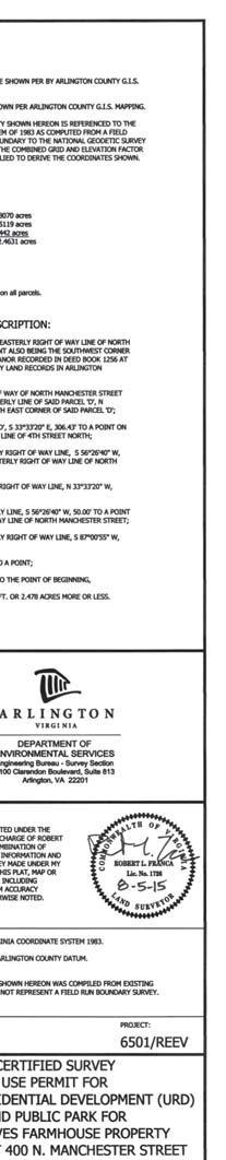
19 A R L I N G T O N V I R G I N I A DEPARTMENT OF PARKS AND RECREATION Park Development Division 2100 Clarendon Boulevard, Suite 414, Arlington, VA Phone: Fax: Plans For: Reeves Farm 400 North Manchester St., Arlington VA Unified Residential Development Use Permit and Public Park Use Permit A R L I N G T O N V I R G I N I A DEPARTMENT OF PARKS AND RECREATION Parks Development Division 2100 Clarendon Boulevard, Suite 414 Arlington, VA Phone: Fax: North Manchester St., Arlington, VA Unified Residential Development Use Permit Public Park Use Permit Approvals Date DESIGN TEAM SUPERVISOR 08/05/2015 Table of Contents: S1 S2 S3 L1 L2 L3 Property Survey Plat of New Parcel Farmhouse Location Survey Tree Inventory and Landscape Conservation Plan Landscape Plan Enlargement and Details Tree Preservation and Planting Details Seal URD PERMIT #ZADM Vicinity Map - Not to Scale Date:
20
21
22

23 GRAPHIC SCALE Park Development Division 2100 Clarendon Boulevard, Suite 414 Arlington, VA Phone: Fax: A R L I N G T O N V I R G I N I A DEPARTMENT OF PARKS AND RECREATION


24 A R L I N G T O N V I R G I N I A DEPARTMENT OF PARKS AND RECREATION Park Development Division 2100 Clarendon Boulevard, Suite 414 Arlington, VA Phone: Fax:
25 A R L I N G T O N V I R G I N I A DEPARTMENT OF PARKS AND RECREATION Park Development Division 2100 Clarendon Boulevard, Suite 414 Arlington, VA Phone: Fax:
26 FUTURE STREET RIGHT-OF-WAY AS SHOWN ON PLAT RECORDED IN DEED BOOK 1812 AT PAGE 5. EXHIBIT 1 POTENTIAL AREA FOR FUTURE REEVES FARMHOUSE ADDITION JULY 13, 2015
27 N MONTANA ST TH ST N N MANCHESTER ST TH RD N S-3A R N MONTAGUE ST TH ST N N MANCHESTER ST RD ST N U N. Manchester St I RPC # , -072, -073 Scale: Case Location(s) 1:1,800 Note: These maps are for property location assistance only. They may not represent the latest survey and other information. Department of Community Planning, Housing and Development County Use Only Date Placard Posted By Removed
28 N MONTANA ST TH ST N N MANCHESTER ST TH RD N S-3A R N MONTAGUE ST TH ST N N MANCHESTER ST RD ST N U N. Manchester St I RPC # , -072, -073 Scale: Case Location(s) 1:1,800 Note: These maps are for property location assistance only. They may not represent the latest survey and other information. Department of Community Planning, Housing and Development County Use Only Date Placard Posted By Removed
ARLINGTON COUNTY, VIRGINIA
 ARLINGTON COUNTY, VIRGINIA County Board Agenda Item Meeting of July 13, 2013 DATE: June 27, 2013 SUBJECT: U-2607-88-1 USE PERMIT REVIEW for a dormitory with a maximum of 21 occupants (Doorways for Women
ARLINGTON COUNTY, VIRGINIA
 ARLINGTON COUNTY, VIRGINIA County Board Agenda Item Meeting of July 8, 2006 DATE: June 30, 2006 SUBJECT: U-3156-06-1 USE PERMIT for a, 2 dwelling units located at 4717 24 th Road North (RPC #05-005-092).
ARLINGTON COUNTY, VIRGINIA
 ARLINGTON COUNTY, VIRGINIA County Board Agenda Item Meeting of July 16, 2016 DATE: July 5, 2016 SUBJECT: SP #64 SITE PLAN AMENDMENT to allow temporary extension of construction hours for ; located at 1000
ARLINGTON COUNTY, VIRGINIA
 ARLINGTON COUNTY, VIRGINIA County Board Agenda Item Meeting of January 27, 2007 DATE: January 19, 2007 SUBJECT: A. Z-2532-06-1 REZONING from RA14-26 Apartment Dwelling Districts to R-6 One- Family Dwelling
ARLINGTON COUNTY, VIRGINIA. County Board Agenda Item Meeting of May 16, 2015
 ARLINGTON COUNTY, VIRGINIA County Board Agenda Item Meeting of May 16, 2015 DATE: May 18, 2015 SUBJECT: Disposition of a Limited Portion of the Real Property and Improvements at 400 North Manchester Street
ARLINGTON COUNTY, VIRGINIA ARLINGTON COUNTY PLANNING COMMISSION. September 9, 2015
 ARLINGTON COUNTY, VIRGINIA ARLINGTON COUNTY PLANNING COMMISSION 2100 CLARENDON BOULEVARD, SUITE 700 ARLINGTON, VA 22201 (703)228-3525 www.arlingtonva.us CHRISTOPHER FORINASH CHAIR NANCY IACOMINI VICE-CHAIR
USE PERMIT AND VARIANCE APPLICATION
 USE PERMIT AND VARIANCE APPLICATION Case No. BOARD OF ZONING APPEALS APPLICATION FOR USE PERMITS AND VARIANCES ARLINGTON COUNTY, VIRGINIA D E P A R T M E N T O F C O M M U N I T Y P L A N N I N G, H O
ARLINGTON COUNTY, VIRGINIA. County Board Agenda Item Meeting of July 14, 2018
 ARLINGTON COUNTY, VIRGINIA County Board Agenda Item Meeting of July 14, 2018 DATE: July 10, 2018 SUBJECT: Historic Preservation Easement on a Portion of Property Owned by the County Board of Arlington
ARLINGTON COUNTY, VIRGINIA
 ARLINGTON COUNTY, VIRGINIA County Board Agenda Item Meeting of January 29, 2005 DATE: January 21, 2005 SUBJECTS: A. SP #83 SITE PLAN AMENDMENT to permit the development of 21 additional units using the
March 6, The County Board of Arlington, Virginia. Ron Carlee, County Manager
 March 6, 2003 TO: FROM: SUBJECT: The County Board of Arlington, Virginia Ron Carlee, County Manager Zoning Ordinance amendments to Section 1. Definitions, Section 31. Special Exceptions and Section 32.
ARLINGTON COUNTY, VIRGINIA
 ARLINGTON COUNTY, VIRGINIA Board of Zoning Appeals Agenda Item V-11250-17-UP-2: Meeting of April 19, 2017 DATE: April 14, 2017 APPLICANT: LOCATION: ZONING: LOT AREA: GLUP DESIGNATION: Robert and Tania
Staff Report: Date: Applicant: Property Identification: Acreage of Request: Current Zoning of Requested Area: Requested Action: Attached:
 Staff Report: Completed by Jeff Palmer Director of Planning & Zoning Date: November 7, 2018, Updated November 20, 2018 Applicant: Greg Smith, Oberer Land Developer agent for Ronald Montgomery ET AL Property
ARLINGTON COUNTY, VIRGINIA
 ARLINGTON COUNTY, VIRGINIA Board of Zoning Appeals Agenda Item V-11338-17-UP-1: Meeting of March 21, 2018 DATE: March 16, 2018 APPLICANT: LOCATION: ZONING: LOT AREA: GLUP DESIGNATION: Hajra Zahid & Zahid
ARLINGTON COUNTY, VIRGINIA
 ARLINGTON COUNTY, VIRGINIA Board of Zoning Appeals Agenda Item V-11349-18-UP-2: Meeting of March 21, 2018 DATE: March 16, 2018 APPLICANT: LOCATION: ZONING: LOT AREA: GLUP DESIGNATION: Gregory and Sarah
ARLINGTON COUNTY, VIRGINIA
 ARLINGTON COUNTY, VIRGINIA Board of Zoning Appeals Agenda Item V-11185-16-UP-1: Meeting of October 12, 2016 DATE: October 7, 2016 APPLICANT: LOCATION: ZONING: LOT AREA: GLUP DESIGNATION: Elizabeth Taylor
ARLINGTON COUNTY, VIRGINIA
 ARLINGTON COUNTY, VIRGINIA County Board Agenda Item Meeting of June 16, 2012 DATE: June 7, 2012 SUBJECT: SP #397 SITE PLAN AMENDMENT to revise condition #31 to modify the retail transparency requirement
Nan E. Terpak, Agent 2200 Clarendon Boulevard, 13th Floor Arlington, Virginia 22201
 July 10, 2002 TO: FROM: APPLICANT: BY: SUBJECT: The County Board of Arlington, Virginia Ron Carlee, County Manager McCaffrey Interests, Inc. Nan E. Terpak, Agent 2200 Clarendon Boulevard, 13th Floor Arlington,
ARLINGTON COUNTY, VIRGINIA. County Board Agenda Item Meeting of November 17, 2018
 ARLINGTON COUNTY, VIRGINIA County Board Agenda Item Meeting of November 17, 2018 DATE: November 7, 2018 SUBJECT: U-3501-17-4 USE PERMIT REVIEW for an Open-Air Market (Arlington Mill Farmer's Market); located
(a) Commercial uses on Laurel Avenue, abutting the TRO District to the
 Commercial uses on Laurel Avenue, abutting the TRO District to the") 32X Zoning Code 150.36 TRANSITIONAL RESIDENTIAL OVERLAY DISTRICT. (A) Intent and purpose. (1) It is the intent of the Transitional Residential Overlay District (hereinafter referred to as the "TRO District")
32X Zoning Code 150.36 TRANSITIONAL RESIDENTIAL OVERLAY DISTRICT. (A) Intent and purpose. (1) It is the intent of the Transitional Residential Overlay District (hereinafter referred to as the "TRO District")
ARLINGTON COUNTY, VIRGINIA
 ARLINGTON COUNTY, VIRGINIA Board of Zoning Appeals Agenda Item V-11394-18-UP-1: Meeting of October 17, 2018 DATE: October 12, 2018 APPLICANT: LOCATION: ZONING: LOT AREA: GLUP DESIGNATION: Sarah Sunday
SPECIAL ZONING DISTRICTS
 SPECIAL ZONING DISTRICTS 5.01 5.99 RESERVED 5.100 PLANNED DEVELOPMENTS: Purpose: This district is intended to accommodate unified design of residential, commercial, office, professional services, retail
SECTION 10.7 R-PUD (RESIDENTIAL PLANNED UNIT DEVELOPMENT) ZONE
 ZONE") Article X Zones 10-20 SECTION 10.7 R-PUD (RESIDENTIAL PLANNED UNIT DEVELOPMENT) ZONE A. PURPOSE AND INTENT: The R-PUD Residential PUD Zone is intended to provide alternative, voluntary zoning procedures
Article X Zones 10-20 SECTION 10.7 R-PUD (RESIDENTIAL PLANNED UNIT DEVELOPMENT) ZONE A. PURPOSE AND INTENT: The R-PUD Residential PUD Zone is intended to provide alternative, voluntary zoning procedures
PLANNED UNIT DEVELOPMENT & SUBDIVISION STAFF REPORT Date: November 17, 2016
 PLANNED UNIT DEVELOPMENT & SUBDIVISION STAFF REPORT Date: November 17, 2016 DEVELOPMENT NAME SUBDIVISION NAME LOCATION Autonation Ford of Mobile Autonation Ford of Mobile Subdivision 901, 909, and 925
ARLINGTON COUNTY, VIRGINIA
 ARLINGTON COUNTY, VIRGINIA Board of Zoning Appeals Agenda Item V-11238-17-VA-1: Meeting of July 19, 2017 DATE: July 12, 2017 APPLICANT: LOCATION: ZONING: LOT AREA: GLUP DESIGNATION: Douglas J Marshall
ARLINGTON COUNTY, VIRGINIA. County Board Agenda Item Meeting of September 22, 2018
 ARLINGTON COUNTY, VIRGINIA County Board Agenda Item Meeting of September 22, 2018 DATE: September 13, 2018 SUBJECT: SP413-U-18-1 USE PERMIT ASSOCIATED WITH A SITE PLAN for food delivery service for Domino's
PREPARED FOR THE URBAN DESIGN COMMISSION AND PLAN COMMISSION
 PLANNING DIVISION STAFF REPORT PREPARED FOR THE URBAN DESIGN COMMISSION AND PLAN COMMISSION Project Address: Application Type: Prepared By: Demolition Permit and Conditional Use Kevin Firchow, AICP, Planning
AN ORDINANCE TO AMEND SECTION OF THE RAPID CITY MUNICIPAL CODE TO ALLOW FOR ADMINISTRATIVE DISSOLUTION OF PLANNED DEVELOPMENTS
 Ordinance No. 6231 AN ORDINANCE TO AMEND SECTION 17.50.050 OF THE RAPID CITY MUNICIPAL CODE TO ALLOW FOR ADMINISTRATIVE DISSOLUTION OF PLANNED DEVELOPMENTS WHEREAS, the City of Rapid City has adopted a
UPPER MOUNT BETHEL TOWNSHIP NORTHAMPTON COUNTY, PENNSYLVANIA
 UPPER MOUNT BETHEL TOWNSHIP NORTHAMPTON COUNTY, PENNSYLVANIA JOINDER DEED / LOT CONSOLIDATION TOWNSHIP REVIEW PROCESS When accepting proposed Joinder Deeds / Lot Consolidations, review the Joinder Deed
2. The modification is consistent with the objectives of this chapter.
 DRAFT February 11, 2009 BMC 20.28 Infill Housing 20.28.010 Purpose. This chapter establishes special development regulations for a series of housing forms that are different than the traditional detached
ARLINGTON COUNTY, VIRGINIA
 ARLINGTON COUNTY, VIRGINIA County Board Agenda Item Meeting of January 23, 2016 DATE: January 20, 2016 SUBJECTS: A. SP #211 SITE PLAN AMENDMENT to permit a vehicle rental use and associated modification
ARLINGTON COUNTY, VIRGINIA
 ARLINGTON COUNTY, VIRGINIA County Board Agenda Item Meeting of January 23, 2016 DATE: December 30, 2015 SUBJECT: U-3150-06-1 USE PERMIT REVIEW for secondary parking for off-site users (Virginia Hospital
ARLINGTON COUNTY, VIRGINIA
 ARLINGTON COUNTY, VIRGINIA County Board Agenda Item Meeting of July 21, 2012 DATE: June 26, 2012 SUBJECT: SP #402 SITE PLAN AMENDMENT for a comprehensive sign plan amendment to add a projecting sign for
ARLINGTON COUNTY, VIRGINIA
 ARLINGTON COUNTY, VIRGINIA County Board Agenda Item Meeting of February 12, 2005 DATE: February 8, 2005 SUBJECT: Request to Advertise public hearings on the proposed Zoning Ordinance amendment to Section
ARLINGTON COUNTY, VIRGINIA. County Board Agenda Item Meeting of May 14, 2011
 ARLINGTON COUNTY, VIRGINIA County Board Agenda Item Meeting of May 14, 2011 DATE: May 11, 2011 SUBJECT: SP #240 SITE PLAN AMENDMENT for a kiosk for the Department of Environmental Services located at the
ARLINGTON COUNTY, VIRGINIA. County Board Agenda Item Meeting of December 10, 2016
 ARLINGTON COUNTY, VIRGINIA County Board Agenda Item Meeting of December 10, 2016 DATE: November 30, 2016 SUBJECT: U-3077-04-2 USE PERMIT REVIEW of a transitional parking lot for Kline Imports; located
Operating Standards Attachment to Development Application
 Planning & Development Services 2255 W Berry Ave. Littleton, CO 80120 Phone: 303-795-3748 Mon-Fri: 8am-5pm www.littletongov.org Operating Standards Attachment to Development Application 1 PLANNED DEVELOPMENT
AAAA. Planning and Zoning Staff Report Lake Shore Land Holdings, LLC CU-PH Analysis
 AAAA Planning and Zoning Staff Report Lake Shore Land Holdings, LLC CU-PH2016-28 Hearing Date: April 21, 2016 Development Services Department Applicant: BRS Architects/Cindy Huebert Staff: Kyle McCormick,
ARLINGTON COUNTY, VIRGINIA. County Board Agenda Item Meeting of September 16, 2017
 ARLINGTON COUNTY, VIRGINIA County Board Agenda Item Meeting of September 16, 2017 DATE: September 6, 2017 SUBJECT: U-3466-16-1 USE PERMIT for a bed and breakfast for Yogi and Daisy Dumera; located at 3120
ARTICLE 15 - PLANNED UNIT DEVELOPMENT
 Section 15.1 - Intent. ARTICLE 15 - PLANNED UNIT DEVELOPMENT A PUD, or Planned Unit Development, is not a District per se, but rather a set of standards that may be applied to a development type. The Planned
Report to the Plan Commission August 20, 2012
 Report to the Plan Commission Legistar I.D. #27376 5692-5696 Monona Drive Conditional Use Requested Action: Approval of a conditional use for an outdoor eating area for a restaurant and an accessory parking
DETAILED GRADING PLAN CHECKLIST (TEARDOWN/REDEVELOPMENT) Updated: 12/12/2017
 Updated: 12/12/2017") DETAILED GRADING PLAN CHECKLIST (TEARDOWN/REDEVELOPMENT) Updated: 12/12/2017 ADDRESS: PERMIT #: DATE: Sat. Not GENERAL 1. A disposition of comments should be included in all subsequent submittals. 2. Plan
DETAILED GRADING PLAN CHECKLIST (TEARDOWN/REDEVELOPMENT) Updated: 12/12/2017 ADDRESS: PERMIT #: DATE: Sat. Not GENERAL 1. A disposition of comments should be included in all subsequent submittals. 2. Plan
1. APPLICANT: Polsinelli, Shalton & Welte is the applicant for this request.
 5. REVISED PRELIMINARY PLAN APPROVAL - THE RETREAT AT MAPLECREST - Vicinity of the northeast corner of 159 th Street and U.S. 69 Highway 1. APPLICANT: Polsinelli, Shalton & Welte is the applicant for this
a. To insure compatible relationships between land use activities;
 PART B SECTION VIII INSTITUTIONAL DISTRICTS Article 1 Planned Institutional District 1. Purpose and Intent: It is the purpose and intent of this district to permit and encourage the orderly, cooperative
Addendum G SP #409 Page 1
 Addendum 10-13-07-G SP #409 Page 1 The following Conditions of site plan approval (#1 through #14) are valid for the life of the site plan and must be met by the developer before issuance of the Clearing,
PLANNING & COMMUNITY DEVELOPMENT DEPARTMENT STAFF REPORT
 PLANNING & COMMUNITY DEVELOPMENT DEPARTMENT STAFF REPORT DATE: TO: Hearing Officer SUBJECT: Minor Variance #11876 LOCATION: APPLICANT: ZONING DESIGNATION: GENERAL PLAN DESIGNATION: CASE PLANNER: STAFF
DEVELOPMENT STANDARDS FOR RESIDENTIAL PROJECTS RESIDENTIAL BUILDING TYPES: APPROPRIATE ZONES AND DENSITIES 2-1
 2 DEVELOPMENT STANDARDS FOR RESIDENTIAL PROJECTS RESIDENTIAL BUILDING TYPES: APPROPRIATE ZONES AND DENSITIES 2-1 This Chapter presents the development standards for residential projects. Section 2.1 discusses
MINOR SUBDIVISION FINAL PLAT APPLICATION Town of Apex, North Carolina
 MINOR SUBDIVISION FINAL PLAT APPLICATION Town of Apex, North Carolina This document is a public record under the North Carolina Public Records Act and may be published on the Town s website or disclosed
DEVELOPMENT PLAN ORDINANCE
 DEVELOPMENT PLAN ORDINANCE CITY OF GLASGOW Ordinance No. 2026 SECTION A. Section 1. INTENT AND PURPOSE The purpose of this Ordinance is to establish and define development plans, which may be utilized
DRAFT FOR PUBLIC HEARING (rev. March, 2016)
") Chapter 200. ZONING Article VI. Conservation/Cluster Subdivisions 200-45. Intent and Purpose These provisions are intended to: A. Guide the future growth and development of the community consistent with
Chapter 200. ZONING Article VI. Conservation/Cluster Subdivisions 200-45. Intent and Purpose These provisions are intended to: A. Guide the future growth and development of the community consistent with
SECTION 36. ADMINISTRATION AND PROCEDURES. A. Enforcement.
 SECTION 36. ADMINISTRATION AND PROCEDURES A. Enforcement. 1. This ordinance shall be enforced by the Zoning Administrator. No building or other structure shall be erected, reconstructed, enlarged, moved
DEPARTMENT OF COMMUNITY PLANNING, HOUSING AND DEVELOPMENT Planning Division
 DEPARTMENT OF COMMUNITY PLANNING, HOUSING AND DEVELOPMENT Planning Division #1 Courthouse Plaza, 2100 Clarendon Boulevard, Suite 700 Arlington, VA 22201 TEL 703.228.3525 FAX 703.228.3543 www.arlingtonva.us
ARLINGTON COUNTY, VIRGINIA
 ARLINGTON COUNTY, VIRGINIA County Board Agenda Item Meeting of March 13, 2004 DATE: March 10, 2004 SUBJECT: SP #256 SITE PLAN AMENDMENT to amend the comprehensive sign plan; premises known as 4250 Fairfax
 Page 1 of 8 Laguna Beach Municipal Code Up Previous Next Main Collapse Search Print No Frames Title 25 ZONING Chapter 25.10 R-1 RESIDENTIAL LOW DENSITY ZONE 25.10.002 Intent and purpose. This zone is intended
Guidelines for the Approval of New Homes Sales Offices (Building Permits, Agreements, Securities)
") Guidelines for the Approval of New Homes Sales Offices (Building Permits, Agreements, Securities) ENCLOSURES: Site Plan Application Building Permit Application Grading and Drainage Approval Requirements
Guidelines for the Approval of New Homes Sales Offices (Building Permits, Agreements, Securities) ENCLOSURES: Site Plan Application Building Permit Application Grading and Drainage Approval Requirements
ARTICLE I ZONE BASED REGULATIONS
 ARTICLE I ZONE BASED REGULATIONS RZC 21.08 RESIDENTIAL REGULATIONS 21.08.290 Cottage Housing Developments A. Purpose. The purpose of the cottage housing requirements is to: 1. Provide a housing type that
Request Subdivision Variance (Section 4.4(c)(1) of the Subdivision Regulations) Staff Recommendation Approval. Staff Planner Jonathan Sanders
(1) of the Subdivision Regulations) Staff Recommendation Approval. Staff Planner Jonathan Sanders") Applicant & Owner Public Hearing February 14, 2018 City Council Election District Bayside Agenda Item 4 Request Subdivision Variance (Section 4.4(c)(1) of the Subdivision Regulations) Staff Recommendation
Applicant & Owner Public Hearing February 14, 2018 City Council Election District Bayside Agenda Item 4 Request Subdivision Variance (Section 4.4(c)(1) of the Subdivision Regulations) Staff Recommendation
Committed to Service. License Agreement Application Form
 Committed to Service License Agreement Application Form PLEASE NOTE: Effective February 16, 2010 - License Agreements within the downtown Boise area for public structures, objects and uses on ACHD sidewalks
ARLINGTON COUNTY, VIRGINIA
 ARLINGTON COUNTY, VIRGINIA County Board Agenda Item Meeting of April 19, 2008 DATE: April 2, 2008 SUBJECT: ORDINANCE TO AMEND, REENACT, AND RECODIFY Section 20 CP- FBC, Columbia Pike Form Based Code Districts
Staff Report: Date: Applicant: Property Identification: Acreage of Request: Current Zoning of Requested Area: Requested Action: Attached:
 Staff Report: Completed by Jeff Palmer Director of Planning & Zoning Date: November 7, 2018 Applicant: Greg Smith, Oberer Land Developer agent for Ronald Montgomery ET AL Property Identification: Frontage
ARTICLE 8C SITE CONDOMINIUM DEVELOPMENT ORDINANCE
 ARTICLE 8C SITE CONDOMINIUM DEVELOPMENT ORDINANCE SECTION 8C.01 PURPOSE It is the purpose of this Ordinance to insure that plans for development within Oceola Township proposed under the provisions of
PLANNED UNIT DEVELOPMENTS (Ordinance No.: 3036, 12/3/07; Repealed & Replaced by Ordinance No.: 4166, 10/15/12)
") 159.62 PLANNED UNIT DEVELOPMENTS (Ordinance No.: 3036, 12/3/07; Repealed & Replaced by Ordinance No.: 4166, 10/15/12) A. PURPOSE 1. General. The Planned Unit Development (PUD) approach provides the flexibility
159.62 PLANNED UNIT DEVELOPMENTS (Ordinance No.: 3036, 12/3/07; Repealed & Replaced by Ordinance No.: 4166, 10/15/12) A. PURPOSE 1. General. The Planned Unit Development (PUD) approach provides the flexibility
60. ARLINGTON COUNTY, VIRGINIA. County Board Agenda Item Meeting of July 14, DATE: July 13, 2018
 ARLINGTON COUNTY, VIRGINIA County Board Agenda Item Meeting of July 14, 2018 DATE: July 13, 2018 SUBJECT: Request to authorize advertisement of public hearings by the Planning Commission and County Board
AMENDED ZONING BY-LAW ARTICLE SENIOR LIVING COMMUNITY
 AMENDED ZONING BY-LAW ARTICLE 13.5 - SENIOR LIVING COMMUNITY ARTICLE : To see if the Town will vote to amend the Zoning Bylaw as follows: 2. By deleting existing Section 13.5, Senior Living Community,
I. Requirements for All Applications. C D W
 108-16.1. Application checklists. Checklist for Required Submissions to the Planning Board or Zoning Board of Adjustment of Monroe Township All required submissions are to be made to the Administrative
MINOR SUBDIVISION PLAT CHECKLIST
 MINOR SUBDIVISION PLAT CHECKLIST Project Name: Tax ID #: Project Number: Date: _ Reviewed By: Telephone: NOTES: All lots on septic systems must comply with the Fulton County Health Department requirements
ARTICLE VII. NONCONFORMITIES. Section 700. Purpose.
 ARTICLE VII. NONCONFORMITIES. Section 700. Purpose. The purpose of this chapter is to regulate and limit the development and continued existence of legal uses, structures, lots, and signs established either
APPLICANT NAME SUBDIVISION NAME DEVELOPMENT NAME LOCATION. CITY COUNCIL DISTRICT Council District 4 PRESENT ZONING PROPOSED ZONING
 SUBDIVISION, PLANNED UNIT DEVELOPMENT, PLANNING APPROVAL, ZONING AMENDMENT, & SIDEWALK WAIVER REQUEST STAFF REPORT Date: February 17, 2010 APPLICANT NAME SUBDIVISION NAME DEVELOPMENT NAME LOCATION David
Zoning Ordinance Amendment (ZOA) Detached Accessory Dwellings
 Detached Accessory Dwellings") DEPARTMENT OF COMMUNITY PLANNING, HOUSING AND DEVELOPMENT Housing Division 2100 Clarendon Boulevard, Suite 700, Arlington, VA 22201 TEL: 703-228-3765 FAX: 703-228-3834 www.arlingtonva.us Memorandum To:
DEPARTMENT OF COMMUNITY PLANNING, HOUSING AND DEVELOPMENT Housing Division 2100 Clarendon Boulevard, Suite 700, Arlington, VA 22201 TEL: 703-228-3765 FAX: 703-228-3834 www.arlingtonva.us Memorandum To:
ARLINGTON COUNTY, VIRGINIA
 ARLINGTON COUNTY, VIRGINIA Board of Zoning Appeals Agenda Item V-11354-18-VA-2: Meeting of April 16, 2018 DATE: April 13, 2018 APPLICANT: LOCATION: ZONING: LOT AREA: GLUP DESIGNATION: Roger Ramia of Rush
DETAILED GRADING PLAN CHECKLIST (TEARDOWN/REDEVELOPMENT)
") GENERAL DETAILED GRADING PLAN CHECKLIST (TEARDOWN/REDEVELOPMENT) ADDRESS: PERMIT #: DATE: 1. Plan is signed and sealed by an Illinois registered professional engineer including date signed and license
GENERAL DETAILED GRADING PLAN CHECKLIST (TEARDOWN/REDEVELOPMENT) ADDRESS: PERMIT #: DATE: 1. Plan is signed and sealed by an Illinois registered professional engineer including date signed and license
TOWN OF EASTCHESTER BUILDING AND PLANNING DEPARTMENT PLANNING BOARD APPLICATION PACKAGE SUBDIVISIONS
 TOWN OF EASTCHESTER BUILDING AND PLANNING DEPARTMENT 40 Mill Road (914) 771-3317 building@eastchester.org Eastchester, NY 10709 (914) 771-3322 Fax www.eastchester.org TABLE OF CONTENTS PLANNING BOARD APPLICATION
REPORT TO PLANNING AND DESIGN COMMISSION City of Sacramento
 REPORT TO PLANNING AND DESIGN COMMISSION City of Sacramento 915 I Street, Sacramento, CA 95814-2671 www.cityofsacramento.org 9 PUBLIC HEARING December 10, 2015 To: Members of the Planning and Design Commission
SUBDIVISION, PLANNED UNIT DEVELOPMENT, & PLANNING APPROVAL STAFF REPORT Date: February 1, 2007
 SUBDIVISION, PLANNED UNIT DEVELOPMENT, & PLANNING APPROVAL STAFF REPORT Date: February 1, 2007 DEVELOPMENT NAME SUBDIVISION NAME Pala Verde Mobile Home Park Subdivision Pala Verde Mobile Home Park Subdivision
Special Use Permit - Planned Unit Development Checklist. Property Address:
 Special Use Permit - Planned Unit Development Checklist Special Use Permit Number. Parcel Code/s #28-11- - - Property Address: Applicant: ARTICLE VIII Ordinance Reference - Section 8.1.2 Permit Procedures:
ARLINGTON COUNTY, VIRGINIA
 ARLINGTON COUNTY, VIRGINIA County Board Agenda Item Meeting of November 15, 2005 DATE: November 8, 2005 SUBJECT: Ordinance to amend the Zoning Ordinance to: A. Section 1. Definitions and Section 32. Bulk,
DEED OF TEMPORARY EASEMENT
 DEED OF TEMPORARY EASEMENT This DEED OF TEMPORARY EASEMENT ( Agreement ) is made this day of, 2005 by THE COUNTY BOARD OF ARLINGTON COUNTY, VIRGINIA, a body corporate ( Grantor ), and LEE GARDENS HOUSING
ARLINGTON COUNTY, VIRGINIA
 ARLINGTON COUNTY, VIRGINIA County Board Agenda Item Meeting of March 17, 2018 DATE: March 9, 2018 SUBJECT: U-3452-16-1 USE PERMIT REVIEW for outdoor cafe seating in a portion of the public right of way
TOWN OF ROXBURY PLANNING BOARD
 UPDATED: APRIL 2011 TOWN OF ROXBURY PLANNING BOARD Applicant s Guide for Subdivision Review The Town Planning Board administers the subdivision review process. This guide has been prepared in order to
ELK RAPIDS TOWNSHIP ANTRIM COUNTY, MICHIGAN ORDINANCE NO
 ELK RAPIDS TOWNSHIP ANTRIM COUNTY, MICHIGAN ORDINANCE NO. 3-2011 AN ORDINANCE TO REPLACE THE SUBDIVISION CONTROL ORDINANCE WITH A NEW SUBDIVISION DEVELOPMENT ORDINANCE, IN ACCORD WITH THE LAND DIVISION
TOWN OF NEW SHOREHAM ZONING BOARD OF REVIEW APPLICATION PROCEDURE
 TOWN OF NEW SHOREHAM ZONING BOARD OF REVIEW APPLICATION PROCEDURE 1. Please answer all questions on the application and please print clearly. If a question is not applicable, mark the space with a N/A.
City of Fayetteville, Arkansas Page 1 of 3
 City of Fayetteville, Arkansas 113 West Mountain Street Fayetteville, AR 72701 (479) 575-8323 Legislation Text File #: 2018-0144, Version: 1 ADM 18-6094 (AMEND UDC 164.19/ACCESSORY DWELLING UNITS): AN
APPLICATION FOR A SWIMMING POOL ENCLOSURE PERMIT
 Page 1 of 5 APPLICATION FOR A SWIMMING POOL ENCLOSURE PERMIT By-law Services 905-619-2529 ext. 3370 Incomplete application packages will not be accepted Address of property Plan Lot Name of all property
Composition of traditional residential corridors.
 Page 1 of 7 St. Petersburg, Florida, Code of Ordinances >> PART II - ST. PETERSBURG CITY CODE >> Chapter 16 - LAND DEVELOPMENT REGULATIONS >> SECTION 16.20.060. CORRIDOR RESIDENTIAL TRADITIONAL DISTRICTS
Table of Contents ARTICLE 5A CHARACTER-BASED ZONING 1
 Table of Contents ARTICLE 5A CHARACTER-BASED ZONING 1 SECTION 10.5A10 GENERAL... 1 10.5A11 Purpose and Intent... 1 10.5A12 Applicability... 1 10.5A13 Compliance with Regulating Plan... 1 10.5A14 Relationship
Action Recommendation: Budget Impact:
 City of Fayetteville Staff Review Form Garner Stoll Submitted By 2018-0144 Legistar File ID 4/17/2018 City Council Meeting Date - Agenda Item Only N/A for Non-Agenda Item 3/22/2018 Submitted Date Action
ARLINGTON COUNTY, VIRGINIA
 ARLINGTON COUNTY, VIRGINIA County Board Agenda Item Meeting of July 10, 2004 DATE: June 24, 2004 SUBJECT: A. GP-298-04-1 GENERAL LAND USE PLAN AMENDMENT from Semi- Public (Country Clubs and semi-public
Introduction. General Development Standards
 Introduction The development standards will set the zoning regulations for the East Park development. This section will illustrate lot standards, approximate open space locations and road standards. The
ARTICLE 15. RULES, REGULATIONS AND DEFINITIONS
 ARTICLE 15. RULES, REGULATIONS AND DEFINITIONS Section 1. Interpretation and Construction: The following rules and regulations regarding interpretation and construction of the Ulysses-Grant County, Kansas,
Initial Subdivision Applications Shall Include the Following:
 Initial Subdivision Applications Shall Include the Following: 1) Subdivision Application Form: completely filled out (12 copies) 2) Plat: The Plat must adhere to the requirements set forth in the Town
APPLICATION FOR A SWIMMING POOL ENCLOSURE PERMIT
 Page 1 of 5 APPLICATION FOR A SWIMMING POOL ENCLOSURE PERMIT By-law Services 905-619-2529 ext. 3370 Incomplete application packages will not be accepted Address of property Plan Lot Name of all property
Item 4. Update location of official zoning map and reference to plat books
 Item 4. Update location of official zoning map and reference to plat books Reference: 2. District Map Issue: Current references to the Zoning Map as the July 15, 1950 zoning districts map, as amended,
MASTER SUBDIVISION FINAL PLAT APPLICATION Town of Apex, North Carolina
 MASTER SUBDIVISION FINAL PLAT APPLICATION Town of Apex, North Carolina This document is a public record under the North Carolina Public Records Act and may be published to the Town s website or disclosed
Development Plan DP13-3 (Arlington Lofts) Planning and Zoning Meeting Date: Document Being Considered: Ordinance
 Planning and Zoning Meeting Date: Document Being Considered: Ordinance") Staff Report Development Plan DP13-3 (Arlington Lofts) Planning and Zoning Meeting Date: 6-19-13 Document Being Considered: Ordinance RECOMMENDATION Following the public hearing, consider Development Plan
Staff Report Development Plan DP13-3 (Arlington Lofts) Planning and Zoning Meeting Date: 6-19-13 Document Being Considered: Ordinance RECOMMENDATION Following the public hearing, consider Development Plan
BEFORE THE HEARINGS EXAMINER FOR THE CITY OF BREMERTON
 BEFORE THE HEARINGS EXAMINER FOR THE CITY OF BREMERTON In the Matter of the Application of ) NO. PL03-0017 ) Rainier Vista Bill Bakker ) ) FINDINGS, CONCLUSIONS For Approval of a Preliminary Plat. ) AND
Coding For Places People Love Main Street Corridor District
 Coding For Places People Love Main Street Corridor District 1) Scope a) District boundaries are assigned according to the District Boundary Map. b) The Primary Retail Corridor is assigned according to
Amendment to the Zoning and Subdivision Ordinances; Consider Repeal Cluster Development Standards
 2 Board of Supervisors Meg Bohmke, Chairman Gary F. Snellings, Vice Chairman Jack R. Cavalier Thomas C. Coen L. Mark Dudenhefer Wendy E. Maurer Cindy C. Shelton February 28, 2018 Thomas C. Foley County
ARLINGTON COUNTY, VIRGINIA
 ARLINGTON COUNTY, VIRGINIA County Board Agenda Item Meeting of July 16, 2016 DATE: July 5, 2016 SUBJECT: Ordinance to Amend and Reenact an Ordinance to Vacate Parcel 1 of North Vermont Street between North
ATLANTA ZONING ORDINANCE UPDATE
 CITY OF ATLANTA ZONING ORDINANCE QUICK FIXES In 2015 the City of Atlanta selected a team of consultants to conduct a comprehensive assessment of the City s Zoning Ordinance, including a review of the ability
DENTON Developer's Handbook
 DENTON Developer's Handbook A guide for land development in the City of Denton Department of Development Services 2017 2 Table of Contents 1. City of Denton Development Process...5 Role of the Development
BUILDING AN ADU GUIDE TO ACCESSORY DWELLING UNITS PLANNING DIVISION
 BUILDING AN ADU GUIDE TO ACCESSORY DWELLING UNITS PLANNING DIVISION 1 451 S. State Street, Room 406 Salt Lake City, UT 84114-5480 P.O. Box 145480 CONTENT 04 OVERVIEW 08 ELIGIBILITY 11 BUILDING AN ADU Types