BELYRLY. Planning Commission Report
|
|
|
- Ashley Newton
- 5 years ago
- Views:
Transcription
858-5966 Planning Commission Report Meeting Date: July 14, 2016 Subject: Project Applicant: Recommendation: 9200 Wilshire Boulevard Zone Text Amendment and Planned Development Review for a mixed")


 was adopted by City Council on September 17, 2007.")
1 BELYRLY City of Beverly Hills Planning Division 455 N. Rexford Drive Beverly Hills, CA TEL. (310) FAX. (310) Planning Commission Report Meeting Date: July 14, 2016 Subject: Project Applicant: Recommendation: 9200 Wilshire Boulevard Zone Text Amendment and Planned Development Review for a mixed use retail/apartment project. This proposal is an amendment to a previously approved project. The application is still under review, however the concept is being brought to the Planning Commission as a preview. Joseph N. Tilem Receive this report and provide comments to staff as appropriate. REPORT SUMMARY This report introduces an amendment to a previously approved Planned Development at the property located at 9200 Wilshire Boulevard, and presents an overview of the proposed changes, and the required entitlements for the revised project. The City is currently processing a formal application for the proposed project; however, the purpose of this preview is to provide the applicant with an opportunity to introduce the project, and to provide the Commission with an opportunity to ask questions and offer preliminary comments. A separate, noticed public hearing will be held at a future date, at which time the Commission will have an opportunity to provide formal comments and take action on the project. BACKGROUND The Mixed Use Planned Development Overlay Zone (M-PD-4) was adopted by City Council on September 17, Along with the Overlay Zone, the City Council adopted resolutions approving a Vesting Tentative Tract Map and Planned Development Permit; approving a Development Agreement; and certifying a Final Environmental Impact Report for a mixed use project consisting of the following: 54 residential condominiums 14,000 square feet of ground floor retail 6 stories and 60 in height, with an additional 10 above for rooftop amenities FARof4:1 A total of 283 parking spaces in a four-level subterranean garage Attachment(s): A. Beverly Hills Municipal Code Section (Mixed Use Planned Development Overlay Zone M-PD-4) B. Originally approved Site Plan and Elevation (From FEIR certified on April 26, 2007) C. Project plans submitted as part of application, dated March 22, 2016 Report Author and Contact Information: Andre Sahakian, Associate Planner (310) asahakianbeverlyhills.org


2 LLS Planning Commission Report 9200 Wilshire Boulevard July 14, 2016 Page 2 of 2 PROJECT DESCRIPTION The proposed project is a re-design of the previously approved project. The proposed uses are generally similar, including a mix of ground floor retail with residential uses above. The proposed project consists of the following: 90 units of residential apartments (maintain as condominiums, but provide as rentals) 4,833 square feet of ground floor retail 6 stories and 60 in height, with additional height for rooftop amenities Total floor area of 160,218 square feet with an FAR of 4:1 A total of 324 parking spaces in a three-level subterranean garage and surface parking APPLICATION PROCESSING As proposed, the project may require a Zone Text Amendment to make amendments to the Overlay Zone development standards. These changes potentially include the following: Allow residential uses within the first 40 of the first floor facing arterial roadways, including Wilshire Boulevard Amend the loading space requirements, which specify that not less than one 35 deep truck loading space and one 50 deep truck loading space accessible from Palm Drive must be provided on the site. Amend the maximum height allowed on the site to accommodate proposed rooftop structures, which currently exceed 10 above the roof deck. As proposed the project will also require a Planned Development Review for the following project components: Amend the minimum permitted floor area devoted to commercial uses. Establish the maximum number of residential units permitted for the project. Amend the requirement that all parking provided above ground to be located behind building space that is dedicated to a permitted use other than parking, which building space shall be a minimum of 40 deep as measured from the building facades facing public streets, to prevent direct visibility form adjacent streets. NEXT STEPS It is recommended that the Planning Commission receive the staff report and presentation from the applicant and provide comments as appropriate. Report Reviewed By: Masa Alkire, AICP, Principal Planner
3 çierly Planning Commission Report 9200 Wilshire Boulevard July 14, 2016 Attachment A Beverly Hills Municipal Code Section (Mixed Use Planned Development Overlay Zone M-PD-4)
 10-3-1990: CREATED: There is hereby created an overlay zone designated as the mixed use planned development overlay zone (M-PD-4). (Ord.")
4 7/6/2016 Sterling Codifiers, Inc. Article Mixed Use Planned Development Overlay Zone (M-PD-4) : CREATED: There is hereby created an overlay zone designated as the mixed use planned development overlay zone (M-PD-4). (Ord , eff ) : APPLICATION OF ZONE: The M-PD-4 zone shall apply to the following areas, as shown on the mixed use planned development map, a copy of which is on file in the department of planning and community development and attached as exhibit A to the ordinance codified herein: All those parcels having frontage on the south side of Wilshire Boulevard, east of Maple Drive and west of Palm Drive, and north of the alley running parallel to and south of Wilshire Boulevard. (Ord , eff ) : OBJECTIVES: The objectives of the M-PD-4 zone shall be as follows: A. To ensure that mixed use development in the M-PD-4 zone will not adversely affect existing and anticipated development in the vicinity and will promote harmonious development of the area. B. To provide for mixed use development that is compatible with the scale and massing of the surrounding neighborhood, through appropriate height, modulation, upper story setbacks, other similar measures, or any combination thereof. C. To provide pedestrian friendly amenities along the street level, and setbacks that are generally consistent with other development along Wilshire Boulevard and along Palm Drive between Wilshire Boulevard and Charleville Boulevard, and along Maple Drive between Wilshire Boulevard and Charleville Boulevard. D. To ensure that mixed use development in the M-PD-4 zone will not create any significant, adverse 1/8

5 7/6/2016 Sterling Codifiers, Inc. traffic safety hazards, pedestrian-vehicle conflicts, or pedestrian safety hazards and will minimize impediments to vehicular circulation and pedestrian safety. E. To foster uniform planning and development of all parcels in the M-PD-4 zone to ensure unified development in the overlay zone. F. To protect the public health, safety, and welfare. (Ord , eff ) : DEFINITIONS: Unless the context plainly requires otherwise, the following definitions shall govern this article: ENTERTAINMENT USE: Any entertainment, other than live musical accompaniment to dining as defined in section of this chapter, and shall include, but not be limited to, movie theaters, playhouses, video arcades, cabarets, nightclubs, adult entertainment businesses, and similar uses. PLANNED DEVELOPMENT: A development that is approved pursuant to the procedures of article 18.4 of this chapter. (Ord , eff ) : USES PERMITTED: No lot, premises, building or portion thereof in the M-PD-4 zone shall be used for any purpose except those approved by the planning commission as part of a planned development pursuant to article 18.4 of this chapter. (Ord , eff ) : RESTRICTIONS: The following restrictions shall apply to mixed use developments in the M-PD-4 zone: A. No establishments whose primary purpose or business is to sell alcoholic beverages for on site consumption, otherwise referred to as bars, may be included in a mixed use development. B. No medical uses may be included in a mixed use development.


6 7/6/2016 Sterling Codifiers, Inc. C. No entertainment uses including, but not limited to, cabarets, nightclubs, and adult entertainment businesses, may be included in a mixed use development. D. No use shall be permitted in a mixed use development if that use would cause the parking generation for all uses in the mixed use development to exceed the available parking on site as determined in accordance with this chapter. E. Residential uses included as part of a mixed use development shall be permitted in all portions of the development regardless of the underlying zone, except that residential uses shall not be permitted within the first forty feet (40 ) of the first floor facing arterial roadways such as Wilshire Boulevard, measured from the building facade. F. Commercial uses included as part of a mixed use development shall only be permitted in those portions of the development in which the underlying zone is a commercial zone. G. The planning commission shall have authority through conditions imposed on a planned development to prohibit other uses as it deems appropriate, on a use by use basis. (Ord , eff ) : APPLICABILITY OF UNDERLYING ZONE REGULATIONS: Except as otherwise specifically provided in this article for mixed use developments, development in an M-PD-4 zone shall comply with the zoning regulations applicable to the underlying zone. Nothing in this article shall require a development to comply with the provisions of the M-PD-4 overlay zone if the development fully conforms to the requirements of the underlying zone. (Ord , eff ) : HEIGHT LIMITATIONS: No mixed use development shall be constructed, altered, or enlarged in the M-PD-4 zone except in accordance with the following height restrictions: A. General Limitations: No building, structure, improvement, or any part thereof, erected, constructed or maintained as part of a mixed use development in the M-PD4 zone shall exceed sixty feet (60 ) in height nor shall it exceed six (6) stories, measured as set forth in this chapter, exclusive of unoccupied architectural features and rooftop uses as provided below.


7 7/ Sterling Codifiers, Inc. B. Unoccupied Architectural Features: Notwithstanding any other provision of this code, unoccupied architectural features, such as skylights and clerestories, structures housing mechanical equipment, elevator penthouses, antennas and similar unoccupied space may exceed the sixty foot (60 ) height limit established by subsection A of this section by not more than ten feet (10 ) in height if such unoccupied architectural features are approved by the planning commission as part of a planned development pursuant to article 18.4 of this chapter and do not exceed, in the aggregate, thirty three percent (33%) of the total roof area upon which they are located and no such feature exceeds or intersects a line projecting from the perimeter of the roof upward at an angle of forty five degrees (45 ) from the horizontal. C. Rooftop Uses: Notwithstanding any other provision of this code, rooftop restrooms, fitness centers, and pools and pool related uses may exceed the height limits established by this section by not more than ten feet (10 ) in height, provided that any structure housing a restroom facility and/or a fitness center is set back from the front (Wilshire Boulevard) and side (Palm Drive and Maple Drive) perimeters of the roof by a minimum of ten feet (10 ). (Ord , eff ) : DENSITY: A. Maximum Floor Area Ratio: Notwithstanding any other provision of this code, a mixed use development in the M-PD-4 zone, including all components, shall have a maximum aggregate floor area ratio determined by the planning commission as part of a planned development pursuant to article 18.4 of this chapter. In no event shall the floor area ratio of a mixed use development in the M-PD-4 zone exceed a maximum of 4.0:1. For the purposes of this article, floor area shall be calculated using the lot of the subject site prior to any required dedications or exactions. B. Minimum Commercial Floor Area: The minimum permitted floor area devoted to commercial uses in the M-PD-4 zone shall be fourteen thousand (14,000) square feet, except as otherwise approved by the planning commission as part of a planned development pursuant to article 18.4 of this chapter. C. Maximum Number Of Residential Units: The maximum number of residential units that may be included in a mixed use development in the M-PD-4 zone shall be determined by the planning commission as part of a planned development pursuant to article 18.4 of this chapter. (Ord , eff ) : PARKING, ACCESS AND CIRCULATION: Notwithstanding any other provision of this code, parking for mixed use developments located in the 4/8


8 7/6/2016 Sterling Codifiers, Inc. M-PD-4 zone shall be provided in accordance with this section. A. A mixed use development shall provide parking for the commercial and residential components that can be physically separated. Notwithstanding the foregoing, the planning commission may modify this requirement, as part of a planned development, if it finds that such access would advance the objectives of the M-PD-4 zone as set forth in section of this article. B. Except as provided otherwise in this article, parking for all uses in a mixed use development shall be provided in accordance with the applicable provisions of this chapter. Notwithstanding the foregoing, the planning commission may modify the parking requirements for a mixed use development, as part of a planned development, if it finds that such modifications would advance the objectives of the M-PD-4 zone as set forth in section of this article. C. Notwithstanding any other provision in this chapter, up to ten percent (10%) of the parking spaces provided in a mixed use development in the M-PD-4 zone may be compact spaces and up to twenty percent (20%) of the total number of multiple-family dwelling units in a project may satisfy the parking requirements of this chapter through the use of tandem parking spaces. The dimensions of each tandem space shall comply with the parking standards adopted by the city council and on file in the community development department-building and safety. D. If parking is provided above ground, all parking, except for driveways and access to loading areas, shall be located behind building space that is dedicated to a permitted use other than parking, which building space shall be a minimum of forty feet (40 ) deep as measured from the building facades facing public streets, to prevent direct visibility from adjacent streets unless otherwise approved by the planning commission as part of a planned development. (Ord , eff ) : SETBACKS: Mixed use developments in the M-PD-4 zone shall maintain the following minimum setbacks: A. Wilshire Boulevard (Front) Setback: No minimum setback shall be required from the property line along the Wilshire Boulevard frontage of a mixed use development in the M-PD-4 zone. B. Maple Drive (Side) Setback: A minimum setback of three feet (3 ) shall be required from the property line along the Maple Drive frontage of a mixed use development in the M-PD-4 zone. C. Palm Drive (Side) Setback: A minimum setback of nine feet (9 ) shall be required from the property 5/8

9 7/6/2016 Sterling Codifiers, Inc. line along the Palm Drive frontage of a mixed use development in the M-PD-4 zone. D. Alley (Rear) Setback: A minimum setback of five feet eight inches (5 8 ) shall be required from the property line along the rear alley of a mixed use development in the M-PD-4 zone. E. Parking Uses Setback: The minimum setback for any aboveground parking component of a mixed use development in the M-PD-4 zone shall be as approved as part of a planned development. Notwithstanding the foregoing, to provide visual relief and modulation of the main building facades, awnings and architectural features (including, but not limited to, sills, eyebrows, and cornices) may encroach into the setbacks required by this section and modulation required by section of this article may also encroach into the setbacks if approved by the planning commission as part of a planned development pursuant to article 18.4 of this chapter. (Ord , eff ) : MODULATION: A mixed use development in the M-PD-4 zone shall be modulated as provided in planned development permit. (Ord , eff ) : LOADING FACILITIES: A. Except as otherwise provided in this section, loading facilities for mixed use developments in the M-PD-4 zone shall be provided in accordance with sections through inclusive of this chapter, or as otherwise approved as part of a planned development. B. Notwithstanding the foregoing, mixed use developments in the M-PD-4 zone shall provide not less than one 35-foot deep truck loading space and one 50-foot deep truck loading space accessible from Palm Drive. (Ord , eff ) : OUTDOOR LIVING SPACE REQUIRED: The residential component of all mixed use developments in the M-PD-4 zone shall provide outdoor living space in accordance with the requirements of section of this chapter, or as otherwise approved as part of a planned development. (Ord , eff ) 6/8
10 7/6/201 6 Sterling Codifiers, Inc : ROOFTOP USES: Notwithstanding any other provision of this code and subject to the restrictions set forth in this section, the planning commission may permit, as part of a planned development pursuant to article 18.4 of this chapter, mixed use developments in the M-PD-4 zone to include rooftop pools and spas, fitness centers, and related restroom facilities provided that: A. The planning commission makes the findings set forth in subsection B of this chapter regarding the rooftop restroom facilities. B. The additional height above the maximum height limit otherwise applicable to the mixed use development will not exceed ten feet (10 ). C. The mixed use development includes a maximum of two (2) rooftop restroom facilities. D. The aggregate floor area of all rooftop restroom facilities permitted pursuant to this section shall not exceed two hundred (200) square feet or such minimum floor area as may be required by federal or state law, whichever is greater. E. Any rooftop fitness centers or restroom facilities permitted pursuant to this section shall be set back from the face of any exterior wall of the floor immediately below so that a forty five degree (45 ) angle to the vertical plane of the nearest outside wall is not intersected. F. Notwithstanding the provisions of subsection E of this section, a rooftop structure may intersect a forty five degree (45 ) angle to the vertical plane of the nearest outside wall provided that the exterior wall of the rooftop structure is constructed in the same plane as the exterior wall of the floor below and the rooftop structure will not exceed the applicable maximum allowable height otherwise permitted by more than forty five inches (45 ). G. No food or beverage service, other than vending machines, shall be provided in connection with any rooftop pool use. H. Use of the rooftop pool facilities and fitness center shall be restricted to residents and guests of residents of the mixed use development. I. No admittance or use fees shall be charged to use the rooftop pool facilities or fitness center. Nothing in this provision shall prohibit the imposition or collection of homeowner association fees 7/8

11 7/6/2016 Sterling Codifiers, Inc. on residents of a mixed use development to offset the costs of operating and maintaining such rooftop pooi facilities. (Ord , eff ) : COMPATIBILITY STANDARDS: The following design standards shall be incorporated into all mixed use developments in the M-PD-4 zone: A. Noise Attenuation: 1. All dwelling units shall be constructed with double glazed glass windows. 2. The exterior walls of all dwelling units, and any interior walls or floor/ceilings that separate dwelling units from commercial uses shall comply with the sound transmission standards set forth in sections 1208 and I 208A of the uniform building code, as amended by the 1998 California building code, or their successors. 3. All dwelling units shall be equipped with internal air conditioning, and state of the art air cleaning/filtering devices. B. Odors: Air conditioning systems for the residential component shall be located and designed in a manner sufficient to prevent adverse impacts from odors generated by the commercial component. (Ord , eff ) : APPLICATION OF TRANSITIONAL OPERATIONAL STANDARDS: Unless otherwise provided in this article, all uses in a mixed use development shall comply with the general operational requirements set forth in section of this chapter. (Ord , eff ) hup:/iwww.sterlingcodifiers.com/codebook/index.php?bookid=466 6/8


12 Attachment B Originally approved Site Plan and Elevation (From FEIR certified on April 26, 2007) Planning Commission Report 9200 Wilshire Boulevard July 14, 2016


 SOURCE:")
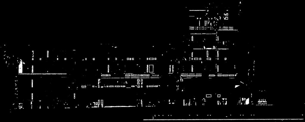
13 from cocclpiualllvaiio\ SOLIH At ALLLY %c I C A 1c: f A iiiitii iii flu iii ii. ii ii rn iii I I ii ii 4 n IiifIt Iii III LI liii IILIJJ liii IJ Ill III II Ui LW1L 1 * R T P t I a w..si *..w!! I ç II liii vimi lit III Ii iii liii III Iii lit tit I! f i. I 4fK S a K Iii till_u I!! _Li _ILl!! 1h!!_!!1_!!l_. h_ill il. lii a I - r ii i ir teq F rt 2C25 ATtM Slit HISH PINT -.NitIt iiciiihl LI) SOURCE: Thomas P Cox Architects, 2005 Conceptual Elevation 9200 Wilshim / I Figure the north and the south


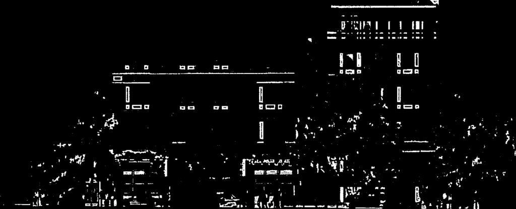


14 from TCF CF / COCLPT1ALLLLVATION -WLS[ Ar S MAPLE DRIVE CO\EPIIALELLVA1IOi\ LASIAl S. PALM DRIVh SOURCE: Thomas P Cox Architects, 2005 Conceptual Elevation 9200 WUshi, / Figure 3B-14 the west and the east
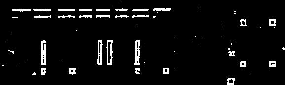
15 > WILSHIRE BLVD. LEFTT RIGHT T ONLY RN-tN& RN-Our SIGNAGE N NOT 10 SCALE SOURCE: Thomas P. Cox Architects Wilshire / Figure 2-2 Site Plan Level One


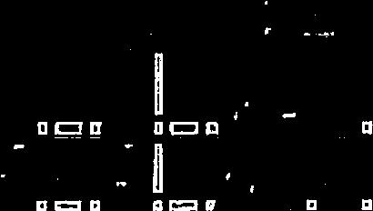
16 1IL5HIE BOULEVARD CGCN CD ) SOURCE: Thomas P Cox Architects, Wilshire / Figure 2-3 Site Plan Level Two
 C (.")
17 a). CL a) -I C,.) C (.3 U E C

18 9200 SOURCE: Thomas P Cox Architects, 2005 Wilshim /204498k Figure 2-5 Site Plan Level Four


19 SOURCE: Thomas P. Cox Architects, Wilshire / Figure 2-6 Site Plan Level Five

20 9200 SOURCE: Thomas R Cox Architects, 2005 Witshire/ Figure 2-7 Site Plan Level Six


21 9200 SOURCE: Thomas R Cox Architects, 2005 Wilshire / I Figure 2-8 Site Plan Roof Plan


22 BEVERLY H I LLS Planning Commission Report 9200 Wilshire Boulevard July 14, 2016 Attachment C Project plans submitted as part of application, dated April 19, 2016 (Provided as a Separate Attachment)
ZONING ORDINANCE: OPEN SPACE COMMUNITY. Hamburg Township, MI
 ZONING ORDINANCE: OPEN SPACE COMMUNITY Hamburg Township, MI ARTICLE 14.00 OPEN SPACE COMMUNITY (Adopted 1/16/92) Section 14.1. Intent It is the intent of this Article to offer an alternative to traditional
SECTION 822 "R-1-A" AND "R-1-AH" - SINGLE FAMILY RESIDENTIAL DISTRICTS
 SECTION 822 "R-1-A" AND "R-1-AH" - SINGLE FAMILY RESIDENTIAL DISTRICTS The "R-1-A" and "R-1-AH" Districts are intended to provide for the development of single family residential homes at urban standards
Planning Commission Report 8600 Wilshire Boulevard March 28, 2019 ATTACHMENT L. Resolution 07-R (November 13, 2007)
") Planning Commission Report 8600 Wilshire Boulevard March 28, 2019 ATTACHMENT L Resolution 07-R-1 2446 (November 13, 2007) 766 RESOLUTION NO. 07-R-12446 RESOLUTION Of THE COUNCIL Of THE CITY Of BEVERLY
Planning Commission Report 8600 Wilshire Boulevard March 28, 2019 ATTACHMENT L Resolution 07-R-1 2446 (November 13, 2007) 766 RESOLUTION NO. 07-R-12446 RESOLUTION Of THE COUNCIL Of THE CITY Of BEVERLY
SECTION 820 "R-R" - RURAL RESIDENTIAL DISTRICT
 SECTION 820 "R-R" - RURAL RESIDENTIAL DISTRICT The "R-R" District is intended to create or preserve rural or very large lot residential homesites where a limited range of agricultural activities may be
Planning Commission Report
 çbev~~~ Beverly Hills Planning Division 455 N. Rexford Drive Beverly Hills, CA 90210 TEL. (310) 458-1140 FA)(. (310) 858-5966 Planning Commission Report Meeting Date: March 13, 2014 Subject: 151 El Camino
FOR SALE > MULTIFAMILY/COMMERCIAL REDEVELOPMENT OPPORTUNITY
 FOR SALE > MULTIFAMILY/COMMERCIAL REDEVELOPMENT OPPORTUNITY 2220 W. Cary Street RICHMOND, VA 23220 CURRENT PROPERTY ILLUSTRATION CONCEPTUAL ONLY (NOT PROPOSED) Property Information Zoning: R-63, Multifamily
b) Tangerine Corridor Overlay District 1) Tangerine Corridor District Regulations
 Tangerine Corridor Overlay District 1) Tangerine Corridor District Regulations") Attachment 1 Tangerine Road Corridor Overlay District Section 27.10.D.3.f.vi.b Initiation of Code Amendment September 2, 2014, Planning and Zoning Commission b) Tangerine Corridor Overlay District 1) Tangerine
Attachment 1 Tangerine Road Corridor Overlay District Section 27.10.D.3.f.vi.b Initiation of Code Amendment September 2, 2014, Planning and Zoning Commission b) Tangerine Corridor Overlay District 1) Tangerine
SECTION 821 "R-A" - SINGLE FAMILY RESIDENTIAL-AGRICULTURAL DISTRICT
 SECTION 821 "R-A" - SINGLE FAMILY RESIDENTIAL-AGRICULTURAL DISTRICT The "R-A" District is intended to provide for the development of single family residential estate homes in a semi-rural environment on
CHAPTER SECOND UNITS
 CHAPTER 22.5. SECOND UNITS SECTION 6425. PURPOSE. Second units are a residential use that provide an important source of housing. The purpose of this Chapter is to: 1. Increase the supply and diversity
Article 50: Business Zones
 ARTICLE 50, Use Regulations Controlling Business Zones [Added effective 7-25-1955] 118-500. East Avenue Village District. [Amended effective 7-25-1955; 9-13-1955; 11-10-1966; 12-11-1975; 7-15-1976; 5-16-1980;
Commercial Property with Great Visibility for Sale or Lease. For Sale at $1,500, or For Lease at $12.00/SF NNN
 EXECUTIVE SUMMARY Commercial Property with Great Visibility for Sale or Lease Monroe, Connecticut 06468 For Sale at $1,500,000.00 or For Lease at $12.00/SF NNN u 8,064 SF freestanding building on 0.95
BYLAW NO. 15/026 A BYLAW OF THE REGIONAL MUNICIPALITY OF WOOD BUFFALO TO AMEND THE LAND USE BYLAW NO. 99/059
 Attachment 2 BYLAW NO. 15/026 A BYLAW OF THE REGIONAL MUNICIPALITY OF WOOD BUFFALO TO AMEND THE LAND USE BYLAW NO. 99/059 WHEREAS Section 639 of the Municipal Government Act requires every municipality
Planning Commission Report
 cjly City of Beverly Hills Planning Division 455 N. Rexford Drive Beverly Hills, CA 90210 TEL. (310) 285-1141 FAX. (370) 858-5966 Planning Commission Report Meeting Date: April 28, 2016 Subject: Project
ORDINANCE NO BOARD OF SUPERVISORS, COUNTY OF SAN MATEO, STATE OF CALIFORNIA
 ORDINANCE NO. 04768 BOARD OF SUPERVISORS, COUNTY OF SAN MATEO, STATE OF CALIFORNIA * * * * * * AN ORDINANCE AMENDING CHAPTER 22.5 (SECOND UNIT ORDINANCE) OF DIVISION VI, PART ONE (ZONING REGULATIONS) OF
R3 (MULTIPLE-FAMILY RESIDENCE)
") Planning and Building Agency Planning Division 20 Civic Center Plaza P.O. Box 1988 (M-20) Santa Ana, CA 92702 (714) 647-5804 R3 (MULTIPLE-FAMILY RESIDENCE) Sec. 41-258. Sec. 41-258.5. Sec. 41-259. Purpose.
Planning and Building Agency Planning Division 20 Civic Center Plaza P.O. Box 1988 (M-20) Santa Ana, CA 92702 (714) 647-5804 R3 (MULTIPLE-FAMILY RESIDENCE) Sec. 41-258. Sec. 41-258.5. Sec. 41-259. Purpose.
ML-4 MULTIFAMILY RESIDENTIAL ZONE. [Added by Ord. No ]
![ML-4 MULTIFAMILY RESIDENTIAL ZONE. [Added by Ord. No ]](/thumbs/90/103301433.jpg "ML-4 MULTIFAMILY RESIDENTIAL ZONE. [Added by Ord. No ]") 55-26. ML-4 MULTIFAMILY RESIDENTIAL ZONE. [Added 2-2-98 by Ord. No. 1998-1 2] The following regulations apply in the ML-4 Zone. A. Permitted Uses. (1) Garden apartments, together with accessory structures
55-26. ML-4 MULTIFAMILY RESIDENTIAL ZONE. [Added 2-2-98 by Ord. No. 1998-1 2] The following regulations apply in the ML-4 Zone. A. Permitted Uses. (1) Garden apartments, together with accessory structures
The demolition required for the project came before the Landmark Preservation Commission (LPC) on November 3, 2016, where no action was taken.
 on November 3, 2016, where no action was taken.") D E S I G N R E V I E W C O M M I T T E E S t a f f R e p o r t 2072 ADDISON STREET PRELIMINARY DESIGN REVIEW For Committee Discussion/ Majority Recommendation JULY 20, 2017 Design Review #DRCP2016-0002
D E S I G N R E V I E W C O M M I T T E E S t a f f R e p o r t 2072 ADDISON STREET PRELIMINARY DESIGN REVIEW For Committee Discussion/ Majority Recommendation JULY 20, 2017 Design Review #DRCP2016-0002
SECTION 23 PLANNED RESIDENTIAL DEVELOPMENT FOR ELDERLY PERSONS
 SECTION 23 PLANNED RESIDENTIAL DEVELOPMENT FOR ELDERLY PERSONS 23.1 General: In order to provide for the special needs of elderly and handicapped persons who may require multifamily type living accommodations,
COMMERCIAL/INDUSTRIAL DEVELOPMENT GUIDELINES
 COMMERCIAL/INDUSTRIAL DEVELOPMENT GUIDELINES Planning Division Sections Chapter 17.16 Commercial, Industrial Development Standards 17.16.010 Lot Size 17.16.020 Setbacks 17.16.030 Fences, Hedges and Walls
PERMITTED USES: Within the MX-1 Mixed Use Neighborhood District the following uses are permitted:
 6.25 MX-1 - MIXED USE NEIGHBORHOOD 6.25.1 INTENT: The purpose of the MX-1 Mixed Use Neighborhood District is to accommodate the development of a wide-range of residential and compatible non-residential
CHAPTER 2 RELATIONSHIP WITH OTHER LAWS.
 CHAPTER 2 General Provisions 12-2-1 Minimum Requirements 12-2-2 Relationship with Other Laws 12-2-3 Effect on Existing Agreements 12-2-4 Scope of Regulations 12-2-5 Building Permit 12-2-6 Nonconforming
Intent and purpose.
 http://library.municode.com/html/15184/level/tit1zo_ch1.4redeltzo.html Page 1 of 7 Carlsbad, California, Code of Ordinances >> Title 1 - ZONING* >> Chapter 1.4 - RD-M RESIDENTIAL DENSITY-MULTIPLE ZONE*
ORDINANCE NO. 15- Regulations (LDR) which would further the codification of TOD regulations that
 which would further the codification of TOD regulations that") 1 1 1 1 1 1 1 0 1 0 1 ORDINANCE NO. 1- AN ORDINANCE OF THE CITY OF BOYNTON BEACH, FLORIDA AMENDING THE LAND DEVELOPMENT REGULATIONS, CHAPTER 1, ARTICLE II, DEFINITIONS; CHAPTER, ARTICLE III, SECTION 1,
1 1 1 1 1 1 1 0 1 0 1 ORDINANCE NO. 1- AN ORDINANCE OF THE CITY OF BOYNTON BEACH, FLORIDA AMENDING THE LAND DEVELOPMENT REGULATIONS, CHAPTER 1, ARTICLE II, DEFINITIONS; CHAPTER, ARTICLE III, SECTION 1,
Multi-family dwellings (including assisted living facilities), Public buildings, facility or land; and,
, Public buildings, facility or land; and,") 607. General Residential District (GR) Intent. It is the intent of this section that the General Residential District be established for medium-to-high density residential purposes. These areas need to
607. General Residential District (GR) Intent. It is the intent of this section that the General Residential District be established for medium-to-high density residential purposes. These areas need to
Section 7.22: Multifamily Assisted Housing in AA-30 Residential Zone (MAHZ) [Note: an additional line will be added to the Table in Article 3, 3.1.
 [Note: an additional line will be added to the Table in Article 3, 3.1.") Section 7.22: Multifamily Assisted Housing in AA-30 Residential Zone (MAHZ) [Note: an additional line will be added to the Table in Article 3, 3.1.1A] 7.22.1 Purpose The purpose of this Special Regulation
Section 7.22: Multifamily Assisted Housing in AA-30 Residential Zone (MAHZ) [Note: an additional line will be added to the Table in Article 3, 3.1.1A] 7.22.1 Purpose The purpose of this Special Regulation
Chapter DENSITY AND OPEN SPACE REQUIREMENTS
 Chapter 19.52 DENSITY AND OPEN SPACE REQUIREMENTS Sections: 19.52.010 Lot coverage Requirements generally. 19.52.020 Measurement of lot coverage. 19.52.030 Lot coverage R-15 zone. 19.52.040 Lot coverage
Planned Unit Development (PUD). Sections:
. Sections:") Chapter 19.07. Planned Unit Development (PUD). Sections: 19.07.01. Purpose. 19.07.02. PUD Definition and Design Compatibility. 19.07.03. General PUD Standards. 19.07.04. Underlying Zones. 19.07.05. Permitted
Chapter 19.07. Planned Unit Development (PUD). Sections: 19.07.01. Purpose. 19.07.02. PUD Definition and Design Compatibility. 19.07.03. General PUD Standards. 19.07.04. Underlying Zones. 19.07.05. Permitted
CHAPTER NORTH LAKE SPECIFIC PLAN
 North Lake Specific Plan 17.34.010 CHAPTER 17.34 - NORTH LAKE SPECIFIC PLAN Sections: 17.34.010 - Purpose of Chapter 17.34.020 - Purposes of SP-1 (North Lake Specific Plan) Overlay District 17.34.030 -
Commercial Property with Great Visibility for Sale or Lease. For Sale at $1,500, or For Lease at $12.00/SF NNN
 EXECUTIVE SUMMARY Commercial Property with Great Visibility for Sale or Lease Monroe, Connecticut 06468 For Sale at $1,500,000.00 or For Lease at $12.00/SF NNN! 8,064 SF freestanding building on 0.95 acres
 Page 1 of 8 Laguna Beach Municipal Code Up Previous Next Main Collapse Search Print No Frames Title 25 ZONING Chapter 25.10 R-1 RESIDENTIAL LOW DENSITY ZONE 25.10.002 Intent and purpose. This zone is intended
HILLS BEVERLY. Planning Commission Report. City of Beverly Hills
 BEVERLY HILLS 1 City of Beverly Hills Planning Division 455 N. Rexford Drive Beverly Hills, CA 90210 TEL, (310) 4854141 FAX. (310) 8584966 Planning Commission Report Meeting Date: February 14, 2013 Subject:
WILSHIRE - WESTWOOD SCENIC CORRIDOR Specific Plan
 WILSHIRE - WESTWOOD SCENIC CORRIDOR Specific Plan Ordinance No. 155,044 Effective February 19, 1981 Amended by Ordinance Nos. 176,417; 176,418 Effective March 2, 2005 Specific Plan Procedures Amended pursuant
CITY PLANNING COMMISSION COMPREHENSIVE PLAN AND REVIEW CRITERIA
 Page 3 CITY PLANNING COMMISSION COMPREHENSIVE PLAN AND REVIEW CRITERIA COMPREHENSIVE PLAN: The City Planning Commission uses the Comprehensive Plan as a guide in all land use matters. The Plan is available
ORDINANCE NO
 APPROVED BY ORANGE COUNTY BOARD OF COUNTY COMMISSIONERS BCC Mtg. Date: May 24, 2016 EFFECTIVE DATE June 1, 2016 ORDINANCE NO. 2016-10 AN ORDINANCE AFFECTING THE USE OF LAND IN ORANGE COUNTY, FLORIDA; AMENDING
In order to permit maximum applicability of the PUD District, PUD-1 and PUD-2 Districts are hereby created.
 ARTICLE III. PUD ned Unit Development Overlay District 205-128. Purpose. The PUD ned Unit Development Overlay District is intended to provide flexibility in the design of planned projects; to encourage
^ARTICLE 54. NORTH END NEIGHBORHOOD DISTRICT (^Article inserted on May 17, 1993*)
") ^ARTICLE 54 NORTH END NEIGHBORHOOD DISTRICT (^Article inserted on May 17, 1993*) TABLE OF CONTENTS Page Section 54-1 Statement of Purpose, Goals, and Objectives...3 54-2 Recognition of the North End Neighborhood
^ARTICLE 54 NORTH END NEIGHBORHOOD DISTRICT (^Article inserted on May 17, 1993*) TABLE OF CONTENTS Page Section 54-1 Statement of Purpose, Goals, and Objectives...3 54-2 Recognition of the North End Neighborhood
The following regulations shall apply in the R-E District:
 "R-E" RESIDENTIAL ESTATE DISTRICT (8/06) The following regulations shall apply in the R-E District: 1. Uses Permitted: The following uses are permitted. A Zoning Certificate may be required as provided
PALM BEACH COUNTY PLANNING, ZONING AND BUILDING DEPARTMENT ZONING DIVISION
 PALM BEACH COUNTY PLANNING, ZONING AND BUILDING DEPARTMENT ZONING DIVISION Application No.: DOA-2014-01111 Application Name: World Class Academy Control No.: 1998-00052 Applicant: World Class Academy Inc
ADMINISTRATIVE HEARING STAFF REPORT
 ADMINISTRATIVE HEARING STAFF REPORT Providence Place Apartments Utility Box No. 2 Conditional Use Petition PLNPCM2011-00426 309 East 100 South September 22, 2011 Planning and Zoning Division Department
Bulk Requirements (For other supplementary location and bulk regulations, see Article VII.)
") 4.13 TOWNSITE OVERLAY DISTRICT (TO) 4.13.1 Purpose The purpose of the Townsite Overlay District is to promote the health, safety and welfare of current and future residents of the City of Hailey; to modify
4.13 TOWNSITE OVERLAY DISTRICT (TO) 4.13.1 Purpose The purpose of the Townsite Overlay District is to promote the health, safety and welfare of current and future residents of the City of Hailey; to modify
6040 Bathurst Street and 5 Fisherville Road Zoning Bylaw Amendment Application Preliminary Report
 STAFF REPORT ACTION REQUIRED 6040 Bathurst Street and 5 Fisherville Road Zoning Bylaw Amendment Application Preliminary Report Date: January 24, 2017 To: From: Wards: Reference Number: North York Community
ORDINANCE NO NOW, THEREFORE, BE IT ENACTED BY THE CITY OF WINTER GARDEN, FLORIDA, AS FOLLOWS:
 ORDINANCE NO. 11-13 AN ORDINANCE OF THE CITY COMMISSION OF THE CITY OF WINTER GARDEN, FLORIDA, AMENDING CHAPTER 118, ARTICLE VI, DIVISION 7, SECTION 118-1297 OF THE WINTER GARDEN CODE OF ORDINANCES RELATING
ARTICLE XXVIII. SPECIAL CONDITIONS AND DEVELOPMENT STANDARDS (Ord. No. 2835, 07/01/0; Ord. No. 2938, 10/19/04; Ord. No. 09/06/16))
)") ARTICLE XXVIII. SPECIAL CONDITIONS AND DEVELOPMENT STANDARDS (Ord. No. 2835, 07/01/0; Ord. No. 2938, 10/19/04; Ord. No. 09/06/16)) SECTION A. SPECIAL YARD REGULATIONS. 1. SPECIAL FRONT YARD REGULATIONS:
ARTICLE XXVIII. SPECIAL CONDITIONS AND DEVELOPMENT STANDARDS (Ord. No. 2835, 07/01/0; Ord. No. 2938, 10/19/04; Ord. No. 09/06/16)) SECTION A. SPECIAL YARD REGULATIONS. 1. SPECIAL FRONT YARD REGULATIONS:
Town of Brookeville Zoning Ordinance
 Town of Brookeville Zoning Ordinance Article I. In General Section 10-101. Purpose: The Town of Brookeville has been included on the National Register of Historic Places since 1979 and designated as an
Sec Tier 2 principal uses and structures. The principal uses of land and structures allowed in Tier 2 are provided below subject to the
 Sec. 27-730.4.9. Tier 2 principal uses and structures. The principal uses of land and structures allowed in Tier 2 are provided below subject to the standards and limitations contained within this division.
CHAPTER 154: SIGNS. Section
 CHAPTER 154: SIGNS Section 154.01 Permit required 154.02 Where prohibited 154.03 Street decorations 154.04 Approval by state 154.05 Purpose 154.06 Definitions 154.07 General sign and street graphics regulations
SECTION 827 "R-2" AND "R-2-A" - LOW DENSITY MULTIPLE FAMILY RESIDENTIAL DISTRICTS
 SECTION 827 "R-2" AND "R-2-A" - LOW DENSITY MULTIPLE FAMILY RESIDENTIAL DISTRICTS The "R-2" and "R-2-A" Districts are intended to provide for the development of low density multiple family residential
DRAFT PARK COUNTY US HIGHWAY 89 SOUTH EAST RIVER ROAD OLD YELLOWSTONE TRAIL ZONING DISTRICT REGULATIONS
 Formatting: Changes recommended by the Board and accepted by the County Commission are formatted in RED: Changes made by the Park County Commission are formatted in YELLOW highlight: and changes made by
Within PUD-LU districts, the following provisions shall apply:
 Sec. 8-3047. Development standards in PUD-LU zoning districts. Within PUD-LU districts, the following provisions shall apply: (a) (b) (c) Definition: planned unit development-limited use (PUD-LU). The
Investment Opportunity: Crescent Village Shopping Center for Sale. For Sale at $1,800,000.00
 EXECUTIVE SUMMARY Investment Opportunity: Crescent Village Shopping Center for Sale Monroe, Connecticut 06468 u u u u u For Sale at $1,800,000.00 Great Visibility on Route 25 / Main Street: 12,340 RSF
POLK COUNTY DEVELOPMENT REVIEW COMMITTEE CASE OVERVIEW
 POLK COUNTY DEVELOPMENT REVIEW COMMITTEE CASE OVERVIEW DRC Date: January 10, 2019 Level of Review: 4 PC Date: March 6, 2019 Type: Text Amendments BoCC Date: May 7, 2019 July 2, 2019 Case Numbers: Case
ARTICLE III: LAND USE DISTRICTS 304 R 9 DISTRICT
 ARTICLE III: LAND USE DISTRICTS III 23 304 R 9 DISTRICT (RESIDENTIAL 9 UNITS PER ACRE) 304 1 Intent and Purpose The R 9 District is intended to implement the policies of the Comprehensive Plan for areas
MINIMUM PARKING STANDARDS DRIVEWAY WIDTH AND SLOPE TABLES LESS THAN 13 STALLS
 MINIMUM PARKING STANDARDS DRIVEWAY AND TABLES LESS THAN STALLS SINGLE FAMILY RES. - - - - In 8* In 8 In 6 In 6 In 6 TO 99 STALLS - - - - 8-6 - In 8* In 8 In 6 In 6 STALLS OR MORE * Required for the first
Cluster Development Princeton Township, Mercer County
 Cluster Development Princeton Township, Mercer County Division 9 Residential Clusters Section 10B-189 Statement of purposes. The township committee to implement the goals and objectives of the Princeton
ORDINANCE NO. An ordinance amending Section of the Los Angeles municipal Code by amending the zoning map.
 ORDINANCE NO. 184850 An ordinance amending Section 12.04 of the Los Angeles municipal Code by amending the zoning map. THE PEOPLE OF THE CITY OF LOS ANGELES DO ORDAIN AS FOLLOWS: Section. Section 12.04
Sec Table of height, bulk, density and area by land use.
 Sec. 18-276. - Table of height, bulk, density and area by land use. The following is the table of height, bulk, density and area by land use for each zoning district: LIMITING HEIGHT, BULK, DENSITY AND
Anacortes, WA. 718 commercial ave. FOR lease. 2,320 +/- sf retail space in a 10,820 +/- sf building. Located in historic downtown Anacortes
 718 commercial ave Anacortes, WA FOR lease 2,320 +/- sf retail space in a 10,820 +/- sf building Located in historic downtown Anacortes Frontage on Commercial Ave alongside four other retail spaces Zoned
ARTICLE XVII SCHEDULE OF REGULATIONS
 ARTICLE XVII SCHEDULE OF REGULATIONS SECTION 1700. LIMITING HEIGHT, BULK, DENSITY, AND AREA BY DISTRICT TYPE Use Minimum Size Lot Per Unit Maximum Height of Structures Minimum Yard Setback (Per Lot in
Chapter CN NEIGHBORHOOD CENTER COMMERCIAL ZONES REGULATIONS
 Chapter 17.33 - CN NEIGHBORHOOD CENTER COMMERCIAL ZONES REGULATIONS Sections: 17.33.010 - Title, intent, and description. 17.33.020 - Required design review process. 17.33.030 - Permitted and conditionally
DIVISION 7. R-6 AND R-6A RESIDENTIAL ZONES* The purpose of the R-6 residential zone is:
 Date of Draft: March 6, 2015 DIVISION 7. R-6 AND R-6A RESIDENTIAL ZONES* Sec. 14-135. Purpose. The purpose of the R-6 residential zone is: (a) To set aside areas on the peninsula for housing characterized
CHAPTER 2 GENERAL PROVISIONS
 CHAPTER 2 GENERAL PROVISIONS 200 ZONING DISTRICTS ESTABLISHED 201 SUPPLEMENTAL DISTRICTS ESTABLISHED 202 OFFICIAL ZONING MAP ESTABLISHED 203 DISTRICT BOUNDARY DESCRIPTION and INTERPRETATION 204 LIMITATION
ARTICLE VII. NONCONFORMITIES. Section 700. Purpose.
 ARTICLE VII. NONCONFORMITIES. Section 700. Purpose. The purpose of this chapter is to regulate and limit the development and continued existence of legal uses, structures, lots, and signs established either
90+/-Acres D-19 Southwest corner of I-96 & D-19 Marion Township, Michigan
 90+/- Acres of Commercial Land 90+/-Acres D-19 Southwest corner of I-96 & D-19 Marion Township, Michigan F O R S A L E Exclusively listed by Mark W. Szerlag, CCIM Partner T: 248.476.3700 F: 248.476.3560
Composition of traditional residential corridors.
 Page 1 of 7 St. Petersburg, Florida, Code of Ordinances >> PART II - ST. PETERSBURG CITY CODE >> Chapter 16 - LAND DEVELOPMENT REGULATIONS >> SECTION 16.20.060. CORRIDOR RESIDENTIAL TRADITIONAL DISTRICTS
UPPER MOUNT BETHEL TOWNSHIP NORTHAMPTON COUNTY, PENNSYLVANIA
 UPPER MOUNT BETHEL TOWNSHIP NORTHAMPTON COUNTY, PENNSYLVANIA JOINDER DEED / LOT CONSOLIDATION TOWNSHIP REVIEW PROCESS When accepting proposed Joinder Deeds / Lot Consolidations, review the Joinder Deed
City of Pinellas Park, Florida APPLICATION FOR TEMPORARY USE PERMIT (Section , Land Development Code)
") GENERAL INFORMATION City of Pinellas Park, Florida APPLICATION FOR TEMPORARY USE PERMIT (Section 18-1530.14, Land Development Code) Application must be completed in full and submitted to the Zoning Division
GENERAL INFORMATION City of Pinellas Park, Florida APPLICATION FOR TEMPORARY USE PERMIT (Section 18-1530.14, Land Development Code) Application must be completed in full and submitted to the Zoning Division
CHAPTER MFR 22 Multi-Family Residential
 CHAPTER 19.28 MFR 22 Multi-Family Residential Sections: 19.28.010 PURPOSE 19.28.020 PERMITTED USES 19.28.030 USES SUBJECT TO A CONDITIONAL USE PERMIT 19.28.040 PERMITTED ACCESSORY USES 19.28.050 PROHIBITED
CITY OF NAPLES STAFF REPORT
 Meeting of 05/13/15 Conditional Use Petition 15-CU3 CITY OF NAPLES STAFF REPORT To: Planning Advisory Board From: Planning Department Subject: Conditional Use Petition 15-CU3 Petitioner: Hazelden Betty
Sedro woolley, WA 720 MURDOCK ST. FOR sale. 14,500 +/- sf office building with 8,500 +/- sf unfinished basement space on 0.
 720 MURDOCK ST Sedro woolley, WA FOR sale 14,500 +/- sf office building with 8,500 +/- sf unfinished basement space on 0.27 +/- AC Former City Hall built in 1930 Located in the Downtown Sedro Woolley core
B. The Plan is in conformity with the Comprehensive Plan.
 ARTICLE 17 PLANNING UNIT DEVELOPMENT 17.01 INTENT The purpose of this Section is to permit the creation of new Planned Unit Developments, permitted as Conditional Uses where maximum variations of design
3.0 Project Description
 3.0 Project Description City of Long Beach Shoreline Gateway Project Environmental Impact Report 3.0 PROJECT DESCRIPTION 3.1 PROJECT LOCATION AND SETTING PROJECT LOCATION The proposed Shoreline Gateway
An Ordinance to provide regulations for private roads and driveways.
 30.0400 PRIVATE ROADS AND DRIVEWAYS TOWNSHIP OF GRAND HAVEN, MICHIGAN ord no. 262 eff. Apr. 27, 1997 An Ordinance to provide regulations for private roads and driveways. 30.0401 Sec. 1 TITLE This Ordinance
ARTICLE VI. SPECIAL EXCEPTION REGULATIONS
 ARTICLE VI. SPECIAL EXCEPTION REGULATIONS SECTION 601. GENERAL DESCRIPTION Special exceptions are deemed to be permitted uses in their respective districts, subject to the satisfaction of the requirements
CHAPTER 5 ZONING SECTION 5.1 PURPOSE
 CHAPTER 5 ZONING SECTION 5.1 PURPOSE The purpose of this Chapter is to regulate the nature and extent of uses of land, and of buildings and structures thereon, in order to promote the purposes of this
Business Park District Zoning Text Amendment (PLNPCM ) ZONING TEXT AMENDMENT
 ZONING TEXT AMENDMENT") Staff Report PLANNING DIVISION COMMUNITY & ECONOMIC DEVELOPMENT To: Salt Lake City Planning Commission From: Maryann Pickering, Principal Planner (801) 535-7660 Date: June 10, 2015 Re: Business Park District
Staff Report PLANNING DIVISION COMMUNITY & ECONOMIC DEVELOPMENT To: Salt Lake City Planning Commission From: Maryann Pickering, Principal Planner (801) 535-7660 Date: June 10, 2015 Re: Business Park District
PLANNING COMMISSION MAY 17, 2018 PUBLIC HEARING
 PLANNING COMMISSION MAY 17, 2018 PUBLIC HEARING SUBJECT: INTENSIFICATION OF USE FROM RESTAURANT WITH OUTDOOR DINING TO A BAR WITH LIVE ENTERTAINMENT (ROCCO S TAVERN). ADDRESS: INITIATED BY: 8900 SANTA
ORDINANCE NO The Town Council of the Town of Yucca Valley does ordain as follows:
 ORDINANCE NO. 141 AN ORDINANCE OF THE TOWN COUNCIL OF THE TOWN OF YUCCA VALLEY, CALIFORNIA, AMENDING TITLE 8, DIVISION 12, CHAPTER 1 RELATING TO DEFINITIONS AND TITLE 8, DIVISION 8, CHAPTER 3, RELATING
VRLYRLY. Planning Commission Report. City of Beverly Hills Planning Division. Meeting Date: July 13, Subject: 462 SOUTH REXFORD DRIVE
 Planning Commission Report VRLYRLY 455 N. Rexiord Drive Beverly Hills, CA 90210 TEL. (310)285-1141 FAX. (310) 858-5966 A. B. Required Finding For Time Extension Draft Resolution D. September 8, 2016 Planning
Community Development Department City of Pismo Beach 760 Mattie Road Pismo Beach, CA Telephone: (805) / Fax: (805)
 / Fax: (805)") Community Development Department City of Pismo Beach 760 Mattie Road Pismo Beach, CA 93449 Telephone: (805) 773-4658 / Fax: (805) 773-4684 Address: APN: Area P Development Standards PISMO HEIGHTS PLANNING
Community Development Department City of Pismo Beach 760 Mattie Road Pismo Beach, CA 93449 Telephone: (805) 773-4658 / Fax: (805) 773-4684 Address: APN: Area P Development Standards PISMO HEIGHTS PLANNING
No principal structure shall be located any closer to any. street or property line than the required minimum setback as
 ARTICLE V Yard and Setback Regulations 1. General requirements. No principal structure shall be located any closer to any street or property line than the required minimum setback as set forth in Article
MEMORANDUM. I1 District Industrial Living Overlay District 110,703 square feet / 2.54 acres
 Department of Community Planning & Economic Development 250 South 4th Street, Room 300 Minneapolis, MN 55415-1385 MEMORANDUM To: City Planning Commission, Committee of the Whole Prepared By: Peter Crandall,
DEVELOPMENT STANDARDS FOR RESIDENTIAL PROJECTS RESIDENTIAL BUILDING TYPES: APPROPRIATE ZONES AND DENSITIES 2-1
 2 DEVELOPMENT STANDARDS FOR RESIDENTIAL PROJECTS RESIDENTIAL BUILDING TYPES: APPROPRIATE ZONES AND DENSITIES 2-1 This Chapter presents the development standards for residential projects. Section 2.1 discusses
Coding For Places People Love Main Street Corridor District
 Coding For Places People Love Main Street Corridor District 1) Scope a) District boundaries are assigned according to the District Boundary Map. b) The Primary Retail Corridor is assigned according to
Midwest City, Oklahoma Zoning Ordinance
 2010 Midwest City, Oklahoma Zoning Ordinance 9/2/2010 Table of Contents Section 1. General Provisions... 5 1.1. Citation... 5 1.2. Authority... 5 1.3. Purpose... 5 1.4. Nature and Application... 5 1.5.
Article IV. Terminology
 Article IV. Terminology 212-22 Purpose. Add or amend the following definitions: BUILDING HEIGHT The vertical distance measured from the average elevation of the proposed finished grade at the front of
ARTICLE 4 - ZONING DISTRICTS
 ARTICLE 4 - ZONING DISTRICTS The following chart is a summary of the uses permitted in each zoning district with the exception of the Downtown Overlay, UMCAD and Preservation Districts. The letter "P"
ARTICLE 834. PD 834. PD 834 was established by Ordinance No , passed by the Dallas City Council on December 8, (Ord.
 ARTICLE 834. PD 834. SEC. 51P-834.101. LEGISLATIVE HISTORY. PD 834 was established by Ordinance No. 28070, passed by the Dallas City Council on December 8, 2010. (Ord. 28070) SEC. 51P-834.102. PROPERTY
FOR SALE COMMERCIAL BEACHSIDE LOT
 FOR SALE COMMERCIAL BEACHSIDE LOT 1100 South Patrick Dr., Satellite Beach, Florida 32937.69 Acres, Zoning C-Commercial Lot is Cleared Numerous Allowable Intended Uses (see zoning on next page) High Visibility
TITLE NINE - SUPPLEMENTAL REGULATIONS Chapter Signs. CHAPTER 1179 Signs. (1) Promote attractive and high value residential districts.
 Promote attractive and high value residential districts.") Village of Boston Heights OH, Planning and Zoning Code, Sign Regulations 1 TITLE NINE - SUPPLEMENTAL REGULATIONS Chapter 1179. Signs. CHAPTER 1179 Signs 1179.01 Purposes 1179.02 Definitions 1179.03 General
Village of Boston Heights OH, Planning and Zoning Code, Sign Regulations 1 TITLE NINE - SUPPLEMENTAL REGULATIONS Chapter 1179. Signs. CHAPTER 1179 Signs 1179.01 Purposes 1179.02 Definitions 1179.03 General
CHAPTER XX ZONING PART 1 GENERAL PROVISIONS PART 2 RESIDENTIAL DISTRICTS
 CHAPTER XX ZONING PART 1 GENERAL PROVISIONS 101 Titles 102 General Intent 103 General Goals 104 General Provisions 105 Relationship to the Comprehensive Plan 106 Establishment of Controls and Districts
ARTICLE IV: DEVELOPMENT STANDARDS
 ARTICLE IV: DEVELOPMENT STANDARDS IV-53 409 PRIVATE STREETS A private street means any way that provides ingress to, or egress from, property by means of vehicles or other means, or that provides travel
ZONING ORDINANCE. Table 1001-A1 Primary Building Area, Width, Story, and Setback Limitations
 Article X. HEIGHT AND AREA REGULATIONS Section 1001. District Regulations 432 485 534 548 564 565 432 444 485 534 548 564 565 633654 2016-04 District height, area and other regulations are shown on Table
ARTICLE 4 - ZONING DISTRICTS
 ARTICLE 4 - ZONING DISTRICTS The following chart is a summary of the uses permitted in each zoning district with the exception of the Downtown Overlay, UMCAD and Preservation Districts. The letter "P"
EXHIBIT F RESOLUTION NO.
 RESOLUTION NO. A RESOLUTION OF THE PLANNING BOARD OF THE CITY OF BURBANK TO APPROVE PROJECT NO. 17-0001385 FOR A CONDITIONAL USE PERMIT AMENDMENT AND AMENDING PROJECT NUMBER 2005-112 APPROVED UNDER RESOLUTION
CHAPTER EAST CENTER STREET DEVELOPMENT SPECIFIC PLAN NO (SP 90-2) ZONING AND DEVELOPMENT STANDARDS
 ZONING AND DEVELOPMENT STANDARDS") CHAPTER 18.110 EAST CENTER STREET DEVELOPMENT SPECIFIC PLAN NO. 90-2 (SP 90-2) ZONING AND DEVELOPMENT STANDARDS Sections: 18.110.010 Purpose and intent. 18.110.020 General provisions; definitions. 18.110.030
CHAPTER 18.110 EAST CENTER STREET DEVELOPMENT SPECIFIC PLAN NO. 90-2 (SP 90-2) ZONING AND DEVELOPMENT STANDARDS Sections: 18.110.010 Purpose and intent. 18.110.020 General provisions; definitions. 18.110.030
ARTICLE 11. NAMEPLATES AND SIGNS Signs in all districts.
 //Culpeper County, Virginia/CODE OF ORDINANCES COUNTY OF CULPEPER, VIRGINIA Codified through Ordinance of November 7, 2007. (Supplement No. 3)/APPENDIX A ZONING ORDINANCE*/ARTICLE 11. NAMEPLATES AND SIGNS
RP-2, RP-3, RP-4, AND RP-5 PLANNED RESIDENTIAL DISTRICTS
 6.10 - RP-2, RP-3, RP-4, AND RP-5 PLANNED RESIDENTIAL DISTRICTS 6.10.1 GENERAL DESCRIPTION: 6.10.1.1 The regulations established in this Section are intended to provide optional methods of land development
City of Coral Gables Planning and Zoning Staff Report
 City of Coral Gables Planning and Zoning Staff Report Applicant: Application: Public Hearing: Date & Time: Location: City of Coral Gables Giralda Restaurant Row Overlay Zoning Code Text Amendment Planning
3. Section is entitled Accessory Buildings ; limited applicability/regulation.
 MEMORANDUM DATE: October 9, 2017 TO: FROM: RE: Chairperson Hetzel, PC Commissioners, and Interim Administrator Meyer Cynthia Smith Strack, Community Development Director 6.1 Discussion: Detached Accessory
Planning Commission Report
 City of Beverly Hills Planning Division 455 N. Rexford Drive Beverly Hills, CA 90210 TEL. (310) 285-1141 FAX. (310) 858-5966 Planning Commission Report Meeting Date: Subject: Project Applicant: February