City of Coral Gables Planning and Zoning Staff Report
|
|
|
- Ashley Hensley
- 6 years ago
- Views:
Transcription
1 City of Coral Gables Planning and Zoning Staff Report Applicant: Application: Public Hearing: Date & Time: Location: City of Coral Gables Giralda Restaurant Row Overlay Zoning Code Text Amendment Planning and Zoning Board January 13, 2016; 6:00 9:00 p.m. City Commission Chambers, City Hall, 405 Biltmore Way, Coral Gables, Florida APPLICATION REQUEST The City of Coral Gables is requesting review and consideration of the following: An Ordinance of the City Commission of Coral Gables, Florida providing for text amendments to the City of Coral Gables Official Zoning Code, by amending Article 4, Zoning Districts, adding Section 4-206, Giralda Restaurant Row Overlay to allow for modified requirements with form-based development standards that modify and supplement the existing Commercial District standards and criteria for the 100 block of Giralda Avenue, legally described as Lots 21-37, Block 29, and Lots 3-24, Block 33, Section L, to allow appropriate infill and redevelopment that enhances the character of Restaurant Row; providing for a repealer provision, providing for a severability clause, providing for codification, and providing for an effective date. 2. PROPOSED ZONING CODE TEXT AMENDMENTS The Giralda Restaurant Row Overlay is a method of enhancing the existing Zoning Code through formbased regulations that will protect and further the goals of creating mixed-use, active pedestrian spaces shaped by high-quality buildings in Downtown Coral Gables. This is a method that could be used in the future if it is found to be a useful technique. The proposed zoning code text amendment is provided as Attachment A. The Planning and Zoning analysis that supports the proposed zoning code text amendment is provided as Attachment B. 3. FINDINGS OF FACT In accordance with Section of the Zoning Code, the Planning and Zoning Board shall not recommend adoption of, and the City Commission shall not adopt, text amendments to these land Zoning Code unless the text amendment: A. Promotes the public health, safety, and welfare. City of Coral Gables Planning and Zoning Division Page 1
2 Staff Report and Recommendation Zoning Code Text Amendments January 13, 2016 B. Does not permit uses the Comprehensive Plan prohibits in the area affected by the district boundary change or text amendment. C. Does not allow densities or intensities in excess of the densities and intensities which are permitted by the future land use categories of the affected property. D. Will not cause a decline in the level of service for public infrastructure which is the subject of a concurrency requirement to a level of service which is less the minimum requirements of the Comprehensive Plan. E. Does not directly conflict with an objective or policy of the Comprehensive Plan. Staff finds that all five of these criteria are satisfied. 4. COMPREHENSIVE PLAN CONSISTENCY In accordance with Section of the Zoning Code, the Planning and Zoning Board shall determine whether the Zoning Code text amendment is consistent with the Comprehensive Plan. Staff finds that the proposed text amendment is consistent with the Comprehensive Plan overall, particularly with the following Goals, Objectives and Policies: Goal FLU-1. Protect, strengthen, and enhance the City of Coral Gables as a vibrant community ensuring that its neighborhoods, business opportunities, shopping, employment centers, cultural activities, historic value, desirable housing, open spaces, and natural resources make the City a very desirable place to work, live and play. Policy FLU The City s Future Land Use Classifications and Map shall describe, assign, and depict the future land uses found to be in the public interest and to be the basis for regulations, programs, actions and rules of the City and other affected agencies. Policy FLU All development applications in residential neighborhoods shall continue to be reviewed by applicable boards and committees to ensure the protection from intrusion by incompatible uses that would disrupt or degrade the health, safety, tranquility, aesthetics and welfare of the neighborhood by noise, light, glare, odor, vibration, dust, hazardous materials or traffic. The City will continue to enforce the adopted restrictive design standards; historic preservation policies and the applicable performance standards of the Commercial Limited designation in the Zoning Code. Objective FLU-1.7. When amendments to the Zoning Code are processed, discourage the proliferation of urban sprawl by including a regulatory framework for encouraging future infill and redevelopment within existing developed areas. In drafting the infill/redevelopment program, the City shall coordinate public and private resources necessary to initiate needed improvements and/or redevelopment within these areas. City of Coral Gables Planning and Zoning Division Page 2
3 Staff Report and Recommendation Zoning Code Text Amendments January 13, 2016 Objective FLU-1.9. Encourage sound innovation in the development standards of the City s Zoning Code which provides a continuing process to respond to community needs. Policy FLU Encourage balanced mixed use development in the central business district and adjoining commercial areas to promote pedestrian activity and provide for specific commitments to design excellence and long term economic and cultural vitality. Policy FLU Encourage the detailed planning of downtown, which is defined as the central business district, to establish sound economic, aesthetic and land use principles for effective utilization of both public and private resources. Goal DES-1. Maintain the City as a livable city, attractive in its setting and dynamic in its urban character. Objective DES-1.1. Preserve and promote high quality, creative design and site planning that is compatible with the City s architectural heritage, surrounding development, public spaces and open spaces. Policy DES Provide for rigorous design guidelines, standards, and review processes via the City s Zoning Code that ensure high quality design of buildings and spaces. Policy DES Promote the development of property that achieves unified civic design and proper relationship between the uses of land both within zoning districts and surrounding districts, by regulating, limiting and determining the location, height, density, bulk and massing, access to light and air, area of yards, open space, vegetation and use of buildings, signs and other structures. 5. PUBLIC NOTIFICATION The following has been completed to provide notice of the request: Type Date Posted agenda on City web page/city Hall Courtesy Notice Letters to Property Owners within area and within 1,000 feet Affected property posted Legal advertisement Posted Staff report on City web page STAFF RECOMMENDATION The Planning and Zoning Division recommends approval. City of Coral Gables Planning and Zoning Division Page 3
4 Staff Report and Recommendation Zoning Code Text Amendments January 13, ATTACHMENTS A. Proposed Giralda Restaurant Row Overlay. B. Planning and Zoning Analysis supporting proposed Giralda Restaurant Row Overlay. C Legal notice published. D Courtesy notice mailed. Please visit the City s webpage at to view all Application plans and materials, notices, applicable public comments, minutes, etc. The complete Application and all background information also is on file and available for examination during business hours at the Planning and Zoning Division, 427 Biltmore Way, Suite 201, Coral Gables, Florida Respectfully submitted, Ramon Trias Director of Planning and Zoning City of Coral Gables, Florida City of Coral Gables Planning and Zoning Division Page 4
5 APPENDIX E: GIRALDA "RESTAURANT ROW" OVERLAY Attachment A Giralda "Restaurant Row" Overlay Purpose: Encourage a harmonious streetscape by allowing consistent height and FAR for both large and small parcels. Create small-scale, engaging urban buildings by elminating minimum parking requirements and encouraging rooftop terraces and balconies overlooking the street. Ensure pedestrian comfort by prohibiting driveways and parking areas along Giralda Avenue. Building Form and Height Lot Occupation 60' 30' 30' 60' 65' max 55' max 45' max Building Site Area Building Site Giralda Frontage Floor Area Ratio (FAR) 2,500 sf min 25' min 3.0 max 3.5 max Med Bonus Principal Frontage Giralda Avenue Giralda Frontage 90% min Shopfront Vehicular Areas prohibited ALLEY GIRALDA AVENUE 60' ALLEY Open Space 20% min rooftop terraces and balconies Building Setback Density no limit as per MXD regulations Secondary Front 0' min Building Setback Corner Building Site Interior Building Site Giralda Avenue Alley 0' min 0' min 30' min 60' min 0' min Principal Front Secondary Front Side Rear Building Stepback 0' Build-to Line 0' Build-to Line 0' min 0' min Parking Placement Secondary Front Giralda Avenue - 4th Fl. or 45' Giralda Avenue - 5th Fl. or 55' Parking / Loading 30' min 60' min Corner Building Site Interior Building Site Giralda Avenue 25' min All Floors 30' min Upper Story 60' min Ground Alley Minimum Required Parking Ground Level Upper Levels Parking Entrance Loading / Service None 60' min setback from Giralda 30' min setback from Giralda Mandatory Alley Entrance Mandatory Alley Frontage Property Line Leasable Space (FAR) Parking / Vehicular Area Building Height Building Height Rooftop Architectural Elements 5 stories, 65' max 15' max GIRALDA AVENUE, RESTAURANT ROW 2 DRAFT NOVEMBER 30, 2015

6 Attachment B Giralda Overlay Analysis Planning Study Supporting Coral Gables Zoning Code Appendix E Overlay zoning regulations to enhance and protect the low-scale, active, pedestrian character of Giralda Avenue, Coral Gables' "Restaurant Row." City of Coral Gables Planning and Zoning Division DRAFT November 30, 2015

7 OVERLAY BOUNDARY Location The Giralda Overlay affects a one-block stretch of Giralda that is unique as the only Low-Rise Intensity land use in the Coral Gables Central Business District, with low-scale, pedestrian-oriented buildings. If implemented, the Giralda Overlay would encourage low-scale, pedestrian oriented development that enhances the existing "Restaurant Row" from Ponce de Leon Boulevard to Galiano Street. The Giralda Overlay affects all properties located between Giralda Avenue and the alleys to the north and south, between Ponce de Leon Boulevard and Galiano Street, as well as Lots 21, 22, and 23 of Block 29, Section L. The Giralda Overlay affects the following Blocks and Lots: Section L, Block 29, Lots 21-37; Block 33, Lots 3-24 LEGEND Proposed Giralda Overlay Boundary Commercial Low-Rise Intensity Land Use 77' Height Limit, 3.5 FAR GIRALDA AVENUE, RESTAURANT ROW 2 DRAFT NOVEMBER 30, 2015
 Buildings constructed from 1922-1955")
8 DATA ANALYSIS Giralda Avenue Existing Conditions North Side - Galiano to Ponce 8 small parcels (2,500 to 10,000 sq ft) Buildings constructed from story buildings FAR build out Restaurants, retail, office use Most properties have not sold for decades South Side - Galiano to Ponce 14 small parcels (2,500 to 11,000 sq ft) Buildings constructed from story buildings FAR build out Restaurants, retail, office, church use Most properties have not sold for decades GIRALDA AVENUE, RESTAURANT ROW 3 DRAFT NOVEMBER 30, 2015
9 CURRENT GIRALDA REGULATIONS Redevelopment Scenarios Existing development regulations for small parcels on Giralda Avenue limit the maximum practical build out to FAR (scenarios 1 and 2), encouraging large assemblies of land to achieve 3.5 FAR (scenarios 3 and 4). 1 Existing Building Change of Use: Parking Exemption, 1.45 FAR Limit 25' - 200'+ NO MINIMUM PARCEL SIZE OR STREET FRONTAGE APPLIES TO ALL LAND USES CAN BE USED FOR ANY PROPERTY IN THE CBD MOST COMMONLY USED FOR RESTAURANT CHANGE OF USE NO MINIMUM PARKING REQUIREMENT MAXIMUM FAR: 1.45 MED BONUS ENCOURAGES ONE VEHICULAR ENTRANCE FRONT- ING GIRALDA; NO LIMITATION ON WIDTH OF DRIVEWAY EXAMPLE: ROSS DRESS FOR LESS, NEW RESTAURANTS 2 Small Parcel Development, 45' Height Limit 45' max 25' - 199' < 200' GIRALDA AVENUE FRONTAGE, < 20,000 SQ FT SITE APPLIES TO ALL LAND USES MOST COMMON DEVELOPMENT OPPORTUNITY; OVER 20 SITES PARKING / LEASABLE SPACE RATIO: APPROX. 1:1 MAXIMUM PRACTICAL FAR: 2.0 NO LIMIT ON DRIVEWAYS AND LOADING FRONTING GIRALDA EXAMPLE: CITY NATIONAL BANK BUILDING, 2855 LEJEUNE LEGEND Property Line Leasable Space (FAR) Required Parking / Vehicular Area GIRALDA AVENUE, RESTAURANT ROW 4 DRAFT NOVEMBER 30, 2015
10 CURRENT GIRALDA REGULATIONS Redevelopment Scenarios Existing development regulations for small parcels on Giralda Avenue limit the maximum practical build out to FAR (scenarios 1 and 2), encouraging large assemblies of land to achieve 3.5 FAR (scenario 3). 3 Large Parcel Redevelopment, 77' Height 102' or 103' max 77' max Med Bonus 50' max > 200' GIRALDA FRONTAGE, > 20,000 SQ FT SITE LOW-RISE LAND USE ONE OPPORTUNITY SITE (WEST OF PONCE BLVD) PARKING / LEASABLE SPACE RATIO: APPROX. 1:1 MAXIMUM PRACTICAL FAR: 3.0 MED BONUS ENCOURAGES ONE GARAGE ENTRANCE FRONTING GIRALDA; NO LIMITATION ON WIDTH OF DRIVEWAY EXAMPLE: PONCE CAT BUILDING, 2990 PONCE 200' + LEGEND Property Line Leasable Space (FAR) Required Parking / Vehicular Area GIRALDA AVENUE, RESTAURANT ROW 5 DRAFT NOVEMBER 30, 2015
11 PRECEDENT ANALYSIS 1930 Zoning Code - Height The 1930 Coral Gables Zoning Code included many time-tested town planning principles, including building height regulations that relate to the width of the street that the building fronts. This method of regulating building height results in public spaces that have proportions of 1:1 or 1:1.5, which maximizes access to light and air while shaping the street space with buildings of a consistent height. This consistent and continuous building frontage creates the feeling of an outdoor room Height District Map Precedent - Giralda Avenue The 1930 Zoning Code Height District Map indicates that Giralda Avenue in the Central Business District was a "Second Height District" street. The Second Height District, as described in the Zoning Code text, was regulated by a maximum height of 1:1 with the width of the street that the building fronts. Giralda Avenue is 60' wide, therefore in 1930, the maximum height for buildings fronting Giralda was 60'. 60' max LEGEND Property Line 1:1 Ratio Building Envelope GIRALDA AVENUE 60' Observations - Current Building Height Regulations Current height limits in the Zoning Code do not relate to the width of the street. Potential maximum building heights can vary from 2 stories to 6 stories on the same street (see "Current Regulations - Three Scenarios" page). Current regulations result in streetscapes of varying building heights, as seen on Alhambra Circle in the Central Business District. Varying building height regulations and heights that do not relate to the width of the street make it difficult to shape public space through private development, and does not result in the feeling of an "outdoor room." GIRALDA AVENUE, RESTAURANT ROW 6 DRAFT NOVEMBER 30, 2015

12 PRECEDENT ANALYSIS Coral Gables Mediterranean Architecture Design Section of the Zoning Code requires that all applications for development approval shall include design elements and architectural styles of eight Coral Gables landmarks, including: H. George Fink Offices, 2506 Ponce de Leon Boulevard. The Colonnade Building, 169 Miracle Mile. Douglas Entrance, 800 Douglas Road. Coral Gables Elementary School, 105 Minorca Avenue. Granada Shops/Charade Restaurant, 2900 Ponce de Leon Boulevard (demolished). San Sebastian Apartments, 333 University Drive. Coral Gables City Hall, 405 Biltmore Way. Biltmore Hotel, 1200 Anastasia Avenue. Coral Gables City Hall, one of the precedent buildings listed in the Zoning Code, was designed by Coral Gables' first City Architect, Phineas Paist. The building is three stories tall and 45' to the cornice line. City Hall Precedent - Three Stories; Forty-five Feet The three stories and 45' height limit is a very special metric that is found throughout the Coral Gables Zoning Code. This height limit is used to promote low-scale, pedestrian-oriented urbanism. It is important to note that this height limit applies even when the Future Land Use Map or the Zoning District Map may indicate a larger maximimum height. Some of the ways this height limit is used include: 45 ft 3 Stories All buildings constructed within 100' of single-family homes or duplexes (3-3.5 stories, 45') MF2 parcels that are smaller than 20,000 sq ft or 100' of street frontage (45') Certain MFSA parcels (45') Commercial or MXD parcels that are smaller than 20,000 sq ft or 200' of street frontage (45') North -South Industrial MXD parcels that are smaller than 10,000 sq ft or 100' of street frontage (45') Commercial Zoning District: 10' Stepback (40') Mixed-Use Overlay District: 10' Stepback (45') GIRALDA AVENUE, RESTAURANT ROW 7 DRAFT NOVEMBER 30, 2015


13 Attachment C
14


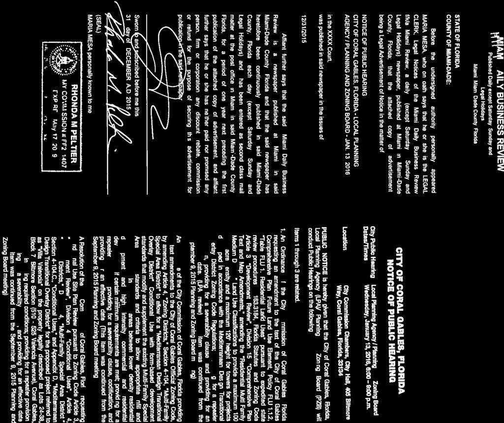
15 Attachment D City of Coral Gables Courtesy Public Hearing Notice December 31, 2015 Applicant: Application: Property: Public Hearing - Date/Time/ Location: City of Coral Gables Zoning Code Text Amendment 100 Block of Giralda Avenue Planning and Zoning Board January 13, 2016, 6:00 9:00 p.m. City Commission Chambers, City Hall, 405 Biltmore Way, Coral Gables, Florida, PUBLIC NOTICE is hereby given that the City of Coral Gables, Florida, Planning and Zoning Board (PZB) will conduct a Public Hearing on January 13, 2016 on the following application at the Coral Gables City Commission Chambers, City Hall, 405 Biltmore Way, Coral Gables, Florida: An Ordinance of the City Commission of Coral Gables, Florida providing for text amendments to the City of Coral Gables Official Zoning Code, by amending Article 4, Zoning Districts, adding Section 4-206, Giralda Restaurant Row Overlay to allow for modified requirements with form-based development standards that modify and supplement the existing Commercial District standards and criteria for the 100 block of Giralda Avenue, legally described as Lots 21-37, Block 29, and Lots 3-24, Block 33, Section L, to allow appropriate infill and redevelopment that enhances the character of Restaurant Row; providing for a repealer provision, providing for a severability clause, providing for codification, and providing for an effective date. All interested parties are invited to attend and participate. Upon recommendation by the Board, the application will be scheduled for City Commission consideration. Please visit the City webpage at to view information concerning the application. The complete application is on file and available for examination during business hours at the Planning and Zoning Division, 427 Biltmore Way, Suite 201, Coral Gables, Florida, Questions and written comments regarding the application can be directed to the Planning Division at planning@coralgables.com, FAX: or Please forward to other interested parties. Sincerely, City of Coral Gables, Florida
City of Coral Gables Planning and Zoning Staff Report
 City of Coral Gables Planning and Zoning Staff Report Applicant: Application: Public Hearing: Date & Time: Location: City of Coral Gables Zoning Code Text Amendment Giralda Plaza Overlay District Planning
City of Coral Gables Planning and Zoning Staff Report
 City of Coral Gables Planning and Zoning Staff Report Property: Applicant: Application: Public Hearing: Date & Time: Location: 625 Almeria Avenue Global Rental E&P, LLC Subdivision Review for a Tentative
City of Coral Gables Planning and Zoning Staff Report
 Applicant: Application: City of Coral Gables Planning and Zoning Staff Report Biltmore Parc Homes, LLC Subdivision Review for a Tentative Plat Property: Biltmore Parc Homes (760 Valencia Ave.; 2605, 2611,
City of Coral Gables Planning and Zoning Staff Report
 City of Coral Gables Planning and Zoning Staff Report Applicant: Application: Public Hearing: Date & Time: Location: City of Coral Gables Zoning Code Text Amendment - Notice of Public Hearing Planning
City of Coral Gables Planning and Zoning Staff Report
 City of Coral Gables Planning and Zoning Staff Report Property: Residence Inn by Marriott (2051 LeJeune Road) Applicant: Application: Public Hearing: Date & Time: Location: Coral Gables Downtown Hotel,
Paseo de la Riviera. August 12, 2015
 Paseo de la Riviera August 12, 2015 1 2 3 Existing Future Land Use Map Existing Zoning Map 4 5 6 7 Review Timeline 1 2 3 4 5 Development Review Committee: 10.31.14 Zoning Code Text, Future Land Use Map,
Future Land Use Element
 Summary of changes to the Goals, Objectives and Policies This element was updated to include the changes recommended in the 2006/2007 EAR and to reorganize the chapter to bring the land use classification
Future Land Use Element
 Vision Statement: Continue Coral Gables vision and mission as a community that is attractive to live, work, play and visit. Goals, Objectives and Policies: Goal FLU-1. Protect, strengthen, and enhance
City of Coral Gables Planning and Zoning Staff Recommendation
 City of Coral Gables Planning and Zoning Staff Recommendation Applicant: Application: Property: Public Hearing - Dates/Time/ Location: Bahamian Village, LLC Review of Planned Area Development (PAD) and
Yonge Street and 3 Gerrard Street East - Zoning Amendment Application - Preliminary Report
 STAFF REPORT ACTION REQUIRED 363-391 Yonge Street and 3 Gerrard Street East - Zoning Amendment Application - Preliminary Report Date: May 22, 2015 To: From: Wards: Reference Number: Toronto and East York
FUTURE LAND USE. City of St. Augustine Comprehensive Plan EAR-Based Amendments
 FUTURE LAND USE City of St. Augustine Comprehensive Plan EAR-Based Amendments Future Land Use Element FLU Goal To create an environment within the City and adjacent areas in which its residents have the
DRAFT FOR DISCUSSION PURPOSES ONLY. Port Credit Local Area Plan Built Form Guidelines and Standards DRAFT For Discussion Purposes
 Port Credit Local Area Plan Built Form Guidelines and Standards DRAFT For Discussion Purposes 1 Local Area Plan - Project Alignment Overview Directions Report, October 2008 (General Summary Of Selected
Director, Community Planning, North York District NNY 23 OZ and NNY 23 RH
 STAFF REPORT ACTION REQUIRED 2 & 50 Sheppard Avenue East 4841 to 4881 Yonge Street and 2 to 6 Forest Laneway Official Plan Amendment, Zoning By-law Amendment and Rental Housing Demolition Applications
Table of Contents ARTICLE 5A CHARACTER-BASED ZONING 1
 Table of Contents ARTICLE 5A CHARACTER-BASED ZONING 1 SECTION 10.5A10 GENERAL... 1 10.5A11 Purpose and Intent... 1 10.5A12 Applicability... 1 10.5A13 Compliance with Regulating Plan... 1 10.5A14 Relationship
Berry/University Form Based Code and Urban Residential Development
 Berry/University Form Based Code and Urban Residential Development Presented to the City Council by the Planning and Development Department October 11, 2016 Purpose Review proposed Berry/University formbased
Table of Contents ARTICLE 5A CHARACTER-BASED ZONING 1
 Table of Contents ARTICLE 5A CHARACTER-BASED ZONING 1 SECTION 10.5A10 GENERAL... 1 10.5A11 Purpose and Intent... 1 10.5A12 Applicability... 1 10.5A13 Compliance with Regulating Plan... 1 10.5A14 Relationship
NOTICE OF MEETING AND AGENDA FOR THE PLANNING COMMISSION OF SPRINGVILLE, UTAH... JANUARY 23, 2018
 NOTICE OF MEETING AND AGENDA FOR THE PLANNING COMMISSION OF SPRINGVILLE, UTAH............................ JANUARY 23, 2018 Notice is hereby given that the Planning Commission will hold a public meeting
REPORT OF THE PLANNING AND DEVELOPMENT DEPARTMENT FOR APPLICATION FOR REZONING ORDINANCE TO PLANNED UNIT DEVELOPMENT SEPTEMBER 22, 2016
 BEL REPORT OF THE PLANNING AND DEVELOPMENT DEPARTMENT FOR APPLICATION FOR REZONING ORDINANCE 2016-576 TO PLANNED UNIT DEVELOPMENT SEPTEMBER 22, 2016 The Planning and Development Department hereby forwards
250, 252, 254 and 256 Royal York Road and 8 and 10 Drummond Street - Zoning By-law Amendment Application - Preliminary Report
 STAFF REPORT ACTION REQUIRED 250, 252, 254 and 256 Royal York Road and 8 and 10 Drummond Street - Zoning By-law Amendment Application - Preliminary Report Date: May 28, 2013 To: From: Wards: Reference
LOT AREA AND FRONTAGE
 LOT AREA AND FRONTAGE Lot Area & Frontage for the R2.1 Zone Lot Area & Frontage for the R2.4 Zone Minimum Lot Minimum Lot Zone Area Width R2.1 700 sq m 18 m R2.4 600 sq m 16 m Lot Area means the total
THE AREA PLAN COMMISSION OF ST. JOSEPH COUNTY, IN AGENDA
 THE AREA PLAN COMMISSION OF ST. JOSEPH COUNTY, IN AGENDA Tuesday, June 20, 2017 Fourth-Floor Council Chambers 3:30 p.m. County-City Building, South Bend, IN PUBLIC HEARINGS: 1. Rezonings: A. A combined
Richmond Street West - Zoning Amendment Application - Preliminary Report
 STAFF REPORT ACTION REQUIRED 457-457 Richmond Street West - Zoning Amendment Application - Preliminary Report Date: March 10, 2017 To: From: Wards: Reference Number: Toronto and East York Community Council
25 Leonard Avenue - Official Plan Amendment and Zoning Amendment Applications - Preliminary Report
 STAFF REPORT ACTION REQUIRED 25 Leonard Avenue - Official Plan Amendment and Zoning Amendment Applications - Preliminary Report Date: March 8, 2017 To: From: Wards: Reference Number: Toronto and East York
1417, , 1427 & 1429 Yonge Street - Official Plan Amendment and Zoning Amendment Applications - Preliminary Report
 STAFF REPORT ACTION REQUIRED 1417, 1421-1425, 1427 & 1429 Yonge Street - Official Plan Amendment and Zoning Amendment Applications - Preliminary Report Date: March 24, 2015 To: From: Wards: Reference Number:
12, 14, 16 and 18 Marquette Avenue and 7 Carhartt Street Zoning By-law Amendment Application - Preliminary Report
 STAFF REPORT ACTION REQUIRED 12, 14, 16 and 18 Marquette Avenue and 7 Carhartt Street Zoning By-law Amendment Application - Preliminary Report Date: July 17, 2014 To: From: Wards: Reference Number: North
CPS-2 Transit Hubs LDR Amendments ORDINANCE NO.
 CPS-2 Transit Hubs LDR Amendments ORDINANCE NO. AN ORDINANCE OF THE MAYOR AND CITY COMMISSION OF THE CITY OF MIAMI BEACH, FLORIDA, AMENDING THE CODE OF THE CITY OF MIAMI BEACH, FLORIDA, BY AMENDING CHAPTER
ARTICLE B ZONING DISTRICTS
 ARTICLE B ZONING DISTRICTS Sec. 8-3021 Established. In order to protect the character of existing neighborhoods; to prevent excessive density of population in areas which are not adequately served with
120 GIRALDA AVENUE PREMIER LOCATION ON RESTAURANT ROW
 120 GIRALDA AVENUE PREMIER LOCATION ON RESTAURANT ROW 120 Giralda Avenue provides a unique marketing opportunity, as it possesses a blend of property and market specific dynamics, which combine to create
LITTLE MOUNTAIN ADJACENT AREA REZONING POLICY
 LITTLE MOUNTAIN ADJACENT AREA REZONING POLICY JANUARY 2013 CONTENTS 1.0 INTENT & PRINCIPLES...1 2.0 APPLICATION...2 3.0 HOUSING TYPES, HEIGHT & DENSITY POLICIES...3 3.1 LOW TO MID-RISE APARTMENT POLICIES...4
City of Sunny Isles Beach Collins Avenue Sunny Isles Beach, Florida 33160
 City of Sunny Isles Beach 18070 Collins Avenue Sunny Isles Beach, Florida 33160 (305) 947-0606 City Hall (305) 949-3113 Fax MEMORANDUM TO: FROM: The Honorable Mayor and City Commission Hans Ottinot, City
CITY OF WEST PALM BEACH ZONING BOARD OF APPEALS
 CITY OF WEST PALM BEACH ZONING BOARD OF APPEALS Meeting Date: November 2, 2017 Zoning Board of Appeals Case No. 3356 Dr. Alice Moore Apartments Variances Location Aerial I. REQUEST Site is outlined in
C i t y o f C o r a l G a b l e s P l a n n i n g a n d Z o n i n g S t a f f R e p o r t
 C i t y o f C o r a l G a b l e s P l a n n i n g a n d Z o n i n g S t a f f R e p o r t Applicant: Application: Property: Mario Garcia-Serra Variance 944 Lugo Avenue BA-17-09-1073 Legal Description:
3390, 3392, 3394, 3396 and 3398 Bayview Avenue - Official Plan Amendment, Zoning By-law Amendment Application - Preliminary Report
 STAFF REPORT ACTION REQUIRED 3390, 3392, 3394, 3396 and 3398 Bayview Avenue - Official Plan Amendment, Zoning By-law Amendment Application - Preliminary Report Date: March 14, 2016 To: From: Wards: Reference
UDO Advisory Committee Meeting #3 August 18, 2011
 UDO Advisory Committee Meeting #3 August 18, 2011 Today s s Agenda Welcome Recap of Meeting #2 Overview of Strategy Statement Overview of Zoning Districts What changes and what stays the same? Break Putting
Indicates Council-recommended changes Introduced by: Mr. Tackett Date of introduction: June 14, 2016 SUBSTITUTE NO. 1 TO ORDINANCE NO.
 Indicates Council-recommended changes Introduced by: Mr. Tackett Date of introduction: June 14, 2016 SUBSTITUTE NO. 1 TO ORDINANCE NO. 16-067 TO AMEND NEW CASTLE COUNTY CODE CHAPTER 40 (ALSO KNOWN AS THE
Church Street and 117 Dundas Street East - Zoning Amendment Application - Preliminary Report
 STAFF REPORT ACTION REQUIRED 215-229 Church Street and 117 Dundas Street East - Zoning Amendment Application - Preliminary Report Date: February 26, 2015 To: From: Wards: Reference Number: Toronto and
Coding For Places People Love Main Street Corridor District
 Coding For Places People Love Main Street Corridor District 1) Scope a) District boundaries are assigned according to the District Boundary Map. b) The Primary Retail Corridor is assigned according to
50 and 52 Finch Avenue East - Official Plan and Zoning By-law Amendment Applications - Preliminary Report
 STAFF REPORT ACTION REQUIRED 50 and 52 Finch Avenue East - Official Plan and Zoning By-law Amendment Applications - Preliminary Report Date: August 16, 2016 To: From: Wards: Reference Number: North York
Accessory Dwelling Units
 Accessory Dwelling Units Housing Committee February 16, 2016 Department of Sustainable Development and Construction Purpose of Briefing Brief the Committee on input received from the December 15, 2015
1202 & 1204 Avenue Road Zoning By-law Amendment Application - Preliminary Report
 STAFF REPORT ACTION REQUIRED 1202 & 1204 Avenue Road Zoning By-law Amendment Application - Preliminary Report Date: March 17, 2017 To: From: Wards: Reference Number: North York Community Council Director,
ARLINGTON COUNTY, VIRGINIA
 ARLINGTON COUNTY, VIRGINIA County Board Agenda Item Meeting March 17, 2007 DATE: March 8, 2007 SUBJECT: Request to Advertise Public Hearings on Amendments to Section 25B. C-O Rosslyn Commercial Office
2. Rezone a portion of the lot from R2 (Small Lot Residential) to RD2 (Duplex: Housing Lane).
 to RD2 (Duplex: Housing Lane).") Public Notice September 6, 2018 Subject Property Subject Property: 337 Hastings Ave Lot 24, District Lot 1, Group 7, Similkameen Division Yale (Formerly Yale-Lytton) District, Plan 932 Application: The
Public Notice September 6, 2018 Subject Property Subject Property: 337 Hastings Ave Lot 24, District Lot 1, Group 7, Similkameen Division Yale (Formerly Yale-Lytton) District, Plan 932 Application: The
Public Review of the Slot Home Text Amendment
 Public Review of the Slot Home Text Amendment The proposed amendments to the Denver Zoning Code have been informed by the Slot Home Strategy Report. This document has been developed out of a robust process
150 Eglinton Avenue East - Zoning Amendment Application - Preliminary Report
 STAFF REPORT ACTION REQUIRED 150 Eglinton Avenue East - Zoning Amendment Application - Preliminary Report Date: May 15, 2015 To: From: Wards: Reference Number: Toronto and East York Community Council Director,
MEMORANDUM. I1 District Industrial Living Overlay District 110,703 square feet / 2.54 acres
 Department of Community Planning & Economic Development 250 South 4th Street, Room 300 Minneapolis, MN 55415-1385 MEMORANDUM To: City Planning Commission, Committee of the Whole Prepared By: Peter Crandall,
PEDESTRIAN OVERLAY DISTRICT. November 6, 2013 Charlotte-Mecklenburg Planning Department
 Midtown Morehead Cherry PEDESTRIAN OVERLAY DISTRICT November 6, 2013 Charlotte-Mecklenburg Planning Department Meeting Purpose To provide a background on the Pedestrian Overlay District Zoning text amendment
6. RESIDENTIAL ZONE REGULATIONS
 6. RESIDENTIAL ZONE REGULATIONS PART 6A PURPOSE OF CHAPTER (1) The purpose of this Chapter is to provide detailed regulations and requirements that are relevant only to residential zones and specific residential
DEVELOPMENT DEPARTMENT STAFF REPORT THE PARK AT 5 TH
 DEVELOPMENT DEPARTMENT STAFF REPORT ARB Meeting Date: July 3, 2018 Item #: _PZ2018-293_ THE PARK AT 5 TH Request: Site Address: Project Name: Parcel Number: Applicant: Proposed Development: Current Zoning:
REPORT OF THE PLANNING AND DEVELOPMENT DEPARTMENT FOR APPLICATION FOR REZONING ORDINANCE TO PLANNED UNIT DEVELOPMENT APRIL 21, 2016
 BEL REPORT OF THE PLANNING AND DEVELOPMENT DEPARTMENT FOR APPLICATION FOR REZONING ORDINANCE TO PLANNED UNIT DEVELOPMENT APRIL 21, 2016 The Planning and Development Department hereby forwards to the Planning
Appendix1,Page1. Urban Design Guidelines. Back to Back and Stacked Townhouses. DRAFT September 2017
 Appendix1,Page1 Urban Design Guidelines DRAFT September 2017 Back to Back and Stacked Townhouses Appendix1,Page2 Table of Contents 1 Introduction 1 1.1 Purpose 1 1.2 Urban Design Objectives 1 1.3 Building
Ann Arbor Downtown Zoning Evaluation
 Ann Arbor Downtown Zoning Evaluation Options Workbook ENP & Associates in cooperation with the City of Ann Arbor September, 2013 Photo Courtesy of Andrew Horne, February 9, 2013 Introduction Thank you
CITY OF ROHNERT PARK CITY COUNCIL AGENDA REPORT
 Mission Statement We Care for Our Residents by Working Together to Build a Better Community for Today and Tomorrow. CITY OF ROHNERT PARK CITY COUNCIL AGENDA REPORT ITEM NO. 12 Meeting Date: February 14,
Article 3. SUBURBAN (S-) NEIGHBORHOOD CONTEXT
 NEIGHBORHOOD CONTEXT") Article 3. SUBURBAN (S-) NEIGHBORHOOD CONTEXT this page left intentionally blank Contents ARTICLE 3. SUBURBAN (S-) NEIGHBORHOOD CONTEXT DIVISION 3.1 NEIGHBORHOOD CONTEXT DESCRIPTION...3.1-1 Section 3.1.1
Article 3. SUBURBAN (S-) NEIGHBORHOOD CONTEXT this page left intentionally blank Contents ARTICLE 3. SUBURBAN (S-) NEIGHBORHOOD CONTEXT DIVISION 3.1 NEIGHBORHOOD CONTEXT DESCRIPTION...3.1-1 Section 3.1.1
New Comprehensive Zoning
 New Comprehensive Zoning By-law Project Phase 2: Strategic Directions Development Services Committee June 14, 2016 Task 1: Guiding Principles and Parameters & Trends and Issues in Zoning 1. Drafting of
The demolition required for the project came before the Landmark Preservation Commission (LPC) on November 3, 2016, where no action was taken.
 on November 3, 2016, where no action was taken.") D E S I G N R E V I E W C O M M I T T E E S t a f f R e p o r t 2072 ADDISON STREET PRELIMINARY DESIGN REVIEW For Committee Discussion/ Majority Recommendation JULY 20, 2017 Design Review #DRCP2016-0002
D E S I G N R E V I E W C O M M I T T E E S t a f f R e p o r t 2072 ADDISON STREET PRELIMINARY DESIGN REVIEW For Committee Discussion/ Majority Recommendation JULY 20, 2017 Design Review #DRCP2016-0002
ARLINGTON COUNTY, VIRGINIA
 ARLINGTON COUNTY, VIRGINIA County Board Agenda Item Meeting of February 12, 2005 DATE: February 8, 2005 SUBJECT: Request to Advertise public hearings on the proposed Zoning Ordinance amendment to Section
3.1. OBJECTIVES FOR RESIDENTIAL LAND USE DESIGNATIONS GENERAL OBJECTIVES FOR ALL RESIDENTIAL DESIGNATIONS
 3. RESIDENTIAL LAND USE DESIGNATIONS INTRODUCTION The Residential land use designations provide for housing and other land uses that are integral to, and supportive of, a residential environment. Housing
Town of Cary, North Carolina Rezoning Staff Report 12-REZ-27 Morris Branch Town Council Public Hearing January 24, 2013
 Town of Cary, North Carolina Rezoning Staff Report 12-REZ-27 Morris Branch Town Council Public Hearing January 24, 2013 REQUEST To amend the Town of Cary Official Zoning Map to rezone approximately 9.0
RURAL SETTLEMENT ZONE - RULES
 Chapter 38 RURAL SETTLEMENT ZONE - RULES INTRODUCTION This Chapter contains rules managing land uses in the. The boundaries of this zone are shown on the planning maps. There is limited opportunity for
ACCESSORY DWELLING UNITS IN THE SOUTHEAST SECTOR
 February 19, 2019 Staff Report to the Municipal Planning Board LDC2018-10020 Item #11 S U M M A R Y Applicant The City of Orlando ACCESSORY DWELLING UNITS IN THE SOUTHEAST SECTOR Applicant s Request Update
SHARED GROWTH AND SHAPING THE PUBLIC REALM RAYMOND ANDREW SIH, UAP, LEED AP
 SHARED GROWTH AND SHAPING THE PUBLIC REALM RAYMOND ANDREW SIH, UAP, LEED AP Old Chamber of the House Of Commons, UK New House of Commons, UK We shape our dwellings, and afterwards our dwellings shape us.
Accessory Dwelling Units
 Accessory Dwelling Units Housing Committee October 19, 2015 Department of Sustainable Development and Construction Purpose of Briefing Update the Committee on Accessory Dwelling Units To get direction
Town of Cary, North Carolina Rezoning Staff Report 14-REZ-20 Habitat for Humanity Evans Road Town Council Meeting October 16, 2014
 Town of Cary, North Carolina Rezoning Staff Report 14-REZ-20 Habitat for Humanity Evans Road Town Council Meeting October 16, 2014 REQUEST To amend the Town of Cary Official Zoning Map by rezoning 0.53
5. Housing. Other Relevant Policies & Bylaws. Several City-wide policies guide our priorities for housing diversity at the neighbourhood level: Goals
 5. Housing Other Relevant Policies & Bylaws Several City-wide policies guide our priorities for housing diversity at the neighbourhood level: Goals 1. Encourage more housing diversity while maintaining
THE AREA PLAN COMMISSION OF ST. JOSEPH COUNTY, IN AGENDA
 THE AREA PLAN COMMISSION OF ST. JOSEPH COUNTY, IN AGENDA Tuesday, January 17, 2017 Fourth-Floor Council Chambers 3:30 p.m. County-City Building, South Bend, IN EXECUTIVE SESSION: A. Election of Officers
DIVISION 1 PURPOSE OF DISTRICTS
 ARTICLE 2 ZONING DISTRICTS AND MAP DIVISION 1 PURPOSE OF DISTRICTS Section 2.101 Zoning Districts. For the purpose of this Ordinance, the City of Richmond is hereby divided into districts as follows: DISTRICT
Accessory Structures Zoning Code Update-, 2015
 Accessory Structures Zoning Code Update-, 2015 This detached ADU code update language on the next 5 pages is excerpted verbatim from the zoning code update, available in full at www.portlandoregon.gov/bps/ricap
Missing Middle Housing in Practice
 Missing Middle Housing in Practice Daniel Parolek Principal, Opticos Design, Inc. dan@opticosdesign.com New Partners for Smart Growth Kansas City, MO 2013 1 Bungalow Courts Missing MIddle Housing 2012
45 & 77 Dunfield Avenue - Zoning Amendment Application - Preliminary Report
 STAFF REPORT ACTION REQUIRED 45 & 77 Dunfield Avenue - Zoning Amendment Application - Preliminary Report Date: January 22, 2014 To: From: Wards: Reference Number: Toronto and East York Community Council
2. The modification is consistent with the objectives of this chapter.
 DRAFT February 11, 2009 BMC 20.28 Infill Housing 20.28.010 Purpose. This chapter establishes special development regulations for a series of housing forms that are different than the traditional detached
City of Fayetteville, Arkansas Page 1 of 1
 City of Fayetteville, Arkansas 113 West Mountain Street Fayetteville, AR 72701 (479) 575-8323 Legislation Text File #: 2015-0400, Version: 1 RZN 15-5148 (402 E. 7TH ST./NIEDERMAN): AN ORDINANCE REZONING
Final Draft Ordinance: Matrix
 1. # Topic Title And Description Dry Sewer olicy Use table footnote 48 revised to include a reference to exemptions in K 17.460.0. Allow properties within an Urban Growth Area, that are too far from sewer,
DEVELOPMENT DEPARTMENT STAFF REPORT STAFF REPORT DRESDEN DRIVE TOWNHOMES DCI
 DEVELOPMENT DEPARTMENT STAFF REPORT Meeting Date: September 13, 2018 Item #: PZ2018-319 STAFF REPORT DRESDEN DRIVE TOWNHOMES DCI Request: Project Name: Development of Community Compact (DCI) and six concurrent
Washington Boulevard + Kirkwood Road Special General Land Use Plan (GLUP) Study "Plus"
 Study Plus") Washington Boulevard + Kirkwood Road Special General Land Use Plan (GLUP) Study "Plus" Long Range Committee of the Planning Commission Meeting #4 May 18, 2017 Department of Community Planning, Housing
Washington Boulevard + Kirkwood Road Special General Land Use Plan (GLUP) Study "Plus" Long Range Committee of the Planning Commission Meeting #4 May 18, 2017 Department of Community Planning, Housing
6040 Bathurst Street and 5 Fisherville Road Zoning Bylaw Amendment Application Preliminary Report
 STAFF REPORT ACTION REQUIRED 6040 Bathurst Street and 5 Fisherville Road Zoning Bylaw Amendment Application Preliminary Report Date: January 24, 2017 To: From: Wards: Reference Number: North York Community
111 Wenderly Drive Official Plan and Zoning By-law Amendment Applications - Preliminary Report
 STAFF REPORT ACTION REQUIRED 111 Wenderly Drive Official Plan and Zoning By-law Amendment Applications - Preliminary Report Date: August 17, 2015 To: From: Wards: Reference Number: North York Community
PUD Zoning Framework
 PUD Zoning Framework PUD Zoning Framework Purpose Development Review Process Site Plan Review Process Planned Unit Developments (PUD) are tools for dealing with special situations or accomplishing certain
PALM BEACH COUNTY PLANNING, ZONING AND BUILDING DEPARTMENT ZONING DIVISION ZONING COMMISSION VARIANCE STAFF REPORT 06/05/2014
 PALM BEACH COUNTY PLANNING, ZONING AND BUILDING DEPARTMENT ZONING DIVISION ZONING COMMISSION VARIANCE STAFF REPORT 06/05/2014 APPLICATION NO. ZV-2013-03120 CODE SECTION REQUIRED PROPOSED VARIANCE (V1)
SPECIAL ZONING DISTRICTS
 SPECIAL ZONING DISTRICTS 5.01 5.99 RESERVED 5.100 PLANNED DEVELOPMENTS: Purpose: This district is intended to accommodate unified design of residential, commercial, office, professional services, retail
Task Force Kickoff Meeting January 10, 2016
 Task Force Kickoff Meeting January 10, 2016 AGENDA Welcome (2:45pm) Introductions (2:50pm) How the Group Will Operate (3:25pm) Staff Presentation (3:40pm) Project Scope Project Schedule Urban Design and
85, 87, 89, 91 Broadway Avenue & 198 Redpath Avenue Zoning Amendment and Rental Housing Demolition Applications Request for Direction Report
 REPORT FOR ACTION 85, 87, 89, 91 Broadway Avenue & 198 Redpath Avenue Zoning Amendment and Rental Housing Demolition Applications Request for Direction Report Date: August 17, 2017 To: Toronto and East
Richmond Street West Zoning Amendment Application - Preliminary Report
 STAFF REPORT ACTION REQUIRED 543-553 Richmond Street West Zoning Amendment Application - Preliminary Report Date: April 24, 2015 To: From: Wards: Reference Number: Toronto and East York Community Council
BYLAW NO. 15/026 A BYLAW OF THE REGIONAL MUNICIPALITY OF WOOD BUFFALO TO AMEND THE LAND USE BYLAW NO. 99/059
 Attachment 2 BYLAW NO. 15/026 A BYLAW OF THE REGIONAL MUNICIPALITY OF WOOD BUFFALO TO AMEND THE LAND USE BYLAW NO. 99/059 WHEREAS Section 639 of the Municipal Government Act requires every municipality
Peter Street and 357 Richmond Street West - Zoning Amendment Application - Preliminary Report
 STAFF REPORT ACTION REQUIRED 122-128 Peter Street and 357 Richmond Street West - Zoning Amendment Application - Preliminary Report Date: March 11, 2016 To: From: Wards: Reference Number: Toronto and East
111 Plunkett Road (formerly part of 135 Plunkett Road) - Zoning By-law Amendment Application and Plan of Subdivision Application - Preliminary Report
 - Zoning By-law Amendment Application and Plan of Subdivision Application - Preliminary Report") STAFF REPORT ACTION REQUIRED 111 Plunkett Road (formerly part of 135 Plunkett Road) - Zoning By-law Amendment Application and Plan of Subdivision Application - Preliminary Report Date: May 27, 2013 To:
STAFF REPORT ACTION REQUIRED 111 Plunkett Road (formerly part of 135 Plunkett Road) - Zoning By-law Amendment Application and Plan of Subdivision Application - Preliminary Report Date: May 27, 2013 To:
507, 509 and 511 Kingston Road - Official Plan and Zoning By-law Amendment Applications Request for Interim Directions Report
 REPORT FOR ACTION 507, 509 and 511 Kingston Road - Official Plan and Zoning By-law Amendment Applications Request for Interim Directions Report Date: June 6, 2018 To: From: Wards: Reference Number: Toronto
May 12, Chapter RH HILLSIDE RESIDENTIAL ZONES REGULATIONS Sections:
 May 12, 2017 Chapter 17.13 RH HILLSIDE RESIDENTIAL ZONES REGULATIONS Sections: 17.13.010 Title, intent, and description. 17.13.020 Required design review process. 17.13.030 Permitted and conditionally
ORDINANCE NO
 ORDINANCE NO. 20050519-008 AN ORDINANCE AMENDING CHAPTERS 25-2 AND 25-6 OF THE CITY CODE TO ADD A NEW ZONING DISTRICT RELATING TO TRANSIT ORIENTED DEVELOPMENT. BE IT ORDAINED BY THE CITY COUNCIL OF THE
CITY OF NAPLES STAFF REPORT
 Meeting of 05/13/15 Conditional Use Petition 15-CU3 CITY OF NAPLES STAFF REPORT To: Planning Advisory Board From: Planning Department Subject: Conditional Use Petition 15-CU3 Petitioner: Hazelden Betty
City of North Richland Hills Transit Oriented Development Code
 Section 118-561. Purpose and Intent: City of North Richland Hills Transit Oriented Development Code The purpose of the Transit Oriented Development (TOD) Code is to support the development of the community
Staff Report PLANNED DEVELOPMENT. Salt Lake City Planning Commission. From: Lauren Parisi, Associate Planner; Date: December 14, 2016
 Staff Report PLANNING DIVISION COMMUNITY & NEIGHBORHOODS To: Salt Lake City Planning Commission From: Lauren Parisi, Associate Planner; 801-535-7932 Date: December 14, 2016 Re: 1611 South 1600 East PLANNED
AGENDA ITEM SUMMARY GLADES COUNTY BOARD OF COUNTY COMMISSIONERS
 AGENDA ITEM SUMMARY GLADES COUNTY BOARD OF COUNTY COMMISSIONERS SUBJECT: Case Number COMP17-01, Legend Moto LLC This is a Legislative Hearing. DEPARTMENT REQUEST: The Community Development Department requests
Chapter DOWNTOWN ZONING DISTRICTS
 Chapter 20.14 Sections: 20.14.010 Purpose of the Downtown Zoning Districts 20.14.020 Land Use Regulations for Downtown Zoning Districts 20.14.030 Development Standards for Downtown Zoning Districts 20.14.010
SUBJECT: Official Plan and Zoning By-law Amendment Applications for 4853 Thomas Alton Boulevard
 Page 1 of Report PB-100-16 SUBJECT: Official Plan and Zoning By-law Amendment Applications for 4853 Thomas Alton Boulevard TO: FROM: Development and Infrastructure Committee Planning and Building Department
Supplemental Application Form Request for a Waiver of Development Standards via Density Bonus
 County of Sacramento Office of Planning and Environmental Review (PER) 827 7 th Street, Room 225 Sacramento, CA 95814 (916) 874-6141 Supplemental Application Form Request for a Waiver of Development Standards
City of Reno October 30, 2012 Draft Midtown Zoning Text Amendments 1
 Section 18.08.405 Regional Center and Transit Corridor Overlay Districts (i) SVTC South Virginia Street Transit Corridor Overlay Zoning District. (1) Applicability. This Section 18.08.405(l)'s standards
ORDINANCE NO:
 ORDINANCE NO: 2016-05 AN ORDINANCE OF THE CITY OF DAYTONA BEACH SHORES, VOLUSIA COUNTY FLORIDA, RELATING TO COMPREHENSIVE PLANNING; AMENDING THE CITY OF DAYTONA BEACH SHORES COMPREHENSIVE PLAN, AMENDING
17.13 RH HILLSIDE RESIDENTIAL ZONES REGULATIONS SECTIONS:
 Effective April 14, 2011 Chapter 17.13 RH HILLSIDE RESIDENTIAL ZONES REGULATIONS SECTIONS: 17.13.010 Title, Intent, and Description 17.13.020 Required Design Review Process 17.13.030 Permitted and Conditionally
CITY AND BOROUGH OF SITKA PLANNING AND COMMUNITY DEVELOPMENT DEPARTMENT VARIANCES
 CITY AND BOROUGH OF SITKA PLANNING AND COMMUNITY DEVELOPMENT DEPARTMENT VARIANCES VARIANCES WHAT? A variance is a waiver of development standards as outlined by municipal code. Variances may be sought
66 Isabella Street Rezoning Application - Preliminary Report
 STAFF REPORT ACTION REQUIRED 66 Isabella Street Rezoning Application - Preliminary Report Date: November 15, 2010 To: From: Wards: Reference Number: Toronto and East York Community Council Director, Community