EASEMENT MONITORING REPORT. Kirkham Property. Sacramento County, California
|
|
|
- Sharleen Terry
- 6 years ago
- Views:
Transcription


1 EASEMENT MONITORING REPORT Kirkham Property Sacramento County, California June 2012 Prepared by: Summer Pardo City of Elk Grove 8401 Laguna Palms Elk Grove, CA 95758
2
3 EASEMENT MONITORING REPORT TABLE OF CONTENTS Table of Contents... i 1. Introduction Purpose Location Methods Description of the Property and Easement Purpose of the Conservation Easement Surrounding Properties Historic Agricultural Practices Current Agricultural Practices Current Water Uses Infrastructure and Buildings... 3 Residences and Other Buildings... 3 Fences and Roads... 3 Ditches and Canals Conservation Features... 4 Surface Waters and Riparian Habitats... 4 Uplands Conclusions Adherence to Easement Requirements Quality of Swainson s Hawk Foraging Habitat within the Easement Property... 5 References... 6 City of Elk Grove June 2012 i Easement Monitoring Report Kirkham
4 EASEMENT MONITORING REPORT Figures... 7 Figure 1 Location Map... 9 Figure 2 Photopoint Locations Appendices Appendix A Conservation Easement Appendix B Photo Documentation Appendix C Photopoint Coordinates and Locality Notes City of Elk Grove June 2012 ii Easement Monitoring Report Kirkham
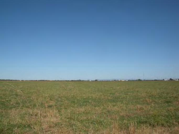
5 EASEMENT MONITORING REPORT 1. INTRODUCTION 1.1. PURPOSE The purpose of this report is to provide an accurate representation of the present condition of the Kirkham Property (property). The property is currently managed in accordance with the conservation easement (CE) language and restrictions as recorded on August 26, 2005 (Appendix A). The information and photographs provided herein represent the condition of the property as of June 6, LOCATION The property is located southwest of the intersection of Twin Cities Road and Franklin Boulevard, in southern Sacramento County, California (Figure 1). The property is bordered to the north by Twin Cities Road, to the east by Franklin Boulevard, and to the south by Lost Slough. Lost Slough is a tributary to Snodgrass Slough, southwest of the property. The western boundary is approximately 1,954 feet west of Franklin Boulevard, and the Union Pacific Railroad runs along the east side of Franklin Boulevard. 2. METHODS A review of the property was conducted on June 6, 2012, by City of Elk Grove biologist Summer Pardo, to note features relevant to the CE and to take reference photographs at predesignated locations. On the day of the site review, the sky was partly cloudy, with a WNW wind averaging 9.2 mph and an ambient temperature of approximately 58 F. US Department of Agriculture (USDA) Farm Service Agency (FSA) National Agricultural Imagery Program (NAIP) 2010 imagery files and Sacramento County 2012 parcel data were utilized as base layers for field maps and the enclosed figures. Maps were created using ArcView software. Photographs of the property were taken with a 10 megapixel Nikon Coolpix S550 digital camera, 5 feet above the ground. The photopoint locations were revised during this monitoring period to eliminate duplicate photopoints and provide a more accurate depiction of their locations. Please refer to Figure 2 for updated photopoint locations. Representative site photos from each photopoint can be found in Appendix B. Photos are referenced by photopoint number and directionality. For example, photo 1-N was taken at photopoint P1 facing north. The latitude and longitude for each photostation and a brief description of its locality can be found in Appendix C. 3. DESCRIPTION OF THE PROPERTY AND EASEMENT The property s legal description is contained in Exhibit A of the CE, which is provided in Appendix A of this report. The property covered under the CE includes a total of 169 acres and is composed of approximately 150 acres of actively grazed pasturelands. The remainder of the property is either disturbed (ruderal) or marsh habitat. A 2.6-acre pond dominated by marsh vegetation is located on the south-central property boundary. The pond s southern edge borders the levee road adjacent to Lost Slough. Additional details regarding site characteristics can be found in sections 3.5, Infrastructure and Buildings, and 3.6, Conservation Features, of this report. City of Elk Grove June Easement Monitoring Report Kirkham
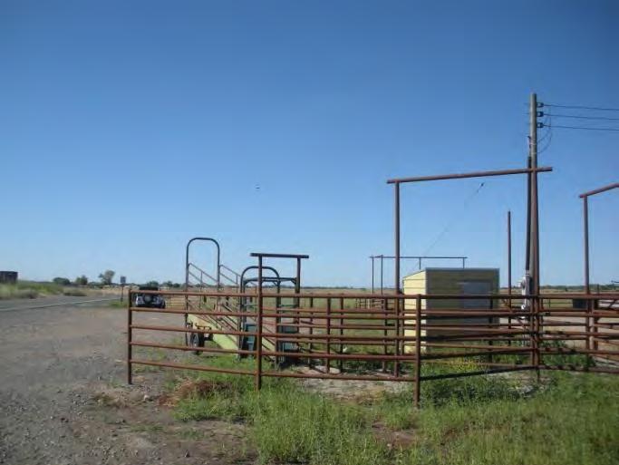
6 EASEMENT MONITORING REPORT 3.1. PURPOSE OF THE CONSERVATION EASEMENT The multiple natural resource conservation purposes of the CE are to preserve and protect in perpetuity (a) the availability of the property for agricultural use by protecting the property from development pressure; (b) the conservation and habitat values of the property as foraging and/or nesting habitat for Swainson s hawks (Buteo swainsoni) and for other wildlife essential for maintaining Swainson s hawk habitat, including the processes which sustain that habitat; and (c) the open space character of the property, which is an important public benefit and is consistent with the availability of the property for wildlife habitat and agricultural uses SURROUNDING PROPERTIES The majority of the surrounding land to the west, north, and east of the property is used for growing row crops or pasture. The zoning for the area is General Agriculture-80, which permits single-family dwellings at a density no greater than one per 80 acres, but smaller parcels may exist west, north, and east of the property (County of Sacramento 1993). The area south of the property and Lost Slough is part of the Cosumnes River Preserve, a nearly 46,000-acre preserve dedicated to the preservation of wetland and riparian habitats along the Cosumnes River HISTORIC AGRICULTURAL PRACTICES Historically, water was pumped from Lost Slough and carried to crops on the southern portion of the property via plastic piping, while irrigation ditches continued to be used in the northern portions of the property. Prior to 1950, the property was used for growing rice. From 1950 to 1977, the property was grazed by cattle. Prior to 2007, the property was used to grow annual row crops such as rice, corn, milo, sudan grass seed, ladino clover seed, oat hay, rye, and wheat. The irrigation ditches used for watering these crops remain on the property CURRENT AGRICULTURAL PRACTICES The property is currently used as pasture for cattle. The cattle corral and barbed-wire fencing installed in 2008 is still present (City of Elk Grove 2008). The location of the cattle corral is in accordance with the description provided in the 2008 Easement Documentation Report (City of Elk Grove). The agricultural practices observed on the property are in compliance with the requirements of the CE. A water well is located in the northeast corner of the property, adjacent to the cattle corral. The well is contained within a small closed structure. The drainage ditch on the eastern boundary, near Franklin Boulevard, and the central drainage ditch near photopoint P2 were converted to underground pipes in 2010 (City of Elk Grove 2010). Drainage ditches run along the southern edge of the property adjacent to the levee road and along the eastern side of the property adjacent to Franklin Boulevard CURRENT WATER USES The property is irrigated by water pumped via a horsepower pump from Lost Slough, which is a perennial, tidal tributary to Snodgrass Slough and the Mokelumne River. The water is then delivered via plastic piping to the southern portion of the property and northward via underground pipes. The highest elevation within the property is in the northeastern corner; therefore, surface water generally flows to the south and west. City of Elk Grove June Easement Monitoring Report Kirkham
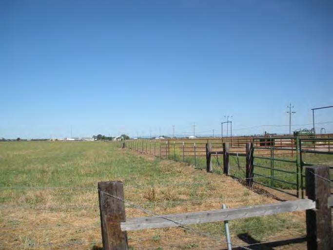
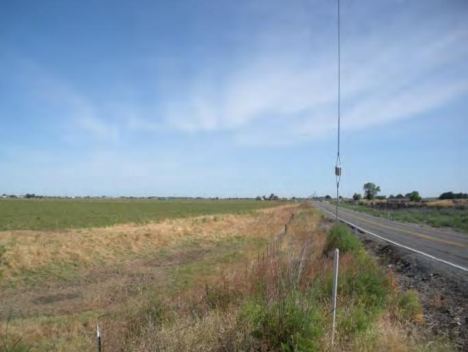
7 EASEMENT MONITORING REPORT There is an oblong, marshy 2.6-acre pond near the south-central edge of the property. Although the 2010 report stated that a small pond located near photopoint P7 on the property s southeastern corner was not present, the 2010 report did note that a depression was visible (City of Elk Grove 2010). This small pond was filled with water and clearly visible during the June 6, 2012, site visit. The CE allows for the repair, maintenance, and rebuilding of existing wells and for the establishment of new wells, as long as they support the allowable uses of the property. The property s current water uses, including the location and size of the water well on the property, are in compliance with the requirements of the CE INFRASTRUCTURE AND BUILDINGS Residences and Other Buildings There are no existing buildings on the property. The CE allows for a building envelope within a 2-acre area. Within the building envelope, the landowner can build one single-family residence as well as other buildings associated with the operation of the farm. There are no plans to construct any new buildings on the property; therefore, the property is consistent with the requirements of the CE. Fences and Roads After the 2008 report, dilapidated barbed-wire fences along the periphery and interior of the property were replaced (City of Elk Grove 2008, 2009). The 2009 report stated that new barbedwire fence ran along the entire perimeter of the property and cross-fencing divided the pasture into four fields. The cross-fencing runs north-south from approximately the middle of the north property line to approximately the middle of the property s southern boundary. This section of cross-fencing runs through the center of the pond, near the south-central portion of the property, and over the levee. A barbed-wire gate is located on the levee. Additional crossfencing runs east west from approximately the middle of the property line bordering Franklin Boulevard to approximately the middle of the western property line. There is no fencing along the southern property boundary; however, barbed-wire fencing is located on the adjacent property on the southern side of the levee road. The levee road adjacent to Lost Slough serves as a the property s southern boundary. A metal farm gate is located in the southeastern corner of the property. This gate prohibits vehicle access to the levee road that runs along Lost Slough from Franklin Boulevard to Snodgrass Slough. A gravel road runs outside the western boundary, and a dirt road runs along the top of the Lost Slough levee. Unimproved interior roads exist for the purposes of facilitating on-site farming practices. The CE allows for the repair and maintenance of existing roads to current levels of improvement, as well as for the creation of new unpaved roads that are reasonably necessary for agricultural purposes and that do not substantially diminish or impair the open space character, agricultural productivity, wildlife habitat, or scenic qualities of the property. New paved roads, as required by state law, are also permissible. The type, location, and size of the roads within the property are similar to what has been reported in the past (City of Elk Grove 2011). The property is consistent with the requirements of the CE for fences and roads. City of Elk Grove June Easement Monitoring Report Kirkham
8 EASEMENT MONITORING REPORT Ditches and Canals Ditches are present along the south and west property boundaries. A small channel is present on the north side of the levee road, along the south property boundary, and inside the barbed-wire fence. Roadside ditches are located just outside the fencing along Twin Cities Road and Franklin Boulevard. There are two irrigation ditches located on the interior of the property. The first ditch is located along the northeast boundary, and the second ditch is situated north south along the center of the property. The location and size of the on-site ditches are similar to what has been reported in the past (City of Elk Grove 2011). The property is consistent with the requirements of the CE for ditches and canals CONSERVATION FEATURES Surface Waters and Riparian Habitats The only surface waters on site are the pond and irrigation/drainage ditches. The pond is dominated by cattails (Typha sp.), with smaller patches of tules (Scirpus sp.) and a few scattered small willows (Salix lasiolepis and S. gooddingii) near the edges of the pond. As stated above, the roadside ditches, located outside of the property boundary, border the property to the north and east adjacent to Twin Cities Road and Franklin Boulevard, respectively. Lost Slough is a perennial, tidal slough that often floods the adjacent Cosumnes River Preserve during the winter. Lost Slough is located adjacent to the levee on the southern edge of the property, which protects the property from seasonal flooding events. These areas contain wetland vegetation such as various rushes (Juncus spp.) and spikerush (Eleocharis spp.) and provide foraging habitat and cover for wildlife. Uplands Almost the entire 169 acres of the property have been converted to pasture. Areas not used for pasture within the property include interior dirt roads, the levee along Lost Slough, and the pond. The roadsides and levees are thickly covered with weedy vegetation typical of the area, including wild radish (Raphanus sp.), mustards (mostly Brassica nigra), poison hemlock (Conium maculatum), milk-thistle (Silybum marianum), and grasses (e.g., Lolium multiflorum, Hordeum murinum ssp. leporinum, Vulpia sp.) and other weedy flora. No large trees suitable for raptor nesting sites are located on the property; however, there are large trees suitable for nesting on adjacent properties. 4. CONCLUSIONS 4.1. ADHERENCE TO EASEMENT REQUIREMENTS Review of the CE (Appendix A) for this property revealed that the activities and practices observed during the site visit on June 6, 2012, were permitted uses. The requirements set forth in the easement state that no structures can be built except in one (2-acre) building envelope. No structures have been built anywhere on the property. The cattle corral at the northeastern corner of the property is still present. The farming practices (cattle pasture) observed during the site visit are allowed under the CE requirements. City of Elk Grove June Easement Monitoring Report Kirkham
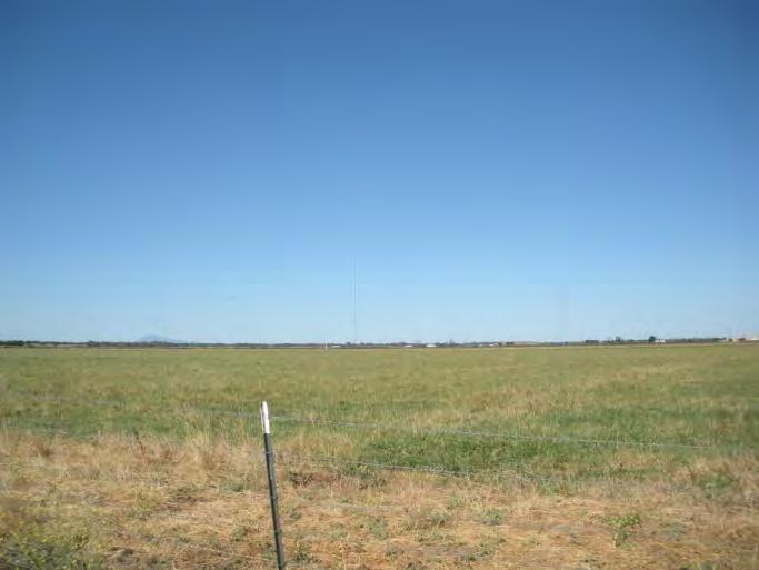
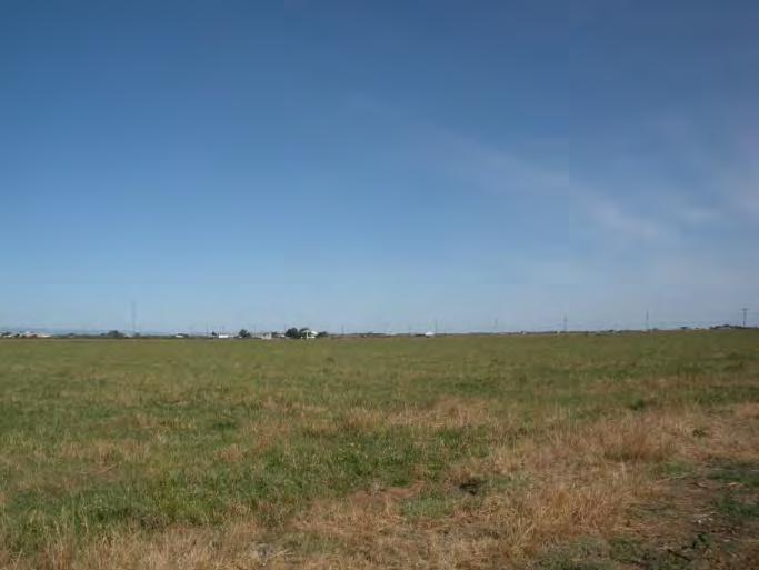
9 EASEMENT MONITORING REPORT 4.2. QUALITY OF SWAINSON S HAWK FORAGING HABITAT WITHIN THE EASEMENT PROPERTY The property consists of high-quality foraging habitat for Swainson s hawks. The low ground cover of the pasture serves as excellent foraging habitat for Swainson s hawks because it allows for clear visibility of prey items. Numerous small burrows, gopher mounds, and vole runs were observed throughout the property. The property contains habitat suitable for prey items preferred by the Swainson s hawk and therefore may be used as foraging habitat. Two (2) Swainson s hawks were observed foraging over the property and sites to the west during the June 6, 2012, site visit. According to the California Department of Fish and Game California Natural Diversity Database (CNDDB), there are 103 previously recorded occurrences of Swainson s hawk, including nests, within a 10-mile radius of the property (CDFG 2012). Other birds observed within or flying above the property during June 6, 2012, survey include mallard (Anas platyrhynchos), tree swallow (Tachycinecta bicolor), western scrub-jay (Aphelocoma californica), red-winged blackbird (Agelaius phoeniceus), and turkey vulture (Cathartes aura). City of Elk Grove June Easement Monitoring Report Kirkham
10 EASEMENT MONITORING REPORT REFERENCES CDFG (California Department of Fish and Game) RareFind 4. Sacramento: California Natural Diversity Database (CNDDB). Accessed June City of Elk Grove Easement Documentation Report: Kirkham Property, Sacramento County, California. City of Elk Grove, Elk Grove, CA. City of Elk Grove Easement Documentation Report: Kirkham Property, Sacramento County, California. City of Elk Grove, Elk Grove, CA. City of Elk Grove Easement Documentation Report: Kirkham Property, Sacramento County, California. City of Elk Grove, Elk Grove, CA. City of Elk Grove Easement Documentation Report: Kirkham Property, Sacramento County, California. City of Elk Grove, Elk Grove, CA. Planning Division Zoning Code of Sacramento County. County of Sacramento, CA. City of Elk Grove June Easement Monitoring Report Kirkham
11 FIGURES
12 APPENDICES
13 APPENDIX A CONSERVATION EASEMENT
14
15
16
17
18
19
20
21
22
23
24
25
26
27
28
29
30
31
32
33
34
35 APPENDIX B PHOTO DOCUMENTATION


36 EASEMENT MONITORING REPORT Appendix B Photo Documentation 1-S 1-SE 2-E 2-SE 2-S 2-SW City of Elk Grove June 2012 Easement Monitoring Report Kirkham


37 EASEMENT MONITORING REPORT 2-W 3-W 3-S 4-W 4-SW 4-S City of Elk Grove June 2012 Easement Monitoring Report Kirkham


38 EASEMENT MONITORING REPORT 5-N 5-NW 5-W 5-SW 5-S 6-N City of Elk Grove June 2012 Easement Monitoring Report Kirkham


39 EASEMENT MONITORING REPORT 6-NW 6-W City of Elk Grove June 2012 Easement Monitoring Report Kirkham
40 APPENDIX C PHOTOPOINT COORDINATES AND LOCALITY NOTES
41 EASEMENT MONITORING REPORT Appendix C Photopoint Coordinates and Locality Notes Photopoint Longitude Latitude Description P ' " W 38 17' " N P ' " W 38 17' " N P ' " W 38 17' " N P ' " W 38 17' " N At northwestern corner of property adjacent to Twin Cities Road At central-northern point on property along Twin Cities Road At northeastern corner of property at intersection of Franklin Blvd and Twin Cities Road Near northeastern corner of property adjacent to Franklin Boulevard P ' " W 38 17' " N At roadside ditch adjacent to Franklin Boulevard P ' " W 38 16' " N P ' " W 38 16' " N P ' " W 38 16' " N P ' " W 38 16' " N At southeastern corner of property, adjacent to Franklin Boulevard, near the Cosumnes River Preserve entrance sign At central-southern location on top of levee road along southern edge of the property, just east of the tailwater pond At central-southern location on top of levee road along southern edge of the property, just west of the tailwater pond At southwestern corner of the property on top of levee road City of Elk Grove June 2012 Easement Monitoring Report Kirkham
EASEMENT DOCUMENTATION REPORT: KIRKHAM FARM
 EASEMENT DOCUMENTATION REPORT: KIRKHAM FARM SACRAMENTO COUNTY, CALIFORNIA April 5, 2011 Prepared by: Daniel Neal City of Elk Grove 8401 Laguna Palms Elk Grove, CA 95758 EASEMENT DOCUMENTATION REPORT TABLE
EASEMENT DOCUMENTATION REPORT: KIRKHAM FARM. Sacramento County, California
 EASEMENT DOCUMENTATION REPORT: KIRKHAM FARM Sacramento County, California March 6, 2009 Prepared by: Jessica Griggs City of Elk Grove 8401 Laguna Palms Elk Grove, CA 95758 EASEMENT DOCUMENTATION REPORT
EASEMENT MONITORING REPORT. Acterra/Avis Property. Sacramento County, California
 EASEMENT MONITORING REPORT Acterra/Avis Property Sacramento County, California June 2012 Prepared by: Summer Pardo City of Elk Grove 8401 Laguna Palms Elk Grove, CA 95758 EASEMENT MONITORING REPORT TABLE
EASEMENT DOCUMENTATION REPORT: CARLI PROPERTY
 EASEMENT DOCUMENTATION REPORT: CARLI PROPERTY SACRAMENTO COUNTY, CALIFORNIA June 8, 2010 Prepared by: Angela Calderaro City of Elk Grove 8401 Laguna Palms Elk Grove, CA 95758 EASEMENT DOCUMENTATION REPORT
EASEMENT MONITORING REPORT. Mohamed Property. Sacramento County, California
 EASEMENT MONITORING REPORT Mohamed Property Sacramento County, California June 2012 Prepared by: Summer Pardo City of Elk Grove 8401 Laguna Palms Elk Grove, CA 95758 EASEMENT MONITORING REPORT TABLE OF
EASEMENT DOCUMENTATION REPORT: July 7, 2010
 EASEMENT DOCUMENTATION REPORT: ACTERRA/AVIS PROPERTY SACRAMENTO COUNTY, CALIFORNIA July 7, 2010 Prepared by: Angela Calderaro City of Elk Grove 8401 Laguna Palms Elk Grove, CA 95758 EASEMENT DOCUMENTATION
EASEMENT DOCUMENTATION REPORT: April 2011
 EASEMENT DOCUMENTATION REPORT: ACTERRA/AVIS PROPERTY SACRAMENTO COUNTY, CALIFORNIA April 2011 Prepared by: Angela Calderaro City of Elk Grove 8401 Laguna Palms Elk Grove, CA 95758 EASEMENT DOCUMENTATION
EASEMENT MONITORING REPORT. Reynen and Bardis Property. Sacramento County, California
 EASEMENT MONITORING REPORT Reynen and Bardis Property Sacramento County, California June 2012 Prepared by: Summer Pardo City of Elk Grove 8401 Laguna Palms Elk Grove, CA 95758 EASEMENT MONITORING REPORT
EASEMENT DOCUMENTATION REPORT: MOHAMED PROPERTY. Sacramento County, California
 EASEMENT DOCUMENTATION REPORT: MOHAMED PROPERTY Sacramento County, California February 11, 2009 Prepared by: Angela Calderaro City of Elk Grove 8401 Laguna Palms Elk Grove, CA 95758 EASEMENT DOCUMENTATION
Yolo County Habitat/Natural Community Conservation Plan Joint Powers Agency
 Yolo County Habitat/Natural Community Conservation Plan Joint Powers Agency ~ Partnering for Conservation ~ Member Agencies County of Yolo City of Davis City of Winters City of West Sacramento City of
RENITA HURDSMAN BEAR RIVER STATE PARK LAND EXCHANGE PROPOSAL
 DETAILED ANALYSIS RENITA HURDSMAN BEAR RIVER STATE PARK LAND EXCHANGE PROPOSAL June 1, 2006 Prepared by the Office of State Lands and Investments Herschler Building, 3W 122 West 25 th Street Cheyenne,
A Comparison of Swainson s Hawk Conservation Easements. County of Sacramento City of Elk Grove. Summary Report
 A Comparison of Swainson s Hawk Conservation Easements County of Sacramento City of Elk Grove Summary Report Shannon McClure Summer 2010 Purpose Sacramento County and its cities have implemented Swainson
RECITALS. B. WHEREAS, Ranch, its successors and assigns, are referred to in the Easement as the Grantor ; and
 Basic Components of Management Plans Associated with Conservation Easement Acquisitions Where A Land Trust Or other third party Is the Grantee April 17, 2012 Key: Text in normal font, without highlight,
BEFORE THE HEARING EXAMINER FOR THURSTON COUNTY
 COUNTY COMMISSIONERS Cathy Wolfe District One Diane Oberquell District Two Robert N. Macleod District Three HEARING EXAMINER BEFORE THE HEARING EXAMINER FOR THURSTON COUNTY In the Matter of the Application
Sample Baseline Documentation Report (BDR) Annotated Template for Environmentally Important Land
 Annotated Template for Environmentally Important Land") Sample Baseline Documentation Report (BDR) Annotated Template for Environmentally Important Land The baseline documentation report (BDR) provides a snap shot of the biophysical condition of a property
Sample Baseline Documentation Report (BDR) Annotated Template for Environmentally Important Land The baseline documentation report (BDR) provides a snap shot of the biophysical condition of a property
COUNTY OF SACRAMENTO CALIFORNIA
 COUNTY OF SACRAMENTO CALIFORNIA Control No.: PLNP2007-00537 Type: PMR TO: FROM: SUBJECT: SUBDIVISION REVIEW COMMITTEE PLANNING AND COMMUNITY DEVELOPMENT DEPARTMENT CHRIS BOTTIMORE TENTATIVE PARCEL MAP
CITY OF WINTERS HABITAT MITIGATION PROGRAM
 CITY OF WINTERS HABITAT MITIGATION PROGRAM The City currently faces oversight of the implementation of various habitat mitigation requirements associated with recently approved and pending development
COUNTY OF SAN MATEO PLANNING AND BUILDING DEPARTMENT
 COUNTY OF SAN MATEO PLANNING AND BUILDING DEPARTMENT DATE: April 16, 2015 TO: FROM: Zoning Hearing Officer Planning Staff SUBJECT: Consideration of a Coastal Development Permit and Planned Agricultural
Cox Ranch, 1,726 +/- Acres
 AG-LAND Investment Brokers 275 Sale Lane Red Bluff, CA 96080 530-529-4400 Fax 530-527-5042 Cox Ranch, 1,726 +/- Acres Paskenta, CA Tehama County, CA i AG-LAND INVESTMENT BROKERS 275 Sale Lane, Suite
OPEN SPACE & RECREATION PLAN
 OPEN SPACE & RECREATION PLAN HOPEWELL TOWNSHIP Cumberland County, New Jersey Prepared by: Hopewell Township Environmental Commission Final October 2011 (THIS PAGE INTENTIONALLY LEFT BLANK) PUBLIC MEETINGS
Wood River Land Trust Staff Report
 Wood River Land Trust Staff Report Date: July 9, 2014 To: Board of Directors From: Staff, Keri York Regarding: MacConnell Agricultural Lands Easement Action Item Action Item: The item for consideration
Rocky Creek Ranch. 2,582 +/- acres. Cattle Operation, Great Hunting! Priced and Offered for Sale as 3 Individual Tracts. Greenville, FL Madison County
 Rocky Creek Ranch 2,582 +/- acres Cattle Operation, Great Hunting! Priced and Offered for Sale as 3 Individual Tracts Rocky Creek Ranch Native Florida lands, hunting and recreation, income opportunities,
FLORIDA DEPARTMENT OF AGRICULTURE AND CONSUMER SERVICES
 FLORIDA DEPARTMENT OF AGRICULTURE AND CONSUMER SERVICES Office of Agricultural Water Policy Mayo Building 407 South Calhoun Street Tallahassee, Florida 32399 Binding Determination Florida Statute 373.406(2);
Yolo Habitat Conservancy County of Yolo City of Davis City of Winters City of West Sacramento City of Woodland University of California, Davis
 Yolo Habitat Conservancy County of Yolo City of Davis City of Winters City of West Sacramento City of Woodland University of California, Davis Science & Technical Advisory Committee (STAC) Operational
Claudia Stuart, Williamson Act Program Manager and Nick Hernandez, Planning Intern
 Land Conservation (Williamson) Act Advisory Committee STAFF REPORT September 15, 2014 Prepared by: Claudia Stuart, Williamson Act Program Manager and Nick Hernandez, Planning Intern Subject: Discussion:
Local Agriculture Perspectives in the Middle Rio Grande Valley
 Local Agriculture Perspectives in the Middle Rio Grande Valley Cecilia Rosacker-McCord Executive Director, Rio Grande Ag Land Trust Socorro Valley Farmer Land & Water Planning in the Middle Valley Friday,
Easement Program Guidelines for Water Resources and Stream Work
 Easement Program Guidelines for Water Resources and Stream Work The following guidelines are established by the Easement Committee to create standards for reviewing requests by landowners to conduct stream
Conceptual Scheme SE W4
 December 2012 1. PURPOSE 1.1. The purpose of a Conceptual Scheme (CS) is as follows: a) To provide a framework for the subsequent subdivision and/or development of land within the Country Residential Policy
FOR SALE 2, /- Gross Acre Cattle Ranch in Tulare County
 FOR SALE 2,252.70 +/- Gross Acre Cattle Ranch in Tulare County Morgan Houchin 3430 Unicorn Road Bakersfield, CA 93308 Neither the Seller, nor makes any representations or warranties, either expressed or
LAND AUCTION.
 LAND AUCTION 919+/- Acre Farm Charles Mix County, South Dakota Offered in Eight Tracts! Friday, December 7, 2018 1:30 PM at the National Guard Armory Building 610 East SD Highway 46, Wagner, South Dakota
Planning Commission Staff Report
 Planning Commission Staff Report Project: Summary Vacation of a Drainage Easement for a Drainage Canal or Ditch over the Apple Computer Inc. Campus Property Finding of Consistency with the General Plan
Conceptual Scheme SE W4
 Conceptual Scheme September 2014 Conceptual Scheme 1. PURPOSE 1.1. The purpose of a Conceptual Scheme (CS) is as follows: a) To provide a framework for the subsequent subdivision and/or development of
CITY OF FORT COLLINS NATURAL AREAS AND CONSERVED LANDS EASEMENT POLICY
 CITY OF FORT COLLINS NATURAL AREAS AND CONSERVED LANDS EASEMENT POLICY Adopted January 3, 2012 PURPOSE: The purpose of the policy statement is to clarify the policies and procedures of the City of Fort
Chapter SWAINSON S HAWK IMPACT MITIGATION FEES
 The Swainson s Hawk ordinance can also be viewed online at: http://qcode.us/codes/sacramentocounty/ Once at the website, click on Title 16 BUILDINGS AND CONSTRUCTION, then Chapter 16.130 SWAINSON S HAWK
MADISON VALLEY RETREAT Off Varney Road Ennis, Montana $925,000
 Off Varney Road Ennis, Montana $925,000 Retreat withdrawal to a safe or private place; a safe, quiet, or secluded place, away from the pressures of ordinary life. Just what we all dream of a serene place,
Diamond Falls Subdivision PROPOSED YELLOWSTONE COUNTY BOARD OF PLANNING FINDINGS OF FACT
 Diamond Falls Subdivision PROPOSED YELLOWSTONE COUNTY BOARD OF PLANNING FINDINGS OF FACT The City/County Planning Staff has prepared the Findings of Fact for the Diamond Falls Subdivision. These findings
Pavillion, Fremont County, Wyoming
 Pavillion, Fremont County, Wyoming 58 E. Benteen Street Buffalo, WY 82834 Ph 307-684-9556 Toll Free 888-684-9557 Fax 307-684-8565 Email: info@pearsonrealestate.com Website: www.pearsonrealestate.com Location
CHARLOTTE PLANNING COMMISSION FINDINGS OF FACT AND DECISION IN RE APPLICATION OF. George R. Aube 1450 Dorset Street
 CHARLOTTE PLANNING COMMISSION FINDINGS OF FACT AND DECISION IN RE APPLICATION OF George R. Aube 1450 Dorset Street Final Plan Review For A Two-Lot Subdivision Application # PC-13-19 Background The Planning
LLC & MLLC Property Bismark Meadows Bonner County, Idaho
 Vital Ground Property Management Plan LLC & MLLC Property Bismark Meadows Bonner County, Idaho December 10, 2009 (updated 2/12/13) Ryan Lutey The Vital Ground Foundation Building T-2, Fort Missoula Road
Circle. Real Estate Brokers Licensed in Texas, New Mexico and Colorado. Thompson Ranch. Socorro County, New Mexico. Nick Philipello, Jr.
 Circle Real Estate Brokers Licensed in Texas, New Mexico and Colorado Thompson Ranch Socorro County, New Mexico Nick Philipello, Jr., Broker 1414 FM 2223 Bryan, TX 77808 Phone [979]778.6711 Cell [979]220.2368
CITY OF CORNING TENTATIVE MAPS
 CITY OF CORNING TENTATIVE MAPS APPLICANT S GUIDE TO PROCEDURES WHAT IS A TENTATIVE MAP? A division of land for the purpose of sale, lease, or finance requires submittal of a map for City approval showing
Whiteman Ranch, Red Bluff, CA
 AG-LAND INVESTMENT BROKERS 275 Sale Lane, Suite 2 / P. O. Box 896 Red Bluff, CA 96080 530.529.4400 office / 530.527.5042 fax Whiteman Ranch, Red Bluff, CA Listing Price: $2,895,000 approximately $1,026
ALREADY SUBMITTED FOR HIGHLANDS COUNCIL PRE
 Highlands Preservation Area Approval Application Checklist Items Block 15901 Lot 1, West Milford See Highlands Council Review at: http://www.highlands.state.nj.us/njhighlands/projectreview/ **For advisory
SAMPLE Deed of Conservation Easement and Development Rights
 RECORDING REQUESTED BY: MAIL TO: Department of Water Resources Division of Land and Right of Way Real Estate Branch 1416 9 th Street, Room 425 Sacramento, CA 95814 MAIL TO: [Easement Grantor] SAMPLE Deed
Countess Joy Estate Development Palm City, Florida Martin County /- Acres
 Countess Joy 978.5 +/- Acres Ideal Location for Upscale Ranchettes, Equestrian, Golf, or an Eco-friendly Community! 2 Countess Joy Ranch & Recreational Upscale Residential Development Located in Florida's
PURCHASE OF DEVELOPMENT RIGHTS (PDR) APPLICATION
 APPLICATION") OTTAWA COUNTY PURCHASE OF DEVELOPMENT RIGHTS (PDR) PROGRAM (Contact Information) FOR OFFICIAL USE ONLY Application Number PURCHASE OF DEVELOPMENT RIGHTS (PDR) APPLICATION This information is required by
OTTAWA COUNTY PURCHASE OF DEVELOPMENT RIGHTS (PDR) PROGRAM (Contact Information) FOR OFFICIAL USE ONLY Application Number PURCHASE OF DEVELOPMENT RIGHTS (PDR) APPLICATION This information is required by
STATE TAX COMMISSION QUALIFIED AGRICULTURAL PROPERTY EXEMPTION GUIDELINES
 STATE TAX COMMISSION QUALIFIED AGRICULTURAL PROPERTY EXEMPTION GUIDELINES Issued by the State Tax Commission August 2018 Table of Contents What is the Qualified Agricultural Exemption?... 2 How does Property
EXHIBIT D. Planned Unit Development Written Description April 13, 2016 Rouen Cove Phase II PUD
 1 EXHIBIT D Planned Unit Development Written Description April 13, 2016 Rouen Cove Phase II PUD Development # 8986.001 Developer: Curtis L. Hart Hart Resources LLC 8051 Tara Lane Jacksonville, Florida
R-9 REPORT ON SUBDIVISION WITHIN THE AGRICULTURAL LANDRESERVE FILE NO. 190/2017 PEACE RIVER REGIONAL DISTRICT DEVELOPMENT SERVICES
 PEACE RIVER REGIONAL DISTRICT DEVELOPMENT SERVICES REPORT ON SUBDIVISION WITHIN THE AGRICULTURAL LANDRESERVE FILE NO. 190/2017 R-9 OWNER: Martin and Allison Mackay DATE: November 6, 2017 AREA: Electoral
Old Thomasson Range, Chico, CA
 AG-LAND INVESTMENT BROKERS 275 Sale Lane, Suite 2 / P. O. Box 896 Red Bluff, CA 96080 530.529.4400 office / 530.527.5042 fax Old Thomasson Range, Chico, CA Property: Approximately 5,270 acres bordered
LCB File No. T ADOPTED TEMPORARY REGULATION OF THE NEVADA TAX COMMISSION
 LCB File No. T031-02 ADOPTED TEMPORARY REGULATION OF THE NEVADA TAX COMMISSION Filed with the Secretary of State on 12/12/2002 EXPLANATION Matter in italics is new; matter in brackets [omitted material]
March 26, Sutter County Planning Commission
 March 26, 2003 To: Re: Sutter County Planning Commission Agenda Item #12: Public hearing on Rezoning #03-04 to change the zoning classification of two parcels totaling 324+ acres from the AG (General Agricultural)
Real Estate Auction ORMESHER RANCH. 1 PM Central, Wednesday, June 20, 2012 Niobrara Lodge in Valentine, Nebraska. Offered Exclusively By:
 ORMESHER RANCH Real Estate Auction 1 PM Central, Wednesday, June 20, 2012 Niobrara Lodge in Valentine, Nebraska Offered Exclusively By: NORTH PLATTE OFFICE P.O. Box 1166 I-80 & US Hwy 83 North Platte,
Trails End Ranch Pinal County, Arizona
 Trails End Ranch Pinal County, Arizona Offered for sale exclusively by: Walter Lane Headquarters West, Ltd. 4582 N 1 st Avenue Tucson, AZ 85718 Telephone: (520) 792-2652 Fax (520) 792-2629 Location The
Donation of Circle Pine Farm, Rural and Family Lands Protection Easement
 AGENDA BOARD OF TRUSTEES DEPARTMENT OF AGRICULTURE & CONSUMER SERVICES JANUARY 19, 2011 Attachments to the items below can be viewed at the following link: http://www.dep.state.fl.us/secretary/cab/public_notices.htm
Conservation Collier Red Maple Swamp Preserve
 Preserve Extended Interim Management Plan First Extension Prepared By: Collier County s Conservation Collier Program Parks & Recreation Department 15000 Livingston Road Naples, FL 34109 May 2013 G:\CDES
BEAR HAMMOCK GAME HAVEN
 COLDWELL BANKER COMMERCIAL SAUNDERS REAL ESTATE BEAR HAMMOCK GAME HAVEN EUSTIS, FL LAKE COUNTY 45 ± ACRES TOTAL 3 PURCHASING OPTIONS AVAILABLE SREland.com/BearHammock Carson Futch 863.216.5913 COLDWELL
2015 Reinvest in Minnesota (RIM) Reserve Wetlands Program
 Reserve Wetlands Program") 2015 Reinvest in Minnesota (RIM) Reserve Wetlands Program Eligibility Guidance Document 1/16/15 The purpose of the RIM Wetlands Program is to identify and enroll under permanent easement lands that contain
2015 Reinvest in Minnesota (RIM) Reserve Wetlands Program Eligibility Guidance Document 1/16/15 The purpose of the RIM Wetlands Program is to identify and enroll under permanent easement lands that contain
Table of Contents E.3 Light and Glare - Glare
 Table of Contents E.3 Light and Glare - Glare 1. INTRODUCTION... 1279 2. ENVIRONMENTAL SETTING... 1280 a. Glare-Sensitive Receptors... 1280 b. Existing Daytime Glare Generated at Project Site... 1282 c.
JORDAO PROPERTY ± RIPARIAN IRRIGATED CROPLAND. $2,438,000 ($23,000/Acre)
") JORDAO PROPERTY ±106.00 RIPARIAN IRRIGATED CROPLAND Located at: 7505 Hogin Road Crows Landing, Stanislaus County, CA 95313 APN s 057-026-009 & 057-026-008 Offered for $2,438,000 ($23,000/Acre) Presented
JORDAO PROPERTY ±106.00 RIPARIAN IRRIGATED CROPLAND Located at: 7505 Hogin Road Crows Landing, Stanislaus County, CA 95313 APN s 057-026-009 & 057-026-008 Offered for $2,438,000 ($23,000/Acre) Presented
METROPOLITAN COUNCIL 390 North Robert Street, St. Paul, MN Phone (651) TDD (651)
 TDD (651)") METROPOLITAN COUNCIL 390 North Robert Street, St. Paul, MN 55101 Phone (651) 602-1000 TDD (651) 291-0904 DATE: November 23, 2009 TO: Metropolitan Parks and Open Space Commission FROM: Jan Youngquist, Senior
METROPOLITAN COUNCIL 390 North Robert Street, St. Paul, MN 55101 Phone (651) 602-1000 TDD (651) 291-0904 DATE: November 23, 2009 TO: Metropolitan Parks and Open Space Commission FROM: Jan Youngquist, Senior
Appendix H REPETITIVE LOSS PLAN
 Appendix H REPETITIVE LOSS PLAN Sacramento County Appendix H.1 Local Hazard Mitigation Plan Update August 2011 AREA #1 DRY CREEK Elkhorn Blvd East of Rio Linda Blvd PAST FLOOD EVENTS: MAY 1983; FEBRUARY
Oxbow Park and Preserve Management Plan Draft: December 2013
 Draft: December 2013 INTRODUCTION This Plan establishes a framework for the sound stewardship of Oxbow Park and Preserve. Policies, management objectives and envisioned future improvements outlined within
Community Development Committee
 C Date Prepared: Subject: Community Development Committee For the Metropolitan Council meeting of December 9, 2009 December 8, 2009 Committee Report SW Item: 2009-444 ADVISORY INFORMATION Rice Creek Chain
Conservation Easement Stewardship
 Conservation Easements are effective tools to preserve significant natural, historical or cultural resources. Conservation Easement Stewardship Level of Service Standards March 2013 The mission of the
Springfield Protected Properties
 Springfield Protected Properties Baptist Pond Trust 6.52 acres 4/08 (N) Harriette G. Hodges purchased the first of 3 properties in 1919 that in 1976 were put into the hands of her descendants to be held
For Office Use Only. Permit No. Fee: $ $ per proposed lot (AN ADDITIONAL 10% CODE COMPLIANCE FEE WILL BE CHARGED)
") For Office Use Only Permit No. Fee: $1600 + $560.00 per proposed lot (AN ADDITIONAL 10% CODE COMPLIANCE FEE WILL BE CHARGED) LAND PARTITION FOREST (Conditional Use) Crook County Planning Department 300
For Office Use Only Permit No. Fee: $1600 + $560.00 per proposed lot (AN ADDITIONAL 10% CODE COMPLIANCE FEE WILL BE CHARGED) LAND PARTITION FOREST (Conditional Use) Crook County Planning Department 300
4. If any perennial surface water passes through or along the property lines of the acreage, a minimum of 200 feet or frontage should be required.
 b. Provide adequate acreage for appropriate productive use of rural residential land, such as small numbers of livestock, large gardens, etc. 3. Minimum of 200 feet of frontage on an improved county or
ARGENTINA RANCH & TIMBERLAND
 COLDWELL BANKER COMMERCIAL SAUNDERS REAL ESTATE ARGENTINA RANCH & TIMBERLAND CHUBUT & RÍO NEGRO ARGENTINA 24,470 ± ACRES TOTAL SREland.com/Patagonia Patrick Archer 772.205.3598 COLDWELL BANKER COMMERCIAL
Baseline Documentation and Inventory Protocol, Version 2
 Rhode Island Conservation Stewardship Collaborative Baseline Documentation and Inventory Protocol, Version 2 September 2014 Carol Lynn Trocki Conservation Biologist Scott Ruhren, Ph.D. Senior Director
3CREEKS CROSSING 2,608 +/- ACRES PENNEY FARMS, FL / CLAY COUNTY. SREland.com/3Creeks COLDWELL BANKER COMMERCIAL SAUNDERS REAL ESTATE
 COLDWELL BANKER COMMERCIAL SAUNDERS REAL ESTATE 3CREEKS CROSSING PENNEY FARMS, FL / CLAY COUNTY 2,608 +/- ACRES SREland.com/3Creeks Tony Wallace, CF, 352.505.9274 and Dean Saunders, ALC, CCIM, 863.648.1528
R-11. REPORT ON SUBDIVISION WITHIN THE AGRICULTURAL LANDRESERVE FILE NO. 212/2017 (Simpson) PEACE RIVER REGIONAL DISTRICT DEVELOPMENT SERVICES
 PEACE RIVER REGIONAL DISTRICT DEVELOPMENT SERVICES") PEACE RIVER REGIONAL DISTRICT DEVELOPMENT SERVICES REPORT ON SUBDIVISION WITHIN THE AGRICULTURAL LANDRESERVE FILE NO. 212/2017 (Simpson) OWNER: David A. Simpson DATE: October 19, 2017 AREA: Electoral Area
PEACE RIVER REGIONAL DISTRICT DEVELOPMENT SERVICES REPORT ON SUBDIVISION WITHIN THE AGRICULTURAL LANDRESERVE FILE NO. 212/2017 (Simpson) OWNER: David A. Simpson DATE: October 19, 2017 AREA: Electoral Area
Flinders Avenue, Lara Planning Scheme Amendment Combined Application for Rezoning and Multi-Lot Subdivision Reference : Decembe
 143-179 Flinders Avenue, Lara Planning Scheme Amendment Combined Application for Rezoning and Multi-Lot Subdivision Reference: 14134-03 TGM Group Geelong Melbourne Ballarat 1/27-31 Myers Street (PO Box
Alberta Conservation Association 2015/16 Program Summary Report
 Project Name: Landowner Habitat Program Alberta Conservation Association 2015/16 Program Summary Report Land Management Program Manager: Darren Dorge Project Leader: Ed Kolodychuk Primary ACA staff on
5. That the Owner shall agree that all development Blocks shown within the Draft Plan will be connected to full municipal services.
 Conditions Relating to Draft Plan of Subdivision Approval East Fonthill 26T 01014 (Draft Plan dated December 1, 2013, and revised August 28, 2014), the Town of Pelham 1. This approval applies to the Draft
QUIET HILLS RANCH 3,871 + ACRES CONTACT:
 QUIET HILLS RANCH 3,871 + ACRES CONTACT: BILL WRIGHT or BILL QUINN SHASTA LAND SERVICES, INC. 358 Hartnell Avenue, Suite C Redding, CA 96002 (530) 221-8100 www.ranch-lands.com QUIET HILLS RANCH LOCATION:
Maverick Trail Acreage Johnson County, Wyoming
 Maverick Trail Acreage Johnson County, Wyoming Easy accessibility and great views make this property an ideal location for either a rural residential home or a snowbird s summer retreat. It would also
Easement Policy Agricultural Crown Land July 2018
 Easement Policy July 2018 A. Purpose This policy describes the terms and conditions associated with applications for easement agreements on land for the construction, laying down, maintenance, operation,
WRP COMPATIBLE USE PERMITS
 WRP COMPATIBLE USE PERMITS By statute, WRP easements are acquired to protect, restore, and enhance the functions of wetland ecosystems for migratory birds and wetland dependent wildlife Reservations in
I203 GOVERNOR'S SQUARE BOULEVARD (850) TALLAHASSEE, florjda FLORIDA DEPARTMENT OF AGRICULTURE AND CONSUMER SERVICES
 TALLAHASSEE, florjda FLORIDA DEPARTMENT OF AGRICULTURE AND CONSUMER SERVICES") OFFICE OF J\.GJUCULTURAL MAGNOLIA CENTER, Sun:B 200 \.x/ater POLICY I203 GOVERNOR'S SQUARE BOULEVARD (850) 617-1700 TALLAHASSEE, florjda 32301 FLORIDA DEPARTMENT OF AGRICULTURE AND CONSUMER SERVICES COMMISSIONER
OFFICE OF J\.GJUCULTURAL MAGNOLIA CENTER, Sun:B 200 \.x/ater POLICY I203 GOVERNOR'S SQUARE BOULEVARD (850) 617-1700 TALLAHASSEE, florjda 32301 FLORIDA DEPARTMENT OF AGRICULTURE AND CONSUMER SERVICES COMMISSIONER
Glad Valley Ranch. Executive Summary: Glad Valley, SD Corson & Ziebach Counties 5, Deeded Acres and 723 Lease Acres $4,950,000.
 Glad Valley Ranch Glad Valley, SD Corson & Ziebach Counties 5,943.85 Deeded Acres and 723 Lease Acres $4,950,000.00 Executive Summary: The Glad Valley Ranch is located in one contiguous 5,943.85 deeded-acre
32,170.7DeededAcres,MoreorLes 6,687.5AcresNewMexicoStateLease 1,360.0Acres FreeUse 40,218.2TotalAcres,MoreorLes
 edwardsranch QUAYCOUNTY,NEW MEXICO 32,170.7DeededAcres,MoreorLes 6,687.5AcresNewMexicoStateLease 1,360.0Acres FreeUse 40,218.2TotalAcres,MoreorLes Phone(806)763-5331 Fax(806)763-1340 www.chassmiddleton.com
Easement Grant of Easement for Habitat Protection
 Date: Grantor(s): XXXXXXXXXX Grantee: Tri-Basin Natural Resources District, (hereinafter referred to as Tri-Basin NRD)1308 2 nd St., Holdrege NE 68949 Protected Property: See Exhibit A attached for legal
DOUGLAS COUNTY ZONING RESOLUTION Section 4 LRR - Large Rural Residential District 3/10/99. -Section Contents-
 SECTION 4 LRR LARGE RURAL RESIDENTIAL DISTRICT -Section Contents- 401 Intent... 4-2 402 Principal Uses... 4-2 403 Accessory Uses... 4-3 404 Uses Permitted by Special Review... 4-4 405 Land Dedication...
WASCO COUNTY PRELIMINARY SUBDIVISION APPLICATION
 WASCO COUNTY PRELIMINARY SUBDIVISION APPLICATION DETAILED SPECIFIC WRITTEN REQUEST File Number: SDV- Number of Proposed Lots & their Dimensions: PRELIMINARY SUBDIVISION PLAN REQUIREMENTS The approval of
LEVY COUNTY VACANT LAND 01/01/2016
 LISTED at: MARKET VALUE- SUBMIT OFFER ARMEL REAL ESTATE, INC. 1101 MIRANDA LN. SUITE 131 KISSIMMEE, FL 34741 407-509-3812 1 Property Type: Vacant Land - Large Acreage Address: NW US HWY 19/98 & NW CR 347
Community Development Department Planning Division 1600 First Street + P.O. Box 660 Napa, CA Napa (707)
") Community Development Department Planning Division 1600 First Street + P.O. Box 660 Napa, CA 94559-0660 Napa (707) 257-9530 PLANNING COMMISSION STAFF REPORT JUNE 16, 2016 AGENDA ITEM # 6.B. 16-0056-EXT;
Community Development Department Planning Division 1600 First Street + P.O. Box 660 Napa, CA 94559-0660 Napa (707) 257-9530 PLANNING COMMISSION STAFF REPORT JUNE 16, 2016 AGENDA ITEM # 6.B. 16-0056-EXT;
Whiskey Creek 360 $650,000. For SALE. Upper Whiskey Creek Road Walla Walla County, Washington. Associated Appraisers of Walla Walla LLC
 For SALE Associated Appraisers of Walla Walla LLC Whiskey Creek 360 $650,000 362.96 total acres Cropland 144.13 acres Timber and Range 218.83 acres Elk & Native Game Habitat AssociatedAppraisersofWW.com
Please complete all sections in detail. If no changes were observed, please say so.
 2018 MONITORING REPORT Please complete all sections in detail. If no changes were observed, please say so. Weather Conditions (check one): Sunny Overcast Cloudy Raining Snowing Temperature Ground Condition
APPLICATION FOR PERMIT: (Pursuant to Ord & Reso ) 4d Habitat Loss Permit Vegetation Removal Tree Removal. Address:
 4d Habitat Loss Permit Vegetation Removal Tree Removal. Address:") CITY OF ESCONDIDO Planning Division 201 North Broadway Escondido, CA 92025-2798 (760) 839-4671 Fax: (760) 839-4313 APPLICATION FOR PERMIT: (Pursuant to Ord. 91-54 & Reso. 94-436) Case No: FOR INTERNAL
CITY OF ESCONDIDO Planning Division 201 North Broadway Escondido, CA 92025-2798 (760) 839-4671 Fax: (760) 839-4313 APPLICATION FOR PERMIT: (Pursuant to Ord. 91-54 & Reso. 94-436) Case No: FOR INTERNAL
Tuesday, September 23, 2014, at 10:00 AM at the Kiowa Community Building 111 South 5th, Kiowa, Kansas 67070
 LAND AUCTION Serving America s Landowners Since 99 L-400775 800+/- Acres Turnkey Cattle Operation in Barber County, Kansas, and Alfalfa County, Oklahoma Offered in Multiple Tracts and Combinations Tuesday,
Oxbow Park and Preserve Management Plan
 Oxbow Park and Preserve Management Plan INTRODUCTION This Plan establishes a framework for the sound stewardship of Oxbow Park and Preserve. Policies, management objectives and envisioned future improvements
REPORT ON SUBDIVISION WITHIN THE AGRICULTURAL LAND RESERVE (ALR) FILE NO. 075/2015
 FILE NO. 075/2015") Peace River Regional District DEVELOPMENT SERVICES REPORT ON SUBDIVISION WITHIN THE AGRICULTURAL LAND RESERVE (ALR) FILE NO. 075/2015 OWNER: Audrey LeClere DATE: April 27, 2015 AREA: Electoral Area B LEGAL:
Peace River Regional District DEVELOPMENT SERVICES REPORT ON SUBDIVISION WITHIN THE AGRICULTURAL LAND RESERVE (ALR) FILE NO. 075/2015 OWNER: Audrey LeClere DATE: April 27, 2015 AREA: Electoral Area B LEGAL:
Land Use Survey Summer 2014
 Land Use Survey Summer 2014 North Ogden City, Utah Robert Scott, City Planner Travis Lund, Planning Intern Contents General Information... 1 Land Use Groups... 1 Urbanized Land Uses... 1 Residential...
( ) Ordinance. Environmental Resources Management
 Ordinance. Environmental Resources Management") PALM BEACH COUNTY BOARD OF COUNTY COMMISSIONERS AGENDA ITEM SUMMARY Agenda Item #:5 I/" 3 Meeting Date: April 1,2008 ( ) Consent Department Submitted By: Submitted For: ( ) Ordinance Environmental Resources
PALM BEACH COUNTY BOARD OF COUNTY COMMISSIONERS AGENDA ITEM SUMMARY Agenda Item #:5 I/" 3 Meeting Date: April 1,2008 ( ) Consent Department Submitted By: Submitted For: ( ) Ordinance Environmental Resources
County of Sonoma Agenda Item Summary Report
 Revision No. 20170501-1 County of Sonoma Agenda Item Summary Report Agenda Item Number: 4 (This Section for use by Clerk of the Board Only.) Clerk of the Board 575 Administration Drive Santa Rosa, CA 95403
Project Narrative Cherry Street Industrial Park Expansion - Subdivision and Street Extension
 Project Narrative Cherry Street Industrial Park Expansion - Subdivision and Street Extension The Ithaca Urban Renewal Agency (IURA) proposes to develop a 6.0 acre vacant parcel located at the southerly
AVAILABLE FUNDING OPPORTUNITIES
 APPENDIX F AVAILABLE FUNDING OPPORTUNITIES FOR GrSG HABITAT CONSERVATION F-1 F-2 Table F-1. Specific funding opportunities identified for GrSG habitat conservation. Colorado Species Partnership (CSCP)
DECLARATION OF RESTRICTIVE COVENANTS
 DECLARATION OF RESTRICTIVE COVENANTS The Declarant,, is the fee simple owner of the certain real property located in County, Kansas, as described on Exhibit A, which is attached hereto and incorporated
CHAPTER 3 PRELIMINARY PLAT
 10-3-1 10-3-3 SECTION: CHAPTER 3 PRELIMINARY PLAT 10-3-1: Consultation 10-3-2: Filing 10-3-3: Requirements 10-3-4: Approval 10-3-5: Time Limitation 10-3-6: Grading Limitation 10-3-1: CONSULTATION: Each