COMMENT ON LAND USE RECOVERY PLAN REVIEW
|
|
|
- Christiana Austin
- 5 years ago
- Views:
Transcription
1 COMMENT ON LAND USE RECOVERY PLAN REVIEW Environment Canterbury PO Box 345 CHRISTCHURCH 8140 By only: Name: Dean and Lorraine Loveridge Address for Service: Aston Consultants PO Box 1435 Christchurch 8140 Attn. Fiona Aston P / E fiona@astonconsultants.co.nz (Signature of applicant or person authorised to sign on behalf of the applicant) Date: May 29, 2015 Topic Areas: Direction and Coordination, Communities and Housing Introduction This comment is made on behalf of Dean and Lorraine Loveridge who commented on the Draft LURP, seeking changes to enable development of their land at South West Halswell for large lot residential purposes. They seek that the LURP Review be amended as requested in their earlier (or such other alternative or additional changes as will give effect to the intent of their Comment. A copy of the Loveridge submission on the Draft LURP is attached to and forms a part of this Comment. Aston Consultants Resource Management and Planning 1
2 SUBMISSION ON PRELIMINARY DRAFT LAND USE RECOVERY PLAN To: Name: Dean and Lorraine Loveridge Postal Address: C/- Fiona Aston Consultancy Ltd PO Box 1435 Christchurch Telephone: Submittor/Background We, Dean & Lorraine Loveridge, own the property at 100 Whincops Road, Halswell, legally described as Lot 1 DP ( the Site ), as shown on Attachment 1. The Site is ( ha) and the western boundary is Knights Stream. There is an existing dwelling on the property, located at the northern end. The northern end of the Site is at the junction of Whincops, Quaifes and Marshs Road and immediately adjoining the South West Halswell growth area. The latter is identified as Urban Priority Area R13 in Map A of the LURP. The Loveridges have recently undertaken further development of the Site by working with ECAN to provide greater access and improvements to water flow from the Knight Stream stormwater detention pond and overflow (located within the neighbouring Fulton Hogan greenfields development). This work involved capital expense for the Loveridges who hired heavy equipment to remove trees and undergrowth. ECAN also hired subcontractors Wood and Tree to remove willow trees. Further work is planned by ECAN with Burnside Contractors to provide improved volume and flow requirements as well as cleaning out the Loveridge s Knights Stream creek. This is of considerable benefit to ECAN who has never given access by the previous owners. Prior to this work the property was heavily overgrown, including the banks of Knights Stream. In this previous state it would have been difficult to utilise this part of the Stream for stormwater management and disposal, as is occurring as part of the Fulton Hogan adjoining residential development. Interests Our interest is in all areas, but particularly in Christchurch City given that this is the location of our property at 100 Whincops Road affected by the LURP. Priority/Response: P5 Increase housing supply to meet demand. R17 Statutory Direction: Amendment as set out in R1 and District Plan amendments as set out in Appendices 3-5. Appendix 2: Amendments to Canterbury Regional Policy Statement Appendix 3: Amendments to Christchurch City Plan: Attitude to Response: Do Differently Changes Requested: 1
3 Appendix 2: Canterbury Regional Policy Statement Amend as necessary to give effect to the intent of our submission. This is to include (but may not be limited to) 1 : 1. Amend Map A to include the Site as part of Urban Priority Area Amend Objective by adding as (f) (f) Providing for limited low density residential development 3. Amend paragraph 5 of Principal reasons and explanation for Objective as follows:- Rural residential and low density residential development is provided for to a limited extent during the recovery period 4. Amend Policy by adding as 3(e) 5. (e) For Low Density Residential Areas in Greenfield Areas identified on Outline Development Plans 2.5 households per ha Reasons for Request: Need for Low Density Residential Sections for Earthquake Recovery/Market Demand & Supply The LURP makes no provision for low density residential development even though there is known to be a very strong unmet demand for this kind of development, and the LURP objectives include providing a greater range of housing types 2 and recognize the desirability of providing for housing choice for those wishing to relocate 3. Limited provision is to be made for rural residential development, required to comprise average lots sizes no less than 5000m 2. Because there is no provision for low density residential sections, the only option for those wanting this type of housing will be larger rural residential lots. This is an inefficient use of land, and does not recognize market demand, contrary to the enabling provisions of the Resource Management Act ( RMA ). This is confirmed by the attached letter from Chris Flanagan, Director, Matson & Allan Real Estate (Attachment 2) who advises:- What people are crying out for are m 2 sections something with a bit of room for the family but also something that is manageable.since the earthquakes there has been a flow of people from the city to the rural areas = these are the sorts of people want to live the rural dream and give their children a semi rural up bringing have room for a tennis court and pool and own a ride on mower. Christchurch City does not have a rural residential development plan (as required for further rural residential growth under Policy 6.3.8) and, it is our understanding that they will not be producing one as they do not want any rural residential development. This is even though the Commissioners decision on Plan Change 1 to the RPS ( PC1 ) suggested such development could be suitable particularly in certain locations including the lower Port Hills and within the 50 dba noise contour in north west Christchurch. So in the City area, there is no provision for rural residential or low density residential sections. Our Site is also an ideal location for low density residential density at the edge of the City but very close and easily accessible to the expanding services and facilities of the adjoining south west growth area, and with a very high amenity setting offering an attractive outlook to the Knights Stream. 1 Amendments are shown as track changes 2 Objective 6.2.1(a) 3 Objective Principal explanation & reasons 2
4 Development Proposal We propose to develop the Site for low density residential purposes. Attached as Attachment 3 is a very preliminary possible subdivision plan, for 10 lots, including the northern lot containing the existing dwelling. The individual sites could be readily accessed from Whincops Road. They would provide an extremely attractive low density living environment in close proximity to the city and easily accessible to the expanding services and facilities of the south west growth area. No geotech investigations have been undertaken to date. There have been no visible signs of liquefaction on the Site as a result of the recent earthquakes and only minor cosmetic damage to our family home, located on the Site. Development Intentions All funding is in place for this rural residential subdivision project. We intend to undertake the proposed subdivision as soon the zoning is confirmed. Sections will be delivered to the market within the next 12 months. Conclusion An adequate supply of residential, low density and rural residential sections is urgently needed for earthquake recovery. This needs to provide homes for both red zoners and the growing rebuild workforce, and cover the full spectrum of housing choice, including low density residential. It is essential that the LURP make provision for low density residential development, especially in the City area, to meet earthquake recovery housing needs, including at our Site which is ideally suited to this kind of development. If the LURP is not amended to make provision for this, it will mean that low density residential proposals such as ours will simply not be able to proceed. This will be a great loss to the recovery of Christchurch, with the risk that those wanting this type of housing will just leave Christchurch, or not come here to assist with the recovery. The very limited existing supply of such housing will escalate in price due to shortage in demand, adding to the already severe housing affordability issue. It is our view that there seems to be a total lack of disregard for choice for Christchurch city rate payers that are either red zoned larger dwelling and section living and also current m 2 section owners now looking to move to a new larger section but withinout the burden of 6ha or 4 ha. We have spoken to a lot of people and the consensus is that the 15 households/ha rule is too small for some of the residents in Christchurch. The choices are just not there in the Christchurch rate payer area, and this is why the outer regions are increasing in population. P5 Increase housing supply to meet demand Attitude to Response Do differently Changes Requested Add additional Response as set out below. No. Response Agency Lead R30 Statutory Direction: TAs, TAs to prepare low density CERA, residential plans under the Local Ecan Implementation Tool Non statutory low density residential plans, Chapter 6 Cost Timing (completion year ending 30 th June) N/A By 1/12/13 3

5 Government Act 2002 and a new policy to Chapter 6 of the RPS providing for low density residential development in accordance with these plans. The amendment to the RPS is to be provided to the CER Minister in of RPS Reasons for Request For reasons discussed above. Signature of person making the response or person authorized to sign on behalf of person making the response: Signed. Date: 21 st April
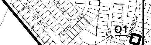
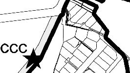
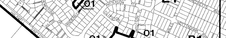
6 Attachment 1 Location Plan 5
7 Attachment 2 Letter from Matson & Allan Real Estate 6
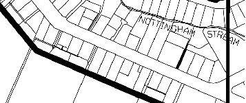
8 Attachment 3 Preliminary Subdivision Concept 7
9 Appendix 3U - Outline Development Plan John Paterson Dr LIMITED ACCESS McTeigue Rd N Halswell Junction Rd Busch Lane Wigram Rd Marshs Rd LAND USE EXISTING RESIDENTIAL ns Rd Fountains Rd Whincops Rd LIMITED ACCESS Quaifes Rd Murphys Rd A A A A A A A A B B B B B B B B C C C C C C RESIDENTIAL DENSITY A RESIDENTIAL DENSITY B RESIDENTIAL DENSITY C BUSINESS 1 RECREATION RESERVE STORMWATER RESERVE POSSIBLE DISTRICT PARK m Business & Information Services Corporate Support Christchurch City Council Halswell West Plan Change - Proposed Change to City Plan Volume 3 Section 2 Appendix 3U Map : ODP 01 Date : Oct
10 Appendix 3U(a) - Marker Buildings & Focal Points John Paterson Dr N COMMUNITY FOOTPRINT Halswell Junction Rd Busch Lane h TO PORT HILLS Wigram Rd MAJOR INTERSECTION Marshs Rd COMMUNITY FOOTPRINT h Fountains Rd Whincops Rd NEIGHBOURHOOD CENTRE Murphys Rd TO PORT HILLS LEGEND h FOCAL POINTS MARKER BUILDING LOCATIONS MAJOR SIGHT LINES COMMUNITY FOOTPRINT BUSINESS 1 AREA m Business & Information Services Corporate Support Christchurch City Council Halswell West Plan Change - Proposed Change to City Plan Volume 3 Section 2 Appendix 3U Map : FOCAL POINTS 02 Date :SEPT
11 Appendix 3U(b) - Movement Network Carrs Rd John Paterson Dr LIMITED ACCESS McTeigue Rd N P E E E E E E E EEEE E EE EE E E E E E E E E E E E E E EE E E E E E E E E E E EEEE E E k Halswell Junction Rd Busch Lane k P Wigram Rd P Marshs Rd INDICATIVE PEDESTRIAN / CYCLE BRIDGE LOCATIONS INTO RESERVE k P LEGEND E E ROAD WIDENING PUBLIC TRANSPORT ROUTE ARTERIAL ROAD COLLECTOR ROAD LANEWAY PEDESTRIAN/CYCLE SHARED ACCESS Fountains Rd Whincops Rd LIMITED ACCESS Quaifes Rd Murphys Rd k BUS STOP P ROUNDABOUT TWO INDICATIVE PUBLIC TRANSPORT ROUTES HAVE BEEN SHOWN BUT ONLY ONE WILL BE PROVIDED, WITH THE CHOICE TO BE MADE AT THE TIME THE PUBLIC TRANSPORT SERVICE IS ESTABLISHED m Business & Information Services Corporate Support Christchurch City Council Halswell West Plan Change - Proposed Change to City Plan Volume 3 Section 2 Appendix 3U Map : transportation Date : OCT


12 Appendix 3U(c) - Blue Network N Carrs Rd John Paterson Dr UPPER UPPER UPPER UPPER CATCHMENT CATCHMENT CATCHMENT CATCHMENT FLOW FLOW FLOW FLOW Busch Lane NATURALISED OPEN SWALE DISCHARGE POINT TO KNIGHTS STREAM Halswell Junction Rd UPPER CATCHMENT FLOW Wigram Rd NATURALISED OPEN SWALE Knights Stream Marshs Rd LEGEND NATURALISED OPEN SWALE Quaifes Rd Murphys Rd WATERWAYS GROUNDWATER CATCHMENT Fountains Rd Whincops Rd DRY DETENTION POND DRY FIRST FLUSH BASIN WET DETENTION POND m Business & Information Services Corporate Support Christchurch City Council Halswell West Plan Change - Proposed Change to City Plan Volume 3 Section 2 Appendix 3U Map : BLUE 03 Date : SEPT
13 Appendix 3U(d) - Green Network N LEGEND POSSIBLE FUTURE ROAD WIDENING STRIP (5m) CIVIC PARK NEIGHBOURHOOD PARK RESERVE (POSSIBLE DISTRICT PARK) SUBURBAN RIPARIAN PARK URBAN RIPARIAN PARK WETLAND PARK m Business & Information Services Corporate Support Christchurch City Council Halswell West Plan Change - Proposed Change to City Plan Volume 3 Section 2 Appendix 3U Map : GREEN 04 Date : SEPT

14 Appendix 3U(e) - Reticulation Network Springs Rd Halswell Junction Rd Carrs Rd N John Paterson Dr PUMP MAIN TO HAYTONS ROAD Busch Lane Wigram Rd H EXISTING PS 83 TO BE REDIRECTED Knights Stream H Hodgens Rd Marshs Rd EXISTING PS 81 TO BE ABANDONED AND FLOWS DIRECTED TO PROPOSED PS Fountains Rd Whincops Rd Quaifes Rd PROPOSED SEWER PUMP STATION H Murphys Rd LEGEND SEWER GRAVITY SEWER TRUNK PUMPED SEWER SEWER CATCHMENT H SEWER PUMP STATION WATER EXISTING WATERMAIN KEY WATER RETICULATION ROUTE FUTURE TRUNK WATERMAINS m Business & Information Services Corporate Support Christchurch City Council Halswell West Plan Change - Proposed Change to City Plan Volume 3 Section 2 Appendix 3U Map : SEWER Date :SEPT
15 Appendix 3U(f) - Tangata Whenua Layer Diagram Owaka Carrs Rd N John Paterson Dr Huritini / Knights Stream Busch Lane Halswell Junction Rd Wigram Rd Marshs Rd LEGEND Traditional places & sites of significance Hodgens Rd Murphys Rd Significant habitat corridor & waterway (controlled) Fountains Rd Whincops Rd Quaifes Rd Traditional headwaters Proposed indigenous tree planting corridor Viewshaft to Otamatua Te Uru Manuka m Business & Information Services Corporate Support Christchurch City Council Halswell West Plan Change - Proposed Change to City Plan Volume 3 Section 2 Appendix 3U Map : tangata whenua Date : SEPT

")


16 REZONE TO LIVING G (HALSWELL WEST) ZONE Loveridge's Property - RU2 not economic at all
17 PROPOSED AMENDMENT PROPOSED AMENDMENT PROPOSED AMENDMENT PROPOSED AMENDMENT Loveridge'2 Property Esplande will not be given access PROPOSED AMENDMENT PROPOSED AMENDMENT
18 19 th April 2013 Dean & Lorraine Loveridge Whincops Road To whom it may concern, I have been selling Real Estate in the Selwyn and outer Christchurch City Council region for 27 years specialising in Lifestyle blocks and Farm properties. Over that time and especially in the last 3 years since the earthquakes we have seen a general flow of people from the city to the rural areas these are the sorts of people want to live the rural dream give their children a semi rural up bringing have room for a tennis court and pool and own a ride on lawn mower. I get this question every day from buyers why is it we can only either purchase a section ( m2) or the next best thing is a 4ha bare land block The zoning on the fringes of the city and larger rural townships like Prebbleton Lincoln and Rolleston is not ideal A lot of people don t want 4 ha they have no idea or the skills to look after it. What people are crying out for are 2000 to 3000 m2 sections some thing with a bit of room for the family but also something that is manageable The block of Dean and Lorraine Loveridge have is in my opinion an ideal subdivision it has long road frontage and it is a reasonably short distance from road boundary to the back boundary (creek). They would be good shaped blocks which I think is important they are on the edge of some major residential developing occurring so it is a good natural progression. To the north of their block up Whincops Road there has been subdivision of smaller blocks that occurred some 40 odd years ago and that has worked well. I think it is a matter that needs addressing and being at the coal face I see it is as a problem that won t go away. Done properly I think the subdivision of smaller blocks on the edge of residential areas is a good thing and a demand that needs to be met If I can help in any further way please don t hesitate to contact me Yours faithfully, Chris Flanagan: Director Matson & Allan Real Estate Ltd Matson & Allan Real Estate Limited, Licensed under the REA Act Rolleston Drive, Rolleston 7614 Ph F rolleston@marealestate.co.nz South Terrace, P.O Box 41, Darfield 7510 Ph F darfield@marealstate.co.nz 70 High Street, Leeston 7632 Ph F leeston@marealestate.co.nz
18 May Minister of Earthquake Recovery Canterbury Earthquake Recovery Authority c/- Environment Canterbury
 18 May 2015 Minister of Earthquake Recovery Canterbury Earthquake Recovery Authority c/- Environment Canterbury AMENDMENT TO LAND USE RECOVERY PLAN MAP1: LAND USE RECOVERY PLAN FOCUS AREA - REINSTATEMENT
RULE C2 ZONE STANDARDS - SUBDIVISION
 RULE C SUBDIVISION 1 RULE C2 ZONE STANDARDS - SUBDIVISION NB Words outlined in bold type below have a specific definition contained in Chapter 2 (Definitions). 2.1 STANDARDS RESIDENTIAL ZONE (Refer Part
Request for Development Land in the Palm Springs Subdivision to be Granted Special Housing Area Status under the Tauranga Housing Accord
 Request for Development Land in the Palm Springs Subdivision to be Granted Special Housing Area Status under the Tauranga Housing Accord Development Proposal Overview of proposal This request is lodged
Officers Report. Appendix 7. Colliers Valuation and Economic Feasibility Technical Report
 Officers Report Appendix 7 Colliers Valuation and Economic Feasibility Technical Report Preliminary Draft Waimakariri Residential Red Zone Recovery Plan March 2016 Technical Experts Report on Amendments
BEFORE THE CHRISTCHURCH REPLACEMENT DISTRICT PLAN HEARINGS PANEL
 BEFORE THE CHRISTCHURCH REPLACEMENT DISTRICT PLAN HEARINGS PANEL IN THE MATTER of the Resource Management Act 1991 and the Canterbury Earthquake (Christchurch Replacement District Plan) Order 2014 AND
SUBDIVISION, DEVELOPMENT AND EARTHWORKS
 PROPOSED CHAPTER 8 SUBDIVISION, DEVELOPMENT AND EARTHWORKS Chapter 8 Subdivisions - Proposed Changes to delete all draft provisions under the Residential Established New Neighbourhood Zone and replace
Nga Potiki is a Treaty Settlement tribe with mana whenua over the Te Maunga, Mangatawa, Rangataua and Papamoa areas.
 THE NGA POTIKI HOUSING DEVELOPMENT PROPOSAL SPECIAL HOUSING AREA PROPOSAL 6 October 2014 Overview of proposal Nga Potiki plan to develop approximately 27 hectares of land in Papamoa for residential housing.
PLANNING COMMISSION REPORT Regular Agenda Public Hearing Item
 PC Staff Report 11/12/12 Item No. 2B- 1 PLANNING COMMISSION REPORT Regular Agenda Public Hearing Item ITEM NO. 2B: A TO GPI; 110 ACRES; E OF K-10 & N OF W 6 TH ST (MKM) : Consider a request to rezone approximately
SELWYN HOUSING ACCORD
 SELWYN HOUSING ACCORD Selwyn Housing Accord 1 The Selwyn Housing Accord between the Selwyn District Council (the Council) and the Government is intended to increase land and housing supply in the Selwyn
building or renovating your home?
 Thinking about... building or renovating your home? What you should know before you start. What you should know before you start... Building or renovating your home can be a very exciting time. You need
The underlying zones and Auckland-wide objectives apply in this precinct, in addition to those specified below.
 I454 Opaheke 1 I454.1 Precinct description The Opaheke 1 precinct comprises some 27 hectares of land between Bellfield Road and Opaheke Park, approximately 1.5km south of the Papakura Metropolitan Centre.
H6 Residential Terrace Housing and Apartment Buildings Zone
 H6. Residential Terrace Housing and Apartment Buildings Zone [CIV-2016-404-002333: Franco Belgiorno-Nettis]-Note: The properties affected by this appeal are identified on the Auckland Unitary Plan viewer.
CHARLOTTE PLANNING COMMISSION FINDINGS OF FACT AND DECISION IN RE APPLICATION OF. George R. Aube 1450 Dorset Street
 CHARLOTTE PLANNING COMMISSION FINDINGS OF FACT AND DECISION IN RE APPLICATION OF George R. Aube 1450 Dorset Street Final Plan Review For A Two-Lot Subdivision Application # PC-13-19 Background The Planning
Report on a Limited Notified Resource Consent Application
 Resource Management Act 1991 Report on a Limited Notified Resource Consent Application (Section 42A) Application Reference: Land Use: RMA92028641 Subdivision: RMA92022831 Applicant: Site address: CS Luney
City of Grande Prairie Development Services Department
 City of Grande Prairie Development Services Department COUNTRYSIDE SOUTH OUTLINE PLAN Prepared by: GPEC Consulting Ltd. #202, 10712-100th Street Grande Prairie, AB Council Resolution of August 20, 2001
For Vintages of Four Mile Creek Town of Niagara on the Lake, Ontario
 Planning Impact Analysis For Vintages of Four Mile Creek Town of Niagara on the Lake, Ontario Prepared by: Upper Canada Consultants 261 Martindale Road Unit #1 St. Catharines, Ontario L2W 1A1 Prepared
Riverton Properties Ltd Proposed Special Housing Area
 Riverton Properties Ltd Proposed Special Housing Area Housing Accords and Special Housing Areas Act 2013 Expression of Interest 1 This Expression of Interest is made on behalf of Riverton Properties Ltd,
H5. Residential Mixed Housing Urban Zone
 H5. Residential Mixed Housing Urban Zone [ENV-2016-AKL-000197: Robert Adams] Addition sought H5.1. Zone description The Residential Mixed Housing Urban Zone is a reasonably high-intensity zone enabling
H5. Residential Mixed Housing Urban Zone
 H5. Residential Mixed Housing Urban Zone H5.1. Zone description The Residential Mixed Housing Urban Zone is a reasonably high-intensity zone enabling a greater intensity of development than previously
15.1 Introduction. Waipa District Plan. Section 15 - Infrastructure, Hazards, Development and Subdivision. Page Version - 1 November 2016 Page 1 of 56
 15.1 Introduction 15.1.1 How and where development and subdivision occurs is critical to the sustainable management of the District s natural and physical resources. This section of the Plan focuses on
Flinders Avenue, Lara Planning Scheme Amendment Combined Application for Rezoning and Multi-Lot Subdivision Reference : Decembe
 143-179 Flinders Avenue, Lara Planning Scheme Amendment Combined Application for Rezoning and Multi-Lot Subdivision Reference: 14134-03 TGM Group Geelong Melbourne Ballarat 1/27-31 Myers Street (PO Box
H4. Residential Mixed Housing Suburban Zone
 H4. Residential Mixed Housing Suburban Zone H4.1. Zone description The Residential Mixed Housing Suburban Zone is the most widespread residential zone covering many established suburbs and some greenfields
DUN LAOGHAIRE RATHDOWN COUNTY COUNCIL PLANNING AND DEVELOPMENT ACTS, SECTION 49 - SUPPLEMENTARY DEVELOPMENT CONTRIBUTION SCHEME.
 DUN LAOGHAIRE RATHDOWN COUNTY COUNCIL PLANNING AND DEVELOPMENT ACTS, 2000-2006 SECTION 49 - SUPPLEMENTARY DEVELOPMENT CONTRIBUTION SCHEME For GLENAMUCK DISTRICT DISTRIBUTOR ROAD SCHEME AND SURFACE WATER
STAGE 3 - SECTION 32 CHAPTER 17 RURAL - CRANFORD BASIN APPENDIX 7 - CRANFORD BASIN PROPERTY ECONOMICS REPORT
 STAGE 3 - SECTION 32 CHAPTER 17 RURAL - CRANFORD BASIN APPENDIX 7 - CRANFORD BASIN PROPERTY ECONOMICS REPORT Notified 25 July 2015 MARCH 2015 CRANFORD BASIN CHRISTCHURCH COMMERCIAL POTENTIAL OVERVIEW CHRISTCHURCH
Guide to Subdivision and Land Development
 Guide to Subdivision and Land Development Fraser Thomas Ltd......is an engineering and surveying consulting firm based in Highbrook which has provided Surveying, Engineering, Planning and Resource Management
Volume Three Appendix 7. Scheme Plan and other subdivision requirements
 Volume Three Appendix 7 Appendix 7 Scheme Plan and other subdivision requirements Any application for subdivision consent must be accompanied by a Scheme Plan that contains the information set out in this
Resource Consent Application Form
 Resource Consent Application Form Section 88 of the Resource Management Act 1991. This form provides us with your contact information and details about your proposal. Please print clearly and complete
μ1:750 SUBJECT PROPERTY RRI INST RRI O RRI DISCLAIMER: This map is based on current information at the date of production.
 W:\Engwork\Planw\applications 2016\147-149 thorburn road.mxd 36 37 38 39 MACLAREN PL R2 μ1:750 93 95 40 41 THORBURN RD RRI 155 SUBJECT PROPERTY R2 42 43 SEABORN ST 97 99 R2 101 103 161 INST 149 RRI O 147
Standard for the acquisition of land under the Public Works Act 1981 LINZS15005
 Standard for the acquisition of land under the Public Works Act 1981 LINZS15005 Version date: 20 February 2014 Table of contents Terms and definitions... 5 Foreword... 6 Introduction... 6 Purpose... 6
6. REPORT BY THE CHAIRPERSON OF THE FENDALTON/WAIMAIRI COMMUNITY BOARD - 4 NOVEMBER 2009
 6. REPORT BY THE CHAIRPERSON OF THE FENDALTON/WAIMAIRI COMMUNITY BOARD - 4 NOVEMBER 2009 1. POUND ROAD ROAD STOPPING AND LAND SWAP General Manager responsible: General Manager City Environment, DDI 941-8608
H4. Residential Mixed Housing Suburban Zone
 H4. Residential Mixed Housing Suburban Zone H4.1. Zone description The Residential Mixed Housing Suburban Zone is the most widespread residential zone covering many established suburbs and some greenfields
LAND USE PROCEDURES (LUP) BYLAW NO. 1235, 2007
 BYLAW NO. 1235, 2007") TOWN OF OSOYOOS LAND USE PROCEDURES (LUP) BYLAW NO. 1235, 2007 Adopted August 13, 2007 PART 1 PART 2 PART 3 PART 4 PART 5 PART 6 PART 7 PART 8 TABLE OF CONTENTS Index provided for ease of use and was not
TOWN OF OSOYOOS LAND USE PROCEDURES (LUP) BYLAW NO. 1235, 2007 Adopted August 13, 2007 PART 1 PART 2 PART 3 PART 4 PART 5 PART 6 PART 7 PART 8 TABLE OF CONTENTS Index provided for ease of use and was not
Determining responsibility for retaining walls
 Determining responsibility for retaining walls Determining Retaining Walls Responsibility Dear resident, Christchurch City Council is contacting property owners around the Port Hills and Lyttelton area,
Bylaw No , being "Official Community Plan Bylaw, 2016" Schedule "A" DRAFT
 Bylaw No. 2600-2016, being "Official Community Plan Bylaw, 2016" Schedule "A" Urban Structure + Growth Plan Urban Structure Land use and growth management are among the most powerful policy tools at the
CHESHIRE WEST AND CHESTER COUNCIL
 Item No. 10 CHESHIRE WEST AND CHESTER COUNCIL Planning Committee 1 st April 2014 APPLICATION NUMBER: 13/05410/FUL DESCRIPTION OF DEVELOPMENT: Residential development of 17 affordable dwellings and associated
BEFORE THE HEARINGS PANEL FOR THE QUEENSTOWN LAKES PROPOSED DISTRICT PLAN AND
 BEFORE THE HEARINGS PANEL FOR THE QUEENSTOWN LAKES PROPOSED DISTRICT PLAN IN THE MATTER of the Resource Management Act 1991 AND IN THE MATTER of Stage 2 including variations to Stage 1 of the Proposed
LAND USE AMENDMENT SPRINGBANK HILL (WARD 6) ELMONT DRIVE SW AND 69 STREET SW BYLAW 114D2017
 ELMONT DRIVE SW AND 69 STREET SW BYLAW 114D2017") Page 1 of 8 EXECUTIVE SUMMARY This land use amendment application proposes to redesignate and subdivide 1.15 hectares of land located within the southwest community of East Springbank to accommodate 17
Page 1 of 8 EXECUTIVE SUMMARY This land use amendment application proposes to redesignate and subdivide 1.15 hectares of land located within the southwest community of East Springbank to accommodate 17
DRAFT PROPOSED CHAPTER 21 SPECIFIC PURPOSE - FLAT LAND RECOVERY ZONE
 DRAFT PROPOSED CHAPTER 21 SPECIFIC PURPOSE - FLAT LAND RECOVERY ZONE Note: The Specific Purpose (Flat Land Recovery) Zone is a "holding" zone that will be subject to a later plan change to confirm the
NORTH LEEDS MATTER 2. Response to Leeds Sites and Allocations DPD Examination Inspector s Questions. August 2017
 NORTH LEEDS MATTER 2 Response to Leeds Sites and Allocations DPD Examination Inspector s Questions August 2017 CLIENT: TAYLOR WIMPEY, ADEL REFERENCE NO: CONTENTS 1.0 INTRODUCTION 2.0 TEST OF SOUNDNESS
APPLICATION FOR A SEVERANCE CONSENT
 APPLICATION FOR A SEVERANCE CONSENT PLEASE SUBMIT YOUR COMPLETED APPLICATION TO: Liz Mitchell, Planning Assistant The Municipality of Trent Hills 66 Front Street South P.O. Box 1030 Campbellford, Ontario
Christchurch Housing Accord Monitoring Report. For quarter ending June 2015
 Christchurch Housing Accord Monitoring Report For quarter ending June 2015 Executive Summary This report provides an overview of the Christchurch housing market and an update on priority Accord actions.
TOWNSHIP OF BORDENTOWN LAND DEVELOPMENT APPLICATION CHECKLIST. General Requirements for all Applications
 TOWNSHIP OF BORDENTOWN LAND DEVELOPMENT APPLICATION CHECKLIST This CHECKLIST has been adopted in accordance with Section 25:807 of the Land Development Ordinance of the Township of Bordentown and will
14 Strachan Ave and East Liberty St - Rezoning Application - Preliminary Report
 STAFF REPORT ACTION REQUIRED 14 Strachan Ave and 39-51 East Liberty St - Rezoning Application - Preliminary Report Date: August 19, 2009 To: From: Wards: Reference Number: Toronto and East York Community
GUIDE TO SUBDIVISION & LAND DEVELOPMENT
 GUIDE TO SUBDIVISION & LAND DEVELOPMENT The Fraser Thomas Difference: Fraser Thomas Ltd is an engineering and surveying consulting firm based in Highbrook, and has been providing; Surveying, Engineering,
PROPOSED ROAD STOPPING / LAND EXCHANGE 47 MANNERS STREET
 REGULATORY PROCESS COMMITTEE 5 DECEMBER 2013 REPORT 3 PROPOSED ROAD STOPPING / LAND EXCHANGE 47 MANNERS STREET 1. Purpose of Report The purpose of this report is to seek approval from the Council for the
ESTES VALLEY STORMWATER MANAGEMENT PROGRAM
 ESTES VALLEY STORMWATER MANAGEMENT PROGRAM Phase I. Stormwater Master Plan Phase II. Stormwater Utility Feasibility Study Board of Realtors Meeting May 3, 2018 Stormwater Master Plan Summary Stormwater
Presentation to the Real Estate Institute of New Zealand 28 October 2016
 Presentation to the Real Estate Institute of New Zealand 28 October 2016 Disclaimer This presentation provides a high level overview of specific parts of the Proposed Auckland Unitary Plan Decisions Version
COUNTY OF ALBEMARLE PLANNING STAFF REPORT SUMMARY
 COUNTY OF ALBEMARLE PLANNING STAFF REPORT SUMMARY Project Name: ZMA 2010-00015, Cedar Hill Planning Commission Worksession: February 15, 2011 Public Hearing: Not scheduled Staff: Judith C. Wiegand, AICP
Settlement Pattern & Form with service costs analysis Preliminary Report
 Settlement Pattern & Form with service costs analysis Preliminary Report Prepared for Regional Planning Halifax Regional Municipality by Financial Services, HRM May 15, 2004 TABLE OF CONTENTS INTRODUCTION...
Chapter 8 Transportation
 Chapter 8 Transportation Introduction 1. Chapter 8 of the PDP contains provisions concerning the development, maintenance and use of the transport network and associated activities. It recognises that
SOUTH CAMBRIDGESHIRE DISTRICT COUNCIL. Executive Director (Operational Services)/ Corporate Manager (Planning and New Communities)
/ Corporate Manager (Planning and New Communities)") SOUTH CAMBRIDGESHIRE DISTRICT COUNCIL REPORT TO: Planning Committee 3 November 2010 AUTHOR/S: Executive Director (Operational Services)/ Corporate Manager (Planning and New Communities) Notes: S/0244/10/F
SOUTH CAMBRIDGESHIRE DISTRICT COUNCIL REPORT TO: Planning Committee 3 November 2010 AUTHOR/S: Executive Director (Operational Services)/ Corporate Manager (Planning and New Communities) Notes: S/0244/10/F
Campbelltown (Urban Area) Local Environmental Plan 2002 (Amendment No 15)
 Local Environmental Plan 2002 (Amendment No 15)") New South Wales Campbelltown (Urban Area) Local Environmental Plan 2002 (Amendment under the Environmental Planning and Assessment Act 1979 I, the Minister for Planning, make the following local environmental
New South Wales Campbelltown (Urban Area) Local Environmental Plan 2002 (Amendment under the Environmental Planning and Assessment Act 1979 I, the Minister for Planning, make the following local environmental
Greenfield Development Requirements
 Greenfield Development Requirements Planning & Engineering Department City of Yorkton Saskatchewan 2014 Summary Greenfield Development refers to the development of raw land to a finished state as residential,
APPLICATION FOR AN OFFICIAL PLAN AMENDMENT
 NOTE TO APPLICANTS: APPLICATION FOR AN OFFICIAL PLAN AMENDMENT and/or ZONING BY-LAW AMENDMENT under Subsection 22(1) and/or 34 of the Planning Act (A PRIVATELY INITIATED APPLICATION) This application form
PLANNING FOR OUR FUTURE
 PLANNING FOR OUR FUTURE ELLSWORTH TOWNSHIP LAND USE AND POLICY PLAN The purpose of this Plan is to serve as a guide for the Township Trustees, Zoning Commission, Board of Zoning Appeals, developers, employers,
Such further or other relief that addresses the issues raised in this appeal point
 Context of the appeal: PD & KJ Sieling consider that: 1. The PDP fails to adequately address Whitianga zoning issues in a pragmatic manner by not allowing for sensible growth of the township and its immediate
PROPOSED APARTMENT DEVELOPMENT 32 & 34 TENNYSON AVE TAKAPUNA INTEGRATED TRANSPORT ASSESSMENT
 PROPOSED APARTMENT DEVELOPMENT 32 & 34 TENNYSON AVE TAKAPUNA INTEGRATED TRANSPORT ASSESSMENT Prepared by E.R Hebner 30 th November 2016 Z:\2015_Projects\15155-34 Tennyson Ave\doc\34 Tennyson Ave - Traffic
Paul D. Ralph, BES, RPP, MCIP, Commissioner, Development Services Department
 Public Report To: From: Report Number: Development Services Committee Paul D. Ralph, BES, RPP, MCIP, Commissioner, Development Services Department DS-18-64 Date of Report: March 22, 2018 Date of Meeting:
Visit the website for plans and further details: M B
 Halswell JUNCTION ROAD, Christchurch Sections in Stage A range in size from m. Prices start from a very exciting $0,000. Fibre will be laid to each property which will provide high-speed internet connections.
DRAFT. 171, 173, 175 Greenbank Road Zoning Review. Planning Report
 DRAFT 171, 173, 175 Greenbank Road Zoning Review Planning Report March 2013 Introduction and Scope of Work Meloshe and Associates Ltd was retained by the City of Ottawa s General Manager, Planning and
Sanctuary North Ltd Cove Rd - Mangawhai Proposed Subdivisions, Changes to Consent Conditions and Consent Notice
 Sanctuary North Ltd Cove Rd - Mangawhai Proposed Subdivisions, Changes to Consent Conditions and Consent Notice Resource Consent Applications Assessment of Environmental Effects August 2016 REPORT INFORMATION
Financial Impact Statement There are no immediate financial impacts associated with the adoption of this report.
 STAFF REPORT Planning and Development Department Subject: Application by RYC Property to rezone a portion of lands on John Murray Dr. and Megan Lynn Dr. from R2 to R3 and to enter into a Development Agreement
NELSON MANDELA METROPOLITAN MUNICIPALITY
 NELSON MANDELA METROPOLITAN MUNICIPALITY APPLICATION FOR CHANGE IN USE OF LAND (PLACE A CROSS IN APPROPRIATE BLOCKS) 1. REZONING TO SUBDIVISIONAL AREA - In terms of section 17 of the Land Use Planning
Section 12A Purpose of Subdivision Provisions
 Section 12A 12A Purpose of Subdivision Provisions Subdivision is primarily about creating land parcels that define and redefine property rights and, in most instances, the creation of new parcels of land
Explanation The policies ensure that land is suitable for subdivision and will not increase risks to people, the environment and property.
 23 Subdivision 23.1 Purpose a) Subdivision is essentially the process of dividing a parcel of land or a building into one or more further parcels, or changing an existing boundary location. Subdivision
DEVELOPMENT AGREEMENT APPLICATION
 151-11172 LYNNETT ROAD, SPRYFIELD DEVELOPMENT AGREEMENT APPLICATION JULY 28, 2016 1 Spectacle Lake Drive Dartmouth, NS B3B 1X7 Phone: 902-835-9955 Fax: 902-835-1645 www.wspgroup.com 151-11172 July 28,
Gisborne District Council
 12.0 SUBDIVISION... 1 12.1 INTRODUCTION... 1 12.2 ISSUE... 1 12.3 OBJECTIVE (SUBDIVISION)... 1 12.4 POLICIES (SUBDIVISION)... 2 12.5 METHODS OF IMPLEMENTATION... 4 12.5.1 REGULATION... 4 12.6 RULES FOR
V3 19/05/2014. Future use of former Red Zone land at Pines and Kairaki Beaches
 Future use of former Red Zone land at Pines and Kairaki Beaches Future use of former Red Zone land at Pines and Kairaki Beaches V3 19/05/2014 This page contains the main points. Details relating to each
Objectives The objectives are as listed in the underlying Single House and Mixed Housing Suburban zones except as specified below:
 7.12 Birdwood 2 Precinct Description The Birdwood 2 precinct comprises 26.1 hectares of land approximately 15 km west of Auckland s CBD, 4 km south-west of the Westgate town centre and 1km north of the
PUBLIC HEARINGS. Variance 1916, 1918 and 1920 St. Mary s Road (St. Norbert Ward) File DAV /2013D [c/r DASZ 28/2013]
![PUBLIC HEARINGS. Variance 1916, 1918 and 1920 St. Mary s Road (St. Norbert Ward) File DAV /2013D [c/r DASZ 28/2013]](/thumbs/90/101595906.jpg "PUBLIC HEARINGS. Variance 1916, 1918 and 1920 St. Mary s Road (St. Norbert Ward) File DAV /2013D [c/r DASZ 28/2013]") Agenda Riel Community Committee January 13, 2014 PUBLIC HEARINGS Item No. 3 Variance 1916, 1918 and 1920 St. Mary s Road (St. Norbert Ward) File DAV 163360/2013D [c/r DASZ 28/2013] WINNIPEG PUBLIC SERVICE
Agenda Riel Community Committee January 13, 2014 PUBLIC HEARINGS Item No. 3 Variance 1916, 1918 and 1920 St. Mary s Road (St. Norbert Ward) File DAV 163360/2013D [c/r DASZ 28/2013] WINNIPEG PUBLIC SERVICE
Pre-Applica on Design Statement : Residen al Development, The Gas Works, 113 Bury Road, The ord, Norfolk 1
 13-188 Pre-Applica on Design Statement: Residen al Development, The Gas Works, 113 Bury Road, The ord, Norfolk Prepared by: Gary Johns Architects Date: October 2015 15-311 Pre-Applica on Design Statement
Wigan Core Strategy Examination Additional Hearing Sessions
 Wigan Core Strategy Examination Additional Hearing Sessions Morris Homes & Persimmon Homes Session on Specific Proposals to Meet the Identified Shortfall in Housing Land Golborne & Lowton 6 th March 2013
E38. Subdivision - Urban
 E38. Subdivision - Urban E38.1. Introduction Subdivision is the process of dividing a site or a building into one or more additional sites or units, or changing an existing boundary location. Objectives,
Acquiring & Disposing Of Land
 SECTION 5 Acquiring & Disposing Of Land 5.1 Acquiring Open Space It is intended that this Strategy be used to identify if, what, where and when future open spaces should be acquired and developed. The
TOWN OF WHITBY REPORT RECOMMENDATION REPORT
 TOWN OF WHITBY REPORT RECOMMENDATION REPORT REPORT TO: Planning and Development Committee REPORT NO: PL 4-08 DATE OF MEETING: January 21, 2008 FILE NO(S): MI-01-07 (SW- 2002-03) PREPARED BY: Planning Department
Conceptual Scheme SE W4
 December 2012 1. PURPOSE 1.1. The purpose of a Conceptual Scheme (CS) is as follows: a) To provide a framework for the subsequent subdivision and/or development of land within the Country Residential Policy
Investment Opportunity Rupley Site
 Investment Opportunity Rupley Site Site size 5.28 acres Location Northwest corner of exit 48 off of South Huntington Access I-5 freeway, street access directly from South Huntington (on truck route), BNSF
LINCOLN COUNTY PLANNING & INSPECTIONS DEPARTMENT
 LINCOLN COUNTY PLANNING & INSPECTIONS DEPARTMENT 30 NORTH ACADEMY STREET, SUITE A, LINCOLNTON, NORTH CAROLINA 809 704-736-8440 OFFICE 704-736-8434 INSPECTION REQUEST LINE 704-73-900 FAX To: Board of Commissioners
East Herts District Plan Part 1: Strategy Sieve 5: Strategy Testing. Land Owner/Developer Questionnaire
 East Herts District Plan Part 1: Strategy Sieve 5: Strategy Testing Land Owner/Developer Questionnaire ugust 2012 rea of Search: 20. Ware East Sub-rea Call for Sites Ref: 05/020 (as subsection of larger
CHECKLIST FOR DEVELOPMENT REVIEW
 CHECKLIST FOR DEVELOPMENT REVIEW Petitions and related documents and plans for land development or other proposals regulated by Title 16 of the Municipal Code (Development Ordinance) and Title 17 of the
CONSULTATION STATEMENT
 October 2016 LB BIR.4109 BLOOR HOMES CONSULTATION STATEMENT Tanworth Lane, Cheswick Green PHASES 2 & 2A TOWN & COUNTRY PLANNING ACT 1990 (AS AMENDED) PLANNING AND COMPULSORY PURCHASE ACT 2004 Pegasus Group
Village of Port Jefferson Urban Renewal Plan
 Urban Renewal Plan Village of Port Jefferson Urban Renewal Plan Port Jefferson, New York PREPARED FOR Village of Port Jefferson Village Board 121 West Broadway Port Jefferson, NY 11777 631.473.4724 PREPARED
610 LAND DIVISIONS AND PROPERTY LINE ADJUSTMENTS OUTSIDE A UGB
 ARTICLE VI: LAND DIVISIONS AND PROPERTY LINE ADJUSTMENTS VI-21 610 LAND DIVISIONS AND PROPERTY LINE ADJUSTMENTS OUTSIDE A UGB 610-1 Property Line Adjustments (Property Line Relocation) A property line
OAKGREEN AVENUE. Project Goals. (County Road 65) Corridor Improvement Project. Turn lanes Resurfacing Stormwater management
 Corridor Improvement Project. Turn lanes Resurfacing Stormwater management") Project Overview Washington County is leading a study to develop a preliminary design concept for Oakgreen Avenue (County Road 65) between 40th Street N and 10th Street N in Baytown Township and West Lakeland
Project Overview Washington County is leading a study to develop a preliminary design concept for Oakgreen Avenue (County Road 65) between 40th Street N and 10th Street N in Baytown Township and West Lakeland
INNOVATIVE PLANNING SOLUTIONS
 Reference Document 2 Committee of the Whole Item CCW 16-190 1 of 13 INNOVATIVE PLANNING SOLUTIONS Township of Springwater Planning Department 2231 Nursery Road Minesing, ON L0L 1Y2 Tuesday February 24
Planned Residential Development ( PRD ) Application
 Application") FOR PLANNING USE ONLY Application # PRD Application Fee $ Receipt No. Filing Date Completeness Date Planned Residential Development ( PRD ) Application A. PROJECT INFORMATION 1. Project Name: 2. Address
FOR PLANNING USE ONLY Application # PRD Application Fee $ Receipt No. Filing Date Completeness Date Planned Residential Development ( PRD ) Application A. PROJECT INFORMATION 1. Project Name: 2. Address
Guidelines for the Approval of New Homes Sales Offices (Building Permits, Agreements, Securities)
") Guidelines for the Approval of New Homes Sales Offices (Building Permits, Agreements, Securities) ENCLOSURES: Site Plan Application Building Permit Application Grading and Drainage Approval Requirements
Guidelines for the Approval of New Homes Sales Offices (Building Permits, Agreements, Securities) ENCLOSURES: Site Plan Application Building Permit Application Grading and Drainage Approval Requirements
Development Variance Permit
 City of Surrey PLANNING & DEVELOPMENT REPORT File: 7905-0149-00 Development Variance Permit Proposal: Development Variance Permit to vary the number of fascia signs from 1 to 2. Recommendation: Approval
4. If any perennial surface water passes through or along the property lines of the acreage, a minimum of 200 feet or frontage should be required.
 b. Provide adequate acreage for appropriate productive use of rural residential land, such as small numbers of livestock, large gardens, etc. 3. Minimum of 200 feet of frontage on an improved county or
SCHEDULE 12 TO THE URBAN GROWTH ZONE. Shown on the planning scheme map as UGZ12. Kororoit Precinct Structure Plan
 SCHEDULE 12 TO THE URBAN GROWTH ZONE Shown on the planning scheme map as UGZ12. Kororoit Precinct Structure Plan 1.0 The plan Map 1 below shows the future urban structure proposed in the Kororoit Precinct
STAFF REPORT. Financial Impact Statement There are no immediate financial impacts associated with the adoption of this report.
 STAFF REPORT Planning and Development Department Subject: Cottage Country Unsubstantial Amendment to Development Agreement To: CAO for Planning Advisory Committee, December 13, 2016 Date Prepared: December
Truganina Employment Precinct Development Contributions Plan
 Amendment C124 to the Wyndham Planning Scheme Truganina Employment Precinct Development Contributions Plan December 2009 SM 20091202 11:05 CONTENTS PURPOSE 3 REPORT STRUCTURE 3 1.0 STRATEGIC BASIS 5 1.1
P L A N N I N G A P P L I C A T I O N F O R M
 P L A N N I N G A P P L I C A T I O N F O R M Part 1: Applicant Information Part 2: Application Details Part 3: Supporting Information Requirements Part 4: Fees PART 1: APPLICANT INFORMATION Registered
Plans shall be drawn at a readable scale, signed, and sealed by a Florida Registered Engineer. The application package shall include:
 CHAPTER 400. SECTION 403. PERMIT TYPES AND APPLICATIONS SITE DEVELOPMENT 403.3. Preliminary Site Plans (PSP) A. Intent and Purpose PSPs are used to identify existing site conditions and demonstrate general
APPENDIX B. SUBMISSION REQUIREMENTS
 Master Major Site Minor Site Landscape Section B.1 Table of /Plat Requirements Proposed or approved name of development, project, subdivision, and/or phase. Location, including township, county, and state.
PAPAKAINGA DISTRICT WIDE ACTIVITY
 SECTION 13.1 PAPAKAINGA DISTRICT WIDE ACTIVITY 13.1.1 INTRODUCTION The Resource Management Act 1991 introduced specific and new obligations for those exercising functions and powers under the Act to provide
P. H. Robinson Consulting Urban Planning, Consulting and Project Management
 PLANNING RATIONALE REPORT 351 CROYDON - SITE PLAN APPLICATION CITY OF OTTAWA PREPARED BY: P H ROBINSON CONSULTING JULY 2017 This report has been prepared on behalf of Urban Structure Properties Ltd in
PART SIXTEEN - SUBDIVISION AND DEVELOPMENT
 16.1 24 July 2010 PART SIXTEEN - SUBDIVISION AND DEVELOPMENT 1. INTRODUCTION Council has the statutory responsibility to control subdivision of land and the effects of land use throughout the District.
Hinchinbrook Shire Adopted Infrastructure Charges Resolution CR1-2018
 Hinchinbrook Shire Adopted Infrastructure Charges Resolution CR1-2018 Part 4 ge 23 Hinchinbrook Shire COUNCIL CHARGES RESOLUTION No. 1-2018 Table of Contents 1.0 Introduction 3 1.1 Planning Act 2016 (PAct)
Hutt River City Centre Upgrade Project Preliminary Integrated Design
 Report 2016.24 Date 5 February 2016 File N/03/18/22 Committee Author Hutt Valley Flood Management Subcommittee Daya Atapattu, Senior Project Engineer Hutt River City Centre Upgrade Project Preliminary