AGENDA - COMMITTEE OF ADJUSTMENT FEBRUARY 13, 2014
|
|
|
- Amberly Atkins
- 5 years ago
- Views:
Transcription
1 AGENDA - COMMITTEE OF ADJUSTMENT FEBRUARY 13, 2014 Page A Meeting of the Committee of Adjustment will be held on Thursday, February 13, 2014 at 9:00 a.m., in the Council Chambers, Municipal Offices, Port Carling, Ontario. 1. Call to Order 2. Adoption of Agenda a. Resolution to Adopt the Agenda. 3. Declaration of Conflict of Interest 4. Adoption of Minutes 4-15 a. Resolution to Adopt the Minutes. 5. Delegations a. Ms. Terry Ledger and Mr. Dennis Cubberley, Agents, to attend at 10:30 a.m. re: Item 11.a., Unfinished Business, (Port of Call Inc.). b. Mr. Adam Wallace to attend at 10:45 a.m. re: Item 11.b., Unfinished Business, (Wallace). 6. Hearing of Consent Applications (In Conjunction with Zoning Amendment Applications) 7. Hearing of Concurrent Consent Applications and Minor Variance Applications a. B/02/14/ML, A-02/14, Ontario Limited, Part of Lot 18, Concession G, Parts 5-7, Plan 35R-12196, Part 1, Plan 35R-21154, (Medora), Page 1 of 133
2 Page 8. Hearing of Consent Applications a. B/01/14/ML, Viner, Part of Lot 34, Concession 1, Part 4, Plan 35R-16217, (Cardwell), Hearing of Minor Variance Applications a. A-60/13, Hopwood, Part of Lots 24 and 25, Concession 7, Part 1, Plan 35R-2335, (Port Carling), b. A-75/13, Matthews, Part of Lots 4 and 5, Concession 4, (Wood), c. A-03/14, Ormiston, Part of Lot 33, Concession 13, (Medora), d. A-04/14, Stone, Part of Lot 21, Concession 9, Parts 1-6, Plan 35R-17567, (Medora), Correspondence 11. Unfinished Business a. B/89/90/13/ML, Port of Call Inc., Part of Lot 29, Concession 3, (Port Carling), This application was adjourned at the hearing held on September 12, b. Reimbursement of Survey and Legal Costs, Transfer of Road, B/32/13/ML, Wallace, Part of Lots 17 and 18, Concession 7, (Medora), Information Items a. Appeal to the Ontario Municipal Board, A-65/13, Meredith, Part of Lot 3, Concession B, Tobin's Island, Lake Rosseau, (Medora), b. Appeal to the Ontario Municipal Board, A-67/13, Leenaars, Part of Lot 30, Concession 3, Part Lot 72 and Lot 74, Part of Block G and I, Plan M-373, Parts 8 and 18, Plan BR-1276, Part 2, Plan BR-1629, (Port Carling), c. Appeal to the Ontario Municipal Board Update, A-41/13, Ontario Ltd., Part of Lot 8, Concession 8, (Medora), New Business 14. Statistics 15. Committee in Closed Session Page 2 of 133
3 Page 16. Adjournment a. Resolution to Adjourn the Meeting. Page 3 of 133


4 Resolution to Adopt the Minutes. Page 4 of 133
5 THE CORPORATION OF THE TOWNSHIP OF MUSKOKA LAKES MINUTES OF COMMITTEE OF ADJUSTMENT A Meeting of the Committee of Adjustment was held on Thursday, January 16 th, 2014, at 9:00 a.m., in the Council Chambers, Municipal Office, Port Carling, Ontario. PRESENT: Members Present: Officials Present: Allen Edwards - Chair B. Noble - Development Planner Alice Murphy D. Pink - Director of Planning Carol-Ann Robinson A. Glazier - Committee of Adjustment Coordinator /Acting Secretary-Treasurer L. Forbes - Planning Assistant 1. Meeting Called to Order a. Chair Edwards called the meeting to order at 9:03 a.m. 2. Adoption of Agenda a. Consideration of a resolution to adopt the agenda. Resolution Number: CA-01-16/01/2014 Member Murphy Member Robinson: Be it resolved that the Committee of Adjustment Meeting Agenda dated January 16, 2014, be adopted. Carried. 3. Declaration of Conflict of Interest a. None. 4. Adoption of Minutes a. Consideration of a resolution to adopt the Committee of Adjustment Meeting Minutes held on December 12, Delegations Resolution Number: CA-02-16/01/2014 Member Murphy Member Robinson: Be it resolved that the minutes dated December 12, 2013, be adopted and approved as circulated. Carried. a. None.DRAFT Resolution to Adopt the Minutes. Committee of Adjustment January 16, 2014 Page 1 of 11 Page 5 of 133
6 Committee of Adjustment January 16, 2014 Page 2 of Hearing of Consent Applications (In Conjunction with Zoning Amendment Applications) a. None. 7. Hearing of Consent Applications and Minor Variance Applications a. None. 8. Hearing of Consent Applications a. None. 9. Hearing of Minor Variance Applications a. A-69/13, Malinowski, Malinowski, Lynch, Part of Lot 4, Concession 12, Parts 2-5 on Plan 35R-19862, (Watt), Roll # Mr. Noble explained the history, nature and location of the application/property and displayed a pictorial summary of the application, a copy of which is attached. Notice of the Hearing was circulated 27 days prior. Mr. Noble circulated photographs submitted by the applicant, copies of which are attached. Submissions were received as follows: i) Letter of no comment from the District Municipality of Muskoka, Engineering and Public Works Department. Mr. Noble reviewed the letter, a copy of which is attached. ii) Letters of support from Rhonda Noll. Mr. Noble reviewed the letter, a copy of which is attached. iii) Letter of support from Ted Warren. Mr. Noble reviewed the letter, a copy of which is attached. iv) Letter of support from Ken and Pat Reese. Mr. Noble reviewed the letter, a copy of which is attached. v) Letter of support from Norman Huggins. Mr. Noble reviewed the letter, a copy of which is attached. vi) Letter of support from Joan Vander Doelen. Mr. Noble reviewed the letter, a copy of which is attached. vii) Letter of support from Nancy and Sandy Harju, Troy Cove Marine. Mr. Noble reviewed the letter, a copy of which is attached. viii) Letter of support from Ray Sultana. Mr. Noble reviewed the letter, a copy of which is attached. DRAFT Mr. Martin Malinowski, Applicant, 1151 Trillium Court, Oshawa, ON, L1G 7M2, attended the meeting. Mr. Malinowski requested Committee to permit one of the sheds to remain. No one attended in support of or in opposition to the application. Resolution to Adopt the Minutes. Committee of Adjustment January 16, 2014 Page 2 of 11 Page 6 of 133
7 Committee of Adjustment January 16, 2014 Page 3 of 11 In response to Committee s question, Mr. Pink indicated if Committee agrees to permit the storage shed to remain it would increase the amount of requested lot coverage and the application should be amended and re-circulated. Mr. Malinowski indicated he would move the storage sheds beyond 200 feet of the High Water Mark. Resolution Number CA-03-16/01/2014 Member Murphy Member Robinson: Be it resolved that Application A- 69/13, (Malinowski), to permit existing buildings (including a shed and garage) to remain which has resulted in a lot coverage of 8.6% or 2,612 square feet within the lot area 200 feet from the high water mark, as shown on the plan attached to the Notice of Decision, is hereby approved, subject to the following condition: i) That all wood shelters be moved to comply with the by-law. Carried. REASONS FOR DECISION: It is the opinion of the Committee that this application is minor in nature, is suitable development for the enjoyment of the property, maintains the intent of Comprehensive Zoning By-law 87-87, as amended, and maintains the intent of the Official Plan. The Committee noted the buildings are not visible from the water, no trees will be removed and the neighbours supported this application. b. A-70/13, (Revised), Rosborough and Holmes, Part of Lot 21, Concession 6, Parts 1 and 2, Plan 35R-20335, (Monck), Mr. Noble explained the history, nature and location of the application/property and displayed a pictorial summary of the application, a copy of which is attached. Mr. Noble circulated photos, copies of which are attached. Notice of the Hearing was circulated 10 days prior. Submissions were received as follows: DRAFT i) Letter of no comment from the District Municipality of Muskoka, Engineering and Public Works Department. Mr. Noble reviewed the letter, a copy of which is attached. ii) Letter from Agent, Tracey Owen, The Drawing Board. Mr. Noble reviewed the letter, a copy of which is attached. iii) Letter of support from Doug Griffiths. Mr. Noble reviewed the letter, a copy of which is attached. iv) Letter of support from Rick Durst. Mr. Noble reviewed the letter, a copy of which is attached. v) Letter of support from Bob Downey. Mr. Noble reviewed the letter, a copy of which is attached. vi) Letter of support from Vivi Price. Mr. Noble reviewed the letter, a copy of which is attached. Resolution to Adopt the Minutes. Committee of Adjustment January 16, 2014 Page 3 of 11 Page 7 of 133
8 vii) viii) ix) Committee of Adjustment January 16, 2014 Page 4 of 11 Letter of support from Sue Russell. Mr. Noble reviewed the letter, a copy of which is attached. Letter of support from John Stone. Mr. Noble reviewed the letter, a copy of which is attached. Letter of support from Tim & Kristi Duncanson. Mr. Noble reviewed the letter, a copy of which is attached. Mr. Glenn Rosborough, Applicant, 29 Lynngrove Ave., Toronto, ON, M8X 1M5, attended the meeting. Mr. Rosborough explained the purpose of the application is to raise the rear of the building to be equivalent in height with the remainder. He indicated he reviewed his plans with the neighbours. No one attended in support of or in opposition to the application. Committee had no questions. Resolution Number CA-04-16/01/2014 Member Murphy Member Robinson: Be it resolved that Application A- 70/13, (Rosborough and Holmes), to permit the construction of a second storey addition to an existing dwelling to be 21 feet from the high water mark and to permit the construction of a second storey addition and a roofed surface on the existing boathouse which will result in a lot coverage of 10.7% or 2,560 square feet within the lot area 200 feet from the high water mark and 10.3% or 2,560 square feet on the entire lot as shown on the plan attached to the Notice of Decision, is hereby approved. Carried. REASONS FOR DECISION: It is the opinion of the Committee that this application is minor in nature, is suitable development for the enjoyment of the property, maintains the intent of Comprehensive Zoning By-law 87-87, as amended, and maintains the intent of the Official Plan. The Committee noted there will be minimal impact on the waterfront, there will be no change in vegetation, there is good tree cover, is consistent with previous approvals and the neighbours supported this application. DRAFT c. A-71/13, Graham and Thacker, Part of Lot 13, Concession B, Lot 231 on Plan 22, (Bala), Roll # Mr. Noble explained the history, nature and location of the application/property and displayed a pictorial summary of the application, a copy of which is attached. Notice of the Hearing was circulated 27 days prior. Submissions were received as follows: i) Letter of no comment from the District Municipality of Muskoka, Engineering and Public Works Department. Mr. Noble reviewed the letter, a copy of which is attached. Resolution to Adopt the Minutes. Committee of Adjustment January 16, 2014 Page 4 of 11 Page 8 of 133
9 Committee of Adjustment January 16, 2014 Page 5 of 11 No one attended in support of or in opposition to the application. Committee had no questions. Resolution Number CA-05-16/01/2014 Member Murphy Member Robinson: Be it resolved that Application A- 71/13, (Graham and Thacker), to permit habitable construction on a lot that is within the Urban Service area of the District and is not serviced by municipal sewer facilities, is hereby approved. Carried. REASONS FOR DECISION: It is the opinion of the Committee that this application is minor in nature, is suitable development for the enjoyment of the property, maintains the intent of Comprehensive Zoning By-law 87-87, as amended, and maintains the intent of the Official Plan. The Committee noted the proposed development is consistent with the area, it is impossible to comply with the zoning by-law and the neighbours did not indicate any concerns. d. A-72/13, Kipfer, Part of Lot 16, Concession E, Lot 18, Part Lot 19 on Plan M-435, Part 1 on Plan 35R-19027, Part 2 on Plan 35R-22167, (Medora), Roll # Mr. Noble explained the history, nature and location of the application/property and displayed a pictorial summary of the application, a copy of which is attached. Notice of the Hearing was circulated 27 days prior. Submissions were received as follows: i) Letter of no comment from the District Municipality of Muskoka, Engineering and Public Works Department. Mr. Noble reviewed the letter, a copy of which is attached. Mr. Randy Kipfer, Applicant, 21 Huntingdale Drive, Kitchener, ON, N2A 3K5, attended the meeting. Mr. Kipfer noted the new dwelling would have less decking than the existing and indicated he was available to answer questions. DRAFT No one attended in support of or in opposition to the application. In response to Committee s questions, Mr. Pink reviewed the locations of sundecks on the lot and indicated the proposed development would be subject to site plan control. Committee held a brief discussion regarding the existing decking, and determined that a further reduction was not warranted. Resolution to Adopt the Minutes. Committee of Adjustment January 16, 2014 Page 5 of 11 Page 9 of 133
10 Committee of Adjustment January 16, 2014 Page 6 of 11 Resolution Number CA-06-16/01/2014 Member Robinson Member Murphy: Be it resolved that Application A- 72/13, (Kipfer), to permit the construction of a new dwelling and existing buildings which will result in a lot coverage of 10.5% or 3,562 square feet within the lot area 200 feet from the high water mark and 10.8% or 4,300 square feet on the entire lot as shown on the plan attached to the Notice of Decision, is hereby approved. Carried. REASONS FOR DECISION: It is the opinion of the Committee that this application is minor in nature, is suitable development for the enjoyment of the property, maintains the intent of Comprehensive Zoning By-law 87-87, as amended, and maintains the intent of the Official Plan. The Committee noted the property is subject to site plan control, there is to be a reduction in sundecks, there will be no tree removal, there will be minimal impact from the water and the neighbours did not indicate any concerns. e. A-73/13, Abell Trustees and Regan Trustee, Part of Lot 21, Concession 6, Part 1 on Plan 35R-12896, (Medora), Roll # Mr. Noble explained the history, nature and location of the application/property and displayed a pictorial summary of the application, a copy of which is attached. Notice of the Hearing was circulated 27 days prior. Submissions were received as follows: i) Letter of no comment from the District Municipality of Muskoka, Engineering and Public Works Department. Mr. Noble reviewed the letter, a copy of which is attached. Ms. Gayle Zlotney, Agent, Highway 60, Dwight, ON, P0A 1H0, attended the meeting. Ms. Zlotney indicated she concurred with staff s recommendations. DRAFT No one attended in support of or in opposition to the application. Committee held a brief discussion regarding the recent zoning amendment approval. In response to Committee s question, Mr. Pink indicated the request for a minor variance is the result of an error by the contractor shortly thereafter the zoning approval. Resolution Number CA-07-16/01/2014 Member Murphy Member Robinson: Be it resolved that Application A- 73/13, (Abell Trustees, Regan Trustee), to permit the reconstruction and extension of a dwelling by 180 square feet where three sleeping cabins Resolution to Adopt the Minutes. Committee of Adjustment January 16, 2014 Page 6 of 11 Page 10 of 133
11 Committee of Adjustment January 16, 2014 Page 7 of 11 exist, as shown on the plan attached to the Notice of Decision, is hereby approved, subject to the following condition: i) That the lands be made subject to Enhanced Site Plan Control and that a site plan agreement be entered into, along with securities, in order to re-vegetate the front yard and the area surrounding the proposed dwelling. This agreement is to be registered on title. Carried. REASONS FOR DECISION: It is the opinion of the Committee that this application is minor in nature, is suitable development for the enjoyment of the property, maintains the intent of Comprehensive Zoning By-law 87-87, as amended, and maintains the intent of the Official Plan. The Committee noted that the proposed development will not be visible from the water, there will be no tree removal and the neighbours did not indicate any concerns. f. A-74/13, Galli, Part of Lot 18, Concession F, Parts 1 and 2 on Plan RD-699, (Medora), Roll # Mr. Noble explained the history, nature and location of the application/property and displayed a pictorial summary of the application, a copy of which is attached. Notice of the Hearing was circulated 27 days prior. Mr. Noble circulated photographs submitted by the Agent, a copy of which is attached. Submissions were received as follows: i) Letter of no comment from the District Municipality of Muskoka, Engineering and Public Works Department. Mr. Noble reviewed the letter, a copy of which is attached. ii) Letter of support from Brian Atkinson. Mr. Noble read the letter, a copy of which is attached. iii) Letter of support from Eric Hauser. Mr. Noble read the letter, a copy of which is attached. iv) Letter of support from Richard Roell. Mr. Noble read the letter, a copy of which is attached. DRAFT Mr. Kevin Crozier, Agent, Crozier Designs, 315 Union St., E. Fergus, ON, N1M 1W2, attended the meeting. Mr. Crozier indicated the owner of the property was also present and available to answer questions. Mr. Crozier noted the circulated photographs were taken from the lake. There would not be any visual impact from the lake. He explained the owners have met with the neighbours to ensure there were no concerns. No one attended in support of or in opposition to the application. Resolution to Adopt the Minutes. Committee of Adjustment January 16, 2014 Page 7 of 11 Page 11 of 133
12 10. Correspondence a. None. Committee of Adjustment January 16, 2014 Page 8 of 11 Resolution Number CA-08-16/01/2014 Member Robinson Member Murphy: Be it resolved that Application A- 74/13, (Galli), to permit the construction of an addition to an existing dwelling which will result in a lot coverage of 11% or 4,715 square feet on the entire lot as shown on the plan attached to the Notice of Decision, is hereby approved. Carried. 11. Unfinished Business REASONS FOR DECISION: It is the opinion of the Committee that this application is minor in nature, is suitable development for the enjoyment of the property, maintains the intent of Comprehensive Zoning By-law 87-87, as amended, and maintains the intent of the Official Plan. The Committee noted there is adequate shoreline vegetation providing a buffer, there will be minimal impact from the water and the neighbours supported this application. a. Dedication of Township Road, B/32/13/ML, Wallace, Part of Lots 17 and 18, Concession 7, (Medora), Mr. Pink explained the history, nature and location of the application/property. Mr. Pink noted the applicant requested to be reimbursed for the additional survey costs and legal fees incurred by the expropriation of the lands by the Township for the roadway. In response to Committee s questions, Mr. Pink reviewed the survey and legal process involved with the identification of each encroachment of the Township road on the applicant s lands. Mr. Adam Wallace, Applicant, Box 46, Port Carling, ON, P0B 1J0, attended the meeting. Mr. Wallace indicated he would like to complete the consent process and register the newly created lot. DRAFT Committee requested staff to investigate further the Applicant s request for reimbursement of survey and legal fees, and provide a report to Committee for discussion and consideration. Resolution Number: CA-09-16/01/2014 Member Robinson Member Murphy: Be it resolved that the decision of the Committee of Adjustment dated June 13, 2013 for Application B/32/13/ML, (Wallace), is hereby amended by adding the following condition: Resolution to Adopt the Minutes. Committee of Adjustment January 16, 2014 Page 8 of 11 Page 12 of 133
13 12. Information Items a. None. 13. New Business a. None. 14. Statistics a. None. 15. Committee in Closed Session Committee of Adjustment January 16, 2014 Page 9 of Condition Number 3: That the portions of the Township Road located on the severed lot be transferred to the Township. The applicant is to fulfill this condition. EXPLANATION OF CHANGES: A draft survey has been prepared and it and it has been found that portions of Big Joe Road are located on the severed lot. REASONS: This application conforms with the requirements of Comprehensive Zoning By-law 87-87, as amended, the Township Official Plan and the District Municipality of Muskoka Official Plan. Pursuant to Section 41 of Section 53 of the Planning Act, all conditions imposed must be fulfilled within one year from the date of the sending of the Notice of Decision or the application is deemed to be refused. It is a requirement that all conditions imposed be fulfilled prior to the granting of this consent and the giving by the Secretary-Treasurer of the certificate provided for in Subsection 42 of Section 53 of the Planning Act, (R.S.O., 1990, Chapter P.13, as amended). a. Committee in Closed Session to be held for litigation or potential litigation, including matters before administrative tribunals, affecting the municipality pursuant to Section 239(2) of the Municipal Act, 2001 DRAFT Resolution Number: CA-10-16/01/2014 Member Murphy Member Robinson: Be it resolved that Committee of Adjustment in Closed Session be held for litigation or potential litigation, including matters before administrative tribunals, affecting the municipality, pursuant to Section 239(2) of the Municipal Act, Carried. Resolution to Adopt the Minutes. Committee of Adjustment January 16, 2014 Page 9 of 11 Page 13 of 133
14 Committee of Adjustment January 16, 2014 Page 10 of 11 Resolution Number: CA-11-16/01/2014 Member Murphy Member Robinson: Be it resolved that Closed Session reconvene as Committee of Adjustment to report on matters discussed under Closed Session. Carried. The following resolution was considered upon arising from Closed Session. Resolution Number: CA-12-16/01/2014 Member Robinson Member Murphy: Be it resolved that the decision of the Committee of Adjustment dated May 16, 2013, for Application B/23/13/ML, (Denstedt), is hereby amended by changing and deleting the following conditions: 1. Condition Number 4: The applicants enter into a Consent Agreement with the District Municipality of Muskoka under Section 51(26) of the Planning Act regarding the location of any proposed well on the subject lands in relation to Muskoka Road 118 West. The applicants also agree to restrict the usage of the existing northerly entrance from Muskoka Road 118 West on the retained lot for servicing of cell towers/associated utilities only. This Agreement is to be registered on title. 2. Condition Number 5: That a Consent Agreement be entered into that at which time the Retained Lot is to be developed, access be from Wray Road only, through the issuance of an Entrance Permit in accordance to Resolution No. C-30-13/12/ Condition Number 6: Be deleted. 4. Condition Number 9: That parkland be dedicated to the Township in the amount of 5% of the lands. 5. Condition Number 10: Be deleted. DRAFT 6. Condition Number 11: That a privacy fence be constructed along the southerly line of the Severed Lot for 200 feet from District Road 118 W. REASONS: This application conforms with the requirements of Comprehensive Zoning By-law 87-87, as amended, the Township Official Plan and the District Municipality of Muskoka Official Plan. Pursuant to Section 41 of Section 53 of the Planning Act, all conditions imposed must be fulfilled within one year from the date of the sending of the Notice of Decision or the application is deemed to be refused. It is a requirement that all conditions imposed be fulfilled prior to the granting of this consent and the giving by the Secretary-Treasurer of the Resolution to Adopt the Minutes. Committee of Adjustment January 16, 2014 Page 10 of 11 Page 14 of 133
15 Committee of Adjustment January 16, 2014 Page 11 of 11 certificate provided for in Subsection 42 of Section 53 of the Planning Act, (R.S.O., 1990, Chapter P.13, as amended). 16. Adjournment a. Resolution Number: CA-13-16/01/2014 Allen Edwards, Chair Member Murphy Member Robinson: Be it resolved that the meeting adjourn at 11:18 a.m. Carried. Andrea Glazier, Acting Secretary-Treasurer DRAFT Resolution to Adopt the Minutes. Committee of Adjustment January 16, 2014 Page 11 of 11 Page 15 of 133


16 B/02/14/ML, A-02/14, Ontario Limited, Page 16 of 133
17 THE CORPORATION OF THE TOWNSHIP OF MUSKOKA LAKES COMMITTEE OF ADJUSTMENT FILE #: B/02/14/ML, A-02/14 ROLL #: NOTICE OF HEARING FOR CONCURRENT CONSENT AND MINOR VARIANCE To consider an application for consent for a proposed land severance pursuant to Section 53 of the Planning Act, R.S.O., 1990, Chapter P.13, as amended, and an application for a minor variance pursuant to Section 45(5) of the Planning Act, R.S.O., 1990, Chapter P.13, as amended. APPLICATION MADE BY: LOCATION OF PROPERTY: Ontario Limited, c/o D. W. Naylor, Horseshoe Hill Road, Caledon, ON, L7C 2N9 Part of Lot 18, Concession G, Parts 5-7, Plan 35R-12196, Part 1, Plan 35R-21154, (Medora), Civic Address: 1032 Mortimer s Point Road, Unit #13, Zoning Schedule: 35 EXPLANATION OF THE PURPOSE AND EFFECT: A severance application (B/02/14/ML) has been made by Ontario Limited to create one additional lot along with a grant of right-of-way over the severed lot in favour of the retained lot. The laneway or driveway is existing. The proposed severed lot is vacant and residential development is proposed in the future. The proposed retained lot will contain a dwelling and a boathouse. No changes are proposed at this time. The purpose of the minor variance application (A-02/14) is to request relief from Section a. of Comprehensive Zoning By-law 87-87, as amended, being the minimum lot area requirement of 1.5 acres in a Waterfront Residential (WR5) Zone. The proposed severed lot is to have 1.2 acres in area or 53,600 square feet. The variance requested is 0.3 acres. The severance and minor variance will have the effect of creating one additional lot that is undersized in lot area and recognize the proposed severed lot as a building lot. NOTICE: A Notice of this Hearing has been circulated to all property owners within 120 metres (400 feet) of the subject property and to the appropriate official and agencies according to Ontario Regulation 197/96 and Ontario Regulation 200/96 at least 14 days prior to this Hearing. This Notice has been sent to you for your information and does not require any response unless you wish to make one. The above noted applications will be heard by the Committee of Adjustment on the date and at the time shown below. B/02/14/ML, A-02/14, Ontario Limited, Page 17 of 133
18 Notice of Hearing B/02/14/ML, A-02/14, Ontario Limited DATE: FEBRUARY 13, 2014 TIME: 9:00 A.M. PLACE AND ADDRESS: Township of Muskoka Lakes, Municipal Offices, (corner of Joseph Street and Bailey Street), Box 129, Port Carling, Ontario, P0B 1J0. Telephone: (705) or FAX (705) PUBLIC HEARING: ANY PERSON may attend this Hearing and/or make written or verbal representation either in support of or in opposition to the proposed consent/minor variance application. Please see address below. If a person or public body that files an appeal of a decision of Committee in respect of the proposed consent/minor variance does not make written submissions to Committee before it gives or refuses to give a provisional consent, the Ontario Municipal Board may dismiss the appeal. You are entitled to attend this public hearing in person to express your view about this application or you may be represented by counsel for that purpose. ADDITIONAL INFORMATION: There may be additional information relating to the proposed consent/minor variance application available from staff located in the Planning Department, Municipal Office, (corner of Bailey and Joseph Street), Port Carling, Ontario on weekdays between 8:15 a.m. and 4 p.m. or by mail at The Corporation of the Township of Muskoka Lakes, P.O. Box 129, Port Carling, Ontario, P0B 1J0. Telephone: (705) or FAX (705) Please quote the Committee s file number(s) noted above. FAILURE TO ATTEND HEARING: If you do not attend the hearing it may proceed in your absence and, except as otherwise provided in the Planning Act, you will not be entitled to any further notice in the proceedings. NOTICE OF DECISION: If you wish to be notified of the decision of the Committee of Adjustment in respect of these applications, you must submit a written request to the Committee of Adjustment. This will also entitle you to be advised of a possible Ontario Municipal Board Hearing. Even if you are the successful party, you should request a copy of the decision since the Committee of Adjustment decision may be appealed to the Ontario Municipal Board by the applicant or another member of the public. A copy of the decisions of the Committee will be sent to the applicant and to each person who appeared in person or by counsel at the hearing and who has filed with the Secretary-Treasurer a written request for notice of decision. PLEASE NOTE: THE COMMITTEE OF ADJUSTMENT IS A JUDICIAL BODY WHICH MAKES DECISIONS SOLELY ON INFORMATION GATHERED AS A COMMITTEE. COMMITTEE MEMBERS ARE NOT TO BE CONTACTED PRIOR TO THE HEARING DATE TO AVOID A CONFLICT OF INTEREST. Dated this 28 th day of January, Andrea Glazier, Acting Secretary-Treasurer B/02/14/ML, A-02/14, Ontario Limited, Page 18 of 133
19 LOT 18 CON 1 LOT 17 CON 1 LOT 16 CON 1 LOT 18 CON G KEY PLAN THIS IS NOT A PLAN OF SURVEY. Whiteside Bay LOT 19 CON G LOT CO INFORMATION FOR PLANNING PURPOSES. LOT 17 CON G LOT 18 CON G LOT 16 CON G VICTORIA I. ISLAND LOT 15 CON G LAKE MUSKOKA LOT 18 CON F Lowes Narrow LOT 16 CON F LOT 17 CON F Dudley Bay LOT 18 CON F B/02/14/ML, A-02/14, Ontario Limited, Page 19 of 133
20 COMMITTEE OF ADJUSTMENT AGENDA REPORT TO: Chair Edwards and Members of Committee of Adjustment MEETING DATE: February 13 th 2014 SUBJECT: A/02/14/ML & B/02/14/ML ( Ontario Ltd.), Part of Lot 18, Concession G, Parts 5-7, Plan 35R-12196, Part 1, Plan 35R-21154, (Medora), Civic Address: 1032 Mortimer s Point Road, Unit #13, Zoning Schedule: 35, Roll #: RECOMMENDATION: That consent application B/02/14/ML ( Ontario Ltd.) be approved subject to the following conditions: A registerable description (deed) of the severed lot along with any required right-of-way be submitted to the Secretary-Treasurer along with a registered copy of the reference plan That cash-in lieu of parkland be dedicated to the Township in the amount of 5% of the assessed value of the newly created vacant lot, or the entire lands, whichever is less That relief from the Zoning By-law be obtained to permit the severed lot to be 1.2 acres in size That Minor Variance Application A/02/14 be approved. APPROVALS: Date Signature Submitted By: B. Noble, Development Planner Feb 6, 2014 Original Signed By B. Noble Approved By: D. Pink, Director of Planning Feb 6, 2014 Original Signed By D. Pink Acknowledged: C. Wray, CAO Feb 6, 2014 Original Signed By C. Wray ORIGIN The applicant ( Ontario Ltd.) has applied for severance of property which will result in one severed lot and one retained lot. The applicant also proposes to grant a right-of-way over the severed lot in favour of the retained lot. The original property is 2.73 acres in size with a frontage of 634 feet on Lake Muskoka. The proposed severed lot will be 1.2 acres in size with a frontage of 314 feet. The proposed severed lot is currently vacant and residential development is proposed in the future. The B/02/14/ML, A-02/14, Ontario Limited, Page 1 of 9 Page 20 of 133
21 proposed retained lot will be 1.5 acres in size with a frontage of 400 feet. The proposed retained lot contains a dwelling, boathouse, and garage and no changes are proposed at this time. The consent application is concurrent with Minor Variance application A-02/14. The purpose of this minor variance is to request relief from Section 3.1.2a of Zoning By-law being the minimum lot area requirement of 1.5 acres in a Waterfront Residential (WR5) zone. The following is a summary of the proposed changes to the property: Consent Lot Property Characteristic Existing Change Resultant By-law Requirement Severed Lot Frontage feet 314 feet 300 feet Lot Area acres 1.2 acres 1.5 acre Retained Lot Frontage 634 feet feet 400 feet 300 feet Lot Area 2.73 acres acres 1.5 acres 1.5 acre BACKGROUND PLANNING DATA Official Plan Designation: By-law Zoning: Waterfront WR5 Schedule No.: 35 Access: Neighbouring Uses: Original Shore Road Allowance: Fisheries Resource: Mortimers Point Road (Private) Waterfront Residential Not Applicable Type One Significant Fish Habitat & Type Two General Fish Habitat Civic Address: 1032 Mortimer s Point Road, Unit #13 B/02/14/ML, A-02/14, Ontario Limited, Page 2 of 9 Page 21 of 133
22 PLANNING CONSIDERATIONS 1. Township of Muskoka Lakes Official Plan The subject property is designated Waterfront in the Official Plan. Waterfront policies encourage the protection of waterfront character, and the environment. One of the main objectives of the Waterfront designation is to ensure built form does not dominate the natural shoreline. The following Waterfront policies are stated in the Township of Muskoka Lakes Official Plan and have relevance to this application: Section B.2.2 (Principles): The Waterfront is a unique resource and land asset. As such, development, including lot creation, should occur only after careful consideration of those recreational, environmental, socio-economic, and aesthetic qualities which contribute to the attraction of the waterfront and shared enjoyment of its lakes and rivers. Section B.2.4 (Principles): Limiting density of buildings and structures in the Waterfront area is important in protecting the character of the Waterfront area. Many factors affect Waterfront character such as number of structures, setbacks, shoreline vegetative buffers, height, built size, built form, shoreline structures and the historical lake development. Strict adherence to policies limiting density related to these factors is paramount. Section B.3.3 (Goals): To ensure that development is suited to its site and that appropriate access and services are provided. Section B.3.5 (Goals): To preserve and enhance the high quality of the recreational and biological aspects of the Waterfront. Section B.3.6 (Goals): To ensure growth is compatible with and has regard for the overall physical, environmental, social, and economic aspects of the waterfront. Section B.4.2 (Objectives): To ensure that built form does not become concentrated or dominate the Waterfront to the detriment of natural form. Section B.4.5 (Access and Servicing Objectives): new lots to a standard appropriate to the situation. To ensure that access is provided to all Section B.4.7 (Access and Servicing Objectives): To ensure that development does not unduly contribute to a demand for utilities or services which are uneconomical to provide, improve, or maintain. Section B.4.11 (Natural Areas Objectives): To maintain a high level of biodiversity by protecting natural areas and the connections between them. Section B.4.16 (Development Objectives): To encourage development which will contribute to the attraction and viability of the Waterfront for visitors and residents. Section B.4.18 (Development Objectives): To control development on the waterfront such that it does not dominate the natural shoreline. Section B.5.1 (Character): The Waterfront character differentiates the waterfront area from an urban or rural setting. Waterfront character is linked to the natural and built form which is oriented toward the lakes and rivers in the Township. Natural form includes B/02/14/ML, A-02/14, Ontario Limited, Page 3 of 9 Page 22 of 133
23 predominantly vegetated shorelines with thin soils over the granite bedrock of the Precambrian shield. Built form includes mostly residential development interspersed with some commercial development, primarily resorts and marinas. The Waterfront is the focus for recreation, spiritual relaxation, water supply, and support for fisheries and wildlife habitat, among others. Where development occurs in the Waterfront, it should enhance and protect, where possible, those qualities that contribute to character. Section B.5.2 (Character): Natural form should dominate the character of the Waterfront. Natural shorelines may visually screen development viewed from the water and buffer uses. Shorelines shall be encouraged to be maintained in a predominantly natural state with tree cover and ground vegetation retained as development occurs. Section B.5.8 (General Development Standards): Waterfront lots should be of sufficient dimension and size to accommodate the use proposed, related structures, and services within acceptable standards. As such, a variety of lot sizes, water frontages, setbacks, and structural limitations are expected in recognition of the natural and built influences in the Waterfront. Section B.5.10 (General Development Standards): The following shall constitute minimum lot requirements, unless otherwise specified: a) a lot area of 0.4 hectares (1 acre); and, b) a water frontage of 60 metres (200 feet). Section B.5.46 (Visual, Scenic and Aesthetic Qualities): The preservation and protection of the appearance of the shoreline in a natural vegetated state shall be encouraged. Section B.5.49 (Visual, Scenic and Aesthetic Qualities): Private roads serving waterfront lots are encouraged to blend in with the waterfront setting and terrain, taking into account slope, tree cover, alignment, and road surface. Section B.5.51 (Visual, Scenic and Aesthetic Qualities): The retention of trees and native vegetation shall be encouraged through site plan control to uphold the visual and environmental integrity of the Waterfront. Where development is proposed, a natural undisturbed buffer is required at the water s edge to generally meet a target of 15 metres (50 feet) in depth from the high water mark. Where little or no natural buffer exists, renaturalizing will be required, where possible. Minor accessory structures and an access pathway to the shoreline are permitted. Section B.5.52 (Land Use Compatibility): New uses or interests in land shall be compatible with other legally existing land uses in the vicinity so as to ensure the continued operation of such uses and to allow expansions where feasible and appropriate. The category and character of the lake in which the new use is proposed, and the historical use of the area, shall also be considered to ensure land use compatibility. Section B.5.54 (Land Use Compatibility): Development shall have regard to compatibility of uses in the area and, where necessary, shall have provisions for buffering, screening, limiting built size, increasing setbacks, and lot dimensions, among others. Section B.6.9 (Lake System Health): Construction mitigation measures, storm water management, or other techniques must minimize negative impacts on water quality. B/02/14/ML, A-02/14, Ontario Limited, Page 4 of 9 Page 23 of 133
24 Section B (Residential Development Policies) Linear development shall occur within a single-tier surrounding a waterbody and meet the following minimum lot requirements, unless otherwise stated: 2. Zoning By-Law a) a lot area of 0.4 hectares (1 acre); and, b) a water frontage of 60 metres (200 feet). The applicant proposes the severance of property which will result in one severed lot and one retained lot. The retained lot will meet the minimum lot requirements for a property zoned WR5 in Zoning By-law The severed lot will meet the minimum frontage requirements but will not meet the minimum lot size in the WR5 designation. The minimum lot frontage in the WR5 zone is 300 feet and the minimum lot area is 1.5 acres. The proposed retained lot will have 400 feet of frontage and will be 1.5 acres in size, which meets minimum lot requirements. The severed lot will have 314 feet of frontage and will be 1.2 acres in size. The proposed severed does not meet minimum lot size requirements and will therefore require relief for 0.3 acres in Section 3.1.2a of the By-law. The severance and minor variance will have the effect of creating one additional lot that is undersized in lot area and recognize the proposed severed lot as a building lot. The proposed consent application conforms to all other provisions of By-law Site Characteristics A site visit was conducted on January 31, The property was accessed via 1032 Mortimers Point Road. Once on-site, it was generally observed that the original property has considerable tree cover and subtle to moderate slopes over the majority of the proposed severed and retained lots. On the proposed retained lot five structures were observed at the time of the site visit. The structures included a dwelling, two small sheds beside the dwelling, a two storey boathouse and a garage. Both the boathouse and garage were located in the southernmost portion of the retained lot at the waterfront. The retained lot appeared to be well treed with a clearing in the rear yard near the driveway. The topography of the proposed retained lot was observed to be moderately steep at the waterfront, flat around the location of the dwelling and moderately sloping to the water over the balance of the lot. The proposed severed lot appeared to have substantial tree cover across the entire lot and moderately steep topography. An outhouse was observed on the southernmost portion of the proposed severed lot at the shoreline. The shoreline of the proposed severed lot was very well treed. It was observed that a two storey boathouse exists on the neighbouring property to the north of the proposed severed lot, in close proximity to the property line. The severed property is accessible directly from 1032 Mortimers Point Road which is a private road. The applicant proposes residential development on the severed lot and tree removal will be required. B/02/14/ML, A-02/14, Ontario Limited, Page 5 of 9 Page 24 of 133


25 East facing view of driveway and rear yard of proposed retained lot North facing view of existing dwelling on retained lot B/02/14/ML, A-02/14, Ontario Limited, Page 6 of 9 Page 25 of 133
 on southern portion of retained")


26 Existing garage (left) and boathouse (right) on southern portion of retained lot East facing view of severed property from 1032 Mortimers Point Road (Private Road) B/02/14/ML, A-02/14, Ontario Limited, Page 7 of 9 Page 26 of 133

27 4. Type One Fish Habitat North facing view of two storey boathouse on neighbouring property. Zone mapping records indicate that the subject lands have a small area of Type 1 significant fish habitat on the northern portion of the property in the area of the neighbouring boathouse. As outlined in Section 13.3 of the Official Plan (Waterfront Shoreline Structures), buildings, structures, or works extending beyond the normal or controlled high water mark or located at the shoreline shall be designed and located in a suitable manner so as to have regard for critical fish and wildlife habitat. There is ample room on the severed lot to construct shoreline structures in the area classified as Type 2 general fish habitat. 5. Septic The Township of Muskoka Lakes building department conducted a site inspection on December 4, Township staff indicated that ample area exists for development and an onsite sewage system on the severed lot. Staff stated that the retained lot is serviced by an onsite sewage system approved under ME and that ample area exists for a replacement sewage system. 6. Zoning / Lot Area / Natural Constraints The current zoning of WR5 was applied previously to all of Whiteside Bay, which at the time was thought to have water quality concerns. It has now been determined, through the Lake System Health Program and related water quality model, that the bay is moderately sensitive to phosphorus and not over threshold. There are no steep slopes on the lot or narrow waterbodies, as defined by the Official Plan. The appropriate zoning is therefore WR1 and By-law proposes to make this change. The WR1 zone requires 200 feet of frontage and 1 acre in lot B/02/14/ML, A-02/14, Ontario Limited, Page 8 of 9 Page 27 of 133
28 area. Both lots meet these requirements. Regardless, the proposed lots meet all requirements of the more stringent WR5 zone save for the lot area of the severed lot. The septic inspection has determined suitable septic envelopes exist and suitable building envelopes were identified. Staff is therefore not overly concerned with the area deficiency applied for on the proposed lot. 7. Summary Staff feels that the proposed concurrent applications for a consent and minor variance are reasonable on the property. Although the proposed severed lot is deficient in lot area by 0.3 acres, it meets the minimum frontage requirement of 300 feet for a property zoned WR5. Due to sufficient vegetation cover on the property and at the shoreline minimal impacts will be visible from both neighbours and from the water. Staff recommends approval for consent as well as relief from minimum lot size. B/02/14/ML, A-02/14, Ontario Limited, Page 9 of 9 Page 28 of 133
29 B/02/14/ML, A-02/14, Ontario Limited, Page 29 of 133


30 B/01/14/ML, Viner, Part of Lot 34, Concession 1, Part Page 30 of 133
31 THE CORPORATION OF THE TOWNSHIP OF MUSKOKA LAKES COMMITTEE OF ADJUSTMENT FILE #: B/01/14/ML ROLL #: NOTICE OF HEARING OF AN APPLICATION FOR CONSENT To consider an application for consent for a proposed land severance pursuant to Section 53 of the Planning Act, R.S.O., 1990, Chapter P.13, as amended. APPLICATION MADE BY: LOCATION OF PROPERTY: Nancy Viner, 1 Ridgewood Road, Toronto, ON, M5P 1T4 Part of Lot 34, Concession 1, Part 4, Plan 35R-16217, (Cardwell), Civic Address: 1247 Rosseau Lake Road 3, Unit #10, Zoning Schedule: 14 EXPLANATION OF THE PURPOSE AND EFFECT: made by Nancy Viner to create one additional lot. A severance application (B/01/14/ML) has been The proposed severed lot is vacant and residential development is proposed. The proposed retained lot will contain a dwelling. No changes are proposed at this time. NOTICE: A Notice of this Hearing has been circulated to all property owners within 120 metres (400 feet) of the subject property and to the appropriate official and agencies according to Ontario Regulation 197/96 at least 14 days prior to this Hearing. This Notice has been sent to you for your information and does not require any response unless you wish to make one. The above noted application will be heard by the Committee of Adjustment on the date and at the time shown below. DATE: FEBRUARY 13, 2014 TIME: 9:00 A.M. PLACE AND ADDRESS: Township of Muskoka Lakes, Municipal Offices, (corner of Joseph Street and Bailey Street), Box 129, Port Carling, Ontario, P0B 1J0. Telephone: (705) or FAX (705) PUBLIC HEARING: ANY PERSON may attend this Hearing and/or make written or verbal representation either in support of or in opposition to the proposed consent application. Please see address below. If a person or public body that files an appeal of a decision of Committee in respect of the proposed consent does not make written submissions to Committee before it gives or refuses to give a provisional consent, the Ontario Municipal Board may dismiss the appeal. You are entitled to attend this public hearing in person to express your view about this application or you may be represented by counsel for that purpose. ADDITIONAL INFORMATION: There may be additional information relating to the proposed consent application available from staff located in the Planning Department, Municipal Office, (corner of Bailey and Joseph Street), Port Carling, Ontario on weekdays between 8:15 a.m. and 4 p.m. or by mail at The Corporation of the Township of Muskoka Lakes, P.O. Box 129, Port Carling, Ontario, P0B 1J0. Telephone: (705) or FAX (705) Please quote the Committee s file number(s) noted above. B/01/14/ML, Viner, Part of Lot 34, Concession 1, Part Page 31 of 133
32 Notice of Hearing B/01/14/ML, Viner FAILURE TO ATTEND HEARING: If you do not attend the hearing it may proceed in your absence and, except as otherwise provided in the Planning Act, you will not be entitled to any further notice in the proceedings. NOTICE OF DECISION: If you wish to be notified of the decision of the Committee of Adjustment in respect of this application, you must submit a written request to the Committee of Adjustment. This will also entitle you to be advised of a possible Ontario Municipal Board Hearing. Even if you are the successful party, you should request a copy of the decision since the Committee of Adjustment decision may be appealed to the Ontario Municipal Board by the applicant or another member of the public. A copy of the decision of the Committee will be sent to the applicant and to each person who appeared in person or by counsel at the hearing and who has filed with the Secretary-Treasurer a written request for notice of decision. PLEASE NOTE: THE COMMITTEE OF ADJUSTMENT IS A JUDICIAL BODY WHICH MAKES DECISIONS SOLELY ON INFORMATION GATHERED AS A COMMITTEE. COMMITTEE MEMBERS ARE NOT TO BE CONTACTED PRIOR TO THE HEARING DATE TO AVOID A CONFLICT OF INTEREST. Dated this 28 th day of January, Andrea Glazier Acting Secretary-Treasurer B/01/14/ML, Viner, Part of Lot 34, Concession 1, Part Page 32 of 133
33 CON 2 LOT 32 CON 2 Mutchinbacker Bay LOT 33 CON 2 KEY PLAN THIS IS NOT A PLAN OF SURVEY. LOT 34 CON 1 INFORMATION FORLOT 31 PLANNING PURPOSES. CON 1 LOT Garden Bay LOT 33 CON 1 CON 1 LOT 34 CON 1 LAKE ROSSEAU LOT 34 WNSHIP OF SEGUIN CON 14 LOT 33 CON 14 LOT 32 CON 14 Rosseau B/01/14/ML, Viner, Part of Lot 34, Concession 1, Part Page 33 of 133
34 COMMITTEE OF ADJUSTMENT AGENDA REPORT TO: Chair Edwards and Members of Committee of Adjustment MEETING DATE: February 13 th 2014 SUBJECT: B/01/14/ML (Viner), Part of Lot 34, Concession 1, Part 4, Plan 35R-16217, (Cardwell), Civic Address: 1247 Rosseau Lake Road 3, Unit #10, Zoning Schedule: 14, Roll #: RECOMMENDATION: That consent application B/01/14/ML (Viner) be approved subject to the following conditions: A registerable description (deed) of the severed lot be submitted to the Secretary- Treasurer along with a registered copy of the reference plan Confirmation that the Township is satisfied that the severed lot is satisfactory for on-site sewage disposal and that any problems identified with the existing sewage system on the retained lot be corrected to the satisfaction of the Township That cash-in lieu of parkland be dedicated to the Township in the amount of 5% of the assessed value of the newly created vacant lot, or the entire lands, whichever is less That a zoning by-law amendment be passed which limits building envelopes on the proposed severed lot to location(s) that protect the integrity of steep slopes APPROVALS: Date Signature Submitted By: B. Noble, Development Planner Feb 6, 2014 Original Signed by B. Noble Approved By: D. Pink, Director of Planning Feb 6, 2014 Original Signed by D. Pink Acknowledged: C. Wray, CAO Feb 6, 2014 Original Signed by C. Wray ORIGIN The applicant (Viner) has applied for severance of property which will result in one severed lot and one retained lot. The original property is 5.6 acres in size with a frontage of 880 feet on Lake Rosseau. The proposed severed lot will be 3.2 acres in size with a frontage of 394 feet. The proposed severed lot is currently vacant and residential development is proposed. The proposed retained lot will be 2.4 acres in size with a frontage of 511 feet. The proposed retained lot contains a dwelling and no changes are proposed at this time. B/01/14/ML, Viner, Part of Lot 34, Concession 1, Part Page 1 of 11 Page 34 of 133
35 The following is a summary of the proposed changes to the property: Consent Lot Property Characteristic Existing Change Resultant By-law Requirement Severed Lot Frontage feet 394 feet 200 feet Lot Area acres 3.2 acres 1 acre Retained Lot Frontage 880 feet feet 512 feet 200 feet Lot Area 5.6 acres acres 2.4 acres 1 acre BACKGROUND PLANNING DATA Official Plan Designation: By-law Zoning: Waterfront WR1-7 Schedule No.: 14 Access: Neighbouring Uses: Original Shore Road Allowance: Fish Habitat: Rosseau Lake Road 3 (Seasonally Maintained) Waterfront Residential Closed Type 2 General Civic Address: 1247 Rosseau Lake Road 3, Unit 10 PLANNING CONSIDERATIONS 1. Township of Muskoka Lakes Official Plan The subject property is designated Waterfront in the Official Plan. Waterfront policies encourage the protection of waterfront character, and the environment. One of the main objectives of the Waterfront designation is to ensure built form does not dominate the natural shoreline. The following Waterfront policies are stated in the Township of Muskoka Lakes Official Plan and have relevance to this application: Section B.2.2 (Principles): The Waterfront is a unique resource and land asset. As such, development, including lot creation, should occur only after careful consideration of those B/01/14/ML, Viner, Part of Lot 34, Concession 1, Part Page 2 of 11 Page 35 of 133
36 recreational, environmental, socio-economic, and aesthetic qualities which contribute to the attraction of the waterfront and shared enjoyment of its lakes and rivers. Section B.2.4 (Principles): Limiting density of buildings and structures in the Waterfront area is important in protecting the character of the Waterfront area. Many factors affect Waterfront character such as number of structures, setbacks, shoreline vegetative buffers, height, built size, built form, shoreline structures and the historical lake development. Strict adherence to policies limiting density related to these factors is paramount. Section B.3.3 (Goals): To ensure that development is suited to its site and that appropriate access and services are provided. Section B.3.5 (Goals): To preserve and enhance the high quality of the recreational and biological aspects of the Waterfront. Section B.3.6 (Goals): To ensure growth is compatible with and has regard for the overall physical, environmental, social, and economic aspects of the waterfront. Section B.4.2 (Objectives): To ensure that built form does not become concentrated or dominate the Waterfront to the detriment of natural form. Section B.4.5 (Access and Servicing Objectives): new lots to a standard appropriate to the situation. To ensure that access is provided to all Section B.4.7 (Access and Servicing Objectives): To ensure that development does not unduly contribute to a demand for utilities or services which are uneconomical to provide, improve, or maintain. Section B.4.11 (Natural Areas Objectives): To maintain a high level of biodiversity by protecting natural areas and the connections between them. Section B.4.16 (Development Objectives): To encourage development which will contribute to the attraction and viability of the Waterfront for visitors and residents. Section B.4.18 (Development Objectives): To control development on the waterfront such that it does not dominate the natural shoreline. Section B.5.1 (Character): The Waterfront character differentiates the waterfront area from an urban or rural setting. Waterfront character is linked to the natural and built form which is oriented toward the lakes and rivers in the Township. Natural form includes predominantly vegetated shorelines with thin soils over the granite bedrock of the Precambrian shield. Built form includes mostly residential development interspersed with some commercial development, primarily resorts and marinas. The Waterfront is the focus for recreation, spiritual relaxation, water supply, and support for fisheries and wildlife habitat, among others. Where development occurs in the Waterfront, it should enhance and protect, where possible, those qualities that contribute to character. Section B.5.2 (Character): Natural form should dominate the character of the Waterfront. Natural shorelines may visually screen development viewed from the water and buffer uses. Shorelines shall be encouraged to be maintained in a predominantly natural state with tree cover and ground vegetation retained as development occurs. B/01/14/ML, Viner, Part of Lot 34, Concession 1, Part Page 3 of 11 Page 36 of 133
37 Section B.5.8 (General Development Standards): Waterfront lots should be of sufficient dimension and size to accommodate the use proposed, related structures, and services within acceptable standards. As such, a variety of lot sizes, water frontages, setbacks, and structural limitations are expected in recognition of the natural and built influences in the Waterfront. Section B.5.10 (General Development Standards): The following shall constitute minimum lot requirements, unless otherwise specified: a) a lot area of 0.4 hectares (1 acre); and, b) a water frontage of 60 metres (200 feet). Section B.5.46 (Visual, Scenic and Aesthetic Qualities): The preservation and protection of the appearance of the shoreline in a natural vegetated state shall be encouraged. Section B.5.49 (Visual, Scenic and Aesthetic Qualities): Private roads serving waterfront lots are encouraged to blend in with the waterfront setting and terrain, taking into account slope, tree cover, alignment, and road surface. Section B.5.51 (Visual, Scenic and Aesthetic Qualities): The retention of trees and native vegetation shall be encouraged through site plan control to uphold the visual and environmental integrity of the Waterfront. Where development is proposed, a natural undisturbed buffer is required at the water s edge to generally meet a target of 15 metres (50 feet) in depth from the high water mark. Where little or no natural buffer exists, renaturalizing will be required, where possible. Minor accessory structures and an access pathway to the shoreline are permitted. Section B.5.52 (Land Use Compatibility): New uses or interests in land shall be compatible with other legally existing land uses in the vicinity so as to ensure the continued operation of such uses and to allow expansions where feasible and appropriate. The category and character of the lake in which the new use is proposed, and the historical use of the area, shall also be considered to ensure land use compatibility. Section B.5.54 (Land Use Compatibility): Development shall have regard to compatibility of uses in the area and, where necessary, shall have provisions for buffering, screening, limiting built size, increasing setbacks, and lot dimensions, among others. Section B.6.9 (Lake System Health): Construction mitigation measures, storm water management, or other techniques must minimize negative impacts on water quality. Section B.8.5 (Steep Slopes): Steep slopes, as identified below, are generally measured over a horizontal distance inland of 45 metres (150 feet) from the shoreline for at least 100 metres (330 feet) along the shoreline. Section B.8.6 (Steep Slopes): The following shall constitute minimum water frontage requirements for lot creation: a) a water frontage of 60 metres (200 feet) on lands with slopes >20% and <40%; b) a water frontage of 90 metres (300 feet) on lands with slopes >40% and <60%; and, B/01/14/ML, Viner, Part of Lot 34, Concession 1, Part Page 4 of 11 Page 37 of 133
38 c) a water frontage of 120 metres (400 feet) on lands with slopes >60%. Section B.8.7 (Steep Slopes): For steep slopes >20% and <40%, existing vegetation shall be substantially retained on all slope faces of 20%, or greater. If vegetation can not be substantially retained, then an Environmental Impact Study that addresses specific mitigation measures shall be required to address the visual and environmental integrity of such lands, among other matters. Section B.8.8 (Steep Slopes): For steep slopes >40%, an Environmental Impact Study for development that addresses specific mitigation measures shall be required to address the visual and environmental integrity of such lands, among other matters. Notwithstanding the generality of the foregoing, an Environmental Impact Study shall not be required for undertakings that satisfy the Environmental Assessment Act, such as public road construction. Section B.8.9 (Narrow Waterbodies): A narrow waterbody is defined as a navigable lake or river with a minimum distance from shoreline to shoreline of generally less than 150 metres (500 feet) for at least 100 metres (330 feet) along both shorelines. The shoreline configuration for a narrow bay is further defined as having a perpendicular distance generally along the bay s axis from the shoreline to shoreline measurement to the end of the bay of at least 100 metres (330 feet). Section B.8.10 (Narrow Waterbodies): The following shall constitute minimum water frontage requirements for lot creation: a) a water frontage of 90 metres (300 feet) in areas of narrowness < 150 metres (500 feet) and > 75 metres (250 feet) across; and b) a water frontage of 120 metres (400 feet) in areas of narrowness < 75 metres (250 feet) across. Section B (Linear Development): Linear development shall occur within a single-tier surrounding a waterbody and meet the following minimum lot requirements, unless otherwise stated: a) a lot area of 0.4 hectares (1 acre); and, b) a water frontage of 60 metres (200 feet). 2. Zoning By-Law The applicant proposes the severance of property which will result in one severed lot and one retained lot. Both newly created lots will meet the minimum lot requirements for a property zoned WR1-7 in Zoning By-law The minimum lot frontage in the WR1 zone is 200 feet and the minimum lot area is 1 acre. The proposed severed lot will have approximately 394 feet of frontage and will be 3.2 acres in size. The proposed retained lot will have approximately 511 feet of frontage and will be 2.4 acres in size. The proposed consent application conforms to all other provisions of By-law B/01/14/ML, Viner, Part of Lot 34, Concession 1, Part Page 5 of 11 Page 38 of 133
39 3. Consent Application B/248/93/ML The original property which is the subject of the proposed application was created by consent by the Muskoka Land Division Committee in The Committee granted consent provided that a registerable description of the severed lots be submitted to the Secretary-Treasurer along with a registered copy of the reference plan; and that cash in lieu of parkland dedication be paid to the Township in the amount of $9, in total for applications B/ /93/ML. No other conditions were imposed as part of the original consent application. 4. Site Plan Agreement 22/98 In 1998, the owners of the subject property relocated a historic vertical log house (built in 1856) on the property and constructed a new dwelling. As a result of these changes to the property, a Site Plan Agreement was entered into on June 2, 1998 which is registered on title. In summary, SPA-22/98 stated that the subject property (Part of Lot 34, Concession 1, Part 4, Plan 35R-16217, (Cardwell)) is considered significant deer wintering habitat. As a result of this and for the protection of adjoining lands, the agreement does not permit the removal or diminishment of trees or other vegetation on the property without written consent from the Township. Further, the agreement states that no building will be located on the subject lands except in accordance with Schedule B to the SPA which illustrates one dwelling and an associated septic system. The owner may develop the subject lands in accordance with the Site Plan and agrees that no work will be performed on the subject lands except in conformity to all provisions of the Site Plan Agreement. 5. Site Characteristics A site visit was conducted on January 30, Access to the site was by way of Rosseau Lake Road 3. Once on the property, two existing structures were observed including a dwelling and storage shed. The storage shed was not illustrated on the site plan but is located at the southeast corner of the dwelling. The proposed retained lot appeared to be well treed with clearings in front yard, side yard to the west of the dwelling and in the parking area close to the road. A line of mature trees was evident at the shoreline which provides some mitigation of built form from the water. The topography of the proposed retained lot was observed to be steep at the waterfront and very steep in the rear yard with a series of plateaus in between. Due to dense vegetation on the western portion of the retained lot, neighbouring properties are unlikely to see the existing dwelling. The proposed severed lot appeared to have dense tree cover and steep topography. The proposed severed lot was very steep on the southern (back) of the property and sloped down towards the north (waterfront) and northeast. The terrain was observed to be very steep at times with a few flatter terrace-like features. Perhaps the most moderate slopes on the proposed severed lot were in the western portion, closest to the existing dwelling. This western portion also had quite dense coniferous tree cover which may indicate that some soil cover exists at this location. Due to steepness and snow cover, the shoreline of the proposed severed lot was not investigated closely at the time of the site visit. B/01/14/ML, Viner, Part of Lot 34, Concession 1, Part Page 6 of 11 Page 39 of 133


40 West facing view existing dwelling on proposed retained property Southwest facing view of storage shed, dwelling and rock outcrop on proposed retained property B/01/14/ML, Viner, Part of Lot 34, Concession 1, Part Page 7 of 11 Page 40 of 133


41 Northeast facing view of Lake Rosseau in the front yard on proposed retained property Southwest facing view from proposed severed lot showing vegetation, slope, and dwelling on proposed retained lot B/01/14/ML, Viner, Part of Lot 34, Concession 1, Part Page 8 of 11 Page 41 of 133


42 Northwest facing view of Lake Rosseau from proposed severed lot Northeast facing view on proposed severed lot showing steep slope and dense vegetation B/01/14/ML, Viner, Part of Lot 34, Concession 1, Part Page 9 of 11 Page 42 of 133
43 6. Septic The Township of Muskoka Lakes building department has indicated that steep slopes provide constraints on the proposed severed property with regard to suitable locations for a septic system. They have recommended approval of the severance, with a follow-up inspection of the existing system on the retained lot and soil conditions when weather permits. The standard condition regarding satisfactory septic systems has been included as a condition until this investigation can be completed. 7. Steep Slopes Official Plan policies are clear that minimum water frontage requirements are increased on steep lots. Section B.8.6 states that the minimum frontage on lands with slopes between 20-40% is 200 feet; on lands with slopes between 40-60% is 300 feet; and on lands with slopes greater than 60% is 400 feet. Due to the fact that the frontage for the proposed retained lot is 511 feet and the frontage for the proposed severed lot is 394 feet, Staff feels that sufficient frontages exist for steep slopes on both lots. According to Ontario Base Maps, slopes on the property are in the range of 50%. It was noted during the previous severance that a condition to rezone the property could be considered as a condition of severance, however the lots were very large. Again, a condition to rezone could be considered but the proposed lots exceed or meet the Township s most stringent criteria. Proposed By-law would rezone the property to WR6-7. Official Plan policies also address the preservation of vegetation on steep slopes. Section B.8.7 states that for steep slopes between 20-40%, existing vegetation shall be substantially retained on all slope faces of 20% or greater. Section 8.8 states that for slopes greater than 40%, an Environmental Impact Study for development that addresses specific mitigation measures shall be required to address the visual and environmental integrity of such lands, among other matters. With regard to the proposed consent application, Staff feels that Site Plan Control is appropriate to preserve vegetation on steep slopes for the proposed severed lot and retained lot, together with a condition that requires a zoning by-law amendment be approved to locate a building envelope on the severed lot that addresses the integrity of the lands. There are more level plateaus on the western portion of the severed lot that would be suitable building sites. 8. Narrow Waterbody The property also fronts onto a narrow waterbody, as defined by the Township Official Plan. Similarly to steep slopes above, the proposed lots meet or exceed the most stringent criteria outlined in the Official Plan for these situations. 9. Site Plan Control The property, currently zoned WR1-7 and proposed to be zoned WR6-7, are both automatically subject to site plan control. This tool can be used to mitigate concerns noted above such as tree preservation, steep slopes, and narrow waterbodies. 10. Summary Staff feels that the proposed consent application is reasonable. Both the proposed severed lot and retained lot will meet the minimum lot size and lot frontage in the WR1 zoning designation. In addition, the lots have sufficient frontages to meet Official Plan requirements of larger frontages in steep and narrow areas of the Waterfront. B/01/14/ML, Viner, Part of Lot 34, Concession 1, Part Page 10 of 11 Page 43 of 133
44 Planning staff recognizes the important role that vegetation will play on the proposed severed and retained lots as it relates to slope stability and water quality. Due to lot steepness, vegetation will be critical in preventing erosion; and buffering Lake Rosseau from erosion, siltation and nutrient migration. Planning staff feel the proposed conditions of consent will address these concerns. B/01/14/ML, Viner, Part of Lot 34, Concession 1, Part Page 11 of 11 Page 44 of 133

45 B/01/14/ML, Viner, Part of Lot 34, Concession 1, Part Page 45 of 133


46 A-60/13, Hopwood, Part of Lots 24 and 25, Concession Page 46 of 133
47 E N THE CORPORATION OF THE TOWNSHIP OF MUSKOKA LAKES COMMITTEE OF ADJUSTMENT FILE # A-60/13 ROLL # NOTICE OF PUBLIC HEARING OF APPLICATION FOR MINOR VARIANCE Planning Act, R.S.O., 1990, c.p.13,45(5), R.R.O., 1980, Reg. 787 APPLICATION MADE BY: LOCATION OF PROPERTY: Lawrence Hopwood, 6 Bernadotto Drive, Markham, ON, L6C 1C9 Part of Lots 24 and 25, Concession 7, Part 1, Plan 35R-2335, (Port Carling), Civic Address: 1118 Shamrock Road, Unit #4, Zoning Schedule: 28 EXPLANATION OF THE PURPOSE AND EFFECT: Relief is requested from Section e. of By-law 87-87, as amended, being certain by-law requirements for shoreline structures. The subject property is zoned Waterfront Residential (WR1-7) and is located on a Category 1 Lake, (Lake Rosseau). The applicant proposes to demolish an existing boathouse and docks. The maximum cumulative width of docks permitted is 75 feet. The proposed cumulative width of existing and proposed docks is 126 feet. The variance requested is 51 feet. Please note the existing cumulative width of docks is 126 feet. The maximum cumulative width permitted on the first storey of a boathouse is 16% of the by-law frontage. In this case, the subject property has 320 feet of by-law frontage, and therefore, the maximum cumulative width permitted is 51 feet. The total cumulative width of the proposed boathouse is 59 feet. The variance requested is eight feet. Please note the existing cumulative width of the existing boathouse is 78 feet. Relief is requested from Section a. of By-law 87-87, as amended, being the maximum coverage of buildings on a lot. The maximum permitted coverage of buildings on the entire lot is 10%. In this case, the entire lot area is 54,552 square feet. The maximum coverage permitted on the entire lot is 5,455 square feet. The proposed coverage of existing and proposed buildings on the entire lot is 8,308 square feet or 15.3%. The variance requested is 2,853 square feet. Please note the existing lot coverage within 200 feet from the high water mark is 15.3% or 8,331. A-60/13, Hopwood, Part of Lots 24 and 25, Concession Page 47 of 133
48 Notice of Hearing A-60/13, Hopwood NOTICE that an application under the above file number will be heard by the Committee of Adjustment on the date and at the time shown below. DATE: FEBRUARY 13, 2014 TIME: 9:00 A.M. PLACE AND ADDRESS: Township of Muskoka Lakes, Municipal Offices, (corner of Joseph and Bailey Street), Box 129, Port Carling, Ontario, P0B 1J0. Telephone: (705) or FAX (705) PUBLIC HEARING - You are entitled to attend this public hearing in person to express your view about this application or you may be represented by counsel for that purpose. If you wish to make written comments on this application they may be forwarded to the Secretary - Treasurer at the address shown below. ADDITIONAL INFORMATION: - There may be additional information relating to the proposed variance application available from staff located in the Planning Department, Municipal Office, (corner of Bailey and Joseph Street), Port Carling, Ontario on week days between 8:15 a.m. and 4 p.m. or by mail at The Corporation of the Township of Muskoka Lakes, Box 129, Port Carling, Ontario, P0B 1J0. Telephone: (705) or FAX (705) Please quote the Committee s file number noted above. FAILURE TO ATTEND HEARING - If you do not attend the hearing it may proceed in your absence and, except as otherwise provided in the Planning Act, you will not be entitled to any further notice in the proceedings. NOTICE OF DECISION - If you wish to be notified of the decision of the Committee of Adjustment in respect of this application, you must submit a written request to the Committee of Adjustment. This will also entitle you to be advised of a possible Ontario Municipal Board Hearing. Even if you are the successful party, you should request a copy of the decision since the Committee of Adjustment decision may be appealed to the Ontario Municipal Board by the applicant or another member of the public. PLEASE NOTE: THE COMMITTEE OF ADJUSTMENT IS A JUDICIAL BODY WHICH MAKES DECISIONS SOLELY ON INFORMATION GATHERED AS A COMMITTEE. COMMITTEE MEMBERS ARE NOT TO BE CONTACTED PRIOR TO THE HEARING DATE TO AVOID A CONFLICT OF INTEREST. Dated this 30 th day of January, Andrea Glazier, Acting Secretary-Treasurer A-60/13, Hopwood, Part of Lots 24 and 25, Concession Page 48 of 133
49 AND CEDAR I. (R47) HOPE I. (R45) ISLAND ISLAND OLIVE I. (R49) OAK I. (R46) SUN ISLAND BEACON I. (R48) ISLAND LOT 24 CON LOT 25 CON 7 KEY PLAN THIS IS NOT A PLAN OF SURVEY. LOT 23 CON 7 INFORMATION FOR PLANNING PURPOSES. LOT 26 LOT 23 CON 6 LOT 24 LOT 25 CON 6 CON 6 CON 6 ISLAND LAKE ROSSEAU LOT 24 CON 5 LOT 25 CON 5 A-60/13, Hopwood, Part of Lots 24 and 25, Concession Page 49 of 133
50 COMMITTEE OF ADJUSTMENT AGENDA REPORT TO: Chair Edwards and Members of Committee of Adjustment MEETING DATE: February 13 th, 2014 SUBJECT: A-60/13 (Hopwood), Part of Lots 24 and 25, Concession 7, Part 1, Plan 35R- 2335, (Port Carling), Civic Address: 1118 Shamrock Road, Unit #4, Roll # RECOMMENDATION: That Minor Variance A-60/13 (Hopwood) be approved, subject to the following condition: That a Site Plan Agreement be entered into to address Dark Sky Lighting on the proposed boathouse/boatport and re-vegetation of the front yard and shoreline. This agreement is to be registered on title. APPROVALS: Date Signature Submitted By: B, Noble, Development Planner Feb 7, 2014 Original Signed By B. Noble Approved By: D. Pink, Director of Planning Feb 7, 2014 Original Signed By D. Pink Acknowledged: C. Wray, CAO Feb 7, 2014 Original Signed By C. Wray ORIGIN Particulars of Property: Lot Frontage 320 feet Lot Area Total 54,552 sqft (1.25 ac) A-60/13, Hopwood, Part of Lots 24 and 25, Concession Page 1 of 9 Page 50 of 133
51 Section Description Required Proposed Variance Maximum Lot a Coverage e e Maximum Cumulative Dock Width Maximum Cumulative Boathouse Width 10% (5,455 square feet) 75 feet 16% (51 feet) 5.3 % (2,853 square feet) Proposed Proposal Existing 15.3% (8,308 square feet) 51 feet 126 feet 2% (8 feet) 18% (59 feet) Demolish Existing Boathouses and Reconstruct New Boathouses Demolish Portion of Existing Docks and Reconstruct Docks Demolish Existing Boathouses and Reconstruct New Boathouses 15.3% (8,331 square feet) 126 feet 24% (78 feet) BACKGROUND PLANNING DATA Official Plan Designation: By-law Zoning: Waterfront Waterfront Residential (WR1-7) Schedule No.: 28 Access: Neighbouring Uses: Original Shore Road Allowance: Fisheries Resource: Shamrock Road (Year-Round Maintained) Waterfront Residential Not Applicable Type Two General Fish Habitat Civic Address: 1118 Shamrock Road, Unit 4 Lake: Lake Rosseau (Category 1) PLANNING CONSIDERATIONS 1. Township of Muskoka Lakes Official Plan The subject property is designated Waterfront in the Official Plan. Generally the policies of this Section encourage the protection of waterfront character, and the environment. One of the main objectives of the Waterfront designation is to ensure built form does not dominate the natural shoreline. The following policy excerpts from the Township of Muskoka Lakes are especially relevant to this application. A-60/13, Hopwood, Part of Lots 24 and 25, Concession Page 2 of 9 Page 51 of 133
52 Section B.2.4 of the Official Plan states: Limiting density of buildings and structures in the Waterfront area is important in protecting the character of the Waterfront area. Many factors affect Waterfront character such as number of structures, setbacks, shoreline vegetative buffers, height, built size, built form, shoreline structures and the historical lake development. Strict adherence to policies limiting density related to these factors is paramount. Section B.5.5 of the Official Plan states: The Township recognizes that different lakes have different character. The three (3) large lakes, Muskoka, Rosseau, and Joseph, generally exhibit larger built forms and building types which are generally not in character with the smaller lakes. Section B.5.8 of the Official Plan states: Waterfront lots should be of sufficient dimension and size to accommodate the use proposed, related structures, and services within acceptable standards. As such, a variety of lot sizes, water frontages, setbacks, and structural limitations are expected in recognition of the natural and built influences in the Waterfront. Section B.5.18 of the Official Plan states: Redevelopment of existing properties shall be encouraged to follow current development standards, as closely as possible, to be compatible with and consistent with sound planning principles including environmental considerations. In addition, encouragement shall be given to restoring and preserving natural shorelines. Section B.5.46 of the Official Plan states: The preservation and protection of the appearance of the shoreline in a natural vegetated state shall be encouraged. Section B.5.47 of the Official Plan states: Structurally, high profile development shall generally not be permitted. The height of any structure should be appropriate to its setting and terrain, including slope, tree cover, setbacks, and architecture and generally not exceed the height of the tree canopy. Section B.9.2 of the Official Plan states, in part: The following special policies apply to Category 1 (Large) lakes: b) the maximum lot coverage shall be 10% based on that portion of the area of the lot within 60 metres (200 feet) of the normal water s edge; and, c) the maximum width of docks shall be 25% of the lot frontage up to a maximum of 23 metres (75 feet). Boathouses are subject to further restrictions. Section B.9.6 of the Official Plan states: Coverage is a means by which density is controlled, therefore, strict compliance is required. However, no Official Plan Amendment is required for: a) variation not exceeding 1/10 of the permitted coverage; or, b) variation to recognize coverage of existing structures. Section B.10.6 of the Official Plan states: More specifically, the density shall be controlled by limiting lot coverage to a maximum percentage of that portion of the lot area within 60 metres (200 feet) of the normal water s edge. Section B.10.8 of the Official Plan states: The maximum permitted development on the lakes depends on the category of lake and must comply with Sections B.9.2 to B.9.5. A-60/13, Hopwood, Part of Lots 24 and 25, Concession Page 3 of 9 Page 52 of 133
53 Section B.10.9 of the Official Plan states: The policies and implementing zoning by-law provisions regarding density shall be strictly adhered to in accordance with Section F.1.6 of the Official Plan. Section B.13.2 of the Official Plan states: Standards regulating shoreline structures shall be detailed in the implementing comprehensive zoning by-law. Section B.13.3 of the Official Plan states: Buildings, structures, or works extending beyond the normal or controlled high water mark or located at the shoreline shall be designed and located in a suitable manner so as to have regard for the following matters: a) critical fish and wildlife habitat; b) the natural flow of water; c) potential damage from flood and ice heaving; d) privacy; and, e) other shoreline, resource development, and environmental policies. Section B.13.4 of the Official Plan states, in part: To maintain a balance of natural and built form, the maximum cumulative width of shoreline structures, including all docks, shall be the lesser of 25 percent or 23 metres (75 feet) of the lot s water frontage... Section B.13.8 of the Official Plan states: New single-storey boathouses and boatports shall generally meet the following requirements: a) located on Category 1, Category 2 or Category 4 Lakes, provided significant fish habitat is protected, as defined in this Plan; b) located on a lot with a minimum water frontage of 30 metres (100 feet); and, c) an increased setback from the projected lot line where a roof is for a sundeck. Section F explains: When considering alterations/additions to non-complying structures which require a by-law exemption/variance, the structure shall be brought into compliance with the by-law as much as possible. Section F of the Official Plan states: Due to carefully planned origins of certain provisions of the zoning by-law, exemptions may not be granted for lot coverage, oversized sleeping cabins, additions to second dwellings/sleeping cabins, front yard setbacks for non-complying structures, reduced side yard setbacks for two storey boathouses or sundecks on a boathouse, and shoreline structure widths. These origins must be considered in relation to any such application. 2. Township of Muskoka Lakes Zoning By-Law The applicant wishes to reconstruct an existing boathouse/boat port and related docks which are legal non-complying structures. It was stated by the applicant that the boathouse had sustained extensive damage as a result of ice heave and flooding. Engineers at Tamarack North Ltd., confirmed (report dated April 24 th 2007) that the building was in an unsafe structural condition and that the building was beyond reasonable repair due to the extent of failure of the supporting crib system. The applicant received a demolition permit for the boathouse and docks on September 26, 2013 under permit number At the time of the site visit, it was confirmed that the boathouse had been demolished. A-60/13, Hopwood, Part of Lots 24 and 25, Concession Page 4 of 9 Page 53 of 133
54 The proposed boathouse / boat port and docking will require three variances from requirements in Zoning By-law These include relief from maximum cumulative dock width, maximum cumulative boathouse width and maximum lot coverage. The proposed boathouse / boatport will be longer than those that existed but will meet boathouse length requirements of 50 feet in Zoning By-law The proposed boathouse / boat port will be a reduced width than the previously existing structure which had a width of 78 feet. The proposed boathouse will have a width of 59 feet. The variance requested for the boathouse is 8 feet or 2%. The proposed dock will also be longer than those that existed but will meet dock length requirements of 66 feet in Zoning By-law The proposed dock width will remain the same as that which previously existed at 126 feet or 39% cumulative width. The maximum dock width permitted in Zoning By-law is 75 feet. The applicant therefore seeks relief for 51 feet or 16% to maximum cumulative width of docks. The proposed boathouse reconstruction will not meet lot coverage provisions of By-law The maximum lot coverage for the property is 10% on a Category 1 Lake (Lake Rosseau). The existing lot coverage for all structures on the property is 8,331 square feet or 15.3%. The proposal will reduce this coverage slightly to 8,308 square feet or 15.3%. To do this the applicant will remove existing sheds on the property as part of the application to reconstruct the boathouse / boat port and docking. The proposal conforms to all other provisions of Zoning By-law It must be noted that as the structures are legal non-complying, and in an unsafe condition, the zoning by-law would permit their replacement as they currently sit, as of right. 3. Site Characteristics A site visit was conducted on January 31, The site was accessed from Shamrock Road. The topography of the property was observed to be relatively flat with a mix of coniferous and deciduous treed areas as well as open areas. Six built structures were observed on the property at the time of the site visit. This included two 1-storey frame cottages (at the north and south ends of the property), a bunkie with a porch, a storage shed, and two gazebos on the dock on the northern portion of the property. No other shoreline structures were observed at the time of the site visit however snow cover prevented any viewing of docking structures in the area of the proposed boathouse. The shoreline of the property appeared to be reasonably well treed in front of both cottages although both structures appeared quite close to the water, limiting the width of the shoreline vegetation buffer. The remaining shoreline in between the cottages had a line of coniferous trees and an opening in front of the deck which is attached to the northern cottage. Neighbouring properties were viewed to the northwest and southeast of the subject property. It was observed that reasonable vegetation exists in the side yards and along the property lines to reduce visual impacts of built structures. A-60/13, Hopwood, Part of Lots 24 and 25, Concession Page 5 of 9 Page 54 of 133

 and location of proposed")

, shed (bottom left),")

55 Northwest view along the shoreline of the subject property showing northern cottage (left), gazebo structures (right) and location of proposed boathouse and dock (centre) Existing structures on the subject property including southern cottage (top left), bunkie (top right), shed (bottom left), and northern cottage (bottom right) A-60/13, Hopwood, Part of Lots 24 and 25, Concession Page 6 of 9 Page 55 of 133
 4.")


56 Shoreline vegetation on the northern portion of the property (left) and southern portion of the property (right) North facing view of the shoreline showing location of proposed boathouse (centre) 4. Dock Width and Boathouse Width The Official Plan contains policies outlining that on Large Lakes (Category 1) the maximum dock width permitted is 25% for docks and boathouses are subject to further restrictions. The intent and purpose of the cumulative width restrictions in the Official Plan and Zoning By-law are, in part, to ensure built form does not dominate the shoreline. The application proposes that the new boathouse / boatport will be constructed at a width of 59 feet or 18% cumulative width. Although this exceeds the requirements of the By-law by 2%, the A-60/13, Hopwood, Part of Lots 24 and 25, Concession Page 7 of 9 Page 56 of 133
57 previously existing boathouse structures had a width of 78 feet or 24%. The proposed development brings boathouse structures into closer compliance to the By-law and Staff views this as an improvement to the property as the visual impact of built form from the water will be reduced. The boathouse structure will be longer which will allow the applicant to take advantage of deeper water depths in the docking of boats and visual impacts from the water will be reduced. The application proposes that the new dock will be constructed at a width of 126 feet or 39% cumulative width. This cumulative dock width significantly exceeds the By-law requirement of 75 maximum dock width. However, there will be no change from the previously existing dock width situation on the property. The Official Plan encourages the redevelopment of properties to result in closer conformity with the Zoning By-law. In this case the docking width will remain the same but boathouse width will be reduced. If viewed from a general redevelopment perspective, this is an overall improvement to the level of built form on the property. Although staff is supportive, any reductions in dock width would be beneficial. 5. Lot Coverage There are two primary reasons that the Official Plan and Zoning By-law limit lot coverage within the Waterfront Area. One reason is for the management of erosion. The other reason is to balance the relationship of natural and built form. The Official Plan is clear that the maximum permitted lot coverage on Category 1 lakes is 10%. Section B.9.6 of the Official Plan requires strict adherence to coverage policy, and requires an Official Plan Amendment for a variation exceeding 1/10 of the permitted lot coverage, however also contains policy recognizing existing coverages beyond this amount without the need for an Official Plan Amendment. The applicant proposes a lot coverage of 8,308 square feet or 15.3%. This exceeds maximum lot coverage by 2,853 square feet and a variance of 5.3% is requested. However, the existing lot coverage situation on the property is at 15.3% (8,331 square feet) coverage and thus the proposal is a minor improvement. Staff does prefer that lot coverage be brought closer into compliance with the Official Plan and Zoning By-law. However, if the proposal is evaluated based on all aspects of the application, Staff sees the property redevelopment as an overall improvement. Specifically, the level of built form at the waterfront will be reduced. Again, previously existing structures as they existed can all be replaced, as they were legal noncomplying and in an unsafe condition. 6. Site Plan Control Staff believes that Site Plan Control is needed on the property to address both Dark Sky Lighting on the proposed boathouse/boat port and re-vegetation of the front yard and shoreline. Staff recognizes that a line of trees does exist along the southern portion of the shoreline, and in the northernmost portion of the shoreline. However due to close proximity of built structures to the water, as well as existing and proposed shoreline structures, Staff recommends additional plantings. Specifically, re-vegetation is needed in front of the northern dwelling deck, in front of the bunkie, and in front of the southern dwelling deck. This will enhance the existing shoreline vegetation buffer and mitigate built form from dominating the shoreline. Minor The applicant proposes to reconstruct the boathouse / boat port and docking on the property. In doing so, the applicant requires variances for maximum cumulative dock width (16%), maximum A-60/13, Hopwood, Part of Lots 24 and 25, Concession Page 8 of 9 Page 57 of 133
58 cumulative boathouse width (2%) and maximum lot coverage (5.3%). All three variances are needed based on the fact that the existing situation on the property exceeds current zoning standards in Zoning By-law If viewed, based on net improvements to the property, the cumulative boathouse with improves from 24% to 18%, cumulative dock width remains the same at 39%, and maximum lot coverage improves slightly by 23 square feet. Overall staff views the application as minor in nature. 7. Appropriate The boathouse / boat port and dock will be accessory to the main residential use of the lot. The variance, if granted, would allow for reconstruction of shoreline structures which results in an overall improvement to the property and closer compliance with the Zoning By-law. Staff believes that the requested minor variances are appropriate. A-60/13, Hopwood, Part of Lots 24 and 25, Concession Page 9 of 9 Page 58 of 133


59 A-60/13, Hopwood, Part of Lots 24 and 25, Concession Page 59 of 133
60 A-60/13, Hopwood, Part of Lots 24 and 25, Concession Page 60 of 133


61 A-60/13, Hopwood, Part of Lots 24 and 25, Concession Page 61 of 133


62 A-60/13, Hopwood, Part of Lots 24 and 25, Concession Page 62 of 133


63 A-60/13, Hopwood, Part of Lots 24 and 25, Concession Page 63 of 133


64 A-60/13, Hopwood, Part of Lots 24 and 25, Concession Page 64 of 133


65 A-60/13, Hopwood, Part of Lots 24 and 25, Concession Page 65 of 133


66 A-75/13, Matthews, Part of Lots 4 and 5, Concession 4, Page 66 of 133
67 E N THE CORPORATION OF THE TOWNSHIP OF MUSKOKA LAKES COMMITTEE OF ADJUSTMENT FILE # A-75/13 ROLL # NOTICE OF PUBLIC HEARING OF APPLICATION FOR MINOR VARIANCE Planning Act, R.S.O., 1990, c.p.13,45(5), R.R.O., 1980, Reg. 787 APPLICATION MADE BY: Ann Louise Matthews, Highway 118 West, Bracebridge, ON, P1L 2G7 LOCATION OF PROPERTY: Part of Lot 4, Part of Lot 5, Concession 4, (Wood), Civic Address: 1067 Arundel Lodge Road, Unit #26, Zoning Schedule: 50 EXPLANATION OF THE PURPOSE AND EFFECT: Relief is requested from Section e. of By-law 87-87, as amended, being certain by-law requirements for shoreline structures. The subject property is zoned Waterfront Residential (WR1) and is located on a Category 1 Lake (Lake Muskoka). The applicant wishes to reconstruct an existing dock and boathouse. The proposed boathouse is to include a sauna in the first floor. Where there is an existing dock which existed prior to January 3, 2005, the minimum side yard setback is the existing setback to a minimum of 15 feet. In this case, the existing dock is 8.5 feet from the side lot line, and therefore, the minimum side yard setback is 15 feet. The proposed dock is to be 8.5 feet from the side lot line. The variance requested is 6.5 feet. Where there is an existing single storey boathouse which existed prior to January 3, 2005, the minimum side yard setback is the existing setback to a minimum of 15 feet. In this case, the existing boathouse is 11 feet from the side lot line, and therefore, the minimum side yard setback is 15 feet. The proposed boathouse is 11 feet from the side lot line. The variance requested is 4 feet. The maximum cumulative width of a boathouse is 16% of the by-law frontage. In this case, the by-law frontage is 263 feet, and therefore, the maximum width permitted is 42 feet. The proposed boathouse is to be 44 feet in width. The variance requested is two feet. The applicant proposes to construct a 48 square foot sauna in the first storey of the proposed boathouse. A sauna is not a permitted use in the first floor of a boathouse. This variance, if granted, will permit a 48 square foot sauna in the first floor of a boathouse. A-75/13, Matthews, Part of Lots 4 and 5, Concession 4, Page 67 of 133
68 Notice of Hearing A-75/13, Matthews NOTICE that an application under the above file number will be heard by the Committee of Adjustment on the date and at the time shown below. DATE: FEBRUARY 13, 2014 TIME: 9:00 A.M. PLACE AND ADDRESS: Township of Muskoka Lakes, Municipal Offices, (corner of Joseph and Bailey Street), Box 129, Port Carling, Ontario, P0B 1J0. Telephone: (705) or FAX (705) PUBLIC HEARING - You are entitled to attend this public hearing in person to express your view about this application or you may be represented by counsel for that purpose. If you wish to make written comments on this application they may be forwarded to the Secretary - Treasurer at the address shown below. ADDITIONAL INFORMATION: - There may be additional information relating to the proposed variance application available from staff located in the Planning Department, Municipal Office, (corner of Bailey and Joseph Street), Port Carling, Ontario on week days between 8:15 a.m. and 4 p.m. or by mail at The Corporation of the Township of Muskoka Lakes, Box 129, Port Carling, Ontario, P0B 1J0. Telephone: (705) or FAX (705) Please quote the Committee s file number noted above. FAILURE TO ATTEND HEARING - If you do not attend the hearing it may proceed in your absence and, except as otherwise provided in the Planning Act, you will not be entitled to any further notice in the proceedings. NOTICE OF DECISION - If you wish to be notified of the decision of the Committee of Adjustment in respect of this application, you must submit a written request to the Committee of Adjustment. This will also entitle you to be advised of a possible Ontario Municipal Board Hearing. Even if you are the successful party, you should request a copy of the decision since the Committee of Adjustment decision may be appealed to the Ontario Municipal Board by the applicant or another member of the public. PLEASE NOTE: THE COMMITTEE OF ADJUSTMENT IS A JUDICIAL BODY WHICH MAKES DECISIONS SOLELY ON INFORMATION GATHERED AS A COMMITTEE. COMMITTEE MEMBERS ARE NOT TO BE CONTACTED PRIOR TO THE HEARING DATE TO AVOID A CONFLICT OF INTEREST. Dated this 30 th day of January, Andrea Glazier, Acting Secretary-Treasurer A-75/13, Matthews, Part of Lots 4 and 5, Concession 4, Page 68 of 133
69 CON 3 LOT 5 CON 3 CON 3 W Walkers Bay (M89) TURTLE I. LOT 4 KEY PLAN CON 3 THIS IS NOT A PLAN OF SURVEY. LOT 4 CON 3 LOT 3 CON 3 LOT 7 CON INFORMATION 4 FOR PLANNING PURPOSES. LOT 6 CON 4 LOT 5 I. ) CON 4 GOSSAMER I. ISLAND Q (M90) REBRAND I. Skinner Bay (M92) NEEDLE I. Lake Muskoka LOT 4 CON LOT 3 CON 4 TOWN OF GRAVENHURST A-75/13, Matthews, Part of Lots 4 and 5, Concession 4, Page 69 of 133
70 COMMITTEE OF ADJUSTMENT AGENDA REPORT TO: Chair Edwards and Members of the Committee of Adjustment MEETING DATE: February 13, 2014 SUBJECT: A-75/13, (Matthews), Lot 4, Part of Lot 5, Concession 4, (Wood), Civic Address: 1067 Arundel Lodge Road, Unit #26, Roll #: RECOMMENDATION: That Minor Variance Application A-75/13 (Matthews) be approved subject to the following condition: That the lands be made subject to site plan control to address Dark Sky Lighting on the proposed 1-storey boathouse. The Site Plan Agreement is to be registered on title. APPROVALS: Date Signature Submitted By: B. Noble, Development Planner Feb 6, 2014 Original Signed by B. Noble Approved By: D. Pink, Director of Planning Feb 6, 2014 Original Signed by D. Pink Acknowledged: C. Wray, CAO Feb 6, 2014 Original Signed by C. Wray ORIGIN Particulars of Property: Lot Frontage 263 feet Lot Area Total 106, 700 square feet +/- (2.4 Ac) Page 1 of 10 A-75/13, Matthews, Part of Lots 4 and 5, Concession 4, Page 70 of 133
71 Section Description Requirement Proposed Variance Proposed Proposal 3.1.2(e) 3.1.2(e)(11b) 3.1.2(e)(11b) 3.1.2(e)(16) Maximum Cumulative Width for a Boathouse Side Yard Setback for a One Storey Boathouse Side Yard Setback for a Dock Use of the First Storey of a Boathouse 16% (42 feet) 1% (2 feet) 17% (44 feet) 15 feet 4 feet 11 feet 15 Feet 6.5 feet 8.5 feet Use of first storey limited to berthing and sheltering of boats, a washroom (50 sqft), and a utility room (50 sqft) Permit Sauna on First Storey of Boathouse 48 square foot Sauna in Boathouse Construct Boathouse that is 44 feet in Width Construct a Boathouse with Side yard setback of 11 feet Construct Docks with Side yard setback of 8 feet Allow 48 square foot Sauna of First Floor of Boathoause BACKGROUND PLANNING DATA Official Plan Designation: By-law Zoning: Waterfront Waterfront Residential (WR1) Schedule No.: 50 Access: Neighbouring Uses: Original Shore Road Allowance: Fisheries Resource: Arundel Lodge Road (Year-Round Maintained) Waterfront Residential, Waterfront Commercial N/A Type 2 General Fish Habitat Civic Address: 1067 Arundel Lodge Road, Unit #26 Lake: Lake Muskoka (Category 1) PLANNING CONSIDERATIONS 1. Township of Muskoka Lakes Official Plan The subject property is designated Waterfront in the Official Plan. Generally the policies of this Section encourage the protection of waterfront character, and the environment. One of the main objectives of the Waterfront designation is to ensure built form does not Page 2 of 10 A-75/13, Matthews, Part of Lots 4 and 5, Concession 4, Page 71 of 133
72 dominate the natural shoreline. The following policy excerpts from the Township of Muskoka Lakes are especially relevant to this application. Section B.5.2 of the Official Plan states: Natural form should dominate the character of the Waterfront. Natural shorelines may visually screen development viewed from the water and buffer uses. Shorelines shall be encouraged to be maintained in a predominantly natural state with tree cover and ground vegetation retained as development occurs. Section B.5.4 states that where development occurs in the Waterfront, it should complement the natural and built form and should enhance and protect those qualities that contribute to character. Section B.5.8 states that waterfront lots should be of sufficient dimension and size to accommodate the use proposed, related structures, and services within acceptable standards. As such, a variety of lot sizes, water frontages, setbacks, and structural limitations are expected in recognition of the natural and built influences in the Waterfront. Section B.5.14 explains the purposes of side yard setbacks. In the case of shoreline structures, these purposes are to allow for the ingress and egress of boats to dock spaces and boathouse slips, while maintaining reasonable views and separation for privacy between neighbouring properties. However, consideration may be given to alternatives where such setbacks are not possible due to terrain or other constraints. Section B.5.18 states that Redevelopment of existing properties shall be encouraged to follow current development standards, as closely as possible, to be compatible with and consistent with sound planning principles including environmental considerations. In addition, encouragement shall be given to restoring and preserving natural shorelines. Section B.5.46 states that the preservation and protection of the appearance of the shoreline in a natural vegetated state shall be encouraged. Section B.9.2 of the Official Plan states, in part: The following special policies apply to Category 1 (Large) lakes: (c) the maximum width of docks shall be 25% of the lot frontage up to a maximum of 23 metres (75 feet). Boathouses are subject to further restrictions. Section B.10.1 of the Official Plan states: Development on the waterfront must be carefully controlled and monitored to maintain the character of the Waterfront area. Character of the Waterfront is not only a result of built size and form but also the number of habitable buildings, setbacks, shoreline vegetative cover, height, shoreline structures, and historical lake development. Section B.13.2 of the Official Plan states: Standards regulating shoreline structures shall be detailed in the implementing comprehensive zoning by-law. Section B.13.3 of the Official Plan states: Buildings, structures, or works extending beyond the normal or controlled high water mark or located at the shoreline shall be designed and located in a suitable manner so as to have regard for the following matters: Page 3 of 10 A-75/13, Matthews, Part of Lots 4 and 5, Concession 4, Page 72 of 133
73 a) critical fish and wildlife habitat; b) the natural flow of water; c) potential damage from flood and ice heaving; d) privacy; and, e) other shoreline, resource development, and environmental policies. Section B.13.4 of the Official Plan states, in part: To maintain a balance of natural and built form, the maximum cumulative width of shoreline structures, including all docks, shall be the lesser of 25 percent or 23 metres (75 feet) of the lot s water frontage... Shoreline structures shall not impede the immediate view of surrounding properties, as defined by the extension of property lines onto the water (Section B 13.5). Section B 13.8 states that new single-storey boathouses and boatports shall generally meet the following requirements: a) located on Category 1, Category 2 or Category 4 Lakes, provided significant fish habitat is protected, as defined in this Plan; b) located on a lot with a minimum water frontage of 30 metres (100 feet); and, c) an increased setback from the projected lot line where a roof is for a sundeck. Section F states that in considering applications, the potential impact of similar approvals will be considered. The cumulative impact of amendments on this and other lands will be considered to have greater weight than site specific considerations. The criteria that are relevant in evaluating this application are impact of decisions on future development in the Township, possible building locations, location of shoreline structures on neighbouring properties, visual impact and impact on the natural shoreline (Section F 1.6.5). Section F of the Official Plan states: Due to carefully planned origins of certain provisions of the zoning by-law, exemptions may not be granted for lot coverage, oversized sleeping cabins, additions to second dwellings/sleeping cabins, front yard setbacks for non-complying structures, reduced side yard setbacks for two storey boathouses or sundecks on a boathouse, and shoreline structure widths. These origins must be considered in relation to any such application. 2. Township of Muskoka Lakes Zoning By-Law The applicant wishes to reconstruct an existing dock and boathouse. Both the boathouse and docks will be larger than previously existed and will require a variance for maximum cumulative width of a boathouse and side yard setback relief for the proposed dock as well as for the proposed boathouse. In addition, the applicant proposes to build a sauna on the first storey of the boathouse which is not permitted in the By-law. The applicant seeks a variance for the sauna as part of the minor variance application. The minimum required side yard setback for a 1 storey boathouse which existed prior to January 3, 2005 is the existing setback to a minimum of 15 feet. The existing boathouse is considered legal non-complying and is located 11 feet from the side lot line. For the structure the minimum side yard setback is 15 feet. The applicant proposes to maintain a side yard setback of 11 feet for the new boathouse and therefore requires a minor variance for 4 feet. Page 4 of 10 A-75/13, Matthews, Part of Lots 4 and 5, Concession 4, Page 73 of 133
74 The minimum required side yard setback for a dock which existed prior to January 3, 2005 is the existing setback to a minimum of 15 feet. The existing dock is considered legal non-complying and is located 8.5 feet from the side lot line. For the dock, the minimum side yard setback is 15 feet. The applicant proposes to maintain a side yard setback of 8.5 feet for the new dock and therefore requires a minor variance for 6.5 feet. The frontage of the subject property is 263 feet. This frontage would allow for a maximum cumulative width of 16% or 42 feet for a single storey boathouse. The applicant proposes to build a boathouse that is 44 feet wide. The applicant seeks relief for 2 feet for the maximum cumulative width of a boathouse. Section e(16) of By-law as amended states that the use of the first storey of any boathouse is limited to: i) the berthing and sheltering of boats or other marine related equipment, ii) a washroom which does not exceed 50 square feet in floor area, iii) a utility room for electrical panels, water supply equipment and plumbing related to sewage disposal not exceeding 50 square feet in floor area, and iv) the washroom and utility room noted above are the only permitted separate rooms in the first storey of a boathouse. As stated in the By-law, a sauna is not a permitted use in the first storey of a boathouse. The applicant wishes to construct a sauna on the first storey of the proposed boathouse and requires relief from By-law for the sauna as a permitted use. The proposed boathouse will meet lot coverage provisions of By-law The maximum lot coverage for the property is 10% on a Category 1 Lake (Lake Muskoka). The existing lot coverage for all structures on the property is 3.7%. The proposed boathouse will result in a lot coverage of 5.3%. The proposal conforms to all other provisions of Zoning By-law Site Characteristics A site visit was conducted on January 31, The site was reached via Arundel Lodge Road. Once on site it was observed that the property was flat in the rear yard and slightly sloping to the water in the front yard. The property was well treed in both side yards which provided privacy to neighbours. The rear yard was observed to be well vegetated, however the garage was clearly visible from the road. The front yard of the property had some mature trees at the shoreline which provided some mitigation of built form from the water, however a large open area was also visible in the eastern portion of the front yard. At the shoreline a stone wall was also observed. Existing structures on the property at the time of the site visit included a garage, a dwelling, a shed, an outhouse, and a one storey boathouse. The garage was a two storey, two car garage with living space in the upper storey. The dwelling was a one storey bungalow with a walk-out basement and a deck facing the water. The shed appeared more like a bunkie with a front porch but its use could not be confirmed. Beside the shed to the north was an outhouse which was not shown on the site plan. The existing boathouse was observed to be an older one storey structure located on the western most portion of the shoreline of the property. The western property line was clearly marked at the time of the site visit and it was evident that the sideyard setback decreases toward the front of the boathouse as a result of an angled lot line projection. No shoreline structures were observed on the property to the west where side yard setback relief is requested. A one storey boathouse was observed on the property directly to the east of the subject property. Page 5 of 10 A-75/13, Matthews, Part of Lots 4 and 5, Concession 4, Page 74 of 133
")


75 Existing accessory structures on the subject property including shed (left) and garage (right) North facing view of front yard and dwelling on the subject property Page 6 of 10 A-75/13, Matthews, Part of Lots 4 and 5, Concession 4, Page 75 of 133


76 Northwest facing view of boathouse along the shoreline South facing view of existing boathouse Page 7 of 10 A-75/13, Matthews, Part of Lots 4 and 5, Concession 4, Page 76 of 133


77 South facing view at lot line marker in direction of the lot line projection West facing view of lot line marker and neighbours at the shoreline Page 8 of 10 A-75/13, Matthews, Part of Lots 4 and 5, Concession 4, Page 77 of 133
78 4. Cumulative Width of Boathouse The Official Plan contains policies outlining that on Large Lakes (Category 1) the maximum dock width permitted is 25% for docks and boathouses are subject to further restrictions. The intent and purpose of the cumulative width restrictions in the Official Plan and Zoning By-law are, in part, to ensure built form does not dominate the shoreline. According to Zoning By-law 87-87, the maximum boathouse width in the WR1 designation is 16% on a Category 1 lake with a frontage between feet. The application proposes that the new boathouse will be constructed at a width of 44 feet or 17% cumulative width. The new boathouse does not meet the requirements of the By-law however Staff does feel that relief for 1% is minor in nature and the intent of the Official Plan and Zoning By-law is being met. Although the proposed boathouse will be wider than the existing boathouse, the proposed boathouse is only 2 feet (1%) over what is permitted. Portions of the width consist of a boatport and bump-out, lessening the visual impact. Staff feels that this variance is acceptable on the subject property. 5. Dock and Boathouse Side Yard The Official Plan and Zoning By-law establish side yard setbacks for shoreline structures with the general intent and purpose of allowing for ingress and egress of boats, while maintaining reasonable views and separation for privacy between neighbouring properties. The Official Plan also encourages the redevelopment of properties to result in closer conformity with the Zoning By-law. The applicant proposes to reconstruct the boathouse and dock and maintain a side yard setback of 11 feet for the new boathouse and maintain a side yard setback of 8.5 feet for the new dock. The proposal requires a variance of 4 feet for the boathouse and 6.5 feet for the dock. The proposed redevelopment will not bring the property into closer conformity with the Zoning By-law but rather the side yard situation would remain the same. Planning staff prefers the former but finds the proposal acceptable as structures are not getting any closer to the lot line. If measured along the shoreline, both structures would be moving further away from the lot line. However, due to the angled nature of the lot line, the proposal will maintain side yard setbacks and will not exceed zoning by-law requirements for boathouse and dock length. Due to sufficient vegetation in the western side yard of the subject property, the main structure on the neighbouring property is shielded from view. Staff feels that the existing vegetation decreases visual impacts for the proposed boathouse and docks. At the shoreline staff recognizes that visual and use impacts will exist but these will not be significantly different from the existing situation on the property. The adjacent property is a resort (Arundel Lodge), with considerable frontage and activity at the shoreline. 6. Proposed Sauna The applicant proposes to construct a sauna on the first storey of the proposed boathouse. Zoning By-law is clear that a sauna is not a permitted use on the first storey of a boathouse. Although staff does have concerns regarding the precedence that may be established in permitting this use in a boathouse, it must be noted that a sauna of up to 200 square feet is permitted, as of right, directly behind the boathouse. The intent of Section e(16), when it was implemented, was to prohibit potential habitable use in the first storey of a boathouse. Staff does not feel that the proposed sauna directly contradicts this intent as a sauna is not considered a habitable use. Page 9 of 10 A-75/13, Matthews, Part of Lots 4 and 5, Concession 4, Page 78 of 133
79 Further, there are no Official Plan policies providing guidance on these types of requests. Saunas and boathouses are both permitted uses. 7. Minor The proposed minor variance application includes relief for: maximum cumulative width for a boathouse (1%); side yard setbacks for boathouse (4 feet) and docks (6.5 feet); and to allow a sauna on the first storey of the boathouse. Staff recognizes that each variance requested is minor in nature but that the cumulative nature of 4 variances must also be considered minor. The variance for maximum cumulative width is for 1% and both the boathouse and side yard setbacks are to be maintained after boathouse and dock reconstruction. The sauna size is 48 square feet. Staff finds that these variances are minor in nature. 8. Appropriate It is Planning staff s opinion that the proposed minor variance meets the intent of the Official Plan and the Zoning By-law. With regard to intent, the goal is to allow for the ingress and egress of boats to dock spaces and boathouse slips, while maintaining reasonable views and separation for privacy between neighbouring properties. Staff feel that although the proposed boathouse does not meet requirements of the zoning by-law; it still maintains reasonable views and separation to neighbouring properties. It is Planning staff s opinion that the proposed minor variance is appropriate for the property. Page 10 of 10 A-75/13, Matthews, Part of Lots 4 and 5, Concession 4, Page 79 of 133


80 A-75/13, Matthews, Part of Lots 4 and 5, Concession 4, Page 80 of 133


81 A-75/13, Matthews, Part of Lots 4 and 5, Concession 4, Page 81 of 133


82 A-75/13, Matthews, Part of Lots 4 and 5, Concession 4, Page 82 of 133
83 A-75/13, Matthews, Part of Lots 4 and 5, Concession 4, Page 83 of 133


84 A-03/14, Ormiston, Part of Lot 33, Concession 13, Page 84 of 133
85 E N THE CORPORATION OF THE TOWNSHIP OF MUSKOKA LAKES COMMITTEE OF ADJUSTMENT FILE # A-03/14 ROLL # NOTICE OF PUBLIC HEARING OF APPLICATION FOR MINOR VARIANCE Planning Act, R.S.O., 1990, c.p.13,45(5), R.R.O., 1980, Reg. 787 APPLICATION MADE BY: James Ormiston and Luisa Mary Ormiston, 1588 Juddhaven Road, Box 113, Minett, ON, P0B 1G0 LOCATION OF PROPERTY: Part of Lot 33, Concession 13, (Medora), Civic Address: 1588 Juddhaven Road, Zoning Schedule: 14 EXPLANATION OF THE PURPOSE AND EFFECT: Relief is requested from Section a. of By-law 87-87, as amended, being the minimum front yard setback requirement for a dwelling. The subject property is zoned Waterfront Residential (WR1) and is located on a Category 1 Lake (Lake Rosseau). Where there is an existing dwelling less than 66 feet from the high water mark, the front yard setback is the existing building line or 35 feet whichever is greater. In this case, the existing dwelling is 28 feet from the high water mark and, therefore, the minimum front yard setback is 35 feet. The applicants wish to construct an addition (screened porch) in front of their existing dwelling. The proposed addition is to be 25.5 feet from the high water mark. The variance requested is 9.5 feet. NOTICE that an application under the above file number will be heard by the Committee of Adjustment on the date and at the time shown below. DATE: FEBRUARY 13, 2014 TIME: 9:00 A.M. PLACE AND ADDRESS: Township of Muskoka Lakes, Municipal Offices, (corner of Joseph and Bailey Street), Box 129, Port Carling, Ontario, P0B 1J0. Telephone: (705) or FAX (705) PUBLIC HEARING - You are entitled to attend this public hearing in person to express your view about this application or you may be represented by counsel for that purpose. If you wish to make written comments on this application they may be forwarded to the Secretary - Treasurer at the address shown below. ADDITIONAL INFORMATION: - There may be additional information relating to the proposed variance application available from staff located in the Planning Department, Municipal Office, (corner of Bailey and Joseph Street), Port Carling, Ontario on week days between 8:15 a.m. and 4 p.m. or by mail at The Corporation of the Township of Muskoka Lakes, Box 129, Port Carling, Ontario, P0B 1J0. Telephone: (705) or FAX (705) Please quote the Committee s file number noted above. A-03/14, Ormiston, Part of Lot 33, Concession 13, Page 85 of 133
86 Notice of Hearing A-03/14, Ormiston FAILURE TO ATTEND HEARING - If you do not attend the hearing it may proceed in your absence and, except as otherwise provided in the Planning Act, you will not be entitled to any further notice in the proceedings. NOTICE OF DECISION - If you wish to be notified of the decision of the Committee of Adjustment in respect of this application, you must submit a written request to the Committee of Adjustment. This will also entitle you to be advised of a possible Ontario Municipal Board Hearing. Even if you are the successful party, you should request a copy of the decision since the Committee of Adjustment decision may be appealed to the Ontario Municipal Board by the applicant or another member of the public. PLEASE NOTE: THE COMMITTEE OF ADJUSTMENT IS A JUDICIAL BODY WHICH MAKES DECISIONS SOLELY ON INFORMATION GATHERED AS A COMMITTEE. COMMITTEE MEMBERS ARE NOT TO BE CONTACTED PRIOR TO THE HEARING DATE TO AVOID A CONFLICT OF INTEREST. Dated this 30 th day of January, Andrea Glazier, Acting Secretary-Treasurer A-03/14, Ormiston, Part of Lot 33, Concession 13, Page 86 of 133
87 ISLAND FORMOSA I. (R61) KEY PLAN THIS IS NOT A PLAN OF SURVEY. INFORMATION FOR PLANNING PURPOSES. LOT 32 CON 13 LOT 33 CON 13 LOT 34 LOT 35 CON 13 CON 13 ISLAND Rest Harbour LAKE ROSSEAU LOT 32 CON 12 ISLAND LOT 31 CON 12 A-03/14, Ormiston, Part of Lot 33, Concession 13, Page 87 of 133
88 COMMITTEE OF ADJUSTMENT AGENDA REPORT TO: Chair Edwards and Members of Committee of Adjustment MEETING DATE: February 13 th 2014 SUBJECT: A-03/14 (Ormiston), Part of Lot 33, Concession 13, (Medora), Civic Address: 1588 Juddhaven Road, Roll# RECOMMENDATION: That Minor Variance A-03/14 (Ormiston) be approved subject to the following condition: That a site plan agreement be entered into, along with securities to re-vegetate the front yard directly in front of the dwelling. This Agreement is to be registered on title. APPROVALS: Date Signature Submitted By: B. Noble, Development Planner Feb 7, 2014 Original Signed By B. Noble Approved By: D. Pink, Director of Planning Feb 7, 2014 Original Signed By D. Pink Acknowledged: C. Wray, CAO Feb 7, 2014 Original Signed By C. Wray ORIGIN Particulars of Property: Lot Frontage 324 feet Lot Area Total 31,363 square feet (0.72 Ac) Section Description Requirement Proposed Variance Proposed Proposal a(5) Front Yard Setback for a Legal Non- Complying Structure 35 Feet 9.5 Feet 25.5 Feet Construct New Screened Porch Addition on Front of Existing Dwelling A-03/14, Ormiston, Part of Lot 33, Concession 13, Page 1 of 6 Page 88 of 133
89 BACKGROUND PLANNING DATA Official Plan Designation: By-law Zoning: Waterfront Waterfront Residential (WR1) Schedule No.: 14 Access: Neighbouring Uses: Original Shore Road Allowance: Fisheries Resource: Civic Address: Juddhaven Road (Year-Round Maintained) Waterfront Residential N/A Type 2 General Fish Habitat 1588 Juddhaven Road Lake: Lake Rosseau (Category 1) PLANNING CONSIDERATIONS 1. Township of Muskoka Lakes Official Plan The subject property is designated Waterfront in the Official Plan. Generally the policies of this Section encourage the protection of waterfront character, and the environment. One of the main objectives of the Waterfront designation is to ensure built form does not dominate the natural shoreline. The following policy excerpts from the Township of Muskoka Lakes are especially relevant to this application. Section B.5.2 of the Official Plan states: Natural form should dominate the character of the Waterfront. Natural shorelines may visually screen development viewed from the water and buffer uses. Shorelines shall be encouraged to be maintained in a predominantly natural state with tree cover and ground vegetation retained as development occurs. Section B.5.8 of the Official Plan states: Waterfront lots should be of sufficient dimension and size to accommodate the use proposed, related structures, and services within acceptable standards. As such, a variety of lot sizes, water frontages, setbacks, and structural limitations are expected in recognition of the natural and built influences in the Waterfront. Section B.5.12 of the Official Plan states: Shorelines of all lakes listed in Schedule J to the Official Plan are considered significant within the context of Section 34(1) of the Planning Act. As such, the locating or using of buildings or structures is generally prohibited in such areas. The front yard setbacks, as detailed in an implementing comprehensive zoning by-law, are established in recognition of: a) Requirement of a shoreline vegetative buffer; b) Minimizing the dominance of the built form on the natural environment; c) Maintenance of privacy and noise attenuation especially on properties fronting onto a narrow waterbody; d) Maintenance of aesthetic qualities of the waterfront; and, A-03/14, Ormiston, Part of Lot 33, Concession 13, Page 2 of 6 Page 89 of 133
90 e) Protection of natural habitat and minimizing environmental impact in the foreshore area. Section B.5.13 of the Official Plan states, in part: Land based buildings and structures (unless otherwise specified in the Plan) shall be located a minimum of 20 metres (66 feet) from the normal or controlled high water mark of a waterbody with the exception of the following: a) minor accessory buildings or structures and marine related facilities, which shall be located as detailed in an implementing comprehensive zoning by-law; d) existing development as defined in an implementing zoning by-law; and, e) consideration may be given to alternatives where such setbacks are not possible due to terrain or other constraints and where on site phosphorus management is implemented. Section B.5.18 of the Official Plan states that redevelopment of existing properties shall be encouraged to follow current development standards, as closely as possible, to be compatible with and consistent with sound planning principles including environmental considerations. In addition, encouragement shall be given to restoring and preserving natural shorelines. Section B.10.1 of the Official Plan states: Development on the waterfront must be carefully controlled and monitored to maintain the character of the Waterfront area. Character of the Waterfront is not only a result of built size and form but also the number of habitable buildings, setbacks, shoreline vegetative cover, height, shoreline structures, and historical lake development. Section F of the Official Plan states: In considering applications, the potential impact of similar approvals will be considered. The cumulative impact of amendments on this and other lands will be considered to have greater weight than site specific considerations. Section F of the Official Plan states: Due to carefully planned origins of certain provisions of the zoning by-law, exemptions may not be granted for lot coverage, oversized sleeping cabins, additions to second dwellings/sleeping cabins, front yard setbacks for non-complying structures, reduced side yard setbacks for two storey boathouses or sundecks on a boathouse, and shoreline structure widths. These origins must be considered in relation to any such application. 2. Township of Muskoka Lakes Zoning By-Law The applicant proposes to construct an addition (screened porch) to the front of their existing dwelling. As a result of the addition, the applicant will require relief from the minimum front yard setback of 35 feet for a legal non-complying structure. The proposed addition is to be 25.5 feet from the high water mark and the variance requested is therefore 9.5 feet. The proposed addition conforms with all other requirements in Zoning By-law including the requirements for maximum lot coverage. The proposed lot coverage following construction of the addition would be 9.9%, which is within the maximum coverage of 10% on Lake Rosseau. 3. Site Characteristics A site visit was conducted on January 30, The property was accessed from Juddhaven Road. The property was observed to be moderately sloping with development concentrated on the central portion of the lot. Built structures observed on the property at the time of the site visit included a carport, a single storey dwelling, a single storey bunkie, a storage shed, and a single storey boathouse. The property was generally well vegetated with the exception of an area directly in front of the A-03/14, Ormiston, Part of Lot 33, Concession 13, Page 3 of 6 Page 90 of 133

91 cottage. Sufficient vegetation existed in the side yards and along the lot lines with neighbours to effectively mitigate visual impacts of buildings. At the shoreline, neighbouring accessory structures over water could be observed and included one storey and two storey boathouses. The location of the proposed screened porch addition was viewed during the site visit. The front of the existing dwelling had a chimney that protruded (which is acceptable in the By-law), and the remaining building consisted mostly of windows facing the water. The proposed addition is 9.5 Wx18 L and will essentially infill the southeast corner of the dwelling at a setback which is slightly more than the setback of the chimney. No tree removal or extensive site alteration appeared necessary to construct the addition. The site plan notes the area is an existing patio space. East facing view of the front yard showing dwelling (left), bunking with steps (left-centre) and boathouse (right) A-03/14, Ormiston, Part of Lot 33, Concession 13, Page 4 of 6 Page 91 of 133


92 Northeast facing view of dwelling showing the location of the proposed porch addition West facing view of front yard showing bunkie (right), and dwelling (centre) A-03/14, Ormiston, Part of Lot 33, Concession 13, Page 5 of 6 Page 92 of 133
93 4. Front Yard The intent and purpose of a front yard requirement, as outlined in the Official Plan and implemented in the Zoning By-law is generally to: minimize the dominance of built form, maintain privacy, provide noise attenuation, maintain the aesthetic quality of the waterfront, and protect the natural components of the shoreline. The applicant proposes to build an addition to the front of the cottage which has an existing setback of 28 feet from the high water mark. The new addition will result in a front yard setback of 25.5 feet. Due to the close proximity of the dwelling to the water and the lack of vegetation in front of the dwelling, it is thought that visual impacts will exist from the water. It is anticipated however that the addition itself will result in minimal additional impacts of built form. The structure is coming closer to the water (2.5 feet), however the width of the dwelling will remain the same. This will result in minimal additional impacts of built form. Based on the placement of other structures on the lot, and lack of overall lot depth, the dwelling is limited in expansion ability that would be in compliance with the zoning by-law. 5. Minor The requested minor variance to allow an addition to the existing dwelling with a front yard setback of 25.5 feet is considered minor in nature. Although the applicant seeks relief from the front yard requirement of 35 feet, the addition will only result in a net increase of 171 square feet on the property, and will essentially infill the southeast corner of the building. As it relates to the intent of the Official Plan and Zoning By-law, this addition to the dwelling will not have significant additional impacts on built form, noise attenuation, aesthetic quality of the waterfront, or the protection of natural components of the shoreline. A portion (approximately one quarter) of the building is proposed to come closer to shore however Staff does feel that the amount of relief requested by the applicant is minor in nature. 6. Appropriate In Staff s opinion the proposed minor variance meets the general intent of the Official Plan and Zoning By-law. The dwelling is already located close to shore at 28 feet however the proposed addition will infill the southeast corner of the dwelling and come slightly closer to shore at 25.5 feet. Due to the small size of the addition, and the limited additional impacts which will result, Staff considers the application appropriate. Staff recommends that the application be approved subject to a site plan agreement to re-vegetate the front yard directly in front of the dwelling. A-03/14, Ormiston, Part of Lot 33, Concession 13, Page 6 of 6 Page 93 of 133


94 A-03/14, Ormiston, Part of Lot 33, Concession 13, Page 94 of 133


95 A-03/14, Ormiston, Part of Lot 33, Concession 13, Page 95 of 133
96 A-03/14, Ormiston, Part of Lot 33, Concession 13, Page 96 of 133


97 A-03/14, Ormiston, Part of Lot 33, Concession 13, Page 97 of 133


98 A-04/14, Stone, Part of Lot 21, Concession 9, Parts 1-6, Page 98 of 133
99 E N THE CORPORATION OF THE TOWNSHIP OF MUSKOKA LAKES COMMITTEE OF ADJUSTMENT FILE # A-04/14 ROLL # NOTICE OF PUBLIC HEARING OF APPLICATION FOR MINOR VARIANCE Planning Act, R.S.O., 1990, c.p.13,45(5), R.R.O., 1980, Reg. 787 APPLICATION MADE BY: LOCATION OF PROPERTY: Raymond Stone and Felicity C. Stone, Trustee, 22 Alexandra Wood, Toronto, ON, M5N 2S1 Part of Lot 21, Concession 9, Parts 1-6, Plan 35R-17567, (Medora), Civic Address: 1085 Kingsett Road, Unit #5, Zoning Schedule: 28 EXPLANATION OF THE PURPOSE AND EFFECT: Relief is requested from Section e. of By-law 87-87, as amended, being certain by-law requirements for shoreline structures. The subject property is zoned Waterfront Residential (WR1 and WR2) and is located on a Category 1 Lake, (Lake Rosseau). The maximum cumulative width of docks permitted is 25% of the by-law frontage. In this case, the subject property has 201 feet of by-law frontage and the maximum permitted width is 50 feet. The applicants wish to demolish and reconstruct their two storey boathouse and docks. The cumulative width of the proposed docks is 63 feet. The variance requested is 13 feet. NOTICE that an application under the above file number will be heard by the Committee of Adjustment on the date and at the time shown below. DATE: FEBRUARY 13, 2014 TIME: 9:00 A.M. PLACE AND ADDRESS: Township of Muskoka Lakes, Municipal Offices, (corner of Joseph and Bailey Street), Box 129, Port Carling, Ontario, P0B 1J0. Telephone: (705) or FAX (705) PUBLIC HEARING - You are entitled to attend this public hearing in person to express your view about this application or you may be represented by counsel for that purpose. If you wish to make written comments on this application they may be forwarded to the Secretary - Treasurer at the address shown below. ADDITIONAL INFORMATION: - There may be additional information relating to the proposed variance application available from staff located in the Planning Department, Municipal Office, (corner of Bailey and Joseph Street), Port Carling, Ontario on week days between 8:15 a.m. and 4 p.m. or by mail at The Corporation of the Township of Muskoka Lakes, Box 129, Port Carling, Ontario, P0B 1J0. Telephone: (705) or FAX (705) Please quote the Committee s file number noted above. A-04/14, Stone, Part of Lot 21, Concession 9, Parts 1-6, Page 99 of 133
100 Notice of Hearing A-04/14, Stone FAILURE TO ATTEND HEARING - If you do not attend the hearing it may proceed in your absence and, except as otherwise provided in the Planning Act, you will not be entitled to any further notice in the proceedings. NOTICE OF DECISION - If you wish to be notified of the decision of the Committee of Adjustment in respect of this application, you must submit a written request to the Committee of Adjustment. This will also entitle you to be advised of a possible Ontario Municipal Board Hearing. Even if you are the successful party, you should request a copy of the decision since the Committee of Adjustment decision may be appealed to the Ontario Municipal Board by the applicant or another member of the public. PLEASE NOTE: THE COMMITTEE OF ADJUSTMENT IS A JUDICIAL BODY WHICH MAKES DECISIONS SOLELY ON INFORMATION GATHERED AS A COMMITTEE. COMMITTEE MEMBERS ARE NOT TO BE CONTACTED PRIOR TO THE HEARING DATE TO AVOID A CONFLICT OF INTEREST. Dated this 30 th day of January, Andrea Glazier, Acting Secretary-Treasurer A-04/14, Stone, Part of Lot 21, Concession 9, Parts 1-6, Page 100 of 133
101 WIS ISLAND LOT 22 CON 9 KEY PLAN THIS IS NOT A PLAN OF SURVEY. INFORMATION FOR PLANNING PURPOSES. LOT 21 CON 9 LOT 20 CON LOT 20 CON 8 LOT 21 CON 8 LAKE ROSSEAU Gregory Bay LOT 20 A-04/14, Stone, Part of Lot 21, Concession CON 9, Parts 8 1-6, Page 101 of 133
102 COMMITTEE OF ADJUSTMENT AGENDA REPORT TO: Chair Edwards and Members of Committee of Adjustment MEETING DATE: February 13 th 2014 SUBJECT: A-04/14, (Stone), Part of Lot 21, Concession 9, Part 1-6, Plan 35R-17567, (Medora), Civic Address: 1085 Kingsett Road, Unit 5, Roll# RECOMMENDATION: That Minor Variance A-04/14 (Stone) be denied. APPROVALS: Date Signature Submitted By: B. Noble, Development Planner Feb 10, 2014 Original Signed By B. Noble Approved By: D. Pink, Director of Planning Feb 10, 2014 Original Signed By D. Pink Acknowledged: C. Wray, CAO Feb 10, 2014 Original Signed By C. Wray ORIGIN Particulars of Property: Lot Frontage 201 feet Lot Area Total 71,500 sqft+/- (1.64 ac) Section Description Required Proposed Variance Maximum e Cumulative 25% 6% Dock Width (50 feet) (13 feet) Proposed Proposal Existing 31% (63 feet) Reconstruct Docks 31% (63 feet) BACKGROUND PLANNING DATA Official Plan Designation: By-law Zoning: Waterfront Waterfront Residential (WR1 and WR2) Schedule No.: 28 A-04/14, Stone, Part of Lot 21, Concession 9, Parts 1-6, Page 1 of 7 Page 102 of 133
103 Access: Neighbouring Uses: Original Shore Road Allowance: Fisheries Resource: Kingsett Road (Private, Seasonal) Waterfront Residential Not Applicable Type Two General Fish Habitat Civic Address: 1085 Kingsett Road, Unit #5 Lake: Lake Rosseau (Category 1) PLANNING CONSIDERATIONS 1. Township of Muskoka Lakes Official Plan The subject property is designated Waterfront in the Official Plan. Generally the policies of this Section encourage the protection of waterfront character, and the environment. One of the main objectives of the Waterfront designation is to ensure built form does not dominate the natural shoreline. The following policy excerpts from the Township of Muskoka Lakes are especially relevant to this application. Section B.5.2 of the Official Plan states: Natural form should dominate the character of the Waterfront. Natural shorelines may visually screen development viewed from the water and buffer uses. Shorelines shall be encouraged to be maintained in a predominantly natural state with tree cover and ground vegetation retained as development occurs. Section B.5.4 of the Official Plan states: Where development occurs in the Waterfront, it should complement the natural and built form and should enhance and protect those qualities that contribute to character. Section B.5.5 of the Official Plan states: The Township recognizes that different lakes have different character. The three (3) large lakes, Muskoka, Rosseau, and Joseph, generally exhibit larger built forms and building types which are generally not in character with the smaller lakes. Section B.5.8 of the Official Plan states: Waterfront lots should be of sufficient dimension and size to accommodate the use proposed, related structures, and services within acceptable standards. As such, a variety of lot sizes, water frontages, setbacks, and structural limitations are expected in recognition of the natural and built influences in the Waterfront. Section B.5.18 of the Official Plan states: Redevelopment of existing properties shall be encouraged to follow current development standards, as closely as possible, to be compatible with and consistent with sound planning principles including environmental considerations. In addition, encouragement shall be given to restoring and preserving natural shorelines. Section B.5.51 of the Official Plan states: The retention of trees and native vegetation shall be encouraged through site plan control to uphold the visual and environmental integrity of the Waterfront. Where development is proposed, a natural undisturbed buffer is required at the water s edge to generally meet a target of 15 metres (50 feet) in depth from the high water mark. Where little or no natural buffer exists, renaturalizing will be required, where possible. Minor accessory structures and an access pathway to the shoreline are permitted. A-04/14, Stone, Part of Lot 21, Concession 9, Parts 1-6, Page 2 of 7 Page 103 of 133
104 Section B.9.1 of the Official Plan states, in part: The following special policies apply to Category 1 (Large) lakes: c) the maximum width of docks shall be 25% of the lot frontage up to a maximum of 23 metres (75 feet). Boathouses are subject to further restrictions. Section B.10.1 of the Official Plan states: Development on the waterfront must be carefully controlled and monitored to maintain the character of the Waterfront area. Character of the Waterfront is not only a result of built size and form but also the number of habitable buildings, setbacks, shoreline vegetative cover, height, shoreline structures, and historical lake development. Section B10.8 of the states: The maximum permitted development on the lakes depends on the category of lake and must comply with Sections B.9.2 to B.9.5. Section B.13.2 of the Official Plan states: Standards regulating shoreline structures shall be detailed in the implementing comprehensive zoning by-law. Section B.13.3 of the Official Plan states: Buildings, structures, or works extending beyond the normal or controlled high water mark or located at the shoreline shall be designed and located in a suitable manner so as to have regard for the following matters: a) critical fish and wildlife habitat; b) the natural flow of water; c) potential damage from flood and ice heaving; d) privacy; and, e) other shoreline, resource development, and environmental policies. Section B.13.4 of the Official Plan states, in part: To maintain a balance of natural and built form, the maximum cumulative width of shoreline structures, including all docks, shall be the lesser of 25 percent or 23 metres (75 feet) of the lot s water frontage... Section B.13.6 of the Official Plan states: The primary use of docks is for the docking and berthing of boats as well as access to the lake for swimming. Large docks, used as decks over the water, shall be discouraged. Section F states that in considering applications, the potential impact of similar approvals will be considered. The cumulative impact of amendments on this and other lands will be considered to have greater weight than site specific considerations. Section F of the Official Plan states: Due to carefully planned origins of certain provisions of the zoning by-law, exemptions may not be granted for lot coverage, oversized sleeping cabins, additions to second dwellings/sleeping cabins, front yard setbacks for non-complying structures, reduced side yard setbacks for two storey boathouses or sundecks on a boathouse, and shoreline structure widths. These origins must be considered in relation to any such application. 2. Township of Muskoka Lakes Zoning By-Law The applicant intends to reconstruct a boathouse which has been damaged and is considered unsafe. During the application process for boathouse reconstruction, it was discovered that the original dock was built wider than was approved by a Building Permit in January, The original permit authorized a dock which is 50 feet wide. The dock which was constructed was 63 A-04/14, Stone, Part of Lot 21, Concession 9, Parts 1-6, Page 3 of 7 Page 104 of 133


105 feet wide. The applicant seeks a variance for the additional portion of the dock (13 feet) which was not originally authorized. The proposal conforms to all other provisions of Zoning By-law It must be noted that the boathouse is legal non-complying, and in an unsafe condition, and the zoning by-law permits replacement as it currently sits, as of right. 3. Site Characteristics A site visit was conducted on January 31, The site was accessed via Kingsett Road. Once on site, it was observed that the property was moderately sloping in the rear yard of the property and gently sloping in the front yard. The rear yard was well treed around the driveway area and the front yard was relatively open with some tree clusters right at the shoreline. Existing structures on the property included a one story dwelling, a shed, a tree house and a boathouse which was under construction at the time of the site visit. A one storey boathouse was observed on the neighbouring property to the south and no shoreline structures were visible on the property to the north of the subject property. Existing structures on the subject property including dwelling (top left), shed (top right), tree house (bottom left) and boathouse under construction (bottom right) A-04/14, Stone, Part of Lot 21, Concession 9, Parts 1-6, Page 4 of 7 Page 105 of 133


106 Southeast facing view of boathouse reconstruction along shoreline West facing view of dock showing portion (to the right of the board) which is proposed to be maintained A-04/14, Stone, Part of Lot 21, Concession 9, Parts 1-6, Page 5 of 7 Page 106 of 133
 4.")


107 South facing view of front yard of property between dwelling and boathouse Shoreline view of neighbouring properties to the north (left) and to the south (right) 4. Dock Width The Official Plan contains policy outlining that on Large Lakes (Category 1) the maximum dock width permitted is 25% or, in this case, 50 feet. The application proposes a dock width of 63 feet which is a cumulative dock width of 31% of By-law frontage. The relief requested is 13 feet or 6%. The intent and purpose of the cumulative width restrictions in the Official Plan and Zoning Bylaw are, in part, to ensure built form does not dominate the shoreline. The Official Plan reinforces that The primary use of docks is for the docking and berthing of boats as well as access to the lake for swimming. A-04/14, Stone, Part of Lot 21, Concession 9, Parts 1-6, Page 6 of 7 Page 107 of 133
108 Staff does not feel that the extent of the docking proposed meets the general intent and purpose of the Official Plan and Zoning By-law. Specifically, Staff is concerned with the level of built form at the shoreline. On 201 feet of By-law frontage the applicant will be reconstructing a 2 storey boathouse with docking which exceeds the width as stated in the Official Plan and Zoning Bylaw. The Official Plan also discourages large docks used as decks over water. The applicant cites shallow water depths at the boathouse as an issue and that the additional docking provides alternative docking at deeper depths. Although this may be true, there appears to be alternatives to address this concern in compliance with the Zoning By-law and intent of the Official Plan. Actual frontage on the property is very similar to the straight-line, by-law frontage. Considering the actual frontage, the proposed docks are still nearly 29% of the lot frontage. It should also be noted that precedence must be considered with regard to the proposed application. Section F states that in considering applications, the potential impact of similar approvals will be considered. 5. Minor Although the additional dock width does not extend for its entire extent back to shore, lessening its visual impact, and there may be minimal compatibility impacts to neighbours (in compliance with present day side yard setbacks), the requested dock width is beyond the anticipated ratio of built to natural form along the shoreline outlined in the Official Plan and Zoning By-law. The potential cumulative effect / impact across the Township, cannot be considered minor. 6. Appropriate The requested variance to maintain a dock at a width of 63 feet cannot be considered appropriate on the subject property as the proposal does not satisfy the general intent and purpose of the Official Plan and Zoning By-law. Although the dock has existed for quite some time, and a permit was received for the dock, it was built larger than was initially approved on the permit. Staff has difficulty finding justification for this additional dock width and feels that it goes against the Official Plan and Zoning By-law specifically with regard to the level of built form on the property. A-04/14, Stone, Part of Lot 21, Concession 9, Parts 1-6, Page 7 of 7 Page 108 of 133


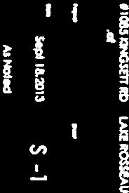


109 A-04/14, Stone, Part of Lot 21, Concession 9, Parts 1-6, Page 109 of 133


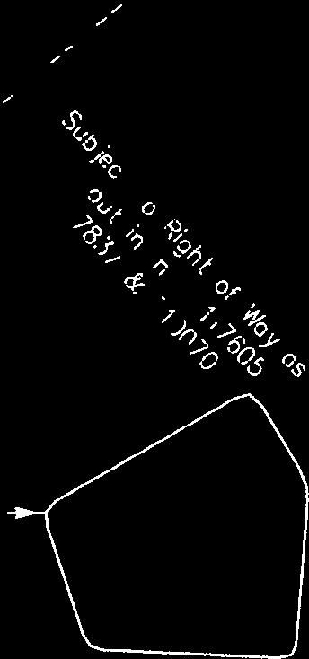


110 A-04/14, Stone, Part of Lot 21, Concession 9, Parts 1-6, Page 110 of 133


111 B/89/90/13/ML, Port of Call Inc., Part of Lot 29, Page 111 of 133

112 THE CORPORATION OF THE TOWNSHIP OF MUSKOKA LAKES COMMITTEE OF ADJUSTMENT FILE #: B/89/90/13/ML ROLL #: NOTICE OF HEARING OF AN APPLICATION FOR CONSENT To consider an application for consent for a proposed land severance pursuant to Section 53 of the Planning Act, R.S.O., 1990, Chapter P.13, as amended. APPLICATION MADE BY: LOCATION OF PROPERTY: Port of Call Inc., 1828 Danforth Avenue, Toronto, ON, M4C 1H8 Part of Lot 29, Concession 3, (Port Carling), Civic Address: 165 Medora Street, Zoning Schedule: 55 EXPLANATION OF THE PURPOSE AND EFFECT: Two severance applications (B/89/90/13/ML) have been made to sever two portions from an existing land holding and add them to two abutting lots. A grant of right-of-way over an existing road is also proposed in favour of the severed and abutting lots (resultant lots). The proposed severed lots are vacant. Severed Lot 1 is to be added to a residential property. Severed Lot 2 is to be added to a commercial property known as Fixtures. The proposed retained lot is vacant and no changes are proposed at this time. NOTICE: A Notice of this Hearing has been circulated to all property owners within 120 metres (400 feet) of the subject property and to the appropriate official and agencies according to Ontario Regulation 197/96 at least 14 days prior to this Hearing. This Notice has been sent to you for your information and does not require any response unless you wish to make one. The above noted application will be heard by the Committee of Adjustment on the date and at the time shown below. DATE: SEPTEMBER 12, 2013 TIME: 9:00 A.M. PLACE AND ADDRESS: Township of Muskoka Lakes, Municipal Offices, (corner of Joseph Street and Bailey Street), Box 129, Port Carling, Ontario, P0B 1J0. Telephone: (705) or FAX (705) PUBLIC HEARING: ANY PERSON may attend this Hearing and/or make written or verbal representation either in support of or in opposition to the proposed consent application. Please see address below. If a person or public body that files an appeal of a decision of Committee in respect of the proposed consent does not make written submissions to Committee before it gives or refuses to give a provisional consent, the Ontario Municipal Board may dismiss the appeal. You are entitled to attend this public hearing in person to express your view about this application or you may be represented by counsel for that purpose. B/89/90/13/ML, Port of Call Inc., Part of Lot 29, Page 112 of 133
113 Notice of Hearing B/89/90/13/ML, Port of Call Inc. ADDITIONAL INFORMATION: There may be additional information relating to the proposed consent application available from staff located in the Planning Department, Municipal Office, (corner of Bailey and Joseph Street), Port Carling, Ontario on weekdays between 8:15 a.m. and 4 p.m. or by mail at The Corporation of the Township of Muskoka Lakes, P.O. Box 129, Port Carling, Ontario, P0B 1J0. Telephone: (705) or FAX (705) Please quote the Committee s file number(s) noted above. FAILURE TO ATTEND HEARING: If you do not attend the hearing it may proceed in your absence and, except as otherwise provided in the Planning Act, you will not be entitled to any further notice in the proceedings. NOTICE OF DECISION: If you wish to be notified of the decision of the Committee of Adjustment in respect of this application, you must submit a written request to the Committee of Adjustment. This will also entitle you to be advised of a possible Ontario Municipal Board Hearing. Even if you are the successful party, you should request a copy of the decision since the Committee of Adjustment decision may be appealed to the Ontario Municipal Board by the applicant or another member of the public. A copy of the decision of the Committee will be sent to the applicant and to each person who appeared in person or by counsel at the hearing and who has filed with the Secretary-Treasurer a written request for notice of decision. PLEASE NOTE: THE COMMITTEE OF ADJUSTMENT IS A JUDICIAL BODY WHICH MAKES DECISIONS SOLELY ON INFORMATION GATHERED AS A COMMITTEE. COMMITTEE MEMBERS ARE NOT TO BE CONTACTED PRIOR TO THE HEARING DATE TO AVOID A CONFLICT OF INTEREST. Dated this 28 th day of August, Andrea Glazier Acting Secretary-Treasurer B/89/90/13/ML, Port of Call Inc., Part of Lot 29, Page 113 of 133
114 LOT 27 CON 5 LOT 28 CON 5 LOT 29 CON 5 CON 5 CON 5 LOT 32 CON 4 LOT 32 CON 4 LOT 31 CON 4 LOT 32 CON 4 LOT 33 LOT 33 CON 5 CON 4 LOT 32 LOT 33 CON 4 LOT 34 CON 4 LOT 30 CON 4 LOT 26 CON 4 LOT 27 CON 4 Marion Lake LOT 28 CON 4 LOT 29 CON 4 0 CON 4 LOT 31 CON 4 LOT 30 CON LOT 4 30 CON 3 Indian LOT 31 CON 3 LOT 32 CON 3 Silver LOT 33 CON 3 ISLAND Thompson LakeLOT 28 CON 3 LOT 27 LOT 29 CON 3 LOT 30 CON 3 LOT 31 CON 3 Forman Narrows Mirror Lake haw LOT 25 Creek CON 3 LOT 26 CON 3 CON 3 LOT 32 CON 2 LOT 27 LOT 26 CON 2 CON 2 ISLAND LOT 28 LOT 26 HenshawLOT LOT Lake CON CON 2 2 ADAH I. CON 2 LOT 29 CON 2 LOT 30 CON 2 LOT 31 CON 2 Indian River LOT 25 CON 2 LOT 27 LOT 24 CON 2 CON 2 B/89/90/13/ML, Port of Call Inc., Part of Lot 29, CON 2 LOT 30 CON 1 LOT Page of 133 LOT 31 CON 1
115 COMMITTEE OF ADJUSTMENT AGENDA REPORT TO: Chair Edwards and Members of Committee of Adjustment MEETING DATE: February 13, 2014 SUBJECT: B/89/90/13/ML, (Port of Call), Part of Lot 29, Concession 3, (Port Carling), Civic Address: 163, 167 Medora Street, Roll# , , RECOMMENDATION: That Consent Applications B/89/90/13/ML be approved, subject to the following conditions: A registerable description (deed) of the severed lots be submitted to the Secretary- Treasurer along with a registered copy of the reference plan; and, That a legal undertaking be submitted in order to confirm that the severed lots will merge in title to the lots they are being added to upon registration of the transfers/deeds. APPROVALS: Date Signature Submitted By: D. Pink, Director of Planning Feb. 3, 2014 Original Signed by D. Pink Acknowledged: C. Wray, CAO Feb. 3, 2014 Original Signed by C. Wray ORIGIN Consent Applications B/89/90/13/ML propose two lot additions in the Urban Centre of Port Carling to separate properties along MR 118W. At the Hearing on September 12, 2013, the application was deferred at the applicant s request. Township and District staff had recommended a widening of the retained parcel between the severed lots, so as not to impede future access. The applicant and agent required further consideration on the matter. Please see the attached original staff report for all related information (zoning, policies, background, etc.). Revised Application The applicants have submitted a revised severance sketch depicting a 20 m (66 ft) wide retained parcel separating the two proposed severed lots. This will afford potential future road access at the municipal standard to the retained lands, if needed in the future. Both the applicant and agent have agreed to the revised drawings. As staff s main concern has been addressed, staff can recommend approval subject to the two conditions noted. B/89/90/13/ML, Port of Call Inc., Part of Lot 29, Page 1 of 2 Page 115 of 133
116 As noted in the original staff report, dependant on future use, a zoning by-law amendment may be necessary to rezone the severed lots to bring them into consistency with the benefitting parcels. Although this can be included as a condition of consent at the present time, the applicant may pursue a future rezoning at which time the severed lots are to be developed, if needed. B/89/90/13/ML, Port of Call Inc., Part of Lot 29, Page 2 of 2 Page 116 of 133
117 COMMITTEE OF ADJUSTMENT AGENDA REPORT TO: Chair Edwards and Members of Committee of Adjustment MEETING DATE: September 12 th 2013 SUBJECT: B/89/90/13/ML, (Port of Call), Part of Lot 29, Concession 3, (Port Carling), Civic Address: 163, 167 Medora Street, Roll# , , RECOMMENDATION: That consent applications B/89/90/13/ML be approved, subject to the following conditions, which apply to each application: A registerable description (deed) of the severed lots be submitted to the Secretary- Treasurer along with a registered copy of the reference plan; and, The applicant reduces the width of the lot additions being added to 163 and 167 Medora Street, in order to demonstrate a 66 foot right of way for the full length between of each expanded parcel. That a legal undertaking be submitted in order to confirm that the severed lots will merge in title to the lots they are being added to upon registration of the transfers/deeds. APPROVALS: Date Signature Submitted By: A. Lusty, Planning Consultant Sept 6, 2013 Original Signed By A. Lusty Approved By: D. Pink, Director of Planning Sept 6, 2013 Original Signed By D. Pink Acknowledged: C. Wray, CAO Sept 6, 2013 Original Signed By C. Wray B/89/90/13/ML, Port of Call Inc., Part of Lot 29, Page 1 of 7 Page 117 of 133
118 The following is a summary of the proposed changes to the affected lot areas, being created from a compilation of applicant and MPAC information. Consent Lot Property Characteristic B/89/13/ML (163 Medora Street) Existing Change Resultant By-law Requirement Abutting Lot Frontage 126 feet None 126 feet 150 ft (Deemed Compliance Per 89-75) Lot Area.41 ac ac 1.55 ac.5 ac Retained Lot Frontage 66 feet None 66 feet -- (Medora) Lot Frontage 642 feet None 642 feet 100 feet (Foreman) Lot Area 59 ac -1.14ac ac.45 ac Lot Area (Both Consents) 59 ac ac ac.45 ac B/90/13/ML (167 Medora Street) Abutting Lot Frontage 110 feet None 110 feet 150 feet (Deemed Compliance Per 89-75) Lot Area.41 ac +.87 ac 1.28 ac.5 ac Retained Lot Frontage 66 feet None 66 feet -- (Medora) Lot Frontage 642 feet None 642 feet 100 feet (Foreman) Lot Area 59 ac ac.45 ac Lot Area (Both Consents) 59 ac ac ac.45 ac BACKGROUND PLANNING DATA Official Plan Designation: Urban Centre Highway Commercial and Urban Centre Residential By-law Zoning: Additional Areas: R2 & subject to By-law Abutting Lots: C4 & subject to By-law Schedule No.: 55 Access: Neighbouring Uses: Original Shore Road Allowance: Civic Address: Medora Street Highway Commercial & Vacant No Shore Road Allowance 163 and 165 Medora Street B/89/90/13/ML, Port of Call Inc., Part of Lot 29, Page 2 of 7 Page 118 of 133
119 PLANNING CONSIDERATIONS 1. Township of Muskoka Lakes Official Plan The subject site is designated both Urban Centre Highway Commercial and Urban Centre Residential. The Urban Centre Highway Commercial applies to the lots along Medora Street. The Urban Centre Residential applies to the internal lot. What follows are policy excerpts which are especially applicable to this proposal. Urban Centre Policies Section C of the Official Plan states that it is an objective in the Urban Centres: To direct and accommodate development in a way that will result in a compact, efficient community that complements and sustains the natural environment and the character of the community. Section C of the Official Plan states: The construction of new private roads shall be discouraged. Minor extensions of existing private roads are permitted. Section C of the Official Plan states: Road standards for new development will meet applicable Township standards. Commercial Policies Section C of the Official Plan states: Lands designated Highway Commercial are intended to provide commercial services and facilities to the travelling public or to accommodate commercial activities which may not be conveniently located in the core, which require extensive land areas for buildings, parking and storage areas. Section C of the Official Plan states: Highway commercial uses should, in general, be limited to lots of large size having generous frontage on a major street. Section C of the Official Plan states: The zoning by-law shall establish appropriate minimum lot requirements, including setbacks and landscaped buffers. Port Carling Policies Section C.19.2 of the Official Plan states: Development will conform with the land use designations established for Port Carling on Schedule G2. Implementation Policies Section F.11.2 of the Official Plan states, in part: Subdivision of land shall proceed via registered plan of subdivision or registered condominium description except where: a) It is not necessary for the proper and orderly development of the parcel of land, the surrounding area or the municipality and, without limiting the generality of the foregoing: Would not impair the ultimate development potential of the parcel of land or adjacent properties; Generally would not result in the development of new roads or the significant upgrading of existing roads or the extension of services; B/89/90/13/ML, Port of Call Inc., Part of Lot 29, Page 3 of 7 Page 119 of 133

120 Would not generally be necessary to confer with an extensive number of agencies or individual departments within such agency, commissions, authorities, corporations, departments or persons; Would not require the imposition of extensive or detailed implementation mechanisms; For small scale development of fewer than five lots that will not require the expansion or provision of municipal services, or is not subject to particular development constraints, development may be considered by consent. b) A significant number of lots would not be created or no potential exists to create a significant number of further lots on the lands subject to application or adjacent lands after approval Lot Addition 163 Medora Street (B/89/13/ML) 163 Medora Street is currently developed with a Residential Dwelling. The portion that would be added to the 163 Medora is currently developed with a barn. If the consent were granted, the resultant lot would have a dwelling as well as a barn. A general depiction of the house and barn is provided below. 163 Medora Street is currently zoned Highway Commercial (C4) Zone and is currently developed with a dwelling and a shed which both appear to have been in existence for a lengthy period of time. The portion with the barn is zoned Residential (R2) and the barn appears to be quite old. Arguably, Section of the Zoning By-law (existing uses, buildings and structures) would allow for the continued use of the barn and dwelling without the need for a Zoning By-law Amendment. With the exception of the potential to impair the ultimate development potential of the retained lands (the large holding in the Residential (R2) Zone), the proposed consent conforms to Section 11.2 of the Official Plan. Section C.19.2 of the Official Plan requires that development conform to the land use designations established for Port Carling. In this case, there is no new development proposed. It is noted that future new development would be required to conform to B/89/90/13/ML, Port of Call Inc., Part of Lot 29, Page 4 of 7 Page 120 of 133
 167 Medora Street is currently developed with a retail store, garage and two sheds.")
121 the Township s Official Plan and Zoning By-laws. The potential impairment to the development of the retained lands is addressed in Section 4 of this report. 3. Lot Addition 167 Medora Street (B/90/13/ML) 167 Medora Street is currently developed with a retail store, garage and two sheds. The portion that would be added to 167 Medora Street is currently vacant, with the exception of a parking area. The garage is not visible on the aerial imagery, but the general depiction of the lot is shown below. There has been a recent minor variance that applies to this property. Minor variance (A-09/13) sought to allow a side yard setback of 13.5 feet, where a 20 foot side yard setback is required. The relief would permit an addition to the existing commercial structure. In that report, staff noted that although the number and size of the parking spaces met the requirements of the Zoning By-law, the proposed development would not allow for enough space for proper access to those spaces. It was recommended that a cash-in-lieu of parking agreement be entered into as a condition of the minor variance. An alternative approach to achieving compliance would be to add to the lot area, to allow for enough space to accommodate the required parking. Staff suspect that this application is being made, at least in part, to include the parking area on the same lot as the commercial use which it supports. If that is the case, then the purpose of the application is consistent with good planning practice. Again, any future development will be required to comply with the Zoning By-law and conform to the Official Plan, and an Official Plan Amendment and Zoning By-law amendment could be required to accommodate the expanded use. 167 Medora Street is currently zoned Highway Commercial (C4), and the portion being added to 167 Medora Street is Zoned Residential (R2). Just like the lot addition to 163 Medora Street, the use has been established, and the lot creation will not impact the existing structures. This consent also generally conforms to the Official Plan, just like 163 Medora. B/89/90/13/ML, Port of Call Inc., Part of Lot 29, Page 5 of 7 Page 121 of 133

122 4. Right-of-Way Over Parts 18, 11, and 12 Subdivision control of the Planning Act does not allow for the conveyance of an interest in a right-of-way without the consent of the Township. Despite this requirement in most cases the Township views rights-of-way as largely a private matter and an administrative formality. However, in this case, there is a planning concern which needs to be addressed. The concern is that of the width of access to future development lands, which according to municipal standards should be 66 feet. The drawing submitted with the application shows the 66 foot width being restricted by the proposed lot additions. The future development lands are the retained lands that are zoned Residential (R2). No development is proposed today for the retained lands. However, there has been some interest in developing the lot as demonstrated by an abandoned subdivision application. Given the location of the retained lands, likely entrances to any future development would be off of Medora Street, or off of Foreman Road, or both. The entrances would likely be in these locations because it is where the parcel has frontage on another road, as shown in the graphic below. It important to ensure that the potential means of access are protected where there is no proposal before the Township for the ultimate development of the lands. It would be premature to judge what is or is not a safe and efficient access prior to having a subdivision application for the future potential development. Both Sections C and F.11.2 of the Official Plan require appropriate access to be maintained and that consents not impair the ultimate development potential of the parcel of land or adjacent properties. B/89/90/13/ML, Port of Call Inc., Part of Lot 29, Page 6 of 7 Page 122 of 133
123 The consent drawing, but more importantly, any future surveys should be required to demonstrate a right-of-way width of 66 feet up to the point where the lot additions are furthest from Medora Street. This could be done by modifying the width of land being added to 163 and 167 Medora Street. Should this modification not take place, the application would amount of an impairment of the future development potential of adjacent lands, and could therefore not be supported by Staff. It is important to distinguish the purpose of the existing right-of-way to the water tower from the purpose of any future entrance into a development. The current right of way serves to provide access to the water tower, and is sufficient for that objective. The full 66 feet is provided for the length of the existing lots (163 and 167 Medora), and would have been sufficient at that time to preserve access to any future development lands. Given the proposed changes in the lot fabric, the 66 foot potential access needs to be extended, which is logically equivalent to the existing situation. 5. Assigning Consent Numbers to Right-of-Way Over Parts 18, 11, and 12 The approach of Township staff when providing for right-of-ways is to assign separate consent B numbers to allow for proper administration of finalizing deeds and ultimately registering the consents. Though the notice referenced the intent to consider the grants of right-of-way to each property, the numbers were unassigned. If approval is granted, Staff will create numbers according to the following pattern: Lot Addition to 163 Medora Street B/89(a)/13/ML Right-of-way to 163 Medora Street B/89(b)/13/ML Lot Addition to 167 Medora Street B/90(a)/13/ML Right-of-way to 167 Medora Street B/90(b)/13/ML B/89/90/13/ML, Port of Call Inc., Part of Lot 29, Page 7 of 7 Page 123 of 133


124 B/89/90/13/ML, Port of Call Inc., Part of Lot 29, Page 124 of 133
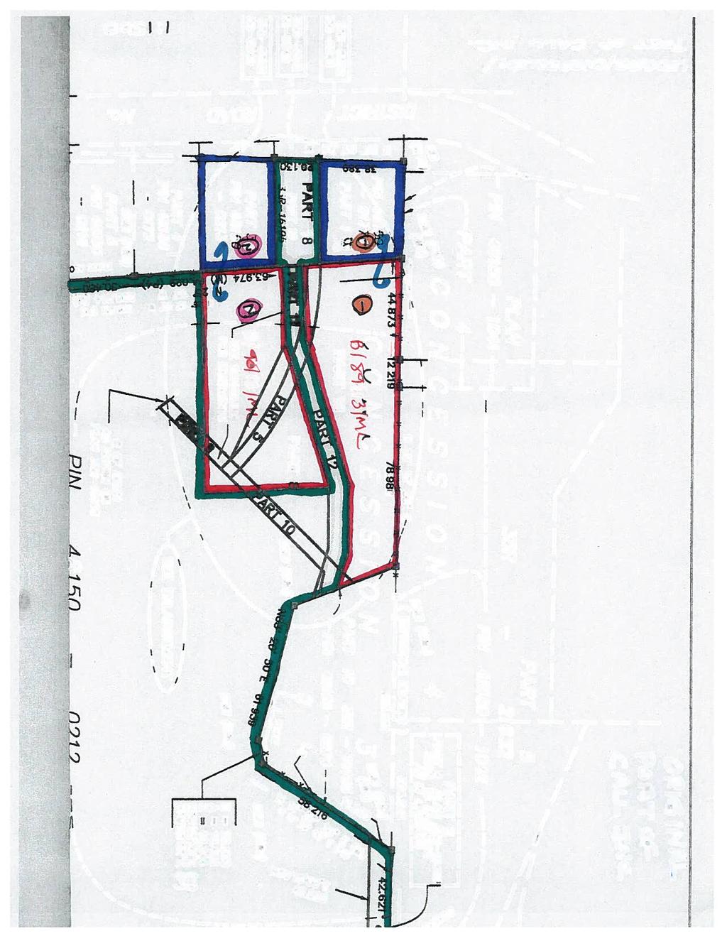


125 B/89/90/13/ML, Port of Call Inc., Part of Lot 29, Page 125 of 133


126 VIEW OF LOT FRONTAGES FROM THE ROADWAY VIEW OF RIGHT OF WAY AND PARKING AREA BEHIND 167 MEDORA VIEW OF EXISTING BARN B/89/90/13/ML, Port of Call Inc., Part of Lot 29, Page 126 of 133


127 Reimbursement of Survey and Legal Costs, Transfer of Page 127 of 133
128 THE CORPORATION OF THE TOWNSHIP OF MUSKOKA LAKES COMMITTEE OF ADJUSTMENT FILE #: B/32/13/ML ROLL #: NOTICE OF HEARING OF AN APPLICATION FOR CONSENT To consider an application for consent for a proposed land severance pursuant to Section 53 of the Planning Act, R.S.O., 1990, Chapter P.13, as amended. APPLICATION MADE BY: LOCATION OF PROPERTY: Janet Wallace, Box 426, Port Carling, ON, P0B 1J0 Part of Lots 17 and 18, Concession 7, (Medora), Civic Address: Not Assigned, Zoning Schedule: 28 EXPLANATION OF THE PURPOSE AND EFFECT: made to create one additional lot. A severance application (B/32/13/ML) has been The proposed severed and retained lots are currently vacant. Residential development is proposed in the future. NOTICE: A Notice of this Hearing has been circulated to all property owners within 120 metres (400 feet) of the subject property and to the appropriate official and agencies according to Ontario Regulation 197/96 at least 14 days prior to this Hearing. This Notice has been sent to you for your information and does not require any response unless you wish to make one. The above noted application will be heard by the Committee of Adjustment on the date and at the time shown below. DATE: JUNE 13, 2013 TIME: 9:00 A.M. PLACE AND ADDRESS: Township of Muskoka Lakes, Municipal Offices, (corner of Joseph Street and Bailey Street), Box 129, Port Carling, Ontario, P0B 1J0. Telephone: (705) or FAX (705) PUBLIC HEARING: ANY PERSON may attend this Hearing and/or make written or verbal representation either in support of or in opposition to the proposed consent application. Please see address below. If a person or public body that files an appeal of a decision of Committee in respect of the proposed consent does not make written submissions to Committee before it gives or refuses to give a provisional consent, the Ontario Municipal Board may dismiss the appeal. You are entitled to attend this public hearing in person to express your view about this application or you may be represented by counsel for that purpose. ADDITIONAL INFORMATION: There may be additional information relating to the proposed consent application available from staff located in the Planning Department, Municipal Office, (corner of Bailey and Joseph Street), Port Carling, Ontario on weekdays between 8:15 a.m. and 4 p.m. or by mail at The Corporation of the Township of Muskoka Lakes, P.O. Box 129, Port Carling, Ontario, P0B 1J0. Telephone: (705) or FAX (705) Please quote the Committee s file number(s) noted above. Reimbursement of Survey and Legal Costs, Transfer of Page 128 of 133
129 Notice of Hearing B/32/13/ML, Wallace FAILURE TO ATTEND HEARING: If you do not attend the hearing it may proceed in your absence and, except as otherwise provided in the Planning Act, you will not be entitled to any further notice in the proceedings. NOTICE OF DECISION: If you wish to be notified of the decision of the Committee of Adjustment in respect of this application, you must submit a written request to the Committee of Adjustment. This will also entitle you to be advised of a possible Ontario Municipal Board Hearing. Even if you are the successful party, you should request a copy of the decision since the Committee of Adjustment decision may be appealed to the Ontario Municipal Board by the applicant or another member of the public. A copy of the decision of the Committee will be sent to the applicant and to each person who appeared in person or by counsel at the hearing and who has filed with the Secretary-Treasurer a written request for notice of decision. PLEASE NOTE: THE COMMITTEE OF ADJUSTMENT IS A JUDICIAL BODY WHICH MAKES DECISIONS SOLELY ON INFORMATION GATHERED AS A COMMITTEE. COMMITTEE MEMBERS ARE NOT TO BE CONTACTED PRIOR TO THE HEARING DATE TO AVOID A CONFLICT OF INTEREST. Dated this 28 th day of May, Andrea Glazier Acting Secretary-Treasurer Reimbursement of Survey and Legal Costs, Transfer of Page 129 of 133

130 Reimbursement of Survey and Legal Costs, Transfer of Page 130 of 133
131 COMMITTEE OF ADJUSTMENT AGENDA REPORT TO: Chair Edwards and Members of Committee of Adjustment MEETING DATE: February 13, 2014 SUBJECT: Survey and Legal Re-Imbursement, B/32/13/ML, Wallace, Roll # RECOMMENDATION: For Committee s information and direction to staff. APPROVALS: Date Signature Approved By: D. Pink, Director of Planning Feb. 3, 2014 Original Signed by D. Pink Acknowledged: C. Wray, CAO Feb. 3, 2014 Original Signed by C. Wray BACKGROUND At the previous meeting of Committee, staff was asked to investigate further a request to reimburse surveying and legal costs associated with a transfer of a road encroachment to the municipality. During survey work on Consent Application B/32/13/ML in the name of Wallace, which was conditionally approved in June 2013, surveyors discovered that portions of the Township Road were not located on the Road Allowance and encroached onto the subject property, in three locations. As standard practice, the surveyors identified the locations as parts on the draft plan, and conditions of consent were amended to require their transfer to the municipality. ANALYSIS According to the Township s Public Works Department, the Township retains the right to continue to use the road, although any future reconstruction should result in the relocation of the road entirely onto the Road Allowance. This can result in considerable expense and is not always desirable, as topographical constraints may have been the cause for the initial encroachment. Accordingly, it is standard practice in these situations to require the encroachment to be corrected through transfer to the municipality, as a condition of approval. Property owners are not typically compensated for the land that the Township is acquiring. To require the property owner to also pay for legal and surveying costs to correct a Township issue or concern, can be seen as onerous. It should be made clear that the applicant has not requested reimbursement for the entire survey and/or legal costs associated with the severance. Applicants should still be responsible for these costs. At issue is the cost of surveying and transferring the road encroachments only. The District of Muskoka has a standard practice of reimbursing property owners those costs relating to survey and legal work in these situations, or where they require road widening. The Township Public Works Department has also advised that they have typically done so in the past. Invoices have been received for the survey work, totalling $1,340.00, and legal costs, totaling $ Reimbursement of Survey and Legal Costs, Transfer of Page 1 of 1 Page 131 of 133


132 Reimbursement of Survey and Legal Costs, Transfer of Page 132 of 133
AGENDA - PLANNING COMMITTEE Thursday September 16, 2010
 AGENDA - PLANNING COMMITTEE Thursday September 16, 2010 Page A Regular Meeting of the Planning Committee will be held on Thursday September 16, 2010 at 9:00 a.m. in the Council Chambers, Municipal Offices,
AGENDA - COMMITTEE OF ADJUSTMENT SEPTEMBER 7, 2012
 AGENDA - COMMITTEE OF ADJUSTMENT SEPTEMBER 7, 212 A Meeting of the Committee of Adjustment will be held on Friday, September 7, 212 at 1: p.m., in the Council Chambers, Municipal Offices, Port Carling,
THE CORPORATION OF THE TOWNSHIP OF MUSKOKA LAKES MINUTES OF COMMITTEE OF ADJUSTMENT
 THE CORPORATION OF THE TOWNSHIP OF MUSKOKA LAKES MINUTES OF COMMITTEE OF ADJUSTMENT A Meeting of the Committee of Adjustment was held on Thursday, January 5, 2005, at 9:00 a.m., in the Council Chambers,
Municipality of Northern Bruce Peninsula Planning Report Application: Minor Variance
 Municipality of Northern Bruce Peninsula Planning Report Application: Minor Variance File No.: A-05-2010.62 Date: June 14, 2010 -------------------------------------------------------------------------------------------------------------------------------------------------------
DYSART ET AL Committee of Adjustment November 12, 2014 at 11:00 a.m. Council Chambers, Haliburton, Ontario
 DYSART ET AL Committee of Adjustment November 12, 2014 at 11:00 a.m. Council Chambers, Haliburton, Ontario Page 2-6 1. ADOPTION OF MINUTES 2. DECLARATION OF PECUNIARY INTEREST 7-12 3. PUBLIC HEARINGS D13-MV-14-023
IN THE MATTER OF subsection 53(19) of the Planning Act, R.S.O. 1990, c. P. 13, as amended.
 of the Planning Act, R.S.O. 1990, c. P. 13, as amended.") ISSUE DATE: FEBRUARY 22, 2008 PL070163 Ontario Municipal Board Commission des affaires municipales de l Ontario IN THE MATTER OF subsection 53(19) of the Planning Act, R.S.O. 1990, c. P. 13, as amended.
ISSUE DATE: FEBRUARY 22, 2008 PL070163 Ontario Municipal Board Commission des affaires municipales de l Ontario IN THE MATTER OF subsection 53(19) of the Planning Act, R.S.O. 1990, c. P. 13, as amended.
Dec. 13, 2007 PL Ontario Municipal Board Commission des affaires municipales de l Ontario
 ISSUE DATE: Dec. 13, 2007 PL070645 Ontario Municipal Board Commission des affaires municipales de l Ontario IN THE MATTER OF subsection 45(12) of the Planning Act, R.S.O. 1990, c. P. 13, as amended Applicant
Date: February 15 th, Based on the analysis contained below, Development Services staff recommends:
 THE CORPORATION OF THE TOWN OF GRAVENHURST To: Committee of Adjustment From: Kris Orsan, GIS/Planning Technician Subject: A/30/2018/GR; ZIVE, Dorothy 1029 Road 2900 (Lake Muskoka) RECOMMENDATIONS Based
DYSART ET AL Committee of Adjustment July 9, 2014 at 11:00 a.m. Council Chambers, Haliburton, Ontario
 DYSART ET AL Committee of Adjustment July 9, 2014 at 11:00 a.m. Council Chambers, Haliburton, Ontario Page 3-7 1. ADOPTION OF MINUTES 2. DECLARATION OF PECUNIARY INTEREST 8-13 14-19 20-36 3. PUBLIC HEARINGS
THE CORPORATION OF THE TOWNSHIP OF SEVERN COMMITTEE OF ADJUSTMENT AGENDA
 THE CORPORATION OF THE TOWNSHIP OF SEVERN A. CALL TO ORDER COMMITTEE OF ADJUSTMENT Tuesday January 20, 2015 Council Chambers - Municipal Office 7:00 P.M. AGENDA B. DISCLOSURE OF PECUNIARY INTEREST & THE
Committee of Adjustment Public Hearing Wednesday, April 22, 2015 Council Chambers, City Hall - 5:00 p.m. Agenda
 Committee of Adjustment Public Hearing Wednesday, April 22, 2015 Council Chambers, City Hall - 5:00 p.m. Agenda 1. Chair to call the Hearing to Order 2. Amendments/Additions to the Agenda 3. Declarations
The Town of Wasaga Beach Committee of Adjustment/Consent November 20, 2017
 The Minutes of the Public Hearing for The Town of Wasaga Beach Committee of Adjustment held Monday, November 20, 2017 at 4:00 p.m. in The Classroom. PRESENT: A. Sigouin Chair R. Groh Member D.Vitali Member
Delete the word setback in these instances
 Various Sections The term principle is used in a various The term principle should be replaced Change reflects proper terminology sections with the term principal Various Sections Section 1 Interpretation
Local Planning Appeal Tribunal Tribunal d appel de l aménagement local
 Local Planning Appeal Tribunal Tribunal d appel de l aménagement local ISSUE DATE: February 11, 2019 CASE NO(S).: PL170550 The Ontario Municipal Board (the OMB ) is continued under the name Local Planning
THE CORPORATION OF THE TOWNSHIP OF NORWICH COMMITTEE OF ADJUSTMENT TUESDAY, SEPTEMBER 9, :00 A.M. COUNCIL CHAMBERS, OTTERVILLE AGENDA
 THE CORPORATION OF THE TOWNSHIP OF NORWICH COMMITTEE OF ADJUSTMENT TUESDAY, SEPTEMBER 9, 2014 9:00 A.M. COUNCIL CHAMBERS, OTTERVILLE 1. CALL TO ORDER 2. APPROVAL OF AGENDA AGENDA 3. DISCLOSURE OF PECUNIARY
Committee of Adjustment Agenda. Meeting Date: Monday January 9, 2017 Woodstock City Hall, Council Chambers Regular Session: 7:00 PM
 Committee of Adjustment Agenda Meeting Date: Monday January 9, 2017 Place: Woodstock City Hall, Council Chambers Regular Session: 7:00 PM Chair: Tom Rock 1. Declaration of Conflict Of Interest 2. Approval
COMMITTEE OF ADJUSTMENT FOR MINOR VARIANCE MINUTES Monday, June 24, :30 p.m. Town Council Chambers Page 1
 Page 1 1. CALL TO ORDER Committee Chair K. Parlett called the meeting to order at 5:30 p.m. and the following were recorded as being present. Committee Members: Staff: Committee Member, K. Parlett Committee
THE CORPORATION OF THE TOWNSHIP OF GEORGIAN BAY COMMITTEE OF ADJUSTMENT
 THE CORPORATION OF THE TOWNSHIP OF GEORGIAN BAY COMMITTEE OF ADJUSTMENT Minutes of the meeting of March 1, 2004 held in the Council Chambers, Baxter Ward Community Centre, Township of Georgian Bay, Port
COMMITTEE OF ADJUSTMENT Council Chambers, Townhall Monday, April 25, 2016, 7:00 PM 3. CONFIRMATION OF MINUTES OF THE PREVIOUS MEETING
 Page COMMITTEE OF ADJUSTMENT Council Chambers, Townhall Monday, April 25, 2016, 7:00 PM 1. CALL TO ORDER 2. DECLARATION OF PECUNIARY INTEREST 3. CONFIRMATION OF MINUTES OF THE PREVIOUS MEETING 3-6 i) Confirmation
3.1. OBJECTIVES FOR RESIDENTIAL LAND USE DESIGNATIONS GENERAL OBJECTIVES FOR ALL RESIDENTIAL DESIGNATIONS
 3. RESIDENTIAL LAND USE DESIGNATIONS INTRODUCTION The Residential land use designations provide for housing and other land uses that are integral to, and supportive of, a residential environment. Housing
APPLICATION FOR VARIANCE OR PERMISSION UNDER SECTION 45 OF THE PLANNING ACT
 APPLICATION FOR VARIANCE OR PERMISSION UNDER SECTION 45 OF THE PLANNING ACT THE CORPORATION OF THE CITY OF LONDON, DEVELOPMENT AND COMPLIANCE SERVICES, 300 DUFFERIN AVENUE, LONDON, ONTARIO, N6A 4L9 Updated:
Delete the word setback in these instances. Delete part of section that reads: and applies to all lands within the Town of Bracebridge.
 Various Sections The term principle is used in a various The term principle should be replaced Change reflects proper terminology sections with the term principal Various Sections Section 1.1 Title The
THE CORPORATION OF THE TOWNSHIP OF NORWICH COMMITTEE OF ADJUSTMENT TUESDAY NOVEMBER 22, :00 P.M. COUNCIL CHAMBERS, NORWICH
 THE CORPORATION OF THE TOWNSHIP OF NORWICH COMMITTEE OF ADJUSTMENT TUESDAY NOVEMBER 22, 2016 7:00 P.M. COUNCIL CHAMBERS, NORWICH AGENDA Page 2-4 1. CALL TO ORDER 2. APPROVAL OF AGENDA 3. DISCLOSURE OF
Art Mior called the regular meeting of the City of Kenora Planning Advisory Committee to order at 8:01 p.m.
 City of Kenora Planning Advisory Committee 60 Fourteenth Street N. Kenora, ON P9N 4M9 MINUTES CITY OF KENORA PLANNING ADVISORY COMMITTEE September 19, 2006 REGULAR MONTHLY MEETING HELD AT 60 Fourteenth
PLANNING RATIONALE REPORT
 PLANNING RATIONALE REPORT Zoning By-law Amendment Application 2920 Danbury Way Prepared for: Bravar Custom Builders Inc. and Village View Estates Ltd. by: 6393 Roslyn Street Ottawa (Orleans), Ontario K1C
TOWNSHIP OF GEORGIAN BAY Minutes Committee of Adjustment Friday October 14, :00 am 99 Lone Pine Road, Port Severn Ontario
 TOWNSHIP OF GEORGIAN BAY Minutes Committee of Adjustment Friday October 14, 2016 9:00 am 99 Lone Pine Road, Port Severn Ontario Members Present Chair Mike Ferguson Vice Chair Cynthia Douglas Members: Tom
APPLICATION FOR AN OFFICIAL PLAN AMENDMENT
 NOTE TO APPLICANTS: APPLICATION FOR AN OFFICIAL PLAN AMENDMENT and/or ZONING BY-LAW AMENDMENT under Subsection 22(1) and/or 34 of the Planning Act (A PRIVATELY INITIATED APPLICATION) This application form
The Corporation of the Township of Otonabee-South Monaghan. Public Meeting - Section 34 Zoning By-law Amendment. Monday, January 8, 6:00pm
 The Corporation of the Township of Otonabee-South Monaghan Public Meeting - Section 34 Zoning By-law Amendment Monday, January 8, 2018 @ 6:00pm Council Chambers, Municipal Office - Keene Page 1. CALL TO
Municipality of Dysart et al
 Municipality of Dysart et al P.O. Box 389, 135 Maple Avenue, Haliburton, Ontario K0M 1S0 www.dysartetal.ca Murray G. Fearrey Reeve Tamara J. Wilbee C.A.O. twilbee@dysartetal.ca The Heart of the Highlands
The Corporation of the City of Kawartha Lakes. Agenda. Committee of Adjustment
 The Corporation of the City of Kawartha Lakes Agenda Committee of Adjustment COA2017-12 Thursday, November 30, 2017 1:00 P.M. Council Chambers City Hall 26 Francis Street, Lindsay, Ontario K9V 5R8 MEMBERS:
Staff Report. Planning and Development Services Planning Division
 This document can be made available in other accessible formats as soon as practicable and upon request Staff Report Planning and Development Services Planning Division Report To: Council Meeting Date:
AGENDA COMMITTEE OF ADJUSTMENT
 Planning & Development Services Tel. 905-683-4550 Fax. 905-686-0360 TOWN OF AJAX 65 Harwood Avenue South Ajax, ON L1S 2H9 www.ajax.ca AGENDA COMMITTEE OF ADJUSTMENT Town Hall 65 Harwood Avenue South Ajax,
HALDIMAND COUNTY COMMITTEE OF ADJUSTMENT MINUTES Tuesday, November 20, 2018
 HALDIMAND COUNTY COMMITTEE OF ADJUSTMENT MINUTES Tuesday, November 20, 2018 A meeting of the Committee of Adjustment was held on Tuesday, November 20, 2018 at 9:00 a.m. in the Council Chambers of the Haldimand
instructions for consent application
 instructions for PLEASE DETACH AND RETAIN THE FIRST TWO PAGES FOR FUTURE REFERENCE BACKGROUND INFORMATION This process pertains to an application for consent pursuant to Section 53 of the Planning Act.
Complete applications are due by 2:00 p.m. on the submission cut-off date.
 CONSENT APPLICATION PLEASE READ ALL INSTRUCTIONS WHAT IS A COMPLETE APPLICATION? Your application is complete when you have: o Discussed the application with a City of St. Catharines Planner Name of Planner:
SUBJECT: Official Plan and Zoning By-law Amendment Applications for 4853 Thomas Alton Boulevard
 Page 1 of Report PB-100-16 SUBJECT: Official Plan and Zoning By-law Amendment Applications for 4853 Thomas Alton Boulevard TO: FROM: Development and Infrastructure Committee Planning and Building Department
140 Charmaine Road, Woodbridge. Condition of Approval Building Standards Development Planning Engineering TRCA PowerStream Other - Other -
 File: A280/12 Item # 16 Ward #2 Applicant: Chris Economou Address: Agent: 140 Charmaine Road, Woodbridge Maria Economou Adjournment Status: Notes: Comments/Conditions: Commenting Department Comment Condition
TOWNSHIP OF SOUTH FRONTENAC PLANNING DEPARTMENT. South Frontenac Municipal Offices, Sydenham
 TOWNSHIP OF SOUTH FRONTENAC PLANNING DEPARTMENT MINUTES 17:10 November 9, 2017 LOCATION: IN ATTENDANCE: ABSENT WITH REGRETS: STAFF: South Frontenac Municipal Offices, Sydenham Ron Sleeth (Storrington District-C)
Chair, Deputy Mayor Karl Moher C.A.O. David Clifford Clerk/Planning Coordinator Crystal McMillan
 Minutes of a Meeting of the Committee of Adjustment for the Township of Douro-Dummer held on October 26, 2018, in the Council Chambers of the Municipal Building Present: Absent: Member, Councillor Raymond
PLANNING REPORT Gordon Street City of Guelph. Prepared on behalf of Ontario Inc. March 17, Project No. 1507
 PLANNING REPORT 1131 Gordon Street City of Guelph Prepared on behalf of 1876698 Ontario Inc. March 17, 2016 Project No. 1507 423 Woolwich Street, Suite 201, Guelph, Ontario, N1H 3X3 Phone (519) 836-7526
Instructions for APPLICATION FOR CONSENT
 Instructions for APPLICATION FOR CONSENT THE CORPORATION OF THE CITY OF LONDON DEVELOPMENT & COMPLIANCE SERVICES, DEVELOPMENT SERVICES, 6 TH FLOOR, CITY HALL, 300 DUFFERIN AVENUE, LONDON, ONTARIO N6A 4L9
Kitsap County Department of Community Development. Administrative Staff Report
 Kitsap County Department of Community Development Administrative Staff Report Report Date: Application Complete Date: March 15, 2018 Application Submittal Date: March 12, 2018 Project Name: Nikki Lee Salon
SPECIAL PLANNING AND DEVELOPMENT COMMITTEE MINUTES Wednesday February 17, :00 p.m. Town Council Chambers Page 1
 Page 1 Procedural Note: Revised February 17, 2016 Special Planning and Development Committee Minutes as approved by Motion 16-GC-087 (Addition of items 5-11 under Public Meetings). 1. CALL TO ORDER Committee
ROAD ALLOWANCE AND SHORE ROAD ALLOWANCE CLOSING PROCEDURES Adopted by: By-law and amended by By-law Page 1
 Page 1 GENERAL POLICY 1. The Corporation of the Town of Bracebridge will consider applications for the closure and conveyance of all types of unused highways, including road allowances, within the Town
The Corporation of the Township of Oro-Medonte
 The Corporation of the Township of Oro-Medonte Application for Minor Variance The undersigned hereby applies to the Development Services Committee for the Township of Oro-Medonte under Section 45 of the
Financial Impact Statement There are no immediate financial impacts associated with the adoption of this report.
 STAFF REPORT Planning and Development Department Subject: Application by RYC Property to rezone a portion of lands on John Murray Dr. and Megan Lynn Dr. from R2 to R3 and to enter into a Development Agreement
Planning Commission Report
 cjly City of Beverly Hills Planning Division 455 N. Rexford Drive Beverly Hills, CA 90210 TEL. (310) 285-1141 FAX. (370) 858-5966 Planning Commission Report Meeting Date: April 28, 2016 Subject: Project
EL DORADO COUNTY DEVELOPMENT SERVICES ZONING ADMINISTRATOR STAFF REPORT VARIANCE
 EL DORADO COUNTY DEVELOPMENT SERVICES ZONING ADMINISTRATOR STAFF REPORT Agenda of: August 6, 2008 Item No.: Staff: 4.d. Robert Peters VARIANCE FILE NUMBER: V08-0004 APPLICANT: Joseph and Ingrid Herrick
COUNTY OF BRANT DEVELOPMENT SERVICES DEPARTMENT COMMITTEE OF ADJUSTMENT. Chair and Members of the Committee of Adjustment
 COUNTY OF BRANT DEVELOPMENT SERVICES DEPARTMENT COMMITTEE OF ADJUSTMENT TO: FROM: Chair and Members of the Committee of Adjustment Ruchika Angrish, Senior Planner DATE: January 23, 2014 REPORT: CA-14-06
Committee of Adjustment Hearing Thursday, September 1, 2016 at 7 p.m. 225 East Beaver Creek Road, Richmond Hill, ON 1 st Floor (Council Chambers)
") Committee of Adjustment Hearing Thursday, September 1, 2016 at 7 p.m. 225 East Beaver Creek Road, Richmond Hill, ON 1 st Floor (Council Chambers) Call to Order Disclosure of Pecuniary Interest Requests
Committee of Adjustment Hearing Thursday, September 1, 2016 at 7 p.m. 225 East Beaver Creek Road, Richmond Hill, ON 1 st Floor (Council Chambers) Call to Order Disclosure of Pecuniary Interest Requests
ii. That the driveway access from Desloges Road be controlled with a gate and access only be used for maintenance and emergency purposes; and,
 Presented To: Planning Committee Request for Decision Melissa Cotesta - Application for rezoning in order to permit a contractor s yard and warehouse, Pioneer Road, Sudbury Presented: Monday, Jun 27, 2016
39 Thora Avenue Zoning Amendment Application Preliminary Report
 STAFF REPORT ACTION REQUIRED 39 Thora Avenue Zoning Amendment Application Preliminary Report Date: January 28, 2014 To: From: Wards: Reference Number: Scarborough Community Council Director, Community
TOWNSHIP OF GEORGIAN BLUFFS APPLICATION FOR AMENDMENT TO THE ZONING BY-LAW
 TOWNSHIP OF GEORGIAN BLUFFS APPLICATION FOR AMENDMENT TO THE ZONING BY-LAW NOTE A PRECONSULTATION MEETING IS REQUIRED PRIOR TO THE SUBMISSION OF APPLICATIONS FOR A ZONING BY-LAW AMENDMENT OR REZONING.
PLANNING AND DEVELOPMENT COMMITTEE MINUTES Wednesday February 7, :00 p.m. Town Council Chambers Page 1
 Page 1 1. CALL TO ORDER Committee Chair, R. Maloney called the meeting to order at and the following were recorded as being present. Committee Members: Regrets: Staff: Deputy Mayor, R. Maloney (Committee
AGENDA - SPECIAL COUNCIL MEETING Monday, August 10, 2009
 AGENDA - SPECIAL COUNCIL MEETING Monday, August 10, 2009 Page A Special Meeting of Council will be held on Monday, August 10, 2009 at 1:00 p.m., in the Council Chambers, Municipal Offices, Port Carling,
COMMITTEE OF ADJUSTMENT MINUTES
 COMMITTEE OF ADJUSTMENT MINUTES The Committee of Adjustment for the City of Guelph held its Regular Meeting on Thursday February 9, 2017 at 4:00 p.m. in Council Chambers, City Hall, with the following
DECISION AND ORDER APPEARANCES. Decision Issue Date Thursday, March 22, 2018
 Court Services 40 Orchard View Blvd Telephone: 416-392-4697 Toronto Local Appeal Body Suite 211 Fax: 416-696-4307 Toronto, Ontario M4R 1B9 Email: tlab@toronto.ca Website: www.toronto.ca/tlab DECISION AND
Applicant: ROYAL 7 DEVELOPMENTS LTD Highway 7 West, Vaughan
 File: A308/12 Item # 25 Ward #4 Applicant: ROYAL 7 DEVELOPMENTS LTD. Address: Agent: 2900 Highway 7 West, Vaughan LUKA KOT Adjournment Status: Notes: Comments/Conditions: Commenting Department Comment
THE CORPORATION OF THE TOWN OF GEORGINA IN THE REGIONAL MUNICIPALITY OF YORK COMMITTEE OF ADJUSTMENT
 THE CORPORATION OF THE TOWN OF GEORGINA IN THE REGIONAL MUNICIPALITY OF YORK COMMITTEE OF ADJUSTMENT MINUTES 2010-DECEMBER-06 7:30 P.M. 1. ROLL CALL: The Secretary-Treasurer gave the roll call and the
COMMITTEE OF ADJUSTMENT AGENDA WEDNESDAY, JUNE 24, 2015, 7:00 PM
 ..... COMMITTEE OF ADJUSTMENT AGENDA Committee of Adjustment Agendas are subject to change without notice. The Final Agenda is available at the beginning of each meeting. WEDNESDAY, JUNE 24, 2015, 7:00
Committee of Adjustment Meeting Number 6
 A meeting of the was held on Monday, June 22, 2015 at 5:00 p.m. at 1211 John Counter Boulevard. Members Present Stephen Foster (Chair) Christine Cannon (Vice-Chair) Kailin Che Blaine Fudge Craig Leroux
4700 Highway 7, Woodbridge. ROSEMARIE HUMPHRIES Humphries Planning Group Inc.
 File: B035/13 Item # 6 Ward #2 Applicant: VISTA PARC LIMITED Address: Agent: 4700 Highway 7, Woodbridge ROSEMARIE HUMPHRIES Humphries Planning Group Inc. Adjournment Status: Notes: NO PLANNING COMMENTS
PLANNING REPORT. Prepared for: John Spaleta 159 Delatre Street Woodstock Ontario N4S 6C2
 PLANNING REPORT County Official Plan Amendment and Zoning By-law Amendment to Permit a Seasonal Dwelling on an Existing Lot of Record with Access onto a Seasonally Maintained Road Parts of Lot 29, Concession
DATE: April 26, 2017 REPORT NO. CD Members of the City of Brantford Committee of Adjustment
 DATE: April 26, 2017 REPORT NO. CD2017-075 TO: Members of the City of Brantford Committee of Adjustment FROM: Victoria Coates, Current Development Planner 1.0 TYPE OF REPORT Committee of Adjustment Decision
CONSENT APPLICATION GUIDE
 Box 5000, Station 'A' 200 Brady Street, Tom Davies Square Sudbury ON P3A 5P3 Tel. (705) 671-2489 Ext. 4376/4346 Fax (705) 673-2200 CONSENT APPLICATION GUIDE APPLYING FOR CONSENT Consent granting authority
8.5.1 R1, Single Detached Residential District
 8.5.1 R1, Single Detached Residential District The purpose of this district is to provide for residential development in the form of single detached dwellings. Dwelling, Single Detached Home Business,
Marilyn Curson, Lynn Brown and Gwen Brice
 Consent Agenda Apr 7 15 Minutes of Regular Meeting of the Committee of Adjustment held on Thursday, December 11, 2014 at 4:30 p.m. at the Canton Municipal Office, 5325 County Road 10, in the Council Chambers.
Staff Report PLANNED DEVELOPMENT. Salt Lake City Planning Commission. From: Lauren Parisi, Associate Planner; Date: December 14, 2016
 Staff Report PLANNING DIVISION COMMUNITY & NEIGHBORHOODS To: Salt Lake City Planning Commission From: Lauren Parisi, Associate Planner; 801-535-7932 Date: December 14, 2016 Re: 1611 South 1600 East PLANNED
Committee of Adjustment Consent Application City of Mississauga 300 City Centre Drive Mississauga ON L5B 3C1
 Committee of Adjustment Consent Application City of Mississauga 300 City Centre Drive Mississauga ON L5B 3C1 Tel. No. 3-1-1 If outside Mississauga (905) 615-4311 Fax. No. 905-615-3950 Web address for down
PENINSULA TOWNSHIP DONATION of DEVELOPMENT RIGHTS ORDINANCE (DDR, No. 45)
") PENINSULA TOWNSHIP DONATION of DEVELOPMENT RIGHTS ORDINANCE (DDR, No. 45) THE TOWNSHIP OF PENINSULA, GRAND TRAVERSE COUNTY, MICHIGAN ORDAINS: Section 101 General Provisions A. Title: This Ordinance shall
PENINSULA TOWNSHIP DONATION of DEVELOPMENT RIGHTS ORDINANCE (DDR, No. 45) THE TOWNSHIP OF PENINSULA, GRAND TRAVERSE COUNTY, MICHIGAN ORDAINS: Section 101 General Provisions A. Title: This Ordinance shall
AGENDA - COMMITTEE OF THE WHOLE MEETING Tuesday June 7, 2011
 AGENDA - COMMITTEE OF THE WHOLE MEETING Tuesday June 7, 2011 Page A Regular Meeting of Committee of the Whole will be held on Tuesday June 7, 2011, at 9:00 a.m., in the Council Chambers, Municipal Offices,
Please read the entire application form prior to completing
 APPLICATION FOR MINOR VARIANCE The Corporation of the Town of Whitby 575 Rossland Road East, Whitby Ontario, L1N 2M8 Telephone: 905.430.4306 ~ Facsimile: 905.668.7812 Please read the entire application
STAFF REPORT. Arthur and Kathleen Quiggle 4(b)
") STAFF REPORT Application: Requests related to the construction of a 28' x 41' dwelling and 6' wrap-around open deck to replace an existing 24' x 32' cabin and wrap-around open deck and the installation
STAFF REPORT Application: Requests related to the construction of a 28' x 41' dwelling and 6' wrap-around open deck to replace an existing 24' x 32' cabin and wrap-around open deck and the installation
PIN , Part 1, Plan SR-713 in Lot 2, Concession 5, Township of McKim (1096 Dublin Street, Sudbury)
") STAFF REPORT Applicant: Dalron Construction Limited Location: PIN 02124-0103, Part 1, Plan SR-713 in Lot 2, Concession 5, Township of McKim (1096 Dublin Street, Sudbury) Official Plan and Zoning By-law:
STAFF REPORT Applicant: Dalron Construction Limited Location: PIN 02124-0103, Part 1, Plan SR-713 in Lot 2, Concession 5, Township of McKim (1096 Dublin Street, Sudbury) Official Plan and Zoning By-law:
IMPORTANT NOTICE MINOR VARIANCE APPLICATION
 This document contains both information and form fields. To read information, use the Down Arrow from a form field. IMPORTANT NOTICE MINOR VARIANCE APPLICATION Please be advised that the Committee of Adjustment
Application for OFFICIAL PLAN AMENDMENT
 Town of Northeastern Manitoulin & the Islands Application for OFFICIAL PLAN AMENDMENT and/or ZONING BY-LAW AMENDMENT Introduction: Application Fees: Authorization: Drawing: Supporting Information: The
Committee of Adjustment Agenda
 Committee of Adjustment Agenda Hearing Date: July 6, 2017 Time: 7:00 p.m. Location: 225 East Beaver Creek Road, 1 st Floor (Council Chambers) Staff reports obtained online do not include hard copy information
ARTICLE FIVE FINAL DRAFT
 ARTICLE FIVE 021218 FINAL DRAFT Sec. 503.6 Open Space Preservation Option Open Space Preservation Option Open Space Preservation developments may be approved in the AR, R-1, R-2 and R-3 zoning districts,
COMMITTEE OF ADJUSTMENT
 Minutes of a Meeting of the Committee of Adjustment for the City of Peterborough held Tuesday, July 17, 2012, at 7:00 p.m., in the General Committee Room, City Hall. PRESENT: Mr. Claude Dufresne, Acting
SANTA BARBARA COUNTY ZONING ADMINISTRATOR STAFF REPORT August 30, 2007
 SANTA BARBARA COUNTY ZONING ADMINISTRATOR STAFF REPORT August 30, 2007 PROJECT: Detrana Entry Gates HEARING DATE: October 22, 2007 STAFF/PHONE: Sarah Clark, (805) 568-2059 GENERAL INFORMATION Case No.:
Township of McNab/Braeside. Committee of Adjustment
 Township of McNab/Braeside Committee of Adjustment A Hearing of the Committee of Adjustment was held on March 27 th, 2017 at 7:00 p.m. in the Municipal Office. PRESENT: Geoff Booth Vance Bedore Chairperson
THE CORPORATION OF THE CITY OF TEMISKAMING SHORES COMMITTEE OF ADJUSTMENT MEETING MINUTES Wednesday, November 27, 2013
 PRESENT: ALSO PRESENT: REGRETS: PUBLIC: Chair: Carman Kidd Members: Rod Mathews, Florent Heroux, Greg Ford Jennifer Sandham, Secretary-Treasurer Voula Zafiris Robert Van Dine, Applicant A-2013-13(H) Chris
LOT AREA AND FRONTAGE
 LOT AREA AND FRONTAGE Lot Area & Frontage for the R2.1 Zone Lot Area & Frontage for the R2.4 Zone Minimum Lot Minimum Lot Zone Area Width R2.1 700 sq m 18 m R2.4 600 sq m 16 m Lot Area means the total
MINNETONKA PLANNING COMMISSION June 2, A conditional use permit for 2,328 square feet of accessory structures at 4915 Highland Road
 MINNETONKA PLANNING COMMISSION June 2, 2016 Brief Description A conditional use permit for 2,328 square feet of accessory structures at Recommendation Recommend the city council adopt the resolution approving
TOWNSHIP OF SOUTH FRONTENAC COMMITTEE OF ADJUSTMENT. South Frontenac Municipal Offices, Sydenham
 MINUTES 16:11 December 8, 2016 LOCATION: IN ATTENDANCE: STAFF: TOWNSHIP OF SOUTH FRONTENAC COMMITTEE OF ADJUSTMENT South Frontenac Municipal Offices, Sydenham Ken Gee (Storrington District) Ron Sleeth
Municipality of Brockton Planning Report. Application: Minor Variance Application. Members of the Committee of Adjustment, Municipality of Brockton
 Municipality of Brockton Planning Report Application: Minor Variance Application File No: A-14-18.34 Date: May 14, 2018 To: From: Subject: Members of the Committee of Adjustment, Municipality of Brockton
Ontario Municipal Board Commission des affaires municipales de l Ontario Ontario Limited P. A. Robertson
 ISSUE DATE: MAR. 17, 2009 PL081277 Ontario Municipal Board Commission des affaires municipales de l Ontario IN THE MATTER OF subsection 34(19) of the Planning Act, R.S.O. 1990, c. P. 13, as amended Appellant:
STAFF REPORT. Financial Impact Statement There are no immediate financial impacts associated with the adoption of this report.
 STAFF REPORT Planning and Development Department Subject: Cottage Country Unsubstantial Amendment to Development Agreement To: CAO for Planning Advisory Committee, December 13, 2016 Date Prepared: December
MUNICIPALITY OF THE TOWNSHIP OF McNAB/BRAESIDE GUIDELINES
 MUNICIPALITY OF THE TOWNSHIP OF McNAB/BRAESIDE APPLICATION FOR OFFICIAL PLAN AND/OR ZONING BY-LAW AMENDMENT GUIDELINES Introduction: Application Fees: Copies: Authorization: Proposed Schedule/Sketch: Supporting
AGENDA - COUNCIL MEETING Friday, July 12, 2013
 AGENDA - COUNCIL MEETING Friday, July 12, 2013 Page A Regular Meeting of Council will be held on Friday, July 12, 2013 at 9:00 a.m., in the Council Chambers, Municipal Offices, Port Carling, Ontario. 1.
CHAPTER XVIII SITE PLAN REVIEW
 CHAPTER XVIII SITE PLAN REVIEW Section 18.1 Section 18.2 Description and Purpose. The purpose of this chapter is to provide standards and procedures under which applicants would submit, and the Township
Township of Howick Special Meeting Agenda Tuesday August 7, 2018 at 5 pm Howick Council Chambers
 1. Call to Order Township of Howick Special Meeting Agenda Tuesday August 7, 2018 at 5 pm Howick Council Chambers 2. Public Meeting - to consider a proposed Zoning By-law Amendment under Section 34 of
SCHEDULE A TO BYLAW Municipality of Hastings Highlands- Corporate Policies and Procedures DEPARTMENT: Planning
 SCHEDULE A TO BYLAW 2017-012 Municipality of Hastings Highlands- Corporate Policies and Procedures DEPARTMENT: Planning POLICY #: POLICY: Original Shore Road Allowance and Original Road Allowance Closure
August 15, 2018 Page 1 of 12 Minutes
 August 15, 2018 Page 1 of 12 Minutes Municipality of Middlesex Centre Council Meeting Minutes Municipal Office, Council Chambers Wednesday, August 15, 2018, 5:45p.m. COUNCIL PRESENT: - Mayor Edmondson
PLANNING COMMISSION STAFF REPORT June 18, 2015
 Community Development Department Planning Division 1600 First Street + P.O. Box 660 Napa, CA 94559-0660 (707) 257-9530 PLANNING COMMISSION STAFF REPORT June 18, 2015 AGENDA ITEM 7.B. PL15-0052 PM, GASSER
EXCERPTS FROM HALIFAX REGIONAL MUNICIPALITY CHARTER
 EXCERPTS FROM HALIFAX REGIONAL MUNICIPALITY CHARTER Municipal planning strategy 227 The Council may adopt a municipal planning strategy for all, or part, of the Municipality and there may be separate strategies
TOWN OF NEW SHOREHAM ZONING BOARD OF REVIEW APPLICATION PROCEDURE
 TOWN OF NEW SHOREHAM ZONING BOARD OF REVIEW APPLICATION PROCEDURE 1. Please answer all questions on the application and please print clearly. If a question is not applicable, mark the space with a N/A.
Committee of Adjustment Agenda. Meeting Date: Monday October 17, 2016 Woodstock City Hall, Council Chambers Regular Session: 7:00 PM
 Committee of Adjustment Agenda Meeting Date: Monday October 17, 2016 Place: Woodstock City Hall, Council Chambers Regular Session: 7:00 PM Chair: Len Reeves 1. Declaration of Conflict Of Interest 2. Approval
Homeowners Guide to Accessory Dwelling Units
 Homeowners Guide to Accessory Dwelling Units Applicable to Buildings in existence AFTER July 14, 1994 In accordance with Zoning By law 2010 050 and the Ontario Building Code 2012 Town of Bradford West
The Corporation of the Township of Otonabee-South Monaghan. Public Meeting - Section 34 Zoning By-law Amendment
 The Corporation of the Township of Otonabee-South Monaghan Public Meeting - Section 34 Zoning By-law Amendment Page Monday, January 12, 2015 @ 6:00 pm Council Chambers, Municipal Office 1. CALL TO ORDER