MEETING DATE: Monday, January 30, 2017 MEETING TIME: 6:00 p.m. MEETING LOCATION: City Council Chambers, 448 East First Street, Salida, CO
|
|
|
- Alisha Stone
- 5 years ago
- Views:
Transcription
1 AGENDA CITY OF SALIDA PLANNING COMMISSION MEETING DATE: Monday, January 30, 2017 MEETING TIME: 6:00 p.m. MEETING LOCATION: City Council Chambers, 448 East First Street, Salida, CO AGENDA SECTION: I. APPOINT CHAIRMAN- Per Salida Municipal Code Section II. III. CALL TO ORDER BY CHAIRMAN 6:00 p.m. ROLL CALL IV. APPROVAL OF THE MINUTES October 24, 2016 V. UNSCHEDULED CITIZENS VI. VII. VIII. IX. AMENDMENT(S) TO AGENDA UPDATES PUBLIC HEARINGS- 1. Su Casa Furniture Store Creative Sign - The request is for approval to internally illuminate a sign in the C-2 zone district at 300 F Street. Internal illumination is not allowed in the Central Business (C-2) zone therefore requires creative sign permit approval. A. Open Public Hearing E. Public Input B. Proof of Publication F. Close Public Hearing C. Staff Review of Application G. Commission Discussion D. Applicant s Presentation 2. Oak Street Apartments Limited Impact Review request - The request is for conditional use and limited impact review approval of a new 16 unit residential development intended for apartments. The property is located within a C-1 zone district and the Highway 291 established Commercial Overlay. Residential use are allowed in the C-1 district, however, the Highway 291 Overlay requires that the Planning Commission approve a conditional use for multi-family dwellings with four or more units in addition to the development plan. A. Open Public Hearing E. Public Input B. Proof of Publication F. Close Public Hearing C. Staff Review of Application G. Commission Discussion D. Applicant s Presentation UNFINISHED BUSINESS- Review Land Use Code amendment for short-term rentals X. NEW BUSINESS XI. XII. COMMISSIONERS COMMENTS ADJOURN
2 PLANNING COMMISSION Minutes DRAFT MEETING DATE: Monday, October 24, 2016 MEETING TIME: 6:00 PM MEETING LOCATION: City Council Chambers, 448 E. First Street, Suite 190, Salida, CO Present: Thomas, Mandelkorn, Cocovinis, Follet, Wood, Denning, Bomer, Kaiser, Jefferson, Absent: Kasper, Berg, AGENDA SECTION: I. CALL TO ORDER BY Wood: - 5:58 PM II. ROLL CALL: III. APPROVAL OF THE MINUTES September 26, 2016 Follet made a motion to approve the minutes. Motion was seconded by Thomas. All voters were unanimous and the motion carried. IV. UNSCHEDULED CITIZENS None V. AMENDMENTS TO AGENDA - None VI. UPDATES: VII. PUBLIC HEARINGS 1. Russell Multiple Principal Structures 1247 J Street Limited Impact Review - The request is to receive limited impact review approval to construct a second primary structure on the property located at 1247 J Street within the medium density residential (R-2) zone district. A. Open Public hearing: - 6:02 p.m. B. Staff Review of Application. Jefferson gave an overview of the application and stated that staff supported the application and recommends approval with 1 condition. C. Applicant s Presentation: Robb Russell and Architect Sarah Whittington were available to answer questions. Russell stated that his family will live in the new dwelling and possibly condominiumize the property in the future. Thomas asked about the reasoning behind a second primary structure and not an ADU. Wood asked about maintaining a 25 height limit and Whittington stated that the applicant would like 30. Cocovinis was concerned that they are not meeting a front setback off of thirteenth and Jefferson explained that the property has an established front setback off of J Street. D. Public Input- None E. Closed Public Hearing 6:14 p.m. F. Commission Discussion Wood opened commissioner s discussion. Mandelkorn stated that the application is well laid out and feels that the request is reasonable. Bomer asked about the height requirement. Wood stated that for second primary structures they look at compatibility within the neighborhood. Bomer asked about the roofline and Russell stated that it will need to be taller than the primary because the need of a garage. Page 1 of 5
3 PLANNING COMMISSION Minutes DRAFT G. Commission Action - A motion was made by Follet to approve the application with the 1 recommended condition. Mandelkorn seconded motion. All were in favor and the motion carried. 2. River s Edge, Right-of-way -Major Impact Review - The request is to approve the City of Salida vacating a 20 gravel right-of-way connecting Scott Street and the Arkansas River. A. Open Public Hearing 6:23 p.m. B. Staff Review of Application: Kaiser gave an overview of the application and stated that staff supported the application and recommends that the Commission makes a recommendation of approval to City Council. C. Applicant s Presentation: Syd Schieren was available to answer questions regarding the zone request. He clarified that there are only two parcels and no access will be eliminated to either of the parcels. Schieren explained that the owner is amenable to allowing easements for the natural gas lines. He stated that the owner does not have a development plan at this time and he is not opposed to the condition for a public trail connection. Schieren added that the owner would like to add language to the condition of approval; that the future trail connection can be modified in the future depending on development plans. D. Public Input Tad Bailey 226 Scott Street space B-2 resident of the mobile home park is concerned with the future development of the property. E. Closed Public Hearing 6:40 pm F. Commission Discussion Wood opened the Commission discussion and stated that he is fine with approving the application as long as the trail access is maintained. Thomas asked if the applicant records a plat with the vacation and Schieren said no. Schieren explained that the city will prepare quit claim deeds that conveys half the right-of-way to each adjoining property. In this case the owner of each lot affected is owns both lots. Bomer stated that she has no problem with the application but wants to make sure that the City is guaranteed river access. Thomas added that the trail maintenance language is vague and should be corrected and suggested changing one of the conditions. Mandelkorn asked about the zoning. Cocovinis stated that it is premature to approve the application without knowing the development plans and is not in favor of approval of the vacation request. G. Commission Action A motion was made by Cocovinis to make the recommended findings and take the recommended action - adding a condition that a deed restriction for a 20 dedication shall be reserved for future access and make the recommendation of approval to City Council. The motion also allows the applicant to determine final placement with future development plans. Kaiser asked to confirm that the motion is - that the applicant agrees to reserve a Page 2 of 5
4 PLANNING COMMISSION Minutes DRAFT. dedicated width of 20 with a final placement to be determined with development plans and Cocovinis said yes. Mandelkorn asked why require a dedication of the land if it is already owned by the City. He suggested that the language be for a 20 easement and not dedication. Wood stated that it will either be an easement or a dedication and Cocovinis said that he wants to keep his motion as stated with a 20 dedication. Denning seconded motion. Thomas was opposed and the motion carried. 3. Buffalo 50- Annexation - The request is to annex (2.63) acres located at 245 East Highway 50 into the City of Salida. A. Open Public Hearing 6:54 p.m. B. Staff Review of Application: Kaiser gave an overview of the application and stated that staff supported the application and recommends that the Commission make a recommendation of approval to City Council. C. Applicant s Presentation: Tim Schwartz and Rich Young were available to answer questions. D. Public Input None E. Closed Public Hearing 7:00 p.m. F. Commission Discussion Wood opened the commission discussion and voiced his support for the annexation. G. Commission Action A motion was made by Bomer to make the recommended findings and take the recommended action as presented and make the recommendation of approval to City Council. Thomas seconded the motion. All were in favor and the motion carried. 4. Buffalo 50- Zoning - The request is to designate the newly annexed property at 245 East Highway 50 as Commercial (C-1) Zone District and include the property within the Highway 50 Corridor Overlay. The property is also known as the Buffalo Annexation. A. Open Public Hearing 7:02 p.m. B. Staff Review of Application: Kaiser gave an overview of the application and stated that staff supported the application and recommends that the Commission make a recommendation of approval to City Council. C. Applicant s Presentation: Tim Schwartz and Rich Young were available to answer questions. D. Public Input None E. Closed Public Hearing 7:03 p.m. Page 3 of 5
5 PLANNING COMMISSION Minutes DRAFT F. Commission Discussion Wood opened the commission discussion and stated that this is an appropriate zoning and voiced his support. Wood explained that the property is required to be zoned in conjunction with the annexation. G. Commission Action A motion was made by Mandelkorn to make the recommended findings and take the recommended action as presented and make the recommendation of approval to City Council. Bomer seconded motion. All were in favor and the motion carried. 5. River View at Cleora Planned Development Major Impact Review - The request is for Major Impact Review for a Planned Development and Subdivision for acres of the River View at Cleora Planned Development. A. Open Public Hearing 7:05 p.m. B. Staff Review of Application: Kaiser gave an overview of the application and stated that staff supported the application and recommends that the Commission make a recommendation of approval to City Council. The approval should include the sixteen (16) conditions as presented in the staff report. B. Applicant s Presentation: Joe Deluca, applicants representative presented the planned development with a slide show and was available to answer questions. Wood asked about lighting and Deluca said that they will be using solar dark-sky compliant lighting. Wood asked if the applicant will be able meet the requirements of the Engineer and Fire Department and Deluca said yes. Mandelkorn asked about traffic and parking for larger commercial vehicles and Deluca stated that he believes that there is room within the development to have parking for larger vehicles. Mandelkorn inquired about the difference between the 250 square feet verses the 800 square feet units. Deluca stated that the applicant will probably start with the 500 square foot units to see what the need is within the area. Denning asked if the units will be furnished and Deluca said that he is not sure. She asked if they have projections of the number of people living when completely built out. Thomas said that he has comments and questions. He stated that the project doesn t give a diversity of housing types as required by the comprehensive plan. Thomas said that with the proposal there is only one housing type that is lacking diversity. He stated that this neighborhood is not contiguous with the surrounding neighborhoods as required by the Comprehensive Plan. Thomas feels that the application has two flaws: the proposed housing type and not being contiguous with surrounding neighborhoods. Thomas is also concerned that the applicant is not meeting Land Use Code section with the variation of units. Thomas asked if the manufacturing use will be limited to 5 years and Deluca said yes that is a requirement of the Annexation agreement. Page 4 of 5
6 PLANNING COMMISSION Minutes DRAFT Cocovinis wants to see variation of style within the project. Thomas asked if there is more of a demand for three bedrooms will the developer combine three of the units and Deluca said that the owner will have to answer that question. Follet suggested architectural diversity. Bomer said that she would rather see this type of development than a large apartment complex. D. Public Input None E. Closed Public Hearing 8:31 p.m. F. Commission Discussion Wood opened the commission discussion. Follet stated that the plan is well thought out. Mandelkorn said that if the applicant is comfortable with the conditions of approval he supportive of the application. G. Commission Action A motion was made by Denning to make the recommended findings and take the recommended action as presented with 16 conditions and make the recommendation of approval to City Council. Follet seconded motion. Thomas abstained and the motion carried. VIII. UNFINSHED BUSINESS- None IX. NEW BUSINESS- Kaiser let the Commission know that we will have a work session on Wednesday, November 16 th to continue the Short term rental discussion. X. COMMISSIONER S COMMENTS- Wood stated that we need to address multiple principal structures within the Land Use Code and Jefferson said that we will be looking at Code updates when the City hires a new Community Development Director. XI. ADJOURN: With no further business to come before the Commission, the meeting adjourned at 8:45 p.m. Page 5 of 5
 existing wall signs in the C-2 zone district.")
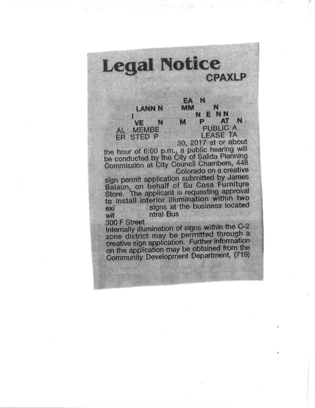
7 MEETING DATE: January 30, 2017 STAFF REPORT AGENDA ITEM TITLE: AGENDA SECTION: Su Casa! Furniture Store Creative Sign Application 300 F Street Public Hearing REQUEST: The request is for approval to internally illuminate two (2) existing wall signs in the C-2 zone district. Internal illumination is not allowed in the Central Business (C-2) zone therefore requires creative sign permit approval. APPLICANT: The applicant is James Balaun, 311 Caldwell Avenue. LOCATION: The subject property is described as 1, 2 and 3, Block 49, Haskells Addition, City of Salida, Chaffee County, Colorado and is known as 300 F Street. PROCESS: It is the policy of the City of Salida to encourage the use of creative signs that exhibit a high degree of thoughtfulness, imagination and inventiveness. The purpose of the Creative Sign process is to establish standards and procedures for the design review and approval of creative signs that due to their unique design and construction will make a significant contribution to the aesthetic beauty, historic character, and cultural identity of the community, yet due to their creative qualities or site constraints, would not be otherwise allowed under this code. The Salida Municipal Code, Chapter 16, specifies that creative signs be reviewed by the City of Salida Planning Commission at a public hearing after fifteen days public notice. The Planning Commission may make a decision to approve, approve with conditions, deny, or remand the application back to the applicant for modification. OBSERVATIONS: 1. The property is located on the corner of F and Third Streets and is within the central business (C-2) zone district, the Downtown Historic District and the Creative Art District. Surrounding land uses are commercial. 2. Internal illumination of new signs is not allowed within the C-2 zone district. This application is to illuminate two (2) of the existing wall signs on the north side of the building. 3. The applicant is proposing to illuminate the wall signs with LED rope lights. The rope will not be seen and the light will glow through the lettering. A conduit will come down the side of the building to the light. Public Hearing, Agenda Item 1, Pg. 1
8 REVIEW STANDARDS Creative Sign Permit Application: (c) Applicants responses are in italics 1. Impact Review Standards. No sign shall be approved under the Creative Sign Process that the Planning Commission finds: a. Will have an adverse impact on adjacent properties. The sign shall not adversely affect neighboring property owners, business or residents and should be compatible with the uses, characters and identity of the area in which it is displayed. Applicant s response: In the past, vertical signs on the corners of buildings have been an aesthetically pleasing way to advertise the business. Adding soft glowing light to the letters in our sign should not create any adverse impact on Moonlight Pizza or Mikes Garage. It will not be bright enough to distract anyone. The proposed internally illuminated wall signs should not have any adverse effects on neighboring properties. The illumination will add character to the to the existing wall signs. b. Create a dangerous condition. Granting the creative sign permit will not adversely affect public safety. The use of signs or attention-attracting devices should not significantly distract traffic on adjacent streets. Granting of the creative sign will not adversely affect public safety because the illumination of the sign will be internal and not shining directly onto traffic. The proposed sign is unlikely to be a distraction to traffic and will have little impact to the adjacent streets. c. Distracts from the important architectural, natural or historic features of the building or neighborhood in which the sign is displayed. The proposed location of the sign is within the Historic District but the building and site are not considered historic. The illumination should not be a distraction from any of the surrounding features of the site or structure and should enhance this building and site. 2. Design Review Standards. In addition to the Impact Review Standards, to approve a sign under the Creative Sign process, the Planning Commission must find that the unique and creative design of the sign will meet standards a, b and c or standard d: a. Constitute a substantial aesthetic improvement to the site and have a positive visual impact on the surrounding area that justifies departure from the parameters of Section and/or Applicant s response: Being at the far end of F Street, the sign can be seen by shoppers coming up the street. When the sun goes down, the lights come on on the building. If we can light the letters in the sign it will be seen more easily after dark. It will also be more aesthetically pleasing in the fading light of evening. It will be a good compliment to the Moonlight Pizza s sign. Public Hearing, Agenda Item 1, Pg. 2
9 The illumination of the existing wall signs will be a creative and unique feature for the downtown area and would contribute to the internally illuminated Moonlight Pizza sign across the street. As part of a creative arts community the City generally supports works of art. b. Utilize and/or enhance the architectural or historic elements of the building or location where it is displayed in an historic, unique and/or creative manner that justifies departure from the parameters of Section and/or Applicant s response: There are signs near our location made of metal that use light to enhance their appearance. We would like to do the same. The light is subtle and will not encroach on the surrounding area. The sign will glow. It will not shine brightly. This sign does not reflect or relate to the architectural elements of the structure in a significant way. However, the unique and creative feature of the metal signs being illuminated will add interest to the property and promote creative art within the City. c. Provide strong artistic character through the imaginative use of design, graphics, color, texture, quality of materials, scale and proportion uses, character, and identity of the area in which it is displayed. Applicant s response: The building we are in has been a non-contributing building to the downtown area. By adding windows and signs to it we have brought this part of F Street back to life. If we can add light to this sign, we will be able to show that it is alive even after the sun goes down. The proposed internal illumination will add character to the existing metal wall signs. The applicants have improved this building substantially and the illumination of the signs incorporates the Creative Art District. d. A Creative Sign may be appropriate to provide reasonable visibility of a business s main sign in some rare situations where topography, landscaping, existing buildings or unusual building design may substantially block visibility of the applicant s existing or proposed signs from multiple directions. Despite the possibility of a creative sign permit, visibility of a sign or attention-attracting device may not be possible. Applicant s response: No There is reasonable visibility of the property s signs as the site is visible from both F Street and Third Street. This business location and structure design do not constitute a rare situation where this criterion would apply. REQUIRED ACTIONS BY THE COMMISSION: 1. The Commission shall confirm that adequate notice was provided. 2. The Commission shall conduct a public hearing. 3. The Commission shall make findings regarding the proposed creative sign in order to ensure the use is consistent with the Comprehensive Plan, conforms with the Land Use Code, is appropriate to its location and compatible with neighboring uses. Public Hearing, Agenda Item 1, Pg. 3
10 RECOMMENDED FINDINGS: 1. The applicable review criteria for a Creative Signs have been met because the applicant has demonstrated that this is a creative design for the internal illumination of the existing metal wall signs. The sign should add an aesthetic improvement to the site and to the District. RECOMMENDED ACTION: Based on the above findings, staff recommends APPROVAL of the request to install internal illumination to the existing wall signs at 300 F Street. RECOMMENDED MOTION: That the recommended findings be made and the recommended action be taken. BECAUSE THIS APPLICATION IS FOR A CREATIVE SIGN, THE SALIDA PLANNING COMMISSION SHALL MAKE THE FINAL DECISION ON THIS APPLICATION. THE DECISION OF THE PLANNING COMMISSION MAY BE APPEALED WITHIN 15 DAYS OF THE DECISION BY AN AGGRIEVED PERSON AS SET FORTH IN SECTION OF THE LAND USE CODE. Attachments: Application form Creative sign drawings and information Public Hearing, Agenda Item 1, Pg. 4

11


12


13


14


15

16
17
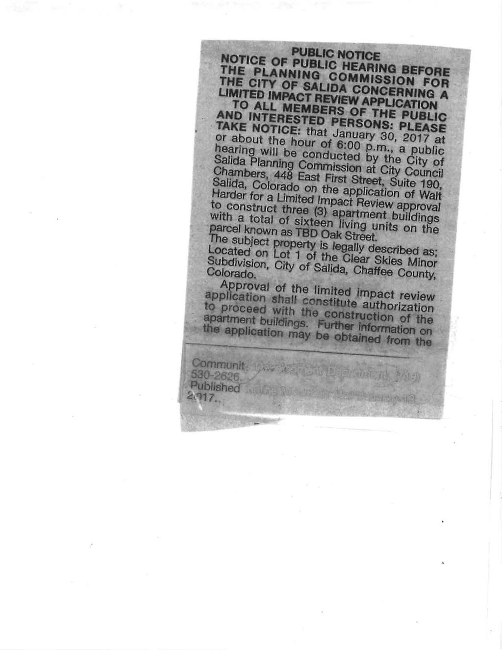
18 STAFF REPORT MEETING DATE: January 30, 2017 AGENDA ITEM TITLE: AGENDA SECTION: Oak Street Apartments Limited Impact Review Application Public Hearing REQUEST: The request is for conditional use and limited impact review approval of a new 16 unit residential development intended for apartments. The property is located within a C-1 zone district and the Highway 291 established Commercial Overlay. Residential use are allowed in the C-1 district, however, the Highway 291 Overlay requires that the Planning Commission approve a conditional use for multi-family dwellings with four or more units in addition to the development plan. APPLICANT: The applicant is Walt Harder, 112 F Street, Salida, CO, LOCATION: The subject property is located on the west side of Oak Street (Hwy 291) one block north of (Highway 50). Public Hearing, Item 2, Pg. 1
19 PROCESS: Limited Impact Review are those land uses which are generally compatible with the permitted uses in a zone district, but require site-specific review of their location, design, intensity, density, configuration, and operating characteristics, and which may require the imposition of appropriate conditions, in order to ensure compatibility of the use at a particular location and mitigate its potentially adverse impacts. The Salida Municipal Code, Chapter 16, specifies that Limited Impact Review applications be reviewed by the City of Salida Planning Commission at a public hearing after fifteen days public notice. The Planning Commission may make a decision to approve, approve with conditions, deny, or remand the application back to the applicant for modification. OBSERVATIONS: 1. The applicant is proposing to develop the site into 16 rental apartments. The site plan is thoughtfully laid out with adequate building spacing. The applicants have stated that although they are not proposing to build the units as affordable housing their desire is to keep the build cost down to offer long-term market rate rentals. 2. Access to the site is provided by a shared access easement. Internal parking and access areas will be paved. 3. The proposed use is considered Residential Multi-Family in the Land Use Code and within the SH 291 established Commercial Corridor Overlay multi-family units with four (4) more units require conditional use approval. Conditional uses are generally considered to be compatible with other uses in a zone district but may require additional consideration to ensure compatibility. Staff supports the use of this parcel for a multi-family apartment project. 4. The parcel was subdivided into two lots in 2008/2009 as part of the Clear Skies Minor Subdivision. At that time Planning Commission and City Council imposed specific conditions of approval regarding Hwy 291. The resolution required that streetscape improvements would be installed prior to the issuance of certificates of occupancy. Streetscape improvements along Hwy 291 included curb, gutter, sidewalk and street trees. Staff is recommending that the condition to provide improvements to Hwy 291 be removed as there is no CDOT approved street cross section or drainage plan for Hwy 291. A condition of approval has been added to remove the requirement for street improvements along Hwy As part of the Clear Skies Minor Subdivision there is a recorded plat note stating: *As required under Section of the Salida Municipal Code, a payment in lieu of land dedication for fair contributions for public school sites shall be paid by the owner of each lot within this subdivision prior to issuance of building permit for any new residence on such lot. *Pursuant to section (8) of the Salida Municipal Code, as may be amended, fees in lieu of land dedication for parks and open space have not been paid this this subdivision. In the event that residential units are constructed on either Lot 1 or Lot 2, either by subdivision or building permit approval, fees in lieu of land dedication for parks and open space in the amount then in effect shall be payable to the city prior to issuance of building permits. A condition of approval has been added that the school and open space fees in lieu be paid per residential unit at the time of building permit submittal. Public Hearing, Item 2, Pg. 2
20 6. The applicant has submitted a site plan showing the layout and landscaping consistent with the Land Use Code. 7. Currently the site is not served by a public sewer line. The nearest public sewer line is located in the Hwy 50 right-of-way approximately 250 south of the site. The applicant has proposed to install a new 8 sewer line to run the full extent of the property along the eastern edge of the parcel and will meet all City standards. REVIEW STANDARDS Land Use Code Section and Section : 1. Consistency with Comprehensive Plan. The use shall be consistent with the City s Comprehensive Plan. The project is consistent with the comprehensive plan. The property is adjacent to a mobile home park on the east side of Oak Street and commercial on the north, south, and west. Chapter 6 encourages a diversity of housing types to provide living units for a variety of income levels including market rate rental units. 2. Conformance to Code. The use shall conform to all other applicable provisions of this Chapter, including, but not limited to: a. Zoning district standards. The purpose of the zone district in which it is located, the dimensional standards of that zone district and any standards applicable to the particular use, all as specified in Article V. The proposed development meets the dimensional standards of the zoning district and standards applicable to the use as a residential development. Specifically, the development meets the minimum lot size, minimum lot frontage, maximum lot coverage for structures, landscaping and parking as noted in table form on sheet C1 of the development plan. Additionally, the applicant has met the setback and height requirements for the C-1 district. Additionally the applicant must meet the State Highway 291 Corridor Overlay requirements. Specifically, Section (d)(4) Architectural Standards for Established Commercial. With new construction, including an addition, two (2) or more materials must be used for exterior materials within the 291 CO, excluding roofing and structural materials. Exposed tilt-up concrete is prohibited, and metal shall not exceed twenty-five percent (25%) of the surface area of exterior materials, excluding roofs. Specifically, exempt from the requirement of using two (2) or more materials are single-family residences, duplex family residences and the accessory structures for single-family and duplex family development. b. Site Development Standards. The parking, landscaping, sign and improvements standards. The proposed development has satisfied the requirements for parking, landscape, sign and improvement standards. Specifically, the applicant has provided 29 parking spaces. The minimum landscape area of 10 percent has been met. A separate sign permit application will be required for the placement of signage. Improvement standards will be through conditions of approval and will be required prior to the issuance of certificates of occupancy. Public Hearing, Item 2, Pg. 3
21 Per Land Use Code section Undergrounding of utilities. a. Service Lines Underground. The developer shall install service lines for local utilities underground to the maximum extent feasible, including those for telephone, electricity, natural gas and cable television. If such lines are placed in a street or alley, they shall be in place prior to surfacing. b. Extend full length of property. Utility lines, water and sewer lines and storm drainage facilities shall extend the full length of the property. The applicant meets this standard with the proposed development. c. Easements. Utility easements shall be dedicated at the time of development approval as a condition of obtaining service. Utility easements shall be at least twenty (20) feet wide in public right-of-way. Widths of utility easements on private property shall be determined by the utility provider. 3. Use Appropriate and Compatible. The use shall be appropriate to its proposed location and be compatible with the character of neighboring uses, or enhance the mixture of complementary uses and activities in the immediate vicinity. The surrounding uses include both residential and commercial development. The use of this property is in conformance with the development standards for the C-1 zone district and the highway 291 established Commercial Overlay. The proposal should enhance this vacant lot and compliment surrounding properties. 4. Traffic. The use shall not cause undue traffic congestion, dangerous traffic conditions or incompatible service delivery, parking or loading problems. Necessary mitigating measures shall be proposed by the applicant. The access to the property is adequate and traffic should not negatively impact Hwy 291. The applicant must receive access approval from CDOT prior to commencing with any improvements. 5. Nuisance. The operating characteristics of the use shall not create a nuisance, and the impacts of the use on surrounding properties shall be minimized with respect to noise, odors, vibrations, glare and similar conditions. The development of this project will be a substantial improvement to the area. The applicant has minimized impacts from noise, odors, vibrations, glare and similar conditions through thoughtful layout of the site. A dumpster enclosure has been provided. No negative impacts are anticipated for the development. 6. Facilities. There shall be adequate public facilities in place to serve the proposed use, or the applicant shall propose necessary improvements to address service deficiencies which the use would cause. There are no additional public facilities required on the site. 7. Environment. The use shall not cause significant deterioration to water resources, wetlands, wildlife habitat, scenic characteristics or other natural features. As applicable, the proposed use shall mitigate its adverse impacts on the environment. There are no negative environmental impacts anticipated for this development. Public Hearing, Item 2, Pg. 4
22 AGENCY REVIEW COMMENTS: Fire Chief, Doug Bess: No concerns. Police Chief, Terry Clark: I have reviewed the plans as submitted by Walt Harder. I have no issues or concerns at this time. Chaffee County Building Official, Dan Swallow: The Building Department has no issues at this time with the apartment complex proposed on Oak Street with an address yet determined. It appears all buildings will be constructed on the same parcel of land and could be constructed under the IRC but may be cheaper to be constructed under the IBC due to reduced requirements of the firewall between the units. I think these details can be worked out later and are not germane to the land use approval. Finance Director, Jana Looney: Per Salida Municipal Code Section (b); Separate water connections required: A property containing multi-family residential housing units owned as one (1) property (not a condominium property) shall have separate water service, with separate meters, for each building containing dwelling units, except for an accessory dwelling that is seven hundred (700) square feet or less in size. Three (3) Commercial water/sewer taps required Public Works Director, David Lady: See attached memo Engineer review, Andrew Rice: See attached memo REQUIRED ACTIONS BY THE COMMISSION: 1. The Commission shall confirm that adequate notice was provided and a fee paid. 2. The Commission shall conduct a public hearing. 3. The Commission shall make findings regarding the proposed use in order to ensure the use is consistent with the Comprehensive Plan and conforms to the Land Use Code, is appropriate to its location and compatible with neighboring uses, is served by adequate public facilities and does not cause undue traffic congestion or significant deterioration of the environment. RECOMMENDED FINDINGS: 1. Public Notice has been provided in accordance with the Municipal Land Use Code. 2. This application is consistent with the Comprehensive Plan, the Land Use Code and is compatible with the surrounding uses within the C-1 district. 3. The applicant has provided and dedicated infrastructure improvements designed to the specifications of the City of Salida Municipal Code and are adequate to serve the public interest. 4. The development plan meets the requirements of the Land Use Code. 5. The applicable review criteria for limited review applications have been met. Public Hearing, Item 2, Pg. 5
23 RECOMMENDED ACTION: Based on the above findings, staff recommends APPROVAL of the conditional use application for multi-family dwelling units and the limited impact review request for this proposal with the following conditions: 1. That the applicant meets the 7 conditions as required by the Public Works Director. 2. That the applicant submit updated engineer plans as required by the Engineer. 3. That all utilities will be required to be located underground. 4. Remove the requirement for street improvements within the Highway 291 frontage. 5. The applicant provide final stamped construction drawings and final landscape plan prior to the issuance of building permits. 6. The applicant must receive access approval from CDOT prior to commencing with any improvements. 7. The application must meet the requirements of the Clear Skies Minor Subdivision that was recorded on January 26, 2009 with reception # That with the submittal of building permits the payment in lieu of land dedication for fair contributions for public school sites and the payment in lieu of land dedication for parks and open space be paid per residential unit. RECOMMENDED MOTION: That the recommended findings be made and the recommended action be taken. BECAUSE THIS APPLICATION IS FOR A LIMITED IMPACT REVIEW, THE SALIDA PLANNING COMMISSION SHALL MAKE THE FINAL DECISION ON THIS APPLICATION. THE DECISION OF THE PLANNING COMMISSION MAY BE APPEALED WITHIN 15 DAYS OF THE DECISION BY AN AGGRIEVED PERSON AS SET FORTH IN SECTION OF THE LAND USE CODE. Attachments: Application Materials and Project Narrative Public Notice Development Plan Public Works Director comments Engineering Review comments Clear Skies Minor Subdivision Plat Public Hearing, Item 2, Pg. 6

24 711 South US Highway 24 Buena Vista, Colorado Tele: (719) Kristi Jefferson Planner City of Salida 448 East 1 st Street Salida, CO kristi.jefferson@cityofsalida.com January 17, 2016 Re: 808 Oak Street Plans Review Dear Kristi: Providence Infrastructure Consultants has reviewed the following documents related to the 808 Oak Street Plans Review: 1. Drawings C2, C3, U 1 and U 2 (4 Sheets) stamped Design Development Not for Construction 2. Drainage Report, 808 Oak Street Development (40 pages with Appendices) dated January 5, This letter constitutes our first review of the above referenced project n relation to City of Salida Chapter 16 Land Use and Development Code, City of Salida Construction Standards Code and general Civil Engineering design standards for drainage control. The review may not include all correspondence concerning the Subdivision and some of the issues raised in this review may have already been addressed. There will likely be additional review effort warranted beyond this submittal and comment letter. This letter contains the following topics and comments: Section Page No. 1 DRAINAGE REVIEW COMMENTS WATER AND SEWER UTILTY PLAN COMMENTS DRAINAGE REVIEW COMMENTS 1. The concepts, rationale and approach outlined in the Drainage Study appear to meet the requirements of the Salida Land Use and Development Code Section b and d. 2. The plans, as submitted, do not contain sufficient information to allow for review for construction approval at this time. Additional information as follows is required: a. The location, size and grades of culverts, drain inlets and storm drainage sewers shall be shown, as applicable (as per Section vii.a) b. Explain how diverted stormwater will be handled after it leaves the property. Details for ditches and culverts shall be submitted, as applicable. (as per vii.b) Page 1 of 3
25 Kristi Jefferson January 17, Oak Street Plans Review 2 WATER AND SEWER UTILITY PLAN COMMENTS 3. The design concepts, as shown on the drawings, appear to meet the general requirements of the City of Salida. However, the plans, as submitted, do not contain sufficient information to allow for review for construction approval at this time. Additional information and/or modifications as follows are required: a. Water and Sewer flow estimates are needed: Data addressing the population planned to occupy the proposed development that may need to be served by extensions of the proposed water supply and sewer collection systems. The resulting domestic, irrigation and fire flow demands shall be expressed in terms of gallons of water needed on an average day and at peak time, and the resulting amounts of sewage to be treated shall be expressed in gallons per day (as per Section viii). b. Please provide confirmation that 10 ft wide easement for the sanitary sewer line is sufficient to allow for future excavation, maintenance and/or reconstruction if necessary. c. A public sanitary sewer manhole is shown on the west side of the property on Drawing U 1 along with 262 LF 8 in sanitary sewer pipe connecting to proposed MH 3. Please provide discussion as to whether this will actually be a public sewer line, and if so, please discuss whether or not there is a need for a sewer easement through the property for this line. d. The proposed sewer connection at MH 1 adjoins to the existing sewer running along the north side of HWY 50. The existing sewer flows from west to east in this reach. The location of the proposed tie in would introduce flow in a direction which is not compatible with the existing flow and may likely impede flow and exacerbate solids and debris deposition. i. Please consider installing a manhole on the existing sewer line with a flow angle of less than 90 degrees. ii. If connection of new sewer line to existing manhole concept is used, please ensure that the construction drawings clearly require compliance with City of Salida Sanitary Sewer Design and Construction Standards Section 12.M or N) e. The City of Salida requires a minimum of 5 ft bury depth for water mains (as per City of Salida Water Mains Design and Construction Standards Section 8.C.4). Revision to Note 8 on Drawing U 1 is required. f. The City of Salida requires that, if at all possible, water meters shall be located within a conditioned space of the structure. Only with advanced approval, and special circumstances, shall meters be allowed to be placed external to the building in a meter pit (as per City of Salida Water Mains Design and Construction Standards Section 9.H) i. Please confirm that the City has approved buried meter pits as proposed. ii. If so, ensure that design drawings and specs conform to requirements of City of Salida Water Mains Design and Construction Standards Section 9.H g. The profile view on Drawing U 2 indicates that the existing water service has +/ 5 ft of cover and runs over the top of the proposed sewer. However, the new proposed water service taps are shown with +/ 7 ft of cover and running underneath the proposed sewer. Please comment on Page 2 of 3

26 Kristi Jefferson January 17, Oak Street Plans Review Sincerely, the as built elevation of the existing water line and whether or not water a water under sewer conflict may exist. Providence Infrastructure Consultants, Inc. Andrew. R. Rice, P.E. Senior Associate CC: David Lady, P.E., City of Salida Enclosures: Drawings U 1 and U 2 with redline notes Page 3 of 3
27 X X X X X E E E E E X X X X S X W S S S S S W W W W W SAS SAS SAS SAS SAS SAS W W W W W SAS SAS SAS W W W W W W W W W W W W E E E E E E W W W W W W W W W W W W W W W W W NOTE: LAND AND WATER CONCEPTS, LLC AND WALKER ENGINEERING ASSUME NO RESPONSIBILITY FOR ANY DAMAGES, INCLUDING STRUCTURAL FAILURES DUE TO ANY DEFICIANCIES. OMISSIONS OR ERRORS BY OTHERS. IN ANY INSTANCE THE MAXIMUM LIABILITY OF LAND AND WATER CONCEPTS, LLC AND WALKER ENGINEERING SHALL BE A REFUND OF THE PRICE OF THE SERVICES PERFORMED. IT IS RECOMMENDED THAT YOU CONSULT WITH THE LOCAL BUILDING OFFICIALSAND/OR ENGINEER PRIOR TO THE START OF ACTUAL CONSTRUCTION. W W W W W W W W W W W W W SAS W W W UTILITY NOTES 1. THE CONTRACTOR SHALL BE RESPONSIBLE FOR THE LOCATION OF ALL EXISTING UTILITIES AND SHOULD NOT RELY SOLELY ON THESE CONSTRUCTION PLANS FOR UTILITY LOCATIONS. CONTRACTOR MUST COMPLETE ALL UTILITY LOCATES PRIOR TO CONSTRUCTION. Utility Notification Center of Colorado (UNCC) DAMAGE TO ANY EXISTING UTILITIES IS THE RESPONSIBILITY OF THE CONTRACTOR. 2. IT IS ASSUMED THAT ALL GAS LINES ARE TO BE INSTALLED BY ATMOS GAS AND ALL ELECTRIC LINES BY EXCEL ENERGY. ALL TRENCHING AND INSTALLATION TO BE COMPLETED ACCORDING TO ATMOS AND EXCEL REQUIREMENTS. LOCATION OF ELECTRIC PRIMARY, SECONDARY LINES AND ALL TRANSFORMER PROVIDED BY EXCEL. ALL ELECTRIC AND GAS LINES ARE SHOWN HERE FOR REFERENCE ONLY. 3. CABLE AND TELEPHONE TO BE INSTALLED IN ACCORDANCE WITH THE LOCAL CABLE AND TELEPHONE PROVIDER. LOCATIONS ARE SHOWN FOR PLANNING PURPOSES ONLY. 4. TO PREVENT INSUFFICIENT CHLORINE CONTACT TIME FOR DOMESTIC WATER CONTAMINATION, THE HYDRANT IS TO BE FLUSHED ON A REGULAR BASIS. THE OWNER SHALL OUTLINE FLUSH HYDRANT PROCEDURES IN THE HOME OWNER'S ASSOCIATION DOCUMENTS. LWC AND WALKER ENGINEERING ACCEPT NO RESPONSIBILITY FOR ANY CONTAMINATION FROM INSUFFICIENT TREATMENT. 5. IF ANY OF THESE STANDARDS DIFFER FROM THE DESIGN IN THIS PLAN SET, CONTACT LAND AND WATER CONCEPTS FOR CLARIFICATION AND DIRECTION BEFORE CONTINUING. 6. ALL PUBLIC WATER IMPROVEMENTS SHALL CONFORM TO THE CITY OF SALIDA CONSTRUCTION STANDARDS AND SPECIFICATIONS FOR WATER, SANITARY SEWER AND STREET, LATEST EDITION, AS WELL AS THE STANDARDS PROMULGATED BY THE WATER QUALITY CONTROL DIVISION OF THE COLORADO DEPARTMENT OF PUBLIC HEALTH AND BY THE UNI-BELL PVC PIPE ASSOCIATION. IF ANY OF THESE STANDARDS DIFFER FROM THE DESIGN IN THIS PLAN SET, CONTACT LAND AND WATER CONCEPTS FOR CLARIFICATION AND DIRECTION BEFORE CONTINUING. 7. ALL UNDERGROUND WATERLINES SHALL BE PVC PRESSURE CLASS 235 AWWA C ALL UNDERGROUND WATERLINES PIPING SHALL MAINTAIN A MINIMUM 3' BURY AND HAVE THRUST BLOCKS AT ALL DIRECTION CHANGES AND DEAD ENDS. THRUST BLOCKS AND RODDING TO BE INSTALLED PER NFPA #24. THRUST BLOCK DIMENSIONS FOR A 4" WATER LINE SHALL BE APPLIED TO THE PROJECT WATER MAINS. SEE DETAILS 9. THE CONTRACTOR SHALL MAINTAIN 10' SEPARATIONS OF SEWER AND WATER LINES PER THE UNIFORM PLUMBING CODE. 10. ALL NEW WATER VALVES AND METERS THAT FALL WITHIN THE LIMITS OF ANY PAVED ROADWAY OR SIDEWALK SHALL HAVE A CONCRETE COLLAR AND CAST IRON COVER. 11. THE CONTRACTOR SHALL BE RESPONSIBLE TO DISINFECT, FLUSH AND PRESSURE TEST ALL INSTALLED WATER LINES IN ACCORDANCE WITH AWWA C600, C605 AND C651 AND THE CITY OF SALIDA CONSTRUCTION STANDARDS AND SPECIFICATIONS FOR WATER, SANITARY SEWER AND STREET, LATEST EDITION. THE CONTRACTOR SHALL FURNISH THE PUMP, PIPE, CONNECTIONS, METER AND ALL OTHER NECESSARY TESTING APPARATUS AND SHALL FURNISH ALL NECESSARY LABOR TO CONDUCT THE TEST. 12. ONCE THE LINE IS FLUSHED, PRESSURIZED AND THE PROPER CHLORINE RESIDUAL IS ACHIEVED FOR 24 HOURS, A TOTAL COLIFORM SAMPLE WILL BE TAKEN. ONCE A CLEAN TOTAL COLIFORM SAMPLE IS ACHIEVED, THE PIPE LINE WILL BE DEEMED ACCEPTABLE FOR DOMESTIC USE. 13. ALL WATER AND SEWER LINES TO MAINTAIN 10' HORIZONTAL AND 18" VERTICAL SEPARATION. WHERE THIS SEPARATION CAN NOT BE MAINTAINED OR WHEN THE WATER LINE PASSES UNDER THE SANITARY SEWER LINE, THE SEWERLINE SHALL BE ENCASED IN CONCRETE. CONCRETE FOR SEWER PIPE ENCASEMENTS SHALL HAVE A MINIMUM CEMENT CONTENT OF FIVE (5) SACKS PER CUBIC YARD AND A MAXIMUM WATER CONTENT OF FIVE (5) GALLONS PER SACK OF CEMENT AND SHALL HAVE A MINIMUM COMPRESSIVE STRENGTH OF 4000 PSI IN TWENTY-EIGHT (28) DAYS. MINIMUM REINFORCING FOR CONCRETE ENCASEMENTS SHALL BE 4 EACH #4 BARS, CONTINUOUS FOR THE LENGTH OF THE CASING. SEE THE CITY OF SALIDA CONSTRUCTION STANDARDS AND SPECIFICATIONS FOR WATER, SANITARY SEWER AND STREET, LATEST EDITION. 14. THE CONTRACTOR SHALL COMPLETE AN AS-BUILT SURVEY AND DRAWINGS TO BE SUBMITTED TO THE CITY OF SALIDA. 15. THE 8" PUBLIC WATERLINE TO SLOPE AT 0.6%. WITH LIMITED FLOWS, SOLIDS MAY ACCUMULATE. WATERLINE TO BE FLUSHED AND MAINTAINED AS REQUIRED BY THE CITY OF SALIDA. WATER PRESSURE NOTE THE TOTAL PRESSURE DROP OVER THE LONGEST RUN OF WATERLINE IN THE PROPOSED DEVELOPMENT IS MORE THAN 10 PSI. THE METER SIZE SHOULD BE VERIFIED BY SALIDA PUBLIC WORKS AND THE PRESSURE IN THE WATERLINE TESTED AT THE PROJECT FIRE HYDRANT. WITH A 3" LINE AND A 1-1/2" WATER METER THERE MAY NOT BE ADEQUATE PRESSURE AT PERIODS OF PEAK DEMAND. E S S W W W 3W
28 GAS SAS SAS SAS SAS SAS SAS SAS SAS SAS GM W W W W W W W SANITARY SEWER NOTES 1. THE CONTRACTOR SHALL BE RESPONSIBLE FOR THE LOCATION OF ALL EXISTING UTILITIES AND SHOULD NOT RELY SOLELY ON THESE CONSTRUCTION PLANS FOR UTILITY LOCATIONS. CONTRACTOR MUST COMPLETE ALL UTILITY LOCATES PRIOR TO CONSTRUCTION. Utility Notification Center of Colorado (UNCC) DAMAGE TO ANY EXISTING UTILITIES IS THE RESPONSIBILITY OF THE CONTRACTOR. STATE HWY 50 SAS SAS SAS SAS SAS SAS SAS SAS SAS W W W W EX MH RIM ELEV.= SEWER LINE A STA= BEGIN CONCRETE ENCASEMENT AT MANHOLE 8" PVC Pipe -0.60% START INV. ELEV. = END INV. ELEV. = W W W SAS SAS E E E W W W W W W W WV WV W W GAS GAS GAS W AS GAS GAS SEWER LINE A STA= END CONCRETE ENCASEMENT WATER CROSSING Sta= W W W W W W MH RIM ELEV.= W W W W W W W W W W W W SEWER LINE A STA= TIE EX. SAS SERVICE TO NEW PRIVATE SEWER LINE E E E E W W W W W WATER CROSSING Sta= SEWER LINE A STA= (ASSUMED LOCATION) TIE EX. SAS SERVICE TO NEW PRIVATE SEWER LINE WMWV W W W W W W W W W W W W W W WV SAS SAS SAS SAS W W W W W W W W W W 8" PVC Pipe -0.48% START INV. ELEV. = END INV. ELEV. = WATER CROSSING Sta= WATER CROSSING Sta= SAS E E E WATER CROSSING Sta= W W W W W W W W W W W W W E SAS SAS SAS S S S S S S S S S S S S S S S S S S S S WATER CROSSING Sta= MH RIM ELEV.= E E W W W E X X X X 8" PVC Pipe -0.94% START INV. ELEV. = END INV. ELEV. = MH RIM ELEV.= STATE HWY OAK STREET 2. ALL WATER AND SEWER LINES TO MAINTAIN 10' HORIZONTAL AND 18" VERTICAL SEPARATION. WHERE THIS SEPARATION CAN NOT BE MAINTAINED OR WHEN THE WATER LINE PASSES UNDER THE SANITARY SEWER LINE, THE SEWERLINE SHALL BE ENCASED IN CONCRETE. CONCRETE FOR SEWER PIPE ENCASEMENTS SHALL HAVE A MINIMUM CEMENT CONTENT OF FIVE (5) SACKS PER CUBIC YARD AND A MAXIMUM WATER CONTENT OF FIVE (5) GALLONS PER SACK OF CEMENT AND SHALL HAVE A MINIMUM COMPRESSIVE STRENGTH OF 4000 PSI IN TWENTY-EIGHT (28) DAYS. MINIMUM REINFORCING FOR CONCRETE ENCASEMENTS SHALL BE 4 EACH #4 BARS, CONTINUOUS FOR THE LENGTH OF THE CASING. SEE THE CITY OF SALIDA CONSTRUCTION STANDARDS AND SPECIFICATIONS FOR WATER, SANITARY SEWER AND STREET, LATEST EDITION. 3. ALL SANITARY SEWER SERVICE LINES ARE TO BE CONSTRUCTED PER THE INTERNATIONAL PLUMBING CODE. IN ADDITION, ALL 8 MAINS, MANHOLES AND SERVICES TO BE CONSTRUCTED PER THE CITY OF SALIDA CONSTRUCTION STANDARDS AND SPECIFICATIONS FOR WATER, SANITARY SEWER AND STREET, LATEST ADDITION. ALL SEWER LINES TO BE SDR 35 PVC PIPE PER ASTM D3034. CONSTRUCTION OF ALL LINES SHALL ALSO BE PER THE STANDARDS PROMULGATED BY THE WATER QUALITY CONTROL DIVISION OF THE COLORADO DEPARTMENT OF PUBLIC HEALTH AND BY THE UNI-BELL PVC PIPE ASSOCIATION. SEWER LINE A PLAN SEWER LINE A 7045 MH RIM ELEV.= DEPTH = 7.70 Elevation BEGIN ENCASE PIPE IN CONCRETE Station= EX MH RIM ELEV.= DEPTH = 8.49 FG Station= elev = EXISTING 8" WATER LINE ASSUMED TOP WATER Station= elev = ASSUMED BOTTOM WATER Station= elev = TOP SAS Station= elev = BOTTOM SAS Station= elev = " PVC Pipe -0.60% START INV. ELEV. = END INV. ELEV. = EXISTING WATER SERVICE ASSUMED TOP WATER Station= elev = END ENCASE PIPE IN CONCRETE Station= EXISTING WATER SERVICE ASSUMED TOP WATER Station= elev = " PVC Pipe -0.48% START INV. ELEV. = END INV. ELEV. = BOTTOM SAS Station= elev = NEW " WATER SERVICE TOP WATER Station= elev = BOTTOM WATER Station= elev = FG Station= elev = MH RIM ELEV.= DEPTH = " PVC Pipe -0.94% START INV. ELEV. = END INV. ELEV. = TOP SAS Station= elev = BOTTOM SAS Station= elev = NEW 1 1 2" WATER SERVICE TOP WATER Station= elev = BOTTOM WATER Station= elev = MH RIM ELEV.= DEPTH = 5.47 TOP SAS Station= elev = VERTICAL EXAGGERATION = 10X SEWER LINE A PROFILE DESIGN DEVELOPMENT - NOT FOR CONSTRUCTION
29 January 17, 2017 RE: Lot 1 Clear Skies LLC 808 Oak Street To: Kristy Jefferson, Planner, City of Salida Beverly Kaiser, Interim Community Development Director, City of Salida Public Works has completed a review of the 808 Oak Street, Civil Engineering Plans dated, 12/19/2016. Public works recommends that the below conditions be met and plans be revised, resubmitted, and approved prior to construction of public infrastructure: 1. That the public utility easement shown on drawings for the sanitary sewer extension be signed and recorded prior to construction of any public utilities. Revise sewer alignment be to 7-ft from west easement line. Provide surveyed property corner information on easement and construction drawings. 2. That the drawings be revised for the sanitary sewer main between STA and to include replacement of the existing private sewer line with 8-inch PVC into the manhole at STA Grout penetration at manhole. Provide concrete encasement per CDPHE requirements. 3. That the sewer main between MH-3 and MH-4 be revised to maintain 0.48% slope. 4. That the drawings be revised to show proper hydrant connection location to existing main. 5. That the drawings be revised to include grades for drainage and driveway access improvements as well as storm water detention facilities.
30 6. That a copy of the approved CDOT access agreement is provided to the City. 7. That the review engineer s comments are addressed. Contact me if you have further questions. Thanks, David Lady, P.E. Director of Public Works City of Salida

31
32 GENERAL DEVELOPMENT APPLICATION 448 East First Street, Suite 112 Salida, CO Phone: Fax: TYPE OF APPLICATION (Check-off as appropriate) Annexation Pre-Annexation Agreement Variance Appeal Application (Interpretation) Certificate of Approval Creative Sign Permit Historic Landmark/District License to Encroach Text Amendment to Land Use Code Watershed Protection Permit Conditional Use Administrative Review: (Type) Limited Impact Review: (Type) Major Impact Review: (Type) Other: 2. GENERAL DATA (To be completed by the applicant) A. Applicant Information Name of Applicant: Mailing Address: Telephone Number: FAX: Address: Power of Attorney/ Authorized Representative: (Provide a letter authorizing agent to represent you, include representative s name, street and mailing address, telephone number, and FAX) B. Site Data Name of Development: Street Address: Legal Description: Lot Block Subdivision (attach description) Disclosure of Ownership: List all owners names, mortgages, liens, easements, judgments, contracts and agreements that run with the land. (May be in the form of a current certificate from a title insurance company, deed, ownership and encumbrance report, attorney s opinion, or other documentation acceptable to the City Attorney) I certify that I have read the application form and that the information and exhibits herewith submitted are true and correct to the best of my knowledge. Signature of applicant/agent Signature of property owner Date Date General Development Application Form 03/09/15
33 Project Proposal for 808 Oak Street Tentatively called The 808 Apartments The subject property is located on Oak Street (State Highway 291), in Salida, Colorado. The subject property is known as Lot 1 of the Clear Skies Minor Subdivision. Because addresses are given during the building permit process, the property does not yet have a street address. Per Kristi Jefferson with the City of Salida, the new address will likely be 808 Oak Street. The major focus of this project is to try to address the need for more rental housing in Salida. The project will not specifically meet Affordable Housing requirements, in terms of any government description. However, the desire is to try to keep the initial build costs and operating costs down, so as to maintain the rent rates at a level which is achievable to a wider range of incomes. Units will be used as apartment rentals, with rental terms typically being long term (1 year or more). Units will be built with an emphasis on energy and resource efficiency to try to ensure lower operating costs for all utilities, including heating, water, and electricity. The proposal is to build 16 apartments on the site. All units will be 3 bedrooms with 2 bathrooms. There will be three buildings: two with five units and one with six. The Site Plan shows the footprint of each building and associated parking areas, which comply with all of the associated standards. Emphasis is being placed on building a project which will help to create an attractive entrance to the City. The style will be contemporary with efficient design. The property has a deeded, shared access for ingress and egress with the property to the south. This access was granted as part of a previous Planning & Zoning hearing on 9/22/08. The project will use this existing shared easement for ingress and egress. Drivers will enter form Oak Street to enter the parking lot. The address of the neighboring property to the south is 840 Oak Street. A site plan is included with this application showing the layout of the development. We are now submitting an access permit application to CDOT and we don t anticipate issues getting the requested access. There is no requirement from CDOT for any curb and gutter, nor any sidewalk along Highway 291 (Oak Street). Strict adherence to guidelines would call for installation of a sidewalk on the east side of the property. While the applicant is open to including a sidewalk we would prefer
34 to leave the streetscape unchanged. The potential for adjacent and nearby properties developing in the next decade is slight. Considering our goal of keeping these rentals attainable to working class Salidans the cost of curb/gutter/sidewalk installation would hinder out ability to reach that goal. We have met with Chief Doug Bess of the Salida Fire Department to review the proposed plan. Chief Bess had expressed no concern with our plans at this point. There is an existing fire hydrant adjacent to the property on Oak Street which is believed to be sufficient to handle any potential water needs for the Department. Water and sewer will be provided by the City of Salida. The existing City water line runs along the eastern edge of the 808 Oak Street property, within the public right of way. Water and sewer tap fees will be based on the commercial rate and will utilize a 1.5 commercial water line. The existing City sewer line runs along the northern edge of the Highway 50 right of way, approximately 240 feet to the south of the proposed property. The plat shows a dedicated Utility Easement through the property at 840 Oak Street for a sewer line to service 808 Oak Street. The easement runs along the eastern edge of the property at 840 Oak Street. This easement will be used to install a new 8 line to connect with the existing City sewer near Highway 50. At the request of the City, the sewer line will run the full length of the eastern edge Lot 1. All other specifications for the sewer line to meet current City standards will be met. The current plat was recorded on 1/26/09 and was approved during the Planning & Zoning meeting held on 9/22/08. Proposed landscape plan included: Landscaping will consist mainly of drought tolerant plantings, in addition we will have shade trees along the common space and side walk. Emphasis will be placed on minimizing outdoor water use, while still providing a feeling of a well-manicured and inviting property. Low flow plumbing fixtures will be installed in all unities to minimize impact on the public water supply. The property is shown on some City of Salida maps as being in the Highway 50 Overlay. Former City Planner Dan Osborn stated that this is an error that was not corrected when the property was previously platted. The property does fall within the Highway 291 Overlay and will meet all associated. Per Salida City Code , Multifamily Dwelling Units of four units or greater are a conditional use. The
35 project will comply with any other associated lighting requirements. The project will be built under the 2006 IRC (International Residential Code) and any other applicable building codes. Contacts Applicants: Walt Harder Kent Townsend Architect: Steven James Riden A.I.A. Architect P.C. CO. License # Steve@riden1.com Engineering and Site Design: Andy Riemenschneider, Land and Water Builder: DSI Applicants Signature:
36 5.00' WV 5.00' C:\LANDMARK\Logo\COMPASS B&W.jpg C:\VCNTY\SALIDA-COLOR.BMP PROJECT SITE 1 1/2" ALUM. CAP ON #5 REBAR LS ' 0' 30' 60' 90' 1 1/2" ALUM. CAP ON #5 REBAR ILLEGIBLE VICINITY MAP NOT TO SCALE IRRIGATION DITCH N 00 02'16" E 32.77' 18" C.M.P. N 00 02'16" E ' SCALE 1" = 30' 10' WIDE ELECTRIC UTILITY EASEMENT BOOK 423 PAGE ' ' 7044 SHED N 89 05'02" W ' 7-11 BUILDING EAVE ENCROACHES 0.46' ' N 00 02'16" E 50.00' S 89 18'08" E S 89 43'08" E ' " STEEL DISC ON #5 REBAR LS 6753 SHED (2.2') (2.3') 7040 SINGLE LEVEL BUILDING (TO BE REMOVED) (0.7') 7039 (3.0') S 89 18'08" E (2.5') (1.9') (2.6') (2.0') ' ' 30' WIDE SHARED ACCESS EASEMENT 15.00' SITE BENCHMARK ELEV.= ' ' ' ' ' N 00 16'52" E N 00 16'52" E ' ' WV ' ' ' 7038 STOP AHEAD (TO BE RELOCATED) 7037 A TRACT OF LAND LOCATED IN THE SOUTH HALF OF THE NORTHWEST QUARTER OF THE SOUTHWEST QUARTER (S1/2NW1/4SW1/4) OF SECTION 4, TOWNSHIP 49 NORTH, RANGE 9 EAST OF THE NEW MEXICO PRINCIPAL MERIDIAN, CHAFFEE COUNTY, COLORADO, BEING DESCRIBED AS FOLLOWS: BEGINNING AT A POINT ON THE NORTHERLY RIGHT-OF-WAY BOUNDARY OF U.S. HIGHWAY NO. 50, WHENCE THE SOUTHEAST CORNER (BRASS CAP) OF SECTION 4 BEARS SOUTH ' EAST FEET, AND WHENCE THE HIGHWAY RIGHT-OF-WAY MARKER (BRASS CAP) AT STATION OF THE CENTERLINE SURVEY OF SAID HIGHWAY BEARS SOUTH 89 35' EAST FEET, SAID BEGINNING POINT BEING MARKED BY A POINT IN THE EASTERLY SIDE OF A 24" C.M.P. CULVERT AND BEING WITNESSED BY A 5/8 INCH STEEL REINFORCING BAR 2 FEET LONG DRIVEN INTO THE GROUND AND HAVING A ONE INCH ALUMINUM CAP WHICH IS NORTH 89 35' WEST 3.0 FEET FROM SAID BEGINNING POINT; THENCE FROM SAID BEGINNING POINT PROCEEDING AROUND THE TRACT HEREIN DESCRIBED NORTH ' WEST FEET TO A REINFORCING BAR AS DESCRIBED ABOVE; THENCE SOUTH 89 35' EAST FEET; THENCE NORTH ' WEST 50.0 FEET; THENCE SOUTH 89 35' EAST 172 FEET, MORE OR LESS, TO THE WESTERLY BOUNDARY OF COLORADO STATE HIGHWAY NO. 291; THENCE SOUTHERLY ALONG SAID BOUNDARY FEET TO THE NORTHERLY BOUNDARY OF U.S. HIGHWAY NO. 50; THENCE NORTH 89 35' WEST ALONG SAID NORTHERLY BOUNDARY 172 FEET, MORE OR LESS, TO AN OFFSET IN SAID BOUNDARY; THENCE NORTH 0 26' EAST ALONG SAID OFFSET 54.6 FEET TO THE HIGHWAY RIGHT-OF-WAY MARKER (BRASS CAP) OF STATION ; THENCE NORTH 89 35' WEST ALONG SAID BOUNDARY FEET TO THE POINT OF BEGINNING. EXCEPT THAT PART CONVEYED TO J&J EVERETT RANCH, INC., IN WARRANTY DEED RECORDED AUGUST 10, 1999, AS RECEPTION NO N 00 15'22" E ' EXCEPTION PARCEL RECEPTION N N 89 05'02" W ' EDGE OF PAVEMENT 3/4" IRON BOLT WITH 1 1/2" HEAD N 00 06'58" E 54.83' N 00 15'22" E ' 7041 (1.8') (2.0') (1.6') (1.4') (2.0') (1.5') 7040 WATER & SEWER EASEMENT (*SEE NOTE 3) 7039 WATER LINE TO BE ABANDONED (1.4') (2.4') 7039 (1.8') (2.0') (2.5') 7038 SINGLE LEVEL BUILDING LIGHT POLE ' (1.5') 7038 LOT 1 UTILITY EASEMENT 10.00' N 00 16'52" E ' END ' ) THIS IMPROVEMENT LOCATION SURVEY WAS DONE IN CONJUNCTION WITH STEWART TITLE GUARANTY COMPANY COMMITMENT NO , DATED JULY 8, ) BASIS OF BEARING FOR THIS SURVEY IS GEODETIC NORTH BASED ON G.P.S. OBSERVATIONS ALONG THE WEST RIGHT-OF-WAY OF OAK STREET BETWEEN A #5 REBAR AND AN ALUMINUM CAP STAMPED LS 16117, HAVING A BEARING OF SOUTH 00 16'52" WEST 3) 10.0' EASEMENT AND RIGHT-OF-WAY FOR WATER AND SEWER LINES (5.0' OF EITHER SIDE OF CURRENT LOCATION) EXTENDING FROM COLORADO STATE HIGHWAY 291 TO EXCEPTION PARCEL AS LISTED IN SCHEDULE B, ITEM 10 OF SAID TITLE COMMITMENT AS SHOWN HEREON. SEWER LINE AND SECOND WATER LINE LOCATIONS ARE UNCERTAIN AND UNMARKED 4) UNDERGROUND UTILITIES SHOWN AS MARKED ON THE SURFACE BY CITY OF SALIDA, UTILITY NOTIFICATION CENTER OF COLORADO, AND OTHERS, LANDMARK SURVEYING AND MAPPING ASSUMES NO RESPONSIBILITY FOR THE ACCURACY OF ANY UNDERGROUND UTILITIES DEPICTED HEREON. 5) PRIVATE SEWER LINE WAS NOT MARKED ON THE GROUND, CONTINUATION OF SEWER LINE TO MAIN ALONG HIGHWAY 50 IS APPROXIMATE 6) AT DATE OF FIELD WORK, NO EVIDENCE OF THE OUTLET OF THE STORM DRAIN WAS FOUND " STEEL DISC ON #5 REBAR LS 6753 GUNNISON 65 MONTE VISTA 81 EDGE OF PAVEMENT N89 16'08"W ' WEST 50 GM 7039 STORM DRAIN WV HISTORIC DOWNTOWN SALIDA SIGN POLE #5 REBAR 7038 YIELD LEGEND GM WM WV FOUND MONUMENT AS NOTED SET 1 1/2" ALUMINUM CAP LS ALIQUOT CORNER AS NOTED SEWER CLEAN OUT ELECTRIC METER GAS METER FIRE HYDRANT MAN HOLE POWER POLE WATER METER WATER VALVE ROAD SIGN ELM TREE (TRUNK DIA.) 7040 JUNIPER TREE (TRUNK DIA.) 7040 X X FENCE E E OVERHEAD ELECTRIC W W UNDERGROUND GAS UNDERGROUND WATER THIS PLAT WAS FILED IN THE OFFICE OF THE CLERK AND RECORDER OF CHAFFEE COUNTY, COLORADO, AT.M. ON THIS DAY OF, 2006 UNDER RECEPTION NUMBER CHAFFEE COUNTY CLERK AND RECORDER REVISED: I, SYDNEY A. SCHIEREN, A REGISTERED LAND SURVEYOR LICENSED TO PRACTICE IN THE STATE OF COLORADO, DO HEREBY CERTIFY THAT THIS LAND SURVEY WAS PERFORMED UNDER MY DIRECT SUPERVISION, AND THAT THE PLAT REPRESENTS THE RESULTS OF SAID SURVEY AND IS TRUE AND CORRECT TO THE BEST OF MY KNOWLEDGE. 7 MAY 17, 2006 SYDNEY A. SCHIEREN COLORADO P.L.S JOB # 0618 DATE: MAY 9, 2006 SHEET 1 OF 1 C:\LANDMARK\Logo\TYPE B&W.jpg P.O. BOX 668 SALIDA, CO PH FAX
37 5.00' WV 5.00' C:\LANDMARK\Logo\COMPASS B&W.jpg C:\VCNTY\SALIDA-COLOR.BMP 0' 30' 60' 90' SHED SCALE 1" = 30' N 00 02'16" E 50.00' S 89 18'08" E ' SITE BENCHMARK ELEV.= VICINITY MAP NOT TO SCALE PROJECT SITE S 89 18'08" E IRRIGATION DITCH 18" C.M.P. 10' WIDE ELECTRIC UTILITY EASEMENT BOOK 423 PAGE ' EAVE ENCROACHES 0.46' ' W W N 00 02'16" E 32.77' LEGEND GM WM WV N 00 02'16" E ' N 00 15'22" E ' FOUND MONUMENT AS NOTED FOUND 1 1/2" ALUMINUM CAP LS SET 1 1/2" ALUMINUM CAP LS SEWER CLEAN OUT ELECTRIC METER GAS METER FIRE HYDRANT MAN HOLE POWER POLE WATER METER WATER VALVE ROAD SIGN STOP SIGN ELM TREE (TRUNK DIA.) JUNIPER TREE (TRUNK DIA.) X X FENCE E E OVERHEAD ELECTRIC UNDERGROUND GAS UNDERGROUND WATER EDGE OF PAVEMENT N 89 05'02" W ' 7-11 BUILDING EXCEPTION PARCEL RECEPTION N N 89 05'02" W ' S 89 43'08" E ' 2" STEEL DISC ON #5 REBAR LS 6753 EDGE OF PAVEMENT 3/4" IRON BOLT WITH 1 1/2" HEAD N 00 06'58" E 54.83' 2" STEEL DISC ON #5 REBAR LS 6753 GUNNISON 65 MONTE VISTA 81 EDGE OF PAVEMENT THIS PLAT WAS FILED IN THE OFFICE OF THE CLERK AND RECORDER OF CHAFFEE COUNTY, COLORADO, AT.M. ON THIS DAY OF, 2009 UNDER RECEPTION NUMBER. 5.00' 5.00' 7041 N 00 15'22" E ' SHED (2.2') 7041 (2.3') (1.8') (2.0') (1.6') (1.4') (2.0') (1.5') 7040 SINGLE LEVEL BUILDING (TO BE REMOVED) (0.7') 7039 (1.4') (2.4') (3.0') (2.5') (1.9') (2.6') (2.0') (1.8') (2.0') GM (2.5') SINGLE LEVEL BUILDING STORM DRAIN WV HISTORIC DOWNTOWN SALIDA LIGHT POLE (1.5') N89 16'08"W ' WATER & SEWER EASEMENT (*SEE NOTE 3) 7040 WATER LINE TO BE ABANDONED WEST ' 30' WIDE SHARED ACCESS EASEMENT 15.00' ' ' ' ' ' 7038 LOT 1 UTILITY EASEMENT 10.00' SIGN POLE 7038 N 00 16'52" E ' N 00 16'52" E WV ' ' STOP AHEAD (TO BE RELOCATED) END ' ' #5 REBAR YIELD KNOW ALL MEN BY THESE PRESENTS, THAT THE UNDERSIGNED BEING ALL OF THE OWNER, MORTGAGEE, AND LIENHOLDER OF CERTAIN PARCELS OF LAND IN THE CITY OF SALIDA, CHAFFEE COUNTY, COLORADO, DESCRIBED AS FOLLOWS: A TRACT OF LAND LOCATED IN THE SOUTH HALF OF THE NORTHWEST QUARTER OF THE SOUTHWEST QUARTER (S1/2NW1/4SW1/4) OF SECTION 4, TOWNSHIP 49 NORTH, RANGE 9 EAST OF THE NEW MEXICO PRINCIPAL MERIDIAN, CHAFFEE COUNTY, COLORADO, BEING DESCRIBED AS FOLLOWS: BEGINNING AT A POINT ON THE NORTHERLY RIGHT-OF-WAY BOUNDARY OF U.S. HIGHWAY NO. 50, WHENCE THE SOUTHEAST CORNER (BRASS CAP) OF SECTION 4 BEARS SOUTH ' EAST FEET, AND WHENCE THE HIGHWAY RIGHT-OF-WAY MARKER (BRASS CAP) AT STATION OF THE CENTERLINE SURVEY OF SAID HIGHWAY BEARS SOUTH 89 35' EAST FEET, SAID BEGINNING POINT BEING MARKED BY A POINT IN THE EASTERLY SIDE OF A 24" C.M.P. CULVERT AND BEING WITNESSED BY A 5/8 INCH STEEL REINFORCING BAR 2 FEET LONG DRIVEN INTO THE GROUND AND HAVING A ONE INCH ALUMINUM CAP WHICH IS NORTH 89 35' WEST 3.0 FEET FROM SAID BEGINNING POINT; THENCE FROM SAID BEGINNING POINT PROCEEDING AROUND THE TRACT HEREIN DESCRIBED NORTH ' WEST FEET TO A REINFORCING BAR AS DESCRIBED ABOVE; THENCE SOUTH 89 35' EAST FEET; THENCE NORTH ' WEST 50.0 FEET; THENCE SOUTH 89 35' EAST 172 FEET, MORE OR LESS, TO THE WESTERLY BOUNDARY OF COLORADO STATE HIGHWAY NO. 291; THENCE SOUTHERLY ALONG SAID BOUNDARY FEET TO THE NORTHERLY BOUNDARY OF U.S. HIGHWAY NO. 50; THENCE NORTH 89 35' WEST ALONG SAID NORTHERLY BOUNDARY 172 FEET, MORE OR LESS, TO AN OFFSET IN SAID BOUNDARY; THENCE NORTH 0 26' EAST ALONG SAID OFFSET 54.6 FEET TO THE HIGHWAY RIGHT-OF-WAY MARKER (BRASS CAP) OF STATION ; THENCE NORTH 89 35' WEST ALONG SAID BOUNDARY FEET TO THE POINT OF BEGINNING. EXCEPT THAT PART CONVEYED TO J&J EVERETT RANCH, INC., IN WARRANTY DEED RECORDED AUGUST 10, 1999, AS RECEPTION NO HAVE BY THESE PRESENTS LAID OUT, PLATTED AND SUBDIVIDED THE SAME INTO LOTS, BLOCKS OR TRACTS, AS SHOWN ON THIS PLAT, UNDER THE NAME AND STYLE OF ' '. THE UNDERSIGNED HEREBY DEDICATES TO THE PUBLIC ALL UTILITY EASEMENTS ON THE PROPERTY AS DESCRIBED AND AS SHOWN HEREON. THE UNDERSIGNED HEREBY FURTHER DEDICATE TO THE PUBLIC UTILITIES THE RIGHT TO INSTALL, MAINTAIN AND OPERATE MAINS, TRANSMISSION LINES, SERVICE LINES AND APPURTENANCES TO PROVIDE SUCH UTILITY SERVICES WITHIN THIS SUBDIVISION OR PROPERTY CONTIGUOUS THERETO, UNDER, ALONG AND ACROSS UTILITY EASEMENTS AS SHOWN HEREON. EXECUTED THIS DAY OF, COUNTY OF CHAFFEE ) ) ss. STATE OF COLORADO ) CLEAR SKIES, LLC (MANAGER) MORTGAGE HOLDER THE FORGOING DEDICATION WAS ACKNOWLEDGED BEFORE ME THIS DAY OF 2009, BY, AS CLEAR SKIES, LLC MANAGER. WITNESS MY HAND AND SEAL. MY COMMISSION EXPIRES. NOTARY PUBLIC CHAFFEE COUNTY CLERK AND RECORDER I HEREBY CERTIFY THAT THIS INSTRUMENT WAS FILED IN MY OFFICE AT.M. ON THIS DAY OF, 2009, AND IS DULY RECORDED. CITY CLERK THIS PLAT IS APPROVED FOR FILING AND THE CITY HEREBY ACCEPTS THE DEDICATION OF THE STREETS AND ROADS SHOWN HEREON SUBJECT TO THE PROVISIONS IN "STREET MAINTENANCE" SET FORTH ABOVE, AND FURTHER ACCEPTS THE DEDICATION OF THE EASEMENTS SHOWN HEREON. SIGNED THIS DAY OF, CITY OF SALIDA BY: MAYOR ) THIS SURVEY WAS DONE IN CONJUNCTION WITH STEWART TITLE GUARANTY COMPANY COMMITMENT NO , DATED JULY 8, ) BASIS OF BEARING FOR THIS SURVEY IS GEODETIC NORTH BASED ON G.P.S. OBSERVATIONS ALONG THE WEST RIGHT-OF-WAY OF OAK STREET BETWEEN A #5 REBAR AND AN ALUMINUM CAP STAMPED LS 16117, HAVING A BEARING OF SOUTH 00 16'52" WEST 3) 10.0' EASEMENT AND RIGHT-OF-WAY FOR WATER AND SEWER LINES (5.0' OF EITHER SIDE OF CURRENT LOCATION) EXTENDING FROM COLORADO STATE HIGHWAY 291 TO EXCEPTION PARCEL AS LISTED IN SCHEDULE B, ITEM 10 OF SAID TITLE COMMITMENT AS SHOWN HEREON. SEWER LINE AND SECOND WATER LINE LOCATIONS ARE UNCERTAIN AND UNMARKED 4) UNDERGROUND UTILITIES SHOWN AS MARKED ON THE SURFACE BY CITY OF SALIDA, UTILITY NOTIFICATION CENTER OF COLORADO, AND OTHERS, LANDMARK SURVEYING AND MAPPING ASSUMES NO RESPONSIBILITY FOR THE ACCURACY OF ANY UNDERGROUND UTILITIES DEPICTED HEREON. 5) PRIVATE SEWER LINE WAS NOT MARKED ON THE GROUND, CONTINUATION OF SEWER LINE TO MAIN ALONG HIGHWAY 50 IS APPROXIMATE 6) AT DATE OF FIELD WORK, NO EVIDENCE OF THE OUTLET OF THE STORM DRAIN WAS FOUND 7) ELEVATIONS SHOWN HEREON ARE BASED UPON N.A.V.D. 88 8) IF LOT 1 OR LOT 2 IS DEVELOPED RESIDENTIALLY, THE DEVELOPER MAY BE RESPONSIBLE FOR " IN LIEU OF OPEN SPACE FEES". * THIS PLAT IS APPROVED BY THE CITY OF SALIDA PLANNING COMMISSION THIS DAY OF, CHAIR OF PLANNING COMMISSION, CITY OF SALIDA I, SYDNEY A. SCHIEREN, A REGISTERED LAND SURVEYOR LICENSED TO PRACTICE IN THE STATE OF COLORADO, DO HEREBY CERTIFY THAT THIS LAND SURVEY WAS PERFORMED UNDER MY DIRECT SUPERVISION, AND THAT THE PLAT REPRESENTS THE RESULTS OF SAID SURVEY AND IS TRUE AND CORRECT TO THE BEST OF MY KNOWLEDGE. I, A LICENSED TITLE INSURANCE AGENT IN THE STATE OF COLORADO, DO HEREBY CERTIFY THAT I HAVE EXAMINED THE TITLE TO THE PROPERTY HEREBY DEDICATED AND AS SHOWN AND DESCRIBED ON THIS PLAT AND FOUND TITLE VESTED IN CLEAR SKIES, LLC, FREE AND CLEAR OF ALL LIENS AND ENCUMBRANCES EXCEPT AS LISTED BELOW: DATED THIS DAY OF, *As required under Section of the Salida Municipal Code, a payment in lieu of land dedication for fair contributions for public school sites shall be paid by the owner of each lot within this subdivision prior to issuance of a building permit for any new residence on such lot *Pursuant to section (8) of the Salida Municipal Code, as may be amended, fees in lieu of land dedication for parks and open space have not been paid for this subdivision. in the event that residential units are constructed on either lot 1 or lot 2, either by subdivision or building permit approval, fees in lieu of land dedication for parks and open space in the amount then in effect shall be payable to the city prior to issuance of building permits. REVISED: SYDNEY A. SCHIEREN COLORADO P.L.S TITLE AGENT JOB # 0879 DATE: JANUARY 7, 2009 SHEET 1 OF 1 C:\LANDMARK\Logo\TYPE B&W.jpg P.O. BOX 668 SALIDA, CO PH FAX
38 DEVELOPMENT PLAN SUMMARY OAK STREET APARTMENTS SITE PLAN V101
39 LANDSCAPE LEGEND OAK STREET APARTMENTS LANDSCAPE PLAN L101
40 COV PATIO GREAT ROOM FOYER ENTRY MASTER BDRM CLOS 1st FLOOR PLAN BDRM 3 CLOS 6 - PLEX BUILDING OAK STREET APARTMENTS BDRM 2 CLOS 2nd FLOOR PLAN A101
41 COV PATIO GREAT ROOM FOYER ENTRY MASTER BDRM CLOS 1st FLOOR PLAN BDRM 3 CLOS 5 - PLEX BUILDING OAK STREET APARTMENTS BDRM 2 CLOS 2nd FLOOR PLAN A102
42
43 5 - PLEX BUILDING OAK STREET APARTMENTS FRONT ELEVATION REAR ELEVATION RIGHT ELEVATION LEFT ELEVATION A201
44 W W W W W W W E E W You created this PDF from an application that is not licensed to print to novapdf printer (
45 X X X X SAS SAS WV W WV WV Elevation You created this PDF from an application that is not licensed to print to novapdf printer (
46 > > > > > > > > X > > > > > > > > > > > > > > > > > > > > > > > > > > > > > > > > > > > > > > > > > > > > > > X X X > > > > > > > X > > > > > > > > > > > > X X X X X > > > > > > ³ ³ > > > > > ³ DESIGN DEVELOPMENT - NOT FOR CONSTRUCTION
47 > > > > X X > > > > X > > > > > X X > > > > > > X X ³ > > > X X X > > > > > > > > > > > > > > > > > > ³ > > > > > > > > > > > > > > > > > > > > > > > > > > > > > > > > > > > > > > > > > > > > > ³ The Contractor is responsible for completing a Storm Water Management Plan (SWMP) and obtaining the associated discharge permit from the Colorado Department of Public Health and Environment water quality control division. THE CONTRACTOR IS ULTIMATELY RESPONSIBLE FOR THE Best Management Practices (BMP) USED, THEIR EFFECTIVENESS, AND COMPLIANCE WITH THE COLORADO DISCHARGE PERMIT SYSTEM (CDPS). THE EROSION CONTROL SUPERVISOR (ECS) SHOULD BE DESIGNATED BY THE CONTRACTOR AND WILL BE RESPONSIBLE FOR THE IMPLEMENTATION, MANAGEMENT, MAINTENANCE, AND CARE OF THE swmp AND THE ASSOCIATED BMP'S, AS AN ADDITIONAL RESOURCE, SEE URBAN STORM DRAINAGE, CRITERIA MANUAL VOLUME 3, BEST MANAGEMENT PRACTICES GENERAL NOTES 1. LAND AND WATER CONCEPTS AND WALER ENGINEERING. WAIVE ANY AND ALL RESPONSIBILITY, AND ARE NOT LIABLE FOR PROBLEMS WHICH ARISE FROM FAILURE TO FOLLOW THESE PLANS, SPECIFICATIONS AND THE DESIGN INTENT THEY CONVEY OR FOR PROBLEMS WHICH ARISE FROM OTHERS OR OTHERS' FAILURE TO OBTAIN AND/OR FOLLOW THE ENGINEER'S GUIDANCE WITH RESPECT TO ANY ERRORS, OMISSIONS, INCONSISTENCIES, AMBIGUITIES OR CONFLICTS. 2. THE CONTRACTOR SHALL NOT COMMENCE CONSTRUCTION WITHOUT CONSTRUCTION PLAN APPROVAL BY ALL RELEVANT AGENCIES. A COPY OF THE APPROVED PLANS SHALL BE AVAILABLE AT THE CONSTRUCTION SITE AT ALL TIMES DURING WORKING HOURS. 3. THE ENGINEER IS TO BE NOTIFIED PRIOR TO ANY PLAN CHANGES OR ON-SITE DESIGN MODIFICATIONS. ALL PLAN CHANGES MUST BE APPROVED BY THE ENGINEER. 4. ALL EXISTING TOPOGRAPHIC AND SURVEY DATA SHOWN ON THESE PLANS HAS BEEN OBTAINED AND CERTIFIED BY OTHERS. THE ENGINEER HAS UNDERTAKEN NO FIELD VERIFICATION OF THIS TOPOGRAPHIC INFORMATION, AND MAKES NO REPRESENTATION PERTAINING THERETO AND THEREFORE ASSUMES NO RESPONSIBILITY OR LIABILITY. 5. THE CONTRACTOR SHALL CONFINE HIS OPERATIONS TO THE CONSTRUCTION LIMITS OF THE PROJECT AND IN NO WAY SHALL ENCROACHMENT OCCUR ONTO ADJACENT PROPERTIES UNLESS LEGAL EASEMENTS ARE OBTAINED. ALL FILL AND CUT SLOPES SHALL BE SETBACK FROM THE PROPERTY LINE IN ACCORDANCE WITH CHAPTER 70 OF THE UNIFORM BUILDING CODE. THE CONTRACTOR WILL BE HELD RESPONSIBLE FOR ANY AGREEMENTS NECESSARY OR DAMAGE CAUSED BY CONSTRUCTION ACTIVITIES TO PUBLIC OR PRIVATE PROPERTY, INCLUDING UTILITIES. 6. WORK SHALL COMPLY WITH ALL LOCAL, STATE, AND FEDERAL AGENCIES' LAWS, RULES, REGULATIONS, AND PERMITS. ALL WORK SHALL BE SUBJECT TO INSPECTIONS AND SITE INVESTIGATION BY REGULATORY AGENCIES. FAILURE TO COMPLY WITH THESE REGULATIONS IS SUBJECT TO LEGAL ENFORCEMENT ACTION. 7. COPIES OF PERMITS OBTAINED BY THE OWNER WILL BE PROVIDED TO THE CONTRACTOR. CONTRACTOR SHALL MAINTAIN COPIES OF ALL PERMITS ON THE SITE AT ALL TIMES. 8. THE CONTRACTOR SHALL BE RESPONSIBLE FOR THE LOCATION OF ALL EXISTING UTILITIES AND SHOULD NOT RELY SOLELY ON THESE CONSTRUCTION PLANS FOR UTILITY LOCATIONS. CONTRACTOR MUST COMPLETE ALL UTILITY LOCATES PRIOR TO CONSTRUCTION. UTILITY NOTIFICATION CENTER OF COLORADO (UNCC) DAMAGE TO ANY EXISTING UTILITIES IS THE RESPONSIBILITY OF THE CONTRACTOR. 9. IF PREVIOUSLY UNKNOWN ARCHEOLOGICAL MATERIALS ARE DISCOVERED DURING CONSTRUCTION ACTIVITIES, WORK SHALL STOP IMMEDIATELY AND THE ENGINEER AND OWNER SHALL BE CONTACTED. THE STATE HISTORIC PRESERVATION OFFICE WILL THEN BE CONTACTED BY THE ENGINEER OR OWNER FOR CONSULTATION. 10. ALL APPROPRIATE SEDIMENT AND POLLUTION CONTROL MEASURES, AND BEST MANAGEMENT PRACTICES (BMP'S) SHALL BE IN PLACE TO MINIMIZE SEDIMENTATION. SEDIMENT AND EROSION CONTROLS SHALL BE INSTALLED IN ACCORDANCE WITH THE URBAN DRAINAGE AND FLOOD CONTROL DISTRICT GUIDELINES. 11. CONTRACTOR SHALL BE WHOLLY RESPONSIBLE FOR THE DESIGN, IMPLEMENTATION, AND MAINTENANCE OF SEDIMENT AND EROSION CONTROLS IN CONFORMANCE WITH CONSTRUCTION STANDARDS AND THE REQUIREMENTS OF REGULATORY AGENCIES THROUGHOUT THE CONSTRUCTION PERIOD. THE ENGINEER WILL NOT BE ON-SITE TO APPROVE, REVIEW, OR MAINTAIN THE CONTROLS. STORM WATER MEASURES MAY BE REQUIRED TO BE INSTALLED AT ANY TIME DURING CONSTRUCTION. 12. BMP'S PLUS TEMPORARY SEDIMENT AND EROSION CONTROLS SHALL BE MAINTAINED TO BE FUNCTIONAL UNTIL THE SITE HAS REACHED FINAL STABILIZATION. 13. ALL WASTE MATERIAL AND/OR EXCESS EXCAVATION NOT USED AS PART OF THE WORK SHALL BE REMOVED FROM THE JOB SITE AND DISPOSED OF AT ACCEPTABLE LOCATIONS IN ACCORDANCE WITH ALL LOCAL, STATE AND FEDERAL REGULATIONS. 14. THE CONTRACTOR AT ALL TIMES DURING CONSTRUCTION SHALL PROVIDE WARNING SIGNS, BARRICADES, AND OTHER SAFETY DEVICES (INCLUDING TEMPORARY FENCING AROUND THE JOB SITE) TO PROTECT PUBLIC SAFETY AND HEALTH. CONSTRUCTION IN AND ADJACENT TO THE ROADWAY SHALL FOLLOW AN APPROVED TRAFFIC CONTROL PLAN COMPLETED BY THE CONTRACTOR. THE TRAFFIC CONTROL PLAN SHALL BE IN COMPLIANCE WITH THE MANUAL ON UNIFORM TRAFFIC CONTROL DEVICES. ALL HOLES AND TRENCHES SAFELY CORDONED OFF AND BACKFILLED, COMPACTED AND PATCHED AS SOON AS POSSIBLE AFTER COMPLETION AND ALL INSPECTIONS. 15. THE CONSTRUCTION SURVEYOR SHALL VERIFY ALL BUILDING, PARKING AND SIDEWALK LOCATIONS AS WELL AS PROPOSED GRADES AND INVERT ELEVATIONS, FLOW LINES, ALIGNMENTS, SETBACKS AND TOPOGRAPHY PRIOR TO CONSTRUCTION. 16. CONSOLIDATED FLOW FROM THE POND OVERFLOWS CAN CREATE EROSION. ANNUAL MAINTENANCE OF THE POND BERMS, WEIRS AND OVERFLOWS IS REQUIRED. FURTHER STABILIZATION MEASURES MAY BE NECESSARY. LWC RECOMMENDS PERIODIC OBSERVATIONS BY THE HOME OWNER ASSOCIATION. IF EXCESS EROSION IS OBSERVED, PLEASE NOTIFY LAND AND WATER CONCEPTS FOR RECOMMENDATIONS. DESIGN DEVELOPMENT - NOT FOR CONSTRUCTION
48 MEMORANDUM MEETING DATE: January 30, 2017 TO: City of Salida Planning Commission FROM: Beverly J. Kaiser, Community Development Department SUBJECT: Discussion: Amendments to the Salida Land Use and Development Code Regarding Short-Term Rentals At the work session of January 10, 2017, in addition to providing input regarding the proposed regulations, the Salida Planning Commission requested additional information regarding the legal basis for regulating short-term rentals. After reviewing the legal summary for regulating short-term rentals detailed below, staff believes it is well within the City s authority to regulate the location and quantity of short-term rentals and establish rules to reduce the negative impacts. Attached to this memo are (1) proposed amendments to the Land Use and Development Code establishing a new section for short-term rentals, (2) amendments and additions to the definitions section in the Land Use Code, (3) a proposed new line item for Table 16-D Schedule of Uses in the Land Use Code for short-term rentals, (4) a proposed amendment to the short term licensing section (Section 6-6) in the municipal code changing the definition of short-term rentals so that it is the same as the new one in the Land Use Code, and (5) sample uniform STR information posting for inside the short-term rental. The proposed amendments to the Land Use and Development Code clarify that short-term rentals are permitted in most zones, and state the conditions under which they must be operated. Legal Authority to Regulate Short Term Rentals Zoning, conditional use permits, special use permits, and other special land use regulations are all tools available for a city to implement goals and policies in a community Comprehensive Plan. Section of the Colorado Revised Statutes states that it is the duty of the (Planning) 1
49 commission to make and adopt a master plan. The stated purpose of Salida s Comprehensive Plan (adopted in 2013), on page 1-4, is to provide direction for elected and appointed officials in making decisions regarding proposals for new development and future needs of the community to achieve a healthy and balanced community. The text on pages 1-4 and 1-5 includes statements such as the Comprehensive Plan is an advisory document that articulates a clear and concise vision for the future of Salida it is to be used to guide creation of new and revised city ordinances. In Chapter 2 on page 2-4, the Plan states protection of our unique small town character is commonly identified as the most important priority for community members in discussion about the future of the city. The legal authority for cities to implement the policies in comprehensive plans using the tools of zoning and associated regulations derives from the Colorado State Statutes, Section (1) reprinted below: (1) Except as otherwise provided in section , C.R.S., for the purpose of promoting health, safety, morals, or the general welfare of the community, including energy conservation and the promotion of solar energy utilization, the governing body of each municipality is empowered to regulate and restrict the height, number of stories, and size of buildings and other structures, the percentage of lot that may be occupied, the size of yards, courts, and other open spaces, the density of population, the height and location of trees and other vegetation, and the location and use of buildings, structures, and land for trade, industry, residence, or other purposes. Regulations and restrictions of the height, number of stories, and the height and location of trees and other vegetation shall not apply to existing buildings, structures, trees, or vegetation except for new growth on such vegetation. Such regulations shall provide that a board of adjustment may determine and vary their application in harmony with their general purpose and intent and in accordance with general or specific rules contained in such regulations. Subject to the provisions of subsection (2) of this section and to the end that adequate safety may be secured, said governing body also has power to establish, regulate, restrict, and limit such uses on or along any storm or floodwater runoff channel or basin, as such storm or floodwater runoff channel or basin has been designated and approved by the Colorado water conservation board, in order to lessen or avoid the hazards to persons and damage to property resulting from the accumulation of storm or floodwaters. Any ordinance enacted under authority of this part 3 shall exempt from the operation thereof any building or structure as to which satisfactory proof is presented to the board of adjustment that the present or proposed situation of such building or structure is reasonably necessary for the convenience or welfare of the public. A report completed by the law firm of Robinson and Cole states Zoning regulations that restrict short-term rentals in residential areas have been upheld where the restrictions are found to be substantially related to land use impacts in the area. Prohibiting short-term occupancy in singlefamily areas has been held to be within the lawful scope of the zoning power. (Robinson and Cole. Short-Term Rental Housing Restrictions National Association of Realtors) The basic purposes for regulating land use are for the protection of community health, safety, and welfare. More specifically, communities have the authority to protect the quality of residential neighborhoods and assure adequate and safe housing for their citizens, as well as permit flexibility in commercial and mixed-use commercial zones. 2
50 Salida Comprehensive Plan Specific policies and statements in the Salida Comprehensive Plan that may guide decision-making concerning the regulation of short-term rentals are: Page 4-8, Policy E&S 1.2 Zoning should not be an impediment to the downtown and other areas and should not restrict innovative commercial development. Page 6-1, Chapter 6 Housing has a considerable amount of text pertaining to assuring attainable housing to rent or own for all income groups: The existing pattern of a mixture of housing types, family sizes and incomes in Salida neighborhoods is integral to the character of the community. Decent housing should be attainable by all citizens of Salida whether to rent or to own. Affordable housing has been a growing concern in recent years as the increase in housing costs has outpaced wage increases. While Salida may seem to some like an affordable alternative to other Colorado resort communities, rising housing costs have put pressure on local residents to live outside of the municipality, live in sub-standard housing or leave the community. Ensuring diverse housing opportunities are available will enhance and support the city s economic and social diversity, and help maintain the sense of community. There are a variety of recent studies and ongoing efforts to address the growing problem of cost-burdened households. Page 6-2, Affordable Housing Salida has historically been a community where multiple generations can grow up and live out their lives. Increasing housing costs along with lack of employment are beginning to erode that valuable social fabric of the community. Page 6-6, Policy H-I.2 The character of existing neighborhoods should be protected. Page 8-4, Principle TO-IV Lodging. Support existing and new lodging facilities that provide guests with overnight stay opportunities. Page 8-5 Policy TO IV.2 Support development of new lodging facilities. Page 8-5 Action TO-IV.2.c Promote the use of vacation rentals during peak events. So, in summary, the Salida Comprehensive Plan includes policies that encourage protection of existing residential neighborhoods and the provision of affordable housing while supporting the tourism/lodging economy. Permitting short-term rentals while regulating their impact on the availability of housing and the quality of residential neighborhoods is clearly in conformity with the Salida Comprehensive Plan. Other Legal Aspects of Regulating Short-term Rentals 3
51 The Robinson and Cole report lists the status of the court decisions (as of 2011) regarding shortterm rentals on specific legal topics. On the topic of takings (i.e. if a regulation is so excessively restrictive that it constitutes a taking of property), the report states plaintiffs who challenge a short-term rental restriction as a taking of property face an uphill battle. As a practical matter, it is difficult to argue that a short-term rental prohibition denies the owner of all economically viable use of his land, particularly where longer-term rentals are still allowed (Robinson report page 15). Regarding due process (substantive and procedural requirements; i.e. there needs to be a rational relationship between the terms of the ordinance and a legitimate governmental interest), the report states that a California ordinance was rationally related to the goals and policies set forth in the city s general plan, as well as the purpose of the R-1 district. The California court of appeals, regarding Carmel regulations, stated: It stands to reason that the residential character of a neighborhood is threatened when a significant number of homes-at least 12 percent in this case, according to the recordare occupied not by permanent residents but by a stream of tenants staying a week-end, a week, or even 29 days. Whether or not transient rentals have the other unmitigatable, adverse impacts cited by the council, such rentals undoubtedly affect the essential character of a neighborhood and the stability of a community. Short-term tenants have little interest in public agencies or in the welfare of the citizenry. They do not participate in local government, coach little league, or join the hospital guild. They do not lead a scout troop, volunteer at the library, or keep an eye on an elderly neighbor. Literally they are here today and gone tomorrow-without engaging in the sort of activities that weld and strengthen a community. In terms of equal protection cities adopting STR regulations can prove equal protection (i.e. all persons similarly situated should be treated alike) if enforcement is fair, i.e. not selective. Salida Land Use and Development Code Sections and in the Salida Land Use and Development regulations describe the specific land uses permitted in the eight Salida zoning districts. The purpose of each residential zone (R-1, R-2, R-3 and R-4) is to provide for a residential neighborhood or residential area relevant to that zone. The RMU (Residential Mixed Use) zone is the only one that permits an integration of residential and commercial uses that are developed and operated in harmony. Although several California communities have prohibited short-term rentals in residential zones, stating that they are a commercial use in a residential zone, the Oregon Supreme Court ruled otherwise. In an article entitled Some Key Resources on Vacation Rental Regulations (Jan. 23, 2015), regarding the case Yogman vs Parrott, the Oregon Supreme Court ruled renting a home on a short term basis is an allowed residential use. Although the renters pay to occupy defendant s 4
52 home, they are using the home for residential purposes not motel-like with on-site public access, signage, etc. What that means for Salida is that STRs may be permitted in residential zones, but the City has the authority to use its zoning powers to create regulations addressing the negative impacts to the neighborhood and the impact on affordable housing. Vacancy Rates for Long Term Rentals in Salida The Robinson report states that a clear demonstration of need helps support STR regulations. Although available long-term rentals currently appear to be scarce, in terms of verifiable data concerning the actual vacancy rates for long-term rentals, staff has found no clear facts. The Chaffee County Housing Needs Assessment, completed in August of 2016, provided some information on second homes and rental prices. The study states that as of 2016 the estimated proportion of second homes in the County is 17% of the total housing units. Rents of long-term rentals have risen from an average of $500/month in 2005 to $1,400/month currently (2016). In 2014, of the total housing units in Chaffee County, 23.9% were vacant. Seventeen percent of the total housing units were vacant second homes. The study suggests that the vacation rental market is a way to utilize otherwise empty homes to bring visitors and their associated spending to Chaffee County. Citizen input provided at the many Planning Commission and City Council meetings in 2015 and 2016 on the topic of short-term rentals and the public forum held on November 16, 2016 supports the perceived need for addressing the negative impacts from short-term rentals. In fact, citizen pressure led to the City Council adopting the moratorium on approving any more short-term rentals on Sept. 20, 2016 Proposed Amendments to the Land Use and Development Code Pertaining to Short-term Rentals The proposed amendments on the attached draft address the major issues concerning short-term rentals. Yet, at the same time, STRs are permitted in most zones with differing regulations depending on whether they fall within residential or commercial zones. The issues and means of resolution are generally described below. 1. Short-term rentals disrupt the neighborhood residential characteristics in residential zones and reduce the available of housing for long-term rentals. a. The amendments limit the total number of licensed short-term rentals to 3% of all dwelling units in residential zones (R-1, R-2, R-3, and R-4). This limit prevents an overabundance of STRs, creating a party/hotel neighborhood feel, and helps retain some dwelling units for long-term rentals. Yet, as new dwelling units are added to the residential pool, the number of short-term rentals can increase. b. A limit of one STR per street segment is included in the draft regulations in the R- 1 and R-2, residential zones. A street segment means a portion of a street that is located between two intersections or between an intersection and the end of a cul- 5
53 de-sac or dead end. This prevents whole blocks and neighborhoods from becoming STR districts thereby ruining the neighborhood character of the block. c. The attached draft regulations include a prohibition of STRs in apartment buildings for the purpose of reserving the most affordable housing in Salida for long term renters. 2. Renters using short-term rentals disrupt the neighborhood character through problems with noise, trash, too many people per rental unit, and parking problems. These negative impacts are addressed via specific regulations for STRs listed under a new section in the Land Use and Development Code. The initial application for a STR can identify the maximum number of permitted renters (which should also be posted in the unit) as well as the parking location and number of available spaces on site for each unit. A uniform posting with information and regulations as well as contact numbers has also been developed for all STRs that can be added to every STR unit. 3. Short-term rentals provide unfair competition for hotels and motels paying lodging taxes and fees required of a business. The new business license section in the Salida Municipal Code, already adopted (Chapter 6, Article VI), requires that all short-term rentals, whether in commercial or residential zones, apply for a STR business license with the City, pay all applicable sales tax and lodging tax, and pay Salida occupational lodging taxes. This licensing also enables the City to track the number, location, land use zone, and pattern of complaints for all STRs. 4. STRs are a compatible use in commercial zones and provide an alternative style of lodging for visiting families. The attached draft regulations do not limit the total number of permitted STRs in commercial zones and the mixed-use residential zone (RMU). 5. Un-hosted and unlimited short-term rentals (in terms of both quantity and number of rental days a year) in residential zones create a permanent commercial use in a residential-style structure. The regulations include the requirement that the person on the license be the property owner on the title in the County Assessor s records. Only one STR is permitted per property owner. In the residential zones (R-1, R-2, R-3, and R-4) the maximum total number of days a year that a STR may be rented is 270 days. This permits the use of a second home as a STR for a maximum of nine months thereby preventing the floating hotel permanent commercial use of residential homes. 6
54 ARTICLE I General Provisions Title and short title. This Chapter, as amended from time to time, shall be known and may be cited as the City of Salida Land Use Code. It may also be called the Land Use and development Code Authority. This Chapter is authorized by Section , et. seq., C.R.S.; Section , et. seq., C.R.S., Section , et. seq., C.R.S., and Section , et. seq., C.R.S., as amended Purposes. This Chapter is enacted for the purpose of promoting the health, safety, quality of life, convenience, order, prosperity, and welfare of the present and future inhabitants of the City by lessening of congestion in the streets or roads, securing safety from fires and other dangers, providing light and air, avoiding undue congestion of the population, facilitating the adequate provision of transportation, water, wastewater, schools, and other public requirements, securing protection of the tax base, and by other means in accordance with the City of Salida Comprehensive Plan Jurisdiction. These regulations shall apply to all land and all land uses within the municipal boundaries of the City of Salida, Colorado Presumption of validity. All provisions of this Land Use Code are presumed to be valid and enforceable. In any challenge to the validity of any provision, the burden of proof shall rest with the person bringing the challenge Rules of construction. Section of this Code establishes rules that shall be observed and applied when interpreting the language of this Chapter, unless the context clearly requires otherwise Severability. If any section, subsection, paragraph, clause, phrase or provision of these regulations shall be adjudged invalid or held to be unconstitutional by a court of competent jurisdiction, the validity of these regulations shall not be affected in whole or in part, other than the provision adjudged to be invalid or unconstitutional Definitions. This Article defines words, terms and phrases contained within this Land Use Code. The following terms shall have the following meanings when used in this Land Use Code: Page 1 of 16 1/24/2017
55 Accessory building or structure means a detached, subordinate building or structure located upon the same lot as the principal building or structure to which it is related, which is: a. Clearly incidental, subordinate, secondary and devoted to the principal building or structure. b. Customarily found in conjunction with the principal building or structure. Accessory use means a use incidental, customary, and subordinate to the principal use of the lot, structure, or building and on the same lot and not prohibited in the zone district in which it is located. Addition means any work which adds square footage, volume or exterior wall or roof area to an existing structure. Alley means a strip of land dedicated to public use, located at the side or rear of lots and providing a secondary means of vehicular access to the property. Alteration, Small means any alteration to an existing residential building or an alteration or change of use to a mixed-use or nonresidential building that increases the gross floor area or lot coverage (by structures or impervious area) by less than 25% and does not increase the parking requirements on the property by more than ten (10) spaces. Construction of one (1) or more dwellings in an existing building in the C-2 zone district where the construction results in four (4) or fewer dwelling units shall be considered a small alteration. Alteration, Large means any alteration or change of use to a mixed-use or nonresidential building that increases the gross floor area, or lot coverage (by structures or impervious area) by 25% or more or increases the parking requirements on the property by more than ten (10) spaces, whether or not the parking spaces exist or need to be constructed. Annexation means the process of incorporating an unincorporated portion of Chaffee County into the boundaries of the City pursuant to the Municipal Annexation Act of 1965, Section , et seq., C.R.S. Apartment building means a building containing three (3) or more separate dwelling units, which may be separated vertically or horizontally, but not including condominiums, commercial lodging, or bed and breakfast inns. Attention-attracting device means any device or object visible from any public street which is primarily designed to attract the attention of the public to a business, institution, sign or activity through such means, including but not limited to illumination, color, size or locations. Attention-attracting devices or objects often-times incorporate illumination, which may be stationary, moving, turning, blinking (including animation) or flashing. Attention-attracting devices may or may not convey a message and can include, but are not limited to, search lights, beacons, strobe lights, internally illuminated translucent canopies or panels, banners, streamers, pennants, propellers and inflatable objects (including strings of balloons) or other devices or objects designed to attract Page 2 of 16 1/24/2017
56 attention. Approved traffic-control devices are not considered attention-attracting devices for purposes of this Code. Awning means a shelter constructed of nonrigid materials on a supporting framework which projects from and is supported by the exterior wall of a building. Banner means a sign made of fabric, plastic or other nonrigid material which has no enclosing framework. Bed and breakfast inn means an overnight lodging establishment that provides short-term lodging for a charge to the public, generally for periods of less than one (1) month, having an owner or manager residing on the site. Incidental sale of supplies or products associated with the bed and breakfast shall be permitted on premises. An appropriate sales tax license shall be obtained and maintained during the course of business. Bedroom means a room in a dwelling unit that is marketed and designed for sleeping, or otherwise has the potential to function primarily for sleeping. Board means the Board of Adjustment of the City. Boarding or rooming house means a building, other than a hotel, bed and breakfast, cafe or restaurant, where, for direct or indirect compensation, lodging and/or meals are provided for three (3) or more boarders and/or roomers, exclusive of the occupant's family. Brewery, distillery, winery means an industrial use that creates ales, beers, meads, wines, spirits, and/or similar beverages on site for wholesale production. Small tasting rooms may be an accessory use. This definition excludes small breweries (less than 5,000 barrels of beverages per year) operated in conjunction with a bar or restaurant defined herein as an accessory use. Building means any structure used or intended for supporting or sheltering any use or occupancy and within the purview of the building codes as adopted by the City. Building area means the maximum horizontal area within the outer perimeter of the building walls, dividers or columns at ground level or above, whichever is the greater area, including exterior stairways, and inner courts but excluding uncovered decks, uncovered porches, patios, terraces and steps of less than thirty (30) inches in height, and completely open, uncovered, cantilevered balconies that have a minimum of eight (8) feet vertical clearance below. Building, enclosed means a building separated on all sides from adjacent open space or other buildings by fixed exterior walls or party walls, with openings only for windows and doors, and covered by a permanent roof. Building height means the distance measured on a vertical plane from the average preconstruction or post-construction grade around the perimeter foundation of a building or structure, whichever is lower, to the highest point on the roof surface of the building or structure. Page 3 of 16 1/24/2017
57 Building line means the average setback of the primary structures on a block. Building, principal means a building in which the primary use for the lot on which the building is located is conducted. Bus station means any premises for the storage or parking of motor-driven buses and the loading and unloading of passengers. Stations may include ticket purchase facilities, toilets, restaurants and retail stores. Campground means a parcel of land used or intended to be used, let or rented for overnight or short-term occupancy by campers, trailers, tents or recreational vehicles. Certificate of approval or CA means the official document/permit issued by the City Administrator approving and/or concerning, without limitation, the erection, moving, demolition, renovation, rehabilitation, remodeling, restoration, reconstruction, repair or alteration of any historic landmark building, site or structure, or any building, site or structure within a designated historic district. Church means any building that is architecturally designed and/or particularly adapted for the primary use of conducting formal religious services on a regular basis. Clear sight triangle means the area at the intersection of any two (2) streets that is to be kept clear of any shrubs, groundcovers, berms, signs, structures or other materials greater than two (2) feet in height above the street centerline grade. A clear sight triangle is measured at the intersection of any two (2) streets. A triangle measuring fifteen (15) feet for alleys, thirty (30) feet for local streets, fifty (50) feet for collector streets and one hundred (100) feet for arterial streets along each curb or edge of roadway/pavement from their point of intersection, the third side being a diagonal line connecting the first two (2). Commercial, large scale means a commercial use where the total area utilized by a single tenant or group of tenants in an attached structure, exclusive of parking, occupies twenty thousand (20,000) square feet or more. Commercial lodging means hotels, motels, lodges or convention centers which have sleeping accommodations and similar commercial facilities that provide temporary lodging in guest rooms, which have common facilities for reservations, reception and maintenance, and in which meals, entertainment and various personal services for the public may or may not be provided for remuneration. Commercial use means an activity involving the sale of goods or services carried out for profit. Commercial zones refers to Residential Mixed Use (RMU), Commercial or Central Business (C-1, C-2) and Industrial (I) zones. These zones are also referred to as residential mixed used, commercial, central business and industrial zone districts. Commission means the Planning Commission of the City. Communication facility means, but is not limited to, unmanned facilities, equipment, parabolic-shaped devices or antennae for the reception, transmission or switching of satellite or electronic signals, including television, radio, telemetry, personal Page 4 of 16 1/24/2017
58 wireless communication, data communication or any other signals which use air space as a medium, whether for commercial or private use and that may or may not be licensed by the Federal Communications Commission. Community building or use means a building which is owned by the City, the County, the State, United States Government or a nonprofit organization that is open to the general use, participation and enjoyment of the public for the purposes of group assembly, a museum, and other civic functions, and which, notwithstanding anything to the contrary in this Code, includes use primarily for offices. Comprehensive Plan means that plan and amendments thereto for the City which provides objectives, guiding principles and recommended actions to guide the current and long-range development of the City. Conditional use means a use that is generally compatible with the other uses permitted in a zone district, but which requires site-specific review of its location, design, configuration, density, intensity and operating characteristics, and may require the imposition of appropriate conditions in order to ensure compatibility of the use at a particular location, to mitigate its potentially adverse impacts and to ensure that it complies with all of the standards of this Chapter. Condominium unit means a physical portion of a common interest community which is designated for separate ownership or occupancy and the boundaries of which are described or determined in the declaration. Contributing building or structure means a building or other structure originally identified and listed as having historical and architectural significance by the National Park Service of the United States Department of the Interior pursuant to the creation and designation of a National Register Historic District and which is still so identified and listed. Day care, adult means a facility providing care for adults sixty (60) years of age or older and/or functionally impaired adults in a protective setting for part of a twentyfour-hour day. Day care, large means a residence, facility or preschool which provides regular care and supervision for more than eight (8) children at any one (1) time during the day for compensation. Day care, small means a residence, facility or preschool which provides regular care and supervision for eight (8) or less children at any one (1) time during the day for compensation. Demolition means the total or partial destruction, disassembly, damage, razing or tearing down of a structure or any portion thereof. The term includes the removal of any material constituting part of the structure other than for purposes of ordinary maintenance or repair, which removal affects the exterior appearance of the structure or which reduces the stability or longevity of the structure. The term excludes the sudden or cataclysmic destruction of or damage to a structure due to acts of nature, including fire, earthquake, wind, excessive snow load or flood. Page 5 of 16 1/24/2017
59 Demolition by neglect means any total or partial destruction of or damage to a structure, or any portion thereof, due to the failure of the owner or lessee to adequately maintain or repair the structure. Design standards means local, state or national criteria, specifications or requirements referenced within this Chapter and used for the design of public or private infrastructure. Development permit means a permit issued by the City which certifies that a proposed development has undergone and completed the required development review procedures. The development permit may include one (1) or more conditions, which conditions shall apply to any future development or use of the land, regardless of ownership changes, unless a new development permit is obtained. Duplex means a detached residential structure containing two (2) dwelling units separated by a building code-compliant common wall. A duplex dwelling unit may have a side-by-side or stacked configuration. Drive-in facility means an establishment which provides such products and services as, but not limited to, food, beverages or financial services, to customers in vehicles. Dwelling unit means a building or portion thereof that provides complete, independent living facilities for one or more persons, including permanent provisions for living, sleeping, eating, cooking, and sanitation. Eating and drinking establishment means a permanent building containing a restaurant, bar or tavern which serves food and/or beverages, prepared or consumed on the premises, within a building or on an outdoor patio, served to the customer at tables or counters. Exterior architectural feature means the architectural style and general arrangement of the exterior of a structure, including the type and texture of the building materials, and including all windows, doors, lights, painted wall signs or displays, and other fixtures appurtenant thereto. Family means an individual, two (2) or more persons related by blood, marriage, adoption or between whom there is a legally recognized relationship, or not more than five (5) unrelated persons who occupy a single dwelling unit. Floodplain means that ground covered by water in the case of the flood of onehundred-year frequency, as delineated by federal flood insurance maps and the flood control regulations of the City. Floor area, gross means total area of a building measured by taking the outside dimensions of the building at each floor level intended for occupancy or storage. Floor area, habitable means the total floor area contained within the inside walls of a structure with at least 7.0 of headroom. Habitable floor area does not include unfinished attics, areas used for access such as stairs and covered porches, garage space used for the parking of cars or storage, unfinished basements and utility rooms less than Page 6 of 16 1/24/2017
60 50 sq. ft. All other areas of an accessory dwelling unit shall count towards habitable floor area. Fully shielded light fixture means an outdoor light fixture constructed in such a manner that all light emitted by the fixture, either directly from the lamp or diffusing element, or indirectly by reflection or refraction from any part of the luminaire, is projected below the horizontal. Gasoline service station means a building or premises in which is conducted the retail sale of batteries, tires, oil, gasoline or other fuel for motor vehicles and which may include, as an incidental use only, facilities used for polishing, greasing, washing or otherwise cleaning or light servicing of motor vehicles, and where the only repair work is done is the exchange of parts and maintenance requiring no open flame or welding. Good repair means a condition which not only meets minimum standards of health and safety, but which also guarantees continued attractiveness, structural soundness and usefulness. Government administrative facilities, services and buildings mean office buildings, maintenance facilities and operations centers owned and operated by a governmental agency. Grade, means the elevation of the surface of the ground. Group home means a residential building that is owned and operated by a nonprofit organization or is owner-occupied, which is occupied by not more than eight (8) persons who are sixty (60) years of age or older who do not require skilled or intermediate care facilities; or a residential building that contains a state-licensed facility for the exclusive use of not more than eight (8) developmentally disabled persons having such illnesses as cerebral palsy, multiple sclerosis, mental retardation, autism or epilepsy as defined in Title III of the Civil Rights Act of 1968, as amended by the Fair Housing Amendments Act of 1988, or disabled persons as defined by Section , C.R.S. Heliport means a paved area designated expressly for the landing and take-off of helicopters. Historic district means a defined neighborhood or area determined by the City, State or National Park Service within which the buildings, structures, appurtenances and places are of basic and vital importance because of their association with history; or because of their unique architectural style and scale, including proportion, form and architectural detail, the design of which should be preserved and/or developed according to a fixed plan based on cultural, historical or architectural motives or purposes. Historical and/or architectural significance means that which has a special historic or aesthetic interest or value as part of the development, heritage or cultural character of the City, region, State or Nation. Home business means the conduct of a business, occupation or trade as an accessory use entirely within a residential building or accessory structure for gain or support by residents of the dwelling and employees residing off-premises, which may serve patrons on the premises. Page 7 of 16 1/24/2017
61 Home occupation means the conduct of a business, occupation or trade as an accessory use entirely within a residential building or accessory structure for gain or support, only by residents of the dwelling and employees residing off-premises which does not serve patrons on the premises, except in an incidental manner. Hospice means a facility for the treatment and support of terminally ill patients which may occur in an institutional or residential setting, but not including when such treatment or support occurs in the patient's own residence. Hospital means a building or portion thereof used for the overnight accommodation, medical care of and ancillary services for human patients. Hotel, Lodge, Hostel means an establishment providing transient, overnight accommodations for individuals who are lodged. Industrial, heavy means the basic processing or manufacturing of materials or products predominately from extracted or raw materials, or a use engaged in storage of or manufacturing processes using flammable or explosive materials, or storage or manufacturing processes that potentially involve hazardous or commonly recognized offensive conditions. Heavy industrial uses may involve extensive exterior operations such as material storage, aggregate processing and batch plants. Industrial, light means a use engaged in the repair or manufacture, predominately from previously prepared materials, of finished products or parts, including processing, fabrication, assembly, treatment, packaging, incidental storage, sales, and distribution of such products, but excluding basic industrial processing. Light industrial does not allow for large structures outside of principal buildings, such as refineries Landmark means City of Salida, State of Colorado or National Park Service designation of a particular building, structure or site that represents historic significance because of its style of architecture, its association with historic events or persons or its archeological interest. Landscape area means an area which has been improved through the planting and maintenance of living plants such as trees, shrubs, plants, vegetative groundcover and turf grasses. Landscape area may include natural nonliving elements such as rock, stone and bark, as well as structural features, including but not limited to walks, trail connections, fences, benches, works of art, reflective pools or fountains and outdoor recreation facilities, such as swimming pools, tennis courts and the like, but shall not include areas covered by buildings, parking or access areas. In subdivisions, PDs and mobile home and RV parks, landscape area may mean an unimproved natural area, including land under water, wetlands, floodplains and similarly sensitive lands when approved by the Commission. Lot means a portion or parcel of land (whether a portion of a platted subdivision or otherwise) occupied or intended to be occupied by a building or use and its accessories, together with such yards, as are required under the provisions of this Land Use Code, having not less than the minimum area and off-street parking spaces required by this Land Use Code for a lot in the zone district in which it is situated, and having frontage on any improved public street or on an approved private street. Lot area means Page 8 of 16 1/24/2017
62 the number of square feet included within the boundaries of the lot, measured on a horizontal plane upon which the boundaries have been vertically projected. Lot coverage means that area or portion of a lot which is occupied or covered by all buildings on that lot. The area included as coverage shall be that area defined herein as building area. Lot, double frontage means a lot which runs through a block from street to street and which abuts two (2) or more streets. Lot frontage means lot width measured at the street frontage. Lot length means the average distance from the street to the rear of a lot, measured perpendicularly from the street line upon which the lot faces. Lot line adjustment means an adjustment of a lot line between two (2) contiguous lots that is necessary to correct a survey or engineering error in a recorded plat, to allow boundary change between adjacent lots or parcels to relieve hardship or practical necessity, or to allow a transfer of land from a larger conforming lot to a smaller nonconforming lot so as to make both lots conforming. Lot line, front means the property line dividing a lot from a street right-of-way. On a corner lot, the front line shall be designated by the location of the primary entrance or front porch. Lot line, rear means the property line opposite the front lot line. On a corner lot the owner shall choose which lot line is designated the rear lot line, typically this lot line is opposite the front lot line. Lot line, side means any lot line other than a front or rear lot line. Major activity (see Article XII, Historic Preservation) means and includes: 1. An activity not defined or qualifying as an insubstantial or minor activity, including, but not limited to, reconstruction, rehabilitation, remodeling, renovation, relocation or demolition; 2. Alterations, additions or other work performed on a building, structure or site that result in the increase or decrease of site coverage, floor area or exterior wall or roof surface; 3. The installation, alteration or removal of a window or door opening; 4. The replacement or repair of surface materials such as roofing or siding or an exterior architectural feature with materials or design not substantially similar to the existing materials or design; 5. The cleaning of an exterior surface of a contributing or landmark building or structure by sandblasting, high-pressure spraying or other chemical or mechanical means; 6. Application of sealant, paint, stucco, texture or other material that would conceal, alter or damage the exterior of any contributing or landmark building with an existing unfinished or unpainted brick, masonry or other unfinished siding or structural element; 7. Those activities deemed to potentially impact or influence in any substantial way the historic integrity or appearance of a landmark building, structure, site or designated historic district, or as deemed to be major upon petition to and determination by the Administrator or his or her designee. Page 9 of 16 1/24/2017
63 Major subdivision means a subdivision that results in the creation of more than five (5) parcels, lots, units, sites, tracts or interests out of the property as it existed prior to any subdivision. Manufactured home means a factory-built dwelling that is manufactured or constructed to comply with the standards of the National Manufactured Housing Construction and Safety Standards Act of 1974 and is to be used as a place for human habitation. Minor activity (see Article XII, Historic Preservation) means and includes: 1. The replacement of surface materials such as roofing or siding or an exterior architectural feature with materials and design substantially similar to the existing materials or design; 2. The installation, removal or replacement of a fence, awning, roofing material or dumpster enclosure; 3. The reuse of an existing window or door opening which has been covered or filled through installation of a replica of a historic door or glazing ; 4. Those activities deemed to not detrimentally impact or influence in any substantial way the historic integrity or appearance of a landmark building, structure, site or designated historic district, or as deemed to be minor upon petition to and determination by the Administrator or his or her designee. Minor subdivision means the division of previously unsubdivided land into five (5) or fewer separate parcels, lots, units, sites, tracts or interests. Mobile home means a dwelling which is designed to be transported on its own permanent chassis after fabrication, and is designed to be used as a dwelling, with or without permanent foundation, when the required plumbing, heating and electrical facilities are connected. Mobile homes shall comply with the HUD Code. New or used mobile homes installed after July 7, 2002, shall comply with the standards of the National Manufactured Housing Construction and Safety Standards Act of 1974 (hereinafter referred to as the HUD Code). Mobile home lot means that area of a mobile home park allotted and designed for the location of one (1) mobile home. Mobile home park means a plot of ground upon which two (2) or more mobile homes, either occupied or intended to be occupied for dwelling or sleeping purposes, are located regardless of whether a charge is made for such accommodations. Multi-family dwelling means a building containing three (3) or more separate dwelling units, which may be separated vertically or horizontally, but not including commercial lodging or bed and breakfast inns. Nonconforming lot means any lot which was lawfully established pursuant to the zoning and building regulations in effect at the time of its development, but which does not conform to the standards of this Chapter for the zone district in which the lot is located regarding minimum lot size or minimum lot frontage. Page 10 of 16 1/24/2017
64 Nonconforming structure means any structure which was lawfully established pursuant to the zoning and building regulations in effect at the time of its development, but which does not comply with the standards of this Chapter for the zone district in which the structure is located regarding minimum setbacks, maximum height, maximum lot coverage, maximum density, minimum landscape area, minimum building width, minimum floor area or the applicable standards for off-street parking, landscaping or improvements. Nonconforming use means any use of a structure or land which was lawfully established pursuant to the zoning and building regulations in effect at the time of its development, but which use is not designated in this Chapter as a permitted or conditional use in the zone district in which the use is located. Nursing home means any place or institution which operates and maintains facilities providing full-time or part-time convalescent and/or chronic care, for a period exceeding twenty-four (24) hours for two (2) or more ill or infirm patients not related to the nursing home administrator or owner by blood or marriage. Convalescent and chronic care may include, but need not be limited to, the procedures commonly employed in palliative services, nursing and caring for the sick. Nursing home may include continuing care retirement facilities and hospice care facilities. Open space means any parcel or area of land or water, essentially unimproved and set aside for public use, enjoyment or benefit. Ordinary maintenance and/or repair means any work for which a building permit is not required by law and where the purpose and effect of such work is to correct any deterioration or decay of or damage to a structure, or any part thereof, and to restore the same, as nearly as may be practicable, to its condition prior to the occurrence of such deterioration, decay or damage, and which work does not substantially alter the appearance, composition or texture of the exterior surface of the structure. Outlot means a measured piece of land contained within subdivided land that is not a building lot. An outlot may be conveyed to the public for open space or other public purposes, be retained by the developer for later subdivision or be conveyed to an owners' association. Outdoor amusement establishment means the provision of entertainment or games of skill to the general public for a fee where any portion of the activity takes place outside of a building, including but not limited to a golf driving range, archery range or miniature golf course and similar establishments. This use does not include a stadium. Overlay zone means a zoning district that encompasses one (1) or more underlying zones and that imposes additional requirements beyond those required for the underlying zone. Owner means a person, firm, association, syndicate, joint venture, partnership, governmental unit or corporation holding fee simple title to property. Ownership parcel means lot, as defined herein. Parcel means lot, as defined herein. Page 11 of 16 1/24/2017
65 Park means an area open to the public and reserved for gathering spaces, community agriculture and recreational, educational, cultural or aesthetic purposes. Parking area means an open area or an enclosed structure or building used for the temporary parking of automobiles or other vehicles. Parking, off-street means a parking area located wholly within the limits of a parcel of land. Parking space means that part of a parking area, exclusive of aisles, turning areas or loading space, devoted to parking for one (1) automobile or vehicle. Parkway means the area, excluding the sidewalk, if any, between the property line and the curb or, in the absence of a curb, between the property line and the nearest edge of the street paving. Permitted use means a use which is allowed in a zone district, subject to all of the restrictions applicable to that zone district and all of the standards of this Chapter. Personal service means an establishment primarily engaged in providing individual services generally related to personal needs. Typical uses may include but are not limited to bank, credit and loan service; beauty and barber shop; catering service; chiropractic clinic; funeral home and mortuary; laundry and dry cleaners; massage facilities; photographic studio; tailor and shoe repair service; and yoga or dance studio. Personal wireless telecommunication service facility means an unmanned facility or equipment for the reception, transmission or switching of personal wireless telecommunications and/or telecommunication services utilizing frequencies that may or may not be licensed by the Federal Communications Commission. Principal use means the purpose or function for which a lot, structure, or building is intended, designed, or constructed, or the activity which is carried out within said lot, structure or building. Professional office means a business which primarily provides professional services in an office environment. Typical uses may include but are not limited to services such as legal, accounting, investment, insurance and real estate; medical, dental and other health services; engineering, architecture, survey and design services; counseling, psychiatric and social services; editing/publishing; and administrative and sales offices for business, industry and government, provided that only the administrative, bookkeeping and clerical activities of the sales office are conducted on-site. Prohibited use means a use that is not permitted in a zone district. Recreation facilities means a place designed and equipped for the conduct of indoor or outdoor sports and leisure time activities. Recreational vehicle (RV) means a pickup camper, motor home, travel trailer, tent trailer or similar mobile unit which has wheels, is intended to be transported over streets, roads and highways as a motor vehicle or attached to a motor vehicle, and is designed primarily for use as a temporary unit for human occupancy. Page 12 of 16 1/24/2017
66 Recreational vehicle park means a plot of ground upon which two (2) or more recreational vehicles, either occupied or intended to be occupied on a short-term or seasonal basis for dwelling or sleeping purposes are located, regardless of whether a charge is made for such accommodations. Retail, large scale means a store engaged in the sale of tangible personal property for any purpose other than for resale where the total area utilized by a single tenant or group of tenants, exclusive of parking, occupies twenty thousand (20,000) square feet or more. Retail sales establishment means a store engaged in the sale of tangible personal property for any purpose other than for resale. Salida Downtown Historic District means that geographic area within historic commercial area of the City designated and listed as a national historic place on the National Register of Historic Places by the National Park Service of the United States Department of the Interior. School means any building or part thereof that is designed, constructed or used for education or instruction in any branch of knowledge. Service building means a structure housing toilet, laundry facilities, recreation equipment and such other facilities incidental to maintenance and management of a mobile home park or recreational vehicle park. Setback means the distance required by this Chapter between the face of a building or structure and the lot line opposite that building face, measured perpendicularly to the building. Where angled buildings or lots, curved streets or similar features exist, the setback shall be taken as the closest distance. Sign means any device, structure, fixture, display or placard which is permanently affixed to, painted on, placed on, incorporated in or displayed from within a building surface or structure, or is freestanding upon a site. Sign area means that area within the marginal lines of the sign surface which bears the advertisement or message; or in the case of messages, figures or symbols attached directly to or painted on the surface of a building, that area which is included in the smallest geometric figure which encloses the message, symbol or figure displayed thereon. Single-family dwelling means a detached principal building, designed for or used as a dwelling exclusively by one (1) family as an independent living unit. Site specific development plan means a plan that has been submitted to the City by a landowner or such landowner s representative describing with reasonable certainty the type and intensity of use for a specific parcel or parcels of property, which plan shall create a vested property right. Short Term Rental Unit means a privately owned residential dwelling unit, such as a single-family detached unit, duplex, condominium, or townhome that is rented for Page 13 of 16 1/24/2017
67 the purpose of lodging for any period less than thirty (30) consecutive days, not to include accessory dwelling units or an apartment building. Solar access means access which protects reasonably placed solar energy systems from shadow-blocking exposure to the sun during hours of high insolation which are between 10:00 a.m. and 3:00 p.m. on December 21. Storage yard means a site used for the keeping, in an outdoor area, of any goods, equipment, personal property, material, merchandise, or vehicles in the same place for more than 24 hours. Story, Half means a space under a sloping roof that has the line of intersection of the roof and wall face not more than 3 feet above the floor level and in which space the possible floor area with headroom of 5 feet or less occupies at least 40 percent of the total floor area of the story directly beneath. Street means a dedicated public right-of-way or private road which provides vehicular and pedestrian access to adjacent properties. Street shall include road, lane, place, avenue, drive and similar terms. The following are types of streets addressed in this Chapter: Arterial street means the major street in the street hierarchy, which has a high traffic volume and is not intended to be a residential street. An arterial street provides connections with or is a major state or interstate roadway and is often the location of significant community facilities as well as retail, commercial and industrial facilities. Collector street means a street whose function is to conduct traffic between major arterial streets and/or activity centers. It is a principal traffic artery within residential areas and carries relatively high volume. Cul-de-sac street means a local street with only one (1) outlet, which is terminated at the other end by a vehicular turnaround. The length of the cul-desac shall be measured from the center of the turnaround to the nearest point where the cul-de-sac intersects with the intersecting street. Local street means a street whose primary purpose is to conduct traffic to and from dwelling units to other streets within the hierarchy. Street frontage means that portion of the boundary of a parcel of land which is parallel with any single public street or way. Corner lots, by way of illustration, are deemed to have two (2) street frontages. Street frontage, primary means the street frontage on which the residential or business address abuts. Street segment means a portion of a street that is located between two intersections or between an intersection and the end of a cul-de-sac or dead end. Page 14 of 16 1/24/2017

68 Structural alteration means an addition to or subtraction of parts from a structure, including walls, columns, beams, girders, foundation, doors, windows and roof. Structure means any manmade item constructed or erected, which requires location on the ground or attached to something having a location on the ground, including, but not limited to, signs, buildings, and fences. Porches, slabs, patios, decks, walks and steps which are uncovered and do not exceed thirty (30) inches above grade are excluded from the definition of structures. Subdivision means the division of a lot, tract or parcel of land into two (2) or more lots, plats, sites, units, or other divisions of land for the purpose, whether immediate or future, of sale, transfer of ownership or building development; and, when appropriate to the context, relates to the process of subdividing or to the land or territory subdivided. Trail means a pathway designed for and used by the public for non-motorized recreation and transportation. A trail may include amenities such as parking areas, benches, restrooms and signage. Truck terminal means a facility for the receipt, transfer, short-term storage and dispatch of goods transported by heavy truck. Uncovered parking and access area means that portion of a parcel which is used for or intended to be used for vehicle parking or loading areas, circulation areas to and within vehicle parking and loading areas, and access driveways from a public or private right-of-way, whether such areas are kept in paved, gravel or other surface. Vacation rental means the rental of any dwelling for overnight or vacation lodging for periods of less than thirty (30) days (see short- term rental unit). Vested property right means the right to undertake and complete development and use of property under the terms and conditions of a site specific development plan. Veterinary clinic means a building or area in which animals requiring special medical care are treated or temporarily housed. The term shall not be construed to include kennel. Warehouse means an enclosed building designed and used primarily for the storage of goods and materials. Page 15 of 16 1/24/2017
AGENDA CITY OF SALIDA PLANNING COMMISSION
 AGENDA CITY OF SALIDA PLANNING COMMISSION MEETING DATE: Monday, June 27, 2016 MEETING TIME: 6:00 p.m. MEETING LOCATION: City Council Chambers, 448 East First Street, Salida, CO AGENDA SECTION: I. CALL
AGENDA CITY OF SALIDA PLANNING COMMISSION
 AGENDA CITY OF SALIDA PLANNING COMMISSION MEETING DATE: Monday, May 23, 2016 MEETING TIME: 6:00 p.m. MEETING LOCATION: City Council Chambers, 448 East First Street, Salida, CO AGENDA SECTION: I. CALL TO
PLANNING COMMISSION Minutes
 MEETING DATE: Monday January 22, 2018 MEETING TIME: 6:00 PM MEETING LOCATION: City Council Chambers, 448 E. First Street, Suite 190, Salida, CO Present: Mandelkorn, Follet, Denning, Thomas, Farrell, Bomer,
MEETING DATE: Monday, August 28, 2017 MEETING TIME: 6:00 PM MEETING LOCATION: City Council Chambers, 448 E. First Street, Suite 190, Salida, CO
 MEETING DATE: Monday, August 28, 2017 MEETING TIME: 6:00 PM MEETING LOCATION: City Council Chambers, 448 E. First Street, Suite 190, Salida, CO Present: Wood, Kasper, Mandelkorn, Follet, Berg, Thomas,
MEETING DATE: Monday, February 27, 2017 MEETING TIME: 6:00 p.m. MEETING LOCATION: City Council Chambers, 448 East First Street, Salida, CO
 AGENDA CITY OF SALIDA PLANNING COMMISSION MEETING DATE: Monday, February 27, 2017 MEETING TIME: 6:00 p.m. MEETING LOCATION: City Council Chambers, 448 East First Street, Salida, CO AGENDA SECTION: I. CALL
MEETING LOCATION: City Council Chambers, 448 East First Street, Salida, CO
 AGENDA CITY OF SALIDA BOARD OF ADJUSTMENT MEETING DATE: Tuesday, May 10, 2016 MEETING TIME: 6:00 p.m. MEETING LOCATION: City Council Chambers, 448 East First Street, Salida, CO AGENDA SECTION: I. CALL
CHAPTER 26 PLANNING AND ZONING ARTICLE VII. MOBILE HOMES AND RECREATIONAL VEHICLE (RV) PARKS. Recreational Vehicle (RV) Park Development Standards
 PARKS. Recreational Vehicle (RV) Park Development Standards") CHAPTER 26 PLANNING AND ZONING ARTICLE VII. MOBILE HOMES AND RECREATIONAL VEHICLE (RV) PARKS. Section 26-VII-1. Section 26-VII-2. Section 26-VII-3. Section 26-VII-4. Section 26-VII-5. Purpose Permitted
CHAPTER 26 PLANNING AND ZONING ARTICLE VII. MOBILE HOMES AND RECREATIONAL VEHICLE (RV) PARKS. Section 26-VII-1. Section 26-VII-2. Section 26-VII-3. Section 26-VII-4. Section 26-VII-5. Purpose Permitted
MEETING LOCATION: City Council Chambers, 448 East First Street, Salida, CO
 AGENDA CITY OF SALIDA BOARD OF ADJUSTMENT MEETING DATE: Monday, April 25, 2016 MEETING TIME: 6:00 p.m. MEETING LOCATION: City Council Chambers, 448 East First Street, Salida, CO AGENDA SECTION: I. CALL
AGENDA CITY OF SALIDA PLANNING COMMISSION
 AGENDA CITY OF SALIDA PLANNING COMMISSION MEETING DATE: Monday, September 26, 2016 MEETING TIME: 6:00 p.m. MEETING LOCATION: City Council Chambers, 448 East First reet, Salida, CO AGENDA SECTION: I. CALL
DIVISION 2 - CONSTRUCTION PLAN AND MISCELLANEOUS REQUIREMENTS
 DIVISION 2 - CONSTRUCTION PLAN AND MISCELLANEOUS REQUIREMENTS 2.1 Required Plan Sheets 2.2 Drawing Requirements 2.3 Graphic Standards 2.4 Easements 2.5 Utility Locations 2.6 Private Facility Locations
AGENDA CITY OF SALIDA PLANNING COMMISSION
 AGENDA CITY OF SALIDA PLANNING COMMISSION MEETING DATE: Monday, July 23, 2018 MEETING TIME: 6:00 p.m. MEETING LOCATION: City Council Chambers, 448 East First Street, Salida, CO AGENDA SECTION: I. CALL
AGENDA CITY OF SALIDA PLANNING COMMISSION
 Page 1 of 42 AGENDA CITY OF SALIDA PLANNING COMMISSION MEETING DATE: Monday, August 27, 2018 MEETING TIME: 6:00 p.m. MEETING LOCATION: City Council Chambers, 448 East First Street, Salida, CO AGENDA SECTION:
Condominium Unit Requirements.
 ARTICLE 19 CONDOMINIUM REGULATIONS Section 19.01 Purpose. The purpose of this Article is to regulate projects that divide real property under a contractual arrangement known as a condominium. New and conversion
FINAL SUBDIVISION AND LAND DEVELOPMENT PLAN CHECKLIST. Plan Name. Applicant's Name:
 TOWNSHIP OF UPPER ST. CLAIR FINAL SUBDIVISION AND LAND DEVELOPMENT PLAN CHECKLIST Date Filed Plan Name PLC Applicant's Name: Phone Filing Date for Final Application Final Plat 114.22. FINAL APPLICATION
Application for Sketch Plan Review
 Town of Standish 175 Northeast Road Standish, ME - 04084 Phone: (207)642-3461 Fax: (207) 642-5181 Application for Sketch Plan Review Applicant & Owner Information 1) Name of Applicant: Address: Phone:
Conditional Use Permit / Standard Subdivision Application
 Conditional Use Permit / Standard Subdivision Application Name of Proposed Subdivision: Total Area (Acres) Is Proposed Subdivision to be built in phases? Number of Lots If yes, how many phases? Applicant/Owner
STAFF REPORT Administrative Subdivision Hearing West 150 South Street, Parcel # , and
 Petition Number: 490-06-24 STAFF REPORT Administrative Subdivision Hearing Project Name: Project Location: Project Type: Applicant: Planning Staff: Haight Industrial Subdivision 5550 West 150 South Street,
ARTICLE IV: DEVELOPMENT STANDARDS
 ARTICLE IV: DEVELOPMENT STANDARDS IV-53 409 PRIVATE STREETS A private street means any way that provides ingress to, or egress from, property by means of vehicles or other means, or that provides travel
Guide to Preliminary Plans
 Guide to Preliminary Plans Introduction The Douglas County is committed to providing open, transparent application processes to the public. This Guide is provided to assist anyone interested in the procedures
Medical Marijuana Special Exception Use Information
 Medical Marijuana Special Exception Use Information The Special Exception Use information below is a modified version of the Unified Development Code. It clarifies the current section 5:104 Special Exceptions
MEETING DATE: Monday, June 25, 2018 MEETING TIME: 6:00 p.m. MEETING LOCATION: City Council Chambers, 448 East First Street, Salida, CO
 page 1 of 98 AGENDA CITY OF SALIDA PLANNING COMMISSION MEETING DATE: Monday, June 25, 2018 MEETING TIME: 6:00 p.m. MEETING LOCATION: City Council Chambers, 448 East First Street, Salida, CO AGENDA SECTION:
ARTICLE VII. NONCONFORMITIES. Section 700. Purpose.
 ARTICLE VII. NONCONFORMITIES. Section 700. Purpose. The purpose of this chapter is to regulate and limit the development and continued existence of legal uses, structures, lots, and signs established either
ARTICLE XI CONDITIONAL USE PERMITS
 ARTICLE XI CONDITIONAL USE PERMITS 11.1 Purpose. The City of Hailey recognizes that certain uses possess unique and special characteristics with respect to their location, design, size, method of operation,
CITY OF MERCED SMALL LOT SINGLE-FAMILY HOME DESIGN GUIDELINES
 CITY OF MERCED SMALL LOT SINGLE-FAMILY HOME DESIGN GUIDELINES Development Services Department Planning and Permitting Adopted August 15, 2005 SMALL LOT SINGLE FAMILY HOME GUIDELINES A. Purpose and Applicability.
DEVELOPMENT POLICY INFRASTRUCTURE GUIDELINES FOR NEW DEVELOPMENT
 CITY OF HAYS SUBJECT DEVELOPMENT POLICY INFRASTRUCTURE GUIDELINES FOR NEW DEVELOPMENT ISSUED BY LAST REVISION DATE POLICY MANUAL REVISION DATE City Commission 3-13-08 10-22-09 POLICY STATEMENT: The City
PLANNING COMMISSION STAFF REPORT. Merrimac PLNSUB Planned Development 38 West Merrimac November 9, Request. Staff Recommendation
 PLANNING COMMISSION STAFF REPORT Merrimac PLNSUB2011-00374 Planned Development 38 West Merrimac November 9, 2011 Planning and Zoning Division Department of Community and Economic Development Applicant:
ARTICLE 23 CONDOMINIUM STANDARDS
 ARTICLE 23 CONDOMINIUM STANDARDS Section 23.01 Intent. The intent of this Article is to provide regulatory standards for condominiums and site condominiums similar to those required for projects developed
CHAPTER 14 SPECIAL DEVELOPMENTS
 10-14-1 10-14-1 CHAPTER 14 SPECIAL DEVELOPMENTS SECTION: 10-14-1: Cluster and Inner Block Development 10-14-2: Planned Unit Development 10-14-1: CLUSTER AND INNER BLOCK DEVELOPMENT: A. Land Use: Cluster
ARTICLE 13 CONDOMINIUM REGULATIONS
 ARTICLE 13 CONDOMINIUM REGULATIONS Section 13.01 Purpose. The purpose of this Article is to regulate projects that divide real property under a contractual arrangement known as a condominium. New and conversion
(if more than one, give square footage for each) ANNEXATION LOT LINE Adjustments PRE/FINAL PLAT SPECIAL USE PERMIT
 ANNEXATION LOT LINE Adjustments PRE/FINAL PLAT SPECIAL USE PERMIT") Planning Commission Application Building & development office 915 Third ST. Rawlins WY ph. 307-328-4599 fax. 307-328-4590 PROJECT REVIEW: GENERAL INFORMATION Project name: OFFICE USE ONLY Site address
Planning Commission Application Building & development office 915 Third ST. Rawlins WY ph. 307-328-4599 fax. 307-328-4590 PROJECT REVIEW: GENERAL INFORMATION Project name: OFFICE USE ONLY Site address
ARTICLE 15 - PLANNED UNIT DEVELOPMENT
 Section 15.1 - Intent. ARTICLE 15 - PLANNED UNIT DEVELOPMENT A PUD, or Planned Unit Development, is not a District per se, but rather a set of standards that may be applied to a development type. The Planned
TOWN OF LEWISTON PLANNING BOARD APPLICATION
 TOWN OF LEWISTON PLANNING BOARD APPLICATION DESCRIPTION OF PROPOSED REQUEST: Name of Property Owner: Phone #: Name of Applicant:Phone #: Address or Location of Proposal:_SBL# Size of Parcel or Structure:Existing
CHAPTER 3 PRELIMINARY PLAT
 10-3-1 10-3-3 SECTION: CHAPTER 3 PRELIMINARY PLAT 10-3-1: Consultation 10-3-2: Filing 10-3-3: Requirements 10-3-4: Approval 10-3-5: Time Limitation 10-3-6: Grading Limitation 10-3-1: CONSULTATION: Each
II. What Type of Development Requires Site Plan Review? There are five situations where a site plan review is required:
 I. What is a Site Plan Review? Site Plan Review is a process where the construction of new buildings, new additions, and certain types of canopies and/or tax-exempt institutions are reviewed by the City
Chapter Plat Design (LMC)
") Chapter 18.14 Plat Design (LMC) Sections: 18.14.010 Lot width 18.14.020 Right-of-way requirements 18.14.030 Pipe stem lots 18.14.040 Division resulting in minimum lot sizes 18.14.050 Flood prone and bad
Chapter 18.14 Plat Design (LMC) Sections: 18.14.010 Lot width 18.14.020 Right-of-way requirements 18.14.030 Pipe stem lots 18.14.040 Division resulting in minimum lot sizes 18.14.050 Flood prone and bad
Guide to Combined Preliminary and Final Plats
 Guide to Combined Preliminary and Final Plats Introduction The Douglas County is committed to providing open, transparent application processes to the public. This Guide is provided to assist anyone interested
Special Use Permit - Planned Unit Development Checklist. Property Address:
 Special Use Permit - Planned Unit Development Checklist Special Use Permit Number. Parcel Code/s #28-11- - - Property Address: Applicant: ARTICLE VIII Ordinance Reference - Section 8.1.2 Permit Procedures:
Operating Standards Attachment to Development Application
 Planning & Development Services 2255 W Berry Ave. Littleton, CO 80120 Phone: 303-795-3748 Mon-Fri: 8am-5pm www.littletongov.org Operating Standards Attachment to Development Application 1 PLANNED DEVELOPMENT
Preliminary Subdivision Application (Minor) (Three (3) lots or less)
 (Three (3) lots or less)") Gunnison City Offices www.gunnisoncity.org 38 West Center Gunnison, Utah 84634 (435) 528 7969 Date of Application: Preliminary Subdivision Application (Minor) (Three (3) lots or less) APPLICANT INFORMATION
Gunnison City Offices www.gunnisoncity.org 38 West Center Gunnison, Utah 84634 (435) 528 7969 Date of Application: Preliminary Subdivision Application (Minor) (Three (3) lots or less) APPLICANT INFORMATION
(b) The location of principal and accessory buildings on the lot and the relationship of each structure to the other.
 The location of principal and accessory buildings on the lot and the relationship of each structure to the other.") ARTICLE XIX SITE PLAN Sec. 20-1900 Site Plan Review Procedure - Intent The site plan review procedures are instituted to provide an opportunity for the Township Planning Commission to review the proposed
ARTICLE XIX SITE PLAN Sec. 20-1900 Site Plan Review Procedure - Intent The site plan review procedures are instituted to provide an opportunity for the Township Planning Commission to review the proposed
BRIDGETON SUBDIVISION APPLICATION CHECKLIST
 APPLICATION NAME AND # CHECKLIST COMPLETED BY: DATE: Signature and printed name BRIDGETON SUBDIVISION APPLICATION CHECKLIST TO SUBDIVISION APPLICANTS: The attached checklist is to assist you in the submission
STAFF REPORT FOR MAJOR SUBDIVISION
 STAFF REPORT FOR MAJOR SUBDIVISION FINAL PLAT CASE NO. FA-14-001 HEARING DATE: January 6, 2016 CASE NAME: Solterra Subdivision Filing No. 16 PROCEDURE: Planning Commission ADDRESS OF MAJOR SUBDIVISION
CHECKLIST FOR DEVELOPMENT REVIEW
 CHECKLIST FOR DEVELOPMENT REVIEW Petitions and related documents and plans for land development or other proposals regulated by Title 16 of the Municipal Code (Development Ordinance) and Title 17 of the
WASCO COUNTY PRELIMINARY SUBDIVISION APPLICATION
 WASCO COUNTY PRELIMINARY SUBDIVISION APPLICATION DETAILED SPECIFIC WRITTEN REQUEST File Number: SDV- Number of Proposed Lots & their Dimensions: PRELIMINARY SUBDIVISION PLAN REQUIREMENTS The approval of
SITE PLAN REVIEW ADMINISTRATIVE REVIEW. Please Note: Once submitted to the County, all application materials become a matter of public record.
 200 W. Oak Street, 3rd Floor Fort Collins, CO 80521 (970) 498-7683 / larimer.org/planning SITE PLAN REVIEW ADMINISTRATIVE REVIEW The submittal requirements listed in this packet are intended to collect
PLANNING AND ZONING DEPARTMENT
 Town of Minturn Development Review Process: Guide To Planned Unit Developments (Concept Plan) This guide describes the Planned Unit Development Process. This guide should be utilized in conjunction with
MIDWAY CITY Planning Office 75 North 100 West Phone: x105 Midway, Utah Fax:
 MIDWAY CITY Planning Office 75 North 100 West Phone: 435-654-3223 x105 Midway, Utah 84049 Fax: 435-654-2830 mhenke@midwaycityut.org Preliminary/ Final Application for Small Scale Subdivision Application
Josephine County, Oregon
 Josephine County, Oregon PLANNING OFFICE 700 NW Dimmick Street, Suite C, Grants Pass OR 97526 (541) 474-5421 / Fax (541) 474-5422 E-mail: planning@co.josephine.or.us HOME OCCUPATION APPLICATION PRE-APPLICATION
MEMORANDUM. TERESA McCLISH, COMMUNITY DEVELOPMENT DIRECTOR
 MEMORANDUM TO: FROM: BY: PLANNING COMMISSION TERESA McCLISH, COMMUNITY DEVELOPMENT DIRECTOR MATTHEW DOWNING, ASSISTANT PLANNER SUBJECT: CONSIDERATION OF TENTATIVE PARCEL MAP CASE NO. 14-002; SUBDIVISION
Guide to Minor Developments
 Guide to Minor Developments Introduction The Douglas County (DCD) is committed to providing open, transparent application processes to the public. This Guide is provided to assist anyone interested in
Appendix 4 Agency Approval Letters
 Appendix 4 Agency Approval Letters 55 Appendix4.a. Appendix 4.b. Appendix 4.c. Appendix 4.d. 3/10/2016 Clarksburg Mews, LLC c/o Michael Fisher 4938 Hampden Lane Bethesda, MD 20814 Re: Phase
ARTICLE 14 PLANNED UNIT DEVELOPMENT (PUD) DISTRICT
 DISTRICT") ARTICLE 14 PLANNED UNIT DEVELOPMENT (PUD) DISTRICT Section 14.01 Intent. It is the intent of this Article to allow the use of the planned unit development (PUD) process, as authorized by the Michigan Zoning
ARTICLE 14 PLANNED UNIT DEVELOPMENT (PUD) DISTRICT Section 14.01 Intent. It is the intent of this Article to allow the use of the planned unit development (PUD) process, as authorized by the Michigan Zoning
B. The Plan is in conformity with the Comprehensive Plan.
 ARTICLE 17 PLANNING UNIT DEVELOPMENT 17.01 INTENT The purpose of this Section is to permit the creation of new Planned Unit Developments, permitted as Conditional Uses where maximum variations of design
JEFFERSON COUNTY, ALABAMA
 JEFFERSON COUNTY, ALABAMA Major Development Checklist, Notes and Information A Major Development is any proposed new structure or addition to an existing structure which will cause a change in the topography
Staff Report PLANNED DEVELOPMENT. Salt Lake City Planning Commission. From: Lauren Parisi, Associate Planner; Date: December 14, 2016
 Staff Report PLANNING DIVISION COMMUNITY & NEIGHBORHOODS To: Salt Lake City Planning Commission From: Lauren Parisi, Associate Planner; 801-535-7932 Date: December 14, 2016 Re: 1611 South 1600 East PLANNED
ADUs and You! Common types of ADUs include mother-in-law suite, garage apartments and finished basements.
 ADUs and You! Accessory Dwelling Units Town of Lyons Accessory Dwelling Units (ADUs) are a form of housing that can be an important tool for diversifying and increasing the local housing stock. Lyons lost
Financial Impact Statement There are no immediate financial impacts associated with the adoption of this report.
 STAFF REPORT Planning and Development Department Subject: Application by RYC Property to rezone a portion of lands on John Murray Dr. and Megan Lynn Dr. from R2 to R3 and to enter into a Development Agreement
ARTICLE IV R-1A, R-1B, R-1C, R-1, R-2, R-3, AND R-4, ONE FAMILY RESIDENTIAL DISTRICTS
 ARTICLE IV R-1A, R-1B, R-1C, R-1, R-2, R-3, AND R-4, ONE FAMILY RESIDENTIAL DISTRICTS PREAMBLE These residential districts are designed to provide for one family low density dwelling sites and residentially
CHAPTER XVIII SITE PLAN REVIEW
 CHAPTER XVIII SITE PLAN REVIEW Section 18.1 Section 18.2 Description and Purpose. The purpose of this chapter is to provide standards and procedures under which applicants would submit, and the Township
New Private Way Ordinance Westbrook Planning Board Workshop , Planning Board Public Hearing Definitions
 201 Definitions Private Right of Way; Private way A strip of land at least fifty feet wide, meeting the minimum standards for the construction of a gravel base for a public road, over which abutters may
ARTICLE SINGLE FAMILY SITE CONDOMINIUM DEVELOPMENT STANDARDS
 ARTICLE 28.00 SINGLE FAMILY SITE CONDOMINIUM DEVELOPMENT STANDARDS Section 28.01 PURPOSE The purpose of this Article is to recognize that conventional single family developments, traditionally developed
Residential Major Subdivision Review Checklist
 Residential Major Subdivision Review Checklist Plan Submittal Requirements: 2 full sets of stamped plans Electric submittal - all plans contained in a single PDF 3 full sets if commercial kitchen or dining
Re: Case # ZP Preplanning Application for 8 townhomes at 1526 Ingalls Street in Lakewood, CO.
 Planning Department Civic Center North 480 South Allison Parkway Lakewood, Colorado 80226-3127 303.987.7505 303.987.7057 TTY/TDD Lakewood.org/Planning February 27, 2017 Nathan Taylor 601 S Jason Street
Preliminary Subdivision Application (Major) (Four (4) lots or more)
 (Four (4) lots or more)") Gunnison City Offices www.gunnisoncity.org 38 West Center Gunnison, Utah 84634 (435) 528 7969 Date of Application: Preliminary Subdivision Application (Major) (Four (4) lots or more) APPLICANT INFORMATION
Gunnison City Offices www.gunnisoncity.org 38 West Center Gunnison, Utah 84634 (435) 528 7969 Date of Application: Preliminary Subdivision Application (Major) (Four (4) lots or more) APPLICANT INFORMATION
Composition of traditional residential corridors.
 Page 1 of 7 St. Petersburg, Florida, Code of Ordinances >> PART II - ST. PETERSBURG CITY CODE >> Chapter 16 - LAND DEVELOPMENT REGULATIONS >> SECTION 16.20.060. CORRIDOR RESIDENTIAL TRADITIONAL DISTRICTS
Town of Lisbon, Maine SUBDIVISION REVIEW APPLICATION
 Date Received: Fee Paid (amount): Applicant: Town of Lisbon, Maine SUBDIVISION REVIEW APPLICATION Subdivision Name/Title: This application must be received at the Town Office by close of business on the
DRAFT PARK COUNTY US HIGHWAY 89 SOUTH EAST RIVER ROAD OLD YELLOWSTONE TRAIL ZONING DISTRICT REGULATIONS
 Formatting: Changes recommended by the Board and accepted by the County Commission are formatted in RED: Changes made by the Park County Commission are formatted in YELLOW highlight: and changes made by
Conditional Use Application
 Conditional Use Application City of St. Pete Beach Community Development Department 155 Corey Avenue St. Pete Beach, Florida 33706 (727) 367-2735 www.stpetebeach.org Case Number: PROPERTY OWNER: Name:
SUBDIVISION DESIGN PRINCIPLES AND STANDARDS
 SECTION 15-200 SUBDIVISION DESIGN PRINCIPLES AND STANDARDS 15-201 STREET DESIGN PRINCIPLES 15-201.01 Streets shall generally conform to the collector and major street plan adopted by the Planning Commission
ADMINISTRATIVE HEARING STAFF REPORT
 ADMINISTRATIVE HEARING STAFF REPORT Providence Place Apartments Utility Box No. 2 Conditional Use Petition PLNPCM2011-00426 309 East 100 South September 22, 2011 Planning and Zoning Division Department
UPPER MOUNT BETHEL TOWNSHIP NORTHAMPTON COUNTY, PENNSYLVANIA
 UPPER MOUNT BETHEL TOWNSHIP NORTHAMPTON COUNTY, PENNSYLVANIA JOINDER DEED / LOT CONSOLIDATION TOWNSHIP REVIEW PROCESS When accepting proposed Joinder Deeds / Lot Consolidations, review the Joinder Deed
ARTICLE 24 PRIVATE ROAD, SHARED PRIVATE DRIVEWAY AND ACCESS EASEMENT STANDARDS
 ARTICLE 24 PRIVATE ROAD, SHARED PRIVATE DRIVEWAY AND ACCESS EASEMENT STANDARDS SECTION 24.00 INTENT AND PURPOSE The standards of this Article provide for the design, construction and maintenance of private
COMMUNITY DEVELOPMENT. Staff Report. Site Plan Review. SP June 19, 2018
 COMMUNITY DEVELOPMENT 333 Broadalbin Street SW, PO Box 490, Albany, Oregon 97321-0144 BUILDING 541-917-7553 PLANNING 541-917-7550 Staff Report Site Plan Review SP-18-18 June 19, 2018 Summary On May 1,
REPORT TO PLANNING AND DESIGN COMMISSION City of Sacramento
 REPORT TO PLANNING AND DESIGN COMMISSION City of Sacramento 915 I Street, Sacramento, CA 95814-2671 www.cityofsacramento.org 9 PUBLIC HEARING December 10, 2015 To: Members of the Planning and Design Commission
Chapter 100 Planned Unit Development in Corvallis Urban Fringe
 100.100 Scope and Purpose. Chapter 100 Planned Unit Development in Corvallis Urban Fringe (1) All applications for land divisions in the Urban Residential (UR) and Flood Plain Agriculture (FPA) zones within
Box Elder County Land Use Management & Development Code Article 3: Zoning Districts
 Chapter 3-6 Mobile Homes, Mobile Home Subdivisions, & Recreational Vehicle Parks Box Elder Zoning Ordinance as Adopted October 2007 Sections. 3-6-010. Purpose and Intent. 3-6-020. Conditional Use Permit
Planning and Zoning Division Department of Community Development. Applicant: Ivory Towns LLC
 ADMINISTRATIVE HEARING STAFF REPORT Trolley Place Condominiums New Preliminary Condominium 480-08-08 located at approximately 540 South Denver Street July 7, 2008 Planning and Zoning Division Department
Request from Chad DeWaard for a Special Land Use Permit to Operate a Home-Based Business on property located at Cascade Road SE
 LOWELL CHARTER TOWNSHIP PLANNING COMMISSION REGULAR MEETING AND PUBLIC HEARINGS PRESENT: Blough, Batchelor, Simmonds, Clements, Edwards TOWNSHIP PLANNER: Tim Johnson CITIZENS IN ATTENDANCE: 13 The Regular
CONDOMINIUM REGULATIONS
 ARTICLE 37 CONDOMINIUM REGULATIONS SECTION 37.01. Purpose The purpose of this Article is to regulate projects that divide real property under a contractual arrangement known as a condominium. New and conversion
Staff Report to the North Ogden Planning Commission
 Staff Report to the North Ogden Planning Commission SYNOPSIS / APPLICATION INFORMATION Application Request: Consideration and action on an administrative application for final approval for the Legacy North
610 LAND DIVISIONS AND PROPERTY LINE ADJUSTMENTS OUTSIDE A UGB
 ARTICLE VI: LAND DIVISIONS AND PROPERTY LINE ADJUSTMENTS VI-21 610 LAND DIVISIONS AND PROPERTY LINE ADJUSTMENTS OUTSIDE A UGB 610-1 Property Line Adjustments (Property Line Relocation) A property line
A. Consideration of the unapproved December 8, 2015 minutes B. Consideration of the unapproved January 12, 2016 minutes
 OFFICIAL AGENDA PLANNING & ZONING COMMISSION CITY OF STARKVILLE, MISSISSIPPI MEETING OF TUESDAY, April 12, 2016 CITY HALL - COURT ROOM, 110 West Main Street, 5:30 PM I. CALL TO ORDER II. III. IV. PLEDGE
BUFFALO TOWNSHIP PLANNING COMMISSION REGULAR MONTHLY MEETING AUGUST 2, 2017
 The Regular Monthly Meeting of the Buffalo Township Planning Commission was called to order on August 2, 2017, at 7:40 p.m. in the Buffalo Township Municipal Building by the Chairman, Ray Smetana. This
PLANNING & ZONING DEPARTMENT 401 South Rogers Street Waxahachie, Texas (469)
") ZONING APPLICATION Select Application Type: Zoning Change Specific Use Permit (SUP) PD Concept Plan PD Detailed Plan PD Amendment Site Plan The following items shall be included in the application submittal:
ZONING APPLICATION Select Application Type: Zoning Change Specific Use Permit (SUP) PD Concept Plan PD Detailed Plan PD Amendment Site Plan The following items shall be included in the application submittal:
MAJOR RESIDENTIAL AND NONRESIDENTIAL SUBDIVISIONS
 Lawrence-Douglas County MAJOR RESIDENTIAL AND NONRESIDENTIAL SUBDIVISIONS Preliminary Plats The applicant shall schedule a Pre-Application meeting with Planning Staff at least seven (7) working days prior
CITY OF SARALAND FINAL SUBDIVISION PLAT REVIEW
 CITY OF SARALAND FINAL SUBDIVISION PLAT REVIEW Application Number: Date Plat Submitted: Name of Subdivision: Name of Owner: Owner Address: (Street or P.O. Box) Telephone #: (City) (State) (Zip) E-mail:
ARTICLE IV R-1A, R-1B, R-1C, R-1, R-2, R-3, AND R-4, ONE FAMILY RESIDENTIAL DISTRICTS
 ARTICLE IV R-1A, R-1B, R-1C, R-1, R-2, R-3, AND R-4, ONE FAMILY RESIDENTIAL DISTRICTS PREAMBLE These residential districts are designed to provide for one family low density dwelling sites and residentially
Residential Minor Subdivision Review Checklist
 Residential Minor Subdivision Review Checklist Plan Submittal Requirements: 2 full sets of stamped plans Electric submittal - all plans contained in a single PDF 3 full sets if commercial kitchen or dining
Planning and Zoning Commission STAFF REPORT REQUEST. DSA : Zone Change from R-3 (Multi-Family Residential) to B-4 (Community Services).
 to B-4 (Community Services).") Planning and Zoning Commission STAFF REPORT AGENDA # TO: FROM: PLANNING AND ZONING COMMISSION Joseph Horn, City Planner MEETING DATES: August 4, 2016 SUBJECT: Gino Tarantini zone change requests REQUEST
Planning and Zoning Commission STAFF REPORT AGENDA # TO: FROM: PLANNING AND ZONING COMMISSION Joseph Horn, City Planner MEETING DATES: August 4, 2016 SUBJECT: Gino Tarantini zone change requests REQUEST
LAND USE PLANNING TRANSPORTATION PLANNING PROJECT MANAGEMENT
 Memorandum LAND USE PLANNING TRANSPORTATION PLANNING PROJECT MANAGEMENT Date: November 2, 2016 To: From: cc: Re: Cindy Walbridge, Kevin Liburdy, and Jennifer Kaden, City of Hood River Cathy Corliss, AICP,
ARTICLE 900 PLAT AND PLAN REQUIREMENTS
 ARTICLE 900 PLAT AND PLAN REQUIREMENTS SEC. 900.1 ITEMS TO BE SHOWN ON PLAT OR PLAN General (1) Property lines of all property owners adjacent to the exterior boundaries of the project shall be located
STATE OF MICHIGAN COUNTY OF BERRIEN ORONOKO CHARTER TOWNSHIP PRIVATE ROAD ORDINANCE ORDINANCE NO. 65
 STATE OF MICHIGAN COUNTY OF BERRIEN ORONOKO CHARTER TOWNSHIP PRIVATE ROAD ORDINANCE ORDINANCE NO. 65 AN ORDINANCE TO REQUIRE THAT ALL LOTS OR PARCELS OF LAND WHICH DO NOT ABUT PUBLIC STREETS ABUT A PRIVATE
M-43 CORRIDOR OVERLAY ZONE
 ARTICLE 26.00 M-43 CORRIDOR OVERLAY ZONE Section 26.01 Findings A primary function of the M-43 state highway is to move traffic through the Township and to points beyond. As the primary east-west arterial
CITY OF GROVER BEACH COMMUNITY DEVELOPMENT DEPARTMENT Tentative Map Checklist
 CITY OF GROVER BEACH COMMUNITY DEVELOPMENT DEPARTMENT Tentative Map Checklist The following list includes all of the items you must submit for a complete application. Some specific types of information
CHAPTER VII R-2 LOW DENSITY RESIDENTIAL DISTRICT
 CHAPTER VII R-2 LOW DENSITY RESIDENTIAL DISTRICT SECTION 7.01 DESCRIPTION AND PURPOSE. This Zoning District is intended for low density residential uses together with required recreational, religious and
Community Development Department 333 Broadalbin Street SW, P.O. Box 490 Albany, OR 97321
 SUMMARY Community Development Department 333 Broadalbin Street SW, P.O. Box 490 Albany, OR 97321 STAFF REPORT Application for Tentative Partition Plat Review Planning File PA-06-17 Phone: 541-917-7550
ARTICLE IV DISTRICT REGULATIONS
 PART 1. RESIDENTIAL DISTRICTS 4-101. RS. Single-Family Residential Suburban District. The RS District is designed for single-family dwellings, and compatible uses, at a density no greater than one dwelling
Eagle County Planning Commission
 Eagle County Planning Commission August 15, 2018 Project Name : File No./Process : Location : Owner : Applicant : Representative : Staff Planner : Staff Engineer: Recommendation: Bergstreser Gunsmith ZS-7657
RE: 6. GILL/GREEN COMPREHENSIVE PLAN AMENDMENT, REZONING AND PRELIMINARY PLAT
 commission memo DATE: Thursday - August 9, 2018 TO: Marion Planning & Zoning Commission FROM: David N. Hockett, AICP Principal Planner RE: 6. GILL/GREEN COMPREHENSIVE PLAN AMENDMENT, REZONING AND PRELIMINARY
Guide to Replats. Step 1. Step 2. Step 3. Step 4. Step 5. Step 6. Step 7. Step 8. Step 9. Step 10
 Guide to Replats Introduction Douglas County is committed to providing open, transparent application processes to the public. This Guide is provided to assist anyone interested in the procedures and expectations