Final Plat Trails at Redwood Falls, Ph. 1 Hinckley Township EXECUTIVE SUMMARY
|
|
|
- April Marshall
- 5 years ago
- Views:
Transcription

 and Stony Hill Roads (see location map below).")
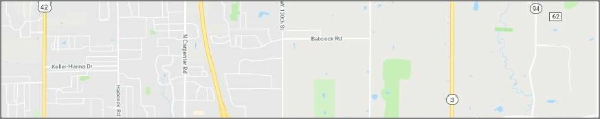
1 Final Plat Trails at Redwood Falls, Ph. 1 Hinckley Township Meeting: December 5, 2018 App. No.: PP Owner: Skyland Land Company LLC Engineer: TGC Engineering, T. Crane Parcel Nos.: A , A , A Site Area: acres Sublots: 41 Open Space: acres Zoning: 6R1 Single-Family Residential Utilities: Central water and sanitary sewer School Dist.: Highland Local Reviewer: Rob Henwood EXECUTIVE SUMMARY The site is located near the northeast corner of the intersection of Center (S.R. 303) and Stony Hill Roads (see location map below). The proposal includes 41 sublots located on public streets and is served by central water and sewers. Recommendation: APPROVAL WITH MODIFICATIONS Proposal: The applicant proposes the following on the acre site: 1 41 sublots acres of Open Space (Blocks A through D). Central water and sanitary sewer. Three public streets with 60 foot right-ofways (ROW) and associated general utility and water easements: o Skyland Falls Boulevard stubs to the north. o Lanterman Circle terminates in a permanent cul-de-sac to the east. o Hayden Drive stubs to the west. Two stormwater management easements. Seven storm sewer easements. Map 1: Location Map History: The Medina County Planning Commission (MCPC) approved the Preliminary Plan in January of 2018; two variances from Subdivision Regulation Section 604(B)(9) for exceeding both the maximum length of a cul-de-sac and maximum number of units on a cul-de-sac street were also approved at the same meeting. A Concept Plan was reviewed in October of Access: Access to the site is via the proposed Skyland Falls Boulevard from Center Road. 1 For the purposes of this staff review the following Final Plat document was utilized: Trails at Redwood Falls Phase 1: Creating Sublot Nos. 1-41, Blocks A D. TGC Engineering, LLC: 7/19/2018. Project No P1. Drawing Name: 1750 plat- p1.dwg. Six sheets: dated stamped by DPS staff 9/7/2018.
2 Trails at Redwood Falls, Ph. 1, Final Plat Zoning: The subject property is zoned 6R1 Single-Family Residential and the applicant is requesting that the site be developed as a Conservation Development; a permitted use in the district. The Hinckley Township Zoning Resolution (HTZ) Section ( ) 6R1.7(A) indicates that Conservation Development standards allow for maximizing the conservation of open space, and retaining the property owner s ability to develop the number of residential units that are permitted under a standard subdivision. Conservation Developments are required to meet the following requirements among others: The minimum area allowable is 100 acres. The maximum permitted density is one unit per two acres. 50 percent of the site must be designated as open space. Common areas may be owned by a Homeowner s Association (HOA) or authorized third party. Per HTZ 6R1.8, the Zoning Commission will review a General and a Final Development Plan for zoning compliance. Comprehensive Plan: The 2015 Hinckley Township Comprehensive Plan (Plan) includes a Future Land Use Map that recommends that this area to be residential and to be developed as density neutral conservation development. Agency Comments: Italicized text indicates quotations from submitting agency comments. Tax Map Department, Beth Mika, 9/17/2018. APPROVED 1. Subject to the Medina County Engineer Land Conveyance Standards available on the website The Tax Map Dept. has previously reviewed this Plat. There are no additional comments. Highway Engineer, Matt Martin, 9/17/2018. CONDITIONAL APPROVAL 1. Sheet 2: Check spelling of Stony Hill Road. 2. Sheet 5: Storm easements between sublots are dimensioned as 5 feet, however, the easements are a total of 20 feet wide, 10 feet on each sublot; revise accordingly. 3. Sheet 5: Show storm easement for storm sewer (CB-2A) located south of Sublot Sheet 6: Show storm easement for storm sewer (HW-9) located north of Sublot Show reservation strips at the north end of Skyland Falls and the west end of Hayden, per MCPC specifications. Sanitary Engineer, Jeremy Sinko, 9/14/2018. APPROVED. The Sanitary Engineer will approve the plat once all requested corrections have been made. The engineer has been notified of the items that need to be corrected. Health Department, Steve Mazak, 9/11/2018. The Trails at Redwood Falls subdivision Phase 1, will be serviced by sanitary sewers and public water. Therefore, our office has no further comments. 2 Planning Commission Page 2 of 6 December 5, 2018
3 Trails at Redwood Falls, Ph. 1, Final Plat Ohio Department of Transportation (ODOT), Jared Feller, 9/11/2018. ODOT has no objection to the Final Plat for the Phase 1 of the Trails at Redwood Falls subdivision, we issued an access permit for the proposed street on 9/6/2018. The developer will be responsible for constructing left and right turn lanes on SR 303 with future phases of the proposed subdivision. Highland Local Schools, Catherine Aukerman, 9/10/2018. completely in the Highland Local School District. The proposed subdivision is Hinckley Township, Thomas Wilson, Zoning Inspector, 12/19/2017 The following comply with the above referenced Hinckley Township Zoning Code: Sublots Building setback lines Lot size In my review, I found two oil wells and brought them to the attention of Travis Crane PE of TGC Engineering and Travis sent me an telling me he was aware of the two wells and Ohio Department of Resources logs indicate the wells have been plugged. Travis will confirm in their due diligence the 25 foot required set back. (Section 4.14.B) TransCanada, Russ Johnson, 12/12/2017. APPROVED Soil and Water Conservation District, Jim Deiter, 10/11/2017. You indicated wetlands on your plan. These areas need to be well marked so it is not disturbed during or after construction. All the wetlands/detention pond areas appear to be in the open space areas. Open space areas behind building lots need to be marked so these areas do not become yard extensions for the home owner. The HOA will need to monitor these areas. Subsurface drain tile may exist on this site. Drainage tile need to be maintained and repaired if damaged during construction. The existing drain tile should not be used as on outlet for the house roof water. Streams on this site will be subject to riparian setbacks per township regulations. 25 feet would be the minimum setback. The primary soil types are Mahoning Silt Loam. This soil has a seasonal high water table and is slow to drain. When the site is cleared, erosion control practices must be in place. Homes with basements will need to plan for seasonal high water table. Footer tile will be required to maintain basement stability. Staff Comments: 1. The following required data/information must be provided on or with a corrected Preliminary Plan as required by the PC s conditional approval granted at the January 3, 2018 meeting: a. Sublots and Blocks: i. The area indicated as the existing clubhouse and parking area located at the entrance to the subdivision on the west side of Center Road is neither designated as sublot nor a block; this parcel must be so designated. Planning Commission Page 3 of 6 December 5, 2018
4 Trails at Redwood Falls, Ph. 1, Final Plat ii. The open space area adjacent to the existing clubhouse site is not designated by an open space block letter; this block must be assigned a letter. iii. It is not clear why the open space adjacent to the existing clubhouse site is differentiated from the other Open Space blocks; restricted versus regular open space. If the area is intended for future development it must be labelled as such. iv. Block boundaries should be consistent with phase boundaries. Large Open Space Block boundaries such as Blocks D and E should be subdivided so that they follow phase boundaries. v. Indicate uses of sites not intended for single family dwellings. b. Include a watershed boundaries inset map. c. Submit a copy of the Developers Notice of Intent to obtain an Ohio EPA stormwater management permit (NOI). d. Submit evidence that the Zoning Commission has approved the General Development Plan for the subdivision. e. Ensure the submitted corrected Preliminary Plan is consistent with the submitted Phase 1, Final Plat. 2. The following required data/information was not provided on or with the Final Plat (Regulations section references are included): a. An original mylar of the Final Plat. 404(D)(2)d. Submit the original mylar. b. The required building setback lines accurately shown with dimensions. 404(D)(2)f.8. Show building and wetland setbacks. c. Sublot and block identification. 404(D)(2)f.10. All blocks must be labelled as Future Development or Open Space. The two parcels fronting on Center Road in the southwest corner of the site with Parcel I.D. numbers A and A are shown as part of the subdivision and appear to be part of Block A; these parcels must be designated as blocks or sublots or be removed from the subdivision. The remainder parcel, if it is to be platted within this phase of the subdivision must be designated as a Block for Future Development; conversely if it is not to be platted, it may remain as a metes and bounds parcel remainder outside of the subdivision boundary. d. Total site data. 404(D)(2)f.13. Correct the site summary data table. e. Signature and seal of a Registered Surveyor on each sheet. 404(D)(2)f.16. Provide the surveyor s signature and seal on each sheet. f. Notarized certification by the owner or owners of the subdivision. 404(D)(2)f.17. Provide notarized signatures of the owners. g. Variances approved. 404(D)(2)f.18. Indicate approved variances. h. Certification from the Township that the Final Plat as submitted is in compliance with local zoning standards and requirements. Such Certification shall be in the form of an executed signature block on the original mylar and signed by at least two of the Township Trustees. 404(D)(2)g.1. Provide signatures of at least two of the township trustees. i. A subdivision served by a public central sanitary sewer shall be certified by the Medina County Sanitary Engineer stating all required wastewater disposal Planning Commission Page 4 of 6 December 5, 2018
5 Trails at Redwood Falls, Ph. 1, Final Plat facilities and central water facilities have been satisfactorily installed or adequate financial guarantees have been approved. Such Certification shall be in the form of an executed signature block on the original mylar. 404(D)(2)g.4. Provide the signature of the Sanitary Engineer. j. Certification of County Engineer that all required improvements have been satisfactorily installed or financial guarantees have been provided to cover all construction. 404(D)(2)g.5. Provide the signature of the Highway Engineer. k. Acceptance of offers of dedication by County Commissioners, when all improvements have been constructed, or financial guarantees and construction agreements have been approved. 404(D)(2)g.6. Provide the signatures of the County Commissioners. l. For new subdivisions with planned public improvements written approval by the applicable U.S. Army Corps of Engineers District Office, or other applicable agency, is required before acceptance of public improvements or dedication of public easements.. 404(D)(2)g.6. Provide written approval by the applicable U.S. Army Corps of Engineers District Office (USACE). m. Covenants and Restrictions and/or deed restrictions including establishment of Owners Association, and if applicable, assignment of responsibilities, ownership of common areas, and any other areas of responsibility or concern relative to public or private maintenance of areas or facilities shall be approved by the Medina County Prosecutors Office as to form and correctness. 404(D)(2)h. Submit evidence that the HOA documents have been approved by the Prosecutor s Office and township. n. Protective covenants, conditions and restrictions shall be recorded separately as a separate instrument, provided volume and page reference thereto is indicated on the plat. 404(D)(2)i. Provide reference to the applicable and recorded HOA documents. 3. The proposed Final Plat fulfills the purpose and intent and meets the standards and requirements of the Subdivision Regulations per 404(D)(5)b.1. and The proposed Final Plat IS NOT in substantial conformance with the approved Preliminary Plan per 404(D)(5)b The Final Plat appears to be in conformance with Hinckley Township Zoning per 404(D)(5)b The Medina County Sanitary Engineer has determined that all required central wastewater disposal facilities and central water facilities have been satisfactorily installed or adequate financial guarantees have been approved. 404(D)(5)b Upon receipt of Highway Engineer s certification of approval of the construction drawings, the Director is authorized to execute the Final Plat on behalf of the MCPC upon certification by the Highway Engineer that the construction is complete or that adequate financial guarantees have been provided per 404(D)(5)b.7. Recommendation: Staff recommends the MCPC APPROVE WITH MODIFICATIONS the Trails at Redwood Falls Phase 1 Final Plat subject to the following: 1. Submit all required data/information listed above in Staff Comment 1 on or with a corrected Preliminary Plan as required by the MCPC s conditional approval. Planning Commission Page 5 of 6 December 5, 2018
6 Trails at Redwood Falls, Ph. 1, Final Plat 2. The applicant shall provide three full size copies of the corrected Preliminary Plan (including a PDF copy of the layout) for transmittal to the appropriate agencies. 3. Satisfy the comments provided by the Highway Engineer. 4. Submit all required data/information and corrections listed in Staff Comment 2 on or with a corrected Final Plat. The following steps must be completed to finalize the Final Plat approval: 1. Three copies of the corrected Final Plat (including a PDF copy of the layout) must be submitted to the Department of Planning Services (DPS) for transmittal to the appropriate agencies. 2. All approval conditions must be satisfied prior to the Director signing the Final Plat. 3. Upon recordation, the applicant shall provide a copy of the recorded Final Plat to the DPS. Attachments: GIS map Final Plat R:\wp\planning\major_subdivisions\2018\Trails_at_Redwood_Falls_Ph_1_FP-fka_Skyland\trails_at_redwood_falls_ph1_final_ docx Planning Commission Page 6 of 6 December 5, 2018
7
8
9
10
11
12
EXECUTIVE SUMMARY. Access: Access to the site is by the proposed extension of Stockbridge Drive.
 Variance & Final Plat Preserve at Trillium Creek, Ph. 1 Montville Township Meeting: January 2, 2019 App. No.: 096-2018-FP Applicant: Haslinger Holdings Owners: Trillium Creek LLC Engineer: Lewis Land Prof.
Commission Planning Final Plat Ledges of Stone Creek Hinckley Township EXECUTIVE SUMMARY
 Commission Planning Final Plat Ledges of Stone Creek Hinckley Township Meeting: February 1, 2017 App. No.: 127-2016-FP Applicant: Legacy-Carrington Dev. Group Engineer: TGC Engineering, LLC Parcel: 016-03A-39-003
Planning Commission Replat Falcon Pointe at Lake Medina Reserve, Ph. 3 Medina Township
 Planning Commission Replat Falcon Pointe at Lake Medina Reserve, Ph. 3 Medina Township Meeting: December 7, 2016 App. No.: 115-2016-R Applicant: W.J. Bailey Homes Owner: Crossbow Development Inc. Engineer:
Planning Commission Final Plat Liverpool Fields, Phase 3 Liverpool Township App. No PP EXECUTIVE SUMMARY
 Planning Commission Final Plat Liverpool Fields, Phase 3 Liverpool Township App. No. 59-21-PP Meeting: August 6, 21 Applicant: Pride One Liverpool, LLC Owner: Pride One Liverpool, LLC Engineer: TGC Engineering
Planning Commission Replat Arbor Lakes at Cobblestone Park, Ph. 10 Montville Township
 Planning Commission Replat Arbor Lakes at Cobblestone Park, Ph. 10 Montville Township Meeting: May 4, 2016 App. No.: 037-2016-R Developer: Cobblestone Park Development Group, LLC Surveyor: TGC Engineering
Planning Commission Preliminary Plan Hidden Lakes Estates Medina Township EXECUTIVE SUMMARY
 Planning Commission Preliminary Plan Hidden Lakes Estates Medina Township Meeting: January 2, 2019 App. No.: 105-2018-PP Applicant: Hidden Lake Medina, LLC Engineer: Cunningham & Associates, LLC Parcel
Planning Commission Preliminary Plan LRC Subdivision Montville Township
 Planning Commission Preliminary Plan LRC Subdivision Montville Township Meeting: February 1, 2017 App. No.: 002-2017-PP Owner: Faith & Hope Land Dev. Co. Applicant: Montville Investors LLC Engineer: Weber
EXECUTIVE SUMMARY. Block A9, acres Cobblestone Park PND
 Planning Commission Replat Arbor Lakes at Cobblestone Park Subdivision, Phase 9 Montville Township App. No. 04-2015-R Meeting: February 4, 2015 Developer: Cobblestone Park Development Group, LLC Surveyor:
Variances & Preliminary Plan Hawks Ridge Montville Township EXECUTIVE SUMMARY
 Variances & Preliminary Plan Hawks Ridge Montville Township Meeting: February 6, 2019 App. No.: 002-2019-PP Applicant: Pulte Group Owners: Crum Family Ltd., RTE Investments LLC, Thomas Kowal Trustee Engineer:
Planning Commission Revised Preliminary Plan & Final Plat Maplebrooke Reserve Subdivision Montville Township EXECUTIVE SUMMARY
 Planning Commission Revised Preliminary Plan & Final Plat Maplebrooke Reserve Subdivision Montville Township Meeting: October 5, 2016 App. No.: 091-2016 RPP and 093-2016-FP Applicant: Cambridge Service
Planning Commission Preliminary Plan Riverview Villas of Stonegate Medina Township App. No PP EXECUTIVE SUMMARY
 Planning Commission Preliminary Plan Riverview Villas of Stonegate Medina Township App. No. 088-2013-PP Meeting: January 8, 2014 Applicant: Stonegate Center, LLC Ken Cleveland Engineer: Lewis Land Professionals,
Planning Commission Final Plat Riverview Villas of Stonegate Medina Township App. No FP EXECUTIVE SUMMARY
 Planning Commission Final Plat Riverview Villas of Stonegate Medina Township App. No. 077-2014-FP Meeting: October 1, 2014 Applicant: Stonegate Center, LLC Ken Cleveland Engineer: Lewis Land Professionals,
MCPC Members and Alternates in Attendance:
 MEDINA COUNTY PLANNING COMMISSION MINUTES OF MEETING WEDNESDAY, JANUARY 3, 2018, 6:30 P.M. PROFESSIONAL BUILDING, LOWER LEVEL CONFERENCE ROOM Attendees / Representing (from sign-in sheet): William Spellman,
Residential Minor Subdivision Review Checklist
 Residential Minor Subdivision Review Checklist Plan Submittal Requirements: 2 full sets of stamped plans Electric submittal - all plans contained in a single PDF 3 full sets if commercial kitchen or dining
Lake County Planning, Building and Development Department
 SUBMISSION CHECKLIST FOR SUBDIVISION FINAL PLAT Lake County Planning, Building and Development Department 500 W. Winchester Rd. Unit 101 Libertyville, Illinois 60048-1331 Telephone (847) 377-2600 E-mail:
Residential Major Subdivision Review Checklist
 Residential Major Subdivision Review Checklist Plan Submittal Requirements: 2 full sets of stamped plans Electric submittal - all plans contained in a single PDF 3 full sets if commercial kitchen or dining
MASTER SUBDIVISION FINAL PLAT APPLICATION Town of Apex, North Carolina
 MASTER SUBDIVISION FINAL PLAT APPLICATION Town of Apex, North Carolina This document is a public record under the North Carolina Public Records Act and may be published to the Town s website or disclosed
WESTON COUNTY FINAL PLAT APPLICATION
 WESTON COUNTY FINAL PLAT APPLICATION Property Owner: Mailing Address of owner: Telephone Number(s) of owner: Property Owner: Mailing Address of owner: Telephone Number(s) of owner: (If subdivider/applicant
FINAL PLAT CHECKLIST
 FINAL PLAT CHECKLIST Project Name: Tax ID #: Project Number: Date: _ Reviewed By: Telephone: Please address all items marked with an "X" Please return redline comments with corrected plan, original mylar,
MINOR SUBDIVISION FINAL PLAT APPLICATION Town of Apex, North Carolina
 MINOR SUBDIVISION FINAL PLAT APPLICATION Town of Apex, North Carolina This document is a public record under the North Carolina Public Records Act and may be published on the Town s website or disclosed
Township of Collier 2418 Hilltop Road Presto, PA 15142
 Township of Collier 2418 Hilltop Road Presto, PA 15142 Fees: Major: 2 checks $600 + $50 per lot & $1700 Escrow) APPLICATION FOR SUBDIVISION major FINAL only Plans must be folded Rolled plans will not be
Staff Report: Date: Applicant: Property Identification: Acreage of Request: Current Zoning of Requested Area: Requested Action: Attached:
 Staff Report: Completed by Jeff Palmer Director of Planning & Zoning Date: November 7, 2018, Updated November 20, 2018 Applicant: Greg Smith, Oberer Land Developer agent for Ronald Montgomery ET AL Property
Planning Commission Text & Map Amendments Pavluk Properties Hinckley Township EXECUTIVE SUMMARY
 Planning Commission Text & Map Amendments Pavluk Properties Hinckley Township Meeting: August, 08 App. No.: 05-08-MA & TA Owner: The Pavluk Family Limited Partnership Applicant: Zoning Commission (Terry
SUBDIVISION AND LAND DEVELOPMENT. 185 Attachment 20
 185 Attachment 20 APPENDIX S Plat No. Date of Submission Twp. Fee $ Dauphin Co. Fee $ TOWNSHIP OF DERRY SUBDIVISION OR LAND DEVELOPMENT PLAN SUBMISSION APPLICATION This block for Twp. use only 1. Title
Time Extension Staff Report
 Time Extension Staff Report Subdivision Name Lunara Subdivision File Number SUB07-00019 Approval Time Extension for Lead Agency Boise City Certification Signature of Boise City Engineer Annexation Date
I. Requirements for All Applications. C D W
 108-16.1. Application checklists. Checklist for Required Submissions to the Planning Board or Zoning Board of Adjustment of Monroe Township All required submissions are to be made to the Administrative
Group Sewer Only** 80 Ft Frontage* 20,000 Sq. Ft. (.46 acre) Minimum** 120 Ft Frontage* 20,000 Sq. Ft. (.46acre) Minimum** 150 Ft Frontage*
 Minimum** 120 Ft Frontage* 20,000 Sq. Ft. (.46acre) Minimum** 150 Ft Frontage*") Residential Lots Minimum Chart The minimum lot size of any minor subdivision where there is no public sewers shall be as shown below or as required by township zoning and/or the Tuscarawas General Health
Residential Lots Minimum Chart The minimum lot size of any minor subdivision where there is no public sewers shall be as shown below or as required by township zoning and/or the Tuscarawas General Health
REGULAR FINAL PLAT SUBDIVISION APPLICATION
 REGULAR FINAL PLAT SUBDIVISION APPLICATION Name of Subdivision (Subdivision Name must be approved by at 856-6216) ( )Cluster Subdivision ( )Lot-by-Lot Subdivision ( )Open Space Subdivision Name of Subdivision
Change In The Name Of Owner (s) Of Land.
 Of Land.") Clermont County TRANSFER AND CONVEYANCE STANDARDS OF THE CLERMONT COUNTY AUDITOR AND THE CLERMONT COUNTY ENGINEER AS ADOPTED UNDER OHIO REVISED CODE SECTION 319.203, AS A RESULT OF TWO PUBLIC HEARINGS
Clermont County TRANSFER AND CONVEYANCE STANDARDS OF THE CLERMONT COUNTY AUDITOR AND THE CLERMONT COUNTY ENGINEER AS ADOPTED UNDER OHIO REVISED CODE SECTION 319.203, AS A RESULT OF TWO PUBLIC HEARINGS
CITY OF SARALAND FINAL SUBDIVISION PLAT REVIEW
 CITY OF SARALAND FINAL SUBDIVISION PLAT REVIEW Application Number: Date Plat Submitted: Name of Subdivision: Name of Owner: Owner Address: (Street or P.O. Box) Telephone #: (City) (State) (Zip) E-mail:
Major Subdivision Application Packet. Revised June 2018
 Major Subdivision Application Packet Revised June 2018 Caroline County Department of Planning and Community Development 233 West Broaddus Avenue Bowling Green, VA 22427 www.co.caroline.va.us Phone: 804-633-4303
APPROVAL REQUIREMENTS
 APPROVAL REQUIREMENTS FOR INSTRUMENTS OF CONVEYANCE IN ERIE COUNTY, OHIO DRAFT Requirements for all instruments of Conveyance in Erie County, revised and effective, 2014. An Erie County policy governing
MUDDY CREEK TOWNSHIP PO BOX 239 PORTERSVILLE, PA SUBDIVISION AND LAND DEVELOPMENT APPLICATION
 MUDDY CREEK TOWNSHIP PO BOX 239 PORTERSVILLE, PA 16051 724-368-3438 SUBDIVISION AND LAND DEVELOPMENT APPLICATION NOTE TO ALL APPLICANTS: This checklist must be completed in its entirety If an item is not
City State Zip City State Zip. 1. Proposed Amendment Modifies Article or Section Numbers. 4. Describe the purpose of the proposed amendment
 APPLICATION FOR ZONING TEXT AMENDMENT (Subject to O.R.C. Section 519.12) Application # -ZC- Liberty Township Zoning Commission Date Filed: 2095 Reynoldsburg Baltimore Rd. NW Baltimore, OH 43105 Fee Paid:
BYRON TOWNSHIP ZONING APPLICATION
 BYRON TOWNSHIP ZONING APPLICATION Phone: (616) 878-9104 * Fax: (616) 878-3980 * Website: www.byrontownship.org This application will not be accepted if incomplete. APPLICATION FOR & REQUIRED COPIES Private
Appendix A: Submittal Checklists
 Appendix A: Submittal Checklists A.1 Preliminary Plat Checklist A.2 Final Plat Checklist 11 Appendix A.1 DESIGN CHECKLIST FOR PRELIMINARY PLATS AND DEVELOPMENTS Development Name: Location: Date: Reviewed
ARTICLE 5 MINOR SUBDIVISION/LAND DEVELOPMENT
 ARTICLE 5 MINOR SUBDIVISION/LAND DEVELOPMENT SECTION 501 ONLY FINAL PLAN REQUIRED The classification of a proposed subdivision as a "Minor Subdivision" shall only require the submission, review and approval
BRIDGETON SUBDIVISION APPLICATION CHECKLIST
 APPLICATION NAME AND # CHECKLIST COMPLETED BY: DATE: Signature and printed name BRIDGETON SUBDIVISION APPLICATION CHECKLIST TO SUBDIVISION APPLICANTS: The attached checklist is to assist you in the submission
TOWN OF ROXBURY PLANNING BOARD
 UPDATED: APRIL 2011 TOWN OF ROXBURY PLANNING BOARD Applicant s Guide for Subdivision Review The Town Planning Board administers the subdivision review process. This guide has been prepared in order to
APPLICATION REVIEW CHECKLISTS
 APPLICATION REVIEW CHECKLISTS The following must be submitted with and are part of each application. No application is complete until all required documentation has been submitted to the Community Development
Staff Report: Date: Applicant: Property Identification: Acreage of Request: Current Zoning of Requested Area: Requested Action: Attached:
 Staff Report: Completed by Jeff Palmer Director of Planning & Zoning Date: November 7, 2018 Applicant: Greg Smith, Oberer Land Developer agent for Ronald Montgomery ET AL Property Identification: Frontage
MAJOR RESIDENTIAL AND NONRESIDENTIAL SUBDIVISIONS
 Lawrence-Douglas County MAJOR RESIDENTIAL AND NONRESIDENTIAL SUBDIVISIONS Preliminary Plats The applicant shall schedule a Pre-Application meeting with Planning Staff at least seven (7) working days prior
DAUPHIN CREEK ESTATES SUBDIVISION
 # 12 SUB-000076-2017 DAUPHIN CREEK ESTATES SUBDIVISION Engineering Comments: FINAL PLAT COMMENTS (should be addressed prior to submitting the FINAL PLAT for review and/or signature by the City Engineer):
Attached is a Clinton Township Zoning Permit Application and requirements for issuance of a permit.
 To Whom It May Concern: Attached is a Clinton Township Zoning Permit Application and requirements for issuance of a permit. The fee for the permit application is $75.00, which shall be made payable to
APPLICATION FOR PRELIMINARY PLAT CERRO GORDO COUNTY, IOWA
 APPLICATION FOR PRELIMINARY PLAT CERRO GORDO COUNTY, IOWA Before subdividing any tract of land and previous to the filing of an Application for conditional approval of the Preliminary Plat, the subdivider
Final Plats for Major Residential and Commercial Subdivisions Checklist
 Project Name: : This form is a checklist of Zoning Ordinance requirements for major residential and commercial subdivision plats to assist the applicant in their submittal. It is not intended to be a comprehensive
Oakland County Michigan Register of Deeds Plat Engineering, GIS, & Remonumentation Dept. Ph: (248) Fax (248)
 Fax (248)") Oakland County Michigan Register of Deeds Plat Engineering, GIS, & Remonumentation Dept. Ph: (248)-858-1447 Fax (248)-858-7466 Requirements Needed for Final Plat Approval No. General Requirements. 1 Routing
Oakland County Michigan Register of Deeds Plat Engineering, GIS, & Remonumentation Dept. Ph: (248)-858-1447 Fax (248)-858-7466 Requirements Needed for Final Plat Approval No. General Requirements. 1 Routing
SECTION 4: PRELIMINARY PLAT
 SECTION 4: PRELIMINARY PLAT After the completion of the sketch plan process, if submitted, the owner or developer shall file with the City an application for preliminary plat. The preliminary plat stage
ARTICLE 4 MAJOR SUBDIVISION/LAND DEVELOPMENT PLAN REQUIREMENTS
 ARTICLE 4 MAJOR SUBDIVISION/LAND DEVELOPMENT PLAN REQUIREMENTS SECTION 401 LAND SKETCH PLANS FOR MAJOR SUBDIVISIONS AND DEVELOPMENTS 401.1 Sketch Plan Information The following process and procedures shall
APPLICATION PROCEDURE
 ANTRIM PLANNING BOARD P. O. Box 517 Antrim, New Hampshire 03440 Phone: 603-588-6785 FAX: 603-588-2969 APPLICATION FORM AND CHECKLIST FOR MINOR OR MAJOR SITE PLAN REVIEW File Date Received By APPLICATION
LAND USE APPLICATION
 LAND USE APPLICATION File Name: File No(s).: Receipt No.: Receipt Date: Received By: Amount.: $ Instructions for Applicants Please read and follow all instructions on your application carefully. If you
Section Preliminary Plat Checklist and Application Forms
 Section 201 - Preliminary Plat Checklist and Application Forms PRELIMINARY SUBDIVISION PLAT REVIEW PROCESS CHART PRELIMINARY SUBDIVISION PLAT APPLICATION PRELIMINARY PLAT REVIEW CHECKLIST CITY OF NAMPA
FINAL PLAT SUBMITTAL CHECKLIST
 FINAL PLAT SUBMITTAL CHECKLIST The submission requirements for a Final Plat Review are found beginning in Section 24-4-40 of the Weld County Code. The Weld County Code is available on line at www.co.weld.co.us
CITY OF SARALAND PRELIMINARY SUBDIVISION PLAT REVIEW
 PRELIMINARY SUBDIVISION PLAT REVIEW Application Number: Date Plat Submitted: Name of Subdivision: Name of Owner: Owner Address: (Street or P.O. Box) Telephone #: (City) (State) (Zip) E-mail: Name of Authorized
Staff Report to the North Ogden Planning Commission
 Staff Report to the North Ogden Planning Commission SYNOPSIS / APPLICATION INFORMATION Application Request: Consideration and action on an administrative application for final approval for the Legacy North
MINOR SUBDIVISION INFORMATION
 A. POINTS OF CONTACT: MINOR SUBDIVISION INFORMATION Surveyor: Address: Phone #: Fax # E-Mail Address: Representative (If different from applicant): Address: Phone #: Fax # E-Mail Address: B. GENERAL INFORMATION:
Initial Subdivision Applications Shall Include the Following:
 Initial Subdivision Applications Shall Include the Following: 1) Subdivision Application Form: completely filled out (12 copies) 2) Plat: The Plat must adhere to the requirements set forth in the Town
SUBMITTAL REQUIREMENTS: The number indicates the number of copies for submittal (if applicable).
.") Office Use Only Preliminary Long Plat Long Subdivision Applicant Checklist PLANNING, COMMUNITY, & ECONOMIC DEVELOPMENT DEPARTMENT FINAL LONG PLAT LONG SUBDIVISION CHECKLIST Mailing Address: P.O. Box 547,
Office Use Only Preliminary Long Plat Long Subdivision Applicant Checklist PLANNING, COMMUNITY, & ECONOMIC DEVELOPMENT DEPARTMENT FINAL LONG PLAT LONG SUBDIVISION CHECKLIST Mailing Address: P.O. Box 547,
FINAL SITE PLAN PLAT APPLICATION Town of Apex, North Carolina
 FINAL SITE PLAN PLAT APPLICATION Town of Apex, North Carolina This document is a public record under the North Carolina Public Records Act and may be published on the Town s website or disclosed to third
County of Ottawa Fillmore Room 141 West Olive, MI (616)
") County of Ottawa Office of the Water Resources Commissioner Joe Bush Commissioner Linda S. Brown Deputy APPLICATION FOR DEVELOPMENT REVIEW & APPROVAL OF THE WATER RESOURCES COMMISSIONER (Michigan Land
County of Ottawa Office of the Water Resources Commissioner Joe Bush Commissioner Linda S. Brown Deputy APPLICATION FOR DEVELOPMENT REVIEW & APPROVAL OF THE WATER RESOURCES COMMISSIONER (Michigan Land
City of Prior Lake APPLICATION FOR REGISTERED LAND SURVEY
 Case File No. Property Identification No. City of Prior Lake APPLICATION FOR REGISTERED LAND SURVEY Requested Action Brief description of proposed project (Please describe the proposed amendment, project,
SUBMITTAL REQUIREMENTS: The number indicates the number of copies for submittal (if applicable).
.") Office Use Only Preliminary Long Plat Long Subdivision Applicant Checklist PLANNING, COMMUNITY, & ECONOMIC DEVELOPMENT DEPARTMENT PRELIMINARY LONG PLAT LONG SUBDIVISION CHECKLIST Mailing Address: P.O.
Office Use Only Preliminary Long Plat Long Subdivision Applicant Checklist PLANNING, COMMUNITY, & ECONOMIC DEVELOPMENT DEPARTMENT PRELIMINARY LONG PLAT LONG SUBDIVISION CHECKLIST Mailing Address: P.O.
7. EASEMENTS Label Established Lines Affecting Tract and/or Mentioned in its Legal Description:
 7. EASEMENTS 7.010 General All sewers shall be constructed in easements with working room. Existing easements without working room may only be used if revised to include working room. All public sewers,
COUNTY OF LINCOLN, NORTH CAROLINA
 Page 1 COUNTY OF LINCOLN, NORTH CAROLINA 302 NORTH ACADEMY STREET, SUITE A, LINCOLNTON, NORTH CAROLINA 28092 BUILDING AND LAND DEVELOPMENT 704-736-8440 OFFICE 704-732-9010 FAX REQUIRED CERTIFICATES FOR
Guide to Preliminary Plans
 Guide to Preliminary Plans Introduction The Douglas County is committed to providing open, transparent application processes to the public. This Guide is provided to assist anyone interested in the procedures
Staff Report to the North Ogden City Council
 Staff Report to the North Ogden City Council SYNOPSIS / APPLICATION INFORMATION Application Request: Consideration and action on an administrative application to provide comments on the preliminary plan
Chapter 100 Planned Unit Development in Corvallis Urban Fringe
 100.100 Scope and Purpose. Chapter 100 Planned Unit Development in Corvallis Urban Fringe (1) All applications for land divisions in the Urban Residential (UR) and Flood Plain Agriculture (FPA) zones within
FINAL SUBDIVISION AND LAND DEVELOPMENT PLAN CHECKLIST. Plan Name. Applicant's Name:
 TOWNSHIP OF UPPER ST. CLAIR FINAL SUBDIVISION AND LAND DEVELOPMENT PLAN CHECKLIST Date Filed Plan Name PLC Applicant's Name: Phone Filing Date for Final Application Final Plat 114.22. FINAL APPLICATION
ARTICLE SINGLE FAMILY SITE CONDOMINIUM DEVELOPMENT STANDARDS
 ARTICLE 28.00 SINGLE FAMILY SITE CONDOMINIUM DEVELOPMENT STANDARDS Section 28.01 PURPOSE The purpose of this Article is to recognize that conventional single family developments, traditionally developed
Time Extension Staff Report
 Time Extension Staff Report Subdivision Name Therrin Subdivision File Number SUB06-00020 Approval Time Extension for Lead Agency Boise City Certification Signature of Boise City Engineer Annexation Date
CONDOMINIUM REGULATIONS
 ARTICLE 37 CONDOMINIUM REGULATIONS SECTION 37.01. Purpose The purpose of this Article is to regulate projects that divide real property under a contractual arrangement known as a condominium. New and conversion
ARTICLE 100 SUBDIVISION APPLICATION PROCEDURE AND APPROVAL PROCESS
 ARTICLE 100 SUBDIVISION APPLICATION PROCEDURE AND APPROVAL PROCESS 100.01 General Procedure 100.02 Exempt Subdivision 100.03 Administrative Subdivision 100.04 Major Subdivision 100.05 Signing and Recording
City of Prior Lake APPLICATION FOR COMBINED PRELIMINARY AND FINAL PLAT
 Case File No. Property Identification No. City of Prior Lake APPLICATION FOR COMBINED PRELIMINARY AND FINAL PLAT Requested Action Brief description of proposed project (Please describe the proposed amendment,
New Private Way Ordinance Westbrook Planning Board Workshop , Planning Board Public Hearing Definitions
 201 Definitions Private Right of Way; Private way A strip of land at least fifty feet wide, meeting the minimum standards for the construction of a gravel base for a public road, over which abutters may
City of Midland Application for Site Plan Review
 City of Midland Application for Site Plan Review Submission Date: Property Owner: Mailing Address: Phone number: ( ) Cell phone: ( ) Email address: Fax: ( ) Owner s Signature: Applicant Name (if not owner):
To provide for the review of the final engineering plans, the subdivision improvement agreement, public dedications, and other legal agreements.
 ARTICLE 5 FINAL PLAT 501 Intent DOUGLAS COUNTY SUBDIVISION RESOLUTION To provide for the review of the final engineering plans, the subdivision improvement agreement, public dedications, and other legal
SUBDIVISION PLAT CHECKLIST. The following information shall be include on the plat:
 SUBDIVISION PLAT CHECKLIST Subdivision Name: Land Surveyor: Owner/Developer: Date Submitted: The following information shall be include on the plat: The plat shall be drawn at a scale of one inch equals
Guide to Minor Developments
 Guide to Minor Developments Introduction The Douglas County (DCD) is committed to providing open, transparent application processes to the public. This Guide is provided to assist anyone interested in
APPLICATION FOR MAJOR SUBDIVISION APPROVAL (PRELIMINARY PLAT)
") 209 S. Main Street Marysville, Ohio 43040 Phone: (937) 645-7350 Fax: (937) 645-7351 www.marysvilleohio.org APPLICATION FOR MAJOR SUBDIVISION APPROVAL (PRELIMINARY PLAT) *** IMPORTANT INFORMATION ~ Please
209 S. Main Street Marysville, Ohio 43040 Phone: (937) 645-7350 Fax: (937) 645-7351 www.marysvilleohio.org APPLICATION FOR MAJOR SUBDIVISION APPROVAL (PRELIMINARY PLAT) *** IMPORTANT INFORMATION ~ Please
TOWN OF LEWISTON PLANNING BOARD APPLICATION
 TOWN OF LEWISTON PLANNING BOARD APPLICATION DESCRIPTION OF PROPOSED REQUEST: Name of Property Owner: Phone #: Name of Applicant:Phone #: Address or Location of Proposal:_SBL# Size of Parcel or Structure:Existing
201 General Provisions
 201 General Provisions 201.01 Title 201.09 Amendments 201.02 Purpose and Intent 201.10 Public Purpose 201.03 Authority 201.11 Variances and Appeals 201.04 Jurisdiction 201.12 Nonconformances 201.05 Enactment
SECTION 10 STANDARD PLATS
 SECTION 10 - STANDARD PLATS Subdivision 1: Purpose Standard Plats allow the subdivision of land into lots smaller than the minimum metes and bounds size in the zoning district, and control road development
ELK RAPIDS TOWNSHIP ANTRIM COUNTY, MICHIGAN ORDINANCE NO
 ELK RAPIDS TOWNSHIP ANTRIM COUNTY, MICHIGAN ORDINANCE NO. 3-2011 AN ORDINANCE TO REPLACE THE SUBDIVISION CONTROL ORDINANCE WITH A NEW SUBDIVISION DEVELOPMENT ORDINANCE, IN ACCORD WITH THE LAND DIVISION
Guide to Replats. Step 1. Step 2. Step 3. Step 4. Step 5. Step 6. Step 7. Step 8. Step 9. Step 10
 Guide to Replats Introduction Douglas County is committed to providing open, transparent application processes to the public. This Guide is provided to assist anyone interested in the procedures and expectations
Guide to Combined Preliminary and Final Plats
 Guide to Combined Preliminary and Final Plats Introduction The Douglas County is committed to providing open, transparent application processes to the public. This Guide is provided to assist anyone interested
TENTATIVE PARCEL MAP APPLICATION GUIDE TENTATIVE PARCEL MAP APPLICATION REQUIREMENTS
 TENTATIVE PARCEL MAP APPLICATION GUIDE SISKIYOU COUNTY PLANNING DIVISION 806 South Main Street, Yreka CA 96097 Phone: (530) 841-2100 / Fax: (530) 841-4076 TENTATIVE PARCEL MAP APPLICATION REQUIREMENTS
Request for Action form is also defined as an application to be considered by the Planning Commission.
 CITY OF NORTH RIDGEVILLE INSTRUCTIONS FOR FILING REQUEST FOR ACTION APPLICATIONS WITH THE PLANNING COMMISSION (Please read the full instruction as it will help in providing a full complete application)
Form 11.A.9.17 INSTRUCTIONS FOR APPLICATION FOR PLAT WAIVER (Art. 11.A.8)
") Form 11.A.9.17 INSTRUCTIONS FOR APPLICATION FOR PLAT WAIVER (Art. 11.A.8) All questions in each part must be completed. When a question is not applicable to the property, enter "N/A" or other phrase indicating
Form 11.A.9.17 INSTRUCTIONS FOR APPLICATION FOR PLAT WAIVER (Art. 11.A.8) All questions in each part must be completed. When a question is not applicable to the property, enter "N/A" or other phrase indicating
SITE CONDOMINIUMS OR CONDOMINIUM SUBDIVISIONS
 Article XX SITE CONDOMINIUMS OR CONDOMINIUM SUBDIVISIONS 20.0 PURPOSE The purpose of this Section is to set forth the standards for review of the site condominiums or condominium subdivisions in all Zoning
COLUMBIA COUNTY LAND DEVELOPMENT SERVICES COURTHOUSE 230 STRAND ST. HELENS, OREGON (503) APPLICANT: Name:
 APPLICANT: Name:") COLUMBIA COUNTY LAND DEVELOPMENT SERVICES COURTHOUSE 230 STRAND ST. HELENS, OREGON 97051 (503) 397-1501 PARTITION General Information File No. APPLICANT: Name: Mailing address: City State Zip Code Phone
COLUMBIA COUNTY LAND DEVELOPMENT SERVICES COURTHOUSE 230 STRAND ST. HELENS, OREGON 97051 (503) 397-1501 PARTITION General Information File No. APPLICANT: Name: Mailing address: City State Zip Code Phone
MUNICIPALITY OF THE TOWNSHIP OF McNAB/BRAESIDE GUIDELINES
 MUNICIPALITY OF THE TOWNSHIP OF McNAB/BRAESIDE APPLICATION FOR OFFICIAL PLAN AND/OR ZONING BY-LAW AMENDMENT GUIDELINES Introduction: Application Fees: Copies: Authorization: Proposed Schedule/Sketch: Supporting
PLANNING BOARD APPLICATION FORM TOWNSHIP OF BETHLEHEM 405 MINE ROAD ASBURY, NEW JERSEY Date of Application: Township Application Number:
 Township of Bethlehem Page 1 of 8 PLANNING BOARD APPLICATION FORM TOWNSHIP OF BETHLEHEM 405 MINE ROAD ASBURY, NEW JERSEY 08802 Date of Application: Township Application Number: Jurisdiction: Planning Board
CITY OF STRONGSVILLE PLANNING COMMISSION APPLICATION CLUSTER SUBDIVISION
 CITY OF STRONGSVILLE PLANNING COMMISSION APPLICATION CLUSTER SUBDIVISION After meeting with City Planner, George Smerigan (if necessary) regarding zoning requirements, submit the following: An application
Application for OFFICIAL PLAN AMENDMENT
 Town of Northeastern Manitoulin & the Islands Application for OFFICIAL PLAN AMENDMENT and/or ZONING BY-LAW AMENDMENT Introduction: Application Fees: Authorization: Drawing: Supporting Information: The
Preliminary Plat Information & Application Packet
 Introduction Preliminary Plat Information & Application Packet This information packet was created to assist anyone who is considering applying for a preliminary plat of subdivision that is not a part
PRELMINARY PLAT CHECKLIST
 PRELMINARY PLAT CHECKLIST A. All preliminary plat submitted for approval shall be prepared by a Registered Professional Land Surveyor. B. Preliminary plats must be drawn to a scale of XXX with such accuracy
SUBDIVISION APPLICATION
 SUBDIVISION APPLICATION Preliminary Plat Minor Plat Final Plat Amended Plat Applicant Name: Owner (if different from applicant) Name: Company: Company: Address: Address: City, State, Zip City, State, Zip
Sketch Plan 2018 Bargersville Plan Commission Application Kit
 Sketch Plan 2018 Bargersville Plan Commission Application Kit For Commercial, Industrial, and Residential Developments At least 31 days prior to the intended filing of the Primary Plat or Development Plan
TOWNSHIP OF DOYLESTOWN APPLICATION FOR REVIEW OF SUBDIVISION OR LAND DEVELOPMENT PROPOSAL. Please PRINT; all information MUST be filled out completely
 TOWNSHIP OF DOYLESTOWN APPLICATION FOR REVIEW OF SUBDIVISION OR LAND DEVELOPMENT PROPOSAL Please PRINT; all information MUST be filled out completely Date: Name of Subdivision or Land Development: Location:
SUBDIVISION APPLICATION CHECKLIST SKETCH PLAN PRELIMINARY PLAT FINAL PLAT
 RECEIVED STAMP SUBDIVISION APPLICATION CHECKLIST SKETCH PLAN PRELIMINARY PLAT FINAL PLAT A checklist of background information and submission requirements for processing of a sketch plan, preliminary plat