3. DISCLOSURES OF PECUNIARY INTEREST AND GENERAL NATURE THEREOF
|
|
|
- Denis Nelson
- 5 years ago
- Views:
Transcription
 Regular Meeting October 15, 2018. 5.")
1 AGENDA COMMITTEE OF ADJUSTMENT/PLANNING ADVISORY COMMITTEE NOVEMBER 19, :00 P.M. Council Chambers, Municipal Office 6648 Road 506, Plevna, Ontario 1. CALL TO ORDER 2. APPROVAL OF AGENDA 3. DISCLOSURES OF PECUNIARY INTEREST AND GENERAL NATURE THEREOF 4. ADOPTION OF MINUTES a) Regular Meeting October 15, BUSINESS ARISING FROM MINUTES a) A7/18 Garth Johnson, Madrene Boyle and Moonyene Boyd 2182 Myers Cave Road Relief from Section 4.20 (f) of By-law regarding setback for a septic system from the high water mark of Kashwakamak Lake. 6. CONSENT APPLICATIONS a) B7/18 Robert Lepage Lot Addition and Easement - Part Lot 16, Concession 1, South Canonto. 7. MINOR VARIANCE APPLICATIONS a) A8/18 Shannon McGrath and Brent Phifer 1056 Bay Lane Relief from Section of By-law regarding setback for a dwelling from the high water mark of Mississagagon Lake; b) A9/18 Gerald and Anne Racicot 1025 Oakridge Point Relief from Section (k) and (i) of By-law regarding increased size and decreased setback for a viewing platform and increased size of a dock; c) A11/18 Dale Southward Road 506 Relief from Section of Bylaw regarding lot area. 8. ZONING BY-LAW AMENDMENT (Recommendations to Council) a) Z3-18 Rucker Proposed Amendment to Zoning By-law # Rezoning one parcel of land from Waterfront Residential and Limited Service Rural (LSR) to Waterfront Residential Exception Zone.
2 9. OTHER BUSINESS a) OACA Report Janice Arthur. 10. ADJOURNMENT
3 MINUTES of a Meeting of the Committee of Adjustment/Planning Advisory Committee for the Township of North Frontenac, held Monday, October 15, 2018, in the Council Chambers, Municipal Office, 6648 Road 506 Plevna, Ontario PRESENT: Barbara Sproule, Chair; and Fred Fowler, Alternate Member. ABSENT WITH REGRETS: Janice Arthur, Member; and Carl Tooley, Member. ALSO PRESENT: Tara Mieske, Secretary/Treasurer (Clerk/Planning Manager); Megan Rueckwald, Manager of Community Planning, County of Frontenac; Jennie Kapusta, Community Planner, County of Frontenac; and Brooke Drechsler, Deputy Clerk/Assistant to the Planning Manager. 1. CALL TO ORDER The Chair called the meeting to order at 1:00 p.m. and read the opening remarks. 2. APPROVAL OF AGENDA Moved by Fred Fowler, Seconded by Barbara Sproule #52-18 BE IT RESOLVED THAT the Committee approves the Agenda for the October 15, 2018 Meeting, as circulated. Carried 3. DISCLOSURES OF PECUNIARY INTEREST AND GENERAL NATURE THEREOF None declared. 4. ADOPTION OF MINUTES Moved by Fred Fowler, Seconded by Barbara Sproule #53-18 BE IT RESOLVED THAT the Committee adopts the Minutes of a Meeting of the Committee of Adjustment/Planning Advisory held on September 17, 2018, as circulated. Carried 5. BUSINESS ARISING FROM MINUTES None. 6. CONSENT APPLICATIONS None. Draft 7. MINOR VARIANCE APPLICATIONS a) A6/18 Kenneth Little A South Kash Lake Lane Relief from Section of By-law regarding setback from the high water mark of Kashwakamak Lake; The applicants were present for the hearing. Mieske read the site inspection report from Tooley provided to the Committee at the meeting on September 17, Committee of Adjustment Minutes October 15, 2018 Page 1 of 4
4 Kapusta advised that MVCA did not support the application, more specifically the further encroachment of the screened in 12 x 27 deck into the setback from the high water mark. Sproule asked if the recommendation from MVCA and the Planners was to permit the 13 x 9 deck and not permit the 12 x 27 deck. Kapusta advised that, based on the recommendations from Mississippi Valley Conservation (MVCA), the Planners support the addition of the 13 x 9 deck as it is more infill than encroachment into the high water mark. Sproule asked the applicants if there were additional bedrooms being added to the cottage. Mr. Little advised the addition of one more bedroom is proposed and the Health Unit has approved the septic. Rueckwald advised, as the current size of the porch makes it hard to accommodate living space, the expansion of 2 feet would create more usable living space and is minor in nature. There is a substantial increase with the proposed front deck. However, the 2 feet increase of the porch may remove the need for the additional 12 x 27 deck as the expansion will create a usable space. Mr. Little advised the area where 12 x 27 deck is proposed is a well-used area and, in his opinion, a harden surface would have more impact on the environment than the current use (i.e. bbq, lounging). He advised there currently is no deck on the cottage. Little advised the natural vegetation in the area was removed by natural circumstances (windstorm, ice storm, tent caterpillars, etc.) No further removal of vegetation is proposed. Sproule stated that the cottage is 69 feet from the water; with the addition of the 12 x 27 deck, the encroachment is increased to 57 feet from the water. Draft Fowler asked what the height of the proposed deck is from the ground. Little advised it would be between 3 ½ to 4 ½ feet above the ground. Sproule asked if the applicants were proposing a roof over. Little advised there would be no enclosure, just an open level space. Rueckwald advised the deck is not supported by planning staff and MVCA. Fowler asked if the deck could be placed closer to the ground and be considered a viewing platform. Rueckwald advised the provisions in the Zoning By-law allow for a viewing platform of 12 x 12 with a total area of 144 square feet. The proposed deck is 12 x 27 with a total area of 384 square feet. Fowler agrees with permitting the 2 feet extension of the porch, as the utilization of the space won t change but, as the decking will be closer to the water, the run-off will change. Committee of Adjustment Minutes October 15, 2018 Page 2 of 4
5 The Committee approved the 13 x 9 deck, 2 foot porch expansion and 2 additions (13 x 22 and 12 x 22) but did not permit the 12 x 27 deck, based on recommendations from the Planners and MVCA. Moved by Fred Fowler, Seconded by Barbara Sproule #54-18 BE IT RESOLVED THAT Minor Variance Application A6/18 Kenneth Little Part Lot 17, Concession 13, and Lot 20, Plan 1560, Geographic Township of Clarendon, shall be approved as per the Decision dated October 15, 2018; AND THAT the Secretary shall forward a copy of the Notice of Decision to the Applicant and each person or public body that made a written request to be notified and any other person or public body prescribed. Carried b) A7/18 Garth Johnson, Madrene Boyle and Moonyene Boyd 2182 Myers Cave Road Relief from Section 4.20 (f) of By-law regarding setback from the high water mark of Kashwakamak Lake. Peter Kempenaar, Agent, was present for the meeting. Fowler performed a site visit and provided a report to the Committee. He advised there are numerous buildings on property and provided photos of the property, including where the existing septic and septic bed is located. Sproule asked Kempenaar about the number of buildings and how many people would the wash house accommodate. Kempenaar advised that there is a 4 bedroom dwelling and 5 bedroom dwelling on the property. Sproule asked Kempenaar how large the current septic system is. Kempenaar advised it is significantly smaller than the proposed system. The current system is a 400 gallon tank, installed in The proposed system is a 2000 gallon system which will provide a higher level of treatment to effluent. Draft Sproule asked how large a conventional septic system would be. Kempenaar advised a conventional system would have to be quite large. However, a conventional system was not considered as the proposed system will be a significant benefit and upgrade to the area. Rueckwald advised MVCA and Public Health, as well as planning staff, determined there are suitable locations outside the 30 metre setback to place the septic system. There are numerous structures on the property which currently encroach into the setback. These structures will be required to meet the current 30 metre setback when they are rebuilt in the future. Rueckwald advised there was no reason to reduce the setback for the septic system except a need to look at the pump. Kempenaar advised that the setback for a septic system in the Building Code is 15 metres, but 30 metres in the Township Zoning By-law. Committee of Adjustment Minutes October 15, 2018 Page 3 of 4
6 The applicant has applied for a setback of 18 metres, due to constraints on the property and difficult terrain. Rueckwald advised the Committee defer the application to allow MVCA, KFLA and Planners to attend site to determine if there is an alternative site for the system that meets the setback from high water and hydro lines. Moved by Fred Fowler, Seconded by Barbara Sproule #55-18 BE IT RESOLVED THAT Minor Variance Application A7/18 Garth Johnson, Madrene Boyle and Moonyene Boyd Part of Lots 23 and 24, Concessions 6 and 7, Geographic Township of Barrie shall be deferred to November 19, Carried 8. PRESENTATIONS a) Matt Craig, Manager of Planning and Regulations, Mississippi Valley Conservation Authority (MVCA) MVCA s Role in Plan Review, Slopes and Lake Protection. Moved by Fred Fowler, Seconded by Barbara Sproule #56-18 BE IT RESOLVED THAT the Committee receives for information the presentation from Matt Craig, Manager of Planning and Regulations, Mississippi Valley Conservation, regarding Site Evaluation Guidelines; and thanks him for his time spent today. 9. OTHER BUSINESS None. 10. ADJOURNMENT Moved by Fred Fowler, Seconded by Barbara Sproule #57-18 BE IT RESOLVED THAT the meeting adjourns at 2:35 p.m. until November 19, 2018, at 1:00 p.m. or at the call of the Chair. Draft Approved by the Committee Chair Secretary-Treasurer Received for information by Council, Committee of Adjustment Minutes October 15, 2018 Page 4 of 4
7
8
9
10
11
12
13
14
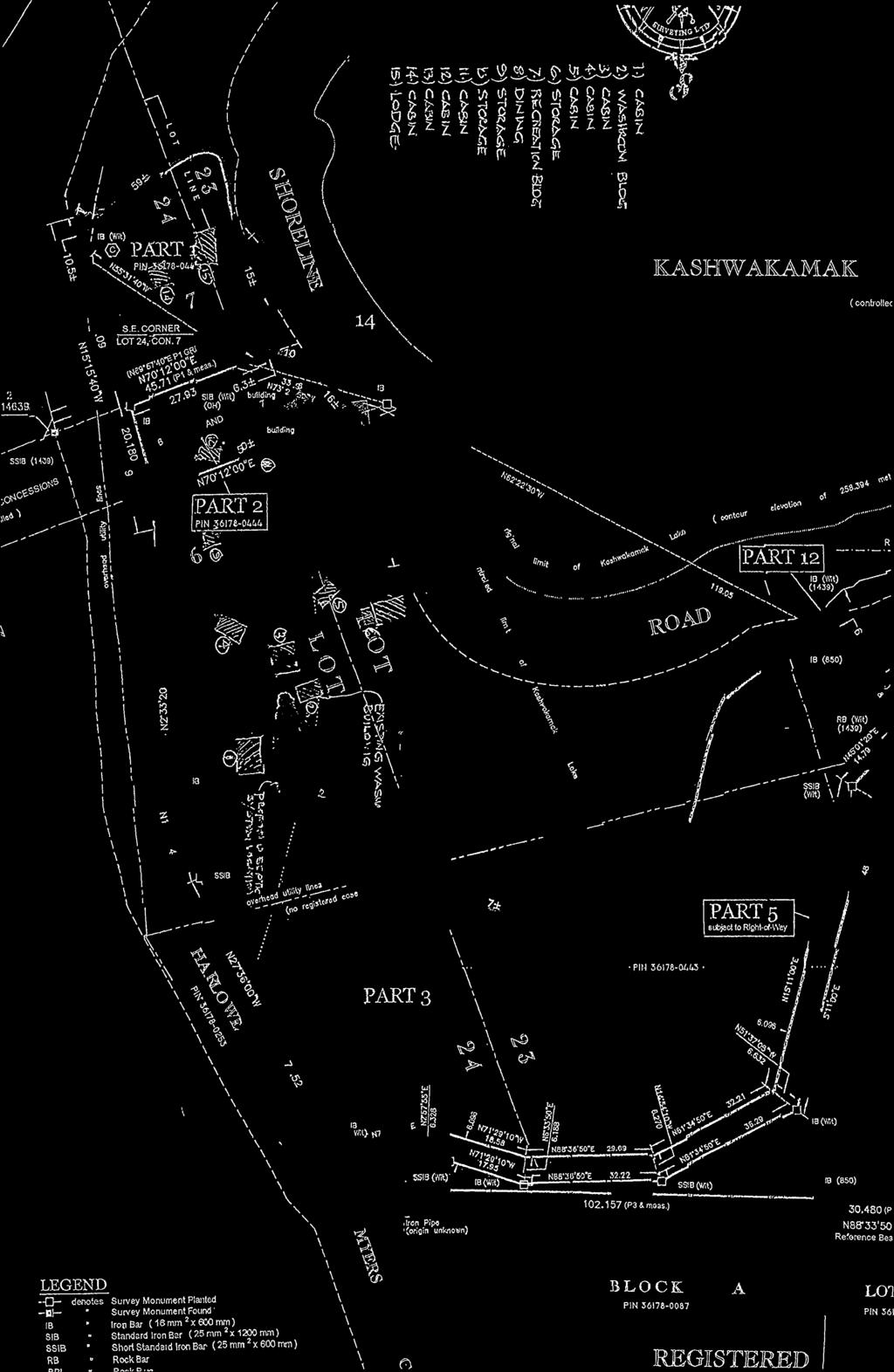
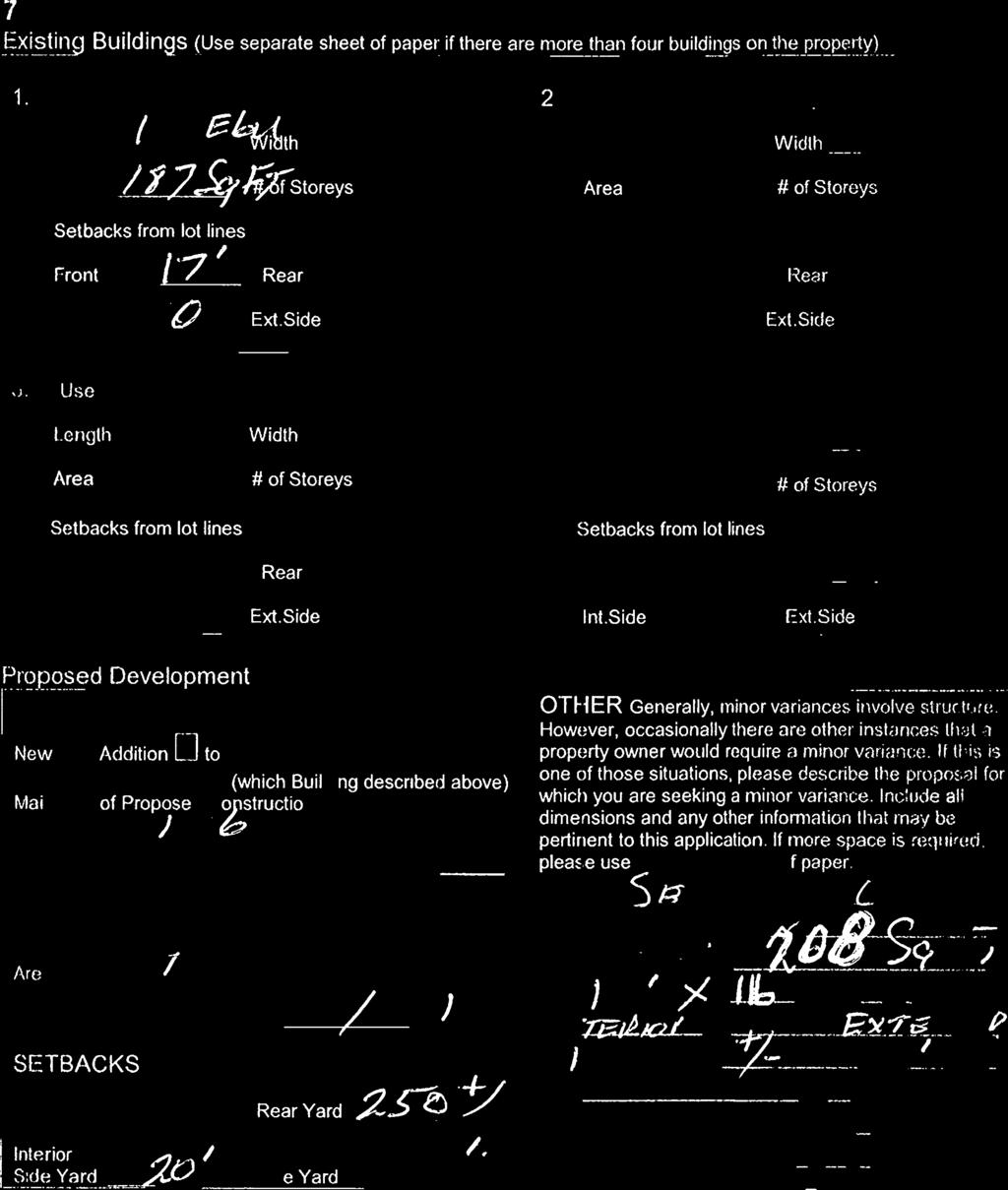
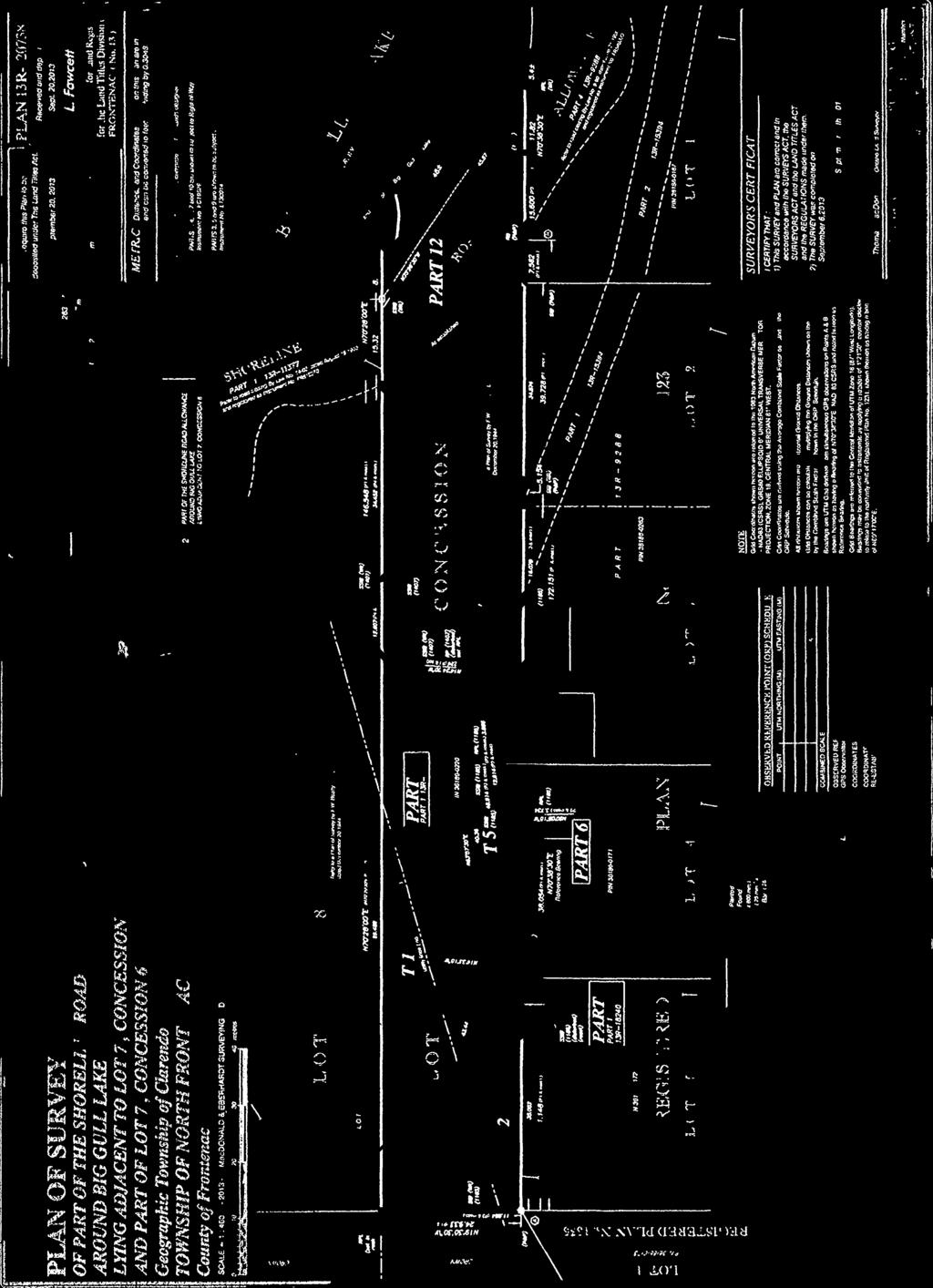
15 Planning Report To: Committee of Adjustment / Planning Advisory Committee From: Jennie Kapusta, Community Planner, County of Frontenac Megan Rueckwald, Manager of Community Planning, County of Frontenac Re: Application for Minor Variance for Part Lots 23 & 24, Concessions 6 & 7, Geographic Township of Barrie, Township of North Frontenac (2182 Myers Cave Road) File No. A7/18 (Johnson, Boyle, Boyd) Recommendation: Approve Date Prepared: November 14, 2018 Date of Meeting: November 19, 2018, October 15, 2018 Proposal An application for minor variance has been submitted to allow for the construction and installation of a replacement sewage disposal system at Part Lots 23 & 24, Concessions 6 & 7, Geographic Township of Barrie, known municipally as 2182 Meyers Cave Road. The property has frontage along Myers Cave Road and Kashwakamak Lake and is approximately 4.3 acres in area. The property is developed with multiple structures which are used for sleeping, storage, dining, a lodge and a single washroom building, that includes shower facilities in addition to toilets, that serve the entire property. The purpose of the application is to replace a failed sewage disposal system, with a new system with upgraded technology. The existing sewage system is located approximately 20 metres from the high water mark of Kashwakamak Lake; the applicant is proposing to construct the new sewage system in approximately the same location. Siting the new sewage disposal system in approximately the same location as the current system will allow the installation of a gravity fed system, rather than one requiring a pumping system. Additionally, the proposed location is proximate to the existing washroom building. Minor variance is required to construct the new sewage disposal system for the following reason: 1. Section 4.20 (f): the minimum setback from the shoreline for an on-site sewage disposal system shall be 30 m (98.4 ft.) for all waterbodies. Requested variance from this section:
16 a. A new sewage disposal system to be located a minimum of 20 metres from the high water mark of Kashwakamak Lake. It is important to note that the application submitted seeks a reduction of 12 metres into the required setback (septic system to be located 18 metres from the high water mark), while the attached sketch marks the setback at 20 metres. Background The subject property is approximately 4.3 acres (1.7 hectares) in area with approximately 199 metres (653 feet) of frontage on Kashwakamak Lake. The subject property is developed with 15 buildings which are used for sleeping, storage, dining, a lodge building and a single washroom building with both shower and toilet facilities. The lot has an existing sewage system located approximately 20 metres from the high water mark of Kashwakamak Lake in proximity to the washroom building. Under Section 45(1) of the Planning Act there are four tests a minor variance must meet. In order to be considered the application must meet all four tests: Does the application conform to the general intent and purpose of the Official Plan? Does the application conform to the general intent and purpose of the Zoning By-law? Is the application desirable for the appropriate development of the lands in question? Is the application minor? Planning Analysis The property is designated as Waterfront Area in the Township of North Frontenac s Official Plan (2017). Waterfront Area policies are intended to govern development within 150 m (500 ft.) of waterbodies and islands with the intent of protecting water quality, shoreline amenities and natural habitat areas. It is Council s intent that the water quality of all waterbodies in the Municipality will be maintained at their present level or enhanced. New development must be considered in light of its impact on the environmental quality of any lake or river. Section Objectives outlines the objectives of the Waterfront Area which include character, access and servicing, natural areas, and development. Limiting the density of buildings and structures in the Waterfront Area is an important part of protecting the character of waterbodies in North Frontenac. The Official Plan also speaks to the preservation and protection of the appearance of the shoreline in a natural vegetated state shall be encouraged. Further, Section I Shoreline Setbacks requires a shoreline vegetated buffer and states that the setback is for the protection of natural habitat and minimizing environmental impact in the foreshore area. Section J reaffirms that the septic system including the septic tile bed and mantle shall not be permitted within 30 metres of the waterbody. The septic system proposed is a newer technology which significantly reduces the level of phosphorous in the effluent after treatment and includes annual testing and monitoring to ensure compliance The property is zoned Waterfront Residential (RW) in the Township of North Frontenac Zoning By-law. The intent of the RW zone is to permit lakefront residential development, in keeping with the rural character of the Township and with appropriate development standards for lake protection. Enhanced waterbody setbacks are intended to protect lakes and sensitive ecological features. The general provisions of the Zoning By-law also require a 30-metre setback from water bodies for all structures including septic systems, in addition to the performance standards described in the individual zone.
17 After the Committee of Adjustment opted to defer this application at the October 22, 2018 Committee of Adjustment meeting, KFL&A staff along with planning staff and the applicant s agent met on site to re-evaluate the potential location of the septic system. At this site visit it was determined that while there may be an alternative location outside the 30m setback, siting the sewage system in that location would limit the potential for future redevelopment and relocation of the existing structures to a location outside the 30 metre setback from the wetland and high water mark further into the property. Additionally, the sewage disposal system being proposed reduces the amount of phosphorous released back into the environment after treatment; one of the major concerns for water quality impact on lakes. The sewage system proposed requires annual testing to ensure this output remains consistent and KFL&A staff confirmed that should the applicant default on this annual inspection their office would be notified and would then follow up. During this site visit measurements were taken to multiple alternative locations which had been suggested previously and it was concluded that there were more limitations with regards to setbacks than previously established and these alternative locations were not as appropriate as believed. Comments KFL&A Public Health No new written comments have been received from Public Health at the time of this writing. Verbal comments provided at the site visit were supportive of the minor variance as submitted and noted the environmental gain provided by the proposed system due to the reduction in phosphorous levels in the effluent after treatment in conjunction with the required annual monitoring. Mississippi Valley Conservation Authority In comments dated October 9, 2018, MVCA suggest that alternative locations be explored to achieve a greater setback prior to the approval of the application. MVCA reviewed the application to assess potential impacts of the proposed development on known natural heritage features on and adjacent to the subject property. The review also includes an evaluation of the subject property for natural hazards such as unstable slopes and areas prone to flooding and erosion. MVCA are of the opinion that a reduction of 12 metres into the required setback is not minor. MVCA also noted that the subject property consists of numerous structures within the waterbody setback requirement and that all future planning decisions on this property should work towards improving the waterbody setback rather than facilitate deficient setbacks. While planning staff respect the comments of MVCA, the information provided at the second site visit and additional constraints identified combined with the environmental gains associated with the proposed system, planning staff are recommending approval of the application. Public Comments As of the date of this writing, no public comments have been received. Site Visit Planning staff completed a site visit on October 1, 2018, along with KFL&A Public Health staff to review the proposal.
18 A second site visit was conducted on October 22, 2018 with planning staff, KFL&A staff and the agent for the applicant to evaluate alternative locations for a septic system. This site visit concluded that alternatives may exist but that the requested location for the sewage system allowed the greatest long term potential for reduction in environmental impact with redevelopment on the property. Installing the replacement septic system in the location proposed would allow for the potential future relocation of some of the existing structures to a location outside the 30 metre setback at the point they undergo renovation or reconstruction. Conclusion Planning staff are of the opinion that the application to construct a new sewage system meets the four tests for a minor variance for the following reasons: The variance conforms to the general intent and purpose of the Official Plan because the proposal seeks to maximize the waterbody setback and further reduces potential impact on water quality by incorporating new septic technology to reduce the phosphorous as well as a mandatory annual inspection. The variance conforms to the general intent and purpose of the Zoning Bylaw because the proposal maximizes the waterbody setback and further reduces potential impact on water quality by incorporating new septic technology. The variance is desirable for the appropriate development of the lands in question because the proposal will result in an upgraded septic system while maintaining an opportunity to increase waterbody setback for future redevelopment of existing structures on the property. The variance is minor because the new septic system will be located in proximity to the location of the existing system and the upgraded septic technology will significantly reduce the potential impact on water quality. It is recommended that the Committee of Adjustment approve minor variance application A7/18, with the following condition: 1. That the Eljin septic system proposed (or a comparable level of treatment) in minor variance application A7/18 be the system that is installed on the property. 2. That the septic system be located a minimum of 18 metres from the high water mark of Kashwakamak Lake in the location provided on the application.
19
20
21
22
23
24


25


26
27 Planning Report To: Chair and Members, Committee of Adjustment / Planning Advisory Committee From: Jennie Kapusta Community Planner County of Frontenac Re: Application for Consent (One lot addition, together with an easement) for Part Lot 16, Concession 1, Geographic Township of South Canonto, Township of North Frontenac B/7-18-NF (Lepage) Recommendation: Approval Date Prepared: November 16, 2018 Date of Meeting: November 19, 2018 Proposal An application for consent to sever for a lot addition has been submitted for lands located at Part Lot 16, Concession 1, Geographic Township of Canoto (see attached map). The subject property is approximately 2.6 acres in area with frontage along Arcol Road and dissected by a right-of-way that provides access to existing waterfront development. The parcel to be severed for a lot addition is approximately 0.87 acres in area and will be consolidated with a 0.17 hectare (0.41 acre) parcel, municipally known as 1197 Arcol Road. The retained parcel will be consolidated with an abutting 0.74 hectare (1.83 acre) parcel, municipally known as 1203A/1203B Arcol Road, as a condition of approval of the consent to sever. These parcel consolidations will increase the size of two existing waterfront residential lots and have the effect of reducing density surrounding Palmerston Lake by making three lots into two lots. Severed (Parcel A - Southern) The proposed lot addition (Parcel A) has no road or water frontage and is approximately hectares (0.87 acres) in area. The lot addition parcel is irregularly shaped due to the existing lot configurations. This parcel is currently vacant and is subject to a registered easement in favour of Bell Canada. Benefitting Lands (Parcel A) The benefitting lands for Parcel A, are located to the south of the subject property and have approximately 105 metres of frontage along Palmerston Lake. This parcel is approximately 0.37 hectares (0.92 acres) in area and developed with a single dwelling and accessory building. With the addition of the severed Parcel A, the total lot size will increase to 0.72 hectares (1.78 acres) in area. The effect of the lot addition will be to
28 enlarge an undersized waterfront parcel and bring it into compliance with the Zoning Bylaw but not into conformity with the Township of North Frontenac Official Plan, Retained (Parcel B - Northern) The retained parcel (Parcel B) has approximately 100 metres of frontage along Arcol Road, a depth of approximately 144 metres and is approximately 0.68 hectares (1.7 acres) in area. The proposed lot addition is regularly shaped and currently vacant. There is a right-of-way access for 1203A, 1203B and 1203C Arcol Road through Parcel B. Benefitting Lands (Parcel B) The lands to be consolidated with Parcel B are located to the west of the subject property, municipally known as 1203A/1203B Arcol Road, and have frontage along Palmerston Lake. This lot is currently 0.75 hectares (1.86 acres) in area and is developed with a single detached dwelling, two seasonal dwellings and multiple accessory buildings. Easement As part of the application, the applicants are requesting that an easement in the form a right-of-way be granted over Part 10 on 13R in favour of Lot A. The area of the easement will be approximately 6.2 metres square and will provide legal deeded access over the small triangle of what is perceived to be the existing right-of-way. Background The applicant is proposing to divide an existing 1.32 hectare (3.27 acres) parcel into two parcels to facilitate two lot additions to abutting properties. There are multiple easements on the subject property including one for Bell Canada and a right-of-way for road access for properties known municipally as 1203A, 1203B and 1203C Arcol Road. The subject property is undeveloped and primarily naturally vegetated with significant portions of the lot being rocky cliffs and outcroppings. The outcomes from this lot addition and parcel consolidation (for the retained parcel) are the enlargement of two waterfront lots. The parcel boundaries shown on Frontenac Maps, which are provided by MPAC, are significantly different than those provided with the consent application. The applicant had the parcels resurveyed in advance of submitting the application to ensure accurate descriptions and sizes for the parcels to be severed. This discrepancy caused some confusion for the property owners in the vicinity which Township staff and the applicants are working together to correct. Surrounding properties contain a mix of undersized developed waterfront residential lots and larger mostly vacant, naturally vegetated rural lots. Provincial Policy Statement (2014) The 2014 Provincial Policy Statement (PPS) provides direction on matters of Provincial interest related to land use planning and development. The PPS promotes efficient land use and development patterns that support strong, liveable and healthy communities, protect the environment and public health and safety, and facilitate economic growth. When assessing consent applications on rural lands, planning authorities must comply with Section of the PPS; this section requires application of relevant policy of Section 1: Building Healthy Communities, Section 2: Wise Use and Management of
29 Recourses, and Section 3: Protecting Public Health and Safety by the approval authority. Section 1: Building Healthy Communities of the PPS promotes the building of strong, healthy communities and includes policies about avoiding development and land use patterns which may cause environmental or public health and safety concerns. Section of the PPS permits limited residential development in rural lands in Ontario municipalities and in Section promotes development that is compatible with the rural landscape and can be sustained by rural service levels. The lot additions will result in a reduced potential density of development in proximity to Palmerston Lake. Section 2: Wise Use and Management of Resources of the PPS contains policies that encourage the protection of natural heritage, water, agricultural, mineral and cultural heritage and archaeological resources for their economic, environmental and social benefits. These lot additions were evaluated by Mississippi Valley Conservation Authority for natural hazards and natural heritage features, flooding and erosion hazards. MVCA does not anticipate any impacts to natural features or natural hazards as a result of this application as provided in correspondence dated November 9, Section 3: Protecting Public Health and Safety of the PPS contains policies intended to reduce the potential for public cost or risk to Ontario s residents from natural or humanmade hazards. No human-made hazards were identified on the subject property. The proposed consent is consistent with the Provincial Policy Statement, County of Frontenac Official Plan The County of Frontenac Official Plan is a framework for guiding development in the County through the management and protection of the natural environment and by providing direction and influence on growth patterns. It is focused on the six themes of economic sustainability, growth management, community building, housing and social services, heritage and culture, and environmental sustainability. Section 3.3 Rural Lands provides policies for all lands outside of the settlement areas. The plan recognizes that rural lands are used as an alternative location for those preferring a rural lifestyle. Section Waterfront Area Goal of the Plan is to improve and protect the waterfront area in Frontenac County as a significant cultural, recreational, economic, and natural environment resource and to maintain or enhance the quality of the land areas adjacent to the shore. Objectives in this section include ensuring that the built form along the shoreline is not overly concentrated, maintain and improve water quality on a watershed-wide basis and to maintain, enhance and/or restore the majority of the developed and undeveloped shorelines in their natural state by promoting property stewardship. The effect of these lot additions is to reduce the number of lots in proximity to Palmerston Lake, which has the effect of reducing development potential and limiting the long term development impact on water quality. Section 4.2: Servicing provides policies for the use of private services provided that site conditions are suitable for the long-term provision of such services with no negative impacts. KFL&A Public Health was circulated as part of the application review process to ensure that the lot addition did not impact the servicing of the resulting lots. They have no objection to lot addition A, and the subsequently the consolidation of the retained.
30 The proposed consent conforms to the County of Frontenac Official Plan, Township of North Frontenac Official Plan, 2017 The property is designated as Rural Area in the Township s Official Plan. The goal of the Rural Area is to provide for a supply of land for a diversity of traditional and evolving uses. These include rural residential in addition to rural commercial uses. The Plan places an emphasis on respective land uses that are environmentally sound and complimentary to the physical and scenic attributes of the natural environment. The proposed lot addition will increase the area of the benefitting lands and maintain the rural character of the development. The benefitting lands are designated Waterfront Area in the Township s Official Plan. The minimum lot sizes for properties designated as Waterfront Area are to be 0.8 hectares (2 acres) with waterfrontage of 77 metres (250 feet). While these lot additions will not bring both benefitting properties in to conformance with the Official Plan, the increase in area, coupled with the reduction in density of parcels does meet the intent of the Official Plan, in the opinion of planning staff. The proposed consent conforms to the intent of the Township of North Frontenac Official Plan, Township of North Frontenac Comprehensive Zoning Bylaw, 2004 The subject property is zoned Limited Service Residential (LSR). The LSR zoning permits a variety of uses suited for rural and waterfront areas. Both benefitting lots will exceed the minimum lot area and frontage requirements of the LSR zone. No new development is proposed for either parcel; any future development would be required to meet the provisions of the Township s Zoning Bylaw. The consent meets the provisions of the Township of North Frontenac s Zoning By-law, Comments At the time of writing of this report no public comments had been received. KFL&A Public Health Comments provided November 9, 2018 indicate that Public Health has no objection to the application for the proposed lot addition for Lot A. Mississippi Valley Conservation Authority (MVCA) In comments dated November 9, 2018, MVCA staff indicated that, as both resulting lots are already developed with no new development proposed at this time, they do not anticipate any impacts to natural features or natural hazards as a result of this application. MVCA does not have any objections to the application. Pre-consultation The applicant formally pre-consulted with Township staff before submitting the application. Through the consultation it was determined that a single application was required and a condition would be included to consolidate the retained lands with the abutting lands.
31 A site visit was completed by planning staff on October 31, 2018 to confirm the suitability of the lot additions. During this visit planning staff it was not clear where the proposed lot boundaries were located as the survey provided and the mapping available did not match. After some discussions in office and with the applicants, planning staff were able to correctly identify the proposed severed and retained parcels and suitably evaluate the application. It was noted that the lot the retained parcel will be consolidated with contains multiple dwellings and has more than one civic address. Conclusion The proposed consent is consistent with the Provincial Policy Statement (2014), and conforms to the County of Frontenac and Township of North Frontenac Official Plan (2017) and meets the provisions in the Township Zoning By-law (2004). It is recommended that the Committee of Adjustment approve consent application B/7-18-NF with the Townships standard conditions and the following conditions: 1. The land to be severed by Consent Application B7/-18-NF shall be for a lot addition with an area of approximately hectares (0.87 acres)to be conveyed only to 1197 Arcol Road. 2. The lands to be severed are for the purpose of a lot addition only to the abutting lands described as Part Lot 16, Concession 1, 13R20004, Part 1, and any subsequent transfer, charge or other conveyance of the lands to be severed is subject to Section 50(3) (or subsection 50(5) if in a plan of subdivision) of the Planning Act. Neither the lands to be severed nor the abutting lands are to be reconveyed without the other parcel unless a further consent is obtained. The owner shall cause the lands to be severed to be consolidated on title with the abutting lands and for this condition to be entered into the parcel register as a restriction. 3. The retained lands from Consent Application B7/-18-NF shall be for a lot addition with an area of approximately hectares (1.7 acres) to be conveyed only to 1203A/1203B Arcol Road. 4. The retained lands are to be consolidated, for the purpose of a lot addition, only to the abutting lands described as Part Lot 16, Concession 1, municipally known as 1203A/1203B Arcol Road and any subsequent transfer, charge or other conveyance of the lands to be severed is subject to Section 50(3) (or subsection 50(5) if in a plan of subdivision) of the Planning Act. Neither the lands to be severed nor the abutting lands are to be reconveyed without the other parcel unless a further consent is obtained. The owner shall cause the lands to be severed to be consolidated on title with the abutting lands and for this condition to be entered into the parcel register as a restriction. 5. The easement registered on title over Part 10 on 13R be in favour of the lands identified as Lot Addition A and the subsequent benefitting lands of Lot Addition A as outlined on the sketch provided.
32 TOWNSHIP OF NORTH FRONTENAC LEPAGE- APPLICATION FOR CONSENT (B NF) 1203A ARCOL RD, GEOGRAPHIC TOWNSHIP OF SOUTH CANONTO ± Inset Map: North Frontenac Central Frontenac Benefitting Lot B a a Retained Parcel (to be consolidated with benefitting lot B) Lot Addition Parcel A a Benefitting Lot A a 1197 Arcol Rd Proposed Lot A Lot A: Addition Proposed Lot B: Lot B: Addition 1197 Arcol Rd Subject Property Meters Produced November 2018 by the County of Frontenac with data supplied under licence by members of the OGDE and ESRI. The County of Frontenac disclaims all responsibility for errors, omissions in this publication. Includes Material 2014 Printer for Ontario. All Rights Reserved. 1:1,500
33 18-NF-CN November 9, 2018 Tara Mieske Secretary-Treasurer Township of North Frontenac P.O. Box 97 Plevna, Ontario K0H 2M0 Dear Ms. Mieske: Re: Application for Consent B7/18-NF(Sc) Part Lot 16, Con 1, Township of North Frontenac (South Cononto) LEPAGE Mississippi Valley Conservation Authority (MVCA) has been circulated the above noted application to conduct a review in terms of MVCA Regulations and Provincial Planning Policy for Natural Heritage and Natural Hazard issues. Specifically, the purpose of this review is to assess potential impacts of the proposed development on known natural heritage features on and adjacent to the subject property. These features could include wetlands, wildlife habitat and areas of natural and scientific interest. This review also includes an evaluation of the subject property for natural hazards such as unstable slopes and areas prone to flooding and erosion. PROPOSAL It is our understanding that the purpose of the subject application is to sever (2) vacant parcels of land as lot additions. Severance A is 0.87 ac, to be added to the adjacent waterfront lot to the south. Parcel B is the retained land, with an area of 1.7 ac. It is proposed to be consolidated with the adjacent waterfront property to the west. Both lots being added to are waterfront properties that are already developed. PROPERTY CHARACTERISTICS According to a review of GIS mapping and aerial imagery, the lots being added to have frontage on Palmerston Lake, while the severed and retained lands do not Hwy 7, Carleton Place, ON K7C 3P1 Tel. (613) Fax (613) info@mvc.on.ca MVCA is a member of Conservation Ontario~Natural Champions
34 REVIEW & CONCLUSION Both resulting lots are already developed with no new development proposed at this time. Therefore, we do not anticipate any impacts to natural heritage features or natural hazards as a result of the subject application. MVCA does not have any objection to the subject application. NOTES A review for Species at Risk was not conducted. We suggest contacting the Ministry of Natural Resources and Forestry should you require a review in this regard. Pursuant to Ontario Regulation 153/06 - Development, Interference with Wetlands and Alterations to Shorelines and Watercourses, written permission is required from MVCA prior to the initiation of any alterations to the shoreline of the lake. We also advise consultation with Fisheries and Oceans Canada (DFO) fisheriesprotection@dfo-mpo.gc.ca prior to conducting any work within the lake, in order to assess potential impacts to fish habitat. Authorization from DFO may be required for such work. Should any questions arise please do not hesitate to call. Please advise us of the Committee s decision in this matter. Yours truly, Diane Reid Environmental Planner
35
36
37
38
39
40
41
42
43

44
45 Planning Report To: Committee of Adjustment / Planning Advisory Committee From: Megan Rueckwald, Manager of Community Planning, County of Frontenac Re: Application for Minor Variance for Part Lot 21, Concession 7, Geographic Township of Barrie, Township of North Frontenac (1056 Bay Lane) File No. A8/18 (McGrath and Phifer) Recommendation: Deny Date Prepared: November 16, 2018 Date of Meeting: November 19, 2018 Proposal An application for minor variance has been submitted to allow for the construction of a dwelling with attached porch and deck on a vacant lot located at Part Lot 21, Concession 7, Geographic Township of Barrie, municipally known as 1056 Bay Lane (see attached map). The property has frontage along Mississagagon Lake and is accessed by Bay Lane, a private lane. The subject property is approximately 1.15 acres in area with 46 metres (150 feet) of frontage along Mississagagon Lake and a similar distance along Bay Lane that dissects the property. The intent of the application is to reduce the waterbody setback from 30 metres to metres for the construction of a dwelling. It is planning staff s understanding that the proposed dwelling will be 9.8 metres by 9.8 metres with a 3.6 metre by 4.9 metre porch to the side and setback 25.6 metres from the highwater mark of Mississagagon Lake. A deck is proposed along the front of the cottage that will be 3.7 metres by 12.8 metres and setback metres from the highwater mark. Combined, the footprint of the proposed construction is 158 square metres (1696 square feet). Minor variance is required to construct the deck and cottage as the structure will be located within 30 metres of the waterbody: 1. Section 5.6.2: Minimum front yard requirement (with shoreline frontage) is 30m. Requested variance from this section: a. Cottage: 25.6 metres from the high water mark of Mississagagon Lake (reduction of 5.4 metres) b. Deck: metres from the high water mark of Mississagagon Lake (reduction of 8.05 metres). 2. Section 4.20 (f): Minimum setback from the shoreline for a habitable structure (dwelling), a non-residential building or on-site sewage disposal system shall be 30 m (98.4 feet) for all water bodies.
46 Requested variance from this section: a. Cottage: 25.6 metres from the high water mark of Mississagagon Lake (reduction of 5.4 metres) b. Deck: metres from the high water mark of Mississagagon Lake (reduction of 8.05 metres). Background The subject property is approximately 1.15 acres (0.47 hectares) with 46 metres (150 feet) of frontage along Mississagagon Lake. Bay Lane, a private right-of-way, dissects the property to provide access to abutting waterfront residential lots. The applicants identified the topography on the site, the existing private lane, and setback from Hydro lines as constraints to development on the lot. Planning staff along with MVCA staff and KFL&A Public Health staff completed a site visit on October 31, 2018, and identified the steep slope to the waterfront as a constraint to the lot but also as a natural hazard that required a setback. Hydro lines were identified on the property that would prevent development from being located beneath them but could be used as a parking area. The surrounding area contains a mixture of seasonal dwellings and related residential uses on Mississagagon Lake. Under Section 45(1) of the Planning Act there are four tests a minor variance must meet. In order to be considered the application must meet all four tests: Does the application conform to the general intent and purpose of the Official Plan? Does the application conform to the general intent and purpose of the Zoning By-law? Is the application desirable for the appropriate development of the lands in question? Is the application minor? Planning Analysis Provincial Policy Statement, 2014 The 2014 Provincial Policy Statement (PPS) provides direction on matters of Provincial interest related to land use planning and development. The PPS promotes efficient land use and development patterns that support strong, liveable and healthy communities, protect the environment and public health and safety, and facilitate economic growth. When assessing consent applications on rural lands, planning authorities must comply with Section of the PPS; this section requires application of relevant policy of Section 1: Building Healthy Communities, Section 2: Wise Use and Management of Recourses, and Section 3: Protecting Public Health and Safety by the approval authority. The PPS is issued under Section 3 of the Planning Act and all decisions affecting land use planning matters shall be consistent with the Provincial Policy Statement. Section 1: Building Healthy Communities of the PPS promotes the building of strong, healthy communities and includes policies about avoiding development and land use patterns which may cause environmental or public health and safety concerns. Section of the PPS permits limited residential development on rural lands in Ontario municipalities including resource-based recreational uses (including recreational dwellings) and in Section promotes development that is compatible with the rural landscape and can be sustained by rural service levels.
47 Section 2: Wise Use and Management of Resources of the PPS contains policies that encourage the protection of natural heritage, water, agricultural, mineral and cultural heritage and archaeological resources for their economic, environmental and social benefits. Mississippi Valley Conservation Authority reviewed the application for natural heritage considerations of the PPS. In comments dated November 9, 2018, MVCA reviews waterbody setback requirement in accordance with the PPS and state that the recommended 30 metre setback distance for waterfront development is intended to protect the lake environment from the effects of increased nutrients from overland runoff and allow room for a natural vegetation buffer. MVCA do not support the reduction of the setback as there appears to be space to construct the dwelling that would not reduce the setback and be consistent with the natural hazard policies of the PPS. Section 2.2 g) of the PPS also requires that planning staff ensure consideration of environmental lake capacity, where applicable. The Township of North Frontenac Official Plan designated Mississagagon Lake as at capacity for future development as reported by the Ministry of the Environment, Conservation and Parks. More strict development policies exist for the creation of new lots along at capacity lakes, as indicated in the Official Plan, however all development adjacent to at capacity lakes must be considered. Achieving the 30 metre setback will enhance the vegetated buffer and result in greater water quality protection. Section 3: Protecting Public Health and Safety of the PPS contains policies intended to reduce the potential for public cost or risk to Ontario s residents from natural or humanmade hazards. No human-made hazards were identified on the subject property. In comments dated November 9, 2018, MVCA indicated that slopes which exceed 3 metre in height and a 3:1 slope angle, are considered potentially unstable. A default of 10 metres from the crest of the slope is recommended on the subject property, in order to ensure safe development. MVCA do not support the application for minor variance as the development will be located within this area. The proposal as submitted is not consistent with the Provincial Policy Statement, 2014 with regards to natural hazards and natural heritage. Although constraints exist on the lot, suitable area exists to increase the setback of the proposed dwelling. Although less desirable for the owners, a parking area on flat ground is located on the southern side of Bay Lane. Township of North Frontenac Official Plan, 2017 The property is designated as Waterfront Area in the Township of North Frontenac s Official Plan (2017). Waterfront Area policies are intended to govern development within 150 m (500 ft.) of waterbodies and islands with the intent of protecting water quality, shoreline amenities and natural habitat areas. It is Council s intent that the water quality of all waterbodies in the Municipality will be maintained at their present level or enhanced. New development must be considered in light of its impact on the environmental quality of any lake or river. Section Objectives outlines the objectives of the Waterfront Area which include character, access and servicing, natural areas, and development. Limiting the density of buildings and structures in the Waterfront Area is an important part of protecting the character of waterbodies in North Frontenac. The Official Plan also speaks to the preservation and protection of the appearance of the shoreline in a natural vegetated state shall be encouraged. Further, Section I Shoreline Setbacks requires a shoreline
48 vegetated buffer and states that the setback is for the protection of natural habitat and minimizing environmental impact in the foreshore area. Section J (iv) states where lakespecific or site-specific conditions suggest that it would be appropriate, the minimum water setback may be increased (examples include sites with steep slopes, limited soil depth or limited vegetative cover). The applicants have applied to reduce the waterbody setback to accommodate a parking area in close proximity to the proposed dwelling. Planning staff note that a cleared parking area exists on the south side of Bay Lane that would be in close proximity to the cottage. Once the location of the septic system is solidified, there may be sufficient area to park between the dwelling and tile field. Planning staff also recommend that the applicants consult with KFL&A Public Health to determine if the location of the dwelling and the septic system could be switched on the plot plan to further meet the required setbacks. Township of North Frontenac Zoning Bylaw, 2004 The property is zoned Waterfront Residential (RW) in the Township of North Frontenac Zoning By-law. The intent of the RW zone is to permit lakefront residential development, in keeping with the rural character of the Township and with appropriate development standards for lake protection. Enhanced waterbody setbacks are intended to protect lakes and sensitive ecological features. The general provisions of the Zoning By-law also require a 30-metre setback from water bodies, in addition to the performance standards described in the individual zone. Section 4.29 Permitted Projections permits an unenclosed deck to project 3 metres into any required front yard or rear yard. The proposed deck on the dwelling projects further into the permitted projection setback and into the setback requirement of the MVCA for the safe construction near natural hazards. Planning staff are recommending that the applicant consult with MVCA to determine if a deck would be supported within the area. It is important for the Committee of Adjustment to be aware that the subject property was created by consent in The Township s Zoning Bylaw contains a provision in Section 4.20 Minimum Distance Separation, Influence Areas and Special Setbacks that states, despite the provisions of this by-law, the setback for a main building on an existing lot of record created prior to July 22, 2004 shall be as close as possible to the required setback and shall not be closer than 20 m (65.6 ft.) from the high water mark of any water body. The Chief Building Official visited the subject property and determined that a building envelope exists outside of the required setback. It is also important to note, that even though the lot was created before the 2014 PPS was in effect, all land use planning decisions shall be consistent with the PPS. Comments Mississippi Valley Conservation Authority MVCA conducted a review of the application in terms of MVCA Regulations and Provincial Planning Policy for Natural Heritage and Natural Hazard concerns. In comments dated November 9, 2018, MVCA does not support the subject application. They state, with careful consideration of a building envelope, it is estimated that adequate area exists to increase the setback of the subject development in compliance with the minimum waterbody setback requirement of 30 metres and the recommended setback of 10 metres from the crest of the slope identified. In a phone conversation between the applicant and Township staff, Township staff recommended that the applicant contact MVCA should they have any further questions.
49 KFL&A Public Health Comments dated November 12, 2018, Public Health state that they have no objection to the application. They did state that the septic bed can possibly be relocated to allow more distance to meet the township bylaws. Pre-Consultation The applicant consulted with Township and planning staff prior to submitting the application. Planning, MVCA staff, KFL&A Public Health staff and Chief Building Official conducted a site visit on October 31, 2018 to evaluate the application. Conclusion Planning staff concur with the analysis completed by MVCA with regards to consistency with the PPS for natural hazard and natural heritage considerations. Planning staff do not support the reduction in the waterbody setback to accommodate a parking area when suitable flat location exists in close proximity to the proposed dwelling location. The Township of North Frontenac Zoning Bylaw does permit a projection of up to 3 metres from an unenclosed deck into the required 30 metre setback, however this does not take into consideration other factors and setbacks including the recommended setback of 10 metres from the top of the steep slope. Planning staff recommend that the applicants consult with MVCA staff regarding the top of bank setback. Planning staff are of the opinion that the application as presented does not meet the four tests for a minor variance: The variance does not conform to the general intent and purpose of the Official Plan because it does not seek to maximize the waterbody setback and take into consideration the natural hazards on the property. The Official Plan Waterfront Area provides policy direction for increasing the waterbody setback where required as a result of steep slopes or other natural features. The variance does not conform to the general intent and purpose of the Zoning By-law for the fact that the Zoning By-law seeks to maximize the waterbody setback to establish a vegetated buffer; a greater vegetated buffer could be achieved by relocating the parking area to the southern side of Bay Lane. The variance is not desirable for the appropriate development of the lands in question because the new dwelling and deck will be located within the recommended 10 metre setback from the top of bank of a slope which exceeds 3 metre in height and a 3:1 slope angle. The variance is not minor because the proposed development is not consistent with the Provincial Policy Statement, It is recommended that the Committee of Adjustment deny minor variance application A8/18 (McGrath and Phifer).

50 TOWNSHIP OF NORTH FRONTENAC MCGRATH - APPLICATION FOR MINOR VARIANCE A BAY LANE, GEOGRAPHIC TOWNSHIP OF BARRIE ± Inset Map: North Frontenac Central Frontenac Proposed Cottage Proposed Deck Proposed Screened Porch Proposed Septic System Subject Property Meters Produced October 2018 by the County of Frontenac with data supplied under licence by members of the OGDE and ESRI. The County of Frontenac disclaims all responsibility for errors, omissions in this publication. Includes Material 2014 Printer for Ontario. All Rights Reserved. 1:600
51 18-NF-MV November 9, 2018 Tara Mieske Secretary-Treasurer Township of North Frontenac P.O. Box 97 Plevna, Ontario K0H 2M0 Dear Ms. Mieske: Re: Minor Variance Application #A8/18 Part Lot 21, Con 7, Township of North Frontenac (Barrie) 1056 Bay Lane MCGRATH Mississippi Valley Conservation Authority (MVCA) has been circulated the above noted application to conduct a review in terms of MVCA Regulations and Provincial Planning Policy for Natural Heritage and Natural Hazard issues. Specifically, the purpose of this review is to assess potential impacts of the proposed development on known natural heritage features on and adjacent to the subject property. These features could include wetlands, wildlife habitat and areas of natural and scientific interest. This review also includes an evaluation of the subject property for natural hazards such as unstable slopes and areas prone to flooding and erosion. PROPOSAL It is our understanding that the purpose of the subject application is to obtain relief in the minimum setback requirement of 30 m from the high water mark (HWM) of a waterbody, in order to construct a 9.8 m x 9.8 m dwelling with a 3.6 m x 4.9 m porch. The dwelling will be 25.6 m from the HWM, with a 3.7 m x 12.8 m deck on the front with a m setback from the HWM. PROPERTY CHARACTERISTICS According to a review of GIS mapping and aerial imagery, the subject property has frontage on Mississagagon Lake. The descent to the lake on the subject property is quite high and steep (estimated to be at least as steep as 3:1 (h:v) and higher than 3 m) Hwy 7, Carleton Place, ON K7C 3P1 Tel. (613) Fax (613) info@mvc.on.ca MVCA is a member of Conservation Ontario~Natural Champions
52 Natural Heritage Features Waterbody MVCA reviews waterbody setback requirements in accordance with the Provincial Policy Statement (PPS). Guidelines prepared in support of the PPS indicate that development shall not be permitted within 30 m of fish habitat unless is has been determined that there will be no negative impacts to this natural heritage feature. The recommended 30 m setback distance for waterfront development is intended to protect the lake environment from the effects of increased nutrients from overland runoff and allow room for a natural vegetation buffer. The natural vegetation buffer prevents shoreline erosion, excess warming of shallow waters and provides wildlife and aquatic habitat. Natural Hazards It is provincial policy that: Development shall generally be directed to areas outside of hazardous lands adjacent to a stream and small inland lake systems which are impacted by flooding and/or erosion hazards (Provincial Policy Statement, Section b). Erosion hazards include slopes which have the potential for slope instability due to their steepness and height. Slopes which exceed 3 m in height and a 3:1 slope angle, are considered potentially unstable. A default setback of 10 m from the crest of the slope is recommended in this case, in order to ensure safe development. Discussion The proposed development extends to the crest of the slope which is not consistent with the recommendation outlined above. Therefore, we recommend this setback be increased by 10 m from the crest of the slope given that adequate area appears to exist. This would also result in an increased waterbody setback of more than 30 m rather than m as proposed. We recognize that the location of the septic system may have to be adjusted to accommodate this increased setback. However, we understand from the Health Unit that this would be feasible. REVIEW & CONCLUSION With all of the above in consideration, MVCA does not support the subject application. With careful selection of a building envelope, it is estimated that adequate area exists to increase the setback of the subject development in compliance with the minimum waterbody setback requirement of 30 m and the recommend setback of 10 m from the crest of the slope identified. NOTES A review for Species at Risk was not conducted. We suggest contacting the Ministry of Natural Resources and Forestry should you require a review in this regard. Pursuant to Ontario Regulation 153/06 - Development, Interference with Wetlands and Alterations to Shorelines and Watercourses, written permission is required from MVCA prior to the initiation of any alterations to the shoreline of the lake.
53 We also advise consultation with Fisheries and Oceans Canada (DFO) prior to conducting any work within the lake, in order to assess potential impacts to fish habitat. Authorization from DFO may be required for such work. Should any questions arise please do not hesitate to call. Please advise us of the Committee s decision in this matter. Yours truly, Diane Reid Environmental Planner
54
55

56
57
58
59
60

61
62
63
64


65
66
67

68


69
70
71
72


73
74


75


76
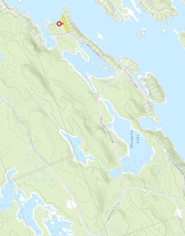
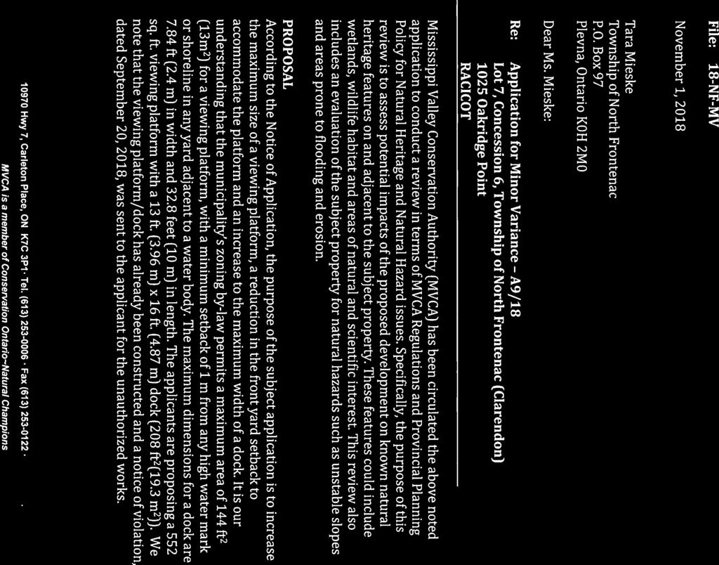
77 Planning Report To: Committee of Adjustment / Planning Advisory Committee From: Jennie Kapusta, Community Planner, County of Frontenac Megan Rueckwald, Manager of Community Planning, County of Frontenac Re: Application for Minor Variance for Part Lot 7, Concession 6, Geographic Township of Clarendon, Township of North Frontenac (1025 Oak Ridge Point Lane) File No. A9/18 (Racicot) Recommendation: Approve with amendments Date Prepared: November 14, 2018 Date of Meeting: November 19, 2018 Proposal An application for minor variance has been submitted to recognize the construction of a dock and viewing platform at Part Lot 7, Concession 6, Geographic Township of Clarendon, known municipally as 1025 Oak Ridge Point Lane (see attached map). The property has frontage along Oak Ridge Point Lane and Big Gull Lake and is approximately 0.47 hectares (1.17 acres) in area. The property is developed with a single detached dwelling and accessory structures. The purpose of the application is to legalise the construction of a dock and viewing platform which were constructed without permits, are larger than permitted in the Township s Zoning Bylaw and closer to the high water mark of Big Gull Lake than permitted. The proposal for the viewing platform is for a 555 square foot viewing platform located at the highwater mark of Big Gull Lake. The viewing platform is 28 feet long and between 14 feet wide and 24 feet wide; the platform is irregularly shaped due to its construction around two large rock outcroppings and the configuration of the shoreline. The proposal for the dock is for a 208 square foot dock with approximate dimensions of 13 feet by 16 feet. The dock is also constructed around the large rock outcroppings, making its shape irregular. Minor variance is required to construct the dock and viewing platform for the following reasons:
78 1. Section (h): Despite Section (c), a shoreline structure other than a boat house, boat port, float plane hangar, dock or wharf shall be set back a minimum of 20 m (65.6 ft.) from any high water mark or shoreline in any yard adjacent to a water body except for a gazebo or viewing stand, which shall be set back a minimum of 1 m (3.28 ft.). Requested variance from this section: a. A new viewing platform to be located 0 metres from the high water mark. 2. Section (j): Despite Section (c), a gazebo or viewing platform not to exceed 13 m 2 (144 ft. 2 ) shall be set back a minimum of 1 m (3.28 ft.) from any high water mark or shoreline in any yard adjacent to a water body. The area cleared shall not exceed the building envelope of the structure and there shall be no undue cutting of natural vegetation nor erosion caused by the construction of the structure. See Section for additional provisions affecting a gazebo or viewing platform. Requested variance from this section: a. A new viewing platform to be located 0 metres from the high water mark. b. A new viewing platform to be 544 ft. 2 in size. 3. Section 4.20 (f): The minimum setback for a gazebo or viewing platform from the high water mark shall be 1 m (3.28 ft.). Requested variance from this section: a. A new viewing platform to be located 0 metres from the high water mark. 4. Section (i): No dock shall exceed 2.4 m (7.84 ft.) in width or 10 m (32.8 ft.) in length. Requested variance from this section: a. A new dock to be 3.96m (13 feet) in width. Background The subject property is approximately 0.48 hectares (1.18 acres) in area with approximately 45 metres of frontage on Big Gull Lake and approximately 118 metres of frontage on Oak Ridge Point Lane. The property is developed with a seasonal dwelling and accessory structures. The property is subject to a right-of-way for Oak Ridge Point Lane in favour of multiple waterfront residential properties. The entire 118 metres of road frontage on Oak Ridge Point Lane is located within the boundaries of the subject property. It is planning staff s understanding that the applicant was unaware that permits were required for the construction of the dock and viewing platform from either the Township or Mississippi Valley Conservation. The applicant advised that they constructed the platform to provide for safe passage into the water over the rocky shoreline. Under Section 45(1) of the Planning Act there are four tests a minor variance must meet. In order to be considered the application must meet all four tests: Does the application conform to the general intent and purpose of the Official Plan? Does the application conform to the general intent and purpose of the Zoning By-law? Is the application desirable for the appropriate development of the lands in question? Is the application minor?
79 Planning Analysis The property is designated as Waterfront Area in the Township of North Frontenac s Official Plan (2017). Waterfront Area policies are intended to govern development within 150 m (500 ft.) of waterbodies and islands with the intent of protecting water quality, shoreline amenities and natural habitat areas. It is Council s intent that the water quality of all waterbodies in the Municipality will be maintained at their present level or enhanced. New development must be considered in light of its impact on the environmental quality of any lake or river. Section Objectives outlines the objectives of the Waterfront Area which include character, access and servicing, natural areas, and development. Limiting the density of buildings and structures in the Waterfront Area is an important part of protecting the character of waterbodies in North Frontenac. The Official Plan also speaks to the preservation and protection of the appearance of the shoreline in a natural vegetated state shall be encouraged. Further, Section I Shoreline Setbacks requires a shoreline vegetated buffer and states that the setback is for the protection of natural habitat and minimizing environmental impact in the foreshore area. With regards to these objectives, the size and setback for a dock and viewing platform should be such that the maximum vegetated are should be maintained. The property is zoned Waterfront Residential (RW) in the Township of North Frontenac Zoning By-law. The intent of the RW zone is to permit lakefront residential development, in keeping with the rural character of the Township and with appropriate development standards for lake protection. Enhanced waterbody setbacks are intended to protect lakes and sensitive ecological features. The general provisions of the Zoning Bylaw also require a 30-metre setback from water bodies for most structures including septic systems, in addition to the performance standards described in the individual zone. There are a few situations where a reduced setback from the water is permitted, including docks and viewing platforms. The bylaw recognizes the general desire for these structures to closer than 30 metres and permits these uses with limitations, including size. Mississippi Valley Conservation Authority was circulated the application for review of MVCA Regulations and Provincial Planning Policy for Natural Heritage and Natural Hazard issues; their comments are summarized below. The subject property has 43 metres of frontage along Big Gull Lake, approximately 25 metres of which have been developed or altered from a naturally vegetated state. The Township Zoning Bylaw states that the extent of shoreline activity should, wherever possible, achieve the following target: 25 % of the shoreline frontage or up to 23 metres, whichever is the lesser. Currently, the developed area along the shoreline encompasses approximately 58% of the waterfrontage. Planning staff concur with the comments provided by MVCA regarding the fact that the viewing platform should be reduced to the area permitted in the Zoning Bylaw and setback 1 metre from the shoreline. Planning staff recommend that the applicant consult with MVCA for determination of the highwater mark. Planning staff did recognize on the site visit, that the shoreline in the area of the dock was rocky and as such are recommending that the Committee approve the construction of stairs that could connect the viewing platform to the dock structure. The definition of
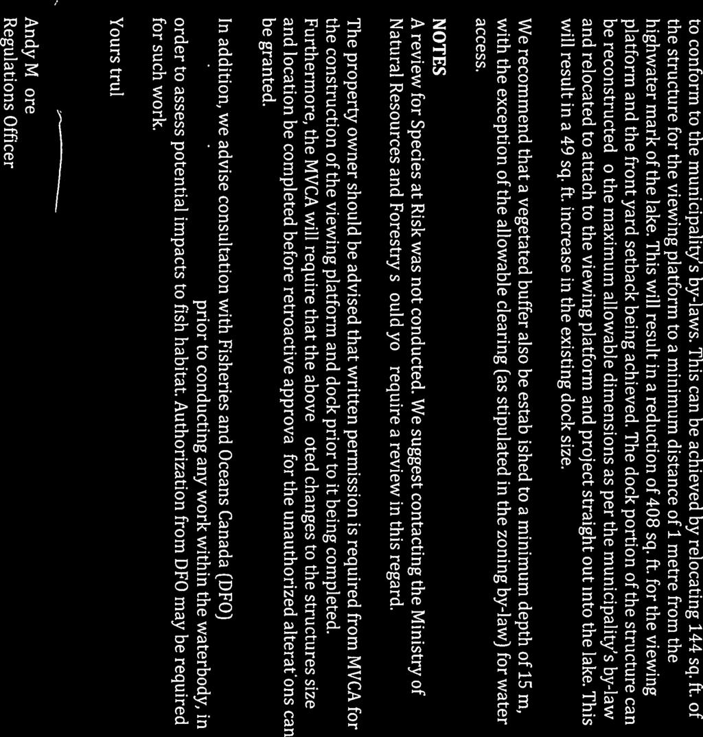
80 viewing platform does state that the structure is to be freestanding, however, planning staff see this connection as minor due to the topography of the property. Comments KFL&A Public Health They were not circulated on this application as there was no increase in living space and the proposed development was not in proximity to the sewage system. Mississippi Valley Conservation Authority In comments dated November 1, 2018, MVCA noted that the viewing platform/dock had already been constructed and a notice of violation, dated September 20, 2018, was sent to the applicant for the unauthorized works. Furthermore, the entire structure has been constructed along the shoreline (mostly out over the lake) and in MVCA s opinion, the entire structure should be considered a dock. MVCA is of the opinion that the provision to allow 144 sq. ft. for a viewing platform; the minimum setback of 1 metre from the highwater mark of the lake for the viewing platform and the maximum dimensions of a dock already provides a reasonable balance between access and enjoyment of the lake, and minimizing near shore development for the protection of the lake. They recommend that the structure be reconfigured and the size of both structures be reduced to conform to the Township zoning bylaw. They suggest that this can be achieved by relocating 144 sq. ft. of the structure for the viewing platform to a minimum distance of 1 metre from the highwater mark of the lake. The dock portion can be reconstructed to the maximum allowable dimensions permitted in the zoning bylaw and be relocated to attach to the viewing platform and project straight out into the lake. MVCA also recommends that a vegetated buffer be established to a minimum depth of 15 metres, with the exception of the allowable clearing for water access. MVCA also stated that written permission is required for the construction of the viewing platform and dock prior to them being completed. Additionally, MVCA stated that they will require the above noted changes to the structure sizes and locations before retroactive approval for the unauthorized alterations can be granted. Public Comments A letter dated November 15, 2018 was submitted by a neighbour which expressed concerns over the extent to which the viewing platform and dock exceed the maximums in the Township bylaw. Additionally it was stated that the fact the dock and platform were constructed prior to obtaining any appropriate approval or consultation should not mean the bylaw is not followed. Pre-Consultation Planning staff completed a site visit on October 31, 2018 to review the proposal. During this site visit it was observed that a significant portion of the area between the viewing platform/deck and the seasonal dwelling had been altered (material excavated, site grading) and that the remaining portion of the shoreline was a grass lawn area. It was also noted that there was a gently sloping flat area for water access adjacent to the viewing platform/dock. Conclusion Planning staff concur with the analysis of the MVCA and are of the opinion that the application to construct a viewing platform and dock, as submitted, does not meet the four tests for a minor variance for the following reasons:
81 The variance does not conform to the general intent and purpose of the Official Plan because the size and setback of the proposed structure does not maximize the vegetated shoreline buffer or minimize the environmental impact for the protection of natural habitat. The variance does not conform to the general intent and purpose of the Zoning Bylaw because it is not in keeping with the rural character of the Township or with appropriate development standards for lake protection. The variance is not desirable for the appropriate development of the lands in question because it is not in keeping with the character of the waterfront development in the area. The variance is not minor because the combined area of the proposed structure is 362 square feet larger than permitted in the Bylaw and expands beyond the permitted clearing for a waterfront area. However, planning staff recognize the desire of the applicant to provide safe access and a reasonable area for enjoyment of the property along the waterfront. Staff concur with the opinion of the MVCA that should the applicant amend their application to allow for a viewing platform with a maximum square footage of 13 m 2 (144 sq. ft.) set back a minimum of 1 metre from the highwater mark and reconstruct the dock to project straight out into the lake that this would be a reasonable option for development. The distance between the large rocks at the shoreline is 13 feet, which is wider than permitted in the zoning bylaw for a dock, but in the opinion of planning staff would still be a reasonable size if the dock were to only to project the 16 feet into the water, as currently constructed. At 16 feet by 13 feet, the dock would have an overall area of 208 square feet, which is less than the 257 square feet the dimensions in the bylaw provide for. With the amendments proposed, the amended application and proposed conditions, meets the four tests for a minor variance: The variance conforms to the general intent and purpose of the Official Plan because the increased setback and reduced viewing platform area will result in a lesser impact along the waterfront and area for vegetation of the vegetative buffer. The variance conforms to the general intent and purpose of the Zoning Bylaw because it will keep within the permitted area of waterfront structures within the Zoning Bylaw. The variance is desirable for the appropriate development of the lands in question because it will provide safe access to the waterfront in a new configuration (including connecting stairs), while limiting the size of the structures to that permitted within the Bylaw. The variance is minor because the area of the structures will meet the provisions in the Zoning Bylaw but in a configuration that will be more usable on the subject property. The size of the viewing platform will permit additional space to be revegetated along the shoreline.

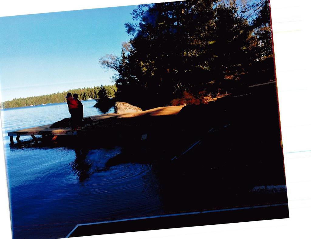
82 It is recommended that the Committee of Adjustment approve minor variance application A9/18 with amendments and the following conditions in addition to the standard Township conditions: 1. That the dock shall be reconstructed to be a maximum width of 13 feet, with a maximum area of not greater than 257 square feet as permitted in the Zoning By-law. 2. That the viewing platform be reconstructed to be a maximum of 13 square metres (144 square feet) and set back a minimum of 1 metre from the highwater mark of Big Gull Lake. 3. That stairs for access between the viewing platform and the dock be permitted. 4. That the applicant work with MVCA to revegetate and re-naturalise the shoreline where the clearing and excavation has taken place. View of dock and viewing platform as currently constructed, from the cottage.

83 Looking north showing dock, platform and cleared beach area.


84 TOWNSHIP OF NORTH FRONTENAC RACIOT - APPLICATION FOR MINOR VARIANCE A OAK RIDGE PT, GEOGRAPHIC TOWNSHIP OF CLARENDON ± North Inset Map: Frontenac Existing Cottage Platform Steps Proposed Dock Subject Property Meters Produced October 2018 by the County of Frontenac with data supplied under licence by members of the OGDE and ESRI. The County of Frontenac disclaims all responsibility for errors, omissions in this publication. Includes Material 2014 Printer for Ontario. All Rights Reserved. 1:502

85

86
87
88 -----Original Message----- From: MERKLINGER Sent: October :01 PM To: Tara Mieske Subject: A9/18 Minor variance Hi Tara, We have no concerns about the-request for a minor variance as requested by the Racicot s. Thank you. Bruce Merklinger. Sent from my iphone
89 Nov. 15,2018 Tara Mieske, Secretary-Treasurer Township of North Frontenac 6648 Road S06 Plevna, Ontario KOH 2MO Dear Ms. Mieske, Re: A9/18 This letter is to provide comments to the Committee of Adjustment, for minor variance File# A9/18. As cottage owners we know the By-law is meant to provide rules to ensure a balance between development for use and protection ofthe shoreline environment. The dimensions ofthis dock and viewing platform far exceeds the allowable dimensions and setback. The fact that the dock and platform were constructed prior to obtaining any appropriate approval or consultation should not mean the bylaw is not followed. Bernard Sargeant and Carol Fowler
90
91
92
93
94
95
96

97
98 Planning Report To: Committee of Adjustment / Planning Advisory Committee From: Jennie Kapusta, Community Planner, County of Frontenac Megan Rueckwald, Manager of Community Planning, County of Frontenac Re: Application for Minor Variance for Part Lot 28, Concession 3, Geographic Township of Palmerston, Township of North Frontenac (10178 Road 509) File No. A11/18 (Southward) Recommendation: Approval Date Prepared: November 16, 2018 Date of Meeting: November 19, 2018 Proposal An application for minor variance has been submitted to allow for a reduction in the minimum required lot size as a result of an application for Consent (B-5-18-NF) for a lot addition at Part Lot 28, Concession 3, Geographic Township of Palmerston, known municipally as Road 509 (see attached map). This lot addition application was approved at the August 20, 2018 Committee of Adjustment meeting. At the time of approval of the Consent application the intent was that the retained parcel was to meet the minimum required lot size. However, once the survey was completed it was determined that the measurements provided with the application were slightly different than the resulting survey. As such, when the draft survey was submitted to the Township office for review, Township and planning staff determined that an application for minor variance was required to allow for the retained parcel to be less than the minimum required lot size. The property has frontage along Road 509 and is developed with a single detached dwelling. The land to be severed is vacant and will be added to a neighbouring vacant lot. The purpose of the minor variance application is to reduce the minimum required lot size for the retained parcel in Consent Application B-5-18-NF. Consent B-5-18-NF was for a lot addition. The land to be severed is vacant and will be added to a neighbouring vacant lot. The intent of the lot addition was to straighten the property line along Road 509 to increase the usability of the benefitting lands. The lot addition is irregularly shaped but results in two more regularly shaped lots. The retained parcel has approximately 76 metres of frontage along Road 509 and is approximately 0.9 acres in area. The retained lot is developed with a dwelling and accessory building.
99 Minor variance is required to permit a reduction in the minimum required lot size for the following reasons: 1. Section 5.8.2: Minimum lot area: 4000 square metres (0.98 acres). Requested variance from this section: a. Minimum lot size 0.9 acres (variance request of 0.08 acres) Background The applicant is proposing to sever acres of land from an existing parcel to facilitate a lot addition. The existing lot meets the required lot frontage and area provisions for a lot in the settlement area but will not continue to do so following the lot addition approved through Consent Application B-5-18-NF. The minimum lot size in the Hamlet zone is 0.98 acres and the retained parcel will be 0.9 acres in size following the lot addition; the benefitting lands will be 1.04 acres in size following the lot addition. Currently the benefitting lands are 0.91 acres in area and the retained parcel is 1.15 acres in area. The benefitting lands are not developed but do contain a fire place and a septic system. Under Section 45(1) of the Planning Act there are four tests a minor variance must meet. In order to be considered the application must meet all four tests: Does the application conform to the general intent and purpose of the Official Plan? Does the application conform to the general intent and purpose of the Zoning By-law? Is the application desirable for the appropriate development of the lands in question? Is the application minor? Planning Analysis The property is designated as Rural Area in the Township s Official Plan. The goal of the Rural Area is to provide for a supply of land for a diversity of traditional and evolving uses. These include rural residential in addition to rural commercial uses. The Plan places an emphasis on respective land uses that are environmentally sound and complimentary to the physical and scenic attributes of the natural environment. The proposed lot addition will increase the usability of the benefitting lands and maintain the rural character of the development. The subject property is zoned Hamlet. The Hamlet zoning recognizing that the subject property is located within the settlement area and permits a variety of uses suited for more developed areas. The retained lot will not meet the minimum area requirements of the Hamlet zone following the lot addition; the benefitting lands are currently deficient in lot frontage and will remain so following the lot addition. It is anticipated that the benefiting lands will be developed for residential use. Comments KFL&A Public Health Comments dated November 9, 2018 indicate that KFL&A public health staff have no objections to the application as the lot has an existing dwelling and septic system under permit number PA Public Works Department The Township Public Works Department reviewed the application and have no concerns.
100 Public Comments As of the date of this writing, no public comments have been received. Pre-Consultation The applicant consulted with Township and planning staff in office prior to submitting the application. Planning staff completed a site visit on October 22, 2018 and met with Mr. Southward to review what area had been staked out on the property. The area marked on the ground did not change from what was submitted with the consent application; only the survey submitted for review to the Township was slightly altered from the dimensions submitted with the consent application. Conclusion Planning staff are of the opinion that the application to reduce the minimum required lot area meets the four tests for a minor variance for the following reasons: The variance conforms to the general intent and purpose of the Official Plan because the variance is in keeping with the character of the settlement area. The variance conforms to the general intent and purpose of the Zoning Bylaw because the lot addition increases the functionality the benefitting lands while still permitting any future development to comply with the zone provisions. The variance is desirable for the appropriate development of the lands in question because the lot addition increases the development potential of the benefitting lands. The variance is minor because prior to the lot addition, the benefitting lands were deficient in area, now the retained parcel will be slightly deficient in area. It is recommended that the Committee of Adjustment approve minor variance application A11/18. Sincerely, Prepared by: Jennie Kapusta Community Planner County of Frontenac Reviewed by: Megan Rueckwald Manager of Community Planning County of Frontenac
101 TOWNSHIP OF NORTH FRONTENAC SOUTHWARD- APPLICATION FOR CONSENT (B-5-18-NF) ROAD 509, GEOGRAPHIC TOWNSHIP OF PALMERSTON ± Inset Map: North Frontenac Central Frontenac PARCEL TO BE SEVERED BENEFITTING LOT Parcel to Sever Subject Property Meters Produced August 2018 by the County of Frontenac with data supplied under licence by members of the OGDE and ESRI. The County of Frontenac disclaims all responsibility for errors, omissions in this publication. Includes Material 2014 Printer for Ontario. All Rights Reserved. 1:800
102
103
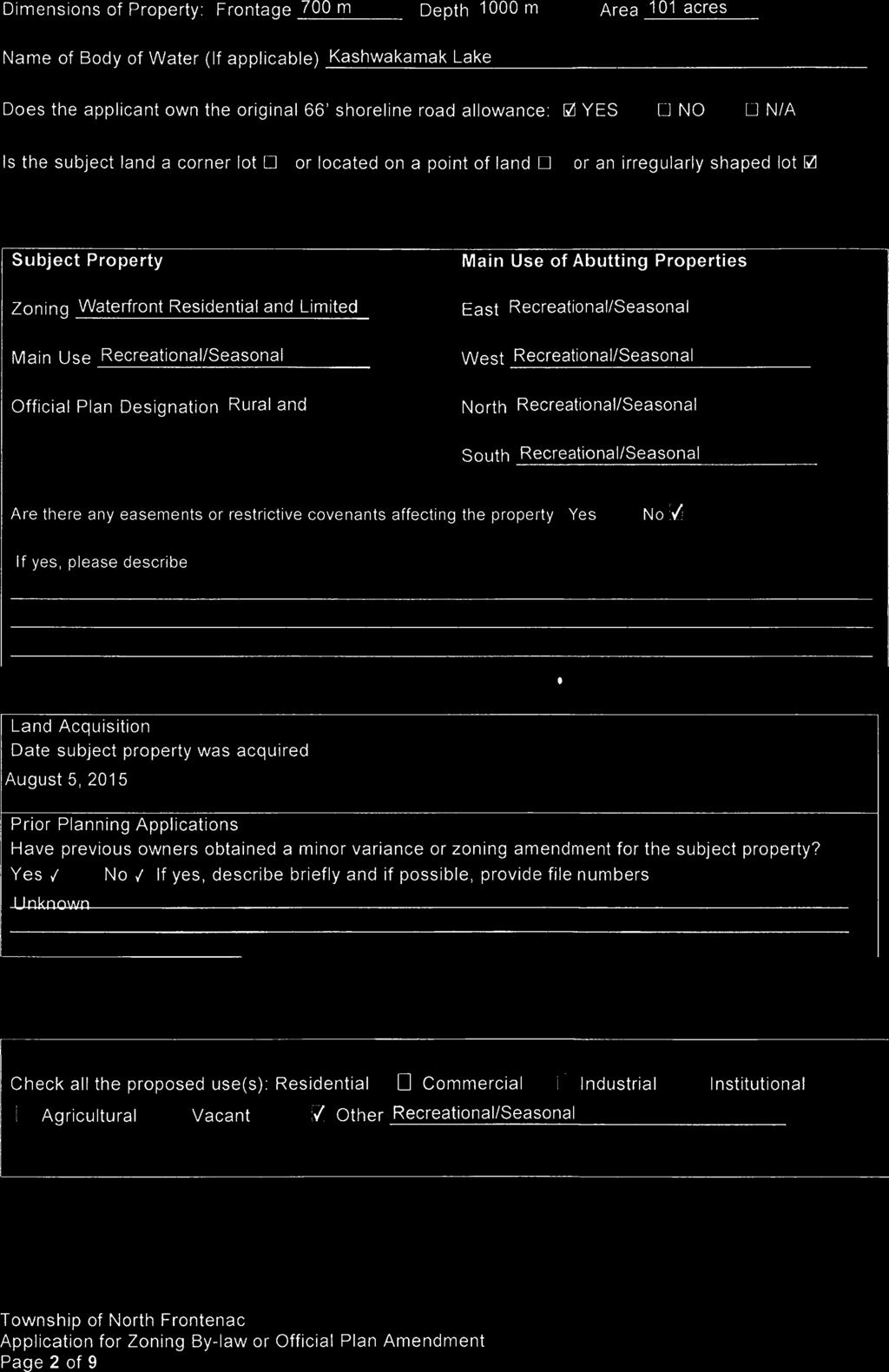
104
105


106

107

108

109
110
111
112
113
114
115
116
117
118
119
120

121
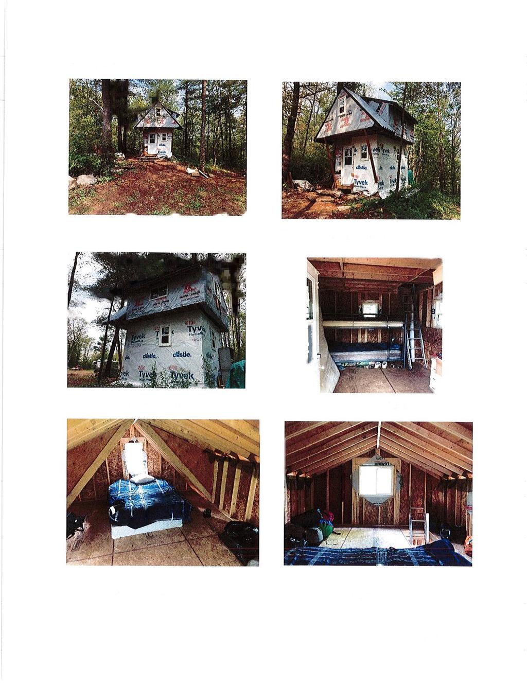
122
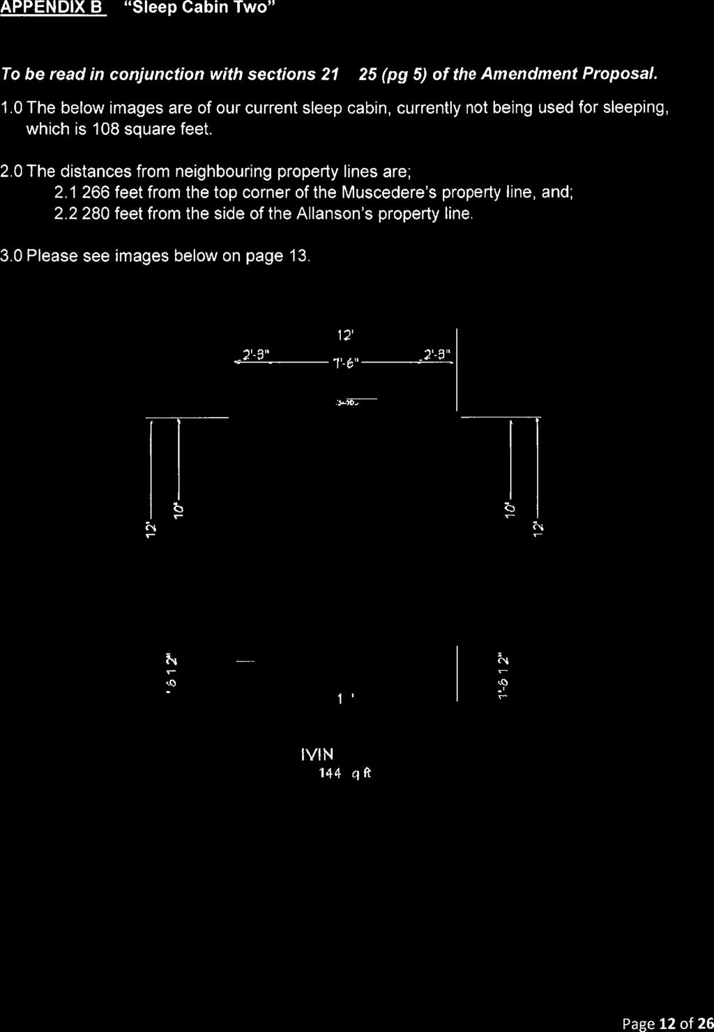
123
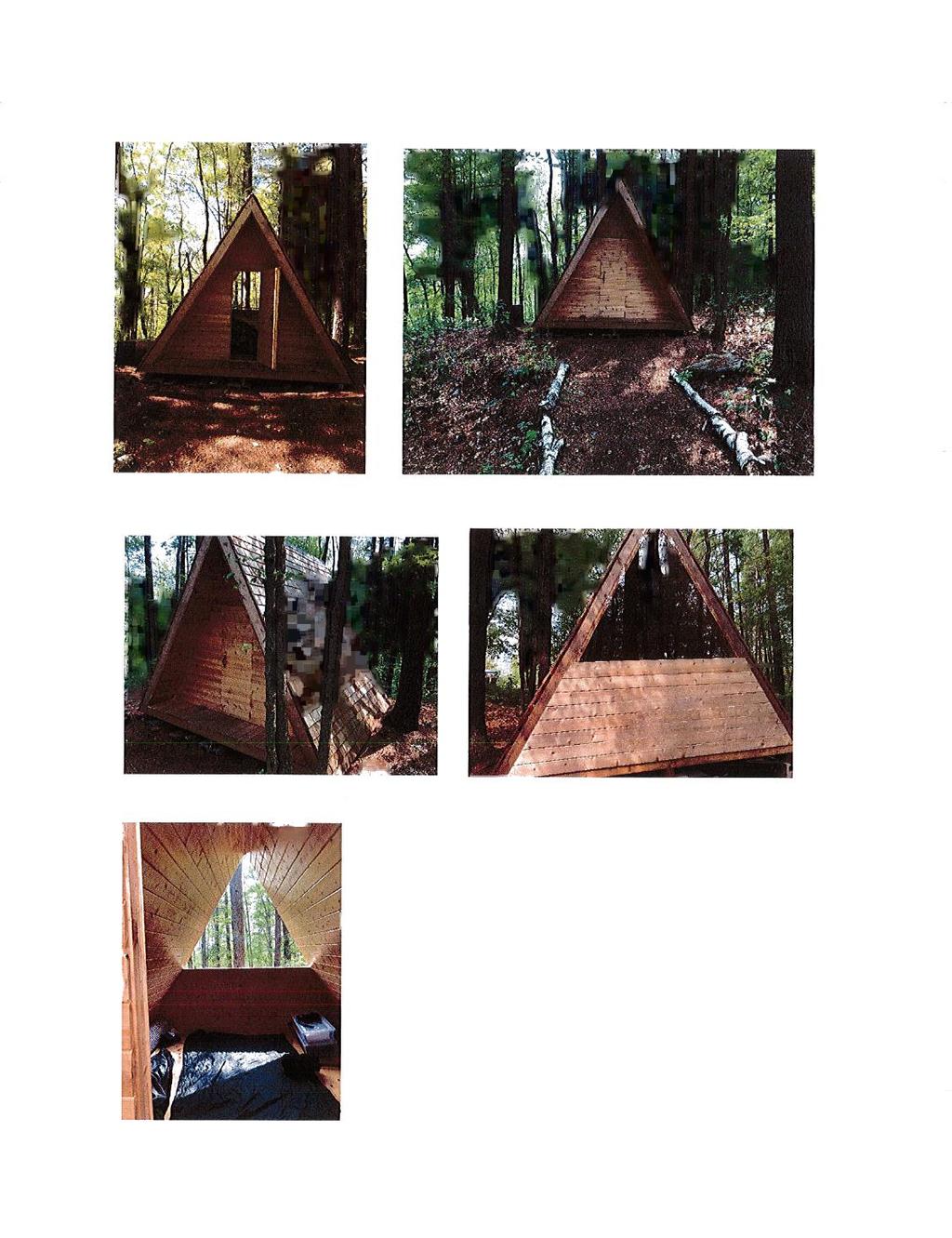


124

125
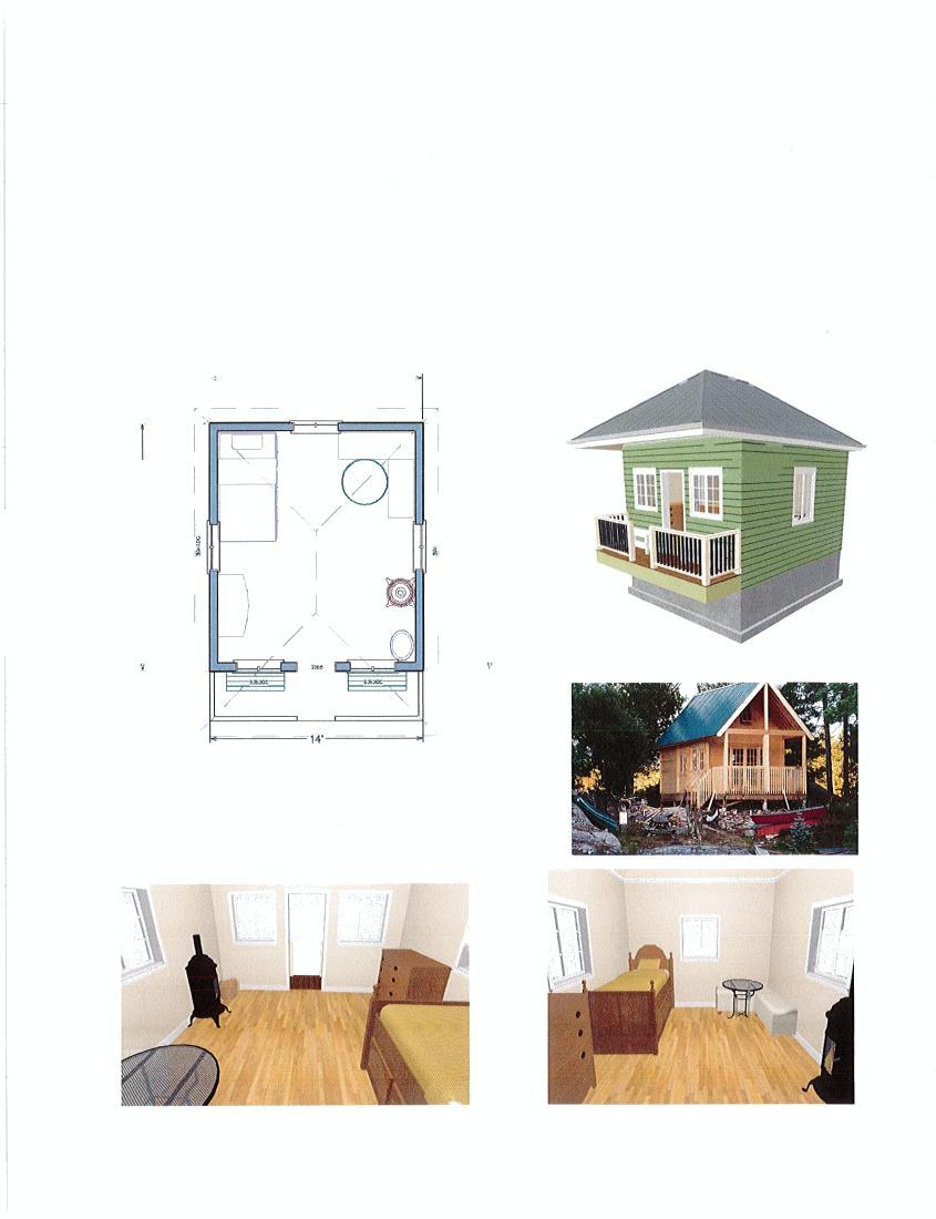

126

127
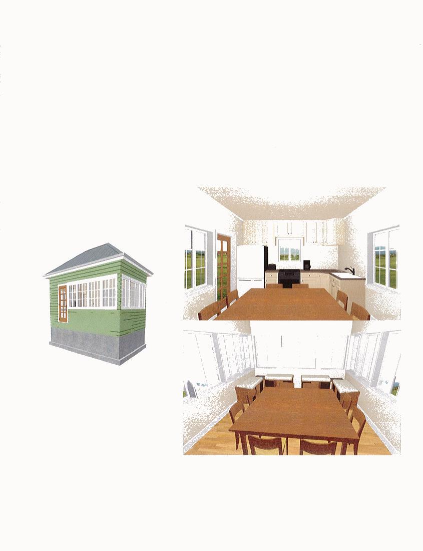
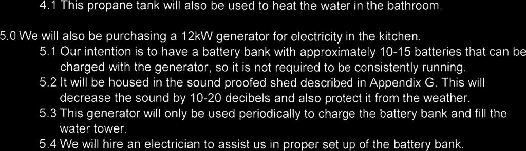
128
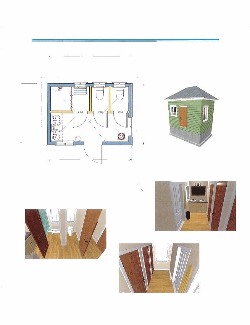
129
130
131
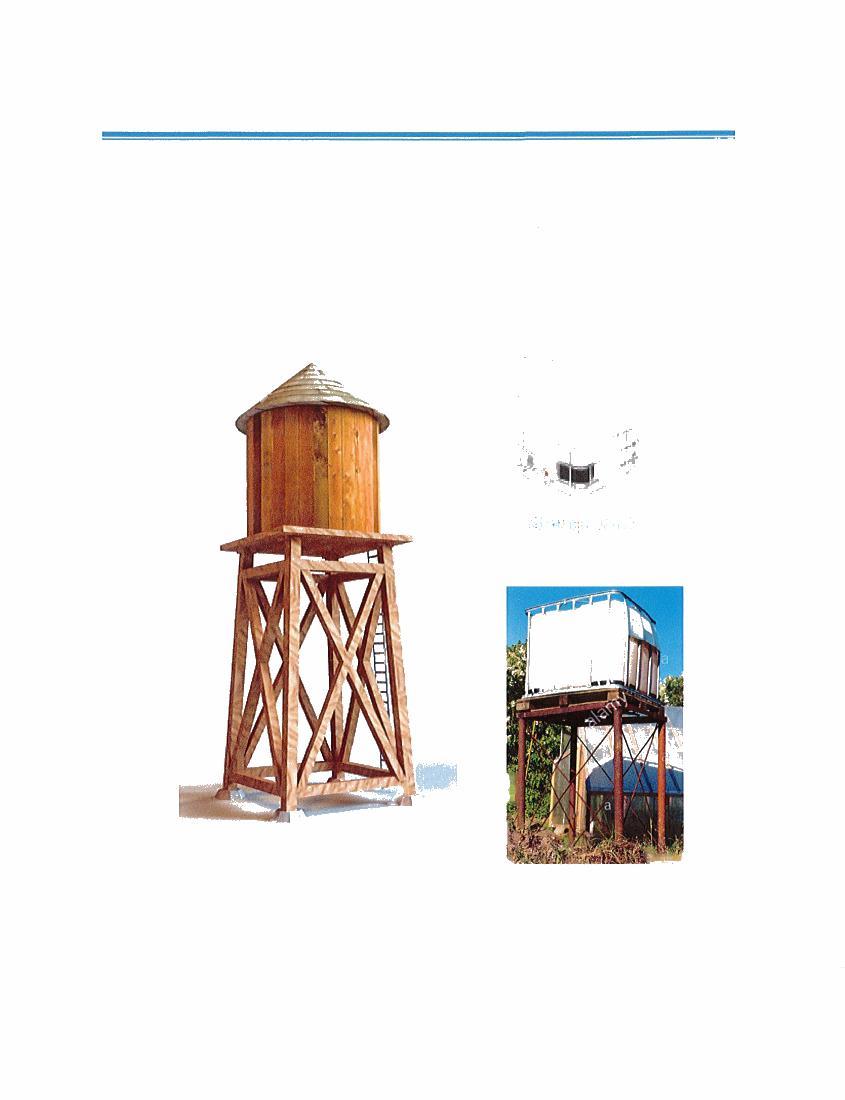
132

133
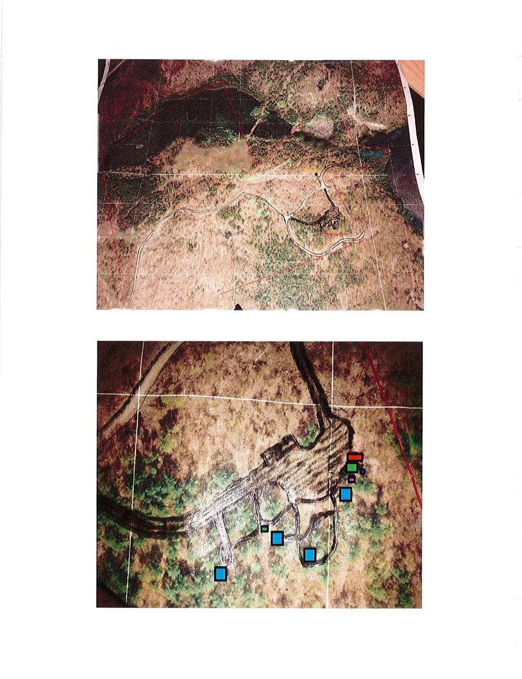
134
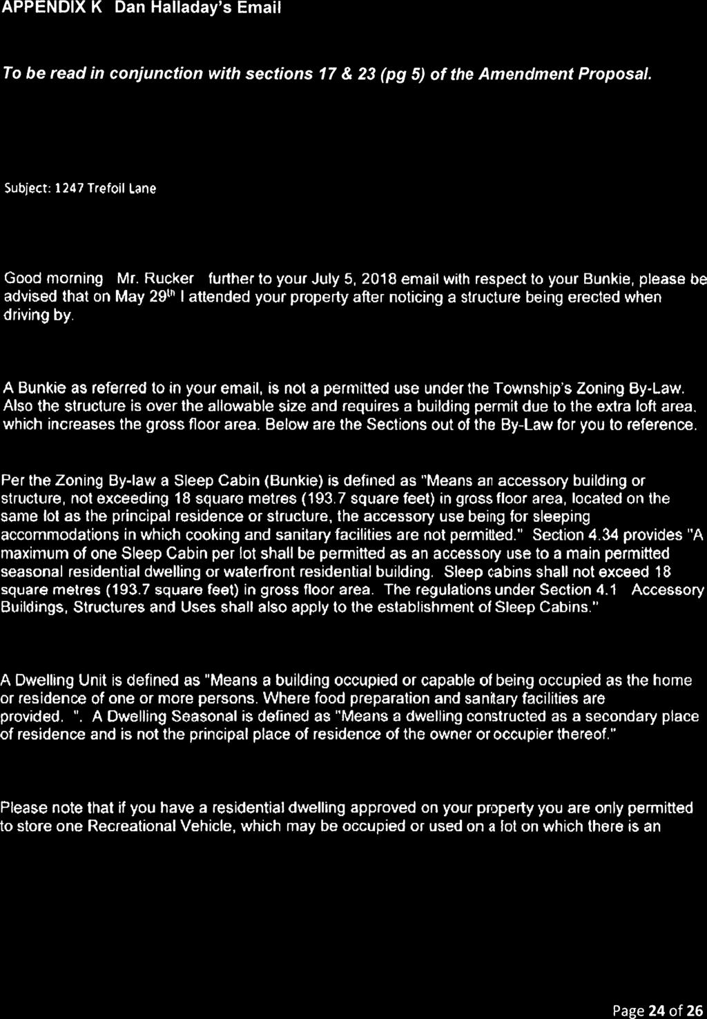

135
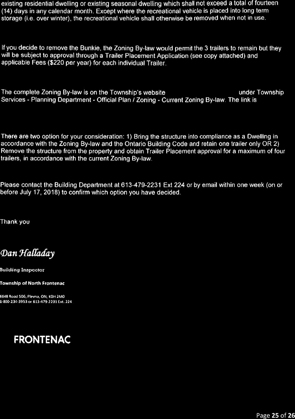
136
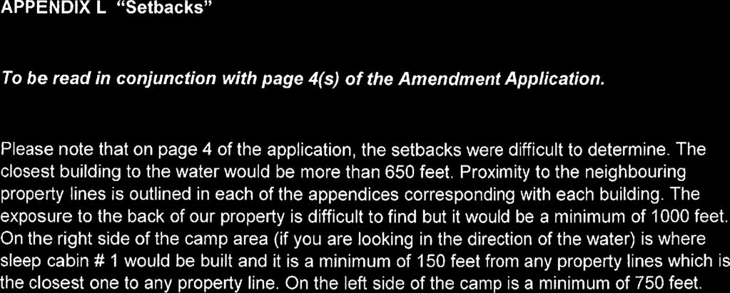
137
138 Planning Report To: Chairs and Members of the Planning Advisory Committee From: Jennie Kapusta, Community Planner, County of Frontenac Megan Rueckwald, Manager of Community Planning, County of Frontenac Re: Application to Rezone Part Lots 16, 17 and 18, Concession 7, Geographic Township of Barrie, Township of North Frontenac (1247A Trefoil Lane) from Waterfront Residential and Limited Service Rural to Waterfront Residential Exception Zone File No. Z3/18 (Rucker) Recommendation: Review and provide recommendation to Council Date Prepared: November 16, 2018 Date of PAC Meeting: November 19, 2018 Date of Public Meeting: November 23, 2018 Proposal An application for a zoning bylaw amendment to rezone lands from Waterfront Residential and Limited Service Rural to Waterfront Residential Exception Zone has been submitted for lands located at Part Lots 16, 17 and 18, Concession 7, Geographic Township of Barrie, Township of North Frontenac (see attached map). The subject property has frontage along Trefoil Lane and Kashwakamak Lake. The subject property is approximately 40.9 hectares (101 acres) in area, with approximately 160 metres of frontage along Kashwakamak Lake. The applicant is proposing to rezone the property to permit a family-lodge-style development. Should the rezoning be approved the applicant intends to construct: a single detached dwelling, four sleeping cabins, an outdoor kitchen with attached screen porch, a communal bathroom/shower facility, a storage garage, a storage shed and a water tower. It is important to note that the proposed rezoning will recognize some of the existing structures that were constructed without building permits. It is important to note that the Zoning Bylaw contains provisions that are meant to guide development across the Township. The Zoning Bylaw controls the use of land in North Frontenac by stating: how the land may be used; where buildings and other structures can be located; the types of buildings that are permitted and how they may be used; and lot sizes and dimensions, parking requirements, buildings heights and setbacks from the street and other features. When a development conforms to the Official Plan, but does not comply with the Zoning Bylaw an amendment may be sought. Council evaluates a zoning bylaw amendment for criteria including: conformity with the official plan and compatibility with adjacent uses of land; suitability of the land for the proposed purpose, including the size and shape of the subject property; adequacy of vehicular
139 access, water supply and sewage disposal; and risk of natural hazards and impact on natural heritage. It is planning staff s understanding that the role of the Township Planning Advisory Committee is to provide a recommendation to Council after reviewing the application. Council will be holding the required public meeting on November 23, At this meeting, planning staff are recommending that Council receive comments but defer making a decision until planning staff have the opportunity to revise the report based on comments received. Background The applicant is proposing to rezone the entire subject property from Waterfront Residential and Limited Service Rural to Waterfront Residential Exception zone to allow a family-lodge-style development. The proposed zoning will allow for the construction of a single detached dwelling, in addition to four sleeping cabins and associated accessory buildings. The proposed zoning will also permit the construction of the accessory buildings prior to the construction of the main building and permit a maximum 5% lot coverage for accessory buildings. The applicant has already constructed two of the four proposed sleeping cabins without obtaining the required permits. The applicants were under the impression that as the footprints were not in excess of 108 square feet no prior approvals were needed for the construction. One of the existing structures has a second story which exceeds the 108 square feet in gross floor area. Planning staff recommend that the property be rezoned from Waterfront Residential and Limited Service Rural to Waterfront Residential Exception Zone to continue to restrict the permitted uses on the subject property to a single detached dwelling and the four sleep cabins with a maximum net floor area of 275 square feet and a height of two storeys each. Planning staff are also recommending that additional accessory structures, pursuant to the Zoning Bylaw, be permitted on the subject property. For instance, the Zoning Bylaw does not list all accessory structures that could be permitted on the lot but instead contains provisions that restrict the placement and size of the structures. The applicants wish to class each of the existing sleep cabins as accessory to ensure no confusion with the construction of a single detached dwelling in the future; as such, planning staff are recommending the inclusion of the provision that accessory structures may be permitted before a main use. The property is currently developed with two sleeping cabins, an outhouse, and a deck/platform. There is also a trailer on the property that complies with the Township s Trailer Licencing Bylaw. The property is heavily treed with cleared areas to provide safe access along Trefoil Lane. Provincial Policy Statement The 2014 Provincial Policy Statement (PPS) provides direction on matters of Provincial interest related to land use planning and development. The PPS promotes efficient land use and development patterns that support strong, liveable and healthy communities, protect the environment and public health and safety, and facilitate economic growth. When directing development on rural lands, planning authorities must comply with Section of the PPS; this section requires application of relevant policy of Section 1: Building Healthy Communities, Section 2: Wise Use and Management of Resources, and Section 3: Protecting Public Health and Safety by the approval authority.
140 Section 1: Building Healthy Communities of the PPS promotes the building of strong, healthy communities and includes policies about avoiding development and land use patterns which may cause environmental or public health and safety concerns. Section of the PPS permits rural land uses and those that are compatible with the rural landscape and can be sustained by rural service levels, while Section lists resource-based recreational uses (including recreational dwellings) as permitted uses. The proposed development will result in a family-lodge-style construction to permit each family to have their own sleeping quarters while recognizing that the impact of the development would be comparable to a four bedroom house that is divided. The Province is also supportive of secondary units throughout Ontario. The proposed rezoning would also support the construction of a single detached dwelling, should the applicants wish to construct one in the future. KFL&A Public Health reviewed the application to ensure that suitable space exist to service the proposed development; Public Health has no concern with the application as presented. Section 2: Wise Use and Management of Resources of the PPS contains policies that encourage the protection of natural heritage, water, agricultural, mineral and cultural heritage and archaeological resources for their economic, environmental and social benefits. The proposed rezoning application was reviewed by Mississippi Valley Conservation with regards to natural heritage and Section 2.1 of the PPS. MVC concluded in their letter dated November 9, 2018, that impacts to natural heritage features are not anticipated as a result of the subject application. Section 3: Protecting Public Health and Safety of the PPS contains policies intended to reduce the potential for public cost or risk to Ontario s residents from natural or humanmade hazards. There are no human-made hazards, as listed in Section 3.2 of the PPS, in proximity to the proposed development. MVC in their letter dated November 9, 2018, state that development shall generally be directed to areas outside of hazardous lands such as erosion hazards and sleep slopes that have the potential for slope instability due to their steepness and height. A default setback of 10 metres from the crest of the slope is recommended to ensure safe development. MVC notes that adequate space appears to exist for development beyond this setback and as such they have no further concerns. The proposed rezoning is consistent with the Provincial Policy Statement, Frontenac County Official Plan, 2016 The County of Frontenac Official Plan is a framework for guiding development in the County through the management and protection of the natural environment and by providing direction and influence on growth patterns. It is focused on the six themes of economic sustainability, growth management, community building, housing and social services, heritage and culture, and environmental sustainability. Section 3.3: Rural Lands provides policies for protecting the rural character, heritage and natural resources within the County. The County Official Plan echoes the PPS in permitting resource-based recreational uses within the Rural Area. Section Waterfront Areas provides more detailed policies for development in close proximity to the waterfront. The Plan generally defines the Waterfront Area as lands within 150 metres of the lake; the proposed sleep cabins will be located in a cleared area that is setback approximately 200 metres from the highwater mark of Kashwakamak Lake.
141 Section 4.2: Servicing provides policies for the use of private services provided that site conditions are suitable for the long-term provision of such services with no negative impacts. KFL&A Public Health reviewed the application to ensure that the proposal could be adequately serviced. Section 7: Environmental Sustainability of the County s Official Plan sets out policies for environmental sustainability and protection of the natural heritage system and ecological functions provided. Mississippi Valley Conservation Authority was circulated on the application and has indicated they have no objections to the proposal given the fact there appears to be sufficient area on the property to meet the minimum development setback of 30 metres from the watercourse and wetland. The proposed family-lodge-style development is proposed to be located 198 metres from the highwater mark of Kashwakamak Lake and as such, beyond the Waterfront Area. The proposed rezoning conforms to the County of Frontenac Official Plan. Township of North Frontenac Official Plan, 2017 The subject property is designated as Rural Area and Waterfront Area in the Township of North Frontenac Official Plan, The goal of the Official Plan is to establish policies that will help the Township deliver a sustainable, living, working rural area that supports existing and future residents who wish to live and work in North Frontenac. Within the Rural Area, the Plan provides for a supply of land for a diversity of traditional and evolving rural uses. These include rural residential, rural co-operative areas, recreational oriented uses, uses characterized by large areas of open space; public utilities and commercial facilities (see Section 3.13 for requirements); rural commercial and industrial uses and air strips. The proposed development is for residential purposes as such conforms to the Rural Area policies in the Official Plan. Section 4.10 Waterfront Area of the Official Plan further reinstates that the Waterfront Area shall generally be 150 metres inland from the highwater mark of the lake. The Plan recognizes that the Waterfront Area of the Township is an important resource, which will be protected. The waterfront setting consists of open space and low density residential land uses on mainland and island shorelines; interspersed with some commercial development, primarily resorts; set among a forested landscape. The Official Plan sets out minimum waterfrontage and area requirements for new lots in the Waterfront Area; new lots created through consent are proposed to be 2 acres with 77 metres of frontage. The subject property is approximately 100 acres in area with 160 metres of frontage along Kashwakamak Lake. The application conforms to the Township of North Frontenac Official Plan; the increased setback to the existing development, combined with the large geographic area and resource-based recreational permitted uses contributed to this conclusion. Township of North Frontenac Zoning By-law, 2004 The subject property is zoned Waterfront Residential and Limited Service Rural in the Township of North Frontenac Zoning By-law, The intent of the Waterfront Residential zone is to permit uses that are compatible with being located in close proximity to the waterfront with provisions that require a 30 metre setback and the maintenance of a vegetated buffer. The Limited Service Rural Zoning permits a variety of uses that are consistent with the rural character of the Township; the limited services recognize that the subject property is only accessible by private lane. Both zones permit
142 uses that are compatible with the rural landscape and provide for limited residential development. Planning staff are recommending that the subject property contain a single zone with a site specific exception to permit the construction of four sleep cabins with a maximum net floor area of 275 square feet and a maximum of two storeys. Planning staff are also recommending the provision of 5% lot coverage for accessory buildings such as an outdoor kitchen with an attached screen porch; bathroom/shower facility; storage garage; storage shed and water tower. The Township of North Frontenac does not have a minimum area requirement for seasonal dwellings in the current Zoning Bylaw; as such, the building department would classify one of the existing sleep cabins as a seasonal dwelling. To avoid confusion, the applicants have referred to the sleep cabins as accessory structures so that in the future when they wish to construct the single detached dwelling, there will be no discrepancy over the main permitted use. As such, planning staff are recommending that a provision be included in the site specific rezoning to permit accessory structures (existing sleep cabins, which could be considered a seasonal dwelling) to be permitted without a principal use. The Township of North Frontenac is currently undergoing a comprehensive review of the Township Zoning Bylaw. Planning staff are cognizant of the timelines for the review process and recognize that in the draft document that the subject property should be rezoned to Limited Service Waterfront. Planning staff will explain the review process to the applicant and advise them of the proposed changes in the draft. The site specific amendments will be carried forth to the new Zoning Bylaw, which is comparable with many of the other site specific zones in the current Bylaw. Comments Public As of the time of writing this report an has been received from a member of the public with comments/points of interest pertaining to the proposed development and their interest in attending the public meeting. They have questions regarding water and treatment, the inner bay conservation of wildlife, and water tower issues re: night sky viewing that they will ask at the public meeting. KFL&A Public Health Comments dated November 12, 2018 indicate that public health has no objections to the application. Mississippi Valley Conservation (MVC) In comments dated November 9, 2018, MVCA staff indicated that they have no objections to the application. Their report stated that Given the substantial size of the subject property; the proposed minimum development setback of 198m from the waterbody; and the fact that sufficient area exists to meet a development setback of 30m from the watercourse and wetland, impacts to natural heritage features are not anticipated as a result of the subject application. MVC further confirmed that they reviewed the application with regards to natural hazards and have no objection. Pre-consultation The applicant pre-consulted with County planning and Township staff prior to submitting the application. A site visit was conducted by County planning staff, along with KFL&A Public Health and Mississippi Valley Conservation staff, on October 31, 2018 to evaluate the application.
143 Conclusion The proposed zoning bylaw amendment will rezone the lands from Waterfront Residential and Limited Service Rural to Waterfront Residential Exception Zone. Planning staff recommend that the zoning be amended to Waterfront Residential in order to continue to allow the permitted uses in the Waterfront Residential zone but expand this to include the proposed four sleeping cabins and permit a 5% lot coverage for accessory buildings and construction of the accessory buildings prior to the construction of the principal use. All structures, including the existing structures, will be required to obtain permits and must comply with the setback requirements, including distance separation from neighbouring properties.


144 TOWNSHIP OF NORTH FRONTENAC RUCKER - ZONE CHANGE FROM RW & LSR to RW-X 1247A TREFOIL LANE, GEOGRAPHIC TOWNSHIP OF BARRIE Mississagagon ± Lake GC Inset Map: Mississagagon Lake RW ROAD 506 R Sources: Esri, HERE, Garmin, Intermap, increment P Corp., GEBCO, USGS, FAO, NPS, NRCAN, GeoBase, IGN, TC R MX TREFOIL LANE RW LSR TOWER LANE LSR FOSTERS LANE Kashwakamak Lake LSR LSR MX Subject Property Parcel Fabric FOREST LANE TOWER LANE Meters LSR Produced November 16, 2018 by the County of Frontenac with data supplied under licence by members of the OGDE and ESRI. The County of Frontenac disclaims all responsibility for errors, omissions in this publication. Includes Material 2014 Printer for Ontario. All Rights Reserved.
 RUCKER Mississippi Valley Conservation Authority (MVCA) has been circulated the")
145 18-NF-ZA November 9, 2018 Tara Mieske Secretary-Treasurer Township of North Frontenac P.O. Box 97 Plevna, Ontario K0H 2M0 Dear Ms. Mieske: Re: Application for Zoning By-Law Amendment #Z3/18 Part Lot 16-18, Con 7, Township of North Frontenac (Barrie) RUCKER Mississippi Valley Conservation Authority (MVCA) has been circulated the above noted application to conduct a review in terms of MVCA Regulations and Provincial Planning Policy for Natural Heritage and Natural Hazard issues. Specifically, the purpose of this review is to assess potential impacts of the proposed development on known natural heritage features on and adjacent to the subject property. These features could include wetlands, wildlife habitat and areas of natural and scientific interest. This review also includes an evaluation of the subject property for natural hazards such as unstable slopes and areas prone to flooding and erosion. PROPOSAL It is our understanding that the purpose of the subject application is rezone the subject property from Waterfront Residential (RW) and Limited Service Residential (LSR) to Waterfront Residential Exception Zone, in order to permit the construction of a Family Lodge with the following: Single Detached Dwelling, Four Sleep Cabins with a total net area of 275 sq. feet each, and 5% lot coverage for accessory buildings such as an outdoor kitchen with an attached screen porch; bathroom/shower facility; storage garage; storage shed and water tower Hwy 7, Carleton Place, ON K7C 3P1 Tel. (613) Fax (613) info@mvc.on.ca MVCA is a member of Conservation Ontario~Natural Champions
1. CALL TO ORDER AND PURPOSE OF THE MEETING 4. DISCLOSURES OF PECUNIARY INTEREST AND GENERAL NATURE THEREOF
 TOWNSHIP OF NORTH FRONTENAC PUBLIC MEETING AGENDA RE: ZONING BY-LAW AMENDMENT NOVEMBER 23, 2018 9:00 A.M. COUNCIL CHAMBERS 6648 ROAD 506, PLEVNA, ONTARIO 1. CALL TO ORDER AND PURPOSE OF THE MEETING 2.
Municipality of Northern Bruce Peninsula Planning Report Application: Minor Variance
 Municipality of Northern Bruce Peninsula Planning Report Application: Minor Variance File No.: A-05-2010.62 Date: June 14, 2010 -------------------------------------------------------------------------------------------------------------------------------------------------------
PLANNING REPORT. Prepared for: John Spaleta 159 Delatre Street Woodstock Ontario N4S 6C2
 PLANNING REPORT County Official Plan Amendment and Zoning By-law Amendment to Permit a Seasonal Dwelling on an Existing Lot of Record with Access onto a Seasonally Maintained Road Parts of Lot 29, Concession
Municipality of Brockton Planning Report. Application: Minor Variance Application. Members of the Committee of Adjustment, Municipality of Brockton
 Municipality of Brockton Planning Report Application: Minor Variance Application File No: A-14-18.34 Date: May 14, 2018 To: From: Subject: Members of the Committee of Adjustment, Municipality of Brockton
DYSART ET AL Committee of Adjustment November 12, 2014 at 11:00 a.m. Council Chambers, Haliburton, Ontario
 DYSART ET AL Committee of Adjustment November 12, 2014 at 11:00 a.m. Council Chambers, Haliburton, Ontario Page 2-6 1. ADOPTION OF MINUTES 2. DECLARATION OF PECUNIARY INTEREST 7-12 3. PUBLIC HEARINGS D13-MV-14-023
Date: February 15 th, Based on the analysis contained below, Development Services staff recommends:
 THE CORPORATION OF THE TOWN OF GRAVENHURST To: Committee of Adjustment From: Kris Orsan, GIS/Planning Technician Subject: A/30/2018/GR; ZIVE, Dorothy 1029 Road 2900 (Lake Muskoka) RECOMMENDATIONS Based
Local Planning Appeal Tribunal Tribunal d appel de l aménagement local
 Local Planning Appeal Tribunal Tribunal d appel de l aménagement local ISSUE DATE: February 11, 2019 CASE NO(S).: PL170550 The Ontario Municipal Board (the OMB ) is continued under the name Local Planning
TOWNSHIP OF SOUTH FRONTENAC PLANNING DEPARTMENT. South Frontenac Municipal Offices, Sydenham
 TOWNSHIP OF SOUTH FRONTENAC PLANNING DEPARTMENT MINUTES 17:10 November 9, 2017 LOCATION: IN ATTENDANCE: ABSENT WITH REGRETS: STAFF: South Frontenac Municipal Offices, Sydenham Ron Sleeth (Storrington District-C)
COUNTY OF BRANT DEVELOPMENT SERVICES DEPARTMENT COMMITTEE OF ADJUSTMENT. Chair and Members of the Committee of Adjustment
 COUNTY OF BRANT DEVELOPMENT SERVICES DEPARTMENT COMMITTEE OF ADJUSTMENT TO: FROM: Chair and Members of the Committee of Adjustment Ruchika Angrish, Senior Planner DATE: January 23, 2014 REPORT: CA-14-06
Committee of Adjustment Meeting Number 6
 A meeting of the was held on Monday, June 22, 2015 at 5:00 p.m. at 1211 John Counter Boulevard. Members Present Stephen Foster (Chair) Christine Cannon (Vice-Chair) Kailin Che Blaine Fudge Craig Leroux
THE CORPORATION OF THE TOWNSHIP OF NORWICH COMMITTEE OF ADJUSTMENT TUESDAY, SEPTEMBER 9, :00 A.M. COUNCIL CHAMBERS, OTTERVILLE AGENDA
 THE CORPORATION OF THE TOWNSHIP OF NORWICH COMMITTEE OF ADJUSTMENT TUESDAY, SEPTEMBER 9, 2014 9:00 A.M. COUNCIL CHAMBERS, OTTERVILLE 1. CALL TO ORDER 2. APPROVAL OF AGENDA AGENDA 3. DISCLOSURE OF PECUNIARY
PLANNING REPORT. Lot 5, SDR Lot 6 and 7 Concession 3 Township of Normanby Municipality of West Grey County of Grey
 PLANNING REPORT Dwelling Surplus to a Farm Operation Official Plan and Zoning By-law Amendment and Consent to Sever Lot 5, SDR Lot 6 and 7 Concession 3 Township of Normanby Municipality of West Grey County
THE CORPORATION OF THE TOWNSHIP OF NORWICH COMMITTEE OF ADJUSTMENT TUESDAY NOVEMBER 22, :00 P.M. COUNCIL CHAMBERS, NORWICH
 THE CORPORATION OF THE TOWNSHIP OF NORWICH COMMITTEE OF ADJUSTMENT TUESDAY NOVEMBER 22, 2016 7:00 P.M. COUNCIL CHAMBERS, NORWICH AGENDA Page 2-4 1. CALL TO ORDER 2. APPROVAL OF AGENDA 3. DISCLOSURE OF
COMMITTEE OF ADJUSTMENT Council Chambers, Townhall Monday, April 25, 2016, 7:00 PM 3. CONFIRMATION OF MINUTES OF THE PREVIOUS MEETING
 Page COMMITTEE OF ADJUSTMENT Council Chambers, Townhall Monday, April 25, 2016, 7:00 PM 1. CALL TO ORDER 2. DECLARATION OF PECUNIARY INTEREST 3. CONFIRMATION OF MINUTES OF THE PREVIOUS MEETING 3-6 i) Confirmation
Township of McNab/Braeside. Committee of Adjustment
 Township of McNab/Braeside Committee of Adjustment A Hearing of the Committee of Adjustment was held on March 27 th, 2017 at 7:00 p.m. in the Municipal Office. PRESENT: Geoff Booth Vance Bedore Chairperson
LAND DIVISION COMMITTEE. MOTION #LD MOVED BY: C. Tyson SECONDED BY: D. Murphy
 MINUTES LAND DIVISION COMMITTEE The Land Division Committee met in regular session on Monday, October 19, 2009 at 9:00 a.m. at the Lanark County Administration Building, 99 Christie Lake Road, Perth, Ontario.
SAULT STE. MARIE NORTH PLANNING BOARD APPLICATION FOR A CONSENT TO CREATE NEW LOTS
 SAULT STE. MARIE NORTH PLANNING BOARD APPLICATION FOR A CONSENT TO CREATE NEW LOTS APPLICATION GUIDE Q & A These tips are intended as a guide to help you decide if your proposed lot might qualify for a
For Vintages of Four Mile Creek Town of Niagara on the Lake, Ontario
 Planning Impact Analysis For Vintages of Four Mile Creek Town of Niagara on the Lake, Ontario Prepared by: Upper Canada Consultants 261 Martindale Road Unit #1 St. Catharines, Ontario L2W 1A1 Prepared
RESIDENTIAL AND RECREATIONAL
 Energy, Mines & Resources Land Management Branch 320-300 Main Street Whitehorse, Yukon Y1A 2B5 667-5215 Fax 667-3214 www.emr.gov.yk.ca RESIDENTIAL AND RECREATIONAL Lot Enlargement Policy OBJECTIVE To facilitate
THE CORPORATION OF THE TOWN OF MISSISSIPPI MILLS COMMITTEE OF ADJUSTMENT AGENDA. Wednesday, January 15, 2014, 7:00 P.M.
 THE CORPORATION OF THE TOWN OF MISSISSIPPI MILLS COMMITTEE OF ADJUSTMENT AGENDA Wednesday, January 15, 2014, 7:00 P.M. Council Chambers, Municipal Office, 3131 Old Perth Rd., Almonte A. CALL TO ORDER B.
TOWNSHIP OF SOUTH FRONTENAC COMMITTEE OF ADJUSTMENT. South Frontenac Municipal Offices, Sydenham
 MINUTES 16:11 December 8, 2016 LOCATION: IN ATTENDANCE: STAFF: TOWNSHIP OF SOUTH FRONTENAC COMMITTEE OF ADJUSTMENT South Frontenac Municipal Offices, Sydenham Ken Gee (Storrington District) Ron Sleeth
LAND DIVISION COMMITTEE. The meeting was called to order at 9:00 a.m. A quorum was present.
 MINUTES LAND DIVISION COMMITTEE The Land Division Committee met in a special meeting on Tuesday, July 15, 2008, at 9:00 a.m. at the Lanark County Administration Building, Perth, Ontario. Members Present:
Committee of Adjustment Public Hearing Wednesday, April 22, 2015 Council Chambers, City Hall - 5:00 p.m. Agenda
 Committee of Adjustment Public Hearing Wednesday, April 22, 2015 Council Chambers, City Hall - 5:00 p.m. Agenda 1. Chair to call the Hearing to Order 2. Amendments/Additions to the Agenda 3. Declarations
Committee of Adjustment A G E N D A
 7490 Sideroad 7 W, PO Box 125, Kenilworth, ON N0G 2E0 www.wellington-north.com 519.848.3620 1.866.848.3620 FAX 519.848.3228 Committee of Adjustment Monday, January 8 th, 2018 2:00 p.m. Municipal Office
TOWNSHIP OF GEORGIAN BLUFFS APPLICATION FOR AMENDMENT TO THE ZONING BY-LAW
 TOWNSHIP OF GEORGIAN BLUFFS APPLICATION FOR AMENDMENT TO THE ZONING BY-LAW NOTE A PRECONSULTATION MEETING IS REQUIRED PRIOR TO THE SUBMISSION OF APPLICATIONS FOR A ZONING BY-LAW AMENDMENT OR REZONING.
Planning Rationale in Support of an Application for Plan of Subdivision and Zoning By-Law Amendment
 Planning Rationale in Support of an Application for Plan of Subdivision and Zoning By-Law Amendment The Kilmorie Development 21 Withrow Avenue City of Ottawa Prepared by: Holzman Consultants Inc. Land
Municipal Planning Services Ltd Chris D. Jones BES, MCIP, RPP 51 Churchill Drive, Unit 1 Barrie, Ontario L4N 8Z5
 MEMORANDUM To: From: Ms. Linda Maurer, Clerk Chris D. Jones MCIP, RPP Date: September 8, 2014 Re: EIS for Proposed Lot Creation in Lot 2, Concession 13 BACKGROUND Further to your request, we have had an
Application for OFFICIAL PLAN AMENDMENT
 Town of Northeastern Manitoulin & the Islands Application for OFFICIAL PLAN AMENDMENT and/or ZONING BY-LAW AMENDMENT Introduction: Application Fees: Authorization: Drawing: Supporting Information: The
THE CORPORATION OF THE TOWNSHIP OF SEVERN COMMITTEE OF ADJUSTMENT AGENDA
 THE CORPORATION OF THE TOWNSHIP OF SEVERN A. CALL TO ORDER COMMITTEE OF ADJUSTMENT Tuesday January 20, 2015 Council Chambers - Municipal Office 7:00 P.M. AGENDA B. DISCLOSURE OF PECUNIARY INTEREST & THE
LAND DIVISION COMMITTEE. MOTION #LD MOVED BY: C. Tyson SECONDED BY: D. Murphy
 MINUTES LAND DIVISION COMMITTEE The Land Division Committee met in regular session on Monday, November 23, 2009 at 9:00 a.m. at the Lanark County Administration Building, 99 Christie Lake Road, Perth,
City of Kingston Report to Committee of Adjustment Report Number COA
 To: From: City of Kingston Chair and Members of Committee of Adjustment Tim Fisher, Planner Date of Meeting: Application for: File Number: Address: Owner: Applicant: Minor Variance D13-052-2018 3328 4
The Corporation of the Township of Otonabee-South Monaghan. Public Meeting - Section 34 Zoning By-law Amendment
 The Corporation of the Township of Otonabee-South Monaghan Public Meeting - Section 34 Zoning By-law Amendment Page Monday, January 12, 2015 @ 6:00 pm Council Chambers, Municipal Office 1. CALL TO ORDER
City of Kingston Report to Committee of Adjustment Report Number COA
 To: From: Date of Meeting: March 18, 2019 Application for: File Number: Address: Owner/Applicant: City of Kingston Report to Committee of Adjustment Report Number COA-19-016 Chair and Members of Committee
The Corporation of the City of Kawartha Lakes. Agenda. Committee of Adjustment
 The Corporation of the City of Kawartha Lakes Agenda Committee of Adjustment COA2017-12 Thursday, November 30, 2017 1:00 P.M. Council Chambers City Hall 26 Francis Street, Lindsay, Ontario K9V 5R8 MEMBERS:
Committee of Adjustment Agenda. Meeting Date: Monday January 9, 2017 Woodstock City Hall, Council Chambers Regular Session: 7:00 PM
 Committee of Adjustment Agenda Meeting Date: Monday January 9, 2017 Place: Woodstock City Hall, Council Chambers Regular Session: 7:00 PM Chair: Tom Rock 1. Declaration of Conflict Of Interest 2. Approval
EVALUATION REPORT PLANNING DEPARTMENT
 EVALUATION REPORT PLANNING DEPARTMENT To: Chair and Members of the Committee of Adjustment and Council, Municipality of North Middlesex From: Stephanie Poirier, Planner, County of Middlesex Date: Re: Application
TOWNSHIP OF WELLINGTON NORTH COMMITTEE OF ADJUSTMENT MONDAY, FEBRUARY 12, :00 P.M. A01/18, A02/18, A03/18, A04/18, A05/18, A06/18, A07/18
 The Committee of Adjustment met in the Municipal Office Council Chambers, Kenilworth. Members Present: Chairman: Andrew Lennox Lisa Hern Steve McCabe Dan Yake Absent: Councillor: Sherry Burke Staff Present:
Planning Justification Report
 Planning Justification Report, Township of Puslinch FARHI HOLDINGS CORPORATION Updated January 27, 2017 Zelinka Priamo Ltd. Page i TABLE OF CONTENTS Page No. 1.0 1.1 1.2 1.3 2.0 2.1 2.2 2.3 2.4 2.5 3.0
Committee of Adjustment Agenda. Meeting Date: Monday October 17, 2016 Woodstock City Hall, Council Chambers Regular Session: 7:00 PM
 Committee of Adjustment Agenda Meeting Date: Monday October 17, 2016 Place: Woodstock City Hall, Council Chambers Regular Session: 7:00 PM Chair: Len Reeves 1. Declaration of Conflict Of Interest 2. Approval
Instructions for APPLICATION FOR CONSENT
 Instructions for APPLICATION FOR CONSENT THE CORPORATION OF THE CITY OF LONDON DEVELOPMENT & COMPLIANCE SERVICES, DEVELOPMENT SERVICES, 6 TH FLOOR, CITY HALL, 300 DUFFERIN AVENUE, LONDON, ONTARIO N6A 4L9
PLANNING REPORT Gordon Street City of Guelph. Prepared on behalf of Ontario Inc. March 17, Project No. 1507
 PLANNING REPORT 1131 Gordon Street City of Guelph Prepared on behalf of 1876698 Ontario Inc. March 17, 2016 Project No. 1507 423 Woolwich Street, Suite 201, Guelph, Ontario, N1H 3X3 Phone (519) 836-7526
CONSENT APPLICATION FORM
 CONSENT APPLICATION FORM Date Application Received: Application Reviewed by: Planning initials & date For Office Use Only Received by (and date of pre-con if applicable): Fee Paid: Municipal paid LTC paid
Committee of Adjustment Agenda
 Committee of Adjustment Agenda Hearing Date: July 6, 2017 Time: 7:00 p.m. Location: 225 East Beaver Creek Road, 1 st Floor (Council Chambers) Staff reports obtained online do not include hard copy information
TOWNSHIP OF SOUTH FRONTENAC COMMITTEE OF ADJUSTMENT. South Frontenac Municipal Offices, Sydenham
 MINUTES 16:07 August 11, 2016 LOCATION: IN ATTENDANCE: TOWNSHIP OF SOUTH FRONTENAC COMMITTEE OF ADJUSTMENT South Frontenac Municipal Offices, Sydenham Ken Gee (Storrington District) Ron Sleeth (Storrington
Date Received: Application Complete? YES / NO
 OFFICE USE ONLY Section 22 (Official Plan Amendment) Section 34 (Zoning Amendment), Section 36 (Holding Zone Removal), Section 41 (Site Plan Approval) and Section 45 (Minor Variance) of the Planning Act
LAND DIVISION COMMITTEE. MOTION #LD MOVED BY: C. Tyson SECONDED BY: D. Murphy
 MINUTES LAND DIVISION COMMITTEE The Land Division Committee met in regular session on Monday, September 28, 2009 at 9:00 a.m. at the Lanark County Administration Building, 99 Christie Lake Road, Perth,
City of Kingston Report to Committee of Adjustment Report Number COA
 To: From: City of Kingston Report to Committee of Adjustment Chair and Members of Committee of Adjustment Tim Fisher, Planner Date of Meeting: Application for: Consent (new lot) and Minor Variance File
APPLICATION FOR SITE PLAN CONTROL
 APPLICATION FOR SITE PLAN CONTROL Information and material to be provided under Section 41 of the Planning Act Township of Lanark Highlands PO Box 340, 75 George Street Lanark, ON K0G 1K0 T: 613.259.2398
MINUTES COMMITTEE OF ADJUSTMENT PROFESSIONAL CENTRE RD AVENUE EAST - SUITE 220, ROOM 4 NOVEMBER 21, :00
 MINUTES COMMITTEE OF ADJUSTMENT PROFESSIONAL CENTRE - 945 3RD AVENUE EAST - SUITE 220, ROOM 4 NOVEMBER 21, 2017-3:00 MEMBERS PRESENT: MEMBERS ABSENT/REGRETS: STAFF PRESENT: Rick Beaney, Chair Ruthann Carson
Committee of Adjustment CONSENT INFORMATION/GUIDELINE The following is preliminary information only
 Development & Emergency Services Department Committee of Adjustment CONSENT INFORMATION/GUIDELINE The following is preliminary information only What is Committee of Adjustment? The Committee of Adjustment
THAT this Committee of Adjustment meeting come to order at 7:00 pm.
 COMMITTEE OF ADJUSTMENT MINUTES October 5, 2011-7:00 PM Council Chamber Administration Centre, Minesing Present: Gregory J. Barker Cor Kapteyn Tami Kitay Robert McClung Gerald Sullivan Also Present: Laura
Members of the City of Brantford Committee of Adjustment. 1.0 TYPE OF REPORT Committee of Adjustment Decision Regarding an Application for Consent
 DATE: October 18 th 2017 REPORT NO. CD2017-168 TO: Members of the City of Brantford Committee of Adjustment FROM: Brandon Kashin, Current Development Planner 1.0 TYPE OF REPORT Committee of Adjustment
MUNICIPALITY OF THE TOWNSHIP OF McNAB/BRAESIDE GUIDELINES
 MUNICIPALITY OF THE TOWNSHIP OF McNAB/BRAESIDE APPLICATION FOR OFFICIAL PLAN AND/OR ZONING BY-LAW AMENDMENT GUIDELINES Introduction: Application Fees: Copies: Authorization: Proposed Schedule/Sketch: Supporting
TOWN OF WHITBY REPORT RECOMMENDATION REPORT
 TOWN OF WHITBY REPORT RECOMMENDATION REPORT REPORT TO: Planning and Development Committee REPORT NO: PL 4-08 DATE OF MEETING: January 21, 2008 FILE NO(S): MI-01-07 (SW- 2002-03) PREPARED BY: Planning Department
APPLICATIONS FOR OFFICIAL PLAN AMENDMENT AND ZONE CHANGE
 COMMUNITY AND STRATEGIC PLANNING P. O. Box 1614, Court House, Woodstock Ontario N4S 7Y3 Phone: 519-539-9800 Fax: 519-537-5513 Web Site: www.county.oxford.on.ca Our Files: OP 11-153 & ZON 3-07-18 APPLICATIONS
DYSART ET AL Committee of Adjustment July 9, 2014 at 11:00 a.m. Council Chambers, Haliburton, Ontario
 DYSART ET AL Committee of Adjustment July 9, 2014 at 11:00 a.m. Council Chambers, Haliburton, Ontario Page 3-7 1. ADOPTION OF MINUTES 2. DECLARATION OF PECUNIARY INTEREST 8-13 14-19 20-36 3. PUBLIC HEARINGS
APPLICATION FOR AN OFFICIAL PLAN AMENDMENT
 NOTE TO APPLICANTS: APPLICATION FOR AN OFFICIAL PLAN AMENDMENT and/or ZONING BY-LAW AMENDMENT under Subsection 22(1) and/or 34 of the Planning Act (A PRIVATELY INITIATED APPLICATION) This application form
Dec. 13, 2007 PL Ontario Municipal Board Commission des affaires municipales de l Ontario
 ISSUE DATE: Dec. 13, 2007 PL070645 Ontario Municipal Board Commission des affaires municipales de l Ontario IN THE MATTER OF subsection 45(12) of the Planning Act, R.S.O. 1990, c. P. 13, as amended Applicant
The Town of Wasaga Beach Committee of Adjustment/Consent November 20, 2017
 The Minutes of the Public Hearing for The Town of Wasaga Beach Committee of Adjustment held Monday, November 20, 2017 at 4:00 p.m. in The Classroom. PRESENT: A. Sigouin Chair R. Groh Member D.Vitali Member
THE CORPORATION OF THE TOWNSHIP OF BECKWITH PLANNING COMMITTEE MINUTES MEETING #7-16
 THE CORPORATION OF THE TOWNSHIP OF BECKWITH PLANNING COMMITTEE MINUTES MEETING #7-16 The Township of Beckwith Planning Committee held its regular meeting on Monday October 11 th, 2016 at 7:00 p.m. in the
STAFF REPORT. Permit Number: Porter. Kitsap County Board of Commissioners; Kitsap County Planning Commission
 STAFF REPORT Permit Number: 15 00461 Porter DATE: November 9, 2015 TO: FROM: Kitsap County Board of Commissioners; Kitsap County Planning Commission Katrina Knutson, AICP, Senior Planner, DCD and Jeff
These matters are addressed in this report and other technical reports provided with this submission.
 September 14, 2012 Lorraine Stevens, Planner II City of Ottawa Planning and Growth Management 110 Laurier Ave. West 4th Floor Ottawa, ON K1P 1J1 Re: Jock River Estates Phase 2 Revised Draft Plan - Lot
3.1. OBJECTIVES FOR RESIDENTIAL LAND USE DESIGNATIONS GENERAL OBJECTIVES FOR ALL RESIDENTIAL DESIGNATIONS
 3. RESIDENTIAL LAND USE DESIGNATIONS INTRODUCTION The Residential land use designations provide for housing and other land uses that are integral to, and supportive of, a residential environment. Housing
Kingston Road - Zoning Amendment and Draft Plan of Subdivision Applications - Preliminary Report
 STAFF REPORT ACTION REQUIRED 6480-6484 Kingston Road - Zoning Amendment and Draft Plan of Subdivision Applications - Preliminary Report Date: April 19, 2016 To: From: Wards: Reference Number: Scarborough
TOWNSHIP OF SOUTH FRONTENAC COMMITTEE OF ADJUSTMENT. South Frontenac Municipal Offices, Sydenham
 MINUTES 16:03 APRIL 12, 2016 LOCATION: IN ATTENDANCE: TOWNSHIP OF SOUTH FRONTENAC COMMITTEE OF ADJUSTMENT South Frontenac Municipal Offices, Sydenham Ken Gee (Storrington District) Ron Sleeth (Storrington
Staff Report. November 16, 2016 Page 1 of 6
 November 16, 2016 Page 1 of 6 Report No.: PDSD-P-62-16 Meeting Date: November 16, 2016 Submitted by: Subject: Ben Puzanov, RPP, Senior Planner Applications for Consent (B-21/16) and Zoning By-law Amendment;
CITY OF HAMILTON. PLANNING AND ECONOMIC DEVELOPMENT DEPARTMENT Economic Development Division
 CITY OF HAMILTON PLANNING AND ECONOMIC DEVELOPMENT DEPARTMENT Economic Development Division TO: Mayor and Members General Issues Committee WARD(S) AFFECTED: WARD 11 COMMITTEE DATE: May 2, 2012 SUBJECT/REPORT
PLANNING RATIONALE REPORT
 PLANNING RATIONALE REPORT Zoning By-law Amendment Application 2920 Danbury Way Prepared for: Bravar Custom Builders Inc. and Village View Estates Ltd. by: 6393 Roslyn Street Ottawa (Orleans), Ontario K1C
LAND DIVISION COMMITTEE. MOTION #LD MOVED BY: C. Tyson SECONDED BY: D. Murphy
 MINUTES LAND DIVISION COMMITTEE The Land Division Committee met in regular session on Monday, June 29, 2009 at 9:00 a.m. at the Lanark County Administration Building, 99 Christie Lake Road, Perth, Ontario.
Staff Report. October 19, 2016 Page 1 of 17. Meeting Date: October 19, 2016
 October 19, 2016 Page 1 of 17 Staff Report Report No.: PDSD-P-58-16 Meeting Date: October 19, 2016 Submitted by: Subject: Recommendation: Ben Puzanov, RPP, Senior Planner Application for Zoning By-law
APPLICATION FOR CONSENT
 THE LAKEHEAD RURAL PLANNING BOARD P.O. Box 59, 4569 Oliver Road Telephone: (807) 935-3300 Murillo, ON P0T 2G0 Fax: (807) 935-2161 APPLICATION FOR CONSENT UNDER SECTION 53 OF THE PLANNING ACT TO CONVEY
ROAD ALLOWANCE AND SHORE ROAD ALLOWANCE CLOSING PROCEDURES Adopted by: By-law and amended by By-law Page 1
 Page 1 GENERAL POLICY 1. The Corporation of the Town of Bracebridge will consider applications for the closure and conveyance of all types of unused highways, including road allowances, within the Town
STAFF REPORT. Financial Impact Statement There are no immediate financial impacts associated with the adoption of this report.
 STAFF REPORT Planning and Development Department Subject: Cottage Country Unsubstantial Amendment to Development Agreement To: CAO for Planning Advisory Committee, December 13, 2016 Date Prepared: December
STAFF REPORT. Arthur and Kathleen Quiggle 4(b)
") STAFF REPORT Application: Requests related to the construction of a 28' x 41' dwelling and 6' wrap-around open deck to replace an existing 24' x 32' cabin and wrap-around open deck and the installation
STAFF REPORT Application: Requests related to the construction of a 28' x 41' dwelling and 6' wrap-around open deck to replace an existing 24' x 32' cabin and wrap-around open deck and the installation
The Corporation of the Township of Otonabee-South Monaghan. Public Meeting - Section 34 Zoning By-law Amendment. Monday, January 8, 6:00pm
 The Corporation of the Township of Otonabee-South Monaghan Public Meeting - Section 34 Zoning By-law Amendment Monday, January 8, 2018 @ 6:00pm Council Chambers, Municipal Office - Keene Page 1. CALL TO
COMMITTEE OF ADJUSTMENT
 Minutes of a Meeting of the Committee of Adjustment for the City of Peterborough held Tuesday, July 17, 2012, at 7:00 p.m., in the General Committee Room, City Hall. PRESENT: Mr. Claude Dufresne, Acting
APPLICATION FOR VARIANCE OR PERMISSION UNDER SECTION 45 OF THE PLANNING ACT
 APPLICATION FOR VARIANCE OR PERMISSION UNDER SECTION 45 OF THE PLANNING ACT THE CORPORATION OF THE CITY OF LONDON, DEVELOPMENT AND COMPLIANCE SERVICES, 300 DUFFERIN AVENUE, LONDON, ONTARIO, N6A 4L9 Updated:
City of Kingston Report to Committee of Adjustment Report Number COA
 To: From: Date of Meeting: April 23, 2018 Application for: File Number: Address: Owner/Applicant: City of Kingston Report to Committee of Adjustment Report Number COA-18-021 Chair and Members of Committee
PLANNING RATIONALE ONTARIO LTD. APLLICATION FOR PLAN OF SUBDIVISION APPROVAL
 PLANNING RATIONALE 1384341 ONTARIO LTD. APLLICATION FOR PLAN OF SUBDIVISION APPROVAL PART OF LOTS 18 & 19, CONCESSION 1 GEOGRAPHIC TOWNSHIP OF MARCH NOW IN CITY OF OTTAWA FEBRUARY 2013 1 Planning Rationale
Township of Howick Special Meeting Agenda Tuesday August 7, 2018 at 5 pm Howick Council Chambers
 1. Call to Order Township of Howick Special Meeting Agenda Tuesday August 7, 2018 at 5 pm Howick Council Chambers 2. Public Meeting - to consider a proposed Zoning By-law Amendment under Section 34 of
FINAL DRAFT 12/1/16, Rev. to 7/18/17
 FINAL DRAFT 12/1/16, Rev. to 7/18/17 (As Adopted 8/8/17 Effective 9/1/17) SHELTON PLANNING AND ZONING COMMISSION Proposed Amendments to Zoning Regulations I. Amend Section 23 PERMITTED USES by inserting
Prepared for: Ontario Limited
 Application for Zoning By-law Amendment and Plan of Subdivision 1353 Scharfgate Drive Planning Rationale Report Prepared for: 1384341 Ontario Limited November 28, 2014 Planning Rationale Report Introduction
Director, Community Planning, Scarborough District ESC 44 OZ & ESC 44 SB
 STAFF REPORT ACTION REQUIRED 6175, 6183 Kingston Road and 1, 2, 4, 5, 7,10 & 11 Franklin Avenue - Official Plan Amendment, Zoning Amendment and Draft Plan of Subdivision Applications Preliminary Report
Staff Report PLANNED DEVELOPMENT. Salt Lake City Planning Commission. From: Lauren Parisi, Associate Planner; Date: December 14, 2016
 Staff Report PLANNING DIVISION COMMUNITY & NEIGHBORHOODS To: Salt Lake City Planning Commission From: Lauren Parisi, Associate Planner; 801-535-7932 Date: December 14, 2016 Re: 1611 South 1600 East PLANNED
Committee of Adjustment Hearing Thursday, September 1, 2016 at 7 p.m. 225 East Beaver Creek Road, Richmond Hill, ON 1 st Floor (Council Chambers)
") Committee of Adjustment Hearing Thursday, September 1, 2016 at 7 p.m. 225 East Beaver Creek Road, Richmond Hill, ON 1 st Floor (Council Chambers) Call to Order Disclosure of Pecuniary Interest Requests
Committee of Adjustment Hearing Thursday, September 1, 2016 at 7 p.m. 225 East Beaver Creek Road, Richmond Hill, ON 1 st Floor (Council Chambers) Call to Order Disclosure of Pecuniary Interest Requests
Committee of Adjustment Agenda
 Committee of Adjustment Agenda Hearing Date: May 25, 2017 Time: 7:00 p.m. Location: 225 East Beaver Creek Road, 1 st Floor (Council Chambers) Call to Order Disclosure of Pecuniary Interest Requests for
ARTICLE FIVE FINAL DRAFT
 ARTICLE FIVE 021218 FINAL DRAFT Sec. 503.6 Open Space Preservation Option Open Space Preservation Option Open Space Preservation developments may be approved in the AR, R-1, R-2 and R-3 zoning districts,
MINTO COMMUNITIES INC. AVALON WEST STAGE 4 PLANNING RATIONALE. July Prepared for:
 MINTO COMMUNITIES INC. AVALON WEST STAGE 4 PLANNING RATIONALE July 2015 Prepared for: MINTO COMMUNITIES INC. 200 180 Kent Street Ottawa, Ontario K1P 0B6 Prepared by: J.L. RICHARDS & ASSOCIATES LIMITED
Planning Justification Report
 Planning Justification Report 103 and 105 Toronto Street Town of Markdale, Municipality of Grey Highlands Maverick Developments November 5, 2016 Zelinka Priamo Ltd. Page i TABLE OF CONTENTS Page No. 1.0
COMPLETENESS OF APPLICATION:
 Community Development Department 50 Dickson Street, 3 rd Floor, P.O. Box 669 Cambridge ON N1R 5W8 Tel: (519) 621-0740 ext. 4289 Fax: (519) 622-6184 TTY: (519) 623-6691 MINOR VARIANCE Application for a
MISSISSIPPI VALLEY CONSERVATION AUTHORITY. Mississippi Valley Conservation Centre MINUTES March 18, 2015 Carleton Place
 MISSISSIPPI VALLEY CONSERVATION AUTHORITY Mississippi Valley Conservation Centre MINUTES Carleton Place MEMBERS PRESENT: MEMBERS ABSENT: INVITED MEMBERS PRESENT: STAFF PRESENT: J. Karau, Chair; D. Abbott,
PLANNING AND DEVELOPMENT COMMITTEE AGENDA Wednesday February 15, :00 p.m. Town Council Chambers Page 1
 PLANNING AND DEVELOPMENT COMMITTEE AGENDA Wednesday 7:00 p.m. Town Council Chambers Page 1 1. CALL TO ORDER 2. DECLARATIONS OF PECUNIARY INTEREST 3. PUBLIC MEETINGS 3.1. Rezoning Application D14-22/16
P. H. Robinson Consulting Urban Planning, Consulting and Project Management
 PLANNING RATIONALE REPORT FOR SITE PLAN AND DRAFT PLAN OF CONDOMINIUM APPLICATIONS 73-75 HARVEY STREET CITY OF OTTAWA PREPARED BY: P H ROBINSON CONSULTING AUGUST 2012 1 This report has been prepared on
LOT AREA AND FRONTAGE
 LOT AREA AND FRONTAGE Lot Area & Frontage for the R2.1 Zone Lot Area & Frontage for the R2.4 Zone Minimum Lot Minimum Lot Zone Area Width R2.1 700 sq m 18 m R2.4 600 sq m 16 m Lot Area means the total
IMPORTANT NOTICE MINOR VARIANCE APPLICATION
 This document contains both information and form fields. To read information, use the Down Arrow from a form field. IMPORTANT NOTICE MINOR VARIANCE APPLICATION Please be advised that the Committee of Adjustment
Committee of Adjustment Consent Application City of Mississauga 300 City Centre Drive Mississauga ON L5B 3C1
 Committee of Adjustment Consent Application City of Mississauga 300 City Centre Drive Mississauga ON L5B 3C1 Tel. No. 3-1-1 If outside Mississauga (905) 615-4311 Fax. No. 905-615-3950 Web address for down
THE CORPORATION OF THE MUNICIPALITY OF BLUEWATER COMMITTEE OF ADJUSTMENT AGENDA MONDAY, OCTOBER 3, 2016 BLUEWATER COUNCIL CHAMBERS VARNA, ON
 THE CORPORATION OF THE MUNICIPALITY OF BLUEWATER COMMITTEE OF ADJUSTMENT AGENDA MONDAY, OCTOBER 3, 2016 1.0 ROLL CALL AND CALL TO ORDER BLUEWATER COUNCIL CHAMBERS VARNA, ON 2.0 APPROVAL OF THE AGENDA MOVED
Municipal Council has directed staff to report annually on the nature of Variances granted by the Committee of Adjustment.
 Report to Planning and Environment Committee To: Chair and Members Planning & Environment Committee From: George Kotsifas, P. Eng. Managing Director, Development & Compliance Services and Chief Building
TOWNSHIP OF SOUTH FRONTENAC COMMITTEE OF ADJUSTMENT. South Frontenac Municipal Offices, Sydenham
 MINUTES 15:02 MARCH 12, 2015 LOCATION: IN ATTENDANCE: ABSENT WITH REGRETS: STAFF: TOWNSHIP OF SOUTH FRONTENAC COMMITTEE OF ADJUSTMENT South Frontenac Municipal Offices, Sydenham Ron Sleeth (Storrington
Staff Report. Planning and Development Services Planning Division
 This document can be made available in other accessible formats as soon as practicable and upon request Staff Report Planning and Development Services Planning Division Report To: Council Meeting Date: