Kings Wood Apartments, 1000 Micmac Blvd., Dartmouth
|
|
|
- Merilyn Byrd
- 5 years ago
- Views:
Transcription


1 Kings Wood Apartments, 1000 Micmac Blvd., Dartmouth Development Agreement Application Application for two multi-unit residential buildings ranging from eight to fourteen storeys and containing approximately 205 units Application Submitted to: HΛLIFΛX Planning Approvals 40 Alderney Drive, 2nd Floor Halifax, NS B3J 3A5 Application submitted by: The Armour Group Limited 1701 Hollis Street, Suite 1400 Halifax, NS B3J 2T3 September 10, 2018
2 Table of Contents Project Team... 2 The Armour Group Limited... 2 Architecture Co:Work Architecture... 2 WSP... 3 Proposal... 4 Background... 4 Enabling Policy and Regulatory Framework... 5 Dartmouth Municipal Planning Strategy... 5 Dartmouth Land Use By-Law... 5 Regional Municipal Planning Strategy... 5 Centre Plan... 5 Discussion... 7 Landscaping & Tree Retention in the Neighbourhood Context... 7 Building Scale, Design and Density... 8 Traffic, Transit and Mobility Conclusion Appendices Appendix A: MPS Policy IP-5 and IP-1(c) Compliance Tables Appendix B: Parcel Description Appendix C: Survey Plan Appendix D: Site Plan Appendix E: Building Elevations and Perspectives Appendix F: Servicing Plan Appendix G: Traffic Impact Statement 1
3 Project Team The Armour Group Limited "The Company has focused on quality developments that create a sense of place and thus allows for a long term view of economically sustainable buildings of enduring value within the community. - Armour (Ben) McCrea, Founder of The Armour Group Limited For over 40 years The Armour Group Limited has been recognized as one of the leading real estate development companies in Atlantic Canada. The firm has been driven by an overriding philosophy - creating a "sense of place. This philosophy has led to our structure and guided our work for the past several decades. The Company is unique in its integration of the concept, development, construction and management of all assets internally. Ultimately, our approach is product-based. We seek to establish "places" of enduring value for the long term, in an inter-generational sense. In accordance with this belief, the Company has not sold developed assets in its history - we are not speculators or syndicators of real estate. The work of the Company is for its own account and that of its closely-held shareholders - there are no partners, investment companies, or institutional funds affecting decision making at the firm. Architecture49 Architecture49 boasts a history spanning over half a century of profoundly significant contributions to cities and communities across Canada and beyond. Our people share a depth of experience in designing award winning, high-profile projects around the globe. Together, we create inspiring spaces that elevate the health, social vitality and sustainability of our communities. We believe that our communities are enriched by a broader, more enlivened collaboration between clients, builders, architects, engineers, interior designers, landscape architects and urban planners. We believe in the strength of a multi-disciplinary view and in the ability to shape urban infrastructure to Canadian principals of honesty, diversity, practicality and regionalism. Co:Work Architecture As Owner and Architect of Co:Work Architecture, Heather Bown has been involved in all aspects of project delivery including conceptual planning, development agreements, and community consultation, through to contract documents and construction. Over the past 16 years Heather has acquired a roster of local, successful mixed-use residential and commercial projects where she has acted as the project team leader, many of which were developed under Development Agreements. For this project Heather has teamed up with the planning and architectural teams at WSP and A49 respectively. With a focus on collaboration and community, Heather often joins forces with other designers to lend her experience to projects by forming specially selected consultant teams specially chosen for the needs of each Client, site, and project. 2
4 WSP WSP is one of the world s leading professional services firms in its industry, working with governments, businesses, architects and planners and providing integrated solutions across many disciplines. WSP s Dartmouth office provide services in urban planning, civil and municipal engineering, land surveying, environmental, geotechnical, traffic and transportation and structural engineering. Our team is made up of highly motivated, skilled and experienced individuals and are recognized for providing practical and effective solutions that are creative and innovative. Our Project Approach is to engage with, learn from and maintain ongoing communication with our clients, municipal staff, key stakeholders and the public as each party provide unique perspectives and visions. We believe that our projects should reflect all aspects of life, and should support the goals and objectives of the people who will live, work and play in the community in which the project is located. 3
. There is currently a 130-unit multi-unit residential building located on the property; however, there is excess land which can support additional development and residential density.")
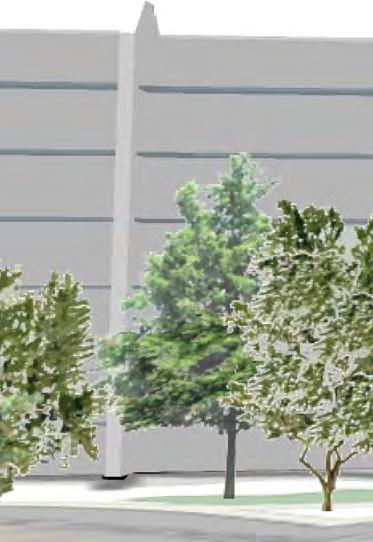
5 Proposal The Armour Group Limited (The Armour Group) is proposing to construct two multi-unit residential buildings on their existing property located at 1000 Micmac Boulevard, Dartmouth, Nova Scotia (PID ). There is currently a 130-unit multi-unit residential building located on the property; however, there is excess land which can support additional development and residential density. The proposed new development will consist of two new buildings: Building A, which will contain approximately 130 units within a fourteen-storey building (comprised of a three-storey podium and an eleven-storey high-rise component); and, Building B, which will contain approximately 75 units within an eight-storey building (comprised of a three-storey podium and a five-storey mid-rise component). Overall, the proposal represents an urban infill development opportunity on an existing underutilized lot, which is supportive of existing and proposed Regional and Municipal land use policies and regulations. Background The existing Kings Wood building was constructed by The Armour Group in 1979 in accordance with the land use regulations at the time. For nearly 40 years, the property has remained an Armour Group property holding, as well as an established home to hundreds of Dartmouth residents. The Armour Group continues to manage, maintain and invest in building upgrades, which, to date, includes the addition of residential amenities such as a pool and gym; however, there have been no major site improvements completed to date. As such, the subject property remains largely underutilized, particularly as an opportunity urban development site. Now, in response to changing market demographics and demands as well as supportive Municipal planning policies and regulations The Armour Group is prepared to reinvest in the property, and community at large, as is reflected in this Application. Image 1: Existing Kings Wood Building looking west through the tree garden 4
6 Enabling Policy and Regulatory Framework Dartmouth Municipal Planning Strategy Within Dartmouth, all multiple-unit development is subject to a Development Agreement (DA) in accordance with Policy IP-5 of the Dartmouth Municipal Planning Strategy (MPS). Furthermore, the subject property is designated Residential (Map 2, pg. 21). Within all Residential areas, MPS policy preamble expresses a need and opportunity to accommodate additional residential growth, particularly on underutilized lots. Under both the Directions for Growth and Housing sections, there is recurring language supporting the infilling of undeveloped lots within the development boundary in order to better utilize existing services and support additional residential density. Dartmouth Land Use By-Law The subject property is zoned Multiple Family Residential Medium Density (R-3). In recognition of Policy IP-5, a DA is required in order to accommodate all proposed multiple unit developments. Regional Municipal Planning Strategy According to the Regional Municipal Planning Strategy s (RMPS, 2014), the subject property is designated Urban Settlement (Map 2) and is located in the area generally identified as the Mic Mac Mall Regional District Growth Centre ( Growth Centre, Map 1). The Growth Centre encourages a mix of uses, including high-density residential, which are intended to act as focal points to transit oriented development. The boundaries of the Growth Centre will be established through a secondary planning process which will more specifically determine appropriate land uses. At present, the boundaries of the Centre are not defined; regardless, the subject property is well within the general area of policy intent. Furthermore, the subject property is located within the Regional Centre where medium to high density residential uses on opportunity sites are envisioned in support of the RMPS s growth objective: 75% of all new housing starts should occur in the Regional Centre and urban communities (RMPS, Vision and Principles, pg. 10). In furtherance of this objective, a Regional Centre Plan (Centre Plan) is currently in draft form which aims to establish new urban development policies and land use regulations for all lands located in the Regional Centre. Centre Plan Although this Planning Application has been submitted under the existing policy and regulatory framework, it is also important to consider the Draft Regional Centre Secondary Municipal Planning Strategy (Centre Plan, 2018) policies and by-laws. To begin with, Centre Plan has designated the property Higher-Order Residential (HR, Map 1: Urban Structure). In suit, the property is zoned Higher-Order Residential 2 (HR-2, Schedule 3: Zone Boundaries) according to the Draft Regional Centre Land Use By-Law. Generally speaking, the HR designation is comprised of areas that contain under-utilized lands which can accommodate the addition of mid-rise and high-rise buildings. The intent of this Designation is to accommodate some additional growth that supports better transit and pedestrian environment. (Centre Plan, pg. 22, emphasis added) Furthermore, the HR designation establishes four main objectives (Centre Plan, pg. 41), which are outlined in Table 1 below. Each objective includes compliance rationale in relation to the development proposal. 5
7 Table 1: Proposed Development s Compliance with Centre Plan s Objectives Centre Plan: HR Policy Development Proposal Land Composition: The subject property is underutilized and represents and infill development opportunity on an existing surface parking lot. The property can accommodate both mid and high-rise buildings. Intent: In support of Regional Planning as well as Centre Plan growth objectives, the proposed development will add upwards of 205 residential units (approx. 461 people) within the Regional Centre. The subject property is within walking distance to a major transit hub (Mic Mac Terminal) and other public amenities such as parks and schools. HR1: Protect and increase The proposed development represents and infill development access to housing choices opportunity that protects and compliments the existing through infill and residential market in the area in two ways: 1) there are no redevelopment that is demolitions of existing low-rise, single or two-unit family complementary to the properties, and; 2) the proposed development will offer a variety surrounding of housing types, including townhouse-style units and a range of neighbourhood. studio to three-bedroom apartment-style units. HR2: Allow home-based businesses, work-live units, professional offices, daycares and other businesses that are supportive of the neighbourhood. HR3: Improve access to pedestrian, active transportation and transit transportation networks. HR4: Create a safe and comfortable public realm for people of all ages and abilities. Nothing in the proposed development restricts the opportunity to provide supportive business uses in the neighbourhood. The proposed development is within walking distance to the Mic Mac Transit Terminal, the Maybank Field Park & Ride, Crichton Park Elementary School and the Mayfield park facilities. The infill, urban development opportunity supports active and transit transportation objectives. The proposed development is maintaining a twenty (20) foot naturally landscaped setback from Micmac Boulevard. This preserves the park-like, treed pedestrian experience of the street. Building B will also provide walk-up townhouse-type units with walkways connecting to the sidewalk in order to create a safe and comfortable relationship with the public realm. Centre Plan also recognizes that there are large parcels within the Regional Centre that could benefit from a comprehensive planning approach to development. (Centre Plan, Section 3.4.2, pg. 43). Accordingly, Policy 23 dictates that developments of lots larger than one hectare (2.47 acres) shall be considered by a development agreement to ensure that the development achieves the objectives of this Plan (Centre Plan, Policy 23, pg. 23). As the subject property is 2.16 hectares (5.34 acres), an application for a DA would be required as part of the approval process whether applying under Centre Plan or existing regulations (MPS). Municipal policies, therefore, recognize that the subject property requires a site specific, comprehensive approach to development where prescriptive land use by-laws and built-form regulations should be considered differently. 6

8 Discussion Whereas much of today s planning policy and regulation in urban-defined areas promotes active street frontages and 100% lot coverages, Kings Wood, in fact, represents an antithesis to this perspective. The existing Kings Wood development and the nearby Kings Arms development, which is also owned and managed by The Armour Group is largely defined by its treed canopy, integration with nature and setback from the street. The vast lot size, coupled with the neighbourhood s forested aesthetic, argues for development that treats urban design and densification differently. Accordingly, the current development proposal embraces an alternative site and building design approach that focuses on landscaping and tree retention, neighbourhood compatibility, and, in essence, insular campus-style development. Image 2: Bird s Eye View showing neighbourhood vegetation (Google Maps) Landscaping & Tree Retention in the Neighbourhood Context Contrary to an urban street frontage approach, the proposed development s ideology reflects a house in the garden perspective. Micmac Boulevard, and the nearby Crichton Park neighbourhood, is largely defined by its meandering (arguably suburban) road typology which is flanked by trees and other vegetation. Similarly, lower density homes in the area are defined by generous lot sizes, pocket parks and backyard greenbelts, all within proximity to lakes, parks and schools. Although densification is a Regional Planning objective, the subject property deserves a balanced approach to achieving this whereby the surrounding neighbourhood context is respected. To begin with, the proposed development maintains a 20 foot (6.1 metre) landscaped setback along Micmac Boulevard. This visual buffer not only helps to diminish the appearance of building mass from street level, it also preserves the existing tree-lined street vernacular that currently exists on the south side of Micmac Boulevard. And, in order to not completely orphan the development from the street, some walkways and paths are being proposed with connections to walk-up style townhomes at the base of Building B. There is also a 12 foot (3.7 metre) landscaped setback being maintained along the rear property line (beneath the existing power 7
; an HRM property at the end of")
9 line easement) which allows for the steep grades to blend into the podium of Building A. As such, the subject property is completely surrounded by nature, which is further reinforced by its neighbouring uses: HRM Parkland to the south (completely treed); an HRM property at the end of Crichton Avenue (completely treed); an Armour Group Property near the end of Crichton Avenue (completely treed); and, The Armour Group s Kings Arms Property, which echoes the same house in the garden design parti. The nearest single family dwelling to the proposed development is located approximately 230 feet (70 metres) away. The driveway entrance to the development will also be enhanced with trees, sidewalks and pathways, and will be flanked by walk-up style townhomes at the base of both buildings. Although not a public street, the driveway entrance is intended to create a true sense of entry, as if recreating a low-density urban streetscape. By formalizing the entrance driveway (and not having a garage door entrance fronting directly on the street, which is common practice in so many urban infill developments), an insular campus approach is maintained as if entering a garden off the main road. Building Scale, Design and Density The proposed buildings are appropriately scaled in the context of the neighbourhood and surrounding land uses. The existing Kings Wood building is seven storeys tall and is situated in the centre of the property away from neighbouring uses and the street. Building A, the taller of the two proposed buildings, which stands at fourteen storeys total (an eleven storey high-rise resting atop a three storey podium), is pushed towards the south-west corner of the property. This was done strategically for two main reasons: first, the building s podium can blend into the steep grades along the southern property line and Micmac Boulevard; and, second, the tower portion of the building can be sensitively located far enough away from nearby low-rise residential uses as well as the street. Building B sits at only eight storey tall, with a small midrise section resting atop a three storey podium. As the smaller of the two buildings, it seemed appropriate to locate the mid-rise closer to the street as a balance between the urban street frontage approach and the house in the garden perspective. Image 3: Building Scale in the Neighbourhood Context (Architecture49) 8

10 The buildings are also appropriately scaled to transition in height from the Crichton Park neighbourhood to the South East, to the CanEuro developments to the North West. As a complete development, the Kings Wood s buildings will range from seven storeys, to eight, to fourteen. Across Micmac Boulevard, the approved Europa development will rise up to 29- storeys, which is scattered amongst other mid to high-rise buildings ( The Summit : 19-storeys; The Horizon : 17-storeys; and, Avonhurst Gardens : 9-storeys). With respect to density, the proposed buildings will add approximately 205 new units ( persons, at an assumed 2.25 persons per unit) to the Kings Wood development. In total, Kings Wood will have approximately 335 units (754 persons) spread across a 5.34 acre lot (62.7 units per acre or persons per acre). This density is consistent with similar developments in the area. For example, Avonhurst Gardens (DA Case No ) contains 214 units (plus 13,900 sq. ft. of commercial) on a 3.69 acre lot (57.9 units per acre or 130 persons per acre); and, The Europa (DA Case No ) contains 216 units on a 3.48 acre lot (62.1 units per acre or 140 persons per acre). Furthermore, when considering density from the perspective of Gross Floor Area Ratio (GFAR), which is the approach being considered in the Centre Plan documents, the proposed development falls well short of policy maximums. Centre Plan is currently proposing a GFAR of 4.25 on the subject property. At a combined building gross floor area of 398,850 square feet (existing Kings Wood Building plus Building A and Building B ), the overall development only represents a GFAR of Accordingly, the proposed density is well within existing and proposed policy limitations. A Servicing Plan was also prepared to evaluate potential impacts of the proposed development on the Municipality s existing infrastructure, and can be referenced as an Appendix to this application. Image 4: Perspective Streetview looking south-west on Micmac Boulevard (Architecture49) 9
11 Traffic, Transit and Mobility A traffic impact study was prepared to evaluate potential impacts of the proposed development on adjacent streets and intersections, and can be referenced as an Appendix to this application. The proposed development is exceptionally connected to HRM s Transit Services. The Micmac Terminal is located immediately across the street from the proposed development, which services Routes 10, 54, 55, 56, 66 and 72. Furthermore, the Maybank Field Park & Ride is located within a 500 metre walk from the proposed development. The subject property is located in proximity to HRM parks, schools and employments notes such as Mic Mac Mall, Downtown Dartmouth and Dartmouth Crossing. The added density and mix of unit types and residents will help support active transportation initiatives as walking and biking to and from the development will be a major benefit to the neighbourhood. Conclusion The proposed Kings Wood development represents an excellent infill development opportunity on an existing underutilized lot within the Regional Centre. The application is consistent with existing RMPS, MPS and LUB policy and regulation (including similarly approved DA s in the area), as well as the draft Centre Plan policies and regulations. The new density has been delicately scaled and massed through the proposed building design, and the site planning has consciously respected the treed and natural surroundings currently found throughout the neighbourhood. 10
12 APPENDIX A: MPS Policy IP-5 and Ip-1(c) Compliance Tables Policy IP-5 It shall be the intention of City Council to require Development Agreements for apartment building development in R-3, R-4, C-2, MF-1 and GC Zones. Council shall require a site plan, building elevations and perspective drawings for the apartment development indicating such things as the size of the building(s), access & egress to the site, landscaping, amenity space, parking and location of site features such as refuse containers and fuel storage tanks for the building. In considering the approval of such Agreements, Council shall consider the following criteria: a) adequacy of the exterior design, height, bulk and scale of the new apartment development with respect to its compatibility with the existing neighbourhood; Exterior Design: At this stage in the planning application process, the proposed building materiality has yet to be determined. That being said, it is likely that the proposed buildings will take design cues for the existing Kings Wood and Kings Arms buildings in order to foster a cohesive design approach to the residential campus that current exists along Micmac Boulevard. Height: - Building A : fourteen (14) storeys total; three (3) storey podium and an eleven (11) storey tower - Building B : eight (8) storeys total; three (3) storey podium and a five (5) storey mid-rise Bulk: - Building A : the bulk of the podium is intended to blend into the steep slopes along Micmac Boulevard and the property line bordering HRM s parkland property to the west. Here we are able to hide the underground and abovegrade parking structure against these slopes. The front of Building A, however, is lined with townhouse-style units to give the entrance a human scale and active frontage. Above the podium, a slender high-rise structure will house the majority of the residential units. Approximate areas are provided below: o Podium Footprint: 25,600 square feet (2,378 square metres) o High-rise Footprint: 9,750 square feet (906 square metres) 11
13 b) adequacy of controls placed on the proposed development to reduce conflict with any adjacent or nearby land uses by reason of: (i) the height, size, bulk, density, lot coverage, lot size and lot frontage of any proposed building; - Building B : Building B s podium is entirely flanked by townhouse-style units which provides and active frontage along Micmac Boulevard as well as the internal residential campus. The mid-rise portion of the building is only five (5) storeys and houses typical apartment-style units. Approximate areas are provided below: o Podium Footprint: 9,600 square feet o (892 square metres) Mid-Rise Footprint: 7,800 square feet (725 square metres) Scale: The proposed development is located in between two residential neighbourhood-types: the lowdensity Crichton Park neighbourhood, which primarily consists of single or two-bedroom units; and, the high-rise, high-density neighbourhood consisting of several large apartment buildings ranging from nine (9) to twenty nine (29) storeys (future approved development). The existing Kings Wood building itself is seven (7) storeys, and, across Micmac Boulevard, Mic Mac Mall one of Atlantic Canada s largest shopping centres and one of Halifax s identified Future Growth Nodes (Draft Centre Plan, 2018). Accordingly, the proposed scale and transitioning of scale of the two buildings of the development is exceptionally responsive and respectful to the surrounding existing community and future identified growth objectives. A development approval will require a Development Agreement which will control and regulate builtform requirements and density. This will reduce conflict with any adjacent or nearby land uses. Existing Building: - Height: seven (7) storeys or 70 feet (21.3 metres) - Bulk/Size (Total GFA): 147,000 square feet (13,657 square metres) - Density: 130 Units (292.5 persons) - Lot Coverage: 9% - Lot Size: 5.34 acres - Frontage: feet ( metres) 12
14 Building A : - Height: fourteen (14) storeys or 140 feet (42.7 metres) - Bulk/Size (Total GFA): 184,050 square feet (17,099 square metres) - Density: 130 Units (292.5 persons) - Lot Coverage: 11% Building B : - Height: eight (8) storeys or 80 feet (24.4 metres) - Bulk/Size (Total GFA): 67,800 square feet (6,299 square metres) - Density: 75 Units ( persons) - Lot Coverage: 4% Total New (A+B): - Height: 8-14 storeys - Bulk/Size (Total GFA): 251,850 new square feet (23,398 square metres) - Density: 205 new units ( persons) - Lot Coverage: 15% new coverage Total (New + Existing Building): - Lot Size: 5.34 acres (232,610 square feet) - Frontage: feet ( metres) - Bulk/Size (Total GFA): 398,850 square feet (37,054 square metres) - Density: 335 Units ( persons or 141 persons per acre or FAR: 1.71) - Lot Coverage: 24% (ii) traffic generation, access to and egress from the site; and Please refer to the enclosed Traffic Impact Statement. (iii) parking; All parking for the proposed development is located on site using a combination of surface and underground parking. In total, there are 312 parking stalls (179 underground and 133 surface) which represent a 0.93:1 parking ratio for all three buildings on site (312 parking stalls to 335 total units). c) adequacy or proximity of schools, recreation areas and other community facilities; d) adequacy of transportation networks in, adjacent to, and leading to the development; Crichton Park Elementary School is located within a 450 metre walk from the proposed development. The Maybank Sports Fields, which include three baseball diamonds, two soccer fields and two tennis courts, among other amenities, is all located within a 500 metre walk from the proposed development. The proposed development is exceptionally connected to HRM s Transit Services. The Micmac Terminal is located immediately across the street from the proposed development, which services Routes 10, 54, 55, 56, 66 and 72. Furthermore, the Maybank Field Park & Ride is located within a 500 metre walk from the proposed development. 13
15 e) adequacy of useable amenity space and attractive landscaping such that the needs of a variety of household types are addressed and the development is aesthetically pleasing; f) that mature trees and other natural site features are preserved where possible; g) adequacy of buffering from abutting land uses; Amenity Space: The existing Kings Wood Building contains a common room, fitness area, and pool, all of which are intended to be upgraded as part of the overall redevelopment project. These amenities are also intended to be shared with the entire Kings Wood residential campus, when complete. Within each new building, as well, amenity spaces will likely be proposed such as common rooms and roof terraces on the podium. There is also ample outdoor amenity space in the vegetative areas and access to Municipal Parks is exceptionally convenient. All amenities are attractive to a wide variety of household types and users. Landscaping: In addition to the untouched natural landscape that will be maintained in buffer zones and existing treed areas, new landscaping elements will be introduced in order to enhance the overall property. For example, mature trees will be preserved, where possible, in parking islands and walkways; new hardscaped sidewalks and pathways will be introduced leading directly to townhouse-style units; and, the podium rooftops will be landscaped to include amenity areas for building residents. The range ins landscaped open spaces will cater to a variety of household types. In support of the overall Development Vision, tree retention is one of the most important objectives of the proposed development. In support of this objective, we are proposing a 20 foot vegetative setback along Micmac Boulevard consisting of preserved trees. Furthermore, the development proposal does not propose altering any of the trees in front of the existing Kings Wood building. Where we are proposing new surface parking lots, efforts will be made to preserve mature trees in islands or buffered edges. A 20 foot (6.1 metre) setback is being proposed along Micmac Boulevard which helps mitigate the appearance of building height and mass from the street. Furthermore, neither building is located adjacent to existing low-rise residential uses. Both buildings are pushed towards Micmac Boulevard and the closest single family dwelling is located approximately 230 feet (70 metres) away from the nearest new building (Building A ). 14
16 h) the impacts of altering land levels as it relates to drainage, aesthetics and soil stability and slope treatment; and i) the Land Use By-law amendment criteria as set out in Policy IP-1(c). The proposed development represents an infill development opportunity on an existing surface parking lot which will have minimal impacts on altering land levels. See Table 2 Policy IP-1(c) Policy IP-1(c) The Zoning By-law is the principal mechanism by which land use policies shall be implemented. It shall set out zones, permitted uses and development standards which shall reflect the policies of the Municipal Development Plan as per Section 33 (3) of the Planning Act. The zoning by-law may use site plan approval as a mechanism to regulate various uses. In considering zoning amendments and contract zoning, Council shall have regard to the following: (1) that the proposal is in conformance with the policies and intent of the Municipal Development Plan The proposal is in conformance and consistent with the policies and intent of the Dartmouth Municipal Planning Strategy. (2) that the proposal is compatible and consistent with adjacent uses and the existing development form in the area in terms of the use, bulk, and scale of the proposal (3) provisions for buffering, landscaping, screening, and access control to reduce potential incompatibilities with adjacent land uses and traffic arteries The proposed development is located in between two residential neighbourhood-types: the lowdensity Crichton Park neighbourhood, which primarily consists of single or two-bedroom units; and, the high-rise, high-density neighbourhood consisting of several large apartment buildings ranging from nine (9) to twenty seven (27) storeys (future approved development). The existing Kings Wood building itself is seven (7) storeys, and, across Micmac Boulevard, Mic Mac Mall one of Atlantic Canada s largest shopping centres and one of Halifax s identified Future Growth Nodes (Draft Centre Plan, 2018). Accordingly, the proposed scale and transitioning of scale of the two buildings of the development is exceptionally responsive and respectful to the surrounding existing community and future identified growth objectives. A proposed 20 foot (6.1 metre) setback is being proposed along Micmac Boulevard which provides natural landscaping as well as visual screening from the street. For the most part, this is an existing buffer which adequately reduces potential incompatibilities with adjacent land uses and traffic arteries. Furthermore, no new access/egress points to the development are being proposed which will mitigate any new traffic to the local street network. Refer to the Traffic Impact Statement for more information. 15
17 (4) that the proposal is not premature or inappropriate by reason of: (i) the financial capability of the City is to absorb any costs relating to the development (ii) the adequacy of sewer and water services and public utilities (iii) the adequacy and proximity of schools, recreation and other public facilities (iv) (v) (vi) (vii) (viii) (ix) the adequacy of transportation networks in adjacent to or leading to the development existing or potential dangers for the contamination of water bodies or courses or the creation of erosion or sedimentation of such areas preventing public access to the shorelines or the waterfront the presence of natural, historical features, buildings or sites create a scattered development pattern requiring extensions to truck facilities and public services while other such facilities remain under utilized the detrimental economic or social effect that it may have on other areas of the City. - N/A there are no apparent financial implications for the City. Please refer to the enclosed Servicing Plan. Crichton Park Elementary School is located within a 450 metre walk from the proposed development. The Maybank Sports Fields, which include three baseball diamonds, two soccer fields and two tennis courts, among other amenities, is all located within a 500 metre walk from the proposed development. The proposed development is exceptionally connected to HRM s Transit Services. The Micmac Terminal is located immediately across the street from the proposed development, which services Routes 10, 54, 55, 56, 66 and 72. Furthermore, the Maybank Field Park & Ride is located within a 500 metre walk from the proposed development. N/A the property does not contain, nor it adjacent to, any water bodies or courses. N/A the property is not accessible to a shoreline or waterfront. N/A the property does not contain historical features, buildings or sites. The proposed development will not create a scattered development pattern. The project represents an infill development opportunity on an already Municipally serviced property which will support servicing efficiencies. The proposed development will contribute to the economic vitality of the City and immediate surrounding area. As a multi-unit residential development, future tenants will support nearby employment nodes, such as Mic Mac Mall, Dartmouth Crossing, and Downtown Dartmouth, among all other areas of the City accessible via Transit or other means. 16
18 (5) that the proposal is not an obnoxious use (6) that controls by way of agreements or other legal devices are placed on proposed developments to ensure compliance with approved plans and coordination between adjacent or nearby land uses and public facilities. Such controls may relate to, but are not limited to, the following: (i) type of use, density, and phasing Residential uses are non-obnoxious uses and are compatible with the surrounding area. A development approval will require a Development Agreement which will control and regulate builtform requirements and density. This will reduce conflict with any adjacent or nearby land uses. Use: The proposed use is Multi-Unit Residential, which is a common and consistent land use found throughout the area. Density: Existing: - The property (PID ) is 5.34 acres - The existing building contains 130 units - Average persons/unit: Existing Population: approx persons - Existing Density: persons/acre Proposed: - Building A will contain approx. 130 units - Building B will contain approx. 75 units. - Total Proposed Units: approx. 205 units - Average persons/unit: Proposed Population Increase: persons - Proposed Density Increase: persons/acre Total: - Proposed Overall Population: persons - Proposed Overall Density: persons/acre According to the above calculations, persons per acre is well within the Municipality s level of acceptance for urban environments within the Regional Centre. When compared to other multiunit residential buildings in the area, their Development Agreements have allowed for similar densities. For example, DA Case No /00728 permitted persons/acre, and DA Case No permitted persons/acre. 17
19 Phasing: At this time, development phasing is unknown. However, it is likely that the Building A and Building B will be built at separate times in response to market conditions. (ii) emissions including air, water, noise The proposed use does not generate obnoxious air, water or noise emissions. (iii) traffic generation, access to and egress from the site, and Please refer to the enclosed Traffic Impact Statement. parking (iv) open storage and landscaping Open Storage: Open storage has yet to be located at the stage in the Application process. Any open storage will be screened from the street using a combination of fencing and vegetation. (v) (vi) (vii) provisions for pedestrian movement and safety management of open space, parks, walkways drainage both natural and subsurface and soil-stability (viii) performance bonds. N/A (7) suitability of the proposed site in terms of steepness of slope, soil conditions, rock outcroppings, location of watercourses, marshes, swamps, bogs, areas subject to flooding, proximity to major highways, ramps, railroads, or other nuisance factors Landscaping: There are two main approaches to landscaping the site: the first is non-disturbance, which is implemented by maintaining vegetative setbacks; and, the second, will be to introduce new hard and soft landscaping elements around pedestrian walkways, common open spaces and surface parking areas. No new access/egress points to the public right-ofway are being proposed. At the existing intersections, new crosswalk pavement markings may be considered. The development proposal also considers new walkways and sidewalks leading directly to individual residential units and lobbies. The Armour Group Limited owns and manages all of their residential properties, which includes maintenance of all on site (private) open spaces, parks and walkways. The property is a municipally serviced lot, and all storm water drainage will managed on site and via Municipal infrastructure. A storm water management plan will be provided at a later stage. The proposed development represents an infill development opportunity on an existing surface parking lot which will have no impact on environmentally sensitive areas. There are, however, steep slopes in two locations: in between Micmac Boulevard and Building A (northwest street frontage) as well as in between the Municipality s parkland property (PID ) and the rear/side wall of Building A (west property 18
20 boundary). In both instances, property line setbacks are introduced which avoid cutting into the slopes and their associated vegetation. (8) that in addition to the public hearing requirements as set out in the Planning Act and City by-laws, all applications for amendments may be aired to the public via the voluntary" public hearing process established by City Council for the purposes of information exchange between the applicant and residents. This voluntary meeting allows the residents to clearly understand the proposal previous to the formal public hearing before City Council (9) that in addition to the foregoing, all zoning amendments are prepared in sufficient detail to provide: (i) Council with a clear indication of the nature of proposed development (ii) permit staff to assess and determine the impact such development would have on the land and the surrounding community (10) Within any designation, where a holding zone has been established pursuant to Infrastructure Charges - Policy IC-6, Subdivision Approval shall be subject to the provisions of the Subdivision By-law respecting the maximum number of lots created per year, except in accordance with the development agreement provisions of the MGA and the Infrastructure Charges Policies of this MPS. The Planning Application shall follow all required public processes. - The proposed development is multi-unit residential. The proposed development is an infill development opportunity which will provide positive impacts and benefits to the already existing Kings Wood and Kings Arms residential communities, as well as the surrounding residential neighbourhood and employment nodes. N/A the property is zoned R-3 19
21 APPENDIX B: Parcel Description All that certain block of land on the southwestern side of Micmac Boulevard, in the City of Dartmouth, Province of Nova Scotia, shown as Block M-4 on a subdivision plan of Micmac Village signed by Granville Leopold, N.S.L.S., dated April 9, 1976, approved July 20, 1977, and more particularly described as follows: BEGINNING on the curved southwestern boundary of Micmac Boulevard at the most northern corner of Block M-5; THENCE S 40 degrees 48 minutes 21 seconds W, feet along a northwestern boundary of Block M-5 to a northeastern boundary of lands owned by the City of Dartmouth; THENCE N 50 degrees 40 minutes 30 seconds W, feet along said northeastern boundary of lands owned by the City of Dartmouth to the curved southern boundary of Micmac Boulevard; THENCE easterly and southeasterly on a curve to the right which has a radius of feet for a distance of feet to the end of said curve; THENCE S 58 degrees 08 minutes 51 seconds E, feet along a southwestern boundary of Micmac Boulevard to a point of curvature; THENCE southeasterly on a curve to the right which has a radius of 1,017.0 feet for a distance of feet to the place of beginning. CONTAINING 232,710 square feet (5.342 acres). SUBJECT TO Rights granted with respect to that 7 and one half foot wide portion of a 15 foot wide Pole Line Easement lying adjacent to the southeastern boundary of the herein described Block M-4 as shown on the above referred to plan. ALSO SUBJECT TO that 12 foot wide portion of a 20 foot wide Pole Line Easement lying adjacent to the southwestern boundary of the herein described Block M-4 as shown on the above referred to plan. ALL bearings are referred to a transverse Mercator grid, 3 Degree Zone. *** Municipal Government Act, Part IX Compliance *** Compliance: The parcel originates with an instrument (registration details below) and the subdivision is validated by Section 291 of the Municipal Government Act Registration District: HALIFAX COUNTY Registration Year: 1977 Book: 3174 Page: 338 Document Number:
22 APPENDIX C: Survey Plan 21
23 Original Signed Original Signed
24 APPENDIX D: Site Plan 22

 BLDG.")


25 SER EASEMENT LEGEND Site Boundary Adjacent Property Boundary N M I C M A C B L V D PID: Acres BLDG.1 ±7,800 SF footprint SITE SUMMARY: Land Area: 5.34 acres Existing Zone: R-3 (Multi. Family Res. Zone) BLDG.2 ±8,900 SF footprint Ditch HALIFAX REGIONAL MUNICIPALITY PID: Acres Swimming Pool KINGS WOOD APARTMENTS ±21,000 SF footprint PID: Acres POWER EASEMENT C R I C H T O N A V E N U E PID: Acres PRELIMINARY SOURCES: Plan based on SDMM survey ' _Kings Wood & Kings Arm Survey Plan.dwg' Adjacent property lines from provincial property mapping. Designer: KWATTERS Planner: SCALE 15 CWALLACE : 1,000 VERSION 100 EXISTING CONDITIONS KINGS WOOD / KINGS ARMS APARTMENTS DARTMOUTH, NOVA SCOTIA AUGUST 30, 2018 Sheet 1 of 4 ARMOUR GROUP m 1 SPECTACLE LAKE DRIVE, DARTMOUTH, NS, CANADA B3B 1X7 PHONE: WSP.COM FILE: \\SV201DATA01\SHARED\ KINGSWOOD PLAZA\04 DRAWINGS\CONCEPT\ DWG Sheet:_11x17 (1000)

 EX.")
 56,200 SF ±9,600 SF Podium Footprint BLDG.")


 Sheet 2 of 4 m FILE: \\SV201DATA01\SHARED\189-00152-00 KINGSWOOD PLAZA\04")
26 LEGEND Site Boundary N Adjacent Property Boundary BLDG.1 tprint ±7,800 SF foo M PID: Acres VD C MI 11 P ARK I NG S TAL Total Surface Parking Provided: 133 stalls LOT COVERAGE: Existing Building: Proposed Building 'A': ING ARK PID: Acres SITE SUMMARY: Land Area: 5.34 acres Existing Zone: R-3 (Multi. Family Res. Zone) EX. P LS SER EASEMENT BL AC 21,000 SF ( 9% ) 25,600 SF ( 11% ) Proposed Building 'B': 9,600 SF ( 4% ) Total Lot Coverage: ( 24% ) 56,200 SF ±9,600 SF Podium Footprint BLDG.2 tprint ±8,900 SF foo RESIDENTIAL ENTRANCE 72 K PAR ING STA LLS m 23.0 PO R WE EAS SOURCES: Plan based on SDMM survey ' _Kings Wood & Kings Arm Survey Plan.dwg' Adjacent property lines from provincial property mapping. ENT EM 6.4m 39.1m ING ARK 50 P PROPOSED BUILDING 'A' ±9,750 SF Tower Footprint h Ditc 70.0m EXISTING POWER POLE 3.7m U/G PARKING ACCESS DRIVAY 179 U/G PARKING STALLS 102 CWALLACE DARTMOUTH, NOVA SCOTIA CRICHTON ±25,600 SF Podium Footprint VERSION Planner: CONCEPT PLAN KINGS WOOD / KINGS ARMS APARTMENTS LS L STA Designer: KWATTERS YY R R A N NA I I M IIM L L REE PPR AVENUE ARMOUR GROUP SEPTEMBER 05, SCALE m 1 : 1,000 HALIFAX REGIONAL MUNICIPALITY PID: Acres 1 SPECTACLE LAKE DRIVE, DARTMOUTH, NS, CANADA B3B 1X7 PHONE: WSP.COM Sheet:_11x17 (1000) Sheet 2 of 4 m FILE: \\SV201DATA01\SHARED\ KINGSWOOD PLAZA\04 DRAWINGS\CONCEPT\ DWG min Poo g l PID: Acres Swim 6.1 KINGS WOOD APARTMENTS ±21,000 SF footprint 17.8m PROPOSED BUILDING 'B' ±7,800 SF Mid-Rise Footprint
 Total Lot Coverage: ( 24%")


 m 23.")


 ( 11% ) PID: 00100255 0.")


.")
27 LEGEND Site Boundary N Adjacent Property Boundary MIC T EN SE M EA ( 4% ) Total Lot Coverage: ( 24% ) SE WE ±25,600 SF Podium Footprint Ditc 3.7m 39.1m 6.4m TA GS KIN AR 50 P SOURCES: Plan based on SDMM survey ' _Kings Wood & Kings Arm Survey Plan.dwg' Adjacent property lines from provincial property mapping. LLS 70.0m h U/G PARKING ACCESS DRIVAY 179 U/G PARKING STALLS T CRICH ON AVENU Designer: KWATTERS VERSION Planner: 102 CWALLACE E CONCEPT PLAN KINGS WOOD / KINGS ARMS APARTMENTS EXISTING POWER POLE DARTMOUTH, NOVA SCOTIA HALIFAX REGIONAL MUNICIPALITY PID: Acres YY R R A N NA I I M IIM L L REE PPR HI ARMOUR GROUP SEPTEMBER 05, SCALE m 1 : 1,500 LL SI DE AV EN UE 1 SPECTACLE LAKE DRIVE, DARTMOUTH, NS, CANADA B3B 1X7 PHONE: WSP.COM Sheet:_11x17 (1500) m 23.0 Sheet 3 of 4 ENT FILE: \\SV201DATA01\SHARED\ KINGSWOOD PLAZA\04 DRAWINGS\CONCEPT\ DWG ARK PROPOSED BUILDING 'A' ±9,750 SF Tower Footprint 56,200 SF W ER Proposed Building 'B': 9,600 SF 72 P PO ( 9% ) ( 11% ) PID: Acres LL STA M ASE RE 21,000 SF 25,600 SF VE min Poo g l DRI Swim Proposed Building 'A': OR PID: Acres S ING LOT COVERAGE: Existing Building: MAN PID: Acres Total Surface Parking Provided: 133 stalls N BLDG.5 footprint ±8,900 SF.4 BLDG otprint fo 0 SF KINGS WOOD APARTMENTS ±21,000 SF footprint GLE PID: Acres BLDG.3 footprint ±8,300 SF ±8,30 m Existing Zone: R-3 (Multi. Family Res. Zone).6 BLDG tprint SF foo LS AL 6.1 PID: Acres ±7,700 ST BLDG.2 tprint ±8,900 SF foo 17.8m SITE SUMMARY: Land Area: 5.34 acres PID: Acres RESIDENTIAL ENTRANCE PROPOSED BUILDING 'B' ±7,800 SF Mid-Rise Footprint BLVD ING NG I RK PA ±9,600 SF Podium Footprint SER EASEMENT ARK EX. P 11 PID: Acres BLDG.1 tprint ±7,800 SF foo PID: Acres MAC

 Total Surface Parking Provided: 133 stalls LOT COVERAGE: Existing Building: 21,000 SF ( 9%")
 H O R I Z O N C O U R T W O O D L A N D A V E N U E AVONHURST")


28 LEGEND Site Boundary Adjacent Property Boundary N MIC MAC MALL SITE SUMMARY: Land Area: 5.34 acres THE HORIZON 17 STOREYS THE SUMMIT 19 STOREYS KENT BUILDING SUPPLIES HEAD OFFICE MIC MAC TERMINAL M I C M A C B L V D G L E N M A N O R D R I V E Existing Zone: R-3 (Multi. Family Res. Zone) Total Surface Parking Provided: 133 stalls LOT COVERAGE: Existing Building: 21,000 SF ( 9% ) Proposed Building 'A': 25,600 SF ( 11% ) Proposed Building 'B': 9,600 SF ( 4% ) Total Lot Coverage: 56,200 SF ( 24% ) H O R I Z O N C O U R T W O O D L A N D A V E N U E AVONHURST GARDENS 9 STOREYS THE EUROPA ( Under Development) 29 STOREYS MAYBANK SPORTS FIELD MAYBANK FIELD PARK & RIDE Ditch HRM PARKLAND CRICHTON PARK SCHOOL C R I C H T O N A V E N U E L Y N G B Y A V E N U E H I L L S I D E A V E N U E PRELIMINARY SOURCES: Plan based on SDMM survey ' _Kings Wood & Kings Arm Survey Plan.dwg' Adjacent property lines from provincial property mapping. Designer: KWATTERS Planner: SCALE 45 CWALLACE : 3,000 VERSION 102 CONCEPT PLAN KINGS WOOD / KINGS ARMS APARTMENTS DARTMOUTH, NOVA SCOTIA SEPTEMBER 05, 2018 Sheet 4 of 4 ARMOUR GROUP m 1 SPECTACLE LAKE DRIVE, DARTMOUTH, NS, CANADA B3B 1X7 PHONE: WSP.COM FILE: \\SV201DATA01\SHARED\ KINGSWOOD PLAZA\04 DRAWINGS\CONCEPT\ DWG Sheet:_11x17 (3000)
29 APPENDIX E: Building Elevations and Perspectives 23


30 KEY PLAN 43.0 m Roof Building A 25.0 m Roof Building B BUILDING A BUILDING B 10.0 m Level m Level m Level m Level -1 Units Townhouses Units Townhouses Parkade Kingswood Redevelopment Armour Group DARTMOUTH, NOVA SCOTIA NORTH ELEVATION MASSING STUDY SCALE 1:600


31 A B 43.0 m Roof Building A KEY PLAN 25.0 m Roof Building B 10.0 m Level m Level 3 ELEVATION A 0.0 m Level m Level -1 BUILDING A Units Townhouses BUILDING B Units Townhouses Parkade SECTION B 43.0 m Roof Building A 25.0 m Roof Building B 10.0 m Level m Level m Level m Level -1 Kingswood Redevelopment Armour Group DARTMOUTH, NOVA SCOTIA ELEVATION - SECTION MASSING STUDY SCALE 1:600


32 THE EUROPA THE HORIZON THE SUMMIT AVONHURST GARDENS MIC MAC MALL KINGS WOOD APARTMENTS KINGS ARMS APARTMENTS Kingswood Redevelopment Armour Group DARTMOUTH, NOVA SCOTIA BIRD VI - LOOKING NORTH MASSING STUDY


33 KINGS ARMS APARTMENTS KINGS WOOD APARTMENTS THE EUROPA Kingswood Redevelopment Armour Group DARTMOUTH, NOVA SCOTIA BIRD VI - LOOKING SOUTH MASSING STUDY


34 THE EUROPA KEY PLAN KINGS WOOD APARTMENTS Kingswood Redevelopment Armour Group DARTMOUTH, NOVA SCOTIA STREET VI - MICMAC BLVD MASSING STUDY


35 KEY PLAN Kingswood Redevelopment Armour Group DARTMOUTH, NOVA SCOTIA STREET VI - HORIZON CT MASSING STUDY
36 APPENDIX F: Servicing Plan 24
37 STM STM STM STM SAN SAN SAN SAN W W W W W W SAN SAN STM STM STM STM SAN SAN X OH OH W W EOH EOH WSP Canada Inc. 1 Spectacle Lake Drive Dartmouth, Nova Scotia, Canada B3B 1X7 T F ² PID: PID: N PID: PID: PID: PID: PID: PID: Original Signed
38 APPENDIX G: Traffic Impact Statement 25

39 September 7, 2018 Mr. Blaise Morrison Manager, Development & Planning The Armour Group Limited [Via RE: Traffic Impact Statement Kings Wood Apartments, Dartmouth, NS Dear Mr. Morrison: Plans are being prepared for an infill development at the site of Kings Wood Apartments at 1000 Micmac Boulevard in Dartmouth, NS (PID ). This is the Traffic Impact Statement (TIS) required to accompany the development application. SITE DESCRIPTION AND PLANNED DEVELOPMENT The site is currently developed with the existing Kings Wood Apartments building, containing approximately 130 units and approximately 130 spaces of surface parking for residents and visitors. The site is bounded by Micmac Boulevard in the north and east, existing apartment developments in the south, and HRM greenspace in the west. The proposed development includes the construction of two additional apartment buildings (14-storey apartment Building A and 8-storey apartment Building B ). These new buildings are expected to combine for a total of up to 210 units. No modifications are planned for the existing 130 unit apartment building (Kings Wood Apartments, See Figure 1). With development, there is expected to include approximately 300 parking spaces including surface and underground parking. Figure 1 Site Plan DESCRIPTION OF EXISTING STREETS AND INTERSECTIONS Micmac Boulevard (See Photos 1 and 2) is a 2-lane collector street that runs just north of the site and connects to Woodland Road, Mic Mac Mall, and Highway 111 (at Exit 5). Traffic volume data provided by HRM Traffic Management indicate the two-way volume on Micmac Boulevard in this area is approximately 340 and 810 vehicles during the AM and PM peak hours, respectively. In the vicinity of the site, there is concrete sidewalk on the south (site) side of the street. The posted speed limit is 50km/h. 1 Spectacle Lake Drive Dartmouth, NS, Canada B3B 1X7 Tel.: Fax:
 is a 2-lane private street that runs north from Micmac Boulevard and serves as a driveway for existing apartments.")

40 Traffic Impact Statement Kings Wood Apartments Dartmouth, NS Photo 1 Looking Left (to the west) on Micmac Boulevard from the site access Photo 2 Looking right (to the east) on Micmac Boulevard from the site access Horizon Court (See Photo 3) is a 2-lane private street that runs north from Micmac Boulevard and serves as a driveway for existing apartments. The intersection of Micmac Boulevard at Horizon Court / Site Driveway (See Photos 1, 2, and 3) operates as a four-legged intersection with STOP control on Horizon Court and the site driveway with free flow traffic on Micmac Boulevard. There is an existing marked crosswalk crossing Micmac Boulevard at the east leg of the intersection. Photo 3 - Looking north from the site toward Horizon Court The intersection of Micmac Boulevard at Mic Mac Mall (the Bay) / Kings Wood Apartments (See Photo 4) is a four-legged signalized intersection with signalized pedestrian crossings at the north and east approaches. SITE ACCESS Vehicular access to the developed site will continue to be via the driveway at Micmac Boulevard opposite Horizon Court (See Photos 1 and 2) with secondary site access to Micmac Boulevard opposite the signals at Mic Mac Mall (near The Bay, See Photo 4). There is a shrub that should be removed or pruned and growth monitored to improve visibility of eastbound traffic on Micmac Boulevard approaching the Horizon Court access (See Photo 1). PUBLIC TRANSIT The site is well served by public transit with stops in each direction immediately in front of the site (See Photo 2). The site is also within 200 metres of the Micmac Terminal (See Photo 5) and its six Halifax Transit routes (#10, 54, 55, 56, 66, and 72). Photo 4 Looking west along Micmac Boulevard toward the signalized site access (the site is on the left) Photo 5 Looking east from the site toward TRIP GENERATION the Micmac Terminal Trip generation estimates using both the average rate (top section, Table 1) and fitted curve equations (bottom section, Table 1) have been included for comparison, however, the average rates have been used. Trip generation estimates, prepared using published rates from Trip Generation, 10 th Edition (Institute of Transportation Engineers, Washington, 2017) for the new development units are included in Table 1. It is estimated that the new development will generate: 76 two-way trips (20 entering and 56 exiting) during the AM peak hour; and, 92 two-way trips (56 entering and 36 exiting) during the PM peak hour. September 7, 2018 Page 2
 1 Multifamily Housing (Mid-Rise) 210 0.09 0.27 0.")
41 Traffic Impact Statement Kings Wood Apartments Dartmouth, NS Table 1 Trip Generation Estimates Trip Generation Rates Trips Generated 4 Land Use Units 3 AM Peak PM Peak AM Peak PM Peak In Out In Out In Out In Out Trip Generation Estimate for new Residential Development (Average Rates) 1 Multifamily Housing (Mid-Rise) (Land Use 221) Trip Generation Estimate for new Residential Development (Fitted curve equations) 2 Multifamily Housing (Mid-Rise) (Land Use 221) Notes: 1. Trip generation rates are 'vehicles per hour per unit' for the indicated land use, prepared using published rates from Trip Generation, 10 th Edition (Institute of Transportation Engineers, Washington, 2017). 3. Units are number of residential units. 4. Vehicles per hour for peak hours Fitted Curve Equations have been Used 2. Trip generation rates use the fitted curve equation for indicated Land Use from Trip Generation, 10 th Edition (Institute of Transportation Engineers, Washington, 2017). SUMMARY 1. Plans are being prepared for the expansion of the Kings Wood Apartments at 1000 Micmac Boulevard in Dartmouth, NS (PID ) to include up to an additional 210 apartment units. 2. Vehicular access to the site will continue to be from Micmac Boulevard opposite Horizon Court. Access to the existing apartments within the site will continue to be via the driveway at Horizon Court and at the signalized intersection at Mic Mac Mall. 3. Using published rates from Trip Generation, 10 th Edition (Institute of Transportation Engineers, Washington, 2017), it is estimated that the (up to 210) additional apartment units will generate about 76 two-way trips (20 entering and 56 exiting) during the AM peak hour and 92 two-way trips (56 entering and 36 exiting) during the PM peak hour. CONCLUSION 4. With convenient access to transit (Micmac Terminal) and adjacent shopping (Mic Mac Mall), the trips generated by the proposed apartment units are not expected to have a significant impact on the level of performance of Mic Mac Boulevard or on other nearby streets and intersections. If you have any questions or comments, please contact me by at patrick.hatton@wsp.com or by telephone at Sincerely, Original Signed Patrick Hatton, P.Eng. Traffic & Transportation Engineer WSP Canada Inc. Original Signed September 7, 2018 Page 3
DEVELOPMENT AGREEMENT APPLICATION
 151-11172 LYNNETT ROAD, SPRYFIELD DEVELOPMENT AGREEMENT APPLICATION JULY 28, 2016 1 Spectacle Lake Drive Dartmouth, NS B3B 1X7 Phone: 902-835-9955 Fax: 902-835-1645 www.wspgroup.com 151-11172 July 28,
Financial Impact Statement There are no immediate financial impacts associated with the adoption of this report.
 STAFF REPORT Planning and Development Department Subject: Application by RYC Property to rezone a portion of lands on John Murray Dr. and Megan Lynn Dr. from R2 to R3 and to enter into a Development Agreement
1.0 Introduction. November 9, 2017
 November 9, 2017 Andrew Bone, Planner III Regional Planning Policy and Strategic Initiatives Halifax Regional Municipality 40 Alderney Drive Dartmouth, NS, B2Y 2N5 Subject: Application to amend the Bedford
Plan Dutch Village Road
 Plan Dutch Village Road Objective: The lands around Dutch Village Road are a minor commercial area that services the larger Fairview community. Maintaining the vibrancy of the area by planning for redevelopment
1 Application Form 4
 1 Application Form 4 5 2 Project Summary Location The proposed development is located at 216 Cobequid Road in Sackville, Nova Scotia. Site Characteristics The mixed-use development is situated on the corner
Urban Design Brief Dundas Street. London Affordable Housing Foundation. November Zelinka Priamo Ltd.
 Urban Design Brief 1039-1047 Dundas Street London Affordable Housing Foundation November 2017 Zelinka Priamo Ltd. TABLE OF CONTENTS Page No. INTRODUCTION... 3 SECTION 1 LAND USE PLANNING CONTEXT... 3 1.1
Urban Design Brief. Italian Seniors Project 1090, 1092, 1096 Hamilton Road City of London
 Urban Design Brief Italian Seniors Project City of London October 1, 2017 TABLE OF CONTENTS Page No. INTRODUCTION... 2 1.0 LAND USE PLANNING CONCEPT... 2 1.1 Subject Lands... 2 1.2 Official Plan and Zoning
3.1. OBJECTIVES FOR RESIDENTIAL LAND USE DESIGNATIONS GENERAL OBJECTIVES FOR ALL RESIDENTIAL DESIGNATIONS
 3. RESIDENTIAL LAND USE DESIGNATIONS INTRODUCTION The Residential land use designations provide for housing and other land uses that are integral to, and supportive of, a residential environment. Housing
Item No Halifax and West Community Council July 10, 2018
 P.O. Box 1749 Halifax, Nova Scotia B3J 3A5 Canada Item No. 10.1.2 Halifax and West Community Council July 10, 2018 TO: Chair and Members of Halifax and West Community Council SUBMITTED BY: Original signed
Jasper 115 Street DC2 Urban Design Brief
 Jasper 115 Street DC2 Urban Design Brief Greenlong Construction Ltd. Stantec Consulting Ltd. 2017 Overview The proposed rezoning application supports the development of two mixed-use high-rise buildings
2866 & 2858 GOTTINGEN STREET AND 5518 MACARA STREET
 DEVELOPMENT AGREEMENT APPLICATION FOR: 2866 & 2858 GOTTINGEN STREET AND 5518 MACARA STREET SEPTEMBER 23, 2015 151-05840 FH DEVELOPMENT GROUP INC. DEVELOPMENT AGREEMENT APPLICATION FOR: 2866 & 2858 Gottingen
STAFF REPORT. January 25, North York Community Council. Director, Community Planning, North District
 STAFF REPORT January 25, 2005 To: From: Subject: Purpose: North York Community Council Director, Community Planning, North District Refusal Report OPA & Rezoning Application 04 194214 NNY 33 OZ Applicant:
Planning Justification Report
 Planning Justification Report 101 Kozlov Street, Barrie, Ont. Destaron Property Management Ltd. November 2015 Revised February 2017 TABLE OF CONTENTS Page 1.0 INTRODUCTION... 1 2.0 DESCRIPTION OF SUBJECT
Ashcroft Homes Trim Road Development Planning Rationale
 18 Antares Drive Ottawa, ON K2E 1A9 Ashcroft Homes Trim Road Development Planning Rationale Proposed Site Plan & Zoning Amendment Applications File No: D02-02-17-0129 & D07-12-17-0175 August 2018 Planning
3 and 5 Southvale Dr - Official Plan Amendment and Zoning Amendment Applications - Preliminary Report
 STAFF REPORT ACTION REQUIRED 3 and 5 Southvale Dr - Official Plan Amendment and Zoning Amendment Applications - Preliminary Report Date: August 20, 2015 To: From: Wards: Reference Number: North York Community
Planning & Development. Background. Subject Properties
 Planning & Development APPLICATION BRIEFING Prepared For: Planning Advisory Committee Submitted by: Jason Fox, Director of Planning & Development Date: Subject: Application by Meech Holdings Limited to
PIN , Part 1, Plan SR-713 in Lot 2, Concession 5, Township of McKim (1096 Dublin Street, Sudbury)
") STAFF REPORT Applicant: Dalron Construction Limited Location: PIN 02124-0103, Part 1, Plan SR-713 in Lot 2, Concession 5, Township of McKim (1096 Dublin Street, Sudbury) Official Plan and Zoning By-law:
STAFF REPORT Applicant: Dalron Construction Limited Location: PIN 02124-0103, Part 1, Plan SR-713 in Lot 2, Concession 5, Township of McKim (1096 Dublin Street, Sudbury) Official Plan and Zoning By-law:
Director, Community Planning, Toronto and East York District
 STAFF REPORT September 1, 2005 To: From: Subject: Toronto and East York Community Council Director, Community Planning, Toronto and East York District Further Report Applications to amend Official Plan
STAFF REPORT. March 14, Toronto and East York Community Council. Director, Community Planning, South District
 STAFF REPORT March 14, 2005 To: From: Subject: Toronto and East York Community Council Director, Community Planning, South District Preliminary Report Official Plan Amendment and Rezoning Application 05
EXCERPTS FROM HALIFAX REGIONAL MUNICIPALITY CHARTER
 EXCERPTS FROM HALIFAX REGIONAL MUNICIPALITY CHARTER Municipal planning strategy 227 The Council may adopt a municipal planning strategy for all, or part, of the Municipality and there may be separate strategies
Inverness Area Planning Advisory Committee Inverness County Planning Advisory Committee Inverness County Council Planning Staff (EDPC)
") STAFF REPORT To: From: Inverness Area Planning Advisory Committee Inverness County Planning Advisory Committee Inverness County Council Planning Staff (EDPC) Date: January 18, 2018 Reference: Request for
STAFF REPORT To: From: Inverness Area Planning Advisory Committee Inverness County Planning Advisory Committee Inverness County Council Planning Staff (EDPC) Date: January 18, 2018 Reference: Request for
Planning and Building Department
 Page 1 of Report PB-83-13 TO: Development and Infrastructure Committee Planning and Building Department SUBJECT: OP & Rezoning 5001 Corporate Drive Appleby Gardens LJM Developers Report Number: PB-83-13
Community Facilities (CF) Zone Residential; community centre; post office; bed and breakfast
 Zone Residential; community centre; post office; bed and breakfast") Applicant Land Owner Proposal Municipality of the County of Kings Report to the Centreville Area Advisory Committee Application to Amend the Zoning Map of the Land Use By-law (File 16-18) Date: Wednesday,
Applicant Land Owner Proposal Municipality of the County of Kings Report to the Centreville Area Advisory Committee Application to Amend the Zoning Map of the Land Use By-law (File 16-18) Date: Wednesday,
P. H. Robinson Consulting Urban Planning, Consulting and Project Management
 PLANNING RATIONALE REPORT FOR SITE PLAN AND DRAFT PLAN OF CONDOMINIUM APPLICATIONS 73-75 HARVEY STREET CITY OF OTTAWA PREPARED BY: P H ROBINSON CONSULTING AUGUST 2012 1 This report has been prepared on
STAFF REPORT PLN September 11, 2017
 Page: 1 TO: SUBJECT: GENERAL COMMITTEE APPLICATIONS FOR OFFICIAL PLAN AMENDMENT AND ZONING BY-LAW AMENDMENT 37 JOHNSON STREET WARD: WARD 1 PREPARED BY AND KEY CONTACT: SUBMITTED BY: GENERAL MANAGER APPROVAL:
3390, 3392, 3394, 3396 and 3398 Bayview Avenue - Official Plan Amendment, Zoning By-law Amendment Application - Preliminary Report
 STAFF REPORT ACTION REQUIRED 3390, 3392, 3394, 3396 and 3398 Bayview Avenue - Official Plan Amendment, Zoning By-law Amendment Application - Preliminary Report Date: March 14, 2016 To: From: Wards: Reference
Bylaw No , being "Official Community Plan Bylaw, 2016" Schedule "A" DRAFT
 Bylaw No. 2600-2016, being "Official Community Plan Bylaw, 2016" Schedule "A" Urban Structure + Growth Plan Urban Structure Land use and growth management are among the most powerful policy tools at the
Yonge Street and 3 Gerrard Street East - Zoning Amendment Application - Preliminary Report
 STAFF REPORT ACTION REQUIRED 363-391 Yonge Street and 3 Gerrard Street East - Zoning Amendment Application - Preliminary Report Date: May 22, 2015 To: From: Wards: Reference Number: Toronto and East York
66 Isabella Street Rezoning Application - Preliminary Report
 STAFF REPORT ACTION REQUIRED 66 Isabella Street Rezoning Application - Preliminary Report Date: November 15, 2010 To: From: Wards: Reference Number: Toronto and East York Community Council Director, Community
DRAFT FOR DISCUSSION PURPOSES ONLY. Port Credit Local Area Plan Built Form Guidelines and Standards DRAFT For Discussion Purposes
 Port Credit Local Area Plan Built Form Guidelines and Standards DRAFT For Discussion Purposes 1 Local Area Plan - Project Alignment Overview Directions Report, October 2008 (General Summary Of Selected
770 BROOKFIELD ROAD Site Plan Control Atlantis Investments November 2017
 770 BROOKFIELD ROAD Site Plan Control Atlantis Investments November 2017 Prepared for: Atlantis Investments Inc. Prepared by: Fotenn Planning + Design 223 McLeod Street Ottawa, ON K2P 0Z8 fotenn.com October
Planning Rationale in Support of an Application for Plan of Subdivision and Zoning By-Law Amendment
 Planning Rationale in Support of an Application for Plan of Subdivision and Zoning By-Law Amendment The Kilmorie Development 21 Withrow Avenue City of Ottawa Prepared by: Holzman Consultants Inc. Land
PLANNING RATIONALE REPORT
 PLANNING RATIONALE REPORT Zoning By-law Amendment Application 2920 Danbury Way Prepared for: Bravar Custom Builders Inc. and Village View Estates Ltd. by: 6393 Roslyn Street Ottawa (Orleans), Ontario K1C
1417, , 1427 & 1429 Yonge Street - Official Plan Amendment and Zoning Amendment Applications - Preliminary Report
 STAFF REPORT ACTION REQUIRED 1417, 1421-1425, 1427 & 1429 Yonge Street - Official Plan Amendment and Zoning Amendment Applications - Preliminary Report Date: March 24, 2015 To: From: Wards: Reference Number:
25 St. Dennis Drive - Zoning By-law Amendment Application - Preliminary Report
 STAFF REPORT ACTION REQUIRED 25 St. Dennis Drive - Zoning By-law Amendment Application - Preliminary Report Date: February 4, 2016 To: From: Wards: Reference Number: North York Community Council Director,
Yonge Street, 5-9 St. Joseph Street and 11-19, 25 St. Nicholas Street Rezoning Application - Preliminary Report
 STAFF REPORT ACTION REQUIRED 606-618 Yonge Street, 5-9 St. Joseph Street and 11-19, 25 St. Nicholas Street Rezoning Application - Preliminary Report Date: December 11, 2008 To: From: Wards: Reference Number:
STAFF REPORT. Financial Impact Statement There are no immediate financial impacts associated with the adoption of this report.
 STAFF REPORT Planning and Development Department Subject: Cottage Country Unsubstantial Amendment to Development Agreement To: CAO for Planning Advisory Committee, December 13, 2016 Date Prepared: December
6040 Bathurst Street and 5 Fisherville Road Zoning Bylaw Amendment Application Preliminary Report
 STAFF REPORT ACTION REQUIRED 6040 Bathurst Street and 5 Fisherville Road Zoning Bylaw Amendment Application Preliminary Report Date: January 24, 2017 To: From: Wards: Reference Number: North York Community
8.5.1 R1, Single Detached Residential District
 8.5.1 R1, Single Detached Residential District The purpose of this district is to provide for residential development in the form of single detached dwellings. Dwelling, Single Detached Home Business,
740 and 750 York Mills Road and 17 Farmstead Road Zoning By-law Amendment Application Preliminary Report
 STAFF REPORT ACTION REQUIRED 740 and 750 York Mills Road and 17 Farmstead Road Zoning By-law Amendment Application Preliminary Report Date: September 20, 2013 To: From: Wards: Reference Number: North York
Director, Community Planning, North York District
 STAFF REPORT ACTION REQUIRED 3, 5, 11, 17, 21 Allenbury Gardens & 3, 5 Kingslake Road Official Plan and Zoning By-law Amendment and Rental Housing Demolition Applications Final Report Date: February 6,
12, 14, 16 and 18 Marquette Avenue and 7 Carhartt Street Zoning By-law Amendment Application - Preliminary Report
 STAFF REPORT ACTION REQUIRED 12, 14, 16 and 18 Marquette Avenue and 7 Carhartt Street Zoning By-law Amendment Application - Preliminary Report Date: July 17, 2014 To: From: Wards: Reference Number: North
Kassner Goodspeed Architects Ltd.
 Kassner Goodspeed Architects Ltd. 29 & State Street Developments Ltd. The Promenade at Robie South Case 20761: Application for Development Agreement Design Rationale The land assembly is a 1.3 Acre parcel
2 Holiday Drive - Zoning Application - Preliminary Report
 STAFF REPORT ACTION REQUIRED 2 Holiday Drive - Zoning Application - Preliminary Report Date: June 12, 2007 To: From: Wards: Reference Number: Etobicoke York Community Council Director, Community Planning,
Sheppard Ave East and 6, 8 and 10 Greenbriar Road - Official Plan Amendment and Zoning Amendment Applications - Preliminary Report
 STAFF REPORT ACTION REQUIRED 625-627 Sheppard Ave East and 6, 8 and 10 Greenbriar Road - Official Plan Amendment and Zoning Amendment Applications - Preliminary Report Date: April 15, 2016 To: From: Wards:
TOTTENHAM SECONDARY PLAN
 TOTTENHAM SECONDARY PLAN AMENDMENT NO. 11 TO THE OFFICIAL PLAN OF THE TOWN OF NEW TECUMSETH The following text and schedules to the Official Plan of the Town of New Tecumseth constitute Amendment No. 11
Director, Community Planning, North York District NNY 23 OZ and NNY 23 RH
 STAFF REPORT ACTION REQUIRED 2 & 50 Sheppard Avenue East 4841 to 4881 Yonge Street and 2 to 6 Forest Laneway Official Plan Amendment, Zoning By-law Amendment and Rental Housing Demolition Applications
230 Oak Street- Official Plan Amendment and Zoning Bylaw Amendment Applications - Preliminary Report
 STAFF REPORT ACTION REQUIRED 230 Oak Street- Official Plan Amendment and Zoning Bylaw Amendment Applications - Preliminary Report Date: February 6, 2014 To: From: Wards: Reference Number: Toronto and East
1202 & 1204 Avenue Road Zoning By-law Amendment Application - Preliminary Report
 STAFF REPORT ACTION REQUIRED 1202 & 1204 Avenue Road Zoning By-law Amendment Application - Preliminary Report Date: March 17, 2017 To: From: Wards: Reference Number: North York Community Council Director,
PREPARED FOR: ADI DEVELOPMENT GROUP INC.
 Acronym Urban Design and Planning/Mark Sterling Consulting Inc. 111 Clendenan Avenue, Toronto, Ontario M6P 2W7 URBAN DESIGN BRIEF PROPOSED DEVELOPMENT 4880 VALERA ROAD, CITY OF BURLINGTON PREPARED FOR:
P.O. Box 1749 Halifax, Nova Scotia B3J 3A5 Canada Item No Halifax and West Community Council December 16, 2015
 P.O. Box 1749 Halifax, Nova Scotia B3J 3A5 Canada TO: Item No. 14.1.1 Halifax and West Community Council December 16, 2015 Chair and Members of the Halifax and West Community Council Original Signed SUBMITTED
5. Housing. Other Relevant Policies & Bylaws. Several City-wide policies guide our priorities for housing diversity at the neighbourhood level: Goals
 5. Housing Other Relevant Policies & Bylaws Several City-wide policies guide our priorities for housing diversity at the neighbourhood level: Goals 1. Encourage more housing diversity while maintaining
111 Plunkett Road (formerly part of 135 Plunkett Road) - Zoning By-law Amendment Application and Plan of Subdivision Application - Preliminary Report
 - Zoning By-law Amendment Application and Plan of Subdivision Application - Preliminary Report") STAFF REPORT ACTION REQUIRED 111 Plunkett Road (formerly part of 135 Plunkett Road) - Zoning By-law Amendment Application and Plan of Subdivision Application - Preliminary Report Date: May 27, 2013 To:
STAFF REPORT ACTION REQUIRED 111 Plunkett Road (formerly part of 135 Plunkett Road) - Zoning By-law Amendment Application and Plan of Subdivision Application - Preliminary Report Date: May 27, 2013 To:
Toronto and East York Community Council. Director, Community Planning, Toronto and East York District
 STAFF REPORT ACTION REQUIRED 1481, 1491, 1501 Yonge Street, 25 & 27 Heath Street East and 30 Alvin Avenue Official Plan and Zoning Amendment Application 06 199698 STE 22 OZ Preliminary Report Date: March
Director, Community Planning, Scarborough District ESC 44 OZ & ESC 44 SB
 STAFF REPORT ACTION REQUIRED 6175, 6183 Kingston Road and 1, 2, 4, 5, 7,10 & 11 Franklin Avenue - Official Plan Amendment, Zoning Amendment and Draft Plan of Subdivision Applications Preliminary Report
20 Edward Street Zoning Amendment Application - Preliminary Report
 STAFF REPORT ACTION REQUIRED 20 Edward Street Zoning Amendment Application - Preliminary Report Date: January 20, 2015 To: From: Wards: Reference Number: Toronto and East York Community Council Director,
1061 The Queensway - Official Plan and Zoning By-law Amendment Applications - Preliminary Report
 STAFF REPORT ACTION REQUIRED 1061 The Queensway - Official Plan and Zoning By-law Amendment Applications - Preliminary Report Date: January 28, 2015 To: From: Wards: Reference Number: Etobicoke York Community
STAFF REPORT. September 25, City Council. Chief Planner and Executive Director, City Planning Division
 STAFF REPORT September 25, 2006 To: From: Subject: City Council Chief Planner and Executive Director, City Planning Division Request for Directions Report Toronto & East York Community Council, Report
Director, Community Planning, Etobicoke York District
 STAFF REPORT ACTION REQUIRED 3555 Don Mills Road Zoning By-law Amendment Application Preliminary Report Date: May 22, 2012 To: From: Wards: Reference Number: North York Community Council Director, Community
4.2 RESIDENTIAL ZONING DISTRICTS
 4.2 RESIDENTIAL ZONING DISTRICTS A. Purpose: To define regulations and standards for each residential zoning district in the City. The following sections identify uses, regulations, and performance standards
355 King St W and 119 Blue Jays Way - OPA & Rezoning Applications - Preliminary Report
 STAFF REPORT ACTION REQUIRED 355 King St W and 119 Blue Jays Way - OPA & Rezoning Applications - Preliminary Report Date: May 27, 2008 To: From: Wards: Reference Number: Toronto and East York Community
45 & 77 Dunfield Avenue - Zoning Amendment Application - Preliminary Report
 STAFF REPORT ACTION REQUIRED 45 & 77 Dunfield Avenue - Zoning Amendment Application - Preliminary Report Date: January 22, 2014 To: From: Wards: Reference Number: Toronto and East York Community Council
5 to 25 Wellesley Street West and 14 to 26 Breadalbane Street - Zoning Amendment Application - Preliminary Report
 STAFF REPORT ACTION REQUIRED 5 to 25 Wellesley Street West and 14 to 26 Breadalbane Street - Zoning Amendment Application - Preliminary Report Date: May 16, 2013 To: From: Wards: Reference Number: Toronto
Multi-unit residential uses code
 9.3.11 Multi-unit residential uses code 9.3.11.1 Application (1) This code applies to assessable development identified as requiring assessment against the Multi-unit residential uses code by the tables
Church Street and Gloucester Street - Rezoning Application - Preliminary Report
 STAFF REPORT ACTION REQUIRED - Rezoning Application - Preliminary Report Date: May 25, 2010 To: From: Wards: Reference Number: Toronto and East York Community Council Director, Community Planning, Toronto
150 Eglinton Avenue East - Zoning Amendment Application - Preliminary Report
 STAFF REPORT ACTION REQUIRED 150 Eglinton Avenue East - Zoning Amendment Application - Preliminary Report Date: May 15, 2015 To: From: Wards: Reference Number: Toronto and East York Community Council Director,
25 Leonard Avenue - Official Plan Amendment and Zoning Amendment Applications - Preliminary Report
 STAFF REPORT ACTION REQUIRED 25 Leonard Avenue - Official Plan Amendment and Zoning Amendment Applications - Preliminary Report Date: March 8, 2017 To: From: Wards: Reference Number: Toronto and East York
Sherwood Forest (Trinity) Housing Corporation. Urban Design Brief
 Housing Corporation. Urban Design Brief") Sherwood Forest (Trinity) Housing Corporation Sherwood Place Affordable Housing Apartments Trinity Presbyterian Church Orchard Park Nursery School 590 Gainsborough Road, London Urban Design Brief REVISED
Sherwood Forest (Trinity) Housing Corporation Sherwood Place Affordable Housing Apartments Trinity Presbyterian Church Orchard Park Nursery School 590 Gainsborough Road, London Urban Design Brief REVISED
Control % of fourplex additions on a particular street. Should locate to a site where there are other large buildings
 Fourplex Ensure privacy of adjacent back yards window Location on the edge of neighbourhood is more Consistent design to blend in with existing street placement: minimal overlook Closer to arterial road
SUBJECT: Official Plan and Zoning By-law Amendment Applications for 4853 Thomas Alton Boulevard
 Page 1 of Report PB-100-16 SUBJECT: Official Plan and Zoning By-law Amendment Applications for 4853 Thomas Alton Boulevard TO: FROM: Development and Infrastructure Committee Planning and Building Department
900 ALBERT STREET PLANNING RATIONALE ADDENDUM NO. 2
 900 ALBERT STREET PLANNING RATIONALE ADDENDUM NO. 2 March 26, 2018 Planning Rationale Addendum No. 2 Official Plan and Zoning By-law Amendment Prepared for: TIP Albert GP Inc. 485 Bank Street, Suite 200
Richmond Street West - Zoning Amendment Application - Preliminary Report
 STAFF REPORT ACTION REQUIRED 457-457 Richmond Street West - Zoning Amendment Application - Preliminary Report Date: March 10, 2017 To: From: Wards: Reference Number: Toronto and East York Community Council
Official Plan & Zoning By-law Amendment Application Preliminary Report
 STAFF REPORT ACTION REQUIRED 847 873 Sheppard Avenue West Official Plan & Zoning By-law Amendment Application Preliminary Report Date: January 13, 2010 To: From: Wards: Reference Number: North York Community
50 and 52 Neptune Drive Rezoning Preliminary Report
 STAFF REPORT ACTION REQUIRED 50 and 52 Neptune Drive Rezoning Preliminary Report Date: February 11, 2010 To: From: Wards: Reference Number: North York Community Council Director, Community Planning, North
307 Sherbourne Street - Zoning Amendment Application - Preliminary Report
 STAFF REPORT ACTION REQUIRED 307 Sherbourne Street - Zoning Amendment Application - Preliminary Report Date: August 14, 2015 To: From: Wards: Reference Number: Toronto and East York Community Council Director,
LITTLE MOUNTAIN ADJACENT AREA REZONING POLICY
 LITTLE MOUNTAIN ADJACENT AREA REZONING POLICY JANUARY 2013 CONTENTS 1.0 INTENT & PRINCIPLES...1 2.0 APPLICATION...2 3.0 HOUSING TYPES, HEIGHT & DENSITY POLICIES...3 3.1 LOW TO MID-RISE APARTMENT POLICIES...4
P. H. Robinson Consulting Urban Planning, Consulting and Project Management
 P. H. Robinson Consulting Urban Planning, Consulting and Project Management PLANNING RATIONALE REPORT 99-101 AND 103 PINHEY - SITE PLAN APPLICATION CITY OF OTTAWA PREPARED BY: P H ROBINSON CONSULTING SEPTEMBER
What is a Neighbourhood Plan?
 What is a Neighbourhood Plan? A Neighbourhood Plan determines the location and design of new transit-oriented land uses, like: Council adopts a Neighbourhood Plan following public consultation and technical
507, 509 and 511 Kingston Road - Official Plan and Zoning By-law Amendment Applications - Preliminary Report
 STAFF REPORT ACTION REQUIRED 507, 509 and 511 Kingston Road - Official Plan and Zoning By-law Amendment Applications - Preliminary Report Date: March 9, 2017 To: From: Wards: Reference Number: Toronto
44 Jackes Avenue and 33 Rosehill Avenue - Zoning Amendment Application - Preliminary Report
 STAFF REPORT ACTION REQUIRED 44 Jackes Avenue and 33 Rosehill Avenue - Zoning Amendment Application - Preliminary Report Date: March 16, 2017 To: From: Wards: Reference Number: Toronto and East York Community
Policy and Standards for Public Local Residential Streets And Private Streets
 Appendix A City of Toronto Development Infrastructure Policy & Standards Policy and Standards for Public Local Residential Streets And Private Streets November 2005 Policy and Standards For Public Local
Staff Report for Council Public Meeting
 Agenda Item 3.3 a Staff Report for Council Public Meeting Date of Meeting: February 7, 2018 Report Number: SRPRS.18.022 Department: Division: Subject: Planning and Regulatory Services Development Planning
5.1 Site Planning & Building Form
 5 Built Form 5.1 Site Planning & Building Form Pearson Dogwood Policy Statement Site Planning & Building Form The redevelopment of Pearson Dogwood will create an attractive and sustainable urban community
Weston Road (Phase 2) - Official Plan and Zoning By-law Amendment and Lifting of the (H) Holding Symbol Applications - Preliminary Report
 - Official Plan and Zoning By-law Amendment and Lifting of the (H) Holding Symbol Applications - Preliminary Report") STAFF REPORT ACTION REQUIRED 3415-3499 Weston Road (Phase 2) - Official Plan and Zoning By-law Amendment and Lifting of the (H) Holding Symbol Applications - Preliminary Report Date: March 8, 2016 To:
STAFF REPORT ACTION REQUIRED 3415-3499 Weston Road (Phase 2) - Official Plan and Zoning By-law Amendment and Lifting of the (H) Holding Symbol Applications - Preliminary Report Date: March 8, 2016 To:
71 RUSSELL AVENUE. PLANNING RATIONALE FOR SITE PLAN CONTROL APPLICATION (Design Brief)
") ` 71 RUSSELL AVENUE Ottawa September 14, 2018 PLANNING RATIONALE FOR SITE PLAN CONTROL APPLICATION (Design Brief) Introduction The intent of this Planning Rationale and Design Brief is to provide planning
` 71 RUSSELL AVENUE Ottawa September 14, 2018 PLANNING RATIONALE FOR SITE PLAN CONTROL APPLICATION (Design Brief) Introduction The intent of this Planning Rationale and Design Brief is to provide planning
PLANNING COMMISSION REPORT Regular Agenda -Public Hearing Item
 PDP-13-00518 Item No. 3B- 1 PLANNING COMMISSION REPORT Regular Agenda -Public Hearing Item PC Staff Report 2/24/14 ITEM NO. 3B PRELIMINARY DEVELOPMENT PLAN FOR HERE @ KANSAS; 1101 INDIANA ST (SLD) PDP-13-00518:
Montreal Road District Secondary Plan [Amendment #127, October 9, 2013]
![Montreal Road District Secondary Plan [Amendment #127, October 9, 2013]](/thumbs/72/66783104.jpg "Montreal Road District Secondary Plan [Amendment #127, October 9, 2013]") [Amendment #127, October 9, 2013] 1.0 General The following policies are applicable to the Montreal Road District as set out in Schedule 1. 1.1 District Objectives The objective of this Plan is to guide
[Amendment #127, October 9, 2013] 1.0 General The following policies are applicable to the Montreal Road District as set out in Schedule 1. 1.1 District Objectives The objective of this Plan is to guide
Church Street and 117 Dundas Street East - Zoning Amendment Application - Preliminary Report
 STAFF REPORT ACTION REQUIRED 215-229 Church Street and 117 Dundas Street East - Zoning Amendment Application - Preliminary Report Date: February 26, 2015 To: From: Wards: Reference Number: Toronto and
Planning Justification Report - Update Castlegrove Subdivision, Gananoque Draft Plan of Subdivision and Class III Development Permit
 Planning Justification Report - Update Castlegrove Subdivision, Gananoque Draft Plan of Subdivision and Class III Development Permit by IBI Group Table of Contents Executive Summary... 1 1 Introduction...
COMMUNITY, DISTRICT AND SPECIAL STUDY AREA PLANS
 RESIDENTIAL COMMUNITIES 1.1 OLD OAKVILLE COMMUNITY -FIGURES "H1" AND "H2" Background The Old Oakville Community extends from the lakefront to the Queen Elizabeth Way in the north, and from Appleby College
470, 490 and 530 Wilson Avenue - Zoning Amendment and Rental Housing Demolition and Conversion Applications - Preliminary Report
 STAFF REPORT ACTION REQUIRED 470, 490 and 530 Wilson Avenue - Zoning Amendment and Rental Housing Demolition and Conversion Applications - Preliminary Report Date: January 31, 2017 To: From: Wards: Reference
3636 Bathurst Street Zoning By-law Amendment Application - Preliminary Report
 STAFF REPORT ACTION REQUIRED 3636 Bathurst Street Zoning By-law Amendment Application - Preliminary Report Date: February 29, 2012 To: From: Wards: Reference Number: North York Community Council Director,
250, 252, 254 and 256 Royal York Road and 8 and 10 Drummond Street - Zoning By-law Amendment Application - Preliminary Report
 STAFF REPORT ACTION REQUIRED 250, 252, 254 and 256 Royal York Road and 8 and 10 Drummond Street - Zoning By-law Amendment Application - Preliminary Report Date: May 28, 2013 To: From: Wards: Reference
AMENDMENT NUMBER 38 TO THE OFFICIAL PLAN OF THE TOWNSHIP OF WEST LINCOLN (COMPLIANCE)
") AMENDMENT NUMBER 38 TO THE OFFICIAL PLAN OF THE TOWNSHIP OF WEST LINCOLN (COMPLIANCE) 2013 AMENDMENT NUMBER 38 TO THE OFFICIAL PLAN OF THE TOWNSHIP OF WEST LINCOLN PART 1 - THE PREAMBLE 1.1 TITLE This
AMENDMENT NUMBER 38 TO THE OFFICIAL PLAN OF THE TOWNSHIP OF WEST LINCOLN (COMPLIANCE) 2013 AMENDMENT NUMBER 38 TO THE OFFICIAL PLAN OF THE TOWNSHIP OF WEST LINCOLN PART 1 - THE PREAMBLE 1.1 TITLE This
6.0 DEVELOPMENT OPPORTUNITIES
 6.0 DEVELOPMENT OPPORTUNITIES Urban neighbourhoods are in a constant process of change and evolution. In successful cities, such as Ottawa, development pressures are a constant. To help direct this growth
111 Wenderly Drive Official Plan and Zoning By-law Amendment Applications - Preliminary Report
 STAFF REPORT ACTION REQUIRED 111 Wenderly Drive Official Plan and Zoning By-law Amendment Applications - Preliminary Report Date: August 17, 2015 To: From: Wards: Reference Number: North York Community
Introduction. General Development Standards
 Introduction The development standards will set the zoning regulations for the East Park development. This section will illustrate lot standards, approximate open space locations and road standards. The
CASTLES OF CALEDON URBAN DESIGN REPORT
 CASTLES OF CALEDON URBAN DESIGN REPORT PROPOSED RESIDENTIAL DEVELOPMENT CALEDON, ONTARIO 10 JULY, 2015 TABLE CONTENTS: 1.0 DEVELOPMENT 4.0 CONCLUSION 1.1 Introduction 1.2 Castles of Caledon- Urban Design
CHAIR AND MEMBERS PLANNING & ENVIRONMENT COMMITTEE JOHN M. FLEMING MANAGING DIRECTOR, PLANNING AND CITY PLANNER
 TO: FROM: SUBJECT: CHAIR AND MEMBERS PLANNING & ENVIRONMENT COMMITTEE JOHN M. FLEMING MANAGING DIRECTOR, PLANNING AND CITY PLANNER APPLICATION BY: RICHMOND MEDICAL CENTRE INC. 1643, 1649 and 1653 RICHMOND
Director, Community Planning, North York District NNY 10 OZ and NNY 10 RH
 STAFF REPORT ACTION REQUIRED 847 873 Sheppard Avenue West - Official Plan Amendment and Zoning By-law Amendment and Rental Housing Demolition and Conversion Applications - Preliminary Report Date: April