CHAPTER 26 PLANNING AND ZONING ARTICLE I. INTRODUCTORY PROVISIONS
|
|
|
- Kelley Hopkins
- 5 years ago
- Views:
Transcription
1 CHAPTER 26 PLANNING AND ZONING ARTICLE I. INTRODUCTORY PROVISIONS Section 26-I-1. Section 26-I-2. Section 26-I-3. Section 26-I-4. Purpose Interpretation Scope Definitions This Chapter shall be entitled THE PLANNING AND ZONING ORDINANCE OF CEDAR CITY, UTAH, and may be so cited and pleaded. SECTION 26-I-1. Purpose. This Chapter is hereby declared to be enacted for the purpose of promoting the health, safety, convenience, morals, and general welfare of the inhabitants of Cedar City, Utah, and: (A) To encourage and facilitate the orderly growth and development of the City. (B) To promote sanitation and the health of the inhabitants. (C) To promote safety from fires, floods, traffic hazards, panic and other dangers. (D) To lessen congestion in the streets, to provide adequate light and air, prevent the over-crowding of land and avoid undue concentration of population. (E) To secure economy in municipal expenditures and to facilitate adequate provisions for transportation, water, sewage, schools, parks, and other public requirements. (F) To stabilize and improve property and prevent obsolescence and degeneration of buildings. (G) To increase the security of home life, improve the morals, and preserve and create a more favorable environment in which to rear children. (H) To promote the development of a more wholesome serviceable and attractive city, and, (I) To maintain or improve the quality of life for present and future inhabitants I - 1
2 SECTION 26-I-2. Interpretation. In the interpretation and application, the provisions of this Chapter shall be held to be the minimum requirements adopted for the promotion of public health, safety and welfare. SECTION 26-I-3. Scope. It is not intended by this Chapter to repeal, abrogate, annul or in any way impair or interfere with existing provisions of other laws or ordinances, except those specifically repealed by this Ordinance, or with private restrictions placed upon property by covenant, deed, or other private agreement, or with restrictive covenants running to which the City is a party. Where this Chapter imposes a greater restriction upon land, building, or structures than is imposed or required by such existing provisions of law, ordinance, contract or deed, the provisions of this Chapter shall control. SECTION 26-I-4. Definitions. (A) Purpose: For the purpose of this ordinance certain words and terms are defined as follows: Words used in the present tense include the future. Words in the singular number include the plural and the plural the singular. The word district is synonymous with the word zone. And the word Zoning Administrator synonymous with the word Building Inspector. Words not included herein, but defined in the Building Code shall be construed as defined therein. (B) Definitions: The following definitions shall apply for this chapter. (1) Accessory Use or Building: A subordinate use or detached building clearly incidental to and located upon the same lot occupied by the main building; also a building clearly incidental to an agriculture or animal care land use located on a lot in an agriculture zone, which lot meets the minimum lot size and is not under one acre. (2) Adult Daycare Facility: An adult daycare facility means any building or structure furnishing care, supervision, and guidance for three (3) or more adults unaccompanied by guardian for periods of less than twenty-four hours per day. (3) Agriculture: The tilling of soil, raising of crops, horticulture and gardening but not including the keeping or raising of domestic animals or fowl, and not including any agricultural industry or business such as fur farms, animal hospitals, farm equipment sales, or similar uses. (4) Airport: A landing area used regularly by aircraft for receiving or discharging passengers or cargo. (5) Alley: Any public place or thoroughfare which affords generally a secondary means of vehicular access to abutting lots and is not intended for general traffic circulation I - 2
3 (6) Alley Line: The boundary which separates the right-of-way of an alley from the abutting property. (7) Alteration: As applied to a building or structure, a change or rearrangement in the structural parts or in the existing facilities or an enlargement, whether by extending on a side or by increasing in height, or the moving from one location or position to another. (8) Animal Hospital: An establishment for the medical treatment and care of animals, including household pets, livestock, and commercial poultry, and which may include temporary or overnight boarding of animals that are recuperating from treatment, all facilities to be within a completely enclosed building, except for exercising runs and parking of automobiles. (9) Antenna Non-commercial: a. A transmitting or receiving device designed to radiate or capture communication signals consisting of electromagnetic or microwave radiation, for private, noncommercial recreational use. "Non-commercial Antenna" includes, but is not limited to, radio and television antennas, satellite antennas, amateur radio antennas, and antennas used for individual delivery of low power radio communication service. b. Antennas associated with commercial or manufacturing structures for the purpose of transmitting or receiving signals are Non-commercial Antennas, if the use of the antenna is incidental to the primary use of the structure. This includes, but is not limited to, antennas for individual delivery of low power radio communication service incidental to the primary use of the structure. (10) Apartment House: A building arranged, intended or designed to be occupied by more than four (4) families living independently of each other and having separate cooking facilities. (11) Assisted Living Facility: An assisted living facility is a residential facility, licensed by the State of Utah, with a home line setting that provides an array of coordinated support of personnel and health care services, available 24-hours per day, to residents who have been assessed under the Utah Department of Health or the Utah Department of Human Services Rules to need any of these services. Each resident shall have a service plan based on the assessment, which may include: a. Specified services of intermediate nursing care; b. Administration of medication, and; c. Support services promoting residence independence and self sufficiency. Such a facility does not include adult day care provided in conjunction with a 26-I-3
4 residential facility for elderly persons or a residential facility for persons with a disability. (12) Average Percent of Slope: An expression of rise or fall in elevation along a line generally perpendicular to the contours of the land, connecting the highest point of land to the lowest point of land within a parcel or lot. A vertical rise of one hundred (100) feet between two points one hundred (100) feet apart, measured on a horizontal plane, is a 100 percent grade. (13) Basement: Any floor level below the first story in a building. To be considered a basement, the floor level shall be more than four feet below grade, for more than 50% of the total perimeter or is more than 8 feet below grade at any point. (14) Bed and Breakfast Inns: A building containing not more than one kitchen, where for compensation, breakfast and lodging are provided persons on a nightly basis, not to exceed one week, in contradiction to a hotel or café. Signs shall be limited to one non-flashing sign not larger in area than eighteen square feet. If lighted, the light shall be defused or shielded. Said signs shall be located at least two feet back from the property line. (15) Boarder: Boarder means a person living in a rented room in a boarding house. The boarding house operator or member of his or her immediate family who reside on the premises with the operator, shall not be considered to be a boarder. (16) Boarding House: A boarding house is a building or a portion thereof where, for compensation, rooms are rented with meals for not more than fifteen (15) boarders who generally do not directly utilize kitchen facilities. The operator of a boarding house must reside on the premises of the boarding house. The work shall include compensation in money, services, or other things of value. A boarding house does not include a residential facility for disabled persons or a residential facility for the elderly. A boarding house does not include a non-residential facility, such as a rehabilitation/treatment facility, where the primary purpose of the facility is to deliver rehabilitation, treatment, counseling, medical, protective or other similar services to the occupants. (17) Building: Any structure used or intended for supporting or sheltering any use or occupancy. (18) Building, Public: For purposes of this section only, a public building is a building owned and operated, or owned and intended to be operated by the City, a public agency of the United States of America, the State of Utah, or any of its political subdivisions. The use of a public building, with immunity, is non-transferrable and terminates if the structure is devoted to a use other than as a public building with immunity. A public building referred to as with immunity under the provisions of this title includes: 26-I-4
5 a. Properties owned by the State of Utah or the United States Government which are outside of the jurisdiction of the City zoning authority as provided under Title 9, Chapter 10, Section 105, Utah Code Annotated, 1953, as amended; and b. The ownership or use of a building which is immune from the City zoning authority under the supremacy clause of the United States Constitution. (19) Build-able Area: The portion of a lot which is in the envelope formed by the required yards. (see "Yard, Required.") (20) Building, Community: A public building designed or used for community activities or for educational, recreational or public service. (21) Building Height: (See Height, Building ) (22) Building Line: The boundary of the build-able area. (23) Building Line, Setback: (See "Setback Building Line.") (24) Building, Principal: The building in which is conducted the principal use of the lot in which it is situated; in a residential zoning district, any dwelling is deemed to be the principal building on the lot on which it is situated. (25) Carport: A private garage open and unobstructed on two sides and attached to a dwelling. (26) Cellar: (See Basement ) (27) Clinic: An outpatient medical or dental facility. (28) Commission: The City Planning Commission of Cedar City, Utah. (29) Common Area: Areas within a PUD that are held by all residents in common ownership through a homeowners association and are available for use by all residents. There is no required amount of common area in a PUD. (30) Communication Antenna: Any transmitting and receiving device designed to radiate and capture communications signals. "Communication Antenna" does not include noncommercial antennas ; includes roof mounted, wall mounted & whip antennas. (31) Communication Facility: Any communication antenna, communication tower, accessory building, or any other structure or equipment installed for the primary purpose of providing communication service. 26-I-5
6 (32) Communication Tower: A tower that supports or contains communications antennas (transmitting or receiving) or related communications equipment. "Communication Tower" also includes equipment and facilities permanently associated with the tower, whether or not such equipment or facilities are used directly to provide communication service. Communication tower include guyed, lattice or mono pole towers. (33) Community Correctional Facility: Community correctional facility means a facility licensed or contracted by the State of Utah to provide temporary occupancy for previously incarcerated persons which assists such persons in making a transition from a correctional institution environment to independent living. (34) Conditional Use: A land use that, because of its unique characteristics of potential for impact on the municipality, surrounding neighbors, or adjacent land uses, may not be compatible in some areas, or may be compatible only if certain conditions are required that mitigate or eliminate the detrimental impacts. (35) Condominium: A unit within a building where the owner only owns the air space occupied by his/her unit. The portion of land upon which the building is situated, the surrounding grounds and services other than those within independent units, etc. become joint responsibilities of all the owners as tenants in common. Condominiums are a permitted use in planned unit developments. (36) Contiguous: Substantial touching (at least 55 feet) between two districts or areas of land which abut. (37) Correctional Institution: A correctional institution means a prison, jail, juvenile detention facility, or juvenile secure facility. (38) Dairy: A commercial establishment for the manufacture or processing of dairy products. (39) Disability/Disabled Person: A disability means a physical or mental impairment that substantially limits one or more of a person s major life activities, including a person having a record of such a problem or being regarded as having such an impairment. The following definitions are incorporated into the definition of disability, to wit: a. disability does not include current illegal use of, or addiction to, any federally controlled substance as defined in Section 102 of the Controlled Substances Act, 21 u.f.c. 802, or as defined under Title 58, Chapter 37, Utah Code Annotated, 1953 as amended: b. A physical or mental impairment includes the following, to wit: 26-I-6
7 i. Any psychological disorder or condition, cosmetic disfigurement, or anatomical loss affecting one or more of the following body systems: neurological, musculoskeletal; special sense organs; respiratory, including speech organs; cardiovascular, reproductive; digestive; genitourinary; hemic and lymphatic; skin; and endocrine; or ii. Any mental or physiological disorder, such as mental retardation, organic brain syndrome, emotional or mental illness, and specific learning disabilities; or iii. Such diseases and conditions as orthopedic, visual, speech and hearing impairments, cerebral palsy, autism, epilepsy, muscular dystrophy, multiple sclerosis, cancer, heart disease, diabetes, human immunodeficiency virus, (HIV), mental retardation, emotional illness, drug addition, (other than addiction caused by current, illegal use of controlled substances ) and alcoholism. (40) Domestic Staff: Domestic staff means persons employed or residing on the premises of a dwelling or other residential facility to perform domestic services or to assist residents in performing major life activities. (41) Drive-In - Fast Food: A place of business where food and drink are sold primarily for consumption on the premises outside the structure. (42) Drive Up Facility: (Also known as Drive-In or Drive-Through Facilities) An establishment that by design, physical facilities, service, or packaging procedures encourages or permits customers to receive services, obtain goods, or be entertained while remaining in their motor vehicles. (43) Duplex: A building of single ownership which is designed for two separate dwelling units. There is one set of utility connections for the building. The dwellings may be separated vertically or horizontally. (44) Dwelling: A building or a portion thereof containing one or more dwelling units exclusively for residential occupancy, but not including hotels, tourist cabins or boarding houses. (45) Dwelling, Single Unit: A building arranged or designed to be occupied by one family, the structure having one dwelling unit. (46) Dwelling, Two-Unit: A building arranged or designed to be occupied by two families, the structure having two dwelling units. 26-I-7
8 (47) Dwelling, Multiple-Unit (3 or more): A building arranged or designed to have three or more dwelling units. (48) Dwelling Group: A group of two or more dwellings, not more than two and one half (2 l/2) stories in height, located on a parcel of land in one ownership and having one yard or court in common. Dwelling groups are regulated as apartments regarding setbacks, parking, fencing, landscaping, etc. (49) Dwelling Unit: One or more rooms providing complete living facilities, including equipment for cooking or provisions for the same, and including room or rooms for living, sleeping and eating. (50) Educational Institution: Educational institution means any elementary or secondary school, seminary, parochial school or private educational institution having a curriculum similar to that ordinarily given in grades 1 thru 12 in public school systems. The term educational institution for the purpose of this title does not include post high school educational facilities or educational facilities which include residential facilities for its students. (51) Educational Institution with Housing: Educational institution with housing means a public or private educational institution with residential facilities or housing for its students and or staff. (52) Elderly Person: A person who is sixty (60) years old or older, who desires or needs to live with other elderly persons in a group setting, but who is capable of living independently. (53) Family - Family means one or more persons related by blood, marriage, adoption, or guardianship, or a group of not more than four (4) unrelated persons living together as a single nonprofit housekeeping unit, together with any incidental domestic staff who may or may not reside on the premises. Family does not exclude the care of foster children. (54) Family Food Production - The keeping of not more than two cows, twenty (20) rabbits, fifty (50) chickens, fifty (50) pheasants, ten (l0) turkeys, ten (l0) ducks, ten (l0) geese, and twenty (20) pigeons. (55) Fast Food Restaurant: An eating/drinking establishment that may be either a. a freestanding operation; or b. a non-freestanding operation incorporated into a building within which one or more other compatible and complimentary uses exist, and whose principal business is the sale of pre-prepared or rapidly prepared food to the customer in a ready-to- 26-I-8
9 consume state for consumption either within the restaurant building or for carry-out with consumption off the premises, and whose design or principal method of operation includes two or more of the following characteristics: i. The elimination, in whole or in part, of table service, thus requiring customers to place orders at the counter where the orders are filled. ii. The food is usually served in edible containers or in paper, plastic or other disposable containers. iii. The facilities for on premises consumption of food are insufficient for the volume of food sold by the establishment. iv. The restaurant provides a drive-up facility for placing and receiving food orders. (56) Floor Area, Gross: The gross floor area shall be the sum of the gross horizontal areas of the several floors of the building, excluding areas used for accessory garage purposes and such basement and cellar areas as are devoted exclusively to uses accessory to the operation of the building. All horizontal dimensions shall be taken from the exterior faces of walls, including walls or other enclosures of the enclosed porches. (57) Fraternity or Sorority House: A fraternity or sorority house means a building occupied by and maintained exclusively for students of a social organization affiliated with an academic or professional college or university or other recognizable institution of higher learning who are associated together in a social fraternity or sorority that is officially recognized by such institution and who receives lodging and/or meals on the premises for compensation. (58) Garage, Private: A building or part thereof accessory to a main building and providing for the storage of automobiles and in which no occupation or business for profit is carried on. (59) Garage, Public or Storage: A building or part thereof other than a private garage for the storage of motor vehicles and in which service station activities may be carried on. (60) Garage, Party Wall: An accessory building designed for the temporary storage of automobiles, and which has a common wall on the property line between two properties. (61) General Plan: A document adopted by the City which sets forth general guidelines for proposed future development of the land within the City limits, as set forth in sections and of the Utah Code. 26-I-9
10 (62) Grade: a. For building adjoining one street only, the elevation of the sidewalk at the center of that wall facing the street. b. For buildings adjoining more than one street, the average level of elevations of the sidewalk at the centers of all walls adjoining streets. c. For buildings having no wall adjoining the street, the average level of the ground (finished surface) adjacent to the exterior walls of the building. All walls approximately parallel to and not more than twenty five (25) feet from a street line are to be considered as adjoining a street. (63) Guest: Any transient person who rents or occupies a room for sleeping purposes. (64) Guest House: An attached or detached dwelling structure with a total of one (1) bedroom located on a lot with one or more main dwelling structures and used for housing of guests or servants, and not rented, leased or sold separate from the rental or sale of the main dwelling. Guest houses are subject to the setback requirements of a one-family dwelling unit (not an accessory building). (65) Guest Room: A room which is designed for occupancy by one or more guests for sleeping purposes, but having no cooking facilities and not including dormitories. (66) Hard Surfaced: Asphalt, concrete or brick pavers. (67) Height, Building: A vertical dimension measured from the average elevation from the finished lot grade at the front of the building at the highest point of ceiling of the top story in the case of a flat room, to the deck line of a mansard roof, and to the average height between the plate and ridge of a gable, hip or gambrel roof. (68) Heliport: A landing area solely for the landing of helicopters. A heliport may include more than one helipad. (69) Home Occupation: An occupation carried on entirely within a dwelling by a person residing within the dwelling, and where there is no visual indication from outside the building that the occupation is being carried on therein. (70) Hometel: A building or buildings containing one-bedroom dwelling units which are primarily used for apartment style living, being rented on a monthly basis. However, the dwelling units may also be used as a motel being rented on a daily basis. For parking requirements see Section Water and sewer connections are the same as apartments. 26-I-10
11 Setback requirements are the same as motels in CC and GC zones. A Hometel is not permitted in residential zones. (71) Hospital: Hospital means an institution licensed by the State of Utah which provides diagnostic, therapeutic, and rehabilitative services to individuals on both an inpatient and out patient basis by or under the supervision of one or more physicians. A medical clinic or professional office which offers any in-patient or overnight care, or operates on a 24-hour basis shall be considered to be a hospital. A hospital may include necessary support service facilities such as laboratories, out-patient units and training and central services, together with staff offices necessary to operate the hospital (72) Hotel: A hotel is a building designed for or occupied as the more or less temporary abiding place of individuals who are, for compensation lodged with or without meals. (73) Household Pets: Animals or fouls ordinarily permitted in the house and kept for company or pleasure. (74) Intensity: The concentration of activities such as a combination of a number of people, cars, visitors, customers, hours of operation, outdoor advertising, etc. Also, the size of buildings or structures, the most intense being higher, longer and/or wider. (75) Jail: Jail means a place of incarceration owned and operated by the County. (76) Junk: Any worn out, cast off, or discarded article or item not functioning for its intended use, material, vehicle or equipment which is ready for destruction or has been collected or stored for salvage or conversion to some use. Any article or material which unaltered or unchanged and without further conditioning can be used for its original purpose as readily as when new shall not be considered junk. (77) Junk Yard: The use of any lot, portion of a lot, or tract of land for the storage, keeping or abandonment of junk, including scrap metal or other scrap material, or for the dismantling, demolition or abandonment of automobiles or other vehicles, or machinery or parts thereof, provided that this definition shall be deemed not to include such uses which are clearly accessory and incidental to any agricultural use permitted in the zone. (78) Juvenile Detention Facility: Juvenile detention facility means a place of temporary detention for delinquent juveniles, which either is owned or operated by the State of Utah or is under contract with the State of Utah. (79) Juvenile Secure Facility: Juvenile secure facility means a place of incarceration for delinquent juveniles which is either owned or operated by the State of Utah or is under contract with the State of Utah. (80) Kitchen: Any room used for or intended to be used for cooking and preparing food. 26-I-11
12 (81) Landfill: A land disposal site where solid waste is disposed of using sanitary land filling techniques in accordance with law. (82) Landscaping (Permanent): Some combination of planted trees, shrubs, vines, groundcover, flowers, lawns, or xeriscape. In addition, the combination or design may include rock and such structural features as fountains, pools, art works, screens, walls, fences, or benches. Such objects alone shall not meet the requirements of the ordinance and must be less than 30 percent of total required landscaping. The selected combination of objects for landscaping purposes shall be arranged in a harmonious manner to encourage pleasant and attractive surroundings. (83) Legislative Body: The Mayor and the Cedar City Council. (84) Loading Space: Off-street space or berth on the same lot with a building, or contiguous to a group of buildings, for the temporary parking of a commercial vehicle while loading or unloading merchandise or materials, and which abuts upon streets, alley or other appropriate means of access. (85) Lot: A parcel of land occupied or to be occupied by a building or buildings, together with such yards, open spaces, lot width, and lot area as required by this ordinance, having a frontage on a street. (86) Lot Area: The lot area of a horizontal plane within the lot line of a lot. (87) Lot, Corner: A lot abutting on two intersecting or intercepting streets where the interior angle of the intersection or interception does not exceed 135 degrees. (88) Lot Coverage: The percentage of the area of a lot which is occupied by all buildings or other covered structures. (89) Lot Depth: For lots having front and rear lot lines which parallel, the shortest horizontal distance between such lines; for lots having front and rear lot lines which are not parallel, the shortest horizontal distance between the mid point of a front line and the mid point of the rear lot line; for triangular shaped lots, the shortest horizontal distance between the front lot lines and a line within the lot, parallel with and at a maximum distance from the front lot line, having a length of not less than ten feet. (90) Lot, Interior: A lot other than a corner lot. 26-I-12
13 (91) Lot, Key: A lot adjacent to a corner lot having its side lot line in common with the rear lot line of the corner lot and fronting on the street which forms the side entry of the corner lot. (92) Lot Line: Any line bounding a lot. (93) Lot Line, Front: The front boundary line of a lot bordering on the street. In the case of a corner lot, the side bordering on the street which has the smaller dimension shall be the front lot line. (94) Lot Line, Rear: A lot line which is opposite and is most distant from the front lot line. In the case of an irregular, triangular, or gore-shaped lot, the rear line shall be a line within the lot, parallel to and with a maximum distance from the front lot line, having a length of at least ten feet. (95) Lot Line, Side: Any lot boundary line not a front lot line or a rear lot line. (96) Lot of Record: A lot which is part of a subdivision, the plat of which has been recorded in the office of the County Recorder of Iron County; or a lot, parcel or tract of land, the deed of which has been recorded in the office of the County Recorder of Iron County. (97) Lot, Through: A lot having a pair of opposite lot lines abutting two streets, and which is not a corner lot. On such lot, both lot lines are front lot lines. (98) Lot Width: The distance between side lot lines measured at required minimum front yard set back line on a line parallel with the city street. (99) Major Life Activities: Major life activities means functions such as caring for ones self, performing manual tasks, walking, seeing, hearing, speaking, breathing, learning and working. (100) Mobile/Manufactured Home: The term "mobile home" or "manufactured home" shall mean a dwelling designed and manufactured after June 14, 1976, by a recognized fabricator of mobile homes to be transported after fabrication on its own wheels or on detachable wheels, and which is ready for occupancy, except for connection to utilities and/or location on a foundation. (101) Mobile Home Park: The term "mobile home park" shall mean any area or tract of land which is used to accommodate two or more mobile homes, generally for long periods of time. (102) Motel: A building or group of buildings containing guest rooms or dwelling units, some or all of which have a separate entrance leading directly from the outside of the 26-I-13
14 building with garage or parking space located on the lot, and designed, used, or intended, wholly or in majority part in any calendar year, for the accommodation of the traveling public. Motel includes motor courts, motor lodges and tourist courts, but not mobile home parks or travel trailer parks. (103) Natural Water Ways: Those areas varying in width along streams, creeks, gullies, springs, faults, or washes which are natural drainage channels as determined by the City Engineer, and in which areas no building shall be constructed. (104) Non-Conforming Building or Structure: A building or structure or portion thereof, lawfully existing at the time this ordinance became effective, and which does not conform to all the height, area, and yard regulations herein prescribed for zoning in which it is located. (105) Nonconforming Use: A use of land that: legally existed before its current zoning designation; has been maintained continuously since the time the zoning regulation governing the land changed; and because of subsequent zoning changes, does not conform with the zoning regulations that now govern the land. (106) Non-Residential Treatment Facility: Non-residential Treatment Facility is a facility wherein no persons will be housed on an overnight basis, and provides services including rehabilitation, treatment, counseling, or assessment and evaluation services related to delinquent behavior, alcohol abuse, drug abuse, sexual offenders, sexual abuse, or mental health. Associated educational services may also be provided to juvenile occupants. (107) Nursery Schools, Kindergarten, Preschool, Day care Centers: Facilities specializing in the education and/or care of children prior to their entrance in the first grade, other than facilities owned and/or operated by the public school system. (108) Nursing/Rest Home: Nursing home means an intermediate care/nursing facility or a skilled nursing facility licensed by the State of Utah, for the care of individuals who, due to illness, advanced age, disability, or impairment require assistance and/or supervision on a 24- hour per day basis. Such a facility does not include an adult day care facility or adult day care provider in conjunction with residential facilities for elderly persons or a residential facility for persons with a disability. (109) Off-Street Parking: An area adjoining a building or business providing for the parking of automobiles which does not include a public street, and has convenient access to it. (110) Open Space: A planned open area suitable for relaxation, recreation or landscaping which is held in common, public, or private ownership that is unoccupied by buildings 26-I-14
15 and hard surface, such as asphalt or cement, except that such open spaces may include walkways, patios, recreational activities, picnic pavilions, gazebos, and water features so long as such surfaces do not exceed 15 percent of the required open space. (111) Parking Lots: An open area other than a street for the parking of more than four (4) automobiles and available for public or private use, whether free, for compensation or an accommodation for clients or customers. (112) Parking Space: A space within a building lot or parking lot for the parking or storage of one automobile having adequate provisions for ingress and egress from a street by a standard-sized automobile sized as provided by this ordinance. (113) Permitted Use: A use of land for which is allowed by this zoning ordinance but for which no conditional use permit is required. (114) Planned Unit Development: Complete development plan for an area pursuant to this Ordinance. (115) Planning and Zoning Commission: The Planning and Zoning Commission of Cedar City, Utah. (116) Prison: Prison means a place of incarceration owned or operated by the State of Utah. (117) Private Jail: Private jail means a place of incarceration established or operated under a contract with the County. (118) Private Prison: Private prison means a correctional facility established or operated under a contract with the State of Utah under the provisions of the Private Correctional Facilities Act, Chapter 13C, Title 64, Utah Code Annotated, 1953 as amended. (119) Protective Housing Facility: Protective housing facility means a facility either: a. operated, licensed, or contracted by a governmental entity, or b. operated by a charitable, non-profit organization, where no compensation, temporary, protective housing is provided to: i. abused or neglected children waiting placement of foster care; ii. pregnant of parenting teens; 26-I-15
16 iii. victims of sexual abuse; or iv. victims of domestic abuse. (120) Public Use: A use operated by public body or quasi-public body, such use having the purpose of serving the public health, safety or general welfare, and including uses such as public schools, parks, playgrounds and other recreational facilities administrative and service facilities, public utilities, and all other public uses recognized under the law. (121) Reasonable Accommodation: Reasonable accommodation means a change in any rule, policy, practice, or service necessary to afford a person with a disability equal opportunity to use and enjoy a dwelling. The following words have the following definitions, to wit: a. Reasonable. Reasonable means a requested accommodation that will not undermine the legitimate purpose of existing zoning regulations notwithstanding the benefit that the accommodation will provide to a person with a disability. b. Necessary. Necessary means the applicant must show that, but for the accommodation, one or more persons with a disability likely will be denied an equal opportunity to enjoy the housing of their choice. c. Equal Opportunity. Equal opportunity means achieving equal results as between a person with a disability and a non-disabled person. (122) Record of Impairment: Having a record of impairment means having a history of, or having been miss-classified as having a mental or physical impairment that substantially limits one or more major life activities. (123) Recreational Vehicle or Camper: Any vehicle or camper which is used or maintained primarily as a temporary dwelling for travel, vacation, or recreational use. (124) Regarded as Having an Impairment: A person is regarded as having an impairment when: a. the person has a physical or mental impairment that does not substantially limit one or more major life activity but is treated by another person as having such a limitation; b. has a physical or mental impairment that substantially limits one or more major life activities only as a result of the attitudes of others towards such an impairment; or 26-I-16
17 c. has none of the impairments defined in this section but is treated by another person as having such an impairment. (125) Rehabilitation/Treatment Facility: Rehabilitation/treatment facility means a facility licensed or contracted by the State of Utah to provide temporary occupancy and supervision of individuals (adults and/or juveniles) in order to provide rehabilitation, treatment or counseling services. Without limitation, such services may include rehabilitation, treatment, counseling, or assessment and evaluation services related to delinquent behavior, alcohol abuse, drug abuse, sexual offenders, sexual abuse, or mental health. Associated educational services may also be provided to juvenile occupants. (126) Residential Facility for Elderly Persons: Residential facility for elderly persons means a dwelling unit that is occupied on a 24-hour per day basis by 8 or fewer elderly persons in a family type arrangement. A residential facility for elderly persons shall not include any of the following, to wit: a. a facility which is operated as a business; provided that such facility may not be considered to be operated as a business solely because a fee is charged for food or for actual and necessary costs of preparation and maintenance of the facility; b. a facility where persons being treated of alcoholism or drug abuse are placed; a facility where placement is not on a strictly voluntary basis or where placement is part of, or in lieu of, confinement, rehabilitation, or treatment in a correctional institution; or a facility which is a health care facility as defined by Title 26, Section 21, Chapter 2, Utah Code Annotated, 1953 as amended; or a facility which is a residential facility for persons with a disability. (127) Residential Facility for Persons with a Disability: Residential facility for persons with a disability means any residence in which more than one person with a disability resides and which is: a. licensed or certified by the Department of Human Services under Title 62 A, Chapter 2, of the Utah Code, licensor for programs and facilities; or b. licensed or certified by the Department of Human Health under Title 26, Chapter 21, Health Care Facilities Licensing and Inspection Act. (128) Residents, Residential Facility: A resident, residential facility means any building or portion thereof where an individual is actually living at a given point and time and intends to remain, and not a place of temporary sojourn or transient visit. 26-I-17
18 (129) Restaurant: A place of business where food is prepared or cooked, and complete meals are served to the general public for consumption on the premises (primarily indoor dining accommodations). (130) Restaurant, Drive-In or Drive-Through: A building in which food is prepared and served for consumption on the premises, and which includes a facility which allows food to be ordered and taken from the premises for consumption elsewhere, without leaving a vehicle. (131) Retirement Home: Retirement home means a residential facility designated, occupied, and intended for residents fifty (50) years of age or older where common facilities for cooking and dining are available to all residents and independent facilities are provided for living sleeping and sanitation. (132) Rooming House: Any dwelling in which more than three persons, either individually or as families, are housed or lodged for compensation, with or without meals. A boarding house or furnished room house shall be deemed a "rooming house." (133) School: A public or private institution of learning such as elementary and secondary schools, colleges and universities, which offers instruction in several branches of learning and study, but not including dancing schools. On campus student housing is subject to the housing regulations of each zone. (134) Service Station: A building or use devoted to the retail sale of fuels, lubricants, and other supplies for motor vehicles including repair activities which are subordinate to the sale of petroleum products. (135) Setback: The shortest horizontal distance between the property line and the building or structure or part thereof on a lot. (136) Sewage Service: Sewage service means a business that cleans, maintains and/or constructs individual or public sewer/wastewater disposal systems and as part of the business, parks or stores vehicles or vessels that contain or have contained human waste. (137) Setback, Building Line: A line which defines the shortest distance between the property line and building or part thereof. (138) Sheltered Workshop: Sheltered workshop means an onsite supervised educational or vocational training facility for persons with a disability and does not provide any residential facilities. 26-I-18
19 (139) Shelter for the Homeless: Shelter for the homeless means charitable lodging or sleeping rooms provided on a temporary basis (usually on a daily basis) to those members of society lacking other safe, sanitary or affordable shelter. A shelter for the homeless may also include kitchen and cafeteria facilities. (140) Sign: Any device for visual communication including any structure or natural object or part thereof, that is used for the purpose of bringing the subject thereof to the attention of the public, but not including any flag, badge or insignia of any government or governmental agency, or of any civil, charitable, religious, patriotic, fraternal or similar organization. (141) Solid Fence: A tight board fence, masonry wall or other material of a similar nature (as approved by the Project Review Committee) of not less than six feet in height nor more than eight feet in height. (142) Story: That portion of a building, other than a basement, included between the surface of any floor and the surface of the floor above it, or, if there be no floor above it, the space between the surface of such floor and the ceiling or roof above it. (143) Street: A public right-of-way, including highways, avenues, boulevards, parkways, roads, lanes, alleys, viaducts, subways, tunnels, bridges, public easements, and other ways. (144) Street Line: The boundary which separates the right-of-way of a street from the abutting property. (145) Structural Alteration: Any change in the supporting members of a building, such as bearing walls or partitions, columns, beams or girders, or any complete rebuilding of the roof or exterior walls. (146) Structure: Anything structured or erected which is either located on the ground or attached to something having a location on the ground, including signs and billboards, but not including fences or walls used as fences, tents, vehicles or travel trailers. (147) Subdivision: The division of a tract or parcel of land, as shown on the records of the Recorder of Iron County, Utah, into two or more parts, including the original parcel or tract, for the purpose, whether immediate or future, of sale or for building development. (148) Townhome: A dwelling unit (regardless of the number of stories) within a building where the owner owns the land upon which his/her unit is located, and is completely independent except for the yard surrounding the building. (149) Trade or Vocational Schools: A post-high school educational or vocational training facility. 26-I-19
20 (150) Transitional Housing Facility: Transitional housing facility means a facility owned, operated or contracted by a governmental entity or a charitable, not for profit organization, where, for no compensation, temporary housing (usually three to twentyfour months, but in no event less than thirty days) is provided to homeless persons, while they obtain work, job skills, or otherwise take steps to stabilize their circumstances. A transitional housing facility shall not include a shelter for the homeless, a dwelling unit provided to a family for the exclusive use as part of a transitional housing program, for more than thirty days, shall not be considered to be a transitional housing facility. (151) Travel Trailer Court: Any area or tract of land used to accommodate two or more travel trailers or campers for a short period of time (thirty days or less). (152) Twin Home: Two family dwelling units of separate ownership having a zero lot line. Each unit is structurally independent with separate utility connections and a maintenance break. The twin homes will have zero setbacks on adjoining sides and may be offset but not separated from each other up to a distance of six (6) feet. All other setback requirements shall apply. Each side of the twin home shall be considered a single family dwelling unit, however, one building permit and certificate of occupancy shall be issued for both units. (153) Use, Principle: The purpose for which land or a building is arranged, designed or intended, or for which either land or a building is or may be occupied or maintained. (154) Use, Accessory: A use which is customarily incidental and subordinate to the principle use of a lot or a building, including bonafide servant or caretaker quarters, and located on the same lot. (155) Veterinary Clinic/Hospital: An establishment for the medical treatment and care of animals, including household pets, livestock, and commercial poultry, and which may include temporary or overnight boarding of animals that are recuperating from treatment, all facilities to be within a completely enclosed building, except for exercising runs and parking of automobiles. (156) Width of Lot: The distance between side lot lines measured at required minimum front yard set back line on a line parallel with the city street. (157) Yard: An open unobstructed space on a lot, unoccupied and unobstructed from the ground upward, except as otherwise permitted. (158) Yard, Front: A space on the same lot of a building between the front line of the building and the front lot line and extending across the full width of the lot. The depth of the front yard is a minimum distance between the front lot line and the front line of the building. 26-I-20
21 (159) Yard, Rear: A space on the same lot with the building between the rear line of the building and the rear lot line and extending the full width of the lot. The depth of the rear yard is a minimum distance between the rear lot line and the rear line of the building. (160) Yard, Required: The minimum open space as required by the regulations of this ordinance for front, rear and side yards, as distinguished from any yard area in excess of the minimum required. (See "Buildable Area") (161) Yard, Side: A space on the same lot with the building between the side line of the building and the side lot line and extending from the front yard to the rear yard. The width of the side yard shall be a minimum distance between the side lot line and side line of the building. (162) Zoning District: Any portion of the incorporated area of Cedar City in which the zoning regulations apply. 26-I-21
22 ARTICLE II. GENERAL ZONING PROVISIONS Section 26-II-1. Section 26-II-2. Section 26-II-3. Section 26-II-4. Section 26-II-5. Section 26-II-6. Establishment of Zones Interpretation of Zone District Boundaries Application of Regulations Transition Zoning Non-Conforming Uses Zoning of Annexed Territory SECTION 26-II-1. Establishment of Zones. The boundaries of the zones set forth herein are established as shown on a map entitled "The Zoning Map of the City of Cedar City," on file in the office of City Engineer, which map, with all explanatory matter thereon, shall be deemed to accompany, and is hereby made a part of this Ordinance. SECTION 26-II-2. Interpretation of Zone District Boundaries. Where uncertainty exists with respect to any of the boundaries of any of the zone districts as shown on the zoning map, the following rules shall apply: (A) Where Boundaries Approximately Follow Streets, Alleys or Highways: Where district boundaries are indicated as approximately following the center line or street line of streets, center line or alley line of alleys, or the center line or right-of-way line of highways, such line shall be construed to be the district boundary. (B) Where Boundaries Parallel Street Lines, Alley Lines or Highway Right-of-Way Line: Where district boundaries are so indicated that they are approximately parallel to the center lines or street lines of streets, the center lines or alley lines of alleys, or the center lines or right-of-way lines of highways, such district boundaries shall be construed as being parallel thereto and at such distance as indicated on the zoning map. If no distance is given, such dimension shall be determined by the use of a scale shown on said map. (C) Where Boundaries Approximately Follow Lot Lines: Where district boundaries are indicated as approximately following lot lines, such lot lines shall be construed to be the boundaries. (D) Where the District Regulations Apply to Schools, Parks, Etc: Any area shown on the zoning map as a park, playground, school, cemetery, water, or street right-of-way shall be subject to the zoning regulations of the district in which they are located. In case of doubt, the zoning regulations of the most restricted adjoining district shall govern. 26-II-1
23 (E) Vacation of Public Ways: When any street, alley, or other public way is vacated in the manner authorized by law, the zoning district adjoining each side of such street, alley, or public way shall be automatically extended to the center of such vacation and all areas included in the vacation shall then be subject to all regulations of the extended districts. (F) Referral to Board of Adjustment: Where other uncertainty exists, the Board of Adjustment shall interpret the matter. SECTION 26-II-3. Application of Regulations. Except as provided in this Ordinance, regulations shall be applied as follows: (A) Conformity of Buildings and Land: No building, structure, or premises shall be used or occupied, and no building or part thereof, or other structure shall be erected, raised, moved, placed, reconstructed, extended, or altered, except in conformity with the regulations as set forth herein. (B) Conformity of Building: No building, structure, or premises shall be erected, altered, or used so as to produce greater height, smaller yard, or less unoccupied area, and no building shall be occupied by more families than prescribed for such building, structure, or premises for the district in which it is located. (C) Conformity of Open Spaces: No yard, court, or open space, or any part thereof, shall be included as a part of the yard, or open space similarly required for any other building, structure, or dwelling under this Ordinance. SECTION 26-II-4. Transition Zoning. (A) Lots in Two Districts: Where a district boundary line, as established, divides a lot which was a single ownership and of record at the time of this Ordinance, the use thereon and the other district requirements applying to the least restricted portion of such lot under this Ordinance shall be considered as extending to the entire lot, provided the most restricted portion of such lot is entirely within 100 feet of said dividing district boundary line. The use so extended shall be deemed to be conforming. (B) Front Yard Position: Where the frontage on one side of a street between two intersecting streets is partly as residential and partly as business or industrial, the front setback in the business or industrial district shall be equal to the required front setback of the residential district. (C) Corner Lot Transition: On every corner lot in a residential district, there shall be provided on the side street a side yard of 20 feet in depth. 26-II-2
24 (D) Garage Entrances: No public or private garage for more than five motor vehicles shall have an entrance or exit for motor vehicles within twenty five feet (25') of a residential district. SECTION 26-II-5. Non-Conforming Uses. The lawful use of any building, structure, or land existing at the time of the enactment of this Ordinance may be continued, although such use does not conform with the provisions of this Ordinance, providing the following conditions are met: (A) Maintenance Permitted: It is the intent of this Zoning Ordinance to prohibit the addition or enlargement of non-conforming uses, nevertheless, a non-conforming building or structure may be maintained and may be continued to the same extent as that which existed at the time of the effective date of this Ordinance. (B) Repairs and Remodeling: Repairs and remodeling may also be made to a non-conforming building or to a building housing the non-conforming use provided such repairs shall not have the effect of increasing the floor space devoted to the non-conforming use, capacity or volume of business. (C) Expansion or Enlargements of Non-Conforming Uses: Land areas of any non-conforming use shall not be increased. However, the floor area in a building or structure occupied by a non-conforming use shall not be increased except as follows: (1) A non-conforming use of a building may be extended to include the entire floor area of the building as it existed at the time such use became non-conforming. (2) Extensions or enlargements to a building containing a non-conforming use may also be made in order to overcome unsafe or unsanitary conditions when required by an official safety or health officer. (D) Restoration of Damaged Buildings: A non-conforming building or structure or a building or structure occupied by a non-conforming use which is damaged or destroyed by fire, flood, wind, earthquake, or other calamity or act of God or public enemy, may be restored, and the occupancy or use of such building, structure, or part thereof which existed at the time of such damage or destruction may be continued or resumed, provided that such restoration is started within a period of one year from the date of destruction and is diligently prosecuted to completion and provided that such restoration does not increase the floor space devoted to the non-conforming use over that which existed at the time the building became non-conforming. (E) Discontinuance: A non-conforming building or structure or portion thereof or a lot occupied by a non-conforming use which is or hereafter becomes abandoned or is discontinued for a continuous period of one year shall not thereafter be occupied except by a use which conforms to the use regulations of the zone in which it is located. (F) Change to a Conforming Use: Any non-conforming use may be changed to a conforming use. Any non-conforming use which has been changed to a conforming use shall not thereafter be changed back to a non-conforming use. 26-II-3
25 (G) Change to Another Non-Conforming Use: A non-conforming use of a building or lot may be continued to the same extent as that which existed at the time of the effective date of this ordinance but may not be changed to another non-conforming use; unless the City Council, after receiving recommendations from the Cedar City Planning Commission, shall authorize such a change. The Cedar City Council and Cedar City Planning Commission in considering such a change shall not allow such a change unless the following conditions are met: (1) That the proposed use is necessary or desirable to provide a service or facility which will contribute to the general well-being of the neighborhood and the community, and; (2) That the proposed change will not substantially affect the comprehensive plan of zoning in Cedar City and that adherence to the strict letter of the ordinance will cause difficulties and hardships the imposition of which upon petitioner is unnecessary in order to carry out the general purpose of the plan; and, (3) That the new or changed use will have a less adverse impact upon the surrounding property than the original allowable non-conforming use as to the nature of the use, the traffic involved, and other such considerations. (H) Reclassification of Territory: The provisions pertaining to non-conforming uses of land and buildings shall also apply to land and buildings which hereafter become non-conforming due to any amendment in the Zoning Ordinance. (I) Permits Granted Prior to Passage of Ordinance or Amendments: Notwithstanding the issuance of a permit therefor, no building which becomes non-conforming upon the passage of this ordinance or which becomes non-conforming due to an amendment to this ordinance shall be built unless construction has taken place thereon to the extent of at least $ in replaceable value by the date on which this ordinance or said amendment becomes effective. SECTION 26-II-6. Zoning of Annexed Territory. In every case where territory becomes a part of the City by annexation, the zoning for said territory shall be designated in consideration of the Cedar City General Plan - Land Use Map, as approved by the Planning Commission and City Council. In the event that no zone is specified in the General Plan, and the future land use is not easily determined by the City Council, after a recommendation from the Planning Commission, the property shall be zoned AT (Annexed Transition). The determined zoning designation shall be adopted in accordance with the zone amendment procedure and public hearing process set forth in Article XIII, of this Chapter 26. The processing of a zoning application for annexing property shall be processed simultaneous with the annexation; however, it requires a separate application, public hearing, and ordinance from that of the annexation. 26-II-4
26 ARTICLE III. ZONES Section 26-III-1 Section 26-III-2. Section 26-III-3. Section 26-III-4. Section 26-III-5. Section 26-III-6 Section 26-III-7 Section 26-III-8. Section 26-III-9. Section 26-III- 10. Section 26-III- 11. Section 26-III-12. Section 26-III- 13. Section 26-III- 14. Section 26-III- 15. Section 26-III-16. Zones Defined R-1 Residential Zone R-2 Residential Zone R-3 Residential Zone RE Residential Estate Zone Master Planned Development Zone Development Agreements GC General Commercial Zone CC Central Commercial Zone DC Downtown Commercial Zone HS Highway Service Zone NC Neighborhood Commercial Zone I&M-1 Industrial and Manufacturing Zone I&M-2 Industrial and Manufacturing Zone AT Annexed Transition Zone Permitted and Conditional Uses SECTION 26-III-1. Zones Defined. In order to carry out the purpose of this Ordinance, Cedar City, Utah, is hereby divided into zones as set forth herein. Regulations and restrictions governing the use of land, buildings, structures, size of yards, courts and other open spaces, density of population, location, size and height of building and structures, and the maintenance of the premises shall apply within the several zones as herein provided. SECTION 26-III-2. R-1 Residential Zone. (A) Objectives and Characteristics of Zone: The objective in establishing the R-1 Residential Zone is to encourage the creation and maintenance of a residential environment within the City which is characterized by large lots (at least 10,000 square feet) on which single family dwellings are situated, surrounded by well-kept lawns, trees, and other plantings. A minimum of vehicular and pedestrian traffic and quiet residential conditions favorable to family living and the rearing of children shall also be characteristic of this zone. Representative of the uses within R-1 zone are one-family dwellings, parks, agriculture, playgrounds, schools, churches, and other community facilities designed in harmony with the characteristics of the zone. Boarding and lodging houses, two-family dwellings, triplexes, apartment houses and other multiple dwellings representative of higher density residential areas are strictly prohibited in this zone as are commercial and industrial uses and home occupations are strictly limited. Owners and developers of property are advised that primacy is given in this zone to one-family dwellings situated on lots averaging from ninety (90) to one hundred (l00) feet in width and from ten thousand (l0,000) to fifteen thousand (l5,000) square feet in area, and property should be developed and maintained in recognition thereof. In order to 26-III-1
27 accomplish the objectives and purposes of this ordinance, and to promote the characteristics of this zone, the following precise regulations shall apply in the R-1 Residential Zone. (B) Permitted Uses: The following uses shall be permitted in the R-1 Residential Zone: (1) One-family dwellings and the following accessory buildings and structures; guest house not to exceed 800 square feet and subject to the setbacks of a one-family dwelling, private garage and/or carport for the storage of automobiles owned by persons residing on the premises, greenhouse for private use only, private swimming pools, pergolas, arbors. (2) Bulletin boards not exceeding eight (8) square feet in area pertaining to the lease or sale of property; also name plates in connection with dwellings not exceeding one and one half (l l/2) square feet in area and constructed and maintained in harmony with the residential character of the zone. (3) Fences, walls, and hedges. (See ). (4) Public schools, public libraries, public recreation buildings and similar public buildings and grounds, churches, but not including temporary revival tents or buildings. Public utility buildings and structures, providing that no storage yard shall be maintained on the premises. (5) A temporary building or yard storage of construction materials and equipment incidental and necessary to construction of a house development, utilities, or other community facilities, provided such temporary building or yard is located on the same tract of land on which the houses, utilities or other community facilities are constructed. A permit therefor shall be issued only to the contractor or builder and shall be valid for not more than two (2) years, at the expiration of which time the said building or yard shall be removed from the premises and said use discontinued. (6) A temporary office building used as an office in connection with the sale of property within a subdivision under construction provided that the temporary office is located on the same part of land as the subdivision. A permit therefor shall be valid for no more than two (2) years, at the expiration of which time said use shall be discontinued. (7) Customary household pets, including, but not limited to dogs, cats, and canaries, but not including the breeding of dogs and cats for sale. (8) Home occupations when approved by the Board of Adjustment. (9) Planned Unit Developments (PUD s) approved per this ordinance. 26-III-2
28 (10) Residential facility for persons with a disability, not to exceed four (4) residents (see Article XVI) (C) Conditional Uses: Fire stations as a conditional use shall be considered in the R-1 residential zone (This does not imply the conditional use is considered in any other zone). (D) Lot Area Requirements: An area of not less than Ten Thousand (l0,000) square feet shall be provided and maintained for each dwelling and uses accessory thereto. (E) Lot Width Requirements: The minimum width of any lot for a dwelling shall be ninety (90) linear feet. (F) Building Setback Requirements: (1) Side Setback: A minimum side yard of any building shall be eight (8) feet and the total width of the two required side yards shall be not less than twenty (20). The minimum side yard for a private garage shall be eight (8) feet, except that private garages and other accessory buildings, located at least six (6) feet in the rear of the main building may have a minimum side yard of one (l) foot, provided that no private garage or other accessory building shall be located closer than sixteen (l6) feet to a dwelling on an adjacent lot. On corner lots, the side yard which faces on a street, shall be not less than twenty (20) feet for main buildings and not less than twenty (20) feet for accessory buildings. A carport may be built within one (1) foot of the property line, except on the street side of corner lots. However, all walls must comply with side yard regulations for buildings. (2) Front Setback: The minimum depth of the front yard for main buildings and for private garages which have a minimum side yard of ten (l0) feet shall be twenty-five (25) feet. Other private garages and all accessory buildings other than private garages shall be located at least six (6) feet in the rear of the main building. No structure, fence, or barrier, shall be constructed in a front yard where said structure, fence or barrier would be perpendicular to the street which the front yard faces, so as to divide the front yard into two different yards. (3) Rear Setback: The minimum rear yard for any main building shall be thirty (30) feet; however, minimum rear yard for main buildings on corner lots may be reduced to eight (8) feet. For accessory buildings the minimum rear yard shall be one (l) foot, provided that on corner lots, accessory buildings shall be set back from the rear lot line a distance of at least eight (8) feet. (G) Building Height Requirements: The maximum height of any building shall be two (2) stories, not to exceed twenty (20) feet, except as provided in Section of this ordinance. 26-III-3
29 (H) Building Size Requirements: The ground floor area of any one-family dwelling shall not be less than one thousand (l,000) square feet, exclusive of open porches and carports. (I) Special Provisions: (1) There shall be no outside storage in connection with public buildings, churches, and public utility buildings. (2) The required front yard and the required side yard, which abuts upon a street, shall not be used for the parking of automobiles, but shall be planted and maintained in lawn, trees, and shrubs, or other customary landscape features, except for permitted driveways. (J) Supplementary Regulations: See Article IV, Supplementary regulations to All Zones. SECTION 26-III-3. R-2 Residential Zone. (A) Objectives and Characteristics: The objective in establishing the R-2 Residential zone is to provide a residential environment within the City which is characterized by a more compact and somewhat denser residential development and a somewhat higher volume of vehicular and pedestrian traffic than is characteristic of the R-1 Zone. Attractive lawns, shrubs and trees, and other landscape plantings about the houses and on the parking strip within the streets is also characteristic of this Zone. Representative of the uses in this zone are one and two family dwellings, and boarding houses and rooming houses, home occupations, parks, playgrounds, schools, churches, and certain other compatible uses. On the other hand, apartment buildings, multiple dwellings, sorority and fraternity houses and other uses normally associated with high density dwelling areas, as well as commercial and industrial uses, are prohibited from this Zone. In order to accomplish the objectives and purpose of this ordinance, and to promote the essential characteristics of this zone, the following precise regulations shall apply to the R-2 Residential Zone: (B) Permitted Uses: The following uses shall be permitted in the R-2 Residential Zone: (1) Any use permitted in the R-1 Residential Zone. (2) Two Family dwelling units which units shall have a common separation, and buildings customarily attached thereto. (3) Twin Homes when approved through the subdivision process. (4) Boarding and rooming houses having accommodations for not more than three (3) boarders and roomers in addition to the residing family. 26-III-4
30 (5) Nursery Schools (6) Rest Homes, also dwelling groups having not more than six (6) dwelling units per acre of land. (7) Planned Unit Developments approved per this ordinance. (8) Residential facility for persons with a disability, not to exceed eight (8) residents (see Article XVI). (C) Conditional Uses: The following conditional uses shall be considered in the R-2 Residential Zone (This does not imply the conditional uses are considered in any other zone): (1) Clinics (2) Fire Stations (D) Lot Area Requirements: For single-family detached dwellings, An area of not less than seven thousand (7,000) square feet shall be provided and maintained. For Twin homes, each dwelling unit shall have a lot area of not less than four thousand five hundred (4,500) square feet on each side of the common separation. For duplexes, an area of not less than nine thousand (9,000) square feet shall be provided and maintained. (E) Lot Width Requirements: The minimum width of any lot shall be seventy (70) linear feet for any twin home or duplex lot (each side of a twin home lot must be at least 35 feet wide) as measured at the front property line, with no portion of the lot being less than the minimum required width. (F) Building Setback Requirements: (1) Side Yard Setbacks: The minimum side yard for any dwelling, or boarding and rooming house, shall be six (6) feet and the total width of the two required side yards shall be not less than sixteen (l6) feet. The minimum side yard for a private garage or other accessory building shall not be located closer than twelve (l2) feet to a dwelling on an adjacent lot. On corner lots, the side yard which faces on a street shall be not less than twenty (20) feet for main buildings and not less than twenty (20) feet for accessory buildings. A carport may be built within one (1) foot of the property line, except on the street side of corner lots. However, all walls must comply with side yard regulations for buildings. A party wall shall be permitted between accessory buildings on adjacent lots when both accessory buildings are located at least twelve (l2) feet in the rear of both adjacent dwellings. (2) Front Setbacks: Same as R-1 Residential Zone. (3) Rear Setbacks: Same as R-1 Residential Zone except the minimum rear yard for any main building shall be Twenty (20) feet. 26-III-5
31 (G) Building Height Requirements: Same as R-l Residential Zone. (H) Building Size Requirements: The ground floor area of any main building shall not be less than seven hundred fifty (750) square feet, exclusive of open porches and carports. Duplexes shall not have less than three hundred seventy-five (375) square feet on each side of the common wall, exclusive of open porches and carports. (I) Special Provisions: Same as R-1 Residential Zone. (J) Supplementary Regulations: See Article IV, Supplementary regulations to all Zones. SECTION 26-III-4. R-3 Residential Zone. (A) Objectives and Characteristics: The objective in establishing the R-3 Residential Zone is to provide a residential environment within the City which is characterized by a variety of dwelling types having widely varying forms, shapes and density. Attractive lawns, shrubs, trees, and other landscape plantings about the houses are characteristic of this zone. Typical also of the R-3 Zone is somewhat smaller lot widths, a greater movement of vehicular traffic, and a somewhat denser residential environment than is characteristic of the R-2 Zone. Representative of the uses in this zone are single and multiple family dwellings mingled with apartment houses, schools, parks, and playgrounds. Commercial and industrial uses are not permitted uses in this zone. (B) Permitted Uses: The following uses shall be permitted in the R-3 Residential Zone: (1) Any use permitted in the R-l and R-2 Residential Zones. (2) Three and Four-family dwellings, apartment houses, townhomes and other multiple dwellings. (3) Boarding and rooming houses. (4) Private Schools. (5) Non-profit Community Service Clubs, except those whose activity of which is customarily carried on as a business. (6) Planned Unit Developments approved per this ordinance. (7) Residential facility for persons with a disability, not to exceed twelve (12) residents (see Article XVI). 26-III-6
32 (C) Conditional Uses: The following conditional uses shall be considered in the R-3 residential zone (This does not imply the uses are considered in any other zone): (1) Administrative, professional and business offices with no on-site retail sales (2) Financial Institutions of less than 2,000 square feet (3) Hospitals and clinics (4) Mortuary (5) Bed and Breakfast (6) Fire Stations (7) Mobile Home Park (D) Lot Area Requirements: An area of not less than six thousand (6,000) square feet for a singlefamily dwelling, or nine thousand (9,000) square feet for a duplex or twin home, plus one thousand five hundred (1,500) additional square feet of lot area for each additional dwelling unit above 2units, and not less than seven thousand (7,000) square feet for any main building other than dwellings. In no case shall there be more than 24 units per acre. Twin homes shall have a minimum lot area of four thousand five hundred (4500) square feet on each side of the common separation. (E) Lot Width Requirements: The minimum lot widths shall be: (1) For single-family detached dwellings: fifty five (55) feet at the front setback. (2) For twin homes or duplexes: seventy (70) feet at front property line (35 feet each side of a twin home lot) (3) For any multi-unit dwelling: fifty five (55) feet at front property line. (F) Building Setback Requirements: (1) Side Setback: The minimum side yard for any R-3 zone shall be six (6) feet and the total width of the two required yards shall be not less than sixteen (16) feet. The minimum side yard for a private garage shall be six (6) feet except that private garages and other accessory buildings located at least six (6) feet in the rear of the main building may have a minimum side yard of one (1) foot, provided that no private garage or other accessory building shall be located closer than twelve (12) feet to a dwelling on an adjacent lot. On corner lots, the side yard which faces on a street, shall be not less than twenty (20) feet for main buildings, and not less than twenty (20) feet for accessory buildings. A carport, may be built within one 26-III-7
33 (1) foot of the property line except on the street side of corner lots. However, all walls must comply with said yard regulations for dwellings. A party wall shall be permitted where both accessory buildings are located at least twelve (12) feet in the rear of both adjacent dwellings. (2) Front Setback: Same as R-1 Residential Zone. (3) Rear Setback: Same as R-2 Residential Zone. (G) Building Height Requirements: No building shall be erected to a height greater than thirty-five (35) feet, except as provided by the Board of Adjustment. (H) Building Size Requirements: No requirements. (I) Special Provisions: Same as in R-l Residential Zone. (J) Supplementary Regulations: See Article IV, Supplementary regulations to all Zones. SECTION 26-III-5. R-E Residential Estate Zone. (A) Objectives and Characteristics: The objective in establishing the R-E Residential Estate Zone is to encourage the creation and maintenance of a residential environment within an area which is characterized by large lots (minimum of one acre) on which single family dwellings are situated, surrounded by settings in which the pre-development natural character of the landscape is retained. Native plant species, wildlife habitats, low water consumptive landscapes, minimum vehicular traffic, private lanes connected to public streets, featured or gated entries, building products produced from natural materials, and quiet residential conditions are also characteristic of this zone. While much of this zone is currently devoted to open land uses, it is intended that the land shall be developed into residential uses as the needs arise having characteristics as herein above set forth. The minimum area for a R-E Zone shall be ten (10) acres. Representative of the uses within the R-E Zone are one family dwellings, caretaker's cottages (not to exceed one per lot), parks and playgrounds. Boarding and lodging houses, two family dwellings, triplexes, apartment houses and other multiple dwellings representative of higher density residential areas are strictly prohibited in this zone. Commercial and industrial uses are strictly prohibited. In order to accomplish the objectives and purpose of this ordinance, and to promote the characteristics of this zone the following precise regulations shall apply to the R-E (Residential Estate) Zone: (B) Permitted Uses: The following uses shall be permitted in the R-E Residential Zone: (1) One-family dwellings and accessory buildings and structures; including guest houses (not to exceed 1200 square feet) and subject to the setback requirements of one-family dwellings, private garage and/or barn. 26-III-8
34 (2) Keeping of animals and fowl, as an accessory use to a single family dwelling, limited to the following: a. Two large animals per lot and one additional large animal for each 10,000 square feet over 1 acre. Large animals may include horses, cattle, goats, sheep or other animals judged by the Planning Commission to be compatible with this zone. b. Not more than 20 poultry or rabbits shall be kept on any lot. (3) Planned Unit Developments approved per this ordinance. (4) Residential facility for persons with a disability, not to exceed four (4) residents (see Article XVI). (C) Conditional Uses: Fire stations as a conditional use shall be considered in the RE residential zone (this does not imply the uses are considered in any other zone). (D) Area Requirements: An area of not less than one (1) acre (43,560 sq. ft) shall be provided and maintained for each dwelling and uses accessory thereto. (E) Width Requirements: The minimum width of any building site for a dwelling shall be one hundred-fifty (150) linear feet. (F) Building Setback Requirements: (1) Side Setback: A minimum side yard of any building shall be twenty (20) feet, and the total width of the two required side yards shall be not less than forty (40) feet. On corner lots, the side yard which faces on a street, shall be not less than thirty (30) feet for any building. (2) Front Setbacks: The minimum depth of the front yard for main buildings and for private garages which have a minimum side yard of twenty (20) feet shall be thirty-five (35) feet. Other private garages and all accessory buildings other than private garages shall be located at least six (6) feet in the rear of the main building. (3) Rear Setbacks: The minimum rear yard for any main building shall be thirty (30) feet. (G) Building Height Requirements: The maximum height of any building shall be two (2) stories above ground, not to exceed thirty-five (35) feet. (H) Building Size Requirements: The ground floor area of any one-family main dwelling shall not be less than twelve hundred fifty (1,250) square feet, exclusive of open porches and carports. (I) Special Provisions: 26-III-9
35 (1) All Special Provisions in R-1 Residential Zone. (2) Variations from development standards of other residential zones may be permitted by the City Council as part of the approval of this zone. Variations shall not include changes in the permitted uses allowed except to the extent set forth herein. (3) The minimum area required for a R-E Residential Estate Zone is ten (10) acres. (4) All streets within a Residential Estate zone shall meet with City Engineering Standards. Streets adjacent to a Residential Estate zone and master planned arterial and collectors shall be fully improved with curb, gutter and sidewalk in accordance with City Engineer Standards. (5) The Residential Estate zone is designed to be in areas where the generally uniform slope is 5% or less and therefore, would not require curb, gutter and sidewalks along public streets. Areas with slopes greater than 5% will be permitted with fully improved streets (curb, gutter and sidewalk) or as a P.U.D. Public streets shall have a minimum of one hard-surfaced sidewalk or footpath per street. (6) Areas used for animals shall be maintained so as to conform with health, sanitation, water and drainage requirements. (J) Supplementary Regulations: See Article IV, Supplementary Regulations to All Zones. SECTION 26-III-6, MPD - Master Planned Development Zone 26-III-6-A 26-III-6-B 26-III-6-C 26-III-6-D 26-III-6-E 26-III-6-F 26-III-6-G 26-III-6-H 26-III-6-I 26-III-6-J Objectives & characteristics Allowable Development Projects Use Regulations Zone Designation Development Review Process Project Master Plan Design & Development Standards Project Amenities and Bonus Densities Allowable Design Modifications to Design Standards Expiration of Approvals 26-III-6-A. Objectives and Characteristics. 26-III-10
36 1. The MPD Master Planned Development Zoning District is established to implement the Master Planned Development provisions of the Cedar City General Land Use Plan, by providing for the development of large areas of the city as master planned residential developments and communities. Provisions within the zone allow for both small and large scale planned residential developments, along with allowances for larger, mixed-use developments. A development project within the MPD District will encompass the following characteristics either entirely within a specific project, or as a project closely associated with the development or planned development of the neighboring community: a. Residential Variety. A wide variety and choice of residential housing types. b. Transportation Alternatives. A functional transportation network that besides automobile traffic, provides for the needs of pedestrians, cyclists, and mass transit users. c. Community Activity Centers. Community centers that provide a mixture of local shopping, employment, recreational, entertainment, and public service facilities, which are easily accessible from residential areas through bicycle and pedestrian corridors. d. Significant Open Space. Large amounts of area that are set aside to enhance the natural landscape; protect scenic views; provide for a wide variant of both active and passive users; and, create significant landscape buffers, especially along major street corridors. e. Resource Conservation. The employment of methods and technologies to reduce environmental impacts and consume fewer resources than more conventional projects. Besides addressing hillside and watershed issues, these methods and technologies also address water usage and energy efficiency. f. Quality Design. Design and building standards that reflect the best qualities of other communities, while incorporating modern planning techniques and new building technologies. 2. This zone is implemented only at the request of the developer. When requesting this zone, the developer does so of his/her own free will and with the knowledge that many of the provisions of the ordinance are subjective in nature and will require negotiation with the City to come to agreeable development standards, with approval of the development subject to an agreement of the City and the developer. 26-III-11
37 26-III-6-B. Allowable Development Projects Any development within the MPD zone must be processed as one of two (2) types of development projects: as a Planned Community Development (PCD) or, as a Planned Neighborhood Development (PND). Each of these development types has specific requirements and qualifications as follows: 1. Area Requirements. The amount of acreage required or allowed for each type of development is as listed below. An allowance for up to a five percent reduction in the minimum area is allowed where the project has frontage of at least 660 feet along a major arterial street. Where it is demonstrated that a non-contiguous area is directly associated with the development, and/or is otherwise surrounded by existing development, that area may be considered for inclusion within the same development, but may not be considered as part of the minimum required acreage. a. PCD: 400 acres minimum - No maximum. b. PND: 50 acres minimum maximum. 2. Multiple Properties and Ownership. Multiple properties and ownerships may be included within any development project, however all owner(s) of any included property must sign the required development agreement, assuring that the project will develop as a unified project. A Title Report is required to be submitted prior to the approval of an MPD Zone, identifying all owners and interests. The development agreement may be construed to allow for specific property owners to represent individual portions of the development, but in any case, the development agreement will not supercede any State or local requirements regarding the recoding of plats, property transfers, and/or associated documents. 3. Allowable Density. A base density of 3.0 units per acre of gross density is permitted within each type of development. However, an increase in the overall density may be allowed as described under the provisions for Project Amenities and bonus Densities (see Section 26-III-H below). The proposed density of a project (in terms of units per acre) must be provided in a chart as part of the master development plan, listing the overall density for the entire project (gross density), as well as the density for each portion or pod of the development (net density). 4. Housing Mix. In order to procide a variety of housing types within the city, each development type is required to provide a minimum mixture of distinctive types of housing. Single-family detached housing may be considered as a different housing type where there is a distinctive variation in lot size and style, however, in PCD and PND developments, single family detached units may not total more than eighty (80) percent of the housing units. 26-III-12
38 26-III-6-C. Use Regulations. a. PCD: 5 housing types (at least two attached or multi-unit types) b. PND: 3 housing types (at least one attached or multi-unit type) All proposed uses within an MPD Zone must be called out in the Project Master Plan, or only included through amendments to the Project Master Plan. Unless otherwise modified through subsection I below, all bulk requirements (those dealing with building heights and setbacks), must follow the minimum requirements for the most closely associated zoning district as otherwise found within the zoning Ordinance. The MPD Zone allows the consideration of the following land uses within an approved development project: 1. Residential Uses. Any use permitted in the R-1, R-2 or R-3 Residential Zones, however, the exclusion of a particular use(s) listed within those zones may be called out within the Project Master Plan. 2. Commercial Uses. a. Any retail or office use permitted within a NC Neighborhood Commercial Zone or a CC Central Commercial Zone when it can be shown that the anticipated population of the project, the proposed location of the use in relation to other residential areas, and/or the site s relation to an appropriate road network, is sufficient to sustain those uses. Areas for larger scale community commercial uses such as grocery stores and other retail sales areas, as well as uses such as hotels and motels, must be indicated with a conceptual layout plan to be included with the Project Master Plan. Large scale commercial areas that include stores exceeding an area of 60,000 square feet in gross floor area (GFA) are only permitted to be included in a location that conforms to the City s General Land Use Plan for such larger scale commercial development. b. Other commercial uses deemed to be compatible with the intent of the zone and the adjoining uses. 3. Industrial and Manufacturing Uses. Industrial and manufacturing uses where it can be shown that such uses are adequately integrated into the design of the project so that their impacts are either completely mitigated or adequately transitioned to avoid any the adverse impacts normally associated with mixing such uses with other uses or areas. 4. Agricultural Uses. Agricultural use either as a feature of the plan, or as a transitional use within the plan until such time as that portion of the plan is developed. The particulars and features of such use(s) must be indicated on the 26-III-13
39 Project Master Plan. If the use is a transitional use, an indication of under what condition or situation the use will be discontinued, must be included with the plan. New construction may be allowed that involves a transitional use when it can be shown that such construction will not create any undue impact on the adjoining development areas, or jeopardize the eventual development of the subject area(s) as called out in the Project Master Plan. 5. Open Space uses and Activities. All uses and structures associated with both active and passive recreational uses, including trails, picnic areas, athletic fields, recreation centers, golf courses and associated activities, and any similar outdoor use. 6. Public and Quasi-Public Uses. Churches, schools, libraries, recreation centers, medical clinics, police stations, fire stations, and similar uses. 7. Other Uses. Uses not included above may be considered and approved with the Project Master Plan when it can be shown that they are generally similar in nature and impact to those listed above, and/or would provide a desirable use within the project that would not be considered detrimental to surrounding areas or other areas of the city. 26-III-6-D. Zone Designation. The following process is required for the adoption of an MPD Zone: 1. Qualifying Areas. All areas indicated as a Residentially Planned Area on the City s General Land Use Plan map may be considered for designation as an MPD Zone. Additionally, an area with any other designation on the General Land Use Plan map may also be considered when it can be shown that the area can be developed in conjunction with a qualifying development project in an area designated on the General Land Use Plan map as a Residentially Planned Area. 2. Minimum Area. The minimum area requested for an MPD Zone designation must be of sufficient size to meet the minimum development standards for an allowed development project as listed under subsection B above. 3. Re-zoning Process. The re-zoning of a property to the MPD zone shall follow the same process required for the re-zoning of a property to any other zoning district within the city. 26-III-6-E. Development Review. The following process is required for the initial and final approval of a development within an MPD Zone. 26-III-14
40 1. Application for Development. An application for a development within an MPD zone may be considered concurrently with the rezoning of the property, however a development plan is not required at the time of the rezoning consideration. In any case, once a property is rezoned to the MPD Zone, the following items are necessary for a development within the MPD zone to proceed. a. Meeting with Staff. Prior to the submittal of an application for a proposed development project, the developer meets with staff as needed, to understand what specific items are required, and what specific conditions might need to be addressed with the application. Following the sumibttal of the application, follow-up meetings may need to be held to insure that all items necessary for the application are completed, including both the Conceptual Development Plan and the Preparatory Documents. b. Preparation of Conceptual Development Plan. The Conceptual Development Plan is the initial development plan that, through any necessary revisions, becomes the proposed Project Master Plan. The following outlines the basic information and use descriptions to be included with the Conceptual Development Plan: i. Residential Areas. Residential areas are to be indicated by descriptive type and general density. Any residential area that is to be developed with common ownership(s), and/or with provisions for a Home Owners Association (HOA), must be deemed to be of sufficient size to guarantee maintenance or repair of any required improvement, amenity, or common feature associated with that area; ii. iii. iv. Community Activity Centers. Community activity centers are to include a mixture of local shopping, employment, recreational, entertainment, and public service facilities that are easily accessible from housing areas through bicycle and pedestrian corridors. Community centers may also include appropriate housing developments as part of the mixture of uses; Open Space Provisions. Open Space provisions must include provisions for both active and passive uses, and provide for the protection of natural landscapes and scenic view corridors. Extra landscape areas should also be provided in project entryways, and along major streets that either adjoin the project or are located within the project. Generally, these provisions should allow for the dedication of at least 2 percent of the land area for each unit per acre of project density; Public Services. Provisions shall be made for both necessary and desirable public service uses. These provisions may include sites for schools, 26-III-15
41 churches, fire and police stations, and similar uses that address the project s sustainability. c. Preparatory Documents. The following documents are required prior to the Planning Commission s action on a development within an MPD zone: i. Critical Lands Inventory and Assessment that denotes the following: 1) Areas that are limited for development because of natural or physical features, or for environmental consideration that may include, bur are not limited to: (a) Wetlands, Waterways and Flood Plains (b) Slopes greater than 30 percent ii. iii. iv. Preliminary Soil and Geotechnical Reports: Preliminary Utilities Report evaluating the current and future utility needs of the project, including water, sewer, storm drain, and power, and those utilities indicated within the City s related Master Plans; Community Services Report evaluating the community services needs (especially emergency services) that are anticipated for the project, the point when they will be needed, and the means to provide for them; v. Any additional preliminary studies and documentation required by the City. 2. Initial approval of Development. a. Review Process i. Planning Commission Action. Once the Conceptual Development Plan and the preparatory documents are submitted and deemed adequate and acceptable by staff, the plan is then considered the proposed Project Master Plan and is scheduled for review by the Planning Commission. Following a Public Meeting, the Planning Commission may recommend approval of the plan as submitted, or recommended changes to the plan as conditions of their recommended approval. 26-III-16
42 ii. iii. City Council Action. After the Planning Commission takes action on the project, it is scheduled for review and approval by the City Council. The City Council may approve the plan as presented by the applicant, approve the plan as recommended by the Planning Commission, approve the plan with revised conditions, or remand the plan to the Planning Commission if it is found that there are additional details or other factors that need to be addressed that were not considered by the Planning Commission during their review of the plan. Public Notice. Public Notice for the review and adoption of a Project Master Plan shall follow the same noticing and hearing requirements that are otherwise required by the State and the City for a rezoning of property, however, because the development of the property is a permitted use within the zone, the action of the Council is an administrative rather than legislative function. b. Required Findings. In connection with the approval of a development within the MPD zone, the City Council shall make the following findings: i. The associated Project Master Plan is in conformance with the Cedar City General Plan and the intent and provisions of the MPD zoning district. ii. The development layout in the Project Master Plan reflects and includes: 1) Development areas, open space areas, uses and densities appropriate for the area, as defined by the Cedar City General Plan. 2) Transportation and circulation elements that are sufficient to serve the requirements of the project, and that provide desirable connections to other city systems. 3) Features and provisions designed to preserve and protect environmentally sensitive open space, ridgelines, steep slopes, wetlands and other natural features from the intrusion of development activity. 4) Amenities and features provided that add to the quality of the area and the city as a whole. 26-III-17
43 5) Uses that will compliment surrounding uses or that will have sufficient buffers to assure adequate protection of such existing uses. iii. The proposed project, as described and conditioned through the Project Master Plan, will not, under the circumstances of the particular project, or the conditions imposed, be detrimental to the health, safety and welfare of persons and/or injurious to property or improvements in the greater Cedar City community. c. Concurrent Document Recording. Approval of a development within an MPD zone requires a concurrent recording of the following documents with the County Recorder as a binding restriction on the property: i. Project Master Plan. The objective of the Project Master Plan is to establish the basic use density, and configuration of a project through a map and an associated Project Design document, with the document describing more closely the intent and anticipated development details of the areas or pods that are illustrated on the project map (see subsection F Project Master Plan, below). d. Designation. For PCD and PND projects, the area included within an approved Master Development Plan shall be indicated by outline and designated on the zoning map by an extended name of the particular development project (i.e. Cedar Ranch PCD ). 3. Stage Two Documents. Unless otherwise specified in the Development Agreement, the following document are to be provided following the rezoning of the project, but prior to the development approval of any portion of the project. Allowances may be made by the Planning Commission for the consideration and approval of preliminary development plans when it can be shown that such approval is not affected by any outstanding documentation. a. Design and Development Standards. These standards are a detailed extension of the Project Design Document adopted as part of the Project Master Plan. The standards are to establish more particularly the common design elements, including streetscape design, signage, and general building materials and styles, to be used throughout the development, as well as for areas within the project. The specific items would be addressed within the Design and Development Standards are listed below (Subsection F-1-b). 26-III-18
44 b. Final Water Needs Study. This study will provide a final evaluation of water needs both in terms of culinary and secondary systems. Additionally, it may also present water re-use and other water conservation strategies. c. Final Transportation Plan. This plan will include the final engineering plans for the major road systems within the project, as well as final traffic study that evaluates the overall transportation network of the project. d. Open Space Management Plan. This plan will address the provisions, improvement, and maintenance of all proposed open space areas and associated structures. Included in the plan will be general references to the open space areas and any common or public amenities that might be included within specific pods. e. Other Documents. Other documents addressing items peculiar to an individual site as may be required by the City. 4. Final Development Review and Approval. Unless otherwise called out in the Development Agreement, the review and approval process for any individual development pod, or any number of development pods processed together, shall follow the standard process for subdivision or project approval as found in the Cedar City Zoning Ordinance. Where the proposed development differs substantially from the parameters of the Project Master Plan, an amendment to the plan must first be processed (see Subsection F-2 below). 26-III-6-F. Project Master Plan. 1. Elements of the Plan. The Project Master Plan is to include both a map and a document to be adopted concurrently with the approval of a PCD or PND development. The Project Master Plan is used to govern the basic use, density, and configuration of the development areas to be included within the specific project. At a minimum, the Project Master Plan shall include the following: a. The Project Master Plan Map(s). A land use map drawn to a scale that is sufficient and effective in providing enough detail of the proposed development, and that indicates the following: i. Outlined development areas or pods, indicating the principal land use, the general area, and the intensity or density of the development proposed for those sites. A land use table must also be included that summarizes these items, especially in terms of the proposed residential and open space areas. 26-III-19
45 ii. iii. iv. Major public and/or private streets, including those indicated by the City s Transportation Master Plan, that are within and/or adjacent to the project; Existing and proposed water ways and water features including streams, waterways, canals, ditches and major storm water drainage ways and how they connect with outside project areas that serve the rest of the city; Existing and proposed corridors and easements for major utility lines, and the anticipated location of any major public utility required to serve the residents and property owners within the planned area, as well as areas of the City outside of the project area; v. Other natural or man-made features on the property or on any neighboring properties that might affect the development of the site. vi. In steeper terrain areas, the City may require a Preliminary Grading Plan for the entire project, showing general cut and fill areas. Further detailed engineering plans that show existing and proposed contours may be required by the City Engineer for extensive cut and fill areas, or where steep slopes may affect road grades and/or limit the buildable area of a site. b. The Project Design Documents. A written document describing more closely the intent and anticipated development details or the areas or pods that are included on the Project Master Plan map. As an element of the Project Master Plan, the Project Master Plan Design Document is to serve as the basis for the final Design and Development Standards and Guidelines for the project, as described under Subsection G, below. However, at the developer s option, the final Design and Development Standards and Guidelines may instead be presented as the required Project Design Document for the Project Master Plan. The Project Design Document should include the following details: i. A description of specific elements of the proposed project, including descriptions of the proposed land uses, specific public facilities to be provided, open space elements, required improvements, alternative development options, and any limitations to development due to environmental constraints, slope conditions, or other factors. 26-III-20
46 ii. Any agreements, approvals or other matters anticipated as necessary to develop the planned area. 2. Amendments to the Project Master Plan. Upon application and payment of the appropriate fee, an amendment to the Project Master Plan may be considered through a procedure that is determined by the extent of the proposed amendment(s). The following classifications shall be used to determine the proper amendment procedure: a. Administrative Changes. i. An administrative Change may be approved when the proposed modification is determined by the community Development Director, with consultation of appropriate City departments, to comply with the spirit and intent of the original Project Master Plan, but that the proposed modification is not extensive enough to qualify as a Minor Amendment. ii. iii. iv. Besides the application form and description of the proposed amendment, the community Development Director shall determine what additional information may need to be submitted before any action is taken on the request. All approved Administrative Changes shall be attached as an addendum to the Project Master Plan. Requests for Administrative Changes that are not approved, may be submitted for consideration as a Minor Amendment. b. Minor Amendment. i. A Minor Amendment may be considered when the proposed modification is deemed to comply with the spirit and intent of the approval of the Project Master Plan and the general purpose of the General Plan for the development of the area, but is too extensive to be considered as an Administrative Change, while not so extensive as to be considered a Major Amendment. The following are criterion that would qualify for consideration as a minor amendment. 1) Rearrangement of pod areas in terms of use that are within 400 feet of an existing or approved development and where the use is 26-III-21
47 considered no more intensive in impact than the original use. (Areas greater than 400 feet in distance, with no change in impact, may be considered as an Administrative Change). 2) An increase or reduction in residential density of greater than 5 percent within any pod area, but which is no more than 10 percent of the originally designated density. (Areas having a 5 percent change or less in residential density may be considered as an Administrative Change). 3) Large scale modifications to major roadway locations that are internal to the development and do not adversely affect a street connection to an adjoining residential development. Large modifications would be considered to include moving any portion of the street more than 400 feet from its original location where it might adversely impact an existing or approved development. (Movement of less than 400 feet may be considered as an Administrative change). 4) Large scale modification to project open space areas or to amenities within those areas, or to public areas or amenities within the project, but where the modification(s) is not deemed to substantially alter the intent or understanding of the approval of those areas or amenities as presented with the Project Master Plan. (Smaller variations to the general arrangement and layout of these sites may be considered as an Administrative Change). 5) Modification to any Phasing Plan, except where the modification would result in conflicts with the development agreement. In such case, a modification of the development agreement must occur in conjunction with the modification to the Phasing Plan. ii. iii. Proposed Minor Amendments shall be posted on the City s web site and the City s bulletin board for a period of 10 days prior tot he Planning Commission s action at a public meeting. After receiving a recommendation from the Planning Commission, and following a public meeting, the City Council may approve the amendment, approve the amendment with modifications, deny the amendment, or make a determination that the proposed amendment is significant enough to be considered as a Major Amendment, in which case the process for a Major Amendment must be followed. 26-III-22
48 iv. All approved Minor Amendments shall be attached as an addendum to the Project Master Plan. v. Where the city Council determines the proposed amendment exceeds the allowance for a minor amendment, the request may be remanded to the Planning Commission upon the application meeting the requirements for the hearing of a major amendment. c. Major Amendment. i. A Major Amendment is any change in the approved Project Master Plan deemed to modify the Project Master Plan that to such an extent that it exceeds an allowable consideration as a Minor Amendment. Generally, such changes include, but are not limited to the following: 1) Increases in the intensity of a use allowed within a pod area that is withing 400 feet of an existing or approved development, where the increased impact of the use is considered have a probable affect on the adjoining properties. 2) Modification to the residential density of a pod area that is greater than 10 percent of the original density. 3) An increase of more than 5 percent in all overall approved density of the project, so long as the resulting density does not exceed the maximum density allowance granted by the development agreement. 4) The inclusion of uses that were not included within the Project Master Plan, or that cannot otherwise be considered under Subsection B Use Regulations. 5) Deletion of any major public amenity or extensive modification to the provisions for the reservation and dedication of land as described in the Project Master Plan. ii. Major Amendments require the same noticing and hearing procedure as a rezoning, except that the distance for mailed notices shall be measured from the parameter of the area where the proposed modification is occurring, not necessarily the outside borders of the project. Where such parameter is vague or cannot 26-III-23
49 otherwise be determined, the Community Development director shall make a determination as to the area to be noticed. 26-III-6-G. Design and Development Standards. The Design and Development Standards are to be a detailed extension of the design considerations proposed through the Project Master Plan, and are to establish more particularly the common design elements, including streetscape design, signage, and general building materials and styles, to be used throughout the development. The development standards listed below shall apply to the development as a whole. In addition, specific development standards as listed within each sub-district, as well as the Project Design and Development Standards, as adopted by the City for the specific development project shall be followed. 1. Streetscape Plan. A plan showing typical improvements proposed for each arterial and/or collector street within the project, and the first 500 feet of those streets that extend outside of the project area. The purpose in showing adjoining areas is not to obligate the developer to off-site improvements, but rather to facilitate the transition from neighboring areas and to set standards for future streetscape improvements to those neighboring areas. 2. Landscape Plan. A plan indicating general landscaping and planting methods to be used throughout the project, with more detailed plans approved with the final approvals of specific development areas. 3. Screening and Buffering Plan. A plan showing the methods and details to be employed in buffering areas adjacent to the project, as well as properties within the development where the uses cannot otherwise be adequately transitioned. 4. Pedestrian and Bicycle Corridor Plan. A prominent feature of a sustainable community is the development of pedestrian and bicycle corridors as an alternative form of transportation. Pedestrian and Bicycle corridors shall not be interpreted to include service driveways, roadways, dumpster areas, parking, or other uses related to commercial building areas. 26-III-6-H. Project Amenities and Bonus Densities. 1. Bonus Density for a project can be realized through the inclusion of a number of substantial project amenities, with the rational that the included amenities sufficiently mitigate the impact of the increased density by creating a more sustainable community and resulting in minimal adverse impact on other areas of the city. Such amenities may either be included within the project or in appropriate areas designated through the development agreement. Items that might be considered as substantial amenities include, but are not limited to the following: 26-III-24
50 a. inclusion of land within areas qualifying as Intensive use Nodes. Intensive Use Nodes are areas of land within 1000 feet of the intersection of major streets that would lend themselves to larger scale commercial and residential development. Where such nodes are part of the development, the base density is adjusted by allowing a higher density for those areas, but excluding the area from the calculations for the remainder of the project. b. Adoption of quality materials standards, including requirements for extensive use of durable materials such as brick or stone, and paintable siding materials. c. A directed program that, in essence, creates a town architect for the project, who would be responsible for the review and enforcement of the adopted Design and Development Standards. d. A substantial provision for attainable housing blended into the development. e. Dedication of Open space areas of at least 3 percent of the project, for each unit per acre of density within the project. However, Planned Unit Development must meet the minimum open space requirement of that provision in the Ordinance. f. Substantial improvements to park areas with considerations for public rather than privant use. g. Water conservation methods that would address the proposed increase in density. h. Construction of Public and Quasi-Public structures including Community Centers, Recreational Facilities, a Fire Station, a Library, or similar features. i. Creation of means to reduce the general city costs for the operation and maintenance of public areas and facilities. These means may include construction and technology methods, as well as financial methods such as special improvement districts. j. Off-site improvements that not only address the direct impacts of the project, but may also serve to benefit the larger community and/or the city as a whole. 26-III-6-I. Allowable Design Modifications to Design Standards. 26-III-25
51 The City Council may consider, upon the recommendation of the Planning Commission, alternative design standards that what would otherwise be required by this Ordinance for the following items: 1. Building Setbacks. Alternative building setbacks may be allowed with the following considerations: a. The proposed setbacks have a reasonable purpose and intent. b. The proposed setbacks do not impair the location of necessary public utilities. c. A certified survey plat showing accurate measurements between property lines and building location(s) is submitted with each building permit application. 2. Street cross-sections. Alternative street designs and cross-sections may be allowed by the City council upon the following considerations: a. The alternative designs and cross-sections follow the City s adopted standards for street design in the MPD Zone. b. A recommendation regarding the proposed alternative street designs and cross-sections has been received from the Planning Commission. c. Input and recommendations are received from the City staff, and any other affected public or quasi-public agency deemed necessary to adequately evaluate the affect of the proposed street design on the ability for service vehicles to access the affected area. 26-III-6-J. Expiration of Approvals. Unless a longer period or different duration is otherwise provided in the Development Agreement, a project approved within the MPD zone may be rescinded by the City Council after a period of seven years of development inactivity on the project following the approval of the project. Such rescinding may only take place after notice to the developer, and a public meeting with a vote of the City Council. Notice shall be sufficient if mailed via first class mail to the developer s last known address. During the public meeting the developer shall have a reasonable opportunity to address the City Council. SECTION 26-III-7. Development Agreements. Section 26-III-7-A Intent 26-III-26
52 It is the intent of this Section to authorize the City to use, consistent with Utah Law, development agreements; to establish a method of approval for development agreements; to establish the minimum scope of subjects to be covered by development agreements; and to allow for the amending and recording of development agreements. Section 26- III-7-B General Requirements At the full discretion of the Cedar City Council, the City may enter into a development agreement with one (1) or more owners or developers of property. The development agreement shall constitute a binding contract between Cedar City and all other parties containing all agreed upon terms and conditions. City staff is authorized to negotiate the terms of the development agreement with the applicant, but in no case shall a development agreement be binding on Cedar City unless it is approved by the Cedar City Council. Section 26- III-7-C Minimum Scope of Development Agreements (A) At a minimum the Development Agreement shall address the following issues: (1) there is sufficient land area to support the proposed development; (2) the agreement is consistent with this Article of the Cedar City Zoning Ordinance; (3) the proposed development agreement advances policies, implements goals, or achieves other desired results of Cedar City; (4) the proposed development conforms with applicable Cedar City general plan, zoning ordinance, subdivision ordinance, engineering standards, and all other applicable ordinance; (5) the proposed development advances the Cedar City general plan; (6) the terms of the agreement provide amenities and features which add to the quality of the area in which the development is proposed, or the property owner agrees to contribute facilities and improvements which exceed the requirements of the City and which advance the provision of desired facilities and improvements within the City. (B) At a minimum, a development agreement shall contain the following items: (1) a legal description of the land covered by the agreement; (2) the names of all persons and parties having a legal or equitable ownership interest in the land covered by the agreement; (3) the duration of the agreement; (4) the uses permitted, including the approval procedures and development requirements and regulations, including lot sizes, maximum densities, building heights, setbacks, landscaping, parking requirements, and requirements in addition to requirements in place; 26-III-27
53 (5) a description of the public facilities, amenities and services to be provided, and the date for their provision, and any requirements to ensure the provisions of such facilities, amenities and services; (6) a statement indicating the required monitoring of the agreement and the actions available to the parties thereto to ensure compliance; (7) a statement that the rights and obligations of the agreement shall be binding upon all successors in interest; and (8) a method of making written amendments that is consistent with this article of the zoning ordinance. Section 26- III-7-D Adoption and Amendment of Development Agreements (A) All development agreements shall go before the Cedar City planning commission for their review and recommendation. After receiving a recommendation from the Cedar City planning commission, all development agreements shall go before the Cedar City Council in a public meeting for adoption, amendment, or rejection. (B) An approved development agreement may be amended with the mutual consent of the parties. All proposed amendments shall be in writing and shall follow the same procedure that is required to adopt a development agreement. Section 26- III-7-E Monitoring and Enforcement The Cedar City Community Development Director shall review the terms and conditions of all development agreements annually to assure compliance. Prior to Cedar City taking any enforcement allowed by the agreement, and state and federal law, the City shall send notice to all parties to the agreement giving notice of the substance of the noncompliance and the time, date, and location of a public meeting where the matter shall be discussed. Section 26- III-7-F Recording No later than twenty one (21) days after the adoption of the development agreement, the Community Development Director shall cause the entire agreement to be recorded with the Iron County Recorder. All costs of shall be paid by the applicant. Section 26-III-7-G Third Party Rights Except as expressly provided in the development agreement, a development agreement shall not create rights enforceable by any individual or party not a party to the development agreement. SECTION 26-III- 8. GC General Commercial Zone. 26-III-28
54 (A) Objectives and Characteristics: This zone has been established as a district in which the primary use of land is for general commercial and residential uses. The objective in establishing the zone is to allow a wide choice of site locations, to provide a place where dwellings can be located close to shops, stores, and industrial enterprises, and to prevent the intermittent scattering of commercial and industrial uses into surrounding residential zones. This zone is characterized by a mixture of dwellings, businesses, warehouses, craft shops, and manufacturing and industrial enterprises incidental to retail establishments. Since the zone permits such a wide variety of uses, owners and developers of property should bear in mind that many of the protective features which zoning normally affords are largely non-existent and should develop and maintain their property in recognition thereof. Representative uses in this zone are retail establishments, warehouses, plumbing, carpenter, and other craft shops, dwellings and incidental manufacturing fabrication and processing. In order to accomplish the objective of this zone, the following regulations shall apply in the GC General Commercial Zone: (B) Permitted Uses: See Section 26-III-14. (C) Lot Area Requirements: There shall be no minimum lot area requirements for commercial lots used for a commercial use permitted in the zone except for gas pumps and off-street parking area requirements. For buildings arranged, intended, or designed exclusively for residential use, the minimum lot area requirements shall be the same as for dwellings in the R-2 zone, except that no lot area requirements shall apply when the dwellings are located above the ground floor and said ground floor is devoted exclusively to a commercial use permitted in the zone. (D) Lot Width Requirements: There shall be no minimum lot width requirements for commercial lots used for a commercial use permitted in the zone except for gas pumps and offstreet parking area requirements. For buildings arranged, intended, or designed exclusively for residential use, the minimum lot width requirements shall be the same as for dwellings in the R-2 zone, except that no lot width requirements shall apply when the dwellings are located above the ground floor and said ground floor is devoted exclusively to a commercial use permitted in the zone. (E) Building Setback Requirements: (1) Side Setback: Any commercial building adjacent to a street right-of-way shall be set back 20 feet therefrom. No other side setback shall be required for commercial buildings having fire resistive walls in compliance with the Building Code, except that all buildings adjacent to a lot zoned residential shall be set back at least twenty (20) feet from the lot line of the adjacent residential property. (2) Front Setback: The front setback shall be twenty (20) feet from the front lot line for commercial buildings. (3) Rear Setback: No rear setback shall be required for commercial buildings having fire resistant walls in compliance with the building code except that all buildings adjacent to a lot zoned residential shall be set back at least twenty (20) feet from the lot line of the adjacent residential property. 26-III-29
55 (4) Non Fire Resistant Building Setbacks: For non-fire resistant buildings, regulations as contained in said Building Code shall apply, except all buildings and structures, including but not limited to gasoline pumps, shall be set back at least twenty (20) feet from the street right-of-way line. (5) Residential Use Building Setbacks: For buildings arranged, intended, or designed exclusively for residential use, the setback requirements shall be the same as for dwellings in the R-2 zone. (F) Building Height Requirements: The maximum height of any building with a commercial use shall be fifty (50) feet except buildings arranged, intended, or designed exclusively for residential use, the maximum height requirement shall be the same as for dwellings in the R-2 zone. (G) Building Size Requirements: No requirements. (H) Special Provisions: (1) All storage except vehicles in running order shall be enclosed within a building or within a masonry wall or sight obscuring fence of at least six (6) feet in height except for temporary sales lasting 90 days or less. (2) Lots shall be kept free from refuse and debris. (3) Landscaping - See Article VII, Landscaping (I) Supplementary Regulations: See Article IV, Supplementary Regulations to all zones. (J) Special Provisions: (1) Residential type uses that are permitted within this zone (i.e. Apartments, Dwelling Units, Nursing Homes, Residential, Residential facility for persons with a disability, and Rest Homes ) are only permitted in the following situations: A. In conjunction with a commercial development where the residential use is located above the ground floor and, except for access to the residential units, said ground floor is devoted exclusively to a commercial use permitted in the zone, and/or; B. In conjunction with a unified mixed use project where any exclusively residential portion of the project ( that part of the project that does not contain a commercial use or associated parking) comprises no more than fifty (50) percent of the overall development site. 26-III-30
56 SECTION 26-III-9. CC Central Commercial Zone. (A) Objective and Characteristics: The CC Central Commercial Zone has been established as a district in which the primary use of the land is for business purposes. The area covered by this zone is now and is intended that it shall continue to be the dominant shopping and financial center of the City and surrounding territory. For this reason the zone has been located where the street pattern makes the business buildings readily accessible to all parts of the City and surrounding region where business and shopping activities can be carried on with maximum convenience. The CC Zone is characterized by wide, clean, well-lighted streets, ample pedestrian ways and vehicular parking lots for the convenience and safety of the public. Attractive, inviting and well-maintained shops, stores, offices and other buildings are also characteristic of this zone. Representative of the uses in this zone are banks, hotels, office buildings, theaters, and a wide variety of retail outlets. Conversely, uses which tend to create business dead spots, cause undue scattering of business and generally tend to thwart the use of the land for its primary purpose have been excluded from this zone. In order to accomplish the objectives and purposes of this ordinance and to promote the characteristics of this zone, the following regulation shall apply in the CC Zone, Central Commercial Zone: (B) Use Regulations: See Section 26-III-14. (C) Lot Area Requirements: There shall be no minimum lot area requirements for commercial lots used for a commercial use permitted in the zone except for gas pumps and off-street parking area requirements. For buildings arranged, intended, or designed exclusively for residential use, the minimum lot area requirements shall be the same as for dwellings in the R-3 zone, except that no lot area requirements shall apply when the dwellings are located above the ground floor and said ground floor is devoted exclusively to a commercial use permitted in the zone. D) Lot Width Requirements: There shall be no minimum lot width requirements for commercial lots used for a commercial use permitted in the zone except for gas pumps and offstreet parking area requirements. For buildings arranged, intended, or designed exclusively for residential use, the minimum lot width requirements shall be the same as for dwellings in the R-3 zone, except that no lot width requirements shall apply when the dwellings are located above the ground floor and said ground floor is devoted exclusively to a commercial use permitted in the zone (E) Building Setback Requirements: (1) Side Setback: Any commercial building adjacent to a street right-of-way shall be set back 20 feet therefrom. No other side setback shall be required for buildings having fire resistive walls in compliance with the Building Code except that all buildings adjacent to a lot zoned residential shall be set back at least twenty (20) feet from the lot line of the adjacent residential property. (2) Front Setback: The front setback shall be twenty (20) feet from the front lot line. 26-III-31
57 (3) Rear Setback: No rear setback shall be required for commercial buildings having fire resistant walls in compliance with the building code, except that all buildings adjacent to a lot zoned residential shall be set back at least twenty (20) feet from the lot line of the adjacent residential property. (4) Non Fire Resistant Building Setbacks: For non-fire resistant buildings, regulations as contained in the Building Code shall apply, except all buildings and structures, including but not limited to gasoline pumps, shall be set back at least twenty (20) feet from the street right-of-way line. (5) Residential Use Building Setbacks: For buildings arranged, intended, or designed exclusively for residential use, the setback requirements shall be the same as for dwellings in the R-3 zone. (F) Building Height Requirements: The maximum height of any building with a commercial use shall be fifty (50) feet except buildings arranged, intended, or designed exclusively for residential use, the maximum height requirement shall be the same as for dwellings in the R-3 zone. (G) Building Size Requirements: No requirements. (H) Special Provisions: (1) All off-street parking space shall be hard surfaced. (2) All merchandise, equipment, and other materials (except for vehicles in running order) shall be stored within an enclosed building or within a sight obscuring enclosure. (3) No dust, odor, smoke, vibrations, or intermittent light, blare, or noise shall be emitted which is discernible beyond the premises. (4) Landscaping - See Article VII, Landscaping (I) Supplementary Regulations: See Article IV, Supplementary Regulations to all zones. (J) Special Provisions: (1) Residential type uses that are permitted within this zone (i.e. Apartments, Dwelling Units, Nursing Homes, Residential, Residential facility for persons with a disability, and Rest Homes ) are only permitted in the following situations: A. In conjunction with a commercial development where the residential use is located above the ground floor and, except for access to the residential units, said ground floor is devoted exclusively to a commercial use permitted in the zone, and/or; 26-III-32
58 B. In conjunction with a unified mixed use project where any exclusively residential portion of the project ( that part of the project that does not contain a commercial use or associated parking) comprises no more than fifty (50) percent of the overall development site. SECTION 26-III-10. DC Downtown Commercial Zone. (A) Objective and Characteristics: The DC Downtown Commercial Zone is established as a district in which the primary use of the land is for retail/business purposes. The area covered by this zone is intended to be the central retail, service and professional center of the City. For this reason the zone has been located in the center part of the City where the street pattern makes the business buildings readily accessible to all parts of the community and the surrounding region. The area is intended to provide for a variety of community activities. The DC Zone is characterized by wide, clean, well-lighted streets, ample pedestrian ways and vehicular parking lots for the convenience and safety of the public. Attractive, inviting and well-maintained shops, stores, offices, theater and cultural buildings, as well as multifamily residential dwellings are also characteristic of this zone. Representative of the uses in this zone are specialty retail, lodging, condo/apartment housing (not at ground level), professional offices, theaters, restaurants and a wide variety of retail outlets. (B) Permitted Uses: See Section 26-III-14. (C) Lot Area Requirements: There shall be no minimum lot area requirements for commercial lots used for a commercial use permitted in the zone except for gas pumps and off-street parking area requirements. For buildings arranged, intended, or designed exclusively for residential use, the minimum lot area requirements shall be the same as for dwellings in the R-3 zone, except that no lot area requirements shall apply when the dwellings are located above the ground floor and said ground floor is devoted exclusively to a commercial use permitted in the zone. (D) Lot Width Requirements: There shall be no minimum lot width requirements for commercial lots used for a commercial use permitted in the zone except for gas pumps and offstreet parking area requirements. For buildings arranged, intended, or designed exclusively for residential use, the minimum lot width requirements shall be the same as for dwellings in the R-3 zone, except that no lot width requirements shall apply when the dwellings are located above the ground floor and said ground floor is devoted exclusively to a commercial use permitted in the zone (E) Building Setback Requirements: Shall be the same as the R-3 Residential Zone. (1) Side Setback: No side setback shall be required for commercial buildings having fire resistive walls in compliance with the Building Code except that all buildings adjacent to a lot zoned residential shall be set back at least twenty (20) feet from the lot line off the adjacent residential lot. 26-III-33
59 zone. (2) Front Setback: No front setback shall be required for commercial buildings in this (3) Rear Setback: No rear setback shall be required for commercial buildings having fire resistant walls in compliance with the building code. (4) Non Fire Resistant Building Setbacks: For non-fire resistant buildings, regulations as contained in said Building Code shall apply. (5) Residential Use Building Setbacks: For buildings arranged, intended, or designed exclusively for residential use, the setback requirements shall be the same as for dwellings in the R-3 zone. (F) Building Height Requirements: The maximum height of any building with a commercial use shall be fifty (50) feet except buildings arranged, intended, or designed exclusively for residential use, the maximum height requirement shall be the same as for dwellings in the R-3 zone. (G) Building Size Requirements: No requirements. (H) Special Provisions: (1) All off-street parking space shall be hard surfaced. (2) All merchandise, equipment, and other materials (except for vehicles in running order) shall be stored within an enclosed building or within a sight obscuring enclosure. (3) No dust, odor, smoke, vibrations, or intermittent light, glare, or noise shall be emitted which is discernible beyond the premises. (4) Landscaping - See Article VII, Landscaping (I) Supplementary Regulations: See Article IV, Supplementary Regulations to all zones. SECTION 26-III-11. HS Highway Service Zone. (A) Objectives and Characteristics: The HS zone has been established as districts in which the primary use of the land is for establishments which serve the traveling public. The Highway Service Zone has been situated in appropriate locations adjacent to major highways. The objectives in establishing the HS zone is to: (1) promote safety on the highways; (2) protect the interest of the public in maintaining unobstructed use of the highway rightof-way; 26-III-34
60 (3) promote the beauty and appearances of the landscape; (4) promote the convenience of the traveling public; (5) encourage establishments to locate in the zone which will provide essential services to the traveling public; and (6) discourage any use which, because of its character or nature, would thwart the use of the land for its primary purpose. The highway service zone is characterized by attractive highway commercial and service buildings situated in restful landscaped settings surrounded by landscaping of well-maintained trees, shrubs, and other plantings, and open off-street parking areas. Representative of the uses in the highway service zone are motels, cafes, and travel trailer courts. In order to accomplish the objectives and purposes in the ordinance and to stabilize and protect the central characteristics of the highway service zone, the following regulations shall apply in the HS zone. (B) Permitted Uses: See Section 26-III-14. (C) Lot Area Requirements: No Requirements. (D) Lot Width Requirements: No Requirements. (E) Building Setback Requirements: (1) Side Setback: Any building adjacent to a street right-of-way shall be set back 20 feet therefrom. No other side setback shall be required for buildings having fire resistive walls in compliance with the Building Code, except that all buildings adjacent to a lot zoned residential shall be set back at least twenty (20) feet from the lot line of the adjacent residential property. (2) Front Setback: The front setback shall be twenty (20) feet from the front lot line. (3) Rear Setback: No rear setback shall be required for buildings having fire resistant walls in compliance with the building code, except that all buildings adjacent to a lot zoned residential shall be set back at least twenty (20) feet from the lot line of the adjacent residential property. (4) Non Fire Resistant Building Setbacks: For non-fire resistant buildings, regulations as contained in said Building Code shall apply, except all buildings and structures, including but not limited to gasoline pumps, shall be set back at least twenty (20) feet from the street right-of-way line. (F) Building Height Requirements: The maximum height of any building shall be fifty (50) feet. 26-III-35
61 (G) Building Size Requirements: No requirements except as specified in Section 26-III-14. (H) Special Provisions: (1) Setback Space: Space resulting from setback requirements may be used for exit and entrance driveways, and shall not be used for off-street parking, automobile repair, or any other activities in which vehicles are left unattended for more than twenty four (24) hours. Ten (10) feet of said setbacks fronting on any roadway shall be landscaped with lawn, shrubs, and other landscape features, except for permitted exit and entrance driveways. (2) Landscaping: See Article VII, Landscaping (3) Storage: All storage (including debris and waste materials) except vehicles in running order, shall be enclosed within a building or within a site obscuring fence or masonry wall at lease six (6) feet in height. (4) Maintenance of Premises: The entire lot shall be kept free from refuse, debris and waste materials and all such refuse, debris and waste material shall be kept in storage areas in approved containers. (I) Supplementary Regulations: See Article IV, Supplementary Regulations to all zones. (J) Special Provisions : (1) Residential type uses that are permitted within this zone (i.e. Apartments, Dwelling Units, Nursing Homes, Residential, Residential facility for persons with a disability, and Rest Homes ) are only permitted in the following situations: A. In conjunction with a commercial development where the residential use is located above the ground floor and, except for access to the residential units, said ground floor is devoted exclusively to a commercial use permitted in the zone, and/or B. In conjunction with a unified mixed-use project where any exclusively residential portion of the project (that part of the project that does not contain a commercial use or associated parking) comprises no more than fifty (50) percent of the overall development site. SECTION 26-III-12. NC Neighborhood Commercial Zone (A) Objectives and Characteristics: The objective in establishing a Neighborhood Commercial Zone is to provide for shopping facilities within the various neighborhoods of the City, primarily 26-III-36
62 for the convenience of people living in the neighborhood. The types of goods and services which may be offered for sale have been limited to convenience goods such as groceries, personal services such as hair care and convenience stores distinguished by the fact that the principal patronage of the establishments originates within the surrounding neighborhood. Consequently, automobile, furniture, appliance and other stores, the principal patronage of which originates outside the surrounding neighborhood, have been excluded from this zone. The area for an NC zone shall be no less than 1 acre and not exceed 3 acres. In general, the NC zone will be located ½ mile from another zone in which daily commercial needs of a neighborhood or residential area will be served. An NC zone will only be approved with new developed areas. Since an NC zone is usually surrounded by dwellings, it is intended that residential amenities be maintained to the extent possible. Stores, shops or businesses shall be retail establishments only and shall be permitted only under the following conditions: (1) Such businesses shall be conducted wholly within an enclosed building except for the parking of customer and employee automobiles and service to persons in automobiles, unless otherwise permitted. (2) No entertainment establishments shall be permitted in an NC zone. (3) All uses shall be free from objections because of odor, dust, smoke, noise vibration or other similar offensive nuisances to adjacent neighborhood areas. (B) Permitted Uses: See section 26-III-14. (C) Area Requirements: The minimum area for a NC zone shall be 1 acre and the maximum area shall be 3 acres. (D) Lot Width Requirements: No requirements. (E) Building Setback Requirements: (1) Side Setback: No side setback shall be required for buildings having fire resistive walls in compliance with the Building Code of Cedar City, Utah, except that all buildings adjacent to a lot zoned residential shall be set back at least twenty (20) feet from the lot line of the adjacent residential property and twenty (20) feet from the street right-of-way line. (2) Front Setback: The front setback shall be twenty (20) feet from the front lot line. (3) Rear Setback: No rear setback shall be required for buildings having fire resistant walls in compliance with the building code, except that all buildings adjacent to a lot zoned residential shall be set back at least twenty (20) feet from the lot line of the adjacent residential property. (4) Non Fire Resistant Building Setbacks: For non-fire resistant buildings, regulations as contained in said Building Code shall apply, except all buildings and structures, including 26-III-37
63 but not limited to gasoline pumps, shall be set back at least twenty (20) feet from the street right-of-way line. (F) Building Height Requirements: The maximum height of any building shall be twenty (20) feet. (G) Building Size Requirements: See Section 26-III-14. (H) Special Provisions: (1) Setback Space: Space resulting from setback requirements may be used for off-street parking, in accordance with landscaping requirements. (2) Landscaping: See Article VII, Landscaping (3) Storage: All storage enclosed within a building. (4) Maintenance of Premises: The entire lot shall be kept free from refuse, debris and waste materials, and all such refuse, debris and waste material shall be kept in storage areas in approved containers. (5) Signage: Signs are intended to be seen by pedestrians and slow moving traffic. Signs are to be for identification and not advertising. Signs shall be limited to those being placed on buildings and shall not exceed the height of the building. a. Guidelines b. Prohibited i. Maximum allowable sign area will be 1 sq. ft. per lineal foot of frontage (measured at the front of building) ii. Maximum allowable sign area shall be 75 sq. ft. iii. Maximum allowable sign area for a single sign need not be less than 15 sq. ft. For a single business. i. All billboards ii. Internally-illuminated signs iii. Flashing or moving signs of any kind iv. Signs not attached to buildings 26-III-38
64 (I) Supplementary Regulations: See Article IV Supplementary Regulations to all zones. SECTION 26-III-13. I&M-1 Industrial and Manufacturing Zone. (A) Objectives and Characteristics: The I&M-1 Zone has been established as a district in which the primary use of the land is manufacturing, fabricating, processing and warehousing establishments. This zone is characterized by flat, open land particularly suited for industrial uses because of the proximity to railroad tracks and streets and the availability of utilities necessary for successful industrial use. Representative of the uses within this zone are manufacturing and fabrication and processing, storage warehousing, and wholesale distribution and railroad trackage switch yards and terminal facilities. Uses which give rise to excessive noise, vibration, smoke, odor, dust, fumes, or danger of explosion have been excluded from this zone. Also subdivisions and dwellings on small lots along with other uses which tend to thwart or prevent the use of the land for its primary purposes have been excluded from this zone. In order to accomplish the objectives and purposes of this ordinance and to encourage the most appropriate use of the land within these zones, the following regulations shall apply in the I&M-1 Industrial and Manufacturing Zone: (B) Permitted Uses: See Section 26-III- 14. (C) Lot Area Requirements: No requirements, except that an area sufficient to accommodate setback, off-street parking, loading and unloading, and vehicular access shall be provided and maintained. (D) Lot Width Requirements: No requirements. (E) Building Setback Requirements: (1) Side Setback: Any building adjacent to a street right-of-way shall be set back 15 feet therefrom. No other side setback shall be required for buildings having fire resistive walls in compliance with the Building Code, except that all buildings adjacent to a lot zoned residential shall be set back at least twenty (20) feet from the lot line of the adjacent residential property. (2) Front Setback: The front setback shall be fifteen (15) feet from the front lot line. (3) Rear Setback: No rear setback shall be required for buildings having fire resistant walls in compliance with the building code, except that all buildings adjacent to a lot zoned residential shall be set back at least twenty (20) feet from the lot line of the adjacent residential property. (4) Non Fire Resistant Building Setbacks: For non-fire resistant buildings, regulations as contained in said Building Code shall apply, except all buildings and structures, including 26-III-39
65 but not limited to gasoline pumps, shall be set back at least fifteen (15) feet from the street right-of-way line. (F) Height Requirements: No requirements unless restricted by Section (G) Size of Buildings: No requirements. (H) Special Provisions: (1) All storage, except vehicles in running order, shall be enclosed within a building or within a site obscuring fence at least six (6) feet in height. (2) Adequate sanitary facilities shall be provided subject to standards required by the Board of Health. (I) Supplementary Regulations: See Article IV, Supplementary Regulations to all zones. SECTION 26-III-14. I&M-2, Industrial and Manufacturing Zone. (A) Objectives and Characteristics: The I&M-2 zone has been established to provide areas in the community where heavy industrial, manufacturing, and extractive uses may be located in an environment which protects them from the encroachment of commercial and residential uses, and which reduces the effect of undesirable characteristics such as odor, dust, and noise upon surrounding residential, commercial or light industrial areas. The I&M-2 zone should be located in areas which are readily accessible to railroads and major highway routes. Said zone shall also be located in areas which will insure the purity of air and waters within Cedar City and will not create hazards to nearby residential, commercial or light industrial areas as the result of noise, dust, fumes, or other disturbances. The I&M-2 zone will be characterized by the location of open and enclosed manufacturing, processing, extractive, and assembly uses which may potentially create hazards, nuisances, or disturbances. These uses will be located in areas which reduce the effects of these characteristics upon other areas of the community, and in an environment which is attractive but which recognizes the characteristics of the permitted uses. Some peripheral landscaping will be provided, where appropriate, to reduce the effects of the detrimental characteristics of permitted uses, and to enhance the appearance of the entire I&M-2 zone. (B) Permitted Uses: See Section 22-III-14. (C) Lot Area Requirements: Same as I&M-1 requirements. (D) Lot Width Requirements: Same as I&M-1 requirements. (E) Building Setback Requirements: Same as I&M-1 requirements. (F) Building Height Requirements: No requirements. 26-III-40
66 (G) Building Size Requirements: No requirements. (H) Special Provisions: Same as I&M-1 requirements. (I) Supplementary Regulations: See Article IV, Supplementary Regulations to all zones. SECTION 26-III-15. AT - Annexed Transition Zone (A) Objectives and Characteristics: The AT (Annexed Transition) zone is intended as a holding zone for newly annexed areas where the future land use is not determined at the time of annexation. It is further intended to retain and protect properties for future development which are undeveloped or underdeveloped and do not have adequate facilities developed, such as sanitary sewer, water, drainage, and streets. The zone allows for the continuation of legally established (pre-existing non-conforming) uses and the establishment of uses compatible with the General Plan designation and zone criteria. The zone is appropriate in areas designated in the City General Plan for future residential development (RPA-4, RPA-6), or to protect lands intended for future commercial, industrial or public uses. (B) Permitted Uses: The following uses, when developed under the applicable development standards in this Zoning Ordinance, are permitted in the AT zone: (1) Lawful uses existing on a property at the time of the effective date of this zone. (2) Housing and storage (including corrals, pens, coops, etc.) for animals and for crop products produced on the premises, to the extent existing at the time of annexation. (3) The management or harvesting of agricultural products, including field crops, trees, vegetables, fruits, flowers and nursery stock. (4) Animal grazing, limited to horses, cattle, sheep, and goats and including their supplementary feeding, providing such grazing is not a part of, nor conducted in conjunction with any dairy, livestock feed yard, livestock sales yard or commercial riding academy located on the premises. (C) Conditional Uses: The following may be permitted in the AT zone, subject to obtaining a conditional use permit as specified in Section XXX (currently ). (1) Public and private parks, golf courses, country clubs. (2) Single-family dwellings on tracts of land which contain five acres or more. No more than one such dwelling shall be permitted on one lot regardless of the size of the lot. 26-III-41
67 (3) Equestrian establishments, provided that in no case shall permanent maintenance or stabling of horses, storage of feed, riding arenas, or storage or maintenance of equipment be permitted within three hundred feet of the boundary of any Residential zone. (4) Utility towers not exceeding 100 feet in height. (See Section , 1H, governing special requirements for utility towers.) (5) Fire Stations. (6) Churches and/or Schools (D) Lot Area Requirements: Property in this zone shall remain the same size or lot area as it existed at the time of annexation. There is no minimum or maximum lot size for this zone. Pre-existing legally created lots of record that exist at the time of annexation will be recognized by the City for purposes of sale. Subdivision of property is not permitted in this zone. The property must first be re-zoned prior to further subdivision. (E) Lot Width Requirements: Same as Lot Area Requirements above. (F) Building Setback Requirements: (1) Side Setbacks: Same as R-1 Residential Zone for dwellings and other main buildings. (2) Front Setbacks: Same as in R-1 Residential Zone. (3) Rear Setbacks: Same as in R-l Residential Zone. (G) Building Height Requirements: Same as in R-1 Residential Zone. (H) Building Size Requirements: Same as in R-1 Residential Zone. (I) Special Provisions: Same is in the R-1 Residential Zone. (J) Supplemental Regulations: See Article IV, Supplementary Regulations to all Zones. 26-III-42
68 SECTION 26-III-16. Permitted and Conditional Uses. The following list itemizes the various uses permitted in each type of commercial and industrial zone. Uses designated as "P" are permitted in that zone and those designated "N" are not allowed in the zone. Zones included here are: General Commercial (GC); Central Commercial (CC); Downtown Commercial (DC); Highway Service (HS); Neighborhood Commercial (NC); Industrial & Manufacturing-1 (I&M-1); and Industrial & Manufacturing-2 (I&M-2). GC CC DC HS NC I&M-1 I&M-2 Agricultural products or supplies P P N N N P P (except large machinery) Air conditioning sales & service P P N N N P N Airports N N N N N P N Amusement enterprises (outdoor) P P N P N P N Amusement enterprises (indoor) P P P P N N N Animal hospitals P N N N N P N Animals, under 20 head N N N N N N P Antique, import or souvenir shops P P P P N P N Apartment houses P P P N N N N Apparel altering & repairing P P P N P N N Appliance and/or electronic instruments assembly N N N N N P P Appliance stores P P P P N P N Arts and crafts shops P P P N P N N Asphalt mixing plants N N N N N C P Assembly of appliances P P N N N P N (from previously prepared parts) Athletic & sporting goods store, P P P P N P N (excluding sales & service of motor vehicles or motor boats) Auction houses (except animals) P P N N N P N Auction houses (including animals) P N N N N P N Automobile parts sales (new parts only) P P N P N P P Automobile rental (< 10,000 GVW) P P N P N P N (See Truck rental for vehicles over 10,000 GVW) Automobile repair & storage P P N N N P P (including painting, body & fender, upholstery, brake & transmission provided it be conducted within enclosed bldg.) Automobile sales (used and new) P P P P N P N Automobile service station P P N P N P P Automobile wrecking yards N N N N N N P Bakeries, on-site retail only P P P P P P N Bakeries, wholesale P N N N N P N Banks and other financial institutions P P P P P P N GC CC DC HS NC I&M-1 I&M-2 26-III-43
69 Barber shops, beauty parlors P P P N P P N Barns, stables & corrals N N N N N N P Bed and breakfast P P P P N N N Beer parlors (on site consumption) P P N P N N N Bicycle sales and repair shops P P P N P N N Boat sales and service (No manufacturing) P P N P N P N Boat storage N N N N N P P Book and stationary stores P P P N P N N Bowling alley P P P P N N N Breweries N N N N N N P Broadcasting studios P P N N N P N Building materials sales yards and storage bldgs. P N N N N P P (Materials are customarily stored outside the main building on a year-around basis) Building supply stores P P N N N N N (Materials are stored primarily inside the main building, including permanently attached, covered and fenced enclosures, with some seasonal sales items temporarily kept outside) Bus terminal P P N P N P N Cabinet & woodwork shop P N N N N P P Camera store P P P P P N N Candy store, confectionery P P P P P N N Caretaker s dwelling N N N N N P P (provided that the dwelling is incidental to the use of the land) Carwash P P P P P P N Catering service (food) P P P N N P N Church P P P P P P P Clinics, medical and dental P P P N P N N Clothing & accessory store P P P N P N N Clubs and fraternal societies P P P N N P N Coal yards N N N N N N P Cold storage plants N N N N N P P Concrete mixing and batching plants N N N N N C P Construction equipment rental (heavy equipment) P N N N N P P Convenience store,>2,400 sq ft, w/fuel islands P P N P N P P Convenience store,<2,400 sq ft, w/fuel islands P P P P P P P Correctional/intensive treatment facility N N N N N C N Craft & hobby store P P P P P N N Dance hall/studio P P P N N P N Day care center P P N N P P N Department/variety store P P P P P P N Drive-ins fast food P P P P N P P Drug store P P P N P P N Dry cleaning and laundry P P P N P P P Dwelling Units P P P N N N N GC CC DC HS NC I&M-1 I&M-2 26-III-44
70 Electrical, heating, air conditioning and plumbing sales & service P N N N N P P Electrical sign shop P N N N N P P Electronic equip. sales & service ( 2400 sf) P P N P N P P Electronic equip. sales & service (> 2400 sf) P P N N N P P Employment agency P P P N N P N Engraving, printing P P P N N P N Farm buildings, fowl N N N N N N P Farm equipment sales, rental & service P N N N N P P Feed processing N N N N N P P Feed processing, cereal and flour mill N N N N N P P Fertilizer and soil conditioner manufacturing, processing and sales N N N N N N P Fire/police/sheriff stations P P P P N P P Fix-it shops (small appliance/equipment repair) P P P N N P N Floral shop P P P P P P N Food processing, wholesale N N N N N P P (with no noise or odor nuisance) Food processing, wholesale N N N N N N P (with noise or odor nuisance) Fuel, gas and oil storage N N N N N P P (when approved by the fire chief) Fur farms N N N N N N P Furniture stores, retail P P P N N P N Furniture stores, wholesale P N N N N P N Garden supply & plant material sales P P P N N P N Gift shops P P P P P P N Grain storage elevators (over 5000 bu.) N N N N N N P Grain storage elevators (under 5000 bu.) N N N N N P P Gravel and sand pits N N N N N C P Grocery stores, less than 2400 sq. ft. P P P P P P N Grocery stores, more than 2400 sq. ft. P P P N N P N Hardware stores P P P N N P N Health clubs P P P N N P N Health food store P P P P P P N Heliport C C N N N P C Home furnishings P P P N N P N Hometel P P P N N P N Hospital P P N N N N N Hotel & motel P P P P N N N House wrecking yards N N N N N N P 26-III-45 GC CC DC HS NC I&M-1 I&M-2 Ice manufacturing and storage (wholesale) N N N N N P P
71 Ice cream parlor P P P P P P N Interior decorating & design (retail) P P P N N P N Janitor service & supply P P P N N P N Jewelry stores sales & service P P P P N N N Junk yards and scrap storage N N N N N N P (when property is fenced with at least six foot (6') site obscuring fence) Karate Studio P P P N N P N Kennels P N N N N P P Knitting mills N N N N N P P Laboratory P N N N N P P Laboratory, dental/medical P P P N N P N Library P P P N N P N Liquor store P P P P N P N Locksmith P P P P P P P Lumber yards P N N N N P P Machine shop (general) P N N N N P P Manufacturing, heavy N N N N N N P Manufactured home sales P N N N N P N Manufacturing, light N N N N N P P Manufacturing, clean P N N N N P N Mill working N N N N N N P Mobile home park P N N N N N N Mortuary/funeral home P P N N N P N Moving & storage company P N N N N P N Museum P P P P N P N Music store P P P N P P N Nurseries & greenhouses (plants) P N N N N P P Nursing homes P P N N N N N Office supply & machines, sales & service P P P N N P N Oil and petroleum refining N N N N N N P Outdoor trap shooting ranges N N N N N C C Paint & wallpaper store P P P N N P N Park & playgrounds P P P N N P P Parking lots P P P P P P P Pawn shops P P P P N N N Pest control & extermination P N N N N P P Pet & pet supply store P P P N N P N Photographic studios/film processing P P P N N P N Plumbing shops P N N N N P N Power plant N N N N N N P Professional, business & admin. offices P P P N N P P 26-III-46
72 26-III-47 GC CC DC HS NC I&M-1 I&M-2 Professional, business & admin. offices P P P P N P P (not to exceed a maximum of 2000 sq. ft. on the ground floor and having no more than 2 stories above grade.) Railroad spurs and dock facilities P N N N N P P Recreational vehicle sales, service & rental P P P P N P N (Small - Vehicles customarily hauled to recreational sites such as snowmobiles, ATV s, etc.) Recreational vehicle sales, service & rental P N N N N P N (Large - Vehicles customarily toed or driven such as campers, trailers, motor homes, etc.) Recycling N N N N N N P Residential P P P N N N N Residential facility for persons with a disability P P P N N N N (see Article XVI) Restaurant P P P P P P N Rest homes P P N N N N N Salvage yards N N N N N N P Sawmills N N N N N N P Schools P P P N N P N Service stations P P N P N P P Sewage service N N N N N N P Sexually oriented businesses N N N N N N P Shoe sales and repair shops P P P N P P N Sign painting P N N N N P P Sporting goods stores P P P N N P N Storage rental (more than 1.5 acre) N N N N N P P Storage rental P N N N N P P (not more than 1.5 acre including; buildings, outdoor storage, and associated parking and driveways - with seven foot masonry perimeter fence and no access or frontage on Main Street) Swap meets P N N N N P N Tanning, curing, storage of hides N N N N N N P Tattoo parlor and body piercing P P P N N P P Theaters, indoor & outdoor P P P N N P N Tire retreading and/or vulcanizing N N N N N P P (associated with sales) Tire sales & service P P N P N P P Toy store P P P N N P N Trade and vocational schools P N N N N P P Travel trailer courts P N N P N P N Truck and heavy equipment rental, sales & service P N N N N P P (trucks 10,000 GVW) Truck terminal P N N N N P P Upholstery shops P P N N N P N Warehouses N N N N N P P (with a principal activity of a storage warehouse, excluding heating and chlorine gas and explosives) Welding shop N N N N N P P Wholesale outlets P P N N N P N
73 ARTICLE IV. SUPPLEMENTARY REGULATIONS Section 26-IV-1. Section 26-IV-2. Section 26-IV-3. Section 26-IV-4. Section 26-IV-5. Section 26-IV-6. Section 26-IV-7. Section 26-IV-8. Section 26-IV-9. Section 26-IV-10. Section 26-IV-11. Section 26-IV-12. Section 26-IV-13. Section 26-IV-14. Section 26-IV-15. Section 26-IV-16 General Regulations Height of Buildings Clear View of Intersecting Streets Fences Curb, Gutter & Sidewalk Dwelling Sites to Have Frontage on Deeded Streets Exceptions to Front & Side Set-back Requirements Flood Channel & Water Courses Swimming Pool Concessions on Public Parks and Playgrounds Land Previously Subdivided Prohibition Health Department Approval Required for Rest Homes, Etc. Location of Gasoline Pumps Electronic Communications Facilities Commercial and Industrial Building Materials SECTION 26-IV-1. General Regulations (A) Effect of Supplementary Regulations: The regulations set forth in this section supplement the zone regulations appearing elsewhere in this ordinance. (B) Yard Space for One Building Only: No required yard or other open space around an existing building, or which is hereafter provided around any building, for the purpose of complying with the provision of this ordinance shall be considered as providing a yard or open space for any other building; nor shall any yard or other required open space on an adjoining lot be considered as providing the yard or open space on the lot whereon a building is to be erected or established. (C) Every dwelling to be on a "Lot": Every dwelling shall be located and maintained on a legal lot of record as provided in this ordinance. (D) Sale or Lease of Required Space: No space needed to meet the width, yard, area, coverage, parking, or other requirements of this ordinance for a lot or building may be sold or leased apart from such lot or building unless other space so complying is provided. (E) Creation of Lots Below Minimum Space Requirements Prohibited: No parcel of land which has less than the minimum width and area requirements for the zone in which it is located may be subdivided from a larger parcel of land. (F) Yards to be Unobstructed; Exceptions: Every part of a required yard shall be open to the sky and unobstructed except for permitted accessory buildings and for projection of sills, eves, belt courses, cornices, and other ornamental features and unenclosed steps and un-walled stoops, porches, and 26-IV-1
74 carports provided that all buildings or parts thereof shall be at least twenty (20) feet from the front property line. (G) Storage of Commercial Vehicles in Residential Zone Prohibited: The commercial storage of automobiles and the storage of construction equipment such as bulldozers, graders, cement mixers, compressors, dump trucks, etc. shall not be permitted on any lot in any Residential Zone, provided that construction equipment may be stored on a lot during construction of a building thereon, but not to exceed one year. (H) Conservation of Values; Beautification: Any lot in any zone shall be improved and maintained as follows: (1) All front or side yards adjacent to a street exists, such yard shall be planted and maintained according to the definition of landscaping contained in this chapter. (2) No trash or rubbish shall be allowed to accumulate on any lot in any zone. SECTION 26-IV-2 Height of Buildings (A) Minimum Height of Main Buildings: No dwelling shall be erected which has a ceiling height of less than eight (8) feet above grade. (B) Maximum Height of Accessory Buildings: The height of buildings which are accessory to a one-family, two-family, three-family, or four-family dwelling shall not exceed sixteen (l6) feet. SECTION 26-IV-3. Clear View Of Intersecting Streets In all zones which require a front yard, no obstruction which will obscure the view of automobile drivers shall be placed on any corner lot within a triangular area formed by the street property lines and a line connecting them at points thirty (30) feet from the intersection of the street lines. SECTION 26-IV-4. Fences (A) Setback area defined: The term "Front Setback Area" shall refer to the setback area (as required by this ordinance) along any street frontage. (B) Interior Lot Requirements: (l) On all interior lots in Commercial and Residential zones, a fence, not to exceed six (6) feet in height may be erected along all side and rear property lines but not in the front yard setback area. (2) In any front setback area in Commercial and Residential zones, no wall fence or hedge shall exceed thirty (30) inches. 26-IV-2
75 (3) Where a fence, wall or hedge is located along an interior property line separating two (2) lots and there is a difference in grade of the two properties, the fence wall or hedge may be erected or allowed to the maximum height permitted on either side of the property line. (4) In Industrial zones a 6-foot non-site obscuring fence is permitted in the front set back area of interior and corner lots. (C) Corner Lot Requirements: (l) On all corner lots in Commercial and Residential zones, a fence, not to exceed six (6) feet in height may be erected along all side and rear property lines, but not in the front yard setback area. Along the rear lot line, if the adjoining property owner has a drive approach or curb-cut within ten (10) feet of the property line, no obstruction to view shall be placed within a triangular area formed by said property line and street right-of-way and a line connecting them at points ten (10) feet from the intersection of the lines. (2) In all Residential and Commercial zones requiring a front yard setback, no obstruction to view in excess of thirty (30) inches in height shall be placed on any corner lot within a triangular area formed by the street property lines and a line connecting them at points thirty (30) feet from the intersection of the property line. (3) Notwithstanding any other provisions herein, a fence which does not obstruct view (i.e. chain link fence) may be erected to a height of thirty (30) inches in any yard abutting a street within the setback area of Commercial and Residential lots. The fence shall in no way be closed in with adjacent plant materials or strips of material inserted into the fence so as to obstruct vision. (4) In Industrial zones a 6-foot non-site obscuring fence is permitted in the front set back area of interior and corner lots. (D) Fences on the Public Right-of-Way: No fence approved under this Chapter shall be erected beyond the property line, on the public right-of-way, without the issuance of a permit by the Cedar City Building Inspector. Approval of a fence on the public right-of-way shall be subject to the following conditions: (1) No fence shall be erected within one (l) foot of an existing or future sidewalk or within three (3) foot radius of a fire hydrant. (2) The City shall retain the right to remove any fence on the public right-of-way for any purpose it deems necessary. Removal shall be at the sole expense of the property owner. (3) Maintenance of the area between the sidewalk and the property line shall be the responsibility of the property owner. 26-IV-3
76 (E) Fences for Recreation Use: A chain link fence may be erected to a height of twelve (l2) feet for the purpose of enclosing a tennis court, swimming pool, or other court game area. Said fence may not be located within the setback area of yards abutting a front, side, or street side yard. (F) Fences to be Required in Certain Areas: Site-obscuring fences shall be required along the boundary line in the following cases: (1) Commercial and Industrial Developments: a. On all Commercial and Industrial developments, in areas zoned accordingly, having a common lot line with property used for residential purposes shall require the construction of a 6-foot high sight-obscuring masonry fence; or b. On residential developments having a common lot line with property used for Commercial or Industrial purposes shall require the construction of a 6-foot high sightobscuring fence. (2) Apartments: Any lot with four (4) or more dwelling units and having a common lot line with: a. property used for less-dense residential purposes; or b. vacant property that is presently zoned for less-dense use, shall require the construction of a 6-foot high site obscuring fence. c. Said fence shall be reduced to thirty (30) inches in height inside the front yard setback area of the residential property. (3) Conditional Uses: In the case of a commercial development permitted by conditional use in a residential neighborhood, fencing may be addressed by written agreement between adjoining property owners. Said agreement shall be submitted to the Planning Commission and City Council for approval and be part of the Conditional Use Permit. (G) Fences Not Otherwise Identified: The Planning Commission shall review all requests for any type of fence not specifically identified in this Chapter and may approve said fence if, in the opinion of the Commission, the fence does not impair the intent and purpose of this Ordinance. SECTION 26-IV-5. Curb, Gutter, Sidewalk and Asphalt Pavement (A) Improvements Required. No certificate of occupancy on any new house or other building, and no building permit to make alterations on any existing house or other building within the City limits of Cedar City, Utah shall be issued unless the frontage improvements of concrete, curb, gutter, sidewalk and asphalt pavement have been installed along the dedicated street frontage of the property. The asphalt pavement shall extend from the lip of the gutter to the existing asphalt or a minimum of 12 feet beyond the street centerline when the developer owns/controls one side of the street frontage. In the event that an owner/developer 26-IV-4
77 is developing on one side only of a public street frontage, but owns/controls both sides of the street frontage, full width asphalt paving and curb & gutter on both sides of the street shall be required, while sidewalk shall be required on the development side only. All curb, gutter, sidewalk and asphalt pavement shall be installed according to City Engineering Standards. (B) Sidewalks Not Required in Industrial Zones In areas designated for industrial uses in the City General Plan - Land Use Plan, sidewalks are required on both sides of the following listed streets. Streets not listed below and designated to be zoned industrial (I&M-1 or I&M-II) are not required to have installed sidewalks on either side of the street frontage. Otherwise, curb, gutter and asphalt improvements shall be required in all zones, on all public streets. North-South Streets East-West Streets 5300 West Industrial Road 5700 West Kitty Hawk Drive Lund Highway Cemetery Road Aviation Way 3000 North Airport Road 2400 North 2300 West 2400 North Parkway West View Drive 1600 North Bulldog Road 400 North 800 West SR West 300 West 200 West 100 West Main Street Any others designated by the City Council. (C) Bonding Deferment If proper weather conditions do not exist or permanent grades for the improvements cannot be established, the permittee can deposit a cash bond for 150% of the City Engineer s estimated cost of the improvements with the City and occupy until proper weather conditions exist or grades can be established. At that time the permittee will install the improvements and be refunded the cash bond. If the improvements are not installed within a reasonable time, the City will execute the cash bond and contract for the installation of the improvements. SECTION 26-IV-6. Dwelling Sites to Have Frontage on a Deeded Street Unless a dwelling is located in a Planned Unit Development with private streets, at least one side of each lot used as a dwelling site shall abut upon a street which has been deeded or dedicated to the public for street purposes. The length of such abutting side measured at the setback line shall be at last as great as 26-IV-5
78 the width required for dwelling sites in the zone in which such building site is located except as may be approved by the Board of Adjustments. Whenever a front or side yard is required for a building abutting on a proposed street which has not been constructed by which has been designated by the Planning Commission as a future street, the depth of such front or side yard shall be measured from the planned street line. SECTION 26-IV-7. Exceptions to Front and Side Setback Requirements The setback from the street for any dwelling located between two existing dwellings in any Residential Zone may be the same as the average for said two existing dwellings provided the existing dwellings are on one side of the street, and are located within one hundred twenty (l20) feet of each other. SECTION 26-IV-8. Flood Channels and Water Courses No building, structure, fence, earth fill or other obstruction shall be constructed within any active flood channels or water courses of the City. Applications for permits to construct buildings or structures within 50 feet of such flood channels or water courses shall require certified engineering plans, showing improvements that will protect the buildings or structures from flood damage. The plans shall be approved by the City Engineer. SECTION 26-IV-9. Swimming Pools Swimming pools not completely enclosed within a building having solid walls shall be set back at least five (5) feet from property lines and shall be completely surrounded by a fence or wall having a height of at least four (4) feet. There shall be no openings larger than thirty-six (36) square inches except for gates which shall be equipped with self-closing and self-latching devices. SECTION 26-IV-10. Concessions in Public Parks and Playgrounds Concessions, including but not limited to amusement devices, recreational buildings, and refreshment stands, shall be permitted on a public park or playground when approved by the City Manager or his designee, with an appeal option by the applicant to the City Council. SECTION 26-IV-11. Non-Conforming Lots The requirements of this ordinance as to area and width shall not be construed to prevent the use for a one-family dwelling of any lot or parcel of land in any district in which dwellings are permitted, in the event that such a lot or parcel of land was of record at the time this ordinance became effective. Any lot that was illegal at the time of the passage of this ordinance shall continue to be illegal and unauthorized unless expressly permitted by the terms of this ordinance. 26-IV-6
79 SECTION 26-IV-12. Prohibitions Uses of land which are not expressly permitted within a zone are prohibited therein, except that properties and land owned by the State of Utah shall be subject only to the provisions of Utah Code Annotated, l953, and except that the provisions of this ordinance shall not apply to properties owned by the United States Government. Any person, firm, or corporation who may obtain State or Federal properties by purchase, lease, or other arrangements shall utilize such properties in accordance with the provisions of this ordinance. SECTION 26-IV-13. Health Department Approval Required for Rest Homes, etc. Rest homes, nurseries, foster care homes, and similar uses shall be approved by the State Department of Health, as evidenced by a letter of approval from said State Department of Health, before a permit therefore shall be issued by the Building Inspector. SECTION 26-IV-14. Location of Gasoline Pumps Gasoline pump islands shall be set back not less than twenty (20) feet from any property line. SECTION 26-IV-15. Electronic Communications Facilities (A) Other Types of Antennas or Equipment: Antennas, communications facilities, or communications equipment not defined by this chapter shall be governed under the most restrictive provisions. (B) General Provisions Applicable to Electronic Communications Facilities: (1) Building Permit Required: No communication tower or other facility shall be constructed unless a building permit is obtained from the City. (2) Engineering Review: Each application for a permit to construct a communication tower or other facility shall be certified by a licensed professional engineer that the design of the facility meets all applicable standards for the facility, including, but not limited to: electrical safety, material and design integrity, seismic safety, etc. For communication towers, the professional engineer shall also certify that the tower meets acceptable design criteria or standards to withstand wind and other weather damage. In all cases, the certification shall indicate whether or not the facility will interfere with any other communications service, including, but not limited to, low power radio communication service. (3) Interference with Other Communications: No permit to construct a communication facility shall be approved if the operation of the facility will interfere with emergency or airport communications. 26-IV-7
80 (4) Aircraft and Airport Safety: All communication facilities shall comply with applicable laws, regulations, and approvals regarding aircraft and airport operations. (5) Project Review Board: All communication facilities shall be approved by Project Review Board. (6) Height Restrictions: a. The maximum allowable height for facilities with a single antenna is sixty (60) feet. The maximum allowable height for a facility co-located with two (2) or more antennas is one hundred (100) feet. Maximum allowable height shall be measured to the highest point of the antenna or tower, whichever is greater. b. The maximum allowable height for roof and wall-mounted antennas, and noncommercial antennas shall be fifteen (15) feet above the maximum building height requirement for the zone. (7) Lattice Towers: Lattice towers shall be located only in the rear yard of a lot. No lattice tower shall be located in any required landscaped area or parking area. Lattice towers shall comply with the setbacks required for the zoning district in which they are located. (C) Permitted Locations: (1) Commercial Facilities: Commercial facilities shall be allowed in Industrial and Manufacturing zones. (2) Non-Commercial Antennas: Non-Commercial antennas shall be allowed in all zones. (3) Location Restriction: No commercial communication facility shall be located within three hundred (300) feet of a residential zone. Commercial communication facilities may be considered as a Conditional Use on City-owned property within 250 feet of the center point of a Cedar City water tank, but in no event shall they be located within 100 feet of the outside wall of such water tank. A conditional use would be subject to obtaining a lease agreement with Cedar City subject to all terms and conditions set by the Cedar City Planning Commission and Council. SECTION 26-IV-16. Commercial and Industrial Building Materials (A) The inclusion and exclusion of the following materials should be considered in the design of commercial building: (1) Preferred Building Materials a. Quarried stone, b. Cultured stone, 26-IV-8
81 c. Full brick veneer d. Composite lap siding (i.e. Hardiplank), e. Architectural concrete (with recessed panels and reveal lines), f. Colored CMU block and architectural CMU block (i.e. split face, fluted, scored, honed, etc) (2) Preferred Accent Materials a. Precast concrete accents, b. Stucco (EIFS) as an accent material (not a major building component). Limited amounts of stucco used for vertical surfaces only if the quality of the design merits such consideration, c. Glass accents. (3) Discouraged Materials a. Plain, grey, flat faced CMU block except when used as an accent, not a total wall treatment, b. Brick Tiles c. Metal Walls d. wood or glass when used as more than for a functional purpose or as on accent material. (B) Along particular street frontages, building materials as listed above are mandatory for the front face and the first 30 feet of the side of any building (i.e. the materials listed as Preferred are required, and those listed as Discouraged are prohibited). This requirement shall apply to buildings located within 150 feet of the following streets: a. Main Street - Entire Length b. 200 North Street extending through U-56 Highway 26-IV-9
82 ARTICLE V REQUIRED PARKING Section 26-V-1. Section 26-V-2. Section 26-V-3. Section 26-V-4. Section 26-V-5. Section 26-V-6. Section 26-V-7. Section 26-V-8. Section 26-V-9. Section 26-V-10. Section 26-V-11. Section 26-V-12. Section 26-V-13. Section 26-V-14. Section 26-V-15. Section 26-V-16. Section 26-V-17. Section 26-V-18. Section 26-V-19. Section 26-V-20. Section 26-V-21. Section 26-V-22. Section 26-V-23. Section 26-V-24. Section 26-V-25. Section 26-V-26. Section 26-V-27. Section 26-V-28. Section 26-V-29. Section 26-V-30. Section 26-V-31. Parking Space Required. Required Parking; Residential Uses. Required Parking; Commercial Uses. Required Parking; Industrial Uses. Required Parking; Other Uses. Required Parking; Uses Not Mentioned. Joint Use Daytime and Nighttime Parking Parking Facilities Required for New Uses. Parking Facilities Required for Change of Use or Change of Occupancy. Parking Facilities Required for More Intensive Use. Parking Facilities; Non Conforming Permissive Parking and Loading Facilities. Location and Control of Parking Facilities. Computation of Required Parking Spaces. Combined Parking Areas. Mixed Uses. Size of Parking Spaces. Access to Parking Facilities. Other Access Requirements. Circulation within a Parking Area. Location of Parking Facilities Restricted. Development and Maintenance of Parking Areas. Lighting of Parking Areas. Limitation on Use of Required Parking Area. Continuing Obligation. Plot Plan Approval Required. Required Off-Street Loading Space. Handicapped Parking Required. Marking of Parking. Parking Surface. Landscaping. SECTION 26-V-1. Parking Space Required The number of off-street parking spaces required for each use shall be no less than the number set forth herein. 26-V-2
83 SECTION 26-V-2. Required Parking; Residential Uses (A) One unit dwelling per lot: Two (2) parking spaces for each dwelling unit. Tandem parking shall be allowed. (B) Two unit dwelling per lot: Two (2) parking spaces for each unit that contains one or two bedrooms. Units that contain three bedrooms and above: one and one third (1.30) parking stalls for each bedroom. Tandem parking shall be allowed. (C) Three unit dwellings: Two (2) parking spaces for each unit that contains one or two bedrooms. Units that contain three bedrooms and above: one and one third (1.30) parking stalls for each bedroom. (D) Four unit dwellings, or more: One and one third (1.30) parking stalls per bedroom. SECTION 26-V-3. Required Parking; Commercial Uses (A) Automotive Repair/Service: Three (3) spaces for each service bay (service bays shall not be considered a parking space). Plus one (1) space for every 250 square feet of office and show room area. (B) Automobile and machinery sales: One (1) space for each 750 square feet of floor area, or five (5) parking spaces, whichever is greater. (C) Banks: One (1) space for each 300 square feet of floor area. (D) Beauty Salons: One and one half (1.5) spaces for each operator chair plus one (1) for each employee. (E) Bowling Alleys: Five (5) spaces for each lane. (Additional parking spaces for balance of building calculate according to use.) (F) Cafes, cafeterias, restaurants, bars, night clubs and other similar places dispersing food or refreshments: One (1) space for each four (4) fixed seats, plus one (1) for every 35 square feet of seating area where there are not fixed seats, plus one (1) parking space for each employee on the largest shift. (G) Clinics: Five (5) parking spaces for each doctor or dental office. (H) Dance halls and skating rinks: One (1) space for every four persons based on maximum allowable occupancy. (I) Dance/karate studios: One (1) space for every 350 square feet of floor area. (J) Furniture sales and repair, major household appliance sales and repair: One (1) space for each 600 square feet of floor area. 26-V-3
84 (K) Hometel: One and one half (1.5) parking spaces for each bedroom. (L) Hotels and motels: One (1) space for each living or sleeping unit, plus one (1) space for each 250 square feet of office area. (M) Mortuaries and Funeral Homes: One (1) parking space for each 35 square feet of assembly area floor space. (N) Professional, business, or administrative office (excluding medical and dental): One (1) space for each 250 square feet of floor area in office space. (O) Open air commercial uses: One (1) space for each 2,000 square feet of lot area devoted to sales and display, or five (5) parking spaces, whichever is greater. (P) Plumbing, heating and electrical shops: One (1) for each 500 square feet of floor area. (Q) Retail establishments otherwise not enumerated in this section, such as drug stores, departments stores, repair shops, animal hospitals, business schools: One (1) space for each 600 square feet of building floor area, except area devoted exclusively to warehousing or storage, or three (3) parking spaces, whichever is greater. (R) Theaters, auditoriums, stadiums, sports arenas, gymnasiums: One (1) space for each four (4) fixed seats or one (1) space for every 35 square feet of seating area where there are not fixed seats; also one (1) space for each 600 square feet of floor area not used for seating. (See Section 26-V-14) (S) Telemarketing Office: One (1) parking space for each 150 square feet of gross floor area, or one (1) parking space for each work station, whichever is greater. SECTION 26-V-4. Required Parking; Industrial Uses Industrial uses shall require one (l) for each 250 square feet of office space, plus one (1) space for each 1000 square feet of manufacturing, plus one (1) space for each 2000 square feet of storage/warehousing. SECTION 26-V-5. Required Parking; Other Uses (A) Bed & Breakfast: One (1) space for each rental bedroom plus two (2) spaces for full time residents. (B) Clubs, lodges, fraternal organizations, social halls, assembly halls: One (l) for each 25 square feet of floor space. 26-V-4
85 (C) Government buildings designed for a public use not otherwise enumerated herein, such as public libraries: One (l) for each 35 square feet of seating, office or assembly area. (D) Governmental buildings not frequently visited by the public, such as fire stations: One (l) space for each 600 square feet of floor space. (F) Hospitals and Sanitariums: One and one half (1.5) spaces for each patient bed, plus one (1) space for each 250 square feet of office area. (G) Jail/Sheriff/Highway Patrol: One (1) parking space for each 250 square feet of floor space plus one (1) space for each employee. (H) Churches: One (1) space for each five (5) fixed seats and in all areas used simultaneously for assembly purposes one (1) for each 35 square feet of non-fixed seating, and one (1) for each 250 square feet of office space. (See Section 26-V-14) (I) Public utility facilities, including electrical sub-stations, telephone exchanges, maintenance and storage facilities: One (l) for each 250 square feet of office space and one (1) space for each 600 square feet of work area within a structure. Also one (l) for each vehicle used in connection with the use. (No requirements for facilities which are normally unattended by employees, except for maintenance.) (J) Public/Private Schools: (1) Elementary/Middle School: Three (3) parking spaces for every room used for administration or classroom. (2) High School: One (1) Parking space for every room used for administration or classroom plus one space for each four students. (K) Rest Homes: One 1) space for each four patient beds. SECTION 26-V-6. Required Parking; Uses Not Mentioned The required off-street parking for any building, structure or use of land of a type which is not listed herein shall be determined by the City Building Official. The City Building Official shall be guided as much as possible by comparison with similar uses which are listed. Appeals may be taken to the Board of Adjustments. SECTION 26-V-7. Joint use of Daytime and Nighttime Parking Fifty percent of parking facilities used primarily for daytime use shall be available for nighttime use provided the parking area is contiguous with the owners properties and there are recorded covenants between the owners allowing such use of the parking facilities. 26-V-5
86 SECTION 26-V-8. Parking Facilities Required for New Uses Any building or structure erected or located after the effective date of this Ordinance or any subsequent amendments thereto shall be required to provide off-street parking and loading facilities in accordance with the provisions of this Ordinance. SECTION 26-V-9. Parking Facilities Required for Change of Use or Change of Occupancy Whenever the existing use of a structure or the existing use of land is changed to another use or another occupancy, parking and loading facilities shall be provided as required by this Ordinance. SECTION 26-V-10. Parking Facilities Required for More Intensive Use When the intensity of use of any building, structure or premises shall be increased through the addition of dwelling units, floor area, seating capacity or other units of measurement specified herein, the additional required parking and loading facilities for such increase shall be provided. SECTION 26-V-11. Parking Facilities; Non Conforming Any use of property which on the effective date of this Ordinance, or of any subsequent amendment thereto, is non-conforming only as to the regulations relating to off-street parking and loading facilities, may be continued in the same manner as if the parking and loading facilities were conforming. However, such parking facilities as they exist shall not be further reduced. SECTION 26-V-12. Permissive Parking and Loading Facilities Nothing in this Ordinance shall be deemed to prevent the voluntary establishment of off-street parking or loading facilities in excess of those required by this Ordinance, provided that all regulations herein governing the location, design and operation of such facilities are adhered to. SECTION 26-V-13. Location and Control of Parking Facilities The off-street parking facilities required by this Ordinance shall be located on the same lot or parcel of land as the use they are intended to serve, except that in cases of practical difficulty, the City Building Official may approve a substitute location which meets the following conditions: (A) That all or part of the substitute location is within 400 feet from the principal use for which the parking is being provided. Said distance shall be measured as walking distance along a public street or sidewalk; and (B) That the substitute lot is in the same possession as the use it is intended to serve. Such possession may be by deed or long term lease, the terms of which meet the approval of the City Building Official. 26-V-6
87 The present and future owners of the substitute lot shall be bound by covenants filed in the office of the County Recorder requiring such owner to maintain the required number of parking spaces for the duration of the use served. SECTION 26-V-14. Computation of Required Parking Spaces For the purpose of computing off-street parking spaces which are required by this Ordinance, the following rules shall apply: (A) Floor area shall mean gross floor area, unless otherwise specified for a particular use. (B) In stadiums, sports arenas, churches and other places of assembly in which benches or pews are used in place of seats, each eighteen (18) inches of length of such benches or pews shall be counted as one (1) seat. (C) When determination of the number of off-street parking spaces results in a requirement of a fractional space, any fraction of less than one half (½) may be disregarded while a fraction of one half (½) or more shall be counted as one (1) required parking space. (D) On-street parking shall not be counted towards meeting the parking requirements. SECTION 26-V-15. Combined Parking Areas The required off-street parking spaces may be provided collectively for two (2) or more buildings or uses, provided that the total number of parking spaces shall be not less than the sum of the requirements for each of the individual uses, and provided that all other requirements of this Ordinance are met. SECTION 26-V-16. Mixed Uses In the event that two (2) or more uses occupy the same building, lot or parcel of land, the total requirements for off-street parking and off-street loading spaces shall be the sum of the requirements of the various uses computed separately. SECTION 26-V-17. Size of Parking Spaces Each off-street parking space shall have dimensions not less than nine (9) feet in width and eighteen (18) feet in length, except that industrial employee parking may be eight and one half (8 l/2) feet in width and eighteen (18) feet in length. No part of the area of a required parking space shall be used for driveways, aisles or other required improvements. SECTION 26-V-18. Access to Parking Facilities (A) Driveways: Access driveways shall be provided for ingress to and egress from all parking and loading facilities. Each parking and loading space shall be easily accessible to the intended user. The 26-V-7
88 width of driveway entrances and exits from a public street shall be measured at the property line and shall comply with the following standards unless specific exemptions are made by the Board of Adjustment for exceptional circumstances: (1) Residential Uses: a. Minimum driveway width: l0 feet. b. Maximum driveway width: 30 feet. (2) All other Uses: a. Minimum driveway width for single lane entrances and exits: l4 feet. b. Minimum driveway width for combined entrance or exits: 24 feet. c. Maximum driveway width: 50 feet. (B) Access Control: Access to the station or the structure or the parking lot shall be controlled as follows: (l) Access shall be by not more than two driveways from any one street upon which there is One Hundred Feet (100') of frontage or less. Any structure with more than One Hundred Feet (100') of frontage shall be allowed one (1) additional driveway for every additional One Hundred Feet (100'). (2) Driveways shall not be closer to each other than twelve (l2) feet and no driveway shall be closer to a side lot line than three (3) feet. When a commercial or industrial lot abuts any residential zone, a driveway shall be at least twenty feet (20') from the side lot line. (3) On corner lots no driveway shall be closer than fifteen (l5) feet to the point of intersection of the front property line with the side property line which abuts upon a street. No driveway shall be located across any curved section of frontage lying between said point of intersection and point of tangent. (4) In all cases where there is an existing curb and gutter and sidewalk on the street, all curb cuts and driveways shall hereafter be made in accordance with these regulations. (5) Where there is no existing curb and gutter or sidewalk, a curb or fence shall be installed in accordance with these regulations. SECTION 26-V-19. Other Access Requirements The following additional requirements shall govern access to off-street parking facilities: 26-V-8
89 (A) Forward travel to and from parking facilities from a dedicated street or alley is required for all uses except residential. The parking area shall be adequate to facilitate the turning of vehicles to permit forward travel upon entering a street. (B) All uses which adjoin a major collector street or larger shall conform with the Engineering Design Standards. (C) The access to all off-street parking facilities shall be designed in a manner which will not interfere with the movement of traffic. (D) Access driveways across sidewalks or pedestrian ways shall be designed in such a manner as to promote pedestrian safety. SECTION 26-V-20. Circulation Within a Parking Area The circulation within a parking area shall comply with the following requirements: (A) Aisle Width: Minimum aisle widths shall be provided in accordance with the angle of the parking spaces they serve. (1) 30 degree Parking - l2 feet. (2) 45 degree Parking - l2 feet. (3) 60 degree Parking - l8 feet. (4) 90 degree Parking - 24 feet. Other aisle widths shall be determined by interpolation from the above minimum requirements. (B) Circulation: Circulation within a parking area with more than one (l) aisle must be such that a car need not enter the street to reach another aisle within the same parking lot. (C) Signs: Directional signs shall be required to differentiate between entrance and exit access points to the street on single lane drives. SECTION 26-V-21. Location of Parking Facilities Restricted The location of parking and loading facilities shall comply with the following: (A) In all zones, parking shall not be permitted in the required landscape area. The development of parking facilities in said prohibited areas and the parking thereon shall not be permitted and the 26-V-9
90 installation of such parking facilities, including but not limited to, asphalt, concrete, gravel or any other material commonly used with parking, shall constitute a nuisance. The term parking facilities shall not include driveways, including circular driveways 12 ½ feet wide or less. Parking may be permitted in other required side and rear yards in the residential zones, providing all other requirements of this ordinance are met. (B) In the Commercial and Industrial Zones parking between a building and a street may be permitted, providing all other requirements of this ordinance are met. (C) No part of any parking area for more than five (5) vehicles shall be closer than ten (l0) feet to any residence, school, hospital, or other institution for human care located on an adjoining lot, unless screened by a masonry wall or hedge not less than six (6) feet in height. (D) In locations where parking areas abut public walkways, protective barriers shall be installed upon the parking area to prevent vehicles from being driven over said walkway and to protect pedestrians walking upon the sidewalk from cars parked in the parking lot. SECTION 26-V-22. Development and Maintenance of Parking Areas Every parcel of land hereafter used as a public or private parking area, including a commercial parking lot or a vehicle sales area, shall be developed and maintained in good condition and in accordance with the provisions of this Ordinance. SECTION 26-V-23. Lighting of Parking Areas Any lighting used to illuminate off-street parking facilities or vehicle sales areas shall be so arranged as to reflect the light down and away from the adjoining premises in any residential zone. SECTION 26-V-24. Limitation on Use of Required Parking Area Required parking areas shall be used exclusively for vehicle parking in conjunction with a permitted use and shall not be reduced or encroached upon in any manner, except that they may be used for special events. The parking limitations imposed by the special event shall be designed to maximize safety and traffic flow. SECTION 26-V-25. Continuing Obligation The required off-street parking and loading facilities shall be a continuing obligation of the property owner so long as the use requiring vehicle parking or vehicle loading facilities continues. It shall be unlawful for an owner of any building or use to discontinue or dispense with the required vehicle parking or loading facilities without providing other vehicle parking or loading areas which meet the requirements of this Ordinance. 26-V-10
91 SECTION 26-V-26. Plot Plan Approval Required At the time a Building Permit is requested for any building or structure, or at the time a new use of land which would require off-street parking is established, a plot plan shall be submitted showing the proposed development of the property including the layout and development of the parking and loading facilities. All parking and loading spaces shall be designated, as well as the access aisles and other improvements. The Building Official may disapprove such plans if he finds they are inconsistent with the requirements of this Ordinance. SECTION 26-V-27. Required Off-Street Loading Space (A) Spaces Required: One (l) off-street loading space shall be provided and maintained for every building or separate occupancy thereof having a gross floor area of ten thousand (l0,000) square feet or more which requires the receipt or distribution of goods, materials, merchandise or supplies by vehicle. One (l) additional loading space shall be provided for each additional twenty thousand (20,000) square feet of gross floor area of such building or for each vehicle which must be loaded or unloaded at the same time, whichever requirement is greater. (B) Space Size: Each required off-street loading space shall be not less than ten (l0) feet in width, twenty-five (25) feet in length, and fourteen (l4) feet in height. (C) School Buses: Off-street loading and unloading space for busses shall be provided at all school sites. On-street loading and unloading of busses shall not be permitted at school sites. SECTION 26-V-28. Disabled Parking Required Disabled parking shall be provided and designed as specified in the current International Building Code, Chapter 11. SECTION 26-V-29. Marking of Parking All units that have 10 or more parking spaces shall designate parking by painted lines or other approved methods. SECTION 26-V-30. Parking Surface All parking areas shall be hard surfaced. SECTION 26-V-31. Landscaping All areas not covered by parking in the parking area shall be landscaped. See Article VI, Landscaping. 26-V-11
92 26-V-12
93 ARTICLE VI LANDSCAPING. Section 26-VI-1. Section 26-VI-2. Section 26-VI-3. Section 26-VI-4. Section 26-VI-5. Section 26-VI-6. Purpose Scope of Requirements Installation of Landscaping Maintenance Plot Plan Required Non-Conforming Status SECTION 26-VI-1. Purpose The purpose of the landscaping requirements in this Ordinance shall be to enhance, conserve and stabilize property values by encouraging pleasant and attractive surroundings in all zones of the City and thus create the necessary atmosphere for the orderly development of a uniformly pleasant community. Landscaping also contributes to the relief of heat, noise and glare through the proper placement of green plants and trees. SECTION 26-VI-2. Scope of Requirements In all commercial and industrial zones except the Downtown Commercial Zone where the building is not set back from the street, there shall be landscaping provided and maintained along the right-of-way line of dedicated streets in accordance with a detailed landscaping plan approved by the City Building Official. The minimum amount of landscaping shall be equivalent to the street frontage multiplied by ten feet (10'). There shall be at least five feet (5') along the right-of-way line of dedicated streets. Landscaping shall be visible to vehicular traffic except in the Downtown Commercial Zone where the building is not set back from the street. In review, the Building Official will consider the proposed location, number, size, and type of plants, the type of irrigation system, and other similar factors, such as provided below: (A) Corner Lots: Where a parcel is on a corner lot, the landscaping shall not exceed thirty inches (30") in height within a triangular area formed by the street property lines and a line connecting them at points thirty feet (30') from the intersection. (B) Driveway Areas: No landscaping shall be required where vehicular accesses are permitted. However, the area of landscaping which is eliminated due to vehicular accesses shall be included in another location of the lot. (C) End Islands: Landscaped end islands at the end of each row of parking shall be installed to delineate all on-site driveways. Each island shall have one (1) deciduous tree, unless the end island is within fifty feet (50') of a dedicated right-of-way or within fifty feet (50') of a store front V I - 1
94 (D) Trees and Plantings: Trees and plantings shall comply with the Cedar City Shade Tree Ordinance and should be planted a distance of four feet (4') from the fence required in subparagraph H of this section (see below). Trees shall be spaced no more than thirty feet (30') on center. (E) Street Trees: Trees planted in the landscape strip adjacent to the right-of-way line in all commercial and industrial zones and shall comply with the Cedar City Shade Tree Ordinance. (F) Tree Size: All required trees, shall be at least one and one inches (1 ½") in caliper, measured four feet (4') above the ground, and shall be at least eight feet (8') in height, when planted. (G) Concrete Curbs: Concrete curbs shall be provided between landscaped areas and off-street parking areas. (H) Other: Where a commercial or industrial development abuts any residential zone, there shall be provided along the adjoining property line a fence as required by this ordinance (Section 26-IV-4) and a ten foot (10') wide landscaped strip. SECTION 26-VI-3. Installation of Landscaping No Certificate of Occupancy shall be issued for any building on any portion of a development until the landscaping is in place or a bond, cash deposit, or equivalent, is deposited with the City conditioned on the guaranteeing the installation of all landscaping shown on the approved landscape plan. SECTION 26-VI-4. Maintenance Required landscaped areas shall be maintained in a neat, clean, orderly, and beautiful condition, this is meant to include proper pruning, mowing of lawns, weeding, removal of litter, fertilizing, replacement of plants when necessary and the regular watering of all plantings. Required landscaped areas shall be provided with suitable permanent method for water or sprinkling of plant. Failure to maintain the landscaping as provided herein shall be a violation of this chapter and enforceable as provided by law. SECTION 26-VI-5. Plot Plan Required Where landscaping is required in this Ordinance, a plot plan showing the proposed landscaping development, watering system and use of the property shall be submitted to the Building Official. The same plot plan used to show parking layout or other requirements for the issuance of a Building Permit may be used providing all proposed landscaping is adequately detailed on said plot plan. The Building Official may disapprove such plans if he determines that they are not consistent with the purpose of this Ordinance. SECTION 26-VI-6. Non-Conforming Status V I - 2
95 Any use of property which on the effective date of this Ordinance or any subsequent amendment thereto is non-conforming only as to the regulations relating to landscaping may be continued in the same manner as if the landscaping was conforming. However, such use may not be increased in intensity except in accordance with the requirements of the Ordinance, and any landscaping which may exist in the locations specified by this Ordinance shall not be reduced unless suitable substitutions are made which would meet the requirements of this Ordinance. ARTICLE VII. MOBILE HOMES AND RECREATIONAL VEHICLES. Section 26-VII-1. Section 26-VII-2. Section 26-VII-3. Section 26-VII-4. Section 26-VII-5. Purpose Permitted Uses Procedure Mobile Home Park Development Standards Recreational Vehicle Park Development Standards SECTION 26-VII-1. Purpose To establish guidelines dealing with the development of Mobile Home Parks and Recreational Vehicle Parks; to promote objectives of the Zoning Ordinance; to enhance aesthetics of the area through landscaping and recreational features; to protect the integrity of developments contiguous to mobile home parks and recreational vehicle parks; and to provide for a quality environment for those who dwell in and visit the developments. SECTION 26-VII-2. Permitted Uses Occupied mobile homes and recreational vehicles shall not be permitted in Cedar City, Utah, except under the following conditions: (l) When located in an approved mobile home park or recreational vehicle park, or (2) When temporarily located on a lot while a main building is being constructed thereon, but not for more than one (l) year. Section 26-VII-3. Procedures (A) Mobile Home Parks: The following procedure is for mobile home park approval: (1) Discuss Proposed Park with City Staff: Any person wishing to develop a mobile home park within Cedar City shall secure from the City planning information pertaining to the City's plan of streets, parks, drainage, zoning, subdivision of land, and other General Plan requirements affecting the land. (2) File Planning Commission Application and Fees: The filing fee required for a mobile home park is $10 per space and shall be submitted with the Planning Commission Application. 26-VII-1
96 (3) Preliminary Plan: The developer shall prepare a Preliminary Plan of the mobile home park and present the same to the City Engineer at least seven (7) days before the Planning Commission work meeting. The Preliminary Plan shall be drawn to an appropriate scale not smaller than 100 feet to the inch, and shall be on standard 24" X 36" paper or smaller. Each sheet of the Plan shall contain the scale of the drawing, the sheet number and an arrow indicating north. The Preliminary Plan shall also contain the following information: a. The proposed name of the development; b. Where the submitted plan covers only a part of the development's tract, or is part of a larger vacant area, the plan shall show the location of the development as it forms part of a larger tract. In such case, a sketch of the prospective street system of the remaining area shall be submitted; c. A vicinity map containing sufficient information to accurately locate the property shown on the plat map; d. The names and addresses of the owner(s), the developer, the engineer and surveyor of the development; e. The boundary lines of the tract to be developed; f. The lot dimensions and square footage of each mobile home space; g. Existing curbs, gutters, sidewalks, sanitary sewers and manholes, storm drains and manholes, water supply main valves, culverts, and fire hydrants within the tract or within 200 feet of the proposed mobile home park (the dimensions of all such improvements shall also be indicated); h. The location, width and other dimensions of proposed curbs, gutters, sidewalks, streets, easements, parks, and other open spaces, and designation of any land to be dedicated to the City; i. The location of all existing or recorded streets, alleys and easements, water courses, ditches, public utilities and other important features, and existing structures within the development or within 200 feet thereof, and the location and distance to the nearest existing bench mark or monument and section line; j. Boundary lines of adjacent tracts of land, showing ownership and property monuments; k. A tabulation of each proposed use by acreage and its percentage of the total acreage; 26-VII-2
97 l. Parks, playgrounds, common areas and facilities, limited common areas and facilities, and other appurtenances within the mobile home park; m. A site plan of typical single-wide and double-wide spaces showing home space, parking, set backs and other features; (4 ) Preliminary Plan Approval: After approval by City staff, the Planning Commission shall review the proposal based on development standards and approve or disapprove the mobile home park preliminary plan, or approve it subject to changes or alterations. (5) Project Review: Between the Planning Commission work meeting and regular meeting, the developer shall also present the Preliminary Plan of the mobile home park to the Project Review Board for their comments and approval. (6) Engineering Drawings and Final Plan: Upon approval of the Preliminary Plan by the Planning Commission, the developer shall then prepare Engineering drawings and a Final Plan of the Mobile Home Park, and shall submit the same to the City Engineer at least seven (7) days before Planning Commission work meeting for approval. a. Engineering Drawings shall include the following data: (i) A contour map drawn at two-foot intervals; (ii) Proposed water facilities, sanitary sewer, storm drainage facilities, and fire hydrants located either within or without the development; (iii) A plan by which the developer proposes to handle storm water drainage within the development as determined by the City Drainage Ordinance (Ch. 38); (iv) Typical section and details for streets, utility trenches, water, sewer and electrical connections, fire hydrants and others as required; (v) Typical planting plan for each common landscaped area of the development. (vi) The names, widths, lengths, bearings and curve data of said streets, public utility and irrigation easements, within the development. (vii) A site plan of typical single wide and double wide spaces showing home space, parking, set backs, and other features. 26-VII-3
98 b. The Final Plan shall be drawn on a sheet of approved Mylar having outside or trim-line dimensions of 24" X 36". The Final Plan shall be made to a scale large enough to clearly show all detail, and in any case not smaller than 60 feet to the inch. The finished drawing shall contain the following information: (i) The name of the development; (ii) A north arrow, the scale of the drawing and the date of preparation of the plat; (iii) All lot sizes, which shall be indicated by square feet; (iv) Accurately drawn boundaries showing the proper bearings and dimensions of all boundary lines of the Park, (properly tied by reference to two public survey monuments - these lines shall be heavier than street and lot lines); (v) The names, widths, lengths, bearings and curve data of said streets, public utility and irrigation easements, and the lines, dimensions, bearings and numbers of all lots within the Park (all lots and streets shall be numbered in accordance with the street numbering system adopted by the City); (vi) A licensed land surveyor s Certificate of Survey ; (vii) The description of the boundaries of the Park together with a certification by the Developer s Engineer or land surveyor stating that the lots described fully comply with the requirements of the City s zoning ordinance; (viii) The signature of every person who owns property within the development and a notary public s acknowledgment of all signatures; (ix) A signature line of the Planning Commission Chair; (x) A signature line for the Mayor; (xi) A signature line for the City Engineer and City Attorney; (xii) A signature line for all utility companies and the postal service; (xiii A notice of all covenants, conditions and other restrictions which may be relevant and applicable to the property contained in the plat; (xiv) Designation of landscaped areas, common parking areas, driveways and other features required by this section; 26-VII-4
99 (7) Final Plan - Planning Commission Recommendation: After approval by City staff, the Planning Commission shall review the Final Plan based on development standards and recommend to approve or disapprove the mobile home park, or recommend approval subject to changes or alterations. (8) Final Plan - City Council Approval: After a recommendation by the Planning Commission, the City Council shall review and approve or disapprove the mobile home park, or approve it subject to changes or alterations. (9) Post Bond: A bond shall be posted prior to final plan approval sufficient in amount to cover the cost of all off-site and on-site improvements, and shall guarantee proper installation of all required improvements, including amenities, to be completed within one year of City Council approval of the Final Plan, and shall not be released until the improvements are installed to the satisfaction of the City Engineer. The amount of said bond shall be determined by the developer's engineer and approved by the City Engineer, and shall be in a form acceptable to the City Attorney (see Ch ). Cedar City does not guarantee or maintain the improvements within the mobile home park. (B) Recreational Vehicle (RV) Parks: RV parks will use the above-mentioned procedure. SECTION 26 -VII-4. Mobile Home Park Development Standards (A) Park Size Requirements: (B) Lot Area Requirements: (C) Lot Width Requirements: (D) Density Requirements: 5 acres minimum 4,000 square feet minimum 40 feet minimum 7 units per acre maximum (E) Park Setback Requirements: From the boundaries of the park each mobile home shall have the following clearances: (1) Side Setback: 10 feet minimum from adjacent property, unless adjacent to public street then 20'. (2) Front Setback: 20 feet minimum from public street; (3) Rear Setback: 10 feet minimum from adjacent property, unless adjacent to public street then 20'. 26-VII-5
100 (F) Interior Setback Requirements: Each mobile home shall have the following clearances from other mobile homes and streets within the park: (1) Side Setback: 6 feet minimum, 16 feet total for both sides, minimum 15' separation between each mobile home. (2) Front Setback: 10 feet minimum from back of curb (3) Rear Setback: 10 feet minimum separation between each mobile home. (G) Accessory Building Setback Requirements: Accessory buildings shall have the following clearances from other mobile homes and streets within the park: (1) Side Setback: 3 feet minimum except on corner lots where the minimum side setback shall be 20 feet. (2) Front Setback: Same as interior setback requirements (3) Rear Setback: 3 feet minimum except on corner lots where the minimum rear set back shall be 8 feet. (H) Home Skirting Requirements: All mobile homes shall be skirted with a decorative masonry, block or brick skirting, or a continuation of the facing material of the home. (I) Landscaping & Fence Requirements: In all mobile home parks, a strip of land at least ten (10) feet wide along public streets shall be left unoccupied by any structures and shall be landscaped in accordance with Landscaping Section of City zoning ordinance. A site obscuring, six (6) foot high fence shall be erected behind the landscape strip and shall continue along the perimeter of the development. Corners of public streets shall not have the fence extend beyond a triangle area formed by street property lines and a line connecting them at points thirty (30) feet from the intersection of the property line. (J) Access Requirements: Mobile home parks shall have a minimum of two (2) accesses from dedicated public streets. Each access shall be a minimum of 100 feet apart. No mobile home space shall have direct access from a public street. Any access road connecting two or more public streets shall be arranged to discourage through traffic. (K) Street Width Requirements: Each mobile home park shall have access roads as follows: For two-way roadways with no parking--24 feet in width for entrance roadways--36 feet in width. All interior roads shall be bordered by a two-(2) foot rolled curb. 26-VII-6
101 (L) Parking Requirements: Two off-street, hard surfaced parking spaces shall be provided for the parking of motor vehicles at each mobile home site. An additional parking space (may be hard surfaced) shall be provided at each site and shall be indicated on the site plan. (M) Storage & Garbage Requirements: All storage and solid waste receptacles maintained outside of the confines of mobile homes must be within a sight obscuring structure which is compatible in design and construction with the mobile homes. Solid waste disposal shall be frequent enough to avoid nuisance. (N) Recreation Area Requirements: Mobile home parks shall provide not less than five (5) percent of the gross land area for recreational use. The land used for roads, sidewalks, set backs for mobile homes and off-street parking shall not be included in computing the recreational space. (O) Launderette Requirements: A launderette for convenience of park occupants but not for the general public may be included in mobile home parks. (P) Sewer Service Requirements: All mobile home developments shall be served by the public sewer system. Each space shall be provided with a four-inch waste line which shall be set in concrete. (Q) Water Service Requirements: Each space shall be provided with adequate water supply lines in accordance with City ordinances. Each space shall have an approved shut-off valve of sufficient depth and approved by the Water Superintendent to allow and provide for water control. Installation of back-flow valves shall be in accordance with the applicable code. (R) Electrical Service Requirements: Each space shall have an electrical outlet of 110 volts; said outlet shall be an underground connection in accordance with the National Electrical Code. (S) Utility Location Requirements: All utilities shall be placed underground. City utilities shall be metered as determined by Project Review Board. (T) Fire Hydrant Requirements: Fire hydrants shall be located within the park so as to service all mobile homes according to International Fire Code and the City Fire Chief. (U) State Health Requirements: All mobile home parks shall conform to the requirements set forth in the code for camp, trailer court, hotel, motel and resort sanitation regulations, adopted by the Utah State Board of Health, and to all applicable codes as required by Federal, State or local law. (V) Rental Period Requirements: No mobile home space shall be rented for a period of less than thirty (30) days. SECTION 26-VII-5. Recreational Vehicle (RV) Park Development Standards 26-VII-7
102 (A) Park Area Requirements: 1 acre minimum, or at least sixteen (16) spaces. (B) Space Area Requirements: 1,000 sq ft. Minimum (No RV park shall have a density greater than 16 units per acre.) (C) Space Width Requirements: 20 feet minimum. (D) Park Setback Requirements: Each recreational vehicle shall have the following clearances: (1) Side Setback: 10 feet minimum from adjacent property, unless adjacent to public street then 20 feet; (2) Front Setback: 20 feet minimum from a public street. (3) Rear Setback: 10 feet minimum from adjacent property, unless adjacent to public street then 20 feet; (E) Allowed Vehicle Requirements: Only recreational vehicles, as defined in this Ordinance, may be located in an RV park. (F) Parking Requirements: Parking shall be provided for each RV in the park in addition to one automobile for each RV space. RV parking spaces need not be hard surfaced but should be of a gravel type material and be kept weed free. Each recreational vehicle (RV) shall be able to park in designated spaces, and no portion of a driveway or roadway may be used for recreational vehicle parking. All RV s shall maintain at least ten (10) feet spacing between units. (G) Access & Road Requirements: Each RV park shall have access roads as follows: For one-way roadways with no parking--l4 feet in width; for two-way roadways with no parking--24 feet in width; for entrance roadways--30 feet in width. All interior roads shall be bordered by a two-(2) foot rolled curb. Access through residential zones is prohibited. (H) Outdoor Living Space Requirements: Each RV space shall provide an outdoor living space adjacent to the vehicle parking space. The outdoor living space shall be a minimum of three hundred (300) sq ft and shall be maintained in a clean and weed-free manner. (I) Landscaping Requirements: Each RV park shall provide ten (10) feet of landscaping along public streets according to the Landscaping section of this Ordinance. (J) Utility Requirements: All RV parks shall be served by the public water supply and public sewer system (including dump stations). All utilities shall be placed underground. City utilities shall be metered as determined by City Building Inspector. Installation of back-flow valves and dump stations shall be in accordance with the applicable code. 26-VII-8
103 (K) Sanitary Facility Requirements: All RV parks shall contain a service building containing all sanitary facilities required by the Utah State Dept. of Health Code for RV s and shall provide a dump station for dependent recreational vehicles. Parking around the service building shall be hard surfaced. (L) Recreational Area Requirements: Recreational space of not less than five (5) percent of the total area of the RV park shall be provided. Recreational space does not include park streets, parking areas, driveways, or the outdoor living space on each RV space. 26-VII-9
104 ARTICLE VIII. PLANNING COMMISSION Section 26-VIII-1. Section 26-VIII-2. Section 26-VIII-3. Section 26-VIII-4. Section 26-VIII-5. Section 26-VIII-6. Section 26-VIII-7. Section 26-VIII-8. Section 26-VIII-9. Creation of Planning Commission Term of Office Organization-Meetings Employees-Expenditures General Plan Zoning Subdivisions City Streets City Land SECTION 26-VIII-1. Creation of Planning Commission There is hereby created a Planning Commission within and for Cedar City to be known as Cedar City Planning Commission. Said Commission shall consist of seven members, one to be designated from among its own members by the City Council and six to be appointed by the Mayor with the consent of the City Council from among qualified voters of the City. Members shall be selected without respect to political affiliations and shall serve with compensation as determined by the City Council. SECTION 26-VIII-2. Terms of Office The term of office for the designated city councilman shall correspond to their tenure of office. The terms of office for the appointive members of such commission shall be four (4) years with a maximum of two consecutive full terms. Vacancies occurring otherwise than through the expiration of terms shall be filled by appointment by the Mayor with the consent of the City Council. The City Council may remove a member of the Planning Commission for Cause upon written charges after a public hearing, if one is so requested. SECTION 26-VIII-3. Organization -- Meetings The Planning Commission shall elect from its membership a chairman and shall adopt rules for its own organization and for the transaction of business not in conflict with ordinances or laws. It shall also keep a public record of its proceedings. SECTION 26-VIII-4. Employees -- Expenditures The Planning Commission may appoint employees and any contract with City Planners, and other consultants providing its expenditures, exclusive of gifts, shall be within the amounts appropriated for the purpose by the City Council. SECTION 26-VIII-5. General Plan 26-VIII-1
105 It shall be the function and duty of the Planning Commission to make, adopt, and certify to the City Council a General Plan for the physical development of the City, including other areas outside of its boundaries which in the Planning Commission's judgment bear relation to the planning of Cedar City. Where the plan involves territory outside of the boundaries of the City, action shall be taken with the concurrence of the county or other legislative body concerned. The General Plan shall show the Planning Commission's recommendations and may include, among other things, the general location, character and extent of streets, parkways, playgrounds, airports, and other public buildings and spaces and, the general location and extent of public utilities and terminals, whether publicly or privately owned; the acceptance, widening, removal, extension, relocations, narrowing, vacation, abandonment, or change of use of any of the foregoing; the general location, character, layout, and extent of community centers and neighborhood units; the extent and layout of the re-planning of blighted areas. The Planning Commission may from time to time amend, extend, or add to the General Plan or carry any part of subject matter into greater detail. In preparing the General Plan, the Planning Commission shall make careful and comprehensive surveys and studies of the existing conditions and probable future growth of Cedar City and its surrounding areas. The Plan shall be made with the general purpose of guiding and accomplishing a coordinated, adjusted, and harmonious development of the City in accordance with existing and future needs. The Planning Commission may make reports and recommendations relating to the Plan and development of the City to public officials and agencies, public utility companies, civic, educational, professional and other organizations, and citizens. In general, the Planning Commission shall have such powers as may be necessary to enable it to perform its functions and promote municipal planning. SECTION 26-VIII-6. Zoning The Planning Commission, through its own initiative may, or by order of the City Council, shall make recommendations for changes in the Zone Map, or text of the Zoning Ordinance and shall have all powers granted by law or by these ordinances in the preparation of zoning maps and the recommendations for zoning in Cedar City. After receiving the recommendations of the Planning Commission, the City Council may amend the Zoning Ordinance or map. Any substantial change made by the City Council in the Planning Commission s recommendation shall be returned to the Planning Commission for review and returned to the City Council within Sixty (60) days. SECTION 26-VIII-7. Subdivisions The subdivision of any land whether by metes and bounds or by recorded plat or the vacating or changing of a subdivision plat shall be reviewed by the Planning Commission and City Council according to the provisions of the City s Subdivision Ordinance, Chapter 32. SECTION 26-VIII-8. City Streets The dedication, widening, removal, extension, relocation, narrowing, vacation, abandonment, naming, change of use, acquisition of land for, or sale or release of any City Street, other public way, City easement or City property shall be referred to the Planning Commission for a recommendation to the City Council within thirty (30) days of the Planning Commission s action. 26-VIII-2
106 SECTION 26-VIII-9. City Land No City owned, improved or unimproved real property shall be sold until the City Council shall have referred the proposition to sell such land to the Planning Commission for its review and recommendations, which shall be returned to the City Council within thirty (30) days. A public hearing shall then be held thereon after notice of such hearing has been published in a newspaper of general circulation in the City at least five (5) days prior to the date set for the hearing. 26-VIII-3
107 ARTICLE IX. BOARD OF ADJUSTMENTS Section 26-IX-1. Section 26-IX-2. Section 26-IX-3. Section 26-IX-4. Section 26-IX-5. Section 26-IX-6. Section 26-IX-7. Section 26-IX-8. Creation Powers of the Board of Adjustments Variances Special Exceptions Other Powers & Duties Vote Procedure Recourse and Decision of the Board SECTION 26-IX-1 Creation. The City hereby creates the Board of Adjustments of five (5) members to be appointed by the Mayor. Each member shall serve for a period of five (5) years, provided that the terms of members of the first board created under this chapter shall be such that the term of only one member shall expire each year. One member of the Planning Commission shall be a member of the Board of Adjustments. Any vacancy occurring on said board by reason of death, resignation, removal, or disqualification shall be promptly filled by the Mayor for the unexpired portion of such term. The City Council may remove any member of the Board of Adjustments for cause upon written charges and after public hearing, if one is requested. The Board of Adjustments shall organize and elect a chairman and adopt rules in accordance with the provisions of this Chapter and State law. Meetings of the Board shall be held at the call of the chairman and at such times as the Board may determine. The chairman, or in his absence, the acting chairman, may administer oaths and compel the attendance of witnesses. All meetings of the Board shall be open to the public. The Board shall keep minutes of its proceedings, show the vote of each member upon each question, or if absent or failing to vote indicating such fact, and shall keep records of its examinations and other official actions; all of which shall be filed in the Cedar City Offices with the City Recorder. SECTION 26-IX-2 Powers of the Board of Adjustments. (A) The Board of Adjustments shall hear and decide: (1) Appeal from administrative decisions applying a zoning or subdivision ordinance, including appeals from: (a) building permit denials based upon a failure to comply with zoning or subdivision ordinance; and (b) administrative decision relating to subdivision plats; (2) Special exceptions to the terms of the Zoning Ordinance; (3) Variances from terms of zoning ordinances; and (4) Appeals from decisions approving or denying a conditional use permit. 26-IX-1
108 (B) (C) The Board of Adjustments may make determinations regarding the existence, expansion, or modification of non-conforming uses. The Board of Adjustments may interpret the zoning maps and pass upon disputed questions of lot lines, district boundary lines, or similar questions as they arise in the administration of the zoning regulations. SECTION 26-IX-3 Variances. (A) In accordance with State law, the Board of Adjustments shall hear any person or entity desiring a waiver or modification of the requirements of zoning ordinance as applied to a parcel of property that he owns, leases, or in which he holds some beneficial interest, the Board of Adjustments may grant a variance from the terms of th zoning ordinance if: (1) Literal enforcement of the zoning ordinance would cause an un reasonable hardship for the applicant that is not necessary to carry out the general purpose of the zoning ordinance; (2) There are special circumstances attached to the property that do not generally apply to other properties in the same district; (3) Granting the variance is essential to the enjoyment of a substantial property right possessed by other property in the same district; (4) The variance will not substantially effect the general plan and will not be contrary to the public interest; and (5) The spirit of the zoning ordinance is observed and substantial justice is done. (B) (C) (D) (E) In determining whether or not enforcement of the zoning ordinance would cause unreasonable hardship, the Board of Adjustments may not find an unreasonable hardship unless the alleged hardship (a) is located on or associated on the property for which the variance is sought; and (b) comes from circumstances peculiar to the property, not from conditions that are general, to the neighborhood. In determining whether or not enforcement of the zoning ordinance would cause unreasonable hardship, the Board of Adjustments may not find an unreasonable hardship if the hardship is self imposed or economic. In determining whether or not there are special circumstances attached to the property, the Board of Adjustments may find that special circumstances exist only if the special circumstances: (1) Relate to the hardship complained of; and (2) Deprive the property of privileges granted to other properties in the same district. The applicant shall bear the burden approving that all conditions justifying a variance have been met. 26-IX-2
109 (F) (G) (H) All variances run with the land. The Board of Adjustments, and any other body, may not grant use variances. In granting a variance, the Board of Adjustments may impose additional requirements on the applicant that will: (1) Mitigate the harmful affects of the variance; or (2) Serve the purpose of the standard or requirement that is waived or modified. SECTION 26-IX-4 Special Exceptions. To hear and decide requests for special exceptions or other special requests upon which such board is authorized to pass as herein set forth; provided, however, that the board shall not act upon matters which have not been specifically delegated to it by the terms of this chapter. Every decision of the Board of Adjustments shall be based upon findings of fact, and every fact and every finding of fact shall be supported in the record of the proceedings of the Board. The special exceptions or other special requests on which the Board of Adjustments shall be authorized to pass are: (A) (B) (C) To permit the building of a dwelling upon a lot which does not have frontage on a street, if an adequate easement is provided, To interpret the zone map, To reduce the amount of off-street parking required where sufficient off-street parking is not readily available within the vicinity, and/or where acquisition of land for such use would cause exceptional hardships. Also to decide the number of off-street parking spaces which shall be required when the number is not specifically set forth in this ordnance. (D) The board of Adjustments may permit buildings to be constructed within seventy-five (75) feet from a natural flood channel, provided measures are taken which will adequately protect the buildings or structures from damage due to floods, will not increase the hazard of flood damage to surrounding lands and buildings, and will be located in accordance with the plan of flood drainage as approved by the City Council. (1) Such use is similar in character and nature to the uses permitted in the zone. (2) Such use conforms to the basic characteristics of the zone in which it is added and is in harmony with the objectives and purposes of the zone. (3) Such use is not likely to create any more traffic, or be more offensive due to noise, heat, dust, smoke, odor, glare, vibration or other objectionable influence than the minimum amount normally resulting from the other uses listed in the zone in which it is added. When any use has been added to any zone in accordance with this procedure, such use shall thereafter be dee4med to be a permitted use within that zone. 26-IX-3
110 (E) Grant Home Occupations. The Board of Adjustments may grant home occupations in the R- 1, R-2, R-3, and RA-1 zones provided: (1) The home occupation is conducted entirely within a dwelling and is carried on only by members of the family residing in the dwelling, with the exception of Nursery Schools which may employ one additional person in an R-1 and R- 2 Zone and two or more additional persons in an R-3 zone. (2) The home occupation does not involve the use of any accessory buildings or yard space for storage or activities outside of the swelling not normally associated with residential use, except for Nursery Schools, in which case it is presumed that rear yard space is utilized and the rear yard space must be completely fenced with at least a sixfoot (6') high fence. (3) No commercial vehicles are used except one delivery truck which does not exceed one (1) ton capacity. (4) The home occupation is clearly incidental and secondary to the use of the dwelling for dwelling purposes and does not change the character of the building from that of a dwelling. (5) Signs shall be limited to one non-flashing sign not larger in area than one and one half (1 ½ ) square feet. If lighted, the light shall be defused of shielded. Said sign must be located at least two (2) feet back of the property line. (6) Not more than the equivalent of twenty-five percent (25%) of the ground floor area of the dwelling is devoted to the home occupation. Nursery schools and day care centers need not designate a particular twenty-five percent (25%) of the ground floor area; however, the actual 25% of the ground floor area shall be utilized to calculate the maximum number of children allowed in the dwelling pursuant to Section 26-IX- (E)(10)(b). Ground floor area is defined as the s quare footage computed in the outside measurements of the dwelling portion of the home on the ground floor level. Basement or basement level floor space shall not be used in computing ground floor area. (7) The home occupation shall be registered with the City License Division or Department. (8) In the opinion of the Board of Adjustments, the activities in connection with the home occupation are not contrary to the objectives and characteristics of the zone in which the home occupation is located. (9) Off-street parking will be provided which will, in the opinion of the Board of Adjustments, be adequate to accommodate all vehicles which will be parked on or about the premises by customers, clients, or occupants of the home, and that said offstreet parking will be provided so that it will not decrease residential amenities in the area surrounding the home occupation. (10) In addition to the above requirements, home occupations for Nursery Schools may be granted by the Board of Adjustments provided that the proposed Nursery School has: a. A maximum of sixteen children at any one time, including the occupant s own children; b. That the portion of the dwelling used for the Nursery School contains floor space of at least twenty five square foot per child and alternate door exits. 26-IX-4
111 (11) Before conducting a hearing on a home occupation request the Building Inspector shall have conducted an on-site inspection and shall make a report of his findings to the Board of Adjustments. SECTION 26-IX-5 Other Powers and Duties. (A) (B) (C) Conditions. The Board of Adjustments may attach reasonable conditions or requirements to the granting of a variance or exception which the petitioner must comply with as a condition of the granting or approval and may attached a time limit on the exercise or non-exercise of any grant. In performing the duties and powers as set forth herein, the Board of Adjustments is hereby empowered to reverse or affirm wholly or partly or modify the order, requirement, decision, or determination of the enforcing officer and may make such order or requirement as ought to be made; provided, however, that in interpreting and applying the provisions of this ordinance, the requirements contained herein shall be deemed to be the minimum requirements for the purposes set forth. Authority Limited. The powers and duties of the Board of Adjustments are limited to administrative matters as herein set forth in this chapter. It shall not be the function of the Board of Adjustments to amend this ordinance or to correct what it may consider to be an unwise requirement. Nevertheless, the Board of Adjustments shall have administrative duties as set forth in this ordinance and within the limitations and intent of the provisions of this ordinance shall perform its duties and shall have the power to perform those acts as herein set forth and such administrative actions shall not be interpreted as unauthorized amendments to this ordinance. SECTION 26-IX-6 Vote. The concurring vote of three (3) members of the Board will be necessary to decide any matter upon which is required to pass. SECTION 26-IX-7 Procedure. Upon receipt of the APPLICATION TO APPEAR BEFORE THE BOARD OF ADJUSTMENTS, the Building Inspector shall forthwith transmit to the Board of Adjustments all papers constituting the record upon which the action appealed from was taken. The Board of Adjustments shall review the application and shall return the same to the Building Inspector with its recommendations pertaining thereto within thirty (30) days. Failure to return said application within thirty (30) days shall constitute approval. An appeal stays all proceedings in furtherance of the action appealed from unless the Building Inspector certifies to the Board of Adjustments after the notice of appeal shall have been filed with him that by reason of facts stated in the certificate a stay would in his opinion cause imminent peril to life or property. In such case, proceedings shall not be stayed otherwise than by 26-IX-5
112 restraining order which may be granted by the Board of Adjustments or by the District Court on application and notice to the Building Inspector and on due cause shown. The Board of Adjustments shall fix a reasonable time for the hearing of the appeal, give public notice thereof by publication of notice at least five (5) days prior to the date of the hearing, as well as due notice to the parties in interest and decide the same within a reasonable time. Upon the hearing any party may appear in person or by agent or by attorney. SECTION 26-IX-8 Recourse from Decisions of Board. Any person aggrieved by any decision of the Board of Adjustments may have and maintain a plenary action for relief therefrom in any court of competent jurisdiction provided that petition for such relief is presented to the court within thirty (30) days after the filing of such decision in the Office of the Board of Adjustments. 26-IX-6
113 ARTICLE X. PLANNED UNIT DEVELOPMENT Section 26-X-1 Section 26-X-2 Section 26-X-3 Section 26-X-4 Purpose Uses Procedure Development Standards and Requirements SECTION 26-X-1. Purpose. The purpose of the Planned Unit Development (PUD) is to allow for flexible and efficient utilization of land in residential, industrial and commercial developments (consolidation of open spaces, clustering of dwelling units and efficient use of public facilities). It is intended that a PUD create attractive and desirable environments. SECTION 26-X-2. Uses. A. PUD shall be utilized in the process of annexing developed property where said development does not meet City Engineering Standards; in such case, the City reserves the right to require conversion of such developed property to a PUD as a condition of annexation. B. PUD may be allowed in residential, commercial and industrial zones, and the PUD development plan shall become supplementary to the provisions of the zone in which the PUD is located. C. PUD's include condominiums, cluster subdivisions, planned residential, commercial and industrial developments, and combinations of housing type such as single units and multiple units. D. Uses permitted in the PUD shall be limited to those uses permitted in the zone in which the PUD is allowed. E. Conversion of existing buildings to a PUD shall conform to existing building codes and the provisions of this chapter. SECTION 26-X-3. Procedure. The following is the procedure for PUD approval with specifics for each step set forth: Step 1. Discuss Proposed PUD with City Engineer: Any person wishing to develop a PUD within Cedar City shall secure from the City Engineer or other authorized representative of the Planning Commission, information pertaining to the City's plan of streets, parks, drainage, zoning, subdivision of land, and other Master Plan requirements affecting the land. Step 2. File Planning Commission Application and Fees: The filing fee required for a PUD is $ and shall be submitted with the Planning Commission Application and the application fee. 26-X-1
114 Step 3. Preliminary Plan: The Developer shall prepare a Preliminary Plan of the PUD and present the same to the City Engineer at least seven (7) days before the Planning Commission work meeting. The Preliminary Plan shall be drawn to a scale not smaller than 60 feet to the inch, and shall be on standard 24" X 36" paper. Each sheet of the Plan shall contain the scale of the drawing, the sheet number and an arrow indicating north. The Preliminary Plan shall also contain the following information: (a) The proposed name of the development; (b) Where the submitted plan covers only a part of the development's tract, or is part of a larger vacant area, the plan shall show the location of the development as it forms part of a larger tract. In such case, a sketch of the prospective street system of the remaining area shall be submitted; (c) A vicinity map containing sufficient information to accurately locate the property shown on the plat map; (d) The names and addresses of the owner(s), the subdivider, the engineer or surveyor of the development; (e) The boundary lines of the tract to be developed; (f) The lot dimensions and square footage of each lot; (g) Existing curbs, gutters, sidewalks, sanitary sewers and manholes, storm drains and manholes, water supply main valves, culverts, and fire hydrants within the tract or within 200 feet of the proposed PUD (the dimensions of all such improvements shall also be indicated); (h) The location, width and other dimensions of proposed curbs, gutters, sidewalks, streets, easements, parks, and other open spaces, and designation of any land to be dedicated to the City; (i) The location of all existing or recorded streets, alleys and easements, water courses, ditches, public utilities and other important features, and existing structures within the development or within 200 feet thereof, and the location and distance to the nearest existing bench mark or monument and section line; (j) Boundary lines of adjacent tracts of land, showing ownership and property monuments; (k) A tabulation of each proposed use by acreage and its percentage of the total acreage; (l) Parks, playgrounds, common areas and facilities, and other appurtenances within the PUD; 26-X-2
115 (m) Location of all dwellings and other structures within the development, the common areas, and other areas of private ownership; (n) The following shall also be submitted with the Preliminary Plan: (1) Any request for proposed zone change if necessary; (2) An Overall Project Analysis describing the concepts the developer proposes to implement with the project development, including but not limited to: a. An expected buyer profile, including selling price range of units. b. Project description indicating the general configuration for the project (i.e., single family, townhouses, condominiums, etc.) with the proposed plan for landscaping, mailboxes, street lighting, and walkways. c. Proposed budget for common area amenities and landscaping, and infrastructure, including construction, as well as operations and maintenance projections; and d. Project construction phasing and time schedule, for infrastructure; landscaping, buildings, amenities, etc. (3) Identification of all variations to the development standards of the underlying zone, including, by not limited to : a. Road widths and street setbacks; b. Location of buildings and structure or front, side, and rear year setback requirements; c. Area requirement (lot size and width); d. Building sizes (minimum and/or maximum ground floor and multi-level); and, e. Building heights (maximum); and f. Supplementary regulations or special provisions. Step 4. Public Notification: Any application for a PUD must comply with the following notice requirements 48-hours prior to the Planning Commission Work Meeting for the Preliminary Plan: (a) Notice by the Petitioner shall be given to all property owners of record within a 300-foot radius from the boundary of the proposed PUD. Said notice shall be sent certified mail by the Petitioner to said property owners, or hand-delivered to the property owners (certificate of hand-delivery to be filed with City Engineer) in accordance with the most current Iron County Assessment Roll; (b) The posting of a sign(s) by the City on the proposed PUD site. The sign(s) shall be posted in a conspicuous place at all points where City Streets intersect, within X-3
116 feet of the street right-of-way line. The sign(s) shall be at least 24 inches square and be labeled with 2-inch high letters reading PROPOSED PLANNED UNIT DEVELOPMENT with the PUD notice stapled below, and; (c) The Planning Commission shall hold a public hearing (requiring appropriate notice and advertizing) before submitting recommendations to the City Council. Step 5. Preliminary Plan Planning Commission Approval: After approval by the City Engineer, the Planning Commission shall review and approve or disapprove the PUD Preliminary Plan, or approve it subject to changes or alterations. The Planning Commission may approve in concept the Preliminary Plan provided they find: (a) That the proposed development will provide an environment at least as attractive as would be provided by a conventional development established under the application of the provisions of the underlying zone; (b) That the PUD project will provide efficient use of the land and useable open space as outlined in this chapter; (c) That any variation allowed from the development standards of the underlying zones are clearly identified and do not create unreasonable hazards to the health, safety and general welfare of the residents of the proposed PUD and adjacent areas. (d) Between the Planning Commission work meeting and action meeting, the developer shall also present the Preliminary Plan of the PUD to the Project Review Board for their comments, with said comments reported to the Planning Commission. Step 6. Engineering Drawings and Final Plat: Upon approval of the Preliminary Plan by the Planning Commission, the developer shall then prepare Engineering Drawings and a Final Plat of the PUD, and shall submit the same to the City Engineer at least seven (7) days before Planning Commission work meeting for approval. (a) Engineering Drawings shall include the following data: (1) A contour map drawn at two-foot intervals; (2) Proposed water facilities, sanitary sewer, storm drainage facilities, and fire hydrants located either within or without the development; (3) A plan by which the developer will handle storm water drainage within the development according to the City Drainage Ordinance, Section 38 (the system must be adequate to handle a 100-year storm); (4) A landscape planting and irrigation system plan for each landscaped area of the development which will be held in common ownership; 26-X-4
117 (5) Building footprints for all buildings within the development, and guarantees in the form of covenants that the buildings on individual lots will be compatible in value and design with other buildings in the development. (6) A certification signed and stamped by the project engineer that all common street, drainage, water and sewer improvements are designed according to applicable codes and standards. (b) The Final Plat must be signed by a licensed surveyor and must conform to City Engineer standards. The Final Plat shall be drawn on a sheet of approved Mylar having outside or trimline dimensions of 24" x 36". The Final Plat shall be made to a scale large enough to clearly show all detail, and in any case not smaller than 60 feet to the inch. The finished drawing shall be in compliance with the format approved by the Iron County Recorder and shall contain the following information: (1) The name of the development; (2) A north arrow, the scale of the drawing and the date of preparation of the plat; (3) All lot sizes, which shall be indicated by square feet; (4) Accurately drawn boundaries showing the proper bearings and dimensions of all boundary lines of the PUD, (properly tied by reference to a public survey monumentthese lines shall be heavier than street and lot lines); (5) The names, widths, lengths, bearings and curve data of said streets, public utility and irrigation easements, and the boundaries, bearings and dimensions of all portions within the subdivisions intended to be dedicated to the use of the public, and the lines, dimensions, bearings and numbers of all lots, blocks and parts reserved within the PUD (all lot, blocks and streets shall be numbered in accordance with the street numbering system adopted by the City); (6) A licensed land surveyor's "Certificate of Survey"; (7) The description of the boundaries of the development together with a certification by the subdivider's engineer or land surveyor stating that the lots described fully comply with the requirements of this ordinance; (8) The owner's Certificate of public and private dedications as required by Cedar City; (9) The signature of every person who owns property within the development and a notary public's acknowledgment of all signatures; 26-X-5
118 (10) A signature line of the Planning Commission Chair; (11) A signature line for the Mayor; (12) A signature line for the City Engineer and City Attorney; (13) A signature line for all utility companies and the postal service; (14) A notice of all covenants, conditions and other restrictions which may be relevant and applicable to the property contained in the plat; (15) Designation of common areas and private ownership areas; (16) Identification of common landscaped areas, parking areas, driveways and other features required by this Section; (17) Foot print drawings of all buildings and building elevations where required; (18) Plat restrictions, lot restrictions and other information required by the Planning Commission and/or City Council; (19) In the case of a PUD/Condominium project, the preliminary plat shall so indicate and comply with step 9 at final plat. Step 7. Engineering Drawings and Final Plat Planning Commission Recommendation; After City Engineer approval of the PUD Engineering Drawings and Final Plat, they shall be submitted to the Planning Commission for their recommendation of approval or disapproval. Failure to submit a Final Plat and Engineering Drawings within one year of the date of approval of the Preliminary Plan shall terminate all proceedings and render all approval of the Preliminary Plan null and void. The following documents shall also be submitted with the Final Plat: (a) A current title report showing ownership of the subject property; (b) Copies of any required agreement relative to the proposed PUD; (c) Written approval of adjoining ditch or canal companies to authorize mandatory piping and/or fencing; (d) In recommending any PUD, the Planning Commission may recommend conditions reasonably connected and necessary to mitigate adverse impacts. Step 8. Improvement Bonding and Inspection Fees: A bond shall be posted, and a bond agreement signed, said bond shall be sufficient in amount to cover the cost of all off-site and on-site improvements, and shall guarantee proper installation of all required common improvements, ( i.e. 26-X-6
119 street, drainage, sewer, water, landscaping, parks, trails, recreational facilities, club houses, parking areas, fencing, solid waste and other storage areas, etc.) to be completed within one year of recordation of the approved Final Plat. The guarantee bond shall be released as improvements are installed, according to the bonding agreement. The amount of said bond shall be determined by the developer's engineer and approved by the City Engineer, and shall be in a form acceptable to the City Attorney. An inspection fee of 1% of the bond amount for public improvements (those improvements that will be owned and maintained by Cedar City) shall be paid to the City prior to final plat approval. The developer shall warrant that the public improvements remain free from defect for a period of one year from the date all improvements are accepted by the City. Cedar City does not guarantee or maintain the non-public improvements within a PUD. Step 9. City Attorney Approval: A current Title Report or copy of a Title Insurance Policy indicating ownership of the property, Declaration of Covenants, Conditions and Restrictions, required bonding, bond agreement, receipt verifying payment of fees and Final Plat shall be presented to the City Attorney for review and approval. Where covenants, conditions and restrictions are imposed upon a PUD, two copies of the Declaration of Covenants, Conditions and Restrictions shall be submitted to the City, signed and prepared for recording at the Iron County Recorder's Office prior to approval of the final plat. In the case of a PUD condominium project, the developer shall submit to the City Attorney a written statement by an attorney who is licensed to practice in the State of Utah. This written opinion shall state that the condominium declaration the record of survey map and other supporting documentation comply in all respects with the Utah Condominium Ownership Act, as well as all applicable federal, state and local laws and ordinances, and that when the condominium declaration and survey map have been recorded in the office of the Iron County Recorder that the proposed project will be a validly existing and lawful condominium project in all respects. Step 10. City Council Approval of Engineering Drawings and Final Plat: After recommendation of the Engineering Drawings and Final plat by the Planning Commission the City Council shall approve or disapprove the same. The City Council may approve the Final Plat of the PUD provided it finds: (a) That all requirements of the Planning Commission have been incorporated into the Final Plat; and (b) That all Engineering Drawings of the PUD have been approved by the City Engineer. (c) In authorizing any PUD the City Council may impose conditions reasonably connected and necessary to mitigate adverse impacts. Step 11. Recordation of Final Plat: The Final Plat shall be recorded by the City after all signatures are obtained, all approvals are given, and all bonds and fees are posted with the City. The developer shall pay to the City Treasurer all costs of checking the PUD which shall be computed on the basis of actual costs as determined by the City Engineer before recording of the Final Plat. SECTION 26-X-4. Development Standards and Requirements. 26-X-7
120 (A) Variations from the development standards of the underlying zone in which the PUD is located may be permitted by the City Council provided the variations are specifically adopted by the City Council as part of the approved development plan or approved supporting documents. Variations shall not include changes in the permitted uses allowed except to the extent set forth herein. The development standards set forth herein are not subject to variations permitted by the City Council. (B) The maximum residential density as defined below in lots and/or units per net acre for a PUD shall be as follows: R-1 5 R-2 7 R-3 15 RE 1 Commercial Same as the underlying zone Industrial N/A (C) In determining the maximum base density, the following areas shall not be included within the boundary of any lot laid out or counted, except as herein provided: (1) ½ of the area of slopes greater than 20 percent but less than 35 percent; (2) All acreage having a slope of 35 percent or greater; and (3) All acreage covered by natural lakes or ponds. (D) The following minimum PUD area and unit requirements shall apply for each zone except for residential PUD s enclosed in a perimeter 6-foot high masonry block wall with automatic gates and with minimum one-half acre single family lots: ZONES MINIMUM AREA MINIMUM UNITS R-1 4 acres 20 R-2 4 acres 20 R-3 3 acres 20 RE 10 acres 20 Industrial & Commercial No Minimum No Minimum Residential development No Minimum No Minimum in a commercial zone Phase one of multi-phase PUD projects must meet the requirements described above. Subsequent phases, after phase one, shall not be subject to minimum area and minimum units requirements when that subsequent phase is owned and developed by the same 26-X-8
121 owner/developer, will belong to the same Owners Association, and is contiguous to and not physically separated from the previous phase(s). The City Council may, upon recommendation of the Planning Commission, allow a PUD development on smaller parcels if the City Council finds that the proposed PUD meets the standards set forth herein and that the benefits of such action outweigh any potential negative effects on the surrounding property. (E) Structure Setbacks. (1) Residential - No structures shall be set back less than 20 feet from the right-of-way line of a dedicated street. (2) Commercial/Industrial - All setbacks shall be as required in the underlying zone, subject to required utility easements. (3) Building setbacks along the perimeter property lines of a residential PUD shall be 10 feet, except within 100 feet of where the perimeter property lines intersect the public street right-of-way the minimum setback shall be 20 feet. Building setbacks in Industrial and Commercial PUD s shall be according to the requirements of the underlying zone. (4) When an existing building is converted to a PUD and the building is nonconforming because of setback requirements and utility easements, the building shall be allowed to continue as a nonconforming PUD relative to the same setback and utility easement requirements/deficiencies. (E) All utilities shall be placed underground, where practical, as determined by the Project Review Board. (F) Total Project Area shall include all land within the development described as follows: (1) Area dedicated for public use. (2) Area privately owned including build-able lots. (3) Open space, including private, public or common area. Open space is described a ss planned open area suitable for relaxation, recreation or landscaping which is held in common, public, or private ownership that is unoccupied by buildings and hard surface, such as asphalt or cement, except that such open spaces may include walkways, patios, recreational activities, picnic pavilions, gazebos, and water features so long as such surfaces do not exceed 15 percent of the required open a. Open space shall not be less than 30% of total project area in residential developments. 26-X-9
122 b. In Commercial and Industrial developments, there is no open space requirement beyond the permanent landscape requirement of the underlying zone. (see Permanent Landscaping (Section 26-X-4, (K)(4)) of this ordinance). (4) Common area, including streets, parking areas, commonly owned facilities, open space and permanent landscape area. Common Area is described as areas within a PUD that are held by all residents in common ownership through a homeowners association and are available for use by all residents. There is no required amount of common area in a PUD. Common areas of a development shall be developed according to the plan approved by the City Council and maintained in accordance with the provisions of this Ordinance. a. Permanent landscape required in the common area shall not be less than 15 % of the Permanent Landscape Calculation Area (PLCA). For purposes of determining the Permanent Landcape Calculation Area (PCLA), areas designated as streets or single family lots shall not be included in the permanent landscape calculation area. All other areas in the planned unit development shall be included in computing the PLCA. PLCA = (total project area) - (streets) - (single family lots). Required permanent landscape = 15% of PLCA Total Project Area Open Space - 30 % Common Area Permanent Landscape - 15 % 26-X-10
123 (H) All PUD developments shall be served by the public sewer system and public water supply. All utilities shall be placed underground. City utilities shall be metered as determined in Project Review Board. Each building shall be served by a separate sewer lateral, sized according to applicable code. Backflow prevention valves shall be required in accordance with the applicable code. (I) (J) (K) All PUD common street, drainage, water and sewer improvements shall be designed and installed and inspected according to applicable codes and standards. Fences. A six-foot high sight obscuring masonry fence shall be erected on the perimeter of all Residential PUD projects where the density exceeds the maximum number of detached single-family lots allowed in the underlying zone. Fences shall be setback a minimum of 10 feet from the right-of-way line of a dedicated street. The fence setback area shall be landscaped. Where the front of units face a dedicated public street fence is not required only on the portion of the development. Landscaping. (Not applicable to RE zone) Permanent Landscaping is described as some combination of planted trees, shrubs, vines, ground cover, flowers, lawns, or xeriscape. In addition, the combination or design may include rock and such structural features as fountains, pools, artworks, screens, walls, fences, or benches. Such objects alone shall not meet the requirement so the Ordinance, and must be less than 30 % of the total required landscaping. The selected combination of objects for landscaping purposes shall be arranged in a harmonious manner to encourage pleasant and attractive surroundings. (1) Required front setback and side setback adjacent to a dedicated street shall be landscaped, except for permitted driveways; said area shall not be used for parking. (2) Permanent landscaping calculations shall only include common areas landscaped with trees, shrubs, lawn, or ground cover, and maintained in accordance with good landscaping practices. The permanent landscaping requirement does not prohibit landscaping on private property within the PUD. (3) Permanent landscaping in residential PUD's shall not be less than 15 percent of the total acreage of the entire development, not including single family lots or streets (streets do not include common parking areas or driveways), and shall remain as common area. (4) In commercial or industrial PUD s, and residential PUD s in commercial zones, permanent landscaping requirements shall be satisfied by the landscaping requirements of the underlying zone. 26-X-11
124 (L) Parking. The number of off street parking spaces shall be 1.5 per bedroom, or three spaces per dwelling unit, whichever is less. Non-residential parking requirements in Commercial and Industrial zones shall be the same as the underlying zone. Excess parking spaces on private property may not be used for other private or common required parking. All parking spaces, parking areas and driveways shall be hard surfaced and properly drained. Drainage shall not flow across pedestrian walkways. Additional private off-street parking spaces for single-family residential lots in a PUD may be required for additional private vehicles when parking is prohibited on the street (when a private street asphalt width is less than city standard). Such parking may not reduce the required front yard landscaping, but may be permitted in side yard setback areas. (M) Private (non-dedicated) Streets. (1) All streets within a PUD shall have a minimum paved width of 24 feet and provide proper circulation according to engineering standards. (2) A private street will not extend to or provide service to another property not included in a phase of the PUD. (3) The minimum width standard may be increased, when in the judgment of the Council, a greater standard is warranted to adequately serve the development. (4) Private streets are entered from the public streets by a drive-way type entrance and are posted as private streets. Entrances shall be designed in accordance with City Engineer Standards. (5) The covenants, conditions and restrictions shall prohibit parking on private streets within PUD's on streets having less asphalt width than the asphalt width of the minimum City street width. (6) Private streets are not maintained by the City. (7) When a PUD entrance occurs at the end of a City Street the developer shall provide for a dedicated, City Standard Cul-de-sac or equivalent turn-around. (N) (O) All storage and solid waste receptacles which are not located within a building shall be enclosed within a site obscuring fence or fence compatible with the design of the development. All residential PUD s with attached dwelling units shall provide a combined paved surface area for the storage of operable and licensed recreational vehicles. This area shall be 140 square feet of storage area for each dwelling unit. Owners of unattached dwelling units on individual lots may provide storage areas for their recreation vehicles on their lot, in addition 26-X-12
125 to the required off-street parking spaces. A PUD may, however, restrict the storage of recreational vehicles within the PUD in the restrictions and covenants of the project. Combined recreational vehicle storage areas in excess of 560 square feet shall be enclosed in a 6 foot high site obscuring fence. (P) Planned Unit Development plats prepared for filing shall be required to show the following minimum utility easements and required dedications to the public: (1) All private streets; (2) Minimum ten-foot utility easement on each side of all streets; (3) Minimum seven and one-half foot utility easement around the perimeter of the Planned Unit Development. In a Commercial or Industrial zone, the City Council may grant an exception to said easement requirement, after a recommendation by the Project Review Board and the Planning Commission, and each city franchised utility has waived in writing their need for the easement; and, (4) All public dedications for streets, trails, drainage, utilities, parks, etc. Said utility easements shall be for the purpose of installing and maintaining utility lines as required by the utility owners. Prior to filing of a Planned Unit Development plat, all utilities currently operating in Cedar City, Utah under a franchise agreement with the City, shall acknowledge by signature on the plat that they have approved said utility easements, and guarantee their utility improvements will be installed and maintained. (Q) The declaration of Covenants, Conditions and Restrictions (CC&R s) shall include: (1) A statement of maintenance responsibilities and estimated maintenance budget for all private common improvements, i.e. streets, drainage, sewer, water, landscaping, parks, trails, recreational facilities, club houses, parking areas, fencing, solid waste and other storage areas, etc.; (2) A statement limiting units available for rent or lease to be less than 30% of the total livable units in the PUD; (3) A statement prohibiting parking on private streets within the PUD on streets having less asphalt width than the asphalt width of the minimum City street width. 26-X-13
126 26-X-14
127 ARTICLE XI. CONDITIONAL USES. Section 26-XI-1. Section 26-XI-2. Section 26-XI-3. Section 26-XI-4. Section 26-XI-5. Purpose Conditional use Permit Special Requirements Restrictions Conditional Uses SECTION 26-XI-1. Purpose. To allow the proper integration into Cedar City of uses which may be suitable only in certain locations in the City or Zoning District, or only if such uses are designed or laid out on the site in a particular manner. SECTION 26-XI-2. Conditional Use Permit. A Conditional Use Permit shall be required for all uses listed as conditional uses in the Cedar City Ordinances or elsewhere in this Chapter. A conditional use permit may be revoked upon failure in compliance with conditions precedent to the original approval of the permit. (l) Application. Application for a Conditional Use Permit shall be made by the property owner or certified agent to the Cedar City Planning Commission. (2) Accompanying Documents. The applicant shall provide detailed site plans drawn to scale and other drawings necessary to assist the Planning Commission and City Council in arriving at an appropriate decision. (3) Fee. The fee for any Conditional Use Permit application shall be Twenty Five Dollars ($25.00) unless otherwise specified in this Ordinance, no part of which shall be refunded. (4) Planning Commission Review. The Planning Commission shall review the proposed Conditional Use Application pursuant to the requirements and criteria set forth hereafter and shall approve or disapprove the permit application, or approve it subject to change or alteration. (5) City Council Approval. The Planning Commission shall forward the permit application together with its recommendations to the City Council for its review pursuant to the requirements and criteria set forth hereafter. The City Council may affirm, reverse, alter, or remand for further review and consideration the recommendation given by the Planning Commission. (6) Public Hearing. A public hearing shall be held by the City Council in its consideration of a Conditional Use Permit Application which hearing shall be held not more than 30 days from the date the application is referred to the City Council by the Planning Commission. A Notice of Hearing shall be published in a newspaper of general circulation in the City not less than seven (7) days prior to the date of said hearing. (7) Determination. The City Council may permit a conditional use to be located within any zone district which the particular conditional use is permitted by Section of this Chapter. In authorizing any conditional use the City Council shall impose such additional conditions as may be necessary for the protection of adjacent properties and the public welfare. 26-XI-1
128 The City Council shall establish policies regarding landscaping, fencing, lighting, ingress/egress, height of buildings, etc. to insure consistency in the issuance of a conditional use permit. A conditional use permit shall not be authorized unless the evidence presented is such as to establish: (a) That the proposed use of the particular location is necessary or desirable to provide a Service or facility which will contribute to the general well being of the neighborhood and the community; and (b) That the proposed use will comply with regulations and conditions specified in this Section for such use; and (c) That the proposed use will conform to the intent of the Cedar City General Plan. (d) That such use will not under the circumstances of the particular case and the conditions imposed, be detrimental to the health, safety and welfare of persons nor injurious to property and improvements in the community, but will be compatible with and complimentary to the existing surrounding uses, buildings and structures when considering the following zones: Residential Zones l. Will the proposed use generate enough traffic to be detrimental to the immediate neighborhood? 2. Will the proposed development overload the carrying capacity for which local streets are designed? 3. Will internal traffic circulation adversely affect adjacent residential properties? 4. Will parking facilities location adversely affect adjacent residential properties? 5. Will parking facilities be effectively screened from adjacent residential properties? 6. Will the relationship of structures and parking be complimentary to the aesthetics of the general area? 7. Will the proposed sign(s) adversely affect the development itself or the overall aesthetics of the general area? 8. Will the proposed landscaping be sufficient to enhance the aesthetic acceptability of the development? Commercial Zones 1. Will traffic ingress and egress adversely affect the general traffic patterns in the area? 2. Will parking facilities location adversely affect internal circulation or access to public street circulation? 3. Will building location create a pedestrian traffic hazard by causing blind approaches to sidewalks? 4. Will building design be compatible with or complimentary to already established adjacent structures? 5. If the development is adjacent to a residential zone or use, will the building location, lighting, parking, or traffic circulation adversely affect the adjacent residential use or zone? 6. Will proposed signing be complimentary to the development and overall aesthetic nature of the immediate area? 26-XI-2
129 7. Will the proposed business be attached to the city sewer, and if so, will it adversely affect the system? 8. Will the parking facility be adequate for employees, clientele, loading and unloading, and other business functions? 9. Will landscaping and parking facilities be satisfactory aesthetically, and as per site plan? 10. Will there be any outside storage? (Outside storage shall not be permitted.) 11. Will there be any hazardous material or chemicals of concern utilized in the proposed business? If so, the City reserves the right to carefully evaluate the potential impact of such materials or chemicals, and deny the conditional use permit based upon any adverse findings. Industrial Zones l. Will heavy vehicle traffic adversely affect adjacent residential or commercial properties? 2. If the proposed use emits tolerable pollution of any type, will the prevailing breezes and winds direct the pollutant toward residential or commercial properties in the immediate area? 3. Will landscaping add aesthetic acceptance to the proposed development? 4. Will proposed signs be inoffensive and unimposing and not create adverse effects on adjacent residential or commercial properties? SECTION 26-XI-3. Special Requirements. Conditions in addition to those outlined in this section may be established to meet the concerns of safety for persons and property, health and sanitation, environment, master plan proposals, and neighborhood needs, performance and administration, may include more specifically: 1. Conditions Relating to Safety for Persons and Property: (A). Building elevations and grading plans which will prevent or minimize flood water damage, where property may be subject to flooding. (B). The relocation, covering or fencing of irrigation ditches, drainage channels, and other potential attractive nuisances existing on or adjacent to the property. (C). Increased setback distances from lot lines where the Cedar City Council determines it to be necessary to insure the public safety and to insure compatibility with the intended characteristics of the district as outlined in this ordinance. (D). Appropriate design, construction, and location of structures, buildings, and facilities in relation to property, and limitations and/or restrictions on the use and/or location of uses due to special site conditions, including but not limited to geologically hazardous areas; flood plains; fault zones; subsidence areas; and landslide areas. (E). Limitations and control of the number, location, color, size, height, lighting, and landscaping of outdoor advertising signs and structures in relation to the creation of traffic hazards and appearance and harmony with adjacent development. (F). Plans for the location, arrangement, and dimensions of truck loading and unloading facilities. (G). Construction of curbs, gutters, drainage culverts, sidewalks, streets, fire hydrants, and street lighting. 2. Conditions Relating to Environmental Concerns. 26-XI-3
130 (A). Processes for the control, elimination, or prevention of land, water, or air pollution; the prevention of soil erosion; and the control of objectionable odors and noise. (B). The planting of ground cover or other surfacing to prevent dust and erosion. (C). Restructuring of the land and planting of the same as directed by the City Council when the conditional use involves cutting and/or filling the land and where such land would be adversely affected if not restructured. 3. Conditions Relating to Compliance With Intent of Comprehensive Plan and Characteristics of Vicinity (or Neighborhood). (A). The removal of structures, debris, or plant materials, incompatible with the intended characteristics of the district outlined in this ordinance. (B). The screening of yards or other areas as protection from obnoxious land uses and activities. (C). Landscaping to insure compatibility with the intended characteristics of the district as outlined in this ordinance. (D). Limitations or controls on the location, height, and materials of walls, fences, hedges, and screen plantings to insure harmony with adjacent development, or to conceal storage areas, utility installations, or other unsightly development. (E). The relocation of proposed or existing structures as necessary to provide for future streets on the master street plan of Cedar City, adequate sight distances for general safety, groundwater control or similar problems. (F). Population density and intensity of land use limitations where land capability and/or vicinity relationships make it appropriate to do so to protect health, safety, and welfare. (G). Other improvements which serve the property in questions and which may compensate in part or in whole for possible adverse impacts to the district from the proposed conditional use. 4. Conditions Relating to Performance. (A). A bond or other valuable assurance in favor of Cedar City in an amount of said bond or other valuable assurance shall not exceed the amount calculated by the developer's engineer and approved by the Cedar City Engineer as necessary to assure compliance with all conditions. SECTION 26-XI-4. Restrictions 1. Inspection. Following the issuance of a conditional use permit by the City Council, the Building Inspector shall approve an application for a Building Permit pursuant to this Ordinance and shall insure that development is undertaken and completed in compliance with said permits. 2. Time Limit. The City Council may grant the conditional use permit on a trial basis for a specified amount of time, which period of time shall be specifically set forth in the permit and reviewed as established. SECTION 26-XI-5. Conditional Uses. 26-XI-4
131 Conditional uses are as indicated in the Permitted and Conditional Use section for Commercial and Industrial zones (Section 26-III-14). Conditional uses in Residential zones are as follow: 1. Residential Zones R-1 R-2 R-3 RE AT Administrative, professional, and business offices N NC NN with no on-site retail sales; Financial Institutions of smaller than 2000 square feet NN CN N Hospitals N NC NN Clinics N CC NN Mortuary N NC NN Bed and Breakfast N NC NN Mobile Home Parks N NC NN Fire Stations C CC CC Utility Towers not exceeding 100 feet in height C (See Section 26-IV-15), governing Special Requirements for Utility Towers) Public recreation grounds and buildings C Private parks, private golf courses, country clubs C Single Family dwellings C Two Family dwelling units and Twin Homes N NN Multiple dwelling units and apartments N N NN Equestrian establishments N NN N C Churches and/or Schools C Residential facility for persons with a disability C (see article XV) 26-XI-5
132 ARTICLE XII. AMENDMENTS Section 26-XII-1. Section 26-XII-2. Procedure Public Hearing Required Before Amending Notice SECTION 26-XII-1. Procedure This Zoning Ordinance, including the map, may be amended, but all proposed amendments shall be submitted first to the Planning commission for its recommendations, which recommendations shall be submitted to the City Council for its consideration within thirty (30) days. For the purpose of establishing and maintaining sound, stable, and desirable development within the City, it is declared to be a public policy that amendments shall not be made to the Zoning Ordinance and map, except to promote more fully the objectives and purposes of this ordinance or to correct manifest errors. Any person seeking an amendment of the Zoning Ordinance shall submit to the Cedar City Community Development Director a written petition designating the change desired, the reasons therefor, and wherein the proposed amendment would further promote the objectives and purposes of the Zoning Ordinance, together with a fee of $ The Community Development Director shall in turn transmit the petition to the Planning Commission. Upon the receipt of the petition, the Planning Commission shall consider the request. Any application for a zone change must comply with the following notice requirements prior to Planning Commission consideration: (1) notice by the Petitioner shall be given to all property owners of record within a 300 foot radius from the boundary of the proposed zone change. Said notice shall be sent certified mail by the Petitioner to said property owners, or hand-delivered to the property owners (certificate of hand-delivery to be filed with City Community Development Director) in accordance with the most current Iron County Assessment Roll; (2) The posting of a sign(s) by the City on the property proposed to be re-zoned. The sign(s) shall be posted in a conspicuous place at all points where City Streets intersect, within 10-feet of the street right-of-way line. The sign(s) shall be at least 24 inches square and be labeled with 2-inch high letters reading PROPOSED ZONE CHANGE NOTICE with the zone change notice stapled below, and; (3) the applicant shall pay an additional administration fee in the amount of $ The Planning Commission may call a public hearing before submitting recommendations to the City Council. Before recommending an amendment to the ordinance, it must be shown that such amendment is reasonably necessary, is in the best interest of the public, and is in harmony with the objectives and purposes of this ordinance. Failure on the part of the Planning Commission to make recommendations within thirty (30) days shall be deemed to constitute approval of such proposed amendment unless a longer period is granted by the City Council. The fee provided herein shall not be remitted. 26-XII-1
133 SECTION 26-XII-2. Public Hearing Required Before Amending. Notice Amendments to this ordinance may be adopted by the City Council only after submitting mailing certifications or affidavit of mailing of notification to all property owners within 300-feet of a proposed zone map amendment, a public hearing has been held in relation thereto before said Council in which parties in interest and citizens shall have an opportunity to be heard. A notice of the time and place of such hearing shall be published in a newspaper of general circulation within the City at least fourteen (l4) days before the date of the hearing. 26-XII-2
134 ARTICLE XIII. MISCELLANEOUS PROVISIONS AND ENFORCEMENT Section 26-XIII-1. Section 26-XIII-2. Section 26-XIII-3. Section 26-XIII-4. Section 26-XIII-5. Section 26-XIII-6. Section 26-XIII-7. Section 26-XIII-8. Section 26-XIII-9. Section 26-XIII-10. Section 26-XIII-11. Section 26-XIII-12. Section 26-XIII-13. Interpretation Applicability Inspector Powers and Duties of Enforcing Officer Site Plans of Buildings Required No Conflicting License or Permits Shall be Issued Utility Connections Severability Violations of Public Nuisance Responsibility for Violations Penalties Each Day Separate Violation Conflicting Provisions Repealed SECTION 26-XIII-1. Interpretation. In interpreting and applying the provisions of this Ordinance they shall be held to be the minimum requirements for promoting the public health, safety, convenience, comfort, and general welfare of the community. When the requirements of this Ordinance impose higher requirements than are imposed or required by existing provisions of Law or Ordinance, the provisions of this Ordinance shall govern. When, however, the provisions of other laws or ordinance impose greater restrictions than required by this Ordinance the provisions of the other laws or ordinances shall govern. It is not the intent of this Ordinance to interfere with or nullify any easement, covenants or agreements which are not in conflict with the provisions of this Ordinance. SECTION 26-XIII-2. Applicability. The provisions of this Ordinance are applicable not only to private persons, agencies and organizations, but also to all public agencies and organizations to the full extent that they may be enforceable in connection with the activities or any such public agencies or organizations. SECTION 26-XIII-3. Inspector. The Office of Inspector is hereby created for the purpose of administering the provisions of this Ordinance and powers delegated to this municipality by said statutes subject to such control and review as the City Council and the Planning Commission may from time to time direct. Until such time as the Mayor may otherwise appoint an inspector by resolution, the Building Inspector shall perform the functions of the Inspector. 26-XIII-1
135 The Mayor may appoint such assistant inspectors and delegate to them such powers and duties as it may from time to time determine by resolution. The powers and duties of the assistants shall be the same as those of the Inspector, unless otherwise so specified by resolution. SECTION 26-XIII-4. Powers and Duties of Enforcing Officer. A. It shall be the duty of the Building Inspector to inspect or cause to be inspected all buildings in the course of construction or repair. He shall enforce all the provisions of this ordinance, entering actions in the courts when necessary, and his failure to do so shall not legalize any violation of such provisions. B. Upon appeal to the Board of Adjustment of any matters on which said Board is required to pass, the Building Inspector shall forthwith transmit all papers, records, and other pertinent data pertaining to the appeal to the Board of Adjustment. The Board of Adjustment may request a recommendation from the Planning Commission before rendering its decision. C. Building Inspector shall also transmit all other matters to the Planning Commission and Board of Adjustment, as required by and under the provisions of this Ordinance. SECTION 26-XIII-5. Site Plans of Buildings Required. All applications for building permits shall be accompanied by a plat drawn to scale showing the actual dimensions of the lot to be built upon, the size and location of existing buildings, building to be erected, and existing buildings on adjacent property and such other information as may be deemed necessary to provide for the enforcement of this ordinance. SECTION 26-XIII-6. No Conflicting License or Permits Shall Be Issued. No license or permit for a use, buildings, or purpose where the same would be in conflict with this Ordinance shall be issued. All departments, officials and public employees vested with the duty and authority to issue licenses or permits shall not issue said licenses or permits which would not be in conformance with the provisions of this Ordinance. Any license or permit so issued shall be null and void. SECTION 26-XIII-7. Utility Connections. The Building Inspector shall not authorize water and sewer connections until all of the provisions of this Ordinance have been met. SECTION 26-XIII-8. Severability. This ordinance and the various parts, sections and clauses are hereby declared to be severable. If any part, section, paragraph, sentence, clause or phrase is adjudged unconstitutional or 26-XIII-2
136 invalid it is hereby declared that the remainder of the Ordinance shall not be affected thereby. The City Council of Cedar City hereby declares that it would have passed this Ordinance and each part, section, paragraph, sentence, clause and phrase thereof, irrespective of the fact that any one or more portions thereof be declared invalid. SECTION 26-XIII-9. Violations. A Public Nuisance. Any building or structure which has been set up, erected, constructed, altered, enlarged, converted, moved, remodeled, or maintained contrary to the provisions of this Ordinance, and any use of land or building or premises established, conducted, maintained or operated contrary to the provisions of this Ordinance are hereby declared to be unlawful and opposed to the orderly development of the community and shall therefore be considered a public nuisance. SECTION 26-XIII-10. Responsibility for Violations. It shall be the duty of all architects, contractors, subcontractors, builders and other persons having to do with the establishment of any use of land or the erection, altering, changing or remodeling of any building or structure to see that a proper permit has been granted before such work is begun. Any such architect, builder, contractor or other person doing or performing any such work without a permit having been issued is in conflict with the requirements of this Ordinance and shall be deemed guilty of a violation of this Ordinance in the same manner and to the same extent that the owner of the premises or the persons for whom the use is established, or for whom such buildings are erected, or altered, and shall be subject to the penalties herein prescribed for violators. SECTION 26-XIII-11. Penalties. Any firm, corporation, person or persons, or any action in behalf of said person, persons, firms or corporation, violating any part of the provisions of this Ordinance shall be guilty of a Misdemeanor and upon conviction thereof shall be punishable by a fine of not to exceed One Thousand Dollars ($1,000.00) or imprisonment for not more than six (6) months, or by both such fine and imprisonment at the discretion of the Court. SECTION 26-XIII-12. Each Day A Separate Violation. Each person, persons, firm or corporation found guilty of violation shall be deemed guilty of a separate offense for every day during which any violation of any provision of this Ordinance is committed, continued, or permitted by such person, persons, firm or corporation, and shall be punishable as provided in this Ordinance. SECTION 26-XIII-13. Conflicting Provisions Repealed. 26-XIII-3
137 Any ordinance, or resolutions, or parts thereof in conflict with the provisions of this ordinance are hereby repealed insofar as they conflict with the provisions set forth in this ordinance. 26-XIII-4
138 ARTICLE XIV. AIRPORT OVERLAY ZONING Section 26-XIV-1. Section 26-XIV-2. Section 26-XIV-3. Section 26-XIV-4. Section 26-XIV-5. Section 26-XIV-6. Purpose and Findings Definitions Maps & Boundaries Airport Height Limitations Airport Compatible Land Use Regulations Nonconforming Structures & Uses Section 26-XIV-1. Purpose and Findings. (A) Purpose. It is the purpose of this Article to regulate and restrict the height of structures and objects of natural growth, and otherwise regulating the use of property, in the vicinity of the Cedar City Regional Airport by creating the appropriate zones and establishing the boundaries thereof; providing for changes in the restrictions and boundaries of such zones; defining certain terms used herein, referring to the Cedar City Regional Airport Height Restriction and Compatible Land Use Overlay Zoning Maps which are incorporated in and made a part of this ordinance; and, providing for enforcement. (B) Findings. To assist communities in the appropriate land use and height restriction designations, the Federal Aviation Administration (FAA) has published two documents, FAR Part 77, Objects Affecting Navigable Airspace, and Advisory Circular (AC) 150/ , Airport Design. This Article incorporates the guidelines set forth in these FAA documents. Based on this information the City finds: (1) That the creation or establishment of an obstruction has the potential of being a public nuisance and may injure the region served by the Cedar City Regional Airport; and, (2) That the encroachment of noise sensitive or otherwise incompatible land uses within certain areas as set forth herein below may endanger the health, safety, and welfare of the owners, occupants, or users of the land; and (3) That it is necessary in the interest of the public health, public safety, and general welfare that the creation or establishment of obstructions that are a hazard to air navigation be prevented; and (4) That the Cedar City Regional Airport fulfills an essential community purpose. SECTION 26-XIV-2. Definitions. 26-XIV-1
139 AIRPORT - Cedar City Regional Airport. AIRPORT ELEVATION - The highest point of an airport's usable landing area measured in feet from mean sea level. This elevation is 5622 feet MSL (NAD 83) as of the date of this ordinance. APPROACH SURFACE - A surface longitudinally centered on the extended runway centerline, extending outward and upward from the end of the primary surface and at the same slope as the approach area height limitation slope set forth in Section of this Ordinance. HAZARD TO AIR NAVIGATION - An obstruction determined to have a substantial adverse effect on the safe and efficient utilization of the navigable airspace. HEIGHT - For the purpose of determining the height limits in all areas set forth in this Ordinance and shown on the area map, the datum shall be mean sea level elevation unless otherwise specified. HELIPORT PRIMARY SURFACE - The primary surface coincides in size and shape with the designated takeoff and landing area of a heliport. This surface is a horizontal plane at the elevation of the established heliport elevation. LARGER THAN UTILITY RUNWAY - A runway that is constructed for and intended to be used by propeller driven aircraft of greater than 12,500 pounds maximum gross weight and jet powered aircraft. NAD 83 - North American Datum All elevations in this ordinance are referenced to the 1983 North American Datum. To convert elevations referenced to the 1927 North American Datum (NAD 27) to the NAD 83 datum, add 3.5 feet to the NAD 27 elevation. NON-PRECISION INSTRUMENT RUNWAY - A runway having an existing instrument approach procedure utilizing air navigation facilities with only horizontal guidance, or area type navigation equipment, for which a straight-in non-precision instrument approach procedure has been approved or planned. It also means a runway for which a non-precision approach system is planned and is so indicated on an approved Airport Layout Plan or any other planning document. OBSTRUCTION - Any structure, growth, or other object, including a mobile object, which exceeds a limiting height set forth in Section of this Ordinance. PERSON - An individual, firm, partnership, corporation, company, association, joint stock association, or governmental entity; includes a trustee, a receiver, an assignee, or a similar representative of any of them. 26-XIV-2
140 PRECISION INSTRUMENT RUNWAY - A runway having an existing instrument approach procedure utilizing an Instrument Landing System (ILS), a Precision Approach Radar (PAR) or a Global Positioning System (G.P.S.). It also means a runway for which a precision approach system is planned and is so indicated on an approved airport layout plan or any other planning document. PRIMARY SURFACE - A surface longitudinally centered on a runway. When the runway has a specially prepared hard surface, the primary surface extends 200 feet beyond each end of that runway; for military runways or when the runway has no specially prepared hard surface, or planned hard surface, the primary surface ends at each end of that runway. The width of the primary surface is set forth in Section of this Ordinance. The elevation of any point on the primary surface is the same as the elevation of the nearest point on the runway centerline. RUNWAY - A defined area on an airport prepared for landing and takeoff of aircraft along its length. STRUCTURE - An object, including mobile object, constructed or installed by man, including but without limitation, buildings, towers, cranes, smokestacks, earth formation, and overhead transmission lines. TRANSITIONAL SURFACES - These surfaces extend outward at 90 degree angles to the runway centerline and the runway centerline extended at a slope of seven (7) feet horizontally for each foot vertically from the sides of the primary and approach surfaces to where they intersect the horizontal and conical surfaces. Transitional surfaces for those portions of the precision approach surfaces, which project through and beyond the limits of the conical surface, extend a distance of 5,000 feet measured horizontally from the edge of the approach surface and at 90 degree angles to the extended runway centerline. TREE - Any object of natural growth. UTILITY RUNWAY - A runway that is constructed for and intended to be used by propeller driven aircraft of 12,500 pounds maximum gross weight and less. VISUAL RUNWAY - A runway intended solely for the operation of aircraft using visual approach procedures. Section 26-XIV-3. Maps & Boundaries The boundaries of the Airport Compatible Land Use Overlay Zones are delineated upon the Airport Compatible Land Use Overlay Zoning Map. The boundaries of the Airport Height Restriction Areas are delineated upon the Cedar City Regional Airport Height Restriction Overlay Map. Said Maps are adopted by reference and made a part of this Chapter as fully as if the same were 26-XIV-3
141 set forth herein in detail. Where uncertainty exists as to the boundaries of the Airport Compatible Land Use Overlay Zones and/or the Airport Height Restriction Areas as shown on the official Maps, the following rules shall apply: Boundaries shall be scaled from the nearest physical feature shown on the maps. Boundaries may be scaled from the nearest platted lot line as shown on the maps. Distances not specifically indicated on either of the original maps shall be determined by a scaled measurement. Where physical features on the ground differ from the information shown on either of the Official Maps or when there arises a question as to how or where a parcel of property is located in relation to a Airport Compatible Land Use Zone or a Airport Height Restriction Area and such questions cannot be resolved by the application of the appropriate section of this Chapter, the property shall be considered to be classified as the most restrictive Airport Compatible Land Use Overlay Zone or Airport Height Restriction Area. Where a parcel of land lies within more than one (1) Airport Compatible Land Use Overlay Zone or Airport Height Restriction Area, the zone or area within which each portion of the property is located shall apply individually to each portion of the development. SECTION 26-XIV-4. Airport Height Limitations (A) Airport Height Restriction Areas. In order to carry out the provisions of this Article, there are hereby created and established certain areas which include all of the land lying beneath the Approach Surfaces, Transitional Surfaces, Horizontal Surfaces, and Conical Surfaces as they apply to the Cedar City Regional Airport. Such areas are shown on the Cedar City Regional Airport Height Restriction Overlay Map. Height restrictions shall be implemented according to FAR Part 77, Objects Affecting Navigable Airspace. Precision Instrument Runway Approach Area - This area applies to Runway 20. The inner edge of this approach area coincides with the width of the primary surface and is 1,000 feet wide. The approach surface expands outward uniformly to a width of 16,000 feet at a horizontal distance of 50,000 feet from the primary surface. The centerline of the approach area is the continuation of the centerline of the runway. Visual Runway Approach Area (Larger Than Utility Aircraft) - This area applies to Runway 2. The inner edge of this approach area coincides with the width of the primary surface and is 1,000 feet wide. The approach surface expands uniformly to a width of 1,500 feet at a horizontal distance 26-XIV-4
142 of 5,000 feet from the primary surface. The centerline of the approach area is a continuation of the centerline of the runway. Visual Runway Approach Area (Utility Aircraft) - This area applies to Runways 8 and 26. The inner edge of this approach area coincides with the width of the primary surface and is 250 feet wide. The approach surface expands uniformly to a width of 1,250 feet at a horizontal distance of 5,000 feet from the primary surface. The centerline of the approach area is a continuation of the centerline of the runway. Transitional Areas - The transitional areas are beneath the transitional surfaces. Horizontal Areas - The horizontal area is established by swinging arcs of 10,000 feet radii from the center of each end of the primary surface of the primary runway and connecting the adjacent arcs by drawing lines tangent to those arcs. The horizontal area does not include the approach and transitional areas. Conical Area - The conical area is commences at the periphery of the horizontal area and extends outward therefrom a horizontal distance of 4,000 feet. (B) Airport Height Limitations Except as otherwise provided in this Ordinance, no structure shall be erected, altered, or maintained, and no tree shall be allowed to grow in any area created by this Ordinance to a height in excess of the applicable height limit herein established for such area. Such applicable height limitations are hereby established for each of the areas in question as shown on the Cedar City Regional Airport Height Restriction Overlay Zoning Map. When determined appropriate by the City, a person may be required to submit a Notice of Proposed Construction or Alteration to the FAA to address any height concerns. Precision Instrument Runway Approach Surface - Slopes fifty (50) feet outward for each foot upward beginning at the end of, and at the same elevation as the primary surface and extending to a horizontal distance of 10,000 feet. It continues on for a distance of 40,000 feet at a slope of forty (40) feet outward for each foot upward along the extended runway centerline. Visual Runway Approach Surface - Slopes twenty (20) feet outward for each foot upward beginning at the end of, and at the same elevation as the primary surface and extending to a horizontal distance of 5,000 feet along the extended runway centerline. Transitional Surface - Slope seven (7) feet outward for each foot upward beginning at the sides of, and at the same elevation as the primary surface and the approach surface, and extending to a height of 150 feet above the airport elevation. In addition to the foregoing, there are established height limits sloping seven (7) feet outward for each foot upward beginning at the sides of and at the same elevation as the approach surface, and extending to where they intersect the conical surface. Where the precision instrument runway approach area projects beyond the conical area, there are established height limits sloping seven (7) feet outward for each foot upward beginning at the sides 26-XIV-5
143 of and at the same elevation as the approach surface, and extending a horizontal distance of 5,000 feet measured at 90 degree angles to the extended runway centerline. Horizontal Surface - Established at 150 feet above the airport elevation or at a height of 5772 feet above mean sea level (MSL). Conical Surface - Slopes twenty (20) feet outward for each foot upward beginning at the periphery of the horizontal area and at 150 feet above the airport elevation (5772 feet MSL) and extending to a height of 350 feet (5972 feet MSL) above the airport elevation. SECTION 26-XIV-5. Compatible Land Use Regulations (A) Airport Compatible Land Use Overlay Zones Established For the purpose of regulating the development of noise sensitive land uses to promote compatibility between the Airport and the surrounding land uses, to protect the Airport from incompatible development and to promote the health, safety, and general welfare of property users, the Controlled Area of Cedar City Regional Airport is divided into five (5) Airport Compatible Land Use Overlay Zones, and shall be known as: Runway Protection Zone (RPZ) - This zone begins at the end of the primary surface of each runway. For Runways 20 and 2 the zone begins at a width of 1,000 feet and expands outward uniformly to a width of 1,725 feet at a horizontal distance of 2,450 feet from the primary surface. For Runways 26 and 8 the zone begins at a width of 500 feet and expands outward uniformly to a width of 700 feet at a horizontal distance of 1,000 feet from the primary surface. Instrument Approach Zone (IAZ) - This zone applies to Runway 20 and begins at the end of the Runway Protection Zone. It is 1,000 feet wide and extends a horizontal distance of 7,350 feet. The centerline of the IAZ is a continuation of the centerline of the runway. Approach Zone (AZ) - This zone applies to Runways 02/20 and 08/26. The Approach Zone for Runway 02/20 has a width of 3,750 and shares the Runway centerline. It begins 10,000 feet from primary surface of Runway 20 and extends toward Runway 02 to a distance of 4,900 feet beyond the primary surface of Runway 02. The Approach Zone for Runway 08/26 has a width of 2,000 feet and shares the Runway centerline. It begins at Interstate-15 and extends toward Runway 08 to a distance of 4,900 feet beyond the primary surface of Runway 08. Traffic Pattern Zone (TPZ) - The Traffic Pattern Zone is established by swinging arcs of 10,000 feet radii from the center of each end of the primary surface of the Runway 02/20 and connecting the adjacent arcs by drawing lines tangent to those arcs. Excluded from this Zone is an area created by the following intersecting lines: parallel to Runway 02 centerline, a line east at a horizontal distance of 2,950 feet from the centerline; and, parallel to Runway 26 centerline, a line south at a horizontal distance of 2,950 feet from the centerline. 26-XIV-6
144 Airport Influence Zone (AIZ) - The Airport Influence Zone commences at the periphery of the Traffic Pattern Zone and extends outward therefrom a horizontal distance of 4,000 feet. It also includes the area excluded from the Traffic Pattern Zone described above. (B) Use of Land and Buildings. (1) Within the Airport Compatible Land Use Overlay Zones as defined herein, no land shall hereafter be used and no structure or other object shall hereafter be erected, altered, converted, or modified other than for those compatible land uses permitted by underlying comprehensive zoning districts, as specified in this Chapter. Additionally, land uses not compatible with the Airport Compatible Land Use Overlay Zones, as set forth in the following land use table, regardless of the underlying zoning, are prohibited. Uses designated as P are permitted, those designated as N are not permitted. AIZ TPZ AZ IAZ RPZ Residential - Those uses identified in R-3-36 uses (Sec (B)), mobile homes, hotels, motels P P N* N* N Churches, schools, hospitals, places of P P N N N public assembly Transportation, parking, cemeteries P P P P N General Commercial Uses P P P P N Industrial & Manufacturing Uses P P P P N Agricultural - Cropland, open space P P P P P Livestock P P P P N Recreational - parks, playgrounds, golf courses, zoos P P P P N Outdoor spectator sports P P P P N Amphitheaters P N N N N * Land within the Approach Zone which is north of 3000 North and/or east of Northfield road may have residential uses as long as they are no more dense than one dwelling/five acres and are located as far as practical away from the centerline extended of the runway. (2) Where any prohibited use of land and buildings set forth in this Section conflicts with any use of land and buildings set forth in Article III of this Chapter, as an allowed use on the Zoning Map, the more restrictive regulation shall apply. 26-XIV-7
145 (3) Owners of property within the Approach Zone, prior to receiving a building permit, shall grant, an avigation easement to Cedar City Corporation. The purpose of this easement shall be to establish a maximum height restriction on the use of property and to hold the public harmless for any damages caused by noise, vibration, fumes, dust, fuel, fuel particles, or other effects that may be caused by the operation of aircraft landing at, taking off from, or operating on, or near Cedar City Regional Airport. (4) Owners of property constructing new buildings or structures within the Approach Zone, where the public is received, office areas, noise sensitive areas, or where the normal noise level is low, or dwellings, shall incorporate measures to achieve at least 25 db sound attenuation. (C) Additional Land Use Regulations. (1) On property within the Airport Compatible Land Use Overlay Zoning Map Jurisdiction, but outside the city limits of Cedar City, this Section shall apply to the property to establish the prohibited uses, but no other provisions of this Chapter shall apply to this property. (2) Notwithstanding any other provisions of this Chapter or other Chapter of the Cedar City, Utah Municipal Code, no use may be made of land, water, or structures within any zone established by this Chapter in such a manner as to create electrical interference with navigational signals or radio communication between the Airport and aircraft, make it difficult for pilots to distinguish between Airport lights and others, or result in glare in the eyes of pilots using the Airport; impair visibility in the vicinity of the Airport; create bird strike hazards, or otherwise in any way endanger or interfere with the landing, taking off, or flight operations of aircraft utilizing the Airport. The FAA documents; FAR Part 77, Objects Affecting Navigable Airspace and, Advisory Circular (AC) 150/ , Airport Design, should be consulted. (3) When a subdivision plat is required for any property within the Approach Zone, the property owner shall grant an avigation easement to the Cedar City Corporation over and across that property. This easement shall establish a height restriction on the use of the property and hold the public harmless from any damages caused by noise, vibration, fumes, dust, fuel, fuel particles, or other effects that may be caused by the operation of aircraft taking off, landing, or operating on or near Cedar City Regional Airport. Section 26-XIV-6. Nonconforming Structures & Uses. (A) Regulations Not Retroactive The regulations prescribed by this Ordinance shall not be construed to require the removal, lowering, or other change or alteration of any structure or tree not conforming to the regulations as of the effective date of this Ordinance, or otherwise interfere with the continuance of nonconforming use. Nothing contained herein shall require any change in the construction, alteration, or intended use of any structure, the construction or alteration of which was begun prior to the effective date of this Ordinance, and is diligently prosecuted. 26-XIV-8
146 (B) Marking and Lighting Notwithstanding the preceding provision of this Section, the owner of any existing nonconforming structure or tree is hereby required to permit the installation, operation, and maintenance thereon of such markers and lights as shall be deemed necessary by Cedar City Corporation to indicate to the operators of aircraft in the vicinity of the airport the presence of such airport obstruction. Such markers and lights shall be installed, operated, and maintained at the expense of the Cedar City Regional Airport. 26-XIV-9
147 ARTICLE XV. CONGREGATE LIVING FACILITIES Section 26-XV-1. Section 26-XV-2. Section 26-XV-3. Section 26-XV-4. Section 26-XVI-5. Definitions Residential Facilities for Persons with a Disability Residential Facilities for Elderly Persons Design Standards for Protective Housing, Rehabilitation/Treatment Facilities (Both Residential and Nonresidential), Transitional Housing, and Assisted Living Facilities Non-Residential Treatment Facilities SECTION 26-XV-1. DEFINITIONS 1. The following definitions shall apply to all sections of Cedar City zoning ordinance and shall supercede any other definition contained in the Cedar City Zoning Ordinance (Section 26): A. ADULT DAYCARE FACILITY. An adult daycare facility means any building or structure furnishing care, supervision, and guidance for three (3) or more adults unaccompanied by guardian for periods of less than twenty-four hours per day. B. ASSISTED LIVING FACILITY. An assisted living facility is a residential facility, licensed by the State of Utah, with a home like setting that provides an array of coordinated support of personnel and health care services, available 24-hours per day, to residents who have been assessed under the Utah Department of Health or the Utah Department of Human Services Rules to need any of these services. Each resident shall have a service plan based on the assessment, which may include: i. specified services of intermediate nursing care; ii. iii. administration of medication, and; support services promoting residence independence and self sufficiency. Such a facility does not include adult day care provided in conjunction with a residential facility for elderly persons or a residential facility for persons with a disability. C. BOARDER. Boarder means a person living in a rented room in a boarding house. The boarding house operator or member of his or her immediate family who reside on the premises with the operator, shall not be considered to be a boarder. D. BOARDING HOUSE. A boarding house is a building or a portion thereof where, for compensation, rooms are rented together with meals for not more than fifteen (15) boarders who generally do not directly utilize kitchen facilities. The operator of a boarding house must reside on the premises of the boarding house. The work shall include compensation in money, services, or other things of value. A boarding house does not include a residential facility for disable persons or a residential facility for the elderly. A boarding house does not include a non-residential facility, such as a 26-XV-1
148 rehabilitation/treatment facility, where the primary purpose of the facility is to deliver rehabilitation, treatment, counseling, medical, protective or other similar services to the occupants. E. BUILDING, PUBLIC. For purposes of this section only, a public building is a building owned and operated, or owned and intended to be operated by the City, a public agency of the United States of America, the State of Utah, or any of its political subdivisions. The use of a public building, with immunity, is non-transferrable and terminates if the structure is devoted to a use other than as a public building with immunity. A public building referred to as with immunity under the provisions of this title includes: I. properties owned by the State of Utah or the United States Government which are outside of the jurisdiction of the City zoning authority as provided under Title 9, Chapter 10, Section 105, Utah Code Annotated, 1953 as amended; and II. the ownership or use of a building which is immune from the City zoning authority under the supremacy clause of the United States Constitution. F. COMMUNITY CORRECTIONAL FACILITY. Community correctional facility means a facility licensed or contracted by the State of Utah to provide temporary occupancy for previously incarcerated persons which assists such persons in making a transition from a correctional institution environment to independent living. G. CORRECTIONAL INSTITUTION. A correctional institution means a prison, jail, juvenile detention facility, or juvenile secure facility. H. DISABILITY. A disability means a physical or mental impairments that substantially limits one or more of a persons major life activities, including a person having a record of such a problem or being regarded as having such an impairment. The following definitions are incorporated into the definition of disability, to wit: i. disability does not include current illegal use of, or addiction to, any federally controlled substance as defined in Section 102 of the Controlled Substances Act, 21 u.f.c. 802, or as defined under Title 58, Chapter 37, Utah Code Annotated, 1953 as amended; ii. a physical or mental impairment includes the following, to wit: 1. Any psychological disorder or condition, cosmetic disfigurement, or anatomical loss affecting one or more of the following body systems: neurological, musculoskeletal; special sense organs; respiratory, including speech organs; cardiovascular, reproductive; digestive; genitourinary; hemic and lymphatic; skin; and endocrine; or 26-XV-2
149 2. Any mental or physiological disorder, such as mental retardation, organic brain syndrome, emotional or mental illness, and specific learning disabilities; or 3. Such diseases and conditions as orthopedic, visual, speech and hearing impairments, cerebral palsy, autism, epilepsy, muscular dystrophy, multiple sclerosis, cancer, heart disease, diabetes, human immunodeficiency virus, (HIV), mental retardation, emotional illness, drug addiction, (other than addiction caused by current, illegal use of controlled substances) and alcoholism. I. DOMESTIC STAFF. Domestic staff means persons employed or residing on the premises of a dwelling or other residential facility to perform domestic services or to assist residents in performing major life activities. J. DWELLING. A dwelling means any building or portion thereof containing one or more dwelling units occupied as or designated or intended for occupancy as a residence by one or more families. K. DWELLING, MULTIPLE FAMILY. A multiple family dwelling means any building arranged or designed to include three (3) or more dwelling units, each to be occupied by one (1) family. L. DWELLING, SINGLE FAMILY. Single family dwelling means any building arranged or designed to include only one (1) dwelling unit. M. DWELLING, TWO FAMILY/DUPLEX. Two family dwelling (duplex) means a building arranged or designed to include two (2) dwelling units, each to be occupied by one (1) family. N. DWELLING UNIT. Dwelling unit means any building or portion thereof designated, occupied, or intended as a residence for a family with complete and independent facilities for living, sleeping, eating, cooking and sanitation. O. EDUCATIONAL INSTITUTION. Educational institution means any elementary or secondary school, seminary, parochial school or private educational institution having a curriculum similar to that ordinary given in grades 1 thru 12 in public school systems. The term educational institution for the purpose of this title does not include post high school educational facilities or educational facilities which include residential facilities for its students. 26-XV-3
150 P. EDUCATIONAL INSTITUTION WITH HOUSING. Educational institution with housing means a public or private educational institution with residential facilities or housing for its students and or staff. Q. ELDERLY PERSON. Elderly person means a person who is 60 years or older, who desires or needs to live with other elderly persons in a group setting, but who is capable of living independently. R. FAMILY. Family means one or more persons related by blood, marriage, adoption, or guardianship, or a group of not more than four (4) unrelated persons living together as a single nonprofit housekeeping unit, together with any incidental domestic staff who may or may not reside on the premises. Family does not exclude the care of foster children. S. FRATERNITY OR SORORITY HOUSE. A fraternity or sorority house means a building occupied by and maintained exclusively for students affiliated with an academic or professional college or university or other recognized institution of higher learning who are associated together in a fraternity or sorority that is officially recognized by such institution and who receives lodging and/or meals on the premises for compensation. T. HOSPITAL. Hospital means an institution licensed by the State of Utah which provides diagnostic, therapeutic, and rehabilitative services to individuals on both an inpatient and out patient basis by or under the supervision of one or more physicians. A medical clinic or professional office which offers any in-patient or overnight care, or operates on a 24-hour basis shall be considered to be a hospital. A hospital may include necessary support service facilities such as laboratories, out-patient units and training and central services, together with staff offices necessary to operate the hospital. U. HOTEL. A hotel is a building designed for or occupied as the more or less temporary abiding place of individuals who are, for compensation lodged with or without meals. V. JAIL. Jail means a place of incarceration owned and operated by the County. W. JUVENILE DETENTION FACILITY. Juvenile detention facility means a place of temporary detention for delinquent juveniles, which either is owned or operated by the State of Utah or is under contract with the State of Utah. X. JUVENILE SECURE FACILITY. Juvenile secure facility means a place of incarceration for delinquent juveniles which is either owned or operated by the State of Utah or is under contract with the State of Utah. 26-XV-4
151 Y. MAJOR LIFE ACTIVITIES. Major life activities means functions such as caring for ones self, performing manual tasks, walking, seeing, hearing, speaking, breathing, learning and working. Z. NON-RESIDENTIAL TREATMENT FACILITY. Non-Residential Treatment Facility is a facility wherein no persons will be housed on an overnight basis, and provides services including rehabilitation, treatment, counseling, or assessment and evaluation services related to delinquent behavior, alcohol abuse, drug abuse, sexual offenders, sexual abuse, or mental health. Associated educational services may also be provided to juvenile occupants AA. BB. CC. DD. EE. FF. NURSING HOME. Nursing home means an intermediate care/nursing facility or a skilled nursing facility licensed by the State of Utah, for the care of individuals who, due to illness, advance stage, disability, or impairment require assistance and/or supervision on a 24-hour per day basis. Such a facility does not include an adult day care facility or adult day care provider in conjunction with residential facilities for elderly persons or a residential facility for persons with a disability. PRISON. Prison means a place of incarceration owned or operated by the State of Utah. PRIVATE PRISONS. Private prison means a correctional facility established or operated under a contract with the State of Utah under the provisions of the Private Correctional Facilities Act, Chapter 13C, Title 64, Utah Code Annotated, 1953 as amended. PRIVATE JAIL. Private jail means a place of incarceration established or operated under a contract with the County. PROTECTIVE HOUSING FACILITY. Protective housing facility means a facility either (1) operated, licensed, or contracted by a governmental entity, or (2) operated by a charitable, non-profit organization, where no compensation, temporary, protective housing is provided to: (i) Abused or neglected children waiting placement of foster care; (ii) Pregnant or parenting teens; (iii) victims of sexual abuse; or (iv) victims of domestic abuse. REASONABLE ACCOMMODATION. Reasonable accommodation means a change in any rule, policy, practice, or service necessary to afford a person with a disability equal opportunity to use and enjoy a dwelling. The following words have the following definitions, to wit: 26-XV-5
152 (i) (ii) (iii) Reasonable. Reasonable means a requested accommodation that will not undermine the legitimate purpose of existing zoning regulations notwithstanding the benefit that the accommodation will provide to a person with a disability. Necessary. Necessary means the applicant must show that, but for the accommodation one or more persons with a disability likely will be denied an equal opportunity to enjoy the housing of their choice. Equal Opportunity. Equal opportunity means achieving equal results as between a person with a disability and a non-disabled person. GG. HH. II. JJ. RECORD OF IMPAIRMENT. Having a record of impairment means having a history of, or having been mis-classified as having a mental or physical impairment that substantially limits one or more major life activities. REGARDED AS HAVING AN IMPAIRMENT. A person is regarded as having an impairment when: (i) the person has a physical or mental impairment that does not substantially limit one or more major life activity but is treated by another person as having such a limitation; (ii) has a physical or mental impairment that substantially limits one or more major life activities only as a result of the attitudes of others towards such an impairment; or (iii) has none of the impairments defined in this section but is treated by another person as having such an impairment. REHABILITATION/TREATMENT FACILITY. Rehabilitation/treatment facility means a facility licensed or contracted by the State of Utah to provide temporary occupancy and supervision of individuals (adults and/or juveniles) in order to provide rehabilitation, treatment or counseling services. Without limitation, such services may include rehabilitation, treatment, counseling, or assessment and evaluation services related to delinquent behavior, alcohol abuse, drug abuse, sexual offenders, sexual abuse, or mental health. Associated educational services may also be provided to juvenile occupants. RESIDENTIAL FACILITY FOR ELDERLY PERSONS. Residential facility for elderly persons means a dwelling unit that is occupied on a 24-hour per day basis by 8 or fewer elderly persons in a family type arrangement. A residential facility for elderly persons shall not include any of the following, to wit: (i) a facility which is operated as a business; provided that such facility may not be considered to be operated as a business solely because a fee is charged for food or for actual and necessary costs of preparation and maintenance of the facility; 26-XV-6
153 (ii) a facility where persons being treated for alcoholism or drug abuse are placed; a facility where placement is not on a strictly voluntary basis or where placement is part of, or in lieu of, confinement, rehabilitation, or treatment in a correctional institution; or a facility which is a health care facility as defined by Title 26, Section 21, Chapter 2, Utah Code Annotated, 1953 as amended; or a facility which is a residential facility for persons with a disability. KK. RESIDENTIAL FACILITY FOR PERSONS WITH A DISABILITY. Residential facility for persons with a disability means any residence in which more than one person with a disability resides and which is: (i) licensed or certified by the Department of Human Services under Title 62 A, Chapter 2, of the Utah Code, licensor for programs and facilities; or (ii) licensed or certified by the Department of Human Health under Title 26, Chapter 21, Health Care Facilities Licensing and Inspection Act. LL. MM. NN. OO. PP. QQ. RESIDENTS, RESIDENTIAL FACILITY. A resident, residential facility means any building or portion thereof where an individual is actually living at a given point and time and intends to remain, and not a place of temporary sojourn or transient visit. RETIREMENT HOME. Retirement home means a residential facility designated, occupied, and intending for residents fifty (50) years of age or older where common facilities for cooking and dining are available to all residents in independent facilities are provided for living, sleeping and sanitation. SHELTERED WORKSHOP. Sheltered workshop means an onsite supervised educational or vocational training facility for persons with a disability and does not provide any residential facilities. SHELTER FOR THE HOMELESS. Shelter for the homeless means charitable lodging or sleeping rooms provided on a temporary basis (usually on a daily basis) to those members of society lacking other safe, sanitary or affordable shelter. A shelter for the homeless may also include kitchen and cafeteria facilities. TRADE OR VOCATIONAL SCHOOL. Trade or vocational school means a post high school educational or vocational training facility. TRANSITIONAL HOUSING FACILITY. Transitional housing facility means a facility owned, operated or contracted by a governmental entity or a charitable, not for profit organization, where, for no compensation, temporary housing (usually three to twenty-four months, but in no event less than thirty days) is provided to homeless persons, while they obtain work, job skills, or otherwise take steps to stabilize their 26-XV-7
154 circumstances. A transitional housing facility shall not include a shelter for the homeless, a dwelling unit provided to a family for the exclusive use as part of a transitional housing program, for more than thirty days, shall not be considered to be a transitional housing facility. SECTION 26-XV-2. RESIDENTIAL FACILITIES FOR PERSONS WITH A DISABILITY. 1. Applicability. This section shall be deemed to govern any facility, residence, or other circumstance that meets the definition of a residential facility as set forth in this ordinance, and the definition of a disabled person as set forth in this Ordinance for the requirements of this section shall govern the same notwithstanding any other provisions of Cedar City Ordinance. 2. Purpose. The purposes of this section are: A. To comply with Title 10, Chapter 9, Section 605, Utah Code Annotated, 1953 as amended; and B. To avoid discrimination and housing against persons with disabilities as provided in the Utah Fair Housing Act and the Fair Housing Amendments Act as interpreted by the Courts having jurisdiction over Cedar City. 3. A residential facility for persons with a disability shall be a permitted use in any zoning district where a dwelling is allowed. Each such facility shall conform to the following requirements: A. The facility shall comply with all building, safety and health regulations, the American with Disabilities Act, fire regulations, and all applicable State core standards and licensing requirements, and any standards set forth in any contract with a state agency. B. The following site development standards and parking standards shall be applicable: i. Each facility shall be subject to minimum site development standards applicable to a dwelling unit in the zone in which the facility is located; and ii. The minimum number of parking spaces required shall be the same as the number required for a dwelling with similar occupancy density in the same zone. C. No facility shall be made available to an individuals who has demonstrated, as a resident, that they: i. Constitute a direct threat to the health or safety of other individuals; or ii. Engage in conduct resulting in substantial physical damage to the property of others. 26-XV-8
155 D. Prior to occupancy of the facility, the person or entity licensed or certified by the Department of Human Services or the Department of Health to establish and operate the facility shall: i. Provide a certified copy of such license to the City Recorder; ii. Certify, in a sworn affidavit submitted with the application for a business license, compliance with the Americans with Disabilities Act; iii. Certify, in a sworn affidavit submitted with the application for a business license, that no person will remain in the facility whose behavior has demonstrated a direct threat to the health or safety of other individuals, or whose behavior has resulted in substantial physical damage to the property of others. E. The use permitted by this section is non-transferrable and shall terminate if: i. A facility is devoted to or used as other than a residential facility for persons with a disability; or ii. The license or certification issued by the Department of Human Services or Department of Health terminates or is revoked; or iii. The facility fails to comply with the conditions set forth in this section. F. No residential facility for persons with a disability, licensed for the housing of persons shall be established or maintained within seven hundred (700) feet measured in a straight line between the closest property lines of the lots or parcels of the following facilities: i. Another residential facility for persons with a disability; ii. A residential facility for elderly with more than five (5) elderly persons in a residents; or iii. Any of the following facilities: Protective housing facility, transitional housing facility, assisted living facility or rehabilitation/treatment facility, a non-residential treatment facility, and elementary schools. G. In a R-1 zone no residential facility for persons with a disability shall exceed four (4) residents, not including staff, or the family that owns the residence. H. In a R-2 zone, no residential facility for persons with disabilities shall exceed eight (8) residents, not including staff, or the family that owns the residence. I. In a R-3-16 or R-3-36 zone, no residential facility for persons with disabilities shall exceed twelve (12) residents, not including staff, or the family that owns the residence. J. In a general commercial (GC) zone, no residential facility for persons with disabilities shall be allowed to exceed twelve (12) residents, not including staff. 26-XV-9
156 K. In the downtown commercial (DC) zone and the central commercial (CC) zone, no residential facility for persons with disabilities shall exceed eight (8) residents, not including staff. L. No residential facilities for persons with disabilities shall be permitted in the following zones: industrial and manufacturing I (I&M I); industrial and manufacturing II (I&M II); neighborhood commercial (NC); and the highway services (HS) zone. 4. Reasonable Accommodations. None of the foregoing conditions shall be interpreted to limit reasonable accommodations necessary to allow the establishment or occupancy of a residential facility for person(s) with a disability. A. Any person or entity who wishes to request a reasonable accommodation shall make application to the City Manager, or the City Manager s designee. Said applications shall specifically articulate, in writing, the following : i. The name, mailing address, and phone number of the applicant; ii. The nature and extent of the disability; iii. An exact statement of the ordinance or policy from which the applicant Needs a reasonable accommodation; iv. The applicant s proposed reasonable accommodations; v. A statement detailing why a reasonable accommodation is necessary; and vi. The physical address of the property where the applicant intends on living. B. When considering wether or not to grant a reasonable accommodation, the City Manager or the City Manager s designee shall use the following factors: i. The zoning ordinance applicable to the property; ii. The parking, traffic, and noise impact on the neighborhood if the reasonable accommodation is granted; iii. Wether or not the accommodation will be an undue burden or expense to the City; iv. The extent to which the accommodation will or will not benefit the applicant; v. The extent to which the accommodation will or will not benefit the community; vi. Weather or not the accommodation fundamentally alters the City wide zoning ordinance; vii. Has the applicant demonstrated that the accommodation will affirmatively enhance the applicant s life, or ameliorate the effects of the applicant s disability; viii. Without the accommodation, is similar housing available in Cedar City for the applicant or group of applicants; and ix. Given the scope of the accommodation requested, what is the impact on the immediate neighborhood; 26-XV-10
157 C. Written findings and conclusions of the City Manager, or the City Manager s designee, shall be sent to the applicant within thirty (30) days; and D. If a request for a reasonable accommodation is denied, such decision may be appealed to the Board of Adjustments. SECTION 26-XV-3. RESIDENTIAL FACILITIES FOR ELDERLY PERSONS. 1. Purpose. The purpose of this code is to comply with Title 10, Chapter 9, Section 605, Utah Code Annotated, 1953 as amended. 2. Residential facilities for elderly persons shall comply with the following requirements: A. The facility shall meet all applicable building codes, safety codes, zoning regulations, the Americans with Disabilities Act, and health ordinance applicable to similar dwellings; B. Minimum site development standards shall be the same as those for a dwelling unit in the zone in which the facility is located; C. The facility shall be capable of being used as a residential facility for elderly persons without structural or landscaping alterations that would change the structures residential character; D. The use granted and permitted by this section is non-transferrable and terminates if the structure is devoted to any use other than as a residential facility for the elderly or if the structure fails to comply with the applicable health, safety and building codes; and E. No residential facility for elderly persons which facility has more than five (5) elderly persons in residence shall be established or maintained within 700 feet measured in a straight line between the closest property lines of the lots or parcels of similar facilities, residential facilities for persons with disabilities protective housing facilities, transitional housing facilities, assisted living facilities, rehabilitation/treatment facilities, or a non-residential treatment facility. SECTION 26-XV-4. DESIGN STANDARDS FOR PROTECTIVE HOUSING, REHABILITATION/TREATMENT FACILITIES (BOTH RESIDENTIAL AND NONRESIDENTIAL), TRANSITIONAL HOUSING, AND ASSISTED LIVING FACILITIES. 1. Any newly constructed, or remodeled, facility in a residential zone or immediately abutting a residential zone shall comply with the following design standards: 26-XV-11
158 A. All setbacks shall be according to the requirements of the residential zone in which the facility sits, or if the facility is in a commercial zone abutting a residential zone the setbacks shall be those of the abutting residential zone; B. All required or accessory parking areas shall be located either in the rear yard area of the lot, or behind the main building or garage; C. Notwithstanding the maximum height restrictions of the individual residential zone. New building or additional buildings shall not exceed 110% of the average height of the closest dwellings on both sides of the proposed structure; D. In order for new construction to reflect the design and character of the existing neighborhood the following standards shall be met: i. The roof design of the proposed structure or remodel roof shall be a pitched roof of the same slope as the most common roof slope of the homes on the side of the block which the building is proposed on; and ii. The type of exterior materials shall be of traditional home finished materials of brick, siding, or stucco. The use of these materials shall be applied in such a manner as to blend in with the neighborhood where the building is located and not draw undue attention to the building because of the materials, their color and combination being uncharacteristic of the other buildings in the neighborhood. SECTION 26-XV-5. NON-RESIDENTIAL TREATMENT FACILITIES 1. Non- residential treatment facilities shall be a permitted use in the general commercial (GC) zone, central commercial (CC) zone, and downtown commercial (DC) zone. In addition, they shall be permitted as a conditional use in R-3-16 and R Non-Residential treatment facilities shall not be a permitted use in a R-1 zone or a R-2 zone. Each permitted facility shall conform to the following requirements: A. The facility shall comply with all building, safety and health regulations, the American with Disabilities Act, fire regulations, and all applicable State core standards and licensing requirements, and any standards set forth in any contract with a state agency. B. The following site development standards and parking standards shall be applicable: i. Each facility shall be subject to minimum site development standards applicable to a business in the zone in which the facility is located; and ii. The minimum number of parking spaces required shall be the same as the number required for an office building with similar size, occupancy, and density in the same zone. 26-XV-12
159 C. Prior to occupancy of the facility, the person or entity licensed or certified by the Department of human services or the Department of Health to establish and operate the facility shall: i. Provide a certified copy of such license with the City Recorder; ii. Certify, in a sworn affidavit submitted with application for a business license, compliance with the Americans with Disabilities Act; D. The use permitted by this section is non-transferrable and shall terminate if: i. A facility is devoted to or used as other than a residential facility for persons with a disability; or ii. The license or certification issued by the Department of Human Services or Department of Health terminates or is revoked, or the facility fails to comply with the conditions set forth in this section. E. No non-residential treatment facility shall be established or maintained within seven hundred (700) feet measured in a straight line between the closest property lines of the lots or parcels of the following facilities: i. A residential facility for persons with a disability; ii. A residential facility for elderly with more than five (5) elderly persons in a residents; or iii. Any of the following facilities: Protective housing facility, transitional housing facility, assisted living facility or rehabilitation/treatment facility, a non-residential treatment facility, and elementary schools. 26-XV-13
160 ARTICLE XVI CEDAR CITY SIGN ORDINANCE SECTION 26-XVI-1. SECTION 26-XVI-2. SECTION 26-XVI-3. SECTION 26-XVI-4. SECTION 26-XVI-5. SECTION 26-XVI-6. SECTION 26-XVI-7. SECTION 26-XVI-8. SECTION 26-XVI-9. SECTION 26-XVI-10. SECTION 26-XVI-11. SECTION 26-XVI-12. SECTION 26-XVI-13. Introduction & Purpose General Provisions Definitions Prohibited Signs Signs Allowed Without a Permit Signs Requiring A Permit Sign Permit Procedures Signs in Specific Areas Temporary Signs Measurement of Regulated Sign Area Nonconforming Signs Removal of Illegal and Unsafe or Abandoned Signs Exhibits 26-XVI-1
161 I. SECTION 26-XVI-1 Introduction & Purpose Signs are an important aspect of the City. Besides providing identification to commercial and industrial businesses, creative and attractive signs show a community s economic vitality. The proliferation and disrepair of signs can deter their effectiveness, as well as cause dangerous conflicts with traffic-control devices. When abused, signs create a visual blight which detracts from the quality of the environment. The purpose of the sign ordinance is to manage the use of signs as to be compatible with their surroundings, provide effective identification of business establishments, contribute to the protection and the promotion of the health, safety, and welfare of the traveling public and the citizens of the City, preserve and enhance property values, promote healthy commercial and industrial districts, and to enhance the community s aesthetics by establishing standards and regulations for sign design, location, size, type and compatibility. SECTION 26-XVI-2 General Provisions This section shall govern and control the erection, remodeling, enlarging, moving, alteration, operation and maintenance of all signs within all zoning districts. It also provides penalties for violations of this section. (1) All signs erected in Cedar City shall comply with the provisions of this ordinance and applicable codes. All sign permit applications shall demonstrate conformance with the provisions of this ordinance and applicable codes. Where required by the Chief Building Official, a permit application shall be accompanied by drawings stamped by an engineer licensed by the State of Utah. Nothing contained in this section shall be deemed a waiver or variance of the provisions of any other articles or sections in this code applicable to signs. Signs located in areas governed by several articles or sections of this code shall comply with all such articles and/or sections. In the case of contradicting requirements or provisions, the more restrictive shall apply. (2) All signs must be built of durable and permanent materials. Permanent power sources for signs must be concealed underground away from public view. No sign, fixture or device involving electrical wiring or connections shall be erected or installed except by a contractor licensed in the State of Utah. (3) No sign shall be erected or maintained which has less horizontal or vertical clearance from communication lines and energized electrical power lines than that prescribed by the applicable codes. (4) The Building Inspector shall inspect, as deemed necessary, signs, regulated by this Chapter to ascertain whether the signs have been adequately installed and adequately maintained. Every sign shall be kept in complete operating condition. The landscaped area in which any sign is placed shall be kept free from weeds, garbage and debris. Maintenance includes repair of facades where signs have been removed, the painting, cleaning and repairing of signs. Upon discovery of a sign in need of maintenance, the Building Department shall give written notice to the owner stating the item(s) of 26-XVI-2
162 needing repair or maintenance. The owner shall have thirty (30) calendar days to make repairs before legal action may be taken. (5) Failure to abide by and faithfully comply with any and all terms and conditions that may be attached to the granting of any sign permit or variance shall constitute grounds for the revocation of such permit by the Building Department. All remedies provided for in this ordinance shall be cumulative and not exclusive. SECTION 26-XVI-3 Definitions (1) A-frame signs: A-frame sign means a temporary and/or movable sign constructed with two sides attached at the top so as to allow the sign to stand in an upright position. (2) Abandoned sign: Any sign applicable to a use which has been discontinued for a period of 30 days. (3) Alterations: Change or rearrangement in the structural parts or design of the sign, whether by extending on a side, by increasing in area or height, or in moving from one location or position to another adding or deleting words from the copy or changing the size of the letters or figures comprising the copy. (4) Area of sign: Includes the entire area within any type of perimeter or border which may enclose the outer limits of any writing, representation, emblem, figure or character. The area of the sign having no perimeter or border shall be computed by enclosing the entire area within the smallest primary shape possible and calculating the area of that shape. (5) Animated sign: Sign which involves motion or rotation of any part by mechanical or artificial means or displays flashing or intermittent lights excluding; time, temperature, electronic display screens and electronic message centers. (6) Awning: Roofed structure constructed of fabric or metal placed so as to extend outward from the building providing a protective shield for doors, windows and other openings with supports extending back to the building, supported entirely by the building. (7) Banner: Any sign of lightweight fabric or similar material that is mounted to a pole or a building at one or more edges. Flags shall not be considered banners. (8) Billboard sign: An off-premise, free-standing outdoor advertising sign. (9) Building face or wall: All window, door and wall area of a building in one plane or elevation. (10) Building marker: Any sign indicating the name of a building, date and incidental information about its construction, which is cut into a masonry surface or made of bronze or other permanent material. 26-XVI-3
163 (11) Canopy: A roofed structure constructed of fabric or other material placed so as to extend outward from a building providing a protective shield for doors, windows, and other openings, supported by the building and supports extended to the ground directly under the canopy or cantilevered from the building. A canopy may also be separated from the primary structure. (12) Changeable copy sign or changeable letter panel: A sign which is characterized by changeable copy, whether said sign is a freestanding or wall sign, or whether said sign projects from and is supported by the building. (13) Directional sign (guide signs): Signs which serve as directional guides to recognize areas of regional importance and patronage. To clarify, three (3) types of areas are intended to be included: 1) Recreational and entertainment centers of recognized regional significance; 2) Major sports stadiums, entertainment centers or convention centers; and, 3) Schools, emergency services, churches; 4)Historic landmarks. (14) Electronic display screen: Any sign or portion of a sign that displays an electronic image or video, which may or may not include text. This definition includes, but is not limited to, television screens, plasma screens, digital screens, flat screens, LED screens, video boards, and holographic displays. (15) Electronic message center: A mechanism or device which uses a combination of lights or lighted panels which are controlled electrically and electronically to produce words, symbols or messages which may travel, or remain stationary within a given panel. (16) Flag: Any fabric, or bunting containing distinctive colors, patterns or symbols. (17) Flat Sign: A sign erected parallel to and attached to the outside wall of a building and extending not more than twelve inches (12") from such a wall with messages or copy on the face side only. (18) Free standing sign: A sign which is supported by one or more uprights or braces which are fastened to, or embedded in the ground or a foundation in the ground. Free-standing signs may refer to permanent (i.e. on-premise advertising ground signs) or temporary signs (i.e. project identification or real estate signs). (19) Graffiti: Any form of unauthorized printing, writing, spraying, scratching, affixing, or inscribing on the property of another regardless of the content or nature of the material used. (20) Height of sign: The vertical distance measured from the curb to the top of the sign, including the air space between the curb and the sign. (21) Hours of operation sign: A sign which displays the hours of operation, including open and closed signs. (22) Identification sign: A sign displayed to indicate the name or nature of buildings or uses other than commercial or industrial uses on the premises, i.e. schools, churches, hospitals, etc. 26-XVI-4
164 (23) Illuminated sign: A sign which has characters, letters, figures, designs or outlines illuminated by electric lights or luminous tubes as part of the sign proper. (24) Interior sign: A sign located within a building so as to be visible from inside the building in which the sign is located. (25) Marquee: A permanent roof-like structure projecting beyond a building wall at an entrance to a building or extending along and projecting beyond the building s wall and generally designed and constructed to provide protection against the weather. (26) Marquee sign: Any sign attached to and made a part of a marquee. (27) Master identification sign: A sign which identifies only the name and/or logo and/or address of a commercial or industrial complex, the owner and tenants thereof. (28) Mobile or portable sign: A sign not permanently attached to the ground or other permanent structure, or a sign designed to be transported, including but not limited to, signs designed to be transported by means of wheels; signs converted to A- or T- frames; balloons used as signs painted on vehicles parked and visible from the public right of way, unless said vehicle is used in the normal day-to-day operations of the business. (29) Monument sign: A freestanding sign whose face extends vertically from the curb. (30) Non-conforming signs: Any advertising structure or sign which was lawfully erected and maintained prior to such time as it came within the purview of this Code and any amendments thereto, and which fails to conform to all applicable regulations and restrictions of this Code. (31) Off-premise sign: An advertising sign which directs attention to a use, product, commodity or service not related to the premises. (32) On-premise or business identification sign: A sign which directs attention to a business, commodity, service, industry or other activity which is sold, offered, or conducted on the premises upon which the sign is located, or to which it is affixed. (33) Owner: The entity that holds legal possession of a sign, or the owner of the property on which the sign is located. (34) Pedestal sign: A temporary and movable sign supported by a column(s) and a base so as to allow the sign to stand in an upright position. (35) Pennant Line: A line suspended in the air with multi-color pennants or hanging strips of material. (36) Planned Commercial Center: A commercial location where two or more businesses are located in one or more main buildings with recorded shared access and parking easements. 26-XVI-5
165 (37) Projecting sign: A sign attached to a building or other structure and extending in whole or in part more than eight (8) inches beyond any wall of the building structure. (38) Public property: Any property owned or used by a governmental agency. (39) Roof sign, integral: Any sign erected or constructed as an integral or essentially integral part of a normal roof structure of any design, such that no part of the sign extends vertically above the highest portion of the roof and such that no part of the sign is separated from the rest of the roof by a space of more than six inches. (40) Sign: A sign shall mean and include every advertising message, announcement, declaration, demonstration, display, illustration, insignia, surface or space erected or maintained in view of the observer thereof for identification, advertisement, or promotion of the interest of any person, entity, product, or service. The definition of sign shall also include the sign structure, supports, lighting system, and any attachments, ornaments or other features used to draw the attention of observers. This definition does not include any flag (41) Sign frontage: The length in feet of the ground floor level of a building front or side facing a street that is occupied by an individual business. (42) Signage plan: A plan designed to show the relationship of signs for any cluster of buildings or any single building housing a number of users or in any arrangement of buildings or shops which constitute a visual entity as a whole. (43) Snipe sign: A sign for which a permit has not been obtained which is attached to a public utility pole, light pole, or service pole. (44) Special purpose sign: Sign of a temporary nature other than those established by a business; for the purpose of advertising a special event pertaining to drives or events of a civic, philanthropic, cultural, educational, sporting events, concerts or religious organization. (45) Street decorations: Pennants, flags, banners, lights and signs that are temporary and promote community festivals, events, activities and gatherings. (46) Structure: The supports, footings, uprights, bracing, guy rods, cables, and framework of a sign or outdoor display. (47) Suspended sign: A sign that is suspended from the underside of a horizontal plane surface (such as the underside of a balcony or canopy) and is supported by such surface. (48) Subdivision or project entrance sign: An identification sign located at the entrance to a residential or commercial development. (49) Temporary sign: A sign which is intended for use during a specified limited time. Temporary signs, as defined by this ordinance shall include real estate signs and construction signs. 26-XVI-6
166 (50) Wall signs: A sign with messages or copy erected parallel to and attached to or painted on the outside wall of a building, or fence and extending not more than twelve inches (12") from the wall. The area of a wall is determined by the height and width of the wall structure without consideration of the non-structural components attached to the wall. (51) Wall murals: Murals which are purely decorative in nature and content, and do not include advertising by picture or verbal message are exempt from sign regulation. (52) Window sign: A sign installed upon or within one foot of a window for the purpose of viewing from outside of the premises. This term does not include merchandise displayed. (53) Zone districts. Refers to land use regulatory zones under the zoning ordinance of Cedar City. (54) Zone lot: A parcel of land in single ownership that is of sufficient size to meet minimum zoning requirements for area, coverage, and use, and that can provide such yards and other open spaces as required by the zoning regulations. SECTION 26-XVI-4 Prohibited Signs The following signs are prohibited: (1) A-frame signs not addressed in Section (9 - Temporary Signs). (2) Animated signs. (3) Banners. All banners except those expressly permitted under this code. (Temporary Signs). (4) Flashing signs or lights. Any sign which contains an intermittent or flashing light source, or which includes the illusion of intermittent or flashing light by means of animation, or an externally mounted intermittent light source. Flashing light sources are prohibited. Electronic message centers are allowed. (5) Graffiti. (6) Hazardous signs. No sign shall be erected or maintained which, due to structural weakness, design defect, or other reason, constitutes a threat to the health, safety and welfare of any person or property. (7) Inflatable signs or displays. Any inflatable object used for signage or promotional purposes except as permitted by this ordinance for a grand opening or special promotion. (8) Off-premise signs. Off-premise signs are not allowed, except billboards, planned commercial center signs and street decorations as described in this ordinance. 26-XVI-7
167 (9) Signs creating traffic hazards. No sign shall be erected at or near any public street or the intersection of any streets or on any curb, sidewalk, hydrant, bridge, in such a manner to create a traffic hazard by obstructing vision or at any location where it would interfere with, obstruct the view of, or be confused with any authorized traffic sign. (10) Signs resembling traffic signs or signals. No sign shall be constructed, erected, or maintained which purports to be or resembles an official traffic sign or signal except those signs (11) Snipe signs (12) Spotlights directed into the night sky except as part of an approved promotional period for temporary signs. (13)Wind signs. Any propeller, whirling, or similar device which is designed to flutter, rotate, or display other movement under the influence of the wind. Pennant signs, street decorations and wind signs on residential property that do not advertise commerce shall be allowed. (14) Obscene Signs. Signs that exhibit words or pictures or an obscene nature. SECTION 26-XVI-5 Signs Allowed Without a Permit (1) The following signs are permitted within the City subject to the limitations and requirements, as noted, and the standards described in this ordinance. Sign permits are not required for these signs unless the limitations and requirements of this section cannot be met. In such cases, a sign permit is required. Exempt signs shall only be illuminated by indirect lighting, except, as specifically allowed otherwise within this section, and shall not be included in the limitation on the number of signs allowed per parcel nor shall they be included in the computation of aggregate permitted sign area unless otherwise stated in this section. (a) Apartment, hotel, or motel sign: One vacancy and/or no vacancy sign, which shall not exceed four (4) square feet in area. Such sign may be internally illuminated. (b) Building interior sign: Any sign located in the interior of any building or within an enclosed lobby or court of any building or group of buildings, which is designed and located to be viewed by patrons. Such sign may be illuminated. Directional or Instructional sign: A sign which provides direction or instruction and is located entirely on-premise and which does not in any way advertise a business and shall not exceed six (6) square feet in area. These signs may identify restrooms, public telephones, walkways and parking directions. (d) Display sign: A sign within a showcase or storefront and, if directly illuminated, shall conform to this ordinance. 26-XVI-8
168 (a) (e) Flag: Flags, emblems or insignia of any nation, or political subdivision may be displayed in a manner whereby it is not construed as an attraction- gaining device for the advertising of a product or use. Such a flag shall not be flown from a pole the top of which is more than 40 feet in height. A corporation flag, limited to one (1) flag per parcel of land, when flown in conjunction with the State or National flag. (f) Gasoline price signs: One double-faced sign including each type of fuel sold is permitted. The area of the sign may not exceed 16 square feet. One additional gasoline price sign is permitted if the property has more than three hundred feet (300') of lineal street frontage on a dedicated public street (g) Home occupation sign or nameplate: Such sign shall not exceed 1.5 square feet in area denoting only the name and profession of an occupant on the premise where the sign is placed. (b) (h) Integral sign: A sign indicating the name(s) of a building, dates or erection, monumental citation, commemorative tablets and the like, and made an integral part of the structure. Such shall not exceed ten (10) square feet in area, and shall be carved into stone, concrete, or similar material or made of metal, bronze, aluminum, or other permanent type construction material. (I) Menu sign for drive-thru and dine-in restaurants shall not be designed to be read from the public right-of-way nor to attract attention to the site from the right-of-way. Such sign may be illuminated. (j) New business signs: may be banners for up to eight weeks pending permanent sign (see Temporary Sign section). (k) No trespassing sign: Such sign regulating the use of property such as no hunting, no fishing, etc., and shall be no more than two (2) square feet. (l) On-premise, individual lot development signs: Individual lots may have signs identifying businesses developing the lot. The signs shall not be erected prior to issuance of a valid building permit and must be removed before final occupancy. Signage shall not exceed one hundred (100) square feet, with the height not to exceed ten (10) feet. (m) On-premise, subdivisions and commercial construction development signs: Subdivisions and commercial construction sites may have promotional signs placed on the premises. The maximum size of any sign shall be ninety-six (96) square feet with the height not to exceed twelve (12) feet. The total square footage of all signs shall not exceed one hundred-forty (140) square feet. The signs shall not be erected prior to the approval of the subdivision or construction by the City and shall be removed within 5 years of issuance of the first building permit, occupancy or upon sale of the last lot, whichever comes first. (n) Political Signs. (o) Public sign: A sign of a noncommercial nature and in the public interest, installed by, or on the order of, a unit of government, such as but not limited to a safety sign, danger sign, trespassing sign, traffic sign, memorial plaque, sign of historical interest, information sign or, a sign of public utility 26-XVI-9
169 agencies or a construction contractor serving as a directional or safety aid, street sign, road work sign, etc. (p) Real estate sign (individual lots): In residential zones, the sign area shall not exceed six square feet and shall not exceed six feet in overall height. In commercial and industrial zones, the sign area shall not exceed thirty-two (32) square feet and shall not exceed eight (8) feet in overall height. Offpremise, directional signs shall be permitted for special promotional events that are temporary in nature, (i.e parade of homes). (q) Vehicle signs: Signs painted or attached directly on vehicles advertising the business establishment using the vehicle, in the normal course of business and not as off-premise advertising. ix. Window sign: Shall be affixed to the window or window frame. Multiple window signs shall be permitted but the total area of all window signs shall not cover more than twenty-five percent (25%) of the window area upon which it is placed. (B) SECTION 26-XVI-6 Signs Requiring A Permit (1) Monument Signs. The use of monument signs is encouraged. The following shall apply: (a) Monument signs are allowed for any size parcel provided that the parcel has a minimum thirty (30) feet of frontage. The sign area allowed is determined by the amount of street frontage along which the sign is to be placed and shall be determined with the ratio of one (1) square foot of sign area for each foot of lineal frontage, beginning with 30 square feet and shall not to exceed two hundred (200) square feet. Multiple monument signs may be used along a street frontage as long as the combined area of the signs does not exceed two hundred (200) square feet. However, signs must be separated by at least 100 feet as measured along the street frontage. (b) Monument signs must have at least a one foot pedestal. The height to the top of the sign shall not exceed twenty (20) feet as measured from the base of the sign at curb level. Monument signs shall be behind the street right-of-way and shall be placed a minimum of fifteen (15) feet from a driveway and thirty (30) feet from a corner lot line so as not to impede the view of traffic. No monument sign shall be more than three (3) feet in height if it is erected at any vehicular traffic intersection within a triangular area formed by the intersection of straight lines extended from the back of curb and a line connecting them at points 30 feet from the intersection. (2) On-Premise Freestanding signs. When using a freestanding sign, the following shall apply: (a) One free standing sign is permitted. Sign area shall not exceed one hundred (100) square feet. In cases where the street frontages exceed one hundred (100) lineal feet, the sign area may increase at the ratio of one (1) square foot of sign area for each additional one (1) lineal foot of frontage, not to exceed two (200) square feet. Sign 26-XVI-10
170 height shall not exceed thirty (30) feet. Free standing signs shall not extend over the street right of way. One additional on premise freestanding sign is permitted if the property has more than three hundred feet (300') of lineal street frontage on a dedicated public street. The additional sign shall not be higher than seventy percent (70%) of the first sign and shall be at least one hundred feet (100') apart. (b) Reader boards, changeable copy areas, gasoline price signs, electronic message centers and electronic display screens are allowed and shall be considered as a portion of the total sign copy area. Freestanding signs shall not extend over any pedestrian or vehicular access. Free standing sign bases shall not obstruct the view of vehicular traffic at intersections. (d) Interstate 15 Interchanges Areas. (Areas defined in Section 13 Exhibits). On parcels located within the Interstate 15 areas, signs may have a height not greater than fifty (50) feet above the nearest travel way (traffic lane) of Interstate 15. Sign area shall not exceed two hundred (200) square feet. In cases where the street frontages exceed one hundred (100) lineal feet, the sign area may increase at the ratio of one (1) square foot of sign area for each additional foot of frontage, not to exceed three (300) square feet. (3) Wall Signs. Wall signs are encouraged as the primary form of identification for business uses in the City. (a) Signs may not occupy more than twenty percent (20%) of the face of the front wall to which they are attached, nor more than fifteen percent (15%) on the face of a side or rear wall. If a sloping facade or roof exists, the signs may not exceed twenty percent (20%) of the face of the front wall to which they are attached, nor more than fifteen percent (15%) on the face of al side or rear wall. (b) Wall signs on sloping roofs shall be erected so as to appear as a sign applied to a similarly vertical wall surface and finished in such a manner that the visual appearance from all sides is such that they appear to be part of the building. All such signs shall be installed or erected so there is no visual support structure such as guy wires or braces. No part of any wall sign or of the sign structure shall project above or below the highest or lowest part of the wall upon which the sign is mounted or painted. (d) No wall sign, including any light box or structural part, shall project more than twelve (12) inches from the face of the building to which it is attached. (e) Projecting signs are permitted if they are not more than four (4) feet from the wall, not more than ten (10) square feet in area, and not lower than ten (10) feet above the sidewalk. (4) Billboard Signs. Billboard signs are allowed only along the I-15 freeway corridor. The following shall apply: 26-XVI-11
171 (a) Billboard signs shall be allowed only on property adjacent to and fronting I-15 or I-15 frontage roads and on property zoned industrial. These signs must be oriented for freeway viewing only and located within 100 feet of the freeway right of way. (b) Maximum area of one side of a sign (whether single or double faced) shall be 675 square feet, with the face not exceeding forty-eight (48) feet in length or fourteen (14) feet in height. Embellishments shall be permitted but the total area of the embellishments shall not exceed ten percent (10%) of the total permitted sign area. Embellishments may extend above and outward from the billboard but may not extend below the billboard. (d) Maximum height of signs shall be thirty (30) feet above the most adjacent grade of the traveled way of the Interstate. Embellishments may extend above the maximum height, but may not extend more than five feet (5') above the height of the billboard. (e) No sign shall be erected within 1,000 feet of another existing billboard sign. No sign shall be erected within two hundred (200) feet of a residential zone. (f) Lighting shall be designed to light only the sign and not neighboring property. (5) Suspended Signs Suspended signs may be used in place of wall signs. The following shall apply: (a) Any sign may not exceed 15% of the flat wall of the tenant space. (b) No sign may project beyond the outside limit of the marquee, canopy or facade to which it is attached. Any sign must have at least a ten (10) foot clearance above the sidewalk or any landscaped area. (6) Awning Signs Awning signs are allowed. The following shall apply: (a) Awning signs shall be limited to single story buildings or to the first level only of multistory buildings. (b) The area of awning signs shall be a maximum of 15% of the primary wall upon which the awning is attached. Awning signs shall not project above the roof line, defined as the highest part of the vertical wall. (d) Awning signs shall maintain a minimum clearance of 7 feet to the bottom of the valance and 8 feet to the frame above the sidewalk and comply with all other clearance requirements. (7) Canopies Signs for canopies not connected to the primary structure over gas islands are allowed. The following shall apply: 26-XVI-12
172 (a) Sign copy, corporate logos, etc. may be a maximum of fifty percent (50 %) of each face used for signage. (b) Up to 3 sides of the canopy may be used for signs. Canopies may not exceed twenty (20) feet from grade and no canopy fascia shall exceed four (4) feet in height. (d) Individual letters, logos, or symbols may not exceed three (3) feet in height or project out from the surface of the canopy more than eight (8) inches or project above or below the canopy face. (8) Planned Commercial Centers: (a) Where businesses are located in a planned commercial center, monument and freestanding signs are limited to one sign per commercial area. That sign shall be for the purpose of identifying all businesses within the planned commercial center and shall have a maximum area of one hundred (100) square feet. In cases where the lineal street frontage exceeds one hundred (100) square feet, the sign area may increase at the ratio of one (1) square foot of sign area for each additional foot of frontage, not to exceed two hundred (200) square feet. One additional monument or freestanding sign in a planned commercial center is permitted if the planned commercial center has more than three hundred feet (300') of lineal street frontage on a dedicated public street. The additional sign shall not be higher than seventy percent (70%) of the first sign and shall be at least one hundred feet (100') apart. (b) Planned Commercial Center signs may be off-premise signs if the sign is located on the property of one of the businesses in the Planned Commercial Center or property jointly owned by the Planned Business Center. SECTION 26-XVI-7 Sign Permit Procedures (1) No person shall erect, install, replace or repair any sign requiring a permit, whether it be temporary or permanent in nature, without obtaining a sign permit from the Building Department, except as outlined in this ordinance. This includes new signs, signs to be added to existing buildings or uses, and existing signs that are to be enlarged, changed in sign structures or a change in business identification. When new buildings or developments are presented for Project Review, signs for the development shall be reviewed concurrently. (2) Required Permit Information An application for a sign permit and site plan will be reviewed by the Building Department and shall be accompanied by the following: (A) Monument, Freestanding and Billboard Signs A site plan indicating all existing and proposed signs on the site, including the relationship of sign(s) to buildings, property lines, setbacks from public rights-of-way, intersections, easements and driveways. The plan shall also include sign elevation indicating height, overall dimensions, colors, materials, proposed 26-XVI-13
173 copy and illumination specifications. Details of sign construction including electrical plan, foundation design and property frontage shall also be included. (B) Wall, Suspended, Awning and Canopy Signs Applications shall include drawings showing the square foot dimensions of the building and the sign and how the sign will appear on the building from the street or parking area, and details of sign construction and any electrical plans. (C)Temporary Signs A site plan indicating all existing and proposed signs on the site, including the relationship of sign(s) to buildings, property lines, setbacks from public rightsof-way, intersections, easements and driveways. The proposed time period for display shall be included. SECTION 26-XVI-8 Signs in Specific Areas (1) Because of the unique character and special standards and/or requirements of certain areas, signs within these areas shall also have specific sign standards set forth below. (2) Historic Downtown Area. (Area defined in Section 13 Exhibits). (a) The overall facade composition, including ornamental details and signs shall be coordinated. Signs shall be proportional to the building, such that they do not dominate the appearance. In no case shall a sign obscure the architectural features or details of the building. Simple letter styles and graphic designs are more appropriate. (b) Flush mounted wall signs are preferred. Flush mounted wall signs may not exceed twenty percent (20%) of the face of the wall to which they are attached. Projecting signs are permitted if they are not more than three (3) feet from the wall, not more than eight (8) square feet in area, and not lower than eight (8) feet above the sidewalk. (d) Window signs may be painted or hung from inside but should not obstruct the view. (e) Monument signs may be permitted on lots having set-back space. (f) Awning signs are permitted. Awning colors shall be compatible with historic theme, which includes, but are not limited to, maroon, forest green, navy blue. Lettering shall be in scale and placed on the valance portion of the awning. (g) Suspended signs are permitted. No suspended sign may project beyond the outside limit of the marquee, canopy or facade to which it is attached. Suspended signs shall not be lower than eight (8) feet above the sidewalk and shall be made of wood, metal or heavy canvas. Wood and metal suspended signs shall be three (3) dimensional or routed. The total square footage of all suspended signs shall apply to the maximum allowable square footage for flush mounted wall signs as stated in Section 8-2-b. 26-XVI-14
174 (h) Sign materials shall be compatible with building facade. Signs shall be three (3) dimensional or routed and made of wood and metal. (I) Simple sign designs are preferred. Symbols and simple type faces that are in keeping with the historic are preferred. Lettering shall not exceed twenty-four inches in height. (j) Lighting design shall enhance the entire building. Sign lighting shall not overwhelm the architectural features of the building. Light shall be directed at the sign from an external source. Internal illumination is not permitted, except for theatre marquees All sign plans shall be reviewed by the Downtown Architectural Review Committee. SECTION 26-XVI-9 Temporary Signs (1) A temporary sign is one which is intended for use during a specified, limited time as determined by the City Building Official. Temporary signs shall not be placed in or over the public right-of-way or on telephone poles, fences, or trees or cause a public nuisance of any kind. They must be firmly secured to the building or ground. Temporary signs may be attached to existing permanent signs. Temporary signs may cover or obscure an existing permanent sign only if the business has changed hands or changed names. No off-premise signs are allowed except those specifically noted and regulated for real estate purposes or otherwise noted in the ordinance. (2) Temporary signs requiring a permit. (A) Directional signs for Subdivisions/PUDs These signs need written permission of the property owner presented to the Building Official before they are erected. (I) Three (3) directional signs are allowed for a developer to guide traffic to the site and should contain only the name, address, and direction of the development. They are limited to twenty-four (24) square feet in area and six (6) feet in height and must be placed entirely upon private property and ten (10) feet from the street right-of-way. (ii) Such signs shall be removed within six (6) months of final plat approval of the project or immediately upon the sale of the last lot, whichever comes first. (B) Going Out of Business. A business may apply for a special permit in order to facilitate the liquidation of inventory for a closing business for a period not to exceed 90 calendar days. Such a permit will be allowed only once for any business license. A banner or portable sign is allowed during this period. A-frame sign A sign which does not exceed six square feet per side and is not more than forty-two inches (42") high. There may be one sign A-frame per business and the sign must be located adjacent to business, on premise. (3) Temporary signs allowed without a permit 26-XVI-15
175 (A) Holiday periods A business may advertise a special service, product or sale during holiday periods without a permit: (B) Religious functions may advertise the function no longer than five (5) days) before the event. (C) Grand opening signs Temporary signs announcing the initial opening of a business, or the relocation, or change of ownership of an existing business may be allowed provided that the event shall not continue for more than thirty (30) days and that the sign is erected within the first year of operation. There shall be no more than two (2) signs allowed per business. Banners and portable signs may be permitted. Signs must comply with size and location standards. (D) Special promotion periods. A business may hold a monthly special promotion periods Each period may not exceed thirty (30) days in length. A banner, portable, or inflatable sign is allowed during this time. SECTION 26-XVI-10 Measurement of Regulated Sign Area (1) Monument Signs The measurement area of a monument sign shall include all parts of the sign or structure that contains identification (words and symbols) and information. The height of a monument sign shall be the distance from the highest point of the sign to the height of the street curb or sidewalk. (2) Freestanding Signs The measurement area of a freestanding sign shall include all parts of the sign or structure that contains identification (words and symbols) and information. The height of a freestanding sign shall be the distance from the highest point of the sign to the base at ground level of the sign. (3) Wall Signs Sign copy mounted or painted on a background panel or area distinctly painted, textured or constructed as a background for the sign copy shall be measured as area contained with the outside dimensions of the background panel or surface. Any illuminated bands or illuminated structures which contain sign copy, corporate logos, etc. are by definition wall signs in their entirety and as such may not exceed twenty percent (20%) of the face of the front wall to which they are attached, nor more than fifteen percent (15%) on the face of a side or rear wall (a) For sign copy mounted as individual letters and/or graphics against a wall or fascia of a building or other structure that has not been painted, textured or otherwise altered to provide a distinctive background for the sign copy, the area shall be defined as the area enclosed by the smallest single rectangle that will enclose all sign area. (b)for sign copy on an illuminated sign or illuminated architectural element of a building, the entire illuminated surface or illuminated architectural element which contains sign copy shall be counted as sign area. 26-XVI-16
176 (4) Multiple Face Signs (a) Single Panel - Measure the area of the single face only. (b) Double panel - If the interior angle between the two faces is 45 degrees or less, the area to be measured will be the area of one face only. If the angle between the two sign faces is greater than 45 degrees, the sign area to be measured shall include the sum of the area of the two faces. (C)Three or More - The sign area shall be the sum of the areas of the three or more faces. SECTION 26-XVI-11 Nonconforming Signs (1) Existing Signs For any sign existing in the City on ( The effective date of the ordinance), the Building Department will determine if the sign is conforming or non-conforming according to this ordinance and issue a notice to the owner. Alterations: A nonconforming sign shall not be raised, moved, replaced, extended or enlarged unless said sign is changed so as to conform to all provisions of this chapter. Alterations shall also mean the changing of the text of the sign when there is a major change in the use of the property. A major change in use occurs whenever the use changes from one of the following land use categories to another: office, retail, food/restaurant service, personal service, entertainment, lodging, repairs, institutional, public utility, manufacturing, and warehouse uses. Any major change in use requires any affected nonconforming sign to conform to all the provisions of this chapter. Alterations shall not be interpreted to include changing the text of a marquee. Restoration: Nonconforming signs which have been allowed to deteriorate or which have been damaged by fire, collision or any other cause beyond the control of the owner, to the extent of more than sixty percent (60%) of its assessed value shall, if repaired or rebuilt, be repaired or rebuilt in conformity with the regulations of this chapter or shall be removed. Maintenance of Legal Nonconforming Signs: Nonconforming signs shall be required to comply with the requirements of this chapter when any change, other than normal maintenance, is made to the sign. SECTION 26-XVI-12 Removal of Illegal and Unsafe or Abandoned Signs (1) Abatement or removal of signs. If, upon inspection, the Building Official determines a sign, or awning to be unsafe, dangerous non-maintained, or abandoned, the Building Official may issue a written order to the owner of the sign stating the nature of the violation and requesting them to repair or remove the sign within fourteen (14) calendar days after receipt of notice from the City. In cases of emergency, the Building Official may cause, at the owners expense, the immediate removal of 26-XVI-17
177 dangerous or defective signs. Signs removed in this manner must present an imminent hazard to the public safety. (2) Any person who hangs, posts, or installs a sign which requires a permit under this Ordinance, and who fails to obtain a sign permit before installing the sign, shall be guilty of an infraction, fined accordingly and ordered, in writing, to remove the sign within fourteen (14) days. (3) After obtaining a court order, the Building Official may cause the removal of an illegal sign or for failure to comply with the written orders of removal or repair at owner s expense. SECTION 26-XVI-13. Exhibits 26-XVI-18
178 26-XVI-19
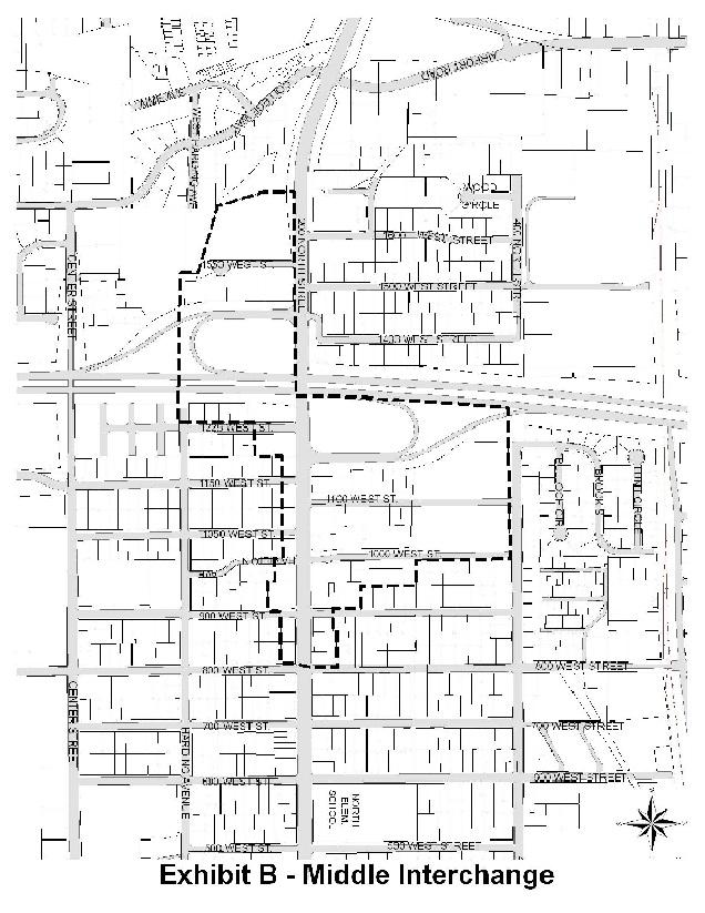
179 26-XVI-20
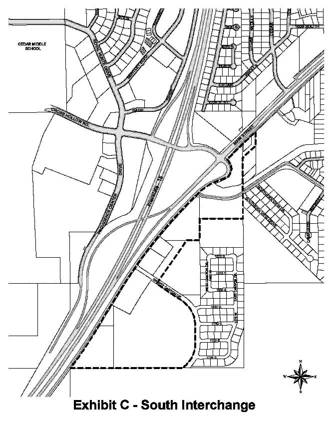
180 26-XVI-21
CHAPTER 26 PLANNING AND ZONING ARTICLE I. INTRODUCTORY PROVISIONS
 CHAPTER 26 PLANNING AND ZONING ARTICLE I. INTRODUCTORY PROVISIONS Section 26-I-1. Purpose Section 26-I-2. Interpretation Section 26-I-3. Scope Section 26-I-4. Definitions This Chapter shall be entitled
Chapter 03 Definitions
 Chapter 03 Definitions Section 10:03: 1 Terms Defined: For the purpose of this title, certain words and terms are defined as follows: Words used in the present tense include the future; words in the singular
ARTICLE 8 R-2 MULTIPLE FAMILY RESIDENTIAL DISTRICT
 ARTICLE 8 R-2 MULTIPLE FAMILY RESIDENTIAL DISTRICT SECTION 800 STATEMENT OF PURPOSE This district classification is designed to permit the greatest density of residential uses allowed within the Township,
ARTICLE 7 R-1 ONE FAMILY RESIDENTIAL DISTRICT
 ARTICLE 7 R-1 ONE FAMILY RESIDENTIAL DISTRICT SECTION 700 STATEMENT OF PURPOSE This district classification is designed to be the most restrictive of the residential districts intended to encourage an
SECTION 822 "R-1-A" AND "R-1-AH" - SINGLE FAMILY RESIDENTIAL DISTRICTS
 SECTION 822 "R-1-A" AND "R-1-AH" - SINGLE FAMILY RESIDENTIAL DISTRICTS The "R-1-A" and "R-1-AH" Districts are intended to provide for the development of single family residential homes at urban standards
GC General Commercial District
 Section 712. GC General Commercial District 712.1 Intent of District. It is the intent of this section that the GC Zoning District be developed and reserved for general business purposes. The regulations
City of Fraser Residential Zoning District
 City of Fraser Residential Zoning District The one-family districts are established to provide principally for one-family dwellings at varying densities. The specific interest of these districts is to
For the purpose of this Zoning Ordinance, the Village is hereby divided into five classes of zoning districts known as:
 Chapter 3 District Regulations SECTION 301. VILLAGE ZONING DISTRICTS. For the purpose of this Zoning Ordinance, the Village is hereby divided into five classes of zoning districts known as: R-1 Low-Density
Title 18 Zoning i
 Title 18 Zoning Chapter 18.02 - General Provisions... 18-1 18.02.010 Adoption of Provisions... 18-1 18.02.020 Purpose.... 18-1 18.02.030 Interpretation.... 18-1 18.02.040 Conflicting Provisions.... 18-1
H 7741 SUBSTITUTE A ======== LC005052/SUB A/2 ======== S T A T E O F R H O D E I S L A N D
 01 -- H 1 SUBSTITUTE A LC000/SUB A/ S T A T E O F R H O D E I S L A N D IN GENERAL ASSEMBLY JANUARY SESSION, A.D. 01 A N A C T RELATING TO TOWNS AND CITIES -- ZONING ORDINANCES Introduced By: Representatives
ARTICLE 14 BUILDINGS, STRUCTURES, AND USES ACCESSORY TO SINGLE-FAMILY RESIDENTIAL DWELLINGS
 ARTICLE 14 BUILDINGS, STRUCTURES, AND USES ACCESSORY TO SINGLE-FAMILY RESIDENTIAL DWELLINGS Sec. 14.1. Sec. 14.2. Sec. 14.3. Sec. 14.4. Sec. 14.5. Sec. 14.6. Sec. 14.7. Sec. 14.8. Sec. 14.9. Sec. 14.10.
ARTICLE IV DISTRICT REGULATIONS
 PART 1. RESIDENTIAL DISTRICTS 4-101. RS. Single-Family Residential Suburban District. The RS District is designed for single-family dwellings, and compatible uses, at a density no greater than one dwelling
Article II, Chapter EXHIBIT A Title 17 Zoning. Chapter Allowed Land Uses and Requirements Sections: Purpose
 Article II, Chapter 17.22 EXHIBIT A Title 17 Zoning Chapter 17.22 Allowed Land Uses and Requirements Sections: 17.22.010 Purpose The purpose of this Chapter is to establish allowed land uses and requirements
ARTICLE 15. RULES, REGULATIONS AND DEFINITIONS
 ARTICLE 15. RULES, REGULATIONS AND DEFINITIONS Section 1. Interpretation and Construction: The following rules and regulations regarding interpretation and construction of the Ulysses-Grant County, Kansas,
SECTION 817 "AL" - LIMITED AGRICULTURAL DISTRICT
 SECTION 817 "AL" - LIMITED AGRICULTURAL DISTRICT The "AL" District is a limited agricultural district. It is intended to protect the general welfare of the agricultural community by limiting intensive
DORSET ZONING BYLAW-APPROVED MARCH 5, 2002 BY VOTERS OF THE TOWN OF DORSET, VERMONT
 APPENDIX A: DEFINITIONS For the purpose of this Bylaw, certain terms or words shall be defined as below. All other words shall retain their dictionary meaning as found in any readily available dictionary,
CHAPTER 11 GENERAL REQUIREMENTS AND PROPERTY DEVELOPMENT STANDARDS
 CHAPTER 11 GENERAL REQUIREMENTS AND PROPERTY DEVELOPMENT STANDARDS Section 1101 Establishment of Development Standards: The purpose of development standards is to protect the general health, safety and
ACCESSORY USE: A subordinate use customarily incidental to and located on the same lot occupied by the principal use, and under the same ownership.
 Village of Chatham, NY Proposed Revisions to 110-5 Definitions Mark-up revisions as of March 5, 2018 ACCESSORY USE: A subordinate use customarily incidental to and located on the same lot occupied by the
ARTICLE III: LAND USE DISTRICTS 304 R 9 DISTRICT
 ARTICLE III: LAND USE DISTRICTS III 23 304 R 9 DISTRICT (RESIDENTIAL 9 UNITS PER ACRE) 304 1 Intent and Purpose The R 9 District is intended to implement the policies of the Comprehensive Plan for areas
4. Public service facilities, such as police and fire stations.
 CHAPTER 500. SECTION 525. ZONING STANDARDS C-1 NEIGHBORHOOD COMMERCIAL DISTRICT 525.1. Purpose The purpose of the C-1 Neighborhood Commercial District is to provide and require a unified and organized
SECTION 821 "R-A" - SINGLE FAMILY RESIDENTIAL-AGRICULTURAL DISTRICT
 SECTION 821 "R-A" - SINGLE FAMILY RESIDENTIAL-AGRICULTURAL DISTRICT The "R-A" District is intended to provide for the development of single family residential estate homes in a semi-rural environment on
A. For the purpose of this Ordinance, certain terms used herein are defined as follows:
 Page 1 of 10 SECTION 10. DEFINITIONS A. For the purpose of this Ordinance, certain terms used herein are defined as follows: All words used in the present tense shall include the future tenses; all words
 Page 1 of 9 Escondido Municipal Code Up Previous Next Main Collapse Search Print No Frames Chapter 33 ZONING ARTICLE 8. RESIDENTIAL ESTATES (R-E) ZONE Sec. 33-120. Purpose. The purpose of the residential
4.2 RESIDENTIAL ZONING DISTRICTS
 4.2 RESIDENTIAL ZONING DISTRICTS A. Purpose: To define regulations and standards for each residential zoning district in the City. The following sections identify uses, regulations, and performance standards
ARTICLE C. ZONING TEXT, DISTRICT CLASSIFICATIONS AND BOUNDARIES
 ARTICLE C. ZONING TEXT, DISTRICT CLASSIFICATIONS AND BOUNDARIES Sec. 10-2054. ZONING TEXT, DISTRICT CLASSIFICATIONS AND BOUNDARIES. In order to regulate the location of structures, the height and bulk
CUDAHY MUNICIPAL CODE
 CUDAHY MUNICIPAL CODE 20.80.010 Accessory uses may be developed as permitted in this zoning code provided such uses are located on the same lot or parcel of land and are incidental to, and do not substantially
Box Elder County Land Use Management & Development Code Article 3: Zoning Districts
 Chapter 3-6 Mobile Homes, Mobile Home Subdivisions, & Recreational Vehicle Parks Box Elder Zoning Ordinance as Adopted October 2007 Sections. 3-6-010. Purpose and Intent. 3-6-020. Conditional Use Permit
ZONE TITLE: RESIDENTIAL MEDIUM DENSITY (RMD)
") ZONE TITLE: RESIDENTIAL MEDIUM DENSITY (RMD) RMD USE CLASSIFICATIONS Permitted Use Classes (see Regulation 101) Single Dwelling, Recreational Open Space, Conservation (see Schedules A and B for definitions
ZONE TITLE: RESIDENTIAL MEDIUM DENSITY (RMD) RMD USE CLASSIFICATIONS Permitted Use Classes (see Regulation 101) Single Dwelling, Recreational Open Space, Conservation (see Schedules A and B for definitions
"R-1" SINGLE-FAMILY RESIDENCE DISTRICT
 ARTICLE IV. "R-1" SINGLE-FAMILY RESIDENCE DISTRICT SECTION 400.060: "R-1" SINGLE-FAMILY RESIDENCE DISTRICT The regulations set forth in this Article or set forth elsewhere in this Chapter when referred
d. DWELLING, GROUP QUARTERS (no more than sixteen [16] persons, including domestic servants and resident staff).
![d. DWELLING, GROUP QUARTERS (no more than sixteen [16] persons, including domestic servants and resident staff).](/thumbs/93/113051450.jpg "d. DWELLING, GROUP QUARTERS (no more than sixteen [16] persons, including domestic servants and resident staff).") SEC. 37-7.5. R-5 GENERAL RESIDENCE DISTRICT The R-5 General Residence District is established to provide for a range of low density residential accommodations and life styles representing a compatible
SEC. 37-7.5. R-5 GENERAL RESIDENCE DISTRICT The R-5 General Residence District is established to provide for a range of low density residential accommodations and life styles representing a compatible
SECTION 828 "R-3" AND "R-3-A" MEDIUM DENSITY MULTIPLE FAMILY RESIDENTIAL DISTRICTS
 SECTION 828 "R-3" AND "R-3-A" MEDIUM DENSITY MULTIPLE FAMILY RESIDENTIAL DISTRICTS The "R-3" AND "R-3-A" Districts are intended to provide for the development of medium density multiple family residential
Section 1. General Rules of Construction The following general rules of construction shall apply to the regulations of the Ordinance:
 ARTICLE 13. DEFINITIONS Section 1. General Rules of Construction The following general rules of construction shall apply to the regulations of the Ordinance: 1. The singular number includes the plural
CHAPTER 7 PROVISIONS GOVERNING USE DISTRICTS
 CHAPTER 7 PROVISIONS GOVERNING USE DISTRICTS 11-701. R-1 Residential and Agricultural. It is the purpose and intent of this district to provide areas that are suitable for low density residential uses,
ZONING ORDINANCE TOWN OF MOUNTAIN CITY
 ZONING ORDINANCE TOWN OF MOUNTAIN CITY AMENDED THROUGH JUNE 2009 ZONING ORDINANCE OFTHE TOWN OF MOUNTAIN CITY An ordinance, in pursuance of the authority granted by Sections 13-7-201 through 13-7- 210
Sec (JULY 2000 EDITION, Pub. by City of LA) 161
 161") Sec. 12.09 SEC. 12.09 -- R2 TWO-FAMILY ZONE. The following regulations shall apply in the R2 Two-family Zone: A. Use -- No building, structure or land shall be used and no building or structure shall be
Sec. 12.09 SEC. 12.09 -- R2 TWO-FAMILY ZONE. The following regulations shall apply in the R2 Two-family Zone: A. Use -- No building, structure or land shall be used and no building or structure shall be
SEC R-3 SINGLE FAMILY RESIDENCE DISTRICT
 SEC. 37-7.3. R-3 SINGLE FAMILY RESIDENCE DISTRICT The R-3 Single Family Residence District is established to preserve and maintain existing single family areas of the County and permit the continued development
SECTION 827 "R-2" AND "R-2-A" - LOW DENSITY MULTIPLE FAMILY RESIDENTIAL DISTRICTS
 SECTION 827 "R-2" AND "R-2-A" - LOW DENSITY MULTIPLE FAMILY RESIDENTIAL DISTRICTS The "R-2" and "R-2-A" Districts are intended to provide for the development of low density multiple family residential
Sec For the purpose of this Ordinance, the City of Plainwell is hereby divided into the following districts: TABLE INSET:
 15.030 Districts. Sec. 300. For the purpose of this Ordinance, the City of Plainwell is hereby divided into the following districts: TABLE INSET: 1. R-1A, R-1B Single-Family Residence District 2. R-1C
Commercial Building for Lease. For Lease at $10.00/SF Gross + Expenses
 Commercial Building for Lease EXECUTIVE SUMMARY 232-242 Boston Post Road Milford, Connecticut 06460 For Lease at $10.00/SF Gross + Expenses 5,750 SF freestanding building with direct access from Plains
DEFINITIONS. 202 General Construction of Language The following general rules of construction apply to the text of the Zoning Regulations.
 2 ARTICLE TWO DEFINITIONS 201 Purpose Article Two shall be known as the Definitions. The purpose of these provisions is to promote consistency and precision in the interpretation of the Zoning Regulations.
Code of Ordinances, Town of Chincoteague, VA Abstracted March CHAPTER 2.
 Code of Ordinances, Town of Chincoteague, VA Abstracted March 2016 http://www.chincoteague-va.gov/pdf/town-code2010.pdf CHAPTER 2. POWERS OF TOWN Sec. 1. Generally. 15. To acquire, establish, enter, open,
ARTICLE 7 R-1 LOW DENSITY ONE-FAMILY RESIDENTIAL DISTRICT Updated 5/4/13
 ARTICLE 7 R-1 LOW DENSITY ONE-FAMILY RESIDENTIAL DISTRICT Updated 5/4/13 Sec. 7.01. DESCRIPTION AND PURPOSE. This is the most restricted, low-density zone, composed chiefly of low-density one-family homes
Camp Washington Zoning Proposed Changes 11/30/2018
 Camp Washington Zoning Proposed Changes 11/30/2018 The Camp Washington Community Board was established in 1975 to help save houses in distress, build homeownership, and generally improve the quality of
PART ONE AUTHORIZATION AND GENERAL PROVISIONS
 PART ONE AUTHORIZATION AND GENERAL PROVISIONS ARTICLE I AUTHORIZATION AND PURPOSE Section 1.01 Title This Resolution shall be known and may be cited as the : Z O N I N G R E S O L U T I O N of MADISON
MOBILE HOME PARKS. MOBILE HOME: A manufactured, relocatable dwelling unit which may not meet the minimum requirements of the Uniform Building Code.
 Title 10 Zoning Ordinance Definitions: MOBILE HOME PARKS MOBILE HOME: A manufactured, relocatable dwelling unit which may not meet the minimum requirements of the Uniform Building Code. MOBILE HOME COURT:
a. To insure compatible relationships between land use activities;
 PART B SECTION VIII INSTITUTIONAL DISTRICTS Article 1 Planned Institutional District 1. Purpose and Intent: It is the purpose and intent of this district to permit and encourage the orderly, cooperative
SECTION 820 "R-R" - RURAL RESIDENTIAL DISTRICT
 SECTION 820 "R-R" - RURAL RESIDENTIAL DISTRICT The "R-R" District is intended to create or preserve rural or very large lot residential homesites where a limited range of agricultural activities may be
RT-2 District Schedule
 District Schedule 1 Intent The intent of this Schedule is to permit two-family dwellings and to conditionally permit, in some instances, low density multiple-family housing. 2 Outright Approval Uses 2.1
As shown on plans filed on October 23, 2015 with this Board and a copy of which is on file with the Town Clerk's office.
 January 5, 2016 Hearing by the Burlington Board of Appeals Continued Hearing The District (2015-96) Planning Board The petition of Town of Burlington Planning Board located at 25 Center St. for property
ARTICLE 11. NAMEPLATES AND SIGNS Signs in all districts.
 //Culpeper County, Virginia/CODE OF ORDINANCES COUNTY OF CULPEPER, VIRGINIA Codified through Ordinance of November 7, 2007. (Supplement No. 3)/APPENDIX A ZONING ORDINANCE*/ARTICLE 11. NAMEPLATES AND SIGNS
CHAPTER 17 ZONING CODE Industrial District
 General Provisions CHAPTER 17 ZONING CODE Industrial District 17.10 Title 17.20 Purpose 17.30 Application of regulations 17.40 Site Plan - requirements 17.50 Definitions Zoning Map 17.60 Establishment
CHAPTER 1268 R-1, R-2 AND R-3 RESIDENTIAL DISTRICTS
 CHAPTER 1268 R-1, R-2 AND R-3 RESIDENTIAL DISTRICTS 1268.01 PURPOSE. Residential districts and their regulations are established in order to achieve, among others, the following purposes: (a) To regulate
CHAPTER XX ZONING PART 1 GENERAL PROVISIONS PART 2 RESIDENTIAL DISTRICTS
 CHAPTER XX ZONING PART 1 GENERAL PROVISIONS 101 Titles 102 General Intent 103 General Goals 104 General Provisions 105 Relationship to the Comprehensive Plan 106 Establishment of Controls and Districts
 Page 1 of 8 Laguna Beach Municipal Code Up Previous Next Main Collapse Search Print No Frames Title 25 ZONING Chapter 25.10 R-1 RESIDENTIAL LOW DENSITY ZONE 25.10.002 Intent and purpose. This zone is intended
Lane Code CHAPTER 10 CONTENTS
 Lane Code CHAPTER 10 CONTENTS SUBURBAN RESIDENTIAL DISTRICT (RA) 10.135-10 Permitted Buildings and Uses. 10.135-15 Conditional Uses. 10.135-21 Height. 10.135-23 Setback Requirements. 10.135-26 Lot Coverage.
SECTION 817 "AL" - LIMITED AGRICULTURAL DISTRICT
 SECTION 817 "AL" - LIMITED AGRICULTURAL DISTRICT The "AL" District is a limited agricultural district. It is intended to protect the general welfare of the agricultural community by limiting intensive
The ordinance codified in this title shall be known as the zoning ordinance of the city of Centerville.
 TITLE 17 - ZONING Chapters: Chapter 17.02 - General Provisions Chapter 17.04 - Definitions Chapter 17.06 - Use Types Chapter 17.08 - Zoning District Regulations Chapter 17.10 - Special and Overlay Districts
ZONING AND SUBDIVIDING CHAPTER 7: ZONING AND SUBDIVIDING
 CHAPTER 7: ZONING AND SUBDIVIDING 1 CHAPTER 7: ZONING AND SUBDIVIDING Chapter Page General Provisions 7.01 Purpose 4 7.02 Definitions 4 District Classification and Map 7.03 Zoning map and districts 11
Bufferyard shall mean a landscaped setback area at the boundary of a development.
 For the purposes of this Specific Plan, certain terms shall be defined as set forth in this Section. Terms not listed herein shall be defined per the City s Zoning Ordinance, or if not listed in said Zoning
RM-1 and RM-1N Districts Schedule
 Districts Schedule 1 Intent The intent of this Schedule is to encourage development of courtyard rowhouses on larger sites while continuing to permit lower intensity development on smaller sites. Siting
ARTICLE 3 DEFINITIONS
 Sections: 3-1 Rules of Construction 3-2 Definitions ARTICLE 3 DEFINITIONS SECTION 3-1 RULES OF CONSTRUCTION 3-101. a. The language set forth in these regulations shall be interpreted in accordance with
FOR SALE COMMERCIAL BEACHSIDE LOT
 FOR SALE COMMERCIAL BEACHSIDE LOT 1100 South Patrick Dr., Satellite Beach, Florida 32937.69 Acres, Zoning C-Commercial Lot is Cleared Numerous Allowable Intended Uses (see zoning on next page) High Visibility
2. Second dwellings and medical hardships per Article 10.
 Article 7: Zoning Districts and Zoning Map Section 135: NON-URBAN ZONING DISTRICT (NU) A. Purpose The intent of this district is to allow agricultural, recreational, wildlife, forestry, open space, farming
VOLUME II - APPENDIX B - BASIC ZONING ORDINANCE ARTICLE V. DISTRICT REGULATIONS
 Sec. 5.1000. Multiple-family Residential (R-5). (Ord. No. 4005, 1(Res. No. 8947, Exh. A, 55), 4-3-12) Sec. 5.1001. Purpose. This district is intended to provide for development of multiple-family residential
CHAPTER ZONING DISTRICTS. For the purposes of this title, the city is divided into districts designated as follows:
 CHAPTER 17.30 ZONING DISTRICTS 17.30.00 ZONING DISTRICT DESIGNATIONS For the purposes of this title, the city is divided into districts designated as follows: DISTRICT SYMBOL Parks and Open Space POS Residential
1. Permitted Uses of Land, Buildings, and Structures
 803 Non-Urban Zone (.) 1. Permitted Uses of Land, Buildings, and Structures Subject to the provisions of Divisions Three and Four of this bylaw, the following uses and no others shall be permitted in the
COMMERCIAL ZONING DISTRICTS (Amended 11/13/14) Part I. C-1 Restricted Commercial District
 Part I. C-1 Restricted Commercial District") ARTICLE XI. COMMERCIAL ZONING DISTRICTS (Amended 11/13/14) Part I. C-1 Restricted Commercial District Section 152: Purpose This district is designed to accommodate commercial uses which act as a transition
ARTICLE XI. COMMERCIAL ZONING DISTRICTS (Amended 11/13/14) Part I. C-1 Restricted Commercial District Section 152: Purpose This district is designed to accommodate commercial uses which act as a transition
CHAPTER 2 RELATIONSHIP WITH OTHER LAWS.
 CHAPTER 2 General Provisions 12-2-1 Minimum Requirements 12-2-2 Relationship with Other Laws 12-2-3 Effect on Existing Agreements 12-2-4 Scope of Regulations 12-2-5 Building Permit 12-2-6 Nonconforming
ARTICLE VII - RESIDENTIAL DISTRICT R-2. be for one or more of the following uses:
 ARTICLE VII - RESIDENTIAL DISTRICT R-2 7-1 USE REGULATIONS In Residential District R-2, structures to be erected or land to be used shall be for one or more of the following uses: 7-1.1 Single-family dwellings.
RO-1 HIGH DENSITY RESIDENTIAL-PROFESSIONAL OFFICE DISTRICT
 6.12 - RO-1 HIGH DENSITY RESIDENTIAL-PROFESSIONAL OFFICE DISTRICT 6.12.1 PERMITTED USES: Within the RO-1 High Density Residential- Professional Office District the following uses are permitted: 6.12.1.1
TITLE 14 ZONING AND LAND USE CONTROL CHAPTER 1 MUNICIPAL PLANNING COMMISSION
 14-1 TITLE 14 ZONING AND LAND USE CONTROL CHAPTER 1. MUNICIPAL PLANNING COMMISSION. 2. ZONING ORDINANCE. 3. MOBILE HOMES (TRAILERS). CHAPTER 1 MUNICIPAL PLANNING COMMISSION SECTION 14-101. Creation and
ARTICLE VI. SPECIAL EXCEPTION REGULATIONS
 ARTICLE VI. SPECIAL EXCEPTION REGULATIONS SECTION 601. GENERAL DESCRIPTION Special exceptions are deemed to be permitted uses in their respective districts, subject to the satisfaction of the requirements
17.13 RH HILLSIDE RESIDENTIAL ZONES REGULATIONS SECTIONS:
 Effective April 14, 2011 Chapter 17.13 RH HILLSIDE RESIDENTIAL ZONES REGULATIONS SECTIONS: 17.13.010 Title, Intent, and Description 17.13.020 Required Design Review Process 17.13.030 Permitted and Conditionally
Sec Tier 2 principal uses and structures. The principal uses of land and structures allowed in Tier 2 are provided below subject to the
 Sec. 27-730.4.9. Tier 2 principal uses and structures. The principal uses of land and structures allowed in Tier 2 are provided below subject to the standards and limitations contained within this division.
ZONING DISTRICT #1 ZONING REGULATION
 ZONING DISTRICT #1 ZONING REGULATION ADOPTED FEBRUARY 9, 1995 TABLE OF CONTENTS SECTION 1 TITLE, CREATION AND ADOPTION... 1 SECTION 2 INTENT... 1 SECTION 3 PURPOSES AND BOUNDARIES... 2 SECTION 4 DEFINITIONS...
Midwest City, Oklahoma Zoning Ordinance
 2010 Midwest City, Oklahoma Zoning Ordinance 9/2/2010 Table of Contents Section 1. General Provisions... 5 1.1. Citation... 5 1.2. Authority... 5 1.3. Purpose... 5 1.4. Nature and Application... 5 1.5.
CHARLOTTE CODE. PART 1: PURPOSE AND PART 2: MIXED USE DISTRICTS (MX-1, MX-2, and MX-3) CHAPTER 11:
 CHAPTER 11:") PART 1: PURPOSE AND PART 2: MIXED USE DISTRICTS (MX-1, MX-2, and MX-3) Section 11.101. Purpose. CHAPTER 11: CONDITIONAL ZONING DISTRICTS PART 1: PURPOSE The Conditional Zoning Districts allow for the establishment
PART 1: PURPOSE AND PART 2: MIXED USE DISTRICTS (MX-1, MX-2, and MX-3) Section 11.101. Purpose. CHAPTER 11: CONDITIONAL ZONING DISTRICTS PART 1: PURPOSE The Conditional Zoning Districts allow for the establishment
Title 17 MOBILE HOMES AND RECREATIONAL VEHICLES
 17.04 General Provisions Title 17 MOBILE HOMES AND RECREATIONAL VEHICLES 17.04.010 General provisions 17.04.020 Application 17.04.030 Interpretation 17.04.040 Mobile homes and recreational vehicles--location
DECLARATION OF RESTRICTIONS, COVENANTS, AND CONDITIONS OF FOREST GLENN, PHASE I & II (Amended as of January 01, 2012)
") DECLARATION OF RESTRICTIONS, COVENANTS, AND CONDITIONS OF FOREST GLENN, PHASE I & II (Amended as of January 01, 2012) STATE OF TEXAS COUNTY OF TARRANT THIS DECLARATION made this 1 st day of February, 1995,
DECLARATION OF RESTRICTIONS, COVENANTS, AND CONDITIONS OF FOREST GLENN, PHASE I & II (Amended as of January 01, 2012) STATE OF TEXAS COUNTY OF TARRANT THIS DECLARATION made this 1 st day of February, 1995,
CHAPTER VII R-2 LOW DENSITY RESIDENTIAL DISTRICT
 CHAPTER VII R-2 LOW DENSITY RESIDENTIAL DISTRICT SECTION 7.01 DESCRIPTION AND PURPOSE. This Zoning District is intended for low density residential uses together with required recreational, religious and
RM-3 District Schedule
 District Schedule 1 Intent The intent of this Schedule is to permit medium density residential development, including high-rise apartment buildings, and to secure a higher quality of parking, open space
VILLAGE OF NEW AUBURN ZONING ORDINANCE
 VILLAGE OF NEW AUBURN ZONING ORDINANCE The Village Board of the Village of New Auburn, Chippewa County and Barron County, Wisconsin does hereby ordain as follows: Chapter 22 of the Code of Ordinances is
ORDINANCE NO. 730 NOW, THEREFORE, BE IT ORDAINED BY THE CITY COUNCIL OF THE CITY OF COLUMBIA FALLS, MONTANA AS FOLLOWS:
 ORDINANCE NO. 730 000142 AN ORDINANCE OF THE CITY COUNCIL OF THE CITY OF COLUMBIA FALLS, MONTANA, AMENDING PORTIONS OF TITLE 18 OF THE COLUMBIA FALLS MUNICIPAL CODE TO INCLUDE REFERENCE TO ASSEMBLY HALLS
C-2C1 District Schedule
 District Schedule 1 Intent The intent of this Schedule is to provide for a wide range of goods and services, to maintain commercial activities and personal services that require central locations to serve
ORDINANCE NO The Town Council of the Town of Yucca Valley does ordain as follows:
 ORDINANCE NO. 141 AN ORDINANCE OF THE TOWN COUNCIL OF THE TOWN OF YUCCA VALLEY, CALIFORNIA, AMENDING TITLE 8, DIVISION 12, CHAPTER 1 RELATING TO DEFINITIONS AND TITLE 8, DIVISION 8, CHAPTER 3, RELATING
Washington County, Minnesota Ordinances
 Washington County, Minnesota Ordinances Ordinance No. 153 Text Amendment to the Washington County Development Code - Chapter One, Section 2 and Chapter Two, Part 1, Part 2, Part 3, of the Development Code
ARTICLE 834. PD 834. PD 834 was established by Ordinance No , passed by the Dallas City Council on December 8, (Ord.
 ARTICLE 834. PD 834. SEC. 51P-834.101. LEGISLATIVE HISTORY. PD 834 was established by Ordinance No. 28070, passed by the Dallas City Council on December 8, 2010. (Ord. 28070) SEC. 51P-834.102. PROPERTY
Charter Township of Plymouth Zoning Ordinance No. 99 Page 52 Article 10: OS Office Service District
 Charter Township of Plymouth Zoning Ordinance No. 99 Page 52 PURPOSE ARTICLE X OS OFFICE SERVICE DISTRICT To provide a district to accommodate office uses of an administrative, business, governmental or
5.0 Specific Use Regulations
 5.0 Specific Use Regulations SPECIFIC 5.1 Application 5.1.1 In addition to the Regulations for the specific zones where the specific uses are allowed, the Specific Use Regulation shall apply to all development
CHAPTER 7 DISTRICT ESTABLISHMENT, ZONING MAP, AND REGULATIONS
 CHAPTER 7 DISTRICT ESTABLISHMENT, ZONING MAP, AND REGULATIONS SECTION 700 PURPOSE The purpose of this chapter is to establish zoning districts in order to realize the general purposes set forth in the
ARTICLE XXVIII. SPECIAL CONDITIONS AND DEVELOPMENT STANDARDS (Ord. No. 2835, 07/01/0; Ord. No. 2938, 10/19/04; Ord. No. 09/06/16))
)") ARTICLE XXVIII. SPECIAL CONDITIONS AND DEVELOPMENT STANDARDS (Ord. No. 2835, 07/01/0; Ord. No. 2938, 10/19/04; Ord. No. 09/06/16)) SECTION A. SPECIAL YARD REGULATIONS. 1. SPECIAL FRONT YARD REGULATIONS:
ARTICLE XXVIII. SPECIAL CONDITIONS AND DEVELOPMENT STANDARDS (Ord. No. 2835, 07/01/0; Ord. No. 2938, 10/19/04; Ord. No. 09/06/16)) SECTION A. SPECIAL YARD REGULATIONS. 1. SPECIAL FRONT YARD REGULATIONS:
 Deed Restrictions Deed Restrictions Tax Parcel Nos.:11-026.00-132,l33,158 & 159 Prepared BY: Nichols Development 2842 Pulaski Hwy. Newark, DE 19702 PERCH CREEK COMMUNITY DECLARATION OF RESTRICTIONS THIS
ZONING ORDINANCE. for the. City of Rainbow City, Alabama. Ordinance #360 Adopted June 28, 1999
 ZONING ORDINANCE for the City of Rainbow City, Alabama Ordinance #360 Adopted June 28, 1999 Amended by Ordinance # 361 on July 12, 1999 Amended by Ordinance #386 on November 13, 2000 Amended by Ordinance
Day care centers: Such uses shall require a Special Permit under the terms of Article VIII of this chapter.
 Page 1 of 12 DIVISION 1. - R-1 RESIDENTIAL ZONE Sec. 38-41. - Permitted uses. Single-family dwellings, excluding factory manufactured homes constructed as a single selfcontained unit and mounted on a single
ARTICLE III Section COMMERCIAL OFFICE RETAIL ENTERPRISE DISTRICT
 ARTICLE III Section 3-100 COMMERCIAL OFFICE RETAIL ENTERPRISE DISTRICT Section 3-100.1 Intent. The CORE district is intended to accommodate high intensity business uses appropriate for downtown locations
C.R. 802 Country Residential Zone (C.R.) 1. Permitted Uses of Land, Buildings, and Structures
 1. Permitted Uses of Land, Buildings, and Structures") 802 Country Residential Zone (.) 1. Permitted Uses of Land, Buildings, and Structures Subject to the provisions of Divisions Three and Four of this bylaw, the following uses and no others shall be permitted
802 Country Residential Zone (.) 1. Permitted Uses of Land, Buildings, and Structures Subject to the provisions of Divisions Three and Four of this bylaw, the following uses and no others shall be permitted
C-2B District Schedule
 District Schedule 1 Intent The intent of this Schedule is to provide for a wide range of goods and services, to maintain commercial activities and personal services that require central locations to serve
CITY OF MOUNT PLEASANT ORDINANCE NO. 1017
 CITY OF MOUNT PLEASANT ORDINANCE NO. 1017 AN ORDINANCE TO AMEND SECTIONS 152.004 AND 152.007 OF THE CODE OF ORDINANCES FOR THE CITY OF MOUNT PLEASANT TO ADOPT PROVISIONS OF THE 2012 INTERNATIONAL PROPERTY
City of Lynden Title 19 ZONING
 City of Lynden Title 19 ZONING Chapters Page Number 19.03 Comprehensive Plan 2 19.05 General Provisions 3 19.09 Maps and District Boundaries 4 19.11 Districts Established 5 19.13 Agricultural Zone 6 19.15
FOR SALE. +/-.86 Acres at St. Lucie West Blvd & Bayshore in Port St. Lucie, Florida. St. Lucie West Boulevard & Bayshore Boulevard, Port St.
 Shirley Harris (772) 288-6646 sharris@tccommercialre.com FOR SALE +/-.86 Acres at St. Lucie West Blvd & Bayshore in Port St. Lucie, Florida St. Lucie West Boulevard & Bayshore Boulevard, Port St. Lucie,