JOINT AIRPORT ZONING BOARD. Approval of the minutes of the June 9, 2014, Joint Airport Zoning Board meeting
|
|
|
- Roland Burns
- 5 years ago
- Views:
Transcription
1
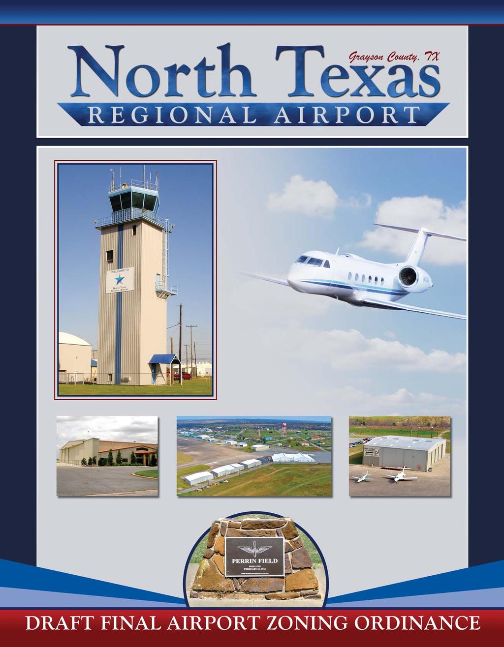
2 JOINT AIRPORT ZONING BOARD ITEM NUMBER: Two MEETING DATE: ITEM TITLE: SUBMITTED BY: Approval of the minutes of the June 9, 2014, Joint Airport Zoning Board meeting Terry Morrow, Administrative Asst. DATE SUBMITTED: June 19, 2014 SUMMARY: Minutes of the June 9, 2014, Joint Airport Zoning Board Meeting as transcribed from recorded tape. ATTACHMENTS (LIST) Minutes ALTERNATIVES/RECOMMENDATIONS: Approve minutes with changes if any.
3 NORTH TEXAS REGIONAL AIRPORT JOINT AIRPORT ZONING BOARD JUNE 9, 2014 MEMBERS' PRESENT: Phil Roether, Chairman Ken Brawley Kevin Farley Randy Hensarling Ryan Johnson Jason Sofey Todd Thompson OTHERS' PRESENT: Michael Hutchins, Herald Democrat Bart Lawrence, Commission, Pct. #4 Scott Shadden, City of Sherman MEMBERS' ABSENT: Janet Gott Lee Olmstead Jim Copeland Wm. B. (Ben) Munson, Esquire Alex Moser I. Call to Order. Mr. Roether called the meeting to order at 12:00 p.m. Mr. Roether stated that the Board was at a point where they had been through the entire document, although there are a few issues that need to be completed before this could go to a public hearing. He stated that depending on how things went at this meeting, the Board would have another regular meeting on June 25. He stated that if everything went well, the Board may be in a position to make a recommendation to take its position to a public hearing which could be scheduled in July. II. Approval of the minutes of the April 30, 2014, Joint Airport Zoning Board Meeting. Mr. Roether asked if the Board had the opportunity to review the minutes of the previous meeting. Mr. Johnson made the motion to approve the minutes. Mr. Sofey seconded the motion. All members voted aye. III. Workshop to review Airport Zoning Committee recommendations for the Airport Zoning Ordinance. Mr. Roether asked Mr. Hensarling to update the Board on the progress of the sub-committee. Mr. Hensarling stated that the committee was made up of himself, Mr. Sofey, Mr. Thompson, and Mr. Brawley. He stated that Mr. Pete Hudgins and Mr. Jim Copeland were the land owners that were on the committee. He stated that the committee had come up with a revised map. He stated that the committee tried to look at this differently so that it would have a minimal impact on landowners. He stated that Zone A had been divided into two zones, which would be Zone A1 and Zone A2. He stated that Zone A1 had a maximum 1 dwelling unit per 5 acres and a maximum of 100 persons per acre for residential intensity. He stated that some prohibited uses had been removed, which included restaurants, office, retail, etc. He stated that some prohibited uses had been left in because it was felt that they were a real safety concern. Mr. Hensarling stated that Zone A2 restrictions were lightened up. He stated that 1 dwelling unit for 2.5 acres and 250 persons per acre and with no limit to the open land requirement. He stated that the Joint Airport Zoning Board June 9,
4 prohibited uses were reviewed and changed to what Zone B had been originally. Mr. Hensarling stated that Zone B was left intact with the only requirement being a fair disclosure statement signed at the time that the property changes hands. He stated that the lines for Zone A1 and A2 were drawn using the existing avigation easements because it was felt that those landowners were already aware of the height restrictions. He stated that the lines were shortened some from the avigation easements in order to follow existing roads or property lines. Mr. Roether asked if the size of Zone A was reduced to what is in the current avigation easement. Mr. Hensarling stated that was correct with the exception of them being shortened somewhat on the north and south ends. He did state that the existing avigation easement would remain in place. Mr. Hensarling stated that Zone B had grown some due to Zone A being decreased. Mr. Johnson asked what the fair disclosure statement was and Mr. Hensarling stated that it was a statement that stated that you were aware that you were either building or buying property near an airport. Mr. Johnson asked if the disclosure statement in the packet was what they were talking about and Mr. Hensarling stated that was correct. Mr. Roether stated that it was his understanding that the current avigation easement has been filed in the County Clerk s office on all the properties within the boundaries. He asked if rather than relying on people s memories when property is finally sold if there was a way to do the same with this notice. Mr. Munson stated that it could be done. He stated that should the Board determine an appropriate disclosure statement for each of the three zones, a surveyor could develop metes and bounds for that particular disclosure area. He stated that the Board could pass a resolution that it be recorded with the County Clerk. Mr. Copeland stated that he felt this was more reasonable than the original proposal. He stated that as he talked to landowners they were most concerned about the dwelling units per acre in Zone A2. He asked the committee to review this so that it might be removed. Mr. Hensarling stated that the committee had not met since the last meeting and therefore it was still in the document. Mr. Copeland stated that the prohibited uses seemed reasonable and the reduction of the open land requirement was reduced. Mr. Copeland stated that he did not understand the safety factor in the residential restriction more than 1 nautical mile from the Airport. Mr. Hensarling stated that the removal of the dwelling unit requirement had not been discussed but he stated that he understood that on approach the aircraft is lined up well before that one nautical mile and is coming in directly over those properties in Zone A2. Mr. Hensarling stated that they had reviewed some other airport s ordinance and this seemed to fall in line with those. After some discussion, it was agreed that this would be left in place. Mr. Sofey stated that there had been some discussion on the 30% open land requirement and a definition for it. Mr. Roether stated that the reasoning behind the 30% requirement was to give the pilot room to land in the case of an emergency and do minimal damage. He further stated that the 30% was for the entire area, and not per parcel of land. After some discussion, it was agreed that a definition of open land should be included in Table A. Mr. Copeland suggested that the definition could be land not occupying a building and could be included as a footnote. After all discussion, Mr. Hensarling made the motion to replace the existing map and Table A with the map and Table A proposed by the Zoning Sub-Committee once a definition of open land is inserted. Mr. Johnson seconded the motion. All members voted aye. Mr. Roether stated that Mr. Johnson was going to review the appeal process. Mr. Johnson stated that he had reviewed Midway Airport and liked the way that they had it structured. He stated that any aggrieved person or taxpayer that is affected by a decision, and also any municipality, could bring an action through judicial process in order to enforce the ordinance or force compliance with the ordinance. He stated that the Board needed to decide if the appeal process included just the aggrieved land owner or Joint Airport Zoning Board June 9,
5 included the municipality that is trying to enforce the ordinance. Mr. Roether asked if Mr. Johnson if he could make a recommendation for this section for the June 25 meeting. He stated that he could but he wanted some guidance from the Board. Mr. Sofey stated that he thought the landowner should have the right to maximize the appeal opportunities without going through the judicial system. Mr. Johnson stated that he would prepare something for a two-tiered system like Midway Airport and the Board could discuss it at the next meeting. Mr. Copeland stated that some of the landowners wanted the governing elected officials of the municipality or county to make the decision on the permit request and/or appeal before going to judicial review. He stated that this would allow an elected official, versus an appointed official, to make the decision. Mr. Johnson asked Mr. Copeland if he would agree that the permit request go through P&Z and appeals be heard by the City Council and Mr. Copeland stated that would be fine. Mr. Sofey asked Mr. Copeland if he wanted the appeal for property in the county to go before Commissioners Court instead of the RMA and Mr. Copeland stated that was correct. Mr. Sofey stated that he felt that the verbiage relating to property in the county was what needed to be addressed. Mr. Roether asked Mr. Johnson to validate the rules is 241 about the JAZB being able to hear appeals. IV. Public Comments. Commissioner Lawrence asked Mr. Roether to repeat the schedule of events for the Board. Mr. Roether stated that there would be a property owner meeting on June 28, He stated that the Board would meet again on June 25, He stated that he hoped that they Board would be in a position to make a recommendation to take what has been accepted to a public hearing in July. He stated that they might be in a position to incorporate what has been developed at the July meeting, which is the last Wednesday in July. He stated that he hoped to be able to enact the ordinance in either July or August. V. Adjourn. Mr. Sofey made the motion to adjourn the meeting and Mr. Brawley seconded the motion. All members voted aye. The meeting was adjourned at 12:55pm. Phil Roether, Chairman Terry Morrow, Administrative Asst. Joint Airport Zoning Board June 9,
6 JOINT AIRPORT ZONING BOARD ITEM NUMBER: Four MEETING DATE: ITEM TITLE: SUBMITTED BY: Workshop to continue review of the draft Airport Zoning Ordinance. Mike Shahan, Airport Director DATE SUBMITTED: June 19, 2014 SUMMARY: Enclosed is Revision 8 of the draft NTRA Zoning Ordinance in red-line format so you can see the changes. The remaining changes include are listed below: 1. Section 6, page 5 has been modified 2. Exhibit B, page 9 has been modified to show the recommended enforcement procedure as recommended by the JAZB at the last meeting. 3. Section 6, page 10 added paragraph 8.2 outlining height related appeal process 4. Section 9, page 11 change Section to Section Section 11.0, page 11 inserted that the penalty is a Class B misdemeanor and a fine of up to $2, per offense. Attachment E: Implementation Materials is included as an attachment for your review. Attachments A through D, which are the zoning maps and legal descriptions for the various properties being covered by this draft zoning ordinance is not included in this agenda packet due to the size of the attachments. These attachments will need to be modified once the zones have been accepted by the JAZB. All attachments will be covered in greater detail at a later JAZB Workshop. Please refer to your previous draft zoning ordinance booklet to review the attachments. ATTACHMENTS (LIST) Draft NTRA Zoning Ordinance, revision 8 dated June 19, 2014 ALTERNATIVES/RECOMMENDATIONS:
7
8 DRAFT NORTH TEXAS REGIONAL AIRPORT LAND USE COMPATIBILITY ZONING ORDINANCE 1.0 PURPOSE The North Texas Regional Airport (the Airport ) is used in the interest of the public and fulfills an essential purpose for the communities of Denison, Pottsboro, Sherman, and Grayson County. This Airport Land Use Compatibility Zoning Ordinance (the Ordinance ) for the Airport is intended to protect and promote the safety and welfare of Airport users and residents near the Airport, while promoting the continued operation of the Airport. Specifically, the Ordinance seeks to protect the public from the adverse effects of Airport noise, to ensure that people and facilities are not concentrated in areas susceptible to aircraft accidents, and to ensure that no structures or activities encroach upon or adversely affect the use of navigable airspace. The Ordinance will ensure compatible development in the vicinity of the Airport by defining terms of use within created compatibility zones, creating the appropriate compatibility zones, and providing for enforcement. The Ordinance is adopted pursuant to the authority conferred by the Airport Zoning Act, Texas Local Government Code, Section 241. Municipal and County Zoning Authority around Airports. 2.0 DEFINITIONS (1) ACT means the Airport Zoning Act, Texas Local Government Code, Section (2) ADMINISTRATIVE AGENCY The Grayson County Denison Pottsboro Sherman Joint Airport Zoning Board (the Joint Airport Zoning Board ) or an administrative agency, commission, board, or person designated by the Joint Airport Zoning Board to administer and enforce airport compatible land use zoning regulations. (3) AIRPORT Means that area of land owned by Grayson County and located within Grayson County, Texas, currently referred to as the North Texas Regional Airport which is designed and set aside for the landing and taking off of aircraft and used or to be used in the interest of the public for such purpose. The term includes an area with installations relating to flights, including facilities, and bases of operation for tracking flights or acquiring data concerning flights. (4) Airport Director Means the Airport Director of the North Texas Regional Airport. (5) Airport Elevation The established elevation of the highest point on the runway, either existing or planned, at the airport measured in feet above mean sea level (MSL). The airport elevation of the North Texas Regional Airport is 749 feet above mean sea level (MSL). (6) AIRPORT HAZARD Means a structure or object of natural growth or use of land that obstructs the air space required for the taking off, landing, and flight of aircraft or that in Draft NTRA Zoning Ord., rev 8:
9 terferes with visual, radar, radio, or other systems for tracking, acquiring data relating to, monitoring, or controlling aircraft. (7) AIRPORT HAZARD AREA Means an area of land or water on which an airport hazard could exist defined by the Act or Regulation. (8) AIRPORT ZONING REGULATION Means an airport hazard area defined or described by zoning regulation or an airport compatible land use zoning regulation adopted under this Ordinance. (9) AVIGATION EASEMENT Means an easement which shall include, but is not limited to, the right of aircraft to fly over the Land, together with its attendant noise, vibrations, fumes, dust, fuel and lubricant particles, and all other effects that may be caused by the operation of aircraft landing at, or taking off from, or operating at or on the Airport. (10) CENTERLINE Means a line extending through the midpoint of each end of a runway and extending outward to the North and/or South end of Zone A. (11) COMPATIBLE LAND USE Means a use of land in the vicinity of the Airport within the Development Zone that does not endanger the health, safety, or welfare of the owners, occupants, or users of the land because of levels of noise or vibrations or the risk of personal injury or property damage created by the operations of the Airport, including the taking off and landing of aircraft, as indicated on attached Exhibit A. (12) CONTROLLED COMPATIBLE LAND USE Means an area of located outside airport boundaries and within a rectangle bounded by lines located no farther than one and onehalf statute miles from the centerline of an instrument or primary runway and lines located no farther than five statute miles from the each end of the paved surface of an instrument or primary runway. Further definition of controlled compatible land use is found in Section 3.0 and Exhibit A: Zoning Boundaries. (13) EXISTING LAND USE A land use which either physically exists or for which local government commitments along with substantial construction investment by the property owner make it not feasible for the land to be used for anything other than its proposed use. Local government commitment to a proposal can usually be considered firm once a vesting tentative map, development agreement, or other land use entitlement has been approved or all discretionary approvals have been made and exists before the date of these adopted regulations. (14) INSTRUMENT RUNWAY An existing or planned runway of at least 3,200 feet for which there is or is planned to be an instrument landing procedure published by the Federal Aviation Administration. Runway 17L 35R is the instrument runway at the Airport. (15) JOINT AIRPORT ZONING BOARD Means a board created by Resolution or Order consisting of nine members, two members appointed by Grayson County, two members appointed by the City of Denison, two members appointed by the City of Pottsboro, and two Draft NTRA Zoning Ord., rev 8:
10 members appointed by the City of Sherman (the Board). The eight appointed members shall elect by a majority vote the ninth member who shall serve as chairman of the Board in accordance with the Airport Zoning Act, Texas Local Government Code, Section (c). (16) NONCONFORMING USE Any structure, object of natural growth, or use of land which exist before the date of these adopted regulations and is inconsistent with the provisions set forth in these policies. See Section 6: Nonconforming Uses, Regulations not Retroactive. (17) OBSTRUCTION Means a structure, growth, or other object, including a mobile object, that exceeds a limiting height established by federal regulations or by an Airport Zoning Regulation. (18) ORDINANCE COORDINATOR The ordinance coordinator shall mean the Airport Director. (19) PERSON Means an individual, firm, partnership, corporation, limited liability company, association, joint stock association, or body politic, and includes a trustee, receiver, assignee, administrator, executor, guardian, or other representative. (20) POLITICAL SUBDIVISION Means a municipality or county as defined by the Act. (21) PRIMARY RUNWAY Means the paved runway, as shown in the official Airport Layout Plan (ALP), greater than 3,200 feet in length on which a majority of the approaches to and departures from the Airport occur. Currently, Runway 17L 35R is the primary runway at the Airport. (22) RUNWAY A defined area on an airport prepared for landing and take off of aircraft along its length. 3.0 ADMINISTRATION OF ORDINANCE 3.1 RESPONSIBLE JURISDICTION. It shall be the duty of the Grayson County Planning Department to administer and enforce this Ordinance within the unincorporated portion of Grayson County. It shall be the duty of the City of Denison Planning Department to administer and enforce this Ordinance within the city limits of Denison. It shall be the duty of the City of Pottsboro Planning Department to administer and enforce this Ordinance within the city limits of Pottsboro. It shall be the duty of the City of Sherman Zoning Department to administer and enforce this Ordinance within the city limits of Sherman. 3.2 Ordinance Coordinator. To ensure consistency and efficiency in administration of this ordinance, the Joint Airport Zoning Board appoints the Airport Director or the appropriate governing body to coordinate administration of this ordinance. It is not intended by this ordinance that the Airport Director be given any authority to make final determinations or enforce this ordinance. Draft NTRA Zoning Ord., rev 8:
11 3.3 Procedure. All applications, appeals, or other documents and inquiries required by this ordinance shall be filed with the Airport Director. The Airport Director shall assign such application, appeal or procedure to the responsible jurisdiction in accordance with Section 3.1. The Airport Director shall coordinate with the jurisdictions the processing and status of applications, appeals and any other procedures affecting the zoning at the Airport. Procedure for processing applications is provided in Section 7.0. Procedure for processing appeals is provided in Section 8.0. Exhibit B depicts the enforcement process. 4.0 CONTROLLED COMPATIBLE LAND USE AREA The Controlled Compatible Land Use Area is defined by the boundaries of the Airport and in the vicinity of the Airport as indicated on attached Exhibit A. 5.0 COMPATIBILITY CRITERIA The criteria for assessing whether a land use plan, ordinance, or development proposal is to be judged compatible with the Airport are set forth in the Compatibility Criteria matrix, Table A. These criteria are to be used in conjunction with the Controlled Compatibility Land Use Area map depicted on Exhibit A. For the purposes of reviewing proposed amendments to community land use plans and zoning ordinances, as well as in the review of individual development proposals, the Compatibility Criteria in the matrix will control. There are three Airport Hazard Areas defined for the Airport which include: Zone A1, this zone encompasses areas overflown at low altitudes, typically 200 or less above Airport elevation. Residential uses are prohibited unless the dwelling unit per acre criteria is met in Table A: Compatibility Criteria Matrix. Nonresidential uses for activities which attract people (uses such as, theaters, meeting halls, multistory office buildings, and labor intensive manufacturing plants) are prohibited. In addition, children s schools, day care centers, hospitals, nursing homes, and hazardous uses (e.g., aboveground bulk fuel storage and landfills) are prohibited. Table A provides a complete list of prohibited uses and conditions for Zone A1. Zone A2, this zone encompasses areas overflown at low altitudes, typically 200 to 400 feet above Airport elevation. Residential uses are prohibited unless the dwelling unit per acre criteria is met in Table A: Compatibility Criteria Matrix. Nonresidential uses for activities which attract people (such as outdoor stadiums and similar uses with very high intensities are prohibited). In addition, airport hazards (physical [e.g., tall objects], visual, and electronic forms of interference with the safety of aircraft operations) are also prohibited. Table A provides a complete list of prohibited uses and conditions for Zone A2. Zone B, this zone includes all other portions of regular aircraft traffic patterns and pattern entry routes. Draft NTRA Zoning Ord., rev 8:
12 Plainview Naylor Reynolds 691 State Highway 289 Quail Run Fm 1417 Airport Enterprise Fm 996 Fm 120 POTTSBORO Preston Hardenberg Hagerman Legend City Limits Airport Property Existing Avigation Easement Extraterritorial Jurisdiction DENISON POTTSBORO SHERMAN Proposed Zones Zone A1 Zone A2 DENISON North Texas Regional Airport UNINCORPORATED GRAYSON COUNTY Zone B SHERMAN SOURCES: * Coffman Associates Analysis * Aerial photo is a 2008 National Agricultural Imagery Program (USDA) 82 SHERMAN 0 2,500 1" = 2500' Exhibit A ZONING BOUNDARIES
13 TABLE A Compatibility Criteria Matrix Maximum Densities/Intensities/Required Open Land Maximum Nonresidential Open Req d Intensity 2 Dwelling Units per Zone Acre 1 Zone A1 1 d.u. per 5 acres 100 persons per acre Additional Criteria Land 3 Prohibited Uses 4 30% Residential, except for very low residential Petroleum refining & storage 8 Natural gas & petroleum pipelines 9 Other Development Conditions 5 Avigation easement dedication Within reason, locate structures maximum distance from extended runway centerline FAA airspace review required for objects > 770 MSL elevation 7 Children s schools, day care centers, libraries Hospitals, nursing homes Places of worship Schools Theaters, auditoriums, & stadiums Dumps or landfills, other than those consisting entirely of earth & rock. Waterways that create a bird hazard, does not include flood control, detention ponds or stock tanks. Hazards to flight 6 Zone A2 1 d.u. per persons per No Limit Theaters, auditoriums, & stadiums Avigation easement dedication acres acre Dumps or landfills, other than those consisting entirely of earth & rock. FAA airspace review required Waterways that create a bird hazard, does for objects > 770 MSL not include flood control, detention ponds or elevation 7 stock tanks. Hazards to flight 6 Zone B No Limit No Limit No Limit No Limit Fair disclosure statement Notes: 1 Residential development must not contain more than the indicated number of dwelling units (excluding secondary units) per gross acre (d.u./ac). Clustering of units is encouraged. Gross acreage includes the property at issue plus a share of adjacent public or private roads and any adjacent, permanently dedicated, open lands. 2 Usage intensity calculations shall include all people (e.g., employees, customers/visitors, etc.) who may be on the property at a single point in time, whether indoors or outside. 3 Open land requirements are to be applied with respect to an entire Zone A1. This is typically accomplished as part of a community general plan or a specific plan, but may also apply to large (10 acres or more) development projects. Open land is defined as all land not occupied by a structure, to include roadways, parking areas, allowed waterways, etc. 4 The uses listed here are ones that are explicitly prohibited regardless of whether they meet the intensity criteria. In addition to these explicitly prohibited uses, other non residential uses will not be permitted in the respective compatibility zones when they do not meet the usage intensity criteria. 5 As part of certain real estate transactions involving residential property within any compatibility zone (that is, anywhere within the Airport influence area); information regarding Airport proximity and the existence of aircraft overflights must be disclosed. Easement dedication and deed notice requirements indicated for specific compatibility zones apply only to new and redevelopment if approval is required. 6 Hazards to flight include physical (e.g., tall objects), visual, and electronic forms of interference with the safety of aircraft operations. Land use development that may cause the attraction of birds to increase is prohibited. 7. This Mean Sea Level (MSL) height criterion is for general guidance. Objects below this 770 MSL height normally will not be airspace obstructions. Taller objects may be acceptable if determined not be obstructions. 8. Does not include storage tanks associated with well heads. 9 Natural gas & petroleum pipelines less than 36 inches below the surface. Draft NTRA Zoning Ord., rev 8:
14 6.0 NONCONFORMING USES, REGULATIONS NOT RETROACTIVE This Ordinance shall not be construed to require changes in land use or the removal or other change or alteration of any structure not conforming as of the effective date of this Ordinance, or otherwise interfere with the continuance of any nonconforming use. Nothing herein contained shall require any change in construction, alteration, or intended use of any structure, the construction or alteration of which was begun prior to the effective date of this Ordinance and whose completion is diligently pursued. For purposes of this Ordinance, permitted non conforming structures shall include all phases or elements of a multiphase structure, whether or not actual construction has commenced, which have received a completed determination by the Federal Aviation Administration under Title 14 of the Code of Federal Regulations, Part before the effective date of this Ordinance or amendments thereto under the Airport Zoning Act. of no hazard by the Federal Aviation Administration under Title 14 of the Code of Federal Regulations, Part 77 before the effective date of this Ordinance or amendments thereto under the Airport Zoning Act. Draft NTRA Zoning Ord., rev 8:


15 06MP12-B-8/1/13 REQUEST FOR BUILDING PERMIT AIRPORT DIRECTOR CITY/COUNTY PLANNING DEPARTMENT REVIEW PERMIT DISAPPROVED AIRPORT DIRECTOR APPEAL TO CITY/COUNTY PERMIT APPROVED PERMIT DISAPPROVED APPEAL FOR JUDICIAL REVIEW JUDICIAL REVIEW North Texas Regional Airport Exhibit B ENFORCEMENT PROCESS
16 7.0 PERMITS 7.1 Future Uses. No change shall be made in the use of land and no structure shall be erected or otherwise established in any zone hereby created unless a permit has been applied for and granted under this Ordinance. Each application for a permit shall be filed with the Airport Director and indicate the purpose of the permit and include sufficient information to determine whether the resulting use or structure would conform to this Ordinance. The Airport Director shall assign the permit application and transmit all permit application documentation to the responsible jurisdiction in accordance with Section 3.1. If the responsible jurisdiction determines that the requested permit is consistent with the provisions of this Ordinance, the permit shall be granted. Within Zone A, an Avigation Easement is required as a condition of the approval of the permit. No Permit that is inconsistent with the provisions of this Ordinance shall be granted unless a variance has been approved in accordance with Section Existing Uses. No permit shall be granted that would allow the expansion of an established nonconforming use or structure or creation of a new nonconforming use or structure. 7.3 Nonconforming Use, Abandoned or Destroyed. Whenever the responsible jurisdiction, County or City determines that a nonconforming structure has been abandoned or more than sixty (60) percent torn down, physically deteriorated, or decayed, no Permit shall be granted that would allow such structure or any nonconforming structure that is inconsistent with the provisions of this Ordinance. 7.4 Variances. Any person desiring to use his or her property in violation of the provisions of this Ordinance may apply for a variance. Applications for a variance shall be filed with the Airport Director. The Airport Director shall assign the variance application and transmit all variance application documentation to the responsible jurisdiction in accordance with Section 3.1. Each jurisdiction shall determine if the variance meets the requirement of the applicable state and/or federal law, local zoning ordinance and this ordinance. A variance may be allowed where it is found that a literal application or enforcement of this Ordinance would result in practical difficulty or unnecessary hardship and granting relief would result in substantial justice being done, would not be contrary to public interest and the relief would be in accordance with the spirit of this ordinance. 8.0 APPEALS 8.1 Any person aggrieved, or any taxpayer affected, by any decision of a responsible jurisdiction (Denison, Pottsboro, Sherman, or Grayson County acting by and through the Grayson County Regional Mobility Authority) made in administration or enforcement of this Ordinance, may appeal to the respective jurisdiction (Denison, Pottsboro, Sherman or Grayson County acting by and through the Grayson County Draft NTRA Zoning Ord., rev 8:
17 Regional Mobility Authority), if that person or taxpayer is of the opinion that a decision of any jurisdiction is an improper application of this Ordinance. 8.2 All height related appeals must be filed with the Airport Director and taken within a reasonable time as provided by the rules of the responsible jurisdiction (Denison, Pottsboro, Sherman or the Grayson County Regional Mobility Authority), by filing a notice of appeal specifying the grounds for the appeal. A completed aeronautical study determination from the Federal Aviation Administration under Title 14 of the Code of Federal Regulations, Part 77.5 must accompany the appeal before it can be considered by the responsible jurisdiction. The Airport Director shall assign such appeal and transmit the appeal documentation constituting the record upon which the action appealed was taken to the responsible jurisdiction in accordance with Section All appeals must be filed with the Airport Director and taken within a reasonable time as provided by the rules of the responsible jurisdiction (Denison, Pottsboro, Sherman or the Grayson County Regional Mobility Authority), by filing a notice of appeal specifying the grounds for the appeal. The Airport Director shall assign such appeal and transmit the appeal documentation constituting the record upon which the action appealed was taken to the responsible jurisdiction in accordance with Section An appeal shall stay all actions and proceedings by any party in furtherance of the decision appealed from, unless the responsible jurisdiction (Denison, Pottsboro, Sherman or Grayson County acting by and through the Grayson County Regional Mobility Authority) certifies in writing that by reason of the facts stated in such certification, a stay would cause imminent peril to life or property. In such case, proceedings shall not be stayed except by order of the responsible jurisdiction on due cause shown. 8.5 The responsible jurisdiction (Denison, Pottsboro, Sherman or Grayson County acting by and through the Grayson County Regional Mobility Authority) shall fix a reasonable time for hearing appeals, give public notice and due notice to the parties in interest and decide the same within a reasonable time. At the hearing, any party may appear in person, by agent or by attorney. 8.6 The responsible jurisdiction (Denison, Pottsboro, Sherman or Grayson County acting by and through the Grayson County Regional Mobility Authority) may in conformity with the provisions of this Ordinance reverse or affirm, in whole or in part, or modify the order, requirement decision or determination appealed from and may make such order, requirement, decision or determination, as may be appropriate under the circumstances. Draft NTRA Zoning Ord., rev 8:
18 9.0 JUDICIAL REVIEW Any person aggrieved, or any taxpayer affected, by any decision of the responsible jurisdiction (Denison, Pottsboro, or Sherman or the Grayson County Regional Mobility Authority), may appeal to a court of record, as provided by the Airport Zoning Act, Texas Local Government Code, Section Section ENFORCEMENT AND REMEDIES (Ryan is reworking this section) Denison, Sherman, Pottsboro, or Grayson County acting by and through the Grayson County Regional Mobility Authority may institute in any court of competent jurisdiction, an action to prevent, restrain, correct, or abate any violation of this Ordinance or of any order or ruling made in connection with its administration or enforcement including, but not limited to, an action for injunctive relief as provided by the Airport Zoning Act, Texas Local Government Code, Section PENALTIES Each violation of this Ordinance or of any regulation, order past the established date of the Ordinance, or ruling promulgated hereunder shall constitute a Class B misdemeanor and upon conviction shall be punishable by a fine of not more than$2, Each day a violation continues to exist shall constitute a separate offense CONFLICTING REGULATIONS Where there exists a conflict between any of the regulations or limitations prescribed in this Ordinance and any other regulations affecting the same land, whether the conflict be with respect to the height of structures or trees, the use of land or any other matter, the Airport compatibility criteria shall govern or prevail as provided by the Airport Zoning Act, Texas Local Government Code, Section SEVERABILITY If any of the provisions of this Ordinance or the application thereof to any person or circumstance is held invalid, such invalidity shall not affect other provisions or applications of this Ordinance which can be given effect without the invalid provision or application, and to this end the provisions of this Ordinance are declared to be severable. Draft NTRA Zoning Ord., rev 8:
19 14.0 EFFECTIVE DATE Implementation of the provisions of this Ordinance is for the general welfare of the public and preservation of the Airport. This Ordinance shall be in full force and effect from and after its passage by the Grayson County Joint Airport Zoning Board and publication and posting as required by law. Adopted by the Grayson County Joint Airport Zoning Board this Day of, 20. Draft NTRA Zoning Ord., rev 8:
20 Attachment E IMPLEMENTATION MATERIALS The materials in this attachment are for use in implementing the North Texas Regional Airport Land Use Compatibility Zoning Ordinance and include the following: Sample Airport Disclosure Statement For New Development Around North Texas Regional Airport Sample Avigation Easement and Release for North Texas Regional Airport Draft NTRA Zoning Ord., rev 8:
21 SAMPLE AIRPORT DISCLOSURE STATEMENT FOR NEW DEVELOPMENT AROUND NORTH TEXAS REGIONAL AIRPORT 2013 For inclusion into covenants, conditions and restrictions (CC&Rs) or for disclosure notice: Proximity to Airport. Each Owner, by accepting a deed to a Lot or Parcel, or by otherwise acquiring title to a Lot or Parcel, acknowledges (for such Owner and such Owner's heirs, successors and assigns) that: (a) the Lot or Parcel is in close proximity to the North Texas Regional Airport (the "Airport"), which is currently located generally between the Farm to Market Road 1417 on the east, Highway 289 to the west, Refuge Road to the north, and Plainview Road to the south; (b) as of the date hereof, the Airport is operated as a general aviation and cargo service airport and used generally for single engine and twin engine airplanes, corporate jets, helicopters, unscheduled cargo, and charter service by turbo prop and jet aircraft and military aircraft; (c) aircraft taking off from and landing at the Airport may fly over the Lot or Parcel and adjacent properties at altitudes which will vary with meteorological conditions, aircraft type, aircraft performance and pilot proficiency; (d) as of the date hereof, the majority of aircraft takeoffs and landings occur daily between 6:00 a.m. and 11 :00 p.m., but the Airport is open twenty four (24) hours each day, so takeoffs and landings may occur at any hour of the day or night; (e) as of the date hereof, the number of takeoffs and landings at the Airport average approximately 200 each day, but that number will vary and may increase with time if the number of Airport operations increases; (f) flights over the Lot or Parcel or adjacent properties by aircraft taking off from or landing at the Airport may generate noise, the volume, pitch, amount and frequency of occurrence of which will vary depending on a number of factors, including without limitation the altitudes at which the aircraft fly, wind direction and other meteorological conditions and aircraft number and type, and may be affected by future changes in Airport activity; (g) such Owner (for such Owner and such Owner's heirs, successors and assigns) hereby accepts and assumes any and all risks, burdens and inconvenience caused by or associated with the Airport and its operations (including, without limitation, noise caused by or associated with aircraft flying over the Lot or Parcel and adjacent properties), and agrees not to assert or make a claim against the County of Grayson, the Cities of Denison, Pottsboro and Sherman, the Grayson County Regional Mobility Authority, the North Texas Regional Airport, their officers, directors, commissioners, representatives, agents, servants and employees. Any questions regarding the operation of the Airport can be directed to the Airport Administration office at Draft Final NTRA Land Use Compatibility Zoning Ordinance -14
22 SAMPLE AVIGATION EASEMENT AND RELEASE FOR NORTH TEXAS REGIONAL AIRPORT Recitals [DEVELOPER/LANDOWNER] ( Owner ) is the owner of land located in Grayson County, Texas, more particularly described in Exhibit A attached to and incorporated in this Easement by this reference ( the Land ). Owner desires to develop or change the use of the Land. Owner is aware that the Land lies under the aircraft overflight area for aircraft utilizing the North Texas Regional Airport (the Airport ). Owner is willing to develop and use the Land subject to the right of flight over the Land and all normal effects of that flight. Easement NOW, THEREFORE, for good and valuable consideration, the receipt and sufficiency of which are hereby acknowledged by the undersigned, Owner does hereby give and grant to Grayson County, the Airport, and the Airport s grantees, lessees, sub lessees, permittees, invitees, successors, and assigns a permanent and perpetual noise, aviation, and avigation easement over the Land for the purpose of the passage of all aircraft within the Navigable Airspace over and above the surface of the Land. This easement shall include, but is not limited to, the right of aircraft to fly over the Land, together with its attendant noise, vibrations, fumes, dust, fuel and lubricant particles, and all other effects that may be caused by the operation of aircraft landing at, or taking off from, or operating at or on the Airport; and Owner does further release, discharge Grayson County and waive any right, claim, or cause of action against Grayson County, the Cities of Denison, Sherman and Pottsboro, the North Texas Regional Mobility Authority and their past, present, and future elected officials, officers, directors, employees, and agents, and the Airport's officers, directors, employees, grantees, lessees, sublessees, permittees, invitees, successors and assigns, from and for any and all liability for any and all claims for damages of any kind to persons or property that may arise at any time in the present or in the future over, through, or in connection with the use of the Navigable Airspace over and above the Land. Grantor, for and on behalf of itself, its heirs, successors and assigns, further covenants and agrees that upon the Land no use shall be permitted that causes a discharge into the air of fumes, smoke or dust which will obstruct visibility and adversely affect the operation of aircraft or cause any interference with navigational facilities necessary to aircraft operation. This Avigation Easement and Release shall be binding upon Owner and Owner s heirs, assigns and successors in interest to the Land, and this instrument shall be a covenant running with the land and shall be recorded in the office of the County Clerk of Grayson County, Texas. IN WITNESS WHEREOF, Owner has caused this Avigation Easement and Release to be executed and signed by the undersigned duly authorized officer this day of [Month], 20. Draft Final NTRA Land Use Compatibility Zoning Ordinance -15
23 Owner [CORPORATE/ENTITY NAME], [correct as necessary] By: [Name, Title] State of ) County) SS The foregoing instrument was acknowledged before me on by [Signer s name], [Title] of [ENTITY NAME], [correct as necessary]. My commission expires: Notary Public Accepted by the Grayson County acting by ordinance through the North Texas Regional Airport By, Airport Director day of, 20 State of Texas Grayson County The foregoing instrument was acknowledged before me on by, Airport Director, North Texas Regional Airport. My commission expires: Notary Public Draft Final NTRA Land Use Compatibility Zoning Ordinance -16
24 JOINT AIRPORT ZONING BOARD ITEM NUMBER: Five MEETING DATE: ITEM TITLE: SUBMITTED BY: Public Comments Mike Shahan, Airport Director DATE SUBMITTED: June 19, 2014 SUMMARY: This item has been added so that the public may address the Board. Each person will be limited to three minutes. ATTACHMENTS (LIST) ALTERNATIVES/RECOMMENDATIONS:
GRANT OF SURFACE AND OVERHEAD AVIGATION EASEMENTS W I T N E S S E T H:
 GRANT OF SURFACE AND OVERHEAD AVIGATION EASEMENTS As a requirement of a land use application for property in the Airport Influence Area, THIS GRANT of Avigation Easements is made and executed this day
INTENT GENERAL PROVISIONS PART 1 ZONING REGULATIONS SECTION 3400 OVERLAY DISTRICT AIRPORT INFLUENCE AREA
 PART 1 ZONING REGULATIONS SECTION 3400 OVERLAY DISTRICT AIRPORT INFLUENCE AREA 1-3401 INTENT The Airport Influence Area District is hereby established as an overlay district which includes within its boundaries
Airport Influence District
 Airport Influence District Sections 800-822, Article 8, Chapter 146, Aurora Municipal Code (Includes up to Ordinance 2006-06, Effective April 8, 2006) City of Aurora Planning Department 15151 E. Alameda
RESOLUTION NUMBER 5059
 RESOLUTION NUMBER 5059 A RESOLUTION OF THE CITY COUNCIL OF THE CITY OF PERRIS, COUNTY OF RIVERSIDE, STATE OF CALIFORNIA, APPROVING MITIGATED NEGATIVE DECLARATION 2325 FOR GENERAL PLAN AMENDMENT 15-05207,
Avigation Easement Instructions
 Avigation Easement Instructions Based on the project location, you will need to complete the Avigation Easement process. 1.) Provide Legal Description: Include a legal description labeled Exhibit A that
CHAPTER 19 PLANNING AND ZONING*
 19:1 CHAPTER 19 PLANNING AND ZONING* Sub-Chapter A -- Lafourche Parish Planning Commission Sub-Chapter B -- South Central Planning and Development Commission Sub-Chapter C -- Airport Hazard Zoning Sub-Chapter
BEAR CREEK TOWNSHIP EMMET COUNTY, MICHIGAN. PRIVATE ROAD ORDINANCE Ordinance No. 11A-99. (to replace prior Private Road Ordinance No.
 BEAR CREEK TOWNSHIP EMMET COUNTY, MICHIGAN PRIVATE ROAD ORDINANCE Ordinance No. 11A-99 (to replace prior Private Road Ordinance No. 11-99) An Ordinance to protect the health, safety, and general welfare
To achieve the conservation purposes, the following conditions and restrictions are set forth:
 DEED OF CONSERVATION EASEMENT (Conservation Subdivision District) STATE OF GEORGIA COUNTY OF COBB THIS DEED OF CONSERVATION EASEMENT (herein "Conservation Easement") is made this day of, 20, by and between
DECLARATION OF RESTRICTIVE COVENANTS. THIS DECLARATION OF RESTRICTIVE COVENANTS made this day of, 200_, by ( Declarant ). RECITALS
. RECITALS") DECLARATION OF RESTRICTIVE COVENANTS THIS DECLARATION OF RESTRICTIVE COVENANTS made this day of, 200_, by ( Declarant ). RECITALS WHEREAS, Declarant is the owner of the surface of certain real property
DECLARATION OF RESTRICTIVE COVENANTS THIS DECLARATION OF RESTRICTIVE COVENANTS made this day of, 200_, by ( Declarant ). RECITALS WHEREAS, Declarant is the owner of the surface of certain real property
RESOLUTION NO WHEREAS, an airport land use report was subsequently prepared by Johnson Aviation for the City of Perris; and
 RESOLUTION NO. 4202 A RESOLUTION OF THE CITY COUNCIL OF THE CITY OF PERRIS, COUNTY OF RIVERSIDE, STATE OF CALIFORNIA, OVERRULING THE RIVERSIDE COUNTY AIRPORT LAND USE COMMISSION (ALUC) FINDING OF INCONSISTENCY
RECITALS. Page 1 of 9
 INTERLOCAL AGREEMENT BETWEEN THE COUNTY OF VOLUSIA AND THE CITY OF DEBARY FOR REIMBURSEMENT OF UTILITY CONSTRUCTION AND A UTILITY SERVICE AGREEMENT FOR POTABLE WATER THIS AGREEMENT is entered into by and
WEBSTER TOWNSHIP LAND DIVISION ORDINANCE. Summary Table of Amendments
 WEBSTER TOWNSHIP LAND DIVISION ORDINANCE Ordinance No. 2012 02 As Adopted 04-17-12 Summary Table of Amendments Adoption Date Affected Sections Summary October 10, 3 Added definition of Township Engineer
The policies set forth in Chapters 2 and 3 of the Oakland International Airport Land Use Compatibility Plan serve two functions:
 CHAPTER 2 County-wide Policies 2.1 Introduction The policies set forth in Chapters 2 and 3 of the Oakland International Airport Land Use Compatibility Plan serve two functions: 1. To articulate the procedures
Burke County WATERSHED PROTECTION ORDINANCE
 Burke County WATERSHED PROTECTION ORDINANCE ARTICLE 100: AUTHORITY AND GENERAL REGULATIONS Section 101. Authority and Enactment. The Legislature of the State of North Carolina has, in Chapter [153A], Article
STATE OF MICHIGAN COUNTY OF BERRIEN ORONOKO CHARTER TOWNSHIP LAND DIVISION ORDINANCE NO. 90
 STATE OF MICHIGAN COUNTY OF BERRIEN ORONOKO CHARTER TOWNSHIP LAND DIVISION ORDINANCE NO. 90 An ordinance to amend the existing Oronoko Charter Township Land Division Ordinance, present Ordinance No. 57
DECLARATION OF PARTY WALL RIGHTS, COVENANTS, CONDITIONS, RESTRICTIONS AND EASEMENTS
 DECLARATION OF PARTY WALL RIGHTS, COVENANTS, CONDITIONS, RESTRICTIONS AND EASEMENTS This Declaration of Party Wall Rights, Covenants, Conditions, Restrictions and Easements (the Declaration) is made this
ELK RAPIDS TOWNSHIP ANTRIM COUNTY, MICHIGAN ORDINANCE NO
 ELK RAPIDS TOWNSHIP ANTRIM COUNTY, MICHIGAN ORDINANCE NO. 3-2011 AN ORDINANCE TO REPLACE THE SUBDIVISION CONTROL ORDINANCE WITH A NEW SUBDIVISION DEVELOPMENT ORDINANCE, IN ACCORD WITH THE LAND DIVISION
ORDINANCE NO. 41. PRIVATE ROAD ORDINANCE As Amended Through April 10, 2008
 ORDINANCE NO. 41 PRIVATE ROAD ORDINANCE As Amended Through April 10, 2008 An Ordinance to protect the health, safety, and general welfare of the inhabitants of Port Sheldon Township. The Township of Port
Chapter 15: Non-Conformities
 Chapter 15: Non-Conformities Section 15.1 Purpose... 15-2 Section 15.2 Non-Conforming Vacant Lots... 15-2 Section 15.3 Non-Conforming Buildings or Structures... 15-3 Section 15.4 Non-Conforming Uses...
DECLARATION OF RESTRICTIVE COVENANTS
 STATE OF MARYLAND COUNTY OF DECLARATION OF RESTRICTIVE COVENANTS THIS DECLARATION OF RESTRICTIVE COVENANTS is made this day of, 20, by ( Declarant(s) ). RECITALS WHEREAS, Declarant(s) is/are the owner(s)
Memorandum: October 13, 2008 REVISED To: Trowbridge Township Planning Commission From: P. Hudson, AICP Re: Suggested New Ordinance
 1 Memorandum: October 13, 2008 REVISED 2-11-09 To: Trowbridge Township Planning Commission From: P. Hudson, AICP Re: Suggested New Ordinance Because of changes in both the Michigan Planning Enabling Act
MAINTENANCE AND INDEMNITY AGREEMENT PURSUANT TO SEAGATE VILLAGE COMMUNITY ASSOCIAITON S DECLARATION OF COVENANTS, CONDITIONS AND RESTRICTIONS
 RECORDING REQUESTED BY AND WHEN RECORDED RETURN TO: Jeffrey A. French, Esq. (SBN 174968) GREEN BRYANT & FRENCH, LLP 402 W. Broadway, Suite 1950 San Diego, CA 92101 Telephone: (619) 239-7900 Fax No.: (619)
PERMANENT EASEMENT AGREEMENT
 PERMANENT EASEMENT AGREEMENT THIS PERMANENT EASEMENT AGREEMENT ( Agreement ) is made and entered into this day of, 2016 ( Effective Date ), by and between Staker & Parson Companies, a Utah corporation
ARTICLE 2: General Provisions
 ARTICLE 2: General Provisions 2-10 Intent The basic intent of the Town of Orange s Zoning Ordinance is to implement the goals and objectives of the adopted Town of Orange Comprehensive Plan, hereafter
DECLARATION OF DECLARANT SEPTEMBER 2007
 DECLARATION OF COVENANTS, CONDITIONS AND RESTRICTIONS EPHRAIM INDUSTRIAL PARK II DECLARANT EPHRAIM CITY, UTAH SEPTEMBER 2007 - Ind. Park II.DOC 0895805/HCH/msp (2126677) THIS DECLARATION is made as of
TRANSFER OF DEVELOPMENT RIGHTS CONSERVATION EASEMENT
 After Recording Return to: Snohomish County Planning and Development Services TDR Program Manager 3000 Rockefeller Ave. M/S #604 Everett, WA 98201 Tax Parcel Numbers: TRANSFER OF DEVELOPMENT RIGHTS CONSERVATION
EASEMENT AGREEMENT (Distributor Performance Non-Exclusive)
") EASEMENT AGREEMENT (Distributor Performance Non-Exclusive) THIS EASEMENT AGREEMENT, effective the day of, 20, is made between WITNESSETH:, hereafter called Grantor, (whether grammatically singular or plural)
EASEMENT AGREEMENT (Distributor Performance Non-Exclusive) THIS EASEMENT AGREEMENT, effective the day of, 20, is made between WITNESSETH:, hereafter called Grantor, (whether grammatically singular or plural)
DRAFT PARK COUNTY US HIGHWAY 89 SOUTH EAST RIVER ROAD OLD YELLOWSTONE TRAIL ZONING DISTRICT REGULATIONS
 Formatting: Changes recommended by the Board and accepted by the County Commission are formatted in RED: Changes made by the Park County Commission are formatted in YELLOW highlight: and changes made by
TOWNSHIP OF HARTLAND ORDINANCE NO. 57-1, AN ORDINANCE AMENDING THE LAND DIVISION ORDINANCE
 TOWNSHIP OF HARTLAND ORDINANCE NO. 57-1, AN ORDINANCE AMENDING THE LAND DIVISION ORDINANCE An ordinance to amend the Land Division Ordinance enacted pursuant to but not limited to the State Land Division
Jasper County Airport Authority Lease of Real Estate WITNESSETH:
 Jasper County Airport Authority Lease of Real Estate THIS AGREEMENT, made and entered into this day of, 20, by and between the Jasper County Airport Authority, hereinafter referred to as Lessor, and, hereinafter
AERONAUTICAL USE LEASE POLICYPOLICY GRAND JUNCTION REGIONAL AIRPORT Revised: November 18, 2014
 AERONAUTICAL USE LEASE POLICYPOLICY GRAND JUNCTION REGIONAL AIRPORT Revised: November 18, 2014 BACKGROUND, SUMMARY, RESPONSE TO COMMENTS AND TEXT The Grand Junction Regional Airport Authority (the Authority
201 General Provisions
 201 General Provisions 201.01 Title 201.09 Amendments 201.02 Purpose and Intent 201.10 Public Purpose 201.03 Authority 201.11 Variances and Appeals 201.04 Jurisdiction 201.12 Nonconformances 201.05 Enactment
PIPELINE RIGHT-OF-WAY EASEMENT
 PIPELINE RIGHT-OF-WAY EASEMENT THIS RIGHT-OF-WAY EASEMENT made this day of March, 2014, by the City of Rochester Hills, a municipal corporation in the State of Michigan,, having an address at 1000 Rochester
19.12 CLUSTER RESIDENTIAL DISTRICT
 Chapter 19.12 CLUSTER RESIDENTIAL DISTRICT (Adopted 12/22/2003; Ordinance #0061970). Amended 7/3/17, Ordinance #079100. Section 19.12.010 - Declaration of Intent. The Cluster Residential District provides
EXCHANGE AGREEMENT R E C I T A L S
 EXCHANGE AGREEMENT This Exchange Agreement (the Agreement ) is made and entered into by and between the LaVerkin Bench Canal Company, a not for profit corporation organized under the laws of Utah (the
DEED OF EASEMENT STATE OF NEW JERSEY AGRICULTURE RETENTION AND DEVELOPMENT PROGRAM. BETWEEN, whose address is and is referred to as the Grantor;
 Page 1 of 8 E3-E DEED OF EASEMENT STATE OF NEW JERSEY AGRICULTURE RETENTION AND DEVELOPMENT PROGRAM This Deed is made, 20. BETWEEN, whose address is and is referred to as the Grantor; AND, whose address
RESTRICTED USE EASEMENT
 RESTRICTED USE EASEMENT THIS CONSERVATION EASEMENT ("Easement") is made this day of, 2014, by, Individually and Trustee of the Trust (the "Grantor"), and the Compatible Lands Foundation, 1305 East 15 th
CHAPTER 21.12: NONCONFORMITIES
 CHAPTER 21.12: NONCONFORMITIES 21.12.010 GENERAL PROVISIONS... 12-2 A. Purpose... 12-2 B. Authority to Continue... 12-2 C. Determination of Nonconformity Status... 12-3 D. Government Agency Property Acquisitions...
HIGHLANDS TRANSFER OF DEVELOPMENT RIGHTS PROGRAM DEED OF EASEMENT (For Non-Agricultural Property with Bonus Highlands Development Credit Allocation)
") SAMPLE DRAFT EASEMENT PREPARED BY Signature Typed or Printed Name HIGHLANDS TRANSFER OF DEVELOPMENT RIGHTS PROGRAM DEED OF EASEMENT (For Non-Agricultural Property with Bonus Highlands Development Credit
SAMPLE DRAFT EASEMENT PREPARED BY Signature Typed or Printed Name HIGHLANDS TRANSFER OF DEVELOPMENT RIGHTS PROGRAM DEED OF EASEMENT (For Non-Agricultural Property with Bonus Highlands Development Credit
This document was prepared by: Albemarle County Attorney County of Albemarle 401 McIntire Road Charlottesville, Virginia 22902
 This document was prepared by: Albemarle County Attorney County of Albemarle 401 McIntire Road Charlottesville, Virginia 22902 Tax Map and Parcel Number This deed is exempt from taxation under Virginia
Town of Prairie du Sac Sauk County, WI. Land Division Ordinance 07-3
 Town of Prairie du Sac Sauk County, WI Land Division Ordinance 07-3 1.01 DISCLAIMER (1) Multiple Jurisdictions. All persons reviewing the provisions of this Ordinance should be aware that the Town of Prairie
TREEPORT DECLARATION OF COVENANTS, CONDITIONS AND RESTRICTIONS WITNESSETH;
 Original recorded on November 1, 1990 as Instrument # 1199960 in the Records of Kootenai County, Idaho. TREEPORT DECLARATION OF COVENANTS, CONDITIONS AND RESTRICTIONS This Declaration is made on the date
-Section Contents- 201 Districts Overlay Districts Incorporation of Maps District Boundaries...
 SECTION 2 GENERAL REQUIREMENTS AND EXCEPTIONS -Section Contents- ZONING DISTRICTS 201 Districts... 2-2 202 Overlay Districts... 2-2 203 Incorporation of Maps... 2-3 204 District Boundaries... 2-3 LAND
PIKE TOWNSHIP, OHIO July 6, 2010 ZONING REGULATIONS
 CHAPTER 9 - ADMINISTRATION AND ENFORCEMENT Section A - General Provisions The formulation, administration, and enforcement of these Zoning Regulations is hereby vested in the following offices of Clark
Menominee Regional Airport PRIVATE TENANT LAND LEASE
 Menominee Regional Airport PRIVATE TENANT LAND LEASE THIS AGREEMENT, made and entered into this day of, 20, by and between MENOMINEE COUNTY, of Menominee, Michigan, a governmental entity existing by and
SOUTH DAKOTA BOARD OF REGENTS. Budget and Finance ******************************************************************************
 SOUTH DAKOTA BOARD OF REGENTS Budget and Finance AGENDA ITEM: 6 K DATE: October 2-4, 2018 ****************************************************************************** SUBJECT USD Discovery District:
SOLAR ENERGY FACILITIES ORDINANCE #17-07 KOCHVILLE TOWNSHIP
 SOLAR ENERGY FACILITIES ORDINANCE #17-07 KOCHVILLE TOWNSHIP WHEREAS, the Kochville Township Board desires to enact an ordinance providing for the regulating of solar energy facilities in Kochville Township,
BOARD OF COUNTY COMMISSIONERS ARCHULETA COUNTY, COLORADO RESOLUTION 2018-
 BOARD OF COUNTY COMMISSIONERS ARCHULETA COUNTY, COLORADO RESOLUTION 2018- ARCHULETA COUNTY IMPROPERLY DIVIDED PARCELS EXEMPTION INTERIM RESOLUTION - A RESOLUTION ADDRESSING PARCELS UNDER THE SIZE OF 35
CONTRACT TO BUY AND SELL REAL ESTATE
 CONTRACT TO BUY AND SELL REAL ESTATE THIS CONTRACT TO BUY AND SELL REAL ESTATE ( Contract ) is made and entered into as of April 9, 2018 (the Effective Date ) by and between the City of Pueblo, Colorado,
Chapter 22 Historic Preservation/Design Review
 Chapter 22 Historic Preservation/Design Review Section 20.01 Purpose and Intent 22.02 Definitions 22.03 Historic Preservation/Design Review Commission 22.04 Administration Historic Preservation/Design
CONSERVATION EASEMENT AND RESTRICTION
 CONSERVATION EASEMENT AND RESTRICTION The purpose of a Conservation Easement is to protect in perpetuity significant natural features and to minimize the environmental impact of activities associated with
DECLARATION OF RESTRICTIVE COVENANTS
 DECLARATION OF RESTRICTIVE COVENANTS The Declarant,, is the fee simple owner of the certain real property located in County, Kansas, as described on Exhibit A, which is attached hereto and incorporated
SALEM MUNICIPAL AIRPORT MCNARY FIELD. Airport Lease Policy
 SALEM MUNICIPAL AIRPORT MCNARY FIELD Airport Lease Policy Adopted: May 22, 2013 Table of Contents 110-001-010 Introduction... 4 110-001-020 Effective Date... 5 110-001-030 Definitions... 5 110-001-040
THIS DECLARATION OF RESTRICTIVE COVENANTS is made this day of, 20, by ("Covenantor"). RECITALS
. RECITALS") Model for Use with Permits Without Mitigation Plans STATE OF COUNTY OF DECLARATION OF RESTRICTIVE COVENANTS THIS DECLARATION OF RESTRICTIVE COVENANTS is made this day of, 20, by ("Covenantor"). RECITALS
Model for Use with Permits Without Mitigation Plans STATE OF COUNTY OF DECLARATION OF RESTRICTIVE COVENANTS THIS DECLARATION OF RESTRICTIVE COVENANTS is made this day of, 20, by ("Covenantor"). RECITALS
1 West Main Street -- Box 1, Fincastle, Virginia STORMWATER MANAGEMENT INFRASTRUCTURE MAINTENANCE AGREEMENT
 1 West Main Street -- Box 1, Fincastle, Virginia 24090 STORMWATER MANAGEMENT INFRASTRUCTURE MAINTENANCE AGREEMENT THIS AGREEMENT, made and entered into this day of, 20, by and between (Insert Full Name
Recitals. WHEREAS, Grantor owns real property ("Property"), under which Improvements (as defined in Section 1 below) will pass; and
, under which Improvements (as defined in Section 1 below) will pass; and") EASEMENT AGREEMENT This Easement Agreement ("Agreement") effective this 24 th day of April, 2017, by and between YMCA Community Campus, LLC, whose address is 3200 Spaulding Avenue, Pueblo, CO 81008 ( Grantor
EASEMENT AGREEMENT This Easement Agreement ("Agreement") effective this 24 th day of April, 2017, by and between YMCA Community Campus, LLC, whose address is 3200 Spaulding Avenue, Pueblo, CO 81008 ( Grantor
This Ordinance is adopted under the authority and provisions of the General Statutes of North Carolina, Article 6, Chapter 153A 121.
 Section 74, Regulations Governing Manufactured Home Parks 1. Purpose The purpose of these regulations to be known and cited as the Madison County Manufactured Home Park Ordinance is to regulate and guide
EASEMENT AGREEMENT. hereinafter called Grantor, (whether grammatically singular or plural) and the:
 and the:") EASEMENT AGREEMENT THIS EASEMENT AGREEMENT made and entered into as of the day of,, by and between: hereinafter called Grantor, (whether grammatically singular or plural) and the: hereinafter called Distributor.
EASEMENT AGREEMENT THIS EASEMENT AGREEMENT made and entered into as of the day of,, by and between: hereinafter called Grantor, (whether grammatically singular or plural) and the: hereinafter called Distributor.
CONSENT TO ASSIGNMENT OF LEASE
 CONSENT TO ASSIGNMENT OF LEASE TO: AND TO: AND TO: AND TO: * ("Assignor" * ("Assignee" * ("Indemnifier" * ("Landlord" DATE: * WHEREAS A. By a lease dated the ** day of **, ** (the "Lease", the Landlord
PART III - CODE OF ORDINANCES LAND DEVELOPMENT CODE APPENDIX E - ATLANTA HOUSING CODE OF 1987 ARTICLE VI. REGISTRATION OF VACANT REAL PROPERTY
 [4] Sec. 60. Definitions. Sec. 61. Registration. Sec. 62. Registration statement. Sec. 63. Registration/renewal fee. Sec. 64. Electronic registration. Sec. 65. Maintenance of vacant real property. Sec.
Allow continued use of existing grass runway for personal use by landowner.
 CUP-13-00193 Item No. 4-1 PLANNING COMMISSION REPORT Regular Agenda PC Staff Report 7/22/13 ITEM NO. 4: CONDITIONAL USE PERMIT; PRIVATE LANDING STRIP; 2215 N 500 (MKM) CUP-13-00193: Consider a Conditional
ARTICLE VI. SPECIAL EXCEPTION REGULATIONS
 ARTICLE VI. SPECIAL EXCEPTION REGULATIONS SECTION 601. GENERAL DESCRIPTION Special exceptions are deemed to be permitted uses in their respective districts, subject to the satisfaction of the requirements
Wisc. County Surveyors Association 2017 Annual Meeting. Diann Danielsen WisDOT Bureau of Aeronautics
 Wisc. County Surveyors Association 2017 Annual Meeting Diann Danielsen WisDOT Bureau of Aeronautics 89 public-use General Aviation Airports (Hillsboro airport recently closed) 8 Primary Airports (commercial
CHARTER TOWNSHIP OF RUTLAND COUNTY OF BARRY, STATE OF MICHIGAN ORDINANCE NO ADOPTED: DECEMBER 14, 2016 EFFECTIVE: JANUARY 21, 2017
 CHARTER TOWNSHIP OF RUTLAND COUNTY OF BARRY, STATE OF MICHIGAN ORDINANCE NO. 2016-159 ADOPTED: DECEMBER 14, 2016 EFFECTIVE: JANUARY 21, 2017 LAND DIVISION, COMBINATION, AND BOUNDARY ADJUSTMENT ORDINANCE
STORMWATER BEST MANAGEMENT PRACTICES OPERATIONS AND MAINTENANCE AGREEMENT
 STORMWATER BEST MANAGEMENT PRACTICES OPERATIONS AND MAINTENANCE AGREEMENT THIS AGREEMENT, made and entered into this day of, 20, by and between, (hereinafter the Landowner ), and the TOWNSHIP OF HEMPFIELD,
TRANSFER OF DEVELOPMENT RIGHTS CONSERVATION EASEMENT
 After Recording Return to: Kitsap County Department of Community Development TDR Program Manager 614 Division St., MS-36 Port Orchard, Washington 98366 TRANSFER OF DEVELOPMENT RIGHTS CONSERVATION EASEMENT
What does the New Land Use Handbook have to offer?
 What does the New Land Use Handbook have to offer? 2006 AirTAP Fall Forum Kathy Vesely, Gina Mitchell 1 New Legislation 2 SF 1940 Effective August 1, 2006 The operation and maintenance of airports is an
ORDINANCE NO.: Adopted: August 2, 2005 Amended: March 27, 2007 Amended: September 23, Fillmore County Rural Addressing Ordinance
 ORDINANCE NO.: 2005-01 Adopted: August 2, 2005 Amended: March 27, 2007 Amended: September 23, 2008 Fillmore County Rural Addressing Ordinance Section 1 Purpose, Scope and Statutory Authorization 1-1 Purpose.
STORMWATER & DRAINAGE EASEMENT
 Prepared by and return to: Michael D. Chiumento III, Esq. Chiumento & Guntharp, P.A. 4 Old Kings Road North, Suite B Palm Coast, FL 32137 STORMWATER & DRAINAGE EASEMENT This Stormwater & Drainage Easement
LOCAL LAW NO. 1 OF 2019 A LOCAL LAW REGULATING SHORT-TERM RENTALS IN THE TOWN OF WARRENSBURG BE IT ENACTED BY THE WARRENSBURG TOWN BOARD AS FOLLOWS:
 LOCAL LAW NO. 1 OF 2019 A LOCAL LAW REGULATING SHORT-TERM RENTALS IN THE TOWN OF WARRENSBURG BE IT ENACTED BY THE WARRENSBURG TOWN BOARD AS FOLLOWS: The Warrensburg Town Code is hereby amended by adding
GRAHAM COUNTY WATERSHED PROTECTION ORDINANCE
 GRAHAM COUNTY WATERSHED PROTECTION ORDINANCE GRAHAM COUNTY WATERSHED PROTECTION ORDINANCE APPENDIX: ARTICLE 100: AUTHORITY AND GENERAL REGULATIONS Section: 101 Section: 102 Section: 103 Section: 104 Section:
It is necessary for the Board to adopt the attached resolution accepting the dedication of the easement.
 SOUTHAMPTON COUNTY BOARD OF SUPERVISORS Regular Session i May 28, 2013 11. ACCEPTANCE OF A SANITARY SEWER EASEMENT FROM THE COMMONWEALTH OF VIRGINIA, DEPARTMENT OF TRANSPORTATION Attached for your review
APPENDIX G: SAMPLE CROSS-ACCESS AGREEMENTS
 APPENDIX G: SAMPLE CROSS-ACCESS AGREEMENTS THIS AGREEMENT is made and entered into on this (date) by (owner's name), a corporation authorized to transact business in the State of Ohio ("OWNER") and the
TOWN OF FREEPORT Planning Department
 TOWN OF FREEPORT Planning Department June 10, 2010 TO: Dale Olmstead From: Donna Larson RE: Freeport Housing Trust Contract Zone On June 2, 2010 at 5PM a site walk was conducted for members of the Town
RESIDENTIAL ACCESS AGREEMENT. ( Owner ) and Butte-Silver Bow County ( BSB ) enter into this Residential Access Agreement ( Agreement ) this day of.
 and Butte-Silver Bow County ( BSB ) enter into this Residential Access Agreement ( Agreement ) this day of.") RESIDENTIAL ACCESS AGREEMENT ( Owner ) and Butte-Silver Bow County ( BSB ) enter into this Residential Access Agreement ( Agreement ) this day of. RECITALS A. BSB has received funding to conduct certain
RESIDENTIAL ACCESS AGREEMENT ( Owner ) and Butte-Silver Bow County ( BSB ) enter into this Residential Access Agreement ( Agreement ) this day of. RECITALS A. BSB has received funding to conduct certain
Chapter 35 - PROTECTION OF AGRICULTURAL LAND*
 Chapter 35 - PROTECTION OF AGRICULTURAL LAND* Sections: 35-1 - Short title. 35-2 - Findings. 35-3 - Relationship to other laws. 35-4 - Schedule of fees and charges. 35-5 - Definitions. 35-6 - Nuisance
City of Scotts Valley INTEROFFICE MEMORANDUM
 City of Scotts Valley INTEROFFICE MEMORANDUM DATE: December 3, 2014 TO: FROM: SUBJECT: Honorable Mayor and City Council Kirsten Powell, City Attorney Approval of Resolution and Agreement Accepting Grant
A Preliminary Plat is required in addition to a Final Plat or Replat if any of the following apply:
 DO YOU NEED A PLAT? City of Grapevine, Texas PLATTING INFORMATION Updated July 22, 2014 Public Works Department Engineering Division 200 South Main Street Grapevine, Texas 76051 Tele: 817.410.3136 Fax:
Cartersville Code of Ordinances Historic Preservation Commission
 Cartersville Code of Ordinances Historic Preservation Commission Sec. 9.25-31. Purpose Sec. 9.25-32. Historic preservation commission. Sec. 9.25-33. Recommendation and designation of historic districts
General Assignment Of Leases And Rents
 Page 1 of 8 General Assignment Of Leases And Rents This Agreement made as of the day of, 2, between: (the Assignor ) of the first part, and Canadian Imperial Bank of Commerce (the Assignee ) of the second
DISTRICT OF SICAMOUS BYLAW NO A bylaw of the District of Sicamous to establish a Revitalization Tax Exemption Program
 DISTRICT OF SICAMOUS BYLAW NO. 917 A bylaw of the District of Sicamous to establish a Revitalization Tax Exemption Program WHEREAS under the provisions of Section 226 of the Community Charter, the Council
Purchasing Division Finance Department 44 E. Downer Place Aurora, Illinois (630) FAX (630)
 FAX (630)") Bruce Lawrie Director Purchasing & Central Services Purchasing Division Finance Department 44 E. Downer Place Aurora, Illinois 60507-2067 (630) 844-3618 FAX (630) 844-3636 CITY OF AURORA INVITATION TO
Bruce Lawrie Director Purchasing & Central Services Purchasing Division Finance Department 44 E. Downer Place Aurora, Illinois 60507-2067 (630) 844-3618 FAX (630) 844-3636 CITY OF AURORA INVITATION TO
SOUTH DAKOTA BOARD OF REGENTS. Committee on Budget and Finance ******************************************************************************
 SOUTH DAKOTA BOARD OF REGENTS Committee on Budget and Finance AGENDA ITEM: III O DATE: December 12-13, 2012 ****************************************************************************** SUBJECT: Resolution
HIDDEN VALLEY AIRPARK ASSOCIATION, INC. DECLARATION OF COVENANTS AND RESTRICTIONS WITNESSETH:
 HIDDEN VALLEY AIRPARK ASSOCIATION, INC. DECLARATION OF COVENANTS AND RESTRICTIONS As amended and approved by the Hidden Valley Airpark Association, Inc. on May 4, 2007 and on March 28, 2009. This Declaration,
DECLARATION OF DRAINAGE EASEMENTS. Document No. Document Title. (Declarant) Recording Data Return Address
 Recording Data Return Address") Document No. DECLARATION OF DRAINAGE EASEMENTS Document Title (Declarant) Recording Data Return Address DOCUMENT PREPARED BY AND AFTER RECORDING RETURN TO: Parcel No. - - - - - - DECLARATION OF DRAINAGE
Document No. DECLARATION OF DRAINAGE EASEMENTS Document Title (Declarant) Recording Data Return Address DOCUMENT PREPARED BY AND AFTER RECORDING RETURN TO: Parcel No. - - - - - - DECLARATION OF DRAINAGE
ARTICLE 1 GENERAL PROVISIONS
 ARTICLE 1 GENERAL PROVISIONS SECTION 100 TITLE This Ordinance shall be known and cited as the "Rice Township Subdivision and Land Development Ordinance." SECTION 101 AUTHORITY Rice Township is empowered
RESTRICTIVE COVENANTS GATE HOLLOW ESTATES ADDITION, BLOCK A, LOTS 1-8. This Declaration of Restrictions, made this day of W I T N E S S E T H:
 THE STATE OF TEXAS COUNTY OF TRAVIS RESTRICTIVE COVENANTS GATE HOLLOW ESTATES ADDITION, BLOCK A, LOTS 1-8 This Declaration of Restrictions, made this day of, 2006, by the undersigned, GREGORY A. ATTWOOD
Article 10. Overlay Zones
 Article 10. Overlay Zones Sections: Sec. 1001 - Purpose and Objectives Sec. 1002 - DDOZ - Dairy Development Overlay Zone Sec. 1003 - NSOZ - Nutrient Spreading Overlay Zone Sec. 1004 - AOZ - Agriculture
PERMANENT EASEMENT AGREEMENT. good and valuable consideration, the sufficiency and receipt of which is hereby acknowledged, The Esther Harrison
 PERMANENT EASEMENT AGREEMENT For and in consideration of the sum of Seven thousand thirty and 00/100 dollars ($7,030.00) and other good and valuable consideration, the sufficiency and receipt of which
Declaration of Protective Covenants, Restrictions, Easements, and Reservations. Columbine Lake Subdivision. County of Grand.
 Columbine Lake Subdivision County of Grand State of Colorado (Second Amendment) Columbine Lake, A Joint Venture, the Declarant, promulgated and recorded a Declaration of Protective Covenants, Restrictions,
Greenbrier County Building Code Administrative Policy Manual
 Greenbrier County Building Code Administrative Policy Manual ARTICLE I STATE BUILDING CODE The State Building Code has been adopted as The Greenbrier County Building Code ( Code ) with all discretionary
SOUTH DAKOTA BOARD OF REGENTS. Budget and Finance ******************************************************************************
 SOUTH DAKOTA BOARD OF REGENTS Budget and Finance AGENDA ITEM: 7 U DATE: October 4-6 ****************************************************************************** SUBJECT: SDSU 6 th Street Land Sale for
ACCESS HOUSING CONNECTIONS INC. ( Housing Connections ) - and. ( Landlord )
 - and. ( Landlord )") LANDLORD HOUSING ALLOWANCE AGREEMENT THIS AGREEMENT made effective the day of, 2007. BETWEEN: ACCESS HOUSING CONNECTIONS INC. ( Housing Connections ) - and OF THE FIRST PART ( Landlord ) OF THE SECOND
LANDLORD HOUSING ALLOWANCE AGREEMENT THIS AGREEMENT made effective the day of, 2007. BETWEEN: ACCESS HOUSING CONNECTIONS INC. ( Housing Connections ) - and OF THE FIRST PART ( Landlord ) OF THE SECOND
PERPETUAL DRAINAGE EASEMENT
 PERPETUAL DRAINAGE EASEMENT THIS GRANT OF PERPETUAL DRAINAGE EASEMENT is made this day of, 2016, between [name and address] ("Grantor"), and the City of Thornton, a Colorado municipal corporation, located
RESOLUTION 5607 (10) NOW, THEREFORE, BE IT RESOLVED by the City Council of the City of Lompoc as follows:
 NOW, THEREFORE, BE IT RESOLVED by the City Council of the City of Lompoc as follows:") RESOLUTION 5607 (10) A Resolution of the Council of the City of Lompoc County of Santa Barbara, State of California, Approving County Of Santa Barbara Resolution Of Intention, Consenting To Participation
RESOLUTION 5607 (10) A Resolution of the Council of the City of Lompoc County of Santa Barbara, State of California, Approving County Of Santa Barbara Resolution Of Intention, Consenting To Participation
ACCESSORY SECOND UNIT PERMIT Application Packet
 ACCESSORY SECOND UNIT PERMIT Application Packet Contents Description & List of Requirements Permit Application Draft Deed Restriction Municipal Code Section 16.333 ACCESSORY SECOND UNIT PERMIT Description
PRESERVATION AND CONSERVATION RESTRICTION
 PRESERVATION AND CONSERVATION RESTRICTION THIS PRESERVATION AND CONSERVATION RESTRICTION ( Deed Restriction ) is made as of the day of, 2017, by and between the City of Tucson, a municipal corporation
TOWN OF SPAFFORD LOCAL LAW
 TOWN OF SPAFFORD LOCAL LAW 1-2017 A LOCAL LAW TO REPEAL LOCAL LAW 4-2016 AND REPLACE IT WITH THE FOLLOWING LANGUAGE AMENDING THE ZONING CODE OF THE TOWN OF SPAFFORD FOR THE PURPOSE OF REGULATING THE SHORT-TERM
FIFTH AMENDMENT OF DECLARATION OF COVENANTS, CONDITIONS AND RESTRICTIONS FOR HICKS AIRFIELD, TARRANT COUNTY, TEXAS
 STATE OF TEXAS COUNTY OF TARRANT FIFTH AMENDMENT OF DECLARATION OF COVENANTS, CONDITIONS AND RESTRICTIONS FOR HICKS AIRFIELD, TARRANT COUNTY, TEXAS Hicks Airfield Pilots Association, a Texas non-profit
WATER LINE & INGRESS/EGRESS EASEMENT AGREEMENT WITNESSETH:
 Prepared by and return to: Carie E. Shealy, MMC, City Clerk City of Cocoa 65 Stone Street Cocoa, Florida 32922 Parcel ID. #(s): WATER LINE & INGRESS/EGRESS EASEMENT AGREEMENT THIS EASEMENT AGREEMENT is