Sacramento Railyards P December 11, 2007
|
|
|
- Juniper Bruce
- 5 years ago
- Views:
Transcription

1
2 Sacramento Railyards P December 11, 2007 Richards Boulevard Area Plan and Facility Element to address the 5 th and 7 th Street Operations 22) a City Resolution approving Business Terms for Sacramento Railyards Funding Agreement; 23) a City Resolution approving Findings related to the Owner Participation Agreement Business Terms; and 24) a Redevelopment Agency Resolution approving the City s Environmental Impact Report and Mitigation Monitoring Program, and the Owner Participation Agreement Business Terms. Contact: Nedzlene Ferrario, Senior Planner, (916) ; Greg Bitter, Principal Planner (916) Presenters: Greg Bitter, Principal Planner Department: Development Services Division: Current Planning Organization No: 4881 Description/Analysis Issue: The 244-acre Sacramento Railyards Specific Plan proposes development of a transit oriented mixed use urban environment that would include between 10,000-12,100 dwelling units, 2.3 million square feet of office, 1.3 million square feet of retail, 1,100 hotel rooms, 491,000 square feet of mixed use flex space, 485,390 square feet of historic/cultural uses, and 46 acres of open space. There are four main governing documents proposed to form the policy and regulatory framework for this project. These documents are the Sacramento Railyards Specific Plan, the Sacramento Railyards Design Guidelines, the Sacramento Railyards Special Planning District and the Central Shops Historic District Ordinance. Other key entitlements necessary for the development of the Sacramento Railyards include; an Inclusionary Housing Plan, the Public Facilities Finance Plan, a Development Agreement between S. Thomas Enterprises of Sacramento, LLC and the City of Sacramento, a rezone of the property consistent with the Specific Plan, and a master tentative parcel map to subdivide the approximately 244 acre site into 108 parcels. There are several other plan and code amendments necessary to allow the development of the Sacramento Railyards. A full description and analysis of all the proposed entitlements is provided in the List of Entitlements and Background section of this report (pages 9-34 of this report). The public hearing on December 11, 2007 is the third in a series of three public hearings regarding the Railyards development. On November 20, 2007 the Council considered the major planning and land use entitlements, including the Specific Plan, Design Guidelines, Special Planning District, Historic District Nomination, Inclusionary Housing Plan, rezone and the various plan/code conformity entitlements, and the Development Agreement provisions that relate to these entitlements. On December 4, 2007 the Council considered the proposed Public Facilities Financing Plan and the City and Redevelopment Agency funding commitments in the Development Agreement and Owner Participation Agreement. This staff report provides a report back to Council on issues identified during the prior public hearings, modifications made to various project documents and a request for formal Council action on the Sacramento Railyards project. 2
3 Sacramento Railyards P December 11, 2007 During the City Council hearing on November 20, 2007 the Council requested a detailed report back regarding the State Lands Public Trust, and the Inclusionary Housing Plan. The background section of this report (Attachment 2, pages 9-34) has been amended to include responses to these questions. A summary of the State Lands issue is provided on page 29 and a more detailed response is provided in Attachment 32 on page 247. A summary of the Inclusionary Housing Plan is provided on pages of this report. In addition to these items, there were questions regarding streetwall heights, unrestricted building heights, energy standards, historic boundary issues, the secondary levee replacement, and flood protection levels. Attachment 3 (pages 35-39) of this report provides a summary of these comments with responses. In regards to the secondary levee and flood protection issues, the Department Utilities has provided a response in Attachment 33 (page 251). As a result of Commission and Council direction, the project s Specific Plan and Design Guidelines (both dated 11/01/2007) require minor text revisions. Attachment 4 (pages 40-42) details the necessary amendments to these documents. Staff s recommendation of approval for the Specific Plan and Design Guidelines includes these revisions. Policy Considerations: The Sacramento City Council adopted a set of Smart Growth Principles in December 2001 to promote growth that is economically sound, environmentally friendly, and supportive of community livability. The proposed project is consistent with the Smart Growth Principles in that it: provides a high intensity transit oriented mix of land uses that creates a range of housing opportunities and choices with a diversity of affordable housing near employment centers, concentrated new development and targeting infrastructure investments within the urban core of the region; fosters a walkable community; emphasizes multi-modal transportation and land use patterns that support walking, cycling, and public transit, provides a variety of transportation choices for people to bike, walk, take transit, or drive. This project has regional benefits and is a poster child for the Sacramento Blueprint effort. Support for such projects allows for progressive growth management. The site is located in the Central City Infill Strategy Target Area and the plan is consistent with the City s Infill policy which promotes rehabilitation, reuse of an existing asset such as recycling the 244-acre brownfield site located in Sacramento s urban core into a compact, mixed-use transit oriented development and capitalizing the historical significance of the site, specifically, by proposing to preserve the Central Shops and transforming it in to a vibrant center. The City adopted the General Plan Update Vision and Guiding Principles in 2005 to capture a vision for the City s key values and aspirations for Sacramento s future. The plan is consistent with many of the adopted principles and the following are the highlights: Encourage sustainable levels of energy and resource consumption through efficient land-use, transportation, building design, construction techniques, 3
4 Sacramento Railyards P December 11, 2007 waste management, and other infrastructure systems Preserve and protect important historic and cultural resources that serve as significant, visible reminders of the City s social and architectural history. Improve and expand the urban forest that contributes to the uniqueness of Sacramento: the City of Trees. Improve the jobs-housing balance by siting housing near employment centers. Expand and improve existing transit systems to encourage higher ridership that will lead to less dependence on the automobile and fossil fuels, and to better air quality. Include a mix of housing types within neighborhoods to promote a diversity of household types and housing choices for residents of all ages and income levels in order to promote stable neighborhoods. Recognize and preserve those areas of the City with a sense of place that are based largely upon their historical and cultural resources. Locate and design buildings, streetscapes, and public spaces that contribute to walkable neighborhoods. Create a vibrant downtown that serves as a regional destination for the arts, culture, and entertainment while accommodating residents that live, work, and gather in the city center. Focus higher density developments and mixed-use projects in areas adjacent to transit stations, along transit corridors and commercial corridors, near job centers, and in strategic opportunity areas throughout the city. Finally, the plan is consistent with the Preservation Element Goal of the General Plan to preserve and protect the city s heritage and recognize its importance to the city s unique character, identity, economy and quality of life. Environmental Considerations: In accordance with California Environmental Quality Act (CEQA) Guidelines, Section 15081, the City, as Lead Agency, determined that an Environmental Impact Report (EIR) should be prepared for the proposed project. The Draft EIR (DEIR) identified significant impacts to air quality; biological resources; cultural resources; seismicity, soils, and geology; hazards and hazardous substances; hydrology and water quality; noise and vibration; parks and open space; public services; public utilities; transportation and circulation; and urban design and visual resources. Mitigation measures were identified to reduce project impacts to a less than significant impact; however, significant and unavoidable impacts remain for 4
5 Sacramento Railyards P December 11, 2007 air quality, noise and vibration, and transportation and circulation. A Mitigation Monitoring Plan (MMP) that lists all of the mitigation measures and required implementing actions was prepared and is attached. The DEIR was prepared and released for a forty-five (45) day public review period, established by the State Clearinghouse, beginning on August 20, 2007 and ending on October 3, Numerous comment letters were received on the DEIR. The comment letters and responses to comments are included in the Final EIR (FEIR). The FEIR responds to all comments received on the DEIR and revises text and/or analyses where warranted. Consistent with (CEQA) Guidelines Section 15025(c) where an advisory body such as a planning commission is required to make a recommendation on a project to the decision making body, the advisory body shall also review and consider the EIR. A draft resolution certifying the EIR, and approving the Mitigation Monitoring Plan and Findings of Fact and Statement of Overriding Considerations is attached as Attachment 5 (provided in a separate document). Future development applications will be evaluated to determine whether supplemental environmental review is required or if the project s impacts were adequately addressed in this Specific Plan EIR. The nomination part of the Sacramento Railyards property as a historic district in of itself is exempt per Section 15308, Actions by Regulatory Agencies for Protection of the Environment. Nomination of Historic Resources for listing in the Sacramento Register is not a project per Section Commission/Committee Action: On September 26, 2007 the Preservation Director made a preliminary determination that the Central Shops Historic District nomination is eligible for listing in the Sacramento Register. On November 7, 2007, the Preservation Commission voted unanimously (5-0) to recommend approval of both the proposed Central Shops Historic District nomination and the Railyards Design Guidelines. The Planning Commission held a hearing on the plans and entitlements for the Railyards project at a special meeting on November 13, 2007 and recommended unanimously (7-0) for approval. Planning Commissioners submitted a letter to Council outlining issues for the Council s consideration at the November 20, 2007 hearing. On November 14, 2007, the Design Commission by unanimous vote recommended approval of the Draft Design Guidelines and Design Review District. Rationale for Recommendation: The proposed project is consistent with the General Plan, City s adopted Smart Growth Principles, City s adopted Vision and Guiding Principles, and the Infill Strategy and Preservation Element of the General Plan. Additionally, the Historic District nomination is consistent with processes established in the Historic Preservation Chapter of the City Code and the property meets the eligibility criteria for listing in the Sacramento Register as a Historic District. Financial Considerations: The recommended actions will commit $17,750,000 in Measure A funds earmarked for upgrading the Richards Boulevard/I-5 interchange; $8,400,000 of Federal earmarked funds and $2,200,000 in local match funds to implement the North CBD Access Study; $600,000 in Central City Park Fees Reserves, $2,000,000 in annual Parking Fund revenue to help fund the proposed 5 th and 6 th Streets Public Parking Garage; and $50 5
6
7 Sacramento Railyards P December 11, Resolution - Sacramento Railyards Design Guidelines Pg 60 Exhibit A Design Guidelines 11/01/07 previously distributed 12 Ordinance Sacramento Railyards Design Review District Pg Ordinance - Sacramento Railyards SPD Redlined Pg Ordinance - Sacramento Railyards Special Planning District Pg Ordinance Sign Code Amendments Pg Ordinance Central Shops Historic District Pg Resolution Preservation Commission Recommendation Pg Central Shops Historic District Nomination previously distributed 19 Resolution - Public Facilities Financing Plan Pg 129 Exhibit A Financing Plan previously distributed 20 Resolution - Inclusionary Housing Plan Pg Ordinance - Development Agreement Pg 138 Exhibit A Draft Development Agreement- separate attachment 22 Ordinance Procedures for Adoption and Review of Railyards Development Agreement Chptr (redlined & clean) Pg Ordinance Rezone Pg Resolution Master Parcel Map and Sub Mods Pg Resolution DTSC (Tri-Party) MOU Pg Ordinance - Repeal Chapter (redlines & clean) Pg Resolution Water Assessment Report Pg Resolution Richard Blvd Area Plan Facility Element 5 th & 7 th Street Operations Pg Resolution- Business Terms Funding Agreement Pg Resolution Findings related to OPA Business Terms Pg Resolution For Redevelopment Agency Adopting City s EIR and MMRP Pg State Lands Public Trust Claim Pg Dept. of Utilities Letter re: Secondary Levee Pg SHRA memo to Council Pg 253 7
8 Vicinity Map ATTACHMENT 1 8
9 List of Actions and Background Attachment 2 City Council: Staff recommends that the City Council APPROVE the following items (no. 1-22): 1. Environmental Determination: Certify the Environmental Impact Report and adopt Findings of Fact, Mitigation Monitoring Program and Statement of Overriding Considerations. 2. General Plan Text Amendment to change the location of the Sacramento Intermodal Facility from 7 th & North B Streets to 5th and I Streets. 3. Central City Map Amendments to 1) incorporate the new Sacramento Railyards Specific Plan, and 2) Redesignate 244 acres from Downtown Commercial Mixed Use, Transit Oriented Commercial Mixed-Use District, Riverfront Commercial District, Transportation Rail Intermodal, Office, Public Utilities, Residential Mixed Use District, Central Shops District, Open Space and Parks to Special Planning District Facility Element of the Railyards Specific Plan and the Richards Boulevard Area Plan Text Amendments to 1) Delete the Railyards Specific Plan Area from the Facility Element so that it only pertains to the Richards Boulevard Plan Area. 2) Revise the Vehicular Circulation Plan and the Light Rail System Plan within the Richards Blvd Plan Area to incorporate the changes set out in the Sacramento Railyards Specific Plan. 5. Bikeway Master Plan Map Amendments to incorporate the Sacramento Railyards Specific Plan Bicycle Network. 6. Rescind the 1994 Railyards Specific Plan (repealing Resolutions and ) and adopt the Sacramento Railyards Specific Plan. 7. Adopt the Sacramento Railyards Design Guidelines. 8. Establish the Sacramento Railyards Design Review District. 9. Adopt the Sacramento Railyards Special Planning District (City Zoning Code (Title 17) Amendment) as follows: 1) Amending Sections and and 2) Repealing and Reenacting Chapter , Railyards Special Planning District (SPD) and establishing the following new zoning districts for the Railyards SPD (M07-097): Residential Commercial Mixed Use (RCMU); Residential Mixed Use (RMU) and Office Residential Mixed Use (ORMU) 9
10 10. Adopt City Sign Code (Title 15) Amendment to add Section to Chapter (the Sign Code) of Title 15 of the Sacramento. 11. Adopt the Central Shops Historic District Ordinance and add the District to the Sacramento Register of Historic and Cultural Resources. 12. Adopt Railyards Specific Plan Public Facilities Financing Plan. 13. Adopt Railyards Inclusionary Housing Plan pursuant to Chapter Mixed Income Housing Ordinance. 14. Approve Development Agreement between City of Sacramento and S. Thomas Enterprises of Sacramento, LLC. 15. Repealing Ordinance No and Amending Section of Chapter of the Sacramento City Code Regarding Procedures for Adoption and Review of Railyards Development Agreements. 16. Rezone the Railyards property owned by S. Thomas Enterprises of Sacramento, LLC comprising net acres from C-3 SPD & M-2-SPD to the following zoning districts: Office/Residential Mixed Use (ORMU-SPD) acres Residential Commercial Mixed Use (RCMU-SPD) acres Residential Mixed Use (RMU-SPD) acres Transportation Corridor (TC-SPD) acres 17. Approve the Master Parcel Tentative Map to create 108 lots from net acres and Modifications of City Subdivision Code (Title 16) of the City Code for the Railyards Master Parcel Tentative Map. 18. Repealing and Restating the Memorandum of Understanding between the State Department of Toxic Substances Control, the City of Sacramento, and Thomas Regarding Remediation and Redevelopment of the Sacramento Locomotive Works and Repealing the 2000 Environmental Oversight Agreement. 19. Repealing Chapter of the City Code, Development in the Sacramento Railyards. 20. Approve the Water Assessment Report for the Sacramento Railyards Project. 10
11 21. Approve the Richards Boulevard Area Plan Facility Element Update relative to 5 th and 7 th Street Operations. 22. Approve the business terms for The Sacramento Railyards project funding agreement. 23. Approve the findings related to the Owner Participation Agreement business terms for the Sacramento Railyards project. For the Redevelopment Agency of the City of Sacramento: Staff recommends that the Redevelopment Agency APPROVE the following: 1. Adopt the City s Environmental Impact Report and Mitigation Monitoring Program for the Sacramento Railyards Specific Plan project and approval of the business terms to be incorporated in to the master owner participation agreement and Initial Phase infrastructure owner participation agreement between the Redevelopment Agency and the City of Sacramento and S. Thomas Enterprises of Sacramento, LLC. 11
12 Background Plan Summary: The 244-acre Sacramento Railyards Specific Plan proposes development of a transit oriented mixed use urban environment that would include between 10,000-12,100 dwelling units, 2.3 million square feet of office, 1.3 million square feet of retail, 1,100 hotel rooms, 491,000 square feet of mixed use flex space, 485,390 square feet of historic/cultural uses, and 46 acres of open space. There are four main governing documents proposed to form the policy and regulatory framework for this project. These documents are the Sacramento Railyards Specific Plan, the Sacramento Railyards Design Guidelines, the Sacramento Railyards Special Planning District and the Central Shops Historic District Ordinance. Other key entitlements necessary for the development of the Sacramento Railyards include; an Inclusionary Housing Plan, the Public Facilities Finance Plan, a Development Agreement between S. Thomas Enterprises of Sacramento, LLC and the City of Sacramento, a rezone of the property consistent with the Specific Plan, and a master tentative parcel map to subdivide the approximately 244 acre site into 108 parcels. The overall average density of the project is 67 dwelling units per acre and range between dwelling units per acre. Floor Area Ratios (FARs) range up to 8.0. The proposed Sacramento Railyards Specific Plan includes the City's proposed Sacramento Intermodal Facility at 5th and I Street covering 32 acres. Buildout is expected within four phases over a 20 year timeframe. There are several other plan and code amendments necessary to allow the development of the Sacramento Railyards. A full description and analysis of all the proposed entitlements is provided in the List of Entitlements and Background section of this report (pages 9-34 of this report). The plan is framed within the context of five districts as follows: The Depot District contains the Intermodal Facility and rail corridor site, and several blocks between 5 th and 7 th Streets. Land uses consist of primarily office, residential and retail mixed-use. This district builds upon the Intermodal Facility as the transit hub, and proposes intense densities such as a maximum of 230 dwelling units per acre and 8.0 maximum Floor Area Ratios (FARs) for nonresidential development. Building heights are unrestricted except for the blocks across Alkali Edge (lot 46a and 46b) where maximum heights are 85 feet to respect the adjacent historic neighborhood. The West End District primarily focuses on mixed use residential/commercial and includes an intensive Main Street component along Camille Lane. Maximum residential densities are proposed at 230 dwelling units per acre and commercial FARs maximum of 5.0. Building heights are unrestricted except when adjacent to the Central Shops Historic District. 12
13 The Central Shops Historic District boundary coincides with the Central Shops Historic Preservation District; thus, the Central Shops buildings form the centerpiece of this district. Residential densities shall not exceed 230 dwelling units per acre, and FARs maximum of 5.0. Building heights for new construction, surrounding the Shops, were lowered to optimize views of the Central Shops. There are two options for building heights on Lots 13 and 14. Refer to Special Planning District Section C 2(a) for building height discussion. The East End District is predominately mid-rise to high rise residential with density potential up to 310 dwelling units per acre. Building heights are unrestricted except for the blocks across the parks, where 120 foot tall buildings or 8 story maximums are proposed. Residential densities maximum 310 dwelling units per acre and non-residential FARs 1.0. The Riverfront District is a mixed use district along the Sacramento River planned to activate the Sacramento Riverfront with potential for 2 high rises (450 and 350 feet maximum) clustered around a public space. The Specific Plan requires buildings to be stepped down towards the River and connections between Old Sacramento and the Central Shops. Residential densities have a maximum of 310 dwelling units per acre, and non-residential FARs 1.0. Background: This Project represents a public private partnership between Thomas Enterprises and the City of Sacramento. During the past five years, the Project has undergone extensive review and public comment. A community workshop was held on June 7, The Planning Commission held hearings to review and/or solicit public comment on the Project on July 12, 2007, July 26, 2007, August 23, 2007, September 11, 2007, October 2, 2007, and October 22, The Planning Commission held a hearing specifically to solicit comment on the Railyards Environmental Impact Report (EIR) on September 13, Because there are legislative entitlements, the City Council shall act as the final hearing authority on the requested master entitlements after receiving the recommendations of the City Planning Commission. Environmental Considerations: In accordance with CEQA Guidelines, Section 15081, the City, as Lead Agency, determined that an EIR should be prepared for the proposed project. The Draft EIR identified significant impacts to air quality; biological resources; cultural resources; seismicity, soils, and geology; hazards and hazardous substances; hydrology and water quality; noise and vibration; parks and open space; public services; public utilities; transportation and circulation; and urban design and visual resources. Mitigation measures were identified to reduce project impacts to a less than significant impact; however, significant and unavoidable impacts remain for air quality, noise and vibration, and transportation and circulation. A Mitigation Monitoring Plan (MMP) that lists all of the mitigation measures and required implementing actions was prepared and is attached. The Draft EIR was prepared and released for a forty-five (45) day public review period, established by the State Clearinghouse, beginning on August 20, 2007 and ending on October 3,
14 Numerous comment letters were received on the DEIR. The comment letters and responses to comments are included in the Final EIR. The FEIR responds to all comments received on the Draft EIR and revises text and/or analyses where warranted. A draft resolution certifying the EIR, Mitigation Monitoring Plan and Findings of Fact and Statement of Overriding Considerations is attached as Attachment 5 (provided as a separate document). The new planning area: The 244 acre Railyards Specific Plan area was once part of a larger 1600 acre planning effort in 1994, which established the Railyards Specific Plan (aka Roma Plan) and Richards Boulevard Area Plan. Infrastructure planning policies were adopted as a separate document known as The Facility Element for the Railyards Specific Plan and the Richards Boulevard Area Plan. Separate Special Planning District zones were established for Railyards and Richards Boulevard Area. The current boundaries of the Sacramento Railyards Specific Plan focuses on the properties owned by Thomas Enterprises, City owned property (8 acre Depot site) and a parcel of land along the riverfront currently owned by State Parks but slated to be transferred to the City. The boundaries differ slightly from the Roma Plan by deleting the following areas: 1. The Federal Courthouse site on the block H, I, 5th and 6 th Street. 2. REA building located east of the Depot. 3. The blocks bounded by 7 th, 8 th, D, E and F Streets in Alkali Flat (Alkali Edge) Amendments to the Central City Community Plan, the Richards Boulevard Area Plan and the Railyards/Richards Boulevard Facility Element, and the Railyards Special Planning District are necessary to incorporate the new Specific Plan. No land use or zoning changes are proposed for the areas outside of the current Railyards Plan Area. With the change in the Railyards Special Planning District boundaries, the SPD designation will no longer apply to the Alkali Edge parcels. The new Railyards Specific Plan Area also includes: 3 acres of state owned land adjacent to the Sacramento River. A segment of Caltrans owned property south of the Depot. Approximately ¼ block located southeast of 5 th Street and North B Street. Policy considerations: Smart Growth Principles: Sacramento City Council adopted a set of Smart Growth Principles in December 2001 in order to promote growth that is economically sound, environmentally friendly, and supportive of community livability. The Smart Growth 14
15 Principles encourage: Providing a mix of land uses; Create a range of housing opportunities and choices with a diversity of affordable housing near employment centers; Concentrating new development and targeting infrastructure investments within the urban core of the region; Fostering a walkable community; Multi-modal transportation and land use patterns that support walking, cycling, and public transit. Provide a variety of transportation choices for people to bike, walk, take transit, or drive. The Railyards Specific Plan embodies these principles with mixed use land designations that allow and encourage a broad mixture of uses to ensure a dynamic urban environment. For example, Goal CC-1 in the Specific Plan provides the following: Create a mixed-use urban environment that will become an integral part of the Central City. (Railyards Specific Plan, p. 38) The Specific Plan then sets forth 8 policies to implement this mixed use goal. In addition, Chapter 5 sets forth the land use designations for the Specific Plan. These designations all allow a broad mix of uses, while identifying specific use types that will be emphasized within the designation. The Specific Plan creates blocks that are of a similar scale and size as the blocks of the Central City. In addition, the densities proposed for the Plan area include residential units up to 310 du/ac and non-residential development up to 8.0 FAR. These densities in conjunction with the block sizes ensure a concentration of high intensity uses for the Plan area, as well as high densities adjacent to the Intermodal Facility and the RT Light Rail Station planned for Seventh Street. Goal HO-2 in the Specific Plan provides, Provide housing affordable to a range of income groups. (Railyards Specific Plan, p. 41) The Specific Plan goes on to provide specific policies ensuring this diversity of housing type is available long term and is on par in terms of quality with the other development in the plan area. Additionally, as demonstrated by the 2000 Census, the Central City housing stock is primarily rental vs ownership; thus, is in need of more owner occupied housing. Eleven (11%) percent of the housing in the Central City is owner-occupied and 89% is renteroccupied. Condos (owner-occupied multi-family units) only represented slightly over 1% of the total housing stock. Railyards proposes a potential between 10, ,100 attached units would represent a significant contribution towards the housing need. The proposal is consistent with the City s goal to provide housing mix, and economic diversity in the neighborhoods and move up housing within the community plan area. Finally, the plan would also achieve Job-Housing balance by providing places for people to work and live within the same community. At maximum buildout, the job to housing ratio would be 0.9. The Railyards Design Guidelines were developed in conjunction with the City s efforts to 15
16 develop Urban Design Standards for the Central City. These Design Guidelines establish and ensure a quality of design that is consistent and reflective of the Specific Plan and the downtown area. In order to achieve the objectives, the design guidelines clearly articulates the overall vision for the physical form and character of the Railyards area, define key components for the public realm by street typology, pedestrian realm-frontage zone, pedestrian zones and public amenity zone, and parks; private realm - placement of buildings, design of buildings, off-street parking, architectural controls such as transparency, bulk controls, streetwall height and articulation, private open space areas; historic resources guidance by establishing a historic district and transition zone for new construction, and signage that would establish unique wayfinding techniques and identity. The Specific Plan area provides and encourages multiple modes of transportation. Thomas Enterprises, working closely with City staff, developed a circulation system that supports pedestrian, bicycle, mass transit, and vehicular traffic. As demonstrative of this, the below goals contained in the Specific Plan demonstrate the emphasis of this element in the Specific Plan: Goal C-1: Reinforce downtown Sacramento as the regional transportation hub with improved light rail, street car, intercity rail, commuter rail and intercity and local bus service. Goal C-2: Organize roadway and pedestrian circulation systems that extend the downtown grid system to serve the Plan Area. Goal C-3: Create a street system that extends the unique qualities of downtown neighborhood street, gives structure and orientation to the downtown experience and enhances the pedestrian environment. Goal C-4: Extend and improve the existing system of bicycle circulation in downtown Sacramento that is safe and efficient. Goal C-5: Create and reinforce safe and efficient pedestrian connections within the Plan Area and in relation to the surrounding districts. These goals, along with supporting policies are found on pages of the Specific Plan. With these goals and policies in mind, a circulation system was developed to encourage and allow the interaction of all transportation types within the Plan area. In addition, the Plan area includes the City s Sacramento Intermodal Transportation Facility ( SITF ), SACOG s number one priority for transportation projects, and a new RT Light Rail station on 7 th Street. Sustainability and Natural Resources Conservation: This principle encourages the promotion of environmentally friendly practices such as energy efficient design, water 16
17 conservation and stormwater management, and shade trees to reduce the ground temperatures in the summer. The proposed Plan promotes sustainable development and conservation oriented development within the Plan area. Goal S-1 of the Specific Plan specifically provides the following: Maximize the use of sustainable development practices in the Plan Area to the extent feasible. (Railyards Specific Plan, page 36.) The Plan then sets forth seven policies to implement this goal. The Specific Plan also sets forth specific conservation goals and policies on pages 36-38, which include, among others, water conservation policies. Infill Policies: The site is located in the Central City Infill Strategy Target Area and the plan is consistent with the City s Infill policy which promotes rehabilitation and reuse of existing assets. The proposed project will result in the redevelopment of a 244-acre brownfield site located in Sacramento s urban core into a compact, mixed-use transit oriented development. This redevelopment will transform the Railyards into a vibrant city center that capitalizes on the historical significance of the site, specifically, by proposing to preserve the Central Shops. Sacramento Vision and Guiding Principles: The City adopted a set of guiding principles in 2005 to capture a vision for the City s key values and aspirations for Sacramento s future. The plan is consistent with many of the adopted principles and the following are the highlights: Encourage sustainable levels of energy and resource consumption through efficient land-use, transportation, building design, construction techniques, waste management, and other infrastructure systems Preserve and protect important historic and cultural resources that serve as significant, visible reminders of the City s social and architectural history. Improve and expand the urban forest that contributes to the uniqueness of Sacramento: the City of Trees. Improve the jobs-housing balance by siting housing near employment centers. Expand and improve existing transit systems to encourage higher ridership that will lead to less dependence on the automobile and fossil fuels, and to better air quality. Include a mix of housing types within neighborhoods to promote a diversity of household types and housing choices for residents of all ages and income levels in order to promote stable neighborhoods. 17
18 Recognize and preserve those areas of the City with a sense of place that are based largely upon their historical and cultural resources. Locate and design buildings, streetscapes, and public spaces that contribute to walkable neighborhoods. Create a vibrant downtown that serves as a regional destination for the arts, culture, and entertainment while accommodating residents that live, work, and gather in the city center. Focus higher density developments and mixed-use projects in areas adjacent to transit stations, along transit corridors and commercial corridors, near job centers, and in strategic opportunity areas throughout the city. Governing Documents: The Railyards Plan area has four over-arching policy documents that are specific to the Railyards and that will shape future development of individual projects within the Railyards, as well as a Development Agreement that will vest various development rights. All future individual projects must be consistent with each of these policy documents and the terms of the Development Agreement. These policy documents are the following: Specific Plan Design Guidelines SPD Historic District Ordinance All future individual projects will be reviewed to determine consistency with these documents. In addition, each of these documents contains specific areas of guidance for development. The Specific Plan contains goals and policies that every project must be consistent with to receive approval. The Design Guidelines contain specific design guidance for specific areas of the planning area to guide future individual development. 18
19 The Railyards SPD sets forth specific allowed uses, development standards, and approval processes for the planning area. And finally, the Development Agreement sets forth certain rights and obligations of the City with respect to future development in the plan area. These policy documents form a detailed policy framework that is more extensive than other similar forms of master planning, such as a Planned Unit Development ( PUD ), while also providing future flexibility in an urban environment. Planning Entitlements Discussion: General Plan Text Amendment: Amending the General Plan for this project is limited to recognizing the locational change of the future Intermodal Facility to 5 th and I Streets, consistent with the Principles of Agreement adopted by City Council 2001 and the 2004 concept plan for the Intermodal Planning effort endorsed by City Council. Prior to 2001, planning efforts recognized that the Intermodal would be located on 7 th and North B Streets. Locating the Intermodal Facility at 5 th and I Streets respects the historical significance of the lower 32 acres of the Railyards site as the transportation hub, and protects the integrity of the Southern Pacific Depot as a transportation landmark. The design and layout of the current parcel configuration takes into account the new Intermodal location and is consistent with the 2004 concept plan. No land use map changes are proposed. The current land use designation, Special Planning District is consistent with the proposal and new designations consistent with the Specific Plan will be applied in conjunction with the General Plan Update efforts currently underway. A draft resolution approving the General Plan is attached as Attachment 6 (page 44 of this report). Central City Community Plan Text and Map Amendment: The new Sacramento Railyards Specific Plan will be incorporated into the Central Community Plan. The new Railyards Plan Area will be shown in the Central City Community Plan as one land use designation, Special Planning District, rather than creating new community plan land use designations. The proposed Railyards Specific Plan incorporates many of the same principles contained in the prior Roma Plan; therefore, is consistent with the goals of the Central City Community Plan. A draft resolution approving the Community Plan amendment is attached as Attachment 7 (page 46 of this report). Facility Element for the 1994 Railyards/Richards Boulevard Area Plan and Richards Blvd Area Plan amendments: The Facility Element encompassed infrastructure components such as street network, transit system, including light rail alignment and the intermodal stations within both Plan Areas, consistent with the 1994 Roma Plan. The prior planning effort identified a circulation pattern with 5 th and 10 th Street extensions to Richards Boulevard. Updates to the Facility Element are necessary due to the new Railyards Specific Plan Area boundary, street grid design, and relocation of the intermodal facility. The amendment is consistent with the Downtown-Natomas-Airport Locally Preferred Alternative. A draft resolution approving the Facility Element amendment is attached as Attachment 8 (page 50 of this report) Additionally, the River District raised concern about 5 th and 7 th Street operations as oneway rather than 2 way. Staff recommends that the one-way vs 2 way street operations 19
20 on 5 th and 7 th Street be revisited in a Facility Element and Richards Boulevard Area Plan Update within the next year. A draft resolution approving the Richards Boulevard Area Plan Facility Element update is attached as Attachment 28. Bikeway Master Plan Amendment: The current Bikeway Master Plan is based on the 1994 Roma Plan bicycle network. Modifications to the bikeway map are necessary to incorporate the bicycle plan in the Railyards Specific Plan. It should be noted that the Sacramento City and County Bicycle Advisory Committee are supportive of the Railyards Bicycle Plan. The Committee included a recommendation for an east-west bike network along the rail corridor. City staff will explore this option as a separate planning effort. A draft resolution approving the Bikeway Master Plan amendment is attached as Attachment 9 (page 54 of this report). Design Guidelines and Design Review District: The Design Guidelines for the Sacramento Railyards articulates the overall vision for the physical form and character of the public and private improvements within the Plan Area. The Design Guidelines, which were developed in conjunction with the City s efforts to develop Urban Design Standards for the Central City, will ensure a quality of design that is consistent and reflective of the Railyards Specific Plan and the larger Central City area. Guiding principles for the Design Guidelines include: celebrating the City s railroad heritage, sustainability, streetscape & connectivity, transit orientation, pedestrian friendliness, respecting existing context, utilizing history as inspiration in urban open spaces and building elements, signage and public art. The Design Guidelines define key components for the public realm by street typology, pedestrian realm-frontage zone, pedestrian zones and public amenity zone, and parks. Key components of the private realm include placement and design of buildings, offstreet parking, architectural controls such as transparency, bulk controls, streetwall height and articulation, private open space areas; and signage that would establish unique wayfinding techniques and identity. A copy of the Resolution and Ordinance is included as Attachment 11 and Attachment 12, respectively (pages 60 and 62 of this report). Special Planning District. The Sacramento Railyards Special Planning District, currently Chapter of Title 17 of the City Code, is to be completely revised to reflect the new Specific Plan zoning categories, development standards, and the new Planning Director s Urban Permit process. The SPD development standards implement the goals and policies of the Specific Plan and Design Guidelines. Enactment of the SPD will allow the City to review proposed development plans via a new permitting process to ensure consistency with the Specific Plan, Design Guidelines, General Plan, Community Plan and other rules and regulations. Since the October 22, 2007 joint hearing, the Draft Special Planning District has been revised to address the following concerns: 20
21 1. All property owners within the SPD and within 500' of boundaries of the SPD rather than 500' from individual project boundary will receive public notices. 2. Both Design Director and Preservation Director review and input to Planning Director on projects in the Transition Zone rather than just Preservation Director. 3. Legislative entitlements (General Plan or Community Plan amendment, Specific Plan amendment and Rezone) approval by City Council prior to Planning Director hearing on the Urban Development Permit % Class I bicycle parking will be required. However, Class I bike lockers may be satisfied by providing bike racks within a secure and lockable area. 5. Changes in height limits in Central Shops Historic District and Transition zone. Add height discussion A red-line version of the Special Planning District is included as Attachment 13 (page 64 of this report) and the draft Ordinance for the Special Planning District is included as Attachment 14 (page 66 of this report). Sign Code Amendments: Due to the site s proximity to the Central Business District, staff determined the regulatory requirements for tenant signage in the Railyards should be subject to the same requirements of the Central Business District Special Planning District. Amendments to the Sign Code are proposed to incorporate the quantity, spacing, size and quality. It should be noted that there are 2 billboards on-site located north and west of Lot 2a. The applicant intends to retain these signs and relocation if needed would be subject to relocation agreement as permitted in the Sign Code. The Draft Ordinance approving the Sign Code amendment is attached as Attachment 15 (page 99 of this report). Central Shops Historic District and Nomination (M07-097) On September 4, 2007, Thomas Enterprises submitted a nomination application to the City s Preservation Office to list the Central Shops as a Historic District on the Sacramento Register. On September 26, 2007, the Preservation Director made a preliminary determination regarding the proposed Central Shops Historic District s eligibility to the Sacramento Register. The nomination was originally scheduled to be heard by the Preservation Commission on October 3, 2007; however Thomas Enterprises chose to withdraw the item from that hearing date in order to address various public concerns regarding their proposed historic district boundaries. On October 29, 2007, Thomas Enterprises submitted a revised historic district nomination application that includes expanded boundaries for the proposed Central Shops Historic District. 21
22 The proposed amended boundaries are: to the north by the proposed Camille Lane, to the West by Bercut Drive, to the South by the proposed alignment of the UPRR railroad tracks, and to the east by the proposed 5th Street; and will include all or parts of proposed Parcels 12, 13, 14, 20, 21a, 21b, 21c, 22, 23, 24, 25, 26, 27, 28, and 29. Sacramento s Historic Preservation Chapter of the City Code, Chapter , regulates the approval and issuance of permits and entitlements involving resources included in the Register, including building permits for new construction; exterior alterations of existing buildings or structures, including work on windows; work affecting certain significant publicly-accessible interiors and site work; relocation of any structure; demolition or wrecking of any building or structure; sewer connection or disconnection; sign permits; and certificates of use or occupancy. Specific uses and development standards (e.g., densities, intensities, and building heights) within the proposed Central Shops Historic District will be governed by the Railyards Specific Plan, the Railyards Design Guidelines, and the Railyards Special Planning District Ordinance. The uses and development standards set forth in these documents will ensure that new development within the proposed Central Shops Historic District is compatible with the historic uses, features, and spatial relationships which characterize the Central Shops complex. The Central Shops Historic District Ordinance is included as Attachment 16 (page 104 of this report) and the Preservation Commission Resolution unanimously recommended approval on November 7, 2007 is attached as Attachment 17 (page 118 of this report). A copy of the Nomination packet is Attachment 18 and was previously transmitted to the City Council. Public Facilities Financing Plan: The goals of the Financing Plan are as follows: Secure funding from Federal and State agencies to contribute to the financing of major freeway, roadway, transit facilities, other transportation improvements, utilities, and other infrastructure; Provide Tax Increment funding and other City funding for infrastructure and public facilities to assist in creating a feasible project; Make appropriate use of municipal debt financing mechanisms to reimburse developers for construction of facilities; Build in flexibility to allow for changing real estate market conditions and public and private financing opportunities; and Assure that new development pays its proportionate share of backbone infrastructure and public facility improvement costs without rendering the development project infeasible. 22
23 Among other actions, the Financing Plan proposes that the City update existing development impact fee programs and create new special financing districts to provide equal participation in financing the proposed public facilities. To the extent that other funding is available from special local, State, and Federal sources, the costs funded through the aforementioned fee programs and special financing districts may be reduced. The Draft Financing Plan for the public facilities and infrastructure required to implement the Railyards Specific Plan identifies a total of $745 million dollars in backbone infrastructure costs for improvements such as storm drainage, sanitary sewer, water, streets and freeway interchanges (both on-site and off-site), transit facilities, Central Shops improvements, community center (30,000 square feet), parks and open space, schools, library (assumed to be a community reading room) and police and fire station. The Financing Plan identifies the potential revenue sources and applies those sources to the applicable infrastructure category. The Plan identifies the set of infrastructure required for the Initial Phase (Phases 1 and 2) and at Buildout (plus Phases 3 and 4). The Plan assumes that the State will allocate $150 million in Proposition 1C funds for infrastructure. If this amount of funding is not approved, the Financing Plan would need to be adjusted to increase the development fees and community facilities district funding sources. A draft resolution approving the Financing Plan is attached as Attachment 19 (see separate attached document). Inclusionary Housing Plan: The applicant has revised the prior drafts of the Inclusionary Housing Plan to eliminate all exceptions to the Mixed Income Ordinance. The proposed plan included in this staff report is consistent with the City s Mixed Income Ordinance and supported by City and SHRA staff. The Inclusionary Housing Plan also provides for longer duration for affordability covenants (55 years for rental units and 45 years for ownership units) than required by the Inclusionary Housing Ordinance s affordability covenant duration for only 30 years. The mix, siting, phasing and design of each project will be subject to subsequent plan approvals at the discretion of the Planning Director consistent with the Mixed Income Ordinance requirements in conjunction with the future Urban Permit public hearing process. The request to count the 150 SRO units at the SHRA 7 th and H Street project against the Railyard s inclusionary requirement has been eliminated. All inclusionary housing required will be located within the Railyards. The 1.5 credit unit credit for special needs housing has also been eliminated, although the need for such housing and the additional costs to build such housing would be evaluated as part of the Housing Element update. After the November 20, 2007 City Council hearing, the following modification was provided by the applicant to ensure the Inclusionary Housing Plan was clear that subsequent approvals would be necessary: 23
24 The City of Sacramento Mixed Income Housing Ordinance, Municipal Code Chapter ( Inclusionary Housing Ordinance ), sets forth affordable housing requirements for new growth areas (the Inclusionary Requirement ). Pursuant to section (B) of the Inclusionary Housing Ordinance, an Inclusionary Housing Plan must be approved prior to or concurrent with the approval of legislative entitlements for the Project. This document constitutes the Inclusionary Housing Plan for the Project and its approval shall obviate the need for any further permits or approvals with respect to the parameters of the Project s Inclusionary Requirement. However, individual Individual residential development projects shall be required to submit site-specific plans showing the location, bedroom size, and any design changes for inclusionary units, for the City s review pursuant to the Railyards Special Planning District process. Such site-specific plans shall be consistent with the affordability percentages and income levels that are specified in this Inclusionary Housing Plan. A draft resolution approving the Inclusionary Housing Plan with the above modification is attached as Attachment 20 (page 131 of this report). Development Agreement Summary: The following summary regarding the Development Agreement is set out in strike-through and underline format in order to make it clear what has been changed since the Council considered the Development Agreement on November 20, 2007 and December 4, Regulatory Provisions The proposed Development Agreement is a contract that grants a vested right to develop the Railyards in accordance with Thomas proposed land use plan, as analyzed in the Specific Plan EIR. The term vested right means that the Specific Plan and zoning districts can t be amended in the future and applied in manner that would prevent Thomas from completing its development plan. There are certain exceptions, such as preventing risks to the public health and safety, and compliance with CEQA and other environmental regulations. The total amount of development that would be vested is as follows: Phase Retail Sq. Ft. Office Sq. Ft. Mixed Use Residential Hotel 1A.1 291, , B.1 799, , B.2 339, , ,373 1,045,200 18,000 1, , , , , ,438 0 TOTAL 1,870,190 2,337, ,000 12,103 1,100 The term of the Agreement is limited to an Initial Term of 10 years with the option for four- 5 year extensions, for a total term of 30+ years, if Thomas continues to develop the property. The development milestones are based on completing roughly 40% of the retail, 50% of the office and 70% of the housing proposed in Thomas development plan 24
25 as follows: Extension Period Retail Sq. Ft. Office Sq. Ft. Residential Units 1 st By , , nd By , ,000 1,000 3 rd By , ,000 2,700 4 th By ,000 80,000 3,000 TOTAL 570,000 1,180,000 7,100 Retail can be credited against office during 1 st & 2 nd periods. Office can be credited against retail during 3 rd & 4 th periods. If build more than minimum during any one period, that amount can be credited for meeting the next period requirements. The 10 year Initial Term starts from the date of completion of the Track Relocation project, which is projected to occur in Regulatory Changes - Development agreements also freeze the Specific Plan, zoning, and the ordinances in effect at the time the agreement is approved so that new regulations would not apply and Plan and zoning changes would be limited. Besides health and safety exclusions from such limitation, the agreement specifically provides that the City can t impose any new regulations that would increase the cost of development until after the end of the Initial Term, except as follows: Design Guidelines - Since the Railyards Design Guidelines are patterned after the draft Central City Urban Plan and Design Guidelines (CCUPDG), but will be approved in advance, the Development Agreement provides that the City can make consistent conforming changes so we have one set of substantially similar Design Guidelines for the entire Central City. The changes can t conflict or materially alter the Railyards Design Guidelines, or impose new and substantive design obligations. After the Initial Term, the City can amend the Design Guidelines as long as the changes don t prevent implementation of materially alter Thomas development plan. Increased costs to comply with the CCUPDG is not considered a conflict with the Design Guidelines. SPD Process - The Council can change the entitlement review process after the first five years from the date of completion of the Track Relocation Project. Since infrastructure has to be constructed before Thomas can apply for a Planning Director s Urban Development Permit, and the tracks have to be relocated to allow for development of the Initial Phase, likely the trial period for this new process will extend for about three years. Green Building Ordinance - If the Council adopts an ordinance to address sustainability in regards to building design and construction, it would apply to the Railyards in the same manner as it applies to the Central City as long as it does 25
26 not conflict or materially alter the Design Guidelines. Increased costs to comply with the Green Building Ordinance is not considered a conflict. Parks and Open Space The Development Agreement, which is adopted by ordinance, allows for variations to the Quimby land dedication requirements in the City Code. The Agreement provides for the 2.5 acre per 1,000 dedication requirement, which is consistent within Specific Plan, and waives the Quimby in-lieu fee in consideration for Thomas development of all of the parks and open spaces, plus the riverfront parcel that the City expects to obtain from State Parks and improvement of a pedestrian trail along Sacramento River from Old Sacramento to Tiscornia Park. The off-site improvement would have to be developed at the time that Thomas riverfront parcels are developed (phase 3), and the cost of these off-site improvements would be capped at $3.1 million based on current estimated costs, subject to an annual inflation factor. The City would impose a fair share contribution for the improvements within the River District as part of the Facility Element update. If Thomas builds less than 12,000 units, the City gets to decide which parks to eliminate from the Specific Plan and map conditions. Transportation Management Association The agreement requires Thomas to establish a TMA by creating the corporation and establishing an assessment district to collect funding for the TMA services, and the TMA formation and operations would be subject to City review and approval. Financial Provisions The Development Agreement also includes commitments by both the City and Thomas in regards to financing the infrastructure and public facilities specified in the Specific Plan, which are summarized below and in the City s Funding Agreement Business Terms. Financing Plan The City is obligated to implement the Financing Plan by undertaking the subsequent nexus study to adjust the development impact fees for the Railyards, Downtown and Richards Boulevard. Thomas is obligated to participate in establishment of the public facility improvement and maintenance assessment districts, waive its right to protest formation of such districts, and to pay the applicable development impact fees. Impact Fees The nexus study will determine the appropriate fair share allocation of backbone infrastructure within the Railyards that benefits Downtown and Richards Boulevard areas, such as the extension of 5 th Street, and the amount of Railyards impact fees to cover the off-site improvements, such as the I-5 and Richards Blvd interchange. The amount of the fees can be adjusted annually to account for construction cost inflation. The Development Agreement provides that the impacts fees are not limited by the estimated amounts in the Financing Plan, and Thomas objects to this provision. If Thomas is not successful in obtaining the $150 million in Proposition 1C funds as programmed in the Financing Plan, the amount of development fees as 26
27 well as the community facilities district assessments would increase accordingly. Plan Amendments The Development Agreement provides that in the future the Financing Plan may be amended and the development fees may be adjusted to include cost of public facilities that are not specified in this Plan. For example, if 3 rd Street is extended or if the I Street interchange is to be improved in the future, to the extent that such infrastructure would benefit the Railyards the fair share cost can be included in the development impact fees. Thomas objects to such potential fee increases. Freezing Impact Fees After completion of the nexus study to set the Railyards development fees, the proposed Funding Agreement Business Terms would limit increases in the fees (other than the annual inflation adjustment) for five years from the effective date of the Development Agreement date that the new fees are adopted. This provision encourages development to commence sooner to avoid potential fee increases and is similar to what was recently approved for the Township 9 project. Thomas desires a longer period for limiting fee increases to the Initial Phase/Initial Term, for a minimum 10 year period. Public Parking Facilities/Airspace Rights The Development Agreement requires Thomas to dedicate land for public parking facilities constructed by the City. In accordance with the proposed Funding Agreement Business Terms, the City is making a contingent commitment to construct the 5 th and 6 th Street garage. There are two other public parking facilities included in the Specific Plan, but the City has not made any commitments to construct such facilities. The 5 th /6 th Street garage would extend across three lots; however, the City will own the airspace rights only over that portion of the garage between 5 th and 6 th Streets (lot 17a). The lot to the east of 6 th Street (lot 47b) is slated for an office building and the lot west of 5 th Street (lot 18) above the garage is the location of the steps that lead from the street into Market Plaza, with some retail space below the steps and abutting the garage. If the City decides not to develop over the garage between 5 th and 6 th Streets, the City has to first offer Thomas the opportunity to propose a development project and cannot charge Thomas for such airspace rights. Thomas will get first opportunity to master lease the retail space within the City s garage, subject to payment of market rate rent. Land Donation Credit for Affordable Housing - If the City (including SHRA) undertakes or finances construction of an affordable housing project over the 5 th/ 6 th Street garage, or if Thomas develops this affordable housing project, under the Development Agreement Thomas will get credit for the market value of the land donation against its inclusionary housing obligation for the number of units that the land donation subsidized on a pro-rata basis (i.e., land value versus housing construction costs). Since this garage is adjacent to the Intermodal facility with Capitol Corridor and light rail service, it may be a desirable location for an affordable housing project. Thomas will get first opportunity to propose an affordable housing project at this location. 27
28 Funding Agreement Business Terms - The City is obligated to negotiate the terms of a Funding Agreement to implement the financial commitments set out in the Business Terms sheet, that is approved under a separate resolution, which are not already included in the Development Agreement. The Funding Agreement will be brought back for subsequent approval. The Draft Ordinance approving the Development Agreement and Draft Development Agreement is attached as Attachment 21(page 138 of this report). Repeal of Railyards Development Agreement Procedural Ordinance: In November of 1995, the City Council adopted an ordinance (95-063) to establish the procedures for adoption and review of a development agreement for the Railyards to implement the 1994 Railyards Specific Plan. A development agreement with the prior property owner, the Southern Pacific Transportation Railroad Company, was never approved. The City subsequently enacted Chapter of the City Code to establish procedures for approval and review of development agreements, which are prescribed in the Government Code (Section et. seq.). The provisions of Ordinance are substantially the same as Chapter Refer to Attachment 22 (page 141 of this report) for clean and redline versions of the ordinance. To facilitate the annual review of the proposed Railyards Development Agreement, it is preferable if staff can refer to the existing City Code rather than the 1995 ordinance. Therefore, staff recommends adoption of the ordinance to repeal Ordinance No and amend Section of the City Code to eliminate the Railyards exception. Because the Railyards Development Agreement is being adopted under the existing 1995 ordinance, the effective date of this code amendment has been set as January 1, Rezone: The rezoning applies to the properties owned by Thomas Enterprises within the Plan Area, except for Lot 39. The City is under contract to purchase parcel B (lot 39) and the current M-2 zoning does not need to be changed. The remaining property owned by the applicant will be rezoned to categories consistent with the Specific Plan Land Use Designations and the SPD. The Draft Ordinance approving the rezone is attached as Attachment 23 (page 143 of this report). Tentative Master Parcel Map: The tentative map is a master parcel map to establish 108 buildable lots consistent with the Specific Plan. On November 2, 2007, the Subdivision Review Committee reviewed the map and conditions, and voted to forward a recommendation to approve the master tentative map subject to the conditions attached to this report (Attachment 24, pg 146). The conditions of approval of the Sacramento Railyards Tentative Master Parcel Map include conditions the applicant objects to, which are highlighted in bold in the Tentative Master Parcel Map resolution. Staff will report out to the Commission if there is resolution on any of the disputed conditions. The disputed conditions are discussed below: 28
29 State Lands Public Trust Map Condition no. 136 Based on further research, it is staff s opinion that the State Lands public trust claim may be an easement interest that must be protected from extinguishment when final maps are recorded over the 18 affected lots. Based on an 1868 statute and a recording of a map in 2004 that locates the claim area, staff believes that this easement interest may qualify as a record title interest as referenced in the Map Act. However, the condition allows the applicant to submit documentation satisfactory to the City Attorney, which may be an expert opinion or a court judgment, to clarify the Map Act provisions as it applies to this purported claim. Attachment 32 provides more detailed information regarding this issue. Also, on December 3, 2007, the State Lands Commission has approved an exchange agreement which would allow for removal of the public trust claim in consideration for a land swap that involves State Parks property along the riverfront. Condition no. 136 of Tentative Master Parcel Map (Attachment 24) has been revised. School (cond.no.135): The Sacramento City Unified School district projected a potential need for 2 elementary school sites to be reserved in the Plan area. The Board approved capacity for K-6 elementary school is 450 students. Alternatively, the District might consider 900-capacity K-8 schools or combination of the two. State guidelines recommend 9.6 acres for elementary school, 20.9 acres for typical middle school. However, the School District recognizes that the eventual acreage might need to be less than the State guidelines. The proposed Specific Plan and Draft EIR assume a lesser generation rate, and estimates 1,250 elementary, 250 middle, and 375 high school students. The Specific Plan proposes a potential elementary school site in the Railyards on 2.5 acres per Figure 8-4, page 112, southeast of Railyards Boulevard and 7 th Street located adjacent to the light rail line, heavy rail corridor and arterial, potentially combined with Police and Fire Stations. The School District has indicated that siting a school at this location would require safety precautions from potential derailment and noise, and co-location with Police and Fire facilities may not be the optimal condition. Discussions regarding school location and potential for co-locating facilities are currently underway. If a school were constructed on-site, it would likely be an urban school, with multi-story classrooms and compact hardscape recreation areas. Further, consistent with the California Education Code, the Department of Toxic Substances Control and the Sacramento Unified School District will take preventative measures to ensure that students and faculty will not be exposed to hazardous substances. The Tentative Map includes a reservation for locating a school site at Lot 67N & 67S, totaling 2.44 acre for a multi-story urban school concept. This location is optimal due to siting across from a park, low volume street, in a residential neighborhood and in proximity to a future transit station. The applicant and the School District have agreed to a school site at Lot 67N and 67S. Subdivision Modifications: The request includes modifications of City Subdivision Code (Title 16 of the City Code) for the Sacramento Railyards Tentative Master Parcel Map (P ) to allow non-standard intersections, non-standard block corner radii and non-standard street curve radii. Specifically, the request applies to: 29
30 Non-standard intersections: To allow the following Railyards street intersections to intersect at less/greater than a right angle: South Park Street and 5th Street, Railyards Blvd & 5th Street, Camille Lane & 5th Street, G Street & 5th Street, North 10th & Railyards Blvd, Camille Lane & Bercut Drive, Stevens Street & 5th Street, Huntington & Camille, South Park & Judah, Camille & Jibboom, Jibboom & Railroads, Bercut & Railroads, South Park & Bercut, South Park & Crocker, Stanford & Railyards, Stanford & Camille, Railyards & Judah, North B & 6th, North B & 8th. Non-standard block corner radii: To allow the property line block corners within the Railyards to have less than a minimum (20) twenty foot radius at property line intersections. Non standards curve radii: To allow 5th Street centerline curve approaching UPRR tracks and Railyards Blvd merging with N. 12th street centerline radii to be less than the required 600' minimum (5th Street) and 1,000' (Railyards Blvd). The modification will not be detrimental to the public health, safety, or welfare or be injurious to other properties in the vicinity; and granting the modification is in accord with the intent and purposes of these regulations and is consistent with the General Plan and with all other applicable specific plans of the City. A draft resolution approving the Subdivision Modification is attached as Attachment 24 (page 146 of this report). DTSC MOU (aka Tri Party MOU) and Repeal of Chapter 18.48: In 1994, the City of Sacramento entered into the Memorandum of Understanding with the State Department of Toxic Substances Control (DTSC) and the prior property owner, the Southern Pacific Transportation Company (SPTC), to ensure that the Railyards site is property remediated to allow for redevelopment in a manner that is protective of human health and the environment. Thereafter, in 2000 the same parties entered into an Environmental Oversight Agreement that prescribed how the site could be developed to install utility corridors to protect construction workers and to allow for residential and park and open space uses. In the interim, extensive site characterization studies and remediation work has been completed, and many of the requirements in these agreements are no longer necessary or applicable. Under the current Remedial Action Plans approved by DTSC, the Railyards site will be remediated to levels acceptable for exposures typical of commercial land uses and will be protective of construction workers. For residential development, housing units will not be permitted on the ground floor. The first floor of a residential building will have to be a commercial use or a parking garage to separate housing units from soil conditions. Public parks and open spaces, as well as private common areas, will require layers of imported clean fill material. Certain sensitive land uses, such as day care centers, schools and nursing homes, would not be permitted without DTSC approval, which would involve site specific design plans, special vapor barriers and ventilation systems, and perhaps additional soil remediation or imported clean fill material. 30
31 The MOU has been revised to reflect the current site conditions and DTSC s regulatory process, and includes an obligation by Thomas to complete site remediation and to work with DTSC to develop the land use controls and the land use specific remediation approaches that will allow for development of the site in accordance with the Specific Plan. In addition to repealing the old MOU, the current City Code Chapter 18.48, which was also adopted in 1994 to implement the prior MOU, should also be repealed. The process for ensuring that a parcel has been properly remediated for the proposed land use is now set out in the Railyards Special Planning District. A draft resolution approving the MOU is attached as Attachment 25 and Draft Ordinance is attached as Attachment 26 (page 215 of this report). Water Assessment Report: Under SB 610, a water supply assessment is required for proposed residential developments with more than 500 units and office developments of more than 250,000 square feet. In addition, SB 221 requires written verification of sufficient water supply before a project is approved. This assessment and written verification is included in the Draft EIR, which concluded that the City has sufficient water allocations available to serve the proposed Project, as well as projected future growth. A draft resolution approving the Water Supply Assessment is attached as Attachment 27 (page 223 of this report). The Railyards Specific Plan Financial and Economic Issues: The original work to redevelop the then still operational Southern Pacific Railyards began in the late 1980 s and led in part to the creation of the Richards Blvd. Redevelopment Project Area in 1990, which includes the Railyards. In the mid-90 s the Railyards Specific Plan (ROMA Plan) proposed by the Southern Pacific Railroad and supporting implementation documents were adopted after a lengthy public involvement, design, and planning process. Soon after those documents were approved it became apparent that the huge cost of the proposed infrastructure and lack of market support for the adopted land uses made the plan difficult to implement and eventually was determined to be infeasible. In 2001, Union Pacific Railroad (UP) which acquired Southern Pacific and the Railyards issued an RFP for potential purchasers of the Railyards. This began a long negotiation process with Millennia Associates, for which S. Thomas Enterprises of Sacramento, LLC (TE) is the successor, that culminated in TE s acquisition of the Railyards in late December, A major portion of the negotiations with UP revolved around the remediation of onsite toxics-laced soils, groundwater contamination, and purchasing a toxics insurance liability policy. Over the last year City staff has been engaged in collaboratively developing a new plan for the Railyards with TE and the community. The necessary backbone infrastructure and public facilities necessary to serve the project has also been planned and the estimated costs are set out in the Public Facilities Financing Plan. Through various technical and financial analyses it has become apparent the proposed development does not provide sufficient value under current Sacramento market conditions to fully support the necessary pre-development costs, the toxics remediation and toxics insurance costs, the infrastructure and public facilities costs, and the private development costs. Various analyses (see summaries, following) have concluded that 31
32 there is a financial feasibility gap for the project and particularly the initial planned phase. However, if a public-private partnership can be established to help jumpstart the initial phase of the project by assisting with infrastructure and public facilities costs substantial economic benefits would accrue to the City of Sacramento and the region. In addition, if the proposed development were capable of providing adequate municipal revenues to cover the necessary municipal services the City could feel comfortable implementing such a large project that will create a huge demand for new services. Other benefits of developing such a large infill, mixed-use, transit-oriented project that will provide substantial commercial expansion potential, new cultural and entertainment opportunities and up to 12,000 units of infill housing, including affordable housing in the Central City are numerous. Many of the objectives of the Railyards Specific Plan and related documents are designed to achieve these land use benefits. The Plan will help implement many of the City s smart growth, transit-oriented, preservation, public amenity, and infill policies. The staff report prepared for the December 4, 2007 public hearing regarding the Railyards economic and financial issues covered the following documents: Summary of the Railyards Specific Plan Economic Impact Analysis Summary of the Railyards Specific Plan Fiscal Impact Analysis Summary of the Railyards Specific Plan Public Facilities Financing Plan Summary of the Railyards Pro Forma (Financial Feasibility) Analysis Recommended Business Terms for the Railyards Public-Private Partnership for the City of Sacramento Recommended Business Terms for the Railyards Public-Private Partnership for the Redevelopment Agency of the City of Sacramento Development Agreement Financial Terms Summary The Railyards documents can be found and downloaded at dsd/projects/railyards/. All of the above analyses assume near full build out of the land use entitlements in the proposed Railyards Specific Plan. The recommended Business Terms however are focused primarily on the first initial phase of the development with a more general governing framework for later phases of the project. Ongoing infrastructure cost and funding analysis, market feasibility analysis, municipal service capacity analysis, public financial participation negotiations, and the ongoing search for outside funding will continue over the estimated 20-year build out period for the Railyards development. Over that time many conditions will change and the public-private partnership will need to evolve accordingly, including accommodating the needs of other developers that are anticipated to 32
33 purchase development sites within the Railyards Specific Plan area. The resolutions are attached as Attachment of this report. The following are modifications to the Redevelopment Agency Resolution made subsequently to the December 4, 2007 City Council hearing. A clean copy of this resolution is provided as Attachment 31 on page 241. MASTER OPA. The entire Railyards Project will be subject to a Master OPA, with Subsidiary OPAs to implement actual projects, which provides the Agency Board the discretion over future use of redevelopment resources. The following business terms are specifically intended to guide the preparation of, and will be formalized in the respective agreements described herein. 1. Infrastructure in the Initial Phase of the Project, which includes Phase 1 and Phase 2 as shown in the Development Agreement will be funded under the Initial Phase Infrastructure OPA described below, which is a commitment of the first $50 million in tax increment as further described below. Such amount is net present value in 2008 dollars, and shall be adjusted annually by a 6% compounded inflation rate. Actual amount of commitment is determined as described below. INITIAL PHASE INFRASTRUCTURE OPA 1. The Net TI funding will be available to Developer for the qualified infrastructure designated in the attached list. Agency agrees that this list will be modified at the request of the Developer if additional infrastructure solely to the extent required to satisfy the funding commitments made by the State under applicable infrastructure bond programs and an applicable funding agreement. In any event, the parties may agree to further changes in the list of qualified infrastructure 2. Agency will reimburse Developer for not more than $50,000,000 (as adjusted) of actual cost of such qualified infrastructure after it is constructed. This cap shall be adjusted annually from the effective date of the Initial Phase OPA by the amount of a 6% compounded inflation factor annually. The Agency s intent is to reverse the calculation that produced to the $50,000,000 net present value figure. Reimbursement for qualifying infrastructure shall be obligated at the time of the completion of construction of a given piece of qualifying infrastructure, subject to the limitations described below. 3. Developer shall have ten years from the effective date to vest Agency s obligations under the Initial Phase Infrastructure OPA. To vest the OPA, Developer must complete the same level of development as required for vesting in the City Railyards DA. If Developer fails to vest its rights under the City Railyards DA, the Agency s obligations under the Initial Phase Infrastructure OPA will be terminated. Regardless of whether the Developer vests its rights under 33
34 this OPA it is the Agency s intent to start reimbursing the developer as net TI revenues are received, subject to the terms herein. 34
35 Attachment 3 CITY COUNCIL COMMENTS NOVEMBER 20, 2007 MEETING AND RESPONSES Councilmember Abbreviations: Mayor Heather Fargo (HF) Ray Tretheway (RT) Lauren Hammond (LH) Steve Cohn (SC) Robbie Waters (RW) Bonnie Pannell (BP) Sandy Sheedy (SS) Kevin McCarty (KM) Rob King Fong (RF) *Thomas Enterprises is abbreviated as TE. COMMENT COMMENTS/QUESTIONS ER HF 1. Can you provide a diagram or picture that explains what street-wall heights are? RESPONSE 1. The street wall of a building refers to the exterior wall(s) of a building rising from the street edge to a height where the wall either terminates or its lower portion is delineated by an architectural cornice protrusion(s) or other decorative horizontal demarcation(s). The purpose is to establish a pedestrian friendly scale along the urban street edge. This term will be added to the City s Zoning Code definition section in a future Code update. HF 2. We should consider establishing a maximum building height in the Railyards with a special permit requirement to exceed that height. 2. Similar to the Central Business District (C-3 zone), the Railyards would have unrestricted height limits except for certain locations around the Central Shops and the park blocks. The future review process for Railyards includes Design Commission consideration of the building height and bulk. As long as the project was consistent with the Design Guidelines and the Specific Plan, per the DA vested right there would have to be some other reason based on the SPD provisions (wind tunnel analysis) or environmental review to justify conditioning it to reduce its height. HF 3. If Depot Park is going to be part of the Plan, suggest it be located more to the corner of 5 th and I Street instead of in the middle of the parcel. HF 4. Why is the Chinese Garden proposed to be located in Depot District? 3. Depot Park is conceptual at this point, and City projects are not required to conform to the Specific Plan. The Intermodal Facility design has not been finalized, although including a public plaza is being considered. 4. The intent of the Design Guidelines was to recognize the historic location of Chinatown along I Street. The Chinese Garden could 35
36 HF HF 5. The park under the I-5 freeway should be discounted or moved because it s not a usable park space. 6. There is a shortage of park space in this Plan. be located anywhere within the Plan area as part of the design of the other parks. 5. Staff supports this park location and full credit for the 3.2 ac. park under the freeway. Such spaces can be designed to be inviting and usable by the public. The design plan for this park will be subject to the Parks and Recreation Commission and Council approval. 6. Staff supports the 2.5 ac. per 1000 population for on-site park space because of this dense urban infill site. Thomas is required to develop all of the parks and there is a higher development cost per acre than standard suburban parks. In consideration for waiving the Quimby in-lieu fees, the Development Agreement requires off-site park improvements for the riverfront parcel currently owned by State Parks that the City expects to obtain and improving the pedestrian connection from Old Sac. to Tiscornia Park at the time when the riverfront parcels are being developed by Thomas. HF 7. What about meeting energy standards? 7. According to the Draft Air Quality Plan, the project will exceed Title 24 stds by 20%. Additionally, the project will be subject to the City s proposed Green Building Ordinance to the extent those requirements do not conflict with or materially alter the Design Guidelines, which is not expected. HF RT RT RT 8. I would like some clarity on the schedule for applying for Prop 1C funds? 9. Why is there only an 80 foot setback for buildings from the river? 10. Why is there a maximum density for units per acre? 11. Do we need to raise the levee to meet 200 year flood protection? If so, what are the costs? 8. The Notice of Funding Availability (NOFA) for the $95 million in Transit Oriented Development (TOD) Prop 1C funding was to be issued in November with applications due by the end of January. The NOFA for the $240 million in Infill Incentive Grant Program Prop 1C funding is scheduled to be released in January, with applications due by the end of March. 9. The 80 foot building setback in the SPD is measured from the property line closest to the river edge not the river edge. Therefore, the actual setback is closer to approximately 130 feet. 10.The maximum densities in the SPD are to establish limits on the building size, since there are generally no height limits. These densities were used to define the project for purposes of environmental review.. 11.The Specific Plan anticipates the removal of the secondary levee along North B Street, but it would be replaced by the height of an eastwest street (likely North Park Street) at an elevation of 35. Department of Utilities submitted a memo clarifying that the secondary levee will not be 36
37 raised and 200 year flood protection could be provided by the American or Sacramento River once Folsom Dam modifications are complete. See Attachment 33 RT LH SC SC SC 12. Has there been consideration of general community needs (e.g., community center, small business opportunities, work force training, and environmental enhancements.)? 13. Delete Depot District from page 3-58 of the Design Guidelines as solution to Chinese Garden question. 14. The idea of an independent consultant to help resolve the museum issue is a good idea. We need to meet the next milestone and have some flexibility; the details can be worked out later. 15. The State Land issue can be worked out, but we need a better response. 16. I d like some more information about the national historic district boundary issue. 12. Yes. The Plan has undergone extensive public review. The Financing Plan includes$97.5 million for a community center and $500,000 for a library annex,. Small business opportunities will be provided as part of the infrastructure and public facility bidding procedures. Other community needs, such as police and fire services and public open spaces are also included in the Specific Plan. 13. This site location will be deleted from the Design Guidelines. Relative to the Specific Plan, the Chinese Garden concept will be placed under Other Open Space Elements (Section 6, page 62 of the Specific Plan) rather than be identified under the Depot District Section (page 60). See #4, above. 14. Comment noted. 15. The revised staff report provides additional information. 16. It is important to note that the National Register Historic District nomination, which was submitted to the State Office of Historic Preservation by the Sacramento County Historical Society and others, is a separate nomination from the TE nomination submitted to the City for listing in the Sacramento Register of Historic & Cultural Resources. TE s nomination of the Central Shops Historic District for City designation is a component of the proposed Sacramento Railyards project. The City has different criteria for listing Historic Districts than the National Register listing criteria. While the boundaries of the two districts need not be contiguous, the DDA includes provision for the City Council to reconsider the City s boundaries once those are finally determined. Also, as part of the National Register nomination process, since the City s Historic Preservation program is a Certified Local Government program, the City Council and the Preservation Commission will be afforded an opportunity to review and comment on the National Register nomination prior to its review by the State 37
38 RW 17. I am concerned about losing Prop 1C funds if Thomas and State Parks cannot come to some compromise. Historic Resources Commission. One difference in the two nominations is whether the boundaries should include the route and remnants (the rail bed and portions of track on the west, per Kyle Wyatt, Curator, California State Railroad Museum) of the Transcontinental Railroad. As noted in the DEIR, remnant portions of the route in other places have been listed in the National Register, and the Old Sacramento venue of its beginning is recorded. The TE project proposes an Interpretive Walk following the historic Transcontinental Railroad alignment and connecting to historic points in Old Sacramento, as well as incorporating features of the route into (currently named) Camille Way. (See Specific Plan, page 63; Design Guidelines, pages 3-56 and 3-57.) Also, it could be argued that evaluation of the historic Transcontinental Railroad route should be considered in its multi-state entirety. Additionally, one might argue that the listings (Transcontinental Railroad and Central Shops complex) could be considered separately if the Central Shops period of significance extends beyond that of the historic railroad route. 17. Comment noted. BP 18. I do not want any one way streets. 18. This issue will be reevaluated when the Facility Element for the River District area is updated next year. The Development Agreement allows for 5 th and 7 th Streets not to be converted from two-way to one-way operation based on the results of that subsequent study. BP SS KM KM 19. Thomas and State Parks need to work together to preserve the history of this site 20. I also like the idea of an independent consultant for the museum. I want a world class museum. We need to save the history of this area. 21. Can we get some more information regarding the State Lands public trust easement issue? 22. I am not as concerned about the height issue, but requiring a special permit over a certain height is okay. 19. Comment noted. 20. Comment noted. 21. The revised staff report provides additional information. 22. Comment noted. KM 23. Will there be community facilities assessment districts for the Railyards? 23. The Financing Plan contemplates creating assessment districts and impact fees. KM 24. I do not like the one-way streets. 24. This issue will be addressed when the Facility Element for the Richards Blvd. area is updated next year. KM 25. I want a report back on the issue raised in the Legal Services letter regarding use of 25. A memo from SHRA is included in the revised staff report. See Attachment
39 KM RF tax increment funding to meet the developer s inclusionary obligation. 26. I am concerned about meeting the housing requirement to get the Prop 1C funds. 28 We need more acreage to meet everyone s wants. 27. Comment noted. 28. Comment noted. 39
40 Sacramento Railyards Documents Revisions Attachment 4 Staff is recommending the City Council approve the Railyards Specific Plan and Design Guidelines with the following list of modifications. These modifications are a result of Preservation Commission, Planning Commission and City Council direction regarding these documents. The Sacramento Railyards Specific Plan shall be modified as follows: Page 28. The terms encourage, promote, and ensure are not clearly differentiated in the document. The following text will be added after the definition for Policy on page 28: Encourage, Promote and Ensure. The verbs encourage, promote and ensure are used in the body of many of the policies included in this chapter. The use of promote and encourage in policies is the equivalent to the word should as used in the Design Guidelines. The use of ensure in policies is the equivalent to the word shall as used in the Design Guidelines. Page 28. The first sentence under Section B incorrectly refers to seven principles rather than nine. This sentence will be reworded to read as follows: The seven nine principles outlined below fulfill the primary vision for the Specific Plan: to fulfill the Opportunities of Redevelopment that is presented by the Railyards site, as one of the largest urban infill projects in the nation. Page 40. Goal CC-3 and the corresponding policies are very similar to Goal HR-1 and its corresponding policies. To avoid redundancies, the following Goal CC-3 and the corresponding policies (Policy CC-3.1 Policy CC-3.7 will be deleted. As a result, Goal CC-4 will become CC-3. Policies CC-4.1 and CC-4.2 will become CC-3.1 and CC-3.2 respectively. Page Figure 5-1 and 5-2 do not currently show the developable areas on Parcel 18. The four polygons representing these areas will be added to Figure 5-1 and they will be colored yellow to signify their designation as Residential Mixed-Use (RMU). The same four polygons will be added to Figure 5-2. The height limit for Parcel 18 will remain 67 feet on Figure 5-2. Page 51. Figure 5-2 currently shows Parcels 30a, 30b and 21b as having an 85 foot 40
41 maximum height limit for buildings. These parcels are designated for Open Space (OS) and do not allow buildings, therefore Figure 5-2 will be amended to show Parcels 30a, 30b and 21b as white, with no height restriction. Page 51- Figure 5-2 do not currently show the height restrictions on Lot 35 (riverfront parcel) as identified in Figure 3-19 (EIR) and page 4-35 (Design Guidelines); therefore, Figure 5-2 will be amended. Page 60. A Chinese Garden is discussed in Section B.1 as a potential open space feature in the Depot District. Since the exact location of the Chinese Garden has not yet been determined, this entire paragraph will be moved to Section B.6 (Additional Open Space Elements). A new introductory sentence and the moved text will be added on page 63 after the first full paragraph ending with the words Vista Park. The text on this page will be changed to read as follows: One of these additional spaces is located on the southern side of Railyards Boulevard, between 9th and North 12th Street. The other is an L-shaped green link in the northwestern portion of the Plan Area that links Riverfront Park to Vista Park. The following open space feature will be located in the Railyards: Chinese Garden. A Chinese Garden will be included to help commemorate the importance of the Chinese to Sacramento s history. A Chinese Garden will provide an interesting open space and build on the concepts of education and history in the Railyards. A monument will be a central component of the Chinese Garden. Page Text will be added to further clarify that the locations for Police and Fire stations shown in this figure are only conceptual. The caption under Figure 8-4 will be amended to read as follows: Figure 8-4. Conceptual Police and Fire Station Facilities Note: These locations are only conceptual and may change upon actual buildout. The Sacramento Railyards Design Guidelines shall be modified as follows: Page 2-9. The district boundaries in the map on page 2-9 will be amended to reflect the most recent boundaries. The boundaries for this map will be identical to those found on page 20 of the Sacramento Railyards Specific Plan. Page As mentioned above, the exact location of the Chinese Garden has not been determined. Therefore, the reference to the Depot District will be removed from the text of the Chinese Garden section as follows: 41
42 While the exact location has not been determined, the Depot District or other areas should be developed to include a Chinese Garden. This garden can include a monument to the Chinese contribution to Sacramento and the Transcontinental Railroad and serve as both a reminder of Sacramento s past and of Chinese Americans ongoing contributions to the community. Guidelines 1) A Chinese Garden shall be included as a component within one of the parks or open spaces in the Depot District or other areas within the Plan Area. Page 4-9. The discussion of the Riverfront on this page states that there may be a parking lot located near the intersection of Camille and Jibboom Streets. The reference to parking lots in Guideline 4 under Section iii will be eliminated and the guideline will be amended to read as follows: 4) The intersection of Camille Lane and Jibboom Street should provide a pedestrian and vehicular Staging Area to the Riverfront, with a possible parking lot for Riverfront visitors. Page 6-9. To address a concern about signage on historic structures, Guideline 1 under Section B.2 will be amended to read as follows: 1) Tenant signage shall should be either within door openings, painted on glass, or consolidated onto free standing structures/poles near main entries into buildings as part of a comprehensive signage program for each structure, as well as for the entire district. 42
43 ATTACHMENT 5 RESOLUTION CERTIFYING EIR SEPARATE ATTACHMENT TO THIS REPORT 43
44 ATTACHMENT 6 RESOLUTION NO Adopted by the Sacramento City Council AMENDING THE GENERAL PLAN CIRCULATION ELEMENT TO CHANGE THE LOCATION OF THE SACRAMENTO INTERMODAL FACILITY LOCATION FROM 7 th AND NORTH B STREET TO 5 th and I STREETS (P05-097) BACKGROUND A. On September 11, 2007, October 2, 2007 and October 22, 2007, the City Planning Commission participated in the public hearings on the Sacramento Railyards Specific Plan at the joint meetings with the Design Commission and Preservation Commission. B. On November 13, 2007, the City Planning Commission held a noticed public hearing on the Sacramento Railyards Specific Plan in accordance with Government Code Sections and 65453, received and considered evidence, and forwarded to the City Council a recommendation to approve proposed amendments to the Circulation Element of the General Plan. C. On November 20, December 4, and December 11, 2007, the City Council conducted a noticed public hearing in accordance with Government Code Sections and and Sacramento City Code sections , , and (C)(2)(a), and received and considered evidence concerning the Sacramento Railyards Specific Plan and the proposed amendments to the Circulation Element of the General Plan. BASED ON THE FACTS SET FORTH IN THE BACKGROUND, THE CITY COUNCIL RESOLVES AS FOLLOWS: Section 1. Based on the verbal and documentary evidence received at the hearings on the Sacramento Railyards Specific Plan, the City Council finds that the proposed amendment to the General Plan Circulation Element to change the location of the proposed Sacramento Intermodal Transportation Facility from 7 th and North B Streets to 5 th and I Streets so that the location is consistent with the Alignment Option C as directed in the Principles of Agreement Related to the Sacramento Intermodal Facility (Resolution ) adopted May 21, These amendments to the Circulation Element are consistent with: 44
45 A. The Circulation Element goal to create a multi-model transportation center in the Central City. A multi-modal transportation center would provide access to all forms of transportation at a place convenient for travelers into the downtown area. B. Sacramento Intermodal Transportation Facility concept design alternative (Sacramento Northern Design) as approved by Council (Resolution ) adopted on November 4, Section 2. The Environmental Impact Report and Mitigation Monitoring Program for the Sacramento Railyards Specific Plan, which included the impacts associated with these Circulation Element amendments, have been adopted by resolution as of the same date set out above. Section 3. The Circulation Element of the General Plan is hereby amended to be consistent with the Sacramento Railyards Specific Plan, including relocation of the Sacramento Intermodal Transportation Facility from 7 th and North B Streets to 5 th and I Streets. 45
46 RESOLUTION NO Adopted by the Sacramento City Council ATTACHMENT 7 AMENDING THE CENTRAL CITY COMMUNITY PLAN TO INCORPORATE THE SACRAMENTO RAILYARDS SPECIFIC PLAN (P05-097), INCLUDING AMENDING LAND USE DESIGNATIONS FOR A TOTAL OF 244 ACRES FROM DOWNTOWN COMMERCIAL MIXED-USE, TRANSIT ORIENTED DEVELOPMENT, RIVERFRONT, TRANSPORTATION RAIL INTERMODAL, OFFICE, PUBLIC UTILITIES, RESIDENTIAL MIXED USE DISTRICT, CENTRAL SHOPS DISTRICT, OPEN SPACE TO SPECIAL PLANNING DISTRICT (APNS: , 046, 047, 049 AND 051) BACKGROUND A. On September 11, 2007, October 2, 2007 and October 22, 2007, the City Planning Commission participated in the public hearings on the Sacramento Railyards Specific Plan at the joint meetings with the Design Commission and Preservation Commission. B. On November 13, 2007, the City Planning Commission held a noticed public hearing on the Sacramento Railyards Specific Plan in accordance with Government Code Sections and 65453, received and considered evidence, and forwarded to the City Council a recommendation to approve amending the Central City Community Plan to incorporate the Sacramento Railyards Specific Plan. C. On November 20, 2007, December 4, and December 11, 2007, the City Council conducted noticed public hearings in accordance with Government Code Sections and and Sacramento City Code sections , , and (C)(2)(a) and received and considered evidence concerning the Sacramento Railyards Specific Plan and the proposed amendments to the Central City Community Plan. BASED ON THE FACTS SET FORTH IN THE BACKGROUND, THE CITY COUNCIL RESOLVES AS FOLLOWS: Section 1. Based on the verbal and documentary evidence received at the hearings on the Sacramento Railyards Specific Plan, the City Council finds that the proposed amendments to the Central Community Plan is consistent with the goals of the Central City Community Plan to: 46
47 1. Revitalize the Central City Area as a viable living, working, shopping and cultural environment with a full range of day and night activities. 2. Provide adequate housing for all residents of the Central City at all socio-economic levels, and in particular provide the opportunity for low and moderate income persons to reside within the Central City. And further, provide a choice of housing types by developing new housing and conserving existing housing. 3. Provide for a range of commercial activities which meet the needs of the residents, employees and visitors to the Central City. 4. Provide the opportunity for office development in appropriate areas of the Central City, placing emphasis for development in and around the Central Business District. 5. Encourage the development of an overall balanced system of transportation which emphasizes public transit, protects residential neighborhoods, promotes alternatives to the single occupant automobile commuter; and which provides for safe, convenient and efficient movement of people and goods in and through the Central City. 6. Provide adequate community services and facilities within convenient access to serve the general and specialized needs of all residents. 7. Maintain quality educational/vocational facilities and services for Central City residents. 8. Provide adequate parks and recreation facilities and services within convenient access of Central City residents. 9. Improve the physical quality of the environment for Central City residents, shoppers, employees and visitors. 8. Create an attractive urban setting through the preservation of existing amenities in the Central City and development of an urban design addendum to the Central City Plan. 9. Encourage efficient use of energy and natural resources in the Central City. 10. Provide an implementation strategy in the Central City Plan which can be utilized by public and private agencies to guide development. Section 2. The Environmental Impact Report and Mitigation Monitoring Program for the Sacramento Railyards Specific Plan, which included the proposed changes to the Central City Plan, have been adopted by resolution as of the same date set out above. Section 3. The Central City Community Plan is hereby amended to 47
48 incorporate the Sacramento Railyards Specific Plan, including amending the land use designations and circulation system in the Central City Community Plan to be consistent with Sacramento Railyards Specific Plan. Table of Contents: Exhibit A: Central City Community Plan Amendment 48

49 Exhibit A: Central City Community Plan Amendment 49
50 ATTACHMENT 8 RESOLUTION NO Adopted by the Sacramento City Council AMENDING THE 1994 FACILITY ELEMENT OF THE RAILYARDS SPECIFIC PLAN AND RICHARDS BOULEVARD AREA PLAN TO DELETE THE RAILYARDS SPECIFIC PLAN AREA FROM THE FACILITY ELEMENT AND REVISE THE CIRCULATION LIGHT RAIL SYSTEM PLANS TO INCORPORATE THE SACRAMENTO RAILYARDS SPECIFIC PLAN MODIFICATIONS BACKGROUND A. On September 11, 2007, October 2, 2007 and October 22, 2007, the City Planning Commission participated in the public hearings on the Sacramento Railyards Specific Plan at the joint meetings with the Design Commission and Preservation Commission. B. On November 13, 2007, the City Planning Commission held a noticed public hearing on the Sacramento Railyards Specific Plan in accordance with Government Code Sections and 65453, received and considered evidence, and forwarded to the City Council a recommendation to approve amending the Facility Element of the Railyards Specific Plan and the Richards Boulevard Area Plan (the Facility Element ). C. On November 20, 2007, December 4, and December 11, 2007, the City Council conducted noticed public hearings in accordance with Government Code Sections and and received and considered evidence concerning the Sacramento Railyards Specific Plan and the proposed amendments to the Facility Element. BASED ON THE FACTS SET FORTH IN THE BACKGROUND, THE CITY COUNCIL RESOLVES AS FOLLOWS: Section 1. Based on the verbal and documentary evidence received at the hearings on the Sacramento Railyards Specific Plan, the City Council finds that the proposed amendment to the Facility Element to remove the Railyards Specific Plan Area so that it only encompasses the Richards Boulevard Area Plan is consistent with the following objectives: a Accommodate the extension of the light rail system from the downtown to 50
51 the airport in a manner which maximizes service to existing and future uses. b Complete the Central City arterial street system in a manner which relieves existing congestion and serves the future land use needs. Section 2. The Environmental Impact Report and Mitigation Monitoring Program for the Sacramento Railyards Specific Plan, which included the proposed changes to the Facility Element, have been adopted by resolution as of the same date set out above. Section 3. The Facility Element is hereby amended to: a. Delete the Railyards Specific Plan Area from the Facility Element. As a result, as amended, the Facility Element will only pertain to the Richards Boulevard Plan Area. b. Revise the Vehicular Circulation Plan within the Richards Blvd Plan Area to incorporate the changes set out in the Sacramento Railyards Specific Plan in regards to the street network, as shown in the Sacramento Railyards Specific Plan that is located within the Richards Boulevard Area Plan. c. Revise Light Rail System Plan within the Richards Blvd Plan Area relocate the Sacramento Intermodal Transportation Facility from 7 th and North B Streets to 5 th and I Streets. Table of Contents: Exhibit A: Vehicular Circulation Plan Exhibit B: Light Rail System Plan 51
52 EXHIBIT A 52

53 EXHIBIT B 53
54 RESOLUTION NO Adopted by the Sacramento City Council ATTACHMENT 9 AMENDING THE CITY BIKEWAY MASTER PLAN TO INCORPORATE THE BIKEWAY NETWORK IN THE SACRAMENTO RAILYARDS SPECIFIC PLAN BACKGROUND A. On September 11, 2007, October 2, 2007 and October 22, 2007, the City Planning Commission participated in the public hearings on the Sacramento Railyards Specific Plan at the joint meetings with the Design Commission and Preservation Commission. B. On November 13, 2007, the City Planning Commission held a noticed public hearing on the Sacramento Railyards Specific Plan in accordance with Government Code Sections and 65453, received and considered evidence, and forwarded to the City Council a recommendation to adopt the Sacramento Railyards Specific Plan. C. On November 20, December 4, and December 11, 2007, the City Council conducted noticed public hearings in accordance with Government Code Sections and and received and considered evidence concerning adoption of the Sacramento Railyards Specific Plan, which includes changes to the City s Bikeway Master Plan. BASED ON THE FACTS SET FORTH IN THE BACKGROUND, THE CITY COUNCIL RESOLVES AS FOLLOWS: Section 1. Based on the verbal and documentary evidence received at the hearings on the Sacramento Railyards Specific Plan, the City Council finds that amending the City Bikeway Master Plan to incorporate the bikeway network in the Sacramento Railyards Specific Plan is consistent with the City s General Plan goals to: 1. Develop bicycling as a major transportation and recreational mode. 2. Provide a network of safe and convenient bikeways. 3. Promote bicycling as a feasible transportation alternative which conserves energy, improves air quality, reduces traffic congestion, and improves public health. 54
55 Section 2. The Environmental Impact Report and Mitigation Monitoring Program for the Sacramento Railyards Specific Plan, which included the proposed changes to the City s Bikeway Master Plan, have been adopted by resolution as of the same date set out above. Section 3. City Council hereby amends the City s Bikeway Master Plan to incorporate the Sacramento Railyards Specific Plan bikeway network as shown in Exhibit A Table of Contents: Exhibit A: Sacramento Railyards Bikeway Plan Sacramento Railyards 55


56 EXHIBIT A 56
57 RESOLUTION NO Adopted by the Sacramento City Council ATTACHMENT 10 RESCINDING THE 1994 RAILYARDS SPECIFIC PLAN BY REPEALING RESOLUTIONS AND AND ADOPTING THE SACRAMENTO RAILYARDS SPECIFIC PLAN BACKGROUND A. On September 11, 2007, October 2, 2007 and October 22, 2007, the City Planning Commission participated in the public hearings on the Sacramento Railyards Specific Plan at the joint meetings with the Design Commission and Preservation Commission. B. On November 13, 2007, the City Planning Commission held a noticed public hearing on the Sacramento Railyards Project in accordance with Government Code Sections and 65453, received and considered evidence, and forwarded to the City Council a recommendation to adopt the Sacramento Railyards Specific Plan, thereby repealing the 1994 as approved by Resolution and amended by Resolution C. On November 20, December 4, and December 11, 2007, the City Council conducted noticed public hearings in accordance with Government Code Sections and and Sacramento City Code section and received and considered evidence concerning the Sacramento Railyards Specific Plan. BASED ON THE FACTS SET FORTH IN THE BACKGROUND, THE CITY COUNCIL RESOLVES AS FOLLOWS: Section 1. Based on the verbal and documentary evidence received at the hearings on the Sacramento Railyards Specific Plan, the City Council finds that adoption of the Sacramento Railyards Specific Plan is consistent with the following City goals and policies: A. Sacramento City Council adopted a set of Smart Growth Principles in December 2001 in order to promote growth that is economically sound, environmentally friendly, and supportive of community livability. The Smart Growth Principles 57
58 encourage: Providing a mix of land uses; Create a range of housing opportunities and choices with a diversity of affordable housing near employment centers; Concentrating new development and targeting infrastructure investments within the urban core of the region; Fostering a walkable community; Multi-modal transportation and land use patterns that support walking, cycling, and public transit. Provide a variety of transportation choices for people to bike, walk, take transit, or drive. B. The site is located in the Central City Infill Strategy Target Area and the plan is consistent with the City s Infill policy which promotes rehabilitation, reuse of an existing asset such as recycling the 244-acre brownfield site located in Sacramento s urban core into a compact, mixed-use transit oriented development and capitalizing the historical significance of the site, specifically, by proposing to preserve Central Shops and transforming it in to a vibrant center. C. The City adopted a set of Guiding Principles in 2005 to capture a vision for the City s key values and aspirations for Sacramento s future. The plan is consistent with many of the adopted principles and the following are the highlights: Encourage sustainable levels of energy and resource consumption through efficient land-use, transportation, building design, construction techniques, waste management, and other infrastructure systems Preserve and protect important historic and cultural resources that serve as significant, visible reminders of the City s social and architectural history. Improve and expand the urban forest that contributes to the uniqueness of Sacramento: the City of Trees. Improve the jobs-housing balance by siting housing near employment centers. Expand and improve existing transit systems to encourage higher ridership that will lead to less dependence on the automobile and fossil fuels, and to better air quality. 58
59 Include a mix of housing types within neighborhoods to promote a diversity of household types and housing choices for residents of all ages and income levels in order to promote stable neighborhoods. Recognize and preserve those areas of the City with a sense of place that are based largely upon their historical and cultural resources. Locate and design buildings, streetscapes, and public spaces that contribute to walkable neighborhoods. Create a vibrant downtown that serves as a regional destination for the arts, culture, and entertainment while accommodating residents that live, work, and gather in the city center. Focus higher density developments and mixed-use projects in areas adjacent to transit stations, along transit corridors and commercial corridors, near job centers, and in strategic opportunity areas throughout the city. D. The Preservation Element Goal of the General Plan to preserve and protect the City s heritage and recognize its importance to the City s unique character, identity, economy and quality of life. Section 2. The Environmental Impact Report and Mitigation Monitoring Program for the Sacramento Railyards Specific Plan, which included all of the impacts associated with adoption and implementation of the proposed Specific Plan, have been adopted by resolution as of the same date set out above. Section 3. The City Council hereby repeals Resolutions and , thereby repealing the 1994 Railyards Specific Plan, and hereby adopts the Sacramento Railyards Specific Plan as set out in Exhibit A. Table of Contents: Exhibit A: Sacramento Railyards Specific Plan PREVIOUSLY DELIVERED DOCUMENT AVAILABLE at 59
60 RESOLUTION NO Adopted by the Sacramento City Council ATTACHMENT 11 BACKGROUND APPROVING THE SACRAMENTO RAILYARDS DESIGN GUIDELINES (P05-097) A. On September 11, 2007, October 2, 2007 and October 22, 2007, the City Planning Commission, Design Commission and Preservation Commission participated in the joint public hearings on the Sacramento Railyards Specific Plan, the Central Shops Historic District and the Sacramento Railyards Design Guidelines. B. On November 7, 2007, the Preservation Commission held a noticed public hearing on the Sacramento Railyards Project, received and considered evidence, and forwarded to the City Council a recommendation to establish the Central Shops Historic District and to adopt the Sacramento Railyards Design Guidelines, which include provision for the rehabilitation and design of buildings within the Central Shops Historic District. C. On November 13, 2007, the City Planning Commission held a noticed public hearing on the Sacramento Railyards Project, received and considered evidence, and forwarded to the City Council a recommendation to adopt the Sacramento Railyards Specific Plan and the Sacramento Railyards Design Guidelines. D. On November 14, 2007, the Design Commission held a noticed public hearing on the Sacramento Railyards Project, received and considered evidence, and forwarded to the City Council a recommendation to establish the Sacramento Railyards Design Review District and to adopt the Sacramento Railyards Design Guidelines for that District. E. On November 20, December4, and December 11, 2007, the City Council conducted noticed public hearings in accordance with Government Code Sections and and Sacramento City Code sections and 170, and received and considered evidence concerning the Sacramento Railyards Specific Plan, the Central Shops Historic District, Sacramento Railyards Design Review District, and the Sacramento Railyards Design Guidelines. 60
61 BASED ON THE FACTS SET FORTH IN THE BACKGROUND, THE CITY COUNCIL RESOLVES AS FOLLOWS: Section 1. Based on the verbal and documentary evidence received at the hearings on the Sacramento Railyards Specific Plan, the Central Shops Historic District, and the Sacramento Railyards Design Review District, the City Council finds that adoption of the Sacramento Railyards Design Guidelines is consistent with Chapter of the City Code, the Sacramento Railyards Specific Plan, and the Central City Community Plan. Section 2. The Environmental Impact Report and Mitigation Monitoring Program for the Sacramento Railyards Specific Plan, which included all of the impacts associated with adoption and implementation of the proposed Specific Plan, establishment of the Central Shops Historic District and the Sacramento Railyards Design Review District, and adoption of the Railyards Special Planning District and the Sacramento Railyards Design Guidelines, have been adopted by resolution as of the same date set out above. Section 3. The City Council hereby adopts the Sacramento Railyards Design Guidelines as set out in Exhibit A, which Guidelines shall apply within the Sacramento Railyards Design Review District. Table of Contents: Exhibit A: Sacramento Railyards Design Guidelines PREVIOUSLY DELIVERED DOCUMENT AVAILABLE at 61
62 ORDINANCE NO. Adopted by the Sacramento City Council ATTACHMENT 12 ESTABLISHING THE SACRAMENTO RAILYARDS DESIGN REVIEW DISTRICT (APN: , 046, 047, 049 and 051) (M07-067) BE IT ENACTED BY THE COUNCIL OF THE CITY OF SACRAMENTO: Section 1. In accordance with the procedures set out in Section of the City Code, on November 14, 2007 the Design Commission held a noticed public hearing on the Statement of Initiation to establish a new design review district for the Sacramento Railyards, consistent with the boundaries of the Sacramento Railyards Specific Plan, and recommended that the City Council approve an ordinance to establish the Sacramento Railyards Design Review District. Section 2. The City Council finds that establishment of the Sacramento Railyards Design Review District will further the goals and policies of the Railyards Specific Plan and the Central City Community Plan. Section 3. The City Council approves establishment of the Sacramento Railyards Design Review District, which boundaries are generally the Sacramento River on the west, North B Street on the north, I Street on the south, and 12 th Street on the east, as depicted in Exhibit A, which exhibit is attached and incorporated herein by this reference. Table of Contents: Exhibit A: Sacramento Railyards Design Review District map 62

63 EXHIBIT A 63
64 Redlined ORDINANCE NO. ATTACHMENT 13 Adopted by the Sacramento City Council Date Adopted AMENDING SECTIONS AND AND REPEALING AND REENACTING CHAPTER OF TITLE 17 OF THE SACRMENTO CITY CODE (THE ZONING CODE) RELATING TO THE SACRAMENTO RAILYARDS SPECIAL PLANNING DISTRICT (M07-067) BE IT ENACTED BY THE COUNCIL OF THE CITY OF SACRAMENTO: SECTION 1. Section of Title 17 of the Sacramento City Code (the Zoning Code) is amended as follows: A. The RCMU, ORMU, and RMU zoning designations and their descriptions are added to Section to read as follows: RCMU-Residential/Commercial Mixed Use Zone. This zone corresponds to the Residential/Commercial Mixed Use land use designation in the Sacramento Railyards Specific Plan. This zone is designed to create an area that emphasizes a wide mixture of urban uses with an emphasis on commercial uses with a residential component. See Chapter for use, density, intensity, applicable development standards, and other special regulations. ORMU-Office/Residential Use Zone. This zone corresponds to the Office/Residential Mixed Use land use designation in the Sacramento Railyards Specific Plan. This zone allows for a broad range of office, residential, hotel, and supporting retail with an emphasis on office and residential. See Chapter for use, density, intensity, applicable development standards, and other special regulations. RMU-Residential Mixed Use Zone. This zone corresponds to the Residential Mixed Use land use designation in the Sacramento Railyards Specific Plan. This zone allows for a broad range of residential mixed uses including high-density residential, neighborhood-serving retail uses, and restaurants with an emphasis on residential. See Chapter for use, density, intensity, applicable development standards, and other special regulations. B. Except as specifically amended as stated in subsection (A), section shall remain unchanged and in full force and effect. 64
65 SECTION 2. Section of Title 17 of the Sacramento City Code (the Zoning Code) is amended to read as follows: Special planning districts. The following special planning districts (SPDs) are discussed in more detail in Chapters through of this title and are listed here for convenience only: Broadway-Stockton SPD Ch Central business district SPD Ch Northgate Boulevard SPD Ch Alhambra Corridor SPD Ch Del Paso Boulevard SPD Ch Del Paso Nuevo SPD Ch Sacramento Army Depot SPD Ch Richards Boulevard SPD Ch Sacramento Railyards SPD Ch R Street Corridor SPD Ch Freeport SPD Ch SECTION 3. Chapter of Title 17 of the Sacramento City Code (the Zoning Code) is repealed and reenacted. The contents of Section 3 are found in the following ordinance (Attachment 14) 65
66 ORDINANCE NO. Adopted by the Sacramento City Council Date Adopted ATTACHMENT 14 AMENDING SECTIONS AND AND REPEALING AND REENACTING CHAPTER OF TITLE 17 OF THE SACRMENTO CITY CODE (THE ZONING CODE) RELATING TO THE SACRAMENTO RAILYARDS SPECIAL PLANNING DISTRICT (M07-067) BE IT ENACTED BY THE COUNCIL OF THE CITY OF SACRAMENTO: SECTION 1. Section of Title 17 of the Sacramento City Code (the Zoning Code) is amended as follows: A. The RCMU, ORMU, and RMU zoning designations and their descriptions are added to Section to read as follows: RCMU-Residential/Commercial Mixed Use Zone. This zone corresponds to the Residential/Commercial Mixed Use land use designation in the Sacramento Railyards Specific Plan. This zone is designed to create an area that emphasizes a wide mixture of urban uses with an emphasis on commercial uses with a residential component. See Chapter for use, density, intensity, applicable development standards, and other special regulations. ORMU-Office/Residential Use Zone. This zone corresponds to the Office/Residential Mixed Use land use designation in the Sacramento Railyards Specific Plan. This zone allows for a broad range of office, residential, hotel, and supporting retail with an emphasis on office and residential. See Chapter for use, density, intensity, applicable development standards, and other special regulations. RMU-Residential Mixed Use Zone. This zone corresponds to the Residential Mixed Use land use designation in the Sacramento Railyards Specific Plan. This zone allows for a broad range of residential mixed uses including high-density residential, neighborhood-serving retail uses, and restaurants with an emphasis on residential. See Chapter for use, density, intensity, applicable development standards, and other special regulations. B. Except as specifically amended as stated in subsection (A), section shall remain unchanged and in full force and effect. 66
67 SECTION 2. Section of Title 17 of the Sacramento City Code (the Zoning Code) is amended to read as follows: Special planning districts. The following special planning districts (SPDs) are discussed in more detail in Chapters through of this title and are listed here for convenience only: Broadway-Stockton SPD Ch Central business district SPD Ch Northgate Boulevard SPD Ch Alhambra Corridor SPD Ch Del Paso Boulevard SPD Ch Del Paso Nuevo SPD Ch Sacramento Army Depot SPD Ch Richards Boulevard SPD Ch Sacramento Railyards SPD Ch R Street Corridor SPD Ch Freeport SPD Ch SECTION 3. Chapter of Title 17 of the Sacramento City Code (the Zoning Code) is repealed and reenacted to read as follows: Chapter Sacramento Railyards Special Planning District Purpose and intent. A. The Sacramento Railyards Special Planning District ( SPD ) establishes procedures to implement the policies, development standards, and design guidelines of the Sacramento Railyards Specific Plan, which governs reuse of the Sacramento Railyards site as a transit-oriented mixed-use district. The Sacramento Railyards Specific Plan designates the land uses within the boundaries of the Sacramento Railyards Specific Plan area and is the primary policy and regulatory document used to guide redevelopment of properties within the Sacramento Railyards site. B. The goals of the Sacramento Railyards Special Planning District are as follows: 1. Create, facilitate, and encourage the infill development of a dynamic 24- hour mixed-use urban environment that provides a range of complimentary uses that 67
68 will make the site a regional destination. 2. Create cohesive mixed use neighborhoods that contain integrated housing types. 3. Protect the historic integrity of the site and ensure that new construction complements existing historic resources. 4. Provide connectivity between the districts utilizing pedestrian friendly streetscapes. 5. Provide a mixture of transit oriented uses that compliment and support the Sacramento Intermodal Facility and planned 7 th Street transit station. 6. Create a sustainable community that utilizes green building technology and renewable energy sources. 7. Connect and integrate development with vibrant open space along the Sacramento River. 8. To facilitate infill redevelopment of the Sacramento Railyards by allowing a broad mixture of uses, flexible development standards, and an efficient approval process that provides certainty for the City, developers and lenders Sacramento Railyards SPD boundaries. The Sacramento Railyards SPD consists of approximately 244 acres of land within the Sacramento Railyards Specific Plan area generally bounded by the Sacramento River to the west, North B Street to the north, the Alkali Flat neighborhood to the east and the existing Central City/Downtown area to the south. The map in Appendix A at the end of this chapter sets forth the boundaries of the Sacramento Railyards SPD Conflicting requirements. Development within the Sacramento Railyards Specific Plan area shall be subject to the special rules and regulations set forth in this chapter, in addition to the other regulations of this title and code. If a conflict between the provisions of this chapter and other provisions of this title and code occurs, the provisions of this chapter shall prevail Zoning and uses. A. Land Use Zones. All parcels within the Sacramento Railyards Specific Plan shall be zoned consistently with their corresponding land use designation in the Sacramento Railyards 68
69 Specific Plan as follows: 1. RCMU-SPD Residential/Commercial Mixed Use Zone. The RCMU-SPD zone corresponds to the Residential/Commercial Mixed Use land use designation in the Sacramento Railyards Specific Plan. This zone is designed to create an area that features a wide mixture of urban uses with an emphasis on commercial uses with a residential component. 2. ORMU-SPD Office/Residential Use Zone. The ORMU-SPD zone corresponds to the Office/Residential Mixed Use land use designation in the Sacramento Railyards Specific Plan. This zone allows for a broad range of office, residential, hotel, and supporting retail with an emphasis on office and residential.. 3. RMU-SPD Residential Mixed Use Zone. The RMU-SPD zone corresponds to the Residential Mixed Use land use designation in the Sacramento Railyards Specific Plan. This zone allows for a broad range of residential mixed uses including high-density residential, neighborhood-serving retail uses, and restaurants with an emphasis on residential. 4. TC-SPD Transportation Corridor and M-2-SPD - Industrial. The TC-SPD zone and the M-2 SPD zone correspond to the Transportation Use land use designation in the Sacramento Railyards Specific Plan. These zones are intended to regulate land uses around, within, above, and below public transportation corridors to insure that the development is consistent with the Sacramento Railyards Specific Plan. This zone allows for dense transit-oriented development, including retail, office, hotel, and residential uses. See Chapter of this title for more details. 5. Open Space Land Use Designation. The Sacramento Railyards Specific Plan Open Space land use designation encompasses both traditional public parks and other forms of urban open space. Parcels subject to the open space land use designation in the Sacramento Railyards Specific Plan shall have an underlying zone to indicate appropriate private development if the parcel is not used for public open space. B. Allowed Uses. The Sacramento Railyards Specific Plan envisions a dynamic 24-hour mixed-use urban environment that provides a full range of complimentary uses in each land use designation. To realize this goal, the RCMU-SPD, ORMU-SPD, RMU-SPD, TC-SPD, and M-2-SPD zones are intended to allow for any type of urban function. Therefore, 69
70 except as provided in subsections (C), (D), (E), and (F), below, all uses shall be allowed in each of these zones, subject to issuance of a planning director urban development permit as required under section The purpose of the planning director urban development permit required under section is to ensure that development is consistent with the goals, policies, objectives and other provisions of the Sacramento Railyards Specific Plan, the Sacramento Railyards Design Guidelines, the Sacramento Railyards Specific Plan Environmental Impact Report and Mitigation Monitoring Program, any applicable development agreement, this title, and all other applicable plans, ordinances, and development regulations, and is compatible with surrounding development. C. Uses Requiring a Special Permit. The following uses shall require a planning director s special permit under this chapter in addition to a planning director urban development permit: 1. Mobile/manufactured home; 2. Temporary residential shelter; 3. Automobile sales, unless entirely within a building or parking structure; 4. Automobile service, repair, storage, or rental; 5. Bar, nightclub not exceeding four thousand (4,000) gross square feet; 6. Boat dock/marina; 7. Bus terminal public and private; 8. Bus and other transit vehicle maintenance and storage; 9. Cemetery; 10. Cleaning plant; 11. Drive-in theater; 12. Drive-through service facility; 13. Equipment rental/sales yard; 14. Flea market; 15. Laundry, commercial; 70
71 16. Mini-storage/locker building on the street level; 17. Non-residential care facility; 18. Nursery for plants and flowers; 19. Outdoor amusement center; 20. Parking lot, garage, or facility (stand alone); 21. Railroad right-of-way; 22. Railroad yard or shops; 23. RV/mobile home sales yard; 24. RV storage (commercial); 25. Schools, private K-12; 26. Service stations, including car wash; 27. Social club greater than ten thousand (10,000) gross square feet; 28. Tire shop; 29. Any other use that the Planning Director determines is similar in nature, function and operation to the uses listed in this subsection. D. Uses Subject to Regulation under The uses shown in the chart set out below are allowed only if the conditions set forth in the corresponding footnote(s) listed in section are met. The number(s) appearing in the same row as a use correspond to the number(s) of the footnote that applies to that use. If two numbers are listed, both sets of conditions must be satisfied. The conditions required in this subsection (D) apply in addition to the planning director urban development permit. Adult entertainment business 22 Adult related establishment 24 Alcoholic beverage sales (off-premises) 40 Antenna 58 Beer and wine (off-premises) 40 Bar, nightclub greater than 4,000 gross square feet 40 Building contractor shop 4 Cabinet shop 4 71
72 Electrical transmission facilities 61 Furniture refinishing 4 Heliport 57 Home Occupation 6 Major Medical Facility 5 Non-profit organization meal service facility 5 Non-profit organization--food storage and distribution 5 Non-profit organization--food prep for off-site consumption 5 Recycling facility 41 Residential hotel-sro 50 Sidewalk café 55 Somatic practitioners 67 Superstores 81 E. Prohibited Uses. The following uses are prohibited in the Sacramento Railyards SPD: 1. All uses, unless otherwise specified above, listed in the Industrial and Agricultural land use tables in sections A and B; 2. Mobile home park; 3. Penal institution; 4. Check cashing center and check cashing facility. F. Uses in the TC-SPD Zone and the M-2-SPD Zone. Only the uses permitted in the TC zone outside of the Sacramento Railyards SPD shall be permitted in the TC zone and the M-2 zone inside of the Sacramento Railyards SPD. If this title requires the approval of a special permit or other discretionary entitlement(s) or imposes other restrictions or requirements on the establishment of a particular use in the TC zone outside of the Sacramento Railyards SPD, approval of the same discretionary entitlements and compliance with the same restrictions or requirements shall be required to establish the use within the TC zone and the M-2 zone inside of the Sacramento Railyards SPD Development standards. A. Floor Area Ratio (FAR) and Density. The Sacramento Railyards Specific Plan establishes maximum development 72
73 densities and intensities for the specific plan area as a whole and in each of the plan s five districts and five land use designations. The specific plan also envisions a range of residential and hotel densities and nonresidential building intensities within each district and land use designation. The purpose and scope of the planning director urban development permit required under section is to ensure that development is consistent with the goals, policies, objectives and other provisions of the Sacramento Railyards Specific Plan, the Sacramento Railyards Design Guidelines, the Sacramento Railyards Specific Plan Environmental Impact Report and Mitigation Monitoring Program, any applicable development agreement, this title, and all other applicable plans, ordinances, and development regulations, and is compatible with surrounding development. Therefore, the planning director urban development permit may restrict residential and hotel densities and floor area ratios below the maximums stated in this section to ensure the development project is consistent with these governing documents. 1. RCMU-SPD. a. The maximum floor area ratio for nonresidential development, except hotels, is 5.0 per parcel. b. The maximum density for residential development and hotels (measured by number of rooms) is 230 dwelling units per acre. c. The maximum allowed development square footage in the RCMU- SPD zone is limited to the maximum development allowed in the Railyards Specific Plan RCMU land use designation. 2. RCMU Flexible Mixed-Use. The Sacramento Railyards Specific Plan allows for the development of additional building square footage in the RCMU-SPD zone in areas designated as mixed-use flex space. These areas are primarily focused on second floors on the parcels set forth in Appendix B at the end of this chapter. The aggregate additional square footage allowed in the RCMU mixed-use flex space is 491,000 square feet. Development within the mixed-use flex space in the RCMU-SPD zone is subject to the same density requirements established for the RCMU-SPD. 3. RCMU Central Shops Historic District. Development in the RCMU-SPD zone in the Central Shops Historic District shall not exceed an aggregate of 485,390 square feet. Development within the Central Shops Historic District under this subsection (3) is subject to the same density requirements established for the RCMU-SPD. 4. ORMU-SPD. 73
74 a. The maximum floor area ratio for nonresidential development, except hotels, is 8.0 per parcel. b. The maximum density for residential development and hotels (measured by number of rooms) is 230 dwelling units per acre. c. The maximum allowed development square footage in the ORMU- SPD is limited to the maximum development allowed in the Railyards Specific Plan ORMU land use designation. d. In mixed-use office and residential projects, both the residential and the nonresidential uses must conform to the maximum floor area ratio while not exceeding the maximum density for the residential component. 5. RMU-SPD a. The maximum floor area ratio for nonresidential development, except hotels, is 1.0 per parcel. b. The maximum density for residential development and hotels (measured by number of rooms) is 310 dwelling units per acre. c. The maximum allowed development square footage in the RMU- SPD is limited to the maximum development allowed in the Railyards Specific Plan RMU land use designation. 6. TC-SPD and M-2-SPD The provisions of this title relating to height, yard, court, lot coverage/building size, and lot area per dwelling unit requirements for the TC zone set forth in this title shall apply in the TC and the M-2 zones in the Sacramento Railyards SPD. B. Build-To-Lines, Building Frontage, and Street Wall Heights. The following standards shall apply to build-to lines and street wall heights in the Sacramento Railyards SPD; provided that the planning director may modify these standards as a condition of the urban development permit. 1. Build-To-Lines and Building Frontage. Except as specified below in subsection (b) for the Central Shops District and (d) for the Riverfront District, street walls and building frontages shall be permitted up to the property line or the edge of the public right of way. One hundred percent (100%) of the building frontage shall be permitted along the build-to line. Minimum building frontages 74
75 at the build-to line are established as follows: a. Depot District. A minimum of ninety-five percent (95%) of the building frontage shall be established along the build-to-line. b. Central Shops District. Street walls and building frontages on parcel 14 shall be separated by not less than thirty (30) feet from any historic structure located on parcel 26, as shown in Appendix C. c. West End. A minimum of seventy percent (70%) of the building frontage shall be established along the build-to line. d. East End. A minimum of sixty percent (60%) of the building frontage shall be established along the build-to line. e. Riverfront District. Buildings and structures shall be set back a minimum of eighty (80) feet from the property line adjacent to the waterfront. 2. Street Wall Height. a. Street Wall Height Depot District. The maximum street wall height in the Depot District is eighty-five (85) feet with the following exceptions: i. The maximum street wall height for buildings facing existing blocks outside of the Sacramento Railyards SPD is sixty (60) feet, except buildings fronting on H Street between 5 th and 6 th Streets shall have a maximum street wall height of eightyfive (85) feet. ii. The maximum street wall height of buildings fronting onto 7th Street between F Street and the railroad tracks is thirty-five (35) feet. b. Street Wall Height Central Shops District. i. The maximum street wall height in the Central Shops District shall 75
76 not exceed the tops of the historic Central Shops. ii. Street walls along Camille Lane shall be limited to sixty (60) feet. c. Street Wall Height West End District. Street wall height in the West End District shall be limited to eighty-five (85) feet, with the following exceptions: i. Street walls along Camille Lane shall be limited to sixty (60) feet. ii. Street walls of buildings facing the Central Shops District shall not exceed the tops of the historic Central Shops. d. Street Wall Height East End District. The maximum street wall height in the East End District is eighty-five (85) feet, except buildings facing Boxcar Park shall have a maximum street wall height of sixty (60) feet. e. Street Wall Height Riverfront District. The maximum street wall height in the Riverfront District is eighty-five (85) feet or the maximum building height, whichever is less. C. Building Height. 1. Except as set forth below in (2), building heights in the Sacramento Railyards SPD shall be unrestricted; provided, that the planning director may establish a maximum building height as a condition of the urban development permit. 2. Maximum height for buildings in those areas described below and shown in Appendix C at the end of this chapter are set forth below: a. Depot District. The maximum height for buildings located on parcel 46 that front on 7th Street shall be eighty-five (85) feet. b. Central Shops District. i. The maximum height for buildings on parcels 12 and 22 shall be sixty-seven (67) feet. 76
77 The maximum height for buildings on parcel 23 shall be seventy- ii. eight (78) feet. iii. The maximum height for buildings on parcels 13 and 14 shall be determined as follows: (a) If parcel 13 is developed first, or if parcel 14 is developed first to a building height not exceeding sixty-seven (67) feet, then the maximum building height for parcel 13 shall be one hundred (100) feet; otherwise, the maximum building height for parcel 13 is sixty-seven (67) feet. (b) If parcel 14 is developed first, or if parcel 13 is developed first to a building height not exceeding sixty-seven (67) feet, then the maximum building height for parcel 14 shall be one hundred twenty (120) feet; otherwise, the maximum building height for parcel 14 is sixty-seven (67) feet. 77
78 c. West End District. (67) feet. i. The maximum height for buildings on parcel 18 shall be sixty-seven (85) feet. ii. The maximum height for buildings on parcel 15 shall be eighty-five d. East End District. The maximum height for buildings that front on the north side of North Park Street and for buildings that front on the south side of South Park Street shall be one hundred twenty (120) feet and no greater than eight (8) stories. e. Riverfront District. The maximum height for buildings in the Riverfront District ranges from four hundred and fifty (450) feet to thirty-five (35) feet in a pattern that steps down towards the Sacramento River, as shown in Appendix C at the end of this chapter. D. Lot Coverage Requirements. The maximum ground floor lot coverage is one hundred percent (100%) exclusive of pedestrian, open space, recreation, and similar easements. The maximum lot coverage requirement for residential floors located above ground floor garages or retail spaces is seventy-five percent (75%). The planning director may modify these standards as a condition of the urban development permit. E. Open Space. 1. Office. a. Open space shall be provided for office development at a ratio of one square foot of open space per fifteen (15) square feet of the total square footage of development. b. Open space shall be provided on site; provided, that the planning director may approve a special permit under this chapter to allow not more than twenty (20) percent of the required open space off-site. Required off-site open space shall be located within the same Sacramento Railyards Specific Plan district as the proposed office development. c. Open space shall be in the form of courtyards or public plazas. 2. Residential. 78
79 a. Areas specifically designed for recreation or passive enjoyment of the outdoors are required for residential development. b. A minimum of eighty (80) square feet of common usable open space per unit is required. Such area may include courtyards, gardens, recreational and similar areas. c. A minimum of fifty (50) square feet of private usable open space per unit is required. This area is for the exclusive use of the unit. Such areas may include decks, balconies and patios. Private useable open space shall be directly accessible from the associated unit. d. Common open space shall be provided on site or on the immediately adjacent parcel if the common open space is accessible to the residents in both of the adjoining parcels that the open space serves. The combined one hundred and thirty (130) square foot common and private open space per unit requirement may be met by any combination of common and private open space as long as each unit has some amount of private open space. F. Parking. 1. Vehicle Parking Requirements. a. Except as stated in the table, below, minimum vehicle parking requirements inside the Sacramento Railyards SPD shall be as set forth in section of this title. Retail Hotel Office Theater Restaurant, Bar, Nightclub Museum/Exhibit College Per Per Per Per 4 Per 1000 Per 500 gross 1000 gross square feet 2.5 rooms 1000 gross square feet seats gross square feet square feet Per 15 students b. The planning director may, through the urban development permit, either increase or decrease the required parking ratios based on the project s parking management plan to ensure adequate parking capacity based on the goals and objectives of the Central City Parking Master Plan. c. Required off-street parking is not required to be provided and maintained in the same ownership and on the same parcel as the land use it is intended 79
80 to serve, if approved by the planning director through the urban development permit. In reviewing a request for off-site parking, the planning director shall consider the proximity of, and the existence of an accessible path of travel between, the off-site parking parcel and the land use it is intended to serve; and evidence that users of the subject land use will have an unrestricted exclusive right to use the other parcel(s) for required parking for a period of not less than ten (10) years. 2. Bicycle Parking Requirements. Bicycle parking facilities shall be provided as required by section of this title, except for development within the Railyards SPD, a Class I bicycle parking facility may include a stationary rack, designed to secure the bicycle frame and at least one wheel where the bicyclist supplies only a lock, that is located within a completely enclosed and covered parking facility with fully secured access, or equivalent Development permitting process-general provisions. One of the goals of this chapter is to encourage infill development and the redevelopment of the Sacramento Railyards by establishing a streamlined and certain permit process that provides certainty for the city, developers, and lenders, while also maximizing public review and input. As such, development in the Sacramento Railyards SPD shall be subject to the discretionary entitlement processes set forth in this chapter. A. Urban Development Permit. A planning director urban development permit shall be required for all development in the Sacramento Railyards SPD, except that development in the TC- SPD and the M-2-SPD zones shall be subject to section (F) and Chapter of this title and shall not require a planning director urban development permit. The purpose and scope of the planning director urban development permit is to ensure that development is consistent with the goals, policies, objectives and other provisions of the Sacramento Railyards Specific Plan, the Sacramento Railyards Design Guidelines, the Sacramento Railyards Specific Plan Environmental Impact Report and Mitigation Monitoring Program, any applicable development agreement, this title, and all other applicable plans, ordinances, and development regulations, and is compatible with surrounding development. The planning director urban development permit shall be processed, heard, and considered under sections and of this chapter. B. Design Review. The Sacramento Railyards SPD is included in the Sacramento Railyards Design Review District. Design review shall be required for all development in the Sacramento Railyards SPD that is not subject to preservation review under Chapter Design review shall be conducted under the provisions of this chapter and shall not be subject 80
81 to the design review procedures of Chapter C. Preservation Review. All development within the Central Shops Historic District shall be subject to preservation review under Chapter All development within the Central Shops Transition Zone shall be subject to preservation review under the provisions of this chapter and shall not be subject to the preservation review procedures of Chapter The Central Shops Transition Zone is that area generally bounded by Camille Lane, 5 th Street, the relocated rail easement, and Interstate Highway 5, as shown in Appendix D at the end of this chapter. D. Planning Director Special Permit. A planning director special permit shall be required for any use listed in section (C) of this chapter. The special permit application shall be processed, heard, and considered under sections and of this chapter. E. Planning Director Variance. The planning director shall have the authority to approve a variance from the provisions of this title for development within the Sacramento Railyards SPD. The variance application shall be processed, heard, and considered under sections and of this chapter. F. Planning Director Approval of Tentative Subdivision and Tentative Parcel Maps. The planning director shall have the authority to hear and take action on all tentative subdivision maps, tentative parcel maps, and tentative master parcel maps, including requests for subdivision modifications relating to the tentative map, for property within the Sacramento Railyards SPD. The tentative map application shall be processed, heard, and considered under sections and of this chapter. G. Legislative Entitlements. If a development project for property within the Sacramento Railyards SPD requires one or more legislative entitlements that require approval by the city council in addition to approval of an entitlement under this chapter, a separate application for the legislative entitlements shall be submitted, processed, and heard pursuant to chapters and of this title. The development project application for the entitlements under this chapter shall not be scheduled for hearing before the planning director unless and until the application for the legislative entitlements are approved. For purposes of this section, legislative entitlements include general plan, community plan, and specific 81
82 plan amendments and rezonings Applications. A. Pre-Application Review and Comment. 1. Prior to submitting an application for an urban development permit or a planning director special permit for new construction under this chapter, an applicant shall file with the planning director a request for a pre-application review and comment on the proposed project. The request shall be in writing on a form provided by the city. For purposes of this subsection (A), new construction shall mean the construction of a new building or structure, along with all associated facilities and appurtenances, such as walls, fences, and signs, but shall not include additions to existing buildings or structures. 2. A request for pre-application review and comment shall be accompanied by the initial concept drawings of the proposed project, including without limitation the exterior architectural design (including height), the site design (including build-to lines, street-wall heights, setbacks, and lot coverage), landscaping design, and sign design, as well as exhibits showing the proposed project in the context of the existing built environment surrounding the project site. 3. Upon receipt of a request for pre-application review and comment accompanied by all required initial concept drawings, the planning director shall schedule the request for a public hearing at the earliest convenient date. The public hearing shall be conducted by the Design Commission or, if the project location is within the Central Shops Historic District or is within the Transition Zone as described in section (C) and Appendix D, by the Preservation Commission. Notice of the hearing shall be given by posting and mail pursuant to sections (C)(2)(b) and (c), except that the notice by mail required by subsection (C)(2)(c)(i)(C) of Section shall be given to all of the owners of real property located within the Sacramento Railyards SPD and within five hundred (500) feet of the boundary of the Sacramento Railyards SPD. 4. Based on the information received from city staff, the applicant, and members of the public at the hearing, the commission shall provide comments and recommendations for changes to the project based on the vision, goals, policies and objectives of the Sacramento Railyards Specific Plan, the Sacramento Railyards Design Guidelines, the Sacramento Railyards Specific Plan Environmental Impact Report and Mitigation Monitoring Program, any applicable development agreement, this title, and all other applicable plans, ordinances, or development regulations. Within two business days following the hearing, the secretary to the commission shall provide to the applicant a written summary of the comments and recommendations. 5. Review and comment by a commission under this subsection (A) shall not 82
83 imply ultimate approval or denial of any project or project design. Nothing in this subsection (A) is intended to prevent the planning director, city council, or other authority from concluding, upon further consideration during the normal application review process, that the project is consistent with, or in conflict with the Sacramento Railyards Specific Plan, the Sacramento Railyards Design Guidelines, the Sacramento Railyards Specific Plan Environmental Impact Report and Mitigation Monitoring Program, any applicable development agreement, this title, and all other applicable plans, ordinances, or development regulations, even though a different preliminary conclusion may have been reached during the review and comment process. B. Applications-General. The following provisions shall apply to applications for a planning director urban development permit, planning director special permit, and planning director variance, applications for modifications or extensions, and applications for tentative maps for development in the Sacramento Railyards SPD. 1. Application-Submittal. The applicant shall submit an application and plans in conformance with Chapter The plans shall be in sufficient detail to allow the planning director to consider all aspects of the proposed development project as described in this section. The application shall also include a list of the comments received in the pre-application review and comment proceeding under subsection (A) and a specific response to each comment. 2. Remediation. Each application shall be supported by certification or other writing from the California Department of Toxic Substance Control, satisfactory to the planning director: a. That the site has been remediated pursuant to a DTSC-certified remedial action plan; b. That the proposed use of the project site and the design of the proposed development are consistent with the remediation level of the site and any applicable deed restrictions; and c. Except for projects within the Central Shops Historic District, that the appropriate remediation has been completed for the entire block containing the project site and full right-of-way of all surrounding streets. 3. Conformity with the Sacramento Railyards Specific Plan Environmental Impact Report and Mitigation Monitoring Program. Each application shall include a report demonstrating that the proposed 83
84 development is fully compliant with the Sacramento Railyards Specific Plan Environmental Impact Report and Mitigation Monitoring Program. The report shall include the following information: a. Parking. A parking management plan demonstrating adequate parking capacity based on the goals and objectives of the Central City parking Master Plan and identifying parking management strategies. b. Wind Analysis. For all structures over one hundred (100) feet in height, an evaluation of the potential for the creation of uncomfortable and/or hazardous wind accelerations at ground level for pedestrians, vehicles, and structures, including wind tunnel testing at ground level and elevated levels. If it is determined that the proposed building design would generate wind tunnel impact potential, the building design will be modified to reduce or eliminate the adverse wind impacts. c. Vibration Analysis. A site specific vibration analysis for residential uses and historic structures that are within screening distance as shown on Appendix E for freight and passenger trains or light rail trains in conformance with the Sacramento Railyards Specific Plan Mitigation Monitoring Program. The results shall be incorporated in to the project design. d. Noise. The engineering and acoustical specifications for the project mechanical HVAC equipment that demonstrates that equipment design (types, location, enclosures, and specifications) will control noise in conformance with the Sacramento Railyards Specific Plan Mitigation Monitoring Program. e. Light and Glare. i. For projects adjacent to major roadways that propose glass walls, a design plan showing use of low emission (Low-E) glass. Highly reflective glass walls shall not be used as a primary building material for more than thirty-five percent (35%) of the building facades. ii. A lighting plan that specifies the lighting type and placement to ensure that the effects of security and other outdoor lighting are minimized on adjacent uses and do not create spillover effects. iii. For projects located east of 6 th Street, a design plan demonstrating 84
85 that all exterior lighting and advertising (including signage) shall be directed on to the specific location intended for illumination (e.g. parking lots, driveways and walkways) and shielded away from adjacent properties and public rights-of-ways to minimize light spillover onto adjacent areas. Light structures for surface parking areas, vehicular access ways and walkways shall not exceed 25 feet in height. In addition monument lighting and night-lit signage is prohibited on building facades that face existing residential neighborhoods. 4. Fees. Each application shall require a filing and investigation fee as established in the fee and charge report. 5. Conditions May Be Imposed. In approving an application, the planning director may impose such conditions as are reasonably necessary to carry out the intent and purpose of this chapter and title; provided, that conditions may not be imposed that would conflict with or would be contrary to the requirements of the Sacramento Railyards Specific Plan, the Sacramento Railyards Design Guidelines, the Sacramento Railyards Specific Plan Mitigation Monitoring Program, any applicable development agreement, this title, other applicable plans, ordinances, or development regulations, or with conditions of approval imposed by prior approvals other than approvals by the planning director under this chapter. 6. Withdrawal of Application. The planning director may permit the withdrawal of an application, provided such request is made in writing by the applicant. 7. Resubmittal of Application. If an application has been denied wholly or in part, no new application for substantially the same planning director urban development permit, planning director special permit, or modification or extension of either shall be resubmitted for a period of six months from the effective date of the final denial of the application, unless approval of an earlier filing has been granted by the planning director Planning Director Urban Development Permit. A. Authority-Scope of Review. The purpose and scope of the planning director urban development permit is to ensure that development is consistent with the goals, policies, objectives and other provisions of the Sacramento Railyards Specific Plan, the Sacramento Railyards Design 85
86 Guidelines, the Sacramento Railyards Specific Plan Environmental Impact Report and Mitigation Monitoring Program, any applicable development agreement, this title, and all other applicable plans, ordinances, and development regulations, and is compatible with surrounding development. A planning director urban development permit is discretionary in nature. B. Considerations. In reviewing a planning director urban development permit application, the planning director shall consider how the proposed project conforms to and furthers the vision, goals, policies and objectives of the Sacramento Railyards Specific Plan, the Sacramento Railyards Design Guidelines, the Sacramento Railyards Specific Plan Environmental Impact Report and Mitigation Monitoring Program, any applicable development agreement, this chapter, and all other applicable plans, ordinances, and development regulations, with respect to the following: 1. The proposed use: consideration of the proposed use or uses to ensure an appropriate mix (both horizontal and vertical) and balance of uses is achieved within each land use designation and each zone and compatibility with surrounding development. 2. The density and intensity of the proposed development: consideration of the density or floor area ratio for each parcel and development project to ensure that development capacity is appropriately allocated throughout each district, land use designation, and zone when considered in the context of all previously approved and reasonably foreseeable future projects. 3. The site layout and design: consideration of the location and the orientation of buildings and other structures, public and private open space, build-to lines, street wall heights, landscaping and other development features in relation to the physical characteristics of the site. 4. The building design: consideration of the building envelope and architectural design, including but not limited to building height, development of urban streetscape, articulation of building massing and details, and usage of quality materials. 5. Traffic safety, parking, and traffic congestion: consideration of the effect of the site development plan on traffic conditions on abutting streets; the locations and dimensions of vehicular and pedestrian entrances, exits, driveways, and walkways; the circulation patterns within the boundaries of the development; and the location, accessible path of travel to, and the adequacy of off-street parking facilities, including consideration of the parking management plan, increases or decreases in off-street parking ratios, and implementation of a transportation management plan. 6. Energy conservation: consideration of the use of green building technology and techniques and energy conservation, including without limitation the 86
87 presence and orientation of structures, vegetation and other objects, both on and off the site, and building design and materials. 7. City services: consideration of the availability of city services, including, but not limited to, water, sewer, drainage, police and fire; and whether such services are adequate based upon applicable city standards. 8. Conformity with applicable plans and regulations: consideration of any other considerations necessary to ensure that the proposed development conforms to and furthers the vision, goals, policies and objectives of the Sacramento Railyards Specific Plan, the Sacramento Railyards Design Guidelines, the Sacramento Railyards Specific Plan Environmental Impact Report and Mitigation Monitoring Program, any applicable development agreement, this chapter, and all other applicable plans, ordinances, and development regulations. C. Design Director and Preservation Director Review. 1. Design Director Review. Except for applications involving development within the Central Shops Historic District subject to preservation review under Chapter , each application for a planning director urban development permit shall be subject to design director review under this chapter. The design director shall review all urban design elements of a proposed project including without limitation the exterior architectural design (including height), the site design (including build-to lines, street-wall heights, setbacks, and lot coverage), landscaping design, and sign design. The design director shall prepare and submit to the planning director a report on the project design. The report shall include a detailed evaluation of the proposed project design and the design s consistency with the Sacramento Railyards Design Guidelines both as a stand-alone project and in the context of the Sacramento Railyards Specific Plan area and the Central City. The report shall make recommendations for conditions and design modifications as the design director finds appropriate to achieve the design goals of the Sacramento Railyards Specific Plan and Design Guidelines. 2. Preservation Director Review. a. All development within the Central Shops Historic District shall be subject to preservation review under Chapter in addition to this chapter. b. In addition to design director review under subsection (C)(1), above, each application for a planning director urban development permit within the Central Shops Transition Zone, as described in section (C) and Appendix D, shall be subject to preservation review under this chapter. The preservation director shall review all urban design elements of a proposed project including without limitation the exterior architectural design (including height), the site design (including build-to lines, street-wall heights, setbacks, and lot coverage), landscaping design, and sign 87
88 design. The preservation director shall prepare and submit to the planning director a report on the project design. The report shall include a detailed evaluation of the proposed project design and the design s consistency with the Sacramento Railyards Design Guidelines both as a stand-alone project and in its context within the Sacramento Railyards Plan area and the Central City. The report shall make recommendations for conditions and design modifications as the preservation director finds appropriate to achieve the design goals of the Sacramento Railyards Specific Plan and Design Guidelines. D. Hearing and Decision - Urban Development Permit. 1. Notice and Hearing. At least one public hearing shall be held on an application for a planning director urban development permit. The public hearing for the Planning Director urban development hearing shall occur within 45 days from the date the City deems the application complete and the release of the required environmental document, if any. The procedural requirements for the hearing shall be governed by the provisions of Chapter of this title. Notice of the hearing shall be given by posting and mail pursuant to subsections (C)(2)(b) and (c) of Section , except that the notice by mail required by subsection (C)(2)(c)(i)(C) of Section shall be given to all of the owners of real property located within the Sacramento Railyards SPD and within five hundred (500) feet of the boundary of the Sacramento Railyards SPD. 2. Consideration of Report from Design Director or Preservation Director. At the public hearing on an application for a planning director urban development permit, the planning director shall receive and consider as evidence the report submitted by the preservation director or the design director or both under subsection (C) of this section on the proposed development. 3. Decision and Notification. The planning director shall issue a written decision at the conclusion of the hearing setting forth approval, conditional approval or disapproval of the application, and the findings supporting the decision, and shall transmit to the applicant written notice of the decision pursuant to Section (C). The planning director shall not approve a planning director urban development permit unless the planning director makes the findings required by this section. 4. Findings. No planning director urban development permit shall be approved by the planning director unless the following findings are made: 88
89 a. The proposed development, including the proposed use, the density and intensity of the development, the site design and layout, the height and architectural design of the buildings and structures, the landscaping, the parking, and the open space, is consistent with the goals, policies, objectives and other provisions of the Sacramento Railyards Specific Plan, the Sacramento Railyards Design Guidelines, the Sacramento Railyards Specific Plan Environmental Impact Report and Mitigation Monitoring Program, any applicable development agreement, this title, and all other applicable plans, ordinances, and development regulations, and is compatible with surrounding development; b. Facilities, including utilities, access roads, sanitation and drainage are adequate and consistent with applicable city standards, and the proposed improvements are properly related to existing and proposed streets and highways; c. The property involved is of adequate size and shape to accommodate the proposed use and required yard, building coverage, setback, parking area and other requirements of this chapter; and d. Approval of the planning director urban permit review will not be contrary to the public health or safety or injurious to the property or improvements of adjacent properties. 5. Decision, Appeal, and Call-Up. The approval, conditional approval, or denial by the planning director of a planning director urban development permit shall be subject to appeal pursuant to section of this title, except that the appeal shall be made directly to the city council, and shall be subject to city council call-up pursuant to section of this title. The appeal or call-up of the planning director s decision shall stay the proceedings until the determination of the matter on appeal or call-up is final. The decision of the planning director on a planning director urban development permit shall become final upon the expiration of the time within which an appeal or call-up may be taken if no appeal is filed and no call-up is requested. No building permit, license, or other permit may be issued for the development project until the decision approving or conditionally approving the planning director urban development permit is final. E. Urban Development Permit - Modification. No modification of a project for which a planning director urban development permit is approved may be made unless approved by the planning director. 1. Determination of Major or Minor Modification. The planning director shall determine whether a proposed modification to an approved planning director urban development permit is a major or minor modification. No hearing shall be required for the determination and the decision of the planning 89
90 director on whether the proposed modification is major or minor shall be final and shall not be subject to appeal or call-up. 2. Definition of Major Modification. A major modification is one which will result in material change in the nature of the project when all circumstances surrounding the approval of the planning director urban development permit are considered. Set forth below is a list of changes which, by definition, shall be deemed to constitute major modifications for purposes of this provision. This list is not intended to be inclusive, and the fact that a particular change is not included does not limit the discretion or authority of the planning director to determine that a particular proposed change or set of changes constitutes a major modification. The following changes constitute major modifications for purposes of this provision: a. Any major change in the pattern or increase in the volume of traffic flow either on or off any property covered by the plan review; b. Any change in the nature of the use; c. Any increase in height of a structure the exceeds twenty-five percent (25%) of the height of such structure as approved or which exceeds one story, whichever is less; d. Any increase in gross floor area of a building which exceeds twenty-five percent (25%) of the approved gross floor area; e. Any increase in the density of dwelling units per acre; the parcel. f. Any material changes in the orientation or location of structures on g. Any material changes in the site and landscape plan approved for the project which includes changes that involve the location of walkways, plazas or planting areas and the types of plantings and hardscape approved for the project. h. In the Central Shops Transition Zone, any material changes in the final approved design of a project s site or exterior building/structure that involve changes to items a. through g. above; or changes to overall building and site design or changes in materials and their placement on the building or within the site that exceeds ten percent (10%) of the overall building exterior or site/landscape plan; changes in overall window and door opening patterns, or changes in window and door opening placement that involves more than ten percent (10%) of all window and door openings in the project; changes in roof forms; or any decrease in setbacks or stepbacks that exceeds ten percent (10%) of the approved setbacks or stepbacks. 90
91 3. Review and Approval of Proposed Modifications The planning director shall have the authority to review and approve proposed modifications to a planning director urban development permit pursuant to the following provisions. a. Minor Modification. If the planning director determines that a proposed modification is a minor modification of an approved planning director urban development permit, then a planning director urban development permit minor modification, with no required public hearing, is required for approval of the minor modification. In considering the modification, the planning director shall take into consideration all aspects of the development project with the proposed modification and apply the standards set forth in this section for the approval of a planning director urban development permit. For modifications involving building or site design, the planning director will consider recommendations on the proposed modifications from the design director or preservation director. When approving a minor modification to a planning director urban development permit, the planning director may impose such additional conditions as may be required to mitigate any deleterious effect of the modification. b. Major Modification. If the planning director determines that a proposed modification is a major modification of an approved planning director urban development permit, then a planning director urban development permit major modification, with a required public hearing, is required for approval of the major modification. The public hearing shall be noticed and heard in the same manner described in subsections (A) through and including (D) of this section. In considering the modification, the planning director shall take into consideration all aspects of the development project with the proposed modification and apply the standards set forth in this section for the approval of a planning director urban development permit. For modifications involving building or site design, the planning director will consider recommendations on the proposed modifications from the design director or preservation director. When granting a modification to a planning director urban development permit, the planning director may impose such additional conditions as may be required to mitigate any deleterious effect of the modification. F. Time Within Which Urban Development Permit Must Be Established. A use for which a planning director urban development permit is approved must be established within three years from the effective date of final approval of the planning director urban development permit. If not so established the planning director urban development permit shall be deemed to have expired and shall be null and void. A planning director urban development permit shall be deemed established when the building permit is secured and construction is physically commenced. The planning director shall determine 91
92 whether a planning director urban development permit has been established, which decision shall be final and shall not be subject to appeal or call-up. G. Extension of Time Within Which Planning Director Urban Development Permit Must Be Established. Upon application filed prior to the expiration of a planning director urban development permit, the time within which the planning director urban development permit must be established as provided in subsection (A) of this section may be extended by the planning director upon a showing of good cause. One or more extensions may be granted for a planning director urban development permit up to a cumulative total extension period of five (5) years. An application for a time extension for a planning director urban development permit shall be noticed and heard, and shall be subject to appeal, in the same manner as an application for a planning director urban development permit. The request for an extension of time shall be subject to a filing and investigation fee as established in the fee and charge report Planning director special permit. A planning director special permit required by this chapter, including an extension or modification, shall be processed, heard, and considered in the same manner as a planning director urban development permit, except that no special permit shall be approved by the planning director under this chapter unless the findings required under chapter of this title are made by the planning director in lieu of the findings required by section (D)(4). The approval, conditional approval, or denial by the planning director of a planning director special permit shall be subject to appeal pursuant to section of this title, except that the appeal shall be made directly to the city council, and shall be subject to city council call-up pursuant to section of this title. The appeal or call-up of the planning director s decision shall stay the proceedings until the determination of the matter on appeal or call-up is final. The decision of the planning director on a planning director special permit shall become final upon the expiration of the time within which an appeal or call-up may be taken if no appeal is filed and no call-up is requested. No building permit, license, or other permit may be issued for the development project until the decision approving or conditionally approving the planning director special permit is final Planning director variance. The planning director shall have the authority to approve a variance from the provisions of this title for development within the Sacramento Railyards SPD. An application for a variance under this section, including an extension or modification, shall be processed, heard, and considered in the same manner as a planning director urban development permit, except that no variance shall be approved by the planning director under this section unless the findings required under chapter of this title are made by the planning director in lieu of the findings required by section 92
93 (D)(4). The approval, conditional approval, or denial by the planning director of a planning director variance shall be subject to appeal pursuant to section of this title, except that the appeal shall be made directly to the city council, and shall be subject to city council call-up pursuant to section of this title. The appeal or call-up of the planning director s decision shall stay the proceedings until the determination of the matter on appeal or call-up is final. The decision of the planning director on a planning director variance shall become final upon the expiration of the time within which an appeal or call-up may be taken if no appeal is filed and no call-up is requested. No building permit, license, or other permit may be issued for the development project until the decision approving or conditionally approving the planning director variance is final Subdivision maps. Notwithstanding the provisions of Title 16 or any other provisions of this code to the contrary, the planning director shall hear and take action on all tentative subdivision maps, tentative parcel maps, and tentative master parcel maps, including requests for subdivision modifications relating to the tentative map, for property within the Sacramento Railyards SPD. The planning director shall comply with the provisions of Title 16 relating to notice, hearing, findings, and all other relevant procedural matters, except that the notice by mail required by section (A)(1), (A), and subsection (C)(2)(c)(i)(C) of Section shall be given to all of the owners of real property located within the Sacramento Railyards SPD and within five hundred (500) feet of the boundary of the Sacramento Railyards SPD. Appeal from a decision of the planning director on a tentative map or subdivision modification shall be processed and heard in the same manner as an appeal from a zoning administrator action on a tentative parcel map, except that the appeal shall be made directly to the city council. 93
94 94
95 95

96 96
97 97
98 98
99 ORDINANCE NO. Adopted by the Sacramento City Council ATTACHMENT 15 ADDING SECTION TO CHAPTER (THE SIGN CODE) OF TITLE 15 OF THE SACRAMENTO CITY CODE RELATING TO SIGNS IN THE RAILYARDS SPECIAL PLANNING DISTRICT (M07-067) BE IT ENACTED BY THE COUNCIL OF THE CITY OF SACRAMENTO: SECTION 1. Section is added to Chapter (the Sign Code) of Title 15 of the Sacramento City code (the Zoning Code) to read as follows: Sacramento Railyards SPD. The following sign regulations shall apply in the Railyards SPD. A. General Requirements. 1. A sign program shall be submitted with each individual project application for a planning director urban development permit. The sign program shall address: a. Proposed location of signage; b. Dimensions of signage area; c. Materials and design guidelines including colors, letter types and sizes, use of logos/graphics, illumination method. B. Design Requirements. 1. Sign design shall conform to the Railyards Design Guidelines. 2. The location of signs shall be only as shown on the approved plans by the planning director. 3. All electrical signs shall bear the UL label and their installation must comply with all local building and electrical codes. 4. Installation of all signage shall be in accordance with the approved drawings by the planning director. 99
100 C. Types of Signage. 1. Flat mounted wall signs; 2. Individual letters; 3. Wall plaques; 4. Logos; 5. Objects; 6. Window/awning graphics; 7. Projecting signs; D. Quality of Materials. High-quality materials and finishes are required, and signage material must be weather-proof. E. Location and Size. 1. Attached Signs. a. Maximum number of flat/projecting signs: two per occupant, or one per building face plus one for each occupancy; b. Maximum area of flat sign: fifteen (15) square feet per 1,000 square feet of gross leasable area for the first 3,000 square feet, with an additional allowance of ten (10) square feet per 1,000 square feet of gross leasable area thereafter, not to exceed a total of one hundred (100) square feet; c. Maximum height of flat sign: three (3) feet. 2. Projecting Sign (No More Than One Per Occupant). a. Maximum area one side: twenty (20) square feet; b. Maximum height of sign: ten (10) feet; feet; c. Maximum distance from building face to outer edge of sign: four (4) 100
101 d. Minimum height from sidewalk to bottom of sign: eight (8) feet. 3. Suspended Signs. a. Maximum number of suspended signs: one (1) per occupant; b. Maximum area each face: nine (9) square feet; c. Maximum height: one (1) foot six (6) inches; d. Minimum height from sidewalk to bottom of sign: eight (8) feet. 4. Awning/Canopy Signage. a. Maximum height of letters: twelve (12) inches; b. Logos/Graphics: an emblem, insignia, logo, graphic or other similar feature or copy not exceeding twenty-five percent (25%) of surface area may be painted, placed, or installed on any awning or canopy provided that such feature complies with all other applicable provisions of this division. 5. Banners. a. Total maximum area per banner: forty (40) square feet; b. Maximum number of banners: subject to planning director approval; c. Banners in Alleys. A banner which projects above a public alley shall be located not less than ten (10) feet above the alley grade, projecting pole mount must be no less than fourteen (14) feet above alley grade, and banner shall not project more than two (2) feet from the building face. 6. Special Signage. a. Subject to the review and approval of the planning director, retail businesses and facilities that are entertainment or culturally oriented and contribute to the active nightlife of the Railyards SPD area may be allowed creative signage which does not conform to the requirements of this chapter. b. Examples of special signs include but are not limited to the following: exposed neon tubing, flashing, or traveling lights on theater marquees or nightclubs, etc. 7. Office Towers Attached Signs. 101
102 Signage on office buildings above the street-wall or building base is allowed subject to the following provisions: a. Design. The signage must be integral in design to the architectural style of the building. The specific sign program shall be developed by a professional graphic artist or designer with demonstrated ability in sign design. b. Number. No more than one sign per building face. c. Materials, Construction and Design. Signs may be constructed of solid metal, marble, granite, ceramic tile or other comparable materials which convey a rich quality, complimentary to the material of the building exterior. Examples of acceptable metal materials are chrome, brass, stainless steel or fabricated and painted sheet metal. Plastic or wood signs are specifically prohibited. d. Illumination. Signs may be no illuminated or internally illuminated to create a halo back lighted effect. Internally illuminated signs shall be lighted with white neon tubing and thirty milliamperes transformers. Lighting shall not produce a glare on other properties in the vicinity, and the source of light shall not be visible from adjacent property or a public street. Internally lit plastic signs are prohibited. e. Location. Signs must be attached to and parallel to a building face. A sign may not project above the wall on which it is located. A sign may be located in the upper signage area. Upper signage area shall be defined as the area bounded by the (1) top of the windows of the tallest floor of the building; (2) the building parapet line; and (3) the two vertical edges of the building face on which the sign is attached. A sign may be located outside the upper signage area if in a sign zone approved as part of the building design approval, or in a location approved by the planning director. f. Maximum Sign Area. A sign located in the upper signage area shall not exceed ten percent (10%) of that area. The length of sign shall not exceed twenty-five percent (25%) of the length of linear building face on which the sign is affixed. The planning director shall determine the maximum size of the following types of signs: i. Signs located other than as specified above; design. ii. Signs located on buildings with a unique or unusual architectural g. If not specifically approved as part of the design approval for the building, the following types of signs shall require a zoning administrator s special permit pursuant to Chapter : i Signs not located in the upper signage area, as defined in 102
103 subsection (E)(7)(e) of this section. ii Signs which use construction materials other than marble, granite, ceramic tile or individual solid metal letters pursuant to subsection (E)(7)(c) of this section. F. Sidewalk Clocks/Thermometer. A sidewalk clock or thermometer consistent with the architectural design of a building, storefront or streetscape theme is permitted subject to the review and approval of the planning director. If the sidewalk clock is to be located in the public right-of-way or on public property, a revocable permit shall be required. 103
104 ATTACHMENT 16 ORDINANCE NO. Adopted by the Sacramento City Council on NOMINATING AND ADDING THE CENTRAL SHOPS HISTORIC DISTRICT TO THE SACRAMENTO REGISTER OF HISTORIC AND CULTURAL RESOURCES AS A HISTORIC DISTRICT (M07-072) BE IT ENACTED BY THE COUNCIL OF THE CITY OF SACRAMENTO: SECTION 1 The Sacramento Register of Historic and Cultural Resources is amended by adding the Central Shops Historic District located at 105 Bercut Dr. as a Historic District. Pursuant to Sacramento City Code Sections and and based on the duly noticed hearing conducted by the City Council, and the recommendation from the Preservation Commission, the staff reports and nomination materials attached thereto, and the testimony presented at the hearing on the nomination, the City Council makes the following findings in support of its action to designate the Central Shops Historic District and to place it in the Sacramento Register: The property meets Criteria i, ii and iii of the Criteria for Sacramento Register Landmark eligibility pursuant to Sacramento City Code Title 17, Chapter , section C (1-5): A. The nominated resource meets Criterion i for listing on the Sacramento Register: It is associated with events that have made a significant contribution to the broad patters of the history of the city, the region, the state or the nation ; B. The nominated resource meets Criterion ii for listing on the Sacramento Register: It is associated with the lives of persons significant in the city s past ; C. The nominated resource meets Criterion iii for listing on the Sacramento Register: It embodies the distinctive characteristics of a type, period or method of construction ; D. In addition, the District meets the Requirements and Factors to be Considered outlined in Section (B)(1) and (2): 1. Requirements 104
105 a. The area is a geographically definable area; b. The area possesses either: i. A significant concentration or continuity of buildings unified by: a) past events; or b) aesthetically by plan or physical development; ii. The area is associated with an event, person, or period significant or important to city history; or c. The designation of the geographic area as a historic district is reasonable, appropriate and necessary to protect, promote and further the goals and purposes of this chapter and is not inconsistent with other goals and policies of the city. 2. Factors to be Considered a. The historic district has integrity of design, setting, materials, workmanship and association; b. The collective historic value of the buildings and structures in the historic district taken together may be greater than the historic value of each individual building or structure. E. The Historic District Boundaries in the attached map, Exhibit 1, are consistent with Chapter (B) pertaining to Historic District boundaries; and comprises properties located within proposed Lots 12, 13, 14, 20, 21a, 21b, 21c, 22, 23, 24, 25, 26, 27, 28 and 29; F. The following Contributing Resources are designated, including the character-defining features listed in Exhibit 2: The Car Machine Shop The Planing Mill Privy Car Shop No. 3 Blacksmith Shop Paint Shop Erecting Shop Boiler Shop Turntable Water Tower Site Features G. Sacramento City Code Section prescribes that the Significant Feature(s) or Characteristic(s) of the resources to be added to the Sacramento Register shall be identified in the designating Ordinance. The significant features and characteristics of the Central Shops Historic District are included in Exhibit 2. H. The nominated resource has important historic or architectural worth, and its 105
106 SECTION 2 designation as a landmark is reasonable, appropriate, and necessary to protect, promote, and further the goals of this chapter, pursuant to Sacramento City Code Title 17, Chapter , section C (b-c). The Central Shops are associated with important dates, people and features of the Transcontinental Railroad construction and initial operation, as well as the subsequent development of the nation s railroad system. The Central Shops served as the principal shops of the Pacific Lines of the Southern Pacific system between 1868 and 1990, overseeing subsidiary shops from Portland, Oregon, and Ogden, Utah, to San Francisco and Los Angeles, California, and east to El Paso, Texas, with additional major influence on the shops of the Atlantic Lines through Texas and Louisiana to New Orleans. Through its first 80 years or so the Central Shops complex has been recognized as the largest integrated industrial complex west of the Rocky Mountains, and perhaps west of the Mississippi River. As late as World War II they retained industrial capabilities found nowhere else in the West, such as the ability to produce the giant metal rollers for the wartime Kaiser steel plant built at Fontana in Southern California. The Central Shops were by far the largest single employer in the Sacramento region until after World War Il, with workers playing a major part in the economic, social, cultural and political life and development of the Sacramento region. The shops were a major center for innovation, invention and development of railroad and related technologies, and also became an early center for systematic standards, supported by testing, with regional and national impacts. Chief mechanical officers based at Sacramento, notably A. J. Stevens and his successor H. J. Small, gained national recognition, the former for innovation, the latter for standardization. But on the national scene, the most important personage following the original founders of the railroad was E. H. Harriman, who promoted the Sacramento-originated standards all across his railroad system covering over half the country, and who instituted major capital improvements across the system including the last major expansion of the core historic shop buildings preserved today. Architecturally, the shop buildings qualify as being representative examples of typical mid-19th century to late Victorian industrial architecture, with some portions rebuilt in the early 20th century. They feature classic samples of decorative and architectural details from their various periods of construction. SECTION 3 Adoption of this Historic District promotes the maintenance and enhancement of the significant features and characteristics of the Historic District pursuant to the Secretary of the Interior s Standards for the Treatment of Historic Properties. Adoption of the Historic District promotes the maintenance and enhancement of the historic materials and fabric, as well as the appearance, of the Historic District. Adoption of the Historic District is consistent with the City s Preservation Element of the 106
107 General Plan. Adoption of the Historic District will afford the property the use of the California Historical Building Code and eligibility for any future preservation incentives that may be adopted for listed properties. Adoption of the Historic District helps to protect historic resources of the City of Sacramento. SECTION 4 The Preservation Director of the City of Sacramento is hereby directed to add the Central Shops Historic District to the Sacramento Register. Exhibit 1: Map of Boundaries Exhibit 2: Significant Features and Characteristics 107
108 Exhibit 1 Map of Boundaries 108
109 Exhibit 2 Significant Features and Characteristics Sacramento City Code Section prescribes that the Significant Feature(s) or Characteristic(s) of the resources to be added to the Sacramento Register shall be identified in the designating Ordinance. The significant features and characteristics of the Central Shops Historic District include the following: Significant Features & Characteristics: All elements, materials, surfaces, and finishes, of the original design of the structures and landscape/site features shall be included. Specific features and elements include: Car Machine Shop - Exterior free-standing building with four principal elevations gabled roof form with gabled clerestory running length of the ridge line masonry wall structure, common bond brick, with articulated brick piers (repeating) arched door and window openings. corbelled brick arches over door and window openings brick sills wood-framed, multi-lite, sash windows, with fixed upper sash, operable lower sash, on first story. wood-framed, multi-lite, sash windows, operable on second story wood door, hardware and strap hinges (south elevation). corrugated metal roof roof vents, conical caps tracks vent grilles cast iron tie ends, anchors and anchor plates, and bolts remnant cast iron hardware, pintles (upright pivot hinge), other hinges and hooks attached ladder gabled wood bridge connection to Planing Mill signage Car Machine Shop Interior - First Floor (Level) masonry walls brick, painted white. engaged masonry (brick) pilasters, painted white. exposed second floor framing wood posts and brackets concrete floor tracks cast iron wheels, mobile, on tracks (2 sets) 109
110 signage large open interior space (open space incorporates all levels/floors) extent mechanical equipment Car Machine Shop - Interior Second Floor (Level) masonry walls brick, painted white. engaged masonry (brick) pilasters, painted white. roof framing and long span truss system wood posts and brackets wood floor wood wall sheathing wood casework partition walls, wood, inset with multi-lite glazing. attic truss system and wood floor/framing corrugated metal roof decking signage While the information above lists character-defining features by floor, none of the buildings have interior floors, with the exception of the Privy. They are large open spaces, which is a significant character-defining feature of the buildings. The extant mechanical equipment, including cranes, are also character-defining features. The Planing Mill Exterior free-standing building gabled roof form with gabled clerestory running length of the ridge line masonry wall structure, common bond brick, with articulated brick piers (repeating) arched door and window openings. corbelled brick arches over door and window openings brick sills wood-framed, multi-lite, sash windows, with fixed upper sash, operable lower sash, on first story. wood-framed, multi-lite, sash windows, operable on second story corrugated metal roof roof vents, conical tracks vent grilles cast iron tie ends, anchors and anchor plates, and bolts remnant cast iron hardware, pintles (upright pivot hinge), other hinges and hooks attached ladder gabled wood bridge connection to Car Machine Shop Planing Mill Interior - First Floor (Level) masonry walls brick, painted white. engaged masonry (brick) pilasters, painted white. 110
111 long span trusses exposed second floor framing wood posts and brackets suspended, gravity-operated steel fire door concrete floor tracks, two sets large open interior space (open space incorporates all levels/floors) extent mechanical equipment Planing Mill Interior - Second Floor (Level) masonry walls brick, painted white engaged masonry (brick) pilasters, painted white corrugated metal roof decking above ceiling roof framing and long span truss system wood posts and brackets, decking second floor ceiling, tongue-and-groove wood flooring wood wall sheathing painted white and green. wood-framed partition walls and office partitions. wood-framed casework and closets. suspended, gravity-operated steel fire doors swinging doors, half-glazed, pair cast iron fire protection threshold attic truss system and wood floor/framing While the information above lists character-defining features by floor, none of the buildings have interior floors, with the exception of the Privy. They are large open spaces, which is a significant character-defining feature of the buildings. The extant mechanical equipment, including cranes, are also character-defining features. Privy - Exterior free-standing building with four symmetrical elevations gabled roof form boxed metal eaves masonry wall structure, common bond brick, with articulated brick piers stucco finish corbelled brickwork at cornice (repeating) arched door and window openings. recessed door and window openings. projecting sills wood-framed, multi-lite, sash windows, operable. connection to Planing Mill, wood-framed decking louvered vents in gable ends cast iron tie ends, bolts timber roofing members 111
112 metal roof deck recessed vertical panels and moldings wood sash, double-hung windows segmented arched windows with projecting sills horizontal encircling belt course Privy - Interior masonry walls brick, painted white. wood door and window surrounds exposed wood framing/rafters at ceiling large interior open space extant mechanical equipment Car Shop No. 3 - Exterior double clerestory with low-pitched gabled roof and parapet lower level masonry wall structure, common bond brick, with articulated brick piers (repeating) arched door and window openings. tower, hipped (pyramidal) roof, with corrugated sheet metal siding wood keystones with painted numbers at each bay corbelled brick arches over door openings brick sills (west elevation) narrow lancet windows protective cast iron plates over sills wood-framed, multi-lite, sash windows, two-over-two, double-hung. wood-framed, multi-lite, clerestory windows. wood sash windows, multi-lite (west elevation). wood doors, large, squared openings, with diagonal framing. construction and inset doors (west elevation) concrete lintels (west elevation) corrugated metal roof and wall sheathing at elevator tower roof vents, conical caps exterior metal wall sheathing at second floor projecting fire walls, brick freestanding, gabled south wall, brick, with ghosted features and infilled arched door and window openings. suspended, gravity-operated steel fire doors (south elevation) tracks attached ladder cast iron tie ends, anchors and anchor plates, and bolts remnant cast iron hardware, pintles (upright pivot hinge), other hinges and hooks Car Shop No. 3 Interior - First Floor (Level) masonry walls brick, painted white and green engaged masonry (brick) pilasters, painted white 112
113 roof framing and tension rod truss system ceiling framing/rafters wood posts and brackets crane, overhead with tracks concrete floor office partition walls with multi-lite glazing). Tracks large open interior space(open space incorporates all levels/floors) extent mechanical equipment Car Shop No. 3 Interior - Second Floor (Level) masonry walls brick, painted white and green engaged masonry (brick) pilasters, painted white wood deck roof sheathing roof framing and long span truss system wood posts and brackets, decking wood flooring wood-framed partition walls and office partitions wood-framed casework and closets. While the information above lists character-defining features by floor, none of the buildings have interior floors, with the exception of the Privy. They are large open spaces, which is a significant character-defining feature of the buildings. The extant mechanical equipment, including cranes, are also character-defining features. Blacksmith Shop - Exterior concrete walls with articulated piers, formwork markings steel industrial sash windows, multi-lite, with horizontal pivot, operable concrete sills gabled roof with gabled clerestory corrugated metal siding in gabled end roof vents, conical original door, wood, hardware and strap hinges roof vents attached ladder remnant signage Blacksmith Shop Interior concrete walls, painted white concrete floor crane, overhead steel framed roof (northeast addition) wood trusses, wood framing wood columns hewn wood beams 113
114 corrugated transite roofing mechanisms to operate clerestory windows large open interior space (open space incorporates all levels/floors) extent mechanical equipment Paint Shop - Exterior free-standing building with four principal elevations masonry wall structure, common bond brick, with articulated brick piers (repeating) arched door and window openings. arched original door with hardware and strap hinge (west elevation, southernmost bay) corbelled brick arches over door and window openings keystones with painted numbers at each bay brick sills roof, multi-planed, gabled, hipped and flat wood-framed, multi-lite, sash windows vent grilles cast iron tie ends, anchors and anchor plates, and bolts remnant cast iron hardware, pintles (upright pivot hinge), other hinges and hooks tracks Paint Shop Interior - First Floor (Level) brick walls, painted white corbelled brickwork below infilled openings engaged masonry (brick) pilasters, painted white interior passage with arched openings, infilled and/or glazed. interior masonry (brick) partition wall of arches (former south elevation until 1890), painted white. industrial sash windows (east elevation). wood and steel trusses wood posts and brackets concrete floor large open interior space (open space incorporates all levels/floors) Skylights Paint Shop Interior - Second Floor (Level) wood and brick walls, painted white and green wood wall sheathing and ceiling wood floor wood partition walls wood casework wood posts and brackets corrugated metal roof decking remnant historic signage (fire escape sign) extent mechanical equipment 114
115 While the information above lists character-defining features by floor, none of the buildings have interior floors, with the exception of the Privy. They are large open spaces, which is a significant character-defining feature of the buildings. The extant mechanical equipment, including cranes, are also character-defining features. Erecting Shop, Exterior brick walls steel framing metal gable roof over the Engine Rebuild Shop and Component Rebuild Shop metal deck roof of the Erecting Bays parallel roof systems gambrel roof at north end gabled clerestory with multi-paned windows. exterior articulated bays with arched multi-paned windows and brick pilasters brick moldings shallow stepped cornice double-hung windows with cast iron sills. large rectangular windows and articulated bays at east end Erecting Shop, Interior cast iron posts with paired brackets exposed wood truss system interior bays large interior open space (open space incorporates all levels/floors) extant mechanical equipment Boiler Shop, Exterior corrugated metal siding gable roof shed roof extensions on east and west elevations window openings signage Boiler Shop, Interior wood framed construction wood truss ceiling large interior open space (open space incorporates all levels/floors) extant mechanical equipment signage Turntable circular shape concrete pit tracks 115
116 steel framework table metal cab Water Tower cylindrical tank of riveted metal panels trussed legs Site Features/Artifacts Shed/Firing Line, North of Boiler Shop. Control Booth, North of Boiler Shop, north of firing line shed. Roundhouse brick foundation-remnant. North of Boiler Shop, north of firing line shed, running in a east-west direction Line of Poles. East side of the Erecting Shop. Turntable and associated pit and tracks. North of Erecting Shop. Three sets of turntable tracks. North of Erecting Shop Turntable pit. North of Erecting Shop Pipe, Riveted and Sautered. North elevation of Car Machine Shop. Water Tank. Northeast of Site R-used Tank Car. East of Paint Shop Tower for Overhead Wires. South end of Transfer Table between Car Shop No. 3 and Paint Shop Anvil/Hammer from Blacksmith Shop. South of Blacksmith and Erecting Shops in area proposed as site of line relocation Crane. West Elevation of Car Shop No. 3. Air Reservoir. West Elevation of Car Shop No. 3. Tracks and Alignments. Run from interior of Car Shop No. 3 east west, across plaza into corresponding bay of the Erecting Shop and thru to the Boiler Shop and Paint Shop. Transfer Table Pits, between the Boiler Shop and the Erecting Shop. 116
117 Exhibit 1 Map of Boundaries 117

118 ATTACHMENT
119 119

120 120
121 121
122 122
123 123
124 124
125 125
126 126
127 127
128 128
129 RESOLUTION NO Adopted by the Sacramento City Council ATTACHMENT 19 ADOPTING THE SACRAMENTO RAILYARDS SPECIFIC PLAN PUBLIC FACILITIES FINANCING PLAN BACKGROUND A. On September 11, 2007, October 2, 2007 and October 22, 2007, the City Planning Commission participated in the public hearings on the Sacramento Railyards Specific Plan at the joint meetings with the Design Commission and Preservation Commission, which included a review of the proposed street system, parks and open spaces, and other public facilities proposed as part of the Specific Plan. B. On November 13, 2007, the City Planning Commission held a noticed public hearing on the Sacramento Railyards Specific Plan and the Specific Plan Public Facilities Financing Plan in accordance with Government Code Sections and 65453, received and considered evidence, and forwarded to the City Council a recommendation to adopt the Sacramento Railyards Specific Plan and the Specific Plan Public Facilities Financing Plan. C. On November 20, December 4, and December 11, 2007, the City Council conducted noticed public hearings in accordance with Government Code Sections and and received and considered evidence concerning the Sacramento Railyards Specific Plan and Sacramento Railyards Specific Plan Public Facilities Financing Plan. BASED ON THE FACTS SET FORTH IN THE BACKGROUND, THE CITY COUNCIL RESOLVES AS FOLLOWS: Section 1. Based on the verbal and documentary evidence received at the hearings on the Sacramento Railyards Specific Plan and the Specific Plan Public Facilities Financing Plan, the City Council finds that adoption of the Sacramento Railyards Specific Plan Public Facilities Financing Plan would achieve the following: 1. Implement the City s General Plan goal to provide infrastructure for identified infill areas; 129
130 2. Establish a program of implementation measures, including regulations, programs, public works projects and financing measures for funding the Backbone Infrastructure and Public Facilities required to implement the Sacramento Railyards Specific Plan, including identifying existing and potential future development impact fees, public financing mechanisms, and federal, state and local funding programs; 3. Identify the development timing for implementation of the Backbone Infrastructure and Public Facilities improvements needed for the Initial Phase and Buildout conditions consistent with the Sacramento Railyards Specific Plan phasing plan; and 4. Establish the policy framework for future financing of the required Backbone Infrastructure and Public Facilities improvements needed to implement the Sacramento Railyards Specific Plan. Section 3. The City Council hereby adopts the Sacramento Railyards Specific Plan Public Facilities Financing Plan. Table of Contents: Exhibit A: Sacramento Railyards Public Facilities Financing Plan PREVIOUSLY DELIVERED DOCUMENT AVAILABLE at 130
131 RESOLUTION NO Adopted by the Sacramento City Council ATTACHMENT 20 ADOPTING THE INCLUSIONARY HOUSING PLAN FOR THE SACRAMENTO RAILYARDS PROJECT (P05-097) BACKGROUND A. On September 11, 2007, October 2, 2007 and October 22, 2007, the City Planning Commission participated in the public hearings on the Sacramento Railyards Specific Plan at the joint meetings with the Design Commission and Preservation Commission. At the October 22, hearing, the draft Sacramento Railyards Inclusionary Housing Plan dated as October 16, 2007 was presented. B. On October 30, 2007, the City Council held a noticed public hearing on the Sacramento Railyards Project, and received and considered evidence regarding the draft Sacramento Railyards Inclusionary Housing Plan dated as October 25, C. On November 13, 2007, the City Planning Commission held a noticed public hearing on the Sacramento Railyards Project, and received and considered evidence regarding the draft Sacramento Railyards Inclusionary Housing Plan dated as November 4, The Planning Commission found that the Sacramento Railyards Inclusionary Housing Plan dated as November 4, 2007 was consistent with the Mixed Income Housing Ordinance and forwarded to the City Council a recommendation to approve this Inclusionary Housing Plan. D. On November 20, December 4, and December 11, 2007, the City Council conducted noticed public hearings on the Sacramento Railyards Project, and received and considered evidence regarding the draft Sacramento Railyards Inclusionary Housing Plan dated as November 4, BASED ON THE FACTS SET FORTH IN THE BACKGROUND, THE CITY COUNCIL RESOLVES AS FOLLOWS: Section 1. Based on the verbal and documentary evidence received at the hearings on the Sacramento Railyards Project, the City Council finds that the Sacramento Railyards Inclusionary Housing Plan dated as November 4, 2007 is consistent with Chapter of the City Code (Mixed Income Housing Ordinance), 131
132 which requires an Inclusionary Housing Plan for the Sacramento Railyards setting forth the number, unit mix, location, structure type, affordability and phasing of the Inclusionary Units for the residential portion of the Sacramento Railyards development. Section 2. The City Council adopts the Inclusionary Housing Plan for the Sacramento Railyards Project, attached as Exhibit A. Table of Contents: Exhibit A: Sacramento Railyards Inclusionary Housing Plan 5 pages 132
133 Introduction EXHIBIT A INCLUSIONARY HOUSING PLAN The Sacramento Railyards December 3, 2007 S. Thomas Enterprises of Sacramento, LLC is the owner and developer (the Developer ) of certain real property in the City of Sacramento known as The Railyards, an urban infill mixed-use redevelopment project which will include up to 12,000 high density housing choices (the Project ). The Project is located within the current Richards Boulevard Redevelopment Area and the proposed Railyards Redevelopment Area. The City of Sacramento Mixed Income Housing Ordinance, Municipal Code Chapter ( Inclusionary Housing Ordinance ), sets forth affordable housing requirements for new growth areas (the Inclusionary Requirement ). Pursuant to section (B) of the Inclusionary Housing Ordinance, an Inclusionary Housing Plan must be approved prior to or concurrent with the approval of legislative entitlements for the Project. Individual residential development projects shall be required to submit site-specific plans showing the location, bedroom size, and any design changes for inclusionary units, for the City s review pursuant to the Railyards Special Planning District process. Such site-specific plans shall be consistent with the affordability percentages and income levels that are specified in this Inclusionary Housing Plan. This Inclusionary Housing Plan fully complies with the Inclusionary Housing Ordinance and with Community Redevelopment Law ( CRL ). Subsequent approvals for the Project will be consistent with the Inclusionary Housing Plan, and development of further detail concerning such items as the siting, mix and phasing of affordable residential units shall, pursuant to section of the Inclusionary Housing Ordinance, be set forth in an Inclusionary Housing Agreement(s) executed by the Developer and the City, the Redevelopment Agency of the City ( RACS ), or the Sacramento Housing and Redevelopment Agency ( SHRA ), as applicable, and recorded against all the residential land in the Project. The Inclusionary Housing Agreement(s) and any amendments to the Inclusionary Housing Plan shall be consistent with the Development Agreement and the Railyards Special Planning District. Market Analysis for Ownership Housing As a follow-up to a May 2007 City Council housing workshop, the SHRA is undertaking a market analysis to provide additional information to the Council on income levels for affordable ownership housing. In the event that the Inclusionary 133
134 Housing Ordinance is amended to reflect that market analysis, the City agrees that the Developer shall be entitled to modify this Inclusionary Housing Plan accordingly. Current Standards for Inclusionary Housing The Developer will fully comply with the current Inclusionary Housing Ordinance for the Project: ten percent (10%) very low income units and five percent (5%) low income units, for a total of fifteen percent (15%) affordable units within the Project (the Inclusionary Units ). Because the Project is located in a redevelopment area, it must also comply with the CRL, which requires longer duration of affordability covenants than does the Inclusionary Housing Ordinance. Accordingly, pursuant to the CRL any rental Inclusionary Units provided for the Project will remain affordable for 55 years, and any ownership Inclusionary Units provided for the Project will remain affordable for 45 years, rather than for 30 years as provided in the Inclusionary Housing Ordinance. Number, Affordability Levels, and Tenure of Inclusionary Units The total build-out of residential units in the Project has not yet been finalized. Based on current Project proposals of a total of 12,000 dwelling units, the Inclusionary Requirement is 1800 units. If the Project approvals are amended to increase or decrease the number of dwelling units in the Project, this Plan will be adjusted to reflect a number equal to the stated percentage of the adjusted number of dwelling units. Special Needs Housing The Developer seeks to provide affordable special needs housing as part of the Project. It has been noted that affordable housing also includes an often forgotten segment of housing for special needs populations. The City s Housing Element in the General Plan addresses housing for individuals or households who share a common type of need due to age, disability, income or other mutual circumstance. The 2000 Census reported that Sacramento had over 150,000 special needs individuals and households. The California Legislature has recognized the importance of fulfilling this need, as well as the benefits provided to cities and residents from such housing, by including senior housing developments and special needs housing programs in legislation providing density bonuses, loan programs, or other development incentives. Several California cities, including San Francisco, Carlsbad and Novato, also have recognized this need by permitting inclusionary credit for affordable senior and other special needs housing. The City is in the process of updating the Housing Element of the General Plan, including addressing special needs housing. The City, the SHRA and the Developer will work together in the development of affordable special needs housing consistent with the updated Housing Element. 134
135 Density Bonus The Developer shall receive a density bonus pursuant to Government Code section and section of the Inclusionary Housing Ordinance. In addition, should any City, State or Federal program or law permit the award of additional density bonuses, whether for provision of affordable housing, special needs housing, or otherwise, Developer shall have the right to apply for such bonuses and to receive them if awarded. Proposition 1C Grant Requirements Effective August 24, 2007, the Infill Incentive Grant Program of 2007, Health and Safety Code section , et seq., permits funds approved pursuant to State Proposition 1C to be used for capital outlay grants to qualifying urban infill residential and mixed-use projects. In the event that Developer receives a capital outlay grant, this Inclusionary Housing Plan will be amended if necessary to ensure compliance with the Infill Incentive Grant Program requirements. However, Developer shall continue to comply with the income levels, housing percentages, and other requirements of the Inclusionary Housing Ordinance. Developer shall also comply with the duration of affordability covenants required by the CRL or the Infill Incentive Grant Program, whichever duration is longer. Transit Oriented Development Housing Program Health and Safety Code section 53560, et seq., provides low-interest loans, grants, or a combination of the two, to qualifying housing developments and infrastructure projects to stimulate production of housing near transit stations. Threshold requirements for application include the provision of at least fifteen percent (15%) of the total residential units as affordable rental and/or ownership units with affordability covenants lasting 55 years. During the application process points are awarded for the affordable units, among other items. The TOD Housing Program regulations are still being promulgated and may be revised before they are adopted. In the event that the Developer adjusts the number, type, or affordability level of the Inclusionary Units pursuant to the adopted TOD Housing Program, this Inclusionary Housing Plan will be amended as necessary to reflect the adjustments. However, Developer shall continue to comply with the income levels, housing percentages, and other requirements of the Inclusionary Housing Ordinance, and shall comply with the duration of affordability covenants required by the CRL or the TOD Housing Program, whichever duration is longer. Unit Size The sizes of Inclusionary Units have not yet been determined, but will accommodate households of diverse sizes, in conformity with the Inclusionary Housing Ordinance. Location 135
136 The Inclusionary Units will be provided on the Project site, and will be located and sited in conformity with the requirements of the Inclusionary Housing Ordinance. Phasing Developer will comply with the Inclusionary Housing Ordinance, which provides for development of the Inclusionary Units concurrently with the phasing of the Project. Marketing The Inclusionary Housing Ordinance does not provide specific requirements for marketing of the affordable units. The Developer will comply with applicable Federal and State laws with respect to marketing of the Inclusionary Units, and will cooperate with the City and the RACS or SHRA as applicable to ensure that eligibility requirements are met. Financing The City and the RACS shall dedicate all tax increment generated from the Railyards Project and set aside for housing, exclusively to finance projects built to satisfy the Inclusionary Requirement for the Railyards Project, until such time as all required Inclusionary Units for the Project have been completed. If the Railyards Project itself remains in the Richards Redevelopment Project Area, only tax increment generated from the Railyards Project will be so dedicated. However, if the Railyards Redevelopment Project Area is established, only tax increment from the Railyards Project itself will be so dedicated. Developer will pay Housing Trust Fund Fees in accordance with the City Code. All Housing Trust Fund Fee revenue generated from the Railyards Project itself shall be used to provide Inclusionary Housing that is deemed by the City to satisfy the Railyards Project s Inclusionary Housing Requirement. In no event shall the Railyards Project itself be entitled to receive any other Housing Trust Fund Fee revenue from properties other than itself. The Project shall only receive Fee revenue that the Project generates. Incentives, Assistance and Subsidies Pursuant to City Municipal Code section , upon application therefore the City shall make available to a residential project developer a program of waiver, reduction or deferral of development fees, administrative and financing fees for Inclusionary Units. Such a program may include application, on behalf of a developer, to the California Housing Finance Agency to obtain school facility fee reimbursements for eligible projects and credit such funds to offset school fees paid by a project; and application to the county of Sacramento residential impact fee waiver and deferral program for waiver and/or deferral of regional sanitation impact fees. The Developer intends to make such application, pursuant to section , in order to offset the Developer s cost of the Inclusionary Requirement. 136
137 Amendment and Administration of Housing Plan This Inclusionary Housing Plan shall be administered by the City Planning Director with the advice of the Executive Director of the SHRA. The Planning Director may make minor administrative amendments to the text of this Plan as provided in City Municipal Code section (B) (3) (d). Developer s assignees that provide affordable housing as part of the Project s Inclusionary Requirement shall be subject to this Inclusionary Housing Plan, as the same may be amended. 137
138 ATTACHMENT 21 ORDINANCE NO. Adopted by the Sacramento City Council AN ORDINANCE RELATING TO THE APPROVAL OF A DEVELOPMENT AGREEMENT BETWEEN THE CITY OF SACRAMENTO AND S. THOMAS ENTERPRISES OF SACRAMENTO, LLC FOR THE SACRAMENTO RAILYARDS PROJECT ENCOMPASSING PROPERTY LOCATED NORTH OF I STREET, SOUTH OF NORTH B STREET EAST OF THE SACRAMENTO RIVER AND WEST OF 12 TH STREET (APN: ALL OR PORTIONS OF NOS , 046, 047, 049 and 051) (P05-097) BE IT ENACTED BY THE COUNCIL OF THE CITY OF SACRAMENTO: SECTION 1. This Ordinance incorporates, and by this reference makes part hereof, that certain Development Agreement (Agreement), by and between the City of Sacramento and S. Thomas Enterprises of Sacramento, LLC (Landowner) for the Sacramento Railyards Project (Project) which encompasses the property as described in the Agreement, a copy of which is attached hereto. SECTION 2. On November 20, December 4 and December 11, 2007, the City Council conducted public hearings, for which notice was given pursuant Sacramento City Code Section , and received and considered evidence concerning the Sacramento Railyards Project and the terms and conditions of the Agreement. SECTION 3. The City Council finds: 1. The Agreement is consistent with the City General Plan and the goals, policies, standards and objectives of the Central City Community Plan and the Sacramento Railyards Specific Plan. 138
139 2. Development of the Project should be encouraged in order to meet important economic, social, environmental and planning goals of the Central City Community Plan and the Sacramento Railyards Specific Plan. 3. The Project would be unlikely to proceed in the manner proposed in the absence of the Agreement. 4. The Landowner will incur substantial costs in order to provide public improvements, facilities and services that will benefit the general public. 5. The Landowner will participate in all programs established and/or required under the General Plan and the Central City Community Plan and the Sacramento Railyards Specific Plan, comply with all of the provisions in the resolutions approving the Project (including the Mitigation Monitoring Plan, Tentative Master Parcel Map conditions, Design Guidelines and the Railyards Special Planning District), and has agreed to the financial participation as specified in the Railyards Specific Plan Public Facilities Financing Plan, including development fees and assessment district implementation measures, all of which will accrue to the benefit of the public. 6. The Landowner has made commitments to develop the Project with a high standard of quality and has agreed to comply with all applicable land use and development regulations as specified in the Project Plans, entitlements and the Agreement. SECTION 4. The Development Agreement attached hereto is hereby approved, and the Mayor is authorized to execute after the effective date of this Ordinance said Development Agreement on behalf of the City of Sacramento if all outstanding invoices for processing the Sacramento Railyards Project have been paid as of that date. This approval and authorization is based upon certification of the Environmental Impact Report and adoption of the Mitigation Monitoring Plan, and approval of the Project entitlements, which are the subject of separate resolutions and ordinances adopted by City Council prior to or concurrent with the adoption of this Ordinance. Table of Contents: Exhibit A: Development Agreement 117 Pages 139
140 EXHIBIT A Draft Development Agreement- ATTACHED AS SEPARATE DOCUMENT TO THIS REPORT 140
141 ATTACHMENT 22 ORDINANCE NO. Adopted by the Sacramento City Council REPEALING ORDINANCE NO AND AMENDING SECTION OF CHAPTER OF THE CITY CODE REGARDING PROCEDURES FOR THE ADOPTION AND REVIEW OF THE RAILYARDS DEVELOPMENT AGREEMENT BE IT ENACTED BY THE COUNCIL OF THE CITY OF SACRAMENTO: SECTION 1. Ordinance No is repealed as of January 1, SECTION 2. As of the effective date of this Ordinance, Section of the Sacramento City Code is amended to read as follows: Authority for adoption Applicability. These regulations are adopted under the authority of Government Code Section et seq. ( law ), the Sacramento City Charter and the city general plan. These regulations shall not supersede Ordinance No relating to development agreements within the North Natomas community plan area. Development agreements for property within the North Natomas community plan area shall continue to be subject to said ordinance. 141
142 REDLINE ORDINANCE NO. Adopted by the Sacramento City Council REPEALING ORDINANCE NO AND AMENDING SECTION OF CHAPTER OF THE CITY CODE REGARDING PROCEDURES FOR THE ADOPTION AND REVIEW OF THE RAILYARDS DEVELOPMENT AGREEMENT BE IT ENACTED BY THE COUNCIL OF THE CITY OF SACRAMENTO: SECTION 1. Ordinance No is repealed as of January 1, SECTION 2. As of the effective date of this Ordinance, Section of the Sacramento City Code is amended to read as follows: Authority for adoption Applicability. These regulations are adopted under the authority of Government Code Section et seq. ( law ), the Sacramento City Charter and the city general plan. These regulations shall not supersede Ordinance No relating to development agreements within the North Natomas community plan area, or to Ordinance No , relating to development agreements for property within the railyards specific plan area. Development agreements for property within the North Natomas community plan area and the railyards specific plan area shall continue to be subject to said ordinances. 142
143 ORDINANCE NO Adopted by the Sacramento City Council ATTACHMENT 23 AMENDING TITLE 17 OF THE SACRAMENTO CITY CODE (THE ZONING CODE) BY REZONING CERTAIN REAL PROPERTY WITHIN THE SACRAMENTO RAILYARDS SPECIFIC PLAN AREA FROM CENTRAL BUSINESS DISTRICT (C-3-SPD) AND HEAVY INDUSTRIAL SPECIAL PLANNING DISTRICT (M-2-SPD) TO RESIDENTIAL COMMERCIAL MIXED USE SPECIAL PLANNING DISTRICT (RCMU-SPD), OFFICE RESIDENTIAL MIXED USE SPECIAL PLANNING DISTRICT (ORMU-SPD), RESIDENTIAL MIXED USE SPECIAL PLANNING DISTRICT (RMU-SPD) AND TRANSPORTATION CORRIDOR (TC-SPD) (APN: , 046, 047, 049 and 051) (P05-097) BACKGROUND A. On September 11, 2007, October 2, 2007 and October 22, 2007, the City Planning Commission participated in the public hearings on the Sacramento Railyards Project at the joint meetings with the Design Commission and Preservation Commission. B. On November 15, 2007, the City Planning Commission held a noticed public hearing on the Sacramento Railyards Project in accordance with Sacramento City Code Section , received and considered evidence, and forwarded to the City Council a recommendation to approve rezoning of the Sacramento Railyards property in accordance with the Sacramento Railyards Specific Plan and the Railyards Special Planning District. C. On November 20, December 4, and December 11, 2007, the City Council conducted a noticed public hearing in accordance with Sacramento City Code Section and received and considered evidence concerning the Sacramento Railyards Project and the proposed rezoning of the approximately 240 acres of property that comprise the Sacramento Railyards site. BE IT ENACTED BY THE COUNCIL OF THE CITY OF SACRAMENTO THAT: Section 1. Title 17 of the Sacramento City Code (the Zoning Code) is amended by rezoning the property as shown in the attached Exhibit A, generally described, known, and referred to as the Sacramento Railyards site(apn: , 046, 047, 049 and 051) and consisting of 240 gross acres, from Central Business District (C-3 SPD) 143
144 and Heavy Industrial Special Planning District (M-2-SPD) to Residential Commercial Mixed Use Special Planning District (RCMU-SPD), Office Residential Mixed Use Special Planning District (ORMU-SPD), Transportation Corridor (TC-SPD), Residential Mixed Use Special Planning District (RMU-SPD). Section 2. Rezoning of the property shown in the attached Exhibit A, by the adoption of this Ordinance, will be considered to be in compliance with the requirements for the rezoning of property described in the Zoning Code, as amended, as those procedures have been affected by recent court decisions. Section 3. The City Clerk of the City of Sacramento is directed to amend the official zoning maps, which are part of the Zoning Code, to conform to the provisions of this Ordinance. Table of Contents: Exhibit A Sacramento Railyards Rezone 1 page 144
145 EXHIBIT A 145
146 RESOLUTION NO Adopted by the Sacramento City Council ATTACHMENT 24 ADOPTING FINDINGS OF FACT AND APPROVING THE SACRAMENTO RAILYARDS TENTATIVE MASTER PARCEL MAP AND MODIFICATIONS OF CITY SUBDIVISION CODE (TITLE 16 OF THE CITY CODE) FOR THE SACRAMENTO RAILYARDS PROJECT (P05-097) BACKGROUND A. On September 11, 2007, October 2, 2007 and October 22, 2007, the City Planning Commission participated in the public hearings on the Sacramento Railyards Project at the joint meetings with the Design Commission and Preservation Commission. B. On November 2, 2007, the Subdivision Review Committee reviewed the tentative map for the Sacramento Railyards Project and forwarded a recommendation on a unanimous vote to approve with conditions the Sacramento Railyards Tentative Master Parcel Map and the modifications of the City Subdivision Code (Title 16 of the City Code). C. On November 13, 2007, the City Planning Commission held a public hearing on the Sacramento Railyards Project, received and considered evidence, and forwarded to the City Council a recommendation to approve with conditions the Sacramento Railyards Tentative Master Parcel Map and the modifications of the City Subdivision Code (Title 16 of the City Code). C. On November 20, December 4, and December 11, 2007, the City Council conducted a public hearing, for which notice was given pursuant Sacramento City Code Sections and (C)(2)(a, b,and c)(publication, posting, and mail 500 ), and received and considered evidence concerning the Sacramento Railyards Tentative Master Parcel Map and the modifications of the City Subdivision Code (Title 16 of the City Code). BASED ON THE FACTS SET FORTH IN THE BACKGROUND, THE CITY COUNCIL RESOLVES AS FOLLOWS: Section 1. Based on the verbal and documentary evidence received at the hearings on the Sacramento Railyards Project, the City Council approves the Sacramento Railyards Tentative Master Parcel Map (P05-097) based on the findings of fact and 146
147 subject to the conditions of approval as set forth below Section 2. The City Council approves the Sacramento Railyards Master Tentative Parcel Map based on the following findings of fact: A. Environmental Determination: The Environmental Impact Report and Mitigation Monitoring Program for the Sacramento Railyards Project have been adopted by resolution as the same date set out above. B. Tentative Master Parcel Map: The Tentative Master Parcel Map to subdivide 228 gross acres into 108 lots for residential, commercial, and office mixed use development is approved based on the following findings of fact: 1. None of the conditions described in Government Code Section 66474, subsection (a) through (g), inclusive, exist with respect to the proposed subdivision as follows: a. The proposed subdivision, together with the provisions for its design and improvement, is consistent with the City s General Plan, all applicable community and specific plans, and Title 16 of the City Code as modified herein, which is a specific plan of the City; b. The site is physically suitable for the type of development proposed and suited for the proposed density; c. The design of the subdivision and the proposed improvements are not likely to cause substantial environmental damage or substantially and avoidably injure fish or wildlife or their habitat; d. The design of the subdivision and the type of improvements are not likely to cause serious public health problems; and e. The design of the subdivision and the type of improvements will not conflict with easements, acquired by the public at large, for access through or use, of, property within the proposed subdivision. 2. The proposed subdivision, together with the provisions for its design and improvement, is consistent with the City General Plan, the Central City Community Plan, the Sacramento Railyards Specific Plan and Title 16 Subdivisions of the City Code as modified herein, which is a specific plan of the City (Gov. Code ); 3. The discharge of waste from the proposed subdivision into the existing community sewer system will not result in a violation of the applicable waste discharge requirements prescribed by the California Regional Water Quality Board, Central Valley Region, in that existing treatment plants have a design capacity adequate to service the proposed subdivision (Gov. Code ); 147
148 4. The design of the proposed subdivision provides, to the extent feasible, for future passive or natural heating and cooling opportunities (Gov. Code ); and 5. The City Council has considered the effect of the approval of this tentative subdivision map on the housing needs of the region and has balanced these needs against the public service needs of its residents and available fiscal and environmental resources (Gov. Code ). Section 3: The City Council approves the modifications of City Subdivision Code (Title 16 of the City Code) for the Sacramento Railyards Tentative Master Parcel Map (P ) to allow non-standard intersections, non-standard block corner radii and non-standard street curve radii are hereby approved based on the following findings of fact: 1. The property to be divided is of such size or shape, or is affected by such topographic conditions, or that there are such special circumstances or conditions affecting the property that it is impossible, impractical, or undesirable in the particular case to conform to the strict application of these regulations; 2. The cost to the subdivider, of strict or literal compliance with the regulation, is not the sole reason for granting the modification; 3. The modification will not be detrimental to the public health, safety, or welfare or be injurious to other properties in the vicinity; and 4. Granting the modification is in accord with the intent and purposes of these regulations and is consistent with the General Plan and with all other applicable specific plans of the City. NOTE: The conditions set out in Exhibit A shall supersede any contradictory information shown on the Sacramento Railyards Tentative Master Parcel Map approved for this project (P ). The design of any improvement not covered by these conditions shall be to the applicable City standard. The applicant shall satisfy each of the conditions in Exhibit A prior to filing a Final Map unless a different time for compliance is specifically stated in the conditions. Any condition requiring an improvement that has already been designed and secured under a City approved improvement agreement may be considered satisfied. Table of Contents: Exhibit A - Sacramento Railyards Tentative Master Parcel Map Conditions Exhibit B Jibboom Overhead Exhibit C Railyards Traffic Signal Exhibit D Sacramento Railyards Tentative Master Parcel Map 148
149 EXHIBIT A TENTATIVE MASTER PARCEL MAP CONDITIONS NOTE: These conditions shall supersede any contradictory information shown on the Tentative Master Parcel Map or any contradictory provisions in the Specific Plan or Design Guidelines approved for this project, P05-097, (the Railyards Project ). The design of any improvement not covered by these conditions or the Design Guidelines shall be to the applicable City standard in effect at the time the improvement is constructed. The applicant, S. Thomas Enterprises of Sacramento, LLC and/or any successor shall satisfy each of the following conditions prior to filing the Final Parcel Map or satisfy the applicable conditions prior to filing a Final Subdivision Map for any of the parcels on the Tentative Master Parcel Map, unless a different time for compliance is specifically stated in these conditions or approved by the applicable City Department. Any condition requiring an improvement that has already been designed and secured under a City approved Subdivision Improvement Agreement may be considered satisfied at the discretion of the Development Engineering Division. A condition may also be satisfied if the City Department of Transportation constructs a street improvement that meets the traffic operational needs of a particular Final Subdivision Map to satisfy a condition of the Tentative Master Parcel Map. Because this Tentative Master Parcel Map does not specify a phasing plan to identify the sequence of the development of the Railyards Project, improvements off-site of the proposed Final Subdivision Map may be required in order to serve the proposed development, and additional conditions may be imposed on future Tentative Subdivision Maps. PREAMBLE: The timing of dedication and improvement of public facilities and rights of way, and other requirements, under these conditions shall be reasonably related to the particular parcel(s) proposed on the Final Subdivision Map, excluding the remainder parcels, being filed. All property dedications and easements shall be at no cost to City or to the specified utility district or provider, or other public agency, and shall be free and clear of all encumbrances and liens. GENERAL: 1. Comply with requirements included in the Mitigation Monitoring Plan as approved by the City Council and kept on file in the Planning Division Office (P05-097). 2. Meet all requirements of the Design Guidelines and Specific Plan established for the Railyards Project (P05-097), unless it is superseded by a Tentative Master Parcel Map condition. 3. Meet all conditions of the Development Agreement for the Railyards Project. 149
150 4. Comply with the terms of the Tri-Party MOU regarding remediation of the Railyards. No Final Parcel Map or Final Subdivision Map may be approved until (i) all of the parcels on the proposed final map, excluding the remainder parcels, have been remediated to the satisfaction of DTSC as evidenced by either a clean parcel letter, RAP certification or the equivalent documentation issued by DTSC, which may include a recorded deed restriction; (ii) the DTSC land use controls have been recorded or DTSC has approved in writing the land use controls for those map parcels, and (iii) DTSC has approved in writing the land use specific remediation approaches to allow for development of those parcels in accordance with the Specific Plan. 5. Show all continuing and required easements on the Final (Parcel) Map or on each Final Subdivision Map consistent with the Tentative Master Parcel Map. 6. Multiple Final Subdivision Maps may be recorded. Prior to approval of any Final Subdivision Map, all infrastructure and public improvements necessary to serve the development proposed in the respective Final Subdivision Map must be in place or secured under a City approved Subdivision Improvement Agreement to the satisfaction of the Utilities, Transportation and Development Services Departments. Necessary public improvements and infrastructure shall be determined by the City, but at a minimum, will include street improvements contiguous to the Final Map and shall be dedicated and constructed and connected to the nearest existing street(s) prior to recording of that Final Subdivision Map. 7. Each applicant for a Final Subdivision Map or the applicant for a Final Parcel Map shall fund an operational traffic analysis for the lots proposed to be developed within that map. This analysis will be contracted by the City and will be used to provide recommendations to the City for determining interim improvements to allow for the development of the proposed lots. Unless determined otherwise by the City, the operational traffic analysis will be performed specifically for the final map being proposed for approval. The operational traffic analysis may include but is not limited to the following items: o Count Data o Delivery Routes o Corridor Analysis o Access locations o Signal Warrant Evaluations o Bulb-out locations o Bike Routes o Transit Stops Engineering: Streets General 150
151 8. The City shall determine public infrastructure improvements required prior to recordation of each final map. Any public improvement not specifically noted in these conditions or on the Tentative Master Parcel Map shall be designed and constructed to City standards in effect at the time of filing the final map application. The required improvements shall include the repair or replacement/reconstruction of any offsite existing deteriorated street, curb, gutter and sidewalk that is immediately abutting or across from the public improvements within the Railyards Tentative Master Parcel Map boundary or the proposed final map. 9. Construct standard subdivision improvements as noted in these conditions pursuant to section of the City Code. At a minimum, all improvements shall be designed and constructed to comply with the Design Guidelines, the City s Pedestrian Friendly Street Design Guidelines, the City s Design and Procedures Manual, and to the satisfaction of the Development Engineering Division. Any design conflict that may arise between the policy documents shall be decided by Development Engineering. 10. All right-of-way and street improvement transitions to existing streets and right-ofway shall be located, designed and constructed to the satisfaction of the Development Engineering Division. The center lines of all such streets shall be aligned to provide safe and when possible perpendicular intersections. 11. Construct bulb-outs at locations specified within the Design Guidelines, the City s Pedestrian Friendly Street Design Guidelines, the City s Design and Procedures Manual, or as directed by Development Engineering. 12. Alleys shall be constructed of reinforced concrete or other acceptable material to the satisfaction of Development Engineering; asphalt alleys may be constructed if dumpsters are prohibited on the alley. 13. All crosswalks shall be disability access compliant; curb ramps shall be installed and/or relocated as determined necessary by the Development Engineering at each intersection. 14. Submit a Geotechnical Analysis prepared by a registered engineer to be used in street design. The analysis shall identify and recommend solutions for groundwater related problems, if any and where applicable, which may occur within both the subdivision lots and public right-of-way. Construct appropriate facilities to alleviate those problems. As a result of the Geotechnical Analysis, street sections shall be designed to provide for stabilized subgrades and pavement sections under high groundwater conditions. 15. The design and placement of walls, fences, signs and landscaping near intersections and driveways shall allow stopping sight distance per Caltrans standards and comply with City Code Section (25' sight triangle). Walls 151
152 shall be set back 3' behind the sight line needed for stopping sight distance to allow sufficient room for pilasters. Landscaping in the area required for adequate stopping sight distance shall be limited 3.5' in height. The area of exclusion shall be determined by the Development Engineering Division. This section does not prohibit an applicant from building to the ROW line along Camille Lane or Railyards Blvd. as permitted under the Design Guidelines. 16. Street lights shall be constructed per City standards. Streets within project boundary 17. Prior to approval of the Final Parcel Map or the first Final Subdivision Map and as part of the initial public improvement plan set of documents, the applicant shall provide a horizontal control plan of the Railyards Project circulation plan, as set out in the Specific Plan and the Master Tentative Parcel Map, prepared by a licensed land surveyor. This horizontal control plan shall include the proposed future centerline horizontal curve alignments of the streets within the circulation plan area and the transition with the existing streets, which at a minimum will include: North 12 th, North 10 th Street, 7 th Street, 6 th Street, 5 th Street, Jibboom Street, and Bercut Drive, or as determined necessary by Development Engineering. 18. Dedicate and construct the following streets prior to recordation of the Final Parcel Map or the Final Subdivision Map, including development and dedication of the contiguous streets per the right-of-way and easement standards established by the Specific Plan and Design Guidelines, and per this Tentative Master Parcel Map, the then applicable City Standards, and to the satisfaction of Development Services engineers authorized to accept plans on behalf of the City. When the lots on only one side of a block are being developed, a minimum half street with an adjacent travel lane must be constructed along that block, unless determined otherwise by Development Engineering. North/South Public Streets 19. Dedicate right-of-way and construct Jibboom Street per the Design Guidelines and the Specific Plan, and per the City standards and specifications for street construction, the Tentative Master Parcel Map, and to the satisfaction of Development Engineering. 20. Dedicate right-of-way and construct Bercut Drive per the Design Guidelines and the Specific Plan, and per the City standards and specifications for street construction, the Tentative Master Parcel Map, and to the satisfaction of Development Engineering. 21. Dedicate right-of-way and construct Huntington Street per the Design Guidelines and the Specific Plan, and per the City standards and specifications for street construction, the Tentative Master Parcel Map, and to the satisfaction of 152
153 Development Engineering. 22. Dedicate right-of-way and construct Crocker Street per the Design Guidelines and the Specific Plan, and per the City standards and specifications for street construction, the Tentative Master Parcel Map, and to the satisfaction of Development Engineering. 23. Dedicate right-of-way and construct Stanford Street per the Design Guidelines and the Specific Plan, and per the City standards and specifications for street construction, the Tentative Master Parcel Map, and to the satisfaction of Development Engineering. 24. Dedicate right-of-way and construct 5 th Street per the Design Guidelines and the Specific Plan, and per the City standards and specifications for street construction, the Tentative Master Parcel Map, and to the satisfaction of Development Engineering. 25. Dedicate right-of-way and construct 6 th Street per the Design Guidelines and the Specific Plan, and per the City standards and specifications for street construction, the Tentative Master Parcel Map, and to the satisfaction of Development Engineering. 26. Dedicate right-of-way and construct 7 th Street per the Design Guidelines and the Specific Plan, and per the City standards and specifications for street construction, the Tentative Master Parcel Map, and to the satisfaction of Development Engineering. Reconstruct 7th Street to ultimate grade and width and meet Regional Transit s light rail transit (LRT) Downtown-Natomas-Airport (DNA) plan and secondary levee replacement requirements, including underpass and pedestrian/bicycle path requirements. Coordinate the design with LRT system on 7th Street between F and H Streets per Regional Transit s requirements and the proposed operation as a one-way street. The construction of 7 th Street shall meet the recommendations from the technical memorandum for the LRT system as submitted by Parsons Brinkerhoff to the City s satisfaction for the alignment of 7 th Street, which is kept on file with the Department of Transportation. During the design of 7 th Street, the right of way line and abutting lot lines may need to be adjusted to accommodate safe pedestrian crossings due to the placement of light rail tracks along this street. (See also Advisory Note 7 th Street Construction Phasing ) 27. Dedicate right-of-way and construct 8 th Street per the Design Guidelines and the Specific Plan, and per the City standards and specifications for street construction, the Tentative Master Parcel Map, and to the satisfaction of Development Engineering. 28. Dedicate right-of-way and construct 9 th Street per the Design Guidelines and the 153
154 Specific Plan, and per the City standards and specifications for street construction, the Tentative Master Parcel Map, and to the satisfaction of Development Engineering. 29. Dedicate right-of-way and construct North 10 th Street per the Design Guidelines and the Specific Plan, and per the City standards and specifications for street construction, the Tentative Master Parcel Map, and to the satisfaction of Development Engineering. East/West - Public Streets 30. Dedicate right-of-way and construct Railyards Blvd per the Design Guidelines and the Specific Plan, and per the City standards and specifications for street construction, the Tentative Master Parcel Map, and to the satisfaction of Development Engineering. The first set of improvement plans for Railyards Blvd shall include the conceptual phasing of the future construction of Railyards Blvd and the horizontal and vertical survey control plan prepared by a licensed land surveyor from 12 th Street to Jibboom Street. 31. Dedicate right-of-way and construct North B Street per the Design Guidelines and the Specific Plan, and per the City standards and specifications for street construction, the Tentative Master Parcel Map, and to the satisfaction of Development Engineering; 32. Dedicate right-of-way and construct North Park Street per the Design Guidelines and the Specific Plan, and per the City standards and specifications for street construction, the Tentative Master Parcel Map, and to the satisfaction of Development Engineering; 33. Dedicate right-of-way and construct South Park Street per the Design Guidelines and the Specific Plan, and per the City standards and specifications for street construction, the Tentative Master Parcel Map, and to the satisfaction of Development Engineering; 34. Dedicate right-of-way and construct Camille Lane (which may be renamed as approved by City) per the Design Guidelines and the Specific Plan, and per the City standards and specifications for street construction, the Tentative Master Parcel Map, and to the satisfaction of Development Engineering; 35. Dedicate right-of-way and construct Stevens Street per the Design Guidelines and the Specific Plan, and per the City standards and specifications for street construction, the Tentative Master Parcel Map, and to the satisfaction of Development Engineering. 36. Dedicate right-of-way and construct F Street per the Design Guidelines and the Specific Plan, and per the City standards and specifications for street construction, 154
155 the Tentative Master Parcel Map, and to the satisfaction of Development Engineering. Dedicate and construct F Street west of 7th Street as a 48 foot ROW Street (two 12 -wide travel mixed flow lanes for buses, vehicles and LRT, two 6 - wide bicycle lanes and two attached 6 -wide sidewalks) to the Intermodal site (lot 39) to provide for LRT line tracks, vehicles, pedestrians and cyclists. The applicant may reserve an air space easement, 16.5 above finished grade of the rail on F Street, for development, and subject to meeting the minimum clearance as permitted by the Public Utility Commission (See Advisory Note 25). 37. Dedicate right-of-way and construct G Street per the Design Guidelines and the Specific Plan, and per the City standards and specifications for street construction, the Tentative Master Parcel Map, and to the satisfaction of Development Engineering. 38. Dedicate a 16-foot wide and 14 foot high pedestrian access easement on Lot 40, between G Street and Lot 39, to provide a direct pedestrian connection from G Street to the light rail station on lot 39. This may be satisfied by integrating a 16 foot wide and 14 foot high passage way through the building lot 40 by designing the building to allow for through public access. Construction of the pedestrian connections improvements, including vertical circulation that may be needed from the building on lot 40 to reach the light rail station on Lot 39 is expressly not part of this condition. 39. Dedicate right-of-way and construct H Street per the Design Guidelines and the Specific Plan, and per the City standards and specifications for street construction, the Tentative Master Parcel Map, and to the satisfaction of Development Engineering; Offsite Street Improvements (rotating around the site clockwise from Jibboom Street) Note: The applicant shall endeavor to obtain dedications and easements from the adjacent property owner(s) for necessary rights-of-way for the construction of all offsite streets and all offsite intersection and signal improvements (collectively street improvements ). To the extent necessary and at its discretion, the City may acquire the property interests for the offsite street improvements, including exercising its eminent domain authority as provided by Government Code Section , at the applicant s expense to provide for the construction of the offsite street improvements conditioned as part of this Tentative Master Parcel Map and required prior to approval of a Final Parcel Map or a Final Subdivision Map. 40. Jibboom Street, north of the relocated UPRR tracks shall be constructed from Camille Lane extending north and transition with the existing Jibboom Street to the satisfaction of Development Engineering. With the removal of the Jibboom Street Overhead, the new roadway segment from the I Street Bridge shall connect to existing Jibboom Street. 155
156 41. Bercut Drive shall be constructed from the intersection of South Park Street north connecting to the existing Bercut Drive and transitioning into existing Bercut Drive. 42. After the development of the Initial Phase as defined in the Railyards EIR or when determined necessary by Development Engineering based on an Operational Traffic Analysis, 5 th Street shall be extended to North B Street and connecting to Richards Blvd. 43. When determined necessary by Development Engineering based on an Operational Traffic Analysis, 7th Street shall be reconstructed from North B Street to Richards Blvd to be consistent the Specific Plan and Design Guidelines, and Regional Transit s LRT DNA plan. 44. With the development in the East End District as defined in the Specific Plan, or as when determined necessary by Development Engineering based on an Operational Traffic Analysis, North 10 th Street shall be constructed from North Park Street to the intersection with North B Street. 45. With the development of the East End or as when determined necessary by Development Engineering based on an Operational Traffic Analysis, Railyards Blvd shall be constructed to connect with North 12 th Street. Removal of Jibboom Street Overhead (Bridge 24C0006) 46. The Jibboom Street Overhead shall not be removed without providing the connector road descending from I Street Bridge (north of the relocated UPRR tracks) to Bercut Drive or other vehicular transportation access satisfactory to Development Engineering. Jibboom Street shall also be transitioned to the new section of Jibboom street intersection with Railyards Blvd and Camille Ave. Please reference Exhibit JIBBOOM OVERHEAD for the phasing of these improvements. Signalized Intersections 47. The applicant shall dedicate sufficient right-of-way for the construction of the intersections per the requirements of the Mitigation Measures for the subject intersection. 48. With the improvement plan sets for signalized intersections, the applicant shall submit a signal design concept report (SDCR) per section of the City s Design and Procedures Manual to the Development Engineering Division for review and approval prior to the submittal of any improvement plans involving traffic signal work. The SDCR provides crucial geometric information for signal design and should be started as early as possible to avoid delays during the plan check process. The transportation analysis and EIR Mitigation Measures should be reference for the lane geometry of the intersections, as well as current field operational conditions immediate to the site. 156
157 49. Signals shall be designed and constructed at the same time as the intersection improvements. Some streets that are to operate as one-way streets in the future may have an initial operational phase that is bidirectional. In this case, the design concept report shall include both the interim and ultimate configuration for the signal. Improvements for the signal shall be constructed for the interim and ultimate condition at the following intersections (See also exhibit TRAFFIC SIGNALS) when the street is constructed: 1 5 th and North B Street 2 7 th Street and North B Street 3 North 10 th Street and North B Street 4 North Park Street and 5 th Street 5 North Park Street and 7 th Street 6 North Park Street and North 10 th Street 7 South Park Street and Bercut Drive 8 South Park Street and Huntington Street 9 South Park Street and Crocker Street 10 South Park Street and Stanford Street 11 South Park Street and 5 th Street 12 South Park Street and 7 th Street 13 South Park Street and North 10 th Street 14 Railyards Blvd and Jibboom Street 15 Railyards Blvd and Bercut Drive 16 Railyards Blvd and Huntington Street 17 Railyards Blvd and Crocker Street 18 Railyards Blvd and Stanford Street 19 Railyards Blvd and 5 th Street 20 Railyards Blvd and 6 th Street 21 Railyards Blvd and Judah Street 22 Railyards Blvd and 7 th Street 23 Railyards Blvd and 8 th Street 24 Railyards Blvd and 9 th Street 25 Railyards Blvd and North 10 th Street 26 Camille Lane and Bercut Drive 27 Camille Lane and mid-block crossing at ( Hopkins Walk ) midway between Huntington and Crocker signalized pedestrian crossing. 28 Camille Lane and 5 th Street 29 Camille Lane and 6 th Street 30 5 th Street and Stevens Street 31 F Street and 7 th Street 32 G Street and 5 th Street 33 G Street and 6 th Street 34 5 th Street and H Street At a minimum, all underground infrastructure/conduit shall be installed and all mast 157
158 arms purchased and provided to the City for each signal for the interim and ultimate condition at the time of street construction. The City will determine when the signal is to be activated. 50. The signal shall be connected to the City of Sacramento Traffic Operation Center and traffic surveillance equipment shall be provided per City requirements. The signal communication infrastructure shall be capable of both fiber and/ or copper communication medium consistent with the communications infrastructure used for the site. Closed Circuit Television Cameras (CCTV) shall be installed at the following intersections with construction of the signal: 1 South Park Street and Bercut Drive 2 South Park Street and 5 th Street 3 North B Street and 5 th Street 4 North B Street and 7 th Street 5 Railyards Blvd and 5 th Street 6 Railyards Blvd and 7 th Street 7 Railyards Blvd and Huntington Street PEDESTRIAN ACCESS UNDER RELOCATED RAIL CORRIDOR 51. At location central to the Sacramento Valley Station within lot 39, provide a 40 foot wide easement and access rights construction and maintenance for a tunnel connection under the to be relocated UPRR track rail corridor, connecting north and south sides of the corridor with the planned passenger rail platforms. On north side of the tunnel connection within lots 21a, 21b and 22, provide public access easement from the tunnel ramps to access the public open space plaza. Dedication of this easement will require consent from UPRR. 52. In the vicinity of Interstate 5 overcrossing and 2nd Street, provide for a minimum 20 foot wide passage way tunnel within up to a 40 foot wide access easement dedicated across lots 38 and 39 for construction and maintenance of a pedestrian and bicycle tunnel, connecting north and south sides of the relocated UPRR track corridor connecting Old Sacramento to the Central Shops District. On north side of the tunnel connection within lot 30a, provide public access easement from the tunnel ramps to access the public open space plaza. Dedication of this easement will require consent from UPRR and Caltrans. 53. A 12 foot wide grade-separated sidewalk tunnel under the UPRR tracks shall be constructed on the west side of 7th Street. Dedication of this easement will require consent from UPRR. UTILITIES 158
159 General 54. An assessment district, community facilities district or other financing mechanism approved in writing by the City must be formed for the purpose of construction of all common drainage facilities and all common sanitary sewer facilities within the Master Tentative Parcel Map boundary and any additional drainage and/or sewer capacity or facilities required to accommodate development of the subject area and surrounding area in accordance with the drainage master plan and sewer master plan for the Specific Plan area. For this purpose, other financing mechanism includes but is not limited to a fully executed agreement approved as to form by the City Attorney, which provides for funding and construction of the said facilities, and which provides for posting or depositing with the City unconditional security for performance of the landowner s obligations, which security is adequate in the sole and exclusive discretion of the City, and which is in a form acceptable to the City Attorney. 55. The applicant and/or any successor shall fully participate in any financing mechanism, including but not limited to assessment districts, or community facilities districts formed for the purpose of financing the facilities specified in the previous condition, and any such mechanism formed for the purpose of financing the drainage facilities and sewer facilities required as part of the drainage master plan and sewer master plan for the Master Tentative Parcel Map based on the Specific Plan for the entire plan area. For this purpose, fully participate requires that the applicant and/or any successor shall, notwithstanding the provisions of Articles XIIIC and/or XIIID of the California Constitution, or any other applicable federal or state law, rule or regulation, waive and relinquish any right to protest or vote against the formation of the mechanism and/or the levy of any assessment or tax pursuant thereto; actively participate in a positive manner in the proceedings for formation of the mechanism and/or the levy of any assessment or tax pursuant thereto; and pay all taxes, assessments and/or fees levied pursuant thereto. 56. All dedications of property to the City of Sacramento (City) for water, sewer or storm drainage facilities shall, at the discretion of the Department of Utilities (DOU), be either in IOD fee title on a City-approved form or in fee title and shall be free and clear of all encumbrances and liens. All property dedications shall be at no cost to the City. 57. Construct storm drain and sanitary sewer stubs and water taps, meters and reduced pressure backflow devices for all Park Lots. The construction shall be to the satisfaction of the DOU and Parks Department. 58. Public and private streets with City maintained water facilities, City maintained drainage facilities or City maintained sewer facilities shall have a minimum paved width of 25-feet from lip of gutter to lip of gutter. 159
160 59. Public and private alleys with City maintained water facilities, City maintained drainage facilities, and City maintained sewer facilities shall have a minimum paved width of 25-feet from right-of-way line to right-of-way line and shall be constructed with AC pavement. Public and private alleys with City maintained water facilities and City maintained sewer facilities shall have a minimum paved width of 22-feet from right-of-way line to right-of-way line and shall be constructed with AC pavement and a concrete V-gutter for drainage. Public and private alleys with only City maintained drainage facilities shall have a minimum paved width of 20-feet from right-of-way line to right-of-way line and shall be constructed in accordance with condition 12 pertaining to alley construction. 60. Within Lots 13, 18, 21a, 21b, 21c, 23, 30a, 30b, 38, 39, 40, 47a1, 47a2, 47b, 48a, 48b and 49a1, 49c dedicate to CITY public easements for all water, sanitary sewer and drainage facilities that are accepted by DOU as public facilities. The utility easement shown on Lot 39 shall be 15 feet wide and located to the eastern edge of Lot 39. The locations and dimensions of these easements shall be subject to the approval of the DOU. DOU approval will include such conditions and requirements as may be specified by DOU pertaining to the responsibilities of applicant and/or its successors for costs associated with future maintenance and repair of these facilities, and applicant shall execute such agreement or agreements imposing these conditions and requirements as may be required by the DOU. A note referencing such agreement(s) shall be placed on the Final Map. 61. Provide standard subdivision improvements per Section of the City Code. Within the Master Tentative Parcel Map, construct all public water facilities, public sewer facilities, and public drainage facilities to the satisfaction of the DOU. Construct all required connections to the existing public water facilities, sewer facilities, and drainage facilities adjacent to the proposed Final Parcel Map or Final Subdivision Map. Off-site main extensions may be required for connection to exiting City water, sewer, and drainage systems. The off-site main extensions, are defined on the Railyards Utility Plan. If additional off-site main extensions are required to serve the development within the proposed final map, construction of the mains shall be the responsibility of the applicant and constructed to the satisfaction of DOU and the cost shall be added to the financing plan. 62. Properly abandon under permit, from the County Environmental Health Division, any well or septic system located on the property. Except in the case of remediation monitoring wells and other remediation features including pumps, pipes, etc., which will be added or abandoned according to their respective remediation plans in fulfillment of their respective remediation plans. 63. All existing easements and all existing right-of-ways shall be shown on the Final 160
161 Parcel Map or Final Subdivision Map. 64. Dedicate all necessary easements, right-of-way, fee title property, or IOD in fee title property on the Final Parcel Map or Final Subdivision Map as required to implement the approved drainage, water and sewer studies. Easements shall be dedicated for off-site water, sanitary sewer and storm drain main extensions. Street right-of-way shall be dedicated for common drainage water, and sanitary sewer pipes identified in the applicable studies. All dedications shall be at no cost to the City, shall be to the satisfaction of the DOU, and shall be free and clear of all encumbrances and liens. 65. If required by the DOU, the applicant shall enter into and record an Agreement for Conveyance of Easements with the City, in a form acceptable to the City Attorney, requiring that private easements be granted, as needed, for drainage, water and sanitary sewer at no cost at the time of sale or other conveyance of any lot. A note stating the following shall be placed on the applicable final maps: The lots created by this map shall be developed in accordance with recorded Agreement for Conveyance of Easements # (Book, Page ). 66. The applicant is responsible for obtaining all necessary permits, easements and approvals from federal, state and local agencies for the construction of the development as proposed in the Specific Plan. 67. All onsite water, storm drainage, and sanitary sewer facilities not located on City property or within public right-of-ways or public easements shall be private facilities maintained by the property owner. 68. Construct new or retain the existing secondary levee and appurtenances to the satisfaction of the DOU. The minimum top elevation of the replacement levee shall be not less than 35 feet. SEWER: 69. Execute a sewer agreement with the City for the construction of common sewer facilities per the approved sewer studies for the Specific Plan. The sewer agreement shall be to the satisfaction of the DOU and the City Attorney. Common sanitary sewer facilities shall include, but are not limited to, sewer pipes serving all parcels, lift station(s), trunk lines, force main, and other appurtenances. 70. Prior to the submittal of improvement plans, sanitary sewer studies for the Master Tentative Parcel Map based on the Specific Plan and for each proposed final map must be completed by applicant and approved by the DOU. All sewer lines shall be placed within the asphalt section of public street right-of-ways as per the City s Design and Procedures Manual, unless otherwise approved by the DOU. 161
162 The sanitary sewer studies shall include flows from the Richards Blvd. area unless otherwise approved by the DOU. 71. The applicant shall dedicate in fee title at no cost to the City parcel 49b for a sanitary sewer lift station. DRAINAGE: 72. Execute a drainage agreement with the CITY for the construction of common drainage facilities per the approved drainage studies for the Master Tentative Parcel Map. The drainage agreement shall be to the satisfaction of the DOU and the City Attorney. Common drainage facilities shall include, but are not limited to, storm drain pipes serving all parcels, pump stations, discharge pipes, cistern (detention basin), outfall structures, and weir structures. 73. Prior to submittal of improvement plans, prepare drainage studies for the Master Tentative Parcel Map based on the Specific Plan and for each proposed final map for review and approval by the DOU. The 10-year and 100-year HGLs for these studies shall be calculated using the City s SWMMM model. Prior to performing the studies the applicants engineer shall obtain from the DOU the design 10 year and 100 year storm hydrographs. Drain inlets shall be 6-inches above the 10-year HGL. Building pad elevations shall be a minimum of 1.2 feet above the 100-year HGL and 1.5 feet above the local controlling overland flow release elevation, whichever is higher; or, finished floor and finished garage elevations shall be a minimum of 1.50 feet above the 100-year HGL and shall be a minimum of 1.80 feet above the local controlling overland flow release elevation, whichever is higher. All drainage lines shall be placed within the asphalt section of public-right-of-ways as per the City s Design Procedures Manual, unless otherwise approved by the DOU. Per City Code, the applicant may not develop the lots in any way that obstructs, impedes, or interferes with the natural flow of existing off-site drainage which crosses the property. The applicant shall construct the required public and/or private infrastructure to handle off-site runoff to the satisfaction of the DOU. If private infrastructure is constructed to handle off-site runoff, the applicant shall dedicate the required private easements. Sufficient off-site and on-site spot elevations shall be provided in the drainage studies to determine the direction of storm drain runoff. The drainage studies shall include an overland flow release map for the Master Tentative Parcel Map and the proposed development within each final map. 74. All lots shall be graded so that drainage does not cross property lines or private drainage easements shall be dedicated. 75. Construct cistern, pump station and discharge pipes, and construct inlet and outlet structures for the cistern at the time specified by DOU. The pump station 162
163 shall be located west of the cistern on a parcel dedicated to the City, at no cost to the City for the pump station. The construction shall be to the satisfaction of the DOU. The applicant is responsible for obtaining all necessary permits, easements and approvals from federal, state and local agencies, and private land owners for the construction of these facilities. The easements shall be granted to the City, at no cost to the City, and shall be to the satisfaction of the DOU. 76. A grading plan showing existing and proposed elevations is required. Adjacent off-site topography shall also be shown to the extent necessary to determine impacts to existing surface drainage paths. No grading shall occur until the grading plan has been reviewed and approved by the DOU and a clean parcel letter or an equivalent approval for soil remediation has been issued by DTSC. The grading plan could be phased so that as areas within the proposed final map are certified clean by DTSC through a clean parcel letter or an equivalent approval for soil and the phased grading plans have been approved by DOU so that grading for the proposed final map could be completed. 77. Dedicate an easement to the City, at no cost to the City for storing storm drain runoff in the cistern. The easement shall allow for access and operation of the facility. The cistern shall be privately owned and maintained and the owner shall execute an agreement with the City for operation of the cistern. The agreement shall be to the satisfaction of DOU and the City Attorney. 78. Dedicate to the City in IOD fee title, at no cost to the City a parcel for a storm drain pump station. The location and size of the parcel shall be to the satisfaction of the DOU and shall be identified on the Master Tentative Parcel Map prior to approval of the first final map. WATER: 79. Prior to the submittal of improvement plans, prepare project specific water studies for the Master Tentative Parcel Map based on the Specific Plan and each phase of the project for review and approval by the DOU. The water distribution system shall be designed to satisfy the more critical of the two following conditions: (1) at maximum day peak hour demand, the operating or "residual" pressure at all water service connections shall be at least 30 pounds per square inch, (2) at average maximum day demand plus fire flow, the operating or "residual" pressure in the area of the fire shall not be less than 20 pounds per square inch. The water study shall determine if the existing and proposed water distribution system is adequate to supply fire flow demands for the proposed development as set out in the Specific Plan. The water study shall show if the existing water transmission mains are sufficient to support the proposed development as set out in the Specific Plan or if an additional transmission main is required for the project. The water study shall show the size and location of the proposed water distribution mains (pipes <
164 inches) and transmission mains (pipes > 12 inches). The water study shall show the proposed tie-ins to the existing water system. The applicant shall design the water system to provide design flows and pressures with a transmission main removed from service. A water supply test may be required for this study. Contact the DOU for the pressure boundary conditions to be used in the water study. 80. Two or more points of service for the water distribution system for development within the Master Tentative Parcel Map or any phase of this map at the time of filing the proposed final map are required. All water lines shall be placed within the asphalt section of public right-of-ways as per the City s Design and Procedures Manual, unless otherwise approved by DOU. If DOU approves placement of public water mains placed on private property they shall be located a minimum of 30-feet from buildings. Easements shall be dedicated at no cost to the City for public water mains located on private property. The owner shall execute a Hold Harmless Agreement with the City, to the satisfaction of DOU and the City Attorney, for any use of the easement area allowed by the City. 81. All water connections shall comply with the City of Sacramento s Cross Connection Control Policy. 82. Applicant shall submit an exhibit prepared by a licensed surveyor showing the location of the existing 42 diameter and twin 30 diameter transmission mains located along the West side of the Master Tentative Parcel Map. The exact locations of which will be located through a mutually acceptable method agreed to by the applicant and DOU. The applicant shall construct a new 42 diameter transmission main from the Sacramento River Water Treatment Plant to the I St. / 5 th St. intersection to replace the existing twin 30 diameter mains. If the new 42-inch T-main is placed in phases as final maps are approved, this new transmission main shall tie into both existing parallel 30-inch riveted steel mains. After construction of each phase, the sections of the 30-inch transmission mains that have been replaced shall be abandoned. The abandoned pipes shall be filled with sand and plugged at both ends. The transmission line is to not conflict with existing sub-grade or proposed ground. The applicant shall obtain written acceptance by the City on the 42-inch diameter transmission main route in order to proceed with preparation of water transmission main construction bid documents. If the 42 transmission main is to be located outside of the City ROW the applicant shall dedicate an exclusive easement for the 42-inch diameter transmission main to the City and a Hold Harmless Agreement shall be executed by and between the City and applicant to the satisfaction of DOU and the City Attorney, for any use of the easement areas allowed by the City. 83. The applicant shall extend the existing 18-inch diameter transmission main in 7 th Street from the F/G Street Alley to I Street and tie into the existing 42-inch diameter transmission main. Construction documents for the transmission main shall be submitted to and approved by DOU prior to bidding and construction. 164
165 84. Per Sacramento City Code, water meters shall be located at the point of service which is the back of curb for separated sidewalks or the back of walk for connected sidewalks or the back of curb where no sidewalk is constructed. 85. Along all streets with separated curb and sidewalk, place minimum 2-inch diameter sleeves as needed under the sidewalk for irrigation of the landscape planter. The irrigation sleeves shall be placed prior to construction of sidewalks. In situations where separated sidewalks are located along the perimeter of parks or other common lots/parcels, irrigation sleeves shall be placed at maximum 200 linear foot intervals under the sidewalks. 86. Any new domestic water services shall be metered. Only one domestic water service is allowed per parcel. Excess services shall be abandoned to the satisfaction of the DOU. 87. Residential water taps and meters shall be sized per the City s Building Department onsite plumbing requirements (water taps and meters may need to be larger the 1-inch depending on the length of the house service, number of fixtures units, etc.). 88. The applicant shall properly abandon all existing private water lines on this site. WATER QUALITY: 89. Post construction (permanent), stormwater quality control measures shall be incorporated into the development to minimize the increase of urban runoff pollution caused by development within the Specific Plan area. The applicant is required to incorporate both source controls and treatment controls in all development plans. Specific source controls are required for: (1) commercial/industrial fueling areas, (2) commercial/industrial loading areas, (3) commercial/industrial outdoor storage areas, (4) commercial/industrial outdoor work areas, (5) commercial/industrial outdoor equipment wash areas, and (6) commercial/industrial/multi-family waste management areas. Permanent storm drain markings (e.g. no dumping -drains to river) is required at all drain inlets. The applicant is required to treat the water quality volume/flow with a combination of accepted treatment control measures such as water quality detention basins, stormwater planters or vegetative swales. The applicant may also incorporate runoff reduction control measures. Some runoff reduction and treatment controls may be prohibited at the discretion of DOU. Refer to the Stormwater Quality Design Manual for the Sacramento and South Placer Regions dated May 2007 for appropriate source, runoff reduction and treatment control measures. 90. The Master Tentative Parcel Map is greater than 1 acre; therefore, all development within the project boundaries is required to comply with the State 165
166 NPDES General Permit for Stormwater Discharges Associated with Construction Activity (State Permit). To comply with the State Permit, the applicant will need to file a Notice of Intent (NOI) with the State Water Resources Control Board (SWRCB) and prepare a Stormwater Pollution Prevention Plan (SWPPP) prior to construction. A copy of the State Permit and NOI may be obtained from The SWPPP will be reviewed by the Department of Utilities prior to issuing a grading permit. At a minimum, the following items shall be included in the SWPPP: (1) vicinity map, (2) site map, (3) list of potential pollutant sources, (4) type and location of erosion and sediment BMP s, (5) name and phone number of person responsible for SWPPP, and (6) certification by property owner or authorized representative. 91. The applicant must comply with the City of Sacramento's Grading, Erosion and Sediment Control Ordinance. This ordinance requires the applicant to show erosion and sediment control methods on the subdivision improvement plans. These plans shall also show the methods to control urban runoff pollution from the project site during construction. REGIONAL TRANSIT 92. Dedications that are for the benefit of Regional Transit (RT) are subject to review by RT s Assistant General Manager of Engineering and Construction for a determination of compliance with these Tentative Master Parcel Map conditions prior to recordation of the Final Parcel Map or a Final Subdivision Map that includes all or part of RT s proposed light rail transit (LRT) system. 93. Regarding Circulation Plan Cross Section S28 and S17, ensure that the right of way along the north side of H Street between 5 th and 6 th streets allows for installation of RT light rail facilities and equipment (poles, electrical boxes, etc.) within the street right of way. 94. Design of 7 th Street must allow for placement of the Railyards station and placement of light rail tracks and platform in accordance with RT s Light Rail Design Criteria. Coordinate with RT on design of levee crossing on 7 th Street in order to meet RT s Light Rail Design Criteria; consistent with map street sections S15 and S Dedicate space on parcel 69N for a RT traction power substation (36 feet by 64 feet) in the form of an IOD in the name of RT. 96. Dedicate a 56-1/2 feet by 400 feet of right-of-way for the relocated light rail station platform in the form of an IOD on lot 39 consistent with the Intermodal Concept Plan in the name of the City of Sacramento. 97. Place note on Final Parcel Map and each Final Subdivision Map: Construction/relocation of utilities adjacent to existing and future light rail 166
167 SMUD alignments shall be coordinated with RT Department of Engineering and Construction. 98. The applicant shall designate and reserve Parcel 49c (as shown and dimensioned on the approved Tentative Map-Lotting Plan drawing, dated 10/17/2007), as the mutually agreed upon land parcel size, shape and location; for acquisition by SMUD; needed for use as an Electrical Substation Site to locate and install the facilities required for provision of services to area planned development. 99. Dedicate a nonexclusive access easement to SMUD across the Landscape Corridor adjacent to the boundary of lots 49b & 49a2 for a commercial driveway, 24-feet wide, and; overlaying dedication of public utility easement (PUE) for underground utilities and appurtenances, 24-feet wide 100. Dedicate a nonexclusive access easement to SMUD; across Lot 49a1 adjacent to boundary of 7th Street for commercial driveway 25-feet wide, and; dedication of public utility easement (PUE) for underground utilities and appurtenances, 10- feet wide; adjacent along east boundary of said access easement Dedicate a 12.5-foot public utility easement (PUE) adjacent at back of franchise on all open space lots, as shown on said approved Tentative Map-Lotting Plan drawing Applicant shall coordinate with SMUD all public easements and/or rights of way dedicated, granted or otherwise conveyed for water, sewer or road improvements plans affecting SMUD facilities and/or the SMUD Electrical Substation Site. Said coordination shall be inclusion of SMUD Substructure Commitment Plans as an integral part of said improvement plans submitted for approval by City Applicant shall coordinate with City to secure a 30-foot wide underground easement, exclusive to SMUD, crossing Union Pacific Rail Road property in southerly direction from southwest corner of Lot 49c; required for locating electric transmission facilities needed to energize SMUD Substation Site Prior to permanent provision of power for parcel development, other than Lot 2a, within the boundaries of the Railyard Specific Plan Area; the SMUD Electric Substation Site must be complete and operational. Construction of SMUD Substation Site shall be concurrent with remaining Phase-IA development Developer will provide and install all required substructure (Including, but not limited to: manholes, switchvaults, ductways, conduits and boxes) to SMUD specifications, as deemed necessary by SMUD for the Back Bone mainline electrical facilities in all streets, alley ways, public utility easements and on 167
168 private property as required by this development. Said substructure will be installed as an integral part of all Right of Way improvements Upon request for service for individual parcels, said parcels shall be served pursuant to all applicable line/service extension policies, including but not limited to: SMUD Rule 15 and Rule Where appropriate Public Utility Easement (PUE) is not available, SMUD ductways and other substructure as determined by SMUD will be installed in the road surface (typically). SPECIAL DISTRICTS: Assessment Districts 108. Dedicate to the City those areas identified on the Tentative Master Parcel Map as Landscape Corridors, and Open Space areas. Annex the land within the Tentative Master Parcel Map to the appropriate Landscape Maintenance District, or create another financing mechanism acceptable to the City for maintenance of the Landscape Corridors and Open Space areas prior to recordation of the Final Parcel Map or a Final Subdivision Map. Design and construct landscaping, irrigation and masonry walls (or wood fences) in dedicated easements or rights of way, to the satisfaction of the Development Services Department, Parks Planning, and Development Services (PPDS). Acceptance of the required landscaping, irrigation and walls or fences by the City into the Landscape Maintenance District shall be coordinated with the Development Engineering Division (Special Districts and Development Services) and PPDD. The applicant shall maintain the landscaping, irrigation and walls for two years or until acceptance by the City into the District (whichever is less). The two year period shall begin following the issuance of a notice of completion by the City for the landscaping, irrigation and walls or fences. Parks 109. Park Dedication Pursuant to Sacramento City Code Chapter (Parkland Dedication), the applicant shall provide on City s form an Irrevocable Offer of Dedication (IOD) in fee of the parks sites identified on the Tentative Master Parcel Map dated October 15, 2007 as Lots 2b, 3b, 3e, 10b1, 10b2, 34, 50, 60, 61, 62, 63, 64, 65, and portions of Lots 54N (0.12 acres) and 54S (0.13 acres) designated for Box Car Station Park to complement ultimate design and configuration of the proposed Light Rail station. The applicant shall also provide on City s form an IOD of recreation and/or public access easements for: (i) Lots 1, 18, 21a, 21b, 21c, 30a, 30b, 31; (ii) portions of Lots 13 (0.55 acres) and 35 (2.08 acres), and (iii) an exclusive recreation easement for Lot
169 At the time of delivery of IOD, the applicant shall: (1) provide the City a title report demonstrating that it holds full and clear title including all interests necessary for maintenance and access, to the lots dedicated in fee for parks and open space and dedicated as recreational, public access and pedestrian/bike access easements For all of the Lots listed above; (2) provide written certification from the State Department of Toxic Substances Control (DTSC) that remediation of the dedicated lots and easements have been completed in accordance with the DTSC approved Remedial Action Plan, that the DTSC deed restrictions, DTSC land use controls, or land use specific remediation approaches will allow for the proposed park, open space, and recreational and public access use. The applicant will indemnify the City in the event any further remediation is required in the future due to the hazardous substances that remain at the site at the time of dedication, and any pollution and public liability insurance carried by applicant shall name City as an additional insured as long as the site is used as planned at the time of acceptance; and (3) at the time of dedication, take all actions necessary to ensure that the dedicated lots and easements are free and clear of any wetland mitigation, endangered or threatened animal or plant species, sensitive habitat or other development restrictions (mitigation measures) that would prevent the intended parks and open space or recreational, public access, or pedestrian/bike access use. The applicant shall be solely responsible, and at its sole cost, for any required mitigation costs or measures associated with the dedicated lots and easements. The applicant shall be responsible for maintenance of the dedicated lots and easements until the time that the City records acceptance of the IOD and accepts the improvements thereon in accordance with the terms of any public improvement agreement Park Sites All lots to be dedicated in fee or in easement and their respective net acreage shall be shown on the Final Parcel Map or Final Subdivision Map and labeled as open space (OS). The acreage to be applied towards the park land requirements pursuant to Sacramento City Code Chapter (Parkland Dedication) shall be determined and approved by City Park Planning and Development Services (PPDS). The applicant shall provide for recreation and pedestrian use in the form of a recorded easement on a portion(s) of Lot 35 (2.08 acres). Location of the easement shall be approved by PPDS to ensure unrestricted public access 169
170 between the Central Shops/West End Districts and the Sacramento Riverfront Payment of In-lieu Park Fee Pursuant to Sacramento City Code Chapter (Parkland Dedication) and the terms of the Development Agreement, the applicant shall pay to City an in-lieu park fee in the amount determined under SCC and equal to the value of land prescribed for dedication in fee or in easement under and not satisfied by dedication. For urban infill, high density development, the City s requirement is for a minimum of 2.5 of the 5 acres per 1,000 population parkland dedication requirement be provided on-site and the remainder may be met through payment of in-lieu fees. In lieu fees for the additional 2.5 acres shall be waived per the terms of the Development Agreement. Park Development Impact Fees cannot be applied towards meeting this requirement Design of Trails All multi-use trails (pedestrians and bicycles) and adjacent landscaping shall be dedicated and constructed in compliance with the PPDS Multi-Use Trail Design Guidelines available by contacting PPDS. The applicant shall submit and obtain PPDS approval of the alignment and design of the multi-use trail prior to submitting improvement plans for the trail. Vehicular access controls shall be placed at the entrance to all access points to the trail (refer to PPDS details and specifications for approved designs) unless otherwise approved by PPDS. Where a multi-use trail is located adjacent to any embankment with a greater than 4:1 slope, the applicant shall, at its expense, install a post-and-cable fence along the top of the embankment, between the embankment and the multi-use trail or other barriers as approved by PPDS Parks Finance Plan The applicant shall prepare and submit a Finance Plan for the Final Parcel Map or for each Final Subdivision Map for approval that shall include the plan for the sources of revenue and financing of the development and maintenance costs of all park and open space areas and all recreational, public access, and pedestrian/bike access easements to be dedicated and maintained by the City of Sacramento Department of Parks and Recreation. The Plan shall include all improvement costs for these areas and facilities, along with the costs of ongoing maintenance and operations Landscaping and Lighting Maintenance or Mello-Roos District At the time of filing of the Final Parcel Map or each Final Subdivision Map, as applicable, applicant shall either (i) initiate the proceedings to create a Landscaping and Lighting District in accordance with Streets and Highway Code 170
171 Section et seq. encompassing the property, or (ii) a Mello-Roos District in accordance with Community Facilities Code encompassing the property, or (iii) annex the property into an existing parks maintenance or community facilities district to fund the maintenance of all of the public park and open space and the recreational, public access, and pedestrian/bike access easement improvements as permitted under Streets and Highways Code Section The applicant shall pay all City fees for formation of or annexation to a parks maintenance or community facilities district. (Contact: Development Services Department, Special Districts, Project Manager.) 115. Site Plan The applicant shall submit a site plan and electronic file showing the location of all utilities on the park and open space and the recreational, public access, and pedestrian/bike access easement sites to the PPDS for review and approval Improvements The applicant shall construct the following public improvements on all lots shown as public park and open space or as recreational, public access, and pedestrian/bike access on the Final Parcel Map or Final Subdivision Map prior to and as a condition of City s acceptance of the dedications: Full street improvements where adjacent to streets, including but not limited to curbs, gutters, accessible ramps, street paving, streetlights, and sidewalks; and improved surface drainage through the site. A concrete sidewalk and vertical curb along all street frontages. PPDS to approve rough grade plan for the sites as required by City Code to provide positive drainage as approved by PPDS. PPDS to jointly approve with utilities the size and location of all storm drain, sanitary sewer, water for irrigation and domestic water, and electrical and phone service infrastructure that serves each public open space site. PPDS to approve access to each public park and open space location and all recreational, public access, and pedestrian/bike access areas for maintenance purposes Design Coordination for PUEs and Facilities The applicant shall coordinate with PPDS and SMUD and other utilities regarding the location of appurtenances within the Public Utility Easement(s) (PUEs) to minimize visual obstruction in relation to the public parks and open space and recreational, public access, and pedestrian/bike access to best accommodate future park and recreational related improvements. The applicant shall facilitate a meeting with SMUD and PPDS prior to SMUD s facilities coordinating meeting for each project. 171
172 118. Turnkey Development All of the park, open space and recreational improvements to be developed on the parks and open space dedications and the recreational, public access, and pedestrian/bike access easements must be undertaken by the applicant under the terms of a Public Improvement or Credit/Reimbursement agreement (collectively Turnkey Agreement unless the City decides to undertake the proposed park and recreational improvements and require the applicant to pay the applicable Park Improvement Fees. The applicant shall notify PPDS in writing prior to the approval of the each Final Subdivision Map which includes lots designated for park, open space or recreational improvements and shall enter into a City Turnkey Agreement to construct to the satisfaction of the City s PPDS all of the required park, open space and recreational improvements. The Turnkey Agreement shall address: (1) the preparation and approval of the design and improvement plans, (2) time for completion of the facility (or of each phase if it s not to be completed in one phase) as a function of build-out of the subdivision or issuance of occupancy permits, (3) any credits to be awarded to the applicant against the City s Park Development Impact Fee (PIF) that would be payable as a condition of issuance of building permits for the dwelling units to be constructed in the subdivision, (4) maintenance of all improvements to be accepted into the park maintenance financing district for a minimum of one year and for a longer period until a minimum of 50% of the residential units to be served by the park have received occupancy permits, as determined by City, unless the City agrees to accept maintenance of that park and recreational improvement into the existing park maintenance or community facilities assessment district at an earlier date. The one-year maintenance period shall begin following the issuance by the City of a notice of completion for the improvements in accordance with the terms of the Turnkey Agreement. MISCELLANEOUS 119. Pay off existing assessments, or file the necessary segregation requests and fees to segregate existing assessments As required in the Mitigation Monitoring Plan, if unusual amounts of bone, stone, or artifacts are uncovered, work within 50 feet of the area will cease immediately and a qualified archaeologist shall be consulted to develop, if necessary, further mitigation measures to reduce any archaeological impact to a less than significant effect before construction resumes. A note shall be placed on the final improvement plans referencing this condition, and setting out the applicable Mitigation Measures from the Mitigation Monitoring Plan Form a Homeowner's Association or other financial funding mechanism such as a Community Facility District for the maintenance of the enhanced public improvements as set out in the Design Guidelines, such as special paving 172
173 treatments, landscaping, street furniture, and similar public amenities. CC&R's or other financial funding mechanism shall be approved by the City and recorded assuring maintenance of the enhanced roadway(s) and/or landscaping improvements. The Homeowner's Association or Community Facility District shall fund the maintenance of all public and common area streets, lights, sewers, drains and water systems, unless determined otherwise by the City Provide easement and access to Caltrans for Interstate 5 maintenance. Coordinate with Caltrans District 3 ROW for specifics Dedicate common and open space lots within the Central Shops Historic District and within lots 30a, 30b, 31 and 35 for reciprocal ingress and egress access rights between all affected private parcels. Private reciprocal ingress, egress, and maneuvering easements are required for future development of the Central Shops area and for access between the Central Shops and Old Sacramento covered by this tentative master parcel map. The applicant shall enter into and record an Agreement for Conveyance of Easements with the City stating that a private reciprocal ingress/egress, and maneuvering easement shall be conveyed to and reserved from the appropriate parcels at no cost, at the time of sale or other conveyance of a property interest in either/any of the parcel(s). The foregoing reciprocal access easements shall include, without limitation, rail, vehicular and pedestrian access for ingress and egress. FIRE DEPARTMENT 124. Fire/Police Station: Lots 49a1 and Lot 49a2 shall be dedicated in the name of the City for development of a joint a Fire/Police Station; however, the exact location of any future fire/police station will need to be determined jointly by the Fire and Police Departments following a review of the land use diagram and roadway circulation. As a condition of approval of a final map that would allow for development of Phase 1B1 of the Specific Plan, as described in the EIR development scenario, commencement of construction of the Fire/Police Station must begin so that construction of the Fire/Police Station occurs concurrently with development of Phase 1B in order to provide fire and police services for the Railyards. Please contact Deputy Chief Leo Baustian, at (916) or Deputy Chief Ray Jones at (916) for further information regarding the Fire Station and Dana Matthes at (916) regarding the Police Station All turning radii for fire access shall be designed as 35 inside and 55 outside. Traffic calming devices such as bulb outs need prior approval from the Fire Marshal Dead ends exceeding 150 feet in length require an approved Fire Department turnaround (45 radius cul-de-sac or city standard hammerhead). 173
174 127. Roads used for Fire Department access shall have an unobstructed width of not less than 20 and unobstructed vertical clearance of 13 6 or more. Exceptions: This provision may be modified, with a resulting road width of not less than 17 feet, if the following conditions are met: a. Provisions are made for the emergency use of sidewalks and/or medians by such means as a rolled or mountable curb and surface capable of supporting fire apparatus; or b. Streets are identified for one-way circulation with pull-outs 30 feet in length (i.e. no parking) every 150 feet; or c. A grid system for traffic flow is provided in which roadways in the grid do not exceed 300 feet in length and are accessible from each end from approved access roadways A minimum of two points of access, from different directions, shall be provided in Phase 1A (as defined in the EIR) or any lot during construction. Northeast area could be accessible from Jibboom Street, Bercut Drive and/or completing Railyards Boulevard through to North 7 th Street. Fire only access road could be acceptable Provide the required fire hydrants in accordance with CFC and Appendix III- B, Section As development of each lot is implemented, provide two points of connection to the public water distribution system, beginning with the first final map or building permit (i.e., Phase 1A as defined in the EIR). Fire Department Historic Building Sites Conditions 131. All turning radii for fire access shall be designed as 35 inside and 55 outside. This will be determined on a case (building) by case (building) basis Dead ends exceeding 150 feet in length require an approved Fire Department turnaround (45 radius cul-de-sac or city standard hammerhead) A minimum of two points of access, from different directions, shall be provided by phase 1A or any lot during construction. The south end of Lots 27, 28 and 29 could be accessible with an agreement from Union Pacific to provide a Fire Access road. Bump outs would need to be provided at certain points to allow for the proper turning radius Where practical difficulties with the above conditions occur, the Fire Marshal may consider alternative means of providing equivalent protection. SCHOOLS 174
175 135. Provide for a reservation in the name of the Sacramento City Unified School District on lots 67N and 67S for development of an elementary school. STATE LANDS 136. Prior to approval of a final map(s) that encompasses one more of lots 1, 2a, 2b, 11a1, 3a, 3b, 3c, 3d, 3e, 3f, 6a, 33, 60, 70N, 71N, 71S, and 72 on which State Lands has made a public trust claim, applicant shall submit documentation that the public trust claim asserted by the State Lands Commission over said lot(s) has either been removed or the applicant submits evidence of no recorded interest of the State Lands Commission in the above listed lots and the City verifies that it has no legal obligation to protect such claim. Prior to undertaking improvements, other than constructing public streets and parks, and prior to approval of a final map(s) that encompasses one or more of lots 1, 2a, 2b, 11a, 3a, 3b, 3c, 3d, 3e, 3f, 5a, 6a, 33, 60, 70N, 71N, 71S, and 72 on which State Lands has made a public trust claim, either (a) the applicant shall submit documentation to the City Attorney s satisfaction that the public trust claim asserted by the State Lands Commission over said lot(s) has been removed, or (b) the City Attorney verifies that: (i) the claim of the State Lands Commission in the above listed lots is not a record title interest in the real property or a public easement which cannot be extinguished without the State s consent as specified in the Subdivision Map Act, and (ii) that the City has no other legal obligation to protect development of the area encompassed by such claim from a use that is incompatible with a public trust interest Intentionally omitted. PACIFIC GAS & ELECTRIC (PG & E) 138. On Lot 50, the developer must reserve a space with a minimum width of 20 feet by 40 for a future easement to be granted to Pacific Gas and Electric Company. This space will consist of gas regulator station to supply the development with such a large capacity. This will need to be coordinated with PG&E to decide the best location for the regulator lot s placement. ADVISORY NOTES: The following advisory notes are informational in nature and are not a requirement of this tentative master parcel map: Fire Department Advisories: 1. Provide a water flow test. (Make arrangements at the Downtown Permit Center s walk-in counter: New City Hall, 3rd Flr, 915 I St. or the North Permit Center s walkin counter: 2101 Arena Blvd., Suite 200, Sacramento, CA 95834) 175
176 2. The furthest projection of the exterior wall of a building shall be accessible from within 150 ft of an approved Fire Department access road and water supply as measured by an unobstructed route around the exterior of the building. (CFC ) 3. Provide appropriate Knox access for site. 4. Roads used for Fire Department access that are less than 28 feet in width shall be marked "No Parking Fire Lane" on both sides; roads less than 36 feet in width shall be marked on one side. 5. Unless approved by the Fire Marshal, the maximum grade for fire access shall not exceed 4% for High-Rise Structures. Firefighting aerial apparatus set-up locations shall be a minimum width of 30 feet. City Code An automatic fire sprinkler system shall be installed in any portion of a building when the floor area of the building exceeds 4,999 (3,599 as of 01/01/08) square feet. Refer to City Code , Amendment of Article 10, Section 1003, for exceptions. 7. Locate and identify Fire Department Connections (FDCs) on address side of building no further than 40 feet and no closer than 5 feet from a fire hydrant. 8. Provide a secondary access. The Chief is authorized to require two means of access for a PUD having sites serving 25 or more dwelling units. CFC Appendix III-D, Section Provide 5 clearance for second story bedroom window, 8 clearance for third story windows. Provide clear access to building openings, free of landscaping and other obstructions. Exterior doors and openings required by this code or the Building Code shall be maintained readily accessible for emergency access by the Fire Department. CFC Timing and Installation. When fire protection, including fire apparatus access roads and water supplies for fire protection, is required to be installed, such protection shall be installed and made serviceable prior to and during the time of construction. Building Division Advisory: 11. The Historic Buildings (Central Shops) exterior wall construction and openings may be impacted by location of the proposed property lines (i.e. protection openings/fire resistive wall construction may be required depending on the actual occupancies types of construction, and clear yard distances established). These fire life safety issues maybe mitigated by providing alternate means of protection and/or fire resistive construction/systems, and/or by distances greater than 20 feet from 176
177 property lines, and/or by designating open spaces with no build easement provisions, all in accordance with the 2007 Historic Code and 2007 CBC/CFC provisions. Furthermore, the existing Historic Building will require a complete Investigation and evaluation which may include but not limited to structural analysis, Fire Safety, Means of Egress, and General Safety. Utility Department Advisories: 12. Prior to occupancy within the subject area, all sanitary sewer, storm drainage, and water improvements shall be in place, fully functioning, and a notice of completion shall be issued by Development Engineering. 13. Prior to issuance of any building permits within the subject area all sanitary sewer, storm drainage, and water, improvements shall be in place and fully functioning unless otherwise approved by the Department of Utilities. 14. Many projects within the City of Sacramento require on-site booster pumps for fire suppression and domestic water systems. Prior to design of the subject project, the Department of Utilities suggests that the applicant request a water supply test to determine what pressure and flows the surrounding public water distribution system can provide to the site. This information can then be used to assist the engineers in the design of the on-site fire suppression systems. 15. Per City Code the applicant is required to pay the Combined Sewer Development Fee, provided that the applicant will receive credit against the Fee for construction or contributing toward the construction of a project or projects that mitigate the impacts on the combined sewer system of combined wastewater flows from the subject area, determined by DOU as provided in City Code F. 16. Per City Code the applicant is required to pay the Water System Development Fee, provided that the applicant will receive Water System Development Fee Credits for the construction of water transmission mains, determined as provided in City Code F. The City and applicant will enter into an agreement related to these credits. Pacific Gas & Electric (PG & E) Advisories: 17. Continued development consistent with the City s General Plans will have a cumulative impact on PG&E s gas systems and may require on-site and off-site additions and improvements to the facilities which supply these services. Because utility facilities are operated as an integrated system, the presence of an existing gas facility does not necessarily mean the facility has capacity to connect new loads. 18. If PG&E s gas and electric transmission facilities fall within the project limits, they will need to be reviewed by both PG&E s Electric Transmission Supervisor and our Gas Pipeline Engineer. The applicant will need to work closely with PG&E s facilities and the public. Please submit 3 sets of plans to PG&E Attn: Donald Kennedy, Land 177
178 Services Office 343 Sacramento Street, Auburn, CA The applicant should contact PG&E s Service Planning Department at (916) as soon as possible to coordinate construction so as not to delay the project. 19. Expansion of distribution and transmission lines and related facilities is a necessary consequence of growth and development. In addition to adding a new regulator station, upgrades or additions needed to accommodate additional load on the gas system could include facilities such as regulator stations, odorizer stations, valve lots, and distribution and transmission lines. 20. The requesting party will be responsible for the costs associated with the relocation of existing PG&E facilities to accommodate their proposed development. Because facilities relocation require long lead times and are not always feasible, the requesting party should consult with PG&E as early in their planning stages as possible. 21. Dedicate Common Areas as a public utility easement for underground facilities and such underground and aboveground appurtenances and additional areas as required within the common areas as required to provide service as a public utility easement for underground facilities and appurtenances. 22. PG&E operates and maintains tower lines which are located within or adjacent to the proposed project boundaries. Land use is restricted within the easement. One of PG&E s concerns is for continued access to the structures and lines with heavy equipment for maintenance and repair of the towers, insulators, and wires. Another is for adequate ground clearance from the wires as set forth in California Public utilizes commission General Order No. 95 for the proposed improvements as shown on the plan. Should and infraction occur, the developer will be responsible for the costs of rising or the relocation of the facilities. The planting of trees is considered an unacceptable use within our easements. Unless approved by PG&E s Vegetation Management personal. 23. PG&E owns and operates gas transmission facilities which are located within or adjacent to the proposed project boundaries along 7 th and D Street. To promote the safe and reliable maintenance and operation of utility facilities, the California Public Utilities Commission (CPUC) has mandated specific clearance requirements between utility facilities and surrounding objects or construction activities. To ensure compliance with these standards, project proponents should coordinate with PG&E early in the development of their plans. Any proposed development plans should provide for unrestricted utility access and prevent easement encroachments that might impair the safe and reliable maintenance and operation of PG&E facilities. When potholing gas transmission facilities to confirm depths, PG&E standby personnel is required. Please contact Charlene Kinard with PG&E at (916) to schedule PG&E standby to monitor potholing activities. Parks Department Advisory: 178
179 24. Maintenance The City will be responsible for maintenance of City-owned or controlled property only. The City shall only be responsible for the applicable proportion of the maintenance costs for areas that are under a public access easement which are subject to multiple access or use easements and under the concurrent control of other entities and private property owners (e.g., outdoor cafes within Central Shops Plazas). Regional Transit Advisory: 25. RT will agree to reduce the minimum vertical clearance along 7 th Street and F Street to 16 6 subject to Public Utility Commission approval of a waiver of the applicable PUC requirement. If the Public Utility Commission does not approve the waiver, the required vertical clearance is 19 6 (mixed traffic) for the overhead contact wire, the poles, assemblies and signaling messenger wires extend the envelope to 26 feet vertical clearance outside of structures. 7 th Street Construction Phasing Advisory: 26. In the first phase of MOS1/DNA expansion, the MOS1 track would be placed in the easterly most vehicular travel lane from F Street to South Park Street and from North Park to Richards Blvd. Seventh Street has two way auto traffic. The travel lane between the MOS1 line and the south bound vehicular traffic would be striped to prohibit vehicular usage. Pedestrian walks on both sides of the existing underpass would be removed as necessary to permit two 11 foot travel lanes on the west side of the existing street. Sections S15 (MOS1), S17(MOS1) and S21 (MOS1) illustrate this phase. This reach of single track will become the ultimate north bound track in the two track system. Between South and North Park Streets, the MOS1 line would utilize the easterly mixed lane of what will ultimately be the future southbound DNA track. This length of track would be on the westerly side of the future raised platform. See Section S16 (MOS1). A temporary crossover track through the intersections will move the trains from this section of ultimate south bound double track to the ultimate north bound double track. In the second phase of MOS1/DNA construction, from F Street to South Park Street and from North Park to Richards Blvd., a second track used for south bound trains would be constructed in the formerly striped travel lane adjacent to and west of the existing MOS1 track. The existing retaining walls north and south of the Seventh Street underpass will be widened by about 5 feet on the west side of the street to accommodate the required full width for all travel lanes. Sections S15, S7 and S21 illustrate this phase. In this phase, Seventh Street will also be converting to one way south configuration. At the LR station between South and North Park Streets, the temporary cross over 179
180 track will be removed and the ultimate north bound track will be constructed on the east side of the Light Rail Station. See Section S16. SMUD Advisories: 27. Allocate space for subsurface switch vaults (9 x 20 ID, Typical) in planter strips or back of walk. Typically one or two per city block in ORMU zoned parcels, on per city block in RRMU zoned parcels and one every other block in RMU zoned parcels to SMUD specification. In area adjacent to designated open space parcels, or where setbacks are available, pad mounted switching cubicles may replace these subsurface switch vaults. 28. SMUD shall serve transformer vault locations below grade, on grade, inside or outside of the building. SUBDIVISION MODIFICATIONS The Subdivision Modification to allow non-standard intersections, non-standard block corner radii and non-standard street curve radii is hereby approved subject to the following conditions of approval: 1. The applicant shall comply with the conditions of approval on the Master Tentative Parcel Map (P05-097). 180


181 EXHIBIT A 181


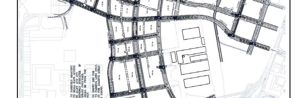

182 EXHIBIT B 182

183 EXHIBIT C 183
184 EXHIBIT D 184
185 RESOLUTION NO Adopted by the Sacramento City Council ATTACHMENT 25 RESCINDING RESOLUTIONS NO AND TO REPEAL THE 1994 MEMORANDUM OF UNDERSTANDING AND THE 2000 ENVIRONMENTAL OVERSIGHT AGREEMENT WITH THE STATE DEPARTMENT OF TOXIC SUBSTANCES CONTROL (DTSC) AND THE SOUTHERN PACIFIC TRANSPORTATION COMPANY, AND APPROVING THE MEMORANDUM OF UNDERSTANDING WITH DTSC AND S. THOMAS ENTERPRISES, LLC REGARDING REMEDIATION OF THE SACRAMENTO RAILYARDS BACKGROUND A. On December 13, 1994, the City of Sacramento entered into a Memorandum of Understanding (1994 MOU) with the California Environmental Protection Agency Department of Toxic Substances Control (DTSC) and the Southern Pacific Transportation Company (SPTCo) regarding remediation and redevelopment of the Sacramento Locomotive Works (Sacramento Railyards). B. On October 3, 2003, the City Council approved the Environmental Oversight Agreement (2000 EOA) with DTSC and SPTCo that implemented the 1994 MOU by prescribing the methods for remediation of the Sacramento Railyards to allow for redevelopment and DTSC granted to the City oversight authority regarding remediation that was intended to ensure that SPTCo undertook remediation of the entire site an din a manner that would allow for non-industrial development. C. The Union Pacific Railroad Company (UPRR) became a successor in interest to SPTCo for ownership of the Sacramento Railyards and thereafter undertakes site characterization and remediation work. D. In December 2006, S. Thomas Enterprises, LLC (Thomas) purchased the Sacramento Railyards from UPRR and has continued working with DTSC regarding site characterization and remediation under the DTSC approved Remedial Action Plans. E. Remediation of portions of the Sacramento Railyards has been completed and completion of the soil and groundwater contamination is targeted to occur within the next few years. F. A new Memorandum of Understanding has been developed between the City, DTSC and Thomas to reflect the current site conditions and DTSC s regulatory 185
186 process, and includes an obligation by Thomas to complete site remediation and to work with DTSC to develop the land use controls and the land use specific remediation approaches that will allow for redevelopment in accordance with the Railyards Specific Plan. BASED ON THE FACTS SET FORTH IN THE BACKGROUND, THE CITY COUNCIL RESOLVES AS FOLLOWS: Section 1. Resolutions and are rescinded, thereby repealing the 1994 MOU and the 2000 EOA. Section 2. The attached Memorandum of Understanding with the Department of Toxic Substances Control and S. Thomas Enterprises, LLC Concerning Remediation and Redevelopment of the Sacramento Locomotive Works, Sacramento California is hereby approved. The City Manager is authorized and directed to execute the Memorandum of Understanding on behalf of the City of Sacramento. Table of Contents: Exhibit A: 2007 Memorandum of Understanding 20 pages 186
187 Exhibit A MOU MEMORANDUM OF UNDERSTANDING AMONG THE DEPARTMENT OF TOXIC SUBSTANCES CONTROL, CITY OF SACRAMENTO, AND S. THOMAS ENTERPRISES OF SACRAMENTO, LLC CONCERNING REMEDIATION AND REDEVELOPMENT OF THE SACRAMENTO LOCOMOTIVE WORKS, SACRAMENTO, CALIFORNIA RECITALS A. This Memorandum of Understanding ("MOU") between the Parties consists of general provisions for coordination of remediation and redevelopment of the site of the former Southern Pacific Transportation Company Sacramento Locomotive Works ( Railyards or Site ), which encompasses approximately 240 acres in the downtown area of the City of Sacramento. Exhibit A is a map depicting the Railyards Site and the remediation study areas. B. The Railyards was used by the Southern Pacific Transportation Company ( SPTCO ) as a locomotive construction, repair and maintenance facility for over 100 years. As a result of these activities, the surface and subsurface soils were impacted to some degree by chemicals across much of the Site. In addition, the groundwater that underlies a portion of the Railyards was also impacted. The Department of Toxic Substances Control ( DTSC ) issued enforcement orders to SPTCO to investigate and remediate the soil and groundwater contamination at the Railyards. In June 6, 1988, DTSC and SPTCO entered into an agreement regarding compliance with the enforcement orders ( Enforceable Agreement ), which has been amended over time to reflect the site investigation and remediation work undertaken under the oversight of DTSC C. On December 2, 1994, DTSC, SPTCO and the City of Sacramento ( CITY ) entered into the Memorandum of Understanding ( 1994 MOU ) to set forth a program to ensure protection of human health and the environment during redevelopment of the Railyards. The 1994 MOU specified the respective responsibilities of each Party in implementing such program. D. On December 13, 1994, CITY approved the Railyards Specific Plan, which allowed for redevelopment of the Railyards from an industrial complex to a mixed use commercial, office and housing development, in reliance on the 1994 MOU that the Site would be remediated in a manner that would allow for such development. E. SPTCO commenced remediation of the Railyards under the oversight of DTSC in accordance with the Enforceable Agreement and the terms of the 1994 MOU. Thereafter, the Union Pacific Railroad Company (UPRR) became the successor to SPTCO in the ownership of the Railyards and continued the remediation efforts. 187
188 F. Under the terms of the 1994 MOU, an Environmental Oversight Program was to be developed to address the development planning and permitting process, construction activities, and ongoing remediation and environmental oversight of the Railyards. On July 31, 2000, DTSC, UPRR and the CITY entered into the Environmental Oversight Program ( 2000 EOP ) for the purpose of implementing the provisions of the 1994 MOU. The 2000 EOP set out the framework for (1) the determination whether unacceptable risk may exist on a given parcel, (2) establishment of a process for managing impacted media (i.e., soil or groundwater contamination) encountered during construction, and (3) ensuring that development of the Railyards is protective of human health and the environment during construction and postconstruction periods. G. The 1994 MOU and 2000 EOP identified that the Railyards would be remediated to a baseline of restricted-use standard based on construction worker clean-up levels for the entire Site, which is also the cleanup level that is protective for commercial land uses at the Site. Land use specific remediation approaches ( LUSRA ) would be applied for certain parcels where utility corridors, residential and park uses were planned, and additional deed restrictions would be imposed to limit certain types of land uses and construction methods (e.g., excavation depths and dewatering) because contaminated soil would remain in place at a subsurface levels. The commercial land use/construction worker cleanup level, as applied to the Railyards through the risk assessment protocol, is based on an evaluation of the potential human exposure risk during long-term build-out and occupation of the Railyards property that concluded that the maximally exposed individual will be the construction worker. For specific land uses that require a more protective cleanup level, additional remedial measures including land use covenants, engineering controls, and LUSRAs would be needed to provide the appropriate level of protection. H. In December of 2006, S. Thomas Enterprises of Sacramento, LLC ( THOMAS ) purchased the Railyards from UPRR. At the same time, THOMAS sold a portion of the Railyards to CITY, which is the site of the Sacramento Valley Station. Thereafter, THOMAS has been expeditiously undertaking continued remediation of the Railyards in accordance with the Enforceable Agreement and under the oversight of DTSC. I. Remediation of portions of the Railyards completed to-date has been to levels acceptable for exposures typical of commercial land uses or construction workers in the following areas: Sand Blast Grit Piles Battery Shop Yard Ponds and Ditch Drum Storage Area Sacramento Station 7 th Street right of way 188
189 J. For purposes of ongoing investigation and remediation of contaminated soil and groundwater at the Site, DTSC recognizes six soil study areas and the minimum targeted remediation level is for commercial land use/construction worker cleanup levels. The targeted soil remediation completion to allow for DTSC certification of the Remedial Action Plan (RAP) for the defined study areas is scheduled as follows: Lagoon (RAP Certification targeted for 2010) Car Shop Nine (RAP Certification targeted for 2009) Northern Shops/Drum S (RAP Certification targeted for 2009) Central Corridor (RAP Certification targeted for 2009) Manufactured Gas Plant (RAP Certification targeted for 2011) Central Shops (RAP Certification targeted for 2009) DTSC recognizes three groundwater study areas. These areas targeted groundwater remediation completion to allow for DTSC RAP certification is as follows: Lagoon Groundwater Study Area (RAP Certification targeted for 2010) Central Shops (RAP Certification targeted for 2009) Former Manufactured Gas Plant (RAP Certification targeted for 2011) K. Exhibit A depicts the location of the foregoing study areas for the Railyards. Exhibit B provides a schedule of anticipated completion dates for remaining remediation of soil and/or groundwater, as of the Effective Date of this MOU. L. To ensure that uncontrolled exposure to soil and groundwater contamination that may remain in place does not occur, DTSC requires that use restrictions in the form of land use covenants ("LUCs") be recorded on those parcels at the Site which were not remediated to unrestricted use levels. The applicable LUCs may differ by parcel. M. Exhibit C is a copy of the 7 th Street LUC that includes restrictions concerning excavation, soil management, extraction of groundwater and other matters pertaining to the land uses at that portion of the Site. This serves as an example of types of restrictions that may be applicable to other portions of the Site. Section VIII of this Memorandum of Understanding sets forth the mechanism whereby LUCs specific to the redevelopment of the Railyards will be developed. Those LUCs will allow for residential development and parks if additional measures are implemented. N. THOMAS proposes to redevelop the Railyards for mixed commercial (office and retail), high density residential, and parks and open spaces for public use. Plans for redevelopment are detailed in documents to be adopted by CITY, including the Railyards Specific Plan, Railyards Design Guidelines, and the Railyards Special Planning District zoning ordinance ( SPD ), which are collectively referred to herein as 189
190 the Development Plan. The Specific Plan establishes the land uses for each area of the Railyards, the Design Guidelines specify the design of buildings, streets, parks and open spaces, and the SPD establishes the process for approval of individual development projects. The SPD requires verification that the remediation of the parcels proposed for development has been completed and the development complies with the remedial measures defined for that portion of the Site, including LUCs. LUSRAs will be defined for various potential land uses for the Site and will provide an aid to Developers. LUSRAs will provide a convenient template for development design that identifies acceptable controls that are consistent with the remedial measures determined by DTSC to be protective of public health and the environment. O. The 1994 MOU and the 2000 EOP need to be updated, particularly in regards to: (1) the remediation methods and cleanup standards to reflect current conditions at the Railyards and DTSC s approved Remedial Action Plans and Remedial Design and Implementation Plans; (2) to insure that during construction in areas that have been remediated and in areas adjacent to where remediation is on-going, the public health and construction worker safety is protected by compliance with the LUCs; (3) to insure that planned residential development and park and open space areas can be developed by implementing updated LUSRAs; and (4) to provide for coordination between the Parties in regard to compliance with post-certification obligations. P. On December 13, 1994, CITY approved the Railyards Specific Plan, which allowed for redevelopment of the Railyards from an industrial complex to a mixed use commercial, office and housing development, in reliance on the 1994 MOU that the Site would be remediated in a manner that would allow for such development. AGREEMENT THE DEPARTMENT OF TOXIC SUBSTANCES CONTROL, THE CITY OF SACRAMENTO, AND S. THOMAS ENTERPRISES OF SACRAMENTO, LLC HAVE EXECUTED THIS MEMORANDUM OF UNDERSTANDING AS OF DECEMBER 11, 2007 ( EFFECTIVE DATE ) AND AGREE AS FOLLOWS: I. THE PARTIES AND THEIR ROLES The parties to this Agreement ("Parties") are: A. Department of Toxic Substance Control ( DTSC ) DTSC is a department of the California Environmental Protection Agency, an. agency of the State of California. DTSC has authority to regulate the remediation of hazardous materials pursuant to Health and Safety Code, Chapter 6.5, Sections et seq., and Chapter 6.8, Sections et seq., and other provision of the law. On March 29, 2006, the California Environmental Protection Agency s ( Cal EPA ) Site Designation Committee designated DTSC as the Administering Agency for the State of 190
191 California for remediation of the Railyards pursuant to Health and Safety Code Section et seq. B. City of Sacramento CITY is a municipal corporation of the State of California. CITY has the authority to regulate land use and development within its jurisdiction pursuant to the police power (Cal. Const. Art. XI, 5 and 7). C. S. Thomas Enterprises of Sacramento, LLC THOMAS is the owner of the Railyards and proposes to redevelop the Site as a mixed use commercial (retail and office) and residential community as permitted by CITY. Pursuant to the Enforceable Agreement, UPRR and THOMAS are the responsible parties for the continued remediation of hazardous materials on or emanating from the Site. Successors and subsequent property owners and subsequent property owners undertaking redevelopment of the Site ( Developers ) will also be subject to the applicable terms of this MOU through the CITY s SPD provisions. D. Exercise of Authority Consistent with the Authority of the Other Parties. This MOU concerns the interrelationship of DTSC s authority under the Health and Safety Code to regulate site remediation, the CITY s authority under the police power to regulate land use, and the responsibility of THOMAS under the Enforceable Agreement to remediate the Railyards. By entering in this MOU in the spirit of cooperation, the Parties do not in any way intend to alter the legal authority or jurisdiction that each possesses pursuant to constitutional, statutory or common law. In particular, while the CITY does not relinquish its police power to regulate in the interests of the health, safety and welfare of its citizens, it has no intention of regulating or taking on liability for remediation of the Site. Thus, this MOU allows the CITY to administer land use in the Railyards without in any way substituting its judgment for DTSC s on matters of remediation This MOU and all LUCs and LUSRAs prepared pursuant to the terms of this MOU shall be binding upon all successors, including successor agencies. II. REPEAL OF 1994 MOU AND 2000 EOP Due to the remediation activities that have occurred since the 1994 MOU and the 2000 EOP were approved, changes in clean-up standards, additional soil characterization studies, and the level of remediation completed to-date; many of the components of the 1994 MOU and the 2000 EOP are no longer applicable to the current conditions at the Railyards. Those portions of the 1994 MOU and the 2000 EOP which are still relevant to the ongoing remediation of the Railyards for redevelopment in accordance with the Development Plan have been retained in this MOU. Also, the CITY no longer desires the authority to undertake environmental oversight of the remediation 191
192 of the Railyards, subject to THOMAS compliance with the terms of this MOU, and the CITY is willing to administer the LUCs and LUSRAs as approved by DTSC. For these and other reasons, the Parties agree that the 1994 MOU and the 2000 EOP are hereby repealed and are no longer have any force or effect in regard to Railyards remediation and redevelopment. III. PURPOSE OF THIS MOU The Parties agree that the primary purpose of this MOU is to enable the orderly and timely completion of the remediation in a manner fully protective of human health and the environment and to allow for redevelopment of this Site in accordance with the Development Plan and consistent with the LUCs and LUSRAs. THOMAS has prepared a Development Plan for the Site, and will work with DTSC to assure that appropriate LUSRAs and LUCs will be put in place for the proposed land uses. In order to achieve this purpose, the Parties agree that the following provisions shall guide performance of their respective implementation responsibilities. IV. COMMUNICATION AMONG THE PARTIES Ongoing communication among the Parties is essential to implementation of this MOU, especially with regard to changes in remediation schedules, health risk assessment assumptions, land uses, and remediation standards, which may affect the types of permitted land uses and the timing of redevelopment of the Railyards. It is the intent of the Parties to meet within a reasonable time upon the request of any Party in advance of a decision that will affect the attainment of the remediation of the Railyards in a manner that will allow for timely implementation of the Development Plan. V. DEVELOPMENT RESPONSIBILITIES A. CITY Administration of DTSC Land Use Covenants The Parties agree that CITY will establish and administer a process that will enable implementation of DTSC s land use restrictions consistent with the LUCs and the DTSC approved LUSRAs that will be recorded against applicable portion of the Railyards. Each property owner will be responsible for recording the applicable LUCs. This process will be administered through the CITY s Development Services Department. The CITY s expertise in land use and development approvals will ensure that the administration of the following process for compliance with the DTSC-approved LUCs and LUSRAs as applicable to the Railyards is carried out in an efficient manner: 1. Within two hundred and seventy (270) days after execution of this MOU, THOMAS will provide CITY with a listing, which has been reviewed and approved by DTSC, of all of the existing LUC s and LUSRAs ( List ) that have been recorded against each of the parcels set out in the approved Railyards Master Tentative Parcel Map ( Map Parcels ). The List shall, at a minimum, 192
193 include for each Map Parcel: (i) the APN number, (ii) tentative map parcel number, (iii) Specific Plan parcel number, (iv) DTSC designated study area, (v) the chemical constituents remaining in place, (vi) the date of DTSC certification that remediation of the subject parcel has been completed, and (vii) the recorded LUCs and DTSC approved LUSRAs. As remediation of each Map Parcel is completed, THOMAS will update this listing and resubmit a revised List to CITY, after review and approval of DTSC, which identifies the changes from the prior List so that CITY can update its computer records. THOMAS shall provide this data in a format as specified by CITY so that it can be easily downloaded in CITY s computer system. CITY will input the LUCs and LUSRAs by APN and Map Parcel numbers into the CITY s computer system, which tracks zoning and map conditions by APN number. The Parties shall establish a format and schedule for monitoring and reporting to DTSC the status of land use, zoning, and parcelization. 2. Upon completion of implementation of a RAP for a study area or portions thereof, DTSC will issue either a clean parcel letter, RAP certification, or the equivalent documentation for the subject Map Parcel. This document will satisfy the SPD s remediation verification requirement for that Map Parcel. THOMAS shall not submit to CITY a proposed final map for a Map Parcel, and the CITY shall not approve a final map for that Map Parcel, until (i) DTSC has issued a clean parcel letter, RAP certification, or the equivalent documentation for the subject Map Parcel, (ii) the LUCs have been recorded or DTSC has approved the LUCs for that Map Parcel, and (iii) DTSC has approved the LUSRAs to allow for development of that Map Parcel in accordance with the Development Plan. After CITY approves and records the final map, CITY will update its computer system to denote the new APN number for each final map parcel. CITY will not issue a development permit or entitlement or a building permit for any land use which is not allowed under the LUCs or LUSRAs for that APN and/or Map Parcel. 3. Grading and other street and utility permits and approvals will not be issued by CITY unless THOMAS submits to CITY: (i) a DTSC clean parcel letter, RAP certification, or the equivalent documentation for the subject area that is to be graded or improved, and (ii) verification that the grading and improvement plan is in compliance with DTSC-approved remedial measures including LUCs regarding excavation depths, soil management, and dewatering restrictions. Also, grading permits and improvement plans for utility installations may be conditioned on compliance with the Utility Corridor requirements set out in Section VII, below. 4. CITY shall notify DTSC and THOMAS of any observed violations of LUCs, engineering controls, or LUSRAs. 5. THOMAS acknowledges that CITY s costs to input and administer the List and to review applications for final maps, development permits and 193
194 grading and utility permits for compliance with the LUCs and LUSRAs will be included in CITY s application fees. The foregoing provisions regarding CITY administration of the LUCs, which may restrict certain future excavations, land use development, and extraction of groundwater, are to ensure that: (a) land use is consistent with completed remediation, (b) specific development projects are compatible with remediation achieved, (c) construction and development is protective of human health and the environment, and (d) procedures are established to guide the proper administration of the DTSC LUCs. VI. CONTINUED REMEDIATION EFFORTS DTSC has established priorities for investigations and remediation of portions of the Site based on actual or potential threats to human health and the environment from contamination, and the priorities may change as new information becomes available in the future. DTSC has approved schedules for investigation and remediation of the Railyards that take into account DTSC s priorities for remediation. THOMAS commits to undertaking all commercially practicable actions to continue remediation of the Railyards in compliance with the Enforceable Agreement. Within sixty (60) days after receipt of a written request from CITY, THOMAS will provide CITY with information regarding the status of DTSC s approved Remedial Action Plans (RAP) and Remedial Design and Implementation Plans (RDIP), and the schedule for completion of the remediation of those portions of the Site which have not yet been certified by DTSC as of the date of the written request. CITY acknowledges that DTSC may approve amendments to the RAPs and RDIPs without CITY s approval and that in no event will the CITY s redevelopment goals outweigh protection of public health and the environment. THOMAS may encounter unforeseen subsurface conditions while undertaking remediation of the Site that differ from those anticipated in an approved RAP. In the event that a RAP must be amended or revised to change the approved remediation standards or approach, THOMAS, DTSC and CITY will evaluate the impact of this change on implementation of the Development Plan in regards to whether it is practical to undertake the additional remediation for redevelopment of that portion of the Site. VII. UTILITY AND CONSTRUCTION WORKER PROTECTIONS DTSC has approved RAPs that require at a minimum that the Site be remediated to commercial land use/construction worker cleanup levels and such levels are protective of construction workers and utility workers who undertake excavation of the Site for installation and maintenance of public utilities and public streets, as well as protective of construction workers for private developments. Therefore, establishment of utility corridors with no test soil zones as set out in the 1994 MOU and the
195 EOP are no longer required to be protective of utility and construction worker health and safety. In general, utility corridors and the location of buildings in the Development Plan have been designed to avoid areas where contaminated soil has been left in place under the terms of the approved RAP. In those places where soil contamination exceeding commercial land use/construction worker cleanup levels will be left in place, THOMAS shall work with DTSC to obtain its concurrence that there will be no unacceptable risks associated with the contamination left in place. In addition, construction methods employed by THOMAS for the private development shall include construction worker protections pursuant to a worker health and safety plan and protocols if contaminated soils above thresholds of concern (as defined by DTSC) are encountered, pursuant to the terms of the applicable soil management plan. Any utility or construction work which requires dewatering shall be subject to DTSC s prior approval of a site-specific dewatering plan before CITY issues a grading, building or other permit. Any air monitoring required shall be performed in compliance with the Sacramento Metropolitan Air Quality Management District regulations and permits, as well as DTSC s approved air monitoring plan. VIII. LAND USE BASED REMEDIATION AND LUSRAS Land Use Specific Remediation Approaches (LUSRAs) specified in the 1994 MOU and the 2000 EOP have been repealed. New LUSRAs will be developed by the Parties to define supplemental engineering and institutional controls or additional remediation that will be implemented to allow residential and park/open space land uses along with other uses that would otherwise be restricted by the LUCs at the Railyards. A. Remediation Approaches to Allow for Residential Development DTSC and THOMAS will establish LUCs specific to the redevelopment of the Railyards as referenced above. Those LUCs will allow for residential development if certain additional measures are implemented. These additional measures or LUSRAs, consisting of engineering and institutional controls, will be specific to the land uses and conditions at each portion of the Site. The LUSRAs approved by DTSC will be consistent with decisions made in accordance with the Enforceable Agreement and Chapter 6.8 of the Health and Safety Code. LUSRAs typically allow for residential development if the building design provides that living areas are not located on the ground or first floor of any building, so as to provide a physical separation between the contaminated soil and the residents, or if imported clean soil is placed on the parcel at specified depths to provide a soil barrier. In addition, for areas of the Site with a history of volatile organic compounds ( VOCs ) constituents in soil and/or groundwater, LUCs and LUSRAs may also include measures to prevent the migration and accumulation of soil vapors in interior spaces, for example 195
196 with impermeable membranes or specialized ventilation systems. In order to implement the Development Plan, THOMAS must obtain DTSC s approval of the applicable LUSRAs required to allow for residential development throughout the Site. Exhibit D sets out a list of LUSRAs that may be acceptable to DTSC for implementation by THOMAS or Developers to permit residential development at the Railyards consistent with the Development Plan. Exhibit D shall be replaced with the LUSRAs list after approval by DTSC. B. Remediation Approaches to Allow for Park Development DTSC and Thomas will establish LUCs specific to this Railyards as referenced above. Those LUCs will allow for park and open space development if certain additional measures are implemented. These additional measures will be specific to land uses and conditions at each portion of the Site and are also referred to as LUSRAs. The LUSRAs for parks and open spaces and landscaped areas typically require the placement of acceptable fill at specified depths and/or impervious caps so that the public is not exposed to contaminated soil or hazardous soil vapors. In addition, for areas of the Site with a history of volatile organic compounds ( VOCs ) constituents in soil and/or groundwater, the LUCs and LUSRAs may also include measures to prevent unacceptable exposure to soil vapors, for example with impermeable membranes or specialized ventilation systems. In order to implement the Development Plan, THOMAS must obtain DTSC s approval of the applicable LUSRAs required to allow for development of parks and open spaces and landscaped areas throughout the Site. The type and amount of fill required may differ by location and types of use. Exhibit D also sets out the list of LUSRAs that DTSC may require THOMAS or Developers to implement in order to permit park and open space development and landscaped areas throughout the Railyards consistent with the Development Plan. Exhibit D shall be replaced with the LUSRAs list after approval by DTSC. C. Schedule for Approval of LUSRAs by DTSC Prior to CITY s approval of the first final map or issuance of the first building permit for development in the Railyards, THOMAS must: (1) obtain DTSC s approval of the LUSRAs and the terms of the LUCs that will allow for implementation of the Development Plan, including development of all planned residential uses and parks and open spaces and landscaped areas; and (2) modify any previously recorded LUCs that would prevent implementation of the Development Plan for each portion of the Site. IX. POST-CERTIFICATION REMEDIAL ACTIVITIES A. Additional Remediation Following Certification 196
197 The Parties recognize that additional remedial activities may be necessary after DTSC certification that the Remedial Action Plan (RAP) has been implemented and the remediation work has been fully completed. Additional Remediation means additional assessment and/or remediation arising under one or more of the following circumstances, among others: (i) discovery of soil conditions that create unacceptable risks to utility or construction workers during construction, (ii) a change of land use or development types or building designs, or (iii) a change of remediation standards that significantly impact risks to human health or the environment. It is the intent of the THOMAS and DTSC to carry out any Additional Remediation in a timely and efficient manner. To ensure that this occurs, the Parties agree to comply with the following principles: 1. DTSC will be notified in a timely manner by the Party that discovers during construction soil conditions that may require Additional Remediation. In the case of a change of applicable remediation standards as noted above, DTSC will notify the CITY and THOMAS and specify the regulatory process, pursuant to the Health and Safety Code, applicable to the proposed Additional Remediation. 2. The Parties agree that the process to be used to complete Additional Remediation will be the most efficient consistent with current RAP approvals and the need to protect human health and the environment. THOMAS or Developer, as applicable, will be responsible to undertake such Additional Remediation subject to DTSC oversight and in accordance with the provisions of the Enforceable Agreement. CITY may deny or condition a grading or building permit or issue a stop work order at a development site which requires Additional Remediation if the CITY determines that such action is needed to protect the public health or the environment or if DTSC requests CITY take such action. 3. DTSC will ensure where applicable that the process used to complete Additional Remediation will apply DTSC approved documents in effect as of the date of discovery of the need for Additional Remediation, including the applicable cleanup goals and remediation technologies approved for the Railyards. The DTSC approved documents as of the Effective Date are listed in Exhibit E, on file with DTSC, and incorporated herein by this reference as if set forth in full. Notwithstanding the terms of the existing documents as set out in Exhibit E, DTSC will follow Chapter 6.8 of the Health and Safety Code during oversight of any Additional Remediation. Upon review of and concurrence with the adequacy of investigation and completion of the remediation of the contaminants, DTSC will provide written certification that the Additional Remediation was properly undertaken, and additional LUCs will be recorded, if applicable, prior to CITY s approval of any additional or continued development at the subject site. 4. For all Additional Remediation required, THOMAS shall notify both the CITY and DTSC in writing to identify the legal entity that will be responsible 197
198 for such remediation, the schedule for submittal of the required documentation to DTSC to obtain approval to undertake the remediation, and identify the proposed contractor that will be undertaking the work and the schedule for completion. B. Changing Land Uses Following Certification The Parties recognize that over the term of the development of the Railyards in accordance with the Development Plan, changes in and modification of the Development Plan and the RAPs may occur for areas for which remediation has not been completed prior to the Effective Date. If in the future CITY or THOMAS proposes to make changes to the Development Plan, such changes will be submitted to DTSC for a determination whether the proposed new or modified land use is of a type that is consistent with existing cleanup standards and LUCs and LUSRAs. A health risk assessment or other analysis may be required to establish remediation levels for the proposed change in the Development Plan. In such cases, Additional Remediation may be required and/or additional LUCs and LUSRAs may need to be developed. In all cases where the change to the Development Plan would require Additional Remediation and/or imposition of new or differing LUCs and/or LUSRAs, DTSC approval of modified LUCs or LUSRAs must be obtained before CITY amends the Development Plan or issues any development-related permits for that portion of the Site. C. Changing Standards Following Certification The Parties recognize that over the term of the development of the Railyards in accordance with the Development Plan, relevant remediation standards may be revised downward or more restrictive standards may be adopted as needed to protect human health and the environment. Under terms of an Operation and Maintenance Agreement between THOMAS and DTSC, THOMAS will review and reevaluate the Response Action every five (5) years to determine the adequacy of the implemented response measures in protecting human health and the environment. Based on DTSC s review of Thomas' 5-Year Review Report, as well as other information, DTSC may determine if there is a significant change in risk requiring Additional Remediation or other action such as engineering and/or institutional controls. The additional measures required may include further remediation of soil and/or groundwater, imposition of additional LUCs and/or engineering controls/lusras to reduce the risk to human health and the environment for the anticipated exposures to acceptable levels. X. IMPLEMENTATION A. Amendment of MOU All amendments to the provisions of this MOU shall require an agreement in writing by all of the Parties representatives authorized to execute this MOU. B. Term 198
199 This MOU shall remain in effect until terminated by all of the Parties in writing. C. Notices All notices required pursuant to this MOU shall be in written form and transmitted simultaneously by either first class mail or telefacsimile (followed by first class mail) to each Party s designated point of contact. The points of contact are as follows: CITY: Lezley Buford Environmental Services Manager Development Services Department 915 I Street, New City Hall Sacramento CA Phone: (916) Fax: (916) DTSC: James Tjosvold Chief of Northern California, Central Cleanup Operations Branch Department of Toxic Substances Control Attention: Paul Carpenter, Project Manager 8800 Cal Center Drive Sacramento, Phone: (916) Fax: (916) THOMAS: Elias A. Rashmawi Director of Land Redevelopment S. Thomas Enterprises of Sacramento, LLC 401 I Street Sacramento, CA Phone: (916) Fax: (916) XI. RESPONSIBILITIES OF THE PARTIES Each Party agrees to perform the tasks listed below in addition to their duties in Sections II through X within the time periods specified. A. DTSC 1. DTSC agrees to provide, to the extent within its control and consistent with protection of human health and the environment of the State of California, the staffing it determines necessary to meet its responsibilities under this MOU. 199
200 2. DTSC agrees that it will use its best efforts to provide oversight for purposes of overseeing ongoing remediation of the Railyards after the Effective Date and certifying Additional Remediation. 3. DTSC agrees to exercise reasonable efforts to respond to submittals detailed in this MOU consistent with agreed upon schedules. 4. Pursuant to their lead agency designation, DTSC is responsible for determining that all applicable state laws, regulations and standards regarding remediation have been complied with at the time of completion of the investigation and remediation of each portion of the Site, including both soil and groundwater remediation. B. CITY 1. CITY s primary role will be to assist DTSC in administering the LUCs and LUSRAs, where applicable, for each portion of the Site, and to confirm with DTSC that remediation has been performed to standards consistent with proposed development. C. THOMAS 1. In addition to preparation of the List and development of the applicable LUCs and LUSRAs for DTSC s approval, THOMAS shall prepare guidance documents for approval by DTSC to provide prospective developers at the Railyards with appropriate guidance for administration of LUCs and complying with the applicable LUSRAs, and post-remediation (Additional Remediation) provisions of this Agreement. 2. THOMAS will monitor LUC implementation and provide reports on LUC implementation (including O&M responsibilities) to DTSC and CITY as required by DTSC. 3. THOMAS shall continue to fund DTSC's oversight costs in accordance with the March 29, 2006 resolution approved by the Cal/EPA Site Designation Committee designating DTSC as the Administering Agency for the Railyards and DTSC s oversight costs for any long-term operation and maintenance activities, and administration of all LUCs. 4. THOMAS will continue to provide CITY with notices when major remediation milestones have been reached and provide copies of the applicable remediation documents upon request. This MOU is hereby entered into as of the Effective Date by: 200
201 DEPARTMENT OF TOXIC SUBSTANCES CONTROL Rick Moss, Acting Deputy Director Date S. THOMAS ENTERPRISES OF SACRAMENTO, LLC Suheil Totah Vice President of Development Date CITY OF SACRAMENTO Ray Kerridge, City Manager Date APPROVED AS TO FORM: City Attorney Attest: City Clerk 201
202 Exhibit A: SITE MAP INDICATING STUDY AREAS 202
203 Exhibit B: REMEDIATION STATUS AND ESTIMATED COMPLETION SCHEDULE Railyards Study Area Remediation Status November 2007 Study Area Status Anticipated Certification Date Drum Storage Area Soil Remediation ongoing 2009 with Northern Shops; to be completed by 4Q 2008 Drum Storage Area To be remediated with 2010 Ground Water Lagoon Ground Water Battery Shop Remediation completed 1989 Sand Piles Remediation completed 1989 Ponds and Ditch Remediation completed 1995 Lagoon Soil To be completed by 4Q Lagoon Ground Water RAP complete by 1Q Car Shop Nine Remediation completed 2009 Central Corridor To be completed by 4Q Northern Shops To be completed by 4Q Central Shops Soil RAP complete by 3Q Manufactured Gas Plant RAP complete by Sacramento Station Remediation completed 1994 Central Shops/South Plume Ground Water RAP complete by 3Q
204 Exhibit C: LAND USE CONTROLS (DEED RESTRICTION) Attached is DTSC s Land Use Covenant for the 7 th Street Corridor that sets out typical land use restrictions for the Railyards. The Land Use Specific Remediation Approaches to be developed under this MOU will provide the means for development of multi-family residential, parks and open spaces consistent with the LUCs. 204
205 205

206 206

207 207

208 208

209 209
210 210
211 211
212 212
213 Exhibit D: LAND USE SPECIFIC REMEDIATION APPROACHES FOR RESIDENTIAL DEVELOPMENTS AND PARKS, OPEN SPACES AND LANDSCAPED AREAS WITHIN RAILYARDS CONSISTENT WITH THE DEVELOPMENT PLAN The terms of the LUSRAs have yet to be defined; however, components may include the following: Multi-Family Residential Land Uses. Vapor mitigation (e.g., barrier, ventilation, remediation) for areas of elevated VOC risk Alternate first floor uses (e.g., parking, commercial) Physical barriers (e.g., pavement, hardscape, clean fill) Parks/Open Spaces. Clean fill placed over remediated soil (thickness of soil to be determined based on actual risk and land use) Physical barriers (e.g., pavement, hardscape, containerized plantings) Vapor mitigation (e.g., barrier, ventilation, remediation) for areas of elevated VOC risk 213
214 Exhibit E: DTSC APPROVED DOCUMENTS ON FILE THAT PERTAIN TO ON-GOING AND POST-REMEDIATION REMEDIAL ACTION PLANS REMEDIAL DESIGN AND IMPLEMENTATION PLANS SOIL TRANSPORT PLAN AIR MONITORING PLAN SOIL SAMPLING PLAN 214
215 ORDINANCE NO ATTACHMENT 26 Adopted by the Sacramento City Council REPEALING CHAPTER OF THE SACRAMENTO CITY CODE, DEVELOPMENT IN DOWNTOWN RAILYARDS, REGARDING IMPLEMENTATION OF THE 2000 ENVIRONMENTAL OVERSIGHT AGREEMENT RELATED TO REMEDIATION (M07-067) BE IT ENACTED BY THE COUNCIL OF THE CITY OF SACRAMENTO: SECTION 1. The City Council finds that Chapter 18.8 of the City Code, Development in Downtown Railyards, which was enacted to implement Environmental Oversight Agreement between the State Department of Toxic Substances Control (DTSC) and the prior property owner, the Southern Pacific Transportation Company, is no longer necessary or applicable given the current site conditions, the provisions of the revised Memorandum of Understanding with DTSC and the current property owner, S. Thomas Enterprises of Sacramento, LLC, and the procedures in the Railyards Special Planning District for ensuring that a parcel has been properly remediated for the proposed land use before a development permit is approved. SECTION 2. Chapter of the Sacramento City Code is repealed. 215
216 DRAFT REDLINE ORDINANCE NO Adopted by the Sacramento City Council REPEALING CHAPTER OF THE SACRAMENTO CITY CODE, DEVELOPMENT IN DOWNTOWN RAILYARDS, REGARDING IMPLEMENTATION OF THE 2000 ENVIRONMENTAL OVERSIGHT AGREEMENT RELATED TO REMEDIATION (M07-067) BE IT ENACTED BY THE COUNCIL OF THE CITY OF SACRAMENTO: SECTION 1. The City Council finds that Chapter 18.8 of the City Code, Development in Downtown Railyards, which was enacted to implement Environmental Oversight Agreement between the State Department of Toxic Substances Control (DTSC) and the prior property owner, the Southern Pacific Transportation Company, is no longer necessary or applicable given the current site conditions, the provisions of the revised Memorandum of Understanding with DTSC and the current property owner, S. Thomas Enterprises of Sacramento, LLC, and the procedures in the Railyards Special Planning District for ensuring that a parcel has been properly remediated for the proposed land use before a development permit is approved. SECTION 2. Chapter of the Sacramento City Code is repealed. Table of Contents: Exhibit A Chapter
217 Exhibit A Chapter DEVELOPMENT IN DOWNTOWN RAILYARDS Findings. The Sacramento city council finds and declares that: A. The downtown railyards (railyards), owned for many years by Southern Pacific Transportation Company (SPTCo) and currently owned by Union Pacific Railroad Company (UPRR), successor-in-interest to SPTCo., was used for over one hundred (100) years as a locomotive construction, repair and maintenance facility. As a result of these activities, the surface and subsurface soils were impacted to some degree by hazardous and toxic materials and chemicals across much of the site; additionally impacted groundwater underlies some portions of the railyards site. B. The railyards site is the subject of an enforceable agreement, dated June 2, 1988, as amended, between the Department of Toxic Substances Control ( department or DTSC ) and SPTCo. This enforceable agreement establishes the requirements for investigation and remediation of hazardous materials at the railyards. C. SPTCo, and its successor-in-interest, UPRR, have obtained department certification of remediation of hazardous materials completed on some portions of the railyards site, and intend to complete remediation on additional portions of the site, to levels required for various types of land uses. When the hazardous materials present on a portion of the site are remediated to levels that are acceptable for some land uses, but not for others, the department requires that land use restrictions ( deed restrictions ) be recorded to ensure that inappropriate exposures to hazardous materials do not occur, by restricting the future use of such portion of the site to only those land uses that are appropriate for the level of remediation attained. Current deed restrictions allow for commercial and industrial uses; however, under the deed restrictions, all other land uses, excavation of soil, and extraction of ground water are not allowed without prior department approval. D. As various portions of the railyards site are remediated and/or following the completion of remediation at the railyards, UPRR proposes to redevelop the railyards site for mixed commercial, residential, open space and public uses, pursuant to the railyards specific plan and other planning documents that have been or may be adopted or amended by the city. Redevelopment of the railyards will require various city development approvals, and it is important that hazardous materials issues be considered at appropriate steps in the development approval process. E. The specific plan establishes the allowable land uses for each area of the railyards, as well as remediation approaches for each land use. These land use specific remediation approaches, which have been approved by DTSC, are designed to eliminate any risk from human exposure to soil. Pursuant to the specific plan, the railyards special planning district and other applicable documents, there are linkages between completion of remediation approved by DTSC and city issuance of 217
218 development approvals. F. Rather than requiring separate and uncoordinated city and department review, approval and oversight of every application for development in the railyards, it would be more efficient and would ensure more orderly and timely redevelopment, if a coordinated program were adopted for joint city and department regulation of redevelopment activities in the railyards. Such a coordinated program would: (1) allow the city to exercise its authority under the police power to regulate land use, without regulating or taking on any liability for site remediation, which responsibilities lie with the department and UPRR, respectively; and (2) allow the department to administer remediation activities pursuant to the department s authority under the California Health and Safety Code, without the necessity of becoming involved in the city s regulation of land use at the railyards site. G. On or about December 13, 1994, the city, SPTCo and DTSC entered into a memorandum of understanding (MOU), the purpose of which was to establish general provisions for coordination of remediation and redevelopment of the railyards and to enable orderly and timely remediation and redevelopment of the railyards in a manner fully protective of human health and the environment. H. Pursuant to the MOU, the DTSC and the city agreed to establish a program for joint city and DTSC administration of deed restriction provisions affecting development of the railyards. The deed restriction provisions to be administered by the city and department are restrictions on excavation, land use changes, and extraction of ground water. As set forth in the MOU, the goals of the program for joint city and DTSC administration are to ensure that: (1) land use is consistent with completed remediation; (2) specific development projects are compatible with remediation achieved; (3) excavation, soil handling, and dewatering activities are observed by an environmental oversight authority; (4) pre-tested soil zones are established; (5) development is protective of human health and the environment; and (6) procedures for the city and DTSC to work together efficiently to carry out their respective administrative and regulatory duties are established. I. Under the program contemplated by the MOU, and pursuant to procedures to be developed by DTSC, the city is to be given the right, responsibility and authority to approve development and excavation on the railyards without prior DTSC approval of each project that would be required in the absence of such a program. As expressly stated in the MOU, the parties in executing that document did not intend to alter in any way the legal authority or jurisdiction that each possesses pursuant to constitutional, statutory or common law. While the city does not relinquish its police power to regulate in the interest of the health, safety and welfare of its citizens, it has no intention of regulating or taking on liability for site remediation, which responsibilities lie with the DTSC and SPTCo, UPRR or their successors, respectively. J. Pursuant to the MOU, city joint administration of the deed restrictions requires the establishment by the city of an environmental oversight program (EOP), approved by DTSC, to regulate development and excavation on the railyards. Since the execution of the MOU, the city and DTSC, with appropriate involvement of, and input 218
219 from, SPTCo and UPRR, have met, conferred, discussed and participated in the preparation of a program designed to serve as an EOP. At this time, it is anticipated that the EOP may be administered by a third party entity retained by the city, and approved by DTSC after appropriate input by UPRR and its successors, to be known and referred to as the environmental oversight authority ( EOA ). K. The purposes of this chapter are: (1) to establish a process for adoption and administration of the EOP, including procedures generally requiring UPRR, its successor-in-interest or the developer or constructor at the railyards site to pay the costs incurred by the city to administer the EOP; and (2) to establish certain additional requirements to ensure that the basic purposes of the MOU are satisfied. The basic purposes of the MOU include: (1) to provide for a coordinated, joint administration of deed restrictions by the city and DTSC, in order to promote more orderly and timely redevelopment; and (2) to do so without subjecting the city or its officials, employees or agents, including any independent contractors who may serve in the capacity of environmental oversight authority, to any greater liability than they would incur if the deed restrictions were administered solely by DTSC. L. In fulfillment of these goals, this ordinance is adopted in order to authorize city council adoption of an environmental oversight program governing. redevelopment activities at the railyards site, and to provide a means for enforcement of the plan Definitions. When used in this chapter, the following terms shall have the meanings set forth in this section: Building Official means the head of the city s building department, or his or her authorized representative(s). City means the city of Sacramento. Department means the California Department of Toxic Substances Control. Environmental oversight authority means the person or entity retained and responsible for administration of the environmental oversight program adopted pursuant to this chapter. Environmental oversight program means the program for oversight of remediation of hazardous materials at the railyards site, adopted pursuant to this chapter. MOU means the memorandum of understanding entered into on December 14, 1994, by and between the city, the department, and the Southern Pacific Transportation Company (identified as city Agreement No ), concerning remediation and redevelopment of the Sacramento locomotive works site. Person means any person, company, firm, partnership, business or other entity, other than the city, its officers and employees. 219
220 Railyards means the Southern Pacific Transportation Company s former Sacramento locomotive works site located in downtown Sacramento, as further described in the city s railyards specific plan. SPTCo means the Southern Pacific Transportation Company. UPRR means the Union Pacific Railroad Company, successor-in-interest to the SPTCo at the railyards site Environmental oversight program. The city council may adopt, by resolution, an environmental oversight program (EOP) developed in accordance with the provisions of the MOU, governing redevelopment activities at the railyards site. The city council may amend the EOP by resolution as needed, provided that the amendments shall be consistent with the MOU Process for adoption and amendment of EOP. The EOP shall be adopted by resolution by the city council following at least one hearing before the planning commission and the city council. Such hearings shall be noticed and held in the same manner as general and specific plans and amendments thereto. To the extent not otherwise required, notice of hearings on adoption or amendment of the EOP shall be given to UPRR, so long as it has an ownership interest in the railyards site, and any and all other owners of property within the railyards site Requirements of EOP. An EOP adopted pursuant to Section of this chapter shall include, at a minimum, the following provisions: provisions to ensure that the remediation obligations of the railyards specific plan, enforceable agreement and MOU are satisfied, including but not limited to remediation consistent with the land use specific remediation approaches (LUSRAs); provisions to address requirements for T suffix and T suffix removal, clean fill and installation of clean fill, pre-tested soil, testing, handling, transporting, stockpiling and storage of materials excavated in preparation for and during construction, construction dewatering, and construction air monitoring conducted on the railyards site; and provisions that apply when construction is carried out at the railyards site by the city, such as a street constructed by the city rather than by UPRR, its successor-in-interest or a developer or constructor DTSC approval of EOP. The EOP or amendments thereto shall not be used to govern remediation unless and until DTSC has approved the EOP or amendments thereto Use and applicability of EOP. A. General. If application of the EOP and oversight by an EOA is requested or required, prior to issuance of a building permit or grading permit to undertake development, construction, excavation or any other work on or at the railyards site for which a building or grading permit is required, UPRR or its successor-in-interest and, as appropriate, the developer or constructor, shall be required to enter into the following agreement(s) with the City: 1. An agreement to abide by the EOP; 220
221 2. A funding agreement pursuant to which UPRR or its successor-in-interest or the developer or constructor agrees to pay the costs of administration of the EOP, including the reasonable costs and expenses incurred by the city and the EOA, and pursuant to which UPRR or other contracting party will be required to deposit sufficient funds or provide adequate security in advance to cover anticipated costs of administration of the EOP for the construction or development of the railyards site; and 3. A liability and indemnification agreement, satisfactory to and approved as to form by the city attorney, which is consistent with the terms and conditions of the MOU, which ensures that city and the EOA incur no greater liability than the city and the EOA would incur if no EOP were adopted and the city did not participate in oversight of remediation of hazardous materials. B. DTSC Oversight of Remediation. It is anticipated that the EOP and EOA will be utilized to oversee much, if not all, of the development of the railyards site. However, use of the EOP and the EOA is discretionary, both with the city and with UPRR and its successors, and as appropriate, developers and constructors at the railyards site. Nothing in this chapter is intended to prevent or preclude UPRR and its successors, and as appropriate, developers and constructors, from deciding to forego use of the EOP and EOA and instead undertaking construction and other activities under the direct oversight of DTSC after obtaining all necessary permits from the city. Further, nothing in this chapter is intended to prohibit, preclude or interfere with the authority of DTSC to oversee remediation of hazardous materials at the railyards site, and as appropriate, to take over the oversight of remediation, in its sole discretion Enforcement. A. Stop Work Order. Whenever any work is being done at the railyards in violation of the provisions of the EOP adopted by the city council, the building official may order the work stopped by serving a written notice of such violation and stop work order upon any person engaged in, doing, or causing such work to be done, or, if no such person is present at the railyards site, by posting such notice in a conspicuous place. Any such person shall immediately stop work until authorized by the building official to proceed with the work. B. Penalty. Any person violating any provision of the EOP or violating a stop work order shall be guilty of a misdemeanor. Such violations shall constitute violations of this code and shall be subject to the remedies and penalties specified in Section of this code, provided that the remedies and penalties provided therein are not exclusive, and are in addition to any other remedy or penalty provided or authorized by any law or regulation or by any other provision of this code: Nothing in this chapter shall prevent the city from using one or more of such other remedies to address violations. C. Right-of-Entry. The building official may enter the railyards at all reasonable times as needed to conduct inspections and/or determine whether work is being performed in accordance with the provisions of the EOP. If such entry is refused or prevented, the city shall have recourse to every remedy provided by law to secure entry. 221
222 No city liability. Nothing contained in this chapter or in the EOP adopted or amended pursuant to this ordinance shall: A. affect the responsibility and/or liability of the owner(s) of the railyards site for the remediation of hazardous materials, under applicable provisions of Federal, State or local laws or regulations; nor B. impose, or be construed to impose, any responsibility or liability for such remediation upon the city. 222
223 ATTACHMENT 27 RESOLUTION NO Adopted by the Sacramento City Council APPROVING WATER SUPPLY ASSESSMENT REPORT FOR THE SACRAMENTO RAILYARDS PROJECT (P05-097) BACKGROUND A. State law requires a water supply and demand analysis (Water Supply Assessment) for development projects of a certain size or type, which would include the Sacramento Railyards Project, based on the City s Urban Water Management Plan. B. The Water Supply Assessment evaluates projected water supplies, determined to be available by the City for the project during normal, single dry and multiple dry years over a 20 year period. The City prepared the Water Supply Assessment for the Sacramento Railyards Project in June of 2007, which was set out as Appendix M of the Railyards Specific Plan Draft Environmental Impact Report dated August C. On November 13, 2007, the City Planning Commission held a noticed public hearing on the Sacramento Railyards Project in accordance with Government Code Sections and 65453, received and considered evidence, and forwarded to the City Council a recommendation to adopt the Sacramento Railyards Specific Plan and approve the Sacramento Railyards Project. D. On November 20, December 4, and December 11, 2007, the City Council conducted noticed public hearings in accordance with Government Code Sections and 65453, considered the Environmental Impact Report, and received and considered evidence concerning the Sacramento Railyards Specific Plan and the Sacramento Railyards Project. BASED ON THE FACTS SET FORTH IN THE BACKGROUND, THE CITY COUNCIL RESOLVES AS FOLLOWS: Section1. The Environmental Impact Report and Mitigation Monitoring Program for the Sacramento Railyards Specific Plan, which included all of the impacts associated with adoption and implementation of the proposed Specific Plan and approval of the Sacramento Railyards Project, have been adopted by resolution as of the same date set 223
224 out above. Section 2. Based on the verbal and documentary evidence received at the hearings on the Sacramento Railyards Specific Plan, Environmental Impact Report and the Sacramento Railyards Project, the City Council approves the Water Supply Assessment Report for the Sacramento Railyards Project and approves the SB 210/SB 221 Water Supply Assessment and Certification Form attached as Exhibit A. Table of Contents: Exhibit A: Sacramento Railyards Project Water Supply Assessment and Certification Form 3 pages 224
225 Exhibit A: Sacramento Railyards Project Water Supply Assessment and Certification Form 225
226 226
227 227

228 228

229 229
230 ATTACHMENT 28 RESOLUTION NO Adopted by the Sacramento City Council UPDATING THE RICHARDS BOULEVARD AREA PLAN FACILITY ELEMENT TO ADDRESS 5 TH AND 7 TH STREET OPERATIONS WITHIN THE RAILYARDS SPECIFIC PLAN AREA BACKGROUND A. The Richards Boulevard Area Plan was adopted on December 13, 1994 in conjunction with the adoption of the 1994 Railyards Specific Plan, because both plans were developed concurrently (i.e., the Roma Plan ). B. The Facility Element of the Richards Boulevard Area Plan and the Railyards Specific Plan (Facility Element) was also adopted on December 13, 1994, and subsequently amended on November 26, C. The Facility Element indicated that 7 th Street would be extended from D Street to Richards Boulevard as a two-way, four lane arterial and with the light rail alignment, which is now referred to as the Downtown-Natomas-Airport (DNA) light rail line extension. D. The Facility Element indicated that 5 th and 6 th Streets would be extended from H Street to Richards Boulevard as a one-way north (5 th Street) and one-way south (6 th Street) couplet, and sized between three and five lanes. E. The Facility Element also planned on conversion of Richards Boulevard and Bannon Street from two-way operation to one-way couplets, with five lanes along Richards Boulevard and Bannon Street and Richards Boulevard operating one-way from east to west. F. The Facility Element presumed that the location of the Intermodal Facility would be at 7 th and North B Streets, and that the light rail station would be located between 3 rd and 4 th Streets along Richards Boulevard. G. The Facility Element was recently amended with the approval of the Township 9 project, located between 5 th and 7 th Streets north of Richards Boulevard, to revise the Circulation Plan by redesignating 7 th Street from four lanes to two 230
231 lanes north of Richards Boulevard, and to relocate the light rail station to between 5 th and 7 th Streets along Richards Boulevard. H. The Facility Element is being amended with the adoption of the new Railyards Specific Plan to revise the Circulation Plan to incorporate the street network changes, including conversion of 5 th and 7 th Streets from two-way to one-way operations after the Initial Phase, and to relocate the Intermodal Facility to 5 th and I Streets. I. The City plans to update the Facility Element during the next year to address changes to the Circulation Plan. The street network which serves the area within the Richards Boulevard Area Plan (the River District ) is to be reevaluated so that it is designed to be more pedestrian friendly as this area converts from an industrial area to a mixed use residential and commercial community. J. As part of the Facility Element update, the circulation system within the River District will be evaluated in conjunction with the Railyards Specific Plan street network and to reflect the current DNA alignment along 7 th Street and Richards Boulevard. K. During its review of the Railyards Specific Plan, the Planning Commission questioned the conversion of 5 th and 7 th Streets to one-way operation after the Initial Phase based on their belief that two-way streets are more pedestrian friendly and appropriate for mixed use neighborhoods. BASED ON THE FACTS SET FORTH IN THE BACKGROUND, THE CITY COUNCIL RESOLVES AS FOLLOWS: Section 1. The City Council hereby directs staff to proceed in updating the Facility Element and the Richards Boulevard Area Plan. Council also directs staff that in preparing the transportation and environmental studies for this update, the conversion of 5 th and 7 th Streets from two-way to one-way operation after the Initial Phase of the Railyards Specific Plan be reevaluated and that the studies allow for the possibility of amending the Railyards Specific Plan to change these two street operations and the corresponding rights of way. 231
232 RESOLUTION NO Adopted by the Sacramento City Council Attachment 29 APPROVING THE BUSINESS TERMS FOR THE SACRAMENTO RAILYARDS PROJECT FUNDING AGREEMENT BACKGROUND A. On September 11, 2007, October 2, 2007 and October 22, 2007, the City Planning Commission participated in the public hearings on the Sacramento Railyards Specific Plan (Specific Plan) at the joint meetings with the Design Commission and Preservation Commission, which included a review of the proposed street system, parks and open spaces, and other public facilities proposed as part of the Specific Plan. B. On November 13, 2007, the City Planning Commission held a noticed public hearing on the Specific Plan and the Specific Plan Public Facilities Financing Plan (Financing Plan) in accordance with Government Code Sections and 65453, received and considered evidence, and forwarded to the City Council a recommendation to adopt the Specific Plan and approve the Financing Plan. C. On November 20, 2007, December 4, 2007 and December 11, 2007, the City Council conducted noticed public hearings in accordance with Government Code Sections and and received and considered evidence concerning the Specific Plan and the Financing Plan. D. On November 20, 2007, December 4, 2007 and December 11, 2007, the City Council also conducted noticed public hearings in accordance with Government Code Sections regarding approval of the Development Agreement for the Sacramento Railyards Project. In accordance with Government Code Section , a development agreement can contain terms and conditions relating to public financing of the necessary backbone infrastructure and related public facilities for a development project and can provide for subsequent reimbursement of the applicant s advancement of costs for such infrastructure and public facilities in accordance with applicable public financing laws. E. The Development Agreement for the Sacramento Railyards Project provides for the subsequent preparation of a funding agreement related to public financing of 232
233 certain backbone infrastructure and public facilities to allow for implementation of the Specific Plan in accordance with the Financing Plan. The City and the applicant have prepared the Funding Agreement Business Terms as an exhibit to the Development Agreement to guide the preparation of the public financing funding agreement. F. As part of the evaluation of the Sacramento Railyards Project, a Fiscal Impact Study and an Economic Impact Study were prepared to assess the public service costs of the Project and the municipal revenue and overall economic benefits that would be generated by the proposed development. The Funding Agreement Business Terms was prepared in reliance on the information contained in these studies. BASED ON THE FACTS SET FORTH IN THE BACKGROUND, THE CITY COUNCIL RESOLVES AS FOLLOWS: Section 1. Based on the verbal and documentary evidence received at the hearings on the Sacramento Railyards Specific Plan, the Specific Plan Public Facilities Financing Plan, and the Development Agreement for the Sacramento Railyards Project; the City Council finds that a funding agreement between the City and S. Thomas Enterprises of Sacramento, LLC to specify the public financing of backbone infrastructure and other public facilities would benefit the City by facilitating implementation of the Railyards Specific Plan. Section 2. The City Council in a prior action approved the Sacramento Railyards Specific Plan Public Facilities Financing Plan. The City Council hereby accepts the Sacramento Railyards Fiscal Impact Study and the Sacramento Railyards Economic Impact Study. Section 3. The City Council in a prior action approved the Development Agreement for the Sacramento Railyards Project. The City Council hereby approves the attached Funding Agreement Business Terms (Exhibit A), to be included as an exhibit to the Development Agreement, to set out the terms and conditions for preparation of a public financing funding agreement. The City Council directs staff to prepare the Railyards Funding Agreement in accordance with the attached Funding Agreement Business Terms that will be submitted for subsequent City Council consideration and approval. Table of Contents: Exhibit A: Funding Agreement Business Terms Exhibit B: Sacramento Railyards Fiscal Impact Study Exhibit C: Sacramento Railyards Economic Impact Study 233
234 EXHIBIT A SACRAMENTO RAILYARDS CITY OF SACRAMENTO Funding Agreement Business Terms 11/29/07 The City agrees that the project backbone infrastructure needs exceed what the private development economics can fully bear. A public-private partnership is necessary to initiate the Initial Phase of the project and likely future phases. The following business terms are specifically intended to guide the preparation of, and will be formalized in the Development Agreement or a separate Funding Agreement to be adopted after the Project Entitlements are approved. TRANSPORTATION FUNDS 1. The City commits to investing the road and highway funds identified in Measure A for the Railyards/River District Area for improvements to the Richards/I-5 interchange and nearby access improvements to offset costs identified in the Railyards Public Facilities Financing Plan (PFFP). ($17,750,000) 2. The City commits to investing the road and highway funds that are the Federal Earmark and local match funds to help implement the North CBD Access Study including improvements to the Richards/I-5 interchange and the Interim Access Project (Jibboom/Bercut) to offset costs identified in the Railyards PFFP. ($8,400,000+$2,200,000 local match = $10,600,000) PARKS AND OPEN SPACE 3.. The City commits to investing $600,000 of Park Fees in the Central City Community Planning Area Reserves to help the initial financing of Railyards Parks and Open Space improvement costs, specifically Market Plaza between the Paint Shop and Car Shop #3, as identified in the PFFP. 5 TH /6 TH STREETS PUBLIC PARKING GARAGE 4. The City commits to providing $2 million annually to service debt to help fund the 5 th /6 th Street Public Parking Garage expected to be completed and operational by It is anticipated that most of this cash flow will come from the surplus operating revenue of the City s parking fund. Actual construction of the garage or a phased portion thereof, will be contingent upon securing other funding adequate to finance the project such as long term parking agreements with Sacramento County, Sacramento Superior Courts, other tenants, the Developer, and user fees. 8. If the Agency or City chooses to develop affordable housing in the airspace on parcel 17a developer shall be given the first opportunity to develop the project on the Agency or City s behalf that housing itself or with an affordable housing partner. If an affordable 234
235 housing project is developed within the City s air rights the Developer shall receive credit for the value of that portion of the land towards their inclusionary housing obligations. TRACK RELOCATION AND INTERMODAL SITE PURCHASE 10. Under a separate agreement, the City has already committed to invest $40 million to relocate the Union Pacific rail tracks and Sacramento Valley Station passenger platforms and pedestrian access to the relocated platforms. The City and Developer have committed to sharing project costs above the first $40 million in accordance with the terms of the Track Relocation Agreement. 11. Under a separate agreement (i.e. Purchase and Sale Agreement, dated December 13, 2006, City Agreement ) the City has obtained an option to purchase the remainder of the Intermodal Site and rail alignment, the exercise of which is subject to CEQA review and compliance with applicable federal acquisition and NEPA regulations. 12. The City has already committed to development of the Sacramento Intermodal Transportation Facility (SITF), which includes track relocation, as one of its top priority projects and shall move to accomplish implementation of these projects as expeditiously as Federal and State regulations allow and based on the receipt of funding for the SITF project. CITY GENERAL FUND AND MUNICIPAL REVENUES 13. The General Fund cannot be put at risk. Municipal services required to serve the Railyards must be funded by municipal revenues from the Project. The fiscal analysis of the Project assumed full build out of each project phase and currently shows that after costs of services there will be a net gain of revenue to the General Fund. If the development program varies from the assumed build out a different balance of costs to revenues can be expected. 14. Public debt financing cannot use the General Fund as security. 15. If there are surplus municipal revenues from the Railyards project the City is willing to consider the use of surpluses from the Railyards district for assistance in financing backbone infrastructure or public facilities after the current projected General Fund budget deficit has been reduced to an acceptable level. The use of surplus municipal revenues will only be considered to be used as they are actually received. Use of surplus local public funds to underwrite the cost of private development is not intended except potentially to assist with the Central Shops. 235
236 SACRAMENTO RAILYARDS RECOMMENDED CITY FUNDING ASSISTANCE SUMMARY 11/29/07 Type of Assistance Estimated Value or Funding Principle INFRASTRUCTURE AND PUBLIC FACILITIES ASSISTANCE Road and Freeway Funding-Measure A* $17,750,000 Road and Freeway Funding-Federal Earmark (N. 10,600,000 CBD Access)* Parks and Open Space (Downtown improvement 600,000 reserves)* City reinvests property tax increment to offset Initial $50,000,000 Phase backbone infrastructure costs through Agency cooperation agreement (2008$, 6% annual inflator)**^ Estimated Subtotal**^ $78,950,000 OTHER FACILITIES ASSISTANCE GENERATING VALUE FOR DEVELOPER City financing of 5 th and 6 th Street parking garage $80,000,000 (commit $2 Million annually)**> Track Relocation Agreement (inc new platforms and $40,000,000+ tunnel)** Public Purchase of Intermodal Site#????? Estimated Subtotal** $120,000,000+ Estimated Potential Total** $198,950,000+ * This funding is secured and actual amount is known (Measure A funds are received in two different rounds of funding.). ** This funding is an estimated value. > Additional parking garage feasibility analysis required. ^ This assumes full entitlement buildout of Phase 1. # Value will be determined based on Federal acquisition process or negotiation/mediation/arbitration process previously agreed to. OTHER PUBLIC ACTIONS GENERATING VALUE FOR DEVELOPER Estimated increased in value of property south of $45,000,000 relocated rail tracks (@$100/sf)** Value of granting land use entitlements and????? approving DA** Re-investment of RDA 20% housing set aside $8,500,000 (Phase 1 only)**^ ESTIMATED VALUE OF OTHER ACTIONS** $53,500,
237 Exhibit B: Sacramento Railyards Fiscal Impact Study PREVIOUSLY DELIVERED AVAILABLE at 237
238 Exhibit C: Sacramento Railyards Economic Impact Study PREVIOUSLY DELIVERED AVAILABLE at 238
239 Attachment 30 RESOLUTION NO Adopted by the Sacramento City Council APPROVING FINDINGS RELATED TO THE OWNER PARTICIPATION AGREEMENT BUSINESS TERMS FOR THE SACRAMENTO RAILYARDS PROJECT BACKGROUND A. On November 20, 2007, December 4, 2007 and December 11, 2007, the City Council conducted noticed public hearings in accordance with Government Code Sections 65355, and and received and considered evidence concerning the Sacramento Railyards Project. B. The Railyards Specific Plan specifies the public facility and infrastructure improvements necessary for implementation of the Specific Plan and the Railyards Specific Plan Public Facilities Financing Plan sets forth the estimated costs of those public facility and infrastructure improvements and identifies potential funding sources for those improvements. C. As part of the evaluation of the Sacramento Railyards Project, a Pro Forma Analysis was prepared to assess the capacity of the Sacramento Railyards Project to incur the costs for the required public facilities. This Analysis demonstrated that developer can only pay up to $49 million towards the $290 million estimated costs for the public facilities and infrastructure necessary to develop Phase 1, and there is a cumulative financial feasibility gap for this Project of approximately $860 million. D. The Redevelopment Agency of the City of Sacramento is considering appropriating up to $50 million in 2007 dollars, net present value at a six percent discount rate, in tax increment revenues from the Railyards portion of the Richards Boulevard Project Area to assist the developer in funding public facilities and infrastructure improvements required for the Initial Phase of the Project. BASED ON THE FACTS SET FORTH IN THE BACKGROUND, THE CITY COUNCIL RESOLVES AS FOLLOWS: 239
240 Section 1. Pursuant to Section of the Health and Safety Code of the State of California, the City Council finds that: a. The implementation of the public facility and infrastructure improvements specified in the Railyards Specific Plan will benefit the Richards Boulevard Redevelopment Project Area by improving inadequate infrastructure and by constructing and installing public facilities and infrastructure required for redevelopment within both the Railyards and the Richards Boulevard portions of the Project Area; b. Based on the Railyards Specific Plan Public Facilities Financing Plan, the cost of the Railyards public facilities and infrastructure improvements will exceed the available public and private funding sources, and there is no other reasonable means of financing the public facilities and infrastructure improvements available to the community except for redevelopment area tax increment proceeds; and c. The use of redevelopment tax increment proceeds for the Railyards public facilities and infrastructure improvements will result in the elimination of blighting influences of inadequate, under capacity, and dilapidated infrastructure within the Richards Boulevard Project Area and the public facilities and infrastructure improvements set out in the Railyards Specific Plan are consistent with the Implementation Plan for the Richards Boulevard Redevelopment Plan that was adopted pursuant to Health and Safety Code Section Section 2. The preceding statements are findings of the City Council on behalf of the City, and do not predispose the action of the Redevelopment Agency of the City of Sacramento, acting in its independent discretion as a separate and public entity, in considering the use of tax increment funds for the proposed project. 240
241 Attachment 31 RESOLUTION NO Adopted by the Redevelopment Agency of the City of Sacramento ADOPTING THE CITY S ENVIRONMENTAL IMPACT REPORT AND MITIGATION MONITORING PROGRAM FOR THE SACRAMENTO RAILYARDS SPECIFIC PLAN PROJECT AND APPROVAL OF BUSINESS TERMS TO BE INCORPORATED INTO THE MASTER OWNER PARTICIPATION AGREEMENT AND THE INITIAL PHASE INFRASTRUCTURE OWNER PARTICIPATION AGREEMENT BETWEEN THE REDEVELOPMENT AGENCY OF THE CITY OF SACRAMENTO AND S. THOMAS ENTERPRISES OF SACRAMENTO, LLC BACKGROUND A. The City of Sacramento certified the Environmental Impact Report for the Sacramento Railyards Specific Plan project ( Project ) by resolution and adopted findings of fact, a statement of overriding considerations and the Mitigation Monitoring Program as part of the approval of the Project at its meeting on December 11, 2007 B. The Redevelopment Agency of the City of Sacramento (Agency) has reviewed the Sacramento Railyards Specific Plan Public Facilities Financing Plan and that plan highlights significant gaps in funding reasonably available to the community to implement the Project. C. The Sacramento Railyards portion of the project area is an undeveloped 238 acre site that is devoid of infrastructure, contains extensive soil and groundwater contamination, and has remained in this blighted condition since the adoption of the redevelopment plan. D. The Agency and S. Thomas Enterprises of Sacramento, LLC. are committed to furthering the Project and intend that these fundamental business terms be incorporated into Owner Participation Agreements to be negotiated and considered for approval in independent exercise of their legislative obligations and authorities. BASED ON THE FACTS SET FORTH IN THE BACKGROUND, THE REDEVELOPMENT AGENCY OF THE CITY OF SACRAMENTO RESOLVES AS FOLLOWS: Section 1. All of the evidence presented having been duly considered, the 241
242 Background, as stated above, is true and correct. Section 2. The Agency has reviewed and considered the Environmental Impact Report (EIR) for the Sacramento Railyards Specific Plan project as prepared by the City of Sacramento and certified by resolution on the December 11, The Agency makes the same findings for each of the significant environmental effects and alternatives of the Project identified in the EIR as set out in the City resolution, and hereby adopts that EIR and its Mitigation Monitoring Program as a responsible agency for those components of the Project which the Agency will carry out, finance or approve. Section 3. In accordance with California Redevelopment Law Section 33445, the Agency further finds and determines that: (a) (b) (c) The Project will benefit the project area by improving inadequate infrastructure and by constructing and installing public facilities and infrastructure required for redevelopment within the project area. No other reasonable means of financing the rehabilitation of the Central Shops buildings, public facilities and infrastructure, affordable housing and other improvements contemplated by Project is available to the community. The payment of tax increment proceeds towards the cost of the buildings, facilities, infrastructure, housing and other improvements is consistent with the project area implementation plan and will assist in eliminating blighting conditions inside the project area. Section 4. The Agency hereby approves the Sacramento Railyards Owner Participation Agreement Business Terms, attached to this resolution as Exhibit 1, and directs staff to prepare a Master Owner Participation Agreement and the Initial Phase Infrastructure Owner Participation Agreement in accordance with the attached Business Terms. Section 5: When negotiated to satisfaction of Agency staff, staff shall return to the Agency governing board for consideration of approval of the Master Owner Participation Agreement and the Initial Phase Infrastructure Owner Participation Agreement in independent exercise of their legislative obligations and authorities. 242
243 REDEVELOPMENT AGENCY OF THE CITY OF SACRAMENTO OWNER PARTICIPATION AGREEMENT (OPA) BUSINESS TERMS 12/5/07 EXHIBIT 1 MASTER OPA. The entire Railyards Project will be subject to a Master OPA, with Subsidiary OPAs to implement actual projects, which provides the Agency Board the discretion over future use of redevelopment resources. The following business terms are specifically intended to guide the preparation of, and will be formalized in the respective agreements described herein. 2. Infrastructure in the Initial Phase of the Project, which includes Phase 1 and Phase 2 as shown in the Development Agreement will be funded under the Initial Phase Infrastructure OPA described below, which is a commitment of the first $50 million in tax increment as further described below. Such amount is net present value in 2008 dollars, and shall be adjusted annually by a 6% simple inflation rate. Actual amount of commitment is determined as described below. 3. The term Net TI means net of statutory pass-throughs, county and Agency administrative costs, housing set-aside funds, and other mandatory charges against TI funds (e.g. ERAF). All future Net TI payments shall be subordinated to the senior rights, if any, for any future bonded indebtedness. The Master OPA will acknowledge that the Agency anticipates that most aspects of the Railyards Project if built out to the full entitlements will have demonstrable financing gaps at the anticipated build-out levels based on the Railyards Specific Plan Public Facilities Financing Plan and the pro-forma analysis of the Railyards Project prepared by Keyser Marston. 4. All remaining Net TI not allocated under the Initial Phase Infrastructure OPA will be available for qualified Developer projects, subject to Agency Board approval. The Net TI funding, after payment under the Initial Phase OPA, will be committed as follows. It is Agency s intent to commit Net TI funds to eligible projects within 3 years from receipt, in accordance with redevelopment law obligations to expend funds to eliminate blight. a. After Agency fulfills its Initial Phase Infrastructure OPA obligations (see below), and fulfills any outstanding obligations incurred for specific projects hereunder, the Agency reserves the right to prioritize the use of the Net TI funds (i.e., 80% money) to assure development of affordable housing and to meet Agency legal obligations for the Railyards Project Area. b. Each project and the Net TI funding allocation must qualify as a 243
244 redevelopment project under Community Redevelopment Law and allocation of funding will be subject to a subsidiary OPA. c. Except for the reservation in a. above, for the allocation of Net TI funding, priority will be given to Railyards Project public facilities financing, Developer-proposed affordable housing projects, Central Shops rehabilitation, and public parking facilities qualified to receive redevelopment funding. a. Rights to receive Net TI generated from any portion of the property that is sold by Developer will be transferred to that purchaser, which may apply and will have priority for allocation of those Net TI funds and if not used by that purchaser within the same 3 year period, those Net TI funds will also be released from the Master OPA obligation. However, the Developer can still apply for an allocation of those Net TI funds if not allocated to the purchaser. 5. Low and moderate housing set-aside (20%) funds generated by the Railyards Development Project will be provided to first meet the Developer s inclusionary ordinance obligations imposed by the City and the Community Redevelopment Law. Only after all such obligations are met would the housing set-aside funds generated within the Railyards be available for other affordable housing projects, except as follows. It is the Agency s intent to commit low and moderate housing set-aside funds to eligible projects within 3 years from receipt. If Developer fails to propose a project within 3 years of notification of available funds, the Agency reserves the right to solicit other affordable housing development proposals, for which Developer may also submit a proposal, individually, or with an affordable housing partner. 6. Notwithstanding the lack of sufficient affordable housing set-aside funds, Developer must nonetheless meet all of the Agency s Community Redevelopment Law housing production/inclusionary requirements for the Railyards development based on the level of housing developed within the Railyards. 7. If in the opinion of the Chief Building Official of the City, there is an immediate and imminent threat of structural collapse of any of the Central Shops, Developer must take appropriate steps to stabilize the Central Shops from failure. This may include temporary support of walls and temporary protection of roofs if such structures are in immediate jeopardy of failing. Such actions would be considered temporary remediation steps not subject to SHPO or SOI standards to the extent permitted by law. 8. Developer shall enter into reciprocal easement agreements with the City for the Intermodal Tunnel Entrance Building and Market Plaza no later than at the time of completion of the Market Plaza or 5 th /6 th Streets Public Parking Garage 244
245 whichever occurs first, as those projects are described in the Development Agreement and the Railyards Project entitlements. The Developer shall also meet its obligations under the Track Relocation Agreement. 9. Developer must pay prevailing wages and undertake public bidding on all public works projects funded with Net TI funds, to the extent those obligations are defined in the Labor Code and Public Contract Code. 10. Developer must indemnify Agency and City for any claims for prevailing wages, whether the claims are filed against public works projects or private development projects, including any penalties, charges, costs, and defense costs resulting from such claims. Unless expressly released by Agency in its sole discretion for the specific project, the indemnity obligation stays with Developer irrespective of subsequent sale of any of the Railyards property. Developer shall not be responsible for indemnification of the Agency for development undertaken by an approved assignee or transferee of Developer where such assignee or transferee enters into a separate OPA and indemnity with the Agency. 11. All Agency funding obligations are limited to Net TI as it is received and payments to Developer will not be owed until after Agency s actual receipt of the Net TI funds. 12. A default of the Development Agreement or the Initial Phase Infrastructure OPA is a default of the Master OPA, subject to applicable cure rights. INITIAL PHASE INFRASTRUCTURE OPA 4. The Net TI funding will be available to Developer for the qualified infrastructure designated in the attached list. Agency agrees that this list will be modified at the request of the Developer if additional infrastructure solely to the extent required to satisfy the funding commitments made by the State under applicable infrastructure bond programs and an applicable funding agreement. In any event, the parties may agree to further changes in the list of qualified infrastructure 5. Agency will reimburse Developer for not more than $50,000,000 (as adjusted) of actual cost of such qualified infrastructure after it is constructed. This cap shall be adjusted annually from the effective date of the Initial Phase OPA by the amount of a 6% compounded inflation factor annually. The Agency s intent is to reverse the calculation that produced to the $50,000,000 net present value figure. Reimbursement for qualifying infrastructure shall be obligated at the time of the completion of construction of a given piece of qualifying infrastructure, subject to the limitations described below. 6. Developer must complete the same level of development as required for vesting in the City Railyards DA. If Developer fails to vest its rights under the City 245
246 Railyards DA, the Agency s obligations under the Initial Phase Infrastructure OPA will be terminated. Regardless of whether the Developer vests its rights under this OPA it is the Agency s intent to start reimbursing the developer as net TI revenues are received, subject to the terms herein. 7. In no event shall Agency be obligated to reimburse Developer additional Net TI funds under this OPA for infrastructure constructed more than 15 years after the effective date, whether or not the full $50,000,000 (as adjusted) Agency commitment has been reimbursed. 8. Reimbursement will only be made from Net TI actually received by the Agency from the property taxes generated by the Developer s development of the Initial Phase properties. The Agency s obligation to actually pay reimbursement under this OPA shall begin at the time Net TI is actually received. To the extent the Net TI funds from the Developer s cumulative Initial Phase development are inadequate to fully reimburse the Developer, the Developer shall forego further reimbursement. 9. A default of the Development Agreement or the Master OPA is a default of the Initial Phase Infrastructure OPA, subject to applicable cure rights. 10. DESIGNATED INFRASTRUCTURE LIST 1. 5 th Street from H Street to Railyards Boulevard 2. Railyards Boulevard from Jibboom Street to 7 th Street 3. Expansion of 7 th Street from H Street to Railyards Boulevard 4. 6 th Street from H Street to Railyards Boulevard 5. Wet and dry utilities to be placed within the right of way of any qualifying streets 6. The storm drainage detention facility (cistern), pump station and outfall 7. 5 th and 6 th Street Public Parking Garage 8. Car Shop #3 and Paint Shop Renovation 9. Market Plaza (Parcels 21a and 21b) between Car Shop #3 and Paint Shop 10. Intermodal Tunnel Gateway Structure (Parcel 22) 11. Pedestrian Access Improvements between the 5 th and 6 th Public Parking Garage and the Intermodal Tunnel North Entrance (The Developer has indicated a desire to expand the above list. Additional proposed infrastructure shall be subject to agreement by Agency staff and ultimately the Agency Board as part of the OPA.) 246
247 State Lands Public Trust Claim Map Condition Attachment 32 The State Lands Commission claim of a public trust interest over certain parcels within the Railyards relates to events that took place when California became a state and when the City began improving levees to control flooding in the downtown area over 150 years ago. The claim involves the fact that the American River previously flowed through the Railyards at the time of statehood and State asserts a property interest in this former riverbed, despite the fact that it may have transferred its interest to the City in 1868, under a statute enacted as Chapter 519, as described below. The claimed interest has been described as an easement, although in some instances the State s public trust interest is held in fee. For the reasons set out below, the map condition has been revised to read as follows: 136. Prior to undertaking improvements, other than constructing public streets and parks, and prior to approval of a final map(s) that encompasses one or more of lots 1, 2a, 2b, 11a1, 3a, 3b, 3c, 3d, 3e, 3f, 5a, 6a, 33, 60, 70N, 71N, 71S, and 72 on which State Lands has made a public trust claim, either (a) the applicant shall submit documentation to the City Attorney s satisfaction that the public trust claim asserted by the State Lands Commission over said lot(s) has either been removed, or the applicant submits evidence of no recorded interest of the State Lands Commission in the above listed lots and (b) the City Attorney verifies that: (i) the claim of the State Lands Commission in the above listed lots is not a record title interest in the real property or a public easement which cannot be extinguished without the State s consent as specified in the Subdivision Map Act, and (ii) that the City has no other legal obligation to protect development of the area encompassed by such claim from a use that is incompatible with a public trust interest. Map Act - Section of the Subdivision Map Act provides that: No final map or parcel map... shall be filed with the local agency without the written consent of all parties having any record title interest in the real property proposed to be subdivided. (emphasis added). Also, Section 66445(j) provides that filing of a map does not result in the abandonment of a public easement if there is an official record creating the easement and the public entity holding that easement objects to its abandonment. These Map Act provisions do not specify that the interest must be recorded in the County records. If the interest is set out in an official public record that may be sufficient. There is no case law which addresses whether an unrecorded public trust claim is nonetheless a public easement that must be protected from abandonment under the Map Act based on that interest being set out in another official public record. A further question is whether this claim, which is disputed by Thomas, in fact qualifies as a record title interest. The State Lands Commission asserts that title in trust vested in the bed of the American River pursuant to the United States Congress Act for Admission of California into the Union on September 9, That Act together with the State statutes and maps related to this claim that have been filed in the offices of the County of Sacramento and the State of California most likely constitute an official 247
248 public record of title interest as referred to in the Map Act. In 1991 when the City was preparing the prior Railyards Specific Plan, as well as more recently, the State Lands Commission sent the City letters asserting its public trust claim over this portion of the Railyards site and objected to filing any final maps which would extinguish or conflict with the State s asserted property interest claim. Record of Claim - The State s claim to an interest in the historic channel of the bed of the American River bed relates to a statute enacted in 1868 (Chapter 519), which arguably transferred interest in the former riverbed to the City with certain restrictions, and authorized the City to construct levees and build streets within this prior river channel. The statute states that: All rights and interest of the State of California in and to so much of the old bed of the American River as lies west of what would be Thirty first street if said street was extended, is hereby granted to the City of Sacramento; provided, that no legal or equitable rights which may heretofore accrued to any portion of said river bed shall be impaired by the passage of this Act In 1941, a subsequent statute (Chapter 581) provided that the State Lands Commission was authorized to sell to the City its interest in a portion of the former riverbed in the area from 17 th Street to 31 st Street. A 1948 Attorney General Opinion interpreting this 1941 statute inferred that the 1868 statute also had the effect of transferring the State s interest in the riverbed west of 17 th Street to the City. However, if such interest was transferred, the City may have a fiduciary responsibility as trustee of the State s public trust claim. A map that located the former channel of the American River was developed in 1859 (Doherty map) and State Lands believes this map best represents the location of the prior river bed. The location of the former channel of the American River in relation to the lots on the Railyards tentative map is attached, and it covers approximately 24 acres and covers 18 lots. Although the State Land s claim has not been recorded in the County records as an easement interest with a legal description (i.e., book and page number), the map of the location of the abandoned bed of the American River was recorded on November 30, Map Condition - Tentative map condition number 136, as revised, is a requirement that the public trust claim of the State Lands Commission over the 18 lots either be extinguished or the City Attorney after further review of these issues makes a determination that such interest is not a record title interest or an easement interest under the Subdivision Map Act. If the claim is not removed but a determination is made that the claim is not an interest recognized under the Map Act, the City Attorney must then further verify that the City does not have an obligation as trustee to protect these lots from development that would be incompatible with the public trust claim before the 248
249 final map can be filed. One of the affected lots is slated to be developed as Vista Park and certain park uses of a regional or statewide benefit may be consistent with the asserted public trust claim. However, the commercial and housing developments proposed for the other 17 lots is not consistent with use of public trust lands. The 1868 statute allows the City the authority to permit Thomas to begin construction of public streets within the claim area as provided under the tentative map conditions, which would allow Thomas to start construction while the public trust claim issue is being resolved. However, other infrastructure improvements needed to support the private development on these lots which is incompatible with public trust uses must be delayed until the City s purported obligations to protect that claim, either under the Map Act or as a trustee, have been affirmed or disproved with some certainty. The City is consulting with outside counsel (Shute Mihaly) which specializes in public trust issues, to determine if the 1868 statute or case law requires the City to act as a trustee to protect this claim. Removal of Claim - Under Resources Code Section 6307, the State Lands Commission may only make exchanges of trust property when it is in the public interest to do so. Otherwise, only the Legislature can approve disposition of the State s public trust interest, as it did back in 1941 when the State transferred its claim to the City for that portion of the prior riverbed between 17 th and 31 st Streets. The claim could also be removed by a successful quiet title action by the State Lands Commission or Thomas. Although Thomas disputes the validity of the claim, there have been collective efforts to use this exchange statute to cooperatively remove this claim from the Railyards property. In 2004, the State Lands Commission, the State Parks Department, the City and UPRR began working a draft agreement to provide for exchanging the State Lands claim on the Railyards property for a recorded interest in the State Parks riverfront parcel at the Railyards and City s Sand Cove park along the Sacramento River. The State Parks four acre parcel and the City s Sand Cove property would be transferred to State Lands and leased back to City for park use in exchange for transfer of the Central Shops buildings to State Parks for its Rail Technology Museum. This agreement had been scheduled for approval by the State Lands Commission in October of On December 3, 2007, the State Lands Commission unilaterally approved this four-party agreement as an offer to the other parties, even though neither Thomas nor the City have ever reached final agreement as to its terms. 249
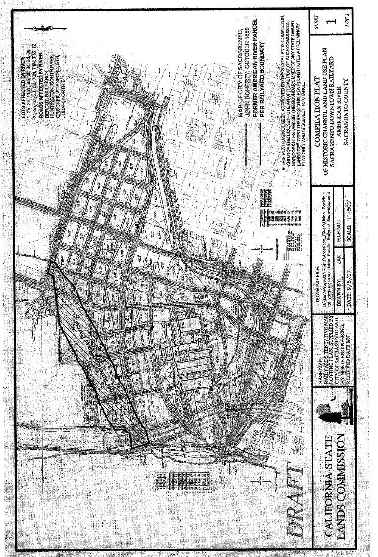
250 250
251 Attachment
252 252
 regarding the subject Inclusionary Housing")
253 Attachment 34 Memo To: From: City Council of the City of Sacramento Jim Hare, Assistant Director, SHRA Date: November 28, 2007 Re: Railyards Inclusionary Housing Plan At your November 20 th meeting, Vice-Mayor McCarty asked for a staff response on three issues raised by the Sacramento Housing Alliance (at the podium and in a letter addressed to Council) regarding the subject Inclusionary Housing Plan. The issues are listed below, followed by the staff response. 1) Legal Services of Northern California, in a letter dated November 13, 2007, questioned the legality of using low and moderate (L/M) housing tax increment funds to meet the Railyard s inclusionary housing requirements. Response: Agency legal counsel has responded to this issue in a separate memo to Council. Agency counsel has determined that the use of Tax Increment Housing Set-Aside Funds to assist inclusionary housing units is not prohibited by either state redevelopment law or the City s Mixed Income Ordinance. 2) A statement in the second paragraph of the plan reads, This document constitutes the Inclusionary Housing Plan for the Project and its approval shall obviate the need for any further permits or approvals with respect to the parameters of the Project s Inclusionary Requirement. Response: Staff shares the concern regarding the cited statement and believes it should be removed from the plan. Approval of this plan does not obviate the need for further approvals. The submitted Plan is a concept inclusionary housing plan and it will require further approvals, as the Plan itself notes in the subsequent sentences. Pursuant to the Mixed Income Ordinance (MIO), the Plan is to include the number, unit mix, location, structure type, affordability, and phasing of inclusionary units. Only the barest sketches of these details are outlined in the Plan submitted. Future submittals will be needed to meet the requirements of the MIO and assure sufficient public dialogue on actual inclusionary projects. In 253
DRAFT FOR DISCUSSION PURPOSES ONLY. Port Credit Local Area Plan Built Form Guidelines and Standards DRAFT For Discussion Purposes
 Port Credit Local Area Plan Built Form Guidelines and Standards DRAFT For Discussion Purposes 1 Local Area Plan - Project Alignment Overview Directions Report, October 2008 (General Summary Of Selected
SUBJECT: CONSIDERATION OF CENTRAL PARK VILLAGE BREA ENTITLEMENT DOCUMENTS FOR A PROPOSED MIXED USE PROJECT AT W.
 City of Brea Agenda Item: 18 COUNCIL COMMUNICATION Date: July 17, 2012 TO: FROM: Honorable Mayor and City Council City Manager SUBJECT: CONSIDERATION OF CENTRAL PARK VILLAGE BREA ENTITLEMENT DOCUMENTS
ARTICLE 3: Zone Districts
 ARTICLE 3: Zone Districts... 3-1 17.3.1: General...3-1 17.3.1.1: Purpose and Intent... 3-1 17.3.2: Districts and Maps...3-1 17.3.2.1: Applicability... 3-1 17.3.2.2: Creation of Districts... 3-1 17.3.2.3:
PLANNED UNIT DEVELOPMENT & SUBDIVISION STAFF REPORT Date: April 18, 2019
 PLANNED UNIT DEVELOPMENT & SUBDIVISION STAFF REPORT Date: April 18, 2019 DEVELOPMENT NAME SUBDIVISION NAME Springhill Village Subdivision Springhill Village Subdivision LOCATION 4350, 4354, 4356, 4358,
Ann Arbor Downtown Zoning Evaluation
 Ann Arbor Downtown Zoning Evaluation Options Workbook ENP & Associates in cooperation with the City of Ann Arbor September, 2013 Photo Courtesy of Andrew Horne, February 9, 2013 Introduction Thank you
PART ONE - GENERAL INFORMATION
 Corrected Date: Page 7 Date of Submittal Changed to Coincide with Submittal Date on Page 5 PART ONE - GENERAL INFORMATION A. INTRODUCTION B. Background Miami Shores Village is soliciting responses to this
MERIDEN TOD A NEW TRANSIT-ORIENTED DEVELOPMENT DISTRICT ZONING REGULATION FOR MERIDEN. Greater Meriden Chamber & Connecticut Bar Association
 A NEW TRANSIT-ORIENTED DEVELOPMENT DISTRICT ZONING REGULATION FOR MERIDEN PRESENTATION TO Greater Meriden Chamber & Connecticut Bar Association 25 September 2013 Dominick J. Caruso, AICP Director of Planning
1.0 INTRODUCTION PURPOSE OF THE CIP VISION LEGISLATIVE AUTHORITY Municipal Act Planning Act...
 April 2017 TABLE OF CONTENTS 1.0 INTRODUCTION... 1 2.0 PURPOSE OF THE CIP... 1 3.0 VISION... 1 4.0 COMMUNITY IMPROVEMENT PROJECT AREA..3 5.0 LEGISLATIVE AUTHORITY... 3 5.1 Municipal Act... 3 5.2 Planning
PLANNING COMMISSION STAFF REPORT
 PLANNING COMMISSION STAFF REPORT West Capitol Hill Zoning Map Amendment Petition No. PLNPCM2011-00665 Located approximately at 548 W 300 North Street, 543 W 400 North Street, and 375 N 500 West Street
TOTTENHAM SECONDARY PLAN
 TOTTENHAM SECONDARY PLAN AMENDMENT NO. 11 TO THE OFFICIAL PLAN OF THE TOWN OF NEW TECUMSETH The following text and schedules to the Official Plan of the Town of New Tecumseth constitute Amendment No. 11
Agenda Report DATE: APRIL 30,2007 TO: CITY COUNCIL CYNTHIA J. KURTZ, CITY MANAGER FROM:
 Agenda Report DATE: APRIL 30,2007 TO: FROM: SUBJECT: CITY COUNCIL CYNTHIA J. KURTZ, CITY MANAGER APPROVAL OF THE DEVELOPMENT AGREEMENT FOR THE SMVIA NOISE WITHIN MIXED-USE PROJECT BETWEEN THE ClTY OF PASADENA
Poughkeepsie City Center Revitalization Plan
 Purpose and Need Purpose Increase job and educational opportunities for all residents Maximize fiscal productivity of downtown land uses Diversify retail mix Eliminate surface and building vacancies Create
LITTLE MOUNTAIN ADJACENT AREA REZONING POLICY
 LITTLE MOUNTAIN ADJACENT AREA REZONING POLICY JANUARY 2013 CONTENTS 1.0 INTENT & PRINCIPLES...1 2.0 APPLICATION...2 3.0 HOUSING TYPES, HEIGHT & DENSITY POLICIES...3 3.1 LOW TO MID-RISE APARTMENT POLICIES...4
REPORT TO THE CHIEF ADMINISTRATIVE OFFICER FROM THE DEVELOPMENT AND ENGINEERING SERVICES DEPARTMENT
 REPORT TO THE CHIEF ADMINISTRATIVE OFFICER FROM THE DEVELOPMENT AND ENGINEERING SERVICES DEPARTMENT ON OFFICIAL COMMUNITY PLAN AMENDMENT APPLICATION NO. OCP00108 REZONING APPLICATION NO. REZ00578 900 MCGILL
Bylaw No , being "Official Community Plan Bylaw, 2016" Schedule "A" DRAFT
 Bylaw No. 2600-2016, being "Official Community Plan Bylaw, 2016" Schedule "A" Urban Structure + Growth Plan Urban Structure Land use and growth management are among the most powerful policy tools at the
GENERAL PLAN UPDATE SPECIFIC AREAS OF THE CITY
 GENERAL PLAN UPDATE SPECIFIC AREAS OF THE CITY Background There are a total of 14 specific areas that are being reviewed as part of the update of the General Plan. Requests to review these areas came from
COLDSTREAM (PC-1) INCLUSIONARY HOUSING PLAN
 INCLUSIONARY HOUSING PLAN") COLDSTREAM (PC-1) INCLUSIONARY HOUSING PLAN A. Overview The proposed affordable housing strategy for PC-1 has evolved over time to reflect changes in the marketplace, including the loss of redevelopment
COLDSTREAM (PC-1) INCLUSIONARY HOUSING PLAN A. Overview The proposed affordable housing strategy for PC-1 has evolved over time to reflect changes in the marketplace, including the loss of redevelopment
1417, , 1427 & 1429 Yonge Street - Official Plan Amendment and Zoning Amendment Applications - Preliminary Report
 STAFF REPORT ACTION REQUIRED 1417, 1421-1425, 1427 & 1429 Yonge Street - Official Plan Amendment and Zoning Amendment Applications - Preliminary Report Date: March 24, 2015 To: From: Wards: Reference Number:
3.1. OBJECTIVES FOR RESIDENTIAL LAND USE DESIGNATIONS GENERAL OBJECTIVES FOR ALL RESIDENTIAL DESIGNATIONS
 3. RESIDENTIAL LAND USE DESIGNATIONS INTRODUCTION The Residential land use designations provide for housing and other land uses that are integral to, and supportive of, a residential environment. Housing
PROPOSED METRO JOINT DEVELOPMENT PROGRAM: POLICIES AND PROCESS July 2015 ATTACHMENT B
 PROPOSED METRO JOINT DEVELOPMENT PROGRAM: POLICIES AND PROCESS ATTACHMENT B TABLE OF CONTENTS I. INTRODUCTION / PURPOSE............................ 3 II. OBJECTIVES / GOALS..................................
PINELLAS COUNTY COMPREHENSIVE PLAN
 PINELLAS COUNTY COMPREHENSIVE PLAN Future Land Use Map (FLUM) Category Descriptions and Rules Amended March 17, 2009 (Ordinance 09-17) Amended March 16, 2010 (Ordinance 10-18) Amended October 26, 2010
The Corporation of the District of Central Saanich
 The Corporation of the District of Central Saanich COMMITTEE OF THE WHOLE REPORT For the Committee of the Whole meeting on November 28, 2016 To: Patrick Robins Chief Administrative Officer File: From:
Director, Community Planning, Toronto and East York District
 STAFF REPORT September 1, 2005 To: From: Subject: Toronto and East York Community Council Director, Community Planning, Toronto and East York District Further Report Applications to amend Official Plan
Be linked by an internal circulation system (i.e., walkways, streets, etc.) to other structures within the IPUD;
 to other structures within the IPUD;") 2. HALIFAX ACTIVITY CENTER A. DESCRIPTIONS OF FUTURE LAND USE DESIGNATIONS Each of the future land use designations specified by Phase I of the Halifax Activity Center Plan, and the relationship of these
2. HALIFAX ACTIVITY CENTER A. DESCRIPTIONS OF FUTURE LAND USE DESIGNATIONS Each of the future land use designations specified by Phase I of the Halifax Activity Center Plan, and the relationship of these
2.0 LAND USE FRAMEWORK
 Land Use Framework 2.0 LAND USE FRAMEWORK FOLSOM BOULEVARD 2.1 LAND USE OVERVIEW The proposed land uses for Easton Place offer local and regional employment, shopping, and entertainment, highlighting the
Affordable Housing Plan
 Affordable Housing Plan CORDOVA HILLS SPECIAL PLANNING AREA 1 Proposed Project Conwy LLC is the master developer ( Master Developer ) of that certain real property in the County of Sacramento ( County
Downtown Development Focus Area: I. Existing Conditions
 Downtown Development Focus Area: I. Existing Conditions The Downtown Development Focus Area is situated along Route 1, south of the train tracks, except for the existing Unilever property. It extends west
Napa County Planning Commission Board Agenda Letter
 Agenda Date: 10/15/2014 Agenda Placement: 9A Napa County Planning Commission Board Agenda Letter TO: FROM: Napa County Planning Commission Charlene Gallina for David Morrison - Director Planning, Building
Agenda Report TO: CITY COUNCIL DATE: NOVEMBER 20,2006
 Agenda Report TO: CITY COUNCIL DATE: NOVEMBER 20,2006 FROM: CITY MANAGER SUBJECT: FULLER THEOLOGICAL SEMINARY MASTER DEVELOPMENT PLAN, FINAL ENVIRONMENTAL IMPACT REPORT, AND DEVELOPMENT AGREEMENT RECOMMENDATION
RESOLUTION NO
 RESOLUTION NO. 2014- A RESOLUTION OF THE BOARD OF SUPERVISORS OF THE COUNTY OF NAPA, STATE OF CALIFORNIA, ADOPTING CEQA FINDINGS FOR ADOPTION OF THE DEVELOPMENT PLAN, DESIGN GUIDELINES, DEVELOPMENT AGREEMENT
density framework ILLUSTRATION 3: DENSITY (4:1 FSR) EXPRESSED THROUGH BUILT FORM Example 1
 EXPRESSED THROUGH BUILT FORM Example 1") density framework 4 ILLUSTRATION 3: DENSITY (4:1 FSR) EXPRESSED THROUGH BUILT FORM INTRODUCTION The Downtown Core Area contains a broad range of building forms within its relatively compact area. These
density framework 4 ILLUSTRATION 3: DENSITY (4:1 FSR) EXPRESSED THROUGH BUILT FORM INTRODUCTION The Downtown Core Area contains a broad range of building forms within its relatively compact area. These
REZONING GUIDE. Zone Map Amendment (Rezoning) - Application. Rezoning Application Page 1 of 3. Return completed form to
 - Application. Rezoning Application Page 1 of 3. Return completed form to") Zone Map Amendment (Rezoning) - Application COMMUNITY PLANNING & DEVELOPMENT REZONING GUIDE Rezoning Application Page 1 of 3 PROPERTY OWNER INFORMATION* CHECK IF POINT OF CONTACT FOR APPLICATION Property
Zone Map Amendment (Rezoning) - Application COMMUNITY PLANNING & DEVELOPMENT REZONING GUIDE Rezoning Application Page 1 of 3 PROPERTY OWNER INFORMATION* CHECK IF POINT OF CONTACT FOR APPLICATION Property
HOUSING ELEMENT. 3. group and foster home construction. 1. increase the supply of new affordable housing with: a regional housing trust fund;
 Goal 8.0. Facilitate an adequate supply of decent, safe, and sanitary housing in suitable neighborhoods, including housing for special needs populations; available in a range of housing types, architectural
HOUSING ELEMENT GOALS, OBJECTIVES, & POLICIES
 HOUSING ELEMENT GOALS, OBJECTIVES, & POLICIES GOAL H-1: ENSURE THE PROVISION OF SAFE, AFFORDABLE, AND ADEQUATE HOUSING FOR ALL CURRENT AND FUTURE RESIDENTS OF WALTON COUNTY. Objective H-1.1: Develop a
AMENDMENT NUMBER 38 TO THE OFFICIAL PLAN OF THE TOWNSHIP OF WEST LINCOLN (COMPLIANCE)
") AMENDMENT NUMBER 38 TO THE OFFICIAL PLAN OF THE TOWNSHIP OF WEST LINCOLN (COMPLIANCE) 2013 AMENDMENT NUMBER 38 TO THE OFFICIAL PLAN OF THE TOWNSHIP OF WEST LINCOLN PART 1 - THE PREAMBLE 1.1 TITLE This
AMENDMENT NUMBER 38 TO THE OFFICIAL PLAN OF THE TOWNSHIP OF WEST LINCOLN (COMPLIANCE) 2013 AMENDMENT NUMBER 38 TO THE OFFICIAL PLAN OF THE TOWNSHIP OF WEST LINCOLN PART 1 - THE PREAMBLE 1.1 TITLE This
CITY OF KAMLOOPS BYLAW NO A BYLAW TO AMEND THE ZONING BYLAW OF THE CITY OF KAMLOOPS
 67 68 CITY OF KAMLOOPS BYLAW NO. 5-1-2796 A BYLAW TO AMEND THE ZONING BYLAW OF THE CITY OF KAMLOOPS The Municipal Council of the City of Kamloops, in open meeting assembled, enacts as follows: 1. This
H-POLICY 1: Preserve and improve existing neighborhoods. Ensure that Prince William County achieves new neighborhoods with a high quality of life.
 HOUSING Intent The intent of the Housing Plan is to provide a framework for providing for the housing needs of all residents of Prince William County. These needs are expressed in terms of quality, affordability,
Montreal Road District Secondary Plan [Amendment #127, October 9, 2013]
![Montreal Road District Secondary Plan [Amendment #127, October 9, 2013]](/thumbs/72/66783104.jpg "Montreal Road District Secondary Plan [Amendment #127, October 9, 2013]") [Amendment #127, October 9, 2013] 1.0 General The following policies are applicable to the Montreal Road District as set out in Schedule 1. 1.1 District Objectives The objective of this Plan is to guide
[Amendment #127, October 9, 2013] 1.0 General The following policies are applicable to the Montreal Road District as set out in Schedule 1. 1.1 District Objectives The objective of this Plan is to guide
Richmond Street West - Zoning Amendment Application - Preliminary Report
 STAFF REPORT ACTION REQUIRED 457-457 Richmond Street West - Zoning Amendment Application - Preliminary Report Date: March 10, 2017 To: From: Wards: Reference Number: Toronto and East York Community Council
b. providing adequate sites for new residential development
 DIVISION 2.200 SECTION 2.201 INTRODUCTION A. Purpose The purpose of the Housing Element is to establish the goal, objectives, and policies to guide housing development within Polk County over the next
CHAPTER IV IMPLEMENTATION
 CHAPTER IV IMPLEMENTATION Chapter Outline IV. Implementation Page A. Public Works Projects/Public Infrastructure IV-1 1. Facilities Master Plan Overview IV-1 2. Facilities Master Plan Service Standards
7. IMPLEMENTATION STRATEGIES
 7. IMPLEMENTATION STRATEGIES A. GENERAL APPROACH FOR IMPLEMENTATION Implementing the plan will engage many players, including the Municipality of Anchorage (MOA), the Government Hill Community Council,
REZONING GUIDE. Zone Map Amendment (Rezoning) - Application. Rezoning Application Page 1 of 3. Return completed form to
 - Application. Rezoning Application Page 1 of 3. Return completed form to") COMMUNITY PLANNING & DEVELOPMENT REZONING GUIDE Rezoning Application Page 1 of 3 Zone Map Amendment (Rezoning) - Application PROPERTY OWNER INFORMATION* PROPERTY OWNER(S) REPRESENTATIVE** CHECK IF POINT
COMMUNITY PLANNING & DEVELOPMENT REZONING GUIDE Rezoning Application Page 1 of 3 Zone Map Amendment (Rezoning) - Application PROPERTY OWNER INFORMATION* PROPERTY OWNER(S) REPRESENTATIVE** CHECK IF POINT
CITY OF CHARLOTTESVILLE DEPARTMENT OF NEIGHBORHOOD DEVELOPMENT SERVICES STAFF REPORT APPLICATION FOR A SPECIAL USE PERMIT
 CITY OF CHARLOTTESVILLE DEPARTMENT OF NEIGHBORHOOD DEVELOPMENT SERVICES STAFF REPORT APPLICATION FOR A SPECIAL USE PERMIT PLANNING COMMISSION AND CITY COUNCIL JOINT PUBLIC HEARING DATE OF HEARING: December
10 St Mary Street - Zoning Amendment Application - Preliminary Report
 STAFF REPORT ACTION REQUIRED 10 St Mary Street - Zoning Amendment Application - Preliminary Report Date: May 14, 2015 To: From: Wards: Reference Number: Toronto and East York Community Council Director,
12 REGIONAL CENTRES AND CORRIDORS PROGRAM UPDATE
 Clause No. 12 in Report No. 11 of was adopted, without amendment, by the Council of The Regional Municipality of York at its meeting held on June 26, 2014. 12 REGIONAL CENTRES AND CORRIDORS PROGRAM UPDATE
307 Sherbourne Street - Zoning Amendment Application - Preliminary Report
 STAFF REPORT ACTION REQUIRED 307 Sherbourne Street - Zoning Amendment Application - Preliminary Report Date: August 14, 2015 To: From: Wards: Reference Number: Toronto and East York Community Council Director,
Pierce County Comprehensive Plan Review
 2015-2016 Pierce County Comprehensive Plan Review March 16, 2016 Introduction Planning and Management Policies Some of the policies governing both the planning and management of growth and change within
ADMINISTRATIVE STAFF REPORT 5.1
 ADMINISTRATIVE STAFF REPORT 5.1 DATE: January 24, 2017 ITEM: RECOMMENDATION: NOTIFICATION: PROPOSAL: DEV16-0014 - Danville Office Partners, LLC Approve Final Development Plan request DEV16-0014 subject
STAFF REPORT. January 25, North York Community Council. Director, Community Planning, North District
 STAFF REPORT January 25, 2005 To: From: Subject: Purpose: North York Community Council Director, Community Planning, North District Refusal Report OPA & Rezoning Application 04 194214 NNY 33 OZ Applicant:
PLANNING COMMISSION STAFF REPORT
 PLANNING COMMISSION STAFF REPORT REZONING CASE: RZ-16-001 REPORT DATE: March 8, 2016 CASE NAME: Trailbreak Partners Rezoning PLANNING COMMISSION DATE: March 16, 2016 ADDRESSES OF REZONING PROPOSAL: 5501
25 Leonard Avenue - Official Plan Amendment and Zoning Amendment Applications - Preliminary Report
 STAFF REPORT ACTION REQUIRED 25 Leonard Avenue - Official Plan Amendment and Zoning Amendment Applications - Preliminary Report Date: March 8, 2017 To: From: Wards: Reference Number: Toronto and East York
Keele Street - Official Plan and Zoning By-law Amendment Application - Preliminary Report
 STAFF REPORT ACTION REQUIRED 406-410 Keele Street - Official Plan and Zoning By-law Amendment Application - Preliminary Report Date: September 20, 2017 To: From: Wards: Reference Number: Etobicoke York
Upcoming Apartment Projects with No On-Site Parking Frequently Asked Questions June 2012
 Upcoming Apartment Projects with No On-Site Parking Frequently Asked Questions June 2012 Recent proposals to construct apartment buildings with no on-site parking along many of Portland s commercial streets
Executive Summary Planning Code Text Amendment HEARING DATE: MAY 10, 2018
 Executive Summary Planning Code Text Amendment HEARING DATE: MAY 10, 2018 Project Name: Central SOMA Housing Sustainability District Case Number: 2018-004477PCA [Board File No. 180453] Initiated by: Mayor
In order to permit maximum applicability of the PUD District, PUD-1 and PUD-2 Districts are hereby created.
 ARTICLE III. PUD ned Unit Development Overlay District 205-128. Purpose. The PUD ned Unit Development Overlay District is intended to provide flexibility in the design of planned projects; to encourage
Chapter 10: Implementation
 Chapter 10: Introduction Once the Comprehensive Plan has been adopted by the City of Oakdale, the City can begin to implement the goals and strategies to make this vision a reality. This chapter will set
MEMORANDUM. I1 District Industrial Living Overlay District 110,703 square feet / 2.54 acres
 Department of Community Planning & Economic Development 250 South 4th Street, Room 300 Minneapolis, MN 55415-1385 MEMORANDUM To: City Planning Commission, Committee of the Whole Prepared By: Peter Crandall,
OAKLAND OVERSIGHT BOARD MEMORANDUM
 OAKLAND OVERSIGHT BOARD MEMORANDUM TO: Oakland Oversight Board FROM: Fred Blackwell SUBJECT: Approval of Oakland Army Base DATE: Disposition ITEM: # EXECUTIVE SUMMARY The Oakland Redevelopment Successor
CITY OF FARMERSVILLE CITIZEN ADVISORY COMMITTEE AGENDA November 17, :30 P.M. 1, COUNCIL CHAMBERS, CITY HALL
 I. PRELIMINARY MATTERS CITY OF FARMERSVILLE CITIZEN ADVISORY COMMITTEE AGENDA November 17, 2014 6:30 P.M. 1, COUNCIL CHAMBERS, CITY HALL Call to Order, Roll Call, Prayer and Pledge of Allegiance Welcome
THE CORPORATION OF THE TOWNSHIP OF KING THE CERTIFICATE PAGE FOR AMENDMENT NO. 89 TO THE OFFICIAL PLAN OF THE TOWNSHIP OF KING
 THE CORPORATION OF THE TOWNSHIP OF KING THE CERTIFICATE PAGE FOR AMENDMENT NO. 89 TO THE OFFICIAL PLAN OF THE TOWNSHIP OF KING (KING CITY COMMUNITY PLAN) The attached text and schedules constituting Amendment
2306 St. Clair Avenue West Zoning By-law Amendment Application - Preliminary Report
 STAFF REPORT ACTION REQUIRED 2306 St. Clair Avenue West Zoning By-law Amendment Application - Preliminary Report Date: August 10, 2017 To: From: Wards: Reference Number: Etobicoke York Community Council
Chapter 100 Planned Unit Development in Corvallis Urban Fringe
 100.100 Scope and Purpose. Chapter 100 Planned Unit Development in Corvallis Urban Fringe (1) All applications for land divisions in the Urban Residential (UR) and Flood Plain Agriculture (FPA) zones within
ORDINANCE NO. 15- Regulations (LDR) which would further the codification of TOD regulations that
 which would further the codification of TOD regulations that") 1 1 1 1 1 1 1 0 1 0 1 ORDINANCE NO. 1- AN ORDINANCE OF THE CITY OF BOYNTON BEACH, FLORIDA AMENDING THE LAND DEVELOPMENT REGULATIONS, CHAPTER 1, ARTICLE II, DEFINITIONS; CHAPTER, ARTICLE III, SECTION 1,
1 1 1 1 1 1 1 0 1 0 1 ORDINANCE NO. 1- AN ORDINANCE OF THE CITY OF BOYNTON BEACH, FLORIDA AMENDING THE LAND DEVELOPMENT REGULATIONS, CHAPTER 1, ARTICLE II, DEFINITIONS; CHAPTER, ARTICLE III, SECTION 1,
Village of Perry Zoning Ordinance Update Draft Diagnostic Report
 Village of Perry Zoning Ordinance Update Draft Diagnostic Report Background The Village of Perry began work on a new comprehensive plan in 2014. After a year of committee meetings and public outreach,
City of Winnipeg Housing Policy Implementation Plan
 The City of Winnipeg s updated housing policy is aligned around four major priorities. These priorities are highlighted below: 1. Targeted Development - Encourage new housing development that: a. Creates
4.2 LAND USE INTRODUCTION
 4.2 LAND USE INTRODUCTION This section of the EIR addresses potential impacts from the Fresno County General Plan Update on land use in two general areas: land use compatibility and plan consistency. Under
900 BURRARD STREET CD-1 GUIDELINES (BY-LAW NO. 6421) (CD-1 NO. 229) CONTENTS. 1 Application and Intent... 1
 (CD-1 NO. 229) CONTENTS. 1 Application and Intent... 1") 50 City of Vancouver Land Use and Development Policies and Guidelines Community Services, 453 W. 12th Ave Vancouver, BC V5Y 1V4 F 604.873.7344 fax 873.7060 planning@city.vancouver.bc.ca 900 BURRARD STREET
50 City of Vancouver Land Use and Development Policies and Guidelines Community Services, 453 W. 12th Ave Vancouver, BC V5Y 1V4 F 604.873.7344 fax 873.7060 planning@city.vancouver.bc.ca 900 BURRARD STREET
CASE SUMMARY Conditional District Zoning Modification Planning Commission January 9, 2013 CD M1212
 CASE SUMMARY Conditional District Zoning Modification Planning Commission January 9, 2013 CD-3-109-M1212 Jim Diepenbrock, Associate Planner jim.diepenbrock@wilmingtonnc.gov 910-341-3257 Staff recommendation
Generic Environmental Impact Statement. Build-Out Analysis. City of Buffalo, New York. Prepared by:
 Generic Environmental Impact Statement Build-Out Analysis City of Buffalo, New York 2015 Prepared by: TABLE OF CONTENTS 1.0 INTRODUCTION 1 2.0 METHODOLOGY 2 3.0 EXISTING LAND USE 3 4.0 EXISTING ZONING
APPENDIX D: DEFINITIONS
 D APPENDIX D: DEFINITIONS Terms used throughout the 2040 Comprehensive Plan should be interpreted using the definitions provided in this appendix. For interpretation of any term not defined, defer to the
Sherwood Forest (Trinity) Housing Corporation. Urban Design Brief
 Housing Corporation. Urban Design Brief") Sherwood Forest (Trinity) Housing Corporation Sherwood Place Affordable Housing Apartments Trinity Presbyterian Church Orchard Park Nursery School 590 Gainsborough Road, London Urban Design Brief REVISED
Sherwood Forest (Trinity) Housing Corporation Sherwood Place Affordable Housing Apartments Trinity Presbyterian Church Orchard Park Nursery School 590 Gainsborough Road, London Urban Design Brief REVISED
Community & Infrastructure Services Committee
 REPORT TO: DATE OF MEETING: September 12, 2016 Community & Infrastructure Services Committee SUBMITTED BY: Alain Pinard, Director of Planning, 519-741-2200 ext. 7319 PREPARED BY: Natalie Goss, Senior Planner,
3.0 Project Description
 3.0 Project Description City of Long Beach Shoreline Gateway Project Environmental Impact Report 3.0 PROJECT DESCRIPTION 3.1 PROJECT LOCATION AND SETTING PROJECT LOCATION The proposed Shoreline Gateway
4 LAND USE 4.1 OBJECTIVES
 4 LAND USE The Land Use Element of the Specific Plan establishes objectives, policies, and standards for the distribution, location and extent of land uses to be permitted in the Central Larkspur Specific
Land Use, Transportation, and Infrastructure Committee of Denver City Council FROM: Scott Robinson, Senior City Planner DATE: December 6, 2018 RE:
 Community Planning and Development Planning Services 201 W. Colfax Ave., Dept. 205 Denver, CO 80202 p: 720.865.2915 f: 720.865.3052 www.denvergov.org/cpd TO: Land Use, Transportation, and Infrastructure
Staff Report: Date: Applicant: Property Identification: Acreage of Request: Current Zoning of Requested Area: Requested Action: Attached:
 Staff Report: Completed by Jeff Palmer Director of Planning & Zoning Date: November 7, 2018, Updated November 20, 2018 Applicant: Greg Smith, Oberer Land Developer agent for Ronald Montgomery ET AL Property
Central Lathrop Specific Plan
 Addendum to the Draft Environmental Impact Report for the Central Lathrop Specific Plan SCH# 2003072132 Prepared for City of Lathrop Prepared by December 2005 Addendum to the Draft Environmental Impact
FUTURE LAND USE. City of St. Augustine Comprehensive Plan EAR-Based Amendments
 FUTURE LAND USE City of St. Augustine Comprehensive Plan EAR-Based Amendments Future Land Use Element FLU Goal To create an environment within the City and adjacent areas in which its residents have the
250, 252, 254 and 256 Royal York Road and 8 and 10 Drummond Street - Zoning By-law Amendment Application - Preliminary Report
 STAFF REPORT ACTION REQUIRED 250, 252, 254 and 256 Royal York Road and 8 and 10 Drummond Street - Zoning By-law Amendment Application - Preliminary Report Date: May 28, 2013 To: From: Wards: Reference
HOUSING ELEMENT GOALS, OBJECTIVES, AND POLICIES
 HOUSING ELEMENT GOALS, OBJECTIVES, AND POLICIES GOAL 1: To promote the preservation and development of high-quality, balanced, and diverse housing options for persons of all income levels throughout the
LAND USE AND ZONING OVERVIEW
 OVERVIEW OF PLANNING POLICIES LAND USE AND ZONING OVERVIEW The Minneapolis Plan for Sustainable Growth and Other Adopted Plans Community Planning and Economic Development Development Services Division
Washington Boulevard + Kirkwood Road Special General Land Use Plan (GLUP) Study "Plus"
 Study Plus") Washington Boulevard + Kirkwood Road Special General Land Use Plan (GLUP) Study "Plus" Long Range Committee of the Planning Commission Meeting #4 May 18, 2017 Department of Community Planning, Housing
Washington Boulevard + Kirkwood Road Special General Land Use Plan (GLUP) Study "Plus" Long Range Committee of the Planning Commission Meeting #4 May 18, 2017 Department of Community Planning, Housing
STAFF REPORT PLN September 11, 2017
 Page: 1 TO: SUBJECT: GENERAL COMMITTEE APPLICATIONS FOR OFFICIAL PLAN AMENDMENT AND ZONING BY-LAW AMENDMENT 37 JOHNSON STREET WARD: WARD 1 PREPARED BY AND KEY CONTACT: SUBMITTED BY: GENERAL MANAGER APPROVAL:
CITY CLERK. Consolidated Clause in Policy and Finance Committee Report 7, which was considered by City Council on July 19, 20, 21 and 26, 2005.
 CITY CLERK Consolidated Clause in Report 7, which was considered by City Council on July 19, 20, 21 and 26, 2005. 3 Regent Park Revitalization - Financial Strategy (Ward 28) City Council on July 19, 20,
Planning & Development. Background. Subject Properties
 Planning & Development APPLICATION BRIEFING Prepared For: Planning Advisory Committee Submitted by: Jason Fox, Director of Planning & Development Date: Subject: Application by Meech Holdings Limited to
COUNTY OF SONOMA PERMIT AND RESOURCE MANAGEMENT DEPARTMENT 2550 Ventura Avenue, Santa Rosa, CA (707) FAX (707)
 FAX (707)") COUNTY OF SONOMA PERMIT AND RESOURCE MANAGEMENT DEPARTMENT 2550 Ventura Avenue, Santa Rosa, CA 95403 (707) 565-1900 FAX (707) 565-1103 MEMO Date:, 1:05 p.m. To: Sonoma County Planning Commission From:
COUNTY OF SONOMA PERMIT AND RESOURCE MANAGEMENT DEPARTMENT 2550 Ventura Avenue, Santa Rosa, CA 95403 (707) 565-1900 FAX (707) 565-1103 MEMO Date:, 1:05 p.m. To: Sonoma County Planning Commission From:
14 Duncan Street, 180, 184 & 188 Pearl Street Zoning Amendment Application Preliminary Report
 STAFF REPORT ACTION REQUIRED 14 Duncan Street, 180, 184 & 188 Pearl Street Zoning Amendment Application Preliminary Report Date: October 26, 2017 To: From: Wards: Reference Number: Toronto and East York
WELCOME! TO THE UNIVERSITY ENDOWMENT LANDS BLOCK F PUBLIC OPEN HOUSE
 WELCOME! TO THE UNIVERSITY ENDOWMENT LANDS BLOCK F PUBLIC OPEN HOUSE The UEL & Block F What is the UEL? Site Location The University Endowment Lands (UEL) is a separate jurisdiction from the City of Vancouver
174 North King Street Workforce Housing Development Downtown Jackson, Wyoming
 174 North King Street Workforce Housing Development Downtown Jackson, Wyoming Request for Proposals Release Date November 7, 2017 Information Session December 4, 2017 Submission Deadline February 9, 2018
Approval of Takoma Amended Joint Development Agreement and Compact Public Hearing
 Planning, Program Development and Real Estate Committee Item IV - B March 13, 2014 Approval of Takoma Amended Joint Development Agreement and Compact Public Hearing Washington Metropolitan Area Transit
On December 15, 2017, the Board of Supervisors approved the legislative amendments associated with the Pier 70 Mixed Use District Project (Project).
.") DATE: January 18, 2018 TO: FROM: RE: Planning Commission Richard Sucré, Principal Planner & Michael Christensen, Planner Pier 70 28 Acre Site Phase 1 Submittal Case No. 2014 001272DVA On December 15, 2017,
DATE: January 18, 2018 TO: FROM: RE: Planning Commission Richard Sucré, Principal Planner & Michael Christensen, Planner Pier 70 28 Acre Site Phase 1 Submittal Case No. 2014 001272DVA On December 15, 2017,
City of Coral Gables Planning and Zoning Staff Report
 City of Coral Gables Planning and Zoning Staff Report Applicant: Application: Public Hearing: Date & Time: Location: City of Coral Gables Zoning Code Text Amendment Giralda Plaza Overlay District Planning
Ashcroft Homes Trim Road Development Planning Rationale
 18 Antares Drive Ottawa, ON K2E 1A9 Ashcroft Homes Trim Road Development Planning Rationale Proposed Site Plan & Zoning Amendment Applications File No: D02-02-17-0129 & D07-12-17-0175 August 2018 Planning
Charlottesville Planning Commission, Neighborhood Associations & News Media
 CITY OF CHARLOTTESVILLE A World Class City Department of Neighborhood Development Services City Hall Post Office Box 911 Charlottesville, Virginia 22902 Telephone 434-970-3182 Fax 434-970-3359 www.charlottesville.org
FULL TEXT OF MEASURE I CITY OF YORBA LINDA
 FULL TEXT OF MEASURE I CITY OF YORBA LINDA ORDINANCE NO. 2011-962 AN ORDINANCE OF THE CITY COUNCIL OF THE CITY OF YORBA LINDA ADOPTING THE YORBA LINDA TOWN CENTER SPECIFIC PLAN AND AN AMENDMENT TO THE
Yonge Street and 3 Gerrard Street East - Zoning Amendment Application - Preliminary Report
 STAFF REPORT ACTION REQUIRED 363-391 Yonge Street and 3 Gerrard Street East - Zoning Amendment Application - Preliminary Report Date: May 22, 2015 To: From: Wards: Reference Number: Toronto and East York
Director, Community Planning, North York District
 STAFF REPORT ACTION REQUIRED 32-50, 52, 55, 56, 59, 60, 62, 65, 66, 70, 72, 76, 80, 85 & 90 Forest Manor Road, 100, 106, 110, 123, 123A, 125 and 130 Parkway Forest Drive, 1751 and 1761 Sheppard Avenue
PLANNING REPORT THE CORPORATION OF THE TOWN OF COBOURG
 THE CORPORATION OF THE TOWN OF COBOURG PLANNING REPORT TO: Planning & Sustainability Advisory Committee FROM: Desta McAdam, MCIP, RPP Planner I Development DATE OF MEETING: May 8 th, 2018. REPORT TITLE/SUBJECT:
85, 87, 89, 91 Broadway Avenue & 198 Redpath Avenue Zoning Amendment and Rental Housing Demolition Applications Request for Direction Report
 REPORT FOR ACTION 85, 87, 89, 91 Broadway Avenue & 198 Redpath Avenue Zoning Amendment and Rental Housing Demolition Applications Request for Direction Report Date: August 17, 2017 To: Toronto and East