MOU No. AZ AMENDMENT #2 MEMORANDUM OF UNDERSTANDING BETWEEN
|
|
|
- Ross Bruce Daniel
- 5 years ago
- Views:
Transcription


1 AMENDMENT #2 MEMORANDUM OF UNDERSTANDING BETWEEN THE ARIZONA DEPARTMENT OF TRANSPORTATION, THE FEDERAL HIGHWAY ADMINISTRATION, ARIZONA, AND THE BUREAU OF LAND MANAGEMENT, ARIZONA
2 MEMORANDUM OF UNDERSTANDING BETWEEN THE ARIZONA DEPARTMENT OF TRANSPORTATION, THE FEDERAL HIGHWAY ADMINISTRATION, ARIZONA, AND THE BUREAU OF LAND MANAGEMENT, ARIZONA I. PURPOSE BACKGROUND This Memorandum of Understanding (MOU) outlines policies and procedures for the Arizona Department of Transportation (ADOT), Arizona Division of Federal Highway Administration (FHWA), and Arizona Bureau of Land Management (BLM) to establish and improve cooperative working relationships for implementing the BLM/FHWA Interagency Agreement Number AA- 851-IA2-40 of July 27, 1982 (attached as Appendix A), specifically by: A. Developing a mutual understanding of the missions, goals, constraints and responsibilities of the BLM, ADOT and FHWA as they relate to land and resource management practices on public lands under or contiguous to ADOT highways; ADOT development and operation practices on highways located on public lands; and public lands needed for transportation purposes; B. Defining BLM, ADOT and FHWA organizational structures and identifying areas of cooperation to facilitate coordinated work efforts; C. Developing procedures and standardized methods for communication and coordination; and D. Minimizing duplication of work and streamlining work processes. This MOU provides for a coordinated approach to accomplish land and resource management and transportation development and operation management in completing BLM, ADOT and FHWA goals and objectives. Such coordination is subject to the respective authorities of each agency, and is designed to reduce and, if possible, eliminate duplication of work; to establish procedures for streamlining work processes; to ensure each agency is provided sufficient lead time for proper sequential function; to make more efficient use of and share available resources; and to develop and execute action programs which maximize responsiveness to public needs and concerns. II. AUTHORITY The general authorities for this MOU include, but are not limited to, the following: A. Federal Land Policy and Management Act of 1976 (Pub.L ; 90 Stat. 2744), as amended (43 U.S.C et seq.). B. Taylor Grazing Act of 1934 (Act of June 28, 1934; 48 Stat. 1269), as amended (43 U.S.C. 315). C. Various Federal Aid Highway Acts codified in 23 U.S.C. 1 3/21/ 2006
3 D. National Environmental Policy Act of 1969 (Pub.L , 83 Stat. 852), as amended (42 U.S.C et seq.). E. Title IV of the Intergovernmental Cooperation Act of 1968 (Pub. L ; 82 Stat. 1098), as amended (31 U.S.C et seq.). F. Federal Grants and Cooperative Agreement Act of 1977 (Pub.L ; 92 Stat. 3), as amended (31 U.S.C et seq.). G. Arizona Revised Statutes Sections and Other authorities, and regulations for administering such authorities, if applicable, will be cited within the supplemental Operating Agreement attached as an Appendix to this MOU. This MOU provides an operating framework for the 1982 Interagency Agreement (AA 851-IA2-40) between BLM and FHWA, and all amendments, memoranda, and other supplements thereto; and such other State of Arizona and/or Federal legislation and regulations as may apply. This MOU supersedes former MOU No. "BLM-MOU-2800-AZ ", dated May 2, Ill. ORGANIZATION AND WORK FLOW Refer to Appendix B for description of each agency's organizational structure and a map depicting the geographic boundaries of each agency's organization. IV. AGENCY RESPONSIBILITIES A. FHWA is responsible for administration and management of the Federal-aid highway program and application for right-of-way appropriation consistent with 23 C.F.R Subpart F. B. ADOT is responsible for the design, construction and management of the highway system within Arizona for which it has responsibility. C. BLM is responsible for administration and management of certain public lands and interests in lands within Arizona. V. OBJECTIVES It is the objective of each party to cooperatively design and implement projects that promote transportation efficiency and safety, minimize impacts to the environment and are integrated to BLM land management plans. A. It is the objective of BLM, in collaboration with other Federal agencies, State Agencies, tribal governments and the public, to provide for a wide variety of public land uses without compromising the long-term health and diversity of the land and without sacrificing natural, cultural, and historical values. B. It is the objective of ADOT to provide a safe and efficient transportation system, together with the means of revenue collection, licensing and safety programs, which meets the needs of the citizens of Arizona. C. It is the objective of the FHWA to provide leadership, expertise, resources, and information to improve the quality and safety of Arizona's highway system and intermodal connectors in cooperation with their partners without sacrificing natural and cultural values. 2 3/21/ 2006
4 AGREEMENT VI. AREAS OF COOPERATION The BLM, ADOT and FHWA recognize the need to work together to develop coordinated action plans; to establish procedures for timely disposition of issues or problems connected with the planning, scoping, environmental studies, design, construction and maintenance of public road systems on BLM-managed public lands in the State of Arizona; and to achieve maximum efficiency from their respective agency funds and personnel. Therefore the parties hereto agree to: A. Develop a mutual understanding of each other's missions, goals and objectives. B. Develop effective communication by: 1) taking advantage of existing and new forums for issue identification; 2) defining and eliminating communication barriers; and 3) sharing information using appropriate communication vehicles, such as , video conferencing, etc. C. Achieve effective conflict resolution by: 1) developing and implementing a process for resolving conflicts (see Section VIII of this MOU); 2) maintaining a commitment to use the process developed; 3) honoring past commitments; 4) maintaining a solutions-oriented approach; and 5) recognizing the need for flexibility, especially to meet the public safety needs. D. Streamline and improve timeliness of review processes by: 1) early involvement of all relevant parties through proactive participation; 2) pooling and sharing of expertise and resources; 3) striving for a single point of contact; 4) eliminating unnecessary paperwork and processing steps; and 5) removing, where feasible and appropriate, FHWA from routine right-of-way transactions. E. Coordinate planning processes by: 1) holding, at a minimum, yearly coordination meetings; 2) integrating transportation needs with BLM land use plans; 3) using an interdisciplinary approach throughout all processes; and 4) developing consensus on the environmental review process. F. Develop and maintain effective teamwork by: 1) undertaking additional training in team building and partnering; 2) striving for mutual respect; and 3) evaluating the resulting partnership on an annual basis. G. Follow the established roles, responsibilities and operating procedures as outlined in the Operating Agreement attached hereto as Appendix C. In addition, the BLM, ADOT and FHWA agree to develop a programmatic approach to streamline interagency coordination of the NEPA process and reduce repetitive documentation for low impact projects. 3 3/21/ 2006
5 VII. COORDINATION MEETINGS The BLM, ADOT and FHWA agree to hold coordination meetings as follows: A. Local coordination meetings or contacts between each BLM Field Office and corresponding ADOT Districts will be held as often as needed, but not less frequently than annually. Attending these meetings will be the BLM Field Manager, FHWA and ADOT District Engineers, and appropriate staffs. The meetings will be scheduled by joint action of the BLM Field Managers and ADOT District Engineers. Other groups, agencies and individuals, as deemed necessary or beneficial to the intent of the meeting, may be invited to attend. The purpose of these local meetings is to: 1. Share information and keep each other informed of progress on ongoing projects and the partnering effort, including developing action items. 2. Review agency responsibilities, programs and priorities, including preliminary plans which may develop into future cooperative efforts. 3. Identify additional opportunities for improvement that may require the attention and/or support of the next level of management and/or should be included on the agenda for the State meeting. 4. Work out exchanges of materials, workers or equipment on a temporary basis and on specific case related work areas where such an arrangement would be to the mutual benefit of the BLM, ADOT and FHWA. B. Statewide meetings as necessary, but not less frequently than annually, and preferably after concluding all the local meetings, will be scheduled by joint action of the BLM State Director, ADOT State Engineer, and FHWA Division Administrator or their respective designees. Agenda items and participants will be discussed as needed before the meeting. The purposes of the State meetings are to: 1. Discuss each agency's short and long range plans, annual work plans, and programming processes to provide adequate time for submission of budget requests to ensure simultaneous scheduling of programs and completion of scheduled work. 2. Develop and maintain procedures designed to coordinate BLM, ADOT and FHWA work on a statewide basis. 3. Review priorities and designate critical functional and/or geographical areas. 4. Conduct joint evaluations of the coordination efforts and review of plans and/or completed work. 4 3/21/ 2006
6 VIII. CONFLICT RESOLUTION All parties hereto agree to work cooperatively to minimize conflicts in implementation of this MOU. Where an impasse has been reached, each party agrees to involve relevant agency management as necessary to resolve the conflict as quickly as possible. Final resolution of any continuing impasse will be a matter for determination by the State Director, BLM, Arizona State Office; Director, ADOT; and Division Administrator, FHWA, or their respective designees. A. If an impasse remains, it shall be escalated as follows: BLM ADOT PROGRAM DEVELOPMENT ADOT CONSTRUCTION Project Manager Project Manager Resident Engineer Field Manager & District Manager Deputy State Director, Resources ADOT MAINTENANCE District Maintenance Engineer/State Natural Resources Manager Group Manager District Engineer District Engineer/State Maintenance Engineer Deputy State Engineer, Development and/or Operations or Development or State Engineer Deputy State Engineer, Operations or State Engineer Deputy State Engineer, Operations and/or State Engineer FHWA Area Engineer or Right-of-Way Officer Senior Engineering Manager-- Operations Assistant Division Administrator State Director Director Director Director Division Administrator B. When the representatives at the lowest level for each party have reached an impasse and have agreed to escalate an impasse, a meeting date will be established within a time acceptable to all parties. At that time, representatives from both levels will meet to discuss the issues related to the impasse and attempt resolution. If an agreement cannot be reached, then the issue will be escalated to the next level and a meeting date will be established within a time acceptable to all parties. At that time, representatives from all three levels will meet to discuss the issues related to the impasse and attempt resolution. If an agreement cannot be reached, the issue will be escalated to the highest organizational level and a meeting date will be established within a time acceptable to all parties. At that time, all parties at all levels will meet to resolve the issue. If resolution cannot be secured, then at the option of any of the parties hereto, and pursuant to section IX.F. herein, this MOU may be terminated. C. The parties hereto agree that any resolution to an impasse secured through the 5 3/21/ 2006
7 conflict resolution process set forth in this section shall be communicated in writing to all parties (with any communication including the technical, policy or business rationale for the resolution). IX. ADMINISTRATION A. Each party hereto shall fund any activities which it may undertake pursuant to this MOU, or may, on a voluntary basis, assist other parties in the implementation of this MOU. However, if the voluntary assistance identified herein involves a substantial commitment of personnel or other resources, the parties may enter into an appropriate interagency agreement. Nothing in this MOU shall be construed as obligating any of the parties to expend in excess of appropriations authorized by law and administratively allocated for the purposes set forth in this MOU. B. BLM and FHWA agree to assume liability for any act or omission of its officers, employees or agents only to the extent legally permissible under the Federal Tort Claims Act, 28 U.S.C et seq. C. No member of, or delegate to, Congress shall be admitted to any share or part of this MOU, or to any benefit that may arise there from, but this provision shall not be construed to extend to this agreement if made with a corporation for its general benefit. D. All parties to this MOU shall comply with all Federal Statutes, including but not limited to those relating to nondiscrimination, employments and civil rights. E. This MOU is subject to all applicable Federal and State laws and regulations. Nothing in this MOU is intended to conflict with any Federal statute or regulation. If a conflict is determined to occur, applicable Federal statutes and regulations shall control. F. This MOU shall become effective upon signature by all parties and shall continue in effect unless and until it is terminated by written request of at least one of the parties hereto. This MOU shall terminate following the expiration of 30 days after written notice to the other parties of intent to terminate by any party. G. This MOU may be amended as necessary by mutual consent of all parties upon issuance of written notification of such modification, signed and dated by all parties. X. SIGNATURES IN WITNESS WHEREOF, the parties hereto have caused Amendment #2 to be executed by the Director, Arizona Department of Transportation; the Division Administrator, Federal Highway Administration, Arizona; and the State Director, Bureau of Land Management, Arizona, on this 21 st day of March, /21/ 2006
8

9 Appendix A (Page 1 of 3)

10 Appendix A (Page 2 of 3)
11 Appendix A (Page 3 of 3)
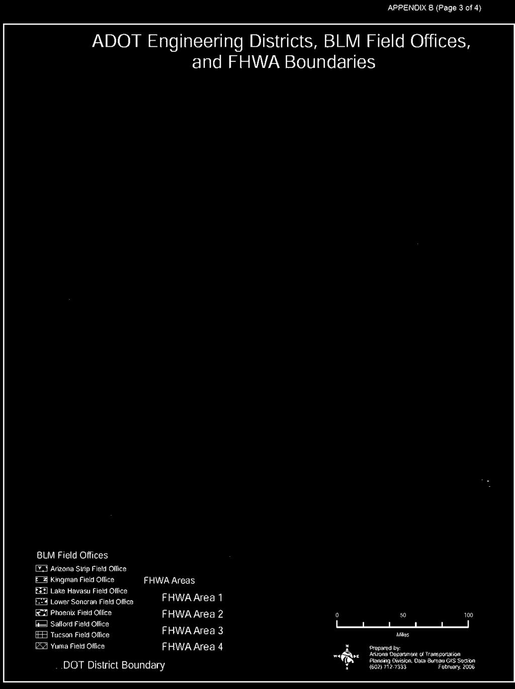
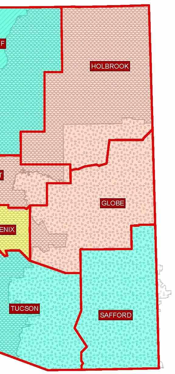
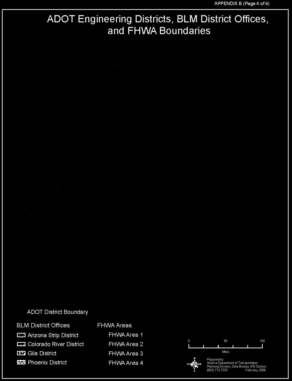
12 APPENDIX B (Page 1 of 4) ORGANIZATION AND WORK FLOW A. Bureau of Land Management 1. Arizona BLM organizational structure consists of three levels of line management Field Managers, District Managers and the State Director. Decision-making authority for most actions occurring on public lands has been delegated to the respective Field Managers within the following seven Field Offices administering BLM public lands in Arizona: a. Colorado River District (1) Yuma Field Office Yuma, Arizona (2) Lake Havasu Field Office Lake Havasu City, Arizona (3) Kingman Field Office Kingman, Arizona b. Phoenix District (1) Phoenix Field Office Phoenix, Arizona c. Arizona Strip District (1) Arizona Strip Field Office St. George, Utah d. Gila District (1) Tucson Field Office Tucson, Arizona (2) Safford Field Office Safford, Arizona 2. Staff positions provide technical and administrative assistance and support to both levels of line management. One additional level of staff assistance is available at the BLM National applied Resource Science Center in Denver, Colorado. 3. BLM s customary internal workflow is from the technical staff specialist to the Field Manager and from the Field Manager to the State Director. Generally, on intergovernmental working relationships, the Field Managers and their staffs work with their local counterpart, and the State Director and his/her staff work with State and field offices. B. Arizona Department of Transportation 1. ADOT operates under a centralized structure with the primary support offices in Phoenix. There are ten districts throughout the State as follows: Kingman Globe Yuma Safford Phoenix Construction Flagstaff Holbrook Tucson Phoenix Maintenance Prescott
13 APPENDIX B (Page 2 of 4) 2. Each District maintains the roadways within their District boundaries. Additionally, they support local customers by reviewing customer needs, concerns and opportunities. Each District has a support administration team, a construction team and a maintenance team. 3. The ADOT central office, located in Phoenix, provides the technical support for all of ADOT. This office provides engineering, right-ofway, environmental, project development, utility location and computer technical support. C. Federal Highway Administration 1. The Arizona Division organizational structure consists of three levels of line management: District Engineer, Assistant District Administrator, Division Administrator. 2. The Division Office uses an Operations Team organizational structure. The leadership of the Operations Team is led by a District Engineer who has administrative authority statewide. The Team includes an Environmental Specialist with oversight responsibilities on environmental issues for the entire State and five Area Engineers with responsibilities as delineated in Paragraph 3 below. 3. Each Area Engineer has oversight responsibilities for project development, environment and project approvals. The Area Engineer designated A-1 is responsible for activities in ADOT s Phoenix (East/Central) District. The Area Engineer designated A-2 is responsible for activities in ADOT s Tucson, Flagstaff and Safford Districts. The Area Engineer designated A-4 is responsible for ADOT s Prescott, Globe, Holbrook and Kingman Districts. The Area Engineer designated A-5 is responsible for activities in ADOT s Phoenix (West) and Yuma Districts. 4. In addition, the Arizona Division has a Right-of-Way Officer responsible for right-of-way actions and issues for the entire State.


14

15

16 APPENDIX C OPERATING AGREEMENT RELATED TO HIGHWAY PROJECTS BETWEEN THE BUREAU OF LAND MANAGEMENT, ARIZONA THE ARIZONA DEPARTMENT OF TRANSPORTATION AND THE FEDERAL HIGHWAY ADMINISTRATION, ARIZONA SUPPLEMENTING MEMORANDUM OF UNDERSTANDING NO. AZ
17 TABLE OF CONTENTS BACKGROUND I. HISTORY II. PURPOSE 1 III. AUTHORITY 1 AGREEMENT IV. RESPONSIBILITIES.. 1 V. PLANNING AND IMPLEMENTATION 2 A. Introduction. 2 B. ADOT Process and BLM Input 2 C. BLM Land Use Planning Process and ADOT/FHWA Input. 6 D. BLM Project Implementation Process and ADOT/FHWA Input. 8 VI. TITLE 23 PROJECTS 10 A. Agency Roles.. 10 B. Early Project Coordination. 11 C. Development of Environmental Document. 12 D. Project Reference Definition Benefits Contents Implementation.. 14 E. Project Design 15 F. Appropriation Process Request for Appropriation Agreement to Appropriation Conditions of Appropriation Disagreement to Appropriation Appropriation by Operation of Law. 19 G. Construction. 19 H. Operation, Maintenance and Minor Rehabilitation. 20 I. Disposal of Title 23 Rights-of-Way Disposal of Existing Title 23 Highway Rights-of-Way to Local Jurisdictions Disposal of Existing Title 23 Highway and Material Site Rights-of-Way on BLM Lands No Longer Needed for Transportation Purposes.. 21 VII. NON-TITLE 23 PROJECTS A. Agency Roles 22 B. NEPA Evaluation.. 23 C. Title V Rights-of-Way/Temporary Use Permits Early Project Coordination Application Filing Application Processing NEPA Processing Time Offer to Grant Decision Term of Authorization Relinquishment/Termination of Rights-of-Way/Temporary Use Permits D. Title 30 Use Permits 26 (RESERVED) VIII. MINERAL ESTATE OWNERSHIP ISSUES. 26 A. Project Assessment & NEPA. 26 B. Land and Title Work. 26 C. Mining Claims Post July 23, 1955, Mining Claims Pre July 23, 1955, Mining Claims Status of Title 23 Appropriated Lands.. 28 i
18 IX. ACCESS TO STATE HIGHWAYS.. 28 A. Third Party Access Roads. 28 B. BLM Access Roads 29 C. Highway Segments Designated as Access Controlled 29 X. ADMINISTRATION 29 ILLUSTRATIONS: 1. BLM Input Opportunities into ADOT s Process (New) 2. ADOT/FHWA Input Opportunities in BLM s Land Use Planning (LUP) Process (New) 3. BLM Project Implementation Graph (New) 4. Project Reference (Revised) 5. ADOT R/W to FHWA for Linear Highway R/W 6. ADOT Materials to FHWA for Material Site/Haul Road 7. FHWA Response to ADOT R/W Request (Revised) 8. FHWA Response to ADOT Materials Request (Revised) 9. ADOT R/W Appropriation Request to BLM for Linear Highway R/W (Revised) 10. ADOT Materials Appropriation Request to BLM for Material Site/Haul Road (Revised) 11. BLM Letter of Consent to Appropriation of Linear Highway R/W 12. BLM Letter of Consent to Appropriation of Material Site/Haul Road 13. Highway Easement Deed for Grant of Linear Highway R/W (Revised) 14. Highway Easement Deed for Grant of Material Site/Haul Road (Revised) 15. Resolution of Abandonment 16. Resolution of Disposal 17. Offer-to-Grant Letter 18. BLM Decision Letter COMMON ACRONYMS & ABBREVIATIONS AND GLOSSARY OF TERMS ii
19 OPERATING AGREEMENT Related to Highway Projects BACKGROUND I. HISTORY In January 1997, Arizona Department of Transportation (ADOT), Bureau of Land Management (BLM), and Federal Highway Administration (FHWA) held a two-day partnering workshop to begin enhancing and streamlining coordination among the three agencies. A Partnering Charter was developed, and on May 2, 1997, a Memorandum of Understanding (MOU) between the three agencies became effective. The MOU was purposely written as a general umbrella agreement with the intent that one or more Operating Agreements would be developed to supplement the MOU. The original MOU has been revised and replaced by dated April 23, II. III. PURPOSE The purpose of this Operating Agreement is to supplement dated April 23, 2003, as amended September 10, 2004, to establish roles, responsibilities, and operating procedures between ADOT, BLM and FHWA relating to highway projects on lands administered by BLM. AUTHORITY and authorities cited therein. BLM policy for implementing these authorities is contained in BLM Manual 2805 Federal Agencies. AGREEMENT IV. RESPONSIBILITIES A. FHWA will be the lead federal agency with the responsibility to comply with the National Environmental Policy Act, as amended (NEPA), National Historic Preservation Act as amended (NHPA), Endangered Species Act as amended (ESA), and other legal requirements for all Title 23 transportation-related projects on land administered by BLM. FHWA will invite, in writing, BLM to be a cooperating agency. B. BLM will be the lead federal agency with the responsibility to comply with NEPA, NHPA, ESA, and other legal requirements for the development of all BLM land management plans and amendments and on transportation-related projects without FHWA involvement. BLM will invite, in writing, FHWA and ADOT to be cooperating agencies in developing and amending its land use plans. In the event of a project using Federal-aid funds on a nontransportation related project (i.e. some Transportation Enhancement projects), the BLM Field Office will contact FHWA to discuss the specific roles of each agency. C. ADOT will be co-lead agency and will serve as FHWA's agent in the project development process for Title 23 projects. 1
20 V. PLANNING AND IMPLEMENTATION A. Introduction It is the intent of the three agencies to coordinate early, consistently and throughout each agency s process. Agency processes and input points follow. B. ADOT Process and BLM Input (Illustration 1) 1. Long Range Planning a. ADOT Long Range Planning typically occurs 20 or more years prior to construction. b. ADOT Long Range Planning includes Regional Transportation Profiles, Small Area Transportation Studies, Multi-Modal Transportation Studies, Statewide Access Management Plan, Policy Issues, the Long Range Plan and the Five Year Program. c. The ADOT contact for Long Range Planning (except for the Five Year Program) is its State and Regional Planning Section Manager. d. The ADOT contact for the Five Year Program is its Priority Program Manager. e. If there will be an impact to the BLM, ADOT will invite the BLM to be a Technical Advisory Committee (TAC) Member. f. BLM input opportunities into the following ADOT Regional Transportation Profiles, Small Area Transportation Studies, Statewide Access Management Plan, Policy Issues and Long Range Plan include: (1) Attend TAC Meetings. (2) Attend Public Meetings. (3) Review and comment on working papers. (4) Review and comment on draft final report. g. Activities that occur during ADOT s Five Year Program process include: (1) Rank projects to be scoped based on requests received from engineering districts. (This is an in-house TAC function). (2) Rank scoped projects received from engineering districts. (This is an inhouse TAC function). (3) Select projects to be included in the Tentative Five Year Program. (This is an in-house TAC function). (4) The State Transportation Board approves the Tentative Five Year Program. 2
21 (5) ADOT holds Public Hearings on its Tentative Five Year Program. (6) The State Transportation Board approves the Final Five Year Program. (7) After the Final Five Year Program approval, the Three Year State Transportation Improvement Plan (STIP) is developed. (8) Note: BLM s involvement in the Five Year Programming process is during the scoping and design phases of the project. 2. ADOT Project Development includes the following phases: Scoping, National Environmental Policy Act (NEPA) documentation, Design, Construction and Maintenance. 3. Scoping Phase a. ADOT s Scoping Phase typically occurs five to seven or more years prior to construction. b. The BLM may provide input into ADOT s scoping document. Types of scoping documents include: Scoping Letter, Project Assessment, Feasibility/Corridor Study and Location/Design Concept Report. c. The scoping process for either the Feasibility/Corridor Study or Location/Design Concept Report includes: Kick Off/Agency/Field Review, Initial Document, Draft Environmental Document, Final Environmental Document and Engineering Document. 4. NEPA Documentation a. ADOT s NEPA process begins during Scoping and continues through Stage V of Design. b. The ADOT contact for NEPA is its Environmental and Enhancement Group Manager. c. The BLM has the opportunity to: (1) Be a Cooperating Agency during development of an Environmental Assessment (EA) or Environmental Impact Statement (EIS) and participate as a member of an Interdisciplinary (ID) Team throughout the duration of the process. (2) Provide input on issues during agency scoping meetings and/or field reviews. (3) Review and comment on the predraft EA or EIS during its 30 day period. (4) Review and comment on the initial Design Concept Report (DCR) during its 30 day period. (5) Comment on the Draft EA or EIS during the 30 day public comment period. 3
22 (6) Review the Summary of Comments prepared for IDCR during its one week period. (7) Review the prefinal EA or EIS; Provide a letter supporting findings for inclusion in final NEPA document during the 30 day period. (8) Provide input during development and subsequent updates to NEPA documentation concurrent with all of V. B. 3, 4 and 5 herein. 5. Design Phase a. ADOT s Design Phase typically occurs 1 to 3 years prior to construction. b. The ADOT contact for the Design Phase is its Valley Group Manager (for Maricopa County) or its Statewide Manager (for other counties). c. The BLM has the opportunity to: (1) Participate in the Design Kick Off Partnering Meeting, Field Review and General Plan Development. (2) Receive key project documents through the Project Reference document distribution system concurrent with V. B. 5 and 6 herein. (3) Participate in monthly coordination meetings, review plans and special provisions and provide comments during Stage I of the design. These may occur during scoping or design. These take the design to 15%. (4) Participate in monthly coordination meetings, review plans and special provisions and provide comments during Stage II of the design. These take the design to 30%. (5) Participate in the constructability review. (6) Participate in monthly coordination meetings, review plans and special provisions and provide comments during Stage III of the design and participate in the field review. These take the design to 60%. (7) Participate in monthly coordination meetings, review plans and special provisions and provide comments during Stage IV of the design. These take the design to 95%. All clearances are completed by the end of Stage IV. d. Following Stage IV of the design, the following occur: (1) Stage V of the design produces Plans, Specifications and Estimate (PS&E). (2) FHWA authorization. (3) ADOT advertises the project. (4) The State Transportation Board awards the project to the contractor. 4
23 6. Construction Phase a. The Construction Phase occurs subsequent to the award of contract by the State Transportation Board. b. The ADOT contact for the Construction Phase is its Construction State Engineer. c. The BLM has the opportunity to: (1) Participate in the Construction Kick Off Partnering Workshop. (2) Participate in creating the project Issue Resolution Ladder. (3) Communicate regarding mobilization/ancillary facilities. (4) Participate in the Field Inspection. (5) Participate in Weekly Construction Meetings. (6) Participate in Field Reviews. (7) Participate in Partnering Refresher Workshops. (8) Participate in Public Meetings. (9) Participate in the Walk Through. (10) Participate in the Partnering Close Out Workshop. d. Note: The permit process is ongoing throughout the entire ADOT process. e. Note: Paragraph V. B. outlines the process for ADOT s typical design-bid-build projects. In design-build projects and construction manager at risk projects, design and construction are intermingled. 7. Maintenance Phase a. The ADOT Maintenance Phase includes both natural resources and maintenance and is ongoing through the entire ADOT process. b. The ADOT contact for maintenance is its State Maintenance Engineer. The ADOT contact for natural resources is its Statewide Natural Resources Manager. c. The Maintenance Phase includes activities to operate and maintain the highway. d. Herbicide Use. (1) ADOT is responsible for providing the motoring public with safe and aesthetically pleasing highway corridors. Accordingly, ADOT uses a variety of vegetation management techniques - mechanical, chemical, manual and cultural, in an intergraded approach to control hazardous vegetation and 5
24 noxious weeds along Arizona highways. (2) Herbicide use on lands managed by the BLM is regulated by NEPA guidelines for the BLM. Only those chemical herbicides approved for use on BLM managed lands will be considered by ADOT for use on roads crossing BLM managed lands. (3) The FHWA s role is to facilitate agreement between ADOT and BLM as needed. (4) ADOT, BLM and FHWA will meet once annually to coordinate herbicide vegetation management activities. The purpose of the meeting will be to identify issues and opportunities, plan vegetation control actions, and resolve potential difficulties and/or conflicts related to ADOT s vegetation management activities on roads crossing BLM managed lands. ADOT s Statewide Natural Resources Manager will contact BLM s State Invasive Species Coordinator and FHWA s Environmental Program Manager to schedule and plan this meeting. 8. Other Opportunities The BLM also may provide input at State Transportation Board Meetings and at the Five Year Program Development/Public Hearings. C. BLM Land Use Planning Process and ADOT/FHWA Input (Illustration 2) 1. The BLM s Land Use Planning (LUP) process includes a Comprehensive Evaluation, development and approval of a Preparation Plan, issuance of a Notice of Intent (NOI) Federal Register (FR) Notice, Notice of Availability (NOA), Draft Resource Management Plan (RMP)/Draft Environmental Impact Statement (EIS) FR Notice, NOA Proposed RMP/Final EIS FR Notice and issuance of Approved RMP Record of Decision (ROD) FR Notice. The BLM will give ADOT and FHWA input into its LUP process as follows: 2. Comprehensive Land Use Plan Evaluation a. The BLM conducts a Comprehensive LUP Evaluation every three years. b. The BLM will notify its partners (including ADOT and FHWA) that the BLM is about to conduct a Comprehensive LUP Evaluation. This also will be shown on the BLM s approved LUP. c. The BLM s contact is its State Planning and NEPA Lead. d. ADOT contacts are ADOT District Engineers, State Engineer, Deputy State Engineers, Director of Transportation Planning Division and Environmental & Enhancement Group Manager. e. The FHWA contact is its Environmental Program Manager. f. If the BLM s evaluation indicates that the LUP needs to be either amended or revised, then it moves on to the next phase, which is to develop and approve the 6
25 Preparation Plan. Otherwise, no action is required. 3. Develop and Approve Preparation Plan ADOT, BLM and FHWA will follow their Agreement Number AZ (Memorandum of Understanding Between the Department of Interior, Bureau of Land Management, Arizona Office, All Arizona Field Offices and U.S. Department of Transportation, Federal Highway Administration, Arizona Division Office as a Cooperating Agency and The State of Arizona, Arizona Department of Transportation as a Cooperating Agency) in the development and approval of the Preparation Plan. 4. Issue Notice of Intent Federal Register Notice ADOT and FHWA have an opportunity to contribute issues and concerns to be addressed in the LUP related to the NOI FR Notice during the following activities: a. Develop Scoping Report. b. Planning Criteria. c. Formulate Alternatives and develop Preferred Alternative. d. Describe Affected Environment. e. Assess and describe Impacts. 5. Notice of Availability Draft Resource Management Plan/Draft Environmental Impact Statement Federal Register Notice ADOT and FHWA have an opportunity to contribute issues and concerns that need to be addressed in the LUP related to the NOA Draft RMP/Draft EIS during the following activities: a. Analyze Comments. b. Respond to Comments and Text Revisions. 6. Notice of Availability Proposed Resource Management Plan/Final Environmental Impact Statement Federal Register Notice ADOT and FHWA have an opportunity to contribute issues and concerns to be addressed in the LUP related to the NOA Proposed RMP/Final EIS during the following activities: a. 30 Day Protest Period. b. 60 Day Governor s Consistency Review. 7. Issue Approved Resource Management Plan/Record of Decision Federal Register Notice BLM will send ADOT and FHWA a copy of the approved RMP/ROD FR Notice. Then, 7
26 BLM s process moves to implementation. D. BLM Project Implementation Process and ADOT/FHWA Input (Illustration 3) 1. BLM s NEPA phases for project implementation are to determine the scope, conduct NEPA analysis, make the NEPA determination, document the decision and allow administrative review/appeal. 2. Phase 1: Determining the Scope a. Categorical Exclusion Process (1) ADOT and FHWA have an opportunity for input when the BLM fleshes out a brief description of the proposed project. (2) The BLM determines whether a project is on the BLM or Department of Interior Categorical Exclusion List. b. Determination of NEPA Adequacy (1) ADOT and FHWA have an opportunity for input when the BLM fleshes out a brief description of the proposed project and identifies and lists other related NEPA documents. (2) The BLM determines LUP conformance. c. EA Level Analysis Process (1) ADOT and FHWA have an opportunity for input when the BLM fleshes out a brief description of the proposed project, invites Cooperating Agencies and determines the scope of the EA level analysis. (2) The BLM determines LUP conformance. d. EIS Level Analysis Process (1) ADOT and FHWA have an opportunity for input when the BLM fleshes out a brief description of the proposed project, invites Cooperating Agencies and during the public review and comment period. (2) The BLM determines LUP conformance and publishes a NOI in the Federal Register. BLM allows a minimum 30 day public review and comment period. 3. Phase 2: Conducting NEPA Analysis a. Categorical Exclusion Process ADOT and FHWA have an opportunity for input when the BLM conducts an analysis to determine if any of the extraordinary circumstances apply to the project. b. Determination of NEPA Adequacy Process 8
27 ADOT and FHWA have an opportunity for input when the BLM conducts an analysis using seven criteria for determining NEPA adequacy. c. EA Level Analysis Process (1) ADOT and FHWA have an opportunity for input when the BLM prepares the EA. (2) Preparing the EA includes preparing the Need for the Proposal, Alternatives including the Proposed Action, site specific affected environment and a list of agencies and individuals committed. d. EIS Level Analysis Process (1) ADOT and FHWA have an opportunity for input when the BLM prepares the draft EIS. (2) Preparing the EIS includes preparing the Purpose and Need Statement, Proposed Action and Alternatives including No Action, affected environment, environmental consequences, list of agencies and individuals to whom copies are sent, appendices, glossary and references cited. (3) The BLM publishes a Federal Register Notice of Availability for the draft EIS. (4) The BLM provides and ADOT and FHWA have an opportunity for input into the 60 day Review and Comment Period. 4. Phase 3: Making the NEPA Determination a. Categorical Exclusion Process The BLM responsible official makes the determination whether the proposal is categorically excluded and whether any additional NEPA analysis is needed. b. Determination of NEPA Adequacy Process The BLM responsible official makes the determination whether the existing NEPA analysis is adequate to implement the proposal. c. EA Level Analysis Process The BLM prepares the Finding of No Significant Impact (FONSI). d. EIS Level Analysis Process (1) ADOT and FHWA have an opportunity for input when the BLM conducts analysis of public comments received, prepares responses to comments and prepares text changes. (2) The BLM publishes a Federal Register NOA for the Final EIS. This is followed by a 30 cooling off period. 9
28 5. Phase 4: Documenting Decision a. Categorical Exclusion Process The BLM responsible official makes the decision whether to implement the proposal. b. Determination of NEPA Adequacy Process The BLM responsible official makes the decision whether to implement the proposal. c. EA Level Analysis Process (1) The BLM responsible official makes the decision whether to implement the proposal. (2) The BLM publishes a Decision Record (DR). d. EIS Level Analysis Process The BLM publishes a ROD. 6. Phase 5: Administrative Review/Appeal Process For Phases 1 through 4 above, an administrative review/appeal process is provided. ADOT and FHWA have an opportunity for input during Phase 5. VI. TITLE 23 PROJECTS In this Operating Agreement, unless the context otherwise requires, necessary environmental clearances shall be understood as including compliance with the National Environmental Policy Act, Section 7 of the ESA, Section 106 of the NHPA, and all other pertinent and applicable Federal and State environmental protection laws. A. Agency Roles 1. As the lead Federal agency for highway projects eligible for funding pursuant to 23 U.S.C. (Title 23), FHWA is ultimately responsible for compliance with NEPA and other necessary environmental clearances. No NEPA decision is required by the BLM for a Title 23 U.S.C. funded highway project unless the proposed action does not conform to BLM s land use plan for the affected lands. BLM, as federal land manager on public lands, retains responsibility for enforcement of, and compliance with, the Native American Graves Protection and Repatriation Act (NAGPRA) and the Archaeological Resources Protection Act (ARPA). In situations where a land use plan amendment is required, the NEPA analysis and documentation must meet both FHWA and BLM regulatory standards. 2. Unless otherwise agreed, ADOT serves as agent for FHWA in meeting FHWA s responsibility for NEPA and other necessary environmental clearances. 10
29 3. ADOT Environmental and Enhancement Group (EEG), or its designated consultant, will coordinate with the appropriate BLM Field Office(s) where BLM-managed lands needed for highway purposes are located during the various stages of a highway project. B. Early Project Coordination 1. Early in the planning and NEPA stages of a Federal-aid-eligible highway project on BLMmanaged lands, FHWA will send written notification of the project to all affected BLM Field Offices, with a copy to ADOT EEG: (1) inviting BLM to participate as a cooperating agency, (2) requesting that BLM identify known issues and concerns relating to protection of valid existing rights and resources on BLM-managed lands potentially affected by the project, and (3) requesting a determination whether the proposed project is in conformance with BLM land use plans. 2. BLM will provide a written response to FHWA, with a copy to ADOT EEG, in a timely manner, usually within 30 days after receipt of the notification, which: a. acknowledges receipt of the notification; b. verifies whether or not the proposal is in conformance with BLM land use plans; c. states whether or not BLM will be a cooperating agency with special expertise or, in the case where a land use plan amendment is required, a cooperating agency with jurisdiction; d. provides readily available information on wildlife, wildlife habitat, areas where threatened or endangered plant or animal species are known to occur, information on special status or sensitive species of plants or animals, special fencing needs, grazing, cultural resources, valid existing rights, etc.; e. identifies any known unique or special conditions, based on knowledge of existing resources, including any anticipated special protective measures, which may be necessary; f. provides the name, phone number and address of the designated point of contact (BLM Project Manager); and g. identifies the BLM Serial Number assigned to the project. 3. When more than one BLM Field Office will be affected by the proposed project, the BLM State Director will designate a Lead Office that will then assign a Project Manager. The BLM Project Manager will send written notification to FHWA, with a copy to ADOT, identifying which office is the BLM Lead Office. 4. The BLM Project Manager will coordinate with all other BLM Field Offices affected by the project and will provide consolidated responses to ADOT and FHWA on issues affecting BLM-managed lands throughout the life of the project. 5. The BLM Serial Number, the FHWA Project Number, and the ADOT TRACS Number(s) or Material Site Number will be referenced on all future correspondence relating to the project, whether correspondence is by formal letter, , or fax transmittal. 11
30 C. Development of Environmental Document 1. Before any public/agency scoping meetings are held, BLM, FHWA, and ADOT will meet to identify the primary points of contact for each agency and determine members needed on the Inter-disciplinary (ID) Team. The ID Team will meet on a regular basis to discuss and resolve issues pertaining to (but not limited to) alternatives, methodology, potential mitigation, and levels of analysis. The ID Team will also develop a team partnering charter that identifies the roles and responsibilities of each member. 2. At the beginning of each ID Team meeting, the team will review, modify if necessary, and approve the minutes from the previous meeting. These minutes will serve as the documentation which demonstrates the issues on which the team has, or has not, reached consensus. 3. Every attempt will be made to resolve differences relating to measures BLM may feel are necessary for protection of adjacent BLM-managed lands and resources. If agreement cannot be reached at the lowest level of each organization, the dispute resolution process described in Section VIII of the MOU shall be followed. 4. BLM will have opportunity to formally review the NEPA and engineering documents and provide written comments to FHWA, with copies to ADOT EEG, within the following times (Illustration 1): a. Administrative draft of the Categorical Exclusion (CE), Environmental Assessment (EA), or Environmental Impact Statement (EIS) - 30 to 45 days after receipt. b. Initial Design Concept Report (DCR) - 30 to 45 days after receipt. c. Draft EA or EIS during the public comment period - 30 days after receipt for an EA, and 45 days after receipt for an EIS. d. Administrative final EA or EIS - 30 days after receipt. 5. The BLM Project Manager shall provide FHWA a letter, signed by the BLM Authorized Officer, supporting the findings for inclusion in the Final EA or EIS. 6. Field reviews may be scheduled by ADOT, their consultant, FHWA, or BLM. Review of project submissions, environmental documentation and participation in field reviews provides the opportunity for BLM to identify specific concerns relating to resource issues on BLM-managed lands throughout the entire NEPA process. This will ensure adequate time for all parties to discuss and come to resolution regarding specific mitigation measures to be implemented for the project. 7. ADOT and FHWA will mitigate highway construction impacts to resources on BLMmanaged lands in a practical and reasonable manner. Proper highway design, including safety, is the responsibility of ADOT and FHWA. Where conflicts arise in selection of project design features, highway safety will be the overriding factor. 8. Special measures which BLM believes are necessary to protect BLM-managed lands adjacent to but outside the right-of-way will be discussed with the ID Team during the early consultation, environmental analysis, and throughout the design phases of the project. The BLM Project Manager will submit, in writing to ADOT with a copy to FHWA, 12
31 any special measures determined necessary for protection of BLM-managed lands or resources, along with a rationale for each measure identified. Upon agreement with such protective measures, ADOT will reply, in writing with a copy to FHWA, that such measures will be included in the project design. If ADOT disagrees with the identified measures, ADOT will provide a written response to BLM, with copy to FHWA, stating the rationale for not agreeing to inclusion of the measures in the project design. All such documentation will be included in the Project Reference (see Section D below). D. Project Reference Given increased environmental awareness, as well as federal and state government streamlining, the parties recognized the need for a new method of coordinating highway construction project activities. This resulted in the creation of the Project Reference (Illustration 4), a cooperative effort of the Arizona Department of Transportation and the Arizona offices of the Bureau of Land Management and the Federal Highway Administration. The following information provides a brief overview of this new document. 1. Definition: The Project Reference is designed to: a. consolidate project specific documents and information applicable to the appropriation of and construction on BLM-managed lands pursuant to Title 23 U.S.C.; b. ensure that project partners receive pertinent documents throughout the life of the project; and c. be a resource to assist in the preparation of the Plans Specifications and Estimates (PS&E) by ADOT Contracts and Specifications (C&S) Group. 2. Benefits: a. Project information is centrally located and readily available to key stakeholders in the project, thereby reducing or eliminating delays to the project caused by confusion, misunderstanding or conflict associated with project design. b. Project stakeholders receive pertinent information in a timely and reliable manner. c. Efficient use of time, clarity of understanding and positive working relationships are improved. d. The ability of team members to successfully execute the project is enhanced. e. The public benefits from a better informed government staff with regard to highway projects. 3. Contents: Not all project-related information will be available when the Project Reference is created, and information will change as the project progresses through the design and implementation phases, each of which occur over a period of several years. When presented at the design kick off meeting, the Project Reference will consist of, at a minimum: a. 8 ½ inch x 11 inch 3 ring binder; 13
32 b. Table of Contents; c. Purpose (Section 1.1 of the Project Reference); d. Project Summary (Section 1.2 of the Project Reference); e. Available environmental information to include project specific mitigation measures and copies of all correspondence generated throughout the NEPA process; f. Divider tabs; and g. Copy of current Operating Agreement. 4. Implementation: a. Creating the Project Reference will be a collective effort of the ADOT Development Group. Development of the Project Reference will begin after completion of the Design Concept Report (DCR) or the final Project Assessment (PA) and the final environmental document. b. For projects where a Pre-Negotiations Partnering Meeting is held, the ADOT Project Manager will educate workshop participants about the Project Reference and identify who will create the initial reference notebooks. c. The ADOT Project Manager (or Design Consultant) will distribute Project Reference notebooks to the key stakeholders at the Design Kick-Off Partnering Workshop. Key stakeholders are defined as, at a minimum, the BLM Project Manager, ADOT Project Manager, Design Consultant, ADOT District Engineer (2 copies: 1 for the Resident Engineer & 1 for the prime construction contractor, when selected), ADOT Right of Way Coordinator and FHWA Area Engineer. FHWA and BLM will each need only one Project Reference. If it is determined that additional Project References are needed, the responsible party for each agency will make the necessary copies and ensure continued distribution of updated materials within their organization. The ADOT Project Manager (or Design Consultant) will be responsible for providing an upto-date Project Reference to the representative from ADOT Contracts & Specifications for use as a reference in preparation of the bid package. d. Any additional project stakeholder who wants to receive a copy of the Project Reference and subsequent documents and information will put his/her name and contact information on a sign-in sheet at the Design Kick-Off Partnering Workshop. The ADOT Project Manager (or Design Consultant) will distribute a Project Reference to these individuals and add their name to the distribution list for updates throughout the life of the project. The ADOT Project Manager will distribute Project Reference notebooks to ADOT-related stakeholders e. The ADOT Project Manager (or Design Consultant) will identify at the design kick off meeting the documents to be generated for inclusion within the Project Reference and the appropriate method of transmitting documents/information to design team members. Project documents and information may be in the form of s, fax or hard copy transmittals, as appropriate. He/she will identify the responsible parties for submission of project related information. The following examples identify types of information which will be transmitted to the key stakeholders and any others who have indicated they wish to be included on the Project Reference distribution list: Example: ADOT Environmental and Enhancement Group will be responsible for providing copies of documents generated through the NEPA process for inclusion in 14
33 the Project References distributed at the design kick off meeting, information related to hazardous contamination issues and copies of SHPO concurrence. Example: BLM Field Office Representative will be responsible for providing baseline information, i.e. information related to valid existing rights such as mining claims, mineral leases and permits, rights-of-way, grazing leases, known locations of habitats for sensitive or T&E wildlife and plant species, big horn sheep lambing grounds, etc., and information pertaining to third party ancillary facilities. Example: ADOT Right of Way Coordinator will be responsible for providing copies of the Arizona State Trust Land approvals and Special Conditions information, i.e. cost-to-cure, salvage, right-of-way contracts on private parcels. Example: ADOT Resident Engineer will be responsible for providing copies of signed application for the Corps of Engineers permits and agreements reached throughout the development and construction phases of a project. Example: ADOT Utilities will be responsible for providing information regarding prior rights and any signed agreements resulting from their research. f. All stakeholders will be responsible for updating their copy of the Project Reference throughout the development process. g. The ADOT Resident Engineer will assume responsibility for the Project Reference at the Construction Partnering Kick-Off Workshop and will provide an updated Project Reference to the prime contractor. At this phase, the prime contractor will be added to the list of project stakeholders and will receive copies of all subsequent documents. Any additional stakeholders who want a Project Reference will put his/her name and contact information on a sign-in sheet at the construction kick-off meeting. The ADOT Resident Engineer will distribute Project Reference notebooks to ADOT-related stakeholders. BLM and FHWA will assume the responsibility for providing Project Reference notebooks and updated information to individuals in their agencies who request that their names be added to the stakeholder list. h. Agreements made throughout the development and construction phases of a project will be acknowledged, in writing, with concurrence signatures of both ADOT and BLM, and will be transmitted for inclusion within the Project Reference. i. The official Project Reference for the project is the one maintained by ADOT s Project Manager and Resident Engineer. Any changes to the mitigation measures identified in the Final Environmental Assessment (EA) or Environmental Impact Statement (EIS) must be agreed upon, in writing, by ADOT, BLM and FHWA, and distributed for inclusion in the Project Reference. E. Project Design In addition to the opportunities for formal review and comment during the NEPA process discussed above in Section VI.C.4, BLM will also have opportunity for review and comment during the design process as follows: 1. during the design kickoff meeting and/or field review; 2. at the monthly progress meetings; 15
34 3. during the 30%, 60%, and 95% plan reviews; and 4. on any subsequent NEPA re-evaluations or supplemental analysis. BLM will provide all comments resulting from such reviews in writing to the ADOT Project Manager, with a copy to FHWA. F. Appropriation Process 1. Request for Appropriation a. After completion of NEPA and prior to sending the formal Request for Appropriation to BLM, ADOT will send notification to, preferably via , the FHWA Realty Officer requesting concurrence that the BLM-managed lands are needed for the project. The notification and concurrence may include a request for more than one project. (Illustration 5 or 6 for linear or material site rights-of-way, respectively). b. The FHWA Realty Officer will reply to ADOT s request, preferably via , either concurring or not concurring to the determination of public necessity for the project (Illustration 7 or 8 for linear or material site rights-of-way, respectively). c. ADOT will submit directly to the appropriate BLM Field Office, with a copy to FHWA, the formal Request for Appropriation consistent with 23 C.F.R. Section 710, Subpart F. ADOT will use the standard letter (Illustration 9 or 10 for linear or material site rights-of-way, respectively) for requesting appropriation of linear or material site rights-of-way and any associated haul/access roads. The Request for Appropriation will identify both the permanent easement and any temporary construction easements (TCE) necessary for the project. d. A complete Request for Appropriation will consist of the appropriate letter (Illustration 9 or 10 for linear or material site rights-of-way, respectively) accompanied by the following: (1) Reference to the final, approved NEPA document by name and date, for the project, a copy of which will have already been provided to the BLM Project Manager. (2) Right-of-Way Plans for linear rights-of-way; plat maps and mining and reclamation plan for material site rights-of-way; (3) Highway Easement Deed (HED) with legal description of the requested permanent right-of-way and separate description of temporary construction areas; and (4) A copy of the from FHWA to ADOT (Illustration 7 or 8 for linear or material site rights-of-way, respectively) concurring that the lands are necessary for the project. e. The BLM Project Manager will acknowledge receipt of the formal Request for Appropriation within 30 days, as follows: 16
35 (1) If the package is incomplete, the BLM Project Manager will send notification, preferably via an , to ADOT, with copy to FHWA, to state the package is incomplete and identify what is missing. (2) If the package is complete, BLM will follow the procedures in VI.F.2 or 4 below. 2. Agreement to Appropriation a. Agreement to the request for appropriation will be in the form of a Letter of Consent (LOC), signed by the BLM Authorized Officer (Illustration 11 or 12 for linear or material site rights-of-way, respectively) in accordance with Section VI.F.3 below. b. The LOC will be addressed to FHWA but will be sent directly from BLM to ADOT, with a copy to FHWA. The LOC will cover both the permanent easement, any associated haul/access roads, and any identified TCEs. c. After receipt of the LOC, ADOT will submit the appropriate Highway Easement Deed (HED) (Illustration 13 or 14 for the form deeds for linear or material site rights-of-way, respectively) to FHWA for signature. The form deeds specified in Illustrations 13 and 14 have been certified as legally sufficient by legal counsel for ADOT and FHWA and such certifications are on file at ADOT and the FHWA Arizona Division Office. These deeds may be augmented only by insertion of ADOT project and parcel information, BLM reference number, execution dates, 23 U.S.C. appropriation section reference, legal description, signatures and notarization information. Any other additions or modifications to these deeds will require separate certifications of legal sufficiency by legal counsel for ADOT and FHWA in accordance with 23 U.S.C. 107 (d) and 317 and implementing regulations at 23 C.F.R d. After signature by FHWA, ADOT will have the easement deed recorded in the appropriate county or counties, and submit a copy of the recorded deed to the BLM Project Manager and to FHWA Realty Officer. e. ADOT will notify BLM in writing, with a copy to FHWA, when TCEs lying outside the permanent right-of-way are no longer needed and request a joint inspection with BLM to coordinate rehabilitation of the TCEs. Upon determination that the TCEs have been rehabilitated to the satisfaction of BLM, a letter acknowledging that the TCEs are no longer part of the appropriation will be signed by the BLM Authorized Officer. The letter will be addressed to FHWA but will be sent directly to ADOT, with a copy to FHWA. 3. Conditions of Appropriation All appropriations shall be subject to and conditioned upon compliance with the standard conditions of approval as stated below. Title 23 Material Site Rights-of-Way (MSROWs) are established for the purpose of extraction, processing, and storage of materials for the construction, operation, and maintenance of federal aid-eligible projects. ADOT will evaluate whether there is a continuing need for the MSROWs upon completion of the construction project. The following conditions will not be specifically elaborated in each LOC or HED. However, BLM s consent to the appropriation, and thus the LOC and HED, are wholly contingent upon ADOT and FHWA concurrence to, and conformance with, the following conditions: 17
36 a. All appropriations shall be subject to any additional conditions agreed to, in writing, in accordance with this Operating Agreement during the early coordination, environmental analysis, and design phases, whether or not those conditions are specifically carried forward in the request for appropriation or the LOC. b. If outstanding valid rights exist on the date of the use authorization, ADOT shall obtain such permission as may be necessary on account of any such rights. c. The use right authorized shall terminate 10 years, or sooner if agreed upon, from the date of execution of the HED by FHWA to ADOT in the event construction of a highway or use of the material site has not been started during such period. d. The use right authorized is limited to the described right-of-way and the space above and below for federal highway purposes and does not include any rights for nonfederal highway purposes. e. BLM retains the right to use, or authorize use on, any portion of the right-of-way for non-highway purposes provided such uses would not interfere with ADOT s use of the right-of-way, impair the full use and safety of the highway, or be inconsistent with the provisions of Title 23 U.S.C. and the FHWA regulations issued pursuant thereto. Such use will be authorized only after consultation with, and written concurrence from, ADOT. f. BLM may locate information signs conforming to the Manual on Uniform Traffic Control Devices (MUTCD) on portions of the right-of-way outside of clear zone limits, however, such signs shall not be located on the right-of-way of an Interstate System. g. Consistent with highway safety standards, ADOT shall: (1) Protect and preserve soil and vegetative cover and scenic and esthetic values on the right-of-way outside of construction limits. (2) Provide for the prevention and control of soil erosion within the right-of-way and on adjacent lands that might be affected by the construction, operation, maintenance, minor rehabilitation, and termination of the highway project. (3) Vegetate and keep vegetated with suitable species all earth cut or fill slopes feasible for re-vegetation or other areas on which ground cover is destroyed where it is deemed necessary prior to completion of the highway and shall maintain terracing, water bars, leadoff ditches, or other preventive works that may be required to accomplish this objective. This provision shall also apply to slopes that are reshaped following slides which occur during or after construction. h. No sites for highway operation and maintenance facilities, camps, supply depots, or disposal areas within the right-of-way may be established without obtaining written approval of the BLM authorized officer. i. ADOT shall maintain the right-of-way clearing by means of chemicals only after consultation with the appropriate BLM Field Office, specifying the time, methods, chemicals and locations of the right-of-way to be treated. 18
37 j. The provisions of Title VI of the Civil Rights Act of 1964 (78 Stat. 252, 42 U.S.C. 2000d-2000d-4) shall be complied with. k. ADOT shall follow the standard procedures contained within the 1973 Department of Interior Manual of Survey Instruction in removing, resetting, referencing or otherwise perpetuating the position of any cadastral survey monuments which may be subject to disturbance during construction or maintenance of any highway project. l. ADOT and BLM will cooperate in responding to and keeping each other informed of oil and gas and hazardous material spills of mutual concern. Contact for coordination shall be between the ADOT District Maintenance Engineer, the BLM Field Manager, and Arizona Department of Environmental Quality (ADEQ). Specific contingency plans shall be discussed annually at District and/or State coordination meetings or as needed to facilitate full cooperation. Unless otherwise agreed in writing by supplement to this Operating Agreement or other written instrument, ADOT will respond to emergency response/cleanup for oil and gas or hazardous materials spills within the highway right-of-way and will immediately notify BLM of any such incidents. BLM will respond to emergency response/cleanup for oil and gas or hazardous materials spills outside of the right-of-way but which may impact the highway project and immediately notify ADOT of such incidents. 4. Disagreement to Appropriation As a result of the cooperative process developed by FHWA, ADOT and BLM as documented within the dated April 23, 2003, as amended September 10, 2004, and this Operating Agreement, the parties believe it is highly unlikely BLM would issue a formal disagreement to an appropriation request. However, if such a unique situation were to arise, disagreement to a request for appropriation would be in the form of a letter, signed by the State Director, with supporting documentation clearly substantiating that: a. appropriation would be contrary to the public interest; b. appropriation would be inconsistent with the purposes for which the BLM-managed lands or minerals are managed; or c. FHWA and ADOT will not accept the conditions BLM determines necessary for protection of the BLM-managed land or resources. 5. Appropriation by Operation of Law If, within four months, BLM has not responded, in writing, to the Request for Appropriation, such land may be considered appropriated by FHWA and transferred to ADOT for the purposes requested. Before exercising this authority, FHWA will notify BLM that it has appropriated the land. G. Construction 1. During construction or during the use of a material source, ADOT, as agent for FHWA, will ensure compliance with all such terms and conditions identified in the NEPA document, the LOC, and any special conditions designed to protect the BLM-managed land and its resources to which all parties have agreed. If BLM identifies a situation 19
38 where it appears there may be non-compliance with such terms and conditions, BLM will work directly with the ADOT Project Manager or Resident Engineer to resolve the issue. BLM will not initiate direct contact with any contractor working for ADOT. 2. If necessary, ADOT, FHWA and BLM will coordinate a joint meeting to resolve differences. Escalation procedures outlined in Section VIII of the MOU will be followed if differences cannot be resolved at the joint meeting between ADOT, BLM and FHWA. 3. The BLM Field Office staff will be given an opportunity to provide input on construction issues during the construction partnering meeting and the weekly construction meetings. H. Operation, Maintenance, Minor Rehabilitation 1. Operation and maintenance within a highway easement includes standard highwayrelated preservation activities to ensure a continued safe and efficient highway for the public (23 CFR 460, 625, 635, 771). Such activities include, but are not limited to: emergency repair; restoration of surfacing, shoulders, roadsides; restoration or replacement of structures (including bridges); cleaning ditches and cross-drainage; minor (less than 100 feet in length) slope flattening for erosion mitigation, snow removal, sight distance or other safety reasons; controlling brush and roadside vegetation to maintain clear zones, sight distance and to remove hazard trees; slope stabilization and scaling; removal of hazards and other obstructions; preserving and adding traffic control measures to conform with the Manual on Uniform Traffic Control Devices (MUTCD), etc. These activities are approved in the easement and do not require an additional NEPA decision. However, compliance by FHWA, and thus ADOT acting as their agent, with all other applicable laws and regulations is required. BLM, as federal land manager, retains the responsibility for enforcement of, and compliance with NAGPRA and ARPA. a. If any BLM facilities will be impacted by operation or maintenance, ADOT will notify the affected BLM Field Office(s). b. If highway operation or maintenance will require use of BLM-managed lands outside the right-of-way, ADOT will notify the affected BLM Field Office to secure the appropriate authorization prior to commencing the work. If an emergency situation arises where public safety may be at risk, ADOT may proceed without specific BLM authorization and will notify BLM as soon as possible of the situation. 2. Minor rehabilitation within a highway easement includes non-standard highway-related operation and maintenance to provide minor upgrades to a highway (23 CFR 625, 635, 771). Such activities include but are not limited to: minor realignment (i.e., straightening dangerous curves); minor widening (adding lane and/or shoulder width); adding auxiliary lanes (passing, turning, climbing, parking, etc.); major (more than 100 feet in length) slope flattening for erosion mitigation, snow removal, sight distance or other safety reasons, etc. If federal funds will be used for any of these activities, additional NEPA by FHWA would be required. A CE may be sufficient in most cases. No NEPA decision or additional authorization by BLM is needed for minor rehabilitation work within a highway easement, however BLM, as federal land manager, retains the responsibility for enforcement of, and compliance with NAGPRA and ARPA. a. If any BLM facilities will be impacted by minor rehabilitation, ADOT will notify the affected BLM Field Office(s) before implementing such activities. BLM facilities may include, but are not limited to, such items as fences, cattle guards, signs, etc. 20
39 b. If minor rehabilitation will require use of BLM-managed lands outside the right-of-way, ADOT will notify the affected BLM Field Office to secure the appropriate authorization. I. Disposal of Title 23 Rights-of-Way This section establishes procedures for disposal of Title 23 rights-of-way on BLM-managed lands that ADOT determines are no longer needed for state transportation purposes. This includes disposal of state highways to local jurisdictions for continued use as a public transportation facility, as well as highway and MSROW no longer needed for public transportation purposes that will revert to BLM as provided in the Highway Easement Deed. ADOT will evaluate the need for the MSROW upon completion of its associated construction project. If the 10-year use requirements provided for in the Conditions of Appropriation in the HED are not met, BLM will notify ADOT and the FHWA in writing. The letter will request a meeting to discuss the inactive MSROW within 30 days. At the request of BLM, ADOT will follow the procedures in 2. below. 1. Disposal of Existing Title 23 Highway Rights-of-Way to Local Jurisdictions a. When ADOT Right of Way Titles Section receives a Recommendation for Disposal (Form ) from an ADOT District Office, notification will be provided to the receiving local jurisdiction informing them that they will need to contact BLM to obtain a right-of-way grant for the highway. Copies of the notification will be sent to the FHWA and the affected BLM Field Office, ADOT District Engineer and ADOT Right of Way. FHWA concurrence will be obtained. When required, FHWA concurrence will be obtained following the provisions of 23 CFR Subpart 620. b. Prior to presenting the disposal resolution to the State Transportation Board (STB), copies of the resolution plats and/or legal description and a copy of FHWA s concurrence will also be provided to the receiving local jurisdiction, FHWA and the affected BLM Field Office, ADOT District Engineer and ADOT Right of Way for review and comment. c. Upon approval by the STB, the Resolution of Abandonment stating Area of right of way has been removed from the State Transportation System (Illustration 15) will be recorded in the appropriate County, thereby becoming effective. A copy of the recorded resolution will be provided by ADOT Right of Way Titles Section to the receiving local jurisdiction, FHWA and the affected BLM Field Office. 2. Disposal of Existing Title 23 Highway and Material Site Rights-of-Way on BLM Lands No Longer Needed For Transportation Purposes: a. Prior to disposal of Title 23 rights of way on BLM-managed lands, ADOT District Office will send written notification to the affected BLM Field Office, with a copy to FHWA, of its intent to dispose. FHWA concurrence will be obtained. b. ADOT will arrange a joint inspection of the facility with the appropriate staff from the BLM Field Office, ADOT District Office, and FHWA to finalize a plan for disposal and rehabilitation. The Rehabilitation Plan, and any supplemental agreements thereto, 21
40 VII. will be documented in writing and signed by ADOT and the BLM Authorized Officer (AO). NOTE: Should new construction eliminate the need for existing Title 23 rights-of-way, rehabilitation proposals will be developed during the design process as defined in Sections VI. C and VI. D of this Operating Agreement. c. Upon satisfactory completion of rehabilitation by ADOT and written acceptance by BLM AO, ADOT District will initiate Recommendation for Disposal (Form ). d. When ADOT Right of Way Titles Section receives a Recommendation for Disposal (Form ) from an ADOT District Office, a letter of notification of disposal commencement will be provided to FHWA, and the affected BLM Field Office, ADOT District Engineer, and ADOT Right of Way Sections. e. Prior to the STB meeting, ADOT Right of Way Titles will provide copies of resolution plats and/or legal description and FHWA concurrence to FHWA, the affected BLM Field Office, ADOT District Engineer, and ADOT Right of Way Project Management Section for review. f. Upon approval by the STB, the Resolution of Disposal stating Area of right of way has been removed from the State Transportation System (Illustration 16) will be recorded in the appropriate County, thereby becoming effective. A copy of the recorded resolution will be provided by ADOT Right Way Titles Section to FHWA and the affected BLM Field Office, ADOT District Engineer, and ADOT Right of Way Sections. g. BLM Field Office will notify FHWA in writing, with copy to ADOT, that the appropriation no longer exists and notify BLM State Office to update the public land records accordingly. NON- TITLE 23 PROJECTS In this Operating Agreement, necessary environmental clearances shall be understood to include the following: compliance with the National Environmental Policy Act (NEPA), Section 7 of the Endangered Species Act (ESA), Section 106 of the National Historic Preservation Act (NHPA), and all other pertinent and applicable federal and state environmental protection laws. As it relates to this Operating Agreement, there are two basic types of uses for which ADOT could request authorization from BLM. One type of use would be a right-of-way (ROW) or temporary use permit (TUP) pursuant to Title V of the Federal Land Policy and Management Act (FLPMA), as amended (43 U.S.C ) and the implementing regulations at 43 C.F.R. Part The other type of use would be a Title 30 Free Use Permit (FUP) for materials pursuant to the Act of July 31, 1947, as amended (30 U.S.C. 601), and the implementing regulations at 43 C.F.R. Part A. Agency Roles 1. As the lead federal agency for non-title 23 projects, BLM is ultimately responsible for compliance with NEPA and other necessary environmental clearances. BLM is also responsible for enforcement of, and compliance with, the Native American Graves Protection and Repatriation Act (NAGPRA) and the Archaeological Resources Protection Act (ARPA). BLM is the lead federal agency for development of all BLM land use plans 22
41 (LUP) and amendments to such plans. 2. FHWA typically has no role in non-title 23 actions occurring on BLM-managed land. 3. ADOT s role in obtaining a non-title 23 eligible use of BLM-managed lands is that of Applicant. In situations where a contractor is ADOT s authorized agent, ADOT would still be considered the Applicant. B. NEPA Evaluation As lead federal agency for compliance with NEPA, BLM must adhere to the following: 1. Council of Environmental Quality (CEQ) Regulations for Implementing the Procedural Provisions of NEPA, 40 C.F.R., Part 1500; 2. Department of the Interior Manual (DOI), 516 DM 1-15; and 3. BLM Manual Section 1790, National Environmental Policy Act and the accompanying handbook, H , National Environmental Policy Act Handbook. This guidance emphasizes use of existing environmental analyses, when available, to avoid duplication. C. Title V Rights-of-Way/Temporary Use Permits Use of public land for highway-related purposes that are not eligible for Title 23 funding requires written authorization by BLM, unless the proposed use is determined by the BLM Authorized Officer (AO) to be casual use. Examples of casual use include driving vehicles over existing roads, surveying, marking routes, collecting data to prepare an application for a use authorization, and certain other activities that do not cause any appreciable disturbance or damage to the public lands, resources, or improvements. It is anticipated that there will be few situations where ADOT will need to obtain a right-of-way (ROW) or temporary use permit (TUP) for use of public lands pursuant to Title V of the Federal Land Policy and Management Act (FLPMA) and the implementing regulations at 43 C.F.R. Part A contractor, on the other hand, is more likely to need a ROW or TUP for highway-related uses outside the highway ROW. The entire process is elaborated herein to ensure better understanding of the full process that BLM is required to follow in considering any application for a ROW or TUP on public lands, whether the application is filed by ADOT or by a contractor. ADOT is exempt from paying cost recovery fees and rental when obtaining a ROW or TUP. A contractor, however, is required to pay cost recovery and rental for a ROW or TUP on public lands, unless the contractor is officially designated by ADOT to serve as ADOT s authorized agent. In such cases, ADOT would still be considered the Applicant and any authorization would be issued to ADOT, not the contractor. The following discussion is written as though ADOT, or a contractor serving as ADOT s authorized agent, is requesting a ROW or TUP, and therefore, contains no references to payment of cost recovery or rent. 1. Early Project Coordination a. Early in the development of a project, ADOT will establish contact with the BLM Field Office responsible for managing the affected public lands to arrange a pre-application meeting so that potential constraints may be identified and processing of an 23
42 application tentatively scheduled. The objective of the pre-application meeting, which may be held in the office or on site, is to expedite application processing by fostering a mutual understanding of the process and the needs of both ADOT and BLM. b. When more than one BLM Field Office will be affected by the proposed project, the BLM State Director will designate a Lead Office that will then assign a Project Manager. The BLM Project Manager will send written notification to ADOT identifying which office is the BLM Lead Office. c. The BLM Project Manager will coordinate with all other BLM Field Offices affected by the project and provide consolidated responses to ADOT on issues affecting BLMmanaged land throughout the life of the project. 2. Application Filing a. ADOT will submit an application for ROW or TUP (SF-299, available by accessing BLM s internet website then selecting What We Do, Lands and Realty, Right-of-Way Information ) to the appropriate BLM Field Office. The application may be submitted by mail, fax transmission, or in person. b. The BLM Serial Number and ADOT project reference number will be referenced on all future correspondence relating to the project, whether correspondence is by formal letter, or fax transmittal. c. The directions for completing the SF-299 application are contained on the form. Items 1, 3, 4, 5, 7, 8, 10, 12, 19, signature and date are required. Items 2, 6, 11 are required only if applicable. Items 9, 13, 14, 15, 16, 17, and 18 are optional. The Supplemental Page is only required if the project is an oil or gas pipeline. 3. Application Processing a. BLM will review the application to determine whether: (1) the form is complete; (2) the map is submitted and adequately shows the public lands and the proposed project in relationship to other on-the-ground uses; and (3) the application is properly signed and dated. BLM will notify ADOT if any deficiencies in the application are found and identify what is needed to correct such deficiencies. b. Upon acceptance of a complete application package, BLM will conduct an internal administrative scoping of the proposal to schedule, coordinate and determine the level of effort required to process the application. 4. NEPA Processing Time a. Proposals that are categorical exclusions (CX) for either BLM or DOI should be processed within 30 days. Proposals requiring environmental assessments should be processed within 60 days. If processing the application and reaching a decision on whether or not a ROW or TUP may be authorized is expected to take longer than 60 days, BLM will notify ADOT in writing and provide an explanation for the delay and an estimate of when the processing of the application may be completed. b. To expedite the NEPA analysis, ADOT may choose to assist BLM in processing the application by offering to prepare or contract preparation of all or part of any special 24
43 study or environmental assessment (EA) to BLM standards. If it is determined that an Environmental Impact Statement (EIS) is required, BLM will immediately notify ADOT and request a meeting to discuss the anticipated schedule for complying with NEPA. BLM must select the NEPA contractor for an EIS level analysis. 5. Offer to Grant a. An offer-to-grant (Illustration 17) is used to offer the ROW or TUP and obtain ADOT s written acceptance of the terms and conditions of authorization. The offer-togrant package consists of: (1) offer letter; (2) ROW or TUP (BLM Form ) and other attachments, as appropriate. b. ADOT signifies agreement with the terms and conditions of the ROW or TUP by signing and dating Form and returning it to BLM within 30 days of receipt. c. Upon receipt of the signed Form from ADOT, the BLM AO will sign and date the form. The Grant becomes effective when signed by the BLM AO. 6. Decision a. Decisions are used to take BLM s final and formal action on an application (Illustration 18). A final Decision of the BLM AO is subject to appeal to the Interior Board of Land Appeals (IBLA). b. BLM is required to send a copy of its Decision and supporting analysis to any party who may be adversely affected by the Decision, otherwise they shall be made available upon request. Either ADOT or any party who may be adversely affected by BLM s Decision may file an appeal. If an appeal is filed, the Decision remains in full force and effect unless the appellant petitions for, and IBLA grants, a stay of the Decision pending IBLA s final ruling. 7. Term of Authorization a. Term of the ROW shall be specific and is dependent upon a reasonable period of time needed to accomplish the purpose of the authorization. Most ROW grants are renewable. b. Term of a TUP is 3 years or less and is not typically renewable. 8. Relinquishment/Termination of Right-of-Way When the ROW or TUP is no longer needed, Holder will notify the affected BLM Field Office to arrange a joint inspection of the ROW or TUP to finalize a plan for rehabilitation. The rehabilitation plan will be documented in writing and concurred with, in writing, by both Holder and the BLM AO. Upon satisfactory completion of rehabilitation, the Holder will relinquish the ROW or TUP and BLM will accept the relinquishment, in writing, and close the case. 25
44 D. Title 30 Use Permits (RESERVED) VIII. Mineral Estate Ownership Issues The purpose of this section is to (1) establish procedures for conducting preliminary title work for both Title 23 and non-title 23 actions on BLM-managed lands and (2) clarify procedures for dealing with situations where mining claims and split federal estate may affect Title 23 linear and material site rights-of-way (MSROW). A. Project Assessment & NEPA 1. Title 23 MSROWs may only be used for federal-aid eligible highways and FHWA will be the lead Federal agency for the purpose of NEPA compliance. Free use permits or material sales, both under Title 30, shall be used for non-federal-aid eligible highways, and BLM will be the lead Federal agency for the purpose of NEPA compliance. 2. ADOT may apply for a Title 30 free use permit through the local BLM Field Office for existing community pit material sources. Approval may be granted in a Letter of Approval for a Free Use Permit (see Illustration G). BLM will be responsible for NEPA documentation for Title 30 community pit material sources. ADOT may utilize information from the BLM NEPA analysis to aid in preparation of any required environmental analysis. ADOT may allow a contractor to operate under the auspices of its Free Use Permit with the written approval of BLM. 3. The contractor will be responsible for compliance with BLM mitigation measures developed through the NEPA process and other required terms and conditions and ADOT environmental requirements when utilizing a material source on BLM-managed land. When contractors are obtaining material sources from non-blm-land, the BLM will not be involved in the permitting process for the material source. 4. ADOT/FHWA will be responsible for compliance with BLM mitigation measures developed through the NEPA process and other required terms and conditions when utilizing an authorized material source on BLM-managed land. When ADOT is obtaining material sources from non-blm-managed land, the BLM is not involved in the permitting process for the material source. 5. Prior to requesting a Title 23 appropriation on BLM-managed lands, ADOT shall take necessary steps to communicate and discuss with the BLM Field Office personnel the need for MSROWs in an area. B. Land and Title Work For both Title 23 and non-title 23 actions, ADOT will conduct preliminary title work to identify ownership interests, possible valid existing rights and possible mitigation activities prior to submission of a Title 23 request for appropriation to FHWA or an application for a Title 30 materials permit or a Title V ROW or TUP to BLM. 26
45 1. In instances when full fee estate is in federal ownership and managed by BLM, ADOT will make application for Title 23 rights-of-way pursuant to Section VI and non-title 23 uses pursuant to Section VII of this Operating Agreement. 2. In instances when BLM manages split federal estate, ADOT may seek to gain right of entry for a proposed Title 23 MSROW in the following manner: a. Federal mineral estate with private/state surface estate: ADOT will send a request to the affected BLM Field Office for a determination of whether mineral materials are administered by the BLM. If so, ADOT will seek to procure right of entry to the surface with the private/state surface estate owner. Once the right of entry is obtained, ADOT will make application for a Title 23 MSROW pursuant to the procedures of this Operating Agreement. If the mineral materials are not administered by the BLM, ADOT will determine ownership and seek agreement with the mineral materials owner. b. Federal surface estate with private/state mineral estate: ADOT will send a request to the affected BLM Field Office for a determination about the ownership of the mineral materials. ADOT will confer with the affected BLM Field Office for right of entry. Once the appropriate right of entry (if any is necessary) is obtained that satisfies the private/state mineral right, and BLM determines that it administers the mineral materials, ADOT will make application for a Title 23 MSROW pursuant to the procedures of Section VI of this Operating Agreement. If BLM does not administer the mineral materials, ADOT must seek agreement with the owner of the mineral materials. C. Mining Claims In instances when a mining claim exists, ADOT will request that BLM determine the rights of the mining claimant. In the interest of cooperation and ADOT/BLM timelines, BLM may require the assistance of ADOT to determine the nature and extent of such mining claims. In general the following types of mining claims exist and should be handled as follows: 1. Post July 23, 1955, Mining Claims: ADOT should attempt to obtain a waiver from the mining claimant for purposes of extracting the needed materials from the proposed MSROW or for use of the land for highway purposes. If ADOT experiences deadlocked negotiations with the mining claimant, then ADOT may request assistance from BLM in obtaining proper authority. Within 30 days, BLM will review the request and make a public interest determination whether it will exercise its authority under the general mining laws to pursue administrative remedies. Once the proper waiver is obtained or proper authority by BLM is granted, ADOT will make application for a Title 23 right-of-way for highway or MSROW purposes pursuant to the procedures of this Operating Agreement. 2. Pre July 23, 1955, Mining Claims: ADOT must obtain a waiver from the mining claimant for purposes of extracting the needed materials from a proposed MSROW or for use of the land for highway purposes. This waiver is required prior to BLM taking any action relating to issuance of a Letter of Consent (LOC) for use of such lands for Title 23 highway or MSROW purposes. ADOT may request assistance from BLM in obtaining the waiver. Within 30 days, BLM will review the request and make a public interest determination whether it will exercise its authority under the general mining laws to pursue administrative remedies. 27
46 3. Status of Title 23 Appropriated Lands a. Once appropriated, Title 23 mineral MSROWs are closed to (withdrawn from) location and entry under the general mining laws. b. Linear rights-of-way authorized pursuant to Title 23 are not closed to (segregated from) location and entry under the mining laws upon appropriation. Consent to the appropriation of a linear right-of-way under Title 23 does, however, establish a dominant right to which any later use of the land or filing of a mining claim is subordinate. c. A Title 23 MSROW will only be used for federal-aid eligible projects. d. There will be no subsequent use for non-title 23 purposes of a MSROW allowed by BLM or ADOT. IX. ACCESS TO STATE HIGHWAYS This section establishes the procedures to be followed when BLM or a customer of BLM (referred to as a third party ) requests access pursuant to Title V of FLPMA and the implementing regulations at 43 C.F.R. Part 2800 between BLM-managed land and State highways. For highways not designated as controlled access highways, the procedures will be as in paragraphs A and B below. For highways designated as controlled access highways, the procedures will be as in paragraphs A, B and C below. A. Third Party Access Roads 1. When BLM receives a request from a third party for an access road on BLM-managed lands that is proposed to connect to an ADOT highway, the affected BLM Field Office will send written notification to the affected ADOT District Office (with a copy to the ADOT Chief Right of Way Agent, and, if the highway is part of the National Highway System, a copy to the FHWA Realty Officer). The affected BLM Field Office will include a copy of the application, if appropriate, and a copy of a map showing the proposed access to the ADOT highway. 2. The ADOT District Office personnel will arrange a meeting with the affected BLM Field Office and/or the third party to discuss the requested access to the highway. 3. If ADOT is not agreeable to the request, ADOT will provide the affected BLM Field Office a written explanation of the reason(s). BLM will not grant a right-of-way that accesses an ADOT highway if ADOT states in writing that an access permit will not be issued. 4. If ADOT is agreeable to the request, ADOT will provide the affected BLM Field Office a written statement outlining the requirements for issuance of an access permit. BLM will include those requirements in the description of the proposed action for compliance with NEPA in processing the application. 5. If BLM s Decision is to approve the application, the right-of-way grant will be subject to the Holder complying with the terms and conditions of ADOT s access permit and any other terms and conditions BLM determines are necessary to protect the public land and its resources. 28
47 6. BLM s right-of-way grant, if authorized, will be up to the highway right-of-way line, but will not extend into the highway right-of-way. B. BLM Access Roads 1. If BLM needs to construct a BLM road connecting to an ADOT highway, the affected BLM Field Office will file a written request with the affected ADOT District Office (with a copy to the ADOT Chief Right of Way Agent, and, if the highway is part of the National Highway System, a copy to the FHWA Realty Officer). 2. ADOT will determine whether the request for access to the highway will be approved and will notify the affected BLM Field Office in writing. 3. If ADOT is not agreeable to the request, ADOT will provide the affected BLM Field Office a written explanation of the reason(s). 4. If ADOT is agreeable to the request, ADOT will provide the affected BLM Field Office a written statement outlining the requirements for issuance of a permit. BLM will include those requirements in the description of its proposed action for compliance with NEPA for the project. BLM will comply with ADOT requirements for an access permit. C. Highway Segments Designated as Access Controlled 1. Generally new access will not be approved on access-controlled segments except at locations designated in ADOT s Access Management Plan. Approval of access to a highway will require more extensive engineering studies showing intersection and/or interchange types. 2. Proposals for new access points on controlled access facilities will require extensive early planning by both ADOT and BLM. 3. Approvals by ADOT will be necessary prior to issuance of any right-of-way grant by BLM. 4. When ADOT proposes to convert an existing non-access controlled highway to an access controlled highway, ADOT will advise and coordinate with BLM to discuss the anticipated impacts that more restricted access may have on BLM-managed lands. ADOT and BLM will coordinate in the development of an Access Management Plan, including the identification of existing access points on BLM-managed land used by the general public and other users such as right-of-way holders, grazing permitees, mining claimants, etc. 5. FHWA approval is required for changes in the control of access involving the Interstate Highway System. X. ADMINISTRATION A. This amended Operating Agreement, identified as Appendix C to, becomes effective upon signature of all parties to Amendment #1 to. B. This amended Operating Agreement, identified as Appendix C to, may be amended or modified as necessary by mutual consent of all parties upon written notification of such modification, signed and dated by all parties. Such amendment/ 29
48 modification will supercede this amended Operating Agreement, identified as Appendix C, but will not necessarily require an amendment to. C. Nothing in this Operating Agreement is intended to conflict with any Federal statute or regulation. If a conflict is determined to occur, applicable Federal statutes and regulations shall control. 30
49 ILLUSTRATION 1 (Page 1 of 5) BLM INPUT OPPORTUNITIES INTO ADOT S PROCESS Long Range Planning (20+ years prior to construction) 1a- Participate on a Technical Advisory Committee (TAC) for a plan/study (Note: Every project in ADOT s Five Year Program has been through a TAC) Long Range Planning includes: Regional Transportation Profiles Small Area Transportation Studies Multi-Modal Transportation Studies Statewide Access Management Plan Policy Issues Long Range Plan FiveYear Program Note: If there will be an impact to BLM, ADOT will invite them to be a TAC Member (Note: 1a through 1d below apply to Regional Transportation Profiles, Small Area Transportation Studies, Statewide Access Management Plan, Policy Issues and Long Range Plan) ADOT CONTACT FOR LONG RANGE PLANNING (EXCEPT FIVE YEAR PROGRAM): STATE AND REGIONAL PLANNING SECTION MANAGER 1b- Attend TAC meetings 1c- Attend Public meetings 1d- Review and comment on working papers 1e- Review and comment on draft final report ADOT CONTACT FOR FIVE YEAR PROGRAM: PRIORITY PROGRAM MANAGER 5 Year Program Rank projects to be scoped based on requests received from engineering districts (in house TAC function) Rank scoped projects received engineering districts (in house TAC function) Select projects to be included in the Tentative Five Year Program (in house TAC function)
50 ILLUSTRATION 1 (Page 2 of 5) State Transportation Board approves Tentative Program Public hearings on Tentative program State Transportation Board approves the Final Five Year Program After Final Five Year Program approval, the Three Year STIP is developed Note: BLM s involvement in the Five Year Programming process is during the Scoping and Design phases of the project. Project Development ADOT CONTACT FOR SCOPING PHASE: PREDESIGN SECTION MANAGER Scoping Phase (Typically 5-7+ years prior to construction) 2- Provide input into Scoping Document (The scoping document will be one of the four below): Scoping Letter (6 months) Project Assessment (12 months) Feasibility/Corridor Study (18 months) Location/Design Concept Report (24+ months) The Scoping process for either the Feasibility/Corridor Study or Location/Design Concept Report includes: Kick Off/Agency/Field Review (Stakeholders and Public) (technical analysis, engineering and literal research (environmental) Initial Document Draft Environmental Document Final Environmental Document Engineering Document National Environmental Policy Act (NEPA) Documentation (NEPA process begins during Scoping and continues through Stage V of Design) ADOT CONTACT FOR NEPA: ENVIRONMENTAL & ENHANCEMENT GROUP MANAGER 3a- Opportunity to be a Cooperating Agency during development of EA or EIS and participate as member of Interdisciplinary (ID) Team (duration of process)
51 ILLUSTRATION 1 (Page 3 of 5) 3b- Provide input on issues during agency scoping meeting and/ or field review (per meeting) 3c- Review and comment on predraft EA or EIS (30 days) 3d- Review and comment on Initial DCR (30 days) 3e- Comment on Draft EA or EIS during public comment period (30 days) 3f- Review Summary of Comments prepared for IDCR (One week) 3g- Review prefinal EA or EIS. Provide letter supporting findings for inclusion in final NEPA Document (30 days) 3h- Provide input during development/subsequent updates to NEPA documentation (varies) (Concurrent with all of # 2, 3 and 4) Design Phase (Occurs 1-3 years prior to construction) ADOT CONTACT FOR DESIGN PHASE: VALLEY GROUP MANAGER (FOR MARICOPA COUNTY) OR STATEWIDE GROUP MANAGER (FOR OTHER COUNTIES) 4a- Participate in Design Kick Off Partnering Meeting and Field Review General Plan Development 4b- Receive key project documents through Project Reference document distribution system (Concurrent with # 4 and 5) 4c- Participate in monthly coordination meetings, review plans and special provisions and provide comments during Stage I of design (May occur during Scoping or Project Development. Takes the design to 15%) 4d- Participate in monthly coordination meetings, review plans and special provisions and provide comments during Stage II of design (Takes the design to 30%) 4e- Participate in constructability review 4f- Participate in monthly coordination meetings, review plans and special provisions and provide comments during Stage III of design and participate in the Field Review (Takes the design to 60%) 4g- Participate in monthly coordination meetings, review plans and special provisions and provide comments during Stage IV of design
52 ILLUSTRATION 1 (Page 4 of 5) (Takes the design to 95%. All clearances are completed by the end of Stage IV) Stage V of design produces Plans, Specifications and Estimate (PS&E) FHWA Authorization ADOT advertises project State Transportation Board awards project to contractor Construction Phase (Occurs subsequent to award of contract by State Transportation Board) ADOT CONTACT FOR CONSTRUCTION PHASE: CONSTRUCTION STATE ENGINEER ADOT CONTACT FOR PERMITS: DISTRICT ENGINEER 5a- Participate in Construction Kick Off Partnering Workshop 5b- Participate in creating project Issue Resolution Ladder 5c- Communicate regarding mobilization/ancillary facilities 5d- Participate in Field Inspection 5e- Participate in Weekly Construction Meetings 5f- Participate in Field Reviews 5g- Participate in Partnering Refresher Workshops 5h- Participate in Public Meetings 5i- Participate in Walk Through 5j- Participate in Partnering Close Out Workshop Permit process is ongoing throughout the entire timeline. [Note: The foregoing outlines the process for ADOT s typical design-bid-build projects. In design-build projects and construction manager at risk projects, design and construction are intermingled]
53 ILLUSTRATION 1 (Page 5 of 5) Maintenance Phase ADOT CONTACT FOR MAINTENANCE: STATE MAINTENANCE ENGINEER ADOT CONTACT FOR NATURAL RESOURCES: STATEWIDE NATURAL RESOURCES MANAGER 6-Operate and maintain highway ADOT Transportation Board meetings Other Opportunities Five Year Program Development/Public Hearings
54 ILLUSTRATION 2 (Page 1 of 2) ADOT/FHWA INPUT OPPORTUNITIES INTO BLM S LAND USE PLANNING (LUP) PROCESS Comprehensive LUP Evaluation (Conducted every 3-5 years) 1. BLM notifies all partners (including ADOT and FHWA) that BLM is about to conduct a Comprehensive LUP Evaluation. ADOT contacts are ADOT District Engineers, State Engineer, Deputy State Engineers, Director of Transportation Planning Division and Environmental & Enhancement Group Manager. FHWA contact is its Environmental Program Manager. If evaluation indicates that the LUP needs to be either amended or revised, then it moves on to the next phase. Otherwise, no action is required. Develop and Approve Preparation Plan 2. During the time that BLM is developing and approving the Preparation Plan, the Cooperating Agency MOU between BLM, ADOT and FHWA should be reviewed for accuracy and appropriateness, and modified when needed. Issue Notice of Intent (NOI) Federal Register (FR) Notice 3. During the "formal scoping period" ADOT and FHWA should identify issues and concerns that need to be addressed in the LUP (such as, Are the transportation corridors accurately identified? Do we need to talk about mineral and material sales, etc)? RMP/EIS Development Process Steps a. Issue Identification and Development of the Scoping Report b. Develop Planning Criteria and Announce Availability c. Inventory and Data Collection d. Analysis of the Management Situation e. Alternative Formulation and Development of Preferred Alternative f. Estimation of Effects 4. During each step of the RMP/EIS development process, ADOT and FHWA should participate in all cooperating agency meeting, provide information and analysis as agreed upon in the cooperating agency MOU.
55 ILLUSTRATION 2 (Page 2 of 2) Notice of Availability (NOA) for the Draft Resource Management Plan and Draft Environmental Impact Statement (DRMP/DEIS) (A Notice Published in the Federal Register (FR)) 5. The 90-day public review and comment period begins the day that the Environmental Protection Agency's (EPA) publishes it's NOA for the DRMP/DEIS in the FR. During this step of the process, ADOT and FHWA may be involved in the public comment analysis process and asked to provide assistance in preparing responses to comments and text revisions. NOA for the Proposed RMP and Final EIS (PRMP/FEIS) (FR Notice) 6. A 30-day protest period begins the day that EPA publishes it's NOA for the PRMP/FEIS in the FR. During this step of the process, ADOT and FHWA may be involved in the protest resolution process and asked to provide information or assistance in preparing responses. Also running concurrently at this time is the 60-day Governor Consistency Review. Publish the Approved RMP and Record of Decision (ROD) (FR Notice) 7. ADOT and FHWA will receive copy of document. Implementation and Monitoring of Approved RMP and ROD 8. ADOT, FHWA and BLM should continue to partner and collaborate during the implementation, monitoring and any needed modification of the approved RMP.
56 ILLUSTRATION 3 (Page 1 of 3) BLM PROJECT IMPLEMENTATION GRAPH [Note: Asterisk * indicates opportunity for ADOT input] BLM NEPA Process Categorical Exclusion Determination of NEPA EA Level Analysis EIS Level Analysis Phases Process Adequacy Process Process Process Determining the Scope *Flesh out brief description of proposed project BLM determines whether a project is on the BLM or DOI CX List. *Flesh out brief description of proposed project. Determine LUP conformance *Identify & list other related NEPA documents *Flesh out brief description of proposed project. Determine LUP conformance *Invite Cooperating Agencies. *Flesh out brief description of proposed project. Determine LUP conformance *Invite Cooperating Agencies *Determine scope of EA Level Analysis Publish NOI in Federal Register (minimum 30 day *public review and comment period) Amendment #2
57 ILLUSTRATION 3 (Page 2 of 3) BLM PROJECT IMPLEMENTATION GRAPH [Note: Asterisk * indicates opportunity for ADOT input] BLM NEPA Process Categorical Exclusion Determination of NEPA EA Level Analysis EIS Level Analysis Phases Process Adequacy Process Process Process Conducting NEPA Analysis *Conduct Analysis to determine if any of the extraordinary circumstances apply to the project *Conduct analysis using seven criteria for determining NEPA adequacy *Prepare EA Need for the proposal Alternatives including the proposed action Affected environment (site specific) List of agencies and individuals committed *Prepare draft EIS Purpose & Need Statement Proposed Action and Alternatives including No Action Affected Environment Environmental consequences List of agencies & individuals to whom copies are sent Appendices, Glossary, References cited Publish Federal Register Notice of Availability for draft EIS * Provide 60 day Public Review and Comment period Amendment #2
58 ILLUSTRATION 3 (Page 3 of 3) BLM PROJECT IMPLEMENTATION GRAPH [Note: Asterisk * indicates opportunity for ADOT input] BLM NEPA Process Categorical Exclusion Determination of NEPA EA Level Analysis EIS Level Analysis Phases Process Adequacy Process Process Process Making NEPA Determination BLM responsible official makes determination whether or not the proposal is categorically excluded and whether any additional NEPA analysis is needed. BLM responsible official makes determination whether existing NEPA analysis is adequate to implement the proposal Prepare and Sign FONSI *Conduct analysis of public comments received *Prepare responses to comments *Prepare text changes Publish Federal Register NOA for Final EIS (30 day cooling off period) Documenting Decision BLM responsible official makes decision whether or not to implement the proposal BLM responsible official makes decision whether or not to implement the proposal BLM responsible official makes decision whether or not to implement the proposal Publish record of Decision (ROD) Publish a Decision Record (DR) *Administrative Review/ Appeal Process Provided *Administrative Review/ Appeal Process Provided *Administrative Review/ Appeal Process Provided *Administrative Review/ Appeal Process Provided *Administrative Review/ Appeal Process Provided Amendment #2
59 ILLUSTRATION 4 PROJECT REFERENCE for U.S. 93 WICKENBURG KINGMAN HIGHWAY COTTONWOOD CANYON & BRIDLE CREEK SECTION ADOT Tracs #093 YV 156 H C FHWA Project #U 093-B(002)B Other Tracking #s as Applicable (for example, tracking numbers from BLM, Forest Service, Arizona State Land, etc.) Note to User: This is a template. The wording contained in the Cottonwood Canyon & Bridle Creek Section Project Reference is standard for all future documents. Only the highlighted areas will change by project. Note: Electronic File can be found at G:\Everyone\Right of Way\Project Reference , Revised DO NOT PRINT THIS BOX ON YOUR PROJECT REFERENCE
60 Date of transmittal: 06/01/05 To: Transmittal Project Reference Information Project Manager ROW Representative District Representative Land Management Representative FHWA Representative EEG Representative Larry Doescher, Mail Drop 614E Roxanne Turner, Mail Drop K600 Kara Hinker-Brambach, Mail Drop K600 John Reid, 2755 Mission Drive, Kingman Drive, Kingman AZ Tom Deitering, Mail Drop 005R Larry Lindner, Mail Drop 619E URS Dale Wiggins, 7720 N. 16 th St. Suite 100, Phx From: Larry Lindner Phone: Project Name: Cottonwood Canyon and Bridle Creek TRACS: 093 YV 156 H554401C FHWA Project No. 093-B(002)B PR Filing location Project Reference Topic Guiding Documents A. Land Management Agency Agreements Applicable to this Project (For example, Memorandums of Understanding, grazing leases, etc.) B. Interagency Agreements Applicable to this Project C. Programmatic Agreements (excerpted from environmental document) D. Joint Project Agreements E. Project Team Information (To be updated frequently) F. Stakeholder Lists (To be updated frequently) G. Engineering Scoping Documents (For example, Scoping Letter, Project Assessment, Design Concept Report, etc.) Date(s) Distributed to Project References (*Indicates that document is referenced only, rather than included in its entirety). Addendum Distribution date
61 PR Filing location Project Reference Topic Environmental A. Environmental Document (EIS, EA, CE) B. Project Specific Mitigation Measures C. Cultural Concurrence (SHPO/ Land Management Agency,/Tribal) D. Biological Consultation and Concurrences E. Clean Water Act certification permit F. Clearances - ROD / FONSI / CE - Environmental Re-evaluation - ADOT Clearance Memo Date(s) Distributed to Project References (*Indicates that document is referenced only, rather than included in its entirety). Addendum Distribution date Design A. Scope of Work (Design Scope of Services and Responsibility Matrix) B. Design Progress Meeting Notes Summary (Because of frequency of distribution, these summaries will not be distributed by transmittal regularly). C. Design Agreements D. Geotechnical Clearance E. Utility and Railroad coordination - Agreements with Utilities and Railroad companies - Railroad Clearance - Utility Clearance F. Right of Way Information - Right of Way Contract - Right of Way Clearance -Parcel Inventory Report G. Miscellaneous - Drainage / Flood Plain Coordination - Plant Inventory - Stormwater Pollution Prevention Plan (SWPPP)
62 PR Filing location Project Reference Topic Ancillary Permits and Agreements A. Nursery Site Agreements B. Borrow-Material Pit Information (including the Environmental Clearances) C. Burn Permits D. Private Party Agreements E. District Access Permit Locations F. Magazine Site G. Construction Water H. Other Date(s) Distributed to Project References (*Indicates that document is referenced only, rather than included in its entirety). Addendum Distribution date Construction Activities A. Mitigation/Monitoring Checklist B. Storm Water Pollution Prevention Plan (SWPPP) C. Notice of Intent (NOI) D. Notice of Termination (NOT) E. Schedule and Work Sequence Information F. Subcontractor List G. Supplemental Agreement Tracking System (SATS) H. Meeting Notes Summary Post Construction Punch List A. Vegetation Survivability B. Monitoring Commitments C. Fence Maintenance D. Erosion E. MOU/JPA Commitments Other
63 TABLE OF CONTENTS Section 1 Purpose 1.1 Project Summary 1.2 Project Specific Information and Agreements 1.3 Lists of Known Agreements 1.4 Section 2 Appendix Guiding Documents 1 Environmental Documentation 2 Design 3 Ancillary Permits and Agreements 4 Construction 5 Post Construction Punch List 6 NOTE: This Reference was originally developed as a cooperative effort among the Federal Highway Administration, the Bureau of Land Management (Arizona State Office) and the Arizona Department of Transportation. It is now intended to be used on all projects managed by ADOT. It is composed, in part, of copies of original documents stored elsewhere in official files. Copies of the documents are provided for inclusion in the Reference as they are created and distributed to appropriate stakeholders. Where Agency concurrence, approval, or consultation is referenced, the discussion pertains to actions located on public lands under the jurisdiction of the Federal or State Agency.
64 1.0 PROJECT INFORMATION 1.1 PURPOSE The purpose of this reference document (Reference) is to provide a roadmap and compendium of documents and information applicable to the implementation of the US 93, Cottonwood Canyon & Bridle Creek highway construction project. Not all project-related information is available when the Reference is initially created, and information changes as the project progresses through the design and implementation stages, each of which occur over a period of several years. It is therefore anticipated that there will be both change and growth of the contents included in the Reference over time. The Reference will ordinarily be initiated with the beginning of the design process. Information will be included as it is generated, leading to a continuous change in the physical content as information becomes available and decisions are made during project development. New sections may be added to the basic list as the need arises. Where document size, difficulty of reproduction or other factors eliminate the practicality of inclusion within this Reference, the text will provide reference only. Each Reference is updated by its owner as pertinent information is generated. Therefore, while there will be many similarities, there will also be differences in content among the several References maintained by different people working on the same project primarily due 1.2 PROJECT SUMMARY estimated to be: to the perceived needs of each Reference holder. At project completion, the Reference may consist of several volumes. State Land: Public Land (BLM): Private Land: The Reference has no specific status in or of itself and does not change or supersede any other document(s). As a roadmap, the Reference provides a convenient collection of data and information that was originally developed, approved and filed elsewhere for specific purposes. It does not attempt to repeat, interpret, clarify or modify information or direction existent elsewhere. It is simply a compilation of project-related information collected by and for the convenience of the holder. When continuously updated, it provides a collection of reference material for a specific project in a single location. The US 93, Cottonwood Canyon & Bridle Creek Section forms the ninth improvement project of the Santa Maria to Wikieup segment of Highway 93 (US 93). The Wickenburg-Kingnum Highway; Segment 2: Santa Maria River to Wikieup Environmental Assessment (September 16, 1997), which includes this project, provides environmental guidance for highway improvements to US 93 from the Town of Wikieup to the Santa Maria River. The purpose of the project is to improve the capacity and operational characteristics of the highway by upgrading the existing road to a four-lane divided highway. New southbound and northbound lanes will be constructed from approximately Milepost to Milepost The new northbound and southbound lanes will include a new bridge over Cottonwood Creek at approximately Milepost The US 93, Cottonwood Canyon & Bridle Creek Section, is approximately 3.9 miles in length. The DCR alignment was optimized and revised to increase the design speed in the Cottonwood Canyon section to 70 mph, reduce excavation and balance the earthwork, and provide 46- foot open median where required to provide adequate horizontal SSD. The alignment revisions also necessitated the relocation of the tie-in point to the Placerita Section further to the north by approximately 4,000 feet, which also increase the length on the Cottonwood Canyon Section by the same amount. The project is on State and Public Lands in Township 12 North, Range 9 West. The approximate disturbance is % % % 20.5 Acres 100.0% This project completes the gap between the US 93, Santa Maria Section and the No Name/Placeritas Section projects. The design will be in accordance with the Final Environmental Assessment (EA) and DCR, including any agreements reached among the agencies. Final plans and special provisions will be developed considering all mitigation measures presented in the EA. The DCR alignment has been developed with Project Reference US 93, Cottonwood Canyon & Bridle Creek Section Arizona Department of Transportation P:\ADOT\ IDOCSIREPORTSIPROJECT REFERENCEICOTTONWOOD-BRIDLE PROJECT REFERENCEV2.DOC May 16, 2003 TRACS No. 093 YV 156 H D Project No. U 093-B-401
, and several ADOT sections.")


65 LEGEND e considerable input from the Bureau of Land Management (BLM), Parkways Historic and Scenic Roads Advisory Committee (PHSRAC), US Army Corps of Engineers (COE), Federal Highway Administration (FHW A), and several ADOT sections. Project Issues by Discipline Roadway/Design The ultimate roadway proposed in the DCR is a fourlane highway divided by a concrete median barrier consisting of 12-foot lanes and 8-foot interior and lofoot exterior shoulders for a total width of 84 feet. The proposed DCR alignment along Bridle Creek is located 35 feet west of the existing centerline. The alignment was offset to the west to facilitate construction and minimize encroachment into Bridle Creek. The alignment along Cottonwood Creek and Highway Spring shifts away from the existing centerline and significantly cuts into the hill along the east side of the highway. The south end of the project will tie into the Santa Maria Section that was completed in The last 2,500 feet of the Santa Maria section was constructed to the ultimate median barrier section width without the median barrier. This project will add the median barrier to this section. The north end of the project will tie into the No Name/Placeritas Section, which is currently under design by ADOT and is at Stage IV design. It is programmed for construction in 2002 and construction will be completed prior to construction of this project. The design speed for the DCR alignment of the Bridle Creek section is 70 mph, as is most of US 93. The DCR alignment for Cottonwood Canyon section has a design speed of 60 mph. The Cottonwood Creek segment was the only segment within the Santa Maria to Wikieup study limits with a design speed of less than 70 mph. ADOT wishes to increase the design speed to 70 mph to provide continuity throughout the corridor. This will have significant impacts to the Cottonwood Canyon alignment where the DCR alignment has several horizontal curves designed for a 60 mph maximum degree of curvature of 5E150. Flattening the curves to a 70 mph maximum degree of curvature of 3E300 will have significant impacts to Project Reference US 93, Cottonwood Canyon & Bridle Creek Section 2 Arizona Department of Transportation P:\ADOT\ IDOCSIREPORTSIPROJECT REFERENCEICOTTONWOOD-BRIDLE PROJECT REFERENCEV2.DOC May 16, 2003 TRACS No. 093 YV 156 H D Project No. U 093-B-401
66 elements in this constricted section, including earthwork, construction cost, aesthetics, environment, construction phasing, encroachment into Highway Spring and adjacent wash. Following preparation of new mapping and digital terrain modeling and compilation of new geotechnical data, an alignment study will be performed to optimize the alignment to provide the highest design speed though this section while balancing visual, environmental and engineering constraints, and staying within the programmed construction budget. Some of the refinements to the alignment that will be evaluated are discussed in further detail below. Geotechmcal/Earth Work Significant features of the project that need geotechnical input are rock cuts, embankment fills, new bridges' over Cottonwood Creek, and pavement. The geology within the project limits consists primarily of thick deposits of variably cemented alluvial sand and gravel deposits and variably weathered granite rock. Based on the information in the DCR, the earthwork estimates indicate a balanced earthwork for the Bridle Creek segment and 700,000 cubic yards (CY) of waste for the Cottonwood Creek segment. The volume of waste will increase with the flattening of the curves to accommodate an increase in design speed. One of the main objectives of the alignment study will be to reduce the volume of waste because there are minimal opportunities to haul the material off-site except for the possible use of the abandoned ADOT yard located at the southwest quadrant at the Santa Maria River crossing. The site is approximately 5 acres in size and could probably accommodate approximately 100,000 CY of waste material. The majority of the waste is generated from the proposed cut into the large existing benched rock slope located just north of the Cottonwood Creek bridge crossing. We propose to avoid most of this rock cut by shifting the alignment to the west of the existing centerline and widening the roadway on the west side adjacent to Cottonwood Creek. This will minimize encroachment into the existing benched rock slope and will decrease the excavation by a significant amount. A retaining wall will be required. Two frequently used wall types are mechanically stabilized earth (MSE) and soldier-pile-lagging. The number and size of boulders likely to be encountered in the fill material may render these types less appropriate. A third alternative is the use of the Reinforced Soil Slope (RSS) technique, which will result in a considerably cheaper and easily constructible solution. This innovative technique has been recently used by FHW A in a very similar setting along US 93 in Idaho. Figure 2 Graphic Here Figure 2 shows a schematic of a potential RSS solution which offers the following significant benefits: Minimum to no impact on visual aesthetics (i.e.,maintaining the presence of a slope and placing a slope facing using excavated rock that will blend with the surrounding terrain); Use of on-site soils (as opposed to select backfillmaterial for an MSE wall); No foundation improvement necessary due to the flexibility of the RSS system as well as our proposed slope configuration that extends to the bottom of the slope; The inherent improvement of the existing embankment due to excavation and recompaction of the embankment after placement of the reinforcing elements; Use of geosynthetic reinforcements that are muchcheaper than steel reinforcements; Minimum disturbance to the US 93 traffic during construction because most of the slope construction can be done on the side slope rather than the roadway level; Project Reference US 93, Cottonwood Canyon & Bridle Creek Section 3 Arizona Department of Transportation P:\ADOT\ \DOCS\REPORTS\PROJECT REFERENCE\COTTONWOOD-BRIDLE PROJECT REFERENCEV2.DOC May 16, 2003 TRACS No. 093 YV 156 H D Project No. U 093-B-401

67 . Minimizes blasting and excavation of the benched slope; and. Southbound embankment and roadway can be easily constructed without impacting the existing roadway. The alignment along Highway Spring and adjacent wash from Station 1830 to 1870 will be optimized to provide the highest design speed practical while minimizing impacts to the wash, spring and earthwork. To reduce the amount of cut and waste in this segment, our approach will be to minimize rock cuts in an attempt to minimize the excess earthwork. Similar to the philosophy used by Bob Cummings on SR 87, the appropriate rock reinforcement (nailinglbo1ting) techniques to permit steep angle cuts will be evaluated, selected and designed. In order to study the necessity of reinforcement, we will perform a comprehensive rock mass characterization by visual mapping and core drilling. This characterization will also help us evaluate whether the rock formations are rippable or will require blasting. The rock excavation methods will place emphasis on producing nonplanar to warped and rounded cuts to match adjacent roadway sections and to accentuate the visual quality. Rock face staining to achieve a natural look will be designed and implemented. For all existing and proposed rock cuts, we will perform a rockfall simulation study to evaluate rockfall protection measures such as ditches and fences. The existing large benched cut slope is in need of revamping to extend its useful life and in need of aesthetic enhancement. We will evaluate the bench areas and slope faces to determine what corrective action may be needed. We will work closely with the Kingman District in this effort. Working closely with ADOT and BLM, we will also identify and evaluate alternati ve visual enhancements to the slope. Potential Figure 3: Minimize excavation into existing bench cut; will develop aesthetic improvement program to rehabilitate and extend life. actions include additional vegetation, staining and selective slope modifications. Alternative actions will be developed and pre sented at the monthly coordination meetings for review and consideration. Although we expect to reduce the quantity of waste material substantially, the project still will require moving a quantity of excess material from the Cottonwood Creek segment to the Bridle Creek segment during the first phase of construction. To facilitate and provide an opportunity to balance the earthwork, the alignment in the Bridle Creek section could be refined to construct a bifurcated roadway with a wide median between Stations 1720 and 1790 in lieu of the median barrier section. Bifurcating the roadway with independent alignments and profiles may reduce the amount of impacts when compared to the EA preferred alignment by providing the following benefits: The southbound alignment can be aligned further to the west and the profile raised to provide larger embankment sections to waste excess material and provide for an overall project balance. Reducing the length of the median barrier will improve safety by increasing the recovery zone in the median, and provide closer DPS cross-over spacing. Improve constructibility. Improve wildlife crossing of the roadway by eliminating the median barrier which impedes movement. Reduce visual impacts by reducing cut heights. Utilize existing roadway for northbound betweenstations 1740 and It meets ADOT geometric criteria and can be easily upgraded without impacting the Bridle Creek Federal Emergency Management Agency (FEMA) floodplain. This will reduce the amount of excavation required and reduce costs. The URS Team will work closely with ADOT and BLM during the initial alignment study to refine this approach so it will not violate the intent of the EA and avoid the need for a supplemental EA. Specialized drill rigs from CRUX under a subcontract to Hoque & Associates will be used for geotechnical investigations to mitigate the surface disturbance in the environmentally sensitive project area. Areas of steep or rugged terrain or restricted access conditions will be Project Reference US 93, Cottonwood Canyon & Bridle Creek Section 4 Arizona Department of Transportation P:\ADOT\ \DOCSIREPORTSIPROJECT REFERENCEICOTTONWOOD-BRIDLE PROJECT REFERENCEV2.DOC May 16, 2003 TRACS No. 093 YV 156 H D Project No. U 093-B-401

68 investigated utilizing a portable rig and rock coring equipment. The rig will be transported to selected borehole locations by hand or helicopter in order to minimize site preparation required to access boring locations, resulting in minimal disturbance to natural ground surfaces. Other more accessible boring and test pit locations will be investigated with conventional truck-mounted drill rigs and a backhoe. Structures New bridge structures will be constructed at the crossing of Cottonwood Creek to improve the flow characteristics of Cottonwood Creek. In the winter of 1993, a major flood event occurred and washed out the road. A double-barrel 12-foot by 12-foot box culvert was constructed as part of the emergency repair to replace the twin 12-foot diameter pipes and to get the road back in service. Two years later, the entrance and the floor of the box culvert had to be repaired due to large rocks and boulders severely eroding the floor ~~ exposing rebar. A 6- \"-. "-<, ~.J;;: Entrance of box culvert with boulders laying at bottom. inch concrete. wearing 1layer was laid along the invert of the box culvert, and the inlet was armor plated. Replacing the box culvert with a bridge will allow the debrisladen flows that occur during high storm events to safely pass downstream. The DCR proposes to construct twin two-span, AASHTO I-girder bridges with each bridge having a total span of 250 feet and a clear roadway width of 42 feet. We will investigate this option in addition to other alternatives, including keeping the existing box culvert, bridges with three-span and single-span configurations, with the aim of avoiding impactsusceptible bridge piers within the channel. If it is found necessary to construct piers within the waterway, an armor system will be developed to avoid costly maintenance after major flows. The final bridge type will be determined with a bridge type study and Bridge Structure Selection Report, prepared in ADOT's format. This report will evaluate alternative structure types in terms of cost, constructibility, maintenance, scour and other criteria. The existing US 93 embankment across Cottonwood Creek will be removed after bridge construction is complete. It appears feasible to use a two-phase "topdown" approach to the bridge construction wherein the majority of the embankment would remain in place to support existing US 93 during construction of the southbound bridge, then removed for construction of the northbound bridge. The amount of embankment removal and the lengths of the new bridges can be minimized by steepening the slopes of the approach embankments and constructing the new abutments on deep foundations through the fills. Drainage The project team will perform hydrologic analyses early in the design. This effort will enable culvert sizes to be established so drainage and roadway designs are coordinated. After computing the rates of runoff, hydraulic analyses will be prepared in accordance with ADOT standard procedures. Hydraulic analyses and related design will focus on improving the performance of any deficient drainage facilities and proper design of any new drainage facilities including cross-, paralleland median-drainage structures. Foundation substructure elements for the new bridge structures will be evaluated against scour potential using FHW A and ADOT scour prediction methodology if bridge structure elements are located in the watercourse. A water surface profile will be developed using HEC-RAS along Cottonwood Creek so that accurate water surface elevations, flow depths, topwidths, and velocities are determined. This data will be used in design of foundations, bank protection, and/or grade control structures. A grade control structure may be required immediately downstream of the bridge to prevent upstream headcutting and undermining of the roadway embankment slope. Alternative material types will be evaluated for bank protection and grade control structures. Key alternatives include riprap and grouted riprap drop structures, cement stabilized alluvium (CSA), and wire-tied gabions. Within the project limits, there are over 28 existing culvert crossings ranging from 24-inch CMP to a twin 12'x12' reinforced box culvert. The majority of the Project Reference US 93, Cottonwood Canyon & Bridle Creek Section 5 Arizona Department of Transportation P:\ADOT\ IDOCSIREPORTSIPROJECT REFERENCEICOTTONWOOD-BRIDLE PROJECT REFERENCEV2.DOC May 16, 2003 TRACS No. 093 YV 156 H D Project No. U

69 crossings are small diameter pipes (less than 30 inches). The DCR recommends extending the majority of these existing structures through the new roadway prism. The structures will be individually inspected by our Team to verify structural integrity and useful life prior to design. Those with a useful life less than that of the proposed roadway should be replaced. There are two box culverts that are serving as cattle passes that will need to be maintained for cattle. Constructibility/Construction Sequencing Highway Spring and the adjacent wash has existing wire-tied bank protection in place that was constructed in The bank protection appears to be holding up well. Once the hydrology has been updated to current methodology, the design parameters used to design this bank protection will be investigated and the bank protection performance will be assessed against the 50- year discharge. The sequence of construction will be evaluated during the Initial Alignment Study. One critical area of concern is in the Cottonwood Creek Section where ADOT wishes to increase the design speed. Flattening of the horizontal curves will require multiple phasing and rerouting of traffic through the construction zone. Another area of concern during construction will be the haul route to be used for transporting materials from the northern end of the project to the southern end that will occur during the first phase of construction. It will be virtually impossible not to require some form of delay to the traveling public throughout the construction process. We will develop a program during the alignment study that will optimize the constructibility of the project while minimizing the interference with the traveling public. Lane rental may be included in the construction phasing program as an incentive to the contractor to minimize delays. Basic construction sequence steps are as follows, subject to refinement during the alignment study: Phase 1: Begin southbound bridge construction and construct southbound lanes from the south end of the project to approximately Station Also, construct the northbound lanes from Station 1830 to the north end of the project. Maintain traffic on the existing roadway Phase 2: Construct a temporary crossover near Station Move traffic to the newly completed lanes and construct the northbound bridge and the remaining portions of the northbound and southbound lanes. Other constructibility issues include earthwork cross hauling, construction water source, contractor staging areas and potential nursery sites. All of these will be resolved during design. Environmental Landscape and Revegetation. All embankment and cut slopes created by the project will need to be revegetated by reseeding with native seed species and planting with materials salvaged from within the roadway disturbance area. Based on a recent meeting between ADOT Roadside and Statewide Project Management Sections, a standardized approach to the landscape restoration for the remainder of US 93 between Santa Maria and Wikieup was agreed upon. At this time, only selected salvaged plants (trees, saguaros, yuccas, nolinas, and ocotillo) will be required to be watered by artificial sources after replanting. Currently, experimental watering techniques are being tested on the Boulders Section. These experiments may also provide data during the design phase that could modify ADOT's perspective on the watering approach for the Cottonwood Canyon Section revegetation. Vegetation within the project area is dominated by palo verde trees and creosote bushes with a few scattered saguaros and smaller cacti. These plants will be inventoried and salvaged prior to construction. An effecti ve inventory technique utilized by LSD on the Signal Road and Burro Creek projects was to tag all plants desired to be salvaged at the 95% design stage. Tagging the plants effectively eliminated any issues with salvage quantity overruns. Project Reference US 93, Cottonwood Canyon & Bridle Creek Section 6 Arizona Department of Transportation P:\ADOT\ IDOCSIREPORTSIPROJ ECT REFERENCEICOTTONWOOD-BRIDLE PROJECT REFERENCEV2.DOC May 16, 2003 TRACS No. 093 YV 156 H D Project No. U 093-B-401


70 Erosion Control. The proximity of the project to Bridle Creek/Santa Maria River will heighten the importance of complying with the National Pollutant Discharge Elimination System (NPDES) regulations. Conventional erosion control techniques will be used on this section, although some new techniques may need to be developed during design to protect these watercourses. 404 Permit/Mitigation. The removal of the existing box culvert and channelization and potential installation of grade control structures in Cottonwood Creek will require an Individual Permit from CaE to authorize the work. An Individual Permit would require approximately five to nine months to acquire, depending on what position on the CaE's priority list ADOT gives the project. measures change in response. Therefore, the design is not considered "final" until the project is placed under contract. Even then, some modification, consistent with the Purpose and Need of the Environmental Assessment (EA) and within the scope and parameters of the design guidelines, may be dictated by on-site conditions. Even though there is some flexibility for modification, ADOT must ensure that the final design meets both the approved environmental clearance and the AASHTO design criteria. Where possible, we will avoid the washes or limit impacts to reduce the permitting needs of the project. When permitting needs can be identified (usually around 60%), one of the key tasks will be to develop a mitigation plan acceptable to the BLM, Arizona Game and Fish Department (AGFD), and others. Mitigation is a prerequisite for submittal of the Section 404 application and, based on LSD's experience on the Kaiser Spring, Boulders and Burro Creek Sections, can take a significant amount of time to reach agreement on this element. Early identification of the permitting needs and achieving approval of the mitigation plan are critical to obtaining the 404 permits in a timely manner. Utilities There are 345 kv power transmission lines owned and operated by W AP A that parallel the roadway from beginning to end. Issues associated with these lines include avoiding encroachments on tower bases by high cuts, evaluating possible effects of blasting and future maintenance access requirements after ultimate roadway is constructed. 1.3 PROJECT SPECIFIC INFORMATION AND AGREEMENTS Project design and implementation are discovery processes that result in continuing adjustments and changes. As project knowledge increases and the design matures, the need for different solutions often becomes apparent and designs and mitigation Project Reference US 93, Cottonwood Canyon & Bridle Creek Section 7 Arizona Department of Transportation P:\ADOT\ IDOCSIREPORTSIPROJECT REFERENCEICOTTONWOOD-BRIDLE PROJECT REFERENCEV2.DOC May 16, 2003 TRACS No. 093 YV 156 H D Project No. U 093-B-401
71 Section 1.4 List of Known Agreements Below are lists of known agreements. List of Known Land Management Agreements MOU No. 06-MU Among The Arizona Department of Transportation, The Federal Highway Administration, Arizona Division and the USDA, Forest Service, Southwestern Region Regarding the Construction, Operation and Maintenance of Highways in Arizona Crossing National Forest System Lands (dated 10/20/05) Amendment #1 Memorandum of Understanding Between the Arizona Department of Transportation, the Federal Highway Administration and the Bureau of Land Management, Arizona (dated 9/10/04) Agreement Number AZ Memorandum of Understanding Between the Department of the Interior, Bureau of Land Management, Arizona State Office, All Arizona Field Offices and U.S. Department of Transportation, Federal Highway Administration, Arizona Division Office as a Cooperating Agency and The State of Arizona, Arizona Department of Transportation as a Cooperating Agency (dated 9/10/04) MOU 03-MU , Memorandum of Understanding Between the Arizona Department of Transportation, the Federal Highway Administration and the USDA Forest Service, Southwestern Region regarding invasive species (dated 5/27/03) List of Known Interagency Agreements Operating Agreement between ADOT, FHWA Arizona Division, and US Army Corps of Engineers - Arizona Area Office, relative to the Integration Process of NEPA and Section 404 of the Clean Water Act (dated 2/8/05) MOU between US Environmental Protection Agency Region IX and FHWA Arizona Division on Sole Source Aquifer Review, pursuant to Section 1424 (e) of the Safe Drinking Water Act (dated 11/27/02) Programmatic Agreement Between the Arizona Department of Transportation and the Arizona State Historic Preservation Officer Regarding the Implementation of the Cultural Resources Management Program for the Arizona Department of Transportation (dated 4/30/92 together with an amendment dated 7/16/01)
72 Section 2 Appendix (Page 1) (Note: Where document size, difficulty of reproduction or other factors eliminate the practicality of inclusion within this Project Reference, the text will provide reference only.) Location may be a file name, URL or e-file. 1. GUIDING DOCUMENTS Document A. Land Management Agency Agreements Applicable to this Project B. Interagency Agreements Applicable to this Project C. Programmatic Agreements (excerpted from environmental document) D. Joint Project Agreements E. Project Team Information (To be updated frequently) F. Stakeholder Lists (To be updated frequently) G. Engineering Scoping Documents (For example, Scoping Letter, Project Assessment, Design Concept Report) (Title) (Title) Location (*Indicates that document is referenced only, rather than included in its entirety). Date
73 Section 2 Appendix (Page 2) 2. ENVIRONMENTAL DOCUMENTS (Note: Where document size, difficulty of reproduction or other factors eliminate the practicality of inclusion within this Project Reference, the text will provide reference only.) Location may be a file name, URL or e-file. Document A. Environmental Document (Applicable environmental document, i.e., Categorical Exclusion, Environmental Assessment, Environmental Impact Statement) (Title) (Title) B. Project Specific Mitigation Measures C. Cultural Concurrence (SHPO/Land Management Agency/Tribal) D. Biological Consultation and Concurrence E. Clean Water Act 401 Water Quality Certification 404 Permit F. Clearances ROD/FONSI/CE Environmental Re-evaluation ADOT Clearance Memo Location (*Indicates that document is referenced only, rather than included in its entirety). Date
74 Section 2 Appendix (Page 3) 3. DESIGN (Note: Where document size, difficulty of reproduction or other factors eliminate the practicality of inclusion within this Project Reference, the text will provide reference only.) Location may be a file name, URL or e-file. Document A. Scope of Work (Design Scope of Services and Responsibility Matrix) B. Design Progress Meeting Notes Summary (Because of frequency of distribution, these summaries will not be distributed by transmittal regularly). C. Design Agreements D. Geotechnical Clearance E. Utility and Railroad Coordination Agreements with Utilities and Railroad companies Railroad Clearance Utility Clearance F. Right of Way Information Right of Way Contract Right of Way Clearance Parcel Inventory Report G. Miscellaneous Drainage/Flood Plain Coordination Plant Inventory Stormwater Pollution Prevention Plan (SWPPP) Location (*Indicates that document is referenced only, rather than included in its entirety). Date
75 Section 2 Appendix (Page 4) 4. ANCILLARY PERMITS AND AGREEMENTS (Note: Where document size, difficulty of reproduction or other factors eliminate the practicality of inclusion within this Project Reference, the text will provide reference only.) Location may be a file name, URL or e-file. Document A. Nursery Site Agreements B. Borrow-Material Pit Information (including environmental clearance) C. Burn Permit D. Private Party Agreements E. District Access Permit Locations F. Magazine Site G. Construction Water H. Other Location (*Indicates that document is referenced only, rather than included in its entirety). Date
76 Section 2 Appendix (Page 5) 5. CONSTRUCTION ACTIVITIES (Note: Where document size, difficulty of reproduction or other factors eliminate the practicality of inclusion within this Project Reference, the text will provide reference only.) Location may be a file name, URL or e-file. Document A. Mitigation/Monitoring Checklist B. Storm Water Pollution Prevention Plan (SWPPP) C. Notice of Intent (NOI) D. Notice of Termination (NOT) E. Schedule and Work Sequence Information F. Subcontractor List G. Public Involvement H. Supplemental Agreement Tracking System I. Meeting Notes Summary Location (*Indicates that document is referenced only, rather than included in its entirety). Date
77 Section 2 Appendix (Page 6) 6. POST CONSTRUCTION PUNCH LIST (Note: Where document size, difficulty of reproduction or other factors eliminate the practicality of inclusion within this Project Reference, the text will provide reference only.) Location may be a file name, URL or e-file. Document A. Vegetation Survivability B. Monitoring Commitments C. Fence Maintenance D. Erosion E. MOU/JPA Commitments Location (*Indicates that document is referenced only, rather than included in its entirety). Date
78 ILLUSTRATION 5 (The following is sample text for an transmission initiated by ADOT R/W Acquisition Section requesting FHWA's concurrence of public necessity for the appropriation on Linear Rights of Way from BLM.) To: Subject: (NAME FHWA Realty Officer) (R/W Parcel #) BLM Lands Appropriation Concurrence PROJECT: HIGHWAY: SECTION: PARCEL #: BLM SERIAL #: The Arizona Department of Transportation has determined a public need to acquire lands for the above referenced highway project. The project consists of (brief project description) and requires the acquisition of acres of new right of way; acres of drainage easement; and acres of temporary construction easement from lands under the jurisdiction of the Bureau of Land Management (BLM) (Field Office Name). We hereby request your concurrence of public necessity in order to proceed with application for appropriation of these federal lands as identified on the right of way plans for this project. Upon receipt of your concurrence, we will submit an appropriation request directly to the BLM (Field Office Name) and a copy of the submittal will be provided to you for your files. (NAME) Acquisition Agent
79 ILLUSTRATION 6 (The following is sample text for an transmission initiated by ADOT Materials Geotechnical Design Section requesting FHWA's concurrence of public necessity for the appropriation on Material Site & Haul Road Rights of Way from BLM.) To: Subject: (NAME) FHWA Realty Officer (MS #) BLM Lands Appropriation Concurrence HIGHWAY(s): MS #: The Arizona Department of Transportation has determined a public need to acquire lands for the above referenced material site and haul road. The material from this site will be used for (brief description) and requires the acquisition of acres of new right of way lands under the jurisdiction of the Bureau of Land Management (BLM) (Field Office Name). We hereby request your concurrence of public necessity in order to proceed with application for appropriation of these federal lands as identified on the plat map and aerial photograph for this site. Upon receipt of your concurrence, we will submit an appropriation request directly to the BLM (Field Office Name) and a copy of the submittal will be provided to you for your files. (NAME) Acquisition Agent
80 ILLUSTRATION 7 (The following is sample text for FHWA's response to ADOT R/W Acquisition Section.) The Federal Highway Administration has reviewed this request and concurs in the necessity of the lands for use on a Federal or Federally eligible project pursuant to the provisions of Title 23 U.S.C. Section (107(d) or 317). (NAME) FHWS Realty Officer Original Transmission from ADOT: To: Subject: (NAME FHWA Realty Officer) (R/W Parcel #) BLM Lands Appropriation Concurrence PROJECT: HIGHWAY: SECTION: PARCEL #: BLM SERIAL #: The Arizona Department of Transportation has determined a public need to acquire lands for the above referenced highway project. The project consists of (brief project description) and requires the acquisition of acres of new right of way; acres of drainage easement; and acres of temporary construction easement from lands under the jurisdiction of the Bureau of Land Management (BLM) (Field Office Name). We hereby request your concurrence of public necessity in order to proceed with application for appropriation of these federal lands as identified on the right of way plans for this project. Upon receipt of your concurrence, we will submit an appropriation request directly to the BLM (Field Office Name) and a copy of the submittal will be provided to you for your files. (NAME) Acquisition Agent
81 ILLUSTRATION 8 (The following is sample text for FHWA's response to ADOT Materials Geotechnical Design Section.) The Federal Highway Administration has reviewed this request and concurs in the necessity of the lands for use on a Federal or Federally eligible project pursuant to the provisions of Title 23 U.S.C. Section (107(d) or 317). (NAME) FHWA Realty Officer Original Transmission from ADOT: To: Subject: (NAME) FHWA Realty Officer (MS #) BLM Lands Appropriation Concurrence HIGHWAY(s): MS #: The Arizona Department of Transportation has determined a public need to acquire lands for the above referenced material site and haul road. The material from this site will be used for (brief description) and requires the acquisition of acres of new right of way lands under the jurisdiction of the Bureau of Land Management (BLM) (Field Office Name). We hereby request your concurrence of public necessity in order to proceed with application for appropriation of these federal lands as identified on the plat map and aerial photograph for this site. Upon receipt of your concurrence, we will submit an appropriation request directly to the BLM (Field Office Name) and a copy of the submittal will be provided to you for your files. (NAME) Acquisition Agent
82 ILLUSTRATION 9 (Page 1 of 2) Intermodal Transportation Division 206 South Seventeenth Avenue Phoenix, Arizona Janet Napolitano Governor Victor M. Mendez Director (DATE) Sam Elters State Engineer (Bureau of Land Management Field Office) (Street Address) (City, State, Zip Code) RE: APPLICATION FOR HIGHWAY RIGHT OF WAY PROJECT: (ADOT Project and Tracs Number) HIGHWAY: (ADOT Highway Designation) SECTION: (ADOT Section Designation) PARCEL #: (ADOT Parcel Number) BLM SERIAL #: (BLM Serial Number) Dear (Field Office Manager): Application is hereby made by the State of Arizona, acting by and through its Department of Transportation (ADOT), for a federal land transfer located within the jurisdiction of your Field Office in (County) County, pursuant to the provisions of Section (107(d) or 317 of Title 23, U.S.C). This right of way is needed for the construction, operation and maintenance of the above-referenced highway project and is in the best interest of public safety, necessity and convenience. We further request immediate right of entry to avoid project delays. Enclosed is the proposed Highway Easement Deed (HED) and a set of Right of Way plans that provides a graphic depiction of the right of way required on portions of public lands, containing approximately (number of acres) acres, and described as: REFER TO ATTACHED EXHIBIT(S) (Gila & Salt River Base and Meridian) This project is being completed in accordance with the specific conditions as agreed to during the environmental and design phases, which will be incorporated into the ADOT Special Provisions for the above-referenced project
83 ILLUSTRATION 9 (Page 2 of 2) (BLM Field Office) (R/W Parcel #) (Date) Page 2 The Federal Highway Administration (FHWA), Arizona Division, has determined that the lands shown are reasonably necessary for use on a Federal Highway administered project and has concurred with this request (see attached correspondence). If the appropriation of these lands is not contrary to public interests, or inconsistent with the purpose for which such lands have been acquired, please provide your Letter of Consent authorizing the transfer of this land and immediate right of entry, directly to ADOT, with a copy to FHWA. Upon receipt of your Letter of Consent, the enclosed Highway Easement Deed will be sent to FHWA for execution. You will be provided a copy of the executed deed upon recording. If you have any questions, you may contact me in writing at Arizona Department of Transportation, Right of Way Acquisition Section, 205 South 17 th Avenue 612E, Phoenix, Arizona , via e- mail at ( address) or call me at (telephone number). Thank you for your consideration. Sincerely, (Agent Name) Right of Way Agent Enclosures Cc: (w/enc.): (Realty Officer Name), Realty Officer FHWA, Arizona Division
 Sam Elters State Engineer (Bureau of Land Management Field Office) (Street Address) (City, State, Zip Code) RE: APPLICATION FOR MATERIAL SOURCE & HAUL ROAD HIGHWAY(s): (ADOT")
84 ILLUSTRATION 10 (Page 1 of 2) Intermodal Transportation Division 206 South Seventeenth Avenue Phoenix, Arizona Janet Napolitano Governor Victor M. Mendez Director (Date) Sam Elters State Engineer (Bureau of Land Management Field Office) (Street Address) (City, State, Zip Code) RE: APPLICATION FOR MATERIAL SOURCE & HAUL ROAD HIGHWAY(s): (ADOT Highway Designation) MATERIAL SITE #: (Material Site Number Designation) Dear (Field Office Manager) Application is hereby made by the State of Arizona, acting by and through its Department of Transportation (ADOT), for a federal land transfer located within the jurisdiction of your Field Office in (County) County, pursuant to the provisions of Section (107(d) or 317) of Title 23, U.S.C. Right of way is needed for a material source and haul road for the construction, operation and maintenance of the above-referenced highway(s) and is in the best interest of public safety, necessity and convenience. We further request immediate right of entry to avoid project delays. Enclosed is a proposed Highway Easement Deed and a description for the requested right of way, a plat map, mining and reclamation plan, and environmental documentation for the material source covering this application for right of way on portions of the following public lands (Gila & Salt River Base and Meridian): (LEGAL DESCRIPTION)
Arlington County, Virginia City Of Falls Church, Virginia INTERGOVERNMENTAL COOPERATION AGREEMENT
 , Virginia City Of Falls Church, Virginia INTERGOVERNMENTAL COOPERATION AGREEMENT Relating to the Conduct of Community Development Block Grant and Home Investment Partnership Programs For Program Grant
DRAFT. Article I Background and Purpose
 Memorandum of Agreement Between the United States Department of the Interior and the United States Department of Energy for the Manhattan Project National Historical Park This Memorandum of Agreement (
TABLE OF CONTENTS General Legal Authority for Certification of Right of Way Control 24-2
 TABLE OF CONTENTS 2400 CERTIFICATION OF RIGHT OF WAY CONTROL PAGE 2401 General 24-1 2402 Legal Authority for Certification of Right of Way Control 24-2 2403 Right of Way Certification and Advertising for
PACIFIC REGION LAND ACQUISITION REQUIREMENTS
 PACIFIC REGION LAND ACQUISITION REQUIREMENTS The following is an outline of the filing requirements for tribal land acquisition requests and timeframes involved for various steps of the process: 1) All
[RR , 189R5065C6, RX ] National Environmental Policy Act Implementing Procedures for the Bureau of
![[RR , 189R5065C6, RX ] National Environmental Policy Act Implementing Procedures for the Bureau of](/thumbs/95/125373881.jpg "[RR , 189R5065C6, RX ] National Environmental Policy Act Implementing Procedures for the Bureau of") This document is scheduled to be published in the Federal Register on 10/17/2018 and available online at https://federalregister.gov/d/2018-22630, and on govinfo.gov 4332-90-P DEPARTMENT OF THE INTERIOR
This document is scheduled to be published in the Federal Register on 10/17/2018 and available online at https://federalregister.gov/d/2018-22630, and on govinfo.gov 4332-90-P DEPARTMENT OF THE INTERIOR
1.1 Purpose. The purpose of this chapter is to summarize guidance on those requirements generally applicable to grant programs.
 523 FW 1 Summary FWM#: 061 (new) Date: December 17, 1992 Series: State Grant Programs Part 523: Federal Aid Compliance Requirements Originating Office: Division of Federal Aid 1.1 Purpose. The purpose
SANTA CLARA COUNTY RHNA SUBREGION TASK FORCE GUIDING PRINCIPLES - May 2018
 SANTA CLARA COUNTY RHNA SUBREGION TASK FORCE GUIDING PRINCIPLES - May 2018 Attachment A Vision For Santa Clara County and its cities to work collaboratively to produce more housing in the Region. have
RECITALS. WHEREAS, the GMA requires counties to adopt county-wide planning policies in cooperation with cities within the County; and
 AN INTERLOCAL AGREEMENT FOR THE IMPLEMENTATION OF A DEMONSTRATION PROJECT TO TRANSFER DEVELOPMENT RIGHTS FROM RURAL UNINCORPORATED KING COUNTY TO THE DENNY TRIANGLE IN DOWNTOWN SEATTLE This Agreement is
content chapter Section 4(f) Parks, Recreation Areas, Historic Sites, Wildlife and Waterfowl Refuges
 Parks, Recreation Areas, Historic Sites, Wildlife and Waterfowl Refuges") chapter Section 4(f) Parks, Recreation Areas, Historic Sites, Wildlife and Waterfowl Refuges 22 content 22.1 Summary of Key Legislation, Regulations, and Guidance 22.2 Agency Roles 22.3 General Methodology
chapter Section 4(f) Parks, Recreation Areas, Historic Sites, Wildlife and Waterfowl Refuges 22 content 22.1 Summary of Key Legislation, Regulations, and Guidance 22.2 Agency Roles 22.3 General Methodology
25 CFR, PART 151 LAND ACQUISITIONS
 25 CFR, PART 151 LAND ACQUISITIONS Contents 151.1 Purpose and scope. 151.2 Definitions. 151.3 Land acquisition policy. 151.4 Acquisitions in trust of lands owned in fee by an Indian. 151.5 Trust acquisitions
Attachment 2 Civil Engineering
 A. Phase 1, Programming and Schematic Design: The CONSULTANT shall for each project: 1. Ascertain the project s requirements through a meeting with the COUNTY, and a review of an existing schematic layout
Environmental Assessment South Administrative Site Proposed Property Sale
 Department of Agriculture Forest Service June 2010 Environmental Assessment 6200 South Administrative Site Proposed Property Sale Uinta-Wasatch-Cache NF Salt Lake Ranger District Salt Lake County, Utah
For the reasons set forth in the preamble, the Department proposes to amend 25 CFR 151
 For the reasons set forth in the preamble, the Department proposes to amend 25 CFR 151 as follows: 1. Revise Part 151 of Title 25 of the Code of Federal Regulations to read as follows: PART 151 LAND ACQUISITION
Tenant Participation in the Modernization of State Public Housing
 Tenant Participation in the Modernization of State Public Housing How to Effectively Participate in the Modernization Process A Guide for State-Aided Public Housing Tenants in Massachusetts May 9, 2008
UNOFFICIAL COPY OF HOUSE BILL 1272 A BILL ENTITLED
 UNOFFICIAL COPY OF HOUSE BILL 1272 M4 6lr0525 By: Delegates Smigiel, Kelley, Rosenberg, and Sossi Introduced and read first time: February 10, 2006 Assigned to: Environmental Matters 1 AN ACT concerning
Record of Decision Mt. Hood National Forest Geothermal Leases August Record of Decision. Mt. Hood National Forest Geothermal Leases
 Summary Record of Decision Mt. Hood National Forest Geothermal Leases USDA Forest Service Mt. Hood National Forest Hood River and Barlow Ranger Districts Hood River County, Oregon It is my recommendation
DAKOTA DEPARTMENT OF TRANSPORTATION AND THE THE FEDERAL HIGHWAY ADMINISTRATION
 USDA, Forest Service OMB 0596-0217 FS-1500-15 FS Agreement No. 17-MU-11020000-072 Cooperator Agreement No. MEMORANDUM OF UNDERSTANDING Between The SOUTH DAKOTA DEPARTMENT OF TRANSPORTATION AND THE THE
December 21, The specific provisions of P.L that apply solely to the CDCA are:
 United States Department of the Interior BUREAU OF LAND MANAGEMENT California State Office 2800 Cottage Way, Suite W1623 Sacramento, CA 95825 www.blm.gov/ca December 21, 2012 In Reply Refer To: 4100 (CA930)
Township of Salisbury Lehigh County, Pennsylvania REQUEST FOR PROPOSALS EMERGENCY SERVICES COMPREHENSIVE REVIEW
 Township of Salisbury Lehigh County, Pennsylvania REQUEST FOR PROPOSALS EMERGENCY SERVICES COMPREHENSIVE REVIEW Township of Salisbury 2900 South Pike Avenue Allentown, PA 18103 (610) 797-4000 Cathy Bonaskiewich
Arlington County, Virginia. Internal Audit of the Real Estate Assessment Appeals Process Calendar Year Ended December 31, 2014
 Arlington County, Virginia Internal Audit of the Real Estate Assessment Appeals Process Calendar Year Ended December 31, 2014 Table of Contents Transmittal Letter... 1 Executive Summary... 2-9 Background...
CITY OF FORT COLLINS NATURAL AREAS AND CONSERVED LANDS EASEMENT POLICY
 CITY OF FORT COLLINS NATURAL AREAS AND CONSERVED LANDS EASEMENT POLICY Adopted January 3, 2012 PURPOSE: The purpose of the policy statement is to clarify the policies and procedures of the City of Fort
[15XL LLIDI02000.L EO0000. LVTFD A ; IDI- Notice of Intent to Amend the Pocatello Resource Management Plan and Notice of
 This document is scheduled to be published in the Federal Register on 08/10/2015 and available online at http://federalregister.gov/a/2015-19606, and on FDsys.gov 4310-GG-P DEPARTMENT OF THE INTERIOR Bureau
SECTION 1 INTRODUCTION TO THE PANAMA CITY BEACH COMPREHENSIVE GROWTH DEVELOPMENT PLAN
 1. PURPOSE SECTION 1 INTRODUCTION TO THE PANAMA CITY BEACH COMPREHENSIVE GROWTH DEVELOPMENT PLAN The purpose of the City of Panama City Beach's Comprehensive Growth Development Plan is to establish goals,
Boot Camp Breakout Session #3. September 19, 2018 Carolyn France Moderator Transportation Alternatives Program Manager, Central Office
 Boot Camp Breakout Session #3 September 19, 2018 Carolyn France Moderator Transportation Alternatives Program Manager, Central Office Environmental Overview Kevin Bradley Lynchburg District Environmental
content chapter Section 6(f) Land and Water Conservation Fund Areas 23.1 Summary of Key Legislation, Regulations, and Guidance 23.
 Land and Water Conservation Fund Areas 23.1 Summary of Key Legislation, Regulations, and Guidance 23.") chapter 23 Section 6(f) Land and Water Conservation Fund Areas content 23.1 Summary of Key Legislation, Regulations, and Guidance 23.2 Agency Roles 23.3 General Methodology for Evaluation 23.4 Format and
chapter 23 Section 6(f) Land and Water Conservation Fund Areas content 23.1 Summary of Key Legislation, Regulations, and Guidance 23.2 Agency Roles 23.3 General Methodology for Evaluation 23.4 Format and
JOB DESCRIPTION MANAGEMENT EXCLUSION
 1. Position No. Various 2. Descriptive Working Title SENIOR DEVELOPMENT MANAGER JOB DESCRIPTION MANAGEMENT EXCLUSION 3. Present Classification Excluded Mgmt 4. Branch DEVELOPMENT AND ASSET 5. Department
MASTER INTERLOCAL AGREEMENT FOR GROWTH MANAGEMENT ACT IMPLEMENTATION IN YAKIMA COUNTY TABLE OF CONTENTS
 MASTER INTERLOCAL AGREEMENT FOR GROWTH MANAGEMENT ACT IMPLEMENTATION IN YAKIMA COUNTY TABLE OF CONTENTS I. PREAMBLE A. Purpose... 1 B. Background... 2 II. AGREEMENT A. Parties to Agreement... 3 B. Authority...
RULES OF THE TENNESSEE DEPARTMENT OF ENVIRONMENT AND CONSERVATION DIVISION OF WATER RESOURCES ABANDONED MINE LANDS RECLAMATION PROGRAM
 RULES OF THE TENNESSEE DEPARTMENT OF ENVIRONMENT AND CONSERVATION DIVISION OF WATER RESOURCES 0400-44-01 ABANDONED MINE LANDS RECLAMATION PROGRAM TABLE OF CONTENTS 0400-44-01-.01 Scope 0400-44-01-.09 Methods
MIDWAY CITY Municipal Code
 MIDWAY CITY Municipal Code TITLE 9 ANNEXATION CHAPTER 9.01 PURPOSE CHAPTER 9.02 GENERAL REQUIREMENTS CHAPTER 9.03 PROPERTY OWNER INITIATION OF ANNEXATION CHAPTER 9.04 PROCEDURES FOR CONSIDERATION OF PETITION
The United States Department of Transportation (USDOT) Standard Title VI/Non-Discrimination Assurances. DOT Order No A
 Standard Title VI/Non-Discrimination Assurances. DOT Order No A") The United States Department of Transportation (USDOT) Standard Title VI/Non-Discrimination Assurances DOT Order No. 1050.2A The (Title of Subrecipient) (herein referred to as the Subrecipient ), HEREBY
The United States Department of Transportation (USDOT) Standard Title VI/Non-Discrimination Assurances DOT Order No. 1050.2A The (Title of Subrecipient) (herein referred to as the Subrecipient ), HEREBY
Note: The Local Public Agency should print the first page of this assurance on their respective letterhead
 Note: The Local Public Agency should print the first page of this assurance on their respective letterhead Standard Title VI/Non-Discrimination Assurances DOT Order No. 1050.2A The Local Public Agency,
43 USC NB: This unofficial compilation of the U.S. Code is current as of Jan. 4, 2012 (see
 TITLE 43 - PUBLIC LANDS CHAPTER 35 - FEDERAL LAND POLICY AND MANAGEMENT SUBCHAPTER II - LAND USE PLANNING AND LAND ACQUISITION AND DISPOSITION 1716. Exchanges of public lands or interests therein within
Attachment 8 Mechanical Engineering
 A. Phase 1, Preliminary Design: The CONSULTANT shall: 1. Ascertain the requirements for each project through a meeting with the Capital Projects Division Manager or his/her designated representative and
II. NEBRASKA INVESTMENT FINANCE AUTHORITY (NIFA) LOW INCOME HOUSING TAX CREDIT PROGRAM ALLOCATION PLAN
 LOW INCOME HOUSING TAX CREDIT PROGRAM ALLOCATION PLAN") II. NEBRASKA INVESTMENT FINANCE AUTHORITY (NIFA) LOW INCOME HOUSING TAX CREDIT PROGRAM ALLOCATION PLAN 2004 LOW INCOME HOUSING TAX CREDIT PROGRAM 2004 Allocation Plan Table of Contents Page Available Low
II. NEBRASKA INVESTMENT FINANCE AUTHORITY (NIFA) LOW INCOME HOUSING TAX CREDIT PROGRAM ALLOCATION PLAN 2004 LOW INCOME HOUSING TAX CREDIT PROGRAM 2004 Allocation Plan Table of Contents Page Available Low
FLORIDA DEPARTMENT OF TRANSPORTATION
 FLORIDA DEPARTMENT OF TRANSPORTATION ADDENDUM NO. 1 DATE: 5/15/2015 RE: BID/RFP #: ITN-DOT-15/16-1012BT BID/RFP TITLE: District Wide Appraisal and Appraisal Review Services OPENING DATE: June 22, 2015
CHAPTER 3: IDENTIFYING SECTION 4(f) PROPERTIES
 PROPERTIES") CHAPTER 3: IDENTIFYING SECTION 4(f) PROPERTIES Section 4(f) and its provisions state that publicly owned parks, recreation areas, wildlife and waterfowl refuges, and publicly and privately owned historic
CHAPTER 3: IDENTIFYING SECTION 4(f) PROPERTIES Section 4(f) and its provisions state that publicly owned parks, recreation areas, wildlife and waterfowl refuges, and publicly and privately owned historic
CITY COUNCIL TRANSMITTAL
 JACKIE BlSKUPSKI MAYOR SUSTAINABILI1Y DEPARTMENT OFFICE of the DIRECTOR VICKI BENNE1T DIRECfOR CITY COUNCIL TRANSMITTAL Da te Received ' Mt~ I~, 1AJ I ( Date sen t to Council: ~ 2 fr?./o I K TO: FROM:
Public Lands Formal Disposition Application Process
 April 19, 2018 List of Documents and Webpages To access the AEP documents referenced in this schedule, search one of the following document titles at aep.alberta.ca Associated Dispositions, Access Roads
Public Law th Congress An Act
 114 STAT. 2563 Public Law 106 538 106th Congress An Act To establish the Las Cienegas National Conservation Area in the State of Arizona. Be it enacted by the Senate and House of Representatives of the
RECITALS. B. WHEREAS, Ranch, its successors and assigns, are referred to in the Easement as the Grantor ; and
 Basic Components of Management Plans Associated with Conservation Easement Acquisitions Where A Land Trust Or other third party Is the Grantee April 17, 2012 Key: Text in normal font, without highlight,
Evaluating and Processing Road and Utility Easement Proposals on Corps Lands and Flowage Easements
 Evaluating and Processing Road and Utility Easement Proposals on Corps Lands and Flowage Easements Don Wiese Natural Resources Manager Fort Worth District September 13, 2017 US Army Corps of Engineers
SCOPE OF SERVICES Appraisal Consultant Services For SR 710/Beeline Highway FM
 SCOPE OF SERVICES Appraisal Consultant Services For SR 710/Beeline Highway FM 2298961 This project will be divided into two separate groups of parcels, identified as Group A and Group B. The specific parcel
DRAFT Decision Notice and Finding of No Significant Impact
 United States Department of Agriculture Forest Service December 2014 DRAFT Decision Notice and Finding of No Significant Impact Town of Manila Land Conveyance (Manila Landfill) Flaming Gorge Ranger District,
PART 1 - Rules and Regulations Governing the Building Homes Rhode Island Program
 860-RICR-00-00-1 TITLE 860 Housing Resources Commission CHAPTER 00 N/A SUBCHAPTER 00 N/A PART 1 - Rules and Regulations Governing the Building Homes Rhode Island Program 1.1 Purpose A. The purpose of these
Notice H Cross References: Handbook REV.1
 Special Attention of: Notice H-2012-14 All Multifamily Hub Directors Issued: August 3, 2012 All Multifamily Program Center Directors All Multifamily Operations Officers All Directors of Project Management
IV. Florida Administrative Code (F.A.C.) Department of Community Affairs Rules
 Department of Community Affairs Rules") IV. Florida Administrative Code (F.A.C.) Department of Community Affairs Rules - 1998 CHAPTER 9J-2 - RULES OF PROCEDURE AND PRACTICE PERTAINING TO DEVELOPMENTS OF REGIONAL IMPACT PART I GENERAL 9J-2.001
IV. Florida Administrative Code (F.A.C.) Department of Community Affairs Rules - 1998 CHAPTER 9J-2 - RULES OF PROCEDURE AND PRACTICE PERTAINING TO DEVELOPMENTS OF REGIONAL IMPACT PART I GENERAL 9J-2.001
I N T R O D U C T I O N
 I N T R O D U C T I O N Introduction I N T R O D U C T I O N PROJECT BACKGROUND The original Jackson Hole land surveys in the late 1800s ended at meander lines established at the outer banks of the Snake
Attachment 10 Structural Engineering
 A. Phase 1, Preliminary Design: The CONSULTANT shall: Attachment 10 Structural Engineering 1. Ascertain the requirements for each project through a meeting with the Capital Projects Division Manager or
RULE NO. 21 MIDDLE RIO GRANDE CONSERVANCY DISTRICT RULES AND PROCEDURES GOVERNING DISPOSITION OF DISTRICT REAL PROPERTY (LAND SALES POLICY)
") RULE NO. 21 MIDDLE RIO GRANDE CONSERVANCY DISTRICT RULES AND PROCEDURES GOVERNING DISPOSITION OF DISTRICT REAL PROPERTY (LAND SALES POLICY) I. STATEMENT OF POLICY It is the policy of the Middle Rio Grande
RULE NO. 21 MIDDLE RIO GRANDE CONSERVANCY DISTRICT RULES AND PROCEDURES GOVERNING DISPOSITION OF DISTRICT REAL PROPERTY (LAND SALES POLICY) I. STATEMENT OF POLICY It is the policy of the Middle Rio Grande
Town of North Castle New York REQUEST FOR PROPOSALS REAL ESTATE BROKER SERVICES
 Town of North Castle New York REQUEST FOR PROPOSALS REAL ESTATE BROKER SERVICES 1. Overview The Town of North Castle, New York is hereby requesting proposals from qualified, real estate brokers to assist
UNITED STATES DISTRICT COURT DISTRICT OF ALASKA
 Southeast Alaska Conservation Council et al v. Federal Highway Administration et al Doc. 185 UNITED STATES DISTRICT COURT DISTRICT OF ALASKA SOUTHEAST ALASKA CONSERVATION COUNCIL, et al., Plaintiffs, 1:06-cv-00009
Request for Proposals WASTE AND ORGANICS COLLECTION SERVICES RFP# ANM
 Village of Anmore Request for Proposals WASTE AND ORGANICS COLLECTION SERVICES RFP# ANM2014-02 Date Issued: March 10, 2014 Closing Date: April 2, 2014 Submission Location: Village of Anmore 2697 Sunnyside
Request for Proposals for Commercial Real Estate Brokerage Services Port Angeles, Washington. Issued June 6, 2016
 Request for Proposals for Commercial Real Estate Brokerage Services Port Angeles, Washington Issued June 6, 2016 Proposal Due Date: June 13, 2016 RFP FOR PROPOSALS ( RFP ) COMMERCIAL REAL ESTATE BROKERAGE
4/8/2015 Item #10E Page 1
 MEETING DATE: April 8, 2015 PREPARED BY: Glenn Pruim DEPT. DIRECTOR: Glenn Pruim DEPARTMENT: Public Works CITY MANAGER: Lawrence A. Watt SUBJECT: A COOPERATION AGREEMENT BETWEEN NORTH COUNTY TRANSIT DISTRICT
MOTION NO. M Capitol Hill Transit-Oriented Development Purchase and Sale Agreement and Ground Lease
 MOTION NO. M2015-34 Capitol Hill Transit-Oriented Development Purchase and Sale Agreement and Ground Lease MEETING: DATE: TYPE OF ACTION: STAFF CONTACT: Board 04/23/2015 Final Action Ric Ilgenfritz, Executive
PERRY CITY UTAH REQUEST FOR PROPOSALS REAL ESTATE BROKER SERVICES
 PERRY CITY UTAH REQUEST FOR PROPOSALS REAL ESTATE BROKER SERVICES Overview The City of Perry, Utah is hereby requesting proposals from qualified, real estate brokers to assist with the sale of approximately
VIRGINIA POLYTECHNIC INSTITUTE AND STATE UNIVERSITY POLICY GOVERNING CAPITAL PROJECTS
 MANAGEMENT AGREEMENT BETWEEN THE COMMONWEALTH OF VIRGINIA AND VIRGINIA POLYTECHNIC INSTITUTE AND STATE UNIVERSITY PURSUANT TO THE RESTRUCTURED HIGHER EDUCATION FINANCIAL AND ADMINISTRATIVE OPERATIONS ACT
RELOCATION ASSISTANCE PROGRAM (RAP) BOOKLET THE 10 MINUTE MANAGER
 BOOKLET THE 10 MINUTE MANAGER") RELOCATION ASSISTANCE PROGRAM (RAP) BOOKLET THE 10 MINUTE MANAGER WHAT IS THE 10 MINUTE MANAGER? The 10 Minute Manager is an overview of the much more detailed Relocation Assistance Handbook (insert link)
RELOCATION ASSISTANCE PROGRAM (RAP) BOOKLET THE 10 MINUTE MANAGER WHAT IS THE 10 MINUTE MANAGER? The 10 Minute Manager is an overview of the much more detailed Relocation Assistance Handbook (insert link)
Agricultural Lease Bid Process and Policy Updated September 21, 2017
 Agricultural Lease Bid Process and Policy Updated September 21, 2017 Introduction: Pitkin County Open Space & Trails (OST) was established by the voters of Pitkin County in 1990 with the following mission;
PART ONE - GENERAL INFORMATION
 Corrected Date: Page 7 Date of Submittal Changed to Coincide with Submittal Date on Page 5 PART ONE - GENERAL INFORMATION A. INTRODUCTION B. Background Miami Shores Village is soliciting responses to this
POKAGON BAND OF POTAWATOMI INDIANS RESIDENTIAL LEASING ACT. Table of Contents
 POKAGON BAND OF POTAWATOMI INDIANS RESIDENTIAL LEASING ACT Table of Contents CHAPTER 1... 2 Section 1.01 Short Title... 2 Section 1.02 Authority... 2 Section 1.03 Purpose... 2 Section 1.04 Applicability...
Terms and Conditions
 U.S. Department of Housing and Urban Development Terms and Conditions Constituting Part A of a Consolidated Annual Contributions Contract Between Housing Authority and the United States of America Forms
Subpart Novation and Change-of- Name Agreements
 Subpart 42.12 Novation and Change-of- Name Agreements 42.1200 Scope of subpart. This subpart prescribes policies and procedures for (a) Recognition of a successor in interest to Government contracts when
FOREST SERVICE HANDBOOK NATIONAL HEADQUARTERS (WO) WASHINGTON, DC
 WASHINGTON, DC") Page 1 of 58 FOREST SERVICE HANDBOOK NATIONAL HEADQUARTERS (WO) WASHINGTON, DC Amendment No.: 5409.13-2004-1 Effective Date: February 27, 2004 Duration: This amendment is effective until superseded or
Page 1 of 58 FOREST SERVICE HANDBOOK NATIONAL HEADQUARTERS (WO) WASHINGTON, DC Amendment No.: 5409.13-2004-1 Effective Date: February 27, 2004 Duration: This amendment is effective until superseded or
Public Lands Formal Disposition Application Process
 February 16, 2018 List of Documents and Webpages To access the AEP documents referenced in this schedule, search one of the following document titles at aep.alberta.ca Associated Dispositions, Access Roads
NEW YORK CITY ECONOMIC DEVELOPMENT CORPORATION POLICY REGARDING THE ACQUISITION AND DISPOSITION OF REAL PROPERTY
 NEW YORK CITY ECONOMIC DEVELOPMENT CORPORATION POLICY REGARDING THE ACQUISITION AND DISPOSITION OF REAL PROPERTY I. Introduction In accordance with the requirements of Title 5-A of Article 9 and Section
Billing Code p DEPARTMENT OF HOUSING AND URBAN DEVELOPMENT. [Docket No. FR-5557-D-01]
![Billing Code p DEPARTMENT OF HOUSING AND URBAN DEVELOPMENT. [Docket No. FR-5557-D-01]](/thumbs/83/88723259.jpg "Billing Code p DEPARTMENT OF HOUSING AND URBAN DEVELOPMENT. [Docket No. FR-5557-D-01]") This document is scheduled to be published in the Federal Register on 06/20/2012 and available online at http://federalregister.gov/a/2012-15064, and on FDsys.gov Billing Code 4210-67p DEPARTMENT OF HOUSING
This document is scheduled to be published in the Federal Register on 06/20/2012 and available online at http://federalregister.gov/a/2012-15064, and on FDsys.gov Billing Code 4210-67p DEPARTMENT OF HOUSING
RESOLUTION 5607 (10) NOW, THEREFORE, BE IT RESOLVED by the City Council of the City of Lompoc as follows:
 NOW, THEREFORE, BE IT RESOLVED by the City Council of the City of Lompoc as follows:") RESOLUTION 5607 (10) A Resolution of the Council of the City of Lompoc County of Santa Barbara, State of California, Approving County Of Santa Barbara Resolution Of Intention, Consenting To Participation
RESOLUTION 5607 (10) A Resolution of the Council of the City of Lompoc County of Santa Barbara, State of California, Approving County Of Santa Barbara Resolution Of Intention, Consenting To Participation
Contract Management Body of Knowledge, Acquisition Planning and Strategy, and Post- Award Competencies
 Contract Management Body of Knowledge, Acquisition Planning and Strategy, and Post- Award Competencies Breakout Session #: B17 Presented by: Dr Mike Criss, CPCM, C.P.M., CSI Date: July 22, 2013 Time: 2:30
DEVELOPMENT AGREEMENT RIVER EDGE COLORADO PLANNED UNIT DEVELOPMENT
 DEVELOPMENT AGREEMENT RIVER EDGE COLORADO PLANNED UNIT DEVELOPMENT THIS AGREEMENT, is made and entered into between the BOARD OF COUNTY COMMISSIONERS OF THE COUNTY OF GARFIELD, a body politic and corporate
[NPS-WASO-BSD-CONC-22120; PPWOBSADC0, PPMVSCS1Y.Y00000 (177)] Information Collection Request Sent to the Office of Management and
![[NPS-WASO-BSD-CONC-22120; PPWOBSADC0, PPMVSCS1Y.Y00000 (177)] Information Collection Request Sent to the Office of Management and](/thumbs/96/126836582.jpg "[NPS-WASO-BSD-CONC-22120; PPWOBSADC0, PPMVSCS1Y.Y00000 (177)] Information Collection Request Sent to the Office of Management and") This document is scheduled to be published in the Federal Register on 10/13/2016 and available online at https://federalregister.gov/d/2016-24751, and on FDsys.gov 4310 EH DEPARTMENT OF THE INTERIOR National
This document is scheduled to be published in the Federal Register on 10/13/2016 and available online at https://federalregister.gov/d/2016-24751, and on FDsys.gov 4310 EH DEPARTMENT OF THE INTERIOR National
H. UNIVERSITY PROCUREMENT CODE
 Page 1 H. UNIVERSITY PROCUREMENT CODE 3-801 General A. Applicability 1. This Article H ( University Procurement Code ) shall consist of rules prescribing procurement policies and procedures for the Arizona
Grand Mesa, Uncompahgre and Gunnison National Forests Region 2, USDA Forest Service
 Decision Memo Taylor River Land Exchange Under the General Exchange Act of March 20, 1922 as Amended, The Federal Land Policy and Management Act of 1976 as Amended and the Federal Land Exchange Facilitation
UNIFORM RULE 5. Administration of Williamson Act Contracts
 UNIFORM RULE 5 Administration of Williamson Act Contracts I. PROCEDURE TO ESTABLISH AN AGRICULTURAL PRESERVE AND WILLIAMSON ACT CONTRACT See Appendices 1 and 2 for the following forms: Application Form
EXHIBIT A ENVIRONMENTAL COVENANT AND ACCESS AGREEMENT
 ENVIRONMENTAL COVENANT AND ACCESS AGREEMENT AFTER RECORDING RETURN TO: Laura Wishik, Esq. Director, Environmental Protection Section P. O. Box 94769 Seattle, WA 98124-4769 GRANTOR AND OWNER: City of Seattle
DEPARTMENT OF THE ARMY U.S. Army Corps of Engineers Washington, DC Regulation No May 2015
 CEMP-CR DEPARTMENT OF THE ARMY U.S. Army Corps of Engineers Washington, DC 20314-1000 ER 405-1-19 Regulation No. 405-1-19 29 May 2015 Real Estate ACQUISITION BY CONDEMNATION PROCEEDINGS 1. Purpose. Engineer
Architectural Process & Standard for Parish Construction Project Canons of the Episcopal Church in the Diocese of Alabama: Canon 6 Section 6
 Canons of the Episcopal Church in the Diocese of Alabama: Canon 6 Section 6 The Diocese and each of its Parishes and other organization shall submit to the Department, for its review and recommendations,
OHIO DEPARTMENT OF TRANSPORTATION OFFICE OF REAL ESTATE
 OHIO DEPARTMENT OF TRANSPORTATION OFFICE OF REAL ESTATE DATE: April 3, 2017 TO: FROM: RE: Users of the Real Estate Manual Jared Miller, Manager Appraisal Unit Changes and Updates to the Real Estate Manual
6.5 LAND AND WATER CONSERVATION FUND ACT SECTION
 along the Trinity River Corridor are given the opportunity to review and comment upon them. The proposed project would be required to obtain a CDC from the floodplain/cdc administrators of Dallas and Irving.
Code of Federal Regulations
 Code of Federal Regulations Title 24 - Housing and Urban Development Volume: 1 Date: 2004-04-01 Original Date: 2004-04-01 Title: PART 50 - PROTECTION AND ENHANCEMENT OF ENVIRONMENTAL QUALITY Context: Title
Stockton Port District Job Description
 Stockton Port District Job Description JOB TITLE: Real Estate and Property Development Manager Department: Property Management Reports to: Deputy Port Director, Real Estate and Port Development FLSA Status:
Documentation Standard for an Individual Section 4(f) Evaluation
 Evaluation") Documentation Standard for an Individual Section 4(f) Evaluation Use this documentation standard (DS) to prepare an Individual Section 4(f) evaluation for Federal Highway Administration (FHWA) projects
Documentation Standard for an Individual Section 4(f) Evaluation Use this documentation standard (DS) to prepare an Individual Section 4(f) evaluation for Federal Highway Administration (FHWA) projects
Chapter 1 OVERVIEW OF THE PROGRAM AND PLAN
 INTRODUCTION Chapter 1 OVERVIEW OF THE PROGRAM AND PLAN The PHA receives its operating subsidy for the public housing program from the Department of Housing and Urban Development. The PHA is not a federal
Chapter 100 Planned Unit Development in Corvallis Urban Fringe
 100.100 Scope and Purpose. Chapter 100 Planned Unit Development in Corvallis Urban Fringe (1) All applications for land divisions in the Urban Residential (UR) and Flood Plain Agriculture (FPA) zones within
CITY OF BULLHEAD CITY,.* COUNCIL COMMUNICATION MEETING DATE: May 19, 2015
 CITY OF BULLHEAD CITY,.* COUNCIL COMMUNICATION MEETING DATE: May 19, 2015 SUBJECT: DEPT OF ORIGIN: DATE SUBMITTED: May 7, 2015 SUBMITTED BY: IGA for County Administration of Federally Funded Housing Assistance
REQUEST FOR PROPOSALS (A )
") CITY OF TUSCALOOSA ) STATE OF ALABAMA ) REQUEST FOR PROPOSALS (A18-1471) TO: FROM: RE: Qualified Firms The City of Tuscaloosa, Alabama Request for Proposals for Development of Analysis of Impediment to
CITY OF TUSCALOOSA ) STATE OF ALABAMA ) REQUEST FOR PROPOSALS (A18-1471) TO: FROM: RE: Qualified Firms The City of Tuscaloosa, Alabama Request for Proposals for Development of Analysis of Impediment to
The University of Texas System Systemwide Policy. Policy: UTS Title. Environmental Review for Acquisition of Real Property. 2.
 1. Title 2. Policy Environmental Review for Acquisition of Real Property Sec. 1 Sec. 2 Policy Statement. It is the policy of The University of Texas System to minimize its potential for exposure to claims
CURRENT THROUGH PL , APPROVED 11/11/2009
 CURRENT THROUGH PL 111-98, APPROVED 11/11/2009 TITLE 10. ARMED FORCES SUBTITLE A. GENERAL MILITARY LAW PART IV. SERVICE, SUPPLY, AND PROCUREMENT CHAPTER 159. REAL PROPERTY; RELATED PERSONAL PROPERTY; AND
OFFICE OF REAL ESTATE
 OFFICE OF REAL ESTATE DATE: October 25, 2017 TO: FROM: RE: Users of the Real Estate Manual Wayne Pace, Manager Acquisition Unit Changes and Updates to the Real Estate Manual The only current and accurate
PUBLIC TRANSPORTATION VEHICLE LEASING
 Approved: Effective: June 22, 2000 Office: Transit Topic No.: 725-030-001-e Thomas F. Barry, Jr., P.E. Secretary PURPOSE: PUBLIC TRANSPORTATION VEHICLE LEASING To establish the requirements for the lease
INTERLOCAL AGREEMENT BETWEEN THE CITIES OF OLYMPIA, LACEY AND YELM FOR IMPLEMENTING DESCHUTES WATER RIGHTS MITIGATION STRATEGY PHASE III
 When recorded return to: City of Olympia PO Box 1967 Olympia, WA 98507-1967 INTERLOCAL AGREEMENT BETWEEN THE CITIES OF OLYMPIA, LACEY AND YELM FOR IMPLEMENTING DESCHUTES WATER RIGHTS MITIGATION STRATEGY
PROPOSED METRO JOINT DEVELOPMENT PROGRAM: POLICIES AND PROCESS July 2015 ATTACHMENT B
 PROPOSED METRO JOINT DEVELOPMENT PROGRAM: POLICIES AND PROCESS ATTACHMENT B TABLE OF CONTENTS I. INTRODUCTION / PURPOSE............................ 3 II. OBJECTIVES / GOALS..................................
REQUEST FOR EXPRESSIONS OF INTEREST Environmental Assessment Services
 REQUEST FOR EXPRESSIONS OF INTEREST Environmental Assessment Services February 12, 2008 TREASURE COAST BROWNFIELDS PROGRAM I. INTRODUCTION A. Purpose REQUEST FOR EXPRESSIONS OF INTEREST Environmental Assessment
Field CPD Division Directors Issued: July 17, 2001 Field Environmental Officers Expires: July 17, 2002 HOME Participating Jurisdictions and Partners
 U.S. DEPARTMENT OF HOUSING AND URBAN DEVELOPMENT Community Planning and Development WASHINGTON, D.C. 20410-7000 Special Attention of: NOTICE CPD-01-11 Field CPD Division Directors Issued: July 17, 2001
Town of Bristol Rhode Island
 Town of Bristol Rhode Island Subdivision & Development Review Regulations Adopted by the Planning Board September 27, 1995 (March 2017) Formatted: Highlight Formatted: Font: 12 pt Table of Contents TABLE
Adopts a revised Real Property Excess, Surplus, and Disposition Policy and supersedes Resolution No. R99-35.
 RESOLUTION NO. R2013-30 Real Property Excess, Surplus, and Disposition Policy MEETING: DATE: TYPE OF ACTION: STAFF CONTACT: PHONE: Board Board 11/21/13 12/19/13 PROPOSED ACTION Introduction to Board Final
National Trust for Historic Preservation Collections Management Policy INTRODUCTION
 National Trust for Historic Preservation Collections Management Policy INTRODUCTION The National Trust for Historic Preservation and its Collections. The National Trust for Historic Preservation in the
LWDB PROCUREMENT / PROPERTY MANAGEMENT POLICY
 NWPA WDB POLICY - 100 Rev. Level: C LWDB PROCUREMENT / PROPERTY MANAGEMENT POLICY The system of property and procurement management must have procedures to determine the actions of responsible parties
5.5 Relocations and Displacements
 I-70 East Supplemental Draft EIS 5.5 Relocations and Displacements 5.5 Relocations and Displacements This section investigates the impacts to residential units, businesses, and non-profit associations
10.a. Staff Report. Date: July 12, City Council. Valerie J. Barone, City Manager
 10.a Staff Report Date: July 12, 2016 To: From: Prepared by: City Council Valerie J. Barone, City Manager Justin Ezell, Director of Public Works Justin.Ezell@cityofconcord.org (925) 671-3231 Subject: Considering