Northern Conomo Point Planning Study
|
|
|
- Jennifer Tyler
- 5 years ago
- Views:
Transcription


1 Northern Conomo Point Planning Study Town of Essex, MA November 2010 Taintor & Associates, Inc. with and Howard Snyder Landscape Architect
2 TABLE OF CONTENTS INTRODUCTION... 1 BACKGROUND INFORMATION... 2 Community Context...2 Northern Conomo Point Existing Conditions...2 Brief History of Conomo Point...3 PLANNING PROCESS... 6 REDEVELOPMENT SCENARIOS... 7 Scenario 1 Retain existing dwellings and increase public benefit...7 Scenario 2 (Options A and B) Compliance with DEP wastewater flow limits...10 Scenario 3 No Residential Uses with Land for Public Benefit...14 Phasing...16 FISCAL IMPACT ASSESSMENT Overview of Existing Revenue and Costs...17 Overview of Costs and Revenues of Redevelopment...19 Redevelopment Costs...20 Potential Revenue...22 Long term Fiscal Impact...24 DESIGN AND MANAGEMENT GUIDELINES IMPLEMENTATION PLAN Taintor & Associates, Inc. i

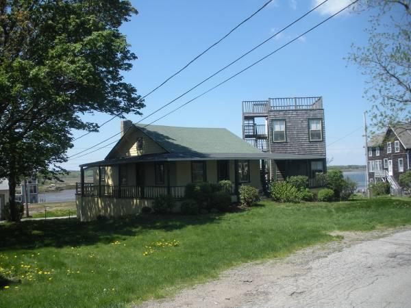
3 Introduction In January of 2010 the Town of Essex began a public process to discuss the future of Northern Conomo Point. Why is this necessary? For a century, the land on Conomo Point has been Town owned and leased for residential use to tenants. Over the years, tenants (consisting of both local Essex residents as well as non residents) have built seasonal and year round dwellings in this scenic area on the Essex River. The Town has had a turbulent past with the leasing of the Point disagreements over lease rates and terms, taxes, wastewater treatment, and access and use for non tenants have created contention among residents, Town leaders, state officials, and the tenants of the Point. Leases for all of the Conomo Point lots expire in December In 1999, Town Meeting voted to retain the waterfront area for public use upon the expiration of leases for those properties north of Robbins Island Road. The Town began this planning process to develop a vision for Northern Conomo Point that would include: o o Substantial expansion of public use and access to the waterfront; Compliance with MA DEP wastewater flow limits. This report summarizes the planning process and outlines possible future scenarios for Northern Conomo Point. The intent of this report is to provide a guide for the Town as it begins to transition the Point from its current status to a future that satisfies the desires of the Town s residents, is fiscally sound, and complies with state regulations. This plan presents a menu of options from which the Town can craft its desired future. What happens on the Point is ultimately in the hands of the Town s leaders and voters. View of Cross Island from Conomo Point Road Taintor & Associates, Inc. 1 November 3, 2010
 3,267 Total Annual Tax Levy $10,038,384 (other sources of income such as local aid and fees for services make up the difference in")
4 Community Context 1 Background Information Town s Annual Budget $14,054,811 o $5,954,035 for Manchester Essex School District o $138,840 for North Shore Vocational District o $7,961,936 for Municipal Operating Budget Total population of the Town (based on Town census) 3,267 Total Annual Tax Levy $10,038,384 (other sources of income such as local aid and fees for services make up the difference in revenue between the tax levy and Town budget) Total Town Real Estate Valuation (FY 10) $820,643,307 o $747,050,820 (residential) o $57,807,831 (commercial) o $15,784,656 (industrial) Northern Conomo Point Existing Conditions Land area 11 acres (approx.) Number of leased properties 80 (62 with occupied dwellings) Number of leaseholders 66 Number of bedrooms 188 Number of permits for yearround use 19 Number of months public water is supplied by the Town 6 Water Department fees collected annually $49,000 Annual tax revenue $380,000 Annual rent for all leased properties (due annually on April 1) $74,007 Number of school children 2 Source: Google Maps 2010 Assessed value $7,139,800 (buildings), $23,927,400 (land) reflects 30% abatement on land value Existing public access o 2 boat ramps (Front Beach and Clammer s Beach) o 2 beaches sandbar access at low tide o Dock at Front Beach available for Town resident use o Parking on roadside with resident permit and on beach in off season 1 From Essex Town Administrator Spring, Taintor & Associates, Inc. 2 November 3, 2010

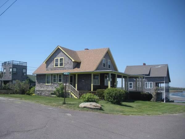
5 Brief History of Conomo Point 1875 Essex began leasing building lots on Town owned property at Conomo Point o o o From the onset, tenants have paid rent in addition to property taxes on the land and buildings Until 1991 rents were not based on land values and made no provision for inflation Rents were increased only 4 times in 100 years by 1986, average rent was $60 per year 1987 Town meeting voted to establish a new base rent for each property based on 3% of assessed value o Estimated assessed value of properties was $4.7 million o Voters also approved prohibiting conversions from seasonal to year round o After Town meeting vote, tenants filed suit in Land Court against the Town for breaking the existing lease 1991 Land Court Settlement o 10 yr lease term (with option for renewal of one 10 year term) o Rent increased (x10 existing) with allowance of an annual cost of living increase o Conversions from seasonal to year round permitted (must meet all Town regulations) o Tenants granted assignment rights can sub lease their properties o Final and binding agreement, put to rest all claims which had been raised by tenants 1996 MA Department of Environmental Protection (DEP) Consent Decree issued to Town to address discharge of pollutants into the Essex River from inadequate sewage disposal systems located on Conomo Point. Required state wastewater flow limit is 10,000 gpd (gallons per day) for any property owned by one owner. Anything over that amount would require a groundwater discharge permit from DEP and sufficient site conditions and land area to comply with the permit s requirements for wastewater treatment. Current estimate of 20,000 gallons per day (gpd) for Northern Conomo Point Town Meeting voted not to renew the Conomo Point leases that expire in Town Meeting voted to direct a Conomo Point Planning Committee (CPPC) to devise a plan to sell parts of the Point while retaining a portion of Town owned land for access to the waterfront and to ensure environmental protection tenants filed for a tax abatement. Town Assessors agreed to 30% abatement on land taxes for all CP tenants Town Meeting voted to retain waterfront area for public use on expiration of leases for properties north of Robbins Island Road: map 19 lots 65 79,81 86, 88 89, 91 93, and map 24 lots 1 25,27 39, Taintor & Associates, Inc. 3 November 3, 2010

 o Plan for lots in south was yet to be determined (see 2008 Town Meeting vote) 2007 Town")
6 2003 MA Department of Environmental Protection (DEP) Consent Decree revised as the Second Modified Final Judgement with a requirement for an updated plan for reducing pollution from Conomo Point Town submits plan to DEP outlining steps it would take to reduce pollution from Conomo Point septic systems impacting Essex River. Plan was revised again in 2007 and outlines: o Retaining 80 lots (not all are presently occupied) in north for public use (approved by Town Meeting vote in 1999) o Final procedures for homeowners to return properties to the Town would be developed by summer of 2009 (subsequently extended to end of 2010) o Plan for lots in south was yet to be determined (see 2008 Town Meeting vote) 2007 Town Meeting rejects Articles presented by Conomo Point Planning Committee and petitioners related to reuse of Conomo Point and sale of lots Plan submitted by Town to DEP for Conomo Point revised (see 2003 plan description) Town Meeting voted to approve funding to hire a consultant to develop a subdivision plan for southern Conomo Point, Town Meeting will still need to approve final zoning changes and sale. View from northwest point along Conomo Point Road Clammer s Beach Taintor & Associates, Inc. 4 November 3, 2010

7 Graphic prepared by Howard Snyder

8 Planning Process Throughout this process, community members were invited to share their ideas about options for use of Town owned land located north of Robbins Island Road. The consultant team of Taintor & Associates, Inc. (Newburyport, MA) and (Ipswich, MA) met periodically throughout the process with the Conomo Point Planning Commission to review and discuss planning scenarios and concepts. Three public forums were held in March, June, and October. In addition, the consultant team held five focus group discussions with community stakeholders. These focus group discussions included 10 to 12 stakeholders from the community representing a variety of interests. A summary of the public meetings and focus group discussions is provided in the Appendix. Pier and floating docks at Front Beach access Taintor & Associates, Inc. 6 November 3, 2010
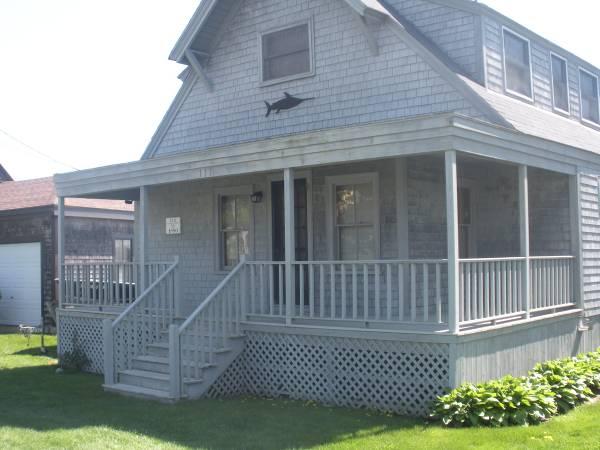
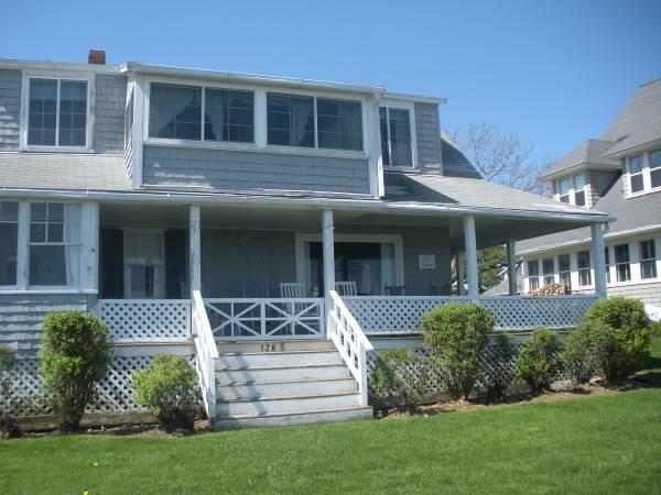
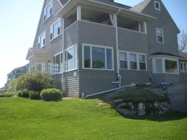
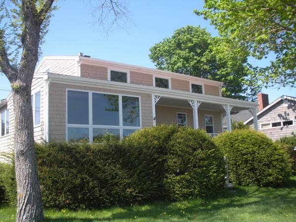
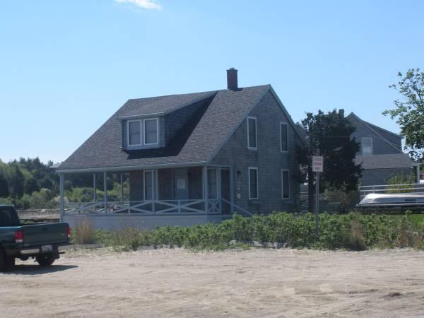
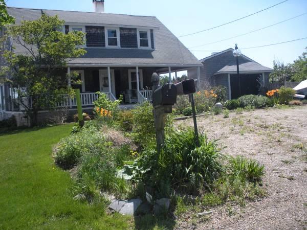
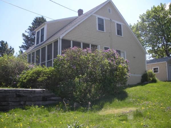
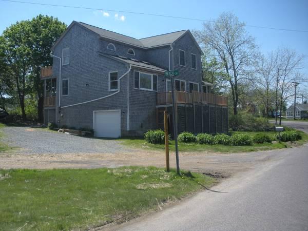
9 Redevelopment Scenarios Based on the public dialogues facilitated by the consultant team, three scenarios for the future of Northern Conomo Point were developed. These were presented to the public for review and comment and then revised and reviewed again. The three scenarios present three different possible development plans for the Point one with little change to the existing residential uses, the second (two options) with a scaling back of the residential uses, and the third with no residential uses. These scenarios could be implemented individually or as a phased plan over time. The scenarios are meant to illustrate some of the concepts discussed in the public discussions. All would require further site planning and public review to implement. Furthermore, some of the ideas raised during this planning process that are not included in these three scenarios are discussed in the Implementation Section. Scenario 1 Retain existing dwellings and increase public benefit This Scenario presents a concept for increasing public use and access along the waterfront while maintaining the existing dwellings. COMPONENTS Create new public waterfront park: o remove a portion of Conomo Point Road o benches o perimeter fencing/landscaping o walking path o provide driveway for access to Front Beach Maintain existing docks (2) and boat ramps (at Front Beach and Clammers Beach) for year round public use; Improve old ramp at north of point (next to Lot 17) for walk in boat loading (kayakers, etc); Continue to allow access for commercial shellfishermen, recreational boaters, and seasonal beach parking; Improve existing parking areas and add new public parking areas o gravel lots with improved grading and signs o improve parking across from Clammer s Beach o add new parking between Middle Road and Conomo Point Road o convert Lot 16 (parking for Cross Island) to public parking Provide seasonal public restrooms (either composting or portable). Private uses would continue for dwellings and associated outbuildings under short term renegotiated leases (3 to 5 years). Tenants would be responsible for maintenance of existing and future improvements and would continue to pay property taxes (for land and buildings). If any leases are not renegotiated, the Town could chose to secure a new tenant, convert the property to public use, or remove the building. Properties without existing habitable dwellings would not be leased and the buildings would be removed. Taintor & Associates, Inc. 7 November 3, 2010


10 BENEFITS Expanded public use and access; Decreased density through removal of outbuildings; Revenue production. ISSUES Does not release Town from landlord role; Does not comply with DEP limit if all lots are retained under single ownership by the Town. Benches above seawall on north side of Conomo Point Road Dinghies and canoe at north east point, next to lot 17 Taintor & Associates, Inc. 8 November 3, 2010
11 Graphic prepared by Howard Snyder

 Conomo Point Association boat house with modest gathering")
12 Scenario 2 (Options A and B) Compliance with DEP wastewater flow limits Components include all of the Scenario 1 improvements, plus; Expansion of parking areas; Expanded public green space o Fill, clean up o Native plantings o Additional walking paths Creation of picnic areas o Grading, fill, grass seeding o Benches and grills Conversion of existing building to seasonal public facility available for rental. Two options were considered: Conomo Point Association boat house on south side of o Option 2A Renovate existing Conomo Point road (lot 14) Conomo Point Association boat house with modest gathering space and small restroom o Option 2B Renovate an existing residential dwelling at north of point to include restrooms, changing area, kitchen, gathering area 2 Private residential uses would continue. Leases would be as proposed in Scenario 1. This translates to 90 bedrooms and 28 dwellings. 3 Options for consideration: View of Robbins Island from north 2 The existing residential dwelling identified as a potential future community building in the conceptual plan for Scenario 2B is lot 14. This is for illustrative purposes only, a specific location and dwelling suitable for conversion to a public facility will need further study by the Town. 3 Would need to be approved by DEP. Taintor & Associates, Inc. 10 November 3, 2010


13 Options 2A Maximize total income from remaining properties by retaining higher value properties, while still retaining the existing neighborhood character. Remove 34 dwellings and associated outbuildings. Options 2B Maximize public benefit by prioritizing access to most scenic and waterfront areas, sell 11 Robbins Island lots (lots 66 to 76.) 4 Remove 24 dwellings and associated outbuildings. Trucks with boat trailers parked along Front Beach BENEFITS DEP Compliant regarding wastewaster flows; Expanded public areas; Seasonal public facility; Revenue production; Decreased density. ISSUES Does not entirely release Town from landlord role; Would need DEP approval for continued residential uses. Looking north from south side of lot 40 (fire lane) 4 The sale of Robbins Island or other portions of Town owned properties could be part of either option presented for Scenario 2. This is included in Option B as Robbins Island may be less desirable for public access due to the width constraints of Robbins Island Road and periodic flooding. However, even with sale of these lots, Robbins Island Road may still be maintained as a public way to allow pedestrian access. Taintor & Associates, Inc. 11 November 3, 2010
14 Graphic prepared by Howard Snyder
15 Graphic prepared by Howard Snyder
, this scenario would involve")


16 Scenario 3 No Residential Uses with Land for Public Benefit In addition to the improvements from Scenarios 1 and 2 (Options A or B), this scenario would involve conversion of the remaining properties to public use. BENEFITS Substantial increase of public use and parking; Town released from landlord role; Complies with DEP limit. ISSUES Improvement costs; On going maintenance required; Loss of revenue. View from east side of Conomo Point Road north of Clammer s Beach Taintor & Associates, Inc. 14 November 3, 2010
17 Graphic prepared by Howard Snyder

18 Phasing The Town could select one scenario or consider a phased redevelopment for Northern Conomo Point by implementing all three scenarios. The benefits of this approach are: Distribution of related costs over time; Option to continue to receive revenue from existing properties during transition; Flexibility to seek additional funding sources or revenue generators for different components; Provides an opportunity to re evaluate the objectives of each phase and adapt if necessary based on current community needs or goals. This approach does not make any assumptions on how long the phased redevelopment would take but rather leaves it to the will and capacity of the Town. In addition, the phased approach does not rule out the option to overlap different components of the phases (e.g. portions of Scenario 2 could happen concurrently with Scenario 1.) Marsh east side of Conomo Point Road Taintor & Associates, Inc. 16 November 3, 2010
19 Fiscal Impact Assessment Overview of Existing Revenue and Costs REVENUE Direct revenue from the current leaseholders on Northern Conomo Point Revenue Categories Revenues Source Taxes $380,000 Assessors Rents $72,100 Selectmen's Office Excise taxes 5 $1,411 Assessors Office Water Dept. payments 6 $49,009 Water Department Moorings (79) 7 $5,200 Police Department / Harbor Master TOTAL $507,720 EXPENSES Costs of providing municipal services are difficult to allocate to individual properties. To estimate existing expenses, inquired with municipal departments to identify any significant or unusual costs associated with Northern Conomo Point. General Government: This cost is unlikely to decrease with a reduction in units on Northern Conomo Point, but may potentially increase as the transition may require more administrative involvement on the part of the Town. Whatever decision comes out of the planning effort, continued government involvement (and the associated expense for staff time and consultant fees) will be required to implement the next stage. Harbor Master: Processing of mooring applications and enforcement of mooring permits may increase at a low level with the potential turn over of those moorings to new holders. School: Currently there are two school aged children living on Northern Conomo Point. The formula for allocating school funding cost by town for the Manchester Essex Regional School District factors in both the number of students, total population size, and the Equalized Valuation (EQV) of each town. Even a complete elimination of population on NCP and of the two school aged children would make no measureable change in the formula. The complete removal of the leasehold improvements on the Northern Conomo Point properties, which reduce the assessed value on the land and buildings to $0, is estimated to reduce the Essex contribution to the school costs by $17,000. The retention of all or some of the leasehold improvements (as described in Scenarios 1, 2A and 2B) would proportionally lower Essex s contribution. Public Works: The Town currently plows the roads on Northern Conomo Point during the winter. While this expense could potentially be reduced if year round rentals are eliminated, it is likely that 5 This total could vary by a factor of 100% based on the extensive use of Post Office boxes by residents in Essex. It was not possible to match up names and addresses to confirm ownership on Conomo Point. 6 Based on master meter measuring all water users 44 households north of Robbins Island Rd Leaseholders on Northern Conomo Point have at least one mooring. Thirteen (14) households have two moorings, and another three (3) households have three (3) moorings for a total of 79 moorings. Taintor & Associates, Inc. 17 November 3, 2010
20 year round access would continue to be necessary (and desirable) for public safety, fishing and other waterfront users. DPW services would also be required for the transition stage, contracting for and managing demolition and construction projects. Any improvements or additions to public spaces at Conomo Point would also require additional services for maintenance and upkeep by the Public Works department (unless a Town department is created specifically for this purpose or a public private partnership is negotiated to carry out these tasks.) Water Department: Water Department fees are billed directly and are deposited into an enterprise account. They do not affect general fund revenue, however they do provide important revenue to the operations of the Town s water treatment plant. If the Town developed a park on Northern Conomo Point, or operated community facilities or seasonal rentals, any water charges for those uses would be paid by the Town to the water enterprise fund. The Town made an investment in new water pipes to the area about 15 years ago, so complete discontinuance of water service to the area will not save the Town from maintenance upgrades that may be required. Annual maintenance on the seasonal water lines is significant, as they need to be cleared of water each fall, and the 44 homes that are metered have the meters removed in the fall and reinstalled in the spring. This work would decline proportionate to the decrease in the number of units. Police/Fire/Human Services: Use of a waterfront area generates a need for public safety services and possible rescue. This demand will continue, whether the users are local residents or the general public. There is reported to be no special demand on police/fire services for the current uses on Northern Conomo Point, however the Police Department projects that more services may be required from their department during the transition to protect any vacant buildings. Debt Service: Debt service is unlikely to change with the continued residential uses on NCP. Debt service could increase if the Town bonds for the development of new recreation projects such as a community building, acquisition of extensive park equipment, or other long term assets. Taintor & Associates, Inc. 18 November 3, 2010
21 Overview of Costs and Revenues of Redevelopment This section begins with a summary of the costs and revenues of redevelopment for each scenario. Further discussion of the individual components follows and supplemental details are provided in the Appendix Fiscal Impact Assessment. While the tables below present the revenues and costs for each component, the redevelopment would likely be implemented over a number of years, spreading both costs and revenues over a period of time. A ten year projection of fiscal impact over time concludes this section. Table 1: Summary of Estimated One time Costs and Revenues by Scenario 8 Estimate of One Time Revenue Estimate of One time Costs Net One Time Costs Scenario 1 $324,200 $324,200 Scenario 2A $936,925 $936,925 Scenario 2B $4,500,000 $1,086,805 Covered by revenue Scenario 3 (option 2A) $1,364,925 $1,364,925 Scenario 3 (option 2B) $4,500,000 $1,664,805 Covered by revenue Table 2: Summary of Estimated Annual Costs and Revenues 9 Existing Estimate of Annual Estimate of Income Revenue Annual Costs Net Annual Revenue Scenario 1 $454,000 $1,060,479 to $1,476,415 $12,450 $1,048,029 to $1,463,965 Scenario 2A $454,000 $574,693 to $777,065 $23,285 $551,408 to $753,780 Scenario 2B $454,000 $551,700 to $756,181 $27,375 $524,325 to $728,806 Scenario 3 (with 2A) $454,000 $10,000 $23,285 Net Annual loss Scenario 3 (with 2B) $454,000 $73,905 $27,375 $46,530 8 Detailed table of one time costs and revenues provided in the Appendix Fiscal Impact Assessment. 9 Detailed table of annual costs and revenues provided in the Appendix Fiscal Impact Assessment. Taintor & Associates, Inc. 19 November 3, 2010

22 Redevelopment Costs This is a brief overview of what is included in the costs of redevelopment. More details on how the costs were calculated are provided in the Appendix Fiscal Impact Assessment. PUBLIC FACILITIES Survey and Engineering Work Survey and engineering work of the entire site will be required for most of the activities considered, including the development of recreation facilities, parking, and other common uses of the Town owned land. Estimated costs for survey and engineering work for the Northern Conomo Point were provided by two firms, and ranged from about $26,000 to about $40,000 to $50,000, depending on the final scope. These estimates were based on photogrammetric mapping with land reconnaissance on the entire area, and development of a survey plan defining approximately 30 exclusive use lots to be rented (Scenarios 2A and 2B) and the remainder to be developed for the proposed park activities by the Town. 10 The Town may also opt to undertake survey and engineering before any improvements are undertaken. In that case, the costs would likely be higher as there would be more lots to survey. Waterfront Park Approximately 1 acre park with benches, grass and landscaping / fencing along perimeter estimated cost to be about $100, This estimate considered costs of supplies and labor for asphalt removal, grading, hydroseeding, fencing and plantings, benches, and erosion control. Annual maintenance is estimated to be around $3,000. Boat Ramps No new ramps would be constructed other than improvements to accommodate walk in access at the north. To determine the cost for annual maintenance, a 20 year life of a new ramp was estimated and replacement costs were distributed over that period approximately $1,250 per ramp per year. Potential walk in ramp location at north of Point 10 Dan Ottenheimer, R.S., Mill River Consulting; Philip Pattison, Meridian Associates. 11 Does not account for seawall reinforcement as this would be a Town cost that would need to be considered regardless of what future uses occur on the Point. The Town may want to consider having an engineer evaluate the seawall for structural soundness. Taintor & Associates, Inc. 20 November 3, 2010


23 Parking Areas and Access Roads Estimate for grading and gravel. Total square feet of parking would be 28,000 for Scenario 1 and 29,000 for Scenarios 2A, 2B, and 3. Restrooms Two options for public restroom facilities were considered composting and portable. These would be in addition to any restrooms Parked cars along north side of Conomo Point Road included in a community facility. These ranged in cost from $600 (to rent) to $50,000 per unit (to build). As Scenarios 2A, 2B, and 3 all include a community facility that would likely include public restrooms, the fiscal assessment assumed the outside seasonal restrooms would be portable toilets. Piers / Docks Includes estimate for maintenance and insurance for piers and wooden floats that are attached. Costs for insurance are estimated around $3,000, removal and replacement of floats about $2,000, and regular maintenance about $2,000. Walking Paths The cost for the creation and maintenance of walking paths is based on a price per linear Dock and floats at Front Beach foot. These would be crushed stone paths that are ADA compliant. Pedestrian paths for each scenario in linear feet: o Scenario 2A: 4,650 o Scenario 2B: 5,050 o Scenario 3: 5,050 DEMOLITION COSTS Whether the cost of demolition or removal of the existing buildings is born by the current tenants or the Town, it has been included as a cost in this fiscal assessment for the redevelopment of Northern Conomo Point. The cost of demolition depends on the size of the building, how much pre demolition work is involved, and where the materials are disposed. Further discussion of the considerations for demolition is provided in the Appendix Fiscal Impact Assessment. The demolition of a typical 2,000sf home (a larger home by NCP standards) can be estimated to produce 127 tons of debris. Rough estimates for demolition and disposal run $15,000 to $20,000 for residential properties. Estimates for the sheds and garages without foundations would likely be below $10,000. For the purposes of this analysis, an average of $15,000 per dwelling is used institute.com, and consultation with Jeff Richon, at G. H. Richon Co., and Joe Ginn, of Northern Essex Ltd. Taintor & Associates, Inc. 21 November 3, 2010
24 OTHER COSTS NOT FACTORED INTO THE ANALYSIS Additional costs were not factored into this fiscal assessment where reasonable estimates were unavailable. Specific details that are unique to the circumstances of the Point and where there is still uncertainty about the future make it difficult or impossible to accurately estimate some likely costs. In some cases, more investigation by qualified engineers will be necessary. Insurance If the Town became the default owner for any buildings left by the tenants, it would become necessary for the Town to obtain liability insurance for these properties. This is difficult to estimate without more specifics on the individual properties and would also be dependant on which properties were re leased or not. Legal Costs Legal services would be required for real estate transactions, preparation of new lease terms, and resolution of any potential legal actions. Legal costs are a consideration for any redevelopment of the Point, but could vary widely depending on the circumstances of the transition. The Petersen/LaChance Real Estate Appraisal estimated this cost at $750/lot for Southern Conomo Point. Sewer Improvements Costs for sewage disposal improvements will be dependent on how many and which properties continue to be leased. Engineering and design work will be required for any changes in the way wastewater is disposed. For more about compliance with state regulations, refer to the Appendix Fiscal Impact Assessment. Other Engineering Costs Any improvements to the roads or seawall at Northern Conomo Point would likely need to occur regardless of what the Town decides to do in the future. Without an assessment by a qualified engineer, this cost would be difficult to estimate. Beach Management The Conomo Point beaches are located in mud flats along a tidal river. Weather and tides change these beaches each year. Although there was some public discussion about adding sand to these beaches (particularly Clammers Beach) to make them more desirable as a public beach, this type of renourishment is highly regulated in Massachusetts (and most coastal communities). The regulations make it unlikely and also costly to consider beach nourishment as an option for Northern Conomo Point. For more on this topic, please see the Appendix Fiscal Impact Assessment. Potential Revenue RENTAL RATE An ad hoc group recommended to the Conomo Point Planning Commission a rent of 3% 5% of the assessed value of the land for any new leases for properties on Conomo Point after the 2011 deadline. 13 When the assessed land values are increased to 100% of assessment (corrected for the 30% abatement 13 Essex Chowder Group (ad hoc group) report to CPPC on lease terms, March 17, Taintor & Associates, Inc. 22 November 3, 2010
25 and deleting the land assessments that were less than the value of a residential lot), the average rent based on 3% of land values is $14,462 (ranging from less than $1,000 to over $20,000.) An analysis reviewing current market conditions in areas similar to Northern Conomo Point together with current market information provided by Coldwell Banker was used to estimate market rental rates for future rental of land by the Town to the leaseholders. This analysis resulted in an average land rent of approximately $12,500. More information is provided in the Appendix Fiscal Impact Assessment. For the purposes of this study, the 3% of unabated assessed land value is used to approximate market rate rents for each property. TAXES Under the proposed renegotiation of the lease terms, leaseholders would continue to be responsible for paying taxes on both the land and the buildings. The Town currently provides a 30% abatement on the assessed value of the land. Removal of this abatement would increase the property tax value by 43% from existing. 14 SALE OF ROBBINS ISLAND In order to estimate market value for sale of properties on Northern Conomo Point, this analysis reviewed the appraisal for Southern Conomo Point 15 as well as comparable market rentals in other areas. The estimate for sale of Robbins Island of $4,500,000 was calculated using the existing abated land value and assumed that all properties would be seasonal once sold. The assessed land value for each lot was multiplied by a factor of.94, which is the ratio of value of property sales in Essex to total assessed value of those properties sold between January 2009 and April 9, COMMUNITY FACILITY RENTAL While there are several buildings well located for use as a public facility, it is likely that substantial changes would need to be made to make accommodations for a community facility that would also be suitable for rental for private and/or public functions and events. For a community facility, either new or converted from an existing building the construction costs are estimated to be about $150,000. This would include modest kitchen facilities, public restroom and changing facilities, and a general meeting area. Other uses could include an office space for facility staff or the Harbor Master. Potential revenue is estimated to be between $17,000 to $60,000 based on 50% occupancy on the week, full occupancy on weekends or 100% occupancy 6 days a week. The facility would be available for rental for 18 weeks of the year. Rental fees are based on Tucks Point in Manchester by the Sea (see Appendix Fiscal Impact Assessment) with a special rate offered for residents. Costs for Tucks Point run about $17,000 per year. Therefore, it is expected that the facility would be able to run a break even operation at a minimum. The Town could consider increasing rates for residents to increase revenues. 14 The CPPC voted on October 7, 2010 to recommend that any consideration of future leasing of the properties on Northern Conomo Point retain the 30% abatement (70% of assessed land value) on property taxes. 15 Prepared by Petersen/LaChance Realty Advisors April 30, Taintor & Associates, Inc. 23 November 3, 2010


26 Tuck s Point community facility in Manchester by the Sea If the Town used the existing Conomo Point boathouse with modest improvements (as presented in Scenario 2A), the construction and maintenance costs would be reduced, but anticipated annual revenue would be more limited due to the constraints of the facility. Long-term Fiscal Impact Whatever the Town decides, any redevelopment of Northern Conomo Point will likely be implemented over a number of years. To understand how costs and revenues might be distributed over a period of time, the fiscal assessment projected costs and revenues over a ten year period. This analysis is only useful for comparison purposes as an accurate projection would require a more detailed analysis of inflation rates, the future housing market, and trends in labor and supply costs. Scenario 1 projects to generate approximately $1 to $1.5 million in net income over a ten year time frame. This exceeds the extension of current revenues and additional expenses by about 100%. Scenarios 2A and 2B have roughly the same costs for development of park facilities, and the same projected revenue from improvements to and leasing of a community building. Each maintains leasing of a different set of properties, based on maximizing either revenue or desirability of land for public use. In both cases, it is projected that there will be adequate revenue to cover the costs of recreational development in all years included. Scenario 3 leaves no leased property to generate revenue and has the highest projected costs for park development. In addition, it removes approximately $500,000/year in annual Town revenue. Taintor & Associates, Inc. 24 November 3, 2010

27 Design and Management Guidelines The following design and management guidelines are intended to provide general guidance on developing a public space that is safe, comfortable and accessible. These guidelines are in response to the context of the site and reflect standard landscape design principles. SEPARATION OF USES The design of public space on Northern Conomo Point must consider the variety of activities that will occur there. Uses that require access and accommodations at or in the water will likely include clamming, fishing, boating, swimming and general play on the flats and along the waters edge. Land based activities may include walking, bicycling, passive recreational activities such as relaxing and enjoying views, picnicking, and informal games and gatherings. In addition to solitary or small group activities, there may be opportunities for ceremonies or events. To assure enjoyment and safety, some separation of uses will be required. Activities that employ motorized vehicles such as clamming, fishing, and boating should be separated by location or time from activities such as swimming and general play in and near the water. Vehicle access ways should be designed to have the least impact possible to other park areas. Design should seek to restrict vehicle access ways from crossing paths and consider fencing along access ways proximate to high use areas. When path crossings are required warning signs should be posted. Regulations such as hours or seasons of restricted use and other rules should also be clearly defined and posted in the vicinity of the shared use areas. Clammers should continue to have access at Northern Conomo Point sites Clearly delineated boat ramps should be separated from other use areas throughout the year. Truck and trailer parking, however, should be accommodated off the waterfront during the summer season to provide a safe and accessible environment for other users. Additional regulations should be established through a public process with all stakeholders, service providers and regulators. Taintor & Associates, Inc. 25 November 3, 2010

 and porosity to provide property boundaries without indicating that uses are incompatible.")

28 Separating public and privately leased property will also be desirable. Properties may be physically separated by walls, fencing or vegetation or may be implied by material changes, or other landscape clues such as turf length, berms, or swales. In some instances signs may be desired. If used, they should have a positive tone. Design elements used for separating properties should be moderate in height (2 4 feet) and porosity to provide property boundaries without indicating that uses are incompatible. Visibility and an open landscape should be encouraged. ACCESSIBILITY Decorative fencing and vegetation provide a friendly boundary As components of a public space, all park improvements, must comply with standards for accessibility as defined by the Americans with Disabilities Act and paths systems must also comply with the Rules and Regulations of the Massachusetts Architectural Access Board. Accessibility standards will ensure that all aspects of the park can be enjoyed with ease and comfort by a large cross section of the public regardless of their disability. Paths will have firm, stable and slip resistant surfaces and a comfortable grade (no greater than 12:1); building entrances and facilities will accommodate typical mobility and sight impairments; and benches, tables and other site amenities will be convenient and comfortable to use. Designing for accessibility should be considered at the earliest stage of the Accessible boardwalk through the marsh design process so all design elements can be incorporated into a functionally and aesthetically integral space. PARK AMENITIES Park amenities should reflect a consistent design vocabulary and be highly durable, or priced so they can easily be replaced in kind. As noted above, amenities must also comply with accessibility standards. Park amenities should be selected based on an identified need and should be coordinated with the landscape and functions of the park. Taintor & Associates, Inc. 26 November 3, 2010


29 Site furnishings including benches, tables, fences and other fixtures will affect how the park is used. Furnishings should be placed to allow both contemplative and interactive activities and should consider seasonal variations. Benches should be sited along walkways to provide opportunities for rest, in areas offering desirable views, and in areas of shade and sun. Some benches should be in areas that provide solitude. Tables should be sited to allow adequate space to accommodate a group with some privacy. Again, both shade and sun areas should be considered Fire pits, if provided, should be a safe distance away from vegetation and other amenities. Lighting is not recommended for the general landscape, but may be desired around a public facility that is to be rented for evening use. Secluded seating and Seating on an overlook Rest facilities will be an important amenity to provide, whether seasonal or year round. Recommendations for location will depend on design and function. Rest facilities should not be prominent park features, but should be easily accessible from high use areas. They should be screened, but also sited to accommodate required maintenance such as moving or pumping. Rest room maintenance should be scheduled when it will have the least impact on users. A pathway system should provide access along the waters edge between the two beach areas to the greatest extent possible and to other public areas and amenities as feasible. It should be at least ten feet wide to accommodate pedestrians and should be wider if bicycles are to be encouraged. Pathways should be kept separate from roadways to the extent feasible with appropriate warning signs, devices and possibly entrance barriers when they intersect. Paved path along the waters edge Taintor & Associates, Inc. 27 November 3, 2010


30 PARKING LOTS The amount of land to devote to parking should be studied carefully to ensure that an overabundance of parking is not developed. Parking should be accommodated in a number of smaller lots as opposed to a few large lots and should take advantage of topography and vegetation to limit the visual and environmental impacts. Parking lots should remain pervious to limit the negative impacts of stormwater runoff. Location and proximity to other uses will determine if fencing or screening is desired. Natural materials clearly define this small lot VEGETATION Trees, turf, shrub and flower plantings can be used to identify activity areas, separate public and private spaces, screen utility and incompatible uses, and create comfortable and beautiful spaces. The use of vegetation should not block either key public or private views. Native vegetation should be used as often as possible. All vegetation should be selected based on its durability, low maintenance requirements and sustainability. Vegetation that needs annual trimming to maintain size or form should be avoided. Bushes define space Native vegetation and stone used to define space Taintor & Associates, Inc. 28 November 3, 2010
31 Implementation Plan This report presents a menu of options for the future of Northern Conomo Point. The planning scenarios present conceptual ideas for consideration and are meant to be used as a guide for future decisions regarding Northern Conomo Point. To begin the transition of the area from its current state to a future that fulfills the will and desire of the Town s residents, the community will need to make decisions about next steps and then act on them in a timely and responsible way. The implementation steps laid out below do not necessarily require that the Town come to consensus about the final desired future for Northern Conomo Point. Instead, the Town can proceed step by step through the process providing opportunities to review and discuss each decision and understand the benefits and consequences of each course of action. The implementation steps have been grouped into three categories transition period (leading up to the expiration of leases), redevelopment period (from the point the leases expire to a point where the desired redevelopment/reuse of the area has been completed), management period (once the initial redevelopment/reuse has been achieved what will be required for the ongoing operations and activities associated with the area). TRANSITION PERIOD 1) Select preferred conceptual plan The Town needs to select a conceptual plan for Northern Conomo Point. Drawn from one of the scenarios presented in this report or modified to include additional options identified after this planning process has concluded, 16 this conceptual plan would guide the course of action for the Town. The conceptual plan selected will be the basis for identifying the list of projects implemented during the Redevelopment Period. 2) Phased redevelopment or all at once Regardless of the conceptual plan selected, the Town should decide if a phased redevelopment of Northern Conomo Point is preferred. For a phased redevelopment, the Town may opt to select a preferred final concept and then agree to implement this concept in a series of phases. The project list would then be grouped according to phase and approvals for design and funding could be undertaken separately for each phase. 3) Ownership The Scenarios (1, 2A and 2B) presented in this report assume that the Town, for the most part, would continue to be a landlord if ongoing residential uses continue. However, these same scenarios could also be presented as a combination of privately owned residences alongside public areas or, as discussed further in the Management Period, as a public private partnership sharing management of the residential properties and public spaces. The Town needs to decide if sale of all or some of the 16 A design charrette convened by Lisa O Donnell involving design professionals and interested residents from the community met in late September, 2010 to develop some designs for different types of public amenities at Northern Conomo Point. The group plans to meet again and the design ideas generated could be incorporated into the preferred conceptual plan. Taintor & Associates, Inc. 29 November 3, 2010
32 properties should be considered or if all of Northern Conomo Point should be retained under public ownership. 4) Review with DEP For any conceptual plan that involves ongoing residential uses at Northern Conomo Point (either leased or owned), the Town would be advised to meet with the DEP to determine if there are any limitations related to the current consent decree or other state regulations that would require modifications to the selected plan. 5) Transition of existing tenants If the Town determines to continue leasing properties it must identify those properties that will remain as leased sites, and determine the conditions of the new lease (including rate, term and responsibilities). There are a number of options for the Town to consider as part of this process: o Determine if right of first refusal will be given to existing tenants to negotiate a new lease o Identify a process for selecting potential new tenants when existing tenants chose not to remain. o Identify required Title V improvements and determine who will bear costs and monitor upgrades If the Town determines that residential uses will not continue for certain properties, the Town will need to implement a process to equitably and efficiently transition the properties from their existing occupants. The Town may wish to: o o Provide for temporary leases during a transition period Consider if status of tenants (e.g., if property is primary residence, age of tenants) should be included in the criteria for determining which properties (if any) will remain in residential use 6) Securing and removal of buildings For lots that will not continue in residential use due to design of preferred plan: o The Town should define a process for determining whether the building should be considered for public use, destroyed or removed. For example, if a building has historic value, is there an interest in removing the building to another location? o The Town should identify a process for securing and maintaining any unleased properties while final actions are taken. This should include policies on insurance, security, and public safety. 7) Seasonal or year-round use The Town must decide whether year round use will be allowed in some or all cases. Ideas to consider include: o Grandfather existing year rounds or make exceptions for duration of tenancy o Require only seasonal use as part of renegotiated leases o Implement deed restrictions if property is sold o Implement regulations/policies to restrict buildings to seasonal use including restricting footprint, upgrades and improvements, and limiting duration of water supply Taintor & Associates, Inc. 30 November 3, 2010
33 8) Identify funding sources for hard and soft development costs The Town will need to develop a funding plan to implement the redevelopment/reuse of the area. Ideally any funding plan should consider a combination of Town funds, rents, grants, and private financing. o Bond o Community Preservation Act funding o Economic development partner o Non profit partner o State or Federal grants o Proceeds from sale of Robbins Island or other Conomo Point properties o Private citizen donations The Town may wish to work with a development specialist to assess the feasibility of developing a public private partnership (PPP) to develop Conomo Point as a seasonal community while maintaining a defined portion of the site for public use. The PPP could develop infrastructure and manage the Point for a defined period, in return for a percent of income collected, an interest in the land, or other benefit. Town could consider establishing a dedicated fund based on revenue from Northern Conomo Point to cover costs of the new park and other community facilities. 9) Site preparation The Town will need to secure professional services to prepare the area for redevelopment as well as for any renegotiation of leases or sale of properties. Types of services required include legal, engineering, surveying, planning and design, and real estate appraisal. All of the conceptual scenarios presented in this report will require more detailed environmental engineering services to assess land conditions for suitability for proposed land uses. REDEVELOPMENT PERIOD 1) Produce a master plan for Conomo Point community and park The Town should develop a scope of services for soliciting professional planning and landscape architect services to develop a Master Plan for Conomo Point. The scope of services should define the Town s framework for decision making and outline a clear public process. The Master Plan will be based on the preferred conceptual plan identified in the Transition Period as well as the engineering evaluation. Deliverables should include a master plan that can easily be translated into a site plan and construction documents. 2) Develop a work plan for redevelopment The work plan should outline a prioritized set of actions, assign responsibility for each action, project costs and identify funding sources, and determine a schedule. The work plan should be updated regularly to document actions completed, and report on status of others. For example, the plan should document if an action is delayed, needs to be changed, or is on schedule for completion. Costs and schedule should be monitored and updated regularly as well. Taintor & Associates, Inc. 31 November 3, 2010

34 3) Project management The Town will need to establish a framework for staffing for redevelopment as well as long term management of the Point. If the Town decides to continue its role as landlord it should consider hiring a project manager to oversee the development and leasing of Conomo Point. A thorough scope of service would need to be developed that would outline the PM s role and responsibilities. A separate management structure will also be necessary for the public use areas (park and community facilities) on the Point. This management framework may include Town staff assigned to upkeep and maintenance of the public areas as well as a Town appointed committee to oversee the ongoing management and programming of the area. Alternatively the Town may seek a Public Private Partnership to oversee maintenance of the public space. OPERATION AND MANAGEMENT 1) Municipal capacity Dedicate Town staff or solicit proposals for a management entity to operate and manage Conomo Point for the future. Boat ramp at Clammer s Beach Taintor & Associates, Inc. 32 November 3, 2010


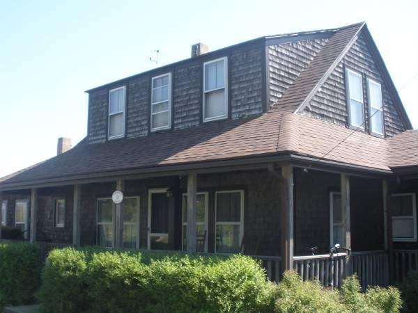
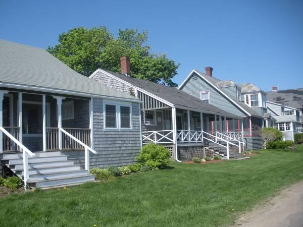
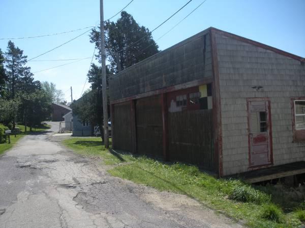
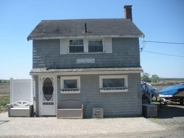
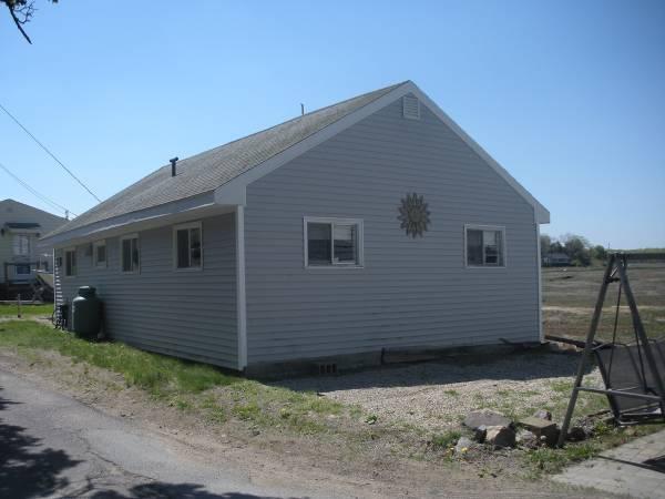
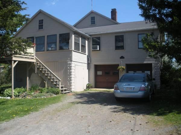
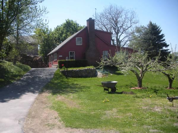
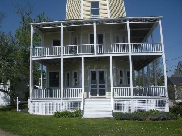
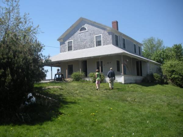
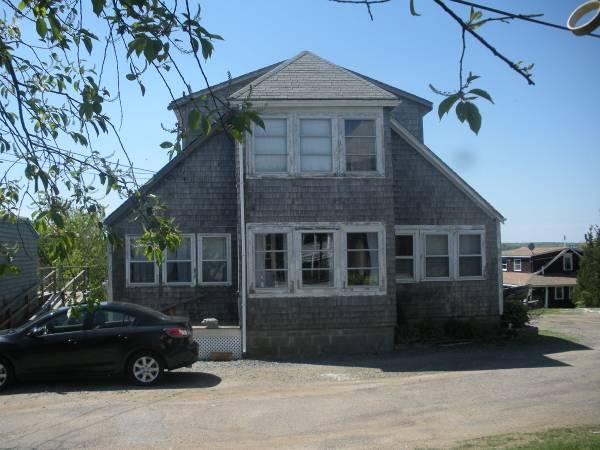
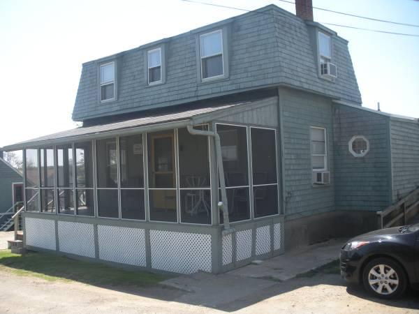
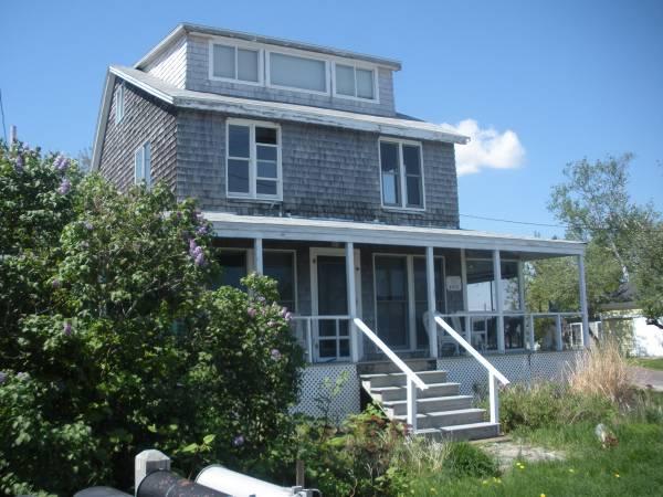
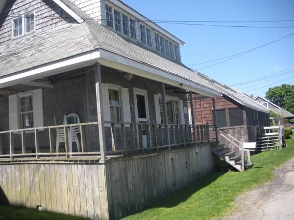
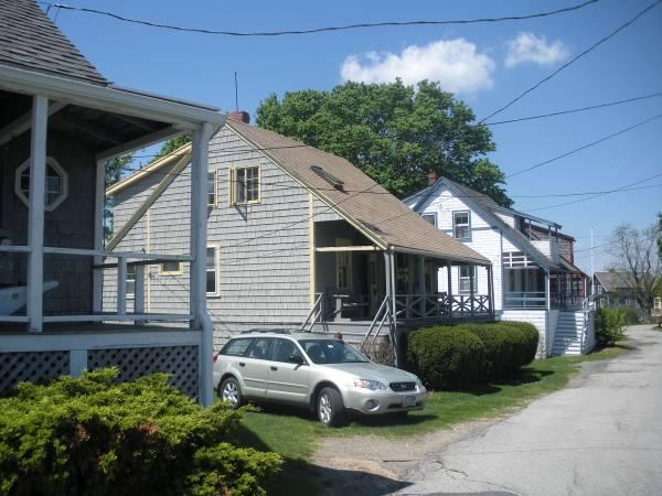
35 Dwellings and outbuildings on Northern Conomo Point Taintor & Associates, Inc. 33 November 3, 2010


36 Taintor & Associates, Inc. 34 November 3, 2010


37 Taintor & Associates, Inc. 35 November 3, 2010

38 Taintor & Associates, Inc. 36 November 3, 2010


39 Taintor & Associates, Inc. 37 November 3, 2010


40 Taintor & Associates, Inc. 38 November 3, 2010
Conomo Point A Bulletized Overview
 Conomo Point A Bulletized Overview Introduction My intention in producing this Bulletized Overview of Conono Point is as an interested resident to provide a top-level summary of the current Master Plan
MIDWAY CITY Municipal Code
 MIDWAY CITY Municipal Code TITLE 9 ANNEXATION CHAPTER 9.01 PURPOSE CHAPTER 9.02 GENERAL REQUIREMENTS CHAPTER 9.03 PROPERTY OWNER INITIATION OF ANNEXATION CHAPTER 9.04 PROCEDURES FOR CONSIDERATION OF PETITION
B. PREFERRED ALTERNATIVE: PROPOSED CONVERSION OF PARKLAND
 Chapter 2: Alternatives Considered A. INTRODUCTION The Brooklyn Bridge Park Corporation (BBPC), in cooperation with the City of New York, is proposing to convert approximately 2.65 acres of land that is
Truax Park Apartments
 Truax Park Apartments Master Planning and Site Development Study Prepared by The Community Development Authority of the City of Madison In association with SMITH & SMITH ASSOCIATES, Inc CONSTRUCTION COST
DRAFT REPORT. Boudreau Developments Ltd. Hole s Site - The Botanica: Fiscal Impact Analysis. December 18, 2012
 Boudreau Developments Ltd. Hole s Site - The Botanica: Fiscal Impact Analysis DRAFT REPORT December 18, 2012 2220 Sun Life Place 10123-99 St. Edmonton, Alberta T5J 3H1 T 780.425.6741 F 780.426.3737 www.think-applications.com
Docks, Fun Facts to Know and Tell
 Docks, Fun Facts to Know and Tell During the real estate boom years of 2005 through 2007, waterfront homes on San Juan Island appreciated around 8-10% per year and homes with docks appreciated around 13%.
ARTICLE 5 GENERAL REQUIREMENTS
 5.1 SUITABILITY OF THE LAND ARTICLE 5 GENERAL REQUIREMENTS 5.1.1 Land subject to flooding, improper drainage or erosion, and land deemed to be unsuitable for development due to steep slope, unsuitable
EXHIBIT A. City of Corpus Christi Annexation Guidelines
 City of Corpus Christi Annexation Guidelines Purpose: The purpose of this document is to describe the City of Corpus Christi s Annexation Guidelines. The Annexation Guidelines provide the guidance and
AN ORDINANCE OF THE NAPA COUNTY BOARD OF SUPERVISORS, APPROVING THE DEVELOPMENT AGREEMENT BETWEEN NAPA COUNTY AND NAPA REDEVELOPMENT PARTNERS, LLC
 ORDINANCE NO. AN ORDINANCE OF THE NAPA COUNTY BOARD OF SUPERVISORS, APPROVING THE DEVELOPMENT AGREEMENT BETWEEN NAPA COUNTY AND NAPA REDEVELOPMENT PARTNERS, LLC WHEREAS, to strengthen the public planning
C Secondary Suite Process Reform
 2018 March 12 Page 1 of 9 EXECUTIVE SUMMARY On 2017 December 11, through Notice of Motion C2017-1249 (Secondary Suite Process Reform) Council directed Administration to implement several items: 1. Land
STAFF REPORT. Financial Impact Statement There are no immediate financial impacts associated with the adoption of this report.
 STAFF REPORT Planning and Development Department Subject: Cottage Country Unsubstantial Amendment to Development Agreement To: CAO for Planning Advisory Committee, December 13, 2016 Date Prepared: December
Sidewalk Program Policy Revised: 06 November 13
 Sidewalk Program Policy Revised: 06 November 13 Program Scope: A program to coordinate identification, selection, design, funding sources and construction management for new sidewalk projects in the City
Town Centre Community Improvement Plan
 2012 Town Centre Community Improvement Plan City of Greater Sudbury Growth and Development Department 1.0 PLAN BACKGROUND 1.1 Introduction The following Community Improvement Plan (CIP) has been prepared
3. FISCAL IMPACT ANALYSIS FISCAL IMPACT ANALYSIS 29
 3. FISCAL IMPACT ANALYSIS FISCAL IMPACT ANALYSIS 29 The purpose of fiscal impact analysis is to estimate the impact of a development or a land use change on the budgets of governmental units serving the
CITY OF EAU CLAIRE, WISCONSIN. SPECIAL ASSESSMENT POLICY (Dated: November 8, 2016)
") CITY OF EAU CLAIRE, WISCONSIN SPECIAL ASSESSMENT POLICY (Dated: November 8, 2016) (Adopted by reference by Ordinance No. 7207 adopted November 8, 2016) PURPOSE The purpose of this Policy is to assure fair
CITY OF EAU CLAIRE, WISCONSIN SPECIAL ASSESSMENT POLICY (Dated: November 8, 2016) (Adopted by reference by Ordinance No. 7207 adopted November 8, 2016) PURPOSE The purpose of this Policy is to assure fair
PORT OF PORT TOWNSEND
 PORT OF PORT TOWNSEND POLICIES AND PRACTICES I. ORGANIZATIONAL MANAGEMENT AND BUSINESS PRACTICES A. Business Practices B. Leasing Policy II. FINANCIAL POLICIES A. Operating Budget B. Revenue C. Operating
4. Parks and Recreation Fee Facility Needs and Cost Estimates Fee Calculation Nexus Findings 24
 TABLE OF CONTENTS CHAPTER PAGE 1. Introduction and Summary of Calculated Fees 1 1.1 Background and Study Objectives 1 1.2 Organization of the Report 2 1.3 Calculated Development Impact Fees 2 2. Fee Methodology
CORPORATION OF THE TOWNSHIP OF LEEDS AND THE THOUSAND ISLANDS BY-LAW
 CORPORATION OF THE TOWNSHIP OF LEEDS AND THE THOUSAND ISLANDS BY-LAW 16-025 BEING A BY-LAW TO ADOPT A TANGILBLE CAPITAL ASSET POLICY FOR THE TOWNSHIP OF LEEDS AND THE THOUSAND ISLANDS. WHEREAS Section
SERVICE & IMPROVEMENT PLAN AND ASSESSMENT PLAN:
 DOWNTOWN MIDLAND MANAGEMENT DISTRICT SERVICE & IMPROVEMENT PLAN AND ASSESSMENT PLAN: 2010-2019 August 25, 2009 Table of Contents 1. Introduction...1 2. Background: The First Five Years...2 3. Service &
Approval of Takoma Amended Joint Development Agreement and Compact Public Hearing
 Planning, Program Development and Real Estate Committee Item IV - B March 13, 2014 Approval of Takoma Amended Joint Development Agreement and Compact Public Hearing Washington Metropolitan Area Transit
COOPERATIVE AGREEMENT BETWEEN THE REDEVELOPMENT AGENCY OF THE CITY OF RIO VISTA AND THE CITY OF RIO VISTA
 COOPERATIVE AGREEMENT BETWEEN THE REDEVELOPMENT AGENCY OF THE CITY OF RIO VISTA AND THE CITY OF RIO VISTA This Cooperative Agreement (this Agreement ) is entered into effective as of March 17, 2011 ( Effective
City of Stockton. Legislation Text AUTHORIZE ACQUISITION OF REAL PROPERTY LOCATED AT 501 AND 509 WEST WEBER AVENUE
 City of Stockton Legislation Text File #: 17-3966, Version: 1 AUTHORIZE ACQUISITION OF REAL PROPERTY LOCATED AT 501 AND 509 WEST WEBER AVENUE RECOMMENDATION It is recommended that the City Council adopt
Development Opportunity: Priority Development Site
 Development Opportunity: Priority Development Site NORTHBRIDGE, MASSACHUSETTS Super Wal Mart National Grid Distribution Facility Route 146 Subject property: Assessor Map 1 Parcels 113, 114, 115, (117),
ZONING AMENDMENT & SUBDIVISION STAFF REPORT Date: November 3, 2016
 ZONING AMENDMENT & SUBDIVISION STAFF REPORT Date: November 3, 2016 APPLICANT NAME SUBDIVISION NAME David Shumer 5955 Airport Subdivision CITY COUNCIL DISTRICT District 6 5955 Airport Boulevard, 754 Linlen
Chapter 10: Implementation
 Chapter 10: Introduction Once the Comprehensive Plan has been adopted by the City of Oakdale, the City can begin to implement the goals and strategies to make this vision a reality. This chapter will set
NANTUCKET ISLANDS LAND BANK AFFORDABLE HOUSING POLICY Adopted by the vote of the Land Bank Commission on November 10, 2015
 NANTUCKET ISLANDS LAND BANK AFFORDABLE HOUSING POLICY Adopted by the vote of the Land Bank Commission on November 10, 2015 In recent history, the island of Nantucket has experienced a shortage of affordable,
Buying Property in the San Juans
 1. Select an Agent to Represent You Buying Property in the San Juans As you may be aware, all of the brokerage firms on San Juan Island are members of the Northwest Multiple Listing Service; therefore,
THE REDEVELOPMENT PLAN
 PAGE 37 THE REDEVELOPMENT PLAN FUTURE LAND USE The Silver Terrace Redevelopment Area is currently designated as Redevelopment Area #4 on the City of Delray Beach Future Land Use Map (FLUM). This designation
Town of Bristol Rhode Island
 Town of Bristol Rhode Island Subdivision & Development Review Regulations Adopted by the Planning Board September 27, 1995 (March 2017) Formatted: Highlight Formatted: Font: 12 pt Table of Contents TABLE
Guidelines for the Approval of New Homes Sales Offices (Building Permits, Agreements, Securities)
") Guidelines for the Approval of New Homes Sales Offices (Building Permits, Agreements, Securities) ENCLOSURES: Site Plan Application Building Permit Application Grading and Drainage Approval Requirements
Guidelines for the Approval of New Homes Sales Offices (Building Permits, Agreements, Securities) ENCLOSURES: Site Plan Application Building Permit Application Grading and Drainage Approval Requirements
Town of Surf City. City Council Presentation April 2, 2013 PETER A. RAVELLA, PRINCIPAL PAR CONSULTING, LLC
 Town of Surf City City Council Presentation April 2, 2013 PETER A. RAVELLA, PRINCIPAL CONSULTING, LLC I. Review Workshop schedule & Input SC-NTB Federal Project Plan 1550 Funding Contributors You re Not
Town of Yucca Valley GENERAL PLAN 1
 Town of Yucca Valley GENERAL PLAN 1 This page intentionally left blank. 3 HOUSING ELEMENT The Housing Element is intended to guide residential development and preservation consistent with the overall values
Housing Commission Report
 Housing Commission Report To: From: Subject: Housing Commission Meeting: July 21, 2016 Agenda Item: 4-B Chair and Housing Commission Barbara Collins, Housing Manager Draft Request for Proposals for Mountain
Planning Rationale in Support of an Application for Plan of Subdivision and Zoning By-Law Amendment
 Planning Rationale in Support of an Application for Plan of Subdivision and Zoning By-Law Amendment The Kilmorie Development 21 Withrow Avenue City of Ottawa Prepared by: Holzman Consultants Inc. Land
2015 Downtown Parking Study
 2015 Downtown Parking Study City of Linden Genesee County, Michigan November 2015 Prepared by: City of Linden Downtown Development Authority 132 E. Broad Street Linden, MI 48451 www.lindenmi.us Table of
Residential Project Convenience Facilities
 Standards for Specific Land Uses 35.42.220 E. Findings. The review authority shall approve a Land Use Permit in compliance with Subsection 35.82.110.E (Findings required for approval) or a Conditional
CITY OF SASKATOON COUNCIL POLICY
 ORIGIN/AUTHORITY Planning and Development Committee Report No. 26-1990; Legislation and Finance Committee Report No. 42-1990; City Commissioner s Report No. 29-1990, and further amendments up to and including
CHAPTER IV IMPLEMENTATION
 CHAPTER IV IMPLEMENTATION Chapter Outline IV. Implementation Page A. Public Works Projects/Public Infrastructure IV-1 1. Facilities Master Plan Overview IV-1 2. Facilities Master Plan Service Standards
David J. Gellner, AICP, Principal Planner; (801) ; Zoning Map Amendment
 ; Zoning Map Amendment") Staff Report PLANNING DIVISION DEPARTMENT of COMMUNITY and NEIGHBORHOODS To: From: Salt Lake City Planning Commission David J. Gellner, AICP, Principal Planner; (801) 535-6107; david.gellner@slcgov.com
Staff Report PLANNING DIVISION DEPARTMENT of COMMUNITY and NEIGHBORHOODS To: From: Salt Lake City Planning Commission David J. Gellner, AICP, Principal Planner; (801) 535-6107; david.gellner@slcgov.com
Proposed Development at Ajax Plaza Windcorp Grand Harwood Place Ltd.
 Proposed Development at Ajax Plaza Windcorp Grand Harwood Place Ltd. Presentation to Ajax Council July 4, 2013 Introduction 1. Background 2. Planning Policies and Regulations 3. Downtown Community Improvement
CHARTER TOWNSHIP OF FENTON SEWER SYSTEM FINANCIAL OVERVIEW MARCH, 2018
 CHARTER TOWNSHIP OF FENTON SEWER SYSTEM FINANCIAL OVERVIEW MARCH, 2018 Fenton Township continues to receive inquiries regarding the relatively high sewer use fees that Township residents have been paying
PART ONE - GENERAL INFORMATION
 Corrected Date: Page 7 Date of Submittal Changed to Coincide with Submittal Date on Page 5 PART ONE - GENERAL INFORMATION A. INTRODUCTION B. Background Miami Shores Village is soliciting responses to this
SENATE, No STATE OF NEW JERSEY. 217th LEGISLATURE INTRODUCED SEPTEMBER 8, 2016
 SENATE, No. 0 STATE OF NEW JERSEY th LEGISLATURE INTRODUCED SEPTEMBER, 0 Sponsored by: Senator BOB SMITH District (Middlesex and Somerset) Senator CHRISTOPHER "KIP" BATEMAN District (Hunterdon, Mercer,
Hardwick State of the Town Forum & Charrette Summary
 Hardwick State of the Town Forum & Charrette Summary May 2014 Introduction The purpose of this report is to summarize the positions of approximately 50 residents of Hardwick provided at a State of the
Shawnee Landing TIF Project. City of Shawnee, Kansas. Need For Assistance Analysis
 Shawnee Landing TIF Project City of Shawnee, Kansas Need For Assistance Analysis December 17, 2014 Table of Contents 1 EXECUTIVE SUMMARY... 1 2 PURPOSE... 2 3 THE PROJECT... 3 4 ASSISTANCE REQUEST... 7
2011 AICP Review Course
 2011 AICP Review Course March 2011 Alex Dambach, AICP, PP Director of Policy, Planning, and Development City of East Orange Exam Content A. Strategic planning/visioning B. Goal setting C. Research methods
CITY OF COLD SPRING ORDINANCE NO. 304
 CITY OF COLD SPRING ORDINANCE NO. 304 AN ORDINANCE AMENDING THE CITY CODE OF COLD SPRING BY ADDING SECTIONS 555 AND 510 PERTAINING TO PAYMENT-IN-LIEU-OF-PARKING THE CITY COUNCIL OF THE CITY OF COLD SPRING,
KERN COUNTY COMMUNITY DEVELOPMENT BLOCK GRANT APPLICATION
 KERN COUNTY COMMUNITY DEVELOPMENT BLOCK GRANT APPLICATION To be considered for CDBG assistance, please submit this completed application with the required attachments. Applications which do not contain
Village of Port Jefferson Urban Renewal Plan
 Urban Renewal Plan Village of Port Jefferson Urban Renewal Plan Port Jefferson, New York PREPARED FOR Village of Port Jefferson Village Board 121 West Broadway Port Jefferson, NY 11777 631.473.4724 PREPARED
Community Occupancy Guidelines
 Community Occupancy Guidelines Auckland Council July 2012 Find out more: phone 09 301 0101 or visit www.aucklandcouncil.govt.nz Contents Introduction 4 Scope 5 In scope 5 Out of scope 5 Criteria 6 Eligibility
Build Over Easement Guidelines
 Build Over Easement Guidelines Document Owner Creation Date 13/04/2015 Revision Date 20/04/2015 Manager Engineering Services Engineering Services Please check Council s Intranet to ensure this is the latest
2. Our community wants to demolish some blighted properties. How can we meet a CDBG national objective with this activity?
 ENTITLEMENT CDBG PROGRAM FAQs ON MEETING A NATIONAL OBJECTIVE WITH ACQUISITION, DEMOLITION, AND DISPOSITION 1. What are the basic principles to meet eligibility and national objective requirements? As
ALL ORDINANCES IN CONFLICT HEREWITH; PROVIDING FOR AN EFFECTIVE DATE.
 ORDINANCE 2013-07 AN ORDINANCE AMENDING THE CODE OF ORDINANCES OF THE TOWN OF LONGBOAT KEY, FLORIDA, BY AMENDING THE ZONING CODE, DIVISION 3, COMMERCIAL REVITALIZATION, CHAPTER 158.180, DISTRIBUTION OF
DESCRIPTION OF THE DISTRICT
 DESCRIPTION OF THE DISTRICT The project plan for City of Wausau, Tax Increment District #11 has been prepared in compliance with Wisconsin Statutes Chapter 66.1105(4). The plan establishes the need for
Residential Intensification in Established Neighbourhoods Study (RIENS)
") Residential Intensification in Established Neighbourhoods Study (RIENS) EXECUTIVE SUMMARY In December 2015, the City of Kitchener retained Meridian Planning Consultants to undertake the Residential Intensification
Residential Intensification in Established Neighbourhoods Study (RIENS) EXECUTIVE SUMMARY In December 2015, the City of Kitchener retained Meridian Planning Consultants to undertake the Residential Intensification
ARLINGTON COUNTY TENANT RELOCATION GUIDELINES
 ARLINGTON COUNTY TENANT RELOCATION GUIDELINES SECTION I: SECTION II: SECTION III: SECTION IV: IN GENERAL 1.1 Purpose 1.2 Definitions 1.3 Applicability 1.4 Exemptions GUIDELINES 2.1 Retain Existing Tenants
Return on Investment Model
 THOMAS JEFFERSON PLANNING DISTRICT COMMISSION Return on Investment Model Last Updated 7/11/2013 The Thomas Jefferson Planning District Commission developed a Return on Investment model that calculates
LITTLE MOUNTAIN ADJACENT AREA REZONING POLICY
 LITTLE MOUNTAIN ADJACENT AREA REZONING POLICY JANUARY 2013 CONTENTS 1.0 INTENT & PRINCIPLES...1 2.0 APPLICATION...2 3.0 HOUSING TYPES, HEIGHT & DENSITY POLICIES...3 3.1 LOW TO MID-RISE APARTMENT POLICIES...4
Change 6, September 1, TITLE 18 WATER AND SEWERS 1
 Change 6, September 1, 2011 18-1 TITLE 18 WATER AND SEWERS 1 CHAPTER 1. MISCELLANEOUS. 2. CITY WASTEWATER SYSTEM. 3. WASTEWATER TREATMENT (SEWER) SYSTEM. 4. WATER. 5. CONNECTIONS WITH PUBLIC WATER SUPPLY.
Box Elder County Land Use Management & Development Code Article 3: Zoning Districts
 Chapter 3-6 Mobile Homes, Mobile Home Subdivisions, & Recreational Vehicle Parks Box Elder Zoning Ordinance as Adopted October 2007 Sections. 3-6-010. Purpose and Intent. 3-6-020. Conditional Use Permit
CITY AND COUNTY OF HONOLULU DEPARTMENT OF BUDGET & FISCAL SERVICES ADMINISTRATIVE GUIDELINES FOR COMMUNITY FACILITIES DISTRICTS
 Working Draft of May 14, 2004 Working Draft of August 11, 2004 Working Draft of September 8, 2004 CITY AND COUNTY OF HONOLULU DEPARTMENT OF BUDGET & FISCAL SERVICES ADMINISTRATIVE GUIDELINES FOR COMMUNITY
PROJECT INITIATION DOCUMENT
 Project Name: Housing Futures Phase Two Project Sponsor: Steve Hampson Project Manager: Denise Lewis Date Issued: 15 February 2008 Version No: 1 Background: At Full Council on 31 January 2008 the following
Extractive Industrial Regulatory Ordinance No. 21 revised Dec. 28, 2010 EXTRACTIVE INDUSTRIAL REGULATORY ORDINANCE TYRONE TOWNSHIP, MICHIGAN
 40.101 Sec. 1. TITLE. EXTRACTIVE INDUSTRIAL REGULATORY ORDINANCE TYRONE TOWNSHIP, MICHIGAN ord. no. 21 eff. May 12, 1979, revised Dec. 28, 2010 This ordinance shall be known and cited as the Tyrone Township
Title: ENCROACHMENT POLICY Number: 0132 Reference: Administrative Committee January 21, Adopted by City Council: February 2, 2009
 POLICY Title: ENCROACHMENT POLICY Number: 0132 Reference: Administrative Committee January 21, 2009 February 2, 2009 Supersedes: May 2, 2005 Prepared by: PLANNING, BUILDING AND DEVELOPMENT SERVICES STATEMENT
{{t:t;r:n;o:"signer 2";l:"Date";}}
 Application/File # Date Application Rec'd: Oct 13 2017 Fee Collected $ (for office use only) CONDITIONAL USE APPLICATION MOTLEY MN Site Address (E-911#): 164 MORRISON STREET WEST 410095000 Lake/River Name:
Chapter 1 OVERVIEW OF THE PROGRAM AND PLAN
 Chapter 1 OVERVIEW OF THE PROGRAM AND PLAN INTRODUCTION The PHA receives its funding for the Housing Choice Voucher (HCV) program from the Department of Housing and Urban Development. The PHA is not a
ARTICLE VII. NONCONFORMITIES. Section 700. Purpose.
 ARTICLE VII. NONCONFORMITIES. Section 700. Purpose. The purpose of this chapter is to regulate and limit the development and continued existence of legal uses, structures, lots, and signs established either
K. All adjoining lots under common deed, for use as a single residence, are considered to be one lot.
 Yadkin Project Shoreline Management Plan (FERC No. 2197) Appendix E: Specifications for Private Recreation Facilities at High Rock and Narrows Reservoirs I. General A. These Specifications of Cube Yadkin
8Land Use. The Land Use Plan consists of the following elements:
 8Land Use 1. Introduction The Land Use Plan consists of the following elements: 1. Introduction 2. Existing Conditions 3. Opportunities for Redevelopment 4. Land Use Projections 5. Future Land Use Policies
City of LaBelle Passive Recreational Park Management Plan
 City of LaBelle Passive Recreational Park Management Plan Table of Contents Park Management Plan 1-7 LIST OF APPENDICES Appendix 1 Appendix 2 Appendix 3 Appendix 4 Appendix 5 Initial Lease First amendment
CHAPTER 1 OVERVIEW OF THE PROGRAM AND PLAN
 OVERVIEW OF THE PROGRAM AND PLAN INTRODUCTION The public housing agency (PHA) receives its funding for the Housing Choice Voucher (HCV) program from the Department of Housing and Urban Development. The
DESIGN PUBLIC HEARING MAY 18, 2017 GROVELAND TOWN HALL GROVELAND, MASSACHUSETTS 7:00PM FOR THE PROPOSED
 DESIGN PUBLIC HEARING MAY 18, 2017 AT GROVELAND TOWN HALL GROVELAND, MASSACHUSETTS 7:00PM FOR THE PROPOSED GROVELAND COMMUNITY TRAIL PROJECT Roadway Project Management Section IN THE TOWN OF GROVELAND,
HOME Program Basic Facts
 HOME Program Basic Facts WHAT IS HOME? HOME is short for "HOME Investment Partnership Program", which became law in 1990. HOME provides an annual formula-based federal grant to the City of San Diego for
Composition of traditional residential corridors.
 Page 1 of 7 St. Petersburg, Florida, Code of Ordinances >> PART II - ST. PETERSBURG CITY CODE >> Chapter 16 - LAND DEVELOPMENT REGULATIONS >> SECTION 16.20.060. CORRIDOR RESIDENTIAL TRADITIONAL DISTRICTS
PLANNED UNIT DEVELOPMENT & SUBDIVISION STAFF REPORT Date: April 18, 2019
 PLANNED UNIT DEVELOPMENT & SUBDIVISION STAFF REPORT Date: April 18, 2019 DEVELOPMENT NAME SUBDIVISION NAME Springhill Village Subdivision Springhill Village Subdivision LOCATION 4350, 4354, 4356, 4358,
Alternatives Considered A. INTRODUCTION
 Chapter 2: A. INTRODUCTION Alternatives Considered The Brooklyn Bridge Park Corporation (BBPC), in cooperation with the City of New York, is proposing to convert approximately 2.65 acres of land that is
The Corporation of the District of Central Saanich
 The Corporation of the District of Central Saanich COMMITTEE OF THE WHOLE REPORT For the Committee of the Whole meeting on November 28, 2016 To: Patrick Robins Chief Administrative Officer File: From:
Funding Public Capital Projects
 Funding Public Capital Projects Kara A. Millonzi Development Finance Toolbox February 2019 millonzi@sog.unc.edu CURRENT REVENUES SAVINGS SPECIAL LEVIES BORROWING MONEY LEASES GRANTS AND PARTNERSHIPS CURRENT
STAFF REPORT. Director Planning, Zoning and Building Department. Longboat Key, Florida
 STAFF REPORT DATE: October 12, 2015 TO: FROM: THROUGH: Planning and Zoning Board Maika Arnold, Planner Planning, Zoning and Building Department Alaina Ray, AICP Director Planning, Zoning and Building Department
Town of Williamstown, Massachusetts Request for Proposal (RFP) for Affordable Housing Development. 59 Water Street RFP.
 for Affordable Housing Development. 59 Water Street RFP.") , Massachusetts Request for Proposal (RFP) for Affordable Housing Development 59 Water Street January 14, 2013 The, Massachusetts (the Town ) is requesting proposals from developers for the development
, Massachusetts Request for Proposal (RFP) for Affordable Housing Development 59 Water Street January 14, 2013 The, Massachusetts (the Town ) is requesting proposals from developers for the development
United States Post Office and Multi-Family Residential; and, Single- Family Residence with an Apartment
 Planning Commission File No.: AME2013 0009 January 9, 2014 Page 2 of 9 Existing Land Use: United States Post Office and Multi-Family Residential; and, Single- Family Residence with an Apartment Surrounding
Public Improvement District (PID) Policy
 Policy") Public Improvement District (PID) Policy OVERVIEW Public Improvement Districts ( PIDs ), per the Texas Local Government Code Chapter 372 ( the code or PID Act ), provide the City of Marble Falls ( the
Public Improvement District (PID) Policy OVERVIEW Public Improvement Districts ( PIDs ), per the Texas Local Government Code Chapter 372 ( the code or PID Act ), provide the City of Marble Falls ( the
Approval of Takoma Amended Joint Development Agreement
 Planning, Program Development and Real Estate Committee Item IV- A October 10, 2013 Approval of Takoma Amended Joint Development Agreement Washington Metropolitan Area Transit Authority Board Action/Information
TOTTENHAM SECONDARY PLAN
 TOTTENHAM SECONDARY PLAN AMENDMENT NO. 11 TO THE OFFICIAL PLAN OF THE TOWN OF NEW TECUMSETH The following text and schedules to the Official Plan of the Town of New Tecumseth constitute Amendment No. 11
Urban Design Brief. Proposed Medical / Dental Office 1444 Adelaide Street North. Vireo Health Facility Ltd.
 Urban Design Brief Proposed Medical / Dental Office Vireo Health Facility Ltd. November 27, 2013 TABLE OF CONTENTS Page No. INTRODUCTION... 1 SECTION 1 LAND USE PLANNING CONTEXT... 1 1.1 The Subject Lands...
How to Read a Real Estate Appraisal Report
 How to Read a Real Estate Appraisal Report Much of the private, corporate and public wealth of the world consists of real estate. The magnitude of this fundamental resource creates a need for informed
INCLUSIONARY HOUSING PROGRAM IMPLEMENTATION GUIDELINES
 INCLUSIONARY HOUSING PROGRAM IMPLEMENTATION GUIDELINES JULY 2005 Department of Grants & Community Investment 1110 West Capitol Avenue West Sacramento, CA 95691 Phone: (916) 617-4555 Fax: (916) 372-1584
Settlement Pattern & Form with service costs analysis Preliminary Report
 Settlement Pattern & Form with service costs analysis Preliminary Report Prepared for Regional Planning Halifax Regional Municipality by Financial Services, HRM May 15, 2004 TABLE OF CONTENTS INTRODUCTION...
PLANNED UNIT DEVELOPMENTS (Ordinance No.: 3036, 12/3/07; Repealed & Replaced by Ordinance No.: 4166, 10/15/12)
") 159.62 PLANNED UNIT DEVELOPMENTS (Ordinance No.: 3036, 12/3/07; Repealed & Replaced by Ordinance No.: 4166, 10/15/12) A. PURPOSE 1. General. The Planned Unit Development (PUD) approach provides the flexibility
159.62 PLANNED UNIT DEVELOPMENTS (Ordinance No.: 3036, 12/3/07; Repealed & Replaced by Ordinance No.: 4166, 10/15/12) A. PURPOSE 1. General. The Planned Unit Development (PUD) approach provides the flexibility
MOTION NO. M Capitol Hill Transit-Oriented Development Purchase and Sale Agreement and Ground Lease
 MOTION NO. M2015-34 Capitol Hill Transit-Oriented Development Purchase and Sale Agreement and Ground Lease MEETING: DATE: TYPE OF ACTION: STAFF CONTACT: Board 04/23/2015 Final Action Ric Ilgenfritz, Executive
ESTES VALLEY STORMWATER MANAGEMENT PROGRAM
 ESTES VALLEY STORMWATER MANAGEMENT PROGRAM Phase I. Stormwater Master Plan Phase II. Stormwater Utility Feasibility Study Board of Realtors Meeting May 3, 2018 Stormwater Master Plan Summary Stormwater
ORANGE BLOSSOM GARDENS PLANNED UNIT DEVELOPMENT PREPARED BY: COASTAL ENGINEERING CONSULTANTS, INC.
 ORANGE BLOSSOM GARDENS A PLANNED UNIT DEVELOPMENT PREPARED BY: COASTAL ENGINEERING CONSULTANTS, INC. REVISED OCTOBER 19, 1992 BY THE COLLIER COUNTY LONG RANGE PLANNING DEPARTMENT REVISED DECEMBER, 2008
Goals, Objectives and Policies
 Goals, Objectives and Policies 1. GOAL SUPPORT THE PROVISION OF DECENT, SAFE AND SOUND HOUSING IN A VARIETY OF TYPES, SIZES, LOCATIONS AND COSTS TO MEET THE NEEDS OF CURRENT AND FUTURE RESIDENTS OF UNINCORPORATED
South African Council for Town and Regional Planners
 TARIFF OF FEES South African Council for Town and Regional Planners PLEASE NOTE : THE TARIFF OF FEES WAS APPROVED BY THE COUNCIL CHAPTER 10 : TARIFF OF FEES 10.1 INTRODUCTION 10.1.1 General This tariff
S 2001 S T A T E O F R H O D E I S L A N D
 ======== LC00 ======== 01 -- S 001 S T A T E O F R H O D E I S L A N D IN GENERAL ASSEMBLY JANUARY SESSION, A.D. 01 J O I N T R E S O L U T I O N AND A N A C T AUTHORIZING THE STATE TO ENTER INTO FINANCING
Technical Line SEC staff guidance
 No. 2013-20 Updated 27 August 2015 Technical Line SEC staff guidance How to apply S-X Rule 3-14 to real estate acquisitions In this issue: Overview... 1 Applicability of Rule 3-14... 2 Measuring significance...
Cressingham Gardens Estate, Brixton. DRAFT Masterplan Objectives for discussion. September 2015
 Cressingham Gardens Estate, Brixton DRAFT Masterplan Objectives for discussion September 2015 Contents Introduction 1 Project objectives 2 Masterplan objectives 4 Draft masterplan objectives for the Cressingham
Property administration overview and risk warning notice
 Property administration overview and risk warning notice Overview of property administration You have informed us that you wish to purchase a property within your Scheme. Please complete and return to
PRELIMINARY PROJECT PLAN AND REINVESTMENT ZONE FINANCING PLAN FOR PROPOSED TAX INCREMENT REINVESTMENT ZONE NO. 1, CITY OF OAK RIDGE NORTH
 PRELIMINARY PROJECT PLAN AND REINVESTMENT ZONE FINANCING PLAN FOR PROPOSED TAX INCREMENT REINVESTMENT ZONE NO. 1, CITY OF OAK RIDGE NORTH DECEMBER 15, 2014 TABLE OF CONTENTS 1. Overview 1.1 Background...
Part 1. Estimating Land Value Using a Land Residual Technique Based on Discounted Cash Flow Analysis
 Table of Contents Overview... v Seminar Schedule... ix SECTION 1 Part 1. Estimating Land Value Using a Land Residual Technique Based on Discounted Cash Flow Analysis Preview Part 1... 1 Land Residual Technique...