Borough Hall Skyscraper Historic District Designation Report
|
|
|
- Avis Barber
- 5 years ago
- Views:
Transcription


1
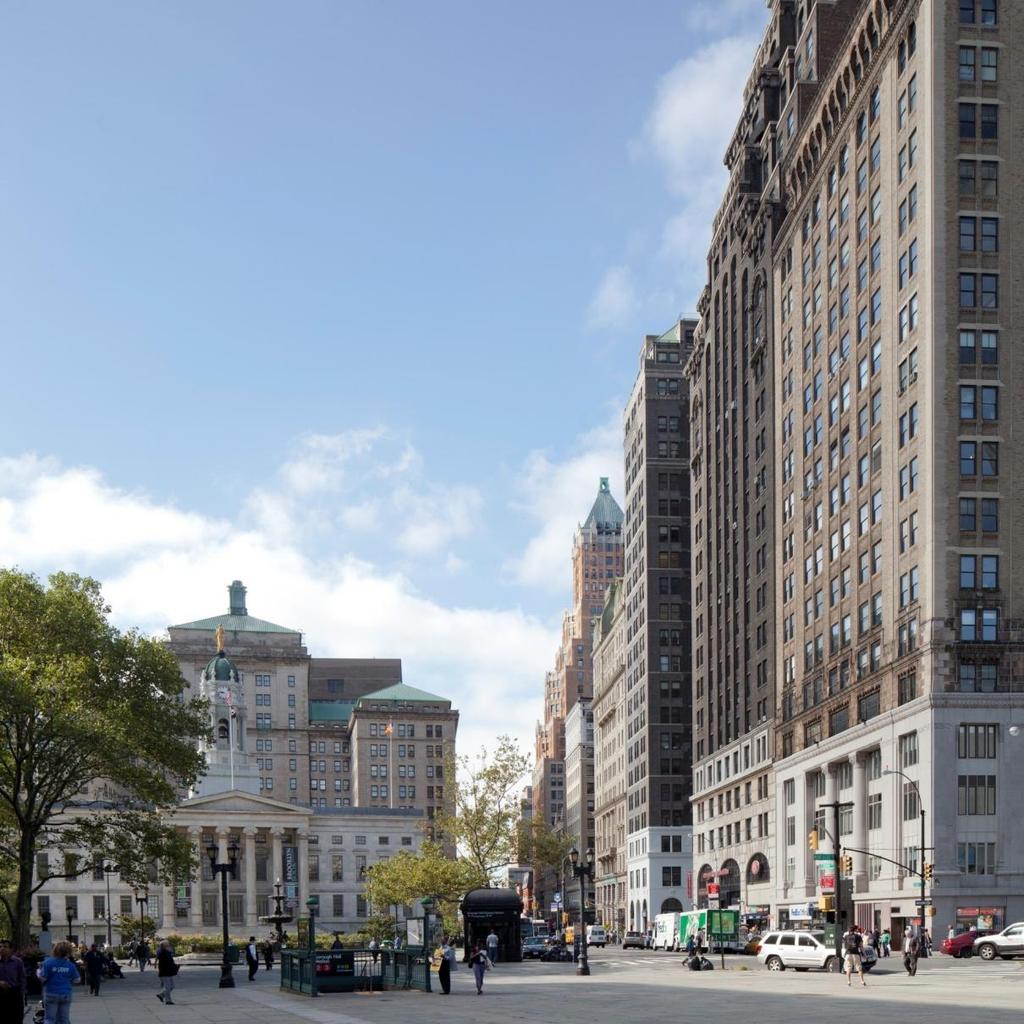
2 Cover Photograph: Court Street looking south along Skyscraper Row towards Brooklyn City Hall, now Brooklyn Borough Hall ( , Gamaliel King) and the Brooklyn Municipal Building ( , McKenzie, Voorhees & Gmelin). Christopher D. Brazee, 2011
3 Borough Hall Skyscraper Historic District Designation Report Prepared by Christopher D. Brazee Edited by Mary Beth Betts, Director of Research Photographs by Christopher D. Brazee Map by Jennifer L. Most Technical Assistance by Lauren Miller Commissioners Robert B. Tierney, Chair Pablo E. Vengoechea, Vice-Chair Frederick Bland Diana Chapin Michael Devonshire Joan Gerner Michael Goldblum Christopher Moore Margery Perlmutter Elizabeth Ryan Roberta Washington Kate Daly, Executive Director Mark Silberman, Counsel Sarah Carroll, Director of Preservation
4
5 TABLE OF CONTENTS BOROUGH HALL SKYSCRAPER HISTORIC DISTRICT MAP... FACING PAGE 1 TESTIMONY AT THE PUBLIC HEARING... 1 BOROUGH HALL SKYSCRAPER HISTORIC DISTRICT BOUNDARIES... 1 SUMMARY... 3 THE HISTORICAL AND ARCHITECTURAL DEVELOPMENT OF THE BOROUGH HALL SKYSCRAPER HISTORIC DISTRICT... 5 Early History and Development of Brooklyn s Civic Center... 5 Mid 19 th Century Development of Brooklyn s Civic Center... 8 The Tall Office Building in Downtown Brooklyn during the Late 19 th Century Early 20 th Century Development Court Street as Skyscraper Row Subsequent History FINDINGS AND DESIGNATION BUILDING PROFILES Court Street (East Side, Odd Numbers) Court Street (West Side, Even Numbers) Joralemon Street (North Side, Odd Numbers) Joralemon Street (South Side, Even Numbers) Livingston Street (North Side, Odd Numbers) Montague Street (South Side, Even Numbers) Remsen Street (North Side, Odd Numbers) Remsen Street (South Side, Even Numbers) ARCHITECTS APPENDIX... 47
6 10 Court St 1 63 Montague St Borough Hall Skyscraper Historic District Adams St Landmarks Preservation Commission Borough Hall Skyscraper Historic District Borough of Brooklyn, NY [LP-2449] Calendared: October 26, 2010 Public Hearing: December 14, 2010 Designated: September 13, 2011 Boundary of Historic District Tax Map Lots in Historic District Existing Historic District Tax Map Lots in Existing District Existing Historic Districts 165 Remsen St Borough Hall Skyscraper Historic District 245 Fulton St Joralemon St 184 Brooklyn Heights Historic District Livingston St 100 Feet Graphic Source: MapPLUTO, Edition 09v1, Author: Landmarks Preservation Commission, JM. Date: September 13, 2011
7 Landmarks Preservation Commission September 13, 2011, Designation List 447 LP-2449 TESTIMONY AT THE PUBLIC HEARING On December 14, 2010, the Landmarks Preservation Commission held a public hearing on the proposed designation of the Borough Hall Skyscraper Historic District (Public Hearing Item No. 1). The hearing had been duly advertised in accordance with the provisions of law. Seven people spoke in support of designation, including representatives of the Brooklyn Heights Association, the Historic Districts Council, the New York City Landmarks Conservancy, and the Municipal Arts Society, and two owners of 75 Livingston Street; a representative of City Council Member Stephen Levin spoke in support of designation and asked the Commission to work with owners of 75 Livingston Street to address their concerns; Brooklyn Borough President Marty Markowitz spoke in support of designation but expressed concerns about the inclusion of 75 Livingston Street and the Brooklyn Municipal Building; a representative of State Assembly Member Joan L. Millman spoke in support of designation but noted that she believed 75 Livingston Street should be excluded from the district. Five people spoke in opposition to designation including representatives of the Brooklyn Law School, the Court-Livingston- Schermerhorn Business Improvement District, the Real Estate Board of New York, a representative of the owner of 26 Court Street, and a representative of the property manager for 188 Montague Street and 175 Remsen Street; six owners of 75 Livingston Street, including the president of the Board of Directors, spoke in opposition to including their building in the district. A letter in support of designation from State Senator Daniel Squadron, and a resolution in support of designation from Brooklyn Community Board 2, were also entered into the record at the public hearing. BOROUGH HALL SKYSCRAPER HISTORIC DISTRICT BOUNDARIES The proposed Borough Hall Skyscraper Historic District consists of the property bounded by a line beginning at the intersection of the southern curbline of Montague Street and the western curbline of Court Street, continuing southerly along the western curbline of Court Street to a point formed by its intersection with a line extending westerly from and parallel with the lowest stair riser of the front steps of Brooklyn Borough Hall at 209 Joralemon Street (aka Joralemon Street, 1-43 Court Street, and 384 Adams Street), easterly along said line to a point formed by its intersection with a line extending northerly from and parallel to the eastern outside wall of Brooklyn Borough Hall at 209 Joralemon Street (aka Joralemon Street, 1-43 Court Street, and 384 Adams Street), southerly along said line and across the roadbed of Joralemon Street to the southern curbline of Joralemon Street, easterly along said curbline to a point formed with its intersection with a line extending northerly along a portion of the eastern property line of 210 Joralemon Street (aka Joralemon Street and Court Street), southerly along a portion of said property line, easterly along a portion of the northern property line of 210 Joralemon Street (aka Joralemon Street and Court Street), southerly along a portion of the eastern property line of 210 Joralemon Street (aka Joralemon Street and Court Street) to a point formed by its intersection with a line extending easterly from a portion of the southern property line of 210 Joralemon Street (aka Joralemon 1
8 Street and Court Street), westerly along said line and a portion of the southern property line of 210 Joralemon Street (aka Joralemon Street and Court Street), southerly along a portion of the eastern property line of 210 Joralemon Street (aka Joralemon Street and Court Street), westerly along a portion of the southerly property line of 210 Joralemon Street (aka Joralemon Street and Court Street) to the eastern curbline of Court Street, southerly along said curbline to the northern curbline of Livingston Street, across the roadbed of Court Street and along the northern curbline of Livingston Street to a point formed by its intersection with a line extending southerly from the western property line of 75 Livingston Street (aka Livingston Street and 66 Court Street), northerly along said property line and a portion of the western property line of 62 Court Street (aka Court Street), westerly along a portion of the southern property line of 62 Court Street (aka Court Street), a portion of the southern property line of 50 Court Street (aka Court Street and Joralemon Street), and a portion of the southern property line of 186 Joralemon Street (aka Joralemon Street), northerly along a portion of the western property line of 186 Joralemon Street (aka Joralemon Street), westerly along a portion of the southern property line of 186 Joralemon Street (aka Joralemon Street) and along a portion of the southern property line of 184 Joralemon Street, southerly along a portion of the eastern property line of 184 Joralemon Street, westerly along a portion of the southern property line of 184 Joralemon Street, northerly along the western property line of 184 Joralemon Street, across the roadbed of Joralemon Street, and along the western property line of 191 Joralemon Street (aka Joralemon Street), easterly along the northern property lines of 191 Joralemon Street (aka Joralemon Street) and 193 Joralemon Street and a portion of the northern property line of 44 Court Street (aka Court Street and Joralemon Street), northerly along the western property line of 186 Remsen Street (aka Remsen Street) and across the roadbed of Remsen Street to the northern curbline of Remsen Street, westerly along said curbline of to a point formed by its intersection with a line extending southerly from a portion of the western property line of 188 Montague Street (aka Montague Street and 165 Remsen Street), northerly along said property line, westerly along a portion of the southern property line of 188 Montague Street (aka Montague Street and 165 Remsen Street) and the southern property line of 186 Montague Street (aka Montague Street), northerly along the western property line of 186 Montague Street (aka Montague Street) to the southern curbline of Montague Street, easterly along said curbline to the point of the beginning. 2
9 SUMMARY The urbanization of Brooklyn began in earnest in the first decades of the 19th century. The Village of Brooklyn was chartered in 1816, and the City of Brooklyn was created less than 20 years later in The newly-formed municipal government quickly set out to build a proper city hall, which was located on the outer edge of the existing settlement at the intersection of Court, Joralemon, and Fulton Streets. While construction on Brooklyn City Hall (now Brooklyn Borough Hall) was delayed by the Panic of 1837 and was not completed until 1848, the finished structure was an imposing monument to the growth of the new city and a masterpiece of the Greek Revival style of architecture. The neighborhood surrounding Brooklyn City Hall (now Brooklyn Borough Hall) developed rapidly during the mid-19th century. A number of grand civic structures went up on Joralemon Street, while many cultural institutions established themselves on the nearby stretch of Montague Street. Stores and other commercial buildings began to rise on Court Street around the time a horsecar route opened on the road in the 1850s. The area became Brooklyn's true downtown office district in the post-civil War period as a series of ever taller commercial buildings were erected on Court Street and in the immediate vicinity. The insurance companies, particularly the Continental and Phenix firms, came first. They were soon followed by speculative developments such as A. A. Low's Garfield Building, as well as financial institutions such as the Dime Savings Bank and the Title Guarantee & Trust Company. While most were later replaced by even taller skyscrapers, A. A. Low's other major investment in downtown commercial real estate, the Franklin Building, remains a significant survivor of this period of development. The growth of Downtown Brooklyn was greatly aided by the planning and construction of the Brooklyn Bridge, which opened in 1883, as well as by the erection of a network of elevated railroads during the late 1880s. Building heights continued to increase throughout the 1890s. Particularly notable was the Temple Bar Building, the last and tallest of a series of early skyscrapers designed by George L. Morse. When it was completed in 1901 the Temple Bar Building was lauded at the largest office building ever constructed in Brooklyn. The City of Brooklyn was consolidated into Greater New York as the Borough of Brooklyn in 1898, a move that was widely supported by the downtown real estate developers. Commercial structures continued to rise in the area during the early 20 th century, although none would best the height of the Temple Bar Building for more than a decade and a half. Several were designed according to the so-called New York City solution to the problem of the tall office building, including 188 Montague Street, 184 Joralemon Street, and the Terminal Building at 50 Court Street. Under this scheme the facade was composed like a classical column, with a monumental base, a relatively simple shaft, and an ornamental capital, each distinguished by the use of color and materials. New transportation improvements, including the opening of several important subway lines through Downtown Brooklyn, as well as the early planning efforts for a new Municipal Building, led many to speculate that the area was ready for a period of even greater commercial development. These predictions came to fruition in 1918 when the 22-story building at 32 Court Street was completed. Widely regarded as Brooklyn s first true skyscraper, the structure easily surpassed the height of the Temple Bar Building and helped initiate a local building boom that turned Court Street into Brooklyn s definitive skyscraper row. The 1920s saw the completion of the Municipal Building, followed soon after by the erection of the Remsen and Court Building, the Montague-Court Building, and the Court-Livingston Building (later renamed the Brooklyn 3
10 Chamber of Commerce Building). These structures show the clear influence of the 1916 zoning resolution, particularly in their use of setbacks and slender towers, and feature architectural detailing in the neo-romanesque and neo-gothic styles that rivals that of any skyscraper erected in Greater New York. Other notable, if shorter, commercial buildings were erected on the adjacent blocks, including a number designed in the neo-gothic style such as 186 Joralemon Street, 191 Joralemon Street, and 56 Court Street. The Great Depression brought a halt to skyscraper construction in Downtown Brooklyn and throughout the city. By the mid 20 th century development in the area had shifted to government-sponsored urban renewal projects, which eventually led to the demolition of many of the borough s historic commercial buildings. The skyscrapers on Court Street and the business structures on the adjacent blocks were amongst the few survivors of this period. The ensemble of 21 buildings in the Borough Hall Skyscraper Historic District remain significant for their historic importance as the heart of Brooklyn s downtown office district, as notable examples of the skyscraper and tall office building typologies, and for their continuing existence in a neighborhood that has undergone radical changes to much of its built environment. 4
11 THE HISTORICAL AND ARCHITECTURAL DEVELOPMENT OF THE BOROUGH HALL SKYSCRAPER HISTORIC DISTRICT Early History and Development of Brooklyn s Civic Center 1 The first inhabitants of western Long Island were the Canarsee, the indigenous people Brooklyn who were members of the Algonquin linguistic group that occupied the Atlantic seaboard from Canada to North Carolina. 2 The Canarsees were an autonomous band of Delaware (Leni Lenape) Native Americans. They lived communally in several settlements in west Brooklyn, hunting and fishing in the low-lying marshes of Wallabout Bay (now the site of the Brooklyn Navy Yard). Europeans at first primarily fur traders from England, the Netherlands, and Sweden arrived in the early 17 th century and began conducting business with the region s indigenous population. By the 1630s, Dutch settlers began taking control of the western end of Long Island from the Canarsee through the purchase of large tracts of land. 3 Troubled relations between Dutch colonists and Native Americans inhibited organized settlement of the area for a while, although by the mid-17 th century the Dutch colonial government had granted official charters for six towns in the region in order to promote permanent European occupation. 4 The 1 Information in this section is based on the following sources: Eugene L. Armbruster, The Eastern District of Brooklyn (New York, 1912); Reginald Pelham Bolton, New York City in Indian Possession, 2d ed. (New York: Museum of the American Indian, Heye Foundation, 1920; reprint 1975); Edwin G. Burrows and Mike Wallace, Gotham: A History of New York City to 1898 (New York: Oxford University Press, 1999); Clay Lancaster, Old Brooklyn Heights: New York s First Suburb (New York: Dover Publications, 1979); Landmarks Preservation Commission (LPC), DUMBO Historic District Designation Report (LP-2279) (New York: City of New York, 2007), prepared by Andrew S. Dolkart; LPC, Vinegar Hill Historic District Designation Report (LP-1952) (New York: City of New York, 1997), prepared by Donald G. Presa; David Ment, with Anthony Robins and David Framberger, Building Blocks of Brooklyn: A Study of Urban Growth (Brooklyn, NY: The Brooklyn Educational & Cultural Alliance, 1979); Brian Merlis and Lee A. Rosenzweig, Brooklyn Heights and Downtown: Volume 1, 1860 to 1922 (Brooklyn: Israelowitz Publishing, 2001); Francis Morrone, An Architectural Guidebook to Brooklyn (Salt Lake City: Gibbs Smith Publisher, 2001); New York Supreme Court, Report of Cases Adjudjed and Determined in the Supreme Couty of Judicature and Court for the Trial of Impeachments and Corrections of Errors of the State of New York (New York: The Layers Co-operative Publishing Co., 1884); Ellen M. Snyder-Grenier, Brooklyn!: An Illustrated History (Philadelphia: Temple University Press, 1996); Henry R. Stiles, ed., History of Kings County Including the City of Brooklyn 1-2 (Brooklyn: W. W. Munsell & Co., 1884); Ralph Foster Weld, Brooklyn Village, (New York: Columbia University Press, 1938); William Lee Younger, Old Brooklyn in Early Photographs, (New York: Dover Publications, 1978). 2 This on the Native American occupants of Brooklyn was adapted from LPC, Vinegar Hill Historic District Designation Report and LPC, Fillmore Place Historic District Designation Report. 3 The Dutch West India Company s Charter of Freedoms and Exemptions of 1629 (also known as the Charter of Liberties) gave official sanction to the colonization of New Netherland; previously the Company had limited wholesale settlement of the area in favor of maintaining a few minimally populated trading posts. The first three large tracts of land on Long Island were acquired between 1636 and 1638 by William Adriaense Bennett and Jacques Bentyn in the Gowanus area, Joris Jansen Rapalje around Wallabout Bay, and Wouter van Twiller, Jacob van Corlear, Andries Hudde, and Wolphert Gerritsen near Jamaica Bay. Burrow and Wallace, The Native American system of land tenure was that of occupancy for the needs of a group and those sales that the Europeans deemed outright transfers of property were to the Native Americans closer to leases or joint tenancy contracts where they still had rights to the property. Bolton, 7. 4 A number of individuals had established homesteads on western Long Island even before Kieft s purchase, but they were widely spaced across the region and had no official government of any sort (see Ambruster [1912], for a list of these early residents). The six towns were Brooklyn (Breuckelen); Bushwick (Boswijck); Flatbush (Midwout); Flatlands (New Amersfoort); Gravesend; New Utrecht. 5
12 closest to the colonial capital of New Amsterdam, located just across the East River from Lower Manhattan, was that of Breuckelen. Regular ferry service between the two was established in the 1640s, and a small group of buildings grew up around the landing at the foot of what came to be known as the Jamaica Turnpike (later Fulton Street). Following the English conquest of New Netherlands the six towns were organized in 1683 as Kings County within the Province of New York. In 1706, much of the land in the southern portion of what is now the neighborhood of Brooklyn Heights was acquired by Joris Remsen. 5 Over the course of the 18 th century the Remsen family divided the property into smaller estates that were sold to families with names such as Joralemon and Livingston that are still used to identify the streets of the area. By the close of the 18 th century it became apparent to several of these large estate holders that the rural hamlet of Brooklyn would soon be ripe for urban development. The first to make a move into the speculative real estate market were the brothers Comfort and Joshua Sands, who had acquired much of the old Rapalje family land east of the ferry landing following the Revolutionary War. They hired surveyor Casimir Theodore Goerck in 1788 to lay out a series of building lots organized around a regular street grid, calling the new neighborhood Olympia. 6 The property south of the ferry landing was first mapped into urban blocks and lots nearly two decades later in 1806 when John and Jacob Hicks employed Jeremiah Lott to survey their estate in order to resolve a boundary dispute with the neighboring Middagh family. 7 The plan produced by Lott established the first street grid in Brooklyn Heights, covering the area north of Clark Street with blocks approximately 200 feet square. The job of enticing people to buy and build on the newly-mapped lots of Brooklyn was made considerably easier after 1814, when Robert Fulton and William Cutting leased the franchise rights to the primary ferry route between Brooklyn and Manhattan and introduced steam-powered service on the line. Two years later in 1816, the Village of Brooklyn, with an initial population of approximately 4,000 citizens, was incorporated within the existing Town of Brooklyn. The fledgling municipal government soon commissioned Jeremiah Lott to produce an official map of the village which closely followed his earlier survey of the Hicks estate to guide development in the area. 8 This plan was modified somewhat in 1819 when prominent landowner Hezekiah B. Pierpont commissioned Lott and Thomas Poppleton to resurvey the section of the Heights south of Clark Street to include larger blocks and wider streets, which he believed would better attract wealthy New Yorkers looking to settle across the East River. 9 5 Much of the southern section of Brooklyn Heights was patented to Andries Hudde by West India Company Director-General Willem Kieft in This property was later sold to Lodewyck Jongh in 1650, whose wife in turn sold a portion of the land to Dirck Janse Woertman in Joris Remsen, Woertman s son-in-law, acquired his estate in Stiles 1, Goerck was also responsible for surveying the Common Lands in Manhattan in 1785 and 1796, which provided the basis for that city s street grid (later expanded and canonized in the Commissioner s Plan of 1811). 7 Stiles 1, 111. New York Supreme Court, 659. The Hicks both owned slaves according to the 1790 census, while an article in the Brooklyn Daily Eagle noted that the Middagh family had at least one United States Census, Kings County, Brooklyn, 2-3; Slavery Here, Brooklyn Daily Eagle (December 29, 1891), 2. 8 Many sources claim the official map of the Village of Brooklyn was produced in 1816, although Stile s chronology seems to indicate it was not completed until Stiles 1, 139; Weld, Burrows and Wallace, Pierpont used the Anglicized spelling of the family name while his descendants reverted back to the original. 6
13 Many of the early residents and developers of Brooklyn were slave owners. Records indicate that the Hicks, Joralemons, Middaghs, Pierreponts, Rapaljes, Remsens, and Sands families all had slaves in the late 18 th and early 19 th centuries. 10 An early history of Brooklyn notes that many of these same families began manumitting their slaves in early 1800s in accordance with the gradual emancipation laws passed by the State of New York in 1799 and Brooklyn Heights and the adjacent neighborhood east of Fulton Street later became an important center for the abolitionist movement and an active part of the Underground Railroad in the years prior to the Civil War although none of the properties within the Borough Hall Skyscraper Historic District have known associations with this history. 12 By the 1820s residential buildings were being erected in significant numbers on both sides of the ferry landing as street openings and other civic improvement projects transformed the old country estates into a viable urban neighborhood. 13 The population of the area continued to increase during the 1830s and in 1834 the City of Brooklyn was incorporated with a population of nearly 25,000 residents. 14 One of the first acts of the newly formed city government was to purchase a plot of land for the construction of a proper city hall. 15 It chose a site on what was then the outer edge of the settled neighborhood of Brooklyn Heights, at the intersection of Fulton, Joralemon, and the recently-opened Court Street well removed from the existing town center clustered around the ferry landing at the foot of Fulton Street. 16 Architect Calvin Pollard was commissioned to design the imposing structure and its cornerstone was laid in The Panic of 1837 and the subsequent economic recession, however, halted construction at the site for nearly a decade United States Census, Kings County, Brooklyn; 1800 United States Census, Kings County, Brooklyn; Peter Ross, A History of Long Island: From its Earliest Settlement to the Present Time (New York and Chicago: The Lewis Publishing Company, 1902), Ross, A transcript of the legal instrument by which Jacob and John Hicks manumitted a female slave named Gin or Jane is transcribed in full in the history. Pierpont, as well as members of the Middagh and Remsen families, were also among those recorded as manumitting slaves during this period. For a description of the gradual abolition of slavery in New York see Patrick Rael, The Long Death of Slavery in Slavery in New York, ed. Ira Berlin and Leslie M. Harris (New York and London: The New Press, 2005). 12 All of the buildings within the district aside from Brooklyn City Hall post-date the Civil War. For a detailed description of Brooklyn sites associated with abolitionist movement and the Underground Railroad, see Research Report on the Portential Underground Railroad Associations of the Duffield Street and Gold Street Properties in Downtown Brooklyn, prepared by AKRF, Inc. (February 2007). 13 A map of the village published in 1827 shows the extent of urban development stretching over much of the northern section of Brooklyn Heights, as well as many of the blocks to the east of Fulton Street laid out by the Sands brothers. Hooker s New Pocket Plan of the Village of Brooklyn (Brooklyn: William Hooker, 1827). 14 Stiles 1, The municipal functions of Brooklyn were initially housed in a small commercial building near the ferry landing; they later moved to the Apprentices Library and other nearby facilities (later renamed the City Buildings) until City Hall was completed. Stiles 1, This decision was heavily influenced by Pierpont, who owned a portion of the land purchased by the city and who believed a grand civic building would help promote the development of his vast estate as an elite enclave. Burrows and Wallace, A description of this design can be found in Stiles 1,
14 Mid 19 th Century Development of Brooklyn s Civic Center 18 While construction on Brooklyn City Hall (now Brooklyn Borough Hall) was temporarily stalled, the city s population continued to grow rapidly in the late 1830s and especially through the 1840s. During this period the remaining large estate owners in Brooklyn Heights increased their efforts to partition and sell off buildings lots. 19 Work on City Hall finally resumed in 1845, albeit at a diminished size from what had originally been proposed. The commission for the revised design was given to architect Gamaliel King, who produced what is widely considered one of the finest Greek Revival-style buildings in the city (it was designated a New York City Landmark in 1966). In the decade following the opening of City Hall, the population of Brooklyn more than doubled propelled not only by in-migration and immigration, but also through the annexation of the neighboring City of Williamsburgh and Town of Bushwick in At the beginning of the 1860s Brooklyn had more than a quarter million residents and was counted as the third most populous urban center in the nation. The needs of this enlarged population soon exceeded the facilities available in City Hall and over the next few decades a number of new governmental structures were erected in the immediate vicinity. The Kings County Courthouse was erected on Joralemon Street across from City Hall in It was soon flanked to the west by the Brooklyn Municipal Building and to the east by the Hall of Records. 22 The federal government also turned its attention to Brooklyn during this period, erecting the United States Post Office and Court House, Brooklyn Central Office ( , Mifflin E. Bell, a New York City Landmark) a few blocks away at the northeast corner of Washington and Johnson Streets just off Fulton Street. As the stretch of Joralemon Street surrounding City Hall was developing into the center of Brooklyn s civic life, many of the city s newly-established cultural institutions were establishing themselves on the adjacent side streets. One of the earliest was Montague Hall (1845, Gamaliel King, demolished) on Court Street just south of Montague Street, which was an 18 Information in this section is based on the following sources: Kenneth Turney Gibbs, Business Architectural Imagery in America, (Ann Arbor, MI: UMI Research Press, 1984); Sarah Bradford Landau and Carl W. Condit, The Rise of the New York City Skyscraper, (New Haven, CT and London: Yale University Press, 1996); Ment; Merlis and Rosenzweig; Morrone; Stiles; Younger. 19 In 1840 the Pierrpont heirs commissioned another survey of their lands that resulted in the creation of Montague Place, and in 1846 the removal of their family manor from the projected path of Remsen Street facilitated the opening of that road. Ment, The population of Brooklyn in 1848 stood at 90,000, increasing to more than 200,000 in Stiles 1, The Kings County Courthouse (demolished, original location immediately outside the boundaries of the Borough Hall Skyscraper Historic District) was designed by Gamaliel King architect of Brooklyn City Hall and Herman Teckritz. (In an interesting twist of history, King s former partner, John Kellum, was the architect for the nearly contemporaneous New York County Courthouse, also known as the Tweed Courthouse, [ , a New York City Landmark], in Manhattan.) Plans for the new building were begun as early as the 1850s, although an early historian of Brooklyn notes, the usual delays, embarrassments and contentions incident to the erection of a great public building prevented its erection, and it was not till May 20, 1862, that its corner-stone was laid. Stiles 1, 535. See also Kings County Court-House, Opinion of Hon Greene C. Bronson, New York Times (September 20, 1854). 22 The original Brooklyn Municipal Building ( , Ditmars & Mumford, demolished) was an imposing Mansard-roofed, French Second Empire-style structure. The Hall of Records ( , William A. Mundell, demolished, original location outside the boundaries of the Borough Hall Skyscraper Historic District) was a classically-inspired design whose prominent triangular pediment complimented the earlier civic buildings. 8
15 important early place of assembly not just for the regular concerts and dances held there but also for the meeting rooms that were used by many of the city s early societies. 23 The Packer Collegiate Institute for Girls was established in 1844 on Joralemon Street west of Court Street; following a fire in 1853 it moved into an impressive new structure on the same site ( , Minard Lafever, within the Brooklyn Heights Historic District). A similar institution for boys, the Brooklyn Collegiate and Polytechnic Institute, opened its building in 1854 on Livingston Street on the south side of the block that would eventually be home to the Courthouse, Municipal Building, and Hall of Records. The stretch of Montague Street west of Court Street became the primary center of Brooklyn s cultural organizations during the 1860s when a group of three Gothic Revival-style buildings were erected in close proximity. The Brooklyn Academy of Music opened on the south side of the street in 1861, the Mercantile Library Association of the City of Brooklyn across the street in 1868, and the Brooklyn Art Association adjacent to the Acedmy of Music in The area near Brooklyn City Hall perhaps reached its apogee as a cultural center when the Long Island Historical Society moved into its new headquarters at the corner of Clinton and Pierrepont Streets ( , George B. Post, within the Brooklyn Heights Historic District). Commercial development in mid-19 th century Brooklyn was more widely dispersed, initially growing outward from the Fulton Ferry landing and later along other important transportation corridors such as Atlantic Avenue east of the South Ferry landing. Stores and other business buildings began to appear on Court Street during the 1850s following the completion of City Hall and coincident with the opening of horsecar service along the road in Most were low in scale, reaching at most four stories, and were designed in the Italianate palazzo style that had become prevalent for commercial structures following the opening of the A. T. Stewart Store near New York s City Hall in Manhattan. 26 A notable block of four-story, marble-fronted stores was erected at the southwest corner of Court and Joralemon Streets around 1852 (heavily-altered traces of the Marble Buildings, as they were often called, remain at 52 Court Street and 62 Court Street within the boundaries of the Borough Hall Skyscraper Historic District), while the opposite side of Court Street was home to the Washington Building (c. 1851, demolished) and other smaller commercial structures. Banks and other important businesses also began to establish their headquarters in the vicinity of Brooklyn City Hall during this period. The Mechanics Bank erected a handsome Italianate-style building on the northwest corner of Court and Montague Streets in 1857, and the same year the Brooklyn Gas Light Company built its own offices on the south side of Remsen 23 Montague Hall, Brooklyn Daily Eagle (April 1, 1879), 4. Montague Hall s major rival during the 1850s was the Brooklyn Atheneum, located on the northeast corner of Atlantic Avenue and Clinton Street. Ment, The historic homes of the Brooklyn Collegiate and Polytechnic Institute, the Brooklyn Academy of Music (1861, Leopold Eidlitz); the Mercantile Library ( , Peter B. Wright); the Brooklyn Arts Association ( , J. C. Cady) were all subsequently demolished; all but a portion of the Brooklyn Academy of Music were located outside the boundaries of the Borough Hall Skyscraper Historic District. See Ment, for a discussion of Montague Street as Brooklyn s cultural center. 25 The Brooklyn City Railroad Company began service on it Fulton Street, Court Street, Myrtle Avenue, and Flushing Avenue routes on July 3, Brooklyn Daily Eagle Almanac (1916), A. T. Stewart Store (a New York City Landmark) was built in with later additions, designed by Joseph Trench & Co. The first palazzo-style building in Brooklyn is widely believed to have been the Brooklyn Savings Bank ( , Minard Lafever, demolished) that stood at the corner of Fulton and Concord Streets. 9
16 Street just west of Court Street. 27 Perhaps the most conspicuous commercial structure erected on Court Street during the mid 19 th century was the four-story, palazzo-style Hamilton Building at the northwest corner of Court and Joralemon Streets. 28 It was commissioned by Abiel Abbot Low, a prominent merchant in the China trade who was deeply involved in the development of Brooklyn in general and the City Hall neighborhood in particular. 29 The Tall Office Building in Downtown Brooklyn during the Late 19 th Century 30 The Panic of 1857 and the subsequent economic depression, followed soon afterwards by the Civil War, significantly inhibited development in Brooklyn for a number of years. By the 1870s, however, construction activity had picked up again on the streets surrounding City Hall. The stretch of Court Street from Montague to Livingston Streets in particular experienced rapid commercial growth, transforming the area from a minor shopping street into Brooklyn s true downtown office district. The buildings erected during this period were a significant departure from the earlier low-scale, Italianate palazzos typified by the Hamilton Building. In addition to employing a growing range of architectural styles including the French Second Empire, neo- Grec, Romanesque Revival, and eventually Beaux-Arts Classicism these structures also adopted a number of technical advancements that allowed them to grow ever larger and taller, in many ways making them the direct predecessors of the skyscrapers that would eventually replace them in the early 20 th century. As in Manhattan, the rivalry between insurance companies in Brooklyn provided the initial motivation that pushed building heights upwards along Court Street. 31 In the Continental Insurance Company of New York, a Manhattan-based firm dealing in fire insurance, erected one of the first of the new class of office buildings at the southwest corner of Court and Montague Streets. 32 A few years later, a local firm, the Phenix Fire Insurance Company of 27 The Mechanics Bank and the Brooklyn Gas Light Company Building (both demolished, located outside the boundaries of the Borough Hall Skyscraper Historic District) were designed as Italianate style palazzos. 28 The design of the Hamilton Building ( , attributed to William Field & Son, demolished) closely resembled other palazzo-mode commercial buildings in New York, particularly the earlier Bank of the State of New York ( , James Renwick, Jr., demolished) erected at William Street and Exchange Place in Manhattan. 29 Low was instrumental in establishing many of the cultural institutions that made their home in downtown Brooklyn. He assisted in founding the Brooklyn Public Library system, the Brooklyn Academy of Music, the Brooklyn Art Association, and the Long Island Historical Society (now Brooklyn Historical Society), as well as serving as president of the board of trustees of the Brooklyn Female Academy (later the Packer Collegiate Institute). 30 Information in this section is based on the following sources: Burrows and Wallace; Gibbs; Landau and Condit; Ment; Merlis and Rosenzweig; Morrone; Snyder-Grenier; Stiles. 31 The rivalry in Manhattan was between life insurance companies, notably the Equitable, Metropolitan, Mutual, and New York firms. In Brooklyn it was the fire insurance firms that predominated. 32 The Continental Building (demolished) was designed by George L. Morse, who would become perhaps the most important architect of commercial structures in Downtown Brooklyn during the late 19 th century. The five-story French Second Empire-style structure featured a cast-iron facade, a mansard roof with a corner pavilion, and a large tower rising a reported 120 feet above the main entrance along Montague Street. Continental Insurance Company, Brooklyn Daily Eagle (September 26, 1873), 4. The Arbuckle Building (demolished) on Fulton Street between Myrtle and Willoughby predated the Continental Building by a few years and was called the first modern office building in Brooklyn by the Brooklyn Daily Eagle. The Continental Insurance Company s headquarters at 100 Broadway in Manhattan ( , Griffith Thomas, demolished) also had a cast-iron front with a prominent 10
17 Brooklyn, commissioned an even taller structure immediately to the south of the Continental Building on the site of the old Montague Hall. 33 The Phenix Building employed a number of notable technical innovations, including the large expanses of glass on its facade, the inclusion of rental office space beyond what was necessary for the owners, and the presence of two steampowered elevators features that are widely considered hallmarks of the early skyscraper. 34 Abiel A. Low, developer of the Hamilton Building, increased his investment in downtown commercial real estate during this period by commissioning a pair of tall office buildings of his own. His most visible contribution was the seven-story Garfield Building at northwest corner of Court and Remsen Streets adjacent to the Phenix Building. 35 Following its completion, the Brooklyn Daily Eagle enthusiastically noted that the locality of [City] Hall is considered THE COMMERCIAL HEART of the city, and claimed that the concentration of the Low [Garfield] Building, with the Phoenix Building and the Continental Building, all on the same block, will make it decidedly the finest in the town for business purposes. 36 Low also developed the seven-and-a-half-story Franklin Building around the corner at 186 Remsen Street in It was designed by the Parfitt Brothers, whose prior experience with tall buildings included a set of three apartment buildings on Montague Street several blocks to the west. 38 The structure shows the growing influence of the Romanesque Revival and incorporates many elements typical of the style, such as the heavy round-arched entrance at the ground floor, the rock-faced stonework covering the lower stories, and the vertical organization of the facade into a regular series of arcades articulated under the round-arched window openings at the sixth story. 39 The Franklin Building, although losing its upper story and a half around 1950, is mansard roof, and is widely considered to be the first Second Empire-style commercial building in New York. Landau and Condit, The Phenix Building ( , Ebenezer L. Roberts, demolished) incorporated elements of the neo-grec style and featured strong vertical piers, decorative beltcourses, and a central cupola. Coming Down, Brooklyn Daily Eagle (March 21, 1879), 4. The Phenix Building predated by a few years the architect s similar, if more famous, commission for the Standard Oil Company Building on Lower Broadway in Manhattan. 34 Architectural historians Sarah Bradford Landau and Carl W. Condit spell out the elements that distinguished early skyscrapers in their description of the Equitable Life Assurance Society Building in Manhattan ( , Dilman & Kendal, demolished), noting that, the exceptional features of the Equitable Building its elevator-predicated height, fireproof construction, extensive iron framing, large window area, and rent-free owner quarters justify the title first skyscraper. Landau and Condit, The Garfield Building (1881, J. C. Cady, demolished) featured a double-height pitched roof and prominent corner clock tower whose height well outstripped the earlier buildings on Court Street. Immense, Brooklyn Daily Eagle (April 4, 1881), The High Low Building, Brooklyn Daily Eagle (July 29, 1881), The Franklin Building may have been named after the Franklin Trust Company, which was founded by Low around 1888 and was an early tenant in the building. The Franklin Trust later moved to the larger Franklin Trust Company Building at 164 Montague Street (1891, George L. Morse, within the Brooklyn Heights Historic District). A Famous Firm, Brooklyn Daily Eagle, September 2, 1887, 2; New Trust Company, Brooklyn Daily Eagle, April 4, 1888, These apartment buildings were the Berkley, the Grosvenor, and the Montague (all ) the latter of which especially resembles the Franklin. Low may have selected the Parfitt Brothers at the recommendation of his son Seth Low, who had hired the firm in 1882 to design his house in Brooklyn Heights. 39 The design of the Franklin Building is also notable for the use of color and materials, particularly the red pressed brick and terra cotta that comprise the upper stories. The terra cotta on the Franklin Building was manufactured by 11
18 significant as one of the few surviving late-19 th -century tall office buildings in Downtown Brooklyn. Banks and other financial institutions continued to cluster around City Hall during the late 19 th century. The Dime Savings Bank erected a new headquarters at the southwest corner of Court and Remsen Streets in A decade later the Title Guarantee and Trust Company built their own offices across Remsen Street adjacent to the Garfield Building in The development of these and other commercial buildings in Downtown Brooklyn coincided with, and in some instances preceded, the planning and construction of a pair of massive transportation projects that further reoriented commercial activity away from the Fulton Ferry landing and towards the City Hall area. 42 The first to open was the Brooklyn Bridge, preparations for which had begun in the 1860s and for which foundations were laid starting in 1870 just a few years before the Continental Building went up. The bridge was opened to pedestrian traffic on May 24, 1883, while cable car service across the span began in September of that year. The Brooklyn terminus for the route was located at Sands Street a few blocks north of City Hall. The second project was the development of a network of elevated railroads that fanned out from the City civic center into the rapidly expanding residential neighborhoods of Brooklyn. The Brooklyn Elevated Railroad opened the first line serving Downtown Brooklyn in 1885, running east into the Fort Greene, Clinton Hill, and Bedford-Stuyvesant neighborhoods from a terminal at Washington and Adams Street just north of the Brooklyn Bridge cable car station. 43 The allied Union Elevated Railroad opened another line in 1888 running along Myrtle Avenue with its main terminal at Adams Street a block east of City Hall. 44 That same year a rival company, the Kings County Elevated Railway, completed its own route running along Fulton Street with a major station stop located directly in front of Brooklyn City Hall and the Kings County Court House. Building heights in Downtown Brooklyn continued to increase in the 1890s, starting with the nine-story Real Estate Exchange Building that ran through the block between Montague and the Boston Terra Cotta Company, while the brickwork is composed of Philadelphia pressed brick laid in stretcher bond which at the time was characteristic of high quality construction. 40 The design of the Dime Savings Bank ( , Mercein Thomas, demolished) was the result of an architectural competition. At four stories which actually read as only two it was shorter than the speculative office buildings that surrounded it, yet contemporary accounts noted that, the general character of the structure is massive and praised the novel use of light-colored limestone and its Classically-detailed facade. To Loom Up, Brooklyn Daily Eagle (April 13, 1883), 4; The Dime Bank, Brooklyn Daily Eagle (December 24, 1884), 1. Another of Brooklyn s great Classical banks, the Brooklyn Savings Bank ( , Frank Freeman, demolished) was located a few blocks to the north at Pierrepont and Clinton Streets. 41 The original design for the Title Guarantee and Trust Company Building by Holland C. Anthony called for a three-story structure, with framing strong enough to support an additional five stories, should an increased demand for offices in the neighborhood warrant. As completed, the Romanesque Revival-style building had six stories shorter than was technically feasible but still a testament to the continuing interest in commercial real estate in the City Hall area. Title Company s New Home, Brooklyn Daily Eagle (June 7, 1896), While Court Street and the blocks west of City Hall developed into Brooklyn s premiere location for office buildings, the stretch of Fulton Street to the east evolved into the city s major shopping district. Several of historic stores remain, including the Offerman Building ( , Peter J. Lauritzen, a New York City Landmark) that once housed the S. Wechsler & Brother department store and later Martin s Department Store. 43 The Lexington Avenue line, as it was commonly called, was soon extended northwards to the Fulton Ferry landing and eastwards into East New York. 44 The Myrtle Avenue line was later extended northwards to connect with the Brooklyn Bridge terminus. 12
19 Pierrepont Streets west of Court Street. 45 Widely denounced in the architectural press as an aberration and a juggernaut amidst the low-scale cultural institutions from the mid 19 th century, it was nevertheless soon surpassed by even larger buildings in the following years. 46 Perhaps more distinguished was a group of four early skyscrapers designed by George L. Morse, architect of the earlier Continental Building. The ten-story Franklin Trust Company Building was completed in 1891 at the southwest corner of Montague and Clinton Streets (within the Brooklyn Heights Historic District). A year later, in 1892, the eight-story Brooklyn Daily Eagle Building (demolished) opened at the southeast corner of Washington and Johnson Street just east of City Hall. 47 Both were completed before the World s Columbian Exposition of 1893 helped popularized the Beaux-Arts classicism that characterized the design of the slightly later Mechanics Bank Building (1896, demolished) that towered ten stories over the northwest corner of Court and Montague Streets. 48 The last and largest of the Morse-designed skyscrapers was the Temple Bar Building, a massive 13-story structure that replaced the old Hamilton Building at 44 Court Street. A speculative investment with over 300 offices, the name derived from owner David G. Leggett s intention that many of the borough s lawyers would take up quarters in the building. The Temple Bar Building was distinguished not only by its sheer height and bulk but also by its skillfully-executed Beaux-Arts-style design. The main elevation facing Court Street was divided vertically with a pair of heavy corner piers flanking a more open central section, while a series of beltcourses separated the facade into a number of horizontal layers. The rusticated base originally had a columned portico, while balconies projected from the upper stories. The most prominent features of the building were the elegantly curving green cooper cupolas at the three visible corners of the building. 49 Construction on the Temple Bar Building commenced in 1899, a year after the independent City of Brooklyn was consolidated into Greater New York as the Borough of Brooklyn. Most of the city s business leaders including Abiel A. Low and other real estate developers active in Downtown Brooklyn had strongly supported unification, believing that the merger would increase property values and bring additional demand for office space. 50 As the 19 th century came to a close, optimism remained high that the prosperity of the business district surrounding the recently-renamed Brooklyn Borough Hall would continue unabated. 45 The Real Estate Exchange Building (1890, George E. Edbrooke, altered) is located outside the boundaries of the Borough Hall Skyscraper Historic District. 46 Architectural Record 1 (1892), , quoted in Ment, An addition, with prominent cupola, was added to the Brooklyn Daily Eagle Building in The complex was located outside the boundaries of the Borough Hall Skyscraper Historic District. 48 The Mechanics Bank Building was enlarged in 1904, following the curve of Fulton Street. It was located outside the boundaries of the Borough Hall Skyscraper Historic District. 49 The design of the Temple Bar Building may have been influenced by the Park Row Building ( , R. H. Robertson, a New York City Landmark) in Manhattan, which also featured a rusticated base with portico, regular horizontal beltcourses, and a vertical division of the facade into heavy corner piers topped with prominent cupolas flanking a more open center section. 50 In 1893 the Brooklyn Consolidation League was formed by members of Brooklyn s business community at a meeting held in the Real Estate Exchange Building on Montague Street. Burrows and Wallace,
20 Early 20 th Century Development 51 When it was completed in 1901, the Temple Bar Building was lauded as the tallest office building ever constructed in Brooklyn. 52 In spite of the enthusiasm of the borough s real estate investors engendered by consolidation and the turn of the new century, it retained that title for more than a decade a half. Yet while no legitimate challengers to its height were raised in the first decades of the 20 th century, commercial development continued to progress on the blocks surrounding Borough Hall. Montague Street in particular became a favored location for financial institutions. A large parcel on the south side of the street became available in 1903 when the old Brooklyn Academy of Music burned to the ground. Most of the site was redeveloped with a series of two-story bank buildings designed in the neo-classical mode. Helmle, Huberty & Hudswell were responsible for a long block of offices at Montague Street, erected for the Lawyers Mortgage Company part of which remains, in an altered form, at 186 Montague Street within the Borough Hall Skyscraper Historic District. 53 Another pair of bank buildings was constructed at nos. 192 and 196 Montague Street, the latter designed by Frank Freeman as an addition for the Title Guarantee & Trust Company (both later replaced). 54 Helmle, Huberty & Hudswell also created a ten-story office building for the Lawyers Title Insurance Company on a portion of the Academy site at 188 Montague Street, constructed in The column-like appearance of the structure with a classic tripartite form comprising a two-story base, a relatively simple brick-clad shaft, and an elaborate capital, each distinguished by the use of color and materials is typical of the New York City solution to the design of tall office buildings that had come to dominate by the early 1900s. 55 A similarly-composed 12-story office building was erected a few years later around at 184 Joralemon Street. It also features a rusticated base, a uniform middle section, and a prominent capital although the more exuberant use of ornament, as well as the mixing of the Beaux-Arts and Colonial Revival styles, may be attributed to the individualism of architect George Keister, who was widely known for his flamboyant theater designs. The 12-story Terminal Building at 50 Court Street, which replaced a few of the 1850s-era Marble Buildings, 51 Information in this section is based on the following sources: Gibbs; Landau and Condit; LPC, Broadway- Chambers Building Designation Report (LP-1753) (New York: City of New York, 1992), prepared by James T. Dillon; Ment; Public Design Commission of the City of New York, Archives. 52 According the Brooklyn Daily Eagle, the structure will be the highest of any building in Brooklyn devoted exclusively to office purposes, and was surpassed in height only by a couple of church steeples including the Morse-designed First Reformed Church at 7 th Avenue and Carroll Street in Park Slope (1893). Will be 14 Stories High, Brooklyn Daily Eagle (January 12, 1900), The building at Montague Street was damaged by fire in 1939, although the portion at nos was renovated and two floors subsequently added in 1941 to the designs of Slee & Bryson. 54 In 1907 the Title Guarantee & Trust Company constructed a second, seven-story, addition at Remsen Street adjacent to their main headquarters dating from This design scheme was exemplified by Cass Gilbert s Broadway-Chambers Building in Manhattan ( , a New York City Landmark), which architectural critic Montgomery Schuyler called, the summation of that type of design of a tall building, the last word in the prosecution of the analogy of the classical column. Montogmery Schuyler, The Woolworth Building (New York: the Woolworth Company, 1913), cited in William Jordy and Ralph Coe, American Architectur and Other Writings of Montgomery Schuyler (Cambridge: The Belknap Press of Harvard University Press, 1961), 614. See also Landau and Condit, ; LPC, Broadway-Chambers Building Designation Report. 14
21 was another notable example of the type. It was constructed in 1913 and was the first major structure to be completed on Court Street after the Temple Bar Building. Designed by New Jersey architect William E. Lehman, the building was particularly notable for the use of whiteand cobalt-colored glazed terra cotta on the upper stories. 56 At the same time as these tall office buildings were going up, the city government was engaged in a protracted planning effort for a new Municipal Building to replace the older structure erected in the 1870s. The first attempts were initiated in 1903 when Borough President J. Edward Swanstrom presided over an architectural competition for the commission. The winning entry, by Washington Hull, was for a boldly detailed, eight-story Beaux-Arts structure with a double-height pitched roof and corner pavilions. Swanstrom s successor, Martin W. Littleton, subsequently rejected Hull s design and in 1905 commissioned the firm of McKim, Mead & White to create its own proposal. Their four-story structure was shorter than Hull s, but was to occupy a larger lot stretching the full block front along Court Street from Joralemon to Livingston Streets. 57 Littleton in turn was replaced in office by Bird S. Coler and yet another set of designs for the Municipal Building was commissioned this time by Lord & Hewlett, who in 1906 submitted a scheme for a ten-story structure in a restrained Beaux-arts style. 58 A fourth successive Borough President, Alfred E. Steers, engaged his own architects for the project, awarding the commission to McKenzie, Voorhees & Gmelin. The firm filed its initial designs in 1911, but these were rejected by the city s Art Commission, which objected to the inclusion of a dome over the central tower that it believed would compete too closely with that of Borough Hall. 59 Revised drawings won preliminary approval from the commission in 1912, with additional approvals in The final scheme created by McKenzie, Voorhees & Gmelin called for an H-plan building, with a pair of wings flanking a central tower recessed above a street-level arcade. The structure was topped with steeply pitched roofs and surmounted by a tall cupola. Actual work on the building proceeded as far as the demolition of the old Municipal Building in 1915, but further construction on its replacement was suspended and did not resume for nearly a decade. Transportation facilities also continued to improve through the turn-of-the-century, bringing ever greater numbers of people to Downtown Brooklyn. The terminal at the foot of Brooklyn Bridge was substantially improved in 1895, linking the bridge s cable car system with the elevated tracks of both the Brooklyn Elevated Railroad and the Kings County Railway. A few years later Brooklyn s transit system was further consolidated when the newly-formed Brooklyn Rapid Transit Company (BRT) gained control of the elevated lines in 1899 and most of the streetcar and surface railroads by The BRT s Manhattan-based rival, the Interborough Rapid Transit Company (IRT), opened the first subway station in Brooklyn in 1908 at Borough Hall, and soon extended the line into the residential neighborhoods to the east. The 56 The terra cotta was manufactured by the Federal Terra Cotta Company. 57 Borough Hall Planned, New-York Daily Tribune (November 11, 1905), 4. The firm s proposal for the Brooklyn Municipal Building closely resembled their later design for the United States General Post Office in Manhattan ( , a New York City Landmark). It also preceded by a couple of years its executed design for the skyscraping Manhattan Municipal Building ( , a New York City Landmark). 58 New Borough Building, New-York Daily Tribune (January 5, 1908), 3; Three Architect, Not a Brick Laid, New-York Daily Tribune (October 29, 1909), Reject Designs for Brooklyn City Hall, New York Times (December 20, 1911), Public Design Commission Archives. 15
22 IRT completed a second line through Downtown Brooklyn in 1919 with a major station at the intersection of Court and Montague Street, while the BRT opened its own subway in the area in 1920 with a stop located just down the block at Montague Street between Clinton and Court Streets. Court Street as Skyscraper Row 61 The anticipation surrounding the construction of a new Municipal Building, as well as the consolidation of Brooklyn s transit facilities and the construction of several important subway lines through Downtown Brooklyn, lead many to speculate that the area was ready for a period of even greater development. The New York Times correctly predicted the coming growth, noting in 1911 that Court Street is the logical centre for new and larger buildings to meet the demands of increasing business activity. 62 The first of these new and larger buildings to be completed in the vicinity was the 22-story building at 32 Court Street, which replaced the old Dime Savings Bank Building. When it was completed in 1918 it easily surpassed the Temple Bar Building as the tallest commercial structure in Brooklyn and was called Brooklyn s first real sky-scraper by Rider s New York City guidebook in Designed by the firm of Starrett & Van Vleck, the structure was developed by the Court and Remsen Company, of which Goldwin Starrett, partner in Starrett and Van Vleck, was president. 63 Like the earlier Terminal Building, 32 Court Street follows the traditional column-like design scheme with a clearly defined base, shaft, and capital. Plans for the new building were submitted in 1916 just before the city s first comprehensive zoning resolution went into effect and the structure rises straight up from the sidewalk for 20 stories before setting back with a two-story penthouse and pitched roof. The ornamentation of the upper stories, particularly the elaborate treatment of the penthouse with balustrades and urns (since removed), suggest the influence of the Colonial Revival style, while the middle section of the building is arranged with a regular grid of paired window openings separated horizontally by beltcourses every second story. Planning efforts for a new Municipal Building were revived yet again in 1923 when the city commissioned McKenzie, Voorhees, and Gmelin to update the design they had initially submitted in The plan and massing of the new proposal was very similar to the earlier scheme, although the ornamentation was somewhat simplified, particularly in the lowering of the roofline and in the treatment of the central tower. 64 As had happened the previous decade, the Art Commission requested a number of refinements to the design; the entrance colonnade, perhaps the most distinctive feature of the building, received particular scrutiny. In 1924 the architects submitted a revised set of renderings and a scale model of the colonnade, which did away with the central sculptural element seen in the original drawings and instead presented a more austere 61 Information in this section is based on the following sources: Gibbs; Landau and Condit; Ment; Morrone; Public Design Commission Archives; Carol Willis, Form Follows Finance: Skyscrapers and Skylines in New York and Chicago (New York: Princeton Architectural Press, 1995). 62 Interesting Contrast in Development Around the Borough Hall of Brooklyn, New York Times (May 28, 1911), XX2. 63 Skyscraper for Brooklyn, New York Times (August 13, 1916), XX A letter from the architects to the Art Commission noted that the building, occupies the same area and is of the same general structure as the plans which received preliminary approval some time ago from your Commission. Public Design Commission Archives. 16
23 series of columns with just a hint of emphasis on the central bays provided by a raised parapet. Construction work began in August of that year, while the building s crowning element, the cupola, won final approval from the Art Commission in the summer of The completed structure opened in While the Municipal Building was not the tallest in Downtown Brooklyn, being easily surpassed by the earlier skyscraper at 32 Court Street, its planning and construction had a profound impact on the neighborhood by renewing development interest in the surrounding blocks. An article in the New York Times in 1926 noted that, private enterprise has been quick to follow the example set by the city in erecting the new Brooklyn Municipal Building. 65 Within a couple of years of its completion a distinguished group of increasingly tall office buildings were erected on the west side of Court Street facing the civic center, definitively earning for the area the title of Brooklyn s skyscraper row. These structures were built as speculative investments and, as with many such ventures, were named for the streets on which they were located: the Montague-Court Building, the Court and Remsen Building, and the Court- Livingston Building (soon renamed the Brooklyn Chamber of Commerce Building after its most influential tenant). 66 The designs of the three buildings show the clear influence of the 1916 zoning ordinance, which required the building envelope to step back from the street wall as it rose to allow light and air to filter downwards. An important provision of the law permitted unrestricted height on a quarter of the building site, which gave developers the option of building slender towers to whatever elevation would prove profitable. The first of the 1920s skyscrapers to be completed was the Court and Remsen Building at 26 Court Street, which replaced the Garfield Building. It was built in to the designs of Schwartz & Gross, and at 30 stories and approximately 350 feet high it was for a brief time the tallest building in Brooklyn, well surpassing 32 Court Street in both height and bulk. The structure was constructed without the slender tower allowed under the zoning resolution, instead rising 18 stories above the sidewalk before stepping away from the street wall in a complex series of setbacks topped with a pitched tile roof. 67 A skyscraper for the site had been proposed earlier by the Chanin Construction Company in 1924, but the property was ultimately sold to a partnership lead by Abraham Bricken and developed by the Bricken Construction Company. Bricken was a major Manhattan real estate developer, particularly active in Manhattan s Garment Center, who frequently worked with architects Schwartz & Gross on large projects such as this. The neo-romanesque detailing of the building was skillfully handled by the designers, with projecting corbelled cornices emphasizing the complex massing of the setbacks, and elaborate spandrel panels recessed between continuous brick piers accentuating the verticality of the structure. 65 Brooklyn s Great Financial Center, New York Times (April 4, 1926), RE2. 66 Building is Renamed, New York Times (April 9, 1927), 35. Other notable speculative office buildings also named for their locations include the Broadway-Chambers Building, the West Street Building ( , Cass Gilbert), and the Nassau-Beekman Building (formerly the Morse Building, , Sillman & Farnsworth; , Bannister & Schell), all New York City Landmarks. For a discussion of speculative office buildings named after their locations, see Gibbs, Early renderings of the building showed a more traditional scheme, with a rectangular block rising sheer from the sidewalk to the upper stories, topped by a triple-height, cross-plan penthouse and a hipped roof. Real Estate Record and Builders Guide 115 (March 7, 1925), 9. The elevations of the building as built are not exactly symmetric, as the north and west corners have additional bays since setbacks were not required along the interior lot lines. These additional bays are minimally ornamented to enhance the visual sense of symmetry. 17
24 The adjacent Montague-Court Building at 16 Court Street, on the site of the Continental and Phenix Buildings, was also commenced in 1925 and was completed in It was designed by H. Craig Severance with David M. Oltarsh as associate and was developed by the Court and Montague Streets Realty Company syndicate headed by Saul Singer, who was also a very active investor in real estate in Manhattan s Garment Center. 68 Unlike the Court and Remsen Building, the Montague-Court Building exercised the tower option permitted by the zoning resolution. At 35 stories it was in turn Brooklyn s newest tallest building, and the prominent site at the curve of Fulton street further enhanced its visual dominance of the neighborhood. The massing of the Montague-Court Building was simpler than its neighbor, with a single deep setback along the Court Street facade and two on the Montague Street frontage. The architectural ornament was deftly executed in the neo-romanesque style, including the intricately patterned terra cotta at the transitions between each building level and the brickwork in the recessed spandrel panels of the upper stories. 69 The detailing of the upper cornice and the setback penthouse is particularly fine and remains notably intact. The third great skyscraper to be completed in the Borough Hall area was the Brooklyn Chamber of Commerce Building, originally known by the street address 66 Court Street and now referred to as 75 Livingston Street. Unlike most of the business buildings on Court Street which were developed by large Manhattan firms and designed by established architects the Brooklyn Chamber of Commerce Building was constructed for a relatively small Brooklyn real estate company working with a recently-licensed architect. The owner of record for the building, Court Street Realty Corporation, was headed by Jacob Adelman whose J. F. I. Construction Company apparently specialized in apartment house construction on Ocean Parkway and in other parts of Brooklyn. Articles in the New York Times indicate that the building s designer, Abraham J. Simberg, also worked primarily on low-scale apartment houses during the mid 1920s, and it is likely that he met Adelman on one of these projects. 70 The Brooklyn Chamber of Commerce Building was by far the largest project that either the developer or the architect had yet undertaken; yet despite their inexperience with skyscraping office towers they produced a building of considerable elegance and sophistication. The massing of the structure was quite complicated, with five primary setbacks above the 13-story base. These setbacks in turn were refined with projecting pavilions, chamfered corners, and secondary setbacks that give the building visual interest well beyond what was required by the zoning regulations and equal to that of any skyscraper in Greater New York. The neo-gothic ornament of the building is also notable. The lower stories are clad with delicate limestone tracery framing large triple-height openings set with elaborate metal spandrels. The upper stories feature wellexecuted patterned brick work particularly in the recessed spandrel panels and projecting piers 68 A few years after the Montague-Court Street Building was completed, Singer was implicated in the controversial failure of the Bank of United States in 1930 at the beginning of the Great Depression. 69 The terra cotta was manufactured by the New York Architectural Terra Cotta Company. 70 An article on the Court-Livingston Building in the Real Estate Record and Builders Guide notes that Adelman developed the Parkway Apartments at Ocean Avenue and Avenue R. A rendering in the New York Times Real Estate section lists Simberg as the architect of an apartment house on the south side of Avenue R between Ocean Parkway and East 5 th Street, which is likely the same building. Brooklyn s Newest Skyscraper Will be 430 Feet High, Real Estate Record and Builders Guide (July 3, 1926), page unknown; Photo Standalone, New York Times (December 27, 1925), RE2. 18
25 that enhance the building s vertical emphasis and sumptuous terra-cotta ornament at each setback that highlights the complicated massing. 71 The skyscrapers on Court Street were well received in the contemporary press. Both the Court and Remsen Building and the Montague-Court Building were featured in photographic spreads in Architecture and Building, while the Brooklyn Chamber of Commerce Building appeared in Francisco Mujica s early treatise The History of the Skyscraper. During the late 1920s, at the peak of skyscraper construction throughout the city, the New York Times ran a regular feature on the front page of its real estate section titled New Building Peaks, which occasionally read as New Building Peaks on Brooklyn s Changing Skyline in order to feature the recently-completed structures on Court Street. 72 Another large headline on the front page of the real estate section of the New York Times in 1929 proclaimed, Towering Buildings Give Brooklyn a New Skyline, and prominently depicted a photograph of the Court Street skyscrapers 73 While skyscraper construction centered on Court Street during the 1920s, a number of notable tall office buildings were erected in the immediate vicinity during the same period. The 12-story office tower at 186 Joralemon Street was built in as a speculative investment for Pincus Glickman. It was designed in the neo-gothic style, with a limestone base, a buff-brick shaft, and an ornamental capital clad in white-glazed terra cotta. The lot directly across the road, at 191 Joralemon Street, was redeveloped a few years later in 1925 when the Dworman Realty Company commissioned the 14-story Central Building from architect Henry I. Oser. A more elaborate example of the neo-gothic style, the facade features delicate terra-cotta tracery at the transitional third and fourth stories and on the upper stories and cornice. The vertical emphasis of the design is enhanced by the division of the facade into four bays separated by projecting piers, within which are set groups of four windows separated in turn by continuous vertical mullions. Though smaller in scale, the seven-story building at 56 Court Street ( ) also features a well-designed neo-gothic facade with ornament executed in white-glazed terra cotta. More modest was the three-story building at 165 Remsen Street, erected c and designed in a simple neo-classical mode. Subsequent History 74 The Brooklyn Chamber of Commerce Building was the last of the great skyscrapers to be built on Court Street. A few others were erected in Brooklyn before the Great Depression brought a virtual halt to construction throughout the city including the Williamsburgh Savings Bank Building ( , Halsey, McCormak & Helmer), which took the title of tallest building in Brooklyn away from downtown; the tower section of the Hotel St. George ( , Emery Roth); and the Long Island Headquarters of the New York Telephone Company ( , Ralph 71 The terra cotta was manufactured by the New Jersey Terra Cotta Company. 72 New Building Peaks on Brooklyn s Changing Skyline, New York Times (April 3, 1927), RE1; New Building Peaks on Brooklyn s Changing Skyline, New York Times (April 1, 1928), RE1. 73 Towering Buildings Give Brooklyn a New Skyline, New York Times (April 7, 1929), RE1. 74 Information in this section is base on the following sources: Robert A. M. Stern, Thomas Mellings, David Fishman, New York 1960: Architecture and Urbanism Between the Second World War and the Bicentennial (New York: The Monacelli Press, 1995); Robert A. M. Stern, David Fishman, Jacob Tilove, New York 2000: Architecture and Urbanism Between the Bicentennial and the Millennium (New York: The Monacelli Press, 2006). 19
26 Walker of Voorhees, Gmelin & Walker); all New York City Landmarks or within designated Historic Districts but they were scattered around the borough rather than concentrated in a cohesive area as were the Court Street buildings. The lone structure within the Borough Hall Skyscraper Historic District that dates from the 1930s is the small, four-story commercial building at 193 Joralemon Street, which in fact was created through the remodeling of an existing row house. Instead of private development of office buildings, the 1930s saw the beginnings of massive government intervention in Downtown Brooklyn that would eventually result in the loss of much of the neighborhood s historic fabric. The blocks north of Borough Hall were the first to be affected. Construction of the elevated trains in the 1880s and the immense Brooklyn Bridge terminal in 1895 had turned the area into a confusing warren of railroad tracks. In 1935 the city announced plans for a redesigned approach to the bridge, focused on the automobile rather than rapid transit, and it acquired all of the property between Fulton and Washington Streets through condemnation. The following year the city demolished more than 90 buildings that stood on the site. In 1939 the improved approach to the Brooklyn Bridge opened under the new name S. Parks Cadman Plaza. The city greatly increased its involvement in Downtown Brooklyn during the 1940s when the City Planning Commission at the behest of Robert Moses and Borough President John Cashmore developed a comprehensive Master Plan for the Brooklyn Civic Center and Downtown Area. The scale of the project far exceeded the earlier improvements to the Brooklyn Bridge approach, covering nearly the entire area north of Atlantic Avenue and west of the Navy Yard. 75 The plan was initially proposed in 1941 and went through a number of revisions before being adopted in The official map produced by the commission classified the structures on Court Street west of Borough Hall as existing private buildings of importance. They were among the few properties in downtown to receive this designation, while most of the area was labeled suitable for replanning, clearance & redevelopment. 77 During the course of the 1950s and 1960s, many components of the city s master plan were implemented and more than 300 buildings including the Kings County Court House, the Hall of Records, the Mechanics Bank Building, and the Brooklyn Daily Eagle Building were demolished as a direct result of these urban renewal activities. 78 It their place rose superblock developments of housing projects, government buildings, and a Cadman Plaza reworked into a large public park. An implicit goal of the master plan was to stimulate private investment in the area. While this objective may have largely remained unfulfilled, two buildings within the boundaries of the Borough Hall Skyscraper Historic District date from this period. In the Lafayette National Bank constructed a Modernist two-story building at 200 Montague Street designed by 75 The project is widely cited as the largest post-war city center renewal project in the country. New York 1960, 905; Morrone, Perhaps the most controversial component was the provision for the Brooklyn-Queens Expressway to pass through Brooklyn Heights. Adoption of the plan was only secured the highway was changed to its current cantilevered configuration. 77 New Post-War Civic Center Proposed for the Borough of Brooklyn, New York Times (March 22, 1945), 25. Several of the blocks on Fulton Street, as well as much of the industrial neighborhood now known as DUMBO, were also determined to have private buildings of importance. Many have been designated New York City Landmarks or are within designated historic districts. 78 New York 1960,
27 Philip Birnbaum. An associated 12-story office tower went up on the lot behind it at 175 Remsen Street in on the site of the Title Guarantee & Trust Company headquarters and annex, also designed by Birnbaum. An article in the New York Times from 1961 noted, the structure is the first offering new rentable space in the Civic Center-Borough Hall area in many years. 79 The article also outlined an unusual design feature a ground-floor easement through the building that allowed drive-through automobile service for the bank on Montague Street a rather suburban touch for the borough s downtown neighborhood. Birnbaum received a third commission from the bank in , this time for a two-story addition on top of the existing two-story structure. The Court Street skyscrapers continued to dominate the Brooklyn skyline throughout the urban renewal period and into the present. 80 As an ensemble, the buildings within the Borough Hall Skyscraper Historic District remain significant for their historic importance as the heart of Brooklyn s downtown office district, as notable examples of the skyscraper and tall office building typologies, and for their continuing existence in a neighborhood that has undergone radical changes to much of its built environment. 79 Brooklyn to Get New Office Unit, New York Times (May 6, 1961), The grouping has recently been joined on the skyline by a number of additions including 1 Pierrepont Plaza in 1988 (which has been called the first skyscraper in Brooklyn in more than 50 years), the buildings of the sprawling MetroTech Center beginning in the 1990s, and the residential towers along Flatbush Avenue Extension from the first decade of the 21 st century. 21
28 FINDINGS AND DESIGNATION On the basis of careful consideration of the history, the architecture, and other features of this area, the Landmarks Preservation Commission finds that the Borough Hall Skyscraper Historic District contains buildings and other improvements that have a special character and a special historic and aesthetic interest and value and which represent one of more eras in the history of New York City and which cause this area, by reason of these factors, to constitute a distinct section of the city. The Commission further finds that, among its important qualities, the Borough Hall Skyscraper Historic District has been the civic, cultural, and commercial heart of Brooklyn for more than a century and a half; that the area developed rapidly during the mid-19 th century following the opening of Brooklyn City Hall (now Brooklyn Borough Hall) in 1848, and that the neighborhood became Brooklyn s true downtown office district in the post-civil War period as a series of ever taller commercial buildings were erected on Court Street and on the adjacent side streets, designed by noted architects for prominent clients of which the Franklin Building is a significant survivor; that building heights continued to increase in Downtown Brooklyn during the latter decades of the 19 th century aided in part by the planning and construction of the Brooklyn Bridge and a network of elevated railroads culminating in the erection of the Temple Bar Building, which was widely lauded as the tallest commercial building yet raised in Brooklyn; that the area continued to develop commercially during the early 20 th century following the consolidation of Brooklyn into Greater New York in 1898, with a number of notable structures designed according to the New York solution to the problem of the tall office building, with facades composed like a classical column consisting of a monumental base, a relatively simple shaft, and an ornamental capital, each distinguished by the use of color and materials; that new transportation improvements, including the opening of the first subway lines, as well as the early planning efforts for a new Municipal Building, lead many to speculate that the area was ready for a period of even great commercial development, and that these predictions came to fruition in 1918 when the 22-story building at 32 Court Street was completed and was widely regarded as Brooklyn s first true skyscraper; that during the 1920s the area became Brooklyn s definitive skyscraper row with the completion of the Remsen and Court Building, the Montague-Court Building, and the Brooklyn Chamber of Commerce Building; that these skyscrapers show the clear influence of the 1916 zoning resolution, particularly in their use of setbacks and slender towers, and that their architectural detailing in the neo-romanesque and neo-gothic styles rivals that of any skyscraper erected in Great New York; that this significant period of development also saw the completion of the Municipal Building as well as a number of other notable commercial buildings on the adjacent blocks; that the Great Depression brought a halt to skyscraper construction in Downtown Brooklyn and throughout the city, and that subsequent development largely consisted of government-sponsored urban renewal projects that resulted in the demolition of many of the borough s historic commercial buildings, so that the skyscrapers on Court Street and the business structures on the adjacent blocks are amongst the few survivors of this period; that the ensemble of buildings within the Borough Hall Skyscraper Historic District remain significant for their historic importance as the heart of Brooklyn s downtown office district, as notable examples of the skyscraper and tall office building typologies, and for their continuing existence in a neighborhood that has undergone radical changes to much of its built environment. Accordingly, pursuant to the provisions of Chapter 74, Section 3020 (formerly Section 534 of Chapter 21) of the Charter of the City of New York and Chapter 3 of Title 25 of the 22
29 Administrative Code of the City of New York, the Landmarks Preservation Commission designates as a Historic District the Borough Hall Skyscraper Historic District, consisting of the property bounded The proposed Borough Hall Skyscraper Historic District consists of the property bounded by a line beginning at the intersection of the southern curbline of Montague Street and the western curbline of Court Street, continuing southerly along the western curbline of Court Street to a point formed by its intersection with a line extending westerly from and parallel with the lowest stair riser of the front steps of Brooklyn Borough Hall at 209 Joralemon Street (aka Joralemon Street, 1-43 Court Street, and 384 Adams Street), easterly along said line to a point formed by its intersection with a line extending northerly from and parallel to the eastern outside wall of Brooklyn Borough Hall at 209 Joralemon Street (aka Joralemon Street, 1-43 Court Street, and 384 Adams Street), southerly along said line and across the roadbed of Joralemon Street to the southern curbline of Joralemon Street, easterly along said curbline to a point formed with its intersection with a line extending northerly along a portion of the eastern property line of 210 Joralemon Street (aka Joralemon Street and Court Street), southerly along a portion of said property line, easterly along a portion of the northern property line of 210 Joralemon Street (aka Joralemon Street and Court Street), southerly along a portion of the eastern property line of 210 Joralemon Street (aka Joralemon Street and Court Street) to a point formed by its intersection with a line extending easterly from a portion of the southern property line of 210 Joralemon Street (aka Joralemon Street and Court Street), westerly along said line and a portion of the southern property line of 210 Joralemon Street (aka Joralemon Street and Court Street), southerly along a portion of the eastern property line of 210 Joralemon Street (aka Joralemon Street and Court Street), westerly along a portion of the southerly property line of 210 Joralemon Street (aka Joralemon Street and Court Street) to the eastern curbline of Court Street, southerly along said curbline to the northern curbline of Livingston Street, across the roadbed of Court Street and along the northern curbline of Livingston Street to a point formed by its intersection with a line extending southerly from the western property line of 75 Livingston Street (aka Livingston Street and 66 Court Street), northerly along said property line and a portion of the western property line of 62 Court Street (aka Court Street), westerly along a portion of the southern property line of 62 Court Street (aka Court Street), a portion of the southern property line of 50 Court Street (aka Court Street and Joralemon Street), and a portion of the southern property line of 186 Joralemon Street (aka Joralemon Street), northerly along a portion of the western property line of 186 Joralemon Street (aka Joralemon Street), westerly along a portion of the southern property line of 186 Joralemon Street (aka Joralemon Street) and along a portion of the southern property line of 184 Joralemon Street, southerly along a portion of the eastern property line of 184 Joralemon Street, westerly along a portion of the southern property line of 184 Joralemon Street, northerly along the western property line of 184 Joralemon Street, across the roadbed of Joralemon Street, and along the western property line of 191 Joralemon Street (aka Joralemon Street), easterly along the northern property lines of 191 Joralemon Street (aka Joralemon Street) and 193 Joralemon Street and a portion of the northern property line of 44 Court Street (aka Court Street and Joralemon Street), northerly along the western property line of 186 Remsen Street (aka Remsen Street) and across the roadbed of Remsen Street to the northern curbline of Remsen Street, westerly along said curbline of to a point formed by its intersection with a line extending southerly from a portion of the western property line of 188 Montague Street (aka Montague Street and 23
30 165 Remsen Street), northerly along said property line, westerly along a portion of the southern property line of 188 Montague Street (aka Montague Street and 165 Remsen Street) and the southern property line of 186 Montague Street (aka Montague Street), northerly along the western property line of 186 Montague Street (aka Montague Street) to the southern curbline of Montague Street, easterly along said curbline to the point of the beginning. Robert B. Tierney, Chair Pablo E. Vengoechea, Vice Chair Frederick Bland, Diana Chapin, Michael Devonshire, Joan Gerner, Michael Goldblum, Christopher More, Margery Perlmutter, Elizabeth Ryan, Commissioners 24
 Borough of Brooklyn Tax Map Block 250, Lot 44 Building Name: Montague-Court Building Date: 1925-27 Architect/Builder: H.")
31 BUILDING PROFILES COURT STREET (EAST SIDE, ODD NUMBERS) 1-43 Court Street See: 209 Joralemon Street Court Street See: 210 Joralemon Street COURT STREET (WEST SIDE, EVEN NUMBERS) 16 Court Street (aka Court Street and Montague Street) Borough of Brooklyn Tax Map Block 250, Lot 44 Building Name: Montague-Court Building Date: Architect/Builder: H. Craig Severence Original Owner: Court and Montague Streets Realty Company Type: Offices Style: Neo-Romanesque Stories: 35 Material(s): Brick; limestone; brownstone Significant Architectural Features: Set-back massing; fourstory limestone base with pilasters; decorative brick spandrels; elaborate cornices above each setback Historic Metal Work: Ornamental spandrels and window frames in lower stories Alterations: Entrance enframement replaced; right storefront opening configuration altered, storefront infill in ground-floor openings; portion of mid cornice removed; many windows replaced (originally two- or three-over-one double-hung); several louvers and vents installed in window openings; light fixtures installed along cornice above limestone base; security cameras installed at building corners Site Features: Subway entrances; stand pipes East Facade: Designed (historic, lower stories painted) Door(s): Replaced primary door Windows: Mixed Storefront: Replaced Cornice: Original Sidewalk Material(s): Concrete Curb Material(s): Granite; bluestone; concrete with metal edging 25

32 North Facade: Designed (historic) Facade Notes: Similar to east facade; some historic windows; several louvers and vents installed in window openings; storefront infill in historic openings; roll-down security gates and a cloth awnings above right-most storefront openings; fixed signage and a utility box with metal conduit installed on right pier; subway vents and stand pipes in sidewalk; concrete sidewalk with granite curb West Facade: Partially designed (historic) Facade Notes: Upper floors similar to east facade, lower floors partially designed with simplified ornament; some historic windows; several louvers and vents installed in window openings South Facade: Partially designed (historic, partially visible) Facade Notes: Upper floors visible above adjacent building; similar to east facade; several bays of blind openings; several louvers and vents in window openings 26 Court Street (aka Court Street and 177 Remsen Street) Borough of Brooklyn Tax Map Block 250, Lot 1 Building Name: Court and Remsen Building Date: (NB ) Architect/Builder: Schwartz & Gross Original Owner: 22 Court Street Company Type: Offices Style: Neo-Romanesque Stories: 30 Material(s): Brick; limestone; granite Significant Architectural Features: Setback massing; fourstory limestone base with double-height, segmentalarched storefront openings; decorative spandrels and piers; elaborate cornices above each setback Special Windows: Arched, multi-pane casement windows in upper section of ground-floor openings Alterations: Entrance doors and enframements in center ground-floor opening replaced, storefront infill in flanking openings; mezzanine windows in right opening bricked in; cloth awnings, sign bands, and a roll-down security gate installed above storefronts; signage and light fixtures affixed to piers and in front of lower-story windows; most upper-story windows replaced (originally one-over-one double-hung) Site Features: Stand pipes on building facade East Facade: Designed (historic) Door(s): Replaced primary door Windows: Mixed Roof: Pitched, tile (historic) 26

33 Storefront: Replaced Cornice: Original Sidewalk Material(s): Concrete Curb Material(s): Granite South Facade: Designed (historic) Facade Notes: Similar to east facade; ground-floor infill in storefront openings, fixed cloth awnings and sign bands installed above; some casement windows replaced and several louvers installed in upper section of ground-floor openings; additional signage installed in front of second-story windows and at corner piers; left-most storefront opening reconfigured with a service entrance and a small one-story commercial entrance extension; subway vents and cellar hatches in sidewalk West Facade: Partially designed (historic) Facade Notes: Upper stories visible above adjacent building; simplified ornament with terracotta or limestone beltcourses; regular arrangement of rectangular window openings North Facade: Not designed (historic, partially visible) Facade Notes: Buff-brick rear wall partially visible above adjacent building; rectangular window openings; brick chimney; metal vent pipe 32 Court Street (aka Court Street and Remsen Street) Borough of Brooklyn Tax Map Block 255, Lot 44 Date: Architect/Builder: Starrett & Van Vleck Original Owner: Court and Remsen Company Type: Offices Style: Colonial Revival Stories: 22 Material(s): Brick; limestone; granite Significant Architectural Features: Tripartite division; limestone-clad base with double-height round-arch storefront openings; beltcourses; paired window openings; ornamented upper stories with spandrel panels and tympanum Alterations: Storefront infill within historic openings; windows replaced (originally six-over-six doublehung); northeast and portions of southeast building corners rebuilt and some ornament removed or modified; brickwork on top stories largely rebuilt in kind, with some historic ornament, including urns and balustrade, removed Site Features: Stand pipe 27
: Concrete; concrete with metal edging North Facade: Designed (historic) Facade Notes: Similar to east facade; storefront infill with raised bulkheads and signboards; sunken")
34 East Facade: Designed (historic, lower stories painted) Door(s): Replaced primary door Windows: Replaced Roof: Pitched - tile (historic) Storefront: Replaced Cornice: Removed Sidewalk Material(s): Concrete Curb Material(s): Concrete; concrete with metal edging North Facade: Designed (historic) Facade Notes: Similar to east facade; storefront infill with raised bulkheads and signboards; sunken areaway enclosed with historic metal railings supported by granite piers and accessed by diamond-plate metal stairs; areaway facade clad in brick with storefront infill, many with roll-down security gates; access ramp with metal railing installed in front of right storefronts; security camera, pipes, and signage installed on ground-floor piers at right; granite curb; cellar hatch in sidewalk West Facade: Partially designed (historic) Facade Notes: Upper stories visible above adjacent building; similar to east facade South Facade: Partially designed (historic, partially visible) Facade Notes: Portions of upper stories visible above adjacent building; generally similar to east facade; some louvers and vents installed in window openings; recessed air shaft; chimney 44 Court Street (aka Court Street and Joralemon Street) Borough of Brooklyn Tax Map Block 255, Lot 1 Building Name: Temple Bar Building Date: (NB ) Architect/Builder: George L. Morse Original Owner: David G. Leggett Type: Offices Style: Beaux Arts Stories: 13 Material(s): Brick; granite; limestone Significant Architectural Features: Elaborately ornamented, rusticated granite base; limestone ornament on upper stories includes window surrounds, balconies, beltcourses, columns, pilasters, and cornices; rusticated brickwork; some historic wood one-over-one double-hung windows; cupolas Special Windows: Round-arched and round windows in upper stories Alterations: Entrance portico with columns removed; ground floor windows openings combined 28
 Door(s): Replaced primary door Windows: Mixed Roof: Pitched,")
35 and enlarged for storefront openings; storefront infill with roll-down security gates and signage; security camera with metal conduit; some windows replaced; a few louvers and vents installed in existing window openings; one window opening bricked over Site Features: Stand pipes; subway entrance East Facade: Designed (historic) Door(s): Replaced primary door Windows: Mixed Roof: Pitched, standing-seam copper (historic) Storefront: Replaced Cornice: Original Sidewalk Material(s): Concrete Curb Material(s): Concrete with metal edging South Facade: Designed (historic) Facade Notes: Similar to east facade; right-most ground-floor window openings reconfigured into storefront, infill and roll-down security gate installed; remainder of ground-floor window openings filled in; basement window openings, some with historic iron security grilles, most filled in; secondary entrance created at left of ground floor, entrance infill and access ramp with metal railing installed; light fixtures installed above lower cornice, security camera and metal conduit beside secondary entrance; stand pipes, cellar hatch, and subway vents in sidewalk; granite curb West Facade: Partially designed (historic) Facade Notes: Brick side wall partially visible above adjacent building; rectangular window openings with shutter attachment points; corbelled brick chimney 50 Court Street (aka Court Street and Joralemon Street) Borough of Brooklyn Tax Map Block 265, Lot 43 Building Name: Terminal Building Date: 1913 Architect/Builder: William E. Lehman Original Owner: Weinboro Realty Company Type: Offices Style: Renaissance Revival Stories: 12 Material(s): Brick; terra cotta; limestone Significant Architectural Features: Tripartite division with limestone-clad base, brick middle section, and terracotta clad upper stories; cornices above ground floor and second story; upper stories feature decorative polychrome terra-cotta spandrels, piers, and round-arched openings 29

36 Special Windows: Round-arched sash in upper story windows Alterations: Storefront openings reconfigured and ground floor reclad with granite panels below projecting cornice; signage and light fixtures installed above lower cornice; upper cornice partially removed; several louvers and vents installed in existing window openings; most window sashes replaced (matching original one-over-one configuration; some historic wood frames remain); fixed marquee installed above main entrance and light fixtures beside; signage and flag pole installed on facade East Facade: Designed (historic) Door(s): Replaced primary door Windows: Mixed Storefront: Replaced Cornice: Removed Sidewalk Material(s): Concrete Curb Material(s): Concrete with metal edging North Facade: Designed (historic) Facade Notes: Similar to east facade; metal-and-glass storefront at right; some louvers and vents in existing window openings; subway entrance, stand pipes, and cellar hatch in sidewalk South Facade: Not designed (historic) Facade Notes: Brick side walls follow L-shape of building lot; rectangular and segmental window openings, some filled in; water tower and vent stack visible above roofline 52 Court Street Borough of Brooklyn Tax Map Block 265, Lot 49 Date: c Architect/Builder: Not determined Original Owner: Not determined Type: Stores Style: None Stories: 4 Material(s): Parged marble Significant Architectural Features: Segmental-arched window openings Alterations: Facade parged; shallow two-story commercial extension with reconfigured openings; cloth awnings above right storefront, roll-down security gate above left; signage, light fixtures, and sign post affixed to facade; cornice replaced Site Features: Cellar hatch Notable History and Residents: Originally erected c as part of a row of marble-fronted commercial buildings that stood at 46 to 64 Court Street 30
 Borough of Brooklyn Tax Map Block 265, Lots 1101-1114 Date: 1926-27 (NB 2981-26) Architect/Builder: Not determined Original Owner: Not determined Type:")
37 East Facade: Designed (resurfaced) Door(s): Replaced primary door Windows: Replaced Storefront: Replaced Cornice: Altered Sidewalk Material(s): Concrete Curb Material(s): Concrete with metal edging 56 Court Street (aka Court Street) Borough of Brooklyn Tax Map Block 265, Lots Date: (NB ) Architect/Builder: Not determined Original Owner: Not determined Type: Commercial (historically); residential (currently) Style: Neo-Gothic Stories: 7 Material(s): Brick; terra cotta; granite Significant Architectural Features: Terra-cotta cladding and ornament; double-height, pointed-arched ground floor openings; cornice with trefoil decoration and finials Alterations: Storefront infill within historic openings; cloth awnings; fire escape; sign post, piping, and security camera with metal conduit installed on facade; windows replaced (matching original one-over-one configuration) East Facade: Designed (historic) Door(s): Replaced primary door Windows: Replaced Storefront: Replaced Cornice: Original Sidewalk Material(s): Concrete Curb Material(s): Concrete with metal edging North Facade: Not designed (historic, partially visible) Facade Notes: Painted brick side wall; rectangular window openings 31
; residential (currently) Style: None Stories: 6 Material(s): Stucco Alterations: Storefront")
38 62 Court Street (aka Court Street) Borough of Brooklyn Tax Map Block 265, Lots Date: c. 1852; 1998 Architect/Builder: Not determined Original Owner: Not determined Type: Stores (historically); residential (currently) Style: None Stories: 6 Material(s): Stucco Alterations: Storefront infill; two floors added and facade of upper stories resurfaced (1998) Site Features: Cellar hatch Notable History and Residents: Originally four separate buildings erected c as part of a row of marblefronted commercial buildings that stood at 46 to 64 Court Street; these structures were combined into a single building, with the addition of two stories and the resurfacing of the facade, in 1998 East Facade: Designed (resurfaced) Door(s): Replaced primary door Windows: Replaced Storefront: Replaced Sidewalk Material(s): Concrete Curb Material(s): Concrete with metal edging 66 Court Street See: 75 Livingston Street 32

39 JORALEMON STREET (NORTH SIDE, ODD NUMBERS) 191 Joralemon Street (aka Joralemon Street) Borough of Brooklyn Tax Map Block 255, Lot 8 Building Name: Central Building Date: 1925 (NB ) Architect/Builder: Henry I. Oser Original Owner: Dworman Realty Company, Inc. Type: Offices Style: Neo-Gothic Stories: 14 Material(s): Brick; limestone; terra cotta Significant Architectural Features: Limestone ground floor with pointed-arch openings; elaborate decorative terra-cotta cladding on third and fourth stories; ornamental spandrels and piers on upper stories; elaborate terra-cotta cornice; set-back top stories with projecting tower-like bays Alterations: Historic infill in most storefront openings (likely 1940s), non-historic entrance infill in left bay; pyramidal roofs on top of corner towers removed; light fixtures installed above ground floor Site Features: Cellar vent; stand pipes South Facade: Designed (historic) Door(s): Replaced primary door Windows: Historic Storefront: Altered Cornice: Original Sidewalk Material(s): Concrete Curb Material(s): Bluestone East Facade: Not designed (historic, partially visible) Facade Notes: Brick side wall; regular arrangement of rectangular window openings, most retain historic six-over-six windows West Facade: Not designed (historic) Facade Notes: Brick side wall; two-story mechanical equipment enclosure on roof 33
: Brick; cast stone Significant")
40 193 Joralemon Street Borough of Brooklyn Tax Map Block 255, Lot 7 Date: c. 1850s; Architect/Builder: Not determined Original Owner: Not determined Type: Stores and offices Style: Art Deco Stories: 3 and basement Material(s): Brick; cast stone Significant Architectural Features: Patterned brickwork; cast-stone ornament and cornice; strip windows Alterations: Lower two stories reconfigured into doubleheight storefront; storefront infill with travertine frame and roll-down security gage; signage installed on right pier Site Features: Stand pipe Notable History and Residents: Originally erected as a row house c. 1850s; new facade installed in for Edward J. Gaynor Realty Corporation South Facade: Designed (historic) Door(s): Replaced primary door Windows: Historic Storefront: Replaced Cornice: Historic Sidewalk Material(s): Concrete Curb Material(s): Bluestone Joralemon Street See: 44 Court Street 34

41 209 Joralemon Street (aka Joralemon Street, 1-43 Court Street, and 384 Adams Street) Borough of Brooklyn Tax Map Block 139, Lot 1 in part Building Name: Brooklyn City Hall, now Brooklyn Borough Hall Date: ; 1898 Architect/Builder: Gamaliel King; Vincent Griffith and Stoughton & Stoughton Original Owner: City of Brooklyn Type: Civic Style: Greek Revival Stories: 3 and basement Material(s): Tuckahoe Marble Significant Architectural Features: Pedimented, Ionic-order portico with monumental staircase; Doric-order pilasters; crisp window enframements, some with pedimented lintels; dentiled cornice; cast-iron cupola with copper-shingle dome Historic Metal Work: Handrails beside main staircase of north facade and along secondary stair on south facade Alterations: Metal flashing above cornice; basement entrances under main stairs altered; straps around portico columns support hanging signage Building Notes: Designated an New York City Individual Landmark (1966); partial lot consists generally of land under building (see boundary description) Site Features: Sunken areaways on both sides of main stairs, leading to basement entrances under stairs; planting beds along east, south, and west facades; subway entrance kiosks at both sides of south facade; replica lamp posts Notable History and Residents: Brooklyn City Hall was originally planned in 1835 to designs by Calvin Pollard; construction was halted by the Panic of 1837 and recommenced in 1845 under the direction of architect Gamaliel King; the cast-iron cupola designed by Vincent Griffith and Stoughton & Stoughton was installed in 1898 after a fire destroyed the original; the building was restored in 1989 under the direction of Conklin & Rossant and the crowning figure of justice, planned in 1898, was finally installed North Facade: Designed (historic) Porch(es): Original Windows: Historic (upper stories); historic (basement) Security Grilles: Historic (basement) Cornice: Original Sidewalk Material(s): Bluestone Curb Material(s): Bluestone Areaway Paving Material: Planting beds 35
 Facade Notes: Projecting wings topped with pediments; central entrance with heavy stone enframement, secondary entrances in reveals of")
42 West Facade: Designed (historic) Facade Notes: Projecting center section with Doric-order pilasters topped with a pediment; secondary entrance in basement East Facade: Designed (historic) Facade Notes: Similar to west facade South Facade: Designed (historic) Facade Notes: Projecting wings topped with pediments; central entrance with heavy stone enframement, secondary entrances in reveals of projecting wings; all entrances with wood doors JORALEMON STREET (SOUTH SIDE, EVEN NUMBERS) 184 Joralemon Street Borough of Brooklyn Tax Map Block 265, Lot 39 Date: c Architect/Builder: George Keister Original Owner: Joralemon Company Type: Offices (historically); residential (currently) Style: Beaux Arts with Colonial Revival elements Stories: 12 Material(s): Brick; limestone Significant Architectural Features: Tripartite composition with rusticated limestone base, brick shaft, and limestone capital; voussoirs and keystone lintels; projecting cornice above ground floor; bracketed balconies above third and ninth stories; modillioned cornice with cartouches Special Windows: Angled bay windows with multi-paned upper sash, some segmental-arched Historic Metal Work: Balcony railing at ninth story Alterations: Fixed cloth canopy above main entrance; accessible ramp with metal railing installed in front of main entrance; light fixtures and bronze plaque beside main entrance, intercom box in entrance reveal Site Features: Cellar hatch in accessible ramp; stand pipes, some installed in building facade North Facade: Designed (historic) Door(s): Replaced primary door Windows: Historic Security Grilles: Possibly historic (upper stories) Cornice: Original Sidewalk Material(s): Concrete Curb Material(s): Concrete 36
 Architect/Builder: Edward A.")
43 West Facade: Not designed (historic, partially visible) Facade Notes: Brick side wall with rectangular window openings 186 Joralemon Street (aka Joralemon Street) Borough of Brooklyn Tax Map Block 265, Lot 40 Date: (NB ) Architect/Builder: Edward A. Klein Original Owner: Pincus Glickman Type: Offices Style: Neo-Gothic Stories: 12 Material(s): Brick; limestone; terra cotta; granite Significant Architectural Features: Tripartite division; segmental arched, double-height openings in lower stories; decorative spandrels and piers in middle stories; terra-cotta-clad upper stories with doubleheight openings fitted with metal window enframements Historic Metal Work: Window enframements and spandrel panels in upper stories Alterations: Storefront and entrance infill in existing openings; fixed metal-and-glass awning installed above main entrance; light fixtures and signage affixed to piers at ground floor; windows replaced (one historic eight-over-eight double-hung window remains) Site Features: Subway vents; cellar hatch North Facade: Designed (historic, lower stories painted) Door(s): Replaced primary door Windows: Replaced Storefront: Replaced Cornice: Original Sidewalk Material(s): Concrete Curb Material(s): Concrete with metal edging Joralemon Street See: 50 Court Street 37
: Limestone; granite Significant Architectural Features:")
44 210 Joralemon Street (aka Joralemon Street and Court Street) Borough of Brooklyn Tax Map Block 266, Lot 30 in part Building Name: Brooklyn Municipal Building Date: Architect/Builder: McKenzie, Voorhees & Gmelin Original Owner: City of New York Type: Civic Style: Neo-Classical Stories: 14 Material(s): Limestone; granite Significant Architectural Features: Recessed central tower flanked by shorter projecting wings; rusticated limestone base with Tuscan-order colonnade in front of main entrance; rusticated piers; paired window openings; modillioned cornice; hipped copper-clad roofs; cupola Special Windows: Multi-pane casements in entrance enframement Historic Metal Work: Bronze entrance enframement; balconettes in three bays of central section Alterations: Mechanical equipment on colonnade roof; accessible ramp with metal handrail at right side of colonnade; light fixtures removed from colonnade soffit and other fixtures installed on piers inside colonnade Building Notes: Partial lot does not include driveway along Livingston Street (see boundary description) Site Features: Subway entrances inside colonnade; newsstand at left; subway vents in sidewalk; historic subway sign post; stand pipes on building facade Notable History and Residents: A previous Municipal Building ( , Ditmars & Mumford) occupied part of this site until it was demolished around 1915; plans for a new Municipal Building were begun as early as 1903 when architect Washington Hull won a competition for the commission; subsequent borough presidents brought in their own architects for the project, with McKim, Mead & White submitting plans in 1905, Lord & Hewlett in 1906, and McKenzie, Voorhees & Gmelin in 1911; none of these were ever executed and McKenzie, Voorhees & Gmelin was commissioned again in 1923 to update its earlier designs; the Brooklyn Municipal Building was finally completed in 1926 North Facade: Designed (historic) Door(s): Historic primary door Windows: Historic Roof: Pitched - copper (historic) Notable Roof Features: Hipped roofs Cornice: Original Sidewalk Material(s): Concrete Curb Material(s): Granite 38
 Facade Notes: Similar to lower wings of main facade; full")
45 West Facade: Designed (historic) Facade Notes: Similar to lower wings of main facade; a few louvers and vents in window openings; metal grates in sidewalk above basement window wells' cellar hatch with metal handrails; stand pipes, other pipes, and utility box on building facade East Facade: Designed (historic, partially visible) Facade Notes: Similar to lower wings of main facade; full cornice towards front of building, simpler cornice on remainder of facade South Facade: Designed (historic, partially visible) Facade Notes: Rear facade partially visible from driveway along Livingston Street; similar to lower wings of main facade LIVINGSTON STREET (NORTH SIDE, ODD NUMBERS) 75 Livingston Street (aka Livingston Street and 66 Court Street) Borough of Brooklyn Tax Map Block 265, Lot 1 Building Name: Brooklyn Chamber of Commerce Building Date: (NB ) Architect/Builder: Abraham J. Simberg Original Owner: Court Street Realty Corporation Type: Offices (historically); residential (currently) Style: Neo-Gothic Stories: 30 Material(s): Brick; limestone; granite; terra cotta Significant Architectural Features: Set-back massing; limestone base with triple-height openings and decorative metal infill; ornamental spandrels; elaborate terra-cotta cornices above each set back; pyramidal roof with cupola Historic Metal Work: Spandrel panels and window frames in lower stories; decorative entrance enframements in primary commercial entrance along Court Street and in residential entrance along Livingston Street Alterations: Storefront infill in all but left-most ground-floor openings; fixed cloth marquee above residential entrance at left; light fixtures installed on piers between storefronts; upper cornice partially stripped; metal flashing installed on parapet; skylights installed in roof; cupola roof removed; windows replaced (were originally one-over-one on the primary facades and three-over-three or two-over-two on the secondary facades) Site Features: Stand pipes and other piping; subway vent South Facade: Designed (historic) Door(s): Replaced primary door Windows: Replaced 39
46 Roof: Pitched - metal (standing seam) (historic) Storefront: Replaced Cornice: Historic Sidewalk Material(s): Concrete Curb Material(s): Concrete with metal edging East Facade: Designed (historic) Facade Notes: Similar to south facade; elaborate, pointed-arch entrance enframement at center; storefront infill within existing openings; new entrance doors, louvers, and vents installed within historic metal frames in entrance opening; signboard installed in front of entrance opening and light fixtures in entrance North Facade: Partially designed (historic) Facade Notes: Brick side wall partially visible above adjacent building; upper set back similar to primary facade; lower stories of simpler design, with regularly-placed rectangular window openings; non-historic fire escape in right bay of upper stories; one row of historic three-over-three windows West Facade: Partially designed (historic, partially visible) Facade Notes: Brick rear wall partially visible above adjacent building; upper set back partially designed with terra-cotta ornamentation; lower stories of simpler design, with regularlyplaced rectangular window openings; metal balconies installed in front of upper story windows; a few window openings reconfigured or combined; much of the brickwork replaced in kind 40
: Limestone Significant Architectural")
47 MONTAGUE STREET (SOUTH SIDE, EVEN NUMBERS) 186 Montague Street (aka Montague Street) Borough of Brooklyn Tax Map Block 250, Lot 34 Date: 1904; (NB ; ALT ) Architect/Builder: Helmle, Huberty & Hudswell; Slee & Bryson Original Owner: Lawyers Mortgage Company Type: Bank Style: Neo-Classical Stories: 4 Material(s): Limestone Significant Architectural Features: Double-height, roundarched storefront openings; entrance enframement with historic bronze frame in left bay; fluted pilasters; modillioned cornice above lower stories; metal spandrel panels and window enframements; denticulated cornice Historic Metal Work: Window enframements and spandrel panels Alterations: Main entrance, including historic entrance enframement, moved from center to left bay (likely in during the addition of the upper stories); entrance infill installed in front of historic bronze door frame in left bay; accessible ramp with metal railing at left entrance; entrance infill in center storefront opening; fixed awnings installed above center entrance and second-story windows; window sash in upper stories replaced Site Features: Cellar hatch; stand pipe Notable History and Residents: Originally erected in 1904 as a 150-foot, nine-bay wide building extending from Montague Street; this structure was damaged by fire in 1939; the western section at nos was essentially demolished and rebuilt, while this section at nos was restored as a separate building; the upper two stories were subsequently added in North Facade: Designed (historic, lower stories painted) Door(s): Altered primary door Windows: Mixed Storefront: Altered Cornice: Historic Sidewalk Material(s): Concrete Curb Material(s): Concrete with metal plating 41
: Brick; limestone; terra cotta Significant Architectural Features: Tripartite division; limestone base with")
48 188 Montague Street (aka Montague Street) Borough of Brooklyn Tax Map Block 250, Lot 36 in part Date: (NB ) Architect/Builder: Helmle, Huberty & Hudswell Original Owner: Lawyers Title Insurance Company Type: Offices Style: Beaux Arts Stories: 10 Material(s): Brick; limestone; terra cotta Significant Architectural Features: Tripartite division; limestone base with pilasters separating bays; molded cornice above base with inscribed frieze; upper stories ornamented with elaborate terra-cotta brackets, pilasters, and spandrels; modillioned cornice Historic Metal Work: Window enframements at second story and upper stories Alterations: Rustication removed from lower story pilasters, entrance enframement removed from left bay, and lower cornice reworked (likely 1934); subsequent changes to lower stories include partial removal of one pilaster, resurfacing of spandrels, and storefront infill in ground floor openings; fixed cloth awning above storefront; window sashes replaced (were originally one-over-one; many historic window frames remain) Site Features: Stand pipe; cellar vent Other Structures on Site: 165 Remsen Street on same tax lot (see separate building profile) North Facade: Designed (historic, other, lower stories painted) Door(s): Replaced primary door Windows: Mixed Storefront: Replaced Cornice: Original Sidewalk Material(s): Concrete Curb Material(s): Concrete with metal plating West Facade: Not designed (historic, partially visible) Facade Notes: Painted brick side wall; regular arrangement of rectangular window openings; several louvers and vents installed in window openings East Facade: Not designed (historic) Facade Notes: Brick side wall; a few irregularly-placed rectangular window openings; fire escape visible on rear facade 42
: Metal; glass; granite Significant Architectural Features:")
49 200 Montague Street (aka Montague Street) Borough of Brooklyn Tax Map Block 250, Lot 39 Date: ; ; 2006 (NB ; ALT ) Architect/Builder: Philip Birnbaum; FacadeMD/Facade Maintenance Design, PC Original Owner: Lafayette National Bank Type: Bank Style: Altered Modern Stories: 4 Material(s): Metal; glass; granite Significant Architectural Features: Glass-and-metal curtain wall framed by granite piers and parapet; glass- and granite-clad ground floor with aluminum piers Alterations: New curtain wall installed on upper stories (2006); ground floor altered, with storefront and entrance infill in left four bays and entrance infill at center; accessible ramp with metal handrail at left; fixed marquee above main entrance; bulkheads visible above parapet Building Notes: Built in conjunction with 175 Remsen Street (see separate building profile) Site Features: Sunken areaway at center enclosed with metal railing; basement facade facing areaway contains plate glass windows similar to ground floor; polished granite planting bed at right inscribed with "1960" date; two flag poles in planting bed Notable History and Residents: Two-story building erected , with two additional stories added in 1968, both designed by Philip Birnbaum; new curtain wall installed in 2006, designed by FacadeMD/Facade Maintenance Design, PC North Facade: Designed (resurfaced) Door(s): Replaced primary door Windows: Replaced Storefront: Altered Sidewalk Material(s): Concrete Curb Material(s): Concrete with metal edging Montague Street See: 16 Court Street 43
: Limestone; metal; granite Significant Architectural Features:")
50 REMSEN STREET (NORTH SIDE, ODD NUMBERS) 165 Remsen Street Borough of Brooklyn Tax Map Block 250, Lot 36 in part Date: c Architect/Builder: Not determined Original Owner: Not determined Type: Commercial Style: Neo-Classical Stories: 3 Material(s): Limestone; metal; granite Significant Architectural Features: Limestone piers frame a triple-height opening with historic metal infill; pedimented entrance enframement; granite watertable; modillioned cornice with parapet Special Windows: Accordion casement windows Historic Metal Work: Bronze entrance enframement Alterations: Light fixture with metal conduit installed above entrance; signage installed on right limestone pier Site Features: Cellar hatch and vent Other Structures on Site: 188 Montague Street on same tax lot (see separate building profile) South Facade: Designed (historic) Door(s): Replaced primary door Windows: Historic Storefront: Historic Cornice: Original Sidewalk Material(s): Concrete Curb Material(s): Concrete East Facade: Not designed (historic, partially visible) Facade Notes: Painted brick side wall; metal conduit and signage installed 44
: Aluminum; glass; granite; brick Significant Architectural Features: Glass-and-aluminum curtain wall framed by white brick piers and parapet;")
51 175 Remsen Street (aka Remsen Street) Borough of Brooklyn Tax Map Block 250, Lot 7 Date: (NB ) Architect/Builder: Philip Birnbaum Original Owner: Lafayette Safe Deposit Company Type: Commercial Style: Modern Stories: 12 Material(s): Aluminum; glass; granite; brick Significant Architectural Features: Glass-and-aluminum curtain wall framed by white brick piers and parapet; operable pivot windows Alterations: Ground floor altered with granite and metal cladding installed around and above storefront and entrance openings; storefront and entrance infill in ground floor openings; roll-down security gates, fixed cloth awnings, and light fixtures installed above storefronts; fixed metal hood above main entrance at left; brick parapet clad with metal Building Notes: Built in conjunction with 200 Montague Street (see separate building profile), with historic vehicular right-of-way to that building passing through the right groundfloor bay Site Features: Subway vents in sidewalk South Facade: Designed (historic) Windows: Historic Storefront: Replaced Sidewalk Material(s): Concrete Curb Material(s): Concrete West Facade: Not designed (historic, partially visible) Facade Notes: Brick side wall; one bay of rectangular window openings, some with historic sixover-six windows; two-story mechanical equipment enclosure with ventilation openings and additional mechanical equipment above North Facade: Not designed (historic) Facade Notes: Brick rear wall partially visible above adjacent building on Montague Street; ribbon windows; parapet clad with metal 45
: Brick; brownstone; terra cotta; granite Significant")
52 REMSEN STREET (SOUTH SIDE, EVEN NUMBERS) 186 Remsen Street (aka Remsen Street) Borough of Brooklyn Tax Map Block 255, Lot 42 Building Name: Franklin Building Date: (NB ) Architect/Builder: Parfitt Brothers Original Owner: Abiel Abbott Low Type: Commercial Style: Romanesque Revival Stories: 6 Material(s): Brick; brownstone; terra cotta; granite Significant Architectural Features: Two-story rusticated brownstone base; round-arched entrance opening flanked by rectangular display windows; decorative terra-cotta lintels, sills, pilasters, spandrels, and beltcourses on upper stories; projecting cornice Special Windows: Round-arched windows at sixth story Alterations: Upper story and a half removed (c. 1950) and replaced with brick parapet; metal fourth-story balconies removed; central entrance boarded up; infill display windows installed; accessible ramp along right side of ground floor; brownstone corbels underneath inner piers shaved down; light fixtures with metal conduit above ground-floor beltcourse; flag poles installed at third story Site Features: Stand pipes; cellar hatch Notable History and Residents: Erected as a speculative real estate development for merchant and prominent Brooklyn citizen Abiel Abbot Low North Facade: Designed (historic) Windows: Historic Storefront: Altered Cornice: Historic Sidewalk Material(s): Concrete Curb Material(s): Concrete Remsen Street See: 32 Court Street 46
Rock Island County Courthouse History & Significance
 1 Rock Island County Courthouse History & Significance HISTORY: The Rock Island County Courthouse was built in 1896 in downtown Rock Island. Rock Island County was established in 1833 and Stephenson, as
BROOKLYN UNION GAS COMPANY BUILDING, 176 Remsen Street (aka Remsen Street), Brooklyn. Built 1914; Architect Frank Freeman.
, Brooklyn. Built 1914; Architect Frank Freeman.") Landmarks Preservation Commission May 10, 2011, Designation List 442 LP-2336 BROOKLYN UNION GAS COMPANY BUILDING, 176 Remsen Street (aka 172-178 Remsen Street), Brooklyn. Built 1914; Architect Frank Freeman.
Landmarks Preservation Commission May 10, 2011, Designation List 442 LP-2336 BROOKLYN UNION GAS COMPANY BUILDING, 176 Remsen Street (aka 172-178 Remsen Street), Brooklyn. Built 1914; Architect Frank Freeman.
November 17, 2004/Calendar No. 22
 CITY PLANNING COMMISSION November 17, 2004/Calendar No. 22 C 040495 ZSM IN THE MATTER OF an application submitted by 400 Park Avenue South LLC pursuant to Sections 197-c and 201 of the New York City Charter
Learning Places Spring 2016 SITE REPORT Vinegar Hill, Revisited. Gerard Jitechian INTRODUCTION PRE-VISIT REFLECTION
 Learning Places Spring 2016 SITE REPORT Vinegar Hill, Revisited 2 St. Anne s church, no longer standing Gerard Jitechian 04.05.2016 INTRODUCTION This site report will examine three buildings in the Vinegar
2054 University Avenue LLC
 L A N D M A R K S P R E S E R V A T I O N C O M M I S S I O N S t a f f R e p o r t FOR COMMISSION ACTION SEPTEMBER 3, 2009 2054 University Avenue Nomination to designate the property know as the Koerber
Administration Building YMCA Branch To Remain Intact
 Project Site BOSTON LANDMARKS COMMISSION The YMCA of Greater Boston, Inc. and Huntington Affordable Housing Limited Partnership (together, Building was originally comprised of three (3) separate buildings
Architectural Gems of Downtown Brooklyn
 Architectural Gems of Downtown Brooklyn Presented to you by: INGRID ROAN ALINA ALMONTE JELANI CRAWFORD PALOMA PIMENTEL MARCELYN LARIVAUX KIZZI SHILLINGFORD Architectural Gems of Downtown Brooklyn Polytechnic
CHRS House and Garden Tour - May 13 and 14, 2017 Terrace Court, NE Outdoor Mini Tour
 CHRS House and Garden Tour - May 13 and 14, 2017 Terrace Court, NE Outdoor Mini Tour Welcome to Terrace Court, NE in Square 759 (2nd/3rd/A/East Capitol streets, NE). These eight alley dwellings, built
Windshield Survey of McLoud, Pottawatomie County. September 12, 2007 By Jim Gabbert Architectural Historian OK/SHPO
 Windshield Survey of McLoud, Pottawatomie County September 12, 2007 By Jim Gabbert Architectural Historian OK/SHPO Purpose and Methodology The purpose of this windshield survey is to identify, based on
History of Spruce Hill. The history of West Philadelphia s Spruce Hill neighborhood roughly bordered
 Lauren Pinsker October 11, 2005 Hist 204.402 / Urbs 227.402 History of Spruce Hill The history of West Philadelphia s Spruce Hill neighborhood roughly bordered by Walnut Street to the north, 41 st Street
Wyman Historic District
 Wyman Historic District DISTRICT DESCRIPTION The Wyman Historic District is a large district that represents the many architectural styles in fashion between the late 1800s through 1955. With the establishment
Renaissance to Georgian in The Low Countries and England Colonial and Federal America
 Oman College of Management & Technology COURSE NAME: HISTORY OF INTERIOR DESIGN PROPOSED BY: DR.MOHAMED ALNEJEM SEMESTER: FIRST 2015/2016 CHAPTER (6): -Renaissance to Georgian in The Low Countries and
Eric Wayne Arthur Kratzer and Meghan Laurel Hinman Arthur Applicant(s): Owners
: Owners") To: Landmark Preservation Commission From: Jenny Buddenborg, Senior City Planner, Community Planning & Development (CPD) Date: December 11, 2018 RE: Landmark Designation for the Samsonite House at 637
To: Landmark Preservation Commission From: Jenny Buddenborg, Senior City Planner, Community Planning & Development (CPD) Date: December 11, 2018 RE: Landmark Designation for the Samsonite House at 637
West 86 th Street Significance
 272-278 West 86 th Street Significance for West 80s Neighborhood Association Introduction This report is an evaluation of the significance of 272-278 West 86 th Street in relation to the proposed Riverside
M E M O R A N D U M PLANNING AND COMMUNITY DEVELOPMENT DEPARTMENT CITY OF SANTA MONICA PLANNING DIVISION
 M E M O R A N D U M 10-A PLANNING AND COMMUNITY DEVELOPMENT DEPARTMENT CITY OF SANTA MONICA PLANNING DIVISION DATE: May 14, 2018 TO: FROM: SUBJECT: The Honorable Landmarks Commission Planning Staff 1314
I. I am a professional historic preservationist. I graduated with distinction from the
 State of New York ) )ss.: County of New York ) ROBERT JAY SHOCKLEY, being duly sworn, deposes and says: My Background I. I am a professional historic preservationist. I graduated with distinction from
Uptown Greenwood. A Century of Growth and Re-Development. Railroads and Early Development
 Uptown Greenwood A Century of Growth and Re-Development Uptown Greenwood is the geographical, cultural and historical center of the railroad and mill town in upstate South Carolina that had its greatest
East Village/Lower East Side Historic District Designation Report
 Cover Photographs: 38 to 34 East 3 rd Street (c. 1835-36); 122 to 116 East 7 th Street (c. 1862-63); New York Turn Verein, 66 East 4 th Street (1871, Kinkel & Klemt); 25 to 29 East 7 th Street (1880, Jobst
Christopher Alexander
 designers & When you build a thing you cannot merely build that thing in isolation, but must also repair the world around it, and within it, so that the larger world at that one place becomes more coherent,
Iowa Department of Cultural Affairs State Historical Society of Iowa Iowa Site Inventory Form Continuation Sheet. Related District Number.
 Page 1 Address 200 (200-208) E. 3rd Street City Davenport SITE DESCRIPTION The Hotel Blackhawk is located on Lots 1-5, Block 58 of LeClaire s 2nd Addition. The structure is sited on the northeast corner
3 School Street Glen Cove, NY 11542
 Call: Gabor Karsai 516-359-8028 OFFICE CONDO FOR SALE 3 School Street Glen Cove, NY 11542 www.landmarkbrochures.homestead.com New Low Price Only: $649,000 Lowest per SF price in building Approx.: 3,700
1 Brewster Street Glen Cove, NY 11542
 OFFICE BUILDING FOR SALE 1 Brewster Street Glen Cove, NY 11542 www.landmarkbrochures.homestead.com Asking $1,200,000 Total of Approx.: 10,600 Sf 1,000 SF Warehouse with Loading Dock 9,000 SF Office Lot
Request to Designate a Structure: District 10, Wayne New Blueprint Denver: Area of Stability John and Beverly Muraglia
 To: Landmark Preservation Commission From: Kara Hahn, Principal Planner, Community Planning & Development (CPD) Date: July 31, 2018 RE: Landmark Designation for 670 Marion Street (Meyer-Reed-Muraglia House)
The application for the special permit was filed by 70th Street Holdings, LLC on November 4,
 CITY PLANNING COMMISSION October 12, 2010 / Calendar No. 3 C 100140 ZSM IN THE MATTER OF an application submitted by 70th Street Holdings, LLC, pursuant to Sections 197-c and 201 of the New York City Charter
CHAPTER 2: Historical Setting
 CHAPTER 2: Historical Setting The Alexandria Monroe Township Historical Society was started in 1979 by John and Marsha Madden, Max and Nancy Draper, Curt and Rosemary Ellis, Jim Donahue and John Noffze.
June 22, 2005/Calendar No. 14
 CITY PLANNING COMMISSION June 22, 2005/Calendar No. 14 C 050400 ZMQ IN THE MATTER OF an application submitted by the Department of City Planning pursuant to Sections 197-c and 201 of the New York City
East River Fifties/Sutton Place Rezoning Manhattan Community District 6 February 22, 2017 Applicant s Project Description
 East River Fifties/Sutton Place Rezoning Manhattan Community District 6 February 22, 2017 Applicant s Project Description LR Item 3 Project Description I. Introduction The applicant, East River Fifties
1 School Street, Suites Glen Cove, NY 11542
 Call: Gabor Karsai 516-359-8028 MEDICAL CONDO FOR SALE 1 School Street, Suites 203-204 Glen Cove, NY 11542 www.landmarkbrochures.homestead.com Price $550,000 Lowest per SF price in building Approx.: 3,862
Ch.16 SOUTH TEMPLE. Historic Districts - Apartment and Multi-family Development A HISTORY OF APARTMENT AND MULTI-FAMILY DEVELOPMENT
 Historic Districts - Apartment and Multi-family Development Ch.16 SOUTH TEMPLE A HISTORY OF APARTMENT AND MULTI-FAMILY DEVELOPMENT The following background on the historical development of apartment and
Unified Vision. Greater Minnesota. Owatonna. The Architecture and Design of the Prairie School Architectural tour:
 Unified Vision The Architecture and Design of the Prairie School Architectural tour: Greater Minnesota The nine buildings in the Greater Minnesota tour include three examples of the great Midwestern Prairie
FILLMORE PLACE HISTORIC DISTRICT. Designation Report
 FILLMORE PLACE HISTORIC DISTRICT Designation Report New York City Landmarks Preservation Commission May 12, 2009 Cover: 28-10 Fillmore Place (left) and 15-23 Fillmore Place (right). (Christopher D. Brazee,
TOOLSforTEACHING. High-School DBQ. high school. Objective. Documents. Standards met by proposed DBQ at the Commencement Level:
 High-School DBQ Objective Using the documents and knowledge of the American economy of the early 1900s, students will discuss the relationship between the development of New York City as a business center
SECURITY BUILDING 117 NE 1 ST AVENUE
 SECURITY BUILDING 117 NE 1 ST AVENUE Designation Report City of Miami REPORT OF THE CITY OF MIAMI PRESERVATION OFFICER TO THE HISTORIC AND ENVIRONMENTAL PRESERVATION BOARD ON THE POTENTIAL DESIGNATION
State of Land Use and the Built Environment
 State of Land Use and the Built Environment The city approved more units for construction in 214 than in 213, but the level remained below that of the mid-2s. Meanwhile, city-initiated rezonings all but
List of Landmarks. Below are the properties currently designated as Cary Historic Landmarks:
 Historic Landmarks Overview The Town of Cary designates Cary Historic Landmarks as a way to preserve buildings that are historically, architecturally, or culturally significant to Cary. The Town Council
D. A. DORSEY HOUSE 250 N.W. 9 STREET
 D. A. DORSEY HOUSE 250 N.W. 9 STREET Designation Report City of Miami REPORT OF THE CITY OF MIAMI PLANNING DEPARTMENT TO THE HERITAGE CONSERVATION BOARD ON THE POTENTIAL DESIGNATION OF D. A. DORSEY HOUSE
COFFEE SHOP OPENING FALL 2018 ON 1ST FLOOR 2,199 SF AVAILABLE 910 PRAIRIE STREET HENRY BRASHEAR BUILDING HOUSTON, TEXAS 77002
 HENRY BRASHEAR BUILDING COFFEE SHOP OPENING FALL 2018 ON 1ST FLOOR 2,199 SF AVAILABLE 910 PRAIRIE STREET HENRY BRASHEAR BUILDING HOUSTON, TEXAS 77002 1900 WEST LOOP SOUTH SUITE 1300 HOUSTON, TX 77027 PHONE:
2014 Plan of Conservation and Development
 The Town of Hebron Section 1 2014 Plan of Conservation and Development Community Profile Introduction (Final: 8/29/13) The Community Profile section of the Plan of Conservation and Development is intended
2nd Quarter Flatbush Fort Greene Brooklyn. A comprehensive analysis of the residential real estate market in Brooklyn.
 Prospect Park South Red Hook Sheepshead Bay Sunset Park Williamsburg Windsor Terrace Bath Beach Bensonhurst Bay Ridge Bedford - Stuyvesant Boerum Hill Brooklyn Heights Bushwick Carroll Gardens Clinton
58-60 Landing Road Glen Cove, NY 11542
 Call Gabor Karsai 516-359-8028 RESTAURANT & STORE FOR SALE 58-60 Landing Road Glen Cove, NY 11542 www.landmarkbrochures.homestead.com Two buildings For Sale Asking $539,000 Restaurant/ Bar 87 Seats Approx.
Venice Report Historic Districts, Planning Districts and Multi-Property Resources 04/02/15
 Districts Name: Lost Venice Canals Historic District Description: The Lost Venice Canals Historic District is a residential neighborhood located in the northwestern portion of Venice. The district contains
CHAPTER 6 - NEIGHBORHOOD HISTORY
 CHAPTER 6 - NEIGHBORHOOD HISTORY CONTENTS 6.1 The Early History of Morningside Heights......... 6.2 6.2 A Neighborhood of Institutions.................. 6.4 6.3 The Rise of Residential Morningside Heights.......
1 Garvies Point Road Glen Cove, NY 11542
 INDUSTRIAL SPACE FOR LEASE 1 Garvies Point Road Glen Cove, NY 11542 WWW.LANDMARKBROCHURES.HOMESTEAD.COM 3,500 SF Ware House 7 wide Overhead Door Heated Air conditioned Asking $3,500/month Immediate Occupancy
79 GLEN COVE AVENUE GLEN COVE, NY 11542
 Call: Gabor Karsai 516-359-8028 OFFICES FOR LEASE 79 GLEN COVE AVENUE GLEN COVE, NY 11542 WWW.LANDMARKBROCHURES.HOMESTEAD.COM Ground Floor Office: Approx. 1,000 RSF Price: $2000 + Utilities Lower Level
This location map is for information purposes only. The exact boundaries of the property are not shown.
 LOCATION MAP AND PHOTOGRAPH: 73 ST. GEORGE ST ATTACHMENT NO. 13A This location map is for information purposes only. The exact boundaries of the property are not shown. View of the principal (west) façade
LOCATION MAP, PHOTOGRAPHS AND BACKGROUND: ATTACHMENT NO. 2A 650 QUEEN STREET EAST
 LOCATION MAP, PHOTOGRAPHS AND BACKGROUND: ATTACHMENT NO. 2A 650 QUEEN STREET EAST The arrow marks the location of 650 Queen Street East. This location map is for information purposes only and is oriented
The Central Park Neighborhood Chuck LaChiusa
 The Central Park Neighborhood 2012 Chuck LaChiusa BuffaloAH.com Frederick Law Olmsted 1868-1898 Olmsted & Vaux Park & Parkway System Calvert Vaux Louis J. Bennett 1833-1925 To Buffalo in 1866 from Fultonville,
THE REAL ESTATE BOARD OF NEW YORK
 THE REAL ESTATE BOARD OF NEW YORK BROOKLYN RETAIL REPORT SUMMER 2018 EXECUTIVE SUMMARY In the summer of 2018, average asking rents for available ground floor retail spaces increased in seven of the 16
CITY PLANNING COMMISSION December 16, 2009/Calendar No. 8
 CITY PLANNING COMMISSION December 16, 2009/Calendar No. 8 C 090397 ZMX IN THE MATTER OF an application submitted by Webster Commons, LLC pursuant to Sections 197-c and 201 of the New York City Charter
C. E. Urban Elizabethtown Public High School: 70 South Poplar Street Elizabethtown, PA
 Hon 170: Elizabethtown History: Campus and Community Zach Gibbons Professor Benowitz 5 May 2017 C. E. Urban Elizabethtown Public High School: 70 South Poplar Street Elizabethtown, PA Abstract: The Elizabethtown
CAPITOL PARK APARTMENTS LIMITED PARTNERSHIP. 301 G Street SW, Washington, DC Rental property
 Capitol Park Towers 301 G Street SW, Washington, DC 20024 1962 CAPITOL PARK APARTMENTS LIMITED PARTNERSHIP 301 G Street SW, Washington, DC 20024 Rental property Occupied X Cecille Chen 1229 4th Street
7 WALNUT ROAD GLEN COVE, NY 11542
 Call: Gabor Karsai 516-359-8028 OFFICE BUILDING FOR SALE 7 WALNUT ROAD GLEN COVE, NY 11542 www.landmarkbrochures.homestead.com Price: $599,000 Bldg. Size: 3,450 SF Lot Size: 7,560 SF 3 Levels: Including
ORDINANCE NO (As Amended)
") ORDINANCE NO. 01-2015 (As Amended) To Amend the Official Zoning Map of the City of Worthington, Ohio, to Change Zoning of Certain Land from the C-3 District (Institutions and Office), AR-4.5 District (Low
ORDINANCE NO. 01-2015 (As Amended) To Amend the Official Zoning Map of the City of Worthington, Ohio, to Change Zoning of Certain Land from the C-3 District (Institutions and Office), AR-4.5 District (Low
Submitted to Fire Station 8 Working Group and Arlington County Public Library HOUSE AT 2211 NORTH CULPEPER STREET
 Submitted to Fire Station 8 Working Group and Arlington County Public Library HOUSE AT 2211 NORTH CULPEPER STREET Location: 2211 North Culpeper Street, Arlington, Virginia. Significance: The house at 2211
ACCOMPANYING CONNECTED DRAFT SURVEY MAPS:
 PENNSYLVANIA ORIGINAL LAND RECORDS SERIES FOR YORK COUNTY by Neal Otto Hively (Used with permission) Pennsylvania Land Records are some of the most reliable colonial documents available to researchers,
NEW HAMPSHIRE HISTORIC PROPERTY DOCUMENTATION DINARDO-DUPUIS HOUSE NH STATE NO Wight Street, Berlin, Coos County, New Hampshire
 NEW HAMPSHIRE HISTORIC PROPERTY DOCUMENTATION DINARDO-DUPUIS HOUSE NH STATE NO. 696 Location:, Berlin, Coos County, New Hampshire USGS Berlin Quadrangle UTM Coordinates: Z19 4926650N 325990E Present Owner:
HERITAGE PROPERTY RESEARCH AND EVALUATION REPORT
 ATTACHMENT NO. 12 HERITAGE PROPERTY RESEARCH AND EVALUATION REPORT WILLIAM CLARKE HOUSES 505-507 and 509-511 ADELAIDE STREET WEST, TORONTO Prepared by: Heritage Preservation Services City Planning Division
August 6, Hon. Robert Tierney, Chair New York City Landmarks Preservation Commission One Centre Street, 9 th floor New York, NY 10007
 August 6, 2010 Hon. Robert Tierney, Chair New York City Landmarks Preservation Commission One Centre Street, 9 th floor New York, NY 10007 Re: Urgent Request for Evaluation for 328 and 326 East 4 th Street,
ASKING PRICE: $ 14,200,000
 02 The Opportunity 62 Thomas Street offers the opportunity to acquire a quality, income producing ground floor retail condominium in the sought after South Tribeca area. The current tenant (lease expiring
THE CHATHAM-KENT MUNICIPAL HERITAGE REGISTER. Listed Properties in the Community of Dover
 THE CHATHAM-KENT MUNICIPAL HERITAGE REGISTER Listed Properties in the 7119 Bay Line 1890 Historical Significance: This dwelling is one of the first structures one notices on their entrance into Mitchell
38 Garvies Point Road Glen Cove, NY 11542
 INDUSTRIAL SPACE FOR LEASE 38 Garvies Point Road Glen Cove, NY 11542 WWW.LANDMARKBROCHURES.HOMESTEAD.COM Industrial Space 11,000 SF Price: Only $9.00/SF Fenced side yard available Lot Size: 8.45 Acres
Los Angeles Department of City Planning RECOMMENDATION REPORT
 Los Angeles Department of City Planning RECOMMENDATION REPORT CULTURAL HERITAGE COMMISSION HEARING DATE: March 1, 2012 TIME: 10:00 AM PLACE: City Hall, Room 1010 200 N. Spring Street Los Angeles, CA 90012
HALISSEE HALL 1475 N.W. 12 AVENUE
 HALISSEE HALL 1475 N.W. 12 AVENUE Designation Report City of Miami REPORT OF THE CITY OF MIAMI PLANNING DEPARTMENT TO THE HERITAGE CONSERVATION BOARD ON THE POTENTIAL DESIGNATION OF THE HALISSEE HAL L
366 QU'APPELLE AVENUE WARWICK APARTMENTS HISTORICAL BUILDINGS COMMITTEE
 366 QU'APPELLE AVENUE WARWICK APARTMENTS HISTORICAL BUILDINGS COMMITTEE 26 January 1983 366 QU'APPELLE AVENUE WARWICK APARTMENTS Located on the southern boundary of Central Park, the Warwick Apartments
Ch. 14 CAPITOL HILL. Historic Districts - Apartment and Multi-family Development
 Historic Districts - Apartment and Multi-family Development Ch. 14 CAPITOL HILL A HISTORY OF APARTMENT AND MULTI-FAMILY DEVELOPMENT The following background on the historical development of apartment and
Monthly Market Update
 Monthly Market Update December 2015 New York City Office Outlook August 2016 M A N H A T T A N Class A Asking Rents M A N H A T T A N Class A Vacancy Rates $100.00 Jul-14 Jul-15 Jul-16 20.0% Jul-14 Jul-15
Marketing Materials West Broadway 175 West Broadway 177 West Broadway
 Marketing Materials 171-173 West Broadway 175 West Broadway 177 West Broadway 171-173 W. Broadway (Lot 13) 175 W. Broadway (Lot 14) 177 W. Broadway (Lot 16) AS EXCLUSIVE SALES AGENTS WE ARE PLEASED TO
Edward Doran Davison Sr. The Lumber King
 Edward Doran Davison Sr. The Lumber King Edward Doran Davison Senior was born in 1819 at Mill Village, Queens County. Growing up under the guidance of his maternal Aunt Catherine Doran, a woman with savvy
Winnipeg Market Report
 Winnipeg Market Report Commercial Land Values Continue to Rise By Aaron DeGroot, Stevenson Advisors Winnipeg has long been known for its stable commercial real estate market. In times of national or international
Second Quarter 2018 Market Report Brooklyn Residential
 Market Report Brooklyn Residential Data Highlights Cover Property: BrownHarrisStevens.com WEB# 18689997 Brooklyn apartment prices averaged $869,587 in the second quarter, 4% less than a year ago. New development
THE BURLINGTON ARCHITECTURAL SCAVENGER HUNT
 THE BURLINGTON ARCHITECTURAL SCAVENGER HUNT PRESENTED BY PRESERVATION BURLINGTON Thank you to everyone who participated in the 2011 Burlington Architectural Scavenger Hunt, or History Hunt! Between October
GREATER BETHEL A.M.E. CHURCH 245 N.W. 8 TH STREET
 GREATER BETHEL A.M.E. CHURCH 245 N.W. 8 TH STREET Designation Report City of Miami REPORT OF THE CITY OF MIAMI PLANNING DEPARTMENT TO THE HERITAGE CONSERVATION BOARD ON THE POTENTIAL DESIGNATION OF THE
Existing Conditions: Economic Market Assessment
 Existing Conditions: Economic Market Assessment Introduction The US 24/40 Corridor Study examined existing conditions as they related to economic and commercial market assessments, existing land use, and
Modern Architecture in Manitoba An Overview
 Modern Architecture in Manitoba An Overview Nicola Spasoff Historic Resources Branch July 2012 On the Cover: Photograph of Precious Blood Roman Catholic Church, Winnipeg, 1968, Etienne Gaboury Architect,
Criteria Evaluation: Landmark staff found that the structure application meets History Criteria 1a, and Architecture Criterion 2a and 2b.
 To: Landmark Preservation Commission From: Kara Hahn, Principal Planner, Community Planning & Development (CPD) Date: October 9, 2018 RE: Landmark Designation for the Henderson House, 2600 Milwaukee Street
Elm Street School. Description of Historic Place. Heritage Value of Historic Place
 100 HISTORIC RESOURCES 2013 City of Medicine Hat Elm Street School Date of Construction 1912 Address 1001 Elm Street SE Original Owner Medicine Hat School District #76 Architect William T. Williams Contractor
Landmarks Preservation Commission February 12, 2013, Designation List 462 LP-2525
 Landmarks Preservation Commission February 12, 2013, Designation List 462 LP-2525 FIREHOUSE, ENGINE COMPANY 28 (now Engine Company 228) 436 39 th Street, Borough of Brooklyn. Built: 1891; Builder: William
History of the Building and Architect
 Testimony of LANDMARK WEST! Certificate of Appropriateness Committee Before the Landmarks Preservation Commission 249 Central Park West September 11, 2007 LANDMARK WEST! is a not-for-profit community organization
Los Angeles Department of City Planning RECOMMENDATION REPORT
 Los Angeles Department of City Planning RECOMMENDATION REPORT CULTURAL HERITAGE COMMISSION HEARING DATE: February 7, 2013 TIME: 10:00 AM PLACE: City Hall, Room 1010 200 N. Spring Street Los Angeles, CA
CRAWFORD & STEARNS ARCHITECTS AND PRESERVATION PLANNERS
 CRAWFORD & STEARNS ARCHITECTS AND PRESERVATION PLANNERS March 28, 2007 Mr. Don Radke, Chairman Syracuse Landmarks Preservation Board City Hall Commons 201 East Washington Street Syracuse, New York 13202
Across the East River: Brooklyn
 May 2014 Across the East River: Brooklyn When I first moved to Brooklyn, you had to beg your friends to get their passports stamped to come here, jokes Jay Molishever, a licensed broker at Citi Habitats.
SCHEDULE B. Comprehensive Mixed Use Sign and Awning Package Replacing Section VI.P.3 of the Redevelopment Plan As amended January 22, 2013
 SCHEDULE B Comprehensive Mixed Use Sign and Awning Package Replacing Section VI.P.3 of the Redevelopment Plan As amended January 22, 2013 3. Mixed Use District a. All dwellings shall clearly display the
Fourth Quarter 2017 BROOKLYN RESIDENTIAL MARKET REPORT
 Fourth Quarter 2017 BROOKLYN RESIDENTIAL MARKET REPORT Data Highlights Cover Property: BrownHarrisStevens.com WEB# 16254860 The average apartment price fell 5% in Brooklyn from a year ago, as buyers favored
RESEARCH AND EVALUATION SUMMARY: 212 DUNDAS STREET EAST
 ATTACHMENT NO. 4 RESEARCH AND EVALUATION SUMMARY: 212 DUNDAS STREET EAST HISTORICAL CHRONOLOGY 212 Dundas Street East: Heritage Preservation Services, 2016 Key Date Historical Event 1798 Park Lot 5 is
10 IONIA NW PROJECT INTRODUCTION
 10 IONIA NW PROJECT INTRODUCTION The Hinman Company ( Hinman ) owns the 11,040 square-foot, triangle-shaped property commonly known as 10 Ionia Avenue NW, Grand Rapids, Michigan (the 10 Ionia property
384 PORTAGE AVENUE BOYD BUILDING
 384 PORTAGE AVENUE BOYD BUILDING HISTORICAL BUILDINGS COMMITTEE March 18, 1981 388 PORTAGE AVENUE BOYD BUILDING This nine-storey steel frame office tower was erected in 1912 by William J. Boyd. Boyd was
The demolition required for the project came before the Landmark Preservation Commission (LPC) on November 3, 2016, where no action was taken.
 on November 3, 2016, where no action was taken.") D E S I G N R E V I E W C O M M I T T E E S t a f f R e p o r t 2072 ADDISON STREET PRELIMINARY DESIGN REVIEW For Committee Discussion/ Majority Recommendation JULY 20, 2017 Design Review #DRCP2016-0002
D E S I G N R E V I E W C O M M I T T E E S t a f f R e p o r t 2072 ADDISON STREET PRELIMINARY DESIGN REVIEW For Committee Discussion/ Majority Recommendation JULY 20, 2017 Design Review #DRCP2016-0002
Damascus
 Damascus Flag Locations 1. Sitting on the roof of a building on the north side of the canal. 2. On the second floor of a building in the north east corner of the district. 3. Sitting in a boat on the west
SUBWAY CENTURY THOMAS R. JABLONSKI
 PHOTO BY MIKE SEGAR, REUTERS NEW YORK CITY S SUBWAY CENTURY Rail Transit s Role in Growth and Development THOMAS R. JABLONSKI The author is Deputy Chief Planner, Department of Capital Program Management,
Views and details of three of Boissevain s grand old houses.
 Views and details of three of Boissevain s grand old houses. Two more impressive Boissevain houses. Boissevain s Heritage Sites The following list of 11 buildings constitutes the Boissevain Heritage Advisory
Existing Land Use. Typical densities for single-family detached residential development in Cumberland County: 1
 Existing Land Use A description of existing land use in Cumberland County is fundamental to understanding the character of the County and its development related issues. Economic factors, development trends,
NEW YORK METHODIST HOSPITAL STATEMENT OF FACTS IN SUPPORT OF AN APPLICATION FOR A SPECIAL ORDER CALENDAR (SOC). AMENDMENT TO APPROVAL
. AMENDMENT TO APPROVAL") NEW YORK METHODIST HOSPITAL STATEMENT OF FACTS IN SUPPORT OF AN APPLICATION FOR A SPECIAL ORDER CALENDAR (SOC). AMENDMENT TO APPROVAL AFFECTED PREMISES: 505-525 6 th Street (Block 1084, Lots 39, 164, 1001,
NEW YORK METHODIST HOSPITAL STATEMENT OF FACTS IN SUPPORT OF AN APPLICATION FOR A SPECIAL ORDER CALENDAR (SOC). AMENDMENT TO APPROVAL AFFECTED PREMISES: 505-525 6 th Street (Block 1084, Lots 39, 164, 1001,
Fourth Quarter 2018 Market Report Brooklyn Residential
 Market Report Brooklyn Residential Data Highlights Cover Property: BrownHarrisStevens.com WEB# 19024015 The average apartment price in Brooklyn was slightly lower than a year ago. Prices were higher over
REASONS FOR LISTING: 306 AND 308 LONSDALE ROAD. #306 Lonsdale #308 Lonsdale. 306 and 308 Lonsdale Road Apartments
 REASONS FOR LISTING: 306 AND 308 LONSDALE ROAD ATTACHMENT 2A #306 Lonsdale #308 Lonsdale 306 and 308 Lonsdale Road Apartments Description The properties at 306 and 308 Lonsdale Road are worthy of inclusion
BROOKLYN RESIDENTIAL MARKET REPORT
 2017 SECOND BROOKLYN RESIDENTIAL MARKET REPORT QUARTER Data Highlights Cover Property: halstead.com WEB# 13291164 While down from last quarter s record $947,732, the average apartment price in Brooklyn
Survey And Research Report On. Restormel. 829 Concord Road. Davidson, North Carolina
 Survey And Research Report On Restormel 829 Concord Road Davidson, North Carolina 1. Name and location of the property: The property known as Restormel is located at 829 Concord Road in Davidson, North
College Avenue. Sowers Street. Calder Way. Beaver Avenue
 K L M Illustrative Master Plan: Collegiate District Calder Way Beaver Avenue High Street ner 16 Sowers Street Stre et 17 Hetzel Street 18 Gar Heister Street 15 Collegiate District 183 4-C: East End Collegiate
FILE OF THE CITY CLERK ADMINISTRATION ORDINANCE NO ADMINISTRATION BILL NO INTRODUCED NOVEMBER 24, 2009
 FILE OF THE CITY CLERK ADMINISTRATION ORDINANCE NO. 15-2009 ADMINISTRATION BILL NO. 15-2009 INTRODUCED NOVEMBER 24, 2009 ADOPTED BY COUNCIL DECEMBER 8, 2009 AN ORDINANCE PROVIDING FOR TAX EXEMPTION FOR
A Chronological Look of the Bronx. Prof. Roxanne Conteh Week 4 August 21, 2015
 A Chronological Look of the Bronx Prof. Roxanne Conteh Week 4 August 21, 2015 Early Bronx Civilization Bronx was said to be originally habited by the native Siwanoy band of Lenape. They called it Rananchqua
BROOKLYN RESIDENTIAL MARKET REPORT
 2017 THIRD BROOKLYN RESIDENTIAL MARKET REPORT QUARTER Data Highlights Cover Property: halstead.com WEB# 15453135 The average apartment price fell for the second straight quarter in Brooklyn, but remained