Welcome. A planning application was submitted in October 2014 and we aim to have resolution granted in early 2015.
|
|
|
- Mariah Cummings
- 6 years ago
- Views:
Transcription


,")


1 Welcome This proposal for the redevelopment of Car Park repairs a hole in the urban fabric of Marylebone by reinstating the historic street pattern dating from 1750 up to The proposal will be constructed from the highest quality natural materials. It will be a fitting contemporary building that will enhance the fine architectural portfolio of Marylebone. The team The design provides high quality residential buildings (both private and affordable), reactivated street frontages, wider streets, community facilities and provision for Marylebone Farmers Market. Throughout the design process the team has consulted widely with statutory bodies and neighbours, including a previous public exhibition attended by over 1,000 people. This consultation has directly assisted in the development of the project and informed the design. The development is highly energy efficient, utilising CHP for its plant, photovoltaics on the roof, and biodiverse planted terraces on the upper levels, as well as being highly thermally efficient in its design and construction. at night, looking west Client Residential Development Manager Ridgeford Developments Ltd Architect Simon Bowden Architecture Structural Engineer Alan Baxter Associates MEP Engineer Hurleypalmerflatt Quantity Surveyor G&T Planning Consultant DP9 Ltd Daylight and Sunlight GIA Townscape Tavernor Consultancy Communications Four Communications Environmental Impact URS Assessment A planning application was submitted in October 2014 and we aim to have resolution granted in early Energy and Sustainability Hurleypalmerflatt Fire Engineering Hurleypalmerflatt Transport TTP Consulting Visualisations AVR London


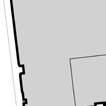

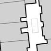


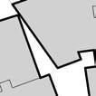


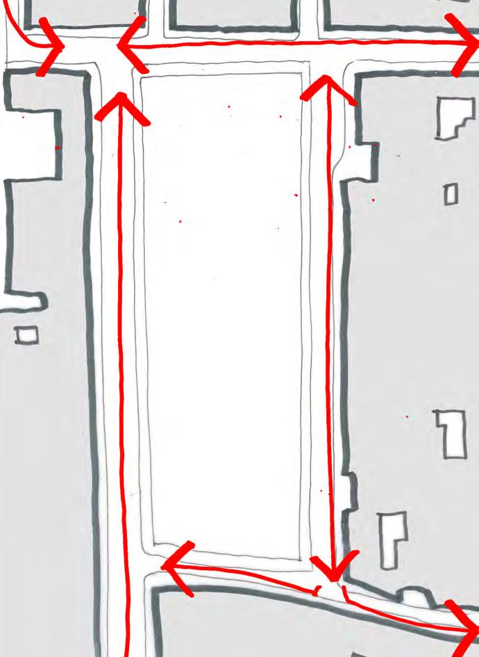


2 The site Site Regents Park The site is bounded by Moxon, Cramer, Aybrook and St. Vincent s. It is set lower than surrounding streets and accessed via a steep ramp off Moxon Its dimensions are 35m by 102m The surrounding streets generally fall 1.5m north to south The car park accommodates approximately 115 car parking spaces arranged in a herringbone layout in two aisles The car park capacity is currently reduced to 95 due to temporary portacabin structures occupying the southern end of the site On Sundays, Marylebone Farmers Market is held on the site between the hours of 10am and 2pm. The market takes up the southern quarter of the site adjacent to St. Vincent, and has approximately 30 to 40 stalls eet r t S k o Aybro treet Cramer S t ree t S r e Bak 102m 35m et St. Vincent h b ryle ig H e e Str on Ma Aerial view of the site Aerial perspective view of the site Sunpath 1. Low morning sun along east facing elevation 2. High southerly sun along shortest southern edge 3. Low evening sun along western edge Prevailing wind South westerly Wider context Marylebone High s bustling streetscape of successful shops and restaurants Characteristic of residential accommodation over shops on street A catalyst for major upgrade in street Opportunity for extending the activity of Marylebone High westwards to connect it with Blandford to the south 3 Traffic 1. Aybrook 1 way towards Moxon 2. 2 way east of Aybrook 3. Cramer 2 way 4. St Vincent exit from Cramer towards Aybrook and Marylebone High only Commercial Residential Community Office The Conran Shop, Marylebone High Wendover Court, Chiltern On street parking provision 1. Aybrook contains a combination of parking bays on both sides of the carriageway 2. 1 obsolete residents bay in Cramer 3. 1 pay by phone bay in Cramer Waitrose loading and deliveries 1. 6 deliveries on average per week day 2. 1 refuse collection per day 3. Approach via Aybrook 4. Exit to Marylebone High via Paddington Gardens Aybrook Marylebone High Informal high street experience Many small independent retailers Smaller scale cafes and restaurants Substantial residential buildings Wendover Court, Chiltern Relevant historic example of residential development Substantial residential building over a parade of shops Uniform yet rich appearance Flat presentation defines the street and public realm Cramer Approach 1. Marylebone High via to the north 2. Marylebone High via St Vincent to the south 3. Blandford via Aybrook to the south west 1 St Vincen t Blan dford Wendover Court, Chiltern Marylebone High Ground floor uses: Plan illustrating how the proposed scheme integrates into the wider context Regents Park Marylebone Road Baker Marylebone High Baker : 8 minutes Marble Arch: 14 minutes Regents Park: 10 minutes Paddington Gardens Bond : 9 minutes Oxford Hyde Park Roads Extremely well served by the local road network Within London Congestion Charging Zone Marylebone Road bus services = 18, 27, 30, 205 and 453 Baker bus services = 2, 13, 30, 74, 82, 113, 139, 189 and 247 PTAL rating = 6b Marylebone High 3 London Underground Baker : Circle, Metropolitan, Hammersmith and City, Jubilee and Bakerloo lines Regents Park: Bakerloo line Bond : Jubilee, Central lines Marble Arch: Central line Cycle Hire 7 cycle stations within an 8 minute walk Public open green space Paddington Gardens - less than 1 minute walk Regent s Park - 10 minutes Hyde Park - 10 minutes Paddington Gardens Formed during 18th Century as an additional burial ground for St. Marylebone Parish Church Formally became recreation grounds in 1895 Directly adjacent to the site Informal garden space Dedicated children s play space Many fine examples of mature London Plane trees Stree t


3 History and surroundings Historical development Site established in the latter part of the 18th Century, with the development of Henry Portman s great estate as the village of Marylebone was absorbed into suburban West London The established pattern of the gridded streets, squares and mews has remained a constant up to today The site was established as an urban block with narrow terraced houses fronting all four sides. These houses largely remained on the site until 1966, with extensions added over time During World War II the site was subject to minor bomb damage The entire site was demolished in 1966 as part of slum clearance and earmarked for the development of a primary school. It has remained a surface car park since then Whilst the street network has remained a constant for 250 years, the building plots have not. Over time sites have amalgamated into larger developments and some significant buildings have been constructed, including St. James Church, St. Vincent s RC Primary School, Faraday House and, most recently Waitrose 1760s 1790s 1870s 1960s Present day 1966 Prior to demolition, the site contained a uniform development of narrow row houses Along Aybrook the houses were 4 storeys tall with more varied buildings on the opposite side of the road Cramer was a residential street, with both sides consistent in alignment and height Aerial view of the site pre-1966 Neighbouring elevations Looking north along Aybrook : The site is on the left St Vincent s RC Primary School 1938 Looking south along Aybrook The site (seen on the left) presents a uniform facade and parapet Waitrose 1997 late C18th s late C18th 1930 The buildings that surround the site are of mixed character, age, quality and scale, with those to the north west along Aybrook being the tallest. Amongst this variety the following characteristics can be determined: None of these buildings were designed to be seen across an open space They were conceived as edge buildings defining streets and to be seen obliquely They are predominantly masonry with punched holes in facades for windows They fill the width of their respective plots They offer a flat presentation to the street With the exception of the Waitrose building, they are an honest construction of their age and typology St Vincent elevation 1980 Cramer elevation late C18th elevation Faraday House 1930s Electricity Board 1900s The Gunmakers 1900s 1890s Aybrook 1930s Aybrook early C20th Aybrook elevation Wider context Conservation area and planning brief Portman Estate Conservation Area Car Park, London W1 Planning Brief Harley Conservation Area Supplementary Planning Document February 2009 The site is located in the heart of the City of Westminster. It is within the Portman Estate Conservation Area and directly adjacent to the Harley Conservation Area. The character of the site is more influenced by Marylebone High (from where the site is approached) than the general characteristics of the Portman Estate. Portman Estate Conservation Area Audit 2003 Site identified as a negative feature The car park detracts from the special character of the estate and presents an opportunity for redevelopment which will enhance the character and appearance of the area Westminster Site Planning Brief 2008 A key planning consideration has been the Planning Brief, compiled by Westminster City Council in February This report comprises the following key points: The site is located outside Westminster UDP s Central Activities Zone but identified as an Opportunity Site Residential and community are specified as preferred uses A preference for public car parking to be retained on site A new development should seek to reinstate all four streets which define the site The facades of a new development should be three or four storeys in height The proposals have been considered in the context of the borough s Unitary Development Plan (UDP) and the Local Development Framework (LDF), as well as the Mayor s London Plan.

.")


4 Proposal The scheme The proposal comprises: Three main levels of residential apartments Two set back roof floors on levels 4 and 5 A central covered courtyard Commercial and community at ground and lower ground floors A public car park at Basement 1 level, replicating the existing surface car park on the site A private residential car park at Basement 2 level m m Courtyard m 5 Residential 2 residential entrances and a pedestrian entrance to the car park off Aybrook 4 Residential m Commercial Retail and restaurant units activate Moxon, Aybrook and Cramer frontages, as well as part of the St. Vincent frontage 11 retail / restaurant units (A1 / A3). No unit is larger than 500m2 There is a maximum of 4 restaurants 1 health club (D2) located on Aybrook m Cramer Servicing and logistics The car park ramp is located towards the southern end of Aybrook Refuse will be collected from a temporary refuse store on Cramer. This is situated opposite the loading bay to Waitrose to minimise length of blank street frontage Aybrook Retail / restaurant Retail / restaurant Commercial G Retail / restaurant Ramp Access All apartments are designed to comply with or exceed standards set out in Approved Document M and the London Housing Design Guide All apartments accessible by wheelchair users Three apartments will be adapted for disabled residents. Specific flats will be defined in detailed design through coordination with officers and the preferred housing provider Public car park Parking Private car park Private car park Section Community Community provision is located at the south end of the site, complementing the St. Vincent s RC Primary School and the St. Marylebone CE School It is predominantly at lower ground level Entrance at the centre of St. Vincent facade, visible from Marylebone High Natural daylight into space via pavement rooflights and void at entrance Accessible by all and serviced with both stair and lift. A needs based assessment has been undertaken, which has identified a specific need for a local GP practice. The Applicant is in discussion with local surgery providers Line of pavement rooflight Service corridor Ramp up to street Retail loading bay Commercial refuse store Affordable residential play space Private residential entrance Community Affordable residential bays Commercial bays On site management bays Lower ground floor Health club entrance Basement 1 It will be a curated and managed facility and its uses could include: Gallery space Auditorium for 250 seats Educational assembly Exhibition hall Home of Marylebone Farmers Market Other Use as gallery space Use as auditorium 10 Use as other type of market Access to Waitrose delivery bay maintained Access to ramp, pedestrian car park entrance, and affordable residential entrance maintained Cramer The Community Hall (Marylebone Hall) is located at the intersection of Cramer and St. Vincent. The hall acts as an anchor at the south eastern corner of the scheme, and is visible from Marylebone High. It measures 18m wide and 25m in length. Aybrook Marylebone Hall Temporary refuse store Car park entrance ramp Pedestrian entrance to car park Access to existing residential car park restricted Affordable residential entrance Marylebone Hall St Vince nt Stalls can spill out onto street on market days Market visible from Marylebone High Indicative stall layout for the Marylebone Farmers Market Community entrance Ground floor plan


5 Living Kitchen Bathroom Porch Kitchen Study Hall Hall Ensuite Ensuite Living Bedroom Bedroom Living Bedroom Bedroom Winter garden Verandah Typical affordable apartment Typical private apartment Affordable residential Private residential Affordable residential apartments are arrayed around the south core Apartments are accessed via a central core with integrated storage facilities dedicated to each apartment Single glazed winter gardens on east and west facades serve as private amenity space, and act as a thermal buffer during cold winter months Type 1 bed 2 bed 3/4 bed Total Private Affordable Total Design principles in generating the floorplan include: A clear sense of direction and orientation from street to front door No internal corridors Open plan layouts to apartments Apartments are dual aspect They have a front porch, which acts as an intermediate threshold All apartments have external verandahs % 18% 47% 35% Apartment mix Courtyard An amenity that allows daylight to penetrate into the heart of the building A covered external space, naturally ventilated while providing protection from rain and snow Residents access their apartments via bridges running down the central axis Promotes a clear sense of direction and orientation at all times Plant species that thrive in shaded environments will be chosen Resident journey North core Cramer Residents approach apartments via bridges located on the central axis of the courtyard Aybrook Panoramic lifts Verandahs Tall stemmed birch trees South core Winter gardens for affordable apartments St Vince nt Balcony for south facing affordable apartment Typical residential floor plan Courtyard View from the courtyard bridge looking into an apartment Section through courtyard


6 Materials Elevation in detail In detail, the articulation of the facade is influenced by the accommodation behind. All bedrooms have two windows with cast iron juliette balconies that add character to the facade and act as a screening element from the street below The full height windows accentuate the vertical rhythm along the facade All living rooms open onto a verandah, with cast iron balustrades At the parapet there is a lantern frieze, a signature piece of the design, which defines the building whilst also acting as the balustrade to the terrace behind Shopfronts comprise a family of components - stall risers, awning boxes, metal frames, doors, and ventilation grillages at high level Metal Frieze Elevation Section Glazed terracotta Plan Lantern frieze Cast iron balconies The public art component of the proposals will be built in to the design rather than stuck on The lantern frieze unifies the scheme and is a signature piece contributing to the rich architectural character of Marylebone It is constructed from cast ceramic elements and will celebrate the crafted process of its manufacture Softly lit - it will offer confident presentation to the streetscape Bronzed metal shopfronts Glass Stall risers Lantern frieze sketches Part elevation Materials Further studies of glazed terracotta Four indicative colours chosen 5 building blocks articulated Plan 05 Taupe Blue Ivory Ground Glazed terracotta mock up Green Section Detail elevation


7 Sustainability Courtyard 1. Air moving over the courtyard creates a negative pressure, which in turn draws air in at lower level The courtyard is central to the energy strategy of the building. Key aspects of the courtyard include: Building axis oriented north-south assists ventilation Air is drawn in at first floor level into base of courtyard Private apartments: fresh air in through courtyard, and extracted into street 4. Air rises up through central courtyard Verandah Fresh air in via courtyard and extracted to shaded verandah zone. Services include: Instantaneous domestic hot water Underfloor heating MVHR (Mechanical Ventilation Heat Recovery) with intake from covered courtyard and exhaust to external facade Separate cooker hood extract to external facade Verandah in section: shade from summer sun 2. Air is drawn in at discrete locations into the base of the courtyard Verandahs in plan: shade from high level midday sun 3. Fresh air is pulled into the apartments from the courtyard Private apartment verandah Wind and orientation Green roofs Winter garden Floors 04 and 05 will have green roof systems, opportunity for sizeable plants to be planted within the soil build up Green roof with photovoltaics. Plant will be minimised, to comprise two adiabatic chillers and several ventilation extracts, including basement extract ventilation shaft. Majority grouped around south core Winter gardens minimise solar gain and overheating in summer months, and provide a thermal buffer during colder winter months. Fresh air in via inlet in core. Extracted to winter garden zone. Affordable residential apartment services include: Instantaneous domestic hot water Heating via radiators MVHR (whole house ventilation) with intake and exhaust to external facade Winter gardens: Mid-season and winter configuration Green terraces Roof levels Affordable apartment winter garden Site wide heat network Energy centre Winter gardens: Summer configuration Covered courtyard Combined Heat and Power (CHP) External circulation routes Roof and facade mounted photovoltaics Low energy solution: Indoor tempered environment Private space Winter gardens Thermal buffer Reduction in heating loads Private space Verandahs Solar shading Green roof and terraces St Vincent Rainwater attenuation tank Code for Sustainable Homes Level 4 Cross section through the proposed development BREEAM Excellent 40% CO2 reduction beyond Part L % CO2 reduction beyond Part L 2013 Grey water recycling


8 Public Realm External works and landscape Indicative wider public realm works Cramer Widened by on average 1m Existing traffic routes maintined, as well as access to Waitrose loading bay and existing residential car park 2 car parking spaces removed for ramp entrance St Vincent New pavement Existing traffic routes maintained Lamp post Retained on-street car parking Traffic direction Lighting Aybrook New pavements Trees planted at regular intervals along the length of the street Existing traffic routes maintained Shared surface introduced in high quality granite paving Existing traffic routes maintained Cramer Shared surface introduced in high quality granite paving Existing traffic routes maintined, as well as access to Waitrose loading bay and existing residential car park St Vincent Shared surface introduced in high quality granite paving Existing traffic routes maintained St Vi ncen t Stre et Paddington Gardens 2 car parking spaces removed for ramp entrance Trees introduced to Aybrook. Cumulatively further 2 car parking spaces removed Hornbeam tree Shared surface on Kingly, W1 Granite setts and paving Aybrook, looking north towards Cramer Cramer Widened by on average 1.2m New pavement Existing traffic routes maintained Marylebone High Paddington Gardens Aybrook Aybrook Widened by on average 1m New pavements Two parking spaces removed in front of new entrance to car park ramp Existing traffic routes maintained An wider public realm enhancement comprises: Aybrook As part of the civic realm enhancements, the scheme includes: St. Vincent, looking east towards Marylebone High St Vi ncen t Stre et


9 Marylebone High Cramer Aybrook elevation The development extends the retail offer westwards towards Paddington Gardens The pavement is widened on the southern side by 1.2m Awnings allow for street activity and complement the neighbouring shops and restaurants An ivory coloured glazed terracotta facade and cast iron metalwork N Looking west from Marylebone High looking west Looking east from Paddington Gardens Paddington Gardens


10 Cramer St. Vincent Marylebone Hall Refuse store Cramer elevation The Cramer elevation presents a uniform frontage onto the street The street is widened by 1m The building parapet broadly aligns with that of the Waitrose building opposite As with Aybrook, a parade of shops and restaurants, inspired by Wendover Court, activates the street, leading to the Marylebone Hall at the south The elevation is articulated with the verandahs along the length of the street N Looking north from St. Vincent Cramer looking south Looking south from Garbutt Place


11 Aybrook St. Vincent Residential entrance Car park Residential entrance Aybrook elevation The development is expressed as 4 blocks, complementing the scale of its neighbours. Retail units with bronze shopfronts activate the street The street is widened by 1m Affordable accommodation (in the foreground of the image below) is constructed to the same quality and appearance as the private residential accommodation Strong parapet and signature frieze shields upper terraces and roof terrace accommodation N Looking north from Blandford Aybrook looking north Looking south from


12 St. Vincent Aybrook Cramer Community entrance Marylebone Hall St. Vincent elevation The development terminates the view along St. Vincent from Marylebone High. Community allocation and Marylebone Hall complement the schools opposite Residential balcony adds rhythm to the facade MH N Looking east from Aybrook St. Vincent looking west Marylebone Hall when in use as a farmers market Marylebone High
DESIGN, ACCESS & PLANNING STATEMENT
 (MADRON STREET) LONDON SE1 5UB DESIGN, ACCESS & PLANNING STATEMENT The architectural response for the site has been designed with regard to the following: The New Southwark Plan The London Plan: Spatial
Design and Access Statement Volume III Part 6 of 9 Plot A1. May 2018 Allies and Morrison
 Design and Access Statement Volume III Part 6 of 9 Plot A1 May 2018 Allies and Morrison 6 OFFICE 135 CANADA WATER MASTERPLAN PLOT A1 Design and Access Statement May 2018 6.1 Introduction The office development
Southall Gas Works: Design Statement by URBED with Capita Symonds, WYG, Lovejoys, Jestico and Whiles and RPSDesign Statement. Typologies.
 9 Typologies Page 95 9:1. Approach to typologies 1. 3. 2. 4. Far left: Traditional walk-up flats: With 2 of 4 flats per landing off a core. The bottom plan shows a perimeter block arrangement based on
WELCOME TIMESCALES. Thank you for attending Anthology s final public exhibition on the emerging plans for Kennington Stage. ANTHOLOGY S COMMITMENTS
 WELCOME Thank you for attending Anthology s final public exhibition on the emerging plans for Kennington Stage. Since the second consultation in October 2018, which asked your views on the preferred approach,
MILL ROAD DEPOT, CAMBRIDGE Design and Access Statement December
 66 MILL ROAD DEPOT, CAMBRIDGE Design and Access Statement December 2017 67 HOOPER STREET EAGLE GREEN EAGLE FOUNDRY STREET C H I S H O L M T R A I L THE LIMES Headly Street is the first new street encountered
Sotheron Place, Fulham
 5 Minute Walk Stamford Bridge BUSES Fulham Broadway Fulham Road King s Road BUSES Harwood Road SITE 5 Minute Walk BUSES Wandsworth Bridge Road Imperial Road River Thames Imperial Wharf Chelsea Harbour
Sherwood Forest (Trinity) Housing Corporation. Urban Design Brief
 Housing Corporation. Urban Design Brief") Sherwood Forest (Trinity) Housing Corporation Sherwood Place Affordable Housing Apartments Trinity Presbyterian Church Orchard Park Nursery School 590 Gainsborough Road, London Urban Design Brief REVISED
Sherwood Forest (Trinity) Housing Corporation Sherwood Place Affordable Housing Apartments Trinity Presbyterian Church Orchard Park Nursery School 590 Gainsborough Road, London Urban Design Brief REVISED
Jasper 115 Street DC2 Urban Design Brief
 Jasper 115 Street DC2 Urban Design Brief Greenlong Construction Ltd. Stantec Consulting Ltd. 2017 Overview The proposed rezoning application supports the development of two mixed-use high-rise buildings
SCHEDULE 32 TO CLAUSE DESIGN AND DEVELOPMENT OVERLAY
 --/--/20-- Proposed GC81 SCHEDULE 32 TO CLAUSE 43.02 DESIGN AND DEVELOPMENT OVERLAY Shown on the planning scheme map as DDO32. FISHERMANS BEND WIRRAWAY PRECINCT 1.0 Design objectives --/--/20-- Proposed
Requirements for accepted development and assessment benchmarks for assessable development
 9.3.10 Small Lot Housing Design Code 9.3.10.1 Application (1) This code applies to development identified as requiring assessment against the Small Lot Housing Design Code by the categories of development
3.1 Existing Built Form
 3.1 Existing Built Form There is a wide variety of built form in the study area, generally comprising 2 and 3 storey buildings. This stretch of Queen Street East is somewhat atypical of Toronto's main
5.0 Development Strategy 32
 5.0 Development Strategy 32 Objectives To ensure the long term future of the Bazaar Market building by giving it a higher order retail use, reflecting the development of retail on the Guy s site To ensure
SCHEDULE 31 TO CLAUSE DESIGN AND DEVELOPMENT OVERLAY
 --/--/20-- Proposed GC81 SCHEDULE 31 TO CLAUSE 43.02 DESIGN AND DEVELOPMENT OVERLAY Shown on the planning scheme map as DDO31. FISHERMANS BEND SANDRIDGE PRECINCT 1.0 Design objectives --/--/20-- Proposed
Appendix1,Page1. Urban Design Guidelines. Back to Back and Stacked Townhouses. DRAFT September 2017
 Appendix1,Page1 Urban Design Guidelines DRAFT September 2017 Back to Back and Stacked Townhouses Appendix1,Page2 Table of Contents 1 Introduction 1 1.1 Purpose 1 1.2 Urban Design Objectives 1 1.3 Building
H6 Residential Terrace Housing and Apartment Buildings Zone
 H6. Residential Terrace Housing and Apartment Buildings Zone [CIV-2016-404-002333: Franco Belgiorno-Nettis]-Note: The properties affected by this appeal are identified on the Auckland Unitary Plan viewer.
18. Appendix H Urban Design Panel Presentation
 18. Appendix H Urban Design Panel Presentation new hotel and serviced apartments 12 lakewood court manukau city URBAN DESIGN PANEL PRESENTATION site context plan neighbourhood analysis plan site context
A mix of uses. Housing:
 7 Massing and uses Page 79 7:1. A mix of uses % Total Habitable Occ/ People Rooms HR Studio 6.8% 308 1 0.90 277 1 bed 32.0% 1442 2 0.90 2,595 2 bed 37.6% 1691 3 0.90 4,567 3 bed 21.2% 955 4 0.90 3,438
The demolition required for the project came before the Landmark Preservation Commission (LPC) on November 3, 2016, where no action was taken.
 on November 3, 2016, where no action was taken.") D E S I G N R E V I E W C O M M I T T E E S t a f f R e p o r t 2072 ADDISON STREET PRELIMINARY DESIGN REVIEW For Committee Discussion/ Majority Recommendation JULY 20, 2017 Design Review #DRCP2016-0002
D E S I G N R E V I E W C O M M I T T E E S t a f f R e p o r t 2072 ADDISON STREET PRELIMINARY DESIGN REVIEW For Committee Discussion/ Majority Recommendation JULY 20, 2017 Design Review #DRCP2016-0002
1 AYLESBURY ESTATE Development Specification (Consolidated) November 2015
 November 2015") AYLESBURY ESTATE Specification (Consolidated) November 2015 Quality Management Issue/revision Version 1 Version 2 Remarks Revised to incorporate changes to Plot 18 floorspace Date 20/02/2015 24/11/2015
AYLESBURY ESTATE Specification (Consolidated) November 2015 Quality Management Issue/revision Version 1 Version 2 Remarks Revised to incorporate changes to Plot 18 floorspace Date 20/02/2015 24/11/2015
H4. Residential Mixed Housing Suburban Zone
 H4. Residential Mixed Housing Suburban Zone H4.1. Zone description The Residential Mixed Housing Suburban Zone is the most widespread residential zone covering many established suburbs and some greenfields
900 BURRARD STREET CD-1 GUIDELINES (BY-LAW NO. 6421) (CD-1 NO. 229) CONTENTS. 1 Application and Intent... 1
 (CD-1 NO. 229) CONTENTS. 1 Application and Intent... 1") 50 City of Vancouver Land Use and Development Policies and Guidelines Community Services, 453 W. 12th Ave Vancouver, BC V5Y 1V4 F 604.873.7344 fax 873.7060 planning@city.vancouver.bc.ca 900 BURRARD STREET
50 City of Vancouver Land Use and Development Policies and Guidelines Community Services, 453 W. 12th Ave Vancouver, BC V5Y 1V4 F 604.873.7344 fax 873.7060 planning@city.vancouver.bc.ca 900 BURRARD STREET
Part 4.0 DEVELOPMENT REGULATIONS
 M A I N S T R E E T N O R T H Part 4.0 DEVELOPMENT REGULATIONS 4.1 Districts 4.2 Permitted and Prohibited Uses, Standards and Standard Specific Criteria and Other General Provisions 4.3 DPS REGULATIONS
DEVONSHIRE PLACE W1 MARYLEBONE
 16 DEVONSHIRE PLACE W1 MARYLEBONE 16 DEVONSHIRE PLACE, MARYLEBONE W1 Prominently situated in the heart of Marylebone Village, a short walk from both Regent s Park and Hyde Park, 16 Devonshire Place provides
Evidential value The building has low evidential value, and the site is thought to have low archaeological potential.
 Friends Meeting House, Oswestry Oak Street, Oswestry, SY11 1LJ National Grid Reference: SJ 28855 29901 Statement of Significance This small meeting house was built in 1934 as an Anglican mission hall,
Potential Building 6-Storey (Allowable) 50' Shoulder ALEXANDER STREET. Evelyne Saller Centre Main Entrance. Rodan Lodge Entry Porch
 50' Shoulder ALEXANDER STREET. Evelyne Saller Centre Main Entrance. Rodan Lodge Entry Porch") DESIGN RATIONALE Potential Building 6-Storey (Allowable) 9th Floor Setback Historic Marr Hotel 4-Storey Building Form of Development and Public Realm The form of the building was initially dictated by
DESIGN RATIONALE Potential Building 6-Storey (Allowable) 9th Floor Setback Historic Marr Hotel 4-Storey Building Form of Development and Public Realm The form of the building was initially dictated by
H5. Residential Mixed Housing Urban Zone
 H5. Residential Mixed Housing Urban Zone [ENV-2016-AKL-000197: Robert Adams] Addition sought H5.1. Zone description The Residential Mixed Housing Urban Zone is a reasonably high-intensity zone enabling
LITTLE MOUNTAIN ADJACENT AREA REZONING POLICY
 LITTLE MOUNTAIN ADJACENT AREA REZONING POLICY JANUARY 2013 CONTENTS 1.0 INTENT & PRINCIPLES...1 2.0 APPLICATION...2 3.0 HOUSING TYPES, HEIGHT & DENSITY POLICIES...3 3.1 LOW TO MID-RISE APARTMENT POLICIES...4
College Avenue. Sowers Street. Calder Way. Beaver Avenue
 K L M Illustrative Master Plan: Collegiate District Calder Way Beaver Avenue High Street ner 16 Sowers Street Stre et 17 Hetzel Street 18 Gar Heister Street 15 Collegiate District 183 4-C: East End Collegiate
H5. Residential Mixed Housing Urban Zone
 H5. Residential Mixed Housing Urban Zone H5.1. Zone description The Residential Mixed Housing Urban Zone is a reasonably high-intensity zone enabling a greater intensity of development than previously
MOTEL STRIP LOCATION 1. VIEW CORRIDORS/RESIDENTIAL STREETS URBAN DESIGN GUIDELINES
 Development in the former Motel Strip (Humber Bay Shores Area) will be consistent with the following urban design guidelines. The guidelines correspond to the Motel Strip Secondary Plan #11, found in Chapter
paddington house words by Tom Rubenach
 paddington house words by Tom Rubenach An honest building can be difficult to come by, particularly with residential architecture. The story told from the street is often disingenuous with respect to the
Angel Building is the re-invention of an unloved early 1980 s commercial building located on one of London s historic focal points where City Road
 ANGEL BUILDING Angel Building is the re-invention of an unloved early 1980 s commercial building located on one of London s historic focal points where City Road and St. John Street meet Pentonville Road
Pre-Applica on Design Statement : Residen al Development, The Gas Works, 113 Bury Road, The ord, Norfolk 1
 13-188 Pre-Applica on Design Statement: Residen al Development, The Gas Works, 113 Bury Road, The ord, Norfolk Prepared by: Gary Johns Architects Date: October 2015 15-311 Pre-Applica on Design Statement
Urban Design Brief (Richmond) Corp. 1631, 1635, 1639, 1643 and 1649 Richmond Street City of London
 Corp. 1631, 1635, 1639, 1643 and 1649 Richmond Street City of London") Urban Design Brief 1635 (Richmond) Corp. 1631, 1635, 1639, 1643 and 1649 Richmond Street City of London Site Plan Control Application Holding Provision Application April 1, 2015 Prepared for: Rise Real
Urban Design Brief 1635 (Richmond) Corp. 1631, 1635, 1639, 1643 and 1649 Richmond Street City of London Site Plan Control Application Holding Provision Application April 1, 2015 Prepared for: Rise Real
Natural Light & Ventilation. Sources. Regulation 45 (1) & 45 (2) A Public road with right of way. A Courtyard or Open Space within the site.
 & 45 (2) A Public road with right of way. A Courtyard or Open Space within the site.") Natural Light & Ventilation Sources Regulation 45 (1) & 45 (2) A Public road with right of way. A Courtyard or Open Space within the site. Natural Light & Ventilation Standard Light Plane Regulation 51
Natural Light & Ventilation Sources Regulation 45 (1) & 45 (2) A Public road with right of way. A Courtyard or Open Space within the site. Natural Light & Ventilation Standard Light Plane Regulation 51
Urban Design Brief Dundas Street. London Affordable Housing Foundation. November Zelinka Priamo Ltd.
 Urban Design Brief 1039-1047 Dundas Street London Affordable Housing Foundation November 2017 Zelinka Priamo Ltd. TABLE OF CONTENTS Page No. INTRODUCTION... 3 SECTION 1 LAND USE PLANNING CONTEXT... 3 1.1
Architectural Narrative Columbia & Hawthorn responds to its unique location as a gateway to Little Italy and the Bay in several ways. 1. The visual ch
 Architectural Narrative Columbia & Hawthorn responds to its unique location as a gateway to Little Italy and the Bay in several ways. 1. The visual character of the building is intended to symbolically
Design and Access Statement Volume III Part 4 of 9 Plot A1. May 2018 Allies and Morrison
 Design and Access Statement Volume III Part 4 of 9 Plot A1 May 2018 Allies and Morrison 4 PROPOSED SCHEME 67 CANADA WATER MASTERPLAN PLOT A1 Design and Access Statement May 2018 4.1 Use Plot A1 is a mixed-use
Multi-unit residential uses code
 9.3.11 Multi-unit residential uses code 9.3.11.1 Application (1) This code applies to assessable development identified as requiring assessment against the Multi-unit residential uses code by the tables
4.5 Residential mix. MARLOWE ROAD DESIGN AND ACCESS STATEMENT May 2015
 4.5 Residential mix Policy WS9 of the London Borough of Waltham Forrest Wood Street Area Action Plan states that development proposals will be required to provide a balanced provision of dwelling sizes
PREPARED FOR: ADI DEVELOPMENT GROUP INC.
 Acronym Urban Design and Planning/Mark Sterling Consulting Inc. 111 Clendenan Avenue, Toronto, Ontario M6P 2W7 URBAN DESIGN BRIEF PROPOSED DEVELOPMENT 4880 VALERA ROAD, CITY OF BURLINGTON PREPARED FOR:
Article 3. SUBURBAN (S-) NEIGHBORHOOD CONTEXT
 NEIGHBORHOOD CONTEXT") Article 3. SUBURBAN (S-) NEIGHBORHOOD CONTEXT this page left intentionally blank Contents ARTICLE 3. SUBURBAN (S-) NEIGHBORHOOD CONTEXT DIVISION 3.1 NEIGHBORHOOD CONTEXT DESCRIPTION...3.1-1 Section 3.1.1
Article 3. SUBURBAN (S-) NEIGHBORHOOD CONTEXT this page left intentionally blank Contents ARTICLE 3. SUBURBAN (S-) NEIGHBORHOOD CONTEXT DIVISION 3.1 NEIGHBORHOOD CONTEXT DESCRIPTION...3.1-1 Section 3.1.1
H4. Residential Mixed Housing Suburban Zone
 H4. Residential Mixed Housing Suburban Zone H4.1. Zone description The Residential Mixed Housing Suburban Zone is the most widespread residential zone covering many established suburbs and some greenfields
Description: Change of use from job centre (A1) to 15 bedroom sui generis HMO (C4)
 to 15 bedroom sui generis HMO (C4)") 2018/0656 Applicant: Job Centre Plus, c/o Andrew Bailey Architects Description: Change of use from job centre (A1) to 15 bedroom sui generis HMO (C4) Site Address: Job Centre Plus, High Street, Goldthorpe,
2018/0656 Applicant: Job Centre Plus, c/o Andrew Bailey Architects Description: Change of use from job centre (A1) to 15 bedroom sui generis HMO (C4) Site Address: Job Centre Plus, High Street, Goldthorpe,
Rawlinson House, Lewisham, London SE13 5EL
 Rawlinson House, Lewisham, London SE13 5EL Client: Lewisham Homes Old Town Hall Catford London SE6 4RU Date: 18 February 2016 Job No: 2540-MA-N-RP-0001-D00 Martin Arnold Ltd 4 Gunnery Terrace The Royal
St Johns Road, Isleworth
 St Johns Road, Isleworth and Access Statement Concept sketch looking south on St Johns Road rocktownsend.co.uk Date Contents. The Process. Consultations. Use. Amount 5. Layout. Scale. Landscaping 8. Appearance
Grosvenor House, Drury Lane, London, WC2. October 2003
 Grosvenor House, 141-143 Drury Lane, London, WC2 October 2003 The material contained in this document is private and confidential and for issue to and use by the client and the project team only. Acknowledgments
Small Lot Housing Code (June 2013):
:") Small Lot Housing Code (June 2013): Standards that establish a building envelope for a single Class 1a building and associated Class 10 buildings on an allotment. If an adjoining allotment is not subject
Small Lot Housing Code (June 2013): Standards that establish a building envelope for a single Class 1a building and associated Class 10 buildings on an allotment. If an adjoining allotment is not subject
Kassner Goodspeed Architects Ltd.
 Kassner Goodspeed Architects Ltd. 29 & State Street Developments Ltd. The Promenade at Robie South Case 20761: Application for Development Agreement Design Rationale The land assembly is a 1.3 Acre parcel
Proposals for the Redevelopment of the Magistrates Court & Police Station, Normandy Street / Orchard Lane, Alton
 THE SITE THE SITE The Site in Context WELCOME Welcome to our public exhibition in connection with our draft proposals ahead of a planning application being proposals for the redevelopment of the magistrates
5.1 Site Planning & Building Form
 5 Built Form 5.1 Site Planning & Building Form Pearson Dogwood Policy Statement Site Planning & Building Form The redevelopment of Pearson Dogwood will create an attractive and sustainable urban community
Residential Design Guide Appendices
 Residential Design Guide Appendices Appendix 1 Thorndon Appendix 2 Mt Victoria Appendix 3 Aro Valley Appendix 4 Southern Inner Residential Areas Appendix 5 Oriental Bay Appendix 6 Residential Coastal Edge
8.5.1 R1, Single Detached Residential District
 8.5.1 R1, Single Detached Residential District The purpose of this district is to provide for residential development in the form of single detached dwellings. Dwelling, Single Detached Home Business,
108 Holders Hill Road London NW4 1LJ
 Location 108 Holders Hill Road London NW4 1LJ Reference: 16/4234/FUL Received: 28th June 2016 Accepted: 7th July 2016 Ward: Finchley Church End Expiry 1st September 2016 Applicant: Proposal: Mr b menahem
Division 8 General Urban (T4) Zone: Assessment Criteria and Assessment Tables
 Zone: Assessment Criteria and Assessment Tables") Division 8 General Urban (T4) Zone: Assessment Criteria and Assessment Tables 15.8.1 General Urban (T4) Zone The provisions in this division relate to the General Urban (T4) Zone as follows overall outcomes
Division 8 General Urban (T4) Zone: Assessment Criteria and Assessment Tables 15.8.1 General Urban (T4) Zone The provisions in this division relate to the General Urban (T4) Zone as follows overall outcomes
REVISED- DEVELOPMENT APPLICATION HEALTH & WELLNESS CENTER 193 SOUTH TERRACE, FREMANTLE DATE JOB NUMBER PPA16101
 REVISED- DEVELOPMENT APPLICATION 193 SOUTH TERRACE, FREMANTLE DATE 17.11.17 JOB NUMBER PPA16101 LOUISA STREET NELSON STREET SOUTH TERRACE No.193 LOT 1 ROSE STREET ER M UM L S ES O Z CO REE B LOCALITY PLAN
BYLAW NUMBER 159D2016
 CPC2016-164 ATTACHMENT 1 BEING A BYLAW OF THE CITY OF CALGARY TO AMEND THE LAND USE BYLAW 1P2007 (LAND USE ) * * * * * * * * * * * * * * * * * * * * * * * * * * * * * * * * WHEREAS it is desirable to amend
2014 OSSC CHAPTER 10 - MEANS OF EGRESS TABLE OF CONTENTS
 2014 OSSC CHAPTER 10 - MEANS OF EGRESS TABLE OF CONTENTS Section 1001 ADMINISTRATIVE 1001.1 General 1001.2 Alterations to existing means of egress 1001.3 Maintenance 1001.4 Fire safety and evacuation plans
Ku-ring-gai Local Environmental Plan No 194
 New South Wales Ku-ring-gai Local Environmental Plan No 194 under the Environmental Planning and Assessment Act 1979 I, the Minister Assisting the Minister for Infrastructure and Planning (Planning Administration),
London Legacy Development Corporation Quality Review Panel. Report of Planning Application Review Meeting: Strand East Plot R6
 London Legacy Development Corporation Quality Review Panel : Strand East Plot R6 Level 10, 1 Stratford Place, Montfichet Road, London E20 1EJ Panel Peter Studdert (chair) John Lyall Tom Lonsdale Attendees
2018 CSBC / 2018 CSFSC Part III. Chapter #10. Means of Egress. Table of Contents. Based on the 2015 IBC and the 2015 IFC.
 2018 CSBC / 2018 CSFSC Part III. Chapter #10. Means of Egress. Table of Contents. Based on the 2015 IBC and the 2015 IFC. October 23, 2018 Section 1001. Administration. See Section 107.2.3 for Egress Drawing
Small Lot Housing Code
 Small Lot Housing Code AUGUST 2014 SMALL LOT HOUSING CODE Level 29, 35 Collins Street Melbourne Victoria 3000 Telephone: 03 9651 9600 Facsimile: 03 9651 9623 Email: Info@mpa.vic.gov.au www.mpa.vic.gov.au
OVERVIEW PROJECT SUMMARY
 OVERVIEW Good terraced house development that creates an excellent edge to the street while accommodating the car via rear lane access. PROJECT SUMMARY The six terraced houses at Buckley Avenue are part
RM-7, RM-7N and RM-7AN Districts Schedules
 1 Intent Districts Schedules The intent of this schedule is to encourage development of ground-oriented stacked townhouses or rowhouses, while continuing to permit lower intensity development. In RM-7AN,
q/., S Lt _ _.._--.
 ~'ii..,... """:." LONDON BOROUGH OF LEWISHAM PLANNING SERVICE LIFETIME HOMES STATEMEf\ t:b~ DEVELOPMENT OF Land to the RIO 13 Calmant Road BR14BY q/., S Lt-7- ----------------.._---- ---_.._--. CASE No
PROVIDENCE (BOLLARD BULRUSH SOUTH) LOCAL DEVELOPMENT PLAN. 2263Rep146E
 LOCAL DEVELOPMENT PLAN. 2263Rep146E") 1 PROVIDENCE (BOLLARD BULRUSH SOUTH) Prepared by: PO Box 796 Subiaco WA 6904 t: 9382 1233 f: 9382 1127 www.cleplan.com.au October 2013 This Local Development Plan has been approved by Council under the
1 PROVIDENCE (BOLLARD BULRUSH SOUTH) Prepared by: PO Box 796 Subiaco WA 6904 t: 9382 1233 f: 9382 1127 www.cleplan.com.au October 2013 This Local Development Plan has been approved by Council under the
Urban Design Brief 6233, 6237, 6241 and 6245 Main Street, Stouffville Pace Savings and Credit Union June 15, 2012
 Pace Savings and Credit Union June 15, 2012 1.0 Introduction 3 2.0 The Proposal 4 3.0 Site and Development Context 5 4.0 Planning Background 7 5.0 Design Rationale 8 5.1 Limited Opportunities 5.2 Overall
Response to Urban Design Panel Comments
 Response to Urban Design Panel Comments The project was brought forward to the International Urban Design Panel on Wednesday April 20th 2011. While the panel felt that the density and height was approvable,
BYLAW NO. 15/026 A BYLAW OF THE REGIONAL MUNICIPALITY OF WOOD BUFFALO TO AMEND THE LAND USE BYLAW NO. 99/059
 Attachment 2 BYLAW NO. 15/026 A BYLAW OF THE REGIONAL MUNICIPALITY OF WOOD BUFFALO TO AMEND THE LAND USE BYLAW NO. 99/059 WHEREAS Section 639 of the Municipal Government Act requires every municipality
PORT PHILLIP PLANNING SCHEME. Condition
 SCHEDULE 1 TO THE CAPITAL CITY ZONE Shown on the planning scheme map as CCZ1. FISHERMANS BEND URBAN RENEWAL AREA Purpose To use and develop the Fishermans Bend Urban Renewal Area generally in accordance
Part 9 Specific Land Uses - Multi Dwelling Housing
 11 MULTI DWELLING HOUSING This section of the DCP only provides Council s specific requirements for Multi Dwelling Housing developments. Other requirements that must be addressed are contained in the relevant
Advisory Design Panel Report For the Meeting of February 27, 2019
 Advisory Design Panel Report For the Meeting of February 27, 2019 To: Advisory Design Panel Date: February 15, 2019 From: Subject: Moira Wilson, Senior Planner - Urban Design 952 Johnson Street and 1400
Urban Design Brief. Italian Seniors Project 1090, 1092, 1096 Hamilton Road City of London
 Urban Design Brief Italian Seniors Project City of London October 1, 2017 TABLE OF CONTENTS Page No. INTRODUCTION... 2 1.0 LAND USE PLANNING CONCEPT... 2 1.1 Subject Lands... 2 1.2 Official Plan and Zoning
6.0 DEVELOPMENT OPPORTUNITIES
 6.0 DEVELOPMENT OPPORTUNITIES Urban neighbourhoods are in a constant process of change and evolution. In successful cities, such as Ottawa, development pressures are a constant. To help direct this growth
TEN LIGHT MIXED USE 10 Light Street Baltimore, MD
 TEN LIGHT MIXED USE 10 Light Street Baltimore, MD Baltimore s most iconic high-rise, as recognized by many of her citizens, was first a financial headquarters building known as the Baltimore Trust Building,
Policy and Standards for Public Local Residential Streets And Private Streets
 Appendix A City of Toronto Development Infrastructure Policy & Standards Policy and Standards for Public Local Residential Streets And Private Streets November 2005 Policy and Standards For Public Local
CHELSEA RESIDENTIAL DEVELOPMENT PORTFOLIO
 CHELSEA RESIDENTIAL DEVELOPMENT PORTFOLIO LOCATION MAP 14-15 Childs Place Cromwell Road Warwick Road Earls Court Road W.8 Earl s Court Earls Court Exhibition Centre Cromwell Road 180 Finborough Road Fulham
New Marrickville Library
 1 New Library Precinct C Heritage Cottages Commericial Use Precinct C New Residential Building 2 & 8 storeys Precinct D New Residential Building 6 storeys Precinct D Possible Refurbishment of Existing
RM-8 and RM-8N Districts Schedule
 Districts Schedule 1 Intent The intent of this schedule is to encourage development of ground-oriented stacked townhouses or rowhouses, including courtyard rowhouses, while continuing to permit lower intensity
The Cannery Marketplace Narrative. Purpose: Site Design Approach: Cannery Commerce District 10/18/2017
 The Cannery Marketplace Narrative Cannery Commerce District 10/18/2017 Purpose: A number of entitlements are being requested for the Cannery Marketplace inclusive of a Master Conditional Use Permit (Master
ARTICLE 4: SCHEDULE OF DISTRICT, USE AND SETBACK REGULATIONS
 Page 1 of 48 City of Hollywood Zoning and Land Development Regulations 4.6.I Beach Community Redevelopment Districts. 1. Purpose. To establish development standards for the Beach Community Redevelopment
Chapter DOWNTOWN ZONING DISTRICTS
 Chapter 20.14 Sections: 20.14.010 Purpose of the Downtown Zoning Districts 20.14.020 Land Use Regulations for Downtown Zoning Districts 20.14.030 Development Standards for Downtown Zoning Districts 20.14.010
Planning Application 16/4008/F Rockwell 771 units off Anchor and Hope Lane SE7
 Annex (6 pages) Planning Application 16/4008/F Rockwell 771 units off Anchor and Hope Lane SE7 Evidence from Charlton Riverside Masterplan Summary (NB This is the Short Annex see also Long Annex for more
Accessory Coach House
 Updated July 2018 Accessory Coach House Development Permit Guidelines 1 Accessory Coach House Development Permit Guidelines Zoning Bylaw, 1995 DIVISION VII C. Contents Part I General Reglations 1 Introduction
Rezoning Petition Pre-Hearing Staff Analysis April 17, 2017
 Rezoning Petition 2017-041 Pre-Hearing Staff Analysis April 17, 2017 REQUEST Current Zoning: R-5 (single family residential), R-22MF (multifamily residential), and I-1 (light industrial) Proposed Zoning:
TROWBRIDGE & WOLF. August 21, 2002 WEST CAMPUS RESIDENTIAL INITIATIVE DEIS ADDENDUM THREE
 TROWBRIDGE & WOLF L a n d s c a p e A r c h i t e c t s P l a n n e r s August 21, 2002 WEST CAMPUS RESIDENTIAL INITIATIVE DEIS ADDENDUM THREE 1. Replace pages 121-a, 121-b and 121-c Section 2.11 Community
148,000 sq ft. Net area of Grade A Office Accommodation
 Situated in the heart of Titanic Quarter, will offer Grade A office accommodation fit for 21st Century occupiers. The building will have a prominent position on the Queen s Road beside the award-winning
1417, , 1427 & 1429 Yonge Street - Official Plan Amendment and Zoning Amendment Applications - Preliminary Report
 STAFF REPORT ACTION REQUIRED 1417, 1421-1425, 1427 & 1429 Yonge Street - Official Plan Amendment and Zoning Amendment Applications - Preliminary Report Date: March 24, 2015 To: From: Wards: Reference Number:
WELCOME! to the resident consultation on the initial designs for Bessborough Road. Bessborough Road. Your Views Matter
 Your Views Matter WELCOME! to the resident consultation on the initial designs for Bessborough Road The Bessborough Road site will be the first site to be developed for the regeneration of the Alton Estate
Attachment E: Architecture and Design: Bill Gregory, Warren and Mahoney
 Attachment E: Architecture and Design: Bill Gregory, Warren and Mahoney Lee Pee December 2017 Hotel Development, Worcester Street, Christchurch Resource Consent Application ATTACHMENT E HOTEL PROPOSAL
SD00. Knight s Walk. Introduction and Summary to the Planning Application
 SD00 Knight s Walk Introduction and Summary to the Planning Application December 2017 Knight s Walk Estate Team Tibbalds Planning and Urban Design Lead Consultant, Design Management and Planning Campbell
Part 9 Specific Land Uses - Dual Occupancy
 6 DUAL OCCUPANCY This section of the DCP only provides Council s specific requirements for Dual Occupancy developments. Other requirements are contained in Part 3 Development within Residential Zones as
DAVIDSON PLANNING ORDINANCE AMENDMENTS AFTER SEPTEMBER 2009 SECTION 9
 AMENDMENT ADOPTED 6/12/2012 Section 9.1.3.3.1 Wall Murals Entire Section Added: 9.1.3.3.1 Wall Murals DAVIDSON PLANNING ORDINANCE AMENDMENTS AFTER SEPTEMBER 2009 SECTION 9 Exterior wall murals are only
SCHEDULE B. Comprehensive Mixed Use Sign and Awning Package Replacing Section VI.P.3 of the Redevelopment Plan As amended January 22, 2013
 SCHEDULE B Comprehensive Mixed Use Sign and Awning Package Replacing Section VI.P.3 of the Redevelopment Plan As amended January 22, 2013 3. Mixed Use District a. All dwellings shall clearly display the
The site is located within the area forming phase 2 of the Town Centre redevelopment scheme. The relevant previous planning history is as follows:-
 2017/1601 Applicant: Barnsley Metropolitan Borough Council, C/o IBI Group Description: Erection of an electrical substation. Site Address: Land at Kendray Street, Barnsley, S70 2JL No comments have been
Designing for an Autonomous Community - Bruyn s Court, South Ockendon, Essex
 Case Study 145 Designing for an Autonomous Community - Bruyn s Court, South Ockendon, Essex Part funded with a grant from Phase One of the Department of Health s Care and Support Specialised Housing Fund,
Update on the Avenues and Mid-Rise Buildings Action Plan
 STAFF REPORT INFORMATION ONLY Update on the Avenues and Mid-Rise Buildings Action Plan Date: May 15, 2009 To: From: Wards: Reference Number: Planning and Growth Management Committee Chief Planner and Executive
Authority: Ontario Municipal Board Decisions/Orders issued June 26, 2014, August 24, 2015 and July 13, 2016 in Board File PL CITY OF TORONTO
 Authority: Ontario Municipal Board Decisions/Orders issued June 26, 2014, August 24, 2015 and July 13, 2016 in Board File PL130285 CITY OF TORONTO BY-LAW 591-2018(OMB) To amend former City of Toronto Zoning
Draft Auckland Unitary Plan - March 2013
 Part 4 Rules»4.3 Zone rules» 4.3.3 Business zones The following provisions form part of the district plan. 1. Activity tables 1. The following table specifies the activity status of activities in the centres
Content. An Introduction to FmK ECOHomes
 An Introduction to FmK ECOHomes The FmK ECOHomes Range are designed to suit every client s need, for any site, on any location. FmK ECOHomes are specialists in the Design and Build of Low Energy and Passive