Southern Sarpy County Sewer Master Plan Phase II. Management and Financial Plan Final Report
|
|
|
- Daisy Carpenter
- 5 years ago
- Views:
Transcription


1 Southern Sarpy County Sewer Master Plan Phase II Management and Financial Plan Final Report October 2007
2 TABLE OF CONTENTS EXECUTIVE SUMMARY INTRODUCTION I. PHASE II OVERVIEW... 7 A. Boundary Conditions... 7 B. Key Understandings and Assumptions... 9 C. Needs and Obstacles Assessment D. Development Zone Concepts Visioning Exercise E. Timing of Growth F. Recommendations II. MANAGEMENT ALTERNATIVES A. Super SID B. Dominant Public Agency C. Sarpy County Sewer Authority D. Alternatives Analysis E. Interlocal Cooperation Master Agreement F. Disclosures, Audits and Legal Review G. Build-Through Acreage (BTA) Development Policy H. Management Recommendation III. FINANCIAL PLAN A. Updated Capital Cost Estimate B. Scenario Analysis C. Financial Recommendations IV. NEXT STEPS A. Finalize Master Interlocal Agreement B. Initiate Detailed Interlocal Cooperation Agreements (Case-by-Case Basis) C. Integrate Commercial, Industrial, Recreational Land Uses into the Sewer Fee D. Design, Construction and Operations E. Design Standards F. Rate Study G. Initiate Land and ROW Acquisition LIST OF TABLES Table 1: Developable Acres Summary...22 Table 2: Management Alternative Summary...26 Table 3: Management Alternative Advantages and Disadvantages...27 Table 4: Basic Range of Duties for Dominant Public Agency...29 Table 5: Operational Responsibilities for the Dominant Public Agency...32 Table 6: Summary of Estimated Interceptor Sewer and Treatment Costs...36 Table 7: Breakdown of Proposed Impact Fee (2006 Dollars)...42 Sarpy County Sewer Study Phase II Page 1 of 45
3 LIST OF FIGURES Figure 1: 2006 Southern Sarpy County Growth Centers...6 Figure 2: Boundary Conditions...8 Figure 3: Policy Tiers and Development District Map...11 Figure 4: Land Use Growth Plan...16 Figure 5: City of Gretna Population Growth...19 Figure 6: City of Gretna Housing Starts...19 Figure 7: Developable Geographic Areas...20 Figure 8: Build-Through Development Example...31 Figure 9: Graphic of Recommended Management Structure...33 Figure 10: Funding Scenario Figure 11: Funding Scenario Figure 12: Funding Scenario Figure 13: Recommended Funding Scenario...40 LIST OF APPENDICES A Meeting Notes B Stakeholder Work Group Memorandum of Understanding C Needs and Obstacles Assessment D Development Zone Maps E Sarpy County Commissioners Road Improvement Policy F Letter from County Board Chair G Interlocal Cooperation Master Agreement H Residential Development Decision Matrix I Updated Cost Estimates Sarpy County Sewer Study Phase II Page 2 of 45
4 EXECUTIVE SUMMARY The communities of Sarpy County, Nebraska have experienced explosive growth in recent years. The vast majority of that growth has occurred in the Papillion Creek drainage basin, where public water supplies and municipal sewerage systems are available. Future growth and land use is expected to occur in the Platte River basin. The basic premise of this study is that the sanitary sewers needed to serve future growth must be publicly-owned and operated systems. This premise assumes that Sarpy County and the local municipal governments possess the interest, political will and vision necessary to lead and control the development of a regional sanitary sewer system outside of the Papillion Creek watershed. It is estimated to take twenty (20) years for the Papillion Creek drainage basin to become 90 percent full. While twenty years is a best guess estimate, it is also a typical planning window and should not be considered an inordinately long period of time. This estimate is subject to many variables (e.g., economic cycle, unemployment rates, interest rates, etc.), but one thing is for certain: growth is going to happen. MANAGEMENT STRUCTURE Currently, there is no MANAGEMENT STRUCTURE in place to design, build, own and operate sanitary sewer systems for residential purposes in southern Sarpy County. There are three management alternatives considered as part of this study. Those include: 1) Super SID 2) Dominant Public Agency 3) Sarpy County Sewer Authority Each of the three management alternatives was analyzed based on three major criteria including: management driver, legal authority, and growth management style. The description of each alternative and a summary definition of the evaluation criteria is shown in the following table. EVALUATION CRITERIA MANAGEMENT DRIVER LEGAL AUTHORITY GROWTH MANAGEMENT SUPER SID Two or more developers (residential, commercial, industrial) The Super SID has the same powers as the individual SIDs Sarpy County has the legal authority to approve or disapprove an SID created within the County MANAGEMENT ALTERNATIVE DOMINANT PUBLIC AGENCY Municipalities Interlocal agreement with each agency performing to the full extent of their authorized power Plan adoption with policies to guide where, how much, and when development occurs SARPY CO. SEWER DISTRICT Sarpy County State legislation required Development to occur only in areas with county-supplied sewer service Sarpy County Sewer Study Phase II Page 3 of 45
5 SIDs (by virtue of the fact that they are political subdivisions) have the right and authority to develop sewerage systems, but on a limited scale. SIDs generally are not focused on the regionalization of sewerage systems. In addition, SIDs will be faced with constructing system infrastructure that will satisfy ultimate build-out, which places a significant financial burden on them. The SUPER SID has many disadvantages in the context of a REGIONAL wastewater system. The Sarpy County Sewer District alternative appears to provide many advantages including centralized administration, improved staffing, uniform design standards, and the ability to lead from a REGIONAL perspective. However, Sarpy County does not have legislative authority to manage sewerage systems for residential purposes and would require an agreement with municipal jurisdictions. Therefore, the Sarpy County Sewer District is not recommended at this time. The management option recommended is the Dominant Public Agency, which provides a reasonable balance of power and will require that balance to be established by INTERLOCAL AGREEMENT between cities and the county. It is important to note that the success of forming Interlocal Agreements and moving forward with a Sewer Master Plan is dependent upon the political will and efforts to be made by the various city councils and the Sarpy County Board. It is recommended that each Board and Council approve the idea of working together (by Interlocal Agreement) to cooperatively construct a publicly-owned and operated sanitary sewerage system. INTERIM MEASURE BUILD THROUGH POLICY Given the expected timing of urban density residential growth in the southern half of Sarpy County, there is an opportunity to conditionally allow some less-dense development. The condition of less-dense development will be described as part of a Build-Through Development (BTD) policy, as drafted by the Sarpy County Planning Department in conjunction with the Planning & Zoning Commission. The BTD policy provides a mechanism to permit short-term large lot development in portions of the Sarpy County planning jurisdiction that will receive urban services within a relatively long-term future. A BTD must be a minimum of 40 acres to qualify. Landowners developing a BTD shall set aside sixty percent (60%) of the property for future urban development. The 60 percent set aside shall have a deed restriction disallowing any further subdivision of the parcel until community water and sewer is provided to the property. The 40% to be developed into large lots shall be allowed the density permitted in Matrix Table 4.11 of the Sarpy County Comprehensive Development Plan. A subdivision within the Build-Through designation shall provide future sanitary sewer trunk line easements and construction easements for the sewer as designated using the most recent final report of the Study Report on Water Quality Issues Related to Water and Wastewater Systems. FINANCIAL PLAN The financial plan includes an updated capital cost estimate, development of a sewer charge (i.e., impact fee) and funding scenario analysis. The capital cost estimate for this phase has been increased from the previous Phase I study to account for additional future wastewater treatment capacity at the REGIONAL TREATMENT PLANT. The previous capital cost estimate has been increased to approximately $180,800,000 (2006 dollars). The financial plan does not include operating and maintenance costs. Sarpy County Sewer Study Phase II Page 4 of 45
6 The impact fee for each drainage basin was also derived. Zweibel Creek (ZC) has the highest capital cost and is the smallest basin (by area). The impact fee for ZC would be $9,550 per acre. Buffalo Creek (BC) has a small capital cost and has the largest area. The impact fee for BC would be $4,429 per acre. The impact fee for Springfield Creek would be $6,443. If an impact fee is assessed on a per basin basis, development might be unfairly skewed. Therefore, a uniform impact fee is recommended. If the estimated capital cost for all sewer work in the study area is divided into an updated number of developable acres, the impact fee would be a minimum of $6,250 per acre (2006 dollars) to fund capital costs only. The financial plan also considered how funds might flow from developer to what is referred to as the lead agency (that authority empowered by interlocal agreement to manage the sanitary sewer system Design, construction (i.e., Build), Ownership and Operation (D/B/O/O). Three funding scenarios were considered including: 1) developer D/B and pays 100 percent impact fee at platting, 2) developer D/B and pays 50 percent impact fee at platting and builder pays 50 percent impact fee at permit, and 3) lead agency D/B/O/O and developer pays 100 percent impact fee. In all scenarios the design and construction is completed in accordance with the Sewer Master Plan. In the first two scenarios, the developer deeds ownership and operation to the lead agency. In Scenario 1, the developer is reimbursed the cost of the project, if less than the amount of the impact fee. In Scenario 2, the developer is reimbursed the amount of the fee and must wait on the builder for complete reimbursement. Under Scenario 3, the lead agency collects all fees and is responsible for all D/B/O/O functions. CONCLUSIONS, RECOMMENDATIONS and NEXT STEPS In addition to adopting the Dominant Public Agency form of Management, the study findings recommend the implementation of funding Scenario 1, whereby an impact fee is charged for all future developments. Other findings and recommendations include: Transportation Coordination. The study findings recommend completion of traffic studies to coordinate growth and sewer development with transportation needs. Acceptance of the Sewer Master Plan. It is recommended that each jurisdictional authority in Sarpy County adopt the Sewer Master Plan, to make it a policy and to take the management responsibility for a publicly-owned sewer system. Coordinated Local Control. It is important that growth be coordinated between cities and the county and that control of development be maintained at the local level. Each community ought to be able to allow growth to occur in accordance with existing planning and zoning regulations and the Sewer Master Plan. Next Steps. Approve the idea of working together (by Interlocal Agreement) Begin development of Design Standards Consider a rate study to determine operation and maintenance costs Sarpy County Sewer Study Phase II Page 5 of 45

7 INTRODUCTION This study and report has been commissioned by Sarpy County and a group of public partners (i.e., stakeholders) including the Metropolitan Area Planning Agency, Metropolitan Utilities District, the Papio-Missouri River Natural Resources District, the City of Springfield, the City of Bellevue, the City of Gretna and the City of Papillion. While this study has been commissioned by informal partnerships, it is important to note that members of this group have varying interests and objectives. This study report is written without bias toward any single member of the stakeholder group and is intended ultimately to serve all citizens of Sarpy County. The communities of Sarpy County, Nebraska have experienced explosive growth in recent years. However, the vast majority of that growth has occurred in the Papillion Creek drainage basin, where public water supplies and municipal sewerage systems are available. Future growth and land use is expected to occur in the Platte River watershed, as shown in Figure 1. The push of growth over the ridge and into the Platte River watershed is imminent, causing decision-makers to question how and when to facilitate the construction of public water and municipal sewerage systems. Figure 1: 2006 Southern Sarpy County Growth Centers Central to the sewerage discussion is the question of jurisdictional authority and fiscal responsibilities. This study and report will attempt to answer these questions. This document is intended to present a process to facilitate the orderly construction of sanitary sewer interceptors and treatment systems in southern Sarpy County. This study will provide the general framework for City and County governments to cooperatively manage inevitable growth outside of the Papillion Creek watershed. Sarpy County Sewer Study Phase II Page 6 of 45
8 I. Phase II Overview The first phase of the study process involved gathering existing water and wastewater data for the southern half of Sarpy County, performing a preliminary engineering analysis to size sanitary sewer interceptor sewers and treatment systems and the preparation of a sanitary sewer Master Plan. This phase was completed in April 2006 with the submittal of a Study Report on Water Quality Issues Related to Waster & Wastewater Systems to Sarpy County and the public stakeholders. The scope of this second phase was originally intended to focus on development of a management structure and financial plan to serve the needs of western Sarpy County. With the growth pressures experienced in the Zweibel Creek basin (south of Papillion), the scope of this phase has been expanded to seek management and financing solutions for all of southern Sarpy County. Phase II, therefore, is focused primarily on finding ways for the public sector agencies to agree to manage and pay for the construction of publicly-owned sanitary sewerage system. This system will support residential development and, in turn, provide for economic growth in the southern half of Sarpy County. In addition, this section of the study report will: describe boundary conditions of the study area, introduce key understandings and assumptions made, present specific needs and obstacles identified by the public partners, evaluate the concept of development zones, and consider the timing of growth. A. Boundary Conditions The major boundary conditions for this study include geographic features (i.e., rivers), and jurisdictional boundaries (i.e., Douglas County). The study area is further subdivided by transportation features that will help define the current and future flow of people into and out of the study area. The geographic boundary conditions are important to understand water quality issues and energy needs. Drainage basin definition provides the basic framework from which wastewater can either flow by gravity flow or be pumped. The jurisdictional boundary conditions are important to understand the limitations or constraints between one governmental authority and another. Sarpy County is geographically bounded by the Platte River on the west and south and the Missouri River on the east. Omaha (Douglas County) is the adjacent neighbor on the north. Sarpy County is the smallest county in the State of Nebraska with only 241 square miles (154,240 acres), but has the third largest population. The county is divided into two approximately equal halves (N43%:S57%) by a ridge line. The ridge line extends from north of Gretna, through Gretna and to the southeast corner of the county. The ridge line can be seen in Figure 2. North of the ridge line is the Papillion Creek watershed. The area south of the ridge line drains to the Platte River. Sarpy County Sewer Study Phase II Page 7 of 45

9 The area is also bisected by Interstate 80 and several major transportation corridors. The major roadways that bisect the area include Highway 50 and Platteview Road, which intersect at Springfield and 84 th Street. The Interstate at Highway 370 provides a logical jurisdictional boundary or barrier between the City of Papillion and the City of Gretna. This jurisdictional issue has not been completely resolved in the County Courts, however, it is understood that each municipal community has significant interest in protecting the future planning, development and taxing authority. Ridge Line Figure 2: Boundary Conditions The focus of this report is on the 87,704 acres on the south side of the ridge line that drains to the Platte River. Moreover, of the 87,704 gross acres, approximately only 33 percent (28,900 acres) are developable. The concept of developable acres will be discussed further later in this report. The 28,900 acres of developable land is divided into three drainage basins. Those include Buffalo Creek (south of Gretna) with approximately 13,800 acres, Springfield Creek (which includes Turtle Creek) with approximately 8,000 acres and Zweibel Creek, south of Papillion, with approximately 7,100 acres. In each of these basins, over the ridge pumping is not necessary, nor recommended in the short or near-term. Ultimately, all of the sanitary sewer generated in the southern half of the county will be treated at a single location (south of Springfield), which will require pumping from the Zweibel Creek basin to the Springfield Creek basin. Sarpy County Sewer Study Phase II Page 8 of 45
10 The Platte River is a natural boundary condition. This river separates Sarpy County and Cass County. The population centers in Cass County include Plattsmouth and Louisville, which are adjacent (or very near) to the Platte River. Both communities operate their own wastewater treatment plants. These plants have not been included in this or past studies to treat sanitary sewer from Sarpy County. Both plants have excess capacity, but the real questions are: 1. What is the treatment capacity of the Louisville treatment plant? 2. Does it make economic sense to pump Sarpy County wastewater across the river? The City of Louisville does have excess wastewater treatment capacity. The plant capacity at Louisville is 250,000 gallons per day and the current average daily flow is between 80,000 and 110,000 gallons (approximately 45% of capacity). But, since there is a wastewater treatment system at Springfield with similar capacity and growth in the Buffalo Creek basin is likely to occur at the top of the basin, the need for wastewater treatment across county boundaries (i.e., the Platte River) does not appear to be feasible. Therefore, without the economic incentive to pump across the river, this alternative will not be discussed further in this study report. B. Key Understandings and Assumptions Early in this phase of the study process, a stakeholder work group (SWG) was created. As part of the effort to develop management and fiscal solutions, the SWG participated in eight meetings. The notes from these eight meetings are presented in Appendix A. The stakeholder work group consisted of at least one representative from the public partnership. The work group developed a Memorandum of Understanding (MOU) to work together to devise a wastewater management solution for the entire county. The solution is intended to outline a long-term wastewater management plan as well as interim steps needed to address continued growth pressures while the long-term solution is being implemented. The MOU is shown in Appendix B. The SWG considered many concepts associated with community development and growth in Sarpy County during the course of this eight-month study. The key understandings and assumptions considered also form the basis of the overall study process. Some of the key assumptions and understandings considered by the stakeholder work group include: Publicly-Owned Sewerage Systems & Political Will, Coordination with the Sarpy County Comprehensive Plan, Affect of Land Prices on Development, Importance of Following a Sewer Master Plan, Dependency on a Public Water Supply, and Integration of a Sewer Master Plan with a Transportation Plan. Each of the six key assumptions and understandings has merit independent of the others and will be considered separately. This section of the Phase II report will briefly describe these key understandings and assumptions considered. Sarpy County Sewer Study Phase II Page 9 of 45
11 1. Publicly-Owned Sewerage Systems and Political Will The first key understanding is that growth requires both public and private leadership. The private sector provides the entrepreneurial investment and demand and the public sector provides the resources for the common good of all people. 1 A key assertion here is that, over time, an extensive system of interceptor sewers will follow the existing drainage ways across southern Sarpy County, as required to serve private real estate development. One of the findings and recommendations developed as part of the Phase I study is that it would be undesirable to allow package wastewater treatment plants to dot the country-side. Multiple wastewater plants (serving individual developments) are believed to be an inefficient use of resources and potentially threatening to the environment. Therefore, it is recommended that the jurisdictional authorities plan now for the responsibility of managing the sanitary sewer system. The first step in this process is for those jurisdictional authorities to clearly understand the technical issues. Then, those authorities must have a firm grasp of the administrative, financial and economic requirements. Once those pieces of the puzzle are in place, it would be recommended that each jurisdictional authority in Sarpy County adopt the Sewer Master Plan and to make it a policy to take the management responsibility for a publicly-owned and operated treatment works (POTW) system. The basic premise of this study is that the sanitary sewers needed to serve future growth must be publicly-owned and operated systems. This basic premise assumes that the public (i.e., Sarpy County and the local municipal governments) possess the interest, political will and vision necessary to lead and control the development of a regional sanitary sewer system outside of the Papillion Creek watershed. In addition, a publicly-owned and operated treatment system is expected to be maintained at a higher standard of performance. Privately owned treatment works (or even treatment works owned and operated by Sanitary & Improvement Districts (S&IDs)) often times do not appropriate sufficient resources to properly manage their facilities. Publicly-owned treatment works are able to maintain a higher standard of performance because there are specific resources (budgets and labor) to carry out the day-to-day operations of the sewers and treatment facilities. A public agency typically possesses the administrative tools to make available the resources necessary to keep a POTW in good standing with the regulatory agencies. The operational side of a public utility, such as a wastewater treatment plant, is typically funded with user fees. A small sewer use fee is charged to all water customers (typically by assessing a rate based on the number of gallons of water metered). Much of the technical discussion associated with a sanitary sewerage system may be found in the Phase I report. The Phase I report describes the recommended sizing of interceptor sewers and the associated treatment plants and also provides a preliminary plan to locate such systems. This report will lay out the administrative, management and fiscal options considered by the SWG and will present recommendations assuming there is the political will of the public sector electorate. 1 THE MISSION of the Papio-Missouri River NRD is to wisely Conserve, Manage and Enhance our soil, water, wildlife, and forest resources for the good of all people residing within the District's boundaries. Sarpy County Sewer Study Phase II Page 10 of 45

12 2. Coordinated with the Sarpy County Comprehensive Plan The Sarpy County Board adopted The Sarpy County Plan, a comprehensive development plan for Sarpy County, Nebraska in April At the time, the County Board expressed some concern that the comprehensive plan might be set in stone and would not allow for flexible growth. Indeed, the comprehensive plan is not set in stone. The comprehensive plan does provide development guidelines, but is a flexible document and may be altered if needed. Figure 3: Policy Tiers and Development District Map It is understood that Sarpy County is rapidly growing. Since the predominant land use in Sarpy County is currently agricultural and there is no publicly-owned wastewater treatment system (except at Springfield), there is an expectation that demand will be for large lot acreages. Some large lot development will be allowed, but the Comprehensive Plan and the Sewer Master Plan identify higher-density residential growth as a goal for the County. Given the expected timing of high-density residential growth in the southern half of Sarpy County, there is an opportunity to conditionally allow some less-dense development. The condition of less-dense development will be described further in the Build-Through Development section of this report. Sarpy County Sewer Study Phase II Page 11 of 45
13 3. Attractive Land Prices Another key understanding identified during the course of this study is that the price of unsewered land in the southern half of the County may be 30 to 50 percent of the cost of sewered land currently available in the northern half of the County. Obviously, the current lack of public water, paved roads, and sanitary sewers limits the asking price of land and the current ability to support large populations. With the advent of utilities and roads, the land prices will increase. The undeveloped-land parcels are expected to sell at undeveloped-land prices and will, in turn, be sold by developers at prices that include their cost of providing the necessary utilities and amenities, plus profit. With the inclusion of infrastructure costs, developed land in the southern half of Sarpy County is expected to ultimately increase to pricing levels found in the Papillion Creek drainage basin. The market forces and public demand will ultimately determine the asking price of developed land and, in turn, the level of risk to the development community. 4. Based on the Phase I Sewer Master Plan The Sewer Master Plan was prepared to provide technical guidance to the communities and Sarpy County on how the sanitary sewer component might develop, over time with increasing residential pressures. The Sewer Master Plan continues to be coordinated with and follows the general plan guidance outlined in the Sarpy County Comprehensive Plan, and like the comprehensive Plan, the Sewer Master Plan must also have the ability to be flexible and expandable as growth pressures ebb and flow over time. Simply stated, a key understanding is that the Sewer Master Plan establishes a basic regional system of interceptor sewers and a limited number of treatment plants to accommodate urban density (i.e., 4 dwelling units/acre) residential growth. Without the Sewer Master Plan, the jurisdictional authorities are left to allow development to occur randomly. a. Regionalization The Phase I study determined that sanitary sewers constructed on a regional basis provide the greatest economy, efficiency and environmental protection. To be economically competitive, sewage, in general, must flow by gravity. The options are whether the collection system is connected to a larger interceptor system or serves only the smaller, immediate needs of the particular development. A system of interceptor sewers has been planned to follow the major creeks in southern Sarpy County. The interceptors are intended to flow, by gravity, to a interim treatment plant planned for the Buffalo Creek basin. The interceptor sewers in the Springfield Creek basin are planned to extend the City of Springfield and be connected to the existing sanitary system owned and operated by the City. Interceptor sewers in the Zweibel Creek basin, south of Papillion, are planned to flow by gravity to two interim treatment plants. The purpose of limiting the number of interim treatment plants to three has been to optimize economics, provide for efficient treatment operations and to protect the environment. Each and every treatment plant will require expenditure for land, equipment, power, water supply, personnel and an operating permit from the State of Nebraska. It makes sense, therefore, to have the fewest number of (i.e., more regional) treatment sites. Sarpy County Sewer Study Phase II Page 12 of 45
14 In the early stages of growth into the Platte River basin, there is expected to be pressure from developers to construct wastewater treatment systems that are higher up in the basin as a costcutting measure. Allowing treatment systems higher up in the basin would not support the regional concept. The cost of the interim treatment plant and the associated interceptor sewers in Buffalo Creek (as proposed in the Sewer Master Plan) may deter near-term growth. Despite the challenges of following the Sewer Master Plan recommendations in Buffalo Creek, the idea of regionalization of sewerage systems is still valid. Ultimately, the plan will be to construct a single, regional wastewater treatment plant at the confluence of the Buffalo and Springfield Creeks to serve the entire southern half of Sarpy County. b. Characteristics of the Sewer Master Plan The Sewer Master Plan is just that a Plan. It is important to recognize that this Plan is flexible and can be changed. As previously described, development challenges to the Sewer Master Plan in Buffalo Creek are expected and some interim steps may be necessary to accommodate the proposed development. The Buffalo Creek basin is especially challenging because development pressure will likely occur at the top of the basin first, which is counter to the concept of constructing treatment systems at the lowest possible location in the basin. Indeed, to strictly follow the Sewer Master Plan in the Buffalo Creek basin may encourage non-continuous development patterns, which is contrary to the more desirable concentric growth pattern. This is one debatable characteristic of the Sewer Master Plan. To overcome this issue in Buffalo Creek, developers may seek agreements with the owners of the Flying J and/or the Nebraska Crossing outlet mall to connect onto their wastewater treatment systems. This connection is not addressed in the long-term Sewer Master Plan, but could serve the larger community on an interim basis. Another important characteristic of the Sewer Master Plan is that the Plan cannot dictate development. Development will be market driven. The decision-making performed by the developer will, in large part, be based on economic forces and not necessarily in strict accordance with the Sewer Master Plan. Therefore, it should be clear that the Sewer Master Plan is simply a guide to development and is not intended to be a rigid, absolute and inflexible strategy to follow. c. Design Reserve Capacity and Oversizing Reserve capacity is both a physical issue and an economic issue. The economics associated with reserve capacity is directly related to timing, rates of growth and the market demand. The economics of constructing wastewater treatment reserve capacity is such that excessive financial investment should be carefully evaluated and only spent when there are clear demand indicators. Then, the physical capacity of a treatment system may be expanded to meet the anticipated sanitary loading. Oversizing is a term applied to both the interceptor sewer system and the treatment system. For the interceptor sewers, oversizing implies that the system (as provided for in the Sewer Master Plan) is constructed without significant deviation. Sarpy County Sewer Study Phase II Page 13 of 45
15 The treatment works, however, would be constructed with only a limited amount of excess capacity. If, for example, a development proposed 150 single-family lots and 90 percent of the lots could be filled in 5 years, the average day sanitary flow would be calculated as follows: 150 lots x 2.6 persons/lot x 100 gpcd = 39,000 gallon per day For this example, a treatment plant with approximately 40,000 gallons per day capacity would satisfy the demand. However, a close look at market forces should be considered and if there appears to be continual growth and demand, then additional treatment capacity should be constructed. Constructing a treatment plant oversized by 10 to 25 percent is not unreasonable and would be recommended. For this example, a plant with 50,000 gallons per day of treatment capacity represents a 25 percent oversizing and could be justified assuming near-term market growth pressures. 5. Dependency on Public Water Supply (PWS) A public water supply is essential to meet the needs of the anticipated residential developments. Certainly, a community water supply (i.e., typically an independent well) can be provided to serve a particular development, but the key understanding is that the existing public water suppliers (i.e., Metropolitan Utilities District (MUD), the City of Papillion, the City of Gretna and the City of Springfield) will expand their systems as necessary and appropriate to meet development needs. An important understanding associated with the expansion of the MUD system is that the cost of expansion is born completely by the developer. If a developer needed an eight-inch water distribution line to serve a project, but the long range plans suggest a 24-inch transmission main, then the developer funds the project and is reimbursed by subsequent users. 6. Integrated with Transportation Plan There has been considerable discussion on the importance of economics in the decision-making process. And while the cost of interceptor sewers and treatment plants to serve a burgeoning population can be significant; growth also demands improved roadways that can easily outpace the cost of sewers and water systems. While the location of interim treatment plants and interceptor sewers is typically dictated by topographic conditions, the demand for new residential housing is reliant on the ease of traffic flow to and from the places of employment. Therefore, the plan to expand into a new area must not only take into consideration how to construct and pay for the sewerage and water systems, but also how the traffic needs will be met with increased population. The cost associated with construction of improved roadways is beyond the scope of this project; however, separate transportation studies that are integrated with sewer and water plans are recommended. Sarpy County Sewer Study Phase II Page 14 of 45
16 C. Needs and Obstacles Assessment During the course of the study, each public partner has had the opportunity to enumerate specific areas where emphasis should be made to prepare for the impending growth over the ridge (into the Platte River valley). In addition, members of the SWG have identified specific obstacles to growth. The list of needs and obstacles is provided in Appendix C. The list of needs was varied, but a couple of generalizations may be made from the SWG responses. Nearly two-thirds of the SWG members noted that having coordinated growth is needed and essential. The coordination efforts resulting from this study are critical to the overall success of any future Sewer Master Planning process. Coordination implies having some understanding of the timing necessary to prepare for the growth and an understanding of the agreements that must be in place prior to the occurrence of the development push. Therefore, the key need going forward is having a coordinated (i.e., managed) development plan and a fiscal plan in place. The list of obstacles to growth also varied widely. When asked to list what the SWG members felt were obstacles to growth, answers ranged from adequate sizing challenges to sustainability (i.e., long-term operation) and operational concerns to financing solutions. Since the characteristic of each member is uniquely varied, what is viewed as an obstacle may be interpreted differently from one member to another. The key obstacles to growth include topography (i.e., ridgeline) and the lack of sanitary sewers and public water supplies. D. Development Zone Concepts Visioning Exercise Development zones are described as specific undeveloped areas that are suitable for development in the future. As part of this study, SWG members were asked to identify areas or zones where growth would be likely to occur. The members generally indicated growth and development patterns based on those shown in the Comprehensive Plan or from patterns further developed during this study. The SWG believes that the key growth areas of Sarpy County include: the top of the Buffalo Creek basin, north of Springfield, and the area near 84 th and Platteview Road. The majority of SWG members identified the areas south of Gretna and south of Papillion as two of the most likely areas to develop. In addition, there is a zone of development expected along Highway 50 near Springfield and growth nodes anticipated along Highway 370, between Gretna and Papillion. The SWG identified other possible areas of growth, but the timing of that growth is more difficult to predict. The development zone maps generated by the stakeholder work group are shown in Appendix D. The result of this visioning exercise is shown as the Land Use Growth Plan in Figure 4. In Omaha, the City planning department uses the development zone concept, in accordance with the Urban Development Policy, to control and manage growth in the far upper reaches of the Papillion Creek basin. Only when the City determines that it can accommodate an expansion is an additional sector of land opened for residential and commercial expansion. Sarpy County Sewer Study Phase II Page 15 of 45

17 Figure 4: Land Use Growth Plan Sarpy County Sewer Study Phase II Page 16 of 45
18 The following is an excerpt from the City of Omaha s Master Plan, Urban Development Policy: In the period since World War II, the country has experienced unprecedented rates of both economic and physical growth. Omaha has experienced its share of this growth. For the most part, Omaha s past growth has been positive and healthy for both the city as a whole and its residents. It has resulted in increased employment, educational, cultural, recreational, business, and industrial opportunities for everyone in the metropolitan area. In addition, most of the new residential development built during this period has been in the form of high quality, reasonably priced, fully improved neighborhoods with a full complement of paved streets, city sewers, parks and utilities. However, past growth has presented the city with potential problems. Our expansion in the last 30 years has resulted in a doubling of the city s size and consequent doubling of its service area. In the natural course of suburban development, many parts of the inner-city have been partially or wholly abandoned and ignored, while scattered tracts of land inside of our developing fringe have been left vacant and unproductive. This situation not only results in the unnecessary waste of valuable natural resources, but also in a costly and inefficient urban services system. These conditions have brought Omaha to a benchmark in its development cycle. In order to continue to provide the high quality of public services the people of Omaha have come to expect and to ensure that our future new development will sustain the high standards of the past, the City must begin to explore areas in which cost efficiencies may be achieved.. 2 There is no existing system to preserve, abandon or ignore in southern Sarpy County, with the exception of the sewer system at Springfield. This citation from the City of Omaha Urban Development Policy is presented as an example of how Omaha grew over time. The Omaha policy demonstrates how there became a significant need to manage the growth in order to avoid the unnecessary waste of valuable natural resources and the cost of an inefficient urban services system. Likewise, the SWG has considered the possibility of using development zones to control and manage growth in their particular jurisdictions. And since the southern half of Sarpy County is made up of three different drainage basins, utilizing the idea of development zones should be applied (if necessary) by the local municipal authority. As previously stated, development will occur as a function of market-driven forces. If a development is proposed, then the cost of the development will include necessary water supplies, interceptor sewers and treatment. If the development is located beyond what is economically reasonable, then the development should not, and likely will not, proceed. 2 Omaha Master Plan. Urban Development Policy. Omaha Planning Department, Report No. 277, October 1997 Sarpy County Sewer Study Phase II Page 17 of 45

19 If, on the other hand, the development is located in close proximity to an interim treatment site, such that the length of interceptor sewer is economically reasonable, then the development is likely to and may proceed. In either case, market forces dictate to the developer the cost of the project and the decision-makers are not required to provide any additional direction. Consequently, the concept of development zones before a system is established has been determined to be unnecessary. Rather, local control with a coordinated effort to follow the Sewer Master Plan is recommended. Once treatment is in place, local jurisdictions will have the ability to set development zones, as necessary. E. Timing of Growth Sarpy County is Nebraska s third largest county by population, but has experienced the fastest growth rate of any county in the state during the past ten years. This growth has turned this once agricultural county into a growing portion of the Omaha metropolitan area 3 Indeed, Sarpy County has grown at a rate of 16.3% from 2000 to 2006, which is approximately five times faster than the State average. The rapid growth in Sarpy County is largely attributable to the phenomenal growth in Gretna (154%) and Papillion (30%) over the same six year period. This growth generally means that the Omaha metropolitan area is expanding as the number of existing agricultural acres declines as can be seen in the photo to the right. In Gretna, for example, the population growth rate over the past six years has been consistently increasing. And there was a record number (275) of new, single-family housing starts in Since then, the number of new housing starts has declined and fluctuated. With falling or declining rates, it is important to stay focused on trends and the need to have the infrastructure plan in place to accommodate whatever the future brings. 3 The Sarpy County Plan, A Comprehensive Development Plan for Sarpy County, Nebraska, December, 2005 Sarpy County Sewer Study Phase II Page 18 of 45
20 The Gretna population and number of housing starts are shown in the following graphs. Gretna Population Growth Estimated Population 6,000 5,000 4,000 3,000 2,000 1, Estimated Population Year Figure 5: City of Gretna Population Growth Gretna Housing Starts Single Family Residential Permits NSFR Permits Gretna Year Figure 6: City of Gretna Housing Starts In Papillion, the population has steadily increased and the number of new, single-family residential housing starts peaked in 2004 at 433. The number of housing starts has also declined in Papillion with 417 recorded in 2005 and 365 in Assuming an annual population growth rate of 3.8%, it will take approximately 20 years for Papillion s population to reach 50,000. If the rate of growth is 5.3%, the population could approach 70,000 in 20 years. Because the rate of growth is dependent on many factors, it is difficult to predict the timing of growth not only in the Papillion Creek watershed, but also the Platte River watershed. Sarpy County Sewer Study Phase II Page 19 of 45
 that supports it. Despite the difficulty in making predictions about the timing of growth, several generalizations can be made.")
21 It is not necessary to precisely know the rate the growth, but to understand that, over the longterm course of time, there will be a demand for new housing and the associated infrastructure (including roads, a public water supply, and the sanitary sewer system) that supports it. Despite the difficulty in making predictions about the timing of growth, several generalizations can be made. First, there are a large, but limited, number of developable acres in both the Papillion Creek and Platte River watersheds. The following graphic shows the various municipal extraterritorial jurisdictions (ETJs) and county ETJ in Sarpy County. The graphic uses alpha characters to break the mass into easily identifiable sectors. Figure 7: Developable Geographic Areas Figure 7 shows all of Sarpy County divided into the Papio Basin and the Platte Basin. The figure also shows the ridge line the separates each of the two major watersheds and the drainage basin located in the Platte Basin. The areas not suitable for urban density development has been determined (as part of the Phase I study) using McHargian analysis and are also shown in Figure 7. The figure is a graphical representation of the land area that is currently available in the county and the relationship with municipal extraterritorial jurisdictions. Sarpy County Sewer Study Phase II Page 20 of 45
, this un-named creek could support urban density")
22 There are approximately 34,379 acres of land in the three basins that drain to the Platte River. This area does not include the un-named creek located between Springfield Creek and Zweibel Creek. With a decision to pump all sanitary sewage in the southern half of the county to the regional treatment plant (located south of Springfield), this un-named creek could support urban density populations. However, for this study, it is assumed that the un-named creek is not included as part of the urban area, in accordance with the Comprehensive Plan. There are an estimated 5,453 environmentally sensitive acres in the southern half of the county. By subtracting the environmentally sensitive acres from the total, the remaining 28,926 acres is referred to as suitable for development at urban densities. The map depicts a large area in the Platte Basin that is suitable for development. The precise number of acres available in each municipal jurisdiction and the county jurisdiction is shown in Table 1. At this time, there are approximately 6,902 acres of land available for development in the municipal jurisdictions. This represents approximately 25 percent of the total number of developable acres in southern Sarpy County. There are approximately 22,024 developable acres in the County s jurisdiction. This represents approximately 75 percent of the total number of developable acres in southern Sarpy County..it is estimated to take twenty years for the Papillion Creek watershed to become 90 percent full. It is expected that most (if not all) of the growth will occur on the Papillion Creek side of the ridge until such time as there is an adequate public water supply and sanitary sewerage system. There are an estimated 23,000 acres of land available for development in the Papillion Creek drainage basin. Assuming a density of 2.8 dwelling units (du) per developable acre (equivalent to urban residential density of 4 du/gross acre) and a family size of 2.6 persons per dwelling unit, it is estimated to take twenty (20) years for the Papillion Creek watershed to become 90 percent full. While twenty years is a best guess estimate, it is also a typical planning window and should not be considered an inordinately long period of time. This is only one estimate and, as such, is subject to many variables (e.g., economic cycle, unemployment rates, interest rates, etc.). The estimate could easily be short or it could be long. Many variables will affect this estimate, but one thing is for certain: growth is going to happen. Sarpy County Sewer Study Phase II Page 21 of 45
23 Total Total Area Area Description Sq. Miles (Acres) Northern Half of Sarpy County 74 47,542 Southern Half of Sarpy County 54 34,379 Total Area Sarpy County ,921 PAPIO BASIN Total McHargian Developable Area Area Area AREA Description (Acres) (Acres) (Acres) A Gretna ETJ 4, ,030 B County between Gretna ETJ and Papillion ETJ 12,679 2,722 9,957 C Papillion ETJ 9,144 3,137 6,007 D Bellevue ETJ 16,208 9,998 6,210 E County south of Bellevue ETJ 4,669 3,369 1,300 TOTALS 47,542 20,038 27,504 PLATTE BASIN Total McHargian Developable Area Area Area AREA Description (Acres) (Acres) (Acres) A Gretna ETJ in Buffalo Creek 2, ,763 B Sarpy County in Buffalo Creek 14,310 2,319 11,991 C Springfield ETJ in Springfield Creek 2, ,899 D Springfield ETJ in Turtle Creek E Sarpy County in Turtle Creek 1, ,353 F Sarpy County in Springfield Creek 5, ,444 G Papillion ETJ in Zweibel Creek 2, ,114 H Bellevue ETJ in Zweibel Creek I Sarpy County in Zweibel Creek 5, ,236 TOTALS 34,379 5,453 28,926 BASIN DEVELOPABLE ACRES BY BASIN Developable Acres Buffalo Creek 13,754 Springfield Creek 8,064 Zweibel Creek 7,108 TOTALS 28,926 Table 1: Developable Acres Summary Sarpy County Sewer Study Phase II Page 22 of 45
24 F. Recommendations There are several preliminary conclusions and recommendations that may be made from the overview of this Phase II study. The basic conclusions are that residential growth pressures in the currently undeveloped southern half of Sarpy County will increase over time. The future growth will be dependent upon a public water supply and sewerage system. Study findings suggest that the jurisdictional authorities adopt a Sewer Master Plan, yet maintain local control for how and when development occurs. The final significant finding from this sewer planning process is that the transportation element be integrated into the growth plan by completing a study of the major growth corridors. Beyond these basic conclusions and recommendations, this study report will present findings and recommendations to manage and fund a future sewerage system. 1. Acceptance of the Sewer Master Plan Despite the fact that there is currently no sanitary sewer system in southern Sarpy County (except at Springfield), it is recommended that the jurisdictional authorities plan now for the responsibility of managing a future sanitary sewer system. The first step in this process is for those jurisdictional authorities to clearly understand the technical issues. Then, those authorities must have a firm grasp of the administrative, financial and economic picture. Once there is a clear technical and administrative understanding, it would be recommended that each jurisdictional authority in Sarpy County adopt the Sewer Master Plan and to make it a policy to take the management responsibility for a publicly-owned and operated treatment works (POTW) system. 2. Coordinated Local Control A key discovery made during this phase of the study is that there is no current need to implement the concept of formal development zones. While is important that growth be coordinated between cities and the county, it is also imperative that control of development be maintained at the local level. Each community ought to be able to allow growth to occur in accordance with existing planning and zoning regulations. Therefore, local control with a coordinated effort to follow the Sewer Master Plan is recommended in lieu of adopting specific Development Zones. 3. Study Transportation Systems During the course of this Phase II study, development projects were explored in the vicinity of Interstate 80 and Highway 31 (south of Gretna) and the intersection of 84 th and Platteview Road (south of Papillion). The future of both of these corridors is uncertain, but as part of this analysis, it has been discovered that understanding traffic flow is essential to the development of a site specific sewer plan. Therefore, it is recommended that separate transportation studies be completed. The studies could be completed by city or county staff at a specific location or completed by contract, if the scope is to understand traffic patterns on a more regional level. Sarpy County Sewer Study Phase II Page 23 of 45
25 II. Management Alternatives The stakeholder work group (SWG) has worked to find ways to provide sanitary sewer service for the future residential population of the Platte River basin in southern Sarpy County. Before a sanitary sewer system can be constructed, decisions must be made about when to build, how much to build, who will own the system and who will operate (i.e., MANAGE) the sanitary sewer system. Currently, there is no MANAGEMENT STRUCTURE in place to design, build, own and operate sanitary sewer systems for residential purposes in southern Sarpy County. There are three management alternatives considered as part of this study. Those include: 1) Super SID 2) Dominant Public Agency 3) Sarpy County Sewer Authority There is also always a Do Nothing alternative. But doing nothing implies the status quo, which leaves every development to provide a community sewerage system for itself. The status quo will lead to the construction of multiple development-sized community treatments systems, which is an inefficient use of resources and may lead to undesirable environmental issues. A. Super SID This management alternative requires the agreement of two or more SIDs. As part of this alternative, SIDs would cooperatively design, build, own and operate sanitary sewer infrastructure. The Super SID is authorized under the Interlocal Cooperation Act, but the County would have the authority to approve or not approve the permit for SID construction. No new jurisdictional authority is necessary, and neither the County nor other municipal government would be required to use their taxing authority. Finding a mix of developers willing to invest in the infrastructure may make this alternative difficult and bonding capacity would be limited due to the lack of collateral and the size of the project, which would be the immediate needs rather than the regional perspective. B. Dominant Public Agency This management alternative may be formed by Interlocal Cooperative Agreement between two or more public agencies (i.e., County and Municipal government). Each agency performs to the full extent of their authorized power. No new jurisdictional authority is necessary. The Dominant Public Agency alternative could be relatively simple to create and would provide local control, but the success of this alternative would depend on the spirit of cooperation between parties. The word dominant implies that the agency formed by interlocal agreement would be the ultimate (i.e., dominant) authority on public sanitation in the region. Each agency that is party to the interlocal agreement must agree to financing terms (debt and fee structure), and specific risk sharing considerations, such as roles and responsibilities (ownership and operation). Growth is managed by adoption of a plan whereby policies guide where, how much, and when growth and development occur. Sarpy County Sewer Study Phase II Page 24 of 45

26 An example of the Dominant Public Agency would be the Mile High Compact. Although much broader in scope, the Mile High Compact is a voluntary agreement among Denver metro area cities and counties to manage growth throughout the region by adhering to the principles outlined in Metro Vision. The landmark agreement, unique in the nation, was achieved through a joint effort of the Metro Mayors Caucus and DRCOG in Metro Vision, the Denver region's long-range growth plan, identifies where transportation investments will be made, where growth is expected to occur and how the region will attain water and air quality standards over the next 20 years. C. Sarpy County Sewer Authority This management alternative is designed to provide a centralized sanitary sewer construction authority throughout Sarpy County and would require legislative authority to create. Sarpy County has attempted (during the 2006 Legislative Session) to obtain authority to own and operate sanitary sewers for residential purposes. Currently, however, Sarpy County does not have the Legislative authority to own and operate sanitary sewers for residential purposes. A County-owned and operated sewer authority would be responsible for financing sanitary sewer collection system and treatment system construction and could apply an acceptable fee structure through water rates and billing practices to recover capital and operating costs (e.g., Johnson County Wastewater Olathe, Kansas). Costs could also be distributed across the entire County population to improve financial feasibility. This alternative has the potential to offer superior administrative function because of the unilateral system, which may simply be an expansion of the County s current authority, but may be unpopular with local jurisdictions because of loss of control. D. Alternatives Analysis Each of the three management alternatives was analyzed based on three major criteria including: management driver, legal authority, and growth management style. Management driver simply defines the party or entity responsible for the administrative and operational decision-making for a sanitary sewerage system on a day-to-day basis. The range of acceptable management driver options includes: SIDs, city/county partnerships or the County as an independent authority. Legal authority is defined as those powers granted by the Nebraska legislature or those powers provided in accordance with the Interlocal Cooperation Act. Growth management style describes the process by which growth is controlled. The description of each alternative and a summary definition of the evaluation criteria are shown in Table 2. Sarpy County Sewer Study Phase II Page 25 of 45
27 EVALUATION CRITERIA MANAGEMENT DRIVER LEGAL AUTHORITY GROWTH MANAGEMENT SUPER SID Two or more developers (residential, commercial, industrial) The Super SID has the same powers as the individual SIDs Sarpy County has the legal authority to approve or disapprove an SID created within the County MANAGEMENT ALTERNATIVE DOMINANT PUBLIC AGENCY Municipalities Interlocal agreement with each agency performing to the full extent of their authorized power Plan adoption with policies to guide where, how much, and when development occurs SARPY CO. SEWER DISTRICT Sarpy County State legislation required Development to occur only in areas with county-supplied sewer service Table 2: Management Alternative Summary There are varying advantages and disadvantages associated with each Management Alternative. The analysis of the Management Alternatives can be quite subjective and complex; however, several generalizations may be made from a simple review of Table 2. The first generalization is that 2 of the 3 alternatives require an Interlocal Agreement. The only alternative not requiring an agreement is the Sarpy County alternative, which is perceived to be an advantage. The second generalization is that 2 of the 3 alternatives currently have legal authority to manage sanitary sewerage systems (for residential purposes). Only the Sarpy County alternative does not, which is a disadvantage for the Sarpy County Sewer District option. The third generalization is that 2 of the 3 alternatives have growth management styles that may be characterized as having an unbalanced division of power. This implies that Sarpy County can control growth under the Super SID and the Sarpy County Sewer District Alternative. Only under the Dominant Public Agency alternative is there a more balanced decision-making structure which would suggest a more balanced division of power. Clearly, SIDs (by virtue of the fact that they are political subdivisions) have the right and authority to develop sewerage systems, but generally on a limited scale. SIDs generally are not focused on the regionalization of sewerage systems. In addition, SIDs will be faced with constructing system infrastructure that will satisfy ultimate build-out, which places a significant financial burden on them. Sarpy County would likely apportion the cost to design, construct and operate a sanitary sewerage system to the SID group. The precedence for apportioning cost has been established by Sarpy County in 2003 as part of the Road Improvement Policy. A copy of this policy is shown in Appendix E. The SUPER SID has many disadvantages in the context of a REGIONAL wastewater system. Sarpy County Sewer Study Phase II Page 26 of 45
28 The Sarpy County Sewer District alternative appears to provide many advantages including centralized administration, staffing efficiencies, uniform design standards, and the ability to lead from a REGIONAL perspective. However, Sarpy County does not have legislative authority to manage sewerage systems for residential purposes and would require an agreement with municipal jurisdiction. Therefore, the Sarpy County Sewer District is not recommended at this time. The advantages and disadvantages of each alternative are summarized in Table 3. ALTERNATIVE ADVANTAGES SUPER SID Has legal authority to manage sewerage systems DOMINANT PUBLIC AGENCY Simple Local Control SARPY CO. SEWER DISTRICT Centralized administration Uniform design standards No new jurisdictional authority Improved bonding capacity and bond ratings Limited Risk Sharing Costs are predictable No formal Contracts Better enforcements capabilities Potentially more staff and support resources. DISADVANTAGES Requires agreement with other SIDs Remains subject to Sarpy County for approval. Financing of systems become the responsibility of the SID group. Financing is subject to approval and fiscal rules set by bonding companies. Limited Financing Powers Politically influenced No new jurisdictional authority required. Potentially difficult to achieve agreement. May have limited assurance of service availability. Risk sharing could be problematic on large or complex technical issues. Currently lacks legislative authority for residential construction. Requires cooperative interlocal agreements for all projects with overlapping ETJs Uniform development zones and connection fee structure must be universally adopted. Table 3: Management Alternative Advantages and Disadvantages The management option recommended is the Dominant Public Agency, which provides a reasonable balance of power and will require that balance to be established by INTERLOCAL AGREEMENT between cities and the county. A letter from the Chairman of the Sarpy County Board of Commissioners was sent to each of the Mayors potentially impacted by this recommendation. A copy of the letter is provided in Appendix F. Overall, the concept of Interlocal Agreements was well received by the City Councils. A legal interpretation of how the Interlocal Agreements might work is described in the following section. Sarpy County Sewer Study Phase II Page 27 of 45
29 E. Interlocal Cooperation Master Agreement The Sarpy County attorney s office has prepared a draft MASTER INTERLOCAL COOPERATION AGREEMENT (i.e., Master Agreement). This Master Agreement is the initial agreement necessary to establish a basic working relationship between the County and a municipal government or other acceptable political subdivision. The Master Interlocal Cooperation Agreement requires the parties to the agreement to recognize an established sewer service area (SSA), agree to adopt the Sewer Plan for the SSA, adopt a sewer development charge, account for fees collected in a segregated fund. The parties further agree that any sewer fees collected or sewer system constructed shall, after an otherwise lawful annexation, be subject to City control. The Master Agreement states simply that one political subdivision will agree to work in good faith with another political subdivision. Theoretically, Sarpy County and other Platte Basin municipalities must agree upon the growth in their respective jurisdictions, and to collect a uniform connection and user fees throughout the region. The draft Master Agreement is shown in Appendix G. More detailed and specific agreements will be necessary subject to the size and location of a particular project. The details of the specific agreements will be necessary to lawfully outline the roles and responsibilities of each party to the publicly-owned and operated sewer system agreement. The details of specific agreements are outlined in the following section. F. Disclosures, Audits and Legal Review In Nebraska, counties only have those powers expressly conferred by statute, and those powers necessary to carry out the duties imposed upon them by law. Sperr v. Kratzenstein, 143 Neb. 310, 12 N.W.2d 360(1943). The Nebraska Legislature granted counties the power to build and maintain sanitary sewers by the adoption of the County Industrial Sewer Act as found at Neb. Rev. Stat Sec to That grant of power is limited to serve the future needs of planned commercial or industrial users. The county may also allow residential use of a sewer built or operated under the act, but only after going through a process that allows the appropriate city to approve the residential connection, as described in Neb. Rev. Stat. Sec to The county may not build a sanitary sewer within the corporate limits of a city (Neb. Rev. Stat. Sec (2)). Once the county proposes a project, the appropriate cities are assigned future growth and development areas within the project (Neb. Rev. Stat. Sec to 2612). The proposed project may be rejected by a supermajority vote of the appropriate city (Neb. Rev. Stat. Sec ). The funding mechanisms for sewer construction and operation include a property tax of up to 3.5 mills ( ), revenue bonds ( ), connection and usage fees ( ) and general obligation bonds ( ). Cities of the first and second class have provisions that allow for the construction of sewer systems, the collection of taxes or the issuance of bonds, and the condemnation of property for those systems. The Interlocal Cooperation Act (Act), found at Neb. Rev. Stat. Sec to , allows public agencies in Nebraska to act jointly. Under the Act, the public agencies may agree to collaborate in a particular manner or form a new separate entity for a specific purpose. Sarpy County Sewer Study Phase II Page 28 of 45
.")
30 If a new entity is formed, that entity is restricted to only those acts which each of the participating agencies could perform. If no new entity is formed, each agency could perform to the full extent of their authorized power (opinion of the Nebraska Attorney General, No ). Clearly, Sarpy County may build a sanitary sewer for commercial or industrial users. This would include providing for sewers in areas designated for future industrial or commercial use. Residential uses may be allowed, but the initial construction must be for an anticipated nonresidential user, with city approval of a residential connection. Cities of the first and second class may also build sewers, but are not restricted to just industrial and commercial uses. There seems to be no restriction on a city s ability to build a sewer system outside of its corporate limits. If an agreement is entered into pursuant to the Interlocal Cooperation Act, and no new entity is formed, a careful division of duties among the parties would make possible many scenarios for the providing sewer service. A broad range of duties or responsibilities associated with designing, building and operating a sanitary sewerage system for commercial and residential use is listed in Table 4. Agreements must identify or address which agency: Controls growth/approves developments Collects connection fees Collects user fees Holds permits Is responsible for construction Manages, operates and owns treatment facilities and sewer system Provides upfront financing Pays for over-sizing and facility expansion Identifies and secures treatment location Establishes design guidelines Defines the level of regulations or minimum standards Defines development type/lot size Develops cross jurisdictional agreement on standards Table 4: Basic Range of Duties for Dominant Public Agency As a hypothetical situation, assume that a residential development is proposed in the Springfield Creek basin that is located in the County s zoning jurisdiction. There is no current sanitary sewer outfall servicing that area. The County could not construct a sewer to serve the residential development. But, the City of Springfield could. By entering into an Interlocal Agreement that uses the city s ability to construct sewers for residential use and by identifying potential future commercial areas to be served by the sewer, the sewer may be legally constructed. Sarpy County Sewer Study Phase II Page 29 of 45
31 G. Build-Through Acreage (BTA) Development Policy The Sarpy County Planning Department in conjunction with the Planning & Zoning Commission has drafted and approved the following BTA Overlay District Development Policy. The purpose of this section is to provide a mechanism that permits short-term acreage development in portions of the Sarpy County planning jurisdiction that will receive urban services within a relatively long-term future. It is intended to allow property owners the opportunity to realize a reasonable return on their property and to accommodate a continuing demand for acreage development in Sarpy County, without obstructing future urban development. It also provides for the eventual transition of the previously developed acreage subdivision to higher densities when the extension of urban services occurs. The BTA District is intended to be a zoning overlay district, and will generally be used in combination with the AGR Agricultural Residential, RE2 Residential Estates II, or RE1 Residential Estates I zoning districts. Application All property designated as BT per the Sarpy County Comprehensive Development Plan Residential Development Decision Matrix shall be required to develop under this overlay district. The Build-Through Acreage development plan should incorporate easements for trails and transportation into the plan. Development as Build-Through Acreages All new subdivisions developed under this chapter shall be developed as BTA Build-Through Acreages, in accordance with the provisions and requirements of this Section and the Subdivision Regulations. Permitted Uses Uses permitted in a BTA Overlay District are those permitted in the underlying zoning district. Acreage Development A BTA Development must be a minimum of 40 acres to qualify. Landowners developing a BTA Development shall set aside sixty percent (60%) of the property for future urban development. The 60 percent set aside shall have a deed restriction disallowing any further subdivision of the parcel until community water and sewer is provided to the property. While community water and sewers are acceptable for the build-through purposes, they are not acceptable for the longterm urban density application. Sarpy County Sewer Study Phase II Page 30 of 45

32 Additionally, new construction of any structure on the set aside is prohibited until community water and sewer is provided to the property. However, additions may be allowed onto existing structures within the set aside provided any addition meets the zoning regulation and building code requirements. The 40 percent to be developed into acreages shall be allowed the density permitted in Matrix Table 4.11 of the Sarpy County Comprehensive Development Plan. The residential development decision matrix (Table 4.11) from the Comprehensive Plan is shown in Appendix H. A subdivision within the Build-Through designation shall provide future sanitary sewer trunk line easements and construction easements for the sewer as designated using the most recent final report of the Study Report on Water Quality Related to Water and Wastewater Systems. An example application of the Build-Through policy is show graphically in Figure 8. Figure 8: Build-Through Development Example If the study does not indicate any trunk line easements, the engineers for the project shall determine the future locations of any sanitary sewer trunk lines or outfall sewers and provide easements along with the necessary construction easements for them. Forms and Elements of the Development Plan Within the BTA Overlay All new residential developments in the BTA Overlay District must be approved as a legally binding development plan. All applications for preliminary and final plats shall also follow the requirements and procedures set forth by the Sarpy County Subdivision Regulations. Sarpy County Sewer Study Phase II Page 31 of 45
33 H. Management Recommendation The creation of a Management Authority responsible for the design, construction and day-to-day operations of a public sanitary collection and treatment system will be a complicated, but necessary, endeavor. Based on a review of alternatives that included Super SIDs and a Sarpy County Sewer District, the finding of the Stakeholder Work Group is to form a Dominant Public Agency through Interlocal Agreements. It is important to note that the success of forming Interlocal Agreements and moving forward with a Sewer Master Plan is dependent upon the political will and efforts to be made by the various city councils and the Sarpy County Board. 1. Roles and Responsibilities A broad range of responsibilities for the Dominant Public Agency must be determined as part of the Interlocal Agreement and presented in Table 4. However, as the Dominant Public Agency is created, specific operational roles and responsibilities must be addressed. The role and responsibilities for each of the parties to the agreement will be widely varying, but some of the basic operational roles to be determined through interlocal agreement (in addition to those shown in Table 4) are listed in Table 5. Monitor and enforce design guidelines and minimum standards. Maintain accounting principles to ensure future funding of regional WWTP. Maintain and submit operating permits. Plan to execute plant expansion, as necessary and appropriate for demand. Perform periodic rate analysis to ensure adequate funds are collected. Table 5: Operational Responsibilities for the Dominant Public Agency This list is a recommendation only. The determination of specific roles and responsibilities is well beyond the scope of this project, but the magnitude of the responsibility should be realized by all of the public stakeholders. The precise definition of partner roles and responsibilities will take tremendous leadership, energy and good faith negotiation. 2. Approval of Management Plan A central theme to this study is cooperation between the county and the cities in Sarpy County. It is understood that the cities have specific agendas to expand their respective tax bases in order to improve the ability to deliver services to their communities. However, for the county to prosper in an organized fashion, it is imperative that common ground be established. Common to all public stakeholders is the adoption of a MANAGEMENT PLAN. It is recommended that each Board and Council approve the idea of working together (by Interlocal Agreement) to cooperatively construct a publicly-owned and operated sanitary sewerage system. The interlocal agreement may be shown graphically as in Figure 9. As depicted in Figure 9, the interlocal agreements between cities and the county satisfy the interim solution. The future solution crosses all of the basin boundaries and integrates the entire sewerage system under one umbrella. For now, this will be referred to as a COMPACT, and must be developed after the formation of the other municipal agreements. Sarpy County Sewer Study Phase II Page 32 of 45


34 Figure 9: Graphic of Recommended Management Structure Sarpy County Sewer Study Phase II Page 33 of 45
35 III. Financial Plan In addition to the Sewer Master Plan, a detailed financial plan will be developed to guide the funding for the sewer projects. The financial plan will provide benefits to governments, developers, and residents through: Establishment of financial policies. Financial policies (i.e., cost estimates) support sound management, fiscal stability, and equitable pricing. Analysis of capital funding scenarios. Capital funding scenarios target completion of nearterm projects and provide a planned approach to addressing long-term system investments. Having a strategy for capital needs helps to avoid shock to future taxes and rates and allows the utility to plan more effectively for future project financing. Determination of current revenue needs. This will ensure that rates and fees can fully recover today s costs of service and projection of longer-term revenue requirements. A revenue assessment will also enable measured rate strategies, which phase-in any higher levels of funding needed. The finance plan can, therefore, be broken into the following three basic steps: STEP 1 - Analysis of desired financial policies, STEP 2 Funding scenario analysis, STEP 3 Setting of fees. STEP 1 Financial Policy This step sets the basic limits on capital funding requirements as determined by completion of a capital cost estimate. Each project should include a separate, detailed cost estimate. But, for purposes of discussion, the total estimated cost of sewers and treatment (broken only into interim and ultimate systems) is presented. A. Updated Capital Cost Estimate According to the Sarpy County sanitary sewer study completed in April 2006, the total capital cost to construct all of the interceptor sewers and intermediate and final treatment plants was estimated to be approximately $144,000,000 (in 2006 dollars). This includes a plan to construct a pump station and force main from the Zweibel Creek basin to the City of Omaha s Papillion Creek Wastewater Treatment Plant (PCWWTP). The cost estimate only included capital to construct and did not include the long-term operation and maintenance cost or the fees for treatment required by the City of Omaha. After review of this preliminary plan to utilize the Papillion Creek wastewater treatment plant, it was felt that another plan might be more feasible. The logistics of physically getting into the PCWWTP was daunting. And the cost of treatment at the PCWWTP makes consideration of another alternative desirable. Sarpy County Sewer Study Phase II Page 34 of 45
36 Therefore, it is recommended that the Zweibel Creek wastewater be pumped to the REGIONAL WWTP proposed to be constructed at the confluence of the Buffalo Creek and Springfield Creek. There is still a capital expense for a force main and pump station, and an additional cost for expansion of the REGIONAL WWTP. The total additional capital requirement to pump and treat Zweibel Creek wastewater at the new Regional WWTP is approximately $36,000,000. Execution of this plan would make the new total sanitary sewerage cost $180,800,000, assuming 2006 dollars. The updated capital cost estimate is provided in Appendix I. While there is considerable cost for the added treatment capacity at the new regional WWTP, this plan is feasible because it involves new infrastructure. The additional capacity requirements could be accommodated to allow for future expansion requirements. There must also be consideration for timing of development. As indicated earlier in this report, the buildout of the Papillion Creek basin may take 20 years. In light of this, it is important to note that the construction of the ultimate (i.e., full buildout) system will be many years away. However, in order to pay for the full build-out system, it is recommended that a sewer fee (i.e., impact fee) be collected and invested for future use. Recognizing that the cost of future construction will be much higher than today, the funds collected should be appropriated and earmarked for use only to meet specific sewerage needs. It is estimated that the total cost to construct sewer infrastructure could easily exceed $200,000,000 by the turn of the decade. The total breakdown of estimated costs to construct the intermediate interceptor sewers, intermediate treatment systems, the interceptor sewers beyond the intermediate treatment and the future regional treatment plant are shown in Table 6, on the following page. Sarpy County Sewer Study Phase II Page 35 of 45
37 Interceptor Intermed. Interceptor Regional Total Estimated Estimated Gross Basin to Int Tmt Tmt. (IT) beyond IT Treatment Cost of Sewer System (3) Developable Acres (4,5) Buffalo Creek $4,620,000 $4,020,000 $14,600,000 $37,670,000 $60,900,000 13,754 Springfield Creek $5,400,000 $4,640,000 $7,700,000 $34,220,000 $52,000,000 8,064 Zweibel Creek (6) $8,640,000 $8,040,000 $5,050,000 $46,150,000 $67,900,000 7,108 TOTALS $18,660,000 $16,700,000 $27,350,000 $118,040,000 $180,800,000 28,926 Annual Inflation Rate = 4.00% 2007 Dollars $19,406,400 $17,368,000 $28,444,000 $122,761, Dollars $20,182,656 $18,062,720 $29,581,760 $127,672,064 $188,032,000 $195,553,280 SUMMARY OF SYSTEM DEVELOPMENT CHARGES (2006 Dollars) Interceptor Sewer Treatment Charge Total Charge Basin Buffalo Creek Charge (per acre) $1,397 (per acre) $3,031 (per acre) $4,429 Springfield Creek $1,625 $4,819 $6,443 Zweibel Creek $1,926 $7,624 $9,550 OVERALL AVERAGE CHARGE (per gross developable ac dollars) = $6, Dollars $6, Dollars $6,760 (1) Construction costs are based on 2006 dollars. (2) Costs are based on high-density residential development and are not broken into commercial/industrial or multi-family land uses. (3) Sewer System includes interim treatment, interceptor sewers, manholes, and future regional treatment plant. (4) Gross developable acres are the total land area in the basin less the environmental factors area (i.e. McHargian area). (5) There are 87,700 acres of land in the southern half of Sarpy County, with 33,245 acres developable (RDG, 2006). (6) Zweibel Creek regional treatment includes pump station, added FM and 5.83 MGD of treatment in the Buffalo/Springfield basin. Table 6: Summary of Estimated Interceptor Sewer and Treatment Costs Sarpy County Sewer Study Phase II Page 36 of 45
38 STEP 2 Funding Scenario Description This phase of the Sarpy County Sewer study progressed through Step 1 (Financial Policy) and began progress toward completion of Step 2. In Phase II, three funding scenarios were evaluated for efficiency and desirability. The funding scenario analysis considers the fee mechanism (impact fees and when they should be collected), the ideal flow of funds, who bears financial responsibility for funding, and who bears the risk of funding. The first scenario assumes that a project developer pays a set platting charge (i.e., impact fee) and constructs the project plus any necessary oversizing. Under this first scenario, the developer is reimbursed through a fee credit up to the amount of the fee. Any overage will be reimbursed through subsequent user payments. The first scenario is show graphically in Figure 10. As part of the first scenario, the developer is responsible for constructing the sewer infrastructure in accordance with the Sewer Master Plan, but the lead public agency assumes the risk when they reimburse the developer for the project costs or the fee, whichever is less. It is assumed that the developer will deed over the infrastructure to the public sewer authority for operation and maintenance. Any loans required as part of this scenario will be obtained if there are insufficient funds (i.e., cash reserve) available. The collateral for the loans are assumed to be any of the unsold lots. Figure 10: Funding Scenario 1 Sarpy County Sewer Study Phase II Page 37 of 45
39 The second scenario provides an alternative capital funding approach assumes that the developer pays a fee at the time of platting and the builder pays a fee at the time the building permit is taken at the city or county office (depending on the jurisdictional authority). The fee paid at the time of platting is assumed to be approximately one-half of the fee paid at the time the building permit is obtained. In this scenario, the developer has less at risk up front. The developer designs and constructs the interim sewer facilities needed for the development (plus any designated amount of oversizing), in accordance with the Sewer Master Plan. The developer is reimbursed for oversizing through subsequent user payments. The second scenario is show graphically as Figure 11. Figure 11: Funding Scenario 2 A third scenario was considered by the SWG which requires the lead public agency to design and construct the necessary sewer infrastructure to meet development demand. The sewer constructed would satisfy the interim needs required and would be completed in accordance with the Sewer Master Plan. Under this scenario, each developer would pay the same fee, which has been established by the sewer authority. The third scenario is show graphically as Figure 12. Sarpy County Sewer Study Phase II Page 38 of 45
40 B. Scenario Analysis Figure 12: Funding Scenario 3 Each of the scenarios was presented to the stakeholder work group. From this presentation the group determined that Scenario 1 would provide the best funding approach going forward. This Scenario requires private investment and cooperation with the Dominant Public Agency. The Dominant Public Agency (also referred to as Regional Bank) is referred to as the Lead Public Agency in the updated Scenario 1 shown in Figure 13. Scenario 2 requires only a partial payment for sewer infrastructure and does not fully fund the cost of the ultimate sewer system. Scenario 2 also requires the builder to pay for approximately one-half of the total sewer fees, which again pushes the risk of loss onto the public stakeholders. Scenario 3 places the entire burden of design, land acquisition, construction and operation of the sewer system on the lead public agency. The opinion of the SWG is that this burden ought to be shared by the developer since the developer would likely profit from the ability to develop land. Based on stakeholder meetings with the county, municipalities, bonding agents, and developers, the most desired and efficient funding mechanism is an impact fee which would be collected at the time of platting of subdivisions. Sarpy County Sewer Study Phase II Page 39 of 45
41 Figure 13: Recommended Funding Scenario The advantages of using an impact fee instead of a tax levy include: the facilitation of growth by expediting development approvals, reducing citizen opposition to new growth, and reducing pressure on local residents to raise taxes and fees With new development paying for its own infrastructure needs (i.e., impact fee), any current funds that have been designated to pay for those projects can be shifted to the more immediate needs of existing residents, such as for facility maintenance and rehabilitation. Establishment of an impact fee will require funds to be earmarked into dedicated accounts for usage specifically to fund the sewer projects. The ordinance establishing the impact fee will need to include provisions for when the fee is collected, the fee methodology, definition of areas in which collected fees must be spent, any offsets or credits, updating frequency, spending limits on projects, phasing and indexing, and independent fee studies. A Dominant (i.e., Lead) Public Agency will be defined by Interlocal Agreement and will be responsible for collecting fees. Developers pay impact fees to the lead agency managing the fund. The developer is responsible for construction of the project. Sarpy County Sewer Study Phase II Page 40 of 45
42 The lead public agency reimburses the developer for cost of project up to the amount of fee. If the project cost is more than the allotted amount for the project under the capital improvement program (i.e., CIP) then, the developer is only reimbursed up to the estimated amount. When the project cost is greater than the fee, the developer will be reimbursed the additional amount through future rates charged by residents for usage of the wastewater treatment system, otherwise known as subsequent user payments. With this flow of funds setup, the short-term financial responsibility for funding is born by the developer. The longer-term funding burden and responsibility is managed by the lead agency. Risk is also shared in the same way, with the developer taking on the initial risk of the build-out, but long-term risk is managed by the lead agency. The lead agency should have the backing of additional public funds to augment fund imbalances. STEP 3 Setting of Fees The impact fee must be set at a level to cover the near-term cost of intermediate treatment and interceptor sewers. Plus, there must be sufficient funds collected to pay for the future sewers and the Regional treatment facility. Table 6 shows the estimated total cost (in 2006 dollars) for the complete interceptor, pump station and treatment at approximately $180,800,000. Assuming a 4 percent rate of growth in capital cost, the estimated total cost (in 2007 dollars) is $188,032,000. As shown in Table 1, there are approximately 28,926 acres of developable land available in the three basins south of the ridge line. This number is derived by simply subtracting the approximate number of environmentally-sensitive acres in the basin (i.e., McHargian Analysis) from the total acres. The true number of acres actually available for residential housing would be less due to the allowance for street and utility right-of-way. However, for this phase of the study, the total number of acres less that for the McHargian environmental factors is used to estimate the impact fee. By considering an impact fee for each of the three drainage basins, the fee for development in Buffalo Creek would be the least due to the lower relative cost of infrastructure ($60,900,000) to the higher number of acres available for development (13,754 acres). This yields a per acre cost of $4,429. The per acre cost in Springfield Creek is estimated to be $6,443. Since Zweibel Creek has the highest infrastructure cost ($67,900,000) and the smallest area (7,108 acres), the impact fee for development here is estimated to be $9,550. A complete breakdown of the proposed impact fee is shown in Table 7. Considering the overall cost of the infrastructure in 2006 dollars at $180,000,000 and distributing this cost across all of the developable acres yields an average infrastructure cost of $6,250 per acre. If the lead agency assessed impact fees based on the basin in which the development occurs, then, as the lowest cost, there will likely be a rush to develop Buffalo Creek. Conversely, the cost of development in Zweibel Creek (which is more than twice the cost of development in Buffalo Creek) would likely limit residential growth. Re-analysis of the sources and uses of funds, capital improvement plan, and fee level will be performed every three (3) years to keep the financing on pace with development and inflationary trends. However, for now, the fee breakdown is recommended to follow the 80/20 rule whereby 80 percent of the total dollars collected is set aside for future wastewater improvements and the 20 percent used for interim (immediate) needs. Sarpy County Sewer Study Phase II Page 41 of 45
43 Total Charge Interim Percent Future Percent Basin (per acre) Cost of Total Cost of Total Buffalo Creek $4,429 $8,640, % $52,270, % Springfield Creek $6,443 $10,040, % $41,920, % Zweibel Creek $9,550 $16,680, % $51,200, % Totals $6,250 $35,360, % $145,390, % Total Charge Interim Future Basin (per acre) Cost Cost Buffalo Creek $4,429 $628 $3,801 Springfield Creek $6,443 $1,244 $5,194 Zweibel Creek $9,550 $2,346 $7,201 Totals $6,250 $1,222 $5,026 Table 7: Breakdown of Proposed Impact Fee (2006 Dollars) Sarpy County Sewer Study Phase II Page 42 of 45
44 C. Financial Recommendations The Phase I study has outlined the proposed Sewer Master Plan, which includes preliminary sizing and locations for interceptor sewers and wastewater treatment facilities. The county and its stakeholders should understand that the Sewer Master Plan is flexible and locations of treatment facilities may be changed (especially ahead of any real development work that actually takes place) until land acquisition efforts are implemented. Once the land acquisition process is initiated, the surrounding land uses will be set, and the developer community must consider the distance to the treatment site into their financial analysis. Land prices in southern Sarpy County are lower than land prices in the Papio Creek Basin and Douglas County due to the current lack of paved roads, public water supplies, and sanitary sewer systems. Paved roads, public water supplies and sanitary sewerage systems are essential to growth, but can not be provided without private investment. The developer community is expected to invest in southern Sarpy County. With the private investment, the public sector must be willing to control growth through the planning and platting process and must also be willing to invest public service financial resources to own, operate and maintain the infrastructure. 1. Approval of Sewer Fee The entire study has been focused on finding solutions to management strategies and funding scenarios to enable the anticipated growth in southern Sarpy County. The growth expected is based on urban density residential development, but will undoubtedly include a proportionate share of commercial/industrial/recreational investment. This study has updated the expected capital cost to design and construct the interceptor sewers and associated wastewater treatment for the southern half of the county, and has presented a recommended impact fee or sewer fee to be paid at the time of platting. The study has not, however, integrated the commercial, industrial and recreational uses into the equation. This should be completed as part of the next phase of work. The impact fee (i.e., sewer fee) recommended is $6,250 (in 2006 dollars) and should be collected by the Dominant Public Agency at the time of platting. The Dominant Public Agency must be cautious about extending sanitary services to minimize risk and must not become the financier by carrying debt to the time of permit. At this time, this sewer fee should be considered a minimum until further analysis is completed to account for the commercial, industrial and recreational land uses. The fee collected should be split based on the 80/20 Rule to set aside 80 percent of the funds into an account for future sewer construction. 2. Approval of Funding Scenario 1 Funding Scenario 1 is recommended and requires the developer to design and construct the sewerage system in accordance with the Sewer Master Plan. This assumes also that the design and construction of the sewerage system is subject to review and approval by the Dominant Public Agency (DPA). The developer must agree to deed over the sewerage infrastructure to the DPA for operation and maintenance. The DPA will limit risk to the public by controlling the expansion of the treatment facilities and overseeing the operation of the sanitary sewer system. Sarpy County Sewer Study Phase II Page 43 of 45
45 IV. Next Steps At the conclusion of this phase of study, a general framework should be understood for City and County governments to cooperatively manage inevitable growth outside of the Papillion Creek watershed. There should be a reasonable expectation that cities and county government cooperate to champion the creation of a publicly-owned wastewater treatment system for the ultimate benefit of the citizens of Sarpy County. Yet this is just the beginning of decades of work to be done. Beyond the policy-making and dayto-day effort to guide the developers and their engineers in the quest to capitalize on lower land prices, there are some additional, administrative steps to consider. Some of the more immediate next steps include negotiations to determine roles and responsibilities and to forge a spirit of cooperation, integrate and update the sewer fee to include commercial, industrial and recreational land uses, develop design standards, perform rate studies (including O&M costs) and initiate the process of acquiring land for construction and easements. Some administrative assistance will be necessary to accomplish these steps. The County and its public stakeholders should consider retaining a team of qualified professionals to facilitate the following next steps. A. Finalize Master Interlocal Agreement This study includes a preliminary Master Interlocal Agreement. This document has not been signed by the city or county representatives. The first step must be to complete this Master Agreement. This step will require additional legal and administrative negotiation. The county currently has in place a moratorium on construction. This moratorium is in effect until January 22, The Master Interlocal Agreement should be approved and authorized before this moratorium expires so that the development community has a clearer picture and understanding of how the platting, planning and construction of sanitary services will be developed. B. Initiate Detailed Interlocal Cooperation Agreements (Case-by-Case Basis) The key elements for detailed agreements between cities and the county have been identified. The lists provided in this study are not to be assumed to be all inclusive, rather a point of beginning and should be referred to as such. The actual details of each agreement will take considerable negotiation and should, therefore, be conducted by a consortium of legal and technical professionals, as the next step after completion of the Master Interlocal Agreement is in effect. The cities and county ought to therefore consider retaining legal and technical representation to assist in the creation and negotiation of each detailed agreement. C. Integrate Commercial, Industrial, Recreational Land Uses into the Sewer Fee The recommended minimum sewer impact fee is $6,250 (2006 dollars). This fee could be reduced if the estimated number of acres for commercial, industrial and recreational (i.e., nonresidential) land uses is included. There is not an exact number of acres for these uses, but estimates may be made based on the recommendations presented in the Comprehensive Plan and the Sewer Master Plan (i.e., Phase I Study). Following the review of the non-residential land uses the impact fee recommended may be revised. Sarpy County Sewer Study Phase II Page 44 of 45
46 D. Design Standards Each development is expected to have a different view of how the sanitary sewerage system should be constructed. Typically, this would entail the design and construction of the system at the least possible cost. Design and construction standards should not be minimized. The result, if allowed, would be expensive operational and maintenance activity. Therefore, the DPA must consider the development of minimum design standards and should retain a qualified technical professional to assist with this project. The design standards ought, as a minimum, to follow the guidelines presented by the State of Nebraska in their Rules and Regulations (Title 123) and the Recommended Standards for Wastewater Facilities (i.e., the Ten States Standards). E. Design, Construction and Operations The next steps will lead closer to the actual design, construction and operations of the planned sanitary sewerage system. The actual construction is expected to be completed by the developer, in accordance with the recommendations made in the Sewer Master Plan. The design and construction efforts are subject to review and approval by the Dominant Public Agency. As part of the detailed agreement negotiation, therefore, the DPA should determine and assign responsibility for the review and approval of developer plans. Upon completion of the construction, the DPA must determine who will operate and maintain the sanitary sewer infrastructure, in accordance with State of Nebraska Rules and Regulations. F. Rate Study A detailed study must be completed to determine the rate for sewer use. To this point, only the impact sewer fee has been estimated to account for the capital expense of the interim and future sanitary sewerage system. The rate study will provide the guidance necessary for the DPA to set rates based on: Operation and Maintenance (Use Fee) Determine Revenue Requirements Cost Allocation G. Initiate Land and ROW Acquisition Finally, the DPA should begin the process of identifying and acquiring necessary parcels of land for the construction of the interceptor sewers and sanitary sewage treatment. The initial effort should focus on land north of (or in the vicinity of) Platteview Road. Efforts to secure land for sewerage construction and easements beyond the Interim System are not essential at this time, but will have greater importance as development begins. The DPA should consider retaining a technical professional, therefore, to assist with the easement and initial acquisition process. The actual effort (as performed by the DPA) should be a part of the detailed Interlocal Agreement process. Sarpy County Sewer Study Phase II Page 45 of 45
47 Appendix A Meeting Notes
48 Southern Sarpy Sanitary Sewer Master Plan Presentation and Review Meeting Papio-Missouri River NRD June 21, :30 to 3:30 DISCUSSION NOTES Project Goal: Implement near term and long-term regional sewer plan to optimize development and minimize negative environmental impact by identifying a management and financial structure Management Framework The management framework is based on the assumption that planning for a long-term regional wastewater solution will result in : the most efficient investment of resources in the wastewater system; maximized development potential in southern Sarpy County; and environmentally sound wastewater management. In areas designated for urban growth in the comprehensive plan, the County is drafting build through options that would allow for partial development of large parcels in the near-term with the remainder reserved for urban density development in the long-term. MUD has been involved in the sewer master planning process. Sewer provisions would not affect current MUD water provision policies. Current state law does not allow for County ownership of residential sewers. Past attempts to change the state law have failed. The County has no plans to obtain the legislative authority to own and operate sanitary sewers for residential purposes. Interim and regional sewer facilities would be administered through interlocal agreements. A master agreement between the County and municipalities would be required. The master agreement would state that the parties agree to follow the Sarpy County Sewer Master Plan, agree to levy a uniform sewer system development charge and agree to set aside the funds for regional sewer system expenses only. Each individual project would likely require a separate more detailed agreement specifically for the jurisdictions involved. Under this management framework, development would largely be driven by developers. The market would determine which projects would be feasible given sewer system development costs. Interim treatment plants should have the capacity to treat at least 10 years of projected growth.
49 Developer Meeting Notes June 21, 2007 Page 2 The proposed regional plant will include wastewater flow from the Zweibel Creek Basin. The original plan (2006) was to pump wastewater to the City of Omaha s Papio plant. Physical difficulties associated with getting into the Omaha plant appear to make pumping to a Sarpy County Regional Plant a better solution. The distance to the regional plant is slightly farther, but building treatment capacity into a new plant is more feasible than adding load to the existing Omaha plant. Spreading the costs for the proposed Sarpy County regional wastewater treatment plant to additional population (outside of the Platte Basin) would make the plant more affordable. However, there may be political issues associated with funding a regional plant (e.g. cost) if not receiving a direct benefit. The cost of the future regional plant will be the financial burden of the population that is connected. Interim wastewater treatment plant operations will be governed by interlocal agreement. The cost of plant operations and maintenance would be paid by user fees. In the case of an initial/early development; user fees could be insufficient to cover operations costs. These costs must be estimated and accounted for during initial engineering and planning. Ultimately, the operations and maintenance costs will be paid by users (likely through SID interlocal agreement). Financial Framework It is assumed that the lower land prices in south Sarpy County will offset the system development charge. Recent land sales in the Papio Basin ~ $40,000 $55,000/acre versus $6,000 /acre in the Platte Basin. Other funding sources for wastewater construction are limited: The State Revolving Fund (SRF) offers lower rate financing for wastewater system improvements. Federal assistance is unlikely. The County or cities could raise sewer use rates or institute a tax. According to Sarpy County policy, interest is not included in the subsequent user reimbursements paid to initial developers. System development charges will be uniform throughout the Platte Basin. Current SID funding practices do not allow for covering the cost of oversizing. This cost would have to be a developer responsibility.
50
51
52 Southern Sarpy Sanitary Sewer Master Plan Presentation and Review Meeting Papio-Missouri River NRD June 21, :30 to 3:30 AGENDA I. Welcome and Introductions Ellen Fitzsimmons HDR, Inc. II. County Perspective III. Sewer Master Plan Process IV. Funding Scenarios Mark Wayne Sarpy County Randy Stahmer HDR, Inc. Tony Bagwell HDR, Inc. V. Discussion Ellen VI. Next Steps and Adjourn Mark HDR, Inc. 10/31/2007
53 Subject: Sarpy Sewer Work Group Meeting #6 Meeting Notes Client: Sarpy County Project: Sewer Master Plan - Phase II Project No: Meeting Date: 06/07/07 Meeting Location: HDR Engineering Notes by: Randy Stahmer, Lyle Christensen and Ellen Fitzsimmons Attendees: Ellen Fitzsimmons HDR Mark Wayne Sarpy County Jeremy Cook HDR Phil Lorenzen D.A. Davidson & Co. Lyle Christensen HDR Kurt Kitson D.A. Davidson & Co. Randy Stahmer HDR John Bachman Pansing, Hogan Ernst & Bachman Jim Wells HDR Brett Wawers Lamp, Rynearson & Associates Brian Hanson Sarpy County Topics Discussed: 1. Opening remarks by Randy Stahmer. See attached Agenda and Attendance List. 2. Randy provided an overview of the Phase I Study results including Land Use Areas and the Development Structure Plan from the Sarpy County Comprehensive Plan. 3. Randy presented the phasing proposed for the Sewer Master Plan. 4. Randy presented an overview of the estimated Capital Costs. The capital costs have increased to approximately $181M due to a decision to keep all of the sewerage from the Platte River Basin in that basin. The wastewater generated in Zweibel Creek will be pumped to the Regional WWTP located south of Springfield rather than to the Papio Creek WWTP. 5. There was a presentation and discussion by the group on DEVELOPABLE ACRES. Randy defined developable acres as the total number of acres in a particular basin (i.e. Buffalo Creek, Springfield Creek, or Zweibel Creek) less the land considered to be environmentally sensitive. 6. Randy introduced several options to pay for future sewers, including: a. Sewer Tax Levy b. Usage Fees c. Revenue Bonds d. General Obligation Bonds 7. There was considerable discussion on the idea of financing and associated risk. It comes down to who s going to guarantee the note? 8. Interlocal Agreements are a good idea, but must decide who s responsible for the seed money. HDR Engineering, Inc Indian Hills Drive Omaha, Nebraska Phone (402) Fax ( Page 1 of 2
54 SWG Meeting #6 June 7, 2007 Page 2 9. Jim Wells pointed out that the land cost per acre is currently much lower in the Platte River Basin. John Bachman argued that the difference in cost per acre (from the Papio Creek Basin to the Platte River Basin) won t be so large until the debt associated with the sewers is paid for. 10. The finance community needs a coverage factor on the enterprise activity. The coverage factor helps to mitigate risk and generates dollars to pay for future capital projects. 11. The group felt that the Interlocal Agreements between City s and the County to form a Joint Public Agency would work. Comments from this discussion: Fees could limit or constrain growth Westmont paid all of their own infrastructure costs The finance community (i.e. banks and bond houses) are used to seeing a fee structure SID s are not willing to take risk SID s cannot afford to put costs in SID world SID s cannot finance oversizing Finance community would prefer to see Sarpy County take the lead Builders don t like the Sarpy County School District Everyone understands that you can t have multiple treatment plants Concern with availability of water supply Plant at 192 nd and Platteview encourages urban sprawl Consider allowing to fill available capacity at Flying J and Nebraska Crossing first The County would prefer to have the City s lead The problem is that farmers are becoming developers Need build-through development policy Joint Public Agency (JPA) could be created. An SID issues debt and the County issues debt that is delivered to the JPA. Agency has revenue stream from debt payments to pay their debt Developer must guarantee payment (fee) at platting No problem with sewer impact fee, if we stay around what developers pay right now. Developer industry has agreed to pay up front for a long time. Developer pays and passes on to lot buyer. 12. The next meeting will be a DEVELOPER MEETING planned for June 21, 2007 at the offices of the Papio-Missouri River NRD. HDR Engineering, Inc Indian Hills Drive Omaha, NE Phone (402) Fax (402) Page 2 of 2
55
56 Sarpy Sewer Master Plan Phase II Financial Strategy Meeting HDR Engineering, Inc. June 7, 2007 AGENDA I. Sewer Master Plan (Phase I) Overview II. Sewer Master Plan (Phase II) III. Overview of Sewerage Capital Costs IV. Definition of Developable Acres Lunch will be delivered at 11:45. Work through. V. Financing Options Sewer Tax Levy (limited to $03.5/$100 valuation ~ $70 on $200,000 home) Usage Fees (sufficient to pay O&M, principle and interest on Rev Bonds) Revenue Bonds General Obligation Bonds VI. Sewerage Development Charges VII. Financing Discussion VIII. Questions. HDR, Inc. 10/31/2007
57 Meeting Notes Subject: Sarpy Sewer Work Group Meeting #5 Client: Sarpy County Project: Sewer Master Plan - Phase II Project No: Meeting Date: 05/17/07 Meeting Location: Papio Missouri River NRD Notes by: Randy Stahmer, Lyle Christensen and Ellen Fitzsimmons Attendees: Ellen Fitzsimmons HDR Sandi Shotkoski City of Springfield Gary Sasse JEO/City of Springfield Engineer Paul Mullen MAPA Mark Stursma City of Papillion Rick Houck Sarpy County Marlin Petermann P-MRNRD David Goedeken City of Bellevue Gerry Bowen P-MRNRD James Bartels MUD Jim Wells HDR Lyle Christensen HDR Donna Stigge City of Gretna Steven Perry City of Gretna/Olmsted & Perry Mark Wayne Sarpy County Randy Stahmer HDR Topics Discussed: 1. Opening remarks by Randy Stahmer. See attendance list and attached AGENDA. 2. Reviewed past management options: (e.g. Super Sanitary & Improvement District (SID), Managing Public Agency (i.e. Interlocal Agreements), and County Wastewater Authority). Consensus to date has pointed toward Interlocal Agreements. Interlocal Agreements will involve Sarpy County, municipalities, and SIDs. 3. Brief discussion on the Development Zone (DZ) concept. Development Zones would dictate location and order of development, which (given the topography of the three basins in southern Sarpy County) would not perform as they do in the City of Omaha and the Papio Basin. Jim Wells cited examples of why a DZ is difficult to work with in southern Sarpy County (economics being the principal driver for a developer). While DZs may be more appropriate at the local level and suitable once a sewer system is in place to guide development; the SWG agrees that the concept of Development Zones will not be promoted at this time. 4. Randy read a list of roles and responsibilities that need to be assigned to a public agency as part of an interlocal agreement. This list was prepared by Ellen Fitzsimmons, HDR Planning. The list is attached for reference and included items like: who controls growth, who collects fees, who holds permits, and who established design guidelines. 5. Randy handed out a paper showing an estimate of a possible sewer use fee. The paper is attached for reference and showed the estimated capital cost of interceptor sewers and treatment for each of the three basins and the associated number of developable acres. The overall rounded cost of interceptor sewers and treatment for southern Sarpy County is estimated to be approximately $5000/developable acre. This cost per developable acre is approximately equivalent to the $2,670/lot presented in the Phase I report (designed to serve a future population of approximately 140,000); and is expected to influence development density to be more in accordance with the Sarpy County Comprehensive Plan. HDR Engineering, Inc Indian Hills Drive Omaha, Nebraska Phone (402) Fax ( Page 1 of 3
58 SWG Meeting #5 May 17, 2007 Page 2 6. There was considerable discussion on what the term, developable acres means. Randy explained that the term developable acres is based on the gross area of the basin less the areas characterized by floodplains, steep slopes, wetlands, etc (i.e. environmental factors identified using the McHargian Analysis). The number of developable acres in each basin needs to be refined further to discount the number of acres needed for streets, right-of-way, easements, outlots, etc. But until this is completed the term developable acre will be revised to gross developable acres. Lyle Christensen suggested that an allowance of 80 percent be included to account for that land that could be taken out for easements, outlots, and streets. 7. Rick Houck has prepared a Build-Through Development (BTD) proposal and has met with HDR separately to review BTD proposal language. The BTD proposal simply states that a subdivision located in an area with a Build Through designation shall 1) provide easements for future sanitary sewers, storm sewer infrastructure, water mains and streets and 2) pay a sewer connection fee. The BTD proposal is attached for reference. 8. Rick distributed a copy of the BTD proposal. As part of the BTD proposal, HDR prepared two development approaches overlaid on aerial photos. The two approaches are attached for reference and have been derived from the Transitional Standards text presented in Chapter 4 of the Comprehensive Plan. One approach illustrates Urban Transitional Development (UTD). The UTD approach assumes the entire parcel is developed, but the project is designed for conversion to urban services when extended. A second approach is the Build-Through Development approach. This approach assumes that a smaller portion of a larger parcel is developed with a balance of the parcel maintained as an outlot for future urban density development. 9. There was discussion on providing language in the BTD proposal stating that a developer (i.e. SID) received a credit for the cost of sewer infrastructure constructed by the developer so long as the sewer infrastructure were designed and constructed in accordance with the provisions of the Sewer Master Plan. 10. There was discussion on how fees would be earmarked. Mark Wayne raised the issue about having different fees for each basin. A fee estimate has been prepared for each basin with a larger fee in Springfield Creek basin due to the current plan to construct a REGIONAL WASTEWATER TREATMENT PLANT (RWWTP) here. The fee distribution is likely to change as decisions are made on the service area of the RWWTP. 11. Rick Houck said that O&M/ownership for interceptor sewers would have to lie with the parties to the interlocal agreement, same thing with the treatment plant. The SWG agreed that fees collected would be retained in accounts specific to the basin in which the sewer infrastructure is constructed. The only exception may be that Springfield and Buffalo Creek basins could be combined. 12. The SWG agreed that fees must be paid at the time of the FINAL PLAT; not the PRELIMINARY PLAT. 13. There was discussion on requiring one-half of the fee at platting and one-half of the fee at the time that the building permit is applied for. Fees must be collected up front. If fees are not collected up front, then the public may be at risk for the subdivision development and the associated infrastructure and the payment of debt. HDR Engineering, Inc Indian Hills Drive Omaha, NE Phone (402) Fax (402) Page 2 of 3
59 SWG Meeting #5 May 17, 2007 Page Fees are set to pay for the essential interceptor sewer pipe, interim treatment (if any) and to pre-pay for the future, ultimate sewer interceptor and treatment system in the basin. The fee structure may also be broken down by interceptor sewer and treatment. 15. There was discussion on the issue of General Obligation (GO) debt. There are some questions on what fees can be paid with GO financing (e.g. bond). It is assumed that PLATTING FEES can be paid using a General Obligation bond and that BUILDING PERMIT FEES would not be paid using GO debt. 16. Some work needs to be done on financing sewer infrastructure beyond the basic premise that the developer (i.e. SID) pays all of the upfront costs. Some issues to resolve include: establishment of policy of payment for sewers larger than necessary for a specific subdivision development, reimbursement policy, and determine the financial risk (if any) to the cities/county as part of an Interlocal Agreement with an SID. 17. Lyle Christensen asked, Who is the keeper of the cash? There was some discussion on how best to manage the collection of fees. Mark Wayne offered using the County Treasurer as the repository of funds collected for sanitary sewer infrastructure. For all subdivision development work outside of a municipal extraterritorial jurisdiction (ETJ), Sarpy County is the common denominator and will always be a party to any Interlocal Agreement. 18. The SWG and the legal representatives need to fashion a boiler plate Interlocal Agreement that lists the common requirements and a few examples of what may be unique to a particular SID. Also need a Master Interlocal Agreement that defines how funds will be managed. Jim suggested that all common elements be included also. HDR is directed to get solicit input from respective legal counsels on Interlocal Agreements before going to development community. 19. The meeting with the Developer/Financial Community is scheduled for 21 June 2007 in the P-MRNRD Board Room at 1:30 pm. Information to present for that meeting includes: BTD Proposal, Example Maps, Definition of Developable Acres, Estimate of Cost and Example Debt Calculation, and Notice of Intent to adopt the Sewer Master Plan and Fee Structure. The Sarpy County Board has placed a moratorium on residential acreage developments until this Study is complete and a fee structure has been adopted. 20. Mark Wayne asked if the group (i.e. municipalities) could support the idea of Interlocal Agreements and if we were going down the right path. All municipal representatives indicated that they could support Interlocal Agreements on sewer fees or would be willing to talk about the specifics of an agreement. HDR Engineering, Inc Indian Hills Drive Omaha, NE Phone (402) Fax (402) Page 3 of 3
60
61 Western Sarpy Sewer Master Plan Phase II Stakeholder Workgroup Meeting Papio-Missouri River NRD May 17, 2007 AGENDA I. Welcome and Progress Synopsis Randy Stahmer HDR, Inc. II. Proposed Sewer Fees Randy III. Build Through Development Proposal IV. Interlocal Agreements Rick Houck Sarpy County Mike Smith Sarpy County V. Next Steps and Adjourn Ellen Fitzsimmons HDR, Inc. Development/Financial Meeting June 21 st 1:30, Papio NRD HDR, Inc. 10/31/2007
62 Subject: Sarpy Sewer Work Group Meeting #4 Meeting Notes Client: Sarpy County Project: Sewer Master Plan - Phase II Project No: Meeting Date: 04/11/07 Meeting Location: Papio Missouri River NRD Notes by: Randy Stahmer, Lyle Christensen and Ellen Fitzsimmons Attendees: Ellen Fitzsimmons HDR Sandi Shotkoski City of Springfield Gary Sasse JEO/City of Springfield Engineer Randy Stahmer HDR Lyle Christensen HDR Rick Houck Sarpy County Steve Perry Olmsted & Perry David Goedeken City of Bellevue Gerry Bowen P-MRNRD James Bartels MUD Jim Wells HDR John Winkler P-MRNRD Mark Wayne Sarpy County Topics Discussed: 1. Opening remarks and welcome by Randy Stahmer. See attached Agenda and Atttendance List. 2. Mark Wayne presented information from Paul Cook regarding the letter to city mayors and request for comment on the preferred Management Alternative. The letter was sent on March 23, The mayors at least recognize some merit in having Interlocal Agreements. Kennebec subdivision may be the first test case (i.e. willing to construct wastewater treatment offsite in accordance with the location shown in the Sewer Master Plan). 4. But questions about Interlocal Agreements remain, including: Who approves developments? Who controls growth? Who collects connection fees assessed to builder when permits issued Who collects user fees? Who holds permits? Who does construction? Who manages the treatment facilities? Who performs operations and maintenance? Who provides initial, upfront financing? What is the timeframe to recoup expenses? Who pays for over-sizing? Are facilities designed for expansion? Who identifies treatment location? Arranges for easements? Development type/lot size must be clearly defined Who establishes design guidelines? Cross jurisdictional agreement on standards Ownership of system Definition of levels of regulations, minimum standards HDR Engineering, Inc Indian Hills Drive Omaha, Nebraska Phone (402) Fax ( Page 1 of 2
63 SWG Meeting #4 April 11, 2007 Page 2 5. There was discussion on current development projects. Some of the projects mentioned include: a. Car dealership on Hwy 31/I-80 b. Springfield Business Park c. Kennebec d. Pflug Road e. Clear Water Falls West Bellevue 6. There was continued discussion on development zones. In order to adapt the Omaha model of Development Zones to the Platte Basin, the following conditions must exist: a. Sarpy County and other Platte Basin municipalities must agree upon development zone model, and uniform connection and user fees throughout the basin b. Accurate, agreed upon growth estimate for Platte Basin for 3 year present development zone and 4 10 year future development zone c. Representative body to set development zones and review every 3 years d. Treatment Facilities e. Estimate of cost to provide sewer service for basin f. Fee structure to meet immediate/interim needs as well as long-term regional needs g. County Board and Joint Planning Commission approval h. Policy for areas that are not sewerable i. Mechanism to direct growth back toward the cities 7. It was discussed that city representatives would report on their opinion regarding the concept of development zones at the next SWG meeting. 8. There was discussion led by Lyle Christensen on the idea of establishing a sinking fund. Other funding ideas include: user fees, taxes, and privatization. 9. If a developer(s) is outside a present development zone (PDZ), then the developer pays the entire (100%) front cost for collection and treatment of sanitary wastewater. 10. The concept of a build-through acreage development was discussed. Rick Houck will begin to prepare the policy language for BTA development. 11. The next SWG meeting is planned for May 9, 2007 to be held at the offices of the Papio- Missouri River NRD. HDR Engineering, Inc Indian Hills Drive Omaha, NE Phone (402) Fax (402) Page 2 of 2
64
65 Western Sarpy Sewer Master Plan Phase II Stakeholder Workgroup Meeting Papio-Missouri River NRD April 11, 2007 AGENDA I. Welcome II. Review of Comments Received III. Discussion of Interlocal Agreement Issues IV. Discussion of Current Development Projects V. Refinement of Development Zone Concept VI. Preliminary Discussion of Funding Alternatives VII. Next Steps & Adjourn HDR, Inc. 10/31/2007
66 Subject: Sarpy Sewer Work Group Meeting #3 Meeting Notes Client: Sarpy County Project: Sewer Master Plan - Phase II Project No: Meeting Date: 02/22/07 Meeting Location: Papio Missouri River NRD Notes by: Randy Stahmer, Lyle Christensen and Ellen Fitzsimmons Attendees: Ellen Fitzsimmons HDR James Bartels MUD Gary Sasse JEO/City of Springfield Engineer Lyle Christensen HDR David Goedeken City of Bellevue Steven Perry City of Gretna/Olmsted & Perry Gerry Bowen P-MRNRD Randy Stahmer HDR Jim Wells HDR Sandi Shotkoski City of Springfield Mark Wayne Sarpy County Topics Discussed: 1. Opening remarks by Mark Wayne. See attached Agenda and Attendance List. 2. Ellen Fitzsimmons led a review of past meetings held in January. Ellen handed out: a. Final Memorandum of Understanding (attached) b. Summary of the Needs/Obstacles Assessment (attached) c. Map of the Land Use Growth Exercise (attached) 3. Randy Stahmer led a discussion on Build-Out Timeframes (see attached map). This map graphically depicts Sarpy County in two distinct areas (i.e. Papio Creek Basin and the Platte River Basin). Each of the two basins is subdivided into jurisdictional boundaries. In the Papio Creek Basin there are five (5) areas. In the Platte River Basin there are nine (9) areas. The geographic area for each has been determined using GIS and McHargian Analysis, which leaves a total developable area in each basin. 4. Based on current growth rates, the Papio Creek Basin may achieve 90% build-out in approximately 20 years. 5. Mike Smith prepared a memorandum explaining the legal framework of the Industrial Sewer Act and Interlocal Cooperation Act (see attached). Mike was not able to attend this meeting, so Mark Wayne presented the information. The following are excerpts from Mike Smith on the subject, dated February 22, a. When a project is proposed under the Industrial Sewer Act the County passes a resolution of intent to proceed with the development with specific plans. Future growth areas are established by the County Board, with input from municipal government. If more than 50% of the proposed project is in the future growth area of a city, that city is presented with the proposal. That city then has a public hearing, in which they may, by supermajority, veto the project, using criteria of HDR Engineering, Inc Indian Hills Drive Omaha, Nebraska Phone (402) Fax ( Page 1 of 2
67 SWG Meeting #3 February 22, 2007 Page 2 b. Interlocal Cooperation Act. Case law states that when two entities set a separate entity, the entity can only have the powers that each participant can exercise. Both would also be correct, but if one of the parties cannot exercise a power, the separate entity cannot either. That is why an interlocal that deosn t set athe separate entity may be preferable. You can delegate the particular power or task to the participant that has the authority to exercise the power or task. 6. Jim Wells presented general information about the SUPER SID as one Management Alternative. Key advantages of this alternative are that no new jurisdictional authority is required and project size is limited, thereby limiting or eliminating the need for county or municipal taxing authority. The key disadvantages of this alternative are finding the right mix of developers that will work together and lack of regional vision or interest. 7. Lyle Christensen presented general information about the Sarpy Count Sewer Authority as one Management Alternative. Key advantages of this alternative include centralized administrative function and broad funding capability. The key disadvantage of this alternative is that legislative authority is required and authorization is not presently sought. 8. Randy presented general information about that Managing Public Agency (which has evolved into the Dominant Public Agency) as one Management Alternative. The key advantage of this alternative is that more broad powers are allowed by Interlocal Agreement. However, the disadvantage is the process of developing terms of the agreement(s). 9. The group discussed each of these management alternatives in length. Then, Mark Wayne suggested sending a synopsis of the management alternatives under consideration to the Mayors of each city. A letter (signed by Paul Cook) was sent to each mayor with a request for comment on the Management Alternatives. The summary of the management alternatives and a copy of the letter from P. Cook are attached for reference. 10. There was discussion on the creation of a FINANCE COMMITTEE, and several ideas were presented including: Trenton Magid, Jeff Beals, Brian Hanson, John Bachman, John Kuehl, and John Fullencamp. After discussion, it was decided that a formal committee is not necessary at this time. 11. The next SWG meeting will be April 11, 2007 HDR Engineering, Inc Indian Hills Drive Omaha, NE Phone (402) Fax (402) Page 2 of 2
68
69 Western Sarpy Sewer Master Plan Phase II Stakeholder Workgroup Meeting Papio-Missouri River NRD February 22, 2007 AGENDA I. Welcome...Mark Wayne II. Review of January Meeting...Ellen Fitzsimmons A. MOU B. Needs/Obstacles C. Development Zone Exercise III. Discussion of Build-Out Timeframes... Randy Stahmer IV. Explanation of Legal Framework... Mike Smith V. Review and Discussion of Management Options A. Super SID... Jim Wells B. Dominant Public Agency... Randy Stahmer C. Sarpy County Sewer Authority... Lyle Christensen VI. Identification of Finance Committee Members...Ellen Fitzsimmons VII. Next Steps & Adjourn...Randy, Ellen, Mark HDR, Inc. 2/22/07
70 Meeting Notes Subject: Sarpy Sewer Work Group Meeting #2 Client: Sarpy County Project: Sewer Master Plan - Phase II Project No: Meeting Date: 01/31/07 Meeting Location: Papio Missouri River NRD Notes by: Randy Stahmer, Lyle Christensen and Ellen Fitzsimmons Attendees: Ellen Fitzsimmons HDR Sandi Shotkoski City of Springfield Gary Sasse JEO/City of Springfield Engineer Paul Mullen MAPA Mark Stursma City of Papillion Rick Houck Sarpy County Marlin Petermann P-MRNRD David Goedeken City of Bellevue Gerry Bowen P-MRNRD James Bartels MUD Jim Wells HDR John Winkler P-MRNRD Donna Stigge City of Gretna Brett Anderson NDEQ Mark Wayne Sarpy County Randy Stahmer HDR Topics Discussed: 1. Introductions by Mark Wayne. See attached Agenda and Atttendance List. 2. Ellen Fitzsimmons conducted some housekeeping, including a recap of the Kickoff meeting held at HDR offices on January 17, Ellen distributed a copy of the Memorandum of Understanding (see attached) and discussed the importance of this document to address long-term planning concerns as they apply to the Stakeholder Work Group (SWG). 4. Ellen discussed SWG roles and responsibilities, action plan and schedule. 5. Ellen led the group in a discussion of Stakeholder NEEDS and OBSTACLES (see attached summary). 6. Randy led a powerpoint presentation entitled, Development Zone Concepts and Consensus. This powerpoint presentation is attached for reference. 7. As part of the understanding of development zones, HDR invited the group to participate in an exercise to help identify area that might develop first. The SWG sketched concepts on aerial mapping provided. HDR will draft the sketches into an updated LAND USE GROWTH PLAN, to be presented at the next SWG meeting. 8. The next SWG meeting is planned for February 22, 2007 to be held at the offices of the Papio-Missouri River NRD. HDR Engineering, Inc Indian Hills Drive Omaha, Nebraska Phone (402) Fax ( Page 1 of 1
71
72
73 Western Sarpy Sewer Master Plan Phase II Stakeholder Workgroup Meeting Papio NRD January 31, 2007 AGENDA I. Introductions Mark Wayne Sarpy County II. Housekeeping A. Recap of January 17 th Kick-Off Meeting B. Action Items C. Memo of Understanding (MOU) D. Establishment of Meeting Dates Ellen Fitzsimmons HDR III. Discussion of Stakeholder Needs Ellen Fitzsimmons IV. Introduction of Development Zone Concept Randy Stahmer HDR V. Adjourn Mark Wayne HDR, Inc. January 31, 2007
74 Subject: Sarpy Sewer Master Plan Kickoff (Meeting #1) Meeting Notes Client: Sarpy County Project: Sewer Master Plan - Phase II Project No: Meeting Date: 01/17/07 Meeting Location: HDR Offices Notes by: Randy Stahmer, Lyle Christensen and Ellen Fitzsimmons Attendees: Ellen Fitzsimmons HDR Sandi Shotkoski City of Springfield Gary Sasse JEO/City of Springfield Engineer Paul Mullen MAPA Rick Houck Sarpy County Marlin Petermann P-MRNRD Stephanie White HDR Gerry Bowen P-MRNRD James Bartels MUD Jim Wells HDR Lyle Christensen HDR Donna Stigge City of Gretna Steven Perry City of Gretna/Olmsted & Perry Mark Wayne Sarpy County Randy Stahmer HDR Topics Discussed: 1. Opening remarks by Randy Stahmer. The focus of this kickoff meeting was to: introduce the scope of the PROJECT to the stakeholders, connect the 2006 wastewater study to the Comprehensive Plan, provide a technical briefing, and to form the Stakeholder Work Group (SWG). See attendance list, attached AGENDA and handouts. 2. The group in attendance agreed also to become the Stakeholder Work Group. The purpose of the SWG is to lead the decision-making associated with development of a Sewer Master Plan. The group decided to meet monthly during this phase of the study. 3. The goal identified by the group included formation of clear policy, position, and message regarding new development. Challenges include: Developer expectation Public perception County management, administration, expense, etc. 4. The group discussed the inventory of existing policy and practice, including: MUD Pioneer Policies Reserve capacity agreements (Gretna) Development zones Current municipal and county comprehensive plans Existing partnerships/agreements HDR Engineering, Inc Indian Hills Drive Omaha, Nebraska Phone (402) Fax ( Page 1 of 2
75 SWG Meeting #1 January 17, 2007 Page 2 5. Critical issues determined to require integration included: MUD extension integration Coordination with other infrastructure roads, interstate exits, etc. Integration of Buffalo Creek public treatment plant Existing facilities life spans/obsolescence When will Omaha system no longer accept Sarpy wastewater? 6. There was discussion on interim issues ranging from 6 months to 5 years. Issues defined were: How to coordinate/administer multiple water providers Existing agreements Temporary solutions Omaha system, small facilities, decommission agreements Integration of Buffalo Creek public treatment plant 7. Additional stakeholder group input will require participation from: The City of Bellevue The City of Papillion NDEQ Legal and public works expertise. as needed 8. The group decided that when the project scope is more clearly defined, invitations should be extended to: Three development community representatives (financial, legal, commercial residential, engineering) Nebraska Land Trust HDR Engineering, Inc Indian Hills Drive Omaha, NE Phone (402) Fax (402) Page 2 of 2
76
77 WESTERN SARPY SEWER MASTER PLAN PHASE II PUBLIC AGENCY STAKEHOLDER KICK-OFF MEETING January 17, 2007 (2:30 pm 4:30 pm) AGENDA 1 Introductions 2 Background and Technical Briefing a) Updated Sarpy County Comprehensive Plan (Handouts) b) Water/Wastewater Infrastructure Study (April 2006) 3 Phase II Study (Summary Handout) a) Objectives i) Create clear lines of communication and foster consensus ii) Develop a preferred management plan iii) Develop a preferred cash flow plan b) Schedule 4 Stakeholder Work Group (SWG) Definition and Formation a) Define mission and goals for Stakeholder Work Group b) Identify Potential SWG Members or Representative Groups i) Group Formation Process c) Preliminary Schedule of SWG Meetings
78 Southern Sarpy Sanitary Sewer Stakeholder Work Group Final Meeting Sarpy County Administrative Conference Room August 3, :30 to 10:00 AGENDA I. Welcome Ellen Fitzsimmons II. County Perspective III. Phase II - In Review Mark Wayne Randy Stahmer Needs Assessment Development Zone Concepts Build-Out Timing Management Options Master Agreement Build-Through Development Policy Updated Cost Estimates Proposed Sewer Fees Developer Meeting IV. Scenario Analysis Randy Stahmer/Jim Wells Regional Vision with Local Focus Management Agreements Funding (Public vs. Private) Schematics (Handout) V. Discussion Ellen Fitzsimmons VI. Next Steps and Adjourn Randy Stahmer/Mark Wayne HDR, Inc. 10/31/2007
79
80 Subject: Sarpy Sewer Work Group Final Meeting #8 Meeting Notes Client: Sarpy County Project: Sewer Master Plan - Phase II Project No: Meeting Date: 08/03/07 Meeting Location: Sarpy County Administrative Conf Rm Notes by: Randy Stahmer, Lyle Christensen and Ellen Fitzsimmons Attendees: Ellen Fitzsimmons HDR James Bartels MUD Jeremy Cook HDR Lyle Christensen HDR Brian Hanson Sarpy County Steven Perry City of Gretna/Olmsted & Perry Gerry Bowen P-MRNRD Randy Stahmer HDR Jim Wells HDR Paul Cook Sarpy County Ken Tex Sarpy County Donna Stigge City of Gretna Mark Wayne Sarpy County Rick Houck Sarpy County Paul Mullen MAPA Topics Discussed: 1. Opening remarks by Ellen Fitzsimmons and Randy Stahmer. See attached Agenda and Attendance List. 2. Mark Wayne provided an overview of the Phase II project from the County s perspective. a. Kennebec Estates could be the first project built in accordance with the Sewer Master plan, but will not be the usual case. b. The cities and the county need to develop policies to fit a broad range of cases. c. The cities and the county need to get Interlocal Agreements in place. Attorneys are waiting for a fee structure that can be approved by the County Board and the City Council s. 3. Randy provided a Phase II in Review. Highlights include: a. The problems in the southern half of the county are not so much technical as they are administrative in nature. b. Needs Assessment: Only 20% of stakeholders identified funding as a key restriction. c. The SWG elected to use market drive development zones to be managed at the local level. d. Timing to build-out of the Papio Creek Basin is expected to be approximately 20 years. e. The study considered the County as the Regional Authority, but the process has evolved into an Interlocal Agreement mechanism. f. The County has prepared a Build-Through development policy to be presented to the Planning Commission on August 15, HDR Engineering, Inc Indian Hills Drive Omaha, Nebraska Phone (402) Fax ( Page 1 of 2
81 SWG Meeting #8 August 3, 2007 Page 2 g. The estimated capital cost for all sewerage infrastructure has been updated to $181M (2006 dollars). h. Developer Meeting presented $8,000/acre impact (i.e. sewer) fee concept. 4. Randy Stahmer opened a discussion on the three funding scenarios considered, that include the following: a. Scenario 1 Developer designs and builds the sewerage system (including any necessary oversizing), deeds the infrastructure over to the Public Agency, pays an impact fee and is reimbursed by the Public Agency for the cost of the project or the fee, whichever is less. b. Scenario 2 Developer designs and builds the sewerage system (including any necessary oversizing), deeds the infrastructure over to the Public Agency, and pays one-half of the impact fee at the time of platting. The other half of the impact fee is paid by the builder when a permit is applied for. The developer is reimbursed for the cost of the fee or the project, whichever is less. c. Scenario 3 The Public Agency designs, builds, owns and operates the sewerage system and assesses an impact fee at the time of platting. 5. The SWG selected Scenario 1 to be the funding mechanism for future development in the southern half of Sarpy County. Scenario 1 limits public risk and exposure, and requires private investment to be successful. 6. Paul Cook pointed out that there needs to be a different rate for commercial/industrial customers. 7. Lyle Christensen indicated that there could also be a charge for a special waste. 8. The plan currently includes Interlocal Agreements between cities and the county, but ultimately the City should acquire ownership. However, since ownership could cross several jurisdictional boundaries, it would be better to ultimately form a COMPACT between the Sarpy County cities and the county. 9. The role of the County is to put the plan in place that makes sense irrelevant of time. 10. This completes the Phase II schedule of meetings. HDR will present the findings of this study to the Planning Commission, Sarpy County Board and the Coalition of Cities. HDR Engineering, Inc Indian Hills Drive Omaha, NE Phone (402) Fax (402) Page 2 of 2
82 Appendix B Stakeholder Work Group Memorandum of Understanding
83 Western Sarpy County Sewer Master Plan Phase II Stakeholder Workgroup Memorandum of Understanding Stakeholder Workgroup Memorandum of Understanding Development in Sarpy County is outpacing the County s and municipalities ability to effectively administer existing wastewater management policies. Current wastewater needs are met through a variety of practices, depending on the local infrastructure and management agreements. These practices will not be able to withstand future growth pressures. The varying methods of managing wastewater throughout the county also present administrative and public perception difficulties, offering no clear guiding precedence or policy for managing growth or addressing immediate development requests that might be at odds with effective long-term planning. To address these long-term planning concerns, Sarpy County invited representatives from surrounding communities, utilities and related government agencies to form a stakeholder workgroup. The workgroup, made up of representatives of Sarpy County, City of Gretna, City of Springfield, City of Bellevue, City of Papillion, Metropolitan Utilities District, Papio/Missouri River Natural Resource District, Nebraska Department of Environmental Quality (NDEQ) and Metropolitan Area Planning Agency (MAPA), will work together to devise a wastewater management solution for the entire county. The solution will outline a long-term wastewater management plan as well as interim steps needed to address continued growth pressures while the long-term solution is being implemented. The process of formulating a long-term solution for Sarpy County wastewater management begins with an inventory and evaluation of current wastewater management practices including: pioneer policies, reserve capacity agreements, municipal and county comprehensive plans, future development zones, and existing partnerships or agreements. The engineering team will then conduct an independent evaluation of other countywide wastewater management alternatives such as a super SID, dominant public agency or Sarpy County Sewer District. Finally, the engineering team will establish and formulate alternative funding scenarios for presentation to the stakeholder workgroup. The alternative solutions presented to the stakeholder group will address short-term and long-term issues critical to the formulation of a wastewater master plan for Sarpy County. Critical Short-Term Issues Coordination/administration of multiple providers and existing agreements Identification of partnership opportunities Clarification of Omaha wastewater system usage and future availability Introduction of temporary facility decommission agreements Critical Long-Term Issues Integration of a Buffalo Creek Basin public treatment plant into Sarpy County wastewater management practices Coordination of MUD and municipal water supply expansion Implications of related infrastructure on wasterwater system (roads, interstate exits, etc.) HDR Page 1 10/31/2007
84 Western Sarpy County Sewer Master Plan Phase II Stakeholder Workgroup Memorandum of Understanding Based on the information provided by the engineering team, the Stakeholder Workgroup will review alternatives and select a long-term solution that: Outlines a defensible strategy for managing wastewater related growth issues in the county and municipalities Is in accordance with current state law and authority granted to the county and municipalities Safeguards critical environmental areas and follows all applicable environmental regulations Supports continued investment and appropriate development in Sarpy County Provides uniform and predictable guidance to developers and landowners when considering development Equitably assigns responsibility and benefit to Sarpy County and individual municipalities Stakeholder Workgroup Roles and Responsibilities The goal of the Workgroup is to involve representatives of all key Sarpy County wastewater stakeholder groups in the evaluation and selection of a long-term wastewater management plan for the county. Workgroup members will provide input and pertinent data needed to understand current wastewater management practices and future wastewater needs. Workgroup members will represent their agency or municipality interests while providing countywide leadership for the longterm solution. Stakeholder Workgroup members are asked to attend five working meetings with the HDR engineering team and three public presentations. Members may be asked to provide relevant wastewater management information or invite local technical representatives to ensure all necessary information is available. Members are also expected to review and comment on draft study report prior to public presentation. The Stakeholder Workgroup will select representatives from the Sarpy County financial and development community to discuss the perceived advantages and disadvantages of proposed funding scenarios. With input from financial and development representatives, the Stakeholder Workgroup will evaluate ways for cash to flow from the owner (developer, land owner or lot owner) to an entity legally authorized to own, operate and manage sewerage systems for residential, commercial and industrial purposes. Ultimately, the Stakeholder Workgroup will select a single funding scenario that may be applied to the short list of wastewater management alternatives. HDR Page 2 10/31/2007
85 Western Sarpy County Sewer Master Plan Phase II Stakeholder Workgroup Memorandum of Understanding Action Plan and Schedule Meeting Number Date Purpose 1 January 17, 2007 Purpose of Phase II Stakeholder Group Formation Memo of Understanding 2 January 31, 2007 Stakeholder Needs Assessment Development Zone Introduction Existing Legal Framework 3 February 22, 2007 Preliminary Alternatives Analysis Identification of Special Finance Committee Members 4 March 14, 2007 Preliminary Discussion of Funding Scenarios 5 April 4, 2007 Stakeholder Work Group Selection of Single Funding Scenario 6 April 25, 2007 Presentation & Review of Draft Study Report HDR Page 3 10/31/2007
86 Appendix C Needs and Obstacles Assessment
87 MUD NEEDS OBSTACLES MAPA NEEDS OBSTACLES PAPILLION NEEDS OBSTACLES SPRINGFIELD NEEDS OBSTACLES PNRD NEEDS OBSTACLES BELLEVUE NEEDS OBSTACLES WHAT/WHERE/WHEN: COMMUNICATION COORDINATION WITH GRETNA, SPRINGFIELD, BENNINGTON LEAD TIME PROACTIVE NOT RURAL SUPPLIER EXPENSE LONG TERM MEETING GROWTH COST EFFECTIVE/EFFICIENCY ADJACENT DEVELOPMENT: HWY/I-80 DEV. REGIONAL BASIS GROWTH IS TOP DOWN CONTIGUOUS GROWTH CITY OUTWARD COORDINATED GROWTH TIMING DISINCENTIVES CHEAP RURAL LAND PLANT EXPANSION MEET HWY 50 NEEDS CONNECTION TO LIFT STATION GROWTH AT EDGES BOTTLENECKS PUMP STATION WATER QUALITY: PLATTE/TRIBUTARIES NO SEPTIC ORGANIZED GROWTH ADMIN STRUCTURE MINIMIZE # INDIVIDUAL TREATMENT PLANTS DO NOT WANT TO SERVE SARPY LESS DENSE OPTION FUNDING PUMPING TO OMAHA INCENTIVES OVERLOADING EXISTING DIFFICULT TO BUILD TREATMENT LAND FILLING UP SEPTIC
88 SARPY COUNTY NEEDS ENFORCEMENT REGULATIONS/REQUIREMENTS TYING TO EXISTING SYSTEM DEVELOPMENT ZONE OMAHA SYSTEM FEE STRUCTURE CITY COORDINATION OPTIONS FOR DEVELOPER OBSTACLES I-80 COMMERCIAL PRESSURE NO LEGAL AUTHORITY FOR RESIDENTS LOTS OF AVAILABLE LAND NDEQ NEEDS OBSTACLES GRETNA NEEDS OBSTACLES CLEAN WATER ACT NPDES EDUCATION COMPLETE SID AGREEMENTS -HOW- REGIONAL TREATMENT AGED INFRASTRUCTURE TRAINING INDUSTRIES CONTRIBUTION PROPER SIZE REGULAR MAINTENANCE UPGRADES SIZE OF TREATMENT FACILITIES CONTIGUOUS GROWTH WEST/SOUTH GROWTH FACILITIES PARTNERSHIPS RIDGELINE EXISTING SEPARATE FACILITIES CAPACITY NEXT SWG MEETING: FEBRUARY 22, 2007 AT PMRND
89 Appendix D Development Zone Maps
90

91
92
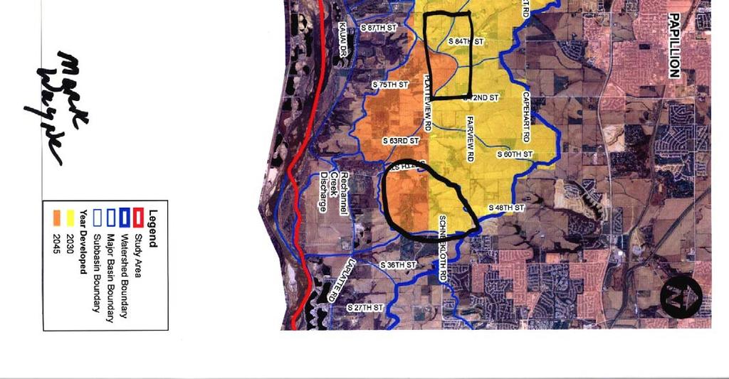
93
94
95
96
97

98
99
100 Appendix E Sarpy County Commissioners Road Improvement Policy
101
102
103
104 Appendix F Letter from County Board Chair
105 INTERLOCAL COOPERATION AGREEMENT This Interlocal Cooperation Agreement is made by and between the City of (hereinafter referred to as "City") and the County of Sarpy, Nebraska, a body politic and corporate (hereinafter referred to as "County"). WHEREAS, County, pursuant to the Nebraska County Industrial Sewer Construction Act (Neb. Rev. Stat , et seq., Reissue 1997), is given the authority to own, construct, equip and operate a sewerage disposal system and plant or plants for the treatment, purification and disposal, in a sanitary manner, of liquid and solid wastes for the purpose of meeting the future needs of planned commercial and industrial users; and WHEREAS, County is exercising that authority in order to develop economic opportunities for large commercial or industrial businesses, which in turn will create economic opportunities which will benefit all residents of the County; and WHEREAS, City wishes to plan for adequate infrastructure in to accommodate orderly growth as City expands; and, WHEREAS, pursuant to the Interlocal Cooperation Act, Neb. Rev. Stat , et seq. (Reissue 1997), the Parties wish to permit their local governmental units to make the most efficient use of their powers by enabling them to cooperate with each other on a basis of mutual advantage and thereby to provide services and facilities in a manner and pursuant to forms of governmental organization that will best accord with geographic, economic, population, and other factors influencing the needs and development of local communities; NOW, THEREFORE, THE PARTIES HEREBY AGREE AS FOLLOWS: 1. For the purposes of administration of this agreement, a Sewer Service Area (SSA) will be established. Said SSA shall be initial established as shown on Exhibit A attached hereto. Said SSA may be modified from time to time by agreement of the parties, which may be by an informal administrative procedure authorized by their respective governing bodies. 2. The County and the City agree to adopt the Sewer Plan for the SSA, a copy of which is attached hereto as Exhibit B. The purpose of said plan is to identify the size and location of the outfall sewer lines and other associated facilities within the SSA. The Parties agree that any development within the SSA must connect with the sewer system described in Exhibit B. The Parties agree to use their best efforts to obtain the dedication of the sewer easements and other necessary real estate shown on Exhibit B as a part of the zoning and subdivision process within their respective jurisdictions. 1
106 3. Each party agrees to take the appropriate action to adopt a sewer development charge ( sewer fee ) of $5850 per acre. This charge shall be required as a condition of any plat or subdivision within the SSA, or for any connection to the system described in Exhibit B. Each party also agrees to take such action as necessary to require connection to the sewer system shown in Exhibit B when said system is reasonably available to a user. 4. Any sewer development charge or connection fee collected within the SSA by a party to this agreement shall be kept in a segregated fund by that party. Said funds may only be used for the purposes of developing the sewer system shown in Exhibit B, and may not be borrowed, transferred or used for any other purpose. Each party agrees to provide a quarterly report to the other party describing any fees collected, the real estate to which said fees apply, and the current balance of the fees collected within the SSA. 5. The development of the system described in Exhibit B may occur in whole or in interim phases at some indefinite future date. Said development may be undertaken independently by either party pursuant as allowed by law, or by future agreement jointly by the parties, as well as with other entities not a party to this agreement. 6. In the event any portion of the system described in Exhibit B is lawfully constructed without the agreement of a party to this agreement: A. The sewer fees collected by a party within the SSA, while still restricted to the uses and areas described herein, are not required to be paid toward the new construction without further agreement; B. The party constructing said sewer system shall not be required to allow connection without the payment of sewer fees for collected by the nonparticipating party. 7. The parties hereby agree that any sewer fees collected or sewer system constructed shall, after an otherwise lawful annexation, be subject to City control pursuant to the provisions of Nebraska County Industrial Sewer Construction Act (Neb. Rev. Stat , et seq., Reissue 1997). 8. Both City and County shall and do hereby save and hold each other harmless, and their officers, employees, and agents from any and all claims and/or liability whatsoever due to or arising out of any acts, conduct, omissions, or negligence of each to the other or to another person or persons, trust or trustee, estate, partnership, corporation, business, company, political subdivision, or property thereof. Such covenant is to include each party s officers, employees, agents, or others acting by, for or under the direction of the City and/or County. EXECUTED in duplicate this day of,
107 CITY OF ATTEST: Mayor SEAL City Clerk a Body Politic and Corporate COUNTY OF SARPY, NEBRASKA, SEAL Chairman, Board of Commissioners of Sarpy County, Nebraska ATTEST: Sarpy County Clerk Exhibit A Map of sewer service area Exhibit B Map of proposed sewer system 3
108 Appendix G Interlocal Cooperation Master Agreement

109
110


111


112
Reading Plats and the Complexities of Antiquated Subdivisions Presented by: David W. Depew, PhD, AICP, LEED AP Morris-Depew Associates, Inc.
 Presented by: David W. Depew, PhD, AICP, LEED AP Morris-Depew Associates, Inc. Introduction Plat is a term for a survey of a piece of land to identify boundaries, easements, flood zones, roadway, and access
Section 4 Master Plan Framework
 Section 4 Master Plan Framework 4.1 PURPOSE The Master Plan, as an implementation tool of the SPC District, establishes the primary framework for the overall development of the Property. Detailed site
EXHIBIT A. City of Corpus Christi Annexation Guidelines
 City of Corpus Christi Annexation Guidelines Purpose: The purpose of this document is to describe the City of Corpus Christi s Annexation Guidelines. The Annexation Guidelines provide the guidance and
BYLAW 5781 ****************
 BYLAW 5781 **************** A BYLAW OF THE CITY OF LETHBRIDGE PROVIDING FOR THE IMPOSITION OF AN OFF-SITE LEVY IN RESPECT OF LAND TO BE DEVELOPED OR SUBDIVIDED FOR THE YEARS 2013, 2014, 2015 and 2016 ************************************************************
1 November 13, 2013 Public Hearing APPLICANT & PROPERTY OWNER: HOME ASSOCIATES OF VIRGINIA, INC.
 1 November 13, 2013 Public Hearing APPLICANT & PROPERTY OWNER: HOME ASSOCIATES OF VIRGINIA, INC. STAFF PLANNER: Carolyn A.K. Smith REQUEST: Conditional Change of Zoning (AG-1 & AG-2 Agricultural Districts
Comprehensive Plan 2030
 Introduction The purpose of this chapter of the Comprehensive Plan is to accurately describe, in words and images, the goals and visions for the future of Clearfield, as determined by the people who live
BUILD-OUT ANALYSIS GRANTHAM, NEW HAMPSHIRE
 BUILD-OUT ANALYSIS GRANTHAM, NEW HAMPSHIRE A Determination of the Maximum Amount of Future Residential Development Possible Under Current Land Use Regulations Prepared for the Town of Grantham by Upper
RECOMMENDATION REPORT
 SARPY COUNTY PLANNING & BUILDING DEPARTMENT RECOMMENDATION REPORT CHANGE OF ZONE (CZ 18-005) PRELIMINARY PLAT (PP 18-007) FINAL PLAT (FP 18-008) SCHOLTING ESTATES APPLICANT: DIANE SCHOLTING PLANNING COMMISSION
8Land Use. The Land Use Plan consists of the following elements:
 8Land Use 1. Introduction The Land Use Plan consists of the following elements: 1. Introduction 2. Existing Conditions 3. Opportunities for Redevelopment 4. Land Use Projections 5. Future Land Use Policies
RESOLUTION NO ( R)
") RESOLUTION NO. 2013-06- 088 ( R) A RESOLUTION OF THE CITY COUNCIL OF THE CITY OF McKINNEY, TEXAS, APPROVING THE LAND USE ASSUMPTIONS FOR THE 2012-2013 ROADWAY IMPACT FEE UPDATE WHEREAS, per Texas Local
RESOLUTION NO. 2013-06- 088 ( R) A RESOLUTION OF THE CITY COUNCIL OF THE CITY OF McKINNEY, TEXAS, APPROVING THE LAND USE ASSUMPTIONS FOR THE 2012-2013 ROADWAY IMPACT FEE UPDATE WHEREAS, per Texas Local
Settlement Pattern & Form with service costs analysis Preliminary Report
 Settlement Pattern & Form with service costs analysis Preliminary Report Prepared for Regional Planning Halifax Regional Municipality by Financial Services, HRM May 15, 2004 TABLE OF CONTENTS INTRODUCTION...
APPENDIX A FACTORS INFLUENCING COUNTY FINANCES
 APPENDIX A FACTORS INFLUENCING COUNTY FINANCES Appendix A Factors Influencing County Finances The finances of counties are affected by many different factors. Some of the variation results from decisions
MIDWAY CITY Municipal Code
 MIDWAY CITY Municipal Code TITLE 9 ANNEXATION CHAPTER 9.01 PURPOSE CHAPTER 9.02 GENERAL REQUIREMENTS CHAPTER 9.03 PROPERTY OWNER INITIATION OF ANNEXATION CHAPTER 9.04 PROCEDURES FOR CONSIDERATION OF PETITION
Appendix A. Factors Affecting City Expenditures
 Appendix A Factors Affecting City Expenditures Factors Affecting City Expenditures The finances of cities are affected by many different factors. Some of the variation results from decisions made by city
Regulatory Impact Statement
 Regulatory Impact Statement Establishing one new special housing area in Queenstown under the Housing Accords and Special Housing Areas Act 2013. Agency Disclosure Statement 1 This Regulatory Impact Statement
HOUSING AFFORDABILITY
 HOUSING AFFORDABILITY (RENTAL) 2016 A study for the Perth metropolitan area Research and analysis conducted by: In association with industry experts: And supported by: Contents 1. Introduction...3 2. Executive
Appendix A. Factors Affecting City Current Expenditures
 Appendix A Factors Affecting City Current Expenditures Factors Affecting City Current Expenditures Every city faces a unique situation based upon its demographic composition, location, tax base, and many
Existing Land Use. Typical densities for single-family detached residential development in Cumberland County: 1
 Existing Land Use A description of existing land use in Cumberland County is fundamental to understanding the character of the County and its development related issues. Economic factors, development trends,
Business Item Community Development Committee Item:
 Business Item Community Development Committee Item: 2008-124 C Meeting date: July 21, 2008 ADVISORY INFORMATION Date: May 21, 2008 Subject: Flexible Residential Development Ordinance Guidelines District(s),
Q: When will the first SID payment become due?
 Rattlesnake Sewer June 19, 2009 FAQs (Frequently Asked Questions) Over the past few months, Rattlesnake Valley residents have asked some very good questions about the sanitary sewer system and creation
9. REZONING NO Vicinity of the northwest corner of 143 rd Street and Metcalf Avenue
 9. REZONING NO. 2002-15 Vicinity of the northwest corner of 143 rd Street and Metcalf Avenue 1. APPLICANT: Andrew Schlagel is the applicant for this request. 2. REQUESTED ACTION: The applicant is requesting
CHAPTER Committee Substitute for Committee Substitute for Senate Bill No. 2188
 CHAPTER 2004-372 Committee Substitute for Committee Substitute for Senate Bill No. 2188 An act relating to land development; amending s. 197.502, F.S.; providing for the issuance of an escheatment tax
3. FISCAL IMPACT ANALYSIS FISCAL IMPACT ANALYSIS 29
 3. FISCAL IMPACT ANALYSIS FISCAL IMPACT ANALYSIS 29 The purpose of fiscal impact analysis is to estimate the impact of a development or a land use change on the budgets of governmental units serving the
Chapter 100 Planned Unit Development in Corvallis Urban Fringe
 100.100 Scope and Purpose. Chapter 100 Planned Unit Development in Corvallis Urban Fringe (1) All applications for land divisions in the Urban Residential (UR) and Flood Plain Agriculture (FPA) zones within
INTER-JURISDICTIONAL COORDINATION AND STREAMLINING ELEMENT
 INTER-JURISDICTIONAL COORDINATION AND STREAMLINING ELEMENT Inter-jurisdictional Coordination Inter-jurisdictional coordination is an important issue for Mardela Springs. It is a valuable tool to help identify
ENGLEWOOD WATER DISTRICT MANDATORY WASTEWATER UTILITY CONNECTION POLICY
 ENGLEWOOD WATER DISTRICT MANDATORY WASTEWATER UTILITY CONNECTION POLICY RESOLUTION NO: 02-12-19 C Section 1 Introduction 1.1 General The following (UCP) of the Englewood Water District (the District )
Planning Justification Report
 Planning Justification Report, Township of Puslinch FARHI HOLDINGS CORPORATION Updated January 27, 2017 Zelinka Priamo Ltd. Page i TABLE OF CONTENTS Page No. 1.0 1.1 1.2 1.3 2.0 2.1 2.2 2.3 2.4 2.5 3.0
Table of Contents. Appendix...22
 Table Contents 1. Background 3 1.1 Purpose.3 1.2 Data Sources 3 1.3 Data Aggregation...4 1.4 Principles Methodology.. 5 2. Existing Population, Dwelling Units and Employment 6 2.1 Population.6 2.1.1 Distribution
Attachment A First Submittal JAZB Safety Zones A and B
 Attachment A First Submittal JAZB Safety Zones A and B Attachment B Second Submittal JAZB Safety Zones A and B Attachment C Flying Cloud Airport (FCM) Draft Airport Zoning Ordinance Social and Economic
CITY OF COLLEGE STATION SERVICE PLAN FOR THE AREA TO BE ANNEXED EFFECTIVE 14 APRIL 2011
 CITY OF COLLEGE STATION SERVICE PLAN FOR THE AREA TO BE ANNEXED EFFECTIVE 14 APRIL 2011 I. ANNEXATION AREA The annexation area is located on the southwest side of the City of College Station, in the City
Administration and Calculation of Servicing Agreement Fees and Development Levies
 Administration and Calculation of Servicing Agreement Fees and Development Levies Policy Title: Applies to: Reference # Administration and Calculation of Servicing Agreement Fees and City of Regina ###-XXX-##
APPENDIX A FACTORS INFLUENCING CITY FINANCES
 APPENDIX A FACTORS INFLUENCING CITY FINANCES This page left blank intentionally Appendix A Factors Influencing City Finances The finances of cities are affected by many different factors. Some of the variation
PLANNING FOR OUR FUTURE
 PLANNING FOR OUR FUTURE ELLSWORTH TOWNSHIP LAND USE AND POLICY PLAN The purpose of this Plan is to serve as a guide for the Township Trustees, Zoning Commission, Board of Zoning Appeals, developers, employers,
Texas Municipal Utility Districts: An Infrastructure Financing System
 Texas Municipal Utility Districts: An Infrastructure Financing System I. The History of Special Districts A. Overview Large population growth requires the development of new communities. Massive capital
CHARTER TOWNSHIP OF FENTON SEWER SYSTEM FINANCIAL OVERVIEW MARCH, 2018
 CHARTER TOWNSHIP OF FENTON SEWER SYSTEM FINANCIAL OVERVIEW MARCH, 2018 Fenton Township continues to receive inquiries regarding the relatively high sewer use fees that Township residents have been paying
Lincolnton, NC Code of Ordinances CHAPTER 53: WATER AND SEWER EXTENSIONS AND AVAILABILITY CHARGES
 Lincolnton, NC Code of Ordinances CHAPTER 53: WATER AND SEWER EXTENSIONS AND AVAILABILITY CHARGES Section 53.01 General principles of water and sewer line extension 53.02 Explanation of terms and requirements
Document under Separate Cover Refer to LPS State of Housing
 Document under Separate Cover Refer to LPS5-17 216 State of Housing Contents Housing in Halton 1 Overview The Housing Continuum Halton s Housing Model 3 216 Income & Housing Costs 216 Indicator of Housing
Suite Metering Provisions Under the Residential Tenancies Act, 2006 and the Energy Consumer Protection Act, Consultation Paper
 Suite Metering Provisions Under the Residential Tenancies Act, 2006 and the Energy Consumer Protection Act, 2009 Consultation Paper Ministry of Municipal Affairs and Housing March 2010 TABLE OF CONTENTS
Land Use. Land Use Categories. Chart 5.1. Nepeuskun Existing Land Use Inventory. Overview
 Land Use State Comprehensive Planning Requirements for this Chapter A compilation of objectives, policies, goals, maps and programs to guide the future development and redevelopment of public and private
THE TREND OF REAL ESTATE TAXATION IN KANSAS, 1910 TO 1942¹
 THE TREND OF REAL ESTATE TAXATION IN KANSAS, 1910 TO 1942¹ HAROLD HOWE². INTRODUCTION The purpose of this study is to show the trends of taxes on farm and city real estate in Kansas from 1910 to 1942 and
SECTION 1 INTRODUCTION TO THE PANAMA CITY BEACH COMPREHENSIVE GROWTH DEVELOPMENT PLAN
 1. PURPOSE SECTION 1 INTRODUCTION TO THE PANAMA CITY BEACH COMPREHENSIVE GROWTH DEVELOPMENT PLAN The purpose of the City of Panama City Beach's Comprehensive Growth Development Plan is to establish goals,
PURPOSE OF STUDY. physical and social environments, as well as our political and economic institutions. As a commodity,
 PURPOSE OF STUDY Housing is one of the most important elements in our lives and our communities. Providing shelter and links to neighborhoods and larger communities, housing plays an essential part in
Comprehensive Plan /24/01
 IV The is a central component of the Comprehensive Plan. It is an extension of the general goals and policies of the community, as well as a reflection of previous development decisions and the physical
METHODOLOGY GUIDE VALUING LANDS IN TRANSITION IN ONTARIO. Valuation Date: January 1, 2016
 METHODOLOGY GUIDE VALUING LANDS IN TRANSITION IN ONTARIO Valuation Date: January 1, 2016 August 2017 August 22, 2017 The Municipal Property Assessment Corporation (MPAC) is responsible for accurately assessing
Burlington Unincorporated Community Plan
 Burlington Unincorporated Community Plan June 30, 2010 Meeting Page 1 of 24 Table of Contents (Page numbers to be inserted) I. Background a. Location and Community Description b. Planning of Unincorporated
4. Parks and Recreation Fee Facility Needs and Cost Estimates Fee Calculation Nexus Findings 24
 TABLE OF CONTENTS CHAPTER PAGE 1. Introduction and Summary of Calculated Fees 1 1.1 Background and Study Objectives 1 1.2 Organization of the Report 2 1.3 Calculated Development Impact Fees 2 2. Fee Methodology
610 LAND DIVISIONS AND PROPERTY LINE ADJUSTMENTS OUTSIDE A UGB
 ARTICLE VI: LAND DIVISIONS AND PROPERTY LINE ADJUSTMENTS VI-21 610 LAND DIVISIONS AND PROPERTY LINE ADJUSTMENTS OUTSIDE A UGB 610-1 Property Line Adjustments (Property Line Relocation) A property line
WASTEWATER SERVICE CHARGES EFFECTIVE FOR ALL BILLS ISSUED ON AND AFTER AUGUST 1, 2003
 Louisville and Jefferson County Metropolitan Sewer District WASTEWATER SERVICE CHARGES EFFECTIVE FOR ALL BILLS ISSUED ON AND AFTER AUGUST 1, 2003 A. WASTEWATER SERVICE CHARGES Applicable to all bills rendered.
Town of Onalaska. A scale map depicting the portion of Pineview Drive to be officially laid out as a Town highway is attached hereto as Exhibit A.
 Town of Onalaska Special Meeting Minutes for March 31, 2011 The Town Board met on site of the Pineview Road and County OT in Onalaska for the purpose of viewing the lay out of the road as required by law.
A. Land Use Relationships
 Chapter 9 Land Use Plan A. Land Use Relationships Development patterns in Colleyville have evolved from basic agricultural and residential land uses, predominate during the early stages of Colleyville
DEVELOPMENT OF ~99 ACRES NEAR I-43 AND HWY 42
 Town of Sheboygan, Wisconsin REQUEST FOR PROPOSALS DEVELOPMENT OF ~99 ACRES NEAR I-43 AND HWY 42 Subject Site Issued: September 18, 2018 Due Date: January 18, 2019 1 REQUEST FOR PROPOSALS Development of
7. IMPLEMENTATION STRATEGIES
 7. IMPLEMENTATION STRATEGIES A. GENERAL APPROACH FOR IMPLEMENTATION Implementing the plan will engage many players, including the Municipality of Anchorage (MOA), the Government Hill Community Council,
UNDERSTANDING THE TAX BASE CONSEQUENCES OF LOCAL ECONOMIC DEVELOPMENT PROGRAMS
 UNDERSTANDING THE TAX BASE CONSEQUENCES OF LOCAL ECONOMIC DEVELOPMENT PROGRAMS Richard K. Gsottschneider, CRE President RKG Associates, Inc. 277 Mast Rd. Durham, NH 03824 603-868-5513 It is generally accepted
Chapter Four Growth in the Next 20 years
 Chapter Four Growth in the Next 20 years Although the city of Fargo has pushed to the limits planned for in the original growth plan, the city still has substantial amounts of land available for growth.
Housing Commission Report
 Housing Commission Report To: From: Subject: Housing Commission Meeting: July 21, 2016 Agenda Item: 4-B Chair and Housing Commission Barbara Collins, Housing Manager Draft Request for Proposals for Mountain
RESPONSIBILITY AND PROCEDURE FOR IMPROVEMENT AND MAINTENANCE OF DRAINS, DITCHES AND WATERCOURSES
 RESPONSIBILITY AND PROCEDURE FOR IMPROVEMENT AND MAINTENANCE OF DRAINS, DITCHES AND WATERCOURSES FORWARD The Offices of the County Engineer and County Commissioners of Greene County are inundated yearly
APPENDIX A FACTORS INFLUENCING COUNTY FINANCES
 APPENDIX A FACTORS INFLUENCING COUNTY FINANCES This page left blank intentionally Appendix A Factors Influencing County Finances The finances of counties are affected by many different factors. Some of
SARPY COUNTY PLANNING COMMISSION MINUTES OF MEETING. July 18, 2017
 SARPY COUNTY PLANNING COMMISSION MINUTES OF MEETING l. CALL MEETING TO ORDER A meeting of the of Sarpy County, Nebraska was convened in open and public session at the call of Chairman Tom Ackley at 7:00
General Development Plan Background Report on Agricultural Land Preservation
 General Development Plan 2008 Background Report on Agricultural Land Preservation February 2008 I. Introduction Anne Arundel County has been an agricultural community for over 350 years, beginning with
Existing Conditions: Economic Market Assessment
 Existing Conditions: Economic Market Assessment Introduction The US 24/40 Corridor Study examined existing conditions as they related to economic and commercial market assessments, existing land use, and
WASTEWATER SERVICE CHARGES EFFECTIVE FOR ALL BILLS ISSUED ON AND AFTER AUGUST 1, 2005
 Louisville and Jefferson County Metropolitan Sewer District WASTEWATER SERVICE CHARGES EFFECTIVE FOR ALL BILLS ISSUED ON AND AFTER AUGUST 1, 2005 A. WASTEWATER SERVICE CHARGES Applicable to all bills rendered.
To achieve growth, property development, redevelopment and an improved tax base in the cities and boroughs in the Lehigh Valley.
 Most growth in property valuation is in townships. Between 1991 and 2004, the assessed valuation of the townships in the Lehigh Valley increased by more than $2.8 billion, an increase of 41%. At the same
RECITALS. WHEREAS, the GMA requires counties to adopt county-wide planning policies in cooperation with cities within the County; and
 AN INTERLOCAL AGREEMENT FOR THE IMPLEMENTATION OF A DEMONSTRATION PROJECT TO TRANSFER DEVELOPMENT RIGHTS FROM RURAL UNINCORPORATED KING COUNTY TO THE DENNY TRIANGLE IN DOWNTOWN SEATTLE This Agreement is
Protecting Farmland in Maryland: A Review of the Agricultural Land Preservation Program
 Protecting Farmland in Maryland: A Review of the Agricultural Land Preservation Program Craig Shollenberger Planning Intern (former) Anne Arundel County Maryland INTRODUCTION During the past ten to twelve
2014 Plan of Conservation and Development
 The Town of Hebron Section 1 2014 Plan of Conservation and Development Community Profile Introduction (Final: 8/29/13) The Community Profile section of the Plan of Conservation and Development is intended
City of Edwardsville, Kansas Special Benefit District Policy
 City of Edwardsville, Kansas Special Benefit District Policy Date Adopted: September 12, 2011 Section 1. Objective The objective is to establish a policy to finance public streets, sanitary sewers, water
ANNEXATION POLICY, PROGRAM, AND PLAN. Presented to the City Council By the Planning and Development Department
 ANNEXATION POLICY, PROGRAM, AND PLAN Presented to the City Council By the Planning and Development Department August 2, 2011 1 Purpose Review the following: Annexation policy Annexation program Annexation
Implementation Guidance. for. The Sustainable Growth and Agricultural Preservation Act of Senate Bill 236
 Implementation Guidance for The Sustainable Growth and Agricultural Preservation Act of 2012 Senate Bill 236 August 1, 2012 Version 2.0 Table of Contents 1. Executive Summary... 1 1.1 Bill Highlights...
Land Preservation in the Highlands Region
 Land Preservation in the Highlands Region Prepared by the Highlands Water Protection and Planning Council - August 2010 The Highlands watersheds are the best in the State in respect to ease of collection,
PART ONE - GENERAL INFORMATION
 Corrected Date: Page 7 Date of Submittal Changed to Coincide with Submittal Date on Page 5 PART ONE - GENERAL INFORMATION A. INTRODUCTION B. Background Miami Shores Village is soliciting responses to this
Su-Knik Mitigation Bank Modification Memorandum
 Su-Knik Mitigation Bank Modification Memorandum Regarding: Request for Approved Instrument Modification for the Su-Knik Mitigation Bank (Expansion of the Su-Knik Mitigation Bank Service Area) Request:
Public Facilities and Finance Element
 This Element of the General Plan addresses the following public facilities issues: Water Service, including both potable (drinkable) and non-potable water delivery. Sewer Service, and Financing and construction
CONTRA COSTA LOCAL AGENCY FORMATION COMMISSION EXECUTIVE OFFICER'S REPORT. January 8, 2014 (Agenda)
") CONTRA COSTA LOCAL AGENCY FORMATION COMMISSION EXECUTIVE OFFICER'S REPORT : Rodeo Marina Annexation to Rodeo Sanitary District (RSD) PROPONENT: RSD by Resolution No. 2011-01 adopted April 12, 2011 ACREAGE
CONTRA COSTA LOCAL AGENCY FORMATION COMMISSION EXECUTIVE OFFICER'S REPORT : Rodeo Marina Annexation to Rodeo Sanitary District (RSD) PROPONENT: RSD by Resolution No. 2011-01 adopted April 12, 2011 ACREAGE
PLANNED UNIT DEVELOPMENTS (Ordinance No.: 3036, 12/3/07; Repealed & Replaced by Ordinance No.: 4166, 10/15/12)
") 159.62 PLANNED UNIT DEVELOPMENTS (Ordinance No.: 3036, 12/3/07; Repealed & Replaced by Ordinance No.: 4166, 10/15/12) A. PURPOSE 1. General. The Planned Unit Development (PUD) approach provides the flexibility
159.62 PLANNED UNIT DEVELOPMENTS (Ordinance No.: 3036, 12/3/07; Repealed & Replaced by Ordinance No.: 4166, 10/15/12) A. PURPOSE 1. General. The Planned Unit Development (PUD) approach provides the flexibility
Understanding the Consent Application Process
 Understanding the Consent Application Process Your Step-By-Step Guide for Consent-Granting Authorities 1 2 3 4 5 6 7 8 9 10 11 Section 53 of the Planning Act ontario.ca/municipallearning Understanding
INTERLOCAL AGREEMENT FOR LEESVILLE BRANCH LIBRARY BETWEEN CITY OF RALEIGH, NORTH CAROLINA AND WAKE COUNTY, NORTH CAROLINA
 DRAFT 01-23-08 INTERLOCAL AGREEMENT FOR LEESVILLE BRANCH LIBRARY BETWEEN CITY OF RALEIGH, NORTH CAROLINA AND WAKE COUNTY, NORTH CAROLINA Dated as of, 2008 INTERLOCAL AGREEMENT THIS INTERLOCAL AGREEMENT
Walworth County Farmland Preservation Plan Update, Chapter 1 Plan Summary (Cover Document)
") Background Walworth County Farmland Preservation Plan Update, 2012 Chapter 1 Plan Summary (Cover Document) For over 30-years, the Wisconsin Farmland Preservation Program has served to preserve Walworth
Background Walworth County Farmland Preservation Plan Update, 2012 Chapter 1 Plan Summary (Cover Document) For over 30-years, the Wisconsin Farmland Preservation Program has served to preserve Walworth
OPEN SPACE & RECREATION PLAN
 OPEN SPACE & RECREATION PLAN HOPEWELL TOWNSHIP Cumberland County, New Jersey Prepared by: Hopewell Township Environmental Commission Final October 2011 (THIS PAGE INTENTIONALLY LEFT BLANK) PUBLIC MEETINGS
Identifying brownfield land suitable for new housing
 Building more homes on brownfield land Identifying brownfield land suitable for new housing POS consultation response Question 1: Do you agree with our proposed definition of brownfield land suitable for
The Onawa and CHAT Report
 The Onawa and CHAT Report Black Hills Energy A Community Housing Assessment Team Study Amy Haase, AICP March 10, 2014 Population Change Onawa, 1960-2010 3,500 3,000 3,176 3,154 3,283 2,936 3,091 2,998
TRANSFER OF DEVELOPMENT RIGHTS
 STEPS IN ESTABLISHING A TDR PROGRAM Adopting TDR legislation is but one small piece of the effort required to put an effective TDR program in place. The success of a TDR program depends ultimately on the
RECOMMENDATION Following the public hearing, consider Zoning Case PD14-16, with a Development Plan.
 Staff Report Zoning Case PD14-16 (Helzer Tract) Planning and Zoning Meeting Date: 12-17-14 Document Being Considered: Ordinance RECOMMENDATION Following the public hearing, consider Zoning Case PD14-16,
KNOXVILLE/KNOX COUNTY METROPOLITAN PLANNING COMMISSION PLAN AMENDMENT/REZONING REPORT
 KNOXVILLE/KNOX COUNTY METROPOLITAN PLANNING COMMISSION PLAN AMENDMENT/REZONING REPORT FILE #: 4-G-12-RZ 4-C-12-SP AGENDA ITEM #: 27 AGENDA DATE: 5/10/2012 POSTPONEMENT(S): 4/12/12 APPLICANT: OWNER(S):
ARTICLE 23 CONDOMINIUM STANDARDS
 ARTICLE 23 CONDOMINIUM STANDARDS Section 23.01 Intent. The intent of this Article is to provide regulatory standards for condominiums and site condominiums similar to those required for projects developed
AB 1397 HOUSING ELEMENT LAW SITE IDENTIFICATION STRENGTHENED OVERVIEW
 AB 1397 HOUSING ELEMENT LAW SITE IDENTIFICATION STRENGTHENED OVERVIEW The 2017 California legislative session yielded a housing package of 15 bills that significantly increased both the available financing
CONTRA COSTA LOCAL AGENCY FORMATION COMMISSION EXECUTIVE OFFICER'S REPORT. May 12, 2010 (Agenda)
") CONTRA COSTA LOCAL AGENCY FORMATION COMMISSION EXECUTIVE OFFICER'S REPORT LAFCO 10-01: Annexation 174 to Central Contra Costa Sanitary District (CCCSD) PROPONENT: CCCSD by Resolution No. 2009-027 adopted
CONTRA COSTA LOCAL AGENCY FORMATION COMMISSION EXECUTIVE OFFICER'S REPORT LAFCO 10-01: Annexation 174 to Central Contra Costa Sanitary District (CCCSD) PROPONENT: CCCSD by Resolution No. 2009-027 adopted
SPECIFIC RESPONSES TO AREA COMMISSION OPPOSITION :
 SPECIFIC RESPONSES TO AREA COMMISSION OPPOSITION 3-14-19: Area Commission reasons for opposition in black APPLICANT S RESPONSE IN RED. The comprehensive planning and design of stream restoration efforts
The Seattle MD Apartment Market Report
 The Seattle MD Apartment Market Report Volume 16 Issue 2, December 2016 The Nation s Crane Capital Seattle continues to experience an apartment boom which requires constant construction of new units. At
Wapiti Ridge Estates Area Structure Plan SE W5M. December Prepared For:
 SE 13-20-1 W5M December 2000 Prepared For: 393494 Alberta Limited, and The Municipal District of Foothills No. 31 Prepared By: Kristi Beunder Professional Planning Services Calgary, Alberta Ph: 201-3309
CLASS 8-C: LAND USE CONTROLS AND PROPERTY DEVELOPMENT
 CLASS 8-C: LAND USE CONTROLS AND PROPERTY DEVELOPMENT LEARNING OBJECTIVES When you have finished reading this chapter in the text, you should be able to: Identify the various types of public and private
Orange Water and Sewer Authority Water and Sewer System Development Fee Study
 Orange Water and Sewer Authority Water and Sewer System Development Fee Study March 6, 2018 March 6, 2018 Mr. Stephen Winters Director of Finance and Customer Service 400 Jones Ferry Road Carrboro, NC
ARTICLE 15 - PLANNED UNIT DEVELOPMENT
 Section 15.1 - Intent. ARTICLE 15 - PLANNED UNIT DEVELOPMENT A PUD, or Planned Unit Development, is not a District per se, but rather a set of standards that may be applied to a development type. The Planned
ESTES VALLEY STORMWATER MANAGEMENT PROGRAM
 ESTES VALLEY STORMWATER MANAGEMENT PROGRAM Phase I. Stormwater Master Plan Phase II. Stormwater Utility Feasibility Study Board of Realtors Meeting May 3, 2018 Stormwater Master Plan Summary Stormwater
City of Grande Prairie Development Services Department
 City of Grande Prairie Development Services Department COUNTRYSIDE SOUTH OUTLINE PLAN Prepared by: GPEC Consulting Ltd. #202, 10712-100th Street Grande Prairie, AB Council Resolution of August 20, 2001
CITY OF PAPILLION PLANNING COMMISSION STAFF REPORT MAY 31, 2017 AGENDA SHADOW LAKE 2 FINAL PLAT FP
 I. GENERAL INFORMATION CITY OF PAPILLION PLANNING COMMISSION STAFF REPORT MAY 31, 2017 AGENDA SHADOW LAKE 2 FINAL PLAT FP-17-0006 A. APPLICANT: Shadow Lake 2, LLC 15950 West Dodge Road, Suite 300 Omaha,
INDIAN RIVER COUNTY, FLORIDA. The Honorable Members of the Planning and Zoning Commission DEPARTMENT HEAD CONCURRENCE
 Public Hearing Legislative INDIAN RIVER COUNTY, FLORIDA M E M O R A N D U M TO: The Honorable Members of the Planning and Zoning Commission DEPARTMENT HEAD CONCURRENCE Robert M. Keating, AICP; Community
RESEARCH BRIEF. Oct. 31, 2012 Volume 2, Issue 3
 RESEARCH BRIEF Oct. 31, 2012 Volume 2, Issue 3 PDR programs affect landowners conversion decision in Maryland PDR programs pay farmers to give up their right to convert their farmland to residential and
ARLINGTON COUNTY, VIRGINIA
 ARLINGTON COUNTY, VIRGINIA County Board Agenda Item Meeting of April 19, 2008 DATE: April 2, 2008 SUBJECT: ORDINANCE TO AMEND, REENACT, AND RECODIFY Section 20 CP- FBC, Columbia Pike Form Based Code Districts
SECTION 16. "PUD" PLANNED UNIT DEVELOPMENT OVERLAY DISTRICT
 SECTION 6. "PUD" PLANNED UNIT DEVELOPMENT OVERLAY DISTRICT Subsection. Purpose. This district is established to achieve the coordinated integration of land parcels and large commercial and retail establishments
Chapter 1: Community & Planning Context
 Chapter 1: Community & Planning Context Yesterday, Today & Tomorrow Comprehensive Plan 2040 2 INTRODUCTION The City of Lauderdale is a small town with a long history. Nestled between Saint Paul and Minneapolis,