July 16, Reference: 112 Las Palmas Street, Oxnard, California, To Whom It May Concern,
|
|
|
- Darrell O’Connor’
- 5 years ago
- Views:
Transcription
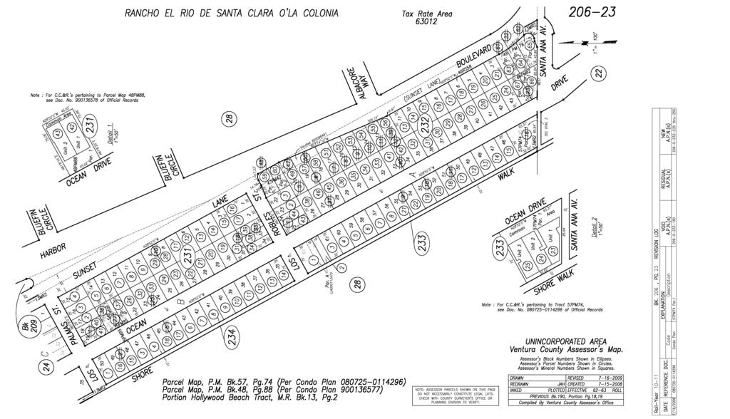
1 July 16, 2018 Reference: 112 Las Palmas Street, Oxnard, California, To Whom It May Concern, Channel Islands Beach Community Service District (CIBCSD) currently owns the property located at 112 Las Palmas Street, Oxnard, California (APN# ). The subject property is in the County of Ventura jurisdiction and within the Hollywood Beach Submarket. The subject property is a decommissioned water well site owned by the Oxnard Beach County Water District. The site is an interior lot located one block from the coastline at Hollywood Beach. The site is approximately 0.05 acres and is typical in size for the Hollywood Beach neighborhood with 35 feet of lot frontage and with a 70-foot average lot depth. According to the County of Ventura Zoning Map, the subject property is zoned Residential Beach Harbor (RBH). The purpose of this zone is to provide for development and preservation of unique beach-oriented residential communities with small lot subdivision patterns. According to Section of the County of Ventura Municipal Code, the building height in the RBH zone shall be no more than twenty-eight (28) feet for structures with flat roofs, pitched or hip roofs, and no more than thirty (30) feet for A-frame structures. According to Table of the County of Ventura Municipal Code, the required minimum front setback is 20 feet and the side interior setback is 3 feet. The minimum lot area is one thousand seven hundred fifty (1,750) sq. ft. per single-family dwelling. The eventual buyer of the subject property will need to submit a Zoning Clearance Form from the County of Ventura Planning Division. A will-serve letter from the local sanitary district will also be required by the County Environmental Health Division. In addition, a Fire Protection Certificate approved by the County Fire Prevention Bureau must be obtained from the Division of Building and Safety. Finally, a Building Permit from the County Building and Safety Division will be required to begin project construction. For more Zoning Clearance Information, please contact the Planning Division Public Counter at the Ventura County Government Center at (805) The Planning Counter is open Monday through Friday from 7:30 AM to 4:30 PM. Please visit their website at for more information. Regards, Kevin Kohan MPA Principal Planner Phone:

2 County View Parcel Report Parcel Information APN APN Suffix Document Date Document Number Tract Number Map Number 013MR 002 Situs Direction Situs Number Situs Street Situs Suffix Acreage.05 Additional Information Cities City Boundary City Name Field not Present Election Precincts Election Precincts Precinct Name HOLLYWOOD NO. 501 Political Districts Assembly Districts Name Ordinal Monique Limon 37TH WARNING: The information contained herein was created by the Ventura County Geographic Information System (GIS), which is designed and operated solely for the convenience of the County and related contract entities. The County does not warrant the accuracy of this information, and no decision involving a risk of economic loss or physical injury should be made in reliance thereon.
3 County View Parcel Report Senatorial Districts Name Ordinal Hannah Beth Jackson 19TH Congressional Districts Name Ordinal Julia Brownley 26TH Supervisorial Districts Name Ordinal John C. Zaragoza 5th School Districts Elementary School Districts District Name HUENEME Secondary School Districts District Name Oxnard Union Land Use Is County SOAR Present? No General Plan GENPLANDES Urban Reserve Zoning Zone RBH Hazards Earthquake Fault Hazard Zones No Liquefaction Yes WARNING: The information contained herein was created by the Ventura County Geographic Information System (GIS), which is designed and operated solely for the convenience of the County and related contract entities. The County does not warrant the accuracy of this information, and no decision involving a risk of economic loss or physical injury should be made in reliance thereon.
4
 prior to the preparation of a Zoning Clearance. For certain uses, supplemental information will also be required.")
; if there are no violations associated with the property; if the applicant has no outstanding bills with the")
5 Zoning Clearance Application Instructions County of Ventura Resources Management Agency Planning Division 800 S. Victoria Avenue, Ventura, CA (805) Applicants are required to submit this form (and related attachments) prior to the preparation of a Zoning Clearance. For certain uses, supplemental information will also be required. The issuance of a Zoning Clearance could take several days. 2. A full, true and correct account of the proposed project must be provided or the Zoning Clearance will be nullified subsequently. 3. Zoning Clearances will only be issued on "legal lots" (with a few minor exceptions); if there are no violations associated with the property; if the applicant has no outstanding bills with the Resource Management Agency; and all other applicable standards are met. 4. Applicants should review the attached standards for site plans, floor plans and elevations; as well as development standards found in Articles 5-10 the Non-coastal Zoning Ordinance and Articles 4-8 of the Coastal Zoning Ordinance. See also Standards relating to the issuance of Zoning Clearances in the respective ordinances are found in Sec and Sec , respectively. This information can be found on the Division's website, after selecting the "Ordinance & Regulations" navigation button. 5. Applicants are encouraged to seek approval for their project from the Homeowners' Association (HOA) that may have jurisdiction over the subject property. Some HOA standards may be stricter than zoning regulations. In some areas a Zoning Clearance will not be issued until written HOA approval is provided. Check with your HOA. 6. Applications that are incomplete and/or include plans that do not meet the applicable standards included with the application packet will be returned to the applicant and not accepted for processing. 7. Refunds are not provided after a Zoning Clearance has been issued. 8. Issuance of a Zoning Clearance does not guarantee issuance of a Building Permit from the Building & Safety Division, or related permits from other divisions such as Public Works and Environmental Health. 9. If a violation is found on the site, the Zoning Clearance will be nullified. 10. The processing of zoning clearances may take up to four working days, though often zoning clearances can be issued on the same day over the counter (depending on number applications that day, etc.). Zoning clearances in a coastal zone always take at least one full day of processing time. Zoning Clearance Application Packet 1 of 11
6 Provide the Following Materials with the Zoning Clearance Application 1. Two sets of 18" x 24" (minimum) construction drawings (for submittal to Building & Safety) that also include a site plan, floor plan (for all levels and floors), and elevations. These sheets must include the information listed on the accompanying "Standards for Required Site Plans, Floor Plans and Elevations." 2. One set of the following items: Site Plan, Floor Plans, Elevations, and Cross-sections (for coastal zones) of the elevations on separate 8.5" x 11" sheets of paper. These sheets should be reductions of the same images that usually appear on the construction drawings submitted to Building & Safety (see #1 above). Internal remodeling or demolition of structures or utilities may not require all these items. Check with Planning and Building & Safety staff first. 3. Zoning Clearance Fee, cash credit card, or check payable to the County of Ventura, Planning Division. It is suggested that one not fill in the amount prior to applying. Consult the Fee Schedule on the Division website for current fees at: 4. Photos of dwelling where exterior remodeling is proposed is helpful, but not required. 5. Application Form filled out completely. 6. Supplemental Materials if the project falls into one of the categories listed below under "Supplemental Materials", please provide the additional materials at the time you apply for a Zoning Clearance. 7. Development Data Table must be filled out and submitted. 8. A Tree Permit Application must also be submitted if the project involves the pruning (beyond specified limits), removal, trenching, excavation, or other encroachment into the protected zone (5 outside the canopy s edge and a minimum of 15 from trunk) of protected trees. More info at: Site plans must show the following: Precise trunk location and approximate outline of all protected tree canopies that are within 20 of the limits of the construction area (including access roads and storage areas), including the canopies of trees growing on adjacent parcels. Any protected trees proposed for removal. For projects that involve the laying of underground utilities illustrate the extent of trenching to the point of connection and for projects that involve above ground utilities show the location of new wires and poles to the point of connection. Location of any livestock and manure pens. Designated concrete washout areas (for construction). Zoning Clearance Application Packet 2 of 11
7 Zoning Clearance Application County of Ventura Resources Management Agency Planning Division 800 S. Victoria Ave., Ventura, CA (805) Applicant Provided Information Owner s Name: Phone: Cell: Owner s Address: Zip Applicant s Name: Phone: Cell: Applicant s Address: Zip Site Address: Cross Streets: & Assessor Parcel No(s).: Proposed Use/Structure 1: Proposed Use/Structure 2: Proposed Use/Structure 3: No. of Existing Bedrooms: Proposed Additional Bedrooms: No. of Existing Covered Parking Spaces (carport/garage): No. of Existing Uncovered Parking Spaces Marked: No. of Protected Trees (see Sec ) within 50 of the limits of the construction area: Written Homeowner Association approval: (attached if applicable) N/A Certificate of Appropriateness for designated Historic Landmarks or Sites of Merit: (attached if applicable) N/A Zoning Clearance Application Packet 3 of 11
8 Page 2, Zoning Clearance Application Form For Office Use Applicant Name: Date Received: Lot Size: sq. ft. acres Violation: Legal Lot Status: Zoning: General Plan Land Use Designation: Area Plan Land Use Designation: Sq. ft. of Gross Floor Area Ministerially Allowed for Structure: On site hazards: Zoning Clearance Application Packet 4 of 11
9 DEVELOPMENT DATA TABLE Applicant Provides Information Existing Principal Structures and/or Uses Footprint in Sq. Ft. Gross Floor Area all floors & Levels TOTALS Existing Detached Accessory Structures and/or Uses Footprint in Sq. Ft. Gross Floor Area all floors & Levels TOTALS Proposed Principal Structures and/or Uses Footprint in Sq. Ft. Gross Floor Area all floors & Levels TOTALS Proposed Detached Accessory Structures and/or Uses Footprint in Sq. Ft. Gross Floor Area all floors & Levels TOTALS Zoning Clearance Application Packet 5 of 11
10 DEVELOPMENT DATA TABLE SAMPLE Existing Principal Structures and/or Uses Footprint in Sq. Ft. House Orchard 43 ac NA Gross Floor Area all floors & Levels TOTALS Existing Detached Accessory Structures and/or Uses Footprint in Sq. Ft. Garage, shed, covered patio Shed Covered Patio Barn Gross Floor Area all floors & Levels TOTALS Proposed Principal Structures and/or Uses Footprint in Sq. Ft. Gross Floor Area all floors & Levels Addition to house Greenhouse 20,000 20,000 TOTALS 20,250 20,250 Proposed Detached Accessory Structures and/or Uses Footprint in Sq. Ft. Second Dwelling Home Occupation NA NA Farmworker Dwelling Ag Sales Facility Gross Floor Area all floors & Levels TOTALS Zoning Clearance Application Packet 6 of 11
11 SUPPLEMENTAL MATERIALS FOR ZONING CLEARANCE APPLICATION If the proposed project involves any of the following categories, special consideration must be paid to the project. Additionally, supplemental information, declarations, etc. may be required to be submitted when applying for a Zoning Clearance. Each category may have more than one document associated with it. Agricultural Sales Facility Agricultural Uses in Coastal Zone Animal Waiver Business Tax Certificates Coastal Zone Development Occupancies in Commercial or Industrial Zones Electric Service Farm Worker and Animal Caretaker Hazardous Waste & Substance Site Historic Designation (Landmark/Site of Merit) Home Occupations Home Owner Association (HOA) Notice or Approval Itinerant Merchant La Conchita Construction Restrictions Matilija Canyon Development Non-conforming Parking in Non-coastal Zone Non-conforming Structures, projects related to Ojai Valley Dwellings within Clean Air (OVCA) Ord. Area Oxnard Forebay Construction Limitations (El Rio, Strickland) RB & RBH Zones, construction Reconstruction Following a Disaster Restrictive Covenants (Deed Restrictions) Scenic Resource Protection Compliance with Ministerial Permits Second Dwelling Unit Signs Temporary Construction Sites Temporary Dwelling During Construction Temporary Office During Construction Tree Alteration or Removal Truck Trailers as Structures Waivers for Uses and Structures, e.g. animals, 4H projects, large vehicles etc.) Water wells in Coastal Zone (new, replacement, re-drill of existing) Wetlands Zoning Clearance on a site with a PD or CUP Zoning Clearance Application Packet 7 of 11
12 STANDARDS FOR REQUIRED SITE PLANS, FLOOR PLANS AND ELEVATIONS General Requirements for Site Plans, Floor Pl ans, Elevations 1. Paper Size Two sets of 18 x 24 minimum for Building & Safety plans; One set of 8½ x 11 for Planning 2. Preferred Scale: a. Site Plan - 1 =10 for lots less than 1 ac. 1 =40 for larger lots; show scale b. Floor Plan & Elevations Architectural scale, ¼ =1 3. North Arrow Show with chosen scale beneath the north arrow. 4. Title Block - Each page in a set of plans shall include the following: a. Assessor s Parcel No. Obtain from tax bill or Assessor b. Site Address If no address assigned use nearest cross streets c. Property Owner Name, Address and Phone Numbers d. Architect/designer/engineer Name, Address and Phone Numbers e. Sheet number 1 of 6, 2 of 6, etc. 5. Location Map On the site plan sheet that includes the following: a. North arrow and scale b. Existing street pattern with names (from the first public road). If the property is more than ½ mile to the nearest public road, note approximate distance c. Highlight parcel, e.g. with cross-hatching. d. Show general location of existing and proposed structures Specific Requirements for Site Plans (see following examples) 1. Property Lines and Setbacks - Show property lines; their dimensions; required setback lines around pro perty; and distances to existing and proposed structures. (Building & Safety will generally require surveyed property lines on small residential lots.) 2. Adjacent Streets Name and specify right of way width and distance from center line to property line. See Assessor map for road widths or PWA Road Inventory. 3. Access/travel easements to and through the site and alleys servicing the parcel Show configuration and dimensions. See property deed for such items. 4. Location of: a. Protected trees (size & type) within construction zone and access to the site, e.g. oaks, sycamores, historic trees, any tree 90 + in girth b. Easements/Deed Restrictions, e.g.: utility, equestrian, archeological, biological, flowage c. Waste disposal systems (tanks, leach fields) d. Existing and proposed water wells on the parcel e. Oil wells when closer than 500 to a proposed dwelling Zoning Clearance Application Packet 8 of 11
13 f. Lakes, ponds, streams, springs, wetlands (whether intermittent or continually wet) g. Geologic Impacts: faults, Special Study Fault Zones, edge of slopes, landslides, (hazard information is available from the GIS section at (805) h. Existing and proposed drainage facilities, including surface drainage patterns 5. Covered parking structures (garages and carports) and uncovered parking spaces 6. Signs, existing and proposed 7. Proposed grading show location and indicate amounts of grading and fill in cubic yard, and heights cuts, etc. Show existing and proposed contours at appropriate scale. 8. Vegetation removal Show location, type and square footage of vegetation to be removed and for what purpose (e.g. roads/drives, structures, flat-work, landscaping. 9. Tree trimming and removal Show location of trunk, outline of drip line (range of tree canopy), type of tree, if it is to be removed, if it is to be trimmed and to what degree. 10. Fire Clearance area required around all structures in wildfire areas. 11. Roof Coverage* of all existing and proposed structures Label the structure same as Bldg. Sq. Ft. Data entry. (*the horizontal area covered by roofs, less 2 eaves) 12. Footprint of all existing and proposed flatwork Driveways, patios, decks, pools, spas, ponds, required uncovered parking spaces, etc. 13. Miscellaneous improvements - fire hydrants; free-standing lights, retaining walls, planters, barbeques, walls, storage sheds, and fences with dimensions 14. Designate the use of all proposed and existing structures 15. Show distances between all existing and proposed buildings 16. Table of structures labeled as to: existing vs. proposed; their purpose; roofprint area and gross floor area. Additional Requirements for multi-family and Commercial and Industrial Projects 1. Indicate use of open areas - including recreational facilities, landscaping, storage and operations yards, etc. 2. Location of trash and recycling areas. 3. On-site Parking and circulation: a. Layout and dimensions of parking area and spaces, including those for the handicapped; number of parking spaces and circle the highest number. b. Direction and flows (shown with arrows). c. Off-street loading spaces and facilities (commercial & industrial only) d. Bicycle and motorcycle parking e. Concrete curbing and retaining wall details Zoning Clearance Application Packet 9 of 11
14 Specific Requirements for Floo r Plans (see following examples) 1. Show measured dimensions of the structure 2. Show floor plans for all floors & levels, e.g. attics, lofts & basements 3. Show fixtures and dimensions of bathrooms in detached accessory structures (36sf is the general size limit) 4. Show property lines to existing and proposed structures if the property line is within 25 of the proposed structure. Specific Requirements for Elevations (see following examples) 1. Measured dimensions of the structure Width, heights at peaks and mid-points of pitched roofs. The lower face of a Gambrel roof must pitch inwards > 45 from vertical. 2. Property lines to existing and proposed structures if the property line is within 20 of the proposed structure. 3. Original grade profile 4. Final grade profile of lot 5 from proposed structure 5. Datum Point Flood Control surveyed elevation 6. Cross-sections for habitable structures in the Coastal Zone. Zoning Clearance Application Packet 10 of 11
15 County of Ventura Resource Management Agency Planning Division Sample Site Plan for Zoning Clearances Assessor s Parcel Number Street Address (if assigned) Locality Zoning Clearance Application Packet 11 of 11

16
Accessory Dwelling Unit Permit
 PLANNING SERVICES DEPARTMENT 411 Main Street (530) 87-6800 P.O. Box 3420 Chico, CA 527 Application No. APPLICATION FOR Accessory Dwelling Unit Permit Applicant Information Applicant Street Address Daytime
GENERAL PLANNING APPLICATION FORM
 PLANNING DEPARTMENT 525 San Anselmo Avenue, San Anselmo, California 94960 Tel. (415)-258-4616/FAX 454-4683 GENERAL PLANNING APPLICATION FORM Job Site Address: Assessor Parcel No.: Zone: Property Owner(s)
ORDINANCE NO. The Board of Supervisors of the County of Ventura, State of California, ordains as follows: Section 1
 ORDINANCE NO. AN ORDINANCE OF THE VENTURA COUNTY BOARD OF SUPERVISORS AMENDING DIVISION 8, CHAPTER 1, ARTICLE 2, 5, 7, 8, 9, 11, 13 AND 19 OF THE VENTURA COUNTY ORDINANCE CODE, NON-COASTAL ZONING ORDINANCE
APPLICATION PROCEDURE
 ANTRIM PLANNING BOARD P. O. Box 517 Antrim, New Hampshire 03440 Phone: 603-588-6785 FAX: 603-588-2969 APPLICATION FORM AND CHECKLIST FOR MINOR OR MAJOR SITE PLAN REVIEW File Date Received By APPLICATION
APPLICATION PACKET FOR. In the Coastal Zone Area
 APPLICATION PACKET FOR Coastal Zone Permit In the Coastal Zone Area Planning Department 1650 Mission Street Suite 400 San Francisco, CA 94103-9425 T: 415.558.6378 F: 415.558.6409 Pursuant to Planning Code
ORDINANCE NO. The Board of Supervisors of the County of Ventura, State of California, ordains as follows: Section 1
 HPD CM CC CRPD RBH RB CR2 CR1 CRE CR CA COS ORDINANCE NO. AN ORDINANCE OF THE VENTURA COUNTY BOARD OF SUPERVISORS AMENDING DIVISION 8, CHAPTER 1.1, ARTICLE 2, 4, 5, 6, 8, AND 11 OF THE VENTURA COUNTY ORDINANCE
ARTICLE ZONING DISTRICTS AND OFFICIAL MAP SEC SUPPLEMENTAL AREA, YARD AND HEIGHT RESTRICTIONS.
 SEC. 27-310. SUPPLEMENTAL AREA, YARD AND HEIGHT RESTRICTIONS. The following requirements provide exceptions or qualify and supplement the specific district regulations set forth in this part. Planned developments
Packet Contents: Page #
 CLEAR CREEK COUNTY PLANNING DEPARTMENT REQUIREMENTS FOR COMMERCIAL AND MULTI-FAMILY DEVELOPMENTS Prior to submitting a building permit application, the Planning staff will review the site plan and construction
All of the following must be submitted before the Planning Department can process the application:
 CITY OF WEST COVINA PLANNING DEPARTMENT Instructions for filing for a Conditional Use Permit All of the following must be submitted before the Planning Department can process the application: 1. Application
ORDINANCE NO. The Board of Supervisors of the County of Ventura, State of California, ordains as follows: Section 1
 ORDINANCE NO. AN ORDINANCE OF THE VENTURA COUNTY BOARD OF SUPERVISORS AMENDING DIVISION 8, CHAPTER 1.1, ARTICLE 2, 4, 5, 6, 8, AND 11 OF THE VENTURA COUNTY ORDINANCE CODE, COASTAL ZONING ORDINANCE PERTAINING
PLANNING CLEARANCE. Planning Clearance is required prior to the submittal of most building and development permit applications.
 PLANNING CLEARANCE Description Planning Clearance is the County s review of the site plan for a proposed development, and is the starting point for most of the County s permitting processes, including
Site Development Review for
 Site Development Review for Guide Agriculture Caretaker Dwelling WHAT IS IT? Site Development Review for Agricultural Caretaker Dwelling(s) ensures that placement of new or continued occupancy of temporary
Accessory Dwelling Units (ADUs)
") Community Development Department Planning Division 14177 Frederick Street PO Box 8805 Moreno Valley, CA 92552-0805 (951) 413-3206 Fax (951) 413-3210 Accessory Dwelling Units (ADUs) Completed Project Application
Community Development Department Planning Division 14177 Frederick Street PO Box 8805 Moreno Valley, CA 92552-0805 (951) 413-3206 Fax (951) 413-3210 Accessory Dwelling Units (ADUs) Completed Project Application
BUILDING PERMIT APPLICATION
 BUILDING PERMIT APPLICATION PERMIT NO. CODE ENFORCEMENT OFFICE 6 SOUTH PARK STREET CLYDE, NY 14433 PERMIT FEE: (315) 923-3971 (Village of Clyde) (315) 923-7259 (Town of Galen) INFORMATION NECESSARY FOR
RESIDENTIAL SHEDS LESS THAN 200 SF INFORMATION PACKET
 40W270 LaFox Road, Suite B CAMPTON HILLS, IL 60175 Office: 630-584-5700 Fax: 630-584-5775 www.villageofcamptonhills.org RESIDENTIAL SHEDS LESS THAN 200 SF INFORMATION PACKET THIS PACKET CONTAINS INFORMATION
Initial Subdivision Applications Shall Include the Following:
 Initial Subdivision Applications Shall Include the Following: 1) Subdivision Application Form: completely filled out (12 copies) 2) Plat: The Plat must adhere to the requirements set forth in the Town
City of East Orange. Department of Policy, Planning and Development LAND USE APPLICATION & SITE PLAN REVIEW CHECKLIST
 Department of Policy, Planning and Development LAND USE APPLICATION & SITE PLAN REVIEW CHECKLIST COMPLETE: Applicant Information: Type of Proposal: OFFICE USE ONLY: New Residential Case #: Date: New Accessory
CITY AND BOROUGH OF SITKA PLANNING AND COMMUNITY DEVELOPMENT DEPARTMENT VARIANCES
 CITY AND BOROUGH OF SITKA PLANNING AND COMMUNITY DEVELOPMENT DEPARTMENT VARIANCES VARIANCES WHAT? A variance is a waiver of development standards as outlined by municipal code. Variances may be sought
COASTAL DEVELOPMENT PERMIT APPLICATION
 COUNTY OF MENDOCINO DEPARTMENT OF PLANNING AND BUILDING SERVICES 501 Low Gap Road, Room 1440 Ukiah, California 95482 Telephone 707-463-4281 FAX 707-463-5709 790 South Franklin Street Fort Bragg, California
Zoning Permit Application
 Zoning Permit Application FOR OFFICE USE ONLY Date Payment Form Amount Receipt # Clerk Required Submittals (circle if presented with application) Incomplete applications may be returned and/or delayed.
SUBDIVISION APPLICATION
 SUBDIVISION APPLICATION Community Planning and Economic Development Development Services Division 250 South 4 th Street, Room 300 Minneapolis MN 55415-1316 612-673-3000 This application packet is used
SECTION 822 "R-1-A" AND "R-1-AH" - SINGLE FAMILY RESIDENTIAL DISTRICTS
 SECTION 822 "R-1-A" AND "R-1-AH" - SINGLE FAMILY RESIDENTIAL DISTRICTS The "R-1-A" and "R-1-AH" Districts are intended to provide for the development of single family residential homes at urban standards
Septic Tank / Drainfield / Holding Tank Permit Application
 Septic Tank / Drainfield / Holding Tank Permit Application : Permit # : PID #: Septic Fee $: Soil Verification Fee $: Investigative/Other Fee $: PLEASE PRINT CLEARLY Total Permit Fee $: The Applicant Is:
Preliminary Subdivision Application (Minor) (Three (3) lots or less)
 (Three (3) lots or less)") Gunnison City Offices www.gunnisoncity.org 38 West Center Gunnison, Utah 84634 (435) 528 7969 Date of Application: Preliminary Subdivision Application (Minor) (Three (3) lots or less) APPLICANT INFORMATION
Gunnison City Offices www.gunnisoncity.org 38 West Center Gunnison, Utah 84634 (435) 528 7969 Date of Application: Preliminary Subdivision Application (Minor) (Three (3) lots or less) APPLICANT INFORMATION
ORDINANCE NO. The Board of Supervisors of the County of Ventura, State of California, ordains as follows: Section 1
 ORDINANCE NO. AN ORDINANCE OF THE VENTURA COUNTY BOARD OF SUPERVISORS AMENDING DIVISION 8, CHAPTER 1, ARTICLE 2, 5, 7, 8, 9, 11, 13 AND 19 OF THE VENTURA COUNTY ORDINANCE CODE, NON-COASTAL ZONING ORDINANCE
Septic Tank / Drainfield / Holding Tank Permit Application
 Septic Tank / Drainfield / Holding Tank Permit Application : Permit # : PID #: Septic Fee $: Soil Verification Fee $: Investigative/Other Fee $: PLEASE PRINT CLEARLY Total Permit Fee $: The Applicant Is:
WRIGHT TOWNSHIP Ottawa County 1565 Jackson Street, P.O. Box 255, Marne, Michigan 49435
 WRIGHT TOWNSHIP Ottawa County 1565 Jackson Street, P.O. Box 255, Marne, Michigan 49435 SITE PLAN REVIEW APPLICATION _ Instructions For an application to be considered complete, ALL information must be
Umatilla County Department of Land Use Planning
 Umatilla County Department of Land Use Planning 216 SE 4 th ST, Pendleton, OR 97801, (541) 278-6252 Property Line Adjustment, Type V Application & Information Packet PROCESSING THE APPLICATION The application
Variance Submittal Requirements
 Variance Submittal Requirements In order for the Planning Department to review your Variance application, certain information is required. Please be aware that incomplete applications will not be placed
RESIDENTIAL PLAN APPROVAL AND INSPECTION FEES. 2. Inspection fee $.25 per sq. ft. Minimum Inspection Fee of $25.00
 RESIDENTIAL PLAN APPROVAL AND INSPECTION FEES A fee for each building permit shall be paid as set forth in the following table: (a) New Residential Construction - one and two family: 2. Inspection fee
Preliminary Subdivision Application (Major) (Four (4) lots or more)
 (Four (4) lots or more)") Gunnison City Offices www.gunnisoncity.org 38 West Center Gunnison, Utah 84634 (435) 528 7969 Date of Application: Preliminary Subdivision Application (Major) (Four (4) lots or more) APPLICANT INFORMATION
Gunnison City Offices www.gunnisoncity.org 38 West Center Gunnison, Utah 84634 (435) 528 7969 Date of Application: Preliminary Subdivision Application (Major) (Four (4) lots or more) APPLICANT INFORMATION
MINOR SUBDIVISION PLAT CHECKLIST
 MINOR SUBDIVISION PLAT CHECKLIST Project Name: Tax ID #: Project Number: Date: _ Reviewed By: Telephone: NOTES: All lots on septic systems must comply with the Fulton County Health Department requirements
I. Requirements for All Applications. C D W
 108-16.1. Application checklists. Checklist for Required Submissions to the Planning Board or Zoning Board of Adjustment of Monroe Township All required submissions are to be made to the Administrative
Condominium Unit Requirements.
 ARTICLE 19 CONDOMINIUM REGULATIONS Section 19.01 Purpose. The purpose of this Article is to regulate projects that divide real property under a contractual arrangement known as a condominium. New and conversion
LAND USE PERMIT INFORMATION PACKET
 DOES YOUR PROJECT NEED A LAND USE PERMIT? Assume the answer to this question is YES! Almost all construction, repair, remodeling or excavation work needs Land Use Permit in Hamburg Township. Please call
DIVISION 2 - CONSTRUCTION PLAN AND MISCELLANEOUS REQUIREMENTS
 DIVISION 2 - CONSTRUCTION PLAN AND MISCELLANEOUS REQUIREMENTS 2.1 Required Plan Sheets 2.2 Drawing Requirements 2.3 Graphic Standards 2.4 Easements 2.5 Utility Locations 2.6 Private Facility Locations
3. Section is entitled Accessory Buildings ; limited applicability/regulation.
 MEMORANDUM DATE: October 9, 2017 TO: FROM: RE: Chairperson Hetzel, PC Commissioners, and Interim Administrator Meyer Cynthia Smith Strack, Community Development Director 6.1 Discussion: Detached Accessory
Note to the Owner, Applicant & Agent:
 Note to the Owner, Applicant & Agent: The Nye County Planning Department does not accept incomplete Zoning Review Applications. Please see highlighted requirements below PRIOR to submitting. The Zoning
CITY OF GROVER BEACH COMMUNITY DEVELOPMENT DEPARTMENT Tentative Map Checklist
 CITY OF GROVER BEACH COMMUNITY DEVELOPMENT DEPARTMENT Tentative Map Checklist The following list includes all of the items you must submit for a complete application. Some specific types of information
Waseca County Planning and Zoning Office
 Waseca County Planning and Zoning Office 300 North State Street Waseca, Minnesota 56093 Phone: 507-835-0650 Fax: 507-837-5310 Form no. PZ 081009 Web Site: www.co.waseca.mn.us FEES: 1) CUP FEE- $400.00
Level III Preliminary and Final Site Plans Development Review Application Portland, Maine Planning and Urban Development Department Planning Division
 Level III Preliminary and Final Site Plans Development Review Application Portland, Maine Planning and Urban Development Department Planning Division Portland s Planning and Urban Development Department
TENTATIVE MAP APPLICATION GUIDE (BCC 20-1)( 20-2 to )( to 20-91)( to )
( 20-2 to )( to 20-91)( to )") Butte County Department of Development Services PERMIT CENTER 7 County Center Drive, Oroville, CA 95965 Planning Division Phone 530.552.3701 Fax 530.538.7785 Email dsplanning@buttecounty.net FORM NO PLG-05
Butte County Department of Development Services PERMIT CENTER 7 County Center Drive, Oroville, CA 95965 Planning Division Phone 530.552.3701 Fax 530.538.7785 Email dsplanning@buttecounty.net FORM NO PLG-05
CITY OF SONORA PLANNING COMMISSION SITE PLAN REVIEW APPLICATION
 CITY OF SONORA PLANNING COMMISSION SITE PLAN REVIEW APPLICATION APPLICANT: MAILING ADDRESS: PHONE: CELL#: EMAIL: OWNER S NAME: MAILING ADDRESS: PHONE: CELL#: EMAIL: ADDRESS OF PROPERTY INVOLVED: ASSESSOR
INSTRUCTIONS FOR APPLICATION IMPORTANT NOTICES
 INSTRUCTIONS FOR APPLICATION Get Zoning and Watershed Permits or the Site Evaluation form (if applicable) and a Map of the property from the County Office building, second floor, room 214 (Planning, and
WRIGHT TOWNSHIP Ottawa County 1565 Jackson Street, P.O. Box 255, Marne, Michigan 49435
 WRIGHT TOWNSHIP Ottawa County 1565 Jackson Street, P.O. Box 255, Marne, Michigan 49435 SPECIAL USE PERMIT APPLICATION _ Instructions For an application to be considered complete, ALL information must be
Permit No: SPR CUP MHR AgLD IPM PUD MP - (Circle one)
") APPENDIX NO. 1A UNIFORM APPLICATION FORM (Rev. 16-02) FOR ZONING PERMIT APPLICATIONS, PURSUANT TO THE KINGS COUNTY DEVELOPMENT CODE (Please print with ink or type) Permit No: SPR CUP MHR AgLD IPM PUD MP
APPENDIX NO. 1A UNIFORM APPLICATION FORM (Rev. 16-02) FOR ZONING PERMIT APPLICATIONS, PURSUANT TO THE KINGS COUNTY DEVELOPMENT CODE (Please print with ink or type) Permit No: SPR CUP MHR AgLD IPM PUD MP
 City Council 1-15-08- Exhibit A Mansionization Code Amendments Recommended by Planning Commission 11-14-07 INCREASE OPEN SPACE AND SETBACKS Section 10.12.030 and A.12.030 Property Development Regulations:
CITY OF RIALTO PLANNING DIVISION
 ENTITLEMENT APPLICATION LEGAL OWNER PROPERTY INFORMATION: I hereby certify that I am (we are) the record owner(s) for property tax assessment purposes of the property encompassed by this application. I
CITY OF RIALTO PLANNING DIVISION ENTITLEMENT APPLICATION
 ENTITLEMENT APPLICATION LEGAL OWNER INFORMATION: I hereby certify that I am (we are) the record owner(s) for property tax assessment purposes of the property encompassed by this application. I understand
ZONING PERMIT APPLICATION and INSTRUCTIONS
 ZONING PERMIT APPLICATION and INSTRUCTIONS INSTRUCTIONS 1. Completely fill out, sign, and date the attached form. Include a check for $35.00 payable to the Borough of Oradell or exact cash amount. Please
FINAL PLAT CHECKLIST
 FINAL PLAT CHECKLIST Project Name: Tax ID #: Project Number: Date: _ Reviewed By: Telephone: Please address all items marked with an "X" Please return redline comments with corrected plan, original mylar,
Residential Low Density Park Zone (RLP) Major Site Development Plan/Plan Amendment Application Packet
 Major Site Development Plan/Plan Amendment Application Packet") Residential Low Density Park Zone (RLP) Major Site Development Plan/Plan Amendment Application Packet 1. Application Packet. Be sure to complete and submit all the required materials that are a part of
Residential Low Density Park Zone (RLP) Major Site Development Plan/Plan Amendment Application Packet 1. Application Packet. Be sure to complete and submit all the required materials that are a part of
May 12, Chapter RH HILLSIDE RESIDENTIAL ZONES REGULATIONS Sections:
 May 12, 2017 Chapter 17.13 RH HILLSIDE RESIDENTIAL ZONES REGULATIONS Sections: 17.13.010 Title, intent, and description. 17.13.020 Required design review process. 17.13.030 Permitted and conditionally
PLANNING & DEVELOPMENT SERVICES 1800 Continental Place Mount Vernon, WA Inspections Office Fax 360.
 PLANNING & DEVELOPMENT SERVICES 1800 Continental Place Mount Vernon, WA 98273 Inspections 360.416.1330 Office 360.416-1320 Fax 360.416-1340 Date Received: Administrative Setback Reduction Checklist Pursuant
ARTICLE 7 UTILITIES AND EASEMENTS
 7.1 PLACEMENT OF UTILITIES ARTICLE 7 UTILITIES AND EASEMENTS 7.1.1 All authorized public underground utilities shall be located within the right-of-way of a public street or within an easement designated
Home Occupation - Zoning Clearance Application Packet
 Home Occupation - Zoning Clearance Application Packet County of Ventura Resources Management Agency Planning Division 800 S. Victoria Avenue, Ventura, CA 93009 (805)654-2488 www.ventura.org/rma/planning
Secondary Dwelling Unit
 Secondary Dwelling Unit Review of Special Use Regulations (City Code Section 17.228.105) The purpose of this application is to determine whether or not your project meets the Planning and Development Code
Township of Little Egg Harbor Planning Board 665 Radio Road Little Egg Harbor, New Jersey Phone: ext. 221 Fax:
 BLOCK(S) LOT(S) Township of Little Egg Harbor Planning Board 665 Radio Road Little Egg Harbor, New Jersey 08087 Phone: 609-296-7241 ext. 221 Fax: 609-294-3040 Development Application Amended Development
CHECKLIST FOR DEVELOPMENT REVIEW
 CHECKLIST FOR DEVELOPMENT REVIEW Petitions and related documents and plans for land development or other proposals regulated by Title 16 of the Municipal Code (Development Ordinance) and Title 17 of the
NEW SINGLE FAMILY RESIDENTIAL
 Community Development Building & Permitting Development 38 Hill Street, Suite G-30 Roswell, GA 30075 770-641-3780 www.roswellgov.com NEW SINGLE FAMILY RESIDENTIAL BUILDING PERMIT APPLICATION This packet
WASCO COUNTY PRELIMINARY SUBDIVISION APPLICATION
 WASCO COUNTY PRELIMINARY SUBDIVISION APPLICATION DETAILED SPECIFIC WRITTEN REQUEST File Number: SDV- Number of Proposed Lots & their Dimensions: PRELIMINARY SUBDIVISION PLAN REQUIREMENTS The approval of
TENTATIVE PARCEL MAP APPLICATION GUIDE TENTATIVE PARCEL MAP APPLICATION REQUIREMENTS
 TENTATIVE PARCEL MAP APPLICATION GUIDE SISKIYOU COUNTY PLANNING DIVISION 806 South Main Street, Yreka CA 96097 Phone: (530) 841-2100 / Fax: (530) 841-4076 TENTATIVE PARCEL MAP APPLICATION REQUIREMENTS
SITE ANALYSIS LEVEL II (SALII) INTAKE CHECKLIST
 INTAKE CHECKLIST") Skamania County Community Development Department Building/Fire Marshal Environmental Health Planning Skamania County Courthouse Annex Post Office Box 1009 Stevenson, Washington 98648 Phone: 509-427-3900
Skamania County Community Development Department Building/Fire Marshal Environmental Health Planning Skamania County Courthouse Annex Post Office Box 1009 Stevenson, Washington 98648 Phone: 509-427-3900
LOT LINE ADJUSTMENT APPLICATION GUIDE (BCC , ET SEQ.)
") Butte County Department of Development Services PERMIT CENTER 7 County Center Drive, Oroville, CA 95965 Planning Division Phone 530.552.3701 Fax 530.538.7785 Email dsplanning@buttecounty.net FORM NO PLG-02
Butte County Department of Development Services PERMIT CENTER 7 County Center Drive, Oroville, CA 95965 Planning Division Phone 530.552.3701 Fax 530.538.7785 Email dsplanning@buttecounty.net FORM NO PLG-02
FOR OFFICE USE ONLY Date Submitted Received By Fees Paid $ Receipt No. Received By Application No. Application Complete Final Action Date
 COMMERCIAL, INDUSTRIAL, & MANUFACTURING SITE PLAN (CIM) APPLICATION Mariposa County Planning Department 5100 Bullion Street, P.O. Box 2039 Mariposa, CA 95338 Telephone (209) 966-5151 FAX (209) 742-5024
CHAPTER 3 PRELIMINARY PLAT
 10-3-1 10-3-3 SECTION: CHAPTER 3 PRELIMINARY PLAT 10-3-1: Consultation 10-3-2: Filing 10-3-3: Requirements 10-3-4: Approval 10-3-5: Time Limitation 10-3-6: Grading Limitation 10-3-1: CONSULTATION: Each
CHAPTER 6 RESIDENTIAL DISTRICTS LOW DENSITY RESIDENTIAL DISTRICT (R-1)
") TYPE OF DISTRICT: TRADITIONAL CHAPTER 6 RESIDENTIAL DISTRICTS LOW DENSITY RESIDENTIAL DISTRICT (R-1) ARTICLE 1: LOW DENSITY RESIDENTIAL DISTRICT (R-1) SECTION 6-1.01: PURPOSE The regulations of the R-1
TYPE OF DISTRICT: TRADITIONAL CHAPTER 6 RESIDENTIAL DISTRICTS LOW DENSITY RESIDENTIAL DISTRICT (R-1) ARTICLE 1: LOW DENSITY RESIDENTIAL DISTRICT (R-1) SECTION 6-1.01: PURPOSE The regulations of the R-1
INFORMATIONAL HANDOUT FOR GARAGES AND ACCESSORY BUILDINGS RESIDENTIAL PROPERTIES ZONED R-3 (SINGLE FAMILY, MIN. LOT 11,000 SQ. FT.
 7100 147 th Street West Telephone (952) 953-2588 Apple Valley, MN 55124-9016 Fax (952) 953-2515 www.cityofapplevalley.org INFORMATIONAL HANDOUT FOR GARAGES AND ACCESSORY BUILDINGS RESIDENTIAL PROPERTIES
Plat Checklist PLAT TYPES AND DESCRIPTIONS
 Master Plan / Revision to Master Plan (For Platting Purposes Only) Preliminary/Final Plat Preliminary Plat Final Plat Minor Plat Replat Amended Plat Plat Checklist So that we may efficiently review your
Make checks payable to Columbia County Treasurer. We do not issue refunds. Credit Cards accepted.
 Columbia County Camping Application Planning & Zoning Department Pursuant to Columbia County Ordinance 16-130-050(D)(5)(i) Phone: (608) 742-9660 Fax: (608) 742-9817 www.co.columbia.wi.us 112 E. Edgewater
ARTICLE 9 SPECIFICATIONS FOR DOCUMENTS TO BE SUBMITTED
 ARTICLE 9 SPECIFICATIONS FOR DOCUMENTS TO BE SUBMITTED SECTION 950 GENERALLY All applications shall be properly signed and filed by the owner or, with the owner s specific written consent, a contract purchaser
CHAPTER 3 REGULATIONS INSIDE THE COASTAL ZONE
 CHAPTER 3 REGULATIONS INSIDE THE COASTAL ZONE Organization. Chapter 3 contains the regulations which apply exclusively within the California Coastal Zone in Humboldt County and is organized as follows:
ALEXANDRIA TOWNSHIP Land Use/Building Permit Application
 Application # Date Application Rec d / / Fee Collected $ (for office use only) ALEXANDRIA TOWNSHIP Land Use/Building Permit Application Site Address (E-911#): Parcel Number (9 digits): - - Legal Description
APPLICATION PROCESSING STEPS
 LOT LINE ADJUSTMENT 1810 E. HAZELTON AVENUE, STOCKTON CA 95205 BUSINESS PHONE: (209) 468-3121 Business Hours: 8:00 a.m. to 5:00 p.m. (Monday through Friday) APPLICATION PROCESSING STEPS STEP 1 CHECK WITH
CANNABIS APPLICATION CHECKLIST
 COUNTY OF MENDOCINO DEPARTMENT OF PLANNING AND BUILDING SERVICES 860 NORTH BUSH STREET UKIAH CALIFORNIA 95482 120 WEST FIR STREET FORT BRAGG CALIFORNIA 95437 IGNACIO GONZALEZ, INTERIM DIRECTOR PHONE: 707-234-6650
BOUNDARY LINE ADJUSTMENT APPLICATION GUIDE
 BOUNDARY LINE ADJUSTMENT APPLICATION GUIDE SISKIYOU COUNTY PLANNING DIVISION 806 South Main Street, Yreka CA 96097 Phone: (530) 841-2100 / Fax: (530) 841-4076 WHAT IS A BOUNDARY LINE ADJUSTMENT? A Boundary
COUNTY OF NEVADA PLANNING DEPARTMENT Eric Rood Administration Bldg. 950 Maidu Avenue Nevada City, California
 COUNTY OF NEVADA PLANNING DEPARTMENT Eric Rood Administration Bldg. 950 Maidu Avenue Nevada City, California 95959-8617 SECOND DWELLING UNIT GUIDELINES Nevada County Zoning Regulations allow for the development
Accessory Dwelling Units (ADUs)
") Accessory Dwelling Units (ADUs) The City of Camarillo permits Accessory Dwelling Units (previously known as granny flats or second dwelling units ) as a means of providing a different form of housing to
Accessory Dwelling Units (ADUs) The City of Camarillo permits Accessory Dwelling Units (previously known as granny flats or second dwelling units ) as a means of providing a different form of housing to
A.3. ARTICLE 7 PLAN REQUIREMENTS FOR MINOR SUBDIVISION AND/OR LAND DEVELOPMENT
 700. 701.A.3. ARTICLE 7 PLAN REQUIREMENTS FOR MINOR SUBDIVISION AND/OR LAND DEVELOPMENT SECTION 700 PURPOSE The purpose of this Article is to set forth a streamlined set of Plan Requirements for minor
SUBDIVISION APPLICATION
 SUBDIVISION APPLICATION Preliminary Plat Minor Plat Final Plat Amended Plat Applicant Name: Owner (if different from applicant) Name: Company: Company: Address: Address: City, State, Zip City, State, Zip
Administrative Review Application Blair Township, Grand Traverse County. Blair Township
 Blair Township ZONING DEPARTMENT 2121 Co. Rd. 633 Grawn, MI 49637 231.276.9263 Applications will NOT be accepted unless ALL information and fully completed application are submitted. Please take note of
ARTICLE 900 PLAT AND PLAN REQUIREMENTS
 ARTICLE 900 PLAT AND PLAN REQUIREMENTS SEC. 900.1 ITEMS TO BE SHOWN ON PLAT OR PLAN General (1) Property lines of all property owners adjacent to the exterior boundaries of the project shall be located
ADMINISTRATIVE REVIEW FOR AN ACCESSORY DWELLING UNIT
 Community Planning and Economic Development Development Services Division 250 South 4 th Street, Room 300 Minneapolis MN 55415-1316 612-673-3000 ADMINISTRATIVE REVIEW FOR AN ACCESSORY DWELLING UNIT WHAT
Attached is a Clinton Township Zoning Permit Application and requirements for issuance of a permit.
 To Whom It May Concern: Attached is a Clinton Township Zoning Permit Application and requirements for issuance of a permit. The fee for the permit application is $75.00, which shall be made payable to
City of Midland Application for Site Plan Review
 City of Midland Application for Site Plan Review Submission Date: Property Owner: Mailing Address: Phone number: ( ) Cell phone: ( ) Email address: Fax: ( ) Owner s Signature: Applicant Name (if not owner):
APPENDIX B. SUBMISSION REQUIREMENTS
 Master Major Site Minor Site Landscape Section B.1 Table of /Plat Requirements Proposed or approved name of development, project, subdivision, and/or phase. Location, including township, county, and state.
MAJOR SUBDIVISION PRELIMINARY PLAT CHECKLIST
 TOWNSHIP OF EGG HARBOR PLANNING BOARD/ZONING BOARD OF ADJUSTMENT 3515 BARGAINTOWN ROAD EGG HARBOR TOWNSHIP, NJ 08234 MAJOR SUBDIVISION PRELIMINARY PLAT CHECKLIST The following checklist is designed to
MINOR ALTERATIONS PROCEDURE
 Planning Division Staff (415) 435-7390 www.townoftiburon.org SUPPLEMENTAL APPLICATION FORM SITE PLAN & ARCHITECTURAL REVIEW FOR MINOR ALTERATION MINOR ALTERATIONS In accordance with Title IV, Chapter 16,
APPLICATION FOR 555 Washington Street Tentative Map Red Bluff, CA Subdivision Map (530) ext Parcel Map.
 ext Parcel Map.") City of Red Bluff Community Development Department Application No. APPLICATION FOR 555 Washington Street Tentative Map Red Bluff, CA 96080 Subdivision Map (530) 527-2605 ext. 3059 Parcel Map Applicant
City of Red Bluff Community Development Department Application No. APPLICATION FOR 555 Washington Street Tentative Map Red Bluff, CA 96080 Subdivision Map (530) 527-2605 ext. 3059 Parcel Map Applicant
ORDINANCE NO. Be it ordained by the City Council of the City of Abilene, Texas:
 ORDINANCE NO. An ordinance repealing Chapter 23, Subpart B of the Code of the City of Abilene, Texas, entitled Mobile Homes and Vacation Travel Trailers; stating the authority; setting forth the scope
Development Requirements in the Residential Zoning Districts
 Development Requirements in the Residential Zoning Districts Planning an Addition or Remodel? Get started with the following steps: 1. Zoning - Check the zoning of your property at www.redwoodcity.org/gis
CITY OF MONTEBELLO Community Development Department Planning Division 1600 W. Beverly Boulevard Montebello CA
 CONDITIONAL USE PERMIT APPLICATION FOR ALCOHOL SALES CITY OF MONTEBELLO Community Development Department Planning Division 1600 W. Beverly Boulevard Montebello CA 90640 www.cityofmontebello.com This checklist
Architectural Control Committee Guidelines
 Architectural Control Committee Guidelines The Architectural Control Committee (ACC) uses existing covenants as a guide when reviewing architectural changes or new construction requests. Covenants are
LOT AREA AND FRONTAGE
 LOT AREA AND FRONTAGE Lot Area & Frontage for the R2.1 Zone Lot Area & Frontage for the R2.4 Zone Minimum Lot Minimum Lot Zone Area Width R2.1 700 sq m 18 m R2.4 600 sq m 16 m Lot Area means the total
WHEREAS, on October 6, 2015, the Planning Commission held a duly noticed public hearing and recommended the proposed Ordinance Amendments; and
 ORDINANCE NO. ORDINANCE OF THE CITY COUNCIL OF THE CITY OF REDWOOD CITY AMENDING ARTICLE 2, ARTICLE 5, ARTICLE 30, ARTICLE 36, ARTICLE 37, AND ARTICLE 45 OF THE REDWOOD CITY ZONING ORDINANCE AND AMENDING
APPLICATION FOR MAJOR SUBDIVISION APPROVAL (PRELIMINARY PLAT)
") 209 S. Main Street Marysville, Ohio 43040 Phone: (937) 645-7350 Fax: (937) 645-7351 www.marysvilleohio.org APPLICATION FOR MAJOR SUBDIVISION APPROVAL (PRELIMINARY PLAT) *** IMPORTANT INFORMATION ~ Please
209 S. Main Street Marysville, Ohio 43040 Phone: (937) 645-7350 Fax: (937) 645-7351 www.marysvilleohio.org APPLICATION FOR MAJOR SUBDIVISION APPROVAL (PRELIMINARY PLAT) *** IMPORTANT INFORMATION ~ Please
RESTRICTIONS PLAT RESTRICTIONS
 RESTRICTIONS WHEREAS Hewitt-Boggs Co. hereinafter called Developer. Is the owner Of land in Stow, Summit County, Ohio which it intends to develop into a single family residential community. WHEREAS, Developer
Chapter Residential Mixed Density Zone
 Chapter 19.16 Residential Mixed Density Zone 19.16.010 Purpose and Intent 19.16.020 Permitted Uses 19.16.030 Accessory Permitted Uses 19.16.040 Secondary Permitted Uses 19.16.050 Conditional Uses 19.16.060
Intent and purpose.
 http://library.municode.com/html/15184/level/tit1zo_ch1.4redeltzo.html Page 1 of 7 Carlsbad, California, Code of Ordinances >> Title 1 - ZONING* >> Chapter 1.4 - RD-M RESIDENTIAL DENSITY-MULTIPLE ZONE*
AN ORDINANCE OF THE CITY OF MINNEAPOLIS. By Palmisano
 AN ORDINANCE OF THE CITY OF MINNEAPOLIS By Palmisano Amending Title 20, Chapter 520 of the Minneapolis Code of Ordinances relating to Zoning Code: Introductory Provisions. The City Council of the City