g&dy Riddle Boise City Planning and Development Services ***
|
|
|
- Kelley Arnold
- 5 years ago
- Views:
Transcription
1 * * I C I T Y O F T R E E S Boise City Hall, 2nd Floor Phone: 208/ N. Capitol Boulevard Fax: 208/ P 0. Box 500 TDD/W 800/ Boise, Idaho Website: MEMORANDUM MEMO TO: FROM: RE: Mayor & Boise City Council g&dy Riddle Boise City Planning and Development Services CAR DATE: November 7,2006 The following application has been scheduled for November 14,2006: CAR Conper Management Group requests approval of a rezone of 5 acres located at W. Overland Road from A- 1 (Open Land) to N-OD (Neighborhood Office with Design Review). *** DISCUSSION At the direction of the Planning and Zoning Commission, the applicant has submitted a new, substantially different conditional use permit application. This application is a specific development plan related to the rezone request and is to be heard by the Commission on November 13, A subdivision application will be heard at this time as well. Per the attached , the applicant would like to address the issues related to the conditional use permit and subdivision requests prior to a City Council Hearing. *** RECOMMENDATION Staff recommends the hearing for CAR be rescheduled to a January hearing date. This will allow the rezone, subdivision, and appeal (if necessary) to be heard concurrently.
2 I (1 1/7/2006) Cody Riddle - Wood park Page 1 ] From: To: Date: Subject: "Dave McKinnon" <dmckinnon@congergroup.corn> "Cody Riddle" <CRiddle@cityofboise.org> : 14 PM Woodpark Per our conversation this afternoon, we are still interested in tabling or continuing our Rezone hearing for the property at Overland Road (the proposed Woodpark Subdivision land) until the reminder of our development applications can catch up with the rezone request. We do not feel that the City Council should be put in a position to a respond to a rezone request without the pertinent development information that will be necessary to make an informed decision on the rezone request. If you have any questions please contact me via or at Thanks, Dave
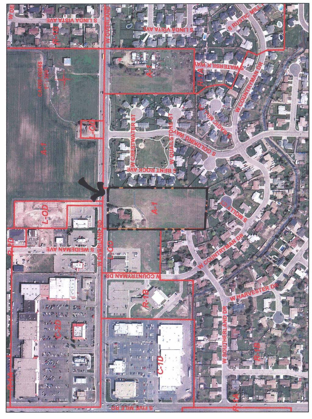
3 a O I Boise City Hall, 2nd Floor Phone: 208/ N. Capitol Boulevard Fax: 208/ f? 0. BOX 500 1DDfI-W: 800/ Boise, Idaho Website: MEMORANDUM TO: Mayor and Boise City Council FROM: Hal Simmons H% Planning Director Boise City Planning and Development Services Department DATE: October 31,2006 RE: CAR / W. Overland Road The following application has been scheduled for November 14,2006: CAR / Cower Mana~ement Group requests approval of a rezone of 5 acres located at W. Overland Road fiom A- 1 (Open Land) to N-OD (Neighborhood Office with Design Review). *** The Planning Commission recommended approval of the rezone at the September 18,2006 public hearing and adopted findings for this decision at the October 2,2006 hearing. Please see the attached documents for your review. TABLE OF CONTENTS Page 2 Summary, Major Issues, and Staff Recommendation Page 4 Vicinity Map Page 5 Aerial Photograph Page 6 Site Plan (CUP ) Page 7 Action Letter fiom September 18,2006 P & Z Hearing Page 8 Action Letter fiom October 2,2006 P & Z Hearing (Reasons for the Decision) Page 10 Minutes fiom September 18,2006 P & Z Hearing Page 23 Planning Division Staff Report (including public and agency comments)
4 CAR Page 2 SUMMARY The applicant is requesting approval to rezone an approximately 5 acre parcel from A-1 (Open Land) to N-OD (Neighborhood Office with Design Review). On September 18 th, the Planning and Zoning Commission heard this rezone request along with an application for a Conditional Use Permit and Subdivision to construct a mixed-use planned development comprised of two office lots and 32 residential units. The Commission determined that the Conditional Use Permit failed to meet all required findings, and as a result denied the Conditional Use Permit, and recommended denial of the Subdivision. The Commission did find the rezone to be in compliance with the applicable findings, and recommended approval of the request based on the findings summarized below. The rezone of the subject property from A-1 (Open Land) to N-OD (Neighborhood Office with Design Review) is in conformance with the goals, objectives and policies of the Boise City Comprehensive Plan. The site is located within ¼ of a mile of the intersection of Five Mile and Overland Road. This intersection is designated as a Community/Activity Center in the Comprehensive Plan. Numerous retail stores, restaurants, and professional offices already exist around this intersection. These amenities are all within walking distance of the subject property. The N-O (Neighborhood Office) zone will provide an appropriate transition to the single-family residential neighborhood from the more intense commercial uses located north and west of the site along Overland Road. The inclusion of the Design Review Overlay District will make certain the site and any structures on the property are designed in a manner that is appropriate given the adjacent residential properties. The rezone will not adversely impact the transportation system or any other public facility in the vicinity. No public agency has voiced opposition to the requested rezone. Correspondence received from the Ada County Highway District indicates the street system will continue to operate at an acceptable level of service. The Highway District will have conditions of approval upon specific development plans for the site. The property is located within the Airport Influence Area. The Boise Airport Manager did not have any objections to the requested rezone. *** Note: Planning Staff originally recommended denial of this request. Staff is concerned that the N-O zone is being used not just to provide office use along Overland Road, but also to increase residential density on a significant portion of the property beyond what the Land Use Map would allow. The N-O zone is not intended to be used as a tool to increase density beyond the Land Use Map Limitations. At the direction of the Planning and Zoning Commission, the applicant has submitted a new, substantially different conditional use permit application. This application will be heard by the Commission on November 13, This conditional use permit should resolve how much residential density is appropriate for the site. ***
5 CAR Page 3 MAJOR ISSUES DISCUSSED Testimony at the Planning and Zoning Commission hearing focused on the Conditional Use Permit and Subdivision applications. While there was little reference to the rezone request, there was testimony regarding the issues outlined below. It is important to note that many of these items are directly affected by the allowances of the requested N-OD (Neighborhood Office with Design Review) zone. Density Compatibility Building Design (Bulk, Mass & Height) Perimeter Setbacks Landscape and sidewalk treatment along Overland Road STAFF RECCOMENDATION Staff recommends approval of CAR
6
7

8 -II SCALE WOODPARK SUBDIVISION BOISE, IDAHO CONGER MANAGEMENT GROUP
9 September 20, 2006 Conger Management Group David McKinnon 405 S. 8 th Street, Ste. 290 Boise, ID Re: CAR / W. Overland Road Dear Mr. McKinnon: This letter is to inform you of the action taken by the Boise City Planning and Zoning Commission on your request for approval of a rezone of +5 acres located at W. Overland Road from A-1 (Open Land) to N-OD (Neighborhood Office with Design Review). The Boise City Planning and Zoning Commission, at their meeting on September 18, 2006, recommended to the Mayor and the Boise City Council approval of the rezone. Staff will be preparing new findings for the rezone approval to be adopted by the Planning and Zoning Commission at the October 2, 2006 hearing. A hearing date will be scheduled before Boise City Council after the adoption of findings. If you have any questions, please contact this department at Sincerely, Cody Riddle Planning Analyst II Boise City Planning and Development Services CR/pe Attachment cc: SWACA / Anne Ellingson / W. Columbia Rd. / Boise, ID Parties of Record
10 October 3, 2006 Conger Management Group David McKinnon 405 S. 8 th Street, Ste. 290 Boise, ID Re: CAR / W. Overland Road Dear Mr. McKinnon: This letter is to inform you of the action taken by the Boise City Planning and Zoning Commission on your request for approval of a rezone of +5 acres located at W. Overland Road from A-1 (Open Land) to N-OD (Neighborhood Office with Design Review). The Boise City Planning and Zoning Commission, at their meeting on September 18, 2006, recommended to the Mayor and the Boise City Council approval of the rezone and directed Staff to prepare new findings. Attached are the new Reasons for the Decision that were presented and adopted by the Planning and Zoning Commission at the October 2, 2006 hearing. If you have any questions, please contact this department at Sincerely, Cody Riddle Planning Analyst II Boise City Planning and Development Services CR/bjc Attachment cc: SWACA / Anne Ellingson / W. Columbia Rd. / Boise, ID 83709
11 Attachment CAR W. Overland Road Page 2 of 2 Reasons for the Decision The rezone of the subject property from A-1 (Open Land) to N-OD (Neighborhood Office with Design Review) is in conformance with the goals, objectives and policies of the Boise City Comprehensive Plan. The site is located within ¼ of a mile of the intersection of Five Mile and Overland Road. This intersection is designated as a Community/Activity Center in the Comprehensive Plan. The plan indicates that higher density residential development and professional offices are appropriate in such locations. Numerous retail stores, restaurants, and professional offices already exist around this intersection. These amenities are all within walking distance of the subject property. The office uses and increased density allowed in the N-O zone are appropriate in this location, and the zoning requirements of this zone will ensure compatibility with adjacent single-family residential homes. The compatibility of the site with surrounding zoning and development will be maintained. The N-O (Neighborhood Office) zone will provide an appropriate transition into the single-family residential neighborhood from the more intense commercial uses located north and west of the site along Overland Road. The inclusion of the Design Review Overlay District will make certain the site and any structures on the property are designed in a manner that is appropriate given the adjacent residential properties. The rezone will not adversely impact the transportation system or any other public facility in the vicinity. No public agency has voiced opposition to the requested rezone. Correspondence received from the Ada County Highway District indicates the street system will continue to operate at an acceptable level of service. The Highway District will have conditions of approval upon specific development plans for the site. The property is located within the Airport Influence Area. The Boise Airport Manager did not have any objections to the requested rezone. Increased density and office activity in this location could help in supporting future public transit along Overland Road, a principal arterial which parallels the northern side of the site.
12 Planning & Zoning Commission Hearing Minutes of September 18, 2006 Commission Members Present Staff Members Present Gene Fadness/Chairman, Brandy Wilson/Vice-Chairman, Doug Cooper, Andy Brunelle, Doug Russell, Amber Van Ocker & Lauren McLean. Angela Wood, Susan Riggs, Carl Miller, Cody Riddle, Scott Spjute, Vicki Van Vliet & Mary Watson (Legal). CAR /Conger Management Group Location: W. Overland Road REZONE 5 ACRES FROM A-1 TO N-OD. CUP /Conger Management Group Location: W. Overland Road REQUEST FOR A PLANNED UNIT DEVELOPMENT CONSISTING OF 32 RESIDENTIAL UNITS AND 2 OFFICE UNITS ON 4 ACRES LOCATED IN A PROPOSED N-OD ZONE. SUB /Woodpark Subdivision Location: On the south side of Overland Road east of Countryman Dr. 38-LOT RESIDENTIAL/COMMERCIAL TOWNHOUSE SUBDIVISION Commissioner Van Ocker will be abstaining due to a conflict of interest. Cody Riddle presented the staff report with a recommendation of denial. Frank Lee (Applicant s Attorney/601 Bannock St./Boise) As I mentioned to you in the letter that you all received, we are disappointed that the staff has made the recommendation that they have when it appears clear to us that this project furthers the Comprehensive Plan, major elements of it, and is exactly the kind of project that this area needs. The guidelines in the Comprehensive Plan are intended to help you consider a wide range of issues so you can make wise planning decisions considering as many factors as are appropriate for the site and the area. These guidelines, like any planning instrument, are naturally and precise and require judgment and flexibility in the interpretation. But the rules aren t fast. The rules give you, the Planning & Zoning Commission as well as the City Council, the discretion to apply these in a way that works
13 Boise City Planning & Zoning Commission Minutes of September 18, 2006 Page 2 the best for Boise. The staff has recommended denial for the reasons you ve just heard. We disagree with staff and feel that this development complies with the Comprehensive Plan and is compatible within the area. This project is an infill site of 5 acres located on a major thoroughfare that is scheduled to be 7 lanes wide, a pretty big road by any standard. The project is within textbook walking distance, i.e. a quarter of a mile, to the center of a designated community activities center with substantial retail and employment opportunities. I have a map that I ve shared with staff that identifies the project site. This is a vision map from the Comprehensive Plan and it identifies the project site in relation to the Five Mile/Overland community activity center and you will see that it is immediately adjacent to it. Commissioner Fadness I ve received from Mr. Lee a vision map with the project site and surrounding uses. Mr. Lee Our analysis of the needs of this area and the public s desire for urban living lead us to believe that this is not the area for more 3-units per acre lots. That s not what the public really is looking for in an area like this and that s not necessarily what the City of Boise needs in an area like this to activate the activity center. Instead, we believe that this site is well suited for the kind of urban living that we will present tonight, the kinds of structures and the kinds of buildings that you saw attached to the letter. The initial meeting with staff was actually very favorable to this. Initially when we were looking at how to zone this sort of property and we looked at the compatibility matrix we saw the N-O. We saw that the N-O allowed the kinds of densities that we thought were appropriate in this particular area based upon our site looks, our site inspections. When you look at the actual designation for this particular area, and I ve got a copy of the land use map with the project site identified on it. Commissioner Fadness I ve received a land use map of the site and surrounding area. Mr. Lee This is another example of sometimes comprehensive plans are not precise in some of the directions that they give, but provide opportunities for you to use discretion and judgment in finding out what s the right thing to do. On this particular site you can see, on this map, the project site indicated. It is an estate density which is on the south side of Overland Road, but it is immediately adjacent to medium density designations which are right across the street. You can see the relationship of the site to the commercial center to Five Mile and Overland and you re just seeing one-half of it, you re not seeing all of it. There is a commercial center and another development. There s the church with some L-O lots there, then the property. This is the natural progression out from the commercial activities center to this site which is going to have neighborhood offices as well as residential. This actually fits within the land use map for the City of Boise. Our team has designed some medium density homes that achieve compatibility with the area through thoughtful design and attention of those elements that make these homes good urban neighbors. I can tell you that the developer here is a big believer in good thoughtful design going a long way to solving some of the issues that zoning does not solve terribly well. Zoning s blunt instruments are setbacks, etc., but good design can help mitigate a setback and mitigate density far better than some of the blunt instruments that the Zoning Ordinance allows.
14 Boise City Planning & Zoning Commission Minutes of September 18, 2006 Page 3 I think well designed homes like this in this area is something that can be made compatible to the adjacent residential and also fits in very well with the City s plans for this kind of area. The homes have attractive elevations with visual diversity, quality materials, and varied rooflines. Please take a look at the plans that you have in your packets attached to the letters. They are close to the street and have reduced number of driveways with garages tucked behind. You will see that these homes are not the standard medium density houses built elsewhere in Boise. They are well designed homes that fit into the area and form a little neighborhood and support urban living near an activity center. Going into staff s reasons, the staff s first primary reason for recommending denial is that the broad stroke of the land use designation for this area, which is 3 units per acre even though important goals favor a medium density project, staff s recommendation puts too much weight on the broad strokes of the Land Use Plan. It doesn t really focus on the other important factors. Estate density allows neighborhood office and allows medium density residential. It gives you guys the discretion to make the kind of decisions about what s really best. The project site is adjacent to medium density land use areas. The project site is adjacent to the L-O zone and within textbook walking distance of the center of the activity area. That makes it close enough for it to help activate that in a way that other projects necessarily couldn t. Though good design, through careful, thoughtful design, compatibility can be achieved with the adjacent residential. The second reason that staff recommends denial is that Policy 12 of Objective essentially states that properties south of Overland Road should be densities of 2 to 4 units per acre. Again this is another example of the imprecise nature of good planning documents like this. This, for planning purposes, really isn t south of Overland Road. It s physically located south, but the influence of this is the 7-lane road of Overland Road. The influence of this property isn t really the residential that s in the proper area south of Overland Road. That s what I think was the intention of that particular component of the Comprehensive Plan. I don t think that they necessarily intended those properties that are adjacent to and really under the influence of Overland Road and adjacent to and under the influence of an activities center such as Five Mile and Overland that fall under this classification. I think that you have the discretion to balance that and go what s better? If the answer is the activities center and the influence of Overland Road, you have the ability to go that way. We think you should. That basically brings us back to what s really at stake here and the question is what s right for the area, what s right for Boise, what s going to work in the Overland Road influence area, what s going to work to help the activities center at Five Mile and Overland. We think this project does and we think this project is and will be, through good design, compatible with the neighborhood. We note that it s in a Design Review zone, though some of you who know me know I m a big believer in good design review, I think that the good aspects of this project will be achieved. Scott Beecham (Applicant/405 S. 8 th St./Boise) I will give you a copy of the elevations which I believe you already have, an office elevation to show consistency in design as well as a rendered site plan. I do very much believe in this development pattern. We look for sites that we think work well with this. We had another project up tonight. It didn t suit the needs so we developed it in a different manner, but I really do believe in medium to high density development pattern. I think it s smart, I think it s smart for Boise especially in this type of location. We are within close proximity to shopping, entertainment and employment, three very critical issues. What
15 Boise City Planning & Zoning Commission Minutes of September 18, 2006 Page 4 Frank pointed out is that this type of use can be approved through what s in front of you today, through the existing Comprehensive Plan, the Consistency Matrix and the zoning. What it says is that it can allow similar uses as long as you achieve the scale and character so we keep coming back to design and the emphasis which Cody clearly pointed out is about design and how do you make these uses fit into an existing neighborhood. Not just the residential side of this neighborhood, we also have an office and commercial environment. We ve got Schucks across the street from us. That s not a particular nice neighbor, but using this transitioning pattern we can transition from the north as well as from the west into this residential neighborhood, which by all accounts, Millcreek and Countryman Estates are very nice neighborhoods. They are well maintained. Countryman, there is a lot of improvement going on right now. You ll hear from a neighbor that s been very involved that s doing a lot with her property and we appreciate that being a property owner in the neighborhood. We were very concerned with massing. We looked at it in three dimensions, modulation on the buildings, variation of materials, varying the building form and varied roof lines help make this work. We ve got two different products, one is kind of a U-shaped courtyard and the other we ve got 4 units attached back-to-back creating courtyards between the buildings. Each of these has pros and cons. We ve maintained perimeter setbacks and we ve designed a product that considers room placement, not just positive and negative space, not just the landscaping and amenities, but also room placement in order to maximize privacy on adjacent properties. I believe floor plans were included in your packets that would demonstrate that. Walking through the site we ve got office that fronts onto Overland and addresses the street with parking tucked behind. The residential is to the south of that with our amenity side located at the terminus of Woodpark Avenue. This is by design. We don t want headlights going into bedroom windows or living rooms. We want to create a nice visual experience. It is a small amenity? I think it is. I would agree with staff but it is appropriate to the use that we are proposing in the target market. We don t expect to have a lot of children in this type of development. There aren t large yard areas. What we ve done is design nice private patio areas that people can look out to on the main floor. We ve included this amenity as a gathering spot so that if people want to get together as a neighbor, have a little block party, they ve got a shade structure, they ve got barbecue facilities, they ve got picnic tables and they do have some grass area. I think we have taken all of these points into consideration. We ve met quite often with staff and with the neighbors. We understand and respect the concerns on all sides. We would ask you to look at the bigger issue and how does Boise want to develop and if not this type of location where you do have activity centers, you do have employment, where is this type of development appropriate? I respectfully disagree that the Comp Plan doesn t allow for it. I think we just need to look at the policies that do support it and we need to promote those and promote smart growth. Commissioner Fadness I would note for the record that we ve received from Mr. Beecham a subdivision drawing as well as one office elevation and two residential elevations. Commissioner Wilson I was just wondering if you could address the issue of amenities a little bit because you admittedly are just proposing one small amenity and for a development of this
16 Boise City Planning & Zoning Commission Minutes of September 18, 2006 Page 5 size we re usually looking for two. Have you considered some other ideas for getting more open space or a different type of amenity in this area in addition to the one you are proposing? Mr. Beecham We considered it in great detail. What we we re trying to provide is a product that is very low maintenance. It s a lock and go type of product so maximizing open space on the interior of the project was not a high priority. What was a high priority was good visual terminus to both streets. We also have a landscaped area coming in off of the existing Countryman, but also a nice street scene and tucking the parking back behind. In the past we ve actually identified that as an amenity. With this development you have eight curb cuts for 32 units. There s significant additional infrastructure required to build these. We think that is a very fair trade-off to get a good street scene, to get nice street trees on that. We didn t try and maximize it for density sake. We tried to achieve a very specific product. Commissioner Cooper You re product is sort of on the middle of the site with the back-to-back units. It looks like it either ends on Southland Drive and with the parking lots you ve just kind of chopped them in half so that the exposed façade at the ridgeline and probably a story and a half of just vertical wall, is that correct? Mr. Beecham It would appear that way, but the units on the end would actually have to be redesigned. The roofline would be redesigned to accommodate that situation so it would have a much lower roofline than the interior unit. Important to note that we do have a Design Review overlay in the zone that we ve requested. We do have an additional step to go through in this process. The product on the south I personally like better. It ended up being a much more thoughtful product in terms of massing. The product to the north, where they are back-to-back, is a product that you ve seen similar product in a number of developments. It s a product I saw in Seattle 4 or 5 years ago designed by Mithun Architects and it s won national awards. It s very well suited for empty nesters and we ve tried to take that design a step further. Commissioner Wilson What about some of the other things like energy conservation measures, etc. Is there any kind of extra effort there that can be counted as part of an amenity? Mr. Beecham Absolutely. That s something that we ve talked about as an ownership group. We very much believe in the energy star and I think there s even some green building practices that are now becoming very affordable and practical to implement. I don t know how that ties into a condition, but we are certainly amenable to talk about that and would happy to put in writing. Commissioner Russell I would be interested to know what your argument is for having the street connect to Overland whereas in the last project you presented tonight you made a pretty good argument that you didn t want to have another connector street there and promote traffic flowing through there, etc.
17 Boise City Planning & Zoning Commission Minutes of September 18, 2006 Page 6 Mr. Beecham In this situation we ve a mix of uses. Terminating the roadway that comes out of Countryman Estates there in a cul-de-sac and then having the offices front onto Overland with a separate access didn t seem to make a lot of sense to us or the staff planners. We actually talked about that. In addition, with Watersilk Subdivision we did have the other two access points into Millcreek that were designed as collectors. It was clearly a consideration of ours when designing the product and minimizing curb cuts. If you look at the aerial, there is a very direct connection from Five Mile Road down Countryman and into our site. That makes a 90 degree turn but then direct access out to Overland. That s an easy, logical cut through so that certainly makes us nervous. What we ve chosen to do is try to design the turn interior to our side as tight as possible to slow that traffic down and we ve also necked down between the office and the residential uses. We ve necked it down and changed pattern in the pavement as you can see in the land plan to try and make a statement that you are transitioning from office to residential but to also slow traffic. I do not believe staff would be in support of no connection at this point. Troy Van Houten (9720 W. Bridge Gate/Boise) We really like what the Conger Group is doing here but we support staff with some of their concerns. One of the things that Millcreek Homeowners Association has championed over the years and has been very successful at with Black Eagle, Time Square, Union Square, is the berming issue. You will see with the elevation, the landscaping plan does not show any berming along the front of the development. Although my preference would be 6 to 8 ft. like Black Eagle, that s not the tendency to be realistic and so we compromised on the Union Square Development, 2 to 3 feet and I don t think that s too far out of scope as we look at compatibility and continuity down the face of Overland. If this were to move forward, this would be the only modern piece of property developed in the last 10 years that wouldn t have berming. We would request again when we look at detached sidewalks we look at berming that those components would be included. Most of the other projects have some type of an entrance. Times Square has the big clock tower. Mill Creek has the waterwheel. Union Square is going to have a large entry there. Black Eagle has the corner signs that are recessed into the berm. As you would drive into this development I would like to see something there, some type of signage or something there that would be built out of stone for compatibility. Betty Bermensolo (Representing the Southwest Ada County Alliance/1970 Cannonaro/Boise) I would like to spend time talking about what was brought to my attention. I was not able to go to the neighborhood meeting when this was proposed. But the concerns that I ve heard from neighbors that were there comes back to more the difference in the mass of these buildings as opposed to some single story homes that they will be adjacent to. I would agree with Scott that everything can be mitigated somewhat with design and many times that s all we have to hold onto is that the design, in the end result, will soften some of the impact of some of the density. We do feel that this could be a very attractive element for this area but we do agree with staff that the magnitude of the units that are being requested, the lack of functional open space for the number of buildings that are going to be proposed. I don t presume to know how many people will actually live in those units, but I think that there should be more time spent in looking at an amenity that includes more open space. We d love to be able to point to this as a good example of infill along Overland, but I think that we have a responsibility to look at the concerns of the
18 Boise City Planning & Zoning Commission Minutes of September 18, 2006 Page 7 people that already live there. I think that s where I disagree with Mr. Lee. When you talk about balance I think that s what staff is trying to achieve, a balance between the people that have been living there for some time and what is being proposed for a parcel that certainly could have increased density, but when you are tripling the density of the existing area I think there would be some question as to whether that would be balance if it were Mr. Lee s neighbor. That s why I m here. I don t live adjacent to this but I always have to look at the people that sometimes stay at home because they don t think it s going to amount to anything to come down here. But there is a need for us to always come back to the Comprehensive Plan and say, as staff did, there does seem to be some protection here for those people that didn t come tonight that have lived in those homes in Countryman Estates for some time now and decreasing the density, decreasing the mass of some of these buildings and providing an area that would be more in the way of adequate open space I think would go a long way to making this a project that we could support. We are always asking for Overland to look and feel less like Fairview and Franklin. One way that we do that is to try and have an element of some kind of berming. The City Council seems to feel that even in Union Square there could be pedestrian access taken off from a detached sidewalk. I have even been singled out before when I missed the boat or Southwest Ada County Alliance missed the boat on Overland Road in not asking for a detached sidewalk when these projects have come forward. Here again we would like to see some berming and something that protects pedestrian access but still invites people to an office area. Those are really the reasons that I feel that I don t know if there s any other Countryman Estate residents, but I did hear from those that did attend the meeting and those were the concerns that were brought forward. I hope that you will consider that likewise. Joyce Barkus (10234 W. Southerland/Boise) I live on the property that directly adjoins this property on the west. Throughout this process all the gentlemen from Conger have been very informative and have provided information to us. But I disagree 100%. This is not compatible with our neighborhood. Mr. Lee speaks about Overland becoming 7 lanes. We don t know when that s going to happen. That could be 20 years down the road. It s not 7 lanes right now and even if it were to become 7 lanes it s going to be harder and harder to get out onto it. It is now already. A 32 unit density with the neighborhood offices up front with one practitioner office, originally the plan was to have 4-plexes with two 2-stories and two 1-stories. We weren t crazy about but that has now become 4-plexes with all 2-stories and it went from approximately 1,500 sq. ft. per house to 1,300 sq. ft. and some 1,900 sq. ft. 1,900 sq. ft. is plenty of house to have 2 or 3 kids. There might not be much of a yard, but there s going to be kids and animals. Three of these units which are 6 houses look directly into our back yard. We have a large yard so we are going to lose our privacy completely. We re not going to ever be able to see the morning sun ever again. I realize that progress takes its toll on all of us. We don t object to building on the property, but not 32 units on a 3 acre parcel. We ask that you consider the area. It has historically been rural. The neighborhood itself is primarily retirees who have invested a lot of money in their homes. These homes are worth upwards of $200,000 to $250,000 many of them in the $400,000 and $500,000 range. Mr. Lee said it s a transportation center. Granted Overland and Five Mile are very busy. There s no bus service. The bus service was discontinued last year shortly after we bought our property. With the street that is going to go
19 Boise City Planning & Zoning Commission Minutes of September 18, 2006 Page 8 through Overland and we don t object to that. We see the necessity for it, but it s going to increase the traffic that s going to turn off of Overland and try to beat that stop light at Five Mile. The design originally we had some 1-stories mixed in there which kind of help alleviate our privacy concerns a little bit. Now they are all 2-story and frankly they are looking pretty boxy. The 15 ft. setback is of great concern to us. This adjoins our side yard which has a 15 ft. to our fence. If they were to build a shed or anything or build anything on the back of their property and go to that 5 ft. they are going to be looking into our family room and down our hall to bedrooms. We don t want that kind of density. We do welcome some building but we would appreciate you d vote to deny that kind of a density. Evelyn Grime (1611 Warren St./Boise) I am not a part of this design team. As a proponent of infill design and understanding the issues before us with the City of Boise and how we grow, a concern with Southwest Boise is the general annexed and land use designation was estate density and this rural feel. I think that s important because that was something that was compromised between the people in those neighborhoods at the time of annexation and with the growth of the City of Boise. We do have an activity center. We have an intersection. We have zoning also across the street that is going on. As I read in the staff report, we have under the approval process right now the PCD/DA zone across the street and we have also a responsibility in planning and in designing neighborhoods to transition from commercial uses to the lower density in neighborhoods. Just as a kind of an assist in melding of these two sides I thought I would offer my opinion for whatever it is worth. The existing Countryman, Millcreek neighborhoods I applaud for their cohesive effort in expanding their neighborhoods and making these connections. But I think also a planning tool to protect those neighborhoods is to have a difference of density between office use and low density housing. So the higher density proposed with this subdivision helps achieve that protective buffer between the offices and the commercial uses and the more spacious neighborhoods that are in effect. From a design element I would say that I think coming down the street whether you are coming from Southerland or Overland, if you study the elevation pattern you really only see two homes at a time. I think that is a pretty effective design tool. If you look at the depth of this lot compared to the C-1D to the west and the church uses in the L-OD to the west, the lot depths of this is comparable to the lot depth of the commercial both north and south of Overland. So as an opportunity for an occasional infill development as we move into Southwest Boise, which isn t as west as it feels, I think it s good to consider some infill projects that are detailed well for a good fit. This is a hard one. Just some notes on the idea of planning and buffering and density and then also using those design tools I think is actually a commendable effort. It addressed the context of the intersection and where that neighborhood is growing. Commissioner Wilson In the staff report it talks about how N-OD isn t really an appropriate zone for this because it s intended to create an office use within an existing neighborhood. I was wondering if you were looking at approaching trying to do an infill type style development on this parcel, what zoning would you suggest?
20 Boise City Planning & Zoning Commission Minutes of September 18, 2006 Page 9 Mr. Riddle I believe if you refer to staff s final recommendation in the report we suggested that N-O may be appropriate. That some office use near Overland would be appropriate but we would like to see a transition to the single family residential lots to the south and to the east and the southern half of the western property line. That could be achieved through a modified conditional use application that could possibly include a development agreement so it s tied down even further. Commissioner Wilson I d like the applicant to address the detached sidewalk and berming question that came up. Mr. Beecham At this point what we ve done is a fairly general landscape plan. What we propose is a 30 ft. landscape buffer. It doesn t address berming per se, but you ve got two different matrix. One is horizontal and the other is a vertical offset. We can accommodate some berming tying into the 6 or 8 ft. berms obviously does not work for a commercial environment. We can get a little bit of modulation within that 30 ft. and are happy to do so. What we need to preserve is some open view corridor into these. We ve tried to concentrate on better architecture rather than berming and intensive landscaping there that would block the view. In terms of the sidewalk we have ample room there to do a detached sidewalk. I ve got to tell you after walking the site a number of times I do not disagree with these guys. It is a little daunting to walk on a 4 ft. sidewalk when cars are going past you at 50 mph. It s a 40 mph speed limit, but there aren t many going that speed. We re happy to do that. It s really an issue with ACHD. I know City Staff is maybe on the fence because it is in opposition to ACHD, but we re happy to do it. It s at our cost. The concern is future public cost of having to remove that improvement. The neighbors have brought some great points. We have met with them on a number of occasions. We are definitely sympathetic to the concerns. We made an extra effort and think we ve done a really good job of working with the architecture and working with density by design. Is privacy an issue in these transitional areas? I think often times it is. If you look at our floor plans we ve tried to place rooms in such a way that you don t have public spaces and rooms overlooking fence lines. I can tell you with regard to a compromise type situation we did go back to the drawing board and instructed the architect to play close attention to that because it is a real issue in people with single story homes that have enjoyed this rural area that s turned urban on them and a lot of that activity has been very recent. We are compassionate to that. Regarding signage, we believe sense of place is very important. We like to achieve that through design. I think signage is a subjective thing. Sometimes it becomes very contrived and detracts from a community. We would like to do a very classy understated signage at the entry and we will do that. That will be under separate application though. We respect the issue of mass. In three dimensions we re very happy with the product that was developed for this. Is it final? No, we still need to go through the final tweaking process and through the Design Review process. I would be the first to admit, even though I think we ve done a good job, there s room for improvement and I think we can work with the Design Review Committee to get there and we ll continue to work with the neighbors. Lack of open space, again, it s by design. It becomes a burden either through individual maintenance or cost of maintenance at some point. What we prefer to do is put better attention to detail and design and bigger plant material and nicer
21 Boise City Planning & Zoning Commission Minutes of September 18, 2006 Page 10 detailed plantings in these types of developments. We ve done it in the past and it s been very successful and we re confident that we can do that here as well. Mr. Lee There are two important points not to lose sight of. First is compatibility can be reached through good design and it is a great tool for urban cities, like this one, to use. The neighbor talked about my neighborhood. Well, there actually is a great example of compatibility through good design in my neighborhood. I live over by Manitou Park and there are come condominium projects that caught the ire of the neighborhood. Some people, and I was one of them, saw that what they were proposing was something used windows and walls and good design to be good neighbors, respected privacy, added to the neighborhood. It s one of the neighborhood s better projects now. People like it and hardly even notice that it s denser than that which surrounds it. One of the neighbors brought up that ACHD right-of-way is 20 years from now. I m not so sure I believe that. They are buying a lot of right-of-way. They are paying full value. This was once a rural area. It s urbanizing. 20 years isn t that long of a period in a planning horizon when you are talking about buildings that will last 100 years. 20 years will come sooner than we think. Now is the time to start thinking about the way that this intersection, this area will be 20 years from now because these buildings will be here 5 times long than that and the question is what do we want to see in this area of Boise? How does Boise want to grow and how will Boise grow over the next 20 years and I think that this project fits in very well with what the vision is of Boise with the type of places that people want to live and this particular area for this location. It s the kind of growth that we need more of in Boise and it s the kind of growth that works well. It s the kind of growth that this Commission should support and approve. We mean it when we say good design. The discussions here will be picked up by the Design Review Committee and we want the Design Review Committee to hold us to it. We will meet our promises. COMMISSIONER RUSSELL MOVED TO APPROVE CAR COMMISSIONER MCLEAN SECONDED THE MOTION. Commissioner Russell I think the applicant has provided us with a nice product. I have some things that I would like to deal with under the CUP, but I think as far as the rezone goes I think that it does meet the intentions of the Comprehensive Plan and I support the rezone. Commissioner Cooper After a lot of thought I m going to support the motion. After looking carefully at the site plan I think this parcel is uniquely situated to be thought of as a buffer or a transition from the commercial to the residential areas and so I think the increased density is appropriate in this spot. MOTION FOR APPROVAL CARRIED WITH COMMISSIONERS VAN OCKER AND BRUNELLE NOT PRESENT. COMMISSIONER RUSSELL MOVED TO APPROVE CUP06-74 WITH AN ADDED CONDITION TO LIMIT THE DENSITY TO 24 RESIDENTIAL UNITS.
22 Boise City Planning & Zoning Commission Minutes of September 18, 2006 Page 11 COMMISSIONER WILSON SECONDED THE MOTION. Commissioner Russell I like the project. I like the architectural renderings that the applicant has provided. I think that they ve gone to a great effort to create a good project. The issue that I do have is that I think that 32 units is not necessarily in agreement to some of the surrounding conditions that we have in the adjacent neighborhoods. I think we saw a project presented earlier tonight that really took a hard look at being compatible and I think that although we do have a transition area here, I think that we should go with some higher density. I think that 32 is a bit much. I think when you look at the adjacent properties that surround this piece, I m concerned about some of the wall effect that s going to be created, particularly with these units that are in the middle that have these long walls that are adjacent to the east and west properties. I agree with the applicant that these units on the south might be a bit nicer and I m curious if we can t take that design, eliminate 8 units and disperse it to the north and get a little bit better layout that has some better space in between the buildings. It will have less impact on the property to the west. I m definitely concerned about these 3 units just north of Southland Drive on the west boundary adjacent to this property owner that spoke tonight. I m concern about the impact that s going to have. I m also concern about the impact it s going to have to the properties to the east. I m of the opinion that we eliminate 8 units, go back, do a little site design revision where we re going to create ourselves a little bit more landscape area and have just a little bit lower impact on the adjacent residential area. I like the way that the commercial area has been designed. I don t really see a dire need for a berm. I do like the idea of a detached sidewalk. I think some good points have been made tonight regarding detached sidewalks, but I think that in going through the Design Review process and addressing the landscape issues we can leave the berm up to Design Review. The only way that I can support the project is if we do eliminate 8 units and look at a little bit different design as we move forward. Commissioner Wilson I seconded the motion that we could get a discussion going. One of the things I m concerned with about the motion that has been made is that it really substantially changes the project. Taking out 8 units is a pretty good chunk of it. I m reminded of what we did with Crescent Rim when we wanted them to decrease their overall project by about 10%. The way that we ended up having to do that, which is kind of messy but it s the most straight forward for us, was denying the project and then recommending that they come back with a lesser density and then they came back with a different site plan that we could then look at. I m a bit uncomfortable giving an approval for something that we re not really getting to look at because I think that the developer has made a pretty strong case for why they ve chosen this density and why they brought this forward to us even though they knew that staff was going to prepare a denial for it. I have a really hard time approving it without having the two required amenities in writing. I think that s a fundamental flaw with it and if they would have come to us saying that instead of just one amenity, they d like to go ahead and propose two and the second one is going to be that all these are going to be built to energy star ratings or they are going to put solar power on the roofs, or something like that. There s a lot of other things that they could do in addition to open space to help out with the amenities. One of the my other concerns with the
23 Boise City Planning & Zoning Commission Minutes of September 18, 2006 Page 12 project is that the 15 ft. side yard setbacks abutting the other 15 ft. side yard setbacks on the west side. In the previous application we heard we approved 15 ft. setbacks because the adjoining properties had pretty substantial setbacks and so I felt that gave a lot more space, especially since we are going from a single story neighborhood to a 2-story neighborhood. There are some things that I am still concerned with too and I think if we have enough concerns we should probably go down a different path. Commissioner McLean I started out pretty skeptical with the whole project but with the way this was presented I m actually more comfortable approving it as presented as opposed to start taking it apart and create requirements. I actually call to mind a couple of other projects where we started taking them apart, thought we were going to see something very different because we thought it was too dense. We asked for 1-story, different things. It came back very different and ended up not being at all what I had hoped to see happen. I m going to vote against the motion as long as it requires changes to this plan. Commissioner Cooper I too think this one is kind of pushing it a little bit. I generally would support a dense project on this site. But, I think Commissioner Wilson has good point about the fact that we re making a substantial change and we re not going to see it again. That gives me some discomfort so I probably won t support the motion. COMMISSIONER RUSSELL I WOULD BE WILLING TO WITHDRAW THE MOTION IF THE SECOND CONCURS. COMMISSIONER WILSON I WILL CONCUR. COMMISSIONER RUSSELL MOVED TO DENY CUP COMMISSIONER COOPER SECONDED THE MOTION. Commissioner Russell I definitely appreciate some of the things that Commissioner Wilson has brought up as far as not being able to see the project again. My view on this is I have a hard time approving it with 32 units. I definitely am concerned about the impact that these buildings are going to have on the adjacent single family properties. I think in my mind I could easily support 24, but I do agree that we probably should see the site plan. I recommend that we stick with some of the same architectural styles if this should come back. I don t think that this meets the criteria and findings that it needs to meet, in particular that I don t think that there is any way that this project, in its current form, is not going to adversely affect the adjacent properties. I can t support it. Commissioner Wilson I m sorry that this ended up going the way of denial because I m with Commissioner Cooper. I m really into density and I think that the best way to preserve any kind of rural feel around the City is to urbanize as much we can within the City and I would also like to see instead of Overland going to 7 lanes, I would love to see some actual transit out there. It would be great to bring in a trolley or something and to do that you have to have the rooftops and
24 Boise City Planning & Zoning Commission Minutes of September 18, 2006 Page 13 the density. From that perspective I completely support the project. The problem that I have is the 15 ft. setback with the 2-story adjacent and if we could even just step down some of those units that are on the outside edges of the site plan, I think that would go a long way. I don t fully agree with Commissioner Russell that we need to dramatically decrease the density, but I think that you could drop some of that height if you re intending to stick with the 15 ft. setback and then come back to us with something that is substantially different that we could reconsider within the year s timeframe so you guys wouldn t have to wait. I think just the way that it is proposed that staff is right on and it doesn t meet enough findings for us to be able to approve it tonight. Commissioner Cooper I think architecturally I wouldn t change much other than reducing the number of units. I d recommend that with that reduction that we add that second amenity. It s a pretty straight forward requirement that we re supposed to meet. I would recommend not berming or minor berming. I think that these berms on Overland just basically give up any pedestrian friendliness to that street and give it to the automobile. I think you need to see the fronts of those buildings along Overland. Commissioner Fadness I m very much in support of what Commissioner Cooper said about not changing the design too much. I really like the design. I like the approach of the visual of just the two homes from every angle. The density is the issue but I do appreciate the design and I hope that you don t have to stray too far from that. I agree very much with Mr. Lee that he is a protector of good design. I ve seen him in Design Review and so I trust that ultimately it will be a project that hopefully will be as good as its design if not better. MOTION TO DENY CUP06-74 CARRIED WITH COMMISSIONERS VAN OCKER AND BRUNELLE NOT PRESENT. COMMISSIONER WILSON MOVED TO DENY SUB COMMISSIONER RUSSELL SECONDED. Commissioner Wilson SUB06-70 was tied to CUP06-74 and since we denied the CUP, we also denied the subdivision. Commissioner Russell In my opinion the subdivision is proposing 32 residential units and to me that density is too much. I think based off of that I m not in favor of it. I think that we have determined it s just not compatible with the surrounding area. I definitely don t support the design of the subdivision. MOTION TO DENY CARRIED WITH COMMISSIONERS VAN OCKER AND BRUNELLE NOT PRESENT.

25 4/5 Planning Division Staff Report File Number CAR & CUP Applicant Conger Management Group Property Address W. Overland Road Public Hearing Date September 18, 2006 Heard by Boise City Planning and Zoning Commission Planning Analyst Cody Riddle Planning Supervisor Scott Spjute Table of Contents 1. Executive Summary 2 2. Facts, Standards of Review & Analysis 3 3. Reasons for the Decision 8 4. General Information 9 5. Boise City Comprehensive Plan Boise City Zoning Ordinance 12 Attachments Vicinity/Zoning Maps Site Plan Applications Applicant s Support Material Agency Comments
26 CAR & CUP Boise City Planning and Zoning Commission / September 18, /5 2 of Executive Summary Description of Applicant's Request: Conger Management group requests approval of a rezone of ± 5 acres located at W. Overland Road from A-1 (Open Land) to N-OD (Neighborhood Office with Design Review). Also requested is a conditional use permit to construct a planned unit development consisting of 32 attached residential units and 2 office lots. Staff's Recommendation: Staff recommends denial of CAR and CUP Summary: The applicant is requesting approval to rezone an approximately 5 acre parcel from A-1 (Open Land) to N-OD (Neighborhood Office with Design Review). Along with the rezone is a request for approval of a Conditional Use Permit to construct a mixed use planned development. The planned development is to be comprised of 32 residential and 2 office lots. The residential units are to be in the form of townhouses attached in groups of four. Woodpark Subdivison (SUB ) is being reviewed concurrently with this request. Staff finds the development fails to meet several of the findings required for approval. The subject property is designated as Estate Density 3 on the Land Use Map of the Boise City Comprehensive Plan. While N-O (Neighborhood Office) is listed one of several permissible zones within this classification, it is inappropriate in this situation. The purpose of the N-O zone is to provide for professional offices and similar uses adjacent to or in proximity to residential uses. The zone is intended to allow office uses serving nearby neighborhoods in buildings and on sites that are small relative to office developments in other zoning districts. Development is intended to be of a scale and character similar to nearby residential development to promote compatibility with the surrounding area. The N-O zone is not intended to accommodate residential densities at nearly three-times that of surrounding development. The project is not in conformance with the goals, objectives and policies of the Boise City Comprehensive Plan. Policy indicates that properties on the south side of Overland Road, north of the Planned Community designation are intended for subdivision and development at densities generally between 2 and 4 dwelling units per acre. The residential portion of the planned development is proposed at nearly 9 units per acre. The proposed development is not compatible with the surrounding neighborhood in terms of bulk, mass, density and lot configuration.
27 CAR & CUP Boise City Planning and Zoning Commission / September 18, /5 3 of Facts, Standards of Review, and Analysis Type Application: The applicant requests the following: Rezone from A-1 (Open Land) to N-OD (Neighborhood Office with Design Review) Conditional Use Permit for a Planned Unit Development including 32 residential units and 2 office lots Applicant/Status: Conger Management Group / Owner s Representative Location and Site Description: The site is addressed at W. Overland Road. It is located on the south side of Overland, approximately ¼ mile east of Five Mile Road. The property is located within the boundaries of the Southwest Ada County Alliance Neighborhood Association and the Southwest Planning Area as designated on the Land Use Map of the Boise City Comprehensive Plan. Zoning, Zoning Allowances, and Comprehensive Plan Designation: The property was annexed by the City of Boise on December 29, 2004, with the zoning designation of A-1 (Open Space). The applicant has requested a rezone to N-OD (Neighborhood Office with Design Review). Planned unit developments are allowed in this zone with conditional use approval. The Comprehensive Plan Land Use Map designates this property as Estate Density Residential (3 DU/acre). The Land Use Consistency Matrix of the Comprehensive Plan supports rezones to N-OD for this land use designation. The A-1, A-2, R- 1A, R-1B and L-O zones are also acceptable classifications within this area. Development Proposal: Conger Management Group requests approval of a rezone of ± 5 acres located at W. Overland Road from A-1 (Open Land) to N-OD (Neighborhood Office with Design Review). The applicant has also requested approval of a conditional use permit to construct a planned unit development comprised of 32 residential units. The proposed planned development utilizes reduced lot sizes, lot width and interior side yard setbacks. History of Previous Actions: The subject property was annexed by the City of Boise on December 29, 2004 (CAR ) with a zoning designation of A-1 (Open Land).
28 CAR & CUP Boise City Planning and Zoning Commission / September 18, /5 4 of 13 Standards of Review Section AMENDMENT, RECLASSIFICATION *** Section Public Hearing The Planning and Zoning Commission shall advertise, provide notice and conduct a public hearing in accordance with Section of this Ordinance for each application to amend this Ordinance or to reclassify a zoning district. Any recommendation of the Commission relating to change, modification and reclassification of zoning districts and land use classifications and the regulations and standards thereof shall be in writing. The recommendation shall include findings of fact supporting the purposes and objectives of zoning and otherwise securing public health, safety and general welfare. The recommendation shall specifically find that such changes, modifications and reclassifications of zoning districts and land use classifications and the regulations and the standards thereof: A. Comply with and conform to the Comprehensive Plan; and B. Provide and maintain sufficient transportation and other public facilities, and does not adversely impact the delivery of services by any political subdivision providing services. C. Maintain and preserve compatibility of surrounding zoning and development. *** Section Criteria and Findings The Commission, following the procedures outlined below, may approve a conditional use permit when the evidence presented at the hearing is such as to establish: A. That the location of the proposed use is compatible to other uses in the general neighborhood; and B. That the proposed use will not place an undue burden on transportation and other public facilities in the vicinity; and C. That the site is large enough to accommodate the proposed use and all yards, open spaces, pathways, walls and fences, parking, loading, landscaping and such other features as are required by this title; and D. That the proposed use, if it complies with all conditions imposed, will not adversely affect other property of the vicinity; and E. That the proposed use is in compliance with and supports the goals and objectives of the Comprehensive Plan.
29 CAR & CUP Boise City Planning and Zoning Commission / September 18, /5 5 of 13 F. Multiple family building (any building containing more than 2 residential units) must be designed to include features which add to the visual and aesthetic appearance of the structure and help prevent a sterile, box-like appearance. Such features may include the use of brick or stone, roof or facade modulation, planter boxes, bay windows, balconies, porches, etc. The Commission or committee must make a finding that specific design features have been added to enhance the physical appearance of such multiple-family residential structures. *** Section Development Standards A. Changes from the development standards of the underlying zone may be approved. For planned unit developments in the R-1M District, only minor changes consistent with the purpose of the R-1M zone may be approved. B. Planned Development Size: The minimum size for a planned development shall be as follows: 1. Planned residential development - no minimum. *** 4. Planned office development-two (2) acres. *** C. Residential Density: The number of dwelling units allowed in a planned development shall be calculated by dividing the gross area, less the area set aside for nonresidential uses (that is, office, commercial or industrial), by the minimum lot area per dwelling unit required by the zone in which the site is located. D. Amenities: Two or more of the following amenities shall be provided as part of each planned development greater than one (1) acres in size: 1. Energy conservation measures such as solar access with active solar heating or water heating capacity, or water conservation measures such as adherence to water-efficient landscaping principals including the use of drought-tolerant native and naturalized plants. 2. Private active recreational facilities such as a swimming pool, tennis court, or playground, picnic area, etc. of a size appropriate to meet the needs of the development. 3. Landscaped open space of at least 10% of gross area excluding required setbacks. 4. Provision for public access to or additions to the Boise River Greenbelt, neighborhood park system or other public open space.
30 CAR & CUP Boise City Planning and Zoning Commission / September 18, /5 6 of A Class I public bicycle circulation system to connect to existing or planned routes on the periphery of the development. Such facilities shall be designed and constructed in accordance with The Bicycle Pedestrian Design Manual for Ada County. 6. Other amenities as approved by the Planning and Zoning Commission. *** F. Required Setbacks: Attached structures may be permitted in planned developments. Along the periphery of planned developments, yards shall be provided as required by the regulations of the district in which the development is located unless the Commission provides an exception as provided for in Section Where development already exists at the periphery, the yards shall, where practical, be matched. For example, side yards should be provided adjacent to side yards, rear yards adjacent to rear yards and front yards opposite front yards. G. Service drive design and construction shall comply with the requirements of the Zoning Ordinance. Private street design and construction shall comply with the requirements of the Subdivision Ordinance. *** Analysis Staff finds the development fails to meet several of the findings required for approval. The applicant is requesting approval to rezone an approximately 5 acre parcel from A-1 (Open Land) to N-OD (Neighborhood Office with Design Review). Also proposed is a conditional use permit to construct a mixed use planned development that is to include both office and residential uses. Two office lots are proposed along Overland Road, consuming approximately 1.38 acres of the 5 acre site. The remaining 3.62 acres include 32 residences at a density of 8.84 dwelling units per acre. The Open Land Zone does not allow residential development in excess of one dwelling unit per acre. The purpose of the Open Land classification is to provide a zoning district within the city for rural residential neighborhoods and uses requiring larger expanses of land, such as golf courses, parks and schools. The subject property is designated as Estate Density (3 Dwelling Units/Acre) on the Land Use Map of the Boise City Comprehensive Plan. The vision for this land use designation is to support slightly higher densities in the developed portion of the Southwest Planning Area. The Land Use / Zoning Consistency Matrix does indicate that N-O may be a permissible zoning district within lands classified as Estate Density 3. Other potential zoning districts within this land use classification are R-1A (Single Family Residential with 2.1 DU/Acre), R-1B (Single Family Residential with 4.8 DU/Acre) and L-O (Limited Office).
31 CAR & CUP Boise City Planning and Zoning Commission / September 18, /5 7 of 13 The subject property is designated as Estate Density 3 on the Land Use Map of the Boise City Comprehensive Plan. While Neighborhood Office is listed as one of several permissible zones within this classification, it is inappropriate in this situation, given the accompanying planned development proposal. The purpose of the N-O zone is to provide for professional offices and similar uses adjacent to or in proximity to residential uses. The zone is intended to allow office uses serving nearby neighborhoods in buildings and on sites that are small relative to office developments in other zoning districts. Development is intended to be of a scale and character similar to nearby residential development to promote compatibility with the surrounding area. The N-O zone is clearly not intended to accommodate residential densities at nearly three-times that of surrounding development. This is evident in The Land Use / Zoning Consistency Matrix which does not list R-1C (Single Family Residential with 8 DU/Acre) or R-2 (Combined Residential with 14.5 DU/Acre) as permissible zones within the current land use designation. The residential portion of the planned development is proposed at nearly nine dwelling units per acre. Staff finds the project fails to comply with the goals, objectives and policies of the Comprehensive Plan, including those specific to the Southwest Planning Area. Policy states: Properties on the south side of Overland Road, north of the Planned Community designation are intended for subdivision and development at densities generally between 2 and 4 dwelling units per acre. When development occurs with annexation, the R-1B zoning standards and attendant PUD provisions are applicable and appropriate. When development occurs in the county, zoning that closely replicates the R-1B should be selected. Unless open space is provided that approximates that required by the Boise PUD requirements, county subdivisions should not exceed 3.5 dwelling units per acre. While the office portion of the development is appropriately located along Overland Road, staff finds the residential aspect of the project to be incompatible with the surrounding single-family homes. The 32 residential units are to be comprised of 8 structures, with 4 attached townhouses included in each building. Each of these buildings are to include two-story construction. Policy of the Comprehensive Plan requires all new residential development in existing neighborhoods be compatible with existing structures by incorporating complimentary setbacks, building heights and bulk. With the exception of two parcels near Overland Road, the project site abuts single family residential homes on larger lots. These single-family homes include both one and two story construction, but are significantly smaller in terms of bulk and mass when compared to the proposed multi-family buildings. The proposed lots are about 1/3 of the size of adjoining parcels, and much of this ground is consumed by paved surfaces to accommodate vehicular circulation. As a result, there is only minimal outdoor open space associated with the individual parcels. The open space that has been included is primarily located within the setback areas and provides very little privacy for the residents of the project or adjoining parcels.
32 CAR & CUP Boise City Planning and Zoning Commission / September 18, /5 8 of 13 In addition to the lack of open space on individual lots, the planned development fails to provide adequate amenities for the residents. The only public open space provided within the development is a 5,000 sq. ft. common lot located along the southern perimeter of the site. As a point of reference, at 5,000 square feet, the common lot is nearly half the size of the smallest parcel adjoining the project site. The common lot has not been centrally located, and only includes a small shade structure, barbecue pit and outdoor seating. No active recreation facilities have been incorporated into the site. Staff finds the common lot and proposed amenities are not large enough to support a 32 unit residential development. *** Street Connectivity & Sidewalk Design Southerland Drive is currently stubbed to the southwestern corner of the subject property. The applicant has proposed to extend Southerland into the project site and connect to Overland, an arterial roadway to the north. Along with the street connection, attached sidewalks will provide for pedestrian connectivity from Overland Road to the existing residential neighborhood. Attached sidewalks are an appropriate design solution, matching the existing walkways already located along Southerland. *** Recommendation Staff finds the application fails to meet all required findings and recommends denial of CAR & CUP To obtain approval, the applicant could re-design the project in conformance with the Land Use Map and goals, objectives and policies of the Comprehensive Plan that apply to this property. This might be achieved with a lower density project that incorporates additional centrally located open space and a mix of housing types that better responds to adjacent land uses. To provide some assurance as to the appropriateness of development on the parcel, future applications could include a development agreement. *** 3. Reasons for the Decision Neighborhood Office is an inappropriate zoning designation in this location. Development in the N-O zone is intended to be of a scale and character similar to nearby residential development to promote compatibility with the surrounding area. The N-O zone is clearly not intended to accommodate residential densities at nearly three-times that of surrounding development. This is evident in The Land Use / Zoning Consistency Matrix which does not list R-1C (Single Family Residential with 8 DU/Acre) or R-2 (Combined Residential with 14.5 DU/Acre) as permissible zones within the current land use designation. The project does not comply with the goals, objectives and policies of the Comprehensive Plan, including those specific to the Southwest Planning Area. Policy indicates that properties on the south side of Overland Road, north of the Planned Community designation are intended for subdivision and development at densities generally between 2 and 4 dwelling units per acre. The residential portion of the proposed planned development includes a density of nearly nine dwelling units per acre, and does not include adequate amenities or open space for the future residents. ***
33 CAR & CUP Boise City Planning and Zoning Commission / September 18, /5 9 of General Information Notifications: Neighborhood Meeting held on: June 27, 2006 Newspaper notification published on: September 2, 2006 Radius notices mailed to properties within 300 feet on: September 1, 2006 Staff posted notice on site on: August 21, 2006 Size of Property: ± 5.0 Acres Land Use Existing Land Use: The site is currently occupied by a single-family residence. Hazards: Staff is unaware of any hazards on or adjacent to the project site. Adjacent Land Uses and Zoning: North: Overland Rd, then Undeveloped Parcel / A-1 (Open Land)* North: Overland Rd, then Commercial Development / C-2D (General Commercial w/ D. Review) South: Single-Family Residences / R-1A (Single-Family Residential) East: Single-Family Residences / R-1A (Single-Family Residential) West: Single-Family Residences / R-1B (Single-Family Residential) * This parcel has received approval of a rezone to PC-D/DA (Pedestrian Commercial with Design Review and a Development Agreement) and R-2D/DA (Combined Residential with Design Review and a Development Agreement). Recording of the development agreement and final readings of the rezone have yet to be completed. Setbacks N-O BUILDING SETBACKS PARKING LOT AND SERVICE DRIVE SETBACKS Standard Rear or Side Yard Abutting a Residential Use or District Standard Front/side adj. to street 15' 15' 20' 20' Interior side & rear 5' 10' 5' 10' yards - 1 story 2 or more stories 5' 10' 5' 10' Rear or Side Yard Abutting a Residential Use or District Yards adjacent to the20 NA 10 NA Interstate or Connector *The applicant is proposing to meet or exceed all required perimeter setbacks. The exceptions to interior setbacks are outlined below.
34 CAR & CUP Boise City Planning and Zoning Commission / September 18, /5 10 of 13 EXCEPTIONS (INTERIOR TO DEVELOPMENT): EXCEPTIONS REQUIRED MINIMUM PROPOSED Front & Street Side Setbacks 15 5 Interior Side & Rear Yard Setbacks 5 &10 0 Lot Size (Residential) 3,000 sq. ft. 2,739 sq. ft. Street Frontage 30 7 ±* *The applicant is proposing to utilize common driveways to provide access to the residential lots. *** Parking Land Use Unit Of Measure General (Parking Space) Office Per 250 s.f. net leasable area 1 Single Family Residential Per Unit 2 Density Zone Total Acres Units Per Acre Allowed By Zoning Total Units Allowed By Available Acreage N-OD 5.0 Acres (3.62 x 14.5) = Proposed Units 32 *** 5. Boise City Comprehensive Plan This project is located in the Southwest Planning Area with the following specific or applicable goals, objectives and policies in the Boise City Comprehensive Plan. Policy Throughout the Southwest area, particular attention shall be paid to new development to ensure compatibility with existing development including street system interconnections. *** Policy Properties on the south side of Overland Road, north of the Planned Community designation are intended for subdivision and development at densities generally between 2 and 4 dwelling units per acre. When development occurs with annexation, the R-1B zoning standards and attendant PUD provisions are applicable and appropriate. When development occurs in the county, zoning that closely replicates the R-1B should be selected. Unless open space is provided that approximates that required by the Boise PUD requirements, county subdivisions should not exceed 3.5 dwelling units per acre. ***
35 CAR & CUP Boise City Planning and Zoning Commission / September 18, /5 11 of 13 Additional Boise City Comprehensive Plan Goals, Objectives and Policies CHAPTER 6 TRANSPORTATION *** Objective Encourage completion of the existing street system and creation of new links, within reasonable constraints, as the transportation system develops. *** Policy All new development shall be reviewed for appropriate opportunities to connect to local roads and collectors in adjacent developments. *** CHAPTER 7 COMMUNITY QUALITY *** Objective Provide for the protection of character and the enhancement of services in existing residential neighborhoods. Policy Require that all new residential development in existing residential neighborhoods (i.e., infill) be compatible with existing structures, including the following criteria: 1. Use of complimentary setbacks, building heights, grade elevations, orientation, bulk, building materials, colors and forms, while allowing flexibility for distinctive design solutions. 2. Maintenance of privacy. *** CHAPTER 8 LAND USE *** Objective The land-use map and attendant policies shall be the official guide for development of the planning area and shall be implemented through zoning and development review. Policy The Land Use/Zoning Consistency Matrix shall identify the zoning districts that are permissible within each land-use designation. Conformance with the Land Use/Zoning Consistency Matrix shall be a necessary finding of approval for all zone changes and conditional uses, unless one or more of the forms of flexibility identified in the policies under Objective 2 are implemented. ***
36 CAR & CUP Boise City Planning and Zoning Commission / September 18, /5 12 of 13 (excerpt from) Land Use / Zoning Consistency Matrix 1) Land Use A R-1A R-1B R-1C R-1M R-2 R-3 N-O L-O Estate Residential 3 X X X X X *** Policy Zone change requests that are consistent with the Land Use/Zoning Consistency Matrix and the policies of the Boise City Comprehensive Plan should be approved by the City pursuant to appropriate findings related to service levels and other requirements of the Boise City Comprehensive Plan. *** Table Definitions of Land Use Map Designations Land Use Applies To Allowed Uses and/or Limitations Estate Density Residential 3 Slightly higher density in the developed portion of the Southwest area 9,000-square-foot lots, overall target density of 3 units per gross acre. Clustering of units through Planned Unit Developments (PUDs) may be allowed on smaller lots. *** Objective Residential land-uses shall be designated to provide a variety of housing densities, product types and affordable costs, and shall be located and distributed in a manner that is compatible with adjacent uses and promotes transit and pedestrian activity. *** 6. Boise City Zoning Ordinance Section Regulations for Neighborhood Office (N-O) Districts Purpose: It is the purpose of the Neighborhood Office district to provide for professional offices and similar uses adjacent to or in proximity to residential uses. The zone is intended to allow office uses serving nearby neighborhoods in buildings and on sites that are small relative to office developments in other zoning districts. Development is intended to be of a scale and character similar to nearby residential development to promote compatibility with the surrounding area. *** Section General Standards ***
37 CAR & CUP Boise City Planning and Zoning Commission / September 18, /5 13 of 13 Section Purpose A-1 District It shall be the purpose of the Open Land or A-1 District classification to provide a zoning district within the City for low density residential use and land uses requiring larger land areas for development such as parks, schools, golf courses, agriculture, rural residential neighborhoods, and other uses in conformity with the Comprehensive Plan. The regulations set forth in this Section shall apply in addition to the general regulations of this Ordinance, to all land, buildings and structures located in any A-1 District. *** Section AMENDMENT, RECLASSIFICATION *** Section CONDITIONAL USE PERMITS *** Section PLANNED DEVELOPMENTS *** Section VARIANCES TO THE ZONING ORDINANCE *** Section GENERAL PROVISIONS *** Section OFF-STREET PARKING REQUIREMENTS *** NOTE If the Planning and Zoning Commission elects to approve the conditional use permit and recommend approval of the rezone, staff should be directed to return with findings and recommended conditions of approval at the next regularly scheduled hearing.

38 CONCEK MANAGEMENT GROUP WOODPARK SUBDIVISION A PARCEL OF M U ALL LOCATED IN THE NWI/4 OF SELTON 23 KSN. RJE, 6'OI.TE CITi. ADA COUNTY. IDAHO 2006 PROJECT N O l C _,. U, " ' ~, o. ~ ~ m ~. ". ~. (0 m -- m w - -a.m.. L llonmw"zryiciulm mm.. m-s-n-mw c+v-=,m,1--- "rn 7 ummmm-#sa-,-, -- -,-m, am> 20".,a.,< l m m m K. L. - m w >- m m m. - A m - -, w, amt.-la. &! mpmm-mlm-m-m m7" mm & &umm-m-",mm rr~n~mmr.*lrranrr Srn m - m m m
39
40
41 ,- 1 I-. '3 s: <;J 5 7 >> )&! _ - ~~... > :..I,. >. <3.,,., - -'.T i.dl!i ") W 3

42
43
44
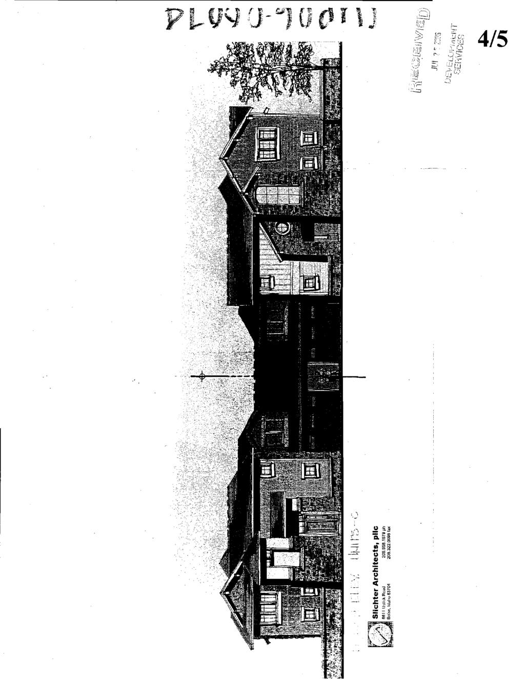
45
46 BOUNDARY EXaIBIT THE NW 1/4 OF SECTION 23,T.3N., R.1E.. B.M., ADA COUNTY, IDAHO.. SCALE: I" = 200' OVERLAND ROAD W 1/16 CORNER SECnON 23, N 1/4 CORNER SECTION 23, CORNER RECORD CORNER RECORD NW CORNER secnon 23, CORNER RECORD Cb MONUMENT. PLS 4998 FND. 3.5' ALUMINUM CAP MONUMENT, AS NOTED 0 FOUND 5/8' REBAR/CAP AC. * CALC POINT NOT SET \FOB POJNT OF BEClNNlNC 3130 S. Owyhee St. Boise, Idaho Plannerr. Engineers - Surveyors - Landscape Architects CAR 06 Oor~4-1
47 Boundary Legal Description W%H Pacific Project For Conger Management Group A parcel of land located in Ada County, Idaho, being a portion of We NE I14 NW 114 of Section 23, Township 3 North, Range 1 East, Boise Meridian, and more particularly described as follows: Commencing at the accepted W 1116Corner common to Sections 14 and 23, said point being a 3 In' diameter Aluminum Cap Monument (Comer Record, Instrument Number ), which bears South 89'22'25" East, feet frwn the M(V Corner of Section 23, monumented by a 3.5" Aluminum Cap Monument (Comer Record, Instrument Number ), and bears North 89'22'25" West, feet from the N 114 Comer of Section 23, monumented by a 3.5" Aluminum Cap Monument (Corner Record, Instrument Number ); Thence South 00'10'58" West, coincident with the westerly line of the NE 114 NW 114 of Section 23. a distance of feet to a point on the southerly right of way line of Overland Road, said point being a 2.5" Aluminum CaplPLS 4998, and being the Point of Beginning for this description; Thence continuing South 00'10'58' West coincident with the westerly line of the NE 114 NW 114 of Section 23, also being the easterly boundary of Countryman Estates Subdivision No. 4 (Book 51 of Plats, Page 4357, Ada County Records), a distance of feet to the corner common to Lots I, 3 and 6 of Block 8 of said Countryman Estates Subdivision No. 4; Thence South 86"53'36" East, coincident with the northerly boundary of said Countryman Estates Subdivision No. 4, a distance of feet to the comer common to Lot 8, Block 8 of said Countryman Estates Subdivision No. 4 and Lots 17 and 18, Block 1 of Millcreek Subdivision No. 1 (Book 65 of Plats, Page 6707, Ada County Recorder Records); Thence North 00'10'58" East, coincident with the westerly boundary of said Millcreek Subdivision No. 1, a distance of feet to a point on the southerly right of way line of Overland Road, said point being a 518" Rebar/Plastic Cap, PULS 3260; Thence North 8922'25" West, coincident with the southerly right-of-way line of Overland Road, a distance of feet to the Point of Beginning. The area described above contains acres more or less. Basis of bearings is Grid North, idaho State Ptane Coordinate System, West Zone
48 July 25,2006 Mr. Scott Spjute Manager, Zoning and Development City of Boise 150 N. Capitol Boulevard Boise, Idaho Re: Woodpark Subdivision Dear Mr. Spjute, Please accept the attached rezone, preliminary plat, and planned unit development applications for the proposed Woodpark Subdivision. The request is for a mixed-use (oece and residential) inffl development located on the south side of Overland Koad approximately 54 of a mile east of Five Mile Road. The property is surrounded by single family residential on the south and east boundaries, office on the west and commercial to the north. The subdivision consists of 2 office lots, 32 single-family residential lots and 2 common lots on approximately 5-acres of land. The design of the housing component is for single-family attached homes clustered around a common driveway or auto court. Conceptual elevations and floor plans are attached for your review. The property is currently zoned A-1, with a rezone request to N-0 (Neighborhood Office) for the enfire subdivision. The N-0 zone will accommodate neighborhood friendly office uses ffonting Overland Road and higher density housing to the south. Although the office buildings have not been designed, the intent is to incorporate architectural features consistent with the residential component for continuity within the community. We anticipate that the City will require design review for each of the proposed buildings in the future, and we agree in advance to this condition. The planned unit development request is to allow for a new higher density development pattern in close proximity to employment, shopping and services. The density of the residential portion of the proposal is for 8.9 units per acre, within the allowance for the Neighborhood Office zone. Through the planned unit development, we are requesting modifications to the setback and lot size requirements in order to accommodate our proposal for attached housing. Specific requests are attached as Exhibit A. Woodpark Subdivision has been designed to offer a housmg alternative in Southwest Boise that will be both more affordable and lower maintenance. This housing product will appeal to non-traditional families (singles, young professionals, empty nesters, etc.), a segment of the market that is currently underrepresented. In addition to private patios and courtyards, a community open space md amenity consisting of a heavy timber trellis structure and barbeque facilities have been added to encourage community gatherings and activities. We are very excited to bring this proposal to the City of Boise and look forward to worldng wth you and your staff on this project. If you have any questions concerning the attached application - and supporting > materials please contact me directly at or via at dmckinnon@,con~er o - ' m? i 5, i?,i' Sincere y, ve McKinnon K z 1 F\F 4L-u - - isil' L.- I "<. isg&, Ji;, D~\+I EL~:--~,;~E[~\IT CC: David Abo; Manager, Subdivision Planning \SEF.\,'FCES
49 Woodpark Subdivision Exhibit A In order to achieve the development pattern requested in the attached applications, the following modifications to the N-0 zoning standards are requested as a part of the residential planned unit development request: Standard 1 N-0 Minimums 1 PUD Request Lot Size 1 3,000 square feet square feet I Frontage 1 30 feet 1 Common Drive ( Common Drive Frontage 1 10 feet of frontage 1 7 feet of frontage Setbacks Front Yard (street) Side Yard (interior) Side Yard (street) Rear Yard 10 feet 0 feet(attached)/ 5 r 10 feet 0 feet0 5 feet* * Note - Rear yard varies per plan in attached housing. All perimeter setbacks are to be a minimum of 15 feet adjacent to existing development.
50 ' I CITY O F T R E E S 1 Boise Cify Hall, 2nd Floor Phone 208/ N. Capitol Boulevard Fax: 208/ F! 0. Box 500 TDO/TTY. 800/ Boise, Idaho Website: Conditional Use Application This box for office use only File #: (,LAO 0 \.- c C O? ~ Fee: $- SvQ7GL- G G G I ~ LRFo \a' CCCqS Cross Referenced File(s): 1 Are Pre-Application materials attached? Yes No The application is a request to construct, add or chan A.(b/ali,~tr f i(5-c I I ~ 9 4 the use of the property as follows: Commission Level Planned Development Special Exception Other: Note: When an application has been submitted, it will be reviewed in order to determine compliance with application requirements. It will not be accepted if it is not complete. A hearing date will be scheduled only after an application has been accepted as complete. Applicant: [rsn4~.c,4w*g-rjt ~~JBVP Phone: 'd Owner; 4p?0 Purchaser Lessee Renter Applicant's Address: &,5 5. grl 5ii%:cf- 5f~. 278 Zip: g37- Agent/Representative:C~q,'bkt~ MLK A&'--- Fax: Phone: %L'%5-" Agent/Representativers Address: * Contact Person (if different from above): six&-- - v 3 Xlb Zip: 9370~ Zip: Phone: Address of Subject Property: j0 1 2 \ - Mapping Division to signify address verification : ; c2,++.?., < r.-,-. Property description (Lot, Block & Subdivision name or recorded deed with a me! -d&w&dhbj:oi"e! 3% -;L,!':" 3 5 A # A C ~ ~ Z ~ Pc~rcel Number: S/i~521240_"; Section:." t..b* &,,- &lq$ # t! q - e.<r, DEvELc., ~:,.%g p cc ef~pr. -* L L ~ ~ L - L ~ _&- 3 Township: 3hj Range: / 5 Quarter: fl wi/& - L-c
51 Conditional Use Application 3 5" q.71 Size of property (square feet and/or acres).- Water Issues: a. What are your fire flow requirements? l;v qp4 (Please see ~~pdendix A of Uniform Fire Code) b. What volume of water is available? 1 (Contact ~nit'dd Water of Idaho, inc. at ) Existing uses and structures on the property are as follows: s ; ~ F-I ~ ~ L7 ha-e L A#A~-LLFE A ;f-l[ E + ~ J C L ~ h.~*~e/&--d 9 fi.-.ay \ F-4- j-ri,rvt+ip~ Are there any known hazards on or near the property? (such as canals, hazardous material spiiis, soil or water contamination). if so, describe them, anci give iheir locations: 130 Adjacent properties have the following building types and/or uses: North: &'L-E /$TES;J~~.~ fj~ south: East: West: 72s rd& h.o ( 7~~<;3e~~h-k 1zes;dem4~ / ( Maximum proposed structure height(s): Number of Stories: Structures.-z 7 ' a. Number of proposed non-residential structures: 'L Square footage of pro~osed non-residential structures or additions (if applicable): Gross Squ~re Feet 1 st Floor 2nd Floor N.6 3rd Floor 4~. Net LeascS!e SQ. F!. b. Number of existing non-residential structures to remain: :.;:%., ;?;:-.? Square footage of existinq non-residential structures to rema@. r j i f ~. ~.., ; ~, 1 st Floor 2nd Floor Gross Sauare Feet Net Leasable Sd..Ft ; I?. j. I?!!: e,.<!t!f :t - -. "-.. *. ~.FVKE fafj,;t~i;. 3rd Floor r 9 _ ill.2,,y ,... i ' ~
52 Conditional Use Application 4 C..- Number of proposed residential structures (if applicable):...-.., d. Size of proposed residential units (if applicable): Studio One-bedroom Two- bedroom Number of Units Sa. Ft. per Unit Total Sq. Ft -- x x x Three-bedroom 37.. x = cy OOC~ ~/- Total Number x - Number of existinq units to remain: i 8. Landscaping: Is any proposed? b%/;lqr 9. Site Design: Percentage of site devoted to building coverage: Percentage of site devoted to landscaping: Percentage of site devoted to paving: Percentage of site devoted to other uses:, I v %;5* Ci'$ C 3~ Describe: Total: 100% 10. Parking a. Handicapped spaces proposed:,ub Handicapped spaced required: hj. h b. Parking spaces proposed: M-A Parking spaces required: da. c. Bicycle parking spaces proposed: FJ. A. Bicycle parking spaces required: & d. Number of compact spaces proposed: & Compact spaces allowed: hw e. Width(s) of garage door(s): 28 ' f. Restricted parking spaces proposed: hsk g. Are you proposing off-site h. Are you requesting a shared parking or parking reduction? dc Note: If you are requestiug a shared parking or parking reduction, you must submit a survey of persons using and working on the premises and any additional information demonstrating that use by the regular employees and visitors to the premises will require fewer off-street parking spaces than required by the Zoning Ordinance Setbacks: V, I<)Fs-fi::.'"..L<'i,. ;,. y: TzLj -\!; U %=:(! Building Parking % u L'! L!* Proposed Required Proposed Required L_.C Front i 5 15!!I! :- 2~06 Rear Side (St) Side - - -
53 ~.. Conditional Use Applicafion Exterior Roof Buiiding Materials: Colors: q1.a c ic Walls &r; 2.3 \ 6.,,! " Windows/Doors -$@c;oa!; ~5~ \I ~,l.~;&3e ws -- Fascia, Trim, Etc. 3 aob 13. Loading facilities (if proposed): Number & Size: Location: hl,~, u 1' = Screening: Drainage (proposed method of on-site retention): % 14 ' C 15. Floodways and Hillsides a. Is any portion of this property located in a Floodway or a 100-year Floodplain? & I b. Does any portion of this parcel have slopes in excess of 15%? )3 a Note: If either of the above answers to Number 15 is yes, than you will be required to submit an additional Floodplain andlor Hillside application and additional fee. You must submit the additional required application(s) for review at the same time as this request. I 16. Airport Influence Area Is subject site located within the Airport Influence Area? Yes No If so, you must obtain an avigation easement from the Boise Airport Director. The easement must be obtained before the issuance of building permits. 17. Is the applicant requesting an infill P. U. D?.63 Yes No Applicationsfor infill F!U.D's must includedocumentation that shows that the site qualifies as an infill site, including: a. A written statement explaining why this site may qualify as an infiil FIU.D. b. A vicinity map (8'/zU x 11" at 1 "=300J scale, available from PDS Mapping, showing: 1. The property lines of the subject lot. 2. The property lines and uses of all lots within 300' of the exterior boundaries of the subject lot. ~. ~.,.. - {['' ->! <, h L~. L-L=:. c- i ". :-2.,,;;, ;-=, : 5 Y"~.' c. Evidence (map) showing the location of sewer and water utill&cs. _ Note: It is intended that "infill" PUDs are restricted to the City core area and generallg!ate ;I.._ pot. X@$&able. to parcels of land located on the periphery of the City or recently annexed lands. CUP 06 f 0 a ~ :_ 2kki&(LL;-iL,.;. -=!:~ P..(-r hi ',<;r-:>! ;.-.. crz~?,:!f-~~zc:.--.,. I
54 Conditional Use Application Street Layout a. Review of public street layout: The impacts of proposed development on adjacent land uses and transportation facilities must be considered. A "Traffic lmpact Study" (TIS) will be generally required by the Ada County Highway District, if the proposed development contains more than 100 dwelling units (includes hotels and motels as well as private dwelling units), more than 30,000 square feet of commercial use, or more than 50,000 square feet of industrial or institutional use, or has associated with it special circumstances deemed by ACHD to warrant an impact study. A copy of this study must be submitted with this application. Is a Traffic lmpact Study required? Yes,El No b. Review of private street layout: The impacts of proposed development on adjacent land uses and transportation iaciiiiies must be considered. k "Traffic impact Siudy" (TiSj prepared by a traffic engineer will be required by Public Works and Planning & Zoning for the interior roadway and parking system. This requirement may be waived when it can be shown by the applicant that no section of on-site roadway will exceed 240 vehicle trips per day. Is a Traffic lmpact Study required? Yes Lb No Any revisions to the application must be received 14 days prior to hearing date or your application will be deferred to the next meeting. Signature Applicant/Representative. : L..-~
55 ~- Bol SE CITY O F - 7 Boise City Hull, 2nd Floor Phone: 208/ N. Capitol Boulevard Fax: PO.Box500 TDDrrPi Boise, Idaho Website: Annexation/Rezone Application This box for office use only File #: (,fi9-0b-ccc45 Fee: sj4g\ozeii61(1 Cross Referenced File(s): i.w/190b - O 6 2? dr ~one(s): - 1 Are Pre-Application materials attached? yes NO This application is a request to construct, add or change the use of the property as follows: pvonr Gfl A,-! A, fd-c:j I Pre-Application Conference/Submittal Information A pre-application conference with staff and pre-application neighborhood meeting are required prior to the submittal of this application. Contact a Procedures Analyst at for details. Applications for annexations will no/ be acceptedwithout a property description and map that meets the guidelines listed on page 3. Current Zone: 4- \ Applicant Information Requested Zone: Applicant:,f n'~ a M-el~e~b &up Phone:Ib - 53% - <J App!l:an:'s Address: 4753,4,~ %z& 9- <+I 0 Zip: c$j~(... AgenVRepresentative: h 25 /&~b VWL~~IA Phone: Agent/Representativens Address: W5 4. &% S~ZTKJ- 5i-e'UI~) Zip:.%37os Contact Person (If different from above):,~::x :; ;Phone:.: ,. ~. I..;, ;:;,,. i 7:' *".,..?; -,., 9 ;, Address of Subject Property: - - ill 1 -p d, o~dmlwd Mapping Division must initial here tofigpi??d& verification. & Property Description (Lot, Block & Subdivision name or recorded deed with a ~ ~~~~b&y(rj;~y-iption): Parcel Number: -, - ~uarter: G $,~'"~'&GES Township: 3 Range: 1%. CAR t 23 6/04
56 Annexation/Rezone Aoolication 2 Development Information 1. Size of Property: Square Feet or 5 f/- Acres 2. How is the property now used? -5r30- k' How are the adjoining properties used? North: &)-ua ~ost: F~-s;J- (ihi~qi LJ% South: %.$;&-& 1 west: ~~iafi& ( % 0-4Tice Ci cc ( 4. Are there any existing land uses in the general area similar to the proposed use? If yes, what are they, and where are they located? &L& (15E. is,44\ 4~e-i~ -to -tr, -+,< /firier &S lt+y, - TE~,'J&~'..( 5 bfljd--d 5 *G- P-OS~ SO b1i~;~i- 5. On what street(s) does the property have frontage? 6. Why are you requesting annexation into the City of Boise? intended for the property? $& 2 " +~7 F pyv r yp P & -, -LT -LL d f.'-, t? i -%.,?-- F- *~~F~l!L,, What changes have occurred in the area that justify the requested rezone? 7-
57 Annexation/Rezone Application 3 9. Any additional comments? Note: When an application has been submitted, it will be reviewed in order to determine compliance with application requirements. It will not be accepted if it is not complete. A hearing date will be scheduled only after an application has been accepted as complete. Submittal Requirements Note: The Boise City Council requires the following information to be submitted to the Planning & Development Seniices Department for every application for annexation. Applications for annexations will not he accepted without a property description and map that meets the guidelines listed 4 $D 2-41) Submittal requirements list. 1.. ) Completed application, including signature of applicant. &T 3Ji1) Detailed letter of explanation or justification for the proposed project. I 4.A1) Affidavit of Legal Interest (attached). Form must be completed by the legal owner of record. Current Vicinity Map. (8V x 11") at 1" = 300' scale, showing location and current zoning of the property. Map must be dated. Map is available f?om the Mapping Division. Please indicate the locationofyour property on the map). Map must contain the following information. A. A precise copy that matches the description (ordinance numbers, all bearings, distances, commencing and beginning points, etc.) B. Cross-hatched area showing the annexation property C. Street names D. Address grid E. Names of surrounding subdivisions F. The annexation area shall be located as close to the center of the map as possible., - -< hb- L- JegiStergd tq.@e 2 $6. (1) Land Description. Attach a description of the actual property which you wish to hare rezoned or b Y 14 annexed on a separate page. All land descriptions must be certified byg]as*eyoz kzz;. ;. ~ State of Idaho. il u,.-, A. All property description shall be labeled as "Exhibit A," a.ui t;:!, 7 L yf3g L~.,." cap c nc:pf( ;,..,...,. i-7 ~,-<..,,..., C"-,",-..-. ~.. i.i_.,~ c -..., i'..., b:
58
59
60
61
62
63

64
65
66

67 Boise City Hall, 2nd Floor Phone: 208/ N. Capitol Boulevard Fax: 208/ F! 0. Box 500 TDDm 800/ Boise, Idaho Website: Conditions for Permit Number: PREO~ Print Date: 8/21/2006 ll:07:47am Page 1 of APPLICABLE CODES None NOTMFT 8/4/2006 DSM This application has been reviewed with respect to the REQUIREMENTS of the Boise City Code (BCC) Title VII and the 2000 International Fire Code (IFC) as adopted and amended by the City of Boise. Applicant can feel free to contact David S. Miller at APPROVAL None NOTMFT 8/4/2006 DSM The Fire department can approve this application w~th the following conditions ACCESS None N9TMFT 8/4/2006 DSM Fire department vehicular access shall be provided to within 150 feet of all portions of any non-sprinklered buildings. This distance can be increased somewhat for sprinwered buildings but exact distances are determined on a case by case basis ACCESS SPECIFICATIONS None NOTMFT 8/4/2006 DSM All bridges, gates, public or private streets, individual or common driveways, or dedicated emergency vehicle access lanes, etc., which are considered "fire department access" shall be: a minimum of 20 feet wide with 13 feet 6 inches overhead clearance, paved and capable of supporting 70,0001bs. GW and 24,000 Ibs. per axle, a minimum outside turning radius of 48 feet, no dead-ends over 150 feet unless an approved turnaround is provided, maximum grade of 10 per cent, Please note that fire apparatus is designed for a maximum 6 per cent grade. NO dead-ends in excess of 700 feet, if barricades are required by another department, said barricade shall be by means approved by the fire department NO PARDNG None NOTMFT 8/4/2006 DSM Streets less than 36 feet wide shall be designated and marked "No Parking" on one side; streets less than 29 feet wide shall be designated and marked "no Parking" on both sides; and standard ACHD cul-de-sacs shall be designated and marked "No Parking" on all sides. A note on the face of the Final Plat is required noting the parking restriction prior to signing of the plat by the Boise City Engineer. For the purposes of this section street width is measured back-of-curb to back-of-curb SFD HYDRANT SPACING None NOTMFT 8/4/2006 DSM Maximum hydrant spacing for one and two family dwelling areas is 500 feet between hydrants COM HYDRANT SPACING None NOTMFT 8/4/2006 DSM Maximum spacing for areas containing other than one and two dwellings is 300 feet between hydrants F.P. BEFORE CONSTRUmON None NOT MFT 8/4/2006 DSM Fire Department require hydrants, access, and street identification shall be installed prior to construction or storage of combustible materials on site. Provisions may be made for temproary access or street identification PRELIMINARY APPROVAL None NOTMFT 8/4/2006 DSM Any fire hydrant approvals given by the fire department are to be considered as "preliminary". Final approval is not considered to be granted until the fire department performs its "hydrant acceptance" tests. Any changes, such as finished landscaping, which affect hydrant clearance or finished height shall not be cosidered as approved and will need to be corrected IBC Construction Requirements None NOT MFT 8/4/2006 DSM Specific construction requirements of the International Building Code, the International Fire Code, and Boise City Code will apply. However, these - provisions. are best addressed by a licensed Architect at building permit
68 Conditions for Permit Number: PRE Print Date: 8/21/ :07:47AhI Page 2of application Fire Sprinkler Supply None NOTMET 8/4/ 2006 DSM The architect of record for the construction phase shall ascertain the water pressure and flow available for automatic fire sprinkler system design. The required information may be obtained from United Water. The "static pressure", "residual pressure", and "flow" shall then be included on the plans submitted for construction permit Construction Permits Required None NOT MET 8/4/2006 DSM Planning, Subdivision, and Public Works approvals do NOT exempt the applicant from the requirement to obtain Building Permits, Fire Sprinkler Permits, and Fire Alarm Permits Project None NOTMET 8/4/2006 DSM cup ,9839 W Overland Rd.
69 BOISE CITY PUBLIC WORKS DEPARTMENT DEPARTMENT CORRESPOR'DENCE To: Re: Boise City Planning & Zoning CUP /CAR / CAR CUP 9839 W. Overland Road Date: August 4, 2006 CONDITIONS OF APPROVAL AUG % O 2006 SEWER CONDITIONS -JIM PARDY ( ) DEVELOPNIEMT SERVICES Upon development of the property, connection to central sanitary sewer is required. Sewers are available in S. Watersilk Way, at south side of property and in Overland Road ( ). DRAINAGE / STORM WATER CONDITIONS - BRIAN MURPW ( ) A drainage plan must be submitted and approved by Public Works. Drainage conditions shall be placed during the subdivision platting process. Approvals of subdivision building pads are conditional to slab on grade structures only (not structures with basements). STREET LIGHT CONDITIONS - BILL COLSON ( ) Street lights are required. The specific location and type of facilities to be installed will be identified in the conditions of subdivision plat approval. PERSON MAKING OTHER COMMENTS OTHER COMMENTS Cc: Applicant I:\USERSDIS\SUBS\C-USE\CU-2006\CW-O6-0073&CAR &CAR-06-0W&CUP doc 6.4
70 Independent School District of Boise City #I Boundaries, Transportation, and Safety 8169 W. Victory Rd - Boise, ID (208) Fax (208) August 8,2006 Bo~se City Planning PL Development Scrvices 150 N Capitol Blvd P. 0. Box 500 BOISE,!D R RE: CAROG & CUP At Lhc present timc, 1hc Dcvelopcr andlor Owner have made arrangements lo comply w~th all requlrcments nl: thc Bo~se School District. The schools assjgncd to the p~oposed project area arc: Elementary School: Maplc Grove Junior Wgh School: South Hiall School: Bornh If you havc any furlhcs questions. please fecl Oec to contact this office. Sarah Stohaugh, Supervisor Traffic Safety and Transportation
71 Boise Airport John W. Anderson A.A.E. Direclor BOI Boise Airport Suile Airport Woy Boise, ldoho Phone Fax I, DATE: August 7,2006 " AUG DEVELOPMENT SERVICES TO: Boise City Planning and Development Services I I FROM: Matt D. Petaja fi~~- I Deputy ~irector, Engineering & ~acilitgs Web w*.u cityolboise.org SUBJECT: CAR WOODPARK SUBDiVlSlON (CONGER MGMT GROUP) City of Boise Equipment. Services 4833 Dormon Street Boise, ldoho Phone Fax Mayor David H. Bielei City Council President Moryonne Jordan Council ProTern Eloine Clegg Boise Airport staff has no objections to the project as proposed. This project is located within the airport influence area A, which is affected by average sound levels in the DNL, and/or aircraft traffic patterns below 1000 feet. Standard conditions of approval are contingent upon an avigation easement executed on the entire property. New residential development and new schools located within the overlay area are required to meet the sound attenuation standards of a minimum noise level reduction (NLR) of 25d b. Please call if' you have any questions. Vernon L B~sterfeldi David Eberle Alan W. Shealy Jim Tibbr h Equol Oppohniw Employer a hinted on racycled vper

72 ght-of- Way &Development Sc>i-vzces Dcynrtment $.&- Committed to ProjectlFile: Lead Agency: Site address: Woodpark Subdivision I SUB This is a Preliminary Plat Subdivision application for 32-residential lots, 2-Ofice lots and 4 common lots on 5.02 acres City of Boise West Overland Road Staff Level Approva I: August 1 1,2006 OwnerlApplicant: CMG c/o WL Overland, LLC 405 South B'~ Street, Suite 290 Boise, ID Staff Contact: Ryan McDaniel Phone: rmcdaniel@achd.ada.id.us Tech Review: August 15,2006 Application Information: Acreage: 5.02 Current Zoning: R-I Proposed Zoning: N-0 Residential Lots: 32 Office Lots: 2 Common Lots: 4 A. Findinqs of Fact Existing Conditions 1. Site Information: The site is currently used as a single family dwelling with a garage and barn. Woodward Subdivision
73 2. Description of Adjacent Surrounding Area: Direction North South East Single Family Residential West Single Family Residential Land Use Commercial 1 Residential, Zoning C-20 R-lB R-1 B I L-OD 3. Existing Roadway lmprovements and Right-of-way Abutting or Near the Site: West Overland Road is currently improved with 4-traffic lanes, 1 turning lane, 65-feet of pavement with vertical curb, gutterand sidewalk abutting the site. There is 80-feet of right-of-way existing for West Overland Road (40-feet from centerline). Southerland Road is currently improved with 2-traffic lanes, 36-feet of pavement with curb, gutter and sidewalk abutting the site. There is 50-feet of right-of-way existing for Southerland Road (25-feet from centerline). 4. Existing Access: There is one defined access point to West Overland Road and another clsfined access point to Sogtherland P.05cl from this properly. 5. Site History: ACHD has not previously reviewed this site for a development application. Development Impacts 6. ' Trip Generation: This development is estimated to generate 285 additional vehicle trips per day (I0 existing) based on the Institute of Transportation Engineers Trip Generation Single Family Detached Dwelling (188) and Office (97) land use designation. 7. Impact Fees: There will be an impact fee that is assessed and due prior to issuance of any building permits. The assessed impact fee will be based on the impact fee ordinance that is in effect at that time. 8. Traffic Study: A traffic impact study was not required with this application. Impacted Roadways: Roadway Frontage West Overland Road 300-Feet Functional Classification Principal Arterial Traffic Count 26,458 east of Five Mile Road on / west of Five I I Mile Road on ( Level of Service* Better than "C" Southerland 1 50-feet Local Residential I NIA 1 Acceptable 1 20 MPH 1 planning thresholds for roadways are 1 2,000ADT *Acceptable level of service for a 5-lane principal arterial roadway is "D" (33,000 ADT). Speed Limit 40 MPH 10. Capital lmprovements PlanlFive Year Work Program There are currently no roadways, bridges or intersections in the general vicinity of the project that are currently in the Five Year Work Program. West Overland Road is currently listed in the Capital
74 .. Waadaark Suhdivisian Improvements Plan for future expansion to a 7-lane roadway from Five Mile Road to Locust Grove, to the west of this site. B. Findinas for Consideration 1. West Overland Road District Right-of-way Policy: District policy requires 120-feet of right-of-way on arterial roadways (Figure 72-F1B). This right-ofway allows for the construction of a 7-lane roadway with vertlcal curb, gutter and 5-foot detached concrete sidewalks. District Roadway Offset Policy: District policy , requires local roadways to align or offset a minimum of 300-feet from an arterial roadway (measured centerline to centerline). District Driveway Offset Policy: District policy 72-F5, requires driveways located on collector or arterial roadways with a speed limit of 40 to align or offset a minimum of 185-feet from any existing or proposed driveway. District Sidewalk Policy: District pollcy requires 7-foot wide attached (or 5-foot detached) concrete sidewalk on all collector roadways and arterial roadways ( ). Applicant Proposal: The applicant does not propose to dedicate additional right-of-way or additional street improvements to West Overland Road. The applicant proposes to locate an entry road, Park Avenue, approximately 150-feet east of the west property line (measured centerline to property line). Staff CommentlRecommendation: The proposed location of the entry road offsets driveways on the north side of West Overland Road: the proposed location of the entry road is approximately 25-feet to the west of the nearest driveway and another driveway proposed in the Union Square Subdivision by 225-feet to the west. The proposed location offsets the nearest public street, Weideman Avenue, by 300-feet to the east. By moving the entry road 25-feet to the east, the applicant will be in compliance with both district policies regulating the spacing between all three access points on West Overland Road. Locate the entry road, Park Avenue, 175-feet east of the west property line (measured centerline to property line). Due to the fact that Overland Road is slated for w~dening to 7-lanes in the Capitai improvements Plan, the applicant should be required to dedicate 60-feet of right-of-way from the centerline of Overland Road abutting the parcel by means of a warranty deed. The right-of-way purchase, sale agreement and deed must be completed and signed by the applicant prior to scheduling the final plat for signature by the ACHD Commission or prior to issuance of a building permit (or other required permits), whichever occurs first. 2. Internal Public Roadways District Street Section and Right-of-way Policy: District policy states, "developments with any buildable lot that is less that 1-acre in size will typically provide streets having a minimum pavement width of 32-feet with curb, gutter and sidewalks. The total street width shall be 36-feet from back-of-curb to back-of-curb. Variations of
75 this width may be allowed, depending on traffic volumes forecast to be generated by the development. Concrete sidewalks shall be a min~mum of 5-feet in width unless they are separated from the curb 5-feet or more in which case the sidewalk shall be a minimum of 4-feet in width. District Offset Policy: District policy , requires local roadways to align or offset a minimum of 125-feet from another local roadway (measured centerline to centerline). District Island Policy: District policy and require islands to be constructed a minimum of 4-feet wide with a minimum area of 100-square feet and designed to safely channel traffic. The roadway on either side of the traffic island should maintain a minimum of a 21-foot street section. District policy also requires any proposed landscape islands/medians within the public right~f-way dedicated by this plat should be owned and maintained by a homeowners association. Notes of this should be required on the final plat. The design should be reviewed and approved by ACHD's Development staff. Applicant Proposal: The applicant proposes to construct the internal roadways as 36-foot street sections within 50-feet of right-of-way complete with curb, gutter and sidewalk. The applicant proposes to locate the internal roads not closer than 125-feet (measured centerline to centerline). Staff ComrnenffRecornmendation: The applicant's proposal for the internal street sections and the proposed location of the roadways is approved with this application, as proposed. 3. Turnarounds, Corners and Traffic Calming Devices District Turnaround Policy: District policy requires turnarounds to be constructed to provide a minimum turning radius of 45-feet. The applicant should also be required to provide a minimum of a 29-foot street section on either side of any proposed center islands within the turnarounds. The medians should be constructed a minimum of 4-feet wide to total a minimum of a 100-square foot area. District Traftic Calming Policy: District policy states that the design of local street systems should discourage excessive speeds by using curvilinear alignment and/or breaks in the street system. District Knuckle Policy: District policy District policy and and the local Fire District standards require an island within a knuckle to be constructed with the island being a minimum of 4-feet wide with a minimum area of 100-square feet and designed to safely channel traffic. The roadway around the traffic island should maintain a minimum of a 29-foot street section. The design should be reviewed aiid app~ved by ACHD's Deve!=pment staff. Applicant Proposal: The applicant proposes to construct one local roadway, West Southland Drive where it proceeds eastward from its intersection with Park Avenue, with no turnaround. The applicant proposes to construct one pair of chokers on Park Avenue at the south property line of the commercial lots and the north property line of the residential lots. Staff CornmenffRecornmendation: Staff is supportive of the applicant's proposal for the traffic chokers on Park Lane located between the commercial and residential lots, which are approved with this application.
76 _, Wnndnark S~~hdivieinn Construct West Southland Drive with either (a) a standard cul-de-sac turnaround (b) a standard Knuckle or (c) no turnaround at all and a 50-foot turning radius for the westward turn in the roadway. Staff notes that a standard cul-de-sac or knuckle may be ut~l~zed, at the applicant's discretion, to accommodate the flow of traffic in this location and the applicable policies are above stated. Due to the concern for cut-thru traffic, length of the roadway and the posted speed limit of 20 MPH on a roadway connecting two arterial roadways, a corner in this location is suitable to the existing roadway conditions. Stub Streets District Stub Street Policy: District policy states that the street design in a proposed development shall cause no undue hardship to adjoining property. An adequate and convenient access to adjoining property for use in future development may be required. If a street ends at the development boundary, it shall meet the requirements of sub section 7205, "non-continuous streets." District policy states that stub streets will be required to provide intra-neighborhood circulation or to provide access to adjoining properties Stub streets will conform with the requirements described in Section , and , except a temporary cul-de-sac will not be required if the stub street has a length no greater than 150-feet. A sign shall be installed at the terminus of the stub street stating that, "THIS ROAD WILL BE EXTENDED IN THE FUTURE". Applicant Proposal: The applicant proposes to continue a stub street from the west into the site, West Southland Drive, located approximately 125-feet north of the south property line (measured property line to centerline). Staff CornmentlRecornrnendation: Staff is supportive of the stub street extension, which is approved with this application. Driveways District Driveway Policy: Graveled driveways abutting public streets create maintenance problems due to gravel being tracked onto the roadway. In accordance with District policy, , the applicant should be required to pave the driveway its full width and at least 30-feet into the site beyond the edge of pavement of the roadway and install pavement tapers with 15-foot radii abutting the existing roadway edge. District Driveway Width Policy: District Policy restricts residential driveways to a maximum width of 20-feet. District policy restricts commerc~al driveways with daily traffic volumes over 1,000 vehicles to a maximum width of 36-feet. Most commercial driveways will be constructed as curb-cut type facilities if located on local streets. Curb return type driveways with 15-foot radii will be requlred for driveways accessing collector and arterial roadways. District Driveway Offset Policy: District policy 72-F4 (I) and 72-F4 (2), requires dr~veways located on local residential roadways to offset a controlled andlor uncontrolled intersection a minimum of 50-feet (measured near edge to near edge). Applicant Proposal: The applicant has not specifically identified the location of any driveways on the Preliminary Plat application or site plan.
77 Staff CornrnentlRecornrnendation: Staff understands that the driveway locations are to be determined at a later time. The applicant is being provided the current policy in effect at this time and is directed to work with ACHD Construction Services staff in attaining driveway approach permits. 6. District Tree Planters District's Tree Planter Width Policy prohibits all trees in planters less than 6-feet in width. In addition to prohibiting trees in planters less than 6-feet in width, the policy requires a minimum planter width of 6-feet for class II tress with the installation of root barriers on both sides of the planter strip or a minimum planter width of 8-feet without the installation of a root barrier. The policy also requires Class I and Class Ill trees to provide a minimum planter width of 10-feet. Applicant Proposal: The applicant has not specaically identified trees on the Preliminary Plat application or site plan. Staff CommentlRecommendation: Staff understands that the use nf trees rnay be determined at a later time. The applicant is being provided the current policy in effect at this time and is directed to work with Development Review Staff in regard to the planning of trees in the right-of-way. 7. Other Access West Overland Road is classified as an arterial roadway: all access points to West Overland Road will be closed except the access specaically approved with this application: direct lot access to West Overland Road is prohibited and should be noted on the final plat. C. Site Specific Conditions of Approval 1. Dedicate 60-feet of right-of-way from the centerline of Overland Road. 2. Lomte the entry road 175-feet east of the west property line (measured centerline to property line). 3. Construct the internal roadways as 36-foot street sections within 50-feet of right-of-way complete with curb, gutter and sidewalk. 4. The appliai;: may do w e of tt?e fo!lowing: A. Construct the intersection of Park Avenue and West Southland Drive with a standard cul-de-sac turnaround. B. Construct no turnaround at all and provide a 50-foot minimum turning radius for a curve in the roadway. 5. Construct traffic chokers on Park Lane located between the commercial and residential lots. 6. West Overland Road is classaied as an arterial roadway: all access points to West Overland Road will be closed except the access specaically approved with this application: direct lot access to West Overland Road is prohibited and should be noted on the final plat.
78 Comply with all Standard Conditions of Approval Standard Conditions of Approval Any existing irrigation facilities shall be relocated outside ~f the right-of-way. Private sewer or water systems are prohibited from being located within any ACHD roadway or right-of-way. All utility relocation costs associated with improving street frontages abutting the site shall be borne by the developer. Replace any existing damaged curb, gutter and sidewalk and any that may be damaged during the construction of the proposed development. Contact Construction Services at (with file number) for details. Comply with the District's Tree Planter Width interim Policv. District's Tree Planter Width Policy prohibits all trees in planters less than 6-feet in width. In addition to prohibiting trees in planters less than 6-feet in width, the policy requires a minimum planter width of 6-feet for class II tress with the installation of root barriers on both sides of the planter strip or a minimum planter width of 8-feet without the installation of a root barrier. The policy also requires Class I and Class Ill trees to provide a minimum planter width of 10-feet. Utility street cuts in pavement less than five years old are not allowed unless approved in writing by the District. Contact the District's Utility Coordinator at (with file numbers) for details. All design and construction shall be in accordance with the Ada County Highway District Policy Manual, ISPWC Standards and approved supplements, Construction Services procedures and all applicable ACHD Ordinances unless specifically waived herein. An engineer registered in the State of Idaho shall prepare and certffy all improvement plans. The applicant shall submit revised plans for staff approval, prior to issuance of building permit (or other required permits), which incorporates any required design changes. Construction, use and property development shall be in conformance with all applicable requirements of the Ada County Highway District prior to District approval for occupancy. Payment of applicable road impact fees is required prior to building construction in accordance with Ordinance #200, also known as Ada County Highway District Road Impact Fee Ordinance. It is the responsibility of the applicant to verify all existing utilities within the right-of-way. The applicant at no cost to ACHD shall repair existing utilities damaged by the applicant. The applicant shall be required to call DIGLINE ( ) at least two full business days prior to breaking ground within ACHD right-of-way. The applicant shall contact ACHD Traffic Operations in the event any ACHD conduits (spare or filled) are compromised during any phase of construction. No change in the terms and conditions of this approval shall be valid unless they are in writing and signed by the applicant or the applicant's authorized representative and an authorized representative of the Ada County Highway District. The burden shall be upon the applicant to obtain written confirmation of any change from the Ada County Highway District.
79 14. Any change by the applicant in the planned use of the property which is the subject of this application, shall require the applicant to comply with all rules, regulations, ordinances, plans, or other regulatory and legal restrictions in force at the time the applicant or its successors in interest advises the Highway District of its intent to change the planned use of the subject property unless a waiverlvariance of said requirements or other legal relief is granted pursuant to the law in effect at the time the change in use is sought. E. Conclusions of Law 1. The proposed site plan is approved, if all of the Site Specific and Standard Conditions of Approval are satisfied. 2. ACHD requirements are intended to assure that the proposed use/development will not place an undue burden on the existing vehicular transportation system within the vicinity impacted by the proposed development. Attachments 1. ' Vicinity Map 2. Site Plan 3.. Appeal Guidelines 4. Development Process Checklist

80 c - Wood~ark Subdivision
Boise City Planning & Zoning Commission Minutes November 3, 2014 Page 1
 Page 1 PUD14-00020 / 2 NORTH HOMES, LLC Location: 2818 W. Madison Avenue CONDITIONAL USE PERMIT FOR A FOUR UNIT PLANNED RESIDENTIAL DEVELOPMENT ON 0.28 ACRES LOCATED AT 2818 & 2836 W. MADISON AVENUE IN
Hal Simmons Planning Director Boise City Planning and Development Services. CAR / 1689 South Entertainment Avenue
 MEMORANDUM MEMO TO: FROM: Mayor and Boise City Council Hal Simmons Planning Director Boise City Planning and Development Services DATE: November 15, 2008 RE: CAR08-00019 / 1689 South Entertainment Avenue
Boise City Planning & Zoning Commission Minutes August 5, 2013 Page 1
 Page 1 CAR13-00010 / JSO VENTURES, LLC Location: 7000 E. Columbia Road REZONE 21.19 ACRES FROM A-1 (OPEN LAND) TO R-1C (SINGLE-FAMILY RESIDENTIAL 8 DWELLING UNITS.ACRE) SUB13-00022 / BONNEVILLE POINT SUBDIVISION
Planned Residence District (PR) To review a plan to construct 11 single family homes on approximately 4.01 acres.
 To review a plan to construct 11 single family homes on approximately 4.01 acres.") STAFF REPORT PLANNING & ZONING COMMISSION Village Green Municipal Building, Council Chambers 47 Hall Street Wednesday, March 13, 2019 7:00 P.M. 1. FINAL DEVELOPMENT PLAN REVIEW Applicant: Romanelli and
STAFF REPORT PLANNING & ZONING COMMISSION Village Green Municipal Building, Council Chambers 47 Hall Street Wednesday, March 13, 2019 7:00 P.M. 1. FINAL DEVELOPMENT PLAN REVIEW Applicant: Romanelli and
RE: CAR / 4280 N.
 MEMORANDUM TO: FROM: Mayor and Boise City Council Hal Simmons - Planning Director Boise City Planning and Development Services DATE: April 29, 2009 RE: CAR09-00006 / 4280 N. Eagle Road The following application
PLAINFIELD CHARTER TOWNSHIP COMMUNITY DEVELOPMENT DEPARTMENT PLANNING, ZONING & BUILDING SERVICES MEMORANDUM
 PLAINFIELD CHARTER TOWNSHIP COMMUNITY DEVELOPMENT DEPARTMENT PLANNING, ZONING & BUILDING SERVICES 6161 BELMONT AVENUE N.E. BELMONT, MI 49306 PHONE 616-364-1190 FAX: 616-364-1170 www.plainfieldchartertwp.org
MAJOR ISSUES DISCUSSED To date, there has been no opposition to this request and no member of the public has testified. ***
 CAR07-00051 Page 2 SUMMARY Larry and Barbara Woolf request approval to rezone ± 1.33 acres from R-1C (Single Family Residential with a maximum of 8.0 DU/acre) to R-2D (Combined Residential with a maximum
Planning Director Boise City Planning and Development Services Department. CAR / Rezone / 4041 N. Edelweiss Street
 MEMORANDUM TO: FROM: Mayor and Boise City Council Hal Simmons Planning Director Boise City Planning and Development Services Department DATE: April 24, 2006 RE: CAR05-00056 / Rezone / 4041 N. Edelweiss
SPRINGFIELD TOWNSHIP ZONING BOARD OF APPEALS REGULAR MEETING October 17, 2018
 SPRINGFIELD TOWNSHIP ZONING BOARD OF APPEALS REGULAR MEETING October 17, 2018 Call to Order: Vice-Chairperson Whitley called the October 17, 2018 Zoning Board of Appeals meeting to order at 7:30 pm at
I am submitting to you applications for the Belmar Estates Subdivision, located at 6012 & 6050 N. Pierce Park Lane. These applications include:
 January 27, 2015 Cody Riddle, Manager, Current Planning David Moser, Associate Planner City of Boise Planning & Development Services 150 N. Capitol Boulevard Boise ID 83701 Re: Belmar Estates Subdivision
1. What are the risks if we don t rezone to be consistent with our comprehensive plan?
 IT S NOT JUST A COLOR ON THE MAP - ZONING IN PLAN IMPLEMENTATION Presented by LisaBeth Barajas, Michael Larson Thursday, November 16, 2017 12:00 1:00 PM Webinar Summary: Land use regulations are an important
Charter Township of Lyon. Planning Commission. Meeting Minutes. September 13, 2010
 Charter Township of Lyon Planning Commission Meeting Minutes September 13, 2010 The meeting was called to order by Mr. O Neil at 7:00 p.m. Approved: September 27, 2010, as corrected Roll Call: Lise Blades
Episode 17 Get Creative! Out of the Box Ways to Structure Real Estate Deals
 https://www.spousesflippinghouses.com Hosted by: Doug & Andrea Van Soest Episode 17 Get Creative! Out of the Box Ways to Structure Real Estate Deals Doug: Welcome back to Spouses Flipping Houses podcast.
Audio #26 NRAS NRAS
 NRAS Dymphna: Welcome everybody to iloverealestate.tv. Great to have you guys listening again and once again, I have a fabulous guest speaker to come and talk to you. Now we re talking about something
ANOKA PLANNING COMMISSION REGULAR MEETING ANOKA CITY HALL TUESDAY, MAY 16, :00 P.M.
 ANOKA PLANNING COMMISSION REGULAR MEETING ANOKA CITY HALL TUESDAY, MAY 16, 2017 7:00 P.M. CALL TO ORDER: The regular meeting of the Anoka Planning Commission was called to order at 7:00 p.m. ROLL CALL:
BARRE TOWN PLANNING COMMISSION MINUTES
 BARRE TOWN PLANNING COMMISSION MINUTES The Town of Barre held its regular meeting on Wednesday, beginning at 7:00 p.m. at the Municipal Building, Lower Websterville, to consider the following: Members
LARKSPUR PLANNING COMMISSION REGULAR MEETING MINUTES OF FEBRUARY 28, 2017
 REGULAR MEETING MINUTES OF The Larkspur Planning Commission was convened at 7:00 p.m. in the Council Chambers by Acting Chair Kunstler. Commissioners Present: Commissioners Absent: Staff Present: Chair
Public Hearing Rezoning of 5264 Sherbourne Dr. Wednesday, April 26, :19:31 AM
 From: To: Subject: Date: Rod Nielsen Public Hearing Rezoning of 5264 Sherbourne Dr. Wednesday, April 26, 2017 10:19:31 AM Hi, my name is Rod Nielsen and I live at 5265 Sherbourne Dr., which is directly
CITY OF ANN ARBOR, MICHIGAN
 CITY OF ANN ARBOR, MICHIGAN 100 North Fifth Avenue, P.O. Box 8647, Ann Arbor, Michigan 48107-8647 www.a2gov.org Administration (734)794-6210 Community Development Services (734) 622-9025 Parks & Recreation
Our second speaker is Evelyn Lugo. Evelyn has been bringing buyers and sellers together for over 18 years. She loves what she does and it shows.
 Wi$e Up Teleconference Call Real Estate May 31, 2006 Speaker 2 Evelyn Lugo Jane Walstedt: Now let me turn the program over to Gail Patterson, also a member of the Women s Bureau team that plans the Wi$e
PLANNING COMMISSION STAFF REPORT
 PLANNING COMMISSION STAFF REPORT West Capitol Hill Zoning Map Amendment Petition No. PLNPCM2011-00665 Located approximately at 548 W 300 North Street, 543 W 400 North Street, and 375 N 500 West Street
ARTICLE 23 CONDOMINIUM STANDARDS
 ARTICLE 23 CONDOMINIUM STANDARDS Section 23.01 Intent. The intent of this Article is to provide regulatory standards for condominiums and site condominiums similar to those required for projects developed
Cascade Charter Township, Zoning Board of Appeals Minutes July 14, 2015 Page 1
 ZONING MINUTES Cascade Charter Township Zoning Board of Appeals Tuesday, July 14, 2015 7:00 P.M. Cascade Library Wisner Center 2870 Jackson Avenue SE ARTICLE 1. ARTICLE 2. ARTICLE 3. Chairman Casey called
How Selling Your House to a Real Estate Investor Stacks Up Against Your Other Options
 How Selling Your House to a Real Estate Investor Stacks Up Against Your Other Options Pros, cons, costs, and timeline of each option So, you need to sell your house. Selling in a market like today s can
M-43 CORRIDOR OVERLAY ZONE
 ARTICLE 26.00 M-43 CORRIDOR OVERLAY ZONE Section 26.01 Findings A primary function of the M-43 state highway is to move traffic through the Township and to points beyond. As the primary east-west arterial
URBANDALE PLANNING AND ZONING COMMISSION MINUTES. November 2, 2015
 URBANDALE PLANNING AND ZONING COMMISSION MINUTES The Urbandale Planning and Zoning Commission met in regular session on Monday,, at the Urbandale City Hall, 3600 86 th Street. Chairperson Julie Roethler
INTRODUCTION...2 THE CALLS...3 INFORMATION REQUIRED TO PROVIDE PROPER PROTECTION...3 TWO KEY PROPERTY QUESTIONS...4
 TABLE OF CONTENTS INTRODUCTION...2 THE CALLS...3 INFORMATION REQUIRED TO PROVIDE PROPER PROTECTION...3 TWO KEY PROPERTY QUESTIONS...4 FOUR REAL PROPERTY DEFINITIONS...5 THREE LEVELS OF ASSOCIATION RESPONSIBILITY...9
MINUTES CITY OF NORTH LAS VEGAS SPECIAL PLANNING COMMISSION STUDY SESSION
 MINUTES CITY OF NORTH LAS VEGAS SPECIAL PLANNING COMMISSION STUDY SESSION CALL TO ORDER: ROLL CALL: STAFF PRESENT: VERIFICATION: Wednesday, May 31, 2006 at 6:00 P.M. Aliante Library Meeting Room 2400 Deer
STAFF PRESENT: Community Development Director: Nathan Crane Secretary: Dorinda King
 1 0 1 0 1 Highland City Planning Commission April, The regular meeting of the Highland City Planning Commission was called to order by Planning Commission Chair, Christopher Kemp, at :00 p.m. on April,.
Belfast Municipal Airport Airspace Obstruction Analysis
 Belfast Municipal Airport Airspace Obstruction Analysis BST MEETING NOTES project: meeting date: location: subject: EA AND DATA COLLECTION FOR AIRSPACE OBSTRUCTION ANALYSIS WEDNESDAY, MARCH 18, 2015 6:30
PENINSULA TOWNSHIP PLANNING COMMISSION MINUTES Center Road Traverse City, MI (Township Hall) February 27, :30 pm - amended time
 February 27, :30 pm - amended time") Meeting called to order at 5:30 pm by Couture. PENINSULA TOWNSHIP PLANNING COMMISSION MINUTES 13235 Center Road Traverse City, MI 49686 (Township Hall) February 27, 2017 5:30 pm - amended time Present:
Meeting called to order at 5:30 pm by Couture. PENINSULA TOWNSHIP PLANNING COMMISSION MINUTES 13235 Center Road Traverse City, MI 49686 (Township Hall) February 27, 2017 5:30 pm - amended time Present:
LIN AVE The applicant is proposing to construct a four-unit Lot A R.P
 Public Notice June 21, 2018 Subject Property: 125 Calgary Avenue Lot 4, District Lot 250, Similkameen Division Yale District, Plan 1164, Except Plan B5473 Application: Rezone PL2018-8261 The applicant
1. APPLICANT: The City of Overland Park is the applicant for this request.
 8. UNIFIED DEVELOPMENT ORDINANCE AMENDMENT - ZRR 2590 - Residential Neighborhood District 1. APPLICANT: The City of Overland Park is the applicant for this request. 2. REQUESTED ACTION: The applicant is
TOWN OF HARRISBURG, NORTH CAROLINA BOARD of ADJUSTMENT MEETING TUESDAY, JANUARY 19, :00 PM MINUTES
 TOWN OF HARRISBURG, NORTH CAROLINA BOARD of ADJUSTMENT MEETING TUESDAY, JANUARY 19, 2016 6:00 PM MINUTES 1. CALL TO ORDER called the meeting to order. PRESENT:, John Overcash, Mike Hamamgian,, Thelma Thorne-Chapman,
THE REDEVELOPMENT PLAN
 PAGE 37 THE REDEVELOPMENT PLAN FUTURE LAND USE The Silver Terrace Redevelopment Area is currently designated as Redevelopment Area #4 on the City of Delray Beach Future Land Use Map (FLUM). This designation
JUNE 25, 2015 BUTTE-SILVER BOW PLANNING BOARD COUNCIL CHAMBERS BUTTE, MONTANA MINUTES
 JUNE 25, 2015 BUTTE-SILVER BOW PLANNING BOARD COUNCIL CHAMBERS BUTTE, MONTANA Members Present: Absent: Staff: Janet Lindh, Dan Foley, Rick LaBreche, Marc Murphy, Mike Kerns and John Taras Michael Marcum,
REGULAR MEETING OF LURAY PLANNING COMMISSION APRIL 13, 2016
 REGULAR MEETING OF LURAY PLANNING COMMISSION The Luray Planning Commission met on Wednesday, April 13, 2016 at 7:00 p.m. in regular session. The meeting was held in the Luray Town Council Chambers at 45
PREPARED FOR: ADI DEVELOPMENT GROUP INC.
 Acronym Urban Design and Planning/Mark Sterling Consulting Inc. 111 Clendenan Avenue, Toronto, Ontario M6P 2W7 URBAN DESIGN BRIEF PROPOSED DEVELOPMENT 4880 VALERA ROAD, CITY OF BURLINGTON PREPARED FOR:
East Fallowfield Township Historic Commission
 East Fallowfield Township Historic Commission 2264 Strasburg Road 610-384-7144 Chairman: Paula Latta Coyne Member: Fred Bissinger Member: Arthur Deleo Member: Sue Monaghan Member: Lee Schlingman APPROVED
Toronto Issues Survey
 Toronto Issues Survey Today, we are asking Greater Toronto Area residents for their views on some different issues that have been in the news lately. Remember, there are no wrong or right answers -- we
HARRIS TOWNSHIP Planning Commission Meeting Minutes September 19, 2016
 HARRIS TOWNSHIP Planning Commission Meeting Minutes September 19, 2016 Members in Attendance: Staff in Attendance: Public in Attendance: Bob Igo, Chairman Jeff Duerr, Vice Chairman Ron Buckalew John Wainright
M I N U T E S. Meeting was called to order by Chauncey Knopp at 7:00 P.M. with the following present:
 M I N U T E S LOWER SWATARA TOWNSHIP PLANNING COMMISSION REGULAR MEETING July 28, 2016 7:00 P.M. Meeting was called to order by Chauncey Knopp at 7:00 P.M. with the following present: Chauncey Knopp, Chairman
O-I (Office-Institutional) and AG-1(Agricultural)
 and AG-1(Agricultural)") PROPERTY INFORMATION ADDRESS 3503 and 3505 Bethany Bend DISTRICT, LAND LOTS 2/1 973 and 974 OVERLAY DISTRICT State Route 9 PETITION NUMBERS EXISTING ZONING O-I (Office-Institutional) and AG-1(Agricultural)
PROPERTY INFORMATION ADDRESS 3503 and 3505 Bethany Bend DISTRICT, LAND LOTS 2/1 973 and 974 OVERLAY DISTRICT State Route 9 PETITION NUMBERS EXISTING ZONING O-I (Office-Institutional) and AG-1(Agricultural)
City of Walker Planning Commission Regular Meeting November 16, 2011
 City of Regular Meeting November 16, 2011 Members Present: Vice-chair C. Rypma, A. Parent, C. Gornowich, D. Brown, T. Schweitzer, T. Korfhage and T. Byle Absent: Chairman J. Hickey Also Present: Planning
CVA Robert and Renate Bearden
 CVA15-00016 Robert and Renate Bearden Summary Variance to reduce the rear yard setback for a carport located along the alley at 1811 S. Pacific Street in an R-1C (Single Family Residential) zone. Prepared
The 5 biggest house-flipping mistakes that will cost you serious time and money and how to avoid them
 Doug Hopkins Free Special Report The 5 biggest house-flipping mistakes that will cost you serious time and money and how to avoid them Hi! Doug Hopkins here from the Property Wars TV show on The Discovery
NOTICE OF MEETING The City of Lake Elmo Planning Commission will conduct a meeting on Monday December 10, 2018 at 7:00 p.m. AGENDA
 3800 Laverne Avenue North Lake Elmo, MN 55042 (651) 747-3900 www.lakeelmo.org NOTICE OF MEETING The City of Lake Elmo Planning Commission will conduct a meeting on Monday December 10, 2018 at 7:00 p.m.
ECONOMIC DEVELOPMENT ZONE COMMITTEE (EDZC) MEETING MONDAY, MAY 21, :00 A.M. CITY HALL, COUNCIL CHAMBERS, VERO BEACH, FLORIDA A G E N D A
 MEETING MONDAY, MAY 21, :00 A.M. CITY HALL, COUNCIL CHAMBERS, VERO BEACH, FLORIDA A G E N D A") 1. CALL TO ORDER 2. APPROVAL OF MINUTES A) April 16, 2018 3. PUBLIC COMMENT 4. NEW BUSINESS ECONOMIC DEVELOPMENT ZONE COMMITTEE (EDZC) MEETING MONDAY, MAY 21, 2018 10:00 A.M. CITY HALL, COUNCIL CHAMBERS,
1. CALL TO ORDER 2. APPROVAL OF MINUTES A) April 16, 2018 3. PUBLIC COMMENT 4. NEW BUSINESS ECONOMIC DEVELOPMENT ZONE COMMITTEE (EDZC) MEETING MONDAY, MAY 21, 2018 10:00 A.M. CITY HALL, COUNCIL CHAMBERS,
Constance Bakall Request for Return of Escrow Balance Mr. Merante asked Mr. Gainer if there was anything outstanding.
 Philipstown Planning Board Meeting Minutes May 19, 2011 The Philipstown Planning Board held its regular monthly meeting on Thursday, May 19, 2011 at the VFW Hall on Kemble Avenue in Cold Spring, New York.
Do You Want to Buy a Home but have Poor Credit or Little in Savings?
 Do You Want to Buy a Home but have Poor Credit or Little in Savings? If you re reading this guide, you re likely considering rent to own (also commonly referred to as lease to own ) properties because
Town of Hamburg. Planning Board Meeting Minutes. December 17, 2008
 Town of Hamburg Planning Board Meeting Minutes December 17, 2008 The Town of Hamburg Planning Board met in regular session on Wednesday, December 17, 2008 at 7:30 p.m. in Room 7B of Hamburg Town Hall.
First of all, how can the City proceed with annexing and zoning when the surrounding landowners have filed a lawsuit against the county?
 From: Ross, Glenda S [CON] [mailto:glenda.ross@sprint.com] Sent: Monday, June 23, 2008 9:13 AM To: Lisa Harris Email; 'greg@moorevaluation.com'; 'cblaser@sunflower.com'; 'bradfink@stevensbrand.com'; 'hughcarter@dgcounty.com';
ARLINGTON COUNTY, VIRGINIA
 ARLINGTON COUNTY, VIRGINIA Board of Zoning Appeals Agenda Item V-11338-17-UP-1: Meeting of March 21, 2018 DATE: March 16, 2018 APPLICANT: LOCATION: ZONING: LOT AREA: GLUP DESIGNATION: Hajra Zahid & Zahid
Minutes. Village Planning Board. March 23, 2004
 Minutes March 23, 2004 A meeting of the Village of Horseheads Planning Board was held on the above date at 6:00 p.m. Present were Chairman Bob Skebey, Board Members,,, and, Alternate Members Denis Kingsley
DEVELOPMENT DEPARTMENT STAFF REPORT STAFF REPORT DRESDEN DRIVE TOWNHOMES DCI
 DEVELOPMENT DEPARTMENT STAFF REPORT Meeting Date: September 13, 2018 Item #: PZ2018-319 STAFF REPORT DRESDEN DRIVE TOWNHOMES DCI Request: Project Name: Development of Community Compact (DCI) and six concurrent
We contacted all RNOs in the area to come to their meetings and personally explain the draft, and take questions. Four RNOs took us up on the offer,
 1 2 3 At the last TTF meeting at the end of April, the TTF reached a consensus recommendation on the draft zoning and directed staff to put it out in a draft for public review and feedback. I m going to
CITY OF ANN ARBOR, MICHIGAN
 CITY OF ANN ARBOR, MICHIGAN 100 North Fifth Avenue, P.O. Box 8647, Ann Arbor, Michigan 48107-8647 www.a2gov.org Administration (734)794-6210 Community Development Services (734) 622-9025 Parks & Recreation
Bolton Zoning Board of Appeals Regular Meeting Minutes June
 Bolton Zoning Board of Appeals Regular Meeting Minutes June 10 2014 Present at the meeting were: Mark Altermatt, John Toomey, Joel Hoffman, Jon Treat, Morris Silverstein, Bob Peterson and Jim Rupert, Zoning
PLANNING AND ZONING COMMISSION AGENDA MEMORANDUM
 City and County of Broomfield, Colorado PLANNING AND ZONING COMMISSION AGENDA MEMORANDUM To: Planning and Zoning Commission From: John Hilgers, Planning Director Anna Bertanzetti, Principal Planner Meeting
TOWN OF ORO VALLEY PLANNING & ZONING COMMISSION MEETING DATE: December 6, 2011
 PLANNING & ZONING COMMISSION MEETING DATE: December 6, 2011 TO: FROM: SUBJECT: PLANNING & ZONING COMMISSION Matt Michels, Senior Planner mmichels@orovalleyaz.gov; tel. 229-4822 Public Hearing: Rancho de
Sell Your House in DAYS Instead of Months
 Sell Your House in DAYS Instead of Months No Agents No Fees No Commissions No Hassle Learn the secret of selling your house in days instead of months If you re trying to sell your house, you may not have
Article 3. SUBURBAN (S-) NEIGHBORHOOD CONTEXT
 NEIGHBORHOOD CONTEXT") Article 3. SUBURBAN (S-) NEIGHBORHOOD CONTEXT this page left intentionally blank Contents ARTICLE 3. SUBURBAN (S-) NEIGHBORHOOD CONTEXT DIVISION 3.1 NEIGHBORHOOD CONTEXT DESCRIPTION...3.1-1 Section 3.1.1
Article 3. SUBURBAN (S-) NEIGHBORHOOD CONTEXT this page left intentionally blank Contents ARTICLE 3. SUBURBAN (S-) NEIGHBORHOOD CONTEXT DIVISION 3.1 NEIGHBORHOOD CONTEXT DESCRIPTION...3.1-1 Section 3.1.1
In Business Q and A. Todd Nigro, president of Nigro Development. December 24 December 30, 2004 Interviewed by Jennifer Shubinski / Staff Writer
 In Business Q and A Todd Nigro, president of Nigro Development December 24 December 30, 2004 Interviewed by Jennifer Shubinski / Staff Writer Nigro Development is a small company with big plans for the
Staff Report: Date: Applicant: Property Identification: Acreage of Request: Current Zoning of Requested Area: Requested Action: Attached:
 Staff Report: Completed by Jeff Palmer Director of Planning & Zoning Date: November 7, 2018, Updated November 20, 2018 Applicant: Greg Smith, Oberer Land Developer agent for Ronald Montgomery ET AL Property
CITY OF WEST PARK PROPOSED TRANSIT ORIENTED CORRIDOR (TOC) EXPANSION WORKSHOP JUNE 15, 2016 FREQUENTLY ASKED QUESTIONS (FAQ)
 EXPANSION WORKSHOP JUNE 15, 2016 FREQUENTLY ASKED QUESTIONS (FAQ)") CITY OF WEST PARK PROPOSED TRANSIT ORIENTED CORRIDOR (TOC) EXPANSION WORKSHOP JUNE 15, 2016 FREQUENTLY ASKED QUESTIONS (FAQ) Q: Have you considered that people here love driving their cars and trucks,
CITY OF WEST PARK PROPOSED TRANSIT ORIENTED CORRIDOR (TOC) EXPANSION WORKSHOP JUNE 15, 2016 FREQUENTLY ASKED QUESTIONS (FAQ) Q: Have you considered that people here love driving their cars and trucks,
1999 Town Center West Proposal
 Crescent Square June 10, 2014 Page 2 1999 Town Center West Proposal Food-4- Less Retail Not a Part On June 10, 2004, the City Council and Planning Commission conducted a joint workshop to review conceptual
CITY OF SIGNAL HILL SUBJECT: PUBLIC HEARING THE COURTYARD RESIDENTIAL DEVELOPMENT OF 10 CONDOMINIUMS AND A NEW SPECIFIC PLAN
 CITY OF SIGNAL HILL 2175 Cherry Avenue Signal Hill, CA 90755-3799 AGENDA ITEM TO: FROM: HONORABLE CHAIR AND MEMBERS OF THE PLANNING COMMISSION SELENA ALANIS ASSOCIATE PLANNER SUBJECT: PUBLIC HEARING THE
PLANNING COMMISSION REPORT Regular Agenda -Public Hearing Item
 PDP-13-00518 Item No. 3B- 1 PLANNING COMMISSION REPORT Regular Agenda -Public Hearing Item PC Staff Report 2/24/14 ITEM NO. 3B PRELIMINARY DEVELOPMENT PLAN FOR HERE @ KANSAS; 1101 INDIANA ST (SLD) PDP-13-00518:
CITY PLAN COMMISSION STAFF REPORT
 CITY PLAN COMMISSION STAFF REPORT SUBJECT: Request for a Change of Zoning and Preliminary Development Plan FROM: Mara Perry, Director of Planning & Development MEETING DATE: November 6, 2017 PETITION:
CASTLES OF CALEDON URBAN DESIGN REPORT
 CASTLES OF CALEDON URBAN DESIGN REPORT PROPOSED RESIDENTIAL DEVELOPMENT CALEDON, ONTARIO 10 JULY, 2015 TABLE CONTENTS: 1.0 DEVELOPMENT 4.0 CONCLUSION 1.1 Introduction 1.2 Castles of Caledon- Urban Design
Planning Board Minutes August 14, 2014
 Planning Board Minutes August 14, 2014 Members Present: John Robertson, Vice Chairman Allen Brawley Bill Ogburn Joe Yanicak Steve McGlothlin Danny Martin Mark Brady Rosalind Campbell Bill Ogburn Also Present:
DEVELOPMENT DEPARTMENT STAFF REPORT THE PARK AT 5 TH
 DEVELOPMENT DEPARTMENT STAFF REPORT ARB Meeting Date: July 3, 2018 Item #: _PZ2018-293_ THE PARK AT 5 TH Request: Site Address: Project Name: Parcel Number: Applicant: Proposed Development: Current Zoning:
Rule of corner may need to be flexible i.e. context school, park. With a clustered approach. Should row housing go where fourplexes are?
 Fourplex Privacy Traffic issues by school (don t locate next to school) Highest density is furthest from park and school. Is this best? Family friendly (i.e. private green space, nicely designed, etc.)
Condos vs. Houses. You ve found the area where you want to live. You have your financing arranged.
 Condos vs. Houses You ve found the area where you want to live. You have your financing arranged. But, you are stuck. Which is better? The freedom of a condo*, or the land value of a house? Here are some
Green Oak Charter Township. Planning Commission Regular Meeting Minutes June 16, 2016
 1 2 3 4 5 6 7 8 9 10 11 12 13 14 15 16 17 18 19 20 21 22 23 24 25 26 27 28 29 30 31 32 33 34 35 36 37 38 39 40 41 42 43 44 45 46 47 48 49 Planning Commission Regular Meeting Minutes June 16, 2016 The meeting
A guide for first time buyers
 On the move: A guide for first time buyers www.legalombudsman.org.uk 1 Introduction Buying your first home can be a daunting experience. There are lots of things to sort out, such as surveys, checking
Evolution of the Vision for NE 181st Street Study Area
 City Council Action on NE 181 St Street Study Area Evolution of the Vision for NE 181st Street Study Area such uses to ensure neighborhood compatibility. More intense uses may be allowed through a conditional
CITY OF MANHATTAN BEACH [DRAFT] PLANNING COMMISION MINUTES OF REGULAR MEETING JANUARY 28, 2015
![CITY OF MANHATTAN BEACH [DRAFT] PLANNING COMMISION MINUTES OF REGULAR MEETING JANUARY 28, 2015](/thumbs/94/121103169.jpg "CITY OF MANHATTAN BEACH [DRAFT] PLANNING COMMISION MINUTES OF REGULAR MEETING JANUARY 28, 2015") CITY OF MANHATTAN BEACH [DRAFT] PLANNING COMMISION MINUTES OF REGULAR MEETING JANUARY 28, 2015 A Regular Meeting of the Planning Commission of the City of Manhattan Beach, California, was held on the 28
CITY OF MANHATTAN BEACH [DRAFT] PLANNING COMMISION MINUTES OF REGULAR MEETING JANUARY 28, 2015 A Regular Meeting of the Planning Commission of the City of Manhattan Beach, California, was held on the 28
For Vintages of Four Mile Creek Town of Niagara on the Lake, Ontario
 Planning Impact Analysis For Vintages of Four Mile Creek Town of Niagara on the Lake, Ontario Prepared by: Upper Canada Consultants 261 Martindale Road Unit #1 St. Catharines, Ontario L2W 1A1 Prepared
CAR Judith Balkins
 CAR14-00015 Judith Balkins Summary The applicant requests annexation of approximately 16.3 acres located at 6012 and 6050 N. Pierce Park Lane with R-1B (Single Family Residential) zoning. Prepared By David
Missing Middle Alternative Proposal: Olympians for Smart Development & Livable Neighborhoods
 Olympians for Smart Development & Livable Neighborhoods Judy Bardin Jay Elder Jim Keogh John Tobin Walt Jorgensen August 3, 2018 Olympia City Council City Hall 601 4th Avenue E Olympia, WA 98507-1967 PO
Village of Bellevue Plan Commission
 Village of Bellevue Plan Commission Pursuant to Section 19.84 Wis. Stats., a scheduled regular meeting of the Village of Bellevue Plan Commission was held on Tuesday, at 7:00 p.m. at the Bellevue Village
2. Rezone a portion of the lot from R2 (Small Lot Residential) to RD2 (Duplex: Housing Lane).
 to RD2 (Duplex: Housing Lane).") Public Notice September 6, 2018 Subject Property Subject Property: 337 Hastings Ave Lot 24, District Lot 1, Group 7, Similkameen Division Yale (Formerly Yale-Lytton) District, Plan 932 Application: The
Public Notice September 6, 2018 Subject Property Subject Property: 337 Hastings Ave Lot 24, District Lot 1, Group 7, Similkameen Division Yale (Formerly Yale-Lytton) District, Plan 932 Application: The
Staff Report PLANNED DEVELOPMENT. Salt Lake City Planning Commission. From: Lauren Parisi, Associate Planner; Date: December 14, 2016
 Staff Report PLANNING DIVISION COMMUNITY & NEIGHBORHOODS To: Salt Lake City Planning Commission From: Lauren Parisi, Associate Planner; 801-535-7932 Date: December 14, 2016 Re: 1611 South 1600 East PLANNED
CITY OF SANTA ROSA COMMUNITY DEVELOPMENT DEPARTMENT STAFF REPORT FOR PLANNING COMMISSION SEPTEMBER 10, 2015 APPLICANT FILE NUMBER MJP
 ITEM NO. 9 CITY OF SANTA ROSA COMMUNITY DEVELOPMENT DEPARTMENT STAFF REPORT FOR PLANNING COMMISSION SEPTEMBER 10, 2015 PROJECT TITLE Yogurt Time Center ADDRESS/LOCATION 3093 Marlow Road ASSESSOR S PARCEL
MEMORANDUM. I1 District Industrial Living Overlay District 110,703 square feet / 2.54 acres
 Department of Community Planning & Economic Development 250 South 4th Street, Room 300 Minneapolis, MN 55415-1385 MEMORANDUM To: City Planning Commission, Committee of the Whole Prepared By: Peter Crandall,
Town of Bayfield Planning Commission Meeting September 8, US Highway 160B Bayfield, CO 81122
 Planning Commissioners Present: Bob McGraw (Chairman), Ed Morlan (Vice-Chairman), Dr. Rick K. Smith (Mayor), Dan Ford (Town Board Member), Gabe Candelaria, Michelle Nelson Planning Commissioners Absent:
FORKS TOWNSHIP PLANNING COMMISSION Thursday, January 12, 2017
 FORKS TOWNSHIP PLANNING COMMISSION Thursday, January 12, 2017 The Forks Township Planning Commission meeting was held at the Forks Township Municipal Building, 1606 Sullivan Trail. Pledge of Allegiance
Cover Letter with Narrative Statement
 Cover Letter with Narrative Statement March 31, 2017 rev July 27, 2017 RE: Rushton Pointe Residential Planned Unit Development Application for Public Hearing for RPUD Rezone PL2015 000 0306 Mr. Eric Johnson,
1. Roll Call. 2. Minutes a. September 24, 2018 Special Joint Meeting with Clay County Planning Commission. 3. Adoption of the Agenda
 1. Roll Call City of Vermillion Planning Commission Agenda 5:30 p.m. Regular Meeting Tuesday, October 9, 2018 City Council Chambers 2 nd Floor City Hall 25 Center Street Vermillion, SD 57069 2. Minutes
Hey guys! Living in London: What to expect. This video is for you if you re curious
 Renting in London: What to Expect CLICK TO WATCH VIDEO : https://www.youtube.com/watch?v=99g2mf4a29m By Jade Joddle Hey guys! Living in London: What to expect. This video is for you if you re curious about
3 STEP BUYERS GUIDE STEP FINANCE STEP LAND STEP HOME
 3 STEP BUYERS GUIDE STEP FINANCE 1 STEP LAND 2 STEP HOME 3 STEP FINANCE 1 WORKING OUT YOUR BUDGET Before you can borrow money for your first home, you need to answer two big questions: WHAT S THE MAXIMUM
Staff Report: Date: Applicant: Property Identification: Acreage of Request: Current Zoning of Requested Area: Requested Action: Attached:
 Staff Report: Completed by Jeff Palmer Director of Planning & Zoning Date: November 7, 2018 Applicant: Greg Smith, Oberer Land Developer agent for Ronald Montgomery ET AL Property Identification: Frontage
Monaco Investments Partnership December 7, 2017
 Monaco Investments Partnership 592 BEDFORD HIGHWAY Community Location Map 592 BEDFORD HIGHWAY Neighbourhood Location Map Over the previous seven years Monaco Investment Partnership based on community,
ROSEMEAD CITY COUNCIL STAFF REPORT
 ROSEMEAD CITY COUNCIL STAFF REPORT TO THE HONORABLE MAYOR AND CITY COUNCIL FROM JEFF ALLRED CITY MANAGER DATE JUNE 9 2015 6 SUBJECT MUNICIPAL CODE AMENDMENT 15 02 AMENDING CHAPTERS 17 04 AND 17 72 OF TITLE
Susan E. Andrade 91 Sherry Ave. Bristol, RI
 STATE OF RHODE ISLAND AND PROVIDENCE PLANTATIONS MINUTES THE ZONING BOARD OF REVIEW OF BRISTOL, RHODE ISLAND 02 OCTOBER 2017 7:00 PM BRISTOL TOWN HALL BRISTOL, RHODE ISLAND BEFORE THE TOWN OF BRISTOL ZONING
Composition of traditional residential corridors.
 Page 1 of 7 St. Petersburg, Florida, Code of Ordinances >> PART II - ST. PETERSBURG CITY CODE >> Chapter 16 - LAND DEVELOPMENT REGULATIONS >> SECTION 16.20.060. CORRIDOR RESIDENTIAL TRADITIONAL DISTRICTS
GUIDE. The Shields Team of Keller Williams Realty (423)
") GUIDE The Shields Team of Keller Williams Realty (423) 896-1232 www.tricityrealestateforsale.com theshieldsteam@gmail.com Shields Team At The Shields Team, we also love real estate--the land, the homes,
GUIDE The Shields Team of Keller Williams Realty (423) 896-1232 www.tricityrealestateforsale.com theshieldsteam@gmail.com Shields Team At The Shields Team, we also love real estate--the land, the homes,
DEPARTMENT OF COMMUNITY PLANNING, HOUSING AND DEVELOPMENT Planning Division
 DEPARTMENT OF COMMUNITY PLANNING, HOUSING AND DEVELOPMENT Planning Division #1 Courthouse Plaza, 2100 Clarendon Boulevard, Suite 700 Arlington, VA 22201 TEL 703.228.3525 FAX 703.228.3543 www.arlingtonva.us
Session 4 How to Get a List
 Land Profit Generator LPG Session 4 Page 1 Session 4 How to Get a List The List is the most IMPORTANT AND CRUCIAL piece of information in this process. If you don t have a list you can t send out letters