SUBDIVISION BY-LAW MUNICIPALITY OF THE COUNTY OF INVERNESS
|
|
|
- Garry Anthony Price
- 5 years ago
- Views:
Transcription
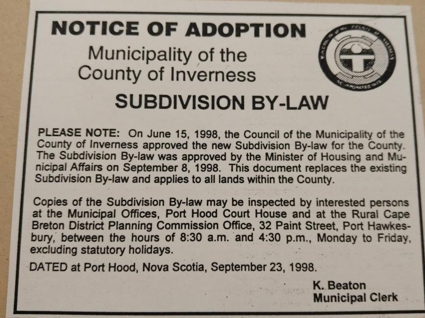
1 SUBDIVISION BY-LAW MUNICIPALITY OF THE COUNTY OF INVERNESS APPROVED BY COUNCIL: JUNE 15, 1998 EFFECTIVE DATE: SEPTEMBER 23, 1998
2 Page 2
3 TABLE OF CONTENTS PART 1: SHORT TITLE... 5 PART 2: INTERPRETATION... 5 PART 3: GENERAL PROVISIONS... 7 A PROCEDURE... 7 B LOT REQUIREMENTS... 8 C PUBLIC STREETS D PRIVATE ROADS E PARKLAND TRANSFER F WAIVER FROM SURVEY REQUIREMENTS OF FINAL PLAN OF SUBDIVISION PART 4: PRELIMINARY PLANS OF SUBDIVISION (Optional First Step) A REQUIREMENTS B PROCEDURE PART 5: TENTAIVE PLANS OF SUBDIVISION A REQUIREMENTS B PROCEDURE PART 6: FINAL PLANS OF SUBDIVISION A REQUIREMENTS B PROCEDURE PART 7: REPEAL OF A PLAN OF SUBDIVISION SCHEDULE A APPLICATION FOR SUBDIVISION APPROVAL SCHEDULE B LOT SIZE REQUIREMENTS SCHEDULE C NOTICE OF APPROVAL OF A PLAN OF SUBDIVISION SCHEDULE D APPLICATION FOR REPEAL OF A SUBDIVISION SCHEDULE E REPEAL OF A SUBDIVISION SCHEDULE F-1 LETTER OF UNDERTAKING - OWNER SCHEDULE F-2 LETTER OF UNDERTAKING - ENGINEER SCHEDULE G CERTIFICATION OF FIELD REVIEW OF ROAD CONSTRUCTION Page 3
4 Page 4
5 PART 1: SHORT TITLE SUBDIVISION BY-LAW FOR THE MUNICIPALITY OF THE COUNTY OF INVERNESS 1. This By-law may be cited as the "Consolidated " and shall apply to all lands within the Municipality of the County of Inverness. PART 2: INTERPRETATION 2. In this bylaw: a. Act means the Planning Act; b. "Area of land" means any lot or parcel as described by its boundaries. For the purposes of Section 19 "area of land" means: (ii) (iii) any lot or parcel described in a deed executed on or before August 6, 1984 less any subsequent conveyances prior to August 6, 1984, or any lot or parcel shown on a FINAL plan of subdivision filed in the Registry of Deeds before August 6, 1984 or any lot or parcel described in a deed executed on or subsequent to August 6, 1984, by means of Section 102(2) of the Act. (d) "Central system" means a system of piping and plant for the collection, transportation and treatment of sewage or water of such design and installation as to satisfy the requirements of all agencies concerned both Provincial and municipal. "Frontage" means in an area not covered by a Land Use By-law (ii) the distance between the side lines of a lot measured along a public street or private road except in Section 18, or where a lot is located on a curve on a public street or private road the distance may be measured along a line joining points on the side lines of the lot which points are eight metres (26.3 feet) from such street or private road; or in an area covered by a Land Use By-law (iii) the frontage measured as required in such By-laws; (e) "Island" means an area of land completely surrounded by water at low tide; Page 5
6 (f) (g) (h) (j) "Lot" means any parcel to be created by the filing of an approved final plan of subdivision; "Municipal engineer" means an engineer licensed to practise professional engineering in Nova Scotia and appointed by the municipality; "Municipality" means the Municipality of the County of Inverness; "Nova Scotia Land Surveyor" means a member licensed to practice in Nova Scotia who is in good standing with the Association of Nova Scotia Land Surveyors; "Private road" means any road which is not public shown on a plan of subdivision which extends to and has access to a public street and where not totally located within the area of land being subdivided, the private road shall have an easement for right-of-way and access which has been clearly surveyed and granted by deed, registered in the Registry of Deeds, and (ii) includes any private road approved by the Department of Transportation and Communications and shown on an approved plan of subdivision prior to the first day of August, 1987 and filed in the Registry of Deeds; (k) (l) "Province" means Her Majesty the Queen in right of the Province of Nova Scotia; "Public street" includes any street or road owned and maintained by a municipality or the province; and (ii) "municipal public street" means any street or road owned and maintained by a municipality, "provincial public street" means any street or road owned and maintained by the Department of Transportation and Communications of the Province excluding designated controlled access highways pursuant to Section 20 of the Public Highways Act, (m) (n) "Registry of Deeds" means the office of the Registrar of Deeds for the registration district in which the area of land being subdivided is located; "Right-of-way easement" means an easement for right-of-way and access, extending to and having access to a public street or highway, and where not totally located within the area of land proposed to be subdivided the right-of-way easement shall be clearly surveyed and granted by deed, registered in the Registry of Deeds for the County of Inverness: (ii) prior to August 6,1984, having a minimum width of 3 metres (9.8 feet), or subsequent to August 6, 1984, having a minimum width of 6 metres (19.7 feet); (o) (p) "Subdivider" means the owner of the area of land proposed to be subdivided and includes anyone acting with the owner's written consent; "Subdivision" means the division of any area of land into two or more parcels, and includes a resubdivision or a consolidation of two or more parcels.. Page 6
7 PART 3: GENERAL PROVISIONS A PROCEDURE 3. Application for approval of a plan of subdivision shall be made to the Development Officer in the form specified in Schedule "A" of this By-law. 4. The Development Officer shall comply with the notification and approval provisions of the Act. 5. The Development Officer shall forward a copy of the subdivision plan to (d) (e) in areas not served by a central sewer, the Department of the Environment of the Province to determine compliance with the "Regulations Respecting Subdivision of Land to be Serviced by On- Site Sewage Disposal Systems"; in areas served by a central sewer, the authority having jurisdiction for central sewers; in areas served by a central water supply, the village commission or other authority having jurisdiction for water services; the authority having jurisdiction for public streets; and any other agency of the Province or the municipality which the Development Officer deems necessary. 6. Any agency which has been forwarded a copy of the plan of subdivision pursuant to Section 5 shall forward a written report of their assessments or recommendations to the Development Officer. 7. Approval of a plan of subdivision may not be refused or withheld as a result of the assessment or recommendations made by the Department of the Environment, the Department of Transportation and Communications or of any other agency of the Province or the municipality unless the plan of subdivision is clearly contrary to a law of the Province or regulation made pursuant to a law of the Province, including any applicable requirements for lot area and lot frontage contained in a Land Use By-law. 8. (1) At the time of application, the subdivider shall submit the fees contained in the Costs and Fees Act, and regulations made thereunder, for (ii) filing the endorsed FINAL plan of subdivision, certifying a copy of the plan and registering a notice of approval of the plan, or registering a repeal of a plan of subdivision; and a processing fee of $ per plan plus $25.00 per lot for each lot above five (5) for which approval is being requested on a FINAL plan of subdivision for review and approval of the subdivision, or for repeal of a plan of subdivision; or a processing fee of $50.00 for review and approval of a TENTATIVE plan of subdivision. Page 7
8 (2) Where the Development Officer refuses, to approve a TENTATIVE or FINAL plan, or to repeal a FINAL PLAN of subdivision or where the applicant withdraws the application, the fees referred to in Clause (1) and 50% of the fees referred to in Clauses 1 or 1,shall be returned to the subdivider. 9. The Development Officer shall forward a copy of the approved TENTATIVE plan of subdivision to the subdivider and the surveyor. 10. The Development Officer shall forward an endorsed copy of the FINAL plan of subdivision to the subdivider and the surveyor. 11. Where the Development Officer refuses to approve a TENTATIVE plan or FINAL plan of subdivision, the Development Officer shall give notice of the refusal to all agencies which were forwarded a plan pursuant to Section Where the Development Officer refuses to approve a TENTATIVE plan or FINAL plan of subdivision, the Development Officer shall notify the subdivider pursuant to Clause 105(3) of the Act, give reasons for refusal, and advise the subdivider of the appeal provisions of Section 115 of the Act. 13. A FINAL PLAN of subdivision showing lots to be approved under circumstances described in Subsection 111(3) of the Act by special note on the plan should identify such lots; state the name(s) of the grantee of such lots; and state the date, PID number, book and page number of the conveyance of such lots as recorded in the Registry of Deeds. B LOT REQUIREMENTS 14. All lots shall abut a public street; or a private road. 15. (1) Subject to Subsection (2) all lots for which approval is requested and the remainder lot, if any, shall meet the requirements for minimum lot area and minimum lot frontage contained in Schedule "B". (2) Where an authorized person of the Department of the Environment of the Province has assessed the proposed lots shown on a FINAL plan of subdivision and approved such lots for the installation of on-site Sewage Disposal systems, such lots shall be deemed to meet the lot area requirements contained in Schedule "B". 16. Where a Land Use By-law is in effect notwithstanding Section 15, all lots for which approval is being requested and the remainder lot, if any, shall meet the applicable requirements for minimum lot area and minimum lot frontage contained in such By-law; and Page 8
9 Clause 14, and Sections 17, 18, 19, and 22 are inoperative and do not apply unless the Land Use By-law permits development on any lot created pursuant to these Sections and the Municipal Planning Strategy allows for the subdivision and development of such lots. 17. (1) Notwithstanding the lot area and frontage requirements of this By-law, the Development Officer may approve a maximum of two lots, shown on a plan of subdivision, in accordance with Section 107 of the Act provided all other requirements of this By-law are met. (2) Subsection (1) shall not vary the dimension for frontage below 6 metres (19.7 feet) or the minimum requirement for area for a lot served by an on-site sewage disposal system. 18. (1) For the purposes of this Section, "water frontage" means the distance measured along the Ordinary High Water Mark as defined in the Nova Scotia Land Surveyors Regulations. (2) Notwithstanding Section 14 and the lot frontage requirements of this By-law, the Development Officer may approve a subdivision on an island which does not contain a public street provided each lot has water frontage of 6 metres (19.7 feet) or more and: (d) the subdivider provides a parking area measuring not less than 3 x 6 metres (9.8 x 19.6 feet) for the exclusive use of each lot so subdivided, and the parking area is within 300 metres ( feet) of the navigable watercourse on which the lots shown on the plan of subdivision abut, and the subdivider provides an easement for right-of-way and access, clearly surveyed and granted by deed registered in the Registry of Deeds having minimum width of 15 metres (49.2 feet) extending from a public street or highway or a private road to the parking area and to the shoreline of the navigable watercourse where there exists suitable boat launching facilities, and the parking area, easement for right-of-way and the boat launching facilities are clearly identified on the FINAL plan of subdivision. 19. (1) Notwithstanding the lot frontage requirements of this By-law, the Development Officer may approve a FINAL plan of subdivision showing the subdivision of an existing area of land into two lots only, or one lot and a remainder lot for which no approval is requested, provided that each proposed lot and the remainder lot, if any: has minimum lot frontage of 6 metres (19.7 feet), or (ii) notwithstanding Section 14, is served by a right-of way easement as defined in Clause 2(n), and meets the lot area requirements contained in Schedule "B" of this By-law. (2) Where an area of land cannot be subdivided in accordance with the provisions of this section because the access to it is required to cross a railway right-of-way and no easement for the right-of way and access can be obtained from the railway, if all other requirements of this section have been Page 9
10 met, subdivision approval maybe granted, provided that the lot(s) created have access by a right-ofway easement as defined in Clause 2(n), except that with regard to that portion of the right-of-way easement which crosses the railway right-of way, a license for right-of-way and access from the railway shall be sufficient. 20. (1) Notwithstanding Section 14, and the lot area and frontage requirements of this By-law, the Development Officer may approve a subdivision altering the boundaries of two or more areas of land where no additional lots are created; each resulting lot (ii) meets the minimum dimension for lot frontage of this By-law or where a Land Use Bylaw is in effect, the Land Use By-law, or has not had its frontage, if any, reduced; and each resulting lot (ii) meets the minimum requirement for lot area of this By-law or where a Land Use By-law is in effect, the Land Use By-law, or has not had its area reduced. (2) Where the proposed lot is not surveyed, the FINAL plan of subdivision prepared pursuant to Subsection (1) shall be certified and stamped by a Nova Scotia Land Surveyor that the boundaries of the parcel or area of land proposed to be added to the existing area of land have been surveyed and shown as a heavy solid line, except the common boundary between the existing areas of land, which is surveyed and certified as being the common boundary and shown as a heavy broken line; notwithstanding Clause 49(1), other than the new boundaries which have been surveyed pursuant to Clause, show the remaining boundaries of the resulting lot for which approval is requested described graphically as a lighter solid line; and have the following notation, completed and signed by the surveyor, affixed to the plan adjacent to the certification required by the Land Surveyors Act and the regulations made thereunder: NOTE: The only boundaries shown on this plan which have been surveyed are the boundaries of. The common boundary between the existing areas of land identified by and, which is shown by a heavy broken line, is hereby certified as having been the common boundary. Page 10
11 The remaining boundaries of resulting Lot shown on this plan are a graphic representation only and do not represent the accurate shape or position of the lot boundaries which are subject to a field survey. 21. (1) Notwithstanding the lot area and frontage requirements of this By-law, where a development component of a permanent nature such as a structure, driveway, well, or on-site sewage disposal system is encroaching in or upon an immediately adjacent area of land, the Development Officer may approve a plan of subdivision to the extent necessary and practical to remove the encroachment. (2) Where a lot created pursuant to Subsection (1) is not surveyed, the provisions of Subsection 20(2) shall apply. 22. Notwithstanding the lot area requirements of this By-law, the Development Officer may approve a lot on a plan of subdivision which does not contain an on-site sewage disposal system or any part thereof; and which has a maximum area of 465 square metres ( square feet). 23. (1) For purposes of Subsection (2), "main building" is a building which is not an accessory building to another building on the area of land. (2) Notwithstanding the lot area and frontage requirements of this By-law, where an area of land contains more than one main building built or placed on the land prior to August 6, 1984, the Development Officer may approve a FINAL plan of subdivision creating the same number of lots or fewer as there are main buildings provided that each proposed lot has minimum frontage of 6 metres (19.7 feet). 24. Where an area of land contains any buildings, the property shall be subdivided such as to retain the spatial separation distances required by the National Building Code. 25. Lots shall not be subdivided to create a width or depth of less than 6 metres (19.7 feet). 26. There shall not be more than four public street or highway or private road approaches in an intersection. 27. Where a public street or highway or private road in an adjoining subdivision abuts the boundaries of a plan of subdivision submitted for approval, a public street or highway or private road in the latter shall, if reasonably feasible, be laid out in prolongation of such public streets or highways or private roads, unless it would be in violation of this By-law. 28. Wherever possible, side lot lines shall be substantially at right angles to a Public street or highway or private road, or radial to a curved public street or highway or private road. 29. Wherever possible, the rear lot lines of a series of adjoining lots shall be continuous, not stepped or jogged. Page 11
12 C PUBLIC STREETS 30. (1) All proposed public streets shall (d) (e) be shown on a FINAL plan of subdivision; be designed in accordance with "Specifications for Subdivision Roads in Urban and Rural Areas" prepared by the Department of Transportation and Communications of the Province, or specifications adopted by the municipality; have a minimum right-of-way width of 20 metres (65.6 feet); be constructed prior to endorsement in accordance with "Standard Specifications for Municipal Services" prepared by the Nova Scotia Road Builders Association (NSRBA) and the Nova Scotia Consulting Engineers Association (NSCEA) Joint Committee on Contract Documents, or specifications adopted by the municipality; and be approved by the municipal engineer. (2) The specifications referred to in Clauses 1, 1 and 1(d) may be varied in accordance with accepted engineering practise and the requirements of the Nova Scotia Planning Act. (3) Construction of a proposed public street shall be inspected at intervals appropriate to the stage of construction to determine general compliance with the design drawings accepted by the Municipality and such inspections shall be committed to through the use of Letters of Undertaking, Schedule "F" and verified through the use of Certificates of Field Review, Schedule "G" before endorsement of approval of the FINAL plan. (4) Where a proposed municipal public street intersects a provincial public street, that intersection shall be approved by the Nova Scotia Department of Transportation and Communications of the Province. 31. (1) All proposed lots which abut a public street shall have an access point to the public street which meets the stopping sight requirements of the Department of Transportation and Communications of the Province or requirements adopted by a municipality where the proposed lots abut a municipal public street. (2) This section does not apply to proposed lots which have an existing access to a public street. 32. Where a plan of subdivision shows a proposed lot abutting an existing public street, the authority having jurisdiction shall verify that the street is a public street. Page 12
13 D PRIVATE ROADS 33. (1) All proposed private roads shall be shown on a TENTATIVE or FINAL plan of subdivision; be designed by a professional engineer to meet the Municipal Service System requirements established under the Standard Specifications for Municipal Services prepared by the Nova Scotia Road Builders Association (NSRBA) and the Nova Scotia Consulting Engineers Association (NSCEA) Joint Committee on Contract Documents; have a minimum right-of-way width of 20 metres (65.6 feet); and (d) be constructed in accordance with Section 34. (2) The specifications referred to in Clauses 1, 1 and 1(d) may be varied in accordance with accepted engineering practise and the requirements of the Nova Scotia Planning Act. (3) Construction of a proposed private road shall be inspected at intervals appropriate to the stage of construction to determine general compliance with the design drawings accepted by the Municipality and such inspections shall be committed to through the use of Letters of Undertaking, Schedule "F" and verified through the use of Certificates of Field Review, Schedule "G" before endorsement of approval of the FINAL PLAN. (4) The intersection of a private road with a public street shall be approved by the authority having jurisdiction over the public street. (5) A private road shall be approved as a separate lot and is deemed to meet minimum lot area and lot frontage requirements of this By-law. 34. All proposed private roads shown on a FINAL plan shall be constructed in accordance with the following minimum requirements: (1) Roots, stumps, moss, sod and all other organic material shall not be placed in roadway fills or allowed to remain under roadway fills, and (2) Notwithstanding (1) above, an undisturbed natural ground surface may be allowed to remain under a roadway fill only where such surface is covered by at least 1.5 metres (4.9 feet) of non-organic fill, and (3) the minimum road surface width, inclusive of shoulders, is 7.5 metres (24.6 feet), and (4) the minimum width of the travelled surface is 5.5 metres (18 feet), and (5) the travelled surface shall have a base course of crushed, screened or pit run gravel to a minimum thickness of 20 centimetres (8 inches), and may be paved in a manner acceptable to the Engineer, and (6) the maximum road grade shall be eight (8) percent, except within 15 metres (49.2 feet) of the intersection with a public highway in which case the maximum grade shall be two (2) per cent, and Page 13
14 (7) ditches shall have a maximum road slope and a maximum backslope of fifty (50) percent, and (8) culverts shall be constructed of steel concrete pipe or high density polyethylene double wall culvert, shall have a minimum diameter of 46 centimetres (18 inches), shall be buried a minimum of 46 centimetres (18 inches) below the road surface, and shall be placed substantially at right angles to the road centreline, and (9) all bridges shall be certified by a Professional Engineer as having been constructed to current Canadian Standards Association specifications, and (10) the minimum road surface width required under (3) shall be located entirely within the right-of-way, and (11) provision shall be made for surface drainage of the right-of-way through the use of culverts, ditches, and natural watercourses of appropriate capacity, and the Subdivider is responsible for the effects of any downstream flow onto other properties, and (12) all road construction shall be carried out in accordance with procedures contained in the Erosion and Sedimentation Control Handbook as updated from time to time by the Nova Scotia Department of the Environment. E PARKLAND TRANSFER 35. (1) Before endorsement of approval on a FINAL plan of subdivision by the Development Officer, the subdivider shall reserve and convey to the municipality free of encumbrances, for park, playground or similar public purposes an area of usable land, equal to five (5) percent of the area of the new lots created on the FINAL plan of subdivision exclusive of public or private streets or a sum of money equal to five (5) percent of the assessed value of the new lots created. (2) Notwithstanding Subsection (1), where five (5) percent of the subdivided area is less than the minimum lot required for park, playground and similar public purposes as set out in a Land Use Bylaw or in Schedule "B", the Clerk shall accept, a sum of money equal to five (5) percent of the assessed value of the new lots created, before endorsement of the FINAL PLAN of subdivision by the Development Officer. 36. In the alternative to Section 35 before endorsement of approval of the FINAL plan of subdivision a subdivider may offer to the Municipality, and at Council's option the Clerk may accept an amount of usable land clearly surveyed and granted by deed in the Registry of Deeds of equivalent value to that required under Section 35, outside the area of land being subdivided and within the boundaries of the Municipality. 37. At the option of the Municipality, a combination of land and cash may be accepted by the Clerk on behalf of the Municipality provided that its combined value is equivalent in value to that required under Section 35. Page 14
15 38. Following the completion of parkland transfers under Sections 35, 36 or 37, the Municipality shall forward a letter of acceptance to the Development Officer. 39. The requirements of Sections 35, 36 or 37, are waived when the applicant is requesting approval for the consolidation or re-subdivision of existing lots; or the subdivision of an existing area of land, to a maximum of five(5) lots. F WAIVER FROM SURVEY REQUIREMENTS OF FINAL PLAN OF SUBDIVISION 40. (1) Notwithstanding Clauses 49(1) and 45(2)(j) the Development Officer may approve a FINAL plan of subdivision where: all other requirements of this By-law are met, and the plan shows only lots having a minimum area of 4 hectares (9.8 acres) including the remainder lot, if any, and the plan is prepared, stamped and signed by a member in good standing of the Association of Nova Scotia Land Surveyors but is not certified in accordance with the Land Surveyors Act and the Regulations made thereunder, (2) The FINAL plan of subdivision submitted to the Development Officer for approval pursuant to Subsection (1) shall have the following affixed thereto immediately above the title block: "The boundaries shown on this plan are a graphic representation only and do not represent the accurate shape or position of lot boundaries. The accurate locations of all boundaries shown are subject to a field survey prepared in accordance with Land Surveyors Act and the Regulations made thereunder." Page 15
16 PART 4: PRELIMINARY PLANS OF SUBDIVISION (Optional First Step) A REQUIREMENTS 41. (1) The subdivider proposing to subdivide an area of land may submit to the Development Officer four copies of the PRELIMINARY plan of subdivision drawn to scale showing (d) (e) (f) (g) (h) (j) (k) (l) (m) (n) (o) (p) (q) the name of the owner of the area of land being subdivided; the names of all owners of all properties abutting the area of land being subdivided; where a civic addressing system is in place, the civic number of main buildings on the area of land being subdivided; a location plan showing the approximate distance between the area of land being subdivided and the nearest prominent landmark; the shape, dimensions, and area of the lots being created; each proposed lot identified by a number except in cases where a parcel is being added to or subtracted from an existing area of land, in which case the parcel shall be identified by a letter and the new lot identified by the existing area of land identifier, where available, and the letter; no duplication of lot identifiers; the approximate location of railways; the approximate location of any easements or any rights-of-way; the location of existing and proposed public streets and private roads; the name of existing and proposed public streets (and the public street number) and private roads as issued by the civic addressing system; the graphic representation of lots being created shown by solid lines, and the vanishing boundaries of existing areas of land being re-subdivided, consolidated or both, shown as broken lines; the approximate location of existing buildings within 10 metres (32.8 feet) of a property line; the general location of watercourses; the north point; the scale; any other information necessary to determine whether this subdivision conforms to this. Page 16
17 (2) Where the plan of subdivision is to be forwarded to the Department of the Environment the following additional information is required: (d) (e) the lot layout including buildings, proposed on-site sewage disposal system, proposed driveway and water wells; the location of watercourses, wetlands and other features that may influence the design of the system, including ditches, roads and driveways; the surface slopes and directions; an explanation of the extent, volume and type of usage to which the system will be subjected; if required by the On-site Sewage Disposal Systems Regulations, an assessment report of the lot respecting its suitability to support an on-site sewage disposal system including the results of a soil evaluation test, except where the assessment report is to be prepared by the Department of the Environment; and (f) B PROCEDURE any information necessary to determine whether the subdivision meets the On-Site Sewage Disposal Systems Regulations. 42. The procedure for processing PRELIMINARY plans of subdivision is contained in the GENERAL PROVISIONS. PART 5: TENTAIVE PLANS OF SUBDIVISION A REQUIREMENTS 43. The subdivider proposing to subdivide an area of land shall submit to the Development Officer eight (8) copies of the TENTATIVE plan of the proposed subdivision meeting the requirements of Section 45 of this By-law. 44. Notwithstanding Section 43, the Development Officer may waive the requirement that TENTATIVE application and plan of subdivision be submitted where lots abut an existing public street or an existing private road, except where lots are created without frontage pursuant to Sections 18, 19, or 20; a central water or sewer system is not being installed; and all lots to be served by on-site sewage disposal systems (ii) are 9290 square metres (100,000 square feet) or more in area; have been evaluated by an authorized person of the Department of the Environment and the Development Officer has been informed in writing by the authorized person that the information already provided by the subdivider is satisfactory; or Page 17
18 (iii) do not require an assessment by virtue of the exception contained in Clause 2(1) of the "Regulations Respecting Subdivision of Land to be Serviced by On-Site Sewage Disposal Systems". 45. (1) TENTATIVE plans of subdivision submitted to the Development Officer shall be drawn to a scale or scales sufficient for clarity of all particulars on the TENTATIVE plan of subdivision; based on a description of the area of land to be subdivided, including a survey of the perimeter of the lot to be subdivided; and folded to approximately 20x30 cm (8x12 in) with the face of the folded print being the title block which is located in the lower right-hand corner of the TENTATIVE plan of subdivision. (2) TENTATIVE plans of subdivision shall show the following (d) (e) (f) (g) (h) (j) (k) (l) the words "PLAN OF SUBDIVISION" located in the title block; the words "TENTATIVE PLAN" located above the title block; a clear space for stamping being a minimum of 225 square centimetres (36 square inches) with a minimum width of 8 centimetres (3 inches); the name of the subdivision, if any, and the name of the owner of the area of land; if applicable, the book and page number of the deed to the area of land as recorded in the name of the owner in the Registry of Deeds; where Nova Scotia property mapping exists, the unique Parcel Identifier (PID number) of all areas of land being subdivided, or where this property mapping does not exist the assessment account number may be shown; where a civic addressing system is in place, the civic number of main buildings on the area of land being subdivided; the names of all owners or the identifiers of all properties abutting the proposed subdivision; a location map, drawn to a scale not smaller than 1:50,000 (such scale to be shown on the map), preferably with the same orientation as the area of land and, if possible, showing the location of the closest community to the area of land proposed to be subdivided; the approximate shape, dimensions, and area of the lots being created; based on a survey of the perimeter of the lot to be subdivided; each lot being approved identified by a number, except in cases where a parcel is being added to or subtracted from an existing area of land, in which case the parcel shall be identified by a letter and the new lot identified by the existing area of land identifier, where applicable, and the letter; no duplication of lot identifiers; Page 18
19 (m) (n) (o) (p) (q) (r) (s) (t) (u) (v) (w) (x) the boundaries of lots being created shown by solid lines, and the vanishing boundaries of existing areas of land being re-subdivided, consolidated or both, shown as broken lines; the approximate location of existing buildings within 10 metres(32.8 feet) of a property boundary; based on a survey of the perimeter of the lot to be subdivided; the location of existing and proposed public streets and private roads; the name of existing and proposed public streets (and the public street number) and private roads as issued by the civic addressing system; the width and location of railroads; the location of any watercourse, prominent rock formation, marsh, or swamp which might affect the layout or provision of public streets or private roads and services to the area where the subdivision is to be located; the width, location, and nature of any easements on or affecting the area of land proposed to be subdivided; where applicable, a notation stating the lots are serviced by a public sewer and/or water system; the north point; the date on which the plan of subdivision was drawn and the date of any revisions; the scale to which the plan of subdivision is drawn; any other information necessary to determine whether or not the plan of subdivision conforms to this By-law. (3) Where the plan of subdivision is to be forwarded to the Department of the Environment the following additional information is required: (d) (e) the lot layout including buildings, proposed on-site sewage disposal system, proposed driveway and water wells; the location of watercourses, wetlands and other features that may influence the design of the system, including ditches, roads and driveways; the surface slopes and directions; an explanation of the extent, volume and type of usage to which the system will be subjected; if required by the On-Site Sewage Disposal Systems Regulations, an assessment report of the lot respecting its suitability to support an on-site sewage disposal system including the results of a soil evaluation test, except where the assessment report is to be prepared by the Department of the Environment; and Page 19
20 (f) any other information necessary to determine whether the subdivision meets the On-site Sewage Disposal Systems Regulations. (4) In addition to meeting the requirements of Subsections (1) (2) and (3), where the proposed lots front on a proposed public street or proposed private road, a tentative plan of subdivision shall show a boundary survey of the area of land proposed to be subdivided, excluding the remainder lot, certified and stamped by a Nova Scotia Land Surveyor in the manner required by the Land Surveyors Act and the regulations made thereunder; except for private roads, be accompanied by four copies of a plan showing (ii) (iii) contours at 2 metre (5 foot) intervals, and drainage patterns, the width and location of proposed public streets or highways and their intersection with existing public roads, and the location of existing and proposed central sewer and water systems and proposed connections thereto; and B PROCEDURE be accompanied by two (2) copies of centerline profiles of proposed public streets. 46. The procedure for processing TENTATIVE plans of subdivision is contained in The GENERAL PROVISIONS. 47. The following information shall be stamped or written and completed by the Development Officer on any TENTATIVE plan of subdivision which is approved together with any other information necessary for the TENTATIVE plan to proceed to the FINAL plan stage. "This TENTATIVE plan of subdivision is approved for Lots. Such approval lapses if the lots are not shown on a FINAL plan of subdivision approved within two years of the date of the approval of the TENTATIVE plan."; the date of the approval of the TENTATIVE plan; and "This TENTATIVE plan of subdivision shall not be filed in the Registry of Deeds as no subdivision takes effect until a FINAL plan of subdivision is endorsed by the Development Officer and filed in the Registry of Deeds." Page 20
21 PART 6: FINAL PLANS OF SUBDIVISION A REQUIREMENTS 48. The subdivider proposing to subdivide an area of land shall submit twelve (12) copies of the FINAL plan of subdivision meeting the requirements of Section 49 of this By-law to the Development Officer for approval. 49. (1) FINAL plans of subdivision submitted to the Development Officer shall be drawn to a scale or scales sufficient for clarity of all particulars of the FINAL plan of subdivision; certified and stamped by a Nova Scotia Land Surveyor that the lots for which approval is requested have been surveyed in the manner required by the Land Surveyors Act and the regulations made thereunder, except for a FINAL plan of subdivision prepared pursuant to Subsection 20(2) of this By-law; and folded to approximately 20x30 centimetres (8x12 inches) with the face of the folded print being the title block which is located in the lower right-hand corner of the FINAL plan of subdivision. (2) FINAL plans of subdivision shall meet the plan content requirements of Subsection 45(2) except that Clause 45(2) does not apply, proposed streets and roads shall be surveyed, and B PROCEDURE the geographical and mathematical location of all buildings within 3 metres (9.8 feet) of a proposed boundary shall be shown. 50. The procedure for processing a FINAL plan of subdivision is contained in the GENERAL PROVISIONS. 51. The following information shall be stamped or written and completed by the Development Officer on any FINAL PLAN of subdivision which is endorsed: "This FINAL plan of subdivision is approved for Lots "; where applicable, (Lot(s) approved and/or remainder) (is, are) suitable for the construction or installation of an on-site sewage disposal system for: (Proposed Use) and any conditions which apply are contained in a report dated and available from the Department of the Environment, Page 21
22 or; (ii) IMPORTANT NOTICE (Lot(s) approved and/or remainder) (has, have) been created for a purpose which does not require an on-site sewage disposal system and will not be eligible for a permit to install a system unless the requirements of the Department of the Environment are met. (d) (e) where there are public streets which are to be owned and maintained by the Province, the words "The following streets and highways are owned and maintained by the Department of Transportation and Communications of the Province of Nova Scotia: "; where there are municipal public streets which are to be owned and maintained by the municipality, the words "The following streets and roads are owned and maintained by (Name of Municipality)"; and a notation stating which lots abut a private road and that no provincial or municipal services shall be provided to these lots. 52. The Development Officer shall forward to the Registry of Deeds one(1) endorsed copy of the FINAL plan of subdivision and a notice of approval in the form specified in Schedule "C" of this By-law. PART 7: REPEAL OF A PLAN OF SUBDIVISION 53. Any person requesting the repeal of a plan of subdivision shall submit to the Development Officer an application in the form specified in Schedule "D" for a plan or an instrument. 54. The Development Officer shall comply with the notification and approval provisions of the Act which apply to the repeal of a plan of subdivision. 55. When the Development Officer is satisfied that an application for repeal is complete, the Development Officer may forward a copy to any agency who provided an assessment or recommendations on the original plan of subdivision. 56. Where buildings have been erected on the subject lands after the date of the subdivision approval sought to be repealed, no repeal shall be granted which would cause these buildings to be in violation of any building code regulations, Land Use By-law, or sewage disposal regulations unless the violation can be rectified by the approval of a new plan of subdivision filed at the Registry of Deeds on the same day as the repeal is filed. 57. Sections 14 to 52 inclusive of this By-law do not apply to the repeal of a plan of subdivision. Page 22
23 58. A plan of subdivision may not be refused or withheld as a result of the assessment or recommendations made by the Department of the Environment, the Department of Transportation and Communications or of any other agency of the Province or the municipality unless the repeal of the plan of subdivision is clearly contrary to a law of the Province or regulation made pursuant to a law of the Province. 59. The Development Officer shall forward to the Registry of Deeds the repeal in the form specified in Schedule "E" for a plan or an instrument. 60. The Development Officer shall forward a copy of the repeal referred to in Section 59 to the subdivider, any agency who provided an assessment or recommendations on the original plan of subdivision, and the surveyor. 61. Where the Development Officer refuses to repeal a plan of subdivision, the Development Officer shall give notice of the refusal to all agencies which were forwarded the application for repeal pursuant to Section Where the Development Officer refuses to repeal a plan of subdivision, the Development Officer shall notify the subdivider pursuant to Clause 105(3) of the Act, give reasons for refusal, and advise the subdivider of the appeal provisions of Section 115 of the Act. Page 23
Richmond County Subdivision By-law
 Richmond County Subdivision By-law SHORT TITLE 1. This By-law may be cited as the "Subdivision By-law" and shall apply to all lands within the Municipality of the County of Richmond. INTERPRETATION 2.
PROVINCIAL SUBDIVISION REGULATIONS. Municipal Government Act
 PROVINCIAL SUBDIVISION REGULATIONS Made under Section 270 of the Municipal Government Act Chapter 18 of the Statutes of Nova Scotia, 1998 Service Nova Scotia and Municipal Relations April 1, 1999 (with
MUNICIPALITY OF THE DISTRICT OF CLARE SUBDIVISION BY-LAW
 MUNICIPALITY OF THE DISTRICT OF CLARE SUBDIVISION BY-LAW 1 Table of Contents PART 1 - TITLE... 4 PART 2 - INTERPRETATION... 4 PART 3 - DEFINITIONS... 4 PART 4 - PROCEDURE FOR APPROVAL OF PLANS OR INSTRUMENTS
A BY-LAW RESPECTING THE SUBDIVISION OF LAND IN THE MUNICIPALITY OF THE DISTRICT OF LUNENBURG
 A BY-LAW RESPECTING THE SUBDIVISION OF LAND IN THE MUNICIPALITY OF THE DISTRICT OF LUNENBURG Approved by Municipal Council on May 4, 1999 CONSOLIDATED EDITION This CONSOLIDATED EDITION is prepared for
MUNICIPALITY OF THE COUNTY OF PICTOU SUBDIVISION BY-LAW. Act means the Municipal Government Act, Stats. N.S., 1998, c. 18 and amendments thereto;
 MUNICIPALITY OF THE COUNTY OF PICTOU SUBDIVISION BY-LAW SHORT TITLE 1. This by-law may be cited as the Pictou County Subdivision By-Law and shall apply to all lands within the Municipality of the County
Municipality of Colchester. Subdivision Bylaw. March 31, Colchester
 Municipality of Colchester Subdivision Bylaw March 31, 2010 Colchester Municipality of the County of Colchester Subdivision Bylaw (Consolidated Edition) Revisions Adopted by Council January 28, 2010 Effective
Stacey Ingraham Pam MacInnis Michael Gaudet Blair Oickle. Brad Hodgins Linda Graham Jo Ann Fewer Eli Chiasson
 SUBDIVISION BYLAW EAST HANTS OFFICIAL COMMUNIT Y PL AN BYL AW P-600 JULY 2016 The Municipality of East Hants recognizes the input members of the Plan Review Citizens Panel devoted to the development of
BRIDGETON SUBDIVISION APPLICATION CHECKLIST
 APPLICATION NAME AND # CHECKLIST COMPLETED BY: DATE: Signature and printed name BRIDGETON SUBDIVISION APPLICATION CHECKLIST TO SUBDIVISION APPLICANTS: The attached checklist is to assist you in the submission
E L M E R B O R O U G H L A N D U S E B O A R D APPLICATION COVER SHEET (to be completed for all applications and appeals)
") E L M E R B O R O U G H L A N D U S E B O A R D APPLICATION COVER SHEET (to be completed for all applications and appeals) 1. Name(s): 2. Address: 3. Telephone Number(s): 4. E-mail: 5. Owner Name(s) (if
E L M E R B O R O U G H L A N D U S E B O A R D APPLICATION COVER SHEET (to be completed for all applications and appeals) 1. Name(s): 2. Address: 3. Telephone Number(s): 4. E-mail: 5. Owner Name(s) (if
Victoria County - Subdivision By-law Subdivision By-law Schedules
 Subdivision By-law Schedules [19] SCHEDULE A APPLICATION FOR SUBDIVISION APPROVAL FOR OFFICE USE ONLY File No: Fees Attached Yes No SUBDIVIDER RELATED INFORMATION------------------------------------------------------------------------------------------------------
ARTICLE 5 MINOR SUBDIVISION/LAND DEVELOPMENT
 ARTICLE 5 MINOR SUBDIVISION/LAND DEVELOPMENT SECTION 501 ONLY FINAL PLAN REQUIRED The classification of a proposed subdivision as a "Minor Subdivision" shall only require the submission, review and approval
THE COUNTY BOARD OF SUPERVISORS OF THE COUNTY OF DOUGLAS DOES ORDAIN AS FOLLOWS:
 8.1 SUBDIVISION CONTROL ORDINANCE THE COUNTY BOARD OF SUPERVISORS OF THE COUNTY OF DOUGLAS DOES ORDAIN AS FOLLOWS: SECTION I. GENERAL INTERPRETATION This ordinance shall not repeal, impair or modify private
SUBDIVISION APPLICATION CHECKLIST SKETCH PLAN PRELIMINARY PLAT FINAL PLAT
 RECEIVED STAMP SUBDIVISION APPLICATION CHECKLIST SKETCH PLAN PRELIMINARY PLAT FINAL PLAT A checklist of background information and submission requirements for processing of a sketch plan, preliminary plat
I. Requirements for All Applications. C D W
 108-16.1. Application checklists. Checklist for Required Submissions to the Planning Board or Zoning Board of Adjustment of Monroe Township All required submissions are to be made to the Administrative
CITY OF HOBBS ORDINANCE NO..
 CITY OF HOBBS ORDINANCE NO.. AN ORDINANCE TO AMEND TITLE 16 OF THE HOBBS MUNICIPAL CODE IN ITS ENTIRETY. BE IT ORDAINED BY THE GOVERNING BODY OF THE CITY OF HOBBS, NEW MEXICO, that the following Chapter
REGIONAL DISTRICT OF NANAIMO BYLAW NO. 500 PART 4 SUBDIVISION REGULATIONS
 REGIONAL DISTRICT OF NANAIMO BYLAW NO. 500 PART 4 SUBDIVISION REGULATIONS PART 4 - SUBDIVISION REGULATIONS 4.1 Subdivision Districts 1) For the purpose of this Bylaw, the area described in the section
KASSON TOWNSHIP PRIVATE ACCESS ROAD ORDINANCE ORDINANCE NO (EFFECTIVE: MAY 12, 2007)
") KASSON TOWNSHIP PRIVATE ACCESS ROAD ORDINANCE ORDINANCE NO. 2007-01 (EFFECTIVE: MAY 12, 2007) An ordinance providing for the standards and specifications incident to the development of Private Motor Vehicle
KASSON TOWNSHIP PRIVATE ACCESS ROAD ORDINANCE ORDINANCE NO. 2007-01 (EFFECTIVE: MAY 12, 2007) An ordinance providing for the standards and specifications incident to the development of Private Motor Vehicle
APPLICATION PROCEDURE
 ANTRIM PLANNING BOARD P. O. Box 517 Antrim, New Hampshire 03440 Phone: 603-588-6785 FAX: 603-588-2969 APPLICATION FORM AND CHECKLIST FOR MINOR OR MAJOR SITE PLAN REVIEW File Date Received By APPLICATION
The Subdivision Regulations, 2014
 SUBDIVISION REGULATIONS, 2014 P-13.2 REG 2 1 The Subdivision Regulations, 2014 being Chapter P-13.2 Reg 2 (effective July 18, 2014). NOTE: This consolidation is not official. Amendments have been incorporated
TOWNSHIP OF BORDENTOWN LAND DEVELOPMENT APPLICATION CHECKLIST. General Requirements for all Applications
 TOWNSHIP OF BORDENTOWN LAND DEVELOPMENT APPLICATION CHECKLIST This CHECKLIST has been adopted in accordance with Section 25:807 of the Land Development Ordinance of the Township of Bordentown and will
Subdivision By-law No. 5208
 No. 5208 Being a By-law to Control the Subdivision of Land THE COUNCIL OF THE CITY OF VANCOUVER in open meeting assembled, enacts as follows: 1 Short Title 1.1 This By-law may be cited as the. 2 Definitions
APPLICATION FOR MAJOR SUBDIVISION APPROVAL (PRELIMINARY PLAT)
") 209 S. Main Street Marysville, Ohio 43040 Phone: (937) 645-7350 Fax: (937) 645-7351 www.marysvilleohio.org APPLICATION FOR MAJOR SUBDIVISION APPROVAL (PRELIMINARY PLAT) *** IMPORTANT INFORMATION ~ Please
209 S. Main Street Marysville, Ohio 43040 Phone: (937) 645-7350 Fax: (937) 645-7351 www.marysvilleohio.org APPLICATION FOR MAJOR SUBDIVISION APPROVAL (PRELIMINARY PLAT) *** IMPORTANT INFORMATION ~ Please
TOWN OF LEWISTON PLANNING BOARD APPLICATION
 TOWN OF LEWISTON PLANNING BOARD APPLICATION DESCRIPTION OF PROPOSED REQUEST: Name of Property Owner: Phone #: Name of Applicant:Phone #: Address or Location of Proposal:_SBL# Size of Parcel or Structure:Existing
APPENDIX B TOWN OF LITTLE COMPTON, RHODE ISLAND INSTRUCTIONS AND CHECKLIST FOR MINOR SUBDIVISION
 APPENDIX B TOWN OF LITTLE COMPTON, RHODE ISLAND INSTRUCTIONS AND CHECKLIST FOR MINOR SUBDIVISION These Instructions and Checklist apply to Minor Subdivisions a residential subdivision resulting in five
City of Suwanee Development Regulations ARTICLE 10 PLAN AND PLAT SPECIFICATIONS
 ARTICLE 10 PLAN AND PLAT SPECIFICATIONS 10.1 CONCEPT PLAN SPECIFICATIONS The following paragraphs outline the required elements of both the required and optional plans and plats mentioned throughout these
ARTICLE SINGLE FAMILY SITE CONDOMINIUM DEVELOPMENT STANDARDS
 ARTICLE 28.00 SINGLE FAMILY SITE CONDOMINIUM DEVELOPMENT STANDARDS Section 28.01 PURPOSE The purpose of this Article is to recognize that conventional single family developments, traditionally developed
Condominium Unit Requirements.
 ARTICLE 19 CONDOMINIUM REGULATIONS Section 19.01 Purpose. The purpose of this Article is to regulate projects that divide real property under a contractual arrangement known as a condominium. New and conversion
A. Appropriate agency responsible for transportation review for the subject property.
 7.8.10 Procedure Any person desiring to create a minor subdivision shall submit to the Commission for approval an application on forms provided by the Division, and a record plat in conformance with the
BY THE CITY COMMISSION ORDINANCE NO.:
 BY THE CITY COMMISSION ORDINANCE NO.: 2005-0868 AN ORDINANCE BY THE CITY COMMISSION OF THE CITY OF DADE CITY, FLORIDA CREATING A DEVELOPMENT REVIEW PROCEDURES ORDINANCE; PROVIDING FOR INTENT, PURPOSE,
CHAPTER 3 PRELIMINARY PLAT
 10-3-1 10-3-3 SECTION: CHAPTER 3 PRELIMINARY PLAT 10-3-1: Consultation 10-3-2: Filing 10-3-3: Requirements 10-3-4: Approval 10-3-5: Time Limitation 10-3-6: Grading Limitation 10-3-1: CONSULTATION: Each
Instructions for APPLICATION FOR CONSENT
 Instructions for APPLICATION FOR CONSENT THE CORPORATION OF THE CITY OF LONDON DEVELOPMENT & COMPLIANCE SERVICES, DEVELOPMENT SERVICES, 6 TH FLOOR, CITY HALL, 300 DUFFERIN AVENUE, LONDON, ONTARIO N6A 4L9
City of Midland Application for Site Plan Review
 City of Midland Application for Site Plan Review Submission Date: Property Owner: Mailing Address: Phone number: ( ) Cell phone: ( ) Email address: Fax: ( ) Owner s Signature: Applicant Name (if not owner):
SUBDIVISION PROCEDURES AND REGULATIONS. for the Town of Stratford, New Hampshire
 SUBDIVISION PROCEDURES AND REGULATIONS for the Town of Stratford, New Hampshire TABLE OF CONTENTS Page A. PRE-APPLICATION 2 B. PRELIMINARY PLAN REQUIREMENTS 3 C. PRELIMINARY PLAN REVIEW 5 Site Plan Review
WASCO COUNTY PRELIMINARY SUBDIVISION APPLICATION
 WASCO COUNTY PRELIMINARY SUBDIVISION APPLICATION DETAILED SPECIFIC WRITTEN REQUEST File Number: SDV- Number of Proposed Lots & their Dimensions: PRELIMINARY SUBDIVISION PLAN REQUIREMENTS The approval of
A.3. ARTICLE 7 PLAN REQUIREMENTS FOR MINOR SUBDIVISION AND/OR LAND DEVELOPMENT
 700. 701.A.3. ARTICLE 7 PLAN REQUIREMENTS FOR MINOR SUBDIVISION AND/OR LAND DEVELOPMENT SECTION 700 PURPOSE The purpose of this Article is to set forth a streamlined set of Plan Requirements for minor
ARTICLE 8C SITE CONDOMINIUM DEVELOPMENT ORDINANCE
 ARTICLE 8C SITE CONDOMINIUM DEVELOPMENT ORDINANCE SECTION 8C.01 PURPOSE It is the purpose of this Ordinance to insure that plans for development within Oceola Township proposed under the provisions of
CITY OF CORNING TENTATIVE MAPS
 CITY OF CORNING TENTATIVE MAPS APPLICANT S GUIDE TO PROCEDURES WHAT IS A TENTATIVE MAP? A division of land for the purpose of sale, lease, or finance requires submittal of a map for City approval showing
ANDOVER CODE. Checklist #5 Preliminary Site Plan Conditional Use
 ANDOVER CODE Checklist #5 Preliminary Site Plan Conditional Use Applicant: Block Lot File No. This checklist is for general reference only. Further information may be required by the reviewing authority.
Greenfield Development Requirements
 Greenfield Development Requirements Planning & Engineering Department City of Yorkton Saskatchewan 2014 Summary Greenfield Development refers to the development of raw land to a finished state as residential,
EXCERPTS FROM HALIFAX REGIONAL MUNICIPALITY CHARTER
 EXCERPTS FROM HALIFAX REGIONAL MUNICIPALITY CHARTER Municipal planning strategy 227 The Council may adopt a municipal planning strategy for all, or part, of the Municipality and there may be separate strategies
SOIL DEPOSIT BYLAW
 SOIL DEPOSIT BYLAW 5506-2015 THE FOLLOWING DOCUMENT HAS BEEN REPRODUCED FOR CONVENIENCE ONLY and is a consolidation of "District of Mission Soil Deposit with the following amending bylaws: Bylaw Number
SUBDIVISION STANDARDS BEDFORD COUNTY, TENNESSEE. Certified by the Bedford County Regional Planning Commission. November 20, 1997.
 SUBDIVISION STANDARDS OF BEDFORD COUNTY, TENNESSEE Certified by the Bedford County Regional Planning Commission November 20, 1997 Effective Date November 24, 1997 Page 1 of 39 TABLE OF CONTENTS ARTICLE
THE CORPORATION OF THE TOWN OF WASAGA BEACH PLANNING DEPARTMENT
 THE CORPORATION OF THE TOWN OF WASAGA BEACH PLANNING DEPARTMENT ZONING BY-LAW AMENDMENT/LIFTING OF HOLD (H)/ TEMPORARY USE BY-LAW APPLICATION FOR APPROVAL OFFICE USE ONLY DATE RECEIVED: FILE NO.: DATE
MAJOR SUBDIVISION PRELIMINARY PLAT CHECKLIST
 TOWNSHIP OF EGG HARBOR PLANNING BOARD/ZONING BOARD OF ADJUSTMENT 3515 BARGAINTOWN ROAD EGG HARBOR TOWNSHIP, NJ 08234 MAJOR SUBDIVISION PRELIMINARY PLAT CHECKLIST The following checklist is designed to
TOWNSHIP OF EGG HARBOR ZONING BOARD ADJUSTMENT CHECK LIST
 TOWNSHIP OF EGG HARBOR ZONING BOARD ADJUSTMENT CHECK LIST Schedule A - General Requirements 1. Where the application involves only a variance one (1) original and nineteen (19) copies of the appropriate
WESTON COUNTY FINAL PLAT APPLICATION
 WESTON COUNTY FINAL PLAT APPLICATION Property Owner: Mailing Address of owner: Telephone Number(s) of owner: Property Owner: Mailing Address of owner: Telephone Number(s) of owner: (If subdivider/applicant
-MENDOCINO COUNTY PLANNING AND BUILDING SERVICES- DIVISION OF LAND REGULATIONS TITLE 17
 ARTICLE VI -- GENERAL REGULATIONS AND PROVISIONS Sec. 17-50. Sec. 17-51 General Plan. Sec. 17-52 Lot and Block Design and Configuration. Sec. 17-53 Lot Access. Sec. 17-54 Private Roads. Sec. 17-55 Water
ARTICLE 13 CONDOMINIUM REGULATIONS
 ARTICLE 13 CONDOMINIUM REGULATIONS Section 13.01 Purpose. The purpose of this Article is to regulate projects that divide real property under a contractual arrangement known as a condominium. New and conversion
610 LAND DIVISIONS AND PROPERTY LINE ADJUSTMENTS OUTSIDE A UGB
 ARTICLE VI: LAND DIVISIONS AND PROPERTY LINE ADJUSTMENTS VI-21 610 LAND DIVISIONS AND PROPERTY LINE ADJUSTMENTS OUTSIDE A UGB 610-1 Property Line Adjustments (Property Line Relocation) A property line
DIVISION 2 - CONSTRUCTION PLAN AND MISCELLANEOUS REQUIREMENTS
 DIVISION 2 - CONSTRUCTION PLAN AND MISCELLANEOUS REQUIREMENTS 2.1 Required Plan Sheets 2.2 Drawing Requirements 2.3 Graphic Standards 2.4 Easements 2.5 Utility Locations 2.6 Private Facility Locations
Quarter Section Township Range Meridian 4. Mailing Address Street and number City/town Province Postal code
 Property Access Approach Application (Page 1 of 3) Transportation and Agriculture Services Phone 780-417-7100 Fax 780-417-7109 Office: 370 Streambank Avenue, Sherwood Park, Alberta T8H 1N1 www.strathcona.ca
Complete applications are due by 2:00 p.m. on the submission cut-off date.
 CONSENT APPLICATION PLEASE READ ALL INSTRUCTIONS WHAT IS A COMPLETE APPLICATION? Your application is complete when you have: o Discussed the application with a City of St. Catharines Planner Name of Planner:
The Drainage Control Regulations
 1 The Drainage Control Regulations Repealed by Saskatchewan Regulations 89/2015 (effective October 16, 2015) Formerly Chapter D-33.1 Reg 1 (effective August 18, 1981) as amended by Saskatchewan Regulations
CHAPTER 14: DRIVEWAYS, TOWN HIGHWAYS, AND PRIVATE ROADS
 CHAPTER 14: DRIVEWAYS, TOWN HIGHWAYS, AND PRIVATE ROADS TABLE OF CONTENTS CHAPTER 14: PRIVATE DRIVEWAYS, TOWN HIGHWAYS AND PRIVATE ROADS 14-1 14.0100 AUTHORITY... 14-1 14.0200 TITLE... 14-1 14.0300 REGULATION
Committee of Adjustment The Planning Act - Section 53 Application for Consent
 The Planning Act - Section 53 Please Type or Print In Ink File No. 1. (a) Registered Owner(s): Mailing Address: City: Province: Postal Code: Telephone: Fax: Email: Owner's Solicitor (if any): Mailing Address:
4. No subdivision shall contain a lot that is less than the minimum dimensions set out in the applicable zoning district regulations.
 Article 8 Subdivisions Part 1 Major and Minor Subdivisions Section 161: Purpose The intent of these regulations is to protect the public health, safety and welfare by providing for the orderly growth and
APPLICATION SUBMITTAL REQUIREMENTS FOR Tentative Parcel or Subdivision Maps
 CITY OF EL CERRITO Community Development Department Planning and Building Division 10890 San Pablo Avenue, El Cerrito, CA 94530 (510) 215-4330 FA (510) 233-5401 planning@ci.el-cerrito.ca.us APPLICATION
LABEL PLEASE NOTE: ALL APPLICATIONS AND SITE PLANS MUST BE COMPLETED IN BLACK OR BLUE INK ONLY Intake by:
 STAFF USE ONLY Thurston County Resource Stewardship 2000 Lakeridge Dr. S.W. Olympia, WA 98502 (360)786-5490 / (360)754-2939 (Fax) TDD Line (360) 754-2933 Email: permit@co.thurston.wa.us Supplemental Application
ARTICLE 1: GENERAL PROVISIONS
 ARTICLE 1 GENERAL PROVISIONS AN ORDINANCE REGULATING THE SUBDIVISION OF LAND PRESCRIBING STANDARDS FOR SUBDIVISIONS AND FOR THE IMPROVEMENT THEREOF, PRESCRIBING PROCEDURES FOR THE REVIEW OF PROPOSED SUBDIVISION
CHAPTER FINAL AND PARCEL MAPS
 CHAPTER 19.48 FINAL AND PARCEL MAPS Section Page 19.48.010 General... IV-25 19.48.020 Phasing... IV-25 19.48.030 Survey Required... IV-26 19.49.040 Form... IV-26 19.48.050 Contents... IV-27 19.48.060 Preliminary
Map Filing Law. 46: Effective date This act shall take effect January first, one thousand nine hundred and fiftyfour.
 46:23-9.8. Effective date This act shall take effect January first, one thousand nine hundred and fiftyfour. L.1953, c. 358, p. 1941, s. 8. 46:23-9.9. Short title This act shall be known and may be cited
City of Duluth Development Regulations
 ARTICLE 10 PLAN AND PLAT SPECIFICATIONS 10.1 CONCEPT PLAN SPECIFICATIONS The following paragraphs outline the required elements of both the required and optional plans and plats mentioned throughout these
This Ordinance is adopted under the authority and provisions of the General Statutes of North Carolina, Article 6, Chapter 153A 121.
 Section 74, Regulations Governing Manufactured Home Parks 1. Purpose The purpose of these regulations to be known and cited as the Madison County Manufactured Home Park Ordinance is to regulate and guide
ARTICLE 15. RULES, REGULATIONS AND DEFINITIONS
 ARTICLE 15. RULES, REGULATIONS AND DEFINITIONS Section 1. Interpretation and Construction: The following rules and regulations regarding interpretation and construction of the Ulysses-Grant County, Kansas,
SUBDIVISION AND LAND DEVELOPMENT. 185 Attachment 20
 185 Attachment 20 APPENDIX S Plat No. Date of Submission Twp. Fee $ Dauphin Co. Fee $ TOWNSHIP OF DERRY SUBDIVISION OR LAND DEVELOPMENT PLAN SUBMISSION APPLICATION This block for Twp. use only 1. Title
SECTION I. POLICY AND GENERAL REQUIREMENTS
 SECTION I. POLICY AND GENERAL REQUIREMENTS 1-1 Declaration of Policy: It is declared to be the policy of the Planning and Zoning Commission of the City of Shelton to consider land subdivision as a living
FINAL PLAT APPLICATION
 FINAL PLAT APPLICATION (Page 1 of 3) LEGAL OWNER(s): NAME: STREET ADDRESS OWNER(s): CITY, STATE, ZIP CODE: PHONE NUMBER: BILLING ADDRESS: NAME OF ENGINEER/SURVEYOR: Engineer/Surveyor Address, Phone: PROPERTY
FINAL SUBDIVISION AND LAND DEVELOPMENT PLAN CHECKLIST. Plan Name. Applicant's Name:
 TOWNSHIP OF UPPER ST. CLAIR FINAL SUBDIVISION AND LAND DEVELOPMENT PLAN CHECKLIST Date Filed Plan Name PLC Applicant's Name: Phone Filing Date for Final Application Final Plat 114.22. FINAL APPLICATION
instructions for consent application
 instructions for PLEASE DETACH AND RETAIN THE FIRST TWO PAGES FOR FUTURE REFERENCE BACKGROUND INFORMATION This process pertains to an application for consent pursuant to Section 53 of the Planning Act.
1105 SUBDIVISIONS, PARTITIONS, REPLATS, CONDOMINIUM PLATS, AND VACATIONS OF RECORDED PLATS
 1105 SUBDIVISIONS, PARTITIONS, REPLATS, CONDOMINIUM PLATS, AND VACATIONS OF RECORDED PLATS 1105.01 PURPOSE AND APPLICABILITY Section 1105 is adopted to provide standards, criteria, and procedures under
New Private Way Ordinance Westbrook Planning Board Workshop , Planning Board Public Hearing Definitions
 201 Definitions Private Right of Way; Private way A strip of land at least fifty feet wide, meeting the minimum standards for the construction of a gravel base for a public road, over which abutters may
Preliminary Subdivision Application (Major) (Four (4) lots or more)
 (Four (4) lots or more)") Gunnison City Offices www.gunnisoncity.org 38 West Center Gunnison, Utah 84634 (435) 528 7969 Date of Application: Preliminary Subdivision Application (Major) (Four (4) lots or more) APPLICANT INFORMATION
Gunnison City Offices www.gunnisoncity.org 38 West Center Gunnison, Utah 84634 (435) 528 7969 Date of Application: Preliminary Subdivision Application (Major) (Four (4) lots or more) APPLICANT INFORMATION
APPLICATION FOR CONSENT
 THE LAKEHEAD RURAL PLANNING BOARD P.O. Box 59, 4569 Oliver Road Telephone: (807) 935-3300 Murillo, ON P0T 2G0 Fax: (807) 935-2161 APPLICATION FOR CONSENT UNDER SECTION 53 OF THE PLANNING ACT TO CONVEY
Chapter 22 LAND USE* Article III. Subdivisions
 Chapter 22 LAND USE* Article III. Subdivisions Sec. 22-256. Authority to Regulate. Sec. 22-257. Scope; plat required. Sec. 22-258. Definitions. Sec. 22-259. Interpretations and Meanings. Sec. 22-260. Procedure
Township of Collier 2418 Hilltop Road Presto, PA 15142
 Township of Collier 2418 Hilltop Road Presto, PA 15142 Fees: Major: 2 checks $600 + $50 per lot & $1700 Escrow) APPLICATION FOR SUBDIVISION major FINAL only Plans must be folded Rolled plans will not be
The Corporation of The Town of Richmond Hill. Schedule of Conditions. Draft Plan of Subdivision. File 19T(R) Town of Richmond Hill
 Town of Richmond Hill") The Corporation of The Town of Richmond Hill Development Planning Division Schedule of Conditions Draft Plan of Subdivision File 19T(R)-14009 Country Wide Homes (Jefferson) Inc. Lot 3, Plan 65M-2071 Town
The Corporation of The Town of Richmond Hill Development Planning Division Schedule of Conditions Draft Plan of Subdivision File 19T(R)-14009 Country Wide Homes (Jefferson) Inc. Lot 3, Plan 65M-2071 Town
SUBDIVISION APPLICATION
 CITY OFMAYWOOD Building and Planning Department 4319 E. Slauson Avenue Maywood, CA 90270 Date: SUBDIVISION APPLICATION 1. Street : Between: and 2. This parcel/tract map has been filed to: a. Divide parcel(s)
SUBDIVISION AND DEVELOPMENT STANDARDS BYLAW. Date: Monday, April 27, Annacis Room. 4:30-4:45 pm
 L P SUBDIVISION AND DEVELOPMENT STANDARDS BYLAW Date: Monday, April 27, 2015 I. Location: Time: Annacis Room 4:30-4:45 pm Presentation: Steven Lan, Director of Engineering Background Materials: Memorandum
SUBDIVISION DESIGN PRINCIPLES AND STANDARDS
 SECTION 15-200 SUBDIVISION DESIGN PRINCIPLES AND STANDARDS 15-201 STREET DESIGN PRINCIPLES 15-201.01 Streets shall generally conform to the collector and major street plan adopted by the Planning Commission
MINOR & MAJOR SUBDIVISION APPLICATION
 TOW OF HOOKSETT APPLICATIO # DATE MIOR & MAJOR SUBDIVISIO APPLICATIO Application for: Completeness Map and Lot o. Public Hearing o. of Lots LOCATIO: (Specify Street Address) OWER: APPLICAT: ADDRESS: ADDRESS:
Memorandum: October 13, 2008 REVISED To: Trowbridge Township Planning Commission From: P. Hudson, AICP Re: Suggested New Ordinance
 1 Memorandum: October 13, 2008 REVISED 2-11-09 To: Trowbridge Township Planning Commission From: P. Hudson, AICP Re: Suggested New Ordinance Because of changes in both the Michigan Planning Enabling Act
Section SKETCH PLAN REVIEW
 Section 210 - SKETCH PLAN REVIEW 1. Within 30 days of receiving a complete application for a subdivision involving three or more lots, the Zoning Administrator shall refer the matter to the first available
PRELIMINARY PLAT CHECK LIST
 PRELIMINARY PLAT CHECK LIST Name of Proposed Subdivision: The following items must be included with the initial submittal of a Preliminary Plat: Application, filled out completely Project Narrative Pre-application
Initial Subdivision Applications Shall Include the Following:
 Initial Subdivision Applications Shall Include the Following: 1) Subdivision Application Form: completely filled out (12 copies) 2) Plat: The Plat must adhere to the requirements set forth in the Town
CERTIFICATION OF THE APPROVAL OF WATER AND SEWERAGE SYSTEMS
 ARTICLE 9 FORMS AND CHECK LISTS 9.100 On preliminary layout & final subdivision plat CERTIFICATION OF THE APPROVAL OF WATER AND SEWERAGE SYSTEMS I hereby certify that the (...type: private or pubic...)
SECTION 6 - APPROVAL OF PLATS. Whenever any subdivision of land is proposed, and before any permit for the
 SECTION 6 - APPROVAL OF PLATS 6-1 APPROVAL REQUIRED BEFORE SALE Whenever any subdivision of land is proposed, and before any permit for the erection of a structure shall be granted, the subdivider or his
Knoxville-Knox County SUBDIVISION REGULATIONS. Adopted July 8, 1971 As amended through February 8, 2018
 Knoxville-Knox County SUBDIVISION REGULATIONS Adopted July 8, 1971 As amended through February 8, 2018 KNOXVILLE-KNOX COUNTY SUBDIVISION REGULATIONS TABLE OF CONTENTS ARTICLE 1 - GENERAL PROVISIONS 1.01
PLYMOUTH PLANNING BOARD APPLICATION FOR A MINOR SUBDIVISION OR MAJOR SUBDIVISION
 CASE # PLYMOUTH PLANNING BOARD APPLICATION FOR A MINOR SUBDIVISION OR MAJOR SUBDIVISION The undersigned Applicant hereby submits to the Plymouth Planning Board a completed application for a proposed minor
CONSENT APPLICATION FORM
 CONSENT APPLICATION FORM Date Application Received: Application Reviewed by: Planning initials & date For Office Use Only Received by (and date of pre-con if applicable): Fee Paid: Municipal paid LTC paid
Town of Lisbon, Maine SUBDIVISION REVIEW APPLICATION
 Date Received: Fee Paid (amount): Applicant: Town of Lisbon, Maine SUBDIVISION REVIEW APPLICATION Subdivision Name/Title: This application must be received at the Town Office by close of business on the
MUNICIPALITY OF THE TOWNSHIP OF McNAB/BRAESIDE GUIDELINES
 MUNICIPALITY OF THE TOWNSHIP OF McNAB/BRAESIDE APPLICATION FOR OFFICIAL PLAN AND/OR ZONING BY-LAW AMENDMENT GUIDELINES Introduction: Application Fees: Copies: Authorization: Proposed Schedule/Sketch: Supporting
TOWN OF COLCHESTER SUBDIVISION REGULATIONS
 TOWN OF COLCHESTER SUBDIVISION REGULATIONS ADOPTED BY RESOLUTION OF THE TOWN PLANNING BOARD December 12, 1991 Amended: April 5, 1995 Amended: October 20, 2004 Adopted by Town Board: August 17, 2005 Local
Request for Action form is also defined as an application to be considered by the Planning Commission.
 CITY OF NORTH RIDGEVILLE INSTRUCTIONS FOR FILING REQUEST FOR ACTION APPLICATIONS WITH THE PLANNING COMMISSION (Please read the full instruction as it will help in providing a full complete application)
APPLICATION INSTRUCTION AND INFORMATION SHEET CONSENT APPLICATION (Also see Instructions on the application form)
") Committee of Adjustment City of Brampton 2 Wellington Street West Brampton, ON L6Y 4R2 Phone (905) 874-2117 Fax (905) 874-2119 jeanie.myers@brampton.ca APPLICATION INSTRUCTION AND INFORMATION SHEET CONSENT
Committee of Adjustment City of Brampton 2 Wellington Street West Brampton, ON L6Y 4R2 Phone (905) 874-2117 Fax (905) 874-2119 jeanie.myers@brampton.ca APPLICATION INSTRUCTION AND INFORMATION SHEET CONSENT
SUBDIVISION AND DEVELOPMENT REGULATION
 Province of Alberta MUNICIPAL GOVERNMENT ACT SUBDIVISION AND DEVELOPMENT REGULATION Alberta Regulation 43/2002 With amendments up to and including Alberta Regulation 188/2017 Office Consolidation Published
Fee Type Make Cheque Payable to Fee. (Minor - easement, lot addition, lease, etc.) City of Burlington $3, City of Burlington
 City of Burlington $3, City of Burlington") CONSENT 2018 Fee Type Make Cheque Payable to Fee Consent Application Fee* (Minor - easement, lot addition, lease, etc.) City of Burlington $3,927.00 Consent Application Fee* (Major - Lot creation) City
CONSENT 2018 Fee Type Make Cheque Payable to Fee Consent Application Fee* (Minor - easement, lot addition, lease, etc.) City of Burlington $3,927.00 Consent Application Fee* (Major - Lot creation) City
WYANDOT COUNTY BASIC STANDARDS FOR THE APPROVAL OF REAL ESTATE DEED TRANSFERS & LAND CONTRACT AGREEMENTS
 GENERAL In compliance with Section 315.251 of the Ohio Revised Code, the County Auditor and the County Engineer have adopted these written standards governing the conveyance of real property in Wyandot
TOWN OF WATERVILLE VALLEY NEW HAMPSHIRE SITE PLAN REVIEW REGULATIONS
 TOWN OF WATERVILLE VALLEY NEW HAMPSHIRE Effective date March 17, 1981 Revised March 16, 1982 Revised March 13, 1986 Revised March 10, 1987 Revised March 14, 2013 Revised March 8, 2016 TOWN OF WATERVILLE
ARTICLE 23 CONDOMINIUM STANDARDS
 ARTICLE 23 CONDOMINIUM STANDARDS Section 23.01 Intent. The intent of this Article is to provide regulatory standards for condominiums and site condominiums similar to those required for projects developed
ORDINANCE NO. 41. PRIVATE ROAD ORDINANCE As Amended Through April 10, 2008
 ORDINANCE NO. 41 PRIVATE ROAD ORDINANCE As Amended Through April 10, 2008 An Ordinance to protect the health, safety, and general welfare of the inhabitants of Port Sheldon Township. The Township of Port