Conservation Development Area Authority: The Guide
|
|
|
- Suzan Tyler
- 5 years ago
- Views:
Transcription

1 S A S K A T C H E W A N Conservation Development Area Authority: The Guide
2
3
4 CONTENTS Introduction What is a Conservation and Development Authority? Why Develop a C&D? Steps to Developing a Conservation and Development Authority STEP ONE Determine the Local Interest to Develop a C&D, page 7 STEP TWO Develop the CDA Boundaries, page 7 STEP THREE Complete the Petition Process, page 8 STEP FOUR Form a C&D Board, page 9 STEP FIVE Complete a Conceptual Study, page 10 STEP SIX Preliminary Design, page 11 STEP SEVEN Arrange Financing for Detailed Design and Construction, page 12 STEP EIGHT Detailed Design, page 13 STEP NINE Apply to the Water Security Agency for Approval to Construct, page 14 STEP TEN Construction, page 14 STEP ELEVEN Register Permanent Easements and Apply for Approval to Operate, page 15 STEP TWELVE Project Maintenance and Operation Adding New Drainage Works Preparing an Assessment and Tax Roll Assessment and Tax Roll Complaint Process Appendix A: Form of Easement, pages Appendix B: Example of a Plan Map, page 23 Water Security Agency

5 C&D Development Guide It s great to see a group of hard-working farmers team up with Water Security Agency to find a solution to water management. Ken Weichel, Reeve of the RM of Montmartre, discussing the historic Dry Lake drainage approval, Feb Water Security Agency June 2017
6 Development Guide Introduction What is a Conservation and Development Area Authority? C&Ds are producer-led groups. Their membership is individual landowners within a defined area boundary that have the ability to construct, own and maintain drainage works and other works on behalf of their membership. In this document CDA refers to the land within a Conservation and Development Area. The Board refers to the Conservation and Development Area Authority, or the Board that governs. The term C&D broadly refers to both the land and the Board. CDAs are normally drainage, or sub-drainage, basins defined by hydrology and ground-truthing on the landscape. One large watershed region may contain many sub-drainage basins. C&Ds can be formed when at least two-thirds of the landowners within the defined area boundary agree by way of petition. The petition is then submitted to the Minister Responsible for Saskatchewan Water Security Agency, for approval to form a legal entity. The Saskatchewan Conservation and Development Association (SaskCDA) is the provincial organization that represents all C&D s in Saskatchewan. SaskCDA was formed in 1966 to provide a unified, coordinated voice for its members. Today, there are over 1800 miles of drainage ditches which have an impact on 4.5 million acres in Saskatchewan. Through the years, SaskCDA has developed an important partnership with both government and non-government agencies to develop policies that relate to water management. Agriculture producers develop C&Ds to provide flood control and move water off the landscape in an organized and responsible manner to improve productivity. Development of C&Ds is increasingly recognized as an important public interest tool to ensure responsible water management on agricultural land. Developing a C&D engages producers at a local level to work together and tackle agricultural water management issues as a group rather than as individuals. It also provides local governance over local water management issues. Landowners have a significant amount of knowledge regarding the landscape, water movement and its impact. It is beneficial to use this knowledge to develop functional and sustainable projects. WSA reviews and issues approvals for C&D projects. Development of projects reduces construction of unapproved drainage, minimizing requests for assistance related to drainage and hardships to those downstream. C&D projects embrace a drainage stewardship approach; meaning proper ditch construction with grassed waterways reduce sedimentation and nutrient loading into receiving waters downstream. Using a network approach, having multiple landowners contributing financial resources to the project, as well as having an organization responsible for the project, means the project will be properly designed, constructed and maintained into the future. The end result is a sustainable project. Why Develop a C & D? Legal authority for a C&D comes from The Conservation and Development Act. Establishing a C&D can provide a means for landowners to work together in developing agricultural water management projects. They can borrow money for projects, expropriate land and apply administrative and infrastructure levies to the municipal tax roll on the land that falls within their boundaries. 6 Water Security Agency
7 Conservation & Development Area Authority Steps to Developing a Conservation and Development Area Authority STEP ONE Determine the Local Interest to Develop a C&D Many landowners do not explore developing a C&D until they are faced with extreme weather and flooding events as occurred in For many, developing a C&D comes to the forefront when rural and urban municipality infrastructure and personal property are destroyed or threatened and when water management extends beyond an individual landowner s capacity and capability. Identifying local leaders to champion the project is critical to success. Without such leadership, projects usually fail. Start by communicating with your local neighbours/ landowners, rural municipalities, and watershed associations. Many C&Ds get their start with a complaint about drainage, or by landowners wanting approval for their drainage works. Organizing a public meeting with the landowners in the proposed area is a positive first step in setting up a C&D. Contact your local regional WSA representative to attend the meeting and provide information to the landowners. See wsask.ca for contact information. Familiarize yourself with The Conservation and Development Act that can be found online at the Saskatchewan Publication Centre. The Act and regulations outline the rules and powers of C&Ds. If a positive response is received from the landowners in the area, form an interim board. Depending on the size of the proposed CDA, a suggested interim board is three members, however, this is up to the discretion of the landowners. It is beneficial to nominate an interim board chair that will manage communication with the WSA, schedule interim board and public meetings and complete administration as required. STEP TWO Develop the CDA Boundaries Once the interim board is formed, their first duty of business is to develop a correct CDA boundary map. See Figure 2 for an example of a map. Use rural municipality maps, National Topographic Series (NTS) maps and aerial photography available on line to determine where the adequate outlet is located for the proposed CDA. Consult the WSA for technical resources. Once the adequate outlet is determined, work upstream from the outlet and determine which quarter sections of land are, or will be, draining into the adequate outlet. It is beneficial to draw in existing approved and unapproved ditches so everyone has a better understanding of how the water moves across the landscape. It is important to include laterals in the original plan, even if they are not constructed in the initial phase. Approvals can be issued for construction at the beginning. This will ensure that the main ditches of the project are adequately sized. Once the boundaries are determined, the interim board provides WSA with the defined proposed CDA boundary. Please note that WSA will include all lands within the basin or catchment, upstream of the adequate outlet. In some cases, WSA may add in or delete land depending on elevation and water movement upstream from the adequate outlet. Once WSA has completed its analysis of the proposed boundary, the interim committee will be provided with a map outlining the CDA. Figure 2 illustrates an example of a CDA Boundary Map. The interim board will then organize a public landowner meeting to review these boundaries. In most cases, there will be additions and deletions of land by participating landowners as water does not always flow the way it is shown on digital aerial imagery. The interim board may be required to ground truth quarter sections to ensure the boundaries are correct, especially those on the fringe areas of the CDA. These Water Security Agency June

8 Development Guide areas are the most difficult to determine. In some cases, the area may need to be flown during spring runoff to take pictures to confirm the direction of flow along the boundary. It is important for the interim board to require every landowner, renter or interested party who attends the public meetings to sign in and provide their contact information and address. This provides a record of who has attended the meetings. This is very important if a lessee has attended the meeting on behalf of a landowner. It also keeps the lines of communication open between participating landowners and the interim board. The interim board finalizes the proposed CDA and sends it to WSA. WSA prepares a final map. STEP THREE Complete the Petition Process A petition must include the land locations, the owner(s) and a place for the landowner and/or signing authorities to sign and date, Statutory Declaration and a Schedule of Lands. The Schedule of Lands lists the land location of each quarter within the CDA boundary. The WSA, or a Qualified Person as defined in the WSA Regulations, assisting the interim board, will complete land title searches on each land location within the proposed CDA. Original signatures on the petition are required. However, WSA will accept fax and scanned signatures on the petition if this is the only way to obtain the landowner s signatures. Two thirds or greater of the owners of land must sign the petition. To clarify, if a landowner owns 20 quarters in a CDA they only have one vote. Two thirds or greater is not determined by the amount of land owned: one landowner, one vote. There may be quarter sections that have multiple landowners. A signature must be obtained from each landowner, but the group has only one vote. For example, if three landowners own one quarter of land, a signature from each is required on the petition. The only exception would be if one of the landowners has Power of Attorney to sign on behalf of the other two. In that case, the Power of Attorney must be provided with the petition. A Statutory Declaration signed by one of the petitioners is required to verify that the required numbers of owners have signed and that the signatures on the petition are the signatures of the petitioners. The interim board must provide one or two pages of background information about the proposed C&D. The background information must explain why the group would like to form a C&D, its importance and benefits to the local landowners. This is imperative as it provides the Minister with a better understanding of the project and the goals of the local landowners. Figure 2 - An example of a CDA Boundary Map issued by WSA The interim board provides the signed petition, Statutory Declaration and background information to 8 Water Security Agency
9 Conservation & Development Area Authority WSA s Regional Manager. WSA confirms the information and prepares a C&D package for the Minister to review and approve. Once the Minister has received a petition, he or she may approve the establishment of a C&D, if in their opinion the land in the proposed area is benefitting, or can benefit, from the works. Once the C&D is established, the Minister will publish a notice of order in the Saskatchewan Gazette for 14 days, establishing the area and a description of the lands included in the area. (The Saskatchewan Gazette is the Government of Saskatchewan s official publication for notices that agencies, ministries and other organziations are required to make public.) If there are no objections by a landowner within the proposed CDA, the Minister will appoint a returning officer to organize an election of members for the C&D. It is common for the local rural municipality administrator to be the appointed returning officer. The members of a C&D must be owners or occupants of the land within the area and must be 18 years of age. See Who s entitled to vote on the bylaw? in Step Seven. STEP FOUR Form a C&D Board Once the C&D is approved, the appointed returning officer posts a call for nominations for the Board in the local newspaper, post office, or a frequently visited agricultural business such as a rural municipality office. The call for nominations must remain posted for 14 days. All proceedings must be in accordance with Part VIII of The Saskatchewan Local Government Election Act. Part II, Section 3(1) of The Conservation and Development Act defines the size of the Board based on the acres in the CDA. To change the size of the CDA a request must be made to the Minister for approval. Once the Board is established, it must hold a meeting within 60 days to elect a chairman, appoint a secretary/treasurer and an auditor. The secretary/ treasurer can be a hired position. The secretary/treasurer will notify WSA in writing of the elected Board, the chair and secretary/treasurer. The C&D may become a member of SaskC- DA. SaskCDA can help access liability insurance and will register a GST number for each C&D. A membership fee is payable annually to SaskCDA. The Board must hold two regular meetings per year, one before the first day of June and the other no later than the first day of December. The meetings must be at least four months apart. The chair or two board members can call a special meeting if required. An annual meeting of members of the C&D - landowners and occupants - must be scheduled each year. The secretary/treasurer will post a notice of the annual meeting at least 14 days before the date, by either: 1. Publishing in a local, circulating newspaper in the CDA and posting in at least two conspicuous places in each rural municipality within the CDA, or; 2. Mailing notice to all owners of land within the CDA. Section 33(2) of The Conservation and Development Act outlines the correct wording to post the Annual Meeting Notice. The fiscal year end of the C&D is the 31st day of December. Its books and records are required to be audited annually. If new major works are required to be constructed in your CDA continue with Steps Five to Nine. If not, go to Step Ten. (Not all C&Ds require construction of major works.) Water Security Agency June
10 Development Guide Powers and Duties of a Board An approved Board has numerous powers and duties: It conducts the business of the C&D. Subject to The Water Security Agency Act, it may construct, operate and maintain drainage works. It may expropriate land in accordance with The Expropriation Act for the purpose of constructing works. It may negotiate and register permanent easements on the land where the drainage works are to be constructed. This allows access to the land to maintain and repair constructed works even if the land is sold. It may borrow money to construct works approved by the Saskatchewan Municipal Board (SMB). It may also levy the costs of construction, maintaining and repairing all works upon the benefited lands in the CDA. Normally, the levy is submitted to the local rural municipality(ies) where the C&D is located and the RM adds the levy on to the land taxes for the landowners in the CDA. The due diligence of the Board and the significant accountability of developing a C&D is onerous, but becuase the Board is given great power by the Act, the system is in place to ensure checks and balances to the Board s power. STEP FIVE Complete a Conceptual Study Developing, constructing and permitting new major works in a CDA takes patience and time. The conceptual level study checks the technical feasibility and costs based on existing available information (i.e. a desktop study). The study would use National Topographic Series (NTS) maps for elevations. Costing of the projects would be done on an order of magnitude basis. That is, is this a $10,000, $100,000; or $1 million project, with a level of accuracy of half an order of magnitude. To understand the economic feasibility of the project, weigh the project costs against the number of acres it benefits. This will provide a dollar per acre cost for the project which is easily understood by most producers. This review of the cost versus the benefit is known as the 40,000 foot view. It is important at every design stage to come back to the 40,000 foot view to make sure the project continues to make sense. This information can also be used to make an argument to move to the next phase of engineering design. This stage is most useful for differentiating between a number of design alternatives - different routes or drainage schemes. It is very important to include all options so that they can be screened and decided on at this level. It can be discouraging to get to the detailed design stage and have someone ask whether a particular option has been considered. It is very important during the planning process to engage Saskatchewan Ministry of Highways, CPR and CN Railways, and rural municipalities. Many projects cross highway, railway and municipal infrastructure. Engagement in the initial phases avoids hardship after the project is completed when the C&D may require more capacity through the highway or railroad or both. Continued Water Security Agency
11 Conservation & Development Area Authority As much as possible, try to avoid constructed works crossing utilities such as power, gas and phone lines. This is an expensive unforeseen cost to the project. If this cannot be avoided, ensure this cost is in the construction budget. WSA may be able to provide a map outlining the intersection (utility) and known easements within the CDA. This is useful in the early planning and design stages of the project. Legal Advice Technical work can cost a lot of money. Expropriation of land for your project is complicated and must be completed correctly. You are strongly urged to retain knowledgeable legal counsel early in your project to protect your interests and ensure that your legal i s are dotted and t s are crossed. STEP SIX Preliminary Design After completion of a conceptual design, the Board can decide whether moving to a preliminary design is warranted. The preliminary design provides a further refinement of the costs and technical requirements for the project. Costs and technical requirements can change a lot from conceptual to preliminary design. Taking a stepwise approach to engineering is important to ensure that a large sum of money is not spent on a project that is not feasible. A preliminary design will involve some fieldwork (such as topographic surveys) on those items that are critical in addressing the unknowns and the assumptions made at the conceptual level. That would include any item that needs to be undertaken to confirm the technical feasibility, as well as items that may affect the major costing elements. At the preliminary stage, cost estimates should be within plus or minus 50 per cent of the project costs. Developing Terms of Reference for an Engineering Consultant The first step is to source an engineer or engineering firm, familiar with hydrology and water management, to prepare a preliminary examination of the feasibility and cost for the engineering and construction of the project. The Board will need to provide the engineering firm with a terms of reference which describes in detail the work required. Most projects start with a conceptual design. This helps the Board decide whether the project is worth investing the money for a detailed design and engineering. Ensure the costing includes: engineering, surveying and hydrology, detailed construction costs including re-vegetating works, and a post construction as built survey once construction is completed. The as built survey confirms that the project was constructed as approved in the engineering plans. WSA will review the study before issuing an Approval to Operate Works. The survey is used to determine where permanent easements need to be placed on each quarter section where the project has been constructed. Tip: It is beneficial to include laterals in the original plan, even if they are not constructed in the initial phase. Approvals can be issued for construction at the beginning. This will ensure that the main ditches of the project are adequately sized. A key part of the preliminary design is understanding whether the project is reasonable and practical. Looking at the project from the 40,000 foot view, does it still make sense? Water Security Agency June
12 Development Guide STEP SEVEN Arrange Financing for Detailed Design and Construction Please note that Step Seven (Arrange Financing) may happen in parallel with Step Eight (Detailed Design). Once the engineering company provides a preliminary design and costing of the entire project, the Board reviews the information and organizes a public meeting with the CDA landowners to discuss payment/ financing options for the project. There are normally two ways to finance a project - through levies collected, or borrowing through debenture. If a project is being financed through debenture, the Board must receive approval from the SMB to borrow money. SMB will require engineering and construction costs, required permits such as Aquatic Habitat Protection Permits and Approval to Construct, project background information which includes the project s longevity and an estimate on contingency funds needed. Most Boards budget 20 to 30 percent of the total cost as a contingency to cover unforeseen costs that may occur during the engineering and construction phases, such as the lowering of gas, telephone and power lines. Under careful review, the SMB will take into consideration the necessity for, or the expediency of the works, maintenance and repair, and the financial position of the C&D. It also has the authority to fix the amount that may be raised by way of loan on finance and the rate of interest. This can be a lengthy process. Once authorization is received from the SMB the Board must give two readings to a bylaw. The bylaw must: be in a form approved by the SMB, and include the dollar amount of the loan and repayment of the loan in annual installments. Annual installments cannot exceed 30 years. A notice of authorization will be published in the Gazette. Within 30 days of the second bylaw reading the Board can pass a resolution giving notice to the persons entitled to vote on the bylaw of its intention to borrow the amount outlined in the bylaw. Who s entitled to vote on the bylaw? Landowners, or lessees who have a lease of five years or longer, are entitled to vote. The Board must: publish notice of the bylaw in one of the circulating area newspapers; post at least two copies of the bylaw in each township where any land to be assessed for repayment is situated; and post at least two copies of the bylaw in a town or village that is in close proximity to the project. Within 21 days from the date of the notice published in the newspaper, a poll, for or against the bylaw, can be demanded by (whichever is lesser): any five persons entitled to vote on the bylaw, or one quarter (but not less than two) of the number of persons entitlted to vote. For example, 100 people are entitled to vote; one quarter would be 25 people, but since it is the lesser of one quarter or five, five people can demand a poll. Another example: five people are entitled to vote, at least two people would be required in order to demand a poll. The demand for a poll must be in writing and submitted to the secretary treasurer who will provide a copy to the SMB. If there is not a demand for a poll, the Board will give a third bylaw reading and finally pass it. The following information must be sent to the SMB: A certified copy of the bylaw that is sealed by the Board. The secretary treasurer will have to get a corporate seal made with the full and correct name of the C&D. A certified copy of the notice and a statutory declaration of the secretary treasurer proving the notice was published, posted, and stating that a poll was not required. Continued Water Security Agency


13 Conservation & Development Area Authority A Statutory Declaration showing the lands to be assessed for repayments of the loan. Once this is completed, the SMB will present the Board with a resolution approving the borrowing of funds for the project. This resolution will be required when the Board meets with its financial institution to set up borrowing of funds. If a poll is required, the Board will set a date and time for the poll and appoint a returning officer. The returning officer will set up one or more polling places within the CDA, will appoint a deputy returning officer for each polling place, and appoint a time and place where he or she will count the votes. The Board will pay the returning officers, deputy returning officers and all voting expenses. The returning officer will give notice to the persons entitled to vote by posting the notice in each township of the land to be assessed for repayment and in a town and village that is in close proximity to the project. The secretary treasurer will supply the deputy returning officer with a certified list of the persons entitled to vote. No person shall vote in more than one polling station. Once the polling is complete the returning officer will notify the Board of the voting results. If two thirds of the persons entitled to vote on the bylaw have voted in favor of the bylaw, the third reading is completed and the bylaw is declared carried. The same information required if a poll is requested is provided to the SMB. In addition, the secretary/treasurer will provide a certified copy of the returning officer s statement as to the results of the poll. If there was a recount held a certified copy of the statement from the person who conducted the recount must be provided. Again, once this is completed the SMB will present the Board with a resolution approving the borrowing of funds for the project. This resolution will be required when the Board meets with its financial institution to set up borrowing of funds. STEP EIGHT Detailed Design Completing a detailed design is the important next step. The detailed design will include: hydrology; a detailed site investigation including surveys; sizing of culverts; detailed design of any water control structures; and identify any erosion control or environmental protection measures that need to be in place to satisfy regulatory requirements. Detailed design will usually result in a set of detailed construction drawings and tender documents for the project. The drawings will include: cross sections and profiles of the conveyance works, culvert and water control structure details, and erosion control requirements. The tender package will include an estimate of: the quantities of cut and fill earthwork; the quantity and size of rip-rap (rock); the number and sizes of culverts; a materials list for water control structures; etc. A costing will be provided for the quantities contained in the Tender Package. The accuracy of the estimate should be within plus or minus 30 per cent. Continued... Water Security Agency June


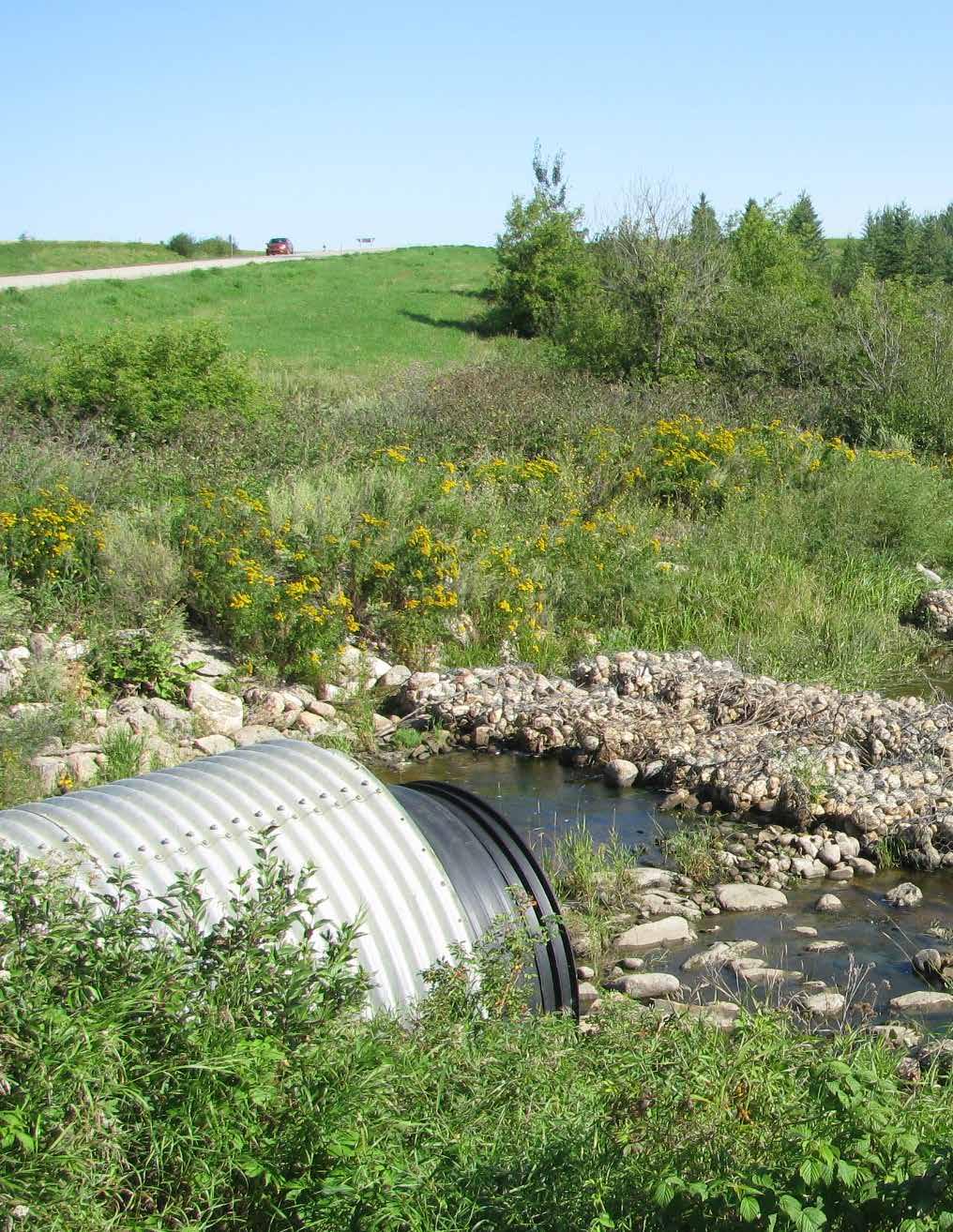
14 Development Guide It is recommended that the engineer, Board and the members meet regularly to review the design, provide input on the project and ensure they are getting the product they want. However, it s good to be aware that changing the scope of the project may affect the cost of engineering. Participating in regular meetings provides due diligence for the project and keeps the landowners engaged. At this step the Board must decide if it requires an engineer to supervise the construction phase. STEP NINE Apply to the Water Security Agency for Approval To Construct Once the detailed design is approved by the Board, the engineer will stamp the detailed design. Each landowner where the works will be constructed must sign an Easement form and a plan map. This ensures land control for the project. The plan map details where the works will be located on each quarter section and how many acres will be used. The engineering company completes the plan maps. Appendix A provides a form of Easement. Appendix B provides an example of a plan map. The Board will then make an application to WSA for Approval to Construct Drainage Works and any other regulatory agency that is needed to permit the project. The application will include engineering plans, Easements, plan maps and other required permits. After reviewing the application WSA can issue an Approval to Construct Works if the application meets all regulatory requirements. The review can take up to three months. STEP TEN Construction It is important to obtain bids for the construction from numerous contractors. By tendering out the project, the Board has performed its due diligence for its members and the SMB. The Board will need to decide who is undertaking site supervision and contract administration. For larger projects this would usually be an engineering firm with the ability to survey and quantify the volumes of earth that have been moved and to inspect water control structures as they are being built to ensure they comply with the tender documents. For small projects such as a single culvert installation, the Board may choose to supervise the installation themselves, relying on someone with construction experience. 14 Water Security Agency

 can complete the as-built surveys required for the regulatory process, however the as-built survey must be completed by a certified")


15 Conservation & Development Area Authority Be sure to include the cost of the post construction as built survey in the construction budget, as well as site supervision and contract administration. These items are easy to miss. STEP ELEVEN Register Permanent Easements and Apply for Approval To Operate Once the ditch is constructed, an as built survey must be completed. The survey confirms that the project has been constructed to specifications outlined in the engineering plan. Lateral drainage ditch that requires additional grass seeding. General surveyors (for example, engineering firms) can complete the as-built surveys required for the regulatory process, however the as-built survey must be completed by a certified Saskatchewan Land Surveyor if it is part of an easement registered with ISC. Finalized plan maps of each quarter where the project has been constructed will also be required. The plans are used in registering easements for each quarter. Easements can be registered manually at the ICS office or online. Once the easement is registered, each landowner is notified by ISC. Registering easements is the most important step of a project. Easements provide permanent land control for the C&D. If the land is sold, the C&D will continue to have access to operate and maintain the project. This is a very important step. Also, note that if the Board has expropriated easements, the Expropriation Notice acts as the easement and no further documents are required. Lateral ditch that requires proper sloping and grass seeding to revegetate. Culverts cleaned out early spring. As-built plans and proof of registered easements can then be provided to WSA, along with any other necessary documentation. If all necessary conditions have been met, WSA can issue an Approval to Operate Works. Be aware that WSA may apply restrictions to an Approval to Operate Works. Restrictions may include delaying the release of surface water until after the peak flow of receiving waters has passed. Each C&D s Approval to Operate Works will be different. More rock added at an erosion control drop structure. More geo-tech fabric and rock needed to be added to the sides of the ditch. Slumping along the ditch. Erosion control maintenance needed. Water Security Agency June
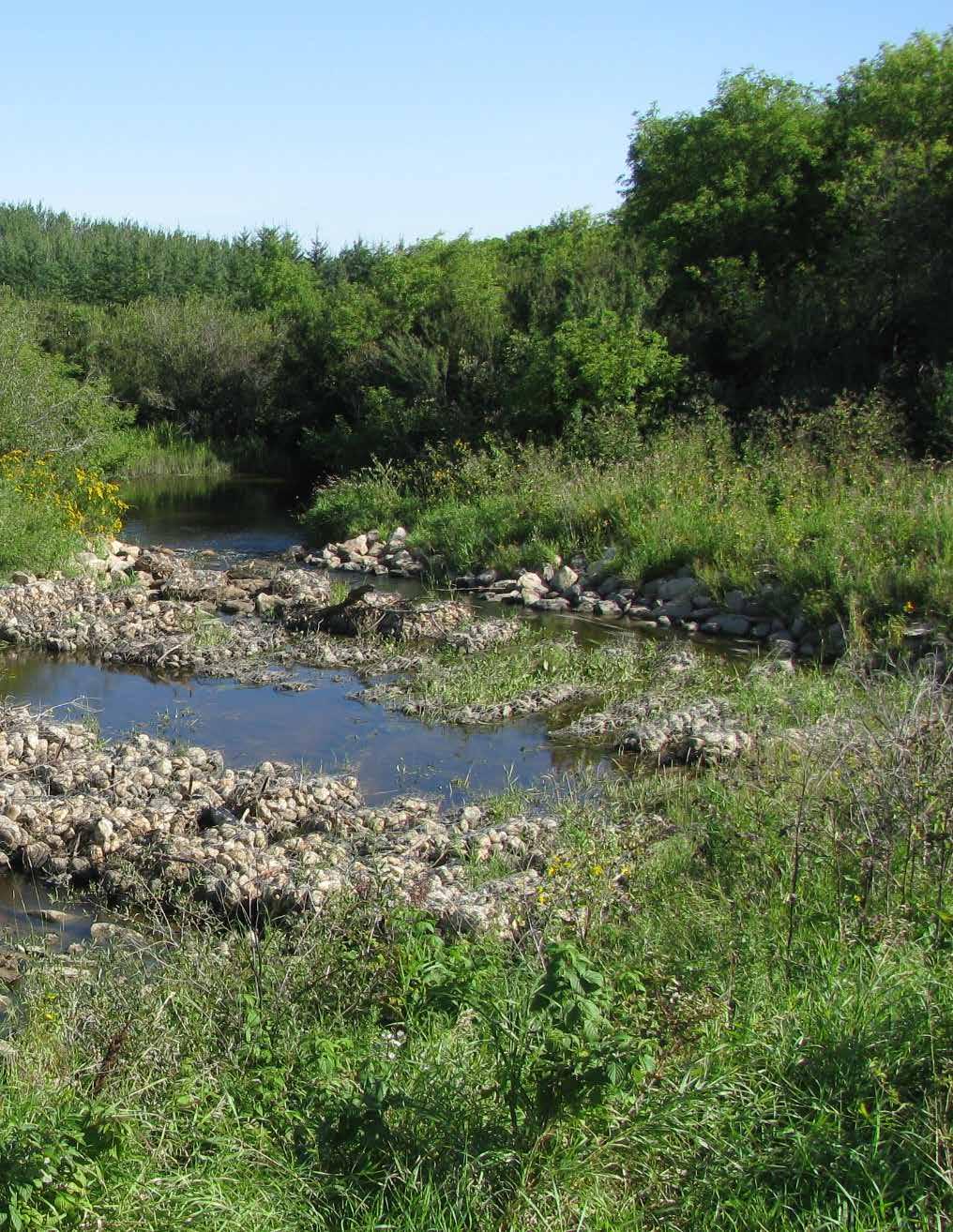
16 Development Guide STEP TWELVE Project Maintenance and Operation Implementing a sound maintenance plan is essential in sustaining the project. Some key points to consider: The Board must develop and implement an operating plan for the project s works. The plan must be shared and reviewed with the landowners within the CDA boundary to minimize any concerns or issues during spring runoff or extreme weather events. A ditch maintenance inspection should be completed in early fall. This gives the Board an opportunity to address and prioritize any ditch maintenance runoff issues for the upcoming spring. For instance, more rock may be required around some of the culvert installations, or some areas of the ditch may require more grass seeding. The inspection aids in preparing a maintenance budget for the upcoming spring, which could have an effect on the C&D levy depending on costs. Ensure the ditch is mowed annually in early fall. Mowing prevents trees growing and helps reduce snow from building up in the ditch making it easier for spring runoff to flow. Large snow build-up can cause spring runoff to flow out of the ditch banks, eroding the sides of the ditch. Before spring runoff begins to flow, it is important to have the ditch culverts opened by removing the snow around them and ensuring they are not frozen shut. This allows snow to melt and runoff to flow easily through the project. If this is not done, there is a potential for spring runoff to back up upstream and then release all at once causing damage to the ditch s infrastructure downstream. A plan must be developed to manage the opening and closing of the ditch gates. The proper procedure is to open gates closest to the adequate outlet and then work upstream. Upstream gates should not be opened until the downstream spring runoff has been released and is gone. This means that landowners at the top of the project may need to hold water on their land for a time until the downstream spring runoff has left. The Board may need to obtain back flood agreements. C&D s should consider becoming financially prepared to eventually replace infrastructure. Levy dollars can be accumulated over time to pay for this cost. Adding New Drainage Works The Approval to Operate issued by WSA is based on the project s hydrology and approved engineering plan. If the Board wants to construct lateral ditches that were not in the initial approved engineering plan to tie into an existing project, an approval is required. This is because the original project was designed for a certain amount of flow. Increasing the volume of water and flows could potentially damage the existing project s infrastructure and have detrimental effects on receiving waters downstream. Preparing an Assessment and Tax Roll Each year the secretary/treasurer shall as soon as possible prepare an assessment and tax roll for the Board. The tax roll should include the following: The number of assessed benefited acres per quarter. Each acre is assessed an administration and operating levy that is set by resolution of the Board annually. Some Boards assess an administration levy on all acres in the CDA and an operating levy on only the benefited acres. For instance, a landowner may have 40 benefited acres on a quarter. He or she will only pay an operating levy on the 40 acres and an administration levy on the whole quarter. Other Boards may assess an administration and operating levy on all the acres in the CDA. The Board determines assessment of costs and each C&D is different. Continued Water Security Agency

17 Conservation & Development Area Authority After preparation of the assessment role, the secretary/treasurer mails an assessment notice to each landowner listed on the assessment role. Each notice must contain the final date upon which complaints against the assessment notice may be lodged with the secretary/treasurer. Once the assessment notices have been dispensed the secretary/treasurer will post a notice in each post office in the area, as well as in the local newspaper circulating in the C&D area. You can find the required notice format in The Conservation and Development Act, Section 59(5). The secretary/treasurer shall, no later than May 31 st of each year, forward to each rural municipality administrator a copy of the tax roll certified by them to be a true copy. If the levy rates are the same as last year, the administrator requires a letter stating just that. The secretary/treasurer must also include a list of any additions or deletions to the tax roll as required. The rural municipality administrator will enter the levy amount on each parcel of land assessed and will notify each owner of the land affected of the amount so entered. They will collect the levies on behalf of the Board. Assessment and Tax Roll Complaint Process A landowner wanting to lodge a complaint has 21 days from the date the assessment notice was mailed to notify the secretary/treasurer in writing. Every complaint must be received in a specific format outlined in The Conservation and Development Act, Section 62(1). The Board shall schedule a date, place and time to hear complaints in respect to the assessments. This is known as the court of revision. The secretary/treasurer will contact the complainant and every person whose assessment is affected by the complaint of the date, place and time of the complaint hearing. At least 15 days prior to the court of revision date, the secretary/treasurer will send a registered letter to the complainant. If the complainant disagrees with the court of revision process, they have 14 days to notify the secretary/treasurer of their intention to appeal to the SMB. A copy of the notice must be forwarded to the SMB as well. SMB will notify all parties 21 days in advance of the date and time of the appeal hearing. The notice has the same force and effect as a subpoena. Upon decision of the SMB, either party, within 30 days can appeal to the Court of Appeal on a question of law only. Section 77(1) of The Conservation and Development Act outlines the Court of Appeal process. Water Security Agency June
18 Development Guide BETWEEN: [FULL NAME OF LANDOWNER] GRANT OF EASEMENT of in the Province of Saskatchewan, [FULL NAME OF C&D] - and The Grantor is the registered owner of the following land: the Land Title # Surface Parcel # Reference Land Description: As described on Certificate of Title THIS AGREEMENT WITNESSES THAT: the Grantor the Grantee In consideration of the Mutual Covenants and the sum of One (1) Dollar paid to the Grantor by the Grantee, the receipt of which sum is hereby acknowledged, and in consideration of the sum of ($ ) Dollars, the Grantor hereby grants to the Grantee the right, license, liberty, privilege and easement and right-of-way on, over, under and/or through that portion of the said Lands being hectares ( acres), more or less, as shown outlined in red on the attached sketch marked Exhibit A, hereinafter called the easement area for the purposes granted to the Grantee pursuant to The Conservation and Development Act, namely: (a) the right and privilege at all times hereafter for the laying down, construction, operation, maintenance, inspection, alteration, removal, replacement, reconstruction and/or repair of works and appurtenances necessary or convenient for the safe carriage, conveyance, or transportation of water (the works ); and (b) the right to remove and clean trees, brush and other obstruction and the right of ingress and egress to and from the easement area for its servants, agents, vehicles, machinery, supplies, and equipment for all purposes necessary or incidental to the exercise and enjoyment of the rights and privileges herein granted, IT IS MUTUALLY covenanted and agreed by and between the Grantor and Grantee as follows: 1. The Grantee shall have the right to immediate use of the easement area. 2. The Grantor shall not without prior written consent of the Grantee, cultivate, excavate, drill, install, erect or permit to be cultivated, excavated, drilled, installed or erected on or under the easement area, any crop, obstruction, structure, installation or any other thing that will interfere with or damage the works, but otherwise the Grantor shall have the right fully to use and enjoy the easement area. 3. The Grantee shall be solely responsible for the operation and maintenance of the works. 4. The Grantee shall compensate the Grantor or any person claiming through or under the Grantor for damage done outside the easement area when such damage is caused by the Grantee while constructing, operating, maintaining, or altering its works or the easement area. 5. NOTWITHSTANDING that in constructing, maintaining and operating its works the Grantee may install works and appurtenances in, on or under the said lands in such manner that it or they become affixed to the realty, the title to such works and appurtenances together with the right to remove the same shall remain in the Grantee. 6. The Grantor shall from time to time and at all times hereafter, at the request and at the cost of the Grantee, execute such further documents and assurances of the Grantee s rights as the Grantee may reasonably require. 7. This Grant of Easement may be registered in the Land Titles Registry, Information Services Corporation of Saskatchewan, under provisions of The Public Utilities Easements Act, and shall be of the same force and effect, to all intents and purposes, as a 18 Water Security Agency
19 Conservation Appendix & Development A: Form Area of Easement Authority covenant running with the land, and shall be binding upon the heirs, executors, administrators, successors and assigns of the Grantor and enure to the benefit of the successors and assigns of the Grantee. 8. No further actions will be taken by the Grantee to define the limits of the easement area granted herein, but such limits shall be sufficiently defined by the Exhibit A sketch attached hereto and forming a part of the Grant of Easement. IN WITNESS WHEREOF the Grantor has hereunto set his hands and seals, this day of, 20. [FULL NAME OF LANDOWNER] (witness) Grantor (witness) Grantor IN WITNESS WHEREOF the Grantee has hereunto set its hand and seal this day of, 20. CANADA SEAL PROVINCE OF SASKATCHEWAN TO WIT: [FULL NAME OF C&D] Title AFFIDAVIT Under Section 122(2) of The Planning and Development Act, 2007 I, of in the Province of Saskatchewan, (occupation), MAKE OATH AND SAY AS FOLLOWS: 1. I am employed / contracted by the [Full name of C&D] and in such capacity have knowledge of the matters hereinafter deposed to; 2. The attached Grant of Easement dated will be used for right-of-way for a drainage ditch which is a purpose listed in Section 122(1)(f) of The Planning and Development Act, 2007; 3. To the best of my knowledge, information and belief no portion of the easement is located within 5 kilometres from the limits of a city, or within 2.5 kilometres from the limits of a hamlet, organized hamlet, resort village, village or town as defined under The Municipalities Act; 4. The interest is not a subdividing instrument requiring an approval pursuant to Part VII of The Planning and Development Act, 2007; and 5. Notice of intention to submit the aforesaid subdividing instrument for interest registration has been given to the municipality or municipalities in which the right-of-way is located. Water Security Agency June
20 Development Guide SWORN BEFORE ME AT ) ) in the Province of Saskatchewan, ) ) this day of, 20. ) ) (signature of person swearing affidavit) ) ) A Notary Public or Commissioner for Oaths in and for the Province of Saskatchewan. My appointment expires: Consent of Non-Owning Spouses (Declaration A) I,, the non-owning spouse of the Grantor, consent to this Instrument. I declare that I have signed this consent for the purpose of relinquishing all my homestead rights in the property described in this Instrument in favour of (the Grantee) to the extent necessary to give effect to this Instrument. Signature of Non-Owning Spouse Notes 1. Declaration A must be signed by the non-owning spouse of the Grantor if he or she has ever lived on the land affected. The non-owning spouse must then appear before a proper official to be examined separate and apart from the owning spouse and the official must execute Certificate B on this page. OR 2. If the Grantor has no spouse, or has a spouse who has never lived on the land affected, instead of the Grantor s spouse signing Declaration A, the Grantor must execute the Homestead Affidavit under The Homesteads Act. 20 Water Security Agency
21 Conservation Appendix & Development A: Form Area of Easement Authority The Homesteads Act - Certificate of Acknowledgement (Certificate B) I,, (indicate capacity) certify that I have examined the non-owning spouse of the owning spouse in this Instrument, separate and apart from the owning spouse. The non-owning spouse acknowledged to me that he or she: (a) signed the consent to this Instrument of his or her own free will, and without any compulsion on the part of the owning spouse; and, (b) understands his or her rights in the homestead. I further certify that I have not, nor has my employer, partner or clerk, prepared this Instrument, and that I am not, nor is my employer, partner or clerk, otherwise interested in the transaction involved. Homestead Affidavit (Affidavit D) Signature I, of in the Province of, make oath and say: 1. I am Grantor, named in the within Instrument. 2. My spouse and I have not occupied the Grantor s land as our homestead at any time during our marriage. 2. I have no spouse. 2. My spouse is a registered owner of thegrantor s land and a co-signator of the within Instrument. 2. My spouse and I have entered into an interspousal agreement pursuant to The Matrimonial Property Act, in which my spouse has specifically released his or her homestead rights in the Grantor s land. 2. An order has been made by Her Majesty s Court of Queen s Bench for Saskatchewan/Unified Family Court pursuant to The Matrimonial Property Act declaring that my spouse has no homestead rights in the Grantor s land and (the order has not been appealed and the time for appealing has expired) or (all appeals from the order have been disposed of or discontinued). 2. My spouse is the Grantee named within this Instrument. SWORN BEFORE ME AT ) in the Province of Saskatchewan, ) this day of, 20. (signature of person swearing affidavit) ) A Notary Public or Commissioner for Oaths in and for the Province of Saskatchewan. My appointment expires: Water Security Agency June
22 Development Guide AFFIDAVIT OF EXECUTION (To be completed by Witness to Landowner s Signature) CANADA PROVINCE OF SASKATCHEWAN TO WIT I, of in the Province of Saskatchewan,, MAKE OATH AND SAY: (occupation) 1. THAT I was personally present and did see (Grantor) named in the within instrument, and who is personally known to me to be the person named therein, duly sign and execute the same for the purposes named therein. 2. THAT the same was executed at, in the Province of Saskatchewan, on the day of, 20 and that I am the subscribing witness thereto. 3. THAT I personally know the said (Grantor) and he/she is in my belief eighteen years of age or more. SWORN BEFORE ME AT ) ) in the Province of Saskatchewan, ) ) this day of, 20. ) ) (signature of witness) ) ) A Notary Public or Commissioner for Oaths in and for the Province of Saskatchewan. My appointment expires: Note: This entire Form of Easement is available at wsask.ca as a fillable PDF for your use. 22 Water Security Agency
23 Conservation Appendix & Development B: Example Area of Plan Authority Map Water Security Agency June
24 wsask.ca 111 Fairford Street East Moose Jaw SK S6H 7X9 Canada June 2017
Easement under Section 65 of The Water Security Agency Act
 Easement under Section 65 of The Water Security Agency Act THIS AGREEMENT MADE BETWEEN: OF hereinafter called the Grantor, - and - Insert Full name of Grantor Insert Address of Grantor OF hereinafter called
Instruction Sample of Easement under Section 65 of The Water Security Agency Act
 Instruction Sample of Easement under Section 65 of The Water Security Agency Act THIS AGREEMENT MADE BETWEEN: < Insert full name of Grantor > OF < Insert address of Grantor > hereinafter called the Grantor,
INSTRUCTIONS Grant of Easement Form
 INSTRUCTIONS Grant of Easement Form PAGE 1 THIS GRANT OF EASEMENT made as of, 20 BETWEEN: WHEREAS: [insert company name or individual owner(s here] (the "Grantor" - and - NOVA SCOTIA POWER INCORPORATED,
The Drainage Control Regulations
 1 The Drainage Control Regulations Repealed by Saskatchewan Regulations 89/2015 (effective October 16, 2015) Formerly Chapter D-33.1 Reg 1 (effective August 18, 1981) as amended by Saskatchewan Regulations
ALBERTA SURFACE LEASE AGREEMENT
 CAPL 95 ALBERTA ALBERTA SURFACE LEASE AGREEMENT This Indenture of Lease made the day of A.D. 20 BETWEEN of. in the Province of Alberta, (hereinafter called the Lessor ) and (hereinafter called the Lessee
PERMANENT DRAINAGE EASEMENT
 City Project No. Project Name: ; Tr. # Parcel No. (LLC, Corporation, Partnership) PERMANENT DRAINAGE EASEMENT THIS AGREEMENT, made and entered into this day of, 201, by and between, a, hereinafter called
GENESIS PIPELINE CANADA LIMITED AGREEMENT FOR EASEMENT PROVINCE OF ONTARIO
 EASEMENT AGREEMENT GENESIS PIPELINE CANADA LIMITED Property Identification No.: GST #: Yes No GST# AGREEMENT FOR EASEMENT PROVINCE OF ONTARIO I, (We), (the "Owner(s)"), being registered as owner(s) or
DEED OF EASEMENT & MAINTENANCE AGREEMENT FOR STORMWATER MANAGEMENT FACILITIES THIS DEED OF EASEMENT AND MAINTENANCE AGREEMENT FOR
 (The City of Chesapeake is exempt from recordation taxes pursuant to Section 58.1-811.A.3. and Grantors are exempt pursuant to Section 58.1-811.C.5. of the 1950 Code of Virginia as amended.) DEED OF EASEMENT
DEED OF EASEMENT Utility Line and Grinder Pump
 RECORD AND RETURN TO: Jerry Jackson City of LaPorte, Wastewater Department 2101 Boyd Blvd, LaPorte IN 46350 DEED OF EASEMENT Utility Line and Grinder Pump THIS DEED OF EASEMENT, made this day of,, by (insert
DRAYTON VALLEY REA LTD. MEMBER OWNED COMMUNITY POWERED
 DRAYTON VALLEY REA LTD. MEMBER OWNED COMMUNITY POWERED CONTRACT #: SITE ID #: ELECTRIC SERVICE CONTRACT (referred to as the Contract 1. PARTIES This section identifies the parties to this Contract: (Attach
DEED OF EASEMENT STATE OF NEW JERSEY AGRICULTURE RETENTION AND DEVELOPMENT PROGRAM. BETWEEN, whose address is and is referred to as the Grantor;
 Page 1 of 8 E3-E DEED OF EASEMENT STATE OF NEW JERSEY AGRICULTURE RETENTION AND DEVELOPMENT PROGRAM This Deed is made, 20. BETWEEN, whose address is and is referred to as the Grantor; AND, whose address
CHAPTER 2 RELATED DOCUMENTS AND FORMS
 CHAPTER 2 RELATED DOCUMENTS AND FORMS TABLE OF CONTENTS CHAPTER 2 RELATED DOCUMENTS AND FORMS Resolution R00- Establishing Public Improvement Design Standards Page 1 Current Plans Review & Construction
APPROVAL REQUIRED... A5 APPLICATION FOR APPROVAL OF PRELIMINARY PLAN... A6 APPLICATION FOR APPROVAL OF DEFINITIVE PLAN... A7
 APPENDIX FORM A. FORM A-2. FORM A-3. FORM B. FORM C. FORM C-1. FORM C-2. FORM D. FORM E. FORM F. FORM G. FORM H. FORM I. FORM J. FORM J-1. FORM K. FORM K-1 FORM L Form M. APPLICATION FOR A DETERMINATION
Province of Alberta LAND TITLES ACT FORMS REGULATION. Alberta Regulation 480/1981. With amendments up to and including Alberta Regulation 170/2012
 Province of Alberta LAND TITLES ACT FORMS REGULATION Alberta Regulation 480/1981 With amendments up to and including Alberta Regulation 170/2012 Office Consolidation Published by Alberta Queen s Printer
RM of Torch River BYLAW NO
 BYLAW NO 06-2017 A BYLAW TO PROVIDE FOR THE CLOSING AND SELLING OF A MUNICIPAL ROAD Section 13 The Municipalities Act The Council of the Rural Municipality of Torch River No. 488 in the Province of Saskatchewan
ALBERTA REGULATION 480/81 Land Titles Act FORMS REGULATION
 (Consolidated up to 149/2007 ALBERTA REGULATION 480/81 1 The forms in the Schedule are the forms prescribed for the purposes of the sections indicated on the forms. AR 480/81 s1 2 For the purpose of ensuring
CERTIFICATE OF APPROVAL OF COUNTY COMMISSION
 STATE OF FLORIDA COUNTY OF PINELLAS CERTIFICATE OF APPROVAL OF COUNTY COMMISSION It is hereby certified that this plat has been officially approved for record by the Board of County Commissioners of the
City of Edwardsville, Kansas Special Benefit District Policy
 City of Edwardsville, Kansas Special Benefit District Policy Date Adopted: September 12, 2011 Section 1. Objective The objective is to establish a policy to finance public streets, sanitary sewers, water
It is necessary for the Board to adopt the attached resolution accepting the dedication of the easement.
 SOUTHAMPTON COUNTY BOARD OF SUPERVISORS Regular Session i May 28, 2013 11. ACCEPTANCE OF A SANITARY SEWER EASEMENT FROM THE COMMONWEALTH OF VIRGINIA, DEPARTMENT OF TRANSPORTATION Attached for your review
CITY OF INDIANAPOLIS GRANT OF PERPETUAL DRAINAGE EASEMENT AND RIGHT-OF-WAY
 CROSS REFERENCE TO DEED#: PROJECT #: DRN - INSTRUMENT NO.: PARCEL #: CITY OF INDIANAPOLIS GRANT OF PERPETUAL DRAINAGE EASEMENT AND RIGHT-OF-WAY THIS INDENTURE made this day of, 20, by and between, ("GRANTOR")
STORMWATER MANAGEMENT AGREEMENT AND DECLARATION OF EASEMENT
 APPENDIX F STORMWATER MANAGEMENT AGREEMENT AND DECLARATION OF EASEMENT THIS AGREEMENT AND DECLARATION OF EASEMENT made this day of 20, by and between BRECKNOCK TOWNSHIP, Lancaster County, Pennsylvania,
Stormwater Ordinance Appendix APPENDIX K EXAMPLE TAR-PAM CONVERSATION EASEMENT
 APPENDIX K EXAMPLE TAR-PAM CONVERSATION EASEMENT Tax Parcel ID # NORTH CAROLINA FRANKLIN COUNTY CONSERVATION EASEMENT Franklin County, North Carolina THIS CONSERVATION EASEMENT (this "Conservation Easement")
TRANSFER OF DEVELOPMENT RIGHTS CONSERVATION EASEMENT
 After Recording Return to: Kitsap County Department of Community Development TDR Program Manager 614 Division St., MS-36 Port Orchard, Washington 98366 TRANSFER OF DEVELOPMENT RIGHTS CONSERVATION EASEMENT
C. Florida Power & Light (FPL): FPL Distribution Supervisor at (386) Or Pattie Hersch at (386)
: FPL Distribution Supervisor at (386) Or Pattie Hersch at (386)") SECTION 28.0 BINDING LOT AGREEMENT Section 28.01 Purpose This section describes the process for the binding of lots. An owner of two (2) or more contiguous lots or portions of subdivided lots may apply
SECTION 28.0 BINDING LOT AGREEMENT Section 28.01 Purpose This section describes the process for the binding of lots. An owner of two (2) or more contiguous lots or portions of subdivided lots may apply
Stormwater Treatment Facility Maintenance Agreement
 Stormwater Treatment Facility Maintenance Agreement This Agreement made and entered into this day of, 20, by, (hereinafter referred to as Property Owner") RECITALS: WHEREAS, the Property Owner is the owner
City of Melissa, Texas Plat Dedication Language
 City of Melissa, Texas Plat Dedication Language [INCLUDE THE FOLLOWING DEDICATION LANGUAGE FOR INDIVIDUALS (MODIFY APPROPRIATELY TO REFLECT EXACTLY AS SHOWN ON PROPERTY DEED)]: NOW THEREFORE, KNOW ALL
DEEP SUMP CATCH BASIN OPERATION & MAINTENANCE AGREEMENT
 Return after recording to: Lindley Paynter Town of Apex P.O. Box 250 Apex, NC 27502 DEEP SUMP CATCH BASIN OPERATION & MAINTENANCE AGREEMENT This Operation and Maintenance Agreement ( Agreement ) is established
SMOKY LAKE COUNTY. Alberta Provincial Statutes
 SMOKY LAKE COUNTY Title: Disposition of County Owned Property Policy No: 10-01 Section: 61 Code: P-R Page No.: 1 of 14 E Legislative Reference: Alberta Provincial Statutes Purpose: To outline the procedures
address address branch address Fee Simple Absolute See Schedule G attached
 Form 15.1 Collateral Mortgage Land Titles Act, S.N.B. 1981, c.l-1.1, s.25 Standard Forms of Conveyances Act, S.N.B. 1980, c.s-12.2, s.2 Parcel Identifier: Mortgagor: name address name address Spouse of:
UTILITY RIGHT-OF-WAY AND EASEMENT
 THE LAND TITLES ACT UTILITY RIGHT-OF-WAY AND EASEMENT I (We), Hauser Development Corp., of Buck Lake, in the Province of Alberta, Canada (hereinafter call the Grantor ) being registered owner of an estate
STORMWATER MANAGEMENT FACILITIES AND PRACTICES COVENANT
 STORMWATER MANAGEMENT FACILITIES AND PRACTICES COVENANT City of Roswell, GA Community Development Department (770) 641-3780 THIS INSTRUMENT, made and entered into this day of, 20, by and between (Insert
BOONE COUNTY, MISSOURI RESOURCE MANAGEMENT DEPARTMENT (573)
") STORMWATER MANAGEMENT/BMP FACILITIES MAINTENANCE AGREEMENT FOR ON-SITE FACILITIES BOONE COUNTY, MISSOURI RESOURCE MANAGEMENT DEPARTMENT (573)-886-4330 THIS agreement made and entered into this Day of 20,
STORMWATER MANAGEMENT/BMP FACILITIES MAINTENANCE AGREEMENT FOR ON-SITE FACILITIES BOONE COUNTY, MISSOURI RESOURCE MANAGEMENT DEPARTMENT (573)-886-4330 THIS agreement made and entered into this Day of 20,
APPENDIX C STANDARD FORMS OF LEGAL AGREEMENT
 APPENDIX C STANDARD FORMS OF LEGAL AGREEMENT TABLE OF CONTENTS PAGE # Certificate of Authenticity...C-4 Deed of Dedication, Subdivision and Easement...C-5 Deed of Easement...C-11 Deed of Dedication...C-14
PERMANENT EASEMENT AGREEMENT. good and valuable consideration, the sufficiency and receipt of which is hereby acknowledged, The Esther Harrison
 PERMANENT EASEMENT AGREEMENT For and in consideration of the sum of Seven thousand thirty and 00/100 dollars ($7,030.00) and other good and valuable consideration, the sufficiency and receipt of which
6. LIST THE CAUSE DOCKETED NUMBER (E.G. ZONING CASE NUMBER, PLAT NUMBER...)
") GRANT OF RIGHT OF WAY CHECKLIST DOCUMENTS TO FOLLOW PLEASE MAKE SURE YOUR GRANT IS COMPLETED AS FOLLOWS: 1. NAME, COUNTY, AND THE STATE OF THE GRANTOR CLEARLY TYPED OR HAND WRITTEN. 2. A LEGAL DESCRIPTION
GRANT OF RIGHT OF WAY CHECKLIST DOCUMENTS TO FOLLOW PLEASE MAKE SURE YOUR GRANT IS COMPLETED AS FOLLOWS: 1. NAME, COUNTY, AND THE STATE OF THE GRANTOR CLEARLY TYPED OR HAND WRITTEN. 2. A LEGAL DESCRIPTION
ORDINANCE NO
 Draft No. 12-21 ORDINANCE NO. 2012-23 AN ORDINANCE ACCEPTING A RIGHT-OF-WAY AND UTILITY EASEMENT FOR WATER LINES, SEWER LINES, STORM SEWER LINES AND SUCH OTHER UTILITIES AS ARE NEEDED FROM THE CARTER JONES
GENERAL WARRANTY DEED
 PROJECT. # 89008160 TRACT NO.:10 PARCEL ID NO.:PL199032200000001003 OWNERS NAME: Park Hill School District SITUS ADDRESS:5520 N. Northwood: KANSAS CITY, MISSOURI MAILING ADDRESS:7703 NW Barry Rd. Kansas
SOUTH DAKOTA BOARD OF REGENTS. Budget and Finance ******************************************************************************
 SOUTH DAKOTA BOARD OF REGENTS Budget and Finance AGENDA ITEM: 7 U DATE: October 4-6 ****************************************************************************** SUBJECT: SDSU 6 th Street Land Sale for
DEED OF EASEMENT STATE OF NEW JERSEY AGRICULTURE RETENTION AND DEVELOPMENT PROGRAM. This Deed is made, 20. BETWEEN, and is referred to as the Grantor;
 DEED OF EASEMENT E3E Page 1 of 7 STATE OF NEW JERSEY AGRICULTURE RETENTION AND DEVELOPMENT PROGRAM This Deed is made, 20 BETWEEN whose address is, and is referred to as the Grantor; AND the State Agriculture
TRANSFER OF DEVELOPMENT RIGHTS CONSERVATION EASEMENT
 After Recording Return to: Snohomish County Planning and Development Services TDR Program Manager 3000 Rockefeller Ave. M/S #604 Everett, WA 98201 Tax Parcel Numbers: TRANSFER OF DEVELOPMENT RIGHTS CONSERVATION
PIPELINE RIGHT-OF-WAY EASEMENT
 PIPELINE RIGHT-OF-WAY EASEMENT THIS RIGHT-OF-WAY EASEMENT made this day of March, 2014, by the City of Rochester Hills, a municipal corporation in the State of Michigan,, having an address at 1000 Rochester
An Act to provide for the incorporation of The Manitoba-Saskatchewan Conference of the Seventh-day Adventist Church
 1995 CHAPTER 03 An Act to provide for the incorporation of The Manitoba-Saskatchewan Conference of the Seventh-day Adventist Church (Assented to March 28, 1995) WHEREAS there had existed for many years
RESTRICTIVE COVENANT THIS RESTRICTIVE COENANT MADE THE DAY OF, 2017.
 Neighbourhood: Stage: BERM AND FENCE RESTRICTIVE COVENANT THIS RESTRICTIVE COENANT MADE THE DAY OF, 2017. BETWEEN: Developer s Name a body corporate carrying on business in the City of Edmonton, in the
INDIANA DRAINAGE LAW. Title 36 Article 9 Chapter 27
 INDIANA DRAINAGE LAW Title 36 Article 9 Chapter 27 IC 36-9-27 Chapter 27. Drainage Law IC 36-9-27-1 Application of chapter Sec. 1. This chapter applies to all counties. However, sections 6, 7, 9, 10, 30,
AGREEMENT FOR TEMPORARY CONSTRUCTION EASEMENT AND PERMANENT SEWER UTILITY EASEMENT
 AGREEMENT FOR TEMPORARY CONSTRUCTION EASEMENT AND PERMANENT SEWER UTILITY EASEMENT This Agreement for Temporary Construction Easement and Permanent Sewer Utility Easement (hereinafter the "Agreement")
Subdivision By-law No. 5208
 No. 5208 Being a By-law to Control the Subdivision of Land THE COUNCIL OF THE CITY OF VANCOUVER in open meeting assembled, enacts as follows: 1 Short Title 1.1 This By-law may be cited as the. 2 Definitions
DISTRICT OF SICAMOUS BYLAW NO A bylaw of the District of Sicamous to establish a Revitalization Tax Exemption Program
 DISTRICT OF SICAMOUS BYLAW NO. 917 A bylaw of the District of Sicamous to establish a Revitalization Tax Exemption Program WHEREAS under the provisions of Section 226 of the Community Charter, the Council
Request for Assignment
 PRINT CLEAR SAVE Ministry Environment Request for Assignment May 2016 CSB CSB17004 Some the information required on this form is personal information within the meaning The Freedom Information and Protection
TITLE 145: DEPARTMENT OF PUBLIC LANDS SUBCHAPTER AGRICULTURAL HOMESTEAD WAIVER PROGRAM RULES AND REGULATIONS
 SUBCHAPTER 145-20.1 AGRICULTURAL HOMESTEAD WAIVER PROGRAM RULES AND REGULATIONS Part 001 - General Provisions 145-20.1-001 Authority 145-20.1-005 Purpose Part 100 - Agricultural Homestead Waiver Program
WASHINGTON STATE COUNTY AUDITOR/RECORDER'S INDEXING FORM
 AFTER RECORDING RETURN TO: The City of Gig Harbor Attn: City Clerk 3510 Grandview St. Gig Harbor, WA 98335 WASHINGTON STATE COUNTY AUDITOR/RECORDER'S INDEXING FORM Document Title(s) (or transactions contained
DEED AND DEDICATION FOR PUBLIC RIGHT OF WAY
 TO : BOARD OF DIRECTORS FROM : GARY PLATT, EXEC. DIRECTOR BUSINESS AND OPERATIONS SUBJECT : CITY OF STANWOOD CONSTRUCTION EASEMENT AND RIGHT-OF-WAY DEDICATION DATE : MARCH 17, 2009 TYPE : ACTION NEEDED
Certificates and Statements
 CITY OF NAPERVILLE Certificates and Statements Development Review Team Updated: 10/29/2015 Please use the decision matrix found in the Plat Review Checklist to determine which certificates and statements
Dallas Sloan General Manager Barron Area Phone: (715) Toll Free: Fax: (715) NEW SERVICE PROCESS
 Toll Free: Fax: (715) NEW SERVICE PROCESS") Barron Area Phone: (715) 537-3171 Toll Free: 800-322-1008 Fax: (715) 637-1906 Dallas Sloan General Manager NEW SERVICE PROCESS Paperwork: Membership application social security number required for credit
Barron Area Phone: (715) 537-3171 Toll Free: 800-322-1008 Fax: (715) 637-1906 Dallas Sloan General Manager NEW SERVICE PROCESS Paperwork: Membership application social security number required for credit
VILLAGE OF ASHVILLE DEPARTMENT OF PUBLIC UTILITIES DIVISION OF STORMWATER MANAGEMENT STORMWATER MANAGEMENT PROGRAM STORMWATER CREDIT MANUAL
 VILLAGE OF ASHVILLE DEPARTMENT OF PUBLIC UTILITIES DIVISION OF STORMWATER MANAGEMENT STORMWATER MANAGEMENT PROGRAM STORMWATER CREDIT MANUAL SECTION I. OVERVIEW AND GENERAL INSTRUCTIONS INTRODUCTION A stormwater
The Homesteads Act, 1989
 1 HOMESTEADS, 1989 c. H-5.1 The Homesteads Act, 1989 being Chapter H-5.1 of the Statutes of Saskatchewan, 1989-90 (effective December 1, 1989) as amended by the Statutes of Saskatchewan, 1992, c.27; 1993,
2. Attach copy of Certified Abutters List for abutters within 300 feet of the effected property line. (Form for Assessor s Office attached)
") Retreat Lot Application Instructions: Carefully read Section IV.N. Retreat Lot Bylaw (Attached) 1. Fill out one (1) copy of retreat lot application 2. Attach copy of Certified Abutters List for abutters
Retreat Lot Application Instructions: Carefully read Section IV.N. Retreat Lot Bylaw (Attached) 1. Fill out one (1) copy of retreat lot application 2. Attach copy of Certified Abutters List for abutters
PERMANENT EASEMENT AGREEMENT
 PERMANENT EASEMENT AGREEMENT This Permanent Easement Agreement ("Agreement") effective this day of, 2016, by and between Goin Straight, LLC, a Colorado limited liability company (Grantor"), whose mailing
WITNESSETH: 1. Definitions
 LEASE AGREEMENT FOR OPERATION OF CLINTON HEIGHTS, WEST GENESEE, EMERICK HEIGHTS, SENECA ESTATES, RIVER MIST AND OSWEGO ROAD WATER DISTRICTS TOWN OF LYSANDER, NEW YORK THIS LEASE AGREEMENT (the AGREEMENT
Request for Assignment
 PRINT CLEAR SAVE Ministry Environment Request for Assignment July 2017 CSB CSB17004 Some the information required on this form is personal information within the meaning The Freedom Information and Protection
CITY AND COUNTY OF BROOMFIELD SUBDIVISION IMPROVEMENT AGREEMENT FOR (PROPERTY NAME - ALL CAPS)
") CITY AND COUNTY OF BROOMFIELD SUBDIVISION IMPROVEMENT AGREEMENT FOR (PROPERTY NAME - ALL CAPS) THIS AGREEMENT, made and entered into this day of, 20, by and between The CITY AND COUNTY OF BROOMFIELD, a
CITY AND COUNTY OF BROOMFIELD SUBDIVISION IMPROVEMENT AGREEMENT FOR (PROPERTY NAME - ALL CAPS) THIS AGREEMENT, made and entered into this day of, 20, by and between The CITY AND COUNTY OF BROOMFIELD, a
AMENDED DEED OF CONSERVATION EASEMENT
 Prepared by: Wayne E. Flowers Lewis, Longman & Walker, P.A. 245 Riverside Ave. Suite 150 Jacksonville, FL 32202 Return recorded original to: Mitigation Marketing 1091 W. Morse Blvd. Suite 101 Winter Park,
DRY POND OPERATION & MAINTENANCE AGREEMENT
 Return after recording to: Lindley Paynter Town of Apex P.O. Box 250 Apex, NC 27502 DRY POND OPERATION & MAINTENANCE AGREEMENT This Operation and Maintenance Agreement ( Agreement ) is established this
PERMANENT EASEMENT AGREEMENT
 PERMANENT EASEMENT AGREEMENT THIS PERMANENT EASEMENT AGREEMENT ( Agreement ) is made and entered into this day of, 2016 ( Effective Date ), by and between Staker & Parson Companies, a Utah corporation
APPENDIX 7 SPECIAL NOTES FOR PLATS AND CONSTRUCTION PLANS
 APPENDIX 7 SPECIAL NOTES FOR PLATS AND CONSTRUCTION PLANS EASEMENT AND DRAINAGE STATEMENT TO BE PLACED ON PLANS AND ALL SUBDIVISION PLATS REQUIRING SOIL DRAINAGE MANAGEMENT PLANS The easements designated
SOUTH DAKOTA BOARD OF REGENTS. Committee on Budget and Finance ******************************************************************************
 SOUTH DAKOTA BOARD OF REGENTS Committee on Budget and Finance AGENDA ITEM: III O DATE: December 12-13, 2012 ****************************************************************************** SUBJECT: Resolution
CONCEPT PLAN APPLICATION Meeting with Staff Commercial Projects
 COMMUNITY DEVELOPMENT City of South Salt Lake Community Development Department 220 E. Morris Avenue South Salt Lake City, Utah 84115 Phone (801) 483-6011 Fax (801) 483-6060 CONCEPT PLAN APPLICATION Meeting
MECKLENBURG COUNTY Land Use & Environmental Services Agency Groundwater & Wastewater Services
 MECKLENBURG COUNTY Land Use & Environmental Services Agency Groundwater & Wastewater Services Instructions for Permitting On-Site Sewage Treatment & Disposal Systems Requiring a Septic System Easement,
A Guide to the Municipal Planning Process in Saskatchewan
 A Guide to the Municipal Planning Process in Saskatchewan A look at the municipal development permit and the subdivision approval process in Saskatchewan May 2008 Prepared By: Community Planning Branch
JERDONE ISLAND ASSOCIATION, INC. LAKE ANNA BUMPASS, VIRGINIA 23024
 AMENDED AND RESTATED BY-LAWS JULY 2010 INDEX PAGE ARTICLE TITLE PAGE INDEX 1 DEFINITIONS 2-3 I MEMBERSHIP RESPONSIBILITIES AND PRIVILEGES 3-6 II STOCKHOLDERS MEETING 6-7 III BOARD OF DIRECTORS 7-8 IV OFFICERS
BILL NO (Emergency Measure) ORDINANCE NO. 5072
 ORDINANCE NO. 5072") BILL NO. 5210 (Emergency Measure) ORDINANCE NO. 5072 AN ORDINANCE AUTHORIZING THE MAYOR TO EXECUTE WITH MICHELSON-HADLEY HEIGHTS DEVELOPMENT, LLC, A CONTRACT AND QUIT CLAIM DEED CONVEYING CERTAIN PROPERTIES
BILL NO. 5210 (Emergency Measure) ORDINANCE NO. 5072 AN ORDINANCE AUTHORIZING THE MAYOR TO EXECUTE WITH MICHELSON-HADLEY HEIGHTS DEVELOPMENT, LLC, A CONTRACT AND QUIT CLAIM DEED CONVEYING CERTAIN PROPERTIES
ARTICLES OF INCORPORATION Of LAKE IN THE WOODS OWNERS ASSOCIATION, INC.
 ARTICLES OF INCORPORATION Of LAKE IN THE WOODS OWNERS ASSOCIATION, INC. In compliance with the requirements of Chapter 617, Florida Statutes, the undersigned, all of whom are residents of the State of
WAKE COUNTY STORMWATER CONTROL STRUCTURE AND ACCESS EASEMENT AND AGREEMENT (Corporate)
") Return to: Matthew Flynn Stormwater Field Services Administrator Water Resources Department Town of Cary PO Box 8005, Cary, NC 27512 NORTH CAROLINA WAKE COUNTY STORMWATER CONTROL STRUCTURE AND ACCESS EASEMENT
Return to: Matthew Flynn Stormwater Field Services Administrator Water Resources Department Town of Cary PO Box 8005, Cary, NC 27512 NORTH CAROLINA WAKE COUNTY STORMWATER CONTROL STRUCTURE AND ACCESS EASEMENT
(Space above this line reserved for Recorder of Deeds)
") (Space above this line reserved for Recorder of Deeds) STORMWATER MANAGEMENT and BEST MANAGEMENT PRACTICES FACILITIES MAINTENANCE AGREEMENT COVER PAGE Date: Grantor: Grantee: Property Owner Owner's Address
(Space above this line reserved for Recorder of Deeds) STORMWATER MANAGEMENT and BEST MANAGEMENT PRACTICES FACILITIES MAINTENANCE AGREEMENT COVER PAGE Date: Grantor: Grantee: Property Owner Owner's Address
Option to Repurchase Land
 Option to Repurchase Land This agreement made this day of 20 A.D. Between: The Village of Marwayne P.O. Box 113 Marwayne, AB T0B 2X0 Hereinafter called the Village And: Hereinafter called the Land Owner
-ii~ ADAMS COUNTY. &,.ee8.& PUBLIC HEARING AGENDA ITEM
 -ii~ ADAMS COUNTY &,.ee8.& PUBLIC HEARING AGENDA ITEM DATE: January 6,2015 SUBJECT: Easement grant to Molson Coors FROM: Jeffery A. Maxwell, P.E., PTOE, Transportation Director~ AGENCYIDEPARTMENT: Transportation
AGREEMENT OF PURCHASE AND SALE *
 . The information in this document does not constitute a legal opinion and should not be considered as such. Its content is given on an information basis only. In each case, we advise you to consult a
Maintenance Agreement
 STATE OF GEORGIA COUNTY OF GWINNETT Maintenance Agreement WHEREAS, the Property Owner recognizes that the wet or extended detention facility or facilities (hereinafter referred to as "the facility" or
EXHIBIT C TVA TRACT NO. XTBRDC-1, LOT REDBUD SUBDIVISION SPECIAL WARRANTY DEED
 EXHIBIT C THIS DEED WOULD BE USED FOR LAND OWNED BY TVA AND WHERE THE LOTS ARE NOT ON THE WATERFRONT. A STATEMENT OF SUBDIVISION STANDARDS AND SHORELINE MANAGEMENT ZONE (SAMPLES ATTACHED HERETO AS EXHIBITS
THIS DECLARATION OF RESTRICTIVE COVENANTS is made this day of, 20, by ("Covenantor"). RECITALS
. RECITALS") Model for Use with Permits Without Mitigation Plans STATE OF COUNTY OF DECLARATION OF RESTRICTIVE COVENANTS THIS DECLARATION OF RESTRICTIVE COVENANTS is made this day of, 20, by ("Covenantor"). RECITALS
Model for Use with Permits Without Mitigation Plans STATE OF COUNTY OF DECLARATION OF RESTRICTIVE COVENANTS THIS DECLARATION OF RESTRICTIVE COVENANTS is made this day of, 20, by ("Covenantor"). RECITALS
PETITION APPLICATION PROCEDURE
 INSTRUCTIONS & EXPLANATIONS TO ABANDON/VACATE RIGHTS OF WAY, EASEMENTS AND PLATS UNDER THE JURISDICTION OF THE BOARD OF COUNTY COMMISSIONERS OF PALM BEACH COUNTY The following are explanations of the required
EASEMENT DEED. 2) Thence N 60º12 36 W through said Parcel 1 a distance of Two Hundred Ninety- Five and 97/100 (295.97) feet to a point;
 Thence N 60º12 36 W through said Parcel 1 a distance of Two Hundred Ninety- Five and 97/100 (295.97) feet to a point;") EASEMENT DEED TALL TREES CONSTRUCTION CORP., a Maine corporation having a mailing address of 30 Preservation Drive, Falmouth, Maine 04105 (the "Grantor") for consideration paid, grants to the TOWN OF FALMOUTH,
EASEMENT DEED TALL TREES CONSTRUCTION CORP., a Maine corporation having a mailing address of 30 Preservation Drive, Falmouth, Maine 04105 (the "Grantor") for consideration paid, grants to the TOWN OF FALMOUTH,
SPECIAL SERVICE AREA DISCLOSURE
 SPECIAL SERVICE AREA DISCLOSURE All lots within this subdivision are included within the County of Will Special Service Area Number and are subject to an annual tax levy in accordance with the provisions
PLEASE NOTE. For more information concerning the history of this Act, please see the Table of Public Acts.
 PLEASE NOTE This document, prepared by the Legislative Counsel Office, is an office consolidation of this Act, current to May 30, 2009. It is intended for information and reference purposes only. This
APPENDIX B TYPICAL FORMS AND AGREEMENTS
 APPENDIX "B" APPENDIX B TYPICAL FORMS AND AGREEMENTS The forms contained herein will be acceptable to the Regional District. These forms are included for information only and do not form part of the Regional
MEETING TYPE: Board of Commissioners - Regular. MEETING DATE: 23 May STAFF RESPONSIBLE: Matt Hubert. DEPARTMENT: Development Services Department
 MEETING TYPE: Board of Commissioners - Regular MEETING DATE: 23 May 2017 STAFF RESPONSIBLE: Matt Hubert DEPARTMENT: Development Services Department DESCRIPTION Approval of Easement Agreement To approve
CITY OF SARALAND FINAL SUBDIVISION PLAT REVIEW
 CITY OF SARALAND FINAL SUBDIVISION PLAT REVIEW Application Number: Date Plat Submitted: Name of Subdivision: Name of Owner: Owner Address: (Street or P.O. Box) Telephone #: (City) (State) (Zip) E-mail:
Recitals. WHEREAS, Grantor owns real property ("Property"), under which Improvements (as defined in Section 1 below) will pass; and
, under which Improvements (as defined in Section 1 below) will pass; and") EASEMENT AGREEMENT This Easement Agreement ("Agreement") effective this 24 th day of April, 2017, by and between YMCA Community Campus, LLC, whose address is 3200 Spaulding Avenue, Pueblo, CO 81008 ( Grantor
EASEMENT AGREEMENT This Easement Agreement ("Agreement") effective this 24 th day of April, 2017, by and between YMCA Community Campus, LLC, whose address is 3200 Spaulding Avenue, Pueblo, CO 81008 ( Grantor
Sale and Other Disposition of Land Policy
 Section Community & Development Services Subsection Sale and Other Disposition of Land DATE Approved by By-law : December 12, 2017 158-2017 Supersedes By-law : 138-2000 PAGE OF 1 1.0 Purpose 1.1 To provide
WYOMING WATER DISTRICTS. Harriet M. Hageman Hageman and Brighton, P.C.
 WYOMING WATER DISTRICTS Harriet M. Hageman Hageman and Brighton, P.C. TYPES OF DISTRICTS Water Conservancy District (W.S. 41-3-701 through 41-3-779) Flood Control District (W.S. 41-3-801 through 41-3-803)
Complete applications are due by 2:00 p.m. on the submission cut-off date.
 CONSENT APPLICATION PLEASE READ ALL INSTRUCTIONS WHAT IS A COMPLETE APPLICATION? Your application is complete when you have: o Discussed the application with a City of St. Catharines Planner Name of Planner:
The Homesteads Forms Regulations
 1 The Homesteads Forms Regulations being Chapter H-5.1 Reg 1 (effective December 1, 1989) as amended by Saskatchewan Regulations 81/2001. NOTE: This consolidation is not official. Amendments have been
DECLARATION OF COVENANTS CONDITIONS AND RESTRICTIONS
 DECLARATION OF COVENANTS CONDITIONS AND RESTRICTIONS This Declaration, made on the date hereinafter set forth by PAREC Realty Skippack Associates, a Pennsylvania Limited Partnership, (hereinafter referred
EXCLUSIVE OPTION TO PURCHASE DEVELOPMENT RIGHTS WITH PROVISION FOR ACCEPTANCE AND ASSIGNMENT
 EXCLUSIVE OPTION TO PURCHASE DEVELOPMENT RIGHTS WITH PROVISION FOR ACCEPTANCE AND ASSIGNMENT PDR@ Page 1 of@ The Conservation Fund witness that, @, @, and @ tenants in common, hereinafter collectively
ACCESS AND OPTION AGREEMENT TEMPLATE FOR REAL PROPERTY PARTNERSHIP PROJECTS
 ACCESS AND OPTION AGREEMENT TEMPLATE FOR REAL PROPERTY PARTNERSHIP PROJECTS Appendix 3 This ACCESS AND OPTION AGREEMENT (this Agreement ) is entered into as of, 201 (the Execution Date ), by and between
An Act to incorporate The Ukrainian Missionary and Bible Society
 UKRAINIAN MISSIONARY AND BIBLE SOCIETY c. 120 1 An Act to incorporate The Ukrainian Missionary and Bible Society being a Private Act Chapter 120 of the Statutes of Saskatchewan, 1948 (effective March 25,
EXHIBIT "A" THE PRESERVE AT WILDERNESS LAKE COMMUNITY DEVELOPMENT DISTRICT 5844 Old Pasco Road, Suite 100, Wesley Chapel, Florida 33544
 EXHIBIT "A" THE PRESERVE AT WILDERNESS LAKE COMMUNITY DEVELOPMENT DISTRICT 5844 Old Pasco Road, Suite 100, Wesley Chapel, Florida 33544 NATURAL AREAS POLICY STATEMENT The following is the policy statement
WET POND OPERATION & MAINTENANCE AGREEMENT
 Return after recording to: Lindley Paynter Town of Apex P.O. Box 250 Apex, NC 27502 WET POND OPERATION & MAINTENANCE AGREEMENT This Operation and Maintenance Agreement ( Agreement ) is established this
ARTICLES OF INCORPORATION of HARTRIDGE HARBOR OWNERS' ASSOCIATION, INC.
 ARTICLES OF INCORPORATION of HARTRIDGE HARBOR OWNERS' ASSOCIATION, INC. In compliance with the requirements of Chapter 617 of the Florida Statutes, the undersigned, all of whom are residents of Polk County,
The Assessment Management Agency Act
 Consolidated to March 15, 2013 1 The Assessment Management Agency Act being Chapter A-28.1 of the Statutes of Saskatchewan, 1986 (consult Table of Saskatchewan Statutes for effective date) as amended by
CONFIRMATION OF REPRESENTATION In representing the parties in the negotiations for the purchase and sale of the Property:
 CONDOMINIUM UNIT FORM OF OFFER TO PURCHASE This form of offer is prescribed under The Real Estate Brokers Act for use by brokers in the purchase of a completed condominium unit in a registered Condominium