City of Chelan Comprehensive Plan Update. City Council Meeting. September 12, 2017
|
|
|
- Wilfrid Pitts
- 5 years ago
- Views:
Transcription

1 City of Chelan Comprehensive Plan Update City Council Meeting September 12, 2017

2 Agenda Future Land Use / Zoning Changes Small Town Chelan: Height and Density Other Municipal Code Changes Capital Facility Plan Deliberation Schedule

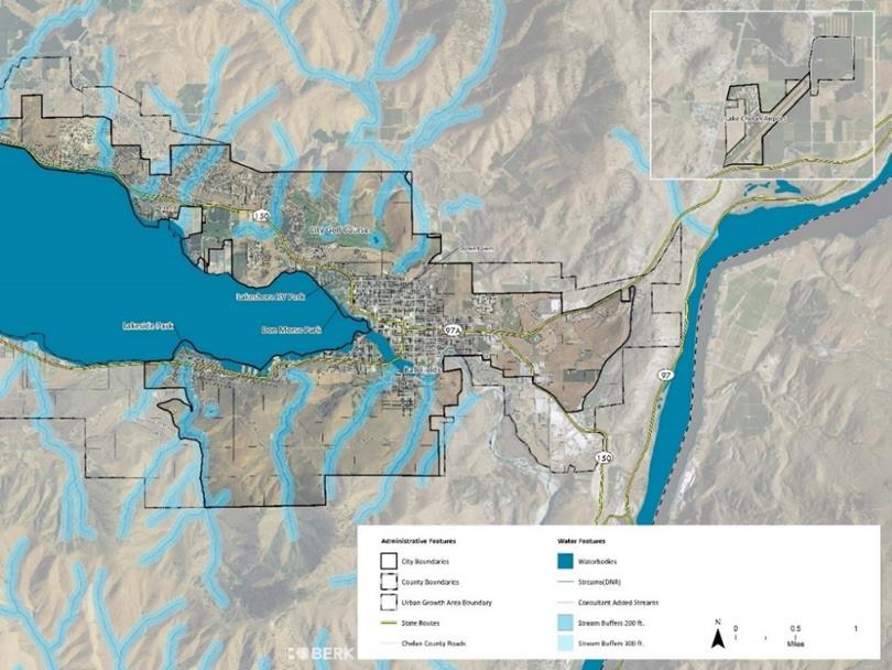
3 Future Land Use and Zoning Map Respond to Vision and Land Use Workshops and Property Owner Requests Key Changes: ~15 Areas UGA reductions: North, East, South (Modified) Added areas of R-M and T-A DMR: Expanded next to Downtown, abutting C-HS, and in South Chelan Correction to DSF = DMR Small additions to SUD near Lord Acres Small changes to C-HS and C-W Added overlays: T-A on Butte and Live-Work in W-I UGA + T-A UGA - UGA - R-M SUD T-A & C-W T-A Overlay T-A & RM DMR DMR & C-HS DMR R-M Live- Work UGA - See Staff Report Attachment B for list of comments/requests to Planning Commission.
4 Balance of Land Uses #1: Most Land designated R-L, T-A, SUD, W-I #2: T-A Overlay makes up 75% of zoned acres (gross) Half of W-I has overlays of ABC or Live-Work #3: Most developable land is T-A (primarily Butte), R-L, SUD, and W-I #1 FLU/Zone Acres A 123 C-HS 44 C-W 25 DMR 161 DMU 34 DP 13 DSF 11 PLF 354 R-L 1,674 R-M 302 SUD 702 T-A 1,159 TMU 6 W-I 632 Grand Total 5,239 Base and Overlay Zones Acres Base/Overlay Share Special Use District % Lookout 46 7% Tourist Accommodation 1,159 25% T-A Overlay % Warehouse and Industrial % Apple Blossom Center % Live-Work % Developable Land Acres #2 #3

5 Developable Land Vacant (Red) Underutilized (Yellow) Note: Doesn t include deductions for critical areas or other factors.
6 T-A Zoning Note: Doesn t include deductions for critical areas or other factors. Including Butte T-A ZONING ZONE: CITY ZONE: UGA ZONE: CITY AND UGA DEVELOPABLE: CITY DEVELOPABLE: CITY AND UGA Current Plan/Zoning , , ,249 Proposed Plan/Zoning July , , ,021 Excluding Butte T-A ZONING ZONE: CITY ZONE: UGA ZONE: CITY AND UGA DEVELOPABLE: CITY DEVELOPABLE: CITY AND UGA Current Plan/Zoning Proposed Plan/Zoning July

7 Campbell s T-A and R-M Request

8 T-A Requests T-A Request N of W. Campbell


9 Other T-A Requests Edgewater Residents Rezone C-W to T-A Northshore Sterling, Merry Change the zoning from R-L to T-A Edgewater Address Nonconforming Use T-A to C-W


10 R-M Recommendations T-A Requests Property Owners Prefer T-A Planning Commission Recommended R-M for yearround residential options. North of Apple Blossom Center Lafferty above Lakeside

11 Why take a closer look at the T-A area on the Butte? Identified through Visioning as an important area for community character & views Area has: Extensive steep slopes Ravines High & Moderate Wildland Fire Risk Lack of utilities Approach: Allow development comparable to what s allowed today Allow development in areas with less environmental sensitivity and at heights respecting views


12 Conditions Steep Slopes Wildland Urban Interface

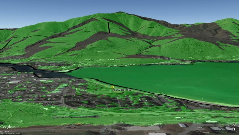
13 Conditions Streams and Ravines Viewshed Analysis

14 T-A Overlay Original Approach: Apply a gross density that would be similar to Bear Mountain Example Resort with recreation, vineyards, and single family homes clustered 1 du/10 ac unclustered 1 du/2.5 ac clustered Revised Proposal: In response to property owner comments and further review, amend density to be more consistent with current potential development capacity and past plans: Base density 1 du/5 ac unclustered, 1 du/1ac clustered Density bonus for recreation and affordable housing 1.5 du/ac Resort Plan for greater density by Density does not apply to hotels/accommodations. The Resort Plan is to achieve greater density for residential development. CUP du/ac Planning Commission: Include Revised Proposal. Treat height like T-A base zone.

15 City Dwellings + T-A Overlay Development 2,650 dwellings citywide in Depending on density and rate of growth, future development on Butte could add 50% to over 300% to the city s current dwelling units. In addition there would be dwellings elsewhere in city. Updated Table: Parcels Corrected for Split Zone ~5 ac Site Fifer Palisade Acres in T-A Overlay Low Range High Range 0.2 du/ac 1.0 du/ac 1.25 du/ac 1.5 du/ac 4 du/ac 8.7 du/ac Property Owner Proposals Morris unknown Golden Gate Ventures , , , , Total , , , , ,

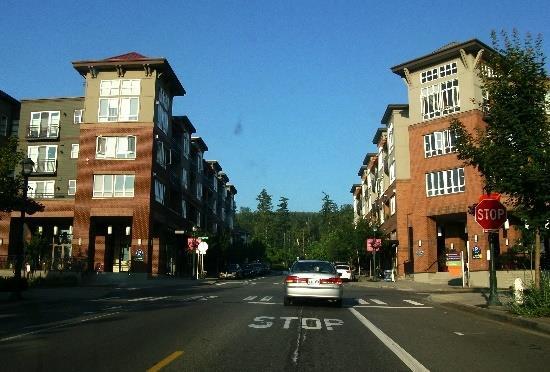

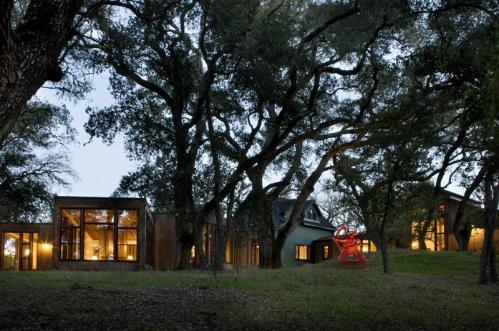
16 Issaquah Highlands


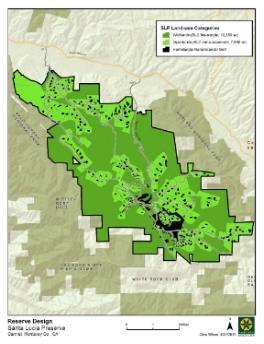
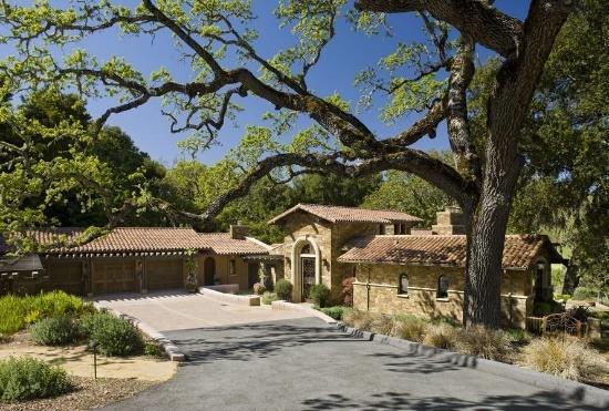
17 Santa Lucia Preserve, CA
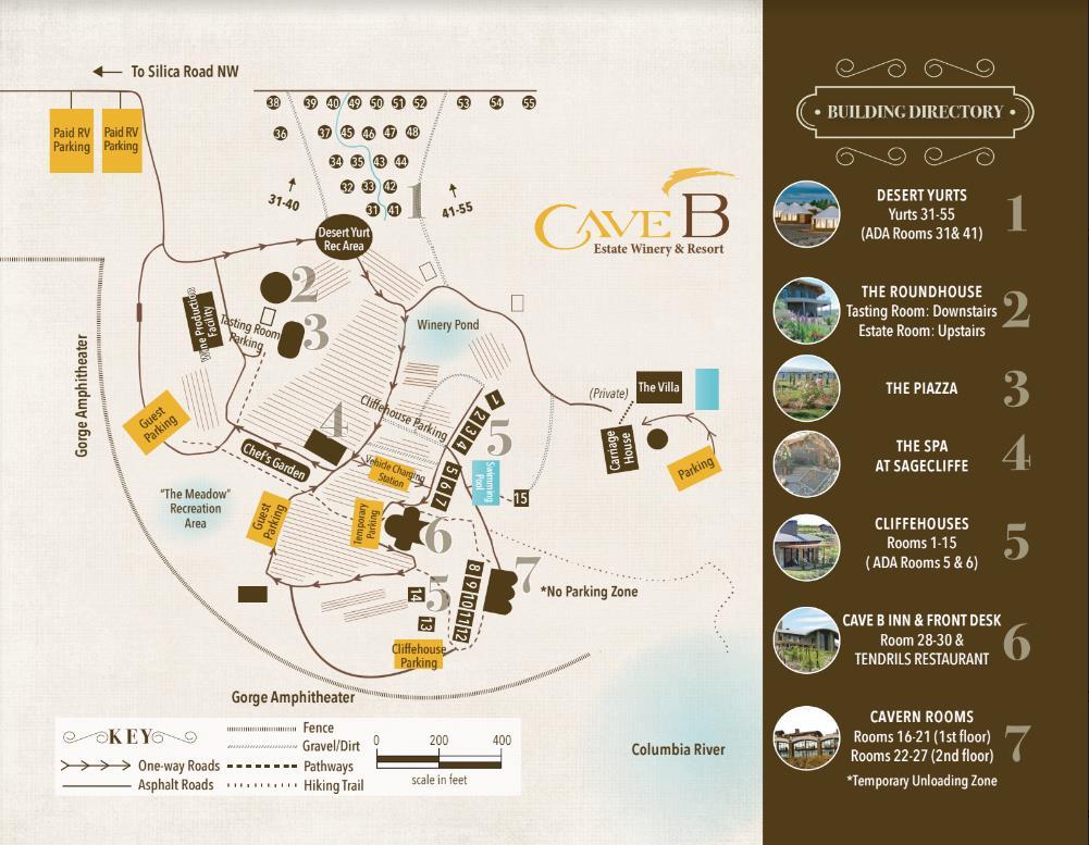

18 Cave B Winery/Resort
19 T-A Overlay Allowable Uses Uses same as Base Zone Emphasis on Hotel and other Accommodations Range of detached and attached dwellings Overlay also allows Resort Plan request greater density by CUP in exchange for public benefits Further adjustment: Since Overlay allows agriculture in open space, consider allowing agri-tourism uses Similar to other retail, restaurant, and lodging uses

20 R-M and DMR DMR added north, east, and south of Downtown Similar mix of residential uses Greater design review Applied to areas with similar lot pattern as downtown
21 C-W Amendments Residential / Mixed Use Match Shoreline Master Program (SMP) allowance for mixed-use developments that include water-dependent and water-oriented commercial uses together with singlefamily or multi-family uses while promoting public access for significant numbers of the public and/or providing an ecological restoration resulting in a public benefit. Allow existing legal residential developments as of the date of the code. Other Use and Standard Changes Add allowance for parks and playgrounds. Remove cross references to R-L and C-L zones and pull in appropriate uses to the C-W zone. Reduce standard height by 10 feet; allow consideration of heights greater than standard with model and compliance with criteria in CMC
22 Affordable Housing Incentives Affordability Proposed Approach Density bonuses for affordable housing : SUD, R-L, and T-A Overlay Accessory workforce housing in the W-I zone requires long-term affordability Affordable and special needs housing are added as allowable uses in PLF to respond to the Senior Living Initiative Mandatory Affordability - Options Consider a requirement for areas where zoning is changed to add capacity for workforce Places rezoned from lower zoning to higher zoning, e.g. R-L to T-A, R-L to R-M, residential in W-I Examples: Jackson, WY required for all employment uses Kirkland, WA required when adding new multi-family in commercial and multifamily zones
23 W-I Workforce Housing Required to be for employees of primary use (can be on or offsite) Consider if units could be used in some percentage for other business employees
24 Small Town Chelan: Height Downtown Reduce heights on blocks that are allowed 4 stories in the DMU and TMU zones: reduce from 50 feet to 45 feet For developments 3 stories and greater in the DMU and TMU zones require 3-D model and ability to condition Other Reduce heights in zones by 10 feet with ability to ask for greater height with 3-D model and criteria R-M (from 50 to 40 feet) T-A (from 50 to 40 feet) C-HS (from 50 to 40 feet) C-W (from 35 to 25 feet) SUD zone vary by view corridor 35 feet outside, 25 feet inside R-L retained at 30 feet
25 Small Town Chelan: Density Comprehensive Plan: Identify gross density per acre for each zone Gross density is more predictable and allows property owners and neighbors to understand what is possible Zoning Code: Match standards to Comp. Plan density Because not all sites are regular in shape or in constraints, some lot sizes or areas are made smaller Gross density controls (same as today) The comprehensive plan specifies a density for some zones and not others The zoning code gives minimum lot sizes or area per dwelling unit The City s development standards also affect density Comprehensive Plan CONSISTENTLY ADDRESS GROSS DENSITY Zoning Code MATCH TO COMP PLAN City Standards: Slope Density Chart REMOVE CHART USE HILLSIDE DEV STDS Critical Areas Regulations RETAIN & UPDATE
26 WUI Code Adopt a Wildland Urban Interface (WUI) Code into the Chelan Municipal Code to regulate new development and retrofit existing development within the city and UGA boundaries. Fulfils CPAW recommendations Considers International Code and amendments There is support for property owners National Fire Plan-Wildland Urban Interface Community Fire Assistance Washington Emergency Management Division-Hazard Mitigation Assistance Grants Title III County Funds- attached to firewise program
27 Grading, Weed Control, Critical Areas Code Amending the City s critical areas ordinance to address best available science for geologic hazard areas. Require topsoil retention. Requiring dust control and weed control. Adding hillside development standards to minimize changes to natural landforms. Removing the slope-density chart. Streams and Ravines Adding the 200- foot distance from centerline creates a zone of protection (the ravine channel) along the steep portions of the ravine that could be rapidly eroded and steepened during extreme weather events and after wildfires. RH2, May 1, 2017
28 Interim Water and Sewer Standards Purpose: Allow interim septic and water wells with low density development in the city or UGA that are located away from infrastructure provide developed occurs in a pattern that allows future urban uses when municipal services are available. Similar to City Council reviewed proposal. Place regulations in Zoning Code. Alternative to Conservation Easement To allow for limited development potential and to advance agricultural or open space uses: Require building placement requirements - ensure development and building areas are located to provide the maximum protection of existing or potential agricultural production areas Develop a management plan implemented by homeowner s associations or property owners
29 Capital Facilities Plan Parks Zoning: Add to zones SUD, C-W, T-A, W-I Already allowed in R-L, R-M, C-HS, and PLF Capital Facilities: Clarify Level of Service Address Seasonal Population Parks Investments 6-year investments fully fund Consider range of proposals Any adjustments? Potential Acquisitions 7-20 years as funding allows Three Fingers and Butte and Other Make Other Changes designed to Dovetail with 2017 Budget or TIP
30 Deliberation Schedule Deliberation and Potential Action September 12, 2017 September 26, 2017
City of Chelan Comprehensive Plan Update
 City of Chelan Comprehensive Plan Update *V- Joint Planning Commission & City Council Study Session May 9, 2017^"^^ Agenda : T" Overview of Process & Outreach Reviewing the Plan & Code Public Comments/Requests
Supplemental Meeting Packet: Planning Commission Direction Recap
 DRAFT June 16, 2017 Supplemental Meeting Packet: Planning Commission Direction Recap Follow up Plan and Code Changes Responding to June 14, 2017 Commission Direction Attached are changes to the May 2,
City of Chelan Comprehensive Plan & Municipal Code Update
 DRAFT July 28, 2017 City of Chelan Comprehensive Plan & Municipal Code Update Staff Report to City Council Draft July 28, 2017 Purpose of Plan and Code Update... 1 Summary of Planning Commission Recommendations...
MEMORANDUM. Critical Areas Ordinance Density Requirements
 COUNTY COMMISSIONERS Creating Solutions for Our Future Cathy Wolfe District One Sandra Romero District Two Karen Valenzuela District Three PLANNING DEPARTMENT Scott Clark Director MEMORANDUM TO: FROM:
1. an RSF-R, RSF-1, RSF-2, RSF-4, RMF-5, or RMF-8 zoning district; or
 Chapter 9 INCENTIVES 9.1 General 9.1.1 Review and Approval Procedure Projects requesting bonuses under this chapter for land that has not been platted, or for land that is being voluntarily replatted,
Lacey UGA Residential density
 Thurston County Planning Department BOARD OF COUNTY COMMISSIONERS PUBLIC HEARING DRAFT AMENDMENTS TO THE CRITICAL AREAS REGULATIONS Residential density amendment to Title 21 Title 21 6/1/2012 Lacey UGA
STAFF REPORT. Permit Number: Porter. Kitsap County Board of Commissioners; Kitsap County Planning Commission
 STAFF REPORT Permit Number: 15 00461 Porter DATE: November 9, 2015 TO: FROM: Kitsap County Board of Commissioners; Kitsap County Planning Commission Katrina Knutson, AICP, Senior Planner, DCD and Jeff
Staff Report. Planning Commission Public Hearing: October 17, 2007 Staff Recommendation: Denial
 COUNTY OF PRINCE WILLIAM 5 County Complex Court, Prince William, Virginia 22192-9201 PLANNING (703) 792-6830 Metro 631-1703, Ext. 6830 FAX (703) 792-4401 OFFICE Internet www.pwcgov.org Stephen K. Griffin,
Public Comment Land Use and Policy Requests Matrix
 DRAFT Chelan Comprehensive Plan Update: Land Use and Policy Requests Matrix Public Comment Land Use and Policy Requests Matrix DRAFT Chelan Comprehensive Plan Update May 2, 2017 This matrix summarizes
Conservation Design Subdivision Option
 Sheridan County, Wyoming Conservation Design Subdivision Option Recent Amendments to Zoning and Subdivision Rules and Regulations Adopted November 2010 Mark Reid, County Planner 1 County Road #255 traffic
SANTA BARBARA COUNTY ZONING ADMINISTRATOR STAFF REPORT February 15, 2013
 SANTA BARBARA COUNTY ZONING ADMINISTRATOR STAFF REPORT February 15, 2013 PROJECT: Galbraith Lot Line Adjustment HEARING DATE: March 4, 2013 STAFF/PHONE: J. Ritterbeck, (805) 568-3509 GENERAL INFORMATION
2014 Plan of Conservation and Development. Development Plan & Policies
 The Town of Hebron Section 3 2014 Plan of Conservation and Development Development Plan & Policies C. Residential Districts I. Residential Land Analysis This section of the plan uses the land use and vacant
TOWN OF ORO VALLEY PLANNING & ZONING COMMISSION MEETING DATE: December 6, 2011
 PLANNING & ZONING COMMISSION MEETING DATE: December 6, 2011 TO: FROM: SUBJECT: PLANNING & ZONING COMMISSION Matt Michels, Senior Planner mmichels@orovalleyaz.gov; tel. 229-4822 Public Hearing: Rancho de
Bylaw No , being "Official Community Plan Bylaw, 2016" Schedule "A" DRAFT
 Bylaw No. 2600-2016, being "Official Community Plan Bylaw, 2016" Schedule "A" Urban Structure + Growth Plan Urban Structure Land use and growth management are among the most powerful policy tools at the
STAFF REPORT. Permit Number: Garland. Kitsap County Board of Commissioners; Kitsap County Planning Commission
 STAFF REPORT Permit Number: 15 00686 Garland DATE: February 25, 2016 TO: FROM: Kitsap County Board of Commissioners; Kitsap County Planning Commission Katrina Knutson, AICP, Senior Planner, DCD and Jeff
Affordable Housing Plan
 Affordable Housing Plan CORDOVA HILLS SPECIAL PLANNING AREA 1 Proposed Project Conwy LLC is the master developer ( Master Developer ) of that certain real property in the County of Sacramento ( County
Kitsap County Department of Community Development
 Kitsap County Department of Community Development Staff Report and Recommendation Annual Comprehensive Plan Amendment Process for 2018 George s Corner LAMIRD Boundary Adjustment Report Date 7/16/2018 Hearing
Puyallup Downtown Planned Action & Code Changes. January 10, 2017
 Puyallup Downtown Planned Action & Code Changes January 10, 2017 Purpose & Location Purpose Promote economic development and downtown revitalization Tools: Municipal Code amendments Change development
Article Optional Method Requirements
 Article 59-6. Optional Method Requirements [DIV. 6.1. MPDU DEVELOPMENT IN RURAL RESIDENTIAL AND RESIDENTIAL ZONES Sec. 6.1.1. General Requirements... 6 2 Sec. 6.1.2. General Site and Building Type Mix...
STAFF REPORT. Permit Number: Unlimited. Kitsap County Board of Commissioners; Kitsap County Planning Commission
 STAFF REPORT Permit Number: 15 00550 Unlimited DATE: March 2, 2016 TO: FROM: Kitsap County Board of Commissioners; Kitsap County Planning Commission Katrina Knutson, AICP, Senior Planner, DCD and Jeff
5-703 Agricultural Rural (AR) District Cluster Option. (A)
 District Cluster Option. (A)") 5-703 Agricultural Rural (AR) District Cluster Option. (A) Purpose. The purpose of the Agricultural Rural (AR) District Cluster Option is to provide for residential singlefamily detached development in
5-703 Agricultural Rural (AR) District Cluster Option. (A) Purpose. The purpose of the Agricultural Rural (AR) District Cluster Option is to provide for residential singlefamily detached development in
Town of Truckee. Contents. Article I - Development Code Enactment and Applicability. Chapter Purpose and Effect of Development Code...
 Town of Truckee TITLE 18 - DEVELOPMENT CODE Article I - Development Code Enactment and Applicability Chapter 18.01 - Purpose and Effect of Development Code... I-3 18.01.010 - Title... I-3 18.01.020 - Purposes
CCC XXX Rural Neighborhood Conservation (NC)
") CCC 33.10.XXX Rural Neighborhood Conservation (NC) Purpose: Maintain low density rural residential areas and associated uses commonly found in rural areas consistent with the local character of the distinctive
CCC 33.10.XXX Rural Neighborhood Conservation (NC) Purpose: Maintain low density rural residential areas and associated uses commonly found in rural areas consistent with the local character of the distinctive
Solutions to the Rising Costs of Fighting Fires in the Wildland Urban Interface 10 Ideas
 Solutions to the Rising Costs of Fighting Fires in the Wildland Urban Interface 10 Ideas Wildland firefighting is dangerous, expensive, & costs are rising Costs the federal government more than $3 billion
PAPRlamird5-Four Seasons
 PAPRlamird5-Four Seasons Lamird Report This report provides the written record of local circumstances that explains how the 4 Seasons LAMIRD ( this lamird ) fits within the rural element goals of the Growth
1. Future Land Use FLU6.6.8 Land uses within the Rural Service Area portion of the Wekiva Study Area shall be limited to very low and low intensity
 1. Future Land Use FLU6.6.8 Land uses within the Rural Service Area portion of the Wekiva Study Area shall be limited to very low and low intensity uses to the greatest extent possible. Existing land uses
VICINITY MAP. Board of Adjustment File No.: VAR & VAR January 9, 2014 Page 2 of 11 ATTACHMENTS
 Board of Adjustment File No.: VAR2013 0024 & VAR2013 0025 January 9, 2014 Page 2 of 11 VICINITY MAP ATTACHMENTS Attachment A Applicant s Letter Attachment B Site Plan Attachment C Elevation Drawings Board
Article Floating Zone Requirements
 Division 5.1. In General Article 59-5. Floating Zone Requirements Section 5.1.1. Zone Categories There are 4 categories of Floating zones: A. Residential Floating zones (Division 5.2); B. Commercial/Residential
Village of Queen Charlotte OCP and Bylaw Review Open House April 29, 2017 Highlights, Policy Directions, and Choices
 Village of Queen Charlotte OCP and Bylaw Review Open House April 29, 2017 Highlights, Policy Directions, and Choices Purpose The purposes of the open house were: 1) to receive community input on topics
4. If any perennial surface water passes through or along the property lines of the acreage, a minimum of 200 feet or frontage should be required.
 b. Provide adequate acreage for appropriate productive use of rural residential land, such as small numbers of livestock, large gardens, etc. 3. Minimum of 200 feet of frontage on an improved county or
Planned Unit Development (PUD). Sections:
. Sections:") Chapter 19.07. Planned Unit Development (PUD). Sections: 19.07.01. Purpose. 19.07.02. PUD Definition and Design Compatibility. 19.07.03. General PUD Standards. 19.07.04. Underlying Zones. 19.07.05. Permitted
Chapter 19.07. Planned Unit Development (PUD). Sections: 19.07.01. Purpose. 19.07.02. PUD Definition and Design Compatibility. 19.07.03. General PUD Standards. 19.07.04. Underlying Zones. 19.07.05. Permitted
WASCO COUNTY PRELIMINARY SUBDIVISION APPLICATION
 WASCO COUNTY PRELIMINARY SUBDIVISION APPLICATION DETAILED SPECIFIC WRITTEN REQUEST File Number: SDV- Number of Proposed Lots & their Dimensions: PRELIMINARY SUBDIVISION PLAN REQUIREMENTS The approval of
To: Ogunquit Planning Board From: Lee Jay Feldman, Director of Planning Date: April 18, 2018 Re: Senior/Affordable Multi-Family Housing Assessment
 To: Ogunquit Planning Board From: Lee Jay Feldman, Director of Planning Date: April 18, 2018 Re: Senior/Affordable Multi-Family Housing Assessment I. Introduction The Planning Board held a workshop on
STAFF REPORT. Permit Number: Gonzalez. Kitsap County Board of Commissioners; Kitsap County Planning Commission
 STAFF REPORT Permit Number: 15 00657 Gonzalez DATE: March 2, 2016 TO: FROM: Kitsap County Board of Commissioners; Kitsap County Planning Commission Katrina Knutson, AICP, Senior Planner, DCD and Jeff Arango,
A. Preserve natural resources as identified in the Comprehensive Plan.
 1370.08 Conservation Residential Overlay District. Subd. 1 Findings. The City finds that the lands and resources within the Conservation Residential Overlay District are a unique and valuable resource
Chapter Planned Residential Development Overlay
 Chapter 19.29 Planned Residential Development Overlay Sections 010 Purpose 020 Scope 030 Definitions 030 Minimum Size 040 Allowable Uses 050 Minimum Development Standards 060 Density Bonus 070 Open Space
City of Tacoma Planning and Development Services
 Agenda Item D-3 City of Tacoma Planning and Development Services To: Planning Commission From: Elliott Barnett, Planning Services Division Subject: Affordable Housing Planning Work Program (Phase 3) Meeting
** If your lot does not meet the requirements above, please read Sec below
 Sec. 13-1-60 Zoning District Dimensional Requirements. For the Zoning Dept To Issue a Land Use Permit The Following Dimensions are Required. Minimum Side and Rear Yards s Lakes Classification Minimum Class
Comprehensive Plan /24/01
 IV The is a central component of the Comprehensive Plan. It is an extension of the general goals and policies of the community, as well as a reflection of previous development decisions and the physical
HOUSING ELEMENT GOALS, OBJECTIVES, & POLICIES
 HOUSING ELEMENT GOALS, OBJECTIVES, & POLICIES GOAL H-1: ENSURE THE PROVISION OF SAFE, AFFORDABLE, AND ADEQUATE HOUSING FOR ALL CURRENT AND FUTURE RESIDENTS OF WALTON COUNTY. Objective H-1.1: Develop a
TRANSFER OF DEVELOPMENT RIGHTS (TDR) ORDINANCE Revised November 2013
 ORDINANCE Revised November 2013") ARTICLE III Transfer of Development Rights (TDR) Program Part 301 Establishment and Purpose. 165-301.01. Purpose. Pursuant to the authority granted by 15.2-2316.1 and 2316.2 of the Code of Virginia, there
ARTICLE III Transfer of Development Rights (TDR) Program Part 301 Establishment and Purpose. 165-301.01. Purpose. Pursuant to the authority granted by 15.2-2316.1 and 2316.2 of the Code of Virginia, there
MEETING SUMMARY TDR/PDR Multi-Stakeholder Work Group
 MEETING SUMMARY TDR/PDR Multi-Stakeholder Work Group Wednesday January 3, 2018, 2:30-4:30 PM Planning and Development Services Annex Conference Room Attendees Members Perspective Present Chris Behee City
Midwest City, Oklahoma Zoning Ordinance
 2010 Midwest City, Oklahoma Zoning Ordinance 9/2/2010 Table of Contents Section 1. General Provisions... 5 1.1. Citation... 5 1.2. Authority... 5 1.3. Purpose... 5 1.4. Nature and Application... 5 1.5.
ARTICLE III District Regulations. A map entitled "Franklin Zoning Map" is hereby adopted as part of this chapter 1.
 ARTICLE III District Regulations ~ 305-8. Adoption of Zoning Map. A map entitled "Franklin Zoning Map" is hereby adopted as part of this chapter 1. ~ 305-9. Official Zoning Map; amendments. Regardless
STAFF REPORT. Permit Number: Lee. Kitsap County Board of Commissioners; Kitsap County Planning Commission
 STAFF REPORT Permit Number: 15 00689 Lee DATE: March 2, 2016 TO: FROM: Kitsap County Board of Commissioners; Kitsap County Planning Commission Katrina Knutson, AICP, Senior Planner, DCD and Jeff Arango,
ARTICLE I ZONE BASED REGULATIONS
 ARTICLE I ZONE BASED REGULATIONS RZC 21.08 RESIDENTIAL REGULATIONS 21.08.290 Cottage Housing Developments A. Purpose. The purpose of the cottage housing requirements is to: 1. Provide a housing type that
2/22/2016. Planning and Zoning. David Owens March 2016 SOME CONTEXT
 Planning and Zoning David Owens March 2016 SOME CONTEXT 1 N.C. Population 1900 1.6 million 1950 2.4 million 2015 10 million 2 3 Population Growth Housing Units/ Square Mile Source: UNC Carolina Population
Article XII. R-1 Agricultural-Low Density Residential District
 Article XII R-1 Agricultural-Low Density Residential District Section 1200. Declaration of Legislative Intent In expansion of the Declaration of Legislative Intent and Statement of Community Development
ZONING Matters. Zoning Determines. Citywide Zoning Workshop April 26, 2010 North Oakland West Oakland North Oakland Hills
 Citywide Zoning Workshop April 26, 2010 North Oakland West Oakland North Oakland Hills ZONING Matters 1 2 Zoning Determines Zoning Determines what you can build on your property the allowable height of
Chapter 100 Planned Unit Development in Corvallis Urban Fringe
 100.100 Scope and Purpose. Chapter 100 Planned Unit Development in Corvallis Urban Fringe (1) All applications for land divisions in the Urban Residential (UR) and Flood Plain Agriculture (FPA) zones within
SPECIFIC RESPONSES TO AREA COMMISSION OPPOSITION :
 SPECIFIC RESPONSES TO AREA COMMISSION OPPOSITION 3-14-19: Area Commission reasons for opposition in black APPLICANT S RESPONSE IN RED. The comprehensive planning and design of stream restoration efforts
Introduction to INRMP Implementation Options
 El Dorado County Integrated Natural Resources Management Plan Introduction to INRMP Implementation Options 1 Our approach to the options evaluation is based on the INRMP components as they are currently
Implementation. Approved Master Plan and SMA for Henson Creek-South Potomac 103
 Implementation Approved Master Plan and SMA for Henson Creek-South Potomac 103 104 Approved Master Plan and SMA for Henson Creek-South Potomac Sectional Map Amendment The land use recommendations in the
Procedures For Collecting and Monitoring Data
 DRAFT Kitsap County Buildable Lands Program Procedures For Collecting and Monitoring Data Page 1 12/1/05 Introduction This procedures report is intended to provide guidelines for Kitsap County and its
Mohave County General Plan
 63 64 65 66 67 68 69 70 71 The Land Use Diagram is not the County's zoning map. 13 It is a guide to future land use patterns. Zoning and area plan designations may be more restrictive than the land use
ADMINISTRATIVE REPORT
 ADMINISTRATIVE REPORT TO: FROM: Advisory Planning Commission B. Newell, Chief Administrative Officer DATE: February 14, 2017 RE: OCP & Zoning Bylaw Amendment Electoral Area D Purpose: To facilitate a residential
FINAL DRAFT 12/1/16, Rev. to 7/18/17
 FINAL DRAFT 12/1/16, Rev. to 7/18/17 (As Adopted 8/8/17 Effective 9/1/17) SHELTON PLANNING AND ZONING COMMISSION Proposed Amendments to Zoning Regulations I. Amend Section 23 PERMITTED USES by inserting
Conservation Design Subdivisions
 Conservation Design Subdivisions An excerpt from the Rules and Regulations Governing Division of Land in Sheridan County, Wyoming, November 5, 2010 Sheridan County Public Works Department 224 S. Main Street
MIDWAY CITY Municipal Code
 MIDWAY CITY Municipal Code TITLE 9 ANNEXATION CHAPTER 9.01 PURPOSE CHAPTER 9.02 GENERAL REQUIREMENTS CHAPTER 9.03 PROPERTY OWNER INITIATION OF ANNEXATION CHAPTER 9.04 PROCEDURES FOR CONSIDERATION OF PETITION
Residential Project Convenience Facilities
 Standards for Specific Land Uses 35.42.220 E. Findings. The review authority shall approve a Land Use Permit in compliance with Subsection 35.82.110.E (Findings required for approval) or a Conditional
Whither the Wilderness County?
 Whither the Wilderness County Lane Kendig Kendig Keast Collaborative Scott Clark Director, Kootenai County Community Development Wilderness City Wilderness City is an oxymoron. Urban City cannot be a wilderness.
EAST VILLAGETALUS DEVELOPMENT AGREEMENT (FORMERLY KNOWN AS COUGAR MOUNTAIN EAST VILLAGE) Between CITY OF ISSAQUAH, WASHINGTON. and
 Between CITY OF ISSAQUAH, WASHINGTON. and") EAST VILLAGETALUS DEVELOPMENT AGREEMENT (FORMERLY KNOWN AS COUGAR MOUNTAIN EAST VILLAGE) Between CITY OF ISSAQUAH, WASHINGTON and COUGAR MOUNTAIN EAST VILLAGE PARTNERSHIPTALUS MANAGEMENT SERVICES Original
EAST VILLAGETALUS DEVELOPMENT AGREEMENT (FORMERLY KNOWN AS COUGAR MOUNTAIN EAST VILLAGE) Between CITY OF ISSAQUAH, WASHINGTON and COUGAR MOUNTAIN EAST VILLAGE PARTNERSHIPTALUS MANAGEMENT SERVICES Original
Burlington Unincorporated Community Plan
 Burlington Unincorporated Community Plan June 30, 2010 Meeting Page 1 of 24 Table of Contents (Page numbers to be inserted) I. Background a. Location and Community Description b. Planning of Unincorporated
management Lake views from single-family homes are highly sought after by Lake Lure property owners and visitors.
 11 Land Use & Growth Management 11-1 11.1. Introduction 11-1 11.2. Inventory and Existing Conditions 11-1 11.3. Summary of Issues and Opportunities 11-7 11.4. Goals, Objectives and Policies 11-8 11.1 INTRODUCTION
Transfer of Development Rights (TDR) Program in Frederick County, VA. Frederick County Department of Planning and Development
 Program in Frederick County, VA. Frederick County Department of Planning and Development") Transfer of Development Rights (TDR) Program in Frederick County, VA Frederick County Department of Planning and Development Farmer Scenario/Issue Farmer has good productive farm land. Products of the
Transfer of Development Rights (TDR) Program in Frederick County, VA Frederick County Department of Planning and Development Farmer Scenario/Issue Farmer has good productive farm land. Products of the
Item # 9 September 13, 2006
 Item # 9 September 13, 2006 Planning and Development Department Land Use Planning Division To: From: Planning Commission Allan Gatzke Principal Planner Memorandum Date: September 13, 2006 Subject: Housing
A. ARTICLE 16 - STEEP SLOPE CONSERVATION DISTRICT
 1600. 1601.A. ARTICLE 16 - STEEP SLOPE CONSERVATION DISTRICT SECTION 1600 PURPOSE The purpose of this Article is to expand upon the Community Development Objectives associated with environmental protection
City of Spokane Infill Development. June 30, 2016
 City of Spokane Infill Development June 30, 2016 Today s Agenda Introductions Background and Adopted Policy Infill Forms: Facilitated Group Discussion Small-Group Discussions Groups Report Out Next Steps
DZC and DRMC Amendments to Implement 38th and Blake Station Area Height Amendments
 DZC and DRMC Amendments to Implement 38th and Blake Station Area Height Amendments DZC Text Amendment #2 to establish River North Design Overlay (DO-7) / 38 th and Blake Incentive Overlay (IO-1) (CB18-0016)
A Zoning Ordinance Comprehensive Update Zoning Ordinance Study Group Meeting August 20, 2012
 A Zoning Ordinance Comprehensive Update Zoning Ordinance Study Group Meeting August 20, 2012 Sioux Falls Zoning Ordinance Study Group How long will this take? How do I participate? What is the goal of
STAFF REPORT. Permit History:
 STAFF REPORT Application: Request to rezone property from General Agriculture (AG) to Suburban Residential (a) (R-2a) Applicant: Perry Puncochar Agenda Item: 4(g) Background Information: Proposal: The
Eleven Tindall Road Middletown, New Jersey 07748
 MASTER PLAN REVISION TO THE HOUSING PLAN ELEMENT AND FAIR SHARE PLAN AMENDMENT MANALAPAN TOWNSHIP MONMOUTH COUNTY, NEW JERSEY NOVEMBER 24, 2008 REVISED APRIL 9, 2010 PREPARED FOR: MANALAPAN TOWNSHIP PLANNING
ARLINGTON COUNTY, VIRGINIA. County Board Agenda Item Meeting of June 17, 2017
 ARLINGTON COUNTY, VIRGINIA County Board Agenda Item Meeting of June 17, 2017 DATE: June 9, 2017 SUBJECT: Request to authorize advertisement of public hearings by the Planning Commission and County Board
3.1. OBJECTIVES FOR RESIDENTIAL LAND USE DESIGNATIONS GENERAL OBJECTIVES FOR ALL RESIDENTIAL DESIGNATIONS
 3. RESIDENTIAL LAND USE DESIGNATIONS INTRODUCTION The Residential land use designations provide for housing and other land uses that are integral to, and supportive of, a residential environment. Housing
June 23, 2009 Initial Meeting RURAL FRAMEWORK COMMITEE
 June 23, 2009 Initial Meeting RURAL FRAMEWORK COMMITEE Committee Member Introductions One minute summary Name Subarea location/stakeholder identification What do you hope will come out of this rural framework
Future Land Use Categories & Nodes December 23, Future Land Use Categories
 Future Land Use Categories & Nodes December 23, 2015 A note regarding nodes: Descriptions for nodes are located in the general recommendations handout. Node locations are set in part by the Auburn Interactive
Zoning and Subdivision Ordinances Public Hearing
 Zoning and Subdivision Ordinances Public Hearing June 14, 2007 Kise Straw & Kolodner Public Process Begun in September 2004 Comprehensive Plan (June 2006) Zoning Ordinance SALDO Comprehensive Plan Committee
EXHIBIT B FINDINGS OF FACT BEND DEVELOPMENT CODE (BDC) UPDATE AMENDMENT PZ
 UPDATE AMENDMENT PZ") EXHIBIT B FINDINGS OF FACT BEND DEVELOPMENT CODE (BDC) UPDATE AMENDMENT PZ 18-0524 Procedural Findings Notice of the proposed amendments was provided to the Department of Land Conservation and Development
EXHIBIT B FINDINGS OF FACT BEND DEVELOPMENT CODE (BDC) UPDATE AMENDMENT PZ 18-0524 Procedural Findings Notice of the proposed amendments was provided to the Department of Land Conservation and Development
Triangle Special Planning Area Update. Community Workshop #5 September 17, 2018
 Triangle Special Planning Area Update Community Workshop #5 September 17, 2018 Welcome and Introductions Recap of the Project and Discussion to Date Meeting Agenda Review Draft SPA Revisions Discuss Outstanding
Comparison of Highlands Plan Conformance versus Non-Conformance for Oakland s Highlands Planning Area
 Comparison of Highlands Plan Conformance versus Non-Conformance for Oakland s Highlands Planning Area Item # Plan Conformance Non-Conformance Opt In (Y/N) A. General Issues 1 Strong presumption of validity
CITY OF PORTSMOUTH. CITY COUNCIL POLICY No HOUSING POLICY
 CITY OF PORTSMOUTH CITY COUNCIL POLICY No. 2016-03 HOUSING POLICY WHEREAS, the goals of the City of Portsmouth, as expressed in its 2025 Master Plan, include encouraging walkable mixed-use development,
STAFF REPORT And INFORMATION FOR THE HEARING EXAMINER
 KITSAP COUNTY DEPARTMENT OF COMMUNITY DEVELOPMENT 614 DIVISION STREET MS-36, PORT ORCHARD WASHINGTON 98366-4682 Louisa Garbo, Director (360) 337-7181 FAX (360) 337-4925 HOME PAGE - www.kitsapgov.com/dcd/
Palmerton Area Comprehensive Plan
 DRAFT Palmerton Area Comprehensive Plan Bowmanstown Borough, Lower Towamensing Township, Palmerton Borough and Towamensing Township Carbon County, Pennsylvania Draft - With Minor Revisions - March 2008
CZMP Workshop Preserving Your Community & The Environment From Development Impacts
 CZMP Workshop Preserving Your Community & The Environment From Development Impacts Sponsored By Community & Environmental Defense Services 410-654-3021 www.ceds.org/bcmd Help@ceds.org Greater Baltimore
CHAPTER34 PRUD - PLANNED RESIDENTIAL UNIT DEVELOPMENT
 CHAPTER34 PRUD - PLANNED RESIDENTIAL UNIT DEVELOPMENT 17-34-1 17-34-2 17-34-3 17-34-4 17-34-5 17-34-6 17-34-7 17-34-8 17-34-9 Purpose Planned Residential Unit Development Defined Planned Residential Unit
PLANNING COMMISSION REPORT Regular Agenda Public Hearing Item
 PC Staff Report 11/12/12 Item No. 2B- 1 PLANNING COMMISSION REPORT Regular Agenda Public Hearing Item ITEM NO. 2B: A TO GPI; 110 ACRES; E OF K-10 & N OF W 6 TH ST (MKM) : Consider a request to rezone approximately
Updating the Housing Element Planning for your Community s Future
 Updating the Housing Element Planning for your Community s Future Melinda Coy, Policy Specialist California Department of Housing and Community Development 2013 Life is Better When We are Connected The
PROPOSED FINDINGS OF FACT BENDER URBAN GROWTH BOUNDARY EXPANSION AND ANNEXATION REQUEST April 3, Background
 PROPOSED FINDINGS OF FACT BENDER URBAN GROWTH BOUNDARY EXPANSION AND ANNEXATION REQUEST April 3, 2016 Background The owners of TL300, 301, 302, 303, and 304, 3N1027BD - properties abutting the City Limits
SUBURBAN AND URBAN RESIDENTIAL LAND USE
 SUBURBAN AND URBAN RESIDENTIAL LAND USE GOAL 1 DISCOURAGE URBAN AND SUBURBAN DEVELOPMENT OUTSIDE INCORPORATED AREAS IN WHITMAN COUNTY, EXCEPT WITHIN DESIGNATED UNINCORPORATED COMMUNITIES, AND THOSE AREAS
CHAPTER Committee Substitute for Committee Substitute for Senate Bill No. 2188
 CHAPTER 2004-372 Committee Substitute for Committee Substitute for Senate Bill No. 2188 An act relating to land development; amending s. 197.502, F.S.; providing for the issuance of an escheatment tax
CHAPTER 50 LAND USE ZONES ARTICLE 50 BASIC PROVISIONS
 CHAPTER 50 LAND USE ZONES ARTICLE 50 BASIC PROVISIONS 50.010 - PURPOSE The purposes of this chapter are to establish land use zones required to implement the goals and policies of the Klamath County Comprehensive
Amendments to the Subdivision and Zoning Ordinances Regarding Open Space Land in Cluster Subdivisions
 Board of Supervisors Gary F. Snellings, Chairman Laura A. Sellers, Vice Chairman Meg Bohmke Jack R. Cavalier Paul V. Milde, III Cord A. Sterling Robert Bob Thomas, Jr. 10 May 13, 2015 Anthony J. Romanello,
2030 General Plan. December 6, 7 pm
 2030 General Plan GPAC Meeting #9 GPAC Meeting #9 December 6, 7 pm City Council Input on Working Draft Land Use Map Council discussed GPAC & PC versions of the working draft land use map 11/28 Council
The City of Carlsbad Planning Division A REPORT TO THE PLANNING COMMISSION. Item No. P.C. AGENDA OF: March 16, 2011 Project Planner: Shannon Werneke
 The City of Carlsbad Planning Division A REPORT TO THE PLANNING COMMISSION Item No. 2 Application complete date: January 24, 2011 P.C. AGENDA OF: March 16, 2011 Project Planner: Shannon Werneke Project
Residential Capacity Estimate
 Residential Capacity Estimate Montgomery County Department of Park & Planning Research & Technology Center January 2005 Current plans allow 75,000 more housing units. by Matthew Greene, Research Planner
Residential Neighborhoods and Housing
 Residential Neighborhoods and Housing 3 GOAL - To protect Greenwich as a predominantly residential community and provide for a variety of housing options The migration of businesses and jobs from New York
Draft Zoning Changes for the 2nd Planning Board Public Hearing, January 22, 2018.
 Draft Zoning Changes for the 2nd Planning Board Public Hearing, January 22, 2018. No changes were made at the 1st Public Hearing. Proposed wording for the 1 st Public Hearing in red, eliminated text in
HHLT Educational Forum: Conservation Subdivisions and the Open Space Overlay. February 5th 2018 Winter Hill
 HHLT Educational Forum: Conservation Subdivisions and the Open Space Overlay February 5th 2018 Winter Hill 1 Topics Covered SECTION I II III IV V TOPIC Comprehensive Plan Open Space Index Conservation
891941, , : COMPREHENSIVE PLAN AMENDMENT, COMMUNITY PLAN AMENDMENT, AND AREA-WIDE MAP AMENDMENT
 Application Nos. 891941, 891909, 891940: COMPREHENSIVE PLAN AMENDMENT, COMMUNITY PLAN AMENDMENT, AND AREA-WIDE MAP AMENDMENT Amendments to designate five parcels as Rural Industrial Center in the Alderton
Napa County Planning Commission Board Agenda Letter
 Agenda Date: 9/20/2017 Agenda Placement: 8C Napa County Planning Commission Board Agenda Letter TO: FROM: Napa County Planning Commission Charlene Gallina for David Morrison - Director Planning, Building