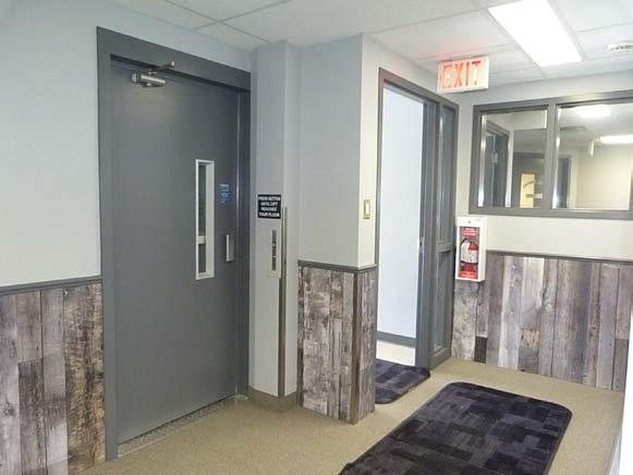
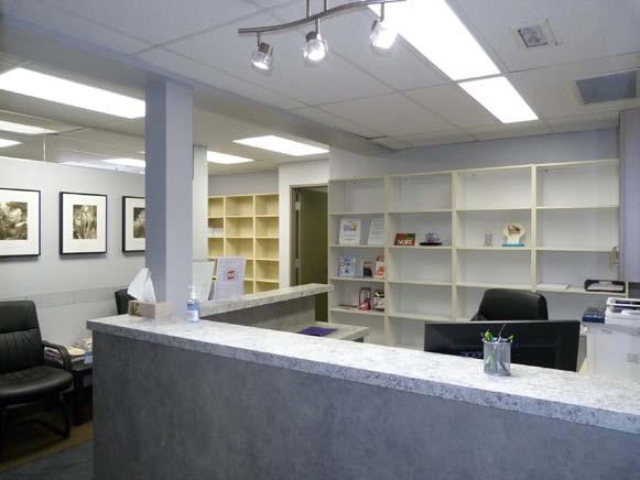
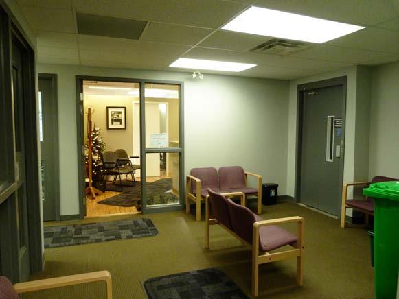
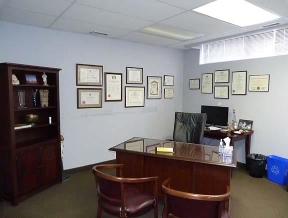
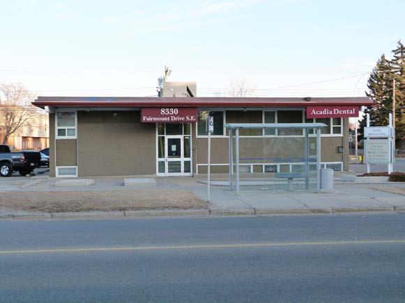
SALE FOR 8,034 SQ. FT. FULLY LEASED MULTI TENANT MEDICAL BUILDING CONDITIONALLY SOLD! 8330 FAIRMOUNT DR SE CALGARY, AB
|
|
|
- Tyrone Cole
- 5 years ago
- Views:
Transcription
 540-0238 EMAIL: jim@manchesterproperties.")

1 FOR SALE 8,034 SQ. FT. FULLY LEASED MULTI TENANT MEDICAL BUILDING CONDITIONALLY SOLD! 8330 FAIRMOUNT DR SE CALGARY, AB For additional information contact: JIM EDWARDSON (403) This information has been obtained from a reliable source and is believed to be accurate but is not warranted to be so. This property may be withdrawn from the market at any time without notice. Manchester Properties Inc. represents the interest of the Seller/Landlord of this property. Recipients of this information are advised to conduct their own due diligence to determine the accuracy of the information provided. The information provided is subject to change without notice Ave SE Calgary, AB T2H 2E6 TEL:(403) FAX:(403)
 14,390 SQ. FT. or 0.33 Acres (119.98 x 119.91 ) Abundant surface parking C-N2 Medical Building Yes See attached RPR CS!")
2 PROPERTY DETAILS NET REVENUE:00 RENTABLE AREA: PROPERTY TAX: LOT SIZE: PARKING: LAND USE: CURRENT USE: ELEVATOR: LEGAL DESCRIPTION: SALE PRICE: $124,700 per year ($15.52 per SQ. FT. AVG) 8,034 SQ. FT. $23, (2017) 14,390 SQ. FT. or 0.33 Acres ( x ) Abundant surface parking C-N2 Medical Building Yes See attached RPR CS! $2,608,888 The property has excellent tenants, is very nicely improved and well maintained inside and out. Located on Fairmount Dr SE (vehicle traffic count of 12,000 vehicles per day) in a prominent, walkable shopping district of a very well established community. Easily accessible by transit with a bus stop located in front of the building. Numerous retailers and service providers nearby include Shoppers Drug Mart, Winners, Co-op Food Store, Shell Gas Station, NAPA Autopro, Car Wash, Liquor Store, Butcher, Deli, and several restaurants. 6 minute bus ride from Heritage LRT Station. For additional information contact: JIM EDWARDSON (403) jim@manchesterproperties.ca This information has been obtained from a reliable source and is believed to be accurate but is not warranted to be so. This property may be withdrawn from the market at any time without notice. Manchester Properties Inc. represents the interest of the Seller/Landlord of this property. Recipients of this information are advised to conduct their own due diligence to determine the accuracy of the information provided. The information provided is subject to change without notice Ave SE Calgary, AB T2H 2E6 TEL:(403) FAX:(403)
3


4 ST. Matthew School Heritage Drive Fairmount Drive 8330 Fairmount Drive SE 83 Avenue
5
6
7 c I T 8330 FAIRMOUNT DR SE CALGARY, AB Copyright Global Raymac Surveys Inc Fd Spike Plan Metal Sign 0.04 High Pad Planter 0.29 Wide 0.40 High Fairmount Drive S.E. 0.27m to back of sidewalk 0.26 Pad 0.07 High 0.05 High Asphalt 0.96 Pad 0.26 High Pad 0.24 High N Retaining Wall 0.22 Wide 0.15 High CS Lot 3 FDI Disturbed Did not use Plan CS rd Avenue S.E. 1.54m to back of sidewalk (C. of T ) 9.28 Asphalt Parking See Lot description BLOCK 14 PLAN 7174 HS Eaves 0.40 Eaves Car Plugs 0.14 Diameter Planter 0.20 Wide 0.27 High Brick/Stucco Siding Eaves as shown BUILDING 2.38 Eaves 0.40 Eaves Planter 0.20 Wide 0.27 High 0.40 Eaves Asphalt Parking See Lot Description Portion of Lot 2 (C. of T ) North Reminder Lot 2 Building is on the Property Line ADJACENT BUILDING Building is on the Property Line Lot Heritage Drive S.E. ALBERTA LAND SURVEYOR'S REAL PROPERTY REPORT CS Asphalt is on the Property Line Edge of Asphalt Lane Lot 1 Community Reserve Block 14 Re-est. according Plan Fd No Mk Block Z Plan 1377 LK P235 GLOBAL RAYMAC SURVEYS INC. 312, th Street S.E. Phone (403) Calgary, Alberta T2G 2W3 admin@globalraymac.ca Fax (403) DESCRIPTION OF PROPERTY LOT 2 First: The southerly 25.30m throught Lot 2 BLOCK PLAN HS I, Robert M. Wallace, Alberta Land Surveyor do hereby certify that this Report and related survey, was prepared and performed under my personal supervision and in accordance with the Manual Of Standard Practice of the Alberta Land Surveyors' Association and supplements thereto. Accordingly, within those standards as of the date of this Report, I am of the opinion that: 1. The Plan illustrates the boundaries of the Property, the improvements as defined in Part D, Section 8.5 of the Alberta Land Surveyors' Association's Manual of Standard Practice, registered easements and rights-of-way affecting the extent of the title to the property; 2. The improvements are entirely within the boundaries of the property unless otherwise noted; 3. No visible encroachments exist on the Property from any improvement situated on an adjacent property unless otherwise noted, and; 4. No visible encroachments exist on registered easements or rights-of-way affecting the extent of the property, unless otherwise noted. 5. Title information is based on a title search dated October 13th, 2017 C. of T. No and Date of Survey January 15th, Unless otherwise specified the dimensions shown relate to distances from Property boundaries to foundation walls at time of survey. 8. Distances are in metres and decimals thereof. 9. This document is not valid unless it bears an original signature 10. Purpose: This Report has been prepared for the benefit of the (in blue ink) and a red Global Raymac Surveys Inc. permit stamp. Property owner, subsequent owners and any of their agents for the purpose of a real estate transaction. Copying is permitted only for the benefit of these parties. Where applicable, registered easements and utility rights of way affecting the extent of the property have been shown on the plan. Unless shown otherwise, property corner markers have not been placed during the survey for this report. The plan should not be used to establish boundaries due to the risk of misinterpretation or measurement error by the user. The information on this Real Property Report reflects the status of this property as of the date of survey only. Users are encouraged to have the Real Property Report updated for future requirements. Lot 1 Community Reserve Block 14 Dated this 19th day of January A.D MUNICIPAL ADDRESS: 8330 Fairmount Drive S.E. Calgary, Alberta CLIENT: Jim Edwardson - Manchester Properties Inc. Robert M. Wallace, A.L.S. Lot 35 CLIENT FILE NO. SCALE 1: 200 Drawn by: GRSI. FILE NO. DM 17CR1961 ALBE T I ON RT I A A C R L P O B E A ER SS ND M UM N A SU R VEY OR S' Asphalt encroaches into Lane by 0.80 Asphalt encroaches into Lane by 0.77 Asphalt encroaches into Lane by 0.32 ABBREVIATIONS AND SYMBOLS THAT MAY APPEAR ON THIS PLAN. Drill Hole found shown thus Iron Bar found shown thus Statutory Iron Post found shown thus Delta (Central) angle of arc shown thus Eave Fascia are shown thus Fences are shown thus Line not to scale shown thus Utility Rights-Of-Way are shown thus Building foundation shown thus Property line shown thus A denotes length of arc AC denotes Air Conditioner Blk denotes Block CB denotes Cinder Block CS denotes depth FdI is counter sunk Cant denotes cantilever denotes concrete E denotes East Eave dimensioned to Fascia Fd denotes found Fences are within 0.10m of property line unless otherwise noted GL denotes ground level m denotes metres MA denotes Maintenance Access MF denotes Main Floor Mk denotes mark Mks denotes marks N denotes North OD denotes Overland Drainage R denotes radius of arc RW denotes Right-Of-Way Reg No denotes registration number Ret Wall denotes retaining wall S denotes South U denotes Utility Up denotes distance Fd I is above ground W denotes West WOB denotes Walk Out Basement Second: That Portion of Lot 2 which Lies to the South of the Northerly 48.77m and to the North of the Southerly 25.30m Throughout the Said Lot Property is subject to Restrictive Covenant Reg. No IL, 1124 KR and 75 IO. 12. Property is subject to Easement Reg. No. 511 IS. Re: (Subject to) in Favour of the South 25.30m of Lot 2). 13. Property is subject to Caveat Reg. No , and Asphalt from subject property encroaches into lane as shown. 15. This survey has been updated as of January 19th, 2018 (Ref. Job No ). Fd No Mk
Palm Ave Hialeah Building Data Palm Avenue
 400-450 Palm Ave Hialeah Building Data Address 400-450 Palm Avenue City, State Hialeah, Florida County Miami Dade parcel # 04-3118-001-1950 and 1960 Zoning Retail Commercial - BU2 Land Size 13500 Type
RULES OF THE GEORGIA STATE BOARD OF REGISTRATION FOR PROFESSIONAL ENGINEERS AND LAND SURVEYORS CHAPTER APPLICATIONS TABLE OF CONTENTS
 RULES OF THE GEORGIA STATE BOARD OF REGISTRATION FOR PROFESSIONAL ENGINEERS AND LAND SURVEYORS CHAPTER 180-7 APPLICATIONS TABLE OF CONTENTS 180-7-.07 Maps and Plats. All maps, plats and similar documents
Rule 21 STANDARDS OF PRACTICE FOR SURVEYING
 Rule 21 STANDARDS OF PRACTICE FOR SURVEYING 21.1 Whenever a survey is performed, it shall comply with Section 73-13-71 (4) and Section 73-13- 73 and the Standards of Practice for Surveying in Mississippi
SECTION SITE SURVEYS
 PART 1 - GENERAL 1.1 DESCRIPTION SECTION 02 21 00 SPEC WRITER NOTES: 1. Use this section only for NCA projects. 2. Delete between //---// if not applicable to project. Also delete any other item or paragraph
DAWSON COUNTY MINOR PLAT REVIEW CHECKLIST $50.00 FEE PER PLAT REVIEW, $5.00 FEE FOR SCAN & CD FOR RECORDING
 DAWSON COUNTY MINOR PLAT REVIEW CHECKLIST $50.00 FEE PER PLAT REVIEW, $5.00 FEE FOR SCAN & CD FOR RECORDING NAME ON PLAT: CONTACT/PHONE #: NAMED STREET/ADDRESS: LAND LOT: DISTRICT: SECTION: ZONING: SETBACKS:
Sections 8 and 10 of the Act and the Condominium Property Regulation (Alberta Regulations 168/2000), govern the preparation of a condominium plan.
, govern the preparation of a condominium plan.") Procedure # SUR-4 Land Titles Procedures Manual Subject: SURVEYS - EXAMINATION OF CONDOMINIUM PLANS Page 1 of 13 Date Issued 2018 10 16 BACKGROUND The Condominium Property Act ("Act") provides for the
Procedure # SUR-4 Land Titles Procedures Manual Subject: SURVEYS - EXAMINATION OF CONDOMINIUM PLANS Page 1 of 13 Date Issued 2018 10 16 BACKGROUND The Condominium Property Act ("Act") provides for the
Title: ENCROACHMENT POLICY Number: 0132 Reference: Administrative Committee January 21, Adopted by City Council: February 2, 2009
 POLICY Title: ENCROACHMENT POLICY Number: 0132 Reference: Administrative Committee January 21, 2009 February 2, 2009 Supersedes: May 2, 2005 Prepared by: PLANNING, BUILDING AND DEVELOPMENT SERVICES STATEMENT
Town of Cochrane Policy
 Town of Cochrane Policy Policy No.: Policy Title: Approval Date: Revision Date: Department: 2002-01 Encroachment Agreement Policy February 14, 2000 Planning & Engineering Services Policy Statement: The
New Jersey Administrative Code Title 13, Chapter 40 State Board of Professional Engineers and Land Surveyors
 New Jersey Administrative Code Title 13, Chapter 40 State Board of Professional Engineers and Land Surveyors SUBCHAPTER 1. TITLE BLOCKS AND SEALS FOR PROFESSIONAL ENGINEERS AND LAND SURVEYORS 13:40-1.1
Part 901 Chapter 19: REINSTATEMENT OF LICENSURE OR CERTIFICATION AFTER REVOCATION
 Rule 18.12 - Any person aggrieved by the action of the Board as a result of disciplinary proceedings conducted hereunder may appeal therefrom as provided for in Section 73-13-37(10) Mississippi Code Annotated
Map Filing Law. 46: Effective date This act shall take effect January first, one thousand nine hundred and fiftyfour.
 46:23-9.8. Effective date This act shall take effect January first, one thousand nine hundred and fiftyfour. L.1953, c. 358, p. 1941, s. 8. 46:23-9.9. Short title This act shall be known and may be cited
FINAL PLAT. Community Development Department 8101 Ralston Road Arvada, Colorado 80002
 FINAL PLAT Community Development Department 8101 Ralston Road Arvada, Colorado 80002 September 2015 FINAL SUBDIVISION PLAT Final Subdivision Plat Review Applications for a Final Plat shall be submitted
Standards of Practice for Surveying in the State of Alabama
 Standards of Practice for Surveying in the State of Alabama Effective January 1, 2017 RULE NO. 1.01 PURPOSE The purpose of these rules is to establish standards for the practice of surveying in the State
MINOR SUBDIVISION PLAT CHECKLIST
 MINOR SUBDIVISION PLAT CHECKLIST Project Name: Tax ID #: Project Number: Date: _ Reviewed By: Telephone: NOTES: All lots on septic systems must comply with the Fulton County Health Department requirements
INSTRUCTIONS FINAL PLAT APPROVAL APPLICATION
 INSTRUCTIONS FINAL PLAT APPROVAL APPLICATION 1. The applicant/agent shall fill out the attached application. The attached application form must be completely filled in before it can be filed. Portions
MINOR SUBDIVISION PLAT
 MINOR SUBDIVISION PLAT Community Development Department 8101 Ralston Road Arvada, Colorado 80002 September 2015 MINOR SUBDIVISION PLAT Subdivisions consisting of five (5) or fewer lots are eligible for
MINOR SUBDIVISION PLAT
 MINOR SUBDIVISION PLAT Community Development Department 8101 Ralston Road Arvada, Colorado 80002 MINOR SUBDIVISION PLAT Subdivisions consisting of five (5) or fewer lots are eligible for the minor subdivision
BOSSIER CITY PARISH METROPOLITAN PLANNING COMMISSION 620 Benton Rd. Bossier City, LA Phone: Fax: PRELIMINARY PLAT
 (OFFICE USE ONLY) Application Fee: Paid: Date: CASE # Project Information BOSSIER CITY PARISH METROPOLITAN PLANNING COMMISSION 620 Benton Rd. Bossier City, LA 71111 Phone: 318-741-8824 Fax: 318-741-8827
CLARK 3925 E. US 377 COMMERCIAL $699,000 COMMERCIAL PAD SITE IN FRONT OF NEW KROGER. Granbury, Texas
 PAD SITE IN FRONT OF NEW KROGER $699,000 1.858 Acres Monument sign on 377 377 road frontage Platted Zoned Utilities to the site PROPERTY INFORMATION Property Information: Adjacent to recently opened Kroger
MOBILE CITY PLANNING COMMISSION
 MOBILE CITY PLANNING COMMISSION Mailing Address: Location Urban Development Department Mobile Government Plaza Land Use Administration 205 Government Street P. O. Box 1827 Third Floor - South Tower Mobile,
BUILDING & INSPECTIONS DIVISION 200 East Wood Street Palatine, IL Telephone (847)
") 2018 EXPRESS PERMIT APPLICATION PAVER DRIVEWAY PRINT CLEARLY. ILLEGIBLE AND/OR INCOMPLETE APPLICATIONS WILL BE RETURNED (this is a two sided application) Property/Owner Information check if applicant Project
2018 EXPRESS PERMIT APPLICATION PAVER DRIVEWAY PRINT CLEARLY. ILLEGIBLE AND/OR INCOMPLETE APPLICATIONS WILL BE RETURNED (this is a two sided application) Property/Owner Information check if applicant Project
AIR ONE. 829 HULL ROAD Ormond Beach, Florida BENCHMARK #1 EL NAIL IN POWER POLE EASTERLY RIGHT-OF-WAY LINE TOMOKA AIRPORT ROAD (UR) HULL ROAD
 HULL ROAD") NORTH LINE LOT 2 SOUTH LINE LOT 1 S75 46'55"E 2 NORTH LINE LOT 3 SOUTH LINE LOT 2 N75 43'32"W(UR) S75 43'32"E(D) N75 43'32"W(URD) NORTH LINE LOT 1 SOUTH LINE LOT 12 225.15'(M)225'(UR) P.O.R. PARCELS II
NORTH LINE LOT 2 SOUTH LINE LOT 1 S75 46'55"E 2 NORTH LINE LOT 3 SOUTH LINE LOT 2 N75 43'32"W(UR) S75 43'32"E(D) N75 43'32"W(URD) NORTH LINE LOT 1 SOUTH LINE LOT 12 225.15'(M)225'(UR) P.O.R. PARCELS II
FINAL PLAT CHECKLIST
 FINAL PLAT CHECKLIST Project Name: Tax ID #: Project Number: Date: _ Reviewed By: Telephone: Please address all items marked with an "X" Please return redline comments with corrected plan, original mylar,
STANDARDS OF PRACTICE
 STANDARDS OF PRACTICE Association of Nova Scotia Land Surveyors Approved by the membership on the 15 th day of October, 2015 (Effective January 1, 2016; Revised October 14, 2016) Page 1 of 18 STANDARDS
DRIVEWAY REQUIREMENTS
 APPLICATION FOR: RESIDENTIAL DRIVEWAY / ACCESS Zoning Review Mail: - 101 White Ave. S.E. - Live Oak, FL 32064 Office: City Hall Annex - 416 Howard Street E - Live Oak, FL 32064 Phone: 386.362.2276 ofc.
LAND USE PERMIT APPLICATION
 LAND USE PERMIT APPLICATION Date Application No. TYPE OF PERMIT Subdivision Short Plat Conditional Use Binding Site Plan Final Plat Final Short Plat Variance Final Binding Site Plan Plat Amendment Short
Oakland County Michigan Register of Deeds Plat Engineering, GIS, & Remonumentation Dept. Ph: (248) Fax (248)
 Fax (248)") Oakland County Michigan Register of Deeds Plat Engineering, GIS, & Remonumentation Dept. Ph: (248)-858-1447 Fax (248)-858-7466 Requirements Needed for Final Plat Approval No. General Requirements. 1 Routing
Oakland County Michigan Register of Deeds Plat Engineering, GIS, & Remonumentation Dept. Ph: (248)-858-1447 Fax (248)-858-7466 Requirements Needed for Final Plat Approval No. General Requirements. 1 Routing
West 85 th FOR LEASE> A CLASS SUBURBAN OFFICE BUILDING 2000, A AVENUE SW, CALGARY, AB AVAILABLE FOR FIXTURING
 AVAILABLE FOR FIXTURING This document/email has been prepared by Colliers International for advertising and general information only. Colliers International makes no guarantees, representations or warranties
AGENDA ITEM G-2 Public Works
 AGENDA ITEM G-2 Public Works STAFF REPORT City Council Meeting Date: 2/23/2016 Staff Report Number: 16-035-CC Consent Calendar: Adopt a resolution accepting Easements and approving the abandonment of two
Final Plat Mapping Requirements
 CURRENT PLANNING DIVISION 410 E. 5 th Street Loveland, CO 80537 970-962-2523 eplan-planning@cityofloveland.org cityofloveland.org/dc Final Plat Mapping Requirements All Final plats shall comply with the
Subdivisions. CITY OF OAK HARBOR Development Services Department
 CITY OF OAK HARBOR Development Services Department Subdivisions Finall Platt Applicatti ion Review Prrocess VII What is a Subdivision? A subdivision is the division of land into ten or more lots, tracts,
PRELMINARY PLAT CHECKLIST
 PRELMINARY PLAT CHECKLIST A. All preliminary plat submitted for approval shall be prepared by a Registered Professional Land Surveyor. B. Preliminary plats must be drawn to a scale of XXX with such accuracy
Kansas Minimum Standards For Boundary Surveys and Mortgagee Title Inspections Standards of Practice
 5/28/2010 9:28 PM 1 Kansas Minimum Standards For Boundary Surveys and Mortgagee Title Inspections Standards of Practice PREFACE These standards were first adopted by the Kansas Society of Land Surveyors
Enforcement of Minimum Survey Standards
 Presented By: F. Anthony Rettke, P.S., Tax Map Supervisor, Franklin County John Greenhalge, Executive Director, State Board of Registration n the Ohio Revised Code, Section 315.251: If a deed conveying
Minor Subdivision Application
 FOR PLANNING USE ONLY Application # SD Application Fee $1,000.00 Receipt No. Filing Date Completeness Date Minor Subdivision Application A. PROJECT INFORMATION 1. Project Name: 2. Address of Subject Property:
Strata Plan Fast Facts
 December 2015 ISSN: 2201-4292 Title: Strata Plan Fast Facts ISSN: 2201-4292 Land and Property Information www.lpi.nsw.gov.au Copyright Crown in right of New South Wales through Land and Property Information
USE PERMIT AND VARIANCE APPLICATION
 USE PERMIT AND VARIANCE APPLICATION Case No. BOARD OF ZONING APPEALS APPLICATION FOR USE PERMITS AND VARIANCES ARLINGTON COUNTY, VIRGINIA D E P A R T M E N T O F C O M M U N I T Y P L A N N I N G, H O
Department of Natural Resources
 Rules of Department of Natural Resources Division 30 Land Survey Chapter 2 Missouri Minimum Standards for Property Boundary Surveys Title Page 10 CSR 30-2.010 Application of Standards...3 10 CSR 30-2.020
VICINITY MAP SCALE 1'' = 2000'
 CITY CREEK ANNEXATION TO THE CITY OF THORNTON LOCATED IN THE SOUTHWEST QUARTER OF SECTION 11 AND THE WEST HALF OF SECTION 14, TOWNSHIP 1 SOUTH, RANGE 68 WEST OF THE 6TH PRINCIPAL MERIDIAN, COUNTY OF ADAMS,
CITY OF BEVERLY HILLS Department of Public Works and Transportation Civil Engineering Division FINAL MAP SUBMITTAL PROCESS Transmitted
 CITY OF BEVERLY HILLS Department of Public Works and Transportation Civil Engineering Division FINAL MAP SUBMITTAL PROCESS Transmitted From To* Planning Department Civil Engineering Division RKA Consulting
SKETCH OF BOUNDARY SURVEY ALTA / ACSM LAND TITLE SURVEY
 SKETCH OF BOUNDARY SURVEY ALTA / ACSM LAND TITLE SURVEY SURVEYOR'S NOTES: All distances as shown hereon are based on the US Survey foot. Subject property lies inside the UBD (Urban Development Boundary),
Department of Development Services Engineering; Survey Plat Review Group SPRG
 Department of Development Services Engineering; Survey Plat Review Group SPRG CITY OF DALLAS LEGAL DESCRIPTION PREPARATION GUIDELINE AND CHECKLIST The following guideline and checklist are provided to
SEE ENLARGEMENT 'A' SHEET 1 OF 2 SHEETS 502 DP PEN MARK ON BOTTOM OF METAL FENCE m P MARK ON METAL FENCE
 Tue Jun 1 11::07 17 SURVEY STRATA PLAN 555 SHEET 1 OF 2 SHEETS PLAN OF LOT 501 ON DP 60 CERTIFICATE OF TITLE LOCAL GOVERNMENT INDEX PLAN FIELD BOOK SCALE 1:00 AT A NAME OF SCHEME ADDRESS OF PARCEL MANAGEMENT
Change In The Name Of Owner (s) Of Land.
 Of Land.") Clermont County TRANSFER AND CONVEYANCE STANDARDS OF THE CLERMONT COUNTY AUDITOR AND THE CLERMONT COUNTY ENGINEER AS ADOPTED UNDER OHIO REVISED CODE SECTION 319.203, AS A RESULT OF TWO PUBLIC HEARINGS
Clermont County TRANSFER AND CONVEYANCE STANDARDS OF THE CLERMONT COUNTY AUDITOR AND THE CLERMONT COUNTY ENGINEER AS ADOPTED UNDER OHIO REVISED CODE SECTION 319.203, AS A RESULT OF TWO PUBLIC HEARINGS
Chapter 29. Standards of Practice for Boundary Surveys Scope and Purpose Definitions
 Chapter 29. Standards of Practice for Boundary Surveys 2901. Scope and Purpose A. The following standards of practice for boundary surveying in the state of Louisiana have been adopted to help ensure that
CITY OF LEE S SUMMIT MINOR PLAT PROCESS. Purpose of Minor Plats
 MINOR PLAT PROCESS Purpose of Minor Plats The City of Lee s Summit requires that all property be platted before a building permit is issued. Platting involves the subdivision of land into lots or tracts.
GeoPoint 213 Hobbs Street Tampa, Florida
 AIRPORT ROAD PINELAND P.R.D. SUBDIVISION - PHASES 2 & 3 DESCRIPTION: A parcel of land lying in Sections 13 and 24, Township 14 South, Range 31 East, Volusia County, Florida, and being more particularly
COMMERCIAL PAD OPPORTUNITY SAN ANTONIO, TEXAS
 COMMERCIAL PAD OPPORTUNITY SAN ANTONIO, TEXAS LOCATION: SIZE: The site located on the west corner of Culebra Road and Lone Star Parkway. 0.595 Acres UTILITIES: Electric: City Public Service maps indicate
CERTIFIED SURVEY MAP
 SCONSIN STATE PLANE N:389676.12 E:2130390.15 Center of Section 23 CERTIFIED SURVEY MAP 734.06' THE (PRITCHETTE) ORIGINAL PLAT OF ALL IN THE NW 1 4 OF THE SE 1 4 OF FRACTIONAL SECTION 23, T7N, R9E, IN THE
 Page 1 of 6 Office of the Professions Land Surveying Practice Guidelines - February 2000 The State Board for Engineering and Land Surveying issued the first draft of its proposed Land Surveying Practice
LAND FOR SALE - ± ACRES
 LAND FOR SALE - ± 6.109 ACRES 14248 FM 2769 Leander, TX 78641 3 2 5 6 183 SITE LOOP 1 620 620 1 LOCATION: SIZE: FRONTAGE/ ACCESS: UTILITIES: ZONING: TOPOGRAPHY: Approximately 4.7 miles west of FM 620 and
DALLAS WATER UTILITIES WATER/WASTEWATER COVENANT
 DALLAS WATER UTILITIES WATER/WASTEWATER COVENANT Procedure for obtaining a water and wastewater covenant, water covenant, or wastewater covenant; Required for initial submittal: 1. One letter from the
PLAT OF SURVEY VICINITY MAP (NOT TO SCALE) N N W E SITE BENCHMARK # 2 W E N&D ON BACK OF CURB NAVD 88 S S 0' 10' 20' 40' 60' 1" = 20' TOP=106.7
 N N W E SITE BENCHMARK # 2 W E N&D ON BACK OF CURB NAVD 88 S S 0' 10' 20' 40' 60' 1 = 20' TOP=106.7") PLAT OF SURVEY VICINITY MAP (NOT TO SCALE) N N W E SITE BENCHMARK # 2 W E N&D ON BACK OF CURB 106.21 NAVD 88 S S 0' 10' 20' 40' 60' 1" = 20' TOP=106.72 N INV PVC=99.27 S INV PVC=99.32 E INV CLAY=99.39
PLAT OF SURVEY VICINITY MAP (NOT TO SCALE) N N W E SITE BENCHMARK # 2 W E N&D ON BACK OF CURB 106.21 NAVD 88 S S 0' 10' 20' 40' 60' 1" = 20' TOP=106.72 N INV PVC=99.27 S INV PVC=99.32 E INV CLAY=99.39
PLANNING EXEMPTION REGULATION
 Province of Alberta MUNICIPAL GOVERNMENT ACT PLANNING EXEMPTION REGULATION Alberta Regulation 223/2000 With amendments up to and including Alberta Regulation 184/2017 Office Consolidation Published by
APPROVAL REQUIREMENTS
 APPROVAL REQUIREMENTS FOR INSTRUMENTS OF CONVEYANCE IN ERIE COUNTY, OHIO DRAFT Requirements for all instruments of Conveyance in Erie County, revised and effective, 2014. An Erie County policy governing
30785 Grand River Ave, Farmington Hills, MI 48336
 Sep 17, 2018 on CPIX Signature Office Building 30785 Grand River Ave, Farmington Hills, MI 48336 Listing ID: 30085496 Status: Active Property Type: Office For Sale Office Type: Executive Suites, Governmental
Submittal Requirements: Subdivision Plat (Final)
") s Planning and Zoning Submittal Requirements: Subdivision Plat (Final) 1. Application form, APO fees, and filing fee. Transportation Development Review Fee please contact Engineering at (970) 221-6605
s Planning and Zoning Submittal Requirements: Subdivision Plat (Final) 1. Application form, APO fees, and filing fee. Transportation Development Review Fee please contact Engineering at (970) 221-6605
PLYMOUTH PLANNING BOARD APPLICATION FOR A MINOR SUBDIVISION OR MAJOR SUBDIVISION
 CASE # PLYMOUTH PLANNING BOARD APPLICATION FOR A MINOR SUBDIVISION OR MAJOR SUBDIVISION The undersigned Applicant hereby submits to the Plymouth Planning Board a completed application for a proposed minor
ADMINISTRATIVE REVIEW FOR AN ACCESSORY DWELLING UNIT
 Community Planning and Economic Development Development Services Division 250 South 4 th Street, Room 300 Minneapolis MN 55415-1316 612-673-3000 ADMINISTRATIVE REVIEW FOR AN ACCESSORY DWELLING UNIT WHAT
Development Review Committee Application
 City of Coral Gables, Florida Level 2 Review Development Review Committee Application Address: 427 Biltmore Way, 2 nd Floor, Coral Gables, Florida 33134 Email: planning@coralgables.com Phone: 305.460.5211
30785 Grand River Ave, Farmington Hills, MI 48336
 Signature Office Building 30785 Grand River Ave, Farmington Hills, MI 48336 Listing ID: 30085496 Status: Active Property Type: Office For Sale Office Type: Executive Suites, Governmental Size: Sale Price:
CHAPTER FINAL AND PARCEL MAPS
 CHAPTER 19.48 FINAL AND PARCEL MAPS Section Page 19.48.010 General... IV-25 19.48.020 Phasing... IV-25 19.48.030 Survey Required... IV-26 19.49.040 Form... IV-26 19.48.050 Contents... IV-27 19.48.060 Preliminary
FOR LEASE CRESTVIEW SHOPPING CENTRE PORTAGE AVENUE WINNIPEG, MANITOBA
 3369-3393 PORTAGE AVENUE WINNIPEG, MANITOBA RYAN BEHIE Vice President, Managing Director 204 500 5001 ryan.behie@cbre.com CBRE LIMITED 201 Portage Avenue 18 th Floor Winnipeg, MB, R3B 3K6 TAYLOR CALDWELL
COUNTY OF ADAMS, STATE OF COLORADO E. 40TH AVE. TOWER RD. E. 38TH AVE. SALIDA ST. HIGH LINE CANAL PROJECT LOCATION E. 32ND PKWY.
 LEGAL DESCRIPTION:, GATEWAY EAST AT TOWER SUBDIVISION FILING NO. 1, SAID PARCEL CONTAIN 598,154 SQUARE FEET OR MORE OR LESS GENERAL NOTES: 1. NOTICE: ACCORDING TO COLORADO LAW YOU MUST COMMENCE ANY LEGAL
QUEBEC STREET EAST 130TH AVENUE ONEIDA STREET E. 130TH AVE. VALENTIA ST TAMARAC ST EAST 128TH AVENUE MOACO STREET BACHMAN DR. SITE QUINCE ST.
 SHEET OF CASE NO.: SUBA - PURPOSE STATEMENT: THIS PLAT IS INTENDED TO SUBDIVIDE. ACRES INTO SINGLE FAMILY LOTS, AND TRACTS FOR PARKS, OPEN SPACE, DRAINAGE AND DETENTION, DEDICATE RIGHT-OF-WAY AND GRANT
Ballard City Final Plat Check List
 Ballard City Final Plat Check List TO BE COMPLETED BY BOTH THE DEVELOPER AND THE CITY Design: Check: Check each of the following items for compliance with adopted City Standards, Titles, General Plans
Title 46 PROFESSIONAL AND OCCUPATIONAL STANDARDS Part LXI. Professional Engineers and Land Surveyors
 Title 46 PROFESSIONAL AND OCCUPATIONAL STANDARDS Part LXI. Professional Engineers and Land Surveyors Chapter 29. Standards of Practice for Boundary Surveys 2901. Scope and Purpose A. The following standards
Application For Development Review (Subdivisions and Site Plan Review)
") Application For Development Review (Subdivisions and Site Plan Review) Thank you for your interest in Pickens County, South Carolina. This packet includes the necessary documents for review of subdivision
Application For Development Review (Subdivisions and Site Plan Review) Thank you for your interest in Pickens County, South Carolina. This packet includes the necessary documents for review of subdivision
APPENDIX C: PLAT SPECIFICATIONS AND CERTIFICATES
 APPENDIX C: PLAT SPECIFICATIONS AND CERTIFICATES A. Drawing. All plats for recording must be submitted on photographically reproducible and dimensionally stable polyester sheets such as Mylar, Cronar or
E L M E R B O R O U G H L A N D U S E B O A R D APPLICATION COVER SHEET (to be completed for all applications and appeals)
") E L M E R B O R O U G H L A N D U S E B O A R D APPLICATION COVER SHEET (to be completed for all applications and appeals) 1. Name(s): 2. Address: 3. Telephone Number(s): 4. E-mail: 5. Owner Name(s) (if
E L M E R B O R O U G H L A N D U S E B O A R D APPLICATION COVER SHEET (to be completed for all applications and appeals) 1. Name(s): 2. Address: 3. Telephone Number(s): 4. E-mail: 5. Owner Name(s) (if
OTTAWA COUNTY LEGAL DESCRIPTION REVIEW GUIDELINES
 OTTAWA COUNTY LEGAL DESCRIPTION REVIEW GUIDELINES APPROVED BY: RONALD P. LAJTI, JR., P.E., P.S. OTTAWA COUNTY ENGINEER APPROVED BY: LAWRENCE HARTLAUB OTTAWA COUNTY AUDITOR EFFECTIVE DATE: January 1, 2017
Group Sewer Only** 80 Ft Frontage* 20,000 Sq. Ft. (.46 acre) Minimum** 120 Ft Frontage* 20,000 Sq. Ft. (.46acre) Minimum** 150 Ft Frontage*
 Minimum** 120 Ft Frontage* 20,000 Sq. Ft. (.46acre) Minimum** 150 Ft Frontage*") Residential Lots Minimum Chart The minimum lot size of any minor subdivision where there is no public sewers shall be as shown below or as required by township zoning and/or the Tuscarawas General Health
Residential Lots Minimum Chart The minimum lot size of any minor subdivision where there is no public sewers shall be as shown below or as required by township zoning and/or the Tuscarawas General Health
ZONING PERMIT APPLICATION and INSTRUCTIONS
 ZONING PERMIT APPLICATION and INSTRUCTIONS INSTRUCTIONS 1. Completely fill out, sign, and date the attached form. Include a check for $35.00 payable to the Borough of Oradell or exact cash amount. Please
201 KAR 18:150. Standards of practice.
 201 KAR 18:150. Standards of practice. RELATES TO: KRS 322.290(1)(a), (2)(f) STATUTORY AUTHORITY: KRS 322.290(2)(f) NECESSITY, FUNCTION, AND CONFORMITY: KRS 322.290(1)(a) authorizes the board to administer
Preliminary Plat/Final Plat Application
 Melissa Municipal Center 3411 Barker Avenue Melissa, Texas 75454 Phone: (972) 838-2036 Applicant: Date: Address: Phone: Contact: Fax: E-mail: Propose Addition Name: Acres: Existing Zoning: Propose Zoning:
HOME TRUST NATION PROPERTY INSPECTION AND MARKET ANALYSIS
 HOME TRUST NATION PROPERTY INSPECTION AND MARKET ANALYSIS LOAN #: N/A PROPERTY ADDRESS: 8400 SE BRIDGE RD PARCEL #: 343842030051012157 CITY, STATE, ZIP: HOBE SOUND, FL 33455 CURRENT MARKET CONDITION: DEPRESSED
WYANDOT COUNTY BASIC STANDARDS FOR THE APPROVAL OF REAL ESTATE DEED TRANSFERS & LAND CONTRACT AGREEMENTS
 GENERAL In compliance with Section 315.251 of the Ohio Revised Code, the County Auditor and the County Engineer have adopted these written standards governing the conveyance of real property in Wyandot
GeoPoint 1403 E. 5th Avenue Tampa, Florida
 AIRPORT ROAD PINELAND P.R.D. SUBDIVISION - PHASE 1 DEDICATION: CERTIFICATE OF REVIEW BY SURVEYOR, CITY OF ORMOND BEACH DEDICATION: THIS IS TO CERTIFY THAT FORESTAR (USA) REAL ESTATE GROUP INC., A DELAWARE
CHECK LIST FOR REVIEW OF SURVEY PLATS FOR COMPLIANCE WITH MISSOURI MINIMUM STANDARDS FOR PROPERTY BOUNDARY SURVEYS NAME OF SURVEYOR: DATE OF SURVEY:
 CHECK LIST FOR REVIEW OF SURVEY PLATS FOR COMPLIANCE WITH MISSOURI MINIMUM STANDARDS FOR PROPERTY BOUNDARY SURVEYS NAME OF SURVEYOR: DATE OF SURVEY: REVIEWED BY: DATE: DESCRIPTION OF SURVEY: GENERAL LAND
FENCE PERMIT APPLICATION
 FENCE PERMIT APPLICATION DATE: PERMIT FEE: $60.00 Submit (2) sets of drawings and data required to assure compliance with the provisions of the zoning code. Drawings must include a site plan dawn to scale
ACCESSORY DWELLING UNITS
 ACCESSORY DWELLING UNITS LAND USE BYLAW C-4841-97 ACCESSORY DWELLING UNIT (ADU): means a subordinate dwelling unit attached to, created within or detached from the principal dwelling, single detached,
NOT TO BE SUBMITTED WITH SKETCH DESIGN APPROVAL Subdivision Checklist: Major Subdivision Final Plat
 Must be received with review fee (equal to $200.00, plus $25.00 per lot) no later than 15 days prior to Planning Board meeting, which is normally the first Monday of the month (certain holidays may modify
Information contained
 New South Wales Strata Schemes (Leasehold Development) Regulation 2012 under the Strata Schemes (Leasehold Development) Act 1986 [The following enacting formula will be included if the Regulation is made:]
Plan Presentation Guide SECTION 60. Chapter 3 RIGHT-OF-WAY SECTION PRESENTATION
 Chapter 3 RIGHT-OF-WAY SECTION PRESENTATION Right of Way plans are necessary for the acquisition of the required right of way and easements for projects. Proper representation of the right of way and easements
Schedule A. Citation 1 These regulations may be cited as the Land Registration Administration Regulations. Definitions 2 (1) In these regulations,
 In these regulations,") Schedule A Regulations Respecting Administration of the Land Registration Act made by the Minister of Service Nova Scotia and Municipal Relations under Section 94 of Chapter 6 of the Acts of 2001, the
Schedule A Regulations Respecting Administration of the Land Registration Act made by the Minister of Service Nova Scotia and Municipal Relations under Section 94 of Chapter 6 of the Acts of 2001, the
City of Kenora Application for Letter of Comfort The Municipal Act, 2001, S.O. 2001, c.25
 City of Kenora Application for Letter of Comfort The Municipal Act, 2001, S.O. 2001, c.25 A letter of comfort is an agreement between the City and a property owner who owns lands adjacent to municipal
WASTEWATER BACKFLOW RELEASE PROCEDURES
 WASTEWATER BACKFLOW RELEASE PROCEDURES PROCEDURE FOR OBTAINING A WASTEWATER RELEASE FOR PRIVATE DEVELOPMENT PROJECTS: PLEASE NOTE THAT THE WASTEWATER BACKFLOW RELEASE DOCUMENT MUST FOLLOW THE CITY S PROCEDURES.
APPLICATION FOR MAJOR SUBDIVISION APPROVAL (FINAL PLAT)
") 209 S. Main Street Marysville, Ohio 43040 Phone: (937) 645-7350 Fax: (937) 645-7351 www.marysvilleohio.org APPLICATION FOR MAJOR SUBDIVISION APPROVAL (FINAL PLAT) *** IMPORTANT INFORMATION ~ Please read
209 S. Main Street Marysville, Ohio 43040 Phone: (937) 645-7350 Fax: (937) 645-7351 www.marysvilleohio.org APPLICATION FOR MAJOR SUBDIVISION APPROVAL (FINAL PLAT) *** IMPORTANT INFORMATION ~ Please read
WESTERN CANADIAN PLACE SOUTH TOWER
 WESTERN CANADIAN PLACE SOUTH TOWER BUILDING DETAILS: Rentable Area: 394,560 Sq.Ft Average Floorplate: 15,120 Sq.Ft Number of Floors: 30 SUBLEASE INFORMATION: Available Premises: Floors 12,13 & 15-15,120
A. Appropriate agency responsible for transportation review for the subject property.
 7.8.10 Procedure Any person desiring to create a minor subdivision shall submit to the Commission for approval an application on forms provided by the Division, and a record plat in conformance with the
Open Air Dining Permit Planning Review Application
 Application Overview: Open Air Dining Permit Planning Review Application City of Beverly Hills Community Development Department Planning Division 455 N. Rexford Drive Beverly Hills, CA 90210 Tel. (310)
Sketch & Legal Description of Mitigation Bank and Ingress/Egress Access Easements
 Appendix H: Sketch & Legal Description of Mitigation Bank and Ingress/Egress Access Easements Tippen Bay Wetland Mitigation Bank DeSoto County, Florida Prepared by: September, 2017 Original file
PLANNING COMMISSION SUBDIVISION PLAT APPLICATION
 PLANNING COMMISSION SUBDIVISION PLAT APPLICATION Economic Development Department 3468 North Fulton Avenue Hapeville, Georgia 30354 Phone - 404.669.8269 Fax 404.669.3302 Rev. 09/23/16 1 The following information
WATERFORD LANDING COMMUNITY DEVELOPMENT DISTRICT REGULAR MEETING AGENDA
 WATERFORD LANDING COMMUNITY DEVELOPMENT DISTRICT REGULAR MEETING AGENDA January 31, 2019 Waterford Landing Community Development District OFFICE OF THE DISTRICT MANAGER 2300 Glades Road, Suite 410W Boca
Innsbruck Val Moritz AFP of Lot 46, Lot 47, & Amended Lot 48 Block 17 Amended Final Plat Adjustment of Interior Lot Lines
 Innsbruck Val Moritz AFP of Lot 46, Lot 47, & Amended Lot 48 Block 17 Amended Final Plat Adjustment of Interior Lot Lines APPLICATION: AMENDED FINAL PLAT HEARING DATES: Planning Commission: 8 November
9605 Autumn Hl, Boerne, TX 78006
 M o b i l e : ( r e p r e s e n t a n a p p r a i u n d e r t H o u s t I U n i P i 677 - n o t S a n e s t d e v e l S t s a m F l s a l a s t b y a l o f p r i o p i fo a p p r a i o f MINI PROPERTY
APPLICATION FOR BUSINESS TENANT CHANGE or BUSINESS TENANCY CHANGE OF USE
 FOR OFFICE USE ONLY APPLICATION FOR BUSINESS TENANT CHANGE or BUSINESS TENANCY CHANGE OF USE Fee Submitted File Number Date of Receipt Receipt # Original Tenant-Use Approved (type of use): New Business
COMPREHENSIVE REVIEW CHECK LIST & RATING SCALE
 COMPREHENSIVE REVIEW CHECK LIST & RATING SCALE Topic Reference Reference Synopsis Rating Scale Research {tc \l3 "Research } Documentary Evidence S.3(a) Guide S.1 Documentary evidence related to the land
Conveyance Standards. Boundary Survey Requirements. Adams County, Ohio
 Conveyance Standards And Boundary Survey Requirements Adams County, Ohio OFFICE OF THE ADAMS COUNTY AUDITOR DAVID GIFFORD 110 WEST MAIN STREET WEST UNION, OH 45693 OFFICE OF THE ADAMS COUNTY ENGINEER DAVID
MCPC MONONGALIA COUNTY PLANNING COMMISSION 243 High Street, Rm 110, Morgantown, WV Phone Fax
 GENERAL APPLICATION FOR DEVELOPMENT OF SIGNIFICANT IMPACT This application shall be used for all Level III reviews of developments of significant impact (DSI) that have a broader impact. Such impacts would