Click to edit Master title style
|
|
|
- Karin Wilkinson
- 6 years ago
- Views:
Transcription


 projection formulation including the Philippine Transverse Mercator projection")

1 Click to edit Master title style Research and Development in Support of the Implementation of PRS92 Data Build-up up and Transformation of Cadastral Maps and Data from Different Local Plane Coordinate System to PPCS- TM/PRS92 Alexander CAPARAS, Florence GALEON, Anjillyn Mae CRUZ, Jeark PRINCIPE, Vanessa DELA CRUZ 7 th FIG Regional Conference Spatial Data Serving People: Land Governance and the Environment Building the Capacity Hanoi, Vietnam, October Click Research to edit Master Composition title style and The research is divided into four (4) subcomponents Objectives each tasked of a specific set of goals and objectives: SUBCOMPONENT 1: Data Build-up up and Encoding of Cadastral Data. The objective of this subcomponent is to evaluate different encoding techniques for the conversion of Cadastral information from analog to database file format and recommend a cost-effective protocols and procedures for the data build-up of these information in preparation for a NSDI. SUBCOMPONENT 2: Evaluation and Assessment of the Philippine Transverse Mercator (PTM) Geographic to Grid Coordinate Conversion. The objective of this subcomponent is to evaluate the accuracy and applicability of different Transverse Mercator (TM) projection formulation including the Philippine Transverse Mercator projection for the conversion of Geographic-to-Grid Coordinates in the PPCS-TM/PRS92 and recommend upgrading provisions in the DENR Technical Bulletin No.26. SUBCOMPONENT 3: Transformation of Cadastral Data from Different Local Plane Coordinate System to PPCS-TM/PRS92 TM/PRS92. The objective of this subcomponent is to evaluate different methods used in transformation of Plane Coordinate Systems and recommend procedures and guidelines in implementing Cadastral Data transformation from different local plane coordinate system to the PPCS- TM/PRS92. SUBCOMPONENT 4: Computer Programming and Automation of the Cadastral Transformation. The objective of this subcomponent is to develop a Cadastral Transformation program that will implement the recommended procedures and mathematical algorithms for data build-up and transformation of cadastral data to the PPCS-TM/PRS92.
2 Click to edit Flow Master title style of Presentation A. Subcomponent Research Objectives B. Methodology C. Results and Discussion D. Conclusion E. Recommendation Click to edit Master title style Subcomponent Research Objectives Data Requirement and Resources Methodology Findings and Discussion Recommendation DATA BUILD-UP UP AND ENCODING OF CADASTRAL INFORMATION
3 Click Subcomponent to edit Master title style Research Objectives 1. Development of Procedures and Protocols addressing issues and problems in Cadastral Data Encoding. 2. Build Up of Cadastral Data through compiling, archiving, and encoding analog cadastral data. 3. Development of Cadastral Database for storing and retrieving data. Click Data to edit Master title style Requirements and Resources Data: 1. Cadastral Survey Inventory of the five (5) pilot areas 2. Cadastral Textual Data 3. Cadastral Maps 4. Cadastral Index Map Resources: 1. Cadastral Data Collection and Archiving Protocols 2. Encoding Environment (Spreadsheet template) 3. Cadastral Database Program 4. Encoding workstation 5. Encoding Logging Protocols

4 Click to edit Methodology Master title style 1. Cadastral Data Collection 2. Inventory and Archiving 3. Data Preparation 4. Data Encoding 5. Data Quality Assessment 6. Build Up 7. Compilation of Encoding Issues 8. Encoding Protocol Development Click to Cadastral edit Master title style Data Collection 1. Imaging Cadastral Data 2. Instrumentation 3. Procedures for Imaging 4. Archiving Cadastral Data Diagram of the instrument used for capturing the cadastral data record


5 Click to edit Data Master title style Preparation 1. Image Enhancement 2. Data Tagging Click to edit Data Master title style Encoding 1. Encoding Template

6 Click to edit Data Master title style Encoding 1. Encoding Template Click to edit Master title style Subcomponent Research Objectives Conceptual/Scientific Framework Pilot Areas and the Criteria for Selection Methodology Results and Analysis Conclusions Recommendation TRANSFORMATION OF CADASTRAL SYSTEM FROM DIFFERENT LOCAL PLANE COORDINATE SYSTEM TO PPCS-TM/PRS92
7 Click Subcomponent to edit Master title style Research Objectives 1. Development of Procedures and Protocols for cadastral data transformation. 2. Assessment of different transformation methods available for cadastral transformation 3. Implementation of different transformation methods to cadastral data 4. Assessment of the effects of different transformation methods to the cadastral system. 5. Integration of the cadastral system to the PPCS TM/PRS92 Start Database of Cadastral Information (Maps, Click to edit Data, Control Master Points) of Pilot Areas (in LCS) title Methodology: style Cadastral Records Integrity and Completeness Analysis Process Flow NO Cadastral Survey Records Intact and Complete? YES Determination of the Initial Cadastral Common Point Network (ICCPN) CadTrans_Flowchart_expanded Systematic Error Cadastral Survey Integrity Analysis (Verification of the Cadastral Survey) Error Analysis NO Cadastral Survey Approved for Transformation? YES Erroneous Cadastral Survey Determination and Integration of the Cadastral Common Point Network (CCPN) to the PPCS TM/PRS92 Recommend for Resurvey Cadastral Common Point Network (CCPN) Derivation of Local Transformation Parameters Transformation and Integration of the Municipal Cadastre Results Transformed Municipal Cadastral System in PPCS TM/PRS92 End
 analysis 7.")
8 Click to Results edit Master title style and Analysis 1. Summary Table of Transformation Methods 2. 3 Parameter vs. 4 Paramater Area Table (4 Lots) 3. Minimum and Optimum GCP Graph 4. Area vs Area Difference Graph 5. Transformation Effect in the Technical Description of Lots 6. 4 Parameter (NAMRIA) analysis 7. Findings on Municipal and Provincial Boundary Monuments Click Summary to edit Table Master of title Transformation style Methods

 Effects")
9 Click Derived to edit Master title style Transformation Parameters Click to edit LS3-Parameter Master title vs. 4- style Paramater(Similarity) Effects in the Area

10 Click Minimum to edit Master title style and Optimum GCP Graph Click to Area edit Master title style Difference vs. Area

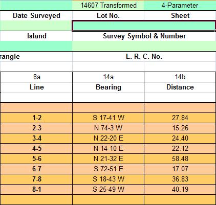
11 Transformation Effect in the Technical Description of Lots (Using 3-Parameter) 3 Click to edit Master title style Original Technical Description Transformed Technical Description Transformation Effect in the Technical Description of Lots (Using 4-Parameter) 4 Click to edit Master title style Original Technical Description Transformed Technical Description

12 Click to edit Master title style 4-Parameter (NAMRIA) analysis Click to edit Master title style 4-Parameter (NAMRIA) analysis Differences in Scale and Translation Parameters are negligible. The rotation parameters differ only by their directions. N Y E X NAMRIA Coordinate System

13 Click Findings to edit Master on Municipal title style and Provincial Boundary Monuments Click to edit Conclusions Master title style 1. On Cadastral Survey and Cadastral Transformation 2. On Transformation Methods 3. On Municipal Boundary Delineation
14 Click On Cadastral to edit Master Survey title and style Cadastral Transformation Transformation of Cadastral Survey and Data to PPCS TM/PRS92 must be done only to cadastral projects (approved) with intact and complete cadastral records with verified correct ground control survey. Verification and validation of correctness of cadastral survey plays an important role in approving cadastral survey for transformation and integration to PPCS TM/PRS92. Click On Cadastral to edit Master Survey title and style Cadastral Transformation Municipalities and Cities may have: 1. Approved Cadastral Survey 2. Partially Surveyed (Unapproved) Cadastre 3. Approved Graphical (Unconverted cadastre) 4. Unsurveyed Cadastre
15 Click On Cadastral to edit Master Survey title and style Cadastral Transformation Approved cadastral survey maybe any of the following current condition: Condition Complete Records Incomplete Records Completely Lost Records Correctly Surveyed CCPN with recovered CPs Ideal No. CCPs CCPs >min but not wd CCPs <min CCPN Incorrectly Surveyed Case1 Case2 Case3 Case4 Case5 Case6 Case7 Case8 Case9 Click On to edit Master title style Transformation Methods Among the available methods for plane coordinate system transformation, the Least Squares 3 parameter and 4 parameter (Similarity) transformations are the only methods suitable for cadastral survey and data transformation. The 3 parameter and 4 parameter transformation has the following advantages and disadvantages: Method RMS Yield Effect in Area Effect in the TD of a lot Legal implication LS 3-Parameter Good Negligible may change bearings; retain distances Title amendment 4-Parameter (Similarity) Better ±0.01% (1sqm/5000sqm) changes bearings; changes distances Title amendment
16 Click On to edit Master title style Municipal Boundary Delineation Municipal boundary monuments as well as provincial boundary monuments proves to have unreliable approved plane and geodetic coordinates. Confusion on the MBM numbering and markings are rampant in the cadastral surveys. Click to edit Recommendations Master title style 1. On Cadastral Survey and Cadastral Transformation 2. On Transformation Methods 3. On Municipal Boundary Delineation 4. On Zonal (Block) Parameter Derivation for Cadastral Survey Transformation
17 Click On Cadastral to edit Master Survey title and style Cadastral Transformation Implementation of Cadastral Survey verification and validation BEFORE the transformation and integration to the PPCS TM/PRS92. Per cadastral project inventory of cadastral records and data. Implementation of the recommended cadastral transformation flowchart Click On Cadastral to edit Master Survey title and style Cadastral Transformation For approved cadastral survey: Condition Case1 Case2 Case3 Case4 Case5 Case6 Case7 Case8 Case9 Recommendation Transform and Integrate to PPCS-TM/PRS92 using either LS3-Parameter or 4- Parameter (Similarity) Transform and integrate to PPCS-TM/PRS92 using either LS3-Parameter or 4- Parameter (Similarity); Reconstitute lost records Relocate lost cadastral control points or establish new compensating control points before transforming and integrating to PPCS-TM/PRS92 using either LS3-Parameter or 4-Parameter (Similarity) -do Recommendation for Case3 and Case2 Further study on the applicability of using lot corners for cadastral transformation and integration to PPCS-TM/PRS92 Further study on the applicability of using lot corners for cadastral transformation and integration to PPCS-TM/PRS92 Resurvey of partial or entire Cadastre Resurvey of partial or entire Cadastre Resurvey of partial or entire Cadastre
18 Click On to Transformation edit Master title Method style and Procedure Implement a single method that will be used for all the cadastral survey transformation for the entire country for uniformity and consistency of data to be integrated. Improving quality of the cadastral common point network (CCPN) by improving measurement method and technology (e.g., use of DF GPS receivers instead of SF) Click On Zonal to edit (Block) Master Parameter title style Derivation for Cadastral Survey Transformation If implemented accordingly, the transformation flowchart will yield homogenous/seamless cadastral survey across municipalities, provinces, and regions. Zonal (block) parameter derivation may no longer be needed but breaking cadastral surveys on microplate boundaries may play crucial role in realizing the solutions on naturally changing land areas.
19 Click to On edit Master title style Municipal Delineation Incorporate municipal boundaries after reobserving the agreed upon MBM between municpalities to the transformed cadastral survey and data before integrating to the PPCS TM/PRS92. Institutionalize maintenance of MBMs and PBMs by the provincial government. Click to edit Further Master title style Studies 1. Applicability of a dynamic coordinated cadastre in the cadastral survey of the Philippines. 2. Effects of crustal deformation to the cadastral survey system of the Philippines. 3. Applicability of cadastral lot corners as common point in cadastral transformation. 4. Reconstitution of lost records and monuments in a transformed cadastre. 5. Alternative methods of cadastral surveying.
20 Click to edit Master title style Literature of the DANR (DENR LMB) Technical Bulletin No.26 Computational Methods for Evaluating TB No.26 Conversion Criteria for Assessment Analysis Test Data for Analysis Results and Discussion: Discrepancy and Correlation Analysis Results and Discussion : Statistical Analysis Results and Discussion : Cyclic Conversion Conclusion Recommendation EVALUATION AND ASSESSMENT OF PPCS- TM/PRS92 GEOGRAPHIC-TO TO-GRID AND GRID-TO TO- GEOGRAPHIC COORDINATE CONVERSION Click Methodology: to edit Master title style Process Flow Results
21 Click to edit Master title style Computation Methods for Assessing and Evaluating TB No.26 Geographic-to to-grid Conversion There were four computation methods examined in performing the geographic to grid and grid to geographic coordinate conversion. 1. Conversion using the prescribed computation method stated in the Technical Bulletin No. 26, using the values of the roman numerals found on the published tables; 2. Conversion using the prescribed computation method in the Technical Bulletin No. 26, using the re calculated values of the roman numerals based on the published supplementary manual of the bulletin (DANR, 1967); 3. Conversion using the closed formulation adapted from Snyder (1987); and 4. Conversion using the closed formulation in USCGS Special Publication#251 (Thomas, 1952). Click Criteria to edit Master title style for the Assessment Analysis The following were the criteria for the assessment analysis of the conversion methods: a. Discrepancy and Correlation Analysis b. Statistical Analysis c. Cyclic Conversion Analysis
22 Click to Test edit Master title style Data for the Analysis a. Latitude = to b. Longitude = c. Central Meridian = The latitudes used were adapted from the range used on Technical Bulletin No. 26. The CM was arbitrarily chosen and the fixed longitude was made to be 1⁰ away from the CM to assess the maximum error (convergency). Click Discrepancy to edit Master title style and Correlation Analysis Geographic to Grid Conversion: Computation of Nothings vs. Latitude Figure 1. Latitude versus Northing of four (4) calculation methods.
23 Click Discrepancy to edit Master and Correlation title style Analysis Geographic to Grid Conversion: Computation of Eastings vs Latitude Figure 2. Latitude versus Easting of four (4) calculation methods. Click Discrepancy to edit Master and Correlation title style Analysis Geographic to Grid Conversion: Discrepancy Graph Blue lines and dots correspond to values of Northings; Red lines and dots correspond to values of Eastings.
24 Click Discrepancy to edit Master and Correlation title style Analysis Geographic to Grid Conversion: Discrepancy Range Comparison Discrepancies (millimeters) Data and Formulations Northings Eastings Method 1 Method 2 Minimum Maximum Minimum Maximum Snyder (1987) Published TB Snyder (1987) TB 26 Supplement Snyder (1987) Thomas (1952) Published TB 26 Snyder (1987) Published TB 26 TB 26 Supplement Published TB 26 Thomas (1952) Click Discrepancy to edit Master and Correlation title style Analysis Grid to Geographic Conversion: Computation of Latitude Figure 3: Northings versus computed latitude using four conversion methods.
25 Click Discrepancy to edit Master and Correlation title style Analysis Grid to Geographic Conversion: Computation of Longtitude Northings versus computed longitude using four conversion methods. Click Discrepancy to edit Master and Correlation title style Analysis Grid to Geographic Conversion: Computation of Latitude
26 Click Grid to edit to Geographic Master title Coordinate style Conversion Grid to Geographic Conversion: Computation of Latitude (Snyder and Thomas) Click Grid to edit to Geographic Master title Coordinate style Conversion Grid to Geographic Conversion: Discrepancy Range (Latitude) Discrepancies in Latitude Conversion Method Minimum Maximum Difference Mean Standard Deviation Published TB No TB No. 26 Supplement Snyder (1987) Thomas (1952)
27 Click Grid to edit to Geographic Master title Coordinate style Conversion Grid to Geographic Conversion: Discrepancy Range (Longitudes) Discrepancies in Longitude (secs) Conversion Method Minimum Maximum Difference Mean Standard Deviation Published TB No TB No. 26 Supplement Snyder (1987) Thomas (1952) E E-06 Click to edit Statistical Master title style Analysis The formula used in the set up of the confidence intervals is: ts ts P X X 2 F( t) 1 n n where, X is the sample mean, μ is the population mean, S is the sample standard deviation and n is the number of independent measurement. The confidence level signifies the probability that μ lies between the confidence limits of the interval is 95% or 99%.
28 Click to edit Statistical Master title style Analysis Two confidence levels were used for the assessment of the data, 95% and 99%. Click Cyclic to edit Master title style Conversion Analysis GEOGRAPHIC COORDINATE (ϕ, λ) GRID COORDINATE (N, E)
29 Click Cyclic to edit Master title style Conversion Analysis No. of Iterations Latitude GEOGRAPHIC COORDINATES Longitude Northing GRID COORDINATES Easting E E E E E E E E E E E E E E E E E E E E E E E E E E E E E E E E Click to edit Conclusions Master title style On the Accuracy of the Published Coordinate Conversion Table under the DENR LMB TB No.26: A number of outliers in the roman numeral values have been found to exist in the table causing erroneous conversion on specific points. The conversion Philippine Transverse Mercator (PTM) projection formulation found in the Supplement to the DENR LMB TB No.26 for coordinate conversion were found to be consistent, to the level of accuracy prescribed therein, with Universal Transverse Mercator (UTM) formulation based on cited literatures and references.
30 Click to edit Conclusions Master title style On Accuracy of other UTM projection formulation for coordinate conversion: It can be concluded that all the answers obtained by using the direct coordinate conversion methods are more or less accurate, or at least having discrepancies which are insignificant based on the three point criteria assessment. However, the closed formulation adapted from Snyder gave the least amount of discrepancies for both the forward and backward solutions Click PTM to Zoning edit Master Based title on style Municipal Boundaries The project component is still under the process of evaluating the PTM zoning based on municipal boundaries using several criteria: 1. Boundaries of any municipality does not exceed prescribed extent of PTM (2 degree ) zone. 2. Significance of the convergence correction in the outer boundaries of any municipalities beyond the PTM (2 degree) zones.
31 Click to edit Recommendation Master title style Republication of the DENR LMB Technical Bulletin No.26 with the corrections found in the Coordinate Conversion Table. Republication of the Supplement to the DENR LMB Technical Bulletin No.26 for reference. Incorporation of a Close formulation based on a cited literature for coordinate conversion in the republish technical bulletin. Click to edit Recommendation Master title style Incorporation of a numerical example computation of coordinate conversion using the conversion table from the republished technical bulletin and the prescribed formulation Publication/commissioning of a PPCS TM/PRS92 coordinate conversion program for automation of coordinate conversion program which can be integrated in the technical bulletin.
32 Click to edit Acknowledgement Master title style The authors would like to thank the National Mapping and Resource Information Authority (NAMRIA) of the Philippine Government for funding this research project. Click to edit Master title style
SCOPE OF PRESENTATION
 INTERNATIONAL SYMPOSIUM AND EXHIBITION ON GEOINFORMATION Global Trends: Geoinformation For The New Economy Studies Toward the Development of Implementation Plan Of Coordinated Cadastral System for Peninsular
A Method For Building Legal Digital Cadastre Without Using Cadastral Measurements Field Book Data Is It Accurate Enough?
 A Method For Building Legal Digital Cadastre Without Using Cadastral Measurements Field Book Data Is It Jad JARROUSH, Dmitri BRICKMAN, Israel Key words: Digital Cadastre, Least Squares Cadastral Computations,
Establishing Efficient Cadastral Surveying Plan in Accordance with Introducing World Geodetic Reference System in Korea
 Modern Environmental Science and Engineering (ISSN 2333-2581) December 2015, Volume 1, No. 6, pp. 299-303 Doi: 10.15341/mese(2333-2581)/06.01.2015/003 Academic Star Publishing Company, 2015 www.academicstar.us
A Geocoded Cadastral Fabric as a Precondition for a Sustainable Land Management System
 A Geocoded Fabric as a Precondition for a Sustainable Land Management System Gottfried KONECNY, Germany; J.P. LAUZON, Canada; Abdul Salam MOHAMMED, India Key words: SDI,, Parcel Boundaries, GPS-GNSS, Land
D DAVID PUBLISHING. Mass Valuation and the Implementation Necessity of GIS (Geographic Information System) in Albania
 in Albania") Journal of Civil Engineering and Architecture 9 (2015) 1506-1512 doi: 10.17265/1934-7359/2015.12.012 D DAVID PUBLISHING Mass Valuation and the Implementation Necessity of GIS (Geographic Elfrida Shehu
Journal of Civil Engineering and Architecture 9 (2015) 1506-1512 doi: 10.17265/1934-7359/2015.12.012 D DAVID PUBLISHING Mass Valuation and the Implementation Necessity of GIS (Geographic Elfrida Shehu
Hybrid Cadastre Pilot Project Guidelines for Public Land Disposition Surveys Operations Division
 Hybrid Cadastre Pilot Project Guidelines Operations Division January 12, 2015 Version Update Version No. Date Summary of Changes 2.0 January 12, Table of Contents 2015 Table of Contents added to Guidelines.
General Instructions For Surveys and Plans Outside the Provincial Survey System
 May 15, 2018 General Instructions For Surveys and Plans Outside the Provincial Survey System NOTE: This document is a Controller of Surveys Policy manual to be used as a general guideline for the Legal
A NOMINAL ASSET VALUE-BASED APPROACH FOR LAND READJUSTMENT AND ITS IMPLEMENTATION USING GEOGRAPHICAL INFORMATION SYSTEMS
 A NOMINAL ASSET VALUE-BASED APPROACH FOR LAND READJUSTMENT AND ITS IMPLEMENTATION USING GEOGRAPHICAL INFORMATION SYSTEMS by Tahsin YOMRALIOGLU B.Sc., M.Sc. A thesis submitted for the Degree of Doctor of
Parcel Identifiers for Cadastral Core Data: Concepts and Issues
 Parcel Identifiers for Cadastral Core Data: Concepts and Issues Nancy von Meyer, Bob Ader, Zsolt Nagy, David Stage, Bill Ferguson, Katie Benson, Bob Johnson, Stu Kirkpatrick, Robert Stevens, Dan Mates
Ownership Data in Cadastral Information System of Sofia (CIS Sofia) from the Available Cadastral Map
 from the Available Cadastral Map") Ownership Data in Cadastral Information System of Sofia (CIS Sofia) from the Available Cadastral Map Key words: ABSTRACT Lydmila LAZAROVA, Bulgaria CIS Sofia is created and maintained by GIS Sofia ltd,
Ownership Data in Cadastral Information System of Sofia (CIS Sofia) from the Available Cadastral Map Key words: ABSTRACT Lydmila LAZAROVA, Bulgaria CIS Sofia is created and maintained by GIS Sofia ltd,
MASS REGISTRATION OF LAND PARCELS USING FIT-FOR-PURPOSE LAND ADMINISTRATION: PROCEDURES AND METHODS
 MASS REGISTRATION OF LAND PARCELS USING FIT-FOR-PURPOSE LAND ADMINISTRATION: PROCEDURES AND METHODS TAREK ZEIN Hansa Luftbild AG, Germany zein@hansaluftbild.de Paper prepared for presentation at the 2017
DIRECTIVE # This Directive Supersedes Directive # and #92-003
 Division Of Property Valuation Docking State Office Building 915 SW Harrison St., Room 400N Topeka, KS 66612-1588 Nick Jordan, Secretary David N. Harper, Director phone: 785-296-2365 fax: 785-296-2320
Reporting Thailand Cadastral System in Cadastre 2014 Trends BY VUTTINAN UTESNAN. Rajamangala University of Technology Krungthep
 Reporting Thailand Cadastral System in Cadastre 2014 Trends BY VUTTINAN UTESNAN Rajamangala University of Technology Krungthep Faculty of Engineering, Bangkok, THAILAND Topics INTRODUCTION THAILAND CADASTRAL
Refinement of Cadastral Maps
 Acta Montanistica Slovaca Ročník 16(2011), číslo 4, 242-248 Refinement of Cadastral Maps Alena Berková 1 Making cadastral maps more precise The amended cadastral ordinance takes effect from 1.7. 2009.
General Market Analysis and Highest & Best Use. Learning Objectives
 General Market Analysis and Highest & Best Use Learning Objectives Module & Title Module 1 Real Estate Markets and Analysis Module 2 Types and Levels of Market Analysis Module 3 The Six-Step Process and
Glossary of Terms & Definitions
 Glossary of Terms & Definitions European AVM Alliance Independent - Transparent - Unbiased Key AVM Terms Term Definition Remarks Automated Model (AVM) AVM Performance AVM Coverage AVM Accuracy A system
Engr. Juan P. Fernandez, Jr. Chief, Surveys and Mapping Division DENR Region-3 Club Royale Hotel, Malolos, Bulacan February 27,2016
 Engr. Juan P. Fernandez, Jr. Chief, Surveys and Mapping Division DENR Region-3 Club Royale Hotel, Malolos, Bulacan February 27,2016 ! DAO 2007-29 issued on July 31, 2007 re Revised Regulations on Land
Real Estate Transaction Method And System
 ( 1 of 1 ) United States Patent Application 20060282378 Kind Code A1 Gotfried; Bradley L. December 14, 2006 Real Estate Transaction Method And System Abstract A method and system for brokering real estate
2017 Reappraisal Preliminary Report. February 6, 2017
 2017 Reappraisal Preliminary Report February 6, 2017 Reappraisal is required at least every 8 years per NCGS105-286 Last reappraisal was conducted for 2011 Reappraisal includes both land and improvements.
FORM F1 TECHNICAL REPORT TABLE OF CONTENTS
 FORM 43-101F1 TECHNICAL REPORT TABLE OF CONTENTS TITLE CONTENTS OF THE TECHNICAL REPORT Item 1: Item 2 Item 3 Item 4 Item 5 Item 6 Item 7 Item 8 Item 9 Item 10 Item 11 Item 12 Item 13 Item 14 Item 15 Item
Moving from a Successful to a Modern Cadastre in LAO PDR
 Moving from a Successful to a Modern Cadastre in LAO PDR Daniel CARTER (Australia) and Bounhom HEUANGSAVATH (Lao PDR) Key Words: cadastre; digital cadastre; land administration systems; South East Asia
City of Surrey s Digital Plan Submission Process
 City of Surrey s Digital Plan Submission Process Cadastral Update Karen Stewart, B.Tech. (GIS) Spatial Information Manager Peter Mueller, B.C.L.S., C.L.S. Survey Manager City of Surrey, British Columbia,
The programme is implemented
 Surveying Property valuation and spatial data tools to assist in land restitution by Jaco de Kock, GISCOE Land and tenure reform in the South African government context are beyond talk and have received
LANDONLINE PRE-VALIDATION
 LANDONLINE PRE-VALIDATION ACCURACY RULE TESTS RUN DURING PRE-VALIDATION OF CADASTRAL SURVEY DATASETS Land Information New Zealand Customer Services May 2010 Version 4.0 Table of Contents Introduction...3
*Predicted median absolute deviation of a CASA value estimate from the sale price
 PLATINUMdata Premier AVM Products ACA The AVM offers lenders a concise one-page summary of a property s current estimated value, complete with five recent comparable sales, neighborhood value data, homeowner
Functional system for cadastral plans
 , Republic of Macedonia Key words: Cadastre, Digital plans, Data, System SUMMARY The analysis shows that the real estate market in Republic of Macedonia grows daily. With the expansion of this market increases
Application of Finite Difference Method to Develop Land Value Map
 Application of Finite Difference Method to Develop Land Value Map WALJIYANTO, Nurrohmat WIDJAJANTI and Waruno SURYOHADI, Indonesia Key words: finite difference, isovalue, land value zone SUMMARY In the
Collateral Underwriter, Regression Models, Statistics, Gambling with your License
 Collateral Underwriter, Regression Models, Statistics, Gambling with your License Keith Wolf, SRA, AI-RRS Kwolf Consulting Inc. Kwolf1021@gmail.com 05/20/2015 There are Lies, Damned Lies and Statistics
Part 1. Estimating Land Value Using a Land Residual Technique Based on Discounted Cash Flow Analysis
 Table of Contents Overview... v Seminar Schedule... ix SECTION 1 Part 1. Estimating Land Value Using a Land Residual Technique Based on Discounted Cash Flow Analysis Preview Part 1... 1 Land Residual Technique...
Ⅱ-2. The Resurvey Project
 Presenter : JANG, Bong-Bae MLTM Ministry of land,transport and Maritime Affairs KIM, Soon-Tae KCSC Korea Cadastral Survey Corp., JANG, Bong-Bae Ⅰ. INTRODUCTION The Korean modern cadastral system was established
Section I General Information
 General Information Table of Contents A. Introduction... I-2 1. Purpose... I-2 2. Scope... I-2 3. Maintenance... I-3 4. Units... I-3 B. Public Relations... I-3 1. General Public... I-3 2. Property Owners...
New Models for Property Data Verification and Valuation
 New Models for Property Data Verification and Valuation for 2006 IAAO Councils and Sections Joint Seminar May 9-11, 2006 Charleston, South Carolina Presented by George Donatello, CMS Principal Consultant
RENTAL MARKET REPORT. Manitoba Highlights* Highlight Box. Housing market intelligence you can count on
 H o u s i n g M a r k e t I n f o r m a t i o n RENTAL MARKET REPORT Manitoba Highlights* C a n a d a M o r t g a g e a n d H o u s i n g C o r p o r a t i o n Date Released: Spring 2011 Figure 1 Winnipeg
INDIAN INSTITUTE OF TECHNOLOGY ROORKEE. Presentation on REAL TIME CADASTRAL SURVEYING SOLUTION WITH A SPECIAL IMPHESIS TO MODERN GPS TECHNOLOGY.
 INDIAN INSTITUTE OF TECHNOLOGY ROORKEE Presentation on REAL TIME CADASTRAL SURVEYING SOLUTION WITH A SPECIAL IMPHESIS TO MODERN GPS TECHNOLOGY By: Prof. Kamal Jain, Dept. of Civil Engg. IIT-Roorkee AIM
NEW DEVELOPMENTS IN THE REAL PROPERTY REGISTER AND CADASTRE IN LITHUANIA
 NEW DEVELOPMENTS IN THE REAL PROPERTY REGISTER AND CADASTRE IN LITHUANIA Jaunius Grigas E-mail: jaunius.grigas@registrucentras.lt Verona, 2008 FUNCTIONS OF STATE ENTERPRISE CENTRE OF REGISTERS Registration
Directorate of Survey and Mapping NAMIBIA. Cadastral Information System. Vehupisa Kasuko Tjatindi Surveyor Directorate of Survey and Mapping NAMIBIA
 Vehupisa Kasuko Tjatindi Directorate of Survey and Mapping NAMIBIA Tel: +64 61 965000 Directorate of Survey and Mapping NAMIBIA Cadastral Information System Introduction Over the past few decades cadastral
The Digital Cadastral Database and the Role of the Private Licensed Surveyors in Denmark
 IRISH INSTITUTE OF SURVEYORS, DUBLIN INSTITUTE OF TECHNOLOGY, 23 NOVEMBER 2005 PUBLISHED IN IIS NEWS, WINTHER 2006. The Digital Cadastral Database and the Role of the Private Licensed Surveyors in Denmark
RENTAL MARKET REPORT. Manitoba Highlights* Highlights. Housing market intelligence you can count on
 H o u s i n g M a r k e t I n f o r m a t i o n RENTAL MARKET REPORT Highlights* C a n a d a M o r t g a g e a n d H o u s i n g C o r p o r a t i o n Date Released: Spring 2012 Figure 1 Winnipeg CMA Brandon
86 years in the making Caspar G Haas 1922 Sales Prices as a Basis for Estimating Farmland Value
 2 Our Journey Begins 86 years in the making Caspar G Haas 1922 Sales Prices as a Basis for Estimating Farmland Value Starting at the beginning. Mass Appraisal and Single Property Appraisal Appraisal
STATE LAND AUDIT REPORT
 STATE LAND AUDIT REPORT 1 Presentation to the Portfolio Committee on Rural Development and Land Reform M514 Marks Building 30 March 2011 CHIEF SURVEYOR GENERAL Mr M RIBA Content 2 Background Project Objectives
Quality Improvement to Cadastral Information in Sweden
 Gunnar BLIXT, Sweden Key words: digital cadastre, quality, cadastral index map, real property register. SUMMARY Lantmäteriet is a governmental agency which gives support for creating an efficient and sustainable
The Impact of Using. Market-Value to Replacement-Cost. Ratios on Housing Insurance in Toledo Neighborhoods
 The Impact of Using Market-Value to Replacement-Cost Ratios on Housing Insurance in Toledo Neighborhoods February 12, 1999 Urban Affairs Center The University of Toledo Toledo, OH 43606-3390 Prepared by
1. LAND INFORMATION NEW ZEALAND : CONTACT DETAILS
 Cadastral Survey Guidelines Hardcopy Plans LINZ CONTACT DETAILS Chapter 1 - Page 1 1. LAND INFORMATION NEW ZEALAND : CONTACT DETAILS Phone: 0800 ONLINE 0800 665 463 Email: info@linz.govt.nz National Office
CFedS Outline Unit 1. Course 1: History, Records & Administrative Systems
 CFedS Outline Unit 1 Course 1: History, Records & Administrative Systems History of U.S. Surveying Historical Perspective Similarities in Surveying Seniority of Calls Lack of Standards A National Debt
Course Residential Modeling Concepts
 Course 311 - Residential Modeling Concepts Course Description Course 311 presents a detailed study of the mass appraisal process as applied to residential property. Topics covered include a comparison
PROJECT INFORMATION DOCUMENT (PID) CONCEPT STAGE Report No.: AB3229 Project Name. Land Registry and Cadastre Modernization Project Region
 CONCEPT STAGE Report No.: AB3229 Project Name. Land Registry and Cadastre Modernization Project Region") PROJECT INFORMATION DOCUMENT (PID) CONCEPT STAGE Report No.: AB3229 Project Name Land Registry and Cadastre Modernization Project Region EUROPE AND CENTRAL ASIA Sector Central government administration
PROJECT INFORMATION DOCUMENT (PID) CONCEPT STAGE Report No.: AB3229 Project Name Land Registry and Cadastre Modernization Project Region EUROPE AND CENTRAL ASIA Sector Central government administration
DECREE GENERAL PROVISIONS
 THE GOVERNMENT ------- SOCIALIST REPUBLIC OF VIET NAM Independence - Freedom Happiness --------------- No: 44/2014/ND-CP Hanoi, May 15, 2014 DECREE REGULATIONS ON LAND PRICES Pursuant to Law on Government
Initial sales ratio to determine the current overall level of value. Number of sales vacant and improved, by neighborhood.
 Introduction The International Association of Assessing Officers (IAAO) defines the market approach: In its broadest use, it might denote any valuation procedure intended to produce an estimate of market
Concerns about Methodology
 1979 NDSPLS ADMINISTRATIVE OFFICE PO Box 7370 Bismarck, ND 58507 Phone: 701-223-3184 E-mail: info@ndspls.org Website: www.ndspls.org North Dakota Industrial Commission Department of Mineral Resources Lynn
Development of Mobile Cadastral Surveying System for Korean Cadastral Resurvey Project
 Development of Mobile Cadastral Surveying System for Korean Cadastral Resurvey Project Joon-Sik, KIM, Sang-Gu, KANG, Yun-Soo, CHOI, Republic of Korea Key words: Mobile Cadastral Surveying System, RTK-GPS,
Cadastral NSDI Reference Document
 Cadastral NSDI Reference Document Version 12 October 2012 FGDC Subcommittee for Cadastral Data Cadastral NSDI Reference Document Table of Contents 1. Purpose... 1 2. Business Applications... 1 3. Terminology
Trip Rate and Parking Databases in New Zealand and Australia
 Trip Rate and Parking Databases in New Zealand and Australia IAN CLARK Director Flow Transportation Specialists Ltd ian@flownz.com KEYWORDS: Trip rates, databases, New Zealand developments, common practices
Ordinance on Official Cadastral Surveying
 English is not an official language of the Swiss Confederation. This translation is provided for information purposes only and has no legal force. Ordinance on Official Cadastral Surveying 211.432.2 of
Problems and Solution Proposals in Integration of Cadastral Data into Geographical Information System (GIS) in Turkey
 in Turkey") Problems and Solution Proposals in Integration of Cadastral Data into Geographical Information System (GIS) in Turkey Gülgün OZKAN, S. Savas DURDURAN, Ali ERDI and Bilal GIRGIN, Turkey Key words: Cadastre,
Problems and Solution Proposals in Integration of Cadastral Data into Geographical Information System (GIS) in Turkey Gülgün OZKAN, S. Savas DURDURAN, Ali ERDI and Bilal GIRGIN, Turkey Key words: Cadastre,
Cadastral Template 2003
 PCGIAP-Working Group 3 "Cadastre" FIG-Commission 7 "Cadastre and Land Management" Cadastral Template 2003 The establishment of a cadastral template is one of the objectives of Working Group 3 "Cadastre"
Mass appraisal Educational offerings and Designation Requirements. designations provide a portable measurement of your capabilities
 Mass appraisal Educational offerings and Designation Requirements designations provide a portable measurement of your capabilities WE are IAAO International Association of Assessing Officers We re a professional
The New Technology of a Survey Data Model and Cadastral Fabric as the Foundation for a Future Land Administration System.
 The New Technology of a Survey Data Model and Cadastral Fabric as the Foundation for a Future Land Ian HARPER, Australia Key words: cadastral modelling, survey data model, Survey Accuracy, Cadastre 2014
The purpose of the appraisal was to determine the value of this six that is located in the Town of St. Mary s.
 The purpose of the appraisal was to determine the value of this six that is located in the Town of St. Mary s. The subject property was originally acquired by Michael and Bonnie Etta Mattiussi in August
Field surveying inspection using tablets
 Field surveying inspection using tablets Rami Farraj, Ahmad Sghyyer Survey of Israel, Lincoln 1, Tel-Aviv, Israel rami@mapi.gov.il ahmad@mapi.gov.il Key words: Field Surveying, Cadastre, Mapping Procedures
AVM Validation. Evaluating AVM performance
 AVM Validation Evaluating AVM performance The responsible use of Automated Valuation Models in any application begins with a thorough understanding of the models performance in absolute and relative terms.
The creation of a Survey Accurate Cadastral Map for surveyed areas in Trinidad & Tobago
 The creation of a Survey Accurate Cadastral Map for surveyed areas in Trinidad & Tobago Anesh Gopee, Keith Miller and Charisse Griffith Charles University of the West Indies Trinidad aneshtt@yahoo.com
86M 4.2% Executive Summary. Valuation Whitepaper. The purposes of this paper are threefold: At a Glance. Median absolute prediction error (MdAPE)
") Executive Summary HouseCanary is developing the most accurate, most comprehensive valuations for residential real estate. Accurate valuations are the result of combining the best data with the best models.
Executive Summary HouseCanary is developing the most accurate, most comprehensive valuations for residential real estate. Accurate valuations are the result of combining the best data with the best models.
REPEATABILITY & REPRODUCIBILITY (R&R) STUDY
 STUDY") ProMSA is math-anxiety-free, comprehensive and dedicated software solution for Measurement Systems Analysis conforming to AIAG's MSA Manual - 4 th Edition. REPEATABILITY & REPRODUCIBILITY (R&R) STUDY R&R
ProMSA is math-anxiety-free, comprehensive and dedicated software solution for Measurement Systems Analysis conforming to AIAG's MSA Manual - 4 th Edition. REPEATABILITY & REPRODUCIBILITY (R&R) STUDY R&R
Washington Department of Revenue Property Tax Division. Valid Sales Study Kitsap County 2015 Sales for 2016 Ratio Year.
 P. O. Box 47471 Olympia, WA 98504-7471. Washington Department of Revenue Property Tax Division Valid Sales Study Kitsap County 2015 Sales for 2016 Ratio Year Sales from May 1, 2014 through April 30, 2015
PROPERTY TAX IS A PRINCIPAL REVENUE SOURCE
 TAXABLE PROPERTY VALUES: EXPLORING THE FEASIBILITY OF DATA COLLECTION METHODS Brian Zamperini, Jennifer Charles, and Peter Schilling U.S. Census Bureau* INTRODUCTION PROPERTY TAX IS A PRINCIPAL REVENUE
Demonstration Properties for the TAUREAN Residential Valuation System
 Demonstration Properties for the TAUREAN Residential Valuation System Taurean has provided a set of four sample subject properties to demonstrate many of the valuation system s features and capabilities.
Standard on Automated Valuation Models (AVMs)
") Standard on Automated Valuation Models (AVMs) Approved September 2003 Revised approved July, 2018 Contents 1. Scope...4 2. Principles...4 3. Introduction...5 3.1 Definition of automated valuation model
Standard on Automated Valuation Models (AVMs) Approved September 2003 Revised approved July, 2018 Contents 1. Scope...4 2. Principles...4 3. Introduction...5 3.1 Definition of automated valuation model
Regression + For Real Estate Professionals with Market Conditions Module
 USER MANUAL 1 Automated Valuation Technologies, Inc. Regression + For Real Estate Professionals with Market Conditions Module This Regression + software program and this user s manual have been created
Plats and subdivisions; mapping requirements. (a) Size Requirements. All land plats presented to the register of deeds for recording in the
 Size Requirements. All land plats presented to the register of deeds for recording in the") 47-30. Plats and subdivisions; mapping requirements. (a) Size Requirements. All land plats presented to the register of deeds for recording in the registry of a county in North Carolina after September
47-30. Plats and subdivisions; mapping requirements. (a) Size Requirements. All land plats presented to the register of deeds for recording in the registry of a county in North Carolina after September
The ecrv Submit application opens with the following important warning message on privacy:
 Submit Form Tabs Buyers and Sellers Property Sales Agreement Supplementary Submitter The ecrv form is a single Web-page form with entry fields, choices and selections in multiple tabs for submitting a
Mass Appraisal of Income-Producing Properties
 Chapter 10 Mass Appraisal of Income-Producing Properties Whether valuing income-producing property or residential property, you can use similar information and methods for collecting and analyzing data
Support to Implementation of Multipurpose Cadastral Information system in Vietnam
 Support to Implementation of Multipurpose Cadastral Information system in Vietnam Lennart JOHANSSON and Per SÖRBOM, Sweden Key words: Land Registration, Land Information, Land Administration, SWOT analyse,
LAND PARCEL IDENTIFICATION FOR AUTOMATED LAND INFORMATION SYSTEMS
 LAND PARCEL IDENTIFICATION FOR AUTOMATED LAND INFORMATION SYSTEMS D a r r e l l R. D e a n, J r., Teaching Assistant Surveying and Mapping Purdue University R E C O G N IT IO N O F N EED F O R M O R E
Part 2. Measures of Central Tendency: Mean, Median, and Mode
 Table of Contents Overview... vii Schedule... xi SECTION 1 Introduction... 1 Part 1. Introduction to Statistics Preview Part 1... 3 Why Is Knowledge of Statistics Useful to the Appraiser?... 5 How Does
Cadastral PLSS Stewardship December 2010 Updated December 2013
 Cadastral PLSS Stewardship December 2010 Updated December 2013 Compiled by Bob Ader, Ben Knott, and Nancy von Meyer for the FGDC Cadastral Subcommittee Table of Contents 1. Overview... 2 2. Underlying
Development of the New Cadastral Survey System in Tanzania
 Samwel S. KATAMBI, Tanzania Keywords: Cadastral Survey System, Cadastre, Land Administration, NSDI. SUMMARY In recent years the demand for cadastral survey informations in Tanzania has been increasing
Digital Archives and Document Management in the Cadastral Procedure in Sweden
 Digital Archives and Document Management in the Cadastral Procedure in Sweden Bengt-Olof KÄCK and Lennart SUNDSTRÖM, Sweden Key words: Digital Archives, Archives strategy, Document management. SUMMARY
THE VALUATION ANALYST
 USER MANUAL Companion Spreadsheet for the book: THE VALUATION ANALYST Research in Extracting Adjustment Rates by David A. Braun, MAI, SRA, AI-GRS. The Compass Spreadsheet copyright 2016 by Automated Valuation
Geodetic Infrastructure in Samoa. FIG Pacific Small Islands Developing States Symposium September 2013, Suva, FIJI.
 Geodetic Infrastructure in Samoa. FIG Pacific Small Islands Developing States Symposium 18 20 September 2013, Suva, FIJI. FIG Commission 5 Position and Measurement United Nations Global Geospatial Information
IAS Revenue. By:
 IAS - 18 Revenue International Accounting Standard No 18 (IAS 18) Revenue In 1998, IAS 39, Financial Instruments: Recognition and Measurement, amended paragraph 11 of IAS 18, adding a cross-reference to
Challenges for the multi purpose cadastre
 Jens RIECKEN, Markus SEIFERT, Germany Key words: Multi purpose cadastre, 3d-cadastre, land use, SDI, solar cadastre SUMMARY Over the past 30 years, with the progress of information technologies the development
Land Information System as new instrument for Land Administration: Case Examples. Mike Cheremshynskyi Consultant, Land Administration Expert
 Land Information System as new instrument for Land Administration: Case Examples Mike Cheremshynskyi Consultant, Land Administration Expert Background Growth of population and fast urbanization in many
REDSTONE. Regression Fundamentals.
 REDSTONE from Bradford Advanced Analytics Technologies for Appraisers Regression Fundamentals www.bradfordsoftware.com/redstone Bradford Technologies, Inc. 302 Piercy Road San Jose, CA 95138 800-622-8727
Table of Contents Before You Begin... 2 Starting an Analysis... 2 Address Verification... 3 Order Confirmation... 5 Overview of Drop Down Menu Bar...
 Table of Contents Before You Begin... 2 Starting an Analysis... 2 Address Verification... 3 Order Confirmation... 5 Overview of Drop Down Menu Bar... 6 Overview of the Analytic Process... 7 Process Tab
GOVERNMENT. Case Study Ville de Trois Rivières streamlines property assessment
 GOVERNMENT Case Study Ville de Trois Rivières streamlines property assessment GIS-generated parcel basemap provides powerful visualization & analysis capabilities With a population of just over 130,000,
Ministry of Mines, Industry and SME
 Republic of Senegal Ministry of Mines, Industry and SME User Conference 2010 08/02/2010 COPYRIGHT 2010. SPATIAL DIMENSION (PTY) LTD. A MINING CADASTRE IN SENEGAL: IMPLEMENTATION PROCESS AND ORGANIZATIONAL
Appraisal Review: Analyzing the 1004
 Appraisal Review: Analyzing the 1004 1 LIVE ONLINE PARTICIPANT GUIDE Version: 8.12 Table of Contents The Purpose of the Appraisal... 3 Define Market Value... 3 Scenario 1 (John Johnson report) - 1004 Uniform
ASSESSMENT METHODOLOGY
 2019 ASSESSMENT METHODOLOGY COMMERCIAL RETAIL AND OFFICE CONDOMINIUMS A summary of the methods used by the City of Edmonton in determining the value of commercial retail and office condominium properties
User Manual. Section 2: Implementation and Industry Translations. Created: October Copyright PropertyBoss Solutions, LLC. All Rights Reserved.
 User Manual Section 2: Implementation and Industry Translations Created: October 2010 Copyright PropertyBoss Solutions, LLC. All Rights Reserved. PropertyBoss Manual Section 2 - Implementation and Industry
Knowledge based Condition Assessments
 Knowledge based Condition Assessments Presentation for: Predicting Outcomes of Investments in Maintenance and Repair of Federal Facilities Report Dissemination Forum D.R. Uzarski, Ph.D., P.E. University
Flood Hazard Modelling
 Flood Hazard Modelling Identification Information Dataset Name: Rapid Flood Hazard Model, Detailed Flood Hazard Model Dataset Abstract: The flood hazard model identifies areas that may be subject to flooding
UTAH COUNCIL OF LAND SURVEYORS STANDARDS OF PRACTICE FOR BOUNDARY SURVEYS
 UTAH COUNCIL OF LAND SURVEYORS STANDARDS OF PRACTICE FOR BOUNDARY SURVEYS By the Utah Council of Land Surveyors Committee on Boundary Survey Standards Adopted by the Utah Council of Land Surveyors Executive
Cadastral Framework Standards
 Cadastral Framework Standards The goal of the Data Standards and Recommendations Committee is to provide recommendations and guidelines to Indiana GIS user communities to facilitate the collection, maintenance
A statistical system for. Residential Property Price Indices. David Fenwick
 A statistical system for Residential Property Price Indices Eurostat IAOS IFC Conference on Residential Property Price Indices Hosted by the Bank for International Settlements 11-12 November 2009, Basle
GENERAL ASSEMBLY OF NORTH CAROLINA SESSION 2017 H 1 HOUSE BILL 454* Short Title: Surveying and Plat Recording Changes. (Public)
") GENERAL ASSEMBLY OF NORTH CAROLINA SESSION H 1 HOUSE BILL * Short Title: Surveying and Plat Recording Changes. (Public) Sponsors: Referred to: Representative Arp. For a complete list of sponsors, refer
GENERAL ASSEMBLY OF NORTH CAROLINA SESSION H 1 HOUSE BILL * Short Title: Surveying and Plat Recording Changes. (Public) Sponsors: Referred to: Representative Arp. For a complete list of sponsors, refer
UNDERSTANDING HOW USPAP APPLIES TO REAL PROPERTY APPRAISAL PRACTICE USPAP Matrix
 UNDERSTANDING HOW USPAP APPLIES TO REAL PROPERTY APPRAISAL PRACTICE - 2014-2015 USPAP Matrix This matrix assumes an Appraisal Report Format under S. R. 2-2(a). *Last updated 9/11/14* GENERAL Violation
If you want even more information, look for the advanced training, which includes more use cases and demonstrates CU s full functionality.
 Thank you for attending the Collateral Underwriter user interface basic training. My name is Steve Jones and I will be taking you through the course. Our objective today is to provide a foundational understanding
FIG Congress 2010 Facing the Challenges Building the Capacity Sydney, Australia, April
 Setting up the infrastructure for improving the development of Cadastre in Greece Dr. Dimitris ROKOS, Dr. Konstantinos KYRIAZIS and Dr. Panos LOLONIS KTIMATOLOGIO S.A. (Hellenic Cadastre) Source: wikipedia
Viability of a Coordinated Cadastre in New South Wales
 University Of Southern Queensland Faculty of Engineering and Surveying Viability of a Coordinated Cadastre in New South Wales A dissertation submitted by Wayne Edmund Stoeckl in fulfilment of the requirements
The TAUREAN Residential Valuation System An Overview
 The TAUREAN Residential Valuation System An Overview By Michael L. Robbins, Ph.D., CRE Taurean Residential Valuation Services, LLC 150 N. Sunny Slope Road, Suite 225, Brookfield, WI 53005 Phone: (262)