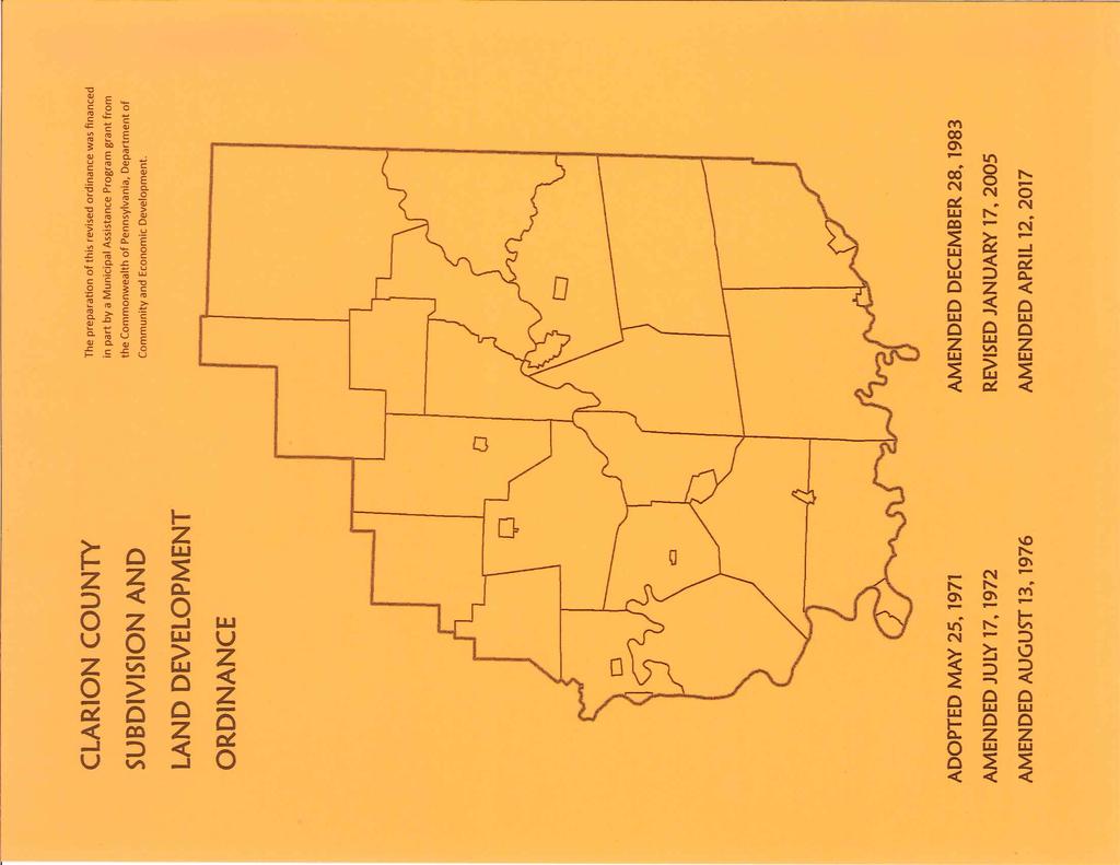
CLARION COUNTY SUBDIVISION AND LAND DEVELOPMENT ORDINANCE TABLE OF CONTENTS
|
|
|
- Brice Lindsey
- 6 years ago
- Views:
Transcription
1
2
3 Table of Contents CLARION COUNTY SUBDIVISION AND LAND DEVELOPMENT ORDINANCE TABLE OF CONTENTS ARTICLE I... 1 GENERAL PROVISIONS Short Title Effective Date Purpose of Ordinance Jurisdiction and Authority of the County Severability Definitions and Terms Fees... 8 ARTICLE II... 9 SUBDIVISIONS Classifications of Subdivisions General Procedure for Subdivisions Contents of Application Packet for Subdivision Preliminary Subdivisions Final Subdivisions Lots and Lot Sizes Water and Sewer Facilities Off-Street Parking Requirements Lots Abutting Major Highways Access Requirements Street Standards Drainage, Stormwater Management and Erosion & Sedimentation Controls Blocks Monuments and Markers Assurance for Completion and Maintenance of Improvements ARTICLE III LAND DEVELOPMENTS Jurisdiction Minor Land Developments April 2017 Page i
4 Table of Contents 303 General Procedure For Land Development Projects Contents of Application for Land Development Preliminary Land Development Plats Final Land Development Projects Assurance for Completion and Maintenance of Improvements Design Standards Water and Sewer Facilities Parking Space and Size Requirements Access Requirements Street Standards Drainage, Stormwater Management and Erosion & Sedimentation Controls Blocks Major Land Development: Commercial and Industrial Land Developments Major Land Development: Multi-Family Dwellings Major Land Development: Communication Towers Major Land Development: Mobile Home Parks Major Land Development: Recreational Vehicle Parks Major Land Development: Sanitary Landfill ARTICLE IV IMPROVEMENT GUARANTEES Improvement Guarantees ARTICLE V ADMINISTRATION Revision and Amendment Modifications and Waivers Commission Records ARTICLE VI ENFORCEMENT REMEDIES Preventive Remedies Violations ARTICLE VII ACKNOWLEDGEMENTS, CERTIFICATIONS, APPROVALS AND LEGEND April 2017 Page ii
5 General Provisions/ Definitions 101 Short Title ARTICLE I GENERAL PROVISIONS This Ordinance shall be known and may be cited as the Clarion County Subdivision and Land Development Ordinance, Revised. 102 Effective Date This Ordinance shall take effect on January 17, 2005, and as amended and restated on, Purpose of Ordinance The purpose of this Ordinance, pursuant to powers granted by the Pennsylvania Municipalities Planning Code, Act 247, as amended, is to promote the health, safety, welfare, convenience and orderly development of Clarion County by enacting regulations which will: A. Accomplish coordinated development. B. Provide for the general welfare by guiding and protecting amenity, convenience, future governmental, economic, practical, social, and cultural facilities. C. Improve governmental processes and functions. D. Guide the development of land and structures, type and location of streets, public grounds and other facilities. E. Permit other purposes outlined and authorized by the Pennsylvania Municipalities Planning Code. 104 Jurisdiction and Authority of the County The County shall have the power to enact a subdivision and land development ordinance governing the development of land in all boroughs, incorporated towns and townships wholly or partially within the County which have no subdivision and land development ordinance of their own as vested by law (Act 247 of 1968, P.L. 805), as amended. A. Upon adoption of a subdivision and land development ordinance by a township or borough, such adoption shall serve as a repeal protanto of the County ordinance within the boundaries of that municipality. B. Any municipality other than a county may adopt, by reference, the subdivision and land development ordinance of the County, and may, by separate ordinance of the municipality, designate the Planning Commission as its official administrative agency for review and approval of subdivision and land development plats. 105 Severability If any section, clause, provision or part of this Ordinance is deemed invalid or unconstitutional by a court of competent jurisdiction, the validity of the remainder shall not be affected. April 2017 Page 1
6 General Provisions/ Definitions 106 Definitions and Terms As used in this Ordinance, words in the singular include the plural and those in plural include the singular and words in the present tense include the future. The word person includes a corporation, unincorporated association and a partnership, as well as an individual. The word plat includes a replat, plat, resubdivision and site development. The word building includes structure and shall be construed as if followed by the phrase or part thereof. The word watercourse includes channel, creek, ditch, drain, dry run, spring and stream. Alley A right-of-way providing secondary access to the side or rear of two or more properties. No dwellings shall front on an alley. Applicant A landowner or developer, as hereinafter defined, who has filed an application for development including his heirs, successors and assigns. Application For Development Every application, whether tentative, preliminary, or final, required to be filed and approved prior to start of construction or development including but not limited to an application for a building permit, for the approval of a subdivision plat or plat or for the approval of a development plat. Available Sewer A municipal sewer is considered available if it is within distances specified in Sections 207 and 309 of this Ordinance. Benchmark An object of known elevation in or near the subdivision or land development. Block An area bounded by streets, utility, railroad, public facility or other rights-of-way or easement or other definite barrier. Building Line The line parallel to the right-of-way across the lot establishing the minimum open space to be provided between the edge of the legal or required right-of-way and the foremost projection of the building. Cartway The improved portion of a street or alley used or required for vehicular travel. Clear Sight Triangle A triangular area of unobstructed vision at the intersection of two (2) or more streets. Commission or Planning Commission The Clarion County Planning Commission. Conservation District The conservation district serving Clarion County. Contour An imaginary line on the surface of the earth connecting all points that are equal height above some reference plate, usually mean sea level. Contour Map A contour map is a drawing which shows the location of the contour lines for a particular parcel of land. Conversion A change in the use of land or a structure. County The County of Clarion, Pennsylvania. Covenant An agreement or restriction placed on a parcel of land by a previous owner and usually found in the deed or instrument of conveyance. April 2017 Page 2
7 General Provisions/ Definitions Cul-De-Sac A street terminating in a vehicular turnaround. Culvert A pipe, conduit or similar structure including appurtenant works which carries surface water. DEP The Pennsylvania Department of Environmental Protection. Developer Any landowner, agent of such landowner, or tenant with the permission of such landowner, who makes or causes to be made a land development. Easement A right granted to a person or persons or the general public (not inconsistent with the general property rights of the owner) for the use of certain land to include the area over, under or through it. Erosion The process by which the surface of the land is worn away by the action of water, wind, ice or other natural forces. Accelerated Erosion The removal of the surface of the land through the combined action of man s activities and natural processes at a greater rate or volume than would occur because of the natural processes alone. Floodplain The land surrounding a river, stream, watercourse, ocean, lake or other body of standing water, which has been or may be covered by flood water, as identified by a map issued by the Federal Emergency Management Agency. Floodway The channel of a watercourse and portions of the adjoining floodplain which are reasonably required to carry and discharge floodwater of a designated magnitude. Floodway Fringe The area adjoining a watercourse, which, although not lying within a floodway, has been or may hereafter be covered by floodwaters up to the regulatory flood. Governing Body The council in cities, boroughs, and incorporated towns; the board of commissioners in townships of the first class, the board of supervisors in townships of the second class; the board of commissioners in counties of the second class through eighth class or as may be designated in the law providing for the form of government. Gross Floor Area The sum or occupiable floor area minus vehicular parking and loading areas within the structure and floor area used for building heating, cooling, ventilation and electrical control equipment and apparatus. Groundwater Recharge Replenishment of existing natural underground water supplies. Impervious Surface A surface which prevents the percolation of water into the ground. Improvements Those physical changes to the land, including, but not limited to building, grading, paving, curbs, gutters, storm sewers, drains, detention facilities, alterations or improvements to existing watercourses, sidewalks, crosswalks, streets, street signs, monuments, parking lots, water supply facilities and sewage disposal facilities. Private Improvements Those improvements provided by private sector developers for the use of the general public and maintained by such private sector interests. April 2017 Page 3
8 General Provisions/ Definitions Public Improvements Those improvements required by local governments, including the County, municipal authorities or public utilities as a condition of final approval and proposed to be adopted and maintained by said governments or agencies. Land Development: (a) (b) (c) Improvement of one (1) lot or two (2) or more contiguous lots, tracts, or parcels for any purpose involving: (i) (ii) A group of two (2) or more residential or nonresidential buildings, whether proposed initially or cumulatively, or a single nonresidential building on a lot or lots regardless of the number of occupants or tenure; or The division or allocation of land or space, whether initially or cumulatively, between or among two (2) or more existing or prospective occupants by means of, or for the purpose of streets, common areas, leaseholds, condominiums, building groups or other features. A subdivision of land. Pursuant to Section 503(1.1) of the MPC, the following are not considered to be land developments: (i) (ii) (iii) The conversion of an existing single-family detached dwelling or singlefamily semi-detached dwelling into not more than three (3) residential units, unless such units are intended to be a condominium. The addition of an accessory building, including farm buildings, on a lot or lots subordinate to an existing principal building; or The addition or conversion of buildings or rides within the confines of an enterprise which would be considered an amusement park. For purposes of this subclause, an amusement park is defined as a tract or area used principally as a location for permanent amusement structures or rides. This exclusion shall not apply to newly acquired acreage by an amusement park until initial plats for the expanded area have been approved by proper authorities. Landowner The legal or beneficial owner or owners of land including the holder of an option or contract to purchase (whether or not such option or contract is subject to any condition), a lessee if he is authorized under the lease to exercise the rights of the landowner, or other person having a proprietary interest in land. Lot A designated parcel, tract or area of land established by a plat or otherwise as permitted by law and to be used, developed or built upon as a unit. Double Frontage Lot A lot, the opposite ends of which both abut streets. Reverse Frontage Lot A lot extending between two streets, with one street at the front and one street at the rear of the lot, and with vehicular access solely from the latter. Lot Area The area contained within the property lines of the individual parcels of land as shown on a plat, excluding space within any street, but including the area of any easement. April 2017 Page 4
9 General Provisions/ Definitions Lot Depth The average horizontal distance between the front and rear lines of a lot. Lot Width The average horizontal distance between the side lines of a lot. Mobile Home A transportable, single-family dwelling intended for permanent occupancy, contained in one (1) unit, or in two (2) or more units designed to be joined into one (1) integral unit capable of again being separated for repeated towing, which arrives at a site complete and ready for occupancy except for minor and incidental unpacking and assembly operations, and constructed so that it may be used without a permanent foundation. Mobile Home Lot A parcel of land in a mobile home park, improved with the necessary utility connections and other appurtenances necessary for the erections thereon of a single mobile home. Mobile Home Park A parcel or contiguous parcels of land which has been so designated and improved that it contains two (2) or more mobile home lots for the placement thereon of mobile homes. Mobile Home Stand That part of an individual lot, which has been reserved for the placement of the mobile home. Monument An object of known coordinates, established by a Professional Land Surveyor, and used to locate property boundary lines, building lines, and points of demarcation. The monument shall be tied in with the United States Geodetic Survey monument that may exist in the vicinity. MPC The Pennsylvania Municipalities Planning Code, Act 247 of 1968, as amended. Municipal Authority A body politic and corporate created pursuant to the act of May 2, 1945 (P.L. 382, No. 164), known as the Municipality Authorities Act of Municipal Engineer A professional engineer licensed as such in the Commonwealth of Pennsylvania, duly appointed as the engineer for a municipality, planning agency or joint planning commission. Municipality Any city of the second class A or third class, borough, incorporated town, township of the first or second class, county of the second class through eighth class, home rule municipality, or any similar general purpose unit of government which shall hereafter be created by the General Assembly. Peak Discharge The maximum rate of flow of water at a given point and time resulting from a specified storm event. PennDOT The Pennsylvania Department of Transportation. Percolation Tests Testing of the subsoil to determine its capacity to absorb septic tank or other on-lot sewage treatment effluent discharge in accordance with the procedure prescribed by the Pennsylvania Department of Environmental Protection. Planning Department The Clarion County Department of Planning and Development. Plat The map or plan of a land development, whether preliminary or final. Professional Consultants Persons who provide expert or professional advice, including, but not limited to, architects, attorneys, certified public accountants, engineers, geologists, land surveyors, landscape architects or planners. April 2017 Page 5
10 General Provisions/ Definitions Professional Engineer A person licensed and registered by the Commonwealth of Pennsylvania to practice engineering in the Commonwealth. Professional Land Surveyor (PLS) A person licensed and registered by the Commonwealth of Pennsylvania to practice land surveying in the Commonwealth. Public Hearing A formal meeting held pursuant to public notice by the governing body or planning agency, intended to inform and obtain public comment, prior to taking action in accordance with this Ordinance. Public Meeting A forum held pursuant to notice under 65 Pa. C.S. CH. 7 (Relating to open meetings). Public Notice Public notice content and procedures as outlined in the MPC. Recorder s Office The Clarion County Register and Recorder s Office. Recreational Vehicle A vehicular type unit, primarily designed as temporary living quarters for recreational, camping or travel use, which either has its own motive power or is mounted on or drawn by another vehicle. The basic entities are: travel trailer, camping trailer, truck camper and motor home. Recreational Vehicle Park A plot of land upon which two (2) or more recreational vehicle sites are located, established, or maintained for occupancy by recreational vehicles as temporary living quarters for recreation or vacation purposes. Recreational Vehicle Parks shall be designed to serve the short-term placement of recreational vehicles, however, no recreational vehicle shall be used as a permanent dwelling or business. Regulatory Flood Protection Elevation The elevation of the regulatory flood plus two (2) feet of freeboard to provide a safety factor. Report Any letter, review, memorandum, compilation or similar writing made by any body, board, officer or consultant other than a solicitor to any other body, board, officer or consultant for the purpose of assisting the recipient of such report in the rendering of any decision or determination. All reports shall be deemed recommendatory and advisory only and shall not be binding upon the recipient, board, officer, body or agency, nor shall any appeal lie therefrom. Any report used, received or considered by the body, board, officer or agency rendering a determination or decision shall be made available for inspection to the applicant and all other parties to any proceeding upon request, and copies thereof shall be provided at cost of reproduction. Right-of-Way A dedicated strip of land used as a street, alley, crosswalk, a utility or needed use, whether public or private. Runoff That part of precipitation which flows over the land. Sediment Solid material, both mineral and organic, that is in suspension, is being transported, or has been moved from its site of origin by water. Sight Distance The distance at which an object eighteen (18) inches off the pavement (i.e. a tail light) is visible from an eye level three-and-one-half (3½) feet above the pavement (average height driver s eyes). Storm Sewer A system of pipes or other conduits which carries intercepted surface runoff, street water and other wash waters, or drainage, but excludes domestic sewage and industrial wastes. April 2017 Page 6
11 General Provisions/ Definitions Street Includes street, avenue, boulevard, road, highway, freeway, parkway, lane, alley, viaduct and any other ways used or intended to be used by vehicular traffic or pedestrians whether public or private. Structure Any man-made object having an established stationary location on or in land or water, whether or not affixed to the land. Subdivider A person who is the registered owner, or authorized agent of the registered owner, of land proposed for subdivision. Subdivision A division or a redivision of a lot, tract, or parcel of land by any means into two (2) or more lots, tracts, parcels or other divisions of land including changes in existing lot lines for the purpose, immediate or future, of lease, partition by the court for distribution to heirs or devisees, transfer of ownership or building or lot development: Provided, however, that the subdivision by lease of land for agricultural purposes into parcels of more than ten (10) acres, not involving any new street or easement of access or residential dwellings, shall be exempted. Major Subdivision A subdivision containing eleven (11) lots or more (including residual land) or a subdivision of ten (10) lots or fewer involving either the construction of a new street or the extension of public sanitary sewers or public water or public storm sewers requiring the submission of Preliminary and Final Subdivision Plats by the subdivider for approval by the Planning Commission. Minor Subdivision A subdivision containing ten (10) or fewer lots (including residual land), and not involving either the construction of a new street or the extension of public sanitary sewers or public water or public storm sewers requiring the submission of Preliminary and Final Plats by the subdivider for approval by the Planning Commission or Planning Department. Substantially Completed Where, in the judgment of the municipal engineer, at least 90% (based on the cost of the required improvements for which financial security was posted pursuant to Section 308) of those improvements required as a condition for final approval have been completed in accordance with the approved plat, so that the project will be able to be used, occupied or operated for its intended use. Swale A low-lying stretch of land which gathers or carries surface water runoff. Use The purpose or activity for which land or buildings are designed, arranged, or intended or for which land or buildings are occupied or maintained. Waiver A release from a plat processing procedure or plat requirement based upon Section 503(8) of the MPC. Yard, Front The open space extending across the width of the lot, between the front building line and the street right-of-way. Yard, Rear The open space extending from the rear of the main building and along the rear lot line (not a street line) throughout the whole width of the lot. Yard, Side The open space extending between the building and the adjacent side property line of the lot from the front line of the building to the rear line of the building. April 2017 Page 7
12 General Provisions/ Definitions 107 Fees Fees to defray the cost of subdivision and land development review shall be submitted to the Planning Department at the time of filing. The County shall, by resolution, adopt a fee schedule for this purpose. April 2017 Page 8
13 Subdivisions ARTICLE II SUBDIVISIONS A. The subdivision principles, standards, and requirements in this Article shall be applied by the Planning Commission and Planning Department in evaluating all subdivision submissions. B. The standards and requirements outlined herein shall be considered minimum standards and requirements for the promotion of the public health, safety, morals and general welfare. C. Whenever Township and Borough design and construction regulations impose more restrictive standards and requirements than those herein outlined, the Township and Borough regulations shall control. D. Land subject to hazards of life, health and safety shall not be developed until such hazards have been removed. These hazards shall be interpreted to include land subject to flooding, slides due to excessive slope or excavation, land with excessive or improper fill material, or land improperly drained. E. All costs associated with inspections, certifications consultant review fees, technical reports and related services shall be borne by the applicant and/or developer. F. All required federal, state and local permits and approvals shall be acquired by the owner/applicant prior to the issuance of any permits to begin construction. 201 Classifications of Subdivisions A. Minor Subdivisions 1. A minor subdivision, including part and parcel conveyances, creating up to two lots (a new lot with a residual tract) not requesting any waivers or modifications from ordinance provisions, may be reviewed, a decision rendered and signed, as applicable, by the Planning Department. Such approved minor subdivisions shall be included on the Local Projects list and reviewed by the Planning Commission. 2. The Planning Department shall prepare a list of all other minor subdivisions along with pertinent information: i.e., sewage, access, lot size, location. This list will be reviewed by the Planning Commission who will render a decision. 3. Minor subdivision applications that include either a modification request or a waiver request will be listed on the Agenda as a separate item and will be reviewed by the Planning Commission who will render a decision. 4. Unless otherwise stated, the minor subdivision plat shall be signed by either the Chairman or the Vice-Chairman and the Planning Department. One counterpart of the endorsed final plat shall be kept by the Planning Commission, one (1) forwarded to the local municipality, one (1) forwarded to the school district, as applicable, and the remaining returned to the developer/applicant. April 2017 Page 9
14 Subdivisions 5. Part and Parcel Conveyances B. Major Subdivisions For subdivisions involving a conveyance that will become part and parcel of the grantee s existing lands, the following procedure shall also be followed: a. The application will be processed the same as a minor subdivision. b. The plat shall include a statement from the grantor to the effect that this conveyance will not reduce the grantor s remaining land area below applicable requirements. c. The plat shall include a statement from the grantee affirming that the parcel to be acquired shall merge with the grantee s present lot. This statement shall also include the complete tax map number of the grantee s present lot. d. If the grantee records a deed consolidating his lands as stated on the recorded plat, that part and parcel conveyance shall not be considered when determining if future conveyances from a parent tract are minor or major subdivisions. 1. Major subdivisions shall be listed on the Agenda as a separate item. The Planning Commission shall review preliminary and/or final plat submissions and render its decision. 2. The Plat shall be signed by either the Chairman or the Vice-Chairman and the Planning Department. 202 General Procedure for Subdivisions A. Application packets shall be submitted to the Planning Department according to current Planning Commission policy if the application is to be considered at the next meeting. The Planning Commission shall appoint a staff person as Planning Commission Administrator for these purposes. The entire application packet shall be subject to a completeness review by the Planning Commission Administrator. An application packet shall not be considered filed until it is complete and contains all information and drawings required by this Ordinance. Planning Department staff shall review all application packets for compliance with the provisions of this Ordinance. B. The Planning Commission shall review each complete application packet and shall render its decision not later than ninety (90) days following the date of its regular meeting, or such time period as may be allowed by the MPC, and shall notify the applicant in writing of their decision within fifteen (15) days of such action. Failure on the part of the Planning Commission to comply with these requirements shall constitute approval of the application, unless an extension of time has been mutually agreed upon in writing by the applicant and the Planning Commission. C. The Planning Commission Administrator shall forward a copy of the application and pertinent information to each Planning Commission member, to the local municipality and to the local school district, as applicable. D. The initial plat filed with the County shall be the preliminary plat. The Planning Commission may, at their discretion, combine their preliminary plat and final plat review April 2017 Page 10
15 Subdivisions for minor subdivisions containing no new streets, and meeting all preliminary and final plat requirements of this Ordinance. E. A conceptual sketch plat is strongly encouraged for all prepared subdivisions. Such plats are for informal discussion only but may avoid subsequent problems during the formal application process. Submission of the sketch plat does not constitute formal filing, does not commence statutory review comments, and is not subject to statutory timeliness. F. During the sketch plat process, the applicant is strongly encouraged to meet with the Planning Commission or Planning Department and to provide a drawing and a project narrative to discuss the applicant s proposal and compliance with this Ordinance. Municipal comment given during this process is advisory only and does not incur liability on any party. 203 Contents of Application Packet for Subdivision A complete application packet shall be submitted for all minor and major subdivisions, whether preliminary or final. A complete application packet shall include: A. Subdivision application form. B. Minor or major subdivision checklist form, as applicable. C. Preliminary or final plat requirements checklist form, as applicable. D. Four (4) original full sized plats, with all original signatures, and one (1) ledger size (11" x 17") of the plat. E. Property description for each proposed lot, including acreage, new tax map number and right-to-use and maintenance language for driveways, accesses and all right-of-ways. F. All required fees. G. Copies of any other required federal, state, or local permits, pending or approved, for public water service, public and/or private sewage service, stormwater management and erosion and sedimentation controls and driveway entrances. 204 Preliminary Subdivisions A. It is the responsibility of the developer to coordinate his plats with the respective public and private utility and service agencies as set forth in this Ordinance prior to the submission of a plat to the Planning Department. B. Approval of the preliminary plat subject to conditions, revisions and modifications as stipulated by the Planning Commission and confirmed in writing by the applicant, shall constitute preliminary approval of the subdivision as to the character and intensity of the development and the general layout and approximate dimensions of streets, lots, and other proposed features; but shall not constitute authorization to sell lots. Written agreement by the applicant to any condition upon preliminary approval shall be a pre-requisite for application for a final plat. C. In the case of approval of the preliminary plat, either the Planning Commission s Chairman or the Vice-Chairman and the Planning Department shall endorse all full-size preliminary plats to that effect. One counterpart of the endorsed preliminary plat shall be kept by the April 2017 Page 11
16 Subdivisions Planning Commission, one (1) forwarded to the local municipality, one (1) forwarded to the school district, as applicable, and the remaining returned to the developer/applicant. D. Preliminary Plat Requirements 1. The preliminary plat shall be drawn to an engineer s scale where one inch (1") equals ten foot (10') increments so that the plat is legible. 2. Plat Size and Legibility a. The subdivision plat submitted for preliminary approval shall be a clear, legible black or blue line print on white paper, or suitable approved equivalent. b. Preliminary plats shall be on sheets no larger than twenty-four inches (24") by thirty-six inches (36"). Preliminary plats drawn in two (2) or more sections shall be accompanied by a key diagram showing the relative location of the sections. 3. The preliminary plat shall show, at a minimum, the following information: a. A title block containing the following: i. Name of owner and site address of property being subdivided and/or consolidated. ii. iii. iv. Preliminary plat of (inserted proposed name of subdivision or identifying title). Name of municipality. Plat date. b. Certificate blocks containing the following (See Article VII): i. Owner s Adoption of subdivision. ii. iii. Professional Land Surveyor certificate. Planning Commission signature block. c. North point, scale and legend. See Article VII for required legend. d. An inset location map for the purpose of locating the site to be subdivided at a scale of not more than two thousand feet (2,000') to the inch (e.g. drawn on a copy of a 7.5 Minute USGS Quadrangle Map). e. Tract boundaries with bearings and distances and total acreage being subdivided and acreage of the residual tract. f. Tax Map Number of parent tract and proposed lot(s). g. The property owner s name(s) and tax map numbers of all adjacent parcels and the names of all adjacent subdivisions. h. All existing buildings, driveways, sewers, water mains, culverts, petroleum or petroleum product lines, fire hydrants and other significant man-made features on each proposed lot. April 2017 Page 12
17 Subdivisions i. All existing streets, sidewalks, or alleys on or adjacent to the tract, including name, street number, right-of-way width, and pavement width. j. Access to the residual parcel, including width and length, whether through a proposed lot(s) or directly from a public street. k. All existing property lines, easements and rights-of-way, and the purpose for which the easements or rights-of-way have been established. l. All existing watercourses, lakes or ponds, floodways, floodplains, identified wetlands, caverns or sinkholes. m. Location, name, street number, right-of-way width and pavement width of all proposed streets, alleys, rights-of-way and easements. n. Playgrounds, public buildings, public areas and parcels of land proposed to be dedicated or reserved for public use. o. Existing zoning districts, if any. p. Notice of the PennDOT s requirement for Highway Occupancy Permit, only in the absence of a copy of the permit. q. For major subdivisions, contours at vertical intervals of five feet (5') or, in the case of relatively level tracts, at such lesser intervals as may be necessary for satisfactory study and planning of the tract. Where reasonably practicable, data shall refer to known, established elevations. r. For major subdivisions, any areas where non-agricultural earth disturbance will occur, including estimated acreage of disturbance. s. Where community or municipal water supply and/or community or municipal sewage treatment facilities are required or intended by the developer, such facilities shall be identified on the preliminary plat. E. The preliminary plat shall be accompanied by: 1. Approval of all plans of public or private sewer facilities shall have been given by the DEP or applicable municipal sewage enforcement officer prior to the preliminary plat approval by the Planning Commission. This approval by the DEP or applicable municipal sewage enforcement officer shall constitute approval of the sewer and/or water facilities plans only. 2. Documentation of approvals for the public water service, stormwater management and erosion and sedimentation controls and driveway entrances. 3. Copies of any proposed deed restrictions. 4. Proposed cross-sections, profiles and details of any new proposed streets, sewer and waterlines, and storm sewer facilities. 5. In addition to showing all related facilities on the plats, the developer shall indicate by letter his anticipated schedule for installation of such facilities. April 2017 Page 13
18 Subdivisions 6. For major subdivisions, where the preliminary plat covers only a part of the developer s entire abutting lands, a statement on eventual development of those lands, including a sketch of prospective eventual street layout. 205 Final Subdivisions A. A final plat with supporting data shall be submitted to the Planning Commission Administrator for final approval within five (5) years after the Planning Commission has approved a preliminary plat; provided that an extension of time may be granted by the Planning Commission upon written request. Otherwise, the plat submitted shall be considered as a new preliminary plat. B. The final plat shall be consistent with the approved preliminary plat. Otherwise, the plat shall be considered as a revised preliminary plat. C. The Planning Commission may permit submission of the final plat in phases, each covering a portion of the entire proposed subdivision as shown on the preliminary plat. D. The posting of financial security with the municipality in the form of a performance bond, letter of credit, cash deposit or other form of surety agreeable to the County, shall be provided by the applicant/developer for required public and private improvements within all subdivisions as per the provisions of Article IV. The County Engineer shall perform the final inspection and recommend or deny release of the surety posted by the applicant/developer upon review of as-built drawings prepared by the developer submitted prior to occupancy of the structure(s) given final approval. E. New Streets If a new street is proposed (whether public or private), verification of the street name must be done with either the municipality and/or the GIS and Mapping Department, as applicable, so the new official street name can be shown on the plat. This is to be done before the application packet is submitted to the Planning Department. F. New Parcels For subdivisions that create new parcels, the County will establish the new tax map number so it can also be included on the plat to be recorded. A copy of the plat must be submitted to the GIS and Mapping Department prior to the submission of the application packet so they can provide the new tax map number(s). The plat shall include the following language on each lot To be known as Tax Map Number XX-XXX-XXX- XXX-XX. If it is not possible to fit the new language on the proposed lot(s), a notation shall be included on the plat. Property descriptions also must include the following language Part of Tax Map Number XX-XXX-XXX-XXX-XX, to be known as Tax Map Number XX-XXX-XXX-XXX-XX. G. In the case of approval of the final plat, either the Planning Commission s Chairman or the Vice-Chairman and the Planning Department shall endorse all full-size final plats to that effect. H. Recording Plats and Deeds 1. In an effort to streamline the recording process of final plats for subdivision projects, the Planning Department shall immediately but within ninety (90) days of such final approval, following completion of conditions imposed for such approval, whichever is later, record such plat in the Recorder s Office. April 2017 Page 14
19 Subdivisions a. To accomplish this, a separate check in an amount set by the Recorder s Office, made payable to Recorders Office, Clarion County, is to be included at the time the application package is submitted. b. The recording date and deed book and page number/instrument number will then be noted on each remaining final plat. 2. The recording of the plat shall not constitute grounds for assessment increases until such time as lots are sold or improvements are installed on the land included within the subject plat. 3. Recording of a deed of parcel conveyance and a deed of parcel consolidation (if applicable) are the responsibility of the property owner and shall be recorded concurrently. I. After recording the final plat, one counterpart of the endorsed final plat shall be kept by the Planning Commission, one (1) forwarded to the local municipality, one (1) forwarded to the school district, as applicable, and the remaining returned to the developer/applicant. J. In cases where the final plat has been recorded but the a deed of parcel conveyance and/or a deed of parcel consolidation cannot be recorded concurrently and within the 90 day requirement, the Planning Department Director may authorize an extension of the deed recording deadline a maximum of 90 days upon written request by the developer/owner. An extension request exceeding the said additional 90 days shall be forwarded to the Planning Commission for action. K. Final Plat Requirements 1. Plat Size and Legibility a. The final plat shall be drawn to an engineer s scale where one inch (1") equals ten foot (10') increments so that the plat is legible. b. The subdivision plat submitted for final approval shall be a clear, legible black or blue line print on white paper, or suitable approved equivalent. c. Final plats shall be on sheets no larger than twenty-four inches (24") by thirty-six inches (36"). Final plats drawn in two (2) or more sections shall be accompanied by a key diagram showing the relative location of the sections. 2. Required Information a. The title block on the final plat shall include the following: i. Name of owner and site address of property being subdivided and/or consolidated. ii. iii. iv. Final plat of (inserted proposed name of subdivision or identifying title). Name of municipality. Plat date. April 2017 Page 15
20 Subdivisions b. Certificate blocks containing the following (See Article VII): i. Owner s Adoption of subdivision. ii. iii. iv. Professional Land Surveyor certificate. Planning Commission signature block. A Proof of Recording statement. c. North point, scale and legend. See Article VII for required legend. d. An inset location map for the purpose of locating the site to be subdivided at a scale of not more than two thousand feet (2,000') to the inch (e.g. drawn on a copy of a 7.5 Minute USGS Quadrangle Map). e. Tract boundaries with bearings and distances and total acreage being subdivided and acreage of the residual tract. f. The latitude and longitude, to the nearest approximate 0.1 second, of the starting point for the new parcel(s). Method of determination for latitude and longitude shall be included on the plat. g. Tax Map Number of parent tract and proposed lot(s). h. The property owner s name(s) and tax map numbers of all adjacent parcels and the names of all adjacent subdivisions. i. All existing buildings, driveways, sewers, water mains, culverts, petroleum or petroleum product lines, fire hydrants and other significant man-made features on the residual lot and all new lots. j. All existing streets, sidewalks, or alleys on or adjacent to the tract, including name, street number, right-of-way width, and pavement width. k. Access to the residual parcel, including width and length, whether through a proposed lot(s) or directly from a public street. l. All existing property lines, easements and rights-of-way, and the purpose for which the easements or rights-of-way have been established. m. All existing watercourses, lakes or ponds, floodways, floodplains, identified wetlands, caverns or sinkholes. n. Location, name, street number, right-of-way width and pavement width of all proposed streets, alleys, rights-of-way and easements. o. Playgrounds, public buildings, public areas and parcels of land proposed to be dedicated or reserved for public use. p. Maintenance language for all private streets and stormwater management facilities. q. Statement of all approved modification requests, including section number, section name and date of approval. r. Existing zoning districts, if any. April 2017 Page 16
21 Subdivisions s. Notice of PennDOT s requirement for Highway Occupancy Permit, only in the absence of a copy of the permit. t. For major subdivisions, contours at vertical intervals of five feet (5') or, in the case of relatively level tracts, at such lesser intervals as may be necessary for satisfactory study and planning of the tract. Where reasonably practicable, data shall refer to known, established elevations. u. For major subdivisions, any areas where non-agricultural earth disturbance will occur, including estimated acreage of disturbance. v. Certificate of dedication of public streets and other public property, if offered for dedication. L. The final plat shall be accompanied by: 1. Documentation of approvals and inspections for the public water service, public or private sewage service and driveway entrances. 2. An approval letter of the stormwater management plan from the Clarion County Conservation District or the Clarion County Engineer, as applicable. 3. Copies of any deed restrictions. 4. As-built cross-sections, profiles and details of any new streets, sewer and waterlines, and storm sewer facilities. 5. An agreement by the developer to provide a list of specified design standards, deed restrictions, covenants, and regulations to purchasers, builders or their agents, if applicable. 6. Protective covenants, if any, in form for recording. 7. For major subdivisions, where the final plat covers only a part of the developer s entire abutting lands, a statement on eventual development of those lands, including a sketch of prospective eventual street layout. 206 Lots and Lot Sizes A. Lot standards shall meet or conform to the Township or Borough ordinance in which the subdivision is located unless the governing body of the municipality otherwise informs the Planning Commission or Planning Department in writing a different standard has been approved or is acceptable. B. Where zoning ordinances have not been adopted in the host municipality, lot size and dimensional standards shall comply with the following minimums, which are established to provide for the health and welfare of County residents: 1. Areas which are served with both public sanitary sewage and public water: a. Minimum Lot Size: i. Single Family Residential/Commercial 7,500 square feet ii. Multi-Family Residential 7,500 square feet plus 1,500 square feet per additional dwelling unit April 2017 Page 17
22 Subdivisions b. Minimum Lot Widths: i. Interior Lots 60 feet ii. Corner Lots 80 feet c. Minimum Building Setback Distances: Minimum Building Setback Distances From Edge of Abutting Public Road Right-of-Way and Property Lines Residential Parcels Commercial Parcels* Front 25 feet 40 feet Side 10 feet 40 feet Rear 25 feet 40 feet *Setback lines shall increase 3 feet for every 10,000 square feet of gross floor area above 40,000 square feet. 2. Areas which are served by public sanitary sewage and a private water system; a. Minimum Lot Size: i. Single Family Residential 10,000 square feet ii. b. Minimum Lot Width: Multi-Family Residential 10,000 square feet plus 2,000 square feet per additional dwelling unit i. Interior Lots 60 feet ii. Corner Lots 80 feet c. Minimum Building Setbacks: Minimum Building Setback Distances From Edge of Abutting Public Road Right-of-Way and Property Lines Residential Parcels Commercial Parcels* Front 25 feet 40 feet Side 10 feet 40 feet Rear 25 feet 40 feet *Setback lines shall increase 3 feet for every 10,000 square feet of gross floor area above 40,000 square feet. 3. Areas without public sanitary sewage or without both public sanitary sewage and public water: a. Minimum Lot Size: i. Single Family Residential/Commercial 43,560 square feet (1 acre) ii. Multi-Family Residential 43,560 square feet plus 3,000 square feet per additional dwelling unit April 2017 Page 18
23 Subdivisions b. Minimum Lot Widths: i. Interior Lots 150 feet ii. Corner Lots 170 feet c. Minimum Building Setback Distances: Minimum Building Setback Distances From Edge of Abutting Public Road Right-of-Way and Property Lines Residential Parcels Commercial Parcels* Front 50 feet 40 feet Side 15 feet 40 feet Rear 30 feet 40 feet *Setback lines shall increase 3 feet for every 10,000 square feet of gross floor area above 40,000 square feet. 4. For proposed lots, part and parcel conveyances and residual lots, the average depth of a lot shall not exceed four (4) times the average width. 5. Side lot lines shall be substantially at right angles or radial to street lines. 6. Residential lots shall have access to a public street, existing or proposed. 7. No remnant parcel shall exist that does not conform to the requirements of this Ordinance. All portions shall be attached to a lot or residual parcel or dedicated to public use if acceptable to the municipality. 8. Double frontage lots are prohibited, except where employed to prevent vehicular access to a street. 207 Water and Sewer Facilities A. General Water Supply 1. The developer shall provide a water supply of adequate quality and quantity for all lots in the subdivision. Where available, subdivisions shall access an available public water system. The following table will also be used to determine if a subdivision is required to connect to a public water system: Size of Development Distance Equivalent Dwelling Units or Lots 200 Feet unless otherwise specified 5-14 Equivalent Dwelling Units or Lots 500 Feet unless otherwise specified 15+ Equivalent Dwelling Units or Lots 1,000 Feet unless otherwise specified 1 The distance to be measured shall be from the closest proposed lot boundary line in the subdivision along public streets or public rights-of-way to the nearest available public water supply line of sufficient size to provide service. If Townships and/or Boroughs have specified distances that are less than as indicated, these will govern. 2. Connection shall not be required in the following circumstances: a. Inability or lack of capacity of the public system to serve the subdivision. April 2017 Page 19
24 Subdivisions b. Topographic changes between the proposed subdivision and existing service area if this makes connection not feasible. c. Intervening environmental conditions that would preclude service, including, but not limited to perennial streams and wetlands. 3. For subdivisions with more than fifteen (15) units and located within two thousand feet (2,000') of an existing public water system, adequate justification shall be provided as to why they shall not provide a connection to the existing public water supply system. 4. Where a subdivision of more than fifteen (15) residential lots is proposed and individual wells are proposed, a hydrogeological study may be required to determine the feasibility of the water supply. 5. All proposals for new public water supplies, including extensions to existing public water systems, installation of dry lines (a capped system), or use of public wells and other public water sources shall include documentation of capacity and willingness to serve the development by the municipal authority or municipal utility with jurisdiction prior to preliminary approval by the Planning Commission. 6. All new public water supplies, including extensions to existing public water systems, installation of dry lines (a capped system), or use of public wells and other public water sources shall include documentation of approval by the municipal authority or municipal utility with jurisdiction prior to final approval by the Planning Commission. B. General Sanitary Sewers 1. All sanitary sewer installations in any subdivision shall be properly connected to an approved and functioning sanitary sewer system approved by the Municipal Sewage Enforcement Officer and/or the local public sewer operating department/authority. Storm sewers and sanitary sewers must be separate. 2. Subdivisions shall be required to connect to an existing public or community sewer system, where public service is available within the following distances: Size of Development Distance Equivalent Dwelling Units or Lots 200 Feet unless otherwise specified 5-14 Equivalent Dwelling Units or Lots 500 Feet unless otherwise specified 15+ Equivalent Dwelling Units or Lots 1,000 Feet unless otherwise specified 1 The distance to be measured shall be from the closest proposed lot boundary line of the development to the nearest available public sewer line of sufficient size to provide service following a feasible route for connection. If Townships and/or Boroughs have specified distances that are less than as indicated, these will govern. 3. Connection shall not be required in the following circumstances: a. Inability or lack of capacity of the public system to serve the subdivision. April 2017 Page 20
ARTICLE 15. RULES, REGULATIONS AND DEFINITIONS
 ARTICLE 15. RULES, REGULATIONS AND DEFINITIONS Section 1. Interpretation and Construction: The following rules and regulations regarding interpretation and construction of the Ulysses-Grant County, Kansas,
ARTICLE 5 MINOR SUBDIVISION/LAND DEVELOPMENT
 ARTICLE 5 MINOR SUBDIVISION/LAND DEVELOPMENT SECTION 501 ONLY FINAL PLAN REQUIRED The classification of a proposed subdivision as a "Minor Subdivision" shall only require the submission, review and approval
Use permitted by: Right Special Exemption
 CENTER TOWNSHIP 150 Henricks Road Butler, PA 16001-8472 Phone (724) 282-7805 Fax (724) 282-6550 Application Number: FEE COLLECTED: Application for: Preliminary Final Land Development Location: Map and
Chapter 22. Subdivision and Land Development
 Chapter 22 Subdivision and Land Development Part 1 Short Title, Authority and Purpose 22-101. Short Title 22-102. General Legislative Authority 22-103. Activities to Be Regulated 22-104. Exemptions from
A.3. ARTICLE 7 PLAN REQUIREMENTS FOR MINOR SUBDIVISION AND/OR LAND DEVELOPMENT
 700. 701.A.3. ARTICLE 7 PLAN REQUIREMENTS FOR MINOR SUBDIVISION AND/OR LAND DEVELOPMENT SECTION 700 PURPOSE The purpose of this Article is to set forth a streamlined set of Plan Requirements for minor
CLARION COUNTY DEVELOPMENT
 CLARION COUNTY DEVELOPMENT SUBDIVISION AND LAND ORDINANCE, REVISED January 17,2005 Prepared by the Clarion County Planning Commission Assisted by: Graney, Grossman, Colosimo and Associates, Inc. Grove
PRELMINARY PLAT CHECKLIST
 PRELMINARY PLAT CHECKLIST A. All preliminary plat submitted for approval shall be prepared by a Registered Professional Land Surveyor. B. Preliminary plats must be drawn to a scale of XXX with such accuracy
SUBDIVISION AND LAND DEVELOPMENT ORDINANCE. For ENACTED: DECEMBER 12, 1991
 SUBDIVISION AND LAND DEVELOPMENT ORDINANCE For COLUMBIA COUNTY PENNSYLVANIA ENACTED: DECEMBER 12, 1991 EFFECTIVE: JANUARY 1, 1992 Prepared by COLUMBIA COUNTY PLANNING COMMISSION COLUMBIA COUNTY PLANNING
PAUPACK TOWNSHIP WAYNE COUNTY, PENNSYLVANIA. Subdivision and Land Development Ordinance
 PAUPACK TOWNSHIP WAYNE COUNTY, PENNSYLVANIA Subdivision and Land Development Ordinance 100-1 Title 100-2 Authority and Jurisdiction 100-3 Purposes 100-4 Interpretation 100-5 Township Liability 100-6 Separability
E L M E R B O R O U G H L A N D U S E B O A R D APPLICATION COVER SHEET (to be completed for all applications and appeals)
") E L M E R B O R O U G H L A N D U S E B O A R D APPLICATION COVER SHEET (to be completed for all applications and appeals) 1. Name(s): 2. Address: 3. Telephone Number(s): 4. E-mail: 5. Owner Name(s) (if
E L M E R B O R O U G H L A N D U S E B O A R D APPLICATION COVER SHEET (to be completed for all applications and appeals) 1. Name(s): 2. Address: 3. Telephone Number(s): 4. E-mail: 5. Owner Name(s) (if
HAWLEY BOROUGH WAYNE COUNTY, PENNSYLVANIA
 HAWLEY BOROUGH WAYNE COUNTY, PENNSYLVANIA Subdivision and Land Development Ordinance 100-1 Title 100-2 Authority and Jurisdiction 100-3 Purposes 100-4 Interpretation 100-5 Borough Liability 100-6 Separability
I. Requirements for All Applications. C D W
 108-16.1. Application checklists. Checklist for Required Submissions to the Planning Board or Zoning Board of Adjustment of Monroe Township All required submissions are to be made to the Administrative
ARTICLE V PRELIMINARY PLAN SUBMISSION
 ARTICLE V PRELIMINARY PLAN SUBMISSION 501. Plan Requirements a. On or before the 25 th day of the month prior to a regularly scheduled meeting of the Planning Commission, the applicant shall submit two
ARTICLE 3 DEFINITIONS
 Sections: 3-1 Rules of Construction 3-2 Definitions ARTICLE 3 DEFINITIONS SECTION 3-1 RULES OF CONSTRUCTION 3-101. a. The language set forth in these regulations shall be interpreted in accordance with
FINAL SUBDIVISION AND LAND DEVELOPMENT PLAN CHECKLIST. Plan Name. Applicant's Name:
 TOWNSHIP OF UPPER ST. CLAIR FINAL SUBDIVISION AND LAND DEVELOPMENT PLAN CHECKLIST Date Filed Plan Name PLC Applicant's Name: Phone Filing Date for Final Application Final Plat 114.22. FINAL APPLICATION
BOROUGH OF JESSUP SUBDIVISION AND LAND DEVELOPMENT ORDINANCE
 BOROUGH OF JESSUP SUBDIVISION AND LAND DEVELOPMENT ORDINANCE 1993 Amended May 1995 Reenacted May 2000 Amended February 9, 2004 Amended May 7, 2007 SUBDIVISION AND LAND DEVELOPMENT ORDINANCE BOROUGH OF
TOWNSHIP OF BORDENTOWN LAND DEVELOPMENT APPLICATION CHECKLIST. General Requirements for all Applications
 TOWNSHIP OF BORDENTOWN LAND DEVELOPMENT APPLICATION CHECKLIST This CHECKLIST has been adopted in accordance with Section 25:807 of the Land Development Ordinance of the Township of Bordentown and will
ARTICLE 4 MAJOR SUBDIVISION/LAND DEVELOPMENT PLAN REQUIREMENTS
 ARTICLE 4 MAJOR SUBDIVISION/LAND DEVELOPMENT PLAN REQUIREMENTS SECTION 401 LAND SKETCH PLANS FOR MAJOR SUBDIVISIONS AND DEVELOPMENTS 401.1 Sketch Plan Information The following process and procedures shall
MAJOR SUBDIVISION PRELIMINARY PLAT CHECKLIST
 TOWNSHIP OF EGG HARBOR PLANNING BOARD/ZONING BOARD OF ADJUSTMENT 3515 BARGAINTOWN ROAD EGG HARBOR TOWNSHIP, NJ 08234 MAJOR SUBDIVISION PRELIMINARY PLAT CHECKLIST The following checklist is designed to
TOWNSHIP OF SPRINGBROOK SUBDIVISION AND LAND DEVELOPMENT
 TOWNSHIP OF SPRINGBROOK SUBDIVISION AND LAND DEVELOPMENT ORDINANCE JULY, 1995 with Revisions to January, 2001 SUBDIVISION AND LAND DEVELOPMENT ORDINANCE TOWNSHIP OF SPRINGBROOK LACKAWANNA COUNTY, PENNSYLVANIA
ARTICLE SINGLE FAMILY SITE CONDOMINIUM DEVELOPMENT STANDARDS
 ARTICLE 28.00 SINGLE FAMILY SITE CONDOMINIUM DEVELOPMENT STANDARDS Section 28.01 PURPOSE The purpose of this Article is to recognize that conventional single family developments, traditionally developed
SUBDIVISION AND LAND DEVELOPMENT ORDINANCE #324
 SUBDIVISION AND LAND DEVELOPMENT ORDINANCE #324 An Ordinance establishing rules, regulations and standards governing the subdivision and development of land within the Township of Conewago, York County,
FANNETT TOWNSHIP SUBDIVISION AND LAND DEVELOPMENT ORDINANCE
 FANNETT TOWNSHIP SUBDIVISION AND LAND DEVELOPMENT ORDINANCE ORDINANCE 2-2002 TABLE OF CONTENTS Article I - General Provisions IO I -Short Title 102 - Purpose 103 - Authority and Jurisdiction 104 - Interpretation
THE COUNTY BOARD OF SUPERVISORS OF THE COUNTY OF DOUGLAS DOES ORDAIN AS FOLLOWS:
 8.1 SUBDIVISION CONTROL ORDINANCE THE COUNTY BOARD OF SUPERVISORS OF THE COUNTY OF DOUGLAS DOES ORDAIN AS FOLLOWS: SECTION I. GENERAL INTERPRETATION This ordinance shall not repeal, impair or modify private
SUBDIVISION APPLICATION
 SUBDIVISION APPLICATION Preliminary Plat Minor Plat Final Plat Amended Plat Applicant Name: Owner (if different from applicant) Name: Company: Company: Address: Address: City, State, Zip City, State, Zip
SUBDIVISION AND LAND DEVELOPMENT ORDINANCE HARBORCREEK TOWNSHIP ERIE COUNTY, PENNSYLVANIA
 SUBDIVISION AND LAND DEVELOPMENT ORDINANCE HARBORCREEK TOWNSHIP ERIE COUNTY, PENNSYLVANIA ORDINANCE N0. 01-180 Adopted: November 28, 2001 Prepared by: Harborcreek Township Planning Department Harborcreek
APPLICATION PROCEDURE
 ANTRIM PLANNING BOARD P. O. Box 517 Antrim, New Hampshire 03440 Phone: 603-588-6785 FAX: 603-588-2969 APPLICATION FORM AND CHECKLIST FOR MINOR OR MAJOR SITE PLAN REVIEW File Date Received By APPLICATION
ARTICLE III GENERAL PROCEDURES, MINOR PLANS AND FEE SCHEDULES
 ARTICLE III GENERAL PROCEDURES, MINOR PLANS AND FEE SCHEDULES 301. Prior to Submission a. Copies of this Ordinance shall be available on request, at cost, for the use of any person who desires information
SUBDIVISION AND LAND DEVELOPMENT. 185 Attachment 20
 185 Attachment 20 APPENDIX S Plat No. Date of Submission Twp. Fee $ Dauphin Co. Fee $ TOWNSHIP OF DERRY SUBDIVISION OR LAND DEVELOPMENT PLAN SUBMISSION APPLICATION This block for Twp. use only 1. Title
CONDOMINIUM REGULATIONS
 ARTICLE 37 CONDOMINIUM REGULATIONS SECTION 37.01. Purpose The purpose of this Article is to regulate projects that divide real property under a contractual arrangement known as a condominium. New and conversion
CHANCEFORD TOWNSHIP SUBDIVISION AND LAND DEVELOPMENT ORDINANCE YORK COUNTY, PENNSYLVANIA
 CHANCEFORD TOWNSHIP SUBDIVISION AND LAND DEVELOPMENT ORDINANCE YORK COUNTY, PENNSYLVANIA TABLE OF CONTENTS ARTICLE 1 NAME AND PURPOSE Section 101 Name... 102 Purpose... ARTICLE II JURISDICTION AND AUTHORITY
ARTICLE 1 GENERAL PROVISIONS
 ARTICLE 1 GENERAL PROVISIONS SECTION 100 TITLE This Ordinance shall be known and cited as the "Rice Township Subdivision and Land Development Ordinance." SECTION 101 AUTHORITY Rice Township is empowered
610 LAND DIVISIONS AND PROPERTY LINE ADJUSTMENTS OUTSIDE A UGB
 ARTICLE VI: LAND DIVISIONS AND PROPERTY LINE ADJUSTMENTS VI-21 610 LAND DIVISIONS AND PROPERTY LINE ADJUSTMENTS OUTSIDE A UGB 610-1 Property Line Adjustments (Property Line Relocation) A property line
Memorandum: October 13, 2008 REVISED To: Trowbridge Township Planning Commission From: P. Hudson, AICP Re: Suggested New Ordinance
 1 Memorandum: October 13, 2008 REVISED 2-11-09 To: Trowbridge Township Planning Commission From: P. Hudson, AICP Re: Suggested New Ordinance Because of changes in both the Michigan Planning Enabling Act
Condominium Unit Requirements.
 ARTICLE 19 CONDOMINIUM REGULATIONS Section 19.01 Purpose. The purpose of this Article is to regulate projects that divide real property under a contractual arrangement known as a condominium. New and conversion
ARTICLE 13 CONDOMINIUM REGULATIONS
 ARTICLE 13 CONDOMINIUM REGULATIONS Section 13.01 Purpose. The purpose of this Article is to regulate projects that divide real property under a contractual arrangement known as a condominium. New and conversion
CHAPTER 22 SUBDIVISION AND LAND DEVELOPMENT
 CHAPTER 22 SUBDIVISION AND LAND DEVELOPMENT 22-101. Title 22-102. Legislative Intent Part 1 General Provisions 22-201. Development Permits Part 2 Administration 22-301. Fee Schedule Part 3 Fee Schedule
ELK RAPIDS TOWNSHIP ANTRIM COUNTY, MICHIGAN ORDINANCE NO
 ELK RAPIDS TOWNSHIP ANTRIM COUNTY, MICHIGAN ORDINANCE NO. 3-2011 AN ORDINANCE TO REPLACE THE SUBDIVISION CONTROL ORDINANCE WITH A NEW SUBDIVISION DEVELOPMENT ORDINANCE, IN ACCORD WITH THE LAND DIVISION
EPHRATA TOWNSHIP SUBDIVISION AND LAND DEVELOPMENT ORDINANCE ENACTED FEBRUARY 18, 1992
 EPHRATA TOWNSHIP SUBDIVISION AND LAND DEVELOPMENT ORDINANCE ENACTED FEBRUARY 18, 1992 AS AMENDED BY: ORDINANCE NO. 123 (JULY 19, 1994) ORDINANCE NO. 146 (MARCH 17, 1997) ORDINANCE NO. 152 (DECEMBER 9,
CHAPTER 22 SUBDIVISION AND LAND DEVELOPMENT. Part 1 General Provisions. Part 2 Application Procedure and Approval Process
 CHAPTER 22 SUBDIVISION AND LAND DEVELOPMENT Part 1 General Provisions 101. Title 102. Policy 103. Purposes 104. Authority 105. Jurisdiction 106. Interpretation, Conflict and Separability 107. Municipal
Preliminary Subdivision Application (Minor) (Three (3) lots or less)
 (Three (3) lots or less)") Gunnison City Offices www.gunnisoncity.org 38 West Center Gunnison, Utah 84634 (435) 528 7969 Date of Application: Preliminary Subdivision Application (Minor) (Three (3) lots or less) APPLICANT INFORMATION
Gunnison City Offices www.gunnisoncity.org 38 West Center Gunnison, Utah 84634 (435) 528 7969 Date of Application: Preliminary Subdivision Application (Minor) (Three (3) lots or less) APPLICANT INFORMATION
Chapter 22 LAND USE* Article III. Subdivisions
 Chapter 22 LAND USE* Article III. Subdivisions Sec. 22-256. Authority to Regulate. Sec. 22-257. Scope; plat required. Sec. 22-258. Definitions. Sec. 22-259. Interpretations and Meanings. Sec. 22-260. Procedure
Germany Township. Subdivision and Land Development Ordinance. Adopted December 9, 2013 Section 513 Amended January 3, 2017
 Germany Township Subdivision and Land Development Ordinance 51 Adopted December 9, 2013 Section 513 Amended January 3, 2017 ORDINANCE 2013-51 TABLE OF CONTENTS PAGE Article I Short Title, Purpose, and
Section Preliminary Plat Checklist and Application Forms
 Section 201 - Preliminary Plat Checklist and Application Forms PRELIMINARY SUBDIVISION PLAT REVIEW PROCESS CHART PRELIMINARY SUBDIVISION PLAT APPLICATION PRELIMINARY PLAT REVIEW CHECKLIST CITY OF NAMPA
FINAL PLAT APPLICATION
 FINAL PLAT APPLICATION (Page 1 of 3) LEGAL OWNER(s): NAME: STREET ADDRESS OWNER(s): CITY, STATE, ZIP CODE: PHONE NUMBER: BILLING ADDRESS: NAME OF ENGINEER/SURVEYOR: Engineer/Surveyor Address, Phone: PROPERTY
TOWN OF WATERVILLE VALLEY NEW HAMPSHIRE SITE PLAN REVIEW REGULATIONS
 TOWN OF WATERVILLE VALLEY NEW HAMPSHIRE Effective date March 17, 1981 Revised March 16, 1982 Revised March 13, 1986 Revised March 10, 1987 Revised March 14, 2013 Revised March 8, 2016 TOWN OF WATERVILLE
WASCO COUNTY PRELIMINARY SUBDIVISION APPLICATION
 WASCO COUNTY PRELIMINARY SUBDIVISION APPLICATION DETAILED SPECIFIC WRITTEN REQUEST File Number: SDV- Number of Proposed Lots & their Dimensions: PRELIMINARY SUBDIVISION PLAN REQUIREMENTS The approval of
BRIDGETON SUBDIVISION APPLICATION CHECKLIST
 APPLICATION NAME AND # CHECKLIST COMPLETED BY: DATE: Signature and printed name BRIDGETON SUBDIVISION APPLICATION CHECKLIST TO SUBDIVISION APPLICANTS: The attached checklist is to assist you in the submission
This Ordinance is adopted under the authority and provisions of the General Statutes of North Carolina, Article 6, Chapter 153A 121.
 Section 74, Regulations Governing Manufactured Home Parks 1. Purpose The purpose of these regulations to be known and cited as the Madison County Manufactured Home Park Ordinance is to regulate and guide
SUBDIVISION AND LAND DEVELOPMENT ORDINANCE GREENE COUNTY, PENNSYLVANIA ARTICLE I PURPOSE AND AUTHORITY
 101 ADOPTION AND AUTHORITY SUBDIVISION AND LAND DEVELOPMENT ORDINANCE GREENE COUNTY, PENNSYLVANIA ARTICLE I PURPOSE AND AUTHORITY This Ordinance is adopted in accordance with the authority granted to municipalities
SUBDIVISION AND LAND DEVELOPMENT ORDINANCE
 Mount Pleasant Township Wayne County, Pennsylvania SUBDIVISION AND LAND DEVELOPMENT ORDINANCE Prepared by: Mount Pleasant Township Planning Commission With the assistance of: Shepstone Management Company
-MENDOCINO COUNTY PLANNING AND BUILDING SERVICES- DIVISION OF LAND REGULATIONS TITLE 17
 ARTICLE VI -- GENERAL REGULATIONS AND PROVISIONS Sec. 17-50. Sec. 17-51 General Plan. Sec. 17-52 Lot and Block Design and Configuration. Sec. 17-53 Lot Access. Sec. 17-54 Private Roads. Sec. 17-55 Water
CHAPTER XVIII SITE PLAN REVIEW
 CHAPTER XVIII SITE PLAN REVIEW Section 18.1 Section 18.2 Description and Purpose. The purpose of this chapter is to provide standards and procedures under which applicants would submit, and the Township
AMENDED SUBDIVISION AND LAND DEVELOPMENT ORDINANCE NO FOR BEDFORD TOWNSHIP, BEDFORD COUNTY ADOPTED
 AMENDED SUBDIVISION AND LAND DEVELOPMENT ORDINANCE NO. 2011-01 FOR BEDFORD TOWNSHIP, BEDFORD COUNTY ADOPTED MARCH 1, 2011 TABLE OF CONTENTS ARTICLE I - REPEALER... 1 ARTICLE II - GENERAL PROVISIONS
SUBDIVISION AND LAND DEVELOPMENT ORDINANCE
 SUBDIVISION AND LAND DEVELOPMENT ORDINANCE Ordinance Number 2014-9 LEWIS TOWNSHIP NORTHUMBERLAND COUNTY PENNSYLVANIA TABLE OF CONTENTS ARTICLE I - GENERAL PROVISIONS... 1 1.0 AUTHORITY... 1 1.01 Definitions
SUBDIVISION APPLICATION CHECKLIST SKETCH PLAN PRELIMINARY PLAT FINAL PLAT
 RECEIVED STAMP SUBDIVISION APPLICATION CHECKLIST SKETCH PLAN PRELIMINARY PLAT FINAL PLAT A checklist of background information and submission requirements for processing of a sketch plan, preliminary plat
Preliminary Subdivision Application (Major) (Four (4) lots or more)
 (Four (4) lots or more)") Gunnison City Offices www.gunnisoncity.org 38 West Center Gunnison, Utah 84634 (435) 528 7969 Date of Application: Preliminary Subdivision Application (Major) (Four (4) lots or more) APPLICANT INFORMATION
Gunnison City Offices www.gunnisoncity.org 38 West Center Gunnison, Utah 84634 (435) 528 7969 Date of Application: Preliminary Subdivision Application (Major) (Four (4) lots or more) APPLICANT INFORMATION
WAYNE TOWNSHIP SUBDIVISION REGULATIONS TABLE OF CONTENTS
 1 WAYNE TOWNSHIP SUBDIVISION REGULATIONS TABLE OF CONTENTS ARTICLE I GENERAL PROVISIONS ARTICLE II DEFINITIONS ARTICLE III MAJOR SUBDIVISON AND REPLATS ARTICLE IV MINOR SUBDIVISIONS AND REPLATS ARTICLE
MUNICIPALITY OF THE DISTRICT OF CLARE SUBDIVISION BY-LAW
 MUNICIPALITY OF THE DISTRICT OF CLARE SUBDIVISION BY-LAW 1 Table of Contents PART 1 - TITLE... 4 PART 2 - INTERPRETATION... 4 PART 3 - DEFINITIONS... 4 PART 4 - PROCEDURE FOR APPROVAL OF PLANS OR INSTRUMENTS
13-2 SUBDIVISION PLANS AND PLATS REQUIRED EXCEPTIONS Subdivision Plats Required To be Recorded
 ARTICLE XIII SUBDIVISIONS 13-1 INTENT AND PURPOSE 13-1-1 Intent: It is the intent of the County Commission through the adoption of this Article to more fully avail itself of the power granted under 17-27-601
MINOR PLAT. The following documents are provided as required by the City of Conroe for use in the above titled platting submittals:
 Public Works - Engineering Division CITY OF CONROE MINOR PLAT The following documents are provided as required by the City of Conroe for use in the above titled platting submittals: Submittal Questionnaire
ARTICLE 8C SITE CONDOMINIUM DEVELOPMENT ORDINANCE
 ARTICLE 8C SITE CONDOMINIUM DEVELOPMENT ORDINANCE SECTION 8C.01 PURPOSE It is the purpose of this Ordinance to insure that plans for development within Oceola Township proposed under the provisions of
SUBDIVISION AND LAND DEVELOPMENT ORDINANCE THE TOWNSHIP OF UPPER TULPEHOCKEN BERKS COUNTY, PENNSYLVANIA
 SUBDIVISION AND LAND DEVELOPMENT ORDINANCE OF THE TOWNSHIP OF UPPER TULPEHOCKEN BERKS COUNTY, PENNSYLVANIA JULY, 1975 As Amended SEPTEMBER 12, 1994 As Amended DECEMBER 13, 2005 TABLE OF CONTENTS ARTICLE
PEACH BOTTOM TOWNSHIP SUBDIVISION & LAND DEVELOPMENT PLAN
 PEACH BOTTOM TOWNSHIP SUBDIVISION & LAND DEVELOPMENT PLAN TABLE OF CONTENTS PAGE ARTICLE I NAMES AND PURPOSES Section 101 Name... I-1 102 Purpose... I-1 ARTICLE II JURISDICTION AND AUTHORITY Section 201
TABLE OF CONTENTS. Page TITLE, SHORT TITLE, AND PURPOSE SUBMISSION AND REVIEW PROCEDURES
 ARTICLE I TABLE OF CONTENTS TITLE, SHORT TITLE, AND PURPOSE Page 101 Title 3 102 Short Title 3 103 Purpose 3 104 Application of the Ordinance 3 105 Interpretation 4 106 Revision and Resubdivisions 4 ARTICLE
DEVELOPMENT PLAN ORDINANCE
 DEVELOPMENT PLAN ORDINANCE CITY OF GLASGOW Ordinance No. 2026 SECTION A. Section 1. INTENT AND PURPOSE The purpose of this Ordinance is to establish and define development plans, which may be utilized
SUBDIVISION REGULATIONS
 SUBDIVISION REGULATIONS FOR THE CITY OF SELMER As Updated November 2007 PREPARED FOR THE SELMER MUNICIPAL-REGIONAL PLANNING COMMISSION Rascoe Rhea, Chairman Glenn Mutters, Vice Chairman Bruce Manley, Secretary
SUBDIVISION AND LAND DEVELOPMENT ORDINANCE FOR LAWRENCE COUNTY
 SUBDIVISION AND LAND DEVELOPMENT ORDINANCE FOR LAWRENCE COUNTY Prepared by the LAWRENCE COUNTY PLANNING DEPARTMENT ADOPTED DECEMBER, 1991 REVISED JULY, 1993 REVISED JANUARY, 1996 REVISED APRIL, 2002 REVISED
CHAPTER 26 PLANNING AND ZONING ARTICLE VII. MOBILE HOMES AND RECREATIONAL VEHICLE (RV) PARKS. Recreational Vehicle (RV) Park Development Standards
 PARKS. Recreational Vehicle (RV) Park Development Standards") CHAPTER 26 PLANNING AND ZONING ARTICLE VII. MOBILE HOMES AND RECREATIONAL VEHICLE (RV) PARKS. Section 26-VII-1. Section 26-VII-2. Section 26-VII-3. Section 26-VII-4. Section 26-VII-5. Purpose Permitted
CHAPTER 26 PLANNING AND ZONING ARTICLE VII. MOBILE HOMES AND RECREATIONAL VEHICLE (RV) PARKS. Section 26-VII-1. Section 26-VII-2. Section 26-VII-3. Section 26-VII-4. Section 26-VII-5. Purpose Permitted
TOWN OF LEWISTON PLANNING BOARD APPLICATION
 TOWN OF LEWISTON PLANNING BOARD APPLICATION DESCRIPTION OF PROPOSED REQUEST: Name of Property Owner: Phone #: Name of Applicant:Phone #: Address or Location of Proposal:_SBL# Size of Parcel or Structure:Existing
THE UNINCORPORATED AREA OF CLARKE COUNTY, IOWA TABLE OF CONTENTS
 ORDINANCE #11 THE UNINCORPORATED AREA OF CLARKE COUNTY, IOWA TABLE OF CONTENTS ARTICLE I:-------------------------------------------------------------------------GENERAL PROVISIONS ARTICLE II:--------------------------------------------------------------------------------------DEFINITIONS
CHAPTER 25 REVIEW AND APPROVAL OF SITE CONDOMINIUM AND CONDOMINIUM PROJECTS
 CHAPTER 25 REVIEW AND APPROVAL OF SITE CONDOMINIUM AND CONDOMINIUM PROJECTS Section 25.1. Purpose and Scope. 1. Tracts of land that are developed and sold as site condominium developments and condominium
Major Subdivision Application Packet. Revised June 2018
 Major Subdivision Application Packet Revised June 2018 Caroline County Department of Planning and Community Development 233 West Broaddus Avenue Bowling Green, VA 22427 www.co.caroline.va.us Phone: 804-633-4303
HENRY COUNTY, OHIO SUBDIVISION REGULATIONS AND DESIGN STANDARDS TABLE OF CONTENTS. TABLE OF CONTENTS... i-v. PREAMBLE... vi
 HENRY COUNTY, OHIO SUBDIVISION REGULATIONS AND DESIGN STANDARDS TABLE OF CONTENTS TABLE OF CONTENTS... i-v PAGE PREAMBLE... vi ARTICLE I GENERAL PROVISIONS 100 TITLE... 1 102 PURPOSE... 1 104 ADMINISTRATION...
City of Leavenworth DEPARTMENT OF DEVELOPMENT SERVICES MAJOR SUBDIVISION APPLICATION 1
 Proposed Name of Subdivision: City of Leavenworth DEPARTMENT OF DEVELOPMENT SERVICES MAJOR SUBDIVISION APPLICATION 1 FOR PRELIMINARY SUBDIVISION APPROVAL This application must be filled out legibly, in
LAND DEVELOPMENT AND SUBDIVISION ORDINANCE
 LAND DEVELOPMENT AND SUBDIVISION ORDINANCE (CHAPTER 18 OF THE MUNICIPAL CODE OF ORDINANCES) TO BE IMPLEMENTED BY: THE CITY OF FLORENCE July 2007 TABLE OF CONTENTS ARTICLE I: IN GENERAL... 1 1.1 Title...
ARTICLE 24 SITE PLAN REVIEW
 ARTICLE 24 SITE PLAN REVIEW 24.1 PURPOSE: The intent of these Ordinance provisions is to provide for consultation and cooperation between the land developer and the Township Planning Commission in order
HAMILTON TOWNSHIP SUBDIVISION AND LAND DEVELOPMENT ORDINANCE
 HAMILTON TOWNSHIP SUBDIVISION AND LAND DEVELOPMENT ORDINANCE HAMILTON TOWNSHIP SUPERVISORS 1270 CROTTLESTOWN ROAD CHAMBERSBURG, PENNSYLVANIA 1720 1 (7 17) 264-2946 AS PROPOSED FEBRUARY 6,2002 HAMILTON
SUBDIVISION PROCEDURES AND REGULATIONS. for the Town of Stratford, New Hampshire
 SUBDIVISION PROCEDURES AND REGULATIONS for the Town of Stratford, New Hampshire TABLE OF CONTENTS Page A. PRE-APPLICATION 2 B. PRELIMINARY PLAN REQUIREMENTS 3 C. PRELIMINARY PLAN REVIEW 5 Site Plan Review
Appendix A. Definitions
 Definitions 1. Terms Defined. Words contained in this are those having a special meaning relative to the purposes of this Ordinance. Words not listed in this section shall be defined by reference to: (1)
ARTICLE 100 SUBDIVISION APPLICATION PROCEDURE AND APPROVAL PROCESS
 ARTICLE 100 SUBDIVISION APPLICATION PROCEDURE AND APPROVAL PROCESS 100.01 General Procedure 100.02 Exempt Subdivision 100.03 Administrative Subdivision 100.04 Major Subdivision 100.05 Signing and Recording
Initial Subdivision Applications Shall Include the Following:
 Initial Subdivision Applications Shall Include the Following: 1) Subdivision Application Form: completely filled out (12 copies) 2) Plat: The Plat must adhere to the requirements set forth in the Town
WARREN COUNTY, IOWA CHAPTER 46 CHAPTER 46 SUBDIVISION REGULATIONS
 TITLE V- PROPERTY AND LAND USE CHAPTER 46 SUBDIVISION REGULATIONS 46.01 Title and Jurisdiction 46.09 Subdivision Design Standards 46.02 Definitions 46.10 Preliminary Plat Requirements 46.03 Filing Process
MINOR SUBDIVISION INFORMATION
 A. POINTS OF CONTACT: MINOR SUBDIVISION INFORMATION Surveyor: Address: Phone #: Fax # E-Mail Address: Representative (If different from applicant): Address: Phone #: Fax # E-Mail Address: B. GENERAL INFORMATION:
Lower Gwynedd Township 1130 N. Bethlehem Pike, P.O. Box 625 Spring House, PA (215) phone (215) fax
 phone (215) fax") Lower Gwynedd Township 1130 N. Bethlehem Pike, P.O. Box 625 Spring House, PA 19477 (215)646-5302- phone (215)646-3357-fax www.lowergwynedd.org Subdivision and Land Development Application Procedures Requests
Lower Gwynedd Township 1130 N. Bethlehem Pike, P.O. Box 625 Spring House, PA 19477 (215)646-5302- phone (215)646-3357-fax www.lowergwynedd.org Subdivision and Land Development Application Procedures Requests
Application for Preliminary Plat Checklist
 Application for Preliminary Plat Checklist Note: No portion of an existing parcel may be sold or transferred to another party without first legally subdividing the property according to the City of Richmond
PRELIMINARY PLAT CHECK LIST
 PRELIMINARY PLAT CHECK LIST Name of Proposed Subdivision: The following items must be included with the initial submittal of a Preliminary Plat: Application, filled out completely Project Narrative Pre-application
ARTICLE 1. AUTHORITY, PURPOSE & JURISDICTION
 100 ARTICLE 1. AUTHORITY, PURPOSE & JURISDICTION 100 AUTHORITY This Ordinance is adopted by the Columbia County Board of Commissioners under authority granted by the provisions of Article V of the PA Municipalities
PRELIMINARY PLATS. The following documents are provided as required by the City of Conroe for use in the above titled platting submittals:
 Public Works Engineering Division CITY OF CONROE PRELIMINARY PLATS The following documents are provided as required by the City of Conroe for use in the above titled platting submittals: Submittal Questionnaire
The purpose of this Chapter is to establish rules, regulations, standards and procedures for approval of subdivisions of land to promote and ensure:
 CHAPTER 7 SUBDIVISION SECTION 7.1 PURPOSE The purpose of this Chapter is to establish rules, regulations, standards and procedures for approval of subdivisions of land to promote and ensure: A. Conformity
LYON COUNTY TITLE 15 LAND USE AND DEVELOPMENT CODE LAND DIVISION REGULATIONS CHAPTERS October 19, 2017 Ordinance Draft DRAFT
 DRAFT LYON COUNTY TITLE 15 LAND USE AND DEVELOPMENT CODE LAND DIVISION REGULATIONS CHAPTERS 15.600 15.607 October 19, 2017 Ordinance Draft This page left blank intentionally DRAFT DRAFT Lyon County Contents
New Private Way Ordinance Westbrook Planning Board Workshop , Planning Board Public Hearing Definitions
 201 Definitions Private Right of Way; Private way A strip of land at least fifty feet wide, meeting the minimum standards for the construction of a gravel base for a public road, over which abutters may
LITTLESTOWN BOROUGH ADAMS COUNTY, PA.
 LITTLESTOWN BOROUGH ADAMS COUNTY, PA. LAND SUBDIVISION REGULATIONS AS ADOPTED OCTOBER 28, 2008 REVISED 1 TABLE OF CONTENTS Page ARTICLE I: GENERAL PROVISIONS Section 100: Short Title...4 Section 101: Purpose...4
CITY OF HOBBS ORDINANCE NO..
 CITY OF HOBBS ORDINANCE NO.. AN ORDINANCE TO AMEND TITLE 16 OF THE HOBBS MUNICIPAL CODE IN ITS ENTIRETY. BE IT ORDAINED BY THE GOVERNING BODY OF THE CITY OF HOBBS, NEW MEXICO, that the following Chapter
Ferry County Ordinance #89-04 BINDING SITE PLAN ORDINANCE
 Ferry County Ordinance #89-04 BINDING SITE PLAN ORDINANCE AN ORDINANCE providing for an alternate method of subdividing property for the purpose of allowing tracts of land having more than one residence
PLANNING BOARD CITY OF CONCORD, NH MINOR SUBDIVISION CHECKLIST
 PLANNING BOARD CITY OF CONCORD, NH MINOR SUBDIVISION CHECKLIST Summary This checklist is intended to assist applicants and design professionals in the preparation of minor subdivision applications for
SUBDIVISION & LAND DEVELOPMENT ORDINANCE CLINTON COUNTY, PENNSYLVANIA
 CLINTON COUNTY SUBDIVISION & LAND DEVELOPMENT ORDINANCE CLINTON COUNTY, PENNSYLVANIA Allison Township Avis Borough Chapman Township Colebrook Township Crawford Township Gallagher Township Grugan Township
CHAPTER 18 SUBDIVISION AND PLATTING ORDINANCE OF THE TOWN OF OSCEOLA CODE OF ORDINANCES
 TOWN OF OSCEOLA POLK COUNTY WISCONSIN ORDINANCE # 18-03-03 CHAPTER 18 SUBDIVISION AND PLATTING ORDINANCE OF THE TOWN OF OSCEOLA CODE OF ORDINANCES 18.01 Purpose Adopted 3/08/99, Amended 5/12/03, 7/9/07,
Chapter 100 Planned Unit Development in Corvallis Urban Fringe
 100.100 Scope and Purpose. Chapter 100 Planned Unit Development in Corvallis Urban Fringe (1) All applications for land divisions in the Urban Residential (UR) and Flood Plain Agriculture (FPA) zones within
SUBDIVISION AND LAND DEVELOPMENT ORDINANCE
 SUBDIVISION AND LAND DEVELOPMENT ORDINANCE BLACK CREEK TOWNSHIP, LUZERNE COUNTY, PA ADOPTED: 01/03/11 PREPARED BY: RJD ENGINEERING, INC. 8 WEST BROAD STREET SUITE 700 HAZLETON, PA 18201 AND THE BLACK CREEK