* * UNTAPPED RESOURCES * ** * ** ** * * * * * * * ** ** ** * * %* * * * 1 9 t h S t r e e t S t a t i o*n
|
|
|
- Heather Haynes
- 5 years ago
- Views:
Transcription


1 UNTAPPED RESOURCES adw ay Bro 14t h St. 1 9 t h S t r e e t S t a t i on POTENTIAL BAY AREA SITES FOR AFFORDABLE TRANSIT-ORIENTED DEVELOPMENT Teleg raph A ve. 12th Street Station

2 ACKNOWLEDGMENTS CO-AUTHORS: Michael Lane, Policy Director, NPH Libby Seifel, Founder and President, Seifel Consulting Inc. RESEARCH SUPPORT PROVIDED BY: Pilar Lorenzana-Campo, Deputy Policy Director, NPH Danielle Mazzella, Policy & Research Intern, NPH Seifel Consulting Inc. EDITOR: Sarah Gudernatch, Communications Manager, NPH PHOTOGRAPHY: cover: top image: Bruce Damonte/courtesy of David Baker Architects middle image: Proehl Studios/courtesy of David Baker Architects The Non-Profit Housing Association of Northern California (NPH) and Seifel Consulting Inc. (Seifel) collaborated on this report to drive creation of affordable transit-oriented development (TOD) in Bay Area communities. By providing concrete information on available sites, we hope to enable our partners working on the ground - advocates, developers, and residents - to push for the development of affordable TOD in their communities and help shape a future that is prosperous for all. Special thanks to Great Communities Collaborative for their generous support in making this report possible. GCC is a network of organizations dedicated to creating healthy, thriving, and affordable neighborhoods in the Bay Area, anchored by transit and linked to important amenities and services. As a founding member of GCC, NPH joins other core partners including regional policy leaders, community groups, businesses, local and regional government agencies, and funders to lend knowledge on crafting sustainable and equitable policies and plans. TO LEARN MORE: Jan 2015
3 EXECUTIVE SUMMARY FORMER REDEVELOPMENT PROPERTIES: POTENTIAL SITES FOR AFFORDABLE TOD Given current real estate pressures in the Bay Area, finding and securing sites for affordable TOD is extremely challenging. With two million new residents expected in the Bay Area by 2040, Plan Bay Area, adopted in the Summer of 2013, directs 80 of future growth into just 5 of regional land area. While the established Priority Development Areas (PDAs) are intended to accommodate infill housing development and employment centers, housing affordability is threatened as all development is forced into relatively limited geographical areas. With land for development scarce, nonprofit developers are competing for limited land resources with market-rate developers, as well as commercial and industrial uses. In addition to increased competition, land scarcity increases land prices, which translates into higher housing costs in a market where average income earners are already priced out. At the same time, many of the new jobs expected in the Bay Area are low-wage earning, exacerbating the current jobs-housing fit and further increasing the need for affordable housing. The constraints of infill development create a need for additional tools to facilitate affordable TOD site acquisition. While the elimination of redevelopment dramatically decreased local funding sources, the wind down process offers a time-sensitive opportunity for developers and communities to secure former redevelopment sites for sustainable, transit-oriented development that includes affordable housing. Untapped Resources identifies former redevelopment properties as potential resources for the development of affordable TOD by evaluating their proximity to transit, open space and schools (the key criteria used by various funding sources for affordable housing). Each former redevelopment agency s (RDA) designated Successor Agency must meet a series of dissolution requirements in order to sell or develop existing land. Part of this process includes receiving a Finding of Completion (FOC) from the State s Department of Finance (DOF), which then allows the Agency to dispose of properties based on a Long Range Property Management Plan (LRPMP). The LRPMP includes an inventory of all agency-owned properties and a designation for how the properties will be utilized, sold or retained. Using these LRPMPs, NPH and Seifel identified the location of former redevelopment properties in Bay Area cities that are located along transit corridors and are projected to accommodate a significant amount of infill development. In addition to identifying potential sites, NPH coordinated programs to provide technical assistance, education, and advocacy for a targeted group of Redevelopment Successor Agencies. This included meeting with State legislators and staff and the DOF to discuss challenges in and propose remedies for the property dissolution process. The Untapped Resources Executive Summary is organized into the following sections: Criteria and Site Identification Process List of Potential Properties - Exhibits 1-3: Maps of Potential Sites in Oakland Outreach, Education and Advocacy Conclusion and Recommendations Attachment 1: Status of Former Redevelopment Agency Property Disposition Process Attachment 2: Websites for Additional Information Attachment 3: Potential TOD/Affordable Housing Property Information (for Bay Area communities) We hope this research enables our on-the-ground partners to identify affordable TOD sites in their communities and to advocate for the provision of specific sites located near transit to include affordable housing. 1
4 EXECUTIVE SUMMARY CRITERIA AND SITE IDENTIFICATION PROCESS Given the large number of communities within the Bay Area, the first step in the research effort was to identify and prioritize transit-oriented locations. Using GCC s list of key transit-oriented areas, regional transit and planning agency projections (MTC and ABAG), as well as a review of potential development capacity in the transit-oriented areas, a summary matrix of potential communities was prepared. Due to the time-sensitive nature of the redevelopment wind-down process, the first priority was to identify properties in communities with LRPMPs that have been approved by DOF. However, as the DOF approval process for LRPMPs has taken longer than anticipated, sites were also identified based on LRPMPs submitted to DOF but not yet approved. Each LRPMP must describe the key characteristics of each property and propose a disposition strategy for each LIST OF POTENTIAL SITES site in accordance with State law. Properties designated for governmental use, small sites (5,000 sq. ft. or less), and those that will be developed based on an existing legal obligation (which includes agreements to build TOD in some communities) were excluded from this study s consideration. Sites designated in the LRPMP for Future Development and For Sale, likely represent the most suitable future sites for affordable TOD. NPH and Seifel considered a variety of development factors, including property size, land use designation, area planning goals and zoning. Given the broad range of sites identified, the best evaluation tool was determined to be a set of maps that display property sizes and locations in relationship to transit, parks and schools the key criteria used by funding sources for affordable housing. The following maps were prepared based on information presented in the LRPMPs for each community evaluated in this study: Map of potential LRPMP sites, overlaid with transit stations/routes, parks and public schools Map showing a ½-mile radius around each LRPMP site, illustrating distance to transit Based on the criteria mentioned above, Seifel and NPH identified potential sites in the following communities: City/County LRPMP Status Location of Potential Sites TOD Potential Alameda County APPROVED Along East 14th Street Heavily traveled bus corridor. City of Concord Under review Downtown area Access to BART and bus transit. City of Hayward Under review Along Mission Boulevard Heavily traveled bus corridor; access to BART. City of Mountain View APPROVED Downtown area Access to Caltrain; combine with other City-owned properties to create usable sites. City of Oakland APPROVED 1. Uptown and Lake Merritt Access to BART and bus transit. area 2. Fruitvale Station area 3. Coliseum area City of San Mateo Under review Downtown area Access to Caltrain and bus transit; some sites currently important parking resources. City of South San Francisco Under review 1. Downtown area 2. Near Caltrain station 3. Along El Camino Real City of Union City APPROVED 1. Station district 2. Along Mission Boulevard 2 Access to Caltrain and BART. Access to BART and bus transit; some currently under development as TOD. Status as of November 15, This report utilizes information presented in LRPMPs as of this date.
5 EXECUTIVE SUMMARY NPH has the electronic GIS files that produced the following maps as well as the underlying database of properties identified as potential affordable TOD sites. Please contact the NPH Policy team for additional maps and information. EXHIBIT 1: POTENTIAL SITES IDENTIFIED IN OAKLAND, CALIFORNIA R o c k r i d g e S t a t i o n M a c a r t h u r S t a t i o n 1 9 t h S t r e e t S t a t i o n 1 2 t h S t r e e t S t a t i o n L a k e M e r r i t t S t a t i o n O a k l a n d J a c k L o n d o n S q u a r e S t a t i o n à F r u i t v a l e S t a t i o n O a k l a n d C o l i s e u m S t a t i o n O a k l a n d C o l i s e u m S t a t i o n à o O a k l a n d I n t e r n a t i o n a l A i r p o r t Sites BART Stations à Amtrak Stations Oakland International Airport o ± Miles Provided by the Non-Profit Housing Association of Northern California,
6 EXECUTIVE SUMMARY EXHIBIT 2: POTENTIAL SITES IDENTIFIED NEAR FRUITVALE IN OAKLAND, CALIFORNIA Fruitvale Ave. International Blvd. Interstate 880 F r u i t v a l e S t a t i o n Sites Schools Bus Stops BART Stations Parks ± Public Transit Routes Miles Provided by the Non-Profit Housing Association of Northern California,
7 EXECUTIVE SUMMARY EXHIBIT 3: POTENTIAL SITES IDENTIFIED NEAR UPTOWN OAKLAND, CALIFORNIA W e s t O a k l a n d S t a t i o n W e s t O a k l a n d S t a t i o n à M a c a r t h u r S t a t i o n 1 9 t h S t r e e t S t a t i o n 1 2 t h S t r e e t S t a t i o n O a k l a n d J a c k L o n d o n S q u a r e S t a t i o n L a k e M e r r i t t S t a t i o n O a k l a n d J a c k L o n d o n S q u a r e S t a t i o n Sites Schools BART Stations à Amtrak Stations Parks Public Transit Routes Half-Mile Radius ± Miles Provided by the Non-Profit Housing Association of Northern California,
8 EXECUTIVE SUMMARY OUTREACH, EDUCATION AND ADVOCACY While Bay Area Successor Agencies proceeded through the FOC and LRPMP processes, a number of issues and concerns were raised regarding DOF s review process and interpretation of redevelopment dissolution law. A key focus of this project was to provide technical assistance, education and advocacy to Successor Agencies and assist them during the preparation of their LRPMPs. This included sharing information and best practices among communities, as well as working to develop legislation that could facilitate the disposition of sites for affordable TOD. In summary, NPH and Seifel performed the following outreach services: Facilitated a Brown Bag training in 2013 for Successor Agencies and developers on categorizing sites and methods to ensure an expedited LRPMP approval. Worked with several target communities to provide advocacy and technical information during the DOF review process that would help facilitate TOD development. Held meetings and conference calls with California legislative staff and DOF to discuss challenges in the property dissolution process. Prepared advocacy recommendations and technical analysis of key issues related to the property disposition process. (See NPH website: Recommendations for Property Disposition of Former Redevelopment Properties, August 2013.) After meeting with DOF staff, prepared an updated technical legal analysis that was submitted to DOF and legislative staff for consideration. (See NPH website: Technical Analysis Regarding DOF Interpretations on Property Disposition Process, November 2013.) Worked with legislative staff on 2014 legislation related to the potential provision of properties for affordable TOD. Assembly Bill 2135 (Ting) takes effect in 2015 and strengthens the right of first refusal to obtain nonredevelopment surplus land held by local agencies for affordable housing. This bill gives developers more time to negotiate the purchase of surplus lands, stipulates that surplus land can be sold for less than fair market value, and requires that 100 percent affordable housing developments be given first priority. Senate Bill 1129 (Steinberg) would have facilitated affordable TOD by clarifying redevelopment dissolution law to provide greater certainty during the property disposition process. Although this bill received widespread support in both the Senate and Assembly, Governor Brown vetoed the bill, indicating that he is willing to work with the Legislature in the next session to refine the redevelopment agency dissolution statutes. 6
9 EXECUTIVE SUMMARY CONCLUSION AND RECOMMENDATIONS Housing costs in the Bay Area are among the highest in the country and building homes that people of all income levels can afford must be a priority. With land scarce and competition stiff, targeted strategies to drive affordable housing development are needed. Continued research, education and advocacy will be necessary as the LRPMP process moves forward, and communities begin to sell and/or develop properties. Many communities continue to experience budget and staffing constraints, and need advocates and developers to encourage the development of former redevelopment sites as affordable TOD, including mixed-use and mixed income development. In addition, surplus land held by local agencies may also be available for development, and some of these sites could be combined with former redevelopment sites to make an even larger development parcel. Great vigilance is required during the surplus land process, and nonprofit development organizations should send letters to local jurisdictions, agencies, authorities and special districts formally requesting to be notified when surplus land becomes available for disposition. To create equitable, thriving communities, a large portion of these parcels must be dedicated for homes affordable to lower-income workers and families. NPH will continue outreach, education and advocacy work to help create the requisite political will at the regional and local levels. In addition, new legislation in 2015 is needed to provide additional funds for affordable TOD and to facilitate the redevelopment dissolution process. The following key funding resources from the redevelopment dissolution process should also be further explored and leveraged in 2015 for affordable TOD: Boomerang funds - recaptured Tax Increment Financing from former RDAs. Affordable housing loan repayment funds - funds borrowed from the 20 Percent Housing Tax Increment set-aside by former RDAs and able to be repaid out of residual tax increment. Unspent bond proceeds from bonds issued prior to 2011 by former RDAs. If new legislation is crafted and signed into law in 2015, unspent bond proceeds from bonds issued in 2011 by former RDAs. NPH considers the dedication of publicly-held land for affordable housing development, including land held by our local and regional public transit agencies, to be a key strategy and best practice. As the Bay Area continues to grow, its future prosperity will depend on a coordinated effort to meet the rising housing needs of current and future residents. 7
10 EXECUTIVE SUMMARY ATTACHMENT 1: STATUS OF FORMER REDEVELOPMENT AGENCY PROPERTY DISPOSITION PROCESS FOR TRANSIT-PRIORITY AREAS City County Location MTC Priority City Finding of Completion LRPMP Due Date Oversight DOF LRPMP Board LRPMP Approval Date Adoption Date TOD Property Potential Antioch Contra Costa Antioch Hillcrest Ave N/A N/A N/A N/A To be determined Concord Contra Costa Downtown Concord x 8/7/13 2/7/14 1/16/14 N/A Downtown near Concord BART Daly City San Mateo Mission BART Corridor N/A N/A N/A N/A To be determined East Palo Alto-Ravenswood Business District 7/16/13 1/16/14 1/7/14 N/A Governmental Use Only East Palo Alto San Mateo El Cerrito Contra Costa San Pablo Avenue N/A N/A N/A N/A To be determined Fairfield Solano Various x 4/18/13 10/18/13 8/12/13 2/27/14 To be determined Fremont Alameda Centerville x 3/29/13 9/29/13 5/1/13 12/13/13 Next to Amtrak Station Hayward Alameda South Hayward BART x 11/8/13 5/8/14 10/18/13 N/A Next to BART Livermore Alameda Livermore Downtown x 7/26/13 1/26/14 9/25/13 N/A Bus access, future BART access Milpitas Santa Clara Central Milpitas x 6/27/14 12/27/14 N/A N/A Near future Warm Springs BART Station Mountain View Santa Clara Mountain View x 11/14/13 5/13/14 9/20/13 2/7/14 Near Caltrain Station Oakland Alameda Oakland Broadway/Valdez x 5/29/13 11/29/13 7/15/13 5/29/14 Uptown near 19th St BART Oakland Alameda Oakland Lake Merritt x 5/29/13 " " " Near 19th St, 12th St & Lake Merrit BART Oakland Alameda Oakland International Blvd x 5/29/13 " " " Adjacent to Fruitvale BART Pittsburg Contra Costa Pittsburg Railroad Ave 8/26/13 2/26/14 10/15/12 N/A Pittsburg/Baypoint BART a couple miles west Pittsburg Contra Costa Pittsburg/Bay Point BART Station " " " N/A BART 1-2 miles west of properties Richmond Contra Costa Central Richmond x N/A N/A N/A N/A None likely in LRPMP San Carlos San Mateo Railroad Corridor 4/18/13 10/18/13 4/30/13 N/A Near Caltrain Station San Leandro Alameda San Leandro Downtown N/A N/A 9/17/2013 N/A N/A To be determined San Mateo San Mateo San Mateo Downtown x 4/18/13 10/18/13 9/29/14 (rev) N/A Near Caltrain Station (parking lot properties) Santa Clara Santa Clara Bayshore North Area near Convention Center and Downtown x N/A N/A N/A N/A Near VTA Light Rail and bus access along major corridors Santa Rosa Sonoma Santa Rosa Downtown x N/A N/A N/A N/A To be determined Santa Rosa Sonoma North Santa Rosa x N/A N/A N/A N/A To be determined South San Francisco San Mateo South San Francisco Downtown 5/24/13 11/24/13 11/19/13 N/A Near El Camino BART and Downtown Caltrain Sunnyvale Santa Clara Downtown Sunnyvale x N/A N/A N/A N/A Near Caltrain Station (exclusively parking lot properties for Town Center) Unincorporated Alameda Ashland/Cherryland 4/26/13 10/26/13 7/3/13 7/2/14 Along E 14th Union City Alameda Union City BART Station 4/1/13 10/1/13 4/22/13 11/8/13 Adjacent to BART Station Walnut Creek Contra Costa Walnut Creek 10/3/13 4/3/14 1/15/14 6/30/14 Governmental Use Only Finding of Completion (or FOC) = Date when Successor Agency received notification from Department of Finance that it has completed all key requirements necessary before it can begin property disposition process. LRPMP = Long Range Property Management Plan, which is the property disposition document that outlines the disposition process for each property. LRPMP must be submitted within six months of Finding of Completion. DOF LRPMP Approval Date = Date when California Department of Finance approved Long Range Property Management Plan, which then allows the Successor Agency to transfer or dispose of properties. N/A = Information not available as of 11/15/14. Source: Great Communities Collaborative, California Department of Finance (as of 11/15/14), City and Successor Agency websites, Seifel Consulting Inc. 8
11 EXECUTIVE SUMMARY ATTACHMENT 2: WEBSITES FOR ADDITIONAL INFORMATION STATUS OF DOF APPROVALS RELATED TO FOC AND LRPMP PROCESSES Finding of Completion Letters that DOF has issued Approved Long Range Property Management Plans submitted by California Cities and Counties Long Range Property Management Plan Approval Letters OVERSIGHT BOARD WEBSITE URLS Alameda County Antioch Campbell Concord Daly City East Palo Alto El Cerrito Fairfield Fremont Hayward Lafayette Livermore 9
12 EXECUTIVE SUMMARY ATTACHMENT 2: OVERSIGHT BOARD WEBSITE URLS (CONT) Milpitas Mountain View Oakland Pittsburg Richmond San Carlos San Leandro San Mateo San Pablo San Rafael Santa Clara Santa Rosa South San Francisco Sunnyvale Union City Walnut Creek 10
13 ATTACHMENT 3: POTENTIAL TOD/AFFORDABLE HOUSING PROPERTY INFORMATION (BY AREA, LISTED BELOW), INCLUDING: Map of potential LRPMP sites, overlaid with transit stations/routes, parks and public schools Map showing a ½-mile radius around each LRPMP site, illustrating distance to transit Page excerpts from LRPMPs, showing more precise property locations, including assessor parcel numbers (APNs) for properties Attachment 3A. Alameda County Attachment 3B. City of Concord Attachment 3C. City of Hayward Attachment 3D. City of Mountain View Attachment 3E. City of Oakland Attachment 3F. City of San Mateo Attachment 3G. City of South San Francisco Attachment 3H. City of Union City 11
14 ATTACHMENT 3A: POTENTIAL SITES IDENTIFIED IN ALAMEDA COUNTY, CALIFORNIA Interstate 580 C a s t r o V a l l e y S t a t i o n Mission Blvd. Sites Schools Bus Stops BART Stations à Amtrak Stations Parks Public Transit Routes ± Miles Provided by the Non-Profit Housing Association of Northern California,
15 ATTACHMENT 3A: POTENTIAL SITES IDENTIFIED IN ALAMEDA COUNTY, CALIFORNIA B a y f a i r S t a t i o n C a s t r o V a l l e y S t a t i o n à Sites Schools H a y w a r d S t a t i o n BART Stations Amtrak Stations Parks Public Transit Routes H a y w a r d S t a t i o n Half-Mile Radius à Miles ± Provided by the Non-Profit Housing Association of Northern California,
16 ATTACHMENT 3A: LISTING OF PROPERTY INFORMATION IN ALAMEDA COUNTY LRPMP Properties designated as Government Use (properties 1-5) are not considered candidates for TOD. 14
17 ATTACHMENT 3B: POTENTIAL SITES IDENTIFIED IN CITY OF CONCORD, CALIFORNIA Interstate 242 Willow Pass Rd. C o n c o r d S t a t i o n Sites Sites Schools Schools Bus Stops BART Stations BART Stations Parks Parks Public Transit Routes Public Half-Mile Transit Radius Routes Cowell Rd Miles ± Provided by the Non-Profit Housing Association of Northern California,
18 ATTACHMENT 3B: POTENTIAL SITES IDENTIFIED IN CITY OF CONCORD, CALIFORNIA C o n c o r d S t a t i o n Sites Schools BART Stations Parks ± Public Transit Routes Half-Mile Radius Miles Provided by the Non-Profit Housing Association of Northern California,
19 ATTACHMENT 3B: LISTING OF PROPERTY INFORMATION IN CITY OF CONCORD LRPMP Successor Agency: Concord County: Contra Costa LONG RANGE PROPERTY MANAGEMENT PLAN: PROPERTY INVENTORY DATABASE HSC (c)(2) HSC (c)(1)(a) HSC (c)(1)(b) HSC (c)(1)(c) No. Property Type Permissible Use Acquisition Date 1 Port Chicago Highway Median Value at Time of Purchase Estimated Current Value Value Basis Date of Estimated Current Value Roadway/Median Governmental Use 8/3/1981 $121,550 $0 Market November Salvio Street Garage Parking Lot/Structure Governmental Use 3 Concord Avenue Site (Concord Center B) Approximately 5/12/1983 Unknown $342,340 Market November 2013 Purpose for which property was acquired Address APN # Lot Size To facilitate right of way and street extension in order to improve circulation and access within the Project Area. To provide off-street public parking facilities to assist with intensifying/ diversifying uses in the downtown East Street ,280 Current Zoning Downtown Mixed Use (DMX) 2255 Salvio Street ,976 Downtown Pedestrian Vacant Lot/Land Future Development 12/12/2006 $1,325,000 $1,866,105 Market November 2013 In accordance with Redevelopment Plan goals and objectives and to implement the former RDA's Strategic Plan, the former RDA acquired the site in order to assemble a larger site for potential residential development 1701 and 1711 Concord Avenue ,380 Downtown Mixed Use (DMX) 4 Town Center II/Galindo Street Site Vacant Lot/Land Future Development N/A $5,869,000 $3,773,000 Market November 2013 To eliminate blight and implement the former RDA's Strategic Plan by facilitating the future disposition of the site for development Galindo Street/Clayton Road ,036 Downtown Mixed Use (DMX) 5 Oak Street Site /25/2000 $800, /21/2001 $235, /22/2008 $4,834, Vacant Lots/Land Future Development 11/7/1983 $1,200,000 $4,807,250 Market November 2013 Land planned to be developed to create anchor type uses in the downtown such as residential, retail, office and higher education. Several street addresses, Bounded by Oak and Laguna Streets (see property description for addresses) ( , , , , , , , ) 46,609 Downtown Mixed Use (DMX) Properties designated as Governmental Use and/or in zoning that precludes residential development are not considered candidates for TOD. 17
20 ATTACHMENT 3B: LISTING OF PROPERTY INFORMATION IN CITY OF CONCORD LRPMP CONT Successor Agency: Concord County: Contra Costa LONG RANGE PROPERTY MANAGEMENT PLAN: PROPERTY INVENTORY DATABASE HSC (c)(2) HSC (c)(1)(a) HSC (c)(1)(b) HSC (c)(1)(c) No. Property Type Permissible Use Acquisition Date Value at Time of Purchase Estimated Current Value Value Basis Date of Estimated Current Value Purpose for which property was acquired Address APN # Lot Size 12/16/1998 $1,946,573 Bounded by Mt. Diablo Street, Oak Street, Laguna Street and Galindo Street ( , , , , , , , , , , , ) 136, Sutter Street Commercial Sale of Property 2/24/1986 $405,000 $482,936 Market November 2013 To maximize land use opportunities in, and establish the Project Area as, the center of the community in symbolic, functional and economic terms 1601 Sutter Street , Colfax Street Site Parking Lot/Structure Sale of Property 9/15/1986 $350,000 $165,000 Market November 2013 Provide commercial/job/ residential opportunities close to BART and intensify/diversify uses surrounding Todos Santos Plaza 1956 Colfax Street , Market Street (Pine Street Site) Vacant Lot/Land Sale of Property 12/16/1986 $1,025,000 $1,237,100 Market November 2013 To achieve the objectives of the Redevelopment Plan, the former RDA acquired the property to facilitate a gateway type development such as office or hotel type uses leading into the Project Area Market Street ,484 Current Zoning Downtown Mixed Use (DMX) Residential High Density (RH) Downtown Pedestrian (DP) Regional Commerce (RC) Properties designated as Governmental Use and/or in zoning that precludes residential development are not considered candidates for TOD. 18
21 ATTACHMENT 3B: LISTING OF PROPERTY INFORMATION IN CITY OF CONCORD LRPMP CONT Successor Agency: Concord County: Contra Costa LONG RANGE PROPERTY MANAGEMENT PLAN: PROPERTY INVENTORY DATABASE HSC (c)(2) HSC (c)(1)(e) HSC (c)(1)(f) HSC (c)(1)(g) HSC (c)(1)h) No. Property Type Permissible Use 1 Port Chicago Highway Median Estimate of Income/Revenue Contractual requirements for use of income/revenue History of environmental contamination, studies, and/or remediation, and designation as a brownfield site Description of property's potential for transit oriented development Advancement of planning objectives of the successor agency History of previous development proposals and activity Roadway/Median Governmental Use $0 N/A No known record of environmental contamination There is no potential for development on this site due its irregular shape, not contiguous to other properties and deficient development standards. N/A N/A Salvio Street Garage Parking Lot/Structure Governmental Use $0 N/A No known record of environmental contamination The former RDA's development of the site achieved redevelopment goals and objectives and also advanced the planning objectives of the City of Concord. In 1984, the 2255 Salvio Street property was developed as a 512- space parking structure. 3 Concord Avenue Site (Concord Center B) Vacant Lot/Land Future Development 4 Town Center II/Galindo Street Site Vacant Lot/Land Future Development $0 N/A $0 N/A Phase I and II testing were performed on the site and no significant contamination was found to preclude the purchase of the property. Phase I and II conducted at the site revealed no environmental contamination. The property is located along a gateway into Downtown Concord. Current zoning allows for various uses, including residential and/or commercial development. Because the site is situated along a very busy arterial (Concord Avenue), between service and retail commercial uses and is located more than half a mile roughly a 20 minute walk from the Downtown Concord BART Station, a commercial development would be more likely to occur on the site. Located within 1/4 mile of the Downtown Concord BART Station, the site has excellent potential for transit-oriented development. The property could accommodate a number of uses, including residential, commercial or hotel. Development of a commercial use would support the City's General Plan and zoning objectives. It would also support the City's goals for the Specific Plan Study Area as part of the Priority Development Area Planning grand program funding by ABAG and MTC. Development of the site would support the City's General Plan and zoning. It would also support the City's Specific Plan study area as part of the Priority Development Area Planning grant program funded by ABAG and MTC. The Redevelopment Agency purchase of this site was the first step in assembling a larger site for potential residential development. The site's size was too small to create much interest from either affordable or market rate housing developers. The Agency purchase of the property allowed for the Agency to be in control of the timing of the project, the selection of the developer and the product to be developed on the site. If enough property were aggregated and market conditions were supportive, the Agency Board would have issued an RFQ/RFP to affordable and market rate housing developers and sought proposals based on the Agency's development and financial requirements. The former RDA envisioned through its Strategic Plan a hotel with ground floor retail on the site. Due to a weak market at the time, the former RDA did not move forward. Subsequently, the former RDA received a proposal to develop the Galindo site (Town Center Site II) with 200 residential units. However, given another downturn in the economy, the proposed development did not move forward. Currently, there are no known restrictions on the disposition of the property. The City anticipates a dedication of approximately 5,000 square feet of property along Galindo Street to improve multi-modal mobility along this main arterial. The City continues to maintain the property with debris removal and weed abatement. 5 Oak Street Site Vacant Lots/Land Future Development $0 N/A Study conducted in 1998 revealed no existing environmental contamination. The site is approximately 300 yards from the Downtown Concord BART Station. Proximity to the BART Station makes this site an excellent candidate for future transit-oriented development. Future development of the site could further the City s planning objectives. The property s zoning designation is Downtown Mixed Use (DTMU), which is applied to downtown areas appropriate for a cohesive mix of high-density residential, commercial, office, and mixeduses. This designation is intended to allow a high density and intensity mix of residential, commercial and office development in Central Concord, and allows for a mix of uses that balances jobs and housing opportunities, including offices, commercial development, hotels, public/quasi public, and residential uses. The site, if developed as a dense catalyst anchor development for the downtown, would fulfill objectives. The Oak Street Site is a project envisioned in the Redevelopment Plan goals, objectives and activities, and was identified in several redevelopment plan documents. The Oak Street Site was an underutilized site at a highly visible and strategic location. The former RDA assembled the site, and in 1998 the former RDA entered into a disposition and development agreement with John F. Kennedy University (JFKU) to develop the site. JFKU never implemented the agreement and the agreement lapsed due to JFKU finding an alternative location in a neighboring community. The former RDA also contemplated and study high density residential as part of achieve its goals and objectives. Properties designated as Governmental Use and/or in zoning that precludes residential development are not considered candidates for TOD. 19
22 ATTACHMENT 3B: LISTING OF PROPERTY INFORMATION IN CITY OF CONCORD LRPMP CONT Successor Agency: Concord County: Contra Costa LONG RANGE PROPERTY MANAGEMENT PLAN: PROPERTY INVENTORY DATABASE HSC (c)(2) HSC (c)(1)(e) HSC (c)(1)(f) HSC (c)(1)(g) HSC (c)(1)h) No. Property Type Permissible Use Estimate of Income/Revenue Contractual requirements for use of income/revenue History of environmental contamination, studies, and/or remediation, and designation as a brownfield site Description of property's potential for transit oriented development Advancement of planning objectives of the successor agency History of previous development proposals and activity Sutter Street Commercial Sale of Property Colfax Street Site Parking Lot/Structure Sale of Property Market Street (Pine Street Site) $600 / year $6,120/year No contractual requirements for use of lease revenue No contractual requirements for use of lease revenue No known record of environmental contamination No known record of environmental contamination As 1601 Sutter is more than a mile from the Downtown Concord BART Station, it does not have potential for transit-oriented development. However, three bus routes that stop at the BART station #19 local, #649 limited services, and #91X express travel along Concord Avenue, which is two blocks north of the property. The property is located in the Priority Development Area for the Downtown Concord BART Station Planning Area (Downtown BART PDA), as described in Section I of this report. The property is within a half mile radius of the BART station, and any future residents or workers at the property would have a short walk to the utilize BART services. Because of the small size of the parcel, it is not conducive for a transit oriented development The site is located in a Specific Plan study area as part of the Priority Development Area Planning grant program funded by Association of Bay Area Governments (ABAG) and Metropolitan Transportation Commission (MTC). Refer to Section I.C. of this report for a more detailed description of current Downtown planning efforts, including efforts to develop a Specific Plan for the Downtown Concord BART Station PDA. Thus, potential future redevelopment of this property could further the advancement of planning objectives to be established in the specific plan. The property is zoned Downtown Pedestrian and under the current zoning restrictions, the property would accommodate a mixed-use development with a limited number of residential units. Development of the property would further enhance the connectivity of Downtown Concord by transforming an underutilized site into a more intensified use. There are no known previous or current development plans or activities for this site.. The site is located in a zoning district that does not allow office uses. Office uses are allowed (grandfathered) up to one year once the office use ceases to operate within the building. A buyer would not be able to expand office use on the property. An existing tenant, the Concord Historical Society, is on a month-tomonth lease and has secured a space to relocate to once the building is sold. There are no known development proposals or activity at the site and no known restrictions on the disposition of the property. The property is leased through June 30, The property could be sold subject to the lease, or after June 30, 2014, the lease could be terminated and the property could be sold unencumbered by the lease. Vacant Lot/Land Sale of Property $0 N/A Phase I and II conducted at the site revealed no significant environmental contamination concerns to preclude development. The site is in a zoning district that precludes residential development. The site is more than one mile from Downtown Concord BART Station; however, it is within 20-minute walking distance of the BART station. A regional commercial gateway type of project would support the City of Concord General Plan the vision the Agency had for a gateway type of development. A regional commercial use would also support the City s Specific Plan study that shows the site to be developed with a commercial type of use. The Priority Development Area Planning grant program is funded by Association of Bay Area Governments (ABAG) and Metropolitan Transportation Commission (MTC). In 2008, the site, along with an adjacent City-owned site, was offered through a Request for Proposal. However, development at the site was not pursued due to poor economic and market condition. There are no known restrictions on the disposition of the property. Future development would need to either relocate a PG&E power line and pole at considerable cost or build around the pole thereby losing developable area for a future development. These constraints will discount the value of the property. The City of Concord owns a parcel to the west of the property in question that could be combined with the property to create a larger, developable site. Properties designated as Governmental Use and/or in zoning that precludes residential development are not considered candidates for TOD. 20
23 ATTACHMENT 3C: POTENTIAL SITES IDENTIFIED IN CITY OF HAYWARD, CALIFORNIA Mission Blvd. Jackson St. Sites Schools Bus Stops Parks Public Transit Routes Miles ± Provided by the Non-Profit Housing Association of Northern California,
24 ATTACHMENT 3C: POTENTIAL SITES IDENTIFIED IN CITY OF HAYWARD, CALIFORNIA H a y w a r d " S t a t i o n ± Sites Schools Parks Bus Stops BART Stations Public ParksTransit Routes Half-Mile Radius S o u t h H a y w " a r d S t a t i o n Miles Provided by the Non-Profit Housing Association of Northern California,
25 ATTACHMENT 3C: LISTING OF PROPERTY INFORMATION IN CITY OF HAYWARD LRPMP Properties with a recommended use of Government Use or Fulfill Enforceable Obligation are not considered candidates for TOD. 23
26 ATTACHMENT 3D: POTENTIAL SITES IDENTIFIED IN CITY OF MOUNTAIN VIEW, CALIFORNIA Central Expressway M o u n t a i n V i e w S t a t i o n D o w n t o w n M o u n t a i n V i e w S t a t i o n à Shoreline Blvd. Church St. Sites Schools Bus Stops à Caltrain Stations VTA Stations Parks Public Transit Routes ± Miles Provided by the Non-Profit Housing Association of Northern California,
27 ATTACHMENT 3D: POTENTIAL SITES IDENTIFIED IN CITY OF MOUNTAIN VIEW, CALIFORNIA M o u n t a i n V i e w S t a t i o n à D o w n t o w n M o u n t a i n V i e w S t a t i o n E v e l y n S t a t i o n à à W h i s m a n S t a t i o n à à Sites Schools Caltrain Stations VTA Stations Parks Public Transit Routes Half-Mile Radius ± Miles Provided by the Non-Profit Housing Association of Northern California,
28 ATTACHMENT 3D: LISTING OF PROPERTY INFORMATION IN CITY OF MOUNTAIN VIEW LRPMP 26
29 ATTACHMENT 3E: POTENTIAL SITES IDENTIFIED IN CITY OF OAKLAND, CALIFORNIA R o c k r i d g e S t a t i o n M a c a r t h u r S t a t i o n 1 9 t h S t r e e t S t a t i o n 1 2 t h S t r e e t S t a t i o n L a k e M e r r i t t S t a t i o n O a k l a n d J a c k L o n d o n S q u a r e S t a t i o n à F r u i t v a l e S t a t i o n O a k l a n d C o l i s e u m S t a t i o n O a k l a n d C o l i s e u m S t a t i o n à o O a k l a n d I n t e r n a t i o n a l A i r p o r t Sites BART Stations à o Amtrak Stations Oakland International Airport ± Miles Provided by the Non-Profit Housing Association of Northern California,
30 28 ATTACHMENT 3E: POTENTIAL SITES IDENTIFIED NEAR UPTOWN, OAKLAND, CALIFORNIA Provided by the Non-Profit Housing Association of Northern California, à 1 2 t h S t r e e t S t a t i o n 1 2 t h S t r e e t S t a t i o n 1 9 t h S t r e e t S t a t i o n 1 9 t h S t r e e t S t a t i o n L a k e M e r r i t t S t a t i o n L a k e M e r r i t t S t a t i o n O a k l a n d J a c k L o n d o n S q u a r e S t a t i o n O a k l a n d J a c k L o n d o n S q u a r e S t a t i o n Miles Sites Schools Bus Stops BART Stations à Amtrak Stations Parks Public Transit Routes ± 14th St. Broadway Telegraph Ave.
31 ATTACHMENT 3E: POTENTIAL SITES IDENTIFIED NEAR UPTOWN, OAKLAND, CALIFORNIA W e s t O a k l a n d S t a t i o n W e s t O a k l a n d S t a t i o n à M a c a r t h u r S t a t i o n 1 9 t h S t r e e t S t a t i o n 1 2 t h S t r e e t S t a t i o n O a k l a n d J a c k L o n d o n S q u a r e S t a t i o n L a k e M e r r i t t S t a t i o n O a k l a n d J a c k L o n d o n S q u a r e S t a t i o n Sites Schools BART Stations à Amtrak Stations Parks Public Transit Routes Half-Mile Radius ± Miles Provided by the Non-Profit Housing Association of Northern California,
32 30 ATTACHMENT 3E: POTENTIAL SITES IDENTIFIED IN SOUTH OAKLAND, CALIFORNIA Provided by the Non-Profit Housing Association of Northern California, à F r u i t v a l e S t a t i o n F r u i t v a l e S t a t i o n O a k l a n d C o l i s e u m S t a t i o n O a k l a n d C o l i s e u m S t a t i o n O a k l a n d C o l i s e u m S t a t i o n O a k l a n d C o l i s e u m S t a t i o n Miles Sites Schools BART Stations à Amtrak Stations Parks Public Transit Routes Half-Mile Radius ±
33 ATTACHMENT 3E: POTENTIAL SITES IDENTIFIED NEAR COLISEUM CITY IN OAKLAND, CALIFORNIA San Leandro St. Seminary Ave. International Blvd. Interstate 880 O a k l a n d C o l i s e u m S t a t i o n à Sites Schools Bus Stops BART Stations à Amtrak Stations Parks ± Public Transit Routes Miles Provided by the Non-Profit Housing Association of Northern California,
34 ATTACHMENT 3E: POTENTIAL SITES IDENTIFIED NEAR FRUITVALE STATION IN OAKLAND, CALIFORNIA Fruitvale Ave. International Blvd. Interstate 880 F r u i t v a l e S t a t i o n Sites Schools Bus Stops BART Stations Parks ± Public Transit Routes Miles Provided by the Non-Profit Housing Association of Northern California,
35 ATTACHMENT 3E: LISTING OF PROPERTY INFORMATION IN CITY OF OAKLAND LRPMP Properties in categories A and B ( Government Use, Enforceable Obligation ), small sites (5,000 sq. ft. or less) and properties with parking garages currently being used for civic parking spaces or that are subject to agreements for their continued use as parking are not considered candidates for TOD. 33
36 ATTACHMENT 3E: LISTING OF PROPERTY INFORMATION IN CITY OF OAKLAND LRPMP CONT Properties in categories A and B ( Government Use, Enforceable Obligation ), small sites (5,000 sq. ft. or less) and properties with parking garages currently being used for civic parking spaces or that are subject to agreements for their continued use as parking are not considered candidates for TOD. 34
37 ATTACHMENT 3E: LISTING OF PROPERTY INFORMATION IN CITY OF OAKLAND LRPMP CONT Properties in categories A and B ( Government Use, Enforceable Obligation ), small sites (5,000 sq. ft. or less) and properties with parking garages currently being used for civic parking spaces or that are subject to agreements for their continued use as parking are not considered candidates for TOD. 35
38 ATTACHMENT 3F: POTENTIAL SITES IDENTIFIED IN CITY OF SAN MATEO, CALIFORNIA Delaware St. Highway 101 S a n M a t e o S t a t i o n Bus Stops Caltrain Stations Parks Sites Schools Public Transit Routes S. Railroad Ave Miles ± Provided by the Non-Profit Housing Association of Northern California,
39 ATTACHMENT 3F: POTENTIAL SITES IDENTIFIED IN CITY OF SAN MATEO, CALIFORNIA S a n M a t e o S t a t i o n H a y w a r d P a r k S t a t i o n Sites Schools Parks Caltrain Stations Public Transit Routes H i l l s d a l e S t a t i o n ± Half-Mile Radius Miles Provided by the Non-Profit Housing Association of Northern California,
40 ATTACHMENT 3F: LISTING OF PROPERTY INFORMATION IN CITY OF SAN MATEO LRPMP The Successor Agency to the Redevelopment Agency of the City of San Mateo has been conveyed title by operation of law to property located at five sites and comprised of eight parcels. The following matrix organizes the properties by their proposed disposition, and the map on the following page indicates the locations of the properties. Site # Property Address APN SF Existing Use Properties to be transferred to the City of San Mateo for Governmental Use 1 North B Street ,492 2,383 Public Roadway Right of Way Providing Access to Caltrain Station 2 4 th and Railroad Avenue ,064 5,442 Public Parking for the Central Parking and Improvement District 5 Detroit Drive ,829 23,941 (CPID) City s Marina Lagoon flood control pump station Properties to be transferred to the City of San Mateo for Future Development E. 4 th Avenue ,472 Public parking lot and temporary fire station 4 5 th and Railroad Avenue ORGANIZATION OF REPORT ,770 Public parking lot and Worker Resource Center This report is organized by proposed disposition category. The site numbers are consistent with those that were included with the original LRPMP, submitted to DOF in October As a result, the sites are not presented sequentially in this report. This report includes additional attachments that were not included in the prior submittal. The attachments are numbered sequentially in this report and as a result, are not consistent with the numbering of the attachments in the prior version of the LRPMP. If viewing this document in portable document format (PDF), note that all references to attachments contain a clickable, internal link to the corresponding attachment as it appears in the Attachments section. LRPMP Revised August Properties designated for Governmental Use are not considered candidates for TOD. 38
41 ATTACHMENT 3G: POTENTIAL SITES IDENTIFIED IN CITY OF SOUTH SAN FRANCISCO, CALIFORNIA S o u t h S a n F r a n c i s c o S t a t i o n Mission Rd. Chestnut Ave. Camaritas Ave. Sites Schools BART Station à Bus Stops à Parks Public Transit Routes Miles ± Provided by the Non-Profit Housing Association of Northern California,
42 ATTACHMENT 3G: POTENTIAL SITES IDENTIFIED IN CITY OF SOUTH SAN FRANCISCO, CALIFORNIA Grand Ave. Highway 101 à S S a n F r a n c i s c o S t a t i o n S. Linden Ave. Sites Schools Bus Stops à Caltrain Station Parks Public Transit Routes ± Miles Provided by the Non-Profit Housing Association of Northern California,
43 ATTACHMENT 3G: POTENTIAL SITES IDENTIFIED IN CITY OF SOUTH SAN FRANCISCO, CALIFORNIA S o u t h S a n F r a n c i s c o S t a t i o n à S S a n F r a n c i s c o S t a t i o n à à Sites Schools Parks Caltrain BART Station Station Parks Caltrain Station Public Transit Routes Half-Mile Radius Miles ± Provided by the Non-Profit Housing Association of Northern California,
44 ATTACHMENT 3G: LISTING OF PROPERTY INFORMATION IN CITY OF SOUTH SAN FRANCISCO LRPMP No. Property Type HSC (c)(2) HSC (c)(1)(a) SALE OF PROPERTY HSC (c)(1)(b) HSC (c)(1)(c) Permissible Use Permissible Use Detail Acquisition Date Value at Time of Purchase Estimated Current Value Value Basis Date of Estimated Current Value Proposed Sale Value Proposed Sale Date Purpose for which property was acquired Address APN # Lot Size (sq.ft.) Current Zoning 1 Commercial Governmental Use Restrictive covenants requiring use for: a) operation of a child day care facility; b) a public library; c) a public office facility as an amenity to the property. 28-May-03 $1,259,000 $1,259,000 Book May-03 N/A N/A Construction a childcare center 559 Gateway Blvd ,330 Gateway Specific Plan with a General Plan designation of Business Commercial 2 Vacant Lot/Land Future Development High Density Mixed-Use Development 31-Jan-08 $21,060,000 (inclusive of properties #2-6) TBA Market Sep-13 N/A N/A Development of a mixed-use district at the center of South San Francisco No address ,056 (inclusive of #2-3) Transit Village district 3 Vacant Lot/Land Future Development High Density Mixed-Use Development 31-Jan-08 $21,060,000 (inclusive of properties #2-6) $11,939,915 Market Sep-13 N/A N/A Development of a mixed-use district at the center of South San Francisco No address ,056 (inclusive of #2-3) Transit Village District 4 Vacant Lot/Land Governmental Use Public Park 31-Jan-08 $21,060,000 (inclusive of properties #2-6) $2,417,580 (inclusive of properties #4-5) Market Sep-13 N/A N/A Development of a mixed-use district at the center of South San Francisco No address ,172 (inclusive of #4-5) Transit Village District 5 Other Governmental Use Public Park 31-Jan-08 $21,060,000 (inclusive of properties #2-6) $2,417,580 (inclusive of properties #4-5) Market Sep-13 N/A N/A Development of a mixed-use district at the center of South San Francisco No address ,172 (inclusive of #4-5) Transit Village District 6 Vacant Lot/Land Future Development High Density Mixed-Use Development 31-Jan-08 $21,060,000 (inclusive of properties #2-6) $970,000 Appraised Sep-13 N/A N/A Development of a mixed-use district at the center of South San Francisco No address ,764 Transit Village District 7 Commercial Future Development High Density Mixed-Use Development 11-Jan-08 $6,500,000 $4,438,080 Appraised 11-May-12 N/A N/A Essential for the development of the former PUC Properties; implementation of the Redevelopment Plan for the El Camino Project Area. 1 Chestnut Ave ,000 El Camino Real/Chestnut Avenue Area, Mixed Use High Intensity Properties designated as Governmental Use are not considered candidates for TOD. 42
45 ATTACHMENT 3G: LISTING OF PROPERTY INFORMATION IN CITY OF SOUTH SAN FRANCISCO LRPMP CONT No. HSC (c)(1)(d) HSC (c)(1)(e) HSC (c)(1)(f) Estimate of Current Parcel Value Estimate of Income/ Revenue Contractual requirements for use of income/revenue History of environmental contamination, studies, and/or remediation, and designation as a brownfield site HSC (c)(1)(g) Description of property's potential for transit oriented development Advancement of planning objectives of the successor agency HSC (c)(1)h) History of previous development proposals and activity $1,259,000 ($500.00/month) TBA $ - $11,939,915 $ - $2,417,580 (inclusive of properties #4-5) $ - $2,417,580 (inclusive of properties #4-5) $ - $970,000 $ - $4,438,080 $23,620.00/year Annual rent waived, but SA must pay $500/mo for Gateway Association fees No recognized environmental condition None No recognized environmental condition None No recognized environmental condition None No recognized environmental condition Revocable Permit between the Agency and the Boys and Girls Club including provisions: 1) no rent, 2) the Permit has no sunset clause and can be revoked at any time. None The term of the lease with Pet Club is three years (36 months) at a gross rate of $37,519 per month, with an option to extend 12 months. A $500,000 tenant improvement allocation to Pet Club from the Successor Agency/Oversight Board includes a pay back of $13,899 per month for three years resulting in a net rent of $23,620. No recognized environmental condition The Agency conducted Phase I and Phase II assessments contamination of TEPH-mo No recognized environmental condition Restricted to public benefit uses. However, the site benefits from regional employee shuttle services, operated by both Genentech and the Congestion Management Relief Alliance, which allows employees to use the Caltrain and BART stations. Sitting along El Camino Real and in close proximity to the BART station, the former PUC properties are suitable for transit oriented development. This proposed efficient use of land creates a pedestrian oriented, walkable area close to transit. Sitting along El Camino Real and in close proximity to the BART station, the former PUC properties are suitable for transit oriented development. This proposed efficient use of land creates a pedestrian oriented, walkable area close to transit. Sitting along El Camino Real and in close proximity to the BART station, the former PUC properties are suitable for transit oriented development. This proposed efficient use of land creates a pedestrian oriented, walkable area close to transit. Sitting along El Camino Real and in close proximity to the BART station, the former PUC properties are suitable for transit oriented development. This proposed efficient use of land creates a pedestrian oriented, walkable area close to transit. Sitting along El Camino Real and in close proximity to the BART station, the former PUC properties are suitable for transit oriented development. This proposed efficient use of land creates a pedestrian oriented, walkable area close to transit. Ideal location along Chestnut Avenue in close proximity to El Camino Real and the South San Francisco BART station. Key property for advancing the City's Transit Village Zoning District. Furthers the Gateway Redevelopment Plan s goals of providing affordable childcare Promote Transit Oriented Development (Grand Blvd. Initiative, El Camino Real Master Plan, South San Francisco General Plan Housing Element, South El Camino Real General Plan Amendment) Promote Transit Oriented Development (Grand Blvd. Initiative, El Camino Real Master Plan, South San Francisco General Plan Housing Element, South El Camino Real General Plan Amendment) Promote Transit Oriented Development (Grand Blvd. Initiative, El Camino Real Master Plan, South San Francisco General Plan Housing Element, South El Camino Real General Plan Amendment) Promote Transit Oriented Development (Grand Blvd. Initiative, El Camino Real Master Plan, South San Francisco General Plan Housing Element, South El Camino Real General Plan Amendment) Promote Transit Oriented Development (Grand Blvd. Initiative, El Camino Real Master Plan, South San Francisco General Plan Housing Element, South El Camino Real General Plan Amendment) The Agency purchased 1 Chestnut Avenue as an essential property in the implementation of the Transit Village Zoning District and the Redevelopment Plan for the El Camino Project Area. In compliance with Restrictive Covenants conveying the property to the Redevelopment Agency. The property is leased to the Peninsula Family YMCA. Prior to the acquisition, the PUC had not considered any development proposals of consequence. Prior to the acquisition, the PUC had not considered any development proposals of consequence. Prior to the acquisition, the PUC had not considered any development proposals of consequence. Prior to the acquisition, the PUC had not considered any development proposals of consequence. Prior to the acquisition, the PUC had not considered any development proposals of consequence. At the time of acquisition the property housed Ron Price Motors. The property is currently leased to Red Cart Market, Inc., doing business as Pet Club Stores, Inc. Properties designated as Governmental Use are not considered candidates for TOD. 43
46 ATTACHMENT 3G: LISTING OF PROPERTY INFORMATION IN CITY OF SOUTH SAN FRANCISCO LRPMP CONT No. Property Type HSC (c)(2) HSC (c)(1)(a) SALE OF PROPERTY HSC (c)(1)(b) HSC (c)(1)(c) Permissible Use Permissible Use Detail Acquisition Date Value at Time of Purchase Estimated Current Value Value Basis Date of Estimated Current Value Proposed Sale Value Proposed Sale Date Purpose for which property was acquired Address APN # Lot Size (sq.ft.) Current Zoning 8 9 Public Building Police/Fire Station Governmental Use Expansion of Orange Memorial Park 21-Dec-07 $1,100,000 $1,100,000 Book N/A N/A N/A Governmental Use Fire Station Apr-04 $3,650,000 $3,650,000 Book 28-Apr-04 N/A N/A Expand Orange Memorial Park 80 Chestnut Ave ,330 Public/Quasi-Public Public safety, relocation of fire station serving project area. 480 North Canal St ,260 Mixed Industrial per the General Plan 10 Vacant Lot/Land Governmental Use Caltrain station extension and pedestrian access improvements 28-Jan-10 $763,000 $763,000 Book 28-Jan-10 N/A N/A Caltrain station extension and pedestrian access improvements 296 Airport Blvd ,325 Public/Quasi-Public 11 Parking Lot/Structure Governmental Use Parking Garage Structure 14-Mar-07 $700,000 $700,000 Book 14-Mar-07 N/A N/A To combine with three City owned parcels to build the Miller Avenue Parking Structure for the downtown 323 Miller Ave ,500 Downtown Core 12 Roadway/Wa lkway Governmental Use Pedestrian access to Parking Garage Structure 10-Feb-10 $1,700,000 $560,000 Market Sep-13 N/A N/A Pedestrian connection from the Parking Structure directly onto Grand Avenue 356 Grand Ave ,000 Downtown Core 13 Commercial Governmental Use County Medical Health Center 12-Nov-97 $3,050,000 (including property #14) $1,260,000 Market Sep-13 N/A N/A Rehabilitation of blighted property and for the San Mateo County Health Center 472 Grand Ave./ 306 Spruce Ave ,000 Downtown Core 14 Parking Lot/Structure Governmental Use Parking for County Medical Health Center 12-Nov-97 $3,050,000 (including property #13) $560,000 Market Sep-13 N/A N/A Rehabilitation of blighted property and for the San Mateo County Health Center 468 Miller Ave ,000 Downtown Residential Medium Properties designated as Governmental Use are not considered candidates for TOD. 44
47 ATTACHMENT 3G: LISTING OF PROPERTY INFORMATION IN CITY OF SOUTH SAN FRANCISCO LRPMP CONT No. HSC (c)(1)(d) HSC (c)(1)(e) HSC (c)(1)(f) Estimate of Current Parcel Value Estimate of Income/ Revenue Contractual requirements for use of income/revenue History of environmental contamination, studies, and/or remediation, and designation as a brownfield site HSC (c)(1)(g) Description of property's potential for transit oriented development Advancement of planning objectives of the successor agency HSC (c)(1)h) History of previous development proposals and activity 8 $1,100,000 $1.00/year The property is leased to Historical Society for $1 per year. The term of the lease is for one year and renews automatically each year until April 1, 2033 unless either lessor or lessee terminates the lease with 90 day notice. No known environmental conditions None Expand Orange Memorial Park according to Orange Memorial Park Master Plan and the South San Francisco General Plan (Park and Recreation Element) The property was owned by Cal Water to operate wells providing water. Cal Water did not entertain any development proposals or activity. 9 $3,650,000 $ - None No known environmental conditions None Improving public facilities and public safety. Improving public facilities and public safety. 10 $763,000 $ - None Multiple hazardous materials exist in soil and ground water including TPHd, TPHmo, TPHg, Arsenic, Vanadium, Cadmium and other VOCs Integral part of advancing transit oriented development for the entire downtown project area. Relocate the Caltrain station, related public uses, and pedestrian access improvements The City has prepared full plans for the relocation of the train station and all public amenities to this site and ready to commence but delayed by plans for Bullet Train and Caltrain electrification. 11 $700,000 $ - Maintenance and Operations No known environmental conditions Higher density in-fill parking for downtown TOD and project area Development of the Miller Avenue Parking Structure for the downtown TOD The Agency maintained the affordable residential units at 323 Miller Avenue until the City constructed the parking structure. The property now houses the easternmost end of the parking structure which contains the elevator shaft and a small amount of unimproved commercial space. 12 $560,000 $ - None No known environmental conditions The property is located within a transit oriented planning area and has the potential to be developed into a transit oriented development. However it is serves to provide pedestrian access to Miller Avenue Parking Structure Redevelopment plan goal of eliminating blighted conditions, increasing economic activity, improving pedestrian circulation, and encouraging further development in the surrounding area Upon acquisition the Agency demolished the blighted building on the property and created pedestrian access to Miller Avenue Parking Structure 13 $1,260,000 $ /year Maintenance and Operations No known environmental conditions None Relocate vital social services serving low-income resident residing in the downtown project area The property serves public goal and Redevelopment goal of providing public facilities serving low-income residents residing in the project area. 14 $560,000 $ - Maintenance and Operations No known environmental conditions Unless the property at 472 Grand/306 Spruce converted to a use not requiring parking, the property cannot be redeveloped into a TOD. Relocate vital social services serving low-income resident residing in the downtown project area The property serves public goal and Redevelopment goal of providing public facilities serving low-income residents residing in the project area. Properties designated as Governmental Use are not considered candidates for TOD. 45
48 ATTACHMENT 3G: LISTING OF PROPERTY INFORMATION IN CITY OF SOUTH SAN FRANCISCO LRPMP CONT No. Property Type HSC (c)(2) HSC (c)(1)(a) SALE OF PROPERTY HSC (c)(1)(b) HSC (c)(1)(c) Permissible Use Permissible Use Detail Acquisition Date Value at Time of Purchase Estimated Current Value Value Basis Date of Estimated Current Value Proposed Sale Value Proposed Sale Date Purpose for which property was acquired Address APN # Lot Size (sq.ft.) Current Zoning 15 Parking Lot/Structure Future Development Downtown core and future Downtown Area Specific Plan 22-Mar-00 $611,097 $406,160 Market Sep-13 N/A N/A Multiple purposes including removal of blight, replacement of 25 parking spaces lost in the Downtown Parking District and future infill high density development. 201 Grand Ave ,077 Downtown Core 16 Parking Lot/Structure Future Development Downtown core and future Downtown Area Specific Plan 10-Dec-10 $350,000 $280,000 Market Sep-13 N/A N/A Combine site with adjacent properties to develop a mixed use project containing residential units and 14,000 sq. ft. of retail space in the Downtown transit oriented district 207 Grand Ave ,500 Downtown Core 17 Mixed-Use Future Development Downtown core and future Downtown Area Specific Plan 10-Nov (including property #18) $1,230,000 Market Sep-13 N/A N/A Combine site with adjacent properties to develop a mixed use project containing residential units and 14,000 sq. ft. of retail space in the Downtown transit oriented district Grand Ave and ,000 Downtown Core 18 Vacant Lot/Land Future Development Downtown core and future Downtown Area Specific Plan 10-Nov (including property #17) $280,000 Market Sep-13 N/A N/A Combine site with adjacent properties to develop a mixed use project containing residential units and 14,000 sq. ft. of retail space in the Downtown transit oriented district 227 Grand Avenue ,500 Downtown Core 19 Public Building Future Development Downtown core and future Downtown Area Specific Plan 8-Oct-96 $535,000 $1,600,000 Market Sep-13 N/A N/A Combine site with adjacent properties to develop a mixed use project containing up to 100 residential units and 6,500 sq. ft. of retail space in the Downtown transit oriented district 200 Linden Ave A and A 14,000 Downtown Core 20 Parking Lot/Structure Future Development Downtown core and future Downtown Area Specific Plan 14-Jun-00 $942,000 $560,000 Market Sep-13 N/A N/A Combine site with adjacent properties to develop a mixed use project containing up to 100 residential units and 6,500 sq. ft. of retail space in the Downtown transit oriented district 212 Baden Ave ,000 Downtown Mixed Use Properties designated as Governmental Use are not considered candidates for TOD. 46
49 ATTACHMENT 3G: LISTING OF PROPERTY INFORMATION IN CITY OF SOUTH SAN FRANCISCO LRPMP CONT No. HSC (c)(1)(d) HSC (c)(1)(e) HSC (c)(1)(f) Estimate of Current Parcel Value Estimate of Income/ Revenue Contractual requirements for use of income/revenue History of environmental contamination, studies, and/or remediation, and designation as a brownfield site HSC (c)(1)(g) Description of property's potential for transit oriented development Advancement of planning objectives of the successor agency HSC (c)(1)h) History of previous development proposals and activity 15 $406,160 $5,436.18/year (inclusive of properties #15-17) Operating and maintaining the parking lot No known environmental conditions The property is located within the downtown and is less than 1/4 mile away from the Caltrain station. Upon the relocation of the train station the property will be one block away from the train station entrance. Plans for this site and the adjacent parcels indicate that 37 units and 8,000 sq. ft. of retail can be built. Advancing major transit oriented development in the Downtown through high-density in-fill housing Agency received a proposal to develop this site and adjacent private properties into development of residential units with retail space 16 $280,000 $5,436.18/year (inclusive of properties #15-17) Operating and maintaining the parking lot No recognized environmental condition This site is ideal for a TOD. The property is located within the downtown less than 1/4 mile away from the Caltrain station. Relocated train station will be one block away. Plans for this site and the adjacent parcels indicate that residential and retail can be built. Advancing major transit oriented development in the Downtown through high-density in-fill housing Agency received a proposal to develop this site and adjacent private properties into development of residential units with retail space 17 $1,230,000 $5,885.00/month Maintenance and Operations No recognized environmental condition This site is ideal for a TOD. The property is located within the downtown less than 1/4 mile away from the Caltrain station. Relocated train station will be one block away. Plans for this site and the adjacent parcels indicate that residential and retail can be built. Advancing major transit oriented development in the Downtown through high-density in-fill housing Agency received a proposal to develop this site and adjacent private properties into development of residential units with retail space 18 $280,000 $ - None No recognized environmental condition This site is ideal for a TOD. The property is located within the downtown less than 1/4 mile away from the Caltrain station. Relocated train station will be one block away. Plans for this site and the adjacent parcels indicate that residential and retail can be built. Advancing major transit oriented development in the Downtown through high-density in-fill housing Agency received a proposal to develop this site and adjacent private properties into development of residential units with retail space 19 $1,600,000 $ /year (inclusive of properties #19-21) Operating and maintaining the parking lot. No known environmental conditions The property is located within the downtown and is about 1/3 mile away from the Caltrain station. Relocated train station will be two blocks away. Plans for this site and the adjacent parcels indicate residential units can be built. Advancing major transit oriented development in the Downtown through high-density in-fill housing Exclusive Negotiating Rights Agreement (2000) for developing new residential and retail supporting uses for the downtown. 20 $560,000 $ /year (inclusive of properties #19-21) Operating and maintaining the parking lot. No known environmental conditions The property is located within the downtown and is about 1/3 mile away from the Caltrain station. Relocated train station will be two blocks away. Plans for this site and the adjacent parcels indicate residential units can be built. Advancing major transit oriented development in the Downtown through high-density in-fill housing Exclusive Negotiating Rights Agreement (2000) for developing new residential and retail supporting uses for the downtown. Properties designated as Governmental Use are not considered candidates for TOD. 47
50 ATTACHMENT 3G: LISTING OF PROPERTY INFORMATION IN CITY OF SOUTH SAN FRANCISCO LRPMP CONT No. Property Type HSC (c)(2) HSC (c)(1)(a) SALE OF PROPERTY HSC (c)(1)(b) HSC (c)(1)(c) Permissible Use Permissible Use Detail Acquisition Date Value at Time of Purchase Estimated Current Value Value Basis Date of Estimated Current Value Proposed Sale Value Proposed Sale Date Purpose for which property was acquired Address APN # Lot Size (sq.ft.) Current Zoning 21 Parking Lot/Structure Future Development Downtown core and future Downtown Area Specific Plan 23-Jan-08 $781,000 $280,000 Market Sep-13 N/A N/A Combine site with adjacent properties to develop a mixed use project containing up to 100 residential units and 6,500 sq. ft. of retail space in the Downtown transit oriented district 216 Baden Ave ,500 Downtown Mixed Use 22 Commercial Future Development Downtown core and future Downtown Area Specific Plan 9-Sep-11 $8,743,000 (inclusive of properties #22-27) $2,100,000 assuming environmental remediation completed. Market Sep-13 N/A N/A Develop a mixed use project containing up to 58 residential units and 9,000 sq. ft. of retail space in the Downtown transit oriented district 315 Airport Blvd ,136 Downtown Core & Downtown Parking District 23 Commercial Future Development Downtown core and future Downtown Area Specific Plan 9-Sep-11 $8,743,000 (inclusive of properties #22-27) $1,100,000 assuming environmental remediation completed. Market Sep-13 N/A N/A Combine site with adjacent properties to develop a mixed use project containing up to 100 residential units and 6,500 sq. ft. of retail space in the Downtown transit oriented district 401 Airport Blvd ,259 Downtown Core & Downtown Parking District 24 Commercial Future Development Downtown core and future Downtown Area Specific Plan 9-Sep-11 $8,743,000 (inclusive of properties #22-27) $995,000 Market Sep-13 N/A N/A Combine site with adjacent properties to develop a mixed use project containing up to 100 residential units and 6,500 sq. ft. of retail space in the Downtown transit oriented district 411 Airport Blvd ,404 Downtown Core & Downtown Parking District 25 Vacant Lot/Land Future Development Downtown core and future Downtown Area Specific Plan 9-Sep-11 $8,743,000 (inclusive of properties #22-27) $1,800,000 Market Sep-13 N/A N/A Combine site with adjacent properties to develop a mixed use project containing up to 100 residential units and 6,500 sq. ft. of retail space in the Downtown transit oriented district 421 Airport Blvd ,809 Downtown Core & Downtown Parking District Properties designated as Governmental Use are not considered candidates for TOD. 48
51 ATTACHMENT 3G: LISTING OF PROPERTY INFORMATION IN CITY OF SOUTH SAN FRANCISCO LRPMP CONT No. HSC (c)(1)(d) HSC (c)(1)(e) HSC (c)(1)(f) Estimate of Current Parcel Value Estimate of Income/ Revenue Contractual requirements for use of income/revenue History of environmental contamination, studies, and/or remediation, and designation as a brownfield site HSC (c)(1)(g) Description of property's potential for transit oriented development Advancement of planning objectives of the successor agency HSC (c)(1)h) History of previous development proposals and activity 21 $280,000 $ /year (inclusive of properties #19-21) Operating and maintaining the parking lot. No known environmental conditions The property is located within the downtown and is about 1/3 mile away from the Caltrain station. Relocated train station will be two blocks away. Plans for this site and the adjacent parcels indicate residential units can be built. Advancing major transit oriented development in the Downtown through high-density in-fill housing Exclusive Negotiating Rights Agreement (2000) for developing new residential and retail supporting uses for the downtown. 22 $2,100,000 $ - None Phase I found it has three former gasoline tanks (USTs) abandoned in place existing TCE, DCE and vinyl chloride contaminants. Future development activities that disturb underlying soil or groundwater will encounter the contaminated media and require special handling and disposal The property is located within the downtown and is less than 1/4 mile away from the Caltrain station. Relocated train station will be across the street. Plans for this site indicate that residential units and 9,000, sq. ft. of retail can be built. Advancing major transit oriented development in the Downtown through high-density in-fill housing The Agency has not considered any other plans to develop the property. However, the Agency has prepared a development program for the property based on the rezoning of the area by the DSAP. 23 $1,100,000 $ - None Phase I and II found the soil and groundwater impacted with petroleum hydrocarbons. Future development activities that disturb underlying soil or groundwater will require special handling and disposal. This property is located within the downtown and is less than 1/4 mile away from the Caltrain station. Relocated train station will be across the street. Assembled properties #23-25 can be developed into residential units and 8,000, sq. ft. of retail. Advancing major transit oriented development in the Downtown through high-density in-fill housing The Agency has not considered any other plans to develop the property. However, the Agency has prepared a development program for the property based on the rezoning of the area by the DSAP. 24 $995,000 $ - None No known environmental conditions This property is located within the downtown and is less than 1/4 mile away from the Caltrain station. Relocated train station will be across the street. Assembled properties #23-25 can be developed into residential units and 8,000, sq. ft. of retail. Advancing major transit oriented development in the Downtown through high-density in-fill housing The Agency has not considered any other plans to develop the property. However, the Agency has prepared a development program for the property based on the rezoning of the area by the DSAP. 25 $1,800,000 $ - None No known environmental conditions This property is located within the downtown and is less than 1/4 mile away from the Caltrain station. Relocated train station will be across the street. Assembled properties #23-25 can be developed into residential units and 8,000, sq. ft. of retail. Advancing major transit oriented development in the Downtown through high-density in-fill housing The Agency has not considered any other plans to develop the property. However, the Agency has prepared a development program for the property based on the rezoning of the area by the DSAP. Properties designated as Governmental Use are not considered candidates for TOD. 49
52 ATTACHMENT 3G: LISTING OF PROPERTY INFORMATION IN CITY OF SOUTH SAN FRANCISCO LRPMP CONT No. Property Type HSC (c)(2) HSC (c)(1)(a) SALE OF PROPERTY HSC (c)(1)(b) HSC (c)(1)(c) Permissible Use Permissible Use Detail Acquisition Date Value at Time of Purchase Estimated Current Value Value Basis Date of Estimated Current Value Proposed Sale Value Proposed Sale Date Purpose for which property was acquired Address APN # Lot Size (sq.ft.) Current Zoning 26 Vacant Lot/Land Future Development Downtown core and future Downtown Area Specific Plan 9-Sep-11 $8,743,000 (inclusive of properties #22-27) $719,000 Market Sep-13 N/A N/A Develop a residential project containing up to 28 units in the Downtown transit oriented district 405 Cypress Ave ,763 Downtown Core & Downtown Parking District 27 Vacant Lot/Land Sale of Property N/A 9-Sep-11 $8,743,000 (inclusive of properties #22-27) $1,400,000 Market Sep-13 1,400,000 July, 2014 Develop a residential project containing up to 50 units in the Downtown transit oriented district 216 Miller Ave ,500 Downtown Core & Downtown Parking District 28 Commercial Sale of Property N/A 15-Jan-10 $1,100,000 $1,100,000 Book 15-Jan-10 1,100,000 July, 2014 Relocate St. Vincent de Paul s food and social services programs 938 Linden Ave ,937 Downtown Mixed Use 29 Vacant Lot/Land Future Development Development of residential housing Dec-99 $477,000 $1,200,000 assuming environmental remediation completed. Market 13-Sep N/A N/A Remove blighting conditions and incompatible uses. Future housing development. 905 Linden Ave ,000 Downtown Residential Medium Density 30 Parking Lot/Structure Future Development Downtown core and future Downtown Area Specific Plan 14-Apr-97 $325,000 $1,100,000 assuming environmental remediation completed. Market 13-Sep N/A N/A Public use purpose: Develop a community performance theater 616 Linden Ave ,000 Downtown Mixed Use Properties designated as Governmental Use are not considered candidates for TOD. 50
53 ATTACHMENT 3G: LISTING OF PROPERTY INFORMATION IN CITY OF SOUTH SAN FRANCISCO LRPMP CONT No. HSC (c)(1)(d) HSC (c)(1)(e) HSC (c)(1)(f) Estimate of Current Parcel Value Estimate of Income/ Revenue Contractual requirements for use of income/revenue History of environmental contamination, studies, and/or remediation, and designation as a brownfield site HSC (c)(1)(g) Description of property's potential for transit oriented development Advancement of planning objectives of the successor agency HSC (c)(1)h) History of previous development proposals and activity 26 $719,000 $ - None No known environmental conditions The property is located within the downtown and is less than 1/4 mile away from the Caltrain station. Plans for this site indicate that residential units and 9,000, sq. ft. of retail can be built. Advancing major transit oriented development in the Downtown through high-density in-fill housing The Agency has not considered any other plans to develop the property. However, the Agency has prepared a development program for the property based on the rezoning of the area by the DSAP. 27 $1,400,000 $ - None No known environmental conditions The property is located within the downtown and is less than 1/4 mile away from the Caltrain station. Plans for this site indicate that residential units can be built. Advancing major transit oriented development in the Downtown through high-density in-fill housing The Agency has not considered any other plans to develop the property. However, the Agency has prepared a development program for the property based on the rezoning of the area by the DSAP $1,100,000 $ - $1,200,000 $ - None None Phase I report revealed no evidence of recognized environmental conditions. However, significantly elevated concentrations of petroleum hydrocarbons in the shallow groundwater and capillary fringe soils beneath the property. The concentration of petroleum hydrocarbons beneath the building poses potential risk of volatilization to indoor air. Phase II environmental analysis conducted. Wells installed to monitor groundwater. Water continues to be contaminated. Soil surface area is free of gasoline and oil contamination. Agency has assumed the financial responsibility for the cleanup of the groundwater. In 1999 the estimated cost of remediating was $100,000 and has likely increased. Significant distance from the downtown s transit hub and services and is therefore not considered a transit oriented development opportunity. The property is not walking distance to Caltrain station and downtown services but still suitable for high density development. N/A Advancing high-density in-fill housing Private owner had assembled several properties adjacent to this one with the intent of developing a major residential project. At one time the Agency prepared conceptual architectural plans for combined sites for a mixed-use development. Agency was not able to assemble the site. Agency subsequently prepared conceptual plans for a mix-used housing development for this single site. 30 $1,100,000 $2,880.30/year Operating and maintaining the parking lot. The ground water is monitored by wells and continues to show contamination consisting of petroleum compounds. The Successor Agency has assumed responsibility for the remediation of this property The property is in close proximity to the downtown core and the Caltrain station and is suitable for transit oriented development. The site could accommodate up to 40 residential units. Advancing high-density in-fill housing In the late 1990 s and early 2000 s the Agency was working with an arts organization to develop a performance arts theater. Since the cancellation of that project, not other developments have been proposed though the Agency had conceptual plans prepared for a mix-used housing development on the site. Properties designated as Governmental Use are not considered candidates for TOD. 51
54 ATTACHMENT 3G: LISTING OF PROPERTY INFORMATION IN CITY OF SOUTH SAN FRANCISCO LRPMP CONT No. Property Type HSC (c)(2) HSC (c)(1)(a) SALE OF PROPERTY HSC (c)(1)(b) HSC (c)(1)(c) Permissible Use Permissible Use Detail Acquisition Date Value at Time of Purchase Estimated Current Value Value Basis Date of Estimated Current Value Proposed Sale Value Proposed Sale Date Purpose for which property was acquired Address APN # Lot Size (sq.ft.) Current Zoning 31 Vacant Lot/Land Future Development Downtown core and future Downtown Area Specific Plan 14-Apr-97 $315,000 $1,100,000 assuming environmental remediation completed. Market 13-Sep N/A N/A Public use purpose: develop parking for the proposed community performance theater 700 Linden Ave ,000 Downtown Mixed Use 32 Parking Lot/Structure Sale of Property N/A 14-Apr-97 $270,000 $560,000 Market 13-Sep 560,000 July, 2014 Public parking lot 432 Baden Ave./ 429 Third Lane ,000 Downtown Commercial Properties designated as Governmental Use are not considered candidates for TOD. 52
55 ATTACHMENT 3G: LISTING OF PROPERTY INFORMATION IN CITY OF SOUTH SAN FRANCISCO LRPMP CONT No. HSC (c)(1)(d) HSC (c)(1)(e) HSC (c)(1)(f) Estimate of Current Parcel Value Estimate of Income/ Revenue Contractual requirements for use of income/revenue History of environmental contamination, studies, and/or remediation, and designation as a brownfield site HSC (c)(1)(g) Description of property's potential for transit oriented development Advancement of planning objectives of the successor agency HSC (c)(1)h) History of previous development proposals and activity 31 $1,100,000 $ - None Plume of groundwater contamination extends into this property. The soil and ground water contamination make it financially infeasible to develop without taking out several feet of topsoil. The property is in close proximity to the downtown core and the Caltrain station and is suitable for transit oriented development. The site could accommodate up to 40 residential units. Advancing high-density in-fill housing Agency was working with an arts organization to develop a performance arts theater use site as parking for the new theater. The Agency has prepared conceptual plans for a mix-used housing development on the site. 32 $560,000 $2,760.15/year Operating and maintaining the parking lot. No known environmental conditions This site is ideal for a smaller scale transit oriented development. The property is located within the downtown less than 1/2 mile away from the Caltrain station. Conceptual plans for this indicate that residential units can be built. Advancing high-density in-fill housing Upon acquisition, the Agency demolished the existing building. Agency has created a development program for the property based on the rezoning of the area by the DSAP. Properties designated as Governmental Use are not considered candidates for TOD. 53
56 ATTACHMENT 3H: POTENTIAL SITES IDENTIFIED IN CITY OF UNION CITY, CALIFORNIA Provided by the Non-Profit Housing Association of Northern California, U n i o n C i t y S t a t i o n U n i o n C i t y S t a t i o n ± Miles Sites Schools Bus Stops BART Station Parks Public Transit Routes Mission Blvd. Alvarado Niles Rd. Whipple Rd. Decoto Rd. 54
57 ATTACHMENT 3H: POTENTIAL SITES IDENTIFIED IN CITY OF UNION CITY, CALIFORNIA U n i o n C i t y S t a t i o n Sites Schools BART Station Parks Public Transit Routes ± Half-Mile Radius Miles Provided by the Non-Profit Housing Association of Northern California,
58 ATTACHMENT 3H: LISTING OF PROPERTY INFORMATION IN CITY OF UNION CITY LRPMP Properties within station area and along Mission Blvd. are considered candidates for TOD. 56
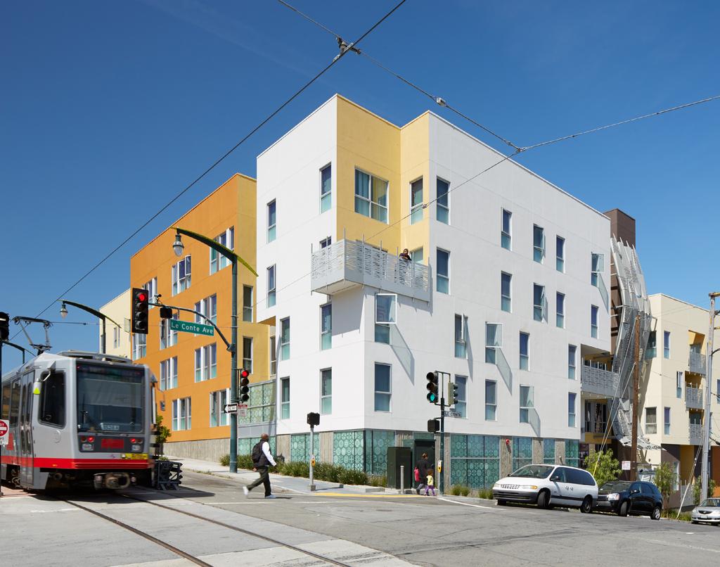


59 Jan 2015
APPROVED LONG-RANGE PROPERTY MANAGEMENT PLAN MAJOR APPROVED DEVELOPMENT PROJECT MISSION BAY
 APPROVED LONG-RANGE PROPERTY MANAGEMENT PLAN MAJOR APPROVED DEVELOPMENT PROJECT MISSION BAY EXECUTIVE SUMMARY The Successor Agency to the Redevelopment Agency of the City and County of San Francisco (the
REPORT TO THE CITY COUNCIL OF THE CITY OF CONCORD/CITY COUNCIL SITTING AS THE SUCCESSOR AGENCY OF THE REDEVELOPMENT AGENCY
 AGENDA ITEM NO.5.a REPORT TO THE CITY COUNCIL OF THE CITY OF CONCORD/CITY COUNCIL SITTING AS THE SUCCESSOR AGENCY OF THE REDEVELOPMENT AGENCY TO THE HONORABLE MAYOR AND COUNCIL: DATE: September 8, 2015
LONG-RANGE PROPERTY MANAGEMENT PLAN. City of Twentynine Palms Successor Agency. A u g u s t 2 8,
 LONG-RANGE PROPERTY MANAGEMENT PLAN City of Twentynine Palms Successor Agency A u g u s t 2 8, 2 0 1 3 INTRODUCTION Assembly Bill (AB) 1484 requires all successor agencies to former redevelopment agencies
SUCCESSOR AGENCY TO THE REDEVELOPMENT AGENCY OF THE CITY OF SAN JOSE LONG RANGE PROPERTY MANAGEMENT PLAN
 SUCCESSOR AGENCY TO THE REDEVELOPMENT AGENCY OF THE CITY OF SAN JOSE LONG RANGE PROPERTY MANAGEMENT PLAN INTRODUCTION On June 28, 2012, Governor Jerry Brown signed into law Assembly Bill 1484 (AB 1484)
LONG-RANGE PROPERTY MANAGEMENT PLAN. Successor Agency to the Palm Springs Community Redevelopment Agency. D e c e m b e r 12,
 LONG-RANGE PROPERTY MANAGEMENT PLAN Successor Agency to the Palm Springs Community Redevelopment Agency D e c e m b e r 12, 2 0 1 3 TABLE OF CONTENTS INTRODUCTION... 1 EXECUTIVE SUMMARY... 1 STATEMENT
City of South San Francisco Page 1 of 5
 City of South San Francisco P.O. Box 711 (City Hall, 400 Grand Avenue) South San Francisco, CA Legislation Text Report regarding the Housing Standing Committee recommendation to consider selecting either
CITY OF MILLBRAE, ACTING AS SUCCESSOR TO THE MILLBRAE REDEVELOPMENT AGENCY MEETING OF THE OVERSIGHT BOARD
 CITY OF MILLBRAE, ACTING AS SUCCESSOR TO THE MILLBRAE REDEVELOPMENT AGENCY MEETING OF THE OVERSIGHT BOARD 2:00 p.m. Library Room B 1 Library Ave., Millbrae, CA 94030 BOARD MEMBERS (selected by) 1. Peggy
SUCCESSOR AGENCY TO THE FORMER DALY CITY REDEVELOPMENT AGENCY
 SUCCESSOR AGENCY TO THE FORMER DALY CITY REDEVELOPMENT AGENCY SPECIAL M E E T I N G City Hall Council Chambers 2 nd Floor 333 90 th Street, Daly City, CA 94015 MONDAY, MARCH 9, 2015-7:00 P.M. For those
Baldwin Park Successor Agency Long-Range Property Management Plan. Prepared for:
 Baldwin Park Successor Agency Long-Range Property Management Plan Prepared for: Baldwin Park Successor Agency August 28, 2014 Introduction A. Purpose of Long Range Property Management Plan As required
Special Meeting Agenda December 14, 2016
 Board Members Mr. James Harman, Chair Orange County Board of Supervisors Representative Mr. Al Shkoler, Vice Chair Placentia Library District Representative Mr. Craig Green, City of Placentia Mayor s Representative
MEETING LOCAL HOUSING NEEDS: HOUSING ELEMENT SNAPSHOTS ACROSS THE BAY AREA
 MEETING LOCAL HOUSING NEEDS: HOUSING ELEMENT SNAPSHOTS ACROSS THE BAY AREA November 2016 INFO@NONPROFITHOUSING.ORG 415.989.8160 @NPHANC 369 PINE ST., SUITE 350, SAN FRANCISCO ACKNOWLEDGMENTS: CO-AUTHORS:
Draft Plan Bay Area Housing and Employment Distribution Revisions June 10, 2013
 Item 3a Attachment 6 Draft Plan Bay Area Housing and Employment Distribution Revisions June 10, 2013 Minor modifications have been made to the housing and employment distributions in the Draft Plan Bay
Creative Approaches to Land Acquisition
 2007 Legislative Session Review CALIFORNIA TRANSIT ASSOCIATION JANUARY/FEBRUARY 2008 Creative Approaches to Land Acquisition Result From Creative Approaches to Land Acquisition It should not surprise anyone
A. SUMMARY OF SITE INVENTORY FINDINGS
 4. LAND INVENTORY A. SUMMARY OF SITE INVENTORY FINDINGS This chapter of the Housing Element presents an inventory of sites suitable for residential development in Oakland within the planning period of
TUSTIN. Long - Range Property. Management Plan. Successor Agency to the Tustin Community Redevelopment Agency BUILDING OUR FUTURE HONORING OUR PAST
 TUSTIN z 0 V y HISTORY a w BUILDING OUR FUTURE HONORING OUR PAST Long - Range Property Management Plan Successor Agency to the Tustin Community Redevelopment Agency Introduction Part 1. 85, Division 24
City of Oakland Programs, Policies and New Initiatives for Housing
 City of Oakland Programs, Policies and New Initiatives for Housing Land Use Policies General Plan Update In the late 1990s, the City revised its general plan land use and transportation element. This included
CITY OF SAN LEANDRO SUCCESSOR AGENCY OVERSIGHT BOARD. Cynthia Battenberg, Business Development Manager
 STAFF REPORT CITY OF SAN LEANDRO SUCCESSOR AGENCY OVERSIGHT BOARD DATE: September 25, 2012 TO: FROM: SUBJECT: Successor Agency Oversight Board Cynthia Battenberg, Business Development Manager Oversight
RESOLUTION NO. OB 14-02
 RESOLUTION NO. OB 14-02 A RESOLUTION OF THE OVERSIGHT BOARD OF THE SUCCESSOR AGENCY TO THE RANCHO CUCAMONGA REDEVELOPMENT AGENCY APPROVING THE AMENDED LONG-RANGE PROPERTY MANAGEMENT PLAN PREPARED BY THE
SUCCESSOR AGENCY TO THE WEST HOLLYWOOD COMMUNITY DEVELOPMENT COMMISSION
 SUCCESSOR AGENCY TO THE WEST HOLLYWOOD COMMUNITY DEVELOPMENT COMMISSION LONG-RANGE PROPERTY MANAGEMENT PLAN September 9, 2013 BACKGROUND On February 1, 2012, pursuant to Assembly Bill x1 26 ( AB x1 26
R&D Report. Bay Area Fourth Quarter 2015
 R&D Report Bay Area Fourth Quarter 2015 R&D Market Summary Area Building Available Space Rate Base Direct Sublease Total Q4-2015 Q4-2014 Average Asking Rate (NNN) San Mateo County 20,134,624 436,234 200,279
Appendix B: Supplemental Technical Information
 Appendix B: Supplemental Technical Information Draft Plan Bay Area Land Use Revision Requests and Final Modifications by Jurisdiction Table 1: Employment and Housing Modifications by Jurisdiction Housing
Prioritizing Publicly-Owned Lands as a Critical Resource For Affordable Housing Recommendations From GCC Public Lands Working to CASA
 BRIDGE Housing Eden Housing Iron Horse Prioritizing Publicly-Owned Lands as a Critical Resource For Affordable Housing Recommendations From GCC Public Lands Working to CASA December 2017 WHO WE ARE The
Appendix B: Housing Element Sites Inventory and Detailed Analysis
 Appendix B: 2015-2023 Housing Element Sites Inventory and Detailed Analysis Redwood City General This page intentionally left blank. Redwood City General Site Identifier Assessor Parcel Number General
APPROVED LONG-RANGE PROPERTY MANAGEMENT PLAN REMNANT PARCELS
 APPROVED LONG-RANGE PROPERTY MANAGEMENT PLAN REMNANT PARCELS EXECUTIVE SUMMARY The Successor Agency to the Redevelopment Agency of the City and County of San Francisco (the Successor Agency ) submits its
WORLD TRADE CENTER GARAGE 1245 Fifth Avenue
 AMENDED AND RESTATED RECOMMENDED ACTION 1. AB 1484 Permissible Use Category Sale of Property If permitted under SB 107, subsequent legislation, and/or DOF direction, Agency reserves right to administratively
Provide a diversity of housing types, responsive to household size, income and age needs.
 8 The City of San Mateo is a highly desirable place to live. Housing costs are comparably high. For these reasons, there is a strong and growing need for affordable housing. This chapter addresses the
per unit Live/Work 1 per unit None mentioned. MF 1 2 bdrms. MF 2+ bdrms* (Transit Oriented MU District) Single Unit, Two Unit, Multi Unit &
 Single Unit, Two Unit, Multi Unit &") TABLE 2 BAY AREA PARKING REQUIREMENTS AND EXCEPTIONS, BY CITY Benicia 26,997 Housing type Berkeley 112,580 Housing type 1.0 per unit or 1.0 per Number of units in 1,000 1,200 sf development El Cerrito
TABLE 2 BAY AREA PARKING REQUIREMENTS AND EXCEPTIONS, BY CITY Benicia 26,997 Housing type Berkeley 112,580 Housing type 1.0 per unit or 1.0 per Number of units in 1,000 1,200 sf development El Cerrito
AGENDA SUMMARY COUNTYWIDE OVERSIGHT BOARD FOR THE COUNTY OF SUTTER
 AGENDA SUMMARY COUNTYWIDE OVERSIGHT BOARD FOR THE COUNTY OF SUTTER Dan Flores Dave Shaw Robert Shemwell Tom Reusser Mazie Brewington Ryan Graham Darin Gale The Agenda is posted in the entrance of the County
Ideas + Action for a Better City learn more at SPUR.org. tweet about this #Oakland spubliclands
 Ideas + Action for a Better City learn more at SPUR.org tweet about this event: @SPUR_Urbanist #Oakland spubliclands Public Lands for Public Benefit: Updating Oakland s Policies on Disposition and Development
City of Bellflower Successor Agency Civic Center Drive Bellflower, CA
 December 14, 2015 16600 Civic Center Drive Bellflower, CA 90706 562-804-1424 Subject: Amendment #1 to Revised Long Range Property Management Plan Honorable Chair and Members of the Oversight Board: December
Staff Report. Victoria Walker, Director of Community and Economic Development
 10.c Staff Report Date: April 25, 2017 To: From: Reviewed by: Prepared by: Subject: City Council Valerie J. Barone, City Manager Victoria Walker, Director of Community and Economic Development John Montagh,
Final Report Funding Affordable Housing Near Transit in the Bay Area Region. May prepared for: The Great Communities Collaborative
 Final Report Funding Affordable Housing Near Transit in the Bay Area Region May 2017 prepared for: The Great Communities Collaborative TABLE OF CONTENTS TABLE OF CONTENTS... 2 TABLE OF TABLES... 3 TABLE
GETTING IT BUILT: OVERCOMING THE IMPLEMENTATION BARRIERS TO SMART GROWTH
 GETTING IT BUILT: OVERCOMING THE IMPLEMENTATION BARRIERS TO SMART GROWTH February 15, 2014 New Partners for Smart Growth Dena Belzer Challenges to Implementing Smart Growth The Typical Smart Growth Vision
DRAFT LONG-RANGE PROPERTY MANAGEMENT PLAN
 DRAFT LONG-RANGE PROPERTY MANAGEMENT PLAN CITY OF MODESTO REDEVELOPMENT SUCCESSOR AGENCY OCTOBER 2013 Prepared By: KOSMONT COMPANIES 865 S. Figueroa Street, #3500 Los Angeles, CA 90017 Telephone: (213)
CITY COUNCIL AGENDA REPORT
 CITY COUNCIL AGENDA REPORT TYPE OF ITEM: Report AGENDA ITEM NO.: 2 DATE: TO: City Council Successor Agency THROUGH: Greg Nyhoff City Manager FROM: Kymberly Horner Economic Development Director SUBJECT:
SANTA CLARA COUNTY RHNA SUBREGION TASK FORCE GUIDING PRINCIPLES - May 2018
 SANTA CLARA COUNTY RHNA SUBREGION TASK FORCE GUIDING PRINCIPLES - May 2018 Attachment A Vision For Santa Clara County and its cities to work collaboratively to produce more housing in the Region. have
Successor Agency to the Paradise Redevelopment Agency Meeting Agenda. 7:00 PM June 11, 2013
 Management Staff: Lauren Gill, Interim Town Manager Dwight L. Moore, Town Attorney Joanna Gutierrez, Town Clerk Craig Baker, Community Development Director Gabriela Tazzari-Dineen, Police Chief George
Sublease Occupied 11.33% Available Sublease Vacant 5.57% Available Occupied Direct 18.86% Availability Rate Breakdown Silicon Valley - All Products
 SILICON VALLEY All Product - First Quarter 2007 Total Current and Vacant Occupied Current Vacancy Availability Under Pending Date Direct Direct Sublease Rate Rate Construction Availability 1Q 2007 27,417,305
Response to the Santa Clara County Civil Grand Jury Report Affordable Housing Crisis Density Is Our Destiny
 September, 2018 Honorable Patricia Lucas Santa Clara County Superior Court 191 North First Street San Jose, CA 95113 Re: to the Santa Clara County Report Affordable Housing Crisis Density Is Our Destiny
Ohlone College Mission Blvd Mixed-Use Project OFFERING MEMORANDUM
 Mission Blvd Mixed-Use Project OFFERING MEMORANDUM TABLE OF CONTENTS TABLE OF CONTENTS THE DEVELOPMENT OFFERING THE PROPERTY DEVELOPMENT CONCEPT DEVELOPMENT APPROACH FREMONT OVERVIEW MAPS AND PHOTOS P.
Draft Strategy Plan Concepts. CAC Meeting #9
 Downtown San Leandro Transit-Oriented Development Strategy Draft Strategy Plan Concepts Discussion & Conclusions CAC Meeting #9 23 January 2007 Land Use Plan & Specific Areas New mixed-use districts Context-sensitive
OVERVIEW ALAMEDA COUNTY HOUSING NEEDS. Transportation & Planning Committee
 1 OVERVIEW ALAMEDA COUNTY HOUSING NEEDS Transportation & Planning Committee 1-21-16 Outline 2 Housing Crisis/Needs Problems Habitability Access Affordability Focus today Contributing Factors Responses
CHAPTER 23A: SURPLUS CITY PROPERTY ORDINANCE
 CHAPTER 23A: SURPLUS CITY PROPERTY ORDINANCE Sec. 23A.1. Sec. 23A.2. Sec. 23A.3. Sec. 23A.4. Sec. 23A.5. Sec. 23A.6. Sec. 23A.7. Sec. 23A.8. Sec. 23A.9. Sec. 23A.10. Sec. 23A.11. Sec. 23A.13. Sec. 23A.14.
Office Development Opportunity 125 Aspen Drive, Martinez, California
 Sale Price $400,000 Office Development Opportunity 125 Aspen Drive, Martinez, California Aspen Drive Brown Drive Micheal Tobin Kidder Mathews Senior Vice President mtobin@ 415.229.8974 LIC # 00414723 Tyler
MOTION NO. M Capitol Hill Site D Agreement with Seattle Central College and Capitol Hill Housing
 MOTION NO. M2017-145 Capitol Hill Site D Agreement with Seattle Central College and Capitol Hill Housing MEETING: DATE: TYPE OF ACTION: STAFF CONTACT: Board 11/16/2017 Final Action Don Billen, Acting Deputy
CHAPTER Committee Substitute for Committee Substitute for Senate Bill No. 2188
 CHAPTER 2004-372 Committee Substitute for Committee Substitute for Senate Bill No. 2188 An act relating to land development; amending s. 197.502, F.S.; providing for the issuance of an escheatment tax
Staff Report. Victoria Walker, Director of Community and Economic Development
 9.c Staff Report Date: June 7, 2016 To: From: Reviewed by: Prepared by: Subject: City Council Valerie J. Barone, City Manager Victoria Walker, Director of Community and Economic Development John Montagh,
AFFORDABLE HOUSING 101 SUBSIDIZED HOUSING DEVELOPMENT AND FINANCING OVERVIEW. September 18, 2017 Housing Subcommittee
 1 AFFORDABLE HOUSING 101 SUBSIDIZED HOUSING DEVELOPMENT AND FINANCING OVERVIEW September 18, 2017 Housing Subcommittee Developing Subsidized Housing 2 The process and requirements of developing subsidized
OFFICE BUILDING INVESTMENT OPPORTUNITY PALO ALTO DOWNTOWN CALIFORNIA. Actual Site
 OFFICE BUILDING INVESTMENT OPPORTUNITY DOWNTOWN PALO ALTO CALIFORNIA Actual Site EXCLUSIVELY MARKETED BY TOM POWER EXECUTIVE VICE PRESIDENT SRS REAL ESTATE PARTNERS 100 Pine Street, Suite 1550 San Francisco,
Background and Purpose
 DRAFT MEMORANDUM To: From: Perkins+Will James Musbach and Rebecca Benassini Subject: Affordable Housing Need and Supply, Downtown Concord Specific Plan, addendum to Existing Conditions Report; EPS #121118
SAN JOSE CAPITAL OF SILICON VALLEY
 COUNCIL AGENDA: 9/22/15 ITEM: q (J CITY OF SAN JOSE CAPITAL OF SILICON VALLEY Memorandum TO: HONORABLE MAYOR, CITY COUNCIL AND SUCCESSOR AGENCY BOARD FROM: Jacky Morales-Ferrand Jennifer A. Maguire SUBJECT:
When the Plan is not Enough
 When the Plan is not Enough Christine Maguire, AICP, EDFP Redevelopment Manager Planning & Community Development 1 Rail~Volution 2012 When the Plan is Not Enough: Garland, TX 16 October 2012 About the
The New Starts Grant and Affordable Housing A Roadmap for Austin s Project Connect
 The New Starts Grant and Affordable Housing A Roadmap for Austin s Project Connect Created for Housing Works by the Entrepreneurship and Community Development Clinic at the University of Texas School of
SanJose. Memorandum. \\[i[ Or. FROM: Jacky Morales-Ferrand TO: RULES AND OPEN GOVERNMENT COMMITTEE. SUBJECT: ALMADEN ROAD DATE: November 1, 2017
 RULES COMMITTEE: 11-8-17 ITEM: G.5. CITY OF SanJose CAPITAL OF SILICON VALLEY Memorandum TO: RULES AND OPEN GOVERNMENT COMMITTEE FROM: Jacky Morales-Ferrand SUBJECT: 15520 ALMADEN ROAD DATE: Date \\[i[
OAKLAND REDEVELOPMENT SUCCESSOR AGENCY LONG RANGE PROPERTY MANAGEMENT PLAN
 OAKLAND REDEVELOPMENT SUCCESSOR AGENCY LONG RANGE PROPERTY MANAGEMENT PLAN Approved by ORSA Board: Approved by Oakland Oversight Board: Approved by California Department of Finance: FIRST REVISED Per the
CIVIC CENTER PRIORITY DEVELOPMENT AREA (PDA) RESPONSES TO COMMUNITY QUESTIONS
 RESPONSES TO COMMUNITY QUESTIONS") CIVIC CENTER PRIORITY DEVELOPMENT AREA RESPONSES TO COMMUNITY QUESTIONS August 29, 2013 INTRODUCTION This document presents a list of questions that have been raised by the community on the topic of the
CIVIC CENTER PRIORITY DEVELOPMENT AREA RESPONSES TO COMMUNITY QUESTIONS August 29, 2013 INTRODUCTION This document presents a list of questions that have been raised by the community on the topic of the
1265 Montecito Avenue Mountain View, California
 OFFERING MEMORANDUM Mountain View Redevelopment Site 1265 Montecito Avenue Mountain View, California NON-ENDORSEMENT & DISCLAIMER NOTICE NON-ENDORSEMENTS Marcus & Millichap is not affiliated with, sponsored
OFFICE OF THE CITY ADMINISTRATIVE OFFICER
 REPORT FROM OFFICE OF THE CITY ADMINISTRATIVE OFFICER Date: To: From: Reference: October 28, 2014 The Honorable Members of the City Council Miguel A. Santana, City Administrative Officer Chair Municipal
Transfers of Property Q Sound Transit did not transfer any properties subject to RCW (1)(b) during the first quarter of 2018.
(b) during the first quarter of 2018.") Sound Transit s Office of Land Use Planning & Development Transit Oriented Development Quarterly Status Report Q1 2018 Background RCW 81.112.350 requires Sound Transit to provide quarterly reports of any
Sound Transit s Office of Land Use Planning & Development Transit Oriented Development Quarterly Status Report Q1 2018 Background RCW 81.112.350 requires Sound Transit to provide quarterly reports of any
State Policy Options for Promoting Affordable Housing
 State Policy Options for Promoting Affordable Housing There are a number of different ways in which states can help expand the supply of affordable homes. These include: 1. Create enforceable rights to
PLANNING COMMISSION STAFF REPORT
 PLANNING COMMISSION STAFF REPORT REZONING CASE: RZ-16-001 REPORT DATE: March 8, 2016 CASE NAME: Trailbreak Partners Rezoning PLANNING COMMISSION DATE: March 16, 2016 ADDRESSES OF REZONING PROPOSAL: 5501
GENERAL PLAN UPDATE SPECIFIC AREAS OF THE CITY
 GENERAL PLAN UPDATE SPECIFIC AREAS OF THE CITY Background There are a total of 14 specific areas that are being reviewed as part of the update of the General Plan. Requests to review these areas came from
Greenfield Plaza Greenfield Avenue San Anselmo, California
 Greenfield Plaza 40-52 Greenfield Avenue San Anselmo, California $3,000,000 ±$368/SF ±8,62 Square Feet Exclusive Listing Agents HadenOngaro Executive Vice President hongaro@newmarkccarey.com 45.526.7649
PDA Investment & Growth Strategy
 PDA Investment & Growth Strategy 2014 Update Adopted The preparation of this report has been financed through a grant from the U.S. Department of Transportation and the Federal Highway Administration.
Parking Challenges and Trade-Offs
 Parking Challenges and Trade-Offs What is the best way to balance competing interests and priorities while updating the City s off street parking regulations? Updating off street parking regulations can
AB 346 (DALY) REDEVELOPMENT: HOUSING SUCCESSOR: LOW AND MODERATE INCOME HOUSING ASSET FUND JOINT AUTHOR ASSEMBLYMEMBER BROUGH
 REDEVELOPMENT: HOUSING SUCCESSOR: LOW AND MODERATE INCOME HOUSING ASSET FUND JOINT AUTHOR ASSEMBLYMEMBER BROUGH") AB 346 (DALY) REDEVELOPMENT: HOUSING SUCCESSOR: LOW AND MODERATE INCOME HOUSING ASSET FUND JOINT AUTHOR ASSEMBLYMEMBER BROUGH IN BRIEF Assembly Bill 346 would authorize a housing successor to use funds
AB 346 (DALY) REDEVELOPMENT: HOUSING SUCCESSOR: LOW AND MODERATE INCOME HOUSING ASSET FUND JOINT AUTHOR ASSEMBLYMEMBER BROUGH IN BRIEF Assembly Bill 346 would authorize a housing successor to use funds
Staff Report. Victoria Walker, Director of Community and Economic Development
 7.a Staff Report Date: July 11, 2017 To: From: Reviewed by: Prepared by: Subject: City Council Valerie J. Barone, City Manager Victoria Walker, Director of Community and Economic Development John Montagh,
Affordable Housing Glossary
 Affordable Housing Glossary Affordable housing is housing that costs 30% or less of a household s gross monthly income. Housing costs include rent, principal and interest, utilities, homeowner insurance,
APPROVED LONG RANGE PROPERTY MANAGEMENT PLAN MAJOR APPROVED DEVELOPMENT PROJECT HUNTERS POINT SHIPYARD/CANDLESTICK POINT
 APPROVED LONG RANGE PROPERTY MANAGEMENT PLAN MAJOR APPROVED DEVELOPMENT PROJECT HUNTERS POINT SHIPYARD/CANDLESTICK POINT EXECUTIVE SUMMARY The Successor Agency to the Redevelopment Agency of the City and
Civic San Diego Affordable Housing Master Plan
 Civic San Diego Affordable Housing Master Plan San Diego Housing Commission April 12, 2013 Affordable Housing Master Plan Guiding Principles 1. Maximize quality unit production with limited resources 2.
Planning Committee STAFF REPORT October 5, 2016 Page 2 of 4 jurisdictions adopt a surplus land resolution is excessive and recommending that it be rep
 Planning Committee STAFF REPORT Meeting Date: October 5, 2016 Subject Summary of Issues Recommendations Financial Implications Options Attachments (See PC Packet, dated 10/5/16 for Attachment A, Attachments
Downtown Development Focus Area: I. Existing Conditions
 Downtown Development Focus Area: I. Existing Conditions The Downtown Development Focus Area is situated along Route 1, south of the train tracks, except for the existing Unilever property. It extends west
Survey of Bay Area Cities Parking Requirements: Summary Report
 MTC Smart Growth Technical Assistance: Reform Campaign Survey of Bay Area Cities Requirements: Summary Report Prepared by Dyett & Bhatia April 11, 2012 MTC Smart Growth Technical Assistance: Reform Campaign
LONG RANGE PROPERTY MANAGEMENT PLAN
 LONG RANGE PROPERTY MANAGEMENT PLAN PREPARED BY: October 20, 2015 TABLE OF CONTENTS I. Background.2 Real Property Asset Inventory 2 III. Proposed Disposition of Capital Assets 4 IV. Approach and Process
Civic San Diego Affordable Housing Master Plan
 Civic San Diego Affordable Housing Master Plan San Diego Housing Commission Board Workshop February 15, 2013 Redevelopment Dissolution Redevelopment agencies eliminated on February 1, 2012 Tax Increment
RD:SSL:JMD 11/23/2015 RESOLUTION NO.
 RD:SSL:JMD 11/23/2015 RESOLUTION NO. A RESOLUTION OF THE COUNCIL OF THE CITY OF SAN JOSE AMENDING THE NORTH SAN JOSE AREA DEVELOPMENT POLICY RELATED TO REDUCED TRAFFIC IMPACT FEES TO (1) EXTEND THE DEADLINE
City of Winnipeg Housing Policy Implementation Plan
 The City of Winnipeg s updated housing policy is aligned around four major priorities. These priorities are highlighted below: 1. Targeted Development - Encourage new housing development that: a. Creates
CITY COUNCIL AGENDA REPORT
 L.4 CITY COUNCIL AGENDA REPORT TYPE OF ITEM: Report AGENDA ITEM NO.: 4 DATE: May 22, 2018 TO: City Council Successor Agency THROUGH: Scott Whitney Interim City Manager FROM: Kymberly Horner Economic Development
City of Watsonville Community Development Department M E M O R A N D U M
 CITY COUNCIL 9.A.1. City of Watsonville Community Development Department M E M O R A N D U M DATE: February 8, 2016 TO: FROM: SUBJECT: Charles A. Montoya, City Manager Keith Boyle, Acting Community Development
Housing Broward An Inclusive Housing Plan
 Housing Broward An Inclusive Housing Plan THE COORDINATING COUNCIL OF BROWARD BROWARD HOUSING COUNCIL JULY 2017 The Coordinating Council of Broward County Chairperson, Senator (Commissioner) Nan Rich Executive
Sound Transit s Office of Land Use Planning & Development Transit Oriented Development Quarterly Status Report Q2 2018
 Sound Transit s Office of Land Use Planning & Development Transit Oriented Development Quarterly Status Report Q2 2018 Background RCW 81.112.350 requires Sound Transit to provide quarterly reports of any
Neighborhood Renewal Program Policies and Procedures
 Neighborhood Renewal Program Policies and Procedures City of Mobile Neighborhood Renewal Program Policies and Procedures Table of Contents I. Mission Statement A. The New Plan for Old Mobile B. Goals and
Bylaw No , being "Official Community Plan Bylaw, 2016" Schedule "A" DRAFT
 Bylaw No. 2600-2016, being "Official Community Plan Bylaw, 2016" Schedule "A" Urban Structure + Growth Plan Urban Structure Land use and growth management are among the most powerful policy tools at the
S C O T T OFFERING MEMORANDUM 3265 EL CAMINO REAL PALO ALTO CALIFORNIA
 OFFERING MEMORANDUM C A R E L i c e n s e # 0 1 2 7 1 9 1 2 Disclaimer: The information contained herein has been obtained from sources deemed reliable but has not been verified and no guarantee, warranty
TRANS MITTAL DATE. To: Council From: hair, Municipal Facilities Committee
 To: Council From: Municipal Facilities Committee TRANS MITTAL DATE 10-30-17 COUNCIL FILE NO. 13-1090 COUNCIL DISTRICT All At its meeting of October 26, 2017, the Municipal Facilities Committee approved
SUMMARY, CONTEXT MATERIALS AND RECOMMENDATIONS AFFORDABLE HOUSING NEXUS STUDIES. Prepared for: City of Albany. Keyser Marston Associates, Inc.
 SUMMARY, CONTEXT MATERIALS AND RECOMMENDATIONS AFFORDABLE HOUSING NEXUS STUDIES Prepared for: City of Albany Prepared by: Keyser Marston Associates, Inc. December 2016 TABLE OF CONTENTS Page I. INTRODUCTION...
Amended Long Range Property Management Plan. Successor Agency to the Former Redevelopment Agency of the City of Stockton
 Amended Long Range Property Management Plan Successor Agency to the Former Redevelopment Agency of the City of Stockton December 16, 2015 Amended Long Range Property Management Plan Successor Agency
CALIFORNIA TAX DISCLOSURE REPORT
 JCP Report No.: 2005012800004 Page: 1 of 8 CALIFORNIA TAX DISCLOSURE REPORT Property Address: 49 MINERVA ST, SAN FRANCISCO Assessors Parcel Number: 7094-047 Table of Contents Description of Property Tax
PROPOSED METRO JOINT DEVELOPMENT PROGRAM: POLICIES AND PROCESS July 2015 ATTACHMENT B
 PROPOSED METRO JOINT DEVELOPMENT PROGRAM: POLICIES AND PROCESS ATTACHMENT B TABLE OF CONTENTS I. INTRODUCTION / PURPOSE............................ 3 II. OBJECTIVES / GOALS..................................
4.13 Population and Housing
 Environmental Impact Analysis Population and Housing 4.13 Population and Housing 4.13.1 Setting This section evaluates the impacts to the regional housing supply and population growth associated with implementation
Memo to the Planning Commission JULY 12TH, 2018
 Memo to the Planning Commission JULY 12TH, 2018 Topic: California State Senate Bill 828 and State Assembly Bill 1771 Staff Contacts: Joshua Switzky, Land Use & Housing Program Manager, Citywide Division
SUNNYVALE RESEARCH »»» CENTER »»» EAST ARQUES, SUNNYVALE, CALIFORNIA EXECUTIVE SUMMARY
 SUNNYVALE RESEARCH»»» CENTER»»» 1050-1090 EAST ARQUES, SUNNYVALE, CALIFORNIA EXECUTIVE SUMMARY EXECUTIVE SUMMARY PROJECT OVERVIEW Colliers International, as Exclusive Advisor, is pleased to present the
Broadway Corridor Framework Plan Pearl District Business Association November 10, 2015
 Broadway Corridor Framework Plan Pearl District Business Association November 10, 2015 Opportunity Central City Growth 2035 ~21,500 new households ~42,500 new jobs USPS Site Redevelopment ~2,400 new households
INFORMATION SUBJECT: UPDATE ON COMMUNITY ENGAGEMENT PLAN FOR PROPOSED GOOGLE DEVELOPMENT AT DIRIDON STATION
 city of C: San Iose CAPITAL OF SILICON VALLEY TO: HONORABLE MAYOR AND CITY COUNCIL Memorandum FROM: Kim Walesh Lee Wilcox SUBJECT: SEE BELOW DATE: December 19, 2017 Approved \ Date V; Tv ' - INFORMATION
Town of Yucca Valley GENERAL PLAN 1
 Town of Yucca Valley GENERAL PLAN 1 This page intentionally left blank. 3 HOUSING ELEMENT The Housing Element is intended to guide residential development and preservation consistent with the overall values
Strategies for Engaging Residents in Bay Area Preservation Efforts. NPH Annual Conference September 21, 2018
 Strategies for Engaging Residents in Bay Area Preservation Efforts NPH Annual Conference September 21, 2018 What is Acquisition-Rehab? Purchasing and securing the affordability of housing that is currently
TOD and Equity. TOD Working Group. James Carras Carras Community Investment, Inc. August 7, 2015
 TOD and Equity TOD Working Group James Carras Carras Community Investment, Inc. August 7, 2015 What is Equitable TOD? Equity is fair and just inclusion. Equitable TOD is the precept that investments in
7. IMPLEMENTATION STRATEGIES
 7. IMPLEMENTATION STRATEGIES A. GENERAL APPROACH FOR IMPLEMENTATION Implementing the plan will engage many players, including the Municipality of Anchorage (MOA), the Government Hill Community Council,
Creating a Brighter Future in the Post-Redevelopment Era
 Creating a Brighter Future in the Post-Redevelopment Era Property Disposition Management Strategies & Policy Issues Sponsored by: Workshop Objectives AB 1484 offers an opportunity! At this workshop, we
MISSION STATEMENT LCLB PURPOSE PRIORITIES & POLICIES. 1. Policies Governing the Acquisition of Properties
 MISSION STATEMENT The LAWRENCE COUNTY LAND BANK (LCLB) will strategically acquire distressed properties and return them to productive, tax-paying use. The LCLB will: reduce blight; stabilize neighborhoods