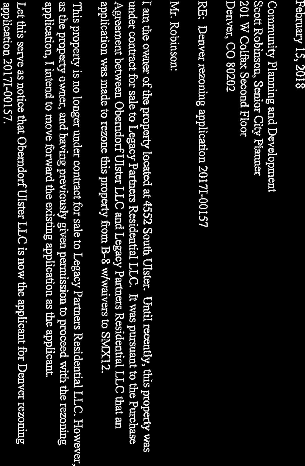
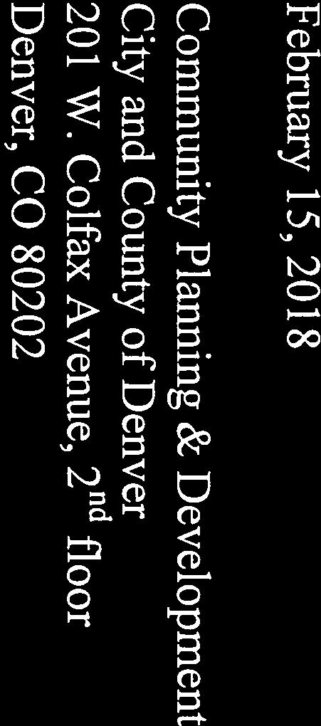
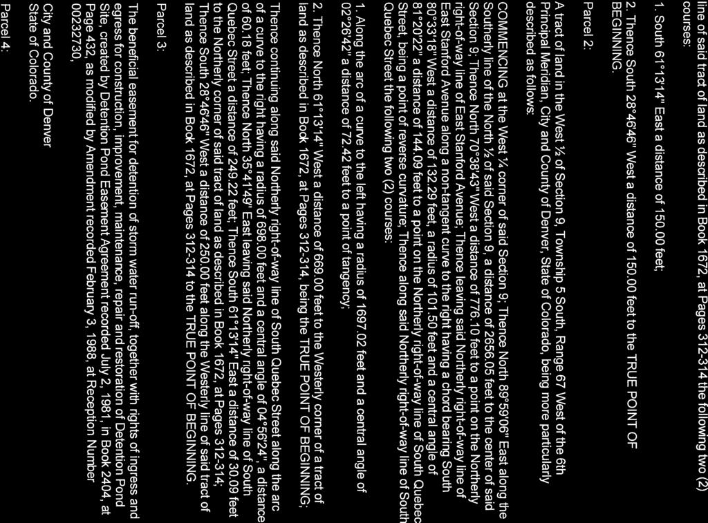
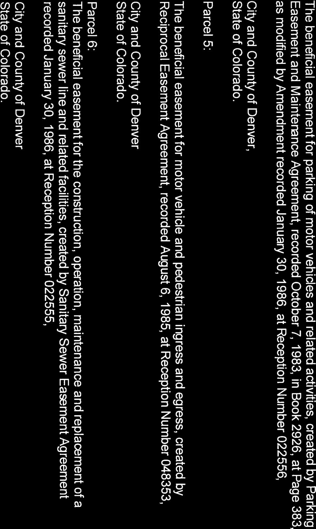
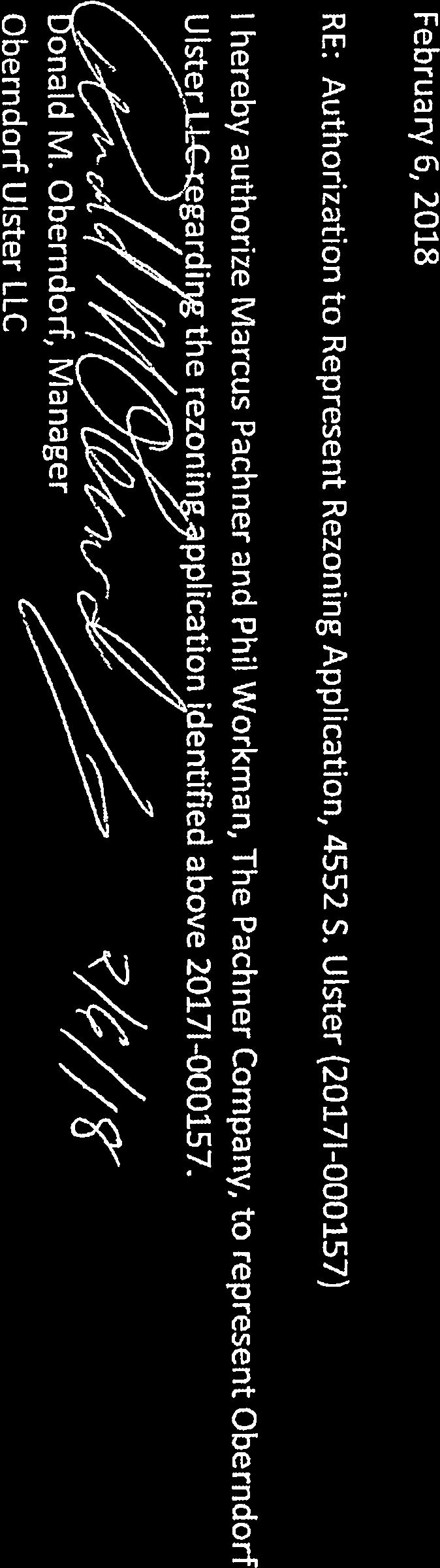
Land Use, Transportation, and Infrastructure Committee of the Denver City Council FROM: Scott Robinson, Senior City Planner DATE: March 22, 2018 RE:
|
|
|
- Brett Wells
- 5 years ago
- Views:
Transcription
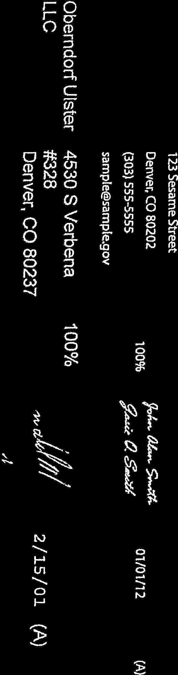
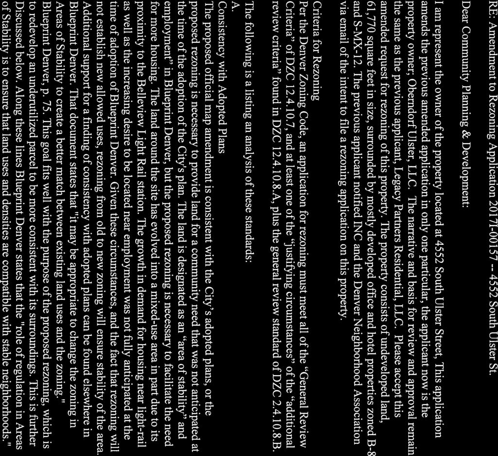
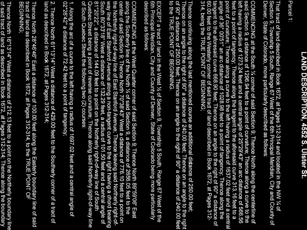
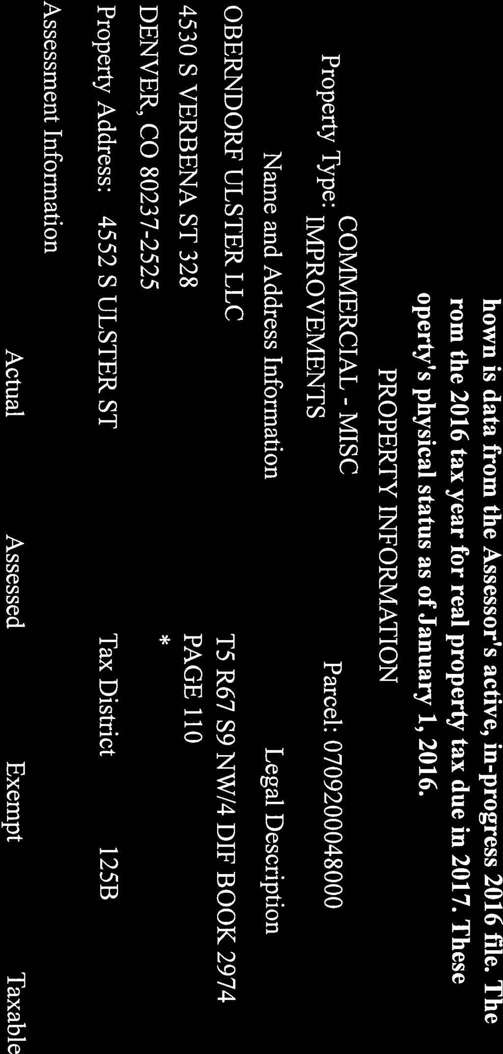
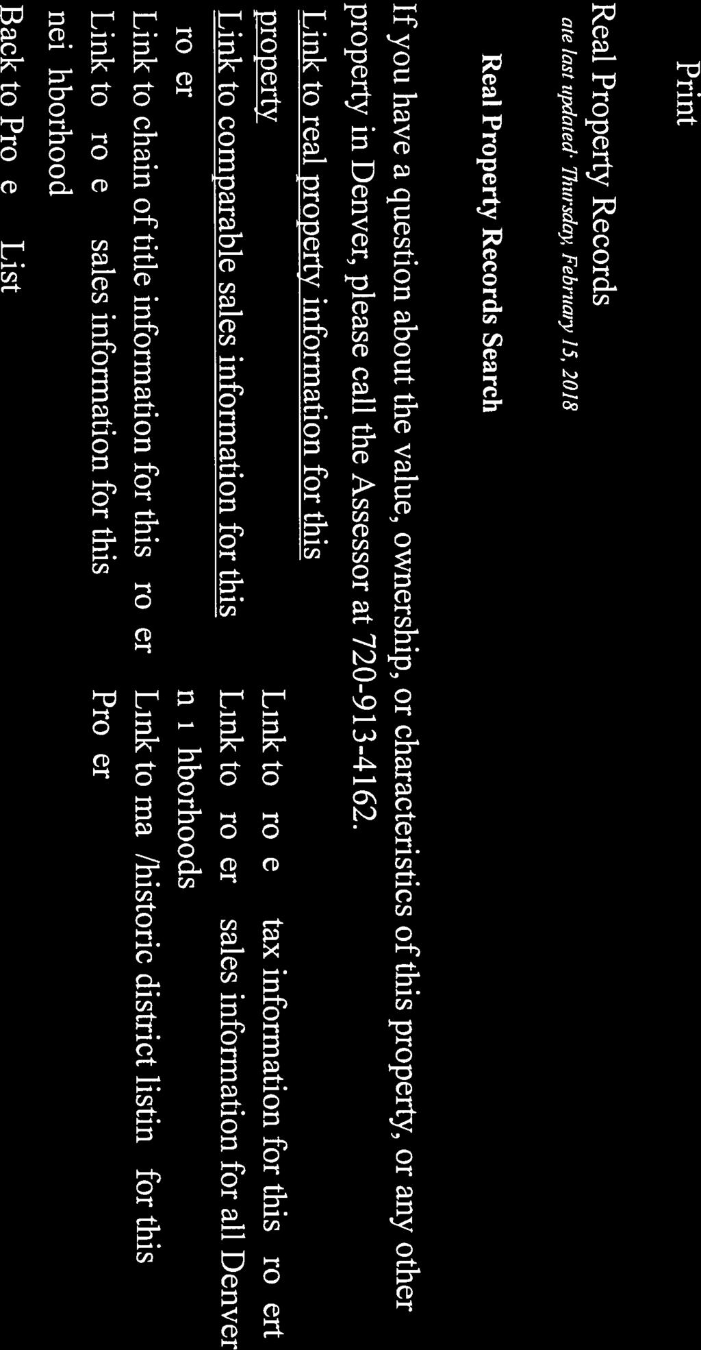
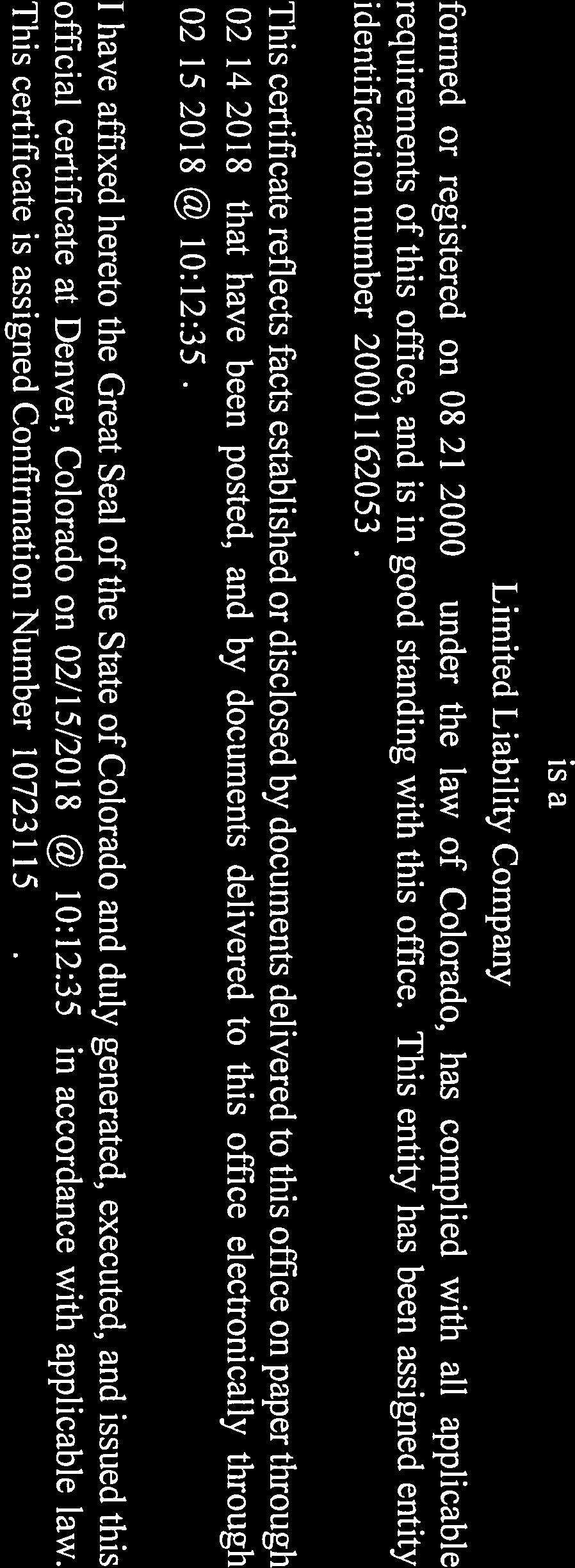
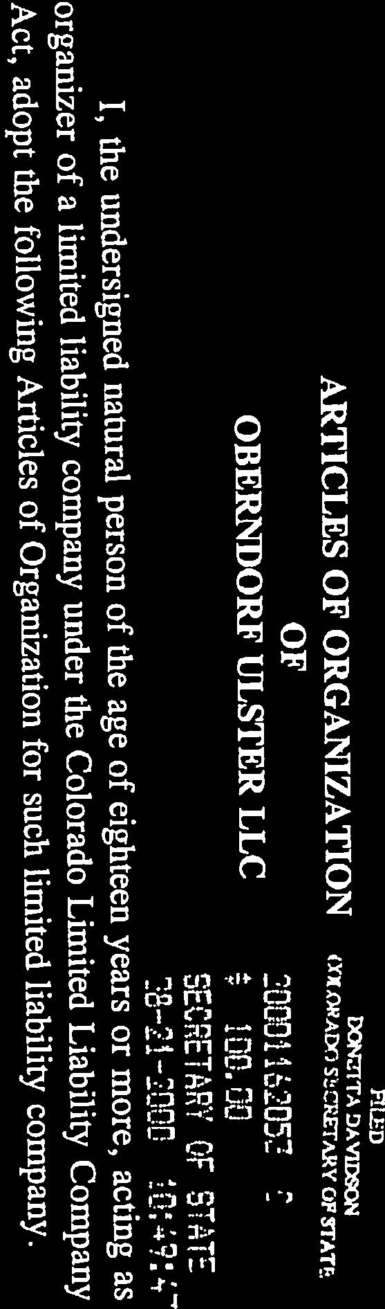
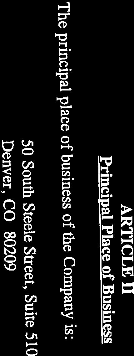
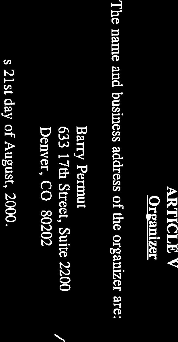
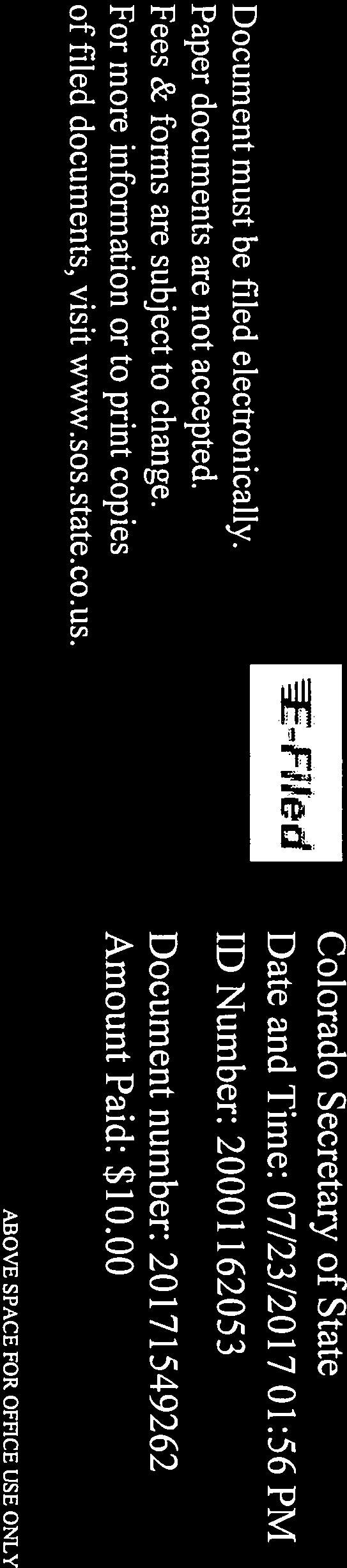
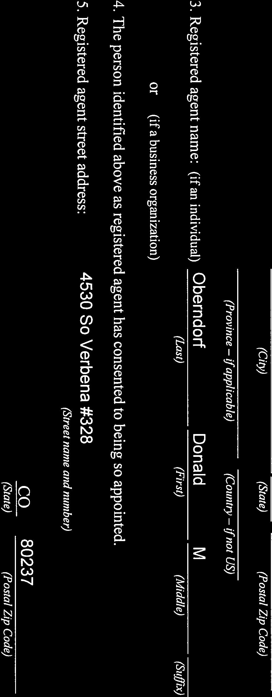
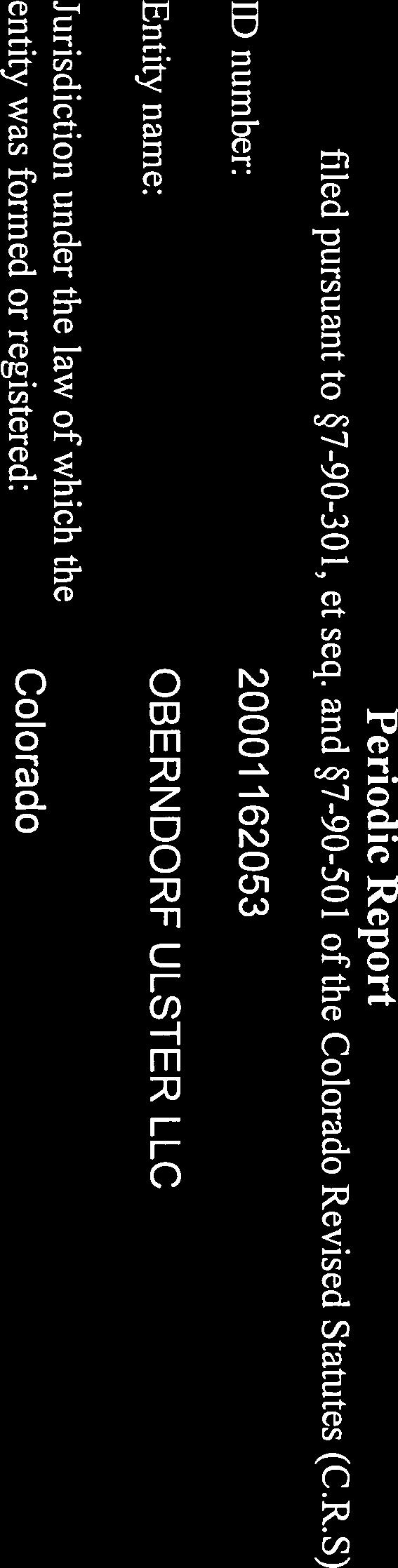
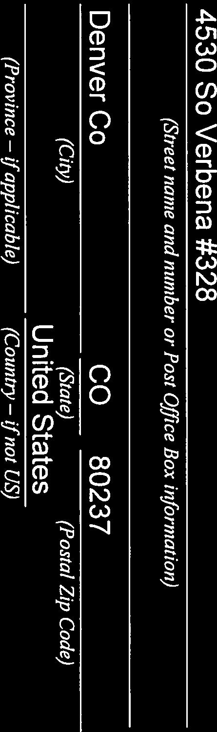
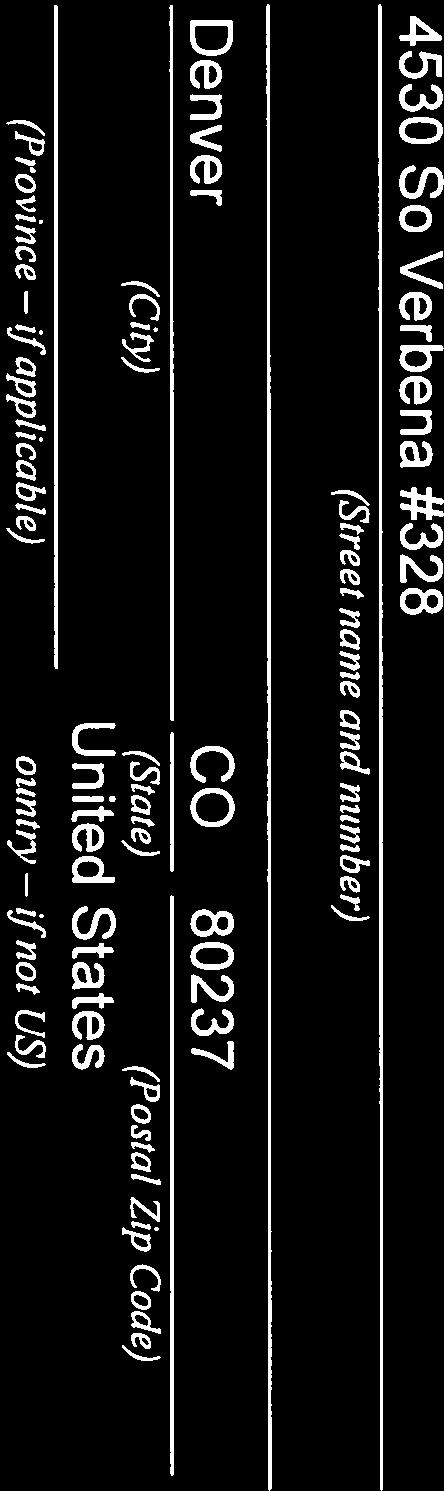
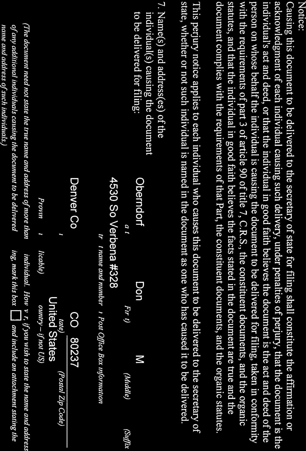
1 Community Planning and Development Planning Services 201 W. Colfax Ave., Dept. 205 Denver, CO p: f: TO: Land Use, Transportation, and Infrastructure Committee of the Denver City Council FROM: Scott Robinson, Senior City Planner DATE: March 22, 2018 RE: Official Zoning Map Amendment Application #2017I Staff Report and Recommendation Based on the criteria for review in the Denver Zoning Code, Staff recommends approval for Application #2017I Request for Rezoning Address: 4552 S. Ulster Street Neighborhood/Council District: Hampden South / Council District 4 RNOs: Inter-Neighborhood Cooperation (INC) Area of Property: 1.4 acres Current Zoning: B-8 with waivers, UO-1, UO-2 Proposed Zoning: S-MX-12 Property Owner(s): Oberndorf Ulster, LLC Owner Representative: Phil Workman Summary of Rezoning Request The property is located in the Hampden South neighborhood, along S. Ulster St. just south of Interstate 225 in the Denver Tech Center. There is currently a parking lot on a portion of the property, and the remainder of the property is vacant. The applicant is requesting the map amendment to facilitate development of the property. The S-MX-12 (Suburban Neighborhood, Mixed Use, 12 story) zone district is intended to promote safe, active, pedestrian-scaled diverse areas within and around the city s neighborhoods. Further details of the zone districts can be found in Article 3 of the Denver Zoning Code (DZC).


2 Rezoning Application #2017I S. Ulster St. March 22, 2018 Page 2

3 Rezoning Application #2017I S. Ulster St. March 22, 2018 Page 3 Existing Context The property is at the north end of the Denver Tech Center, which includes a mix of office, multi-unit residential, retail, and hotels. Surrounding the subject property are mid-rise and high-rise office buildings, parking garages, an electrical substation, a small pond, and Interstate 225. Across I-225 to the north are multi-unit residential and commercial developments. There is RTD bus service on S. Ulster St.
4 Rezoning Application #2017I S. Ulster St. March 22, 2018 Page 4 and the Belleview Station serving the E, F, and R light rail lines is a half-mile to the southwest. Wallace Park and the Goldsmith Gulch Trail are about a quarter-mile to the east. The following table summarizes the existing context proximate to the subject site: Site North South East West Existing Zoning B-8 w/ waivers UO-1, UO-2 S-MX-12 UO-1, UO-2 B-8 w/ waivers UO-1, UO-2 B-8 w/ waivers UO-1, UO-2 S-MX-12 UO-1, UO-2; B-8 UO-1, UO-2 Existing Land Use Surface parking and vacant Vacant and rightof-way Office and structured parking Office and structured parking Surface parking and electrical substation Existing Building Form/Scale None None 6-story office building and 4-level parking garage 16-story office building and 4-level parking garage None Existing Block, Lot, Street Pattern Irregular street grid with large blocks; Ulster Street connects under I-225 to the north. Block shapes are inconsistent. Vehicle parking around buildings in surface lots and garages. Connections within blocks provided by interior drives accessed from the street.

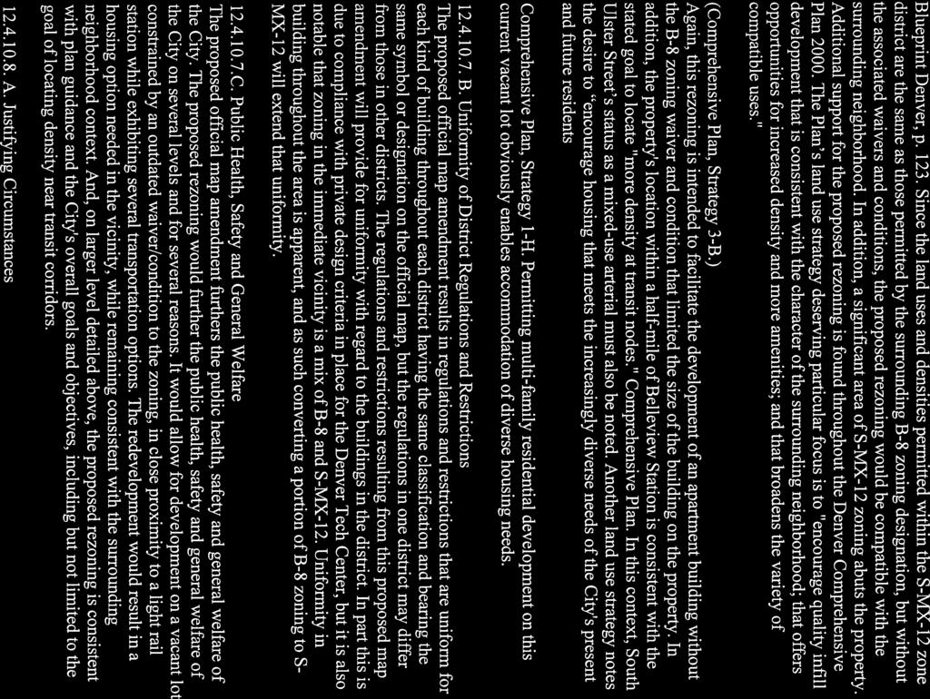
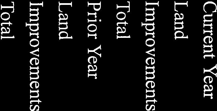
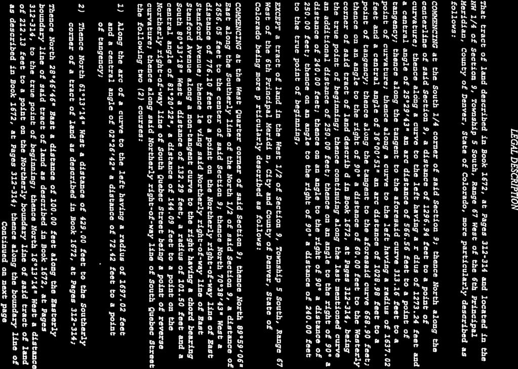
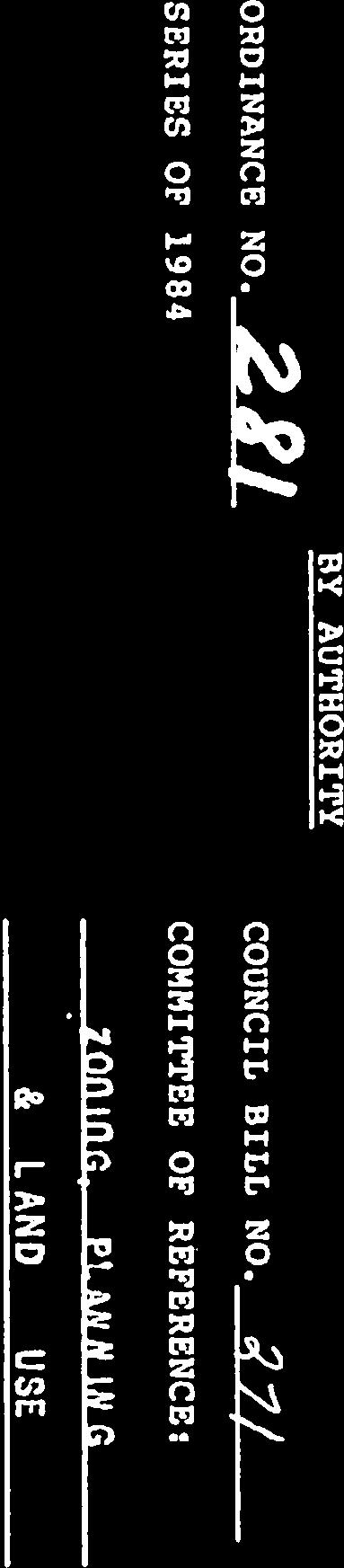
5 Rezoning Application #2017I S. Ulster St. March 22, 2018 Page 5 1. Existing Zoning The B-8 is zone district is part of the Former Chapter 59 (FC59) zoning code. The property was not rezoned as part of the citywide rezoning in 2010 because of the waivers included in the zoning. The B-8 zone district allows a wide range of uses, including single-unit and multi-unit residential, office, retail, industrial, and civic. Development in the B-8 zone district is governed by floor area ratio (FAR), with a base allowance of four square feet of building for each square foot of lot, with additional square footage allowed for providing plazas, arcades, moderately

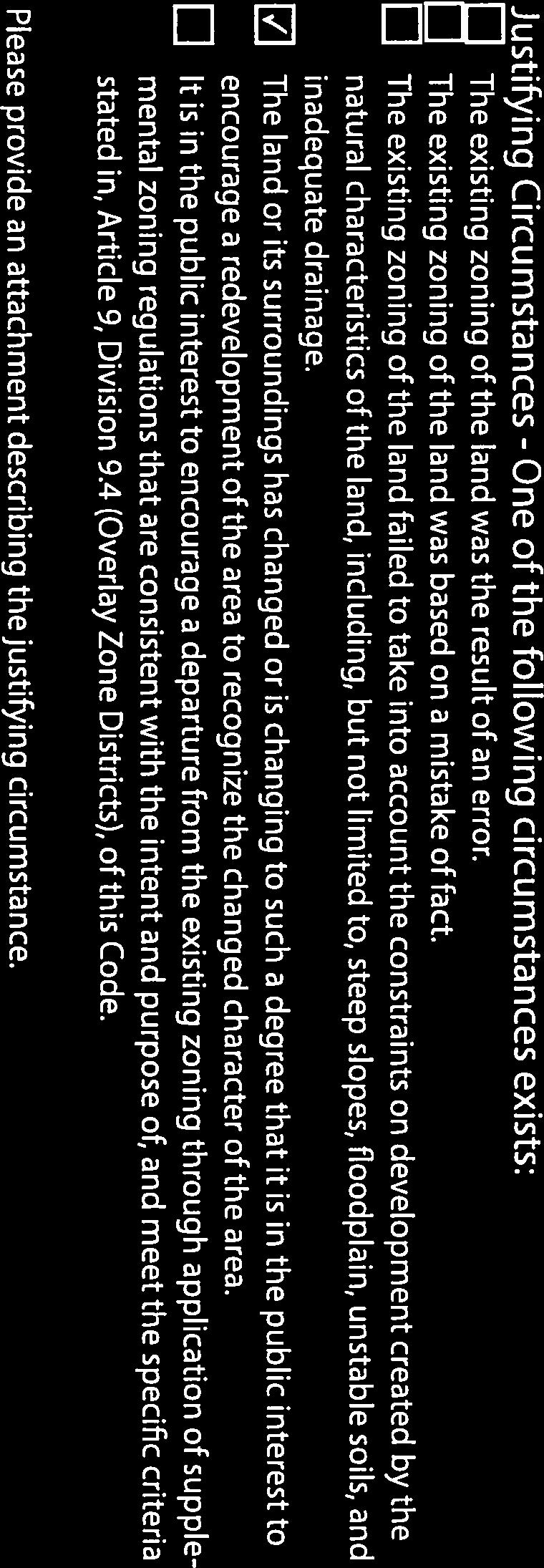
6 Rezoning Application #2017I S. Ulster St. March 22, 2018 Page 6 priced dwelling units, and limiting light pollution. In addition, the code requires 50 square feet of open space on the lot for each dwelling unit in multi-unit residential structures. There is no specified maximum height or setback requirements, and parking requirements vary by use. After rezoning into the Denver Zoning Code, the UO-1 use overlay would allow adult uses and the UO-2 overlay would allow billboards, subject to limitations, if the overlays were retained. The zoning waivers on the property are set forth in Ordinance No. 281 from There are five waivers in the ordinance. The first prohibits billboards and adult uses on the property. The second limits the developable floor area to 152,550 square feet, where the base FAR allowance of 4 to 1 would allow 247,420 square feet. The third waiver limits the height of structures on the property to 210 feet. The fourth allows a maximum of 70 percent of the site to have structures on it. The final waiver requires an approved Planned Building Group before development can occur on the site. 2. Existing Land Use Map


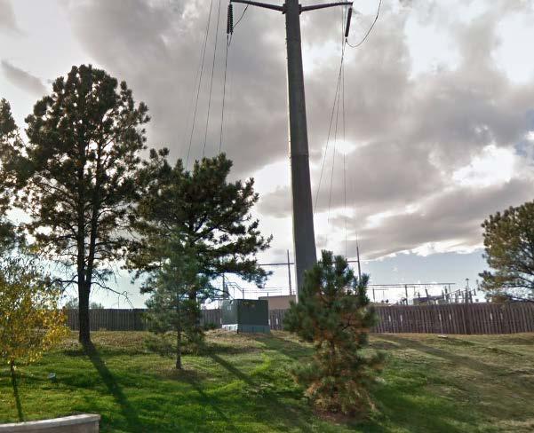
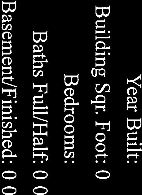
7 Rezoning Application #2017I S. Ulster St. March 22, 2018 Page 7 3. Existing Building Form and Scale Site from Ulster St. North from Ulster St. South from Ulster St. East from Ulster St. West from Ulster St. Source: Google Maps
8 Rezoning Application #2017I S. Ulster St. March 22, 2018 Page 8 Summary of City Agency Referral Comments As part of the DZC review process, the rezoning application is referred to potentially affected city agencies and departments for comment. A summary of agency referral responses follows: Asset Management: Approved No comments. Department of Public Health and Environment: Approved Please see comments below: Notes. The Denver Department of Public Health and Environment (DDPHE) concurs with the rezoning request and is not aware of environmental conditions of concern on the property that would affect the rezoning request. General Notes: Most of Colorado is high risk for radon, a naturally occurring radioactive gas. Due to concern for potential radon gas intrusion into buildings, DEH suggests installation of a radon mitigation system in structures planned for human occupation or frequent use. It may be more cost effective to install a radon system during new construction rather than after construction is complete. If renovating or demolishing existing structures, there may be a concern of disturbing regulated materials that contain asbestos or lead-based paint. Materials containing asbestos or leadbased paint should be managed in accordance with applicable federal, state and local regulations. Denver s Noise Ordinance (Chapter 36 Noise Control, Denver Revised Municipal Code) identifies allowable levels of noise. Properties undergoing Re-Zoning may change the acoustic environment, but must maintain compliance with the Noise Ordinance. Compliance with the Noise Ordinance is based on the status of the receptor property (for example, adjacent Residential receptors), and not the status of the noise-generating property. Violations of the Noise Ordinance commonly result from, but are not limited to, the operation or improper placement of HV/AC units, generators, and loading docks. Construction noise is exempted from the Noise Ordinance during the following hours, 7am 9pm (Mon Fri) and 8am 5pm (Sat & Sun). Variances for nighttime work are allowed, but the variance approval process requires 2 to 3 months. For variance requests or questions related to the Noise Ordinance, please contact Paul Riedesel, Denver Environmental Health ( ). Scope & Limitations: DDPHE performed a limited search for information known to DEH regarding environmental conditions at the subject site. This review was not intended to conform to ASTM standard practice for Phase I site assessments, nor was it designed to identify all potential environmental conditions. In addition, the review was not intended to assess environmental conditions for any potential right-of-way or easement conveyance process. The City and County of Denver provides no representations or warranties regarding the accuracy, reliability, or completeness of the information provided. Development Services Wastewater: Approve Rezoning Only - Will require additional information at Site Plan Review. It is not clear what the proposed changes are. Some narrative and exhibits would be useful to better understand just what changes are proposed. Are the parcels in these legal descriptions the same as before? Are there City easements that are proposed to be going away?
9 Rezoning Application #2017I S. Ulster St. March 22, 2018 Page 9 Public Works City Surveyor: Approved - No Comments. Public Review Process CPD informational notice of receipt of the rezoning application to all affected members of City Council and registered neighborhood organizations: Property legally posted for a period of 15 days and CPD written notice of the Planning Board public hearing sent to all affected members of City Council and registered neighborhood organizations: Planning Board unanimously recommended approval of the proposed map amendment: CPD written notice of the Land Use, Transportation and Infrastructure Committee meeting sent to all affected members of City Council and registered neighborhood organizations, at least ten working days before the meeting: Land Use, Transportation and Infrastructure Committee of the City Council review: Date 12/1/17 2/16/18 3/7/18 3/12/18 3/27/18 Property legally posted for a period of 21 days and CPD written notice of the City Council public hearing sent to all affected members of 4/13/18 City Council and registered neighborhood organizations (tentative): City Council Public Hearing (tentative): 5/7/18 o o Registered Neighborhood Organizations (RNOs) As of the date of this staff report, no comments have been received from RNOs. Other Public Comment As of the date of this staff report, no other comments have been received. Criteria for Review / Staff Evaluation The criteria for review of this rezoning application are found in DZC, Sections and , as follows:
10 Rezoning Application #2017I S. Ulster St. March 22, 2018 Page 10 DZC Section Consistency with Adopted Plans 2. Uniformity of District Regulations and Restrictions 3. Public Health, Safety and General Welfare DZC Section Justifying Circumstances 2. Consistency with Neighborhood Context Description, Zone District Purpose and Intent Statements 1. Consistency with Adopted Plans The following adopted plans apply to this property: Denver Comprehensive Plan 2000 Blueprint Denver (2002) Denver Comprehensive Plan 2000 The proposal is consistent with many Denver Comprehensive Plan strategies, including: Environmental Sustainability Strategy 2-F Conserve land by promoting infill development within Denver at sites where services and infrastructure are already in place; designing mixed use communities and reducing sprawl so that residents can live, work and play within their own neighborhoods. Land Use Strategy 3-B Encourage quality infill development that is consistent with the character of the surrounding neighborhood; that offers opportunities for increased density and more amenities; and that broadens the variety of compatible uses. Mobility Strategy 4-E Continue to promote mixed-use development, which enables people to live near work, retail and services. The proposed map amendment would enable mixed-use development at an infill location where services and infrastructure are already in place. The S-MX-12 zone district would allow increased density and a broad variety of uses consistent with the existing character of the area. The proposed rezoning is consistent with these plan recommendations. One strategy specifically addresses the Denver Tech Center area: Economic Activity 4-B Enhance existing business centers and establish new business centers in a manner that offers a variety of high-quality uses that support Denver s business environment, complements neighboring residential areas, generates public revenue, and creates jobs. Consider the following key strategies as top priorities: o Continue to enhance the Denver Technological Center, Denver s second largest employment center and home to many of the area s high-tech businesses. Help relieve congestion along the I-25/225 corridor by working toward a balance of jobs and housing within the DTC. Support pedestrian-friendly development links to the new light rail stations and further development of shuttle service within the center and to surrounding neighborhoods. [ ]

11 Rezoning Application #2017I S. Ulster St. March 22, 2018 Page 11 The proposed rezoning would enable mixed-use development within the Denver Tech Center area, enhancing an existing business center. The proposed map amendment is consistent with the recommendation of Denver Comprehensive Plan Blueprint Denver According to the 2002 Plan Map adopted in Blueprint Denver, this site has a concept land use of Employment and is located in an Area of Stability. Future Land Use
12 Rezoning Application #2017I S. Ulster St. March 22, 2018 Page 12 According to Blueprint Denver, Employment areas contain office, warehousing, light manufacturing and high tech uses such as clean manufacturing or information technology. Sometimes big-box retail is found in these areas. These areas are distinguished from mixed-use centers in that they have few residences and typically have more extensive commercial and some industrial activity (p. 39). The plan also indicates Employment areas should have average floor area ratios of 2.0 to 4.0 (p. 64). The proposed S-MX-12 zone district would allow a wide range of office and commercial uses, consistent with the plan recommendations. The S-MX-12 district also allows residential uses, which can be consistent with the Employment designation in limited amounts. The surrounding area is predominantly commercial, so even if this site were to be developed with residential uses, the broader area would still have a mix of uses consistent with its Employment designation. In addition, there are no zone districts within the Denver Zoning Code that do not allow residential uses while meeting the other plan goals, so the proposed S-MX-12 zone district is generally consistent with the plan. The S-MX-12 zone district would allow development of a use and scale consistent with the intent of the Employment designation of Blueprint Denver. Area of Change / Area of Stability Blueprint Denver designates the subject property as in an Area of Stability. According to the plan, the goal for Areas of Stability is to identify and maintain the character of an area while accommodating some new development and redevelopment (p. 120). The proposed S-MX-12 zoning would facilitate development of a vacant parcel at an intensity and scale that is consistent with the character of the Denver Tech Center. Street Classifications Blueprint Denver classifies Ulster Street as a Mixed-Use Arterial. According to the plan, Mixed-Use streets are intended for high-intensity mixed-use commercial, retail and residential areas with substantial pedestrian activity (p. 57). Blueprint describes Arterial streets as designed to provide a high degree of mobility and generally serve longer vehicle trips to, from, and within urban areas (p. 51). The proposed S-MX-12 zone district would allow mixed-use development of up to 12 stories, consistent with the Blueprint descriptions for Mixed-Use Arterials. The proposed map amendment is consistent with the future land use, Area of Stability, and street classification recommendations of Blueprint Denver. 2. Uniformity of District Regulations and Restrictions The proposed rezoning to S-MX-12 would result in the uniform application of zone district building form, use, and design regulations. 3. Public Health, Safety and General Welfare The proposed official map amendment furthers the public health, safety, and general welfare of the City primarily through implementation of the city s adopted land use plan. The proposed rezoning would
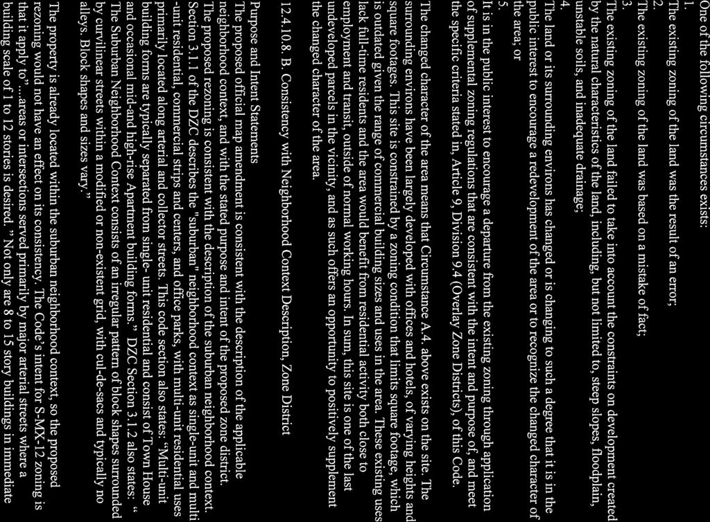
13 Rezoning Application #2017I S. Ulster St. March 22, 2018 Page 13 also facilitate the development of a vacant parcel, enhancing safety and improving welfare for the community. 4. Justifying Circumstance The application identifies several changed or changing conditions as the Justifying Circumstance under DZC Section A.4, The land or its surrounding environs has changed or is changing to such a degree that it is in the public interest to encourage a redevelopment of the area or to recognize the changed character of the area. The existing zoning was put in place in 1984 and significant changes have occurred in the area since then. The Denver Tech Center has continued to evolve into a diverse mixed-use development. Major transportation improvements, including the T-REX improvements to I- 25 and the extension of the Southeast line of the light rail, have also impacted the area. The character of the area has changed such that the requirements and restrictions of the existing B-8 zoning and its associated waivers are no longer appropriate. The proposed S-MX-12 zone district would allow development more consistent with the current character of the area. The proposed rezoning is justified to recognize the changed character of the area. 5. Consistency with Neighborhood Context Description, Zone District Purpose and Intent Statements The requested S-MX-12 zone district is within the Suburban Neighborhood Context. The neighborhood context generally consists of single-unit and multi-unit residential, commercial strips and centers, and office parks with an irregular block pattern and curvilinear streets (DZC, Division 3.1). The Denver Tech Center fits the description of a suburban commercial center and office park, and the proposed rezoning would allow development consistent with the description of the Suburban Neighborhood Context. According to the zone district intent stated in the Denver Zoning Code, the S-MX-12 district applies to areas or intersections served primarily by major arterial streets where a building scale of 1 to 12 stories is desired (DZC Section J). Ulster St., adjacent to the subject site, is designated as an arterial and the site is near both I-25 and I-225 in an area also served by transit. The proposed rezoning would allow development consistent with the intent of the S-MX-12 zone district. Attachments 1. Application 2. Existing zoning ordinance

14

15


16


17
18
19
20
21
22
23
24
25


26


27


28


29


30
31

32


33

34

35

36


37


38
39


40


41


42
Land Use, Transportation, and Infrastructure Committee of Denver City Council FROM: Scott Robinson, Senior City Planner DATE: December 6, 2018 RE:
 Community Planning and Development Planning Services 201 W. Colfax Ave., Dept. 205 Denver, CO 80202 p: 720.865.2915 f: 720.865.3052 www.denvergov.org/cpd TO: Land Use, Transportation, and Infrastructure
Denver City Council Land Use, Transportation, and Infrastructure Committee FROM: Courtney Levingston, Senior City Planner DATE: July 26, 2018 RE:
 TO: Denver City Council Land Use, Transportation, and Infrastructure Committee FROM: Courtney Levingston, Senior City Planner DATE: RE: Official Zoning Map Amendment Application #2017I-00151 Staff Report
Land Use, Transportation, & Infrastructure Committee of the Denver City Council FROM: Chandler Van Schaack, Senior City Planner DATE: July 3, 2018 RE:
 Community Planning and Development Planning Services TO: Land Use, Transportation, & Infrastructure Committee of the Denver City Council FROM: Chandler Van Schaack, Senior City Planner DATE: July 3, 2018
Official Zoning Map Amendment Application #2017I Gaylord Street and York Street Rezoning from U-RH-2.5 to U-RX-3 and U-RX-5
 Community Planning and Development Planning Services 201 W. Colfax Ave., Dept. 205 Denver, CO 80202 p: 720.865.2915 f: 720.865.3052 www.denvergov.org/cpd TO: Denver Planning Board FROM: Elizabeth Weigle,
Staff Report and Recommendation Based on the criteria for review in the Denver Zoning Code, Staff recommends approval for Application #2017I
 TO: Denver Planning Board, Joel Noble, Chair FROM: Theresa Lucero, Senior City Planner DATE: RE: Official Zoning Map Amendment Application #2017I-00163 Staff Report and Recommendation Based on the criteria
Official Zoning Map Amendment Application #2017I and 4889 South Quebec Street Rezoning from B-4 with waivers, UO-1, UO-2 to C-MX-20
 Community Planning and Development Planning Services 201 W. Colfax Ave., Dept. 205 Denver, CO 80202 p: 720.865.2915 f: 720.865.3052 www.denvergov.org/cpd TO: Denver Planning Board FROM: Jeff Hirt, Senior
Official Zoning Map Amendment Application #2018I-00120
 Community Planning and Development Planning Services 201 W. Colfax Ave., Dept. 205 Denver, CO 80202 p: 720.865.2915 f: 720.865.3052 www.denvergov.org/cpd TO: Denver Planning Board FROM: Scott Robinson,
Official Zoning Map Amendment Application #2017I-00094
 Community Planning and Development Planning Services 201 W. Colfax Ave., Dept. 205 Denver, CO 80202 p: 720.865.2915 f: 720.865.3052 www.denvergov.org/cpd TO: Denver Planning Board FROM: Scott Robinson,
Official Zoning Map Amendment Application #2018I-00067
 Community Planning and Development Planning Services 201 W. Colfax Ave., Dept. 205 Denver, CO 80202 p: 720.865.2915 f: 720.865.3052 www.denvergov.org/cpd TO: Denver Planning Board FROM: Courtney Levingston,
Brad Buchanan, Executive Director, Department of Community Planning and Development
 TO: City Council FROM: Jeff Hirt, Senior City Planner DATE: RE: Official Zoning Map Amendment Application #2017I-00076 3400 Arkins Ct., 3460 Arkins Ct., 1900 35 th St, 1930 35th St., 1950 35 th St Rezoning
Request for Rezoning. Current Zoning: Proposed Zoning:
 TO: Denver City Council, Neighborhoods and Planning Committee FROM: Theresa Lucero, Senior City Planner DATE: March 31, 2016 RE: Zoning Map Amendment #2015I-00150 Rezoning from M-RX-5 to I-MX-3 Community
Block bounded by Newton St., 17 th Ave., Lowell Blvd., and 16 th Ave.; plus Meade Street (evens only)
") Community Planning and Development Planning Services 201 W. Colfax Ave., Dept. 205 Denver, CO 80202 p: 720.865.2915 f: 720.865.3052 www.denvergov.org/cpd TO: Denver Planning Board FROM: Sara White, AICP,
Community Planning and Development Planning Services 201 W. Colfax Ave., Dept. 205 Denver, CO 80202 p: 720.865.2915 f: 720.865.3052 www.denvergov.org/cpd TO: Denver Planning Board FROM: Sara White, AICP,
Official Zoning Map Amendment Application #2018I-00095
 Community Planning and Development Planning Services 201 W. Colfax Ave., Dept. 205 Denver, CO 80202 p: 720.865.2915 f: 720.865.3052 www.denvergov.org/cpd TO: Denver Planning Board FROM: Ella Stueve, Senior
Staff Report and Recommendation Based on the criteria for review in the Denver Zoning Code, Staff recommends approval for application #2017I
 TO: Denver City Council, Land Use, Transportation and Infrastructure Committee FROM: Theresa Lucero, Senior City Planner DATE: RE: Official Zoning Map Amendment Application #2017I-00153 Staff Report and
Staff Report and Recommendation
 Community Planning and Development Planning Services 201 W. Colfax Ave., Dept. 205 Denver, CO 80202 p: 720.865.2915 f: 720.865.3052 www.denvergov.org/cpd TO: Denver Planning Board FROM: Andrew Webb, Senior
To: S-MX-8 AIO, S-MX-8A AIO, S-MX-12 AIO, C-MX-8 AIO, C-MX-12 AIO, and S-CC-5 AIO
 Community Planning and Development Planning Services 201 W. Colfax Ave., Dept. 205 Denver, CO 80202 p: 720.865.2915 f: 720.865.3052 www.denvergov.org/cpd TO: Denver City Council FROM: Curt Upton, Senior
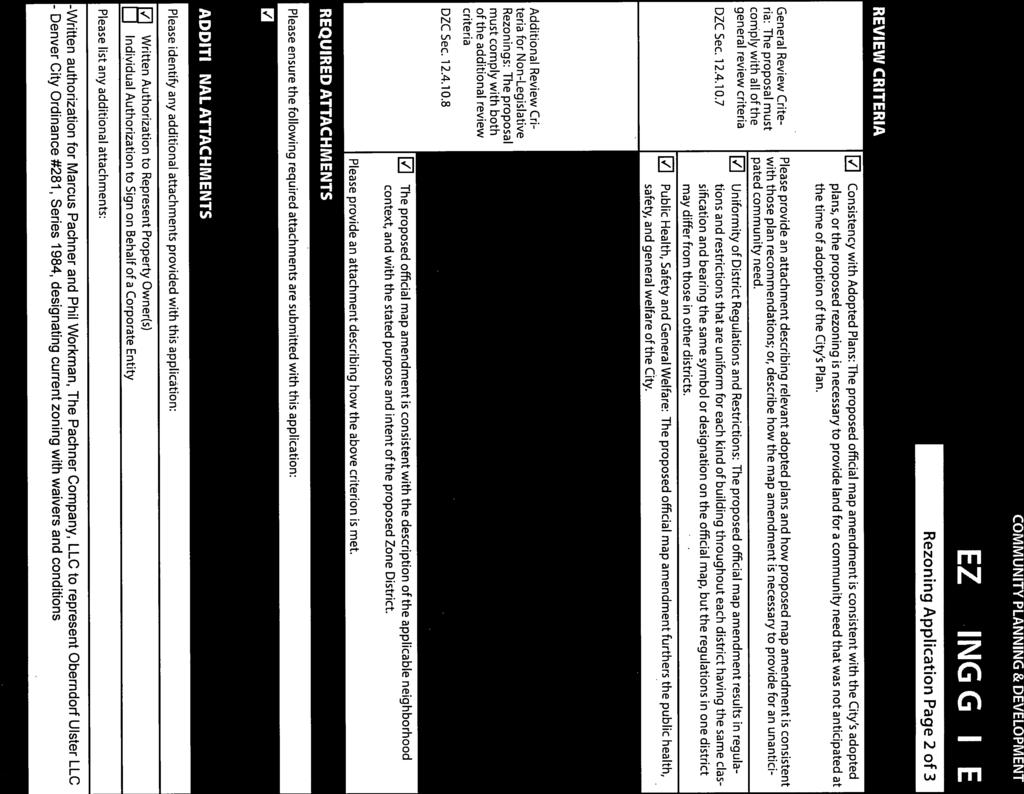
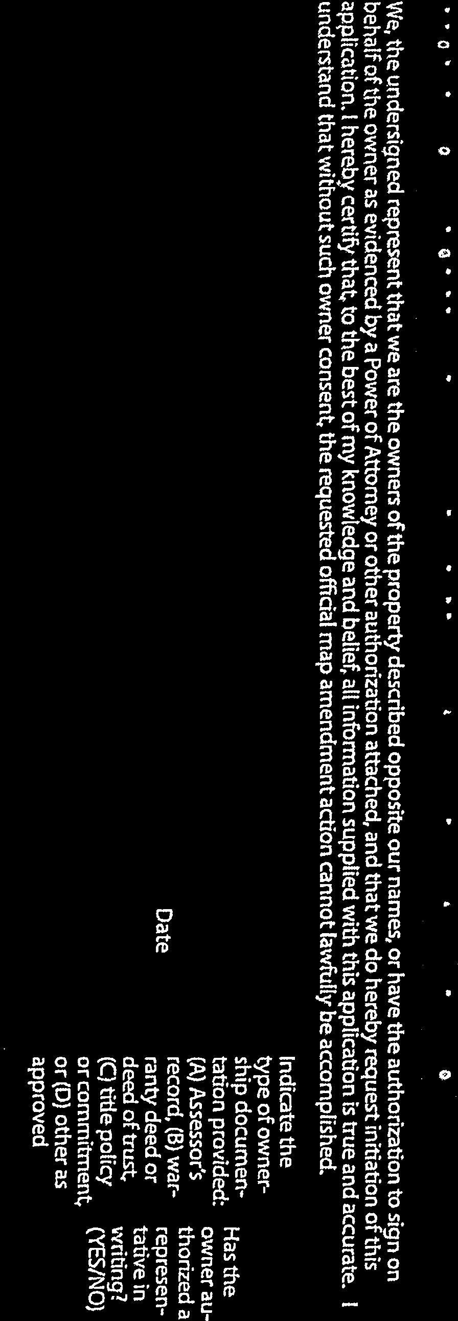
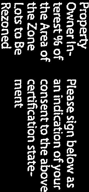
REZONING GUIDE. Zone Map Amendment (Rezoning) - Application. Rezoning Application Page 1 of 3. Return completed form to
 - Application. Rezoning Application Page 1 of 3. Return completed form to") Zone Map Amendment (Rezoning) - Application COMMUNITY PLANNING & DEVELOPMENT REZONING GUIDE Rezoning Application Page 1 of 3 PROPERTY OWNER INFORMATION* CHECK IF POINT OF CONTACT FOR APPLICATION Property
Zone Map Amendment (Rezoning) - Application COMMUNITY PLANNING & DEVELOPMENT REZONING GUIDE Rezoning Application Page 1 of 3 PROPERTY OWNER INFORMATION* CHECK IF POINT OF CONTACT FOR APPLICATION Property
Official Zoning Map Amendment Application #2017I-00090
 Community Planning and Development Planning Services 201 W. Colfax Ave., Dept. 205 Denver, CO 80202 p: 720.865.2915 f: 720.865.3052 www.denvergov.org/cpd TO: Land Use, Transportation, & Infrastructure
Based on the criteria for review in the Denver Zoning Code, Staff recommends approval for Application #2018I
 Community Planning and Development Planning Services 201 W. Colfax Ave., Dept. 205 Denver, CO 80202 p: 720.865.2915 f: 720.865.3052 www.denvergov.org/cpd TO: Denver Planning Board FROM: Chandler Van Schaack,
REZONING GUIDE. Zone Map Amendment (Rezoning) - Application. Rezoning Application Page 1 of 3. Return completed form to
 - Application. Rezoning Application Page 1 of 3. Return completed form to") COMMUNITY PLANNING & DEVELOPMENT REZONING GUIDE Rezoning Application Page 1 of 3 Zone Map Amendment (Rezoning) - Application PROPERTY OWNER INFORMATION* PROPERTY OWNER(S) REPRESENTATIVE** CHECK IF POINT
COMMUNITY PLANNING & DEVELOPMENT REZONING GUIDE Rezoning Application Page 1 of 3 Zone Map Amendment (Rezoning) - Application PROPERTY OWNER INFORMATION* PROPERTY OWNER(S) REPRESENTATIVE** CHECK IF POINT
Official Zoning Map Amendment Application #2015I Marion St. Rezoning from U-SU-A1 to U-MX-2x
 Community Planning and Development Planning Services 201 W. Colfax Ave., Dept. 205 Denver, CO 80202 p: 720.865.2915 f: 720.865.3052 www.denvergov.org/cpd TO: Denver City Council FROM: Courtland Hyser,
REZONING GUIDE. Zone Map Amendment (Rezoning) - Application. Rezoning Application Page 1 of 3. Return completed form to
 - Application. Rezoning Application Page 1 of 3. Return completed form to") Zone Map Amendment (Rezoning) - Application COMMUNITY PLANNING & DEVELOPMENT REZONING GUIDE Rezoning Application Page 1 of 3 PROPERTY OWNER INFORMATION* CHECK IF POINT OF CONTACT FOR APPLICATION Property
Zone Map Amendment (Rezoning) - Application COMMUNITY PLANNING & DEVELOPMENT REZONING GUIDE Rezoning Application Page 1 of 3 PROPERTY OWNER INFORMATION* CHECK IF POINT OF CONTACT FOR APPLICATION Property
REZONING GUIDE. Zone Map Amendment (Rezoning) - Application. Rezoning Application Page 1 of 3. Return completed form to
 - Application. Rezoning Application Page 1 of 3. Return completed form to") COMMUNITY PLANNING & DEVELOPMENT REZONING GUIDE Rezoning Application Page 1 of 3 Zone Map Amendment (Rezoning) - Application PROPERTY OWNER INFORMATION* PROPERTY OWNER(S) REPRESENTATIVE** CHECK IF POINT
COMMUNITY PLANNING & DEVELOPMENT REZONING GUIDE Rezoning Application Page 1 of 3 Zone Map Amendment (Rezoning) - Application PROPERTY OWNER INFORMATION* PROPERTY OWNER(S) REPRESENTATIVE** CHECK IF POINT
REZONING GUIDE. Zone Map Amendment (Rezoning) - Application. Rezoning Application Page 1 of 3. Return completed form to
 - Application. Rezoning Application Page 1 of 3. Return completed form to") Zone Map Amendment (Rezoning) - Application COMMUNITY PLANNING & DEVELOPMENT REZONING GUIDE Rezoning Application Page 1 of 3 PROPERTY OWNER INFORMATION* CHECK IF POINT OF CONTACT FOR APPLICATION Property
Zone Map Amendment (Rezoning) - Application COMMUNITY PLANNING & DEVELOPMENT REZONING GUIDE Rezoning Application Page 1 of 3 PROPERTY OWNER INFORMATION* CHECK IF POINT OF CONTACT FOR APPLICATION Property
Representative Name. Address. City, State, Zip. Telephone.
 COMMUNITY PLANNING & DEVELOPMENT ~~DENVER... THE MILE HIGH CITY REZONING GUIDE Zone Map Amendment (Rezoning)- Application Rezoning Application Page 1 of 3 Property Owner Name Philip M. Falco Address 730
City Council Land Use, Transportation, and Infrastructure Committee FROM: Jeff Hirt, Senior City Planner DATE: March 9, 2018 RE:
 TO: City Council Land Use, Transportation, and Infrastructure Committee FROM: Jeff Hirt, Senior City Planner DATE: March 9, 2018 RE: Official Zoning Map Amendment #2015I-00168 Community Planning and Development
Official Zoning Map Amendment Application #2015I N. King Street and 3441 W. 39 th Ave Rezoning from PUD 406 to U-SU-B1
 Community Planning and Development Planning Services 201 W. Colfax Ave., Dept. 205 Denver, CO 80202 p: 720.865.2915 f: 720.865.3052 www.denvergov.org/cpd TO: Neighborhoods and Planning Committee FROM:
Telephone AC / 21,960 SF G-MU-3 G-MX-3
 Zone Map Amendment (Rezoning) - Application PROPERTY OWNER INFORMATION* CHECK IF POINT OF CONTACT FOR APPLICATION Property Owner Name Siddhartha Rathod Address City, State, Zip Telephone Email COMMUNITY
REZONING GUIDE. Zone Map Amendment (Rezoning) - Application. Rezoning Application Page 1 of 3. Return completed form to
 - Application. Rezoning Application Page 1 of 3. Return completed form to") Zone Map Amendment (Rezoning) - Application COMMUNITY PLANNING & DEVELOPMENT REZONING GUIDE Rezoning Application Page 1 of 3 PROPERTY OWNER INFORMATION* CHECK IF POINT OF CONTACT FOR APPLICATION Property
Zone Map Amendment (Rezoning) - Application COMMUNITY PLANNING & DEVELOPMENT REZONING GUIDE Rezoning Application Page 1 of 3 PROPERTY OWNER INFORMATION* CHECK IF POINT OF CONTACT FOR APPLICATION Property
PALM BEACH COUNTY PLANNING, ZONING AND BUILDING DEPARTMENT ZONING DIVISION ZONING COMMISSION VARIANCE STAFF REPORT 06/05/2014
 PALM BEACH COUNTY PLANNING, ZONING AND BUILDING DEPARTMENT ZONING DIVISION ZONING COMMISSION VARIANCE STAFF REPORT 06/05/2014 APPLICATION NO. ZV-2013-03120 CODE SECTION REQUIRED PROPOSED VARIANCE (V1)
DZC and DRMC Amendments to Implement 38th and Blake Station Area Height Amendments
 DZC and DRMC Amendments to Implement 38th and Blake Station Area Height Amendments DZC Text Amendment #2 to establish River North Design Overlay (DO-7) / 38 th and Blake Incentive Overlay (IO-1) (CB18-0016)
Article 3. SUBURBAN (S-) NEIGHBORHOOD CONTEXT
 NEIGHBORHOOD CONTEXT") Article 3. SUBURBAN (S-) NEIGHBORHOOD CONTEXT this page left intentionally blank Contents ARTICLE 3. SUBURBAN (S-) NEIGHBORHOOD CONTEXT DIVISION 3.1 NEIGHBORHOOD CONTEXT DESCRIPTION...3.1-1 Section 3.1.1
Article 3. SUBURBAN (S-) NEIGHBORHOOD CONTEXT this page left intentionally blank Contents ARTICLE 3. SUBURBAN (S-) NEIGHBORHOOD CONTEXT DIVISION 3.1 NEIGHBORHOOD CONTEXT DESCRIPTION...3.1-1 Section 3.1.1
City of Valdosta Land Development Regulations
 Chapter 206 Section 206-1 Base Zoning Districts Standards for Uses, Structures, and Property Development (B) (C) Principal Uses and Structures. Principal uses and structures permitted in each base zoning
Krisana Park S Edison Way. Conservation Overlay (Proposed) Preapp 03/04/15
 Preapp 03/04/15") Krisana Park S Edison Way Conservation Overlay (Proposed) Preapp 03/04/15 Request Private property - Both sides of S. Edison Way: 4.25 acres 24 Single Unit Dwellings Existing Context Zoning Existing Zoning:
Krisana Park S Edison Way Conservation Overlay (Proposed) Preapp 03/04/15 Request Private property - Both sides of S. Edison Way: 4.25 acres 24 Single Unit Dwellings Existing Context Zoning Existing Zoning:
PLANNING COMMISSION STAFF REPORT
 PLANNING COMMISSION STAFF REPORT REZONING CASE: RZ-16-001 REPORT DATE: March 8, 2016 CASE NAME: Trailbreak Partners Rezoning PLANNING COMMISSION DATE: March 16, 2016 ADDRESSES OF REZONING PROPOSAL: 5501
REZONING GUIDE. Zone Map Amendment (Rezoning) - Application. Rezoning Application Page 1 of 3. Return completed form to
 - Application. Rezoning Application Page 1 of 3. Return completed form to") Zone Map Amendment (Rezoning) - Application COMMUNITY PLANNING & DEVELOPMENT REZONING GUIDE Rezoning Application Page 1 of 3 PROPERTY OWNER INFORMATION* CHECK IF POINT OF CONTACT FOR APPLICATION Property
Zone Map Amendment (Rezoning) - Application COMMUNITY PLANNING & DEVELOPMENT REZONING GUIDE Rezoning Application Page 1 of 3 PROPERTY OWNER INFORMATION* CHECK IF POINT OF CONTACT FOR APPLICATION Property
Zone Map Amendment (Rezoning) for PUD - Application York St. U-MX-3, B-2 with Waivers. General PUD. Yes. See Attachment C U-MX-3, I-MX-3
 for PUD - Application York St. U-MX-3, B-2 with Waivers. General PUD. Yes. See Attachment C U-MX-3, I-MX-3") COMMUNITY PLANNING & DEVELOPMENT REZONING GUIDE Rezoning Application for PUD Page 1 of 3 Zone Map Amendment (Rezoning) for PUD - Application PROPERTY OWNER INFORMATION* CHECK IF POINT OF CONTACT FOR APPLICATION
COMMUNITY PLANNING & DEVELOPMENT REZONING GUIDE Rezoning Application for PUD Page 1 of 3 Zone Map Amendment (Rezoning) for PUD - Application PROPERTY OWNER INFORMATION* CHECK IF POINT OF CONTACT FOR APPLICATION
TO: City Council FROM: Jeff Hirt, Senior City Planner DATE: April 19, 2018 RE: Official Zoning Map Amendment #2015I-00168
 Community Planning and Development Planning Services 201 W. Colfax Ave., Dept. 205 Denver, CO 80202 p: 720.865.2915 f: 720.865.3052 www.denvergov.org/cpd TO: City Council FROM: Jeff Hirt, Senior City Planner
250, 252, 254 and 256 Royal York Road and 8 and 10 Drummond Street - Zoning By-law Amendment Application - Preliminary Report
 STAFF REPORT ACTION REQUIRED 250, 252, 254 and 256 Royal York Road and 8 and 10 Drummond Street - Zoning By-law Amendment Application - Preliminary Report Date: May 28, 2013 To: From: Wards: Reference
Bylaw No , being "Official Community Plan Bylaw, 2016" Schedule "A" DRAFT
 Bylaw No. 2600-2016, being "Official Community Plan Bylaw, 2016" Schedule "A" Urban Structure + Growth Plan Urban Structure Land use and growth management are among the most powerful policy tools at the
PLANNING COMMISSION STAFF REPORT
 PLANNING COMMISSION STAFF REPORT West Capitol Hill Zoning Map Amendment Petition No. PLNPCM2011-00665 Located approximately at 548 W 300 North Street, 543 W 400 North Street, and 375 N 500 West Street
E-SU-A. Zone Map Amendment (Rezoning) -Application E-SU-B. Rf tum cornpleted form to rezoning(i:})denvergov.org. *If More Than One Property Owner;
 -Application E-SU-B. Rf tum cornpleted form to rezoning(i:})denvergov.org. *If More Than One Property Owner;") Zone Map Amendment (Rezoning) -Application Property Owner Name Philip M. Falco Representative Name Address 730 17th Street, Suite 900 Address City, State, Zip Denver, CO 80202 City, State, Zip Telephone
Zone Map Amendment (Rezoning) -Application Property Owner Name Philip M. Falco Representative Name Address 730 17th Street, Suite 900 Address City, State, Zip Denver, CO 80202 City, State, Zip Telephone
WESTMINSTER PARK SUBDIVISION
 WESTMINSTER PARK SUBDIVISION Engineering Comments: FINAL PLAT COMMENTS (should be addressed prior to submitting the FINAL PLAT for review and/or signature by the City Engineer): A. Provide all of the required
Planning Department Oconee County, Georgia
 Planning Department Oconee County, Georgia STAFF REPORT REZONE CASE #: 6985 DATE: October 31, 2016 STAFF REPORT BY: Andrew C. Stern, Planner APPLICANT NAME: Williams & Associates, Land Planners PC PROPERTY
REPORT OF THE PLANNING AND DEVELOPMENT DEPARTMENT FOR APPLICATION FOR REZONING ORDINANCE TO PLANNED UNIT DEVELOPMENT AUGUST 20, 2015
 BEL REPORT OF THE PLANNING AND DEVELOPMENT DEPARTMENT FOR APPLICATION FOR REZONING ORDINANCE TO PLANNED UNIT DEVELOPMENT AUGUST 20, 2015 The Planning and Development Department hereby forwards to the Planning
STAFF REPORT. March 14, Toronto and East York Community Council. Director, Community Planning, South District
 STAFF REPORT March 14, 2005 To: From: Subject: Toronto and East York Community Council Director, Community Planning, South District Preliminary Report Official Plan Amendment and Rezoning Application 05
Public Review of the Slot Home Text Amendment
 Public Review of the Slot Home Text Amendment The proposed amendments to the Denver Zoning Code have been informed by the Slot Home Strategy Report. This document has been developed out of a robust process
1417, , 1427 & 1429 Yonge Street - Official Plan Amendment and Zoning Amendment Applications - Preliminary Report
 STAFF REPORT ACTION REQUIRED 1417, 1421-1425, 1427 & 1429 Yonge Street - Official Plan Amendment and Zoning Amendment Applications - Preliminary Report Date: March 24, 2015 To: From: Wards: Reference Number:
Rapid City Planning Commission Rezoning Project Report
 Rapid City Planning Commission Rezoning Project Report April 21, 2016 Item #9 Applicant Request(s) Case # 16RZ011; a request to rezone property from Central Business District to General Commercial District
CITY OF NORTH LAS VEGAS MEMORANDUM
 CITY OF NORTH LAS VEGAS MEMORANDUM TO: FROM: SUBJECT: Planning Commission Community Development and Compliance Department # 28 ) AMP-03-15; Coleman Airpark II & III - Comprehensive Plan Amendment (Public
Planning Justification Report
 Planning Justification Report Kellogg s Lands City of London E&E McLaughlin Ltd. June 14, 2017 Zelinka Priamo Ltd. Page i TABLE OF CONTENTS Page No. 1.0 2.0 2.1 2.2 3.0 4.0 5.0 5.1 5.2 5.3 5.4 5.5 5.6
Conditional Use Permit case no. CU 14-06: Bristol Village Partners, LLC
 PLANNING AND ZONING COMMISSION STAFF REPORT August 7, 2014 Conditional Use Permit case no. CU 14-06: Bristol Village Partners, LLC CASE DESCRIPTION: LOCATION: LEGAL DESCRIPTION: EXISTING LAND USE: ZONING:
FEASIBILITY REPORT. 1486, 1490 and 1494 Clementine. Prepared by: Lloyd Phillips & Associates Ltd. For: Ottawa Salus
 DRAFT FEASIBILITY REPORT 1486, 1490 and 1494 Clementine Prepared by: Lloyd Phillips & Associates Ltd. For: Ottawa Salus LPA File No. 1008 Lloyd Phillips & Associates June 9, 2010 Feasibility Report Page
THE WHEELER BUILDING SUBDIVISION
 THE WHEELER BUILDING SUBDIVISION Engineering Comments: FINAL PLAT COMMENTS (should be addressed prior to submitting the FINAL PLAT for review and/or signature by the City Engineer): A. Provide all of the
PALM BEACH COUNTY PLANNING, ZONING AND BUILDING DEPARTMENT ZONING DIVISION
 PALM BEACH COUNTY PLANNING, ZONING AND BUILDING DEPARTMENT ZONING DIVISION Application No.: W-2014-00288 Application Name: O Reilly Auto Parts Control No.: 2013-00286 Applicant: Hutton Growth Blue Sky
ARTICLE 3: Zone Districts
 ARTICLE 3: Zone Districts... 3-1 17.3.1: General...3-1 17.3.1.1: Purpose and Intent... 3-1 17.3.2: Districts and Maps...3-1 17.3.2.1: Applicability... 3-1 17.3.2.2: Creation of Districts... 3-1 17.3.2.3:
Glades County Staff Report and Recommendation Unified Staff Report for Small Scale Plan Amendment and Rezoning
 Glades County Staff Report and Recommendation Unified Staff Report for Small Scale Plan Amendment and Rezoning CASE NUMBERS: COMP17-02 and RZ17-02 DATE of STAFF REPORT: May 1, 2017 CASE TYPE: Application
STAFF REPORT. January 25, North York Community Council. Director, Community Planning, North District
 STAFF REPORT January 25, 2005 To: From: Subject: Purpose: North York Community Council Director, Community Planning, North District Refusal Report OPA & Rezoning Application 04 194214 NNY 33 OZ Applicant:
PLANNING COMMISSION REPORT Regular Agenda Public Hearing Item
 CUP-15-00474 Item No. 5-1 PC Staff Report 11/16/15 ITEM NO. 5 PLANNING COMMISSION REPORT Regular Agenda Public Hearing Item CONDITIONAL USE PERMIT FOR PUBLIC WHOLESALE WATER SUPPLY DISTRICT NO. 25; E 1300
DRAFT -- PROPOSED EXPANSION AND REVISIONS TO DIVISION 24. SPECIAL DISTRICT--COLLEGE AND UNIVERSITY NEIGHBORHOODS DISTRICT
 DRAFT -- PROPOSED EXPANSION AND REVISIONS TO DIVISION 24. SPECIAL DISTRICT--COLLEGE AND UNIVERSITY NEIGHBORHOODS DISTRICT Sec. 28-831. Purpose. The college and university neighborhoods district purposes
PLANNED UNIT DEVELOPMENT & SUBDIVISION STAFF REPORT Date: July 20, 2017
 PLANNED UNIT DEVELOPMENT & SUBDIVISION STAFF REPORT Date: July 20, 2017 DEVELOPMENT NAME SUBDIVISION NAME LOCATION Rangeline Crossing III Subdivision Rangeline Crossing III Subdivision 5289 Halls Mill
b. providing adequate sites for new residential development
 DIVISION 2.200 SECTION 2.201 INTRODUCTION A. Purpose The purpose of the Housing Element is to establish the goal, objectives, and policies to guide housing development within Polk County over the next
PUBLIC HEARINGS. Variance Ness Avenue (St. Charles Ward) File DAV /2018C [c/r DCU /2018C]
![PUBLIC HEARINGS. Variance Ness Avenue (St. Charles Ward) File DAV /2018C [c/r DCU /2018C]](/thumbs/95/124557969.jpg "PUBLIC HEARINGS. Variance Ness Avenue (St. Charles Ward) File DAV /2018C [c/r DCU /2018C]") Agenda Board of Adjustment July 25, 2018 PUBLIC HEARINGS Item No. 2 Variance 3045-3059 Ness Avenue (St. Charles Ward) File DAV 143093/2018C [c/r DCU 143080/2018C] WINNIPEG PUBLIC SERVICE RECOMMENDATION:
Agenda Board of Adjustment July 25, 2018 PUBLIC HEARINGS Item No. 2 Variance 3045-3059 Ness Avenue (St. Charles Ward) File DAV 143093/2018C [c/r DCU 143080/2018C] WINNIPEG PUBLIC SERVICE RECOMMENDATION:
BOARD OF ZONING ADJUSTMENT STAFF REPORT Date: July 9, 2018
 BOARD OF ZONING ADJUSTMENT STAFF REPORT Date: July 9, 2018 CASE NUMBER 6185/1339 APPLICANT NAME LOCATION VARIANCE REQUEST Branch Towers III, LLC 1857 Duval Street (South side of Duval Street, 560 + West
CITY COUNCIL TEXT AMENDMENT CASE SUMMARY
 CITY COUNCIL TEXT AMENDMENT CASE SUMMARY AMEND THE PRIVATE DORMITORY ORDINANCE, SECTION 17-321, TO PERMIT THE USE WITH CONDITIONS IN THE C-3 (GENERAL COMMERCIAL) ZONING DISTRICT Public Hearing November
THE AREA PLAN COMMISSION OF ST. JOSEPH COUNTY, IN AGENDA
 THE AREA PLAN COMMISSION OF ST. JOSEPH COUNTY, IN AGENDA Tuesday, June 20, 2017 Fourth-Floor Council Chambers 3:30 p.m. County-City Building, South Bend, IN PUBLIC HEARINGS: 1. Rezonings: A. A combined
2017I September 7, 2018 fees waived per
 Review Criteria for 3610 and 3612 North Clay Street from PUD #504 to U-TU-B. 1. Consistency with Adopted Plans: The following adopted plans apply to this property: Denver Comprehensive Plan 2000 Blueprint
BROADWAY THREE NOTCH ROAD SUBDIVISION
 # 3 SUB-000803-2018 BROADWAY THREE NOTCH ROAD SUBDIVISION Engineering Comments: FINAL PLAT COMMENTS (should be addressed prior to submitting the FINAL PLAT for review and/or signature by the City Engineer):
ZONING AMENDMENT & SUBDIVISION STAFF REPORT Date: March 1, 2018
 #13 SUB-000406-2018 & ZON-000407-2018 ZONING AMENDMENT & SUBDIVISION STAFF REPORT Date: March 1, 2018 NAME SUBDIVISION NAME LOCATION Creekside @ Kooiman Dairy Creekside @ Kooiman Dairy Subdivision (South
Infill Development Incentive Policy
 Infill Development Incentive Policy PURPOSE It is the policy of the City of El Paso to provide incentives to promote infill development, reduce sprawl, increase the availability of attainable housing and
CITY PLANNING COMMISSION COMPREHENSIVE PLAN AND REVIEW CRITERIA
 Page 3 CITY PLANNING COMMISSION COMPREHENSIVE PLAN AND REVIEW CRITERIA COMPREHENSIVE PLAN: The City Planning Commission uses the Comprehensive Plan as a guide in all land use matters. The Plan is available
PLANNED UNIT DEVELOPMENT & SUBDIVISION STAFF REPORT Date: April 18, 2019
 PLANNED UNIT DEVELOPMENT & SUBDIVISION STAFF REPORT Date: April 18, 2019 DEVELOPMENT NAME SUBDIVISION NAME Springhill Village Subdivision Springhill Village Subdivision LOCATION 4350, 4354, 4356, 4358,
Generic Environmental Impact Statement. Build-Out Analysis. City of Buffalo, New York. Prepared by:
 Generic Environmental Impact Statement Build-Out Analysis City of Buffalo, New York 2015 Prepared by: TABLE OF CONTENTS 1.0 INTRODUCTION 1 2.0 METHODOLOGY 2 3.0 EXISTING LAND USE 3 4.0 EXISTING ZONING
SUBDIVISION, PLANNED UNIT DEVELOPMENT, ZONING AMENDMENT, & SIDEWALK WAIVER STAFF REPORT Date: July 19, 2018
 SUBDIVISION, PLANNED UNIT DEVELOPMENT, ZONING AMENDMENT, & SIDEWALK WAIVER STAFF REPORT Date: July 19, 2018 NAME SUBDIVISION NAME LOCATION West Mobile Properties, LLC U.S. Machine Subdivision 556, 566,
CITY OF TYLER PLANNING AND ZONING COMMISSION STAFF COMMENTS
 CITY OF TYLER PLANNING AND ZONING COMMISSION STAFF COMMENTS Date: September 4, 2018 Subject: PD18-019 ZB3 PROPERTIES, LLC (2469 EARL CAMPBELL PARKWAY) Request that the Planning and Zoning Commission consider
ORDINANCE NO. NOW, THEREFORE, BE IT ORDAINED BY THE CITY COUNCIL OF THE CITY OF BRYAN, TEXAS:
 LOCATION MAPS: ORDINANCE NO. AN ORDINANCE OF THE CITY OF BRYAN, TEXAS, AMENDING CHAPTER 130, ZONING, OF THE CITY OF BRYAN CODE OF ORDINANCES, BY CHANGING THE ZONING CLASSIFICATION FROM AGRICULTURAL - OPEN
4650 Eglinton Avenue West - Zoning By-law Amendment Application - Preliminary Report
 STAFF REPORT ACTION REQUIRED 4650 Eglinton Avenue West - Zoning By-law Amendment Application - Preliminary Report Date: August 14, 2015 To: From: Wards: Reference Number: Etobicoke York Community Council
Glades County Staff Report and Recommendation REZONING
 Glades County Staff Report and Recommendation REZONING CASE NUMBER: RZ15-01 DATE: October 2, 2015 CASE TYPE: Application for Rezoning REQUEST: J.J. Wiggins Memorial Trust is requesting a rezoning of 22.1±
PLANNED UNIT DEVELOPMENT & SUBDIVISION STAFF REPORT August 18, 2016
 PLANNED UNIT DEVELOPMENT & SUBDIVISION STAFF REPORT August 18, 2016 DEVELOPMENT NAME SUBDIVISION NAME Mullinax Ford Subdivision Mullinax Ford Subdivision LOCATION CITY COUNCIL DISTRICT District 6 Southeast
Be linked by an internal circulation system (i.e., walkways, streets, etc.) to other structures within the IPUD;
 to other structures within the IPUD;") 2. HALIFAX ACTIVITY CENTER A. DESCRIPTIONS OF FUTURE LAND USE DESIGNATIONS Each of the future land use designations specified by Phase I of the Halifax Activity Center Plan, and the relationship of these
2. HALIFAX ACTIVITY CENTER A. DESCRIPTIONS OF FUTURE LAND USE DESIGNATIONS Each of the future land use designations specified by Phase I of the Halifax Activity Center Plan, and the relationship of these
REGULATING PLAN for the Plaza Saltillo TOD Station Area Plan (SAP)
") REGULATING PLAN for the Plaza Saltillo TOD Station Area Plan (SAP) Adopted: December 11, 2008 Effective: March 1, 2009 REGULATING PLAN for the Plaza Saltillo TOD Station Area Plan (SAP) CONTENTS BACKGROUND...iv
REGULATING PLAN for the Plaza Saltillo TOD Station Area Plan (SAP) Adopted: December 11, 2008 Effective: March 1, 2009 REGULATING PLAN for the Plaza Saltillo TOD Station Area Plan (SAP) CONTENTS BACKGROUND...iv
Chapter 1107: Zoning Districts
 Chapter 1107: Zoning Districts 1107.01 Establishment of Zoning Districts (a) Districts Established In order to carry out the purpose of this code, the City is hereby divided into the zoning districts established
Glendale Housing Development Project Plan
 Glendale Housing Development Project Plan Draft for Public Review May 29, 2015 Table of Contents I. Introduction... 1 II. Description of Project... 1 A. Boundary of Housing Development Project... 1 B.
this page left intentionally blank DENVER ZONING CODE
 Article 1. GENERAL PROVISIONS this page left intentionally blank Contents ARTICLE 1. GENERAL PROVISIONS DIVISION 1.1 GENERAL...1.1-1 Section 1.1.1 Purpose...1.1-1 Section 1.1.2 Intent...1.1-1 Section 1.1.3
FUTURE LAND USE ELEMENT
 FUTURE LAND USE ELEMENT GOAL: 2.1 A distribution of land uses throughout unincorporated Manatee County which limit urban sprawl, providing a predictable and functional urban form, encouraging development
CITY OF CHARLOTTESVILLE DEPARTMENT OF NEIGHBORHOOD DEVELOPMENT SERVICES STAFF REPORT APPLICATION FOR A SPECIAL USE PERMIT
 CITY OF CHARLOTTESVILLE DEPARTMENT OF NEIGHBORHOOD DEVELOPMENT SERVICES STAFF REPORT APPLICATION FOR A SPECIAL USE PERMIT PLANNING COMMISSION AND CITY COUNCIL JOINT PUBLIC HEARING DATE OF HEARING: December
STAFF REPORT. Community Development Director PO Box 4755 Beaverton, OR 97076
 STAFF REPORT HEARING DATE: July 7, 2010 TO: Planning Commission STAFF: Jana Fox, Assistant Planner PROPOSAL: Southeast Beaverton Office Commercial Zoning Map Amendment (ZMA2010-0006) LOCATION: The subject
Staff Report & Recommendation Rezoning Case RZ Date of Report: June 6, 2014 Report by: Doug Stacks
 Staff Report & Recommendation Rezoning Case RZ-2014-02 Date of Report: June 6, 2014 Report by: Doug Stacks Hearing Dates: Planning Commission June 26, 2014 Mayor and Council July 14, 2014 GENERAL INFORMATION
Toronto and East York Community Council. Director, Community Planning, Toronto and East York District
 STAFF REPORT ACTION REQUIRED 1481, 1491, 1501 Yonge Street, 25 & 27 Heath Street East and 30 Alvin Avenue Official Plan and Zoning Amendment Application 06 199698 STE 22 OZ Preliminary Report Date: March
PERMITTED USES: Within the MX-1 Mixed Use Neighborhood District the following uses are permitted:
 6.25 MX-1 - MIXED USE NEIGHBORHOOD 6.25.1 INTENT: The purpose of the MX-1 Mixed Use Neighborhood District is to accommodate the development of a wide-range of residential and compatible non-residential
WESTMINSTER PARK PLACE SUBDIVISION
 WESTMINSTER PARK PLACE SUBDIVISION Engineering Comments: FINAL PLAT COMMENTS (should be addressed prior to submitting the FINAL PLAT for review and/or signature by the City Engineer): A. Provide all of
REPORT OF THE PLANNING AND DEVELOPMENT DEPARTMENT FOR APPLICATION FOR REZONING ORDINANCE TO PLANNED UNIT DEVELOPMENT SEPTEMBER 22, 2016
 BEL REPORT OF THE PLANNING AND DEVELOPMENT DEPARTMENT FOR APPLICATION FOR REZONING ORDINANCE 2016-576 TO PLANNED UNIT DEVELOPMENT SEPTEMBER 22, 2016 The Planning and Development Department hereby forwards
Appendix A: Guide to Zoning Categories Prince George's County, Maryland
 Appendix A: Guide to Zoning Categories Prince George's County, Maryland RESIDENTIAL ZONES 1 Updated November 2010 R-O-S: Reserved Open Space - Provides for permanent maintenance of certain areas of land
PLANNING COMMISSION REPORT Regular Agenda Public Hearing Item
 PC Staff Report 6/20/16 Item No. 4-1 PLANNING COMMISSION REPORT Regular Agenda Public Hearing Item PC Staff Report 06/20/16 ITEM NO. 4: IG to CS 1.56 ACRES; 706 E 23 RD STREET (MKM) : Consider a request
Denver Zoning Code Amendment General Development Plan Revisions REDLINE PUBLIC REVIEW DRAFT 1/16/19
 Denver Zoning Code Amendment General Development Plan Revisions REDLINE PUBLIC REVIEW DRAFT 1/16/19 This document contains the redlined draft of a proposed text amendment and rules and regulations to revamp
Mount Airy Planning Commission March 26, Staff Report
 Mount Airy Planning Commission March 26, 2018 Staff Report Special Exception Request Mixed Use Development in CC District Recommendation to Board of Appeals CASE MA-A-18-01 Applicant: Location: Zoning:
Midwest City, Oklahoma Zoning Ordinance
 2010 Midwest City, Oklahoma Zoning Ordinance 9/2/2010 Table of Contents Section 1. General Provisions... 5 1.1. Citation... 5 1.2. Authority... 5 1.3. Purpose... 5 1.4. Nature and Application... 5 1.5.
Operating Standards Attachment to Development Application
 Planning & Development Services 2255 W Berry Ave. Littleton, CO 80120 Phone: 303-795-3748 Mon-Fri: 8am-5pm www.littletongov.org Operating Standards Attachment to Development Application 1 PLANNED DEVELOPMENT
Salem HNA and EOA Advisory Committee Meeting #6
 Salem HNA and EOA Advisory Committee Meeting #6 Residential Land Policies Employment Land Policies Policy Discussions with the Committee Outcome of today s meeting Direction from this Committee on proposed
17-23 Clairtrell Road and 391 Spring Garden Avenue - OPA & Rezoning, Site Plan - Preliminary Report
 STAFF REPORT ACTION REQUIRED 17-23 Clairtrell Road and 391 Spring Garden Avenue - OPA & Rezoning, Site Plan - Preliminary Report Date: April 10, 2008 To: From: Wards: Reference Number: North York Community