Planning Director Boise City Planning and Development Services Department. RE: CAR / DA: Rezone & Development Agreement / 6401 S.
|
|
|
- Evelyn Waters
- 5 years ago
- Views:
Transcription

1 MEMORANDUM TO: FROM: Mayor and Boise City Council Hal Simmons Planning Director Boise City Planning and Development Services Department DATE: May 22, 2006 RE: CAR / DA: Rezone & Development Agreement / 6401 S. Eisenman Road The following application has been scheduled for June 13, 2006: William R. Smith requests approval for a rezone of ±1.69 acres located at 6401 S. Eisenman Road from C-4D (Planned Commercial with Design Review Overlay) to M-1D/DA (Limited Industrial with Design Review Overlay and a Development Agreement) CAR /DA The Boise City Planning and Zoning Commission recommended approval of the rezone request at the May 8, 2006 public hearing. Please see the attached documents for your review. TABLE OF CONTENTS Summary -Action -Major Issues Discussed -Additions to Development Agreement Vicinity Map Aerial Photograph Action Letter Minutes from the Public Hearing Staff Report (May 8, 2006) Agency Comments
2 CAR / DA 6401 S. Eisenman Road City Council SUMMARY The rezone from C-4D (Planned Commercial with Design Review) to M-1D (Limited Industrial with Design Review) is consistent with the Boise City Comprehensive Plan. The Boise City Comprehensive Plan Land Use Map designates this parcel as Industrial. The Land Use/Zoning Consistency Matrix lists M-1D as a permissible zone for this land use designation. The proposed use would not be out of character within the surrounding area uses which are primarily comprised of retail, incubator, industrial and vehicular uses surrounded by large expanses of vacant land. The proposed use is in compliance with, and supports the goals and objectives of the Comprehensive Plan. Policy indicates that the industrial areas surrounding the airport shall be protected for light manufacturing uses. Policy stresses the importance of maintaining sufficient vacant land for unique forms of industrial, retail and office uses, including incubator industrial development. This request is an attempt to cater to those needs, providing space for tenants who may require office space in excess of the 25% which is allowed as an ancillary use. Objective which seeks to achieve an environment through urban design that creates, maintains and enhances the City s industrial areas. This project is in a Design Review District and shall be subject to review and approval by the Design Review Committee. The Design Review Committee has the authority to require the creation of consistent design theme and the relocation of buildings as necessary to create an integrated appearance and minimize access points. The rezone and conditional use requests will not have a negative impact on the public transportation system. Boise Airport indicated that they have no objections to the project as proposed. No agencies have responded stating that the proposed rezone will adversely impact the delivery of services. Staff finds that providing flexibility in the amount of office space available for individual tenants will accommodate unique users and is appropriate in this location. Conditions of approval pertaining to the development agreement ensure that the overall development maintains a high level of architectural quality and compatible uses. Based on the information submitted with this application, and on-site visits, staff concludes the findings for conditional use and rezone approval have been met. Connectivity: Street Infrastructure, Pathways and Sidewalks The site is located between Eisenman Road and Gowen Road. The rezone and conditional use permit address one lot within a previously approved subdivision, Gowen Business Park, No. 1; therefore, all roadway infrastructure is in place. Access to the parcel is provided by Eisenman Road; all public streets are constructed and in place. The report addresses the issues of connectivity. The report concludes there is no need to stub to adjacent parcels as the roadway infrastructure is fully constructed. Thus, stub street or pedestrian connections were not proposed to be included in the corresponding rezone application. Pedestrian pathway routes will be reviewed within the corresponding design review application, though preliminary reviews have
3 CAR / DA 6401 S. Eisenman Road City Council not uncovered any unresolved issues. Access to Gowen Road will limited by the development agreement. ACTION BY PLANNING AND ZONING COMMISSION The Commission recommended approval of CAR / DA. MAJOR ISSUES DISCUSSED The rezone request generated no controversy among surrounding property owners. Following a discussion on the merits of the rezone, the Commission made a formal motion to approve the rezone with a development agreement to limit the uses within the development and to require a high level of architectural quality. The applicant was in agreement with staff s conclusions as outlined in the staff report. The request was approved by the Planning and Zoning Commission. ADDITIONS TO DEVELOPMENT AGREEMENT The development agreement specifies allowable uses. The intended purpose of the development agreement is to maintain compatibility with surrounding properties by upholding similar design standards as the original planned commercial zoning designation. Thus, the developer must add the following language into the document: Vehicular access to Gowen Road is prohibited. [AND] The M-1D zoning designation is allowable under the design standards of the planned commercial zoning designation: Purpose of Planned Commercial or C-4 District It shall be the purpose of the Planned Commercial or C-4 district to promote imaginative, innovative and comprehensively planned commercial developments which are designed to compliment the surrounding community and service delivery systems. The highest standards of architecture, landscaping and site planning are encouraged to accomplish this purpose. These regulations may be used to encourage medium to high density residential projects within a mixed use area or within a predominantly commercial area. Industrial uses are not appropriate in the C-4 district. Nearly all uses within the C-4 Planned Commercial zone shall require approval of a planned development conditional use application by the Planning & Zoning Commission. The submittal of conditional use applications as planned developments is necessary to promote integrated site planning and to minimize access points. Lands may be classified C-4 in accordance with the Comprehensive General Plan.
4 W INTERSTATE 84 HWY E INTERSTATE 84 HWY UNION PACIFIC RXR S EISENMAN RD S EISENMAN RD A-1 E EXCHANGE ST M-1D E GOWEN RD CAR & CUP " : 300' + C-4D
5 W INTERSTATE 84 HWY E INTERSTATE 84 HWY UNION PACIFIC RXR S EISENMAN RD S EISENMAN RD A-1 E EXCHANGE ST M-1D E GOWEN RD CAR & CUP " : 300' + C-4D
6 May 10, 2006 William R. Smith, LLC P.O. Box Boise, ID Re: CAR DA / 6401 S. Eisenman Road Dear Applicant: This letter is to inform you of the action taken by the Boise City Planning and Zoning Commission on your request of approval of a rezone of 1.69 acres located at 6401 S. Eisenman Road from C-4D (Planned Commercial with Design Review Overlay) to M-1D/DA (Limited Industrial with Design Review Overlay and a Development Agreement) The Boise City Planning and Zoning Commission, at their meeting on May 8, 2006, recommended to the Mayor and the Boise City Council, approval of the request based on the attached Reasons for the Decision. This application will be considered by the Boise City Council to establish a public hearing date. You will be notified of the established hearing date. If you have any questions, please contact this department at (208) Sincerely, Angela Wood Planning Analyst II Boise City Planning and Development Services Department AW/bjc Attachment
7 CAR DA 6401 S. Eisenman Road Page 2 of 2 Reasons for the Decision The rezone from C-4D (Planned Commercial with Design Review) to M-1D (Limited Industrial with Design Review) is consistent with the Boise City Comprehensive Plan. The Boise City Comprehensive Plan Land Use Map designates this parcel as Industrial. Policy suggests that this area near the airport is an appropriate location for manufacturing. An objective of the Economic Development chapter encourages opportunities for business expansion. Further, the development agreement will decisively limit access to Gowen Road and will require a level of architectural quality equivalent to that of the C-4D (planned commercial) zoning designation. The rezone will not have a negative impact on the public transportation system. Boise Airport indicated that they have no objections to the project as proposed. No agencies have responded stating that the proposed rezone will adversely impact the delivery of services. The proposed zoning designation would not be out of character within the surrounding area uses which are primarily comprised of retail, incubator, industrial and vehicular uses surrounded by large expanses of vacant land. Recommended Conditions of Approval 1. Proof of notarized signature must be submitted by the applicant prior to the initial review of the rezone ordinance by the Boise City Council. Failure to record the Development Agreement within the time frame shall automatically render approval of the rezone null and void. 2. The annexation and rezone shall be to M-1D/DA (Limited Industrial with a Development Agreement). The development agreement will decisively limit access to Gowen Road and will require a level of architectural quality equivalent to that of the C-4D (planned commercial) zoning designation. 3. Prior to any application for development on this site, the rezone be approved by the Boise City Council, published as a legal notice, and the Development Agreement recorded.
8 Planning & Zoning Commission Hearing Minutes of May 8, 2006 Commission Members Present Staff Members Present Gene Fadness/Chairman, Brian Ellsworth, Doug Cooper, Andy Brunelle, Doug Russell, Amber Van Ocker, Lauren McLean & Tony Orman. Angela Wood, Susan Riggs, Scott Spjute, Vicki Van Vliet, Mary Watson (Legal). CAR /DA/William R. Smith, LLC. Location: 6401 S. Eisenman Road REZONE 1.69 ACRES FROM C-4D TO M-1D/DA. CUP /William R. Smith, LLC. Location: 6401 S. Eisenman Road CONSTRUCT A 19,884 SQ. FT. OFFICE/WAREHOUSE BUILDING IN A PROPOSED MK- 1D ZONE. Staff presentation was waived. Applicant present & concurred. No public testimony. COMMISSIONER VAN OCKER MOVED TO APPROVE CAR06-19 ALONG WITH STAFF S RECOMMENDED CONDITIONS OF APPROVAL AND FINDINGS OF FACT. COMMISSIONER ELLSWORTH SECONDED THE MOTION. Commissioner Van Ocker This is rezone from C-4D to M-1D which is consistent in this area with our Comp Plan. There are properties out there that are being used in a similar fashion so I think this rezone is appropriate. MOTION TO APPROVE CARRIED UNANIMOUSLY. COMMISSIONER VAN OCKER MOVED TO APPROVE CUP06-39 WITH STAFF S RECOMMENDED CONDITIONS OF APPROVAL AND FINDINGS OF FACT.
9 Boise City Planning & Zoning Commission Minutes of May 8, 2006 Page 2 COMMISSIONER BRUNELLE SECONDED AND THE MOTION CARRIED UNANIMOUSLY.
10 12 & 13 Planning Division Staff Report File Number CAR / DA & CUP Applicant William R. Smith Property Address 6401 S. Eisenman Road Public Hearing Date May 8, 2006 Heard by Planning and Zoning Commission Planning Analyst Angela Wood Planning Supervisor Scott Spjute Table of Contents 1. Executive Summary 2 2. Facts, Standards of Review, and Analysis 3 3. Reasons for Decision 7 4. General Information 7 5. Boise City Comprehensive Plan 9 6. Boise City Zoning Ordinance Recommended Conditions of Approval 16 Attachments Vicinity/Zoning Map Application Support Material Agency Comment
11 CAR / DA & CUP Boise City Planning and Zoning Commission / May 8, &13 2 of Executive Summary Description of Applicant's Request: William R. Smith requests approval for a rezone of ±1.69 acres located at 6401 S. Eisenman Road from C-4D (Planned Commercial with Design Review Overlay) to M-1D/DA (Limited Industrial with Design Review Overlay and a Development Agreement). CAR /DA & William R. Smith requests approval for a Conditional Use Permit to construct a 19,884 sq. ft. office/warehouse building located at 6401 S. Eisenman Road in a proposed M-1D (Limited industrial with Design Review Overlay and a Development Agreement) zone. CUP Staff's Recommendation: Staff recommends approval of CAR / DA & CUP Summary: The rezone from C-4D (Planned Commercial with Design Review) to M-1D (Limited Industrial with Design Review) is consistent with the Boise City Comprehensive Plan. The Boise City Comprehensive Plan Land Use Map designates this parcel as Industrial. The Land Use/Zoning Consistency Matrix lists M-1D as a permissible zone for this land use designation. The proposed use would not be out of character within the surrounding area uses which are primarily comprised of retail, incubator, industrial and vehicular uses surrounded by large expanses of vacant land. The proposed use is in compliance with, and supports the goals and objectives of the Comprehensive Plan. Policy indicates that the industrial areas surrounding the airport shall be protected for light manufacturing uses. Policy stresses the importance of maintaining sufficient vacant land for unique forms of industrial, retail and office uses, including incubator industrial development. This request is an attempt to cater to those needs, providing space for tenants who may require office space in excess of the 25% which is allowed as an ancillary use. Objective which seeks to achieve an environment through urban design that creates, maintains and enhances the City s industrial areas. The rezone and conditional use request will not have a negative impact on the public transportation system. Boise Airport indicated that they have no objections to the project as proposed. No agencies have responded stating that the proposed rezone will adversely impact the delivery of services. Staff finds that providing flexibility in the amount of office space available for individual tenants will accommodate unique users and is appropriate in this location. Conditions of approval and the development agreement will ensure that the overall development maintains a high level of architectural quality and industrial character. Based on the information submitted with this application, and on-site visits, staff concludes the findings for conditional use and rezone approval have been met.
12 CAR / DA & CUP Boise City Planning and Zoning Commission / May 8, &13 3 of Facts, Standards of Review, and Analysis Type Application: Rezone & Conditional Use Permit Applicant/Status: William R. Smith / Developer Location, Site Description The site is located at 6455 S. Eisenman Road, at the northwest corner of Gowen Road and Eisenman Road, near the Gowen Road freeway interchange. At this location Gowen Road is classified as a minor arterial. The site is vacant and has an 8% slope from north to south. Zoning and Zoning Allowances, Comp. Plan Designation The subject property is currently zoned C-4D (Planned Commercial with Design Review). This zoning restricts the type of incubator businesses the applicant anticipates in the tenant space. The subject property is in a Design Review District and shall be subject to review and approval by the Design Review Committee or Staff. This property is designated as Industrial on the Comprehensive Plan map. Background The subject property is in the Gowen Business Park, platted in The site was rezoned from M-1D (Limited Industrial with Design Review) to C-4D (Planned Commercial with Design Review) in Now, the applicant seeks to reverse the zoning designation because the use allowances prohibit many anticipated tenant uses. Development Proposal The applicant requests approval to construct a flexible multi-tenant space with incubator industrial office spaces. The land will be rezoned with a development agreement to limit vehicular access to Gowen Road and a high level of architectural quality. History of Previous Actions: RZ-9-93 Rezone request from M-1D to C-2D. Withdrawn before hearing. RZ Rezone request from M-1D to C-4D. Approved by Boise City Council on January 21, Standards of Review Section Public Hearing The Planning and Zoning Commission shall advertise, provide notice and conduct a public hearing in accordance with Section of this Ordinance for each application to amend this Ordinance or to reclassify a zoning district. Any recommendation of the Commission relating to change, modification and reclassification of zoning districts and land use classifications and the regulations and standards thereof shall be in writing. Their recommendation shall include findings of fact supporting the purposes and objectives of zoning and otherwise securing public
13 CAR / DA & CUP Boise City Planning and Zoning Commission / May 8, &13 4 of 18 health, safety and general welfare. The recommendation shall specifically find that such changes, modifications and reclassifications of zoning districts and land use classifications and the regulations and the standards thereof: A. Comply with and conform to the Comprehensive Plan; and B. Provide and maintain sufficient transportation and other public facilities, and does not adversely impact the delivery of services by any political subdivision providing services. C. Maintain and preserve compatibility of surrounding zoning and development. Failure of an application to meet these findings shall not prevent the request from being forwarded to the City Council for consideration after Commission review. Notice of the Commission s recommendation shall be included in the notice of the public hearing of the City Council. *** Section Conditional Use Permits *** Section Criteria and Findings The Commission, following the procedures outlined below, may approve a conditional use permit when the evidence presented at the hearing is such as to establish: A. That the location of the proposed use is compatible to other uses in the general neighborhood; and B. That the proposed use will not place an undue burden on transportation and other public facilities in the vicinity; and C. That the site is large enough to accommodate the proposed use and all yards, open spaces, pathways, walls and fences, parking, loading, landscaping and such other features as are required by this title; and D. That the proposed use, if it complies with all conditions imposed, will not adversely affect other property of the vicinity; and E. That the proposed use is in compliance with and supports the goals and objectives of the Comprehensive Plan. *** Analysis Rezone: The applicant has proposed a rezone of 1.69 acres located southwest of South Eisenman Road and north of Gowen Road. The rezone from C-4D (Planned Commercial with Design Review) to M-1D (Limited Industrial with Design Review) is consistent with the Boise City
14 CAR / DA & CUP Boise City Planning and Zoning Commission / May 8, &13 5 of 18 Comprehensive Plan. Policy of the Boise City Comprehensive Plan states, Zone change requests that are consistent with the Land Use/Zoning Consistency Matrix and the policies of the Comprehensive Plan, should be approved by the City pursuant to appropriate findings related to service levels and other requirements of the comprehensive plan. The Boise City Comprehensive Plan Land Use Map designates this parcel as Industrial. Areas south of Gowen Road are designated as commercial but the land use designation terminates at Gowen Road. The Land Use/Zoning Consistency Matrix lists M-1D as a permissible zone for this land use designation. Policy suggests that this area near the airport is an appropriate location for manufacturing. An objective of the Economic Development chapter encourages opportunities for business expansion. Further, the development agreement will decisively limit access to Gowen Road and will require a level of architectural quality equivalent to that of the C-4D (planned commercial) zoning designation. The rezone will not have a negative impact on the public transportation system. Boise Airport indicated that they have no objections to the project as proposed. No agencies have responded stating that the proposed rezone will adversely impact the delivery of services. The proposed zoning designation would not be out of character within the surrounding area uses which are primarily comprised of retail, incubator, industrial and vehicular uses surrounded by large expanses of vacant land. The purpose of the Limited Industrial zone is for industrial activities which are more intense than the commercial zones. In this case, the applicant has submitted a development agreement to ensure design compatibility and to prohibit uses that would be materially or environmentally disturbing to adjacent properties. The Comprehensive Plan indicates areas zoned General Industrial should be substantially free from residential or retail commercial activities. Staff finds that the General Industrial zone would allow for appropriate incubator industrial and bulky retail uses for this site, and there are no residential uses within one mile of the subject properties. Conditional Use: The applicant requests conditional use approval to exceed the square footage allotted for individual tenants to be utilized as office space. By policy, offices are allowed as an accessory use for up to 25% of a building s gross square footage, and office uses are allowed with conditional use approval. In this case, the applicant does not know who precise tenants will be, but they will occupy the flex space with offices fronting the tenet space and larger incubator space in the back of the floor plan. The proposed use is in compliance with, and supports the goals and objectives of the Comprehensive Plan. Policy indicates that the industrial areas surrounding the airport shall be protected for light manufacturing uses, and that retail and office uses may be permitted outside the approach zones and in compliance with the airport land use standards. The subject property is located outside the approach zones, and conditions of approval will ensure compliance with the airport land use standards.
15 CAR / DA & CUP Boise City Planning and Zoning Commission / May 8, &13 6 of 18 Recent efforts in local and regional planning have emphasized the importance of maintaining the City s remaining industrial properties to encourage a positive economic climate. This is further reflected in additional elements of the Comprehensive Plan. Policy stresses the importance of maintaining sufficient vacant land for unique forms of industrial, retail and office uses, including incubator industrial development. This request is an attempt to cater to those needs, providing space for tenants who may require office space in excess of the 25% which is allowed as an ancillary use. Staff is in support of the applicant s request to allow square footage for an individual tenant to be utilized as office space. However, it is imperative that the majority of the development be dedicated to industrial uses. This is to ensure the overall development is in compliance with Objective which seeks to achieve an environment through urban design that creates, maintains and enhances the City s industrial areas. The proposed use is compatible with other uses in the vicinity of the site. The parcel is designated as Industrial on the Land Use Map of The Boise City Comprehensive Plan. There are not currently any industrial uses immediately adjacent to the site. The surrounding property remains primarily undeveloped. The proposed use will not place an undue burden on transportation or any other public facilities in the vicinity of the site. Policy c of the Comprehensive Plan indicates that office and commercial uses are compatible within this portion of the influence area. This policy also sets specific requirements for development which will be addressed upon application for specific building construction, typically during the Design Review Process. The undeveloped subject property is located within the Design Review Overlay. This will require all new site development to receive approval by Design Review Committee or Staff. Through the Design Review process, the buildings will be analyzed to confirm it is large enough to accommodate the proposed construction. This will include, but is not limited to a detailed review of building materials, landscaping, setbacks, and parking requirements. Through the Design Review process, conditions of approval will be established to prevent new development from adversely impacting properties in the vicinity. Staff finds that providing flexibility in the amount of office space available for individual tenants will accommodate unique users and is appropriate in this location. Conditions of approval and the development agreement will ensure that the overall development maintains a high level of architectural quality and industrial character. Based on the information submitted with this application, and on-site visits, staff concludes the findings for conditional use approval have been met, and therefore recommend approval. Street Infrastructure and Pathway Connectivity: The site is located between Eisenman Road and Gowen Road. All public streets are constructed and in place. The rezone and conditional use permit address one lot within a previously approved subdivision, Gowen Business Park, No. 1.; therefore, all roadway infrastructure is in place. Pedestrian pathway routes will be reviewed within the corresponding design review
16 CAR / DA & CUP Boise City Planning and Zoning Commission / May 8, &13 7 of 18 application, though preliminary reviews have not uncovered any issues. Access to Gowen Road is limited by the development agreement. 3. Reasons for the Decision Rezone: The rezone from C-4D (Planned Commercial with Design Review) to M-1D (Limited Industrial with Design Review) is consistent with the Boise City Comprehensive Plan. The Boise City Comprehensive Plan Land Use Map designates this parcel as Industrial. Policy suggests that this area near the airport is an appropriate location for manufacturing. An objective of the Economic Development chapter encourages opportunities for business expansion. Further, the development agreement will decisively limit access to Gowen Road and will require a level of architectural quality equivalent to that of the C-4D (planned commercial) zoning designation. The rezone will not have a negative impact on the public transportation system. Boise Airport indicated that they have no objections to the project as proposed. No agencies have responded stating that the proposed rezone will adversely impact the delivery of services. The proposed zoning designation would not be out of character within the surrounding area uses which are primarily comprised of retail, incubator, industrial and vehicular uses surrounded by large expanses of vacant land. Conditional Use: Providing flexibility in the amount of office space available for individual tenants will accommodate unique users and is appropriate in this location. The applicant requests conditional use permit approval to allow individual tenant space to be utilized as office space. The proposed use is in compliance with, and supports the goals and objectives of the Comprehensive Plan. Policy stresses the importance of maintaining sufficient vacant land for unique forms of industrial, retail and office uses, including incubator industrial development. The proposed use is compatible with other uses in the vicinity of the site. The proposed use will not place an undue burden on transportation or any other public facilities in the vicinity of the site. Adjacent properties will not be impacted as the development agreement limits invasive uses and new site development must receive approval by design review. 4. General Information Notifications: Neighborhood Meeting: March 15, 2006 Newspaper notification published on: April 22, 2005 Radius notices mailed to properties within 300 feet on: April 24, 2005 Staff posted notice on site on: April 28, 2006 Size of Property: ± 1.69 acres
17 CAR / DA & CUP Boise City Planning and Zoning Commission / May 8, &13 8 of 18 Land Use Existing Land Use: The subject property is currently undeveloped. Proposed Land Use: Flexible multi- tenant space with incubator industrial office spaces. Hazards: Staff is unaware of any hazards on the property. There is a slope which may be addressed through a hillside application, if necessary. Adjacent Land Uses and Zoning: North: Warehouse / Office / M-1D South: Auto Sales / C-4D East: Service Station / C-4D West: Union Pacific and undeveloped parcels / M-1D Site Design: Percentage of site devoted to building coverage: 28% Percentage of site devoted to landscaping: 16% Percentage of site devoted to paving: 54% Percentage of site devoted to other uses: 2%* *Sidewalks Parking: Proposed Required Handicapped spaces proposed: 3 Handicapped spaces required: 3 Parking spaces proposed: 52 Parking spaces required: 12 Number of compact spaces proposed: 0 Number of compact spaces allowed: 30% Bicycle parking spaces proposed: 0* Bicycle parking spaces required: 2 Parking Reduction requested? No Off-site Parking requested? No (*2 are required.)
18 CAR / DA & CUP Boise City Planning and Zoning Commission / May 8, &13 9 of Boise City Comprehensive Plan This project is located in the Airport Planning Area. The following are applicable goals, objectives and policies in the Boise City Comprehensive Plan. Policy All development within the Airport Influence Area shall be required to adhere to the standards for development as outlined in Chapter 3 Environmental Quality, 3.3 Noise Goals, Objectives and Policies, Objective 2, Policy 2) a-d. *** Policy The building standards and land-use restrictions of the Airport Influence Area shall be strictly enforced. *** Boise City Comprehensive Plan Goals, Objectives and Policies CHAPTER 3, ENVIRONMENTAL QUALITY Objective 2 Prevent and mitigate adverse impacts of excessive noise exposure. Policy 2 All new development and existing structures within the Airport Influence Area must be soundproofed according to the following standards: *** b. All development within Airport Influence Area B is affected by average sound levels in the DNL and/or aircraft traffic patterns below 1,000 feet. Residential development is not allowed. All compatible uses will be required to provide sound insulation in noise sensitive areas of a facility. Chapter 8, LAND USE *** GOAL Achieve a city that minimizes suburban sprawl, that provides for a diverse mixture of life-styles and atmospheres and a sense of place that varies throughout the different areas of the City, and that efficiently provides basic services and facilities in close proximity to where people live. Objective 1 The land-use map and attendant policies shall be the official guide for development of the planning area and shall be implemented through zoning and development review. 1) The Land Use/Zoning Consistency Matrix shall identify the zoning districts that are
19 CAR / DA & CUP Boise City Planning and Zoning Commission / May 8, &13 10 of 18 permissible within each land-use designation. Conformance with the Land Use/Zoning Consistency Matrix shall be a necessary finding of approval for all zone changes and conditional uses, unless one or more of the forms of flexibility identified in the policies under Objective 2 are implemented. 2) Zone change requests that are consistent with the Land Use/Zoning Consistency Matrix and the policies of the Comprehensive Plan, should be approved by the City pursuant to appropriate findings related to service levels and other requirements of the comprehensive plan. *** (excerpt from) Land Use / Zoning Consistency Matrix *** Land Use A L-O C-1 M-1 M-2 M-4 T-1 T-2 General Industrial X X X X X X X X Policy The Land Use/Zoning Consistency Matrix shall identify the zoning districts that are permissible within each land use designation. Conformance with the Land Use/Zoning Consistency Matrix shall be a necessary finding of approval for all zone changes and conditional uses, unless one or more of the forms of flexibility identified in the policies under Objective 2 are implemented. *** Policy Zone change requests that are consistent with the Land Use/Zoning Consistency Matrix and the policies of the Comprehensive Plan, should be approved by the City pursuant to appropriate findings related to service levels and other requirements of the comprehensive plan. *** Table Definitions of Land Use Map Designations Land Use Applies To Allowed Uses and/or Limitations Industrial Standard industrial land use Heavy and light manufacturing, warehousing, mini-storage, open storage, multi-tenant industrial parks, automotive repair and similar uses are permitted. Limited office and commercial uses may be permitted as ancillary uses.
20 CAR / DA & CUP Boise City Planning and Zoning Commission / May 8, &13 11 of 18 *** Chapter 9, ECONOMIC DEVELOPMENT GOAL Maintain and improve economic opportunities for the residents of the Planning Area through creation of a diverse economy, business retention and expansion, provision of adequate infrastructure, and a positive economic climate. Objective 1 Foster a diverse economy that will minimize the impacts of cyclical economic downturns on the City and its residents. *** Objective 2 Protect the economic climate for existing businesses and maintain opportunities for business expansion. *** 6. Boise City Zoning Ordinance Section Purpose of Industrial District M-1 The M-1 District is established to provide for and encourage the grouping together of light industrial uses capable of being operated under such standards that they will be unobtrusive and will not be detrimental to surrounding commercial or residential uses. Areas set aside as M-1 may be classified as such in conformity with the Comprehensive General Plan, and where it is found that in the public interest there is a need for industrial activities substantially free from residential or retail commercial activities with subsequent finding that industrial uses are the highest and best use for the land involved. *** Section Industrial Use Standards Table 7 sets forth the requirements for specific uses in the Industrial Districts (M-1, M-2, M-4, T-1 and T-2). TABLE 7 INDUSTRIAL DISTRICTS (M-1, M-2, M-4, T-1 & T-2) Allowed, Conditional and Prohibited Uses USE Offices Section Conditional Use Permits *** DISTRICT (M-1) CC
21 CAR / DA & CUP Boise City Planning and Zoning Commission / May 8, &13 12 of 18 Section Justifications Conditional uses by definition possess characteristics such as to require review and appraisal by the Commission to determine whether or not the use would cause any damage, hazard, nuisance or other detriment to persons or property in the vicinity. *** Section DEVELOPMENT AGREEMENTS A. Purpose. The purpose of a Development Agreement is to provide a vehicle for development in areas and for uses where, in the opinion of the Council or the Commission, approval of a requested rezone by itself does not satisfy the requirements set forth in the Zoning Ordinance for rezone approval; but, that use of a Development Agreement will assure compliance with the required rezone findings and conclusions. Development agreements can be used after a determination has been made that the proposed rezone by itself is not appropriate, unless the use of a Development Agreement could allow development to proceed under stricter restrictions than those imposed generally in the proposed zoning district. Nothing in this section shall be construed as relieving the property which is subject to Development Agreement restrictions from further compliance with all other permit and code requirements applicable because of the zoning designation of the property. Restrictions imposed upon property as a result of a Development Agreement are in addition to all other zoning ordinance requirements. B. After an application for rezone has been received in the Planning Division, a request to enter into a Development Agreement for that parcel may be submitted by the rezone applicant; or, a Development Agreement may be required by Council at Council's rezone hearing, or may be required by Council upon recommendation from the Commission following the Commission's rezone hearing. 1. In the event of a recommendation by the Commission that a Development Agreement should be entered into, the rezone shall be forwarded to the City Council with a recommendation that the requested rezone be denied or that it be remanded to the Commission, with the Council requiring an application for a Development Agreement to be submitted by the applicant. If, however, the applicant agrees to submit an application for a development agreement, then the Commission shall defer its recommendation to the City Council on the rezone application until a public hearing is held on the Development Agreement application. After the public hearing on the Development Agreement application is held, the Commission shall forward its recommendation on both the rezone and Development Agreement requests to the City Council. 2. In the event of a determination by the Council that a Development Agreement should be entered into, the Council shall remand the matter back to the Commission, with the Council requiring an application for a Development
22 CAR / DA & CUP Boise City Planning and Zoning Commission / May 8, &13 13 of 18 Agreement to be submitted by the applicant, unless the applicant has already done so and a public hearing was held under subsection 1. above. The Council shall, upon remand, direct the Commission on the specific issues to be addressed by the development agreement. The Commission shall then proceed as specified in this Section. 3. In the event a developer seeks to enter into a development agreement, the developer's application for a Development Agreement shall be taken to the Commission at the time of the scheduled rezone hearing. The Commission shall, following consideration of the rezone and Development Agreement applications, forward its recommendation to the City Council regarding each of the applicant's requests. C. In the event of (1) or (2) above, all time limits required by the City Code may be stayed upon affirmative vote of the Council or Commission. D. Form of Development Agreement Application: All applications for development agreements shall be in a form as required by the Planning Director. No application shall be accepted by the Director, which does not include the following: 1. An affidavit by the owner of the property agreeing to submission of the use and property for a development agreement. 2. The specific use(s) or use restrictions of the property upon which the Development Agreement is sought. 3. When deemed appropriate by the Planning Director, a concept plan, which shall include at a minimum: a) Three site plans and one 8 1/2 x 11 inch reduction showing: (1) Existing structures, which will remain, labeled as to existing and proposed uses. (2) Building footprint, height, number of stories, proposed uses (office, retail, restaurant, etc.), and square footage of proposed structures. If residential, overall density and number of dwelling units per building. (If single family residential, information on proposed structures is not necessary.) (3) North arrow. (4) Scale. (5) Property boundary. (6) Names of applicant, owner(s) (if different than applicant); plan preparer, and project.
23 CAR / DA & CUP Boise City Planning and Zoning Commission / May 8, &13 14 of 18 (7) Size of project. (8) Existing vegetation, labeled as to remain or be removed. (9) Existing and generalized proposed grades for hillside developments. (10) Parking areas with total number of parking spaces shown. (11) Locations and widths of right-of-way, easements, canals, ditches and property lines. (12) Drainage features. (13) Conceptual landscape plan (landscape areas, sizes and heights). 4. The time period for which the agreement is requested to be valid, including the time period within which the development or use must commence and the time period within which the development and the terms of the agreement are to be completed. 5. A statement that failure to comply with all commitments in the approved Development Agreement shall be deemed a consent to rezone the property to the pre-existing zone, or in the case of an initial zone at annexation, a zone deemed appropriate by the Council. 6. If the Development Agreement is being requested by the rezone applicant, as opposed to having been required by Council, a statement must be included that all time limits required by City Code are waived. 7. Fee. 8. Phasing plan and proposed phasing schedule. E. Process: Upon receipt of an application for development agreement, the Planning Director shall work with the applicant to prepare a development agreement. The Development Agreement shall include the requirements of (D) and any other matter, which in the discretion of the Planning Director would address the concerns for the development, which has been proposed by the applicant. Such concerns addressed may include, but shall not be limited to: density, bulk, site design, mitigation of impacts on the surrounding neighborhood, appearance, provision of utilities or public facilities, and restrictions on use. The draft of the Development Agreement shall be reviewed by the City Attorney as to form prior to being sent to the Planning & Zoning Commission. F. Approval of a Development Agreement: 1. The Planning & Zoning Commission shall hold a public hearing on the draft Development Agreement and the rezone request, and make recommendation to
24 CAR / DA & CUP Boise City Planning and Zoning Commission / May 8, &13 15 of 18 the Council. The Commission may recommend approval or denial and may recommend the addition of conditions, terms, duties or obligations to the development agreement. 2. The Council shall hold a public hearing on the draft agreement and the rezone request, and shall review the recommendation from the Planning & Zoning Commission. The Council may approve, deny, and may add conditions, terms, duties or obligations to the development agreement. Development agreements may be approved at the sole discretion of Council. G. Upon approval of a Development Agreement or any modification thereto by the Council and the applicant, within one (1) year from the date of such approval it shall be recorded at the expense of the applicant and prior to the rezone approval. Failure to record the Development Agreement within the one-year time frame shall automatically render approval of the rezone null and void. Proof of recording must be submitted by the applicant prior to the third reading of the rezone ordinance by the Boise City Council. The development agreement, or any modification thereto, and all conditions, terms, duties or obligations included therein shall run with the land and shall be considered continuing obligations of the owner, co-owners and each other person acquiring an interest in the property. An owner, co-owner, each subsequent owner or other person acquiring an interest in the property which is restricted by a Development Agreement or modification adopted pursuant to this Section, shall comply with the terms, conditions, obligations and duties contained in the Development Agreement or modification. H. Modification of a Development Agreement: 1. Development agreements may only be modified after public hearing by the City Council. Major modifications as determined by the Planning Director require a hearing and recommendation from the Planning & Zoning Commission prior to Council's hearing. I. Termination of Development Agreements: 1. Development agreements may be amended or terminated by the City Council, after public hearing, for failure to comply with the commitments expressed in the development agreement. 2. Upon termination of the development agreement, the Council shall revert the property to the prior zone or in the case of an initial zone at annexation, to a zone deemed appropriate by the Council. All uses of the property, which are not consistent with the subsequently designated zone following termination of the development agreement, shall cease. The owner of the property shall apply for a conditional use for the property if the use is conditionally allowed within the subsequently designated zone.
25 CAR / DA & CUP Boise City Planning and Zoning Commission / May 8, &13 16 of 18 J. Public Hearings: Public hearings required under this Section shall be conducted and notice shall be provided as is described in Section , Boise City Code, provided, however, that under no circumstances shall the notice and hearing requirements be less than what is required by Section , Idaho Code. K. Enforcement of Development Agreements: Development Agreements may be enforced by the City through any means deemed to be appropriate, including, but not limited to, specific enforcement, injunctive relief, damages or criminal penalty for violation of this section. The enforcement options available to the City shall not be considered exclusive. *** Section Off-Street Parking Requirements *** Table 13 Off-Street Parking Requirements - Spaces Required Land Use Unit Of Measure General (Parking Space) Office Per 250 s.f. net leasable area 1 7. Recommended Conditions of Approval Site Specific: 1. Construction, use and property development shall be in compliance with plans and specifications on file with the Boise City Planning and Development Services Department date stamped received on March 31, 2006 except as may be modified by the Boise City Design Review Committee or Staff or expressly modified by the following conditions. 2. Two (2) bicycle spaces are required. Development Agreement: 3. Proof of notarized signature must be submitted by the applicant prior to the initial review of the rezone ordinance by the Boise City Council. Failure to record the Development Agreement within the time frame shall automatically render approval of the rezone null and void. 4. The annexation and rezone shall be to M-1D/DA (Limited Industrial with a Development Agreement). The development agreement will decisively limit access to Gowen Road
26 CAR / DA & CUP Boise City Planning and Zoning Commission / May 8, &13 17 of 18 and will require a level of architectural quality equivalent to that of the C-4D (planned commercial) zoning designation. 5. Prior to any application for development on this site, the rezone be approved by the Boise City Council, published as a legal notice, and the Development Agreement recorded. General: 6. Comply with all conditions of the Boise Fire Department report. Any deviation from this plan is subject to fire department approval. For additional information, contact David S. Miller at All of the Ada County Highway District conditions of approval related to the development of the subject property shall be complied with per the staff report. 8. The applicant shall comply with the requirements of the Boise City Public Works Department (BCPW) for drainage, sewers, street lights and subdivisions per Department comments. Please contact BCPW at All items required by BCPW shall be included on the plans/specifications that are submitted for a Building Permit. Please note that any changes or modifications by the owner to the approved plans must be submitted to the Public Works Department for approval. 9. Comply with all requirements of the Boise Airport Department report. This site is located in the Boise Airport Influence Area. An avigation easement is required from the Boise City Department of Aviation and Public Transportation. 10. Any outside lighting shall be reflected away from adjacent property and streets. Shields to direct the light downward shall be added to the fixtures. Impacts on adjacent areas shall not be permitted. The illumination level of all light fixtures shall not exceed two (2) footcandles as measured one (1) foot above the ground at property lines. 11. This project is in a Design Review District and shall be subject to review and approval by the Design Review Committee or Staff. 12. No change in the terms and conditions of this approval shall be valid unless in writing and signed by the applicant or his authorized representative, and an authorized representative of the City of Boise. The burden shall be upon the applicant to obtain the written confirmation of any change and not upon the City of Boise. 13. Any change by the applicant in the planned use of the property which is the subject of this application, shall require the applicant to comply with all rules, regulations, ordinances, plans, or other regulatory and legal restrictions in force at the time the applicant or its successors in interest advises the City of its intent to change the planned
27 CAR / DA & CUP Boise City Planning and Zoning Commission / May 8, &13 18 of 18 use of the property described herein unless a variance in said requirements or other legal relief is granted pursuant to the law in effect at the time the change in use is sought. 14. The applicant shall comply with the following agency regulations where applicable by law or judicial decision: a. Boise City Public Works Department b. Boise City Building Department c. Forestry Specialist, Boise City Parks and Recreation Department d. Ada County Highway District 15. Landscaping shall be maintained in a healthy and attractive condition and shall be irrigated by an appropriate underground irrigation system. 16. Construction, use and property development shall be in conformance with all applicable requirements of the Boise City Code. 17. This conditional use shall be valid for a period not to exceed eighteen (18) months from the date of approval by the Planning and Zoning Commission. Within this period, the holder of the permit must: A. Acquire construction permits and commence placement of permanent footings and structures on or in the ground. The definition of structures in this context shall include sewer lines, water lines, or building foundations; or B. Commence the use permitted by the permits in accordance with the conditions of approval. 18. Upon written request by the holder, prior to expiration of this Conditional Use Permit, the Commission may grant a one-year time extension. A maximum of three (3) one-year time extensions may be granted to an unexpired permit. The Commission reserves the right to require additional conditions or modifications to the revised plans. The Conditional Use Permit shall be completed within sixty (60) months of the Commission s approval or a new Conditional Use Permit shall be required. Failure to abide by any condition of this approval may be grounds for revocation by the Boise City Planning and Zoning Commission. 19. An Occupancy Permit will not be issued by the Boise City Building Department until all conditions of approval have been complied with. In the event a condition(s) cannot be met by the desired date of occupancy, the Boise City Planning and Development Services Department Planning Director will determine whether the condition(s) is bondable or should be completed, and if determined to be bondable, a bond will be required in the amount of one hundred ten percent (110%) of the value of the condition(s) which are incomplete.
28 BL I ~ OY DP I TWILS S E Bohm Cii Holl, 2nd Floor Phona: N. Capitol Boulewrd Fax: 208/ ~O.BOX~OO TDDfTf 8W/ Boise, Idaho Webrite: wmw.cityofboise.org/pds - v 5 I File #: (,@vi)lj- 00c\~ Fee: L 2 I This box for office use only 1 Cross Referenced File(s): Cb\ y 9, L k~ 8,Y.P L. v 39? Zone(s): C n N - I Q/& Are Pre-Application materials attached? Yes No This application is a request to construct, add or change the use of the properly as follows: R7-s JN & (3 I\N\ C -q -? A fin -( Q /Q A I. (3 9 fa rd=3 1.? c.& 7-L 2 - Pre-Application Conference/Submittal Inform A pre-application conference with staff and pre-application submittal of this application. Contact a Procedures Analyst at for details. : :, b.. ~.?? Applications for annexations w,ili not he acceptedwithout a property description and map that meets the guidelines listed on page 3. DEVEL&'plqiri..$ f q~~ic"? Cr -- Current Zone: (4 4 Requested Zone: /1/1 - Applicant Information Applicant: k1 LC/ am R. fj/\l\/ - rg LL <.. Phone: 344-3$65 Applicant's Address: P.0. B~x zip:& Agent/Representative: \CJl/ 1 lahh R (B b ~ SM ) I T Phone: ? Agent/Representotivels Address: go.&e\( 17 0 QO 4 Zip: p Contact Person (If different from above): Phone: 4 Address of Subject Property: o.E 15 I?N /Y\A N 17~. Mapping Division must initial here rw(j7 to signify address verification. Property Description (Lot, Block & Subdivision name or recorded deed with a metes and bounds description): Parcel Number: j 2 Quarter: Section: CAR Township: 2N I Range: 06 O O O l s
29 12, 13 Annexation/Rezone Application 2 Development Information 1. Size of Property: Square Feet or Acres 2. How is the property now used? V GC ehl r LGhl i3 3. How are the adjoining properties used? ~orth: 1d43.R UDU* /OFIS f CE South: U 54 f. F 4 I East: SERVICF $+ATIDIU wed: \/ACANr L4Nn 4. Are there any existing land uses in the general area similar to the proposed use? If yes, what are they, and where are they located? A&. - a%t 7%-al &fd - /02r EYCMNL~ kldd - &,tan, 1~x7 d, a5 4 L~rkim-lzdP~q / / 0FL. 1 c Tk5cl-L. 102 r; 'I W ~ F - ~ ~ ~ P I~ P~ QI U~ I~ tbb2 C ~ E I * AFC - / Ob 6 I f 5. On what street(s) does the property have frontage? E15Fk~fihr CORD 6. Why are you requesting annexation into the City of Boise? 7. What use, building or structure is intended for the property? ~ ~ V ~ L ~ P M E N T SERV(CE,~ 8. What changes have occurred in the area that justify the requested rezone?
30 Annexation/Rezone Applica \2J31 ion 3 9. Any additional comments? ~ote: When an application has been submitted, it will be reviewed in order to detemline compliance with application requirements. It will not be accepted if it is not complete. A hearing date will be scheduled only after an application has been accepted as complete. Submittal Requirements Note: The Boise City Council requires the following information to be submitted to the Planning & Development Services Department for every application for annexation. Applications for annexations will not be accepted without a property description and map that meets the guidelines listed below. Q 1. (I) Completed application, including signature of applicant (I) Submittal requirements list. m. (1) Detailed letter of explanation orjustification for the proposed project. &24. (1) Affidavit of Legal Interest (attached). Form must be completed by the legal owner of record. (I) Current Vicinity Map. (8%'' x 11") at I" = 300' scale, showing location and current zoning of the property. Map must bedated. Map is available ftom the Mapping Division. Please indicate thelocation ofyour property on the map). Map must contain the following information. A. A precise copy that matches the description (ordinance numbers, all bearings, distances, commencing and beginning points, etc.) -...~~ \ -7.!., \,.., ' - I, 1 B. Cross-hatched area showing the annexation property L7j, - C. Street names D. Address - grid r E. Names of surrounding subdivisions k ~ ~ t: l d SERVlCEE F. The annexation area shall be located as close to the center of the map as possible. DEvE~~~.~,,! i 6. (I) Land Description. Attach a description of the actual property which you wish to have rezoned or annexed on a separate page. All land descriptions must be certified by a land surveyor registered to the State of Idaho. A. All property description shall be labeled as "Exhibit A,''
31 B. The property description shall have a narrative paragraph, which names the section, township, range and meridian UI which the property is located. The narrative shall also contain a rough description of thc prbperty. For example, "An area of land located in the southwest quarter of the northwest quarter of section, more particularly described as follows:..." C. The commencing point must be a govemrnent-surveyed comer, such as a section comer or a quarter comer. D. The commencing point cin be the point of beginning if the point is a section or quarter comer. E. All descriptions must have a Point of Beginning. F. Bearings and distances shall continuously define an area boundary with a closure accuracy of at least one part in five thousand. G. The property description shall duplicate the metes and bounds of all existing annexations, or shall reference the former annexation. H. The property description shall not overlap or leave gaps from previous annexations. I. The property description shall clearly define where the property is located by calling out known points or courses such as subdivision, lot comers, streets, canals and water courses. J. The all-property description shall state a return to the Point of Beginning. K. The all-property description shall state the number of acres annexed to one-hundredth of an acre. 7. (I) Photographs. Photographs of existing site conditions. 8. (1) Annexation Map. Map must contain the following information A. Section B. Township C. Range D. North arrow Signature Applicnnt/Representotive 4-~5-b4 CAR O P L ~ " ~ ~
32 Boise City Holl, 2nd Floor Phone: 208/ N. Copitol Boulevard Fox 208/ BOISE_ FOf3m5OO E L T Y O F T K F E B TDDW 800j Boise, ldoho Website: ww.cityofboise orglpds Conditional Use Application ( This box tor office use only File #: LL\Vc\,- csc54 Fee: Cross Referenced File(s): LKFG \,~eg~ir? I / Are Pre-Application materials attached? Yes D No I The application is a request to construct, odd or change the use of the property os follows: ovd 'lq;guoc ;w\ 1 7- \ s. % ~ I I VPi W ~ ( 7 5 i I W A 2 = & P.3 ommtsslon Level Planned Develbpmenf Special Exception Ofhec - I Note: When an applicatioll has bee11 submirted, it will be reviewed in order to determine compliance with application requirements. 11 will not be acccpted if it is not complete. A hearing date will be scheduled only after an application has been accepted as complele. Applicant: hf I LLIAM R,5 A&j IT Phone: LC& Owner Purchorer O Lessee Renter Applicant's Address: PO.SO% fig f je 344-3edr zip:b37/7 Agent/Representotive: K. ( W~L~MI 7& Fax: -1 /3Q3 phonz* Agent/Representativers Address: 8.%OX ~ Q Q O ~ zip: 637 / 7 Contact Person (if different from obove): -- Zip: Phone: - Address of Subiect Property: E I 5 & II$\ RN R. Mopping Division must initial here - to signify address uerificotion. Properly description (Lot, Block & Subdivision nome or recorded deed with o metes ond bounds description) (SLOCIC 2- ~BwF-h) 4~51klE5 5 t7llu.c,-2. : k&plvj5lon ;. Y,J,/. :,-., -. d Parcel Number: q q , > Nb. I (-c,-; - U U., b L i L 55 - * *,->;*m ;-';9-- Section: Township: 7d 7 Range: Quarter: p~.,..-. -J&:< :L;.* 1 SEriL t"k.: 6/04
33 Size of property (square feet and/or acres). Water Issues: a. What are your fire flow requirements? Ac Conditional Use Applicntion P h (Please see Appendix 11 1 A of Uniform Fire Code) b. What volume of water is available? 6 P /V\ Z 5 00 (Contact United Water of Idaho, lnc. ot ) Existing uses and structures on the property are as follows: Are there any known hazards on or near the property? (such as canals, hazardous material spills, soil or water contamination]. If so, describe them, and give their locations: Adjacent properties have the following building types and/or uses: /a FF I c IQU TU 5n c E s North: WL&T;LE I~QuL~E south: East: -IZ I/ I C fz 5 j-a rl DN West: _VACANT t4nd Maximum proposed structure height@): Number of Stories: Structures ONE= a. Number of proposed non-residential structures: ON e Square footage of prooosed non-residential structures or additions (if applicable): Gross Sqyore Feet Net Leasable Sa. Ft. 1st Floor _Lq nd Floor 3rd Floor b. Number of existing non-residential structures to remain: - Square footage of existing non-residential structures to remain: 1st Floor Gross Square Feet Net Leasable Ss. Ft. Ts-$zgp, //7 2nd Floor - --~,. : ' 3rd Floor cup 06 OOOtiC G E: EL; ;-,. f
34 Conditional Use Application 4 c. Number of proposed residential structures (if applicable): d. Size of pro~osed residential units (if applicable): Number of Units Sa. Ft. per Unit Total Sa. Ft Studio - One-bedroom Two-bedroom Three-bedroom -- Total Number Number of q * units to remain: 8. Landscaping: Is any proposed? \&ELpp 9. Site Design: Percentage of site devoted to building coverage: -p % Percentage of site devoted to landscaping: Percentage of site devoted to paving: Percentage of site devoted to other uses: LYL-- 53,8_4 O/@ --? 72,ye. Describe: d-m-5 Total: 100% 10. Parking a. Handicapped spaces proposed: 3 Handicapped spaced required: -- 3 b. Parking spaces proposed: fl - z &C Parking spaces required: 1 c. Bicycle parking spaces proposed: z!3 3 Bicycle parking spaces required: 2 d. Number of compact spaces proposed: A Compact spaces allowed: w/# e. Width(s) of garage door($: 1 L~ 0 f. Restricted parking spaces proposed: g. Are you proposing off-site parking? N 0 h. Are you requesting a shared parking or parking reduction2 No-- Note: If you are requesting a shared parking or parking reduction, you must submit a survey of persons usins and working on the premises and any additional information demonstrating that use by the regulaiemployees and visitors to the premises will require fewer off-street pai-king spaces than required hy the Zonui_~ Ordinance. 11. Setbacks: Building Parking Proposed Required Proposed Required -=- Front k -. w..::. -1: -. --: L,,,~ :ol. --7r7t$, ;, Rear -k- 0 2 ~ i ~ ~.. 3 > z 3 -.., m- Side ,.? (St) Side b!,;:.7$i."j -.-
35 Condiiionul Use Application Exterior Build;ng Materials: Colors: ~oof c ~ & 4.5 o P ~ l ~ I NCLE5-1 / w=&t~-)b~cq QWO~D walls a d c ~ x E SLOL~c -~+AINE~/T~UP Windows/Doors _\LI N L. - A=. Fascia, Trim, Etc. M i3 T~L- 'Pal N ED &ZrZF,tJ ejz 4 4wDW 13. Loading facilities (if proposed): Number &Size: 6AIC - g b WWO&C,-~!O Jil df6u - WP Drainage (proposed method of on-site retenilon): 5Ji3 -~V)ZFALE ~ AhJ 46E I PITS 15. Floodways and Hillsides a. Is any portion of this property located in a Floodway or a 100-year Floodplain? MO b. Does any portion of this parcel have slopes in excess of 15%? ~ V O Note: If' either of the above answers to Number 15 is yes, than you will be required to submit an additional Floodplain andior Hillside application and additional fee. You must submit the additional required application(s) for review at the same time as this request. 16. Airport lnfluence Area Is subject site located within the Airport Influence Area? & Yes If so, you must obtain an ovigotion easement from the Boise Airport Director. The easement must be obtained before the issuance of building permits. 17. Is the applicant requesting an infill F! U. D? Yes # No Applicationsfor infill flu.d1s must includedocumentation that show sthatthesite qualifiesas on infill site, including: a. A written statement explaining why this site may qualify as an infill PU.D. b. A vicinity map (8'/2" x 11" at 1"=3001 scale, available from PDS Mopping, showing: 1. The property lines of the subject lot. 2. The property lines and uses of all lots within 300' of the exterior boundaries of the subject lot. c. Evidence (mop) showing the location of sewer and F2G.GL water-util.it'-s= 3 c-'b -;' Note: It is intended that ''infill.' PUDs are :estricted Lo t$@@ors i- I I,. to parcels of land located on the periphery of the& or recently an,=@ lands. - - '..-" K:.. No a r c d oenerallr~re not applicable
36 I Conditional Use Application Street Layout a. Review of public street layout: I The impacts of proposed development on adjacent land uses and transportation facilities must be considered. A "Traffic lmpact Study" (TIS) will be generally required by the Ada County Highway District, if the proposed development contains more than 100 dwelling units (includes hotels and motels as well as private dwelling units), more than 30,000 square feet of commercial use, or more than 50,000 square feet of industrial or institutional use, or has associated with it special circumstances deemed by ACHD to warrant an impact study. A copy of this study must be submitted with this application. Is a Traffic lmpact Study required? Yes $(' No I b. Review of private street layout: The impacts of proposed development on adjacent land uses and transportation facilities must be considered. A "Traffic lmpact Study" (TIS) prepared by a traffic engineer will be required by Public Works and Planning & Zoning for the interior roadway and parking system. This requirement may be waived when it can be shown by the applicant that no section of on-site roadway will exceed 240 vehicle trips per day. Is a Traffic lmpact Study required? Yes No Any revisions to the application must be received 14 days prior to hearing date or your application will be deferred to the next meeting. Signature ~ ~~licclnt/~e~rese~tat~ 2s-06 Date
37 *! Development Agreement Application New 1 Boise City Hall, 2nd Floor Phone: 208D N. Capitol Boulevard Fax: 208/ P 0. Box 500 TDDm 800/ Boiw, Idaho Website. Modification Thls box for office use only File #: iq?-9 b - GCO \+ Fee: Cross Referenced File(s): Cb/\'4b13.'CC/>? ~one(s): 1 1 Are Pre-Application materials attached? Yes No I Describe the purpose of the Development Agreement: I Note: When an application has been submitted, it will be reviewed in order to determine compliance with 'Pa A application requirements. It will not be accepted if it is not complete. W&dk&@a'~e.~Tscheduled only after the draft Development Agreement document has been reviewe 3 as to form by Planning & Development Services and the City Attorney. Applicant Information Applicant: W I L L ~ f?. A ~ Sklra LC/ Phone: [7 Owner Purchaser Lessee Applicant's Address: - Agent/Representative: 0 0- Zip: B 3 7 I R. Sfi ~hone:b30-68s 2. Agent/Representativers Address: P? O B O 9 zip:-837 / 7 Contact Person (if different from above): - Phone: - Address: Address of Subject Property: L 90 1 a 4 - d Mopping Division must initiol here to signify address verification. Property description (Lot, Block & Subdivision nome or recorded deed with a metes ond bounds description): Parcel Number: Quarter: Section: 7N 7 EQ I Township: Range: CAR s 2/05
38 Development Agreement Submiffal Requirements 112, An affidavit by the owner of the property agreeing to submittal of theppplication for a r Development Agreement. 2. Written legal description of the property 3. Vicinity Map (8'A" x 11") at 1" = 300' scale, showing location and current zoning of the property. Map is available from the PDS Mapping Counter. Please indicate the location of your property on the map. 4. Concept Plan (Three copies and one a1/2"x 11" reduction) showing: a. Existing structures which will remain, labeled as to existing and proposed uses b. Building footprint, height, number of stories, proposed uses (office, retail, restaurant, etc.], and square footage of proposed structures. If residential, overall density and number of dwelling units per building. (If single family residential, information on proposed structures is not necessary). c. North arrow d. Scale e. Property boundary f. Names of applicant, owner(s) (if different from applicant); plan preparer and project. g. Size of project: (, 69 3 acres or sq. fr. h. Existing vegetation, labeled as to remain or be removed I. Existing and generalized proposed grades for hillside developments I. Parking areas with total number of parking spaces shown k. Locations and widths of right-of-way, easements, canals, ditches and properiy lines. I. Drainage features!; :,~n?r m. Conceptual landscape plan (landscape areas, sizes 8&sh!ei,gk.f'P Phasing plan and proposed ha sing schedule CAP 86 O084E. 2
39 5. List the specific use or uses of the property upon which the development ogreem 1 n 2 s 1 3 sought: 6. Specify the duration of the agreement From to Note: 7. If the development agreement is being requested, the provisions of Section (Zoning Ordinance) shall be followed. 8. It is agreed by signature below that failure to comply with all commitments in the approved development agreement shall be deemed a consent to rezone the property to the preexisting zone, or in the case of an initial zone at annexation, a zone deemed appropriate by the Council. 9. Set forth provisions, if any, for reservation or dedication of land for public purposes. Ah- Applicant/Representative's Signature 3. Date 2b.0 b
40 DEVELOPMENT AGREEMENT (File #A THIS AGREEMENT is entered into effective the 2 day of w by and between the City of Boise City, hereinafter referred to as "City" and William R. Smlth LLC hereinafter referred to as "Developer." RECITALS WHEREAS, Landowner is the owner of record of that certain real property located in County, Idaho more particularly described in Exhibit " A attached hereto and made a part hereof (the "Property"). NOW THEREFORE, for and in consideration of the mutual promises, covenants; conditions and restrictions contained herein, the parties mutually understand and agree as follows: A. Developer shall have the right to develop approximately acres into a commercial development as depicted on the site plan. Developer has applied to City for zoning (file number ) of the Property, and to develop a commercial development in connection with the defined Property. B. Developer proposes that the Property be developed pursuant to and in accordance with City's Comprehensive Plan and Zoning Ordinance in effect on the date of application of, and in accordance with the terms and conditions of this Agreement and any amendments hereto. C. The requested zoning satisfies the requirements set forth in the Zoning Ordinance for rezone findings, conclusions and approval, and the use of a development agreement will assure compliance with D. City, pursuant to $ , Boise City Code, and la, Idaho Code has the authority to conditionally zone the Property and to enter into a development agreement for the purpose of allowing, by agreement: a specific development to proceed in a specific area and for specific purposes andor uses which are appropriate in the area. E. City's Planning & Zoning Commission and City's City Council have held public hearings as prescribed by law with respect to the zoning and planned development of the Property and this Agreement. F. All public hearings pursuant to notice as required by law or other action required to be held or taken prior to the adoption and execution of this Agreement have been held andor taken. CAB
41 G. It is the intent and desire of the parties hereto that development of the Property proceed as provided herein, subject to the terms and conditions of this Agreement. H. The do enter into this Agreement with mutual consideration as reflected in the covenants, duties and obligations herein set forth. NOW THEREFORE, for and in consideration of the above recitals, which are incorporated below, and, of the mutual covenants and agreements herein contained and other good and valuable consideration, the sufficiency of which is hereby acknowledged, the parties hereto agree as foilows: 1. Description and Location of Pro~ertv, Size of Propertv. Present Zoning. The Property described in Exhibit A is acres. A conditional MI-D zone shall apply to the Property. The Property was formerly zoned by Boise City as C Use and Special Re~uirements Permitted by this Agreement. The uses allowed pursuant to this conditional rezone as only reflected in this Agreement is as described, conditioned and approved under Boise City files which files are on file with the Boise City Community Planning and Development Department andlor City's Clerk and are incorporated by this reference, and which allow all uses listed in Table 7 Industrial Districts but which are restricted specifically to the uses listed below. The following use will be allowed in the rezone area: a. Offices 1:000 square feet or less. b. Offices larger than 1,000 square feet. The following Manufacturing uses will be allowed in the rezone area: a. Signs and other Metal Working with approval of Conditional Use Permit. b. Printing, Lithography, Publishing & Associated Reproduction. Exclusive of Paper Manufacturing with approval of Conditional Use Permit. c. Retail Sales & Senice as.4ccessory Use to an Allowed Use -shall not exceed 25 percent of gross floor area The following Storage uses will be allowed in the rezone area: a. Accessory Outdoor Storage of Nonflammable, Noncorrosive or Noncombustible Materials screened from view and related to the principal use. b. Bulk Storage of Flammable Liquids or Gases Necessary to the Processes on the Premises, provided that proper precautions are being taken to assure that such facilities are designed in a manner which will be aesthetically pleasing to view and such storage meets all Boise City Code Fire Requirement with approval of Conditional Use Permit. c. Nonaccessory Outdoor Storage of Nonflammable. Noncorrosive or Xoncombustible Materials screened &om view. d. Storage Building, Wholesale Business, Self-Service Storage. e. Transit or Tucking Terminal. 1.i Cdi2 -.. Development Agreement - 2,DK' OfJfJL;
42 f. Utility Shop or Storage Facility. 3. This -4greement is subject to the conditions described and specifically incorporated herein under the conditional MI-D zone. No change in the use specified in this Agreement shall be allowed without modification of this Agreement pursuant to the requirements of the Boise City Code. In the event Developer changes or expands the use permitted by this Agreement without formal modification of this Agreement as allowed by the Boise City Code, Developer shall be in default of this Agreement. 4. The Property is currently vacant land. 5. Requirements for Recordation. Developer shall record this document, including all of the Exhibit(s), and submit proof of such recording to the City, prior to the third reading of the zoning ordinance and formal adoption of by the Agreement by Developer. If for any reason after such recordation City's Council fails to adopt, City shall execute and record an appropriate instrument of release of this Agreement. 6. Conditions. Bonding for Completion. Developer shall make no use of the project prior to the issuance of the occupancy permit and full compliance with this Agreement and the Boise City Code. Failure to comply with the conditions within the time frame established in the conditions, the Boise City Code or the terms of this Agreement shall result in a default of this Agreement by Developer. 7. Default: a. In the event Developer, Developer's heirs or assigns or subsequent owners of the Property or any other person acquiring an interest in the Property, fail to faithfully comply with all of the terms and conditions included in this Agreement, this Agreement may be modified or terminated by the Boise City Council upon compliance with the requirements of Boise City Code. b. In the event the City Council, after compliance with the requirements of the Boise City Code, determines that this Agreement shall be modified, the terms of this Agreement shall be amended and Developer shall comply with the amended terms. Failure to comply with the amended terms shall result in default. c. In the event the City Council, after compliance with the requirements of the Boise City Code, determines that this Agreement shall be terminated. within 90 days the zoning of the Property shall revert to C-4. All uses of the Property, which are not consistent with the current C-4 zoning. shall cease. Nothmg herein shall prevent Developer from applying for any nature of use permit consistent with MI-D zoning. d. A waiver by City of any default by Developer of any one or more of the covenants or conditions hereof shall apply solely to the breach and breaches waived and shail not bar any other right or remedies of City or apply to any subsequent breach of any such or other covenants and conditions. Development Agreement - 3
43 e. An excessive number of code enforcement complaints which have to be verified by a code enforcement officer shall be grounds for finding the Developer in default of this Development Agreement. 8. Consent to Rezone. Developer, Developer's heirs, successors, assigns and personal representatives, by entering into thls Agreement, does hereby agree that in the event there shall be a default in the terms and conditions of this Agreement in connection with the Property, after compliance with the requirements of Boise City Code, that this Agreements shall serve as 'consent to a rezone of the Property to MI-D zoning, as provided in A, Idaho Code. 9. Notices. Any and all notices required to be given by either of the parties hereto, shall be in writing and be deemed communicated when mailed in the United States mail, certified, return receipt requested, addressed as follows: a To City: b. To Developer: Boise City Director, Planning and Development Services Department PO Box 500 Boise, Idaho William R. Smith LLC PO Box Boise, Idaho Either party shall give notice to the other party of any change of such party's address for the purpose of this section by giving written notice of such change to the other party in the manner herein provided. 10. Anornev Fees. Should any litigation be commenced between the parties hereto concerning this Agreement, the prevailing party shall be entitled, in addition to any other relief as may be granted, to court costs and reasonable attorney's fees as determined by a court of competent jurisdiction. This provision shall be deemed to be a separate contract between the parties and shall survive any default, termination or forfeiture of this Agreement. 11. Tie is of the Essence. The parties hereto acknowledge and agree that time is strictly of the essence with respect to each and every term, condition and provision hereof, and that the failure to timely perform any of the obligations hereunder shall constirute a breach of and a default under th~s Agreement by the party so failing to perfom. 12. Bindine Uvon Successors. This Agreement shall be binding upon and inure to the benefit of the parties' respective.~ heirs, successors, assigns and personal' representatives, ig/!s!-,e-;, by :;,;/:2:.~ C CI I, -. A ',3...,. b3, Development Agreement - 3 -JE'V'L a,?,;! ":,,, i. - r ',~.L <i' C'f 5:
44 including City's corporate authorities and their successors in office. This Agreement shall be binding on the owner of the Property, each subsequent owner and each other person acquiring an interest in the Property. Nothing herein shall in any way prevent sale or alienation of the Property; or portions thereof, except that wy sale or alienation shall be subject to the provisions hereof and any successor owner or owners shall be both benefited and bound by the conditions and restrictions herein expressed. 13. Modifications. Any modification to the development which may be hereinafter sought by Developer, and which is' deemed minor by City, shall be approved by City administratively without public hearings. City agrees to make any reasonable modifications to the development as submitted by Developer that are necessary to solve engineering, layout or design problems not reasonably foreseeable by Developer or City at the time of execution of this Agreement. If the Property as herein provided, the parties hereto agree that such changes shall require, if City so determines; the submission of amended plans, together with proper supporting documentation, to City's Planning & Zoning Commission. City's Planning & Zoning Commission andlor City Council shall hold such public hearings as may be required by law to approve the requested change in the proposed development of the Property. 14. Final Agreement. This Agreement sets forth all promises. inducements, agreements, conditions and understandings between Developer and City relative to the subject matter hereof, and there are no promises, agreements, conditions or understanding, either oral or written. express or implied. between Developer and City, other than as are stated herem. Except as herem otherwise provided, no subsequent alteration amendment, change or addition to this Agreement shall be binding upon the parties hereto unless reduced to writing and signed by them or their successors in interest or their assigns. and pursuant. with respect to City, to a duly adopted ordinance or resolution of City. 15. Invalid Provisions. If any provision of this.4greement is held not valid, such provision shall be deemed to be excised there from and the invalidity thereof shall not affect any of the other provisions contained herein. Development Agreement - 5
45 IN WITNESS WHEREOF, the parties, having been duly authorized, have hereunto caused this Agreement to be executed, on the day and year first above written, the same being done after public hearing, notice and statutory requirements having been fulfilled. Dated this - day of BOISE CITY: CITY OF BOISE CITY ATTEST: By: David H. Bieter, Mayor Annette P. Mooney City Clerk DEVELOPER: William R. Smith LLC Schedule of Exhibits Exhibit A Legal Description Development Agreement - 6
46 STATE OF IDAHO 1 )SS. County of Ada 1 On this day of -, 2006, before me, the undersigned, a notary public in and for said state, personally appeared DAVID H. BEITER and ANNETTE P. MOONEY, known or identified to me to be the MAYOR and CITY CLERK of the CITY OF BOISE CITY, the municipal corporation that executed the instrument or the person who executed the instrument on behalf of said municipal corporation, and acknowledged to me that such municipal corporation executed the same. IN WITNESS WHEREOF, I have hereunto set my hand and affixed my official seal the day and year in this certificate first above written. NOTARY PUBLIC FOR IDAHO Residing at: Commission expires: STATE OF IDAEIO 1 )ss. County of Ada ) On this day of, 20-: before me, the undersigned, a notary public in and for said state: personally appeared William R. Smith, known to me to be the Developer of the property at 6401 South Eisenrnan Road, the person who executed the instrument and acknowledged to me that he executed the same. IN WTNESS WHEREOF, I have hereunto set my hand and affiied my official seal the day and year in this certificate fust above written. NOTARY PUBLIC FOR IDAHO. ~esidin~ at: -, _,,,._ =_-., ' -. =.. ~omrnission expires: J :' W 4 - _ t i.! 8 Development Agreement - 7
47 wt" 4 \l!$;~<.zd Anderson Survey Group.com 2. 7 Legal Description for Bob Smith A Parcel of land Located in the Gowen Business Park Subdivision No. 1, recorded in Book 47, Page 3858, Records of Ada County, located in a portion of the North 112 of the Northwest 114 of Section 1, Township 2 North, Range 2 East, of the Boise Meridian, City of Boise, Ada County, Idaho, more particularly described as follows: Lot 10, Block 2 of said Subdivision. i.".,*, '":.. ; ;?; -c., ~.. - \ -,-=L?-? =>, ;- -:-.'I -:, 357 [. Uorertower Ln.. Suile F, Heridion, ID ~~,-,.~sj7!~-, 0 In ZAC. i 'ir#l! iiti, -ir1 - i t
48 March Planning & Development Services Boise City Hall 150 N. Capitol Blvd Boise, ID e * Idaho Contractors ~e~istration # RCE-716 Reference: Lot 10 Blk 2 Gowen Business park Subdibision No 1 Subject: LETTER OF INTENT To Whom It May Concern: ~~~~.williamr~mithhomes.co It is our intent to build one concrete block building with architectural pitch roofs. The building will be designed to accomillodate ten (I)) individual offices and wa~~ehouses. The fro~~t of the buildings will have store front type elevations The reiu ofthe builtlillgs will have one (1) illan door and one () 10' -Ox 12"-0 ove~head door. The la~idscaping and signage will be tastefully designed to reflect and up scale office cornpo~lnd. The differential inthe grades between Harris Auto Facility, Gowen Road and the rail road tracts will be accomplished by lhc usc of stone \valls. The use of sizable trees and scrubs togelher with thc stone walls will make a very attractive development. Being of coildonliniuill ownership, the exterior or the buildings and gi-ouilds will be maintained by the owner's association which assures that the grounds and buildings will be properly maintained. This developillent will be an asset to the cominunity and the City of Boise 4% t'illiai R. Smith M'illiam R. Smith, LLC Planning & Construction Management.....,. (208) Fa (208) P.0, Box Boise, Idaho 83717
49 illiamrsmi thhomes.com ~~~~~~.williamrsmithhomes.com Idaho Contractors Registration # RCE-716 March 27,2006 Planning & Development Sen-ices Boise City Hall 150 N. Capitol Blvd Boise, ID Reference: Lot 10 Blk 2 Gowen Business Park Subdivision No 1 Subject: PROJECT DESCRIPTION P Land Area AC i Number of Buildings - One (1) P This building will have (10) - sub dividable areas ranging from 1768 SF to 2080 SIF P Total footage under roof 19,884 The units will be designed to sell as a condominium to firms that need a small office area and an area to warehouse merchandise. As Idaho grows the need for smaller affordable office/warehouse facilities are needed. It is our intent to designi'consrruct an attractive facility that will be a credit to the community plus compliment the surrounding businesses. The landscape design (see enclosed) will utilize the basalt rock formation in retaining walls and surrounding areas to accentuate planting areas. Signage mi11 be controlled by the developer and the owners association. - - CUP s William R. Smith, LLC Planning & Construction Management (208) FAX (208) P.0. Box Boise, Idaho 83717
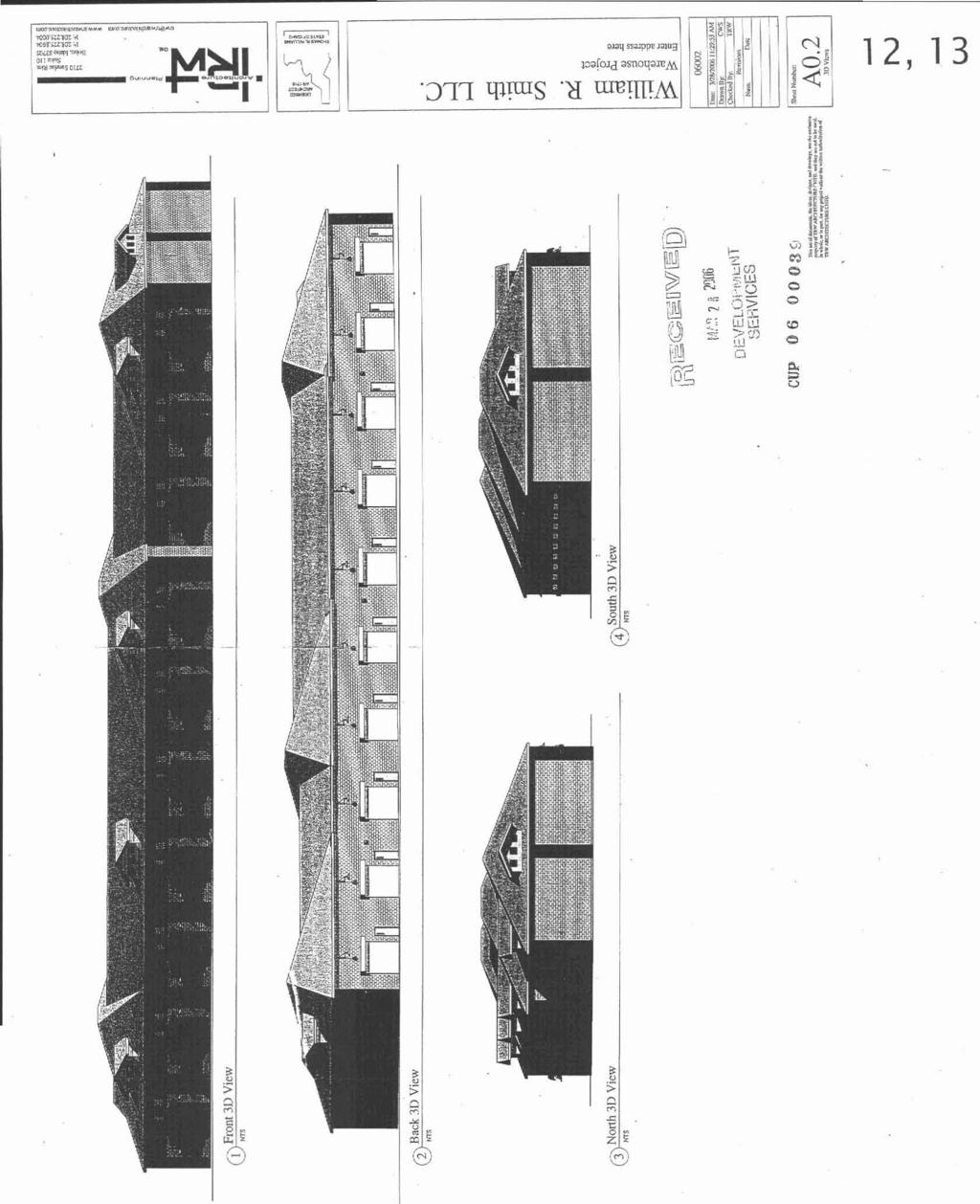
50
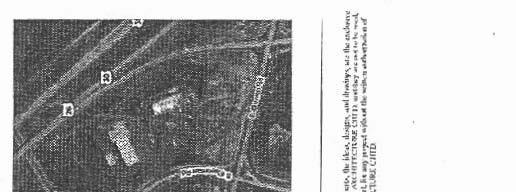
51
52

")
53 VIEW EAST 7 &A,ir VIEW WEST v&~*l)
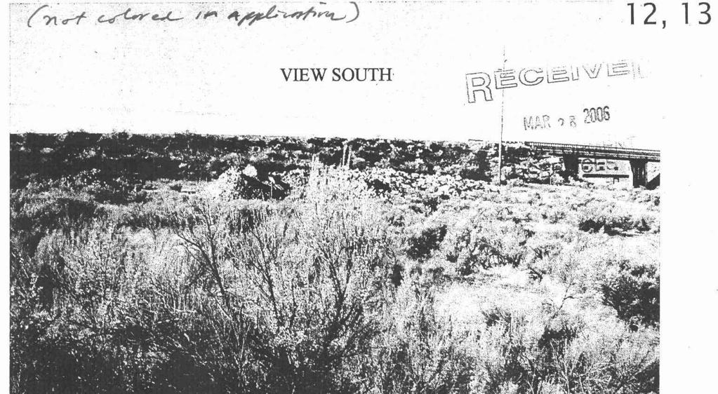
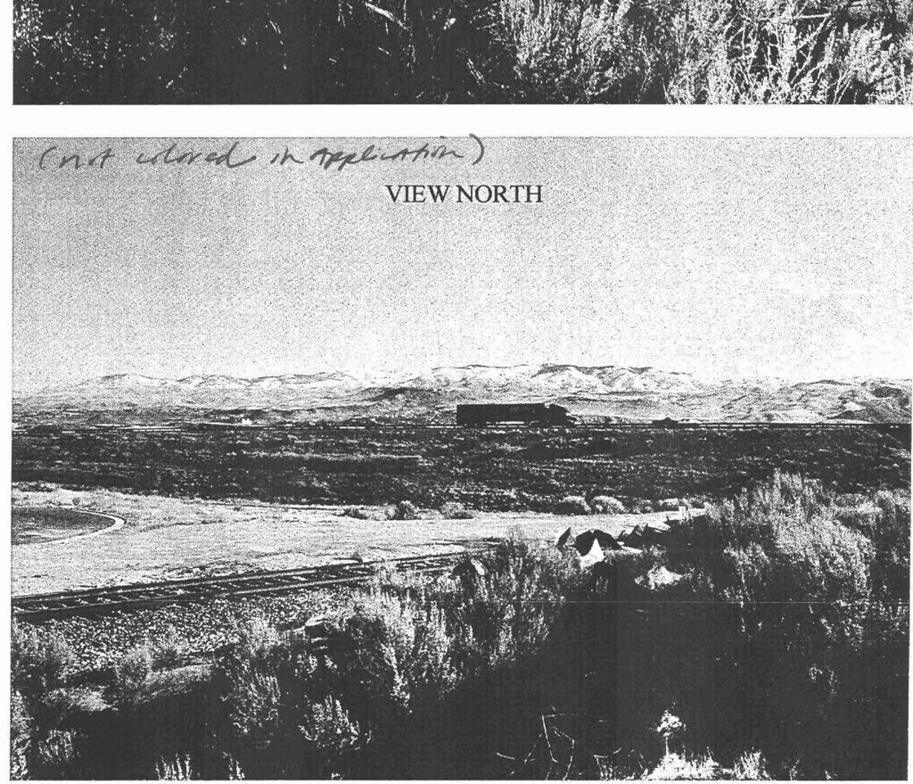
54

55 p O I Boise City Hall, 2nd Floor Phone: 208/ N. Capitol Boulevard Fax: 208/ f! 0. Box SO0 TDDm 800/ Boise, Idaho Website: K, I J I Conditions for Permit Number: PRE Print Date: c41:49PM Page 1 of APPLICABLE CODES None NOT MET 4/7/2006 DSM This application has been reviewed with respect to the REQUIREMENTS of the Boise City Code (BCC) Title VII and the 2000 International Fire Code (IK) as adopted and amended by the City of Boise. Applicant can feel free to contact David S. Miller at APPROVAL None NOT MET 4/7/2006 DSM The Fire department can approve this application with the following conditions F.P. BEFORE CONYIRUCI-ION None NOT MET 4/7/2006 DSM Fire Department require hydrants, access, and street identification shall be installed prior to constructcon or storage of combustible materials on site. Provisions may be made for tempmary a c e or street identification PRELIMINARY APPROVAL None NOTMET 4/7/2006 DSM Any fire hydrant approvals given by the fire department are to be considered as "preliminary". Final approval is not considered to be granted until the fire department performs its "hydrant acceptance" tests. Any changes, such as finished landscaping, which affect hydrant clearance or finished height shall not be cosidered as approved and will need to be correct& IBC Construction Reauirements None NOT MET 4/7/2006 DSM Specific construction requirements of the International Building Code, the International Fire Code, and Boise City Code will apply. However, these provisions are best addressedby a licensed Architect at building permit application.... ~.. -~ ~ 0014 HIGH PILED STORAGE None NOTMET 4/7/2006 DSM This building appears to have the capability of king use for "high piled combustible storage". Consult the appropriate chapter of the International Fire Code Construbion Permits Required None NOT MET 4/7/2006 DSM Planning, Subdivision, and Public Works approvals do NOT exempt the applicant from the requirement to obtain Building Permits, Fire Sprinkler Permits, and Fire Alarm Permits Project None. NOT MET 4/7/2006 DSM cup06-0(3039,64015 Eisenman Rd.
56 BOISE CITY PUBLIC WORKS DEPARTMENT DEPARTMENT CORRESPONDENCE To: Re: Boise City Planning & Zoning CAR / CUP ; 6401 S. Eisenman Road CONDlTIONS OF APPROVAL Date: April 6,2006 SEWER CONDITIONS -JIM PARDY ( ) Upon development of the property, connection to central sanitary sewer is required. Sewers are available in S. Eisenman Road. The existing sewer is a low pressure system ( ). DR41NAGE / STORM WATER CONDITIONS -BRIAN MURPHY ( ) A drainage plan must be submitted and approved by Public Works prior to issuance of a building permit. STREET LIGHT CONDITIONS -BILL COLSON ( ) No comment. PERSON MAKING OTHER COMMENTS OTHER COMMENTS Cc: Applicant I:\USERS~DIS\SUBS\C-LSE\CU-?006\CAR BCUP doc
57 Boise Airport APR f John W. Anderron A.A.E. Director BOI Boise Airport Sulle Airpoo Way Boire, ldoho Phone For i DATE: April I 1, 2006 TO: Boise City Planning and Development Services ~ FROM: Matt Petaja 7-. Deputy Director, Facilities SUBJECT: CAR & CUP WILLIAM R. SMITH, LLC /' Web wwl.ci~ofboire.ory Cily of Boire Equipment Services 4833 Dorman Street Boise, ldoho 83705~5076 Phone 208:34~6549 For Mayor David H. 8ieler Cily Council President Moryonne lordon Council ProTem Eioine Cleyy Boise Airport staff has no objections to the project as proposed. This project is located within the airport influence area B, which is affected by average sound levels in the DNL and/or aircraft traffic patterns below 1000 feet. Standard conditions of approval are contingent upon an avigation easement executed on the entire property. All new structures located within the overlay area are required to meet the sound attenuation standards of a minimum noise level reduction (NLR) of 30 DB in noise sensitive areas of the facility. Residential Development is not allowed. The Airport also requires that within the airport influence area, all sign lighting and exterior lighting must be directed downward Please call if you have any questions. Vernan L. Bisterteldl Dorid Eberle ~lan W. Shealy Jim Ebbs
58 -- - John S. Franden, President Sherry R. Huber, 1st Vice President David Bivens, 2nd Vice President Caml A. McKee, Commissioner Rebecca W. Amold, Commissioner May 1,2006 TO: SUBJECT: Willian R. Smith, LLC. P.O. Box Boise. ID CAR CUP Office with Warehouse 6401 South Eisenman Road MAY % DEVELOPMENT SERVICES On June 7, 1979, the Ada County Highway District Commissioners acted on Job no for Gowen Business Park #1. The conditions and requirements also apply to CAR I CUPO Today. ACHD staff is supportive of the applicant's proposal for two access points to South Eisenman Road at its cul-de-sac, which is approved with this application. Staff is also supportive of the applicant's proposal not to take direct lot access to Gowen Road. which is not approved with this application due to its frontage to the local industrial roadway. Prior to final approval you will need to submit plans to the ACHD Development Review Department. A traffic impact fee will be assessed by ACHD and will be due prior to the issuance of a building permit. Contact ACHD Planning & Development Services at for information regarding impact fees. If you have any questions or concerns please feel free to contact this office at (208) ?>/ S~ncerely, Ryan McDaniel planner I Right-of-way and Development Services CC: Project File City of Boise -- Ada County Highway Olrict Adams Street. Garden City, ID PH FX a
59 DOCUMENTS RECEIVED IN POOR QUALITY
 +llr.aan <\"Cl.'.,.C,Crn~~yCg *o-*-irrly-., UNPClTTLO 2...._ i'..,.? -&.,:F?")
60 el4t SVOWINO GOWEN BUSINESS PARK SUBD~VIS'ION NO.1 A SVSDlVlSlON Or i( P09T1011 CF TIC ;uorth 8,s OF -P-E NOCITHWEST IIC OF ~CCT!ON I 7C)bVNSWIP 2 NORTC. RANGE 2 EAST.. e01se h+cn.ol4hr CEG SMP. Lor Ccr"rlCrlr, ar.,t*) +llr.aan <"Cl.'.,.C,Crn~~yCg *o-*-irrly-., UNPClTTLO 2...._ i'..,.? -&.,:F? t Ae7*"l" JU6 1 E7q #, :,p& tdr && A
~ for C*JVYLI ewlnels Par* Svbdtvirion No. 1. As we dtscur,ol tn your Offirs.")
61 nda County H lghq Olstrfct Wf~%i~n 318 Ialt 37th Stract BOisc, Id s Arm: U?. Ga. t Funkbrer. P.E. AQ: OMCn Buslnrr Park. Subdlvlslon *b. 1 & no. azlt I*av *. FVnkWl,).: rhls letter accmwnl~ LhO rsvised plat dnd st?% d-11)~ for C*JVYLI ewlnels Par* Svbdtvirion No. 1. As we dtscur,ol tn your Offirs. we are pmw*lnq ho cul-dm-sacs aclnst tha Union ~ wffls naiir,rd right-of-. rather than a cvosfiw of the milmad at LD'I lotaciao. 3metlne In nn hrtorr. a rallroad cnsxlng my hl con~tru~ted. bu: tkre an no plans prerrrtly rl long as tn track renainr In the & track ryrtm. YI hawe also rwfsed ur stnet sectton as fndiut~d IM th. plans to iriclszc cwh and gucter ptvs No senage trencher, om a ritb ~fde >r ilk* ioud~q. k ask that.wy mriw md apdmve these change$. mv** tta mfoh is of concern m the deurlapcr fs?h.t arfre udar bqoratran i3 mimt1y expandtnp thlr fnilctier in thc ana B provlde addltiorul, ww nu* needed, aster prcsrun tc th rumounb Irm area and thll ncedr t. be acranpllshw a% rapfdly as polslble. we I would Ilte the Com~ssim to allor the gradrng af the rw6*ay nh.es$dry 70, the YEP*. Iim msrrvctlon to procned. I nlra. rr m a r t that Ma hnty HiqM.r a-rt~fn pmrl& tht messarj lnsvectioll and tsrtlng whlch Pr already been Paid fgr by Tertellng s I that the gradlrq will be %c.ptadle for tha mads. 1 i and The Terttltns Cmpamy Is wllltnp to accept tb rtlmm~bllity V i b any other fom of an agrenrnt t ~ muld t fndemlfy tht nighgy FILE COPY

62 Dlstr'Ct in oder to allw thi* grading JM rater I ~ M EOmtNrt~on prior to the filing of the ffml plat. There am a nuaber.f riyn.tunr necessnry On the viat *fore rt can he fllcd.,nc;,,dtng cfntral ~ f. ~ ~ f ~ ~ HQalth Deprrtnent. County inplheer, and the city.,a,r ca~.~erarlm fhll mtt* IS YeN mch appraclated.

63 1.._1..11,1..1,., s :.nr.\... ",l,.l.l. "'"I U*.. I.<., I nllihway DISTRICT Ib.. I.C. cc*.v,,r, ti., l~=~-*i=-ml ;:*,>w<w,m " * -.. ZV'., :"=, '. i :.
64 V 4. P a m t Of tcsc1rq Fee c?hxqu! ty trc DistrL;c to wrfoilm ninim mmbs of rracorials mv3 mtarirdsln placrrrnt trsei?:~. OI. plans rust tr Plan wrwa1. L/i.?mi& qiiu mpy of f a m i d. for mnatnmtim; r.\ ~mditiau.tlwvc rar ce plat for err rca-+~.% cqy my b phom QC I. D.uL?g metino 5-n (haln RpR,a. aprc..cc! md yau rm gi\n!hw w +% siw % tfr District. 3. -ti& estlrmta W )rcn received: mclo.?.rl are t:~ takulatims o:t.abl?chx~g dmmt cf cstlutml ~znstr:ctivn mst, li0: :v;srety.xcw~lt, am3 terting EL-. yu3'jza?ntorc G. Sorcic. E.T.
65
Hal Simmons Planning Director Boise City Planning and Development Services. CAR / 1689 South Entertainment Avenue
 MEMORANDUM MEMO TO: FROM: Mayor and Boise City Council Hal Simmons Planning Director Boise City Planning and Development Services DATE: November 15, 2008 RE: CAR08-00019 / 1689 South Entertainment Avenue
Planning Director Boise City Planning and Development Services Department. CUP (Adoption of Findings & Revised Conditions of Approval)
") MEMORANDUM TO: FROM: Mayor and Boise City Council Hal Simmons Planning Director Boise City Planning and Development Services Department DATE: May 19, 2006 RE: CUP05-00172 (Adoption of Findings & Revised
MEMORANDUM TO: FROM: Mayor and Boise City Council Hal Simmons Planning Director Boise City Planning and Development Services Department DATE: May 19, 2006 RE: CUP05-00172 (Adoption of Findings & Revised
RE: CAR / 4280 N.
 MEMORANDUM TO: FROM: Mayor and Boise City Council Hal Simmons - Planning Director Boise City Planning and Development Services DATE: April 29, 2009 RE: CAR09-00006 / 4280 N. Eagle Road The following application
MAJOR ISSUES DISCUSSED To date, there has been no opposition to this request and no member of the public has testified. ***
 CAR07-00051 Page 2 SUMMARY Larry and Barbara Woolf request approval to rezone ± 1.33 acres from R-1C (Single Family Residential with a maximum of 8.0 DU/acre) to R-2D (Combined Residential with a maximum
ZONING ORDINANCE: OPEN SPACE COMMUNITY. Hamburg Township, MI
 ZONING ORDINANCE: OPEN SPACE COMMUNITY Hamburg Township, MI ARTICLE 14.00 OPEN SPACE COMMUNITY (Adopted 1/16/92) Section 14.1. Intent It is the intent of this Article to offer an alternative to traditional
May we also take this opportunity to inform you of the following:
 September 15, 2009 Curtis Stigers & Amy O Brien Boise, ID 83702 Re: CVA09-00029 / Dear Mr. Stigers & Ms. O Brien: This letter is to inform you of the action taken by the Boise City Planning and Zoning
ARTICLE XI CONDITIONAL USE PERMITS
 ARTICLE XI CONDITIONAL USE PERMITS 11.1 Purpose. The City of Hailey recognizes that certain uses possess unique and special characteristics with respect to their location, design, size, method of operation,
Bethel Romanian Church - Rezone, RZ
 / Planning and Zoning Staff Report Bethel Romanian Church - Rezone, RZ2018-0023 Hearing Date: November 15, 2018 Development Services Department Owners: Bethel Romanian Church, Corp. Applicant: Viorel Botos
CITY OF NORTH LAS VEGAS MEMORANDUM
 CITY OF NORTH LAS VEGAS MEMORANDUM TO: FROM: SUBJECT: Planning Commission Community Development and Compliance Department # 28 ) AMP-03-15; Coleman Airpark II & III - Comprehensive Plan Amendment (Public
1. Allow a workable, interrelated mix of diverse land uses;
 5-24 PUD Planned Unit Development 5-24.1 Purpose A. The Planned Unit Development (PUD) District is intended to encourage flexible and innovative design in the development of appropriate sites as integrated
The following regulations shall apply in the R-E District:
 "R-E" RESIDENTIAL ESTATE DISTRICT (8/06) The following regulations shall apply in the R-E District: 1. Uses Permitted: The following uses are permitted. A Zoning Certificate may be required as provided
PLANNED UNIT DEVELOPMENTS (Ordinance No.: 3036, 12/3/07; Repealed & Replaced by Ordinance No.: 4166, 10/15/12)
") 159.62 PLANNED UNIT DEVELOPMENTS (Ordinance No.: 3036, 12/3/07; Repealed & Replaced by Ordinance No.: 4166, 10/15/12) A. PURPOSE 1. General. The Planned Unit Development (PUD) approach provides the flexibility
159.62 PLANNED UNIT DEVELOPMENTS (Ordinance No.: 3036, 12/3/07; Repealed & Replaced by Ordinance No.: 4166, 10/15/12) A. PURPOSE 1. General. The Planned Unit Development (PUD) approach provides the flexibility
ARTICLE VII. NONCONFORMITIES. Section 700. Purpose.
 ARTICLE VII. NONCONFORMITIES. Section 700. Purpose. The purpose of this chapter is to regulate and limit the development and continued existence of legal uses, structures, lots, and signs established either
CHAPTER XVIII SITE PLAN REVIEW
 CHAPTER XVIII SITE PLAN REVIEW Section 18.1 Section 18.2 Description and Purpose. The purpose of this chapter is to provide standards and procedures under which applicants would submit, and the Township
SUBDIVISION, PLANNED UNIT DEVELOPMENT, ZONING AMENDMENT, & SIDEWALK WAIVER STAFF REPORT Date: July 19, 2018
 SUBDIVISION, PLANNED UNIT DEVELOPMENT, ZONING AMENDMENT, & SIDEWALK WAIVER STAFF REPORT Date: July 19, 2018 NAME SUBDIVISION NAME LOCATION West Mobile Properties, LLC U.S. Machine Subdivision 556, 566,
ARTICLE 14 PLANNED UNIT DEVELOPMENT (PUD) DISTRICT
 DISTRICT") ARTICLE 14 PLANNED UNIT DEVELOPMENT (PUD) DISTRICT Section 14.01 Intent. It is the intent of this Article to allow the use of the planned unit development (PUD) process, as authorized by the Michigan Zoning
ARTICLE 14 PLANNED UNIT DEVELOPMENT (PUD) DISTRICT Section 14.01 Intent. It is the intent of this Article to allow the use of the planned unit development (PUD) process, as authorized by the Michigan Zoning
Time Extension Staff Report
 Time Extension Staff Report Subdivision Name Therrin Subdivision File Number SUB06-00020 Approval Time Extension for Lead Agency Boise City Certification Signature of Boise City Engineer Annexation Date
Glades County Staff Report and Recommendation Unified Staff Report for Small Scale Plan Amendment and Rezoning
 Glades County Staff Report and Recommendation Unified Staff Report for Small Scale Plan Amendment and Rezoning CASE NUMBERS: COMP17-02 and RZ17-02 DATE of STAFF REPORT: May 1, 2017 CASE TYPE: Application
Operating Standards Attachment to Development Application
 Planning & Development Services 2255 W Berry Ave. Littleton, CO 80120 Phone: 303-795-3748 Mon-Fri: 8am-5pm www.littletongov.org Operating Standards Attachment to Development Application 1 PLANNED DEVELOPMENT
PLANNED UNIT DEVELOPMENT (PUD)
") SECTION 38.01. ARTICLE 38 PLANNED UNIT DEVELOPMENT (PUD) Purpose The purpose of this Article is to implement the provisions of the Michigan Zoning Enabling Act, Public Act 110 of 2006, as amended, authorizing
SECTION 38.01. ARTICLE 38 PLANNED UNIT DEVELOPMENT (PUD) Purpose The purpose of this Article is to implement the provisions of the Michigan Zoning Enabling Act, Public Act 110 of 2006, as amended, authorizing
Town of Bristol Rhode Island
 Town of Bristol Rhode Island Subdivision & Development Review Regulations Adopted by the Planning Board September 27, 1995 (March 2017) Formatted: Highlight Formatted: Font: 12 pt Table of Contents TABLE
ARTICLE 3: Zone Districts
 ARTICLE 3: Zone Districts... 3-1 17.3.1: General...3-1 17.3.1.1: Purpose and Intent... 3-1 17.3.2: Districts and Maps...3-1 17.3.2.1: Applicability... 3-1 17.3.2.2: Creation of Districts... 3-1 17.3.2.3:
SECTION 10.7 R-PUD (RESIDENTIAL PLANNED UNIT DEVELOPMENT) ZONE
 ZONE") Article X Zones 10-20 SECTION 10.7 R-PUD (RESIDENTIAL PLANNED UNIT DEVELOPMENT) ZONE A. PURPOSE AND INTENT: The R-PUD Residential PUD Zone is intended to provide alternative, voluntary zoning procedures
Article X Zones 10-20 SECTION 10.7 R-PUD (RESIDENTIAL PLANNED UNIT DEVELOPMENT) ZONE A. PURPOSE AND INTENT: The R-PUD Residential PUD Zone is intended to provide alternative, voluntary zoning procedures
Chapter 22 PLANNED UNIT DEVELOPMENT.
 Chapter 22 PLANNED UNIT DEVELOPMENT. Sec. 22.1 INTENT. The use of land and the construction and use of buildings and other structures as Planned Unit Developments in Georgetown Township may be established
AAAA. Planning and Zoning Staff Report Lake Shore Land Holdings, LLC CU-PH Analysis
 AAAA Planning and Zoning Staff Report Lake Shore Land Holdings, LLC CU-PH2016-28 Hearing Date: April 21, 2016 Development Services Department Applicant: BRS Architects/Cindy Huebert Staff: Kyle McCormick,
PLANNED UNIT DEVELOPMENT & SUBDIVISION STAFF REPORT Date: April 18, 2019
 PLANNED UNIT DEVELOPMENT & SUBDIVISION STAFF REPORT Date: April 18, 2019 DEVELOPMENT NAME SUBDIVISION NAME Springhill Village Subdivision Springhill Village Subdivision LOCATION 4350, 4354, 4356, 4358,
HOW TO APPLY FOR A USE PERMIT
 HOW TO APPLY FOR A USE PERMIT MENDOCINO COUNTY PLANNING AND BUILDING SERVICES What is the purpose of a use permit? Throughout the County, people use their properties in many different ways. They build
ARTICLE 9: VESTING DETERMINATION, NONCONFORMITIES AND VARIANCES. Article History 2 SECTION 9.01 PURPOSE 3
 ARTICLE 9 VESTING DETERMINATIONS, NONCONFORMITIES, AND VARIANCES Table of Contents Article History 2 SECTION 9.01 PURPOSE 3 SECTION 9.02 LOT OF RECORD AND VESTING DETERMINATIONS FOR NONCONFORMING DEVELOPMENTS
Time Extension Staff Report
 Time Extension Staff Report Subdivision Name Lunara Subdivision File Number SUB07-00019 Approval Time Extension for Lead Agency Boise City Certification Signature of Boise City Engineer Annexation Date
City of Harrisburg Variance and Special Exception Application
 City of Harrisburg Variance and Special Exception Application Note: The Planning Bureau will review all applications for completeness; incomplete applications may cause a delay in processing. Contact Ben
ARTICLE 15 - PLANNED UNIT DEVELOPMENT
 Section 15.1 - Intent. ARTICLE 15 - PLANNED UNIT DEVELOPMENT A PUD, or Planned Unit Development, is not a District per se, but rather a set of standards that may be applied to a development type. The Planned
SPECIAL EXCEPTION APPLICATION LEVY COUNTY, FLORIDA. Fee: (see fee schedule) Validation No.
 Validation No.") Filing Date Petition No. SE Fee: (see fee schedule) Validation No. TO THE LEVY COUNTY PLANNING COMMISSION: Special exceptions are intended to provide for land uses and activities not permitted by right
Filing Date Petition No. SE Fee: (see fee schedule) Validation No. TO THE LEVY COUNTY PLANNING COMMISSION: Special exceptions are intended to provide for land uses and activities not permitted by right
Box Elder County Land Use Management & Development Code Article 3: Zoning Districts
 Chapter 3-8-1 Master Planned Community Zone Ordinance No. 316 as adopted August 11, 2009 Sections. 3-8-1 Purpose and Intent MPC Zones Created Eligibility Master Planned Community Application Submittal
CHAPTER 3 PERMITS, PLANS AND ANNEXATION
 CHAPTER 3 PERMITS, PLANS AND ANNEXATION SECTION: 10-3-1: General Regulations 10-3-2: Building Permit 10-3-3: Plans 10-3-4: Certificate of Compliance and Occupancy 10-3-5: Conditional Use Permits 10-3-6:
5.03 Type III (Quasi-Judicial) Decisions
 Decisions") 5.03 Type III (Quasi-Judicial) Decisions 5.03 General Requirements A. The purpose of this Section is to identify what types of actions are considered Type III decisions. Type III decisions involve significant
5.03 Type III (Quasi-Judicial) Decisions 5.03 General Requirements A. The purpose of this Section is to identify what types of actions are considered Type III decisions. Type III decisions involve significant
DIVISION 9. PLANNED URBAN DEVELOPMENT CLASSIFICATION BY SPECIAL USE FOR ALL ZONING DISTRICTS Sec Statement Of Purpose: (a) Planned
 Planned") DIVISION 9. PLANNED URBAN DEVELOPMENT CLASSIFICATION BY SPECIAL USE FOR ALL ZONING DISTRICTS Sec. 12-169. Statement Of Purpose: (a) Planned developments are such substantially different character from
DIVISION 9. PLANNED URBAN DEVELOPMENT CLASSIFICATION BY SPECIAL USE FOR ALL ZONING DISTRICTS Sec. 12-169. Statement Of Purpose: (a) Planned developments are such substantially different character from
SPECIAL USE FOR A PLANNED UNIT DEVELOPMENT (P.U.D.), REZONING, and COMPREHENSIVE PLAN AMENDMENT APPLICATION PACKET
, REZONING, and COMPREHENSIVE PLAN AMENDMENT APPLICATION PACKET") SPECIAL USE FOR A PLANNED UNIT DEVELOPMENT (P.U.D.), REZONING, and COMPREHENSIVE PLAN AMENDMENT APPLICATION PACKET VILLAGE OF HANOVER PARK DEVELOPMENT COMMISSION Village of Hanover Park Department of Community
SPECIAL USE FOR A PLANNED UNIT DEVELOPMENT (P.U.D.), REZONING, and COMPREHENSIVE PLAN AMENDMENT APPLICATION PACKET VILLAGE OF HANOVER PARK DEVELOPMENT COMMISSION Village of Hanover Park Department of Community
O-I (Office-Institutional) and AG-1(Agricultural)
 and AG-1(Agricultural)") PROPERTY INFORMATION ADDRESS 3503 and 3505 Bethany Bend DISTRICT, LAND LOTS 2/1 973 and 974 OVERLAY DISTRICT State Route 9 PETITION NUMBERS EXISTING ZONING O-I (Office-Institutional) and AG-1(Agricultural)
PROPERTY INFORMATION ADDRESS 3503 and 3505 Bethany Bend DISTRICT, LAND LOTS 2/1 973 and 974 OVERLAY DISTRICT State Route 9 PETITION NUMBERS EXISTING ZONING O-I (Office-Institutional) and AG-1(Agricultural)
Kitsap County Department of Community Development. Administrative Staff Report
 Kitsap County Department of Community Development Administrative Staff Report Report Date: Application Complete Date: March 15, 2018 Application Submittal Date: March 12, 2018 Project Name: Nikki Lee Salon
17.0 NONCONFORMITIES CHAPTER 17: NONCONFORMITIES Purpose and Applicability
 17.0 NONCONFORMITIES 17.1 Purpose and Applicability The purpose of this section is to regulate and limit the continued existence of uses and structures established prior to the effective date of this Ordinance
Chapter SPECIAL USE ZONING DISTRICTS
 Chapter 20.20 Sections: 20.20.010 Urban Transition (U-T) Zoning District 20.20.020 Planned Development (P-D) Zoning Districts 20.20.010 Urban Transition (U-T) Zoning District A. Purpose. The purpose of
City of San Juan Capistrano Agenda Report. Honorable Mayor and Members of the City Council. Joel Rojas, Development Services Director ~ )P
P") 10/17/2017 F1b TO: FROM: SUBMITTED BY: City of San Juan Capistrano Agenda Report Honorable Mayor and Members of the City Council ~n Siegel, City Manager Joel Rojas, Development Services Director ~ )P PREPARED
10/17/2017 F1b TO: FROM: SUBMITTED BY: City of San Juan Capistrano Agenda Report Honorable Mayor and Members of the City Council ~n Siegel, City Manager Joel Rojas, Development Services Director ~ )P PREPARED
6-6 Livermore Development Code
 6.02.030 Applicable to All Zones B. Large family day care. As allowed by Health and Safety Code Sections 1597.465 et seq., a large family day care shall be approved if it complies with the following standards:
STAFF REPORT. Permit Number: Unlimited. Kitsap County Board of Commissioners; Kitsap County Planning Commission
 STAFF REPORT Permit Number: 15 00550 Unlimited DATE: March 2, 2016 TO: FROM: Kitsap County Board of Commissioners; Kitsap County Planning Commission Katrina Knutson, AICP, Senior Planner, DCD and Jeff
ZONING AMENDMENT, PLANNED UNIT DEVELOPMENT & SUBDIVISION STAFF REPORT Date: August 8, 2013
 ZONING AMENDMENT, PLANNED UNIT DEVELOPMENT & SUBDIVISION STAFF REPORT Date: August 8, 2013 NAME SUBDIVISION NAME PV-Magnolia, LLC Twelve Trees Subdivision LOCATION 2860, 2862 and 2866 Pleasant Valley Road
In order to permit maximum applicability of the PUD District, PUD-1 and PUD-2 Districts are hereby created.
 ARTICLE III. PUD ned Unit Development Overlay District 205-128. Purpose. The PUD ned Unit Development Overlay District is intended to provide flexibility in the design of planned projects; to encourage
Plan nt Plan Filing and
 PARISH OF ASCENSION OFFICE OF PLANNING AND DEVELOPMENT PLANNING DEPARTMENT APPENDIX VI PLANNED UNIT DEVELOPMENT (PUD) CODE Contents: 17-601. General Purpose: Procedures... 3 17-602. General Character:...
Salmon Development Code. Ordinance No Adopted March 1, 2017 Repealing Ordinance No and subsequent amendments in its entirety.
 Salmon Development Code Ordinance No. 17-819 Adopted March 1, 2017 Repealing Ordinance No. 92-561 and subsequent amendments in its entirety. TABLE OF CONTENTS Chapter 1 - Purpose, Authority, And General
Subdivision Staff Report
 Subdivision Staff Report Subdivision Name Madera Creek File Number SUB06-00068 Subdivision Approval Final Plat Lead Agency Boise City Annexation Date December 9, 1974 Comp. Plan Complies Public Hearing
CHAPTER 10 Planned Unit Development Zoning Districts
 CHAPTER 10 Planned Unit Development Zoning Districts Section 10.1 Intent and Purpose The Planned Unit Development (PUD) districts are intended to offer design flexibility for projects that further the
Article 6: Planned Unit Developments
 LUDC 2013 GARFIELD COUNTY, COLORADO Article 6: Planned Unit Developments ARTICLE 6 PLANNED UNIT DEVELOPMENTS TABLE OF CONTENTS DIVISION 1. GENERAL.... 1 6-101. GENERAL PROVISIONS.... 1 A. Purpose....
LAND USE AND ZONING OVERVIEW
 OVERVIEW OF PLANNING POLICIES LAND USE AND ZONING OVERVIEW The Minneapolis Plan for Sustainable Growth and Other Adopted Plans Community Planning and Economic Development Development Services Division
DEVELOPMENT PLAN ORDINANCE
 DEVELOPMENT PLAN ORDINANCE CITY OF GLASGOW Ordinance No. 2026 SECTION A. Section 1. INTENT AND PURPOSE The purpose of this Ordinance is to establish and define development plans, which may be utilized
CHAPTER 3 PRELIMINARY PLAT
 10-3-1 10-3-3 SECTION: CHAPTER 3 PRELIMINARY PLAT 10-3-1: Consultation 10-3-2: Filing 10-3-3: Requirements 10-3-4: Approval 10-3-5: Time Limitation 10-3-6: Grading Limitation 10-3-1: CONSULTATION: Each
UPPER MOUNT BETHEL TOWNSHIP NORTHAMPTON COUNTY, PENNSYLVANIA
 UPPER MOUNT BETHEL TOWNSHIP NORTHAMPTON COUNTY, PENNSYLVANIA JOINDER DEED / LOT CONSOLIDATION TOWNSHIP REVIEW PROCESS When accepting proposed Joinder Deeds / Lot Consolidations, review the Joinder Deed
PLANNING COMMISSION STAFF REPORT
 PLANNING COMMISSION STAFF REPORT West Capitol Hill Zoning Map Amendment Petition No. PLNPCM2011-00665 Located approximately at 548 W 300 North Street, 543 W 400 North Street, and 375 N 500 West Street
Draft Zoning Changes for the 2nd Planning Board Public Hearing, January 22, 2018.
 Draft Zoning Changes for the 2nd Planning Board Public Hearing, January 22, 2018. No changes were made at the 1st Public Hearing. Proposed wording for the 1 st Public Hearing in red, eliminated text in
HUERFANO COUNTY SIGN REGULATIONS SECTION 14.00
 TABLE OF CONTENTS Section Title Page 14.01 SIGN CODE... 14-1 14.01.01 Intent and Purpose... 14-1 14.02 GENERAL PROVISIONS... 14-1 14.02.01 Title... 14-1 14.02.02 Repeal... 14-1 14.02.03 Scope and Applicability
LYON COUNTY TITLE 15 LAND USE AND DEVELOPMENT CODE ZONING REGULATIONS CHAPTERS October 19, 2017 Ordinance Draft DRAFT
 -+ LYON COUNTY TITLE 15 LAND USE AND DEVELOPMENT CODE ZONING REGULATIONS CHAPTERS 15.200 15.403 October 19, 2017 Ordinance Draft This page left blank intentionally DRAFT Lyon County Title 15 Land Use and
PLANNING AND ZONING DEPARTMENT
 Town of Minturn Development Review Process: Guide To Planned Unit Developments (Concept Plan) This guide describes the Planned Unit Development Process. This guide should be utilized in conjunction with
PLANNED UNIT DEVELOPMENT (PUD) AREA PLAN/REZONING REVIEW PROCEDURE
 AREA PLAN/REZONING REVIEW PROCEDURE") PLANNED UNIT DEVELOPMENT (PUD) AREA PLAN/REZONING REVIEW PROCEDURE Professional inquiries will be made to our Township Planning Consultant, Township Engineer, and Township Attorney to get their opinions
PLANNED UNIT DEVELOPMENT (PUD) AREA PLAN/REZONING REVIEW PROCEDURE Professional inquiries will be made to our Township Planning Consultant, Township Engineer, and Township Attorney to get their opinions
Salem Township Zoning Ordinance Page 50-1 ARTICLE 50.0: PUD PLANNED UNIT DEVELOPMENT
 Salem Township Zoning Ordinance Page 50-1 ARTICLE 50.0 PLANNED UNIT DEVELOPMENT Section 50.01 Purpose The provisions of this Article provide enabling authority and standards for the submission, review,
CITY PLANNING COMMISSION COMPREHENSIVE PLAN AND REVIEW CRITERIA
 Page 3 CITY PLANNING COMMISSION COMPREHENSIVE PLAN AND REVIEW CRITERIA COMPREHENSIVE PLAN: The City Planning Commission uses the Comprehensive Plan as a guide in all land use matters. The Plan is available
City of Huntington Beach Community Development Department STAFF REPORT
 City of Huntington Beach Community Development Department STAFF REPORT TO: Planning Commission FROM: Scott Hess, AICP, Director of Community Development BY: Jessica Bui, Assistant Planner DATE: June 28,
PRELIMINARY PLANNED AREA DEVELOPMENT APPLICATION (PAD)
") PRELIMINARY PLANNED AREA DEVELOPMENT APPLICATION (PAD) Preliminary Planned Area Development Fee: Date Paid SECTION 1.9.4.1 PRELIMINARY PAD APPLICATION A Master development plan (showing general land use
PRELIMINARY PLANNED AREA DEVELOPMENT APPLICATION (PAD) Preliminary Planned Area Development Fee: Date Paid SECTION 1.9.4.1 PRELIMINARY PAD APPLICATION A Master development plan (showing general land use
Indicates Council-recommended changes Introduced by: Mr. Tackett Date of introduction: June 14, 2016 SUBSTITUTE NO. 1 TO ORDINANCE NO.
 Indicates Council-recommended changes Introduced by: Mr. Tackett Date of introduction: June 14, 2016 SUBSTITUTE NO. 1 TO ORDINANCE NO. 16-067 TO AMEND NEW CASTLE COUNTY CODE CHAPTER 40 (ALSO KNOWN AS THE
AN ORDINANCE TO AMEND SECTION OF THE RAPID CITY MUNICIPAL CODE TO ALLOW FOR ADMINISTRATIVE DISSOLUTION OF PLANNED DEVELOPMENTS
 Ordinance No. 6231 AN ORDINANCE TO AMEND SECTION 17.50.050 OF THE RAPID CITY MUNICIPAL CODE TO ALLOW FOR ADMINISTRATIVE DISSOLUTION OF PLANNED DEVELOPMENTS WHEREAS, the City of Rapid City has adopted a
ARTICLE III GENERAL PROCEDURES, MINOR PLANS AND FEE SCHEDULES
 ARTICLE III GENERAL PROCEDURES, MINOR PLANS AND FEE SCHEDULES 301. Prior to Submission a. Copies of this Ordinance shall be available on request, at cost, for the use of any person who desires information
Staff Report: Date: Applicant: Property Identification: Acreage of Request: Current Zoning of Requested Area: Requested Action: Attached:
 Staff Report: Completed by Jeff Palmer Director of Planning & Zoning Date: November 7, 2018, Updated November 20, 2018 Applicant: Greg Smith, Oberer Land Developer agent for Ronald Montgomery ET AL Property
SUBJECT: Application for Planned Unit Development and Rezoning 1725 Winnetka Road
 TO: FROM: CHAIRMAN BILL VASELOPULOS AND MEMBERS OF THE PLAN & ZONING COMMISSION STEVE GUTIERREZ DIRECTOR OF COMMUNITY DEVELOPMENT MEETING DATE: September 5, 2017 SUBJECT: Application for Planned Unit Development
PLANNING COMMISSION STAFF REPORT. QUEST ASSISTED LIVING CONDITIONAL USE PLNPCM West 800 North Hearing date: October 14, 2009
 PLANNING COMMISSION STAFF REPORT QUEST ASSISTED LIVING CONDITIONAL USE PLNPCM2009-00971 1820 West 800 North Hearing date: October 14, 2009 Planning Division Department of Community & Economic Development
Planned Unit Development (PUD). Sections:
. Sections:") Chapter 19.07. Planned Unit Development (PUD). Sections: 19.07.01. Purpose. 19.07.02. PUD Definition and Design Compatibility. 19.07.03. General PUD Standards. 19.07.04. Underlying Zones. 19.07.05. Permitted
Chapter 19.07. Planned Unit Development (PUD). Sections: 19.07.01. Purpose. 19.07.02. PUD Definition and Design Compatibility. 19.07.03. General PUD Standards. 19.07.04. Underlying Zones. 19.07.05. Permitted
AGENDA ITEM SUMMARY GLADES COUNTY BOARD OF COUNTY COMMISSIONERS
 AGENDA ITEM SUMMARY GLADES COUNTY BOARD OF COUNTY COMMISSIONERS SUBJECT: Case Number COMP17-01, Legend Moto LLC This is a Legislative Hearing. DEPARTMENT REQUEST: The Community Development Department requests
PALM BEACH COUNTY PLANNING, ZONING AND BUILDING DEPARTMENT ZONING DIVISION ZONING COMMISSION VARIANCE STAFF REPORT 06/05/2014
 PALM BEACH COUNTY PLANNING, ZONING AND BUILDING DEPARTMENT ZONING DIVISION ZONING COMMISSION VARIANCE STAFF REPORT 06/05/2014 APPLICATION NO. ZV-2013-03120 CODE SECTION REQUIRED PROPOSED VARIANCE (V1)
CHAPTER 5. PLANNED UNIT DEVELOPMENT REGULATIONS
 Section 5.1. Purpose CHAPTER 5. PLANNED UNIT DEVELOPMENT REGULATIONS 5.1. PURPOSE The purpose for Planned Unit Developments (PUDs) is established in Section 4.5 Zoning District Purpose Statements. 5.2.
Metropolitan Planning Commission. DATE: April 5, 2016
 TO: FROM: Metropolitan Planning Commission MPC Staff DATE: April 5, 2016 SUBJECT: Petition of Nine Line Inc. Robert McCorkle, Agent PIN: 2-1034-01-002 380.5 Acres Aldermanic District: 5 (Shabazz) County
City of Nogales Planning & Zoning Commission Rezoning Application
 City of Nogales Planning & Zoning Commission Rezoning Application REZONING APPLICATION PROCEDURES 1450 N. Hohokam Nogales, Arizona 85621 Office (520) 285-5747 FAX (520) 287-6946 T.D.D. (520) The following
ARTICLE 800 PLANNED UNIT DEVELOPMENTS
 ARTICLE 800 PLANNED UNIT DEVELOPMENTS Sec. 00 Applicability of Planned Development regulations. Any owner of land within the jurisdiction of the City of Bentonville seeking approval of a Planned Unit Development
Planning and Zoning Staff Report JT Ventures, LLC Staging Area, CU-PH
 Planning and Zoning Staff Report JT Ventures, LLC Staging Area, CU-PH2016-60 Hearing Date: December 15, 2016 Development Services Department Applicant: JT Ventures, LLC Jason Stewart and Tony Brown Staff:
ZONING AMENDMENT & SUBDIVISION STAFF REPORT Date: July 3, 2014
 ZONING AMENDMENT & SUBDIVISION STAFF REPORT Date: July 3, 2014 APPLICANT NAME SUBDIVISION NAME LOCATION Georgia Crown Distributing Subdivision Georgia Crown Distributing Subdivision Southwest corner of
Glades County Staff Report and Recommendation REZONING
 Glades County Staff Report and Recommendation REZONING CASE NUMBER: RZ15-01 DATE: October 2, 2015 CASE TYPE: Application for Rezoning REQUEST: J.J. Wiggins Memorial Trust is requesting a rezoning of 22.1±
PALM BEACH COUNTY PLANNING, ZONING AND BUILDING DEPARTMENT ZONING DIVISION
 PALM BEACH COUNTY PLANNING, ZONING AND BUILDING DEPARTMENT ZONING DIVISION Application No.: CA-2012-00688 Control No.: 2011-00552 Applicant: Garry Bernardo Owners: Garry Bernardo Agent: Frogner Consulting,
Special Use Permit Application to Allow Short Term Rental
 Planning & Community Development Department Planning Division 550 Landa St. New Braunfels, Tx 78130 (830) 221-4050 www.nbtexas.org CC/Cash/Check No.: Amount Recd. $ Receipt No.: Case No.: Submittal date
This is a conditional use permit request to establish a commercial wind energy conversion system.
 Public Works 600 Scott Boulevard South Hutchinson, Kansas 67505 620-694-2976 Road & Bridge Planning & Zoning Noxious Weed Utilities Date: March 28, 2019 To: From: Reno County Planning Commission Russ Ewy,
Castle Danger Subordinate Service District Phase I Land Use Ordinance #1
 Castle Danger Subordinate Service District Phase I Land Use Ordinance #1 Effective February 2, 2010 Castle Danger Subordinate Service District Phase I Land Use Ordinance SECTION I PURPOSE The purpose of
CHAPTER 21.12: NONCONFORMITIES
 CHAPTER 21.12: NONCONFORMITIES 21.12.010 GENERAL PROVISIONS... 12-2 A. Purpose... 12-2 B. Authority to Continue... 12-2 C. Determination of Nonconformity Status... 12-3 D. Government Agency Property Acquisitions...
ARTICLE 24 SITE PLAN REVIEW
 ARTICLE 24 SITE PLAN REVIEW 24.1 PURPOSE: The intent of these Ordinance provisions is to provide for consultation and cooperation between the land developer and the Township Planning Commission in order
DRAFT PARK COUNTY US HIGHWAY 89 SOUTH EAST RIVER ROAD OLD YELLOWSTONE TRAIL ZONING DISTRICT REGULATIONS
 Formatting: Changes recommended by the Board and accepted by the County Commission are formatted in RED: Changes made by the Park County Commission are formatted in YELLOW highlight: and changes made by
Staff Report: Date: Applicant: Property Identification: Acreage of Request: Current Zoning of Requested Area: Requested Action: Attached:
 Staff Report: Completed by Jeff Palmer Director of Planning & Zoning Date: November 7, 2018 Applicant: Greg Smith, Oberer Land Developer agent for Ronald Montgomery ET AL Property Identification: Frontage
Application for Sketch Plan Review
 Town of Standish 175 Northeast Road Standish, ME - 04084 Phone: (207)642-3461 Fax: (207) 642-5181 Application for Sketch Plan Review Applicant & Owner Information 1) Name of Applicant: Address: Phone:
ARTICLE X. NONCONFORMITIES AND VESTED RIGHTS
 1 0 1 0 1 ARTICLE X. NONCONFORMITIES AND VESTED RIGHTS DIVISION 1. NONCONFORMITIES Section 0-.1. Purpose. The purpose of this division is to provide regulations for the continuation and elimination of
SPECIAL EXCEPTION APPLICATION LEVY COUNTY, FLORIDA
 Filing Date Petition Number SE Fee (See fee schedule) Validation Number TO THE LEVY COUNTY PLANNING COMMISSION: Special Exceptions are intended to provide for land use and activities not permitted By Right
B. The Plan is in conformity with the Comprehensive Plan.
 ARTICLE 17 PLANNING UNIT DEVELOPMENT 17.01 INTENT The purpose of this Section is to permit the creation of new Planned Unit Developments, permitted as Conditional Uses where maximum variations of design
ARTICLE XXIV. PUD PLANNED UNIT DEVELOPMENT DISTRICT
 Sec. 24.00. Purpose; intent. ARTICLE XXIV. PUD PLANNED UNIT DEVELOPMENT DISTRICT This district is established to permit greater flexibility and, more creative, innovative and imaginative design for the
PUD Preliminary Plan/Plat Information & Application Packet
 Village of Lemont 418 Main Street Lemont, Illinois 60439 phone 630-257-1595 fax 630-257-1598 PUD Preliminary Plan/Plat Information & Application Packet Introduction This information packet was created
CITY PLANNING COMMISSION AGENDA ITEMS: J & K STAFF: NATALIE BECKER FILE NOS: CPC ZC QUASI-JUDICIAL CPC DP QUASI-JUDICIAL
 Page 92 CITY PLANNING COMMISSION AGENDA ITEMS: J & K STAFF: NATALIE BECKER FILE NOS: CPC ZC 05-00151 - QUASI-JUDICIAL CPC DP 05-00152 - QUASI-JUDICIAL PROJECT: APPLICANT: OWNER: MERCURY CAR WASH SCOTT
Cartersville Code of Ordinances Historic Preservation Commission
 Cartersville Code of Ordinances Historic Preservation Commission Sec. 9.25-31. Purpose Sec. 9.25-32. Historic preservation commission. Sec. 9.25-33. Recommendation and designation of historic districts
Town of Scarborough, Maine
 Town of Scarborough, Maine Miscellaneous Appeal INFORMATION REQUIRED FOR ALL APPEALS Before any appeal can be processed, the following material must be submitted to the Code Enforcement Office: 1. A fee
AGENDA ITEM SUMMARY GLADES COUNTY BOARD OF COUNTY COMMISSIONERS
 AGENDA ITEM SUMMARY GLADES COUNTY BOARD OF COUNTY COMMISSIONERS SUBJECT: Case Number COMP17-02, RFYC, LLC This is a Legislative Hearing. DEPARTMENT REQUEST: The Community Development Department requests
DENTON Developer's Handbook
 DENTON Developer's Handbook A guide for land development in the City of Denton Department of Development Services 2017 2 Table of Contents 1. City of Denton Development Process...5 Role of the Development