MONTGOMERY COUNTY PLANNING DEPARTMENT THE MARYLAND-NATIONAL CAPITAL PARK AND PLANNING COMMISSION
|
|
|
- Bryce Foster
- 5 years ago
- Views:
Transcription
1 MONTGOMERY COUNTY PLANNING DEPARTMENT THE MARYLAND-NATIONAL CAPITAL PARK AND PLANNING COMMISSION MCPB Item No. Date: Preliminary Plan Parmjit & Saini Estates Katherine Holt, Senior Planner, Area 3, Katherine.Holt@montgomeryplanning.org Richard Weaver, Acting Supervisor, Area 3, Richard.Weaver@montgomeryplanning.org John Carter, Chief, Area 3, john.carter@montgomeryplanning.org Description Preliminary Plan Parmjit & Saini Estates Four lots requested for four, one-family detached dwelling units; located on the northern side of Travilah Road abutting Patrick Avenue; R-200/TDR zone, 2.63-acres, 2002 Potomac Subregion Master Plan Staff Recommendation: Approval with conditions and adoption of the Resolution Review Basis: Chapter 50 and Chapter 22A Applicant: Chattar Singh & Parmjit Singh, LLC Date Submitted: February 22, 2011 Summary Completed: 01/03/12 Staff Recommendation: Approval with conditions The Applicant requests to create four lots for four one-family detached dwelling units using the standard method of development in the R-200/TDR zone. The Applicant requests a tree variance, which staff and the County Arborist support with mitigation for the trees to be removed.
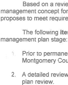
2 RECOMMENDATION: Approval, subject to the following conditions: 1. This Preliminary Plan is limited to four lots for four one-family detached dwelling units. 2. Prior to clearing, grading, or building demolition, the Applicant must comply with the conditions of approval for the Preliminary Forest Conservation Plan, approved as part of this Preliminary Plan, subject to: i. The Applicant must obtain approval of a Final Forest Conservation Plan from the Planning Department prior to the issuance of a Sediment Control Permit from the Montgomery County Department of Permitting Services ( MCDPS ). The Final Forest Conservation Plan must be consistent with the approved Preliminary Forest Conservation Plan. ii. Submit the reforestation, fee-in-lieu payment to the M-NCPPC as required by the Final Forest Conservation Plan. iii. The Applicant must plant nine-three inch caliper native trees as mitigation for the removal of four specimen trees. The species and locations of the mitigation trees must be identified on the Final Forest Conservation Plan. 3. The Planning Board accepts the recommendations of the Montgomery County Department of Transportation ( MCDOT ) in its letter dated October 23, 2012, and does hereby incorporate them as conditions of the Preliminary Plan approval. The Applicant must comply with each of the recommendations as set forth in the letter, which may be amended by MCDOT provided that the amendments do not conflict with other conditions of the Preliminary Plan approval. 4. The Applicant must satisfy the provisions for access and improvements as required by MCDOT prior to recordation of plat. 5. The Planning Board accepts the recommendations of the MCDPS Water Resources Section in its letter dated August 9, 2012, and does hereby incorporate them as conditions of the Preliminary Plan approval. The Applicant must comply with each of the recommendations as set forth in the letter, which may be amended by MCDPS Water Resources Section, provided that the amendments do not conflict with other conditions of the Preliminary Plan approval. 6. For purposes of noise attenuation, any building permits for one-family residences that are issued for Lots 1 and 4 pursuant to this Preliminary Plan must show that the buildings are to be built in substantially the same locations and orientations as shown on the certified Preliminary Plan, or prior to the issuance of the building permit the Applicant must obtain M-NCPPC staff approval of appropriate measures to mitigate unacceptable noise levels. 7. The Applicant must dedicate, and the record plat must show dedication of, 157 square feet of land for the right-of-way for Travilah Road to accommodate an existing shared use path, as shown on the Preliminary Plan. 8. The record plat must show necessary easements. 9. The record plat must reflect common ingress/egress and utility easements over all shared driveways. 2
3 10. The Subject Property is located in the Thomas S. Wootton High School Cluster. The Applicant must make a School Facilities Payment to MCDPS at the high school level at the one-family detached unit rate for all units for which a building permit is issued and a School Facilities Payment is applicable. The timing and amount of the payment will be in accordance with Chapter 52 of the Montgomery County Code. 11. The Adequate Public Facility (APF) review for the Preliminary Plan will remain valid for eightyfive (85) months from the date of mailing of the Planning Board Resolution. SITE DESCRIPTION Preliminary Plan No ( Application or Preliminary Plan ) is a request to subdivide a property identified as Parcels 397 and 398 on Tax Map FR12, located at Travilah Road abutting Patrick Avenue and consisting of 2.6-acres, zoned R-200/TDR ( Property or Subject Property ). The Property is located within the 2002 Potomac Master Plan area ( Master Plan ). The Property currently has a one-family detached dwelling unit with access provided by an existing driveway cut from Travilah Road. There are various sheds, a concrete slab, and other gravel surfaces to access previous uses on the Property. Travilah Road along the property frontage is constructed to the required standards with an eight-foot wide shared use path within the already dedicated right-of-way. There is a very small portion of the shared use path that crosses the existing line with the Subject Property. As depicted in Figures 1 and 2 below, the Property is surrounded by one-family detached dwellings in the R-200/TDR zone 1 and it is to the south of the proposed North Potomac Recreational Center. The Property s topography is generally flat, sloping gently from the southeast to the northwest. There are no forests, streams, wetlands, or environmental buffers on the Property. 1 Minimum lot size in the R-200 zone is 20,000 square feet if TDR option is not exercised. 3


4 North Potomac Recreational Center Big Pines Local Park Quarry Figure 1- Vicinity Map Figure 2- Property looking north 4

5 PROJECT DESCRIPTION 2 The Preliminary Plan proposes to subdivide Parcel 398 and Parcel 397 into four lots. The existing dwelling unit and accessory structures will be removed and the existing driveway cut from Travilah Road will be used for a new shared driveway to provide access to all four lots with a fire truck turnaround. There will be a dedication for the existing eight-foot wide hiker/biker trail of 157 square feet. All lots will be served by public water and sewer as approved by WSSC. Figure 3-Colored rendering of the Preliminary Plan. 2 See attached Preliminary Plan dated May 23,
6 ANALYSIS AND FINDINGS Conformance to the Master Plan The Property is located in the North Potomac Community Area, one of four Community Areas identified on page 5 of the 2002 Potomac Subregion Master Plan, ( Master Plan ). The Master Plan zoned this Property R-200/TDR. On page A-3 (Appendix) of the Master Plan, a minimum of 10 acres is required to utilize the transferable development rights (TDR-3) density. The Property will not be able to utilize the TDR option as the Property is 2.63-acres. Travilah Road is a two lane road and is classified as a primary residential road with a minimum right-of-way width of 70-feet. The Class I (off-road bike path) (p. 125) and shared use path recommended in the Countywide Bikeways Functional Master Plan exists in front of the Property. The Preliminary Plan is accommodating the shared use path by dedicating 157 square feet of right-of-way. The Application is in substantial conformance with the 2002 Potomac Subregion Master Plan as the Application will utilize existing infrastructure to create one-family detached residential lots in compliance with the recommended R-200 zone. As noted above, the Property is not large enough to utilize the optional method of development using TDRs. Public Facilities Roads and Transportation Facilities The Local Area Transportation Review ( LATR ) guidelines require a traffic study to be performed if the development generates 30 or more peak-hour trips. The Application generated traffic volumes well below the 30-trip threshold, and therefore, no LATR is required. The Property is located in the North Potomac Policy Area where there is a 5% Policy Area Mobility Review ( PAMR ) mitigation requirement per new trip, but it is exempt from PAMR because the four lots will generate three or fewer new trips. Access to the Property will be provided by utilizing the existing driveway cut with a new shared driveway from Travilah Road. The sight distance for the driveway is acceptable per the Sight Distance Evaluation reviewed and approved by MCDOT on October 23, The Application was reviewed and approved by the Montgomery County Fire and Rescue Service in a letter dated July 31, finding that the Property has adequate access for the largest emergency vehicles. The approved Fire Access Plan requires the Applicant to construct an emergency apparatus turnaround within the Property boundaries as shown on the Preliminary Plan. The Applicant is required to dedicate an additional 157 square feet of right-of-way for the existing shared use path that will be located within that right-of-way. The proposed vehicle and pedestrian access for the subdivision will be safe and adequate with the proposed improvements. Other Public Facilities and Services Public facilities and services are available and adequate to serve the proposed lots. Public water and sewer service is adequate and is proposed to serve each dwelling unit. The existing well and pump will 3 See attached letter. 4 See attached letter. 6
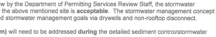
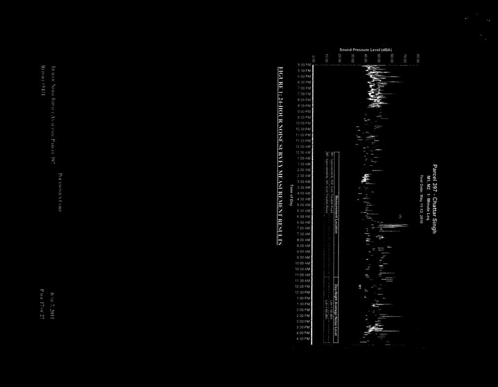
7 be removed from proposed Lot 4. Gas, electrical and telecommunications services are available to serve the proposed lots. Other public facilities and services, such as police stations and health services are operating within the standards set by the Subdivision Staging Policy currently in effect. The Application is located in the Thomas S. Wootton School Cluster which is operating at acceptable levels at the elementary and middle school levels, but at an inadequate capacity at the high school classroom level 5. The Application is subject to a School Facilities Payment at the high school level which must be made for each dwelling unit approved under this Preliminary Plan. The timing and amount of the payment is prescribed in Chapter 52 of the County Code. Environment Environmental Inventory The Natural Resource Inventory/Forest Stand Delineation ( NRI/FSD ) # for this Property was approved on October 18, The NRI/FSD identifies the environmental constraints and forest resources on the Subject Property. The Property contains no forest. There were five trees 30 inches or greater in diameter at breast height ( DBH ); however, one of these trees has been subsequently removed by the Applicant. Additionally, there are eight trees between 24 inches and 30 inches in DBH on the Property. The Property s topography is generally flat, sloping gently from the southeast to the northwest. There are no forests, streams, wetlands, or environmental buffers on the Property. It is within the Watts Branch watershed, which is classified as a Use I watershed by the Maryland Department of the Environment. The Montgomery County CSPS rates streams in this watershed as having fair water quality. Noise Analysis Based upon current and projected traffic volumes for Travilah Road, the Applicant provided a noise study to identify the 60 decibel level day night (dba Ldn) noise contour 6 and to indicate methods to attenuate interior noise of any affected homes to 45 dba Ldn 7 and exterior private spaces (backyard) to 60 dba Ldn. The Applicant provided a noise analysis prepared by Polysonics, dated June 7, The noise analysis identified the 60 dba Ldn noise contour line (Figure 4) for the future as well as today. The Preliminary Plan shows all houses outside of the 60 dba Ldn area to satisfy the noise recommendations and avoid providing specific mitigation measures for outdoor use area. If the actual houses on proposed Lots 1 and 4 are built in the locations reflected on the Preliminary Plan, the Application meets the recommend noise guidelines for outdoor area. The required interior noise levels can generally be attained by meeting standard building construction requirements. If the houses on proposed Lot 1 and 4 are not built in the same general location and orientation shown on the Preliminary Plan, additional noise 5 Per the Subdivision Staging Policy Appendix ndix4sc.pdf 6 60dBA Ldn contour is the maximum recommended noise level for residential areas where suburban densities predominate. 7 45dBA Ldn is the maximum recommended interior noise levels for residential properties. Standard construction measures generally provide sufficient abatement if exterior Ldn guidelines have been met. 7
 The Property contains no forest; however, based on Chapter 22A of the County code the Applicant has a 0.")
8 studies will be required prior to issuance of the building permit, to determine an appropriate noise mitigation technique(s). Figure 4 60 decibel level at day and night contour line Forest Conservation Plan (FCP) The Property contains no forest; however, based on Chapter 22A of the County code the Applicant has a 0.39-acre planting requirement. The Applicant proposes to meet the entire planting requirement through a Fee-In-Lieu payment. In specific development situations the Planning Board or Planning Director may allow an applicant to pay into the County Forest Conservation Fund instead of providing afforestation, reforestation, or landscaping 8. One such situation consists of afforestation on sites with no priority planting areas. If a site has afforestation planting requirements and the Planning Board or Planning Director, as appropriate, finds that no on-site priority planting area is present and no other 8 Chapter 22A-12(g)(2) In lieu fee; Specific Development Situations 8
9 appropriate on-site planting area is available, the applicant may pay the fee instead of doing off-site afforestation. The in-lieu fee must be paid to the Planning Department prior to any land disturbance occurring on-site. Staff finds that for this Property, there is no acceptable on-site priority planting area and that there are no other appropriate planting area to meet the planting requirement. Staff supports the Applicant s request to make a Fee-in-Lieu payment. Forest Conservation Variance Section 22A-12(b)(3) of the County Code requires applicants to identify certain trees, shrubs, plants and specific areas as priority for retention and protection and further requires those features to be left in an undisturbed condition unless a variance is obtained in accordance with Chapter 22A-21 of the County Code. A person may request in writing a variance from this Chapter, if it can be demonstrated that enforcement would result in unwarranted hardship to the person. A variance is required since this project will require that two trees 30 inches or greater DBH ( Protected Trees ) be removed (Trees # 2 and 4) and that there will be impact to two other Protected Trees (Trees # 1 and 5) depicted in Figure 5. As stated in Table 1, Tree 1 was initially going to be impacted, but was removed without permission by the Applicant as discussed in the below section mitigation. Table 1: Trees to be removed Tree Species DBH Condition/Status Proposed Action Number 1 Silver Maple 33 Good, Multi-stemmed Removed without permission 2 White Oak 34 Good, Terminal Dieback To Be Removed 4 White Oak 36 Fair, Terminal Dieback, Poison Ivy, Limb Loss To Be Removed 5 White Oak 35 Good, Off-site, Some Terminal Dieback Saved 9

10 Figure 5 - Tree Variance Unwarranted Hardship Basis The Applicant believes that enforcement of Section 22A-12(b)(3) will create an unwarranted hardship by preventing a reasonable subdivision of the Property. The size and shape of the Property, in conjunction with the avoidance of any impact to the four remaining Protected Trees would prevent the efficient subdivision of the Property into lots that conform to zoning, the Subdivision Regulations, fire marshal requirements and storm water management regulations, thus causing an unwarranted hardship. 10
11 Staff concurs with the Applicant s justification for an unwarranted hardship. The location of the Protected Trees and their associated critical root zones would severely limit the development potential of the Property with four lots that meet all zoning and subdivision requirements. Variance Findings The Planning Board must make findings that the Applicant has met all requirements of this Chapter 22A- 21 before granting the variance. Staff has made the following determination regarding the variance and recommends that it be granted for all four trees: Granting the variance: 1. Will not confer on the Applicant a special privilege that would be denied to other applicants; Granting the variance will not confer a special privilege on the Applicant as the critical root zone ( CRZ ) location/distribution of the Protected Trees is in such a manner that they provide a near contiguous root zone coverage that stretches the entire width of the Property behind the existing residence. Any applicant considering development of the Property consistent with the Master Plan and the zone would require disturbance and/or removal of the Protected Trees. 2. Is not based on conditions or circumstances which are the result of actions by the Applicant; The majority of the Property would not be developable in accordance with the Master Plan or the zoning if the CRZ of specimen trees were required to remain undisturbed. 3. Is not based on a condition relating to land or building use, either permitted or non-conforming, on a neighboring property The requested variance is a result of the proposed development and not a result of land or building use on a neighboring property. 4. Will not violate State water quality standards or cause measurable degradation in water quality. The Protected Trees being removed are not within a stream buffer, wetland, or a special protection area their contribution to maintaining water quality can be replaced by the planting of new trees after construction. Mitigation at a rate that approximates the form and function of the Protected Trees removed will provide some mitigation for water quality protection as the trees grow and mature. A Stormwater Management Concept Plan was approved by the MCDPS Mitigation for Trees Subject to the Variance Provisions Mitigation should be at a rate that approximates the form and function of the trees removed. Staff recommends that replacement occur at a ratio of approximately one inch DBH for every four inches DBH removed, using trees that are three-inches in DBH. This means that for the total 70 caliper inches of variance trees removed (Tree 2 at 34 and Tree 4 at 36 for a total of 70 ), six three inch DBH native canopy trees must be planted on the Property. While these trees will not be as large as the trees lost, the trees will provide some immediate canopy to help augment the canopy coverage that will remain. 11
12 After the Application was filed, Tree #1 (33 Silver Maple) was removed without permission from the site. Tree #1 was not included on the submitted variance request. The Applicant indicated that Tree #1 was removed due to storm damage that occurred on the Property. However, the tree was never inspected by an arborist and was already removed before M-NCPPC staff was notified. The Applicant provided an undated letter from Harjot Singh, president of CCM5-Contracting and Construction Management, indicating that they removed several broken branches from the tree and recommended removal 9. Unfortunately, Staff had no opportunity to verify the damage and no Certified Tree Care Expert or Certified Arborist evaluations were done prior to the tree removal. Staff recommends mitigation for Tree #1 equal to the amount of mitigation that would have been required if they had requested it to be removed. This would generate an additional three three inch DBH native canopy trees in mitigation. The total amount of variance mitigation recommend for this project would be nine three inch DBH native canopy trees to be planted on-site. County Arborist s Recommendation In accordance with Montgomery County Code, Section 22A-21(c), the Planning Department is required to refer a copy of the variance request to the County Arborist in the Montgomery County Department of Environmental Protection for a recommendation prior to acting on the request. The request was forwarded to the County Arborist on May 31, On June 8, 2012, the County Arborist issued a letter recommending that the variance can be granted if mitigation is provided 10. Stormwater Management Concept The MCDPS Stormwater Management Section conditionally approved the Stormwater Management Concept for the Application on August 9, Environmental Site Design has been integrated on-site using drywells and non-rooftop disconnect techniques. Compliance with the Subdivision Regulations and Zoning Ordinance The Application was reviewed for compliance with the Montgomery County Code, Chapter 50 in the Subdivision Regulations. The Application meets all applicable sections. The size, width, shape, and orientation of the proposed lots are appropriate for the location of the subdivision given the use proposed for the Property and the surrounding uses. Based on a review of the local area development map, Figure 1, the lots are comparable in size, width, shape and orientation to existing properties fronting onto Travilah Road in the general area. The lots were reviewed for compliance with the dimensional requirements of the R-200 zone as specified in the Zoning Ordinance. The lots as proposed will meet all the dimensional requirements for area, frontage, width, and setbacks established in that zone. A summary of this review is included in attached Table 2. The Application was reviewed by other applicable county agencies, all of whom have recommended approval of the Preliminary Plan. 9 See attached letter. 10 See attached letter. 11 See attached letter. 12
13 Table 2: Preliminary Plan Data Table for R-200 zone Standard Method PLAN DATA Zoning Ordinance Development Standard Proposed for Approval by the Preliminary Plan Minimum Lot Area 20,000 sq. ft. 22,010 sq. ft. minimum Lot Width 100 ft. 102 ft. minimum Lot Frontage 25 ft. 25 ft. minimum Setbacks Front 40 ft. Min. Must meet minimum 1 Side 12 ft. Min./ 25 ft. total Must meet minimum 1 Rear 30 ft. Min. Must meet minimum 1 Height 50 ft. Max. May not exceed maximum 1 Maximum Residential Dwelling Units 5 4 MPDUs N/A N/A TDRs N/A N/A Site Plan Required N/A N/A 1 As determined by MCDPS at the time of building permit. Citizen Correspondence and Issues The Applicant notified adjacent and confronting property owners of the pre-submission meeting held on October 12, 2010 at 7:30 p.m. at Travilah Road (Gurdwara Lobby). 17 people attended the presubmission meeting. The plan was discussed and according to the minutes of the meeting, the Applicant answered questions regarding the Application. To date, staff has not received any further correspondence regarding the Application. CONCLUSION The Application meets all requirements established in the Subdivision Regulations and the Zoning Ordinance and substantially conforms to the recommendations of the 2002 Potomac Subregion Master Plan. Access and public facilities will be adequate to serve the Property, and the lots conform to all zoning and subdivision requirements. The Application was reviewed by all applicable county agencies, all of whom have recommended approval of the Preliminary Plan. Therefore, approval of the Application with the conditions specified above is recommended. Attachments Attachment A Proposed Development Plan Attachment B Agency Correspondence Attachment C Forest Conservation Plan Attachment D June 7, 2011 Noise Analysis 13
14
15 ATTACHMENT B
16 16 ATTACHMENT B
17 ATTACHMENT B FIRE MARSHAL COMMENTS DATE: TO: FROM: RE: 31-Jul-12 Pritam Arora - parora@deius.com Design Engineering Inc Marie LaBaw Parmjit & Saini Estates \~-.. PLAN APPROVED 1. Review based only upon infonnation contained on the plan submitted 22-May-12.Review and approval does not cove; unsatisfactory installation resulting from errors, omissions, or failure to clearly indicate conditions on this plan. 2. Correction of unsatisfactory installation will be required upon inspection and service of notice of violation tga p'l:' responsible for the property. " ;~r :.i) :. i,arry 17
18 18 ATTACHMENT B
19 19 ATTACHMENT B

20 Ccm5- Contracting and Construction Management 1421 Silo Way Silver Spring, Maryland Phone (240) ATTACHMENT B To Whom this may Concern; Mr. Saini called me to remove the broken branches of the tree near the parked cars and the house at Travilah Rd. Rockville, MD. We removed several broken branched and suggested the tree is going to be dangerous because it is unstable/. Unbalanced and can fall any time. Thanks Harjot Singh CCM5-Contracting And Construction Management, President Harjot Singh 1 20


21 21 ATTACHMENT B

22 22 ATTACHMENT B
23 23

24 24
25 25
26 26
27 27
28 28
29 29
30 30
31 31
32 32
33 33
34 34
35 35
36 36
37 37
38 38
39 39
40 40
41 41
42 42
43 43
44 44
45 45
46 46
47 47
48 48
49 49
50 50
MONTGOMERY COUNTY PLANNING DEPARTMENT THE MARYLAND-NATIONAL CAPITAL PARK AND PLANNING COMMISSION
 MONTGOMERY COUNTY PLANNING DEPARTMENT THE MARYLAND-NATIONAL CAPITAL PARK AND PLANNING COMMISSION MCPB Item No.: Date: 06-21-12 The Plantations, Preliminary Plan -120090240 Benjamin Berbert, Senior Planner,
MONTGOMERY COUNTY PLANNING DEPARTMENT THE MARYLAND-NATIONAL CAPITAL PARK AND PLANNING COMMISSION
 MONTGOMERY COUNTY PLANNING DEPARTMENT THE MARYLAND-NATIONAL CAPITAL PARK AND PLANNING COMMISSION MCPB Item No. 8 Date: 03-07-13 Sonoma, Preliminary Plan, 120130040 Melissa Williams, Senior Planner, Melissa.williams@montgomeryplanning.org,
MONTGOMERY COUNTY PLANNING DEPARTMENT THE MARYLAND-NATIONAL CAPITAL PARK AND PLANNING COMMISSION
 MONTGOMERY COUNTY PLANNING DEPARTMENT THE MARYLAND-NATIONAL CAPITAL PARK AND PLANNING COMMISSION MCPB Item No. 3 Date: 01-31-13 Preliminary Plan 120090300, Boyds Highlands Calvin Nelson, Jr. Planner Coordinator,
MONTGOMERY COUNTY PLANNING DEPARTMENT THE MARYLAND-NATIONAL CAPITAL PARK AND PLANNING COMMISSION
 MONTGOMERY COUNTY PLANNING DEPARTMENT THE MARYLAND-NATIONAL CAPITAL PARK AND PLANNING COMMISSION MCPB Item No. Date: 12/4/14 Preliminary Plan No. 120140200, Northwood Knolls Description Patrick Butler,
RECOMMENDATION: Approval subject to the following conditions:
 RECOMMENDATION: Approval subject to the following conditions: 1) Approval under this preliminary plan is limited to 2 lots for 2 dwelling units 2) The record plat must note that the preliminary plan is
MONTGOMERY COUNTY PLANNING BOARD
 MONTGOMERY COUNTYPLANNING BOARD T H E MARYLAND-NATIONAL CAPITAL PARK A N D P L A N N I N G C O M M I S S I O N MCPB NO. 10-100 Preliminary Plan No. 120100210 Date of Hearing: July 1, 2010 MONTGOMERY COUNTY
MONTGOMERY COUNTY PLANNING DEPARTMENT THE MARYLAND-NATIONAL CAPITAL PARK AND PLANNING COMMISSION
 MONTGOMERY COUNTY PLANNING DEPARTMENT THE MARYLAND-NATIONAL CAPITAL PARK AND PLANNING COMMISSION MCPB Item No. 3 Date: 05/28/15 Ingleside, Preliminary Plan No. 120140140 Ryan Sigworth AICP, Senior Planner
MONTGOMERY COUNTY PLANNING DEPARTMENT THE MARYLAND-NATIONAL CAPITAL PARK AND PLANNING COMMISSION
 MONTGOMERY COUNTY PLANNING DEPARTMENT THE MARYLAND-NATIONAL CAPITAL PARK AND PLANNING COMMISSION MCPB Item No. Date: 12/6/12 Limited Site Plan Amendment, 82000018D, DANAC Stiles Property, Lot 6 of Block
MONTGOMERY COUNTY PLANNING DEPARTMENT THE MARYLAND-NATIONAL CAPITAL PARK AND PLANNING COMMISSION
 MONTGOMERY COUNTY PLANNING DEPARTMENT THE MARYLAND-NATIONAL CAPITAL PARK AND PLANNING COMMISSION MCPB Item No. 6 Date: 9-27-18 Seneca Farms, Preliminary Plan No. 120170240 Jonathan Casey, Senior Planner,
MONTGOMERY COUNTY PLANNING DEPARTMENT THE MARYLAND-NATIONAL CAPITAL PARK AND PLANNING COMMISSION
 MONTGOMERY COUNTY PLANNING DEPARTMENT THE MARYLAND-NATIONAL CAPITAL PARK AND PLANNING COMMISSION MCPB Item No.: 4 Date: 2-7-19 Old Angler s Cove, Preliminary Plan No. 120170290 Ryan Sigworth AICP, Senior
MONTGOMERY COUNTY PLANNING DEPARTMENT THE MARYLAND-NATIONAL CAPITAL PARK AND PLANNING COMMISSION
 MONTGOMERY COUNTY PLANNING DEPARTMENT THE MARYLAND-NATIONAL CAPITAL PARK AND PLANNING COMMISSION Ganassa Property, Preliminary Plan, 120040640 MCPB Item No. Date: 7-25-13 Callum Murray, Area 3 Supervisor,
MONTGOMERY COUNTY PLANNING BOARD
 APR :7 20m MONTGOMERY COUNTY PLANNING BOARD THE MARYLAND-NATIONAL CAPITAL PARK AND PLANNING COMMISSION MCPB No. 10-172 Date of Hearing: December 9, 2010 MONTGOMERY COUNTY PLANNING BOARD RESOLUTION WHEREAS,
MONTGOMERY COUNTY PLANNING DEPARTMENT THE MARYLAND-NATIONAL CAPITAL PARK AND PLANNING COMMISSION
 MONTGOMERY COUNTY PLANNING DEPARTMENT THE MARYLAND-NATIONAL CAPITAL PARK AND PLANNING COMMISSION MCPB Consent Item Date: 12/19/13 * Consent Item Barton Property: Preliminary Plan Amendment No. 12011021A
MONTGOMERY COUNTY PLANNING DEPARTMENT THE MARYLAND-NATIONAL CAPITAL PARK AND PLANNING COMMISSION
 MONTGOMERY COUNTY PLANNING DEPARTMENT THE MARYLAND-NATIONAL CAPITAL PARK AND PLANNING COMMISSION MCPB Item No. Date: 10-03-13 Preliminary Plan Amendment No. 11999034B Alvermar Woods, Lot 17 (In Response
MONTGOMERY COUNTY PLANNING DEPARTMENT THE MARYLAND-NATIONAL CAPITAL PARK AND PLANNING COMMISSION
 MONTGOMERY COUNTY PLANNING DEPARTMENT THE MARYLAND-NATIONAL CAPITAL PARK AND PLANNING COMMISSION MCPB Item No. Hearing Date: 10/8/15 Howard Hughes Medical Institute, Limited Amendment of the Preliminary
MONTGOMERY COUNTY PLANNING DEPARTMENT THE MARYLAND-NATIONAL CAPITAL PARK AND PLANNING COMMISSION
 MONTGOMERY COUNTY PLANNING DEPARTMENT THE MARYLAND-NATIONAL CAPITAL PARK AND PLANNING COMMISSION MCPB Item No. Date: 10-11-12 Subdivision Review Waiver SRW 2011001: Big Woods Road Richard Weaver, Acting
MONTGOMERY COUNTY PLANNING DEPARTMENT THE MARYLAND-NATIONAL CAPITAL PARK AND PLANNING COMMISSION
 MONTGOMERY COUNTY PLANNING DEPARTMENT THE MARYLAND-NATIONAL CAPITAL PARK AND PLANNING COMMISSION MCPB Item No. Date: 05-30-13 Pre-Preliminary Plan No. 720130040: Potomac Highlands Callum Murray, supervisor,
DANAC Stiles Property. Preliminary Plan A
 DANAC Stiles Property Preliminary Plan 11996112A Vicinity Located in the LSC North District of the GSSC Master Plan. Adjacent Uses North: Single-family attached townhouses, R-60 zone; East: Office building,
MONTGOMERY COUNTY PLANNING BOARD
 MONTGOMERY COUNTY PLANNING BOARD T H E MARYLAND-NATIONAL CAPITAL PARK A N D P L A N N I N G C O M M I S S I O N MCPB NO. 10-144 Hearing Date: September 30, 2010 MONTGOMERY COUNTY PLANNING BOARD RESOLUTION
MONTGOMERY COUNTY PLANNING DEPARTMENT THE MARYLAND-NATIONAL CAPITAL PARK AND PLANNING COMMISSION
 MONTGOMERY COUNTY PLANNING DEPARTMENT THE MARYLAND-NATIONAL CAPITAL PARK AND PLANNING COMMISSION MCPB Item No.: Date: 07-28-16 Lake Normandy Estates: Pre-Preliminary Plan No. 720160020 Ryan Sigworth AICP,
7-l MoNtcoupnv CouNtv PreNNrNc Boeno,I 'tne ITaRYLAND-NATIoNAL CAPITAL PARI< AND PLANNING con{n{ission
 7-l MoNtcoupnv CouNtv PreNNrNc Boeno,I 'tne ITaRYLAND-NATIoNAL CAPITAL PARI< AND PLANNING con{n{ission MCPB No. 16-023 Preliminary Plan No. '120160110 Date of Hearing: March 3, 2016 ltar 17 frft, RESOLUTlON
MONTGOMERY COUNTY PLANNING DEPARTMENT THE MARYLAND-NATIONAL CAPITAL PARK AND PLANNING COMMISSION
 MONTGOMERY COUNTY PLANNING DEPARTMENT THE MARYLAND-NATIONAL CAPITAL PARK AND PLANNING COMMISSION MCPB Item No. xxxxx Date: 6-7-12 Hoyt Property, Preliminary/Site Plan, 120120140/820120070 Tina Schneider,
MONTGOMERY COUNTY PLANNING DEPARTMENT THE MARYLAND-NATIONAL CAPITAL PARK AND PLANNING COMMISSION
 MONTGOMERY COUNTY PLANNING DEPARTMENT THE MARYLAND-NATIONAL CAPITAL PARK AND PLANNING COMMISSION Wheaton Woods, Preliminary Plan No. 120160060 MCPB Item No. Date: 02-25-16 Lori Shirley, Planner Coordinator,
MONTGOMERY COUNTY PLANNING DEPARTMENT THE MARYLAND-NATIONAL CAPITAL PARK AND PLANNING COMMISSION
 MONTGOMERY COUNTY PLANNING DEPARTMENT THE MARYLAND-NATIONAL CAPITAL PARK AND PLANNING COMMISSION St. Andrews Episcopal School, Forest Conservation Plan Amendment, CBA 1389C (In response to violation) MCPB
MONTGOMERY COUNTY PLANNING DEPARTMENT THE MARYLAND-NATIONAL CAPITAL PARK AND PLANNING COMMISSION
 MONTGOMERY COUNTY PLANNING DEPARTMENT THE MARYLAND-NATIONAL CAPITAL PARK AND PLANNING COMMISSION Colesville Senior Living Facility, Limited Preliminary Plan Amendment, 12016011A MCPB Consent Item Date:
MONTGOMERY COUNTY PLANNING DEPARTMENT THE MARYLAND-NATIONAL CAPITAL PARK AND PLANNING COMMISSION
 MONTGOMERY COUNTY PLANNING DEPARTMENT THE MARYLAND-NATIONAL CAPITAL PARK AND PLANNING COMMISSION MCPB Item No. 5 Date: 12-15-16 Bradford s Landing, Preliminary Plan, 120170060 Description Sandra Pereira,
MONTGOMERY COUNTY PLANNING DEPARTMENT
 MONTGOMERY COUNTY PLANNING DEPARTMENT THE MARYLAND-NATIONAL CAPITAL PARK AND PLANNING COMMISSION MCPB Item No. Date: 6/2/208 Washington Science Center-6000 Executive Boulevard, Limited Major Site Plan
MONTGOMERY COUNTY PLANNING DEPARTMENT THE MARYLAND-NATIONAL CAPITAL PARK AND PLANNING COMMISSION
 MONTGOMERY COUNTY PLANNING DEPARTMENT THE MARYLAND-NATIONAL CAPITAL PARK AND PLANNING COMMISSION MCPB Item No. Date: 10-1-15 Chick-fil-A Olney: Preliminary Plan No. 120150180 and Site Plan No. 820150100
Article Optional Method Requirements
 Article 59-6. Optional Method Requirements [DIV. 6.1. MPDU DEVELOPMENT IN RURAL RESIDENTIAL AND RESIDENTIAL ZONES Sec. 6.1.1. General Requirements... 6 2 Sec. 6.1.2. General Site and Building Type Mix...
Town of Cary, North Carolina Rezoning Staff Report 12-REZ-27 Morris Branch Town Council Public Hearing January 24, 2013
 Town of Cary, North Carolina Rezoning Staff Report 12-REZ-27 Morris Branch Town Council Public Hearing January 24, 2013 REQUEST To amend the Town of Cary Official Zoning Map to rezone approximately 9.0
O-I (Office-Institutional) and AG-1(Agricultural)
 and AG-1(Agricultural)") PROPERTY INFORMATION ADDRESS 3503 and 3505 Bethany Bend DISTRICT, LAND LOTS 2/1 973 and 974 OVERLAY DISTRICT State Route 9 PETITION NUMBERS EXISTING ZONING O-I (Office-Institutional) and AG-1(Agricultural)
PROPERTY INFORMATION ADDRESS 3503 and 3505 Bethany Bend DISTRICT, LAND LOTS 2/1 973 and 974 OVERLAY DISTRICT State Route 9 PETITION NUMBERS EXISTING ZONING O-I (Office-Institutional) and AG-1(Agricultural)
R E S O L U T I O N. a. Remove Table B from the plan.
 R E S O L U T I O N WHEREAS, Werrlein Property is the owner of a 0.3902-acre parcel of land in the 5th Election District of Prince George s County, Maryland, being zoned One-Family Detached Residential
MEMORANDUM. DATE: November 9, 2016 PC Agenda Item 3.C
 MEMORANDUM DATE: November 9, 2016 PC Agenda Item 3.C TO: FROM: SUBJECT: Planning Commission Eric Zweber, AICP, Interim City Planner Planning Case #16-029 Public Hearing Required Applicant: Bremer Bank,
CREEKSIDE TOWNHOMES Chevy Chase, Maryland Site Plan No Preliminary Plan No
 +1 (301) 656 5901 info@nova-habitat.com CREEKSIDE TOWNHOMES Chevy Chase, Maryland Site Plan No. 820160050 Preliminary Plan No. 120160130 Application Statement of Justification October 28, 2015 Nova-Habitat,
ARTICLE OPTIONAL METHOD REGULATIONS
 ARTICLE 59-6. OPTIONAL METHOD REGULATIONS DIV. 6.1. MPDU DEVELOPMENT IN RURAL RESIDENTIAL AND RESIDENTIAL ZONES SEC. 6.1.1. GENERAL REQUIREMENTS... 6 2 SEC. 6.1.2. GENERAL SITE AND BUILDING T PE MIX...
Applicant s Agent Lisa Murphy, Esq. Staff Planner PJ Scully. Lot Recordation 12/01/1972 Map Book 94, Page 33 GPIN
 Property Owner and Applicant Address 3925 Shore Drive Public Hearing September 24, 2018 City Council District Bayside Agenda Item 6 Variance Request Encroachment into the Resource Protection Area (RPA)
Preliminary Plan
 The Maryland-National Capital Park and Planning Commission Prince George's County Planning Department Development Review Division 301-952-3530 Note: Staff reports can be accessed at www.mncppc.org/pgco/planning/plan.htm.
Staff Report PLANNED DEVELOPMENT. Salt Lake City Planning Commission. From: Lauren Parisi, Associate Planner; Date: December 14, 2016
 Staff Report PLANNING DIVISION COMMUNITY & NEIGHBORHOODS To: Salt Lake City Planning Commission From: Lauren Parisi, Associate Planner; 801-535-7932 Date: December 14, 2016 Re: 1611 South 1600 East PLANNED
GROSVENOR-STRATHMORE METRO STATION MANDATORY REFERRAL APPLICATION NORTH BETHESDA, MD
 GROSVENOR-STRATHMORE METRO STATION MANDATORY REFERRAL APPLICATION NORTH BETHESDA, MD Submission by: Fivesquares JDA at Grosvenor Metro, LLC On behalf of Washington Metropolitan Area Transit Authority 1
Bowie Marketplace Residential Detailed Site Plan Statement of Justification January 13, 2017 Revised February 2, 1017
 Bowie Marketplace Residential Detailed Site Plan Statement of Justification January 13, 2017 Revised February 2, 1017 Submitted on behalf of: BE Bowie LLC 5410 Edson Lane, Suite 220 Rockville, MD 20852
D1 August 12, 2015 Public Hearing APPLICANT: CCW DEVELOPMENT ASSOCIATES, LLC PROPERTY OWNER: WAYNE DUPREE
 D1 August 12, 2015 Public Hearing APPLICANT: CCW DEVELOPMENT ASSOCIATES, LLC PROPERTY OWNER: WAYNE DUPREE REQUEST: Change of Zoning (A-12 Apartment District to Conditional A-12 Apartment District) STAFF
1.94 acres. Gwinnett Prado, L.P. c/o Brogdon Consulting Duluth, GA Contact: Ted Sandler
 Land Use Petition RZ-15-006 Date of Staff Recommendation Preparation: April 21, 2015 Revised to Incorporate Planning Commission Recommendations: 5/6/15 PROJECT LOCATION: 10800 Block of State Bridge Road
Montgomery Village - South Valley Park: Subdivision Regulation Waiver SRW , and Site Plan No
 Montgomery Village - South Valley Park: Subdivision Regulation Waiver SRW - 201402, and Site Plan No. 820140070 12 SUBDIVISION REGULATION WAIVER RECOMMENDATION AND CONDITIONS OF APPROVAL Staff recommends
WHEREAS, the staff of The Maryland-National Capital Park and Planning Commission recommended APPROVAL of the application with conditions; and
 R E S O L U T I O N WHEREAS, Redeemed Christian Church of God is the owner of a 2.83-acre parcel of land known as Lot 9, Lot 19, P/O Lot 1 and P/O Lot 18, Block B, Plat Book A, Plat 5, said property being
FINAL DRAFT 10/23/06 ARTICLE VI
 FINAL DRAFT 10/23/06 ARTICLE VI 185-41.1. Planned Residential Development A. Purpose and Intent. The purposes of the Planned Residential Development (PRD) bylaw are to maintain the rural character of Dover,
GWINNETT COUNTY CSO CONSERVATION SUBDIVISION OVERLAY DISTRICT REQUIREMENTS
 GWINNETT COUNTY CSO CONSERVATION SUBDIVISION OVERLAY DISTRICT REQUIREMENTS Section 1316. CSO Conservation Subdivision Overlay District. 1. Purposes. The purposes of this overlay district are as follows:
MONTGOMERY COUNTY PLANNING DEPARTMENT THE MARYLAND-NATIONAL CAPITAL PARK AND PLANNING COMMISSION
 MONTGOMERY COUNTY PLANNING DEPARTMENT THE MARYLAND-NATIONAL CAPITAL PARK AND PLANNING COMMISSION MCPB Consent Item Date: 11-2-17 Washington Adventist Hospital, Site Plan Amendment No. 82008021F Rhoda Hersson-Ringskog,
ARTICLE 8C SITE CONDOMINIUM DEVELOPMENT ORDINANCE
 ARTICLE 8C SITE CONDOMINIUM DEVELOPMENT ORDINANCE SECTION 8C.01 PURPOSE It is the purpose of this Ordinance to insure that plans for development within Oceola Township proposed under the provisions of
PORT CITY COMMERCE PARK SUBDIVISION
 # 4 SUB2015-00019 PORT CITY COMMERCE PARK SUBDIVISION Engineering Comments: Must comply with the Mobile County Flood Damage Prevention Ordinance. Development shall be designed to comply with the storm
CHAPTER 6 CHESAPEAKE BAY PRESERVATION AREAS AND STREAM PROTECTION AREAS
 CHAPTER 6 CHESAPEAKE BAY PRESERVATION AREAS AND STREAM PROTECTION AREAS 6.1 INTRODUCTION Virginia s Chesapeake Bay Preservation Area (CBPA) Designation and Management Regulations (9VAC10-20 et seq.) require
E L M E R B O R O U G H L A N D U S E B O A R D APPLICATION COVER SHEET (to be completed for all applications and appeals)
") E L M E R B O R O U G H L A N D U S E B O A R D APPLICATION COVER SHEET (to be completed for all applications and appeals) 1. Name(s): 2. Address: 3. Telephone Number(s): 4. E-mail: 5. Owner Name(s) (if
E L M E R B O R O U G H L A N D U S E B O A R D APPLICATION COVER SHEET (to be completed for all applications and appeals) 1. Name(s): 2. Address: 3. Telephone Number(s): 4. E-mail: 5. Owner Name(s) (if
PLANNED DEVELOPMENT DISTRICT STANDARDS. Cadence Site
 PLANNED DEVELOPMENT DISTRICT STANDARDS Cadence Site A Planned Development District 1. Statement of General Facts, Conditions and Objectives Property Size: Approximately 57.51 Acres York County Tax Map
TENTATIVE MAP INFORMATION SHEET
 TENTATIVE MAP INFORMATION SHEET GENERAL INFORMATION This information sheet explains how your Tentative Map application will be processed, what fees you must pay, and what plans you must submit. If you
PGCPB No File No R E S O L U T I O N
 R E S O L U T I O N WHEREAS, Cambridge Place at Westphalia is the owner of a 68.94-acre parcel of land known as Tax Map 90 in Grid C-1 and is also known as Parcel C, said property being in the 15th Election
Article 7: Residential Land Use and Development Requirements
 Article 7: Residential Land Use and Section 701: Statement of Intent (A) (B) (C) The intent of Article 7 is to develop certain land use and development requirements for the residential uses within Cumru
3 July 13, 2011 Public Hearing APPLICANT / PROPERTY OWNER: MARQUETTE & ASSOCIATES, L.L.C. /G.S. DEVELOPERS, L.L.C.
 3 July 13, 2011 Public Hearing APPLICANT / PROPERTY OWNER: MARQUETTE & ASSOCIATES, L.L.C. /G.S. DEVELOPERS, L.L.C. STAFF PLANNER: Faith Christie REQUEST: Conditional Change of Zoning (AG-2 Agricultural
CITRUS HEIGHTS COMMUNITY SPECIAL PLANNING AREA
 CITRUS HEIGHTS COMMUNITY SPECIAL PLANNING AREA 501-90. INTENT. It is the intent of the Board of Supervisors in adopting this Special Planning Area Ordinance to allow development on the property described
MONTGOMERY COUNTY PLANNING DEPARTMENT THE MARYLAND-NATIONAL CAPITAL PARK AND PLANNING COMMISSION
 MONTGOMERY COUNTY PLANNING DEPARTMENT THE MARYLAND-NATIONAL CAPITAL PARK AND PLANNING COMMISSION MCPB Item No.: Date: 11-12-15 15931 Frederick Road (CarMax) Annexation Request ANX2015-00145 Patrick Butler,
Chesapeake Bay Critical Area Conservation Plan
 The Maryland-National Capital Park and Planning Commission Prince George s County Planning Department Development Review Division 301-952-3530 Note: Staff reports can be accessed at www.mncppc.org/pgco/planning/plan.htm.
A. Location. A MRD District may be permitted throughout the County provided it meets the standards established herein.
 752. Multi-Residential District (MRD) The Multi-Residential (MRD) District is intended to provide opportunities for rural, suburban and urban density mixed-residential developments consistent with the
Initial Subdivision Applications Shall Include the Following:
 Initial Subdivision Applications Shall Include the Following: 1) Subdivision Application Form: completely filled out (12 copies) 2) Plat: The Plat must adhere to the requirements set forth in the Town
WHEREAS, the staff of The Maryland-National Capital Park and Planning Commission recommended APPROVAL of the application with conditions; and
 R E S O L U T I O N WHEREAS, F.M. and M.B. Hall are the owners of a 17.60-acre parcel of land known as Lots 1-3, Block O; Lots 1-11, Block P; and Parcel B and part of Parcel A, being located on Tax Map
HERON LANDING SUBDIVISION
 HERON LANDING SUBDIVISION Engineering Comments: Per FEMA guidelines, any development greater than 5 acres in size or subdivision 50 lots in size, requires a flood study. Width of drainage easement to be
CITY OF FERNDALE HEARING EXAMINER
 CITY OF FERNDALE HEARING EXAMINER RE: Planned Unit Development ) 16001-PUD Preliminary Plat ) 16018-SE Plat Variance ) 16002-VAR Application by ) ) MD General, L.L.C. ) FINDINGS OF FACT, Malloy Heights
PLANNING COMMISSION MAY 3, 2018 PUBLIC HEARING
 PLANNING COMMISSION MAY 3, 2018 PUBLIC HEARING SUBJECT: REQUEST TO DEMOLISH TWO SINGLE-FAMILY DWELLINGS ON TWO ADJOINING LOTS AND CONSTRUCT TEN RESIDENTIAL CONDOMINIUM UNITS AT 947 GENESEE AVENUE AND 944
BEFORE THE HEARING EXAMINER FOR THURSTON COUNTY
 COUNTY COMMISSIONERS Cathy Wolfe District One Diane Oberquell District Two Robert N. Macleod District Three HEARING EXAMINER BEFORE THE HEARING EXAMINER FOR THURSTON COUNTY In the Matter of the Application
Staff Report: Date: Applicant: Property Identification: Acreage of Request: Current Zoning of Requested Area: Requested Action: Attached:
 Staff Report: Completed by Jeff Palmer Director of Planning & Zoning Date: November 7, 2018, Updated November 20, 2018 Applicant: Greg Smith, Oberer Land Developer agent for Ronald Montgomery ET AL Property
MONTGOMERY COUNTY PLANNING DEPARTMENT THE MARYLAND-NATIONAL CAPITAL PARK AND PLANNING COMMISSION
 MONTGOMERY COUNTY PLANNING DEPARTMENT THE MARYLAND-NATIONAL CAPITAL PARK AND PLANNING COMMISSION MCPB Item No.: 5 Date: 09/29/2016 Washington Episcopal Day School: Preliminary Plan 120150160, Site Plan
ZONING AMENDMENT & SUBDIVISION STAFF REPORT Date: November 3, 2016
 ZONING AMENDMENT & SUBDIVISION STAFF REPORT Date: November 3, 2016 APPLICANT NAME SUBDIVISION NAME David Shumer 5955 Airport Subdivision CITY COUNCIL DISTRICT District 6 5955 Airport Boulevard, 754 Linlen
Courtyards at Kinnamon Park Sketch Plan
 Courtyards at Kinnamon Park Sketch Plan Courtyards at Kinnamon Park Sketch Plan Staff Analysis PART 1: PROJECT SUMMARY Applicant: EPCON Communities Property Owner: Johnsie M. Kinnamon Heirs, Douglas and
JUSTIFICATION STATEMENT FOR PRELIMINARY PLAN NO Preliminary Plan Justification for Chevy Chase Lake
 I. INTRODUCTION JUSTIFICATION STATEMENT FOR PRELIMINARY PLAN NO. 120150130 Preliminary Plan Justification for Chevy Chase Lake Applicant, CC Associates LLC (the Applicant ), by its attorneys, Linowes and
SITE DEVELOPMENT PLAN REQUIREMENTS CHECKLIST
 SITE DEVELOPMENT PLAN REQUIREMENTS CHECKLIST Completed DRC Application for Review Required for Application Process DRC Processing Fee 1 Commercial $2,500.00 Fire Department Review Fee 150.00 Total $2,650.00
Open Space Model Ordinance
 Open Space Model Ordinance Section I. Background Open space development has numerous environmental and community benefits, including: 1) Reduces the impervious cover in a development. Impervious cover
ARTICLE V AGRICULTURAL PRESERVATION AND RURAL RESIDENTIAL DISTRICT
 ARTICLE V AP AGRICULTURAL PRESERVATION AND RURAL RESIDENTIAL DISTRICT Section 500. PURPOSE It is the purpose of the AP, Agricultural Preservation and Rural Residential District, to foster the preservation
MONTGOMERY COUNTY PLANNING DEPARTMENT THE MARYLAND-NATIONAL CAPITAL PARK AND PLANNING COMMISSION
 MONTGOMERY COUNTY PLANNING DEPARTMENT THE MARYLAND-NATIONAL CAPITAL PARK AND PLANNING COMMISSION MCPB Item No. Date: 7-16-15 Travilah Grove, Preliminary Plan Amendment 12012029A, and Site Plan Amendment
COMMUNITY DEVELOPMENT. Staff Report. Site Plan Review. SP June 19, 2018
 COMMUNITY DEVELOPMENT 333 Broadalbin Street SW, PO Box 490, Albany, Oregon 97321-0144 BUILDING 541-917-7553 PLANNING 541-917-7550 Staff Report Site Plan Review SP-18-18 June 19, 2018 Summary On May 1,
COUNTY COUNCIL OF PRINCE GEORGE S COUNTY, MARYLAND, SITTING AS THE DISTRICT COUNCIL ORDER AFFIRMING PLANNING BOARD DECISION, WITH CONDITIONS
 Case No.: Applicant: SDP-0607 Acton Park, Inc. COUNTY COUNCIL OF PRINCE GEORGE S COUNTY, MARYLAND, SITTING AS THE DISTRICT COUNCIL ORDER AFFIRMING PLANNING BOARD DECISION, WITH CONDITIONS IT IS HEREBY
R E S O L U T I O N. 2. Development Data Summary:
 R E S O L U T I O N WHEREAS, the Prince George s County Planning Board has reviewed Special Permit Application No. SP-170001, Mama s Care Assisted Living Facility, requesting to expand an existing congregate
Town of Cary, North Carolina Rezoning Staff Report 14-REZ-20 Habitat for Humanity Evans Road Town Council Meeting October 16, 2014
 Town of Cary, North Carolina Rezoning Staff Report 14-REZ-20 Habitat for Humanity Evans Road Town Council Meeting October 16, 2014 REQUEST To amend the Town of Cary Official Zoning Map by rezoning 0.53
City of Fayetteville, Arkansas Page 1 of 3
 City of Fayetteville, Arkansas 113 West Mountain Street Fayetteville, AR 72701 (479) 575-8323 Legislation Text File #: 2018-0144, Version: 1 ADM 18-6094 (AMEND UDC 164.19/ACCESSORY DWELLING UNITS): AN
MONTGOMERY COUNTY PLANNING DEPARTMENT
 MONTGOMERY COUNTY PLANNING DEPARTMENT THE MARYLAND-NATIONAL CAPITAL PARK AND PLANNING COMMISSION Forest Conservation Law Amendments - Modifications MCPB Item No. 7 Date: 5/24/2018 SUMMARY Mark Pfefferle,
FINAL DRAFT 12/1/16, Rev. to 7/18/17
 FINAL DRAFT 12/1/16, Rev. to 7/18/17 (As Adopted 8/8/17 Effective 9/1/17) SHELTON PLANNING AND ZONING COMMISSION Proposed Amendments to Zoning Regulations I. Amend Section 23 PERMITTED USES by inserting
WHEREAS, the staff of The Maryland-National Capital Park and Planning Commission recommended APPROVAL of the application with conditions; and
 R E S O L U T I O N WHEREAS, J.W. Barker is the owner of a 4.69-acre parcel of land known as Parcel 176, Tax Map 37, Grid B-3, said property being in the 14th Election District of Prince George's County,
PLANNED UNIT DEVELOPMENT & SUBDIVISION STAFF REPORT Date: November 17, 2016
 PLANNED UNIT DEVELOPMENT & SUBDIVISION STAFF REPORT Date: November 17, 2016 DEVELOPMENT NAME SUBDIVISION NAME LOCATION Autonation Ford of Mobile Autonation Ford of Mobile Subdivision 901, 909, and 925
Prepared by: Casey Kempenaar, Senior Planner
 CITY OF CITRUS HEIGHTS PLANNING DIVISION STAFF REPORT PLANNING COMMISSION MEETING January 27, 2016 Prepared by: Casey Kempenaar, Senior Planner REQUEST The applicant requests approval of a Tentative Parcel
MAGNOLIA SPRINGS SUBDIVISION, PHASE ONE
 MAGNOLIA SPRINGS SUBDIVISION, PHASE ONE Engineering Comments: Must comply with the Mobile County Flood Damage Prevention Ordinance. Development shall be designed to comply with the storm water detention
Preliminary Plan
 The Maryland-National Capital Park and Planning Commission Prince George's County Planning Department Development Review Division 301-952-3530 Note: Staff reports can be accessed at www.mncppc.org/pgco/planning/plan.htm.
WHEREAS, the staff of The Maryland-National Capital Park and Planning Commission recommended APPROVAL of the application with conditions; and
 R E S O L U T I O N WHEREAS, Elizabeth J. Buck is the owner of a 210.73-acre parcel of land located on Tax Map 93A and Grids B 2 and 3 and C 2 and 3, said property being in the 3rd Election District of
BEFORE THE HEARING EXAMINER FOR CITY OF VANCOUVER
 BEFORE THE HEARING EXAMINER FOR CITY OF VANCOUVER In the Matter of the Application of ) NO. PRJ-151162/LUP-53608 ) ) Irina Leschuk, DL Design Group, Inc., ) 136th Avenue Subdivision On behalf of Omega
WHEREAS, the staff of The Maryland-National Capital Park and Planning Commission recommended APPROVAL of the application with conditions; and
 R E S O L U T I O N WHEREAS, Domenic V. Ferrero is the owner of a 6.99-acre parcel of land known as P39 and P139, Parcel A and Outlot A said property being in the 9th Election District of Prince George's
Community Development
 Land Use Petition RZ-15-010 Concurrent Variance VC-15-010-01 Date of Staff Recommendation Preparation: August 14, 2015 Date of Planning Commission Recommendation: September 1, 2015 PROJECT LOCATION: DISTRICT/SECTION/LANDLOT(S):
PLANNING & COMMUNITY DEVELOPMENT DEPARTMENT STAFF REPORT
 PLANNING & COMMUNITY DEVELOPMENT DEPARTMENT STAFF REPORT DATE: TO: Hearing Officer SUBJECT: Minor Variance #11876 LOCATION: APPLICANT: ZONING DESIGNATION: GENERAL PLAN DESIGNATION: CASE PLANNER: STAFF
DAWES SWITCHING STATION SUBDIVISION
 DAWES SWITCHING STATION SUBDIVISION Engineering Comments: Must comply with the Mobile County Flood Damage Prevention Ordinance. Development shall be designed to comply with the storm water detention and
Kitsap County Department of Community Development. Administrative Staff Report
 Kitsap County Department of Community Development Administrative Staff Report Report Date: Application Complete Date: March 15, 2018 Application Submittal Date: March 12, 2018 Project Name: Nikki Lee Salon
COMMUNITY DEVELOPMENT DEPARTMENT 333 Broadalbin Street SW, P.O. Box 490 Albany, OR 97321
 COMMUNITY DEVELOPMENT DEPARTMENT 333 Broadalbin Street SW, P.O. Box 490 Albany, OR 97321 STAFF REPORT Application for Site Plan Review (SP-02-18) Residential Accessory Building Ph: 541-917-7550 Fax: 541-917-7598
CITY OF GROVER BEACH COMMUNITY DEVELOPMENT DEPARTMENT Tentative Map Checklist
 CITY OF GROVER BEACH COMMUNITY DEVELOPMENT DEPARTMENT Tentative Map Checklist The following list includes all of the items you must submit for a complete application. Some specific types of information
DRAFT FOR PUBLIC HEARING (rev. March, 2016)
") Chapter 200. ZONING Article VI. Conservation/Cluster Subdivisions 200-45. Intent and Purpose These provisions are intended to: A. Guide the future growth and development of the community consistent with
Chapter 200. ZONING Article VI. Conservation/Cluster Subdivisions 200-45. Intent and Purpose These provisions are intended to: A. Guide the future growth and development of the community consistent with
THE SUBDIVISION AND LAND DEVELOPMENT REVIEW PROCESS
 THE SUBDIVISION AND LAND DEVELOPMENT REVIEW PROCESS INTRODUCTION: Howard County Subdivision and Land Development Regulations are intended to promote the health, safety and general welfare of County residents.
ARTICLE 5 GENERAL REQUIREMENTS
 5.1 SUITABILITY OF THE LAND ARTICLE 5 GENERAL REQUIREMENTS 5.1.1 Land subject to flooding, improper drainage or erosion, and land deemed to be unsuitable for development due to steep slope, unsuitable
BEFORE THE HEARINGS EXAMINER FOR THE CITY OF BREMERTON
 BEFORE THE HEARINGS EXAMINER FOR THE CITY OF BREMERTON In the Matter of the Application of ) NO. PL03-0017 ) Rainier Vista Bill Bakker ) ) FINDINGS, CONCLUSIONS For Approval of a Preliminary Plat. ) AND