Hungarian Cadastre and its relation to LADM
|
|
|
- Wilfrid Harmon
- 5 years ago
- Views:
Transcription


1 Hungarian Cadastre and its relation to LADM Gyula IVÁN CLGE General Assembly 22 March 2013, Budapest, HUNGARY
2 Content Historical background Evolution of Cadastral modeling in Hungary LADM issues Conclusion 2
3 Historical background Hungarian Cadastre and Land Registry founded in Austro- Hungary at the mid and the end of XIX. Century Since the end of XIX. Century all lands were surveyed and registered in Hungarian Kingdom (including Slovakia, Transsylvania, Croatia, Northern part of Serbia and Zakarpattia) Condominium registration started in the 1920 s Change management of Cadastre and Land Registry were continuous during the communist period of the Country (versus other former socialist countries) Land Registry and Cadastral Mapping were unified in 1972 Since 1972 a Unified, Title Land Registry has been operating in Hungary 3
4 Evolution of Cadastral modeling in Hungary I. Digitization of Unified Land Registry started at the beginning of the 90 s: Act on Land Compensation (software development for digitizing Cadastral Maps) Uploading Land Record Data into an RDBMS Digital Base Map Standard (MSZ ) accepted by the Hungarian Standardization Body in 1996 National Cadastral Programme (NCP) started in 1997, for uploading all Cadastral Map Data into an RDBMS based on the Standard All Cadastral Map Data has been available in RDBMS format since the beginning of
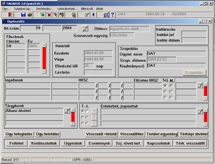
5 IT developments in Unified Land Registry In 1996 all Land Record data were uploaded into an RDBMS Development of a new IT system (TAKAROS) has started for management of Land Record data, which came into operation in 2000 Development of the network of Land Administration started in 1999 (TAKARNET), which was completed in 2003 Since 2003 Land Registry data services are available for citizens First publication of the integrated IT system for Unified Land Registry (DATR), based on MSZ Standard, was in 2003 (Debrecen, Hungary) Integrated IT system (DATR) has been operating in Hungarian Land Administration since
6 All these IT developments carried out by FÖMI both informatic and professional side 6
7 Model of the Hungarian Unified Land Registry (DATR) Basis: MSZ Standard (Digital Base Map Conceptual Model) in Cadastral Domain since 1996 and DAT Regulation since 1997 Visions: Map all the principles of Unified Land Registry Compatible with the Standardized Domain Authentic updating of legal and geometry part of Unified Land Registry Independency from any commercial GIS solutions Full integration of the legal and geometric part of the Registry 7
8 DATR Architecture Kernel Database Base classes Graphic eng. Base modules APPLICATIONS Database FileI/O Open APIs Outer modules 8
9 DATR, Characteristics Providing authenticity No map editor capacity Map updating only via database transactions (in standardized environment) Uniform database structure Enforcing database integrity Real-time queries via Internet Integrated search with Land registry part Real-time map generating Minimizing network weighting Modular self-calibrating architecture All functions are in modules No client-side configuration is needed to insert any new module Easy customizable Uniform calling interface and protocol Opened module API 9
10 DATR, Core Data Model ADMINISTRATIVE PART Cadastral map Subparcel Apartment Land Parcel Real Property SPATIAL Errors Status Building OBJECTS 0,1 Surface Boundary Bo undary line Geometry Margin 2+ Point GEOMETRY + TOPOLOGY Owner Natural Person Restriction Rights Non -natural Person Address LEGAL PART 10
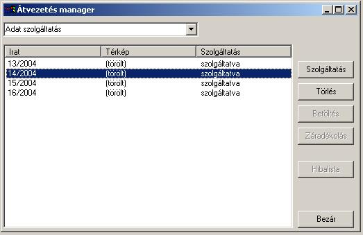
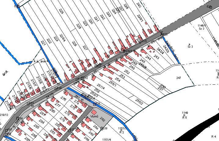
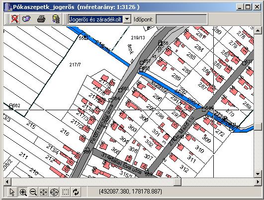
11 Administrative workflow in DATR Time Land Office t 0 Application Application registration Changing area Map Map Data service Surveyor Cadastral map t 1 Map Client Application Map Application registration Uploading t 2 Notice Adding a clause Checking t 3 Application Application registration Land registry t 4 Decision Updating Legal Transaction 11
12 ISO Standard (LADM) Source of all information about LADM is: PhD Thesis of Mr. Christiaan Herman Jacobus LEMMEN Title: A Domain Model for Land Administration
13 Historical aspects of LADM First publication in April 2002 at FIG Congress Washinghton DC Core Cadastral Domain Model (CCDM) was published in 2003 (Brno, Czech Republic) as Version A of LADM CCDM Version 1 published at FIG Congress Munich, Germany, 2006 as Version B of LADM At the beggining of 2008 FIG proposed to develop an ISO Standard for Land Administration In November 2012, ISO approved LADM as an International Standard 13
14 Hungary Hungarian Standard on Digital Base Map 1 st pub. of DATR DATR operating Time 1 st pub. of LADM Workshop on Standardization, Bamberg, Germany DATR published LADM became ISO Standard LADM 14
15 ISO LADM & DATR ADMINISTRATIVE PART Cadastral map Subparcel Apartment Land Parcel Real Property SPATIAL Errors Status Building OBJECTS 0,1 Surface Boundary Bo undary line Geometry Margin 2+ Point GEOMETRY + TOPOLOGY Owner Natural Person Restriction Rights Non -natural Person Address LEGAL PART SPATIAL UNIT RRR PARTY 15
16 ISO LADM & DATR Spatial Units: DATR supports 3D, but only 2D capacity is used till now SpatialUnitSet: DATR supports, based on the original surveying methods (built-up, rural and garden areas) Surveying package: SurveyPoint used Geometry and Topology Package: DATR modeled the same way Party package: similar in DATR Administrative Package: modeled Documentation: is not modeled yet 16
17 ISO LADM & DATR Core model of DATR acts as a Country profile in LADM BUT Development of DATR has been fully independent from LADM 17
18 Conclusion Hungarian Unified Land Registry is operating in a standardized environment, which is a complete domestic development LADM is an important standard, which can be a good interface, base of a common thinking about Land Administration Results of DATR development showed (and its conformity with LADM), that the Hungarian Land Administration, independently from other solutions, are walking on the right way in Cadastral Modeling 18
19 Thank you for your kind attention Gyula IVÁN
A Complete, Free Solution for Cadastral Map Management
 A Complete, Free Solution for Cadastral Map Management Gyula IVÁN Institute of Geodesy, Cartography & Remote Sensing (FÖMI) HUNGARY FIG Commission 7, Annual Meeting 11-15 September 2008., Verona, ITALY
Object Oriented Unified Real Estate Registry for a Good Spatial Data Management
 Object Oriented Unified Real Estate Registry for a Good Spatial Data Management Gyula IVÁN Gábor SZABÓ Zoltán WENINGER Institute of Geodesy, Cartography and Remote Sensing (FÖMI), Hungary Workshop on e-governance,
Country report, HUNGARY
 Country report, HUNGARY Gyula IVÁN Institute of Geodesy, Cartography & Remote Sensing (FÖMI) HUNGARY FIG Commission 7 Annual Meeting 2009 12-16 October, 2009, Kuala Lumpur, Malaysia Institute of Geodesy,
Development of 3D Cadastre in Hungary
 Development of 3D Cadastre in Hungary András OSSKÓ Gyula IVÁN CLGE General Assembly 22 March 2013, Budapest, HUNGARY Content Introduction Problems in development of 3D cadastre and registration Hungarian
Test and Implementation of DATR System in Hungary
 Test and Implementation of DATR System in Hungary, Hungary Key words: unified land registry, cadastral map, Hungary SUMMARY During the last years there has been an important development in the Hungarian
DATR towards e-land Administration in Hungary
 DATR towards e-land Administration in Hungary Gyula IVÁN-Gábor SZABÓ-Zoltán WENINGER-Piroska Zalaba Institute of Geodesy, Cartography and Remote Sensing, Budapest, HUNGARY XXIV. FIG Congress Facing the
Integrated Land Information Services in Hungarian Land Administration
 , Hungary Key words: key words, theme, etc. SUMMARY The Unified Hungarian Land Registry, in which cadastral mapping and land registry belong to the same organization (Land Office Network), has been operating
Expansion of Land Information Services in Hungarian Land Administration
 Expansion of Land Information Services in Hungarian Land Administration Gyula IVÁN, Gábor SZABÓ and Zoltán WENINGER, Hungary Key words: Land registry, Cadastral system, GIS, LIS, WEB based services SUMMARY
Unified Land Administration for a Better Spatial Infrastructure
 Unified Land Administration for a Better Spatial Infrastructure Gyula IVÁN Institute of Geodesy, Cartography & Remote Sensing FÖMI (HUNGARY) Open Symposium 30th Korean Cadastral Seminar & FIG Commission
DATR Towards e-land Administration in Hungary
 DATR Towards e-land Administration in Hungary Gyula IVÁN, Gábor SZABÓ, Zoltán WENINGER, Piroska ZALABA, HUNGARY Key words: Land Registry, Cadastre, Land Administration, GIS SUMMARY DATR has been the most
Object Oriented Unified Real Estate Registry for a Good Spatial Data Management
 Object Oriented Unified Real Estate Registry for a Good Spatial Data Management Gyula IVÁN Gábor SZABÓ Zoltán WENINGER, Hungary Key words: Cadastre, Land Administration, GIS SUMMARY The IT developments
Hungary is a landlocked, Central European country in the Carpathian Basin
 Brief Overview on Hungarian Land Administration MSc. György Domokos Hungarian Geodetic Surveying Liaison Group CLGE GA Hannover 12 13 October 2012 Hungary is a landlocked, Central European country in the
Towards 3D Land Registry in Hungary
 Towards 3D Land Registry in Hungary Gyula IVÁN, András OSSKÓ, Hungary Keywords: Cadastre, Land Administration, Land Registry, 3D Cadastre, GIS SUMMARY New Act on Surveying and Mapping Activities, accepted
Improvement of Effectiveness Present Developments in Hungarian Land Administration
 Improvement of Effectiveness Present Developments in Hungarian Land Administration Gyula IVÁN and András OSSKÓ, Hungary Key words: Land Administration, Cadastre, Land Registry SUMMARY New Act on Surveying
The Multipurpose Hungarian Unified Land Registry System
 The Multipurpose Hungarian Unified Land Registry System András Osskó FIG Working Week Integrating Generation Stockholm, Sweden 14-19 June 2008 Republic of Hungary is located in Central Europe Neighbouring
e-land Administration in Hungary
 e-land Administration in Hungary Piroska Zalaba senior counsellor, project manager Ministry of Agriculture and Rural Development Department of Lands and Mapping FIG SEMINAR Innsbruck, 2-4 June 2004 Land
LADM-based Crowdsourced 3D Cadastral Surveying Potential and Perspectives
 National Technical University Of Athens School of Rural and Surveying Engineering LADM-based Crowdsourced 3D Cadastral Surveying Potential and Perspectives Maria Gkeli, Surveying Engineer, PhD student
EVOLUTION TOWARDS THE DIGITAL LAND OFFICES
 EVOLUTION TOWARDS THE DIGITAL LAND OFFICES Szabolcs MIHÁLY, Piroska ZALABA Budapest, Hungary 1. INTRODUCTION 2. CURRENT STATUS OF THE UNIFORM LAND REGISTRATION 2.1. Management Features of the Hungarian
Preprint.
 http://www.diva-portal.org Preprint This is the submitted version of a paper presented at 10th EC GI & GIS Workshop, ESDI State of the Art, Warsaw, Poland, 23-25 June 2004. Citation for the original published
Country Profile for the Cadastre of the Czech Republic Based on LADM
 Country Profile for the Cadastre of the Czech Republic Based on LADM Karel Janečka 1, Petr Souček 2 1 University of West Bohemia, Pilsen, Czech Republic 2 Czech Office for Surveying, Mapping and Cadastre,
Challenges in technology, society and policy - how they influence Cadastre and Land Management
 Challenges in technology, society and policy - how they influence Cadastre and Land Management Gyula IVÁN, Hungary Key words: Cadastre, Land Administration, GIS SUMMARY During the last years there has
The ISO/TC 211 Land Administration Domain Model (LADM)
") Geographic information/geomatics The ISO/TC 211 Land Administration Domain Model (LADM) Harry Uitermark/Editor LADM Kadaster/ITC, The Netherlands International Organization for Standardization (ISO) A
Geographic information/geomatics The ISO/TC 211 Land Administration Domain Model (LADM) Harry Uitermark/Editor LADM Kadaster/ITC, The Netherlands International Organization for Standardization (ISO) A
TAKARNET intranet for the land administration
 Paper presented at the FIG Commission 3 Annual Meeting and Seminar Budapest, Hungary, 1999 TAKARNET intranet for the land administration Piroska Zalaba Ministry of Agriculture and Regional Development
Hungarian practice of servicing cadastral information Piroska Zalaba senior counselor
 Hungarian practice of servicing cadastral information Piroska Zalaba senior counselor Ministry of Agriculture and Rural Development Department of Land Administration and Geoinformation Cadastre, Public
Cadastral survey - the best way of cadastre modernization Nikola VUČIĆ & Damir ŠANTEK, Croatia
 Presented at the FIG Congress 2018, May 6-11, 2018 in Istanbul, Turkey Cadastral survey - the best way of cadastre modernization Nikola VUČIĆ & Damir ŠANTEK, Croatia LAND ADMINISTRATION IN CROATIA Two
Towards LADM Country Cadastral Profile Case Poland
 Towards LADM Country Cadastral Profile Case Poland Jarosław BYDŁOSZ, Poland Key words: LADM, Country Profile, Cadastre, Poland SUMMARY The Geographic Information - Land Administration Domain Model was
Estonian e-cadastre as basis for efficient land management
 Estonian e-cadastre as basis for efficient land management Priit Kuus Estonian Land Board November 14, 2017 Tallinn Scope of data Cadastral parcels (as of October 2017) 693 026 cadastral parcels, i.e.
Advanced Principles of 3D Cadastral Data Modelling. 2 nd International Workshop on 3D Cadastres 16 th 18 th November 2011
 Advanced Principles of 3D Cadastral Data Modelling 2 nd International Workshop on 3D Cadastres 16 th 18 th November 2011 Agenda Introduction to the project Drivers for land and property information in
Cadastral services and virtual office in e-cadastre
 Cadastral services and virtual office in e-cadastre Priit Kuus Estonian Land Board October 26, 2016 Coimbra Scope of data Cadastral parcels (as of September 2016) 674 383 cadastral parcels, i.e. 97,7 %
Cadastre and Other Public Registers: Multipurpose Cadastre or Distributed Land Information System?
 Cadastre and Other Public Registers: Multipurpose Cadastre or Distributed Land Information System? Ivan PESL, Czech Republic Key words: Cadastre, Land Registry, Property, Taxes, Land Use, Territorial Planning,
LAND ADMINISTRATION IN LITHUANIA: CHALLENGES AND PERSPECTIVES
 UNECE WPLA Workshop Influence of Land Administration on People and Business, Cavtat, Croatia, October 2-3, 2008 LAND ADMINISTRATION IN LITHUANIA: CHALLENGES AND PERSPECTIVES Kestutis Sabaliauskas, Director
Egyptian Nationwide Title Cadastre System
 Kholoud SAAD, Egypt Key words: Cadastre, Registration, Urban, Rural, National Cadastre, Automation, reengineering. SUMMARY With growing need for integrated information, Enterprise Solutions has become
The Challenge to Implement International Cadastral Models Case Finland 1
 The Challenge to Implement International Cadastral Models Case Finland 1 Tarja MYLLYMÄKI and Tarja PYKÄLÄ, Finland Key words: cadastre, modelling, LADM, INSPIRE SUMMARY Efforts are currently made to develop
Cadastral Parcels in the context of INSPIRE
 Cadastral Parcels in the context of INSPIRE Gyula IVÁN Institute of Geodesy, Cartography & Remote Sensing, HUNGARY Open Symposium on Environment and Land Administration Big Works for the Defence of Territory
From 2D representation of the buildings into cadastral maps towards 3D GIS applications and BIM a case study for Prishtina
 From 2D representation of the buildings into cadastral maps towards 3D GIS applications and BIM a case study for Prishtina This is a Peer Reviewed Paper Fisnik LOSHI, Kosovo Keywords: 3D cadastre, property
Presented at the FIG Congress 2018, May 6-11, 2018 in Istanbul, Turkey
 Presented at the FIG Congress 2018, May 6-11, 2018 in Istanbul, Turkey 5 Bibliometric Analysis of Articles Presented Under Commission 7: A Case of the 25th Fig Congress in Malaysia in 2014 Zeynel Abidin
LRIMS Cadastre Module
 LRIMS Cadastre Module User Requirements and Functionality (Seychelles Case Study) John Latham, NRL Renato Cumani, NRL Luigi Simeone, NRL Summary Background User Requirements Business Model Application
Challenge to Implement International Cadastral Models Case Finland
 FIG Articleof the Month April 20 Challenge to Implement International Cadastral Models Case Finland Tarja Myllymäki and Tarja Pykälä 200-04-5 The topics are In European level INSPIRE Experiences, similarities,
Legal Aspects of 3D Property Rights, Restrictions and Responsibilities in Greece and Cyprus
 Legal Aspects of 3D Property Rights, Restrictions and Responsibilities in Greece and Cyprus Efi DIMOPOULOU, National Technical University of Athens, Greece and Elikkos ELIA, Cyprus Department of Lands
BULGARIAN CADASTRE A GUARANTEE FOR THE OWNERSHIP RIGHTS IN IMMOVABLE PROPERTIES
 4 TH INTERNATIONAL CONFERENCE RECENT PROBLEMS IN GEODESY AND RELATED FIELDS WITH INTERNATIONAL IMPORTANCE February 28 - March 2, 2007, Inter Expo Centre, Sofia, Bulgaria BULGARIAN CADASTRE A GUARANTEE
Land Administration and Spatial Enablement Victoria s Experience. Chris McRae, Executive Director Land Victoria
 Land Administration and Spatial Enablement Victoria s Experience Chris McRae, Executive Director Land Victoria 4 th UN Land Administration Forum, October 2011 Outline About Land Victoria Land Victoria
LADM Implementation Prototype for 3D Cadastre Information System of Multi-Level Apartment in Indonesia
 LADM Implementation Prototype for 3D Cadastre Information System of Multi-Level Apartment in Indonesia Yanto Budisusanto Trias Aditya Rochmad Muryamto IDEA Limitations of land supply for infrastructure
Cadastral Parcels in INSPIRE. Lisbon, 27 February 2013
 Cadastral Parcels in INSPIRE Lisbon, 27 February 2013 Dominique.laurent@ign.fr Plan INSPIRE context The modeling approach for theme Cadastral Parcels Implementation of INSPIRE theme Cadastral Parcels Context
A NOMINAL ASSET VALUE-BASED APPROACH FOR LAND READJUSTMENT AND ITS IMPLEMENTATION USING GEOGRAPHICAL INFORMATION SYSTEMS
 A NOMINAL ASSET VALUE-BASED APPROACH FOR LAND READJUSTMENT AND ITS IMPLEMENTATION USING GEOGRAPHICAL INFORMATION SYSTEMS by Tahsin YOMRALIOGLU B.Sc., M.Sc. A thesis submitted for the Degree of Doctor of
Reliability of the Italian cadastral system data quality and improvement prospects
 Reliability of the Italian cadastral system data quality and improvement prospects Eng. Franco MAGGIO (Central Director for Cadastral, Cartographic and Land Registration Services) Eng. Arturo ANGELINI
Croatian SDI: a Tool for Accelerated Development of the Geo-Conscious Society
 STATE GEODETIC ADMINISTRATION Croatian SDI: a Tool for Accelerated Development of the Geo-Conscious Society Prof.Dr.Sc. Željko Bačić, Mr.Sc. Ljerka Rašić FIG Working Week 2009 - Surveyors Key Role in Accelerated
Directorate of Survey and Mapping NAMIBIA. Cadastral Information System. Vehupisa Kasuko Tjatindi Surveyor Directorate of Survey and Mapping NAMIBIA
 Vehupisa Kasuko Tjatindi Directorate of Survey and Mapping NAMIBIA Tel: +64 61 965000 Directorate of Survey and Mapping NAMIBIA Cadastral Information System Introduction Over the past few decades cadastral
Linking the Land Information Systems in the Philippines Using the LADM as a Global Schema
 Linking the Land Information Systems in the Philippines Using the LADM as a Global Schema Romer Kristi ARANAS, Rhodora GONZALEZ and Louie Balicanta, Philippines Key words: Digital cadastre, e-governance,
PROBLEMS IN REGISTRATION IN THE THIRD VERTICAL DIMENSION IN THE UNIFIED LAND REGISTRY IN HUNGARY, AND POSSIBLE SOLUTION
 3D Cadastres Technical and Legal Aspects II PROBLEMS IN REGISTRATION IN THE THIRD VERTICAL DIMENSION IN THE UNIFIED LAND REGISTRY IN HUNGARY, AND POSSIBLE SOLUTION ANDRÁS Osskó Budapest Land Office Hungary
Linking Land Registers and Other Official Registers in the Republic of Croatia based on LADM
 Linking Land Registers and Other Official Registers in the Republic of Croatia based on LADM Mario MAĐER, Hrvoje MATIJEVIĆ and Miodrag ROIĆ, Croatia Key words: official registers, land administration system,
From LADM/STDM to a spatially enabled society: a vision for Harry UITERMARK, Peter VAN OOSTEROM, Jaap ZEVENBERGEN and Christiaan LEMMEN
 From LADM/STDM to a spatially enabled society: a vision for 2025 Harry UITERMARK, Peter VAN OOSTEROM, Jaap ZEVENBERGEN and Christiaan LEMMEN Introduction (1) Vision is a co-production Founding fathers
Ownership Data in Cadastral Information System of Sofia (CIS Sofia) from the Available Cadastral Map
 from the Available Cadastral Map") Ownership Data in Cadastral Information System of Sofia (CIS Sofia) from the Available Cadastral Map Key words: ABSTRACT Lydmila LAZAROVA, Bulgaria CIS Sofia is created and maintained by GIS Sofia ltd,
Ownership Data in Cadastral Information System of Sofia (CIS Sofia) from the Available Cadastral Map Key words: ABSTRACT Lydmila LAZAROVA, Bulgaria CIS Sofia is created and maintained by GIS Sofia ltd,
 Apostolos Arvanitis, Associate Professor Asterios Asteriadis, Rural - Surveying Engineer Thomai Sotireli, Rural - Surveying Engineer Aristotle University School of Rular and Surveying Engineering Department
Developing Infrastructure Framework To Facilitate The Malaysia Multipurpose 3D Cadastre
 Developing Infrastructure Framework To Facilitate The Malaysia Multipurpose 3D Cadastre Sr Dr. Tan Liat Choon Sr Looi Kam Seng University of Technology Malaysia Department of Survey and mapping Malaysia
EXPLORING OPTIONS FOR STANDARDISATION OF PROCESSES AND TRANSACTIONS IN LAND ADMINISTRATION
 EXPLORING OPTIONS FOR STANDARDISATION OF PROCESSES AND TRANSACTIONS IN LAND ADMINISTRATION CHRISTIAAN LEMMEN (1),(2), EVA-MARIA UNGER (2), PETER VAN OOSTEROM (3), MOHSEN KALANTARI (4) AND KEES DE ZEEUW
From LADM/STDM to a spatially enabled society: a vision for Harry UITERMARK, Peter VAN OOSTEROM, Jaap ZEVENBERGEN and Christiaan LEMMEN
 From LADM/STDM to a spatially enabled society: a vision for 2025 Harry UITERMARK, Peter VAN OOSTEROM, Jaap ZEVENBERGEN and Christiaan LEMMEN Introduction (1) Presentation is a coproduction Founding fathers
Cadastral Systems IV
 Computers, Environment and Urban Systems 30 (2006) 523 528 www.elsevier.com/locate/compenvurbsys Editorial Cadastral Systems IV This is the fifth of a series of theme issues on Cadastral Systems in Computers,
The Contribution of Forest Owners Associations for the Forest Cadastre Implementation. João Gaspar Ana Navarro Ferreira PORTUGAL
 The Contribution of Forest Owners Associations for the Forest Cadastre Implementation João Gaspar Ana Navarro Ferreira PORTUGAL Motivation Lack of forestry cadastre; Unify all FOAs databases with common
LADM in the Republic of Croatia making and testing country profile
 STATE GEODETIC ADMINISTRATION Gruška 20,10 000 Zagreb, Croatia LADM in the Republic of Croatia making and testing country profile Nikola Vučić Danko Markovinović Blaženka Mičević CONTENTS INTRODUCTION
FIG Commission 3 Spatial Information Management. Report of Activities 2009
 Appendix to item 10.3 Report to the 33 rd General Assembly FIG Congress in Sydney, Australia 2010 FIG Commission 3 Spatial Information Management Report of Activities 2009 1. General Since 2007, FIG Commission
Developments in the Standardisation of the Core Cadastral Domain Model
 Developments in the Standardisation of the Core Cadastral Domain Model Christiaan Lemmen, Paul vander Molen Kadaster and ITC, The Netherlands Peter van Osterom, Jaap Zevenbergen and Wilko Quak Delft University,
Cadastral Information System of Sofia
 Alexander LAZAROV and Hristo DECHEV, Bulgaria Key words: ABSTRACT A new Cadastre and Property Register Act (CPRA) was passed in April 2000, setting up rules for the maintenance of these two registers.
Amalia Velasco Carlos Alonso Luis Virgos Fernando Serrano
 Inspire services of the Spanish Directorate General for Cadastre and its use to resolve an old problem of coordination between Spanish Cadastre and Land Registry. Amalia Velasco Carlos Alonso Luis Virgos
GIS Projects and Systematic Land Registration in Romania Brasov Case Study
 GIS Projects and Systematic Land Registration in Romania Brasov Case Study Ionut SAVOIU, Ciprian SAVOIU, Mircea POPA and Georgeta CHITAC, Romania Key words: cadastre, land registration, land book SUMMARY
Profile Definition for a. Standardized Cadastral Model
 Profile Definition for a www.caris.com Standardized Cadastral Model Hugh Aste, Rick Nyarady & Greg Mulholland Outline Our interest in the Core Cadastre Domain Model Identification of a practical need for
PROCESSES IN CADASTRE: PROCESS MODEL FOR SERBIAN 3D CADASTRE
 UNIVERSITY IN NOVI SAD, SERBIA FACULTY OF TECHNICAL SCIENCES PROCESSES IN CADASTRE: PROCESS MODEL FOR SERBIAN 3D CADASTRE Dubravka SLADIĆ, Aleksandra RADULOVIĆ and Miro GOVEDARICA 6th International FIG
A Review and Perspective on Parcel Data Models for Urban Planning
 A Review and Perspective on Parcel Data Models for Urban Planning Yiqiang Ouyang Prof. Dr. Ilir Bejleri Department of Urban and Regional Planning University of Florida June 19-21, 2010 1 Content 1. Introduction
A Method For Building Legal Digital Cadastre Without Using Cadastral Measurements Field Book Data Is It Accurate Enough?
 A Method For Building Legal Digital Cadastre Without Using Cadastral Measurements Field Book Data Is It Jad JARROUSH, Dmitri BRICKMAN, Israel Key words: Digital Cadastre, Least Squares Cadastral Computations,
Towards LADM Victoria country profile modelling the spatial information
 Towards LADM Victoria country profile modelling the spatial information Mohsen KALANTARI, Australia and Eftychia KALOGIANNI, Greece Key words: LADM, eplan, Australia, Victoria, Cadastre, Vicmap SUMMARY
The Development Strategy for Cadastre and Land Register in Finland
 1 2 The Development Strategy for and Land in Finland Arvo Kokkonen Ministry of Agriculture and Forestry Facts and figures of Finland - land area 304 530 km² - water area 33 615 km² - total area 338 195
Towards LADM country cadastral profile case Poland
 Towards LADM country cadastral profile case Poland Jarosław Bydłosz Department of Geomatics Faculty of Mining Surveying and Environmental Engineering International FIG workshop on the Land Administration
Utilizing 3D Building and 3D Cadastre Geometries for Better Valuation of Existing Real Estate
 Utilizing 3D Building and 3D Cadastre Geometries for Better Valuation of Existing Real Estate Umit ISIKDAG Beykent U., Turkey Mike HORHAMMER Oracle, USA Sisi ZLATANOVA, Peter VAN OOSTEROM TU Delft, The
LADM SPECIFICATION OF A RELATIONAL DATABASE FOR THE REPUBLIC OF CAPE VERDE
 LADM SPECIFICATION OF A RELATIONAL DATABASE FOR THE REPUBLIC OF CAPE VERDE Alex J. B ANDRADE, Cape Verde (alexgeogis@gmail.com) Andrea F.T CARNEIRO, Brazil (aftc@ufpe.br) Juciela C. DOS SANTOS Brazil (jucielasantos@gmail.com)
Functional system for cadastral plans
 , Republic of Macedonia Key words: Cadastre, Digital plans, Data, System SUMMARY The analysis shows that the real estate market in Republic of Macedonia grows daily. With the expansion of this market increases
Key Registers in Finland and some views of Cadastre 2035
 Presented at the FIG Working Week 2016, May 2-6, 2016 in Christchurch, New Zealand Key Registers in Finland and some views of Cadastre 2035 FIG Working Week, Christchurch New Zealand May, the 3rd, 2016
The importance of changes in land surveyors education
 András OSSKÓ Key words: land administration, roles of land surveyors, extended education, lifelong learning SUMMARY It s a world wide experience, especially in developed countries that the interest in
LAND REGISTRATION SYSTEM OF THE REPUBLIC OF CROATIA
 "On the last day of the Creation God desired to crown His work, and thus created Kornati Islands out of tears, stars and breath." (George Bernard Shaw) LAND REGISTRATION SYSTEM OF THE REPUBLIC OF CROATIA
LADM in the Republic of Croatia Making and Testing Country Profile
 Nikola VUČIĆ, Danko MARKOVINOVIĆ and Blaženka MIČEVIĆ, Croatia Key words: LADM, Croatian Cadastre, Land Book, Class, Testing SUMMARY Land Administration Domain Model (LADM) covers basic information related
Low Cost Cadastral Data Aquisition?
 Low Cost Cadastral Data Aquisition? Jacobus Meijer and Christiaan Lemmen (Netherlands): 21 May 2011 Abstract Spatial Cadastral Data (Mapping) Participatory Development Some low cost approaches in cadastral
Germany on the way to a 4D-Cadastre
 Germany on the way to a 4D-Cadastre Dr. Jens Riecken (DVW Vicepresident), Ulrich Gruber, Dr. Markus Seifert (DVW WG Geoinformation) TS 9.1 4D Cadastre, Land Domain Models & Concepts 1 Content About my
Advances in Modern Land Administration Cadastre 2014 in the Year 2006
 Advances in Modern Land Administration Cadastre 2014 in the Year 2006 Winfried HAWERK, Germany Key words: E-Land Administration, IT renewal strategies SUMMARY FIG Commission 7 Working Group 7.3 deals with
Towards Kenya s Profile of the Land Administration Domain Model
 Department of Geospatial and Space Technology University of Nairobi Towards Kenya s Profile of the Land Administration Domain Model David N. Siriba and Jasper N. Mwenda dnsiriba, jnmwenda{@uonbi.ac.ke}
REGISTRATION OF PROPERTIES IN STRATA
 REGISTRATION OF PROPERTIES IN STRATA REPORT ON THE WORKING SESSIONS INTRODUCTION A cadastre is usually, and in most countries, a parcel-based, and up-to-date land information system containing records
The European Common Agricultural Policy (CAP) after 1992
 after 1992") On the Level of Cooperation between Agricultural & Cadastral Parcel Registration Halil Ibrahim INAN (presenter) & Tahsin YOMRALIOGLU, Turkey Peter van OOSTEROM & Jaap ZEVENBERGEN, The Netherlands 1 OTB
On the Level of Cooperation between Agricultural & Cadastral Parcel Registration Halil Ibrahim INAN (presenter) & Tahsin YOMRALIOGLU, Turkey Peter van OOSTEROM & Jaap ZEVENBERGEN, The Netherlands 1 OTB
Design and Determine 3D Cadastral Systems: A Case Study of Turkey Hicret GURSOY SURMENELI* and Mehmet ALKAN* (Turkey)
") Design and Determine 3D Cadastral Systems: A Case Study of Turkey Hicret GURSOY SURMENELI* and Mehmet ALKAN* (Turkey) *Yildiz Technical University, Civil Engineering Faculty, Department of Geomatics CONTENTS
Design and Determine 3D Cadastral Systems: A Case Study of Turkey Hicret GURSOY SURMENELI* and Mehmet ALKAN* (Turkey) *Yildiz Technical University, Civil Engineering Faculty, Department of Geomatics CONTENTS
HOUSING AND PROPERTY MARKET IN LITHUANIA CONTENTS
 HOUSING AND PROPERTY MARKET IN LITHUANIA Kęstutis Sabaliauskas, Director General State Enterprise Centre of Registers, Lithuania Kestutis.Sabaliauskas@registrucentras.lt CONTENTS Legal environment Real
Topographic Signs Important Context of 3D Cadastre
 STATE GEODETIC ADMINISTRATION Gruška 20,10 000 Zagreb, Croatia Delft University of Technology Faculty of Architecture and the Built Environment Department OTB GIS Technology Section Topographic Signs Important
GAUSSCAD A WEBGIS APPLICATION FOR COLLECTING CADASTRAL DATA
 M.M. Moise GaussCAD a WebGIS Application for Collecting Cadastral Data GAUSSCAD A WEBGIS APPLICATION FOR COLLECTING CADASTRAL DATA Mihai-Mircea MOISE, S.C. GAUSS S.R.L., mihai.moise@gauss.ro Abstract:
Standardization in the Cadastral Domain. Sub Working Group 1: Legal Aspects
 Standardization in the Cadastral Domain Sub Working Group 1: Legal Aspects Framework 10 participants 8 countries 2 sessions Updates from the different countries (mainly as to the legal aspects of cadastre)
Public and State Land Management in Hungary
 Public and State Land Management in Hungary ANDRÁS OSSKÓ WORKING WEEK 2012 May 6-10 2012 ROME, ITALY CONTENT 1. Introduction 2. Legal and institutional background 3. Activities of the national land fund
The Digital Cadastral Database and the Role of the Private Licensed Surveyors in Denmark
 IRISH INSTITUTE OF SURVEYORS, DUBLIN INSTITUTE OF TECHNOLOGY, 23 NOVEMBER 2005 PUBLISHED IN IIS NEWS, WINTHER 2006. The Digital Cadastral Database and the Role of the Private Licensed Surveyors in Denmark
Challenges for the multi purpose cadastre
 Jens RIECKEN, Markus SEIFERT, Germany Key words: Multi purpose cadastre, 3d-cadastre, land use, SDI, solar cadastre SUMMARY Over the past 30 years, with the progress of information technologies the development
Field surveying inspection using tablets
 Field surveying inspection using tablets Rami Farraj, Ahmad Sghyyer Survey of Israel, Lincoln 1, Tel-Aviv, Israel rami@mapi.gov.il ahmad@mapi.gov.il Key words: Field Surveying, Cadastre, Mapping Procedures
COMMISSION 7 CADASTRE AND LAND MANAGEMENT WORK PLAN
 Appendix to item 34.7 FIG Congress in Washington, 19-26 April 2002 COMMISSION 7 CADASTRE AND LAND MANAGEMENT WORK PLAN 2002 2006 1. Title Cadastre and Land Management 2. Terms of Reference Commission 7
INSPIRE Thematic Working. Cadastral parcels. September 2008
 INSPIRE Thematic Working Cadastral parcels September 2008 The INSPIRE context The INSPIRE Directive Its aim is to build the INfrastructure for Spatial InfoRmation in Europe The INSPIRE Directive has been
3D Strata Objects Registration for Malaysia within the LADM Framework
 Nur Amalina ZULKIFLI, Alias ABDUL RAHMAN, Malaysia and Peter VAN OOSTEROM, the Netherlands Key words: Strata Registration, Modelling, LADM SUMMARY This paper discusses 3D objects registration and modelling
Refinement of Cadastral Maps
 Acta Montanistica Slovaca Ročník 16(2011), číslo 4, 242-248 Refinement of Cadastral Maps Alena Berková 1 Making cadastral maps more precise The amended cadastral ordinance takes effect from 1.7. 2009.
Problems and Solution Proposals in Integration of Cadastral Data into Geographical Information System (GIS) in Turkey
 in Turkey") Problems and Solution Proposals in Integration of Cadastral Data into Geographical Information System (GIS) in Turkey Gülgün OZKAN, S. Savas DURDURAN, Ali ERDI and Bilal GIRGIN, Turkey Key words: Cadastre,
Problems and Solution Proposals in Integration of Cadastral Data into Geographical Information System (GIS) in Turkey Gülgün OZKAN, S. Savas DURDURAN, Ali ERDI and Bilal GIRGIN, Turkey Key words: Cadastre,
Quality Improvement of the Real Estate Cadastre in Serbia
 , Serbia Key words: quality improvement, real estate information, quality assurance, Serbia SUMMARY The concept of cadastral modernization in the Republic of Serbia was defined in 1992, and it is being
The Development of the Austrian Cadastre from Documentation to an Integrated Planning and Decision Support System
 The Development of the Austrian Cadastre from Documentation to an Integrated Planning and Decision Support System WPLA - Working Party on Land Administration 15-17 October 2014, Vienna, Austria Wernher