Frank A Ford Etals, C/O Ford Group 9 LLC. Scott Ashley, AICP, Planning Manager
|
|
|
- Shauna Thornton
- 5 years ago
- Views:
Transcription
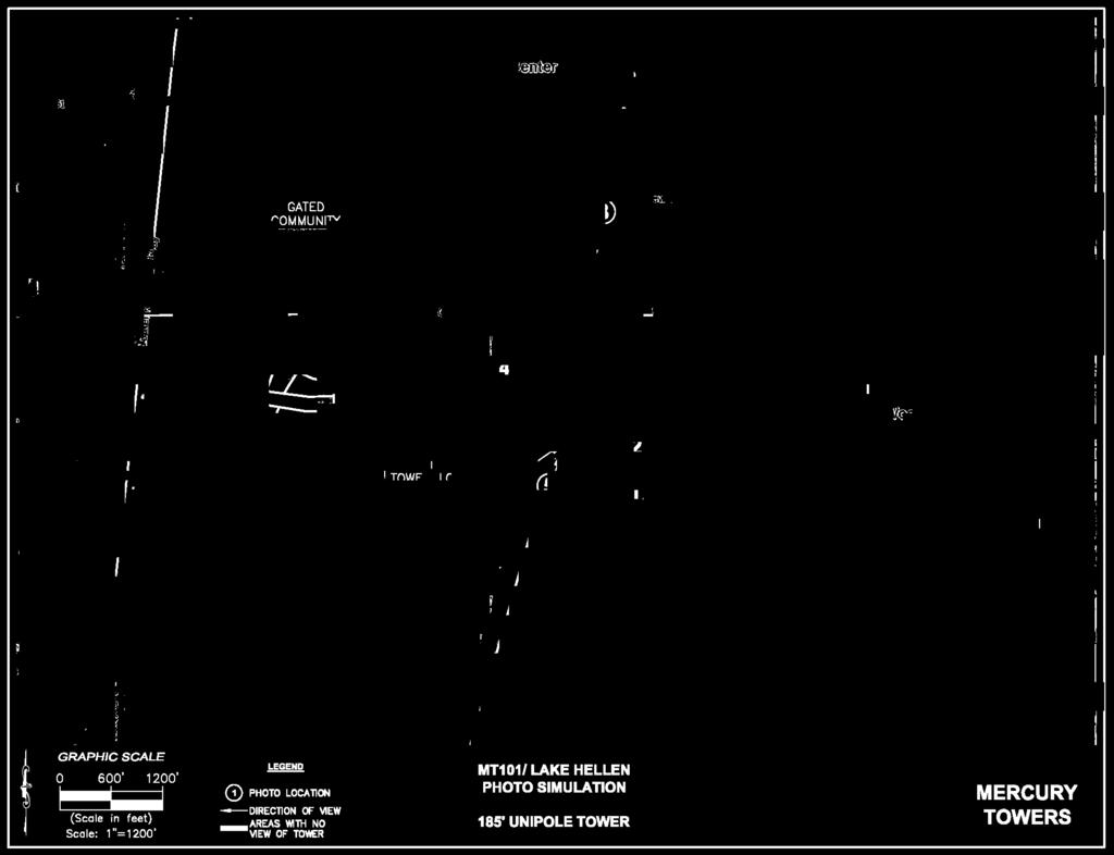
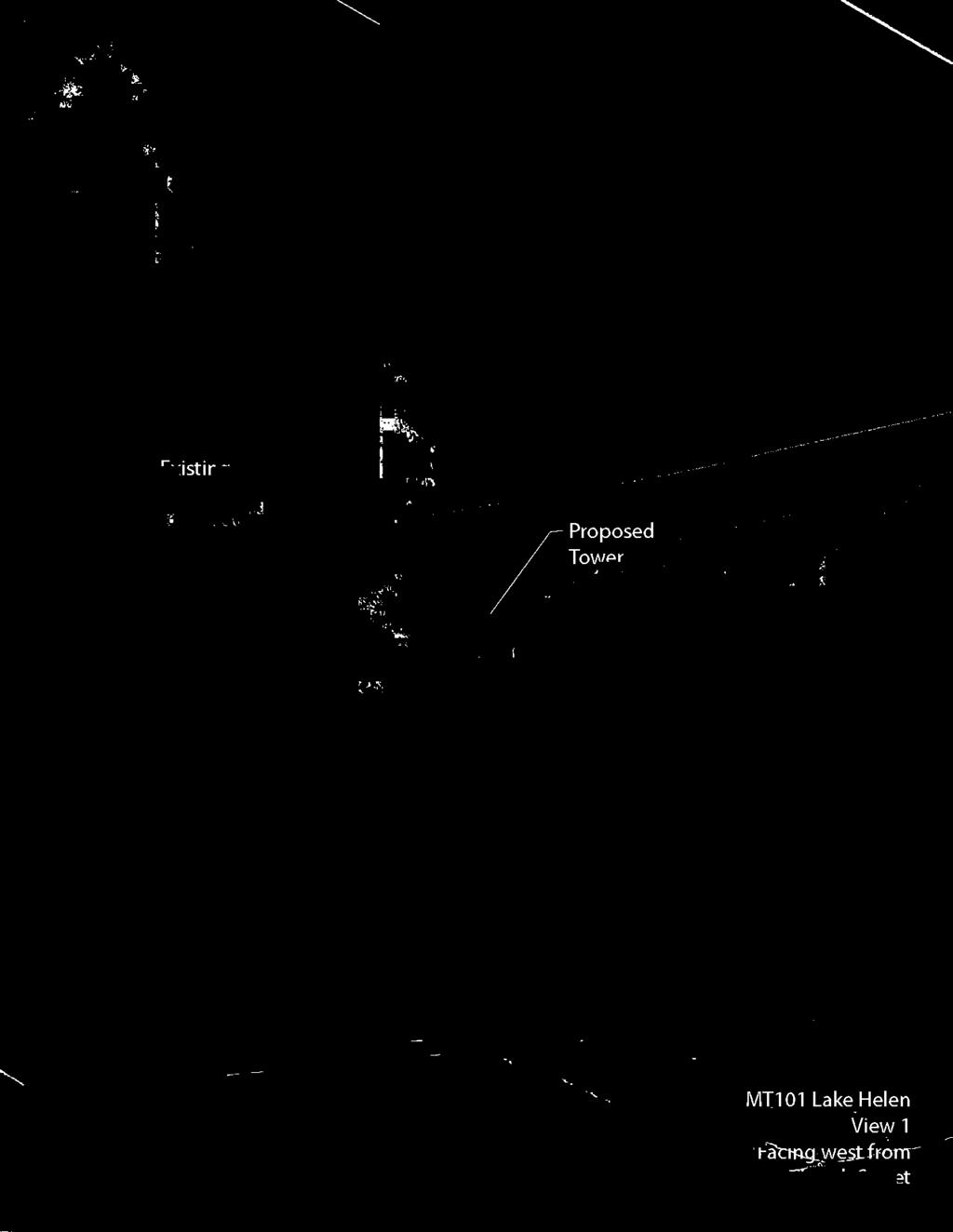
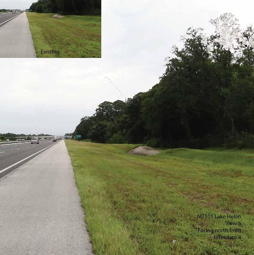
1 Page 1 of 49 GROWTH AND RESOURCE MANAGEMENT DEPARTMENT PLANNING AND DEVELOPMENT SERVICES DIVISION CURRENT PLANNING ACTIVITY 123 W. Indiana Avenue, Room 202, DeLand, FL (386) PUBLIC HEARING: CASE NO: SUBJECT: LOCATION: APPLICANT: OWNER: STAFF: August 13, Planning and Land Development Regulation Commission (PLDRC) S Special exception for communication tower exceeding 70 feet in height on Prime Agriculture (A-1) zoned property. East of Interstate 4, adjacent to the municipality of Lake Helen F.A. Ford, Jr. Frank A Ford Etals, C/O Ford Group 9 LLC Scott Ashley, AICP, Planning Manager I. SUMMARY OF REQUEST The applicant requests approval to erect a 185-foot monopole communication tower on a triangular shaped parcel abutting Interstate Highway 4. Also, the applicant requires a waiver to section (23)(e)(5), Setbacks and separations to allow the tower to be less than 1,000 feet from ten residences. The tower will be capable of accommodating multiple telecommunication carriers. Specifically, the applicant requests a: Special exception for a communication tower exceeding 70 feet in height above ground level (185-foot) and a waiver to section (23)(e)(5), Setbacks and separations on A-1 (Prime Agriculture) zoned property Staff Recommendation: Forward to county council for final action with a recommendation of approval subject to the staff recommended conditions.
: 7036-00-00-0020, east of Interstate 4 3. Property Size: ±34.14 acres; 4,900 sq. ft. lease area 4.")

2 Page 2 of 49 II. SITE INFORMATION 1. Location: This property is located on the east of Interstate 4, approximately 600 ft. north of its intersection with Pioneer Trail, Lake Helen. 2. Parcel Number(s): , east of Interstate 4 3. Property Size: ±34.14 acres; 4,900 sq. ft. lease area 4. Council District: 3 5. Zoning: A-1 6. Future Land Use: R 7. ECO Map: No 8. NRMA Overlay: No 9. Adjacent Zoning and Land Use: DIRECTION ZONING FUTURE LAND CURRENT USE USE Subject Property A-1 Rural Undeveloped and forested North: A-1 Rural Undeveloped and forested East: Lake Helen RE Single-family dwellings and a house of worship South: A-1 Rural Single-family dwellings 10. Location Maps ZONING MAP AERIAL MAP
3 Page 3 of 49 III. BACKGROUND AND PREVIOUS ACTIONS The undeveloped property is located in a county rural designated area between the City of Lake Helen and Interstate Highway 4. This property is nearly triangular in shape, forested, and ±2700 feet in length. The area development pattern consists of single-family residential developed and undeveloped lots to the north, east, and the south, and a house of worship. These lots range in size from ½-acre to 5-acres. According to the applicant s information and aerial map review, ten homes located in the Lake Helen city limits are less than 1,000 feet from the proposed tower site; therefore a waiver is required by county council for each one of the affected homes. The applicant is requesting a special exception for a 185-foot above ground level (AGL) monopole communication tower on Prime Agriculture (A-1) zoned property. Section (23) of the zoning code contains specific requirements that a communication tower must meet. The requirements include provision for tower structure setbacks, separation distance from other towers, and separation distance from existing residential dwellings. IV. REVIEW CRITERIA AND ANALYSIS Communication Tower Code Requirements - Section (23) of the zoning code contains a list of requirements and conditions that an applicant must meet to find this special exception request in compliance with the ordinance. Below is an analysis of Section (23) of the zoning code, starting with the factors considered in granting of special exceptions for communication towers above 70 ft in height. d. Factors considered in the granting of special exceptions. The Planning and Land Development Regulation Commission or the County Council as the case may be, shall consider the following factors in determining whether to issue a special exception, although the Planning and Land Development Regulation Commission or the County Council as the case may be, may waive or reduce the burden of one or more of these criteria as to the applicant if the Planning and Land Development Regulation Commission or the County Council as the case may be, concludes that the goals of this article are better served thereby. 1. Height of the proposed communication tower; The height of the proposed communication tower is 185 feet, as shown on the plan. The applicant has submitted a letter from Verizon Wireless Radio Frequency (RF) Design Engineer, and before and after signal coverage maps to demonstrate the need for the tower in this proposed location and at the proposed height. The purpose of the proposed 185-foot height is to meet the signal needs of the surrounding area, and interface with other Verizon cell antenna sites on U.S. Highway DeLand and Howland Boulevard Deltona, and serving the current gap in coverage being experienced in the Victoria Park and Lake Helen areas.
4 Page 4 of Proximity of the communication tower to residential structures; The closest residential unit is a distance of ft. from the proposed tower location, which does not meet the minimum distance of 1,000 ft. between a communication tower and existing residential dwellings. There are an addition nine residential dwelling units that do not meet the 1,000 ft. separation requirement. A waiver request has been submitted by the applicant to address all affected residential dwelling units. 3. Nature of uses on adjacent and nearby properties; To the north of the subject property is a mix of wooded vacant property and a single-family dwelling on Joe Smith Lane. To the east, along Church Street, are several single-family dwellings and three houses of worship. To the south of the 34-acre subject property are two single-family dwellings on acreage lots. To the west of the site is the Interstate 4 federal aid primary highway. 4. Surrounding topography; The location of the proposed tower has minimum grade changes. The county LiDAR contour information indicates the tower site has a comparable topographic elevation of 70 to 71 feet with the developed portions of adjacent properties. 5. Surrounding tree coverage and foliage; The existing tree canopy can be used to provide adequate vegetative tree coverage to help screen and buffer the tower base from the surrounding residential dwelling units. The tree requirements will be verified during site plan review. 6. Design of the communication tower, with particular reference to design characteristics that have the effect of reducing or eliminating visual obtrusiveness; The tower will be a monopole structure with antennas that will protrude from the pole. The proposal by the applicant is to have a galvanized steel finish to help reduce visual appearance and help it blend with the sky. 7. Proposed ingress and egress; The ingress and egress is shown to be a 20-foot wide access and utility easement along the parcel s east lot line down to Ohio Avenue, which is a Lake Helen city maintained rightof-way. 8. Safety aspects relating to the proposed communication tower; and The tower will be designed and constructed in accordance with all applicable Florida Building Codes as well as other applicable standards as required. The tower shall be
5 Page 5 of 49 designed to fold on itself during a severe storm event and the setbacks are measured accordingly. Staff is requesting that the tower be illuminated for local safety concerns. 9. Availability of suitable existing communication towers and other structures. No new communication towers shall be permitted unless the applicant demonstrates to the reasonable satisfaction of the planning and land development regulation commission (PLDRC) or the county council as the case may be, that no existing communication tower or structure can accommodate the applicant's proposed tower. Evidence submitted to the county to demonstrate that no existing communication tower or structure can accommodate the applicant's proposed antenna shall be for any of the reasons provided as follows: i. No existing communication towers or structures are located within the geographic area required to meet applicant's engineering requirements; or ii. Existing communication towers or structures are not of sufficient height to meet applicant's engineering requirements; or ii. Existing communication towers or structures do not have sufficient structural strength to support applicant's proposed antenna and related equipment; or iv. The applicant's proposed antenna would cause electromagnetic interference with the antenna on the existing communication towers or structures, or the antenna on the existing communication towers or structures would cause interference with the applicant's proposed antenna; or v. The applicant demonstrates that there are other limiting factors, including adverse economic reasons that render existing communication towers and structures unsuitable. The applicant has submitted a letter from a Verizon Wireless Radio Frequency (RF) engineer that shows before and after signal coverage maps to demonstrate the need for the tower in this proposed location. These signal propagation maps show certain cellular coverage capacities in the surrounding area from Blue Lake Road on the west over to Prevatt Avenue on the east and from an area just south of McKenzie Road down to Howland Boulevard. Staff has noted in its research that other towers in the area would not provide the same needed coverage as this proposed location. Presently, the closest communication tower is about 1.7 miles southwest of the requested Lake Helen area site, north of State Road 472. However, the nearest Verizon Wireless cell sites are approximately 3 miles south and west from the subject site. e. Setbacks and separation. Due to the height of the proposed tower being 185 feet, the tower is required to set back half the height of the tower or 92.5 feet from the surrounding property lines. All of the setback dimensions shown on the submitted site plan illustrate that the tower setbacks will either meet or exceed the 92.5-foot distance required. The tower proposed is a monopole tower and will not require guyed supports or associated anchors. Per code, the minimum separation required between a monopole tower exceeding 170 feet and any of type of tower is 1,500 feet.
6 Page 6 of 49 As stated previously, the closest residential unit is a distance of ft. from the proposed tower, which does not meet the minimum distance of 1,000 ft. between communication towers and residential dwelling units. As stated, a waiver request has been submitted by the applicant to address this setback as well as the other nine residential dwelling units. Staff supports the request since there is an existing dense vegetative buffer on both parcels that help screen and buffer the proposed tower from the residential dwelling units. f. Design and lighting standards. The proposal by the applicant is to have a galvanized steel finish to help reduce visual appearance. FAA regulations do not require towers less than 200-foot AGL to contain obstruction markings and lighting. However, staff recommends that this tower be lighted for safety and aid in navigation during low-level flying operations conducted by sheriff s helicopter operations, mosquito-control flights, and medivac flight operations. g. Security fencing. The applicant is proposing to install a six-foot high security fence that shall also be equipped with an appropriate anti-climbing device inside the proposed tower lease site. h. Landscaping. Applicant has requested a partial waiver of the landscape buffer requirements around the entire 70-foot by 70-foot fenced compound from 15 feet to 10 feet due to the existing natural vegetation. Section (23)(h)(5) Landscaping provides the commission the authority to waive the tower related landscaping requirements. i. Camouflaged towers. The applicant is not proposing to use a camouflage agent in order to achieve compatibility with the surrounding area. Overall, the population growth of the east DeLand and Lake Helen area over the years, and the prevalent use of wireless communication devices have created a need for improved service in the area and along the adjacent I-4 corridor. It does not appear that the proposed tower and its placement will have a negative affect on public health, welfare, and safety of the vicinity. The tower will meet a setback dimension equal to half the tower height from all property lines, which is required for safety if the tower were to fold on itself in a major storm event. Also, the separation waiver request does not fall below the absolute minimum 500 ft. separation requirement of the tower from nearby residential dwelling units. Site Plan - The submitted site plan, attached hereto, depicts the generalized location of all proposed on-site improvements. A list of improvements is as follows: A single 185-foot tall self support monopole tower situated within a 70-foot x 70-
7 Page 7 of 49 foot lease parcel enclosure surrounded by a 6-foot chain link fence and gate. According to the submitted plan, access to the tower site will be over a proposed 20-foot access and utility easement that will extend along the eastern perimeter of the parent parcel to connect to Ohio Avenue. Waiver to Section (23) (e) (5) - The proposed communication tower will be located within a 1,000 foot radius of ten residences (501.5 feet, 663 feet, 672 feet, 681 feet, 701 feet, 850 feet, 844 feet, 809 feet, 860 feet, and 910 feet). These homes are situated to the northwest and east. The PLDRC can recommend that the County Council waive a portion of the 1,000 ft. separation requirement up to, but not less than 500 ft. If this request is approved, the PLDRC and county council must include the waiver as part of their motion. Need for a Variance - Section of the zoning code, entitled Airport Hazards, incorporates by reference, the Federal Obstruction Standards as contained in 14 CFR 77.21, 77.23, and Additionally, section of the code, Airport Hazards, requires a variance to be granted by the Planning and Land Development Regulation Commission (PLDRC) if the tower exceeds obstruction standards contained in Part 77, Subdivision-part C, of the Federal Aviation Regulations. Staff does not expect the need for a variance as the site is more four statute miles from the DeLand Airport. Adjacent Municipality Notification - The parcel is adjacent to the City of Lake Helen, and as such a copy of the requested special exception application packet was sent to the city for comments. The city administrator has provided extensive written comments in opposition to the requested tower that are attached to this report. Special Exception Criteria - Per section (8) reasons for denial, the commission may recommend denial and county council may deny any special exception application for one or more of the following reasons: a. It is inconsistent with the purpose or intent of this ordinance. The proposed communication tower is consistent with the purpose and intent of the Chapter 72, Article II Zoning (zoning code) as it is a permitted special exception subject to specific requirements of section of the zoning code. This particular request can be consistent with staff recommended conditions. b. It is inconsistent with any element of the Comprehensive Plan. The comprehensive plan does not contain any specific goals, objectives, or policies that apply to this special exception request. However, the plan does provide the following Land Use Location Criteria: Towers and Antennae: (1) Towers and antennae shall be located in accordance with Part 77, Subchapter E, Airspace, of Title 14 of the Code of Federal Regulations and County Land Development Regulations.
8 Page 8 of 49 (2) The Airport Height Restrictions shall be used as a guide in determining the height of towers and antennae surrounding a public airport. Staff finds that the application is consistent with the comprehensive plan. The tower site is more four (4) statute miles from the nearest public or private airport or helipad of record. c. It will adversely affect the public interest. The proposed special exception has both potential positive and negative impacts. The chief positive impact is improved cellular coverage in the DeLand/Lake Helen area. Additionally, the tower will be capable of co-locating up to six communication carriers, thereby reducing the need for other tower in the area. Some potential adverse impacts of the proposed special exception include visual and aesthetic impacts. However, the request is not anticipated to adversely affect the public interest with staff recommended conditions and compliance with applicable FAA, public safety and building code requirements. d. It does not meet the expressed requirements of the applicable special exception. There are specific conditions listed in section (special exceptions) of the zoning code for this request. In the staff opinion, this application can meet the code specific requirements. Staff also supports the applicant s tower separation waiver for the distance less than the 1,000 ft. required from ten existing residential dwellings. e. The applicant will not be able to meet all requirements imposed by federal, state, or local governments, or by the county council. There is no evidence that the applicant is unable to meet all code requirements and staff recommended conditions. Staff anticipates that the applicant should be able to meet all of these requirements. f. Notwithstanding the provisions of article XIV of the land development code [appendix A], it will generate undue traffic congestion. The proposed unmanned communication tower site will not cause undue traffic congestion as it will not be open to the public. After initial tower construction, site generated traffic will be limited to occasional service checks and installation of new equipment cabinets. g. It will create a hazard or a public nuisance, or be dangerous to individuals or to the public. As described, the proposed special exception is unlikely to create a public hazard or be dangerous to individuals or to the public with code compliance and imposition of appropriate special exception conditions because of distances to existing dwellings.
9 Page 9 of 49 h. It will materially alter the character of surrounding neighborhoods or adversely affect the value of surrounding land, structures, or buildings. Staff does not foresee any harm to the general public or adverse affect on adjacent property values. The applicant has obtained written consent from adjacent property owners stating no objection to the reduced tower separation distance. i. It will adversely affect the natural environment, natural resources or scenic beauty, or cause excessive pollution. The special exception will not have a negative impact upon the environment or natural resources. All future development proposals are subject to the minimum environmental protections established in the land development code and shall be reviewed for compliance during site plan and permit review. The tower site is not within area requiring environmental review, and it is outside of a flood-prone area. V. STAFF RECOMMENDATION Staff recommends approval of this application for a special exception for a communication tower exceeding 70 feet in height above ground level (185-foot tall monopole) and granting of the waivers to section (23)(e)(5) Setback and Separation from the required 1,000 feet to a range of feet to 910 feet from a dwelling on Rural Residential (RR) zoned property, subject to the following condition(s): 1. The special exception approval is for a single, self-supported monopole tower with a maximum height not to exceed 185 feet (AGL), and capable of co-locating a minimum of six carriers. The proposed tower shall be located on the parcel in accordance with the submitted special exception plan sheet 4 of 5 Sketch of Parent Tract Boundary and Tower Zoning 1000 foot Radius prepared by WSP Consultants, Inc. revised 04/29/2013 subject to Land Development Code requirements and condition #2. 2. Approval of a county council waiver to Section (23)(e)(5) Communication towers. Setbacks and separation to allow a tower separation from residential dwellings to be less than 1,000 feet from ten existing dwellings. Denial of a waiver request to section (23)(h) to reduce the required tower perimeter buffer from 15 feet to 10 feet. 3. All permits shall be obtained from the Federal Aviation Administration (FAA), and Federal Communications Commission (FCC) and/or any other applicable federal, state, or local governmental agencies as required and submitted to the Growth and Resource Management Department (GRM). The facility shall be maintained and operated in full accordance with all applicable federal, state, and local regulations and permits.
10 Page 10 of Development of the parcel shall be subject to submittal of a conceptual site plan to the Land Development Division for review and approval prior to building permit application. The site plan must comply with applicable zoning and land development code requirements. The subject parcel shall be developed in accordance with the site plans prepared by WSP Consultants, Inc. revised 04/29/2013 as may be modified by these conditions and/or modified by further County review and/or modified by the FAA/FCC and/or other permitting requirements. In addition, the environmental issues with regard to tree clearing shall be resolved prior to an issuance of a site plan approval and/or building permit. 5. The tower shall be lighted with dual medium intensity white lights during the daylight hours and a continuous red light per the written specifications of FAA Advisory Circular 70/7460-1K Change 2 Chapter 4, so that the tower is visible to aircraft in low light conditions. VI. ATTACHMENTS Written Explanation and maps Survey and site plan Reviewer comments Maps VII. AUTHORITY AND PROCEDURE Pursuant to Section , the County Council shall hold a public hearing after due public notice on all recommendations from the commission. It may accept, reject, modify, return, or seek additional information on those recommendations. No approval of a special exception application shall be made unless, upon motion, four members of the county council concur. The county council will thereafter forward its decision to the applicant. Any new information to be presented at the planning and land development regulation commission for any application will be grounds to continue an application to the next planning and land development regulation commission. Applicants shall inform and provide staff with the new information prior to the planning and land development regulation commission. Any new information to be presented at the county council meeting that was not previously presented to the planning and land development regulation commission for any application will be grounds to return an application to the planning and land development regulation commission for further review. Applicants shall inform and provide staff with the new information prior to the council meeting.

11 Page 11 of 49
12 Page 12 of 49
13 Page 13 of 49
14 Page 14 of 49
15 Page 15 of 49

16 Page 16 of 49
17 Page 17 of 49

18 Page 18 of 49

19 Page 19 of 49
20 Page 20 of 49
21 Page 21 of 49
22 Page 22 of 49
23 Page 23 of 49
24 Page 24 of 49
25 Page 25 of 49 Living in the area Parcel ID Alt Key Signed Marvin & Joeph Fait Yes Lula Bell Cody Yes Morrison Annie Trust Yes Alton Jones Yes Tremaine Johnson TR Yes Joseph & Thelma Williams Yes George Taylor Yes NON RESIDENCE CHURCH PROPERTY Mt. Zion Church NA Lake Helen Church of God NA Abandon House cant find owner or heirs Wille & Christina Woods Cant find Ida Campbel See Below Own but lives somewhere else Pensco Trust No Nelson Defreitas Yes **** Ida Campbel Heirs died and the person who was next in line died According to Wauneta Adkins who is listed on the property card with her
26 Page 26 of 49
27 Page 27 of 49
28 Page 28 of 49
29 Page 29 of 49
30 Page 30 of 49
31 Page 31 of 49
32 Page 32 of 49
33 Page 33 of 49
34 Page 34 of 49

35 Page 35 of 49

36 Page 36 of 49

37 Page 37 of 49

38 Page 38 of 49

39 Page 39 of 49

40 Page 40 of 49
41 Page 41 of 49 Inter-Office Memorandum TO: Scott Ashley, Planning Manager DATE: July 19, 2013 FROM: SUBJECT: Danielle Dangleman, Environmental Specialist III Planning & Land Development Regulation Commission meeting for Date: August 13, 2013 Parcel #: Case #: S , Frank A. Ford et al - owner Environmental Permitting (EP) staff has conducted a site visit and reviewed the Special Exception application for the Ford property. The area that the tower is being proposed to be constructed is heavily wooded with mostly laurel oaks, live oaks, slash pines and palmetto. EP has no objection to this variance; however the applicant should be aware that they will be required to meet all applicable requirements of the Land Development Code at the time of Final Site Plan and/or building permit application.
42 Page 42 of 49
43 Page 43 of 49
44 Page 44 of 49
45 Page 45 of 49
46 Page 46 of 49

47 Page 47 of 49

48 Page 48 of 49

49 Page 49 of 49
April 12, Planning and Land Development Regulation Commission (PLDRC)
") Page 1 of 16 GROWTH AND RESOURCE MANAGEMENT DEPARTMENT PLANNING AND DEVELOPMENT SERVICES DIVISION CURRENT PLANNING ACTIVITY 123 W. Indiana Avenue, Room 202, DeLand, FL 32720 (386) 736-5959 PUBLIC HEARING:
Page 1 of 16 GROWTH AND RESOURCE MANAGEMENT DEPARTMENT PLANNING AND DEVELOPMENT SERVICES DIVISION CURRENT PLANNING ACTIVITY 123 W. Indiana Avenue, Room 202, DeLand, FL 32720 (386) 736-5959 PUBLIC HEARING:
Special exception for a garage apartment on Transitional Agriculture/Enterprise Community Overlay/Low Impact Urban (A- 3E(1)) zoned property.
) zoned property.") GROWTH AND RESOURCE MANAGEMENT DEPARTMENT PLANNING AND DEVELOPMENT SERVICES DIVISION CURRENT PLANNING ACTIVITY 123 W. Indiana Avenue, Room 202, DeLand, FL 32720 (386) 943-7059 PUBLIC HEARING: CASE NO:
GROWTH AND RESOURCE MANAGEMENT DEPARTMENT PLANNING AND DEVELOPMENT SERVICES DIVISION CURRENT PLANNING ACTIVITY 123 W. Indiana Avenue, Room 202, DeLand, FL 32720 (386) 943-7059 PUBLIC HEARING: CASE NO:
PUBLIC HEARING: November 10, Planning and Land Development Regulation Commission (PLDRC)
") Page 1 of 20 GROWTH AND RESOURCE MANAGEMENT DEPARTMENT PLANNING AND DEVELOPMENT SERVICES DIVISION CURRENT PLANNING ACTIVITY 123 W. Indiana Avenue, Room 202, DeLand, FL 32720 (386) 736-5959 PUBLIC HEARING:
Page 1 of 20 GROWTH AND RESOURCE MANAGEMENT DEPARTMENT PLANNING AND DEVELOPMENT SERVICES DIVISION CURRENT PLANNING ACTIVITY 123 W. Indiana Avenue, Room 202, DeLand, FL 32720 (386) 736-5959 PUBLIC HEARING:
TITLE 33 REGULATION OF WIRELESS TELECOMMUNICATIONS FACILITIES
 CITY OF STURGIS ORDINANCES TITLE 33-1 TITLE 33 REGULATION OF WIRELESS TELECOMMUNICATIONS FACILITIES (Title 33 established effective 8/4/07, Ordinance 2007-17) Chapters: 33.01: General Provisions 33.02:
MONTEREY COUNTY PLANNING COMMISSION
 MONTEREY COUNTY PLANNING COMMISSION Meeting: June 11, 2003 @ 9:30 AM Agenda Item: D2 Project Description: Use Permit (Associated Tagline/Sprint #PLN000669) for the construction of a 50 Ft. monopole with
RESOLUTION DISAPPROVING APPEAL NO
 RESOLUTION DISAPPROVING APPEAL NO. 2017-01 WHEREAS, Strategis LLC, 2530 Superior Avenue #303, Cleveland, OH 44114, as agent for Crown Castle and Verizon Wireless, Appellant, on December 7, 2016, filed
Planning and Zoning Staff Report Maverick Towers Van Wassenhove, PH
 Planning and Zoning Staff Report Maverick Towers Van Wassenhove, PH2018-17 Hearing Date: April 19, 2018 Development Services Department Applicant: Maverick Towers - Nadine Bostwick Owner: Paul Van Wassenhove
Division 16.Telecommunication Tower Standards
 Division 16.Telecommunication Tower Standards Section 17-311. Telecommunication towers and antennas: general provision. The Director shall have the authority to regulate the construction and operation
PLANNING COMMISSION AGENDA Tuesday, March 23, 2010, 7:00 pm
 City of Milton Deerfield Professional Centre 13000 Deerfield Parkway Building 100, Suite 107 C Milton, GA 30004 1. Invocation 2. Pledge of Allegiance 3. Call to Order 4. Public Comment PLANNING COMMISSION
COMMUNICATION TOWERS ORDINANCE No. 31
 COMMUNICATION TOWERS ORDINANCE No. 31 ARTICLE 1: AUTHORITY AND JURISDICTION Authority Pursuant to the authority granted by 1967 SDCL 11-2 as amended; the following regulations are hereby adopted by the
Planning and Zoning Staff Report Vallivue School District - PH
 Hearing Date: April 19, 2018 Planning and Zoning Staff Report - PH2018-16 Development Services Department Applicant: Nate Bondelid Owner: Staff: Dan Lister, Planner II (208) 455-5959 dlister@canyonco.org
TOWN OF RUTLAND Ordinance No. 12.5
 TOWN OF RUTLAND Ordinance No. 12.5 AN ORDINANCE RELATING TO CHANGES TO ZONING DISTRICT BOUNDARIES AND CONDITIONAL USE PERMITS REQUESTED TO ALLOW THE CONSTRUCTION AND OPERATION OF COMMUNICATION TOWERS The
This is a conditional use permit request to establish a commercial wind energy conversion system.
 Public Works 600 Scott Boulevard South Hutchinson, Kansas 67505 620-694-2976 Road & Bridge Planning & Zoning Noxious Weed Utilities Date: March 28, 2019 To: From: Reno County Planning Commission Russ Ewy,
850 Grouper Avenue. Michael and Beverly Johnson. Carol McFarlane, AICP, Planner II
 Page 1 of 29 GROWTH AND RESOURCE MANAGEMENT DEPARTMENT PLANNING AND DEVELOPMENT SERVICES DIVISION CURRENT PLANNING ACTIVITY 123 W. Indiana Avenue, DeLand, FL 32720 (386) 943-7059 PUBLIC HEARING: CASE NO:
PUBLIC HEARING: October 14, 2014 Planning and Land Development Regulation Commission (PLDRC)
") Page 1 of 26 GROWTH AND RESOURCE MANAGEMENT DEPARTMENT PLANNING AND DEVELOPMENT SERVICES DIVISION CURRENT PLANNING ACTIVITY 123 W. Indiana Avenue, DeLand, FL 32720 (386) 943-7059 PUBLIC HEARING: October
Page 1 of 26 GROWTH AND RESOURCE MANAGEMENT DEPARTMENT PLANNING AND DEVELOPMENT SERVICES DIVISION CURRENT PLANNING ACTIVITY 123 W. Indiana Avenue, DeLand, FL 32720 (386) 943-7059 PUBLIC HEARING: October
Conditional Use Permit Report South Anna Magisterial District PC Meeting Date: January 21, Overview. Request
 CUP-1O-15, NATIONAL COMMUNICATION TOWERS Conditional Use Permit Report South Anna Magisterial District PC Meeting Date: January 21, 2016 Overview Request To permit a 199 telecommunications tower Zoning
ALBEMARLE COUNTY PLANNING STAFF REPORT SUMMARY
 ALBEMARLE COUNTY PLANNING STAFF REPORT SUMMARY Project Name: SDP2010-94 Hillsdale Farm/Cosner Property (AT&T CV427 Tier II) - Final Planning Commission Public Hearing: March 1, 2011 Owners: Kimco, LC Acreage:
TELECOMMUNICATIONS TOWER AND VARIANCE STAFF REPORT
 TELECOMMUNICATIONS TOWER AND VARIANCE STAFF REPORT City County Planning Commission 1141 State Street Bowling Green, Kentucky 42101 (270) 842 1953 Summary: The applicants have filed an application for approval
Pagosa Lakes Telecommunication Facility Development Plan Rezoning in the PUD zone, located at 1311 Lake Forest Cir.
 Archuleta County Development Services Planning Department 1122 HWY 84 P. O. Box 1507 Pagosa Springs, Colorado 81147 970-264-1390 Fax 970-264-3338 MEMORANDUM TO: Archuleta County Planning Commission FROM:
August 13, Planning and Land Development Regulation Commission (PLDRC)
") Page 1 of 16 GROWTH AND RESOURCE MANAGEMENT DEPARTMENT PLANNING AND DEVELOPMENT SERVICES DIVISION CURRENT PLANNING ACTIVITY 123 W. Indiana Avenue, DeLand, FL 32720 (386) 736-5959 PUBLIC HEARING: CASE NO:
Page 1 of 16 GROWTH AND RESOURCE MANAGEMENT DEPARTMENT PLANNING AND DEVELOPMENT SERVICES DIVISION CURRENT PLANNING ACTIVITY 123 W. Indiana Avenue, DeLand, FL 32720 (386) 736-5959 PUBLIC HEARING: CASE NO:
September 10, Planning and Land Development Regulation Commission (PLDRC)
") Page 1 of 11 GROWTH AND RESOURCE MANAGEMENT DEPARTMENT PLANNING AND DEVELOPMENT SERVICES DIVISION CURRENT PLANNING ACTIVITY 123 W. Indiana Avenue, DeLand, FL 32720 (386) 736-5959 PLDRC HEARING: CASE NO:
Page 1 of 11 GROWTH AND RESOURCE MANAGEMENT DEPARTMENT PLANNING AND DEVELOPMENT SERVICES DIVISION CURRENT PLANNING ACTIVITY 123 W. Indiana Avenue, DeLand, FL 32720 (386) 736-5959 PLDRC HEARING: CASE NO:
WHEREAS, the Board of County Commissioners of Pasco County on August 29, 2017, held a public
 BY THE BOARD OF COUNTY COMMISSIONERS RESOLUTION NO. 17-75RZ RESOLUTION CONSTITUTING CONDITIONAL USE PERMIT AUTHORIZING THE USE OF PROPERTY DESCRIBED IN CONDITIONAL USE APPLICATION NO. CU17-26 FOR A 145-
PUBLIC HEARING: August 11, 2015 Planning and Land Development Regulation Commission (PLDRC)
") Page 1 of 15 GROWTH AND RESOURCE MANAGEMENT DEPARTMENT PLANNING AND DEVELOPMENT SERVICES DIVISION CURRENT PLANNING ACTIVITY 123 W. Indiana Avenue, DeLand, FL 32720 (386) 736-5959 PUBLIC HEARING: August
Page 1 of 15 GROWTH AND RESOURCE MANAGEMENT DEPARTMENT PLANNING AND DEVELOPMENT SERVICES DIVISION CURRENT PLANNING ACTIVITY 123 W. Indiana Avenue, DeLand, FL 32720 (386) 736-5959 PUBLIC HEARING: August
Zoning Regulations. Blount County, Tennessee
 Zoning Regulations Blount County, Tennessee June 15, 2000 Zoning Regulations Blount County, Tennessee June 15, 2000 Containing the text of resolutions from Resolution 00-06-010, a resolution adopting zoning
ZONING RESOLUTION OF BLOUNT COUNTY, TENNESSEE
 ZONING RESOLUTION OF BLOUNT COUNTY, TENNESSEE Article 1. ENACTMENT. Section 1.1. Title. This Resolution shall be titled Zoning Resolution of Blount County, Tennessee, hereinafter referred to as Resolution.
John Machado et al (PLN040304)
") PLANNING COMMISSION COUNTY OF MONTEREY, STATE OF CALIFORNIA RESOLUTION NO. 04051 A.P. # 207-022-017-000 In the matter the application John Machado et al (PLN040304) FINDINGS & DECISION for a Use in accordance
PLANNING COMMISSION COUNTY OF MONTEREY, STATE OF CALIFORNIA RESOLUTION NO. 04051 A.P. # 207-022-017-000 In the matter the application John Machado et al (PLN040304) FINDINGS & DECISION for a Use in accordance
April 12, Planning and Land Development Regulation Commission (PLDRC)
") Page 1 of 16 GROWTH AND RESOURCE MANAGEMENT DEPARTMENT PLANNING AND DEVELOPMENT SERVICES DIVISION CURRENT PLANNING ACTIVITY 123 W. Indiana Avenue, Room 202, DeLand, FL 32720 (386) 736-5959 PUBLIC HEARING:
Page 1 of 16 GROWTH AND RESOURCE MANAGEMENT DEPARTMENT PLANNING AND DEVELOPMENT SERVICES DIVISION CURRENT PLANNING ACTIVITY 123 W. Indiana Avenue, Room 202, DeLand, FL 32720 (386) 736-5959 PUBLIC HEARING:
April 19, Planning and Land Development Regulation Commission (PLDRC)
") Page 1 of 15 GROWTH AND RESOURCE MANAGEMENT DEPARTMENT PLANNING AND DEVELOPMENT SERVICES DIVISION 123 W. Indiana Avenue, DeLand, FL 32720 (386) 736-5959 PLDRC HEARING: CASE NO: SUBJECT: LOCATION: APPLICANT:
Page 1 of 15 GROWTH AND RESOURCE MANAGEMENT DEPARTMENT PLANNING AND DEVELOPMENT SERVICES DIVISION 123 W. Indiana Avenue, DeLand, FL 32720 (386) 736-5959 PLDRC HEARING: CASE NO: SUBJECT: LOCATION: APPLICANT:
LAND OWNER OF SITE ADDRESS PHONE NUMBER FAX NUMBER. APPLICANT (if other than owner) ADDRESS PHONE NUMBER FAX NUMBER
 ADDRESS PHONE NUMBER FAX NUMBER") TELECOMMUNICATION TOWER CONDITIONAL USE PERMIT APPLICATION FOR WALWORTH COUNTY - $1025 The undersigned hereby applies to the Walworth County Zoning Agency (Walworth County Land Use and Resource Management
TELECOMMUNICATION TOWER CONDITIONAL USE PERMIT APPLICATION FOR WALWORTH COUNTY - $1025 The undersigned hereby applies to the Walworth County Zoning Agency (Walworth County Land Use and Resource Management
BOARD OF ZONING ADJUSTMENT STAFF REPORT Date: July 9, 2018
 BOARD OF ZONING ADJUSTMENT STAFF REPORT Date: July 9, 2018 CASE NUMBER 6185/1339 APPLICANT NAME LOCATION VARIANCE REQUEST Branch Towers III, LLC 1857 Duval Street (South side of Duval Street, 560 + West
October 10, Planning and Land Development Regulation Commission (PLDRC)
") Page 1 of 25 GROWTH AND RESOURCE MANAGEMENT DEPARTMENT PLANNING AND DEVELOPMENT SERVICES DIVISION 123 West Indiana Avenue, Room 202, DeLand, Florida 32720 (386) 736-5959 PUBLIC HEARING: CASE NO: SUBJECT:
Page 1 of 25 GROWTH AND RESOURCE MANAGEMENT DEPARTMENT PLANNING AND DEVELOPMENT SERVICES DIVISION 123 West Indiana Avenue, Room 202, DeLand, Florida 32720 (386) 736-5959 PUBLIC HEARING: CASE NO: SUBJECT:
Telecommunications Development Permit Application Package
 Telecommunications Development Permit Application Package POLICY POL#308 Title: Policy Guidelines to Evaluate Commercial Communications Facilities Legal References: Radio Communication Act Municipal Government
2. The AT&T WCF shall consist of a stealth design (faux saguaro cactus) with a maximum height of 30 feet above adjacent grade;
 with a maximum height of 30 feet above adjacent grade;") AGENDA ITEM # DATE: October 24, 2011 COAC NUMBER: 11-4698 CITY OF GOODYEAR CITY COUNCIL ACTION FORM SUBJECT: Special Use to allow the installation of a proposed AT&T Wireless Communication Facility to
AGENDA ITEM # DATE: October 24, 2011 COAC NUMBER: 11-4698 CITY OF GOODYEAR CITY COUNCIL ACTION FORM SUBJECT: Special Use to allow the installation of a proposed AT&T Wireless Communication Facility to
ITEM NO(S): B.1 B.3 STAFF: SHARON ROBINSON FILE NO(S): CPC CU QUASI-JUDICIAL CPC UV QUASI_JUDICIAL CPC NV QUASI-JUDICIAL
: B.1 B.3 STAFF: SHARON ROBINSON FILE NO(S): CPC CU QUASI-JUDICIAL CPC UV QUASI_JUDICIAL CPC NV QUASI-JUDICIAL") Page 16 CITY PLANNING COMMISSION ITEM NO(S): B.1 B.3 STAFF: SHARON ROBINSON FILE NO(S): CPC CU 09-00042 QUASI-JUDICIAL CPC UV 09-00130 QUASI_JUDICIAL CPC NV 09-00128 QUASI-JUDICIAL PROJECT: APPLICANT:
Page 16 CITY PLANNING COMMISSION ITEM NO(S): B.1 B.3 STAFF: SHARON ROBINSON FILE NO(S): CPC CU 09-00042 QUASI-JUDICIAL CPC UV 09-00130 QUASI_JUDICIAL CPC NV 09-00128 QUASI-JUDICIAL PROJECT: APPLICANT:
NEWPORT CODE DRAFT latest revision 11/11/13 APPENDIX A. SPECIAL USE and CONDITIONAL USE PERMITS
 PROVISIONS FOR SPECIAL and CONDITIONAL USES 9-6 Tall Structures, General Tall Structures are defined as but not limited to: Steeples, Towers, Smoke Chimneys, Wind activated Devices, Wind Energy Facilities
PLANNING COMMISSION REPORT Regular Agenda Public Hearing Item CONDITIONAL USE PERMIT FOR VERIZON WIRELESS; 1287 E 1200 RD (SLD)
") PC Staff Report 9/26/2016 CUP-16-00312 Item No. 5-1 PC Staff Report 9/26/2016 ITEM NO. 5 PLANNING COMMISSION REPORT Regular Agenda Public Hearing Item CONDITIONAL USE PERMIT FOR VERIZON WIRELESS; 1287
PC Staff Report 9/26/2016 CUP-16-00312 Item No. 5-1 PC Staff Report 9/26/2016 ITEM NO. 5 PLANNING COMMISSION REPORT Regular Agenda Public Hearing Item CONDITIONAL USE PERMIT FOR VERIZON WIRELESS; 1287
APPLICATION FOR WAIVER OF MINIMUM REQUIRED SETBACKS/SEPARATION
 APPLICATION FOR WAIVER OF MINIMUM REQUIRED SETBACKS/SEPARATION This application must be typed or printed in black ink and submitted with four (4) copies, with all required attachments, to: Planning and
ARTICLE VII. NONCONFORMITIES. Section 700. Purpose.
 ARTICLE VII. NONCONFORMITIES. Section 700. Purpose. The purpose of this chapter is to regulate and limit the development and continued existence of legal uses, structures, lots, and signs established either
ARTICLE VI. SPECIAL EXCEPTION REGULATIONS
 ARTICLE VI. SPECIAL EXCEPTION REGULATIONS SECTION 601. GENERAL DESCRIPTION Special exceptions are deemed to be permitted uses in their respective districts, subject to the satisfaction of the requirements
TYPE II LAND USE APPLICATION Telecommunications Tower: Collocation
 LAND MANAGEMENT DIVISION Date Received: TYPE II LAND USE APPLICATION Telecommunications Tower: Collocation PUBLIC WORKS DEPARTMENT 3050 N. DELTA HWY, EUGENE OR 97408 Planning: 682-3577 For Office Use Only
New Cingular Wireless Telecommunication Tower at County Road 48, Milner Conditional Use Permit
 New Cingular Wireless Telecommunication Tower at 39415 County Road 48, Milner ACTIVITY #: Conditional Use Permit PP2012-023 HEARING DATES: Planning Commission (PC): August 16, 2012 at 6:00pm PETITIONER:
Dane County Planning & Development Division of Zoning
 Dane County Planning & Development Division of Zoning CONDITIONAL USE PERMIT (CUP) APPLICATION REQUIREMENTS FOR COMMUNICATION TOWERS In order to make a Conditional Use Permit (CUP) application in Dane
ZONING HEARING BOARD APPEAL APPLICATON REQUIREMENTS
 ZONING HEARING BOARD APPEAL APPLICATON REQUIREMENTS The following items together must be submitted to the Bureau of Permits, Planning and Zoning to make up a complete application to the Zoning Hearing
REPRESENTATIVE: Centerline Solutions Table Mountain Parkway Golden, CO 80403
 COMMISSIONERS: DARRYL GLENN (PRESIDENT) MARK WALLER (PRESIDENT PRO TEMPORE) STAN VANDERWERF LONGINOS GONZALEZ PEGGY LITTLETON PLANNING AND COMMUNITY DEVELOPMENT DEPARTMENT CRAIG DOSSEY, EXECUTIVE DIRECTOR
Planning and Development Department 156 CHURCH STREET, HENDERSON, NC (252) / FAX Staff Report 9/12/2013
 / FAX Staff Report 9/12/2013") Planning and Development Department 156 CHURCH STREET, HENDERSON, NC 27536 (252) 738-2080 / FAX 738-2089 Staff Report 9/12/2013 Owner: Christine, Carl, and Joe Samford Applicant: Nexsen Pruet, PLLC Thomas
Planning and Development Department 156 CHURCH STREET, HENDERSON, NC 27536 (252) 738-2080 / FAX 738-2089 Staff Report 9/12/2013 Owner: Christine, Carl, and Joe Samford Applicant: Nexsen Pruet, PLLC Thomas
PLANNING AND ZONING COMMISSION AGENDA MEMORANDUM
 City and County of Broomfield, Colorado PLANNING AND ZONING COMMISSION AGENDA MEMORANDUM To: Planning and Zoning Commission From: John Hilgers, Planning Director Anna Bertanzetti, Principal Planner Meeting
ARTICLE 15 - PLANNED UNIT DEVELOPMENT
 Section 15.1 - Intent. ARTICLE 15 - PLANNED UNIT DEVELOPMENT A PUD, or Planned Unit Development, is not a District per se, but rather a set of standards that may be applied to a development type. The Planned
MINUTE ORDER. BONNER COUNTY PLANNING and ZONING COMMISSION PUBLIC HEARING MINUTES JULY 23, 2015
 MINUTE ORDER BONNER COUNTY PLANNING and ZONING COMMISSION PUBLIC HEARING MINUTES JULY 23, 2015 CALL TO ORDER: Chair Roger Daar called the Bonner County Planning and Zoning Commission hearing to order at
Planning and Development Department 156 CHURCH STREET, HENDERSON, NC (252) / FAX Staff Report 8/8/2013
 / FAX Staff Report 8/8/2013") Planning and Development Department 156 CHURCH STREET, HENDERSON, NC 27536 (252) 738-2080 / FAX 738-2089 Staff Report 8/8/2013 Owner: Christine, Carl, and Joe Samford Applicant: Nexsen Pruet, PLLC Thomas
Planning and Development Department 156 CHURCH STREET, HENDERSON, NC 27536 (252) 738-2080 / FAX 738-2089 Staff Report 8/8/2013 Owner: Christine, Carl, and Joe Samford Applicant: Nexsen Pruet, PLLC Thomas
O-I (Office-Institutional) and AG-1(Agricultural)
 and AG-1(Agricultural)") PROPERTY INFORMATION ADDRESS 3503 and 3505 Bethany Bend DISTRICT, LAND LOTS 2/1 973 and 974 OVERLAY DISTRICT State Route 9 PETITION NUMBERS EXISTING ZONING O-I (Office-Institutional) and AG-1(Agricultural)
PROPERTY INFORMATION ADDRESS 3503 and 3505 Bethany Bend DISTRICT, LAND LOTS 2/1 973 and 974 OVERLAY DISTRICT State Route 9 PETITION NUMBERS EXISTING ZONING O-I (Office-Institutional) and AG-1(Agricultural)
CITY PLANNING COMMISSION AGENDA ITEM: Q STAFF: ANDREW FIRESTINE FILE NO: CPC CM QUASI-JUDICIAL
 Page 180 CITY PLANNING COMMISSION AGENDA ITEM: Q STAFF: ANDREW FIRESTINE FILE NO: CPC CM1 06-00172 - QUASI-JUDICIAL PROJECT: APPLICANT: OWNER: 45 MONOPOLE AT 5239 GALLEY ROAD T-MOBILE MICHAEL WATTA PROJECT
Town of Southern Pines Planning Board Meeting, Thursday, July 24 19, 2014, 7:00 PM, Douglass Community Center, 1185 West Pennsylvania Avenue
 Town of Southern Pines Planning Board Meeting, Thursday, July 24 19, 2014, 7:00 PM, Douglass Community Center, 1185 West Pennsylvania Avenue I Call to Order II Approval of the Minutes June 19, 2014 III
Town of York, Maine. Table of Contents. 1.1 Title and Effective Date pg Authority pg Purpose pg Applicability pg 2
 Table of Contents 1.1 Title and Effective Date pg 2 1.2 Authority pg 2 1.3 Purpose pg 2 1.4 Applicability pg 2 1.5 Approval Authority pg 3 1.6 Technical Assistance pg 3 1.7 Locations for WCFs pg 3 1.8
Allow continued use of existing grass runway for personal use by landowner.
 CUP-13-00193 Item No. 4-1 PLANNING COMMISSION REPORT Regular Agenda PC Staff Report 7/22/13 ITEM NO. 4: CONDITIONAL USE PERMIT; PRIVATE LANDING STRIP; 2215 N 500 (MKM) CUP-13-00193: Consider a Conditional
SPECIAL USE PERMIT EXTRA-TERRITORIAL ZONING COMMISSION
 SPECIAL USE PERMIT EXTRA-TERRITORIAL ZONING COMMISSION DOÑA ANA COUNTY COMMUNITY DEVELOPMENT DEPARTMENT Doña Ana County Government Complex 845 N. Motel Blvd., Las Cruces, New Mexico 88007 Office: (575)
BEFORE THE HEARINGS EXAMINER FOR THURSTON COUNTY
 BEFORE THE HEARINGS EXAMINER FOR THURSTON COUNTY In the Matter of the Application of ) NO. SUPT 020642 ) T-Mobile ) FINDINGS, CONCLUSIONS ) AND DECISION For Approval of a Special Use Permit ) ) SUMMARY
ARTICLE II: CELLULAR ANTENNA TOWERS
 Kenton County Planning Commission 8 ARTICLE II: CELLULAR ANTENNA TOWERS SECTION 2.0 PRE-APPLICATION CONFERENCE: Applicants must contact Staff and request a pre-application conference. This meeting will
Location: Approximately 0.25 miles west of State Road 7/US Highway 441 on the south side of Lantana Road (WPTV Tower).
.") Board of County Commissioners County Administrator Maude Ford Lee, Chair Robert Weisman Warren H. Newell, Vice Chair Karen T. Marcus Department of Planning, Zoning & Building Carol A. Roberts 100 Australian
Board of County Commissioners County Administrator Maude Ford Lee, Chair Robert Weisman Warren H. Newell, Vice Chair Karen T. Marcus Department of Planning, Zoning & Building Carol A. Roberts 100 Australian
T-MOBILE DAVID WILKINS MESSINA & HARRIS, INC.
 APPLICATION NUMBER 5368 A REQUEST FOR HEIGHT, SETBACK, AND BUFFER SEPARATION VARIANCES TO ALLOW THE CONSTRUCTION OF A 70 MONOPOLE TELECOMMUNICATIONS TOWER, SETBACK 6.89 FROM A LEASE PARCEL LINE, AND 6.89
The following regulations shall apply in the R-E District:
 "R-E" RESIDENTIAL ESTATE DISTRICT (8/06) The following regulations shall apply in the R-E District: 1. Uses Permitted: The following uses are permitted. A Zoning Certificate may be required as provided
RESOLUTION PC NOW THEREFORE, the Planning Commission of the City of Duarte resolves as follows:
 RESOLUTION PC 18-09 A RESOLUTION OF THE PLANNING COMMISSION OF THE CITY OF DUARTE APPROVING CONDITIONAL USE PERMIT 14-02, FOR THE USE AND OPERATION OF A WIRELESS COMMUNICATION FACILITY FOR VERIZON WIRELESS,
CITY COUNCIL AGENDA MEMORANDUM
 City and County of Broomfield, Colorado CITY COUNCIL AGENDA MEMORANDUM To: Mayor and City Council From: Charles Ozaki, City and County Manager Prepared by: Anna Bertanzetti, Principal Planner David Shinneman,
Town of Scarborough, Maine
 Town of Scarborough, Maine Miscellaneous Appeal INFORMATION REQUIRED FOR ALL APPEALS Before any appeal can be processed, the following material must be submitted to the Code Enforcement Office: 1. A fee
SUBDIVISION, PLANNED UNIT DEVELOPMENT, & PLANNING APPROVAL STAFF REPORT Date: February 1, 2007
 SUBDIVISION, PLANNED UNIT DEVELOPMENT, & PLANNING APPROVAL STAFF REPORT Date: February 1, 2007 DEVELOPMENT NAME SUBDIVISION NAME Pala Verde Mobile Home Park Subdivision Pala Verde Mobile Home Park Subdivision
8 March 12, 2014 Public Hearing
 8 March 12, 2014 Public Hearing APPLICANT: NEW CINGULAR WIRELESS PCS, L.L.C. PROPERTY OWNER: CYPRESS POINT ENTERPRISES, INC. STAFF PLANNER: Ray Odom REQUEST: A. Conditional Change of Zoning (from PD-H2
The minutes of the October 7, 201 4, meeting were approved on a m otion by Martin, seconded by Woleslagel, passed unanimously.
 1 MINUTES CITY PLANNING COMMISSION TUESDAY, OCTOBER 21, 2014 5:00 p.m. CITY COUNCIL CHAMBERS 125 EAST AVENUE B 1. The Planning Commission meeting was called to order with the following members present:
Variances to setbacks for a house of worship on Rural Residential/Thoroughfare Overlay Zone (RRC) zoned property.
 zoned property.") Page 1 of 14 GROWTH AND RESOURCE MANAGEMENT DEPARTMENT PLANNING AND DEVELOPMENT SERVICES DIVISION CURRENT PLANNING ACTIVITY 123 W. Indiana Avenue, DeLand, FL 32720 (386) 736-5959 PUBLIC HEARING: CASE NO:
Page 1 of 14 GROWTH AND RESOURCE MANAGEMENT DEPARTMENT PLANNING AND DEVELOPMENT SERVICES DIVISION CURRENT PLANNING ACTIVITY 123 W. Indiana Avenue, DeLand, FL 32720 (386) 736-5959 PUBLIC HEARING: CASE NO:
PALM BEACH COUNTY PLANNING, ZONING AND BUILDING DEPARTMENT ZONING DIVISION
 PALM BEACH COUNTY PLANNING, ZONING AND BUILDING DEPARTMENT ZONING DIVISION Application No.: CA-2012-00688 Control No.: 2011-00552 Applicant: Garry Bernardo Owners: Garry Bernardo Agent: Frogner Consulting,
PLANNING AND ZONING COMMISSION Planned Unit Development (PUD), Type 2
, Type 2") PLANNING AND ZONING COMMISSION Planned Unit Development (PUD), Type 2 DOÑA ANA COUNTY COMMUNITY DEVELOPMENT DEPARTMENT Doña Ana County Government Center 845 North Motel Blvd Las Cruces, New Mexico 88007
PLANNING AND ZONING COMMISSION Planned Unit Development (PUD), Type 2 DOÑA ANA COUNTY COMMUNITY DEVELOPMENT DEPARTMENT Doña Ana County Government Center 845 North Motel Blvd Las Cruces, New Mexico 88007
PLANNING COMMISSION REPORT Regular Agenda Public Hearing Item
 CUP-15-00474 Item No. 5-1 PC Staff Report 11/16/15 ITEM NO. 5 PLANNING COMMISSION REPORT Regular Agenda Public Hearing Item CONDITIONAL USE PERMIT FOR PUBLIC WHOLESALE WATER SUPPLY DISTRICT NO. 25; E 1300
Request Conditional Use Permit (Communication Tower) Staff Recommendation Approval. Staff Planner Emily Bazemore
 Staff Recommendation Approval. Staff Planner Emily Bazemore") Applicant Property Owner Columbia Club of Virginia Beach Public Hearing July 11, 2018 City Council Election District Beach Agenda Item 5 Request Conditional Use Permit (Communication Tower) Staff Recommendation
Applicant Property Owner Columbia Club of Virginia Beach Public Hearing July 11, 2018 City Council Election District Beach Agenda Item 5 Request Conditional Use Permit (Communication Tower) Staff Recommendation
Conditional Use Permit case no. CU 14-06: Bristol Village Partners, LLC
 PLANNING AND ZONING COMMISSION STAFF REPORT August 7, 2014 Conditional Use Permit case no. CU 14-06: Bristol Village Partners, LLC CASE DESCRIPTION: LOCATION: LEGAL DESCRIPTION: EXISTING LAND USE: ZONING:
BEFORE THE LAND USE HEARINGS OFFICER OF CLACKAMAS COUNTY, OREGON
 BEFORE THE LAND USE HEARINGS OFFICER OF CLACKAMAS COUNTY, OREGON Regarding an Application for a Conditional Use ) Case File No. Permit to Establish a Wireless Telecommunications ) Facility and Design Review
Packet Contents: Page #
 CLEAR CREEK COUNTY PLANNING DEPARTMENT REQUIREMENTS FOR COMMERCIAL AND MULTI-FAMILY DEVELOPMENTS Prior to submitting a building permit application, the Planning staff will review the site plan and construction
ARTICLE XX THE COUNTY BOARD OF MERCER COUNTY, ILLINOIS RESOLUTION AMENDING THE MERCER COUNTY ZONING ORDINANCE SOLAR ENERGY FACILITIES
 ARTICLE XX THE COUNTY BOARD OF MERCER COUNTY, ILLINOIS RESOLUTION AMENDING THE MERCER COUNTY ZONING ORDINANCE SOLAR ENERGY FACILITIES 20.1 TITLE. This ordinance shall be known as the Solar Energy Ordinance.
STAFF REPORT #
 STAFF REPORT #15-4000-0001 A Conditional Use PLANNING COMMISSION MEETING DATE: March 19, 2015 1. APPLICATION: A public hearing regarding a request for a conditional use permit for the installation of a
CHARTER TOWNSHIP OF VAN BUREN PLANNING COMMISSION JANUARY 10, 2018 MINUTES
 CHARTER TOWNSHIP OF VAN BUREN PLANNING COMMISSION JANUARY 10, 2018 MINUTES Chairperson Thompson called the meeting to order at 7:30 p.m. ROLL CALL: Present: Kelley, Atchinson, Budd, Jahr, Franzoi and Thompson.
May 23, 2017 Staff Report to the Board of Zoning Ad justment. C AS E # VAR I t e m #1. Location Map. Subject
 May 23, 2017 Staff Report to the Board of Zoning Ad justment C AS E # VAR 2 0 1 7-00031 I t e m #1 U N I T E D R E N TA L S O R L A N D O Location Map S U M M A R Y Owner Herbert R. Matthews, Jr. Applicant
SPECIAL EXCEPTION APPLICATION LEVY COUNTY, FLORIDA. Fee: (see fee schedule) Validation No.
 Validation No.") Filing Date Petition No. SE Fee: (see fee schedule) Validation No. TO THE LEVY COUNTY PLANNING COMMISSION: Special exceptions are intended to provide for land uses and activities not permitted by right
Filing Date Petition No. SE Fee: (see fee schedule) Validation No. TO THE LEVY COUNTY PLANNING COMMISSION: Special exceptions are intended to provide for land uses and activities not permitted by right
UPPER MOUNT BETHEL TOWNSHIP NORTHAMPTON COUNTY, PENNSYLVANIA
 UPPER MOUNT BETHEL TOWNSHIP NORTHAMPTON COUNTY, PENNSYLVANIA JOINDER DEED / LOT CONSOLIDATION TOWNSHIP REVIEW PROCESS When accepting proposed Joinder Deeds / Lot Consolidations, review the Joinder Deed
Application for Sketch Plan Review
 Town of Standish 175 Northeast Road Standish, ME - 04084 Phone: (207)642-3461 Fax: (207) 642-5181 Application for Sketch Plan Review Applicant & Owner Information 1) Name of Applicant: Address: Phone:
PLANNING AND DEVELOPMENT DEPARTMENT STAFF REPORT SAVOY DRIVE AREA ZONING MAP AMENDMENT II
 PLANNING AND DEVELOPMENT DEPARTMENT STAFF REPORT Meeting Date: March 14, 2019 Item #: PZ2019-429 SAVOY DRIVE AREA ZONING MAP AMENDMENT II Project Name: Savoy Drive Area Zoning Map Amendment II Site Addresses:
Larimer County Planning Dept. Procedural Guide for 1041 PERMITS
 - Larimer County Planning Dept. Procedural Guide for 1041 PERMITS PLEASE NOTE: A PRE-APPLICATION CONFERENCE IS REQUIRED PRIOR TO SUBMITTING THIS APPLICATION. PURPOSE: State Statutes allow local governments
WIND ENERGY CONVERSION SYSTEM (WECS) APPLICATION
 APPLICATION") PLANNING & DEVELOPMENT SERVICES PO Box 4169, 911 North 7 Avenue Pocatello, Idaho 83205 WIND ENERGY CONVERSION SYSTEM (WECS) APPLICATION Submittal Date: Contact Person: Permit #: Receipt Date: Plan Review
PLANNING & DEVELOPMENT SERVICES PO Box 4169, 911 North 7 Avenue Pocatello, Idaho 83205 WIND ENERGY CONVERSION SYSTEM (WECS) APPLICATION Submittal Date: Contact Person: Permit #: Receipt Date: Plan Review
Understanding the Conditional Use Process
 Understanding the Conditional Use Process The purpose of this document is to explain the process of applying for and obtaining a conditional use permit in the rural unincorporated towns of Dane County.
Planning Department Oconee County, Georgia STAFF REPORT
 Planning Department Oconee County, Georgia STAFF REPORT REZONE CASE #: 7332 DATE: November 28, 2017 STAFF REPORT BY: Gabriel Quintas, Planner APPLICANT NAME: Smith Planning Group PROPERTY OWNER: John Hadden
April 12, Planning and Land Development Regulation Commission (PLDRC)
") Page 1 of 16 GROWTH AND RESOURCE MANAGEMENT DEPARTMENT PLANNING AND DEVELOPMENT SERVICES DIVISION CURRENT PLANNING ACTIVITY 123 W. Indiana Avenue, Room 202, DeLand, FL 32720 (386) 736-5959 PUBLIC HEARING:
Page 1 of 16 GROWTH AND RESOURCE MANAGEMENT DEPARTMENT PLANNING AND DEVELOPMENT SERVICES DIVISION CURRENT PLANNING ACTIVITY 123 W. Indiana Avenue, Room 202, DeLand, FL 32720 (386) 736-5959 PUBLIC HEARING:
CHAPTER XVIII SITE PLAN REVIEW
 CHAPTER XVIII SITE PLAN REVIEW Section 18.1 Section 18.2 Description and Purpose. The purpose of this chapter is to provide standards and procedures under which applicants would submit, and the Township
BULLETIN AUGUST 1996 COUNTY ZONING AUTHORITY FOR TELECOMMUNICATIONS TOWERS
 BULLETIN 1996-06 AUGUST 1996 COUNTY ZONING AUTHORITY FOR TELECOMMUNICATIONS TOWERS INTRODUCTION The General Assembly has enacted Am. Sub HB 291, effective October 31, 1996. The new law, which was sponsored
Special Land Use. SLU Application & Review Standards
 review and approval is needed for certain uses of property that have the potential to impact adjacent properties and the neighborhood. The application and review procedure is intended to ensure that the
July 19, 2018 Planning and Land Development Regulation Commission (PLDRC)
") Page 1 of 15 GROWTH AND RESOURCE MANAGEMENT DEPARTMENT PLANNING AND DEVELOPMENT SERVICES DIVISION 123 West Indiana Avenue, DeLand, Florida 32720 (386) 736-5959 PUBLIC HEARING: CASE NO: SUBJECT: LOCATION:
Page 1 of 15 GROWTH AND RESOURCE MANAGEMENT DEPARTMENT PLANNING AND DEVELOPMENT SERVICES DIVISION 123 West Indiana Avenue, DeLand, Florida 32720 (386) 736-5959 PUBLIC HEARING: CASE NO: SUBJECT: LOCATION:
CHAPTER 2 GENERAL PROVISIONS
 CHAPTER 2 GENERAL PROVISIONS 200 ZONING DISTRICTS ESTABLISHED 201 SUPPLEMENTAL DISTRICTS ESTABLISHED 202 OFFICIAL ZONING MAP ESTABLISHED 203 DISTRICT BOUNDARY DESCRIPTION and INTERPRETATION 204 LIMITATION
Conditional Use Application
 Conditional Use Application City of St. Pete Beach Community Development Department 155 Corey Avenue St. Pete Beach, Florida 33706 (727) 367-2735 www.stpetebeach.org Case Number: PROPERTY OWNER: Name:
Cover Letter with Narrative Statement
 Cover Letter with Narrative Statement March 31, 2017 rev July 27, 2017 RE: Rushton Pointe Residential Planned Unit Development Application for Public Hearing for RPUD Rezone PL2015 000 0306 Mr. Eric Johnson,
DEVELOPMENT DEPARTMENT STAFF REPORT DRESDEN HEIGHTS PHASE II DCI
 DEVELOPMENT DEPARTMENT Meeting Date: January 10, 2019 Item #: PZ2019-393 Project Name: Applicant and Owner: Proposed Development: Requests: STAFF REPORT DRESDEN HEIGHTS PHASE II DCI Dresden Heights Phase
SPECIAL EXCEPTION APPLICATION LEVY COUNTY, FLORIDA
 Filing Date Petition Number SE Fee (See fee schedule) Validation Number TO THE LEVY COUNTY PLANNING COMMISSION: Special Exceptions are intended to provide for land use and activities not permitted By Right
Glades County Staff Report and Recommendation REZONING
 Glades County Staff Report and Recommendation REZONING CASE NUMBER: RZ15-01 DATE: October 2, 2015 CASE TYPE: Application for Rezoning REQUEST: J.J. Wiggins Memorial Trust is requesting a rezoning of 22.1±
FRANKLIN COUNTY PLANNING COMMISSION MINUTES April 7, 2009
 FRANKLIN COUNTY PLANNING COMMISSION MINUTES April 7, 2009 MEMBERS PRESENT: Lois Hanses, Bruce Flippo, Flo Sayre, and Claude Pierret. MEMBERS ABSENT: Gary Bosch, Burl Booker, and David Piovesan. The Franklin
DEPARTMENT OF PLANNING JEFFERSON PARISH, LOUISIANA
 DEPARTMENT OF PLANNING JEFFERSON PARISH, LOUISIANA SUBDIVISION REPORT DOCKET NO: ES-89-15-PF SUMMARY NO: COUNCIL DISTRICT 2 Paul D. Johnston COUNCIL AT LARGE: A Chris Roberts B Elton M. Lagasse ADVERTISING
SMALL CELL TECHNOLOGY in the Right-of-Way ADMINISTRATIVE VARIANCE APPLICATION Community Development Department
 PURPOSE OF ADMINISTRATIVE VARIANCE SMALL CELL TECHNOLOGY in the Right-of-Way Pursuant to Sec. 23-706(h), an Administrative Variance is required for installation of a new Small Cell Technology Wireless