DOWNTOWN MASTER PLAN
|
|
|
- Morgan Greer
- 5 years ago
- Views:
Transcription


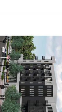
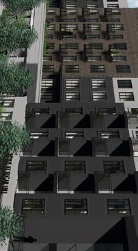
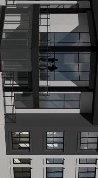
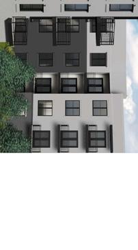
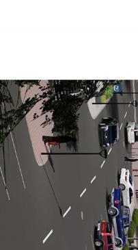
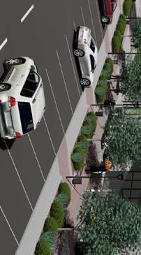
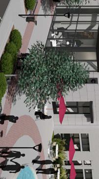

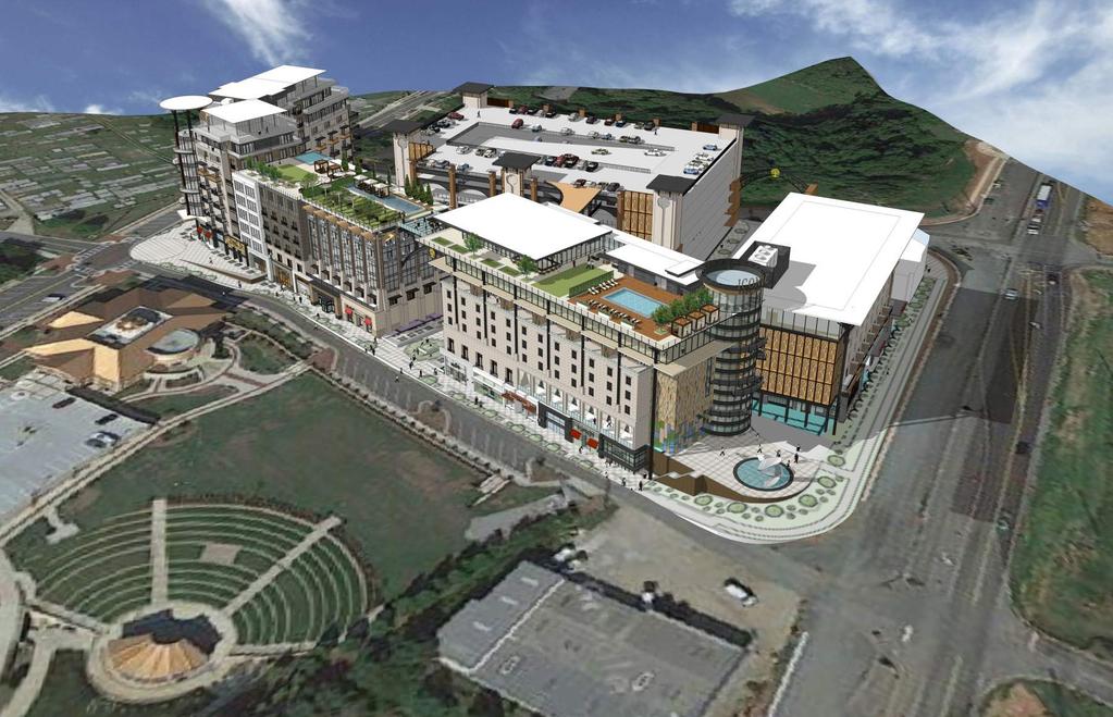
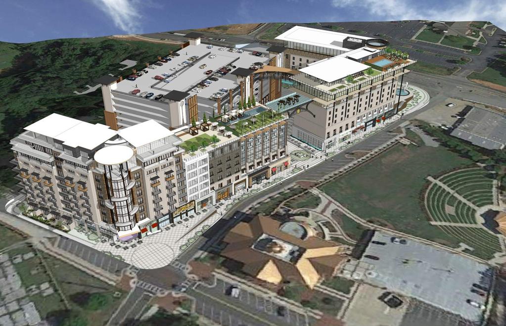
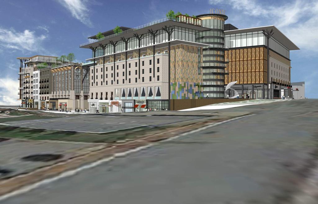


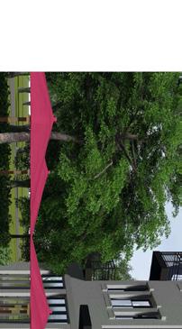
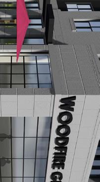
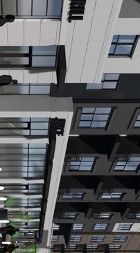
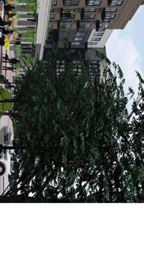
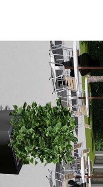
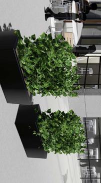
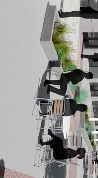
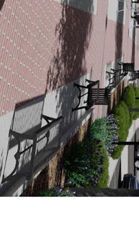


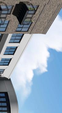

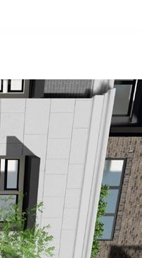
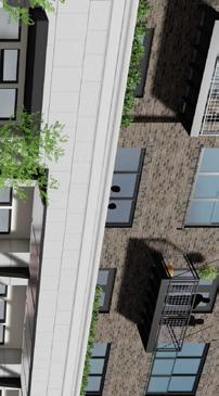
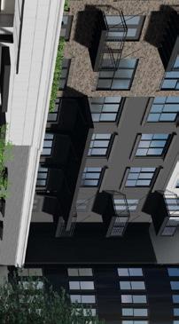
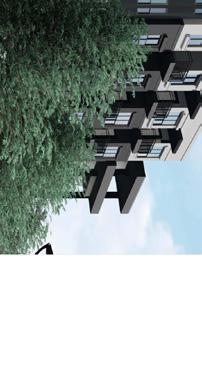
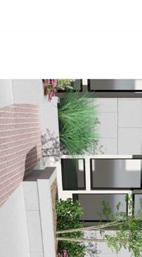
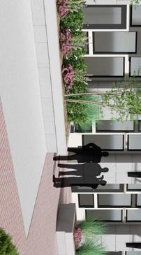
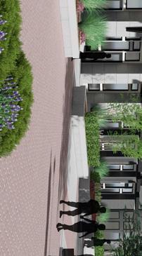
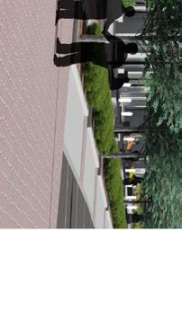

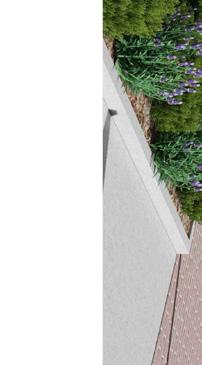

1 Broadstone Alliance Mixed-Use Development 08/01/17 Future Mixed-Use Development on Hillcrest Drive OVERVIEW FROM NORTHEAST at Sug 08/01/17 OVERVIEW FROM SOUTHEAST at Sug Source: City of Sugar Hill 08/01/17 PERSPECTIVE FROM NORTHEAST at Sug DOWNTOWN MASTER PLAN 7
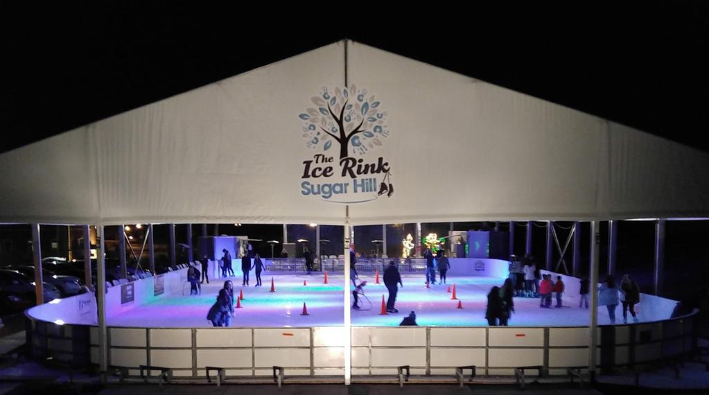
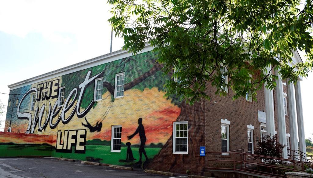
2 APPENDIX 5.3 EXISTING CONDITIONS AND GROWTH TRENDS Cultural Resources: Located in the center of the LCI area, the City Hall block serves as the town center for the Sugar Hill residents and the surrounding community. The 4.8 acre block is the City s significant cultural asset including various amenities such as the City Hall, the Bowl Amphitheater, Dawn P. Gober Community Plaza, Splash Park and Regional Detention & Neighborhood Park. These venues are designed in such a way that they can be used for both local and regional events throughout the year. The downtown core also includes two more local resources, the Town Center Park and the historic cemetery on West Broad Street. All these venues offer a variety of events through the year that contribute to creating a vibrant downtown core and a cultural hub for the City. The following list of events are organized in the downtown core to attract local families and regional audience. Music concerts: The Bowl is a 1,750 seat outdoor amphitheater. It hosts many concerts (ticketed and free) throughout the year attracting singers and artist nationwide. Sugar Rush: This is the annual fall festival for the community with many family-friendly activities, art shows, concerts, and local craft shopping. The Ice Rink: It is the largest outdoor and most visited ice skating rink in the southeast built for three months during winter. The 5,000 sf. Ice area is completely covered by an all weather tent and visited by over 10,000 people a season. Performing arts: Players Guild is a community theater group in the City. They are currently housed in the Buice School to produce and host performing art shows. Once the school building is demolished for the future mixed-use project, the Eagle Theater as part of the new E Center will be the new home for performing arts. Public art: Downtown Sugar Hill is a growing public art community with a newly created Public Arts Commission. During the Sugar Rush festival, the commission invites many artists to organize a public art exhibit. Several murals such as The Sweet Life at the Suite Spot and public art installations on West Broad Street add to the vitality of the Downtown. 8 SUGAR HILL LIVABLE CENTER INITIATIVE


3 APPENDIX DOWNTOWN MASTER PLAN 9
4 APPENDIX Land Use and Development Character Single-Family Residential: Approximately one-third of the study area consists of lower density single-family detached homes, making a total of 135 acres in the area. Multi-Family Residential: Plantation Ridge Apartments, Sugar Hill Station Townhomes, Sugar Hill Place Townhomes, and Mossy Oak Townhomes are the only apartment/rental communities in the LCI area with a total area of 10.2 acres comprising only 2% of the total study area. Mobile Homes: Peachtree Mobile Home Park and Cherry Valley are the two big mobile homes communities located south of Peachtree Industrial Boulevard with a total area of approximately 32-acres. Retail/Commercial: The commercial uses are located along the major vehicular corridors, Highway 20 and Peachtree Industrial Boulevard (PIB). Both corridors have suburbanstyle strip commercial gas stations, auto care and car wash, convenient store, laundry, storage facility, etc. Home Spun is the only eating establishment in the LCI area. The downtown lacks shopping, dining and other retail services. The 6.80-acre site of Extra Space Storage service south of the railroad, and acres site of HPC Import Salvage North of PIB are the two biggest commercial sites in the LCI area. The commercial/retail area is acres, about 11% of the total LCI area. Industrial: AmeriGas Propane Company is the only large industrial use along Norfolk Southern railroad. The older buildings on northeast corner of PIB and Highway 20 are used for some light industrial uses. Institutional/Civic Use: The study area includes a few major community amenities as a part of civic and institutional uses. They are Sugar Hill City Hall, Sugar Hill Church, New Hope Church, Sugar Hill Community Center, the Great Beginning of Sugar Hill, T-Carl Buice School, and The Suite Spot business incubator space. T-Carl Buice School is currently not under session but the 5.86-acre school site is up for redevelopment with a mixed-used development with retail and multi-family apartments (Broadstone). The total land area under institutional/civic use is 28 acres. Parks/Open Space: The Bowl has the dual function of the signature green space and a storm water facility in downtown. It includes an amphitheater and a splash pad on 2.6 acres of land. The historic Sugar Hill Cemetery (6.5 acres) is located on West Broad Street in the heart of downtown. Vacant/Undeveloped: Approximately 26% of land in LCI study area is Vacant/ Undeveloped with a total area of acres. This includes large tracts of undeveloped land. This mostly because of the topography of the area, making the land under 50 feet stream buffer unsuitable for development. Existing Land Use (Fall 2017) Single-Family Detached % % Land Use based on Planned Development Mixed Use 0 0% % Broadstone, Future Mixed-Use Multi-Family Residential % % Dogwood Forest Mobile Home Park % % Retail/Commercial % % E Center Industrial 7.9 2% 7.9 2% Institutional/Civic Facility 28 7% 28 7% Parks/Open Space 9.1 2% 9.1 2% Vacant/Undeveloped % % Planned Development/Under Construction % Total Area SUGAR HILL LIVABLE CENTER INITIATIVE

5 APPENDIX fig. 1: EXISTING LAND USE DOWNTOWN MASTER PLAN 11
6 APPENDIX Current Zoning Central Business District: The Central Business District (CBD) Overlay district is located in the downtown core on both sides of West Broad Street from Highway 20 to PIB. The purpose of the CBD is to create traditional block patterns with pedestrian-oriented building character, multi-model connectivity, and open spaces. The regulatory framework promotes compact mixed-use development, incentivizes redevelopment, rehabilitation, and revitalization of vacant/ underutilized properties, describes development standards to create an urban form, and establishes the design review process for future implementation. The zoning provides design criteria for buildings, pedestrian experience, and signage to create a vibrant downtown. Some highlights of the development standards that would be applicable to future development and growth of downtown are: The maximum building height allowed in CBD is 130 feet in the City Hall block and the Buice School block, and 84 feet in the rest of CBD. Minimum single-family residential density is 4 dwelling units/acre and maximum density is 12 dwelling units/acre Multi-family limited to mid-rise and courtyard building type with a maximum Floor Area Ratio of 2:1. Town Center Overlay District: The majority of the LCI area is part of the Town Center Overlay (TCO) zoning district except for the area on the east side of the railroad. The intent of the TCO is similar to CBD. TCO was created to prepare for the LCI program of Atlanta Regional Commission. The regulations focus on the visual character of the community to maintain the small town feel and architectural consistency. The TCO also encourages mixed-use development with a maximum building height of 4 stories/50 feet. The zoning provides design criteria and standards for architectural design, skyline, building materials, and signage. Any future development in the TCO should go through the design review and approval process by the City council. Mixed-Use Developments: This zoning district is created to encourage large-scale mixed-use development with highquality development and site design in addition to open space and preservation of unique environmental features. Any future development with mixed-use development requires a detailed site design report and plans for the administrative review process. Primarily there are two types of mixed-use developments Commercial Office Districts (COD) on PIB or Nelson Brogdon and Commercial Office Residential District (COR) along Nelson Brogdon. RM: Residential Multi-Family: The South quadrant of PIB and Buford Drive, and the area adjacent to Downtown Commercial District in the West quadrant of LCI study area are mostly zoned as residential multi-family district. This provides for multi-unit structures which are attached housing at a net density not to exceed eight (8) units per acre, and high density single family residential, providing eight thousand (8,000) square foot minimum lot sizes. The regulations for this district are designed to provide an area where individuals and families may establish homes in an environment which satisfies their needs for convenience and economy. The purpose of this district is to promote better utilization of land and freedom of architectural and engineering design without maximizing density. R-150: Low Density Single Family Residential: A very small percentage of the area in the LCI study area is zoned as R-150 Low Density Single-Family Residential District which provides for fifteen thousand (15,000) square foot minimum lot sizes. The regulations for these districts are designed to encourage low density one-family residential development, protected from the depreciating effects of small lot development and excessive density R-100: Medium Density Single Family Residential: There is a fair mix of this zoning category throughout the LCI area. Medium Density Single-Family Residential District provides for ten thousand (10,000) square foot minimum lot sizes. The regulations for this district are designed to take advantage of the greater economy and convenience afforded by more intensive development but still retain some of the open aspects of a detached dwelling unit district. MH: Mobile Home Park: The major concentration of Mobil Home Park District is at the East quadrant of the LCI area. This District provides for the transient and permanent uses of residential mobile home units within the City in mobile home parks located on un-subdivided parcels which have single ownership control. Mobile home subdivisions are not permitted. BG: General Business: The General Business District provides for a wide range of retail and service establishments in a central business environment. Intended to provide adequate space in appropriate locations along major streets, thoroughfares and at intersections for various types of business use. These uses include the retailing of major goods and services, general office facilities and public functions that would serve a community area of several neighborhoods. Development of uses in the district characteristically occupy a larger area than in the HSB district because it is intended to serve a greater population and to offer a wider range of services. Orientation and expansion of this district should occur as an increase in depth at major intersections rather than as a strip-like extension along the street or thoroughfare. HSB: Highway Service Business: Mostly the parcel along Highway 20, PIB, and West Broad St are zoned as Highway Service Business District which provides for limited uses of commercial land adjacent to major traffic arteries. The HSB District requires individual free-standing structures, larger yard areas, greater setbacks, and lower building densities than are permitted in the General Business District. 12 SUGAR HILL LIVABLE CENTER INITIATIVE

7 APPENDIX fig. 2: CURRENT ZONING DOWNTOWN MASTER PLAN 13
8 LM: Light Manufacturing: The Light Manufacturing District provides for most heavy commercial and light industrial uses which can meet rigid standards for control of noise, odor, and other off-site disturbance. Comprised of lands that are located on, or have ready access to a major street or state highway and are well adapted to industrial development but whose proximity to residential. Currently there are very few parcels under this zoning category that are developed as per the zoning criteria, which includes Georgia Emission (along PIB) HM1: Heavy Manufacturing: The Heavy Manufacturing District limits industrial, manufacturing and warehousing uses to those which are wholly conducted indoors, with the exception of outdoor storage which is screened and situated in a required side or rear yard. OI: Office-Institutional: The Office-Institutional District provides for limited commercial and institutional land uses where traffic, noise and congestion are minimized. Major distribution of this zoning category is along the West Broad Street within the LCI area. Distribution functions such as loading, unloading, storage, packaging and un-packaging are limited to ten (10) percent of the total building area and five (5) percent of the total lot area. Natural Feature The north quadrant of the study area between Highway 20 and PIB has a heavy tree canopy with significant topographical challenges which inhibit development. A large portion of the quadrant has slopes of 15-20% or more, making it difficult for any large scale developments or new street connections. A similar situation is present in the south quadrant of the study area, between PIB and Buford Drive, especially along PIB and the railroad, and the sites with portion of Level Creek and Suwanee Creek. The 37-acre site in the west quadrant of the study area along PIB comprises heavy tree canopy and is divided by a tributary of Level Creek and include slopes of 20% or more in some areas. The east quadrant of the study area has challenging slopes of 20% or more, especially around the Mobile Home Park. 14 SUGAR HILL LIVABLE CENTER INITIATIVE

9 DOWNTOWN MASTER PLAN 15
10 APPENDIX Pedestrian Circulation Based on the available street network and sidewalk data from the City, the Downtown Sugar Hill Traffic Study 2016, and a windshield survey in fall of 2017, the connectivity and walkability analysis evaluates the area s challenges when it comes to pedestrian and bike circulation. Sidewalks are located along both sides of Highway 20 and West Broad Street. Both these streets have fairly new sidewalk infrastructure which ranges from 8 feet to 12 feet wide (including buffer) for the length of LCI area. Whithead Road, Level Creek Road, and Temple Drive all have narrow sidewalks at 4-5 feet in width on east side of the road. There are no specific bicycle provisions within the downtown area. In some locations, the angled parking creates an impediment to bicyclists that are trying to share the road with vehicles. In general, there are no physical restrictions for bikes but at the same time there is no bike infrastructure in place (Downtown Sugar Hill Traffic Study 2016). Vehicular Circulation Broad Street has been rebuilt to serve a walkable town center. It balances the needs of pedestrians and motorists. The roundabout at Whitehead Road provides a high level of service while slowing traffic entering the downtown area. West Broad Street s intersections at Temple Drive/Church Street and Level Creek Road are controlled by all-way stop signs (Downtown Sugar Hill Traffic Study 2016). Before the construction of Peachtree Industrial Boulevard, West Broad Street & East Broad Street, 1st Avenue on both sides of PIB, and 3rd Avenue were continuous streets. But in the 80 s these streets were disconnected, leaving multiple dead-end streets. Until the early 60 s Lanier Avenue and Railroad Avenue were connected but in 1966 State Route 20 Spur was redesignated in Sugar Hill, resulting in disconnect in those streets. Alton Tucker Boulevard is a later extension of West Broad Street to connect to PIB. Spring Hill Street is the only one-way street across from Sugar Hill Elementary School. This section slopes down steeply from Level Creek Road to Whithead Road, creating a blind spot for both drivers going in other direction and pedestrians crossing near the school area. 16 SUGAR HILL LIVABLE CENTER INITIATIVE
5/24/2018 RZ Page 1 of 3
 City of Sugar Hill Planning Staff Report RZ 18-004 DATE: May 24, 2018; Updated 6/5/2018 TO: Mayor and City Council FROM: Planning Director SUBJECT: Rezoning RZ 18-004 Ansley Hillcrest LLC, Hillcrest Drive
Appendix A: Guide to Zoning Categories Prince George's County, Maryland
 Appendix A: Guide to Zoning Categories Prince George's County, Maryland RESIDENTIAL ZONES 1 Updated November 2010 R-O-S: Reserved Open Space - Provides for permanent maintenance of certain areas of land
City of Valdosta Land Development Regulations
 Chapter 206 Section 206-1 Base Zoning Districts Standards for Uses, Structures, and Property Development (B) (C) Principal Uses and Structures. Principal uses and structures permitted in each base zoning
Jasper 115 Street DC2 Urban Design Brief
 Jasper 115 Street DC2 Urban Design Brief Greenlong Construction Ltd. Stantec Consulting Ltd. 2017 Overview The proposed rezoning application supports the development of two mixed-use high-rise buildings
Glades County Staff Report and Recommendation Unified Staff Report for Small Scale Plan Amendment and Rezoning
 Glades County Staff Report and Recommendation Unified Staff Report for Small Scale Plan Amendment and Rezoning CASE NUMBERS: COMP17-02 and RZ17-02 DATE of STAFF REPORT: May 1, 2017 CASE TYPE: Application
ARTICLE 3: Zone Districts
 ARTICLE 3: Zone Districts... 3-1 17.3.1: General...3-1 17.3.1.1: Purpose and Intent... 3-1 17.3.2: Districts and Maps...3-1 17.3.2.1: Applicability... 3-1 17.3.2.2: Creation of Districts... 3-1 17.3.2.3:
REQUEST STAFF RECOMMENDATION. On April 26, 2012, Signature Books Inc., represented by Dave Richards, submitted petitions for the following amendments:
 PLANNING COMMISSION STAFF REPORT Signature Books Zoning Map Amendment and an Amendment to the North Temple Area Plan Petitions PLNPCM2012-00254 PLNPCM2012-00255 July 11, 2012 Planning Division Department
APPENDIX D: DEFINITIONS
 D APPENDIX D: DEFINITIONS Terms used throughout the 2040 Comprehensive Plan should be interpreted using the definitions provided in this appendix. For interpretation of any term not defined, defer to the
ARTICLE B ZONING DISTRICTS
 ARTICLE B ZONING DISTRICTS Sec. 8-3021 Established. In order to protect the character of existing neighborhoods; to prevent excessive density of population in areas which are not adequately served with
Introduction. General Development Standards
 Introduction The development standards will set the zoning regulations for the East Park development. This section will illustrate lot standards, approximate open space locations and road standards. The
Route 6 Corridor Study Bristol Planning Commission Meeting #1. May 25, 2016 FITZGERALD & HALLIDAY, INC. Innovative Planning, Better Communities
 Route 6 Corridor Study Bristol Planning Commission Meeting #1 May 25, 2016 FITZGERALD & HALLIDAY, INC. Innovative Planning, Better Communities Today s Agenda 1. Introductions 2. Study overview Scope Schedule
Bylaw No , being "Official Community Plan Bylaw, 2016" Schedule "A" DRAFT
 Bylaw No. 2600-2016, being "Official Community Plan Bylaw, 2016" Schedule "A" Urban Structure + Growth Plan Urban Structure Land use and growth management are among the most powerful policy tools at the
2.2.2 The Land Use Setting
 2-6 Planning Area pearance varies dramatically from season to season. The absence of significant topographic or man-made features within the District contributes to a very open visual character that allows
SECTION 3.1 ZONING DISTRICTS ESTABLISHED
 ARTICLE 3. ZONING DISTRICTS SECTION 3.1 ZONING DISTRICTS ESTABLISHED The City of Cedar Hill, Texas is hereby divided into the following zoning districts. The use, height and area regulations as set out
NORTHWEST QUADRANT NEIGHBORHOOD STUDY
 City of Novato General Plan 2035 Focus Area NORTHWEST QUADRANT NEIGHBORHOOD STUDY May, 2015 Why a Neighborhood Study? The Northwest Quadrant Neighborhood, north of the Grant Avenue business district,
GENERAL PLAN UPDATE SPECIFIC AREAS OF THE CITY
 GENERAL PLAN UPDATE SPECIFIC AREAS OF THE CITY Background There are a total of 14 specific areas that are being reviewed as part of the update of the General Plan. Requests to review these areas came from
Salem HNA and EOA Advisory Committee Meeting #6
 Salem HNA and EOA Advisory Committee Meeting #6 Residential Land Policies Employment Land Policies Policy Discussions with the Committee Outcome of today s meeting Direction from this Committee on proposed
Place Type Descriptions Vision 2037 Comprehensive Plan
 Place Type Descriptions Vision 2037 Comprehensive Plan The Vision 2037 Comprehensive Plan establishes a range of place types for Oxford, ranging from low intensity (limited development) Rural and Natural
Chapter DOWNTOWN ZONING DISTRICTS
 Chapter 20.14 Sections: 20.14.010 Purpose of the Downtown Zoning Districts 20.14.020 Land Use Regulations for Downtown Zoning Districts 20.14.030 Development Standards for Downtown Zoning Districts 20.14.010
DEVELOPMENT DEPARTMENT STAFF REPORT STAFF REPORT MCDONALD S ZONING MAP AMENDMENT AND CONCURRENT VARIANCES
 DEVELOPMENT DEPARTMENT STAFF REPORT Meeting Date: October 12, 2017 Item #: _PZ2017-172_ STAFF REPORT MCDONALD S ZONING MAP AMENDMENT AND CONCURRENT VARIANCES Request: Rezone property from MU-BC to CC,
Planning Justification Report
 Planning Justification Report Kellogg s Lands City of London E&E McLaughlin Ltd. June 14, 2017 Zelinka Priamo Ltd. Page i TABLE OF CONTENTS Page No. 1.0 2.0 2.1 2.2 3.0 4.0 5.0 5.1 5.2 5.3 5.4 5.5 5.6
Master Plan Review SILVER SPRING CBD. Approved and Adopted February Updated January 2013
 Master Plan Review SILVER SPRING CBD Approved and Adopted February 2000 BACKGROUND ZONING CODE REWRITE In 2007, the Montgomery County Council directed the Planning Department to undertake a comprehensive
Parking Challenges and Trade-Offs
 Parking Challenges and Trade-Offs What is the best way to balance competing interests and priorities while updating the City s off street parking regulations? Updating off street parking regulations can
PLANNING COMMISSION STAFF REPORT
 PLANNING COMMISSION STAFF REPORT West Capitol Hill Zoning Map Amendment Petition No. PLNPCM2011-00665 Located approximately at 548 W 300 North Street, 543 W 400 North Street, and 375 N 500 West Street
Town of Cary, North Carolina Rezoning Staff Report 14-REZ-31 Cary Park PDD Amendment (Waterford II) Town Council Meeting January 15, 2015
 Town Council Meeting January 15, 2015") Town of Cary, North Carolina Rezoning Staff Report 14-REZ-31 Cary Park PDD Amendment (Waterford II) Town Council Meeting January 15, 2015 REQUEST To amend the Town of Cary Official Zoning Map by amending
Town of Cary, North Carolina Rezoning Staff Report 14-REZ-31 Cary Park PDD Amendment (Waterford II) Town Council Meeting January 15, 2015 REQUEST To amend the Town of Cary Official Zoning Map by amending
DIVISION 1 PURPOSE OF DISTRICTS
 ARTICLE 2 ZONING DISTRICTS AND MAP DIVISION 1 PURPOSE OF DISTRICTS Section 2.101 Zoning Districts. For the purpose of this Ordinance, the City of Richmond is hereby divided into districts as follows: DISTRICT
POLK COUNTY DEVELOPMENT REVIEW COMMITTEE CASE OVERVIEW
 POLK COUNTY DEVELOPMENT REVIEW COMMITTEE CASE OVERVIEW DRC Date: January 10, 2019 Level of Review: 4 PC Date: March 6, 2019 Type: Text Amendments BoCC Date: May 7, 2019 July 2, 2019 Case Numbers: Case
A. Land Use Relationships
 Chapter 9 Land Use Plan A. Land Use Relationships Development patterns in Colleyville have evolved from basic agricultural and residential land uses, predominate during the early stages of Colleyville
From Policy to Reality
 From Policy to Reality Updated ^ Model Ordinances for Sustainable Development 2000 Environmental Quality Board 2008 Minnesota Pollution Control Agency Funded by a Minnesota Pollution Control Agency Sustainable
BYLAW NO. 15/026 A BYLAW OF THE REGIONAL MUNICIPALITY OF WOOD BUFFALO TO AMEND THE LAND USE BYLAW NO. 99/059
 Attachment 2 BYLAW NO. 15/026 A BYLAW OF THE REGIONAL MUNICIPALITY OF WOOD BUFFALO TO AMEND THE LAND USE BYLAW NO. 99/059 WHEREAS Section 639 of the Municipal Government Act requires every municipality
DEVELOPMENT DEPARTMENT STAFF REPORT STAFF REPORT PUD/DCI BAINBRIDGE MIXED-USE DEVELOPMENT
 DEVELOPMENT DEPARTMENT STAFF REPORT Meeting Date: October 12, 2017 Item #: _PZ-2017-170_ STAFF REPORT PUD/DCI BAINBRIDGE MIXED-USE DEVELOPMENT Request: Project Name: Planned Unit Development (PUD)/ Development
Truax Park Apartments
 Truax Park Apartments Master Planning and Site Development Study Prepared by The Community Development Authority of the City of Madison In association with SMITH & SMITH ASSOCIATES, Inc CONSTRUCTION COST
Poughkeepsie City Center Revitalization Plan
 Purpose and Need Purpose Increase job and educational opportunities for all residents Maximize fiscal productivity of downtown land uses Diversify retail mix Eliminate surface and building vacancies Create
Chapter CN NEIGHBORHOOD CENTER COMMERCIAL ZONES REGULATIONS
 Chapter 17.33 - CN NEIGHBORHOOD CENTER COMMERCIAL ZONES REGULATIONS Sections: 17.33.010 - Title, intent, and description. 17.33.020 - Required design review process. 17.33.030 - Permitted and conditionally
Table of Contents. Concept Plan Overview. Statement of Compliance with Design Guidelines. Statement of Compliance with Comprehensive Plan
 Table of Contents Concept Plan Overview Statement of Compliance with Design Guidelines Statement of Compliance with Comprehensive Plan Developer s Program Market Objective Benefit to Local Businesses Benefit
8.5.1 R1, Single Detached Residential District
 8.5.1 R1, Single Detached Residential District The purpose of this district is to provide for residential development in the form of single detached dwellings. Dwelling, Single Detached Home Business,
Article 3. SUBURBAN (S-) NEIGHBORHOOD CONTEXT
 NEIGHBORHOOD CONTEXT") Article 3. SUBURBAN (S-) NEIGHBORHOOD CONTEXT this page left intentionally blank Contents ARTICLE 3. SUBURBAN (S-) NEIGHBORHOOD CONTEXT DIVISION 3.1 NEIGHBORHOOD CONTEXT DESCRIPTION...3.1-1 Section 3.1.1
Article 3. SUBURBAN (S-) NEIGHBORHOOD CONTEXT this page left intentionally blank Contents ARTICLE 3. SUBURBAN (S-) NEIGHBORHOOD CONTEXT DIVISION 3.1 NEIGHBORHOOD CONTEXT DESCRIPTION...3.1-1 Section 3.1.1
Generic Environmental Impact Statement. Build-Out Analysis. City of Buffalo, New York. Prepared by:
 Generic Environmental Impact Statement Build-Out Analysis City of Buffalo, New York 2015 Prepared by: TABLE OF CONTENTS 1.0 INTRODUCTION 1 2.0 METHODOLOGY 2 3.0 EXISTING LAND USE 3 4.0 EXISTING ZONING
Metropolitan Planning Commission. DATE: April 5, 2016
 TO: FROM: Metropolitan Planning Commission MPC Staff DATE: April 5, 2016 SUBJECT: Petition of Nine Line Inc. Robert McCorkle, Agent PIN: 2-1034-01-002 380.5 Acres Aldermanic District: 5 (Shabazz) County
DEVELOPMENT STANDARDS FOR RESIDENTIAL PROJECTS RESIDENTIAL BUILDING TYPES: APPROPRIATE ZONES AND DENSITIES 2-1
 2 DEVELOPMENT STANDARDS FOR RESIDENTIAL PROJECTS RESIDENTIAL BUILDING TYPES: APPROPRIATE ZONES AND DENSITIES 2-1 This Chapter presents the development standards for residential projects. Section 2.1 discusses
Urban Design Brief. Italian Seniors Project 1090, 1092, 1096 Hamilton Road City of London
 Urban Design Brief Italian Seniors Project City of London October 1, 2017 TABLE OF CONTENTS Page No. INTRODUCTION... 2 1.0 LAND USE PLANNING CONCEPT... 2 1.1 Subject Lands... 2 1.2 Official Plan and Zoning
Wheaton Sector Plan. Preliminary. Recommendations. Montgomery County Planning Board
 Sector Plan Preliminary Recommendations Montgomery County Planning Board 12-03-09 Scope of Work September 2008 Status Report June 2009 Preliminary Recommendations December 2009 1952 Process Today Community
PLANNING COMMISSION WILLIAMSBURG, VIRGINIA WORK SESSION AGENDA Wednesday, May 23, 2012
 PLANNING COMMISSION WILLIAMSBURG, VIRGINIA WORK SESSION AGENDA Wednesday, May 23, 2012 The meeting will be called to order in the third floor Conference Room (Room 310), Williamsburg Municipal Building,
O-I (Office-Institutional) and AG-1(Agricultural)
 and AG-1(Agricultural)") PROPERTY INFORMATION ADDRESS 3503 and 3505 Bethany Bend DISTRICT, LAND LOTS 2/1 973 and 974 OVERLAY DISTRICT State Route 9 PETITION NUMBERS EXISTING ZONING O-I (Office-Institutional) and AG-1(Agricultural)
PROPERTY INFORMATION ADDRESS 3503 and 3505 Bethany Bend DISTRICT, LAND LOTS 2/1 973 and 974 OVERLAY DISTRICT State Route 9 PETITION NUMBERS EXISTING ZONING O-I (Office-Institutional) and AG-1(Agricultural)
Subchapter 5 Zoning Districts and Limitations
 Subchapter 5 Zoning Districts and Limitations 35.5.1 Rural Districts Sections: 35.5.1.1 Purpose. 35.5.1.2 Permitted Uses. 35.5.1.3 General Regulations. 35.5.1.1 Purpose. The purpose of a Rural District
Missing Middle Housing in Practice
 Missing Middle Housing in Practice Daniel Parolek Principal, Opticos Design, Inc. dan@opticosdesign.com New Partners for Smart Growth Kansas City, MO 2013 1 Bungalow Courts Missing MIddle Housing 2012
Primary Districts Established 4
 4.1 GENERAL PURPOSE SECTION 4 PRIMARY DISTRICTS ESTABLISHED The Town of Waxhaw, North Carolina is hereby divided into PRIMARY ZONING DISTRICTS as designated herein and as shown on the Official Zoning Map.
Palmerton Area Comprehensive Plan
 DRAFT Palmerton Area Comprehensive Plan Bowmanstown Borough, Lower Towamensing Township, Palmerton Borough and Towamensing Township Carbon County, Pennsylvania Draft - With Minor Revisions - March 2008
PLANNING REPORT Gordon Street City of Guelph. Prepared on behalf of Ontario Inc. March 17, Project No. 1507
 PLANNING REPORT 1131 Gordon Street City of Guelph Prepared on behalf of 1876698 Ontario Inc. March 17, 2016 Project No. 1507 423 Woolwich Street, Suite 201, Guelph, Ontario, N1H 3X3 Phone (519) 836-7526
Chapter CC COMMUNITY COMMERCIAL ZONES REGULATIONS
 Effective April 14, 2011 Chapter 17.35 CC COMMUNITY COMMERCIAL ZONES REGULATIONS SECTIONS: 17.35.010 Title, Intent, and Description 17.35.020 Required Design Review Process 17.35.030 Permitted and Conditionally
Midwest City, Oklahoma Zoning Ordinance
 2010 Midwest City, Oklahoma Zoning Ordinance 9/2/2010 Table of Contents Section 1. General Provisions... 5 1.1. Citation... 5 1.2. Authority... 5 1.3. Purpose... 5 1.4. Nature and Application... 5 1.5.
COUNTY OF ALBEMARLE PLANNING STAFF REPORT SUMMARY
 COUNTY OF ALBEMARLE PLANNING STAFF REPORT SUMMARY Project Name: ZMA 2010-00015, Cedar Hill Planning Commission Worksession: February 15, 2011 Public Hearing: Not scheduled Staff: Judith C. Wiegand, AICP
EXHIBIT 1 PROJECT DESCRIPTION AND DESCRIPTION OF REQUESTED AREA VARIANCES REDEVELOPMENT OF 201 ELLICOTT STREET
 EXHIBIT 1 PROJECT DESCRIPTION AND DESCRIPTION OF REQUESTED AREA VARIANCES REDEVELOPMENT OF 201 ELLICOTT STREET I. PROJECT DESCRIPTION: Ciminelli Real Estate Corporation (the Applicant ) is seeking area
ARTICLE 3 ZONING DISTRICTS AND ZONING MAP. Table of Contents
 ARTICLE 3 ZONING DISTRICTS AND ZONING MAP Table of Contents 3-1 Establishment of Zoning Districts... 1 A. General Use Zoning Districts... 1 B. Conditional Zoning Districts... 3 C. Overlay Zoning Districts...
City of Coral Gables Planning and Zoning Staff Report
 City of Coral Gables Planning and Zoning Staff Report Applicant: Application: Public Hearing: Date & Time: Location: City of Coral Gables Giralda Restaurant Row Overlay Zoning Code Text Amendment Planning
Staff Report PLANNED DEVELOPMENT. Salt Lake City Planning Commission. From: Lauren Parisi, Associate Planner; Date: December 14, 2016
 Staff Report PLANNING DIVISION COMMUNITY & NEIGHBORHOODS To: Salt Lake City Planning Commission From: Lauren Parisi, Associate Planner; 801-535-7932 Date: December 14, 2016 Re: 1611 South 1600 East PLANNED
LITTLE MOUNTAIN ADJACENT AREA REZONING POLICY
 LITTLE MOUNTAIN ADJACENT AREA REZONING POLICY JANUARY 2013 CONTENTS 1.0 INTENT & PRINCIPLES...1 2.0 APPLICATION...2 3.0 HOUSING TYPES, HEIGHT & DENSITY POLICIES...3 3.1 LOW TO MID-RISE APARTMENT POLICIES...4
Land Use, Transportation, and Infrastructure Committee of Denver City Council FROM: Scott Robinson, Senior City Planner DATE: December 6, 2018 RE:
 Community Planning and Development Planning Services 201 W. Colfax Ave., Dept. 205 Denver, CO 80202 p: 720.865.2915 f: 720.865.3052 www.denvergov.org/cpd TO: Land Use, Transportation, and Infrastructure
CITY OF FATE, TEXAS UNIFIED DEVELOPMENT ORDINANCE. Article III Zoning Districts
 CITY OF FATE, TEXAS UNIFIED DEVELOPMENT ORDINANCE Article III Zoning Districts 3.1. General to all Zoning Districts and Zoning Map 3.1.1. Zoning Districts Established This article establishes the zoning
Existing Land Use. Typical densities for single-family detached residential development in Cumberland County: 1
 Existing Land Use A description of existing land use in Cumberland County is fundamental to understanding the character of the County and its development related issues. Economic factors, development trends,
Washington Boulevard + Kirkwood Road Special General Land Use Plan (GLUP) Study "Plus"
 Study Plus") Washington Boulevard + Kirkwood Road Special General Land Use Plan (GLUP) Study "Plus" Long Range Committee of the Planning Commission Meeting #4 May 18, 2017 Department of Community Planning, Housing
Washington Boulevard + Kirkwood Road Special General Land Use Plan (GLUP) Study "Plus" Long Range Committee of the Planning Commission Meeting #4 May 18, 2017 Department of Community Planning, Housing
PLANNING COMMISSION REPORT Regular Agenda Public Hearing Item
 PC Staff Report 11/12/12 Item No. 2B- 1 PLANNING COMMISSION REPORT Regular Agenda Public Hearing Item ITEM NO. 2B: A TO GPI; 110 ACRES; E OF K-10 & N OF W 6 TH ST (MKM) : Consider a request to rezone approximately
ARTICLE 2 ZONING DISTRICTS AND MAPS
 ARTICLE 2 ZONING DISTRICTS AND MAPS SECTION 2.100 PURPOSE OF DISTRICTS Section 2.101. For the purpose of this Ordinance, Billings Township is hereby divided into districts as follows: DISTRICT NAME SYMBOL
Town Center South End Development Area District
 175.28 ESTABLISHMENT OF DISTRICTS. In order to carry out the purpose and intent of this chapter, the area of the is hereby divided into eighteen (18) Zoning District Classifications and one overlay zoning
50+54 BELL STREET NORTH
 50+54 BELL STREET NORTH SITE PLAN CONTROL APPLICATION OCTOBER 2014 PREPARED BY: FOTENN Consultants Inc. 223 Mcleod Street Ottawa, ON K2P OZ8 (613) 730-5709 PREPARED FOR: Ottawa Chinese Alliance Church
THE AREA PLAN COMMISSION OF ST. JOSEPH COUNTY, IN AGENDA
 THE AREA PLAN COMMISSION OF ST. JOSEPH COUNTY, IN AGENDA Tuesday, January 17, 2017 Fourth-Floor Council Chambers 3:30 p.m. County-City Building, South Bend, IN EXECUTIVE SESSION: A. Election of Officers
Rapid City Planning Commission Rezoning Project Report
 Rapid City Planning Commission Rezoning Project Report April 21, 2016 Item #9 Applicant Request(s) Case # 16RZ011; a request to rezone property from Central Business District to General Commercial District
PLANNED UNIT DEVELOPMENT & SUBDIVISION STAFF REPORT Date: April 18, 2019
 PLANNED UNIT DEVELOPMENT & SUBDIVISION STAFF REPORT Date: April 18, 2019 DEVELOPMENT NAME SUBDIVISION NAME Springhill Village Subdivision Springhill Village Subdivision LOCATION 4350, 4354, 4356, 4358,
DIVISION 1.3 OFFICIAL ZONING MAP
 Article 1. General Provisions Division 1.3 Official Zone Map DIVISION 1.3 OFFICIAL ZONING MAP SECTION 1.3.1 ADOPTION OF OFFICIAL MAP The digital maps created and maintained by the Department of Community
PUBLIC DRAFT May 2017 Zoning Districts Use Regulations Definitions (partial)
") PUBLIC DRAFT May 2017 Zoning Districts Use Regulations Definitions (partial) Table of Contents Subchapter 1: General Provisions... 1 Subchapter 2: Administration & Procedures... 3 Subchapter 3: Zoning
PUBLIC DRAFT May 2017 Zoning Districts Use Regulations Definitions (partial) Table of Contents Subchapter 1: General Provisions... 1 Subchapter 2: Administration & Procedures... 3 Subchapter 3: Zoning
RESIDENTIAL DISTRICTS
 RESIDENTIAL DISTRICTS RESIDENTIAL DISTRICTS The residential district standards have been revised to reflect on-the-ground development conditions, while continuing to respect the use patterns established
Chapter URBAN VILLAGE ZONING DISTRICTS
 Chapter 20.16 Sections: 20.16.010 Purpose of the Urban Village Zoning Districts 20.16.020 Land Use Regulations for the Urban Village Zoning Districts 20.16.030 Development Standards & Guidelines for the
Infrastructure, Development and Enterprise Services
 Staff Report To Service Area City Council Infrastructure, Development and Enterprise Services Date Monday, April 9, 2018 Subject Report Number Statutory Public Meeting 671 Victoria Road North Proposed
Downtown Development Focus Area: I. Existing Conditions
 Downtown Development Focus Area: I. Existing Conditions The Downtown Development Focus Area is situated along Route 1, south of the train tracks, except for the existing Unilever property. It extends west
Recommend approval of the Variances identified and Rezone to Residential Multi-Family (RM) District with following conditions:
 District with following conditions:") City of Sugar Hill Planning Staff Report RZ 17-001 DATE: June 20, 2017: Updated 7/10/17 TO: Mayor and City Council FROM: Tim Schick, Administrative Staff SUBJECT: Rezoning RZ 17-001 Rezoning with Variances
City of Sugar Hill Planning Staff Report RZ 17-001 DATE: June 20, 2017: Updated 7/10/17 TO: Mayor and City Council FROM: Tim Schick, Administrative Staff SUBJECT: Rezoning RZ 17-001 Rezoning with Variances
Chapter 1107: Zoning Districts
 Chapter 1107: Zoning Districts 1107.01 Establishment of Zoning Districts (a) Districts Established In order to carry out the purpose of this code, the City is hereby divided into the zoning districts established
3.1. OBJECTIVES FOR RESIDENTIAL LAND USE DESIGNATIONS GENERAL OBJECTIVES FOR ALL RESIDENTIAL DESIGNATIONS
 3. RESIDENTIAL LAND USE DESIGNATIONS INTRODUCTION The Residential land use designations provide for housing and other land uses that are integral to, and supportive of, a residential environment. Housing
GC General Commercial District
 Section 712. GC General Commercial District 712.1 Intent of District. It is the intent of this section that the GC Zoning District be developed and reserved for general business purposes. The regulations
Rapid City Planning Commission Conditional Use Permit Project Report
 Rapid City Planning Commission Conditional Use Permit Project Report September 21, 2017 Applicant Request(s) Case # 17UR020 Conditional Use Permit to allow a mini-storage facility Companion Case(s) # Item
LAND USE ASSUMPTIONS REPORT POTENTIAL FUTURE DEVELOPMENT WEST WHITELAND TOWNSHIP, CHESTER COUNTY, PA
 LAND USE ASSUMPTIONS REPORT POTENTIAL FUTURE DEVELOPMENT WEST WHITELAND TOWNSHIP, CHESTER COUNTY, PA Adopted June 17, 2015 by Township Resolution No. 2015-30 Prepared by Theurkauf Design & Planning, LLC
Ashcroft Homes Trim Road Development Planning Rationale
 18 Antares Drive Ottawa, ON K2E 1A9 Ashcroft Homes Trim Road Development Planning Rationale Proposed Site Plan & Zoning Amendment Applications File No: D02-02-17-0129 & D07-12-17-0175 August 2018 Planning
Coding For Places People Love Main Street Corridor District
 Coding For Places People Love Main Street Corridor District 1) Scope a) District boundaries are assigned according to the District Boundary Map. b) The Primary Retail Corridor is assigned according to
U r b a n D e s i g n a n d t h e P u b l i c R e a l m
 U r b a n D e s i g n a n d t h e P u b l i c R e a l m Urban Design Goals 1. Enhance public access to and use of the town core s amenities. 2. Improve pedestrian access and circulation throughout the
Chapter 10: Implementation
 Chapter 10: Introduction Once the Comprehensive Plan has been adopted by the City of Oakdale, the City can begin to implement the goals and strategies to make this vision a reality. This chapter will set
UrbanFootprint Place Types. Urban Mixed Use. Urban Residential. Urban Commercial. Residential 1% SF Large Lot 0%
 Urban Mixed Use Residential 18% SF Large Lot 0% Employment 16% SF Small Lot 0% Mixed Use 45% Townhome 0% Open Space/Civic 21% MultiFamily 100% Intersections per mi 2 200 Office 80% Average Floors 23 Retail
Sherwood Forest (Trinity) Housing Corporation. Urban Design Brief
 Housing Corporation. Urban Design Brief") Sherwood Forest (Trinity) Housing Corporation Sherwood Place Affordable Housing Apartments Trinity Presbyterian Church Orchard Park Nursery School 590 Gainsborough Road, London Urban Design Brief REVISED
Sherwood Forest (Trinity) Housing Corporation Sherwood Place Affordable Housing Apartments Trinity Presbyterian Church Orchard Park Nursery School 590 Gainsborough Road, London Urban Design Brief REVISED
CITY OF SANTA ROSA COMMUNITY DEVELOPMENT DEPARTMENT STAFF REPORT FOR PLANNING COMMISSION SEPTEMBER 10, 2015 APPLICANT FILE NUMBER MJP
 ITEM NO. 9 CITY OF SANTA ROSA COMMUNITY DEVELOPMENT DEPARTMENT STAFF REPORT FOR PLANNING COMMISSION SEPTEMBER 10, 2015 PROJECT TITLE Yogurt Time Center ADDRESS/LOCATION 3093 Marlow Road ASSESSOR S PARCEL
Chapter 6 Future Land Use and Housing Plan
 Chapter 6 Future Land Use and Housing Plan The Future Land Use Plan is one of the most important elements of the Comprehensive Plan. It graphically brings together all of the chapters of the plan and evaluates
Urban Design Brief Dundas Street. London Affordable Housing Foundation. November Zelinka Priamo Ltd.
 Urban Design Brief 1039-1047 Dundas Street London Affordable Housing Foundation November 2017 Zelinka Priamo Ltd. TABLE OF CONTENTS Page No. INTRODUCTION... 3 SECTION 1 LAND USE PLANNING CONTEXT... 3 1.1
UPDATE Board of Selectmen June 20, 2017
 MAPLE STREET I-1 AREA DRAFT ZONING BYLAW & DEVELOPMENT STANDARDS Town of Danvers, MA UPDATE Board of Selectmen June 20, 2017 The Danvers Team: Brovitz Community Planning & Design Dodson & Flinker Danvers
SPECIAL USE PERMIT APPLICATION CITY PLAN COMMISSION AND BOARD OF ZONING ADJUSTMENT
 SPECIAL USE PERMIT APPLICATION CITY PLAN COMMISSION AND BOARD OF ZONING ADJUSTMENT City Planning & Development Department City Hall, 414 E. 12 th Street, 15 th floor; Kansas City, MO 64106-2795 Phone (816)
Planning Department Oconee County, Georgia
 Planning Department Oconee County, Georgia STAFF REPORT REZONE CASE #: 6985 DATE: October 31, 2016 STAFF REPORT BY: Andrew C. Stern, Planner APPLICANT NAME: Williams & Associates, Land Planners PC PROPERTY
CITY OF NORTH LAS VEGAS MEMORANDUM
 CITY OF NORTH LAS VEGAS MEMORANDUM TO: FROM: SUBJECT: Planning Commission Community Development and Compliance Department # 28 ) AMP-03-15; Coleman Airpark II & III - Comprehensive Plan Amendment (Public
Staff Report & Recommendation Rezoning Case RZ Date of Report: June 6, 2014 Report by: Doug Stacks
 Staff Report & Recommendation Rezoning Case RZ-2014-02 Date of Report: June 6, 2014 Report by: Doug Stacks Hearing Dates: Planning Commission June 26, 2014 Mayor and Council July 14, 2014 GENERAL INFORMATION
1 Application Form 4
 1 Application Form 4 5 2 Project Summary Location The proposed development is located at 216 Cobequid Road in Sackville, Nova Scotia. Site Characteristics The mixed-use development is situated on the corner
ORDINANCE NO. C 34911
 ORDINANCE NO. C 34911 AN ORDINANCE relating to Residential Zones; amending SMC sections 17C.110.020, 17C.110.030, 17C.110.100, 17C.110.205, 17C.110.220, 17C.110.245, 17C.110.310, Table 17C.110-3 and adopting
City of Coral Gables Planning and Zoning Staff Report
 City of Coral Gables Planning and Zoning Staff Report Applicant: Application: Public Hearing: Date & Time: Location: City of Coral Gables Zoning Code Text Amendment Giralda Plaza Overlay District Planning
COMMERCIAL ELEMENT AND CODE ENFORCEMENT
 COMMERCIAL ELEMENT AND CODE ENFORCEMENT The Commercial Element identifies and describes the existing characteristics that are desired by the neighborhood. The existing conditions will determine appropriate
Rezoning Petition Final Staff Analysis July 16, 2018
 Rezoning Petition 2018-041 Final Staff Analysis July 16, 2018 REQUEST LOCATION Current Zoning: R-5 (single family residential, and UR-2(CD) (urban residential, conditional) Proposed Zoning: UR-2(CD) (urban
Article 10 Marina District
 Michigan City MD Article 10 Article 10 ection 10.01 Intent (a) MD. The MD is to be applied to the waterfront areas of Michigan City, including Washington ark and Marina, as well as development along the