PLANNING COMMISSION WILLIAMSBURG, VIRGINIA WORK SESSION AGENDA Wednesday, September 26, 2012
|
|
|
- David Riley
- 5 years ago
- Views:
Transcription
1 PLANNING COMMISSION WILLIAMSBURG, VIRGINIA WORK SESSION AGENDA Wednesday, September 26, 2012 The meeting will be called to order in the third floor Conference Room (Room 310), Williamsburg Municipal Building, 401 Lafayette Street, on Wednesday, September 26, 2012 at 4:00 p.m. COMPREHENSIVE PLAN WORK SESSION #21 1. Chapter 8 Neighborhoods and Housing Second Draft a. Staff presentation - Reed Nester, Planning Director b. Planning Commission discussion, including review of comments at September 5 Community Forum on the Midtown and Downtown Planning Areas c. Open Forum d. Planning Commission discussion 2. Chapter 10 Commercial and Economic Development Second Draft a. Staff presentation - Reed Nester, Planning Director b. Planning Commission discussion, including review of comments at September 5 Community Forum on the Midtown and Downtown Planning Areas c. Open Forum d. Planning Commission discussion 3. Adjourn Scheduled Comprehensive Plan Work Sessions Work Session on Wednesday, October 10, 2012 at 4:00 p.m. in the Williamsburg Municipal Building, 401 Lafayette St., 3 rd Floor Conference Room. The Planning Commission will discuss Chapter 6 Environmental Management and Chapter 11 Infrastructure. Work Session on Wednesday, October 24, 2012 at 4:00 p.m. in the Williamsburg Municipal Building, 401 Lafayette St., 3 rd Floor Conference Room. The Planning Commission will discuss Chapter 12 Implementation, and review the initial draft of the complete Comprehensive Plan. Scheduled Comprehensive Plan Public Hearing 2012 Comprehensive Plan Public Hearing on Wednesday, November 7, 2012 at 7:00 p.m. in the Council Chamber of the Stryker Building, 412 North Boundary Street. Scheduled Comprehensive Plan Work Sessions Work Session on Wednesday, November 28, 2012 at 4:00 p.m. in the Williamsburg Municipal Building, 401 Lafayette St., 3 rd Floor Conference Room. The Planning Commission will evaluate Public Hearing comments and revise the draft plan as needed. Work Session on Wednesday, December 12, 2012 at 4:00 p.m. in the Williamsburg Municipal Building, 401 Lafayette St., 3 rd Floor Conference Room. The Planning Commission will review the final draft of the 2012 Comprehensive Plan. Recommendation of 2012 Comprehensive Plan to City Council Scheduled for the Planning Commission Regular Meeting on Wednesday, December 19, 2012 at 3:30 p.m. in the Council Chamber of the Stryker Building, 412 North Boundary Street.
2 WILLIAMSBURG PLANNING COMMISSION MINUTES COMMUNITY FORUM ON DOWNTOWN AND MIDTOWN PLANNING AREAS Wednesday, September 5, 2012 A Community Forum on the Downtown and Midtown Planning Areas was held on Wednesday, September 5, 2012, at the Williamsburg Community Building, 401 North Boundary Street, at 7:00 p.m. ATTENDANCE AND CALL TO ORDER Present were Commissioners Sean Driscoll, Greg Ballentine, Chris Connolly, Demetrios Florakis and Sarah Stafford. Absent were Commissioners Bill Kafes and Dan Quarles. Staff members present were Planning Director Reed Nester, Deputy Planning Director Carolyn Murphy and Zoning Administrator Rodney Rhodes. WELCOME AND INTRODUCTION Planning Commission Chair Sean Driscoll welcomed citizens to the Community Forum on the Downtown and Midtown Planning Areas, two of the most important parts of the City s 2012 Comprehensive Plan Update. The Planning Commission has been working on the Update since March 2011, and so far has held 20 work sessions. Mr. Driscoll said that handouts are available that include existing and proposed land use maps for both Planning Areas, as well as a comment form to use if you would like to make written comments to the Commission. DOWNTOWN PLANNING AREA STAFF PRESENTATION Mr. Nester presented the draft of the Downtown Planning Area: The Downtown Planning Area is centered around Merchants Square, and contains 141 acres. It is an authentic mixed use area combining retail, office, museum, residential and educational uses. The irreplaceable charm of this area is a combination of 300 years of history, the quality and scale of the buildings (both historic and modern), and the quality of the streetscape. Merchants Square was developed in the 1930s as one of the first planned shopping centers in the United States, and is listed on the National Register of Historic Places. The College Commercial area is a roughly triangular area bordering Richmond Road that extends west from Armistead Avenue to the Hospitality House. It serves the major concentration of College students just across the street as well as the City s residents and visitors. Recent development in this area has included the Cooke Building (Brickhouse Tavern), Tribe Square, and Mad About Chocolate in the Triangle Building. Prince George Commons is making final revisions to its approved plans before construction begins. The extensions of the Downtown Parking District in this area in 2007, and the establishment of the PDC District for Tribe Square, have encouraged this redevelopment.
3 Williamsburg Planning Commission Minutes Community Forum on the Downtown and Midtown Planning Areas September 5, 2012 Page 2 The North Mixed Use Area, zoned LB-1, was established in This area provides a transition between the Merchants Square commercial uses and the residential uses on the east side of North Henry Street. Several buildings have been adaptively reused as offices and a Montessori School. An important building available for reuse is the former Health Evaluation Center. The South Mixed Use Area is a new recommendation it is now zoned for offices and residential use. This is a transitional area between the Merchants Square commercial uses and the residential uses south of South Boundary Street. The location of commercial, institutional and residential land uses was pointed out on several slides. As part of the preparation of the Comprehensive Plan, a map and analysis of the City s 52 neighborhoods was prepared, and we now have owner-occupancy figures for all of the neighborhoods. These figures were used for analysis in the designated Planning Areas. The Downtown Housing Analysis shows the following owner-occupancy levels: Braxton Court Area 61%, Crispus Attucks 74%, Downtown Area 21%, Other 16%, Total 27%. The Downtown Planning Area s residential component is an essential part of its scale and character, and help make downtown Williamsburg a vibrant area for both living and shopping. There are two factors to consider for residential scale and character. The first part is building massing and location, which is primarily governed by zoning regulations for buildings setback and height. The second part is density, which must fit within the building envelopes delineated by the zoning restrictions. One of the draft Housing goals is to enable a greater residential presence in the Downtown Planning Area. The existing overall residential density of the entire Downtown Planning Area is only 1.7 dwelling units/acre. To enhance the quality, vibrancy and character of this area, residential density should be increased for the Merchants Square area, the Downtown Commercial area to the west, and the Mixed Use areas north and south of Merchants Square. Special use permits should be required for these higher densities to insure compatibility with the character of the downtown area. Because of limited opportunity for new downtown housing, increasing the allowable density will have a marginally small effect on raising the current 1.7 dwelling units/net acre density, as shown on the next slide. The draft 2012 Plan continues to recommend increasing the density to a maximum of 22 dwelling units per net acre. Special use permits would be required for to insure compatibility with the character of the downtown area. Because of limited opportunity for new downtown housing, increasing the allowable density will have a marginally small effect on raising the current 1.7 dwelling units/net acre density. It could increase, over time, to 2.4 to 3.1 dwelling units/net acre.
4 Williamsburg Planning Commission Minutes Community Forum on the Downtown and Midtown Planning Areas September 5, 2012 Page 3 Any changes in the downtown area will be gradual. In the last 25 years, only 31 dwelling units have been added, an average of 1¼ dwelling units/year. 14 of the dwelling units were in one project, Tribe Square. In addition, 17 dwelling units have been approved but not yet built (Prince George Commons 7 and South Henry Street Condominiums 10), and the College built the 244 bed Lettie Page Whitehead dormitories in To better understand residential density in the downtown area, a series of slides showing the densities that exist in the downtown planning area were presented. These buildings have a fairly consistent scale and character that is compatible with the downtown area, and which are governed by setback and height regulations in the Zoning Ordinance, which are not proposed to be changed. The major land use changes in the Downtown Planning Area include: o A small parcel west of the Blayton Building has been changed from Downtown Commercial to Downtown Residential land use. o A variety of William and Mary properties have been designated as William and Mary land use. o The west side of South Henry Street between Ireland Street and South Boundary Street has been changed from Office to Mixed Use land use. o A lot at the northeast corner of South Boundary Street and Newport Avenue has been changed from Office to High Density Residential land use. The changes to the residential maximum density are: o Blayton Building and South Henry Street Downtown Residential land use areas recommended maximum density has been reduced from 22 to 14 dwelling units/net acre, and a provision has been added to allow 28 bedrooms/net acre for senior housing with a special use permit. o South Henry Street Mixed Use land use area recommended maximum density has been increased from 14 to 22 dwelling units/net acre. DOWNTOWN PLANNING AREA OPEN FORUM 1 st Vice Chair Greg Ballentine moderated the Open Forum. Terence Wehle, 412 Harriet Tubman Drive, addressed the 22 dwelling units/net acre proposals. He noted that this caused much controversy during the implementation of the 2006 Comprehensive Plan, and that petitions with 800 signatures were submitted in opposition to the proposals, which were not approved by City Council. The examples of 22 unit/net acre projects were quite large in scale. The Commission should try to be more specific in the size and scale of buildings that would be allowed. He noted that the by right density is being changed from 8 to 14 dwelling units/net acre. He wondered what Williamsburg would look like when 22 dwelling units/net acre is implemented. Mr. Ballentine mentioned that scale and character were part of the Commission s concerns as the Plan was being developed.
5 Williamsburg Planning Commission Minutes Community Forum on the Downtown and Midtown Planning Areas September 5, 2012 Page 4 David Kranbuehl, 201 Harrison Avenue, said that the #1 point that was made was that a greater residential emphasis is needed. There needs to be a mix of lifestyles and ages and incomes in the downtown area. The Kinnamon Townhouses is a prime example of desirable, unique housing we don t need more of the same. He said 22 dwelling units/net acre should be limited to the college district and doesn t see the need for greater density elsewhere. Downtown needs to be more attractive for housing. Clara Gould, Mt. Vernon Avenue, said that more people are needed downtown, which you get by increasing density. More young professionals are needed in the area. We need places to live in that are walkable, close to friends and businesses. Increased density increases the possibility of this happening. Clay Clemens, 600 Counselors Way, noted that we are not going to get where we want to go without changes. The Plan probably doesn t go far enough; the 2006 Plan proposed a modest increase in density. More of the same is not what we need we need housing that is receptive to all income levels and age brackets. The proposed Plan is a good start, but it can be pushed further in density and land use. All corners of Williamsburg do not need to be the same. David Erhard said that we need a multi-generational approach to our community. We need younger individuals, which require affordable housing at higher density. Some of the most dense buildings downtown are the oldest buildings. Planning Commission will not be approving high density monstrosities in the downtown area. Stewart Goddin, 715 Goodwin Street, said that Williamsburg is a unique place, and its character needs to be protected at all costs. Why does every corner of Williamsburg need to be the same, with high density mixed with commercial? Certain parts of town have a different density and vibrancy. One problem is that we are a Dillon Rule state, and the City can t stop certain types of development how are we going to ensure that new development is high quality? The City is not capable of stopping development if rules are relaxed. Mr. Goddin said that there should be more work on developing a vision for the City. We don t want all of downtown to be like the King and Queen apartments. To have affordable housing downtown, you would need to have all 500 square feet apartments because the land costs are so high. There needs to be a great deal of caution as we proceed how do we assure quality of design, and make sure that Colonial Williamsburg is not adversely affected? Scott Caravello, William and Mary Student Assembly, said that he supports higher density with diverse housing options Tribe Square is a good example. The scale and character of the downtown area need to continue to be maintained. Kim Walker, 416 Harriet Tubman Drive, asked if the Commission has thought of linking the downtown together it is not as walkable as it should be. She noted the Prince George Commons areas as an example of where improvements are needed. Mr.
6 Williamsburg Planning Commission Minutes Community Forum on the Downtown and Midtown Planning Areas September 5, 2012 Page 5 Nester reviewed the improvements planned for the area as part of the City s Capital Improvement Program, which will extend the Prince George Street improvements between South Boundary and South Henry Streets to this area. Ted Kennedy, Griffin Avenue, said that he favored the Plan. He noted that we have an Architectural Review Board to ensure that new construction meets certain standards. With higher density housing, not everyone will be low income or students, and 22 dwelling units/net acre isn t really high density. A plan like this would make downtown a more attractive place to live. Kathy Allport, 115 Matoaka Court asked about the zoning changes proposed for the churches along Richmond Road. Mr. Nester responded that this would unify the zoning in the downtown area, and that churches would continue to be allowed uses. Charles Crimmens, Village Green, said that the plans are a step in the right direction, but 14 dwelling units/net acre by right and 22 with a special use permit is way too low it should be 25 by right and (or no limit) with a special use permit. With the present low density, there is no incentive to invest in downtown to provide housing for young professionals. You don t have to worry about quality; we have an ARB to take care of that. If an SUP is required, we need to have clear guidelines. Gladys Victor, 704 Powell Street, asked if other parts of the town are proposed for rezoning. Ms. Murphy replied that this will be addressed in her presentation on the Midtown Planning Area. Jen Garrett, 107 Marshall Lane, York County, supported increased density and mixed use. She works for Colonial Williamsburg and would like to live in the City, in a walkable area where she could visit friends without driving. The Plan is a step in the right direction. David Kranbuehl reiterated that he is not opposed to higher density in certain places. The issue is not the numbers, but where and what is it used for. He wants to have downtown workers living in the downtown area. This is not happening the way it used to, as students have driven up the cost of housing. We need to have a mix of residents, and to keep track of who moves in to the area. We need to maintain that mix. Clay Clemens said that these are a modest set of changes. We need to make opportunities to live in good housing. We need over-the-store housing like we have in the Sacalis Building. There are a lot of lots on South Henry Street that would be more attractive if appropriately developed. Mr. Driscoll noted that more people lived in the downtown area 25 years ago, and agreed with the comments that more density is needed. We need to be more vibrant, and a broad vision needs to be developed.
7 Williamsburg Planning Commission Minutes Community Forum on the Downtown and Midtown Planning Areas September 5, 2012 Page 6 MIDTOWN PLANNING AREA STAFF PRESENTATION Ms. Murphy presented the draft of the Downtown Planning Area: The Midtown Planning Area is located at the intersection of two of the City s major entrance corridors Richmond Road and Monticello Avenue and contains 126 acres. This is a mixed use area with a major commercial component, and with much potential for redevelopment. It has a higher commercial and residential components than the Downtown Planning Area, and much less of an institutional component. The Midtown Planning Area is made up of five major components: the Arts District, the Shopping Centers Area, the Richmond Road Corridor, the Urban Residential Area, and the College Area. The Downtown Housing Analysis shows the following owner-occupancy levels: Arts and Cultural District 15%, Shopping Centers Area 0%, Richmond Road Corridor 0%, Urban Residential Area 0%, Total 3%. The numerous parcels throughout the Midtown Planning Area that are suitable for development and redevelopment were identified on a series of slides, including: o Tioga parcel, 906 Richmond Road o Super 8 Motel, 1233 Richmond Road o Williamsburg and Monticello Shopping Centers, which have a potential for more that 200 multifamily dwelling units o Old Princess Anne Hotel, 1350 Richmond Road o Lawson Apartments, Mt. Vernon Avenue, could accommodate an additional 100 dwelling units under a PDU rezoning No major changes to the basic land use designations for the Midtown Planning Area are proposed, but a number of refinements are recommended to better reflect the character and potential of the area. General Commercial land use is proposed to be changed to Urban Commercial land use, since this is the City s most urban commercial corridor. To implement this change, the B-3 zoning district should be renamed the B-3 Urban Business District. Automobile oriented uses such as service stations and motor vehicle service establishments should be removed from the new district since they are incompatible with the urban character of this area (Kims is a convenience store with gasoline sales, which will continue to be allowed). High Density Residential land use is proposed to be changed to Urban Residential land use. The existing RM-2 Multifamily District will remain in place until an acceptable development plan is presented for rezoning to a revised PDU Planned Development Urban District, with a maximum density of 20 dwelling units/net acre. Student dwellings should be a permitted use, with a permitted dwelling unit occupancy of two unrelated persons in an efficiency or one bedroom dwelling unit, and four unrelated persons in a two or more bedroom
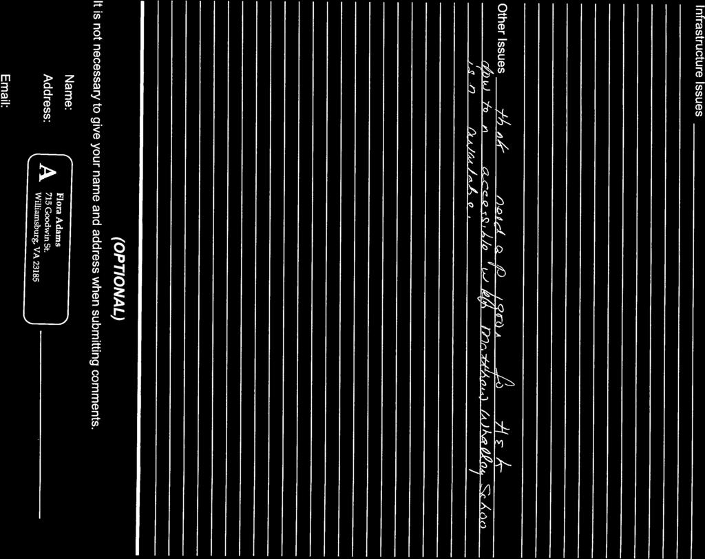
8 Williamsburg Planning Commission Minutes Community Forum on the Downtown and Midtown Planning Areas September 5, 2012 Page 7 dwelling area. Building height would be increased from 35 to 45 feet, the same as in the adjacent B-3 District. A small area of General Commercial land use is proposed to be change to Urban Residential land use. This is the location of the recently approved City Lofts project, housing approximately 140 students. A lot at the corner of Monticello Avenue and Mount Vernon Avenue (the former hospital helipad, now a parking lot) is proposed to be changed from General Commercial to William and Mary land use, since it is owned by the College. Several adjustments were made to the Arts District area by City Council in June (text revision for restaurants and creation of Midtown Parking District). The only additional change proposed is to extend the Medium Density Single Family Residential land use to include the four houses on the north side of Lafayette Street across from the Casey Field. This will be implemented by rezoning this area from RS-2 to RS-3 to match the existing RS-3 area to the west. The changes to the residential maximum density are: o Medium Density Single Family Residential land use unchanged at 5 dwelling units/net acre o Urban Commercial land use unchanged at 14 dwelling units/net acre o Mixed Use land use unchanged at 8 dwelling units/net acre by right, 14 dwelling units/net acre with SUP o Urban Residential land use increased from 14 to 20 dwelling units/net acre, which requires a rezoning to PDU District. Infrastructure improvements recommended for the Midtown Planning Area include sidewalk improvements in the Arts District and adjacent to the School of Education. Redevelopment of the Shopping Centers and in the Urban Residential area may trigger the need for street improvements along Monticello Avenue. MIDTOWN PLANNING AREA OPEN FORUM Commissioner Sarah Stafford moderated the Open Forum. Steve Munday, Creative Cuisine, 1300 Garrison Avenue, said he is looking to host catered events at his business, for up to 50 people. He would like to have the Midtown Parking District extended to cover his area and give him the same flexibility that is available in the Arts District. This could make the area more attractive for new businesses. Dennis Kaiser, 123 Matoaka Court, asked if there were any specific proposals for the Super 8 Motel. Mr. Nester responded that there is no current proposal to redevelop the Super 8, nor the Shopping Centers. Mr. Nester also responded that additional studies can be required in conjunction with a SUP, but noted that staff frequently finds that no additional studies are needed.
9 Williamsburg Planning Commission Minutes Community Forum on the Downtown and Midtown Planning Areas September 5, 2012 Page 8 Dick Schreiber, Williamsburg Chamber and Tourism Alliance, said that William and Mary is vital to the City s economy, and we need to strengthen the economic conditions of the College. As the possibility of redevelopment of the shopping centers area becomes more real, the area should be set up for master planning. Students have no commercial area that belongs to them as is the case in most college towns the shopping centers area needs to be carefully considered in conjunction with the College. Clay Clemens, speaking for young professionals, said that people will go elsewhere without more attractive housing. We need to have an attractive, walkable area, and the Midtown and Downtown areas have potential for this. Kathy Allport asked about the Midtown parking plan. Ms. Stafford replied that the Comprehensive Plan sets goals with recommendations for implementation, and that it could be early summer of 2013 before any changes will be considered. Terence Wehle said that crosswalks are needed behind Staples and the Williamsburg Shopping Centers. He said that no matter what we plan, we need to look at the consequences of the Plan. Will Monticello Avenue be four lanes? What will happen where it intersects with Lafayette Street? Where will people park if higher density development occurs? Scott Caravello, William and Mary Student Assembly, supported the proposed density increases, and the sidewalk extensions. He said that this area serves the shopping needs for students and well as residents. The convenience store with gas pumps needs to stay in the area. Jen Garrett said she would be happy to live in Midtown if more options were available. This area needs to be more walkable. A lot of artists are interested in the Arts Districts there needs to be a better commitment to this area by the City. Mixed use development would be desirable in locations like the Super 8. David Kranbuehl agrees with a student housing presence in the area. The shopping centers should be identified as being open to creative ideas. We need to look at each section of Midtown separately. We need to establish and maintain a mix of dwelling units; certain sections should be opened up more, and SUPs should be required. Lafayette Street should be considered for underground wiring. A lot of sidewalks need to be constructed in the Arts District, and at the end of Harrison Avenue connecting to Lafayette Street. We are in agreement creative ideas and a balanced mixture of land use and development. Ms. Stafford said we need to have a balance between allowed and SUP uses the Plan and implementing ordinances need to give clear guidance.
10 Williamsburg Planning Commission Minutes Community Forum on the Downtown and Midtown Planning Areas September 5, 2012 Page 9 Dennis Kaiser asked if townhouses are being considered for the Mixed Use (LB-2) area. Ms. Murphy said that they are not in the Plan yet, but are being considered by Planning Commission. David Erhard said he was a student at CNU before their rapid growth, and noted the dangers of crossing Warwick Boulevard. He said that the use of pedestrian overpasses and bike lanes should be considered for the Midtown area. He said he has been a Colonial Williamsburg employee for a decade people come to Colonial Williamsburg for what it is, and anything going on outside of Colonial Williamsburg is a bonus. Desirable amenities adjacent to Colonial Williamsburg will benefit the area. CLOSING COMMENTS Mr. Driscoll thanked everyone for coming. He talked about the potential for more housing in the Downtown area an addition of 100 to 200 units is not a lot of change. If the Tioga property is redeveloped, it will create additional tax revenue for the City. He cited the Village at Quarterpath as an example of a creative way to redevelop property at a higher density that took a cooperative effort by the City and the developer. He said the Commission is trying to take a lot of things into perspective, and is always looking for good input. There are tremendous opportunities around the City. Mr. Driscoll said that the comments made tonight will be reviewed at the Commission s next work session on September 26. The Commission s formal public hearing on the full draft of the Comprehensive Plan is scheduled for Wednesday, November 7, 7:00 p.m. in the Council Chamber at the Stryker Building. The Commission hopes to make a recommendation on the Plan to City Council at its regular meeting on December 19. The meeting was adjourned at 8:45 p.m. Sean Driscoll, Chair Williamsburg Planning Commission
11
12
13


14


15


16
17 Chapter 8 Neighborhoods and Housing Williamsburg is a city of neighborhoods, which range from large lot single family to higher density multifamily. Nevertheless, the overall residential density in Williamsburg is 0.9 dwelling units per acre, compared to 2.7 dwelling units per acre in a city like Norfolk. Strong healthy neighborhoods are critical to the quality of life of City residents, and the city is committed to preserving and enhancing its neighborhoods. The Plan s goal for Neighborhoods and Housing is to Protect and enhance the quality of the City s residential neighborhoods, and encourage the provision of affordable housing for those living and working in the City CENSUS Housing Type Williamsburg housing types include both single-family and multifamily homes. Figure 8-1, Williamsburg Housing Types, shows the current percentage share for each housing type in the City. Figure 8-1: Williamsburg Housing Type 33% Single-family homes, which include both single-family detached and townhouses, dominate the housing market in 3% the Williamsburg region, ranging from 64% of the total 14% housing stock in Williamsburg to 82% of the total housing stock Single Family, detached Townhouse Duplex Multifamily in York County. Figure 8-2, Source: American Community Survey Housing Types in the Williamsburg Region, illustrates the distribution of housing types in the Williamsburg region and in Hampton Roads. Although single-family homes are the most common type of housing in Williamsburg, 36% of its housing stock is two-family or multi-family dwellings. This is significantly higher than the surrounding counties, where the two-family and multi-family housing stock accounts for17% of the total. The City s total is also higher than the average of 25% in Hampton Roads. 50% Figure 8-2: Housing Type in the Williamsburg Region York 82% 17% 1% James City 78% 17% 5% Williamsburg 64% 36% 0% Hampton 72% 25% 3% 0% 20% 40% 60% 80% 100% Single-Family Duplex & Multifamily Mobile Home/Other Source: American Community Survey 2012 Williamsburg Comprehensive Plan Chapter 8 Neighborhoods and Housing 2 st Draft

18 Map 8-1 Chapter 8 Neighborhoods and Housing 2 st Draft Williamsburg Comprehensive Plan 8-2
19 Although Williamsburg has a significantly higher portion of multi-family housing than its region, according to the 2010 Census, the percentage of two-family and multifamily housing in Williamsburg is slightly less than most other communities with large student populations. Figure 8-3, Virginia College Towns, compares housing types in Williamsburg to other college towns and cities in Virginia; and Figure 8-4, Other College Towns, compares Williamsburg with college towns that are not located in Virginia. Figure 8-3: Virginia College Towns Lexington 67% 30% 3% Williamsburg 64% 36% 0% Radford 61% 37% 2% Charlottesville 56% 43% 1% Harrisonburg 54% 44% 2% Fredericksburg 53% 53% 1% Blacksburg 43% 55% 2% 0% 10% 20% 30% 40% 50% 60% 70% 80% 90% 100% Source: American Community Survey Single-Family Duplex & Multifamily Mobile Home/Other Figure 8-4: Other College Towns Williamsburg, VA 64% 36% 0% Carlisle, PA 61.6% 38.1% 0.3% Lewisburg, PA 57% 43% 0% Charleston, SC 55% 44% 1% Hanover, NH 55% 45% 0% Clemson, SC 47% 48% 5% Boone, NC 31% 67% 2% 0% 10% 20% 30% 40% 50% 60% 70% 80% 90% 100% Source: American Community Survey Single Family Duplex and Multifamily Mobile home/other 2012 Williamsburg Comprehensive Plan Chapter 8 Neighborhoods and Housing 2 st Draft
20 Age & Quality Housing age is often used as an indicator of local housing quality. The majority of the housing stock in Williamsburg was built after 1960 and is less than fifty five years old. As shown in Table 8-1, Williamsburg Housing Age, 77% of the housing stock was constructed since 1960, and 49% was constructed since The American Community Survey sample data also estimates that only 1% of housing stock in the City lacks complete plumbing facilities and only 3% lack complete kitchen facilities. On average, homes and residential lots in Williamsburg are smaller than other jurisdictions. According to the American Community Survey, most housing units in Williamsburg are 4 or 5 rooms with the median being 5.6 rooms. This is considerably smaller than the median of 6.6 rooms in James City, 6.7 rooms in York, 5.9 rooms in Hampton Roads and 5.9 rooms in Virginia. Table 8-1: Williamsburg Housing Age (ACS Data) % of Total Margin of Error Built 2005 or later 341 7% +/- 91 Built 2000 to % +/- 119 Built 1990 to % +/-168 Built 1980 to % +/- 157 Built 1970 to % +/-167 Built 1960 to % +/-170 Built 1950 to % +/-84 Built 1940 to % +/-126 Built 1939 or earlier % +/-151 Total % +/-327 Source: U.S. Census Bureau, American Community Survey Households According to the 2010 Census, Williamsburg has a total of 5,176 housing units; 88% are occupied and 12% are vacant. A relatively high percentage of the occupied units are renter-occupied when compared with the rest of the region. Figure 8-5, Housing Tenure in the Williamsburg Region, shows that approximately a quarter of the occupied units in James City and York Counties are renter-occupied compared to 56% in the City of Williamsburg. When compared with the region (37%) and the state as a whole (33%), Williamsburg still has a much higher number of renters. The geographic distribution of owners and renters is shown on Map 8-2, Distribution of Owner vs. Renter Occupied Housing. Figure 8-5: Housing Tenure in the Williamsburg Region Williamsburg 44% 56% James City 76% 24% York 75% 25% Hampton Roads 63% 37% State 67% 33% 0% 10% 20% 30% 40% 50% 60% 70% 80% 90% 100% Source: 2010 U.S. Census Owner-Occupied Renter Occupied Chapter 8 Neighborhoods and Housing 2 st Draft Williamsburg Comprehensive Plan

21 Map 8-2 Map Williamsburg Comprehensive Plan Chapter 8 Neighborhoods and Housing 2 st Draft
22 Williamsburg s high proportion of college students accounts for some of the disparity between it and the surrounding region. Figure 8-6, Housing Tenure in Virginia College Towns, illustrates that when evaluated in relation to five other cities and towns in Virginia that have large colleges or universities, the proportion of renters to owners in Williamsburg is actually below average. Because the College of William and Mary houses 73% of its full-time undergraduate students and 14% of full-time graduate students the demand for rental housing near campus remains high. This accounts for the concentration of rental housing around the campus, particularly in the Richmond Road and Jamestown Road areas. Additional concentrations of renters are seen in the Merrimac Trail, Mount Vernon Avenue, High Street, Patriot Lane and Jamestown Road/Route 199 areas. Cities also tend to have a higher amount of rental housing than suburban counties, further contributing to the differences seen in the Williamsburg region. Figure 8-6: Housing Tenure in Virginia College Towns Lexington Williamsburg Radford Charlottesville Fredericksburg Harrisonburg Blacksburg 52% 44% 42% 41% 38% 37% 28% 48% 56% 58% 59% 62% 63% 72% 0% 10% 20% 30% 40% 50% 60% 70% 80% 90% 100% Source: 2010 U.S. Census Owner-Occupied Renter-Occupied About 30% of Williamsburg s population (4,171 persons) lives in group quarters as defined by the U.S. Census. As with housing tenure, the City has a much higher percentage of residents living in group quarters than does the rest of the region. Most of this large non-household population is attributable to the high number of college students living in dormitories (4,051), accounting for 97% of the nonhousehold total. The remaining 3% are nursing home residents (116) and other non-institutionalized (4). Household Size The average size of households in Williamsburg is much smaller than that of its suburban neighbors. The 2010 Census lists the average household size for the City as 2.17 persons, up from 2.07 in 2000 and significantly smaller than the average of 2.45 for James City County or 2.7 for York County. The difference in household size is a product of the larger number of one and two-person households in Williamsburg, which account for over 73% of the total in the City. In comparison, one and two-person households account for 64% of all households in James City and 53% of all households in York County. Over time, average household size has Table 8-2 Average Household Size fluctuated moderately, as shown in Table % Change 2000 % Change , Average Household Size. In York City of Williamsburg % % 2.17 County and James City County average James City County % % 2.45 household size declined over the past 20 York County % % 2.7 years while the City of Williamsburg Source: 2010 U.S. Census experienced an increase between 1990 and Even with this increase, Williamsburg s average household size has remained significantly lower than the average in either of the surrounding counties. Chapter 8 Neighborhoods and Housing 2 st Draft Williamsburg Comprehensive Plan
23 These differences in average household size reflect the type of households in each locality. According to the 2010 Census, family households make up 73% of all households in James City County and 78% in York County, but only 49% in Williamsburg. Figure 8-7, Household Type by Age of Householder, lists family and non-family households for the Williamsburg region. Approximately 26% of all households in the City are occupied by residents who are 65 or over, while about 34% are occupied by residents between the ages of 15 and 34. The latter are primarily students at the College of William and Mary living in non-family households. Only 16% of householders in the City are 24 and under Figure 8-7 Williamsburg Household Type By Age of Householder Family Householder 15 to 34 Family Householder 35 to 64 Family Householder 65 & above Nonfamily Householder 15 to 34 Nonfamily Householder 35 to 64 Nonfamily Householder 65 & above Source: 1990, 2000, 2010 U.S. Census Household Projections Household trends based on occupied housing data for the Williamsburg region between 1970 and 2010 are provided in Table 8-3, Regional Forecast 2034 Households in Hampton Roads, along with projections for From 1970 to 2010 the number of households in the City increased by 91% with the largest increases between 1970 and 1980 (+26%), and between 2000 and 2010 (+26%). Both of the surrounding counties grew at a much higher rate from 1970 to 2010 the number of households was up 258% in James City County and 121% in York County. Household growth slowed dramatically in the City during the 1990s, increasing by just 5% while the overall number of households in Hampton Roads increased by 15% in the same decade. Although the remainder of the Williamsburg region also added fewer households during the 1990s than in the previous two decades, both of the surrounding counties continued to outpace growth in the City. In the 1990s the number of households increased by 46% in James City County and by 38% in York County. Table 8-3: Regional Forecast 2034: Households in Hampon Roads * Williamsburg 2,396 3,024 3,462 3,619 4,571 7,000 James City 4,551 7,493 12,990 19,003 26,860 45,800 York 7,391 10,879 14,452 20,000 24,006 32,600 Hampton Roads NA 390, , , , ,500 Source: HRPDC, Hampton Roads 2034 Socioeconomic Forecast *HRPDC is expected to release its 2040 Socioeconomic Forecast in the Fall of Williamsburg Comprehensive Plan Chapter 8 Neighborhoods and Housing 2 st Draft
24 Based on projections developed by the Hampton Roads Planning District Commission (HRPDC), and graphed in Figure 8-8, Households in the Williamsburg Region , the number of households in Williamsburg is expected to increase to 7000 by 2034, up 53% from This percent increase is significantly greater than the increase anticipated for the Hampton Roads region as a whole (27%) as well as the anticipated increase in York (36%), but remains significantly smaller than the 71% increase projected for James City County (Figure 8-8). Despite the Williamsburg projected growth, the number of households in the City account for only 8% of the total in the Williamsburg region by Figure 8-8: Households in the Williamsburg Region ,000 45,000 40,000 35,000 30,000 25,000 20,000 15,000 Williamsburg James City York 10,000 5, * Source: HRPDC, Hampton Roads 2034 Socioeconomic Forecast *HRPDC is expected to release its 2040 Socioeconomic Forecast in the Fall of 2012 Average household size is also expected to decline in the Williamsburg region, particularly as the population ages. HRPDC forecasts provided indicate that the average household size in Williamsburg will fall to 1.98 in 2034, down significantly from 2.17 in Average household size is anticipated to fall from 2.45 to 2.38 in James City County and slightly increase from 2.7 to 2.71 in York County by Average household size in Hampton Roads is projected to be 2.51 in Future Housing Requirements Population projections for Williamsburg indicate that an additional 5,032 people will live in the City by 2034 (total population 19,100). With an average household size of 1.98, another 2,541 dwelling units will be required to house this increase. Because the population is aging, and the need for student housing is increasing, much of the required new housing will be multifamily (townhouses, condominiums, and apartments). Much of this new housing will be located in mixed-use developments with shops and services within walking distance. This 2010 Census section of this chapter was prepared for the City by the staff of the Hampton Roads Planning District Commission Chapter 8 Neighborhoods and Housing 2 st Draft Williamsburg Comprehensive Plan
25 HOUSING TRENDS As pointed out in the previous section, the character of Williamsburg s housing stock is different than in the surrounding counties of James City and York. Williamsburg has a much higher percentage of multifamily housing (36% vs. 17% for James City County and 17% for York County). Williamsburg also has a higher percentage of rental housing according to the 2010 Census 56% vs. 23% for James City County and 24% for York County. Although Williamsburg is much different from the surrounding jurisdictions, its residential character is fairly typical for a small city that is also a college town. One of the continuing trends since the adoption of the 2006 Comprehensive Plan has been the increase in the amount of multifamily housing constructed in the City. Construction since the 2006 Plan has added 385 multifamily and duplex dwellings and 47 single family dwellings. This compares with 336 multifamily and duplex dwellings, and 204 single family dwellings that were added between the 1998 and 2006 Plans. And for the first time since 1984, a major apartment complex was built the 191 unit Sterling Manor Apartments at High Street, completed in The 2006 Plan identified residential neighborhoods in three Focus Areas adjacent to the College of William and Mary and the Merchants Square area: the Center City, Richmond Road and Jamestown Road Focus Areas. These areas met the criteria of threatened neighborhoods outlined in the 1998 Comprehensive Plan: a gradual influx of college students, increased through-traffic concerns, and the presence of substandard or rapidly deteriorating housing. To protect these and other neighborhoods, the City has taken the following steps: Enforcement of the City s Property Maintenance Code on a consistent citywide basis Enforcement of the City s Rental Inspection Program Pursuit of grants and CDBG programs to improve infrastructure and housing (Wales, Strawberry Plains, and Braxton Court are previous CDBG projects) Creation of the Neighborhood Relations Committee in 2009 to strengthen relations between the William and Mary campus and the community Creation of a Student Renters Guide to improve the quality of life and to help build and maintain effective working relationships for all neighborhood residents Concerning the major impact of the College on the City s neighborhoods, the 2006 Plan noted that it was the responsibility of the College to provide an appropriate amount of student housing on the campus, and that City regulations should encourage student housing in suitable off-campus housing to supplement the housing provided by the College. Since the adoption of the 2006 Plan, the College opened the 387 bed Jamestown Dormitories in 2006 (a net increase of 118 beds when coupled with the closing of the 269 bed Dillard Complex), the 56 bed Tribe Square project in 2011, and the 187 bed Fraternity Complex is under construction and scheduled to open in Fall This represents a gain of 361 undergraduate beds. College enrollment increased from 7,529 in to 8,200 in Undergraduate enrollment for the same time period increased from 5,604 to 6,071, and is expect to grow to 6,200 undergraduates in This will be an increase of 596 undergraduates in ten years, and has exceeded the growth in new on-campus undergraduate beds by 235 students. This underscores the need for private sector participation in the provision of student housing, and the most recent private actions are detailed below. The City approved City Green on Richmond Road in 2009, which provided 24 rental units that have become popular student housing. Two new zoning districts were developed: the PDC Planned Development College District in 2010, which allowed the construction of Tribe Square, and the PDU Planned Development Urban District in 2012, which allowed the approval of the 94 unit City Lofts project at 1406 Richmond Road, housing up to 143 students. The Midtown Planning Area, detailed in Chapter 10 - Commercial and Economic Development, is positioned as a major focus for new student housing due to its close proximity to the College, its location on existing bus routes, and the availability of bicycle and pedestrian facilities connecting this area with the main campus Williamsburg Comprehensive Plan Chapter 8 Neighborhoods and Housing 2 st Draft
26 HOUSING PLAN The 2012 Comprehensive Plan s Housing Plan is detailed in the following sections of this chapter, and is summarized below: 1. Preserve and protect the City s single-family neighborhoods. Neighborhood preservation should be promoted by enforcement of various City regulations, such as the Property Maintenance Code, Rental Inspection Program, Zoning Ordinance, Residential Permit Parking Program, Noise and Nuisance Ordinances and Animal Control Ordinances. Continuous improvements to streets, parks and other public infrastructure should be made. Regulations should be periodically reviewed to assess their effectiveness in protecting the character of these neighborhoods. 2. Enable a greater residential presence in the Downtown Planning Area. The existing overall residential density of the Downtown Planning Area is only 1.7 dwelling units/acre. To enhance the quality, vibrancy and character of this area, the allowable residential density should be increased from 14 to 22 units/net acre for the Merchants Square area, the Downtown Commercial area to the west, and the Mixed Use areas north and south of Merchants Square. Special use permits should be required for these higher densities to insure compatibility with the character of the downtown area. Because of limited opportunity for new downtown housing, increasing the allowable density will have a marginally small effect on raising the current 1.7 dwelling units/net acre density. 3. Build new mixed use neighborhoods. New residential uses should be integrated with or nearby office, commercial and other non-residential uses in master planned mixed use developments. High Street and Quarterpath at Williamsburg are examples of this type of new development, and the Midtown Planning Area has the potential to redevelop into a mixed use neighborhood with an emphasis on student housing. 4. Develop more affordable housing. The City, primarily through the efforts of the Williamsburg Redevelopment and Housing Authority, has developed 104 subsidized rental units and 75 owner occupied single-family dwellings. Future efforts for affordable housing should concentrate on owner-occupied housing projects such as the Strawberry Plains and Crispus Attucks subdivisions, but well planned rental housing should also be considered. 5. Provide more senior housing. The need for senior housing will increase as the City s population ages, and provisions should be added to the Zoning Ordinance to allow the development of senior housing in appropriate locations and at appropriate densities, such as the Blayton Building site on Scotland Street. 6. Develop alternatives for college student housing. The College should provide additional student housing on the campus, as demonstrated by the construction of the Jamestown Dormitories in 2006 and the new Fraternity Complex to be completed in City regulations should encourage student oriented housing in suitable off-campus locations to supplement the housing provided by the College, as demonstrated by the PDC Planned Development College District that allowed the development of Tribe Square, and the PDU Planned Development Urban District that allowed the conversion of an older hotel to the City Lofts apartments. Public/private partnerships that facilitate the construction of student houses should be encouraged. Chapter 8 Neighborhoods and Housing 2 st Draft Williamsburg Comprehensive Plan
27 When this Housing Plan is translated to land use, there is a potential for up to 400 new single-family homes, and up to 2,900 new multifamily dwellings. Low and moderate income housing could comprise up to 300 dwelling units, or almost 9% of the projected housing growth. Housing in mixed use developments could total up to 2,400 dwelling units, or 73% of the projected growth. Completion of this development will represent a residential build-out for the City. The build-out population will be approximately 21,000, a 1,900 increase (+10%) from the projected 2034 population of 19,100. NEIGHBORHOODS A comprehensive map of City neighborhoods was prepared as a part of the 2012 Comprehensive Plan. There are 51 single family, duplex and condominium neighborhoods, plus seven apartment complexes. When the apartment complexes are factored out, the owner occupancy of the 51 single family, duplex and condominium neighborhoods is 55%, with 45% renter-occupancy. This is a higher owner-occupancy than the 46% listed by the 2010 Census. When the apartment complexes are factored in, the owneroccupancy rate determined by City analysis is 41%, with 59% rental-occupancy. This differs slightly from the 2010 Census figures of 44% owner-occupancy and 56% renter-occupancy. Table 8-4, Owner and Renter Occupancy by Neighborhood, lists these neighborhoods, and Map 8-4, Neighborhoods, shows their location. Table 8-4: Owner and Renter Occupancy by Neighborhood Neighborhood Units Owner Occupied Renter Occupied Neighborhood Units Owner Occupied Renter Occupied Barclay Square (#28) (58%) 20 (42%) Pinecrest (#32) (46%) 27 (54%) Brandywyne (#21) (67%) 26 (33%) Piney Creek (#4) (94%) 6 (6%) Braxton Court (#17) (61%) 7 (39%) Port Anne (#57) (95%) 5 (5%) Bristol Commons (#9) (32%) 75 (68%) Powhatan Park (#35) (18%) 85 (82%) Burns Lane (#42) (78%) 13 (22%) Priorslee (#25) (47%) 30 (53%) Capitol Heights (#33) (39%) 54 (61%) Quarterpath (#34) (67%) 27 (33%) Carriage Homes (#50) (90%) 6 (10%) Queen Mary s Port(#20) 4 0 (0%) 4 (100%) Cary/Griffin/Newport (#39) (38%) 128 (62%) Richmond Hill (#55) (93%) 1 (7%) Claiborne (#1) (65%) 41 (35%) Richneck Hts. (#45) (78%) 6 (22%) College Terrace (#14) (90%) 4 (10%) Rolfe Road (#43) (14%) 127 (86%) Colonial Ext. (#36) (28%) 36 (72%) Savannah Green (#5) (89%) 4 (11%) Counselors Close (#40) (94%) 3 (6%) Shellis Square (#23) (43%) 36 (57%) Crispus Attucks (#18) (74%) 5 (26%) Skipwith Farms (#6) (63%) 101 (37%) Downtown (#38) (20%) 106 (80%) Strawberry Plains (#12) (93%) 5 (7%) Forest Hill Area (#31) (58%) 14 (42%) The Coves (#56) (97%) 1 (3%) High Street (#10) 16 0 (0%) 16 (100%) The Oaks (#58) (62%) 21 (38%) Highland Park (#19) (54%) 65 (46%) The Woods (#51) (91%) 2 (9%) Historic Area (#37) 77 1 (1%) 76 (99%) Village Green (#48) (55%) 23 (44%) Holly Hills (#53) (93%) 10 (7%) Wales (#8) (53%) 24 (47%) Indian Springs (#41) (63%) 33 (37%) Walnut Hills (#44) (85%) 15 (15%) Jamestown Comm. (#47) 12 0 (0%) 12 (100%) West Williamsburg (#15) (13%) 87 (87%) Longhill Woods (#45) (89%) 5 (11%) W. Williamsburg Hts. (#16) (32%) 53 (68%) Matoaka Court (#13) (28%) 29 (72%) Westgate at Wmbg. (#2) (60%) 43 (40%) Mimosa (#54) (22%) 43 (78%) Woodlands (#49) 44 33(75%) 11 (25%) Patriot (#3) (40%) 55 (60%) Wyndham (#29) (64%) 40 (36%) Penniman/2 nd St (#26) 22 1 (5%) 21 (95%) Yorkshire (#52) (95%) 2 (5%) Peppertree (#46) 40 4 (10%) 36 (90%) Apartment Complex Units Renter Occupied Apartment Complex Units Renter Occupied Colonial Pines (#30) % Sterling Manor (#10) % Colonial Towne #24) % Tribe Square (#38) % Mount Vernon (#11) % Village of Woodshire (#22) % Parkway (#27) % 2012 Williamsburg Comprehensive Plan Chapter 8 Neighborhoods and Housing 2 st Draft

28 Map 8-4 Chapter 8 Neighborhoods and Housing 2 st Draft Williamsburg Comprehensive Plan
29 DOWNTOWN PLANNING AREA (THIS SECTION WAS MOVED FROM CHAPTER 10) The Downtown Planning Area has Merchants Square at its center, and extends north across the CSX Railroad to the Governor s Inn, south to Mimosa Drive, and west along Richmond Road to Virginia Avenue. It is an authentic mixed use area combining retail, office, museum, residential and educational uses, and brings together all of the major character defining features of the City: Colonial Williamsburg, the College, the Municipal Center, and diverse residential neighborhoods. This Planning Area is discussed in detail in Chapter 10 - Commercial and Economic Development, but the exclusively residential sections of the Downtown Planning Area are described in this section. These residential areas include the single family neighborhoods of Braxton Court and Crispus Attucks, the single family area on the east side of North Henry Street and Scotland Street, the Blayton Building on Scotland Street, and multifamily residential areas on South Boundary and South Henry Streets. The Downtown Planning Area includes two historic residential areas that are located in the Architectural Preservation District (see Chapter 5 - Community Character). Peacock Hill is a residential area that developed north of Merchants Square with the advent of the railroad in the 1880s. The land between Scotland Street and the railroad was subdivided from the Wheatland Farm by R.S. Henley in 1894 and was known as the Northington tract. Henley and later Francis O Keefe, the father of artist Georgia O Keefe, further subdivided the Northington tract throughout the late 1890s and early 1900s. The area south of Scotland Street was developed in the early 1900s. Fashionable Vernacular Victorian and Queen Anne style houses were built in this area, with more modest houses constructed in the Buttermilk Hill area around the corner of Prince George Street and Nassau Street. From this turn of the century era, only 14 houses stand. Braxton Court on Scotland Street is an early twentieth century neighborhood developed and established by African-Americans. Robert H. Braxton platted the subdivision in 1928 and sold lots throughout the 1930s to local African-Americans. Many of the houses were built by him using local African-American carpenters and apprentices from the Hampton Institute (now Hampton University), and the architecture of the neighborhood reflects the variations on Colonial Revival and other early-twentieth century suburban vernacular designs found throughout the City. Braxton s house is located at the top of the cul-de-sac at 128 Braxton Court. Housing Analysis The Downtown Planning Area s residential component is predominantly multifamily and renter occupied. In 2012 the Planning Area had a total of 234 dwelling units: 128 primarily single dwelling units (including one Bed & Breakfast), 14 condominiums, 26 townhouses and 66 apartment units. There are 64 owner-occupied dwelling units (27%) and 170 renter-occupied dwelling units (73%), compared to the City s 2010 Census totals of 44% owner-occupied and 56% renter-occupied. A dwelling unit is considered renter-occupied if the owner s address is different from the property address, or if it is a unit in a rental apartment complex. The breakdowns by neighborhood are: Braxton Court - 18 dwelling units - neighborhood #17: 61% owner-occupied; 39% renter occupied Crispus Attucks - 19 dwelling units - neighborhood #18: 74% owner-occupied; 26% renter occupied Downtown dwelling units - neighborhood #38: 21% owner-occupied; 79% renter occupied Other - 37 dwelling units 1 : 16% owner-occupied; 84% renter occupied Downtown Total dwelling units 27% owner-occupied; 73% renter occupied 1 South Boundary Street from Ireland Street to South Henry Street and the east side of Virginia Avenue Williamsburg Comprehensive Plan Chapter 8 Neighborhoods and Housing 2 st Draft
30 Scale and Character The Downtown Planning Area s residential component is an essential part of its scale and character, and helps make downtown Williamsburg a vibrant area for both living and shopping. There are two parts to this scale and character, and both need to be considered in planning for the future of the Downtown Planning Area. The first part is building massing and location, which is primarily governed by zoning regulations for building setback and height. The second part of residential scale and character is density, which must fit within the building envelopes delineated by the zoning restrictions. This is discussed in more detail in the Downtown Planning Area section of Chapter 10 - Commercial and Economic Development, and a density of 22 dwelling units/net acre is recommended for the Downtown Commercial and Mixed Use sections of the Downtown Planning Area. The Medium Density Single Family Detached Residential land use on the east side of North Henry Street and Scotland Street should continue to have a residential density of 5 dwelling units/net acre. The Downtown Residential areas at the Blayton Building at 613 Scotland Street and the west side of South Henry Street south of South Boundary Street, which are more residential in character, should have a base residential density of 8 dwelling units/net acre, with up to 14 dwelling units/net acre allowed with a special use permit, implemented by the RDT Downtown Residential District. The Williamsburg s Redevelopment and Housing Authority s Blayton Building at 613 Scotland Street provides the City s only senior specific housing. It has 38 subsidized apartments for low and moderate income seniors and disabled persons on a large lot with potential for expansion. As noted in Chapter 3 - Population, there will be an increased need for additional senior housing in the future. The 2010 Census shows significant increases in the age group, driven because of the aging of the post-war baby boom generation. More than 23% of the City s non-student population is 65 or older, significantly higher for Williamsburg than in the surrounding region (19%), Hampton Roads (14%) or the State (14%). To help satisfy the need for senior housing, provisions should be added to the RDT District to allow a residential density for senior housing of up to 28 bedrooms/net acre with a special use permit. This anticipates that future expansion will be primarily single-occupancy one-bedroom apartments, and the 28 bedroom/net acre density will have a similar population density of a standard development of twobedroom apartments. This new density provision will allow the Blayton Building to be expanded from the existing 38 dwelling units to up to 108 low and moderate income one-bedroom senior apartments on the 3.87 net acre site. There are currently 234 dwelling units in the Downtown Planning Area, resulting in an overall residential density for the area of 1.7 dwelling units/net acre. The proposed residential densities of up to 22 dwelling units/net acre in the Downtown Commercial and Mixed Use areas, and up to 14 dwelling units/net acre in the Downtown Residential areas, provide a potential for 65 to 125 new dwelling units, plus the maximum of 70 dwelling units that will be possible for the Blayton Building expansion. This could add roughly 100 to 200 new dwelling units to the Downtown Planning Area, leading to a possible total of 334 to 434 dwelling units. This increase would raise the overall density for the Downtown Planning Area from 1.7 dwelling units/acre to a range of 2.4 to 3.1 dwelling units/acre. This is well in keeping with the character of the Downtown Planning Area. Future Land Use Recommendations for Residential Sub-Areas 3. North Henry Street (east side) and Scotland Street. The existing Medium Density Single Family Detached Residential land use should be continued, implemented by the existing RS-3 Single Family Dwelling District, with a residential density of 5 dwelling units/net acre. This area is separate and distinct from the adjoining North Henry/ North Boundary Street Area, and contains eight single family detached dwellings, one three-unit apartment building, and two vacant lots. Chapter 8 Neighborhoods and Housing 2 st Draft Williamsburg Comprehensive Plan
31 4. Blayton Building. The Blayton Building lot, which now provides 38 one-bedroom low and moderate income senior apartments, should remain Downtown Residential land use, implemented by the RDT Downtown Residential District, with a base residential density of 8 dwelling units/net acre, and up to 14 dwelling units/net acre allowed with a special use permit. The small B-1 Downtown Business District area to the west of the Blayton Building, which was originally intended for extra parking for the Triangle Building, should be changed to the RDT District to match the rest of the property. To allow for the future expansion of senior housing on the Blayton Building lot, provisions should be added to the RDT District to allow a residential density for senior housing of up to 28 bedrooms/net acre with a special use permit. The 1.2 acres of land between the First Baptist Church parking lot and Crispus Attucks subdivision Map 8-5 should remain Park, Parkway, Recreation land use. This should be developed as a landscaped open space and recreation area in conjunction with the expansion of the Blayton Building. 5. South Boundary/South Henry Street Area north and south of Newport Avenue. The area on both sides of South Boundary Street between Ireland Street and the rear of the lots fronting on Newport Avenue should remain High Density Multifamily Residential land use, implemented by the RM-2 Multifamily Dwelling District, with a residential density of 14 dwelling units/net acre, and the lot at the northeast corner of South Boundary Street and Newport Avenue should be changed from Office land use to High Density Multifamily Residential land use. The area on the east side of South Boundary Street south of Newport Avenue should remain Medium Density Multifamily Residential land use, implemented by the RM-1 Multifamily Dwelling District, with a residential density of 8 dwelling units/net acre. 6. South Henry Street - west side from South Boundary Street to Campus Court Condominiums (706 South Henry Street). The existing Downtown Residential land use should remain, implemented by the RDT Downtown Residential District, with a base residential density of 8 dwelling units/net acre and with up to 14 units/net acre allowed with a special use permit. Single family, duplex and townhouse dwellings are allowed by right, and multifamily dwellings require a special use permit Williamsburg Comprehensive Plan Chapter 8 Neighborhoods and Housing 2 st Draft

32 MIDTOWN PLANNING AREA (THIS SECTION WAS MOVED FROM CHAPTER 10) The Midtown Planning Area is located at the intersection of two of the City s major entrance corridors Richmond Road and Monticello Avenue. It is made up of five major components: the Arts and Cultural District centered on Richmond Road and Lafayette Street between Brooks Street and the Williamsburg Shopping Center; the Shopping Centers Area that includes the Williamsburg and Monticello Shopping Centers; the Richmond Road Corridor between Monticello Avenue and Bypass Road; the Urban Residential Area along Mount Vernon Avenue and New Hope Road, and the College Area that is centered on William and Mary s School of Education. This Planning Area is discussed in detail in Chapter 10 - Commercial and Economic Development, but the exclusively residential sections of the Midtown Planning Area are described in this section. These include the mostly single family West Williamsburg neighborhood between Richmond Road and Lafayette Street, the Lawson Apartments on Mount Vernon Avenue, and the Sylvia Brown Apartments and City Lofts student apartments on New Hope Road Map 8-6 The Arts and Cultural District along Richmond Road and Lafayette Street was established by City Council in February 2011 as a way to encourage and enhance the City s creative economy as an economic development initiative. The Medium Density Single Family Detached Residential portion of this Arts and Cultural District is located between the Mixed Use area along Richmond Road and the CSX Railroad. This is the West Williamsburg neighborhood originally platted in 1928 when this portion of the City was located in York County. The houses are predominantly one to one and one-half stories in height, and the area contains several notable Bungalow-style houses around the Lafayette Street-Wythe Street intersection. Studios and workshops for artists and artisans are allowed in this area with a special exception permit, allowing live/work space in an established single family residential area. The Urban Residential Area along Mount Vernon Avenue and New Hope Road contains one of the City s four major concentrations of multifamily housing (the others are the High Street, Patriot Lane and Merrimac Trail areas). The Lawson Apartments are five apartment complexes (Julia Ann, Spring Road, Spring Road Annex, Spring Garden and Clinton Gardens) with a total of 293 apartments. Also in this area is the 28 unit Sylvia Brown Apartments on New Hope Road, a subsidized apartment project owned by the Williamsburg Redevelopment and Housing Authority, and the 95 unit City Lofts student apartment project at the corner of New Hope Road and Middle Street that will house up to 143 students. Chapter 8 Neighborhoods and Housing 2 st Draft Williamsburg Comprehensive Plan
33 These apartments are located between the College of William and Mary and the High Street mixed use development, connected by a growing network of sidewalks and bike lanes. Their proximity to the College makes them very attractive for helping to meet the need for college student housing. This area has potential for redevelopment at a higher residential density, but traffic and other impacts need to be evaluated before approval of any redevelopment project. Housing Analysis The Midtown Planning Area s residential component is concentrated in the Arts and Cultural District and the Urban Residential Area, and is predominantly renter occupied. In 2012, the Planning Area had a total of 425 dwelling units; 14 were owner-occupied (3%), and 410 were renter-occupied (97%). A dwelling unit is considered renter-occupied if the owner s address is different from the property address, or if it is a unit in a rental apartment complex. This is a much higher rental occupancy than the City as a whole the 2010 Census figure for the entire City is 44% owner-occupied and 56% renter-occupied. The Arts and Cultural District is made up of two separate areas Mixed Use land use along Richmond Road, and Medium Density Single Family Detached land use along Lafayette Street and the side streets. This area is also designated as West Williamsburg (#15) on Map 8-4, Neighborhoods. The Shopping Centers Area is located on Richmond Road and Monticello Avenue, and includes the Williamsburg and Monticello Shopping Centers. The Richmond Road Corridor extends from Monticello Avenue to New Hope Road/Bypass Road. The Urban Residential Area includes the 293 unit Lawson Apartments on Mount Vernon Avenue and the 28 unit Sylvia Brown Apartments on New Hope Road. This area is also designated as Mt. Vernon (#11) on Map 8-4, Neighborhoods. The College Area has no dwelling units, but a 53 bed nursing home is located in this area. The breakdowns for the areas are: Arts and Cultural District - 93 dwelling units: 15% owner-occupied; 85% renter occupied. Shopping Centers area - 10 dwelling units: 0% owner-occupied; 100% renter-occupied. Richmond Road Corridor - 1 dwelling unit: 0% owner-occupied; 100% renter-occupied. Urban Residential Area dwelling units: 0% owner-occupied; 100% renter-occupied. Midtown Total 425 dwelling units 3% owner-occupied; 97% renter-occupied Future Land Use Recommendations for Residential Areas 1. Arts and Cultural District. The Medium Density Single Family Detached land use for the West Williamsburg neighborhood between the Mixed Use land use along Richmond Road and the CSX Railroad should be continued, implemented by the RS-3 Single Family Dwelling District. The four adjoining lots at Lafayette Street should also be designated as Medium Density Single Family Detached land use. This land use mirrors the existing density of the area. The existing provisions allowing studios and workshops for artists and artisans with a special exception should be retained, as this is an important feature of the Arts and Cultural District, and encourages live/work space in the area. 2. Urban Residential Area. The existing High Density Multifamily Residential land use (14 dwelling units/net acre) should be changed to Urban Residential land use (20 dwelling units/net acre). The existing RM-2 zoning should remain in place until an acceptable development plan is presented for rezoning to a revised PDU Planned Development Urban District. The PDU District should be limited to land designated as Urban Residential land use, and an alternate residential density of 40 bedrooms per net acre should be allowed along with the standard density of 20 dwelling units/net acre. Student dwellings should be a permitted use, with a dwelling unit occupancy of two unrelated persons in an efficiency or one bedroom dwelling unit, and four unrelated persons in a two or more bedroom dwelling unit. A building height of 45 feet should be allowed Williamsburg Comprehensive Plan Chapter 8 Neighborhoods and Housing 2 st Draft
34 NORTHEAST TRIANGLE PLANNING AREA (THIS SECTION WAS MOVED FROM CHAP. 10) The Northeast Triangle Planning Area is a diverse area with concentrations of singlefamily detached dwellings, condominiums, apartments, townhouses, and commercial uses. It has been developing for over 300 years, and is centered on Capitol Landing Road (the historic connection between the colonial port on Queen s Creek and Colonial Williamsburg), and on Page Street and Second Street. This Planning Area was subject to a comprehensive study in 2011 by the Northeast Triangle Focus Group, and is discussed in detail in Chapter 10 - Commercial and Economic Development, The exclusively residential sections of the Northeast Triangle Planning Area are described in this section. The Northeast Triangle includes three areas that are listed in the Comprehensive Plan as Notable Features of the Architectural Preservation District (Capitol Landing/Capitol Landing Road, Capitol Heights on the west side of Capitol Landing Road, and Pine Crest subdivision on the east side of Page Street). These neighborhoods, together with Minor s Park, help provide a transition between the commercial area of Capitol Landing Road north of the Colonial Parkway and the Colonial Williamsburg Historic Area. A description and discussion of the major residential areas in the Northeast Triangle Planning Area follows: Map 8-7 Capitol Landing/Capitol Landing Road was the second port and access road that served Williamsburg in the eighteenth century. Originally called Queen Mary s Port because of its location on Queen s Creek (a tributary of the York River), Capitol Landing served the same purpose for the City as College Landing to the south. Public wharves and tobacco inspection warehouses were located at the water s edge, and nearby were shops, houses, taverns and light manufacturing uses. There are no above-ground remains of these structures in existence, but archaeological remains provide important educational resources. As with College Landing, this port and its access roads were shown on the 1699 plat of the City. Capitol Landing is listed on the Virginia Landmarks Register. The majority of the Planning Area s single family residential areas are located along Capitol Landing Road: the Haynes/Forest Hills/Woods Drive area at the northwest corner of Capitol Landing Road and Parkway Drive, Brandywyne at the northeast corner of Capitol Landing Road and Merrimac Trail, and the recently approved (in 2010) but not yet built 41 lot Queen Mary s Port subdivision adjacent to Queen s Creek. Chapter 8 Neighborhoods and Housing 2 st Draft Williamsburg Comprehensive Plan
35 Capitol Heights, on the west side of Capitol Landing Road south of the Colonial Parkway, was platted in 1916, and has a consistent scale with uniform setbacks. The modest houses vary in style and include bungalow, Colonial Revival, and simple builders houses that date mainly from the 1920s through the 1950s. The east side of Capitol Landing Road is characterized by Colonial Revival houses in a variety of forms and two Vernacular Victorian houses, one of which was relocated to the area in the 1930s from the Colonial Williamsburg Historic Area. Capitol Landing Green, located between Capitol Landing Road and Page Street, is a planned residential development that was approved in 2008 as a PDR District. The project was designed to respect the scale, density and character of the neighborhood, and preserved two existing houses on the site while adding 12 additional dwellings. Pine Crest subdivision, located on the east side of Page Street, was platted in 1939 on a 12-acre parcel known as the Tan Yard lot. Pine Crest complements the architectural character and scale of the nearby Capitol Heights subdivision, and contains a mixture of architectural styles having a consistent character. Pine Crest, together with Capitol Heights and Minor s Park, reinforces the small-scale residential character of this area of the City. The Merrimac Trail and Parkway Drive area contain all of the multifamily housing in the Planning Area, with 692 apartments (Colonial Pines, Colonial Towne, Parkway, Village of Woodshire), 160 condominiums (Wyndham East and West, Barclay Square) and 120 townhouses (Shellis Square and Priorslee), for a total of 972 dwelling units. This is the largest concentration of multifamily housing in the City, and compares with 648 multifamily dwelling units in the Mount Vernon Avenue/High Street area, and 318 multifamily dwelling units in the Patriot Lane area. This multifamily area also has a growing youth population, with children under 18 increasing from 240 (15.7%) in 1990 to 351 (19.2%). This is much greater than the citywide figure of 10%, and comprises 25% of the City s total population under 18. Housing Analysis The Northeast Triangle Planning Area s residential component is predominantly renter occupied. In 2012, the Planning Area had a total of 1,227 dwelling units, and 76% were renter-occupied: 255 dwelling units (including two Bed & Breakfast), 280 townhouses and condominiums, and 692 apartments in 37 buildings. There are 285 owner-occupied dwelling units (23%) and 964 renter-occupied dwelling units (77%) in the Planning Area, compared to the City s 2010 Census total of 44% owner-occupied and 56% renter-occupied. A dwelling unit is considered renter-occupied if the owner s address is different from the property address, or if it is a unit in a rental apartment complex. The breakdowns for single-family neighborhoods are: Brandywyne - 79 dwelling units - (neighborhood #21): 67% owner-occupied; 33% renter occupied. Capitol Heights area - 89 dwelling units - (neighborhood #33): 39% owner-occupied; 61% renter-occupied. Forest Hills area - 33 dwelling units - (neighborhood #31): 58% owner-occupied; 42% renter-occupied. Pine Crest - 50 dwelling units - (neighborhood #32): 46% owner-occupied; 54% renter-occupied. Queen Mary s Port - 4 dwelling units - (neighborhood #20): 0% owner-occupied; 100% renter-occupied. The breakdowns for townhouses and condominiums are: Barclay Square - 48 dwelling units - (neighborhood #28): 58% owner-occupied; 42% renter-occupied. Priorslee - 57 dwelling units - (neighborhood #25): 47% owner-occupied; 53% renter-occupied. Shellis Square - 63 dwelling units - (neighborhood #23): 43% owner-occupied; 57% renter-occupied. Wyndham dwelling units - (neighborhood #29): 64% owner-occupied; 36% renter-occupied. The breakdowns for apartments are: Colonial Pines 132 dwelling units neighborhood #30 0% owner-occupied; 100% renter-occupied. Colonial Towne 148 dwelling units neighborhood #24 0% owner-occupied; 100% renter-occupied. Parkway 160 dwelling units neighborhood #27 0% owner-occupied; 100% renter-occupied. Woodshire 252 dwelling units neighborhood #22 0% owner-occupied; 100% renter-occupied. Northeast Triangle Total 1,227 dwelling units 24% owner-occupied; 76% renter-occupied Williamsburg Comprehensive Plan Chapter 8 Neighborhoods and Housing 2 st Draft
 should remain for the Haynes/Forest Hills/Woods Drivearea, implemented by the existing RS-2 Single Family")
36 Future Land Use Recommendations for Residential Areas 1. Capitol Landing Road Corridor. The Low Density Single Family Detached Residential land use (3 dwelling units/net acre) should remain for the Haynes/Forest Hills/Woods Drivearea, implemented by the existing RS-2 Single Family Dwelling District; and for Capitol Landing Road north of Brandywyne, implemented by the existing RS-1 Single Family Dwelling District. The existing Low Density Single Family Detached Residential land use (3 dwelling units/net acre) for the Capitol Heights area, Pine Crest, and Capitol Landing Green should be changed to Medium Density Single Family Detached Residential land use (5 dwelling units/net acre), which is consistent with the existing residential density for this area. This district also allows live/work space for artists and artisans with a special exception from the Board of Zoning Appeals. Capitol Landing Green should be implemented by the existing PDR Planned Development Residential District. The remainder of the area should be implemented by the RS-3 Single Family Dwelling District. Medium Density Single Family Detached Residential land use (5 dwelling units/net acre) should remain for Brandywyne, implemented by the PDR Planned Development Residential District. 2. Merrimac Trail The existing High Density Multifamily Residential land use (14 dwelling units/net acre) should be continued, implemented by the RM-2 Multifamily Dwelling District. 3. Parkway Drive The existing Medium Density Multifamily Residential land use (8 dwelling units/net acre) north and south of the Colonial Parkway should be continued, implemented by the RM-1 Multifamily Dwelling District. QUARTERPATH ROAD AREA The Village at Quarterpath (Area 1). The Village at Quarterpath is a 119 lot subdivision of 77 townhouses, 36 duplexes and six single family homes. It is located at the north end of Quarterpath Road across the street from Quarterpath Park and within walking and biking distance of the Colonial Williamsburg Historic Area and the Downtown area. Recommendation. The existing High Density Multifamily Residential land use (14 dwelling units/net acre) should be continue, implemented by the RM-2 Multifamily Dwelling District. Redoubt Park Area (Area 2). This tract of vacant land is located across Quarterpath Road from Redoubt Park. Access to the property needs to be coordinated with access to Redoubt Park and the bicycle and pedestrian facilities planned along Quarterpath Road. This site has the potential for 18 houses on approximately six net developable acres, with Map 8-8 Chapter 8 Neighborhoods and Housing 2 st Draft Williamsburg Comprehensive Plan
 should be continued, implemented by the existing RS-1 Single Family Dwelling District.")
37 views of the Golden Horseshoe Green Course on the west and the historic character of Redoubt Park to the east. Recommendation. The existing Low Density Single Family Residential land use (3 dwelling units/net acre) should be continued, implemented by the existing RS-1 Single Family Dwelling District. Quarterpath at Williamsburg (Areas 3-6). Quarterpath at Williamsburg is a 328 acre mixed use development proposed by Riverside Healthcare Association, Inc., and is located on the east side of Quarterpath Road between the Colonial Williamsburg Foundation Nursery and Route 199. This master planned development is located on the largest tract of undeveloped land under a single ownership in the City, and fulfills the 1998 Comprehensive Plan s recommendation that this area be developed as a comprehensively planned mixed use community which protects the beauty of its sensitive environmental and historic areas. The overall design contributes to the City s character by having a well designed mix of uses, rather than being a monolithic development. For the entire development there is a potential for up to 1,467 dwelling units of various types. In addition to the residential component of the development, Riverside s conceptual plan proposes a hospital (Doctors Hospital, with 50 beds, will be completed in early 2013) and approximately 735,000 square feet of commercial and office land use. The non-residential component is discussed in Chapter 10 - Commercial and Economic Development. The residential component is divided by Tutter s Neck Pond and its tributary streams, which form the environmentally sensitive center of this project. Area 3, located north of the Pond, has 96 net developable acres and will support up to 480 homes at a Medium Density Single Family Detached Residential land use density of 5 dwelling units/net acre. In conjunction with the development of this area, major improvements are needed to the transportation infrastructure, including a major north-south collector road (Redoubt Road) and facilities for bicycles and pedestrians. This main collector road should be designed to accommodate through traffic between York Street and Route 199 without unduly impacting the residential development. Recommendation. The existing Medium Density Single Family Detached Residential land use for Area 3 (5 dwelling units/net acre) should be continued. This land use should be initially implemented by the RS-2 Single Family Dwelling District (3 dwelling units/net acre), with an ability to request rezoning to PDR Planned Development Residential District if an acceptable development plan can be designed which addresses the issues outlined above. The PDR District is strongly encouraged, since this category permits a variety of dwelling types, allowing a better integration of the development with sensitive environmental areas. Adjoining this section is Area 3A, located behind the Colonial Williamsburg Foundation Nursery. This area is also designated Medium Density Single Family Detached Residential land use (5 units/net acre). While this 11 net acre area is not a part of the adjoining Quarterpath at Williamsburg development (Area 3), it should be planned for the same density in order to allow development at the same scale and intensity. There is the potential for 55 dwelling units on this site at a density of 5 units/net acre, and design and development needs to be coordinated with Quarterpath at Williamsburg to ensure that adequate vehicular access is provided Williamsburg Comprehensive Plan Chapter 8 Neighborhoods and Housing 2 st Draft
38 Recommendation.The existing Medium Density Single Family Detached Residential land use (5 units/ /net acre) should be continued. This should be initially implemented by the RS-2 Single Family Dwelling District (3 dwelling units/net acre), with an ability to request rezoning to PDR Planned Development Residential District if an acceptable master plan is developed which addresses the issuess outlined above. The PDR District is encouraged, since this category permits a variety of dwelling types, providing a better integrationn of the development with sensitive environmental areas. Moving south of the Tutter s Neck Pond, Areas 4, 5 and 6 are planned for Economic Development land use (10 dwelling units/net acre for the residential component). Land devoted exclusively to residential use is limited by the Zoning Ordinance to not more than 40% of the total area of the ED Economic Development District, and this area is also subject to additional limitations through zoning proffers: no more than half of the density allowed in the ED District, and no more than one dwelling unit for each 2,0000 square feet of non-residential use in the commercial area at the eastern end of the ED District adjacent to James City County. The net developable acres of Economic Development land use, with the approved proffers, will support up to 987 dwelling units in Areas 4, 5 and 6, in addition to the non-residential uses that are discussed in Chapter 10 - Commercial and Economic Development. Doctors Hospital is located on the eastern end of Area 6, and will be completed in early Most of the site is located in Chesapeake Bay Preservation Areas, and will require the construction of stormwater management facilities in conjunction with development. Tutter s Neck Pond has been acquired by Riverside, and will be the primary stormwater management facility. Substantial buffer areas will be preserved throughout the development, and since Route 199 is designated as a Greenbelt street, a 75 foot buffer will also be required along its length. Preserving these environmentally sensitive areas will be a benefit both to the environment and to the residents of the area. In addition, 21.4 acres along Quarterpath Road was dedicated to the City as Redoubt Park, preserving two Civil War redoubts that were part of Williamsburg s defensive perimeter. Recommendation. The Economic Development land use along Route 199 should be continued, implemented by the ED Economic Development District. HIGH STREET High Street, located on Richmond Road and Ironbound Road, is a mixed use development, with 225,000 square feet of commercial floor area anchored by a multiplex cinema, combined with 574 multifamily dwelling units. To date, 191 apartments and 16 townhouses have been built. The exact future mix of apartments, townhouses and condominiums has yet to be determined. The commercial component is discussed in Chapter 10 - Commercial and Economic Development. As with the Quarterpath at Williamsburg area, no more than 40% of the area of the ED-2 Economic Development District can be devotedd exclusively to residential use. A residential density of 12 dwelling units/ net acre gives this area an urban ambiance with accessibility to shopping and entertainment, supplemented by an integrated pedestrian circulation system. Richmond Road, Ironbound Road and Treyburn Drive provide vehicular access to the site. Middle Street, an interior Chapter 8 Neighborhoods and Housing 2 st Draft Williamsburg Comprehensive Plan 8-22

39 connector street, extends from New Hope Road to Ironbound Road, and residential uses are west of this street. A major stormwater management facility is located on the southern end of the property, and serves as both an environmental and visual amenity for the development. A trail was constructed along the southern edge of the pond, connecting sidewalks on Middle Street and Treyburn Drive. These features both protect and utilize the sensitive environmental features which are part of the City s Chesapeake Bay Preservation Areas, and which provide a natural counterpoint to this urban development. Recommendation. The existing Economic Development land use should be continued for this area, implemented by the ED-2 Economic Development District. OTHER RESIDENTIAL AREAS (THIS SECTION IS REARRANGED WITH NEW MAPS) The remaining residential areas in the City are described in this section. The Neighborhoods map on page 8-10 details neighborhood boundaries, and the accompanying table on page 8-11 provides information on owner and renter occupancy for all of the City s neighborhoods. South England Street This area extends south along South England Street from Newport Avenue to Route 199, and begins with an historic neighborhood that is included in the Architectural Preservation District (see Chapter 5 - Community Character). The Colonial Extension Subdivision was developed following the extension of South England Street. The Colonial Extension Company, Inc. purchased the 299-acre Tazewell Hall property in 1906, and the original subdivision plat had one street parallel to South England Street to the west (Colonial Street, later renamed Tyler Street), five cross streets (Tazewell Hall Avenue, later renamed Newport Avenue, Williamsburg Avenue, Pocahontas Avenue, Powhatan Avenue, and Park Avenue) and a park at the southern end of the subdivision. A few small, vernacular and builder-catalog style houses from this early 1910 development era survive. Much of the area below Williamsburg Avenue was developed with small Colonial Revival style houses in the 1930s and 1940s. Two eighteenthcentury houses were relocated to this subdivision from the Historic Area: the Powell-Hallam House at 410 Tyler Street and the Galt James Cottage at 420 Tyler Street. Map 8-9 Recommendation. The existing Low Density Single Family Detached Residential land use (3 dwelling units/net acre) should be continued, implemented by the RS-2 Single Family Dwelling District. The existing Medium Density Multifamily Residential land use (8 units/net acre) should be continued for the Tyler Court Townhouses, implemented by the PUD Planned Unit Development District. Further south and separated from the Colonial Extension subdivision by the Governor Spotswood Golf Course are four developable areas. Area 1 is located between South England Street and the Colonial Parkway. Area 2 is located on the east side of South England Street between the Golden Horseshoe 2012 Williamsburg Comprehensive Plan Chapter 8 Neighborhoods and Housing 2 st Draft

40 Green Course and Route 199, adjoining the wetlands of Tutter s Creek. Together, these two areas have 42 net developable acres with a potential for 127 houses at a residential density of three dwelling units/net acre. Each of these areas has severe topographical constraints that limit the density of uses, and future development must be sympathetic to the surrounding natural areas and the natural settings of the Colonial Parkway and South England Street. The sensitive environmental land located outside of the developable areas must be maintained as permanent open space to maintain the natural beauty of the area. Another limitation is the fact that South England Street south of the Colonial Extension Subdivision is not a public street, and the City s Zoning Ordinance requires that lots front on public streets. The solution to this problem is to dedicate the roadway as a public street in order to allow the development of these areas into single-family lots, or to utilize the PDR Planned Development Residential district which allows residential development on private streets that meet City construction standards. The PDR District gives the developer the ability to use a variety of housing types that will help the design respond to the difficult topography of this area. Recommendation. The existing Low Density Single Family Detached Residential land use (3 dwelling units/net acre) should be continued for this area, implemented by the RS-1 Single Family Dwelling District. The PDR Planned Development Residential District could be utilized if an acceptable master plan can be developed. Strawberry Plains Road Mixed Use Area.This area is located south of Berkeley School, and borders the office uses fronting on Strawberry Plains Road on the east, existing residential lots on the south, and property owned by the College of William & Mary on the east. This land is suitable for mixed use development with an emphasis on office and institutional land use. The residential component of the mixed use development could be in several different forms: an extension of the Strawberry Plains Subdivision discussed below, providing additional affordable housing in a single-family and/or multifamily format. College student housing and senior housing could also be a component of this Map 8-10 development. At a density range of eight to 14 dwelling units/net acre, this 10 net acre site could support up to 140 dwelling units, which could be integrated with office and/or institutional uses. Care should be taken in planning for the development because of its proximity to Lake Matoaka and the surrounding environmentally sensitive lands, and no rezoning should be approved until an acceptable master plan has been submitted. The major access to the site will be across an 80 foot strip of land between the existing office buildings on Strawberry Plains Road with an opportunity to connect to the street system of the Strawberry Plains Subdivision as a secondary access. Stormwater management will be provided by the existing retention basin. Recommendation. The existing Mixed Use land use should be continued, implemented by the LB-2 Limited Business Neighborhood District (base density of 8 dwelling units/net acre, and up to 14 Chapter 8 Neighborhoods and Housing 2 st Draft Williamsburg Comprehensive Plan
41 dwelling units/net acre with a special use permit). This area should not be rezoned to LB-2 until an acceptable master plan has been submitted. If the master plan is for a residential-only mixed use development, a proffered RM-1 or RM-2 zoning may be more appropriate. Since a rezoning is required to implement the higher residential density, proffers could be submitted to guarantee affordable housing Strawberry Plains Subdivision. The Strawberry Plains Subdivision is located on the east side of Strawberry Plains Road just south of existing residential development, and is adjacent to College Woods on the south and east. The 24 acre site was redeveloped by the Williamsburg Redevelopment and Housing Authority (WRHA), and was recommended for affordable housing in the 1989 and 1998 Comprehensive Plans. In 2000, WRHA prepared a master plan for this site, assembling approximately 30 irregular parcels to create a master planned subdivision centered on a future City park. Fifty-seven new lots were created, and four existing houses were incorporated into the plan. This has created an owneroccupied affordable single family subdivision similar to the Crispus Attucks community developed in 1975 at the corner of Lafayette Street and Armistead Avenue. A large part of the Strawberry Plains site (31%) was preserved as green space, addressing the environmental concerns for this area, which is in the Lake Matoaka watershed. Although the majority of this site was not located in a Chesapeake Bay Preservation Area, extra steps were taken to meet the Chesapeake Bay water quality standards by building a large stormwater management facility adjacent to the subdivision. Recommendation. The existing Medium Density Single Family Detached Residential land use (5 units/net acre) should be continued, implemented by the existing RS-2 Single Family Dwelling District (a special use permit under the RS-2 zoning was approved in 2001 to allow a residential density of 3.2 dwelling units/net acre). Wales Area Bristol Commons. Bristol Commons is a 110-unit condominium development on the south side of Ironbound Road, bordering the Virginia Gazette to the east, the High Street Economic Development Area to the south, and the single family Wales Subdivision to the west, designated High Density Multifamily Residential land use (14 units/net acre). This area fits in with the evolving urban character of this area, and is within walking distance of High Street. The three lots fronting on Ironbound Road west of Bristol Commons are more suited for multifamily development rather than the single-family land use of the Wales Subdivision. Recommendation. The existing High Density Multifamily Residential land use (14 dwelling units/net acre) should be continued, implemented by the RM-2 Multifamily Dwelling District. Wales Subdivision. The Wales subdivision was developed in the 1940 s and includes over 40 homes. It is named after a former pastor of the Mt. Ararat Baptist Church who purchased the land and sold it on a lotby-lot basis after naming the internal streets for each of his four children: Ernestine, Roland, Calvin, and Wilhelmina. With help from Housing Partnerships, a Community Development Block Grant was received in 1996 to begin the revitalization process in the northern developed portion of the subdivision. This resulted in the renovation of several houses and many infrastructure improvements: 300 feet of new sewer line and connections to nine existing houses on Roland Street east of Ernestine Avenue; upgraded water lines and new fire hydrants; widening of Ernestine and Roland Streets with curb and gutter; and replacement of existing drainage ditches with a 15 storm drain along Roland Street. The undeveloped southern half of the Wales Subdivision (3.8 net developable acres) has the potential to build on the improvements that have been made to the front half, expanding this area as a low and moderate income area. Access is by the extension of Ernestine Avenue to the south, but the creation of a practical layout for the new houses will require replatting the existing lots to create a subdivision that respects the environmental constraints of the property. At a density of 5 dwelling units/net acre, this undeveloped southern half will support up to 19 new single-family homes. However, because of the need for additional low and moderate income housing in the City, this area should be further studied to determine 2012 Williamsburg Comprehensive Plan Chapter 8 Neighborhoods and Housing 2 st Draft

42 whether or not it should be considered for a higher residential density of eight or 14 units/net acre (the density of the adjoining Bristol Commons is 14 units/net acre). At 14 dwelling units/net acre, up to 53 new dwelling units would be allowed. For a higher density plan to be acceptable, it would need to respect the character of the existing single family area, as well as respecting the environmental constraints of the property. The new development needs to create a suitable pedestrian environment by connecting to the existing sidewalk system. Recommendation. The existing Medium Density Single Family Detached land use (5 dwelling units/net acre) should be continued Map 8-11 for this area, implemented by the RS-3 Single Family Dwelling District. If future studies determine that a higher residential density is suitable for this area, amendments to the Comprehensive Plan should be considered. Since rezoning is required to implement the higher residential density, proffers could be submitted to guarantee affordable housing. Jamestown Road Area (east of Lake Matoaka) This area extends along Jamestown Road from Chandler Court to Lake Matoaka, and includes four City neighborhoods: Cary/Griffin/Newport, Indian Springs, Burns Lane and Rolfe Road. There are four historic areas that are included in the Architectural Preservation District (see Chapter 5 - Community Character): Chandler Court was developed in the late 1920s by John Garland Pollard, who served as Mayor and was elected Governor of Virginia in Chandler Court has a formal entrance from Jamestown Road and is characterized by simple Colonial Revival style houses with well developed residential landscaping. There is a distinctive court in the center, and an unusual pedestrian connection to Pollard Park. Chandler Court was placed on the National and State Registers of Historic Places in Pollard Park adjoins Chandler Court to the south, and was developed by Governor Pollard in the 1930s. The landscaped ravine in the center provides a park-like setting for its Colonial Revival style houses that reflect the influence of the contemporary Colonial Williamsburg restoration. Pollard Park was added to the National and State Registers of Historic Places in Indian Springs was developed in the 1940s and 1950s, and is characterized by small, predominantly Colonial Revival style houses in a variety of forms. This single-access, looping subdivision is significant in that the plat designated parks, parkways and walkways to be shared by the residents. Burns Lane Subdivision was developed in several stages. The upper portion was platted between 1929 and the 1940s, and is characterized by small, predominantly Colonial Revival style houses in a variety of forms. The lower portion, which is outside of the Architectural Preservation District, was subdivided in 1946 and was developed in the 1950s and 1960s. Chapter 8 Neighborhoods and Housing 2 st Draft Williamsburg Comprehensive Plan
43 Like any of the downtown residential neighborhoods, portions of the Jamestown Road area are not exclusively residential in character. In addition to the dwellings described above, there are 10 College buildings and five church or synagogue buildings. Although not in the Jamestown Road Focus Area, the main campus of the College is directly across the street, and the edge along Jamestown Road is characterized by dormitories, classroom buildings, Phi Beta Kappa Hall, and parking lots. An important transitional use for this area is the location of Room Rentals to Visitors (Bed & Breakfast) along Jamestown Road. The Zoning Ordinance allows up to 15 Bed and Breakfast establishments along Jamestown Road, and eight were operating in Recommendations 1. The existing Low Density Single Family Detached Residential land use (3 dwelling units/net acre) should be continued for this area, with the exception of the existing High Density Multifamily Residential land use (14 dwelling units/net acre) for the Ludwell Apartments on Rolfe Road. These areas are implemented by the RS-2 Single Family Dwelling District and by the RM-2 Multifamily Dwelling District. 2. The College of William & Mary should be encouraged to improve its maintenance of its Jamestown Road houses between Cary Street and the Undergraduate Admissions Office, and to consider neighborhood impacts as its construction and expansion plans along Jamestown Road are developed. In the event that these houses are no longer needed for College purposes, the College is encouraged to offer them for conversion back to residential use. Jamestown Road Area (west of Lake Matoaka) Jamestown Road west of Lake Matoaka is a stable residential area. Single-family residential neighborhoods in this area are Walnut Hills, Richneck Heights, Holly Hills, Yorkshire and The Woods. Recommendation. The existing Low Density Single Family Detached Residential land use (3 dwelling units/net acre) should be continued for the single-family areas, implemented by the RS-1 Single Family Dwelling District. Multifamily developments on the east side of Route 199 are Village Green and Woodlands Condominiums, as well as the adjoining Holly Hills Carriage Homes, a duplex subdivision. A 6.8 acre parcel between Route 199 and Holly Hills Carriage Homes will accommodate up to 20 new duplex or multifamily dwelling units. Recommendation. The existing Medium Density Multifamily Residential land use (8 dwelling units/net acre) for these areas should be continued, implemented by the RM-1 Multifamily Dwelling District. On the west side of the Jamestown Road/Route 199 intersection are Peppertree and Jamestown Commons condominiums, adjacent to commercial areas and developed at a higher density than the east side of the street. Recommendation. The existing High Density Multifamily Residential land use (14 dwelling units/net acre) for these areas should be continued, implemented by the RM-2 Multifamily Dwelling District. Richmond Road Area (Virginia Avenue to Brooks Street, plus Matoaka Court) This area extends along Richmond Road from Virginia Avenue to Brooks Street, plus Matoaka Court, and includes three City neighborhoods: Matoaka Court (#13), College Terrace (#14) and West Williamsburg Heights (#16). There are two historic areas that are included in the Architectural Preservation District (see Chapter 5 - Community Character). College Terrace was developed by the College of William & Mary in the late 1920s and early 1930s on land subdivided from the Bright Farm. Also included is the Henley Jones Subdivision on the north side of Brooks Street, platted in One of the purposes of the development was to provide housing for professors at the College, but several fraternity houses were also built. The majority of 2012 Williamsburg Comprehensive Plan Chapter 8 Neighborhoods and Housing 2 st Draft
44 the houses were built in the Colonial Revival style. The landscaped median along College Terrace, the main interior street, provides a "parkway" character. College Terrace, along with West Williamsburg Heights, provides a transition between the commercial and office areas on Richmond Road west of Brooks Street and the College campus to the east. West Williamsburg Heights is located on the north side of Richmond Road between Virginia Avenue and Nelson Avenue on land subdivided from the Bozarth Farm in Harry D. Bozarth developed this neighborhood in the late 1920s and 1930s, characterized by predominantly Colonial Revival style houses in a variety of forms. The adjoining Bozarth Court Extended, located at the east end of Virginia Avenue and Harrison Avenue, was platted in West Williamsburg Heights complements College Terrace across Richmond Road and helps create a distinctive approach to the College of William and Mary and the Colonial Williamsburg Historic Area. A transitional use for this area is the location of Room Rentals to Visitors (Bed & Breakfasts) along Richmond Road. Bed & Breakfasts have become an important stabilizing influence along the entrance corridors bordering the City s older residential neighborhoods. The Zoning Ordinance allows up to 10 Bed and Breakfast establishments along Richmond Road, and nine were operating in Recommendation. The existing Low Density Single Family Detached Residential land use (3 dwelling units/net acre) should be continued for this area, including the vacant Casey Field. Richmond Road/Longhill Road Area The residential areas between Richmond Road and Longhill Road are a combination single-family and multifamily development. The oldest single-family subdivision in the area, Skipwith Farms, is bracketed by the more recent subdivisions of Longhill Woods, Piney Creek and Savannah Green. Recommendation. The existing Low Density Single Family Detached Residential land use (3 dwelling units/net acre) should be continued for the single family subdivision, implemented by the RS-2 Single Family Residential District and the PUD Planned Unit Development District for Longhill Woods. The multifamily developments along Richmond Road, with a total of 330 dwelling units, are one of five major concentrations of multifamily housing in the City (the Merrimac Trail, Mt. Vernon Avenue, High Street and Jamestown Road/Route 199 areas are the others). Recommendation. The existing High Density Multifamily Residential land use (14 dwelling units/net acre) should be continued for the three developments on Patriot Lane (Patriot Condominiums, Patriot III and Westgate at Williamsburg), implemented by the RM-2 Multifamily Dwelling District. The existing Medium Density Multifamily Residential land use (8 dwelling units/net acre) for the adjoining Claiborne at Williamsburg should be continued. The same Medium Density Multifamily land use (8 units/net acre) should be continued for the small area on Waltz Farm Drive adjacent to Patriot Condominiums - approximately eight dwelling units could be accommodated on this one net acre site. Further east at the entrance to Skipwith Farms, the Townhomes at Skipwith should also continue to be designated Medium Density Multifamily Residential land use (8 dwelling units/net acre). All of these land uses should be implemented by the RM-1 Multifamily Dwelling District. Highland Park Area Highland Park is a residential neighborhood located along North Henry Street north of the CSX Railroad and west of Route 132. A 12 acre undeveloped parcel is located on the east side of North Henry Street north of the 29-unit WRHA subsidized apartment complex on Dunning Street. This land has the potential to be developed as a low and moderate income single family detached subdivision similar in character and quality to the Crispus Attucks and Strawberry Plains subdivisions. To maximize the amount of housing that could be provided, and with an acceptable design, housing density could be increased to six dwelling units/net acre using the special use permit process in the RS-2 District. The topography of the site will require careful placement of roadways and the maintenance of proper screening from Route 132, which is Chapter 8 Neighborhoods and Housing 2 st Draft Williamsburg Comprehensive Plan
45 designated as a Greenbelt street. To create a suitable pedestrian environment, sidewalks should be provided on both sides of the street and link to the existing sidewalks on North Henry Street. Recommendation. This existing Low Density Single Family Detached Residential land use (3 dwelling units/net acre) should be continued, except for a small portion adjacent to Dunning Street which should continue to be designated Medium Density Multifamily Residential land use (8 units/net acre) this encompasses the 29-unit apartment complex owned by the Williamsburg Redevelopment and Housing Authority. These land uses should be implemented by the RS-2 Single Family Dwelling District and by the RM-1 Multifamily Dwelling District. South Henry Street South Henry Street south of Mimosa Drive adjoins the Downtown Planning Area, and is comprised of four distinct residential developments. The Coves is a single-family subdivision that is bordered on either side by the Port Anne and Richmond Hill single-family cluster subdivisions. The Oaks on Henry, a townhouse subdivision, is located on the east side of South Henry Street just south of Papermill Creek. Recommendation. The existing Low Density Single Family Detached Residential land use (3 units/net acre) should be continued the single-family areas, implemented by RS-1 Single Family Dwelling District and the existing PUD Planned Unit Development District for Port Anne. The existing Medium Density Multifamily Residential land use (8 units/net acre) should be continued for The Oaks on Henry, implemented by the RM-1 Multifamily Dwelling District. AFFORDABLE HOUSING Williamsburg s Comprehensive Plans have discussed affordable housing and the improvement of housing conditions since Recommendations in 1953 and 1968 led to the establishment of the Williamsburg Redevelopment and Housing Authority (WRHA) in Projects sponsored by the WRHA include Crispus Attucks Place, a 19 lot single-family subdivision; Strawberry Plains Subdivision, a 56 lot singlefamily subdivision; the Blayton Building, a 38 unit elderly housing apartment complex on Scotland Street; and three subsidized apartment complexes on Mimosa Drive (14 units), in Highland Park (29 units), and on New Hope Road (28 units). This is a total of 75 single family lots and 104 subsidized rental units. 2012National Citizen Survey Housing was one of the issues addressed in the 2012 National Citizen Survey prepared for Williamsburg by The National Citizen Survey tm. This is how the Survey described the issue: Housing variety and affordability are not luxuries for any community. When there are too few options for housing style and affordability, the characteristics of a community tilt toward a single group, often of well-off residents. While this may seem attractive to a community, the absence of affordable townhouses, condominiums, mobile homes, single family detached homes and apartments means that in addition to losing the vibrancy of diverse thoughts and lifestyles, the community loses the service workers that sustain all communities - police officers, school teachers, house painters and electricians. These workers must live elsewhere and commute in at great personal cost and to the detriment of traffic flow and air quality. Furthermore lower income residents pay so much of their income to rent or mortgage that little remains to bolster their own quality of life or local business. The survey of the City of Williamsburg residents asked respondents to reflect on the availability of affordable housing as well as the variety of housing options. The availability of affordable housing was rated as excellent or good by 38% of respondents, while the variety of housing options was rated as excellent or good by 53% of respondents. The rating of perceived affordable housing availability was worse in the City of Williamsburg than the ratings, on average, in comparison jurisdictions. However, ratings for both the availability of affordable 2012 Williamsburg Comprehensive Plan Chapter 8 Neighborhoods and Housing 2 st Draft

46 quality housing and the variety of housing options increased when compared to the previous year s survey. To augment the perceptions of affordable housing in Williamsburg, the cost of housing as reported in the survey was compared to residents reported monthly income to create a rough estimate of the proportion of residents of the City of Williamsburg experiencing housing cost stress. About 34% of survey participants were found to pay housing costs of more than 30% of their monthly household income. Figure 8 9: Ratings of Housing in Community Source: 2012 National Citizen Survey Housing Needs Assessment In 2007, Williamsburg and James City County commissioned a Housing Needs Assessment that was prepared by the Center for Housing Research at Virginia Tech. This study said that: A housing affordability gap forces the lowest income households in James City County and the City of Williamsburg to use a high portion of their income for housing. When considering all households with income below 80% of HUD AMFI [Area Median Family Income], about 35% of James City County s and about 41% of Williamsburg s renters and half of the owners in both jurisdictions were forced to spend more than 30% of their income for housing. Echoing the analysis of the 2012 National Citizen Survey, the Housing Needs Assessment said that A shortage of workforce housing or housing that is affordable to essential workers of a community can lead to a decline in economic advancement and growth. Some other findings from the 2007 Housing Needs Assessment were: Multi-family housing is accounting for an ever-increasing portion of newly-constructed residential housing in James City County and the City of Williamsburg. Demand for housing in Williamsburg is concentrated in the non-family category, which we project to increase to 50% of households by Although most of these households are younger, the fastest growing segment will be seniors living alone. The market share of married-couple households is projected to go down by The presence of college students help drive up rental costs. Most students have support from family or loans to help with rental costs and students are able to share the costs of renting with other students (not a reasonable choice for a family). Students compete with local residents for a limited number of rental units. Chapter 8 Neighborhoods and Housing 2 st Draft Williamsburg Comprehensive Plan
47 Workforce Housing in a Neighborhood Context Following the Housing Needs Assessment was Workforce Housing in a Neighborhood Context, a report of the Workforce Housing Committee of the Greater Williamsburg Chamber and Tourism Alliance. This report considered workforce housing to be that which is affordable to families with incomes from 30% to 120% of median family income. Affordable housing was considered by the Committee as affordable to families earning 60% to 80% of median family income, and they noted that incomes under 60% will usually mean only rental housing is available. The Workforce Housing Committee concluded that workforce housing is best included as an integral part of mixed cost, mixed type, and mixed use developments, where a variety of housing types and sizes can comfortably co-exist. Housing Affordability Housing affordability is expressed as a ratio of housing cost to household income, but the accepted guideline is that housing should not cost more than 30% of the total household income. Housing within this range is termed affordable housing, low/moderate income housing, and/or workforce housing. The baseline used to determine affordability is the HUD (U.S. Department of Housing and Urban Development) Area Medium Income (AMI), which for 2012 is $69,900 for the Virginia Beach-Norfolk- Newport News MSA (Metropolitan Statistical Area). Within this affordable range, % AMI is considered to be moderate income ($55,920-$83,800), 50-80% is considered to be low income ($34,950- $55,920), and 30-50% is considered to be very low income ($20,970-$55,920). When you look at the 50-80% of AMI range, this roughly equates to a house value of $150,000-$250,000. A large percentage of the City s existing non-rental housing stock falls within this affordable range, and this is shown on Table 8-5, Housing in Affordable Range, along with figures for James City County and York County. The City s property tax records, based on the July 1, 2012 reassessment, listed 3,143 taxable parcels for single-family, duplex, condominium and townhouse dwellings. For the 50-80% of AMI range (house values of $150,000-$250,000), there are 1,016 existing dwelling units in the affordable range, which represents 32% of the City s non-rental housing stock. Table 8-5: 2012 Housing in Affordable Range Williamsburg James City County York County Range Number Percent Number Percent Number Percent $100,000 or less % % % $150,000 or less % 3, % 1, % $200,000 or less 1, % 6, % 4, % $250,000 or less 1,738` 55.3% 10, % 8, % Source: 2012 Property Tax Records for Williamsburg, James City County and York County Table 8-6: 2012 Housing Values Williamsburg James City County York County Range Number Percent Number Percent Number Percent $100,000 or less % % % $100,000-$150, % 2, % 1, % $150,000-$200, % 3, % 2, % $200,000-$250, % 3, % 3, % $250,000 or more 1, % 16, % 12, % Total 3, % 26, % 20, % Source: 2012 Property Tax Records for Williamsburg, James City County and York County Encouraging Affordable Housing Through the efforts of the Williamsburg Redevelopment and Housing Authority (WRHA), the City has 104 subsidized rental units managed by WRHA, plus 75 single family lots that have been developed and sold through the efforts of the WRHA (Crispus Attucks and Strawberry Plains Subdivision). The City administration has worked closely with WRHA in obtaining Community Development Block Grants for several areas: Wales Subdivision, Strawberry Plains Subdivision and Braxton Court. Most recently, the 2012 Williamsburg Comprehensive Plan Chapter 8 Neighborhoods and Housing 2 st Draft
48 City applied in March 2011 for a grant to enlarge the Blayton Building, proposing a new building with 38 senior apartments. Unfortunately, the grant was not funded. The existing Zoning Ordinance contains many provisions that encourage innovative housing and could reduce costs for new housing. Cluster subdivisions are allowed by right in the RS-1, RS-2, RM-1 and RM-2 Districts, and the cluster subdivision density in the RS-2 District can be increased from 3 to 6 dwelling units/net acre with a special use permit. The PDR Planned Development Residential District encourages innovative and creative residential design with a variety of housing types, and was used by the Brandywyne and Capitol Landing Green subdivisions. The PDC Planned Development College District encourages student housing in areas designated as Downtown Commercial land use, and was used for the Tribe Square mixed use project on Richmond Road across from the main campus. The PDU Planned Development Urban District encourages multifamily housing in an evolving urban mixed use area in close proximity to the College of William and Mary (Midtown Planning Area), and was used by the City Lofts student apartment project on Richmond Road. Zoning proffers can also be used to increase the supply of affordable housing. When the Village at Quarterpath was rezoned for a higher density, the developer proffered that 10% of the dwelling units (12 units out of a total of 119) would be sold for $220,000 or less, which is in the range of affordable housing identified in the Housing Affordability section on page As of July 2012, 14 townhouses in this development have been sold for less than $220,000, and six have been sold for less than $200,000. This is a model that could be used for other new developments that require rezoning for increased density. The 2012 Comprehensive Plan recommends a number of new initiatives that could increase the affordable housing supply: Increasing housing in the Downtown Planning Area. This adds a potential for 100 to 200 new dwelling units in the downtown area. Establishing a density of 28 bedrooms/net acre for senior housing in the Downtown Residential land use areas, implemented by the RDT zoning district using the existing special use permit process rather than a density bonus program. Positioning the Midtown Planning Area as a location for new student housing. Through the redevelopment of existing shopping centers and apartments in this area over time, there could be a potential for 300 or more new dwelling units with an emphasis on student housing. This could free up affordable housing in existing neighborhoods if students move from existing single family housing into new apartments that are designed to address student needs. Providing more student housing is important, particularly since the Housing Needs Assessment noted that college students help to drive up housing costs. Designating the area between Penniman Road and the CSX Railroad in the Northeast Triangle Planning Area as Mixed Use land use. This area has potential for a high quality mixed use development with a major residential component, with possibilities for both senior and student housing. Increasing the amount of floor area that can be used for residential for mixed use projects in areas designated as Corridor Commercial land use (implemented by the B-2 Corridor Commercial District). The residential floor area is proposed to be increased from 67% to 75%. Taking advantage of zoning proffers for the provision of affordable housing when property is rezoned to a higher density. Another available option that is authorized by the State Code is the provision of density bonuses to encourage the provision of affordable housing (both owner- and renter-occupied). Up to a 30% density increase can be approved, and up to 17% of the total units approved can be required to be affordable dwelling units. If the density increase is less than 30%, the same 30% - 17% ratio must be maintained. This means that for a 20% density increase, 11% of the total dwelling units must be affordable; and that for a 10% density increase, 6% of the total dwelling units must be affordable. The State Code states that Chapter 8 Neighborhoods and Housing 2 st Draft Williamsburg Comprehensive Plan
49 when establishing an affordable housing dwelling unit program, the sales and rental price for affordable dwelling units with a development shall be established such that the owner/applicant shall not suffer economic loss as a result of providing the required affordable dwelling units. The density bonus program, as outlined in the State Code, is a voluntary program that can be used for new development. For Williamsburg, the specific Comprehensive Plan recommendations listed above are a better way to encourage affordable housing than establishing a new density bonus program. Potential Affordable Housing Locations There are several locations in the City that are suitable for affordable housing, which are listed below and shown in Map 8-12, Affordable Housing Locations: The undeveloped portion of the Wales subdivision on Ironbound Road (page 8-24) will support 19 additional single-family dwellings at a Medium Density Single Family Detached density of 5 dwelling units/net acre, and would build on the upgrades made to the existing subdivision by a Community Development Block Grant in If future studies determine that a higher residential density is suitable for this area, up to 53 dwellings could be allowed at a High Density Multifamily Residential density of 14 dwelling units/net acre. This requires an amendment to the Comprehensive Plan and a rezoning, which provides an opportunity for proffers for affordable housing. A plus for this area is that it is within walking distance of the High Street development. The Mixed Use area on Strawberry Plains Road south of Berkeley Middle School (page 8-22) will support up to 140 dwelling units of various types in a mixed use context, or a lesser number of houses if developed as a single-family subdivision to match the existing Strawberry Plains Redevelopment Area. College student housing and senior housing could also be a component of this development. This area is within walking distance of Berkeley Middle School, the Strawberry Plains Community Park to the south, and the New Town development in James City County, and is adjacent to the College of William and Mary. A rezoning is required to implement the higher density, and proffers could be submitted to guarantee affordable housing. The Williamsburg Redevelopment and Housing Authority s Blayton Building property in the Downtown area at 613 Scotland Street (page 8-15) provides the only senior specific housing in the City. This property is designated as Downtown Residential land use, allowing up to 28 bedrooms/net acre for senior housing. This allows the Blayton Building to be expanded from the existing 38 subsidized apartments for low and moderate income seniors and disabled persons to a maximum of 108 one-bedroom apartments. A 12 acre undeveloped parcel in the Highland Park neighborhood (page 8-28) is located on the east side of North Henry Street north of the 29-unit WRHA subsidized apartment complex on Dunning Street. This land has the potential to be developed as a single family detached subdivision similar in character and quality to the Crispus Attucks and Strawberry Plains subdivisions. The topography of the site will require careful placement of roadways and the maintenance of proper screening from Route 132, which is designated as a Greenbelt street, and the cluster subdivision provisions in the RS-2 District would need to be used. This area is within walking distance of the downtown area and the Colonial Williamsburg Historic Area Williamsburg Comprehensive Plan Chapter 8 Neighborhoods and Housing 2 st Draft
50 Affordable Housing Locations Existing 1. Sylvia Brown Apartments (WRHA) 2. Strawberry Plans Subdivision (WRHA) 3. Dunning Street Apartments (WRHA) 4. Crispus Attucks Subdivision (WRHA) 5. Blayton Building (WRHA) 6. Mimosa Drive Apartments (WRHA) 7. Village at Quarterpath (zoning proffers) Potential 8. Wales Subdivision (zoning proffers) 9. Mixed Use Area (zoning proffers) 10. Blayton Building (WRHA) 11. Highland Park Parcel (cluster subdivision) Map 8-12 Chapter 8 Neighborhoods and Housing 2 st Draft Williamsburg Comprehensive Plan
51 Chapter 10 Commercial and Economic Development Through the difficulties of the recession of 2008, the City has continued to maintain its position as a destination market with the premier institutions of Colonial Williamsburg and the College of William and Mary. Williamsburg relies on tourism and its related businesses as a primary source of both employment and revenue. Due in part to this tourism connection, the City was able to generate over $23,935 in per capita retail sales in 2011, the seventh highest among Virginia localities. There have been many commercial projects in the City since the adoption of the 2006 Comprehensive Plan, which include: Walgreen, Richmond Road (2007); Quarterpath Crossing Shopping Center, Quarterpath Road/Route 199 (2008); High Street, Richmond Road (2009); City Green, Richmond Road (2009); Chipotle Restaurant, Richmond Road (2010); Bangkok Garden, Richmond Road (2010), Tribe Square, Richmond Road (2011); CVS, Richmond Road (2011); Cooke Building, Scotland Street (2012); and DoG Street Pub, Duke of Gloucester Street (2012). Although several of these projects have been large developments within the context of the City s commercial areas, they are small relative to the recent major commercial developments in James City and York Counties. James City County projects include the Monticello Avenue commercial area on either side of Route 199, New Town on Monticello Avenue and Ironbound Road, Williamsburg Premium Outlets on Richmond Road, and the new Williamsburg Pottery on Richmond Road. York County projects include the Mooretown Road/East Rochambeau Drive commercial area near Route 199 north of Williamsburg, and Marquis on Route 199 southeast of Williamsburg. While recent commercial development and retail growth in the neighboring counties have outpaced that in Williamsburg, the City is still a major player in the regional marketplace. But with limited land available for commercial expansion, the major mixed use developments of Quarterpath at Williamsburg and High Street, as well as redevelopment opportunities throughout the City, remain key to the City s economic vitality. Great care needs to be taken by the City to recognize and stay on top of the ever-changing dynamics of the market and to respond to them in an appropriate manner (i.e. find and fill market niche opportunities). The City must commit itself to doing this in order to maintain its status as the economic hub of the region and a trendsetter among successful tourism-supported communities in the country. Restaurants and lodging establishments continue to be an important component of the tourist segment of the City s economy. The City has a total of 95 restaurants. Construction has been steady over the years, with 56 new restaurants added since Twenty-two restaurants have been added since the adoption of the 2006 Comprehensive Plan, representing almost 25% of the current total. The City has 76 lodging establishments with a total of 4,915 rooms. Hotels and motels comprise the majority, with a total of 4,694 rooms in 46 hotels and motels. Between 1975 and 1987, there was a gain of 1,631 hotel and motel rooms. Hotel construction ceased between 1988 to Between 1996 and 2006, the City s room supply was modernized and upgraded, with a gain of 375 hotel rooms (711 rooms were demolished or converted). Between 2007 and 2012, no new hotels were constructed. However, 276 rooms were replaced along Richmond Road with different types of development (City Green, Chipotle Restaurant, CVS Pharmacy and City Lofts student housing). The City purchased two motels for future redevelopment the 25 room Tioga Motel on Richmond Road was demolished and the property awaits redevelopment, and the Lord Paget Motel on Capitol Landing Road is vacant and offered for sale. In addition to hotels and motels, there are 28 bed and breakfast establishments with a total of 91 rooms. Two timeshare developments are located on Richmond Road and York Street with a total of 123 rooms. Two approved timeshare projects on Penniman Road and Richmond Road have not been constructed, and together they have 464 potential new rooms Williamsburg Comprehensive Plan Chapter 10 Commercial and Economic Development 2 nd Draft
52 COMMERCIAL AND ECONOMIC DEVELOPMENT PLAN The 2012 Comprehensive Plan s Commercial and Economic Development Plan is detailed in the following sections of this chapter, and is summarized below: 1. Maintain the Merchants Square area as a high quality mixed use commercial area serving residents, college students and visitors. Merchants Square and the surrounding mixed use areas are strategically located between the Colonial Williamsburg Historic Area and the College of William and Mary, and are distinguished by high quality and historically important architecture. Commercial establishments, restaurants, residences, and high quality infrastructure creates a vibrant and walkable urban area. This area is served by ample on and off-street parking and both Williamsburg Area Transport (including the Williamsburg Trolley) and Colonial Williamsburg bus systems. 2. Encourage businesses to locate adjacent to the College of William and Mary. These businesses will serve the needs of the 8,200 students at the College, as well those of residents and visitors. They should be located adjacent to the College, primarily on Richmond Road and Prince George Street between Armistead Avenue and Scotland Street. The Midtown Planning Area is an important secondary area, particularly the Arts and Cultural District on Richmond Road between Brooks Street and Williamsburg Shopping Center. 3. Promote the Midtown Planning Area as a major redevelopment area. The Midtown Planning Area has the potential to become a multifaceted urban mixed use neighborhood. Its location close to the downtown area and to the College of William and Mary should support specialty commercial uses, and there is potential for the redevelopment of the two existing shopping centers. Increasing the residential component of this area is important, and it is well positioned to become an important location for college student housing. The Arts and Cultural District is well positioned to support the City s creative economy, and is also a transition area between automobile-oriented commercial to the west and residential uses to the east. 4. Maintain the City s Corridor Commercial areas as the primary location for tourist-oriented businesses. The primary tourist-oriented areas are Richmond Road west of Bypass Road, York Street, Second Street and Capitol Landing Road. These areas, along with the Colonial Williamsburg Foundation hotels around the Historic Area, provide locations for the majority of the City s lodging and restaurant businesses. Both new development and redevelopment should be encouraged in these areas. When housing is provided as part of a mixed use project, no more than 75% of the floor area should be devoted to residential use. 5. Support development of High Street and Quarterpath at Williamsburg as the City s primary mixed use developments. High Street is a high quality shopping and entertainment area, anchored by a multiplex cinema, and Quarterpath at Williamsburg will be a mixed use area anchored by Doctors Hospital and its adjacent medical campus. Both of these master planned developments integrate residential and non-residential uses. 6. Provide opportunities for mixed use development on Penniman Road. A 20 acre Mixed Use area between Penniman Road and the CSX Railroad is strategically located adjacent to Corridor Commercial areas and within walking distance of Colonial Williamsburg and the downtown area. It has the potential for a high-quality mixed use development with a major residential component. 7. Maintain appropriately located areas for office use throughout the City. These areas provide needed transition uses between major commercial areas and residential areas. Primary office areas are located along the John Tyler Lane/Strawberry Plains Road corridor and along Capitol Landing Road. Office uses can also be a part of mixed-use areas. Chapter 10 Commercial and Economic Development 2 nd Draft Williamsburg Comprehensive Plan
53 DOWNTOWN PLANNING AREA The Downtown Planning Area has Merchants Square at its center, and extends north across the CSX Railroad to the Governor s Inn, south to Mimosa Drive, and west along Richmond Road to Virginia Avenue. It is an authentic mixed use area combining retail, office, museum, residential and educational uses. This area has evolved since the City s establishment in 1699, and has the authenticity and character that neo-traditional plans try to emulate but cannot duplicate. The irreplaceable charm of this area is a combination of 300 years of history, the quality and scale of the buildings (both historic and modern), and the quality of the streetscape. This area brings together all of the major character defining features of the City: Colonial Williamsburg, the College, the Municipal Center, and diverse residential neighborhoods. The challenge for the City is to allow new development and redevelopment in the Downtown area while preserving its historic character and its mix of residential and commercial uses. The size of the Downtown Planning Area, exclusive of street right-of-way, is 141 acres, of which 14% is residential, 20% commercial, 30% institutional, 25% public and semi-public, 2% parks and open space and 9% vacant properties. Residential uses located in the Planning Area include the single family neighborhoods of Braxton Map 10-1 Court and Crispus Attucks as well as single family and multifamily housing located throughout the Downtown area. Non-residential uses located throughout the Downtown Planning Area include 76 offices, one bank, three hotels, 23 restaurants, two schools, four church use buildings, nine municipal buildings, three museum/gallery/art use buildings and one utility building. And although not in this Planning Area, the historic campus of the College is directly to the west (Wren Building, President s House and Brafferton), and the Colonial Williamsburg Historic Area adjoins to the east. The Downtown Planning Area has several commercial and mixed use areas with distinct characteristics: The Merchants Square area is bounded by Prince George, Henry, Ireland and Boundary Streets, and includes retail shops, the College bookstore, restaurants and offices. Parking is provided by internally located parking lots, the Prince George Parking Garage and the P6 Parking Lot south of Francis Street. Merchants Square was developed by the Colonial Williamsburg Foundation in the 1930s as a shopping center to relocate local businesses and services from the Historic Area. It was one of the first planned shopping centers in the United States and still serves as an active retail and office center. As Merchants Square evolved into a tourist district, these local 2012 Williamsburg Comprehensive Plan Chapter 10 Commercial and Economic Development 2 nd Draft

54 businesses and services were relocated beginning in the 1950s to the Williamsburg Shopping Center and the Municipal Center. Duke of Gloucester Street was closed to vehicular traffic in the 1970s and Merchants Square became more pedestrian oriented. Expansion took place in the early 1990s with the conversion of the old Post Office at the corner of Francis and Henry Streets to shops and a restaurant, and again in 2004 with the construction of the Corner Building at the corner of Duke of Gloucester and North Boundary Streets and the City s Prince George Parking Garage. Merchants Square is one of three identified historic areas in the Downtown Planning Area (see Chapter 5 - Community Character), and was named to the National Register of Historic Places in June The College Commercial area is located on Richmond Road, Scotland Street and Prince George Street between the Richmond Road/Scotland Street intersection and Armistead Avenue. This area, as demonstrated by its existing restaurants, Wawa convenience store and Tribe Square, has the ability to serve the major concentration of college students across Richmond Road on the main campus of William & Mary and in nearby residential areas, as well as the City s residents and visitors. In addition to the existing commercial uses, Prince George Commons, a mixed-use development with 9,800 square feet of commercial floor area and seven apartments, has been approved on the northeast corner of Armistead Avenue and Prince George Street. The Triangle Building on the opposite side of Armistead Avenue, owned and managed by the Williamsburg Redevelopment and Housing Authority, has potential for attracting new tenants to the area. Because of its historic character, great care needs to be taken in the design of new commercial buildings and the reuse of existing buildings in the College Commercial area. As stated in the Architectural Review Board s Design Review Guidelines, the proper balance must be maintained between preserving buildings that make important contributions to the history and character of the City and surrounding neighborhoods, and allowing for new development. The Municipal Center area is located north of Scotland Street in the area roughly bounded by Armistead Avenue, North Henry Street, and the CSX Railroad. It is organized around City Square, and includes numerous public uses: Williamsburg Library, Stryker Building, Community Building, City Square Parking Terrace, Police Station, Fire Station, Municipal Building, Transportation Center, and Post Office. It also includes two private office buildings adjacent to the Parking Terrace, and one vacant lot for future private development. The North Henry/North Boundary Street area is centered on Scotland Street. Several buildings have been adaptively reused as offices and a Montessori School. An important building available for adaptive reuse is the former Health Evaluation Center, a 23,750 square foot building on North Henry Street. This area provides a transition between the Merchants Square commercial uses and the residential uses on the east side of North Henry Street, and is served by the major infrastructure improvements that the City completed in the City Square and Prince George Street areas, including the City Square Parking Terrace and the Prince George Parking Garage. The South Henry/South Boundary Street area is located along South Henry Street and South Boundary Street between Ireland Street and the South Boundary/South Henry Street intersection. It is bracketed on the east by the Art Museums of Colonial Williamsburg and the Marshall-Wythe School of Law. Major uses include the Verizon switching center on South Henry Street and the Digges Building, an office and residential building at the northwest corner of South Henry and South Boundary Streets. As with the Mixed Use area to the north of Merchants Square, this is a transitional area between the Merchants Square commercial uses and the residential uses south of South Boundary Street. Chapter 10 Commercial and Economic Development 2 nd Draft Williamsburg Comprehensive Plan

55 Map Williamsburg Comprehensive Plan Chapter 10 Commercial and Economic Development 2 nd Draft

.")


56 Infrastructure Improvements Major infrastructure improvements in the Downtown Planning Area have included the reconstruction of North Henry Street between Prince George Street and Lafayette Street in 1994, the construction of City Square and the City Square Parking Terrace in 1998 and 1999, the construction of the Prince George Parking Garage in 2004, and the reconstruction of Prince George Street between North Henry and North Boundary Street, and of North Boundary Street between College Corner and Scotland Street, in 2004 (this included narrowing Prince George Street and widening the sidewalks). The next major infrastructure improvement proposed is the continuation of the Prince George Street improvements from North Boundary Street to Armistead Avenue, to be done in conjunction with the construction of Prince George Commons on the northeast corner of Prince George Street and Armistead Avenue. This will have the same character as the improvements made east of North Boundary Street, and will include narrowing Prince George Street by eliminating parking on the north side, widening the north sidewalk to 13 feet and the south sidewalk to five feet and bricking both sidewalks, installing new street lights and planting new street trees. The Prince George Commons developer will contribute money toward the construction of brick sidewalks and associated curbs and gutters, which was proffered when the property was rezoned. Additional sidewalk improvements are programmed for Prince George Street from Armistead Avenue west to Scotland Street, which will improve pedestrian access between the College Commercial area and Merchants Square. Prince George Commons Redevelopment Prince George Parking Garage (2004) Armistead Avenue Sidewalk Improvements Prince George Street Reconstruction Street Reconstruction in conjunction with Prince George Parking Garage (2004) Map 10-3 Chapter 10 Commercial and Economic Development 2 nd Draft Williamsburg Comprehensive Plan
57 Scale and Character The Downtown Planning Area s residential component is an essential part of its scale and character, and helps make downtown Williamsburg a vibrant area for both living and shopping. There are two parts to this scale and character, and both need to be considered in planning for the future of the Downtown Planning Area. The first part is building massing and location, which is primarily governed by zoning regulations for building setback and height. The most urban section is the Downtown Commercial area, which does not require building setbacks except along Richmond Road and Lafayette Street. This allows for a lively character as seen along Prince George Street, which is full of sidewalk cafes and activity. Residential setbacks prevail in the Mixed Use, Downtown Residential, Medium Density Single Family and Medium and High Density Multifamily areas, providing a more residential setting than the Downtown Commercial area. A 35 foot height prevails throughout the Downtown Planning Area (except for the small PDC District), helping to unify the overall scale of the area. The second part is density, which must fit within the building envelopes delineated by the zoning restrictions. High density can fit within the small scale character of downtown Williamsburg, as shown by the 54.5 dwelling units/net acre of the six apartments in the Sacalis Building at 433 Prince George Street, and the 60.5 dwelling units/net acre of the 26 unit King and Queen Apartments at 732 Scotland Street. Two things are important to note these high densities fit comfortably in buildings of the proper scale for Williamsburg s downtown, and these high density buildings are interspersed with lower density residential areas and commercial and institutional areas with no residential uses without any significant difference in outward appearance. This dispersal of various residential densities throughout the Downtown Planning Area results in an existing residential density for the entire area of only 1.7 dwelling units/acre, and with a variety of housing types and densities that are appropriate for downtown Williamsburg. The residential densities that are now allowed in the Downtown Planning Area range from 8 to 14 dwelling units/net acre, but higher densities are appropriate in some areas, particularly for multifamily residences. To encourage appropriate residential growth in the downtown an increased density of 22 dwelling units/net acre should be established. This density goes back to the City s 1953 Comprehensive Plan, and was used prior to It is an appropriate density to consider for the Downtown Business and Mixed Use land use categories that include Merchants Square and the areas to the north, south and west (implemented by the B-1 Downtown Business District and LB-1 Limited Business Downtown District). The base density for these areas should be 14 dwelling units/net acre, with up to 22 dwelling units/net acre allowed with a special use permit, which will require additional review for higher density projects. The Downtown Residential areas at the Blayton Building at 613 Scotland Street and the west side of South Henry Street south of South Boundary Street, which are residential in character, should have a base residential density of 8 dwelling units/net acre, with up to 14 dwelling units/net acre allowed with a special use permit, implemented by the RDT Downtown Residential District. To help satisfy the need for senior housing, provisions should be added to the RDT District to allow a residential density of up to 28 bedrooms;/net acre with a special use permit this is discussed in greater detail in Chapter 8 - Neighborhoods and Housing, page There are currently 234 dwelling units in the Downtown Planning Area, resulting in an overall residential density for the area of 1.7 dwelling units/net acre. The proposed residential densities of up to 22 dwelling units/net acre in the Downtown Commercial and Mixed Use areas, and up to 14 dwelling units/net acre in the Downtown Residential areas, provide a potential for 65 to 125 new dwelling units, plus the maximum of 70 dwelling units that will be possible for the Blayton Building expansion. This could add roughly 100 to 200 new dwelling units to the Downtown Planning Area, leading to a possible total of 334 to 434 dwelling units. This increase would raise the overall density for the Downtown Planning Area from 1.7 dwelling units/acre to a range of 2.4 to 3.1 dwelling units/acre. This is well in keeping with the character of the Downtown Planning Area Williamsburg Comprehensive Plan Chapter 10 Commercial and Economic Development 2 nd Draft

58 Future Land Use Recommendations for Commercial and Mixed Use Sub-Areas 1. Merchants Square and College Commercial Areas. The existing Downtown Commercial land use designation should be continued, implemented by the B-1 Downtown Business District, but with a base residential density of 14 dwelling units/net acre, and up to 22 dwelling units/net acre with a special use permit. The existing zoning designations for the Williamsburg Presbyterian and Williamsburg Baptist Churches, for the Bruton Parish Rectory at 314 Prince George Street, and for the area bounded by Armistead Avenue/Scotland Street/North Boundary Street, should be changed from RDT Downtown Residential District and LB-1 Limited Business Downtown District to B-1 Downtown Business District. 2. North Henry/North Boundary Street Area. The existing Mixed Use land use should be continued, implemented by the LB-1 Limited Business Downtown District, but with a base residential density of 14 dwelling units/net acre, and up to 22 dwelling units/net acre with a special use permit. 3. South Boundary/South Henry Street Area north and south of Newport Avenue. The area on the west side of South Henry Street between Ireland Street and South Boundary Street should be changed from Office land use, implemented by the LB-3 Limited Business Residential District, to Mixed Use land use, implemented by the LB-1 Limited Business Downtown District. This will match the Mixed Use area north of Merchants Square, and will allow additional flexibility for development and redevelopment in this two block area. The base residential density will be 14 dwelling units/net acre, with up to 22 dwelling units/net acre allowed with a special use permit. Since this area is adjacent to the P6 pay parking Map 10-4 lot at the corner of South Henry and Ireland Street, the Downtown Parking District should be extended to include this Mixed Use area in the flexible parking regulations that apply to the majority of the downtown area. Chapter 10 Commercial and Economic Development 2 nd Draft Williamsburg Comprehensive Plan

59 The Downtown Planning Area Future Land Use Map (Map 10-5) illustrates these recommendations. Map Williamsburg Comprehensive Plan Chapter 10 Commercial and Economic Development 2 nd Draft

60 MIDTOWN PLANNING AREA The Midtown Planning Area is located at the intersection of two of the City s major entrance corridors Richmond Road and Monticello Avenue. It is made up of five major components: the Arts and Cultural District centered on Richmond Road and Lafayette Street between Brooks Street and the Williamsburg Shopping Center; the Shopping Centers Area that includes the Williamsburg and Monticello Shopping Centers; the Richmond Road Corridor between Monticello Avenue and Bypass Road; the Urban Residential Area along Mount Vernon Avenue and New Hope Road, and the College Area that is centered on William and Mary s School of Education. The Midtown Planning Area abuts the CSX Railroad and York County to the north, the College of William and Mary to the south, the residential neighborhoods of College Terrace and West Williamsburg Heights to the east, and the High Street Mixed Use development and the Richmond Road commercial corridor to the west. The size of the Midtown Planning Area, exclusive of street right-of-way, is 126 acres, of which 24% is residential, 51% commercial, 19% institutional, 3% parks and open space and 3% vacant properties. Map 10-6 Residential uses located in the Midtown Planning Area are discussed in Chapter 8 Neighborhoods and Housing. The non-residential uses located throughout the Midtown Planning Area include: seven restaurants, two hotels, fourteen retail establishments, two shopping centers, four banks, 21 offices, two convenience establishments, one timeshare, one nursing home and one community pool. A discussion of the major commercial and institutional areas in the Midtown Planning Area follows: The Arts and Cultural District along Richmond Road and Lafayette Street was established by City Council in February 2011 as a way to encourage and enhance the City s creative economy as an economic development initiative. This follows state legislation passed in 2009 that enabled the creation of Arts and Cultural Districts, allowing the City to provide tax rebates, grants, technical assistance and other incentives to attract and grow the creative economy and the arts. Research shows that having a group of artists and creative professionals live in one area has great economic and culture spinoffs - revitalizing the area and creating demand for additional artists/creative businesses (possibly including coffee shops, galleries, small theaters, music clubs, artist co-ops, other live/work spaces, studios, wine bars, etc.). Since the creation of the District in 2011, five creative economy businesses have located in the district and created a total of 28 jobs. An artist demand survey completed by Artspace in 2012 shows demand for live/work and stand alone workspace for creative professionals in the District, and the City s Economic Development Authority will look for redevelopment opportunities to provide these spaces. Chapter 10 Commercial and Economic Development 2 nd Draft Williamsburg Comprehensive Plan

61 The Arts and Cultural District is composed of two major areas. The first is the Mixed Use area along Richmond Road between Brooks Street and the Williamsburg Shopping Center that is implemented by the LB-2 Limited Business Neighborhood District. The LB-2 District allows a mixture of office, commercial and residential uses; and, in keeping with the urban mixed use character of the area, allows studios and workshops for artists and artisans with a special exception permit from the Board of Zoning Appeals. The second area is the Medium Density Single Family Detached Residential area between the LB-2 area and the CSX Railroad, discussed in Chapter 8 - Neighborhoods and Housing, page There are two vacant parcels in the District that have development potential: the 0.69 acre Tioga parcel at 906 Richmond Road and a 0.58 acre parcel on a portion of 727 Richmond Road. The 0.89 acre Super 8 Motel at 1233 Richmond Road has redevelopment potential. The parcels are shown on the Map 10-8 below. Map 10-7 Map Williamsburg Comprehensive Plan Chapter 10 Commercial and Economic Development 2 nd Draft

62 The Shopping Centers Area is anchored by two neighborhood shopping centers. Williamsburg Shopping Center fronts on Richmond Road and Monticello Avenue, and was built by the Colonial Williamsburg Foundation in the 1950s to provide space for commercial growth in the area, and has been expanded several times. This 255,968 square foot shopping center contains two department stores, the City s only centrally located grocery store, a hardware store, bookstore, several restaurants and assorted retail and service uses. The 78,396 square foot Monticello Shopping Center, contains a variety of retail, service and restaurant uses, and a movie theater has been converted to a church. West of the shopping centers along Monticello Avenue are four medical office buildings, a small apartment building and two retail stores. The 19.2 acre Williamsburg Shopping Center has potential for a major redevelopment as a mixed use project, but any redevelopment should retain an appropriate mix of retail space to serve the needs of the downtown area. These neighborhood commercial uses, particularly the grocery store and the hardware store, make an important contribution to the livability of the downtown area. The proximity of the Williamsburg Shopping Center to the College and its location on existing bus routes make it a desirable location for student housing, and the Tribe Square model with commercial on the first floor and student apartments on the upper floors is an example of what could be done with a portion of this property. To facilitate this, student dwellings should be added to the B-3 District as a special use permit use, with a permitted dwelling unit occupancy of two unrelated persons in an efficiency or one bedroom dwelling unit, and four unrelated persons in a two or more bedroom dwelling unit. Senior housing is another possibility for similar reasons. Map 10-9 Improvements may be needed to Monticello Avenue with redevelopment the Hampton Roads Transportation Planning Organization s Comprehensive Transportation Study (Appendix A2) shows that Monticello Avenue adjacent to the Williamsburg Shopping Center currently has moderate congestion (LOS D) and is projected to have severe congestion in 2034 (LOS E or F). Special use permits should be required for any major redevelopment so that traffic and other impacts can be properly evaluated. While the Monticello Shopping Center (5.7 acres) is much smaller than the Williamsburg Shopping Center, it also has future potential for redevelopment. As with the Williamsburg Shopping Center, redevelopment should be accomplished with minimal loss of existing commercial floor area. Chapter 10 Commercial and Economic Development 2 nd Draft Williamsburg Comprehensive Plan

63 The Richmond Road Corridor extends from Monticello Avenue northwest to Bypass Road. This section of the Richmond Road corridor is a logical extension of the urban character of the Shopping Centers Area buildings are closer together and closer to the street, and the predominant character defining feature of the street is buildings and sidewalks rather than parking lots. There are three vacant parcels in the Richmond Road Corridor that have potential for new development. The old Princess Anne Motel, on a 5.6 acre parcel located at 1350 Richmond Road and now closed, is a prime parcel for redevelopment, and its size makes a mixed use project a possibility. All of these properties have potential for new commercial uses that will add to the vitality of the corridor. Map The Urban Residential Area is discussed in Chapter 8 Neighborhoods and Housing, page The College Area anchors the southwestern edge of the Planning Area, centered around the William and Mary School of Education. The College owns vacant land adjacent to the School of Education that can be developed in the future, possibly for additional student housing. A nursing home and an office building are located on Mount Vernon Avenue and have redevelopment potential, either separately or in conjunction with the Williamsburg Shopping Center. Improvements to pedestrian facilities are needed in this area a new multiuse trail and sidewalk connects the School of Education with the main campus via Compton Drive, but there is not an adequate pedestrian connection between the School and the Monticello Avenue/Treyburn Drive intersection. This intersection, which is controlled by the Virginia Department of Transportation, could provide an important pedestrian connection to High Street and the Lawson Apartment area. In addition, a sidewalk or multiuse trail is needed between the entrance to the School of Education and Compton Drive this could tie in to a future multiuse trail connecting Compton Drive with New Town in James City County Williamsburg Comprehensive Plan Chapter 10 Commercial and Economic Development 2 nd Draft

64 Map Chapter 10 Commercial and Economic Development 2 nd Draft Williamsburg Comprehensive Plan

65 Infrastructure Recommendations The following infrastructure improvements are recommended for the Midtown Planning Area: Sidewalk improvements. To improve pedestrian accessibility, sidewalks should be provided within the existing rightof-way on both sides of all streets in the Arts and Cultural District. Approximately 3,600 linear feet of sidewalk is needed and should be seen as a long term goal for the area, depending upon the constructability of individual segments. Pedestrian crossings need to be provided across Monticello Avenue to connect the Williamsburg Shopping Center with the commercial area to the north. Locations that should be considered are Garrison Avenue and the traffic light between the two shopping centers. The College of William and Mary needs to extend a sidewalk from the School of Education to the Monticello Avenue/Treyburn Drive intersection. A signalized pedestrian crossing of Monticello Avenue at Treyburn Drive needs to be coordinated with the Virginia Department of Transportation, which has responsibility for this intersection. A sidewalk or multiuse trail needs to be constructed between the entrance to the School of Education and Compton Drive, where it could connect to a future multiuse trail connecting to New Town in James City County. Street improvements. Improvements to Monticello Avenue may be needed if there is a major redevelopment of the Williamsburg Shopping Center, and this should be a part of the redevelopment project. RECOMMENDED INFRASTRUCTURE IMPROVEMENTS Sidewalks Crosswalks Street Improvements Map Williamsburg Comprehensive Plan Chapter 10 Commercial and Economic Development 2 nd Draft
66 Future Land Use Recommendations 1. Arts and Cultural District The existing Mixed Use land use designation along Richmond Road between Brooks Street and the Williamsburg Shopping Center should be continued, implemented by the LB-2 Limited Business Neighborhood District. A variety of residential uses (single family, duplex, townhouses and multifamily) should be allowed with a base density of 8 dwelling units/net acre, and up to 14 dwelling units/net acre with a special use permit. The mix of permitted commercial uses should be designed to allow the Arts and Cultural District to achieve its potential as a vibrant, mixed use area of the City, within walking distance of downtown and the College, and should include banks, bake shops, hotels with 10 or less rooms, museums and art galleries, offices, restaurants and retail stores. To ensure compatibility with surrounding neighborhoods, special use permits should be required for buildings with a floor area exceeding 10,000 square feet, and for uses such as townhouses and multifamily dwellings, hotels with more than ten rooms, larger restaurants, and other uses of similar intensity. The Midtown Parking District should be continued, establishing a uniform parking requirement for non-residential uses. This added flexibility will help the Arts and Cultural District achieve its potential as a vibrant mixed use area. Lafayette Street through the Arts and Cultural District (and extending to York Street) should be designated as an Entrance Corridor, connecting the existing Richmond Road, Monticello Avenue, Page Street and York Street corridors (see Chapter 5 Community Character). This designation will allow the existing Architectural Preservation AP-3 District that encompasses the West Williamsburg neighborhood to be changed to the Corridor Protection District, matching the Corridor Protection District along Richmond Road. This will allow additional flexibility in architectural design for the entire Arts and Cultural District. The Arts and Cultural District should be specifically reviewed as part of the Architectural Design Guidelines review following the adoption of the Comprehensive Plan. The special nature of this area should be considered, since this is a transitional area between the urban commercial land use to the west and the single family residential land use to the east. The Design Guidelines should include a special section in the Corridor Protection District detailing standards for this area, and recognizing its important transitional character. Sign design guidelines should also be developed to recognize both the transitional and creative character of the Arts and Cultural District. 2. Richmond Road Corridor and Shopping Centers Area The existing General Commercial land use designation should be changed to Urban Commercial land use. To implement this change, the B-3 General Business District should be renamed B-3 Urban Business District. Automobile oriented uses such as service stations and motor vehicle service establishments should be removed from the new district since they are incompatible with the urban character of this area. The Midtown Parking District should be extended to this area to provide the same flexibility that exits in the adjoining Arts and Cultural District. The commercial floor area requirement for mixed use projects should remain at 33% to maximize commercial floor area. Residential density should remain at 14 dwelling units/net acre, with multifamily dwellings allowed with a special use permit so that impacts to the surrounding commercial areas can be considered. Student dwellings should be added as special use permit use with a permitted dwelling unit occupancy of two unrelated persons in an efficiency or one bedroom dwelling unit, and four unrelated persons in a two or more bedroom dwelling unit. Building height should remain 45 feet. The Midtown Planning Area Future Land Use Map on the next page (Map 10-13) illustrates these recommendations. Chapter 10 Commercial and Economic Development 2 nd Draft Williamsburg Comprehensive Plan

67 Map Williamsburg Comprehensive Plan Chapter 10 Commercial and Economic Development 2 nd Draft
68 NORTHEAST TRIANGLE PLANNING AREA Vision Statement Our vision for the Northeast Triangle recognizes that this is a diverse section of the City of Williamsburg with both residential neighborhoods and commercial districts that offer opportunities for new development and redevelopment. We believe that thoughtful investments in infrastructure and landscaping will make the area a livelier and more desirable place to live, work, and visit. Accessibility for drivers, pedestrians, and cyclists should be improved to ensure that the area can attract and retain a wide range of community-oriented businesses that meet the increasing needs of residents and provide enticements for visitors. Guidelines need to be developed to create a streetscape that is more inviting and safe. As this area evolves the City needs to continue to be respectful of the natural assets of the area as well as the area s role in history, preserving and developing them where appropriate to share them with the wider community. - Northeast Triangle Focus Group, November 2011 The Northeast Triangle Planning Area is a diverse area with concentrations of singlefamily detached dwellings, condominiums, apartments, townhouses, and commercial uses. It has been developing for over 300 years, and is centered on Capitol Landing Road (the historic connection between the colonial port on Queen s Creek and Colonial Williamsburg), and on Page Street and Second Street, all of which are designated by the Comprehensive Plan as Entrance Corridors. Other major streets are Penniman Road and Merrimac Trail. This area abuts York County to the north and east, the CSX Railroad to the south, and land owned by the Colonial Williamsburg Foundation on the west. The size of the Northeast Triangle Planning Area, exclusive of street rights-of way, is 492 acres, which is 32% residential, 16% commercial, 6% institutional, 2% public/semi-public, 13% parks and open space, 2% environmental and 29% vacant. Non-residential uses located throughout the Northeast Triangle Focus Area include 15 hotels with 1,009 rooms, nine restaurants, nine automotive businesses, six retail establishments, one shopping center, one bank, one medical office, seven office buildings, two multi-use buildings, two storage/warehouse buildings, and two churches. Map Chapter 10 Commercial and Economic Development 2 nd Draft Williamsburg Comprehensive Plan

69 Map Williamsburg Comprehensive Plan Chapter 10 Commercial and Economic Development 2 nd Draft

70 This area was subject to a comprehensive study in 2011 by the Northeast Triangle Focus Group, seven citizens appointed by City Council. Much of the analysis and recommendations in this section are based on the report of the Focus Group. In addition, the Northeast Triangle and Surrounding Area was one of the four geographic areas that were selected for Community Forums as a part of the 2012 Coordinated Comprehensive Plan Update organized by Williamsburg, James City County and York County. This Community Forum was held on February 27, 2012, and a joint Planning Commission work session to discuss the comments made at all of the Community Forums was held on April 30, The Northeast Triangle includes three areas that are listed in the Comprehensive Plan as Notable Features of the Architectural Preservation District (Capitol Landing/Capitol Landing Road, Capitol Heights on the west side of Capitol Landing Road, and Pine Crest subdivision on the east side of Page Street). These neighborhoods, together with Minor s Park, help provide a transition between the commercial area of Capitol Landing Road north of the Colonial Parkway and the Colonial Williamsburg Historic Area. A discussion of the major commercial, office and mixed use areas in the Northeast Triangle Planning Area follows: Capitol Landing/Capitol Landing Road was the second port and access road that served Williamsburg in the eighteenth century. Originally called Queen Mary s Port because of its location on Queen s Creek (a tributary of the York River), Capitol Landing served the same purpose for the City as College Landing to the south. Public wharves and tobacco inspection warehouses were located at the water s edge, and nearby were shops, houses, taverns and light manufacturing uses. There are no above-ground remains of these structures in existence, but archaeological remains provide important educational resources. As with College Landing, this port and its access roads were shown on the 1699 plat of the City. Capitol Landing is listed on the Virginia Landmarks Register. The 1992 Historic Buildings Survey report identifies The Beeches, 1030 Capitol Landing Road, as eligible for individual listing on the National Register of Historic Places. As tourism developed with the restoration of Colonial Williamsburg, Capitol Landing Road became one of the City s tourist entrance corridors, and has the largest concentration of hotels in the Northeast Triangle. Capitol Landing Road was deemphasized as an entrance corridor in 1957 when Route 132 was built to provide access to the Colonial Williamsburg Visitor Center. There are six major parcels along Capitol Landing Road that have potential for development. One of these, the Lord Paget motor court at 901 Capitol Landing Road, was purchased by the City in October 2011 for the primary purpose of allowing time for the best possible outcome on the development or redevelopment of this important parcel. Map The majority of the Planning Area s single family residential areas are located along Capitol Landing Road, and are discussed in Chapter 8 - Neighborhoods and Housing, pages 8-19 and Chapter 10 Commercial and Economic Development 2 nd Draft Williamsburg Comprehensive Plan

71 Second Street served for many years as the City s automobile oriented commercial area, and many automobile-related businesses remain along Second Street. This area also hosts seven of the nine restaurant uses in the Focus Area, as well as a variety of retail uses. A new development proposed by Carlton Holdings LLC next to the Velvet Shoestring at 301 Second Street was approved in September 2011, and will have over 20,000 square feet of commercial floor area and 29 townhouse-style condominiums on Penniman Road. In addition to this parcel, there are three other vacant parcels that have potential for development. Penniman Road is oriented primarily toward the Second Street corridor on the north side. The largely vacant area on the south side east of Page Street and adjacent to the CSX Railroad tracks has been planned for commercial land use since 1968, but has never developed as a viable commercial area because of lack of visibility and access from both Page Street and Second Street. This area is Map largely vacant, and adjoins the recommended Corridor Commercial area on Second Street while being within easy walking distance of downtown and the Colonial Williamsburg Historic Area. An 18.1 acre parcel was approved for a 400-unit timeshare development in 2006, but the project was not built. A small mixed-use area is located on Penniman Road at the City line. Infrastructure Recommendations The Northeast Triangle Focus Group considered possible infrastructure improvements throughout the Northeast Triangle area, and supported the development of a master plan for streetscape and related improvements to enhance the community character of the area. Based on the Focus Group report and additional analysis of the area, the following infrastructure improvements are recommended, and are shown on Map Underground Wiring on Page Street, Second Street and Capitol Landing Road (focused on removing cross street service lines). Page Street underground wiring is in the CIP for FY13. Streetscape improvements that include improved street lighting, clearer and more attractive directional signage (including coordination with VDOT and York County for signage outside of the City limits), and improved landscaping on public and private property. Sidewalk improvements to provide better connectivity within the Northeast Triangle, between the Northeast Triangle and downtown, and between the Northeast Triangle and neighborhoods in York and James City Counties. Sidewalks on the south side of Bypass Road between Rt. 132 and Parkway Drive, on Parkway Drive between Bypass Road and Capitol Landing Road, and on York Street between Lafayette Street and the end of the existing sidewalk are in the CIP for FY13. Crosswalk improvements to improve pedestrian safety. Bike lane improvements to improve safety and connectivity within the Northeast Triangle and neighborhoods in York and James City County. Installing bike lanes on Capitol Landing Road between Merrimac Trail and Page Street requires reducing travel lanes from four to three. Installing bike lanes on Parkway Drive between Penniman Road and Capitol Landing Road requires reconstructing Parkway Drive between Wyndham Plantation and Capitol Landing Road and eliminating some on-street parking between the Colonial Parkway and Penniman Road. Intersection improvements. Three intersections are recommended for further study for improvements that will facilitate and calm traffic movements and improve pedestrian safety Williamsburg Comprehensive Plan Chapter 10 Commercial and Economic Development 2 nd Draft


72 Parks. Capitol Landing Park at Queen s Creek, has been recommended in every Comprehensive Plan since The value of creating a park at this site should be better understood and a long term strategy developed for its realization. Capitol Landing Park Map Future Land Use Recommendations Commercial, Office and Mixed Use Areas 1. Capitol Landing Road Corridor. The existing Corridor Commercial land use designation between Merrimac Trail and the Colonial Parkway should be continued, with residential density remaining at 14 dwelling units/net acre. For mixed use development in this corridor, multifamily dwellings (apartments and condominiums) and townhouses should be allowed with a special use permit so that impacts to the commercial corridor can be considered during the approval process. The commercial floor area requirement for a mixed use project should be reduced from the present 33% to 25%, but the commercial floor area must be constructed simultaneously with the construction of the residential floor area. This should be implemented by the B-2 Corridor Business District. Chapter 10 Commercial and Economic Development 2 nd Draft Williamsburg Comprehensive Plan
73 The Office land use designation at the intersection of Capitol Landing Road and Merrimac Trail should be continued, providing a transition between the Low Density Single Family Detached Residential land use to the north and the Corridor Commercial land use to the south. This should be implemented by a new LB Limited Business District (renamed from the LB-4 District). However, the Office land used to the rear of the Alexander Commons offices at 921 and 925 Capitol Landing Road should be changed to Corridor Commercial land use to match the existing land use to the north and east, and implemented by the B-2 Corridor Business District. The required transitional screening buffer requirements and the existing topography will protect the Woods Drive residential area to the south. The land used designation for The Beeches, 1030 Capitol Landing Road, should be changed from Low Density Single Family Detached Residential to Mixed Use land use. This historic house, eligible for individual listing on the National Register of Historic Places, should be preserved and incorporated into a redevelopment of the property that preserves the house and utilizes the beautiful environmental character of the land surrounding the house. The Mixed Use land use designation is implemented by a revised LB-3 Limited Business Residential District, but because of the strategic and sensitive location of this property, a rezoning to LB- 3 should not be approved until an acceptable master plan has been submitted for the property. 2. Second Street. The existing Corridor Commercial land use designation should be continued for the Second Street corridor, with residential density remaining at 14 dwelling units/net acre. For mixed use development in this corridor, multifamily dwellings (apartments and condominiums) and townhouses should be allowed with a special use permit so that impacts to the commercial corridor can be considered during the approval process. The commercial floor area requirement for a mixed use project should be reduced from 33% to 25%, but commercial floor area must be constructed simultaneously with the construction of the residential floor area. This should be implemented by the B-2 Corridor Business District. Revisions to the zoning regulations are needed to address the setback and buffer requirements for the north side of Second Street between Page Street and Parkway Drive, and particularly the area adjacent to Pine Crest Subdivision. The existing setback and buffer requirements are inappropriate for redevelopment of this area. 3. Penniman Road The south side of Penniman Road should be changed from Corridor Commercial land use to Mixed Use land use. This area has potential for a high quality mixed-use development with a major residential component. Commercial and offices uses could be located along Penniman Road and Page Street adjacent to the Corridor Commercial area, with the interior of the property developed with residential uses. Time shares or hotel use could be part of a mixed use development. Senior housing could be one of the appropriate residential uses because of the proximity of this area to existing commercial uses, Colonial Williamsburg and downtown. Student housing could be another appropriate residential use because of the relative nearness of the College of William and Mary and the availability of bus transportation. This area has 17.8 net developable acres, which could allow up to 249 dwellings units at a density of 14 dwelling units/net acre. The existing B-2 zoning should remain in place until a satisfactory plan is submitted for a mixed use development. The Mixed Use land use designation would be implemented by a revised LB-3 Limited Business Residential District, but because of the strategic and sensitive location of this area, a rezoning to LB-3 should not be approved until an acceptable master plan has been submitted for the property. The Northeast Triangle Planning Area Future Land Use Map on the following page (Map 10-19) illustrates these recommendations Williamsburg Comprehensive Plan Chapter 10 Commercial and Economic Development 2 nd Draft

74 Map Chapter 10 Commercial and Economic Development 2 nd Draft Williamsburg Comprehensive Plan

75 MAJOR MIXED-USE DEVELOPMENTS Quarterpath at Williamsburg Quarterpath at Williamsburg is a 328 acre mixed-use development proposed by Riverside Healthcare Association, located on the east side of Quarterpath Road between the Colonial Williamsburg Foundation Nursery and Quarterpath Road. This area is located on the largest tract of undeveloped land under a single ownership in the City, and is being developed as a planned mixed use community with a well designed mix of uses. The final details for Quarterpath at Williamsburg will be determined as the development and site plans are finalized, governed by the ED District zoning regulations. The development is anchored by Doctors Hospital of Williamsburg, a 50 bed facility opening in early Other components of the project include a medical office campus surrounding the hospital, a mixed use commercial and residential area centered on a large Village Green on Battery Boulevard; corporate, office and retail areas; and a Redoubt Ridge residential village north of Tutter s Neck Pond. When completed, it is anticipated that Quarterpath at Williamsburg will have 400,000 square feet of medical use, 140,000 square feet of retail and restaurant use, and 595,000 square feet of office use, plus up to 1,467 dwelling units. The residential component of Quarterpath at Williamsburg is discussed in detail in Chapter 8 - Neighborhoods and Housing, pages 8-21 and Map Major infrastructure improvements are needed as this area develops. The Quarterpath Road/Route 199 intersection was reconstructed in 2008, and Battery Boulevard, a major east-west collector road that has been shown in the Comprehensive Plan since 1989, will be completed in early Redoubt Road, a major north-south collector road, will provide a connection between York Street and Route 199 when completed. Facilities for bicycles and pedestrians will be integrated into the final design, and will connect to a multiuse path between York Street and Battery Boulevard, which will provide connections to the downtown area as well as to adjacent development in James City County. Major utility improvements for water and sanitary sewer are under construction, including a sanitary sewer pump station connected to the Hampton Roads Sanitation District Force Main along Route 199. A 750,000 gallon elevated water storage tank was constructed on the eastern end of the property to serve the development Williamsburg Comprehensive Plan Chapter 10 Commercial and Economic Development 2 nd Draft
76 Most of the site is located in Chesapeake Bay Preservation Areas. Tutter s Neck Pond will serve as the primary stormwater management feature for Quarterpath at Williamsburg, supplemented by stormwater detention facilities and low-impact design construction practices. In addition, substantial buffer areas will be preserved throughout the development. Since Route 199 is designated as a Greenbelt street, a 75 foot greenbelt buffer will be required along its length. Preserving these environmentally sensitive areas will be a benefit both to the environment and to character of the development. In addition, 21.4 acres along Quarterpath Road was dedicated to the City for Redoubt Park, preserving two Civil War redoubts that were part of Williamsburg s defensive perimeter. Recommendation. The existing Economic Development land use along Route 199 should be continued, implemented by the ED Economic Development District. High Street High Street is a 55 acre mixed use development on Richmond and Ironbound Roads in an area first designated for Economic Development land use in the 1998 Comprehensive Plan. When completed, High Street will have 225,000 square feet of commercial floor area including an eight screen, 1,100 seat multiplex cinema. The major entrance is from Richmond Road, with secondary entrances on Treyburn Drive and Ironbound Road. A parking terrace with 405 spaces is supplemented by over 900 off-street parking spaces. The residential component, when completed, will have 574 multifamily dwelling units (apartments, condominiums and townhouses) located west of the commercial area (191 apartments and 16 townhouses have been constructed). A major stormwater management facility to control runoff and enhance water quality is located on the southern end of the property, and will serve as both an environmental and visual amenity for the development. High Street anchors this section of Richmond Road, drawing on area residents as well as visitors. A residential density of 12 dwelling units/net acre with accessibility to shopping and entertainment will give this area an urban ambiance. Sidewalks connect High Street with residential areas to the north, west and east, and provide easy access from the College of William & Mary. This area is served by Williamsburg Area Transport, the Williamsburg Trolley and by bike lanes along Treyburn Drive which provide connections to the regional bikeway system. Recommendation. The existing Economic Development land use should be continued, implemented by the ED-2 Economic Development District. Chapter 10 Commercial and Economic Development 2 nd Draft Williamsburg Comprehensive Plan

77 OTHER COMMERCIAL AREAS Mooretown Road Monticello Ave./ Ironbound Rd. Strawberry Plains Rd./ John Tyler Ln. S. Henry St./ Rt. 199 York St. Jamestown Rd./ Rt. 199 Quarterpath Rd./ Rt. 199 Map Residential Uses in Corridor Commercial Areas While residential uses can be an important part of commercial areas, steps should be taken to ensure that land in the Corridor Commercial areas remains available for commercial development and redevelopment. This is particularly important because only 6% of the City s land area is currently devoted to commercial use, and only 6% of the City s vacant land is available for new commercial or mixed use development. Corridor Commercial land developed for mixed use projects should have a limitation on the maximum amount of residential use allowed to preserve the availability of land for commercial uses. Recommendation. To allow more flexibility and to encourage well-planned mixed use projects, apartments, condominiums and townhouses should be allowed in the B-2 District, but with a special use permit to allow the review of projects on a case by case basis. The residential threshold should be raised to 75% of the total floor area on an individual lot, which would allow either one floor of commercial use with residential use above, or commercial use on the front of the property with residential use on the rear Williamsburg Comprehensive Plan Chapter 10 Commercial and Economic Development 2 nd Draft
Chapter 8 Neighborhoods and Housing
 Chapter 8 Neighborhoods and Housing Williamsburg is a city of neighborhoods, which range from large lot single family to higher density multifamily. Nevertheless, the overall residential density in Williamsburg
PLANNING COMMISSION WILLIAMSBURG, VIRGINIA WORK SESSION AGENDA Wednesday, May 23, 2012
 PLANNING COMMISSION WILLIAMSBURG, VIRGINIA WORK SESSION AGENDA Wednesday, May 23, 2012 The meeting will be called to order in the third floor Conference Room (Room 310), Williamsburg Municipal Building,
Chapter 10 Commercial and Economic Development
 Chapter 10 Commercial and Economic Development Through the difficulties of the recession of 2008, the City has continued to maintain its position as a destination market with the premier institutions of
WILLIAMSBURG PLANNING COMMISSION MINUTES
 WILLIAMSBURG PLANNING COMMISSION MINUTES Wednesday, The regular monthly meeting of the Williamsburg Planning Commission was held on Wednesday, at 3:30 p.m. in the Council Chambers at the Stryker Building,
BSV Colonial Owner LLC, the owner of the property plans to redevelop the shopping center into a new mixed-use development project named Midtown Row.
 TO: City Council DATE: SUBJECT: PCR #17-019 Request of BSV Colonial Owner LLC for text amendments to the Urban Business District B-3 to allow redevelopment of the Williamsburg Shopping Center into a new
WILLIAMSBURG PLANNING COMMISSION MINUTES
 WILLIAMSBURG PLANNING COMMISSION MINUTES Wednesday, The Planning Commission held its regular monthly meeting on Wednesday, November 19, 2014 at 3:30 p.m. in the Third Floor Conference Room at the Municipal
Charlottesville Planning Commission, Neighborhood Associations & News Media
 CITY OF CHARLOTTESVILLE A World Class City Department of Neighborhood Development Services City Hall Post Office Box 911 Charlottesville, Virginia 22902 Telephone 434-970-3182 Fax 434-970-3359 www.charlottesville.org
DEPARTMENT OF COMMUNITY PLANNING, HOUSING AND DEVELOPMENT Planning Division
 DEPARTMENT OF COMMUNITY PLANNING, HOUSING AND DEVELOPMENT Planning Division #1 Courthouse Plaza, 2100 Clarendon Boulevard, Suite 700 Arlington, VA 22201 TEL 703.228.3525 FAX 703.228.3543 www.arlingtonva.us
MONTGOMERY COUNTY RENTAL HOUSING STUDY. NEIGHBORHOOD ASSESSMENT June 2016
 MONTGOMERY COUNTY RENTAL HOUSING STUDY NEIGHBORHOOD ASSESSMENT June 2016 AGENDA Model Neighborhood Presentation Neighborhood Discussion Timeline Discussion Next Steps 2 WORK COMPLETED Socioeconomic Analysis
UNDERSTANDING THE TAX BASE CONSEQUENCES OF LOCAL ECONOMIC DEVELOPMENT PROGRAMS
 UNDERSTANDING THE TAX BASE CONSEQUENCES OF LOCAL ECONOMIC DEVELOPMENT PROGRAMS Richard K. Gsottschneider, CRE President RKG Associates, Inc. 277 Mast Rd. Durham, NH 03824 603-868-5513 It is generally accepted
Downtown Development Focus Area: I. Existing Conditions
 Downtown Development Focus Area: I. Existing Conditions The Downtown Development Focus Area is situated along Route 1, south of the train tracks, except for the existing Unilever property. It extends west
Missing Middle Housing Types Showcasing examples in Springfield, Oregon
 Missing Middle Housing Types Showcasing examples in Springfield, Oregon MissingMiddleHousing.com is powered by Opticos Design Illustration 2015 Opticos Design, Inc. Missing Middle Housing Study Prepared
2014 Plan of Conservation and Development
 The Town of Hebron Section 1 2014 Plan of Conservation and Development Community Profile Introduction (Final: 8/29/13) The Community Profile section of the Plan of Conservation and Development is intended
Provide a diversity of housing types, responsive to household size, income and age needs.
 8 The City of San Mateo is a highly desirable place to live. Housing costs are comparably high. For these reasons, there is a strong and growing need for affordable housing. This chapter addresses the
CHAPTER 8: HOUSING. Of these units, 2011 Census statistics indicate that 77% are owned and 23% are rental units.
 CHAPTER 8: HOUSING Port Moody has traditionally been a family oriented community. Based on the 2011 Census, 64% of all census families include children. Overall the number of dwelling units in Port Moody
AFFORDABLE WORKFORCE HOUSING REPORT OF THE WORKING GROUP Recommendations for our Region Approved February 22, 2006
 AFFORDABLE WORKFORCE HOUSING REPORT OF THE WORKING GROUP Recommendations for our Region Approved February 22, 2006 www.rrregion.org RAPPAHANNOCK RAPIDAN REGIONAL COMMISSION WORKFORCE HOUSING WORKING GROUP
CHAPTER 2: HOUSING. 2.1 Introduction. 2.2 Existing Housing Characteristics
 CHAPTER 2: HOUSING 2.1 Introduction Housing Characteristics are related to the social and economic conditions of a community s residents and are an important element of a comprehensive plan. Information
Upcoming Apartment Projects with No On-Site Parking Frequently Asked Questions June 2012
 Upcoming Apartment Projects with No On-Site Parking Frequently Asked Questions June 2012 Recent proposals to construct apartment buildings with no on-site parking along many of Portland s commercial streets
HOUSING ELEMENT GOALS, OBJECTIVES, AND POLICIES
 HOUSING ELEMENT GOALS, OBJECTIVES, AND POLICIES GOAL 1: To promote the preservation and development of high-quality, balanced, and diverse housing options for persons of all income levels throughout the
MEMORANDUM Planning Commission Travis Parker, Planning Director DATE: April 4, 2018 Lakewood Zoning Amendments Housing and Mixed Use
 MEMORANDUM TO: FROM: Travis Parker, Planning Director DATE: April 4, 2018 SUBJECT: Lakewood Zoning Amendments Housing and Mixed Use In August 2017, the Lakewood Development Dialogue process began with
CHAPTER 7 HOUSING. Housing May
 CHAPTER 7 HOUSING Housing has been identified as an important or very important topic to be discussed within the master plan by 74% of the survey respondents in Shelburne and 65% of the respondents in
WILLIAMSBURG PLANNING COMMISSION MINUTES Wednesday, May 16, 2012
 WILLIAMSBURG PLANNING COMMISSION MINUTES Wednesday, The regular monthly meeting of the Williamsburg Planning Commission was held on Wednesday,, at 3:30 p.m. in the Council Chambers at the Stryker Building,
Addressing the Impact of Housing for Virginia s Economy
 Addressing the Impact of Housing for Virginia s Economy A REPORT FOR VIRGINIA S HOUSING POLICY ADVISORY COUNCIL NOVEMBER 2017 Appendix Report 2: Housing the Commonwealth's Future Workforce 2014-2024 Jeannette
GENERAL PLAN UPDATE SPECIFIC AREAS OF THE CITY
 GENERAL PLAN UPDATE SPECIFIC AREAS OF THE CITY Background There are a total of 14 specific areas that are being reviewed as part of the update of the General Plan. Requests to review these areas came from
Carver County AFFORDABLE HOUSING UPDATE
 Carver County AFFORDABLE HOUSING UPDATE July 2017 City of Cologne Community Partners Research, Inc. Lake Elmo, MN Executive Summary - Cologne Key Findings - 2017 Affordable Housing Study Update Cologne
REGIONAL. Rental Housing in San Joaquin County
 Lodi 12 EBERHARDT SCHOOL OF BUSINESS Business Forecasting Center in partnership with San Joaquin Council of Governments 99 26 5 205 Tracy 4 Lathrop Stockton 120 Manteca Ripon Escalon REGIONAL analyst april
Table of Contents. Appendix...22
 Table Contents 1. Background 3 1.1 Purpose.3 1.2 Data Sources 3 1.3 Data Aggregation...4 1.4 Principles Methodology.. 5 2. Existing Population, Dwelling Units and Employment 6 2.1 Population.6 2.1.1 Distribution
CITY OF PORTSMOUTH. CITY COUNCIL POLICY No HOUSING POLICY
 CITY OF PORTSMOUTH CITY COUNCIL POLICY No. 2016-03 HOUSING POLICY WHEREAS, the goals of the City of Portsmouth, as expressed in its 2025 Master Plan, include encouraging walkable mixed-use development,
ARTICLE 3: Zone Districts
 ARTICLE 3: Zone Districts... 3-1 17.3.1: General...3-1 17.3.1.1: Purpose and Intent... 3-1 17.3.2: Districts and Maps...3-1 17.3.2.1: Applicability... 3-1 17.3.2.2: Creation of Districts... 3-1 17.3.2.3:
Table of Contents. Concept Plan Overview. Statement of Compliance with Design Guidelines. Statement of Compliance with Comprehensive Plan
 Table of Contents Concept Plan Overview Statement of Compliance with Design Guidelines Statement of Compliance with Comprehensive Plan Developer s Program Market Objective Benefit to Local Businesses Benefit
DRAFT DOWNTOWN DANBURY TRANSIT-ORIENTED DEVELOPMENT STUDY CITY OF DANBURY, CT MAY 2018 APPENDIX A REAL ESTATE MARKET ANALYSIS
 DRAFT DOWNTOWN DANBURY TRANSIT-ORIENTED DEVELOPMENT STUDY CITY OF DANBURY, CT MAY 2018 APPENDIX A REAL ESTATE MARKET ANALYSIS M E M O R A N D U M TO: FROM: RE: Goody Clancy Associates W-ZHA Economic Framework
SJC Comprehensive Plan Update Housing Needs Assessment Briefing. County Council: October 16, 2017 Planning Commission: October 20, 2017
 SJC Comprehensive Plan Update 2036 Housing Needs Assessment Briefing County Council: October 16, 2017 Planning Commission: October 20, 2017 Overview GMA Housing Element Background Demographics Employment
TOTTENHAM SECONDARY PLAN
 TOTTENHAM SECONDARY PLAN AMENDMENT NO. 11 TO THE OFFICIAL PLAN OF THE TOWN OF NEW TECUMSETH The following text and schedules to the Official Plan of the Town of New Tecumseth constitute Amendment No. 11
ARLINGTON COUNTY, VIRGINIA
 ARLINGTON COUNTY, VIRGINIA County Board Agenda Item Meeting of September 18, 2004 DATE: August 19, 2004 SUBJECTS: A. GP-297-04-1 GENERAL LAND USE PLAN AMENDMENT from Service Commercial (Personal and business
Chapter 5: Testing the Vision. Where is residential growth most likely to occur in the District? Chapter 5: Testing the Vision
 Chapter 5: Testing the Vision The East Anchorage Vision, and the subsequent strategies and actions set forth by the Plan are not merely conceptual. They are based on critical analyses that considered how
Task Force Kickoff Meeting January 10, 2016
 Task Force Kickoff Meeting January 10, 2016 AGENDA Welcome (2:45pm) Introductions (2:50pm) How the Group Will Operate (3:25pm) Staff Presentation (3:40pm) Project Scope Project Schedule Urban Design and
CITY LOFTS View from High Street Parking Garage
 CITY LOFTS View from High Street Parking Garage 1. Create new PDU zoning district 2. Rezone property from B-3 to PDU 3. Approve Development Plan for City Lofts as part of the PDU rezoning James Blair Middle
Chapter 1: Community & Planning Context
 Chapter 1: Community & Planning Context Yesterday, Today & Tomorrow Comprehensive Plan 2040 2 INTRODUCTION The City of Lauderdale is a small town with a long history. Nestled between Saint Paul and Minneapolis,
Draft for Public Review. The Market and Octavia Neighborhood Plan
 Draft for Public Review The Market and Octavia Neighborhood Plan San Francisco Planning Department As Part of the Better Neighborhoods Program December 00 . Housing People OBJECTIVE.1 MIXED-USE RESIDENTIAL
June 12, 2014 Housing Data: Statistics and Trends
 June 12, 214 Housing Data: Statistics and Trends This presentation was provided to the Mayor s Housing Commission on June 12, 214 and provided to Council on June 23, 214 along with a report summarizing
LAKE MERRITT STATION AREA PLAN
 LAKE MERRITT STATION AREA PLAN Emerging Plan Open House Summary October 2011 2 1 Introduction The City of Oakland, Bay Area Rapid Transit (BART), and the Peralta Community College District, through a grant
Downtown Housing Policy
 Downtown Housing Policy Background The Downtown Development Authority (DDA) has requested that city staff and other interested Commissions and Boards assist it in developing a Housing Policy to apply within
Housing Characteristics
 CHAPTER 7 HOUSING The housing component of the comprehensive plan is intended to provide an analysis of housing conditions and need. This component contains a discussion of McCall s 1990 housing inventory
Myth Busting: The Truth About Multifamily Renters
 Myth Busting: The Truth About Multifamily Renters Multifamily Economics and Market Research With more and more Millennials entering the workforce and forming households, as well as foreclosed homeowners
Town of Washington, New Hampshire Master Plan 2015
 OVERVIEW OF CURRENT SITUATION: Currently the town consists of one zoning district. The Land Use Ordinance allows a single family or duplex home on a four- acre lot or on a previously approved non- conforming
EXHIBIT 1 PROJECT DESCRIPTION AND DESCRIPTION OF REQUESTED AREA VARIANCES REDEVELOPMENT OF 201 ELLICOTT STREET
 EXHIBIT 1 PROJECT DESCRIPTION AND DESCRIPTION OF REQUESTED AREA VARIANCES REDEVELOPMENT OF 201 ELLICOTT STREET I. PROJECT DESCRIPTION: Ciminelli Real Estate Corporation (the Applicant ) is seeking area
DRAFT. Amendment to the Master Plan Land Use Element for Block 5002, Lot Township of Teaneck, Bergen County, New Jersey.
 DRAFT Amendment to the Master Plan Land Use Element for Block 5002, Lot 18.01 Township of Teaneck, Bergen County, New Jersey Prepared for: Township of Teaneck Planning Board Prepared by: Janice Talley,
Secured Market Rental Housing Policy
 Secured Market Rental Housing Policy Vancouver s Housing and Homelessness Strategy A Home for Everyone May, 2012 TABLE OF CONTENTS 1.0 Introduction 2.0 New Secured Market Rental Housing policies 3.0 Implementation
Summary of Findings. Community Conversation held November 5, 2018
 Summary of Findings Housing and the Future of Lebanon: What types of homes do we need in Lebanon to have a thriving community for all who live or work here? Community Conversation held November 5, 2018
Appendix A: Guide to Zoning Categories Prince George's County, Maryland
 Appendix A: Guide to Zoning Categories Prince George's County, Maryland RESIDENTIAL ZONES 1 Updated November 2010 R-O-S: Reserved Open Space - Provides for permanent maintenance of certain areas of land
MEADOWBROOK FLATS SPECIAL USE PERMIT APPLICATION
 MEADOWBROOK FLATS SPECIAL USE PERMIT APPLICATION March 26, 2013 Submitted by: Bluestone Land, L.L.C. William N. Park, Manager 1821 Avon St. Suite 200 Charlottesville VA 22902 434-979-2900 wpark@pinnacleconstructionva.com
H-POLICY 1: Preserve and improve existing neighborhoods. Ensure that Prince William County achieves new neighborhoods with a high quality of life.
 HOUSING Intent The intent of the Housing Plan is to provide a framework for providing for the housing needs of all residents of Prince William County. These needs are expressed in terms of quality, affordability,
Representation re: Sullivans Cove Planning Scheme /2015 Amendments - Macquarie Point Site Development: Affordable housing
 General Manager, Hobart City Council, GPO Box 503, Tas 7001 16 November, 2015 Representation re: Sullivans Cove Planning Scheme 1997-2/2015 Amendments - Macquarie Point Site Development: Affordable housing
POPULATION FORECASTS
 POPULATION FORECASTS Between 2015 and 2045, the total population is projected to increase by 373,125 residents to reach 2.2 million. Some areas will see major increases, while other areas will see very
MONROE WARD REZONING SUMMARY. October 2018
 MONROE WARD REZONING SUMMARY October 2018 WHY IS THE CITY REZONING MONROE WARD? In July of 2017 Richmond City Council adopted The Pulse Corridor Plan, a corridor-long planning document that outlines steps
PUBLIC NOTICE* Studies Requested: Parking analysis. Other Required Permits: Building Permit, Site Development Permit
 C I T Y O F T A C O M A Planning & Development Services Department 747 Market St, Rm 345 Tacoma, WA 98402 PUBLIC NOTICE* Date of Notification: 1/15/2019 Application Received: 12/03/2018 Application Complete:12/07/2018
Detroit Neighborhood Housing Markets
 Detroit Neighborhood Housing Markets Market Study 2016 In 2016, Capital Impact s Detroit Program worked with local and national experts to determine the residential market demand across income levels for
MINUTES CITY OF NORTH LAS VEGAS SPECIAL PLANNING COMMISSION STUDY SESSION
 MINUTES CITY OF NORTH LAS VEGAS SPECIAL PLANNING COMMISSION STUDY SESSION CALL TO ORDER: ROLL CALL: STAFF PRESENT: VERIFICATION: Wednesday, May 31, 2006 at 6:00 P.M. Aliante Library Meeting Room 2400 Deer
Bylaw No , being "Official Community Plan Bylaw, 2016" Schedule "A" DRAFT
 Bylaw No. 2600-2016, being "Official Community Plan Bylaw, 2016" Schedule "A" Urban Structure + Growth Plan Urban Structure Land use and growth management are among the most powerful policy tools at the
Town of Cary, North Carolina Rezoning Staff Report 14-REZ-31 Cary Park PDD Amendment (Waterford II) Town Council Meeting January 15, 2015
 Town Council Meeting January 15, 2015") Town of Cary, North Carolina Rezoning Staff Report 14-REZ-31 Cary Park PDD Amendment (Waterford II) Town Council Meeting January 15, 2015 REQUEST To amend the Town of Cary Official Zoning Map by amending
Town of Cary, North Carolina Rezoning Staff Report 14-REZ-31 Cary Park PDD Amendment (Waterford II) Town Council Meeting January 15, 2015 REQUEST To amend the Town of Cary Official Zoning Map by amending
THE CITY OF LAKE FOREST AFFORDABLE HOUSING PLAN
 THE CITY OF LAKE FOREST AFFORDABLE HOUSING PLAN THE CITY OF LAKE FOREST AFFORDABLE HOUSING PLAN desires to promote healthy, stable, and vibrant neighborhoods through policies and programs that provide
City of Mitchell RENTAL HOUSING UPDATE
 City of Mitchell RENTAL HOUSING UPDATE March 2015 An updated examination of rental housing market conditions in the Mitchell area Community Partners Research, Inc. 10865 32 nd Street North Lake Elmo, MN
Salem HNA and EOA Advisory Committee Meeting #6
 Salem HNA and EOA Advisory Committee Meeting #6 Residential Land Policies Employment Land Policies Policy Discussions with the Committee Outcome of today s meeting Direction from this Committee on proposed
City of Lonsdale Section Table of Contents
 City of Lonsdale City of Lonsdale Section Table of Contents Page Introduction Demographic Data Overview Population Estimates and Trends Population Projections Population by Age Household Estimates and
Table of Contents. Title Page # Title Page # List of Tables ii 6.7 Rental Market - Townhome and Apart ment Rents
 RESIDENTIAL MONITORING REPORT 2013 Table of Contents Title Page # Title Page # List of Tables ii 6.7 Rental Market - Townhome and Apart ment Rents 21 List of Figures iii 7.0 Other Housing Demands and Trends
Marcel Williams, MPC Project Planner
 TO: FROM: The Planning Commission MPC Staff DATE: SUBJECT: Petition to Rezone Property Heath Shelton, Owner Jay Maupin, Agent 2026 Habersham Street Aldermanic District: 2, Bill Durrence County Commission
We contacted all RNOs in the area to come to their meetings and personally explain the draft, and take questions. Four RNOs took us up on the offer,
 1 2 3 At the last TTF meeting at the end of April, the TTF reached a consensus recommendation on the draft zoning and directed staff to put it out in a draft for public review and feedback. I m going to
Chapter 4: Housing and Neighborhoods
 Chapter 4: Housing and Neighborhoods Introduction Medina is a growing community that provides a variety of housing types and neighborhood styles while protecting and enhancing the City s open spaces and
PLANNING REPORT Gordon Street City of Guelph. Prepared on behalf of Ontario Inc. March 17, Project No. 1507
 PLANNING REPORT 1131 Gordon Street City of Guelph Prepared on behalf of 1876698 Ontario Inc. March 17, 2016 Project No. 1507 423 Woolwich Street, Suite 201, Guelph, Ontario, N1H 3X3 Phone (519) 836-7526
2014 Plan of Conservation and Development. Development Plan & Policies
 The Town of Hebron Section 3 2014 Plan of Conservation and Development Development Plan & Policies C. Residential Districts I. Residential Land Analysis This section of the plan uses the land use and vacant
GOALS, OBJECTIVES, AND STRATEGIES
 GOALS, OBJECTIVES, AND STRATEGIES What follows is a series of goals, recommendations and actions that reflect the themes outlined in the Mineral Springs Vision Plan (incorporated into this document as
UNDERSTANDING DEVELOPER S DECISION- MAKING IN THE REGION OF WATERLOO
 UNDERSTANDING DEVELOPER S DECISION- MAKING IN THE REGION OF WATERLOO SUMMARY OF RESULTS J. Tran PURPOSE OF RESEARCH To analyze the behaviours and decision-making of developers in the Region of Waterloo
NORTHWEST QUADRANT NEIGHBORHOOD STUDY
 City of Novato General Plan 2035 Focus Area NORTHWEST QUADRANT NEIGHBORHOOD STUDY May, 2015 Why a Neighborhood Study? The Northwest Quadrant Neighborhood, north of the Grant Avenue business district,
Ann Arbor Downtown Zoning Evaluation
 Ann Arbor Downtown Zoning Evaluation Options Workbook ENP & Associates in cooperation with the City of Ann Arbor September, 2013 Photo Courtesy of Andrew Horne, February 9, 2013 Introduction Thank you
Carver County AFFORDABLE HOUSING UPDATE
 Carver County AFFORDABLE HOUSING UPDATE July 2017 City of Carver Community Partners Research, Inc. Lake Elmo, MN Executive Summary - Carver Key Findings - 2017 Affordable Housing Study Update Carver has
A. Land Use Relationships
 Chapter 9 Land Use Plan A. Land Use Relationships Development patterns in Colleyville have evolved from basic agricultural and residential land uses, predominate during the early stages of Colleyville
CHAPTER 4: MODERATE INCOME HOUSING ELEMENT
 The Utah Municipal Code, -9a-()(a)(iii) requires that all cities adopt a Plan for Moderate Income Housing as part of their General Plan. Section -9a-() of the Utah Municipal Code, outlines that this Plan
7. DISTRICT OF MUSKOKA HOUSING SUPPLY AND DEMAND
 7. DISTRICT OF MUSKOKA HOUSING SUPPLY AND DEMAND 7-1 7. DISTRICT OF MUSKOKA HOUSING SUPPLY AND DEMAND 7.1 Permanent Housing 7.1.1 Potential Urban Housing Supply by Stage of Development Table 7-1 summarizes
REGULAR MEETING OF LURAY PLANNING COMMISSION APRIL 13, 2016
 REGULAR MEETING OF LURAY PLANNING COMMISSION The Luray Planning Commission met on Wednesday, April 13, 2016 at 7:00 p.m. in regular session. The meeting was held in the Luray Town Council Chambers at 45
ARLINGTON COUNTY, VIRGINIA
 ARLINGTON COUNTY, VIRGINIA County Board Agenda Item Meeting of January 21, 2006 DATE: January 5, 2006 SUBJECT: Action on Proposed Amendments to provide for the achievement of affordable housing objectives
Carver County AFFORDABLE HOUSING UPDATE
 Carver County AFFORDABLE HOUSING UPDATE July 2017 City of Chaska Community Partners Research, Inc. Lake Elmo, MN Executive Summary - Chaska Key Findings - 2017 Affordable Housing Study Update Chaska is
HOUSING & RESIDENTIAL AREAS
 CHAPTER 10: HOUSING & RESIDENTIAL AREAS OVERVIEW With almost 90% of Ridgefield zoned for residential uses, the patterns and form of residential development can greatly affect Ridgefield s character. This
ARLA Members Survey of the Private Rented Sector
 Prepared for The Association of Residential Letting Agents ARLA Members Survey of the Private Rented Sector Second Quarter 2014 Prepared by: O M Carey Jones 5 Henshaw Lane Yeadon Leeds LS19 7RW June, 2014
H o u s i n g N e e d i n E a s t K i n g C o u n t y
 1999 2000 2001 2002 2003 2004 2005 2006 2007 2008 2009 2010 Number of Affordable Units H o u s i n g N e e d i n E a s t K i n g C o u n t y HOUSING AFFORDABILITY Cities planning under the state s Growth
Residential Neighborhoods and Housing
 Residential Neighborhoods and Housing 3 GOAL - To protect Greenwich as a predominantly residential community and provide for a variety of housing options The migration of businesses and jobs from New York
Comparative Housing Market Analysis: Minnetonka and Surrounding Communities
 Comparative Housing Market Analysis: Minnetonka and Surrounding Communities Prepared by Mark Huonder, Eric King, Katie Knoblauch, and Xiaoxu Tang Students in HSG 5464: Understanding Housing Assessment
CITY OF PORT HURON, MICHIGAN EXECUTIVE SUMMARY OF THE TARGET MARKET ANALYSIS STUDY CONDUCTED BY ZIMMERMAN/VOLK ASSOCIATES, INC.
 CITY OF PORT HURON, MICHIGAN EXECUTIVE SUMMARY OF THE TARGET MARKET ANALYSIS STUDY CONDUCTED BY ZIMMERMAN/VOLK ASSOCIATES, INC. 2007 EXECUTIVE SUMMARY TARGET MARKET ANALYSIS PURPOSE: The purpose of this
Highland Green Estates Neighbourhood Area Structure Plan
 Highland Green Estates Neighbourhood Area Structure Plan Original Outline Plan approved by Council: March 10, 1997 Outline Plan amended by Council: March 24, 1997 Converted to a Neighbourhood Area Structure
Dan Immergluck 1. October 12, 2015
 Examining Recent Declines in Low-Cost Rental Housing in Atlanta, Using American Community Survey Data from 2006-2010 to 2009-2013: Implications for Local Affordable Housing Policy Dan Immergluck 1 October
Housing. Approved and Adopted by City Council November 13, City Council Resolution City Council Resolution
 5 Housing Approved and Adopted by City Council November 13, 2018 Chapter 5 Housing 5.1 City Council Resolution 2018-096 5.2 Fontana General Plan CHAPTER 5 Housing This chapter of the General Plan Update
Housing Indicators in Tennessee
 Housing Indicators in l l l By Joe Speer, Megan Morgeson, Bettie Teasley and Ceagus Clark Introduction Looking at general housing-related indicators across the state of, substantial variation emerges but
MINUTES OF THE WORK STUDY MEETING OF THE QUEEN CREEK PLANNING AND ZONING COMMISSION AGENDA
 November 14, 2012, Page 1 of 5 MINUTES OF THE WORK STUDY MEETING OF THE QUEEN CREEK PLANNING AND ZONING COMMISSION WHEN: WEDNESDAY, NOVEMBER 14, 2012 WHERE: TOWN HALL COUNCIL CHAMBERS TIME: 6:00 p.m. Pursuant
Glendale Housing Development Project Plan
 Glendale Housing Development Project Plan Draft for Public Review May 29, 2015 Table of Contents I. Introduction... 1 II. Description of Project... 1 A. Boundary of Housing Development Project... 1 B.
City of Valdosta Land Development Regulations
 Chapter 206 Section 206-1 Base Zoning Districts Standards for Uses, Structures, and Property Development (B) (C) Principal Uses and Structures. Principal uses and structures permitted in each base zoning
MODERATE-INCOME HOUSING BIENNIAL REPORT
 MODERATE-INCOME HOUSING BIENNIAL REPORT Utah Code Section 10-9a-408 requires the legislative body of a municipality to perform a biennial report on moderate-income housing in its community. The following
P o p u l a t i o n, L a n d U s e, a n d Z o n i n g
 P o p u l a t i o n, L a n d U s e, a n d Z o n i n g The Town of Upper Marlboro is located only 15 miles southeast of the District of Columbia, in the central portion of Prince George s County in the
JASPER PLACE NEIGHBOURHOOD HOUSING ASSESSMENT NOVEMBER West Jasper Place. Glenwood. Britannia Youngstown. Canora
 JASPER PLACE NEIGHBOURHOOD HOUSING ASSESSMENT NOVEMBER 2013 West Jasper Place Glenwood Britannia Youngstown Canora TABLE OF CONTENTS A: INTRODUCTION................................... 01 B: PHOTOGRAPHIC
Affordable Rental Housing in Chapel Hill Challenges and Opportunities. Presented to Mayor s Affordable Housing Task Force June 6, 2013
 Affordable Rental Housing in Chapel Hill Challenges and Opportunities Presented to Mayor s Affordable Housing Task Force June 6, 2013 1 Challenges High Barriers to Entry Land costs Entitlement costs Development
COUNTY OF ALBEMARLE PLANNING STAFF REPORT SUMMARY
 COUNTY OF ALBEMARLE PLANNING STAFF REPORT SUMMARY Project Name: ZMA 2011-00006, Albemarle Health and Rehab Center and SP 2011-00014, Albemarle Health and Rehab Center Planning Commission Public Hearing:
Future Land Use Categories & Nodes December 23, Future Land Use Categories
 Future Land Use Categories & Nodes December 23, 2015 A note regarding nodes: Descriptions for nodes are located in the general recommendations handout. Node locations are set in part by the Auburn Interactive